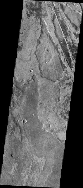
This VIS image shows some of the extensive lava flows that comprise Solis Planum. Orbit Number: 64810 Latitude: -20.2434 Longitude: 258.499 Instrument: VIS Captured: 2016-07-24 06:51 http://photojournal.jpl.nasa.gov/catalog/PIA20991
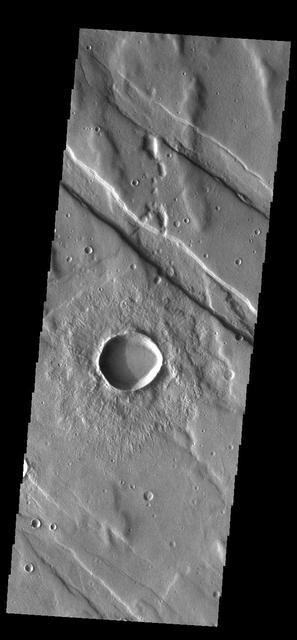
Solis Planum Craters
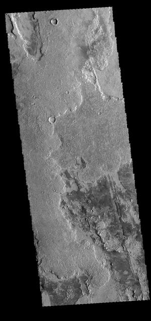
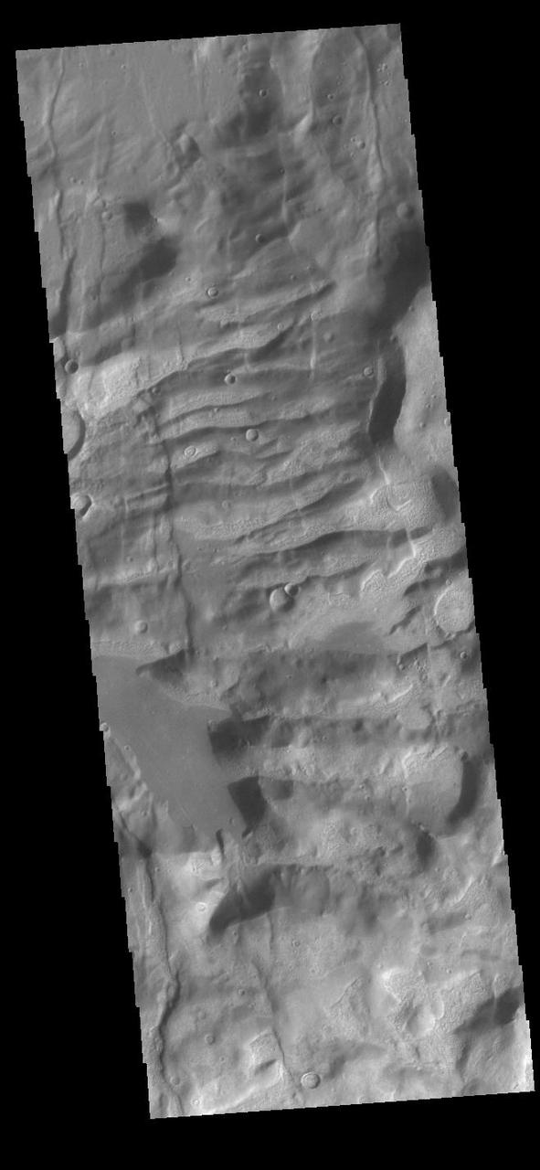
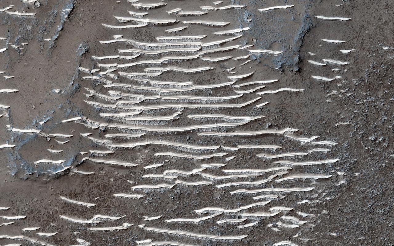
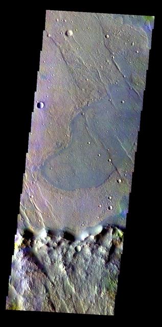
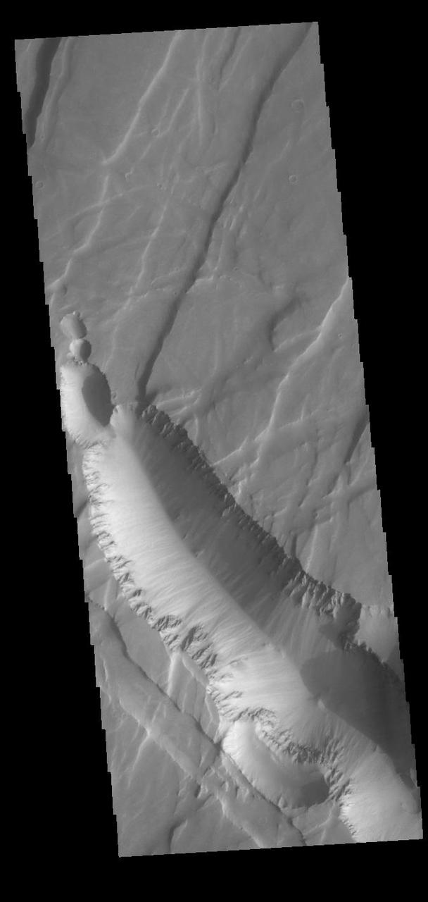
Wrinkle Ridges in Solis Planum
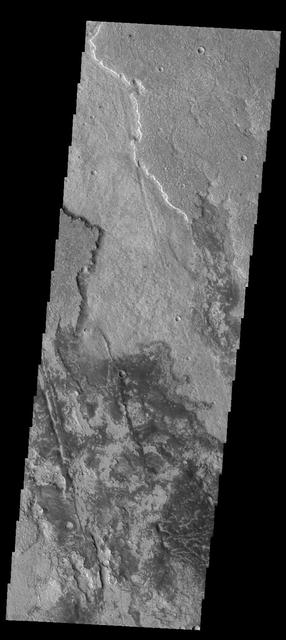
This image captured by NASA 2001 Mars Odyssey spacecraft shows a small portion of the lava flows of Solis Planum.
The lava flows in this image from NASA 2001 Mars Odyssey spacecraft are part of Solis Planum.
Located in Solis Planum, this unusual volcanic flow has margins darker than the surroundings. It appears that the flow originated in the linear fracture or vent that bisects the flow deposit. This image was captured by NASA Mars Odyssey.
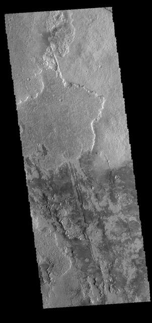
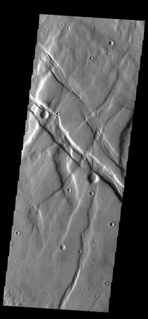
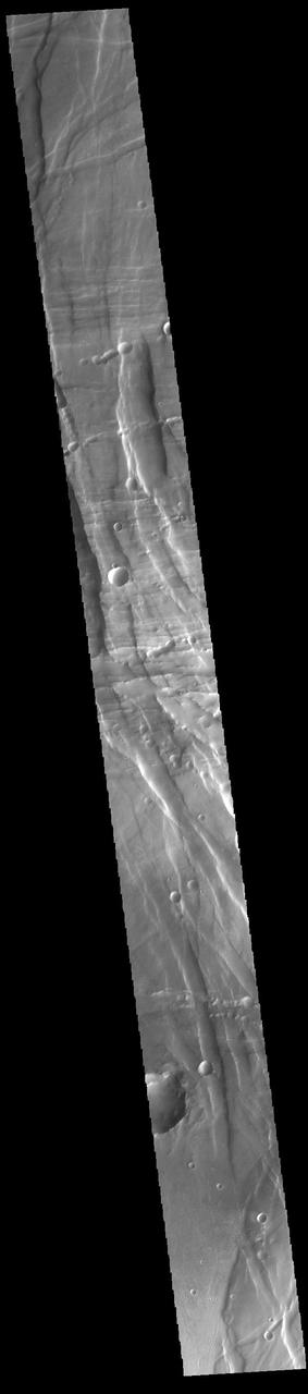
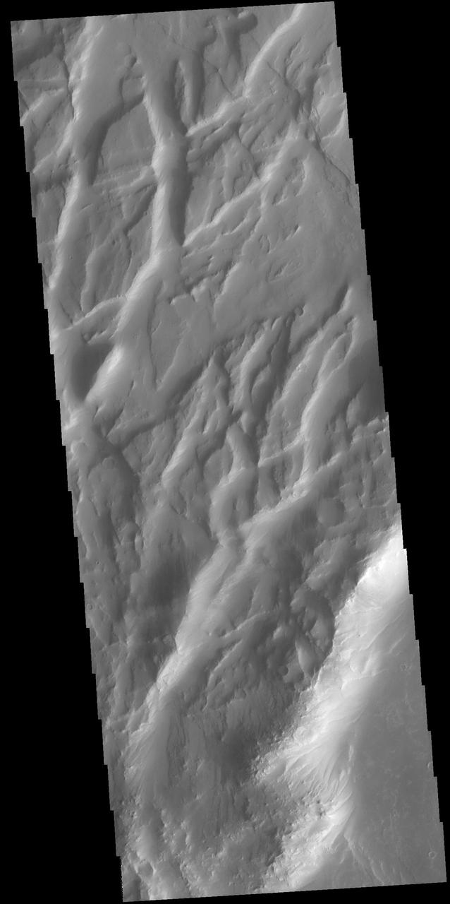
Today's VIS image shows part of Solis Planum. Both volcanic and tectonic forces created the features in this image. The linear features that run diagonally across the image are fault features called graben. The rough surfaced regions are volcanic flows. Orbit Number: 74613 Latitude: -20.2864 Longitude: 257.634 Instrument: VIS Captured: 2018-10-09 21:29 https://photojournal.jpl.nasa.gov/catalog/PIA22860
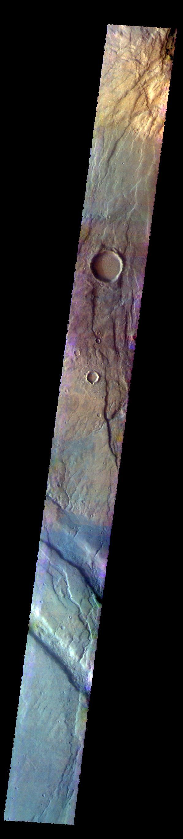
The THEMIS VIS camera contains 5 filters. The data from different filters can be combined in multiple ways to create a false color image. These false color images may reveal subtle variations of the surface not easily identified in a single band image. Today's false color image shows part of Solis Planum. Orbit Number: 8130 Latitude: -28.4509 Longitude: 279.701 Instrument: VIS Captured: 2003-10-14 18:55 http://photojournal.jpl.nasa.gov/catalog/PIA19726

The depressions in this image captured by NASA 2001 Mars Odyssey spacecraft are part of Coracis Fossae, part of the highlands south of Solis Planum.
Claritas Fossae is the dissected and fractured highland between the volcanic plains of Daedalia and Solis Planums. This image is from NASA 2001 Mars Odyssey spacecraft.
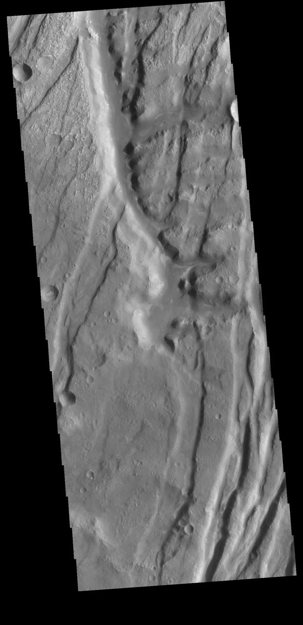
Numerous channels dissect both sides of this high spot south of Solis Planum in this image captured by NASA 2001 Mars Odyssey spacecraft.
Just as on Earth, volcanism and tectonism are found together on Mars. In this image from NASA 2001 Mars Odyssey spacecraft the ridges and fractures of Claritas Fossae are affecting or perhaps hosting the volcanic flows of Solis Planum.
Located between the lava plains of Daedalia Planum and Solis Planum, Claritas Fossae is a graben filled highland. Graben are formed by tectonic activity, where extensional forces stretch the surface allowing blocks of material to slide down between paired faults. These linear grabens are termed fossae. This region of Mars had very active tectonism and volcanism, resulting in the huge volcanos like Arsia Mons and deep chasmata of Valles Marineris. Claritas Fossae was formed prior to the large lava flows of the Tharsis region. Orbit Number: 84439 Latitude: -41.4956 Longitude: 272.168 Instrument: VIS Captured: 2020-12-26 23:43 https://photojournal.jpl.nasa.gov/catalog/PIA24402
Located between the lava plains of Daedalia Planum and Solis Planum, Claritas Fossae is a graben filled highland. Graben are formed by tectonic activity, where extensional forces stretch the surface allowing blocks of material to slide down between paired faults. These linear grabens are termed fossae. This region of Mars had very active tectonism and volcanism, resulting in the huge volcanos like Arsia Mons and deep chasmata of Valles Marineris. Claritas Fossae was formed prior to the large lava flows of the Tharsis region. Orbit Number: 92164 Latitude: -26.3031 Longitude: 253.828 Instrument: VIS Captured: 2022-09-24 01:20 https://photojournal.jpl.nasa.gov/catalog/PIA25757

Located between the lava plains of Daedalia Planum and Solis Planum, Claritas Fossae is a graben filled highland. Graben are formed by tectonic activity, where extensional forces stretch the surface allowing blocks of material to slide down between paired faults. These linear grabens are termed fossae. This region of Mars had very active tectonism and volcanism, resulting in the huge volcanos like Arsia Mons and deep chasmata of Valles Marineris. Claritas Fossae was formed prior to the large lava flows of the Tharsis region. Orbit Number: 91852 Latitude: -35.0327 Longitude: 253.577 Instrument: VIS Captured: 2022-08-29 08:49 https://photojournal.jpl.nasa.gov/catalog/PIA25713
Located between the lava plains of Daedalia Planum and Solis Planum, Claritas Fossae is a graben filled highland. Graben are formed by tectonic activity, where extensional forces stretch the surface allowing blocks of material to slide down between paired faults. These linear grabens are termed fossae. This region of Mars had very active tectonism and volcanism, resulting in the huge volcanos like Arsia Mons and deep chasmata of Valles Marineris. Claritas Fossae was formed prior to the large lava flows of the Tharsis region. Orbit Number: 91733 Latitude: -42.0473 Longitude: 263.442 Instrument: VIS Captured: 2022-08-19 14:12 https://photojournal.jpl.nasa.gov/catalog/PIA25620
Located between the lava plains of Daedalia Planum and Solis Planum, Claritas Fossae is a graben filled highland. Graben are formed by tectonic activity, where extensional forces stretch the surface allowing blocks of material to slide down between paired faults. These linear grabens are termed fossae. This region of Mars had very active tectonism and volcanism, resulting in the huge volcanos like Arsia Mons and deep chasmata of Valles Marineris. Claritas Fossae was formed prior to the large lava flows of the Tharsis region. Orbit Number: 81376 Latitude: -35.6385 Longitude: 253.121 Instrument: VIS Captured: 2020-04-18 15:46 https://photojournal.jpl.nasa.gov/catalog/PIA23957
Located between the lava plains of Daedalia Planum and Solis Planum, Claritas Fossae is a graben filled highland. Graben are formed by tectonic activity, where extensional forces stretch the surface allowing blocks of material to slide down between paired faults. These linear grabens are termed fossae. This region of Mars had very active tectonism and volcanism, resulting in the huge volcanos like Arsia Mons and deep chasmata of Valles Marineris. Claritas Fossae was formed prior to the large lava flows of the Tharsis region. Orbit Number: 92825 Latitude: -36.7944 Longitude: 262.701 Instrument: VIS Captured: 2022-11-17 11:37 https://photojournal.jpl.nasa.gov/catalog/PIA25801
Located between the lava plains of Daedalia Planum and Solis Planum, Claritas Fossae is a graben filled highland. Graben are formed by tectonic activity, where extensional forces stretch the surface allowing blocks of material to slide down between paired faults. These linear grabens are termed fossae. This region of Mars had very active tectonism and volcanism, resulting in the huge volcanos like Arsia Mons and deep chasmata of Valles Marineris. Claritas Fossae was formed prior to the large lava flows of the Tharsis region. Orbit Number: 91646 Latitude: -14.0577 Longitude: 249.123 Instrument: VIS Captured: 2022-08-12 10:26 https://photojournal.jpl.nasa.gov/catalog/PIA25612
Located between the lava plains of Daedalia Planum and Solis Planum, Claritas Fossae is a graben filled highland. Graben are formed by tectonic activity, where extensional forces stretch the surface allowing blocks of material to slide down between paired faults. These linear grabens are termed fossae. This region of Mars had very active tectonism and volcanism, resulting in the huge volcanos like Arsia Mons and deep chasmata of Valles Marineris. Claritas Fossae was formed prior to the large lava flows of the Tharsis region. Orbit Number: 91446 Latitude: -36.8955 Longitude: 262.397 Instrument: VIS Captured: 2022-07-26 23:05 https://photojournal.jpl.nasa.gov/catalog/PIA25572

Located between the lava plains of Daedalia Planum and Solis Planum, Claritas Fossae is a graben filled highland. Graben are formed by tectonic activity, where extensional forces stretch the surface allowing blocks of material to slide down between paired faults. These linear grabens are termed fossae. This region of Mars had very active tectonism and volcanism, resulting in the huge volcanos like Arsia Mons and deep chasmata of Valles Marineris. Claritas Fossae was formed prior to the large lava flows of the Tharsis region. Orbit Number: 91427 Latitude: -41.2195 Longitude: 273.629 Instrument: VIS Captured: 2022-07-25 08:59 https://photojournal.jpl.nasa.gov/catalog/PIA25580
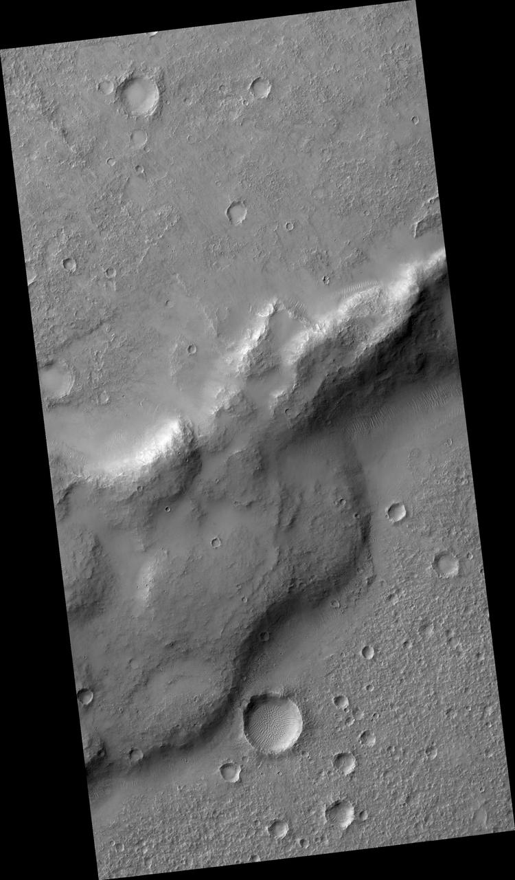
Today's VIS image shows part of Claritas Fossae. These graben filled highlands are bounded by Solis Planum to the northeast and Icaria Planum to the southwest. The linear features (fossae) are graben, a tectonic feature created when blocks of material subside between paired faults. Extensional tectonic forces are responsible for graben formation. While close to the Tharsis region, it is thought that Claritas Fossae formed prior to the large lava flows located north of this image. Orbit Number: 83503 Latitude: -40.434 Longitude: 274.364 Instrument: VIS Captured: 2020-10-10 22:06 https://photojournal.jpl.nasa.gov/catalog/PIA24259
Located between the lava plains of Daedalia Planum and Solis Planum, Claritas Fossae is a graben filled highland. Graben are formed by tectonic activity, where extensional forces stretch the surface allowing blocks of material to slide down between paired faults. These linear grabens are termed fossae. This region of Mars had very active tectonism and volcanism, resulting in the huge volcanos like Arsia Mons and deep chasmata of Valles Marineris. Claritas Fossae was formed prior to the large lava flows of the Tharsis region. Orbit Number: 84464 Latitude: -40.7803 Longitude: 271.084 Instrument: VIS Captured: 2020-12-29 01:07 https://photojournal.jpl.nasa.gov/catalog/PIA24403
Located between the lava plains of Daedalia Planum and Solis Planum, Claritas Fossae is a graben filled highland. Graben are formed by tectonic activity. In this region of Mars extensive and long lived volcanic and tectonic activity created the largest volcanoes and the longest canyon system on Mars. Volcanic and tectonic forces coexist and tectonic faults are often utilized by subsurface magma to reach the surface. Claritas Fossae was formed prior to the large lava flows of the Tharsis region. Orbit Number: 74950 Latitude: -17.7366 Longitude: 252.095 Instrument: VIS Captured: 2018-11-06 15:40 https://photojournal.jpl.nasa.gov/catalog/PIA22974
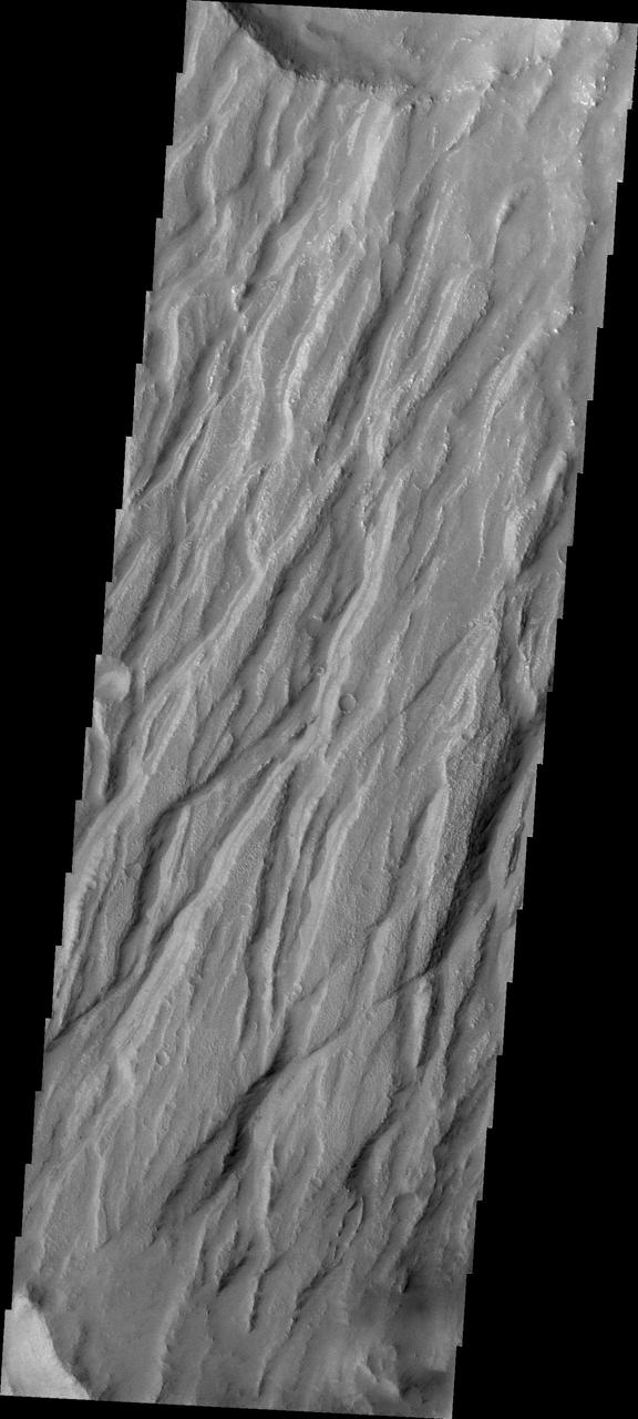
This whole area, located in Solis Planum, is an interesting, tectonic terrain south of Noctis Labrynthus which generally slopes toward the south as seen by NASA Mars Reconnaissance Orbiter spacecraft. Transverse aeolian ridges -- or TAR -- are mysterious, wind-blown features that are intermediate in size between ripples and much larger sand dunes. Ripples form from hopping sand grains, and dunes form from sand grains being blown over longer distances. One hypothesis for TAR formation is that larger grains like pebbles are rolled on top of smaller ripples; then, finer dust settles into the cracks, "inflating" the pebbles, making the TAR larger than typical ripples. Looking between the TAR, one sees a network of ancient, beaten-up channels that were carved by water, lava, or both. This whole area is located in Solis Planum, an interesting, tectonic terrain south of Noctis Labrynthus which generally slopes toward the south. http://photojournal.jpl.nasa.gov/catalog/PIA20157
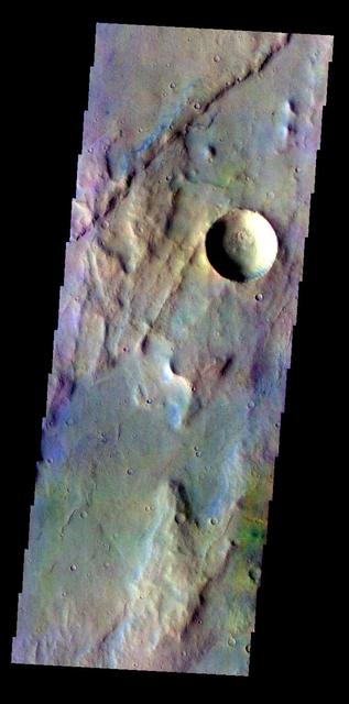
The THEMIS VIS camera contains 5 filters. The data from different filters can be combined in multiple ways to create a false color image. These false color images may reveal subtle variations of the surface not easily identified in a single band image. Today's false color image shows part of Claritas Fossae. The graben filled highlands are bounded by Solis Planum to the northeast and Icaria Planum to the southwest. The linear features (fossae) are graben, a tectonic feature created when blocks of material subside between paired faults. Extensional tectonic forces are responsible for graben formation. While close to the Tharsis region, it is thought that Claritas Fossae formed prior to the large lava flows located north of this image. Orbit Number: 67635 Latitude: -41.3176 Longitude: 260.749 Instrument: VIS Captured: 2017-03-13 23:52 https://photojournal.jpl.nasa.gov/catalog/PIA24074
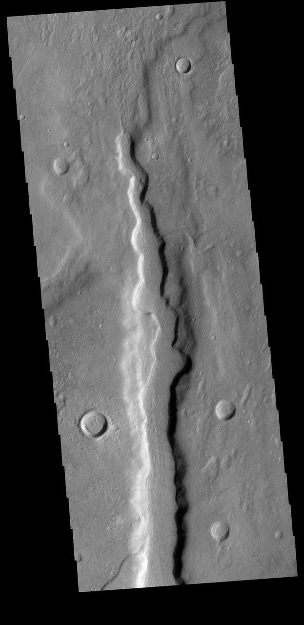
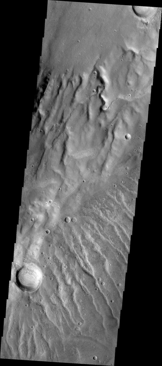
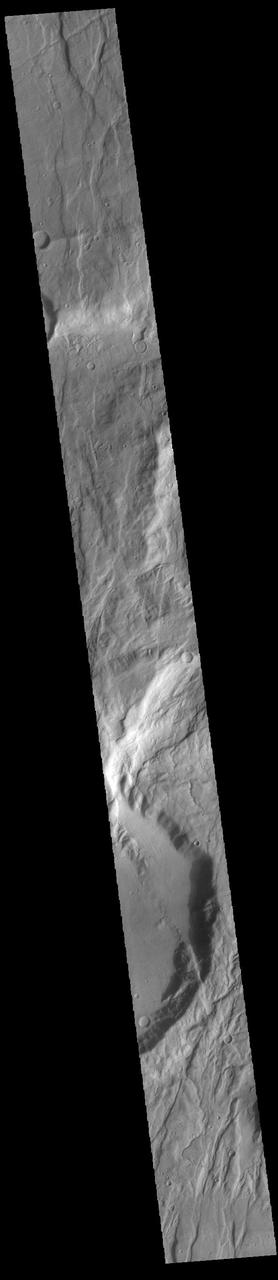
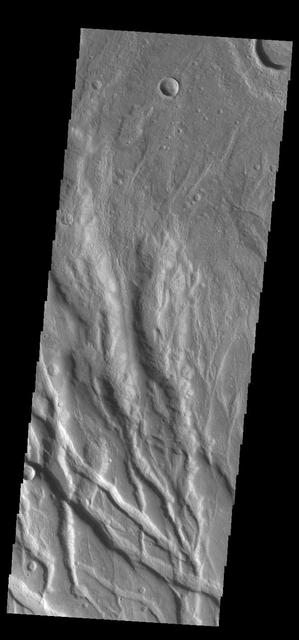
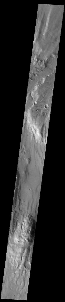
Today's VIS image shows one of the numerous channel features that dissect the highlands between Solis Planum and Aonia Terra. The linear features in the region include both tectonic graben and fluvial channels. Orbit Number: 74525 Latitude: -37.7012 Longitude: 279.788 Instrument: VIS Captured: 2018-10-02 15:26 https://photojournal.jpl.nasa.gov/catalog/PIA22851
The THEMIS VIS camera contains 5 filters. Data from different filters can be combined in multiple ways to create a false color image. This image from NASA 2001 Mars Odyssey spacecraft shows lava flow from Solis Planum has entered an unnamed crater. Orbit Number: 6745 Latitude: -29.5791 Longitude: 261.582 Instrument: VIS Captured: 2003-06-22 18:44 http://photojournal.jpl.nasa.gov/catalog/PIA19429
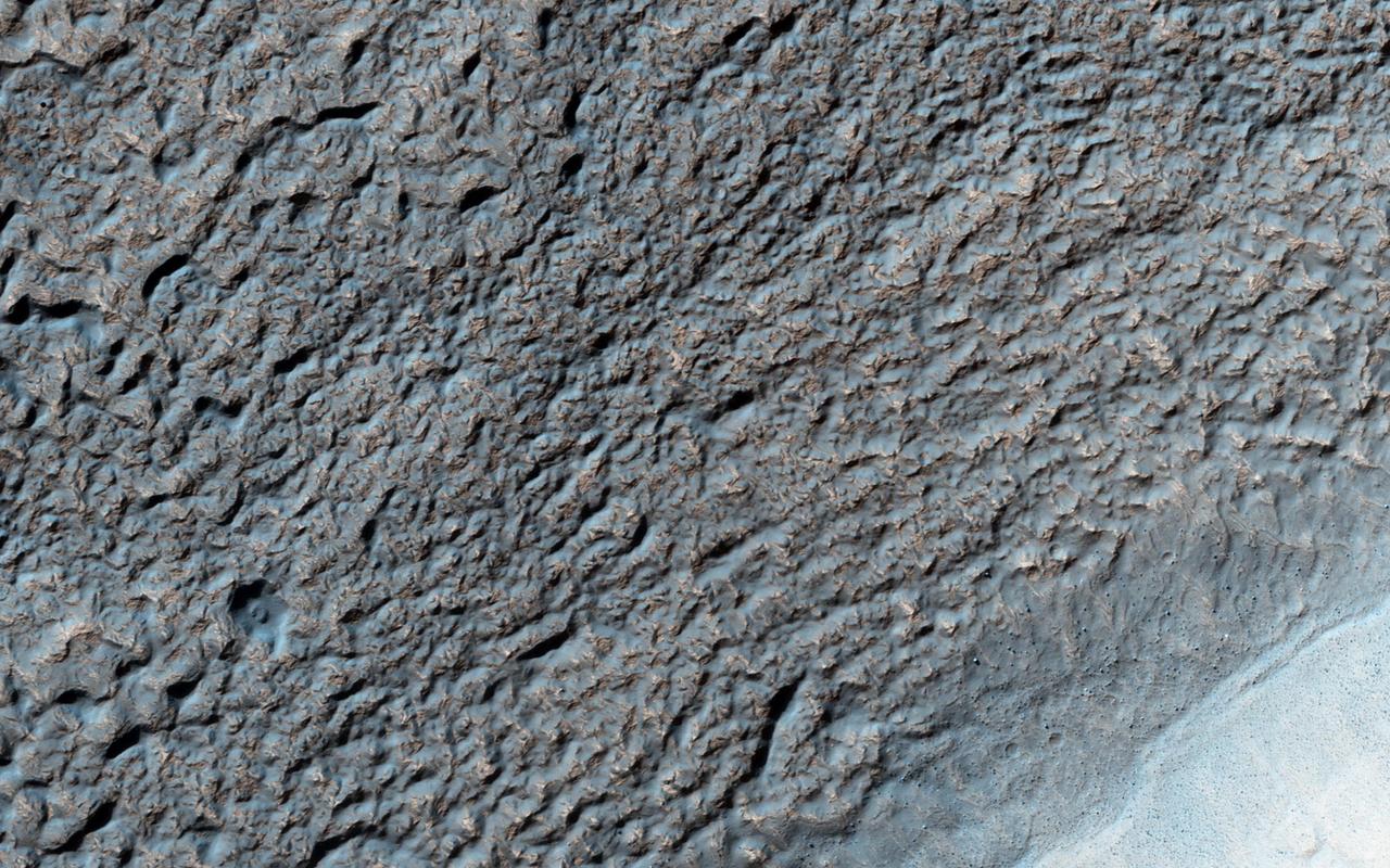
Like Earth's water table, Mars has an ice table. Sometimes, the ice table coincides with the ground's surface as it does here. The knobby, pitted terrain is caused when ice is deposited and then sublimates over and over again. This geologic process is called "accrescence" and "decrescence" and also occurs on Neptune's moon Triton and on Pluto, though in the outer Solar System the ice is not water ice. Other evidence for ice here includes the rope-like, curved flow feature that resembles glacial flow. Solis Planum -- a huge mound south of Valles Marineris -- is the location of this image. http://photojournal.jpl.nasa.gov/catalog/PIA20208
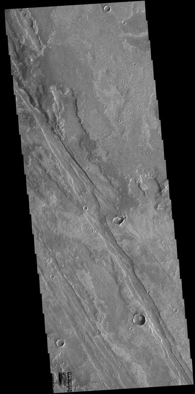
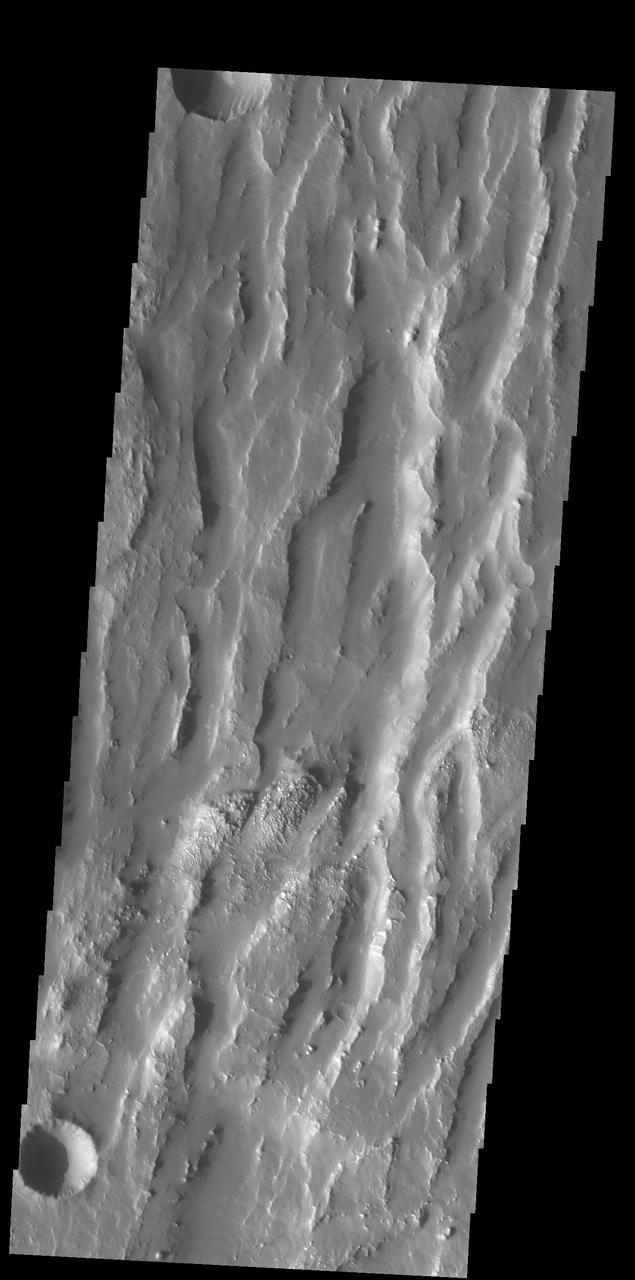
Today's VIS image shows an unnamed region of fractures and graben. Located south of Solis Planum, between Claitas Fossae and Coracis Fossae, this region of fossae has the same appearance and graben orientation of the bordering named Fossae. Fossae are long linear depressions called graben and are formed by extension of the crust and faulting. When large amounts of pressure or tension are applied to rocks on timescales that are fast enough that the rock cannot respond by deforming, the rock breaks along faults. In the case of a graben, two parallel faults are formed by extension of the crust and the rock in between the faults drops downward into the space created by the extension. Orbit Number: 91764 Latitude: -36.7342 Longitude: 272.1 Instrument: VIS Captured: 2022-08-22 02:55 https://photojournal.jpl.nasa.gov/catalog/PIA25635
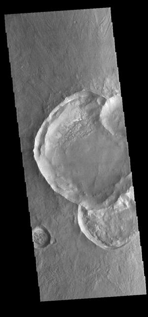
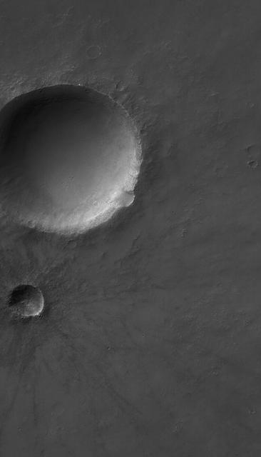
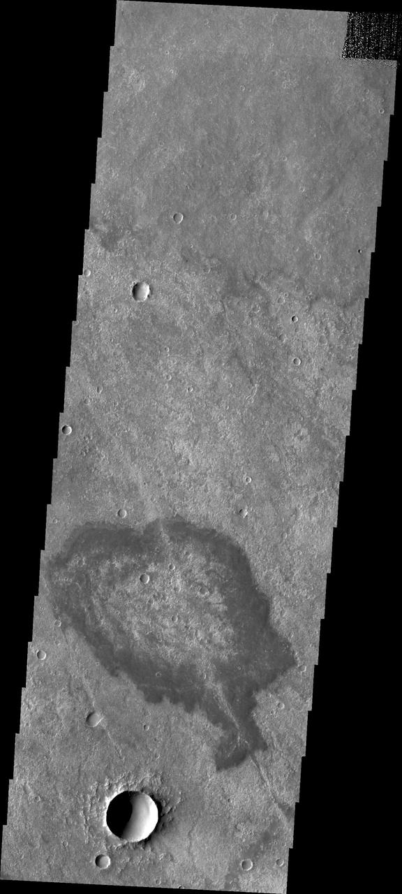
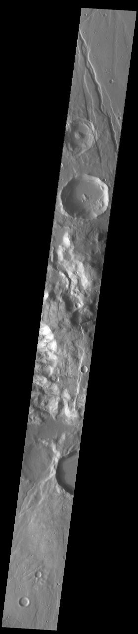
Today's VIS image is of a group of craters in Solis Planum. Because three of the craters are overlapping it is possible to determine the order in which those three were created. While we can not say exactly when in Martian history these craters formed, we can delineate the relative order of formation. Since impacts create circular craters, a recently formed crater will create a crescent into the crater it impacts. So the order of impact in this image is 1) the crater at the bottom, 2) the large crater in the middle of the image, and 3) the small crater mostly off this image to the right. Orbit Number: 67865 Latitude: -30.7955 Longitude: 276.931 Instrument: VIS Captured: 2017-04-01 23:16 https://photojournal.jpl.nasa.gov/catalog/PIA21677
Today's VIS image shows part of Claritas Fossae. The linear features (fossae) are graben, a tectonic feature created when blocks of material subside between paired faults. These graben filled highlands are bounded by Solis Planum to the northeast and Icaria Planum to the southwest. Extensional tectonic forces are responsible for graben formation. While close to the Tharsis region, it is thought that Claritas Fossae formed prior to the large lava flows located north of this image. The large, deepest depression is younger than the other graben of Claritas Fossae. It is not known if it formed just after the other graben, or at a much later time. Orbit Number: 90760 Latitude: -12.0301 Longitude: 249.617 Instrument: VIS Captured: 2022-05-31 11:34 https://photojournal.jpl.nasa.gov/catalog/PIA25506