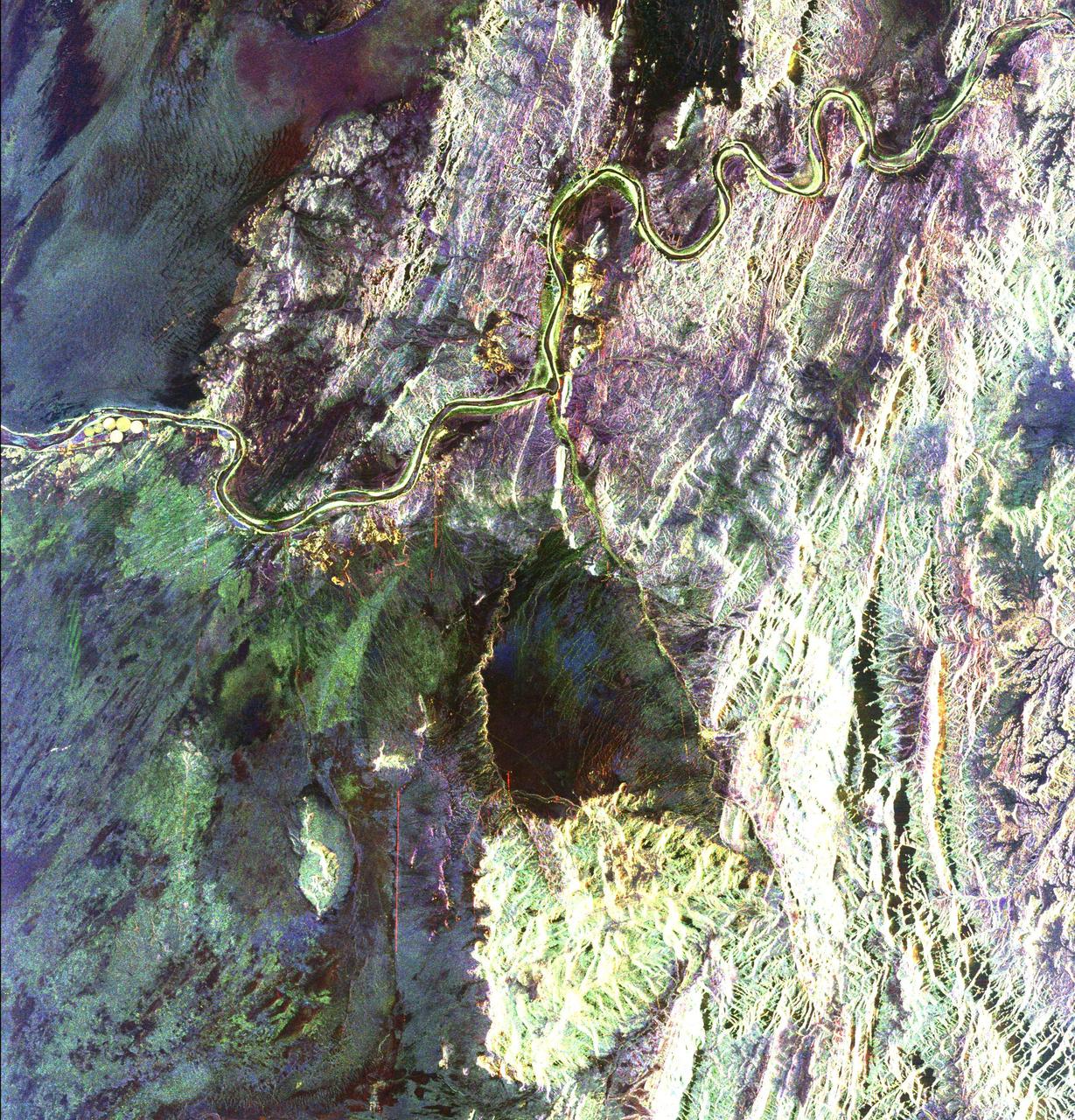
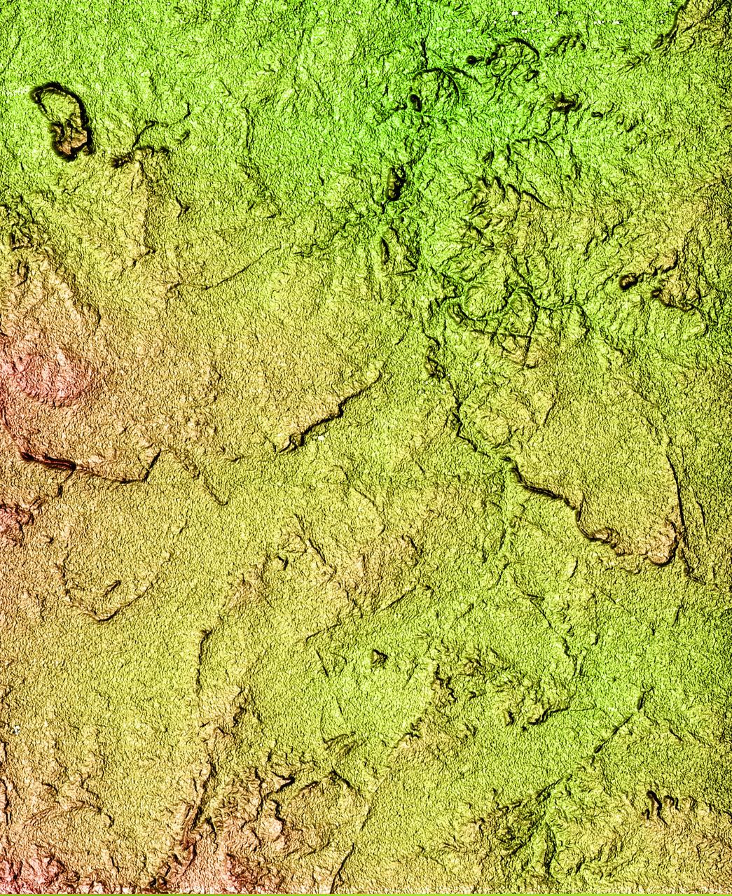
This radar image covers a portion of the Richtersveld National Park and Orange River top of image in the Northern Cape Province of the Republic of South Africa.
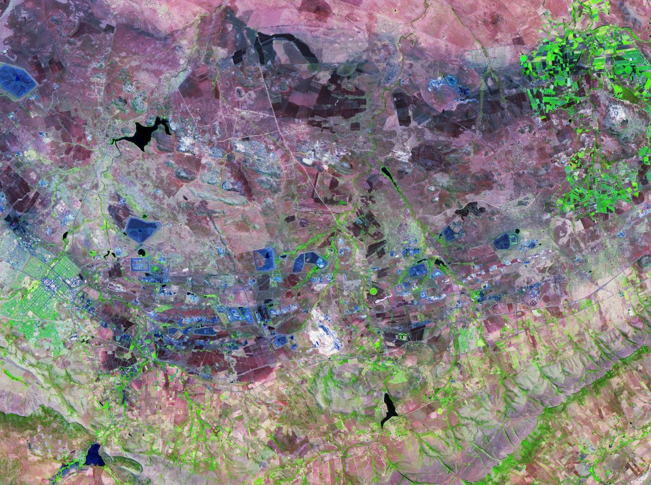
The Bushveld Igneous Complex BIC is a large layered igneous intrusion within the earth crust, exposed at the edge of the Transvaal Basin in South Africa. Numerous mines, tailings piles, and leach ponds are shown in blue.
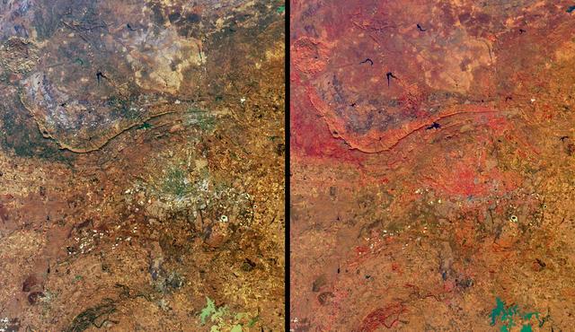
These views from NASA Terra satellite highlight a number of the land use, vegetation, and geological features found Johannesburg, Gauteng Province, South Africa.
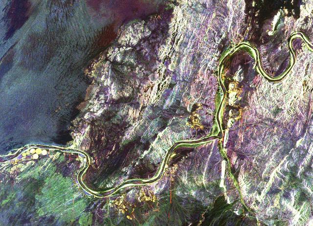
This radar image shows a close up view of a portion of the Richtersveld National Park and Orange River top of image in the Northern Cape Province of the Republic of South Africa.
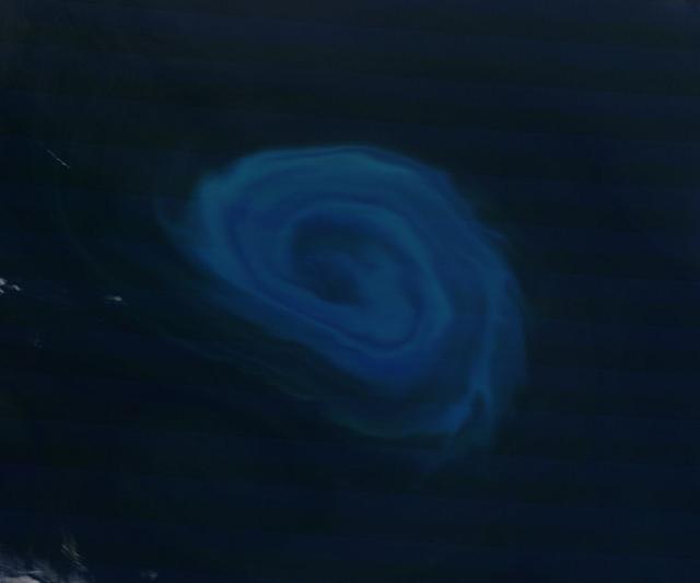
NASA image acquired December 26, 2011 Off the coast of South Africa, near where the South Atlantic meets the Southern Indian Ocean, a massive summer phytoplankton bloom colored the waters with a swirl of turquoise, green and white in late December 2011. Although this circular bloom has the appearance of a precious antique gaming marble, it is actually the result of millions of tiny plant-like organisms (phytoplankton) which are growing where nutrient-rich waters mix together. Each spring and summer, lengthening sunshine comes to the southern oceans, providing light to spur the growth of these microscopic plants. The lengthening light also melts sea ice, which can release additional nutrients into the sea. Blooms such as this one become a banquet for krill, fish and other marine species which survive in these cool waters. The Moderate Resolution Imaging Spectroradiometer (MODIS) aboard NASA’s Terra satellite captured this true-color image on December 26, 2011 as it passed over the region. Credit: NASA/GSFC/Jeff Schmaltz/MODIS Land Rapid Response Team <b><a href="http://www.nasa.gov/audience/formedia/features/MP_Photo_Guidelines.html" rel="nofollow">NASA image use policy.</a></b> <b><a href="http://www.nasa.gov/centers/goddard/home/index.html" rel="nofollow">NASA Goddard Space Flight Center</a></b> enables NASA’s mission through four scientific endeavors: Earth Science, Heliophysics, Solar System Exploration, and Astrophysics. Goddard plays a leading role in NASA’s accomplishments by contributing compelling scientific knowledge to advance the Agency’s mission. <b>Follow us on <a href="http://twitter.com/NASA_GoddardPix" rel="nofollow">Twitter</a></b> <b>Like us on <a href="http://www.facebook.com/pages/Greenbelt-MD/NASA-Goddard/395013845897?ref=tsd" rel="nofollow">Facebook</a></b> <b>Find us on <a href="http://instagrid.me/nasagoddard/?vm=grid" rel="nofollow">Instagram</a></b>

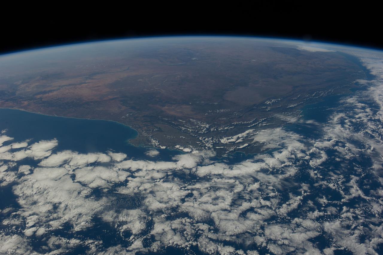
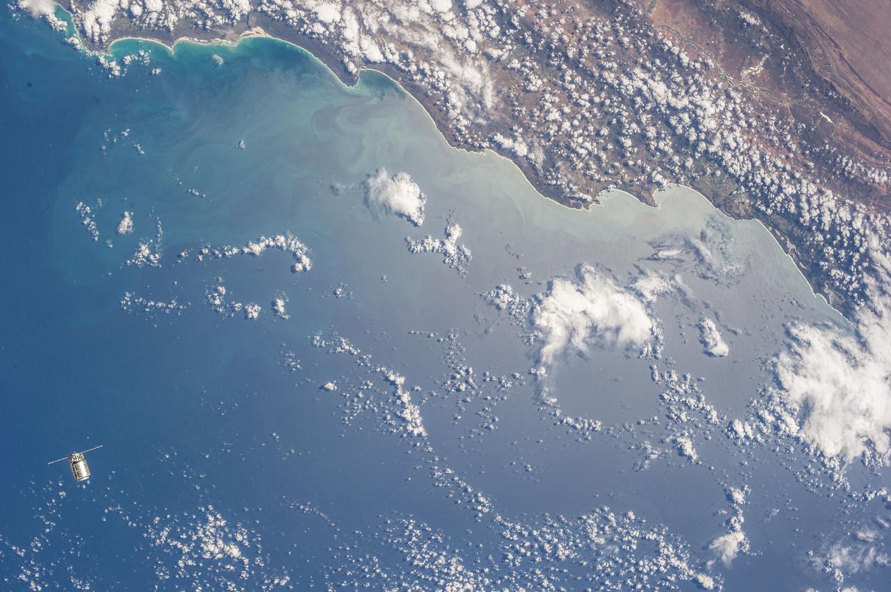
iss071e580719 (Aug. 30, 2024) -- The coastline of South Africa, with Cape Town and the False Bay situated at the top right of the image, is pictured from the International Space Station as it orbited 265 miles above.
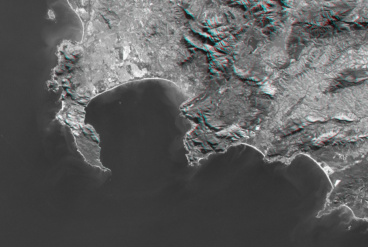
Cape Town and the Cape of Good Hope, South Africa, appear on the left west of this anaglyph from NASA Shuttle Radar Topography Mission. 3D glasses are necessary to view this image.
The southernmost tip of Africa is marked by the Cape Agulhas lighthouse. The warm Atlantic Agulhas current meets the cold water Indian Ocean Benguela current, creating treacherous seas that have claimed many ships over the last 450 years. The image covers an area of 22.5 by 41.1 kilometers, was acquired September 27, 2006, and is located at 34.8 degrees south, 20 degrees east. http://photojournal.jpl.nasa.gov/catalog/PIA21014
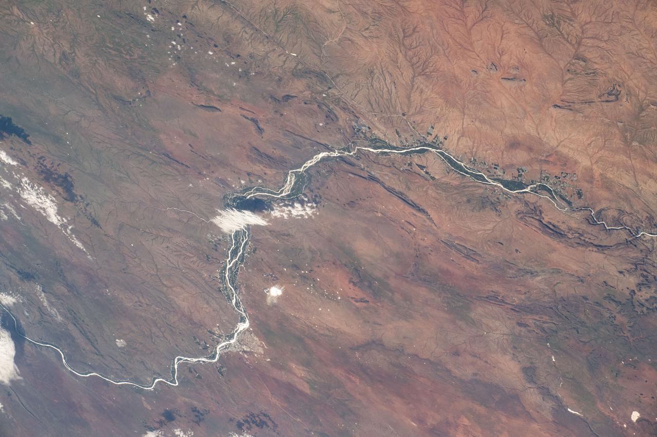
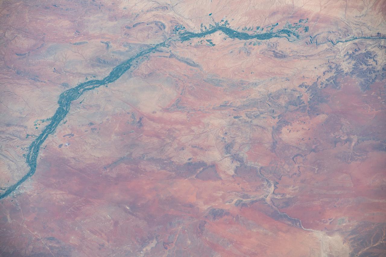
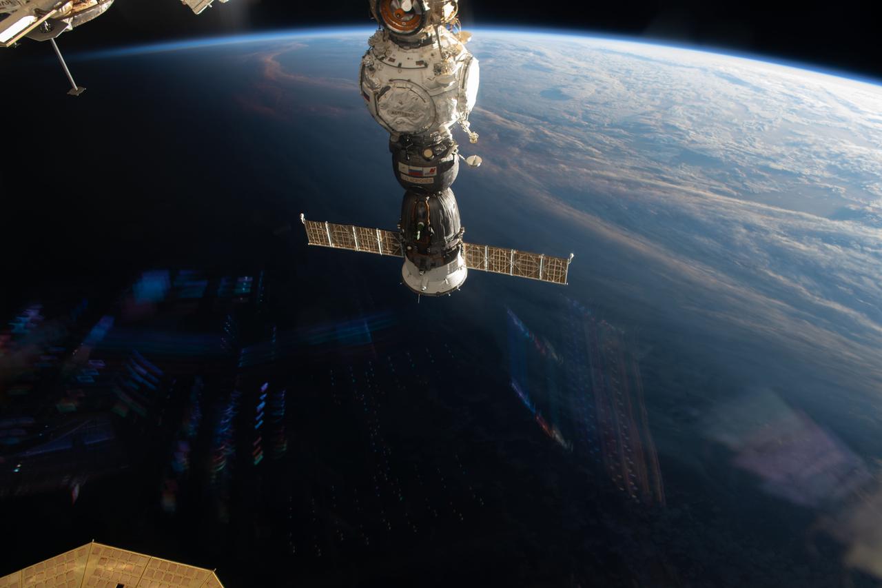
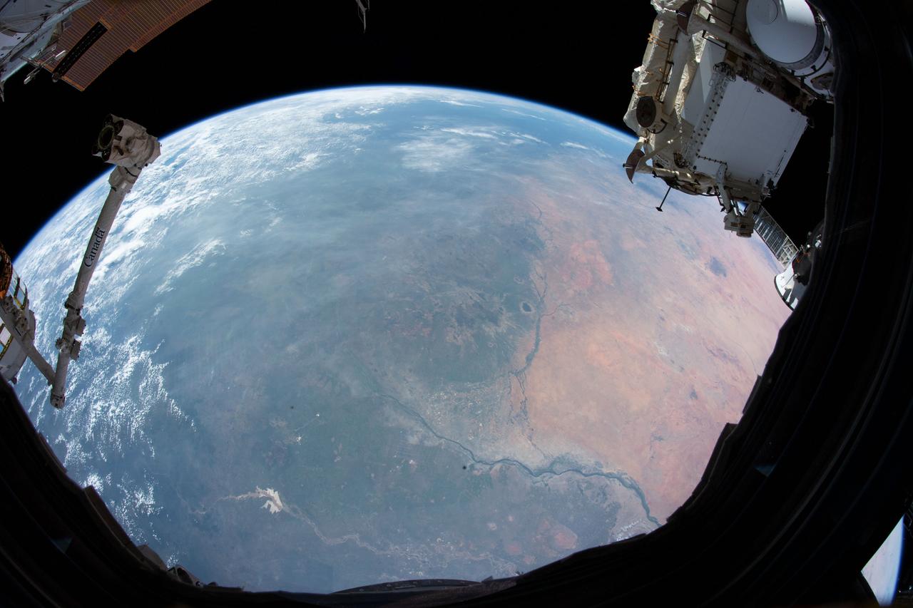
iss072e862232 (March 28, 2025) --- This portion of the Orange River, South Africa's longest river, east of Namibia's southern border and beaming under the sun's glint is pictured from the International Space Station as it orbited 264 miles above.
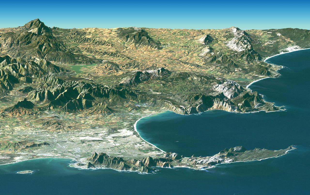
Cape Town and the Cape of Good Hope, South Africa, appear in the foreground of this perspective view generated from a Landsat satellite image and elevation data from NASA Space Shuttle Endeavour.
This image of Western Cape, South Africa was acquired by the Multi-angle Imaging SpectroRadiometer MISR instrument aboard NASA Terra spacecraft. This image is from the MISR Mystery Image Quiz #25.
STS106-713-057 (19 September 2000) --- One of the STS-106 crew members on board the Space Shuttle Atlantis used a handheld 70mm camera to photograph this image of Cape Town and the Karroo Ranges in South Africa. Cape Town occupies the north end of the Cape of Good Hope peninsula and extends to the shore of False Bay. The city is home to about 2.7 million people. Tourism and viticulture contribute importantly to the local economy, and the city is a service center for government and industry -- particularly mining. The great folded mountain ranges of South Africa were formed during the assembly of the ancient super continent of Gondwana. Broad N-trending folds of the Cedarburg range, South Africa formed first, according to geologists, about 230 million years ago, and the W-trending Karroo ranges formed a little later.

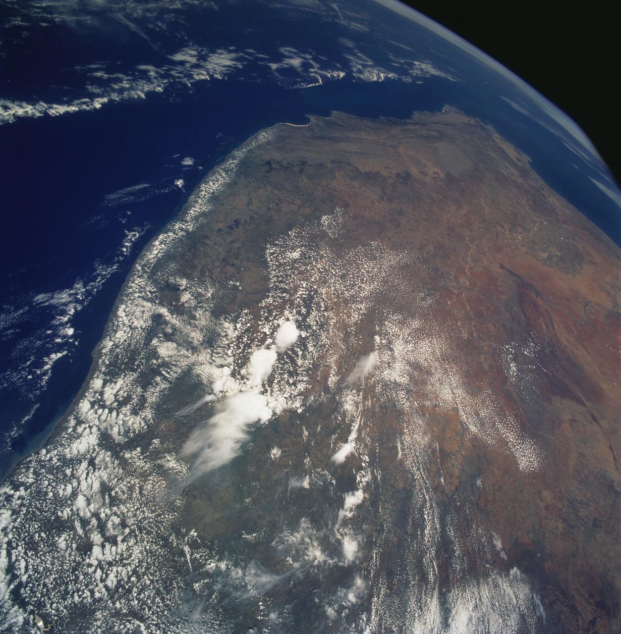
STS058-77-083 (18 Oct-1 Nov 1993) --- In this scene of the south coast of Africa, Cape Agulhas, the southernmost point on the continent, appears as the leftmost cape. Viewed with the Earth's limb top left, clouds at bottom, the view direction is west and north top right. The Cape of Good Hope, with Cape Town nearby, is the thin spike beyond. The great bay in the foreground is Algoa Bay with the city of Port Elizabeth. This was the first time European voyagers are known to have rounded the Cape of Good Hope in their quest to reach India by sea. The entire fold mountain belt of southern Africa is visible: these mountains appear as green (forested) wavy structures stretching west form the foreground, to the Cape of Good Hope, and then northwards some distance. One theory about their origin is that the Falkland Plateau, now an undersea extension of South America, was jostled up against Africa more than 150 million years ago, in times before the Atlantic Ocean existed, before Africa and South America drifted apart from one another. The jostling caused the evolution of the fold mountain belt.

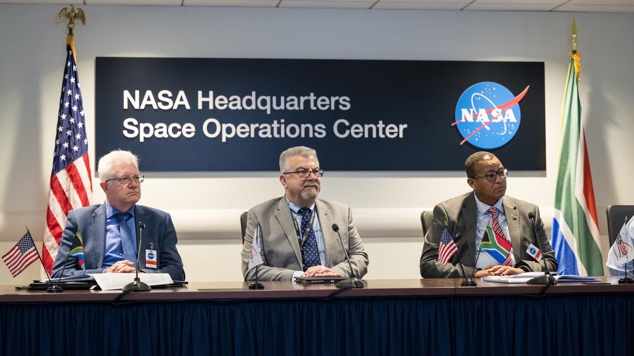
Provincial Minister for Finance and Economic Opportunities of the Western Cape Government, Mireille Wenger, provides remarks during a meeting with the Premier of the Western Cape Government, Alan Winde, right, NASA representatives, and a delegation from South Africa, to discuss the path forward for development of an antenna for the Lunar Exploration Ground Sites (LEGS) mission in Matjiesfontein, South Africa, and other opportunities, Tuesday, June 13, 2023, at the Mary W. Jackson NASA Headquarters building in Washington. Photo Credit: (NASA/Aubrey Gemignani)

Premier of the Western Cape Government, Alan Winde, provides remarks during a meeting with NASA Deputy Associate Administrator for Space Communications and Navigation, Badri Younes, right, other NASA representatives, and a delegation from South Africa, to discuss the path forward for development of an antenna for the Lunar Exploration Ground Sites (LEGS) mission in Matjiesfontein, South Africa, and other opportunities, Tuesday, June 13, 2023, at the Mary W. Jackson NASA Headquarters building in Washington. Photo Credit: (NASA/Aubrey Gemignani)

NASA SCaN Development Manager, Bill Marinelli provides remarks during a meeting with NASA Deputy Associate Administrator for Space Communications and Navigation, Badri Younes, the Premier of the Western Cape Government, Alan Winde, and a delegation from South Africa, to discuss the path forward for development of an antenna for the Lunar Exploration Ground Sites (LEGS) mission in Matjiesfontein, South Africa, and other opportunities, Tuesday, June 13, 2023, at the Mary W. Jackson NASA Headquarters building in Washington. Photo Credit: (NASA/Aubrey Gemignani)

NASA Deputy Associate Administrator for Space Communications and Navigation, Badri Younes, right, speaks with the Premier of the Western Cape Government, Alan Winde, during a meeting with NASA representatives and a delegation from South Africa, to discuss the path forward for development of an antenna for the Lunar Exploration Ground Sites (LEGS) mission in Matjiesfontein, South Africa, and other opportunities, Tuesday, June 13, 2023, at the Mary W. Jackson NASA Headquarters building in Washington. Photo Credit: (NASA/Aubrey Gemignani)

NASA Deputy Associate Administrator for Space Communications and Navigation, Badri Younes, provides remarks during a meeting with the Premier of the Western Cape Government, Alan Winde, NASA representatives, and a delegation from South Africa, to discuss the path forward for development of an antenna for the Lunar Exploration Ground Sites (LEGS) mission in Matjiesfontein, South Africa, and other opportunities, Tuesday, June 13, 2023, at the Mary W. Jackson NASA Headquarters building in Washington. Photo Credit: (NASA/Aubrey Gemignani)
AS08-16-2588 (21-27 Dec. 1968) --- Both sides of the Atlantic Ocean are visible in this view from Apollo 8 spacecraft. (Hold picture with Earth at bottom left). The large, most prominent land mass is the bulge of West Africa. The portion of Africa near the equator is dark and cloudy, but the more northerly portions are clear, showing the prominent cape at Dakar and the Senegal River in Senegal; Cap Blanc; the Adrar Plateau in Mauretania; the wide expanse of desert in Algeria and Spanish Sahara; and the far edge, the Atlas and Anti-Atlas Mountains in Morocco. Clouds cover the eastern coast of South America, southward from Surinam and Guyana to near the city of Salvador, Brazil. The view was photographed following trans-lunar insertion.

Head of Department, Western Cape Government Economic Development and Tourism, Velile Dube, provides remarks during a meeting with NASA Deputy Associate Administrator for Space Communications and Navigation, Badri Younes, Premier of the Western Cape Government, Alan Winde, other NASA representatives, and a delegation from South Africa, to discuss the path forward for development of an antenna for the Lunar Exploration Ground Sites (LEGS) mission in Matjiesfontein, South Africa, and other opportunities, Tuesday, June 13, 2023, at the Mary W. Jackson NASA Headquarters building in Washington. Photo Credit: (NASA/Aubrey Gemignani)

NASA International Program Specialist, Office of International and Interagency Relations, Greg Mann, provide remarks during a meeting with NASA Associate Administrator for the Space Operations Mission Directorate, Ken Bowersox, NASA Deputy Associate Administrator for Space Communications and Navigation, Badri Younes, he Premier of the Western Cape Government, Alan Winde, and a delegation from South Africa, to discuss the path forward for development of an antenna for the Lunar Exploration Ground Sites (LEGS) mission in Matjiesfontein, South Africa, and other opportunities, Tuesday, June 13, 2023, at the Mary W. Jackson NASA Headquarters building in Washington. Photo Credit: (NASA/Aubrey Gemignani)
From left to right, the Premier of the Western Cape Government, Alan Winde, NASA Deputy Associate Administrator for Space Communications and Navigation, Badri Younes, and Director-General of the Western Cape Government, Dr. Harry Malila, are seen during a meeting with NASA representatives and a delegation from South Africa, to discuss the path forward for development of an antenna for the Lunar Exploration Ground Sites (LEGS) mission in Matjiesfontein, South Africa, and other opportunities, Tuesday, June 13, 2023, at the Mary W. Jackson NASA Headquarters building in Washington. Photo Credit: (NASA/Aubrey Gemignani)

NASA SCaN Development Manager, Bill Marinelli provides remarks during a meeting with the Associate Administrator for the Space Operations Mission Directorate, Ken Bowersox, NASA Deputy Associate Administrator for Space Communications and Navigation, Badri Younes, the Premier of the Western Cape Government, Alan Winde, and a delegation from South Africa, to discuss the path forward for development of an antenna for the Lunar Exploration Ground Sites (LEGS) mission in Matjiesfontein, South Africa, and other opportunities, Tuesday, June 13, 2023, at the Mary W. Jackson NASA Headquarters building in Washington. Photo Credit: (NASA/Aubrey Gemignani)
STS072-727-059 (11-20 Jan. 1996) --- Plains of the Orange Free State, South Africa are featured in this 70mm frame exposed from the Space Shuttle Endeavour. If the photograph is oriented with the largest clouds at the top edge, so that the cloud shadows fall to the upper right of each cloud, then north is to the top. The Vaal River flows along the top and through the upper left of the photograph; the reservoir of the Bloemhofdam on the Sand River can be seen between clouds at the upper right of the photograph. Kimberley can be seen as a gray smudge southeast of a contorted set of bends in the Vaal river (upper left center). With high magnification four dark dots, large open-pit mine shafts, can be seen within the gray smudge of the city. Kimberley, the capital of Northern Cape Province, was founded in 1878 after the discovery of diamonds in 1969 - 71, and reached by railway in 1885. Diamond mining and gem cutting remain prominent in the economy. The reddish soil and scattered salt pans (playa lakes) across the plateau suggest the semi-arid climate, suitable for cattle ranching. Reservoirs on most streams now provide water for the towns as well as irrigation for agriculture.
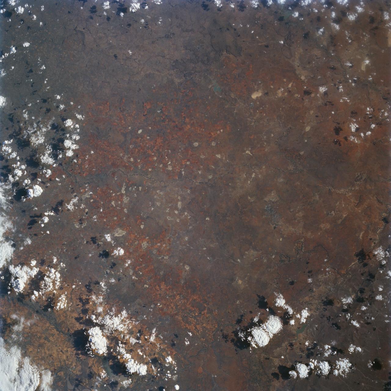
These images from NASA Terra satellite images are of northeastern South Africa, near Kruger National Park, were acquired on September 7, 2000.
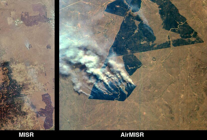
NASA Terra spacecraft flew over South Africa and Zimbabwe where week-long torrential rains swelled the Limpopo River in Jan. 2013.

NASA Associate Administrator for the Space Operations Mission Directorate, Ken Bowersox, and NASA Deputy Associate Administrator for Space Communications and Navigation, Badri Younes, meet with the Premier of the Western Cape Government, Alan Winde, and a delegation from South Africa, to discuss the path forward for development of an antenna for the Lunar Exploration Ground Sites (LEGS) mission in Matjiesfontein, South Africa, and other opportunities, Tuesday, June 13, 2023, at the Mary W. Jackson NASA Headquarters building in Washington. Photo Credit: (NASA/Aubrey Gemignani)
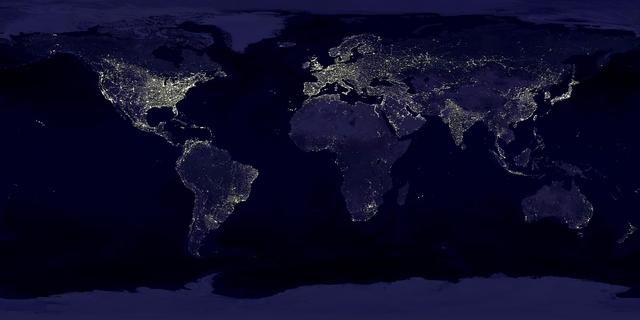
The Eastern U.S., Europe, and Japan are brightly lit by their cities, while interiors of Africa, Asia, Australia, and South America are dark and lightly populated in this image created in 2000 by NASA Goddard Space Flight Center.

iss058e002592 (Jan. 9, 2019) --- The SpaceX Dragon cargo craft is pictured attached to the International Space Station's Harmony module as the orbital complex flew 258 miles above the Indian Ocean off the eastern coast of South Africa.
This nadir camera view was captured by NASA Terra spacecraft around Kruger National Park in NE South Africa. The bright white feature is the Palabora Copper Mine, and the water body near upper right is Lake Massingir in Mozambique.
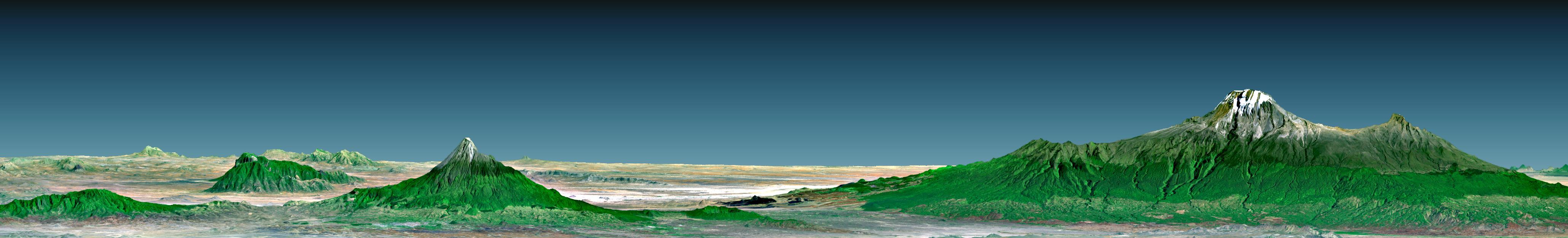
Mount Kilimanjaro, the highest point in Africa, reaches 5,895 meters 19,340 feet above sea level, tall enough to maintain a permanent snow cap despite being just 330 kilometers 210 miles south of the equator.
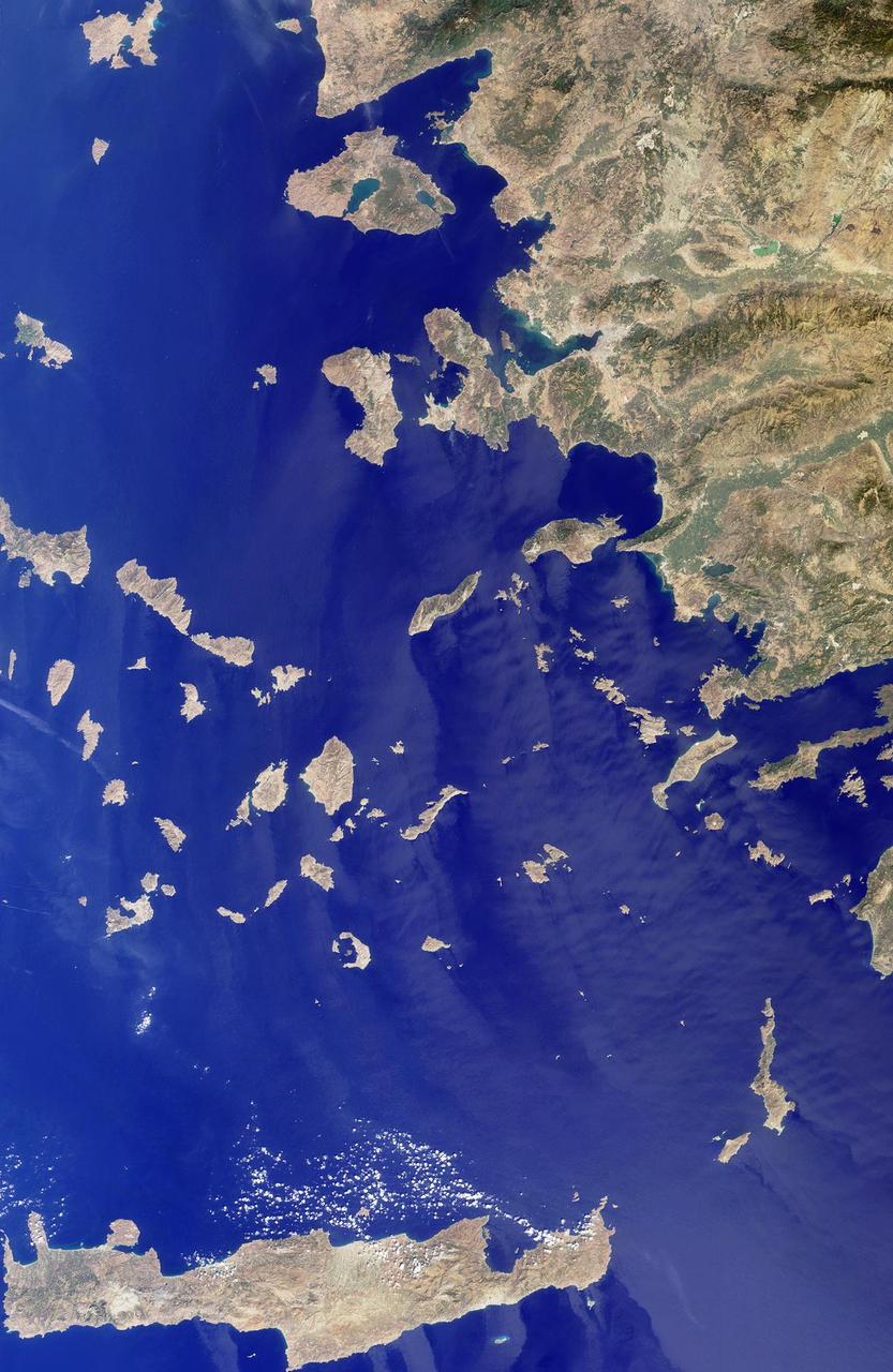
The Greek islands of the Aegean Sea, scattered across 800 kilometers from north to south and between Greece and western Turkey, are uniquely situated at the intersection of Europe, Asia and Africa. This image from NASA Terra satellite was acquired on Se
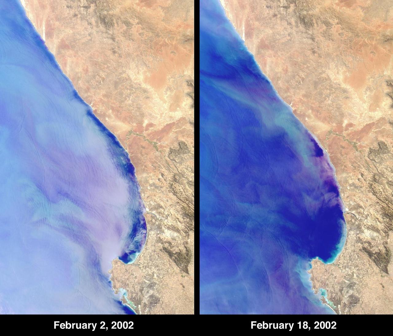
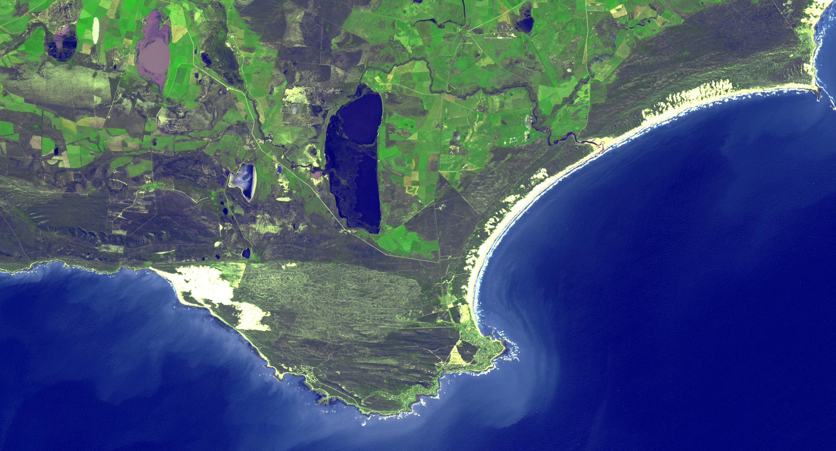
At Elands Bay in South Africa Western Cape province, about 1000 tons of rock lobsters beached themselves during February 2002 when NASA Terra satellite acquired these images.

NASA Associate Administrator for the Space Operations Mission Directorate, Ken Bowersox, right, provides remarks during a meeting with from left to right, the Premier of the Western Cape Government, Alan Winde, NASA Deputy Associate Administrator for Space Communications and Navigation, Badri Younes, and Director-General of the Western Cape Government, Dr. Harry Malila, to discuss the path forward for development of an antenna for the Lunar Exploration Ground Sites (LEGS) mission in Matjiesfontein, South Africa, and other opportunities, Tuesday, June 13, 2023, at the Mary W. Jackson NASA Headquarters building in Washington. Photo Credit: (NASA/Aubrey Gemignani)

Director-General of the Western Cape Government, Dr. Harry Malila, third from left, provides remarks during a meeting with the Premier of the Western Cape Government, Alan Winde, left, NASA Deputy Associate Administrator for Space Communications and Navigation, Badri Younes, second from left, and NASA Associate Administrator for the Space Operations Mission Directorate, Ken Bowersox, second from right, to discuss the path forward for development of an antenna for the Lunar Exploration Ground Sites (LEGS) mission in Matjiesfontein, South Africa, and other opportunities, Tuesday, June 13, 2023, at the Mary W. Jackson NASA Headquarters building in Washington. Photo Credit: (NASA/Aubrey Gemignani)

NASA Deputy Associate Administrator for Space Communications and Navigation, Badri Younes, second from left, provides remarks during a meeting with the Premier of the Western Cape Government, Alan Winde, left, Director-General of the Western Cape Government, Dr. Harry Malila, third from left, and NASA Associate Administrator for the Space Operations Mission Directorate, Ken Bowersox, right, to discuss the path forward for development of an antenna for the Lunar Exploration Ground Sites (LEGS) mission in Matjiesfontein, South Africa, and other opportunities, Tuesday, June 13, 2023, at the Mary W. Jackson NASA Headquarters building in Washington. Photo Credit: (NASA/Aubrey Gemignani)

NASA Associate Administrator for the Space Operations Mission Directorate, Ken Bowersox, right, provides remarks during a meeting with the Premier of the Western Cape Government, Alan Winde, NASA Deputy Associate Administrator for Space Communications and Navigation, Badri Younes, left, and Director-General of the Western Cape Government, Dr. Harry Malila, second from left, to discuss the path forward for development of an antenna for the Lunar Exploration Ground Sites (LEGS) mission in Matjiesfontein, South Africa, and other opportunities, Tuesday, June 13, 2023, at the Mary W. Jackson NASA Headquarters building in Washington. Photo Credit: (NASA/Aubrey Gemignani)
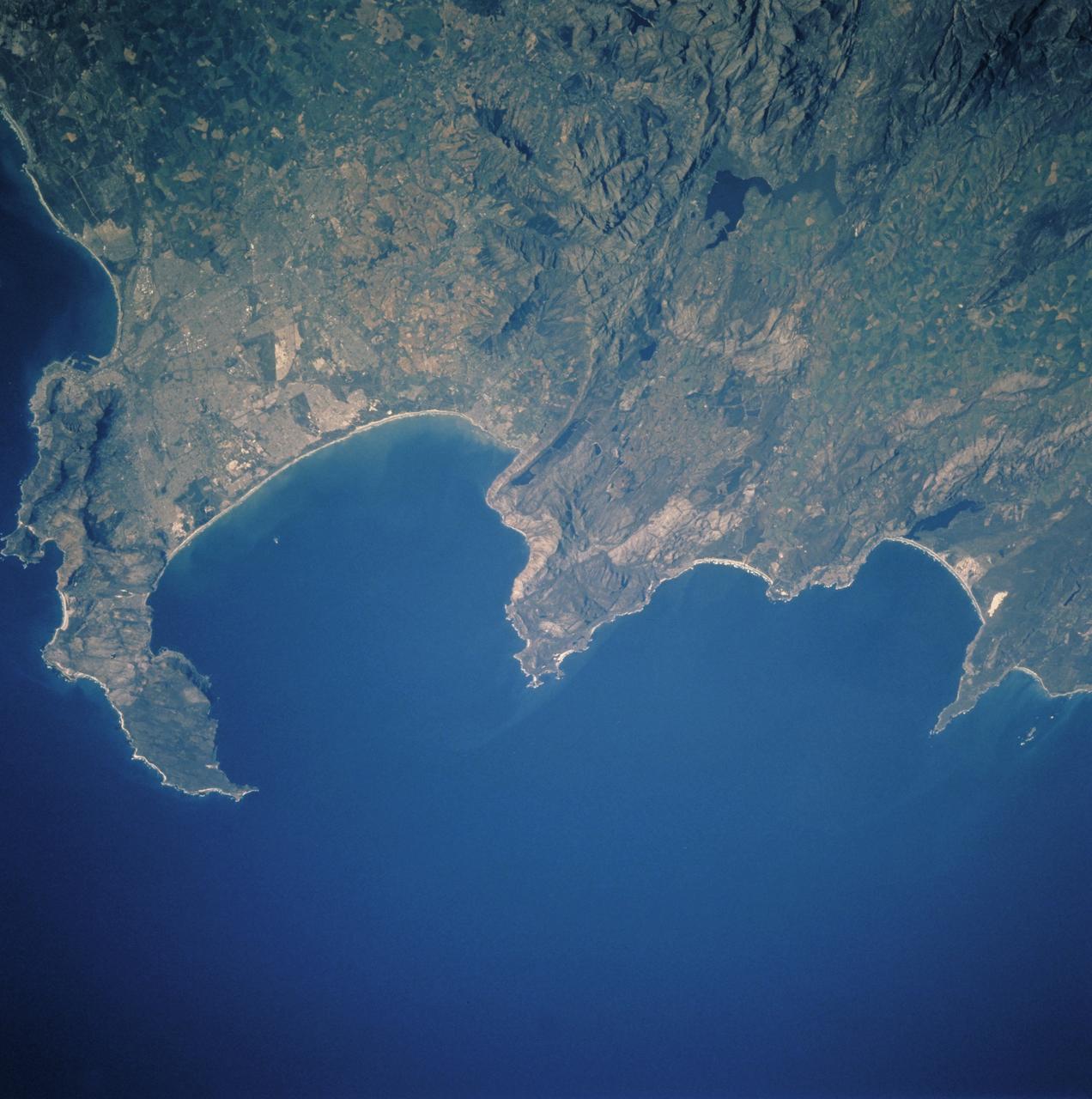
STS097-711-069 (30 Nov. - 11 Dec. 2000) This view featuring Cape Town and the Western Cape Province in the Republic of South Africa was provided by one of the STS-97 astronauts using a 70mm handheld camera aboard the Earth-orbiting Space Shuttle Endeavour. The capital and largest city of Western Cape Province, Cape Town (1995 population in the urban and suburban area shows in excess of 1.9 million), is visible between False Bay (large, U-shaped bay) and a smaller bay along the Atlantic coast of the peninsula. Within the urban built-up area some of the infrastructure of Cape Town, including the city center and the harbor and waterfront facilities, can be identified near the small bay (middle left edge of the image). Table Mountain elevation of 3563 feet (1086 meters above sea level) separates the city center (north of the mountain) from the southern suburbs of Cape Town. The Cape of Good Hope, long famous as the gateway from the Atlantic Ocean to the Indian Ocean, is located at the southern tip of the claw-shaped peninsula. False Bay is a popular recreational region for the local residents of the greater Cape Town region, as well as a tourist attraction for people who live beyond the borders of South Africa. The lighter-colored terrain, mainly north of Cape Town, shows a landscape of large, cultivated field patterns. These coastal plains are separated from the interior by a chain of folded mountain ranges that include the Cedarberg (dark, linear, north/south aligned feature in the upper right corner) and the more complex, folded Herrivierberge Mountains (dark structure, right middle) that are located northeast of Cape Town.
ISS038-E-008471 (26 Nov. 2013) --- One of the Expedition 38 crew members aboard the International Space Station took this photograph showing a part of South Africa's Atlantic Coast. South Africa is the only African nation bordered by both the Indian and Atlantic Oceans.
From left to right, Provincial Minister for Finance and Economic Opportunities of the Western Cape Government, Mireille Wenger, Premier of the Western Cape Government, Alan Winde, NASA Associate Administrator for the Space Operations Mission Directorate, Ken Bowersox, NASA Deputy Associate Administrator for Space Communications and Navigation, Badri Younes, and Director-General of the Western Cape Government, Dr. Harry Malila, pose for a photo in the Space Operations Center during a meeting with NASA and Western Cape Government representatives, to discuss the path forward for development of an antenna for the Lunar Exploration Ground Sites (LEGS) mission in Matjiesfontein, South Africa, and other opportunities, Tuesday, June 13, 2023, at the Mary W. Jackson NASA Headquarters building in Washington. Photo Credit: (NASA/Aubrey Gemignani)
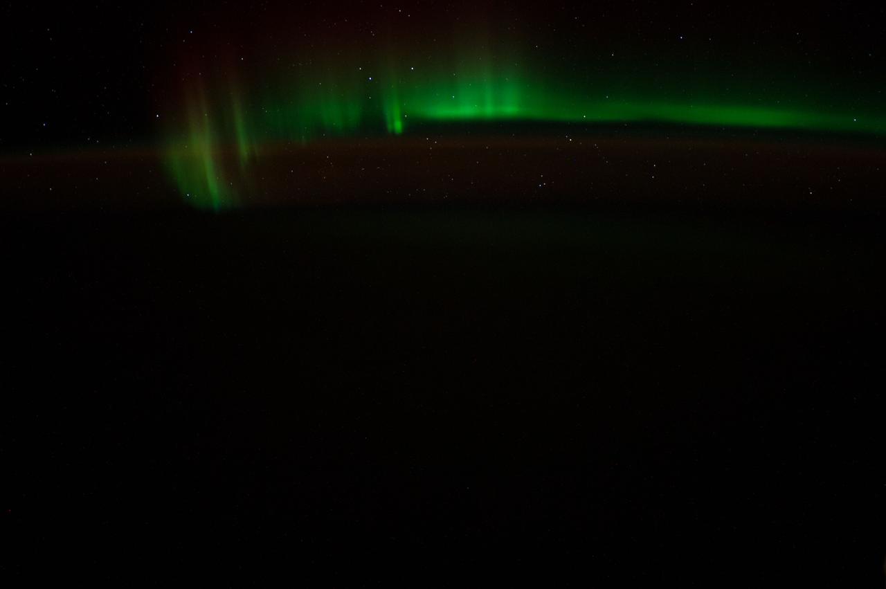
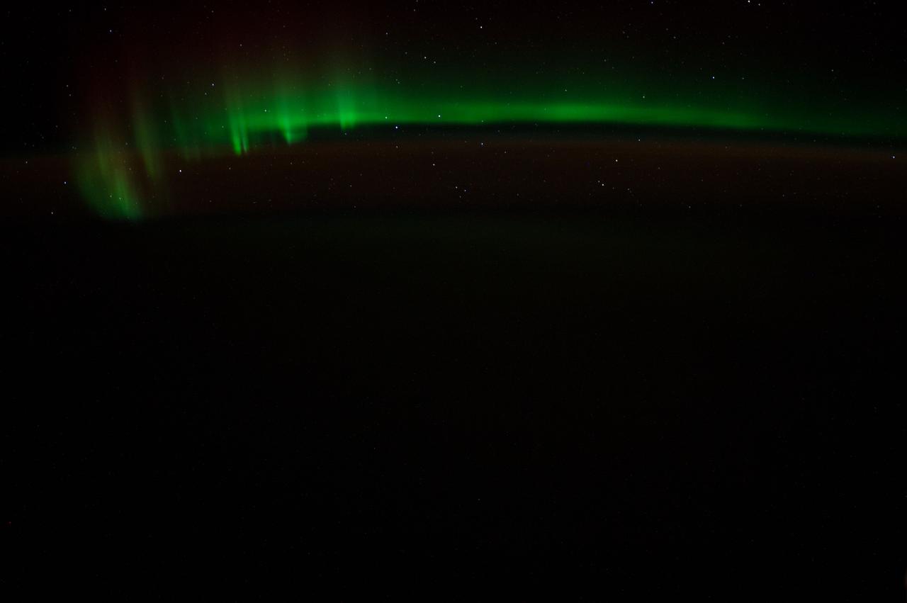
Earth observation taken by the Expedition 39 crew aboard the ISS. Image was downlinked in folder: aurora south of Africa.
iss066e123388 (Jan. 21, 2022) --- The waning gibbous Moon is pictured above the Earth's horizon as the International Space Station orbited 272 miles above the Atlantic Ocean in betweenthe tips of South America and South Africa.
iss055e007531 (March 31, 2018) --- The tip of South Africa and its legislative capital city of Cape Town are pictured as the International Space Station comes out of the lowest portion of its orbit over the South Atlantic Ocean.
iss064e038871 (Feb. 28, 2021) --- Cape Town in South Africa is pictured with the Sun's glint beaming off the South Atlantic coast as the International Space Station orbited 269 miles above. Credit: Roscosmos
iss066e124140 (Jan. 21, 2022) --- The waning gibbous Moon is pictured above the Earth's horizon as the International Space Station orbited 272 miles above the Atlantic Ocean in bnetween the tips of South America and South Africa.
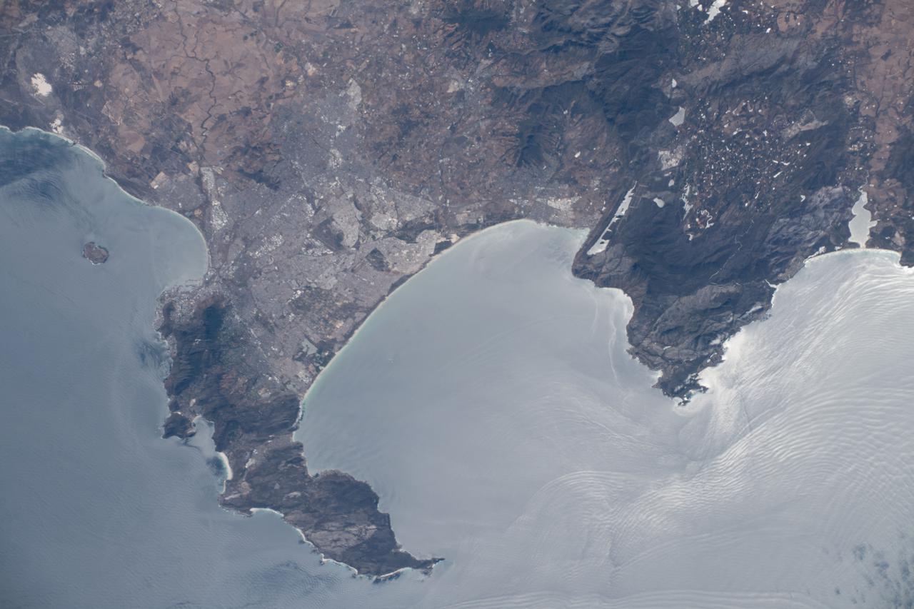
iss066e162015 (March 6, 2022) --- Cape Town, South Africa, on the coast of False Bay, is pictured from the International Space Station as it orbited 264 miles above the south Atlantic Ocean.
ISS047e044560 (04/03/2016) --- The very bottom tip of Africa is imaged here as captured by the crew of the International Space Station on April 3rd, 2016. South Africa's capitol Cape Town is located at the bottom left of this beautiful Earth picture captured on a sunny day.
iss062e103145 (March 20, 2020) --- The Orange River in South Africa is pictured as the International Space Station orbited 264 miles above the African continent.
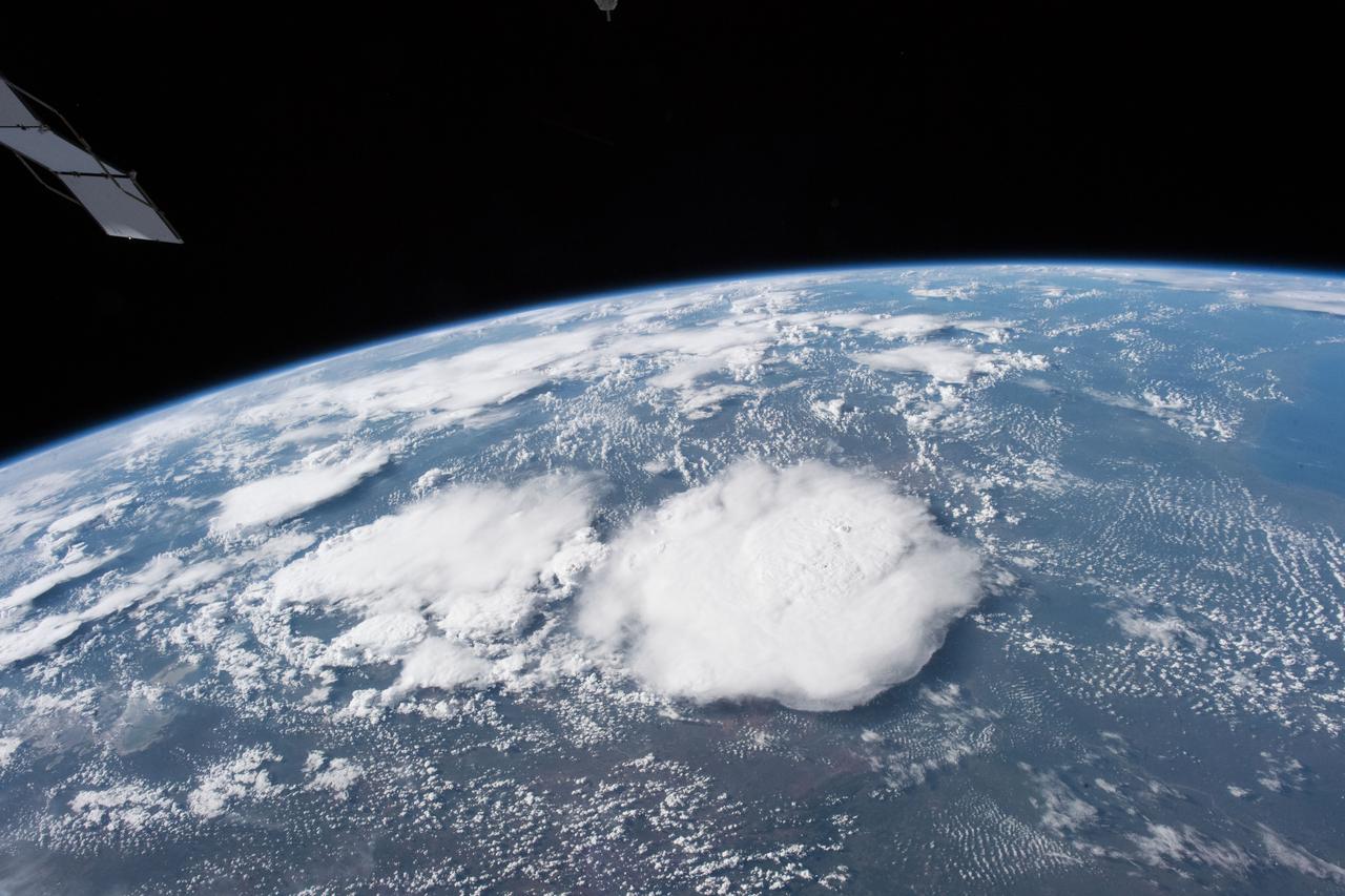
iss055e004922 (March 24, 2018) --- Storm clouds blanket an area of South Africa just inland from its eastern coast on the Indian Ocean.
iss067e036271 (May 7, 2022) --- The International Space Station flies into an orbital sunset at an altitude of 266 miles above the Atlantic Ocean off the coast of South Africa.
Earth Observation taken during a night pass by the Expedition 40 crew aboard the International Space Station (ISS). Folder lists this as: South Africa at night.
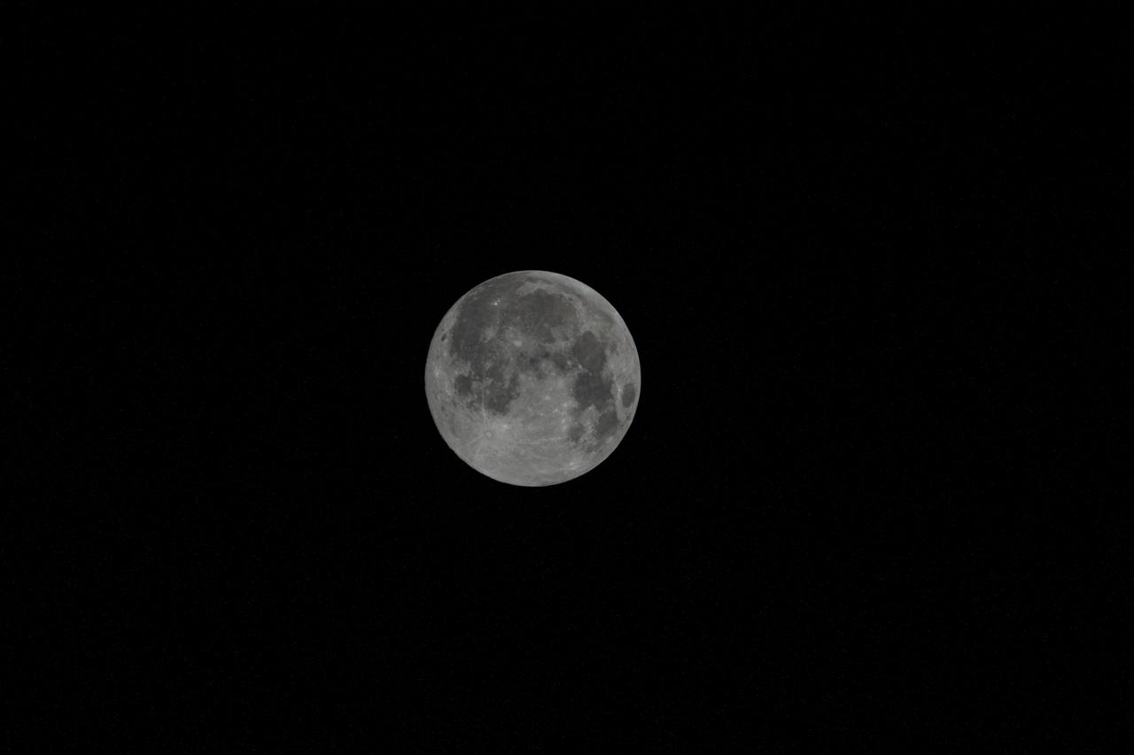
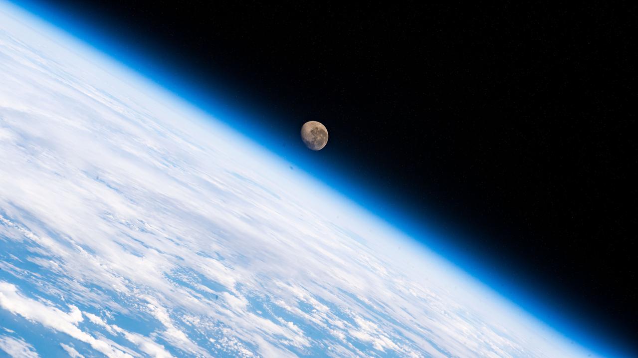
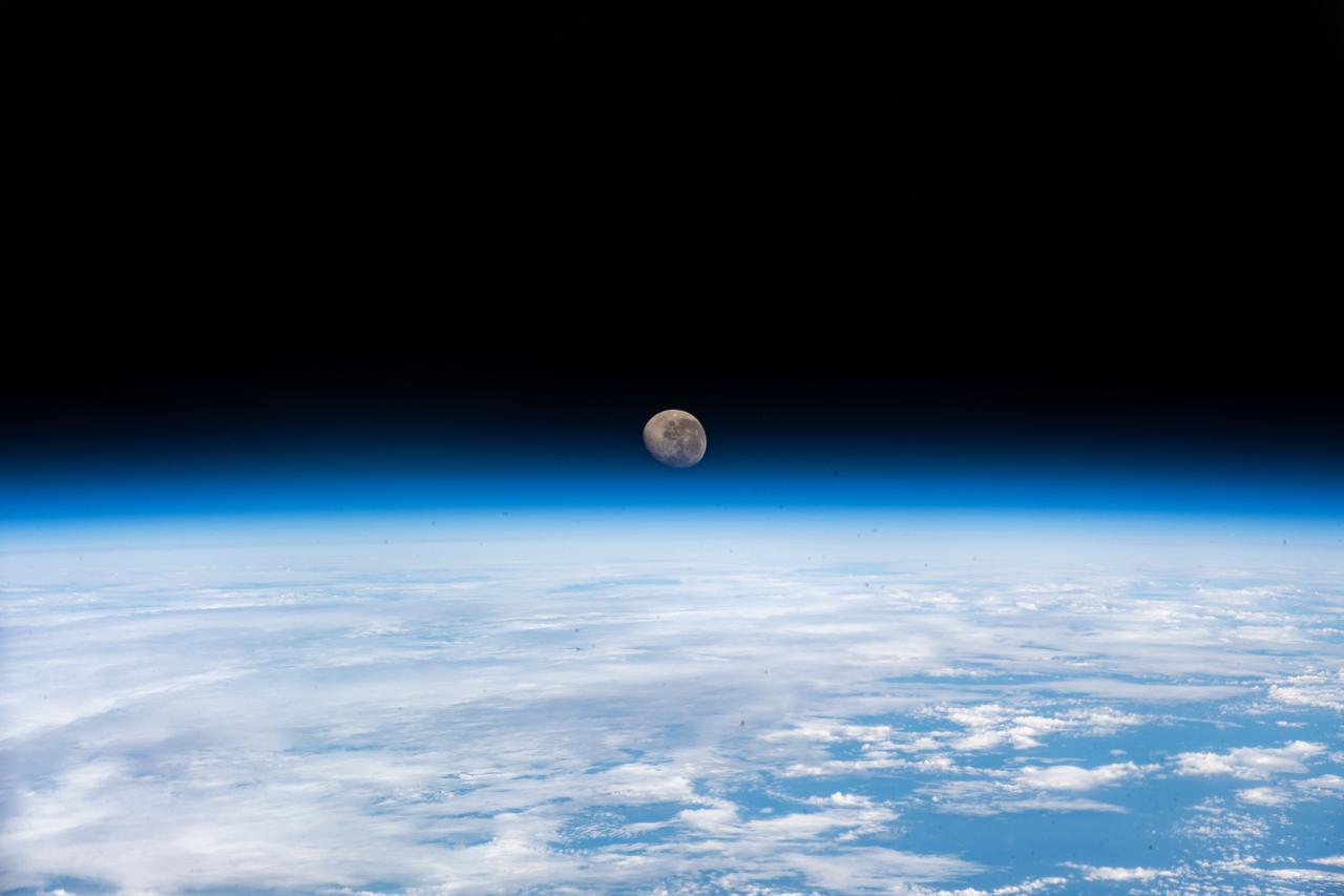
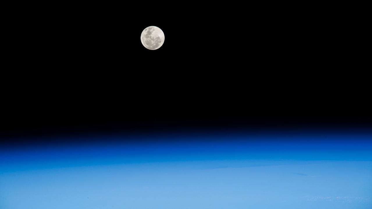
iss064e016494 (Dec. 29, 2020) --- The waxing gibbous Moon, the phase before it becomes a Full Moon, is pictured from the International Space Station as it orbited 272 miles above the South Atlantic in between the tip of South America and the tip of South Africa.

iss064e016183 (Dec. 27, 2020) --- JAXA astronaut Soichi Noguchi is pictured inside the International Space Station's "window to the world," the cupola, as it was orbiting 269 miles above the South Atlantic in between the tip of South America and the tip of South Africa.
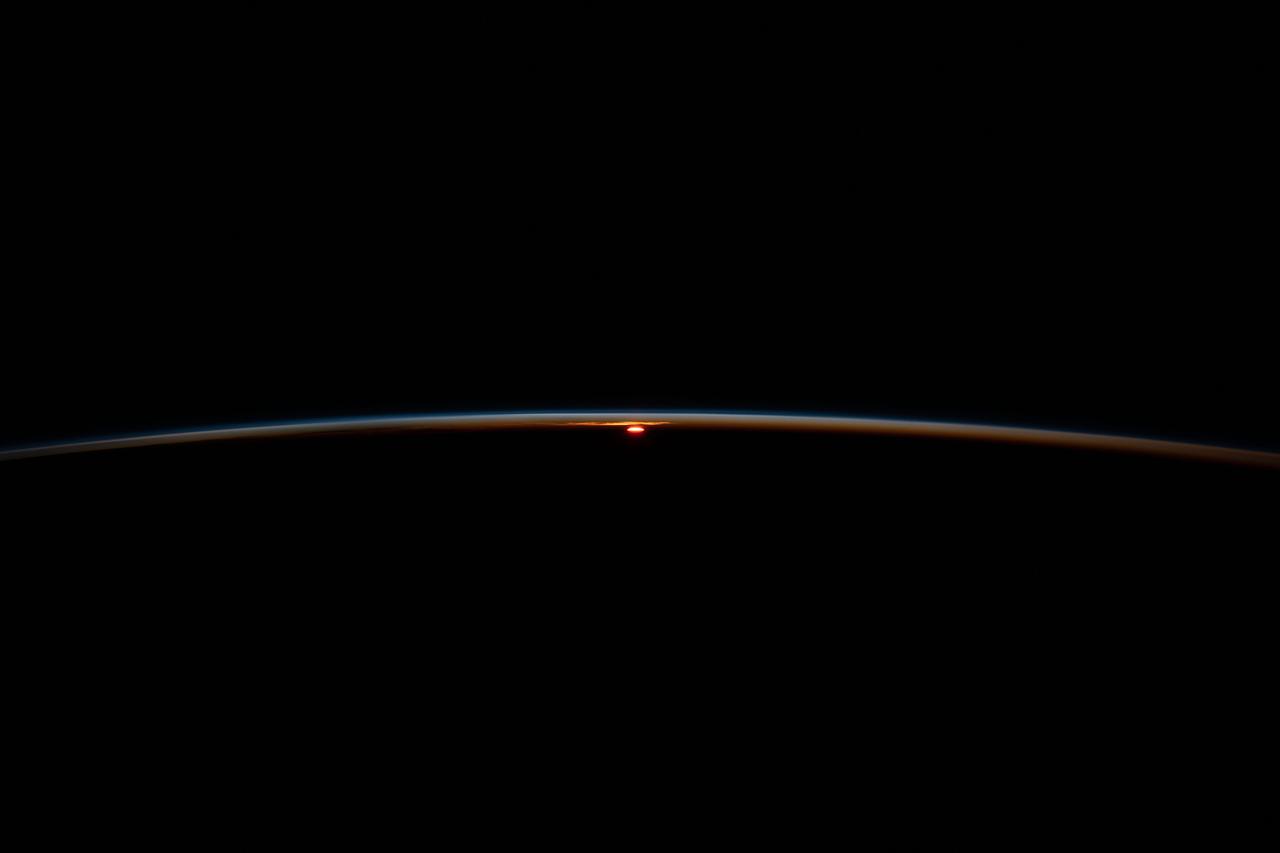
iss071e547275 (Aug. 22, 2024) --- The last rays of an orbital sunset fade below Earth's horizon illuminating the atmosphere in this photograph from the International Space Station as it soared 267 miles above the South Atlantic Ocean in between the tips of South America and South Africa.
iss064e016473 (Dec. 29, 2020) --- The waxing gibbous Moon, the phase before it becomes a Full Moon, is pictured from the International Space Station as it orbited 272 miles above the South Atlantic in between the tip of South America and the tip of South Africa.
This is a C-band, VV polarization radar image of the Namib desert in southern Namibia, near the coast of South West Africa. The image is centered at about 25 degrees South latitude, 15.5 degrees East longitude. This image was one of the first acquired by the Spaceborne Imaging Radar-C/X-Band Synthetic Aperture Radar (SIR-C/X-SAR) when it was taken on orbit 4 from the shuttle Endeavour on April 9, 1994. The area shown is approximately 78 kilometers by 20 kilometers. The dominant features in the image are complex sand dune patterns formed by the prevailing winds in this part of the Namib desert. The Namib desert is an extremely dry area formed largely because of the influence of the cold Benguela ocean current that flows northward along the coast of Namibia. The bright areas at the bottom of the image are exposed outcrops of Precambrian rocks. This extremely barren area is a region rich in diamonds that through the centuries have washed down from the mountains. The town of Luderitz is located just to the south of the area shown. http://photojournal.jpl.nasa.gov/catalog/PIA01720
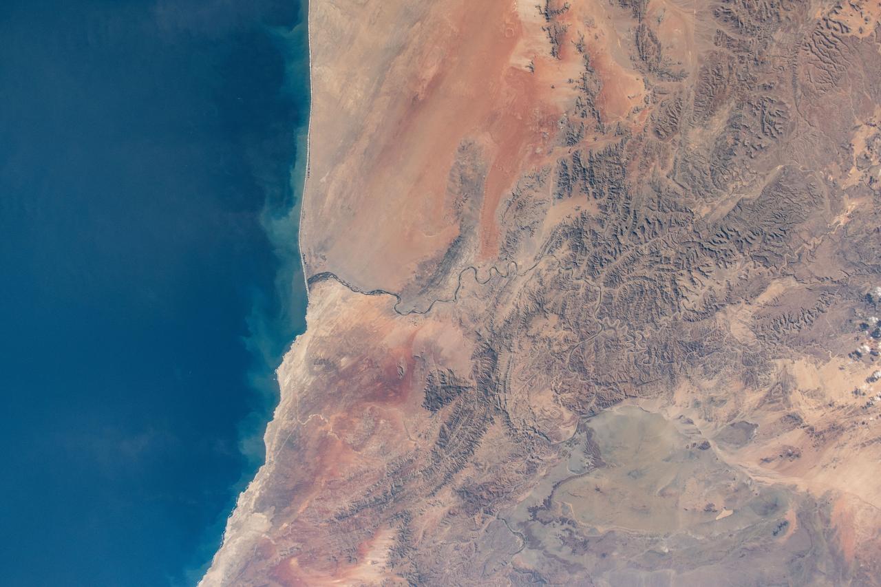
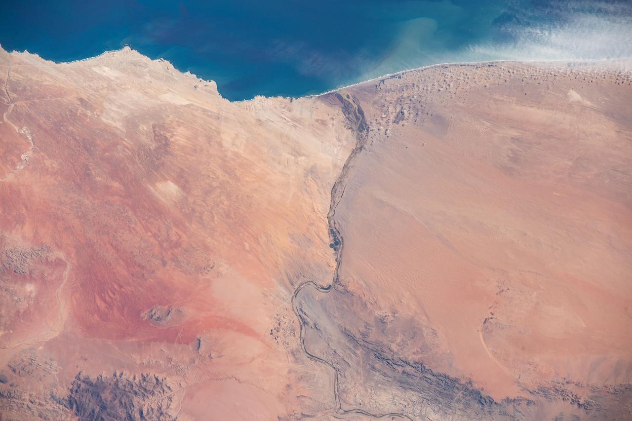
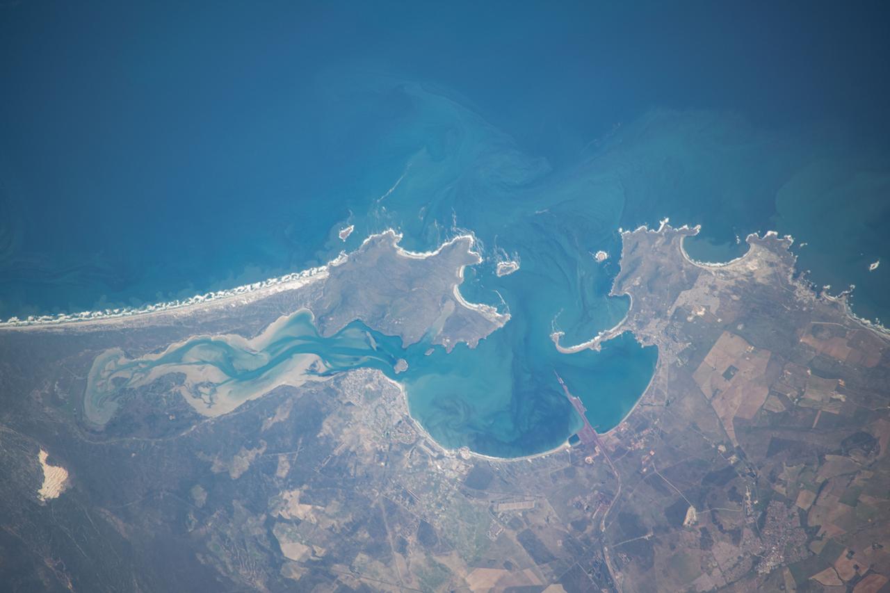
iss071e230735 (June 27, 2024) --- Orange River is the border between South Africa and Namibia on the Atlantic coast and is the termination point of the Namib desert to the north and the desert landscape of Richtersveld to the south. The International Space Station was orbiting 268 miles above at the time of this photograph
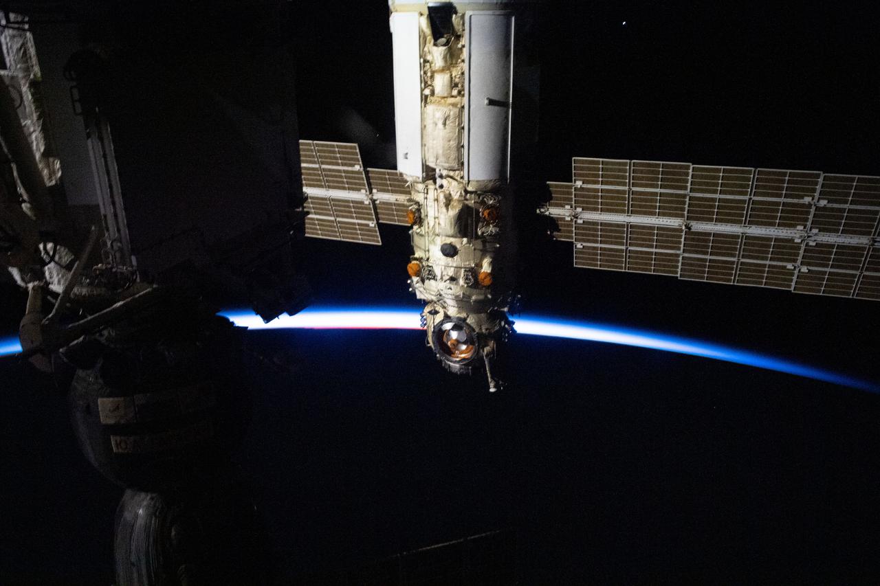
iss067e035732 (May 6, 2022) --- The Soyuz MS-21 crew ship is picture docked to the Prichal docking module as the International Space Station flew into an orbital sunset 271 miles above the Indian Ocean south of Cape Town, South Africa.
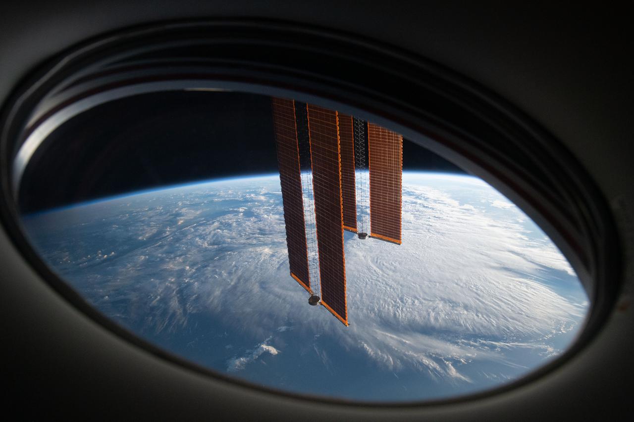
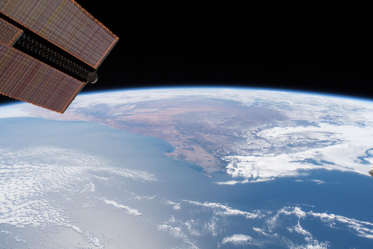
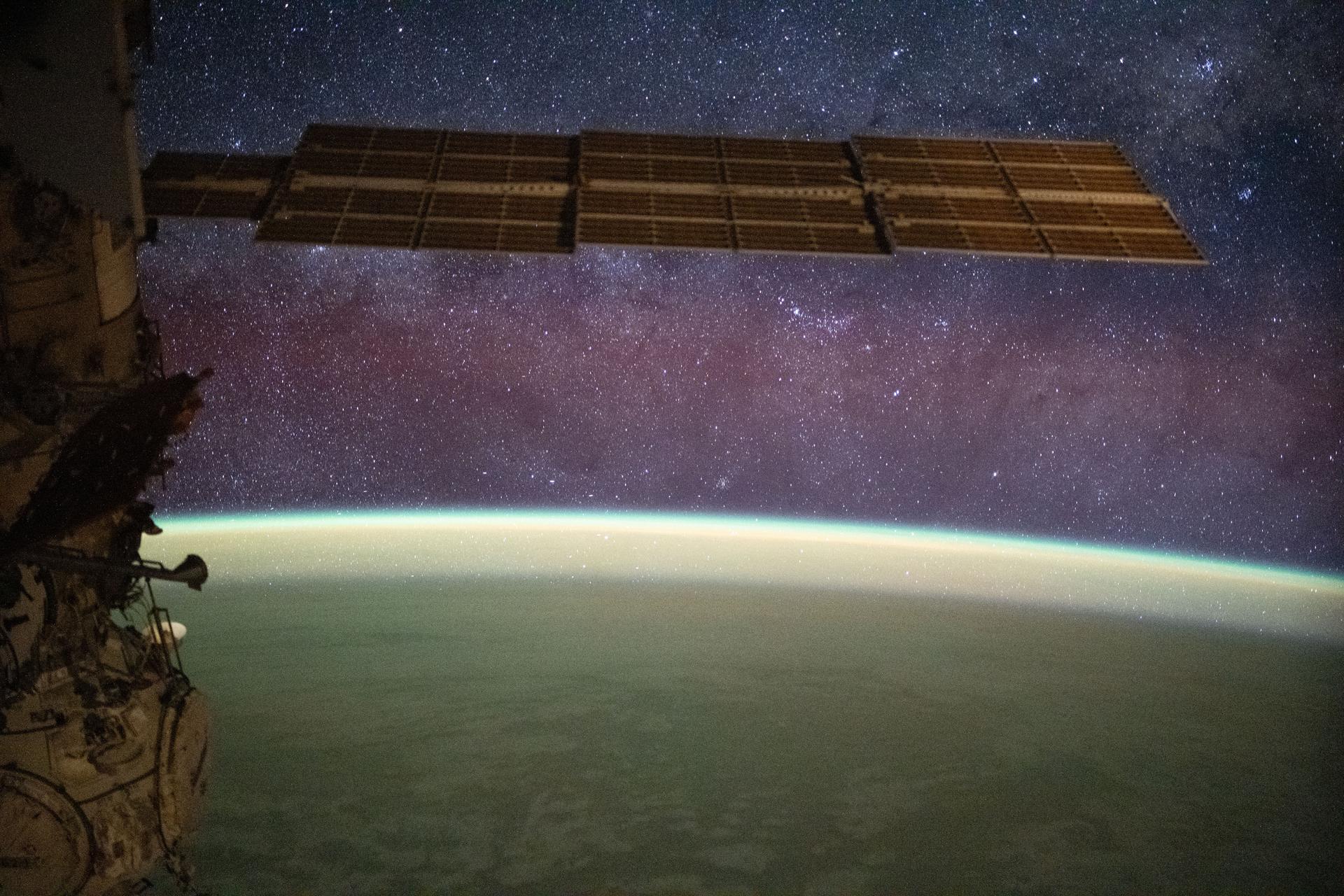
iss065e049854 (May 20, 2021) --- In this view from a window aboard the SpaceX Crew Dragon Endeavour, a pair of the International Space Station's main solar arrays drape across the Earth's horizon as the orbital lab soared 271 miles above the south Atlantic in between Argentina and South Africa.
iss071e522575 (Aug. 20, 2024) --- A portion of the Kalahari Desert, a semi-arid and sandy savanna, in South Africa's Northern Cape province is pictured from the International Space Station as it orbited 262 miles above.
Earth Observation taken during a day pass by the Expedition 40 crew aboard the International Space Station (ISS). Folder lists this as: EOS South Africa Cape Town JoBurg Vredefort Crater.
Earth Observation taken during a day pass by the Expedition 40 crew aboard the International Space Station (ISS). Folder lists this as: EOS South Africa Cape Town JoBurg Vredefort Crater.
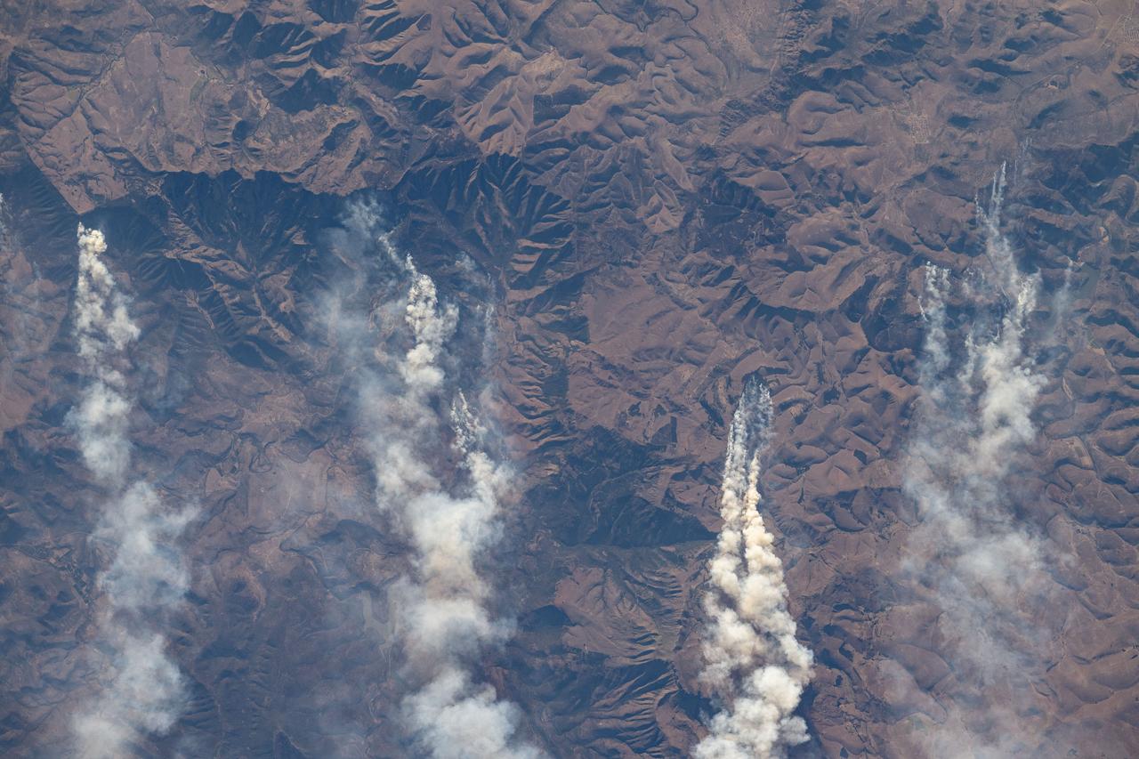
iss071e522679 (Aug. 20, 2024) --- Wildfires in South Africa's Great Escarpment near the coast of the Indian Ocean are pictured from the International Space Station as it orbited 263 miles above.
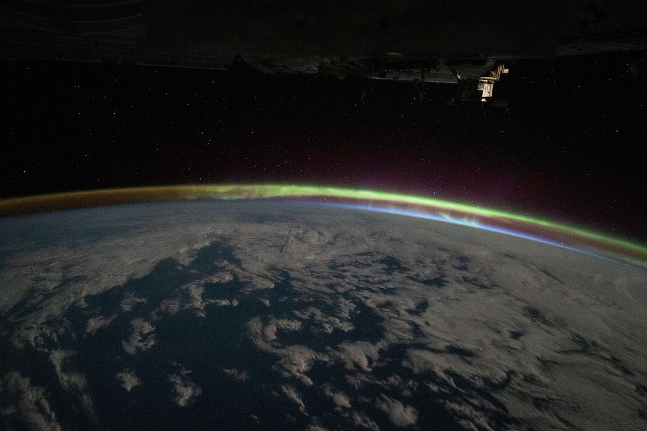
iss068e010113 (Oct. 4, 2022) --- The aurora australis intersects Earth's atmospheric glow in this photograph from the International Space Station as it orbited 268 miles above the Indian Ocean southeast of South Africa.

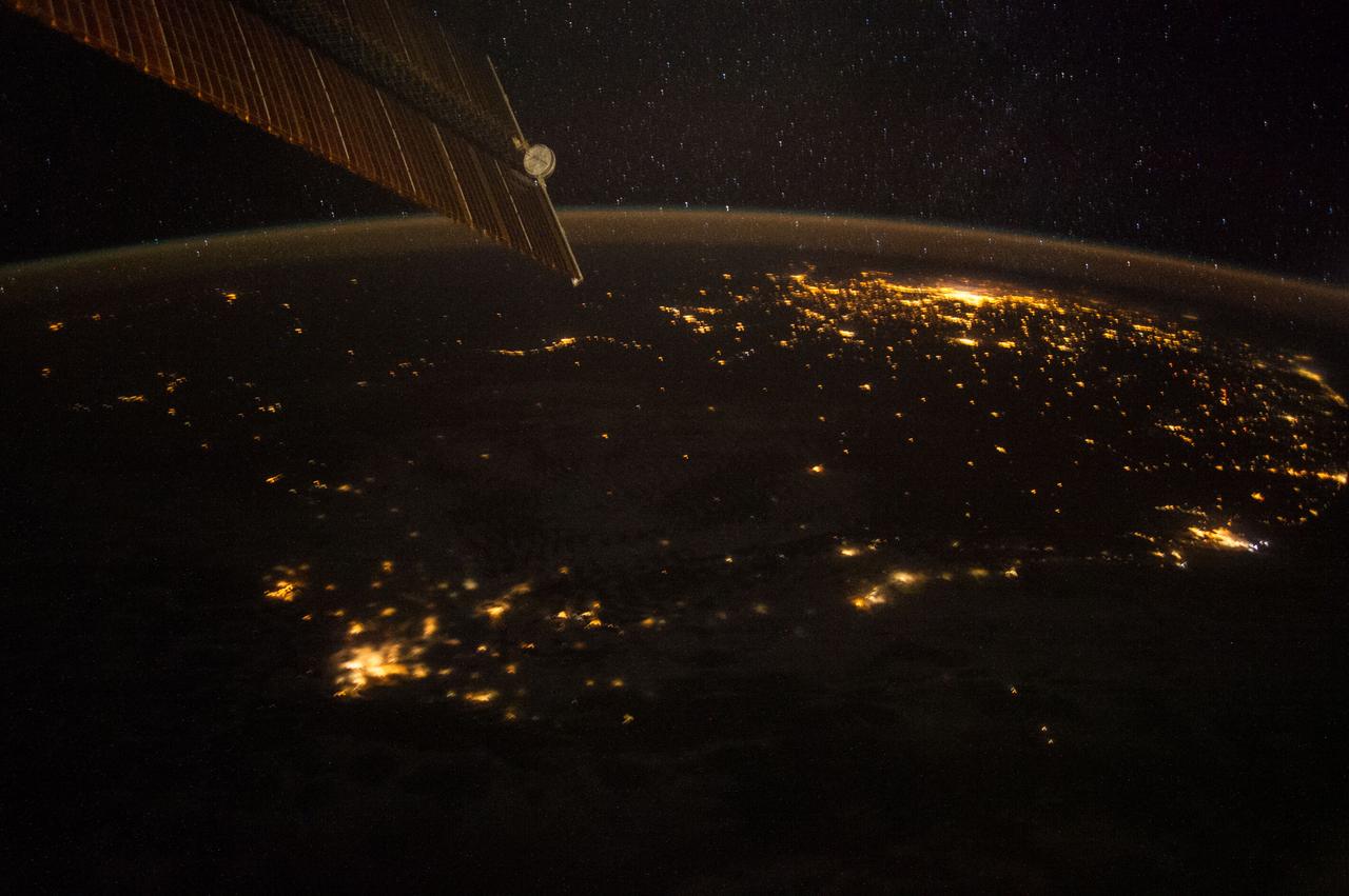
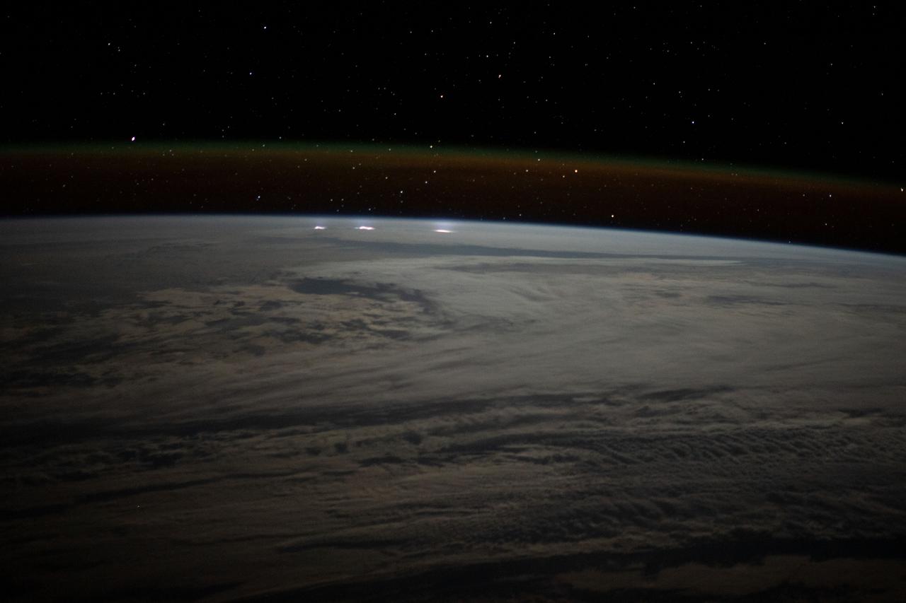
iss065e214537 (Aug. 2, 2021) --- The night lights of South Africa are blanketed by Earth's atmospheric glow and a starry night sky as the International Space Station orbited 266 miles above.
Earth Observation taken during a day pass by the Expedition 40 crew aboard the International Space Station (ISS). Folder lists this as: EOS South Africa Cape Town JoBurg Vredefort Crater.
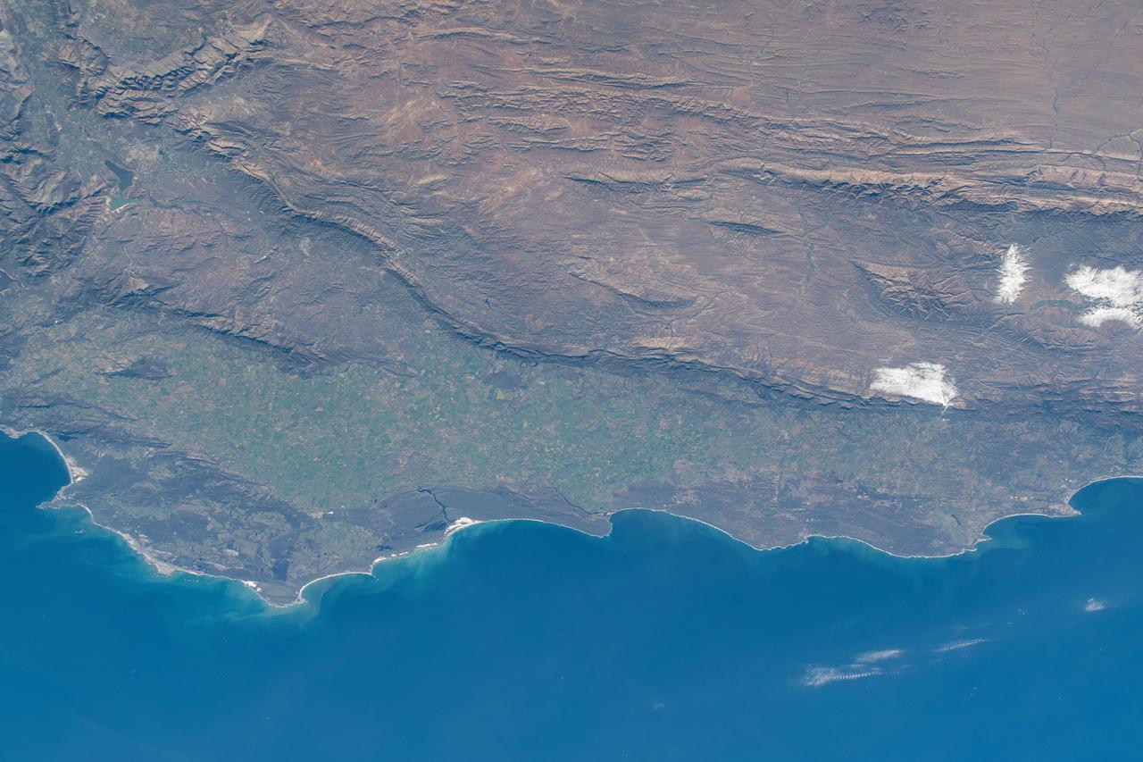
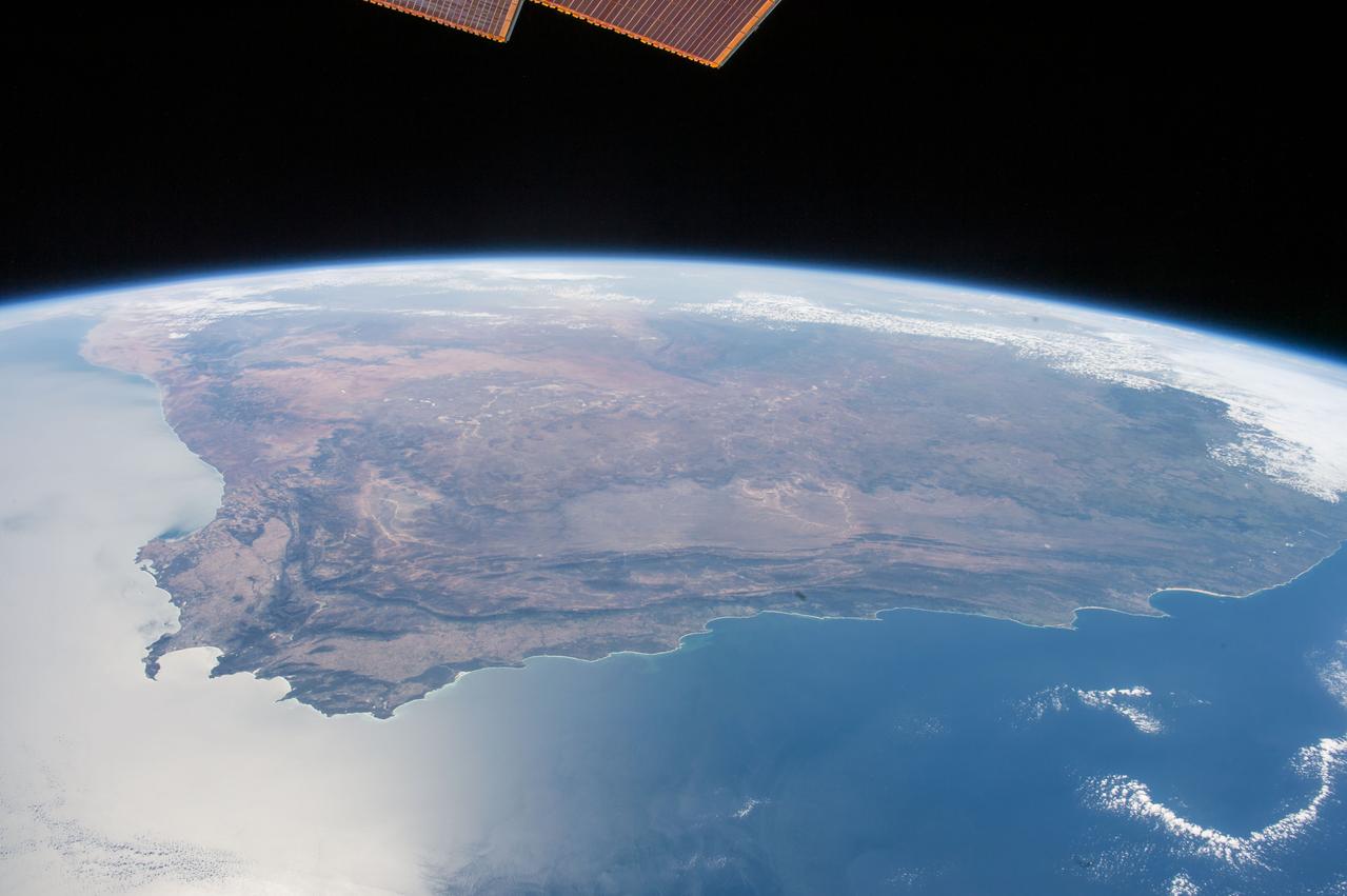
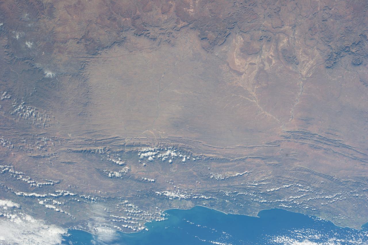
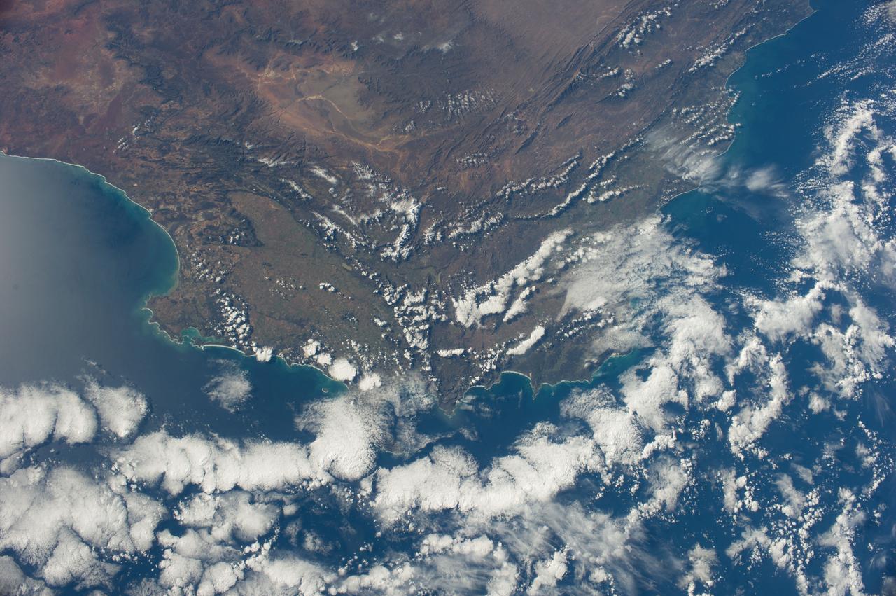
iss071e230776 (June 27, 2024) --- The steep slopes of the Great Escarpment descend toward to the coastal lowlands at the southernmost tip of South Africa in this photograph from the International Space Station as it orbited 269 miles above.
iss062e103100 (March 20, 2020) --- The Orange River empties into the Atlantic Ocean and separates the nations of Namibia and South Africa. The International Space Station was orbiting 265 miles above the African continent when this photograph was taken.
Earth observation taken during day pass by an Expedition 36 crew member on board the International Space Station (ISS). Per Twitter message: Dusk, as we traveled south of the tip of Africa.

iss063e065220 (July 31, 2020) --- This long-exposure photograph captures a starry sky above the Earth's atmospheric glow as the International Space Station orbited above the Indian Ocean about halfway between South Africa and Australia.
Earth Observation taken during a day pass by the Expedition 40 crew aboard the International Space Station (ISS). Folder lists this as: EOS South Africa Cape Town JoBurg Vredefort Crater.
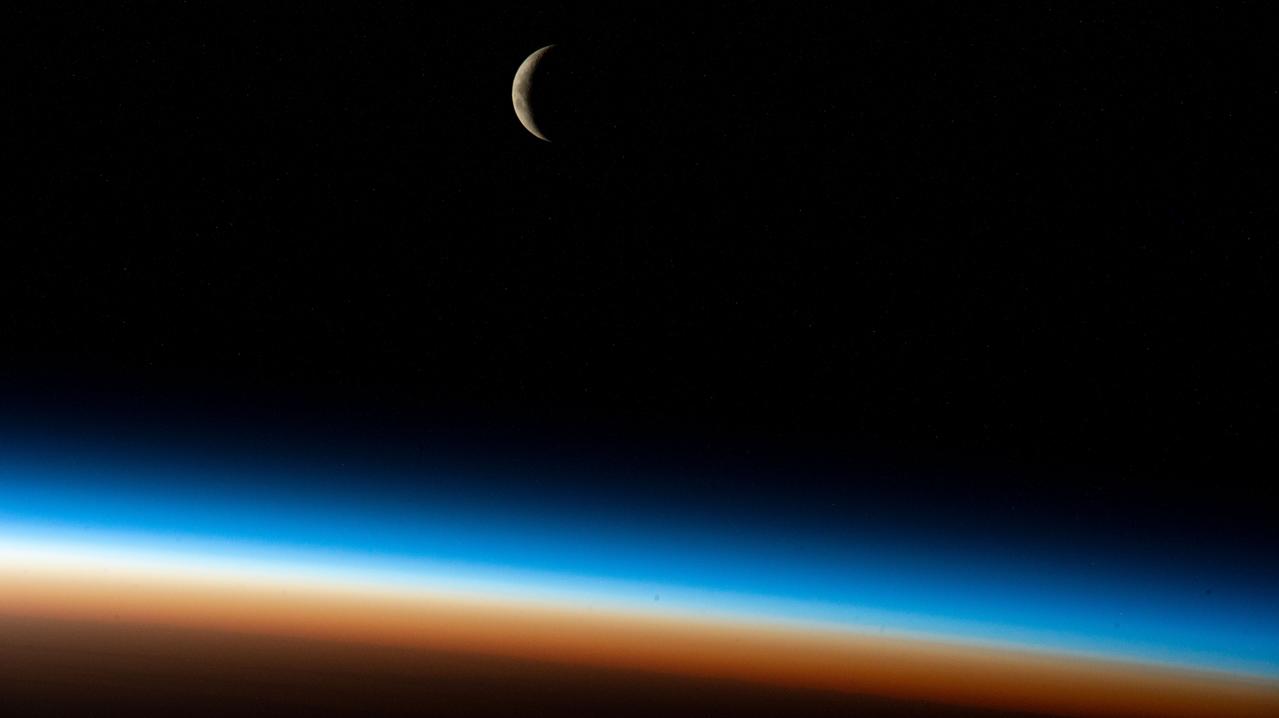
iss068e004256 (Sept. 30, 2022) --- The waxing crescent Moon is pictured from the International Space Station as it orbited 267 miles above the Atlantic Ocean southwest of South Africa during an orbital sunrise.
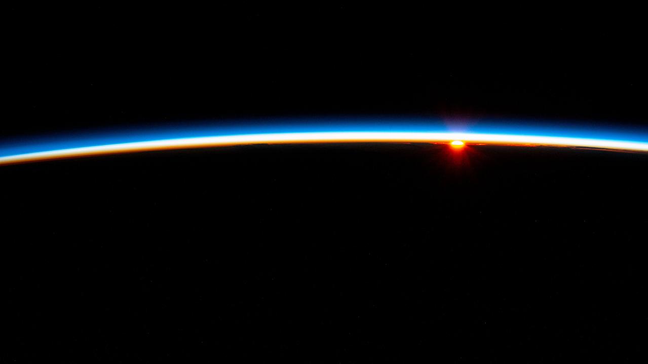
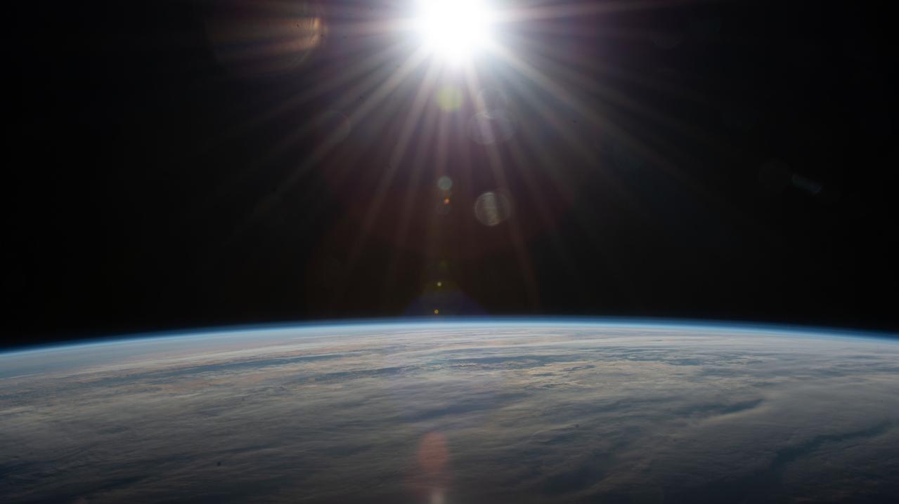
iss071e092499 (May 19, 2024) --- The first rays of an orbital sunrise penetrate Earth's atmosphere revealing the cloud tops as the International Space Station soared 262 miles above the Indian Ocean off the southeast coast of South Africa.
iss067e270871 (Aug. 17, 2022) --- A cloudy, south Indian Ocean between Africa and Antarctica, with lightning storms near the horizon beneath the atmospheric glow, is pictured from the International Space Station as it orbited 271 miles above
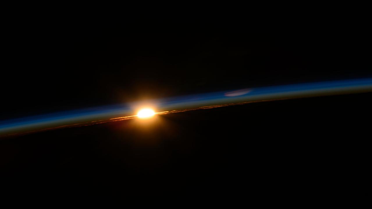
iss063e017117 (May 24, 2020) --- The sun's rays glisten in this photograph from an external high definition camera as the International Space Station orbited over the Atlantic Ocean southwest of South Africa.
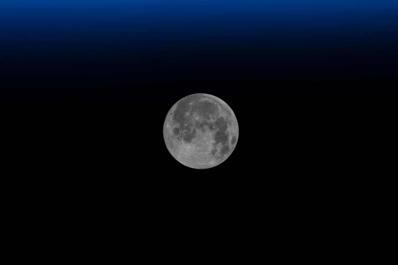
iss071e515447 (Aug. 19, 2024) --- The Full Moon pictured above Earth's horizon as the International Space Station soared 262 miles above the Atlantic Ocean off the coast of South Africa northwest of Cape Town.
iss061e025877 (Oct. 30, 2019) --- Pictured from the International Space Station's cupola, or "window to the world," Sudan's northern arid climate transitions to a tropical climate in the country's far south in eastern Africa.
Earth Observation taken during a day pass by the Expedition 40 crew aboard the International Space Station (ISS). Folder lists this as: EOS South Africa Cape Town JoBurg Vredefort Crater.
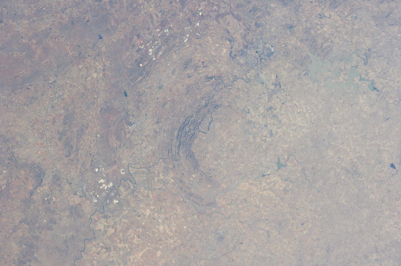
Earth Observation taken during a day pass by the Expedition 40 crew aboard the International Space Station (ISS). Folder lists this as: EOS South Africa Cape Town JoBurg Vredefort Crater.
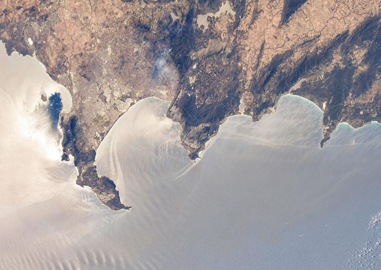
iss071e230761 (June 27, 2024) --- The Saldanha Bay, part of South Africa's West Coast Narional Park Marine Preserve, leads into the Atlantic Ocean in this photograph from the International Space Station as it orbited 269 miles above.

iss063e065237 (July 31, 2020) --- This long-exposure photograph captures a starry sky above the Earth's atmospheric glow as the International Space Station orbited above the Indian Ocean about halfway between South Africa and Australia.
iss065e329698 (Aug. 21, 2021) --- Russia's Nauka multipurpose laboratory module is pictured as the International Space Station orbited into a sunset 271 miles above the southern Indian Ocean in between South Africa and Antarctica.
iss071e6649782 (Sept. 12, 2024) --- A tropical depression in the Atlantic Ocean in between Africa and South America is pictured from the International Space Station as it orbited 259 miles above.
AST-14-890 (18 July 1975) --- An oblique view of unique drainage patterns in southwestern Africa in the Rio Cuando area of Angola and South-West Africa, as photographed from the Apollo spacecraft in Earth orbit during the joint U.S.-USSR Apollo-Soyuz Test Project mission. The picture was taken at an altitude of 223 kilometers (138 statute miles) with a 70mm Hasselblad camera using high-definition Ektachrome aerial SO-242 type film.
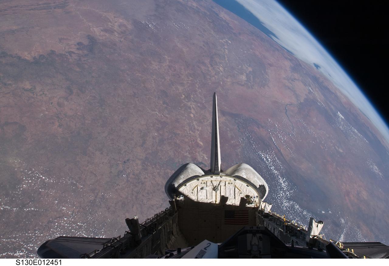
S130-E-012451 (20 Feb. 2010) --- The empty cargo bay and the aft portion of the Earth-orbiting space shuttle Endeavour are featured in this image photographed by an STS-130 crew member from inside the spacecraft?s crew cabin. The view is toward the west across southern Africa to the Atlantic ocean. The view follows along the Orange River, which also serves as the border between Namibia (to the right of the river) and South Africa (to the left of the river) nearer to the coast.
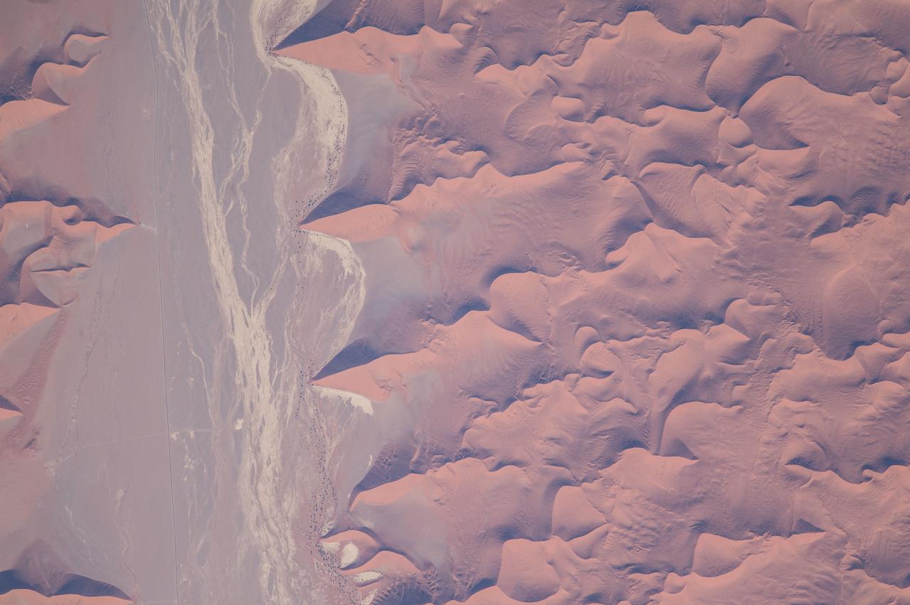
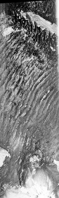
ISS047e022280 (03/26/2016) --- This interesting Earth observation image from the International Space Station seems an abstract painting but is really the outskirts of the Namib Desert in southwest Africa. One of the oldest and largest deserts in the world, the Namib stretches inland from the Atlantic Ocean, covering large swathes of Namibia and parts of Angola and South Africa. This arid hotspot surprisingly supports a diverse number of plants and animals, some of which are found nowhere else in the world.
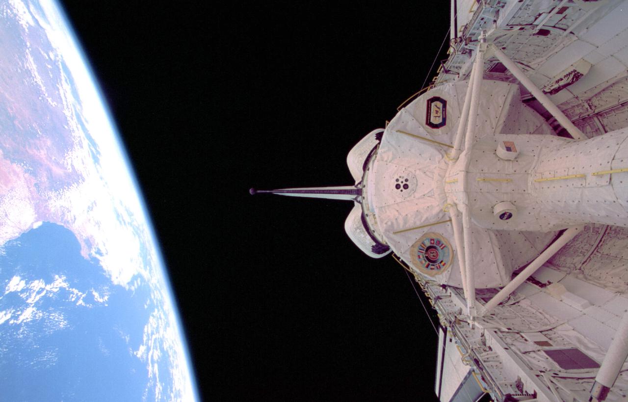
STS073-326-021 (20 October - 5 November 1995) --- The darkness of space and the Atlantic coast of southern Africa form the backdrop for this scene. Five NASA astronauts and two guest researchers spent almost 16 days of research in this science module affixed in the payload bay of the Space Shuttle Columbia in Earth-orbit. The tunnel in bottom foreground served as the busy passageway for the seven crew members, who split their forces into two shifts. South Africa and the Cape of Good Hope are the dominant features that can be delineated in the Earth scene.
STS061-106-091 (December 1993) --- The entire southern tip of Africa is shown in this high altitude 50mm photograph. The center of the photograph is at approximately 28.0 degrees south and 24.0 degrees east Cape Columbine is at the upper right with Durban at the lower center. The Orange River is at the upper center of the frame. Cape Agulas is the southernmost part of the African continent and is visible toward the upper right corner with the great bays of South Africa trending toward the bottom right. Continuing clockwise along the coast, Durban projects out into the Indian Ocean. The oceanic clouds on the right side of the photograph probably depict a current boundary. The Drakensberg Range on the east, the great Karoo Range to the south and the Karas Mountains on the west surround the drier central plateau. The southern Kalahari Desert is at the upper left of the photograph.
This radar image acquired in February 2000 by NASA Shuttle Radar Topography Mission SRTM shows an area in the state of Bahia in Brazil.
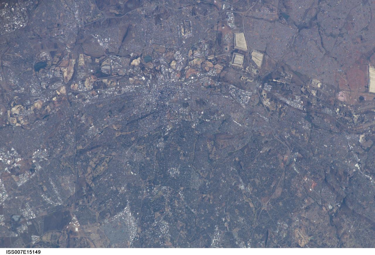
ISS007-E-15149 (21 September 2003) --- This image, photographed by an Expedition 7 crewmember onboard the International Space Station (ISS), was merged with images ISS007-E-15148 and ISS007-E-15150 to create a mosaic of Johannesburg, South Africa. The mosaic can be viewed on http://eol.jsc.nasa.gov
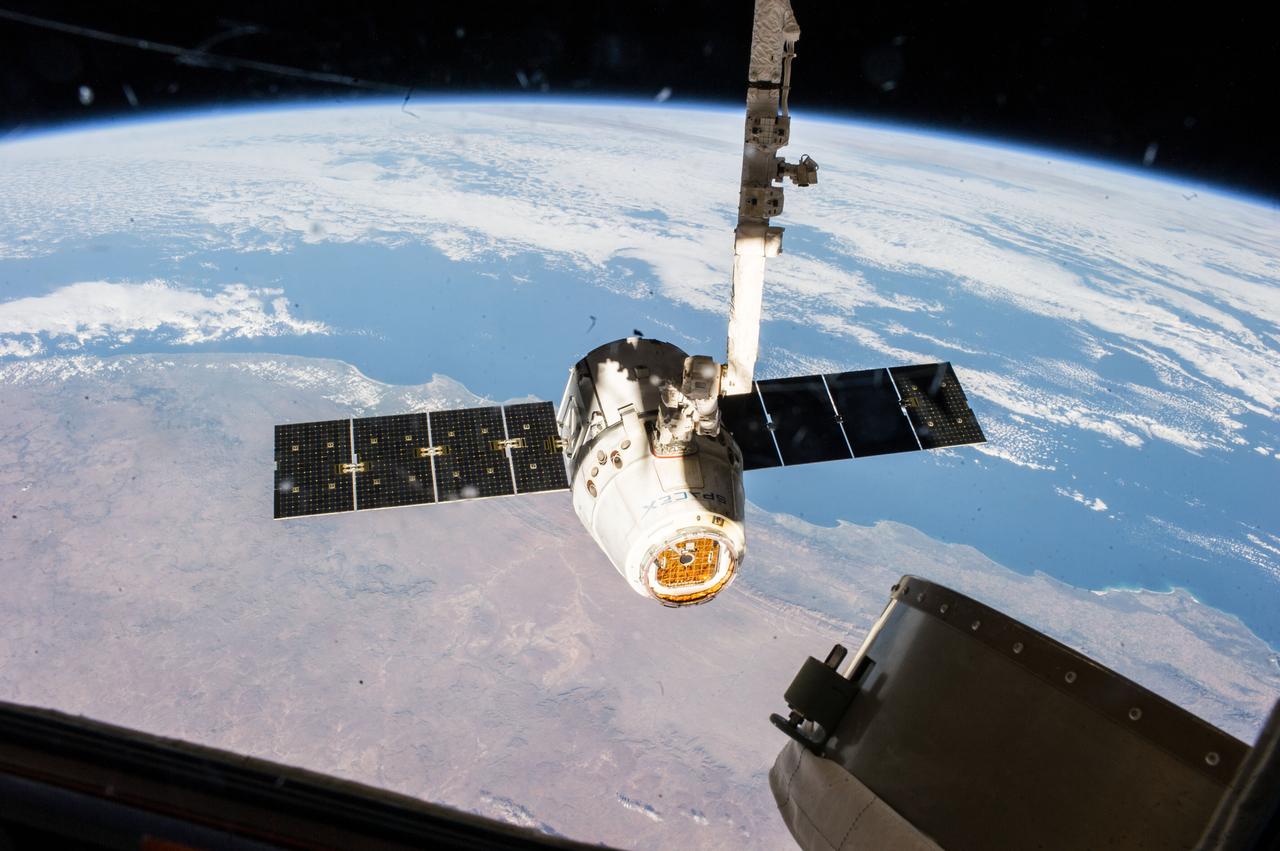
ISS040-E-000407 (18 May 2014) --- The SpaceX Dragon commercial cargo craft is pictured just prior to being released by the International Space Station's Canadarm2 robotic arm on May 18, 2014, to allow it to head toward a splashdown in the Pacific Ocean. South Africa can be seen as the land mass in the picture.
iss071e523401 (Aug. 21, 2024) --- The desert coast of Namibia and the city lights of Johannesburg, South Africa, and surrounding areas on Earth's horizon are pictured from the International Space Station as it soared 263 miles above the Atlantic Ocean in this nighttime photograph.
Very distant view of the approach of the first Cygnus commercial cargo spacecraft built by Orbital Sciences Corp to the International Space Station(ISS) with the Earth in the background. Per Twitter message: #Cygnus, approaching us from below as we pass the coast of South Africa.
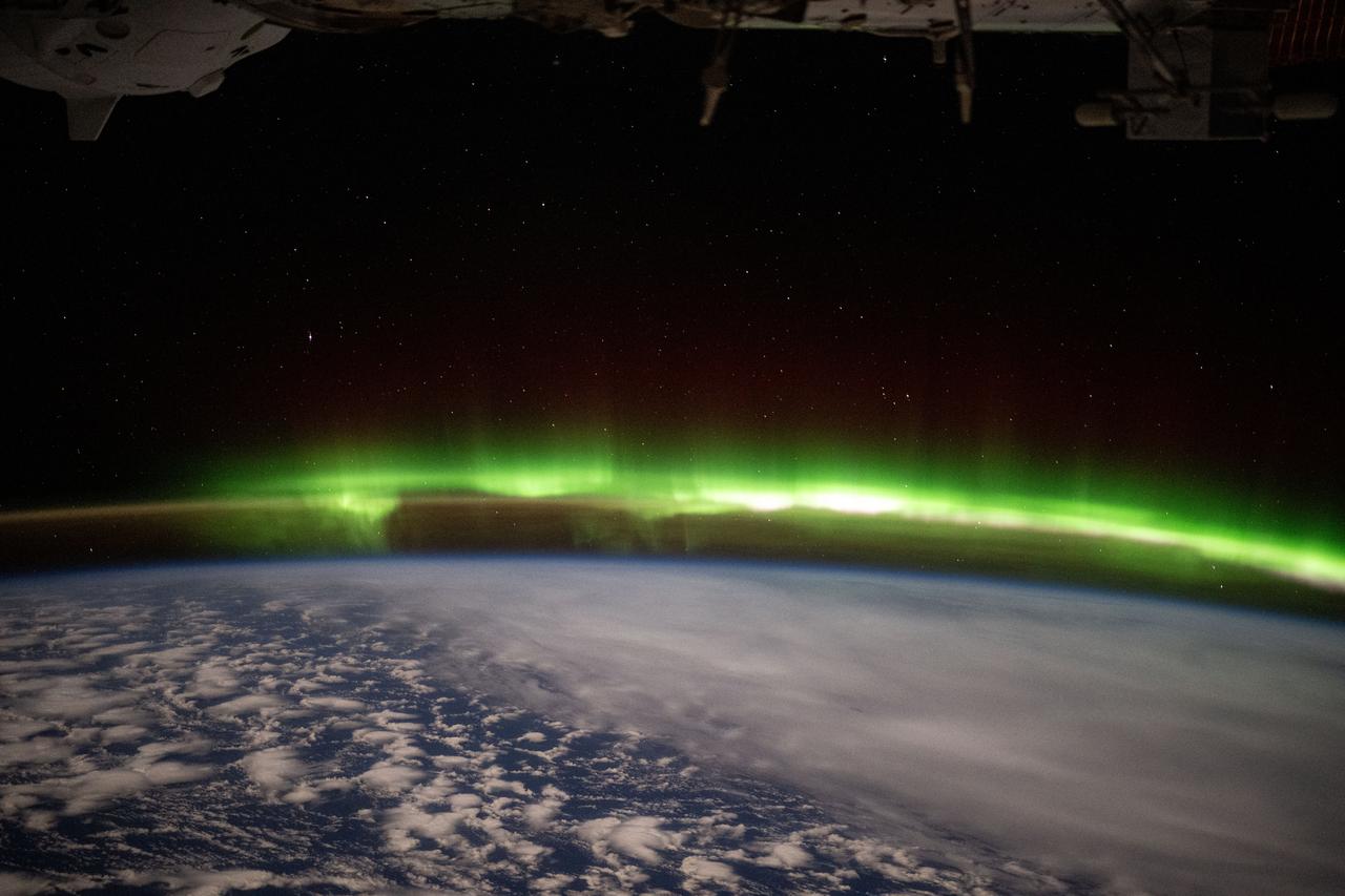
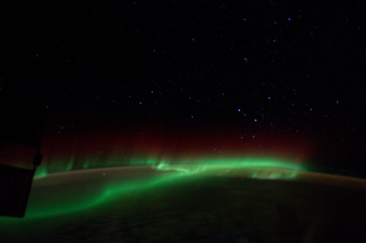
iss073e0246858 (June 9, 2025) --- A bright green aurora australis streams above Earth's horizon blanketing the atmospheric glow in this photograph from the International Space Station as it orbited 269 miles above a cloudy southern Indian Ocean midway between South Africa and Antarctica.
iss073e0982261 (Oct. 24, 2025) --- The Milky Way spans the night sky above a yellow-green airglow that blankets the Atlantic Ocean, midway between South America and Africa. This long-exposure photograph was taken from the International Space Station as it orbited 260 miles above Earth at approximately 11:19 p.m. local time.
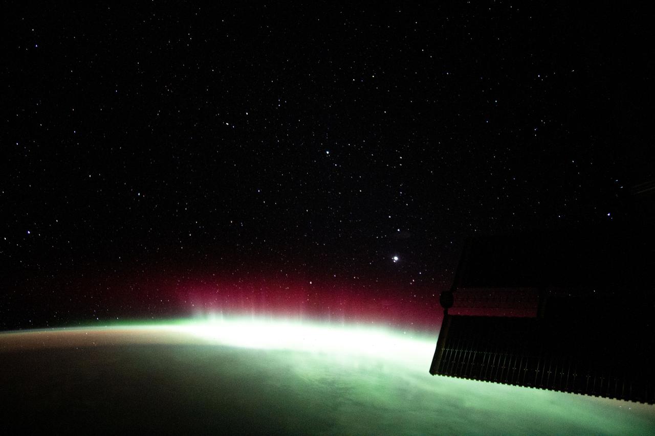
iss065e001061 (April 17, 2021) --- An aurora is pictured streaming above the Earth from a window aboard the SpaceX Crew Dragon Resilience. The International Space Station was orbiting 271 miles above the Indian Ocean in between South Africa and Antarctica.
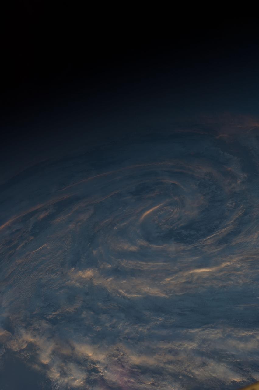
ISS040-E-040103 (5 July 2014) --- As the International Space Station was flying at an altitude of 226 nautical miles on July 5 above a point in the southern Indian Ocean near South Africa's Prince Edwards Islands, one of the Expedition 40 crew members photographed this image of Aurora Australis.

iss069e004683 (April 20, 2023) --- The Northrup Grumman Cygnus space freighter is pictured in the grip of the Canadarm2 robotic arm while attached to the Unity module's Earth-facing port. The International Space Station was soaring into an orbital sunset 266 miles above the Indian Ocean in between South Africa and Antarctica at the time of this photograph.
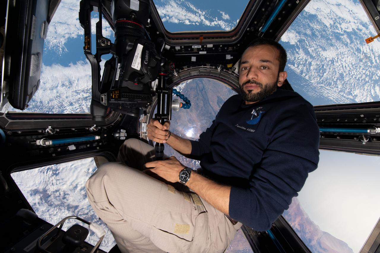
iss069e010671 (May 14, 2023) --- UAE (United Arab Emirates) astronaut and Expedition 69 Flight Engineer Sultan Alneyadi is pictured with camera gear inside the seven window cupola as the International Space Station orbited 263 miles above Cape Town, South Africa.
ISS040-E-040088 (5 July 2014) --- As the International Space Station was flying at an altitude of 226 nautical miles on July 5 above a point in the southern Indian Ocean near South Africa's Prince Edwards Islands, one of the Expedition 40 crew members photographed this image of Aurora Australis.