
The `once upon a time' science fiction concept of a space elevator has been envisioned and studied as a real mass transportation system in the latter part of the 21st century. David Smitherman of NASA's Marshall Space Flight Center's Advanced Projects Office has compiled plans for such an elevator. The space elevator concept is a structure extending from the surface of the Earth to geostationary Earth orbit (GEO) at 35,786 km in altitude. The tower would be approximately 50 km tall with a cable tethered to the top. Its center mass would be at GEO such that the entire structure orbits the Earth in sync with the Earth's rotation maintaining a stationary position over its base attachment at the equator. Electromagnetic vehicles traveling along the cable could serve as a mass transportation system for transporting people, payloads, and power between space and Earth. This illustration by artist Pat Rawling shows the concept of a space elevator as viewed from the geostationary transfer station looking down the length of the elevator towards the Earth.
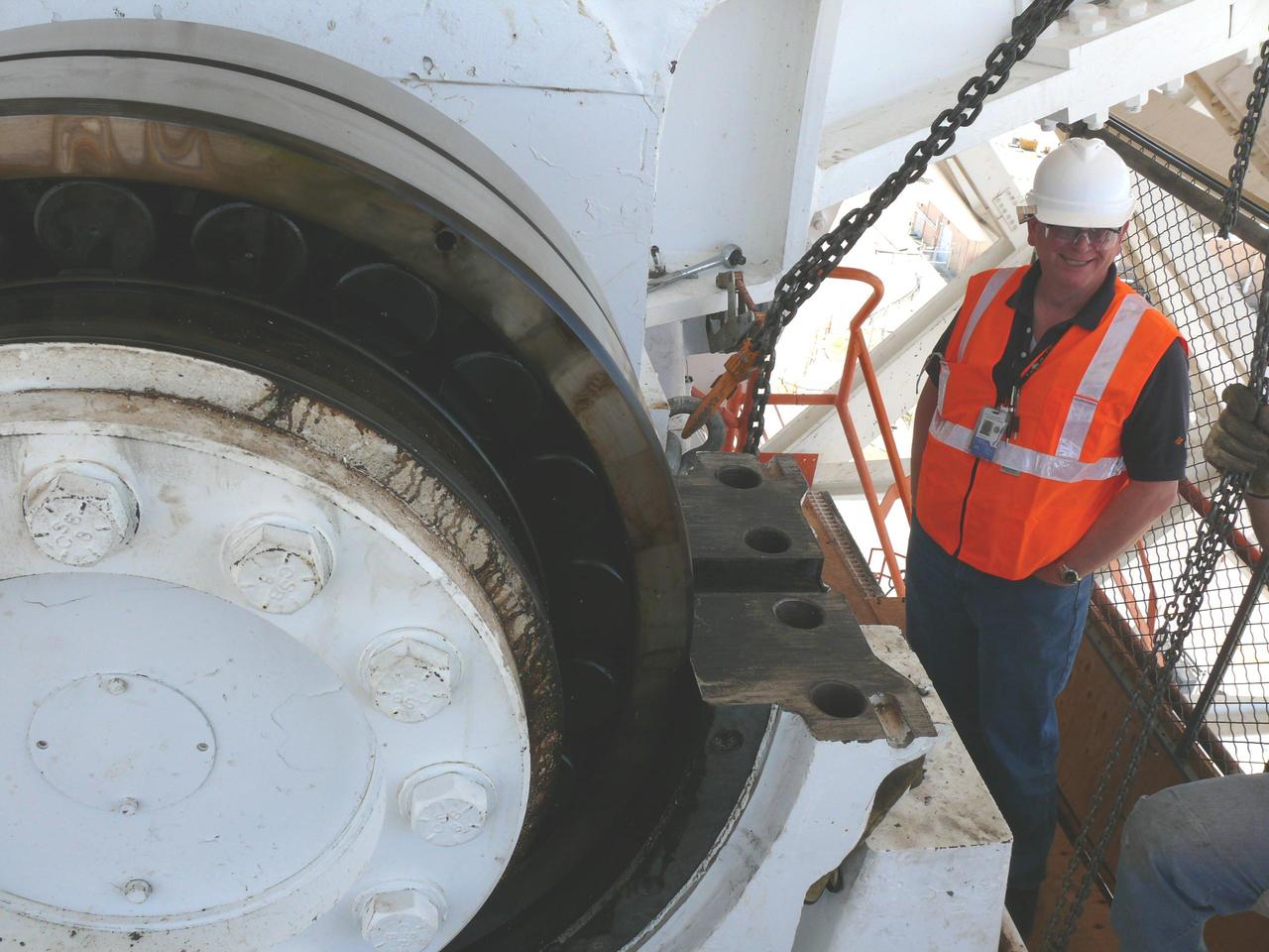
The giant Mars antenna at NASA Deep Space Network Goldstone Deep Space Communications Complex replaced four elevation bearings as part of a major refurbishment.
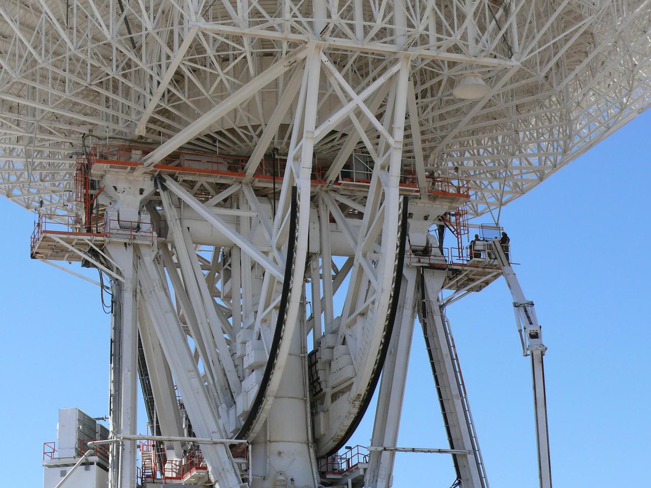
Work began on March 11, 2010 to replace a set of elevation bearings on the giant Mars antenna at NASA Deep Space Network complex in Goldstone, Calif.
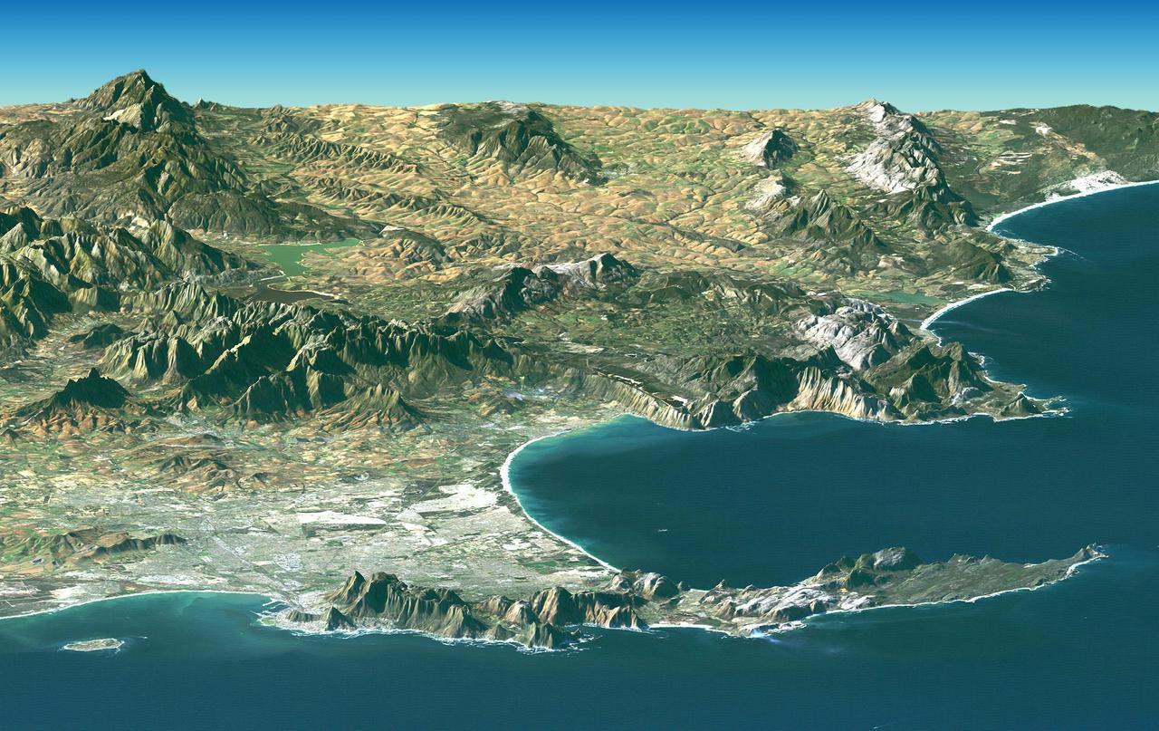
Cape Town and the Cape of Good Hope, South Africa, appear in the foreground of this perspective view generated from a Landsat satellite image and elevation data from NASA Space Shuttle Endeavour.
NASA Shuttle Radar Topography Mission SRTM, flown aboard Space Shuttle Endeavour in February 2000, acquired elevation measurements for nearly all of Earth landmass between 60°N and 56°S latitudes.

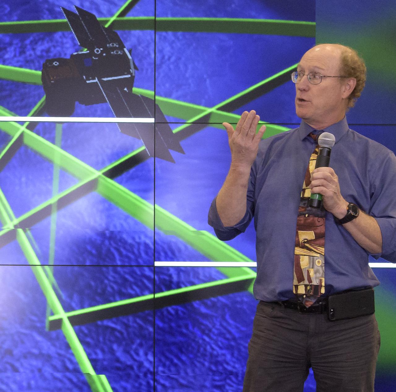
Tom Neumann, ICESat-2 Deputy Project Scientist, NASA's Goddard Space Flight Center, is seen during a NASA Ice, Cloud and land Elevation Satellite-2 (ICESat-2) prelaunch briefing, Thursday, Sept. 13, 2018, at Vandenberg Air Force Base in California. The ICESat-2 mission will measure the changing height of Earth's ice. Photo Credit: (NASA/Bill Ingalls)
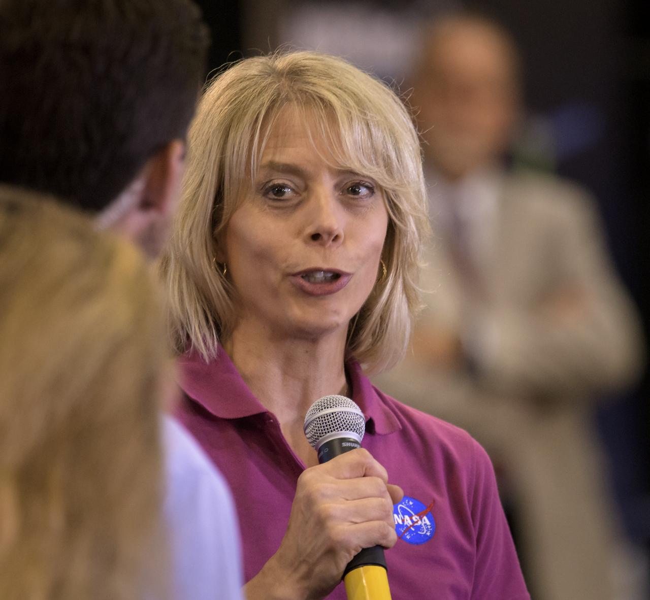
Cathy Richardson, Deputy Program Manager, Earth Science Projects Division, NASA's Goddard Space Flight Center, is seen during a NASA Ice, Cloud and land Elevation Satellite-2 (ICESat-2) prelaunch briefing, Thursday, Sept. 13, 2018, at Vandenberg Air Force Base in California. The ICESat-2 mission will measure the changing height of Earth's ice. Photo Credit: (NASA/Bill Ingalls)
Tim Dunn, Launch Director, NASA's Kennedy Space Center, is seen during a NASA Ice, Cloud and land Elevation Satellite-2 (ICESat-2) prelaunch briefing, Thursday, Sept. 13, 2018, at Vandenberg Air Force Base in California. The ICESat-2 mission will measure the changing height of Earth's ice. Photo Credit: (NASA/Bill Ingalls)
Tom Wagner, ICESat-2 Program Scientist, NASA Headquarters, left, and Doug McLennan, ICESat-2 Project Manager, NASA's Goddard Space Flight Center, are seen during a NASA Ice, Cloud and land Elevation Satellite-2 (ICESat-2) prelaunch briefing, Thursday, Sept. 13, 2018, at Vandenberg Air Force Base in California. The ICESat-2 mission will measure the changing height of Earth's ice. Photo Credit: (NASA/Bill Ingalls)
1st Lt. Daniel Smith, Weather Officer, 30th Space Wing, Vandenberg Air Force Base, is seen during a NASA Ice, Cloud and land Elevation Satellite-2 (ICESat-2) prelaunch briefing, Thursday, Sept. 13, 2018, at Vandenberg Air Force Base in California. The ICESat-2 mission will measure the changing height of Earth's ice. Photo Credit: (NASA/Bill Ingalls)
Doug McLennan, ICESat-2 Project Manager, NASA's Goddard Space Flight Center, is seen during a NASA Ice, Cloud and land Elevation Satellite-2 (ICESat-2) prelaunch briefing, Thursday, Sept. 13, 2018, at Vandenberg Air Force Base in California. The ICESat-2 mission will measure the changing height of Earth's ice. Photo Credit: (NASA/Bill Ingalls)
Bill Barnhart, ICESat-2 Program Manager, Northrop Grumman, left, Doug McLennan, ICESat-2 Project Manager, NASA's Goddard Space Flight Center, center, and Cathy Richardson, Deputy Program Manager, Earth Science Projects Division, NASA's Goddard Space Flight Center, are seen during a NASA Ice, Cloud and land Elevation Satellite-2 (ICESat-2) prelaunch briefing, Thursday, Sept. 13, 2018, at Vandenberg Air Force Base in California. The ICESat-2 mission will measure the changing height of Earth's ice. Photo Credit: (NASA/Bill Ingalls)
Lori Magruder, ICESat-2 Science Definition Team Lead, University of Texas, left, Tom Neumann, ICESat-2 Deputy Project Scientist, NASA's Goddard Space Flight Center, and Helen Fricker, ICESat-2 Science Definition Team Member, Scripps Institution of Oceanography, are seen during a NASA Ice, Cloud and land Elevation Satellite-2 (ICESat-2) prelaunch briefing, Thursday, Sept. 13, 2018, at Vandenberg Air Force Base in California. The ICESat-2 mission will measure the changing height of Earth's ice. Photo Credit: (NASA/Bill Ingalls)

The floor buttons are in view for one of the elevators in the Vehicle Assembly Building at NASA's Kennedy Space Center in Florida.
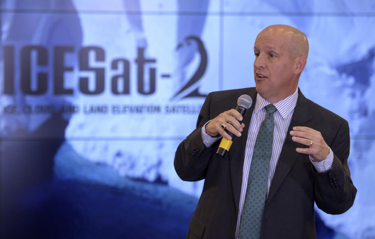
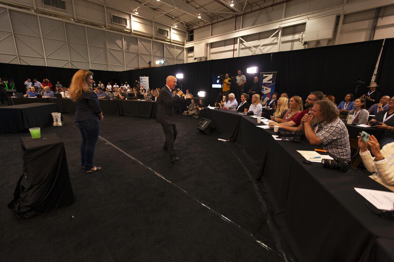
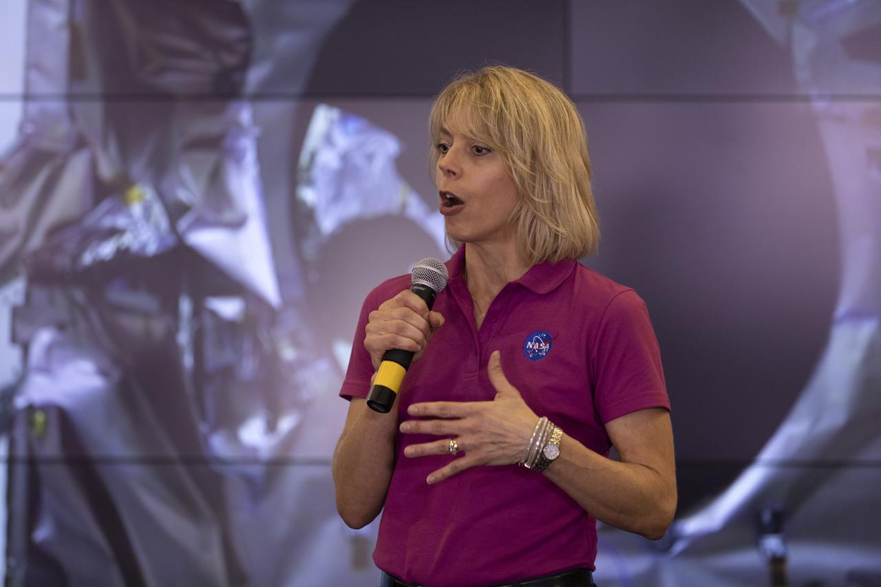
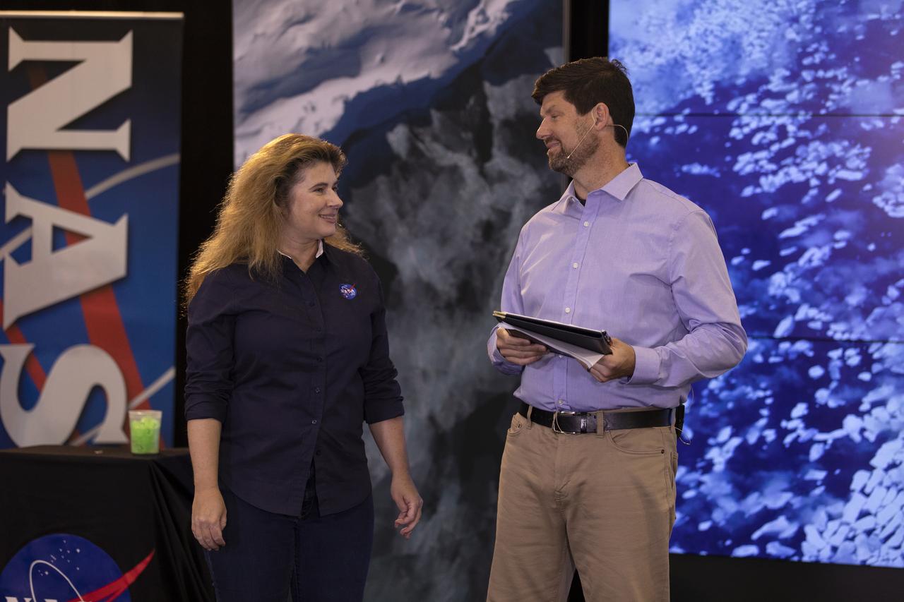
Doug McLennan, ICESat-2 project manager, NASA’s Goddard Space Flight Center, speaks to members of the news media and social media participants during a prelaunch mission briefing for NASA's Ice, Cloud and land Elevation Satellite-2 (ICESat-2), a mission to measure the changing height of Earth's ice, on Sept. 13, 2018 at Vandenberg Air Force Base (VAFB) in California. ICESat-2 will launch aboard a United Launch Alliance Delta II, the rocket’s final mission, from Space Launch Complex 2 at VAFB. Launch is scheduled for 8:46 a.m. EDT (5:46 a.m. PDT).
Tim Dunn, launch director, NASA's Kennedy Space Center in Florida, speaks to members of the news media and social media participants during a prelaunch mission briefing for NASA's Ice, Cloud and land Elevation Satellite-2 (ICESat-2), a mission to measure the changing height of Earth's ice, on Sept. 13, 2018 at Vandenberg Air Force Base (VAFB) in California. ICESat-2 will launch aboard a United Launch Alliance Delta II, the rocket’s final mission, from Space Launch Complex 2 at VAFB. Launch is scheduled for 8:46 a.m. EDT (5:46 a.m. PDT).
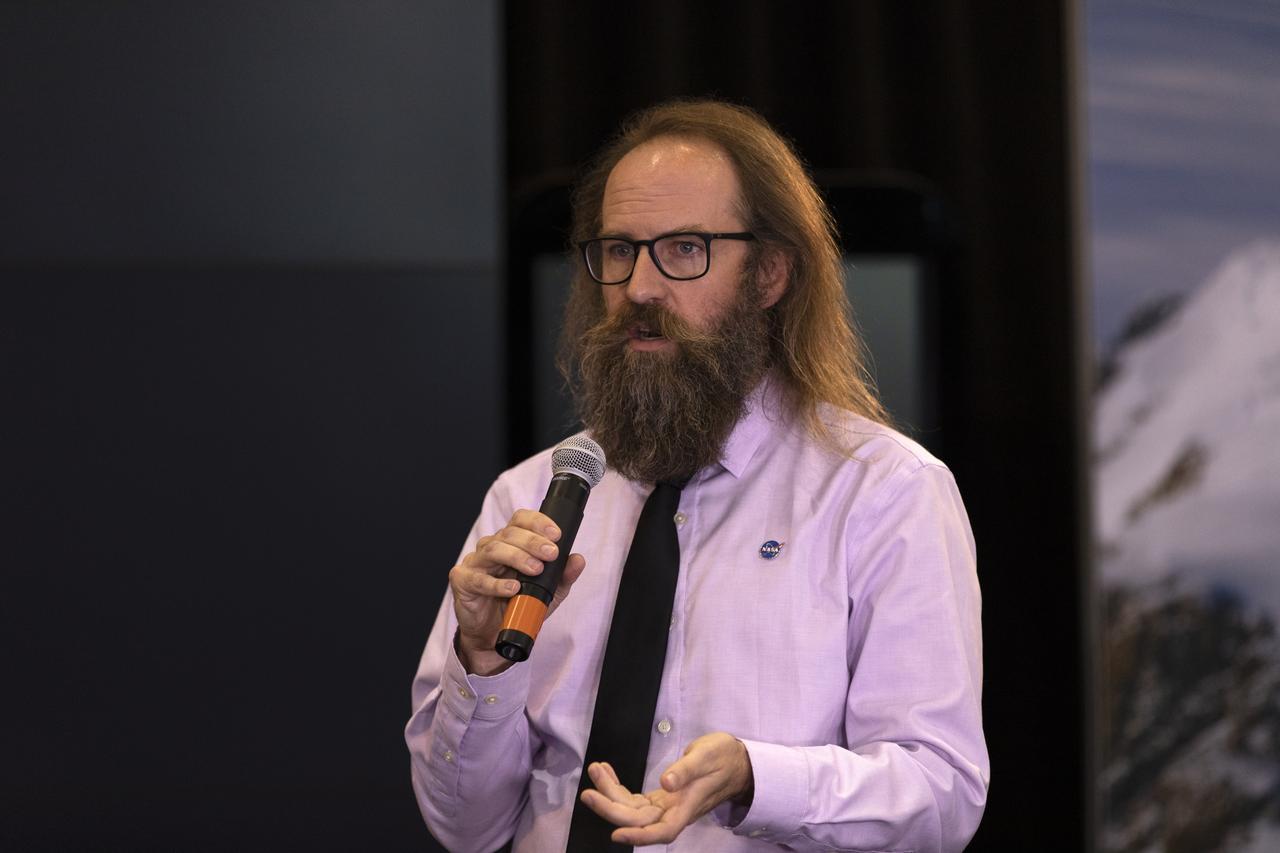
Tom Neumann, ICESat-2 deputy project scientist, NASA's Goddard Space Flight Center, speaks to members of the news media and social media participants during a prelaunch mission briefing for NASA's Ice, Cloud and land Elevation Satellite-2 (ICESat-2), a mission to measure the changing height of Earth's ice, on Sept. 13, 2018 at Vandenberg Air Force Base (VAFB) in California. ICESat-2 will launch aboard a United Launch Alliance Delta II, the rocket’s final mission, from Space Launch Complex 2 at VAFB. Launch is scheduled for 8:46 a.m. EDT (5:46 a.m. PDT).
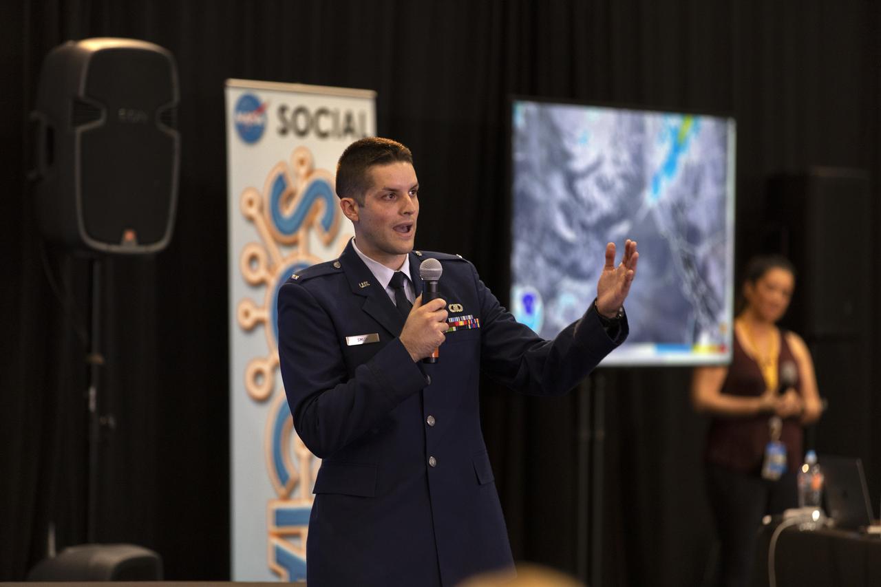
1st Lt. Daniel Smith, launch weather officer, 30th Space Wing, Vandenberg Air Force Base, speaks to members of the news media and social media participants during a prelaunch mission briefing for NASA's Ice, Cloud and land Elevation Satellite-2 (ICESat-2), a mission to measure the changing height of Earth's ice, on Sept. 13, 2018 at Vandenberg Air Force Base (VAFB) in California. ICESat-2 will launch aboard a United Launch Alliance Delta II, the rocket’s final mission, from Space Launch Complex 2 at VAFB. Launch is scheduled for 8:46 a.m. EDT (5:46 a.m. PDT).
Tom Neumann, ICESat-2 deputy project scientist, NASA's Goddard Space Flight Center, speaks to members of the news media and social media participants during a prelaunch mission briefing for NASA's Ice, Cloud and land Elevation Satellite-2 (ICESat-2), a mission to measure the changing height of Earth's ice, on Sept. 13, 2018 at Vandenberg Air Force Base (VAFB) in California. ICESat-2 will launch aboard a United Launch Alliance Delta II, the rocket’s final mission, from Space Launch Complex 2 at VAFB. Launch is scheduled for 8:46 a.m. EDT (5:46 a.m. PDT).
Cathy Richardson, Deputy Program Manager, Earth Science Projects Division, NASA Goddard Space Flight Center, speaks to members of the news media and social media participants during a prelaunch mission briefing for NASA's Ice, Cloud and land Elevation Satellite-2 (ICESat-2), a mission to measure the changing height of Earth's ice, on Sept. 13, 2018 at Vandenberg Air Force Base (VAFB) in California. ICESat-2 will launch aboard a United Launch Alliance Delta II, the rocket’s final mission, from Space Launch Complex 2 at VAFB. Launch is scheduled for 8:46 a.m. EDT (5:46 a.m. PDT).

Tim Dunn, launch director, NASA's Kennedy Space Center in Florida, speaks to members of the news media and social media participants during a prelaunch mission briefing for NASA's Ice, Cloud and land Elevation Satellite-2 (ICESat-2), a mission to measure the changing height of Earth's ice, on Sept. 13, 2018 at Vandenberg Air Force Base (VAFB) in California. ICESat-2 will launch aboard a United Launch Alliance Delta II, the rocket’s final mission, from Space Launch Complex 2 at VAFB. Launch is scheduled for 8:46 a.m. EDT (5:46 a.m. PDT).
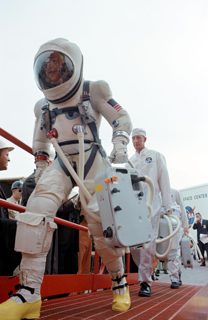
S65-61848 (4 Dec. 1965) --- Astronaut James A. Lovell Jr., pilot for the National Aeronautics and Space Administration Gemini-7 spaceflight, walks to the elevator at Pad 19 one hour and 40 minutes before launch of the spacecraft. Moments later astronauts Lovell and Frank Borman, command pilot, rode the elevator to the White Room where they were inserted into the spacecraft to await the final moments of the countdown. Photo credit: NASA
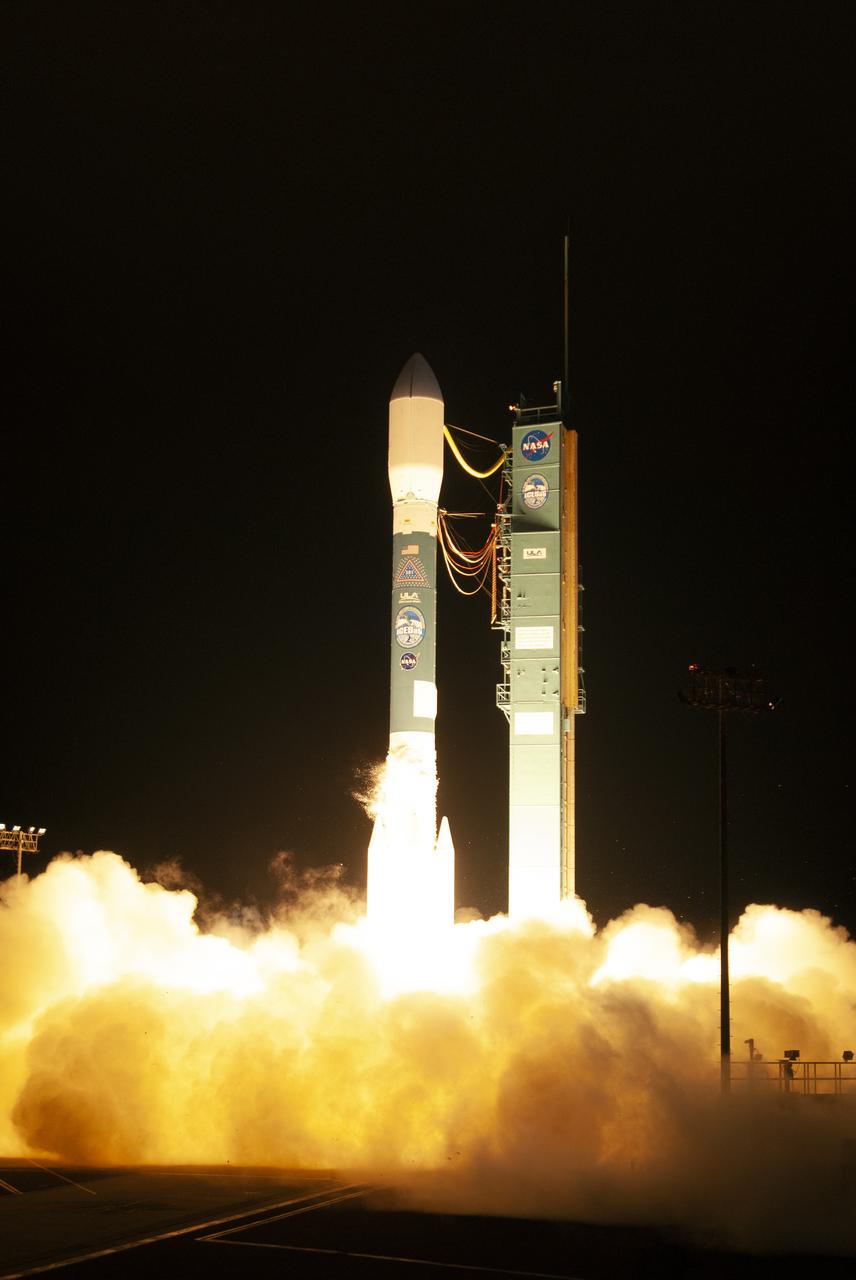
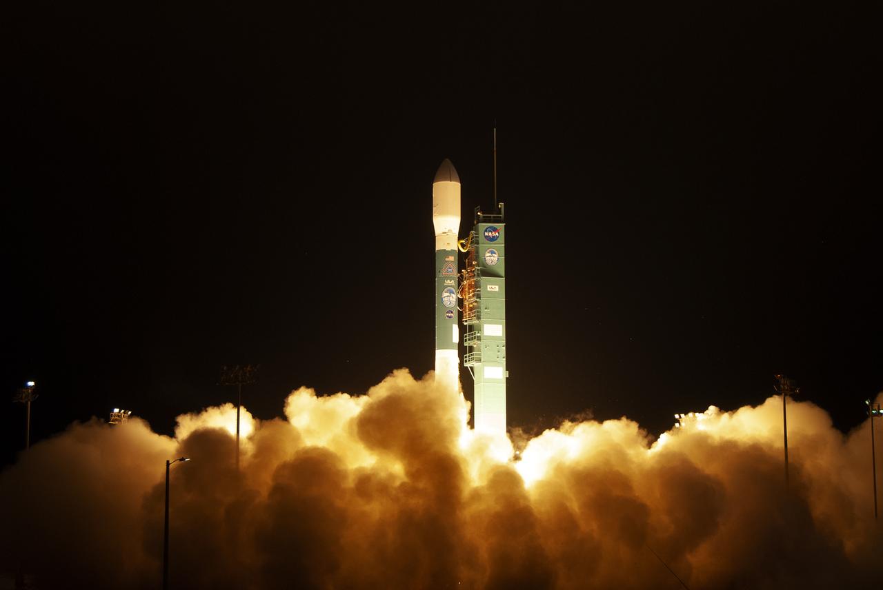
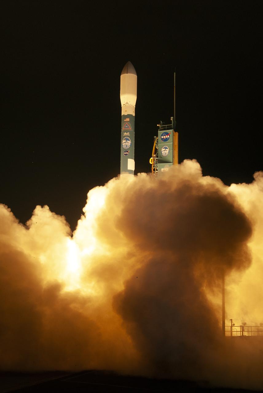
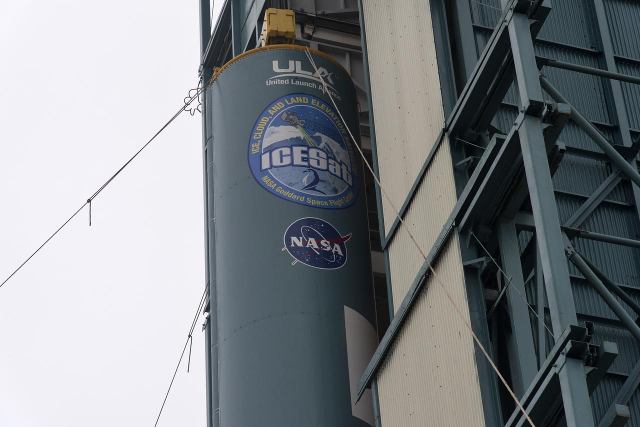
The final United Launch Alliance Delta II rocket lifts off from Space Launch Complex 2 at Vandenberg Air Force Base in California, on Sept. 15, 2018, carrying NASA's Ice, Cloud and land Elevation Satellite-2 (ICESat-2). Liftoff was at 9:02 a.m. EDT (6:02 a.m. PDT). The satellite will measure the height of our changing Earth, one laser pulse at a time, 10,000 laser pulses per second. ICESat-2 will provide scientists with height measurements that create a global portrait of Earth's third dimension, gathering date that can precisely track changes of terrain, including glaciers, sea ice and forests.
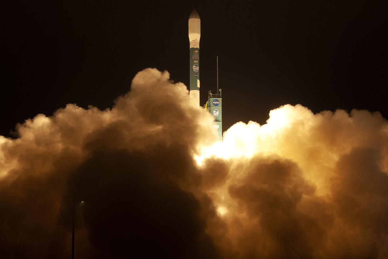
The final United Launch Alliance Delta II rocket lifts off from Space Launch Complex 2 at Vandenberg Air Force Base in California, on Sept. 15, 2018, carrying NASA's Ice, Cloud and land Elevation Satellite-2 (ICESat-2). Liftoff was at 9:02 a.m. EDT (6:02 a.m. PDT). The satellite will measure the height of our changing Earth, one laser pulse at a time, 10,000 laser pulses per second. ICESat-2 will provide scientists with height measurements that create a global portrait of Earth's third dimension, gathering date that can precisely track changes of terrain, including glaciers, sea ice and forests.
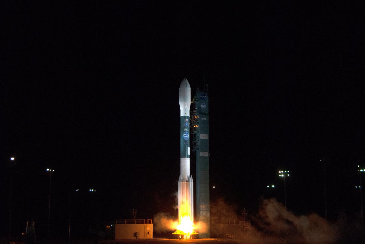
The final United Launch Alliance Delta II rocket lifts off from Space Launch Complex 2 at Vandenberg Air Force Base in California, on Sept. 15, 2018, carrying NASA's Ice, Cloud and land Elevation Satellite-2 (ICESat-2). Liftoff was at 9:02 a.m. EDT (6:02 a.m. PDT). The satellite will measure the height of our changing Earth, one laser pulse at a time, 10,000 laser pulses per second. ICESat-2 will provide scientists with height measurements that create a global portrait of Earth's third dimension, gathering date that can precisely track changes of terrain, including glaciers, sea ice and forests.
The United Launch Alliance Delta II first stage is lifted to vertical on the stand at Space Launch Complex 2 on June 8, 2018, at Vandenberg Air Force Base in California. The booster will be lifted and moved into the mobile service tower. NASA's Ice, Cloud and land Elevation Satellite-2 (ICESat-2) will launch on the final Delta II rocket. ICESat-2 will measure the height of a changing Earth, one laser pulse at a time, 10,000 laser pulses a second. The satellite will carry a single instrument, the Advanced Topographic Laser Altimeter System. ICESat-2 will help scientists investigate why, and how much our planet's frozen and icy areas, called the cryosphere, is changing in a warming climate.
The final United Launch Alliance Delta II rocket lifts off from Space Launch Complex 2 at Vandenberg Air Force Base in California, on Sept. 15, 2018, carrying NASA's Ice, Cloud and land Elevation Satellite-2 (ICESat-2). Liftoff was at 9:02 a.m. EDT (6:02 a.m. PDT). The satellite will measure the height of our changing Earth, one laser pulse at a time, 10,000 laser pulses per second. ICESat-2 will provide scientists with height measurements that create a global portrait of Earth's third dimension, gathering date that can precisely track changes of terrain, including glaciers, sea ice and forests.

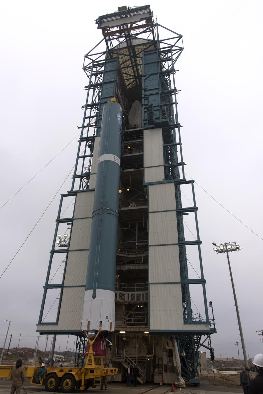
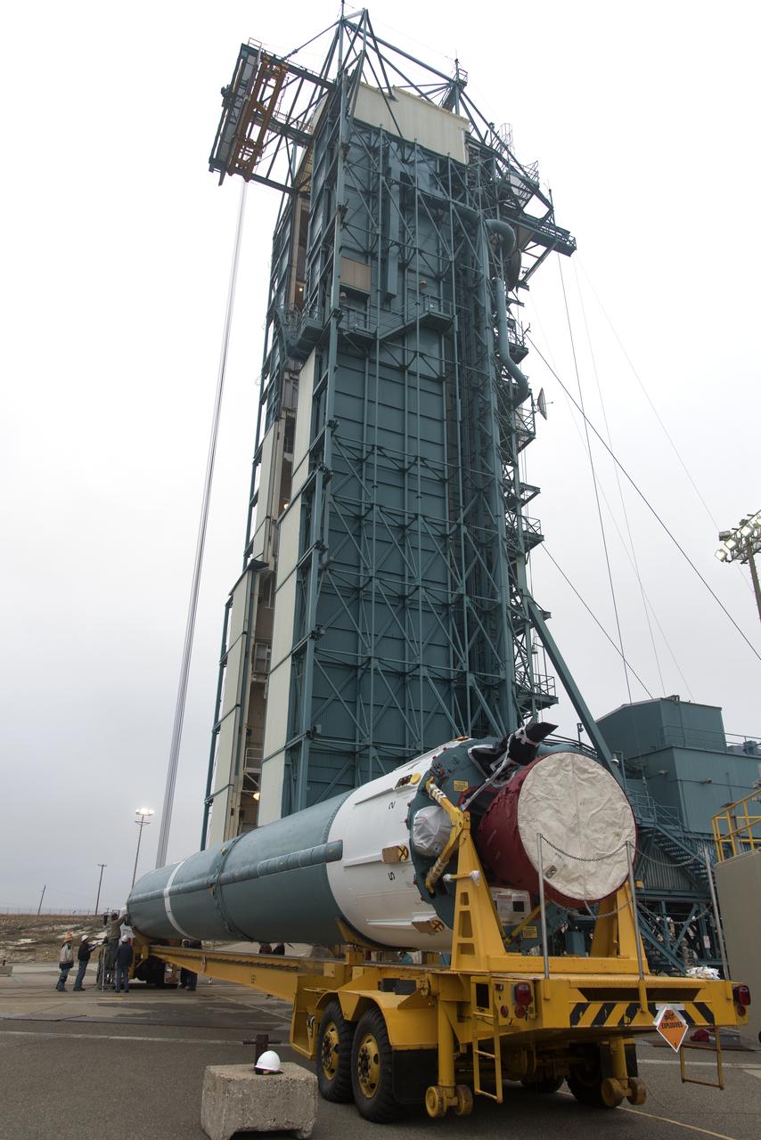
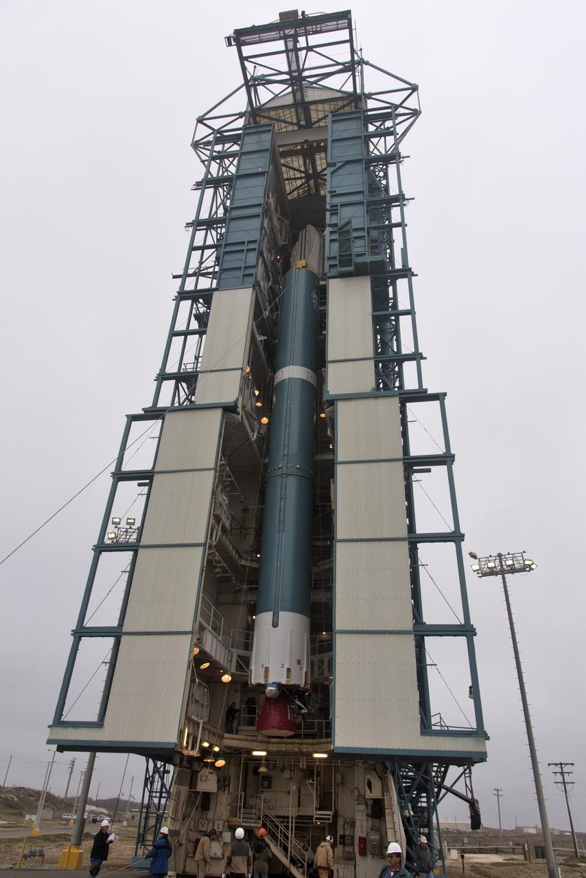
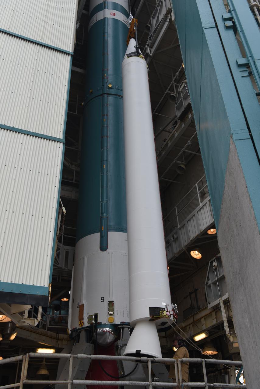
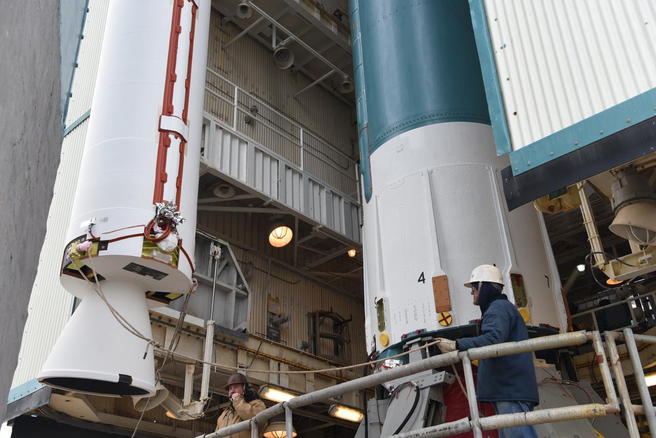
At Vandenberg Air Force Base in California, NASA's Ice, Cloud and land Elevation Satellite-2 (ICESat-2) is hoisted up by crane at the mobile service tower at Space Launch Complex 2, on Aug. 26, 2018. The satellite will be attached to the top of the United Launch Alliance Delta II rocket. Launch is scheduled for Sept. 15, 2018. ICESat-2 will measure the height of a changing Earth, one laser pulse at a time, 10,000 laser pulses a second. The satellite will carry the Advanced Topographic Laser Altimeter System (ATLAS). ICESat-2 will help scientists investigate why, and how much our planet's frozen and icy areas, called the cryosphere, are changing in a warming climate.
The final United Launch Alliance Delta II rocket lifts off from Space Launch Complex 2 at Vandenberg Air Force Base in California, on Sept. 15, 2018, carrying NASA's Ice, Cloud and land Elevation Satellite-2 (ICESat-2). Liftoff was at 9:02 a.m. EDT (6:02 a.m. PDT). The satellite will measure the height of our changing Earth, one laser pulse at a time, 10,000 laser pulses per second. ICESat-2 will provide scientists with height measurements that create a global portrait of Earth's third dimension, gathering date that can precisely track changes of terrain, including glaciers, sea ice and forests.
The United Launch Alliance Delta II first stage arrives at Space Launch Complex 2 on June 8, 2018, at Vandenberg Air Force Base in California. The booster will be lifted to vertical and moved into the mobile service tower. NASA's Ice, Cloud and land Elevation Satellite-2 (ICESat-2) will launch on the final Delta II rocket. ICESat-2 will measure the height of a changing Earth, one laser pulse at a time, 10,000 laser pulses a second. The satellite will carry a single instrument, the Advanced Topographic Laser Altimeter System. ICESat-2 will help scientists investigate why, and how much our planet's frozen and icy areas, called the cryosphere, is changing in a warming climate.

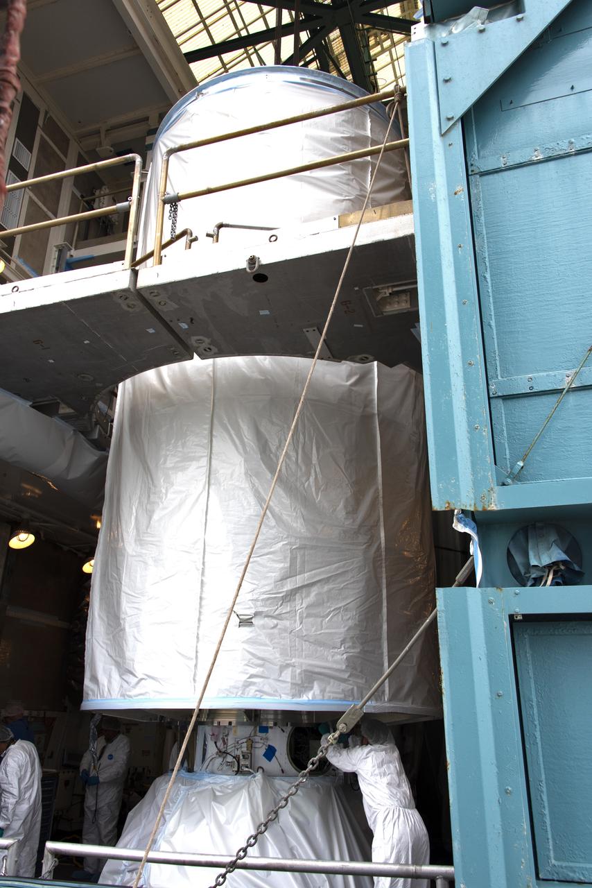
The first half of the United Launch Alliance Delta II payload fairing is secured around NASA's Ice, Cloud and land Elevation Satellite-2 (ICESat-2) on Sept. 4, 2018, at Space Launch Complex 2 at Vandenberg Air Force Base in California. The satellite is being prepared for its scheduled launch on the final Delta II rocket. ICESat-2 will measure the height of a changing Earth, one laser pulse at a time, 10,000 laser pulses a second. The satellite will carry the Advanced Topographic Laser Altimeter System (ATLAS). ICESat-2 will help scientists investigate why, and how much our planet's frozen and icy areas, called the cryosphere, are changing in a warming climate.
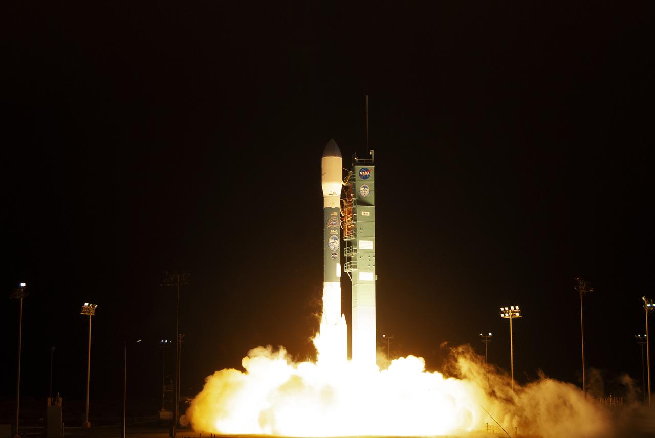
The final United Launch Alliance Delta II rocket lifts off from Space Launch Complex 2 at Vandenberg Air Force Base in California, on Sept. 15, 2018, carrying NASA's Ice, Cloud and land Elevation Satellite-2 (ICESat-2). Liftoff was at 9:02 a.m. EDT (6:02 a.m. PDT). The satellite will measure the height of our changing Earth, one laser pulse at a time, 10,000 laser pulses per second. ICESat-2 will provide scientists with height measurements that create a global portrait of Earth's third dimension, gathering date that can precisely track changes of terrain, including glaciers, sea ice and forests.
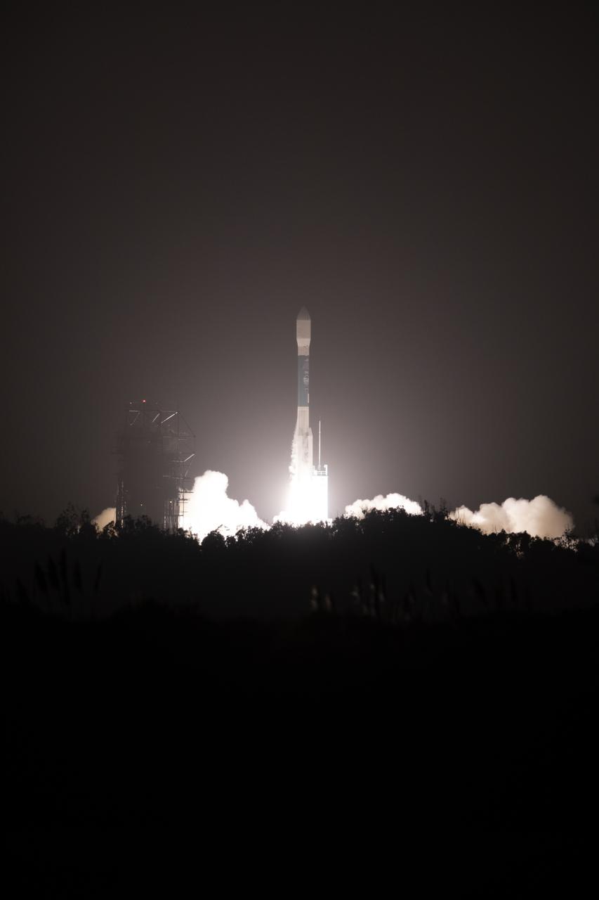
The final United Launch Alliance Delta II rocket lifts off from Space Launch Complex 2 at Vandenberg Air Force Base in California, on Sept. 15, 2018, carrying NASA's Ice, Cloud and land Elevation Satellite-2 (ICESat-2). Liftoff was at 9:02 a.m. EDT (6:02 a.m. PDT). The satellite will measure the height of our changing Earth, one laser pulse at a time, 10,000 laser pulses per second. ICESat-2 will provide scientists with height measurements that create a global portrait of Earth's third dimension, gathering date that can precisely track changes of terrain, including glaciers, sea ice and forests.
The United Launch Alliance Delta II first stage is lifted up in the mobile service tower at Space Launch Complex 2 on June 8, 2018, at Vandenberg Air Force Base in California. NASA's Ice, Cloud and land Elevation Satellite-2 (ICESat-2) will launch on the final Delta II rocket. ICESat-2 will measure the height of a changing Earth, one laser pulse at a time, 10,000 laser pulses a second. The satellite will carry a single instrument, the Advanced Topographic Laser Altimeter System. ICESat-2 will help scientists investigate why, and how much our planet's frozen and icy areas, called the cryosphere, is changing in a warming climate.
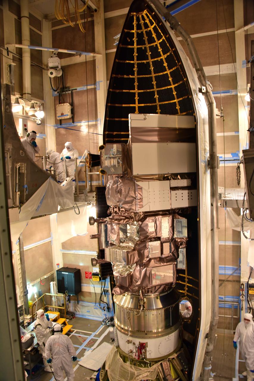
The first half of the United Launch Alliance Delta II payload fairing is secured around NASA's Ice, Cloud and land Elevation Satellite-2 (ICESat-2) on Sept. 4, 2018, at Space Launch Complex 2 at Vandenberg Air Force Base in California. The satellite is being prepared for its scheduled launch on the final Delta II rocket. ICESat-2 will measure the height of a changing Earth, one laser pulse at a time, 10,000 laser pulses a second. The satellite will carry the Advanced Topographic Laser Altimeter System (ATLAS). ICESat-2 will help scientists investigate why, and how much our planet's frozen and icy areas, called the cryosphere, are changing in a warming climate.
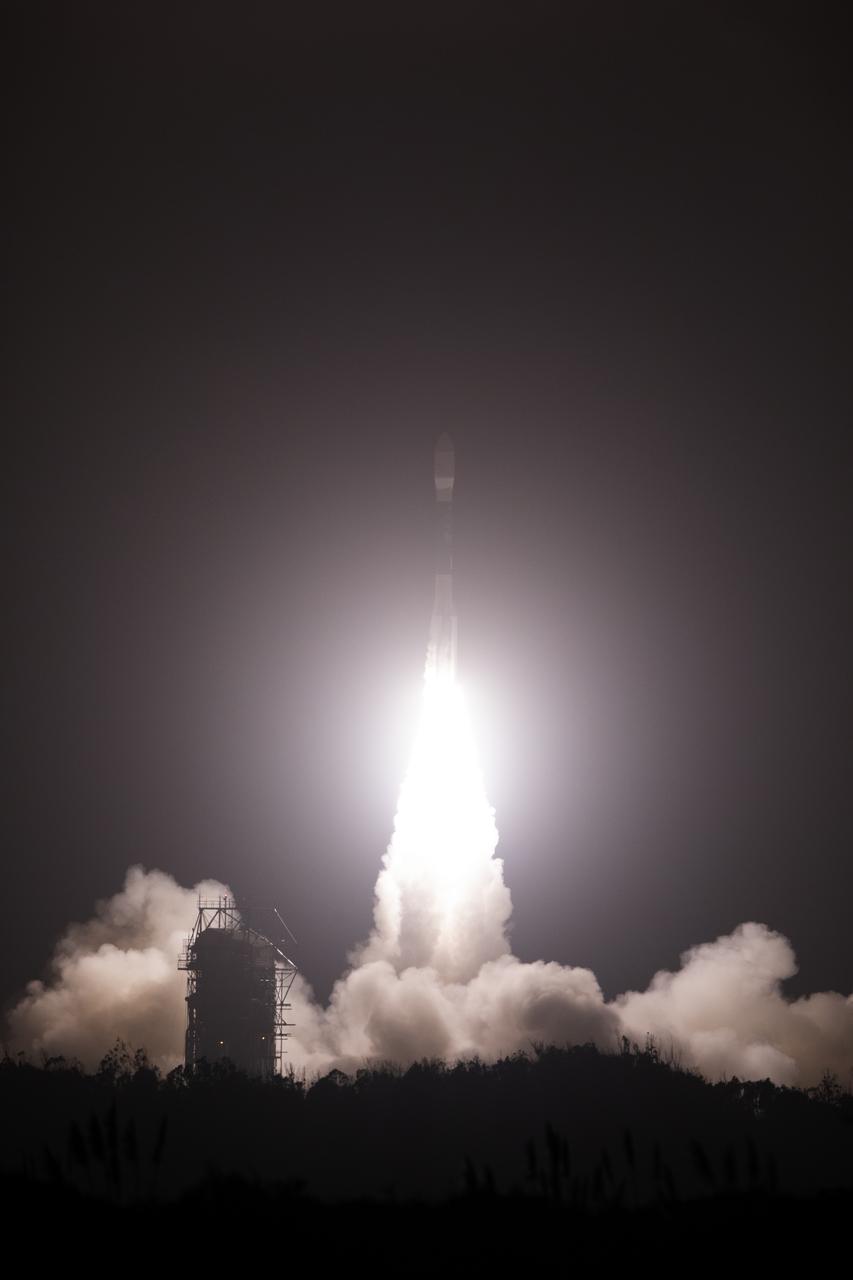
The final United Launch Alliance Delta II rocket lifts off from Space Launch Complex 2 at Vandenberg Air Force Base in California, on Sept. 15, 2018, carrying NASA's Ice, Cloud and land Elevation Satellite-2 (ICESat-2). Liftoff was at 9:02 a.m. EDT (6:02 a.m. PDT). The satellite will measure the height of our changing Earth, one laser pulse at a time, 10,000 laser pulses per second. ICESat-2 will provide scientists with height measurements that create a global portrait of Earth's third dimension, gathering date that can precisely track changes of terrain, including glaciers, sea ice and forests.
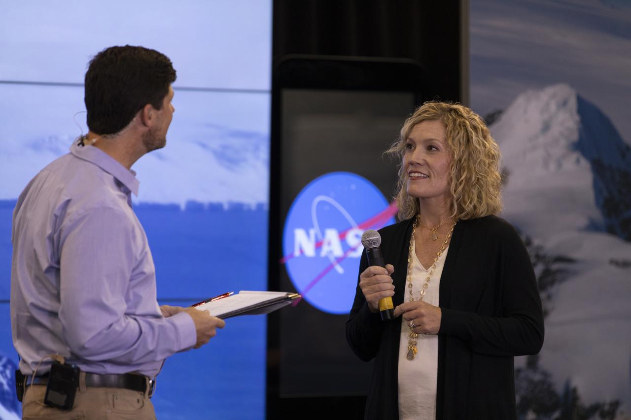
Lori Magruder, University of Texas at Austin, ICESat-2 science definition team lead, speaks to members of the news media and social media participants during a prelaunch mission briefing for NASA's Ice, Cloud and land Elevation Satellite-2 (ICESat-2), a mission to measure the changing height of Earth's ice, on Sept. 13, 2018 at Vandenberg Air Force Base (VAFB) in California. ICESat-2 will launch aboard a United Launch Alliance Delta II, the rocket’s final mission, from Space Launch Complex 2 at VAFB. Launch is scheduled for 8:46 a.m. EDT (5:46 a.m. PDT).
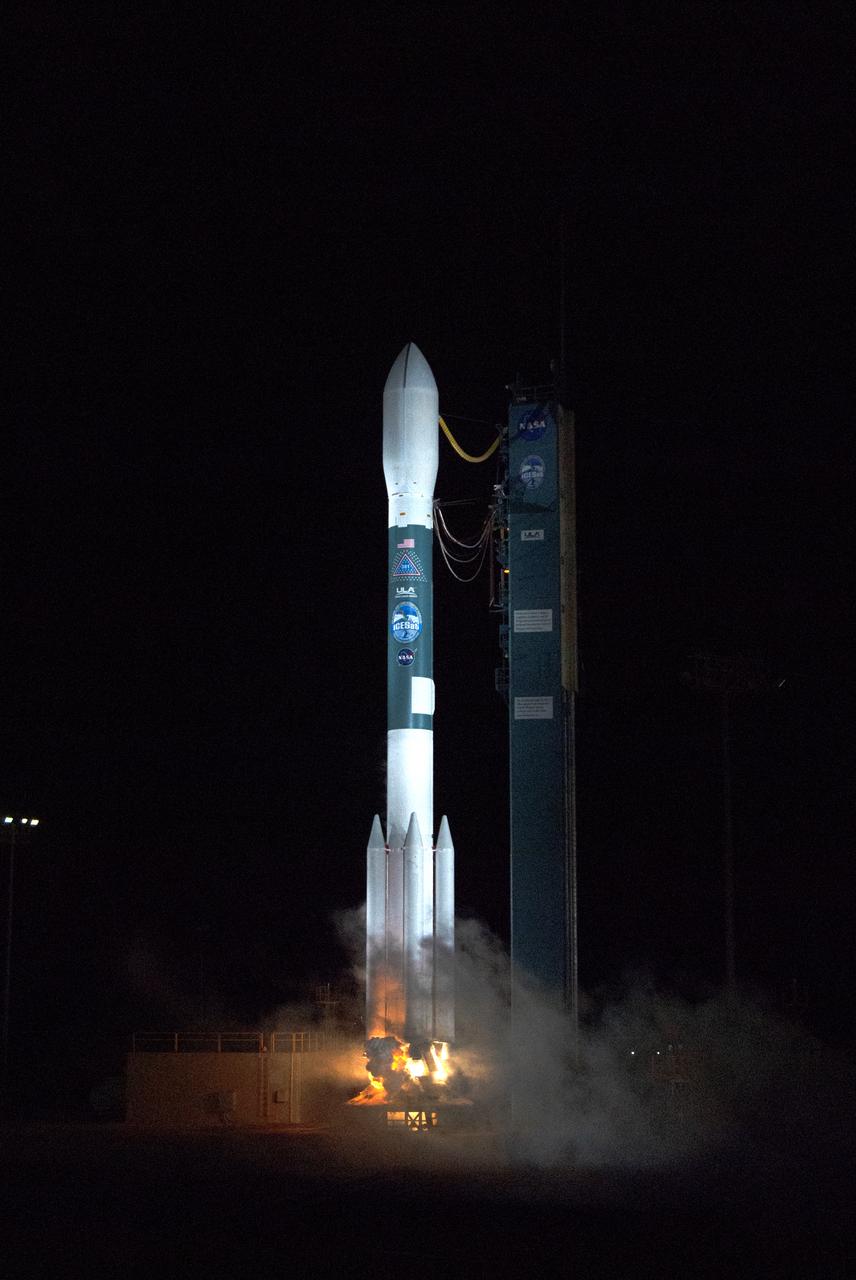
The final United Launch Alliance Delta II rocket lifts off from Space Launch Complex 2 at Vandenberg Air Force Base in California, on Sept. 15, 2018, carrying NASA's Ice, Cloud and land Elevation Satellite-2 (ICESat-2). Liftoff was at 9:02 a.m. EDT (6:02 a.m. PDT). The satellite will measure the height of our changing Earth, one laser pulse at a time, 10,000 laser pulses per second. ICESat-2 will provide scientists with height measurements that create a global portrait of Earth's third dimension, gathering date that can precisely track changes of terrain, including glaciers, sea ice and forests.
Technicians prepare NASA's Ice, Cloud and land Elevation Satellite-2 (ICESat-2) for encapsulation in the United Launch Alliance Delta II payload fairing on Sept. 4, 2018, at Space Launch Complex 2 at Vandenberg Air Force Base in California. The satellite is being prepared for its scheduled launch on the final Delta II rocket. ICESat-2 will measure the height of a changing Earth, one laser pulse at a time, 10,000 laser pulses a second. The satellite will carry the Advanced Topographic Laser Altimeter System (ATLAS). ICESat-2 will help scientists investigate why, and how much our planet's frozen and icy areas, called the cryosphere, are changing in a warming climate.

Bill Barnhart, ICESat-2 program manager, Northrop Grumman, speaks to members of the news media and social media participants during a prelaunch mission briefing for NASA's Ice, Cloud and land Elevation Satellite-2 (ICESat-2), a mission to measure the changing height of Earth's ice, on Sept. 13, 2018 at Vandenberg Air Force Base (VAFB) in California. ICESat-2 will launch aboard a United Launch Alliance Delta II, the rocket’s final mission, from Space Launch Complex 2 at VAFB. Launch is scheduled for 8:46 a.m. EDT (5:46 a.m. PDT).

The United Launch Alliance Delta II first stage arrives at Space Launch Complex 2 on June 8, 2018, at Vandenberg Air Force Base in California. The booster will be lifted to vertical and moved into the mobile service tower. NASA's Ice, Cloud and land Elevation Satellite-2 (ICESat-2) will launch on the final Delta II rocket. ICESat-2 will measure the height of a changing Earth, one laser pulse at a time, 10,000 laser pulses a second. The satellite will carry a single instrument, the Advanced Topographic Laser Altimeter System. ICESat-2 will help scientists investigate why, and how much our planet's frozen and icy areas, called the cryosphere, is changing in a warming climate.
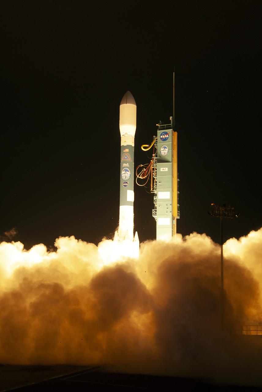
The final United Launch Alliance Delta II rocket lifts off from Space Launch Complex 2 at Vandenberg Air Force Base in California, on Sept. 15, 2018, carrying NASA's Ice, Cloud and land Elevation Satellite-2 (ICESat-2). Liftoff was at 9:02 a.m. EDT (6:02 a.m. PDT). The satellite will measure the height of our changing Earth, one laser pulse at a time, 10,000 laser pulses per second. ICESat-2 will provide scientists with height measurements that create a global portrait of Earth's third dimension, gathering date that can precisely track changes of terrain, including glaciers, sea ice and forests.
The first half of the United Launch Alliance Delta II payload fairing is secured around NASA's Ice, Cloud and land Elevation Satellite-2 (ICESat-2) on Sept. 4, 2018, at Space Launch Complex 2 at Vandenberg Air Force Base in California. The satellite is being prepared for its scheduled launch on the final Delta II rocket. ICESat-2 will measure the height of a changing Earth, one laser pulse at a time, 10,000 laser pulses a second. The satellite will carry the Advanced Topographic Laser Altimeter System (ATLAS). ICESat-2 will help scientists investigate why, and how much our planet's frozen and icy areas, called the cryosphere, are changing in a warming climate.
At Vandenberg Air Force Base in California, NASA's Ice, Cloud and land Elevation Satellite-2 (ICESat-2) is inside the mobile service tower at Space Launch Complex 2, on Aug. 26, 2018. The satellite will be attached to the top of the United Launch Alliance Delta II rocket. Launch is scheduled for Sept. 15, 2018. ICESat-2 will measure the height of a changing Earth, one laser pulse at a time, 10,000 laser pulses a second. The satellite will carry the Advanced Topographic Laser Altimeter System (ATLAS). ICESat-2 will help scientists investigate why, and how much our planet's frozen and icy areas, called the cryosphere, are changing in a warming climate.

The United Launch Alliance Delta II first stage is lifted up from its stand and moved into the mobile service tower at Space Launch Complex 2 on June 8, 2018, at Vandenberg Air Force Base in California. NASA's Ice, Cloud and land Elevation Satellite-2 (ICESat-2) will launch on the final Delta II rocket. ICESat-2 will measure the height of a changing Earth, one laser pulse at a time, 10,000 laser pulses a second. The satellite will carry a single instrument, the Advanced Topographic Laser Altimeter System. ICESat-2 will help scientists investigate why, and how much our planet's frozen and icy areas, called the cryosphere, is changing in a warming climate.
Michelle Thaller, NASA Communications (left), and Tom Wagner, ICESat-2 program scientist, NASA Headquarters (right) speaks to members of the news media and social media participants during a prelaunch mission briefing for NASA's Ice, Cloud and land Elevation Satellite-2 (ICESat-2), a mission to measure the changing height of Earth's ice, on Sept. 13, 2018 at Vandenberg Air Force Base (VAFB) in California. ICESat-2 will launch aboard a United Launch Alliance Delta II, the rocket’s final mission, from Space Launch Complex 2 at VAFB. Launch is scheduled for 8:46 a.m. EDT (5:46 a.m. PDT).
The United Launch Alliance Delta II first stage arrives at Space Launch Complex 2 on June 8, 2018, at Vandenberg Air Force Base in California. The booster will be lifted to vertical and moved into the mobile service tower. NASA's Ice, Cloud and land Elevation Satellite-2 (ICESat-2) will launch on the final Delta II rocket. ICESat-2 will measure the height of a changing Earth, one laser pulse at a time, 10,000 laser pulses a second. The satellite will carry a single instrument, the Advanced Topographic Laser Altimeter System. ICESat-2 will help scientists investigate why, and how much our planet's frozen and icy areas, called the cryosphere, is changing in a warming climate.

Helen Fricker, Scripps Institution of Oceanography, La Jolla, California, ICESat-2 science definition team member, speaks to members of the news media and social media participants during a prelaunch mission briefing for NASA's Ice, Cloud and land Elevation Satellite-2 (ICESat-2), a mission to measure the changing height of Earth's ice, on Sept. 13, 2018 at Vandenberg Air Force Base (VAFB) in California. ICESat-2 will launch aboard a United Launch Alliance Delta II, the rocket’s final mission, from Space Launch Complex 2 at VAFB. Launch is scheduled for 8:46 a.m. EDT (5:46 a.m. PDT).
Technicians prepare NASA's Ice, Cloud and land Elevation Satellite-2 (ICESat-2) for encapsulation in the United Launch Alliance Delta II payload fairing on Sept. 4, 2018, at Space Launch Complex 2 at Vandenberg Air Force Base in California. The satellite is being prepared for its scheduled launch on the final Delta II rocket. ICESat-2 will measure the height of a changing Earth, one laser pulse at a time, 10,000 laser pulses a second. The satellite will carry the Advanced Topographic Laser Altimeter System (ATLAS). ICESat-2 will help scientists investigate why, and how much our planet's frozen and icy areas, called the cryosphere, are changing in a warming climate.
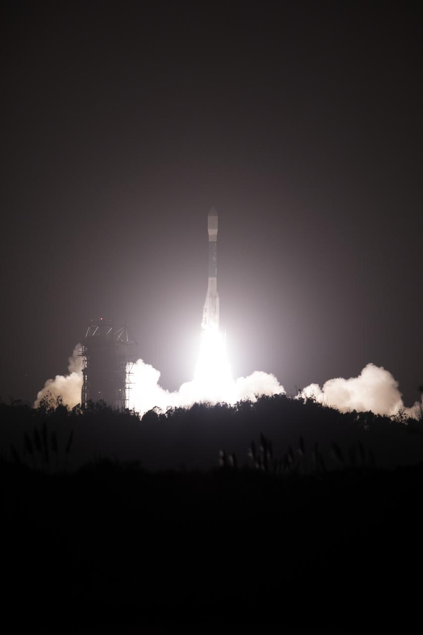
The final United Launch Alliance Delta II rocket lifts off from Space Launch Complex 2 at Vandenberg Air Force Base in California, on Sept. 15, 2018, carrying NASA's Ice, Cloud and land Elevation Satellite-2 (ICESat-2). Liftoff was at 9:02 a.m. EDT (6:02 a.m. PDT). The satellite will measure the height of our changing Earth, one laser pulse at a time, 10,000 laser pulses per second. ICESat-2 will provide scientists with height measurements that create a global portrait of Earth's third dimension, gathering date that can precisely track changes of terrain, including glaciers, sea ice and forests.

The United Launch Alliance Delta II first stage is lifted to vertical at Space Launch Complex 2 on June 8, 2018, at Vandenberg Air Force Base in California. The booster will be lifted and moved into the mobile service tower. NASA's Ice, Cloud and land Elevation Satellite-2 (ICESat-2) will launch on the final Delta II rocket. ICESat-2 will measure the height of a changing Earth, one laser pulse at a time, 10,000 laser pulses a second. The satellite will carry a single instrument, the Advanced Topographic Laser Altimeter System. ICESat-2 will help scientists investigate why, and how much our planet's frozen and icy areas, called the cryosphere, is changing in a warming climate.

At Vandenberg Air Force Base in California, NASA's Ice, Cloud and land Elevation Satellite-2 (ICESat-2) is moved inside the mobile service tower at Space Launch Complex 2, on Aug. 26, 2018. The satellite will be attached to the top of the United Launch Alliance Delta II rocket. Launch is scheduled for Sept. 15, 2018. ICESat-2 will measure the height of a changing Earth, one laser pulse at a time, 10,000 laser pulses a second. The satellite will carry the Advanced Topographic Laser Altimeter System (ATLAS). ICESat-2 will help scientists investigate why, and how much our planet's frozen and icy areas, called the cryosphere, are changing in a warming climate.
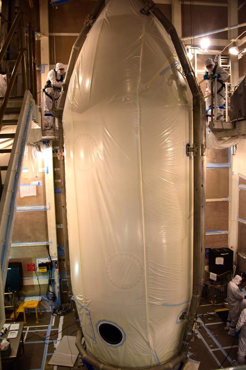
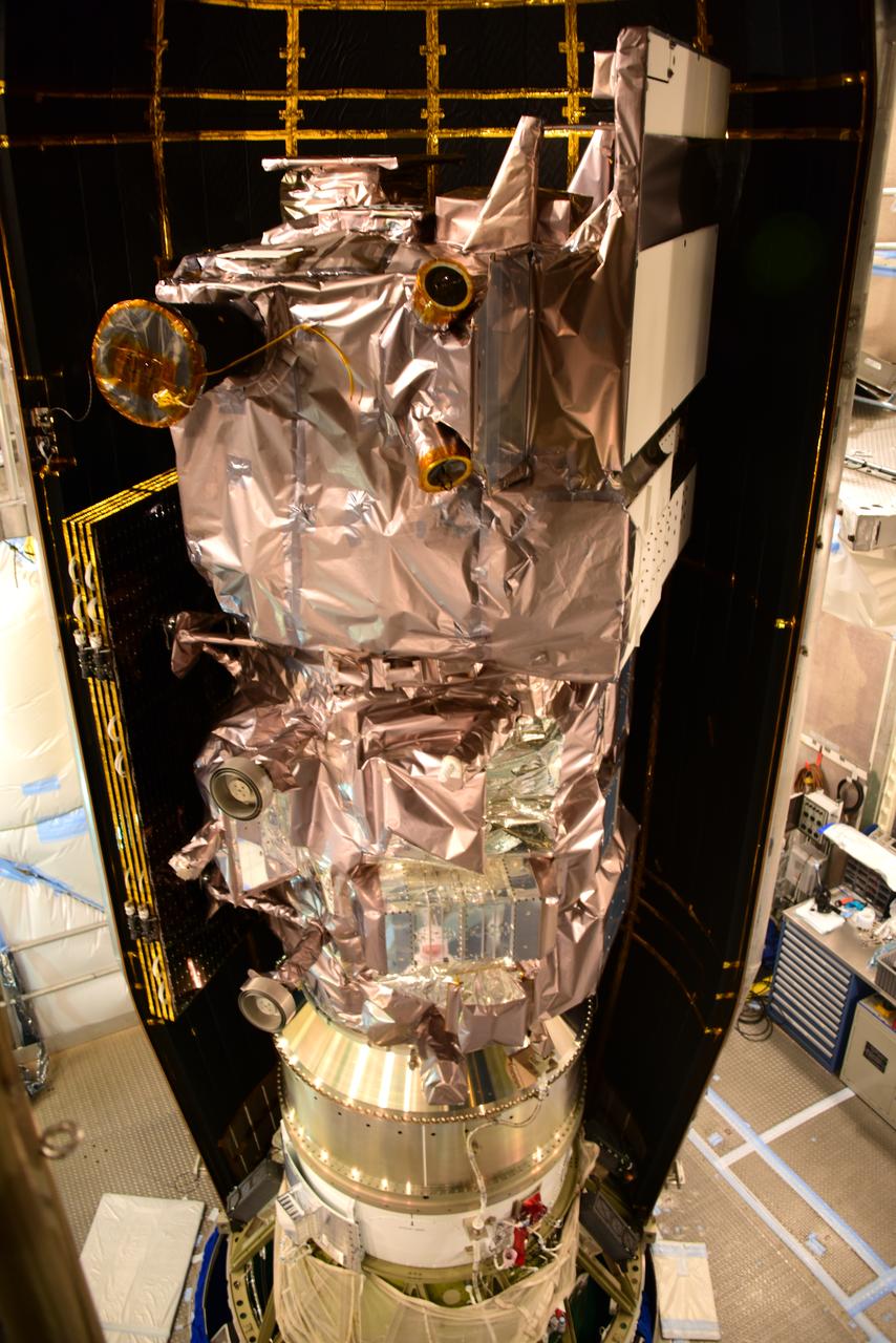
NASA's Ice, Cloud and land Elevation Satellite-2 (ICESat-2) is encapsulated in the United Launch Alliance Delta II payload fairing on Sept. 4, 2018, at Space Launch Complex 2 at Vandenberg Air Force Base in California. The satellite is being prepared for its scheduled launch on the final Delta II rocket. ICESat-2 will measure the height of a changing Earth, one laser pulse at a time, 10,000 laser pulses a second. The satellite will carry the Advanced Topographic Laser Altimeter System (ATLAS). ICESat-2 will help scientists investigate why, and how much our planet's frozen and icy areas, called the cryosphere, are changing in a warming climate.
The United Launch Alliance Delta II first stage is lifted up and into the mobile service tower at Space Launch Complex 2 on June 8, 2018, at Vandenberg Air Force Base in California. NASA's Ice, Cloud and land Elevation Satellite-2 (ICESat-2) will launch on the final Delta II rocket. ICESat-2 will measure the height of a changing Earth, one laser pulse at a time, 10,000 laser pulses a second. The satellite will carry a single instrument, the Advanced Topographic Laser Altimeter System. ICESat-2 will help scientists investigate why, and how much our planet's frozen and icy areas, called the cryosphere, is changing in a warming climate.
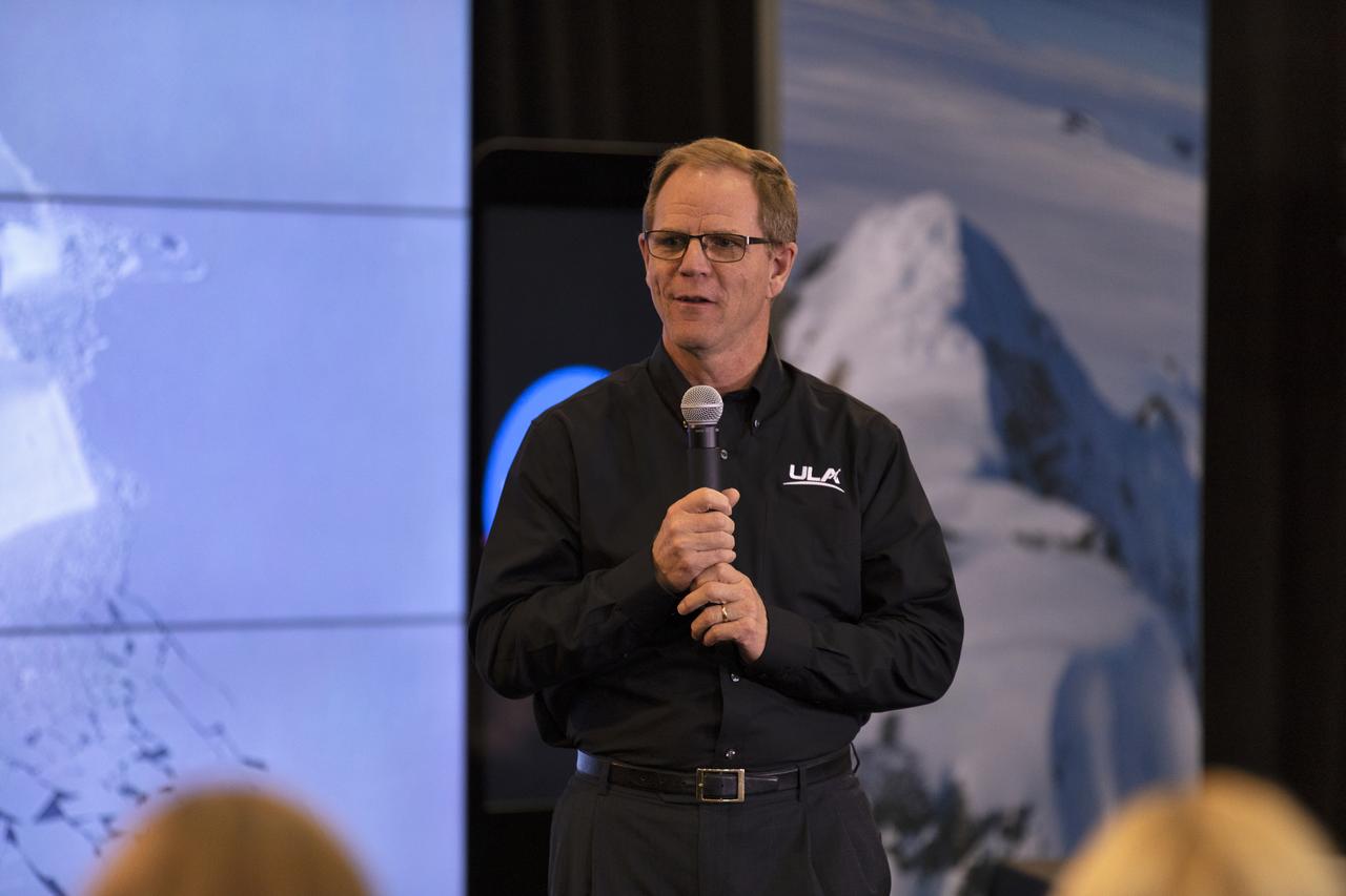
Scott Messer, program manager, NASA Programs, United Launch Alliance, speaks to members of the news media and social media participants during a prelaunch mission briefing for NASA's Ice, Cloud and land Elevation Satellite-2 (ICESat-2), a mission to measure the changing height of Earth's ice, on Sept. 13, 2018 at Vandenberg Air Force Base (VAFB) in California. ICESat-2 will launch aboard a United Launch Alliance Delta II, the rocket’s final mission, from Space Launch Complex 2 at VAFB. Launch is scheduled for 8:46 a.m. EDT (5:46 a.m. PDT).

ISS011-E-13889 (30 September 2005) --- Wasatch Range, Utah is featured in this image photographed by an Expedition 11 crewmember on the international space station. The Wasatch Range forms an impressive backdrop to the Salt Lake City metropolitan area, and is a frequent destination for hikers, backpackers, and skiers. The range is considered to be the westernmost part of the Rocky Mountains, and rises to elevations of approximately 3600 meters (12,000 feet) above sea level. This photograph, taken at the end of September, captures red- (maple trees) and gold-mantled (aspen trees) hill slopes along the western mountain front to the south of Salt Lake City. Other common tree species at these elevations include pine, fir, spruce, willow, birch, and oak. A portion of Draper City is visible in the left half of the image. The elevation of Lone Peak, visible at upper right, is approximately 3410 meters (11,253 feet).
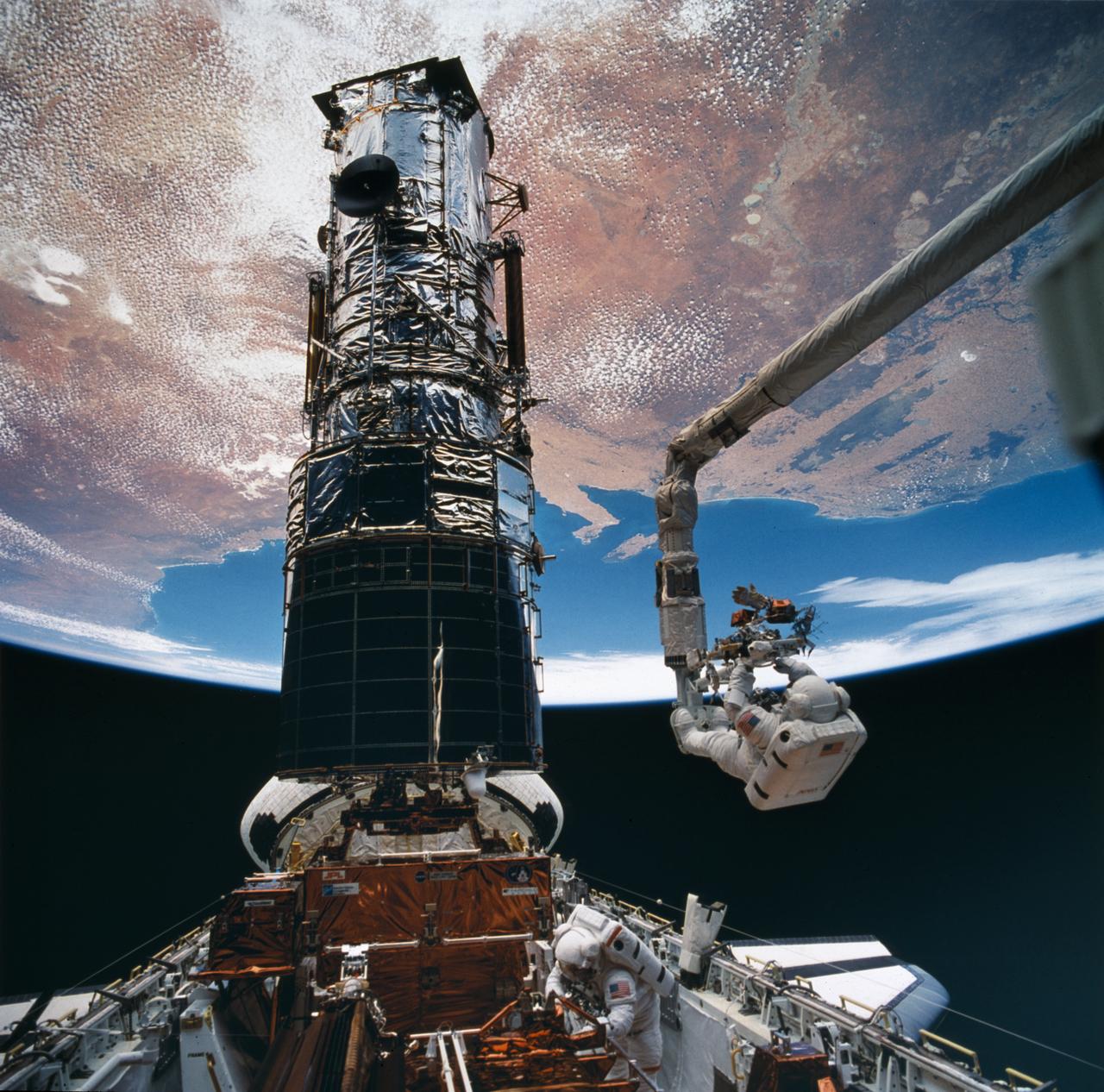
Astronaut Story Musgrave, anchored to the end of the remote manipulator arm, prepares to be elevated to the top of the towering Hubble Space Telescope (HST) to install protective covers on magnetometers. Astornaut Jeffrey Hoffman assisted Musgrave with the final servicing tasks.
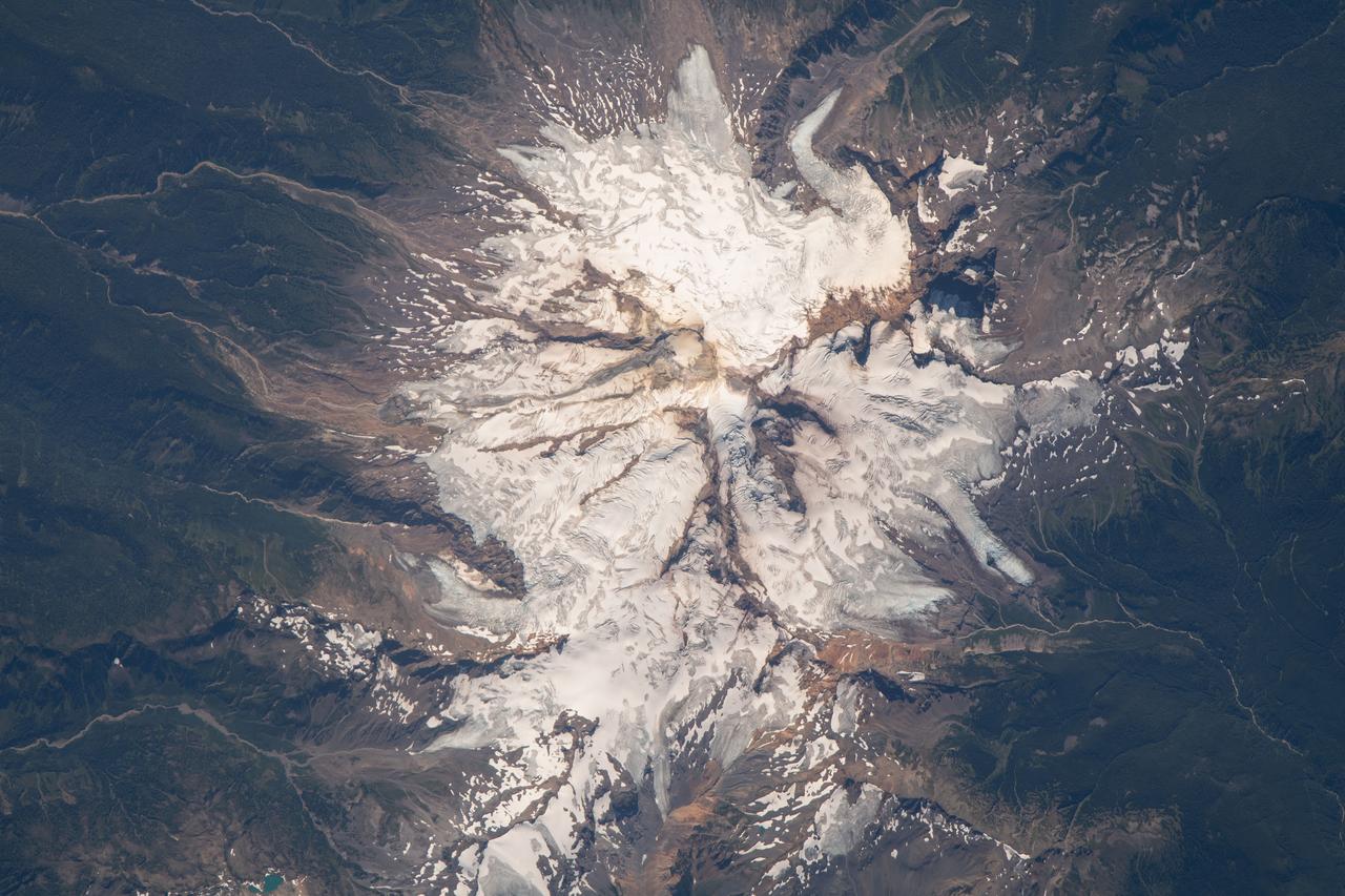
iss069e060816 (August 15, 2023) -- Mount Baker reaches over 10,700 feet of elevation in the state of Washington. The active glacier-covered stratovolcano was seen from the International Space Station as it orbited 265 miles above.
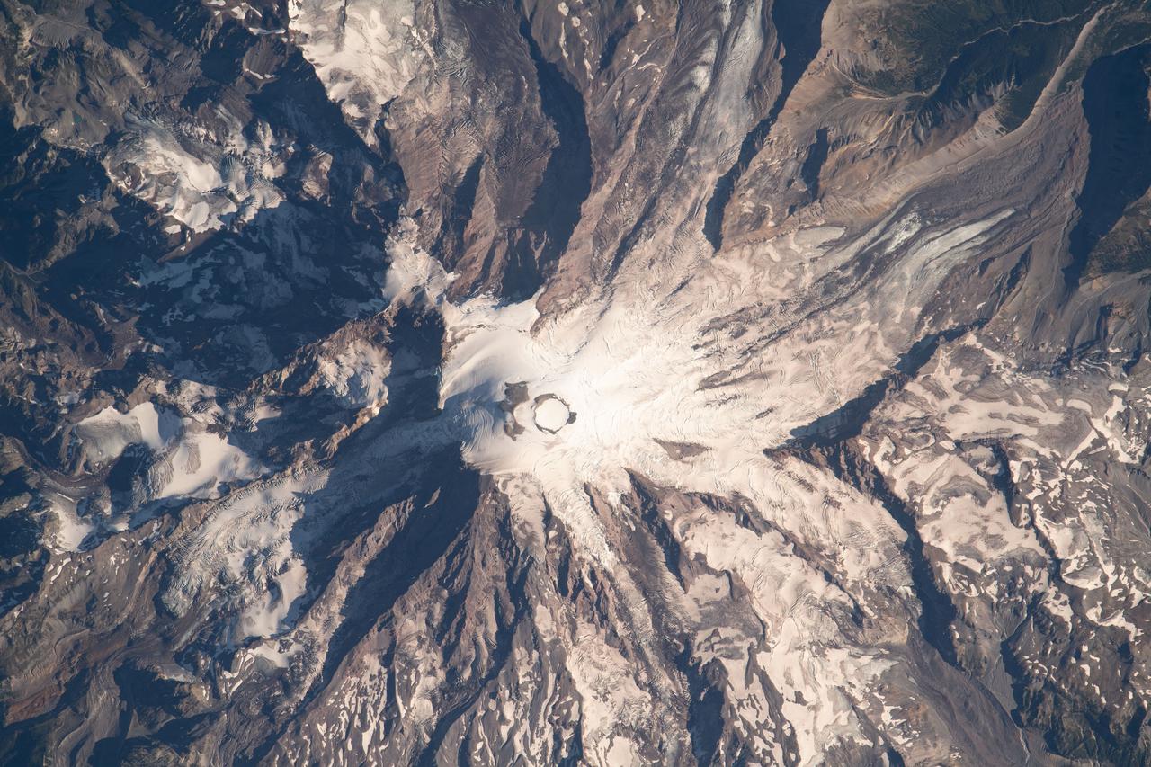
iss069e061159 (Aug. 16, 2023) --- Mount Rainier, an active volcano with an elevation of 14,400 feet, is pictured from the International Space Station as it orbited 264 miles above the Evergreen State of Washington.
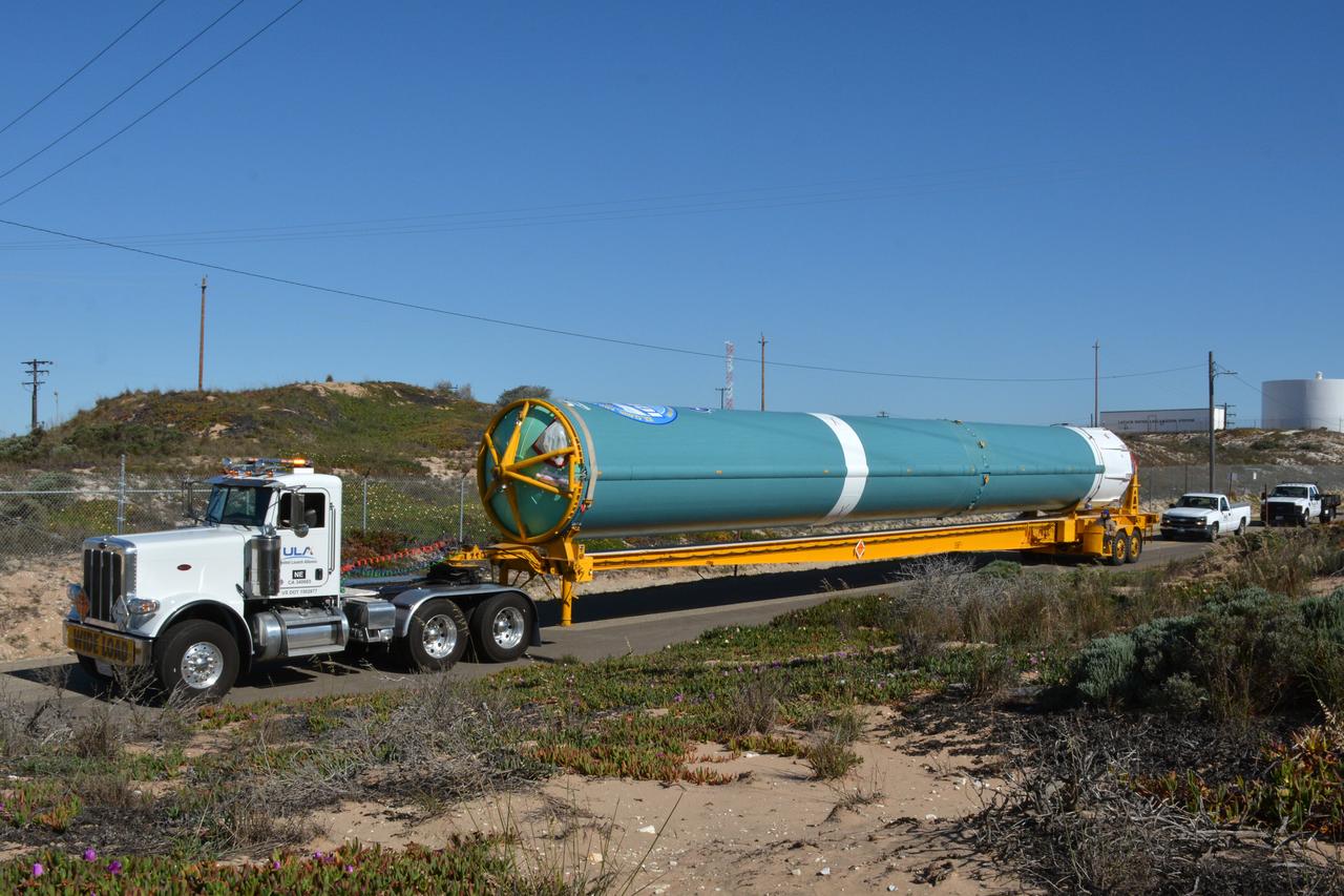
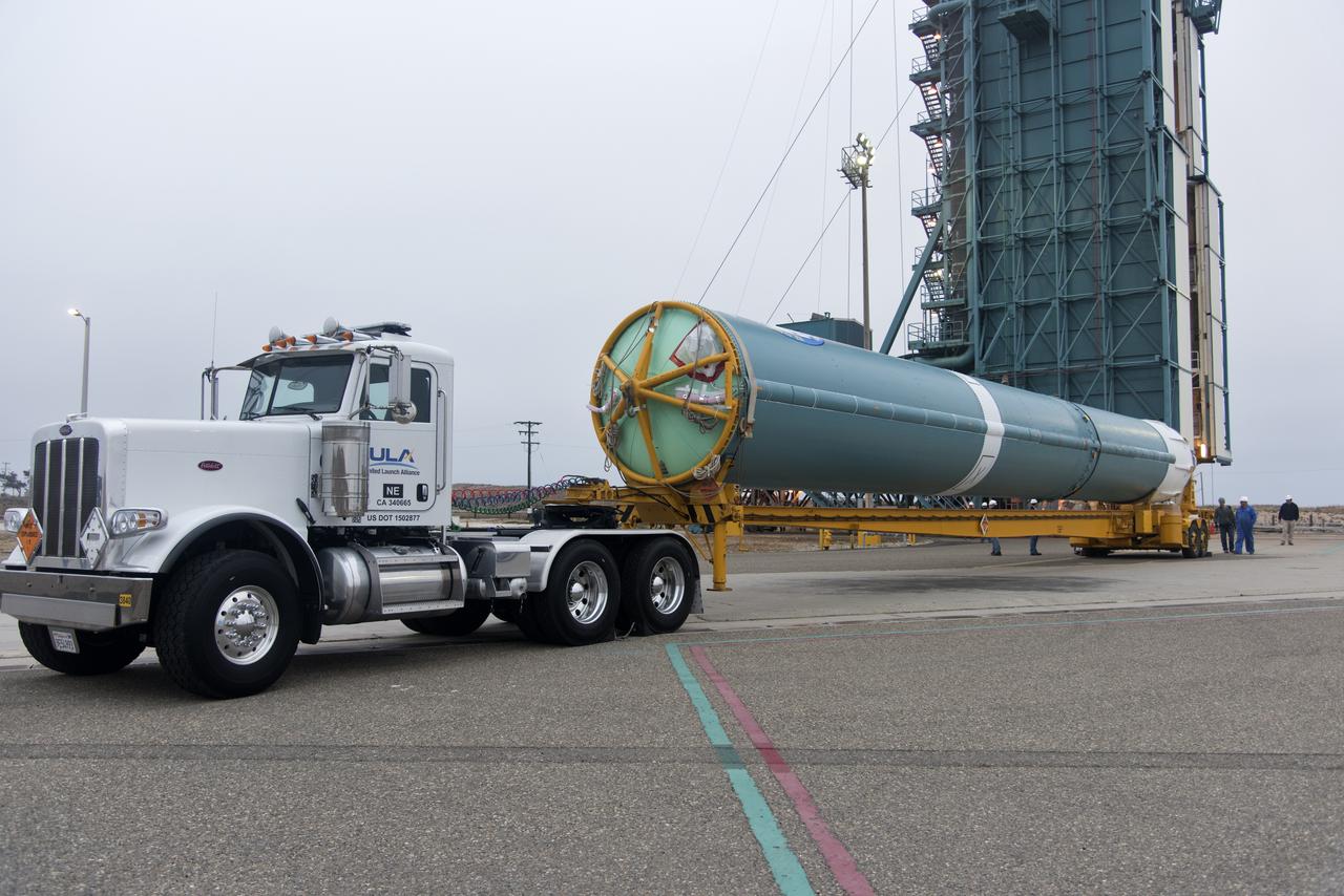
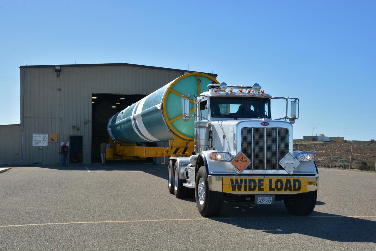
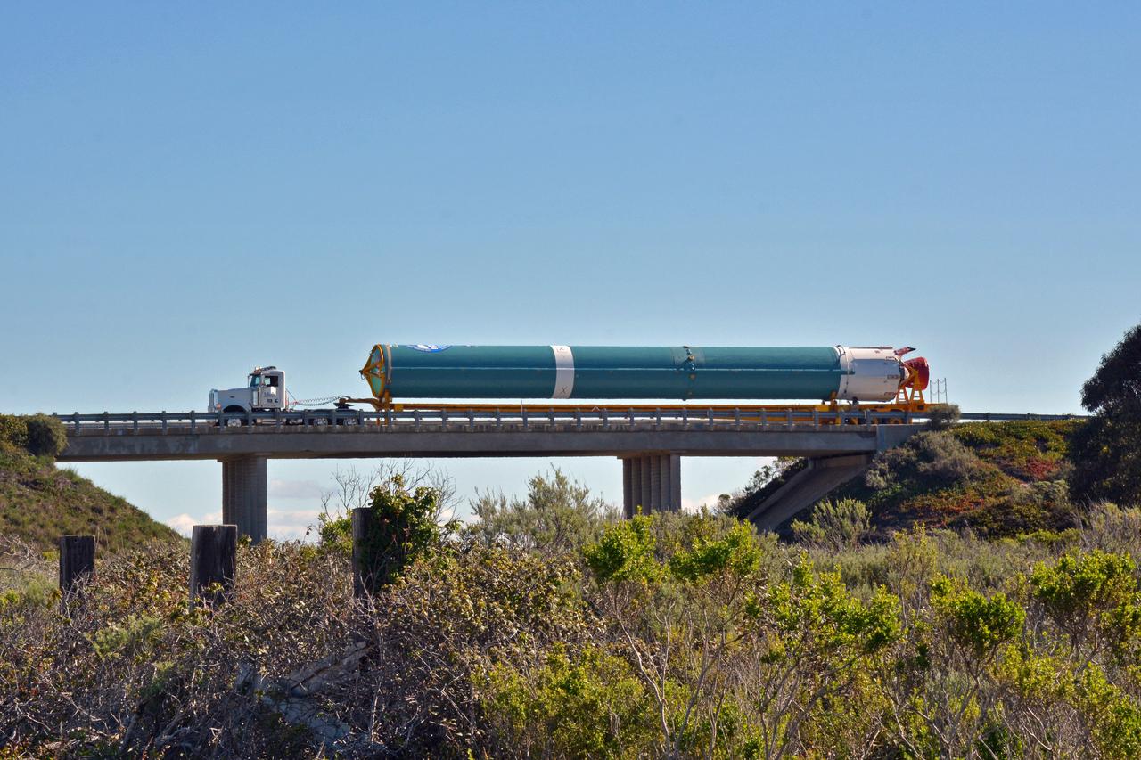
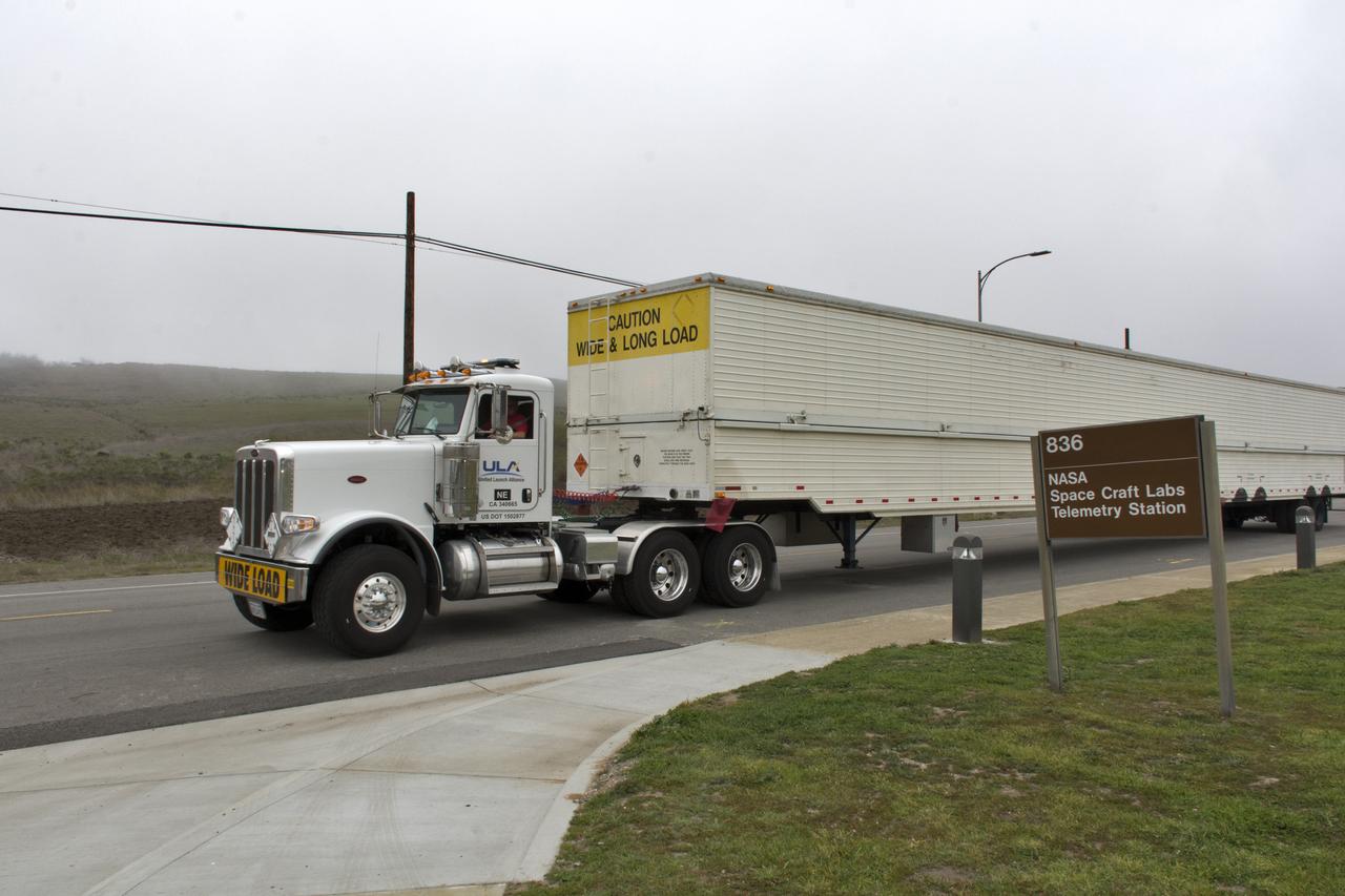
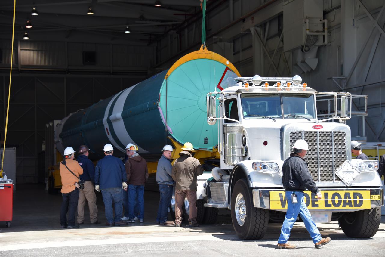
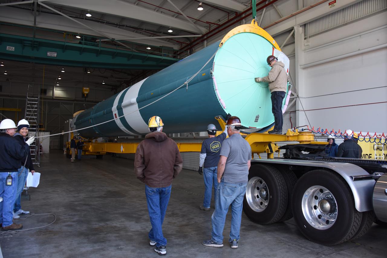
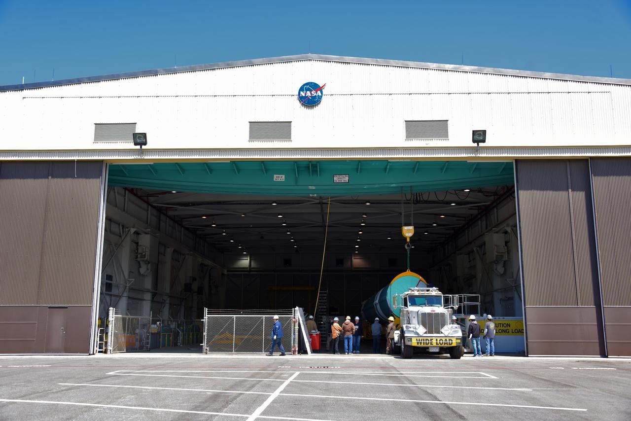
At Vandenberg Air Force Base in California, on Tuesday, April 17, 2018, a United Launch Alliance (ULA) Delta II booster is transported to Space Launch Complex-2 where it will launch NASA's Ice, Cloud and land Elevation Satellite-2, or ICESat-2, satellite. This will be the last flight for the venerable Delta II rocket. ICESat-2, which is being built and tested by Orbital ATK in Gilbert, Arizona, will carry a single instrument called the Advanced Topographic Laser Altimeter System, or ATLAS. The ATLAS instrument is being built and tested at NASA’s Goddard Space Flight Center in Greenbelt Maryland. Once in orbit, the satellite is designed to measure the height of a changing Earth, one laser pulse at a time, 10,000 laser pulses a second. ICESat-2 will help scientists investigate why, and how much, Earth’s frozen and icy areas, called the cryosphere, are changing.
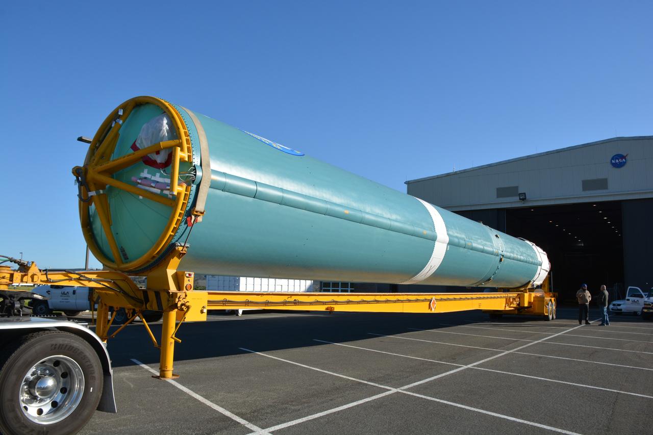
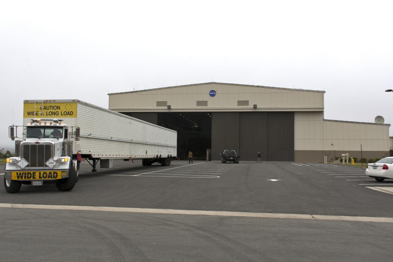
At NASA's Building 836, the Spacecraft Labs Telemetry Station at Vandenberg Air Force Base in California, on Tuesday, April 17, 2018, a United Launch Alliance (ULA) Delta II booster is transported to Space Launch Complex-2 where it will launch NASA's Ice, Cloud and land Elevation Satellite-2, or ICESat-2, satellite. This will be the last flight for the venerable Delta II rocket. ICESat-2, which is being built and tested by Orbital ATK in Gilbert, Arizona, will carry a single instrument called the Advanced Topographic Laser Altimeter System, or ATLAS. The ATLAS instrument is being built and tested at NASA’s Goddard Space Flight Center in Greenbelt Maryland. Once in orbit, the satellite is designed to measure the height of a changing Earth, one laser pulse at a time, 10,000 laser pulses a second. ICESat-2 will help scientists investigate why, and how much, Earth’s frozen and icy areas, called the cryosphere, are changing.
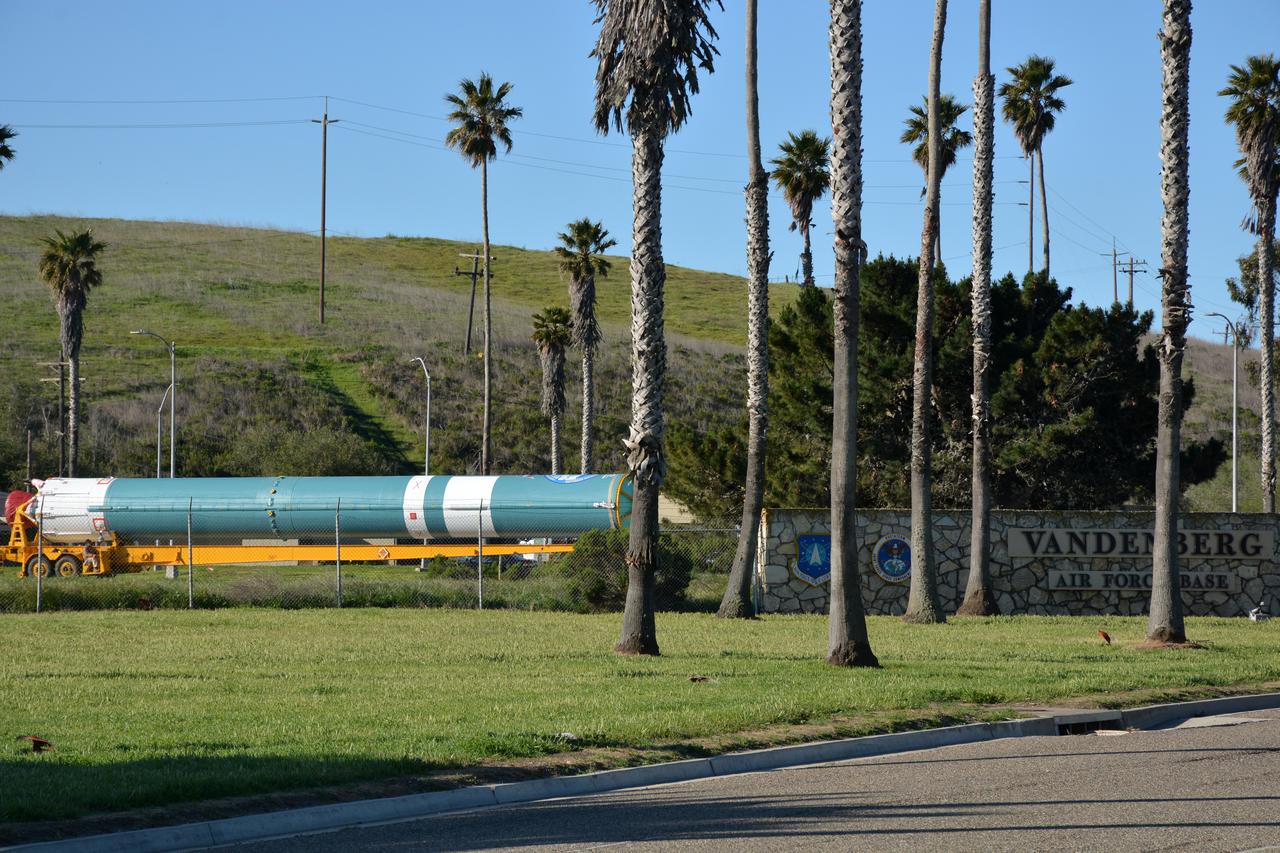
At Vandenberg Air Force Base in California, on Tuesday, April 17, 2018, a United Launch Alliance (ULA) Delta II booster is transported to Space Launch Complex-2 where it will launch NASA's Ice, Cloud and land Elevation Satellite-2, or ICESat-2, satellite. This will be the last flight for the venerable Delta II rocket. ICESat-2, which is being built and tested by Orbital ATK in Gilbert, Arizona, will carry a single instrument called the Advanced Topographic Laser Altimeter System, or ATLAS. The ATLAS instrument is being built and tested at NASA’s Goddard Space Flight Center in Greenbelt Maryland. Once in orbit, the satellite is designed to measure the height of a changing Earth, one laser pulse at a time, 10,000 laser pulses a second. ICESat-2 will help scientists investigate why, and how much, Earth’s frozen and icy areas, called the cryosphere, are changing.
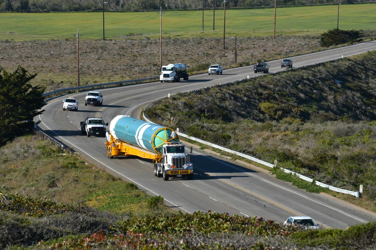
At Vandenberg Air Force Base in California, on Tuesday, April 17, 2018, a United Launch Alliance (ULA) Delta II booster is transported to Space Launch Complex-2 where it will launch NASA's Ice, Cloud and land Elevation Satellite-2, or ICESat-2, satellite. This will be the last flight for the venerable Delta II rocket. ICESat-2, which is being built and tested by Orbital ATK in Gilbert, Arizona, will carry a single instrument called the Advanced Topographic Laser Altimeter System, or ATLAS. The ATLAS instrument is being built and tested at NASA’s Goddard Space Flight Center in Greenbelt Maryland. Once in orbit, the satellite is designed to measure the height of a changing Earth, one laser pulse at a time, 10,000 laser pulses a second. ICESat-2 will help scientists investigate why, and how much, Earth’s frozen and icy areas, called the cryosphere, are changing.
At Vandenberg Air Force Base in California, on Tuesday, April 17, 2018, a United Launch Alliance (ULA) Delta II booster arrives at Space Launch Complex-2 where it will launch NASA's Ice, Cloud and land Elevation Satellite-2, or ICESat-2, satellite. This will be the last flight for the venerable Delta II rocket. ICESat-2, which is being built and tested by Orbital ATK in Gilbert, Arizona, will carry a single instrument called the Advanced Topographic Laser Altimeter System, or ATLAS. The ATLAS instrument is being built and tested at NASA’s Goddard Space Flight Center in Greenbelt Maryland. Once in orbit, the satellite is designed to measure the height of a changing Earth, one laser pulse at a time, 10,000 laser pulses a second. ICESat-2 will help scientists investigate why, and how much, Earth’s frozen and icy areas, called the cryosphere, are changing.
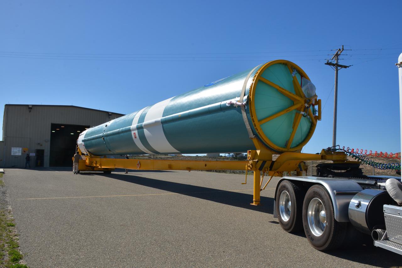
At NASA's Building 836, the Spacecraft Labs Telemetry Station at Vandenberg Air Force Base in California, on Tuesday, April 17, 2018, a United Launch Alliance (ULA) Delta II booster is transported to Space Launch Complex-2 where it will launch NASA's Ice, Cloud and land Elevation Satellite-2, or ICESat-2, satellite. This will be the last flight for the venerable Delta II rocket. ICESat-2, which is being built and tested by Orbital ATK in Gilbert, Arizona, will carry a single instrument called the Advanced Topographic Laser Altimeter System, or ATLAS. The ATLAS instrument is being built and tested at NASA’s Goddard Space Flight Center in Greenbelt Maryland. Once in orbit, the satellite is designed to measure the height of a changing Earth, one laser pulse at a time, 10,000 laser pulses a second. ICESat-2 will help scientists investigate why, and how much, Earth’s frozen and icy areas, called the cryosphere, are changing.
At NASA's Building 836, the Spacecraft Labs Telemetry Station at Vandenberg Air Force Base in California, on Tuesday, April 17, 2018, a United Launch Alliance (ULA) Delta II booster is transported to Space Launch Complex-2 where it will launch NASA's Ice, Cloud and land Elevation Satellite-2, or ICESat-2, satellite. This will be the last flight for the venerable Delta II rocket. ICESat-2, which is being built and tested by Orbital ATK in Gilbert, Arizona, will carry a single instrument called the Advanced Topographic Laser Altimeter System, or ATLAS. The ATLAS instrument is being built and tested at NASA’s Goddard Space Flight Center in Greenbelt Maryland. Once in orbit, the satellite is designed to measure the height of a changing Earth, one laser pulse at a time, 10,000 laser pulses a second. ICESat-2 will help scientists investigate why, and how much, Earth’s frozen and icy areas, called the cryosphere, are changing.
At Vandenberg Air Force Base in California, on Tuesday, April 17, 2018, a United Launch Alliance (ULA) Delta II booster is transported to Space Launch Complex-2 where it will launch NASA's Ice, Cloud and land Elevation Satellite-2, or ICESat-2, satellite. This will be the last flight for the venerable Delta II rocket. ICESat-2, which is being built and tested by Orbital ATK in Gilbert, Arizona, will carry a single instrument called the Advanced Topographic Laser Altimeter System, or ATLAS. The ATLAS instrument is being built and tested at NASA’s Goddard Space Flight Center in Greenbelt Maryland. Once in orbit, the satellite is designed to measure the height of a changing Earth, one laser pulse at a time, 10,000 laser pulses a second. ICESat-2 will help scientists investigate why, and how much, Earth’s frozen and icy areas, called the cryosphere, are changing.
At NASA's Building 836, the Spacecraft Labs Telemetry Station at Vandenberg Air Force Base in California, a United Launch Alliance Delta II booster is removed from its shipping container. After it is offloaded, preliminary checkouts and preflight processing will begin leading to launch of the agency's Ice, Cloud and land Elevation Satellite-2, or ICESat-2. Liftoff from Space Launch Complex-2 at Vandenberg is scheduled for Sept. 12, 2018, and will be the last for the venerable Delta II rocket. Once in orbit, the satellite is designed to measure the height of a changing Earth, one laser pulse at a time, 10,000 laser pulses a second. The satellite will carry a single instrument, the Advanced Topographic Laser Altimeter System. ICESat-2 will help scientists investigate why, and how much, Earth's frozen and icy areas are changing. These area make up Earth's the cryosphere.

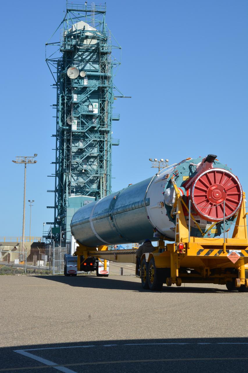
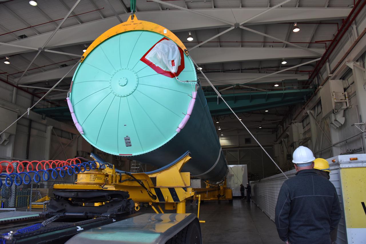
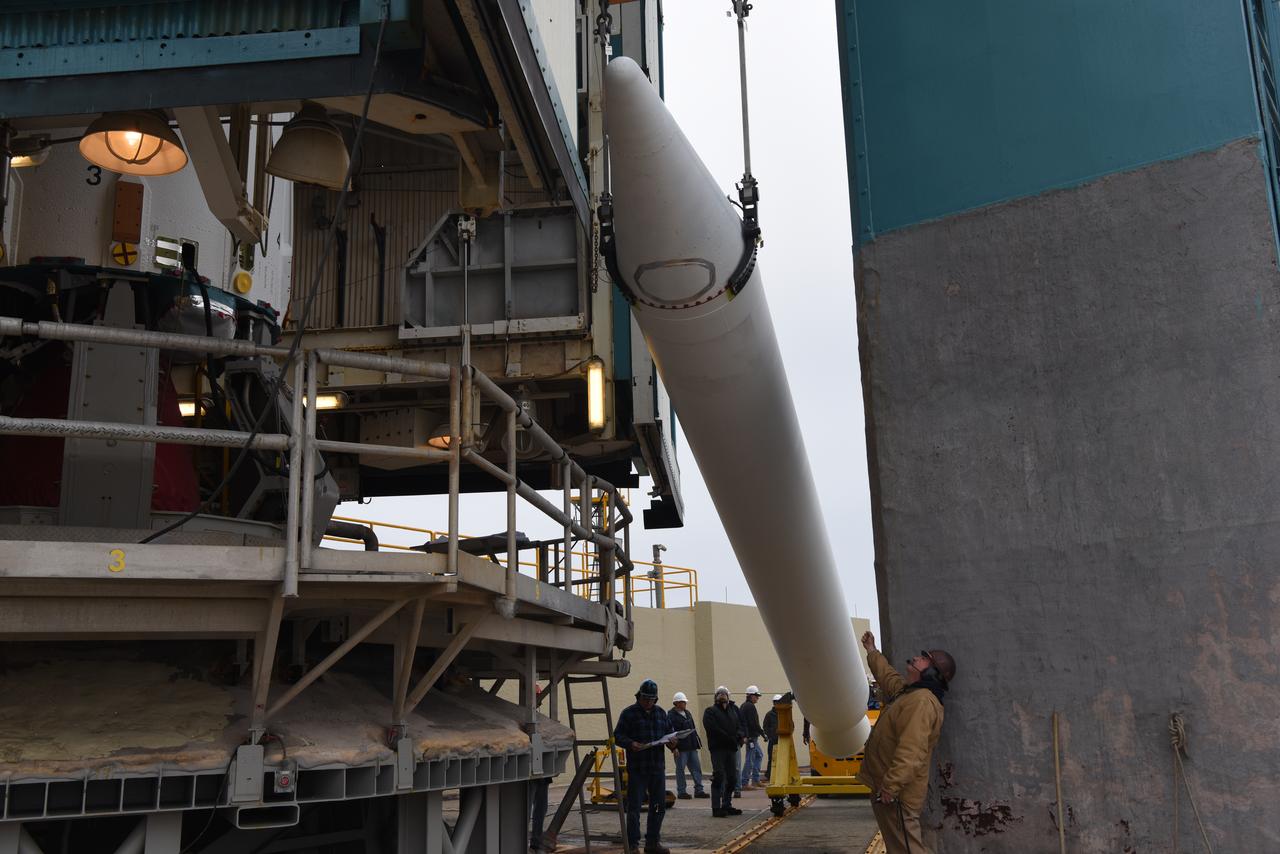
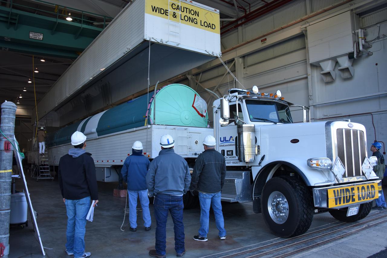
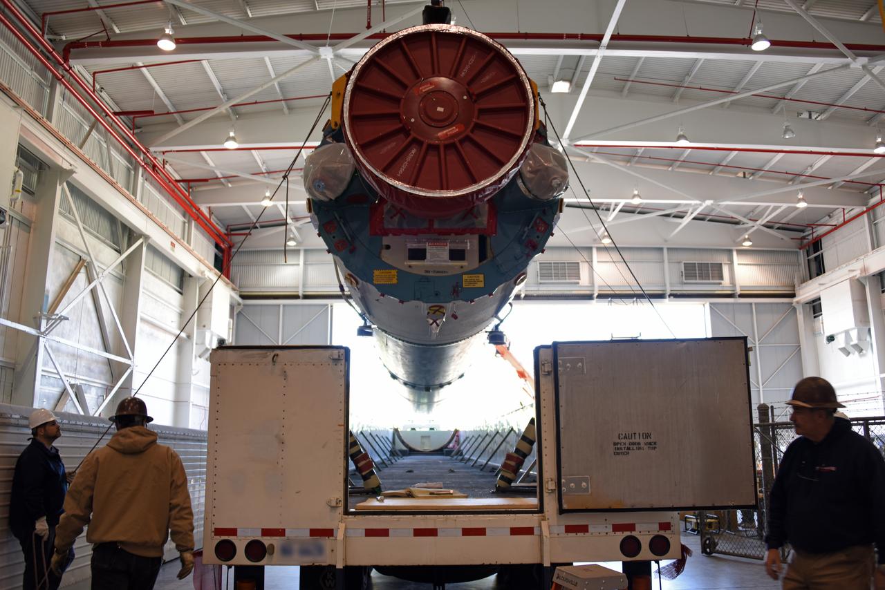
The solid rocket motor for mating to the United Launch Alliance Delta II launch vehicle is lifted up at the Vertical Integration Facility (VIF) at Space Launch Complex 2 on June 14, 2018, at Vandenberg Air Force Base in California. The solid rocket motor will be attached to the rocket. NASA's Ice, Cloud and land Elevation Satellite-2 (ICESat-2) will launch on the final Delta II rocket. ICESat-2 will measure the height of a changing Earth, one laser pulse at a time, 10,000 laser pulses a second. The satellite will carry a single instrument, the Advanced Topographic Laser Altimeter System. ICESat-2 will help scientists investigate why, and how much our planet's frozen and icy areas, called the cryosphere, is changing in a warming climate.
A United Launch Alliance Delta II booster arrives at NASA's Building 836, the Spacecraft Labs Telemetry Station at Vandenberg Air Force Base in California. It will be offloaded and begin preliminary checkouts and preflight processing for launch of the agency's Ice, Cloud and land Elevation Satellite-2, or ICESat-2. Liftoff from Space Launch Complex-2 at Vandenberg is scheduled for Sept. 12, 2018, and will be the last for the venerable Delta II rocket. Once in orbit, the satellite is designed to measure the height of a changing Earth, one laser pulse at a time, 10,000 laser pulses a second. The satellite will carry a single instrument, the Advanced Topographic Laser Altimeter System. ICESat-2 will help scientists investigate why, and how much, Earth's frozen and icy areas are changing. These area make up Earth's the cryosphere.
At NASA's Building 836, the Spacecraft Labs Telemetry Station at Vandenberg Air Force Base in California, a United Launch Alliance Delta II booster has been removed from its shipping container. Preliminary checkouts and preflight processing will begin leading to launch of the agency's Ice, Cloud and land Elevation Satellite-2, or ICESat-2. Liftoff from Space Launch Complex-2 at Vandenberg is scheduled for Sept. 12, 2018, and will be the last for the venerable Delta II rocket. Once in orbit, the satellite is designed to measure the height of a changing Earth, one laser pulse at a time, 10,000 laser pulses a second. The satellite will carry a single instrument, the Advanced Topographic Laser Altimeter System. ICESat-2 will help scientists investigate why, and how much, Earth's frozen and icy areas are changing. These area make up Earth's the cryosphere.
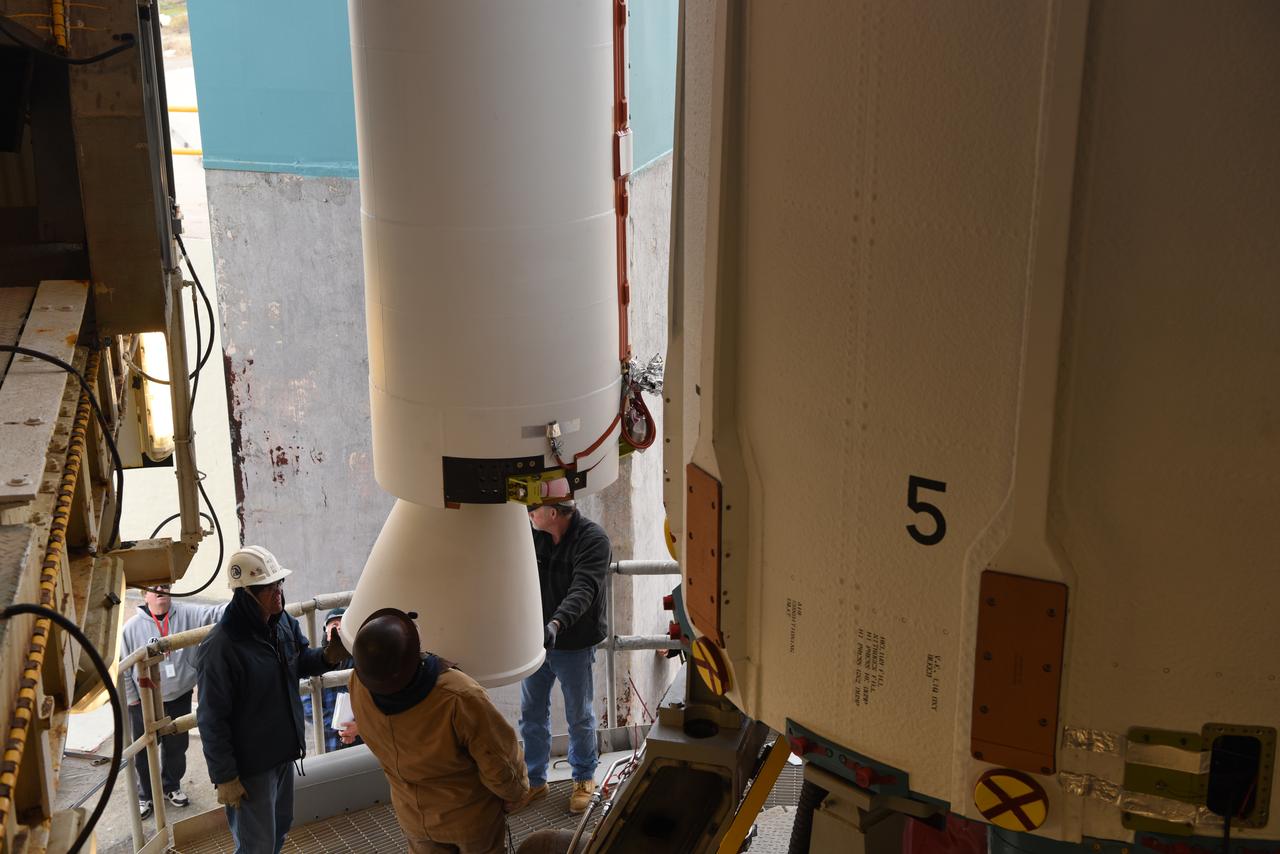
United Launch Alliance (ULA) technicians assist as the solid rocket motor is lifted up and moved toward the Delta II launch vehicle in the Vertical Integration Facility (VIF) at Space Launch Complex 2 on June 14, 2018, at Vandenberg Air Force Base in California. The solid rocket motor will be attached to the rocket. NASA's Ice, Cloud and land Elevation Satellite-2 (ICESat-2) will launch on the final ULA Delta II rocket. ICESat-2 will measure the height of a changing Earth, one laser pulse at a time, 10,000 laser pulses a second. The satellite will carry a single instrument, the Advanced Topographic Laser Altimeter System. ICESat-2 will help scientists investigate why, and how much our planet's frozen and icy areas, called the cryosphere, is changing in a warming climate.
The solid rocket motor for mating to the United Launch Alliance Delta II launch vehicle is lifted up at the Vertical Integration Facility (VIF) at Space Launch Complex 2 on June 14, 2018, at Vandenberg Air Force Base in California. The solid rocket motor will be attached to the rocket. NASA's Ice, Cloud and land Elevation Satellite-2 (ICESat-2) will launch on the final Delta II rocket. ICESat-2 will measure the height of a changing Earth, one laser pulse at a time, 10,000 laser pulses a second. The satellite will carry a single instrument, the Advanced Topographic Laser Altimeter System. ICESat-2 will help scientists investigate why, and how much our planet's frozen and icy areas, called the cryosphere, is changing in a warming climate.
At NASA's Building 836, the Spacecraft Labs Telemetry Station at Vandenberg Air Force Base in California, a United Launch Alliance Delta II booster is removed from its shipping container. After it is offloaded, preliminary checkouts and preflight processing will begin leading to launch of the agency's Ice, Cloud and land Elevation Satellite-2, or ICESat-2. Liftoff from Space Launch Complex-2 at Vandenberg is scheduled for Sept. 12, 2018, and will be the last for the venerable Delta II rocket. Once in orbit, the satellite is designed to measure the height of a changing Earth, one laser pulse at a time, 10,000 laser pulses a second. The satellite will carry a single instrument, the Advanced Topographic Laser Altimeter System. ICESat-2 will help scientists investigate why, and how much, Earth's frozen and icy areas are changing. These area make up Earth's the cryosphere.
A United Launch Alliance Delta II booster arrives at NASA's Building 836, the Spacecraft Labs Telemetry Station at Vandenberg Air Force Base in California. It will be offloaded and begin preliminary checkouts and preflight processing for launch of the agency's Ice, Cloud and land Elevation Satellite-2, or ICESat-2. Liftoff from Space Launch Complex-2 at Vandenberg is scheduled for Sept. 12, 2018, and will be the last for the venerable Delta II rocket. Once in orbit, the satellite is designed to measure the height of a changing Earth, one laser pulse at a time, 10,000 laser pulses a second. The satellite will carry a single instrument, the Advanced Topographic Laser Altimeter System. ICESat-2 will help scientists investigate why, and how much, Earth's frozen and icy areas are changing. These area make up Earth's the cryosphere.
A United Launch Alliance Delta II booster arrives at NASA's Building 836, the Spacecraft Labs Telemetry Station at Vandenberg Air Force Base in California. It will be offloaded and begin preliminary checkouts and preflight processing for launch of the agency's Ice, Cloud and land Elevation Satellite-2, or ICESat-2. Liftoff from Space Launch Complex-2 at Vandenberg is scheduled for Sept. 12, 2018, and will be the last for the venerable Delta II rocket. Once in orbit, the satellite is designed to measure the height of a changing Earth, one laser pulse at a time, 10,000 laser pulses a second. The satellite will carry a single instrument, the Advanced Topographic Laser Altimeter System. ICESat-2 will help scientists investigate why, and how much, Earth's frozen and icy areas are changing. These area make up Earth's the cryosphere.
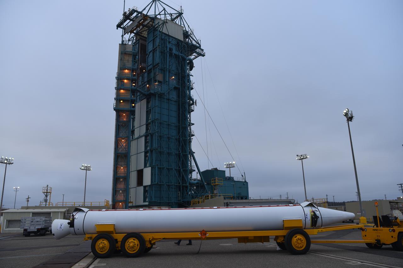
The solid rocket motor for mating to the United Launch Alliance Delta II launch vehicle arrives at the Vertical Integration Facility (VIF) at Space Launch Complex 2 on June 14, 2018, at Vandenberg Air Force Base in California. The solid rocket motor will be lifted up and attached to the rocket. NASA's Ice, Cloud and land Elevation Satellite-2 (ICESat-2) will launch on the final Delta II rocket. ICESat-2 will measure the height of a changing Earth, one laser pulse at a time, 10,000 laser pulses a second. The satellite will carry a single instrument, the Advanced Topographic Laser Altimeter System. ICESat-2 will help scientists investigate why, and how much our planet's frozen and icy areas, called the cryosphere, is changing in a warming climate.
United Launch Alliance (ULA) technicians assist as the solid rocket motor is moved toward the Delta II launch vehicle in the Vertical Integration Facility (VIF) at Space Launch Complex 2 on June 14, 2018, at Vandenberg Air Force Base in California. The solid rocket motor will be attached to the rocket. NASA's Ice, Cloud and land Elevation Satellite-2 (ICESat-2) will launch on the final ULA Delta II rocket. ICESat-2 will measure the height of a changing Earth, one laser pulse at a time, 10,000 laser pulses a second. The satellite will carry a single instrument, the Advanced Topographic Laser Altimeter System. ICESat-2 will help scientists investigate why, and how much our planet's frozen and icy areas, called the cryosphere, is changing in a warming climate.
The solid rocket motor for mating to the United Launch Alliance Delta II launch vehicle is lifted up at the Vertical Integration Facility (VIF) at Space Launch Complex 2 on June 14, 2018, at Vandenberg Air Force Base in California. The solid rocket motor will be attached to the rocket. NASA's Ice, Cloud and land Elevation Satellite-2 (ICESat-2) will launch on the final Delta II rocket. ICESat-2 will measure the height of a changing Earth, one laser pulse at a time, 10,000 laser pulses a second. The satellite will carry a single instrument, the Advanced Topographic Laser Altimeter System. ICESat-2 will help scientists investigate why, and how much our planet's frozen and icy areas, called the cryosphere, is changing in a warming climate.
At NASA's Building 836, the Spacecraft Labs Telemetry Station at Vandenberg Air Force Base in California, a United Launch Alliance Delta II booster has been removed from its shipping container. Preliminary checkouts and preflight processing will begin leading to launch of the agency's Ice, Cloud and land Elevation Satellite-2, or ICESat-2. Liftoff from Space Launch Complex-2 at Vandenberg is scheduled for Sept. 12, 2018, and will be the last for the venerable Delta II rocket. Once in orbit, the satellite is designed to measure the height of a changing Earth, one laser pulse at a time, 10,000 laser pulses a second. The satellite will carry a single instrument, the Advanced Topographic Laser Altimeter System. ICESat-2 will help scientists investigate why, and how much, Earth's frozen and icy areas are changing. These area make up Earth's the cryosphere.
At NASA's Building 836, the Spacecraft Labs Telemetry Station at Vandenberg Air Force Base in California, a United Launch Alliance Delta II booster has been removed from its shipping container. Preliminary checkouts and preflight processing will begin leading to launch of the agency's Ice, Cloud and land Elevation Satellite-2, or ICESat-2. Liftoff from Space Launch Complex-2 at Vandenberg is scheduled for Sept. 12, 2018, and will be the last for the venerable Delta II rocket. Once in orbit, the satellite is designed to measure the height of a changing Earth, one laser pulse at a time, 10,000 laser pulses a second. The satellite will carry a single instrument, the Advanced Topographic Laser Altimeter System. ICESat-2 will help scientists investigate why, and how much, Earth's frozen and icy areas are changing. These area make up Earth's the cryosphere.
The solid rocket motor for mating to the United Launch Alliance Delta II launch vehicle is lifted up at the Vertical Integration Facility (VIF) at Space Launch Complex 2 on June 14, 2018, at Vandenberg Air Force Base in California. The solid rocket motor will be attached to the rocket. NASA's Ice, Cloud and land Elevation Satellite-2 (ICESat-2) will launch on the final Delta II rocket. ICESat-2 will measure the height of a changing Earth, one laser pulse at a time, 10,000 laser pulses a second. The satellite will carry a single instrument, the Advanced Topographic Laser Altimeter System. ICESat-2 will help scientists investigate why, and how much our planet's frozen and icy areas, called the cryosphere, is changing in a warming climate.
At NASA's Building 836, the Spacecraft Labs Telemetry Station at Vandenberg Air Force Base in California, a United Launch Alliance Delta II booster has been removed from its shipping container. Preliminary checkouts and preflight processing will begin leading to launch of the agency's Ice, Cloud and land Elevation Satellite-2, or ICESat-2. Liftoff from Space Launch Complex-2 at Vandenberg is scheduled for Sept. 12, 2018, and will be the last for the venerable Delta II rocket. Once in orbit, the satellite is designed to measure the height of a changing Earth, one laser pulse at a time, 10,000 laser pulses a second. The satellite will carry a single instrument, the Advanced Topographic Laser Altimeter System. ICESat-2 will help scientists investigate why, and how much, Earth's frozen and icy areas are changing. These area make up Earth's the cryosphere.
At NASA's Building 836, the Spacecraft Labs Telemetry Station at Vandenberg Air Force Base in California, a United Launch Alliance Delta II booster is removed from its shipping container. After it is offloaded, preliminary checkouts and preflight processing will begin leading to launch of the agency's Ice, Cloud and land Elevation Satellite-2, or ICESat-2. Liftoff from Space Launch Complex-2 at Vandenberg is scheduled for Sept. 12, 2018, and will be the last for the venerable Delta II rocket. Once in orbit, the satellite is designed to measure the height of a changing Earth, one laser pulse at a time, 10,000 laser pulses a second. The satellite will carry a single instrument, the Advanced Topographic Laser Altimeter System. ICESat-2 will help scientists investigate why, and how much, Earth's frozen and icy areas are changing. These area make up Earth's the cryosphere.
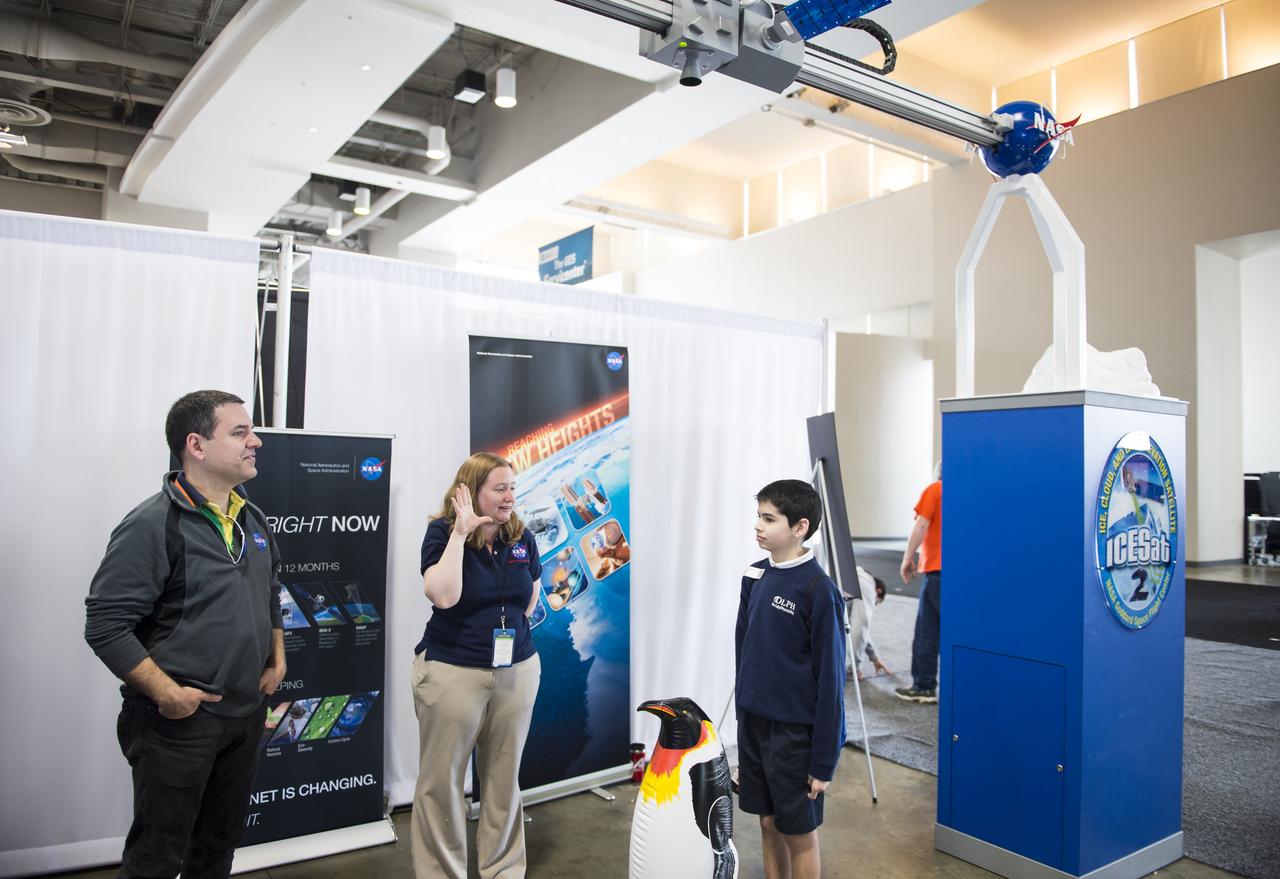
An attendee of the USA Science and Engineering Festival is measured by a laser at the NASA Stage. A NASA Staff member describes the Ice, Cloud, and land Elevation Satellite (ICESat) mission, which operated from 2003-2009, and pioneered the use of laser altimeters in space to study the elevation of the Earth's surface and its changes. ICESat-2 is a follow-on mission to continue the ICESat observations and is scheduled to launch in 2017. The USA Science and Engineering Festival took place at the Washington Convention Center in Washington, DC on April 26 and 27, 2014. Photo Credit: (NASA/Aubrey Gemignani)
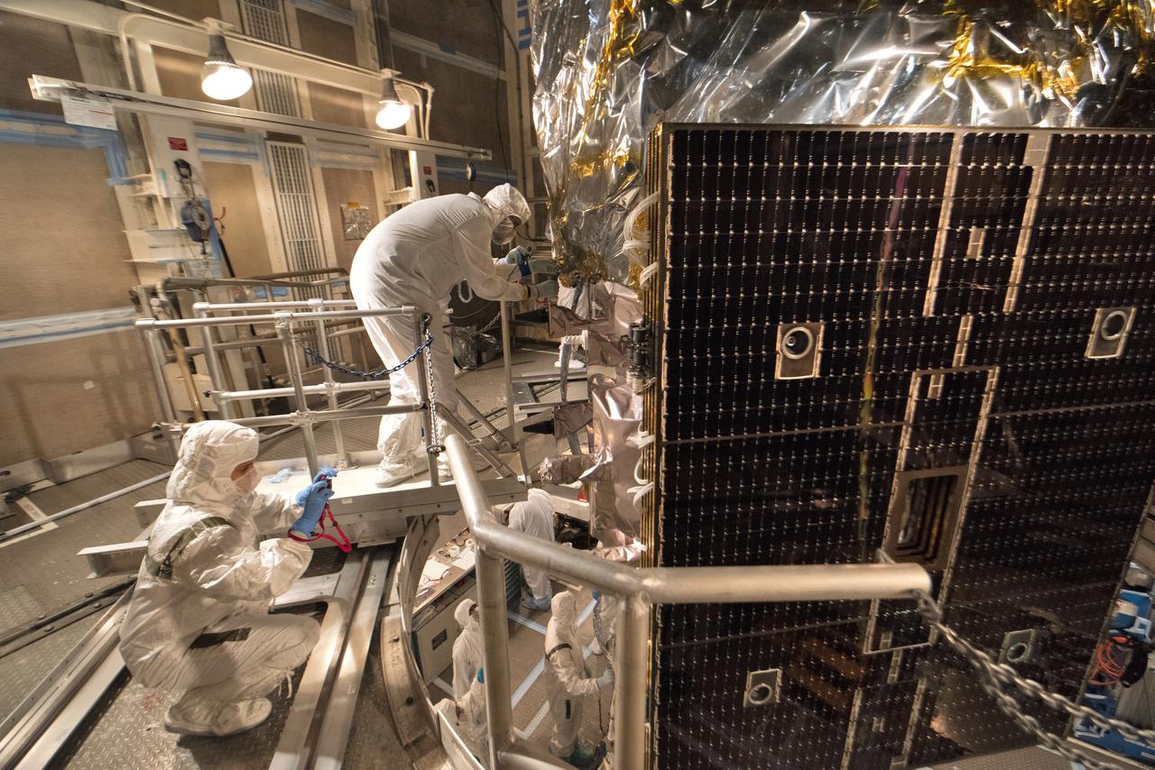
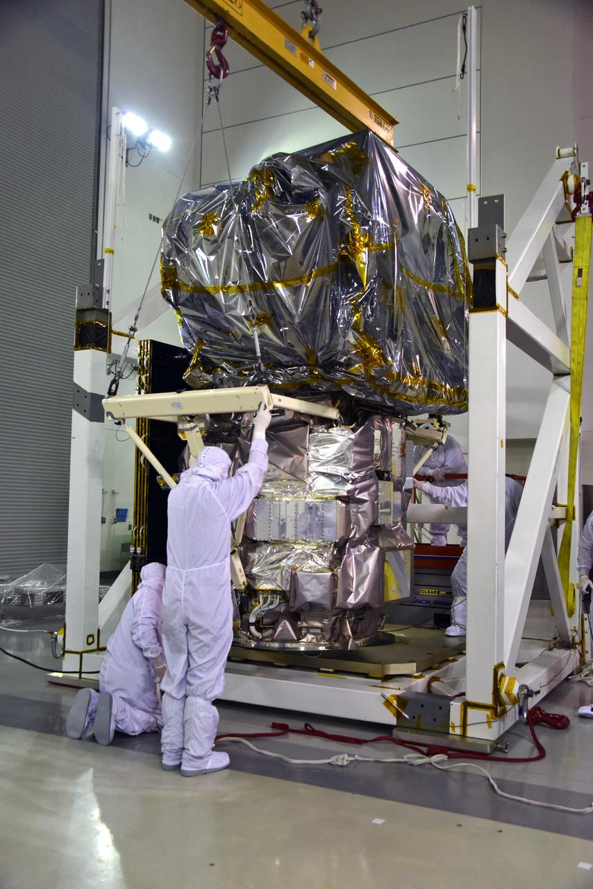
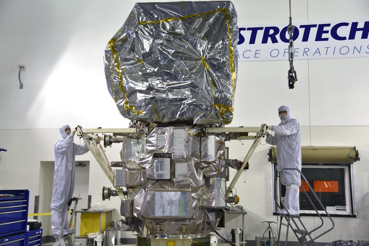
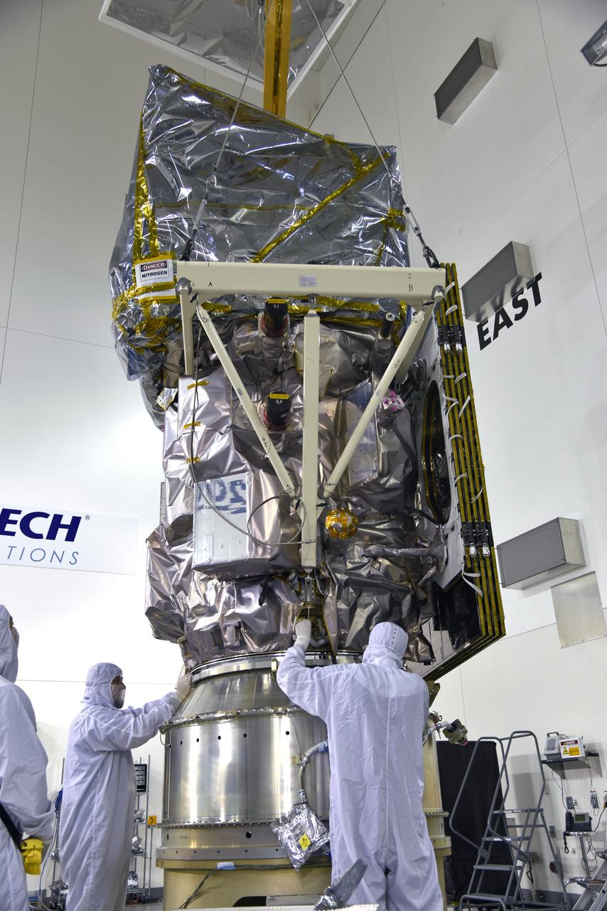
Inside the high bay of the Astrotech Space Operations facility at Vandenberg Air Force Base in California, technicians attach NASA's Ice, Cloud and land Elevation Satellite-2 (ICESat-2) to the payload direct mate adapter, on Aug. 24, 2018. The satellite is being prepared for its scheduled launch from Space Launch Complex 2 at Vandenberg on the final United Launch Alliance Delta II rocket. ICESat-2 will measure the height of a changing Earth, one laser pulse at a time, 10,000 laser pulses a second. The satellite will carry the Advanced Topographic Laser Altimeter System (ATLAS). ICESat-2 will help scientists investigate why, and how much our planet's frozen and icy areas, called the cryosphere, are changing in a warming climate.
Inside the high bay of the Astrotech Space Operations facility at Vandenberg Air Force Base in California, technicians prepare to attach NASA's Ice, Cloud and land Elevation Satellite-2 (ICESat-2) to the payload adapter, on Aug. 20, 2018. The satellite is being prepared for its scheduled launch from Space Launch Complex 2 at Vandenberg on the final United Launch Alliance Delta II rocket. ICESat-2 will measure the height of a changing Earth, one laser pulse at a time, 10,000 laser pulses a second. The satellite will carry the Advanced Topographic Laser Altimeter System (ATLAS). ICESat-2 will help scientists investigate why, and how much our planet's frozen and icy areas, called the cryosphere, are changing in a warming climate.
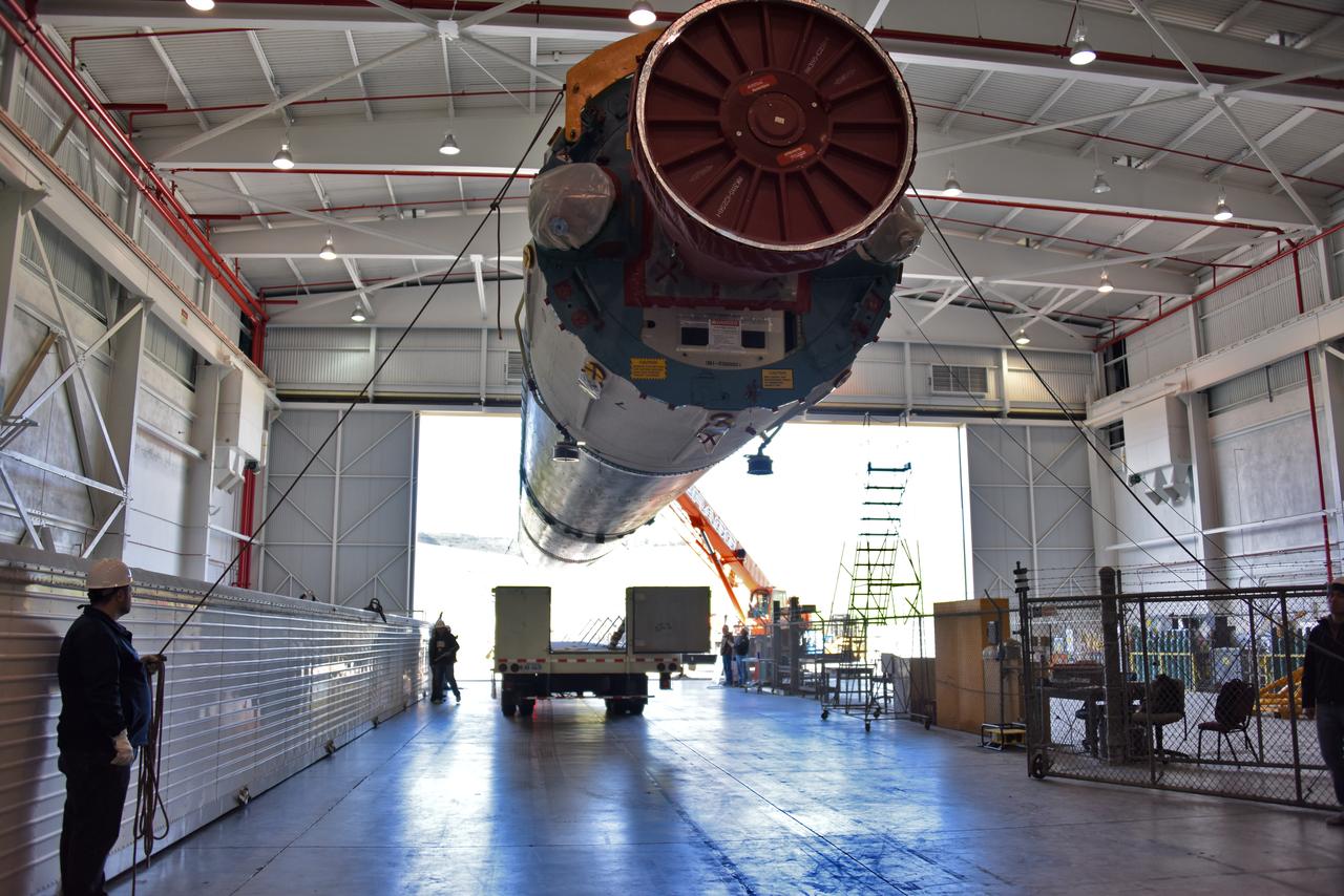
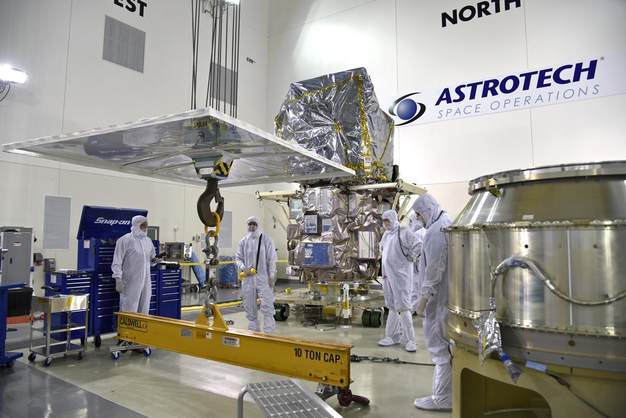
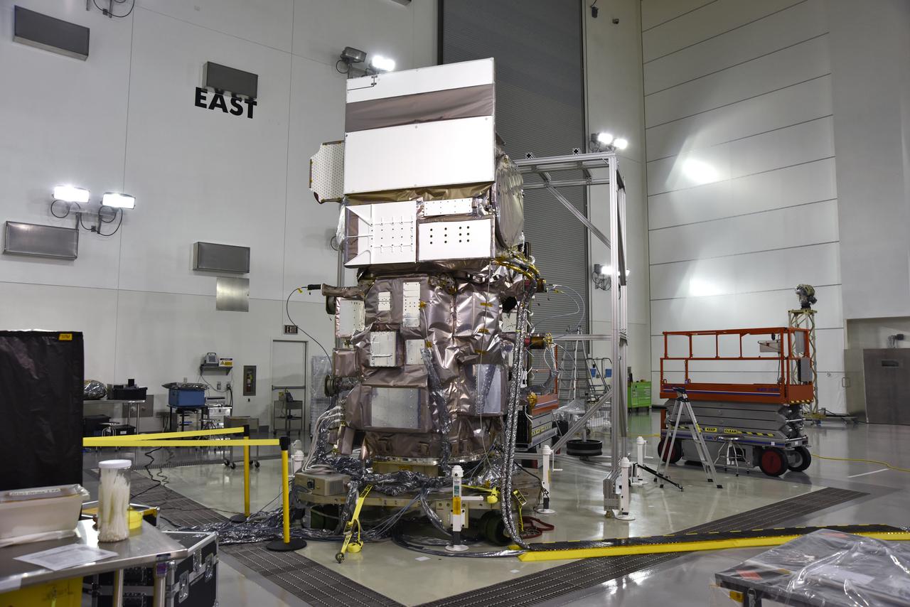
Technicians assist as a crane rotates NASA's Ice, Cloud and land Elevation Satellite-2 (ICESat-2) into position for removal and lift to a work stand in the high bay of the Astrotech Space Operations facility on June 14, 2018, at Vandenberg Air Force Base in California. ICESat-2 was shipped from the Northrop Grumman facility in Gilbert, Arizona, where it was built and tested. The satellite is scheduled to launch from Space Launch Complex-2 at Vandenberg on the final United Launch Alliance Delta II rocket. ICESat-2 will measure the height of a changing Earth, one laser pulse at a time, 10,000 laser pulses a second. The satellite will carry the Advanced Topographic Laser Altimeter System. ICESat-2 will help scientists investigate why, and how much our planet's frozen and icy areas, called the cryosphere, is changing in a warming climate.
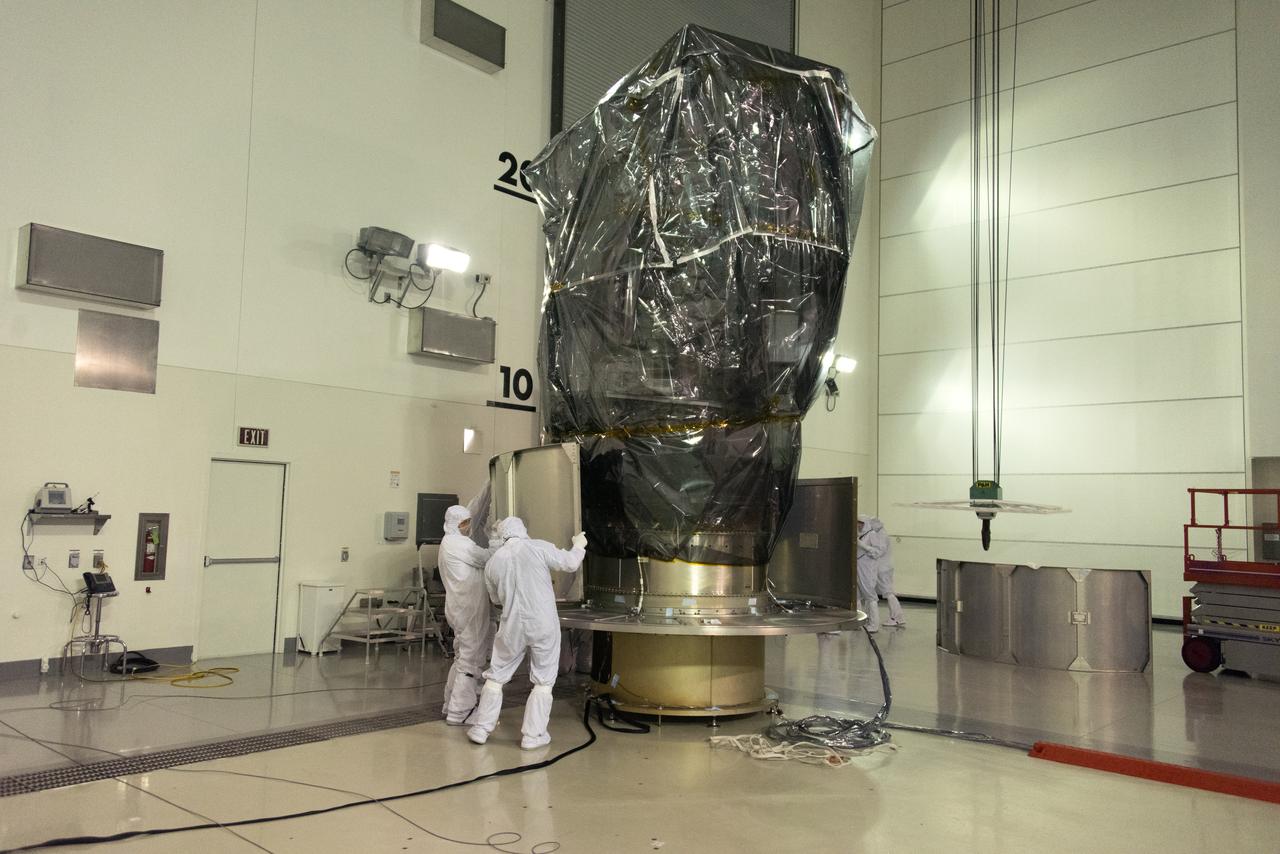
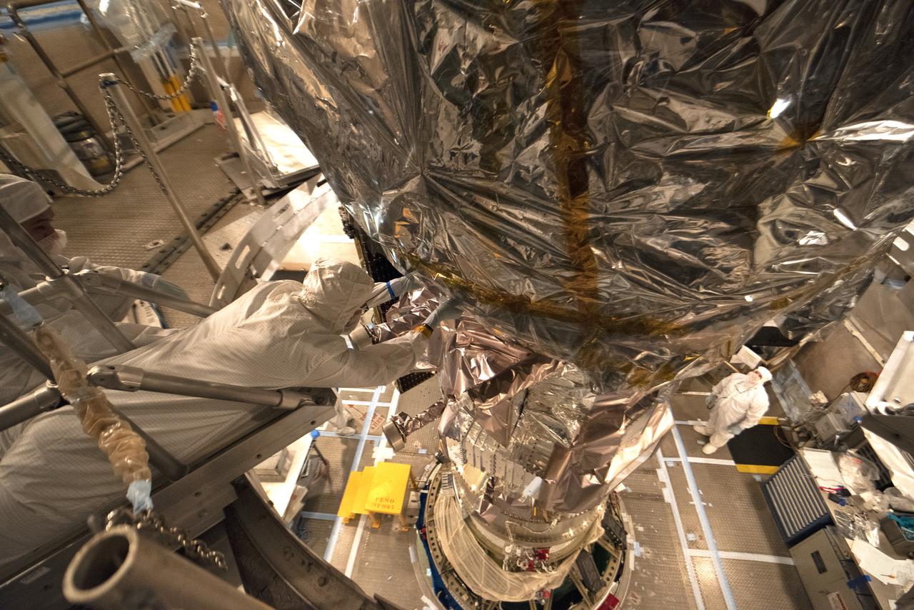
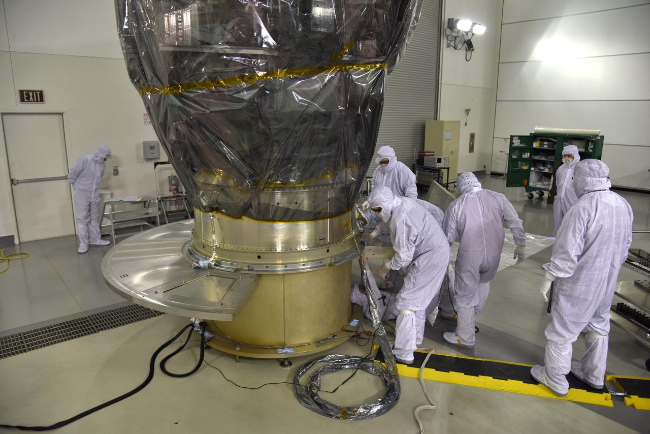
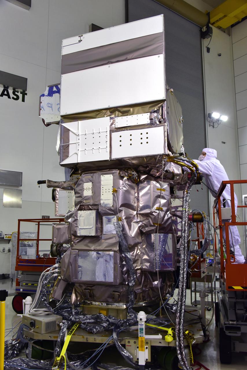
Inside the Astrotech Space Operations high bay at Vandenberg Air Force Base in California, technicians prepare NASA's Ice, Cloud and land Elevation Satellite-2 (ICESat-2), for installation of the protective canister on Aug. 25, 2018. The satellite will be transported to Space Launch Complex 2 where it will be hoisted up by crane and attached to the United Launch Alliance Delta II rocket. Launch is scheduled for Sept. 15, 2018. ICESat-2 will measure the height of a changing Earth, one laser pulse at a time, 10,000 laser pulses a second. The satellite will carry the Advanced Topographic Laser Altimeter System (ATLAS). ICESat-2 will help scientists investigate why, and how much our planet's frozen and icy areas, called the cryosphere, are changing in a warming climate.
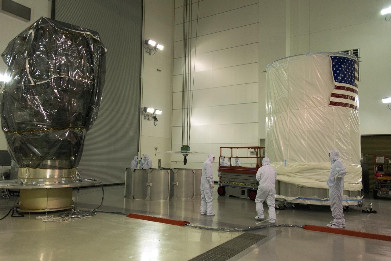
Inside the Astrotech Space Operations high bay at Vandenberg Air Force Base in California, technicians prepare the canister, at right, for installation around NASA's Ice, Cloud and land Elevation Satellite-2 (ICESat-2), at left, on Aug. 25, 2018. The satellite will be transported to Space Launch Complex 2 where it will be hoisted up by crane and attached to the United Launch Alliance Delta II rocket. Launch is scheduled for Sept. 15, 2018. ICESat-2 will measure the height of a changing Earth, one laser pulse at a time, 10,000 laser pulses a second. The satellite will carry the Advanced Topographic Laser Altimeter System (ATLAS). ICESat-2 will help scientists investigate why, and how much our planet's frozen and icy areas, called the cryosphere, are changing in a warming climate.
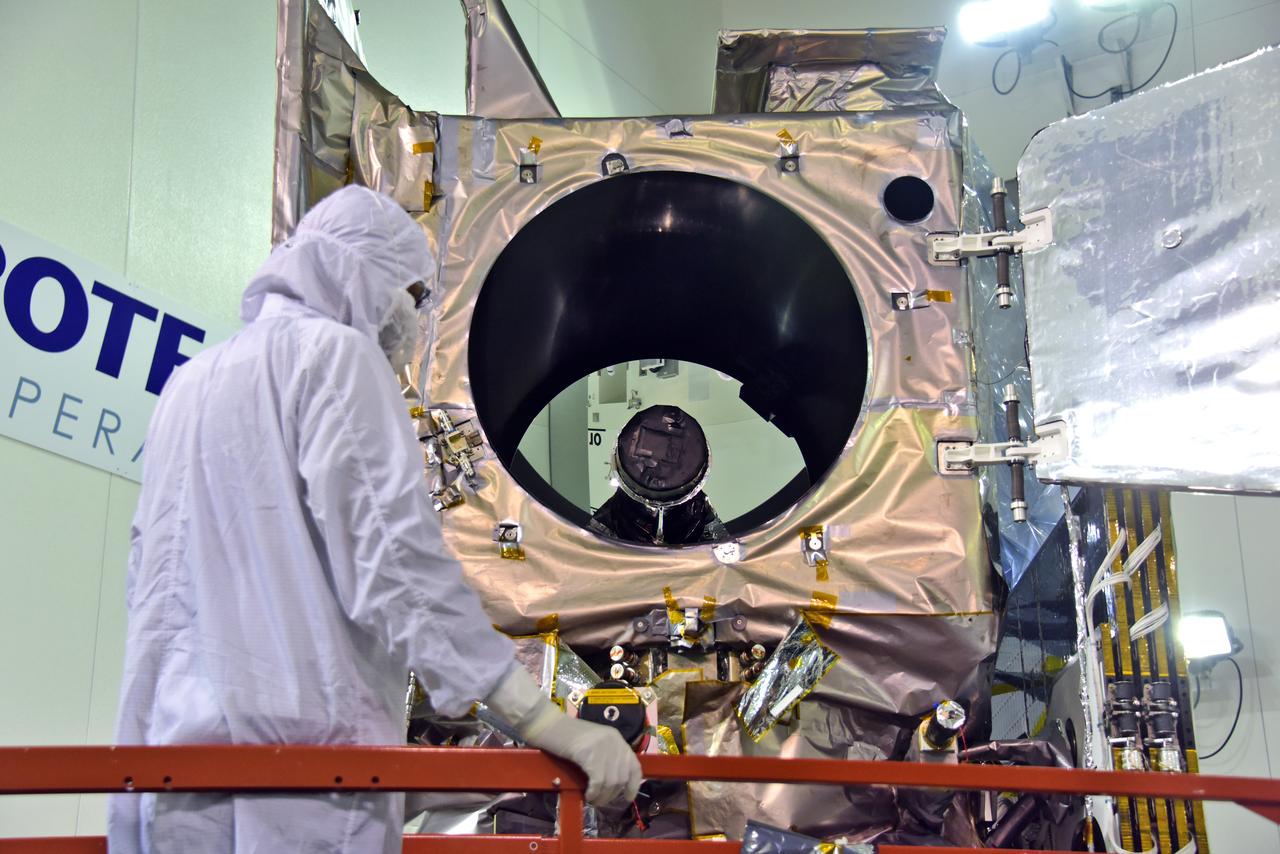
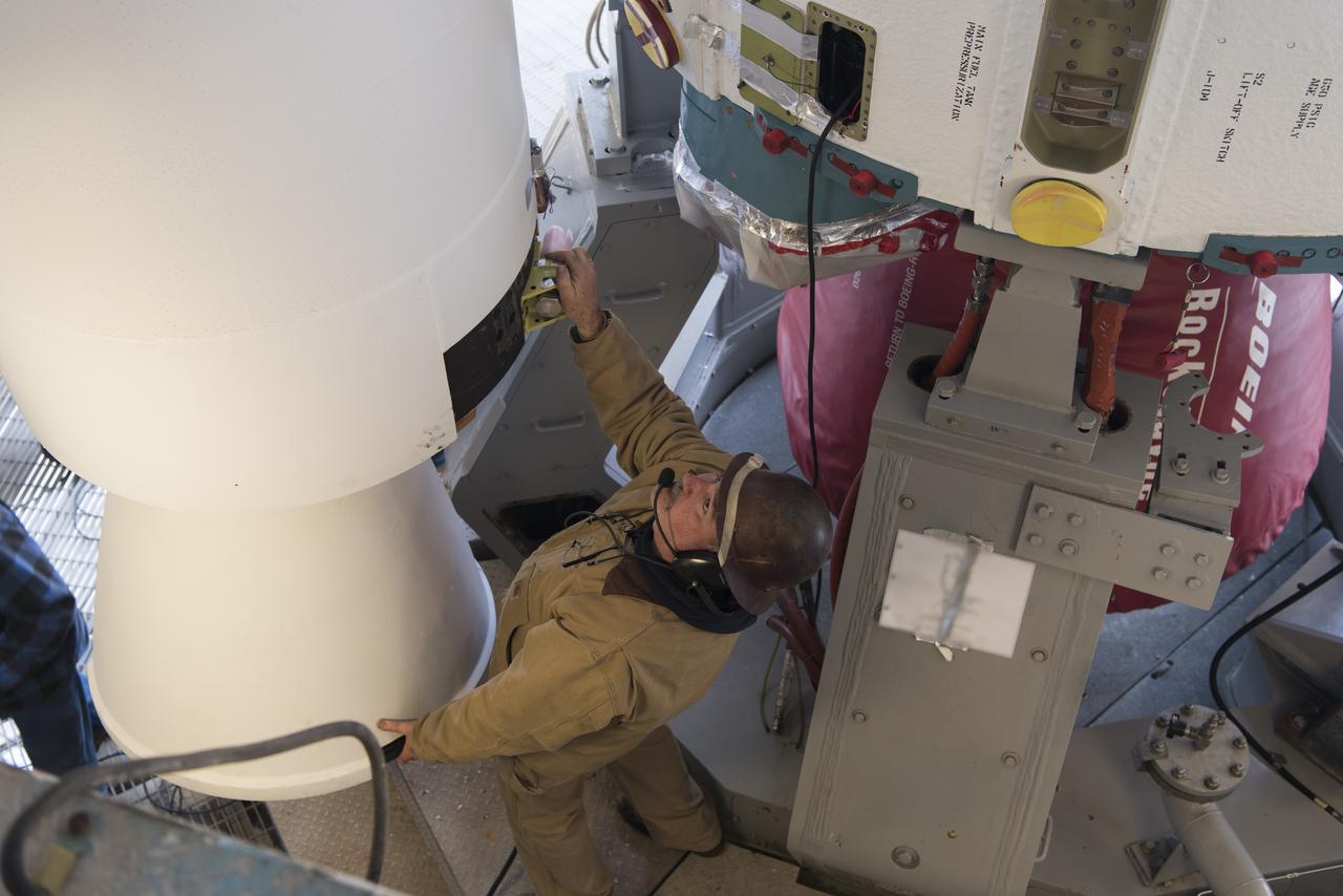
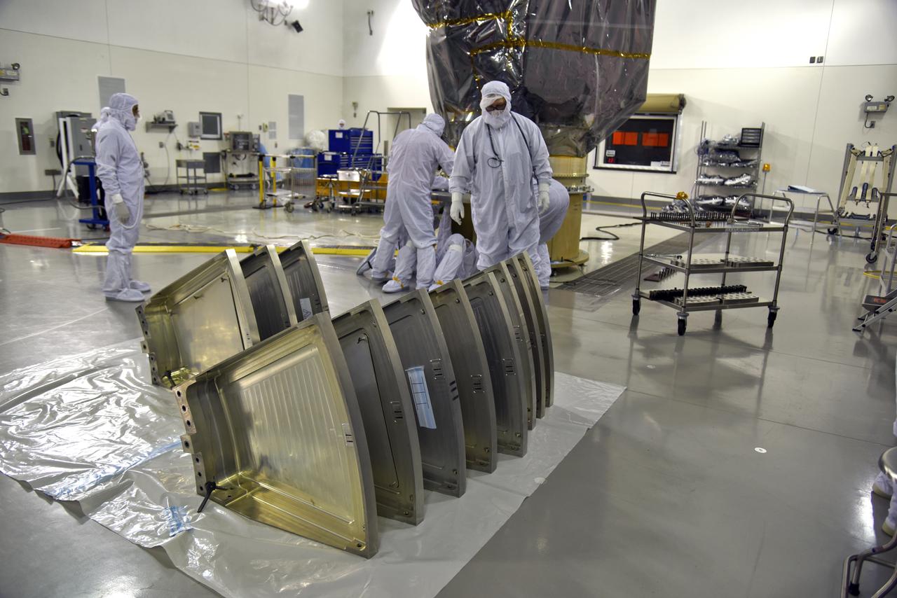
Inside the high bay of the Astrotech Space Operations facility at Vandenberg Air Force Base in California, a technician opens and checks the flight door for the Advanced Topographic Laser Altimeter System (ATLAS) on NASA's Ice, Cloud and land Elevation Satellite-2 (ICESat-2) on June 21, 2018. The satellite is being prepared for its scheduled launch from Space Launch Complex-2 at Vandenberg on the final United Launch Alliance Delta II rocket. ICESat-2 will measure the height of a changing Earth, one laser pulse at a time, 10,000 laser pulses a second. The satellite will carry ATLAS. ICESat-2 will help scientists investigate why, and how much our planet's frozen and icy areas, called the cryosphere, is changing in a warming climate.
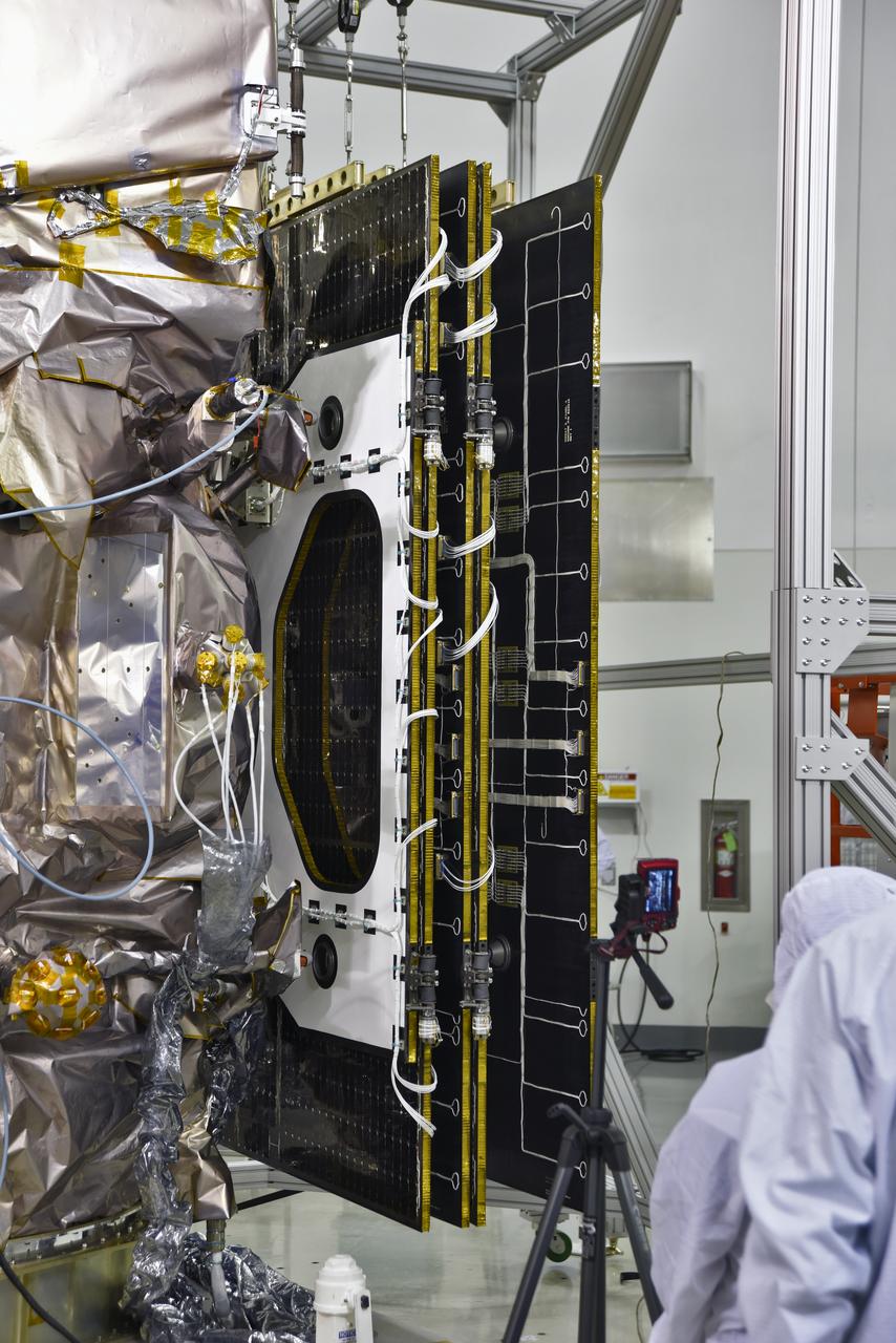
Inside the high bay of the Astrotech Space Operations facility at Vandenberg Air Force Base in California, a solar array first motion test is underway on NASA's Ice, Cloud and land Elevation Satellite-2 (ICESat-2) on June 18, 2018. The satellite is being prepared for its scheduled launch from Space Launch Complex-2 at Vandenberg on the final United Launch Alliance Delta II rocket. ICESat-2 will measure the height of a changing Earth, one laser pulse at a time, 10,000 laser pulses a second. The satellite will carry the Advanced Topographic Laser Altimeter System. ICESat-2 will help scientists investigate why, and how much our planet's frozen and icy areas, called the cryosphere, is changing in a warming climate.
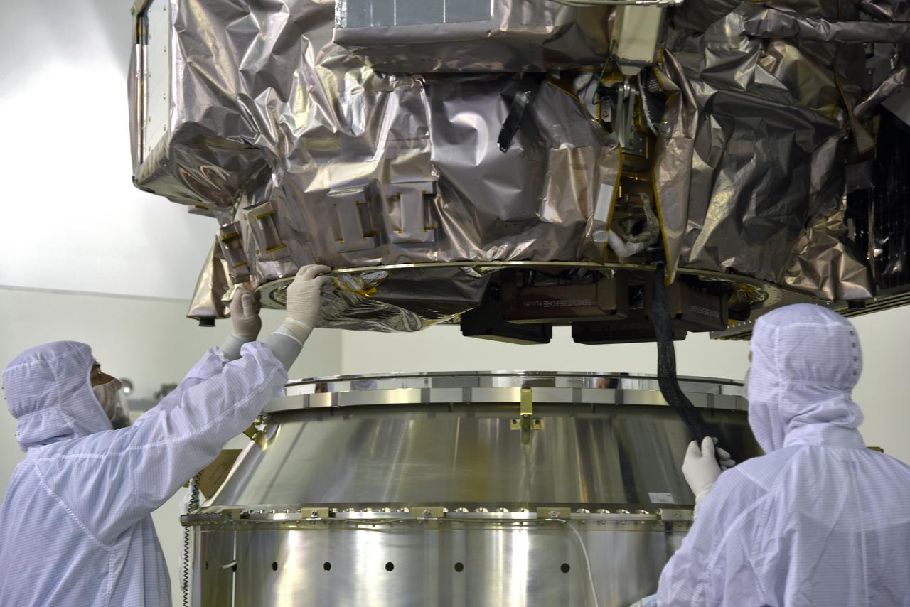
Inside the high bay of the Astrotech Space Operations facility at Vandenberg Air Force Base in California, technicians assist as a crane lowers NASA's Ice, Cloud and land Elevation Satellite-2 (ICESat-2) onto the payload adapter on Aug. 30, 2018. ICESat-2 is being prepared for its scheduled launch from Space Launch Complex 2 at Vandenberg on the final United Launch Alliance Delta II rocket. ICESat-2 will measure the height of a changing Earth, one laser pulse at a time, 10,000 laser pulses a second. The satellite will carry the Advanced Topographic Laser Altimeter System (ATLAS). ICESat-2 will help scientists investigate why, and how much our planet's frozen and icy areas, called the cryosphere, are changing in a warming climate.
Inside the high bay of the Astrotech Space Operations facility at Vandenberg Air Force Base in California, a solar array first motion test is in progress on NASA's Ice, Cloud and land Elevation Satellite-2 (ICESat-2) on June 18, 2018. The satellite is being prepared for its scheduled launch from Space Launch Complex-2 at Vandenberg on the final United Launch Alliance Delta II rocket. ICESat-2 will measure the height of a changing Earth, one laser pulse at a time, 10,000 laser pulses a second. The satellite will carry the Advanced Topographic Laser Altimeter System. ICESat-2 will help scientists investigate why, and how much our planet's frozen and icy areas, called the cryosphere, is changing in a warming climate.
Inside the high bay of the Astrotech Space Operations facility at Vandenberg Air Force Base in California, technicians prepare to attach NASA's Ice, Cloud and land Elevation Satellite-2 (ICESat-2) to the payload adapter, on Aug. 20, 2018. The satellite is being prepared for its scheduled launch from Space Launch Complex 2 at Vandenberg on the final United Launch Alliance Delta II rocket. ICESat-2 will measure the height of a changing Earth, one laser pulse at a time, 10,000 laser pulses a second. The satellite will carry the Advanced Topographic Laser Altimeter System (ATLAS). ICESat-2 will help scientists investigate why, and how much our planet's frozen and icy areas, called the cryosphere, are changing in a warming climate.
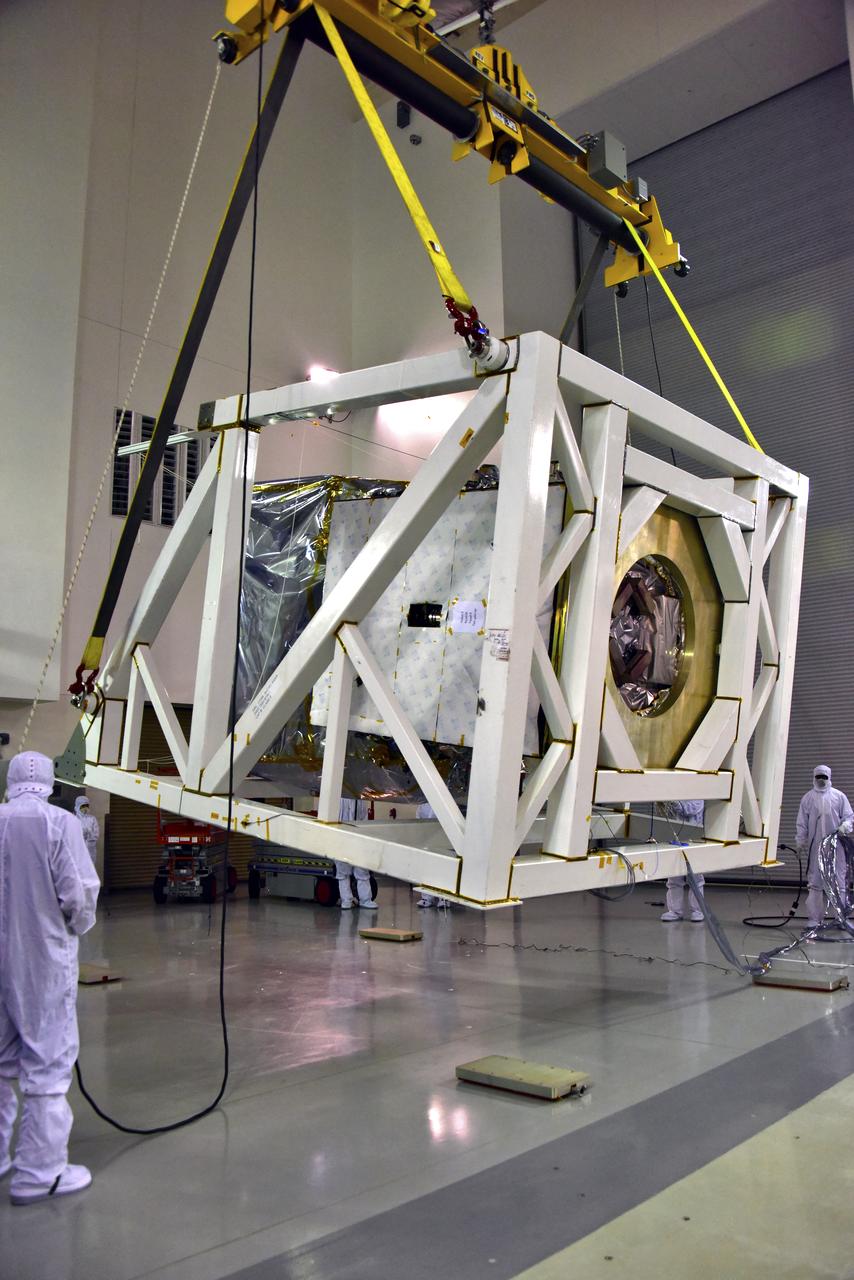
NASA's Ice, Cloud and land Elevation Satellite-2 (ICESat-2) is lifted in its fixture inside the high bay of the Astrotech Space Operations facility on June 14, 2018, at Vandenberg Air Force Base in California. ICESat-2 was shipped from the Northrop Grumman facility in Gilbert, Arizona, where it was built and tested. The satellite is scheduled to launch from Space Launch Complex-2 at Vandenberg on the final United Launch Alliance Delta II rocket. ICESat-2 will measure the height of a changing Earth, one laser pulse at a time, 10,000 laser pulses a second. The satellite will carry the Advanced Topographic Laser Altimeter System. ICESat-2 will help scientists investigate why, and how much our planet's frozen and icy areas, called the cryosphere, is changing in a warming climate.
Inside the high bay of the Astrotech Space Operations facility at Vandenberg Air Force Base in California, a technician checks the flight door for the Advanced Topographic Laser Altimeter System (ATLAS) on NASA's Ice, Cloud and land Elevation Satellite-2 (ICESat-2) on June 21, 2018. The satellite is being prepared for its scheduled launch from Space Launch Complex-2 at Vandenberg on the final United Launch Alliance Delta II rocket. ICESat-2 will measure the height of a changing Earth, one laser pulse at a time, 10,000 laser pulses a second. The satellite will carry ATLAS. ICESat-2 will help scientists investigate why, and how much our planet's frozen and icy areas, called the cryosphere, is changing in a warming climate.

Inside the high bay of the Astrotech Space Operations facility at Vandenberg Air Force Base in California, a technician checks the flight door for the Advanced Topographic Laser Altimeter System (ATLAS) on NASA's Ice, Cloud and land Elevation Satellite-2 (ICESat-2) on June 21, 2018. The satellite is being prepared for its scheduled launch from Space Launch Complex-2 at Vandenberg on the final United Launch Alliance Delta II rocket. ICESat-2 will measure the height of a changing Earth, one laser pulse at a time, 10,000 laser pulses a second. The satellite will carry ATLAS. ICESat-2 will help scientists investigate why, and how much our planet's frozen and icy areas, called the cryosphere, is changing in a warming climate.
Inside the high bay of the Astrotech Space Operations facility at Vandenberg Air Force Base in California, technicians help secure NASA's Ice, Cloud and land Elevation Satellite-2 (ICESat-2) to the payload adapter on Aug. 30, 2018. ICESat-2 is being prepared for its scheduled launch from Space Launch Complex 2 at Vandenberg on the final United Launch Alliance Delta II rocket. ICESat-2 will measure the height of a changing Earth, one laser pulse at a time, 10,000 laser pulses a second. The satellite will carry the Advanced Topographic Laser Altimeter System (ATLAS). ICESat-2 will help scientists investigate why, and how much our planet's frozen and icy areas, called the cryosphere, are changing in a warming climate.
Inside the high bay of the Astrotech Space Operations facility at Vandenberg Air Force Base in California, technicians attach NASA's Ice, Cloud and land Elevation Satellite-2 (ICESat-2) to the payload direct mate adapter, on Aug. 24, 2018. The satellite is being prepared for its scheduled launch from Space Launch Complex 2 at Vandenberg on the final United Launch Alliance Delta II rocket. ICESat-2 will measure the height of a changing Earth, one laser pulse at a time, 10,000 laser pulses a second. The satellite will carry the Advanced Topographic Laser Altimeter System (ATLAS). ICESat-2 will help scientists investigate why, and how much our planet's frozen and icy areas, called the cryosphere, are changing in a warming climate.