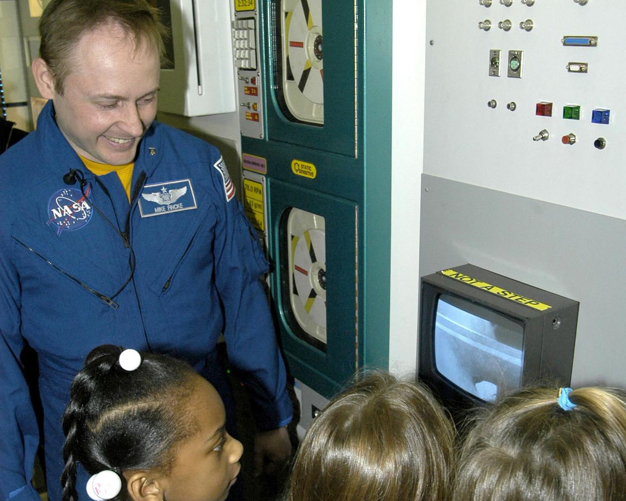
NASA Astronaut Mike Fincke talks with students about his six-month stay aboard the International Space Station during a visit to StenniSphere, the visitor center at NASA's Stennis Space Center.
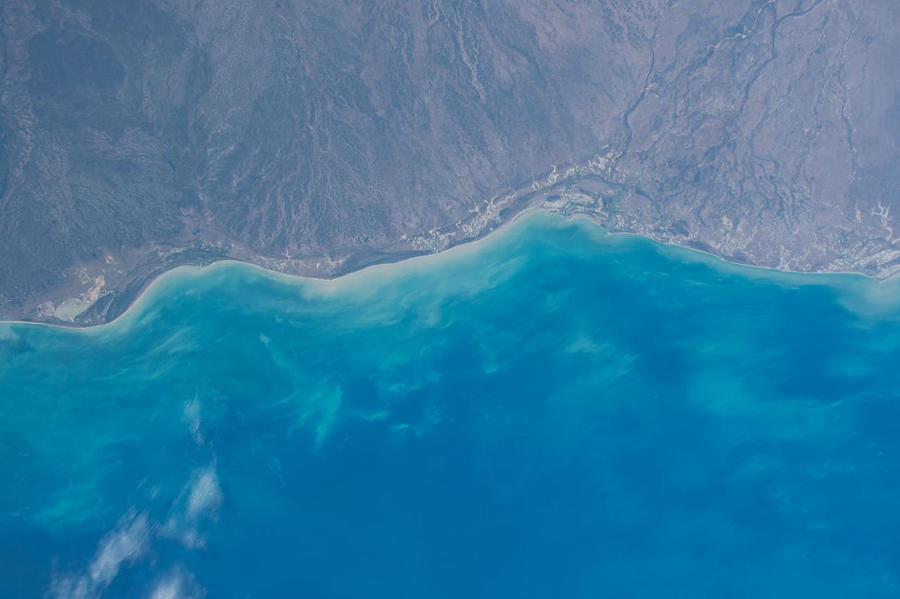
ISS043E256340 (05/26/2015) --- The Crew of Expedition 43 on board the International Space Station took this Earth observation image of Australia that captures the imagination with its brilliant blues and rugged cliffs along the waters edge. The view is of northern Australia, along the eastern Gulf of Carpentaria in Queensland.
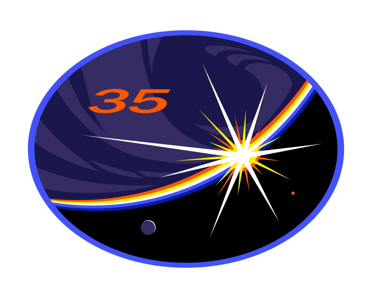
ISS035-S-001 (April 2011) --- Emblazoned with a bold 35 for the 35th expedition to the International Space Station (ISS), this patch portrays a natural moonlit view of the Earth from the ISS at the moment of sunrise, one of the sixteen that occur each day at orbital velocity, with glowing bands of Earth's atmosphere dispersing the sun's bright light into primary colors. The Earth is depicted as it often appears from space, without recognizable coastlines or boundaries - just as the international endeavor of living and working together in space blurs technical and cultural boundaries between nations. The ISS is the unseen central figure of the image, since the view is from a window of the Space Station itself, commemorating full use of the Space Station as a long-duration dwelling from which humans can develop techniques and technologies to further explore. The crew points out, ?The arc of the Earth?s horizon with the sun?s arrows of light imply a bow shooting the imagination to Mars and the cosmos where our species may one day thrive.? The NASA insignia design for shuttle and space station flights is reserved for use by the astronauts and for other official use as the NASA Administrator may authorize. Public availability has been approved only in the form of illustrations by the various news media. When and if there is any change in this policy, which is not anticipated, it will be publicly announced.
ISS038-E-047389 (14 Feb. 2014) --- This panoramic image, which shows parts of Chile and Argentina, and which was exposed with an 80mm lens from the International Space Station (ISS), captures Tierra del Fuego and Cape Horn. Represented here is the southernmost tip of South America (left), with the Atlantic Ocean in the foreground and the Pacific Ocean across the top of the image. Crews on the orbital outpost seldom see Cape Horn in such clear weather. Shortly after this image was taken, the cloud mass approaching from the Pacific Ocean completely obscured the landscape from the station’s view. In this stormy part of the world, ships avoid the heavy seas around exposed Cape Horn and use the protected Strait of Magellan (lower right) on the inshore end of Tierra del Fuego. A small white ice field on the highest parts of Tierra del Fuego (center right) includes Mount Darwin, situated within Chile’s Agostini National Park. The ice field can be imagined as greatly expanded during the geologically recent ice ages, covering an area greater than the land area shown in this view. The heavily indented shape of the fiord coastline and the lake depressions (center and lower right) were carved by the downhill movement of these vanished glaciers, according to NASA scientists.
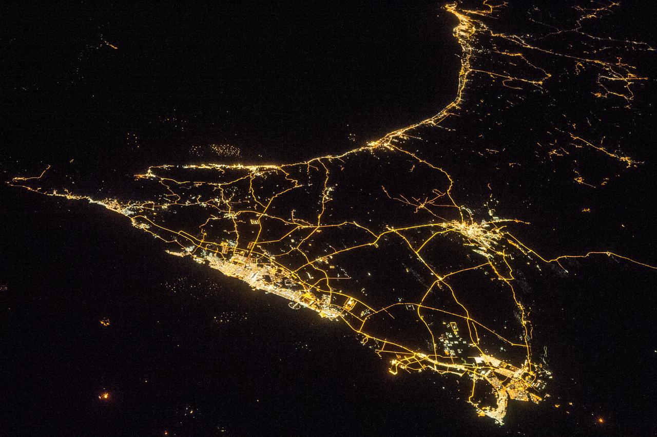
ISS038-E-016335 (11 Dec. 2013) --- A nighttime view of the United Arab Emirates is featured in this image photographed by an Expedition 38 crew member on the International Space Station. Geographers like night images of cities because you see immediately so much about the human landscape--things that are difficult or impossible to see in day images. You see where the cities are located and their shape; the brightest light clusters frequently indicate the city centers. In large field of view images, such as this photograph of the United Arab Emirates (UAE), you can also see cities' position relative to one another and their relative size. Here the largest cluster of lights is the conurbation ("joined cities") of Dubai-Sharjah-Ajman (population 3.25 million), with its smaller neighbor Dubai (population 2.1 million). These cities front onto the Persian Gulf (also known as the Arabian Gulf) where the city lights are cut off abruptly at the coastline. The bright city centers are located at the coast showing that sea trade is important (and has been important) in the growth of these cities. Smaller cities are Al Ain (population 518,000), the fourth largest city in the UAE, and Fujairah (population 152,000). Major highways join the cities in a brightly lit network, and a faint peppering of lights offshore shows the relatively young oil and gas platforms on either side of the Musandam Peninsula (left). Despite being taken at night, the spike of the Musandam Peninsula is easy to imagine at the south end of the Persian Gulf. The biggest cities in the UAE are Abu Dhabi and Dubai. Muscat, the capital city of the neighboring country of Oman, appears top center. By contrast, the almost unpopulated Musandam Peninsula shows very few lights.