Springtime for Dunes
Springtime Dunes, 2004
Springtime on the Martian South Polar Cap
Springtime North Polar Dust Storms

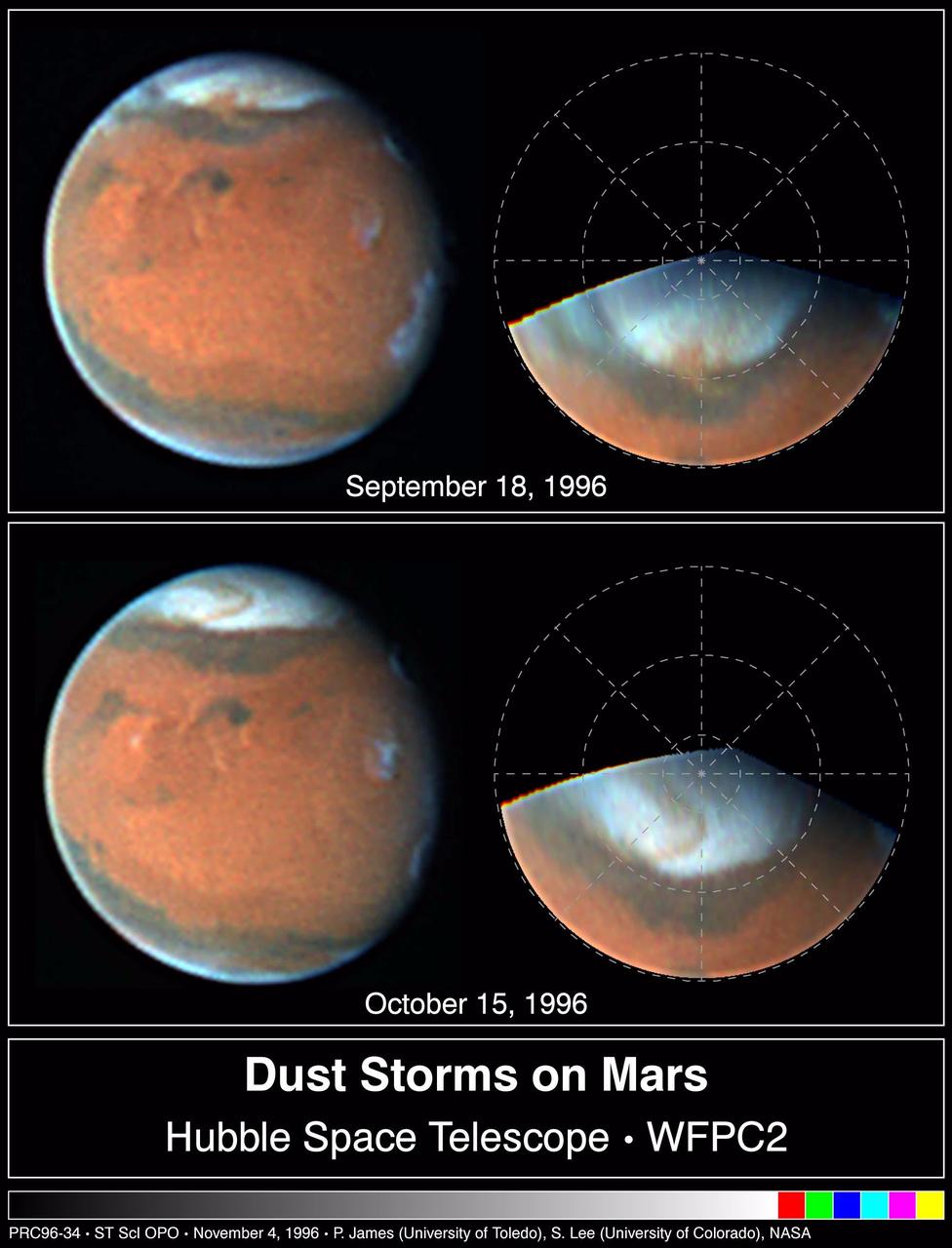
Springtime on Mars: Hubble Best View of the Red Planet
Springtime Dust Storm Swirls at Martian North Pole
Seeing Mars Northern Plains Through Springtime Haze
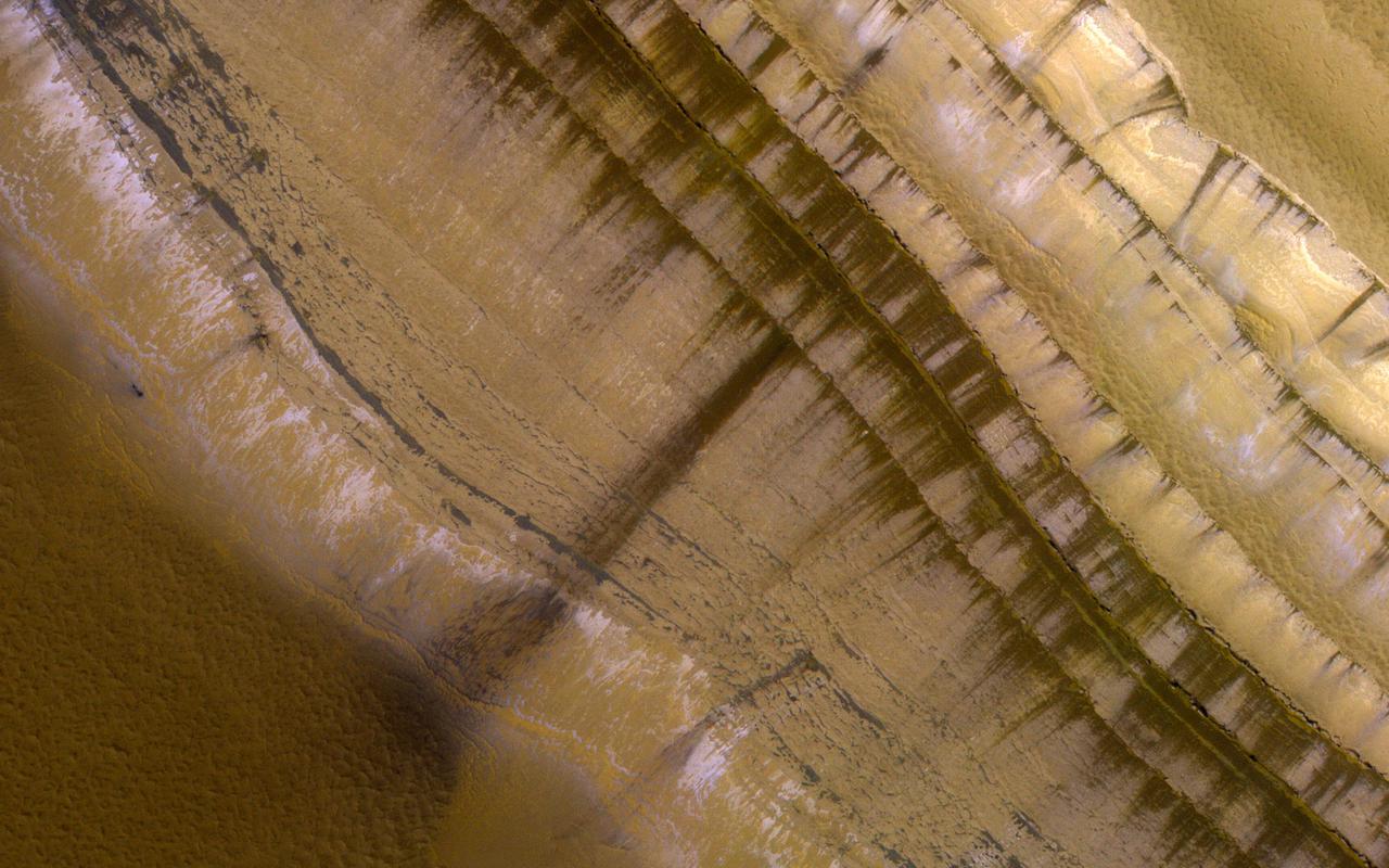
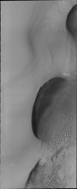
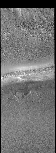
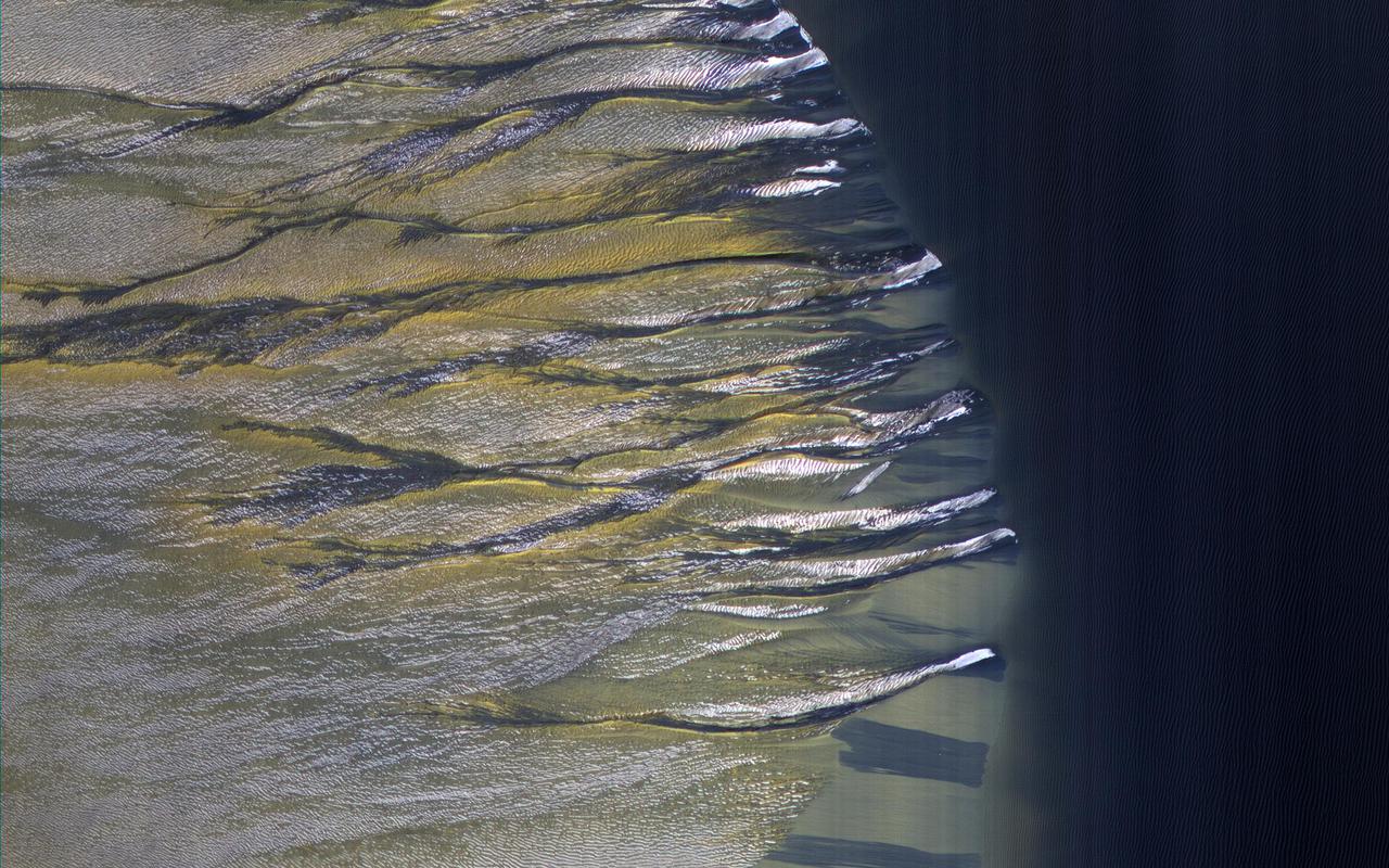
This image shows the very steep outer scarp of the north polar layered deposits. Every year there is a lot of slope activity in the springtime when sunlight warms these slopes. In this image we can see many dark streaks extending down the slope, but no sign yet of larger avalanches that were common in past years. https://photojournal.jpl.nasa.gov/catalog/PIA24695
This image of a crater rim strikingly shows what appear to be bright white flows coming from gullies in the crater wall. However, HiRISE has been watching these gullies for some time (going all the way back to our first observation in 2012) and the flow features have been there for years. The new aspect is the bright white coloration, which is frost. This is the earliest in the springtime that this area has been observed, and just like some winter mornings here on Earth, the conditions on Mars can be just right for frost to form. The interesting thing is that the frost appears on the gully deposits and not as much on the surrounding rock, indicating the physical properties of the gully deposits are different. https://photojournal.jpl.nasa.gov/catalog/PIA23451
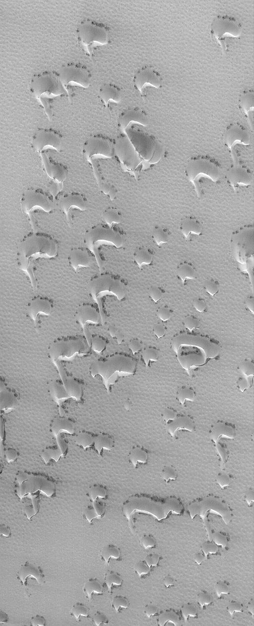
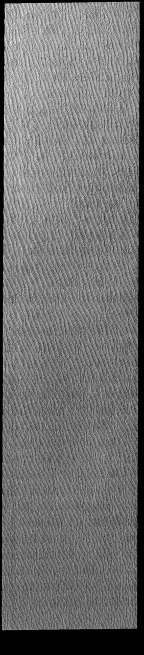
Dunes are common at both poles of Mars. These northern pole dunes are still covered in frost, as it is early springtime when this image was acquired by NASA 2001 Mars Odyssey.
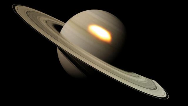
This image from an animation shows beacons of hot air seen in the infrared that appeared during a great springtime storm on Saturn from January 2011 to March 2012.
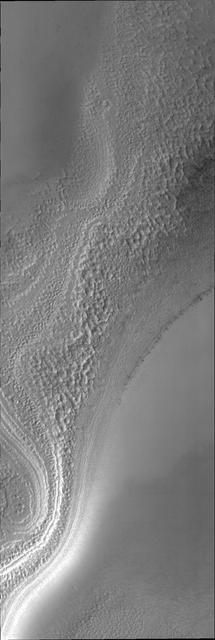
This image from NASA Mars Reconnaissance Orbiter shows a lacy network of many fine channels associated with jets in the subliming carbon dioxide of the springtime.
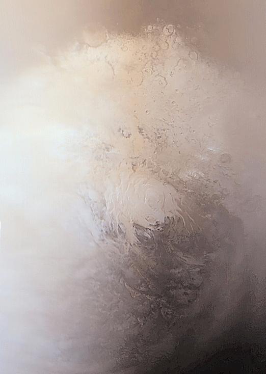
It is early springtime in the southern hemisphere of Mars in this image from NASA Mars Odyssey. The south polar cap is now illuminated by the sun and the surface can be studied as it changes with the passage of spring.
This image from NASA 2001 Mars Odyssey spacecraft shows dunes near the north polar cap of Mars. It is springtime at the north pole and the dunes are starting to lose their frost cover.
Stages in the seasonal disappearance of surface ice from the ground around the Phoenix Mars Lander are visible in these images taken by NASA Mars Reconnaissance Rover on 2-8-2010 and 2-25-2010, during springtime on northern Mars.
This image from NASA 2001 Mars Odyssey spacecraft shows sand dunes located near the north polar cap. It is springtime and the dunes will darken with time as the winter frost sublimates in the sun.
This MOC image shows dunes in the north polar region of Mars. In this springtime view, the dunes are largely covered by frozen carbon dioxide that was deposited during the winter months in the northern hemisphere

This MOC image shows part of a dune field in Chasma Boreale, the large north polar trough. The bright material covering the dunes is frozen carbon dioxide
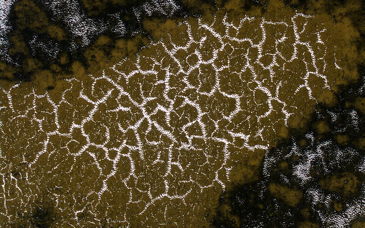
This image shows a field of sand dunes in the Martian springtime while the seasonal carbon dioxide frost is sublimating into the air. This sublimation process is not at all uniform, instead creating a pattern of dark spots. In addition, the inter-dune areas are also striking, with bright frost persisting in the troughs of polygons. Our enhanced-color cutout is centered on a brownish-colored inter-dune area. https://photojournal.jpl.nasa.gov/catalog/PIA26330
The sun has risen over the south pole in this springtime VIS image. At the center of the image is a trough that reveals the layered nature of the polar cap ice. Orbit Number: 81700 Latitude: -85.4398 Longitude: 309.383 Instrument: VIS Captured: 2020-05-15 11:24 https://photojournal.jpl.nasa.gov/catalog/PIA24003
The THEMIS VIS camera contains 5 filters. The data from different filters can be combined in multiple ways to create a false color image. This image from NASA 2001 Mars Odyssey spacecraft shows the surface of the south polar cap during springtime. Orbit Number: 7298 Latitude: -82.1416 Longitude: 128.053 Instrument: VIS Captured: 2003-08-07 07:32 http://photojournal.jpl.nasa.gov/catalog/PIA19461

S98-09507 (6-24-98) --- Attired in a training version of the shuttle partial pressure launch and entry suit, astronaut Steven A. Hawley participates in a water survival/emergency egress training exercise in the Neutral Buoyancy Laboratory (NBL) at the Johnson Space Center's Sonny Carter Training Center. The mission specialist will join four other astronauts for a springtime 1999 mission in Earth orbit aboard the Space Shuttle Columbia.
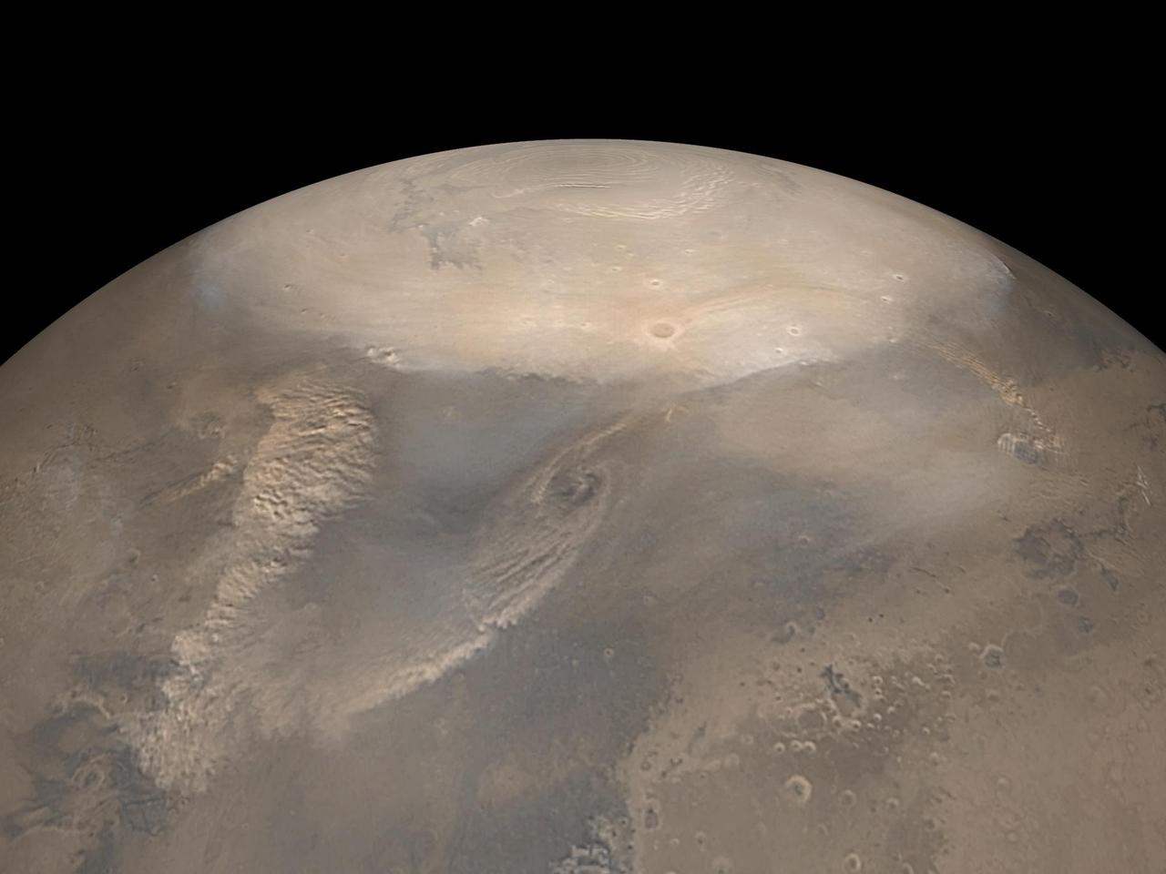
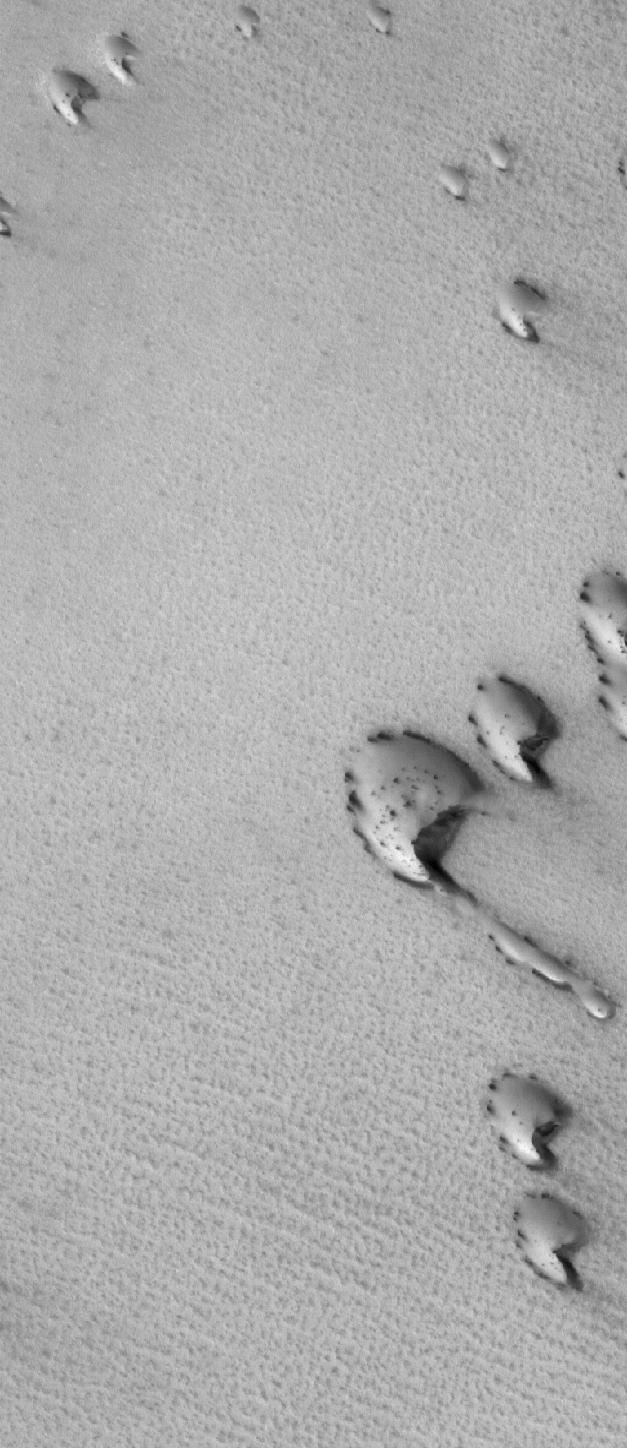
Springtime in the South Polar region of Mars is a season of exciting activity. The thick coating of carbon dioxide ice that accumulated over the winter begins to sublimate (turn to vapor) as the sun rises higher in the sky and warms the ice. Sunlight penetrates through the transparent ice, and is absorbed at the base of the ice layer. The gas that forms as a result of the warming escapes through weaknesses in the ice and erupts in the form of magnificent geysers of gas and dust. This image captures some of this activity in a region near 85 degrees south latitude that is being monitored by HiRISE. What makes this image interesting is the changing directions of the fans left behind by the geysers, indicating that the winds blew from different directions at the time that the geysers erupted. Winds from the southwest produced the dark fans at both ends of the image, whereas northwesterly winds dominated dust deposition in between. Local topography probably played a role in altering the wind direction; this shaded relief image shows that this image traverses a trough in the South Polar layered deposits, which may have funneled winds down slope along the length of the trough. https://photojournal.jpl.nasa.gov/catalog/PIA22881
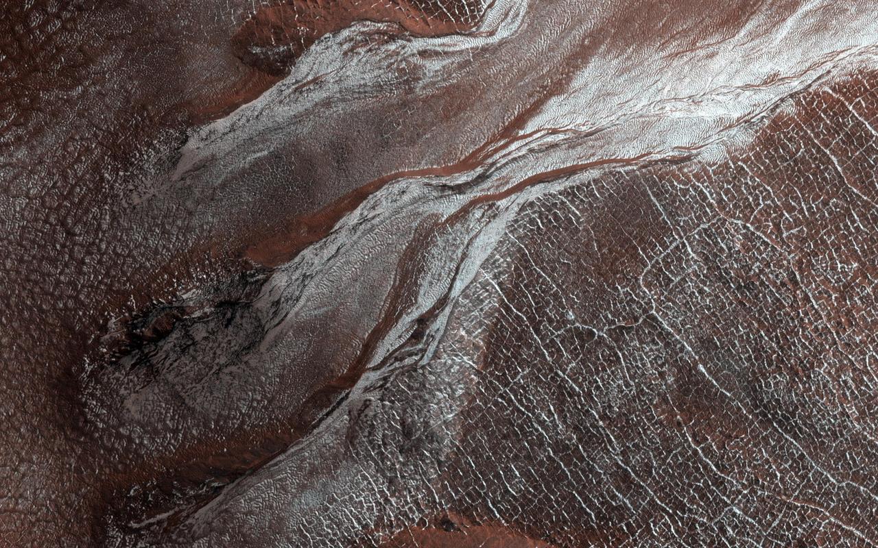
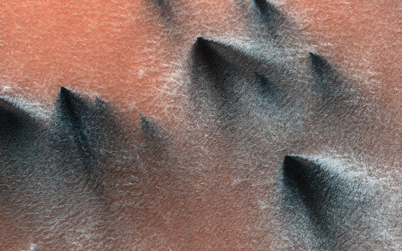
The dark sand dune at the center of this observation is covered in a blanket of white seasonal ice in the winter. In this Martian springtime image, the western slope of the dune is partly defrosted. Bright patches of frost (white in enhanced color) are clearly visible and are made up of water and carbon dioxide ices. Dark streaks of sand have flowed down the dune's slope that sometimes covers the frost. These flows are caused by the rapid transformation of the frost from ice to gas as the sun heats the dune in the spring. We can also see how these flows are diverted by the ripples on the dune. (The width of the cutout is around 520 meters.) https://photojournal.jpl.nasa.gov/catalog/PIA25188
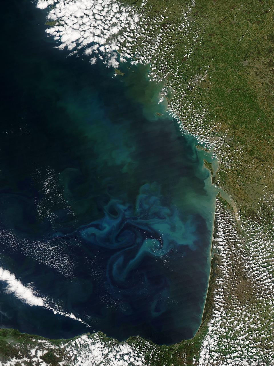
Springtime in the Bay of Biscay, off the coast of France, as in most places, is a season of abundant growth. On April 20, 2013, the Moderate Resolution Imaging Spectroradiometer (MODIS) aboard NASA’s Aqua satellite captured this true-color image of the dynamic growth of a springtime phytoplankton bloom. The swirling colors indicate the presence of vast numbers of phytoplankton – tiny plant-like microorganisms that live in both fresh and salt water. Although these organisms live year-round in the Bay of Biscay, it is only when conditions are right that explosive blooms occur. In spring, the lengthening sunlight, the increased nutrient load swept into the Bay from ocean currents and from snowmelt carried by freshwater rivers, combined with warming waters create the perfect conditions to spur phytoplankton in to tremendous growth. The result is a swirling, multi-hued discoloration that can be easily seen from space. Each year, typically from March through April, such blooms occur in the Bay of Biscay. By May, however, conditions are not as favorable and the blooms fade, then disappear. Credit: NASA/GSFC/Jeff Schmaltz/MODIS Land Rapid Response Team <b><a href="http://www.nasa.gov/audience/formedia/features/MP_Photo_Guidelines.html" rel="nofollow">NASA image use policy.</a></b> <b><a href="http://www.nasa.gov/centers/goddard/home/index.html" rel="nofollow">NASA Goddard Space Flight Center</a></b> enables NASA’s mission through four scientific endeavors: Earth Science, Heliophysics, Solar System Exploration, and Astrophysics. Goddard plays a leading role in NASA’s accomplishments by contributing compelling scientific knowledge to advance the Agency’s mission. <b>Follow us on <a href="http://twitter.com/NASA_GoddardPix" rel="nofollow">Twitter</a></b> <b>Like us on <a href="http://www.facebook.com/pages/Greenbelt-MD/NASA-Goddard/395013845897?ref=tsd" rel="nofollow">Facebook</a></b> <b>Find us on <a href="http://instagram.com/nasagoddard?vm=grid" rel="nofollow">Instagram</a></b>
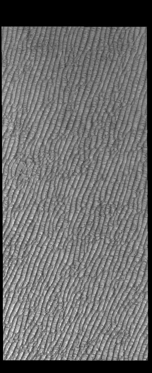
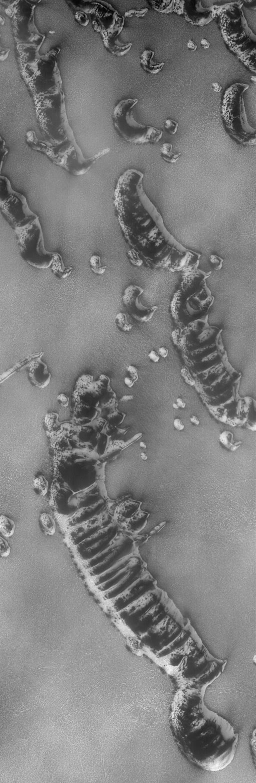
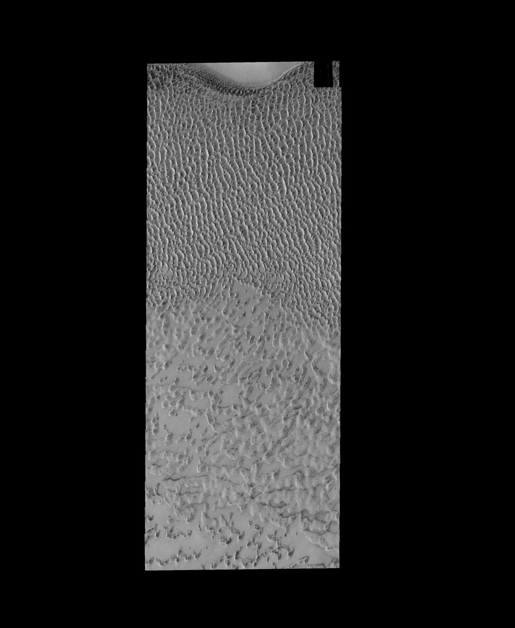
This VIS image of Olympia Undae was collected at the beginning of north polar spring. As the season changes into springtime, the dune crests still show most of the winter frosts completely covering the darker sand beneath. The density of dunes and the alignments of the dune crests varies with location, controlled by the amount of available sand and the predominant winds over time. Olympia Undae is a vast dune field in the north polar region of Mars. It consists of a broad sand sea or erg that partly rings the north polar cap from about 120° to 240°E longitude and 78° to 83°N latitude. The dune field covers an area of approximately 470,000 km2 (bigger than California, smaller than Texas). Olympia Undae is the largest continuous dune field on Mars. Olympia Undae is not the only dune field near the north polar cap, several other smaller fields exist in the same latitude, but in other ranges of longitude, e.g. Abolos and Siton Undae. Barchan and transverse dune forms are the most common. In regions with limited available sand individual barchan dunes will form, the surface beneath and between the dunes is visible. In regions with large sand supplies, the sand sheet covers the underlying surface, and dune forms are found modifying the surface of the sand sheet. In this case transverse dunes are more common. Barchan dunes "point" down wind, transverse dunes are more linear and form parallel to the wind direction. The "square" shaped transverse dunes in Olympia Undae are due to two prevailing wind directions. Orbit Number: 85881 Latitude: 81.5324 Longitude: 216.986 Instrument: VIS Captured: 2021-04-24 18:26 https://photojournal.jpl.nasa.gov/catalog/PIA24882
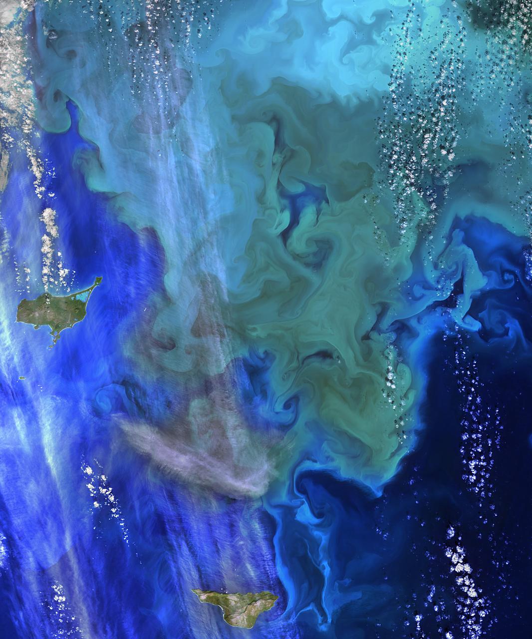
The Operational Land Imager (OLI) on Landsat 8 captured this view of a phytoplankton bloom near Alaska’s Pribilof Islands on Sept. 22, 2014. The Pribilofs are surrounded by nutrient-rich waters in the Bering Sea. The milky green and light blue shading of the water indicates the presence of vast populations of microscopic phytoplankton—mostly coccolithophores, which have calcite scales that appear white in satellite images. Such phytoplankton form the foundation of a tremendously productive habitat for fish and birds. Blooms in the Bering Sea increase significantly in springtime, after winter ice cover retreats and nutrients and freshened water are abundant near the ocean surface. Phytoplankton populations plummet in summertime as the water warms, surface nutrients are depleted by blooms, and the plant-like organisms are depleted by grazing fish, zooplankton, and other marine life. By autumn, storms can stir nutrients back to the surface and cooler waters make better bloom conditions. More information: <a href="http://earthobservatory.nasa.gov/IOTD/view.php?id=85043&eocn=home&eoci=iotd_readmore" rel="nofollow">earthobservatory.nasa.gov/IOTD/view.php?id=85043&eocn...</a> Image Credit: NASA/Landsat 8 <b><a href="http://www.nasa.gov/audience/formedia/features/MP_Photo_Guidelines.html" rel="nofollow">NASA image use policy.</a></b> <b><a href="http://www.nasa.gov/centers/goddard/home/index.html" rel="nofollow">NASA Goddard Space Flight Center</a></b> enables NASA’s mission through four scientific endeavors: Earth Science, Heliophysics, Solar System Exploration, and Astrophysics. Goddard plays a leading role in NASA’s accomplishments by contributing compelling scientific knowledge to advance the Agency’s mission. <b>Follow us on <a href="http://twitter.com/NASAGoddardPix" rel="nofollow">Twitter</a></b> <b>Like us on <a href="http://www.facebook.com/pages/Greenbelt-MD/NASA-Goddard/395013845897?ref=tsd" rel="nofollow">Facebook</a></b> <b>Find us on <a href="http://instagram.com/nasagoddard?vm=grid" rel="nofollow">Instagram</a></b>
This VIS image of Olympia Undae was collected at the start polar spring. As the season changes into springtime, the dune crests are just starting to shed the winter frosts which completely hide the darker sand beneath. The density of dunes and the alignments of the dune crests varies with location, controlled by the amount of available sand and the predominant winds over time. Olympia Undae is a vast dune field in the north polar region of Mars. It consists of a broad sand sea or erg that partly rings the north polar cap from about 120° to 240°E longitude and 78° to 83°N latitude. The dune field covers an area of approximately 470,000 km2 (bigger than California, smaller than Texas). Olympia Undae is the largest continuous dune field on Mars. Olympia Undae is not the only dune field near the north polar cap, several other smaller fields exist in the same latitude, but in other ranges of longitude, e.g. Abolos and Siton Undae. Barchan and transverse dune forms are the most common. In regions with limited available sand individual barchan dunes will form, the surface beneath and between the dunes is visible. In regions with large sand supplies, the sand sheet covers the underlying surface, and dune forms are found modifying the surface of the sand sheet. In this case transverse dunes are more common. Barchan dunes "point" down wind, transverse dunes are more linear and form parallel to the wind direction. The "square" shaped transverse dunes in Olympia Undae are due to two prevailing wind directions. Orbit Number: 85826 Latitude: 80.894 Longitude: 222.032 Instrument: VIS Captured: 2021-04-20 05:51 https://photojournal.jpl.nasa.gov/catalog/PIA24878
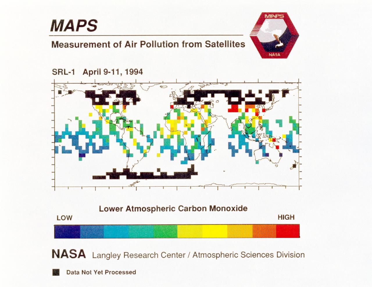
STS059-S-040 (12 April 1994) --- STS-59's MAPS (Measurement of Air Pollution from Satellites) experiment is sending real-time data that provides the most comprehensive view of carbon monoxide concentrations on Earth ever recorded. This computer image shows a summary of "quick look" data obtained by the MAPS instrument during its first days of operations as part of the Space Shuttle Endeavour's SRL-1 payload. This data will be processed using more sophisticated techniques following the flight. The color red indicates areas with the highest levels of carbon monoxide. These Northern Hemisphere springtime carbon monoxide values are generally significantly higher than the values found in the Southern Hemisphere. This is in direct contrast to the data obtained by the MAPS experiment during November 1981 and October 1984, i.e. during Northern Hemisphere fall. The astronauts aboard Endeavour have seen fires in most of the areas showing higher carbon monoxide values (China, Eastern Australia, and equatorial Africa). The relationship between the observed fires and the higher carbon monoxide values will be investigated following SRL-1 by combining the MAPS data with meteorological data, surface imagery, and Space Shuttle hand-held photographs. By the end of SRL-1, MAPS will have acquired data over most of the globe between 57 degrees north and 57 degrees south latitudes. The entire data set will be carefully analyzed using sophisticated post-flight data processing techniques. The data will then be applied in a variety of scientific studies concerning chemistry and transport processes in the atmosphere. The MAPS experiment measures the carbon monoxide in the lower atmosphere. This gas is produced both as a result of natural processes and as a result of human activities. The primary human resources of carbon monoxide are automobiles and industry and the burning of plant materials. The primary natural source is the interaction of sunlight with naturally occurring ozone and water vapor. The strength of all of these sources changes seasonally.

Aerial view cityscape from airplane at summer