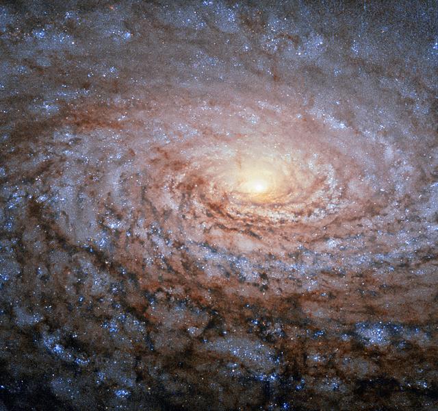
The arrangement of the spiral arms in the galaxy Messier 63, seen here in an image from the NASA/ESA Hubble Space Telescope, recall the pattern at the center of a sunflower. So the nickname for this cosmic object — the Sunflower Galaxy — is no coincidence. Discovered by Pierre Mechain in 1779, the galaxy later made it as the 63rd entry into fellow French astronomer Charles Messier’s famous catalogue, published in 1781. The two astronomers spotted the Sunflower Galaxy’s glow in the small, northern constellation Canes Venatici (the Hunting Dogs). We now know this galaxy is about 27 million light-years away and belongs to the M51 Group — a group of galaxies, named after its brightest member, Messier 51, another spiral-shaped galaxy dubbed the Whirlpool Galaxy. Galactic arms, sunflowers and whirlpools are only a few examples of nature’s apparent preference for spirals. For galaxies like Messier 63 the winding arms shine bright because of the presence of recently formed, blue–white giant stars and clusters, readily seen in this Hubble image. Image credit: ESA/Hubble & NASA <b><a href="http://www.nasa.gov/audience/formedia/features/MP_Photo_Guidelines.html" rel="nofollow">NASA image use policy.</a></b> <b><a href="http://www.nasa.gov/centers/goddard/home/index.html" rel="nofollow">NASA Goddard Space Flight Center</a></b> enables NASA’s mission through four scientific endeavors: Earth Science, Heliophysics, Solar System Exploration, and Astrophysics. Goddard plays a leading role in NASA’s accomplishments by contributing compelling scientific knowledge to advance the Agency’s mission. <b>Follow us on <a href="http://twitter.com/NASAGoddardPix" rel="nofollow">Twitter</a></b> <b>Like us on <a href="http://www.facebook.com/pages/Greenbelt-MD/NASA-Goddard/395013845897?ref=tsd" rel="nofollow">Facebook</a></b> <b>Find us on <a href="http://instagrid.me/nasagoddard/?vm=grid" rel="nofollow">Instagram</a></b>
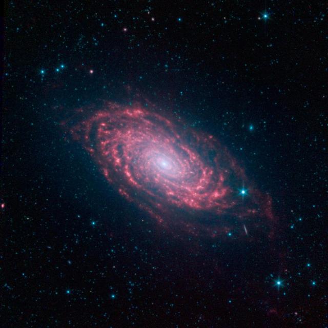
This view of the Sunflower galaxy highlights a variety of infrared wavelengths captured by NASA Spitzer Space Telescope.

The arrangement of the spiral arms in the galaxy Messier 63, seen here in a new image from the NASA/ESA Hubble Space Telescope, recall the pattern at the centre of a sunflower. So the nickname for this cosmic object — the Sunflower Galaxy — is no coincidence. Discovered by Pierre Mechain in 1779, the galaxy later made it as the 63rd entry into fellow French astronomer Charles Messier’s famous catalogue, published in 1781. The two astronomers spotted the Sunflower Galaxy’s glow in the small, northern constellation Canes Venatici (the Hunting Dogs). We now know this galaxy is about 27 million light-years away and belongs to the M51 Group — a group of galaxies, named after its brightest member, Messier 51, another spiral-shaped galaxy dubbed the Whirlpool Galaxy. Galactic arms, sunflowers and whirlpools are only a few examples of nature’s apparent preference for spirals. For galaxies like Messier 63 the winding arms shine bright because of the presence of recently formed, blue–white giant stars, readily seen in this Hubble image.
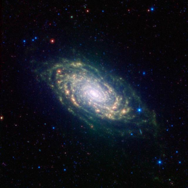
This image from NASA Spitzer Space Telescope shows infrared light from the Sunflower galaxy, otherwise known as Messier 63. Spitzer view highlights the galaxy dusty spiral arms.
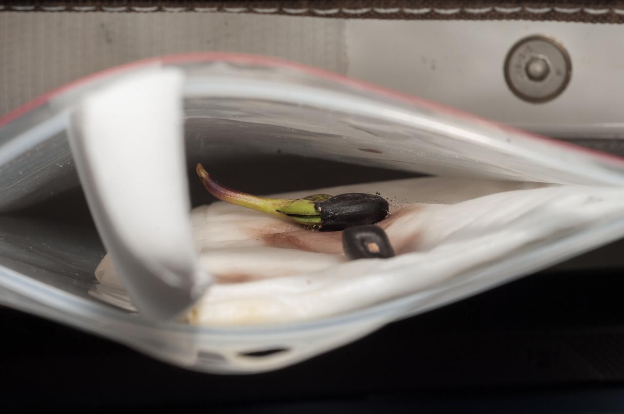
ISS037-E-026274 (4 Nov. 2013) --- A two-day old sunflower sprout is being closely monitored in its temporary home inside a plastic bag by the Expedition 37 crew members onboard the Earth-orbiting International Space Station.
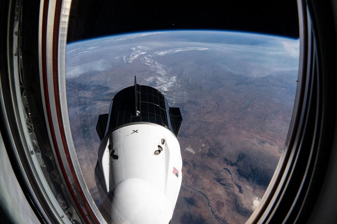
iss072e031305 (Oct. 7, 2024) --- The SpaceX Dragon Freedom spacecraft is pictured from a window on the Dragon Endeavour spacecraft in a photograph taken by NASA astronaut and Expedition 72 Flght Engineer Nick Hague. 258 miles below the International Space Station is the Sunflower State of Kansas.
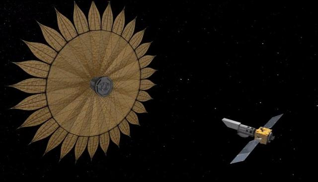
This artist's rendering shows the proposed starshade flying in sync with a space telescope. The giant sunflower-like structure would be used to acquire images of Earth-like rocky planets around nearby stars. The proposed starshade could launch together with a telescope. Once in space, it would separate from the rocket and telescope, unfurl its petals, then move into position to block the light of stars. http://photojournal.jpl.nasa.gov/catalog/PIA20910
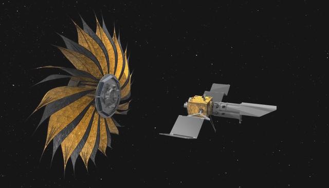
How do we find Earth-like planets outside our solar system? One idea is to send a giant structure that blocks starlight so that astronomers can more easily detect orbiting planets. This artist's rendering shows the proposed starshade concept flying in sync with a space telescope. The giant sunflower-like structure would be used to acquire images of Earth-like rocky planets around nearby stars. The proposed starshade could launch together with a telescope. Once in space, it would separate from the rocket and telescope, unfurl its petals, then move into position to block the light of stars. http://photojournal.jpl.nasa.gov/catalog/PIA20911

A close-up view of a wildflower called Helianthus debilis (Dune sunflower) in a field at NASA’s Kennedy Space Center in Florida on June 13, 2023. The center shares a boundary with the Merritt Island National Wildlife Refuge. Along with wildflowers, Kennedy and the wildlife refuge are home to more than 300 native and migratory bird species, 65 amphibian and reptile species, and more than 1,000 different types of plants.

iss073e0509720 (Aug. 18, 2025) --- Great Bend, Kansas, primarily an agricultural town and located at the point where the Arkansas River course shifts, is pictured from the International Space Station as it orbited 261 miles above the Sunflower State. The triangular Great Bend Municipal Airport, once used as a base for the B-29 Superfortress during WWII and now used for general aviation, can also be seen.
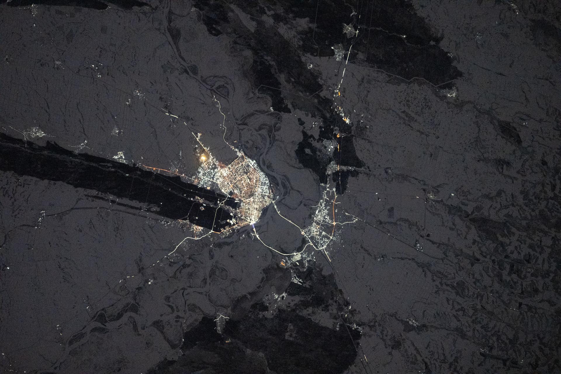
iss074e0044122 (Jan. 3, 2026) --- The city lights of Barnaul in Siberia, Russia, contrast with the extreme winter landscape. The darkened strip of land jutting out from the center of the city is part of the Ob River floodplain and terrace system, which is ideal for farming crops like wheat, barley, and sunflowers. The International Space Station was orbiting 265 miles above Earth at approximately 1:20 a.m. local time when this photograph was taken. Credit: JAXA/Kimiya Yui
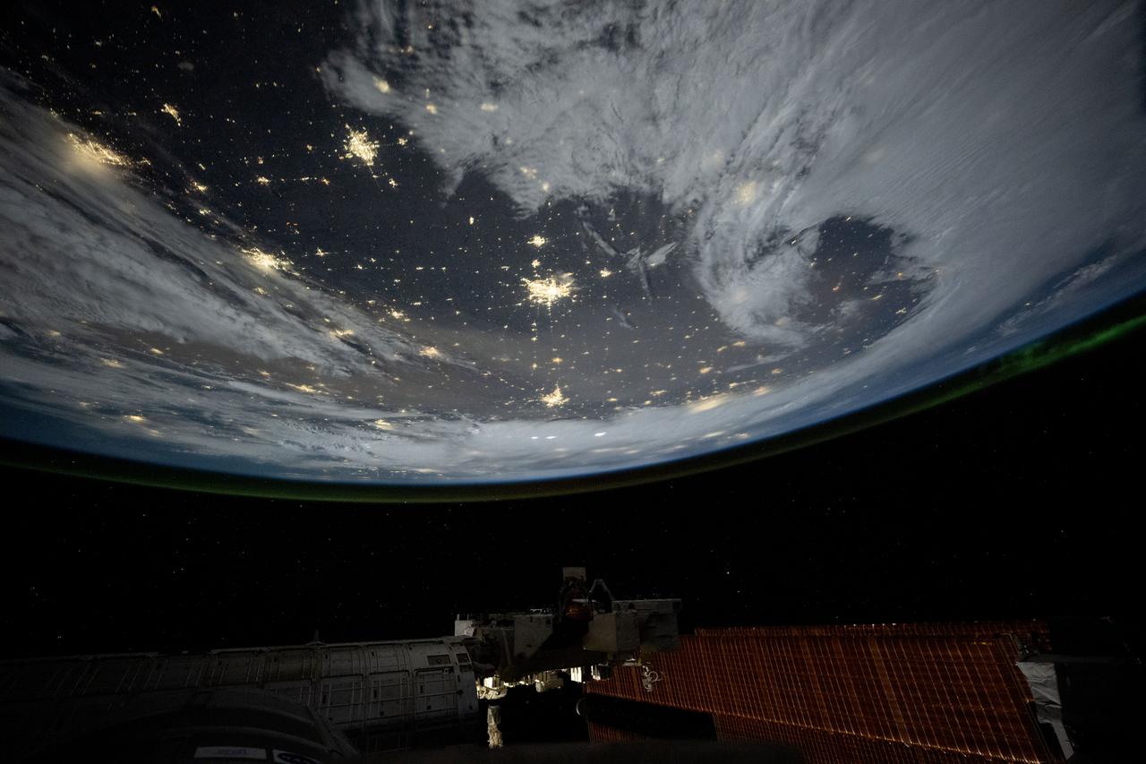
iss072e842757 (March 15, 2025) --- City lights dot the cloudy, midwestern landscape of the United States with a wispy aurora above Earth's horizon in this photograph from the International Space Station as it orbited 261 miles above the Sunflower State of Kansas. In the bottom foreground, is the Kibo laboratory module's Exposed Facility, an external research platform, and the orbital outpost's main solar arrays.
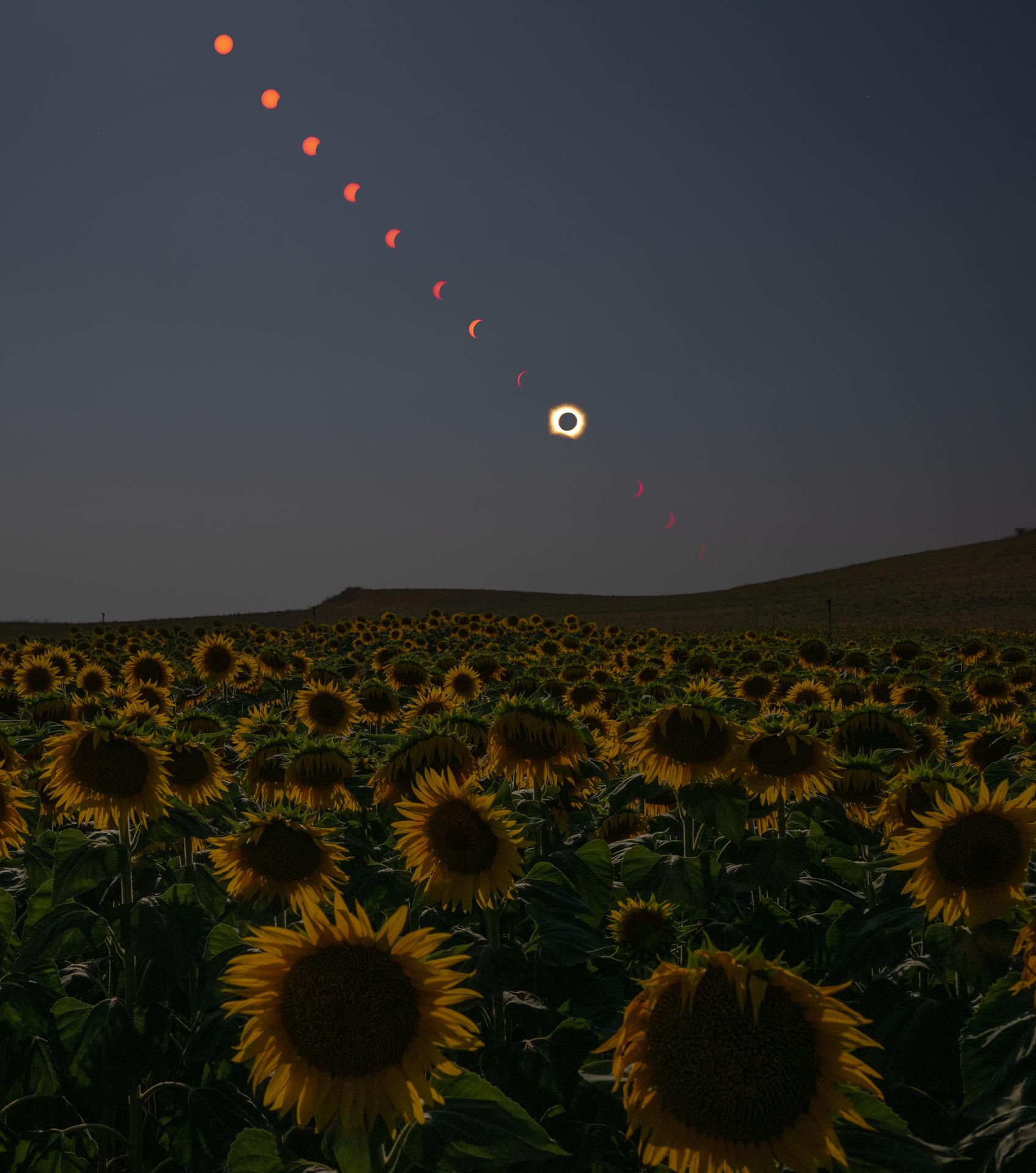
This composite image shows the progression of a total solar eclipse over San Millán de los Caballeros, Spain on, Wednesday, Aug. 12, 2026. A total solar eclipse swept across parts of Greenland, Iceland, northern Russia, the Atlantic Ocean, Spain, and a small corner of Portugal. A partial eclipse was visible in parts of the U.S., most of Canada, much of Europe, and northwest Africa. Photo Credit: (NASA/Bill Ingalls)
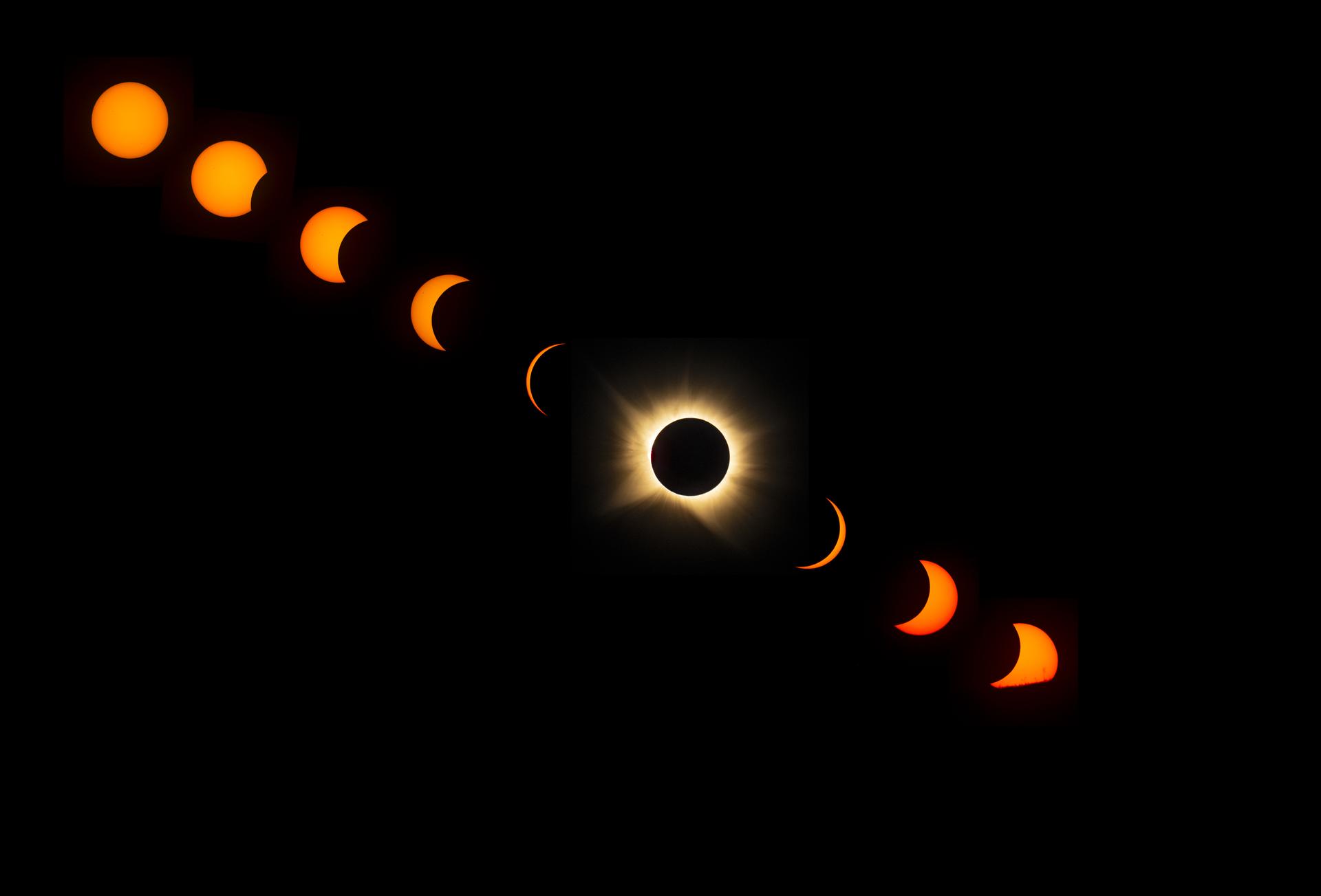
This composite image shows the progression of a total solar eclipse as the Sun sets from San Millán de los Caballeros, Spain on, Wednesday, Aug. 12, 2026. A total solar eclipse swept across parts of Greenland, Iceland, northern Russia, the Atlantic Ocean, Spain, and a small corner of Portugal. A partial eclipse was visible in parts of the U.S., most of Canada, much of Europe, and northwest Africa. Photo Credit: (NASA/Bill Ingalls)
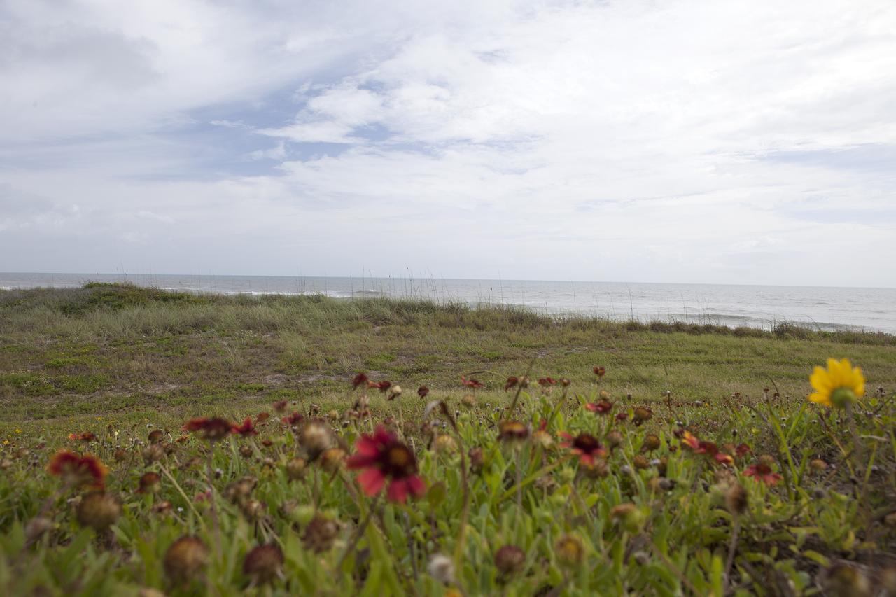
CAPE CANAVERAL, Fla. -- At the Kennedy Space Center in Florida, the sand dunes along a 1.2 mile stretch of shoreline near Launch Pads 39A and B were restored during a six-month effort using 90,000 cubic yards of sand. To help prevent erosion, 180,000 shrubs, including grasses, sunflowers, vines, sea grapes and palmettos were planted. Constant pounding from tropical storms, such as Hurricane Sandy in October of 2012, other weather systems and higher than usual tides, destroyed sand dunes protecting infrastructure at the spaceport. Photo credit: NASA/Dan Casper
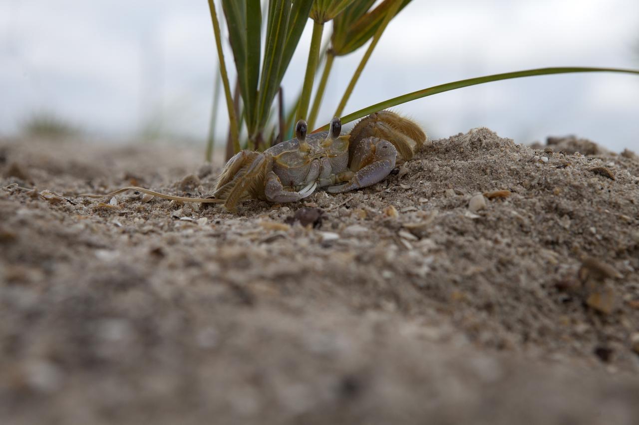
CAPE CANAVERAL, Fla. -- At the Kennedy Space Center in Florida, a small crab sits atop a restored sand dune along a 1.2 mile stretch of shoreline near Launch Pads 39A and B. As part of a six-month effort to help prevent further erosion, 180,000 shrubs, including grasses, sunflowers, vines, sea grapes and palmettos were planted. Constant pounding from tropical storms, such as Hurricane Sandy in October of 2012, other weather systems and higher than usual tides, destroyed sand dunes protecting infrastructure at the spaceport. Photo credit: NASA/Dan Casper
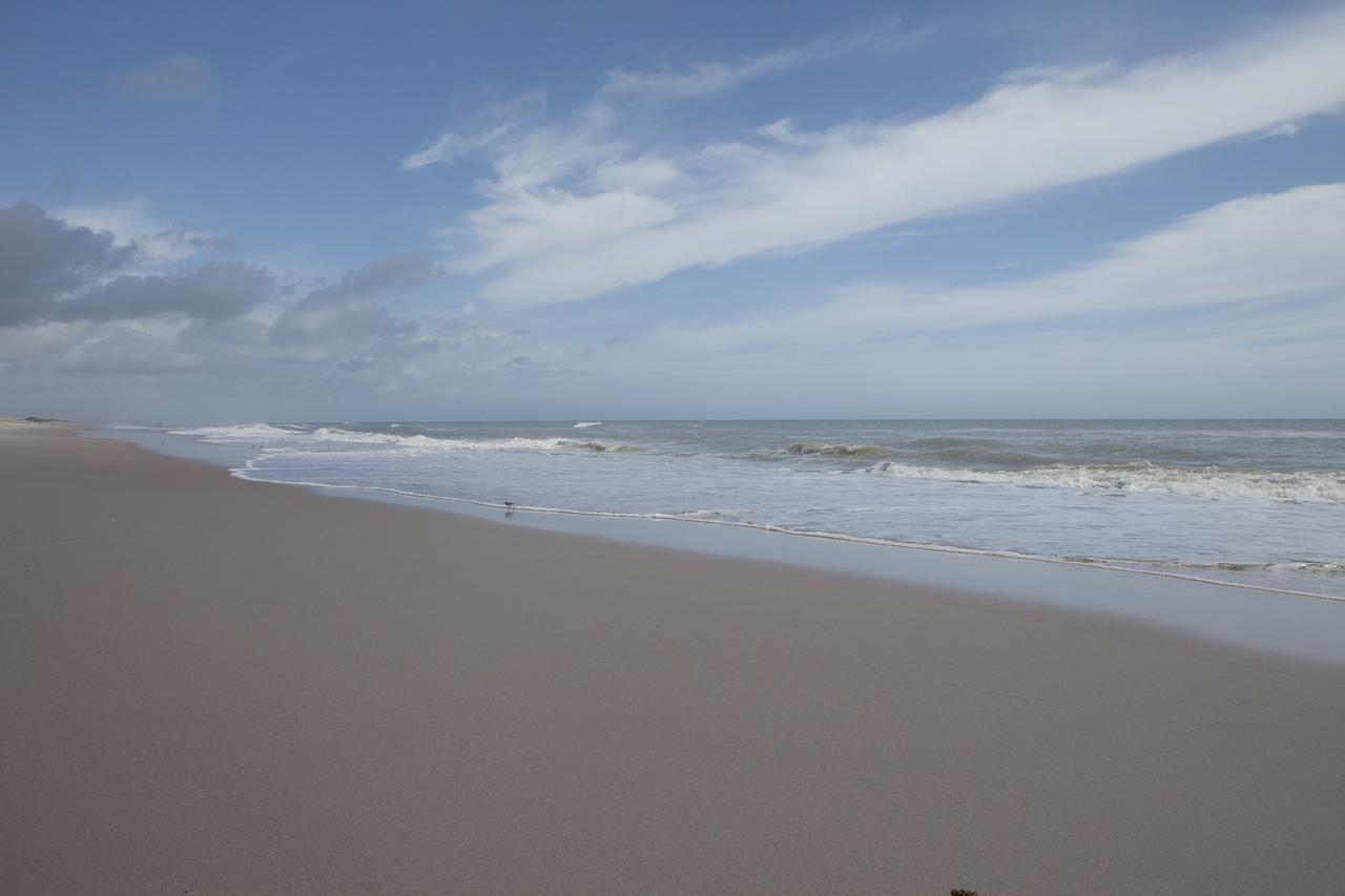
CAPE CANAVERAL, Fla. -- At the Kennedy Space Center in Florida, the Atlantic Ocean surf is seen adjacent to sand dunes restored along a 1.2 mile stretch of shoreline near Launch Pads 39A and B. As part of a six-month effort to help prevent further erosion, 180,000 shrubs, including grasses, sunflowers, vines, sea grapes and palmettos were planted. Constant pounding from tropical storms, such as Hurricane Sandy in October of 2012, other weather systems and higher than usual tides, destroyed sand dunes protecting infrastructure at the spaceport. Photo credit: NASA/Dan Casper
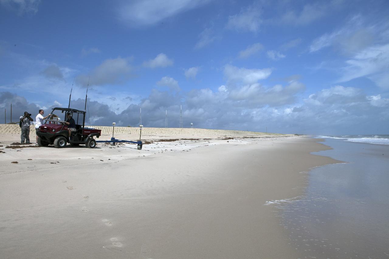
CAPE CANAVERAL, Fla. -- At the Kennedy Space Center in Florida, University of Florida geologists and NASA biologists use an all-terrain vehicle to survey sand dunes that have been restored along a 1.2 mile stretch of shoreline near Launch Pads 39A and B. As part of a six-month effort to help prevent further erosion, 180,000 shrubs, including grasses, sunflowers, vines, sea grapes and palmettos were planted. Constant pounding from tropical storms, such as Hurricane Sandy in October of 2012, other weather systems and higher than usual tides, destroyed sand dunes protecting infrastructure at the spaceport. Photo credit: NASA/Dan Casper
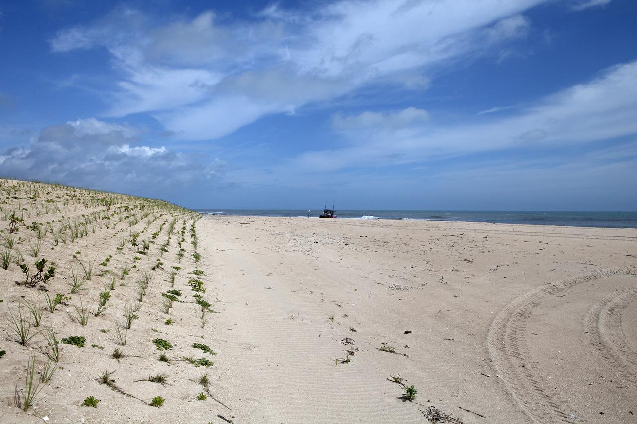
CAPE CANAVERAL, Fla. -- At the Kennedy Space Center in Florida, sand dunes have been restored along a 1.2 mile stretch of shoreline near Launch Pads 39A and B. As part of a six-month effort to help prevent further erosion, 180,000 shrubs, including grasses, sunflowers, vines, sea grapes and palmettos were planted. Constant pounding from tropical storms, such as Hurricane Sandy in October of 2012, other weather systems and higher than usual tides, destroyed sand dunes protecting infrastructure at the spaceport. Photo credit: NASA/Dan Casper
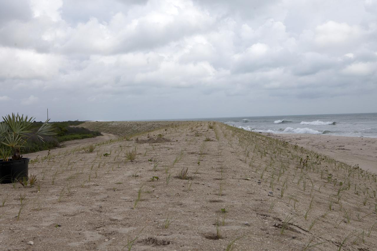
CAPE CANAVERAL, Fla. -- At the Kennedy Space Center in Florida, the sand dunes along a 1.2 mile stretch of shoreline near Launch Pads 39A and B were restored during a six-month effort using 90,000 cubic yards of sand. To help prevent future erosion, 180,000 shrubs, including grasses, sunflowers, vines, sea grapes and palmettos were planted. Constant pounding from tropical storms, such as Hurricane Sandy in October of 2012, other weather systems and higher than usual tides, destroyed sand dunes protecting infrastructure at the spaceport. Photo credit: NASA/Dan Casper
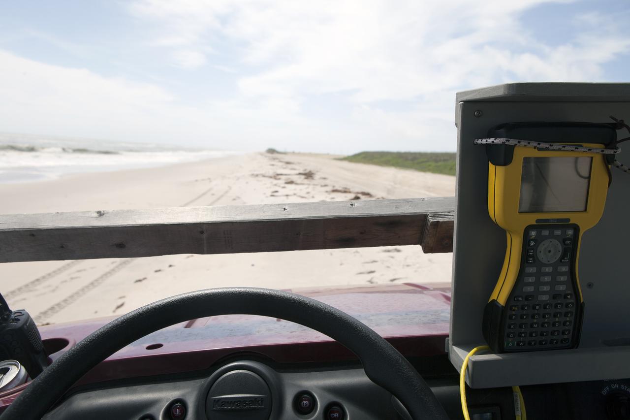
CAPE CANAVERAL, Fla. -- At the Kennedy Space Center in Florida, University of Florida geologists and NASA biologists use an all-terrain vehicle to survey sand dunes that have been restored along a 1.2 mile stretch of shoreline near Launch Pads 39A and B. As part of a six-month effort to help prevent further erosion, 180,000 shrubs, including grasses, sunflowers, vines, sea grapes and palmettos were planted. Constant pounding from tropical storms, such as Hurricane Sandy in October of 2012, other weather systems and higher than usual tides, destroyed sand dunes protecting infrastructure at the spaceport. Photo credit: NASA/Dan Casper
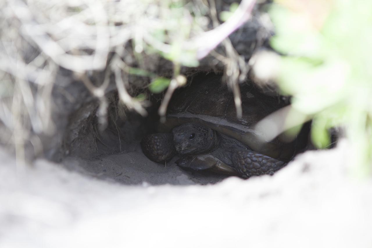
CAPE CANAVERAL, Fla. -- At the Kennedy Space Center in Florida, a turtle has burrowed into a restored sand dune along a 1.2 mile stretch of shoreline near Launch Pads 39A and B. As part of a six-month effort to help prevent further erosion, 180,000 shrubs, including grasses, sunflowers, vines, sea grapes and palmettos were planted. Constant pounding from tropical storms, such as Hurricane Sandy in October of 2012, other weather systems and higher than usual tides, destroyed sand dunes protecting infrastructure at the spaceport. Photo credit: NASA/Dan Casper
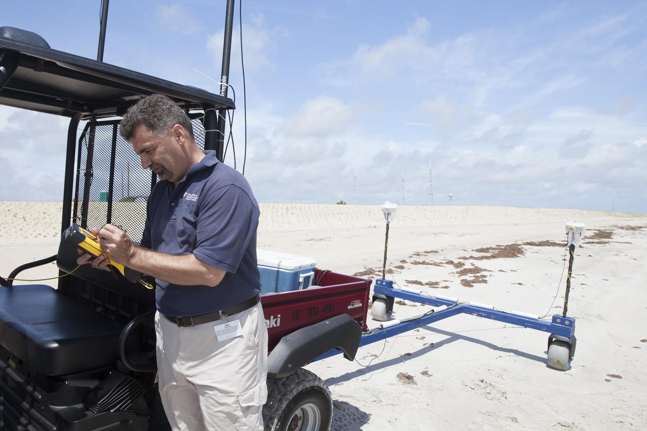
CAPE CANAVERAL, Fla. -- At the Kennedy Space Center in Florida, University of Florida geologists and NASA biologists use an all-terrain vehicle to survey sand dunes that have been restored along a 1.2 mile stretch of shoreline near Launch Pads 39A and B. As part of a six-month effort to help prevent further erosion, 180,000 shrubs, including grasses, sunflowers, vines, sea grapes and palmettos were planted. Constant pounding from tropical storms, such as Hurricane Sandy in October of 2012, other weather systems and higher than usual tides, destroyed sand dunes protecting infrastructure at the spaceport. Photo credit: NASA/Dan Casper

CAPE CANAVERAL, Fla. -- At the Kennedy Space Center in Florida, sand dunes have been restored along a 1.2 mile stretch of shoreline near Launch Pads 39A and B. As part of a six-month effort to help prevent further erosion, 180,000 shrubs, including grasses, sunflowers, vines, sea grapes and palmettos were planted. Constant pounding from tropical storms, such as Hurricane Sandy in October of 2012, other weather systems and higher than usual tides, destroyed sand dunes protecting infrastructure at the spaceport. Photo credit: NASA/Dan Casper
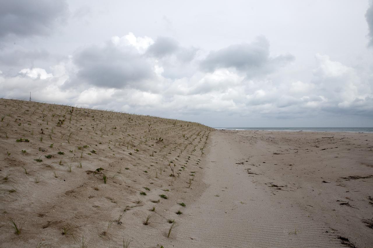
CAPE CANAVERAL, Fla. -- At the Kennedy Space Center in Florida, the sand dunes along a 1.2 mile stretch of shoreline near Launch Pads 39A and B were restored during a six-month effort using 90,000 cubic yards of sand. To help prevent erosion, 180,000 shrubs, including grasses, sunflowers, vines, sea grapes and palmettos were planted. Constant pounding from tropical storms, such as Hurricane Sandy in October of 2012, other weather systems and higher than usual tides, destroyed sand dunes protecting infrastructure at the spaceport. Photo credit: NASA/Dan Casper
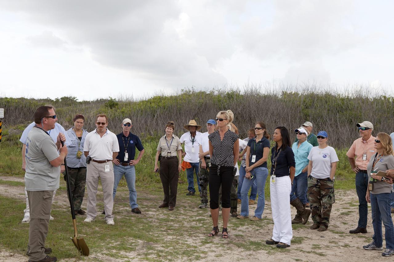
CAPE CANAVERAL, Fla. -- At the Kennedy Space Center in Florida, Don Dankert, a biological scientist in the NASA Environmental Management Branch of Center Operations, far left, speaks to guests during ceremonies to commemorate the completion of a six-month effort to restore 1.2 mile stretch of shoreline near Launch Pads 39A and B. To help prevent erosion, 180,000 shrubs, including grasses, sunflowers, vines, sea grapes and palmettos also were planted on the new dunes. Constant pounding from tropical storms, such as Hurricane Sandy in October of 2012, other weather systems and higher than usual tides, destroyed sand dunes protecting infrastructure at the spaceport. Photo credit: NASA/Dan Casper
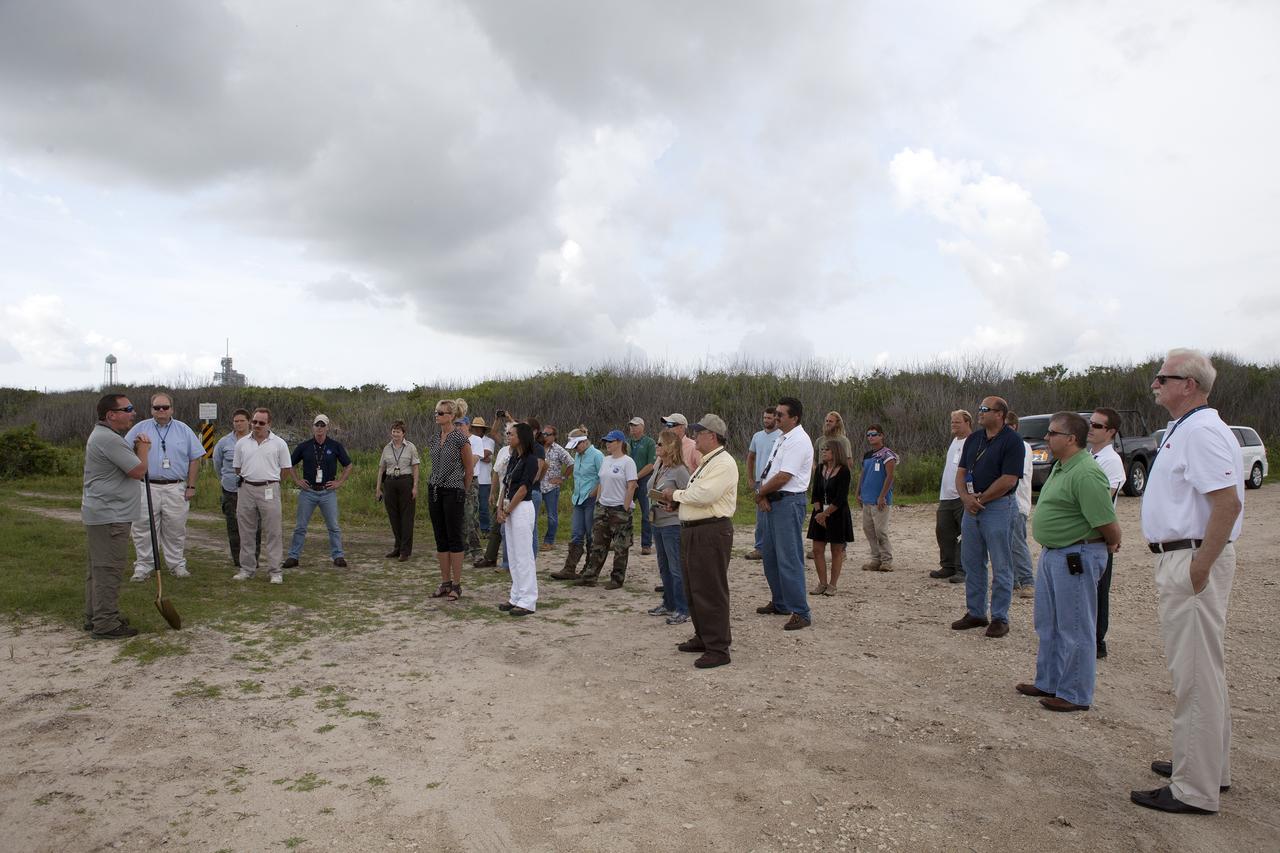
CAPE CANAVERAL, Fla. -- At the Kennedy Space Center in Florida, Don Dankert, a biological scientist in the NASA Environmental Management Branch of Center Operations, far left, speaks to guests during ceremonies to commemorate the completion of a six-month effort to restore 1.2 mile stretch of shoreline near Launch Pads 39A and B. To help prevent erosion, 180,000 shrubs, including grasses, sunflowers, vines, sea grapes and palmettos also were planted on the new dunes. Constant pounding from tropical storms, such as Hurricane Sandy in October of 2012, other weather systems and higher than usual tides, destroyed sand dunes protecting infrastructure at the spaceport. Photo credit: NASA/Dan Casper
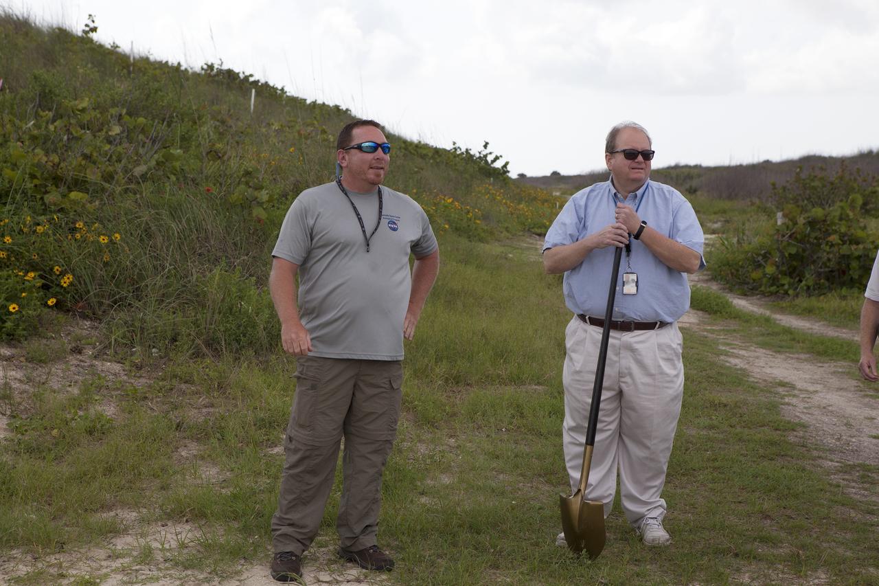
CAPE CANAVERAL, Fla. -- At the Kennedy Space Center in Florida, Don Dankert, a biological scientist in the NASA Environmental Management Branch of Center Operations, left, and Burton Summerfield, senior advisor for Institutional Management in the office of the associate director of Kennedy speak to guests during ceremonies to commemorate the completion of a six-month effort to restore 1.2 mile stretch of shoreline near Launch Pads 39A and B. To help prevent erosion, 180,000 shrubs, including grasses, sunflowers, vines, sea grapes and palmettos also were planted on the new dunes. Constant pounding from tropical storms, such as Hurricane Sandy in October of 2012, other weather systems and higher than usual tides, destroyed sand dunes protecting infrastructure at the spaceport. Photo credit: NASA/Dan Casper
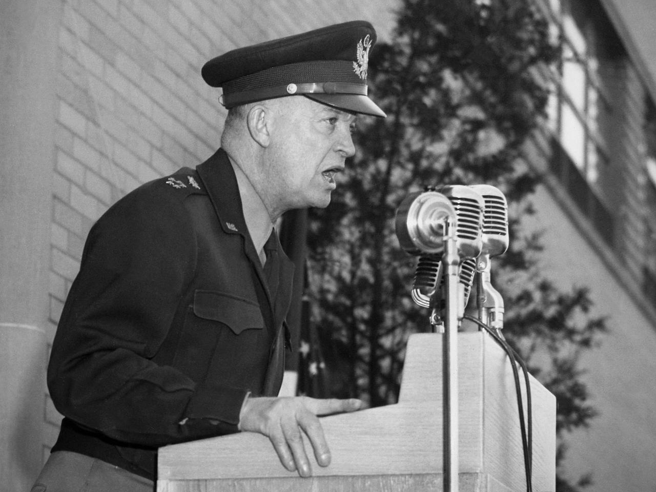
General Dwight Eisenhower addressed the staff of the National Advisory Committee for Aeronautics (NACA) Lewis Flight Propulsion Laboratory during an April 11, 1946 visit to Cleveland. The former supreme commander of Allied Expeditionary Forces in Europe was on a tour of several US cities in the months following the end of World War II. The general arrived in Cleveland on his Douglas C-54 Skymaster, the 'Sunflower II'. Eisenhower employed this aircraft while leading forces during the war. Skymasters, the military version of the DC–4 transport aircraft, were used extensively by both the army and navy throughout the war years. NACA Secretary John Victory, Lewis Director Raymond Sharp, and local politicians formally greeted Eisenhower as he deplaned at the NACA hangar. After patiently posing for the press photographers, Eisenhower accompanied Victory and Sharp to the Administration Building for a press conference. The general made a point of downplaying the prospects for another imminent war. Afterwards Eisenhower was given a tour of the laboratory and addressed the NACA Lewis staff assembled outside the Administration Building on the importance of research and development. Eisenhower left the laboratory in a motorcade for a banquet being held in his honor downtown with the Cleveland Aviation Club.
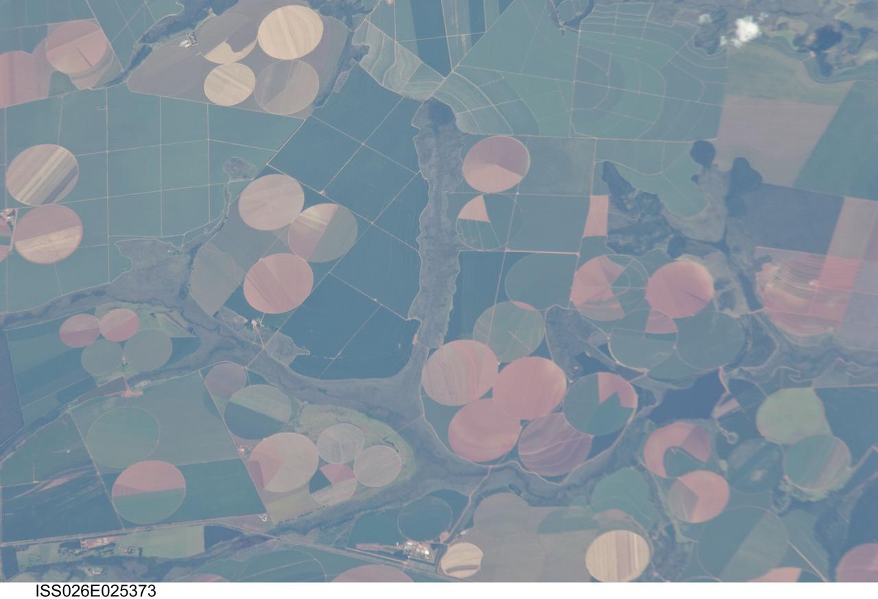
ISS026-E-025373 (10 Feb. 2011) --- Agricultural fields near Perdizes, Minas Gerais, Brazil are featured in this image photographed by an Expedition 26 crew member on the International Space Station. This detailed photograph illustrates diverse agricultural landscape patterns in the western part of the Brazilian State of Minas Gerais. Perhaps most widely known for its mineral wealth, Minas Gerais is also a large agricultural producer in Brazil. The fields in the image are located to the southwest of the city of Perdizes, which means “partridges” in Portuguese. A mix of regularly-gridded polygonal fields, and circular center-pivot fields, marks the human land use of the region. Small tributary streams (and their adjacent floodplains) of the Araguari River extend like fingers throughout the agricultural landscape. The visual diversity of field forms is matched by the variety of crops produced here: sunflowers, wheat, potatoes, coffee, rice, soybeans, and corn are among the agricultural products of the region. While the Northern Hemisphere is still in the grip of winter, crops are growing in the Southern Hemisphere as indicated by the many green fields in the image. Fallow fields—fields not in active agricultural use—display the violet, reddish to light tan soils common to this part of Brazil. The darker soils are often rich in iron and aluminum oxides, and are typical of highly weathered soil material that forms in hot, humid climates.
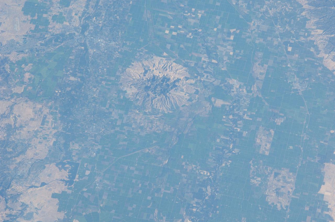
ISS032-E-010482 (29 July 2012) --- Sutter Buttes in California are featured in this image photographed by an Expedition 32 crew member on the International Space Station. Sometimes called the ?smallest mountain range in the world?, the Sutter Buttes rise almost 610 meters above the surrounding flat agricultural fields of the Great Valley of central California. Scientists believe the Sutter Buttes are remnants of a volcano that was active approximately 1.6 ? 1.4 million years ago during the Pleistocene Epoch. The central core of the Buttes is characterized by lava domes?piles of viscous lava that erupted onto the surface, building higher with each successive layer. Today, these lava domes form the high central hills of the Buttes; shadows cast by the hills are visible at center. Surrounding the central core is an apron of fragmental material created by occasional eruptions of the lava domes ? this apron extends roughly 18 kilometers east-west and 16 kilometers north-south. The volcanic material was transported outwards from the central core during eruptions by hot gasses (pyroclastic flows) or by cooler water-driven flows (lahars). Later stream erosion of the debris apron is evident from the radial drainage pattern surrounding the central core. A third geomorphic region of valleys known as the ?moat? is present between the core and the debris apron, and was formed from erosion of older, exposed sedimentary rocks that underlie the volcanic rocks. The Sutter Buttes present a striking visual contrast with the surrounding green agricultural fields?here mostly rice, with some sunflower, winter wheat, tomato, and almonds?of the Great Valley. Urban areas such as Yuba City, CA (located 18 kilometers to the southeast) appear as light to dark gray stippled regions. Sacramento, CA (not shown) is located approximately 80 kilometers to the south-southeast. The image appears slightly distorted (oblique) due to the viewing angle from the space station.
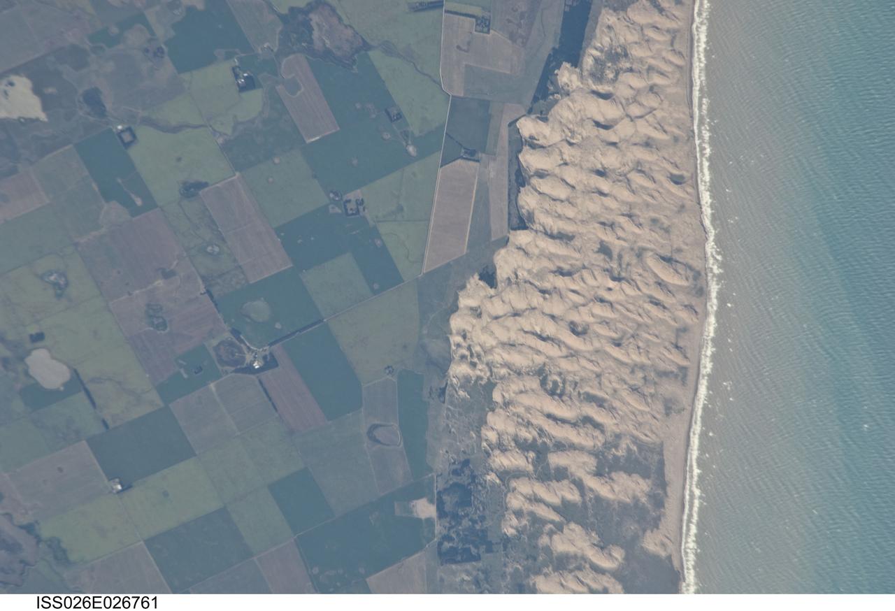
ISS026-E-026761 (13 Feb. 2011) --- Medano Blanco coastal dunes in Buenos Aires Province, Argentina are featured in this image photographed by an Expedition 26 crew member on the International Space Station. The Medano Blanco (White Dunes) are a well known recreational area 35 kilometers west of the twin cities of Nicochea-Quequen, one of the biggest ports in the province of Buenos Aires, central Argentina. The Medano Blanco dunes separate the Atlantic Ocean from intensive sunflower agricultural cropland, visible as the angular pattern of green and brown fields at left. The dune field extends 3.5 kilometers at its widest part. Narrow cordons of coastal dunes stretch along this part of Argentina’s coastline for hundreds of kilometers. Small streams, oriented towards the coast, cross the farmland at upper left. Water from these is dammed behind the dunes, and even within the dunes, where wetlands flourish. This is the drier southern part of Buenos Aires province near the more arid and windier border with Patagonia—one of the windiest places on Earth. The effect of strong westerly winds (blowing bottom to top in this slightly oblique image) can be seen everywhere in this detailed photograph. The dune sand is blown from local beaches onshore where it forms the dunes. The prominent dune ridge crests are oriented at right angles to the prevailing wind. Geologists suspect that erosion by wind has excavated numerous hollows which now dot the farmland as small shallow lakes. A stand of dark green trees has been planted on the upwind side of a health spa—located at the white dot (center left) which is the roof of a stately building—as a protective barrier against the wind. The white fringe along the seashore is formed from lines of breaking waves. Crossing swell trains can be seen offshore in the Atlantic Ocean. The curvature of the swell pattern offshore also shows the effect of the westerly wind, and indeed drives the local sea current in this area—slightly more prominent onshore swells approach the coast from the southeast. The light brown tint of seawater nearer the shore is the fine muddy fraction of the coastal sediment being washed seaward (after being stirred up by wave action) and then east by the current.
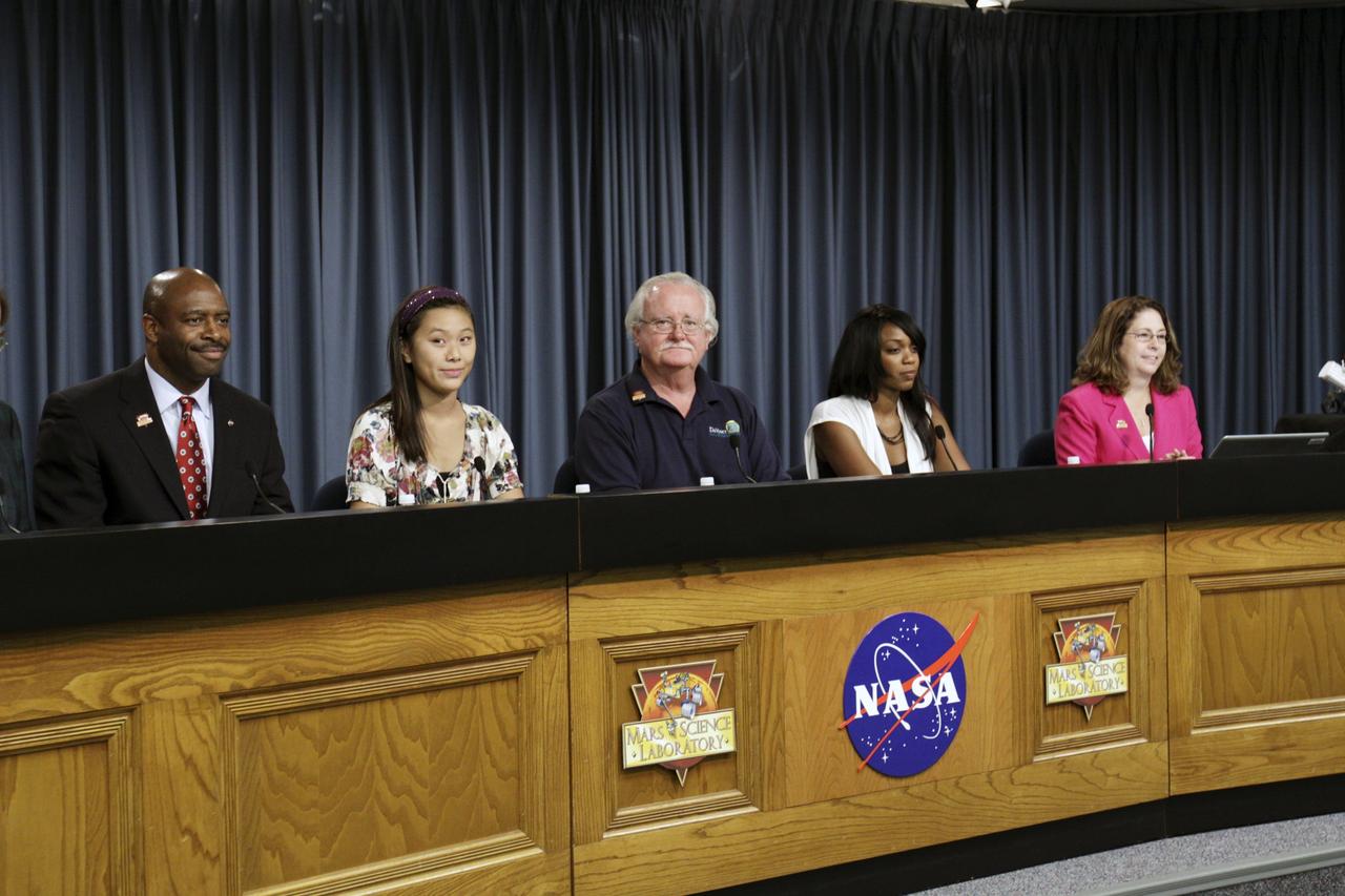
CAPE CANAVERAL, Fla. – An educational news conference to explore "Why Mars Excites and Inspires Us" begins in NASA Kennedy Space Center's Press Site auditorium in Florida during prelaunch activities for the agency’s Mars Science Laboratory (MSL) launch. Participants are, from left, Leland Melvin, NASA associate administrator for Education; Clara Ma, student, NASA contest winner for naming Curiosity, Shawnee Mission East High School, Prairie Village, Kansas; Scott Anderson, teacher and science department chairman, Da Vinci School for Science and the Arts, El Paso, Texas; Lauren Lyons, graduate student, Harvard University, FIRST robotics alumna; and Veronica McGregor, manager, Media Relations Office, NASA Jet Propulsion Laboratory. MSL's car-sized Martian rover, Curiosity, has 10 science instruments designed to search for signs of life, including methane, and help determine if the gas is from a biological or geological source. Ma's entry was selected the winner from 9,000 entries in NASA's nationwide student contest to name the rover. At the time, she was a twelve-year-old sixth-grade student at the Sunflower Elementary school in Lenexa, Kansas. Liftoff of MSL aboard a United Launch Alliance Atlas V rocket from Space Launch Complex-41 on Cape Canaveral Air Force Station is planned during a launch window which extends from 10:02 a.m. to 11:45 a.m. EST on Nov. 26. For more information, visit http://www.nasa.gov/msl. Photo credit: NASA/Kim Shiflett
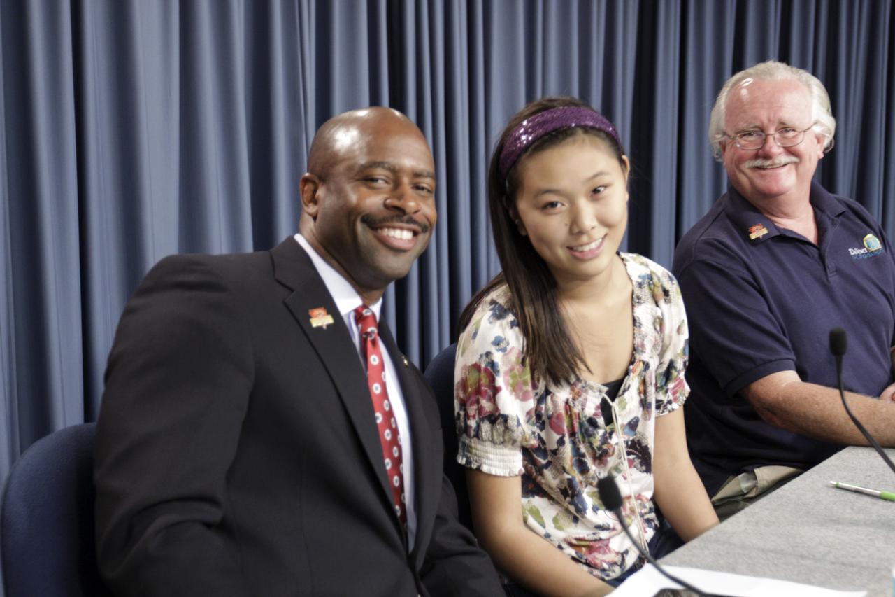
CAPE CANAVERAL, Fla. – Leland Melvin, NASA associate administrator for Education; Clara Ma, student, NASA contest winner for naming Curiosity, Shawnee Mission East High School, Prairie Village, Kansas; Scott Anderson, teacher and science department chairman Da Vinci School for Science and the Arts, El Paso, Texas, take a moment pose for the camera before the start of an educational news conference to explore "Why Mars Excites and Inspires Us" in NASA Kennedy Space Center's Press Site auditorium in Florida during prelaunch activities for the agency’s Mars Science Laboratory (MSL) launch. MSL's car-sized Martian rover, Curiosity, has 10 science instruments designed to search for signs of life, including methane, and help determine if the gas is from a biological or geological source. Ma's entry was selected the winner from 9,000 entries in NASA's nationwide student contest to name the rover. At the time, she was a twelve-year-old sixth-grade student at the Sunflower Elementary school in Lenexa, Kansas. Liftoff of MSL aboard a United Launch Alliance Atlas V rocket from Space Launch Complex-41 on Cape Canaveral Air Force Station is planned during a launch window which extends from 10:02 a.m. to 11:45 a.m. EST on Nov. 26. For more information, visit http://www.nasa.gov/msl. Photo credit: NASA/Kim Shiflett
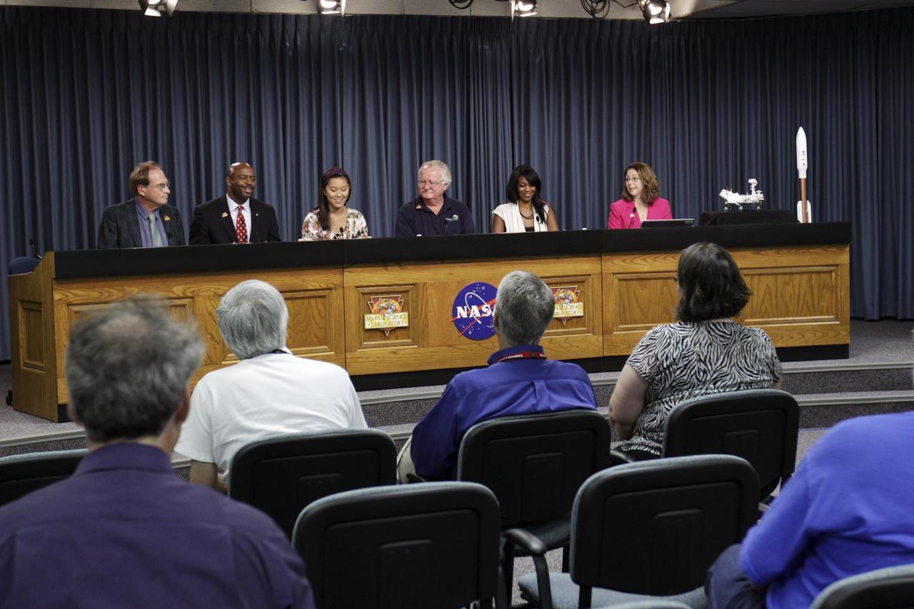
CAPE CANAVERAL, Fla. – An educational news conference to explore "Why Mars Excites and Inspires Us" is under way in NASA Kennedy Space Center's Press Site auditorium in Florida during prelaunch activities for the agency’s Mars Science Laboratory (MSL) launch. Participants are, from left, moderator George Diller, NASA Public Affairs, NASA Kennedy Space Center; Leland Melvin, NASA associate administrator for Education; Clara Ma, student, NASA contest winner for naming Curiosity, Shawnee Mission East High School, Prairie Village, Kansas; Scott Anderson, teacher and science department chairman, Da Vinci School for Science and the Arts, El Paso, Texas; Lauren Lyons, graduate student, Harvard University, FIRST robotics alumna; and Veronica McGregor, manager, Media Relations Office, NASA Jet Propulsion Laboratory. MSL's car-sized Martian rover, Curiosity, has 10 science instruments designed to search for signs of life, including methane, and help determine if the gas is from a biological or geological source. Ma's entry was selected the winner from 9,000 entries in NASA's nationwide student contest to name the rover. At the time, she was a twelve-year-old sixth-grade student at the Sunflower Elementary school in Lenexa, Kansas. Liftoff of MSL aboard a United Launch Alliance Atlas V rocket from Space Launch Complex-41 on Cape Canaveral Air Force Station is planned during a launch window which extends from 10:02 a.m. to 11:45 a.m. EST on Nov. 26. For more information, visit http://www.nasa.gov/msl. Photo credit: NASA/Kim Shiflett
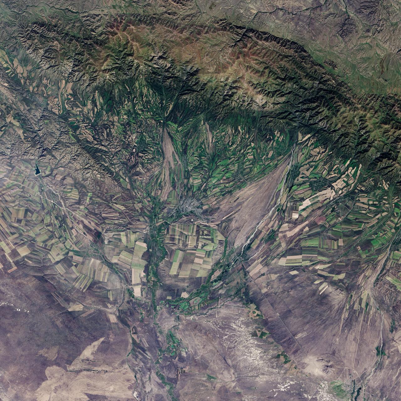
September 22, the autumnal equinox, marks the beginning of fall in the Northern Hemisphere, but the fall harvest begins early in the harsh continental climate of eastern Kazakhstan. By September 9, 2013, when the Operational Land Imager (OLI) on the Landsat 8 satellite acquired this image, several fields were already harvested and bare. Others were dark green with pasture grasses or ripening crops. The fields fill the contours of the land, running long and narrow down mountain valleys and spreading in large squares over the plains. Agriculture is an important segment of the economy in Kazakhstan: the country’s dry climate is ideal for producing high quality wheat for export. However, 61 percent of the country’s agricultural land is pasture for livestock. The area shown in this image, far eastern Kazakhstan near the Chinese border, is a minor wheat-growing region and may also produce sunflowers, barley, and other food crops. An artifact of Soviet-era collective farms, most of the farms in Kazakhstan are large, covering more than 5,000 hectares (12,500 acres). Some of the larger fields in the image reflect the big business side of agriculture. However, family farms and small agriculture businesses account for 35 percent of the country’s agricultural production, and some of these are visible as well, particularly in the uneven hills and mountains. Nearly all agriculture in Kazakhstan is rain fed. Farmers in this region have designed their fields to take advantage of rain flowing down hills, allowing the natural shape of the land to channel water to crops. The effect is a mosaic of green and tan with tones matching the natural vegetation in the mountains to the north. NASA Earth Observatory image by Jesse Allen using Landsat data from the U.S. Geological Survey. Caption by Holli Riebeek. Instrument: Landsat 8 - OLI More info: <a href="http://1.usa.gov/16IZ047" rel="nofollow">1.usa.gov/16IZ047</a> <b><a href="http://www.nasa.gov/audience/formedia/features/MP_Photo_Guidelines.html" rel="nofollow">NASA image use policy.</a></b> <b><a href="http://www.nasa.gov/centers/goddard/home/index.html" rel="nofollow">NASA Goddard Space Flight Center</a></b> enables NASA’s mission through four scientific endeavors: Earth Science, Heliophysics, Solar System Exploration, and Astrophysics. Goddard plays a leading role in NASA’s accomplishments by contributing compelling scientific knowledge to advance the Agency’s mission. <b>Follow us on <a href="http://twitter.com/NASA_GoddardPix" rel="nofollow">Twitter</a></b> <b>Like us on <a href="http://www.facebook.com/pages/Greenbelt-MD/NASA-Goddard/395013845897?ref=tsd" rel="nofollow">Facebook</a></b> <b>Find us on <a href="http://instagram.com/nasagoddard?vm=grid" rel="nofollow">Instagram</a></b>
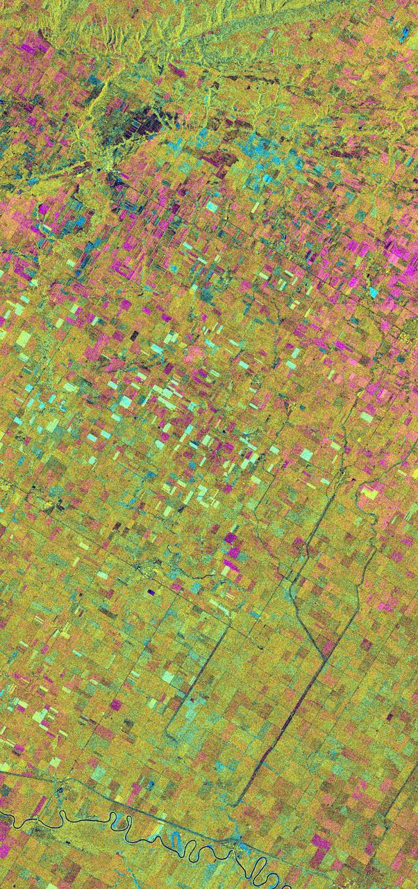
This is an X-band seasonal image of the Altona test site in Manitoba, Canada, about 80 kilometers (50 miles) south of Winnipeg. The image is centered at approximately 49 degrees north latitude and 97.5 degrees west longitude. This image was acquired by the Spaceborne Imaging Radar-C and X-band Synthetic Aperture Radar (SIR-C/X-SAR) aboard the space shuttle Endeavour on April 11, 1994, during the first flight of the radar system, and on October 2, 1994, during the second flight of SIR-C/X-SAR. The image channels have the following color assignments: red represents data acquired on April 11, 1994; green represents data acquired on October 2, 1994; blue represents the ratio of the two data sets. The test site is located in the Red River Basin and is characterized by rich farmland where a variety of crops are grown, including wheat, barley, canola, corn, sunflowers and sugar beets. This SIR-C/X-SAR research site is applying radar remote sensing to study the characteristics of vegetation and soil moisture. The seasonal comparison between the April and October 1994 data show the dramatic differences between surface conditions on the two dates. At the time of the April acquisition, almost all agricultural fields were bare and soil moisture levels were high. In October, however, soils were drier and while most crops had been harvested, some standing vegetation was still present. The areas which are cyan in color are dark in April and bright in October. These represent fields of standing biomass (amount of vegetation in a specified area) and the differences in brightness within these cyan fields represent differences in vegetation type. The very bright fields in October represent standing broadleaf crops such as corn, which had not yet been harvested. Other standing vegetation which has less biomass, such as hay and grain fields, are less bright. The magenta indicates bare soil surfaces which were wetter (brighter) in April than in October. The variations in brightness of the magenta indicate differences in the degree of soil moisture change and differences in surface roughness. This seasonal composite demonstrates the sensitivity of radar to changes in agricultural surface conditions such as soil moisture, tillage, cropping and harvesting. http://photojournal.jpl.nasa.gov/catalog/PIA01742
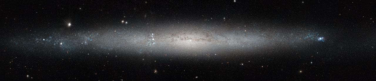
This stunning new image from the NASA/ESA Hubble Space Telescope shows part of the sky in the constellation of Canes Venatici (The Hunting Dogs). Although this region of the sky is not home to any stellar heavyweights, being mostly filled with stars of average brightness, it does contain five Messier objects and numerous intriguing galaxies — including NGC 5195, a small barred spiral galaxy considered to be one of the most beautiful galaxies visible, and its nearby interacting partner the Whirlpool Galaxy (heic0506a). The quirky Sunflower Galaxy is another notable galaxy in this constellation, and is one of the largest and brightest edge-on galaxies in our skies. Joining this host of characters is spiral galaxy NGC 4244, nicknamed the Silver Needle Galaxy, shown in this new image from Hubble. This galaxy spans some 65,000 light-years and lies around 13.5 million light-years away. It appears as a wafer-thin streak across the sky, with loosely wound spiral arms hidden from view as we observe the galaxy from the side. It is part of a group of galaxies known as the M94 Group. Numerous bright clumps of gas can be seen scattered across its length, along with dark dust lanes surrounding the galaxy’s core. NGC 4244 also has a bright star cluster at its center. Although we can make out the galaxy’s bright central region and star-spattered arms, we cannot see any more intricate structure due to the galaxy’s position; from Earth, we see it stretched out as a flattened streak across the sky. A number of different observations were pieced together to form this mosaic, and gaps in Hubble’s coverage have been filled in using ground-based data. The Hubble observations were taken as part of the Galaxy Halos, Outer disks, Substructure, Thick disks and Star clusters (GHOSTS) survey, which is scanning nearby galaxies to explore how they and their stars formed to get a more complete view of the history of the Universe. European Space Agency Credit: NASA & ESA, Acknowledgement: Roelof de Jong <b><a href="http://www.nasa.gov/audience/formedia/features/MP_Photo_Guidelines.html" rel="nofollow">NASA image use policy.</a></b> <b><a href="http://www.nasa.gov/centers/goddard/home/index.html" rel="nofollow">NASA Goddard Space Flight Center</a></b> enables NASA’s mission through four scientific endeavors: Earth Science, Heliophysics, Solar System Exploration, and Astrophysics. Goddard plays a leading role in NASA’s accomplishments by contributing compelling scientific knowledge to advance the Agency’s mission. <b>Follow us on <a href="http://twitter.com/NASAGoddardPix" rel="nofollow">Twitter</a></b> <b>Like us on <a href="http://www.facebook.com/pages/Greenbelt-MD/NASA-Goddard/395013845897?ref=tsd" rel="nofollow">Facebook</a></b> <b>Find us on <a href="http://instagram.com/nasagoddard?vm=grid" rel="nofollow">Instagram</a></b>