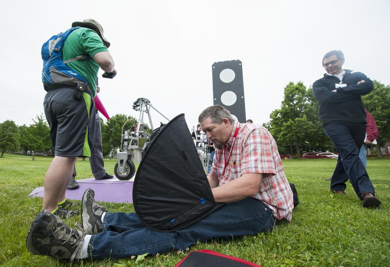
Russel Howe of team Survey, center, works on a laptop to prepare the team's robot for a demonstration run after the team's robot failed to leave the starting platform during it's attempt at the level two challenge at the 2014 NASA Centennial Challenges Sample Return Robot Challenge, Thursday, June 12, 2014, at the Worcester Polytechnic Institute (WPI) in Worcester, Mass. Eighteen teams are competing for a $1.5 million NASA prize purse. Teams will be required to demonstrate autonomous robots that can locate and collect samples from a wide and varied terrain, operating without human control. The objective of this NASA-WPI Centennial Challenge is to encourage innovations in autonomous navigation and robotics technologies. Innovations stemming from the challenge may improve NASA's capability to explore a variety of destinations in space, as well as enhance the nation's robotic technology for use in industries and applications on Earth. Photo Credit: (NASA/Joel Kowsky)
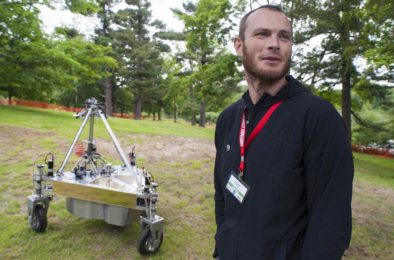
Jascha Little of team Survey is seen as he follows the teams robot as it conducts a demonstration of the level two challenge during the 2014 NASA Centennial Challenges Sample Return Robot Challenge, Thursday, June 12, 2014, at the Worcester Polytechnic Institute (WPI) in Worcester, Mass. Eighteen teams are competing for a $1.5 million NASA prize purse. Teams will be required to demonstrate autonomous robots that can locate and collect samples from a wide and varied terrain, operating without human control. The objective of this NASA-WPI Centennial Challenge is to encourage innovations in autonomous navigation and robotics technologies. Innovations stemming from the challenge may improve NASA's capability to explore a variety of destinations in space, as well as enhance the nation's robotic technology for use in industries and applications on Earth. Photo Credit: (NASA/Joel Kowsky)
Russel Howe of team Survey speaks with Sample Return Robot Challenge staff members after the team's robot failed to leave the starting platform during it's attempt at the level two challenge during the 2014 NASA Centennial Challenges Sample Return Robot Challenge, Thursday, June 12, 2014, at the Worcester Polytechnic Institute (WPI) in Worcester, Mass. Eighteen teams are competing for a $1.5 million NASA prize purse. Teams will be required to demonstrate autonomous robots that can locate and collect samples from a wide and varied terrain, operating without human control. The objective of this NASA-WPI Centennial Challenge is to encourage innovations in autonomous navigation and robotics technologies. Innovations stemming from the challenge may improve NASA's capability to explore a variety of destinations in space, as well as enhance the nation's robotic technology for use in industries and applications on Earth. Photo Credit: (NASA/Joel Kowsky)
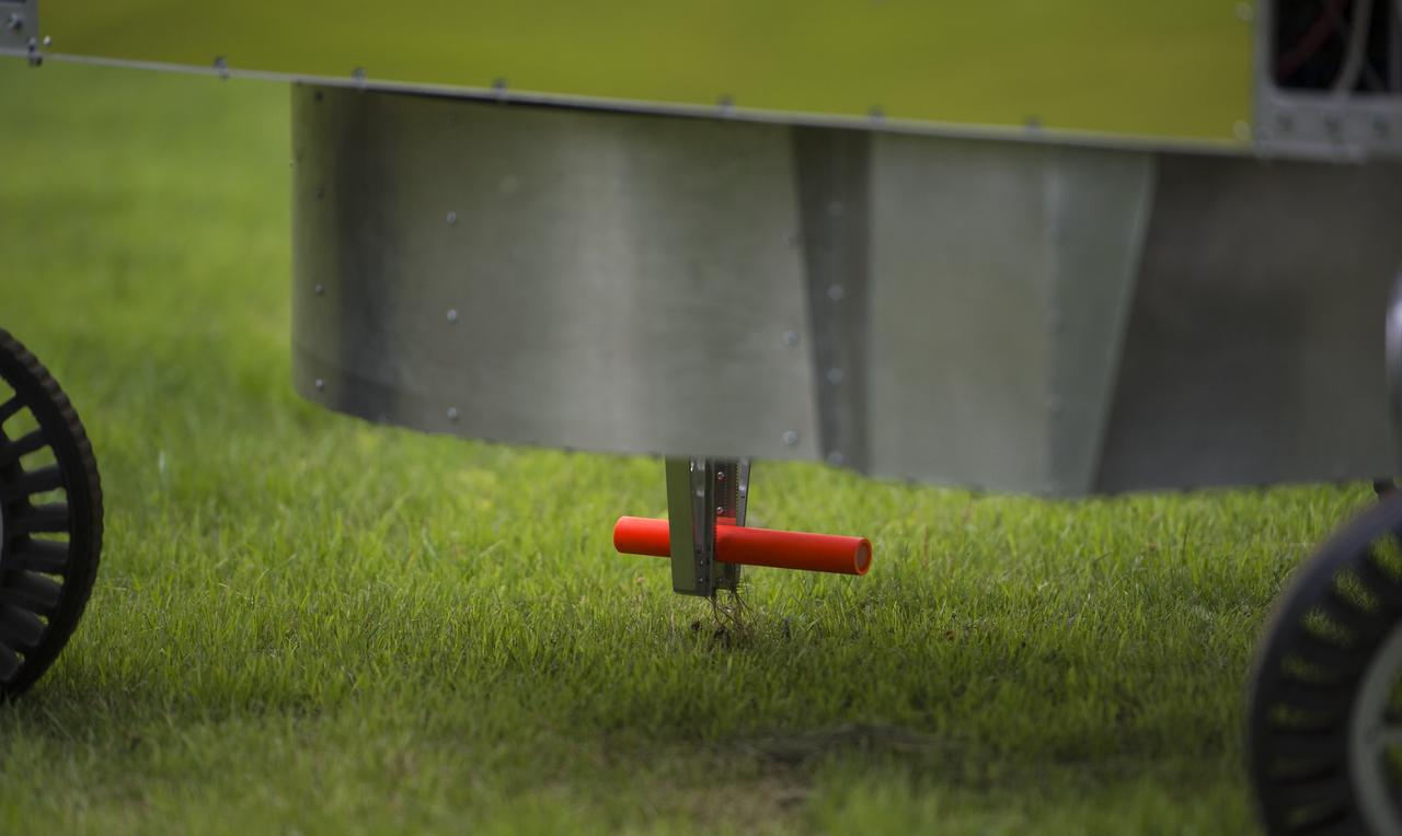
A sample can be seen on the competition field as the team Survey robot conducts a demonstration of the level two challenge during the 2014 NASA Centennial Challenges Sample Return Robot Challenge, Thursday, June 12, 2014, at the Worcester Polytechnic Institute (WPI) in Worcester, Mass. Eighteen teams are competing for a $1.5 million NASA prize purse. Teams will be required to demonstrate autonomous robots that can locate and collect samples from a wide and varied terrain, operating without human control. The objective of this NASA-WPI Centennial Challenge is to encourage innovations in autonomous navigation and robotics technologies. Innovations stemming from the challenge may improve NASA's capability to explore a variety of destinations in space, as well as enhance the nation's robotic technology for use in industries and applications on Earth. Photo Credit: (NASA/Joel Kowsky)
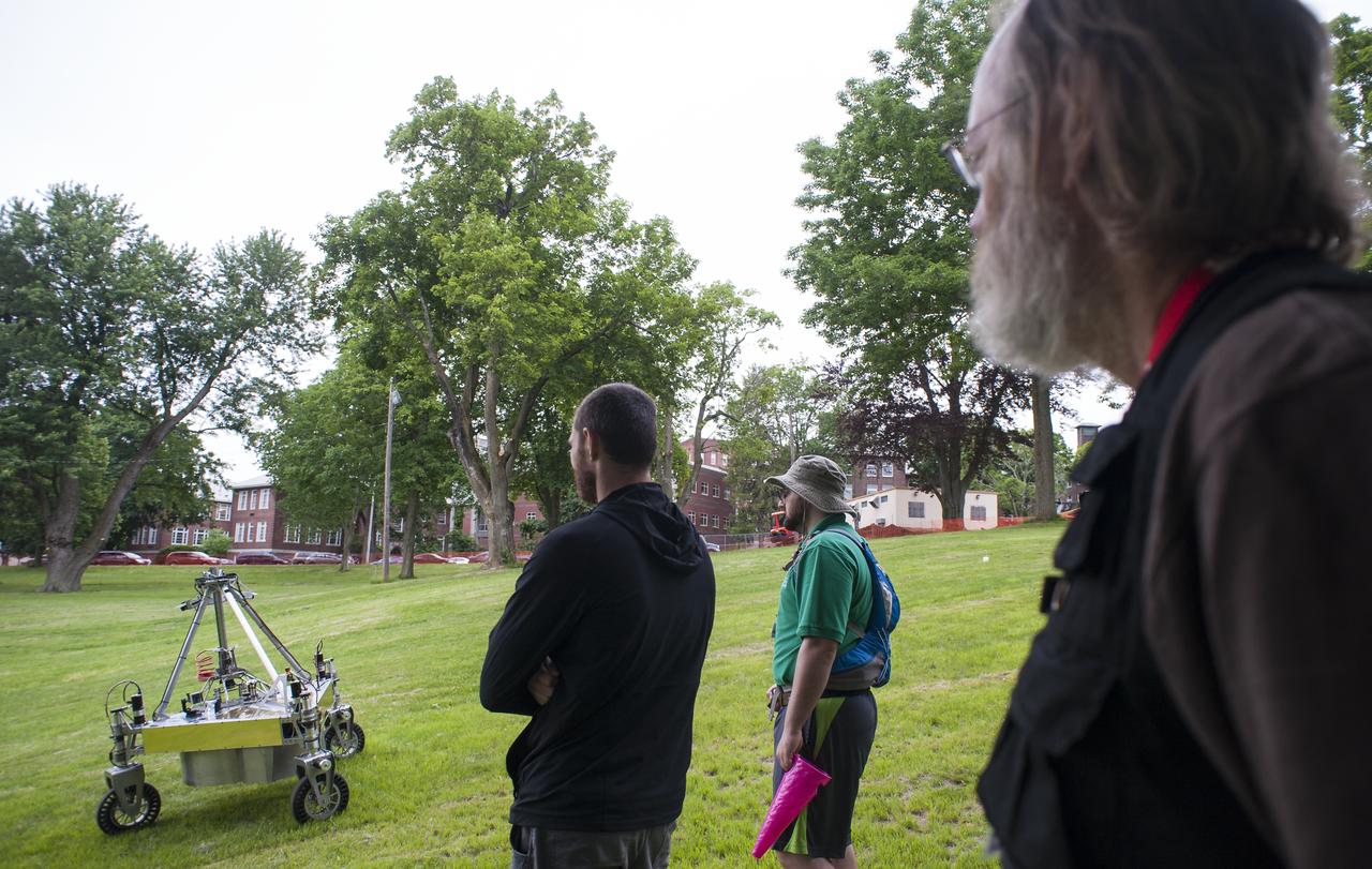
Members of team Survey follow their robot as it conducts a demonstration of the level two challenge during the 2014 NASA Centennial Challenges Sample Return Robot Challenge, Thursday, June 12, 2014, at the Worcester Polytechnic Institute (WPI) in Worcester, Mass. Eighteen teams are competing for a $1.5 million NASA prize purse. Teams will be required to demonstrate autonomous robots that can locate and collect samples from a wide and varied terrain, operating without human control. The objective of this NASA-WPI Centennial Challenge is to encourage innovations in autonomous navigation and robotics technologies. Innovations stemming from the challenge may improve NASA's capability to explore a variety of destinations in space, as well as enhance the nation's robotic technology for use in industries and applications on Earth. Photo Credit: (NASA/Joel Kowsky)
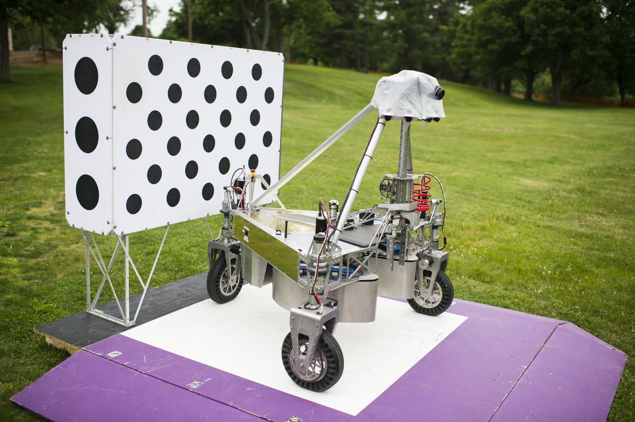
The team survey robot is seen on the starting platform before begging it's attempt at the level two challenge during the 2014 NASA Centennial Challenges Sample Return Robot Challenge, Thursday, June 12, 2014, at the Worcester Polytechnic Institute (WPI) in Worcester, Mass. Eighteen teams are competing for a $1.5 million NASA prize purse. Teams will be required to demonstrate autonomous robots that can locate and collect samples from a wide and varied terrain, operating without human control. The objective of this NASA-WPI Centennial Challenge is to encourage innovations in autonomous navigation and robotics technologies. Innovations stemming from the challenge may improve NASA's capability to explore a variety of destinations in space, as well as enhance the nation's robotic technology for use in industries and applications on Earth. Photo Credit: (NASA/Joel Kowsky)
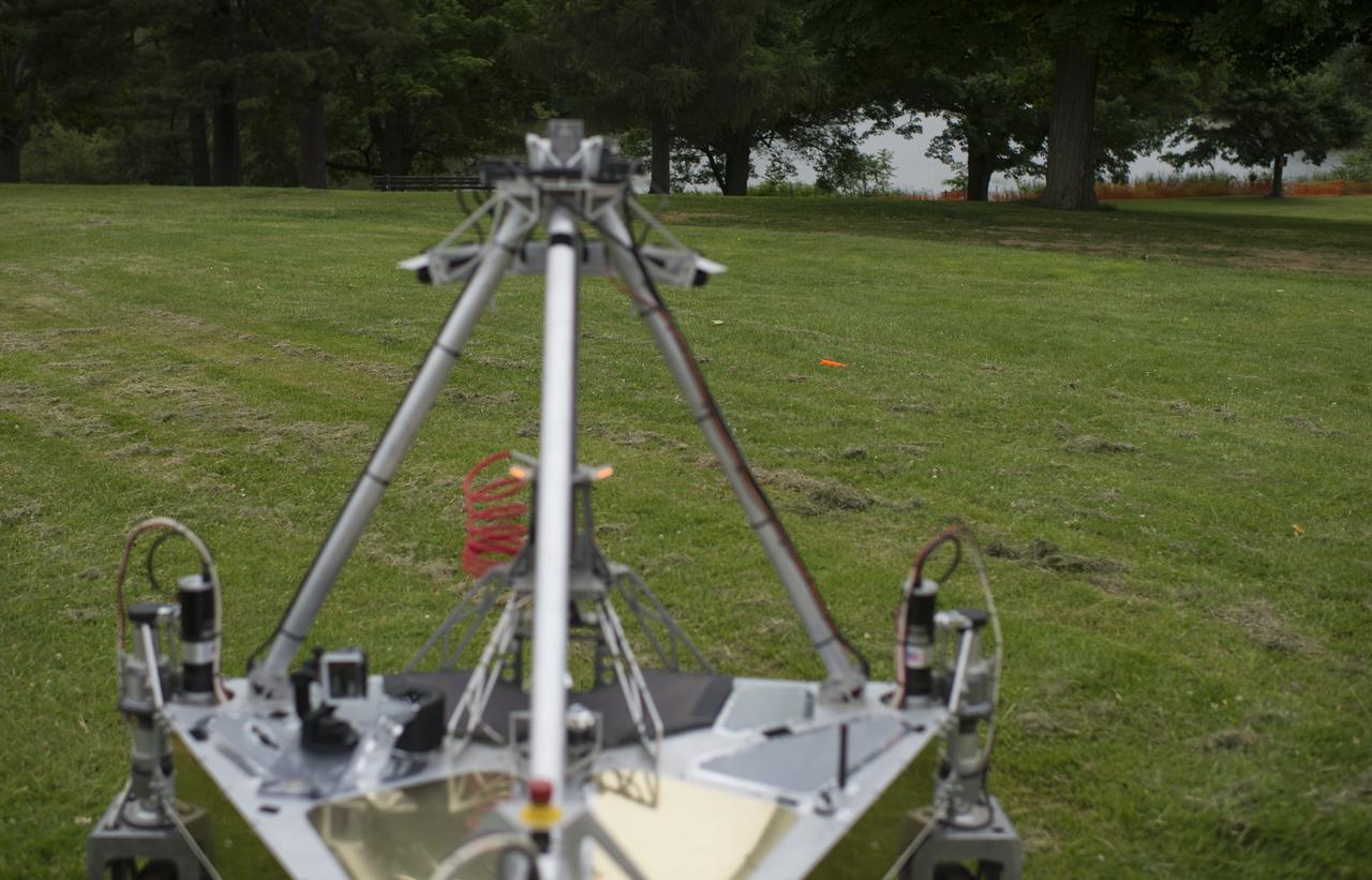
The team Survey robot is seen as it conducts a demonstration of the level two challenge during the 2014 NASA Centennial Challenges Sample Return Robot Challenge, Thursday, June 12, 2014, at the Worcester Polytechnic Institute (WPI) in Worcester, Mass. Eighteen teams are competing for a $1.5 million NASA prize purse. Teams will be required to demonstrate autonomous robots that can locate and collect samples from a wide and varied terrain, operating without human control. The objective of this NASA-WPI Centennial Challenge is to encourage innovations in autonomous navigation and robotics technologies. Innovations stemming from the challenge may improve NASA's capability to explore a variety of destinations in space, as well as enhance the nation's robotic technology for use in industries and applications on Earth. Photo Credit: (NASA/Joel Kowsky)
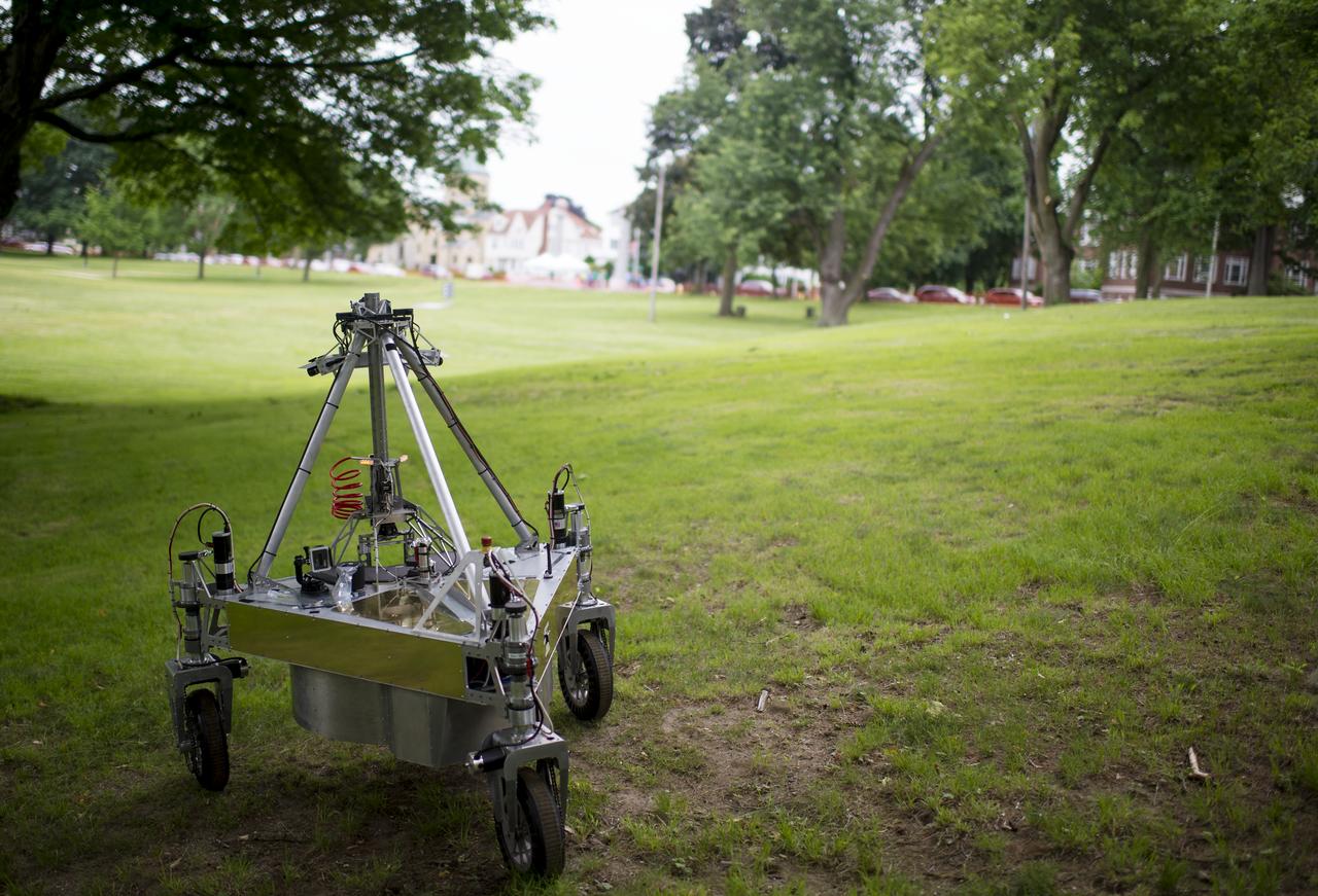
The team Survey robot is seen as it conducts a demonstration of the level two challenge at the 2014 NASA Centennial Challenges Sample Return Robot Challenge, Thursday, June 12, 2014, at the Worcester Polytechnic Institute (WPI) in Worcester, Mass. Eighteen teams are competing for a $1.5 million NASA prize purse. Teams will be required to demonstrate autonomous robots that can locate and collect samples from a wide and varied terrain, operating without human control. The objective of this NASA-WPI Centennial Challenge is to encourage innovations in autonomous navigation and robotics technologies. Innovations stemming from the challenge may improve NASA's capability to explore a variety of destinations in space, as well as enhance the nation's robotic technology for use in industries and applications on Earth. Photo Credit: (NASA/Joel Kowsky)
The team Survey robot retrieves a sample during a demonstration of the level two challenge at the 2014 NASA Centennial Challenges Sample Return Robot Challenge, Thursday, June 12, 2014, at the Worcester Polytechnic Institute (WPI) in Worcester, Mass. Eighteen teams are competing for a $1.5 million NASA prize purse. Teams will be required to demonstrate autonomous robots that can locate and collect samples from a wide and varied terrain, operating without human control. The objective of this NASA-WPI Centennial Challenge is to encourage innovations in autonomous navigation and robotics technologies. Innovations stemming from the challenge may improve NASA's capability to explore a variety of destinations in space, as well as enhance the nation's robotic technology for use in industries and applications on Earth. Photo Credit: (NASA/Joel Kowsky)
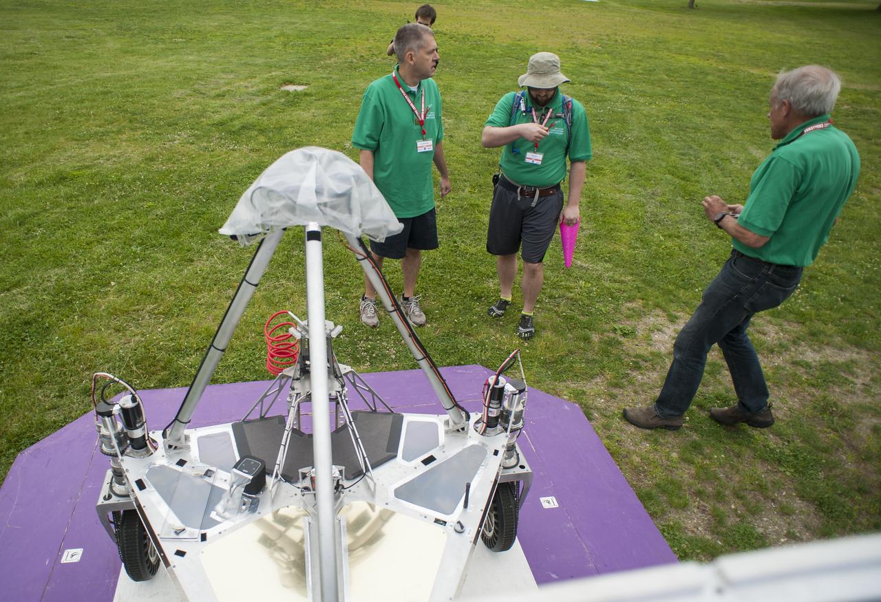
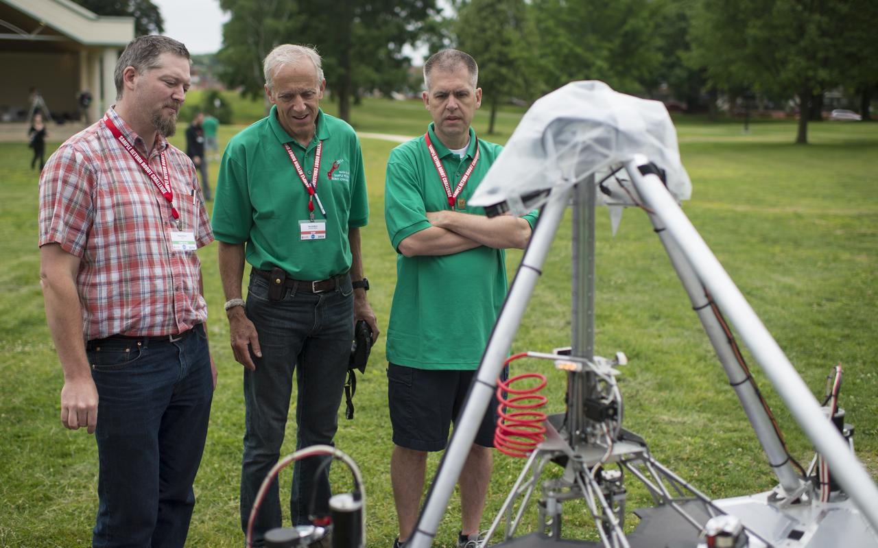
Sample Return Robot Challenge staff members confer before the team Survey robots makes it's attempt at the level two challenge during the 2014 NASA Centennial Challenges Sample Return Robot Challenge, Thursday, June 12, 2014, at the Worcester Polytechnic Institute (WPI) in Worcester, Mass. Eighteen teams are competing for a $1.5 million NASA prize purse. Teams will be required to demonstrate autonomous robots that can locate and collect samples from a wide and varied terrain, operating without human control. The objective of this NASA-WPI Centennial Challenge is to encourage innovations in autonomous navigation and robotics technologies. Innovations stemming from the challenge may improve NASA's capability to explore a variety of destinations in space, as well as enhance the nation's robotic technology for use in industries and applications on Earth. Photo Credit: (NASA/Joel Kowsky)
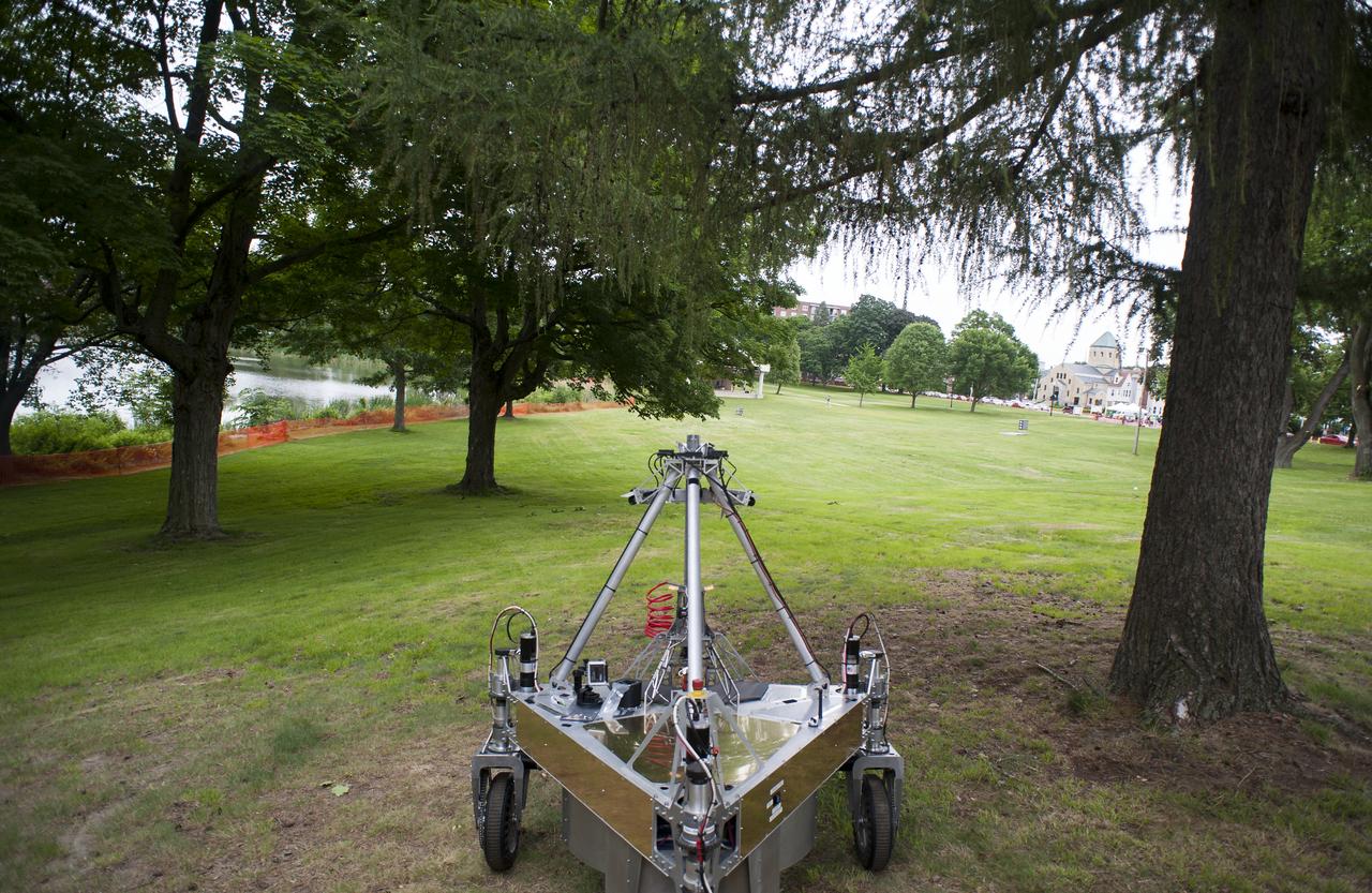
Team Survey's robot is seen as it conducts a demonstration of the level two challenge during the 2014 NASA Centennial Challenges Sample Return Robot Challenge, Thursday, June 12, 2014, at the Worcester Polytechnic Institute (WPI) in Worcester, Mass. Eighteen teams are competing for a $1.5 million NASA prize purse. Teams will be required to demonstrate autonomous robots that can locate and collect samples from a wide and varied terrain, operating without human control. The objective of this NASA-WPI Centennial Challenge is to encourage innovations in autonomous navigation and robotics technologies. Innovations stemming from the challenge may improve NASA's capability to explore a variety of destinations in space, as well as enhance the nation's robotic technology for use in industries and applications on Earth. Photo Credit: (NASA/Joel Kowsky)
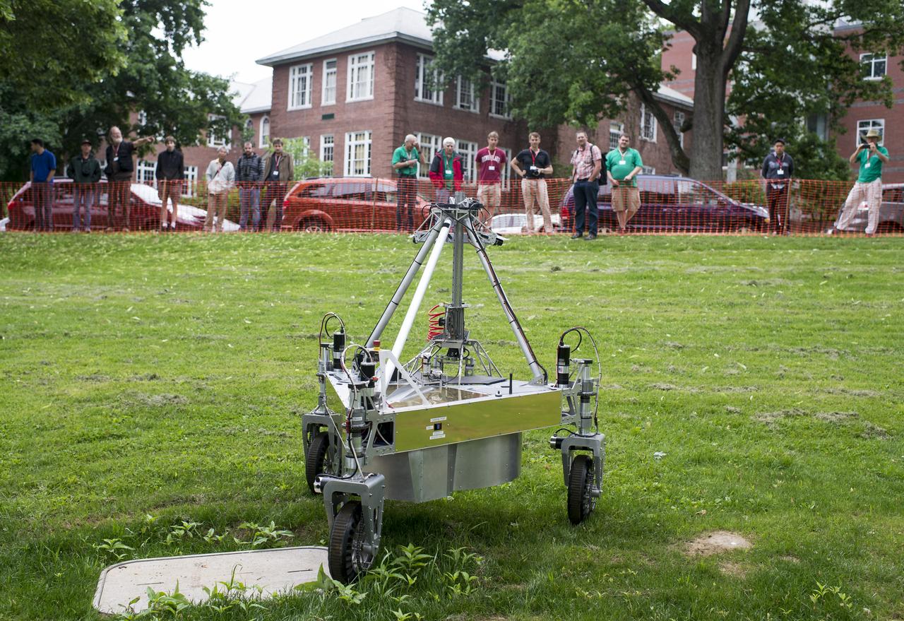
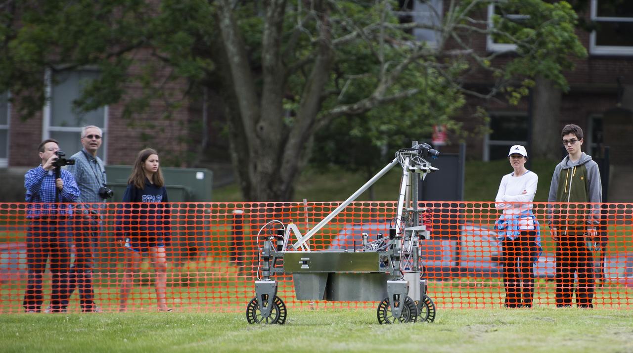
Spectators watch as the team Survey robot conducts a demonstration of the level two challenge during the 2014 NASA Centennial Challenges Sample Return Robot Challenge, Thursday, June 12, 2014, at the Worcester Polytechnic Institute (WPI) in Worcester, Mass. Eighteen teams are competing for a $1.5 million NASA prize purse. Teams will be required to demonstrate autonomous robots that can locate and collect samples from a wide and varied terrain, operating without human control. The objective of this NASA-WPI Centennial Challenge is to encourage innovations in autonomous navigation and robotics technologies. Innovations stemming from the challenge may improve NASA's capability to explore a variety of destinations in space, as well as enhance the nation's robotic technology for use in industries and applications on Earth. Photo Credit: (NASA/Joel Kowsky)
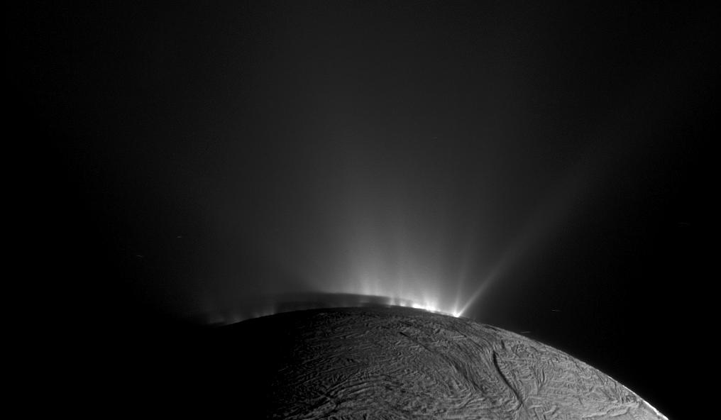
This image from NASA Cassini spacecraft, one of those acquired in the survey conducted by the Cassini imaging science team of the geyser basin at the south pole of Enceladus, was taken as Cassini was looking across the moon south pole.
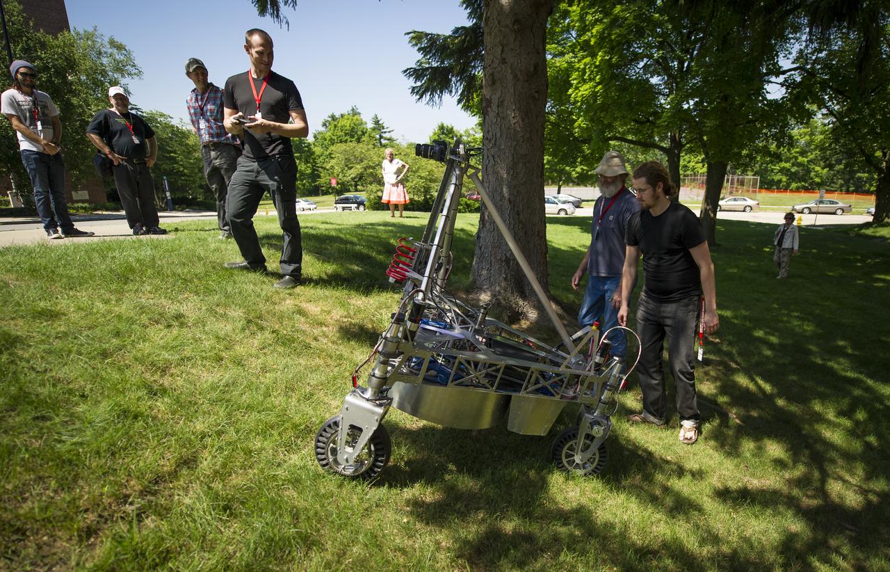
Team members of "Survey" drive their robot around the campus on Saturday, June 16, 2012 at the Worcester Polytechnic Institute (WPI) in Worcester, Mass. The Survey team was one of the final teams participating in the NASA-WPI Sample Return Robot Centennial Challenge at WPI. Teams were challenged to build autonomous robots that can identify, collect and return samples. NASA needs autonomous robotic capability for future planetary exploration. Photo Credit: (NASA/Bill Ingalls)

To celebrate the one-year anniversary of the launch of NASA Wide-Field Infrared Explorer, the mission team put together this image showing just a sample of the millions of galaxies that have been imaged by WISE during its survey of the entire sky.
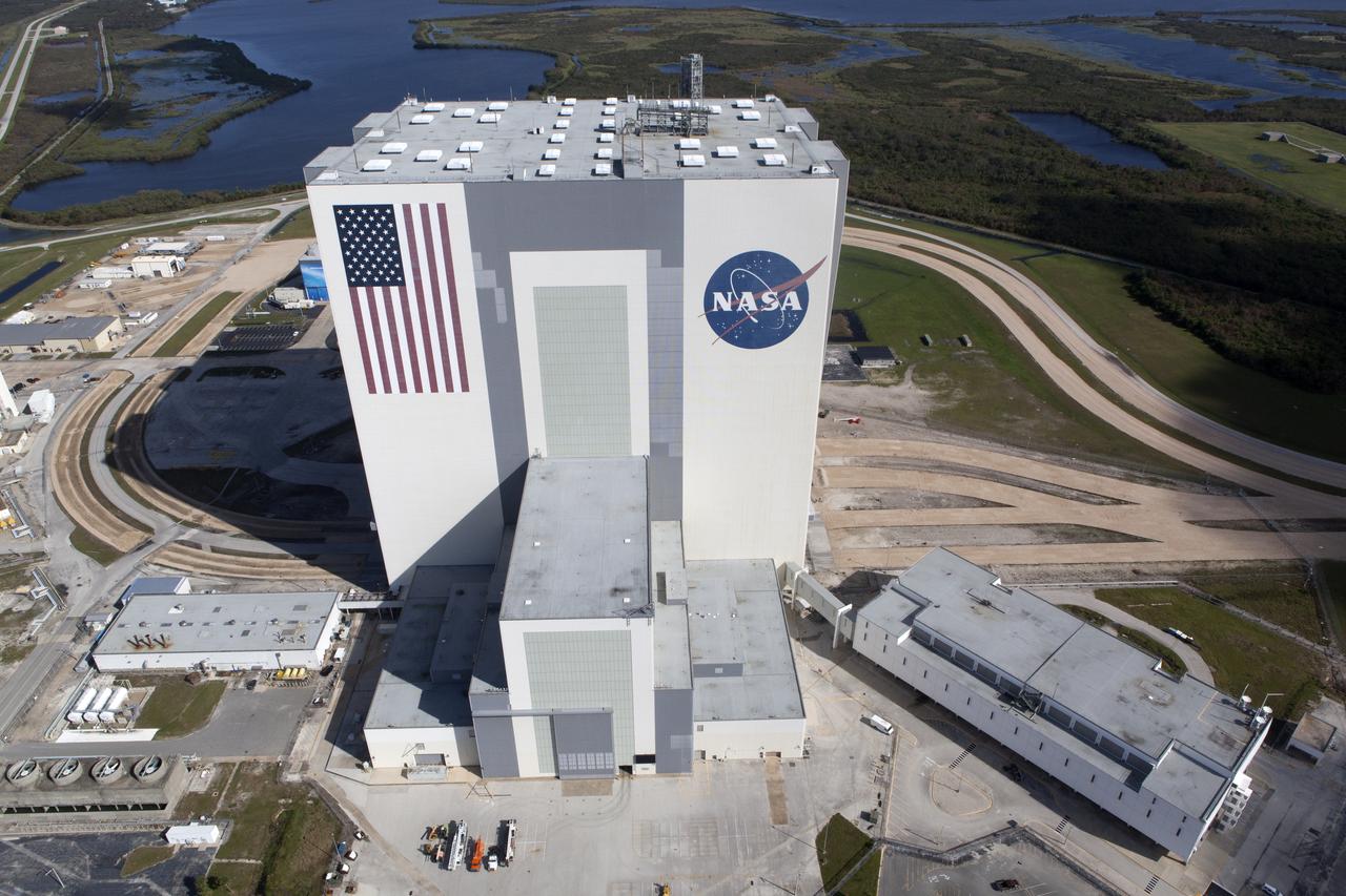
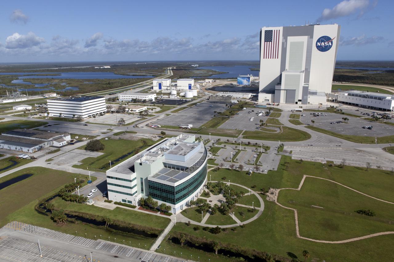
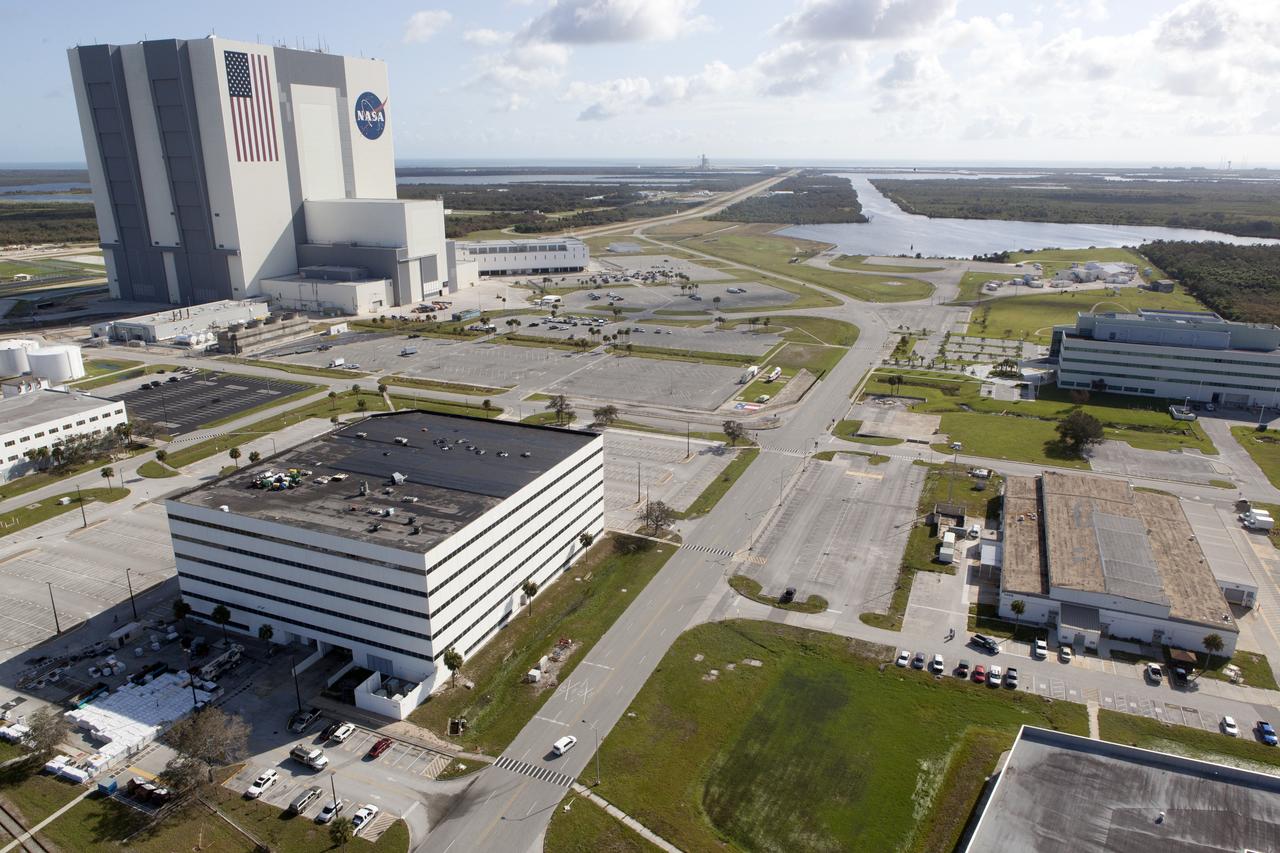
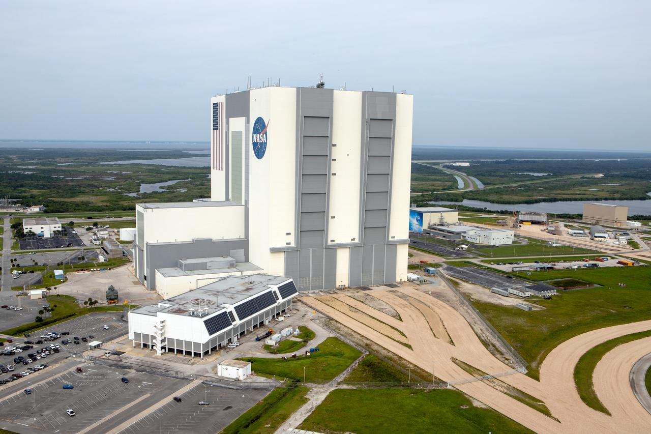
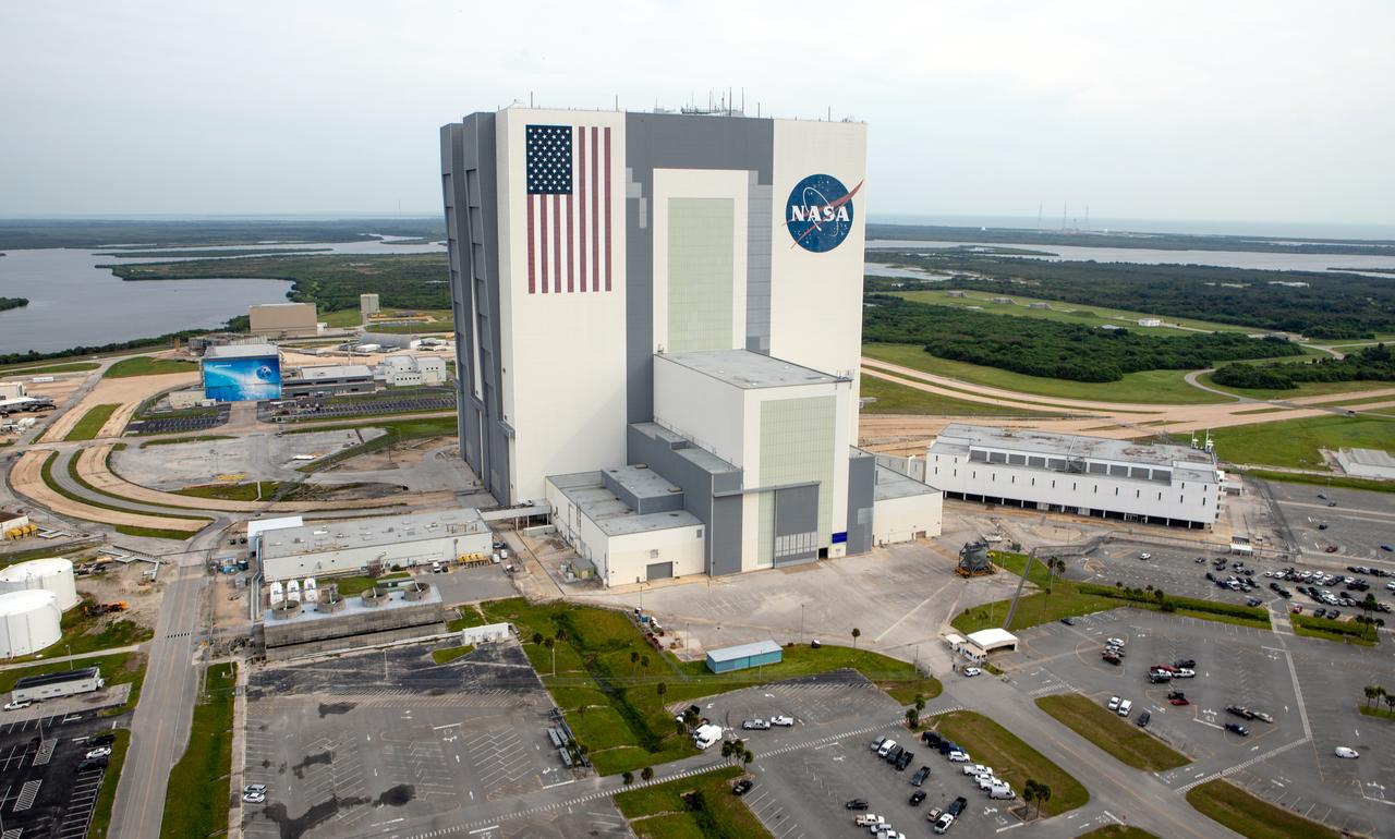
The Vehicle Assembly Building (VAB), Launch Control Center (LCC), and Launch Complex 39 surrounding areas are seen during an aerial survey of NASA's Kennedy Space Center in Florida on September 12, 2017. The survey was performed to identify structures and facilities that may have sustained damage from Hurricane Irma as the storm passed Kennedy on September 10, 2017. NASA closed the center ahead of the storm's onset and only a small team of specialists known as the Rideout Team was on the center as the storm approached and passed.
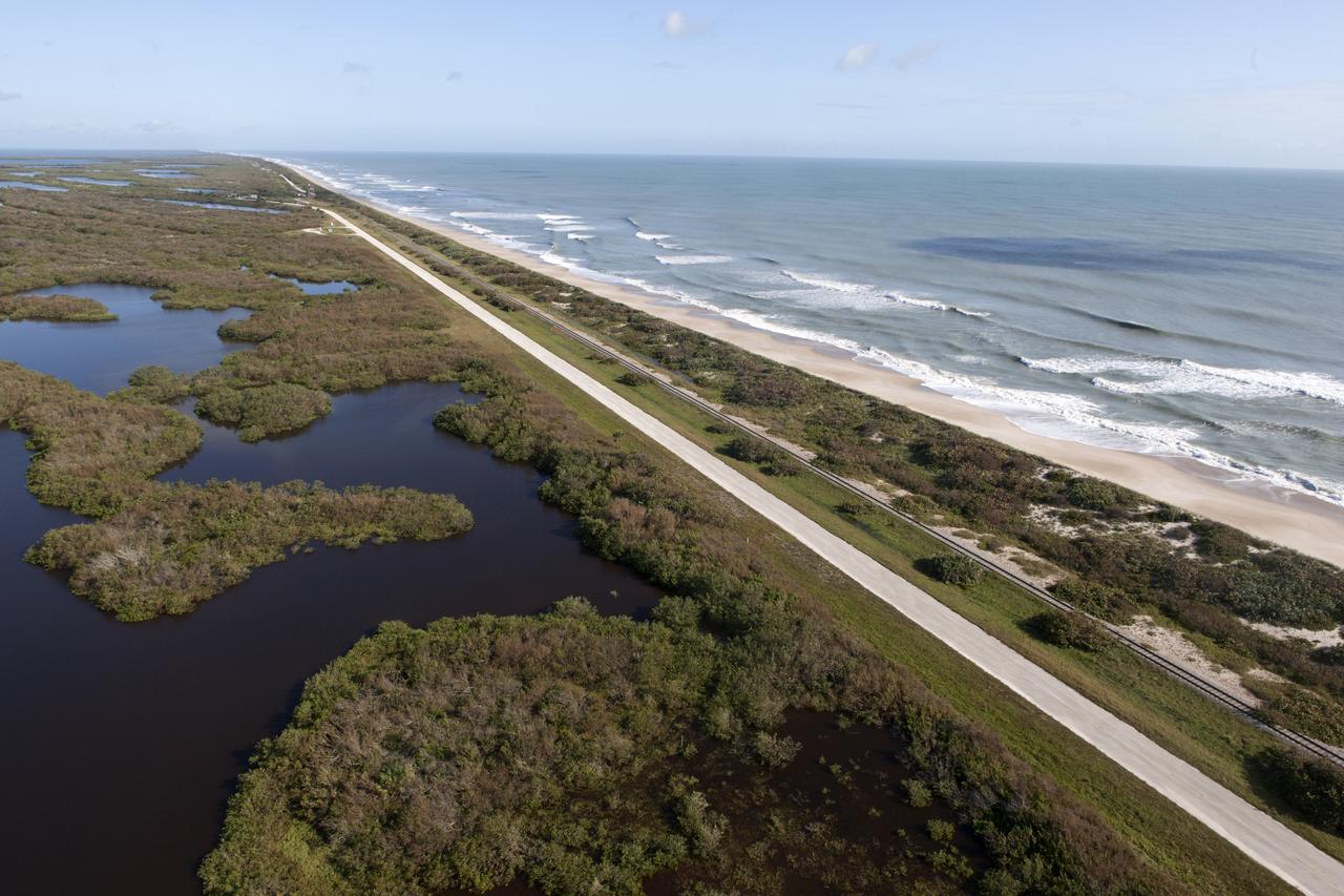
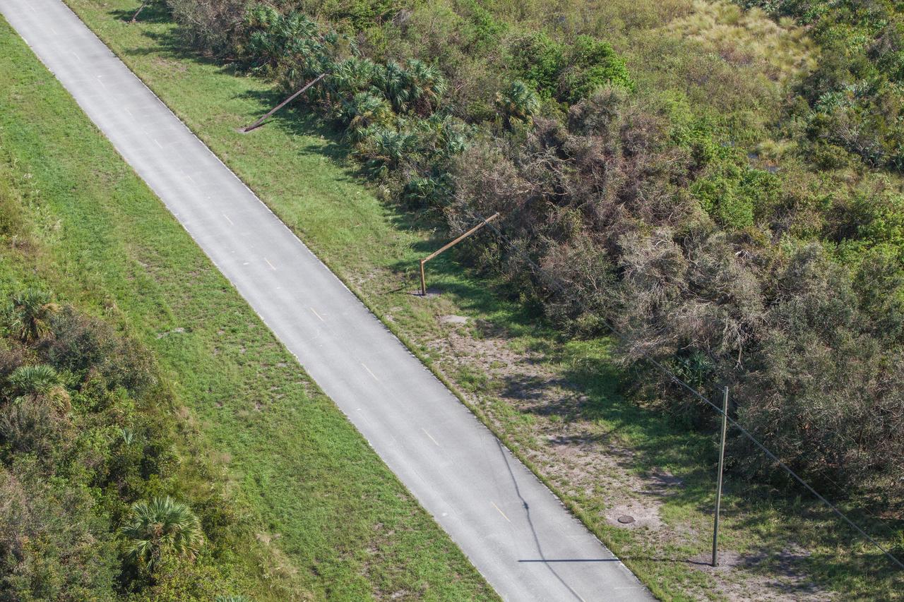
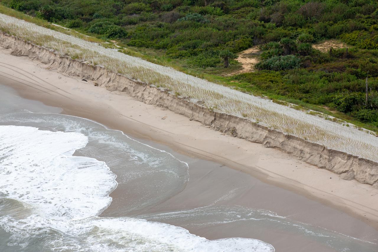
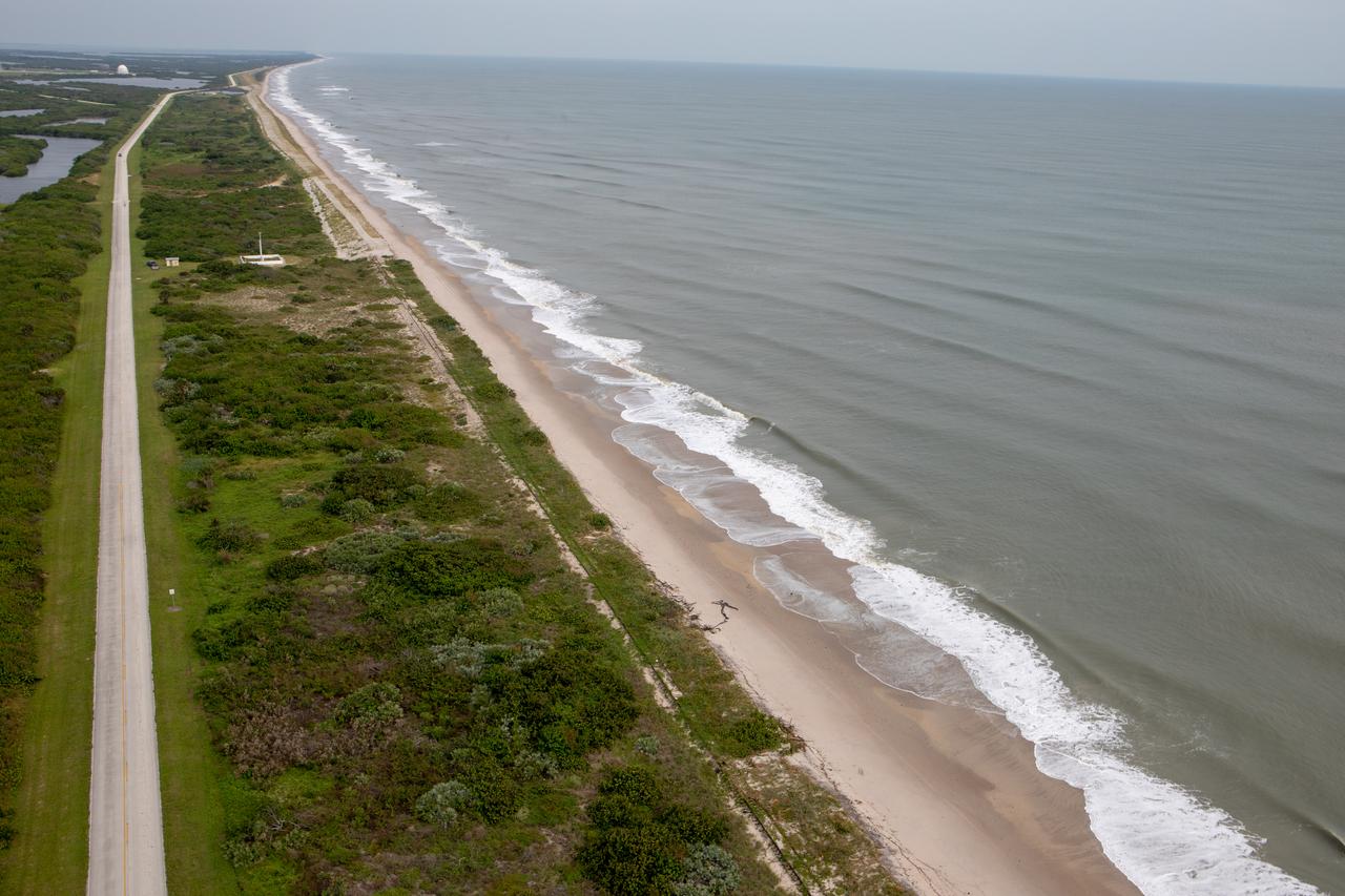
The shoreline is seen during an aerial survey of NASA's Kennedy Space Center in Florida on September 12, 2017. The survey was performed to identify structures and facilities that may have sustained damage from Hurricane Irma as the storm passed Kennedy on September 10, 2017. NASA closed the center ahead of the storm's onset and only a small team of specialists known as the Rideout Team was on the center as the storm approached and passed.
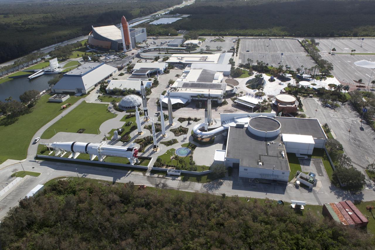
The Kennedy Space Center Visitor Complex is seen during an aerial survey of NASA's Kennedy Space Center in Florida on September 12, 2017. The survey was performed to identify structures and facilities that may have sustained damage from Hurricane Irma as the storm passed Kennedy on September 10, 2017. NASA closed the center ahead of the storm's onset and only a small team of specialists known as the Rideout Team was on the center as the storm approached and passed.
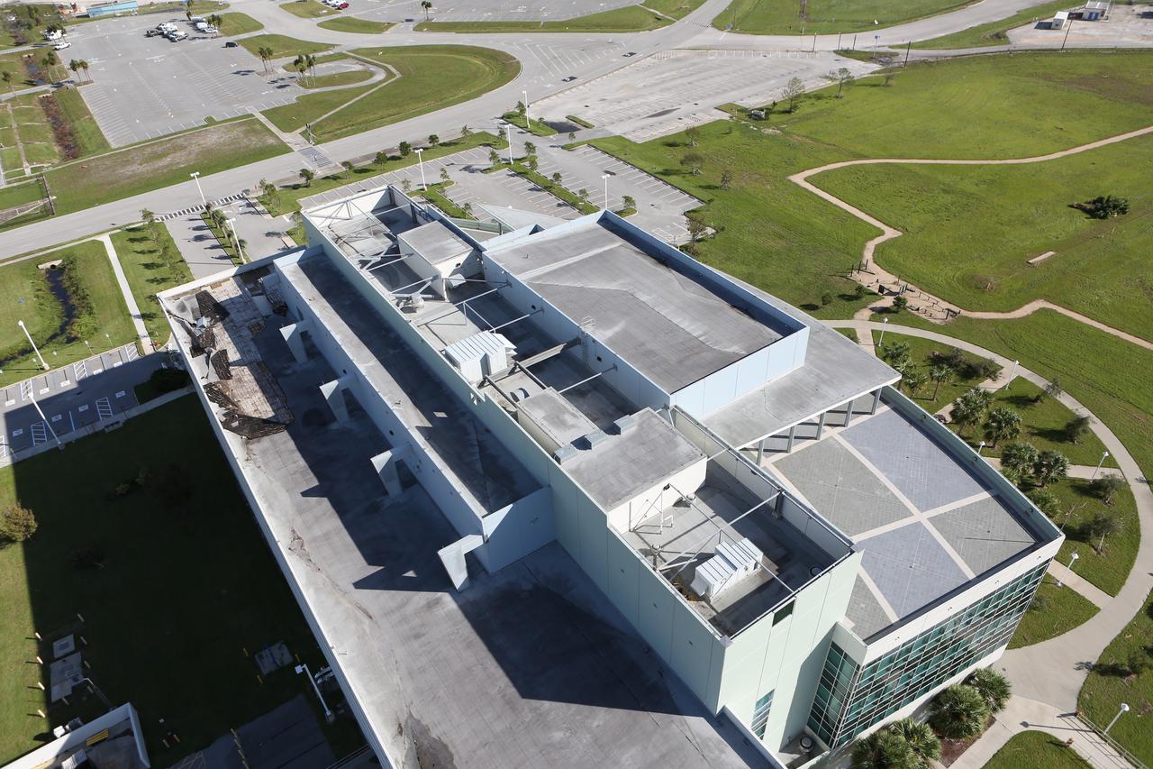
The Central Campus construction site is seen during an aerial survey of NASA's Kennedy Space Center in Florida on September 12, 2017. The survey was performed to identify structures and facilities that may have sustained damage from Hurricane Irma as the storm passed Kennedy on September 10, 2017. NASA closed the center ahead of the storm’s onset and only a small team of specialists known as the Rideout Team was on the center as the storm approached and passed.
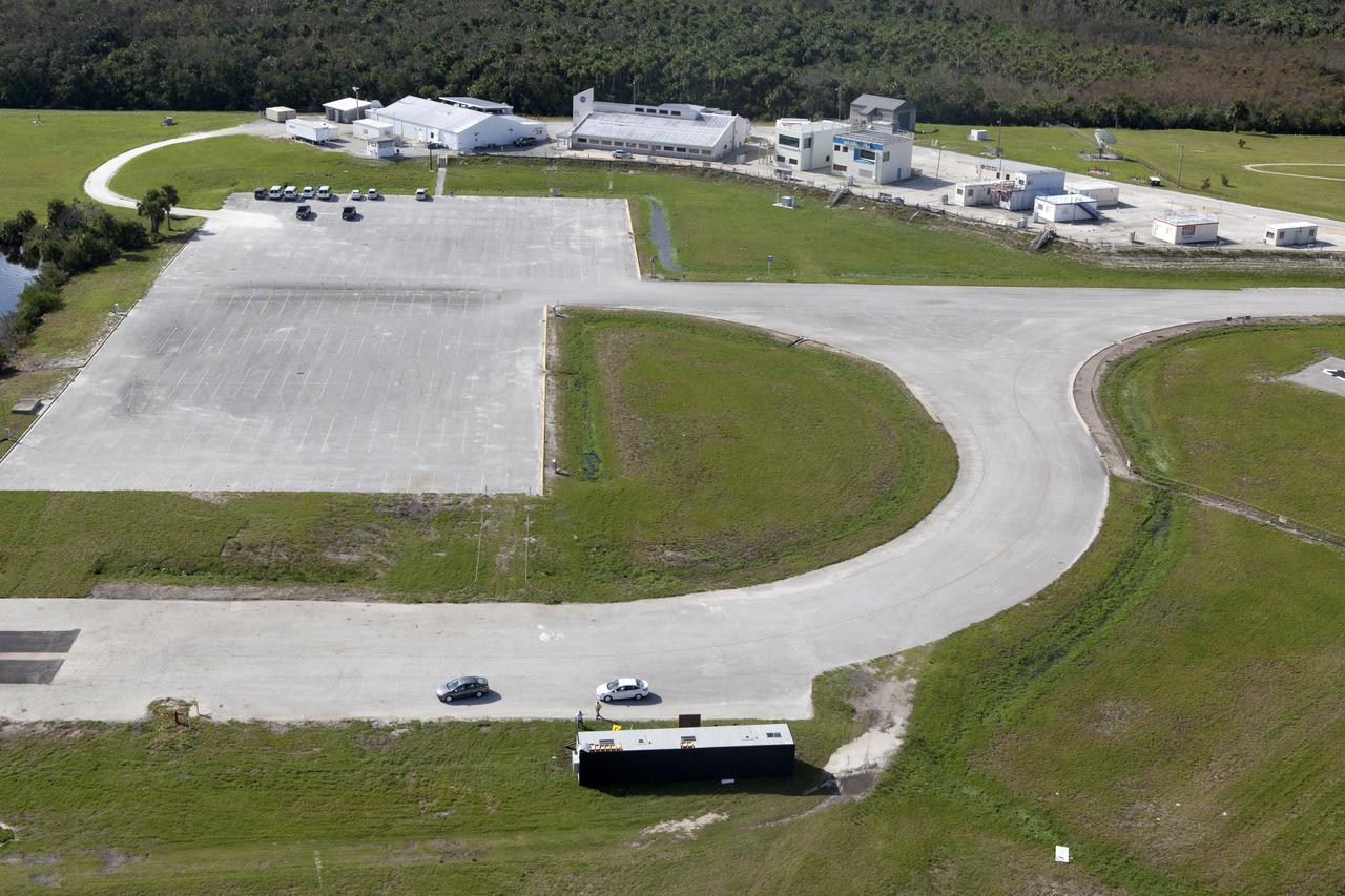
The Launch Complex 39 Press Site is seen during an aerial survey of NASA's Kennedy Space Center in Florida on September 12, 2017. The survey was performed to identify structures and facilities that may have sustained damage from Hurricane Irma as the storm passed Kennedy on September 10, 2017. NASA closed the center ahead of the storm's onset and only a small team of specialists known as the Rideout Team was on the center as the storm approached and passed.
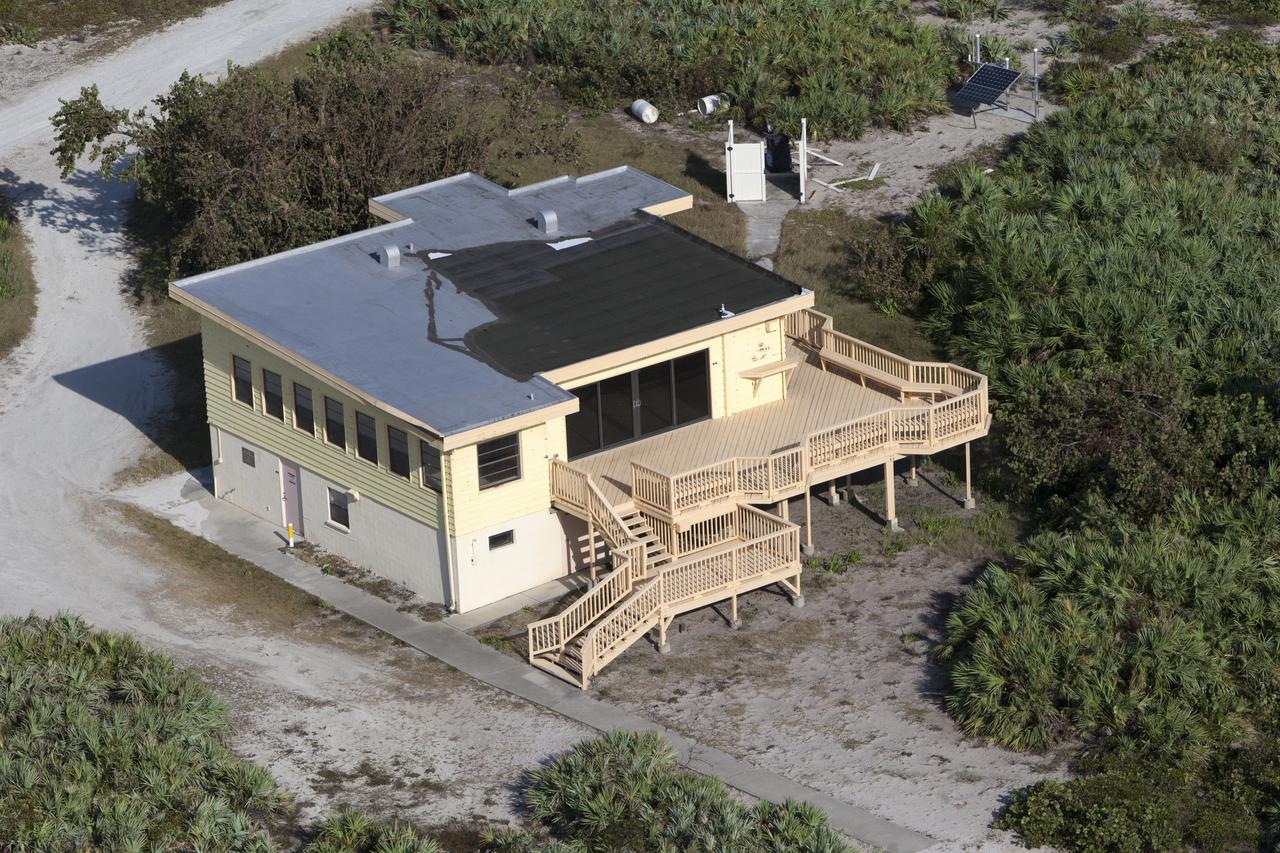
The Beach House is seen during an aerial survey of NASA's Kennedy Space Center in Florida on September 12, 2017. The survey was performed to identify structures and facilities that may have sustained damage from Hurricane Irma as the storm passed Kennedy on September 10, 2017. NASA closed the center ahead of the storm's onset and only a small team of specialists known as the Rideout Team was on the center as the storm approached and passed.
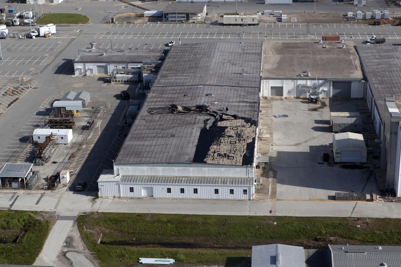
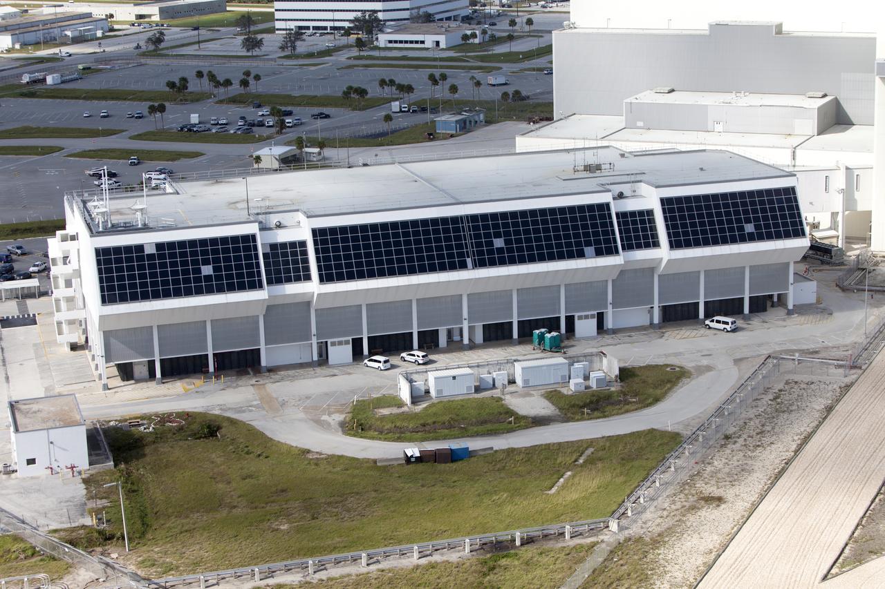
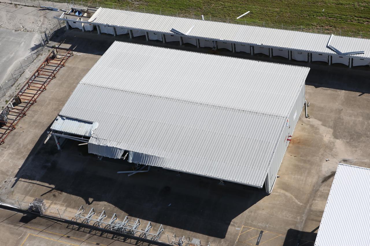
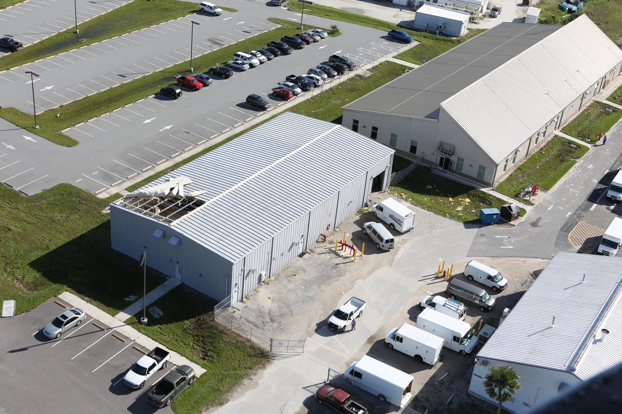
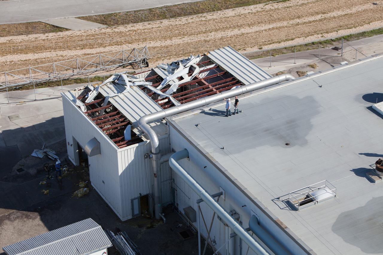
An industrial building behind the Space Station Processing Facility (SSPF) is seen during an aerial survey of NASA's Kennedy Space Center in Florida on September 12, 2017. The survey was performed to identify structures and facilities that may have sustained damage from Hurricane Irma as the storm passed Kennedy on September 10, 2017. NASA closed the center ahead of the storm's onset and only a small team of specialists known as the Rideout Team was on the center as the storm approached and passed.
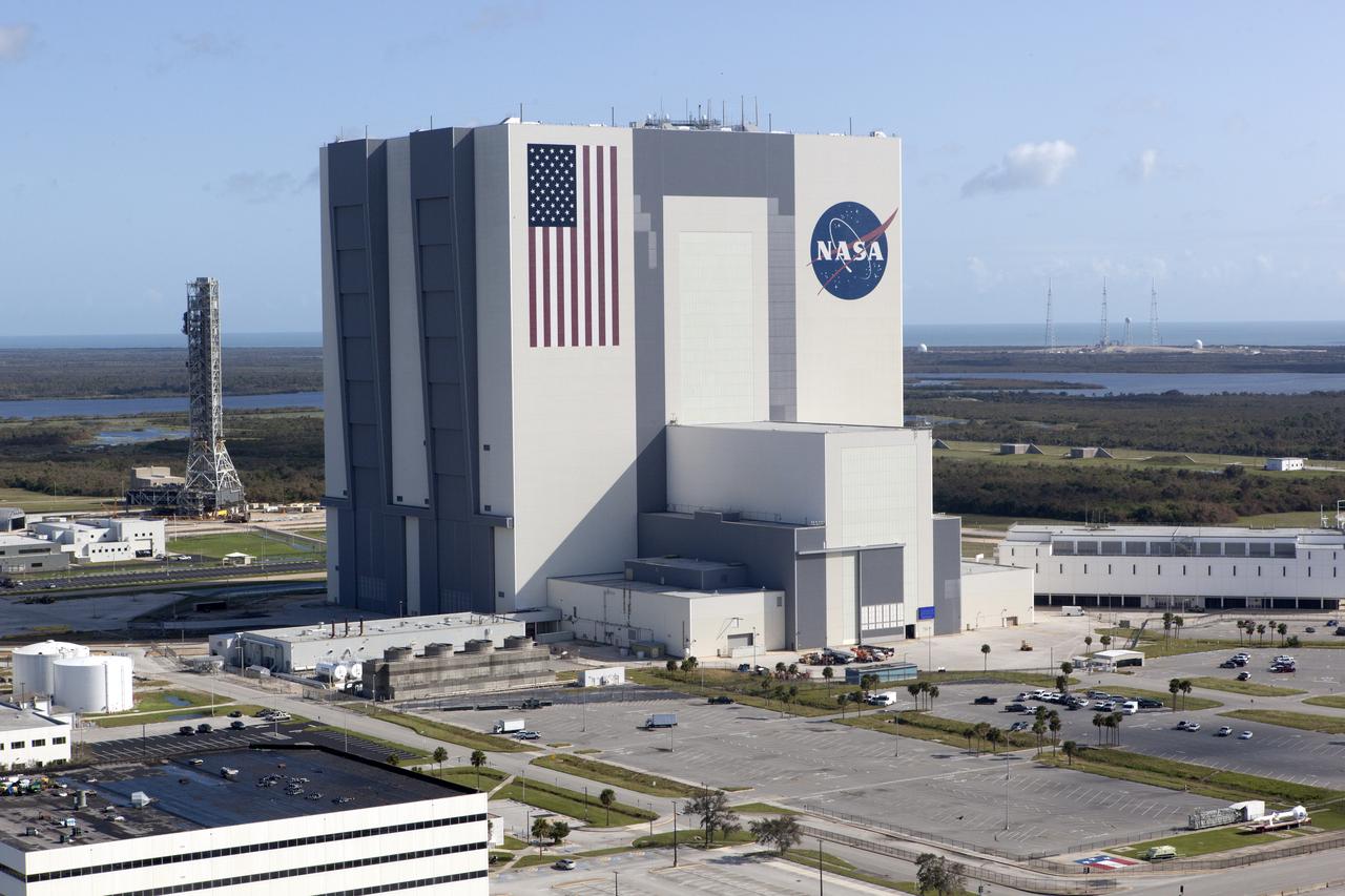
The Mobile Launcher (ML), Vehicle Assembly Building (VAB), Launch Control Center (LCC), and Launch Complex 39 surrounding areas are seen during an aerial survey of NASA's Kennedy Space Center in Florida on September 12, 2017. The survey was performed to identify structures and facilities that may have sustained damage from Hurricane Irma as the storm passed Kennedy on September 10, 2017. NASA closed the center ahead of the storm's onset and only a small team of specialists known as the Rideout Team was on the center as the storm approached and passed.
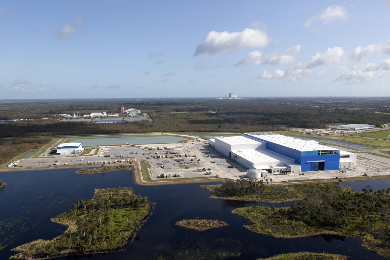
The Blue Origin construction site at Exploration Park is seen during an aerial survey of NASA's Kennedy Space Center in Florida on September 12, 2017. The survey was performed to identify structures and facilities that may have sustained damage from Hurricane Irma as the storm passed Kennedy on September 10, 2017. NASA closed the center ahead of the storm's onset and only a small team of specialists known as the Rideout Team was on the center as the storm approached and passed.
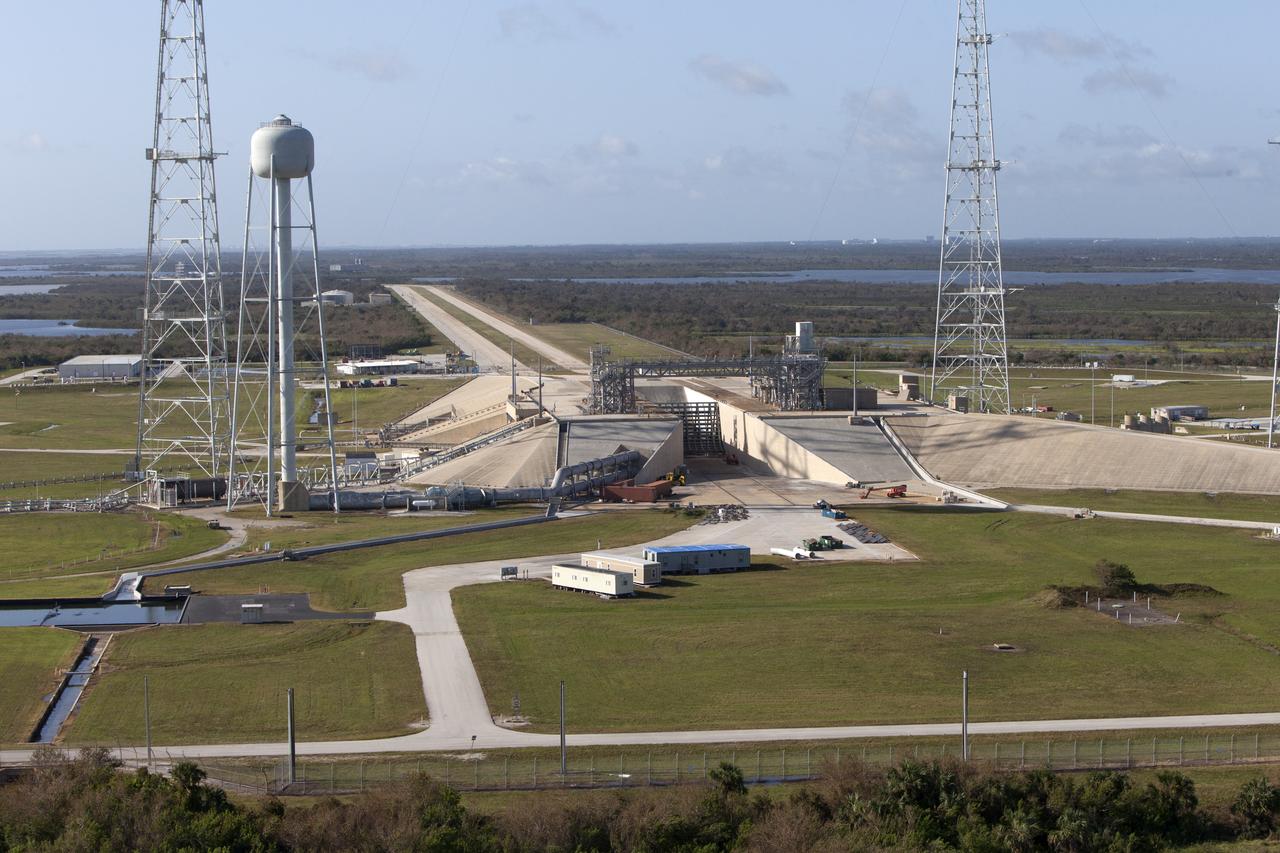
Launch Complex 39 surrounding areas are seen during an aerial survey of NASA's Kennedy Space Center in Florida on September 12, 2017. The survey was performed to identify structures and facilities that may have sustained damage from Hurricane Irma as the storm passed Kennedy on September 10, 2017. NASA closed the center ahead of the storm's onset and only a small team of specialists known as the Rideout Team was on the center as the storm approached and passed.
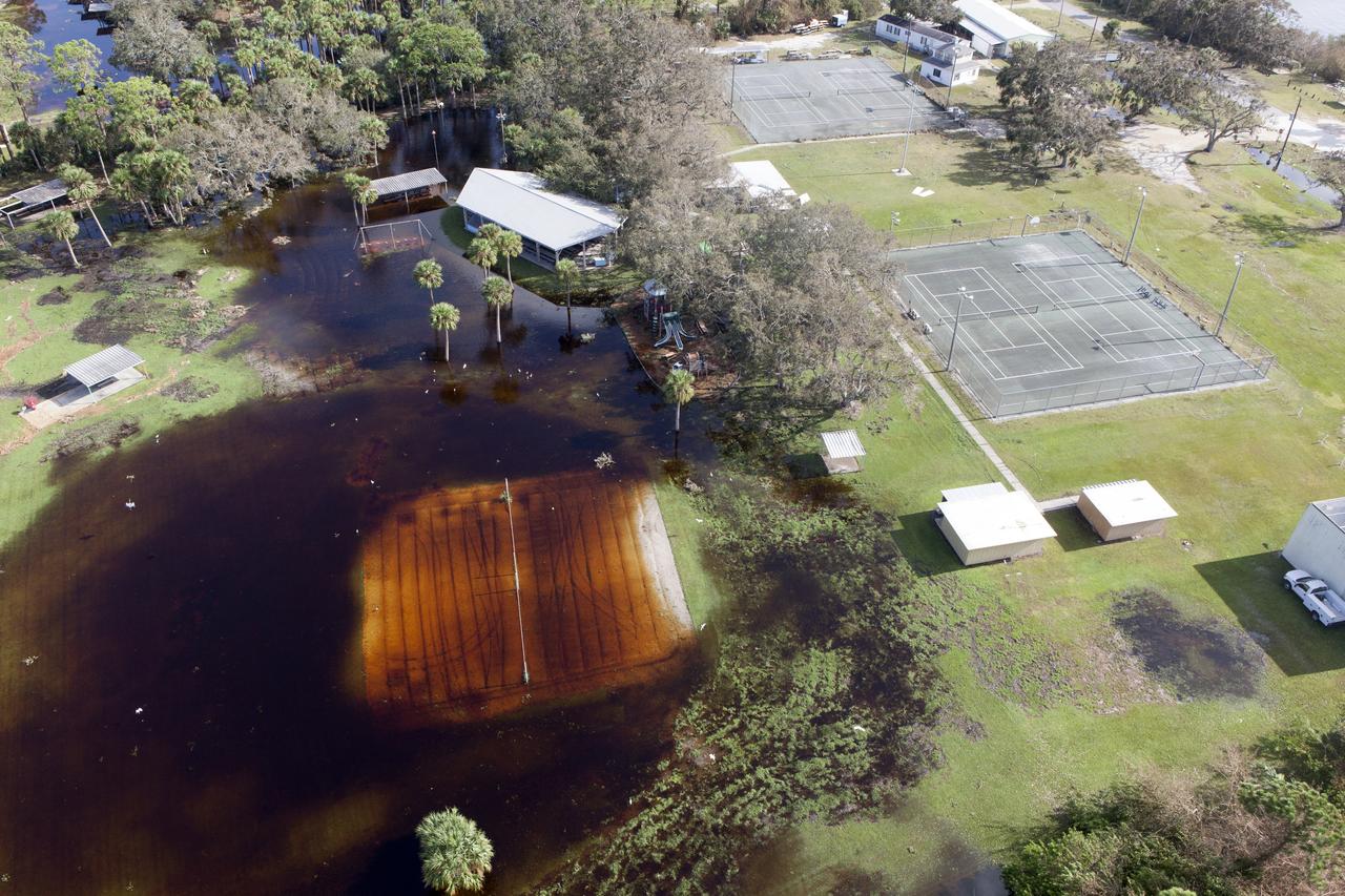
Kars Park I is seen during an aerial survey of NASA's Kennedy Space Center in Florida on September 12, 2017. The survey was performed to identify structures and facilities that may have sustained damage from Hurricane Irma as the storm passed Kennedy on September 10, 2017. NASA closed the center ahead of the storm's onset and only a small team of specialists known as the Rideout Team was on the center as the storm approached and passed.
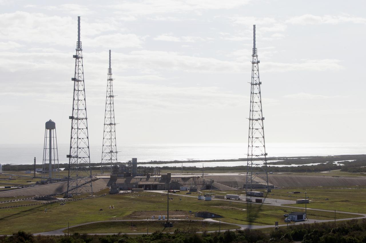
Launch Complex 39B is seen during an aerial survey of NASA's Kennedy Space Center in Florida on September 12, 2017. The survey was performed to identify structures and facilities that may have sustained damage from Hurricane Irma as the storm passed Kennedy on September 10, 2017. NASA closed the center ahead of the storm's onset and only a small team of specialists known as the Rideout Team was on the center as the storm approached and passed.
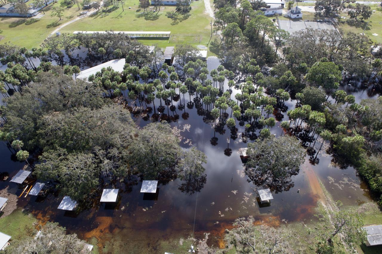
Kars Park I is seen during an aerial survey of NASA's Kennedy Space Center in Florida on September 12, 2017. The survey was performed to identify structures and facilities that may have sustained damage from Hurricane Irma as the storm passed Kennedy on September 10, 2017. NASA closed the center ahead of the storm's onset and only a small team of specialists known as the Rideout Team was on the center as the storm approached and passed.
A tank stroage unit near Launch Complex 39 is seen during an aerial survey of NASA's Kennedy Space Center in Florida on September 12, 2017. The survey was performed to identify structures and facilities that may have sustained damage from Hurricane Irma as the storm passed Kennedy on September 10, 2017. NASA closed the center ahead of the storm's onset and only a small team of specialists known as the Rideout Team was on the center as the storm approached and passed.
Launch Complex 39B is seen during an aerial survey of NASA's Kennedy Space Center in Florida on September 12, 2017. The survey was performed to identify structures and facilities that may have sustained damage from Hurricane Irma as the storm passed Kennedy on September 10, 2017. NASA closed the center ahead of the storm's onset and only a small team of specialists known as the Rideout Team was on the center as the storm approached and passed.
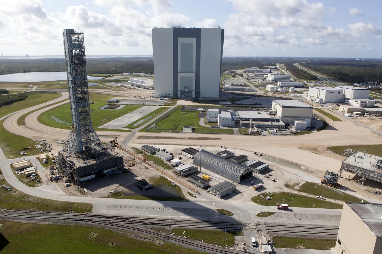
The Mobile Launcher (ML), Launch Control Center (LCC), Vehicle Assembly Building (VAB), and Launch Complex 39 surrounding areas are seen during an aerial survey of NASA's Kennedy Space Center in Florida on September 12, 2017. The survey was performed to identify structures and facilities that may have sustained damage from Hurricane Irma as the storm passed Kennedy on September 10, 2017. NASA closed the center ahead of the storm's onset and only a small team of specialists known as the Rideout Team was on the center as the storm approached and passed.
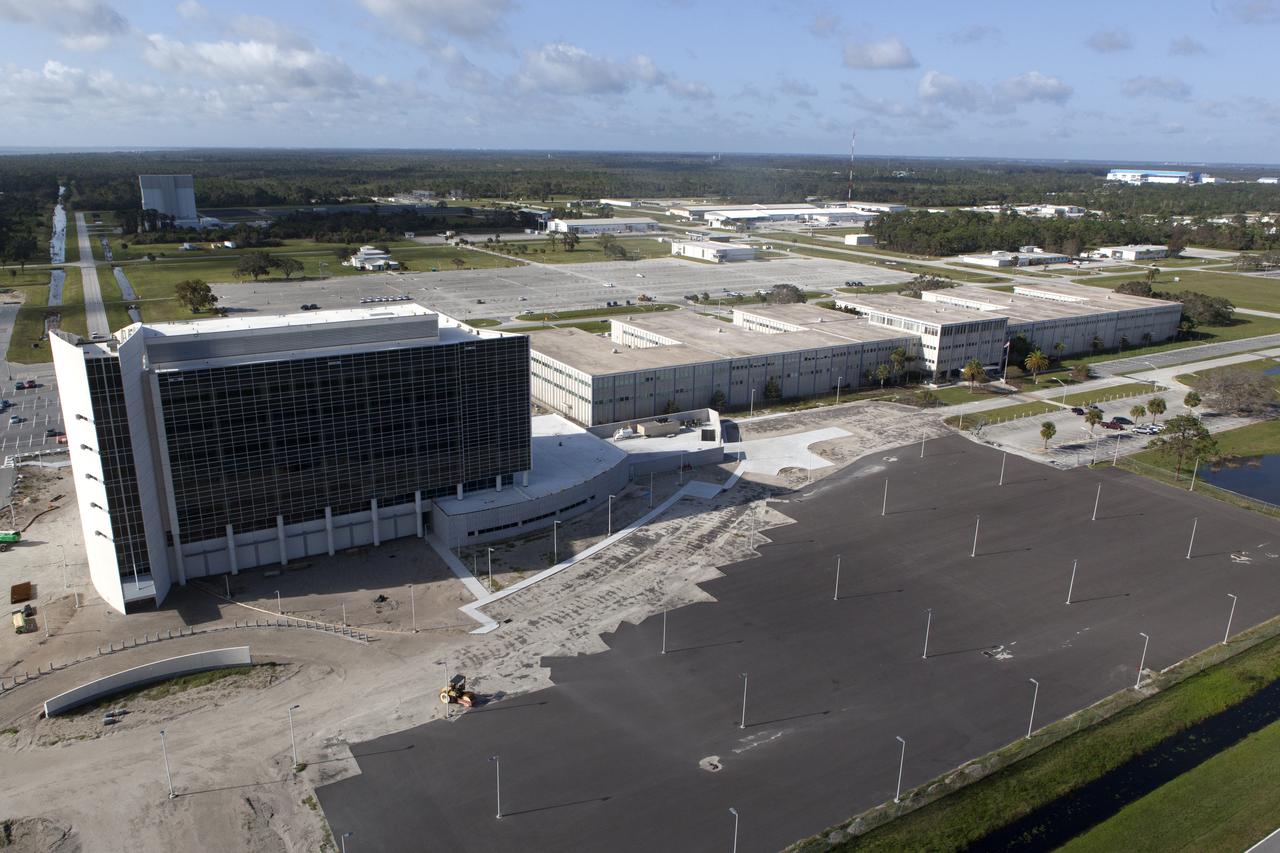
The Central Campus construction site and Headquarters building are seen during an aerial survey of NASA's Kennedy Space Center in Florida on September 12, 2017. The survey was performed to identify structures and facilities that may have sustained damage from Hurricane Irma as the storm passed Kennedy on September 10, 2017. NASA closed the center ahead of the storm's onset and only a small team of specialists known as the Rideout Team was on the center as the storm approached and passed.
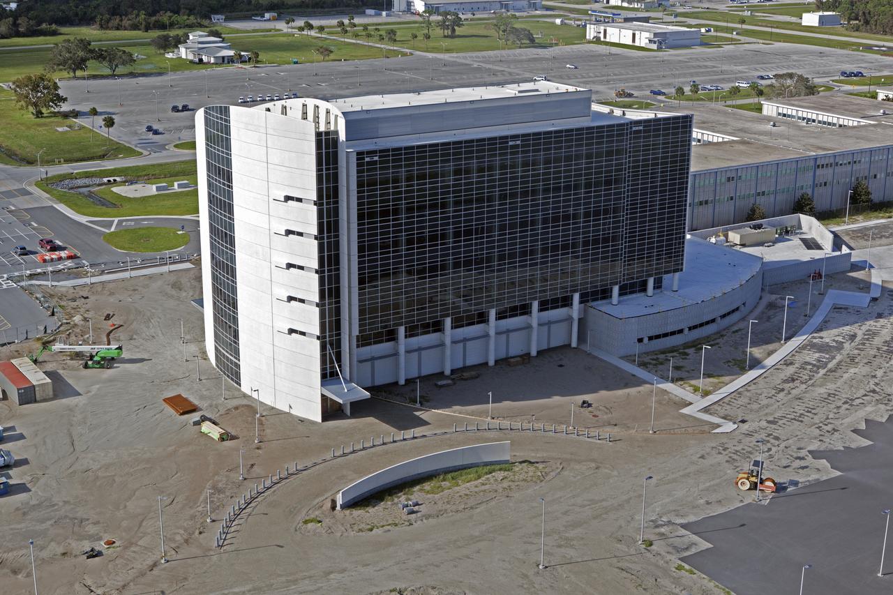
The Central Campus construction site is seen during an aerial survey of NASA's Kennedy Space Center in Florida on September 12, 2017. The survey was performed to identify structures and facilities that may have sustained damage from Hurricane Irma as the storm passed Kennedy on September 10, 2017. NASA closed the center ahead of the storm’s onset and only a small team of specialists known as the Rideout Team was on the center as the storm approached and passed.
Launch Complex 39 surrounding areas are seen during an aerial survey of NASA's Kennedy Space Center in Florida on September 12, 2017. The survey was performed to identify structures and facilities that may have sustained damage from Hurricane Irma as the storm passed Kennedy on September 10, 2017. NASA closed the center ahead of the storm's onset and only a small team of specialists known as the Rideout Team was on the center as the storm approached and passed.
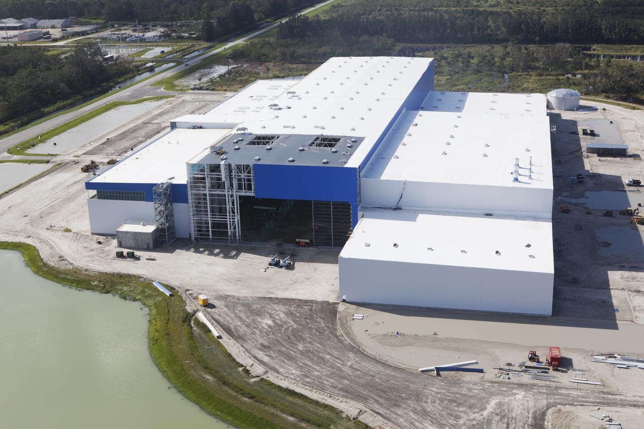
The Blue Origin construction site at Exploration Park is seen during an aerial survey of NASA's Kennedy Space Center in Florida on September 12, 2017. The survey was performed to identify structures and facilities that may have sustained damage from Hurricane Irma as the storm passed Kennedy on September 10, 2017. NASA closed the center ahead of the storm's onset and only a small team of specialists known as the Rideout Team was on the center as the storm approached and passed.
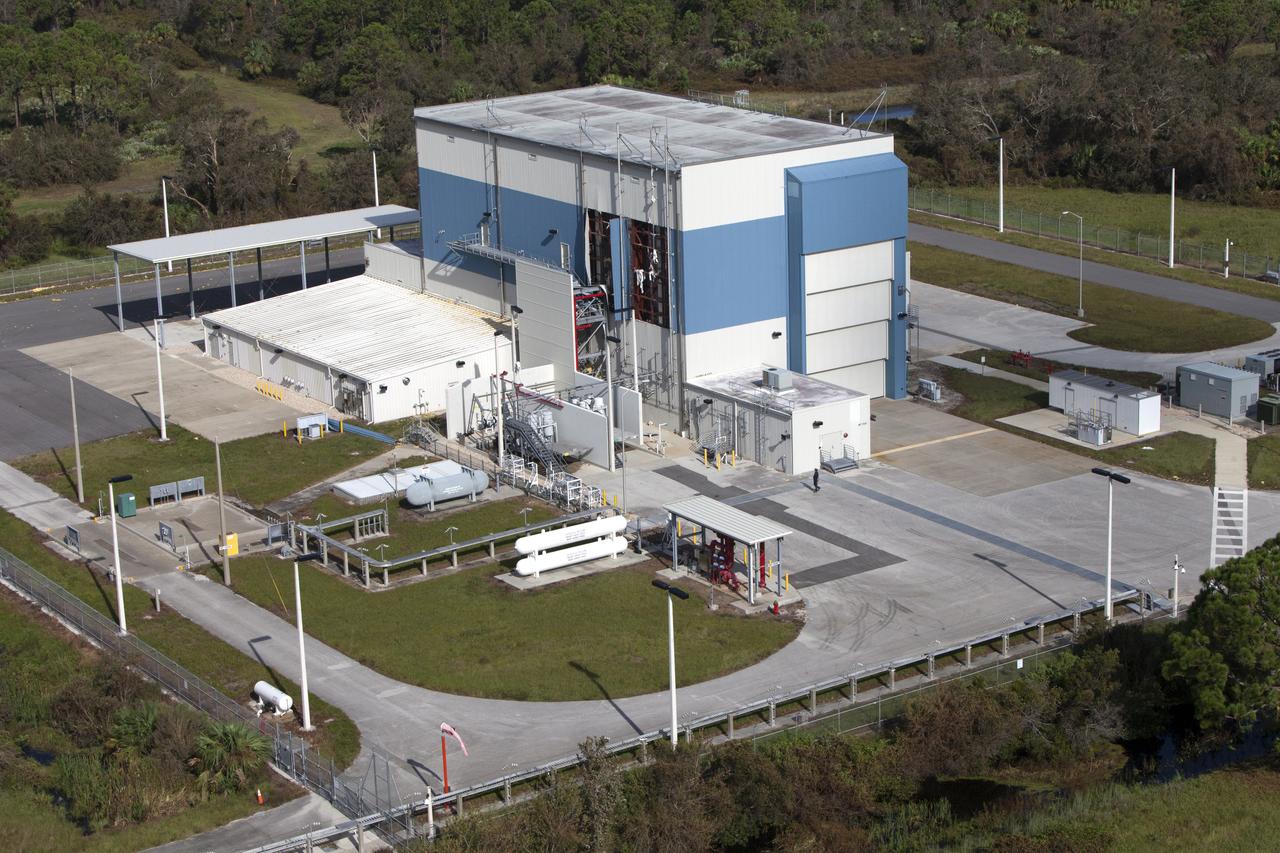
The Multi-Payload Processing Facility (MPPF) is seen during an aerial survey of NASA's Kennedy Space Center in Florida on September 12, 2017. The survey was performed to identify structures and facilities that may have sustained damage from Hurricane Irma as the storm passed Kennedy on September 10, 2017. NASA closed the center ahead of the storm's onset and only a small team of specialists known as the Rideout Team was on the center as the storm approached and passed.
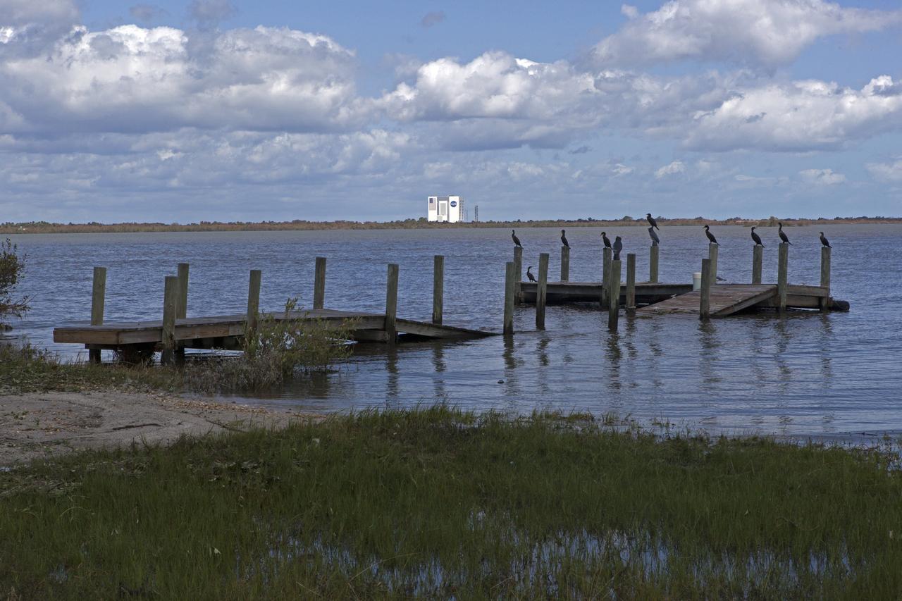
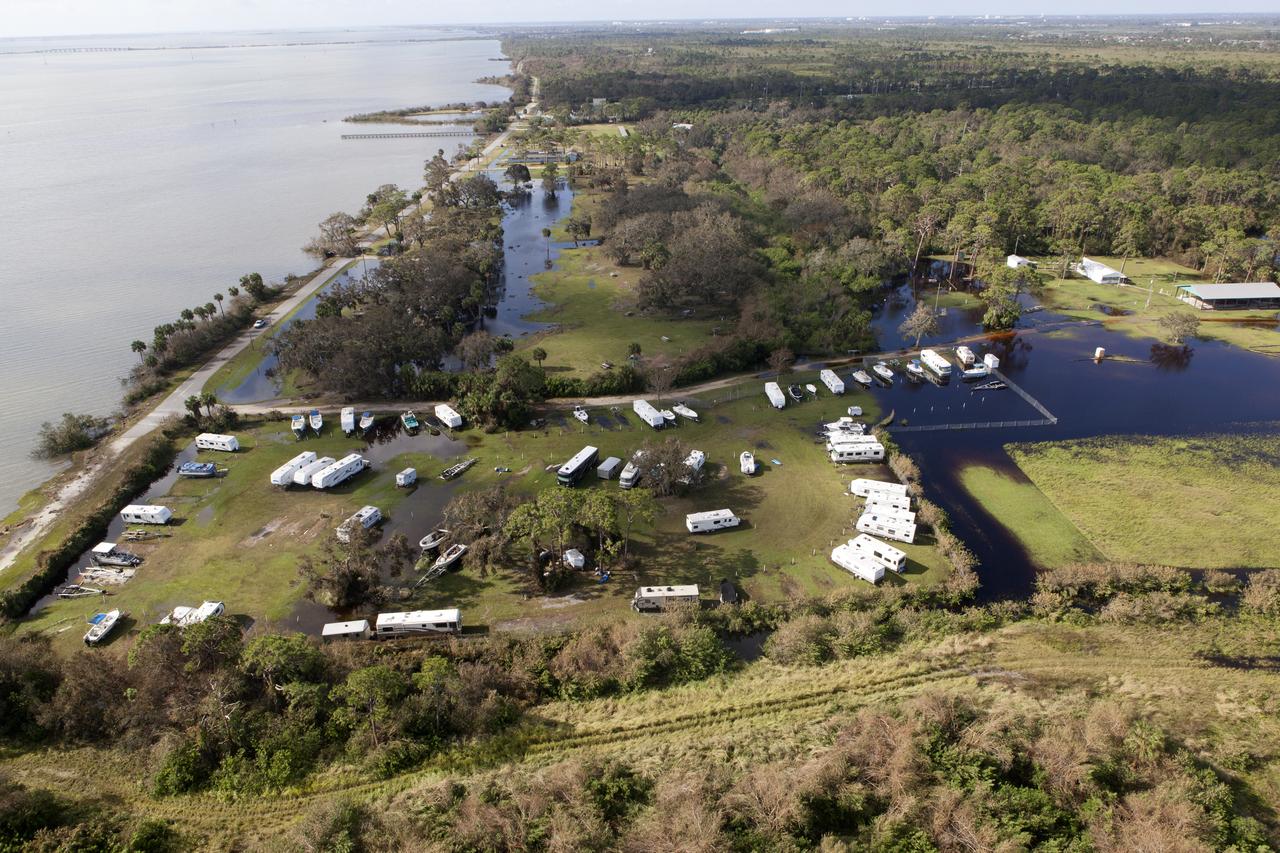
A boat dock torn apart is seen during a survey of NASA's Kennedy Space Center in Florida on September 12, 2017. The survey was performed to identify structures and facilities that may have sustained damage from Hurricane Irma as the storm passed Kennedy on September 10, 2017. NASA closed the center ahead of the storm's onset and only a small team of specialists known as the Rideout Team was on the center as the storm approached and passed.
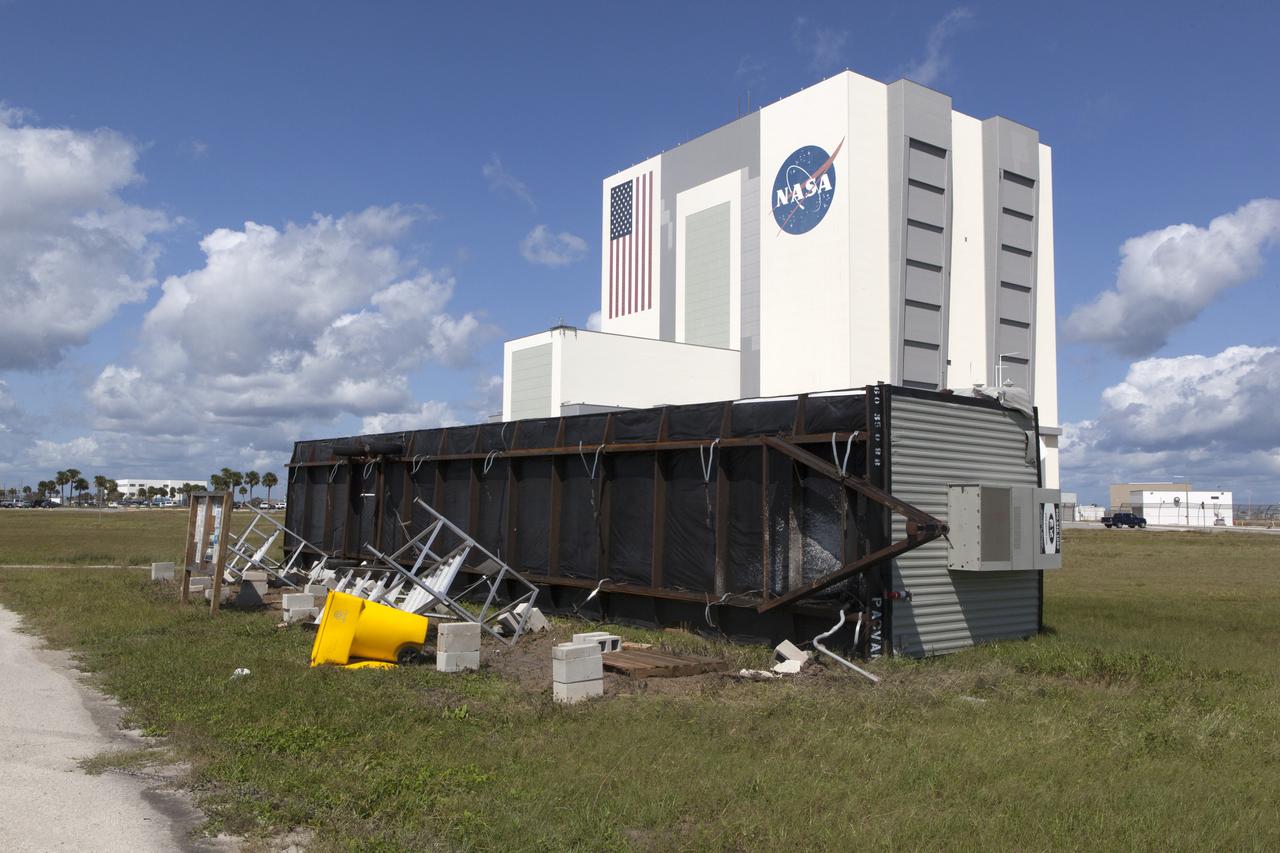
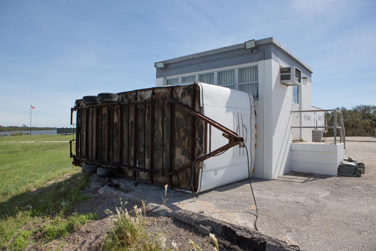
A trailer flipped on it's side at the Turn Basin is seen during a survey of NASA's Kennedy Space Center in Florida on September 12, 2017. The survey was performed to identify structures and facilities that may have sustained damage from Hurricane Irma as the storm passed Kennedy on September 10, 2017. NASA closed the center ahead of the storm's onset and only a small team of specialists known as the Rideout Team was on the center as the storm approached and passed.
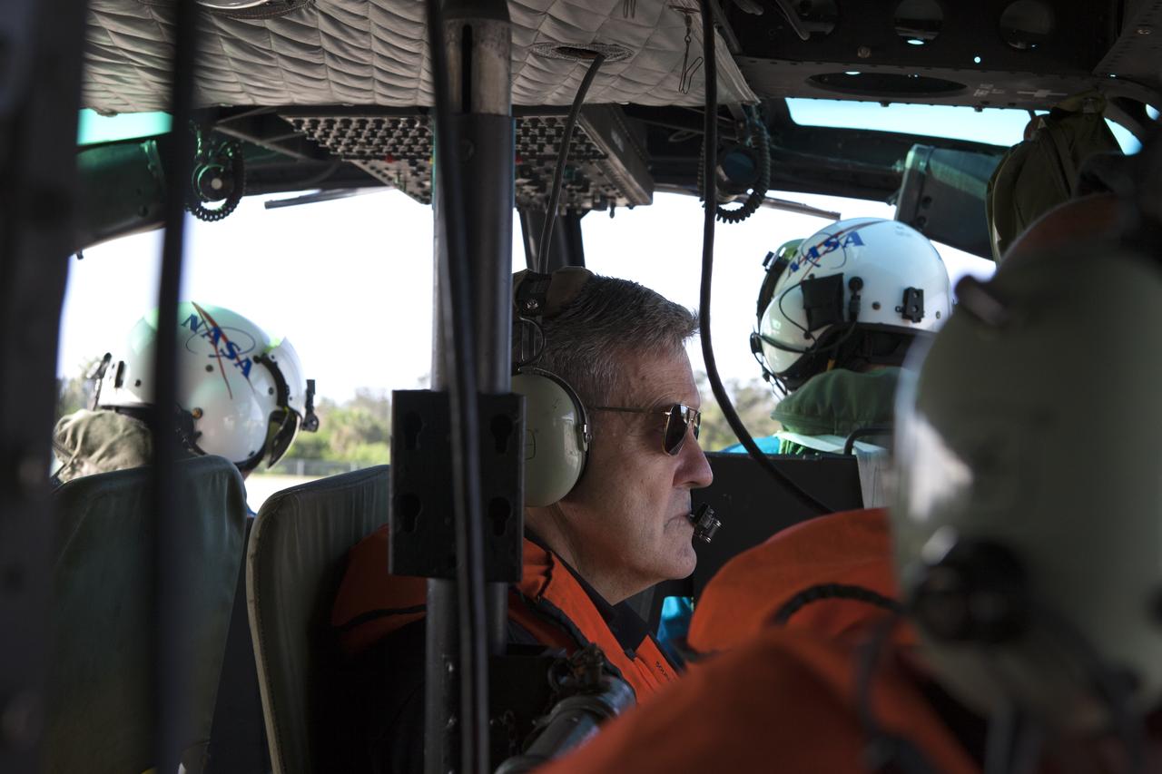
Center Director, Robert Cabana, conducts an aerial survey of NASA's Kennedy Space Center in Florida on September 12, 2017. The survey was performed to identify structures and facilities that may have sustained damage from Hurricane Irma as the storm passed Kennedy on September 10, 2017. NASA closed the center ahead of the storm's onset and only a small team of specialists known as the Rideout Team was on the center as the storm approached and passed.
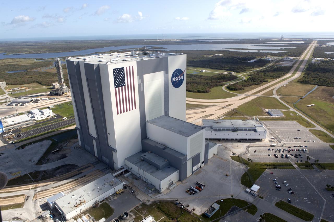
The Mobile Launcher (ML), Vehicle Assembly Building (VAB), Launch Control Center (LCC), and Launch Complex 39 surrounding areas are seen during an aerial survey of NASA's Kennedy Space Center in Florida on September 12, 2017. The survey was performed to identify structures and facilities that may have sustained damage from Hurricane Irma as the storm passed Kennedy on September 10, 2017. NASA closed the center ahead of the storm's onset and only a small team of specialists known as the Rideout Team was on the center as the storm approached and passed.
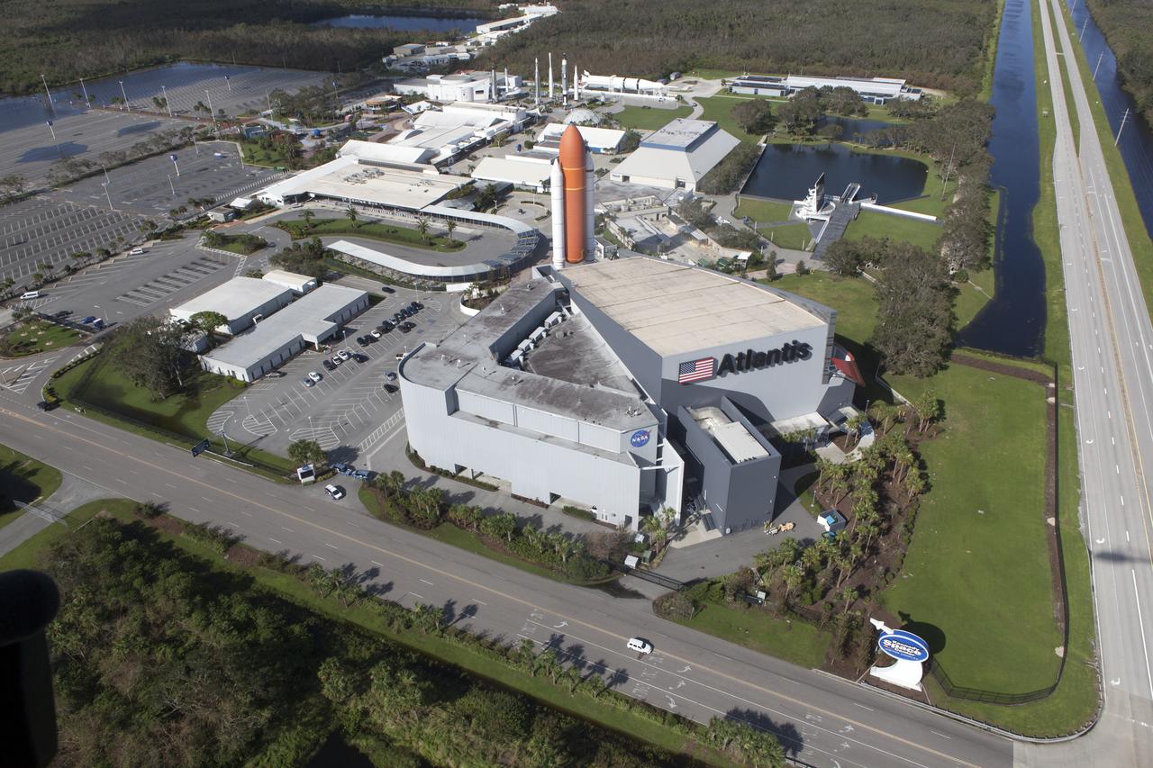
The Kennedy Space Center Visitor Complex is seen during an aerial survey of NASA's Kennedy Space Center in Florida on September 12, 2017. The survey was performed to identify structures and facilities that may have sustained damage from Hurricane Irma as the storm passed Kennedy on September 10, 2017. NASA closed the center ahead of the storm's onset and only a small team of specialists known as the Rideout Team was on the center as the storm approached and passed.
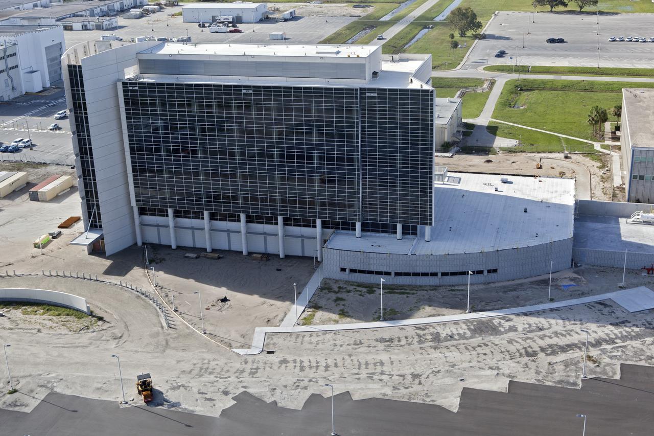
The Launch Control Center (LCC) is seen during an aerial survey of NASA's Kennedy Space Center in Florida on September 12, 2017. The survey was performed to identify structures and facilities that may have sustained damage from Hurricane Irma as the storm passed Kennedy on September 10, 2017. NASA closed the center ahead of the storm's onset and only a small team of specialists known as the Rideout Team was on the center as the storm approached and passed.
Kars Park I is seen during an aerial survey of NASA's Kennedy Space Center in Florida on September 12, 2017. The survey was performed to identify structures and facilities that may have sustained damage from Hurricane Irma as the storm passed Kennedy on September 10, 2017. NASA closed the center ahead of the storm's onset and only a small team of specialists known as the Rideout Team was on the center as the storm approached and passed.
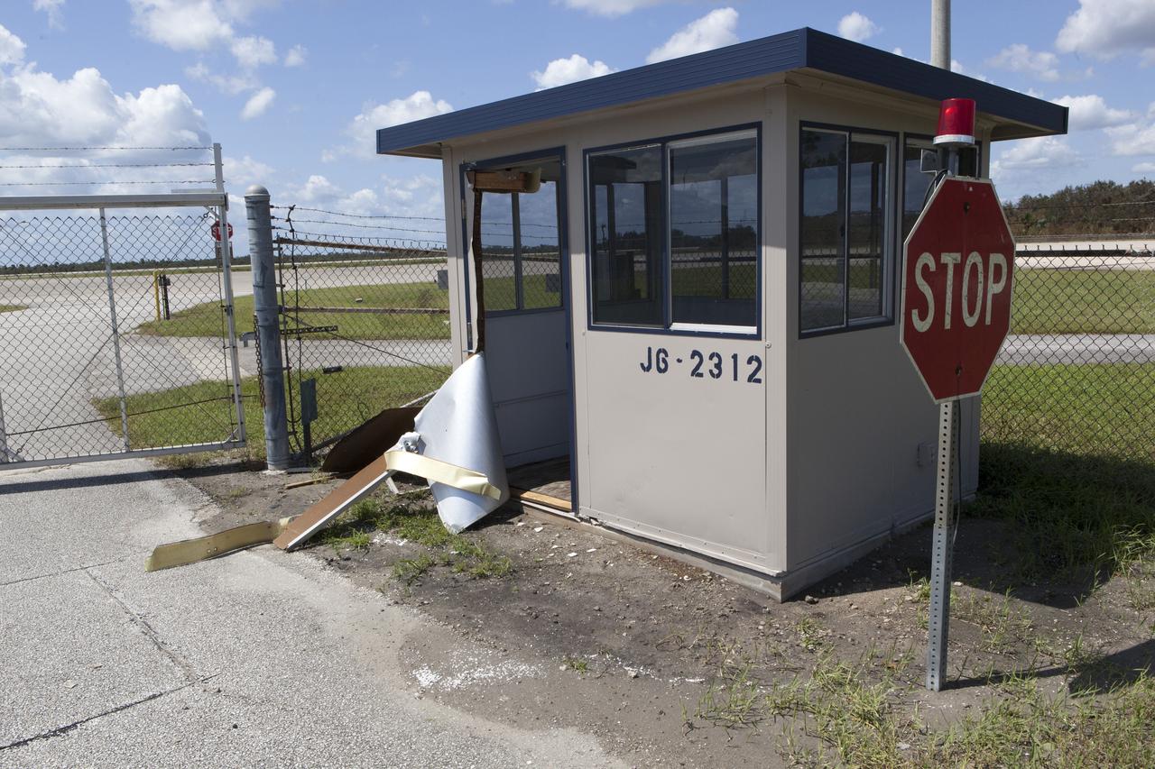
A guard shack at the Shuttle Landing Facility, operated by Space Florida, is seen during a survey of NASA's Kennedy Space Center in Florida on September 12, 2017. The survey was performed to identify structures and facilities that may have sustained damage from Hurricane Irma as the storm passed Kennedy on September 10, 2017. NASA closed the center ahead of the storm's onset and only a small team of specialists known as the Rideout Team was on the center as the storm approached and passed.
The Multi-Payload Processing Facility (MPPF) is seen during an aerial survey of NASA's Kennedy Space Center in Florida on September 12, 2017. The survey was performed to identify structures and facilities that may have sustained damage from Hurricane Irma as the storm passed Kennedy on September 10, 2017. NASA closed the center ahead of the storm's onset and only a small team of specialists known as the Rideout Team was on the center as the storm approached and passed.
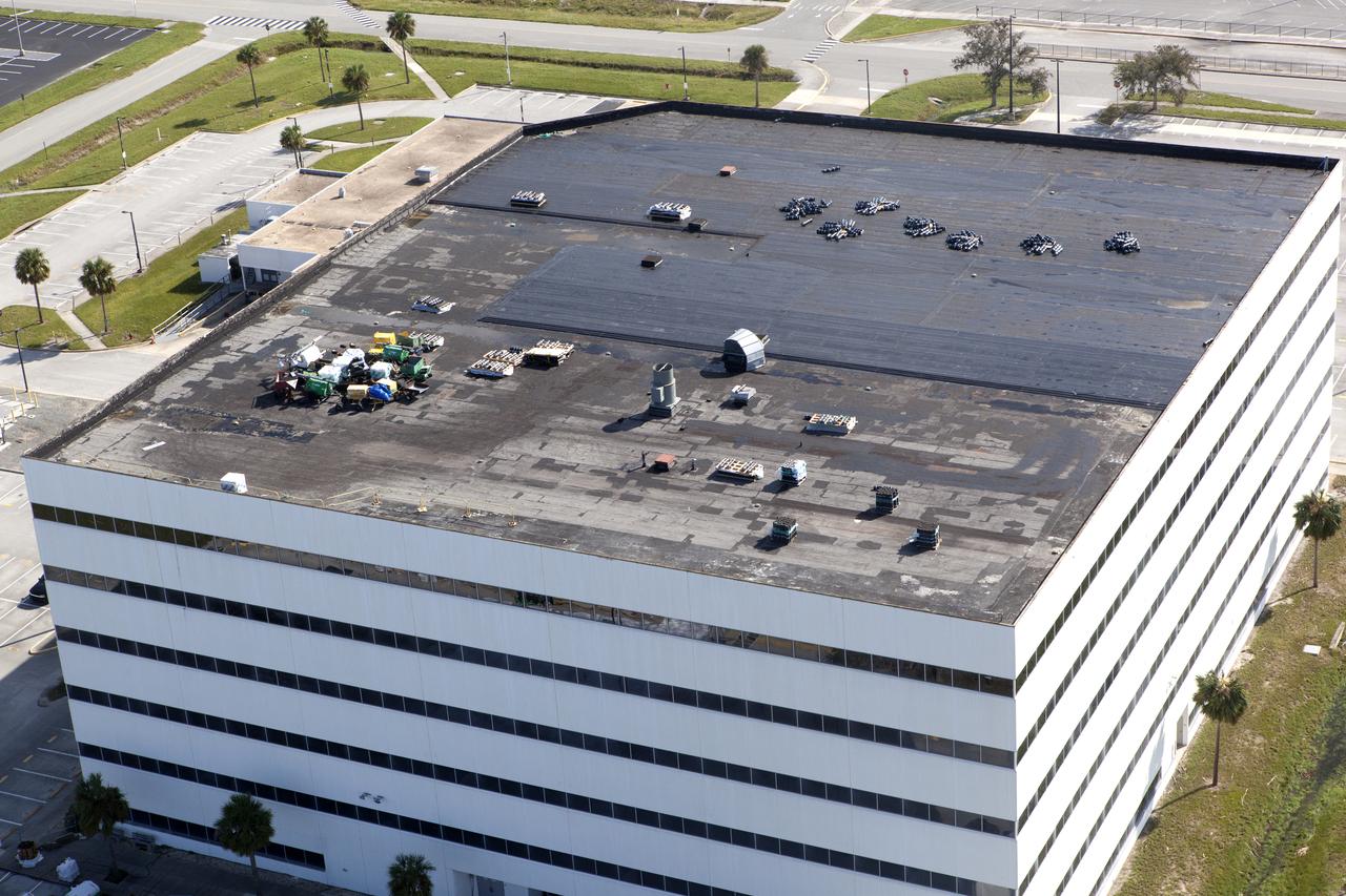
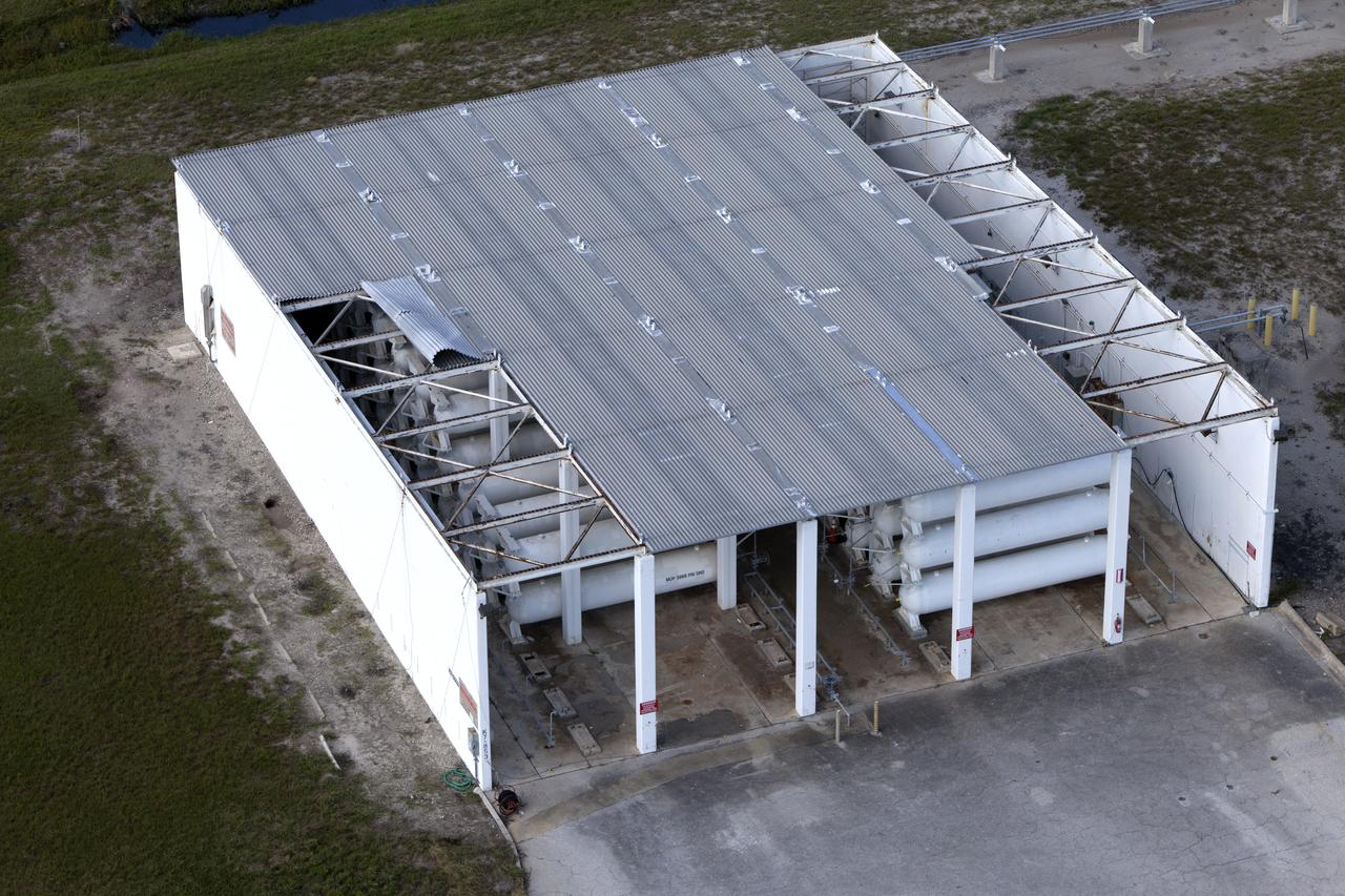
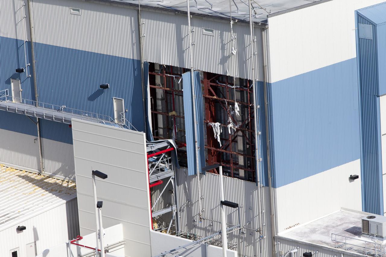
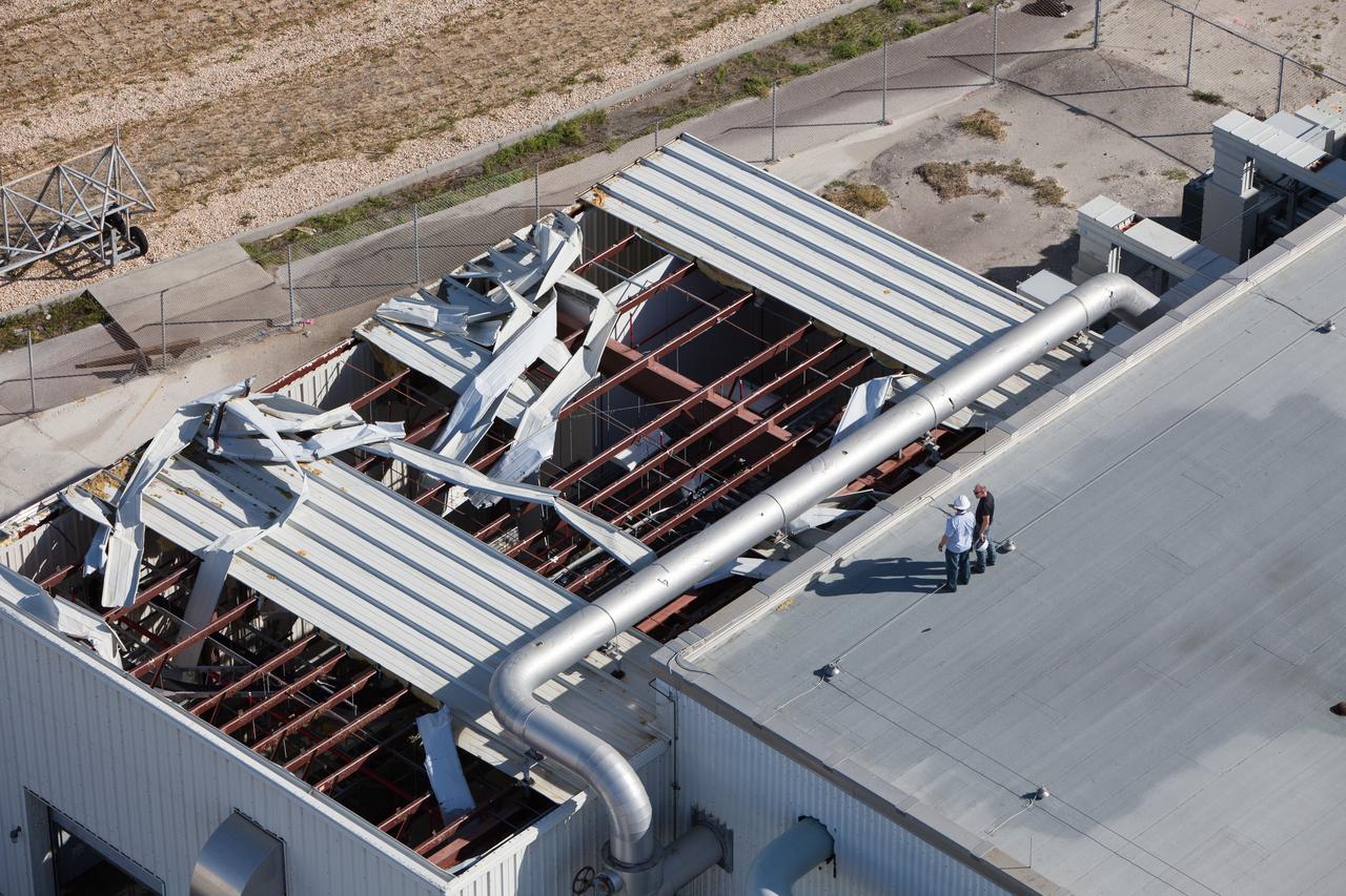
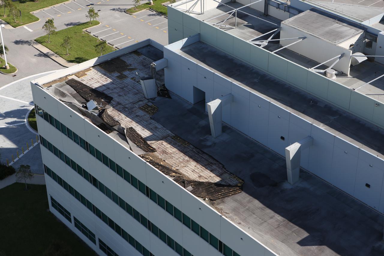
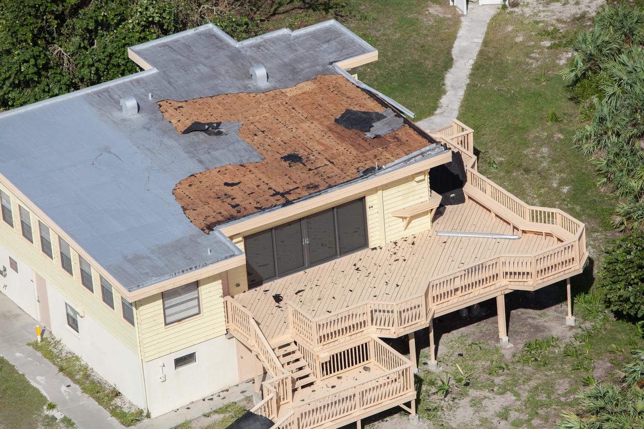
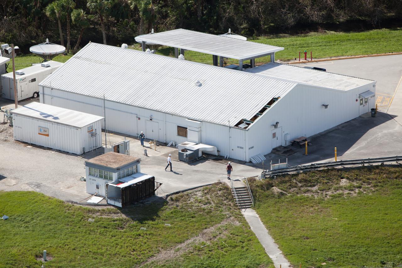
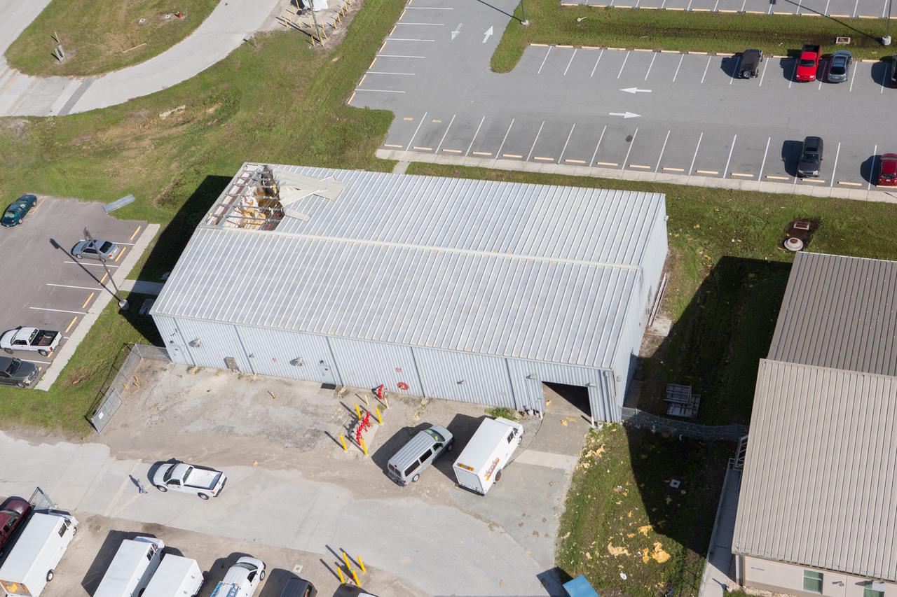
The Operations Support Building I (OSB I) is seen during an aerial survey of NASA's Kennedy Space Center in Florida on September 12, 2017. The roof of the building is currently undergoing repair from Hurricane Matthew. The survey was performed to identify structures and facilities that may have sustained damage from Hurricane Irma as the storm passed Kennedy on September 10, 2017. NASA closed the center ahead of the storm's onset and only a small team of specialists known as the Rideout Team was on the center as the storm approached and passed.
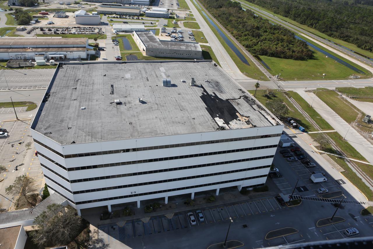
The roof of the Operations Support Building I is seen during an aerial survey of NASA's Kennedy Space Center in Florida on Saturday. The survey was performed to identify structures and facilities that may have sustained damage from Hurricane Matthew as the storm passed to the east of Kennedy on Oct. 6 and 7, 2016. Officials determined that the center received some isolated roof damage, damaged support buildings, a few downed power lines, and limited water intrusion. Beach erosion also occurred, although the storm surge was less than expected. NASA closed the center ahead of the storm’s onset and only a small team of specialists known as the Rideout Team was on the center as the storm approached and passed.
Launch Complex 39B is seen during an aerial survey of NASA's Kennedy Space Center in Florida on Saturday. The survey was performed to identify structures and facilities that may have sustained damage from Hurricane Matthew as the storm passed to the east of Kennedy on Oct. 6 and 7, 2016. Officials determined that the center received some isolated roof damage, damaged support buildings, a few downed power lines, and limited water intrusion. Beach erosion also occurred, although the storm surge was less than expected. NASA closed the center ahead of the storm’s onset and only a small team of specialists known as the Rideout Team was on the center as the storm approached and passed
The Launch Complex 39 area is seen during an aerial survey of NASA's Kennedy Space Center in Florida on Saturday. The survey was performed to identify structures and facilities that may have sustained damage from Hurricane Matthew as the storm passed to the east of Kennedy on Oct. 6 and 7, 2016. Officials determined that the center received some isolated roof damage, damaged support buildings, a few downed power lines, and limited water intrusion. Beach erosion also occurred, although the storm surge was less than expected. NASA closed the center ahead of the storm’s onset and only a small team of specialists known as the Rideout Team was on the center as the storm approached and passed.
Damaged power lines are seen during an aerial survey of NASA's Kennedy Space Center in Florida on Saturday. The survey was performed to identify structures and facilities that may have sustained damage from Hurricane Matthew as the storm passed to the east of Kennedy on Oct. 6 and 7, 2016. Officials determined that the center received some isolated roof damage, damaged support buildings, a few downed power lines, and limited water intrusion. Beach erosion also occurred, although the storm surge was less than expected. NASA closed the center ahead of the storm’s onset and only a small team of specialists known as the Rideout Team was on the center as the storm approached and passed.
A support building is seen during an aerial survey of NASA's Kennedy Space Center in Florida on Saturday. The survey was performed to identify structures and facilities that may have sustained damage from Hurricane Matthew as the storm passed to the east of Kennedy on Oct. 6 and 7, 2016. Officials determined that the center received some isolated roof damage, damaged support buildings, a few downed power lines, and limited water intrusion. Beach erosion also occurred, although the storm surge was less than expected. NASA closed the center ahead of the storm’s onset and only a small team of specialists known as the Rideout Team was on the center as the storm approached and passed.
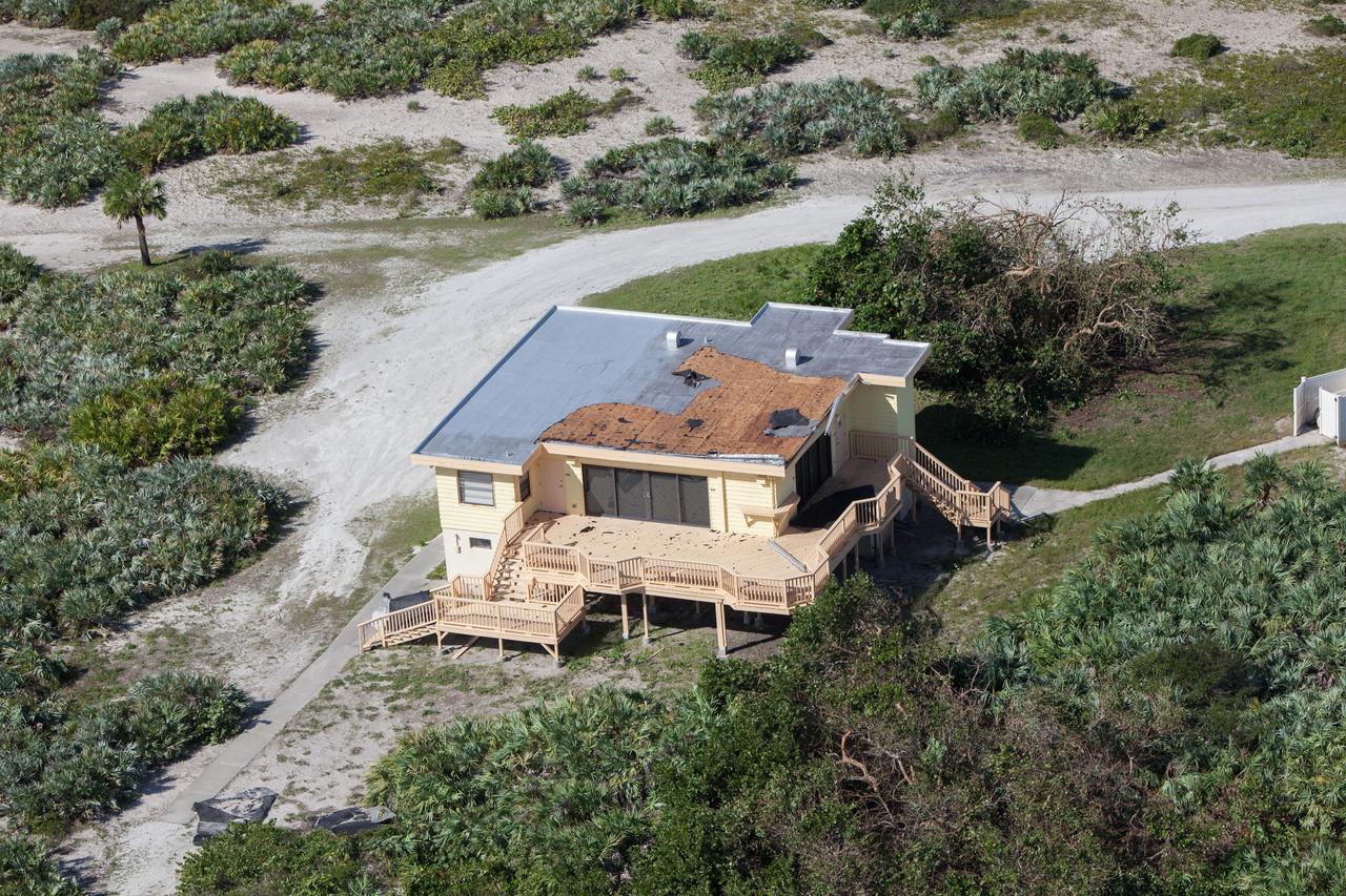
The Beach House is seen during an aerial survey of NASA's Kennedy Space Center in Florida on Saturday. The survey was performed to identify structures and facilities that may have sustained damage from Hurricane Matthew as the storm passed to the east of Kennedy on Oct. 6 and 7, 2016. Officials determined that the center received some isolated roof damage, damaged support buildings, a few downed power lines, and limited water intrusion. Beach erosion also occurred, although the storm surge was less than expected. NASA closed the center ahead of the storm’s onset and only a small team of specialists known as the Rideout Team was on the center as the storm approached and passed
Bob Cabana, director of NASA's Kennedy Space Center in Florida, begins an aerial survey of the center on Saturday. The survey was performed to identify structures and facilities that may have sustained damage from Hurricane Matthew as the storm passed to the east of Kennedy on Oct. 6 and 7, 2016. Officials determined that the center received some isolated roof damage, damaged support buildings, a few downed power lines, and limited water intrusion. Beach erosion also occurred, although the storm surge was less than expected. NASA closed the center ahead of the storm’s onset and only a small team of specialists known as the Rideout Team was on the center as the storm approached and passed.
The roof of the Operations Support Building II is seen during an aerial survey of NASA's Kennedy Space Center in Florida on Saturday. The survey was performed to identify structures and facilities that may have sustained damage from Hurricane Matthew as the storm passed to the east of Kennedy on Oct. 6 and 7, 2016. Officials determined that the center received some isolated roof damage, damaged support buildings, a few downed power lines, and limited water intrusion. Beach erosion also occurred, although the storm surge was less than expected. NASA closed the center ahead of the storm’s onset and only a small team of specialists known as the Rideout Team was on the center as the storm approached and passed.
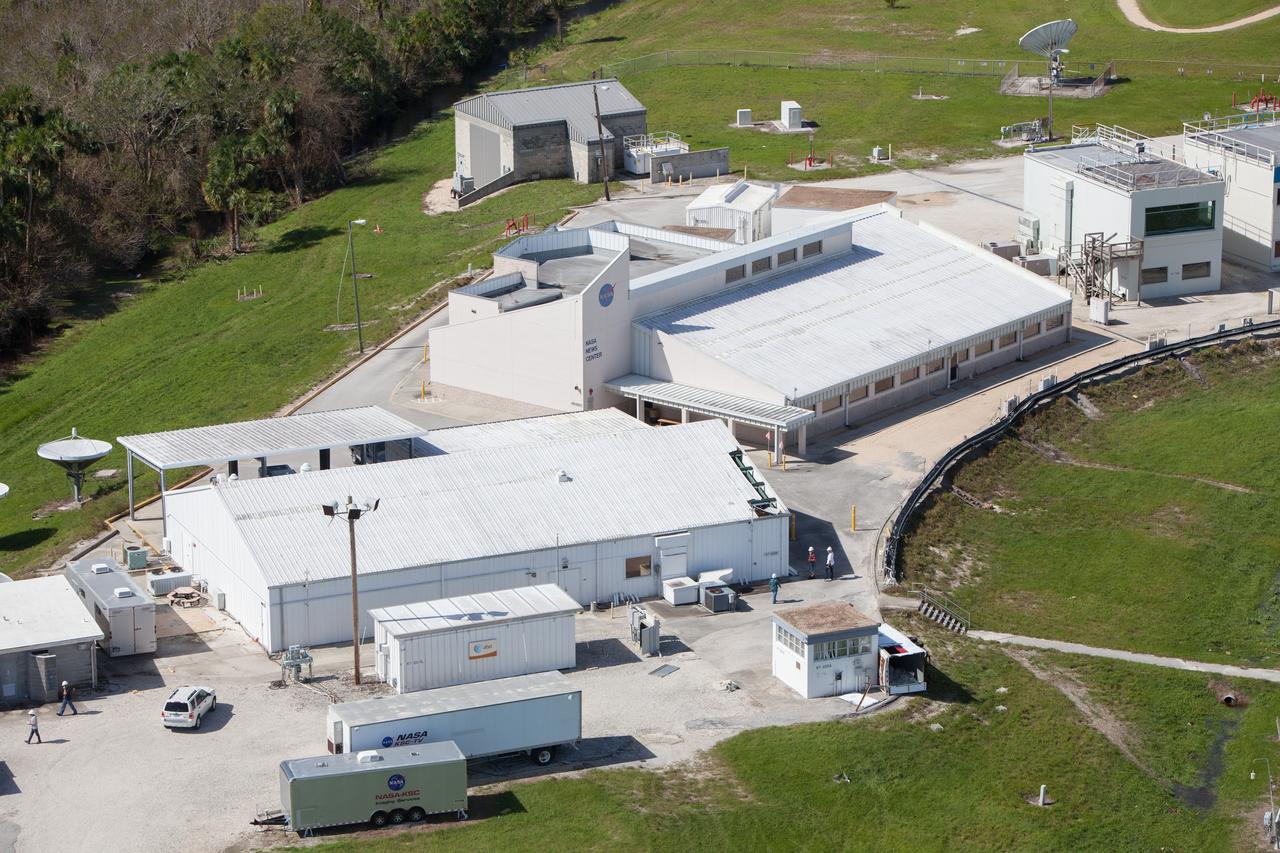
The NASA News Center is seen during an aerial survey of NASA's Kennedy Space Center in Florida on Saturday. The survey was performed to identify structures and facilities that may have sustained damage from Hurricane Matthew as the storm passed to the east of Kennedy on Oct. 6 and 7, 2016. Officials determined that the center received some isolated roof damage, damaged support buildings, a few downed power lines, and limited water intrusion. Beach erosion also occurred, although the storm surge was less than expected. NASA closed the center ahead of the storm’s onset and only a small team of specialists known as the Rideout Team was on the center as the storm approached and passed
The roof of the Operations Support Building II is seen during an aerial survey of NASA's Kennedy Space Center in Florida on Saturday. The survey was performed to identify structures and facilities that may have sustained damage from Hurricane Matthew as the storm passed to the east of Kennedy on Oct. 6 and 7, 2016. Officials determined that the center received some isolated roof damage, damaged support buildings, a few downed power lines, and limited water intrusion. Beach erosion also occurred, although the storm surge was less than expected. NASA closed the center ahead of the storm’s onset and only a small team of specialists known as the Rideout Team was on the center as the storm approached and passed.
The Central Campus construction site is seen during an aerial survey of NASA's Kennedy Space Center in Florida on Saturday. The survey was performed to identify structures and facilities that may have sustained damage from Hurricane Matthew as the storm passed to the east of Kennedy on Oct. 6 and 7, 2016. Officials determined that the center received some isolated roof damage, damaged support buildings, a few downed power lines, and limited water intrusion. Beach erosion also occurred, although the storm surge was less than expected. NASA closed the center ahead of the storm’s onset and only a small team of specialists known as the Rideout Team was on the center as the storm approached and passed
An aerial survey of NASA's Kennedy Space Center in Florida was conducted after Hurricane Dorian skirted the Space Coast area. The survey was performed to identify structures and facilities that may have sustained damage from Hurricane Dorian as the storm passed to the east of Kennedy on September 3 and 4, 2019. Officials determined that the center received some isolated damage and limited water intrusion. Beach erosion also occurred, although the storm surge was less than expected. NASA closed the center ahead of the storm’s onset and only a small team of specialists known as the Rideout Team was on the center as the storm approached and passed.
An aerial survey of NASA's Kennedy Space Center in Florida was conducted after Hurricane Dorian skirted the Space Coast area. The survey was performed to identify structures and facilities that may have sustained damage from Hurricane Dorian as the storm passed to the east of Kennedy on September 3 and 4, 2019. Officials determined that the center received some isolated damage and limited water intrusion. Beach erosion also occurred, although the storm surge was less than expected. NASA closed the center ahead of the storm’s onset and only a small team of specialists known as the Rideout Team was on the center as the storm approached and passed.
Damage to a facility roof is seen during an aerial survey of NASA's Kennedy Space Center in Florida on Saturday. The survey was performed to identify structures and facilities that may have sustained damage from Hurricane Matthew as the storm passed to the east of Kennedy on Oct. 6 and 7, 2016. Officials determined that the center received some isolated roof damage, damaged support buildings, a few downed power lines, and limited water intrusion. Beach erosion also occurred, although the storm surge was less than expected. NASA closed the center ahead of the storm’s onset and only a small team of specialists known as the Rideout Team was on the center as the storm approached and passed.
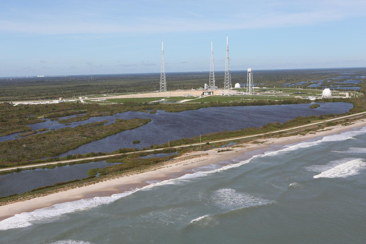
Launch Complex 39B is seen during an aerial survey of NASA's Kennedy Space Center in Florida on Saturday. The survey was performed to identify structures and facilities that may have sustained damage from Hurricane Matthew as the storm passed to the east of Kennedy on Oct. 6 and 7, 2016. Officials determined that the center received some isolated roof damage, damaged support buildings, a few downed power lines, and limited water intrusion. Beach erosion also occurred, although the storm surge was less than expected. NASA closed the center ahead of the storm’s onset and only a small team of specialists known as the Rideout Team was on the center as the storm approached and passed.
An aerial survey of NASA's Kennedy Space Center in Florida was conducted after Hurricane Dorian skirted the Space Coast area. The survey was performed to identify structures and facilities that may have sustained damage from Hurricane Dorian as the storm passed to the east of Kennedy on September 3 and 4, 2019. Officials determined that the center received some isolated damage and limited water intrusion. Beach erosion also occurred, although the storm surge was less than expected. NASA closed the center ahead of the storm’s onset and only a small team of specialists known as the Rideout Team was on the center as the storm approached and passed.
Damage to a facility roof is seen during an aerial survey of NASA's Kennedy Space Center in Florida on Saturday. The survey was performed to identify structures and facilities that may have sustained damage from Hurricane Matthew as the storm passed to the east of Kennedy on Oct. 6 and 7, 2016. Officials determined that the center received some isolated roof damage, damaged support buildings, a few downed power lines, and limited water intrusion. Beach erosion also occurred, although the storm surge was less than expected. NASA closed the center ahead of the storm’s onset and only a small team of specialists known as the Rideout Team was on the center as the storm approached and passed
The NASA TV Support Building at the NASA News Center is seen during an aerial survey of NASA's Kennedy Space Center in Florida on Saturday. The survey was performed to identify structures and facilities that may have sustained damage from Hurricane Matthew as the storm passed to the east of Kennedy on Oct. 6 and 7, 2016. Officials determined that the center received some isolated roof damage, damaged support buildings, a few downed power lines, and limited water intrusion. Beach erosion also occurred, although the storm surge was less than expected. NASA closed the center ahead of the storm’s onset and only a small team of specialists known as the Rideout Team was on the center as the storm approached and passed.
An aerial survey of NASA's Kennedy Space Center in Florida was conducted after Hurricane Dorian skirted the Space Coast area. The survey was performed to identify structures and facilities that may have sustained damage from Hurricane Dorian as the storm passed to the east of Kennedy on September 3 and 4, 2019. Officials determined that the center received some isolated damage and limited water intrusion. Beach erosion also occurred, although the storm surge was less than expected. NASA closed the center ahead of the storm’s onset and only a small team of specialists known as the Rideout Team was on the center as the storm approached and passed.
A support building is seen during an aerial survey of NASA's Kennedy Space Center in Florida on Saturday. The survey was performed to identify structures and facilities that may have sustained damage from Hurricane Matthew as the storm passed to the east of Kennedy on Oct. 6 and 7, 2016. Officials determined that the center received some isolated roof damage, damaged support buildings, a few downed power lines, and limited water intrusion. Beach erosion also occurred, although the storm surge was less than expected. NASA closed the center ahead of the storm’s onset and only a small team of specialists known as the Rideout Team was on the center as the storm approached and passed.
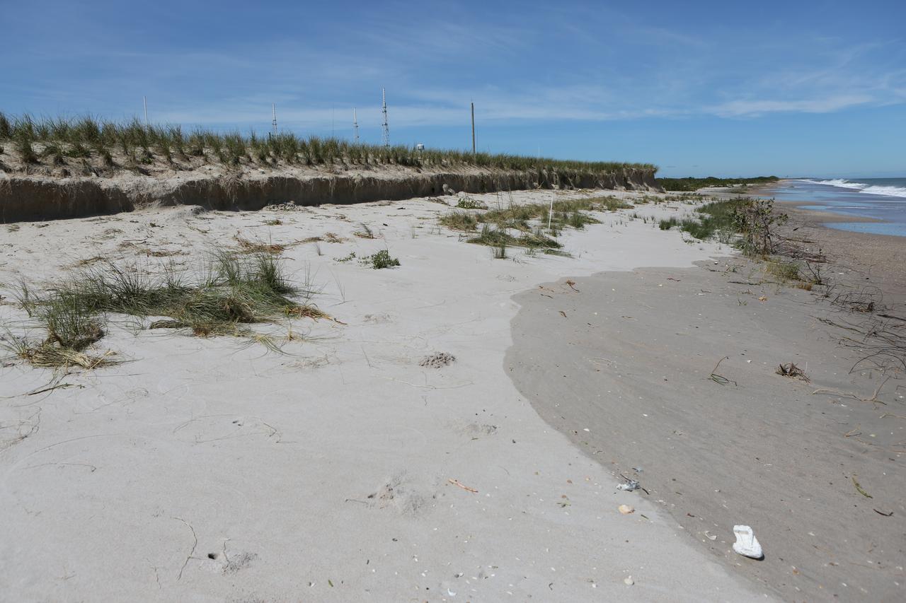
A beach area is seen during a survey of NASA's Kennedy Space Center in Florida on Saturday. The survey was performed to identify structures and facilities that may have sustained damage from Hurricane Matthew as the storm passed to the east of Kennedy on Oct. 6 and 7, 2016. Officials determined that the center received some isolated roof damage, damaged support buildings, a few downed power lines, and limited water intrusion. Beach erosion also occurred, although the storm surge was less than expected. NASA closed the center ahead of the storm’s onset and only a small team of specialists known as the Rideout Team was on the center as the storm approached and passed.

An aerial survey of NASA's Kennedy Space Center in Florida was conducted after Hurricane Dorian skirted the Space Coast area. The survey was performed to identify structures and facilities that may have sustained damage from Hurricane Dorian as the storm passed to the east of Kennedy on September 3 and 4, 2019. Officials determined that the center received some isolated damage and limited water intrusion. Beach erosion also occurred, although the storm surge was less than expected. NASA closed the center ahead of the storm’s onset and only a small team of specialists known as the Rideout Team was on the center as the storm approached and passed.
An aerial survey of NASA's Kennedy Space Center in Florida was conducted after Hurricane Dorian skirted the Space Coast area. The survey was performed to identify structures and facilities that may have sustained damage from Hurricane Dorian as the storm passed to the east of Kennedy on September 3 and 4, 2019. Officials determined that the center received some isolated damage and limited water intrusion. Beach erosion also occurred, although the storm surge was less than expected. NASA closed the center ahead of the storm’s onset and only a small team of specialists known as the Rideout Team was on the center as the storm approached and passed.
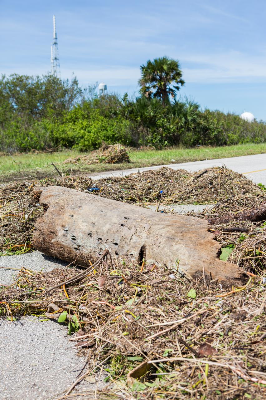
A tree is seen across a road during a survey of NASA's Kennedy Space Center in Florida on Saturday. The survey was performed to identify structures and facilities that may have sustained damage from Hurricane Matthew as the storm passed to the east of Kennedy on Oct. 6 and 7, 2016. Officials determined that the center received some isolated roof damage, damaged support buildings, a few downed power lines, and limited water intrusion. Beach erosion also occurred, although the storm surge was less than expected. NASA closed the center ahead of the storm’s onset and only a small team of specialists known as the Rideout Team was on the center as the storm approached and passed.
The Beach House is seen during an aerial survey of NASA's Kennedy Space Center in Florida on Saturday. The survey was performed to identify structures and facilities that may have sustained damage from Hurricane Matthew as the storm passed to the east of Kennedy on Oct. 6 and 7, 2016. Officials determined that the center received some isolated roof damage, damaged support buildings, a few downed power lines, and limited water intrusion. Beach erosion also occurred, although the storm surge was less than expected. NASA closed the center ahead of the storm’s onset and only a small team of specialists known as the Rideout Team was on the center as the storm approached and passed.
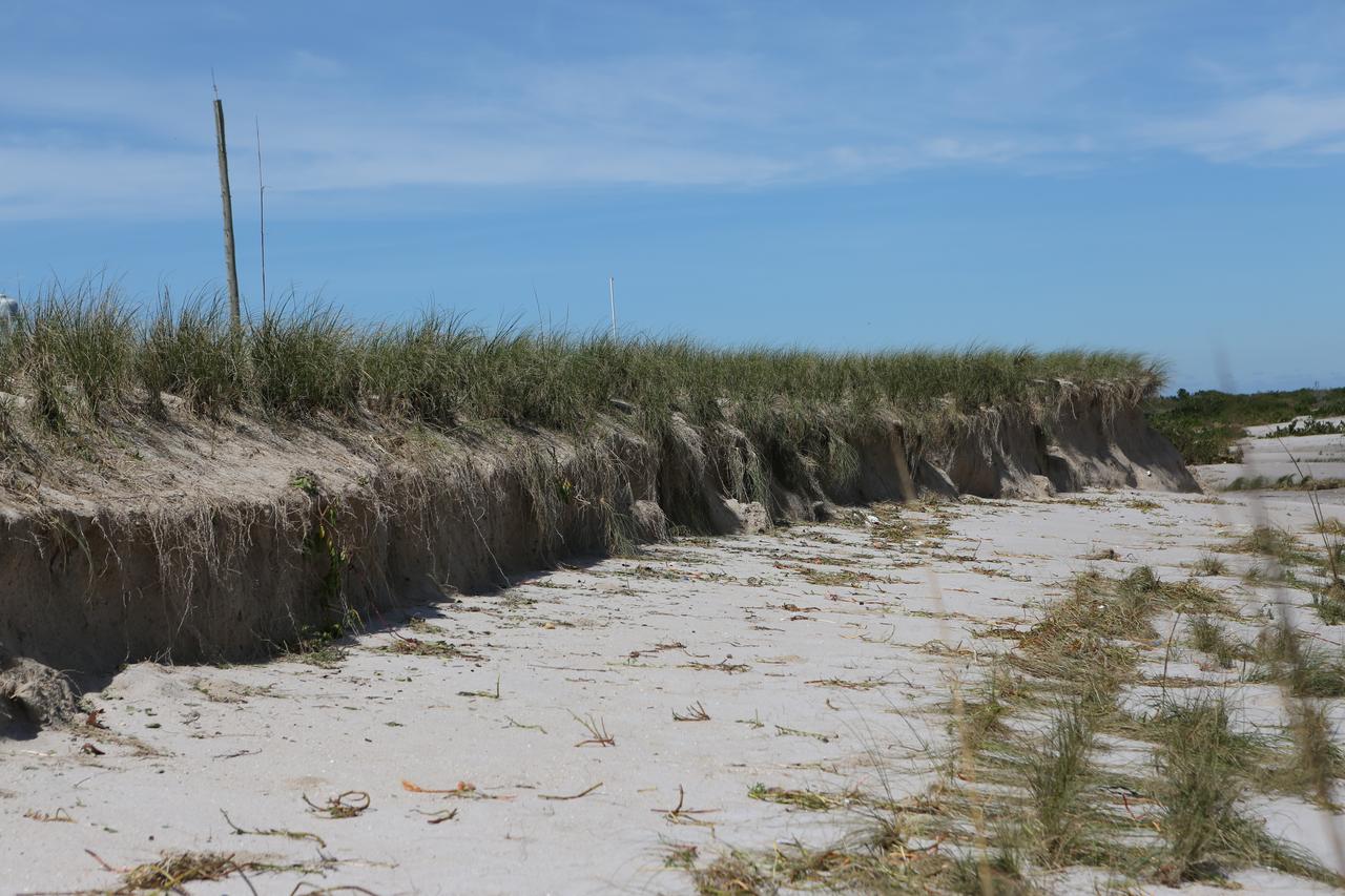
A beach area is seen during a survey of NASA's Kennedy Space Center in Florida on Saturday. The survey was performed to identify structures and facilities that may have sustained damage from Hurricane Matthew as the storm passed to the east of Kennedy on Oct. 6 and 7, 2016. Officials determined that the center received some isolated roof damage, damaged support buildings, a few downed power lines, and limited water intrusion. Beach erosion also occurred, although the storm surge was less than expected. NASA closed the center ahead of the storm’s onset and only a small team of specialists known as the Rideout Team was on the center as the storm approached and passed.
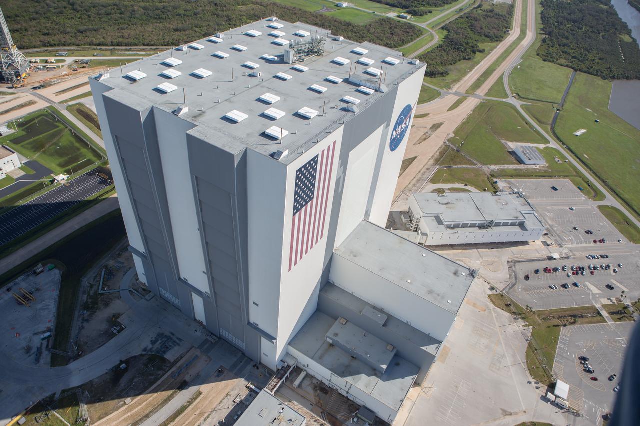
The Vehicle Assembly Building is seen during an aerial survey of NASA's Kennedy Space Center in Florida on Saturday. The survey was performed to identify structures and facilities that may have sustained damage from Hurricane Matthew as the storm passed to the east of Kennedy on Oct. 6 and 7, 2016. Officials determined that the center received some isolated roof damage, damaged support buildings, a few downed power lines, and limited water intrusion. Beach erosion also occurred, although the storm surge was less than expected. NASA closed the center ahead of the storm’s onset and only a small team of specialists known as the Rideout Team was on the center as the storm approached and passed.
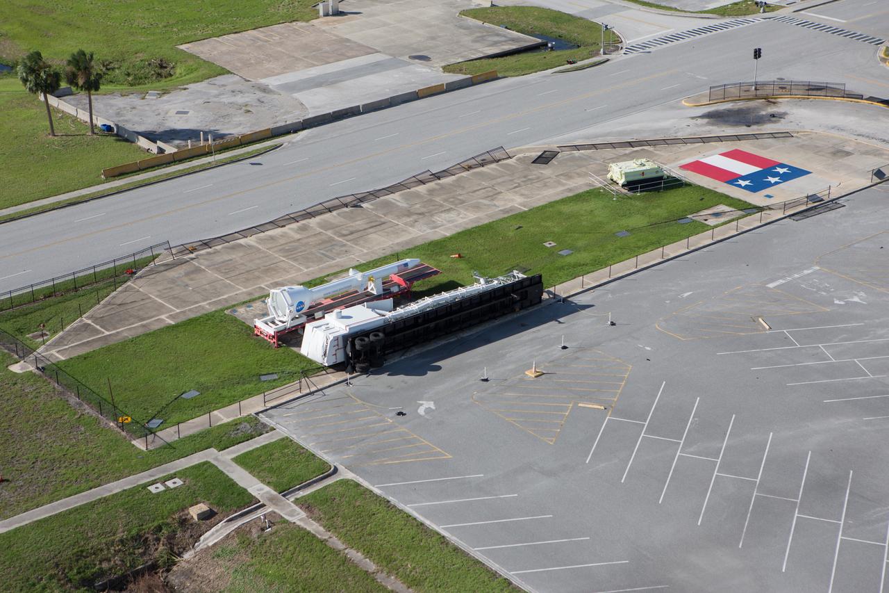
A display area in front of the Vehicle Assembly Building is seen during an aerial survey of NASA's Kennedy Space Center in Florida on Saturday. The survey was performed to identify structures and facilities that may have sustained damage from Hurricane Matthew as the storm passed to the east of Kennedy on Oct. 6 and 7, 2016. Officials determined that the center received some isolated roof damage, damaged support buildings, a few downed power lines, and limited water intrusion. Beach erosion also occurred, although the storm surge was less than expected. NASA closed the center ahead of the storm’s onset and only a small team of specialists known as the Rideout Team was on the center as the storm approached and passed.
The NASA TV Support Building at the NASA News Center is seen during an aerial survey of NASA's Kennedy Space Center in Florida on Saturday. The survey was performed to identify structures and facilities that may have sustained damage from Hurricane Matthew as the storm passed to the east of Kennedy on Oct. 6 and 7, 2016. Officials determined that the center received some isolated roof damage, damaged support buildings, a few downed power lines, and limited water intrusion. Beach erosion also occurred, although the storm surge was less than expected. NASA closed the center ahead of the storm’s onset and only a small team of specialists known as the Rideout Team was on the center as the storm approached and passed.
A support building is seen during an aerial survey of NASA's Kennedy Space Center in Florida on Saturday. The survey was performed to identify structures and facilities that may have sustained damage from Hurricane Matthew as the storm passed to the east of Kennedy on Oct. 6 and 7, 2016. Officials determined that the center received some isolated roof damage, damaged support buildings, a few downed power lines, and limited water intrusion. Beach erosion also occurred, although the storm surge was less than expected. NASA closed the center ahead of the storm’s onset and only a small team of specialists known as the Rideout Team was on the center as the storm approached and passed.
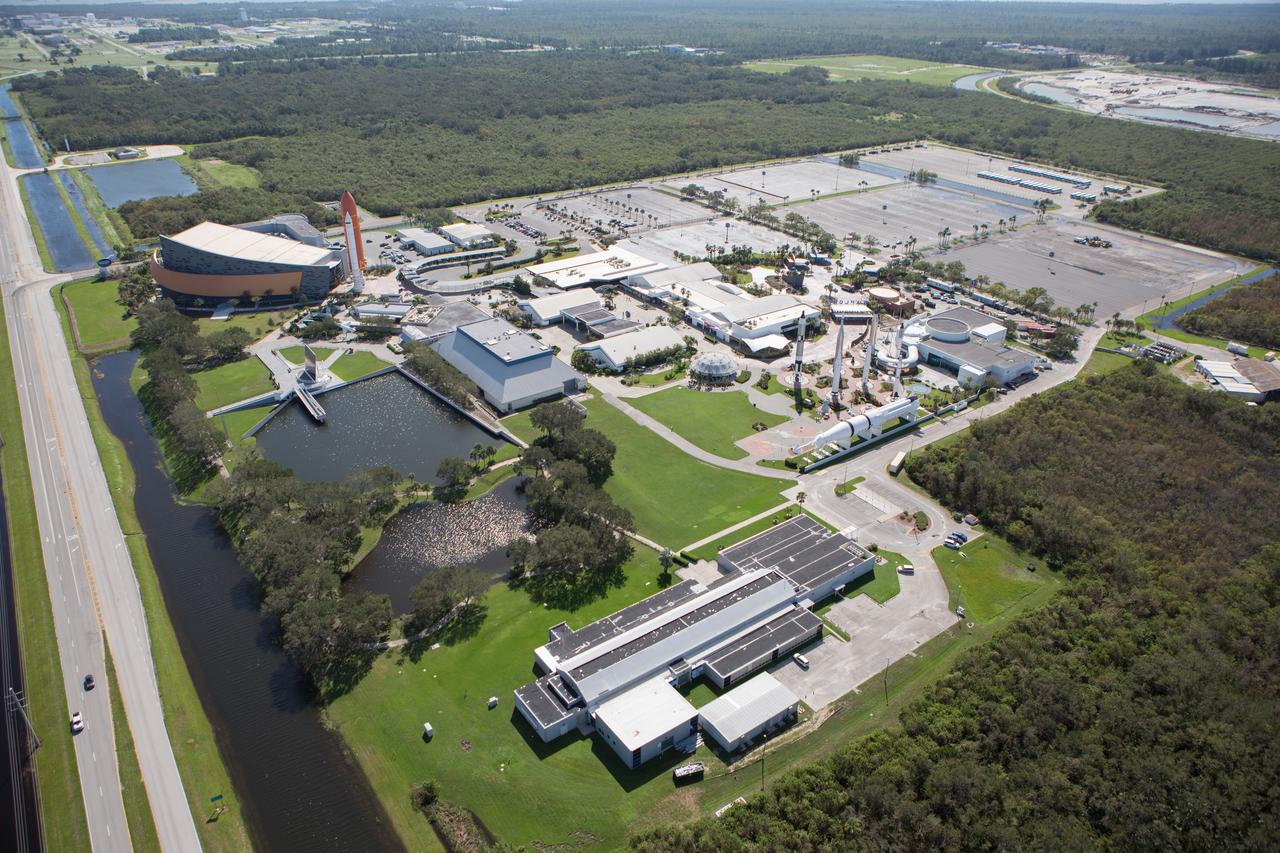
The Kennedy Space Center Visitor Complex is seen during an aerial survey of NASA's Kennedy Space Center in Florida on Saturday. The survey was performed to identify structures and facilities that may have sustained damage from Hurricane Matthew as the storm passed to the east of Kennedy on Oct. 6 and 7, 2016. Officials determined that the center received some isolated roof damage, damaged support buildings, a few downed power lines, and limited water intrusion. Beach erosion also occurred, although the storm surge was less than expected. NASA closed the center ahead of the storm’s onset and only a small team of specialists known as the Rideout Team was on the center as the storm approached and passed.
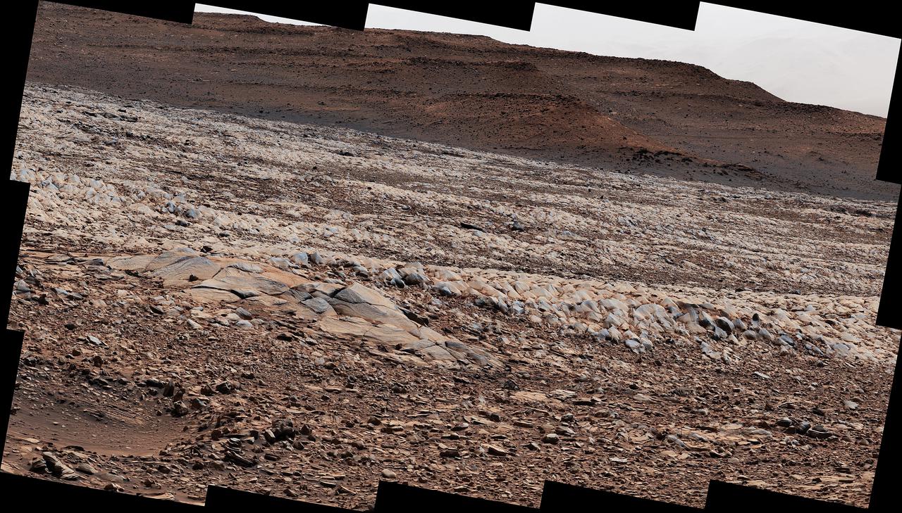
NASA's Curiosity Mars rover used its Mast Camera, or Mastcam, to survey these wind-sharpened rocks, called ventifacts, on March 15, 2022, the 3,415th Martian day, or sol, of the mission. The team has informally described these patches of ventifacts as "gator-back" rocks because of their scaly appearance. Ventifacts chewed up Curiosity's wheels earlier in the mission. Since then, rover engineers have found ways to slow wheel wear, including a traction control algorithm. They also plan rover routes that avoid driving over such rocks, including these latest ventifacts, which are made of sandstone &ndsh; the hardest type of rock Curiosity has encountered on Mars. These rocks form the surface of the "Greenheugh Pediment," a broad, sloping plain in the foothills of Mount Sharp. The floor of Gale Crater is visible along the edges of the mosaic. When Curiosity's team saw the gator-back rocks, they ultimately decided to turn the rover around and take an alternative path to continue climbing Mount Sharp, a 3.4-mile-tall (5.5-kilometer-tall) mountain that Curiosity has been ascending since 2014. As it climbs, Curiosity is able to study different sedimentary layers shaped by water billions of years ago. These layers help scientists understand whether microscopic life could have survived in the ancient Martian environment. https://photojournal.jpl.nasa.gov/catalog/PIA25175
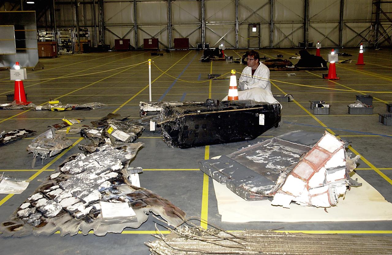
KENNEDY SPACE CENTER, FLA. -- A Columbia Reconstruction Project Team member surveys pieces of debris from the Space Shuttle Columbia in the RLV Hangar. The debris arrived at KSC today from the collection point at Barksdale Air Force Base, Shreveport, La. As part of the ongoing investigation into the tragic accident that claimed Columbia and her crew of seven, workers will attempt to reconstruct the orbiter inside the hangar.
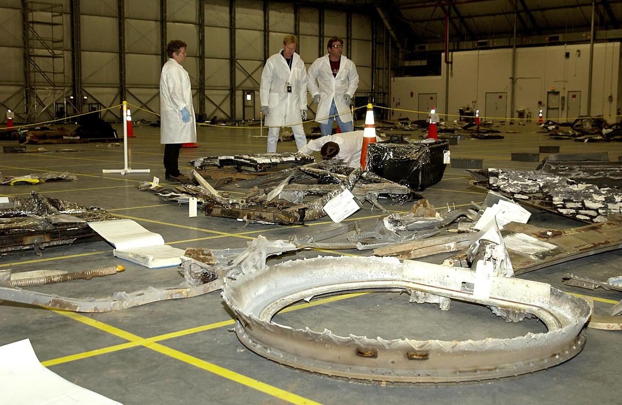
KENNEDY SPACE CENTER, FLA. -- Columbia Reconstruction Project Team members survey pieces of debris from the Space Shuttle Columbia in the RLV Hangar. The debris arrived at KSC today from the collection point at Barksdale Air Force Base, Shreveport, La. As part of the ongoing investigation into the tragic accident that claimed Columbia and her crew of seven, workers will attempt to reconstruct the orbiter inside the hangar.
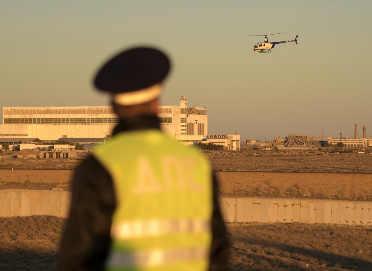
A security helicopter team surveys the train tracks in advance of the Soyuz rocket being rolled out to the launch pad, Tuesday, Oct. 9, 2018 at the Baikonur Cosmodrome in Kazakhstan. Expedition 57 crewmembers Nick Hague of NASA and Alexey Ovchinin of Roscosmos are scheduled to launch on October 11 and will spend the next six months living and working aboard the International Space Station. Photo Credit: (NASA/Bill Ingalls)
Roger Clark, team member, Cassini spacecraft Visual and Infrared Mapping Spectrometer and co-investigator, Moon Mineralogy Mapper, U.S. Geological Survey in Denver answers questions on NASA’s discovery of water molecules in the polar regions of the moon at a press conference at NASA Headquarters, September 24, 2009, in Washington. Photo Credit: (NASA/Carla Cioffi)
Rich Delgado, commanding officer of the Fleet Survey Team located at NASA's John C. Stennis Space Center, visits with Kertrina Watson Lewis, executive director of the HandsOn volunteer organization in New Orleans, during Day of Service activities Jan. 12. The Day of Service was part of the annual Martin Luther King Jr. Day observance at Stennis. During the day, Mississippi and Louisiana organizations visited the center to encourage employees to register and serve as volunteers for various community activities.
NASA's Ingenuity Mars Helicopter recently surveyed a ridgeline near the ancient river delta in Mars' Jezero Crater at request of the Perseverance rover's science team. On the left is the full image Ingenuity acquired of the ridgeline on April 23, 2022, during its 27th flight. The science team calls the line of rocky outcrops running from the upper left to middle right of the main image "Fortun Ridge." Enlarged at right is a close-up of one of the ridgeline's rocky outcrops. This portion of Jezero Crater is of interest to the science team because of the clear exposure of the rocky outcrops that define the boundary between two abutting crater floor geologic units, "Séítah" and "Máaz." The geology of both units is thought to be of igneous (volcanic) origin. https://photojournal.jpl.nasa.gov/catalog/PIA25220
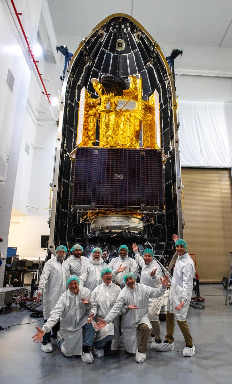
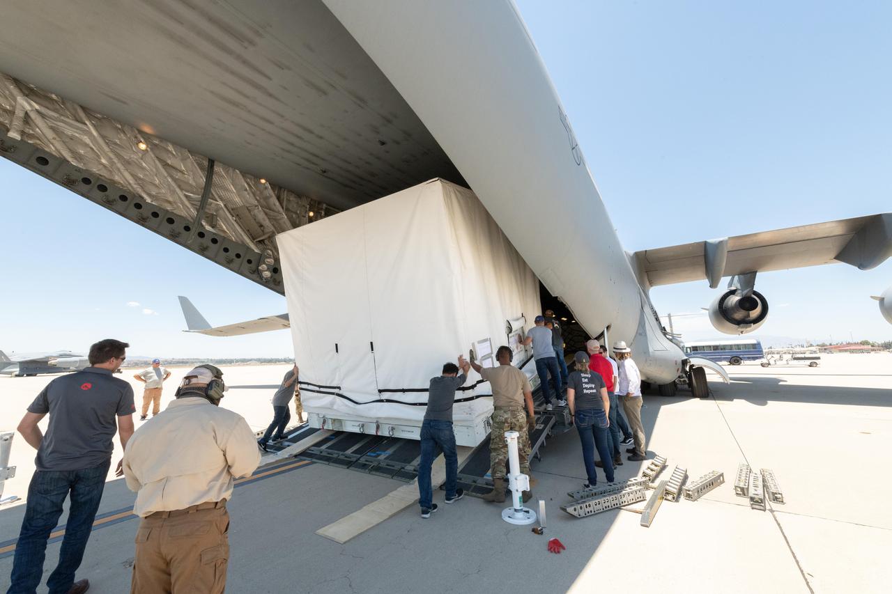
Inside the SpaceX facility at Vandenberg Space Force Base in California, the first half of the SpaceX Falcon 9 payload fairing is moved around the Surface Water and Ocean Topography (SWOT) satellite on Dec. 8, 2022. To mark the milestone, members of the processing team gather in front of the SWOT satellite. A collaboration between NASA and the French space agency Centre National d’Études Spatiales (CNES), with contributions from the Canadian Space Agency and the UK Space Agency, SWOT will be the first satellite to survey nearly all water on Earth’s surface. SWOT is scheduled to lift off aboard the SpaceX Falcon 9 rocket from Vandenberg on Dec. 15, 2022, at 3:46 a.m. PST.

Inside the SpaceX facility at Vandenberg Space Force Base in California, the first half of the SpaceX Falcon 9 payload fairing is moved around the Surface Water and Ocean Topography (SWOT) satellite on Dec. 8, 2022. To mark the milestone, members of the processing team gather in front of the SWOT satellite. A collaboration between NASA and the French space agency Centre National d’Études Spatiales (CNES), with contributions from the Canadian Space Agency and the UK Space Agency, SWOT will be the first satellite to survey nearly all water on Earth’s surface. SWOT is scheduled to lift off aboard the SpaceX Falcon 9 rocket from Vandenberg on Dec. 15, 2022, at 3:46 a.m. PST.
Russian Search and Rescue helicopter teams survey the sky for the Soyuz MS-19 spacecraft as it lands in a remote area near the town of Zhezkazgan, Kazakhstan with Expedition 66 crew members Mark Vande Hei of NASA, and cosmonauts Pyotr Dubrov, and Anton Shkaplerov of Roscosmos, Wednesday, March 30, 2022. Vande Hei and Dubrov are returning to Earth after logging 355 days in space as members of Expeditions 64-66 aboard the International Space Station. For Vande Hei, his mission is the longest single spaceflight by a U.S. astronaut in history. Shkaplerov is returning after 176 days in space, serving as a Flight Engineer for Expedition 65 and commander of Expedition 66. Photo Credit: (NASA/Bill Ingalls)
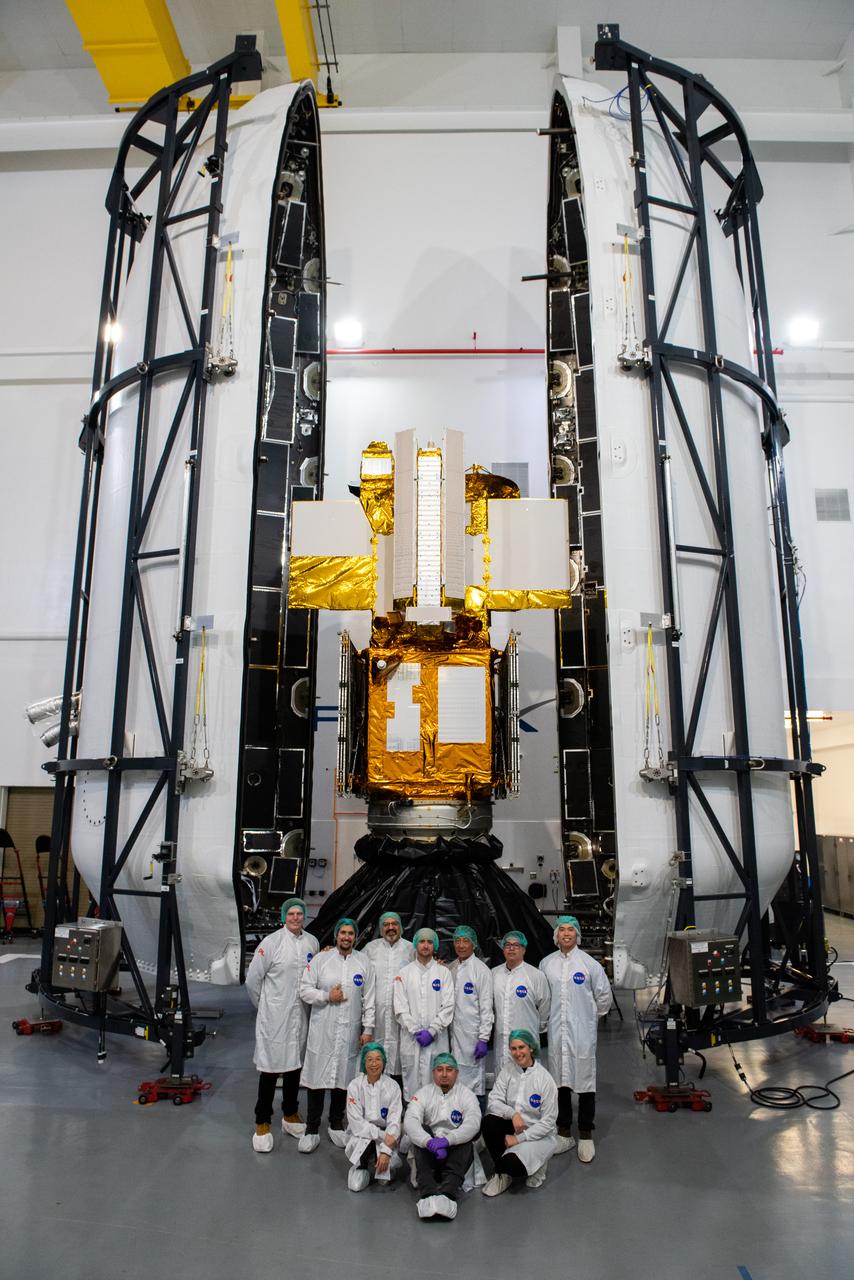
Inside the SpaceX facility at Vandenberg Space Force Base in California, both halves of the SpaceX Falcon 9 payload fairing are moved to enclose the Surface Water and Ocean Topography (SWOT) satellite on Dec. 8, 2022. To mark the milestone, members of the processing team gather in front of the SWOT satellite. A collaboration between NASA and the French space agency Centre National d’Études Spatiales (CNES), with contributions from the Canadian Space Agency and the UK Space Agency, SWOT will be the first satellite to survey nearly all water on Earth’s surface. SWOT is scheduled to lift off aboard the SpaceX Falcon 9 rocket from Vandenberg on Dec. 15, 2022, at 3:46 a.m. PST.
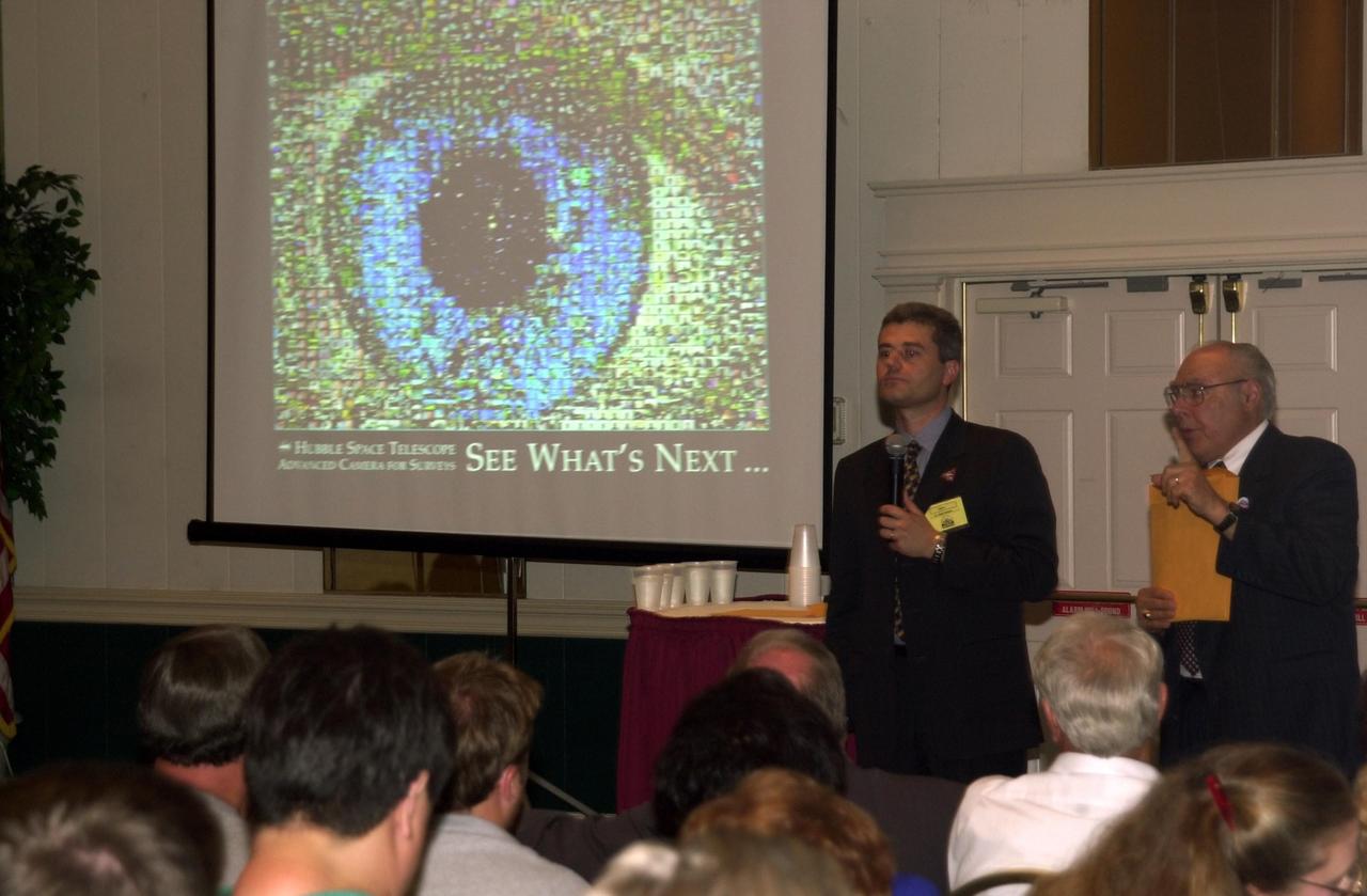
KENNEDY SPACE CENTER, FLA. -- At the 2002 Space Congress, Cape Canaveral, Fla., a presentation on "Hubble Discoveries" by Dr. Mark Clampin (with microphone), Advanced Camera for Surveys team, included an image of an eye (seen on the screen) comprising hundreds of photos of all the people who worked on Hubble. On the right is Frank Ceppolina, project manager, Hubble Space Telescope Development Project. The Space Congress is held annually to highlight military and space initiatives, new technologies, and Florida's role in programs and research. This year's theme is Beginning a New Era - Initiatives in Space. NASA presented several paper sessions, including Advancements in Technology. Space Congress is sponsored by the Canaveral Council of Technical Societies
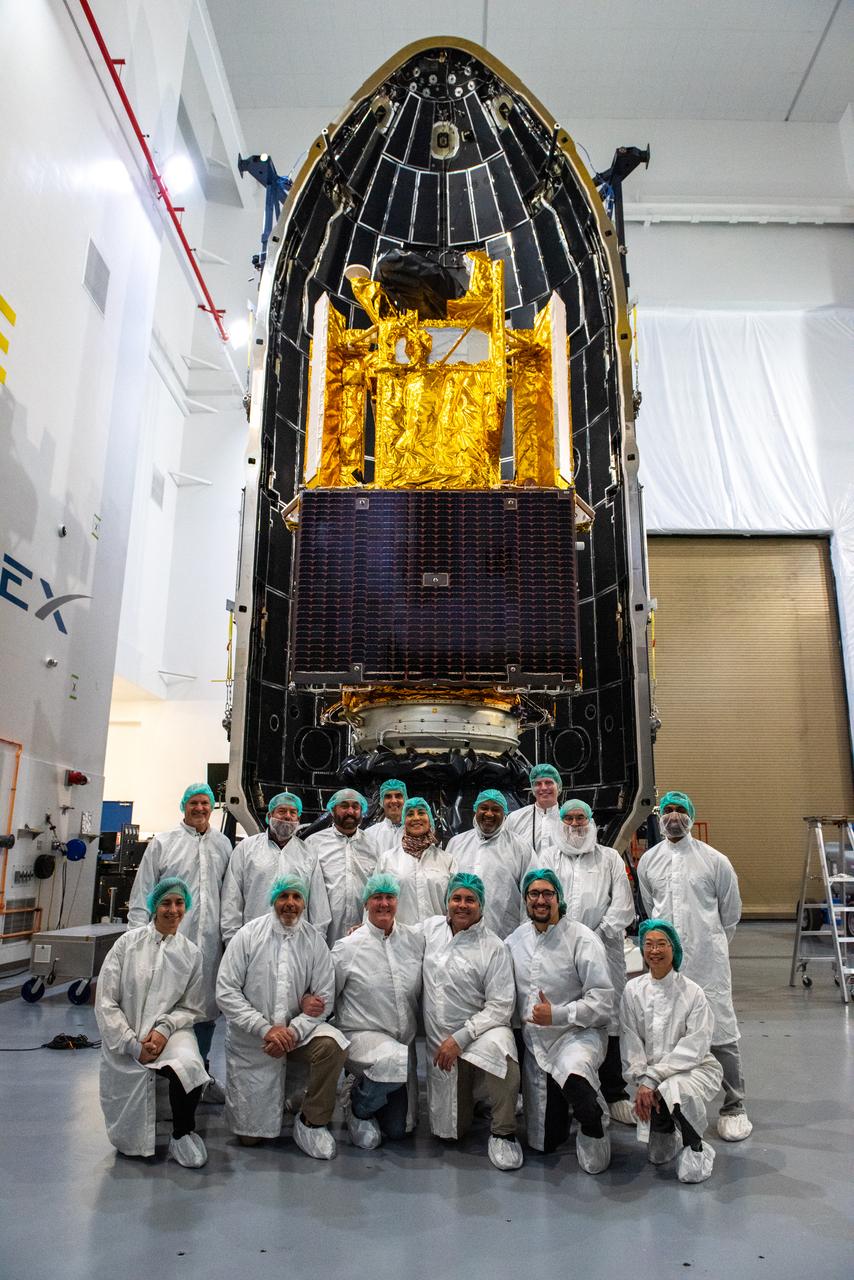
Inside the SpaceX facility at Vandenberg Space Force Base in California, the first half of the SpaceX Falcon 9 payload fairing is moved around the Surface Water and Ocean Topography (SWOT) satellite on Dec. 8, 2022. To mark the milestone, the processing team gathers in front of the SWOT satellite. A collaboration between NASA and the French space agency Centre National d’Études Spatiales (CNES), with contributions from the Canadian Space Agency and the UK Space Agency, SWOT will be the first satellite to survey nearly all water on Earth’s surface. SWOT is scheduled to lift off aboard the SpaceX Falcon 9 rocket from Vandenberg on Dec. 15, 2022, at 3:46 a.m. PST.
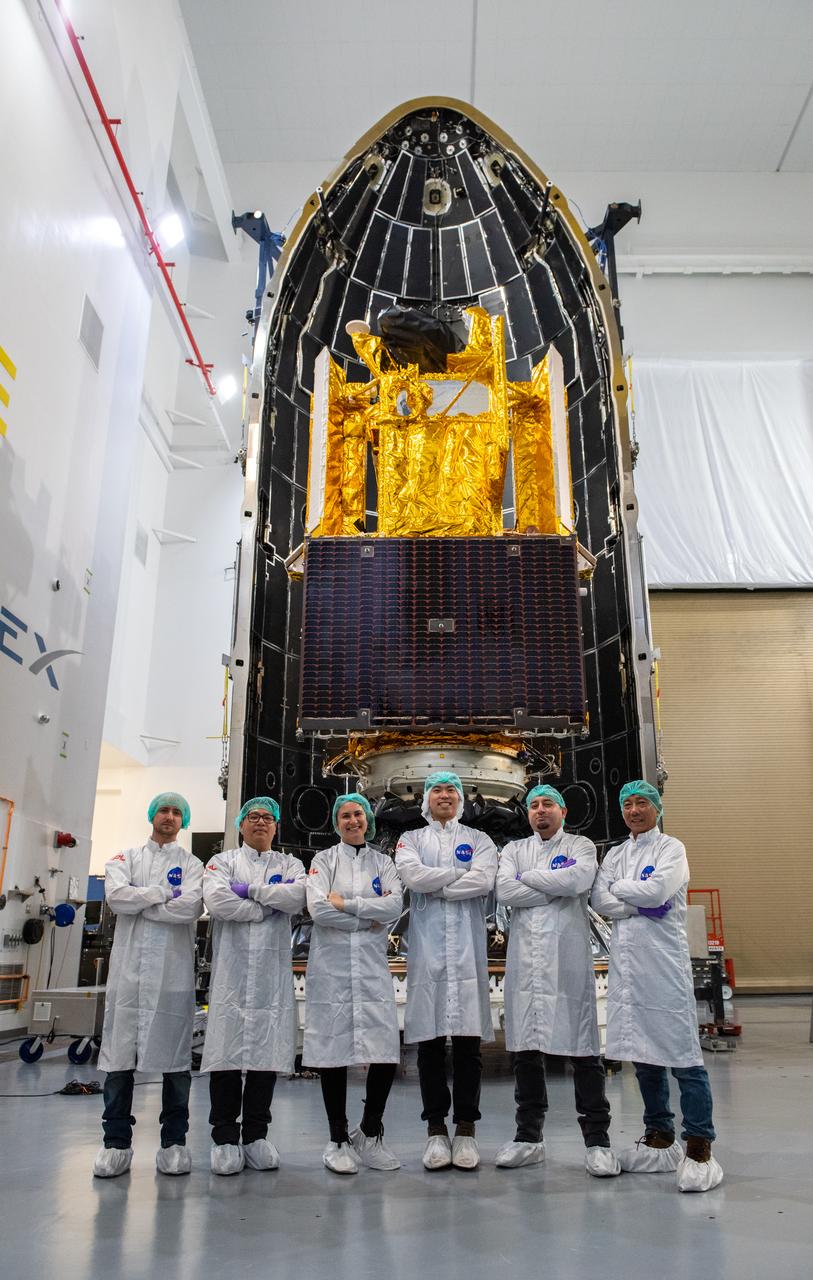
Inside the SpaceX facility at Vandenberg Space Force Base in California, the first half of the SpaceX Falcon 9 payload fairing is moved around the Surface Water and Ocean Topography (SWOT) satellite on Dec. 8, 2022. To mark the milestone, members of the processing team gather in front of the SWOT satellite. A collaboration between NASA and the French space agency Centre National d’Études Spatiales (CNES), with contributions from the Canadian Space Agency and the UK Space Agency, SWOT will be the first satellite to survey nearly all water on Earth’s surface. SWOT is scheduled to lift off aboard the SpaceX Falcon 9 rocket from Vandenberg on Dec. 15, 2022, at 3:46 a.m. PST.
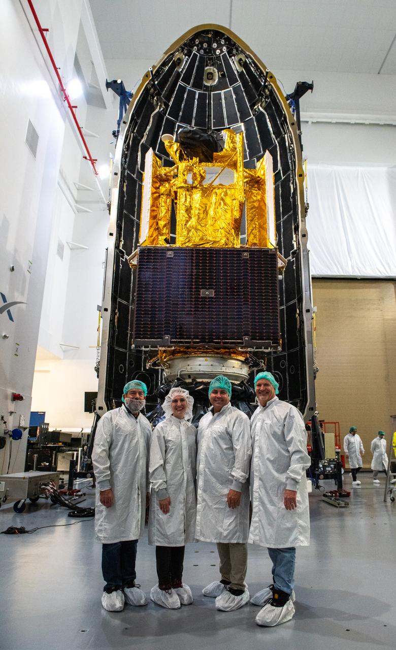
Inside the SpaceX facility at Vandenberg Space Force Base in California, the first half of the SpaceX Falcon 9 payload fairing is moved around the Surface Water and Ocean Topography (SWOT) satellite on Dec. 8, 2022. To mark the milestone, members of the processing team gather in front of the SWOT satellite. A collaboration between NASA and the French space agency Centre National d’Études Spatiales (CNES), with contributions from the Canadian Space Agency and the UK Space Agency, SWOT will be the first satellite to survey nearly all water on Earth’s surface. SWOT is scheduled to lift off aboard the SpaceX Falcon 9 rocket from Vandenberg on Dec. 15, 2022, at 3:46 a.m. PST.
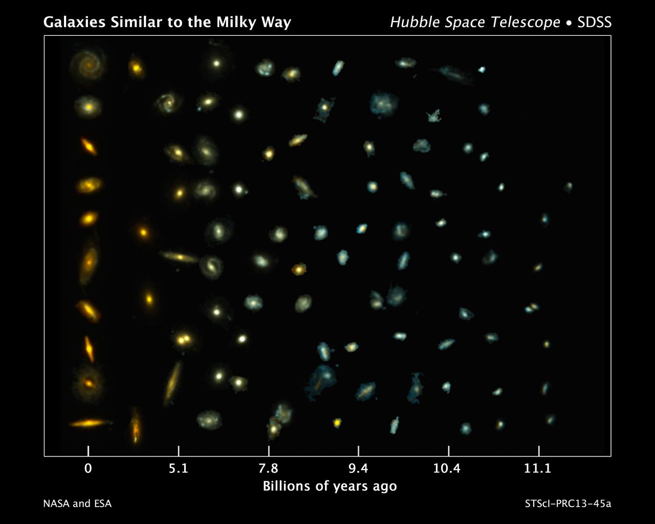
This composite image shows examples of galaxies similar to our Milky Way at various stages of construction over a time span of 11 billion years. The galaxies are arranged according to time. Those on the left reside nearby; those at far right existed when the cosmos was about 2 billion years old. The bluish glow from young stars dominates the color of the galaxies on the right. The galaxies at left are redder from the glow of older stellar populations. Astronomers found the distant galaxies in two Hubble Space Telescope surveys: 3D-HST and the Cosmic Assembly Near-infrared Deep Extragalactic Legacy Survey, or CANDELS. The observations were made in visible and near-infrared light by Hubble's Wide Field Camera 3 and Advanced Camera for Surveys. The nearby galaxies were taken from the Sloan Digital Sky Survey. This image traces Milky Way-like galaxies over most of cosmic history, revealing how they evolve over time. Hubble's sharp vision resolved the galaxies' shapes, showing that their bulges and disks grew simultaneously. Credit: NASA, ESA, P. van Dokkum (Yale University), S. Patel (Leiden University), and the 3D-HST Team <b><a href="http://www.nasa.gov/audience/formedia/features/MP_Photo_Guidelines.html" rel="nofollow">NASA image use policy.</a></b> <b><a href="http://www.nasa.gov/centers/goddard/home/index.html" rel="nofollow">NASA Goddard Space Flight Center</a></b> enables NASA’s mission through four scientific endeavors: Earth Science, Heliophysics, Solar System Exploration, and Astrophysics. Goddard plays a leading role in NASA’s accomplishments by contributing compelling scientific knowledge to advance the Agency’s mission. <b>Follow us on <a href="http://twitter.com/NASA_GoddardPix" rel="nofollow">Twitter</a></b> <b>Like us on <a href="http://www.facebook.com/pages/Greenbelt-MD/NASA-Goddard/395013845897?ref=tsd" rel="nofollow">Facebook</a></b> <b>Find us on <a href="http://instagram.com/nasagoddard?vm=grid" rel="nofollow">Instagram</a></b>
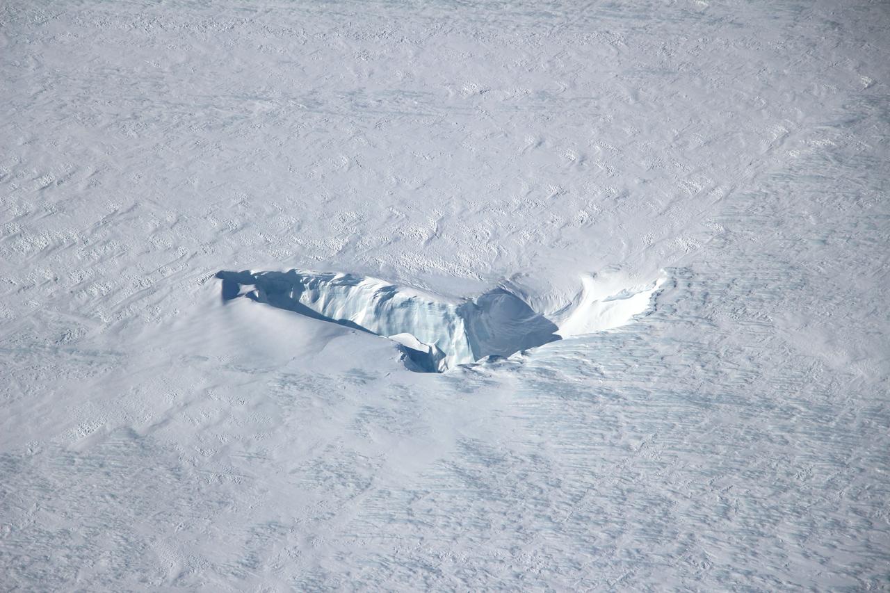
Scientists and crew with NASA’s Operation IceBridge, which makes annual aerial surveys of polar ice, are wrapping up their seventh campaign over the Arctic. In spring 2015, the team began using a different research aircraft—an adapted C-130 Hercules. They also added four new high-priority targets in the rapidly changing region of northeast Greenland. Many of the flights, however, were routine. And that’s exactly the point; making measurements over the same path each year provides continuity between NASA’s Ice, Cloud, and Land Elevation Satellite (ICESat) missions—the first of which ended in 2009 and the second of which is scheduled for launch in 2017. Repeat measurements show how a landscape changes over time. One area that has been surveyed repeatedly is northern Greenland’s Ryder Glacier. This photograph, taken during the IceBridge flight on May 6, 2015, shows a large moulin—dozens of meters across—atop this glacier. Moulins are holes in the ice sheet that drain melt water from the ice sheet’s surface to the bottom or out to the sea. Scientists are working to figure out what happens to melt water once it enters a moulin.
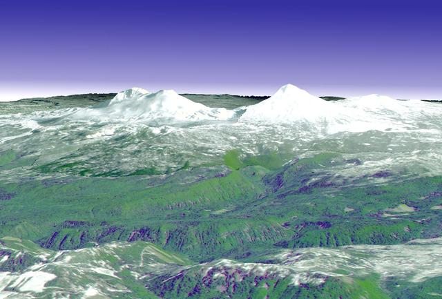
The ground near one of the long-dormant Three Sisters volcanoes in the Cascade Mountains of west-central Oregon has risen approximately 10centimeters in a 10-by-20-km parcel since 1996, meaning that magma or underground lava is slowly flowing into the area, according to a research team from the U.S. Geological Survey. The Three Sisters area -- which contains five volcanoes -- is only about 170 miles from Mount St. Helens, which erupted in 1980. Both are part of the Cascades Range, a line of 27volcanoes stretching from British Columbia in Canada to northern California. This perspective view was created by draping a simulated natural color ASTER image over digital topography from the U.S. Geological Survey National Elevation Dataset. This image was acquired on May 28, 2000 by the Advanced Spaceborne Thermal Emission and Reflection Radiometer (ASTER) on NASA's Terra satellite. With its 14 spectral bands from the visible to the thermal infrared wavelength region, and its high spatial resolution of 15 to 90 meters (about 50 to 300 feet), ASTER will image Earth for the next 6 years to map and monitor the changing surface of our planet. http://photojournal.jpl.nasa.gov/catalog/PIA03492
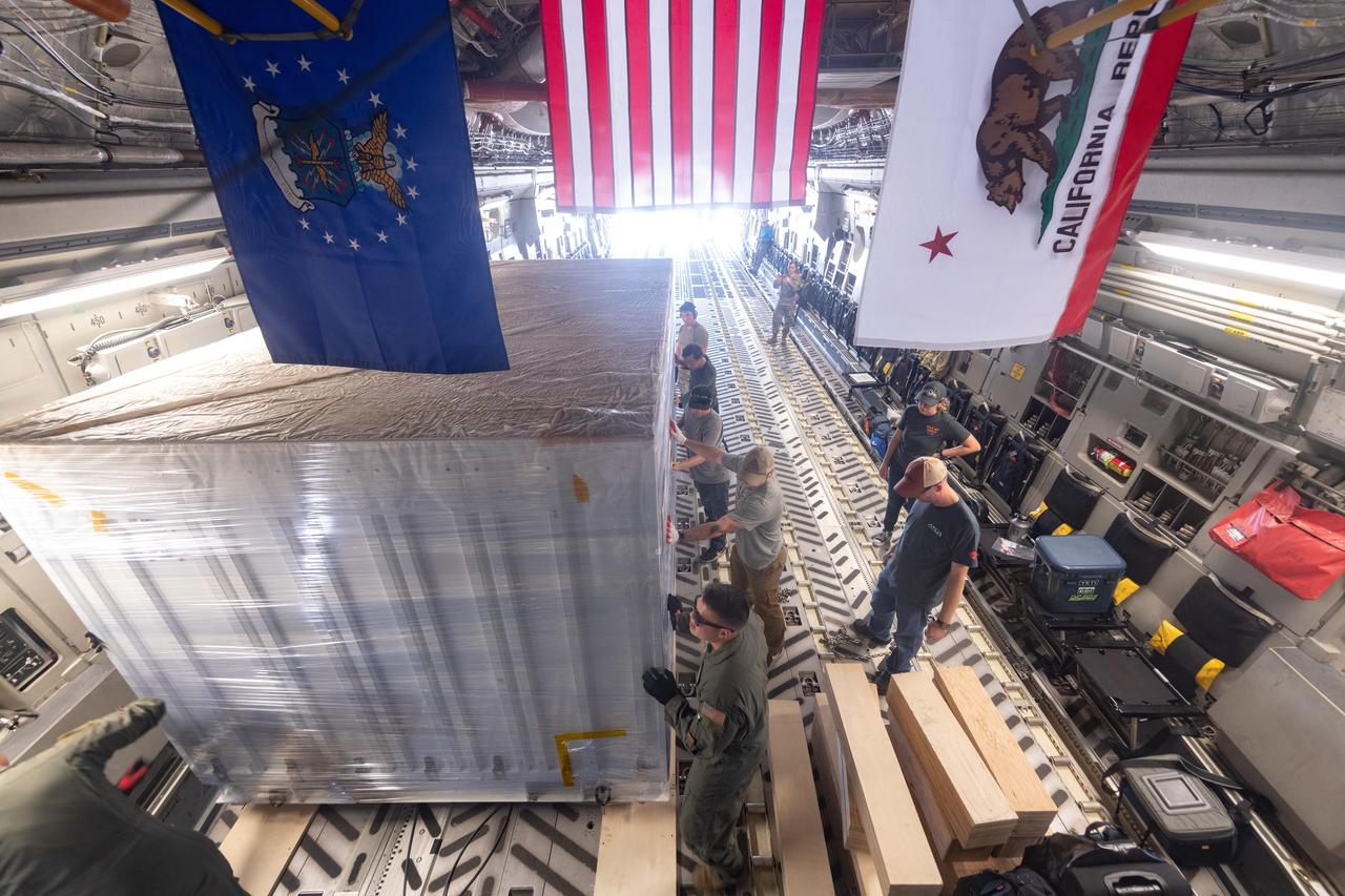
On June 27, 2021, teams from NASA's Jet Propulsion Laboratory in Southern California and the March Air Reserve Base in Riverside County, California, loaded the scientific heart of the Surface Water and Ocean Topography (SWOT) mission into a C-17 airplane. The hardware – which includes research instruments – was headed to a clean room facility near Cannes, France, where engineers and technicians completed assembly of the satellite over the next year. The satellite was subsequently shipped back to California for its December 2022 launch from Vandenberg Space Force Base. SWOT will make global surveys of the water on Earth's surface. By measuring its height, researchers can track the volume and location of the finite resource around the world. The data will help with monitoring changes in floodplains and wetlands, measure how much fresh water flows into and out of lakes and rivers and back to the ocean, and track regional shifts in sea level. https://photojournal.jpl.nasa.gov/catalog/PIA25624
Jim Green (far left), director, Planetary Science Division, Science MissionDirectorate at NASA Headquarters in Washington; Carle Pieters, principal investigator, Moon Mineralogy Mapper, Brown University; Rob Green, project instrument scientist, Moon Mineralogy Mapper, at NASA's Jet Propulsion Laboratory; Roger Clark, team member, Cassini spacecraft Visual and Infrared Mapping Spectrometer and co-investigator, Moon Mineralogy Mapper, U.S. Geological Survey in Denver and Jessica Sunshine (far right), deputy principal investigator for NASA's Deep Impactextended mission and co-investigator for Moon Mineralogy Mapper,Department of Astronomy, University of Maryland discuss their findings of water molecules in the polar regions of the moon at a press conference at NASA Headquarters, September 24, 2009, in Washington. Photo Credit: (NASA/Carla Cioffi)
On June 27, 2021, teams from NASA's Jet Propulsion Laboratory in Southern California and the March Air Reserve Base in Riverside County, California, loaded the scientific heart of the Surface Water and Ocean Topography (SWOT) mission into a C-17 airplane. The hardware – which includes research instruments – is headed to a clean room facility near Cannes, France, where engineers and technicians will complete assembly of the satellite over the next year. SWOT will make global surveys of Earth's surface water. By measuring its height, researchers can track the volume and location of the finite resource around the world. The data will help with monitoring changes in floodplains and wetlands, measure how much fresh water flows into and out of lakes and rivers and back to the ocean, and track regional shifts in sea level. https://photojournal.jpl.nasa.gov/catalog/PIA24534
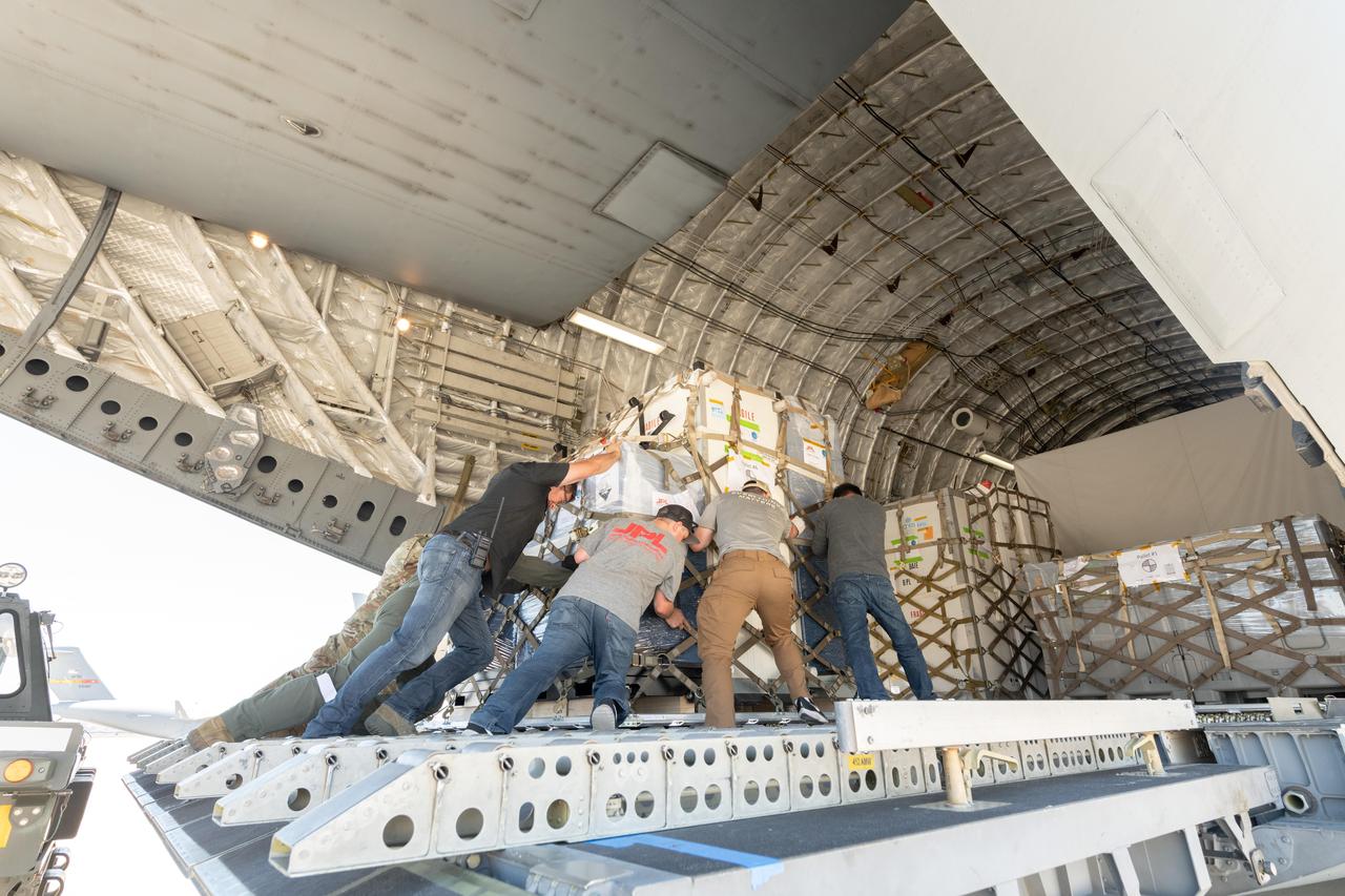
On June 27, 2021, teams from NASA's Jet Propulsion Laboratory in Southern California and the March Air Reserve Base in Riverside County, California, loaded the scientific heart of the Surface Water and Ocean Topography (SWOT) mission into a C-17 airplane. The hardware – which includes research instruments – was headed to a clean room facility near Cannes, France, where engineers and technicians completed assembly of the satellite over the next year. The satellite was subsequently shipped back to California for its December 2022 launch from Vandenberg Space Force Base. SWOT will make global surveys of the water on Earth's surface. By measuring its height, researchers can track the volume and location of the finite resource around the world. The data will help with monitoring changes in floodplains and wetlands, measure how much fresh water flows into and out of lakes and rivers and back to the ocean, and track regional shifts in sea level. https://photojournal.jpl.nasa.gov/catalog/PIA25625
VANDENBERG AIR FORCE BASE, Calif. -- Media attend a mission science briefing at Vandenberg Air Force Base in California in preparation for the launch of the Landsat Data Continuity Mission LDCM. From left are Rani Gran of NASA Public Affairs, LDCM project scientist Dr. Jim Irons from NASA's Goddard Space Flight Center, senior scientist and co-chair of the Landsat Science Team U.S. Geological Survey Earth Resources Observation and Science EROS Center Dr. Thomas Loveland, Landsat scientist and president of Kass Green and Associates Kass Green, and senior research scientist Dr. Mike Wulder of the Landsat Science Team Canadian Forest Service, Natural Resources Canada. Launch of LDCM aboard a United Launch Alliance Atlas V rocket from Vandenberg's Space Launch Complex-3E is planned for Feb. 11 during a 48-minute launch window that opens at 10:02 a.m. PST, or 1:02 p.m. EST. LDCM is the eighth satellite in the Landsat Program series of Earth-observing missions and will continue the program’s critical role in monitoring, understanding and managing the resources needed for human sustainment, such as food, water and forests. NASA's Goddard Space Flight Center in Greenbelt, Md., is responsible for LDCM project management. Orbital Sciences Corp. built the LDCM satellite. NASA's Launch Services Program at the Kennedy Space Center in Florida provides launch management. After launch and the initial checkout phase, the U. S. Geological Survey will take operational control of LDCM, and it will be renamed Landsat 8. Photo credit: NASA/Kim Shiflett