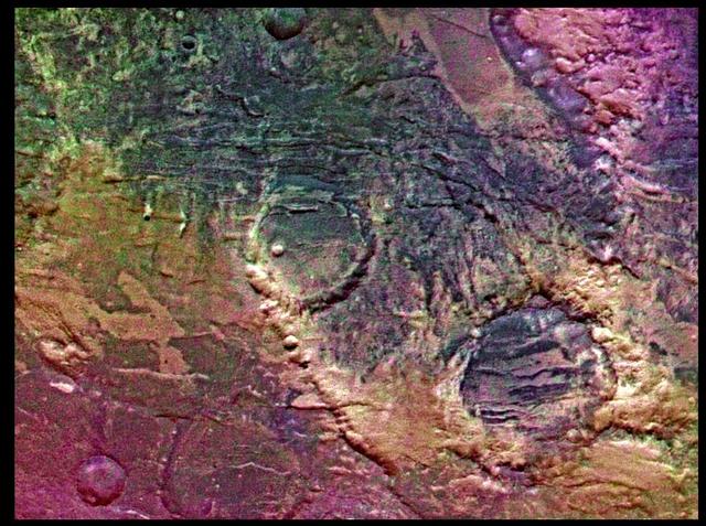
Syria Planum

Dust Storm in Syria
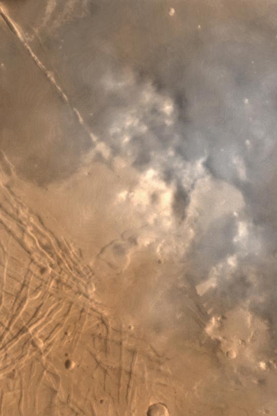
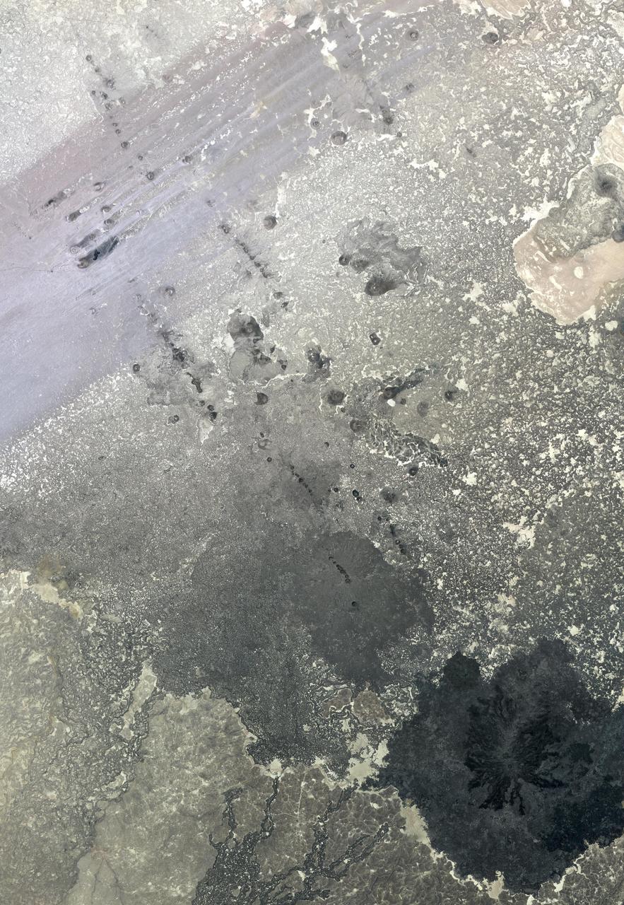
Syria/Claritas Dust Storm
Dusty Volcanic Vent in Syria Planum

Small Dust Storm in Syria/Claritas
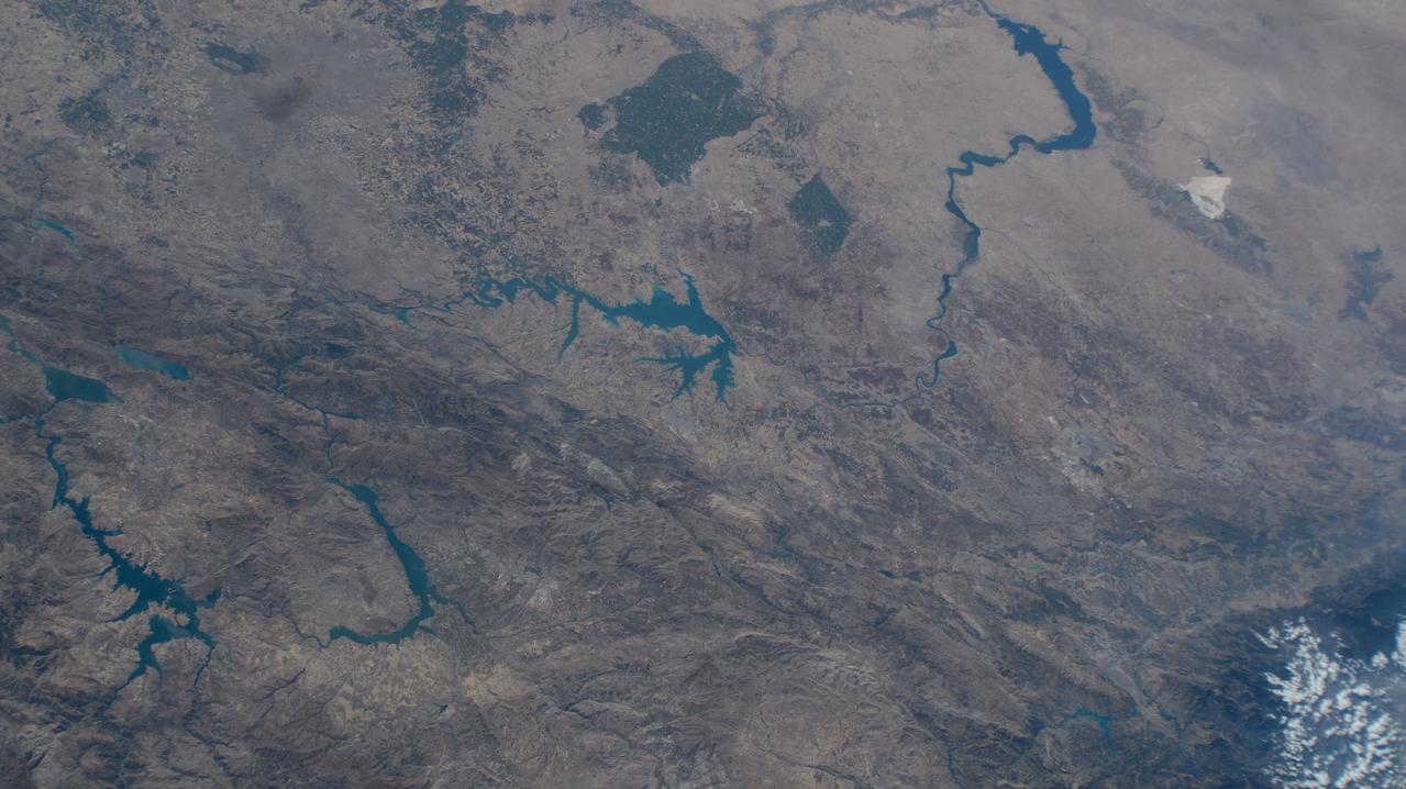
iss071e462180 (Aug. 9, 2024) --- Lake Assad in Syria (upper right) and lakes created by hydroelectric dams in Turkiye, all along the Euphrates River, are pictured from the International Space Station as it orbited 263 miles above the Turkish nation that connects Europe with Asia.
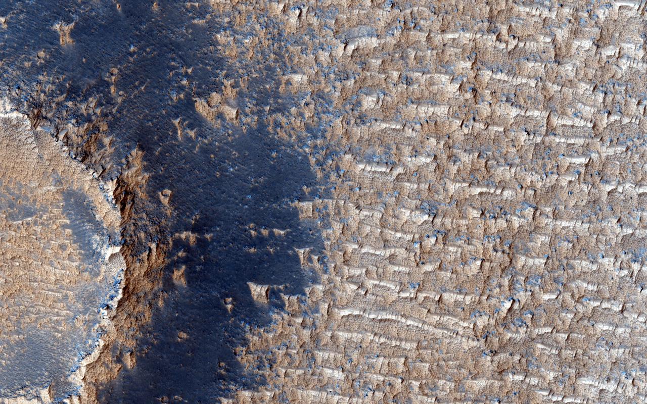
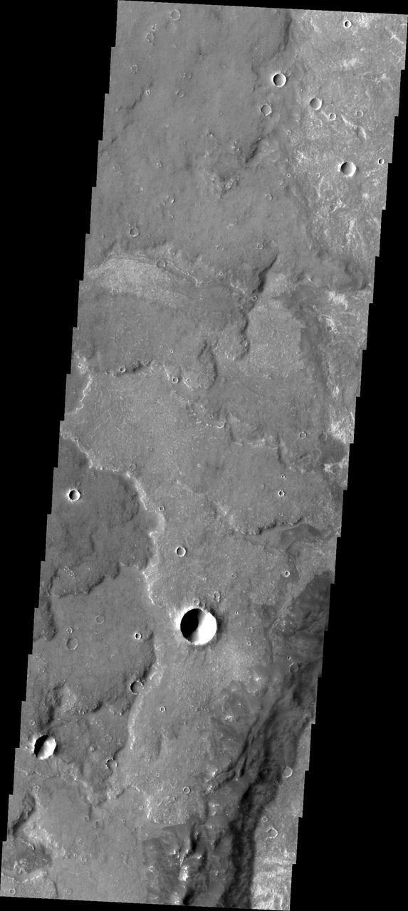
This image from NASA Mars Reconnaissance Orbiter shows curious bright deposits in Syria Planum, a high elevation region near the summit of the Tharsis rise.
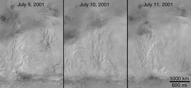
The 2001 Great Dust Storms - Daedalia/Claritas/Syria Dust Plumes
AST-16-1268 (20 July 1975) --- A near vertical view of a portion of the Mediterranean coast of Turkey and Syria, as photographed from the Apollo spacecraft in Earth orbit during the joint U.S-USSR Apollo-Soyuz Test Project mission. This view covers the Levant Coast north of Beirut, showing the cities of Aleppo, Hamah, Homs and Latakia. The Levantine rift bends to the northeast. This picture was taken with a 70mm Hasselblad camera using high-definition aerial Ektachrome SO-242 type film. The altitude of the spacecraft was 225 kilometers (140 statute miles) when this photograph was taken.
This VIS image shows a linear depression in Syria Planum. Volcanic activity, including broad shield volcanoes and extensive volcanic plains created this region of the Tharsis system south of Noctis Labyrinthus. Linear features, like the one in this image, can be caused by several different processes. In this case a combination of tectonic forces and lava emplacement created the depression. Orbit Number: 74800 Latitude: -14.4492 Longitude: 260.323 Instrument: VIS Captured: 2018-10-25 07:10 https://photojournal.jpl.nasa.gov/catalog/PIA22883
In southern Syria, the Azraq-Wadi as Sirhan Depression is the site of young volcanic activity, producing an extensive basaltic volcanic field. The north-northwest to south-southeast structural and fault control of the crust is evident in the straight alignment of numerous chains of cinder cones. At the top of the image, the northeast trending streaks are windblown sand deposits. The image was acquired May 20, 2009, covers an area of 46.5 x 67 km, and is located at 33.3 degrees north, 37.1 degrees east. http://photojournal.jpl.nasa.gov/catalog/PIA19479
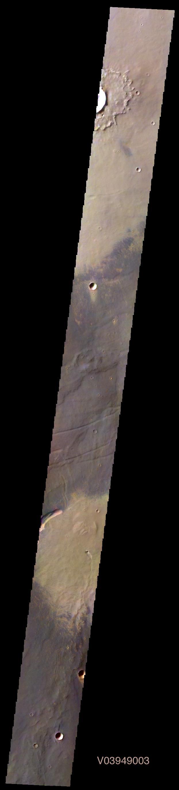
This image shows part of Syria Planum

SL3-115-1924 (July-September 1973) --- Skylab 3 Earth view of Israel, Jordan, Lebanon, Syria, Iraq and the Dead Sea. Photo credit: NASA
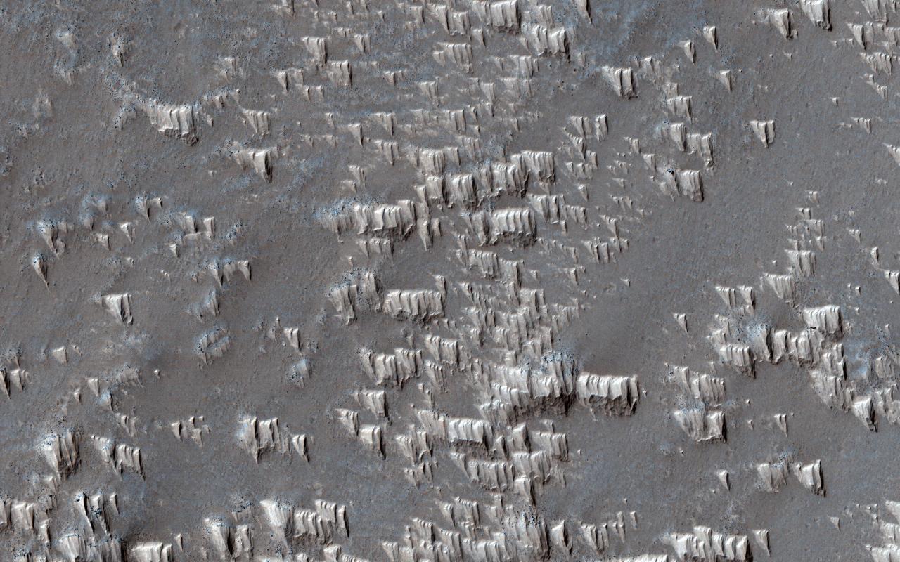
Wind-blown deposits known as transverse aeolian ridges (TARs) are frequently visible in images of the Martian tropics. They are bright ripples with heights of 2.6 meters and spacing that averages 47 meters. The TARs generally appear inactive and eroded, sometimes cratered or littered with boulders from nearby impacts and avalanches. In Syria Planum, unusual bright deposits might be accumulations of dust blown from higher to lower elevations by nighttime slope winds, reaching speeds of up to 50 meters per second. These dust deposits resemble TARs in height and spacing but with a distinct shape from other TARs. A close up view shows that the deposits form pyramidal features with steep faces on the upwind sides (wind is blowing from the top of the picture) and tapered slopes in the downwind direction. Ridges form where the "pyramids" line up together, and the spacing of the ridges appears to be controlled by the length of the "pyramids." These observations suggest that TARs elsewhere on Mars may have formed in a similar fashion, perhaps millions of years ago when the atmosphere was more active. They also may be forming in Syria Planum today. https://photojournal.jpl.nasa.gov/catalog/PIA23529

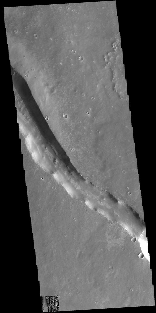
The linear features in this image are called graben and are formed when two parallel faults have a downdropped block of material between them. These graben are located between Syria Planum and Claritas Rupes
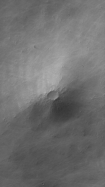
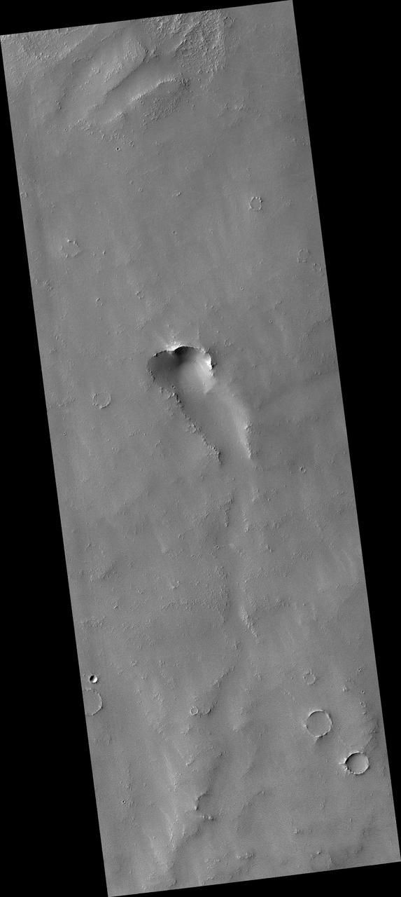
This MOC image shows a small volcano in the Syria Planum region of Mars. Today, the lava flows that compose this small volcano are nearly hidden by a mantle of rough-textured, perhaps somewhat cemented, dust
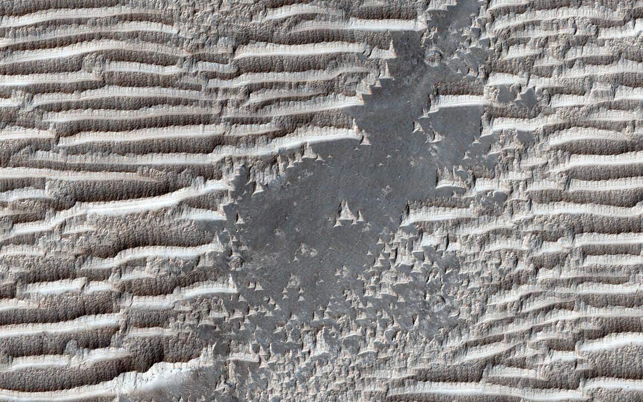
These strange features in Syria Planum are still being widely debated. They have the same general form as transverse aeolian ridges (TARs) elsewhere on Mars; windblown deposits that are common in the Martian tropics. Their height and spacing are similar to the more familiar looking TARs in other places, and they are similarly bright. Unless Nature is perverse, they were both made by the same process. Yet the TARs here in Syria Planum appear different than typical TARs elsewhere on the planet. They have blunt edges, in contrast to the tapering ends of typical TARs. The ridge crests are serrated, unlike the smooth crests of most TARs. They are layered on their upwind faces and scoured on the downwind sides, whereas TARs are usually smooth and symmetric. Why are these TARs bizarre? A possible answer is that the features here in Syria Planum are at a different stage of evolution than TARs elsewhere, and are either younger or older than typical TARs. We can look at an enhanced color cutout to see whether this can be the case. http://photojournal.jpl.nasa.gov/catalog/PIA19942
Mars Syria Planum-centered volcanism and tectonism produced fractures, narrow to broad grabens, large scarps, and broad fold and thrust ridges that deformed a basement complex captured by NASA's Viking Orbiter 2. http://photojournal.jpl.nasa.gov/catalog/PIA00154
iss065e002119 (April 22, 2021) --- The island of Cyprus in the eastern Mediterranean Sea is pictured from the International Space Station as it orbited 263 above Aleppo, Syria.
iss061e118088 (Jan. 4, 2020) --- The International Space Station was orbiting 260 miles above northeastern Syria at the time this photograph of Baghdad, Iraq was taken.
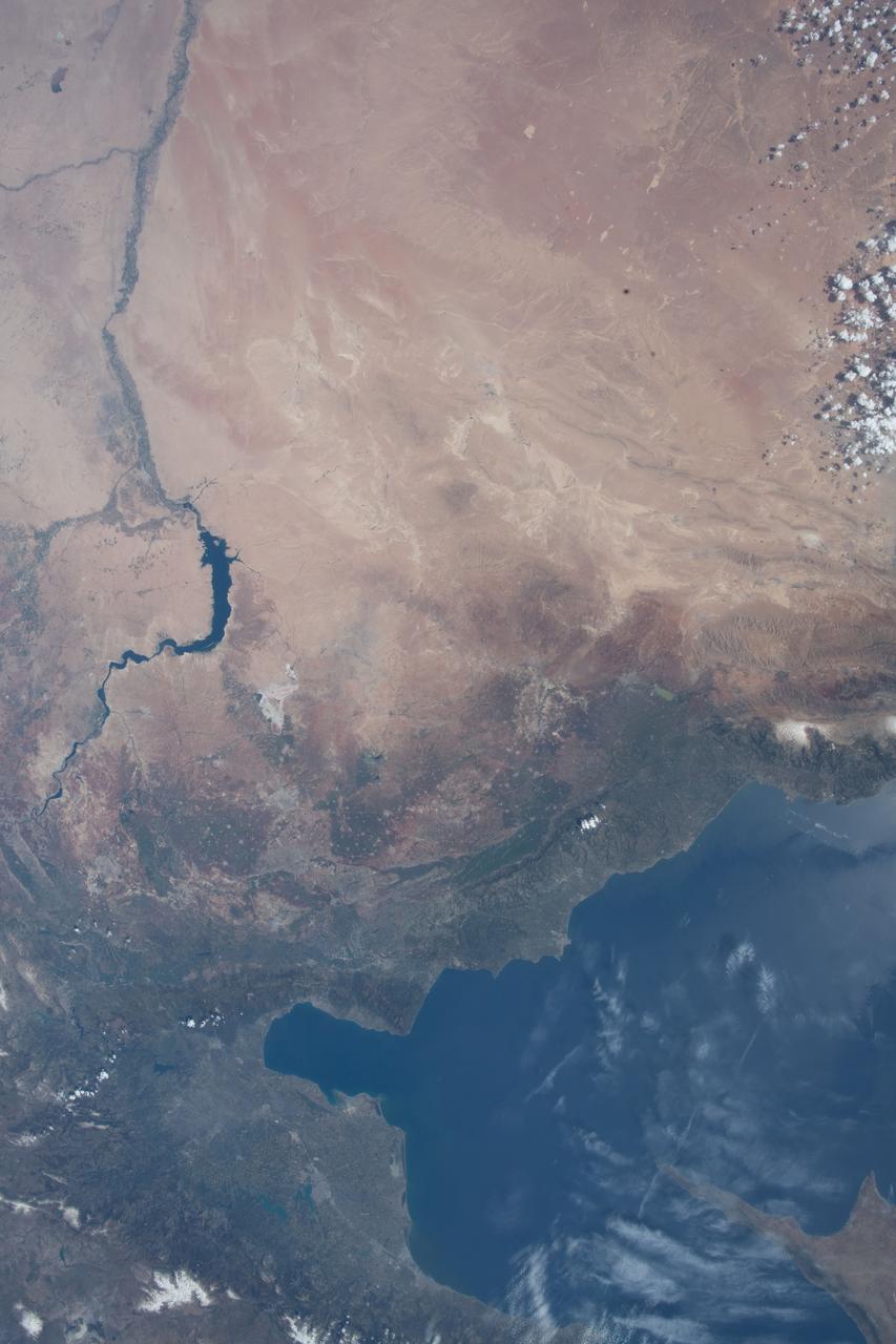
iss065e002136 (April 22, 2021) --- The Euphrates River flows through Lake Assad in Syria in this photograph from the International Space Station as it orbited 263 miles above.

iss068e053809 (Feb. 14, 2023) --- The southern coast of Turkey on the Mediterranean Sea near Syria is pictured from the International Space Station as it orbited 264 miles above.
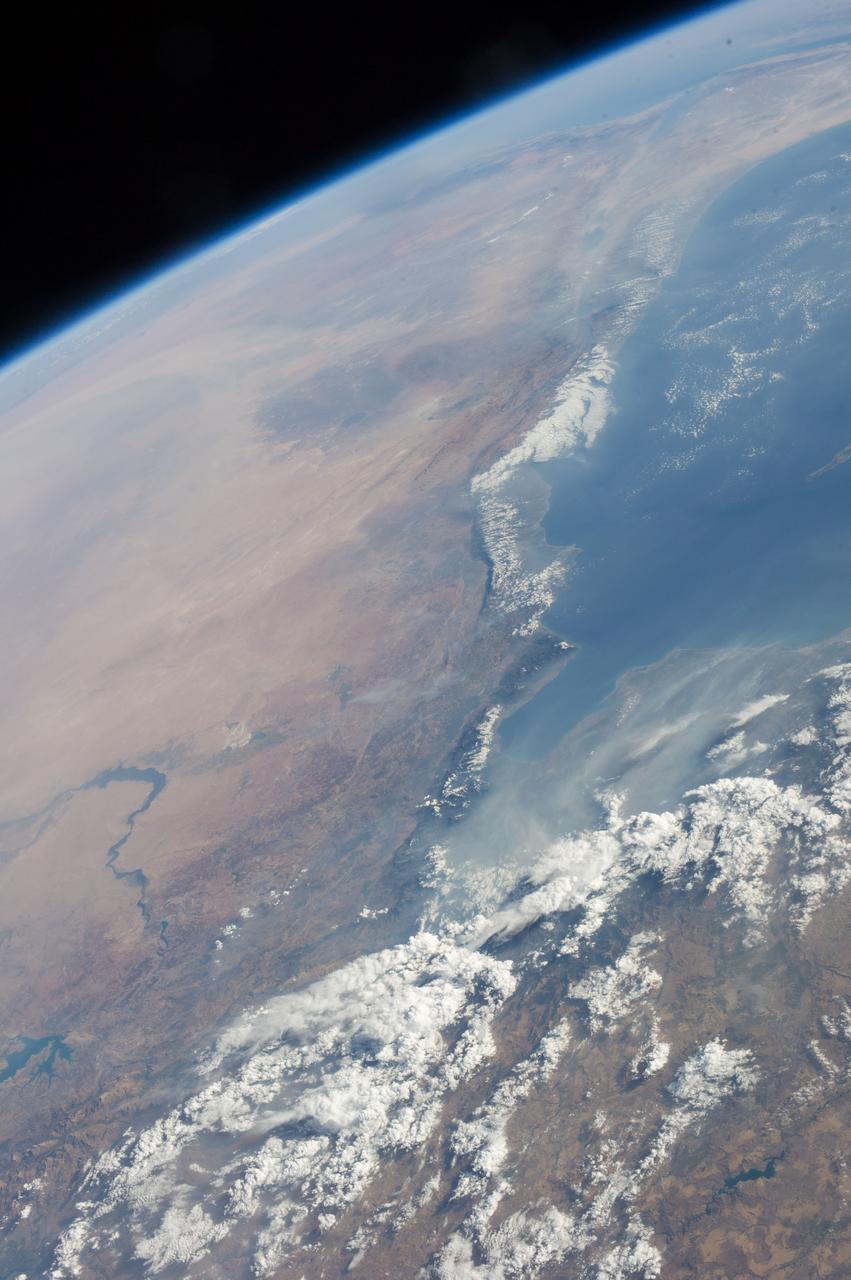
iss055e013356 (April 7, 2018) --- The eastern-most portion of the Mediterranean Sea and portions of the countries of Turkey, Syria and Lebanon was photographed from the International Space Station by an Expedition 55 crew member.
Earth observation taken by an Expedition 36 crew member on board the International Space Station (ISS). Per Twitter message: Eastern Mediterranean Sea coast, Turkey, Syria, Lebanon, Israel.
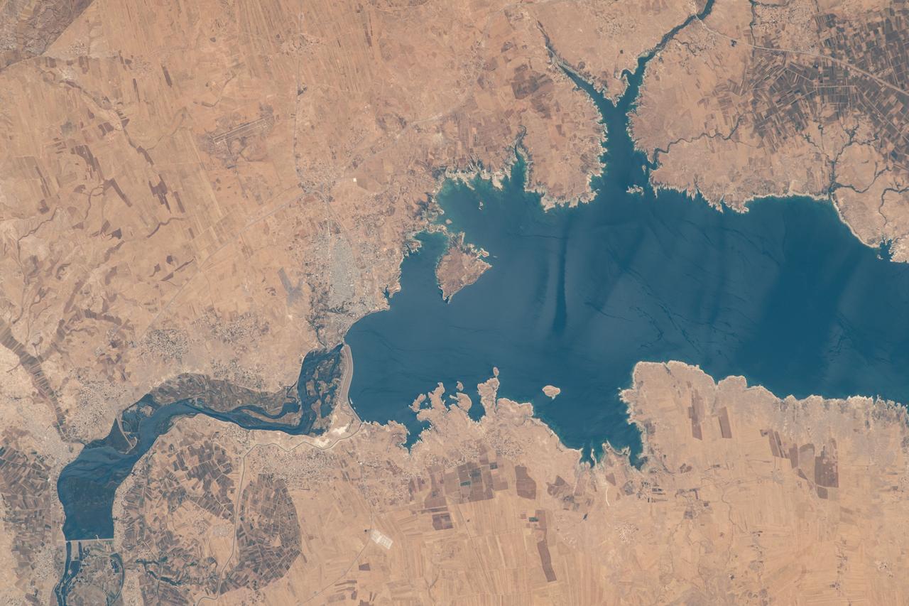
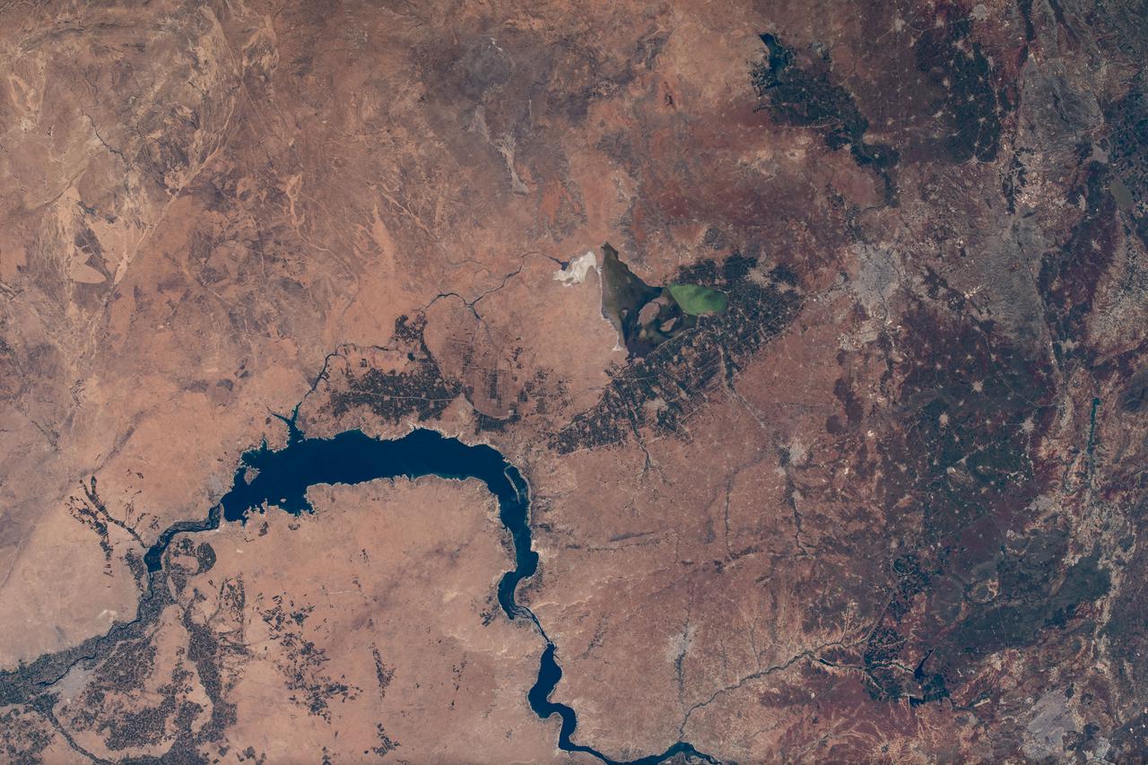
iss069e015083 (May 31, 2023) --- Lake Assad in Syria, a reservoir on the Euphrates River, is pictured from the International Space Station as it orbited 258 miles above the Middle East nation.
iss063e067994 (Aug. 11, 2020) --- Beirut, Lebanon is pictured from the International Space Station as it orbited above southeastern Syria. At right, is the Beirut-Rafic Hariri International Airport.
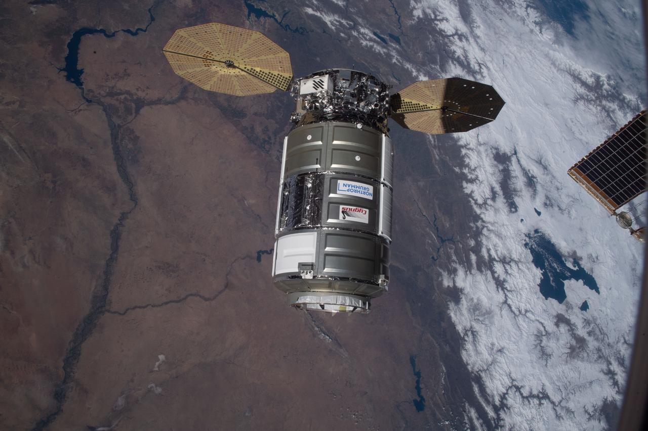
iss064e035951 (Feb. 22, 2021) --- The Cygnus space freighter from Northrop Grumman approaches the International Space Station as both spacecraft were orbiting 262 miles above the Syria-Iraq border.
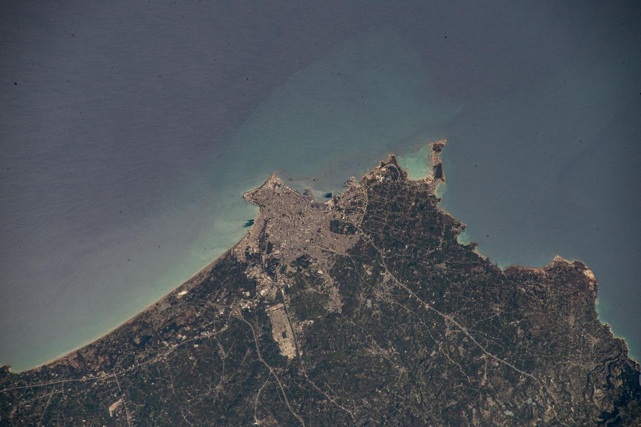
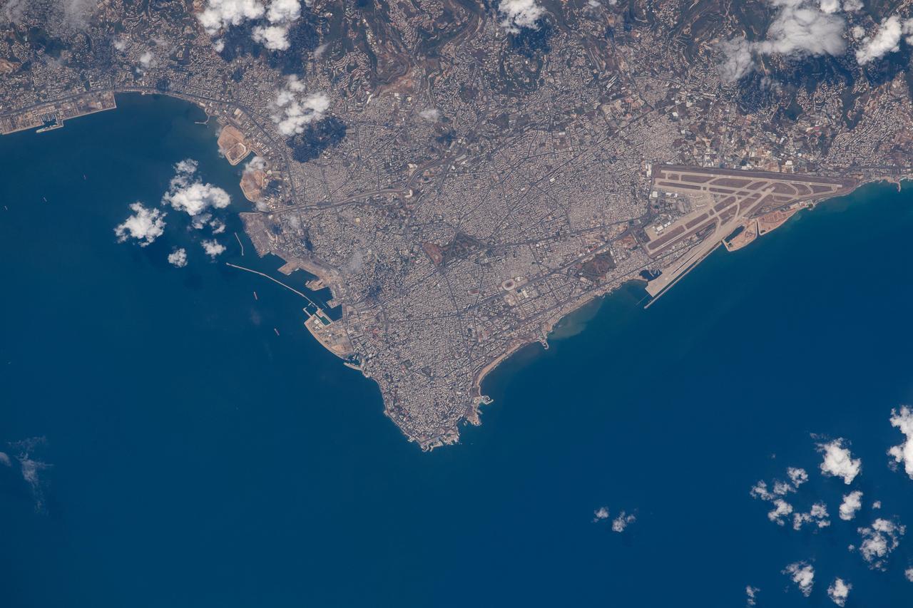
iss069e000774 (April 3, 2023) --- Syria's principal port city of Latakia, on the Mediterranean coast, was pictured by UAE (United Arab Emirates) astronaut and Expedition 69 Flight Engineer Sultan Alneyadi from the International Space Station as it orbited 262 miles above.
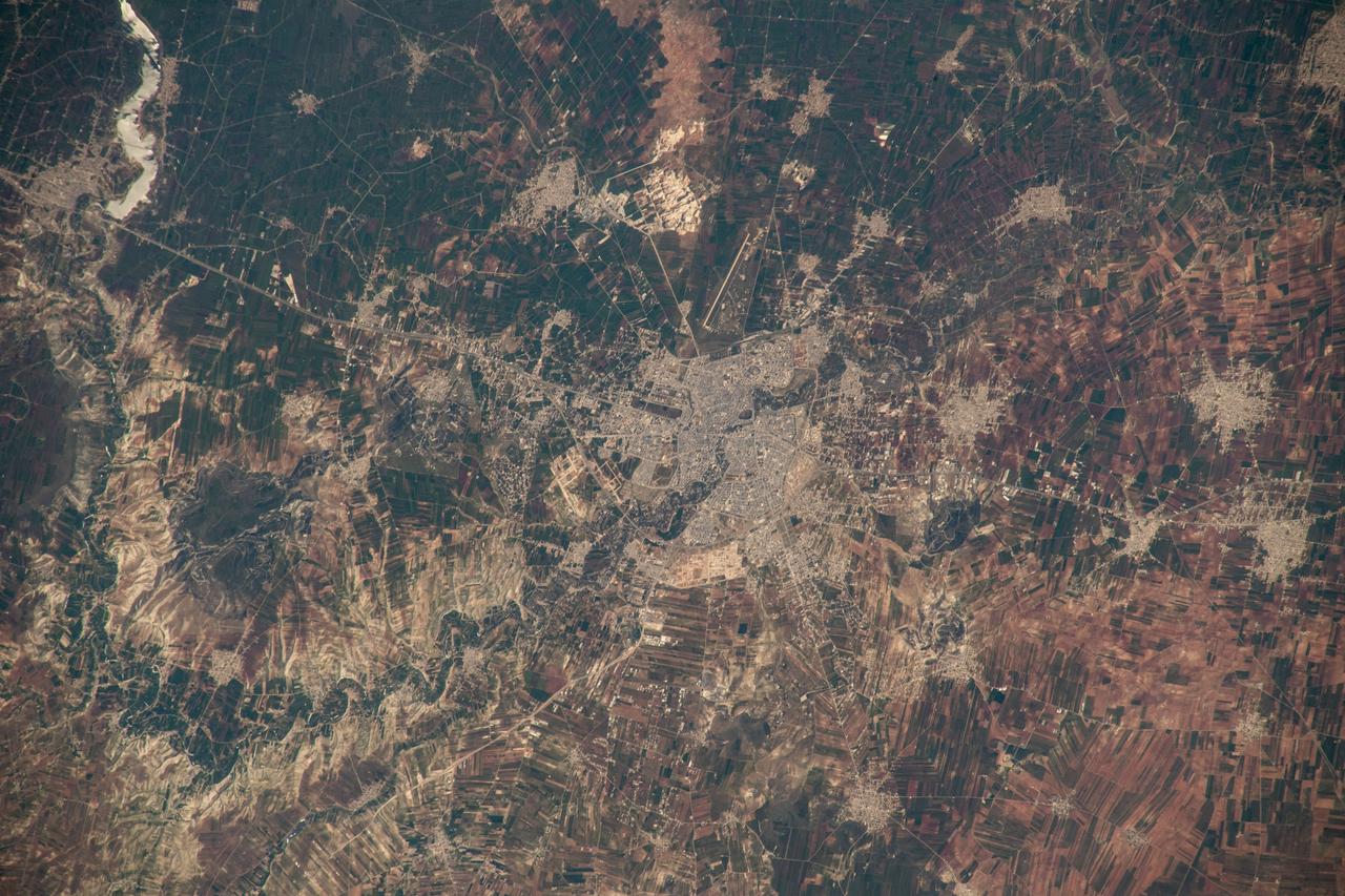
iss069e000778 (April 3, 2023) --- The semi-arid city of Hama, Syria, was pictured by UAE (United Arab Emirates) astronaut and Expedition 69 Flight Engineer Sultan Alneyadi from the International Space Station as it orbited 262 miles above.
S65-34776 (3-7 June 1965) --- This photograph shows the Nile Delta, Egypt, the Suez Canal, Israel, Jordan, Syria, Saudi Arabia, and Iraq as seen from the Gemini-Titan 4 (GT-4) spacecraft during its 12th revolution of Earth.
STS079-824-081 (16-26 Sept. 1996) --- In this 70mm frame from the space shuttle Atlantis, the Jordan River Valley can be traced as it separates Lebanon, Palestine and Israel on the west, from Syria and Jordan on the east. The river flows along the Dead Sea rift; the east side of the fault zone (Syria, Jordan, Saudi Arabia) has moved north about 100 kilometers relative to the west side (Lebanon, Israel, Egypt) during the past 24 million years. The Dead Sea and Sea of Galilee are in depressions formed where faults of the zone diverge or step over. The Dead Sea once covered the area of salt evaporation pans (the bright blue water). The lagoon, barrier islands and evaporite deposits (bright white) along the Mediterranean coast of the Sinai Peninsula (lower left of frame) are just east of Port Said.
41G-120-056 (October 1984) --- Parts of Israel, Lebanon, Palestine, Syria and Jordan and part of the Mediterranean Sea are seen in this nearly-vertical, large format camera's view from the Earth-orbiting Space Shuttle Challenger. The Sea of Galilee is at center frame and the Dead Sea at bottom center. The frame's center coordinates are 32.5 degrees north latitude and 35.5 degrees east longitude. A Linhof camera, using 4" x 5" film, was used to expose the frame through one of the windows on Challenger's aft flight deck.
ISS047e057822 (04/14/2016) --- The Middle East is seen from 250 miles above in this photo from the International Space Station. Countries seen left to right along the Mediterranean coast include Egypt, Gaza, Saudi Arabia, Israel, Lebanon, Syria, and Turkey. The major waterways shown from left to right are the Nile River, Gulf of Suez, Gulf of Aqaba, and the Red Sea.
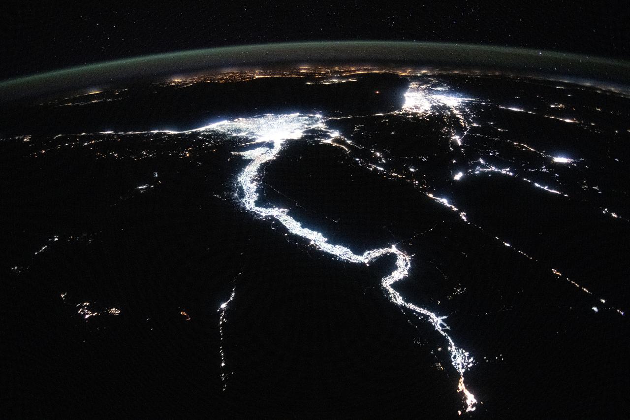
iss071e256968 (June 30, 2024) --- The night lights of civilization highlight the Nile River and dimly outline the shores of the Red Sea, the Gulf of Suez, and the Gulf of Adaba in the Middle East. The nations of Israel, Jordan, and Syria, as well as the Southern European region across the darkness of the Mediterranean Sea also are well lit in this photograph taken from the International Space Station at approximately midnight local time in Cairo, Egypt.
S65-63849 (8 Dec. 1965) --- The eastern Mediterranean area as seen from the National Aeronautics and Space Administration's Gemini-7 spacecraft. The Nile Delta in Egypt is at bottom. The Suez Canal, Gulf of Suez and Red Sea are in the center of the photograph. The Sinai Peninsula is in the upper right corner of the picture. The body of water at the top edge of the photograph is the Gulf of Aqaba. The Dead Sea can be seen at top center. Israel, Palestine, Jordan and Syria are also at top center. The Island of Cyprus is at extreme left. Astronauts Frank Borman and James A. Lovell Jr. took this picture using a modified 70mm Hasselblad camera, with Eastman Kodak, Ektachrome MS (S.O. 217) color film. Photo credit: NASA
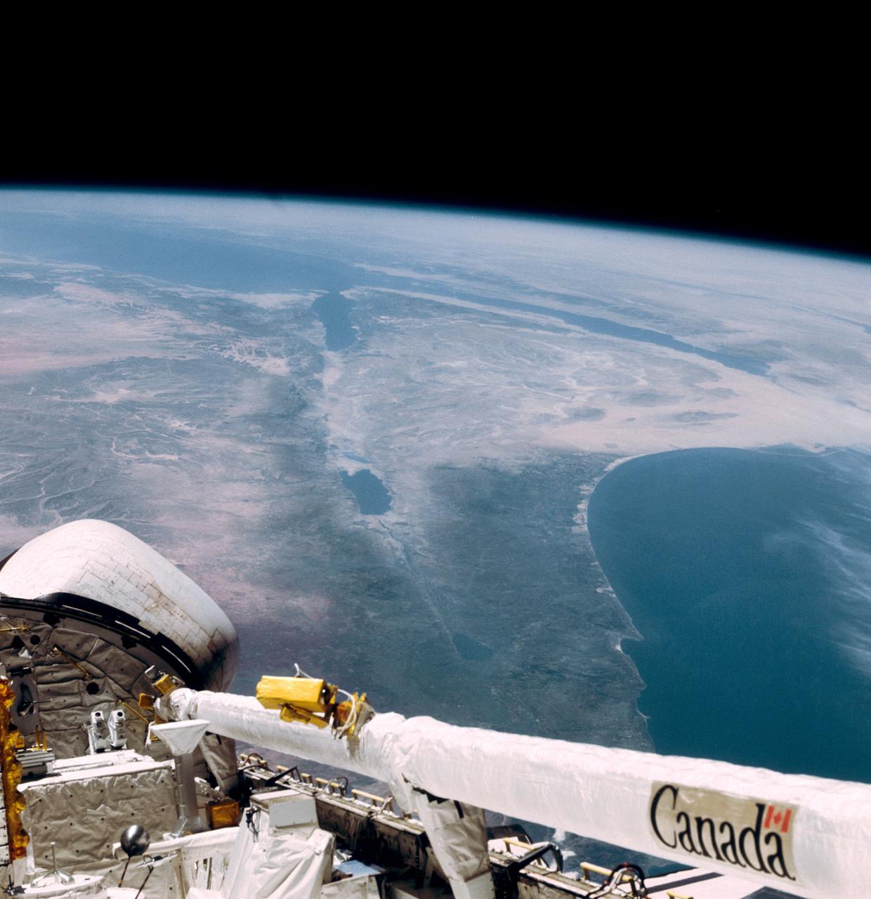
This southerly looking view photographed from the orbiting Space Shuttle Columbia shows a small portion of the vehichle's aft section. The 50-ft Canadian built remote manipulator system (RMS) is in a resting posture (lower right corner) stretched out along the 60-ft. long cargo bay. Many of the components of the OSS-1 payload package are in the bottom center. The Mediterranean Sea is at right foreground. Parts of the Sinai peninsula, Israel, Egypt, Saudi Arabia, Jordan, Palestine, Syria, and Lebanon can be located in the photo. The Red Sea, Gulf of Aqaba, Suez Canal are near the photo's horizon.
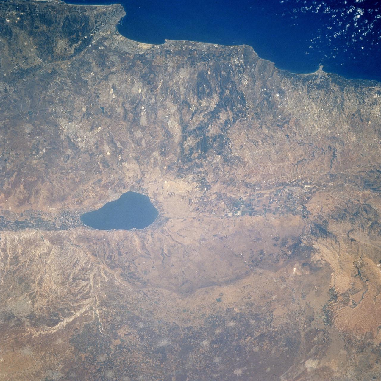
STS106-713-002 (19 September 2000) --- One of the STS-106 crew members on board the Space Shuttle Atlantis, 204 nautical miles above Earth, used a handheld 70mm camera to photograph this image featuring the Sea of Galilee and part of the Mediterranean coast. Also known as Lake Tiberius and other names, the body of water is the only natural fresh-water lake in Israel. It borders on the Golan Heights on its east side. The port of Haifa is visible on the Mediterranean coast. The large agriculture projects on the Israeli side of Galilee are irrigated by the lake and the Jordan River.
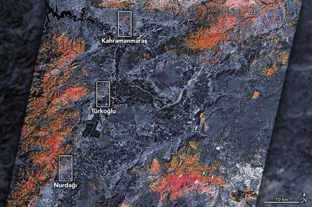
The magnitude 7.8 and 7.5 earthquakes that struck southern Turkey and western Syria on February 6, 2023, caused widespread destruction in both countries. The initial, stronger earthquake emanated from a fault 11 miles (18 kilometers) below the surface. The shallow depth meant the earthquake produced violent shaking that affected areas hundreds of miles from the epicenter, 16 miles (26 kilometers) east of the city of Nurdağı, Turkey. The second quake followed nine hours later, striking 6 miles (10 kilometers) deep, roughly 2.5 miles (4 kilometers) south-southeast of the Turkish town of Ekinözü. Hundreds of smaller aftershocks occurred in subsequent days. The preliminary damage proxy map above shows parts of the Turkish cities of Islahiye, Kahramanmaras, and Nurdağı. Dark red pixels represent areas likely to have severe damage to buildings, homes, and infrastructure or changes to landscape, while orange and yellow areas are moderately or partially damaged. Each pixel measures about 100 feet (30 meters) across (about the size of a baseball infield). The damage estimates are most accurate for urban areas and may be less accurate in the mountain and vegetated areas. The Earth Observatory of Singapore – Remote Sensing Lab and the Advanced Rapid Imaging and Analysis (ARIA) team at NASA's Jet Propulsion Laboratory and Caltech collaborated to derive the map from data collected by Japan's Advanced Land Observing Satellite-2 satellite (ALOS-2) on February 8, 2023. The satellite carries a synthetic aperture radar, a sensor that sends pulses of microwaves toward Earth's surface and records for the reflections of those waves to map the landscape, including buildings. By comparing the February 8 data to observations made by the same satellite before the earthquake (on April 7, 2021 and April 6, 2022), scientists tracked the changes and began to identify areas that were likely damaged. https://photojournal.jpl.nasa.gov/catalog/PIA25564
STS085-505-078 (7 - 19 August 1997) --- This large-format photograph, taken from the Earth-orbiting Space Shuttle Discovery with a 250mm lens, shows most of Lebanon, from the Israeli border to just south of Tripoli. The main distinction is that between the forested coastal mountain ranges which receive rainfall regularly off the Mediterranean, and the yellow-brown "rainshadow" deserts inland (east) of the mountains. Damascus, capital of Syria lies just outside the view bottom right. The biblical and classical cities of Acre (bottom), Tyre, Sidon and Beirut (top, on promontory) all lie on the coast. The Bekaa valley and the Litani River lie inland of the Lebanon Mountains east of Beirut. The agricultural area in the south of the photograph is part of Israel and borders the Golan Heights.
STS073-723-054 (21 October 1995) --- Central Turkey dominates this north-looking panorama, with the long fingered island of Cyprus lower left, surrounded by the deep blue waters of the Mediterranean Sea. Turkey's capital, Ankara, lies just north of the white bed of a dry lake in the center of the view. The city is supplied with water from the neighboring blue lake. The coast of Syria and Lebanon appear bottom right. Man-made lakes on the upper Euphrates River in eastern Turkey appear extreme right. According to scientists studying the STS-73 photo collection, the striking difference in visibility to north and south of Turkey suggests a pollution event over the Black Sea. Air pollution from East European industry flows down into the Black Sea basin, especially at the west end (haze top left) as shown in this view (compare clearer air top right).
This image from the Aqua satellite's MODIS instrument taken at 11:10 UTC on December 16, 2013 shows areas of snow in Syria, Jordan, Israel and the Palestinian Territory. Snow storms in the Middle East are not frequent but not uncommon either. However, this one was unusually early in the winter and more intense than normal. The storm paralyzed Jerusalem with 30 to 50 centimeters (12 to 20 inches) of snow, knocking out power for roughly 15,000 households. The snow closed mountain roads leading into the city, effectively cutting Jerusalem off. Amman, Jordan, received about 45 cm (18 inches) of snow, and Lebanon and Syria also were unusually cold and snowy. Lower elevations near the coast received torrential rain during the storm, resulting in flooding. Some 40,000 people were forced to evacuate flooded areas in Gaza, according to the Associated Press. The floods are not visible at this scale, but tan and green plumes of sediment are visible along the Mediterranean Sea coast. Such plumes can be caused by floods and run off, though stormy, turbid waters may also bring sediment to the surface. <b><a href="http://www.nasa.gov/audience/formedia/features/MP_Photo_Guidelines.html" rel="nofollow">NASA image use policy.</a></b> <b><a href="http://www.nasa.gov/centers/goddard/home/index.html" rel="nofollow">NASA Goddard Space Flight Center</a></b> enables NASA’s mission through four scientific endeavors: Earth Science, Heliophysics, Solar System Exploration, and Astrophysics. Goddard plays a leading role in NASA’s accomplishments by contributing compelling scientific knowledge to advance the Agency’s mission. <b>Follow us on <a href="http://twitter.com/NASA_GoddardPix" rel="nofollow">Twitter</a></b> <b>Like us on <a href="http://www.facebook.com/pages/Greenbelt-MD/NASA-Goddard/395013845897?ref=tsd" rel="nofollow">Facebook</a></b> <b>Find us on <a href="http://instagram.com/nasagoddard?vm=grid" rel="nofollow">Instagram</a></b>
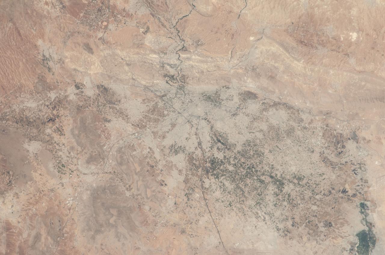
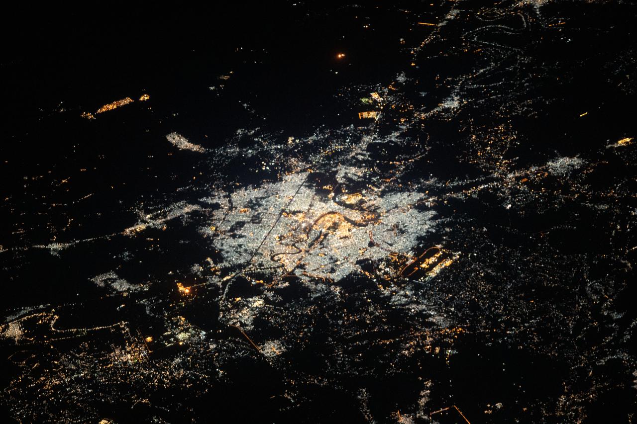
ISS036-E-012047 (26 June 2013) --- Damascus, Syria is featured in this image photographed by an Expedition 36 crew member on the International Space Station. The capital city of the Syrian Arab Republic, Damascus, and its surrounding metropolitan area is highlighted in this photograph from the space station. Damascus is one of the oldest cities in the Middle East, with evidence of human habitation extending back to 8,000-10,000 BC. During medieval times, the city was well known as a craft and trade center specializing in the production of swords and lace; ?Damascus steel? became a watchword for high-quality blades through the 19th century due to its superior properties and characteristic visual appearance. Urban areas are readily recognizable as gray-white regions contrasting with surrounding brown to tan semi-arid landscape. The Barada River runs through Damascus, and is visible entering the metropolitan area at top center. The Ghouta oasis, fed by the Barada River, once encircled Damascus but urban expansion has converted much of the oasis from agricultural to other land uses. A large region of agriculture extends to the southeast of Damascus, visible as extensive green fields at lower right. Today, the city is the center of a metropolitan area with a population of over 2.6 million (based on 2004 information from the Syria Central Bureau of Statistics). Current industries include textiles, food processing, and chemicals, with traditional artisan handcrafts still produced in the old core of Damascus. Most recently, the city has experienced unrest, military conflict, and loss of life stemming from the ongoing Syrian Civil War.
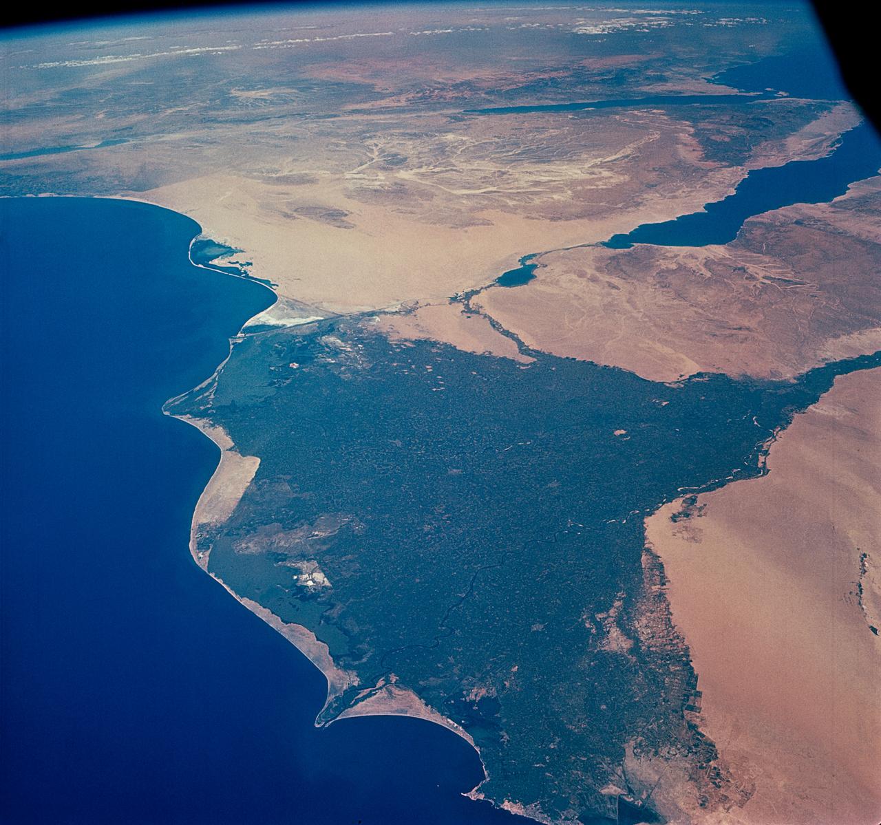
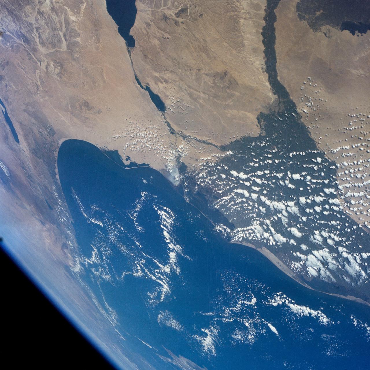
STS109-708-024 (1-12 March 2002) --- The astronauts on board the Space Shuttle Columbia took this 70mm picture featuring the Sinai Peninsula and the Dead Sea Rift. The left side of the view is dominated by the great triangle of the Sinai peninsula, which is partly obscured by an unusual cloud mass on this day. The famous Monastery of St. Catherine lies in the very remote, rugged mountains in the southern third of the peninsula (foreground). The Gulf of Aqaba is a finger of the Red Sea bottom center, pointing north to the Dead Sea, the small body of water near the center of the view. According to NASA scientists studying the STS-109 photo collection, the gulf and the Dead Sea are northerly extensions of the same geological rift that resulted in the opening of the Red Sea . The Gulf of Suez appears in the lower left corner. Northwest Saudi Arabia occupies the lower right side of the view, Jordan and Syria the right and top right, and the Eastern Mediterranean Sea the top left. Thin white lines of cloud have formed along the coastal mountains of southern Turkey and stretch across the top of the view near the Earth's limb.
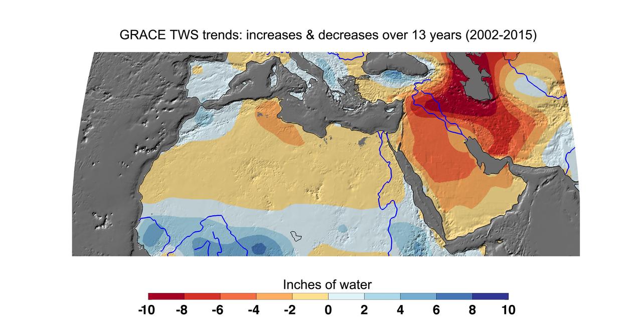
Cumulative total freshwater losses in North Africa and the Middle East from 2002 to 2015 (in inches) observed by NASA's Gravity Recovery and Climate Experiment (GRACE) mission. Total water refers to all of the snow, surface water, soil water and groundwater combined. Groundwater depletion in Turkey, Syria, Iraq and Iran, and along the Arabian Peninsula, are leading to large changes in total water storage in the region. Likewise, drought and groundwater pumping is contributing to the drying of the Caspian Sea Region. The Northwest Sahara Aquifer System, which underlies Tunisia and Libya, is also experiencing increasing water stress as shown in the map. Image updated from Voss et al., 2013. Citation of Record: Voss, K. A., J. S. Famiglietti, M. Lo, C. R. de Linage, M. Rodell and S. C. Swenson, Groundwater depletion in the Middle East from GRACE with Implications for Transboundary Water Management in the Tigris-Euphrates-Western Iran Region, Wat. Resour. Res., 49(2), 904-914, DOI: 10.1002/wrcr.20078. http://photojournal.jpl.nasa.gov/catalog/PIA20207