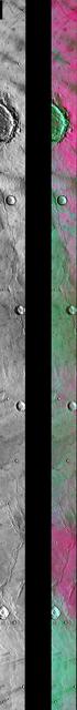
The THEMIS camera contains 5 filters. The data from different filters can be combined in multiple ways to create a false color image. This image from NASA 2001 Mars Odyssey spacecraft shows part of Syrtis Major Planum.
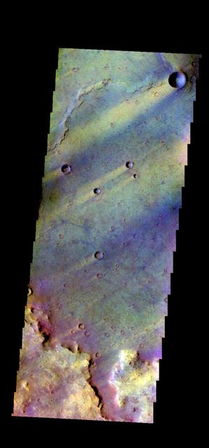
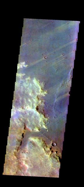
The THEMIS VIS camera contains 5 filters. The data from different filters can be combined in multiple ways to create a false color image. These false color images may reveal subtle variations of the surface not easily identified in a single band image. Today's false color image shows part Syrtis Major Planum. Orbit Number: 45811 Latitude: 21.5691 Longitude: 78.9549 Instrument: VIS Captured: 2012-04-12 07:43 http://photojournal.jpl.nasa.gov/catalog/PIA21171
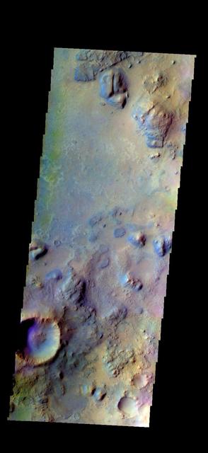
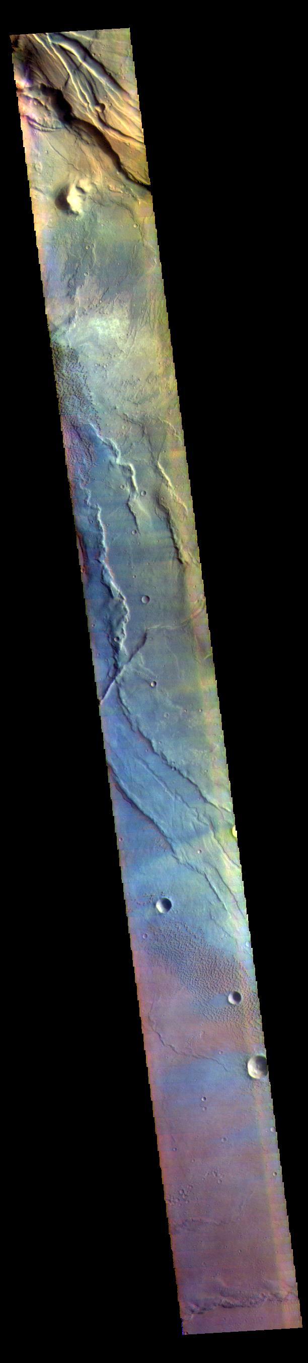
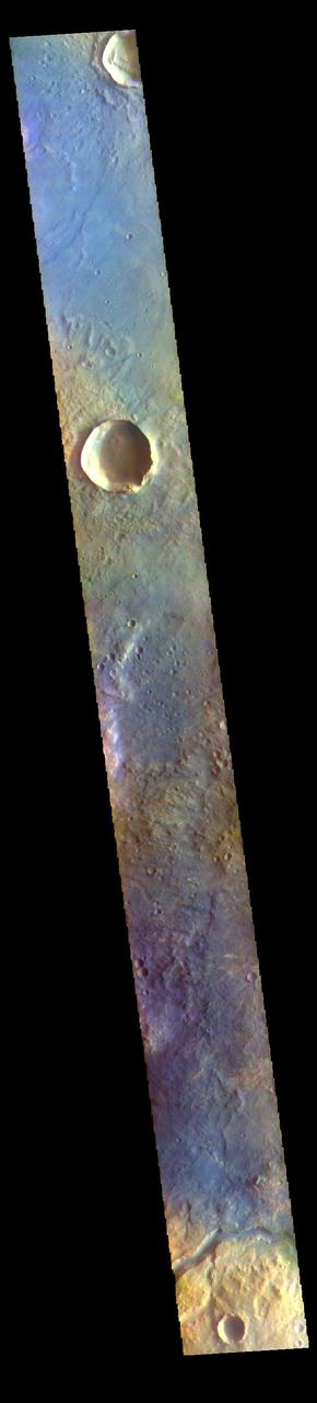
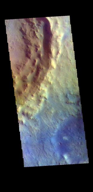
The THEMIS VIS camera contains 5 filters. The data from different filters can be combined in multiple ways to create a false color image. These false color images may reveal subtle variations of the surface not easily identified in a single band image. Today's false color image shows part of Syrtis Major Planum. Orbit Number: 45886 Latitude: 19.0521 Longitude: 75.685 Instrument: VIS Captured: 2012-04-18 11:54 http://photojournal.jpl.nasa.gov/catalog/PIA21174
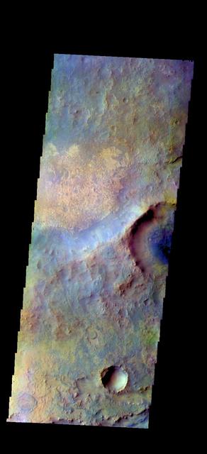
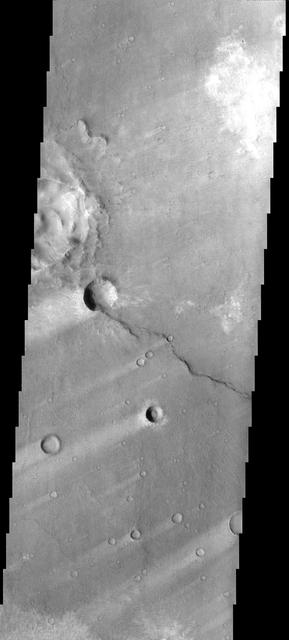
The THEMIS camera contains 5 filters. The data from different filters can be combined in multiple ways to create a false color image. These false color images may reveal subtle variations of the surface not easily identified in a single band image. Today's false color image shows part of Syrtis Major Planum, between Nili Patera and Meroe Patera. Orbit Number: 43352 Latitude: 8.2378 Longitude: 67.7675 Instrument: VIS Captured: 2011-09-22 22:16 http://photojournal.jpl.nasa.gov/catalog/PIA20988
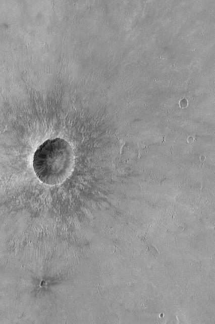
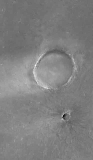
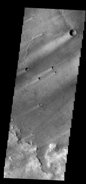
Crater in Syrtis Major
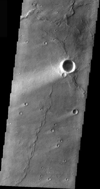
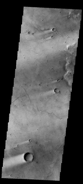
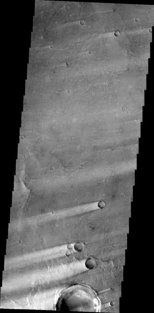
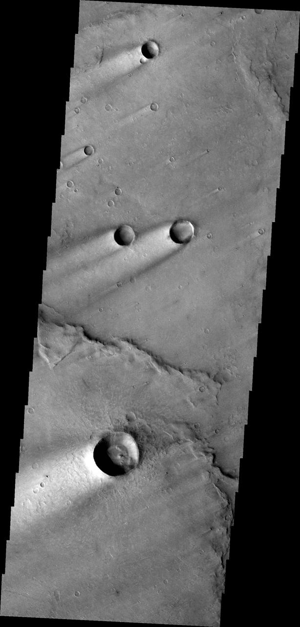
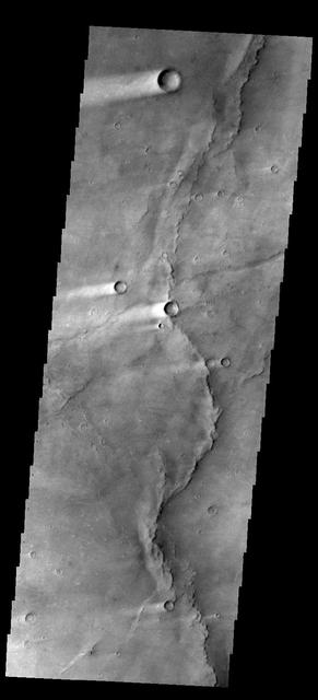
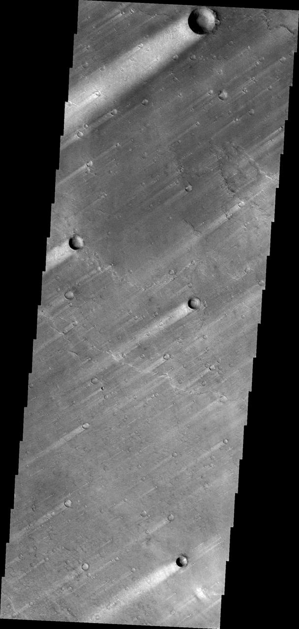
Wind Streaks in Syrtis Major
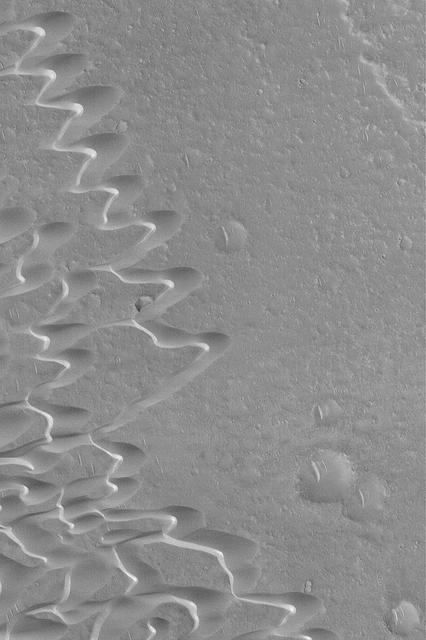
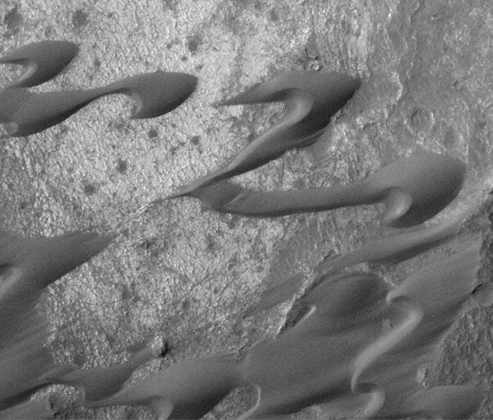
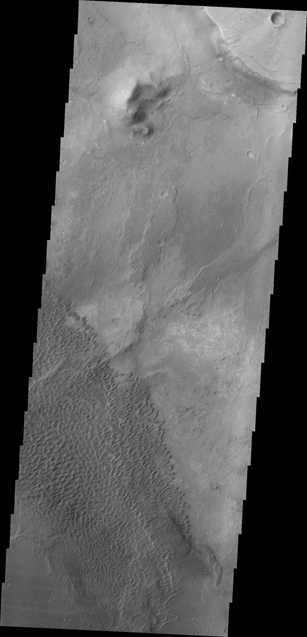
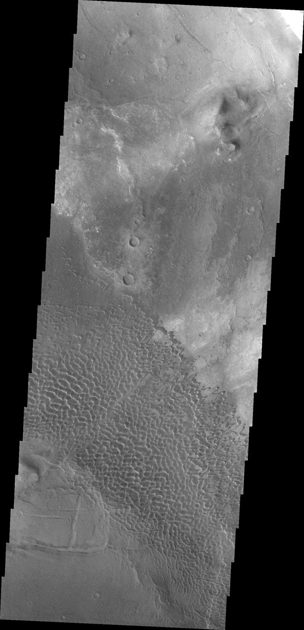
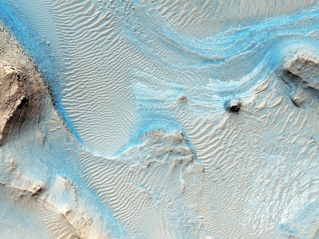
Syrtis Major Dune Field
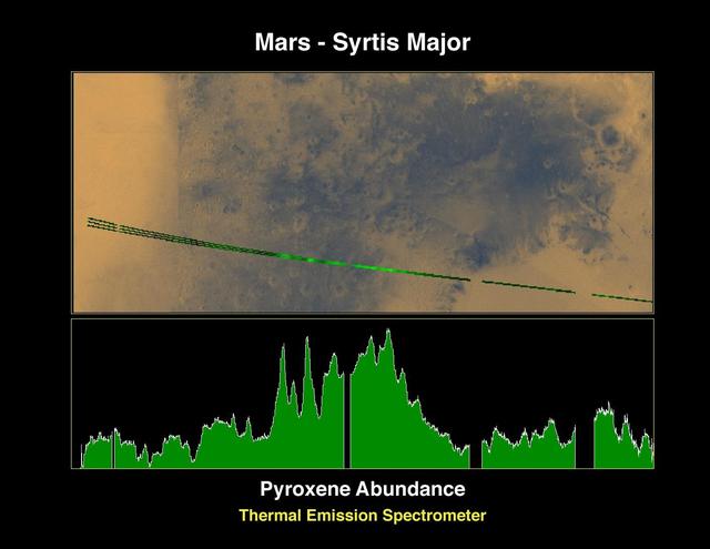
Pyroxene at Syrtis Major
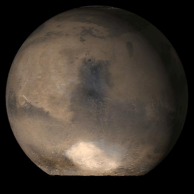
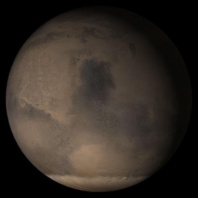
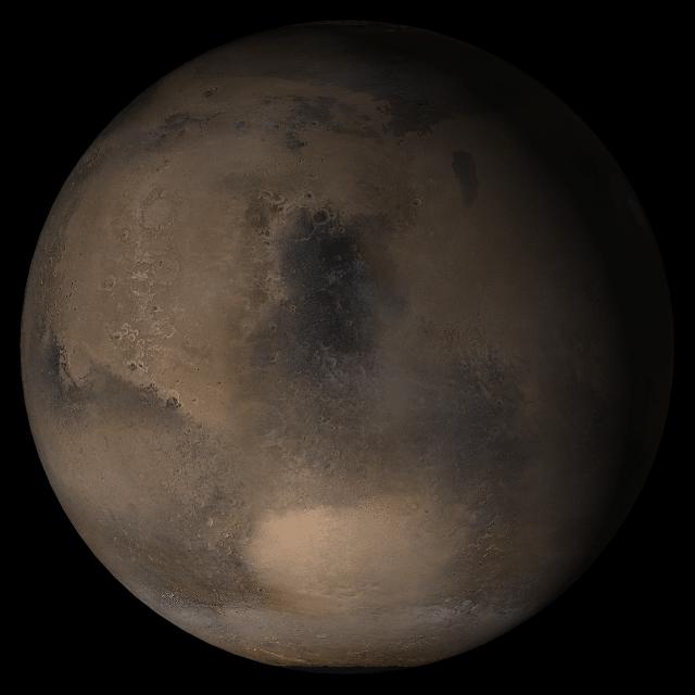
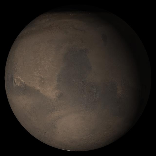
Mars at Ls 79°: Syrtis Major

Mars at Ls 12°: Syrtis Major
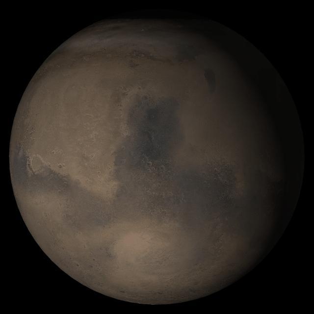
Mars at Ls 306°: Syrtis Major
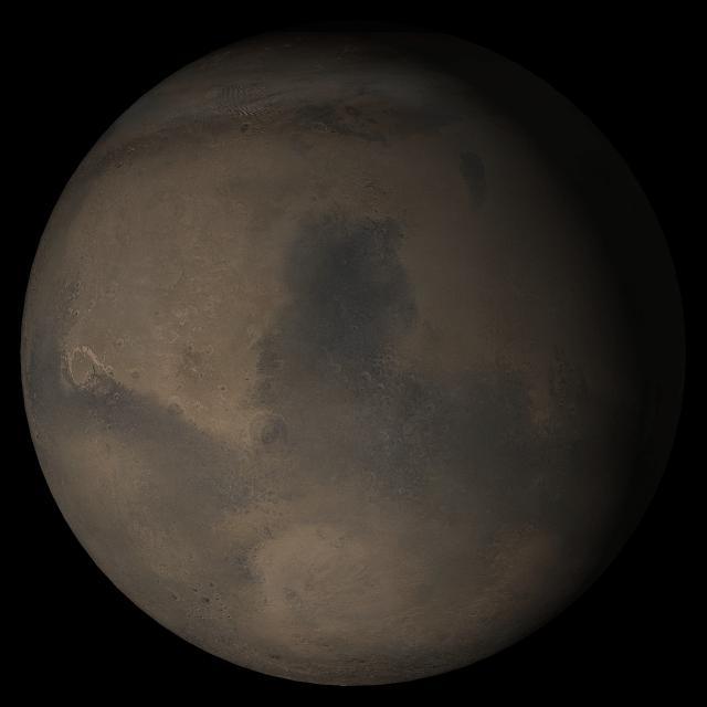
Mars at Ls 324?: Syrtis Major
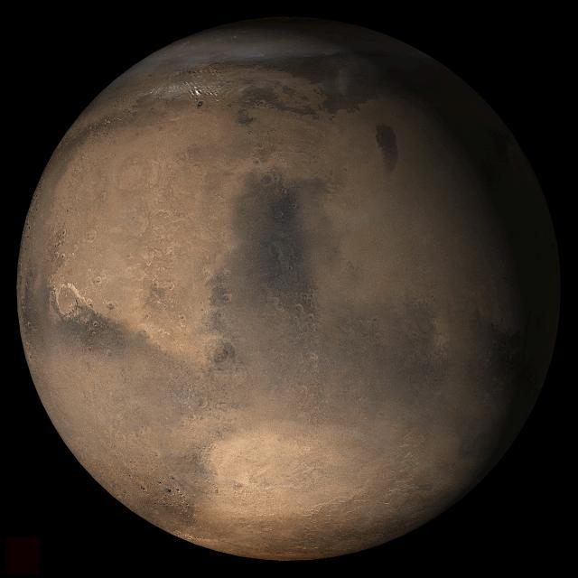
Mars at Ls 357°: Syrtis Major
DCS of Syrtis Major Sand Migration

Mars at Ls 249°: Syrtis Major
Mars at Ls 230°: Syrtis Major
Mars at Ls 269°: Syrtis Major
Mars at Ls 211°: Syrtis Major

Mars at Ls 193°: Syrtis Major

Syrtis Major and Arabia Terra, Mars

Mars at Ls 39°: Syrtis Major
Mars at Ls 341°: Syrtis Major
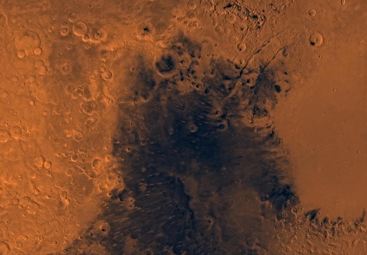
The 2001 Great Dust Storms - Hellas/Syrtis Major
MGS Approach Image - Syrtis Major Region

A Closer Hubble Encounter With Mars - Syrtis Major
Proposed MSL Site in NE Syrtis Major
Sand Dunes of Nili Patera, Syrtis Major
Big, Dark Dunes Northeast of Syrtis Major
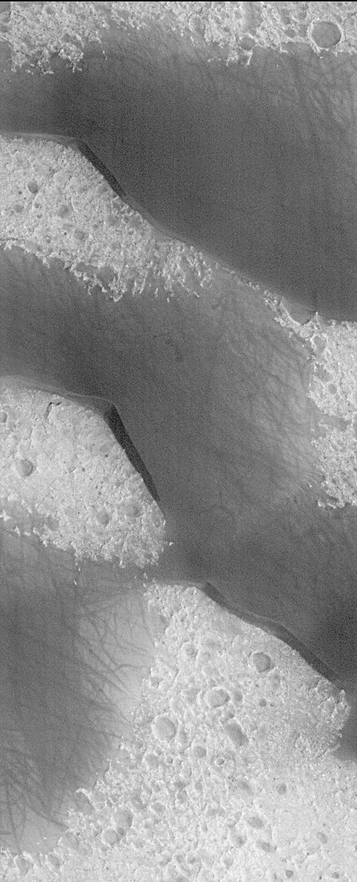
The windstreaks in this image captured by NASA Mars Odyssey are located on the plains of southern Syrtis Major Planum.

The windstreaks in this image from NASA 2001 Mars Odyssey spacecraft are located in Syrtis Major Planum between Nili and Meroe Paterae.
This image of windstreaks from NASA 2001 Mars Odyssey spacecraft indicates winds from the ENE in the region of Syrtis Major Planum.
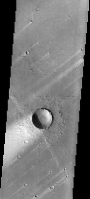
These windstreaks are located on the downwind side of impact craters located in Syrtis Major as seen by NASA 2001 Mars Odyssey spacecraft.
This image from NASA Mars Odyssey spacecraft is from the region of Syrtis Major, which is dominated by a low-relief shield volcano and believed to be an area of vigorous aeolian activity with strong winds in the east-west direction.
This image from NASA 2001 Mars Odyssey spacecraft shows a portion of northeastern Syrtis Major. In this image are several windstreaks and a lava flow that has entered the crater on the top of the image.
This image from NASA Mars Odyssey spacecraft shows a location close to Mars equator, near the southern edge of a low, broad volcanic feature called Syrtis Major.
Transverse aeolian ridges TARs are commonly found throughout the Martian tropics, including rocky regions such as Syrtis Major that are largely devoid of dust as seen by NASA Mars Reconnaissance Orbiter.
This mosaic of Syrtis Major is composed of about 100 red- and violet- filter NASA's Viking Orbiter images, digitally mosaiced in an orthographic projection at a scale of 1 km/pixel. http://photojournal.jpl.nasa.gov/catalog/PIA00092
Mars digital-image mosaic merged with color of the MC-13 quadrangle, Syrtis Major region of Mars. This image is from NASA's Viking Orbiter 1. http://photojournal.jpl.nasa.gov/catalog/PIA00173
Mars at Ls 25?: Syrtis Major
This picture is a composite of Mars Global Surveyor MGS Mars Orbiter Camera MOC daily global images acquired at Ls 107° of the Syrtis Major face during a previous Mars year
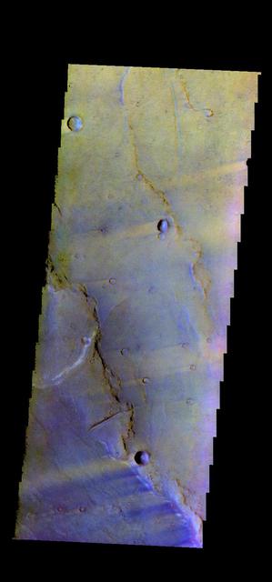
The THEMIS VIS camera contains 5 filters. The data from different filters can be combined in multiple ways to create a false color image. This false color image from NASA 2001 Mars Odyssey spacecraft shows a region in Syrtis Major.
![This scene is a jumbled mess. There are blocks and smears of many different rocks types that appear to have been dumped into a pile. That's probably about what happened, as ejecta from the Isidis impact basin to the east. This pile of old rocks is an island surrounded by younger lava flows from Syrtis Major. The map is projected here at a scale of 25 centimeters (9.8 inches) per pixel. [The original image scale is 27.4 centimeters (10.8 inches) per pixel (with 1 x 1 binning); objects on the order of 82 centimeters (32.2 inches) across are resolved.] North is up. http://photojournal.jpl.nasa.gov/catalog/PIA21553](https://images-assets.nasa.gov/image/PIA21553/PIA21553~medium.jpg)
This scene is a jumbled mess. There are blocks and smears of many different rocks types that appear to have been dumped into a pile. That's probably about what happened, as ejecta from the Isidis impact basin to the east. This pile of old rocks is an island surrounded by younger lava flows from Syrtis Major. The map is projected here at a scale of 25 centimeters (9.8 inches) per pixel. [The original image scale is 27.4 centimeters (10.8 inches) per pixel (with 1 x 1 binning); objects on the order of 82 centimeters (32.2 inches) across are resolved.] North is up. http://photojournal.jpl.nasa.gov/catalog/PIA21553
This picture is a composite of Mars MOC daily global images acquired at Ls 53° during a previous Mars year. This month, Mars looks similar, as Ls 53° occurs in mid-May 2006. The picture shows the Syrtis Major face of Mars
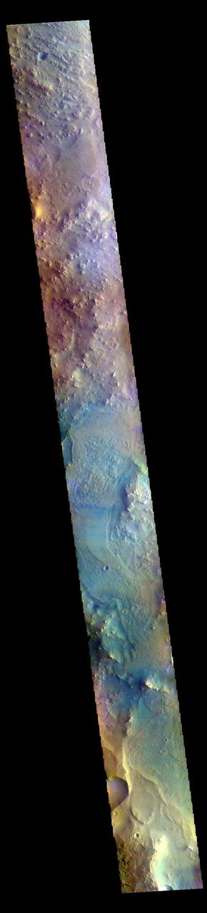
A variety of diverse morphological features are present in this image (21 by 5.5 kilometers) located in the southeastern area of the Nili Fossae region and just northeast of Syrtis Major. This particular region has been studied intensely due to the presence of volcanics from Syrtis Major and impact ejecta from the Isidis Basin. The region is rich in unaltered mafic deposits, in contact with diverse altered deposits rich in clays, carbonates, and sulfates. These deposits make the Nili Fossae region one of the most colorful regions on Mars, which is most distinctive in infrared color composites (IRB). HiRISE IRB color aids in chemical and mineral-type mapping, especially when correlated with other MRO instruments such as CRISM. http://photojournal.jpl.nasa.gov/catalog/PIA19940
The THEMIS VIS camera contains 5 filters. The data from different filters can be combined in multiple ways to create a false color image. These false color images may reveal subtle variations of the surface not easily identified in a single band image. Today's false color image shows several wind streaks in Syrtis Major Planum. Orbit Number: 50693 Latitude: -0.448856 Longitude: 68.374 Instrument: VIS Captured: 2013-05-19 02:56 http://photojournal.jpl.nasa.gov/catalog/PIA21278
This VIS image is located in the center of Syrtis Major Planum. At the top of the image is Nili Patera, a volcanic summit. The sand dunes located near Nili Patera are visible on the left side of the image. The bottom of the image is just west of Meroe Patera. Dunes located between Nili and Meroe are visible towards the bottom of the image. Winds in the region have created the dunes, but also many windstreaks on the downward side of craters in the image. Wind streaks indicate the direction of the wind. In this region the winds are blowing from east to west. The THEMIS VIS camera contains 5 filters. The data from different filters can be combined in multiple ways to create a false color image. These false color images may reveal subtle variations of the surface not easily identified in a single band image. Orbit Number: 62072 Latitude: 7.99408 Longitude: 67.5512 Instrument: VIS Captured: 2015-12-11 18:39 https://photojournal.jpl.nasa.gov/catalog/PIA23095
These windstreaks are located in the southern part of Syrtis major
converted PNM file
converted PNM file
converted PNM file
This picture, released 21 September 2005, is a composite of Mars Global Surveyor (MGS) Mars Orbiter Camera (MOC) daily global images acquired at Ls 288° during a previous Mars year. This month, Mars looks similar, as Ls 288° occurred in mid-September 2005. The picture shows the Syrtis Major face of Mars. Over the course of the month, additional faces of Mars as it appears at this time of year are being posted for MOC Picture of the Day. Ls, solar longitude, are a measure of the time of year on Mars. Mars travels 360° around the Sun in 1 Mars year. The year begins at Ls 0°, the start of northern spring and southern autumn.
The THEMIS VIS camera contains 5 filters. The data from different filters can be combined in multiple ways to create a false color image. These false color images may reveal subtle variations of the surface not easily identified in a single band image. Today's false color image shows part of northern Syrtis Major Planum. The THEMIS VIS camera is capable of capturing color images of the Martian surface using five different color filters. In this mode of operation, the spatial resolution and coverage of the image must be reduced to accommodate the additional data volume produced from using multiple filters. To make a color image, three of the five filter images (each in grayscale) are selected. Each is contrast enhanced and then converted to a red, green, or blue intensity image. These three images are then combined to produce a full color, single image. Because the THEMIS color filters don't span the full range of colors seen by the human eye, a color THEMIS image does not represent true color. Also, because each single-filter image is contrast enhanced before inclusion in the three-color image, the apparent color variation of the scene is exaggerated. Nevertheless, the color variation that does appear is representative of some change in color, however subtle, in the actual scene. Note that the long edges of THEMIS color images typically contain color artifacts that do not represent surface variation. Orbit Number: 85463 Latitude: 17.4847 Longitude: 60.8084 Instrument: VIS Captured: 2021-03-21 08:04 https://photojournal.jpl.nasa.gov/catalog/PIA25058
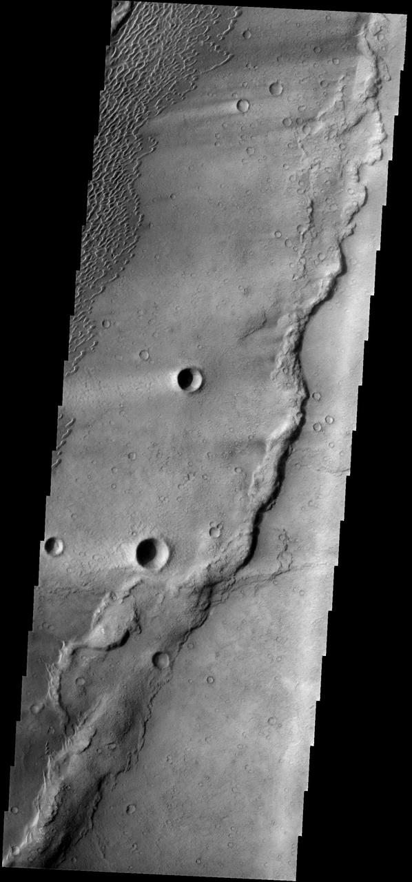
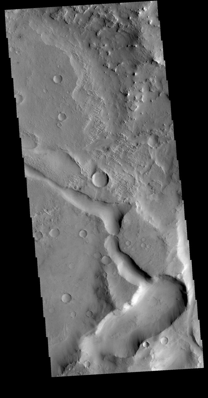
The THEMIS VIS camera contains 5 filters. The data from different filters can be combined in multiple ways to create a false color image. These false color images may reveal subtle variations of the surface not easily identified in a single band image. Today's false color image shows part of the eastern boundary of Syrtis Major Planum. The channel at the bottom of the image is unnamed. The THEMIS VIS camera is capable of capturing color images of the Martian surface using five different color filters. In this mode of operation, the spatial resolution and coverage of the image must be reduced to accommodate the additional data volume produced from using multiple filters. To make a color image, three of the five filter images (each in grayscale) are selected. Each is contrast enhanced and then converted to a red, green, or blue intensity image. These three images are then combined to produce a full color, single image. Because the THEMIS color filters don't span the full range of colors seen by the human eye, a color THEMIS image does not represent true color. Also, because each single-filter image is contrast enhanced before inclusion in the three-color image, the apparent color variation of the scene is exaggerated. Nevertheless, the color variation that does appear is representative of some change in color, however subtle, in the actual scene. Note that the long edges of THEMIS color images typically contain color artifacts that do not represent surface variation. Orbit Number: 85812 Latitude: 17.5754 Longitude: 72.5741 Instrument: VIS Captured: 2021-04-19 01:44 https://photojournal.jpl.nasa.gov/catalog/PIA25095
These dunes occur in the Syrtis Major volcanic complex, near Meroe Patera
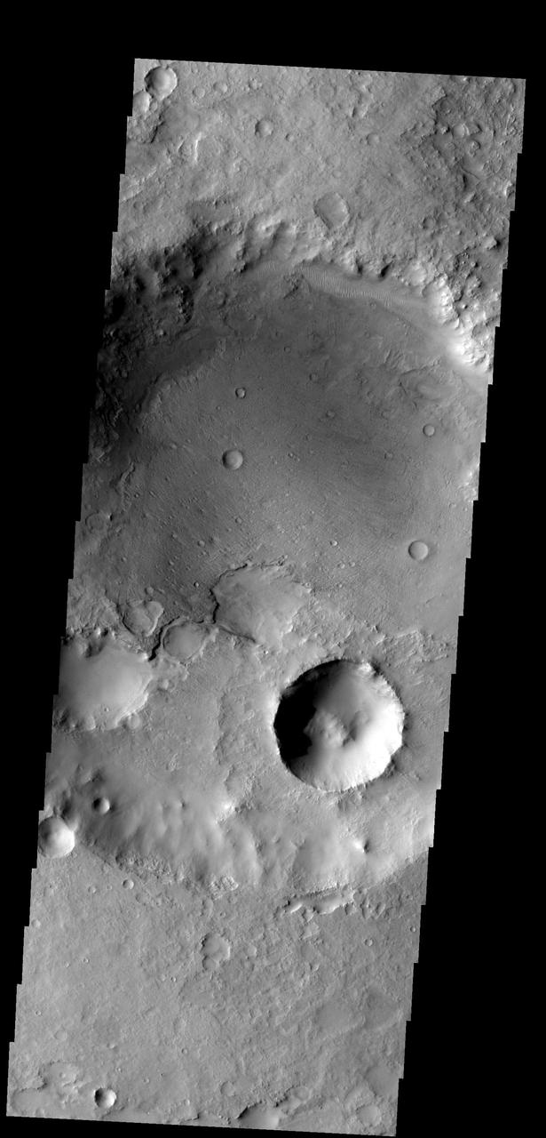
This MOC image shows a portion of Syrtis Major Planum, dominated in this area by two impact craters of differing age
This crater, on the northern margin of Syrtis Major, has been filled with material that is now being removed
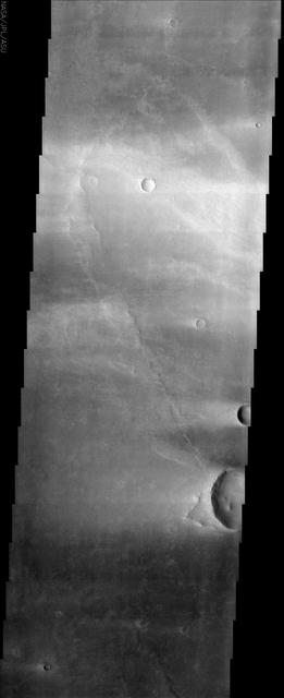
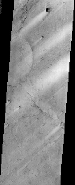
Windstreaks are common in Syrtis Major Planum as seen in this image from NASA 2001 Mars Odyssey spacecraft.
This image shows wind streaks in Syrtis Major Planum as seen by NASA 2001 Mars Odyssey spacecraft.
This 2001 Mars Odyssey image shows windstreaks located on the Syrtis Major Volcanic complex.
These windstreaks are located on Syrtis Major Planum, as shown in this image captured by NASA 2001 Mars Odyssey spacecraft.
This image shows several wind streaks in Syrtis Major Planum as seen by NASA 2001 Mars Odyssey spacecraft.
The dunes in this image from NASA Mars Odyssey are located in Nili Patera, one of the two patera of Syrtis Major Planum.

Windstreaks, like the ones in this image from NASA 2001 Mars Odyssey spacecraft, are a common feature on the plains of Syrtis Major Planum.
These dunes are moving along the hard volcanic surface Nili Patera in Syrtis Major. This image was captured by NASA Mars Odyssey.
The windstreaks in this image of Syrtis Major Planum indicate winds blowing from the northeast. This image is from NASA 2001 Mars Odyssey spacecraft.
Dunes appear on the floor of Nili Patera, one of the two volcanic calderas of Syrtis Major in this image taken by NASA 2001 Mars Odyssey.
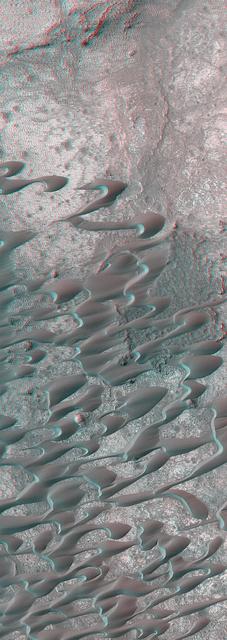
This stereo image mosaic from NASA Mars Global Surveyor is of a field of dunes located in Nili Patera, a volcanic depression in central Syrtis Major. 3D glasses are necessary to view this image.
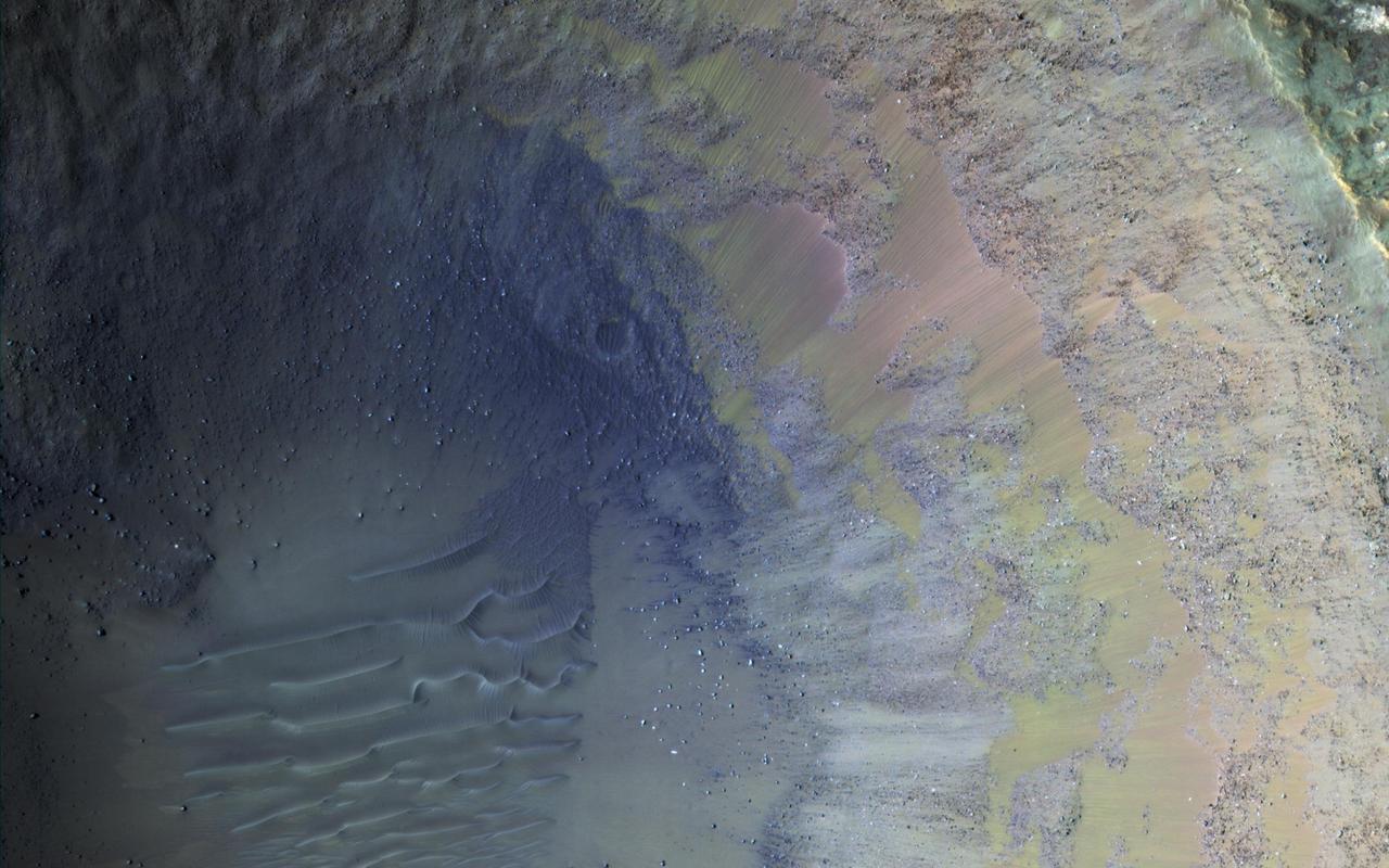
Some regions of Mars are not very colorful, but we can be surprised by local features. This image of an impact crater in the south Syrtis Major region was acquired as a "ride-along" with a CRISM observation, which targeted this location because that instrument's team expected a distinct composition. Our enhanced image reveals colors ranging from red to green to blue. These are infra-red shifted colors (infrared-red-blue) so it's different than what we would see with our eyes. https://photojournal.jpl.nasa.gov/catalog/PIA22727
Today's VIS image shows windstreaks located in Syrtis Major Planum. These streaks are formed by the wind interaction with positive topographic features (like craters), with the 'tail' located down wind of the crater. The streaks in this image indicate the prevailing wind was from the upper right to the lower left side of the image (northeast to southwest). Orbit Number: 94023 Latitude: 6.9785 Longitude: 71.5019 Instrument: VIS Captured: 2023-02-24 03:50 https://photojournal.jpl.nasa.gov/catalog/PIA25942
The circular feature in today's VIS image is called Meroe Patera. It is a volcanic caldera located in Syrtis Major Planum. The volcanic activity in Syrtis Major Planum is thought to be related to the impact event that created Isidis Planitia to the east. Orbit Number: 87684 Latitude: 6.67925 Longitude: 69.0924 Instrument: VIS Captured: 2021-09-20 04:57 https://photojournal.jpl.nasa.gov/catalog/PIA25263
Today's VIS image shows part of Nili Patera. Nili Patera is the northern caldera in the immense volcanic complex of Syrtis Major Planum. The dunes are moving westward across the top of these ancient volcanic flows. Orbit Number: 90030 Latitude: 8.95316 Longitude: 67.1774 Instrument: VIS Captured: 2022-04-01 09:05 https://photojournal.jpl.nasa.gov/catalog/PIA25468

Today's false color image is located at Nili Patera in Syrtis Major Planum. There are regions of small dunes towards the top and the bottom of the image. The wide range of colors indicate the complexity of surface materials in this area. The THEMIS VIS camera contains 5 filters. The data from different filters can be combined in multiple ways to create a false color image. These false color images may reveal subtle variations of the surface not easily identified in a single band image. Orbit Number: 61810 Latitude: 8.37503 Longitude: 67.4659 Instrument: VIS Captured: 2015-11-20 04:48 https://photojournal.jpl.nasa.gov/catalog/PIA23071
This image is located in Meroe Patera (longitude: 292W/68E, latitude: 7.01), which is a small region within Syrtis Major Planitia. Syrtis Major is a low-relief shield volcano whose lava flows make up a plateau more than 1000 km across. These flows are of Hesperian age (Martian activity of intermediate age) and are believed to have originated from a series of volcanic depressions, called calderas. The caldera complex lies on extensions of the ring faults associated with the Isidis impact basin toward the northeast - thus Syrtis Major volcanism may be associated with post-impact adjustments of the Martian crust. The most striking feature in this image is the light streaks across the image that lead to dunes in the lower left region. Wind streaks are albedo markings interpreted to be formed by aeolian action on surface materials. Most are elongate and allow an interpretation of effective wind directions. Many streaks are time variable and thus provide information on seasonal or long-term changes in surface wind directions and strengths. The wind streaks in this image are lighter than their surroundings and are the most common type of wind streak found on Mars. These streaks are formed downwind from crater rims (as in this example), mesas, knobs, and other positive topographic features. The dune field in this image is a mixture of barchan dunes and transverse dunes. Dunes are among the most distinctive aeolian feature on Mars, and are similar in form to barchan and transverse dunes on Earth. This similarity is the best evidence to indicate that martian dunes are composed of sand-sized material, although the source and composition of the sand remain controversial. Both the observations of dunes and wind streaks indicate that this location has a windy environment - and these winds are persistent enough to product dunes, as sand-sized material accumulates in this region. These features also indicate that the winds in this region are originating from the right side of the image, and moving towards the left. http://photojournal.jpl.nasa.gov/catalog/PIA04012
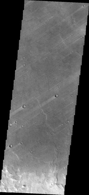
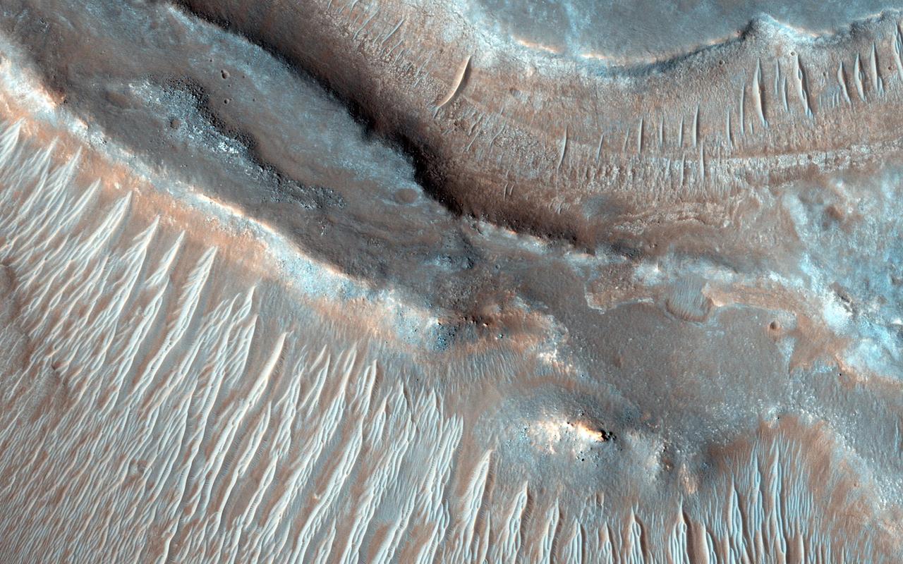
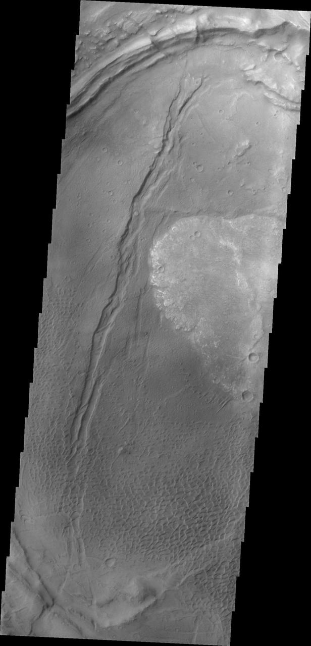
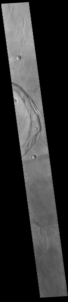
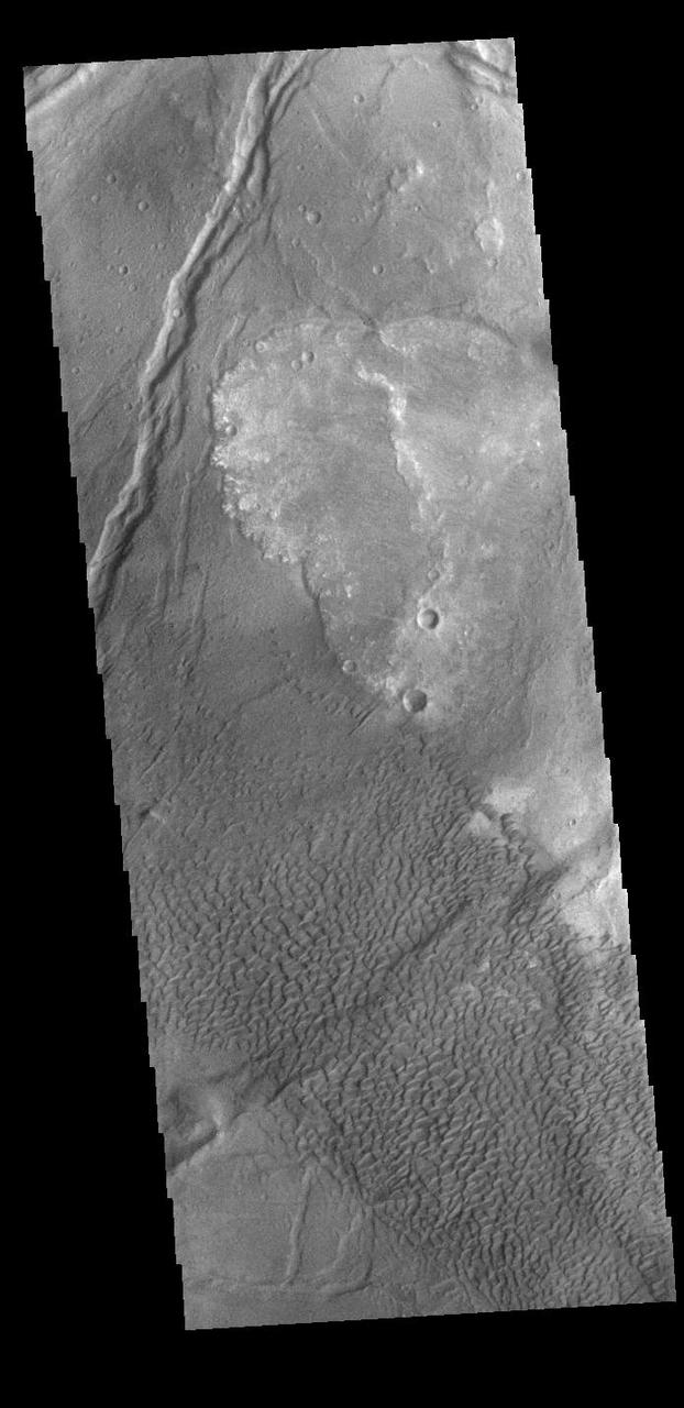
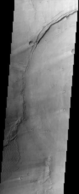
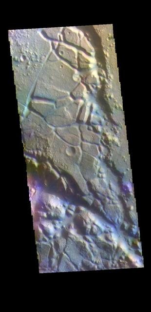
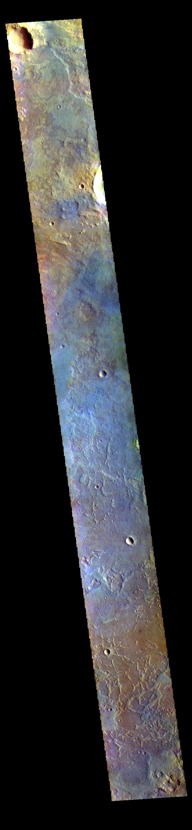
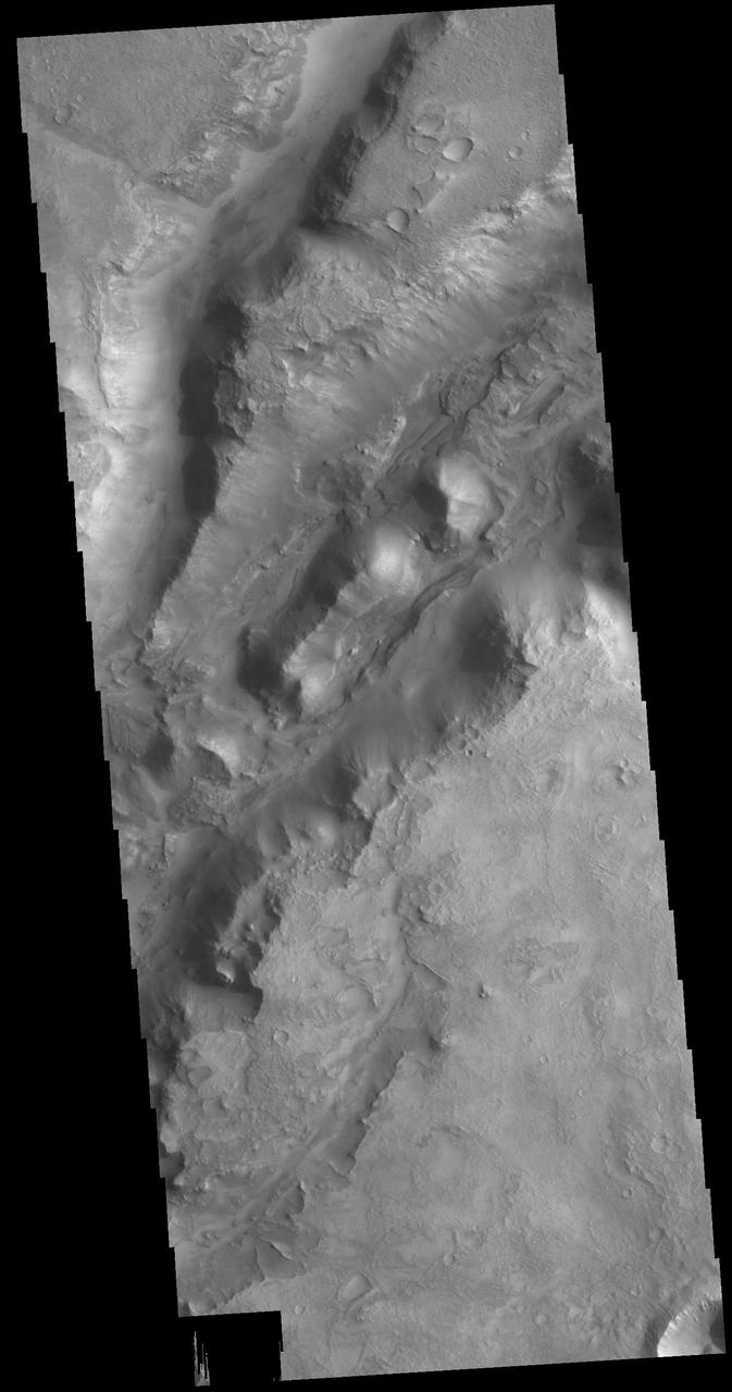
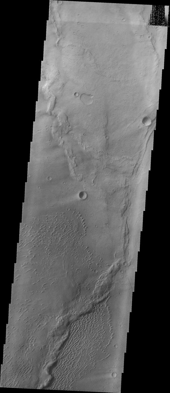
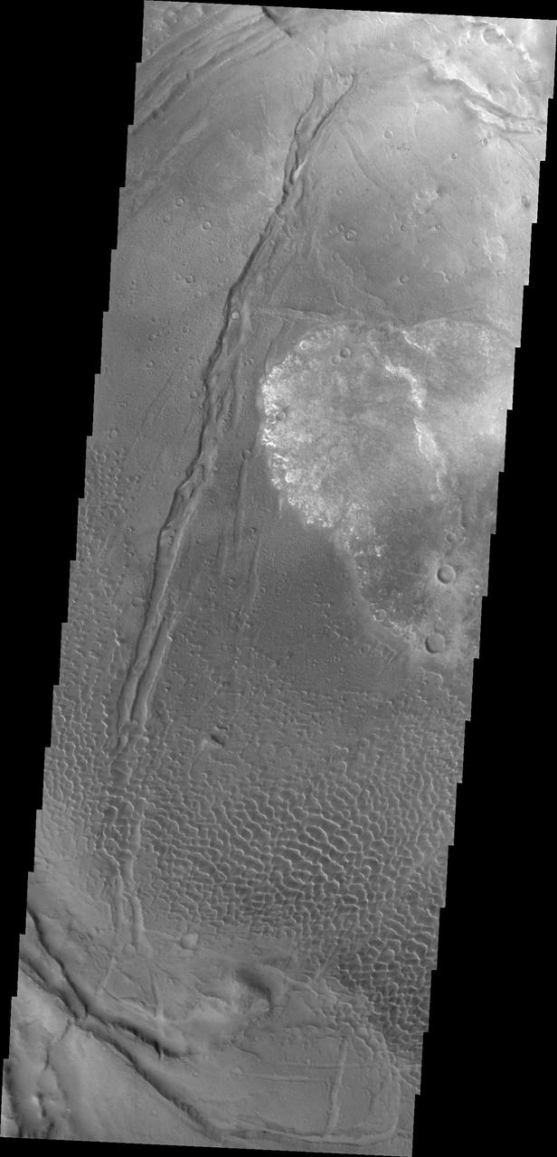
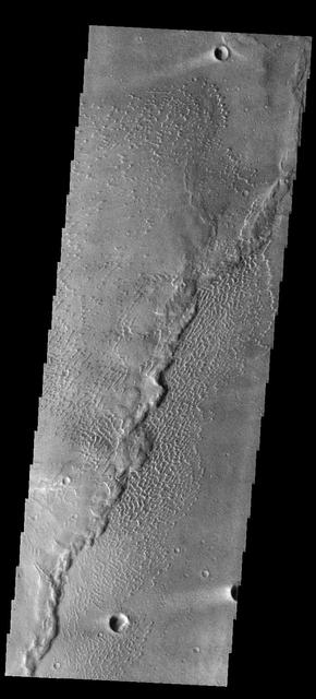
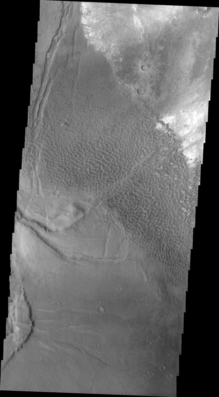
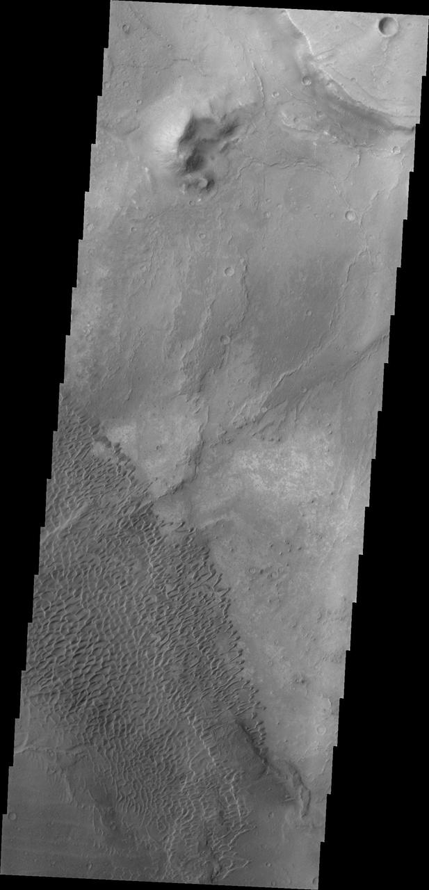
Nili Fossae is a large band of parallel graben located to the northeast of Syrtis Major. The graben in this image from NASA 2001 Mars Odyssey spacecraft were formed by tectonic activity, with faulting that creates the linear depression. Orbit Number: 64105 Latitude: 23.3115 Longitude: 78.6126 Instrument: VIS Captured: 2016-05-27 05:24 http://photojournal.jpl.nasa.gov/catalog/PIA20785
Today's VIS image is located in Aram Chaos. Aram Chaos was initially formed by a large impact. Over time the crater interior was modified by several different processes, including liquid water. Located near Ares Vallis, a narrow channel links the Aram Chaos crater with Ares Vallis indicating a substantial amount of water was located in the crater. Chaos forms from erosion of the surface into mesa features. With time the valleys expand creating the jumble of hills seen in the image. The THEMIS VIS camera contains 5 filters. The data from different filters can be combined in multiple ways to create a false color image. These false color images may reveal subtle variations of the surface not easily identified in a single band image. Orbit Number: 62100 Latitude: 4.04973 Longitude: 340.137 Instrument: VIS Captured: 2015-12-14 01:59 https://photojournal.jpl.nasa.gov/catalog/PIA23107
This picture is a composite of Mars Global Surveyor MGS Mars Orbiter Camera MOC daily global images acquired at Ls 66° during a previous Mars year
This MOC image shows an unconformity in a sequence of layered material in the martian north polar region created by erosion
This VIS image shows part of the floor of Antoniadi Crater, a very large crater located north of Syrtis Major Planum. The THEMIS VIS camera contains 5 filters. The data from different filters can be combined in multiple ways to create a false color image. These false color images may reveal subtle variations of the surface not easily identified in a single band image. Orbit Number: 61311 Latitude: 21.1681 Longitude: 62.1541 Instrument: VIS Captured: 2015-10-10 02:38 https://photojournal.jpl.nasa.gov/catalog/PIA22788
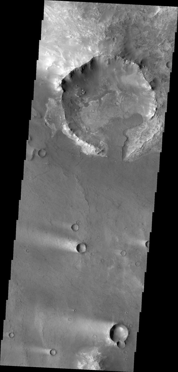
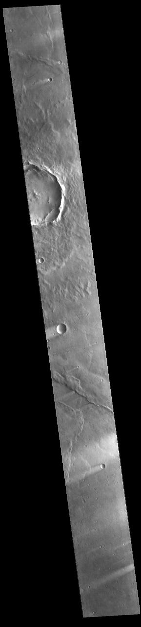
The THEMIS VIS camera contains 5 filters. The data from different filters can be combined in multiple ways to create a false color image. These false color images may reveal subtle variations of the surface not easily identified in a single band image. Today's false color image shows the southeastern rim of Toro Crater. Toro Crater is located in Syrtis Major Planum and is 41km (25miles) in diameter. Orbit Number: 79061 Latitude: 16.8233 Longitude: 72.1675 Instrument: VIS Captured: 2019-10-11 04:54 https://photojournal.jpl.nasa.gov/catalog/PIA24656
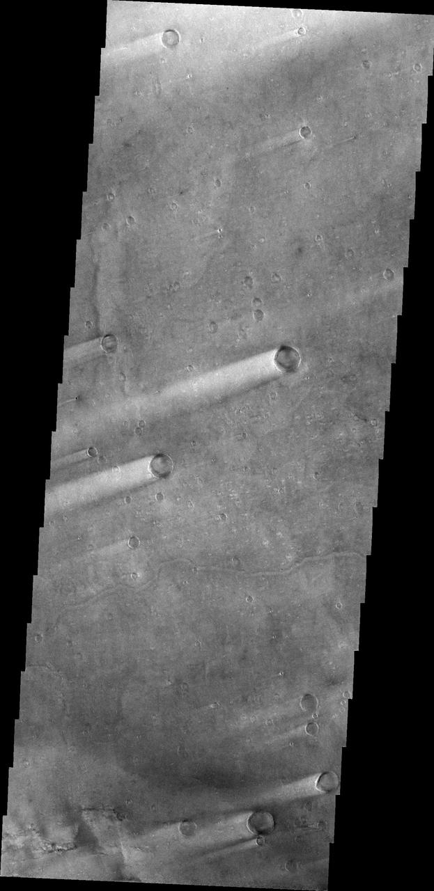
This VIS image is located in Terra Sabaea near the margin of Syrtis Major Planum. The channel-like feature in the bottom of the image is an unnamed feature. There is a high spot within the channel that would not let a fluid pass from one side to the other. This indicates that this is not a water carved channel, but was most likely an underground lava tube, where collapse of the roof has revealed the underlying feature. The 90 degree turns in the channel feature, and the small linear ridges just to the top of the channel indicate tectonic forces are part of the processes at work in this region. Orbit Number: 72337 Latitude: 16.4537 Longitude: 60.7257 Instrument: VIS Captured: 2018-04-05 10:06 https://photojournal.jpl.nasa.gov/catalog/PIA22579
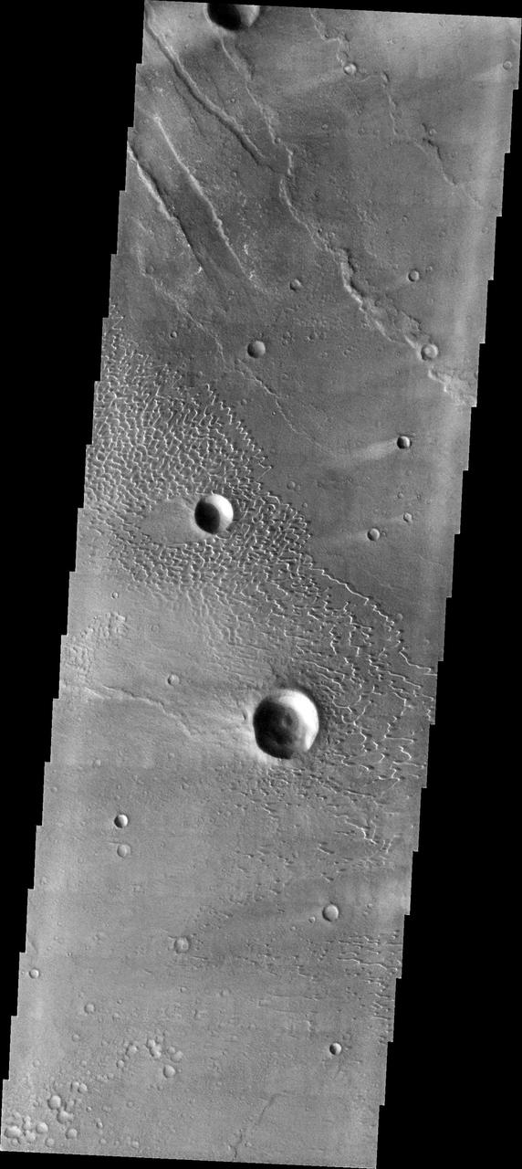
The linear depressions in today's VIS image are part of Nili Fossae. Nili Fossae is a collection of curved faults and down-dropped blocks of crust between the faults called graben. The graben lie northeast of the large volcano Syrtis Major and northwest of the ancient impact basin Isidis Planitia. Orbit Number: 79510 Latitude: 22.3452 Longitude: 77.6366 Instrument: VIS Captured: 2019-11-17 04:15 https://photojournal.jpl.nasa.gov/catalog/PIA23664
Today's VIS image shows one of the linear depressions that form Nili Fossae. Nili Fossae is a collection of curved faults and down-dropped blocks of crust between the faults called graben. The graben lie northeast of the large volcano Syrtis Major and northwest of the ancient impact basin Isidis Planitia. Orbit Number: 78911 Latitude: 22.6314 Longitude: 78.9859 Instrument: VIS Captured: 2019-09-28 20:29 https://photojournal.jpl.nasa.gov/catalog/PIA23524
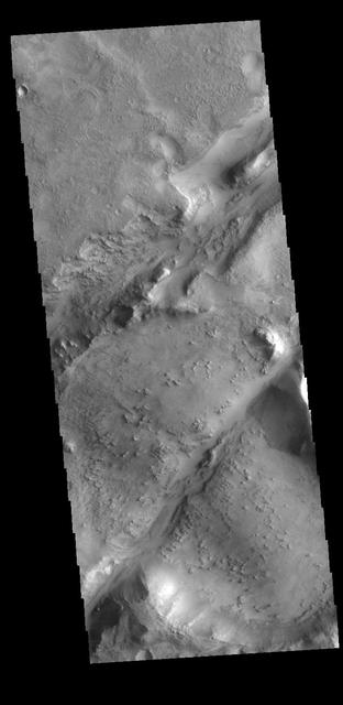
The two linear depressions in this VIS image are part of the Nili Fossae fracture system. Nili Fossae is the name of a collection of curved faults and down-dropped blocks of crust between the faults (called graben). The grabens lie northeast of the large volcano Syrtis Major and northwest of the ancient impact basin Isidis. The grabens make concentric curves that follow the outline of Isidis Planitia. The faults likely formed as the crust sagged under the weight of lava flows filling Isidis. Orbit Number: 77813 Latitude: 22.0638 Longitude: 78.198 Instrument: VIS Captured: 2019-06-30 10:29 https://photojournal.jpl.nasa.gov/catalog/PIA23390
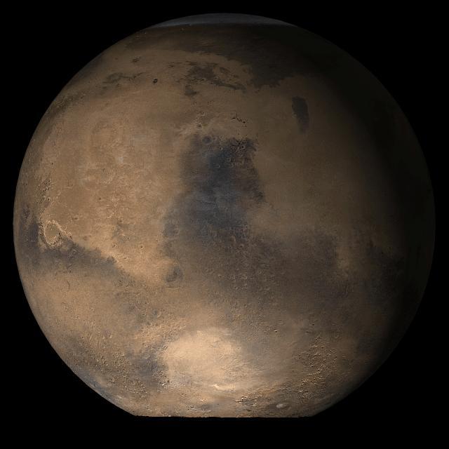
This photograph depicts four Mars views in northern summer provided by the Hubble Space Telescope (HST). The upper left view is centered on Ares Valles where Pathfinder landed in July 1997. Upper right is the Tharsis volcanic region and its associated cloud in the western half of the view. Olympus Mons lies near the western limb, Arsi Mons, Pavonis Mons Ascraeus Mons are to the west of the the center, and Valles Marineris is to the east. The lower Left view shows the Elysium volcanic region in the west, the Tharsis volcanos in East, and Cerberus is left of the center. In the lower right view, the Dark Syrtis Major region, Eysium Mons and Hellas are featured.
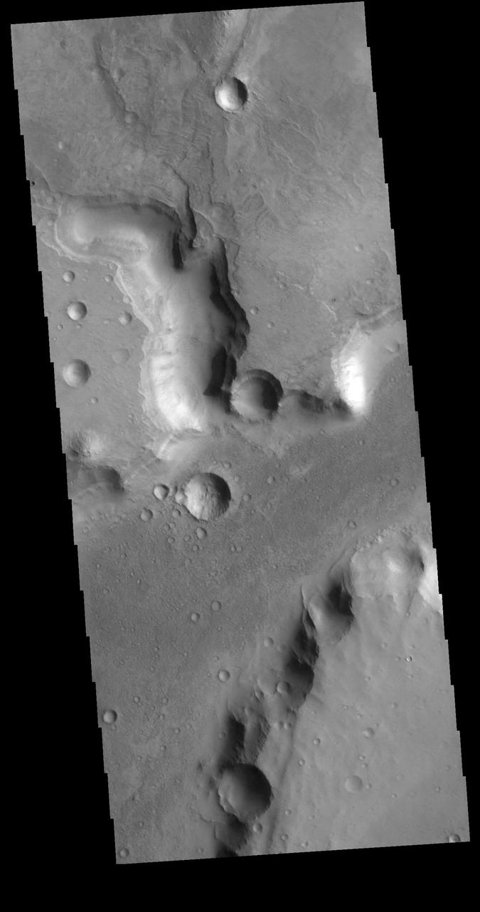
The channels in this VIS image are part of Nili Fossae. Nili Fossae is a collection of curved faults and down-dropped blocks of crust between the faults (called graben). The graben lie northeast of the large volcano Syrtis Major and northwest of the ancient impact basin Isidis Planitia. The graben make concentric curves that follow the outline of Isidis Planitia; the faults likely formed as the crust sagged under the weight of lava flows filling the Isidis basin. Orbit Number: 79485 Latitude: 25.7316 Longitude: 78.4041 Instrument: VIS Captured: 2019-11-15 02:51 https://photojournal.jpl.nasa.gov/catalog/PIA23662
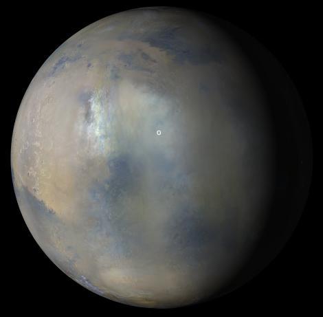
Multiple images from the Mars Color Imager (MARCI) aboard NASA's Mars Reconnaissance Orbiter (MRO) were used to generate this view of a regional dust storm obscuring Syrtis Major and Jezero Crater (white circle). The images were acquired on Jan. 9, 2022. MRO creates global maps of Mars but roll maneuvers for targeted observations produce gaps in the coverage, which appear as black gores in the maps. On some days there are data drops where partial or full orbits of coverage are missing. Green and purple observed in the south polar region indicate saturated pixels. https://photojournal.jpl.nasa.gov/catalog/PIA25068
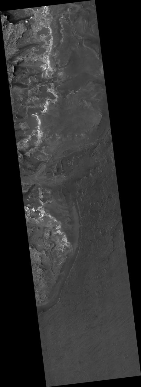
his image shows part of the dune field near Meroe Patera. High resolution imaging by other spacecraft has revealed that the dunes in this region are moving. Winds are blowing the dunes across a rough surface of regional volcanic lava flows. The paterae are calderas on the volcanic complex called Syrtis Major Planum. Dunes are found in both Nili and Meroe Paterae and in the region between the two calderas. The Odyssey spacecraft has spent over 15 years in orbit around Mars, circling the planet more than 69000 times. It holds the record for longest working spacecraft at Mars. THEMIS, the IR/VIS camera system, has collected data for the entire mission and provides images covering all seasons and lighting conditions. Over the years many features of interest have received repeated imaging, building up a suite of images covering the entire feature. From the deepest chasma to the tallest volcano, individual dunes inside craters and dune fields that encircle the north pole, channels carved by water and lava, and a variety of other feature, THEMIS has imaged them all. For the next several months the image of the day will focus on the Tharsis volcanoes, the various chasmata of Valles Marineris, and the major dunes fields. We hope you enjoy these images! Orbit Number: 11606 Latitude: 7.06099 Longitude: 68.2238 Instrument: VIS Captured: 2004-07-27 00:59 https://photojournal.jpl.nasa.gov/catalog/PIA22012
This image shows part of the Nili Patera dune field. High resolution imaging by other spacecraft has revealed that the dunes in this region are moving. Winds are blowing the dunes across a rough surface of regional volcanic lava flows. The paterae are calderas on the volcanic complex called Syrtis Major Planum. Dunes are found in both Nili and Meroe Paterae and in the region between the two calderas. The Odyssey spacecraft has spent over 15 years in orbit around Mars, circling the planet more than 69000 times. It holds the record for longest working spacecraft at Mars. THEMIS, the IR/VIS camera system, has collected data for the entire mission and provides images covering all seasons and lighting conditions. Over the years many features of interest have received repeated imaging, building up a suite of images covering the entire feature. From the deepest chasma to the tallest volcano, individual dunes inside craters and dune fields that encircle the north pole, channels carved by water and lava, and a variety of other feature, THEMIS has imaged them all. For the next several months the image of the day will focus on the Tharsis volcanoes, the various chasmata of Valles Marineris, and the major dunes fields. We hope you enjoy these images! Orbit Number: 42079 Latitude: 8.99242 Longitude: 67.1173 Instrument: VIS Captured: 2011-06-10 03:08 https://photojournal.jpl.nasa.gov/catalog/PIA22007
This image shows part of the dune field near Meroe Patera. High resolution imaging by other spacecraft has revealed that the dunes in this region are moving. Winds are blowing the dunes across a rough surface of regional volcanic lava flows. The paterae are calderas on the volcanic complex called Syrtis Major Planum. Dunes are found in both Nili and Meroe Paterae and in the region between the two calderas. The Odyssey spacecraft has spent over 15 years in orbit around Mars, circling the planet more than 69000 times. It holds the record for longest working spacecraft at Mars. THEMIS, the IR/VIS camera system, has collected data for the entire mission and provides images covering all seasons and lighting conditions. Over the years many features of interest have received repeated imaging, building up a suite of images covering the entire feature. From the deepest chasma to the tallest volcano, individual dunes inside craters and dune fields that encircle the north pole, channels carved by water and lava, and a variety of other feature, THEMIS has imaged them all. For the next several months the image of the day will focus on the Tharsis volcanoes, the various chasmata of Valles Marineris, and the major dunes fields. We hope you enjoy these images! Orbit Number: 48870 Latitude: 6.6541 Longitude: 68.1311 Instrument: VIS Captured: 2012-12-20 02:19 https://photojournal.jpl.nasa.gov/catalog/PIA22014
This image shows part of the Nili Patera dune field. High resolution imaging by other spacecraft has revealed that the dunes in this region are moving. Winds are blowing the dunes across a rough surface of regional volcanic lava flows. The paterae are calderas on the volcanic complex called Syrtis Major Planum. Dunes are found in both Nili and Meroe Paterae and in the region between the two calderas. The Odyssey spacecraft has spent over 15 years in orbit around Mars, circling the planet more than 69000 times. It holds the record for longest working spacecraft at Mars. THEMIS, the IR/VIS camera system, has collected data for the entire mission and provides images covering all seasons and lighting conditions. Over the years many features of interest have received repeated imaging, building up a suite of images covering the entire feature. From the deepest chasma to the tallest volcano, individual dunes inside craters and dune fields that encircle the north pole, channels carved by water and lava, and a variety of other feature, THEMIS has imaged them all. For the next several months the image of the day will focus on the Tharsis volcanoes, the various chasmata of Valles Marineris, and the major dunes fields. We hope you enjoy these images! Orbit Number: 34554 Latitude: 8.70872 Longitude: 67.1631 Instrument: VIS Captured: 2009-09-28 12:58 https://photojournal.jpl.nasa.gov/catalog/PIA22002
This image shows part of the Nili Patera dune field. High resolution imaging by other spacecraft has revealed that the dunes in this region are moving. Winds are blowing the dunes across a rough surface of regional volcanic lava flows. The paterae are calderas on the volcanic complex called Syrtis Major Planum. Dunes are found in both Nili and Meroe Paterae and in the region between the two calderas. The Odyssey spacecraft has spent over 15 years in orbit around Mars, circling the planet more than 69000 times. It holds the record for longest working spacecraft at Mars. THEMIS, the IR/VIS camera system, has collected data for the entire mission and provides images covering all seasons and lighting conditions. Over the years many features of interest have received repeated imaging, building up a suite of images covering the entire feature. From the deepest chasma to the tallest volcano, individual dunes inside craters and dune fields that encircle the north pole, channels carved by water and lava, and a variety of other feature, THEMIS has imaged them all. For the next several months the image of the day will focus on the Tharsis volcanoes, the various chasmata of Valles Marineris, and the major dunes fields. We hope you enjoy these images! Orbit Number: 38248 Latitude: 8.87797 Longitude: 67.3841 Instrument: VIS Captured: 2010-07-29 16:30 https://photojournal.jpl.nasa.gov/catalog/PIA22004

This is a false color image of part of the Nili Patera dune field. High resolution imaging by other spacecraft has revealed that the dunes in this region are moving. Winds are blowing the dunes across a rough surface of regional volcanic lava flows. The paterae are calderas on the volcanic complex called Syrtis Major Planum. Dunes are found in both Nili and Meroe Paterae and in the region between the two calderas. The THEMIS VIS camera contains 5 filters. The data from different filters can be combined in multiple ways to create a false color image. These false color images may reveal subtle variations of the surface not easily identified in a single band image. The Odyssey spacecraft has spent over 15 years in orbit around Mars, circling the planet more than 69000 times. It holds the record for longest working spacecraft at Mars. THEMIS, the IR/VIS camera system, has collected data for the entire mission and provides images covering all seasons and lighting conditions. Over the years many features of interest have received repeated imaging, building up a suite of images covering the entire feature. From the deepest chasma to the tallest volcano, individual dunes inside craters and dune fields that encircle the north pole, channels carved by water and lava, and a variety of other feature, THEMIS has imaged them all. For the next several months the image of the day will focus on the Tharsis volcanoes, the various chasmata of Valles Marineris, and the major dunes fields. We hope you enjoy these images! Orbit Number: 19306 Latitude: 8.80756 Longitude: 67.4616 Instrument: VIS Captured: 2006-04-22 00:12 https://photojournal.jpl.nasa.gov/catalog/PIA22008
This image shows part of the dune field near Meroe Patera. High resolution imaging by other spacecraft has revealed that the dunes in this region are moving. Winds are blowing the dunes across a rough surface of regional volcanic lava flows. The paterae are calderas on the volcanic complex called Syrtis Major Planum. Dunes are found in both Nili and Meroe Paterae and in the region between the two calderas. The Odyssey spacecraft has spent over 15 years in orbit around Mars, circling the planet more than 69000 times. It holds the record for longest working spacecraft at Mars. THEMIS, the IR/VIS camera system, has collected data for the entire mission and provides images covering all seasons and lighting conditions. Over the years many features of interest have received repeated imaging, building up a suite of images covering the entire feature. From the deepest chasma to the tallest volcano, individual dunes inside craters and dune fields that encircle the north pole, channels carved by water and lava, and a variety of other feature, THEMIS has imaged them all. For the next several months the image of the day will focus on the Tharsis volcanoes, the various chasmata of Valles Marineris, and the major dunes fields. We hope you enjoy these images! Orbit Number: 8149 Latitude: 7.17974 Longitude: 67.7955 Instrument: VIS Captured: 2003-10-16 10:14 https://photojournal.jpl.nasa.gov/catalog/PIA22010
This false color image covers the region from Nili Patera at the top of the frame to the dunes near Meroe Patera (which is off the bottom of the image). High resolution imaging by other spacecraft has revealed that the dunes in this region are moving. Winds are blowing the dunes across a rough surface of regional volcanic lava flows. The paterae are calderas on the volcanic complex called Syrtis Major Planum. Dunes are found in both Nili and Meroe Paterae and in the region between the two calderas. The THEMIS VIS camera contains 5 filters. The data from different filters can be combined in multiple ways to create a false color image. These false color images may reveal subtle variations of the surface not easily identified in a single band image. The Odyssey spacecraft has spent over 15 years in orbit around Mars, circling the planet more than 69000 times. It holds the record for longest working spacecraft at Mars. THEMIS, the IR/VIS camera system, has collected data for the entire mission and provides images covering all seasons and lighting conditions. Over the years many features of interest have received repeated imaging, building up a suite of images covering the entire feature. From the deepest chasma to the tallest volcano, individual dunes inside craters and dune fields that encircle the north pole, channels carved by water and lava, and a variety of other feature, THEMIS has imaged them all. For the next several months the image of the day will focus on the Tharsis volcanoes, the various chasmata of Valles Marineris, and the major dunes fields. We hope you enjoy these images! Orbit Number: 61810 Latitude: 8.37503 Longitude: 67.4659 Instrument: VIS Captured: 2015-11-20 04:48 https://photojournal.jpl.nasa.gov/catalog/PIA22015
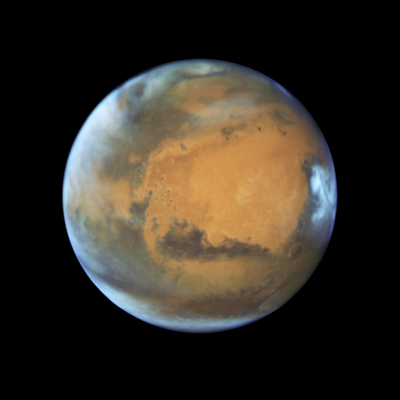
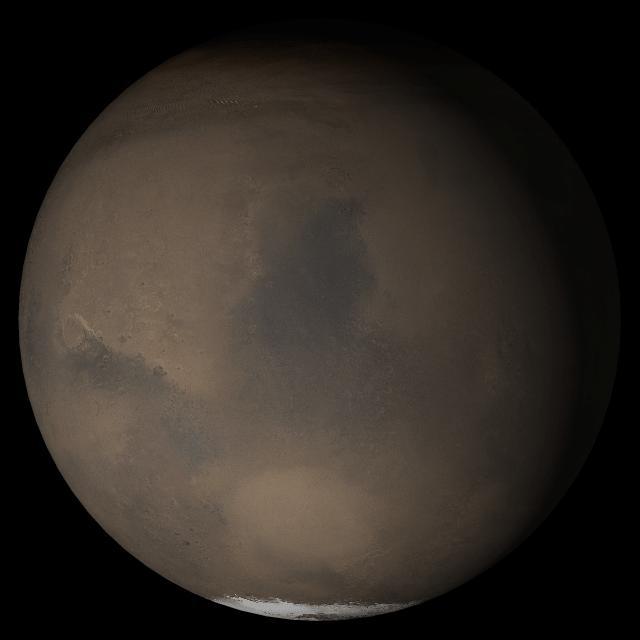
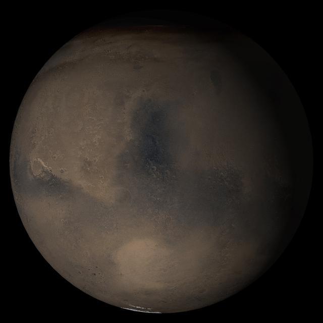
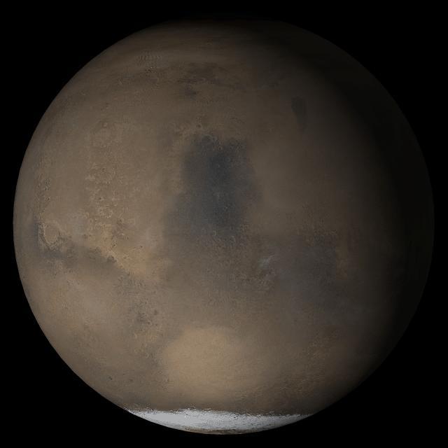
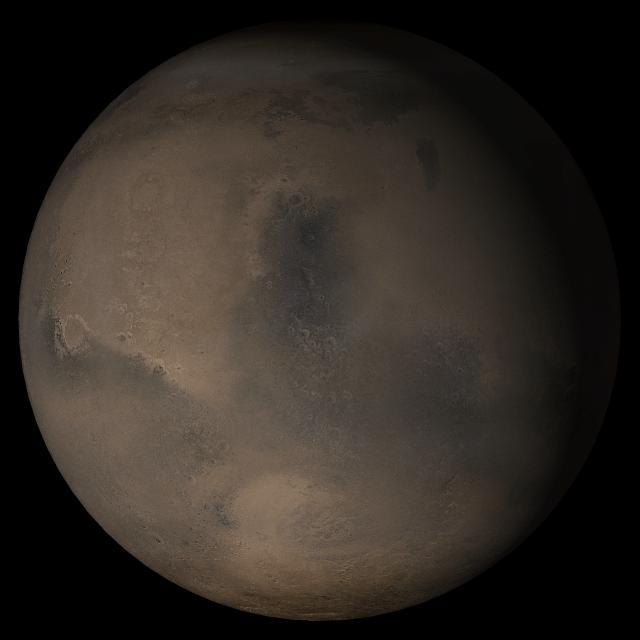
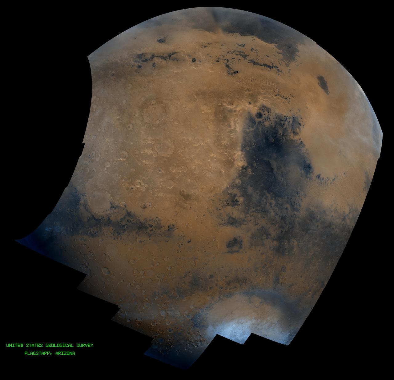
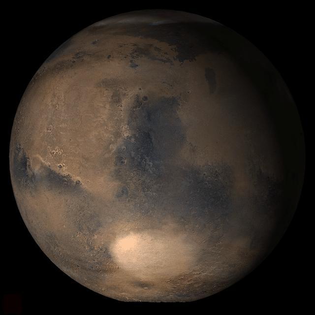
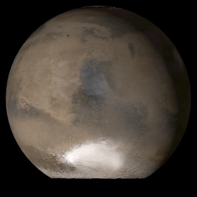
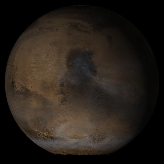
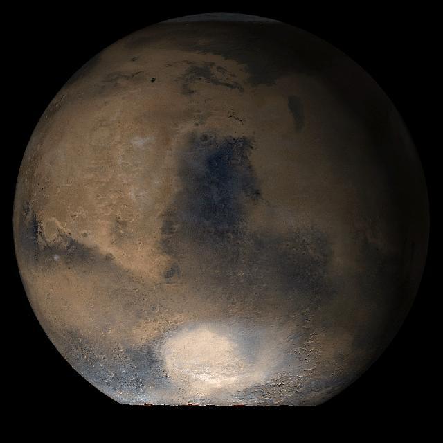
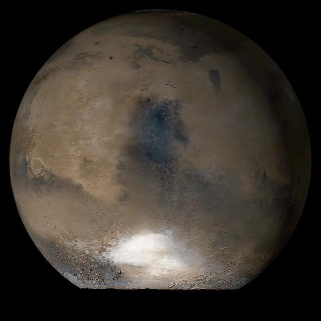
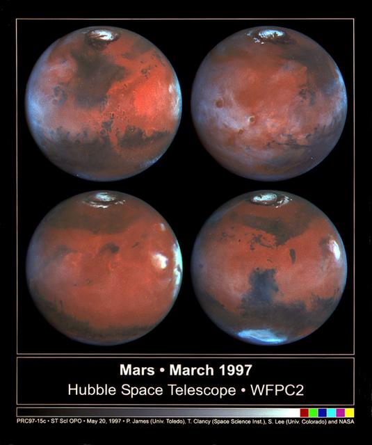
Mars is looking mighty fine in this portrait nabbed by the Hubble Space Telescope on a near close approach! Read more: <a href="http://go.nasa.gov/1rWYiBT" rel="nofollow">go.nasa.gov/1rWYiBT</a> The Hubble Space Telescope is more well known for its picturesque views of nebulae and galaxies, but it's also useful for studying our own planets, including Mars. Hubble imaged Mars on May 12, 2016 - ten days before Mars would be on the exact opposite side of the Earth from the Sun. Bright, frosty polar caps, and clouds above a vivid, rust-colored landscape reveal Mars as a dynamic seasonal planet in this NASA Hubble Space Telescope view taken on May 12, 2016, when Mars was 50 million miles from Earth. The Hubble image reveals details as small as 20 to 30 miles across. The large, dark region at far right is Syrtis Major Planitia, one of the first features identified on the surface of the planet by seventeenth-century observers. Christiaan Huygens used this feature to measure the rotation rate of Mars. (A Martian day is about 24 hours and 37 minutes.) Today we know that Syrtis Major is an ancient, inactive shield volcano. Late-afternoon clouds surround its summit in this view. A large oval feature to the south of Syrtis Major is the bright Hellas Planitia basin. About 1,100 miles across and nearly five miles deep, it was formed about 3.5 billion years ago by an asteroid impact. The orange area in the center of the image is Arabia Terra, a vast upland region in northern Mars that covers about 2,800 miles. The landscape is densely cratered and heavily eroded, indicating that it could be among the oldest terrains on the planet. Dried river canyons (too small to be seen here) wind through the region and empty into the large northern lowlands. Credit: NASA, ESA, the Hubble Heritage Team (STScI/AURA), J. Bell (ASU), and M. Wolff (Space Science Institute) #nasagoddard #mars #hubble #space <b><a href="http://www.nasa.gov/audience/formedia/features/MP_Photo_Guidelines.html" rel="nofollow">NASA image use policy.</a></b> <b><a href="http://www.nasa.gov/centers/goddard/home/index.html" rel="nofollow">NASA Goddard Space Flight Center</a></b> enables NASA’s mission through four scientific endeavors: Earth Science, Heliophysics, Solar System Exploration, and Astrophysics. Goddard plays a leading role in NASA’s accomplishments by contributing compelling scientific knowledge to advance the Agency’s mission. <b>Follow us on <a href="http://twitter.com/NASAGoddardPix" rel="nofollow">Twitter</a></b> <b>Like us on <a href="http://www.facebook.com/pages/Greenbelt-MD/NASA-Goddard/395013845897?ref=tsd" rel="nofollow">Facebook</a></b> <b>Find us on <a href="http://instagrid.me/nasagoddard/?vm=grid" rel="nofollow">Instagram</a></b>
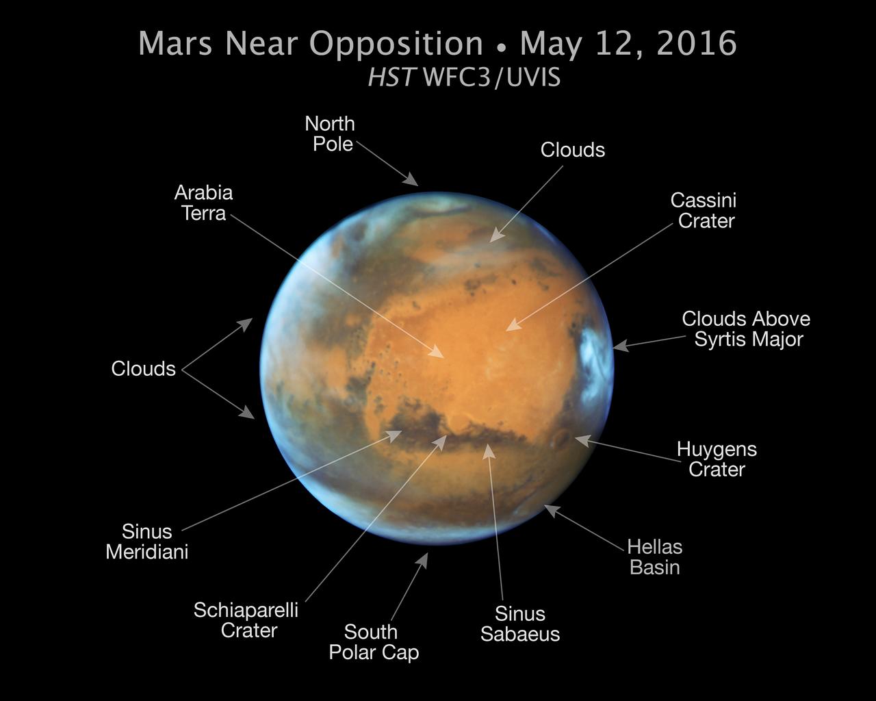
Mars is looking mighty fine in this portrait nabbed by the Hubble Space Telescope on a near close approach! Read more: <a href="http://go.nasa.gov/1rWYiBT" rel="nofollow">go.nasa.gov/1rWYiBT</a> The Hubble Space Telescope is more well known for its picturesque views of nebulae and galaxies, but it's also useful for studying our own planets, including Mars. Hubble imaged Mars on May 12, 2016 - ten days before Mars would be on the exact opposite side of the Earth from the Sun. Bright, frosty polar caps, and clouds above a vivid, rust-colored landscape reveal Mars as a dynamic seasonal planet in this NASA Hubble Space Telescope view taken on May 12, 2016, when Mars was 50 million miles from Earth. The Hubble image reveals details as small as 20 to 30 miles across. The large, dark region at far right is Syrtis Major Planitia, one of the first features identified on the surface of the planet by seventeenth-century observers. Christiaan Huygens used this feature to measure the rotation rate of Mars. (A Martian day is about 24 hours and 37 minutes.) Today we know that Syrtis Major is an ancient, inactive shield volcano. Late-afternoon clouds surround its summit in this view. A large oval feature to the south of Syrtis Major is the bright Hellas Planitia basin. About 1,100 miles across and nearly five miles deep, it was formed about 3.5 billion years ago by an asteroid impact. The orange area in the center of the image is Arabia Terra, a vast upland region in northern Mars that covers about 2,800 miles. The landscape is densely cratered and heavily eroded, indicating that it could be among the oldest terrains on the planet. Dried river canyons (too small to be seen here) wind through the region and empty into the large northern lowlands. Credit: NASA, ESA, the Hubble Heritage Team (STScI/AURA), J. Bell (ASU), and M. Wolff (Space Science Institute) #nasagoddard #mars #hubble #space <b><a href="http://www.nasa.gov/audience/formedia/features/MP_Photo_Guidelines.html" rel="nofollow">NASA image use policy.</a></b> <b><a href="http://www.nasa.gov/centers/goddard/home/index.html" rel="nofollow">NASA Goddard Space Flight Center</a></b> enables NASA’s mission through four scientific endeavors: Earth Science, Heliophysics, Solar System Exploration, and Astrophysics. Goddard plays a leading role in NASA’s accomplishments by contributing compelling scientific knowledge to advance the Agency’s mission. <b>Follow us on <a href="http://twitter.com/NASAGoddardPix" rel="nofollow">Twitter</a></b> <b>Like us on <a href="http://www.facebook.com/pages/Greenbelt-MD/NASA-Goddard/395013845897?ref=tsd" rel="nofollow">Facebook</a></b> <b>Find us on <a href="http://instagrid.me/nasagoddard/?vm=grid" rel="nofollow">Instagram</a></b>

Mars is looking mighty fine in this portrait nabbed by the Hubble Space Telescope on a near close approach! Read more: <a href="http://go.nasa.gov/1rWYiBT" rel="nofollow">go.nasa.gov/1rWYiBT</a> The Hubble Space Telescope is more well known for its picturesque views of nebulae and galaxies, but it's also useful for studying our own planets, including Mars. Hubble imaged Mars on May 12, 2016 - ten days before Mars would be on the exact opposite side of the Earth from the Sun. Bright, frosty polar caps, and clouds above a vivid, rust-colored landscape reveal Mars as a dynamic seasonal planet in this NASA Hubble Space Telescope view taken on May 12, 2016, when Mars was 50 million miles from Earth. The Hubble image reveals details as small as 20 to 30 miles across. The large, dark region at far right is Syrtis Major Planitia, one of the first features identified on the surface of the planet by seventeenth-century observers. Christiaan Huygens used this feature to measure the rotation rate of Mars. (A Martian day is about 24 hours and 37 minutes.) Today we know that Syrtis Major is an ancient, inactive shield volcano. Late-afternoon clouds surround its summit in this view. A large oval feature to the south of Syrtis Major is the bright Hellas Planitia basin. About 1,100 miles across and nearly five miles deep, it was formed about 3.5 billion years ago by an asteroid impact. The orange area in the center of the image is Arabia Terra, a vast upland region in northern Mars that covers about 2,800 miles. The landscape is densely cratered and heavily eroded, indicating that it could be among the oldest terrains on the planet. Dried river canyons (too small to be seen here) wind through the region and empty into the large northern lowlands. Credit: NASA, ESA, the Hubble Heritage Team (STScI/AURA), J. Bell (ASU), and M. Wolff (Space Science Institute) #nasagoddard #mars #hubble #space <b><a href="http://www.nasa.gov/audience/formedia/features/MP_Photo_Guidelines.html" rel="nofollow">NASA image use policy.</a></b> <b><a href="http://www.nasa.gov/centers/goddard/home/index.html" rel="nofollow">NASA Goddard Space Flight Center</a></b> enables NASA’s mission through four scientific endeavors: Earth Science, Heliophysics, Solar System Exploration, and Astrophysics. Goddard plays a leading role in NASA’s accomplishments by contributing compelling scientific knowledge to advance the Agency’s mission. <b>Follow us on <a href="http://twitter.com/NASAGoddardPix" rel="nofollow">Twitter</a></b> <b>Like us on <a href="http://www.facebook.com/pages/Greenbelt-MD/NASA-Goddard/395013845897?ref=tsd" rel="nofollow">Facebook</a></b> <b>Find us on <a href="http://instagrid.me/nasagoddard/?vm=grid" rel="nofollow">Instagram</a></b>
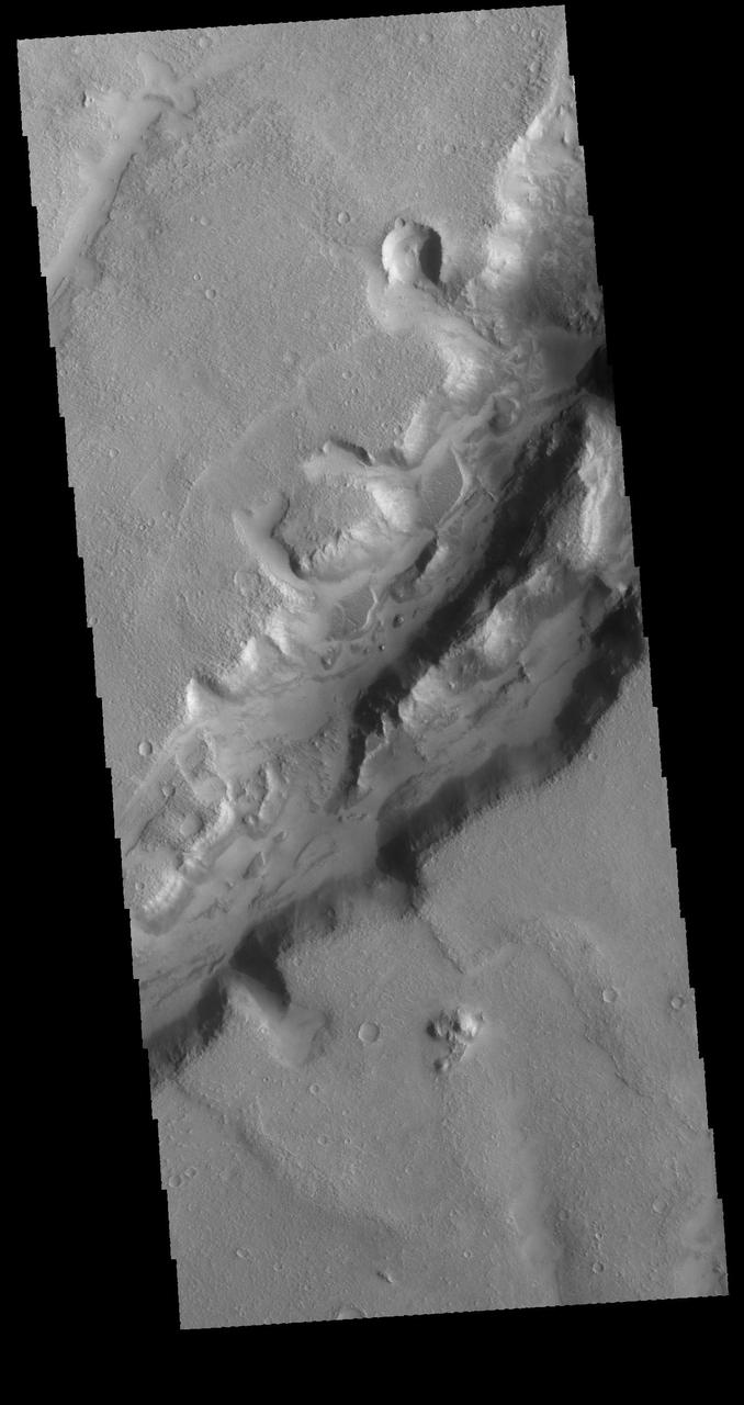
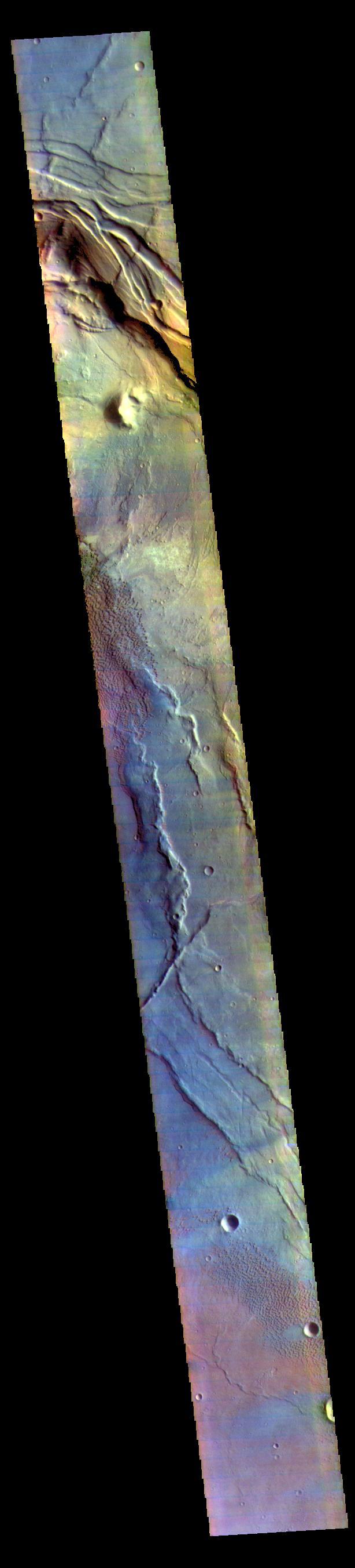
Nothing gets a geologist more excited than layered bedrock, except perhaps finding a fossil or holding a meteorite in your hand. All of these things create a profound feeling of history, the sense of a story that took place ages ago, long before we came appeared. Layered bedrock in particular tells a story that was set out chapter by chapter as each new layer was deposited on top of older, previously deposited layers. Here in Nili Fossae, we see layered bedrock as horizontal striations in the light toned sediments in the floor of a canyon near Syrtis Major. (Note: illumination is from the top of the picture) The ancient layered rocks appear in pale whitish and bluish tones. They are partially covered by much younger ripples made up of dust and other wind blown sediments. The rock of the nearby canyon wall is severely fractured and appears to have shed sand and rocks and boulders onto the floor. This canyon did not form by fluvial erosion: it is part of a system of faults that formed a series of graben like this one, but water probably flowed through Nili Fossae in the distant past. Orbital spectral measurements by the OMEGA instrument on Mars Express and CRISM on MRO detected an abundance of clay minerals of different types in the layered sediments inside Nili Fossae, along with other minerals that are typical of sediments that were deposited by water. The various colors and tones of the layered rocks record changes in the composition of the sediments, details that can tell us about changes in the Martian environment eons ago. Nili Fossae is a candidate site for a future landed robotic mission that could traverse across these layers and make measurements that could be used to unravel a part of the early history of Mars. Nili Fossae is a history book that is waiting to be read. http://photojournal.jpl.nasa.gov/catalog/PIA21206
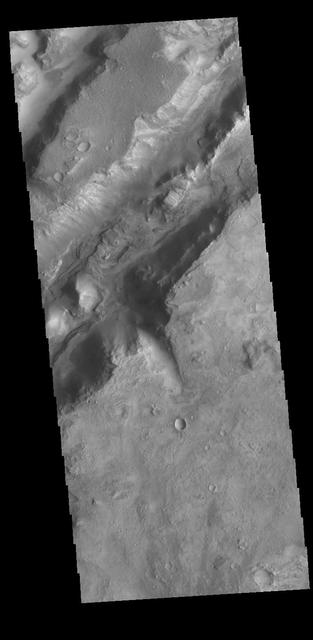
Today's VIS image shows some of the linear depressions that comprise Nili Fossae. Nili Fossae is the name of a collection of curved faults and down-dropped blocks of crust between the faults. The "fossae," or graben, lie northeast of the large volcano Syrtis Major and northwest of the ancient impact basin Isidis Planitia. The troughs, which can be almost 500 meters (1,600 feet) deep , make concentric curves that follow the outline of Isidis Planitia. The graben likely formed as the crust sagged under the weight of lava flows filling the Isidis Planitia impact basin. Orbit Number: 80970 Latitude: 22.4569 Longitude: 77.804 Instrument: VIS Captured: 2020-03-16 09:25 https://photojournal.jpl.nasa.gov/catalog/PIA23908
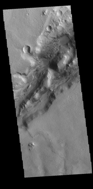
Today's VIS image shows a section of a graben that is part of Nili Fossae. Graben are formed when a block of material drops downward between paired tectonic faults. Graben usually have straight sides with little sinuosity, whereas fluvial channels typically have large amounts of sinuosity along the length of the depression. Nili Fossae is located northeast of the large volcano Syrtis Major and northwest of the ancient impact basin Isidis Planitia. The graben, which can be about 500 meters (1,600 feet) deep, make concentric curves that follow the outline of Isidis Planitia. The faults likely formed as the crust sagged under the weight of lava flows filling Isidis Planitia. Orbit Number: 79198 Latitude: 23.3881 Longitude: 78.7422 Instrument: VIS Captured: 2019-10-22 11:40 https://photojournal.jpl.nasa.gov/catalog/PIA23632