The THEMIS camera contains 5 filters. The data from different filters can be combined in multiple ways to create a false color image. This image from NASA 2001 Mars Odyssey spacecraft shows part of Syrtis Major Planum.
The THEMIS camera contains 5 filters. The data from different filters can be combined in multiple ways to create a false color image. These false color images may reveal subtle variations of the surface not easily identified in a single band image. Today's false color image shows part of Syrtis Major Planum, between Nili Patera and Meroe Patera. Orbit Number: 43352 Latitude: 8.2378 Longitude: 67.7675 Instrument: VIS Captured: 2011-09-22 22:16 http://photojournal.jpl.nasa.gov/catalog/PIA20988
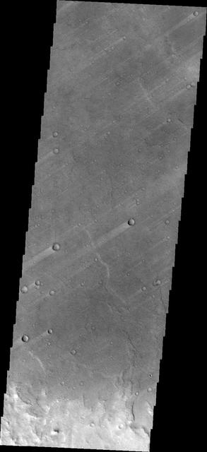
The windstreaks in this image captured by NASA Mars Odyssey are located on the plains of southern Syrtis Major Planum.
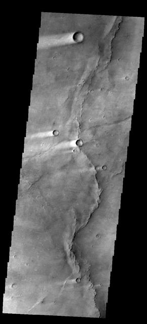
This image of windstreaks from NASA 2001 Mars Odyssey spacecraft indicates winds from the ENE in the region of Syrtis Major Planum.
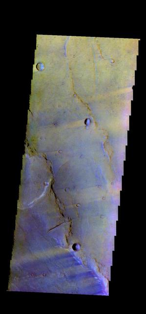
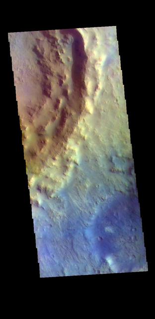
The THEMIS VIS camera contains 5 filters. The data from different filters can be combined in multiple ways to create a false color image. These false color images may reveal subtle variations of the surface not easily identified in a single band image. Today's false color image shows part Syrtis Major Planum. Orbit Number: 45811 Latitude: 21.5691 Longitude: 78.9549 Instrument: VIS Captured: 2012-04-12 07:43 http://photojournal.jpl.nasa.gov/catalog/PIA21171
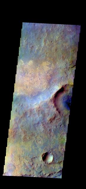
The THEMIS VIS camera contains 5 filters. The data from different filters can be combined in multiple ways to create a false color image. These false color images may reveal subtle variations of the surface not easily identified in a single band image. Today's false color image shows part of Syrtis Major Planum. Orbit Number: 45886 Latitude: 19.0521 Longitude: 75.685 Instrument: VIS Captured: 2012-04-18 11:54 http://photojournal.jpl.nasa.gov/catalog/PIA21174
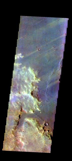
The THEMIS VIS camera contains 5 filters. The data from different filters can be combined in multiple ways to create a false color image. These false color images may reveal subtle variations of the surface not easily identified in a single band image. Today's false color image shows several wind streaks in Syrtis Major Planum. Orbit Number: 50693 Latitude: -0.448856 Longitude: 68.374 Instrument: VIS Captured: 2013-05-19 02:56 http://photojournal.jpl.nasa.gov/catalog/PIA21278
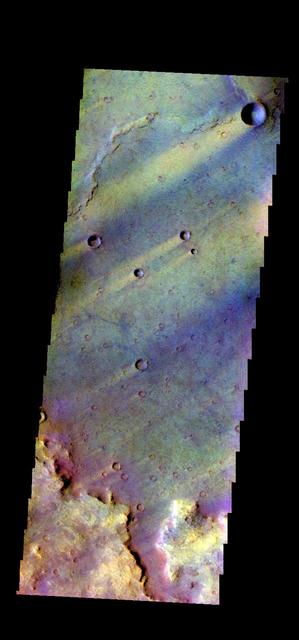
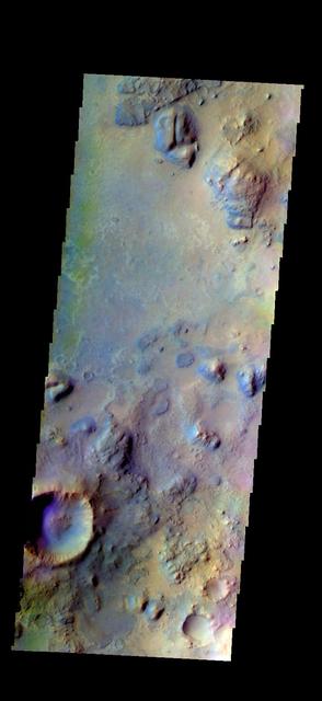
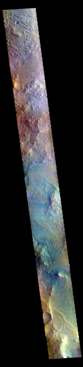
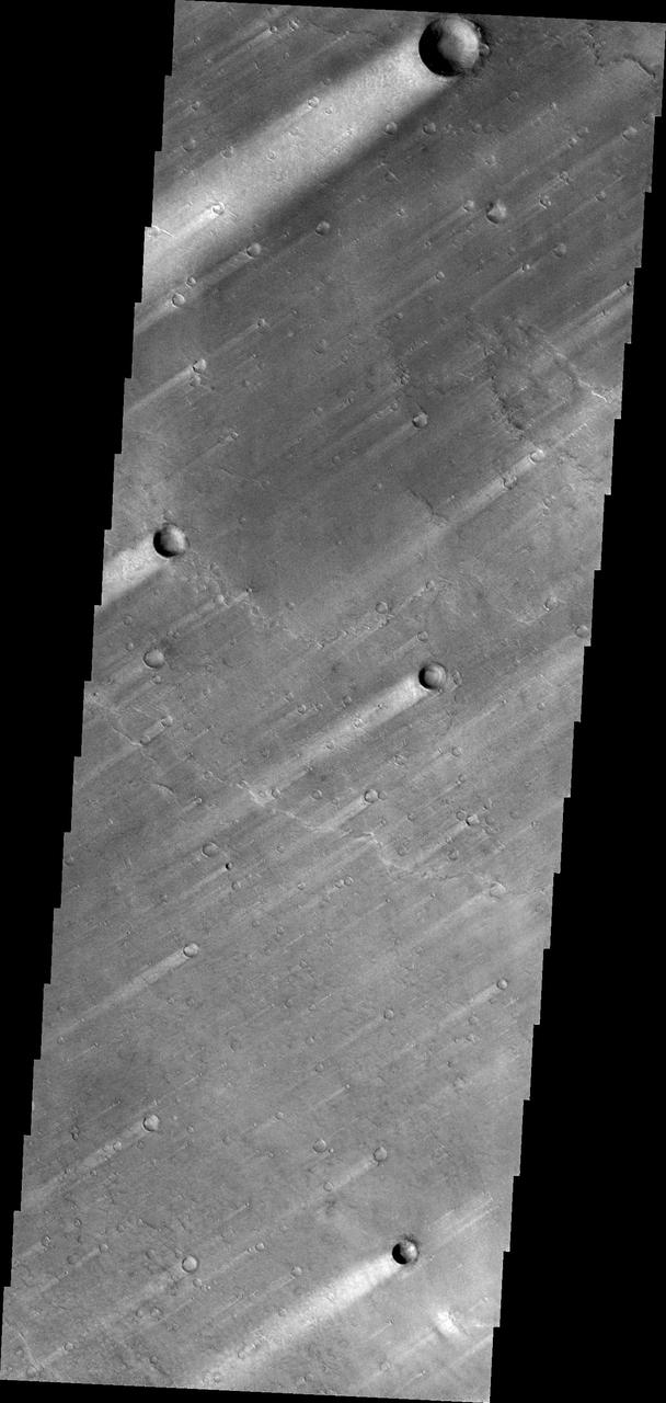
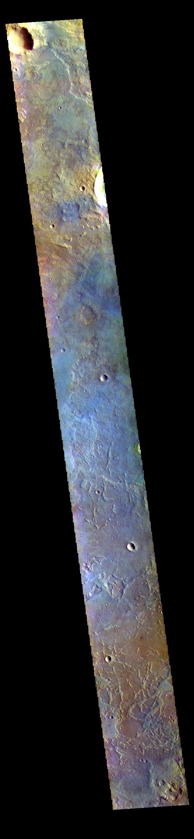
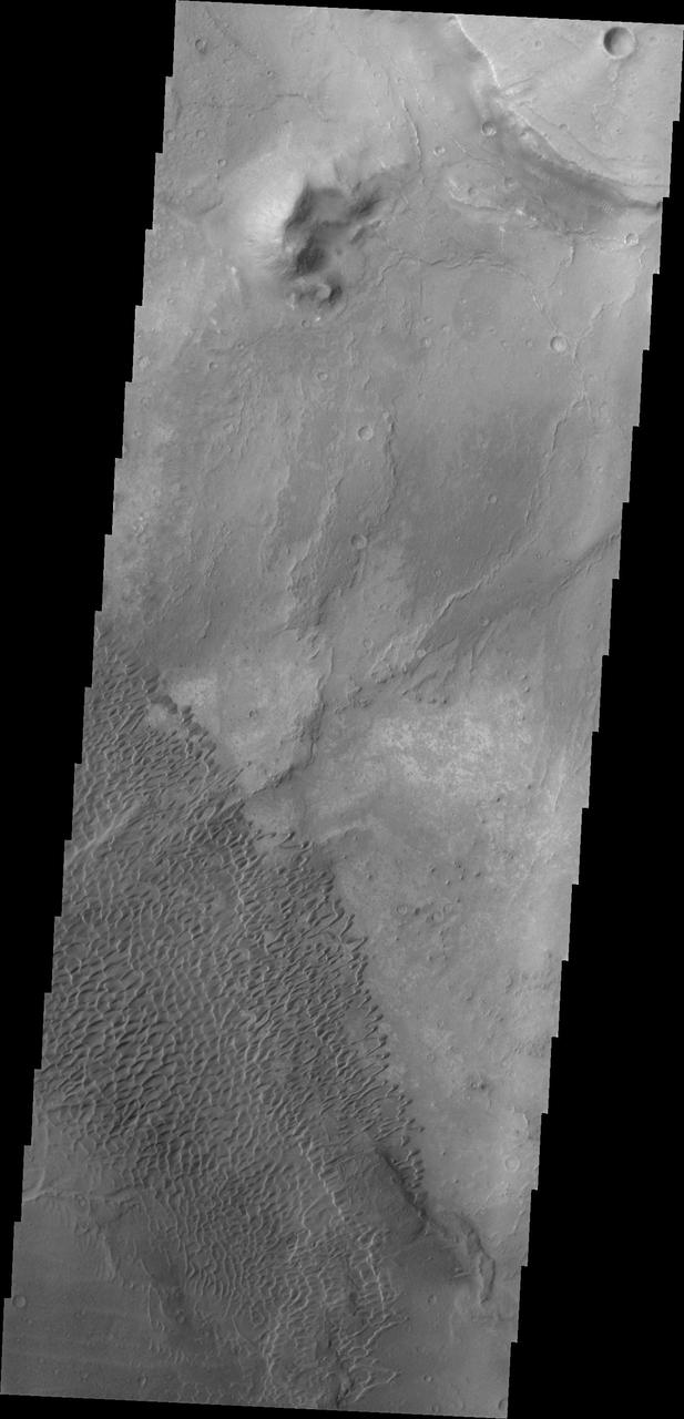
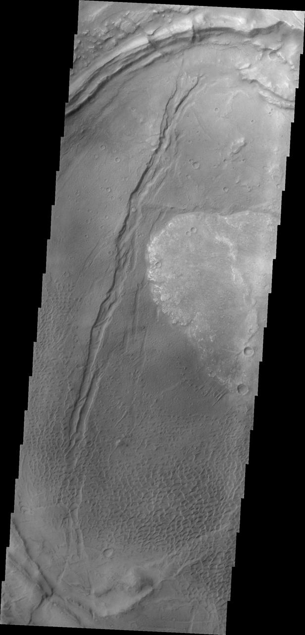
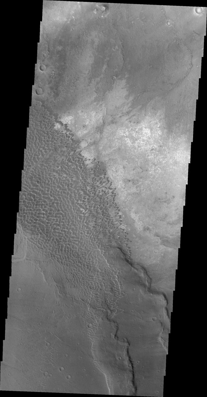
This VIS image is located in the center of Syrtis Major Planum. At the top of the image is Nili Patera, a volcanic summit. The sand dunes located near Nili Patera are visible on the left side of the image. The bottom of the image is just west of Meroe Patera. Dunes located between Nili and Meroe are visible towards the bottom of the image. Winds in the region have created the dunes, but also many windstreaks on the downward side of craters in the image. Wind streaks indicate the direction of the wind. In this region the winds are blowing from east to west. The THEMIS VIS camera contains 5 filters. The data from different filters can be combined in multiple ways to create a false color image. These false color images may reveal subtle variations of the surface not easily identified in a single band image. Orbit Number: 62072 Latitude: 7.99408 Longitude: 67.5512 Instrument: VIS Captured: 2015-12-11 18:39 https://photojournal.jpl.nasa.gov/catalog/PIA23095
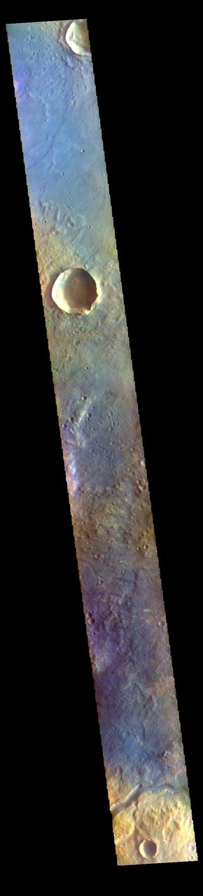
The THEMIS VIS camera contains 5 filters. The data from different filters can be combined in multiple ways to create a false color image. These false color images may reveal subtle variations of the surface not easily identified in a single band image. Today's false color image shows part of northern Syrtis Major Planum. The THEMIS VIS camera is capable of capturing color images of the Martian surface using five different color filters. In this mode of operation, the spatial resolution and coverage of the image must be reduced to accommodate the additional data volume produced from using multiple filters. To make a color image, three of the five filter images (each in grayscale) are selected. Each is contrast enhanced and then converted to a red, green, or blue intensity image. These three images are then combined to produce a full color, single image. Because the THEMIS color filters don't span the full range of colors seen by the human eye, a color THEMIS image does not represent true color. Also, because each single-filter image is contrast enhanced before inclusion in the three-color image, the apparent color variation of the scene is exaggerated. Nevertheless, the color variation that does appear is representative of some change in color, however subtle, in the actual scene. Note that the long edges of THEMIS color images typically contain color artifacts that do not represent surface variation. Orbit Number: 85463 Latitude: 17.4847 Longitude: 60.8084 Instrument: VIS Captured: 2021-03-21 08:04 https://photojournal.jpl.nasa.gov/catalog/PIA25058
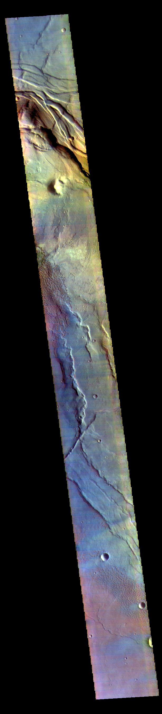
The THEMIS VIS camera contains 5 filters. The data from different filters can be combined in multiple ways to create a false color image. These false color images may reveal subtle variations of the surface not easily identified in a single band image. Today's false color image shows part of the eastern boundary of Syrtis Major Planum. The channel at the bottom of the image is unnamed. The THEMIS VIS camera is capable of capturing color images of the Martian surface using five different color filters. In this mode of operation, the spatial resolution and coverage of the image must be reduced to accommodate the additional data volume produced from using multiple filters. To make a color image, three of the five filter images (each in grayscale) are selected. Each is contrast enhanced and then converted to a red, green, or blue intensity image. These three images are then combined to produce a full color, single image. Because the THEMIS color filters don't span the full range of colors seen by the human eye, a color THEMIS image does not represent true color. Also, because each single-filter image is contrast enhanced before inclusion in the three-color image, the apparent color variation of the scene is exaggerated. Nevertheless, the color variation that does appear is representative of some change in color, however subtle, in the actual scene. Note that the long edges of THEMIS color images typically contain color artifacts that do not represent surface variation. Orbit Number: 85812 Latitude: 17.5754 Longitude: 72.5741 Instrument: VIS Captured: 2021-04-19 01:44 https://photojournal.jpl.nasa.gov/catalog/PIA25095
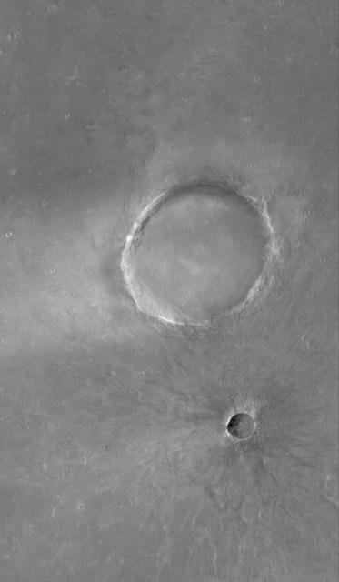
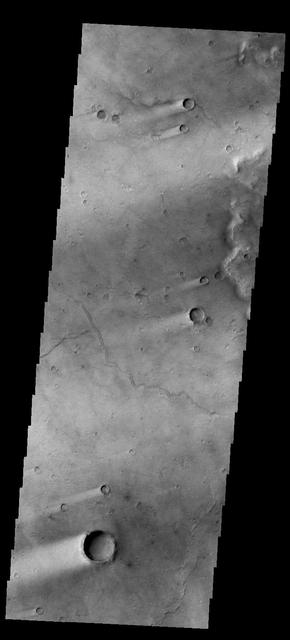
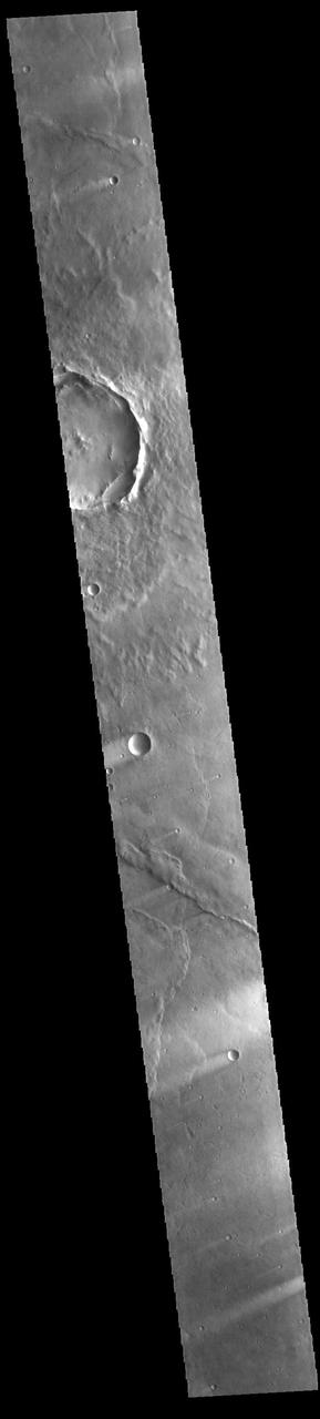
This MOC image shows a portion of Syrtis Major Planum, dominated in this area by two impact craters of differing age

The windstreaks in this image from NASA 2001 Mars Odyssey spacecraft are located in Syrtis Major Planum between Nili and Meroe Paterae.
Windstreaks are common in Syrtis Major Planum as seen in this image from NASA 2001 Mars Odyssey spacecraft.
This image shows wind streaks in Syrtis Major Planum as seen by NASA 2001 Mars Odyssey spacecraft.
These windstreaks are located on Syrtis Major Planum, as shown in this image captured by NASA 2001 Mars Odyssey spacecraft.
This image shows several wind streaks in Syrtis Major Planum as seen by NASA 2001 Mars Odyssey spacecraft.
The dunes in this image from NASA Mars Odyssey are located in Nili Patera, one of the two patera of Syrtis Major Planum.

Windstreaks, like the ones in this image from NASA 2001 Mars Odyssey spacecraft, are a common feature on the plains of Syrtis Major Planum.
The windstreaks in this image of Syrtis Major Planum indicate winds blowing from the northeast. This image is from NASA 2001 Mars Odyssey spacecraft.
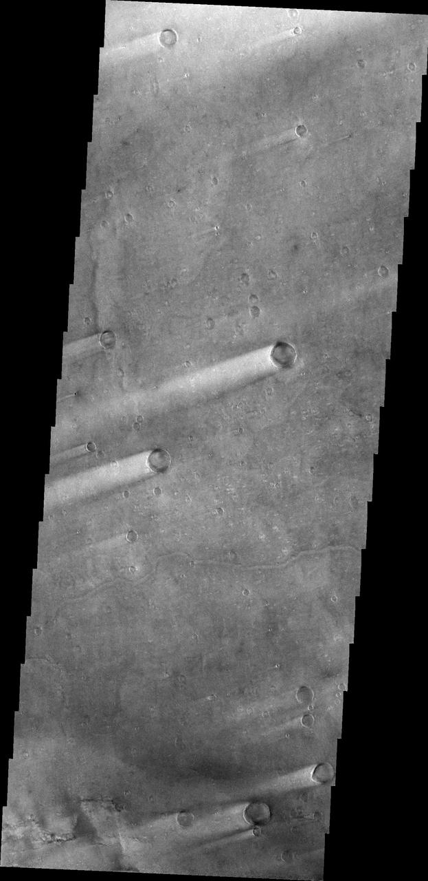
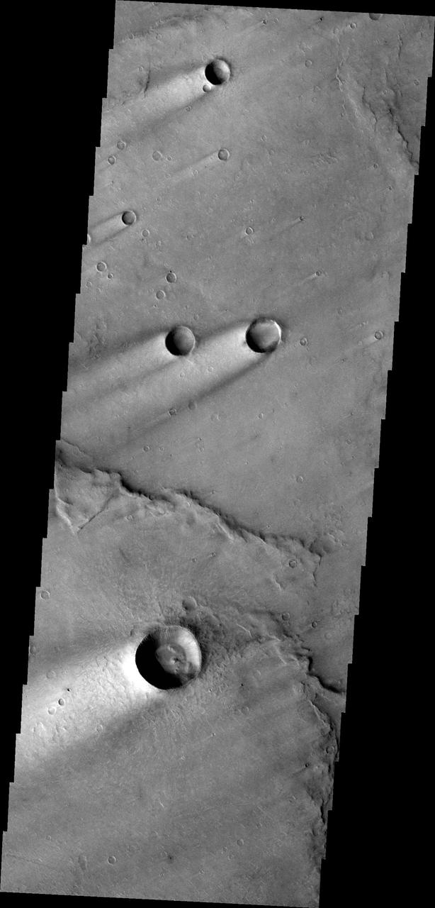
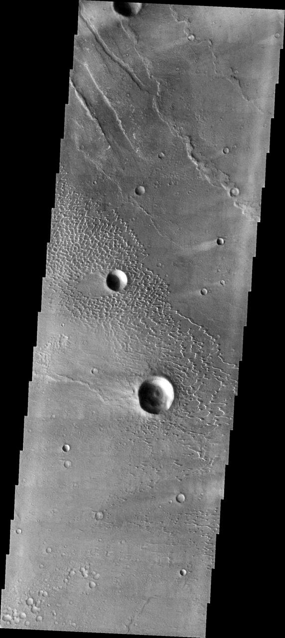
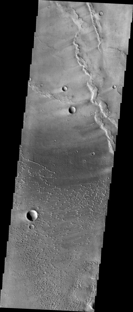
Today's VIS image shows windstreaks located in Syrtis Major Planum. These streaks are formed by the wind interaction with positive topographic features (like craters), with the 'tail' located down wind of the crater. The streaks in this image indicate the prevailing wind was from the upper right to the lower left side of the image (northeast to southwest). Orbit Number: 94023 Latitude: 6.9785 Longitude: 71.5019 Instrument: VIS Captured: 2023-02-24 03:50 https://photojournal.jpl.nasa.gov/catalog/PIA25942
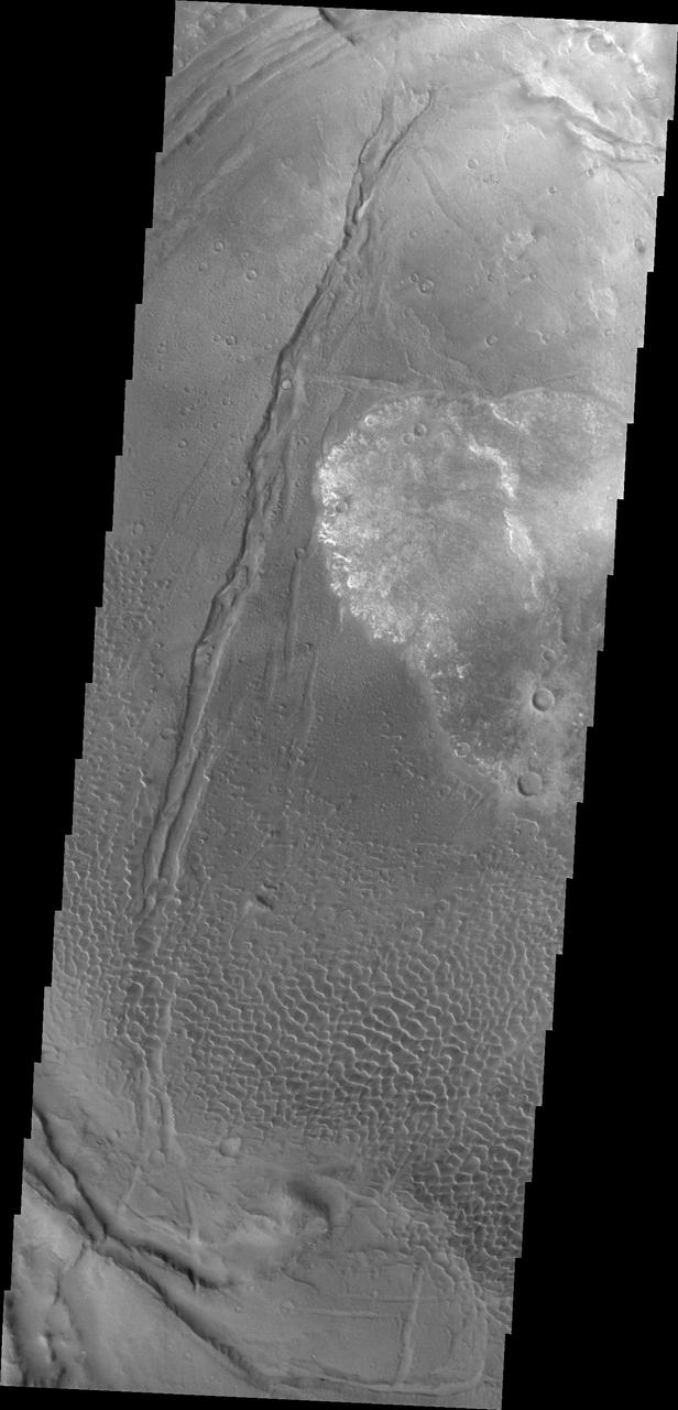
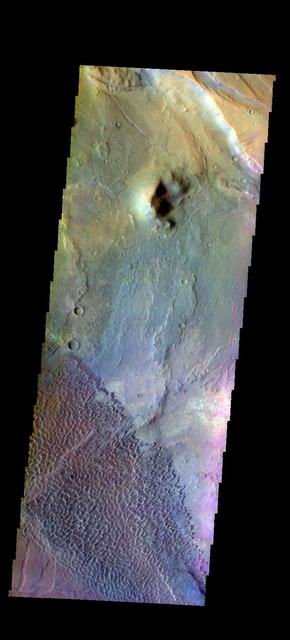
The circular feature in today's VIS image is called Meroe Patera. It is a volcanic caldera located in Syrtis Major Planum. The volcanic activity in Syrtis Major Planum is thought to be related to the impact event that created Isidis Planitia to the east. Orbit Number: 87684 Latitude: 6.67925 Longitude: 69.0924 Instrument: VIS Captured: 2021-09-20 04:57 https://photojournal.jpl.nasa.gov/catalog/PIA25263
Today's VIS image shows part of Nili Patera. Nili Patera is the northern caldera in the immense volcanic complex of Syrtis Major Planum. The dunes are moving westward across the top of these ancient volcanic flows. Orbit Number: 90030 Latitude: 8.95316 Longitude: 67.1774 Instrument: VIS Captured: 2022-04-01 09:05 https://photojournal.jpl.nasa.gov/catalog/PIA25468

Today's false color image is located at Nili Patera in Syrtis Major Planum. There are regions of small dunes towards the top and the bottom of the image. The wide range of colors indicate the complexity of surface materials in this area. The THEMIS VIS camera contains 5 filters. The data from different filters can be combined in multiple ways to create a false color image. These false color images may reveal subtle variations of the surface not easily identified in a single band image. Orbit Number: 61810 Latitude: 8.37503 Longitude: 67.4659 Instrument: VIS Captured: 2015-11-20 04:48 https://photojournal.jpl.nasa.gov/catalog/PIA23071
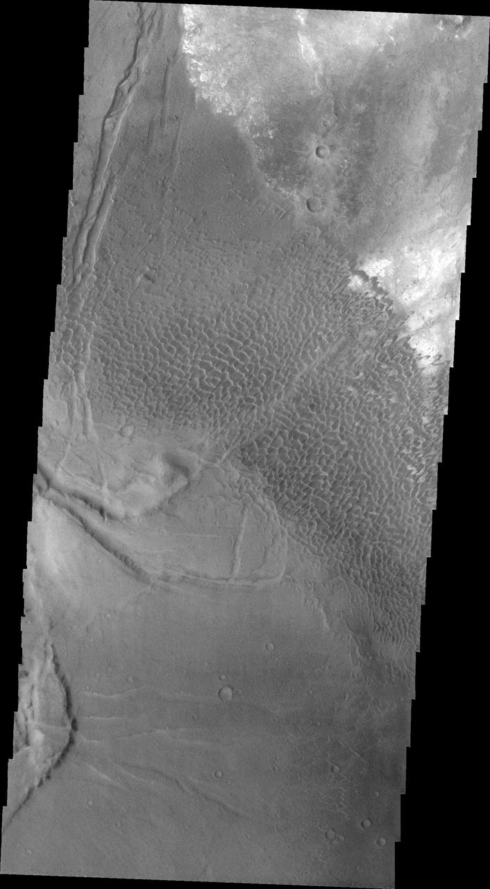
This VIS image shows part of the floor of Antoniadi Crater, a very large crater located north of Syrtis Major Planum. The THEMIS VIS camera contains 5 filters. The data from different filters can be combined in multiple ways to create a false color image. These false color images may reveal subtle variations of the surface not easily identified in a single band image. Orbit Number: 61311 Latitude: 21.1681 Longitude: 62.1541 Instrument: VIS Captured: 2015-10-10 02:38 https://photojournal.jpl.nasa.gov/catalog/PIA22788
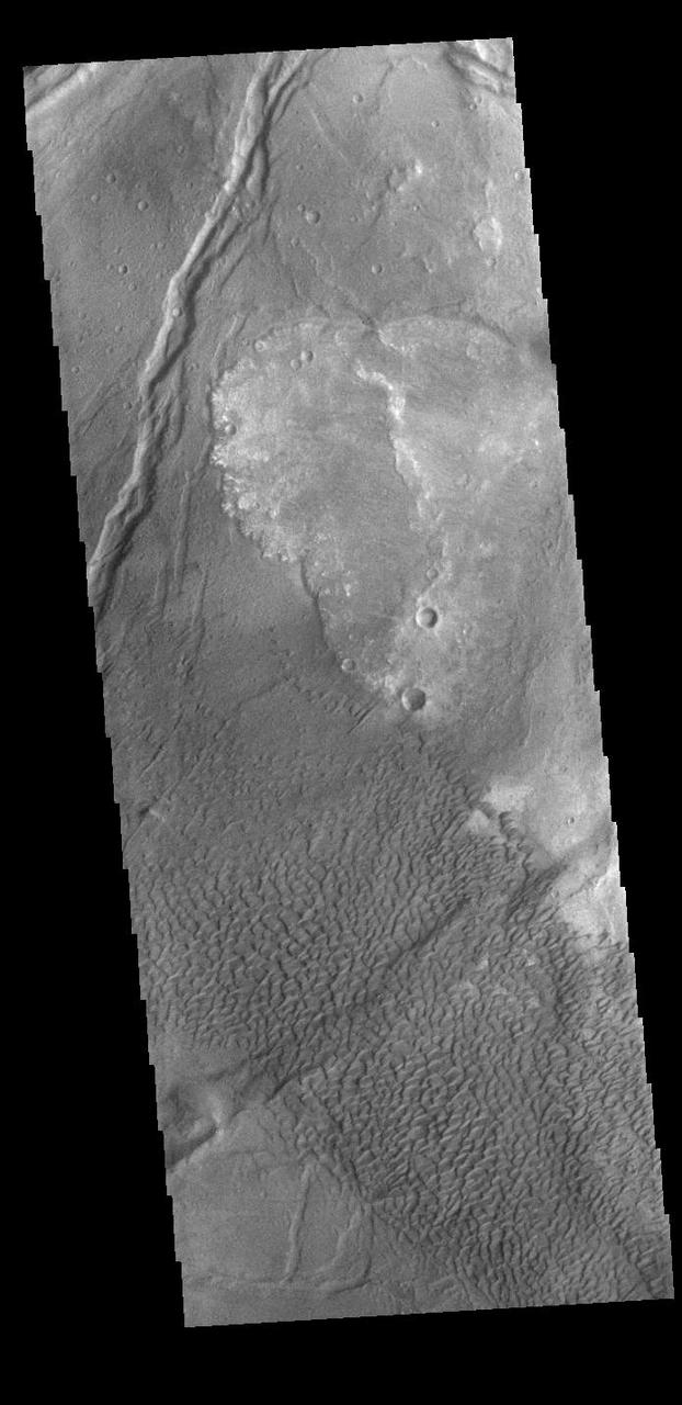
The THEMIS VIS camera contains 5 filters. The data from different filters can be combined in multiple ways to create a false color image. These false color images may reveal subtle variations of the surface not easily identified in a single band image. Today's false color image shows the southeastern rim of Toro Crater. Toro Crater is located in Syrtis Major Planum and is 41km (25miles) in diameter. Orbit Number: 79061 Latitude: 16.8233 Longitude: 72.1675 Instrument: VIS Captured: 2019-10-11 04:54 https://photojournal.jpl.nasa.gov/catalog/PIA24656
Today's VIS image is located in Aram Chaos. Aram Chaos was initially formed by a large impact. Over time the crater interior was modified by several different processes, including liquid water. Located near Ares Vallis, a narrow channel links the Aram Chaos crater with Ares Vallis indicating a substantial amount of water was located in the crater. Chaos forms from erosion of the surface into mesa features. With time the valleys expand creating the jumble of hills seen in the image. The THEMIS VIS camera contains 5 filters. The data from different filters can be combined in multiple ways to create a false color image. These false color images may reveal subtle variations of the surface not easily identified in a single band image. Orbit Number: 62100 Latitude: 4.04973 Longitude: 340.137 Instrument: VIS Captured: 2015-12-14 01:59 https://photojournal.jpl.nasa.gov/catalog/PIA23107
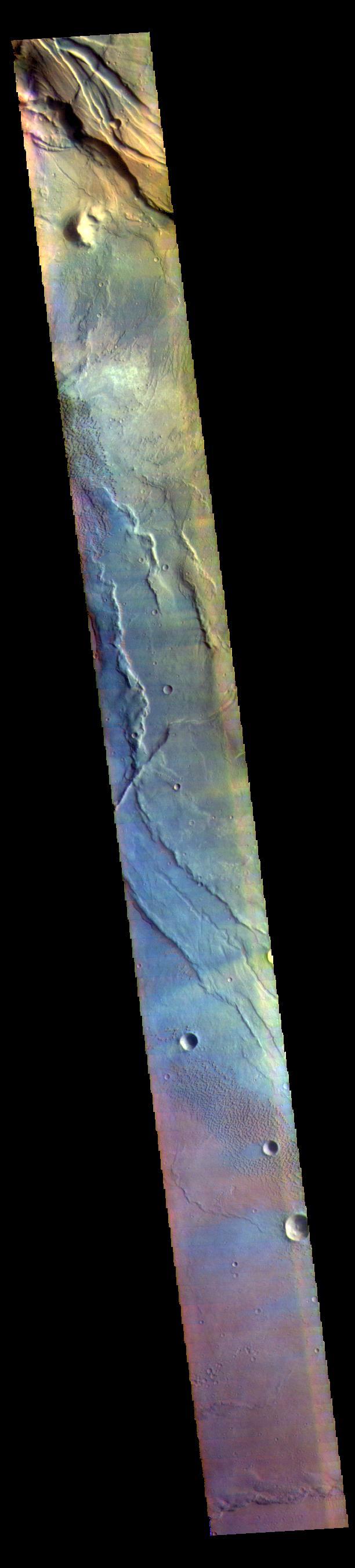
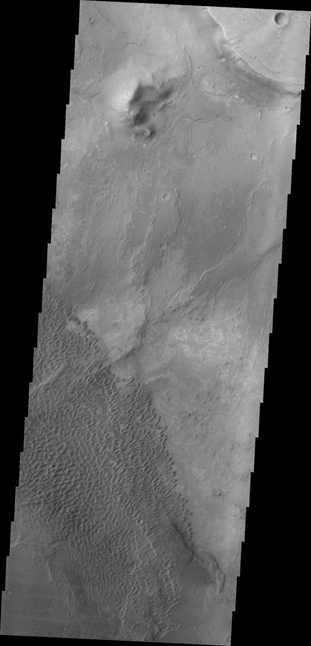
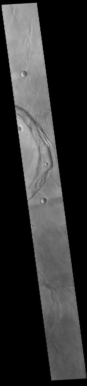
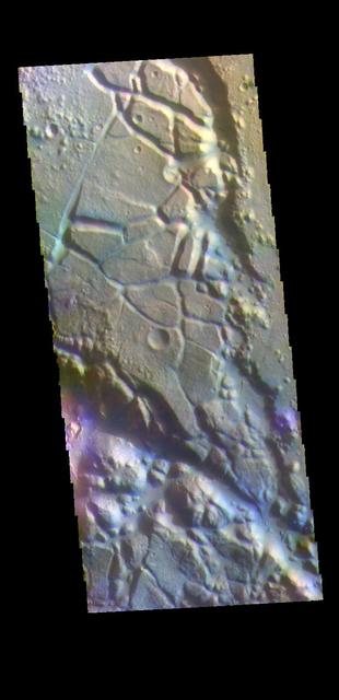
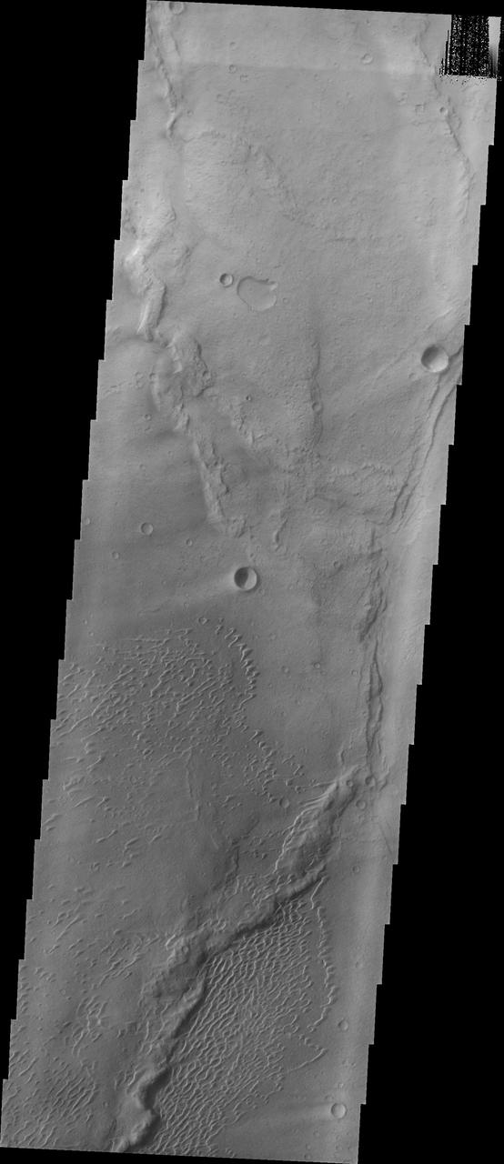
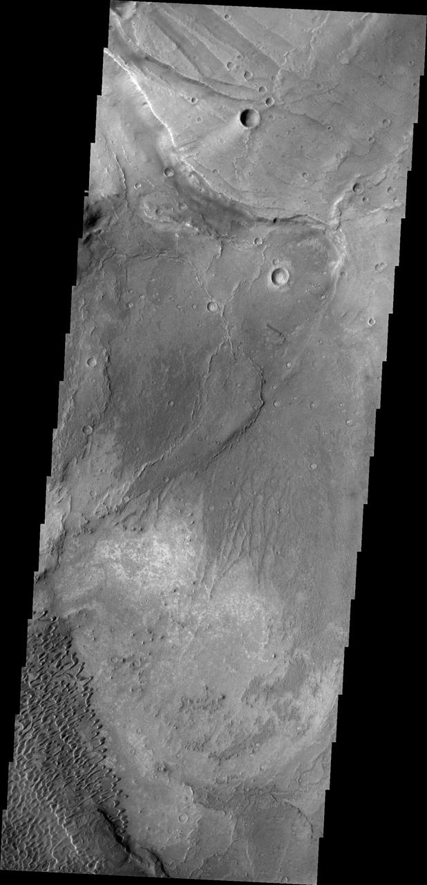
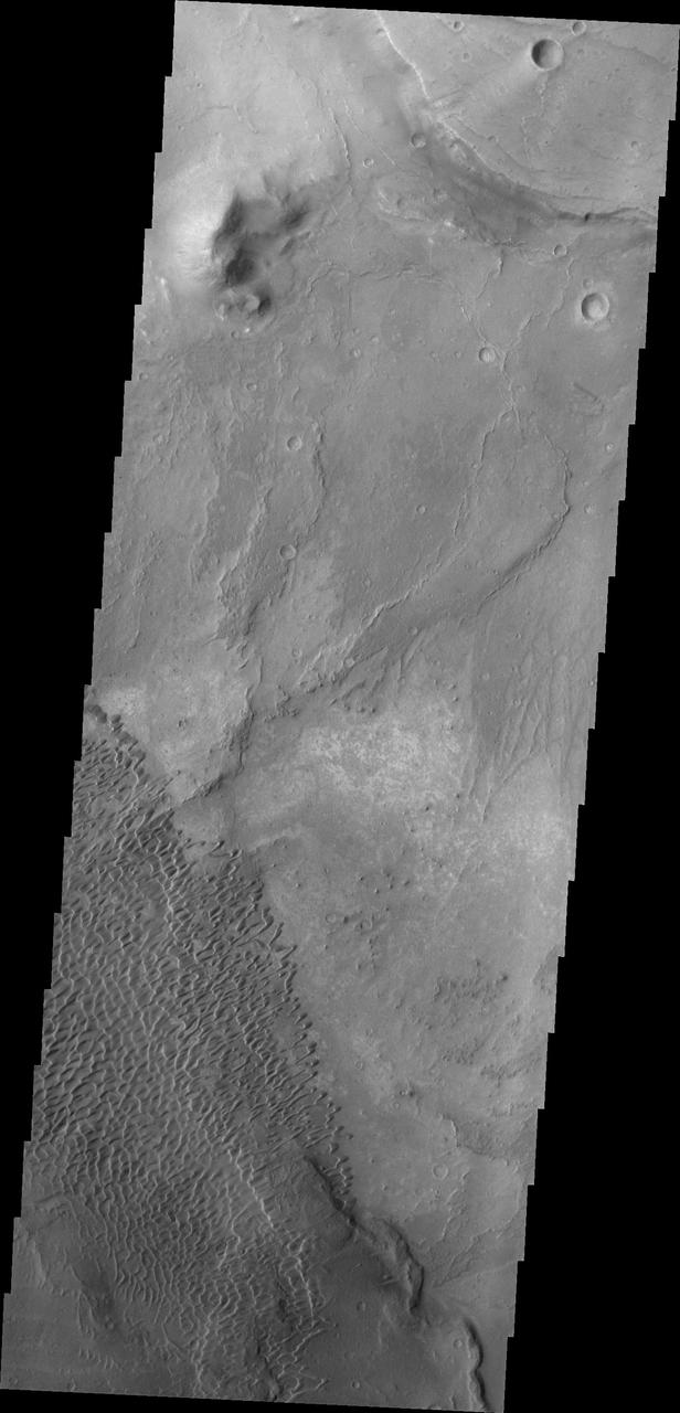
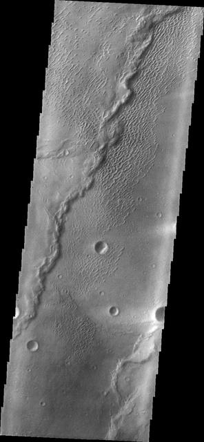
This VIS image is located in Terra Sabaea near the margin of Syrtis Major Planum. The channel-like feature in the bottom of the image is an unnamed feature. There is a high spot within the channel that would not let a fluid pass from one side to the other. This indicates that this is not a water carved channel, but was most likely an underground lava tube, where collapse of the roof has revealed the underlying feature. The 90 degree turns in the channel feature, and the small linear ridges just to the top of the channel indicate tectonic forces are part of the processes at work in this region. Orbit Number: 72337 Latitude: 16.4537 Longitude: 60.7257 Instrument: VIS Captured: 2018-04-05 10:06 https://photojournal.jpl.nasa.gov/catalog/PIA22579
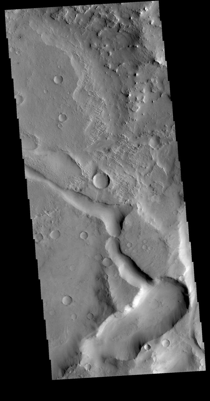
his image shows part of the dune field near Meroe Patera. High resolution imaging by other spacecraft has revealed that the dunes in this region are moving. Winds are blowing the dunes across a rough surface of regional volcanic lava flows. The paterae are calderas on the volcanic complex called Syrtis Major Planum. Dunes are found in both Nili and Meroe Paterae and in the region between the two calderas. The Odyssey spacecraft has spent over 15 years in orbit around Mars, circling the planet more than 69000 times. It holds the record for longest working spacecraft at Mars. THEMIS, the IR/VIS camera system, has collected data for the entire mission and provides images covering all seasons and lighting conditions. Over the years many features of interest have received repeated imaging, building up a suite of images covering the entire feature. From the deepest chasma to the tallest volcano, individual dunes inside craters and dune fields that encircle the north pole, channels carved by water and lava, and a variety of other feature, THEMIS has imaged them all. For the next several months the image of the day will focus on the Tharsis volcanoes, the various chasmata of Valles Marineris, and the major dunes fields. We hope you enjoy these images! Orbit Number: 11606 Latitude: 7.06099 Longitude: 68.2238 Instrument: VIS Captured: 2004-07-27 00:59 https://photojournal.jpl.nasa.gov/catalog/PIA22012
This image shows part of the Nili Patera dune field. High resolution imaging by other spacecraft has revealed that the dunes in this region are moving. Winds are blowing the dunes across a rough surface of regional volcanic lava flows. The paterae are calderas on the volcanic complex called Syrtis Major Planum. Dunes are found in both Nili and Meroe Paterae and in the region between the two calderas. The Odyssey spacecraft has spent over 15 years in orbit around Mars, circling the planet more than 69000 times. It holds the record for longest working spacecraft at Mars. THEMIS, the IR/VIS camera system, has collected data for the entire mission and provides images covering all seasons and lighting conditions. Over the years many features of interest have received repeated imaging, building up a suite of images covering the entire feature. From the deepest chasma to the tallest volcano, individual dunes inside craters and dune fields that encircle the north pole, channels carved by water and lava, and a variety of other feature, THEMIS has imaged them all. For the next several months the image of the day will focus on the Tharsis volcanoes, the various chasmata of Valles Marineris, and the major dunes fields. We hope you enjoy these images! Orbit Number: 42079 Latitude: 8.99242 Longitude: 67.1173 Instrument: VIS Captured: 2011-06-10 03:08 https://photojournal.jpl.nasa.gov/catalog/PIA22007
This image shows part of the dune field near Meroe Patera. High resolution imaging by other spacecraft has revealed that the dunes in this region are moving. Winds are blowing the dunes across a rough surface of regional volcanic lava flows. The paterae are calderas on the volcanic complex called Syrtis Major Planum. Dunes are found in both Nili and Meroe Paterae and in the region between the two calderas. The Odyssey spacecraft has spent over 15 years in orbit around Mars, circling the planet more than 69000 times. It holds the record for longest working spacecraft at Mars. THEMIS, the IR/VIS camera system, has collected data for the entire mission and provides images covering all seasons and lighting conditions. Over the years many features of interest have received repeated imaging, building up a suite of images covering the entire feature. From the deepest chasma to the tallest volcano, individual dunes inside craters and dune fields that encircle the north pole, channels carved by water and lava, and a variety of other feature, THEMIS has imaged them all. For the next several months the image of the day will focus on the Tharsis volcanoes, the various chasmata of Valles Marineris, and the major dunes fields. We hope you enjoy these images! Orbit Number: 48870 Latitude: 6.6541 Longitude: 68.1311 Instrument: VIS Captured: 2012-12-20 02:19 https://photojournal.jpl.nasa.gov/catalog/PIA22014
This image shows part of the Nili Patera dune field. High resolution imaging by other spacecraft has revealed that the dunes in this region are moving. Winds are blowing the dunes across a rough surface of regional volcanic lava flows. The paterae are calderas on the volcanic complex called Syrtis Major Planum. Dunes are found in both Nili and Meroe Paterae and in the region between the two calderas. The Odyssey spacecraft has spent over 15 years in orbit around Mars, circling the planet more than 69000 times. It holds the record for longest working spacecraft at Mars. THEMIS, the IR/VIS camera system, has collected data for the entire mission and provides images covering all seasons and lighting conditions. Over the years many features of interest have received repeated imaging, building up a suite of images covering the entire feature. From the deepest chasma to the tallest volcano, individual dunes inside craters and dune fields that encircle the north pole, channels carved by water and lava, and a variety of other feature, THEMIS has imaged them all. For the next several months the image of the day will focus on the Tharsis volcanoes, the various chasmata of Valles Marineris, and the major dunes fields. We hope you enjoy these images! Orbit Number: 34554 Latitude: 8.70872 Longitude: 67.1631 Instrument: VIS Captured: 2009-09-28 12:58 https://photojournal.jpl.nasa.gov/catalog/PIA22002
This image shows part of the Nili Patera dune field. High resolution imaging by other spacecraft has revealed that the dunes in this region are moving. Winds are blowing the dunes across a rough surface of regional volcanic lava flows. The paterae are calderas on the volcanic complex called Syrtis Major Planum. Dunes are found in both Nili and Meroe Paterae and in the region between the two calderas. The Odyssey spacecraft has spent over 15 years in orbit around Mars, circling the planet more than 69000 times. It holds the record for longest working spacecraft at Mars. THEMIS, the IR/VIS camera system, has collected data for the entire mission and provides images covering all seasons and lighting conditions. Over the years many features of interest have received repeated imaging, building up a suite of images covering the entire feature. From the deepest chasma to the tallest volcano, individual dunes inside craters and dune fields that encircle the north pole, channels carved by water and lava, and a variety of other feature, THEMIS has imaged them all. For the next several months the image of the day will focus on the Tharsis volcanoes, the various chasmata of Valles Marineris, and the major dunes fields. We hope you enjoy these images! Orbit Number: 38248 Latitude: 8.87797 Longitude: 67.3841 Instrument: VIS Captured: 2010-07-29 16:30 https://photojournal.jpl.nasa.gov/catalog/PIA22004

This is a false color image of part of the Nili Patera dune field. High resolution imaging by other spacecraft has revealed that the dunes in this region are moving. Winds are blowing the dunes across a rough surface of regional volcanic lava flows. The paterae are calderas on the volcanic complex called Syrtis Major Planum. Dunes are found in both Nili and Meroe Paterae and in the region between the two calderas. The THEMIS VIS camera contains 5 filters. The data from different filters can be combined in multiple ways to create a false color image. These false color images may reveal subtle variations of the surface not easily identified in a single band image. The Odyssey spacecraft has spent over 15 years in orbit around Mars, circling the planet more than 69000 times. It holds the record for longest working spacecraft at Mars. THEMIS, the IR/VIS camera system, has collected data for the entire mission and provides images covering all seasons and lighting conditions. Over the years many features of interest have received repeated imaging, building up a suite of images covering the entire feature. From the deepest chasma to the tallest volcano, individual dunes inside craters and dune fields that encircle the north pole, channels carved by water and lava, and a variety of other feature, THEMIS has imaged them all. For the next several months the image of the day will focus on the Tharsis volcanoes, the various chasmata of Valles Marineris, and the major dunes fields. We hope you enjoy these images! Orbit Number: 19306 Latitude: 8.80756 Longitude: 67.4616 Instrument: VIS Captured: 2006-04-22 00:12 https://photojournal.jpl.nasa.gov/catalog/PIA22008
This image shows part of the dune field near Meroe Patera. High resolution imaging by other spacecraft has revealed that the dunes in this region are moving. Winds are blowing the dunes across a rough surface of regional volcanic lava flows. The paterae are calderas on the volcanic complex called Syrtis Major Planum. Dunes are found in both Nili and Meroe Paterae and in the region between the two calderas. The Odyssey spacecraft has spent over 15 years in orbit around Mars, circling the planet more than 69000 times. It holds the record for longest working spacecraft at Mars. THEMIS, the IR/VIS camera system, has collected data for the entire mission and provides images covering all seasons and lighting conditions. Over the years many features of interest have received repeated imaging, building up a suite of images covering the entire feature. From the deepest chasma to the tallest volcano, individual dunes inside craters and dune fields that encircle the north pole, channels carved by water and lava, and a variety of other feature, THEMIS has imaged them all. For the next several months the image of the day will focus on the Tharsis volcanoes, the various chasmata of Valles Marineris, and the major dunes fields. We hope you enjoy these images! Orbit Number: 8149 Latitude: 7.17974 Longitude: 67.7955 Instrument: VIS Captured: 2003-10-16 10:14 https://photojournal.jpl.nasa.gov/catalog/PIA22010
This false color image covers the region from Nili Patera at the top of the frame to the dunes near Meroe Patera (which is off the bottom of the image). High resolution imaging by other spacecraft has revealed that the dunes in this region are moving. Winds are blowing the dunes across a rough surface of regional volcanic lava flows. The paterae are calderas on the volcanic complex called Syrtis Major Planum. Dunes are found in both Nili and Meroe Paterae and in the region between the two calderas. The THEMIS VIS camera contains 5 filters. The data from different filters can be combined in multiple ways to create a false color image. These false color images may reveal subtle variations of the surface not easily identified in a single band image. The Odyssey spacecraft has spent over 15 years in orbit around Mars, circling the planet more than 69000 times. It holds the record for longest working spacecraft at Mars. THEMIS, the IR/VIS camera system, has collected data for the entire mission and provides images covering all seasons and lighting conditions. Over the years many features of interest have received repeated imaging, building up a suite of images covering the entire feature. From the deepest chasma to the tallest volcano, individual dunes inside craters and dune fields that encircle the north pole, channels carved by water and lava, and a variety of other feature, THEMIS has imaged them all. For the next several months the image of the day will focus on the Tharsis volcanoes, the various chasmata of Valles Marineris, and the major dunes fields. We hope you enjoy these images! Orbit Number: 61810 Latitude: 8.37503 Longitude: 67.4659 Instrument: VIS Captured: 2015-11-20 04:48 https://photojournal.jpl.nasa.gov/catalog/PIA22015
This image shows part of the Nili Patera dune field. High resolution imaging by other spacecraft has revealed that the dunes in this region are moving. Winds are blowing the dunes across a rough surface of regional volcanic lava flows. The paterae are calderas on the volcanic complex called Syrtis Major Planum. Dunes are found in both Nili and Meroe Paterae and in the region between the two calderas. The Odyssey spacecraft has spent over 15 years in orbit around Mars, circling the planet more than 69000 times. It holds the record for longest working spacecraft at Mars. THEMIS, the IR/VIS camera system, has collected data for the entire mission and provides images covering all seasons and lighting conditions. Over the years many features of interest have received repeated imaging, building up a suite of images covering the entire feature. From the deepest chasma to the tallest volcano, individual dunes inside craters and dune fields that encircle the north pole, channels carved by water and lava, and a variety of other feature, THEMIS has imaged them all. For the next several months the image of the day will focus on the Tharsis volcanoes, the various chasmata of Valles Marineris, and the major dunes fields. We hope you enjoy these images! Orbit Number: 39109 Latitude: 8.96069 Longitude: 67.5169 Instrument: VIS Captured: 2010-10-08 14:02 https://photojournal.jpl.nasa.gov/catalog/PIA22006
This image shows part of the Nili Patera dune field. High resolution imaging by other spacecraft has revealed that the dunes in this region are moving. Winds are blowing the dunes across a rough surface of regional volcanic lava flows. The paterae are calderas on the volcanic complex called Syrtis Major Planum. Dunes are found in both Nili and Meroe Paterae and in the region between the two calderas. The Odyssey spacecraft has spent over 15 years in orbit around Mars, circling the planet more than 69000 times. It holds the record for longest working spacecraft at Mars. THEMIS, the IR/VIS camera system, has collected data for the entire mission and provides images covering all seasons and lighting conditions. Over the years many features of interest have received repeated imaging, building up a suite of images covering the entire feature. From the deepest chasma to the tallest volcano, individual dunes inside craters and dune fields that encircle the north pole, channels carved by water and lava, and a variety of other feature, THEMIS has imaged them all. For the next several months the image of the day will focus on the Tharsis volcanoes, the various chasmata of Valles Marineris, and the major dunes fields. We hope you enjoy these images! Orbit Number: 37075 Latitude: 9.03973 Longitude: 67.1106 Instrument: VIS Captured: 2010-04-24 02:29 https://photojournal.jpl.nasa.gov/catalog/PIA22003
This image shows part of the Nili Patera dune field. High resolution imaging by other spacecraft has revealed that the dunes in this region are moving. Winds are blowing the dunes across a rough surface of regional volcanic lava flows. The paterae are calderas on the volcanic complex called Syrtis Major Planum. Dunes are found in both Nili and Meroe Paterae and in the region between the two calderas. The Odyssey spacecraft has spent over 15 years in orbit around Mars, circling the planet more than 69000 times. It holds the record for longest working spacecraft at Mars. THEMIS, the IR/VIS camera system, has collected data for the entire mission and provides images covering all seasons and lighting conditions. Over the years many features of interest have received repeated imaging, building up a suite of images covering the entire feature. From the deepest chasma to the tallest volcano, individual dunes inside craters and dune fields that encircle the north pole, channels carved by water and lava, and a variety of other feature, THEMIS has imaged them all. For the next several months the image of the day will focus on the Tharsis volcanoes, the various chasmata of Valles Marineris, and the major dunes fields. We hope you enjoy these images! Orbit Number: 38822 Latitude: 8.88015 Longitude: 67.4268 Instrument: VIS Captured: 2010-09-14 22:51 https://photojournal.jpl.nasa.gov/catalog/PIA22005
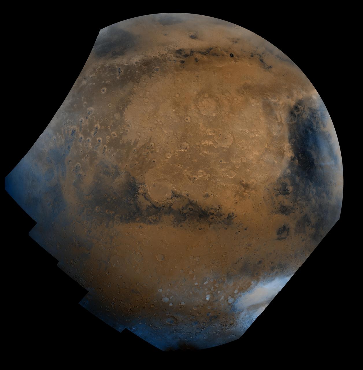
This mosaic is composed of about 100 red- and violet- filter Viking Orbiter images, digitally mosaiced in an orthographic projection at a scale of 1 km/pixel. The images were acquired in 1980 during mid northern summer on Mars (Ls = 89 degrees). The center of the image is near the impact crater Schiaparelli (latitude -3 degrees, longitude 343 degrees). The limits of this mosaic are approximately latitude -60 to 60 degrees and longitude 280 to 30 degrees. The color variations have been enhanced by a factor of two, and the large-scale brightness variations (mostly due to sun-angle variations) have been normalized by large-scale filtering. The large circular area with a bright yellow color (in this rendition) is known as Arabia. The boundary between the ancient, heavily-cratered southern highlands and the younger northern plains occurs far to the north (latitude 40 degrees) on this side of the planet, just north of Arabia. The dark streaks with bright margins emanating from craters in the Oxia Palus region (to the left of Arabia) are caused by erosion and/or deposition by the wind. The dark blue area on the far right, called Syrtis Major Planum, is a low-relief volcanic shield of probable basaltic composition. Bright white areas to the south, including the Hellas impact basin at the lower right, are covered by carbon dioxide frost. http://photojournal.jpl.nasa.gov/catalog/PIA00004
Context image This image shows part of the dune field near Meroe Patera. High resolution imaging by other spacecraft has revealed that the dunes in this region are moving. Winds are blowing the dunes across a rough surface of regional volcanic lava flows. The paterae are calderas on the volcanic complex called Syrtis Major Planum. Dunes are found in both Nili and Meroe Paterae and in the region between the two calderas. The Odyssey spacecraft has spent over 15 years in orbit around Mars, circling the planet more than 69000 times. It holds the record for longest working spacecraft at Mars. THEMIS, the IR/VIS camera system, has collected data for the entire mission and provides images covering all seasons and lighting conditions. Over the years many features of interest have received repeated imaging, building up a suite of images covering the entire feature. From the deepest chasma to the tallest volcano, individual dunes inside craters and dune fields that encircle the north pole, channels carved by water and lava, and a variety of other feature, THEMIS has imaged them all. For the next several months the image of the day will focus on the Tharsis volcanoes, the various chasmata of Valles Marineris, and the major dunes fields. We hope you enjoy these images! Orbit Number: 8536 Latitude: 7.10227 Longitude: 68.0484 Instrument: VIS Captured: 2003-11-17 06:40 https://photojournal.jpl.nasa.gov/catalog/PIA22011
This image shows part of the Nili Patera dune field. High resolution imaging by other spacecraft has revealed that the dunes in this region are moving. Winds are blowing the dunes across a rough surface of regional volcanic lava flows. The paterae are calderas on the volcanic complex called Syrtis Major Planum. Dunes are found in both Nili and Meroe Paterae and in the region between the two calderas. The Odyssey spacecraft has spent over 15 years in orbit around Mars, circling the planet more than 69000 times. It holds the record for longest working spacecraft at Mars. THEMIS, the IR/VIS camera system, has collected data for the entire mission and provides images covering all seasons and lighting conditions. Over the years many features of interest have received repeated imaging, building up a suite of images covering the entire feature. From the deepest chasma to the tallest volcano, individual dunes inside craters and dune fields that encircle the north pole, channels carved by water and lava, and a variety of other feature, THEMIS has imaged them all. For the next several months the image of the day will focus on the Tharsis volcanoes, the various chasmata of Valles Marineris, and the major dunes fields. We hope you enjoy these images! Orbit Number: 33668 Latitude: 8.71491 Longitude: 67.3706 Instrument: VIS Captured: 2009-07-17 14:09 https://photojournal.jpl.nasa.gov/catalog/PIA22001
This image shows part of the dune field near Meroe Patera. High resolution imaging by other spacecraft has revealed that the dunes in this region are moving. Winds are blowing the dunes across a rough surface of regional volcanic lava flows. The paterae are calderas on the volcanic complex called Syrtis Major Planum. Dunes are found in both Nili and Meroe Paterae and in the region between the two calderas. The Odyssey spacecraft has spent over 15 years in orbit around Mars, circling the planet more than 69000 times. It holds the record for longest working spacecraft at Mars. THEMIS, the IR/VIS camera system, has collected data for the entire mission and provides images covering all seasons and lighting conditions. Over the years many features of interest have received repeated imaging, building up a suite of images covering the entire feature. From the deepest chasma to the tallest volcano, individual dunes inside craters and dune fields that encircle the north pole, channels carved by water and lava, and a variety of other feature, THEMIS has imaged them all. For the next several months the image of the day will focus on the Tharsis volcanoes, the various chasmata of Valles Marineris, and the major dunes fields. We hope you enjoy these images! Orbit Number: 28341 Latitude: 6.34784 Longitude: 68.078 Instrument: VIS Captured: 2008-05-04 22:05 https://photojournal.jpl.nasa.gov/catalog/PIA22013
This is a false color image of part of the Nili Patera dune field. High resolution imaging by other spacecraft has revealed that the dunes in this region are moving. Winds are blowing the dunes across a rough surface of regional volcanic lava flows. The paterae are calderas on the volcanic complex called Syrtis Major Planum. Dunes are found in both Nili and Meroe Paterae and in the region between the two calderas. The THEMIS VIS camera contains 5 filters. The data from different filters can be combined in multiple ways to create a false color image. These false color images may reveal subtle variations of the surface not easily identified in a single band image. The Odyssey spacecraft has spent over 15 years in orbit around Mars, circling the planet more than 69000 times. It holds the record for longest working spacecraft at Mars. THEMIS, the IR/VIS camera system, has collected data for the entire mission and provides images covering all seasons and lighting conditions. Over the years many features of interest have received repeated imaging, building up a suite of images covering the entire feature. From the deepest chasma to the tallest volcano, individual dunes inside craters and dune fields that encircle the north pole, channels carved by water and lava, and a variety of other feature, THEMIS has imaged them all. For the next several months the image of the day will focus on the Tharsis volcanoes, the various chasmata of Valles Marineris, and the major dunes fields. We hope you enjoy these images! Orbit Number: 48021 Latitude: 8.95091 Longitude: 67.3366 Instrument: VIS Captured: 2012-10-11 05:22 https://photojournal.jpl.nasa.gov/catalog/PIA22009