Tennessee Clues
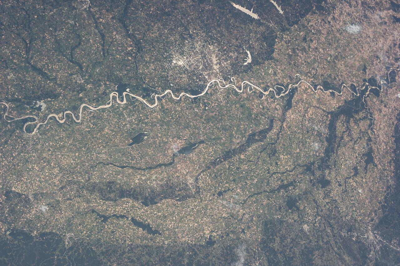
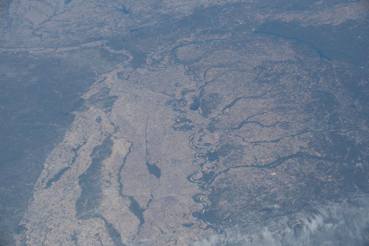
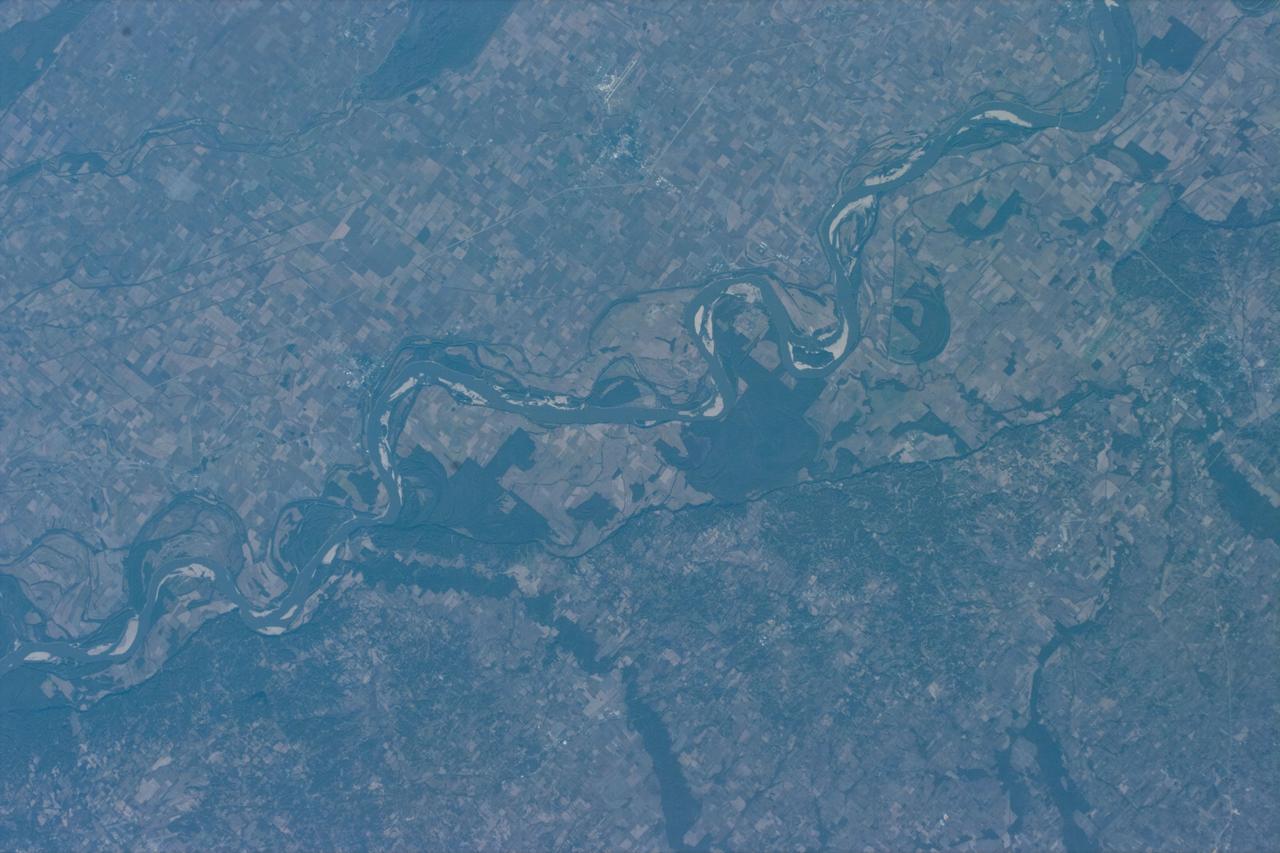
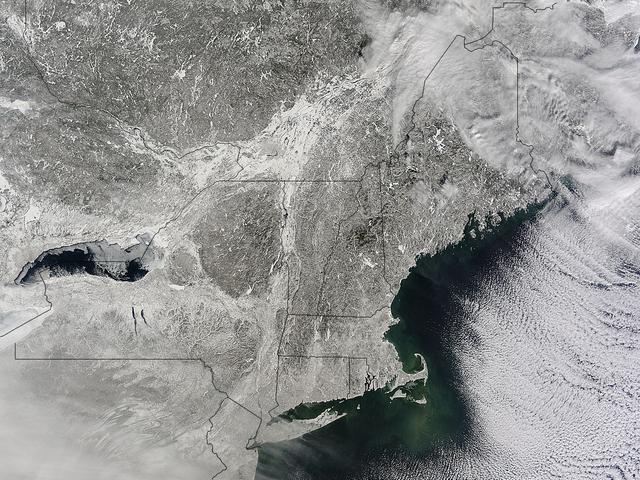
Postcard Above Tennessee Valley

DALE THOMAS PASSES A TACTILE HARDWARE SAMPLE FOR STUDENTS FROM THE TENNESSEE SCHOOL FOR THE BLIND TO PASS AROUND DURING HIS WELCOME

LOUCIOUS HIRES WELCOMES STUDENTS FROM THE TENNESSEE SCHOOL FOR THE BLIND TO MSFC FOR ANNUAL TOUR
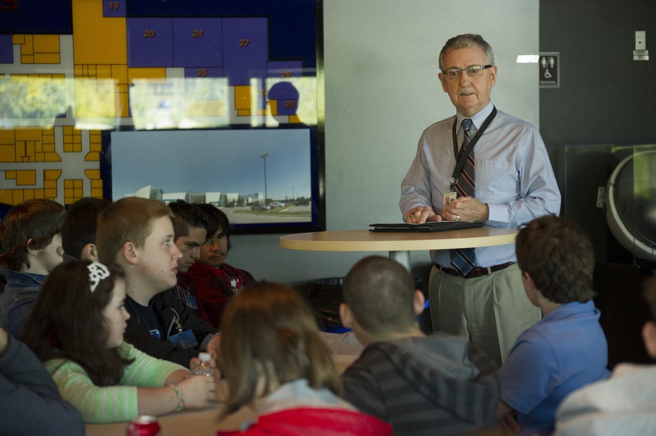
DAVID BROCK GIVES MOTIVATIONAL COMMENTS TO STUDENTS FROM THE TENNESSEE SCHOOL FOR THE BLIND DURING LUNCH BREAK WHILE TOURING MSFC
This image, acquired by NASA Terra spacecraft, shows the mountains of Chattanooga, Tennessee.
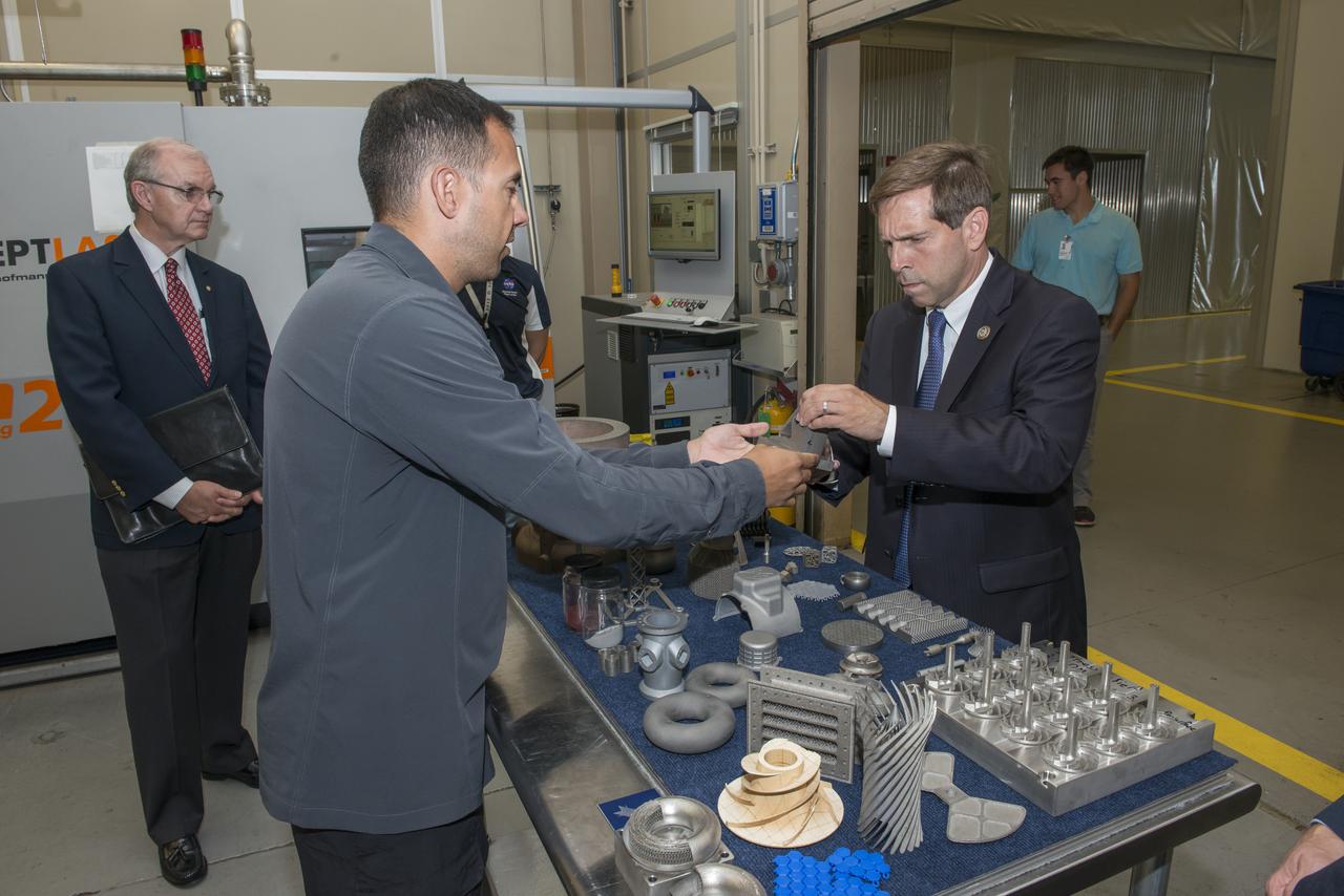
Rep. Chuck Fleischmann (R-Tn) being briefed on additive manufacturing at MSFC during a tour of Marshall facilities. Rep. Fleischmann was accompanied by Darrell Akins, Executive Manager of the Tennessee Valley corridor.
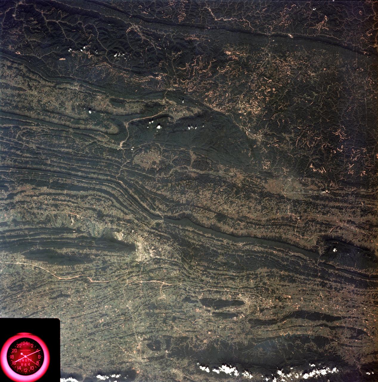
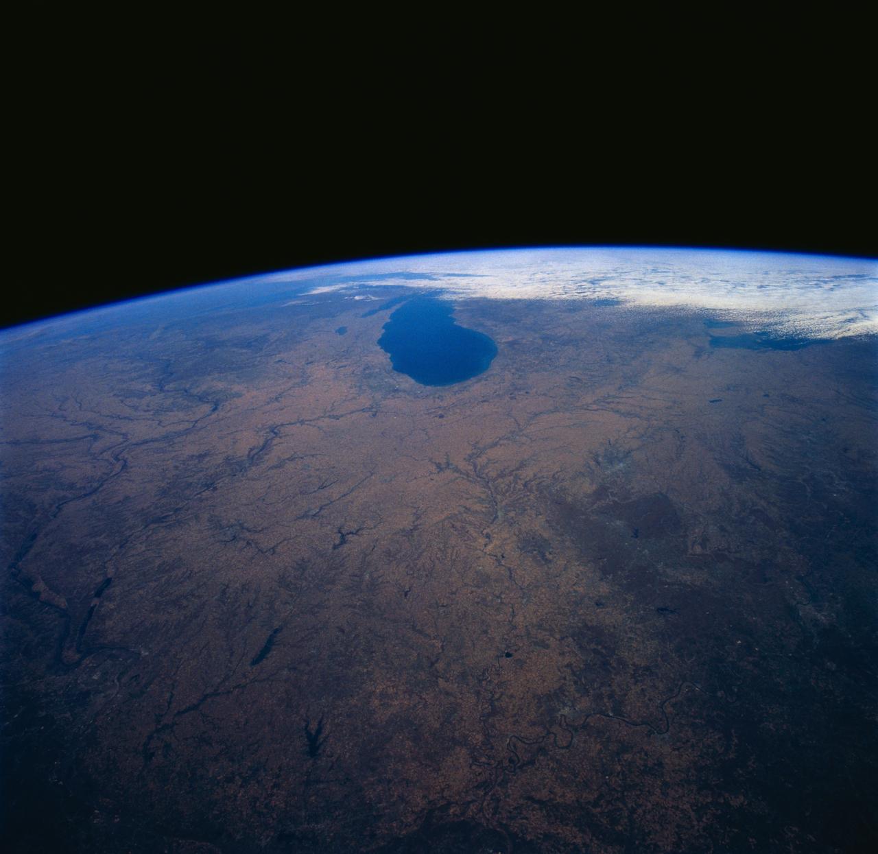
SL3-88-053 (July-September 1973) --- A near vertical view of the Tennessee-Virginia-Kentucky border area is seen in this Skylab 3 Earth Resources Experiments Package S190-B (five-inch Earth terrain camera) photograph taken from the Skylab space station in Earth orbit. The clock is in the most southerly corner of the picture. Interstate 81 under construction extends northeast-southwest across the bottom portion of the photograph. The larger urban area nearest the center of the picture is Kingsport, Tennessee. On the southern side of I-80 and east of Kingsport is the city of Bristol, Tennessee-Virginia. Johnson City, Tennessee is the urban area near the edge of the picture southeast of Kingsport. The Holston River, a tributary of the Tennessee River, meanders through the Kingsport area. The characteristic ridge and valley features in the Cumberland Plateau of Kentucky, Tennessee and Virginia are clearly visible. Forests (dark green) occur on the ridges and clearly outline the folded and faulted rock formations. The valleys (light) were formed in the softer rocks as a result of erosion. Agricultural areas are indicated by the characteristic rectangular patterns. Coal production is an important industry of this area; and it is mined by surface open pit operations. The irregular light areas in the Kentucky-Virginia border area are the strip mines which follow the contour of the land. Reclamation of the strip mine areas is aided through accurate knowledge of the mine and drainage systems. Dr. Ronald Brooks of the Wolf Research and Development Corporation can use this photograph in study of strip mine areas in the east central U.S. Federal agencies participating with NASA on the EREP project are the Departments of Agriculture, Commerce, Interior, the Environmental Protection Agency and the Corps of Engineers. All EREP photography is available to the public through the Department of Interior’s Earth Resources Observations Systems Data Center, Sioux Falls, South Dakota, 57198. Photo credit: NASA
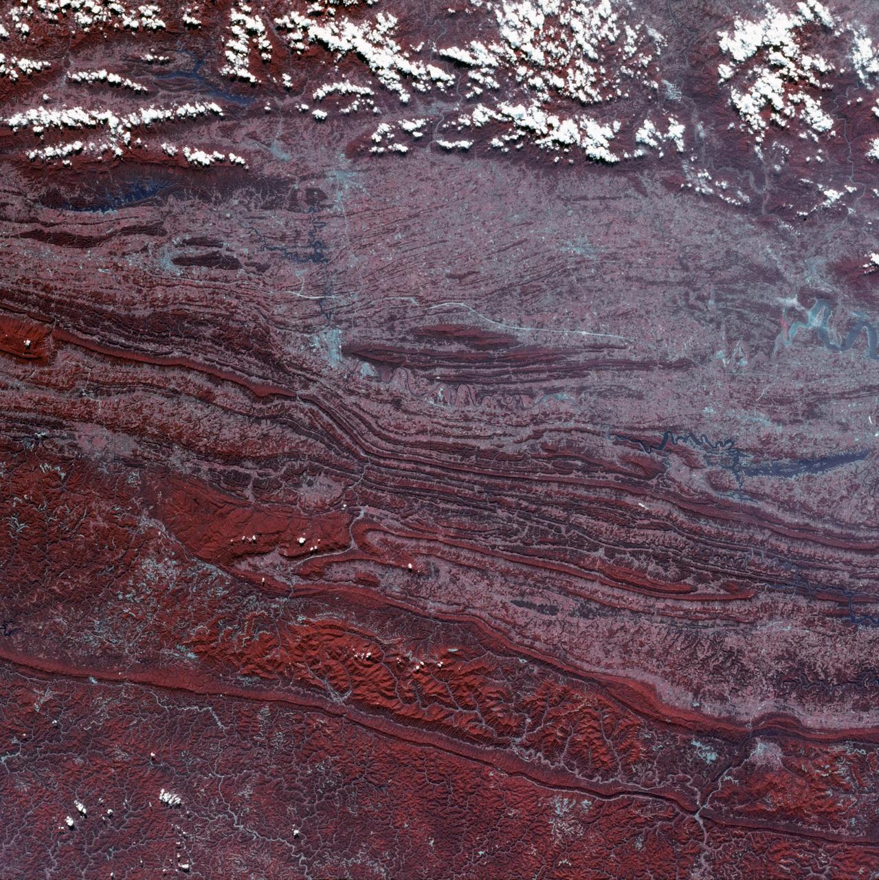
SL3-45-020 (July-September 1973) --- A vertical view of the Virginia-Tennessee-Kentucky border area as photographed from Earth orbit by one of the six lenses of the Itek-furnished S190-A Multispectral Photographic Facility Experiment aboard the Skylab space station. This picture was taken with type 2443 infrared color film. The S190-A experiment is part of the Skylab Earth Resources Experiments Package. The long, narrow ridge is Pine Mountain; and it is crossed by U.S. 25E at Pineville near its southernmost end. Some 25 miles south of Pineville U.S. 25E passes through the famed Cumberland Gap which at 1,600 feet elevation crosses Cumberland Mountain. Kingsport, Tennessee is located east of Cumberland Gap near the center of the picture. Bristol, Tennessee-Virginia is further east. Greenville and Elizabethton, Tennessee can also be seen in this photograph. The clouds across the southeast edge of the picture are over the Blue Ridge Mountains. Federal agencies participating with NASA on the EREP project are the Departments of Agriculture, Commerce, Interior, the Environmental Protection Agency and the Corps of Engineers. All EREP photography is available to the public through the Department of Interior?s Earth Resources Observations Systems Data Center, Sioux Falls, 57198. Photo credit: NASA
STS058-91-074 (18 Oct-1 Nov 1993) --- The largest cityscape in the view is Nashville (top left), part of which is obscured under a band of clouds (the Cumberland River, on which Nashville lies, can not be seen under the cloud band). Close to the main cloud mass on the opposite side of the view, lies a small lake (Normandy Lake in sunglint (right center) 70 miles southeast of Nashville. Between these two features, in the center of the Nashville Basin, lies the city of Murfreesboro. The city appears here as a spider like pattern one third the distance from Nashville towards Normandy Lake. The Tennessee River can be seen bottom right and top right through holes in the cloud.
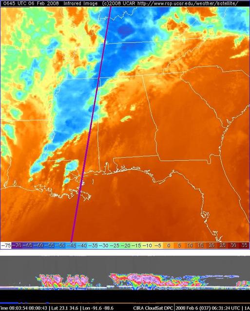
NASA CloudSat made a nighttime overpass approximately 0630 UTC of the thunderstorms responsible for the tornadic outbreak over Kentucky, Tennessee, and Mississippi on Tuesday, February 5, 2008.
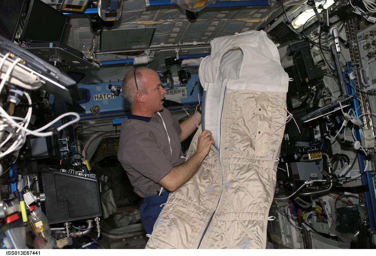
ISS013-E-67441 (17 Aug. 2006) --- Astronaut Jeffrey N. Williams, Expedition 13 NASA space station science officer and flight engineer, holds a sleeping bag while conducting an educational teleconference with the Boys and Girls Clubs of Middle Tennessee in Nashville, via Ku- and S-band in the Destiny laboratory of the International Space Station, with audio and video relayed to the Mission Control Center at Johnson Space Center.
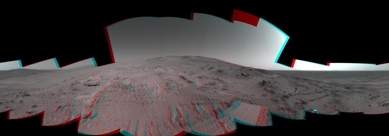
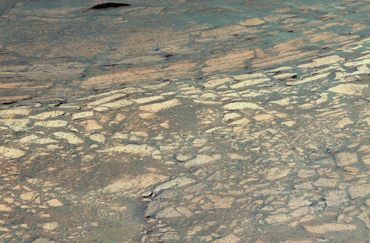
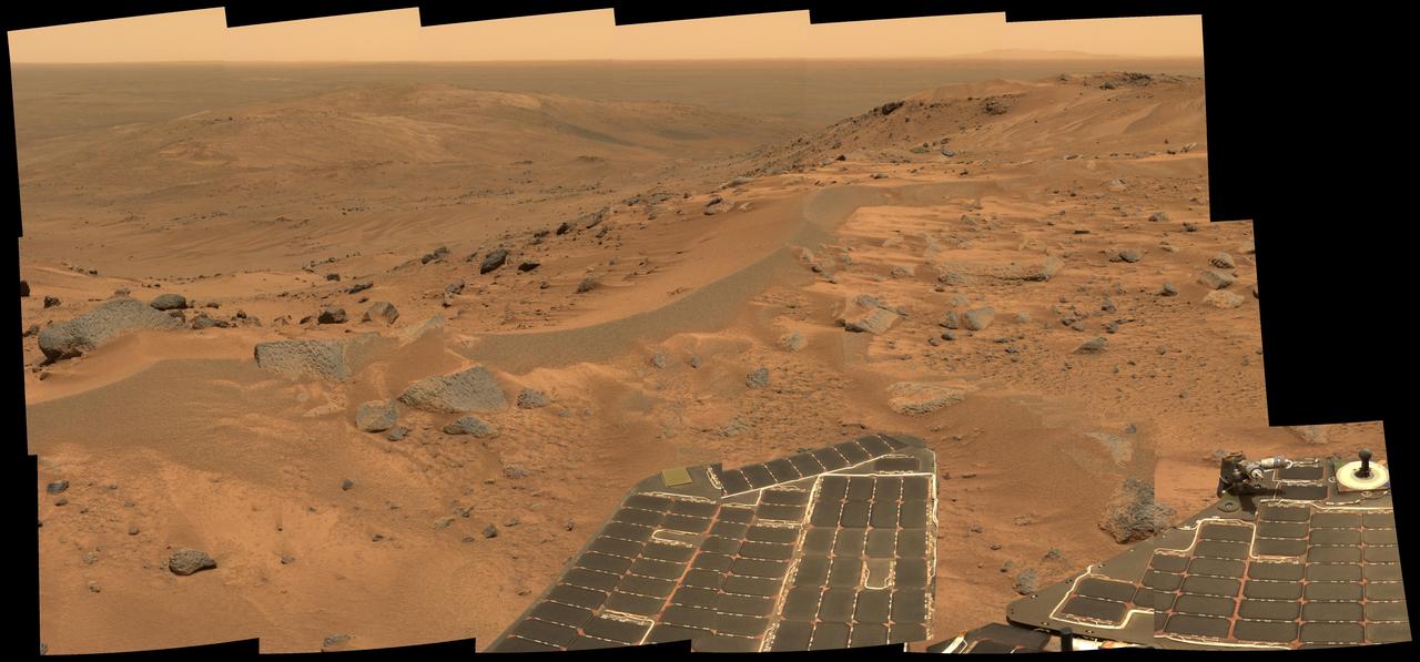
On Feb. 26, 2005, NASA Mars Exploration Rover Spirit had drive 2 meters 7 feet on this sol to get in position on Cumberland Ridge for looking into Tennessee Valley to the east. 3D glasses are necessary to view this image.
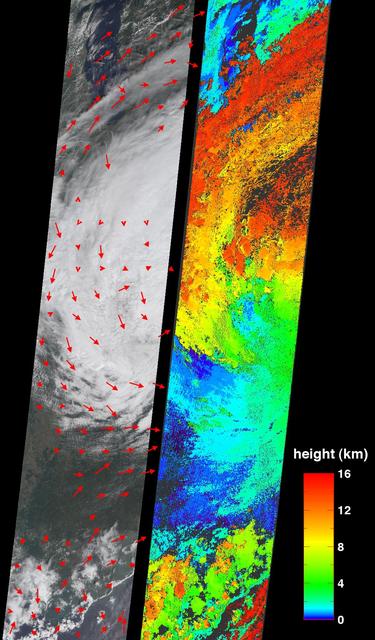
On Tuesday, August 30, 2005, NASA Terra spacecraft retrieved cloud-top heights and cloud-tracked wind velocities for Tropical Storm Katrina, as the center of the storm was situated over the Tennessee Valley.
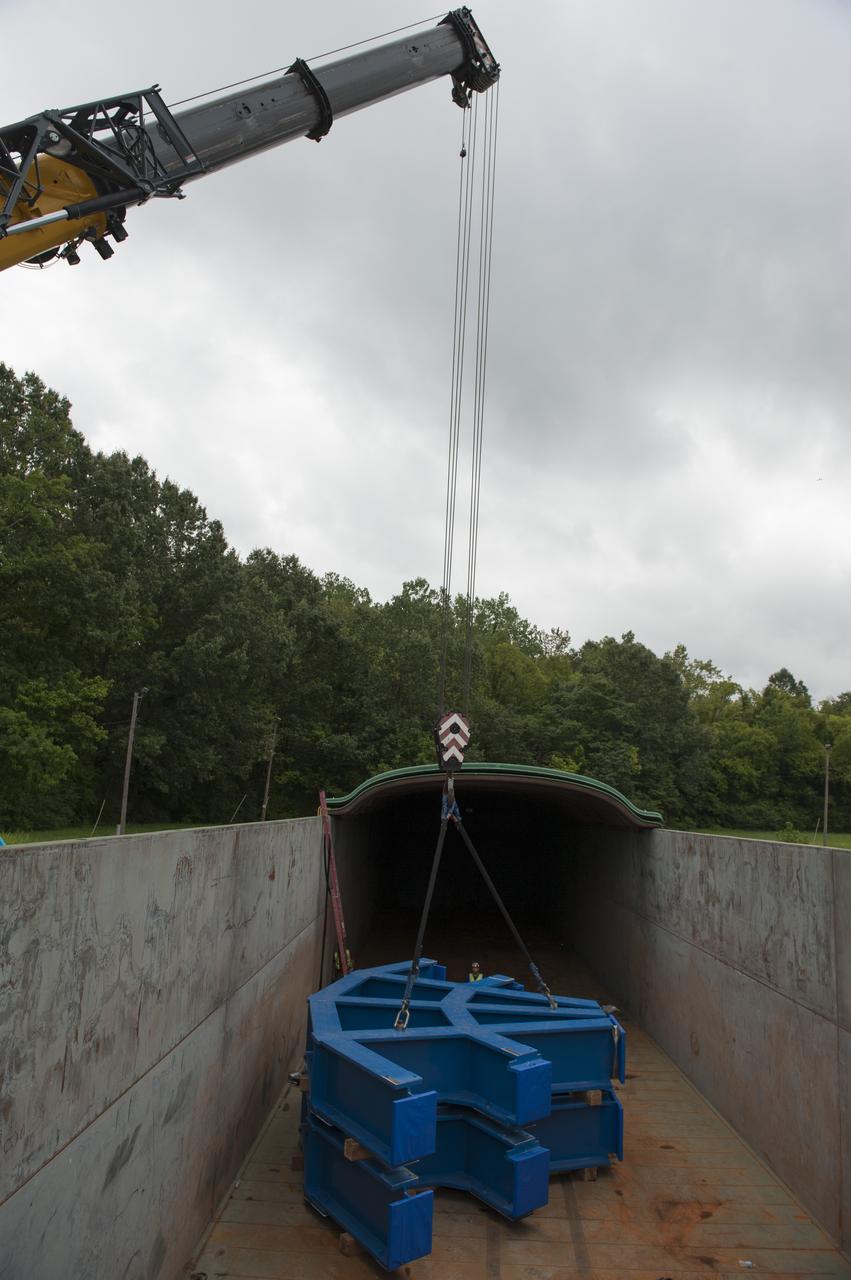
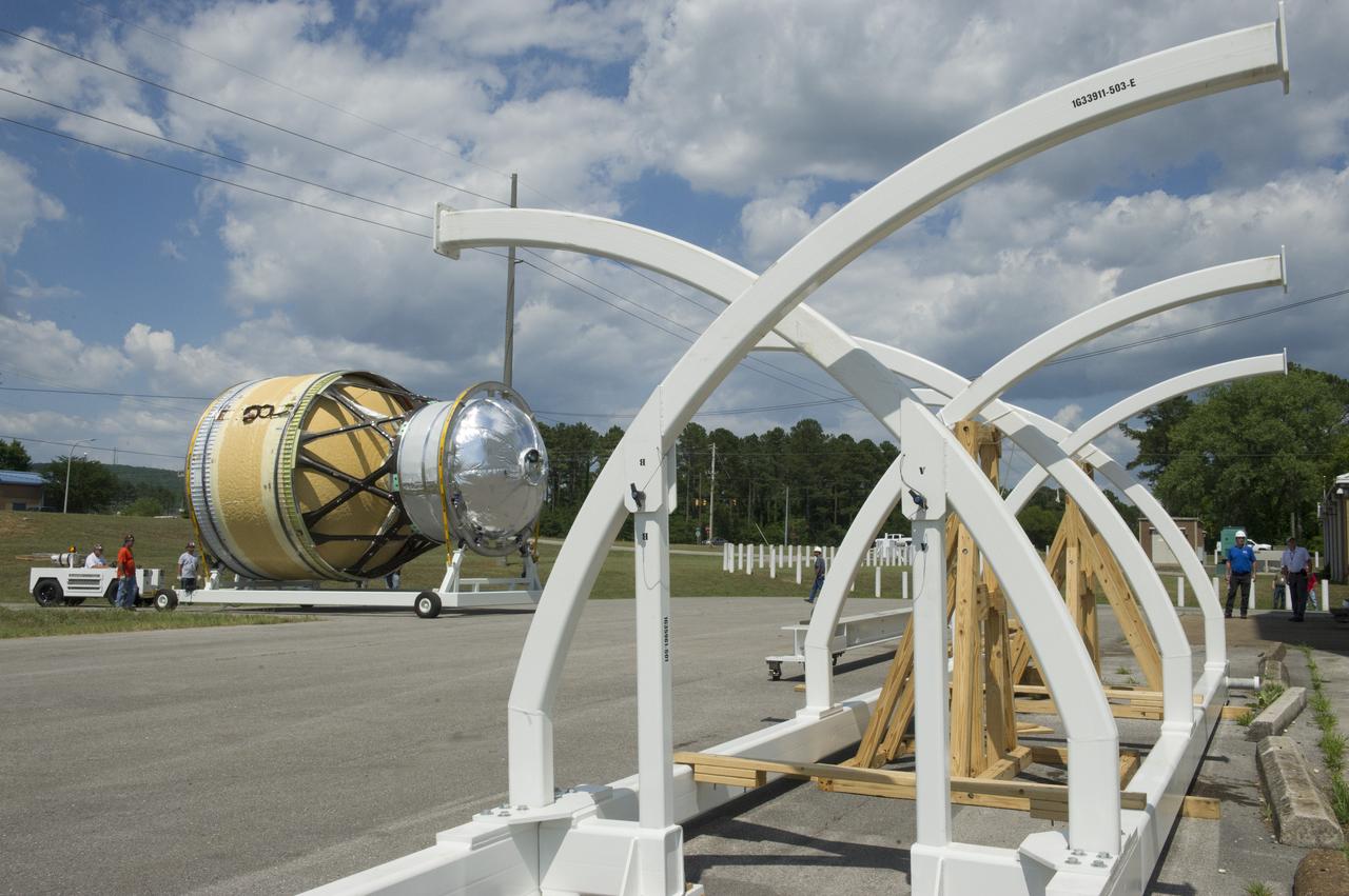
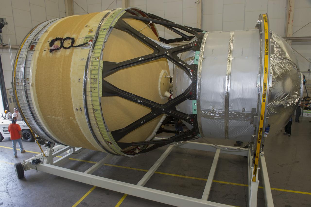
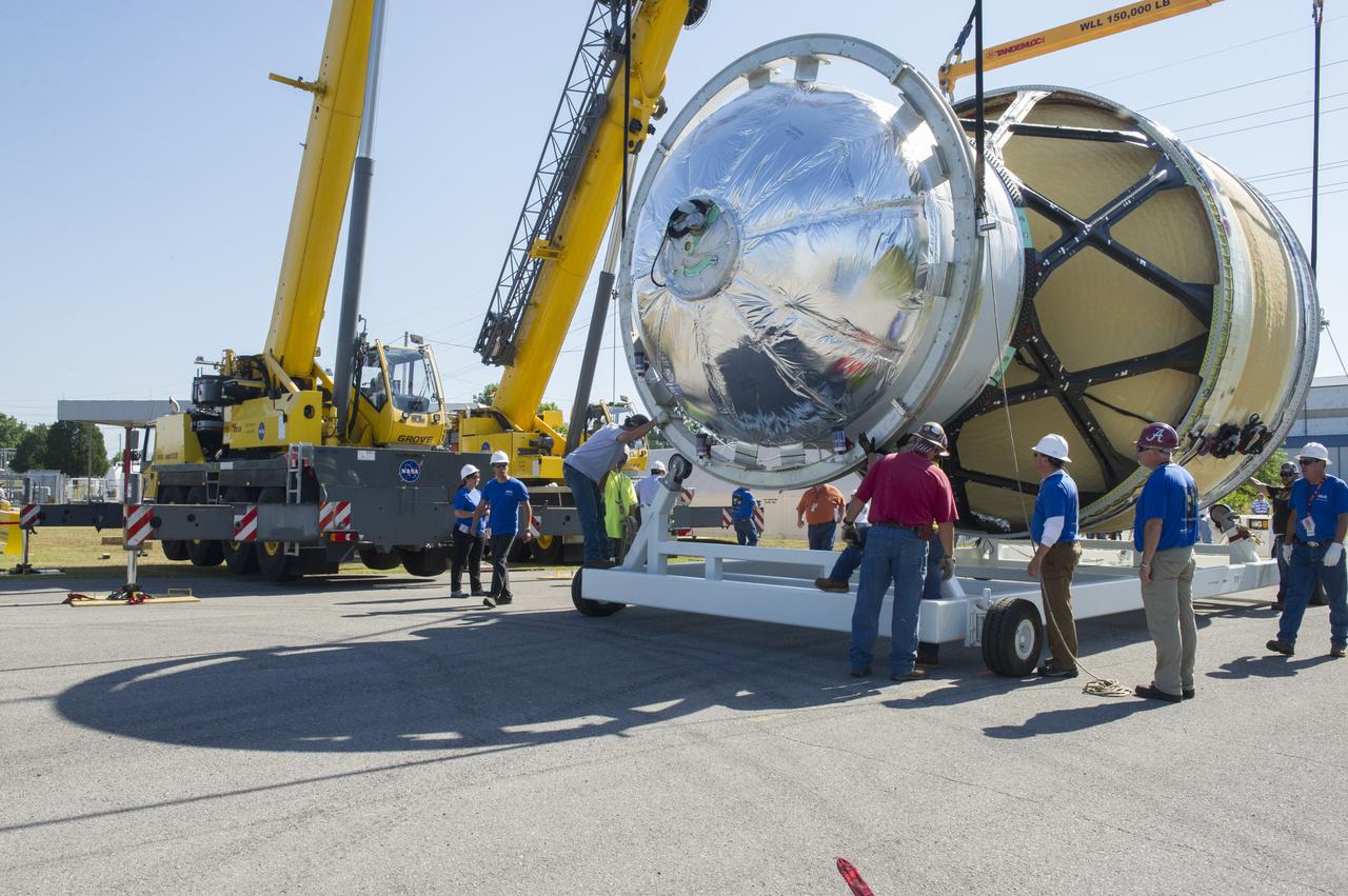
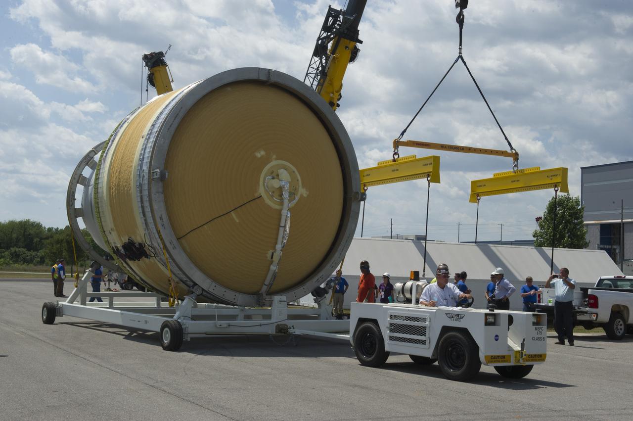
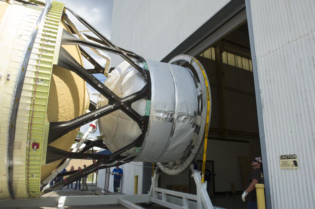
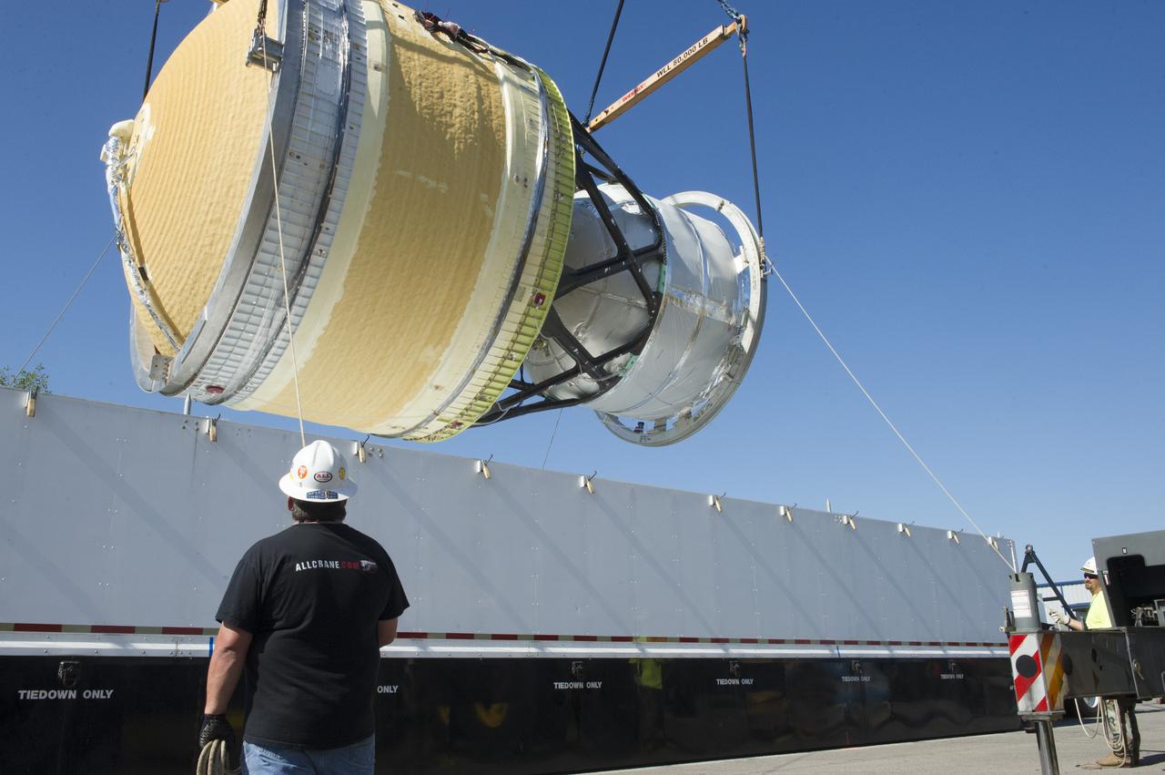
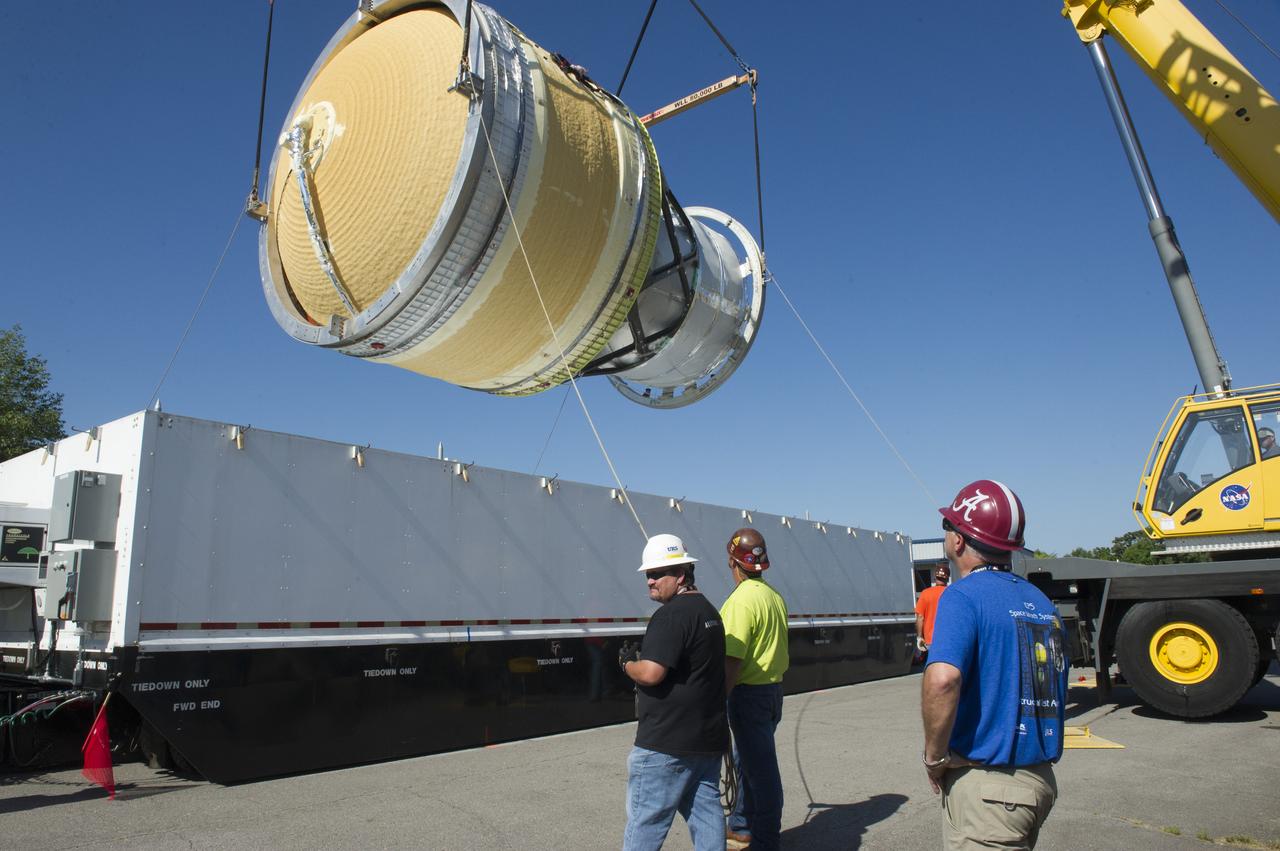
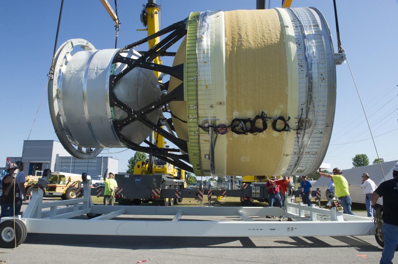
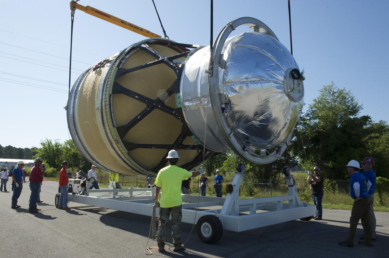
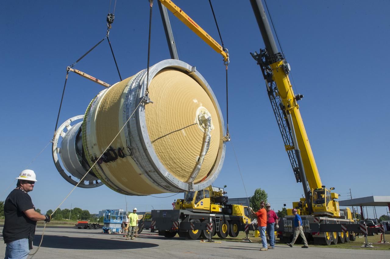
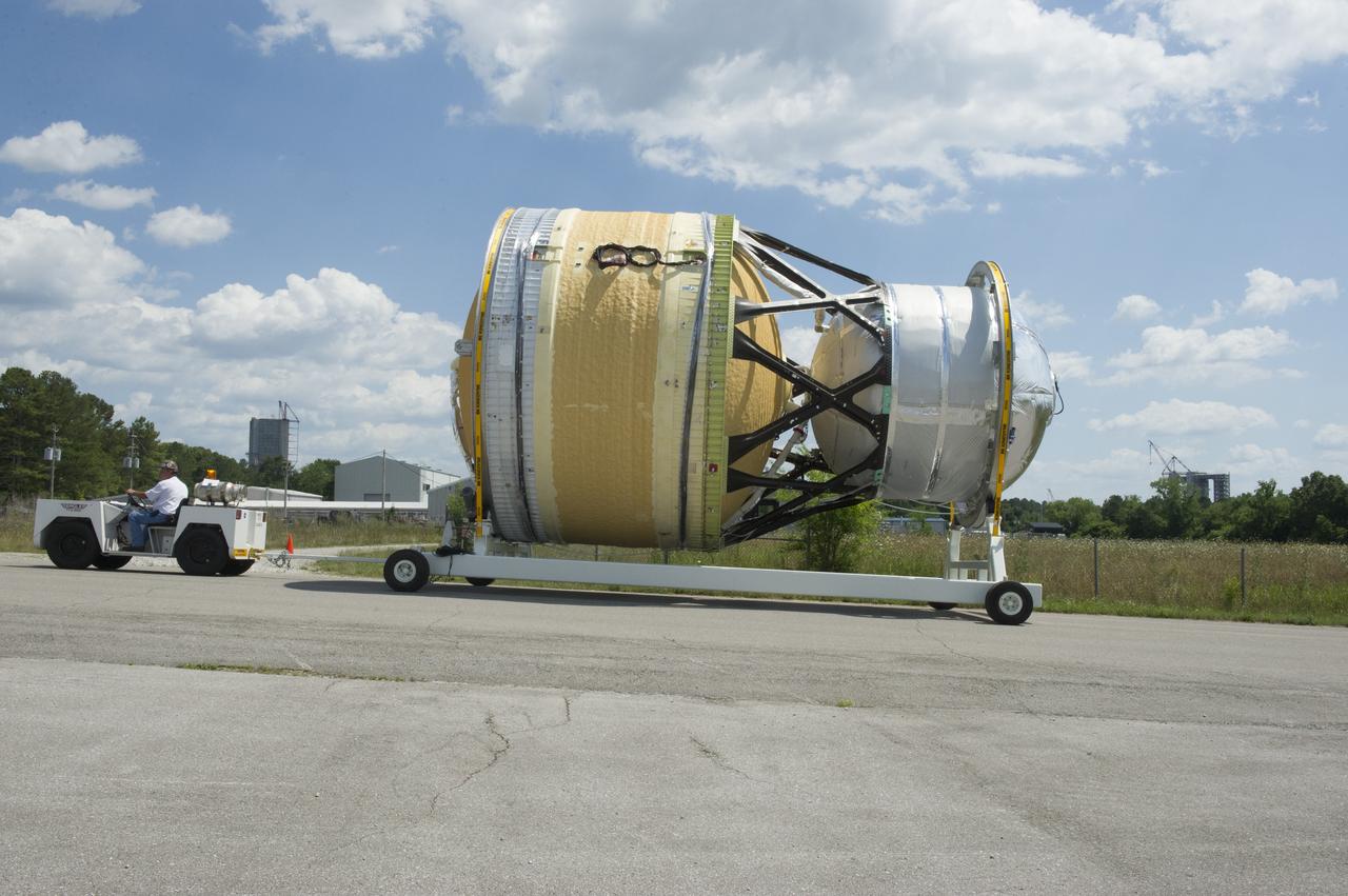
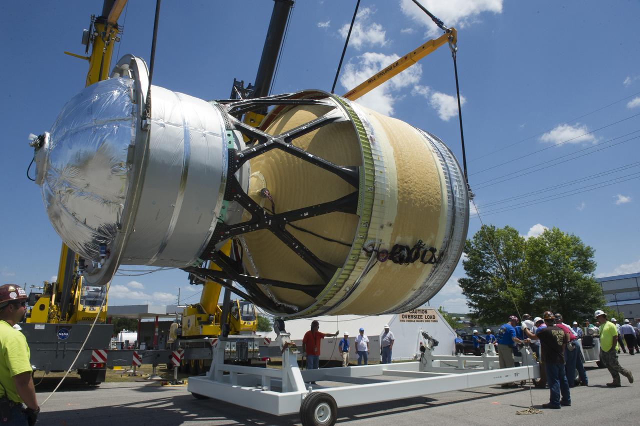
SLS ENGINE SECTION PEDESTALS AND THE ENGINE SECTION SPIDER QUADRANTS ARRIVAL AND UNLOADING AT NASA DOCK ON THE TENNESSEE RIVER.
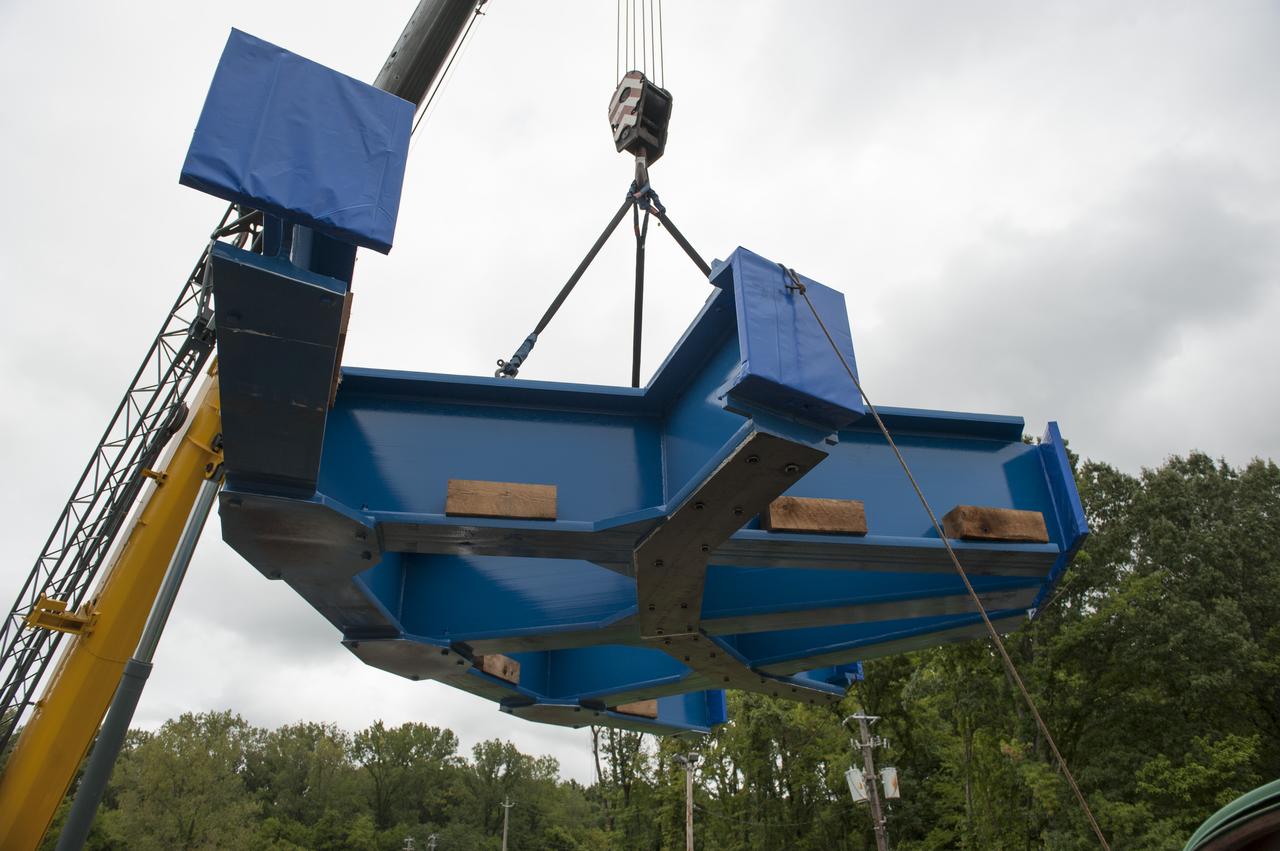
SLS ENGINE SECTION PEDESTALS AND THE ENGINE SECTION SPIDER QUADRANTS ARRIVAL AND UNLOADING AT NASA DOCK ON THE TENNESSEE RIVER.
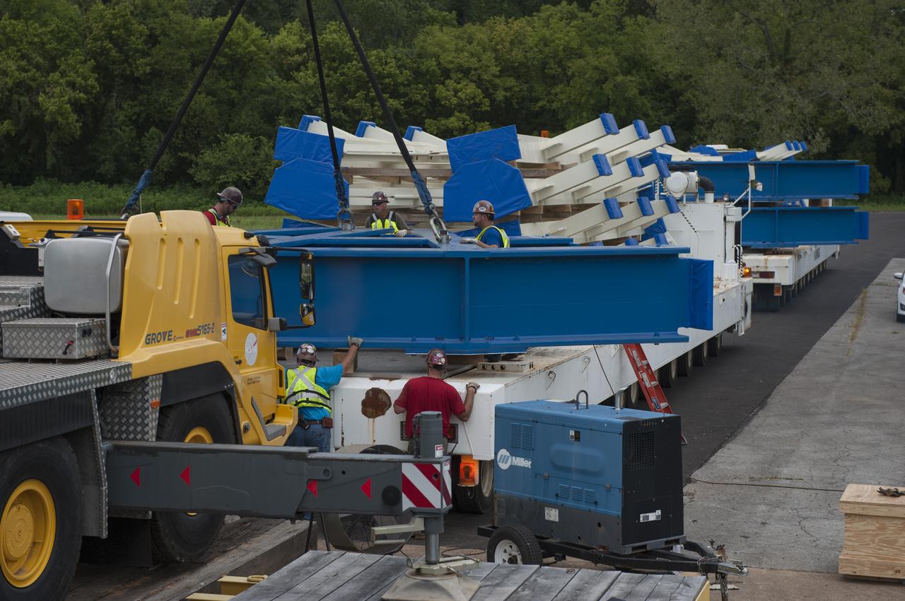
SLS ENGINE SECTION PEDESTALS AND THE ENGINE SECTION SPIDER QUADRANTS ARRIVAL AND UNLOADING AT NASA DOCK ON THE TENNESSEE RIVER.
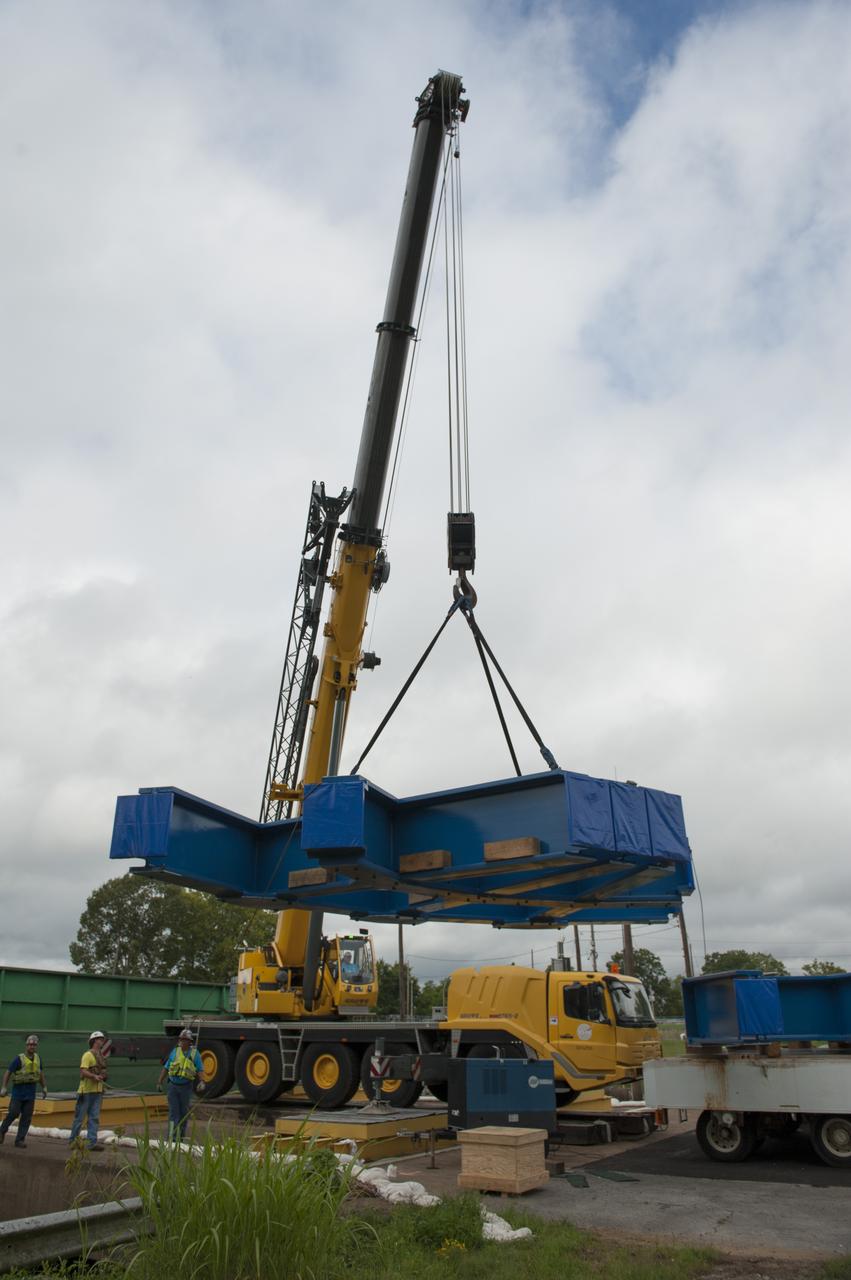
SLS ENGINE SECTION PEDESTALS AND THE ENGINE SECTION SPIDER QUADRANTS ARRIVAL AND UNLOADING AT NASA DOCK ON THE TENNESSEE RIVER.
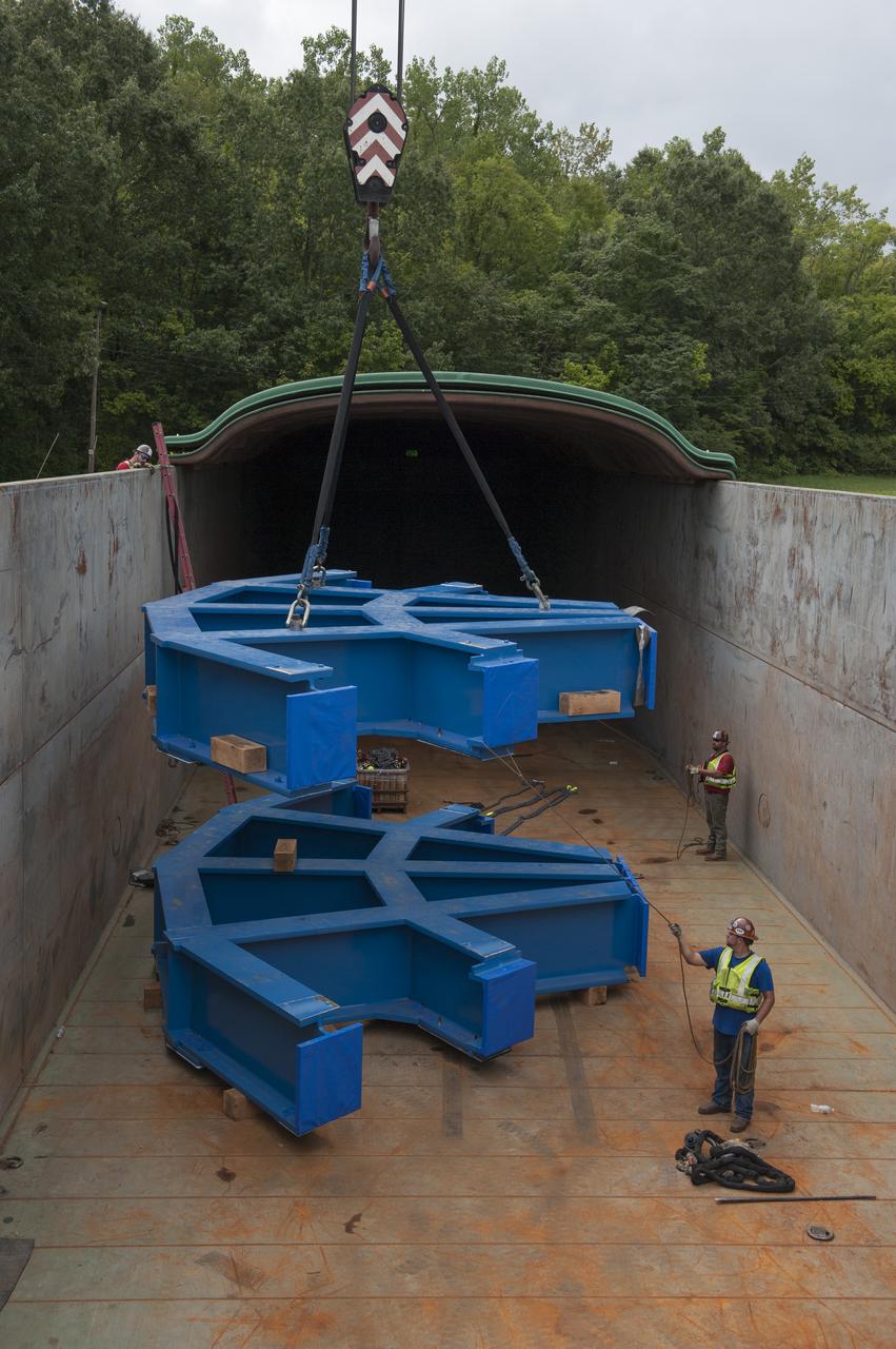
SLS ENGINE SECTION PEDESTALS AND THE ENGINE SECTION SPIDER QUADRANTS ARRIVAL AND UNLOADING AT NASA DOCK ON THE TENNESSEE RIVER.
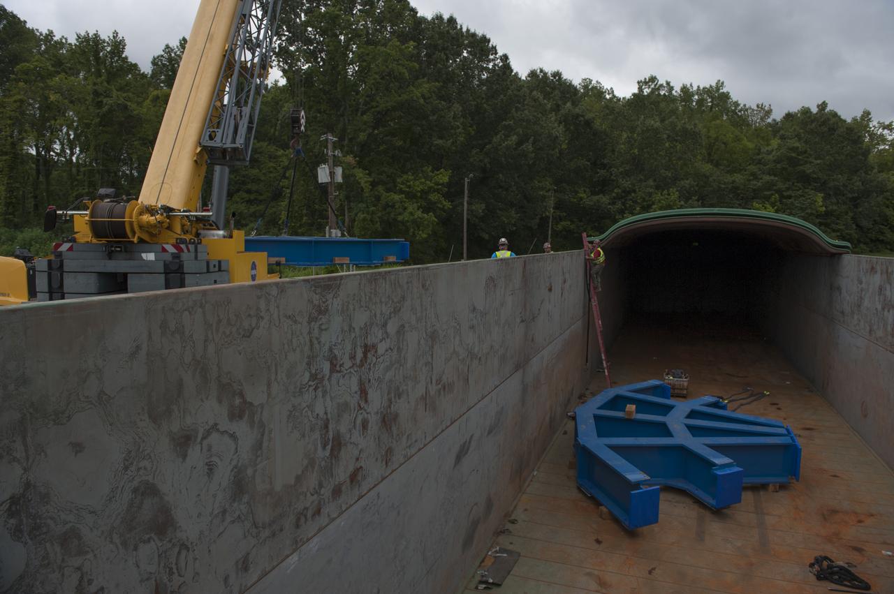
SLS ENGINE SECTION PEDESTALS AND THE ENGINE SECTION SPIDER QUADRANTS ARRIVAL AND UNLOADING AT NASA DOCK ON THE TENNESSEE RIVER.
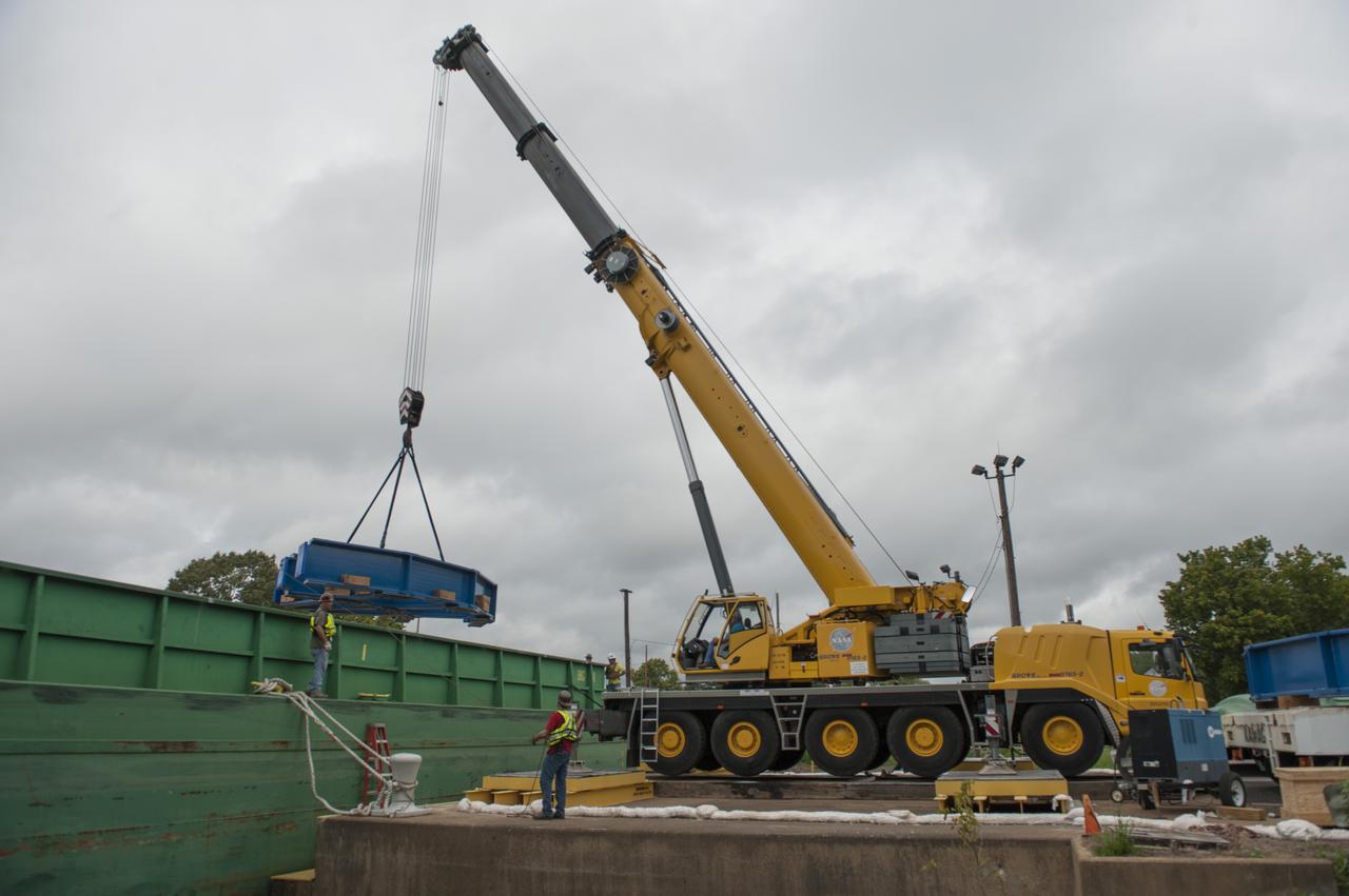
SLS ENGINE SECTION PEDESTALS AND THE ENGINE SECTION SPIDER QUADRANTS ARRIVAL AND UNLOADING AT NASA DOCK ON THE TENNESSEE RIVER.
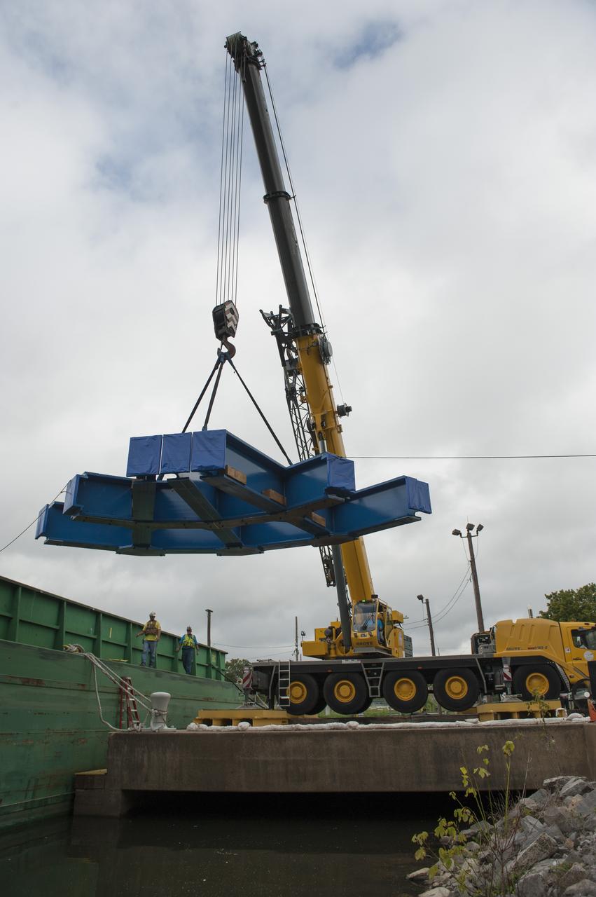
SLS ENGINE SECTION PEDESTALS AND THE ENGINE SECTION SPIDER QUADRANTS ARRIVAL AND UNLOADING AT NASA DOCK ON THE TENNESSEE RIVER.
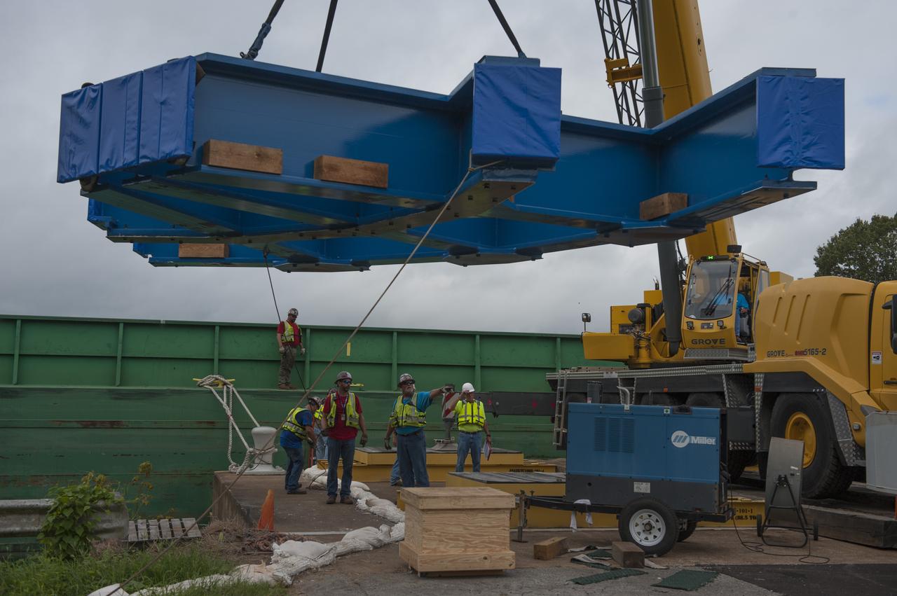
SLS ENGINE SECTION PEDESTALS AND THE ENGINE SECTION SPIDER QUADRANTS ARRIVAL AND UNLOADING AT NASA DOCK ON THE TENNESSEE RIVER.

SLS ENGINE SECTION PEDESTALS AND THE ENGINE SECTION SPIDER QUADRANTS ARRIVAL AND UNLOADING AT NASA DOCK ON THE TENNESSEE RIVER.
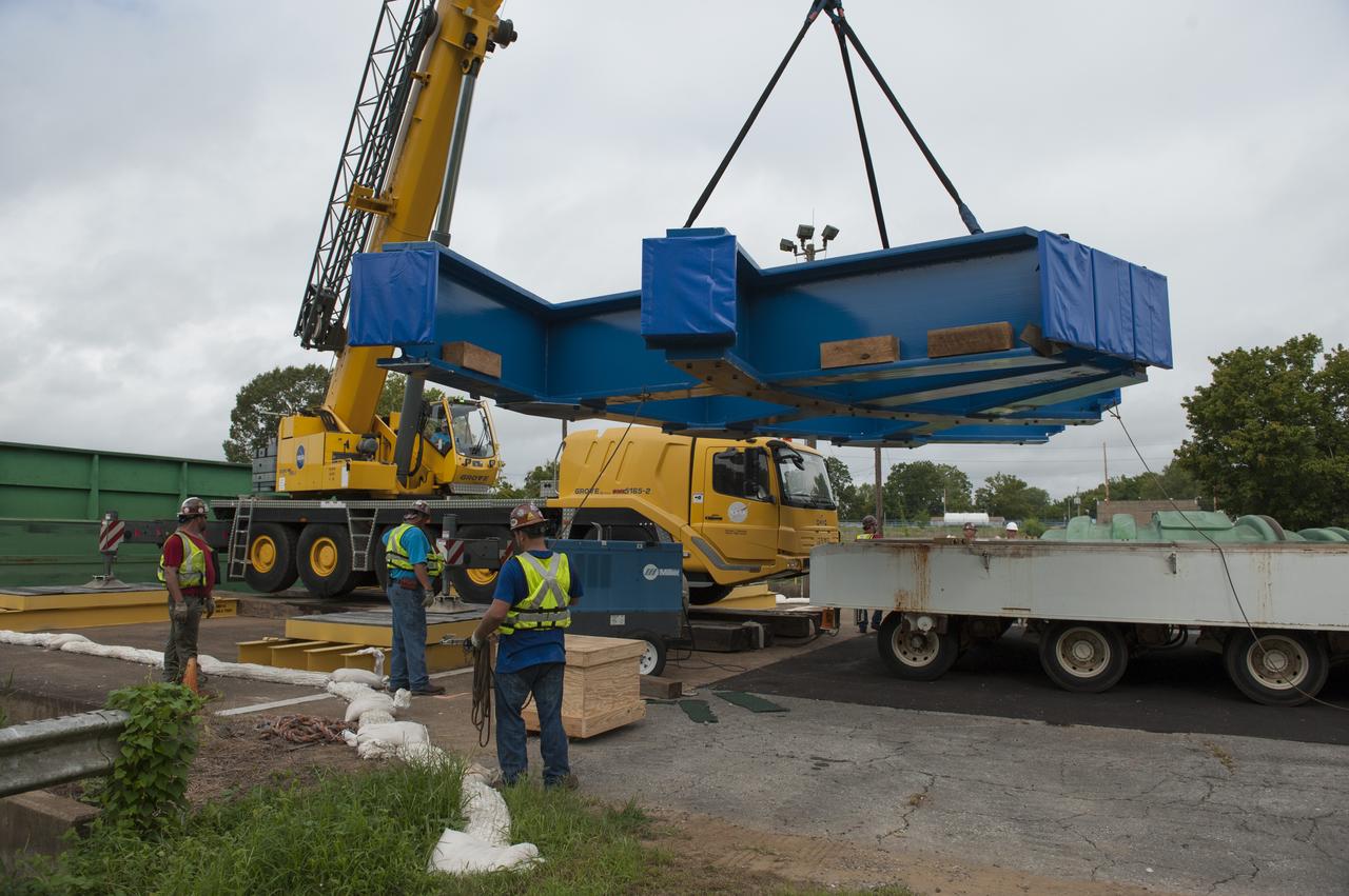
SLS ENGINE SECTION PEDESTALS AND THE ENGINE SECTION SPIDER QUADRANTS ARRIVAL AND UNLOADING AT NASA DOCK ON THE TENNESSEE RIVER.

SLS ENGINE SECTION PEDESTALS AND THE ENGINE SECTION SPIDER QUADRANTS ARRIVAL AND UNLOADING AT NASA DOCK ON THE TENNESSEE RIVER.
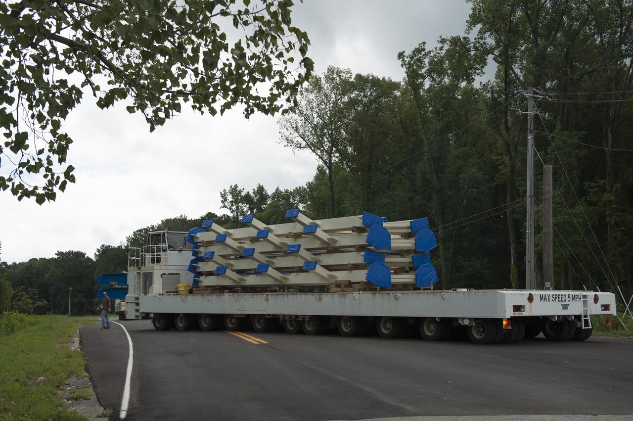
SLS ENGINE SECTION PEDESTALS AND THE ENGINE SECTION SPIDER QUADRANTS ARRIVAL AND UNLOADING AT NASA DOCK ON THE TENNESSEE RIVER.
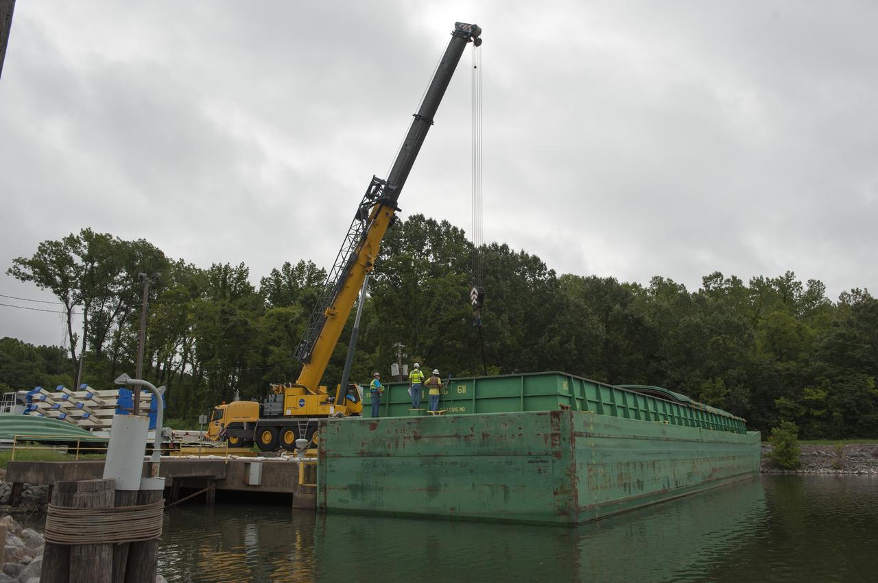
SLS ENGINE SECTION PEDESTALS AND THE ENGINE SECTION SPIDER QUADRANTS ARRIVAL AND UNLOADING AT NASA DOCK ON THE TENNESSEE RIVER.

SLS ENGINE SECTION PEDESTALS AND THE ENGINE SECTION SPIDER QUADRANTS ARRIVAL AND UNLOADING AT NASA DOCK ON THE TENNESSEE RIVER.
Earth observation taken during a day pass by the Expedition 37 crew. Per Twitter message: The Mississippi River through Missouri, Tennessee, Arkansas, Mississippi.
iss061e026278 (Nov. 1, 2019) --- The Mississippi River separates the states of Mississippi and Arkansas and splits into the Arkansas River. The International Space Station was orbiting 255 miles in altitude and 164 miles west of Memphis, Tennessee, when this photograph was taken.
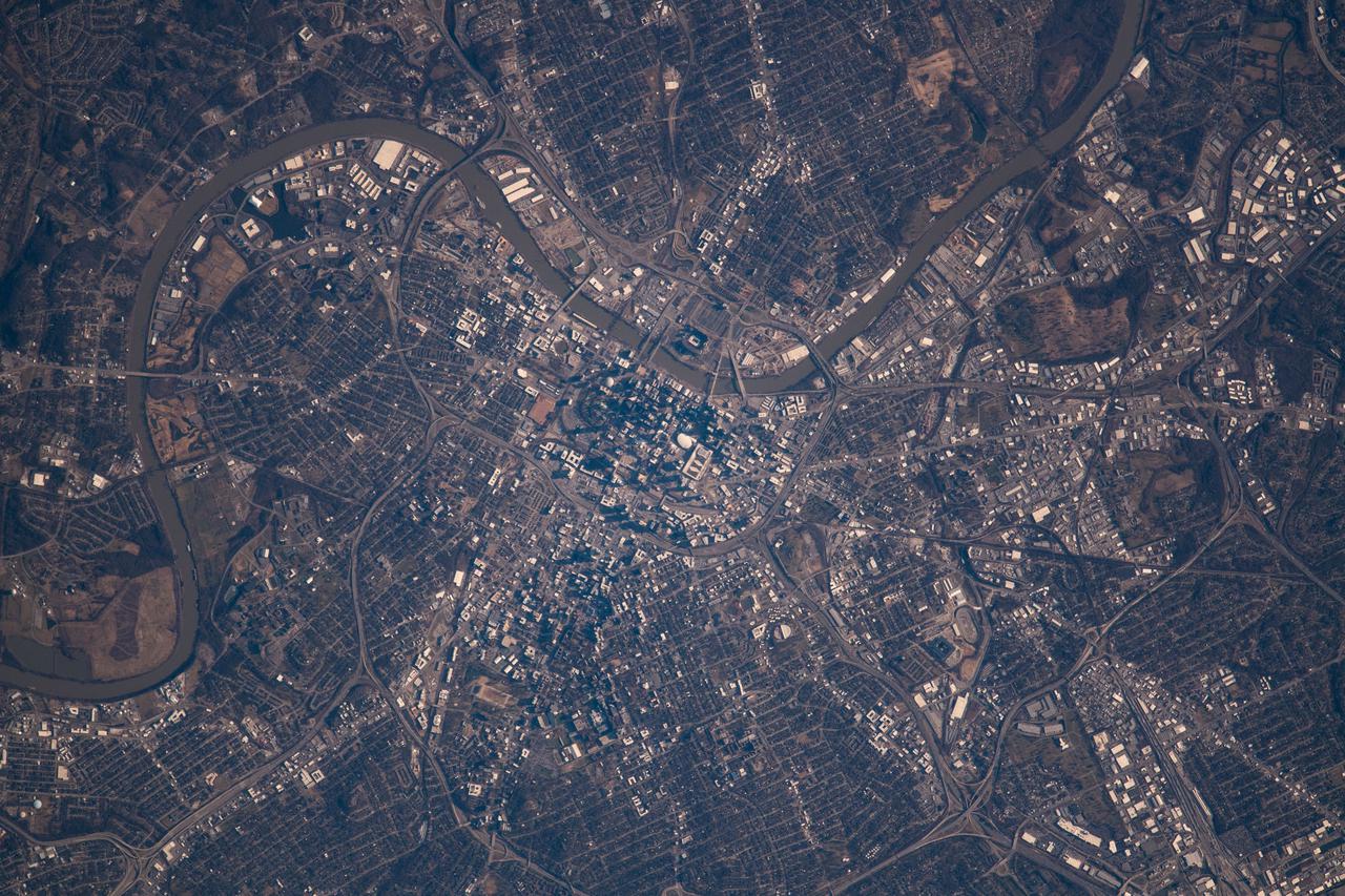
iss066e156616 (March 3, 2022) --- Nashville, Tennessee, split by the Cumberland River, is pictured in this overhead view from the International Space Station as it orbited 261 miles above the Volunteer State.
iss070e008440 (Oct. 22, 2023) --- The Mississippi River Valley and portions of the states of Arkansas, Missouri, Tennessee, Kentucky, and Illinois are pictured from the International Space Station as it orbited 261 miles above
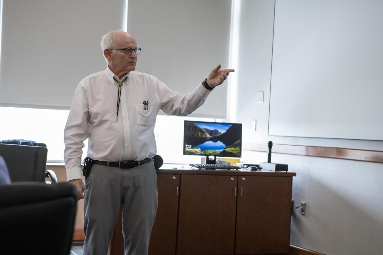
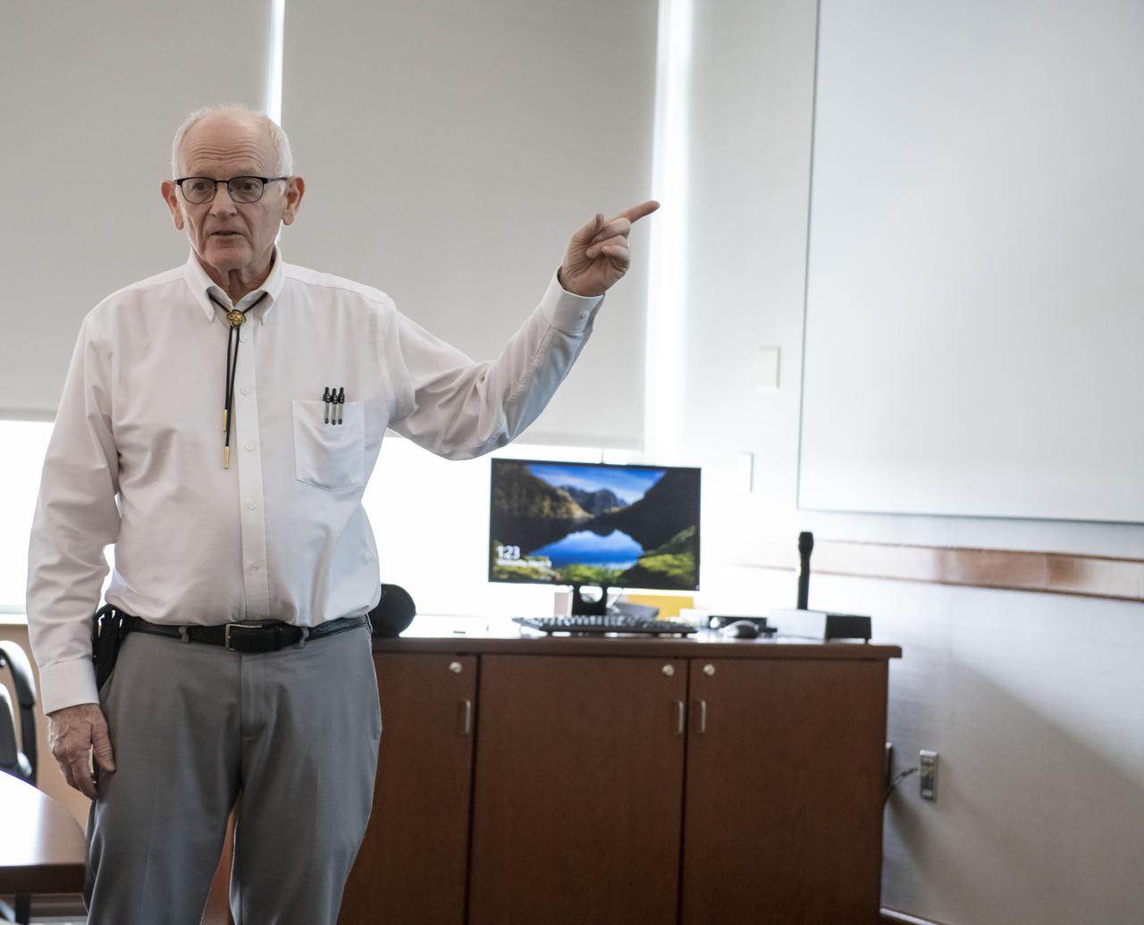
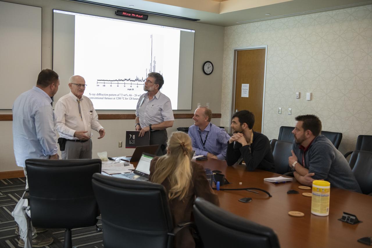
Dr. Thomas T. Meek of The Crown College in Powell, Tennessee addressed the March, 2020 Tech Talk forum on the topic of Microwave Processing of Ceramics as it Pertains to the Proposed Lunar Base.
Dr. Thomas T. Meek of The Crown College in Powell, Tennessee addressed the March, 2020 Tech Talk forum on the topic of Microwave Processing of Ceramics as it Pertains to the Proposed Lunar Base.
iss060e055395 (Sept. 6, 2019) --- Downtown Memphis on the Mississippi River, which separates the states of Tennessee and Arkansas, is pictured from the International Space Station as it orbited 261 miles above the United States.
Dr. Thomas T. Meek of The Crown College in Powell, Tennessee addressed the March, 2020 Tech Talk forum on the topic of Microwave Processing of Ceramics as it Pertains to the Proposed Lunar Base.

Dr. Thomas T. Meek of The Crown College in Powell, Tennessee addressed the March, 2020 Tech Talk forum on the topic of Microwave Processing of Ceramics as it Pertains to the Proposed Lunar Base.
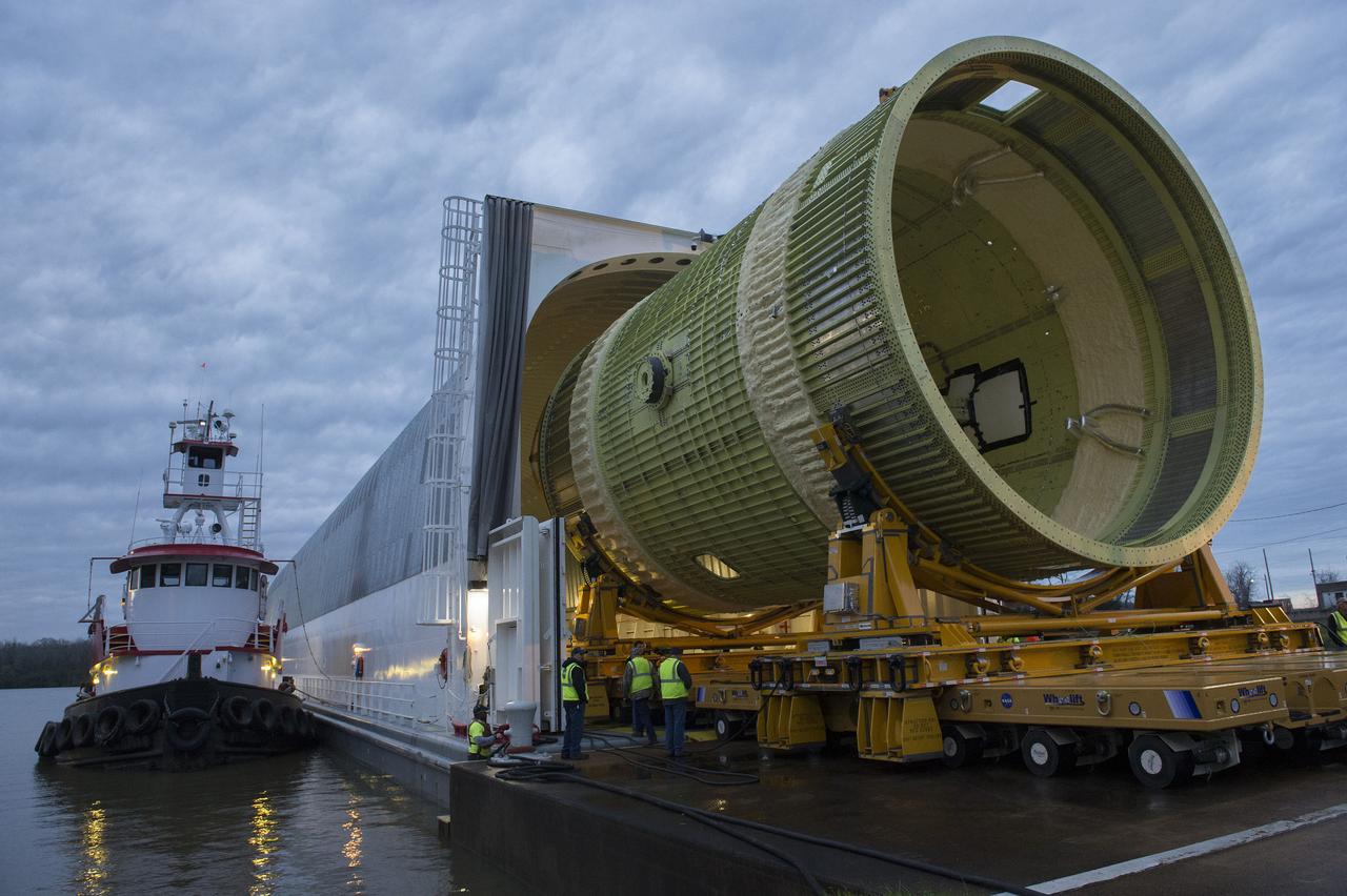
TWO CRANES LIFT THE APPROXIMATELY 8,000-POUND INTERIM CRYOGENIC PROPULSION STAGE TEST ARTICLE OUT OF ITS CRATE AT MARSHALL. THE TEST ARTICLE ARRIVED AT MARSHALL SPACE FLIGHT CENTER VIA BARGE ON THE TENNESSEE RIVER AND WAS TRANSPORTED TO BUILDING 4649 WHERE TESTING WILL BEGIN.
THIS IS A MODEL TEST OF THE 1ST STAGE RE-ENTRY. HEAT TESTING OF A 3% MODEL TO SUPPORT THE ARES/CLV FIRST STAGE RE-ENTRY. THIS OCCURRED AT ARNOLD AIR FORCE BASE, TENNESSEE IN SUPPORT OF THE CONSTELLATION/ARES PROJECT. THIS IMAGE IS EXTRACTED FROM A HIGH DEFINITION VIDEO FILE AND IS THE HIGHEST RESOLUTION AVAILABLE.
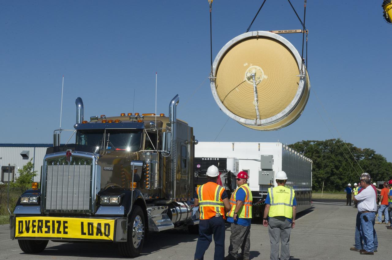
TWO CRANES LIFT THE APPROXIMATELY 8,000-POUND INTERIM CRYOGENIC PROPULSION STAGE TEST ARTICLE OUT OF ITS CRATE AT MARSHALL. THE TEST ARTICLE ARRIVED AT MARSHALL SPACE FLIGHT CENTER VIA BARGE ON THE TENNESSEE RIVER AND WAS TRANSPORTED TO BUILDING 4649 WHERE TESTING WILL BEGIN.
TWO CRANES LIFT THE APPROXIMATELY 8,000-POUND INTERIM CRYOGENIC PROPULSION STAGE TEST ARTICLE OUT OF ITS CRATE AT MARSHALL. THE TEST ARTICLE ARRIVED AT MARSHALL SPACE FLIGHT CENTER VIA BARGE ON THE TENNESSEE RIVER AND WAS TRANSPORTED TO BUILDING 4649 WHERE TESTING WILL BEGIN.
TWO CRANES LIFT THE APPROXIMATELY 8,000-POUND INTERIM CRYOGENIC PROPULSION STAGE TEST ARTICLE OUT OF ITS CRATE AT MARSHALL. THE TEST ARTICLE ARRIVED AT MARSHALL SPACE FLIGHT CENTER VIA BARGE ON THE TENNESSEE RIVER AND WAS TRANSPORTED TO BUILDING 4649 WHERE TESTING WILL BEGIN.
TWO CRANES LIFT THE APPROXIMATELY 8,000-POUND INTERIM CRYOGENIC PROPULSION STAGE TEST ARTICLE OUT OF ITS CRATE AT MARSHALL. THE TEST ARTICLE ARRIVED AT MARSHALL SPACE FLIGHT CENTER VIA BARGE ON THE TENNESSEE RIVER AND WAS TRANSPORTED TO BUILDING 4649 WHERE TESTING WILL BEGIN.
TWO CRANES LIFT THE APPROXIMATELY 8,000-POUND INTERIM CRYOGENIC PROPULSION STAGE TEST ARTICLE OUT OF ITS CRATE AT MARSHALL. THE TEST ARTICLE ARRIVED AT MARSHALL SPACE FLIGHT CENTER VIA BARGE ON THE TENNESSEE RIVER AND WAS TRANSPORTED TO BUILDING 4649 WHERE TESTING WILL BEGIN.
iss070e031247 (Nov. 25, 2023) --- Nashville, Tennessee, split by the Cumberland River, is pictured from the International Space Station as it orbited 261 miles above the Volunteer State. At top left, is the Nashville International Airport near the Percy Priest Lake.
TWO CRANES LIFT THE APPROXIMATELY 8,000-POUND INTERIM CRYOGENIC PROPULSION STAGE TEST ARTICLE OUT OF ITS CRATE AT MARSHALL. THE TEST ARTICLE ARRIVED AT MARSHALL SPACE FLIGHT CENTER VIA BARGE ON THE TENNESSEE RIVER AND WAS TRANSPORTED TO BUILDING 4649 WHERE TESTING WILL BEGIN.
STS073-E-5091 (30 Oct. 1995) --- The Mississippi River meanders through its floodplain between the northeastern corner of Arkansas and the northwestern corner of Tennessee. Blytheville, Arkansas and the former Eaker Air Force Base can be seen near the top of the image. The frame was exposed with the Electronic Still Camera (ESC).
TWO CRANES LIFT THE APPROXIMATELY 8,000-POUND INTERIM CRYOGENIC PROPULSION STAGE TEST ARTICLE OUT OF ITS CRATE AT MARSHALL. THE TEST ARTICLE ARRIVED AT MARSHALL SPACE FLIGHT CENTER VIA BARGE ON THE TENNESSEE RIVER AND WAS TRANSPORTED TO BUILDING 4649 WHERE TESTING WILL BEGIN.
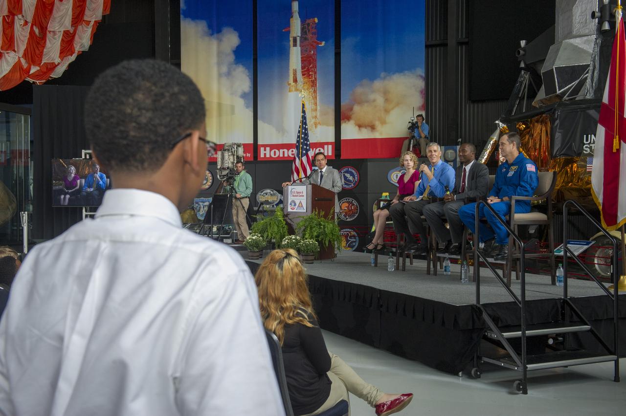
U.S. SECRETARY OF EDUCATION ARNE DUNCAN, ALONG WITH NASA ASTRONAUT RICKY ARNOLD AND OTHER GUESTS, ANSWER STUDENTS’ QUESTIONS DURING AN EDUCATIONAL TOWN HALL MEETING AT THE SPACE & ROCKET CENTER. THE SECRETARY’S VISIT WAS PART OF HIS TOUR TO PROMOTE EDUCATION, WITH STOPS IN GEORGIA, ALABAMA AND TENNESSEE
TWO CRANES LIFT THE APPROXIMATELY 8,000-POUND INTERIM CRYOGENIC PROPULSION STAGE TEST ARTICLE OUT OF ITS CRATE AT MARSHALL. THE TEST ARTICLE ARRIVED AT MARSHALL SPACE FLIGHT CENTER VIA BARGE ON THE TENNESSEE RIVER AND WAS TRANSPORTED TO BUILDING 4649 WHERE TESTING WILL BEGIN.
TWO CRANES LIFT THE APPROXIMATELY 8,000-POUND INTERIM CRYOGENIC PROPULSION STAGE TEST ARTICLE OUT OF ITS CRATE AT MARSHALL. THE TEST ARTICLE ARRIVED AT MARSHALL SPACE FLIGHT CENTER VIA BARGE ON THE TENNESSEE RIVER AND WAS TRANSPORTED TO BUILDING 4649 WHERE TESTING WILL BEGIN.
THIS IS A TEST OF THE 1ST STAGE RE-ENTRY VEHICLE. HEAT TESTING OF A 3% MODEL TO SUPPORT THE ARES/ CLV FIRST STAGE RE-ENTRY. THIS TEST OCCURRED AT ARNOLD AIR FORCE BASE, TENNESSEE. THIS TESTING SUPPORTS THE DEVELOPMENT OF THE CONSTELLATION/ARES PROJECT. THIS IMAGE IS EXTRACTED FROM A HIGH DEFINITION VIDEO FILE AND IS THE HIGHEST RESOLUTION AVAILABLE.
TWO CRANES LIFT THE APPROXIMATELY 8,000-POUND INTERIM CRYOGENIC PROPULSION STAGE TEST ARTICLE OUT OF ITS CRATE AT MARSHALL. THE TEST ARTICLE ARRIVED AT MARSHALL SPACE FLIGHT CENTER VIA BARGE ON THE TENNESSEE RIVER AND WAS TRANSPORTED TO BUILDING 4649 WHERE TESTING WILL BEGIN.

iss046e005351 (1/5/2016) --- The Expedition 46 crew photographed an Earth observation night pass over the Gulf of Mexico. The view looks toward the northeast and includes Texas and Louisiana gulf coasts, as well as major cities in Texas, Louisiana, Mississippi, Alabama, Oklahoma, Arkansas, Tennessee and more.
TWO CRANES LIFT THE APPROXIMATELY 8,000-POUND INTERIM CRYOGENIC PROPULSION STAGE TEST ARTICLE OUT OF ITS CRATE AT MARSHALL. THE TEST ARTICLE ARRIVED AT MARSHALL SPACE FLIGHT CENTER VIA BARGE ON THE TENNESSEE RIVER AND WAS TRANSPORTED TO BUILDING 4649 WHERE TESTING WILL BEGIN.
TWO CRANES LIFT THE APPROXIMATELY 8,000-POUND INTERIM CRYOGENIC PROPULSION STAGE TEST ARTICLE OUT OF ITS CRATE AT MARSHALL. THE TEST ARTICLE ARRIVED AT MARSHALL SPACE FLIGHT CENTER VIA BARGE ON THE TENNESSEE RIVER AND WAS TRANSPORTED TO BUILDING 4649 WHERE TESTING WILL BEGIN.
Sam Ortega, left, manager of the Partnerships Office at NASA’s Marshall Space Flight Center, moderates an Artemis Program panel featuring, second from left, Renee Weber, Marshall chief scientist; David Beaman, manager of Marshall’s Systems Engineering & Integration Office; and Don Krupp, associate program manager for the Human Landing System Program, during Universities of the Tennessee Valley Corridor activities Feb. 27 at Marshall. Leadership staff from eight universities and 10 junior colleges in Alabama, Tennessee and Kentucky also heard presentations on Office of STEM Engagement opportunities, partnership opportunities, Marshall’s Technology Transfer Office, the NASA software catalog and Marshall’s Advanced Concepts Office. The group toured several Marshall facilities to learn more about center capabilities.
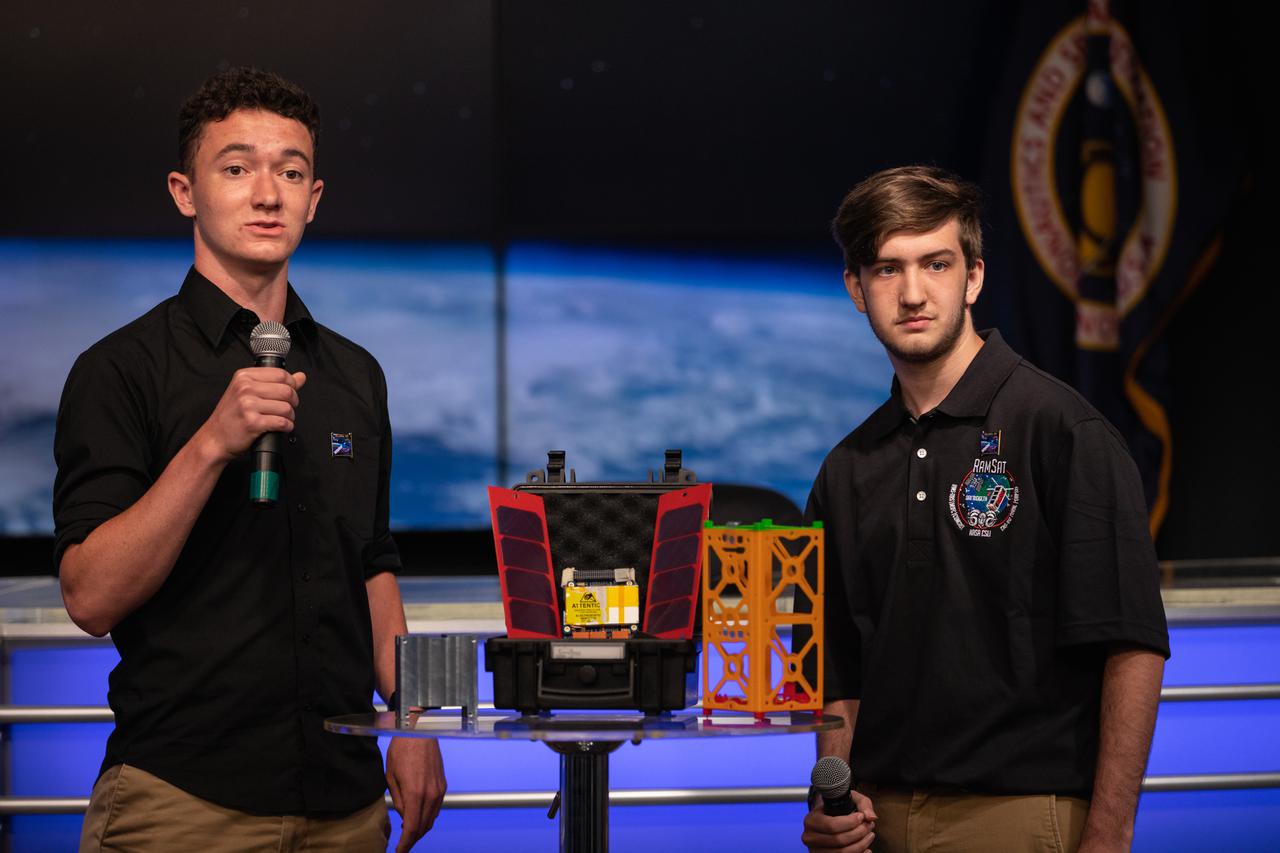
Students Joe Blair, at left, and Jonathon Bonamarte, describe a CubeSat, called RamSat, during a What’s On Board Science Briefing on June 2, 2021, at Kennedy Space Center in Florida for SpaceX’s 22nd Commercial Resupply Services Mission for NASA to the International Space Station. The small research satellite was developed by students and faculty at Robertsville Middle School in Oak Ridge, Tennessee. RamSat will observe forest regrowth in the Gatlinburg, Tennessee area which was devastated by wildfires in 2016. RamSat is the sole payload of the 36th Educational Launch of Nanosatellites (ELaNa) mission and was selected through NASA’s CubeSat Launch Initiative (CSLI). The SpaceX Falcon 9 rocket with the Dragon capsule atop is scheduled to launch at 1:29 p.m. EDT on Thursday, June 3, from the center’s Launch Complex 39A. Dragon will deliver more than 7,300 pounds of cargo and science experiments to the space station.

This image acquired on Jan. 17, 2016 by NASA Terra spacecraft shows major flooding along the Mississippi River, affecting Missouri, Illinois, Arkansas and Tennessee. As of January 17, flood warnings were issued for the area around Baton Rouge, Louisiana, as the river crested at 43.3 feet (13.1 meters), 8 feet (2.4 meters) above flood stage. Shipping and industrial activities were significantly affected; low-lying areas were flooded, and agricultural operations were impacted on the west side of the river. This image from the Advanced Spaceborne Thermal Emission and Reflection Radiometer (ASTER) on NASA's Terra spacecraft was acquired Jan. 17, 2016, covers an area of 23.6 by 23.6 miles (38 by 38 kilometers), and is located at 30.6 degrees north, 91.3 degrees west. http://photojournal.jpl.nasa.gov/catalog/PIA20364
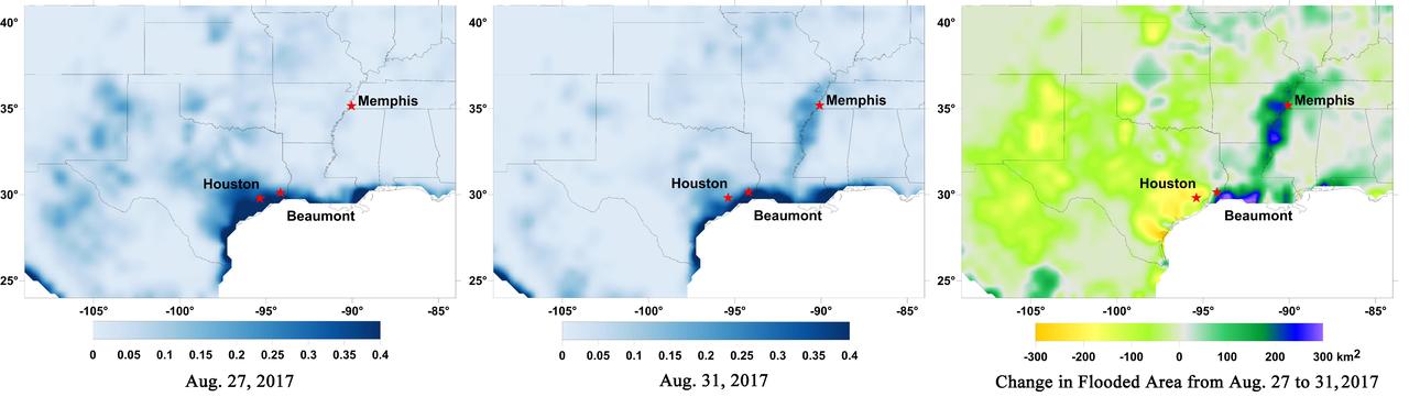
Data from NASA's Soil Moisture Active Passive (SMAP) satellite have been used to create new surface flooding maps of Southeast Texas and the Tennessee Valley following Hurricane Harvey. The SMAP observations detect the proportional cover of surface water within the satellite sensor's field of view. This sequence of images shows changes in the extent of surface flooding from successive five-day SMAP observation composite images. Widespread flooding can be seen in the Houston metropolitan area on Aug. 27 following record rainfall from the Category 4 hurricane, which made landfall on Aug. 25th, 2017 (left image). Flood waters around Houston had substantially receded by Aug. 31 (middle image), while flooding had increased across Louisiana, eastern Arkansas, and western Tennessee as then Tropical Storm Harvey passed over the area. The far right image shows the change in flooded area between Aug. 27 and Aug. 31, with regions showing the most flooding recession depicted in yellow and orange shades and those where flooding had increased depicted in blue shades. The SMAP satellite has a low-frequency (L-band) microwave radiometer with enhanced capabilities for detecting surface water changes in nearly all weather conditions and under low-to-moderate vegetation cover. SMAP provides global coverage with one-to-three-day repeat sampling that is well suited for global monitoring of inland surface water cover dynamics. https://photojournal.jpl.nasa.gov/catalog/PIA21951
The SLS Stages Intertank Structural Test Assembly (STA) is rolling off the NASA Pegasus Barge at the MSFC Dock enroute to the MSFC 4619 Load Test Annex test facility for qualification testing. STA emerges from Barge Pegasus.
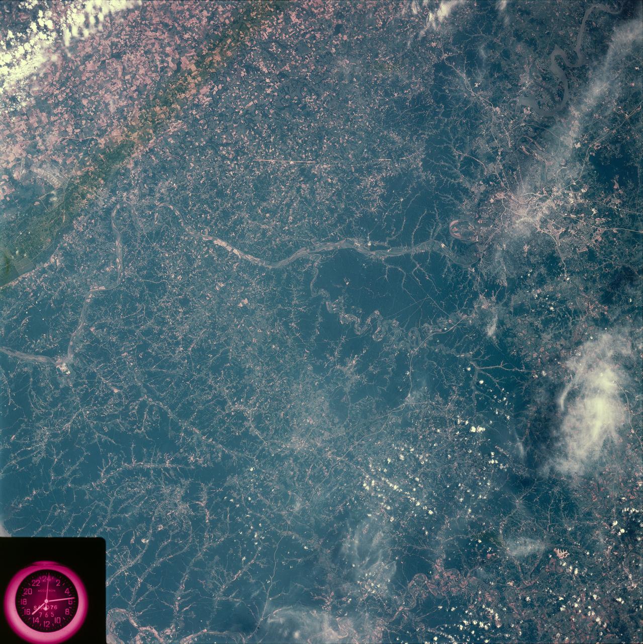
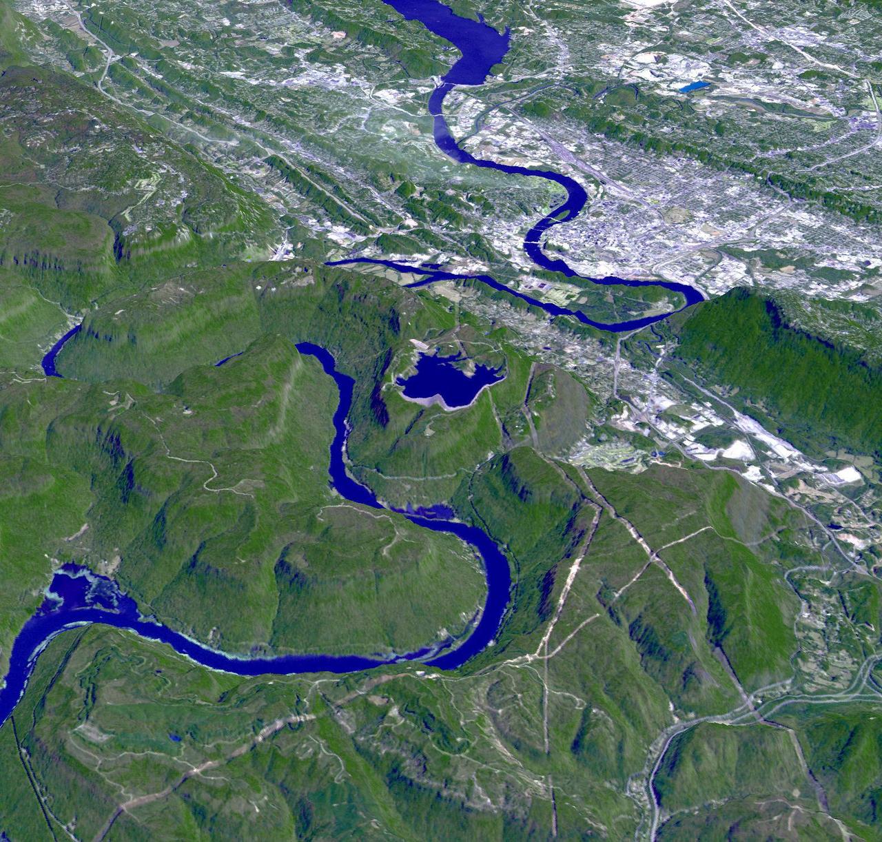
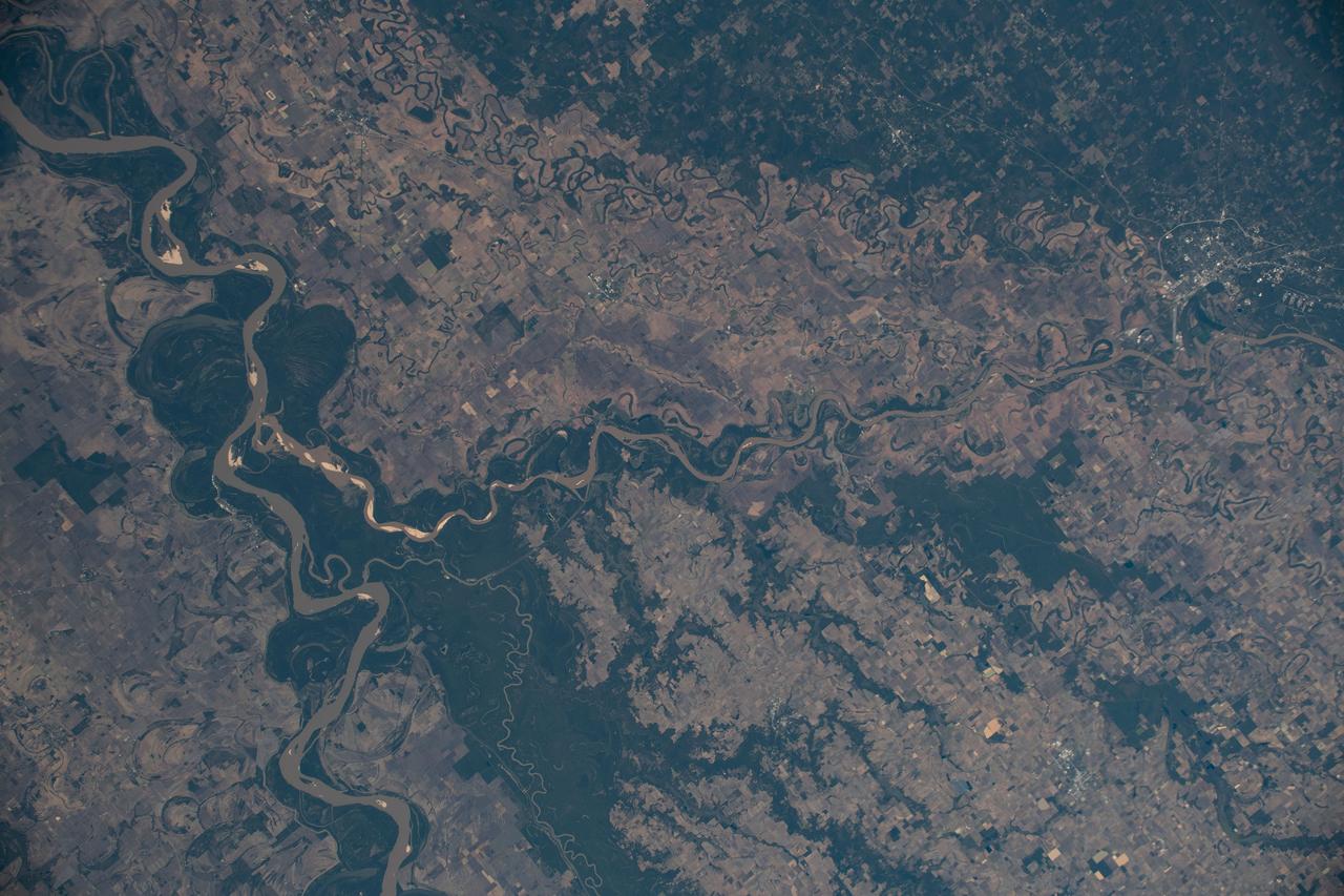
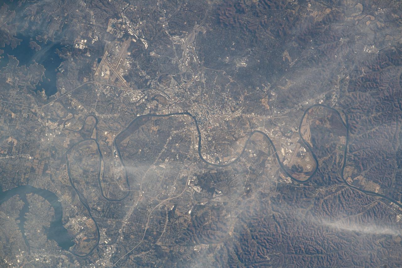
SL2-81-198 (22 June 1973) --- Making its way through the rugged Cumberland Plateau, the Cumberland River winds through the city of Nashville in north central Tennessee (36.0N, 87.0W) where the heavily forested upland terrain produces a landscape of rolling hills with elevations up to 1,100 ft. and narrow valleys. Before the advent of modern communications and transportation in this region, widely scattered and isolated communities had little contact with the outside world. Photo credit: NASA
STS058-102-018 (18 Oct-1 Nov 1993) --- A cloud-free, wide-angle view from above western Tennessee to the northern edge of Lake Michigan. The view extends from Saint Louis, Missouri near the lower left-hand corner, past Evansville, Indiana and Louisville, Kentucky to Cincinnati, Ohio. A range of hills covered by trees in Fall foliage extends from the Ohio River toward Lake Michigan, ending just southwest of Indianapolis, Indiana.
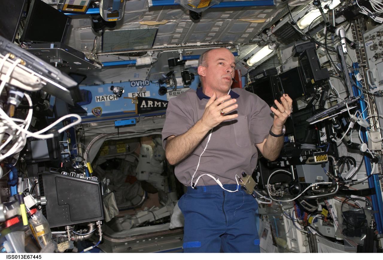
ISS013-E-67445 (17 Aug. 2006) --- Astronaut Jeffrey N. Williams, Expedition 13 NASA space station science officer and flight engineer, conducts an educational teleconference with the Boys and Girls Clubs of Middle Tennessee in Nashville, via Ku- and S-band in the Destiny laboratory of the International Space Station, with audio and video relayed to the Mission Control Center at Johnson Space Center.

During the Kennedy Space Center's Day of Remembrance ceremony, musical selections were performed by Brandon Heath, a contemporary Christian musician from Nashville, Tennessee. Held this year in the Center for Space Education at the Kennedy Space Center Visitor Complex in Florida, the annual event honors the contributions of all astronauts who lost their lives in the quest for space exploration.
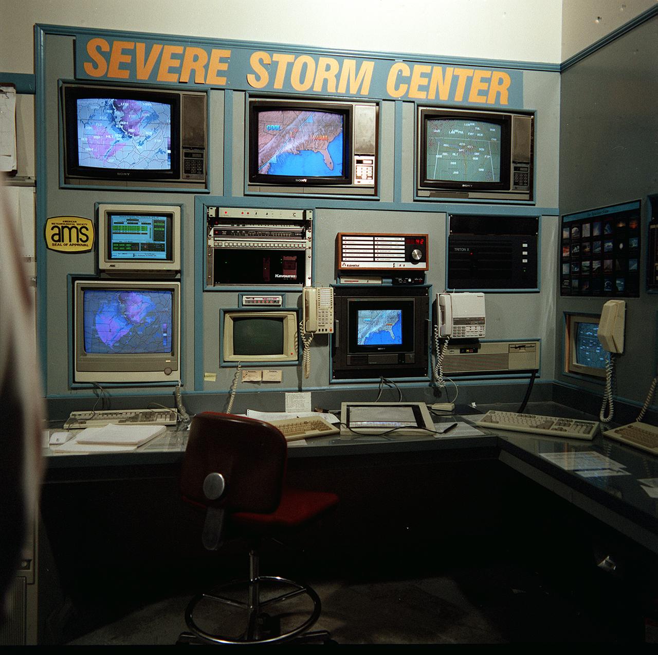
Bob Barin, a Huntsville meterorologist, has formed a commercial weather advisory service. The weather information is based on data from Marshall Space Flight Center (MSFC) collected from anternas in Alabama and Tennessee. Baron proposed and concluded an agreement with MSFC whereby the center would provide him the data and he would refine and enhance real-time software. By using his service, clients can monitor the approach of storms and schedule operations accordingly.
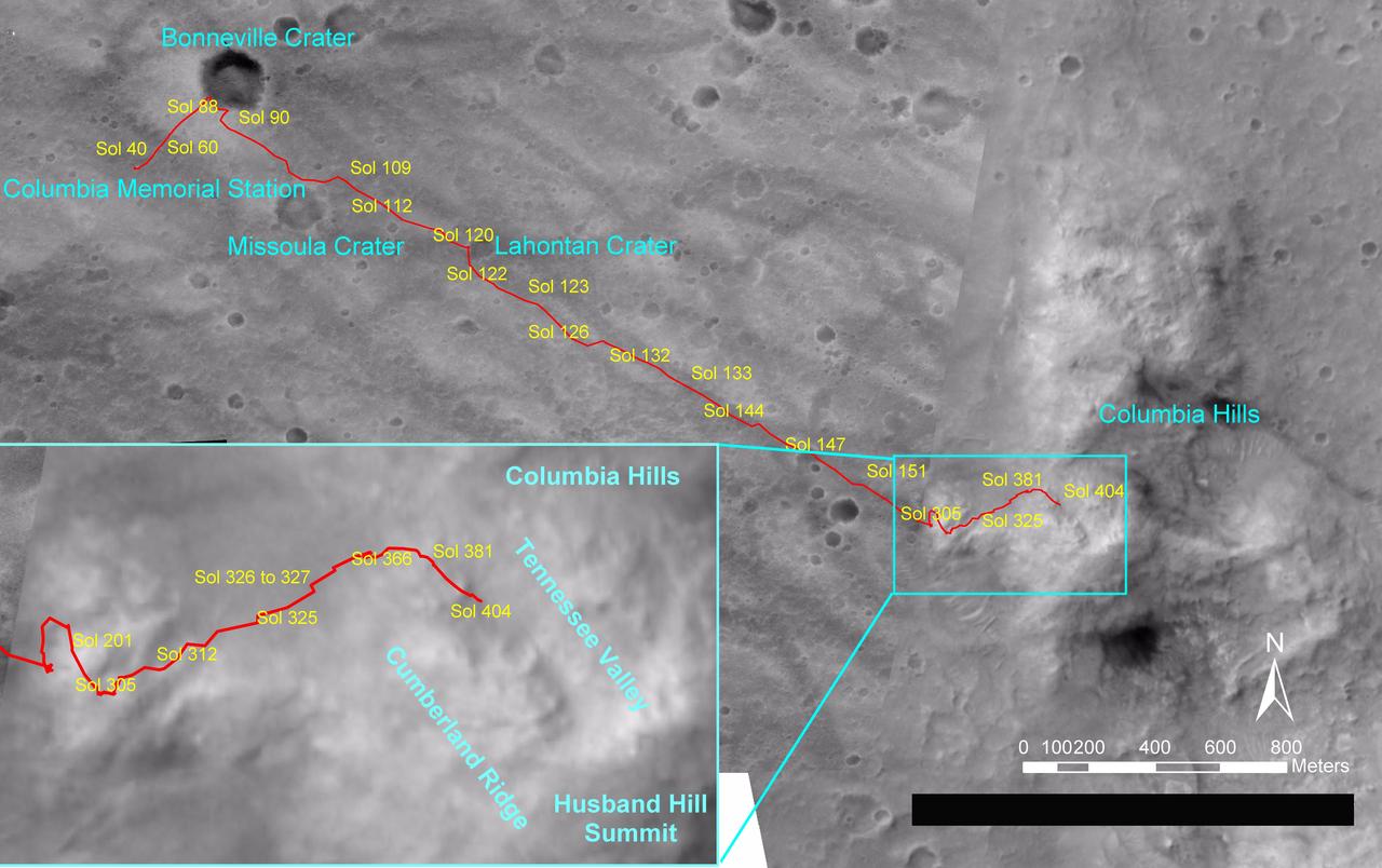
NASA's Mars Exploration Rover Spirit drove a total of 4,143 meters (2.57 miles) between its landing in January 2004 and its 404th martian day, or sol (Feb. 20, 2005). This map on an image taken by the Mars Orbiter Camera on NASA's Mars Global Surveyor shows the course the rover drove during that time. The rover has recently been approaching a ridge overlooking "Tennessee Valley" on the north flank of "Husband Hill." http://photojournal.jpl.nasa.gov/catalog/PIA07393
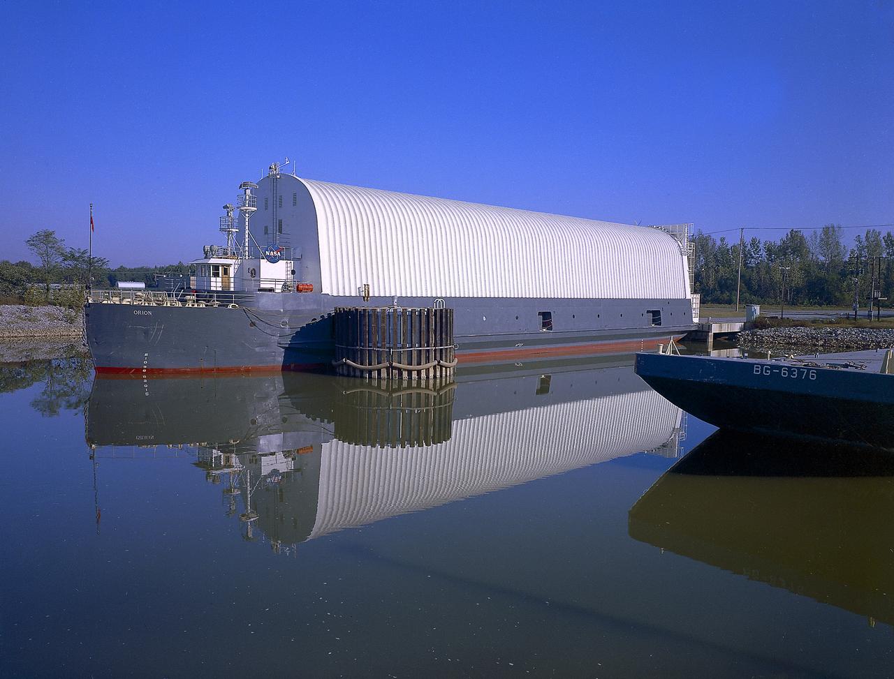
NASA used barges for transporting full-sized stages for the Saturn I, Saturn IB, and Saturn V vehicles between the Marshall Space Flight Center (MSFC), the manufacturing plant at the Michoud Assembly Facility (MAF), the Mississippi Test Facility for testing, and the Kennedy Space Center. The barges traveled from the MSFC dock to the MAF, a total of 1,086.7 miles up the Tennessee River and down the Mississippi River. The barges also transported the assembled stages of the Saturn vehicle from the MAF to the Kennedy Space Center, a total of 932.4 miles along the Gulf of Mexico and up along the Atlantic Ocean, for the final assembly and the launch. This photograph shows the barge Orion at the MSFC dock.
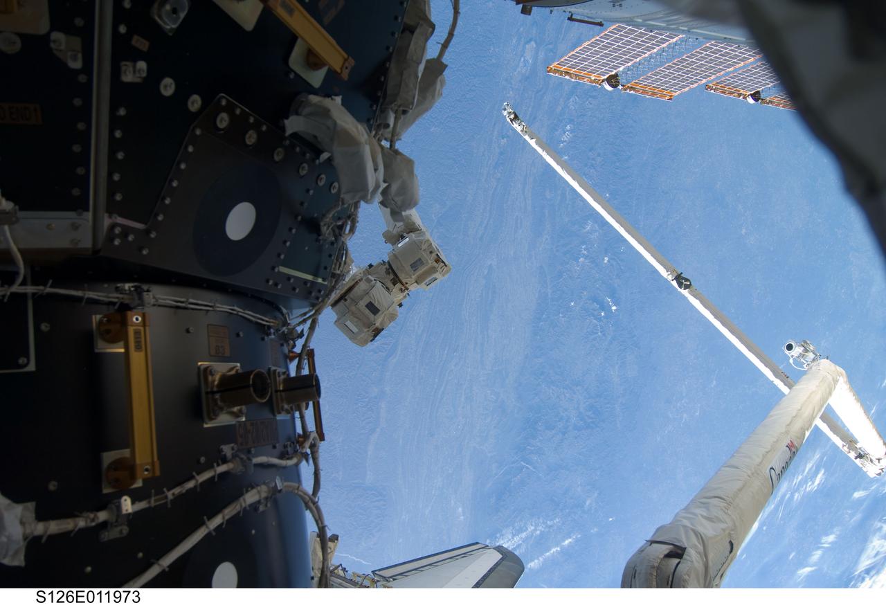
S126-E-011973 (26 Nov. 2008) --- The Canadian-built Orbiter Boom Sensor System (OBSS), in its parked position, and part of the International Space Station are featured in this image, photographed over the Blue Ridge Mountains of West Virginia and Tennessee by one of the Endeavour crew members on the eve of Thanksgiving. The OBSS, on the end of the Canadarm, awaits the final part of its STS-126 role when it will inspect the shuttle one more time, following separation of the orbiter from the space station in a couple of days. When that task is complete, it will be stowed across the payload bay from the robot arm.
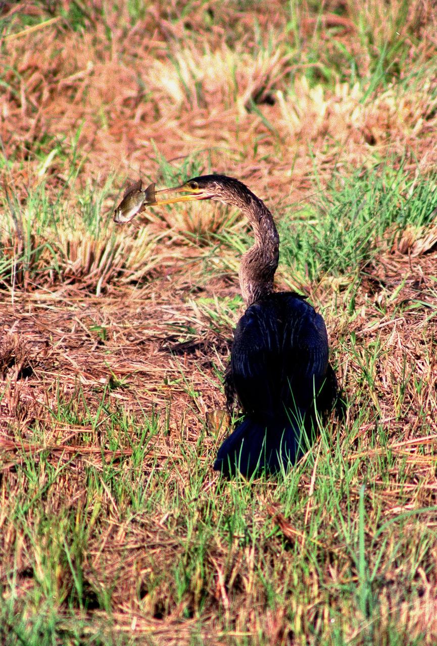
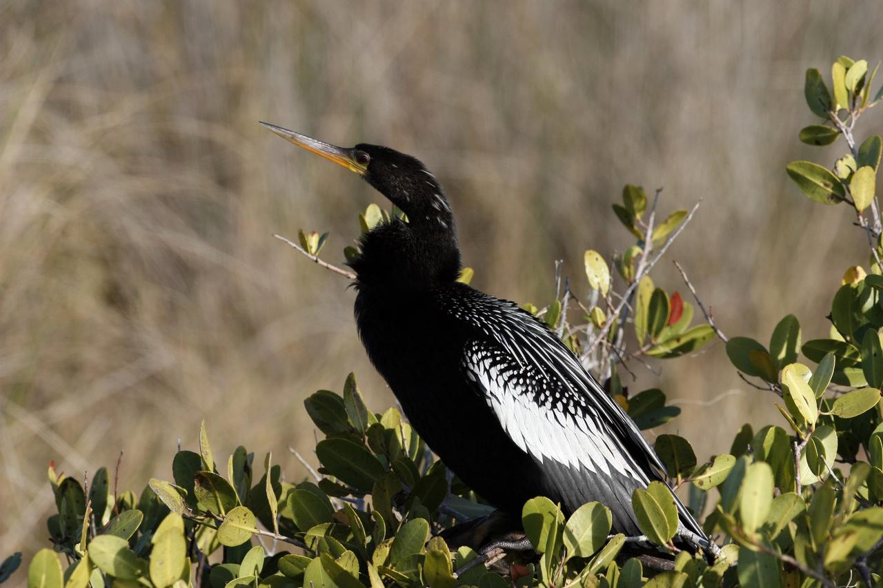
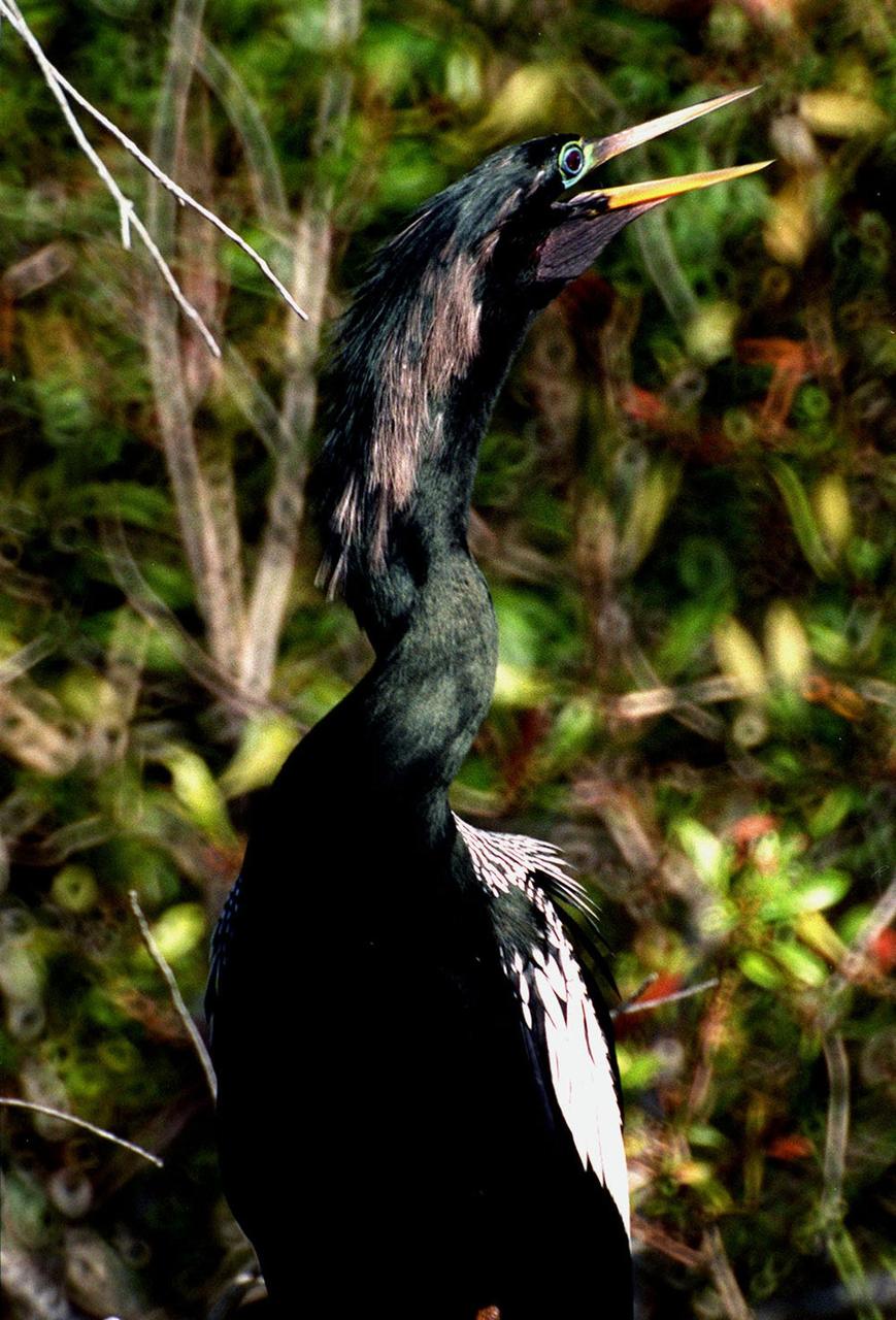
KENNEDY SPACE CENTER, FLA. -- Spotted in the Merritt Island National Wildlife Refuge, which shares a boundary with the space center, an anhinga captures a fish in its long, dagger-shaped bill. It is also known as the "snakebird" because in the water its body is submerged so that only its head and long, slender neck are visible. Ranging the Atlantic and Gulf Coasts from North Carolina to Texas, north in the Mississippi Valley to Arkansas and Tennessee, and in the South to South America, it inhabits freshwater ponds and swamps with thick vegetation. They are often seen with wings half-open, drying them in the sun since they lack oil glands with which to preen
NASA's Mars Exploration Rover Spirit used its navigation camera to take the images combined into this 360-degree view of the rover's surroundings on Spirit's 409th martian day, or sol (Feb. 26, 2005). Spirit had driven 2 meters (7 feet) on this sol to get in position on "Cumberland Ridge" for looking into "Tennessee Valley" to the east. This location is catalogued as Spirit's Site 108. Rover-wheel tracks from climbing the ridge are visible on the right. The summit of "Husband Hill" is at the center, to the south. This view is presented in a vertical projection with geometric and brightness seam correction. http://photojournal.jpl.nasa.gov/catalog/PIA07410

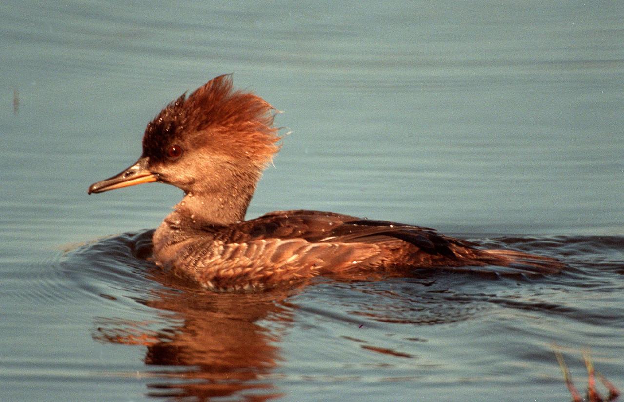
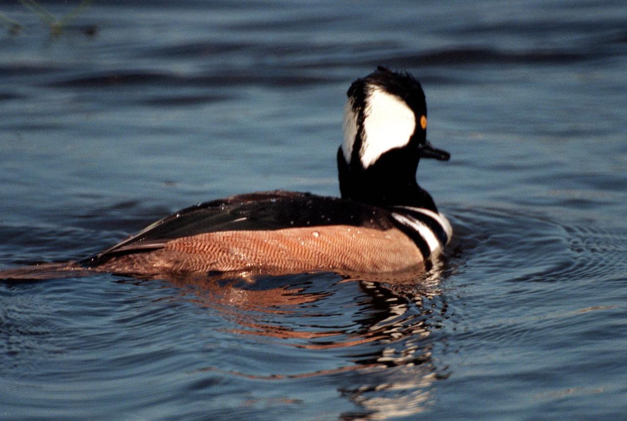
KENNEDY SPACE CENTER, FLA. -- Three male and one female hooded mergansers swim in the quicksilver water of the Merritt Island National Wildlife Refuge, which shares a boundary with Kennedy Space Center. Usually found from Alaska and Canada south to Nebraska, Oregon and Tennessee, hooded mergansers winter south to Mexico and the Gulf Coast, including KSC. The open water of the refuge provides wintering areas for 23 species of migratory waterfowl, as well as a year-round home for great blue herons, great egrets, wood storks, cormorants, brown pelicans and other species of marsh and shore birds. The 92,000-acre refuge is also habitat for more than 310 species of birds, 25 mammals, 117 fishes and 65 amphibians and reptiles.
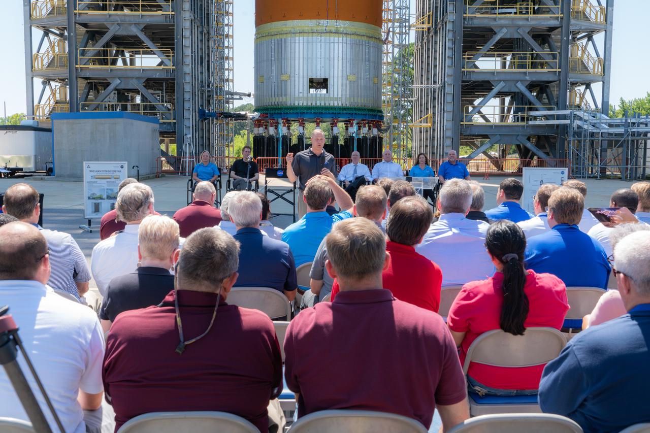
On Aug. 16, 2019, NASA Administrator Jim Bridenstine announced the agency’s Marshall Space Flight Center in Huntsville, Alabama, will lead the Human Landing System Program. Bridenstine was joined by Representatives Mo Brooks and Robert Aderholt of Alabama and Representative Scott DesJarlais of Tennessee. NASA will rapidly develop the lander for safely carrying the first woman and the next man to the Moon’s surface in 2024. The Artemis missions will start with launch by the world’s most powerful rocket, NASA’s Space Launch System, also managed by Marshall. Bridenstine made the announcement in front of the 149-foot-tall SLS liquid hydrogen structural test article, currently being tested to help ensure the structure can safely launch astronauts on the Artemis lunar missions. (NASA/Fred Deaton) For more information: https://www.nasa.gov/artemis-1
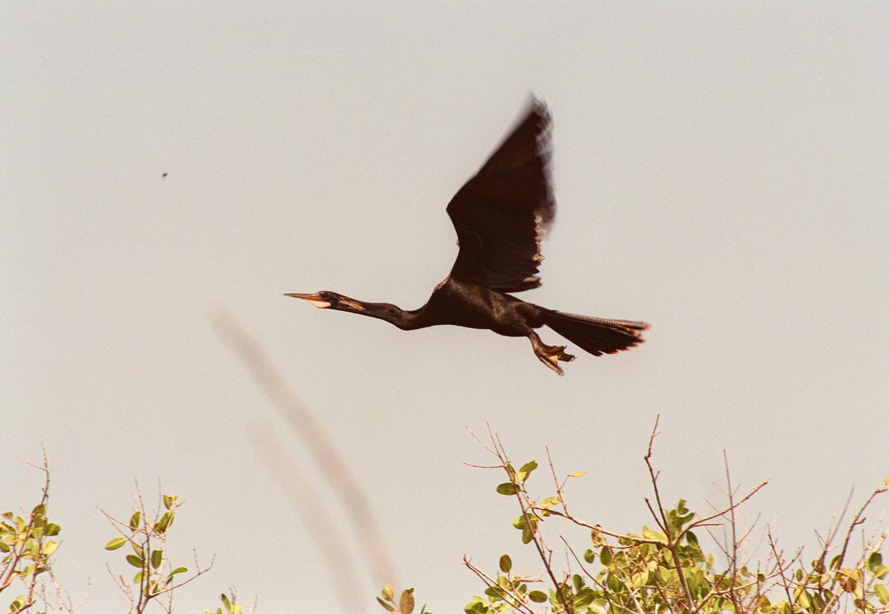
KENNEDY SPACE CENTER, FLA. -- In the Merritt Island National Wildlife Refuge, which shares a boundary with Kennedy Space Center, an anhinga takes flight. Anhingas inhabit frewshwater ponds and swamps with thick vegetation. They ranage from the Atlantic and gulf coasts from North Carolina to Texas, the Mississippi Valley north to Arkansas and Tennessee, and south to southern South America. They are also referred to as snakebirds because its body is submerged when swimming, showing only its head and long, slender neck above water. The 92,000-acre wildlife refuge is a habitat for more than 310 species of birds, 25 mammals, 117 fishes and 65 amphibians and reptiles. The marshes and open water of the refuge also provide wintering areas for 23 species of migratory waterfowl, as well as a year-round home for great blue herons, great egrets, wood storks, cormorants, brown pelicans and other species of marsh and shore birds
KENNEDY SPACE CENTER, FLA. -- A female hooded merganser swims solo in the waters of the Merritt Island National Wildlife Refuge at Kennedy Space Center. The male is distinguished by a fan-shaped, black-bordered crest and striped breast. Usually found from Alaska and Canada south to Nebraska, Oregon and Tennessee, hooded mergansers winter south to Mexico and the Gulf Coast, including KSC. The open water of the refuge provides wintering areas for 23 species of migratory waterfowl, as well as a year-round home for great blue herons, great egrets, wood storks, cormorants, brown pelicans and other species of marsh and shore birds. The 92,000-acre refuge is also habitat for more than 310 species of birds, 25 mammals, 117 fishes and 65 amphibians and reptiles

KENNEDY SPACE CENTER, FLA. -- A male and two female hooded mergansers swim in the waters of the Merritt Island National Wildlife Refuge at Kennedy Space Center. The male displays its distinctive fan-shaped, black-bordered crest. Usually found from Alaska and Canada south to Nebraska, Oregon and Tennessee, hooded mergansers winter south to Mexico and the Gulf Coast, including KSC. The open water of the refuge provides wintering areas for 23 species of migratory waterfowl, as well as a year-round home for great blue herons, great egrets, wood storks, cormorants, brown pelicans and other species of marsh and shore birds. The 92,000-acre refuge is also habitat for more than 310 species of birds, 25 mammals, 117 fishes and 65 amphibians and reptiles
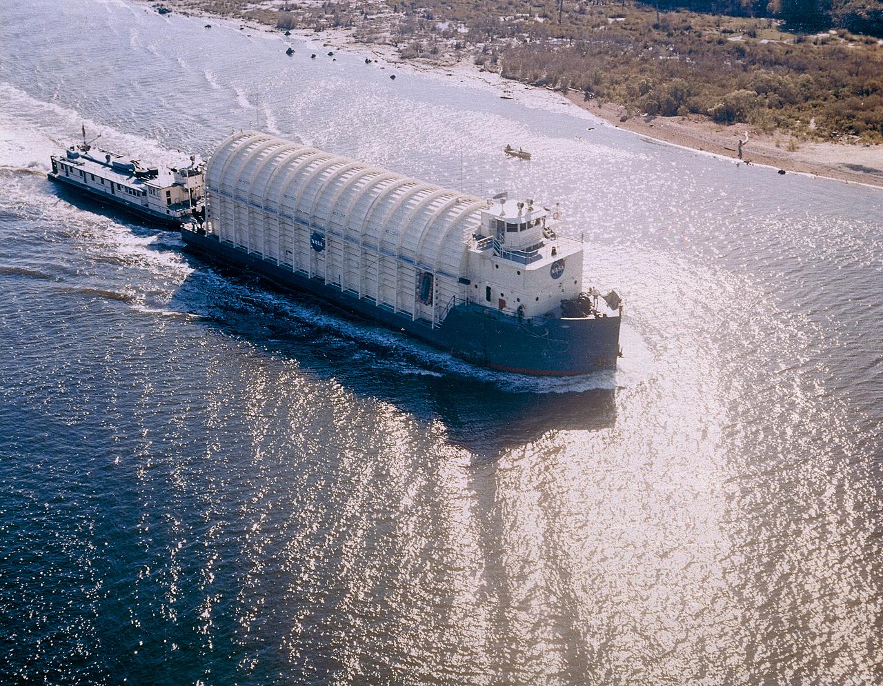
NASA used barges for transporting full-sized stages for the Saturn I, Saturn IB, and Saturn V vehicles between the Marshall Space Flight Center (MSFC), the manufacturing plant at the Michoud Assembly Facility (MAF), the Mississippi Test Facility for testing, and the Kennedy Space Center. The barges traveled from the MSFC dock to the MAF, a total of 1,086.7 miles up the Tennessee River and down the Mississippi River. The barges also transported the assembled stages of the Saturn vehicle from the MAF to the Kennedy Space Center, a total of 932.4 miles along the Gulf of Mexico and up along the Atlantic Ocean, for the final assembly and the launch. Pictured is the barge Palaemon carrying Saturn IV S-IB flight stage enroute to MSFC.
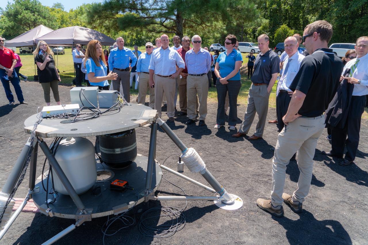
Lisa Watson-Morgan, center left, program manager of NASA’s Human Landing System Program at NASA’s Marshall Space Flight Center in Huntsville, Alabama, shows NASA Administrator Jim Bridenstine equipment used to test seismic sensors on a lunar lander platform on a simulated lunar surface at the center Aug. 16, 2019. Bridenstine was joined by Representatives Mo Brooks and Robert Aderholt of Alabama and Representative Scott DesJarlais of Tennessee. Planetary scientists performed the experiment to learn how these waves travel through simulated regolith, which is material similar to the Moon’s surface. The experiment will help guide instrument deployment scenarios for NASA’s Commercial Lunar Payload Service (CLPS) Program, delivering small science and technology payloads for Artemis. That same day, Bridenstine announced Marshall will lead the agency’s Human Landing System Program. (NASA/Fred Deaton) For more information: https://www.nasa.gov/artemis-1
CAPE CANAVERAL, Fla. – A male Anhinga perches in a shrub in the Merritt island National Wildlife Refuge, which borders NASA's Kennedy Space Center in Florida. Anhingas inhabit freshwater ponds and swamps with thick vegetation. They range from the Atlantic and Gulf coasts from North Carolina to Texas, the Mississippi Valley north to Arkansas and Tennessee, and south to southern South America. They are also referred to as snakebirds because their body is submerged when swimming, showing only the head and long, slender neck above water. The center shares a boundary with the refuge that includes salt-water estuaries, brackish marshes, hardwood hammocks and pine flatwoods. The diverse landscape provides habitat for more than 310 species of birds, 25 mammals, 117 fishes and 65 amphibians and reptiles. Photo credit: NASA/Jim Grossmann
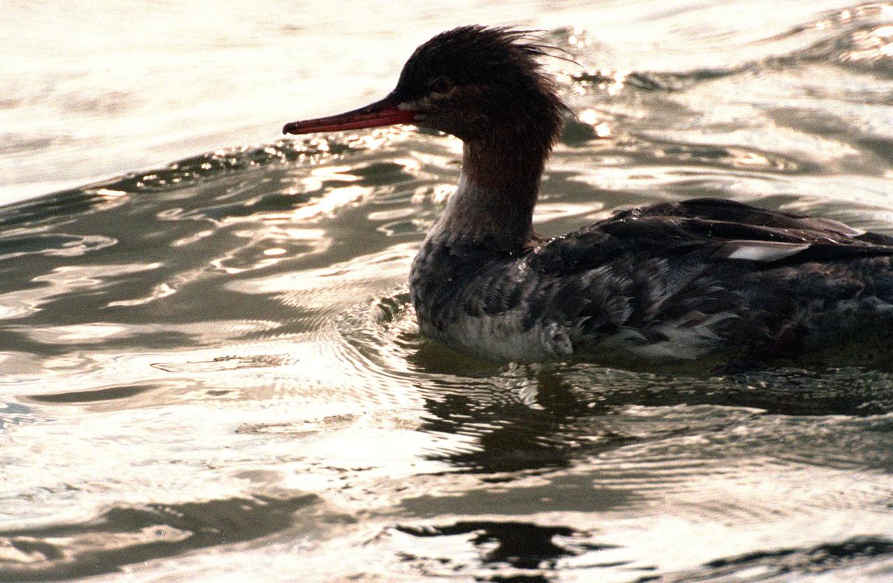
KENNEDY SPACE CENTER, FLA. -- A young female red-breasted merganser swims in the quicksilver water of the Merritt Island National Wildlife Refuge, which shares a boundary with Kennedy Space Center. Usually found from Alaska and Canada south to Nebraska, Oregon and Tennessee, hooded mergansers winter south to Mexico and the Gulf Coast, including KSC. The open water of the refuge provides wintering areas for 23 species of migratory waterfowl, as well as a year-round home for great blue herons, great egrets, wood storks, cormorants, brown pelicans and other species of marsh and shore birds. The 92,000-acre refuge is also habitat for more than 310 species of birds, 25 mammals, 117 fishes and 65 amphibians and reptiles
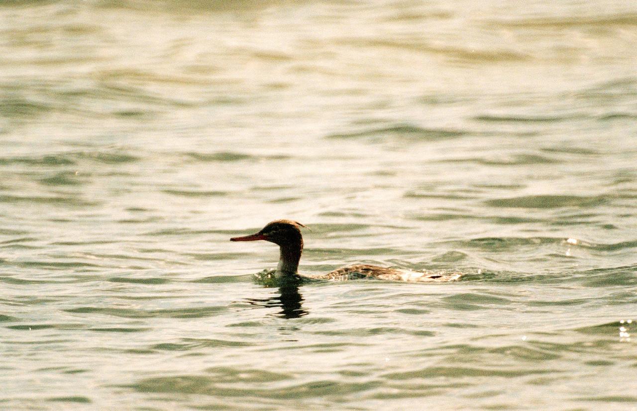
KENNEDY SPACE CENTER, FLA. -- A female red-breasted merganser swims low in the water at the Merritt Island National Wildlife Refuge, which shares a boundary with Kennedy Space Center. Usually found from Alaska and Canada south to Nebraska, Oregon and Tennessee, hooded mergansers winter south to Mexico and the Gulf Coast, including KSC. The open water of the refuge provides wintering areas for 23 species of migratory waterfowl, as well as a year-round home for great blue herons, great egrets, wood storks, cormorants, brown pelicans and other species of marsh and shore birds. The 92,000-acre refuge is also habitat for more than 310 species of birds, 25 mammals, 117 fishes and 65 amphibians and reptiles
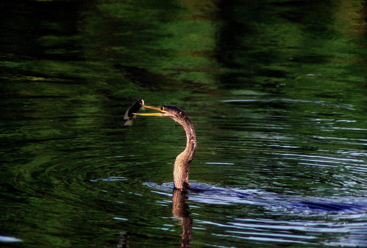
KENNEDY SPACE CENTER, FLA. -- In the Merritt Island National Wildlife Refuge, which shares a boundary with the space center, an anhinga gets ready to eat the fish it captured in the nearby Indian River with its long, dagger-shaped bill. The bird will flip its catch into the air and gulp it down headfirst. The anhinga is also known as the "snakebird" because in the water its body is submerged so that only its head and long, slender neck are visible. Ranging the Atlantic and Gulf Coasts from North Carolina to Texas, north in the Mississippi Valley to Arkansas and Tennessee, and in the South to South America, it inhabits freshwater ponds and swamps with thick vegetation. They are often seen with wings half-open, drying them in the sun since they lack oil glands with which to preen
KENNEDY SPACE CENTER, FLA. -- The distinctive fan-shaped, black-bordered crest and striped breast identify this hooded merganser, swimming in the waters of the Merritt Island National Wildlife Refuge at Kennedy Space Center. Usually found from Alaska and Canada south to Nebraska, Oregon and Tennessee, hooded mergansers winter south to Mexico and the Gulf Coast, including KSC. The open water of the refuge provides wintering areas for 23 species of migratory waterfowl, as well as a year-round home for great blue herons, great egrets, wood storks, cormorants, brown pelicans and other species of marsh and shore birds. The 92,000-acre refuge is also habitat for more than 310 species of birds, 25 mammals, 117 fishes and 65 amphibians and reptiles
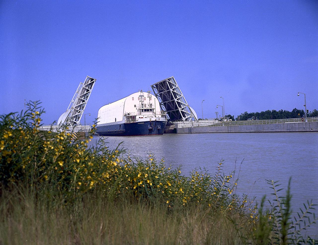
NASA used barges for transporting full-sized stages for the Saturn I, Saturn IB, and Saturn V vehicles between the Marshall Space Flight Center (MSFC), the manufacturing plant at the Michoud Assembly Facility (MAF), the Mississippi Test Facility for testing, and the Kennedy Space Center. The barges traveled from the MSFC dock to the MAF, a total of 1,086.7 miles up the Tennessee River and down the Mississippi River. The barges also transported the assembled stages of the Saturn vehicle from the MAF to the Kennedy Space Center, a total of 932.4 miles along the Gulf of Mexico and up along the Atlantic Ocean, for the final assembly and the launch. This photograph shows the barge Poseidon loaded with the Saturn V S-II (second) stage passing through a bascule bridge.
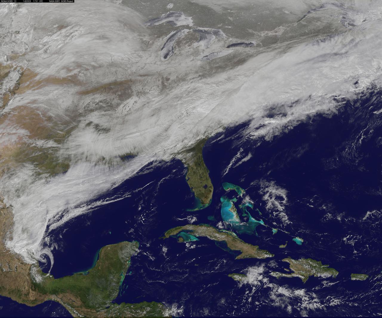
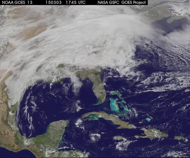
On March 3, a major winter storm brought snow to the mid-Atlantic, freezing rain to the Carolinas and rain and some freezing rain to the Gulf Coast states. NOAA's GOES-East satellite captured an image of the clouds associated with the winter storm on March 3 at 12:45 p.m. EST (1745 UTC)/ as it continued on its march over the mid-Atlantic. Bands of snow and sometimes heavy snow affected the Washington, D.C., region, Delaware and central Virginia, stretching west into West Virginia and eastern Kentucky. Snow also stretched back into the Ohio and Tennessee valleys while rain and freezing rain affected the Carolinas, and while the Gulf Coast states received rain. National Weather Service Winter Storm Warnings remained in effect until 6 p.m. EST on March 3 for Washington, D.C., and Baltimore, Md. In Richmond and Norfolk, Va., the Winter Storm warnings were in effect for six additional hours ending at midnight. On March 3, NOAA's National Weather Prediction Center in College Park, Md., noted the late-season winter storm will continue to shift eastward through the Tennessee Valley and the mid-Atlantic today, making for hazardous travel conditions. NOAA noted that unseasonably cold temperatures more typical of January will prevail east of the Rocky Mountains for the next few days keeping winter around for a while longer. The clouds are associated with a cold front that stretched from eastern Maine through Maryland and west into the Tennessee Valley. At NASA/NOAA's GOES Project at NASA's Goddard Space Flight Center in Greenbelt, Md., the cloud data from NOAA's GOES-East satellite were overlaid on a true-color image of land and ocean created by data from the Moderate Resolution Imaging Spectroradiometer, or MODIS, instrument that flies aboard NASA's Aqua and Terra satellites. Together, those data created the entire picture of the position of this major winter storm. GOES satellites provide the kind of continuous monitoring necessary for intensive data analysis. Geostationary describes an orbit in which a satellite is always in the same position with respect to the rotating Earth. This allows GOES to hover continuously over one position on Earth's surface, appearing stationary. As a result, GOES provide a constant vigil for the atmospheric "triggers" for severe weather conditions such as tornadoes, flash floods, hail storms and hurricanes. For updated information about the storm system, visit NOAA's NWS website: <a href="http://www.weather.gov" rel="nofollow">www.weather.gov</a> For more information about GOES satellites, visit: <a href="http://www.goes.noaa.gov/" rel="nofollow">www.goes.noaa.gov/</a> or goes.gsfc.nasa.gov/ Rob Gutro NASA's Goddard Space Flight Center, Greenbelt, Md. <b><a href="http://www.nasa.gov/audience/formedia/features/MP_Photo_Guidelines.html" rel="nofollow">NASA image use policy.</a></b> <b><a href="http://www.nasa.gov/centers/goddard/home/index.html" rel="nofollow">NASA Goddard Space Flight Center</a></b> enables NASA’s mission through four scientific endeavors: Earth Science, Heliophysics, Solar System Exploration, and Astrophysics. Goddard plays a leading role in NASA’s accomplishments by contributing compelling scientific knowledge to advance the Agency’s mission. <b>Follow us on <a href="http://twitter.com/NASAGoddardPix" rel="nofollow">Twitter</a></b> <b>Like us on <a href="http://www.facebook.com/pages/Greenbelt-MD/NASA-Goddard/395013845897?ref=tsd" rel="nofollow">Facebook</a></b> <b>Find us on <a href="http://instagram.com/nasagoddard?vm=grid" rel="nofollow">Instagram</a></b>
KENNEDY SPACE CENTER, FLA. -- The greenish iridescence of a male Anhinga nearly blends into the green vegetation behind it on the grounds of the Kennedy Space Center. The mostly black-bodied bird is also known as a "snakebird" because, when swimming, only its head and long, slender neck are visible above water. The anhinga inhabits freshwater ponds and swamps with thick vegetation and ranges the Atlantic and Gulf coasts from North Carolina to Texas, the Mississippi Valley north to Arkansas and Tennessee, and south to southern South America. The Center shares a boundary with the Merritt Island National Wildlife Refuge, which encompasses 92,000 acres that are a habitat for more than 331 species of birds, 31 mammals, 117 fishes, and 65 amphibians and reptiles. The marshes and open water of the refuge provide wintering areas for 23 species of migratory waterfowl, as well as a year-round home for great blue herons, great egrets, wood storks, cormorants, brown pelicans and other species of marsh and shore birds, as well as a variety of insects
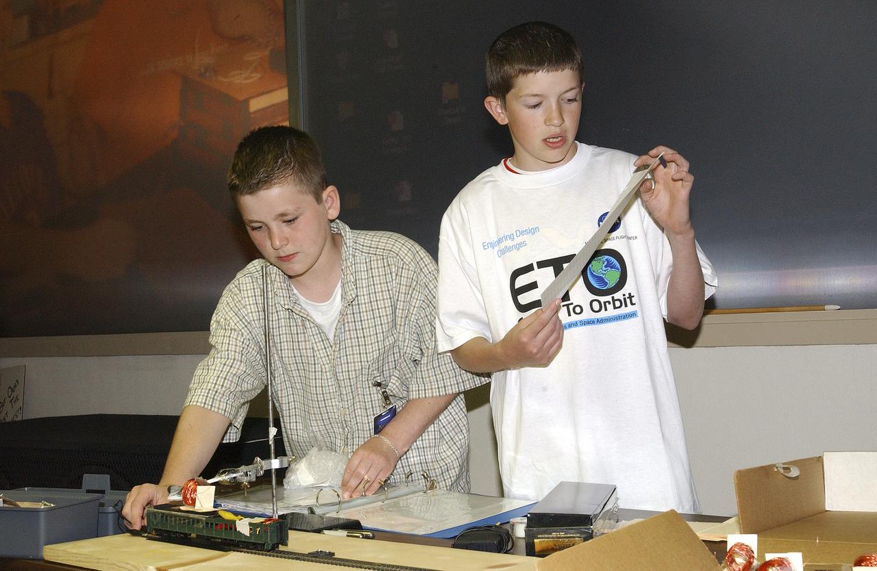
In this photograph, Jeff Alden (left) and Justin O'Cornor, two middle school students at Lane Middle School in Portland, Oregon are demonstrating their Earth-to-Orbit (ETO) Design Challenge project at NASA Marshall Space Flight Center (MSFC) in Huntsville, Alabama. Jeff and Justin, who are just a couple of "typical teens," have been spending their time tackling some of the same challenges NASA engineers face when designing propulsion systems at MSFC. The ETO Design Challenge is a hands-on educational program, targeted to middle school students, in which students are assigned a project engaging in related design challenges in their classrooms under the supervision of their teachers. The project is valuable because it can be used by any student and any teacher, even those without technical backgrounds. Students in 12 states: Alabama, Arkansas, California, Colorado, Illinois, Missouri, Montana, New York, Ohio, Tennessee, Virginia, and Washington, are taking part in the MSFC's Earth-to-Orbit program. NASA uses such programs to support educational excellence while participating in educational outreach programs through centers around the country. The Oregon students' teacher, Joanne Fluvog, commented, "the biggest change I've seen is in the students' motivation and their belief in their ability to think." Both Justin and Jeff said being involved in a real engineering project has made them realize that "science is cool."

KENNEDY SPACE CENTER, FLA. -- The greenish iridescence of a male Anhinga nearly blends into the green vegetation behind it on the grounds of the Kennedy Space Center. The mostly black-bodied bird is also known as a "snakebird" because, when swimming, only its head and long, slender neck are visible above water. The anhinga inhabits freshwater ponds and swamps with thick vegetation and ranges the Atlantic and Gulf coasts from North Carolina to Texas, the Mississippi Valley north to Arkansas and Tennessee, and south to southern South America. The Center shares a boundary with the Merritt Island National Wildlife Refuge, which encompasses 92,000 acres that are a habitat for more than 331 species of birds, 31 mammals, 117 fishes, and 65 amphibians and reptiles. The marshes and open water of the refuge provide wintering areas for 23 species of migratory waterfowl, as well as a year-round home for great blue herons, great egrets, wood storks, cormorants, brown pelicans and other species of marsh and shore birds, as well as a variety of insects

Meandering Mississippi - May 28th, 2003 Description: Small, blocky shapes of towns, fields, and pastures surround the graceful swirls and whorls of the Mississippi River. Countless oxbow lakes and cutoffs accompany the meandering river south of Memphis, Tennessee, on the border between Arkansas and Mississippi, USA. The "mighty Mississippi" is the largest river system in North America. Credit: USGS/NASA/Landsat 7 To learn more about the Landsat satellite go to: <a href="http://landsat.gsfc.nasa.gov/" rel="nofollow">landsat.gsfc.nasa.gov/</a> <b><a href="http://www.nasa.gov/centers/goddard/home/index.html" rel="nofollow">NASA Goddard Space Flight Center</a></b> enables NASA’s mission through four scientific endeavors: Earth Science, Heliophysics, Solar System Exploration, and Astrophysics. Goddard plays a leading role in NASA’s accomplishments by contributing compelling scientific knowledge to advance the Agency’s mission. <b>Follow us on <a href="http://twitter.com/NASA_GoddardPix" rel="nofollow">Twitter</a></b> <b>Join us on <a href="http://www.facebook.com/pages/Greenbelt-MD/NASA-Goddard/395013845897?ref=tsd" rel="nofollow">Facebook</a></b>
A winter storm that moved through the Mid-Atlantic on Feb. 16 and 17, 2015 extended the northeastern U.S. snowcover farther south. Until this storm hit, southern New Jersey and southeastern Pennsylvania appeared snow-free on satellite imagery from the previous week. The overnight storm blanketed the entire states of New Jersey and Pennsylvania, as seen on this Feb. 16 image. The image was taken from the MODIS or Moderate Resolution Imaging Spectroradiometer instrument that flies aboard NASA's Terra satellite. The snow cover from the storm actually extended even farther south than the image. Snowfall also blanketed West Virginia, Kentucky, Maryland, Delaware and Virginia, while freezing rain and icy conditions affected the Carolinas, Tennessee and Georgia. On Feb. 17, 2015, NOAA's National Weather Service noted "The winter storm that brought widespread snow, sleet and freezing rain to parts of the south-central U.S. and Mid-Atlantic will wind down as it moves offshore Tuesday. Lingering snow and freezing rain is possible early Tuesday for parts of the Northeast and mid-Atlantic, with rain across parts of the Southeast." Credit: NASA/GSFC/Jeff Schmaltz/MODIS Land Rapid Response Team <b><a href="http://www.nasa.gov/audience/formedia/features/MP_Photo_Guidelines.html" rel="nofollow">NASA image use policy.</a></b> <b><a href="http://www.nasa.gov/centers/goddard/home/index.html" rel="nofollow">NASA Goddard Space Flight Center</a></b> enables NASA’s mission through four scientific endeavors: Earth Science, Heliophysics, Solar System Exploration, and Astrophysics. Goddard plays a leading role in NASA’s accomplishments by contributing compelling scientific knowledge to advance the Agency’s mission. <b>Follow us on <a href="http://twitter.com/NASAGoddardPix" rel="nofollow">Twitter</a></b> <b>Like us on <a href="http://www.facebook.com/pages/Greenbelt-MD/NASA-Goddard/395013845897?ref=tsd" rel="nofollow">Facebook</a></b> <b>Find us on <a href="http://instagram.com/nasagoddard?vm=grid" rel="nofollow">Instagram</a></b>
The smoke from the Canadian wildfires that was in the middle of the U.S. on June 30 has drifted its way to the East Coast obscuring parts of the coast from New Jersey to North Carolina. Images taken on June 30 showed the smoke covering states from Minnesota to Tennessee. The jet stream has pushed the smoke along so that by July 1 it reached the U.S. East Coast. Residents of the area will get a preview of July 4th fireworks with redder than usual sunrises and sunsets due to particulates in the air. This natural-color satellite image was collected by the Moderate Resolution Imaging Spectroradiometer (MODIS) aboard the Aqua satellite on July 1, 2015. Credit: NASA/GSFC/Jeff Schmaltz/MODIS Land Rapid Response Team <b><a href="http://www.nasa.gov/audience/formedia/features/MP_Photo_Guidelines.html" rel="nofollow">NASA image use policy.</a></b> <b><a href="http://www.nasa.gov/centers/goddard/home/index.html" rel="nofollow">NASA Goddard Space Flight Center</a></b> enables NASA’s mission through four scientific endeavors: Earth Science, Heliophysics, Solar System Exploration, and Astrophysics. Goddard plays a leading role in NASA’s accomplishments by contributing compelling scientific knowledge to advance the Agency’s mission. <b>Follow us on <a href="http://twitter.com/NASAGoddardPix" rel="nofollow">Twitter</a></b> <b>Like us on <a href="http://www.facebook.com/pages/Greenbelt-MD/NASA-Goddard/395013845897?ref=tsd" rel="nofollow">Facebook</a></b> <b>Find us on <a href="http://instagrid.me/nasagoddard/?vm=grid" rel="nofollow">Instagram</a></b>
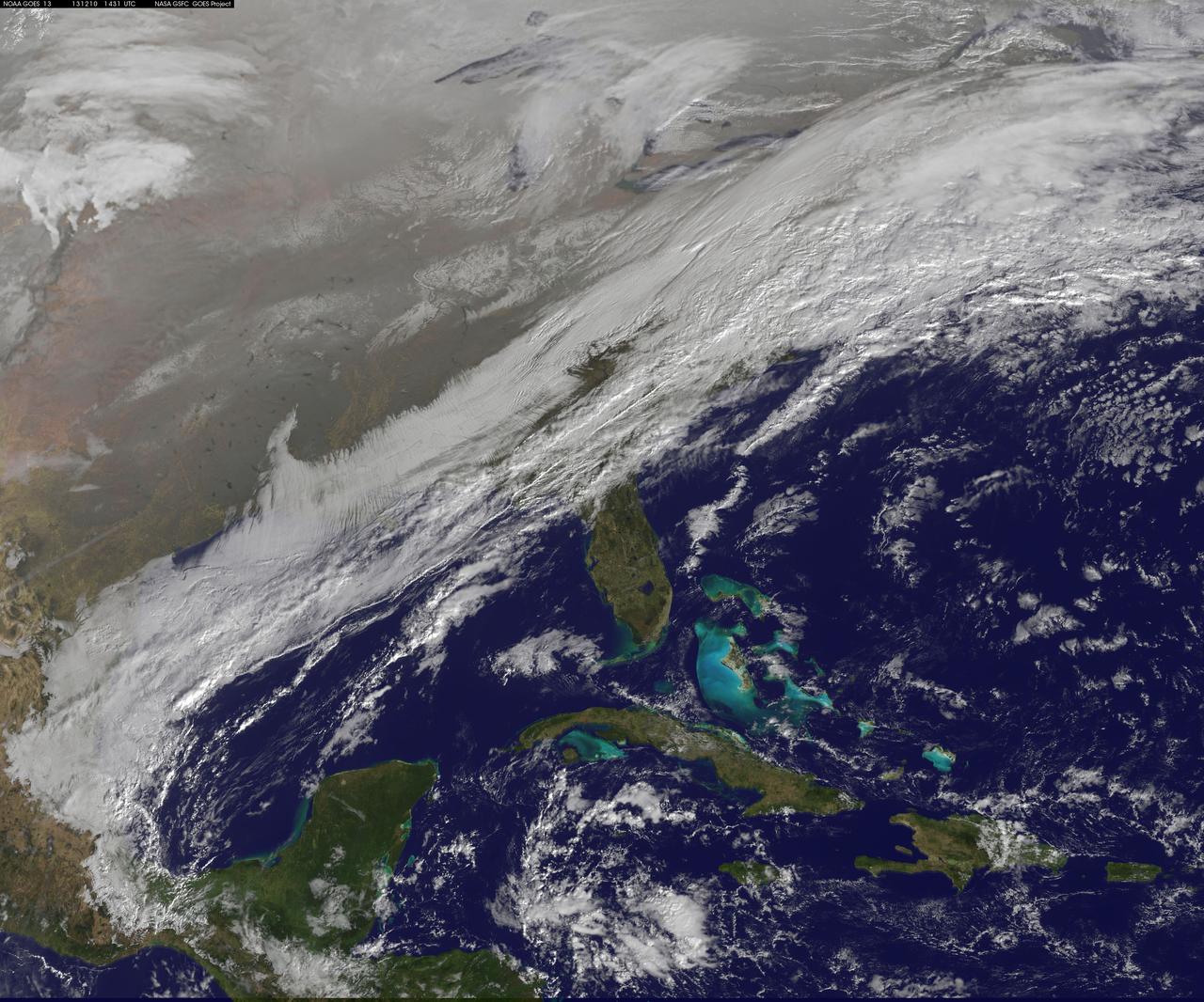
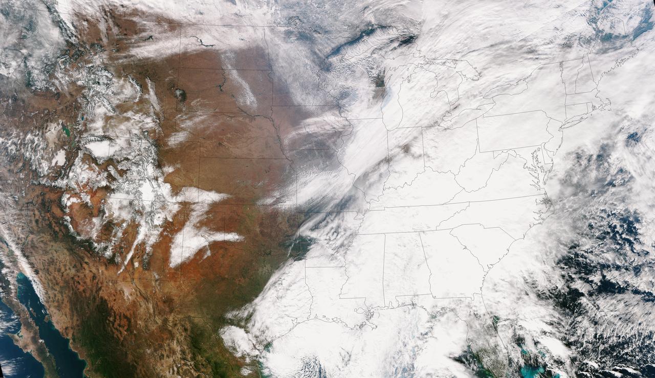
This image shows the strom system on Dec. 10, 2013 at 1445 UTC. According to the National Weather Service snow is falling from Tennessee Valley into the Mid-Atlantic and New England Tuesday . The fast moving system is creating swath of 2 to 7 inches of snow from southwest Virginia to the New England coast. Heavy Lake Effect snows will also impact the Lower Great Lakes into later this week, with up to two feet of accumulation. <b><a href="http://goes.gsfc.nasa.gov/" rel="nofollow">Credit: NOAA/NASA GOES Project</a></b> <b><a href="http://www.nasa.gov/audience/formedia/features/MP_Photo_Guidelines.html" rel="nofollow">NASA image use policy.</a></b> <b><a href="http://www.nasa.gov/centers/goddard/home/index.html" rel="nofollow">NASA Goddard Space Flight Center</a></b> enables NASA’s mission through four scientific endeavors: Earth Science, Heliophysics, Solar System Exploration, and Astrophysics. Goddard plays a leading role in NASA’s accomplishments by contributing compelling scientific knowledge to advance the Agency’s mission. <b>Follow us on <a href="http://twitter.com/NASA_GoddardPix" rel="nofollow">Twitter</a></b> <b>Like us on <a href="http://www.facebook.com/pages/Greenbelt-MD/NASA-Goddard/395013845897?ref=tsd" rel="nofollow">Facebook</a></b> <b>Find us on <a href="http://instagrid.me/nasagoddard/?vm=grid" rel="nofollow">Instagram</a></b>
This true color image of the Continental United States was taken on Nov. 25, 2013 by the Suomi NPP satellite and shows the system as it moves through the South and Midwest. The National Weather Service noted that a complex and powerful storm system continues to generate widespread moderate to heavy rainfall and snows in various parts of the eastern United States as travelers make their way to destinations to celebrate Thanksgiving and Hanukkah on Nov. 28. There are two low-pressure areas working together. One was centered near New Jersey while the other was located over the Carolinas. From the Southeast to New England widespread moderate to heavy rainfall is expected. The rains will also affect the Mid-Atlantic and Southeastern United States, although those regions are not expected to get as much of a soaking. The Appalachians and interior New England are expected to receive snowfall. Areas of heavy snow are forecast for northwestern Indiana and northwestern Pennsylvania on Nov. 27. Snows will blanket the north central United States from the Dakotas to Minnesota, Iowa, Wisconsin, Michigan, the Ohio and Tennessee Valleys, upstate New York and parts of northern New England. The National Weather Service noted that cold air is moving in behind the storm and drop temperatures along the eastern U.S. making for a chilly Thanksgiving. Credit: NASA/NOAA <b><a href="http://www.nasa.gov/audience/formedia/features/MP_Photo_Guidelines.html" rel="nofollow">NASA image use policy.</a></b> <b><a href="http://www.nasa.gov/centers/goddard/home/index.html" rel="nofollow">NASA Goddard Space Flight Center</a></b> enables NASA’s mission through four scientific endeavors: Earth Science, Heliophysics, Solar System Exploration, and Astrophysics. Goddard plays a leading role in NASA’s accomplishments by contributing compelling scientific knowledge to advance the Agency’s mission. <b>Follow us on <a href="http://twitter.com/NASA_GoddardPix" rel="nofollow">Twitter</a></b> <b>Like us on <a href="http://www.facebook.com/pages/Greenbelt-MD/NASA-Goddard/395013845897?ref=tsd" rel="nofollow">Facebook</a></b> <b>Find us on <a href="http://instagram.com/nasagoddard?vm=grid" rel="nofollow">Instagram</a></b>
This full disc image of earth shows the strom system on Dec. 10, 2013 at 1445 UTC. According to the National Weather Service snow is falling from Tennessee Valley into the Mid-Atlantic and New England Tuesday . The fast moving system is creating swath of 2 to 7 inches of snow from southwest Virginia to the New England coast. Heavy Lake Effect snows will also impact the Lower Great Lakes into later this week, with up to two feet of accumulation. <b><a href="http://goes.gsfc.nasa.gov/" rel="nofollow">Credit: NOAA/NASA GOES Project</a></b> <b><a href="http://www.nasa.gov/audience/formedia/features/MP_Photo_Guidelines.html" rel="nofollow">NASA image use policy.</a></b> <b><a href="http://www.nasa.gov/centers/goddard/home/index.html" rel="nofollow">NASA Goddard Space Flight Center</a></b> enables NASA’s mission through four scientific endeavors: Earth Science, Heliophysics, Solar System Exploration, and Astrophysics. Goddard plays a leading role in NASA’s accomplishments by contributing compelling scientific knowledge to advance the Agency’s mission. <b>Follow us on <a href="http://twitter.com/NASA_GoddardPix" rel="nofollow">Twitter</a></b> <b>Like us on <a href="http://www.facebook.com/pages/Greenbelt-MD/NASA-Goddard/395013845897?ref=tsd" rel="nofollow">Facebook</a></b> <b>Find us on <a href="http://instagrid.me/nasagoddard/?vm=grid" rel="nofollow">Instagram</a></b>
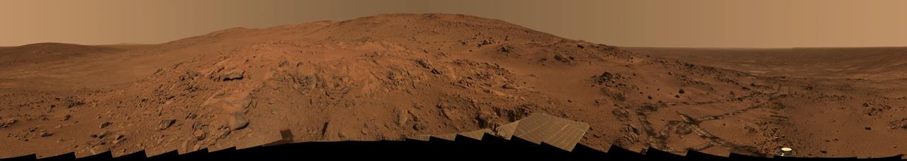
This is the Spirit panoramic camera's "Lookout" panorama, acquired on the rover's 410th to 413th martian days, or sols (Feb. 27 to Mar. 2, 2005). The view is from a position known informally as "Larry's Lookout" along the drive up "Husband Hill." The summit of Husband Hill is the far peak near the center of this panorama and is about 200 meters (656 feet) away from the rover and about 45 meters (148 feet) higher in elevation. The bright rocky outcrop near the center of the panorama is part of the "Cumberland Ridge," and beyond that and to the left is the "Tennessee Valley." The panorama spans 360 degrees and consists of images obtained in 108 individual pointings and five filters at each pointing. This mosaic is an approximately true-color rendering generated using the images acquired through panoramic camera's 750-nanometer, 530-nanometer, and 480-nanometer filters. The lighting varied considerably during the four sols that it took to acquire this image (partly because of imaging at different times of sol, but also partly because of small sol-to-sol variations in the dustiness of the atmosphere), resulting in some obvious image seams or rock shadow variations within the mosaic. These seams have been smoothed out from the sky parts of the mosaic in order to simulate better the vista that a person would have if they were viewing it all at the same time on Mars. However, it is often not possible or practical to smooth out such seams for regions of rock, soil, rover tracks, or solar panels. Such is the nature of acquiring and assembling large Pancam panoramas from the rovers. Spirit's tracks leading back from the "West Spur" region can be seen on the right side of the panorama. The region just beyond the area where the tracks made their last zig-zag is the area known as "Paso Robles," where Spirit discovered rock and soil deposits with very high sulfur abundances. After acquiring this mosaic (which took several weeks to fully downlink and then several more weeks to process), Spirit drove around the Cumberland Ridge rocks seen here and is now driving up the flank of Husband Hill, heading toward the summit. http://photojournal.jpl.nasa.gov/catalog/PIA07882

This image shows three slices of a class of meteorites that fell to Earth that NASA Dawn mission has confirmed as originating from the giant asteroid Vesta.
A winter storm was bringing snow, sleet and freezing rain from lower Mississippi Valley to Northeastern U.S. on Thursday, March 5, 2015. A new NASA animation of NOAA's GOES-East satellite imagery showed the progression of the clouds associated with the storm system that triggered winter storm warnings and winter weather advisories from the southern Plains eastward through the Mid-Atlantic and southern New England coast. The system also triggered flood warnings along and to the west of the central Appalachians. An animation of GOES satellite visible and infrared imagery from March 3 through March 5 showed clouds associated with a cold front push over U.S. East coast. Behind the front, Arctic air is expected to drop low temperatures into the single numbers from Washington, D.C. to Minnesota overnight. Temperatures in the Carolinas and Tennessee are expected to drop to the low 20s. NOAA's National Weather Service Weather Prediction Center (NWS NPC) in College Park, Maryland noted "a strong cold front moving across the eastern U.S. will bring heavy snow from parts of the Ohio Valley to the Northeast today (March 5) with rain, freezing rain and sleet possible from parts of the lower Mississippi Valley across the Southeast to the southern Mid-Atlantic. Snowfall totals of 5 to 10 inches are possible for some areas. Winter Storm Warnings remain in effect from Texas to Nantucket." The animation ends at 17:45 UTC (12:45 p.m. EST). Before the end of the animation, the low pressure center along an arctic frontal boundary was nearly stationary over western North Carolina at 9 a.m. EST on March 5, according to the NWS NPC. NWS radar and surface observations indicated an extended swath of precipitation from near the Texas Gulf Coast through the interior eastern U.S. into southern New England. NPC's storm summary noted at that time "rain was changing to sleet/freezing rain and to all snow along a band within this swath as colder air continues to filter in from the north. Some areas in Tennessee, the northern mid-Atlantic and southern New England were reporting moderate to heavy snow." To create the video and imagery, NASA/NOAA's GOES Project takes the cloud data from NOAA's GOES-East satellite and overlays it on a true-color image of land and ocean created by data from the Moderate Resolution Imaging Spectroradiometer, or MODIS, instrument that flies aboard NASA's Aqua and Terra satellites. Together, those data created the entire picture of the storm and show its movement. After the storm system passes, the snow on the ground becomes visible. GOES satellites provide the kind of continuous monitoring necessary for intensive data analysis. Geostationary describes an orbit in which a satellite is always in the same position with respect to the rotating Earth. This allows GOES to hover continuously over one position on Earth's surface, appearing stationary. For updated information about the storm system, visit NOAA's NWS website: <a href="http://www.weather.gov" rel="nofollow">www.weather.gov</a> For more information about GOES satellites, visit: <a href="http://www.goes.noaa.gov/" rel="nofollow">www.goes.noaa.gov/</a> or goes.gsfc.nasa.gov/ Rob Gutro NASA's Goddard Space Flight Center <b><a href="http://www.nasa.gov/audience/formedia/features/MP_Photo_Guidelines.html" rel="nofollow">NASA image use policy.</a></b> <b><a href="http://www.nasa.gov/centers/goddard/home/index.html" rel="nofollow">NASA Goddard Space Flight Center</a></b> enables NASA’s mission through four scientific endeavors: Earth Science, Heliophysics, Solar System Exploration, and Astrophysics. Goddard plays a leading role in NASA’s accomplishments by contributing compelling scientific knowledge to advance the Agency’s mission. <b>Follow us on <a href="http://twitter.com/NASAGoddardPix" rel="nofollow">Twitter</a></b> <b>Like us on <a href="http://www.facebook.com/pages/Greenbelt-MD/NASA-Goddard/395013845897?ref=tsd" rel="nofollow">Facebook</a></b> <b>Find us on <a href="http://instagrid.me/nasagoddard/?vm=grid" rel="nofollow">Instagram</a></b>
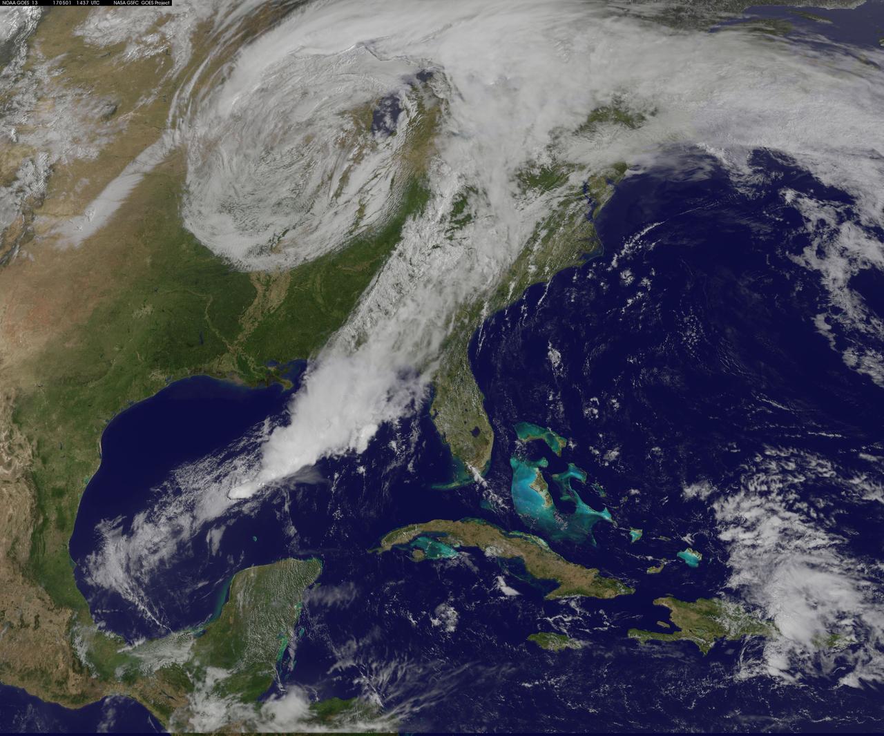
NASA Sees Severe Weather from Central to Eastern US A vigorous weather system has generated severe weather over the mid-section of the U.S. and satellites are providing a look at it as it is moving toward the East Coast. NASA and NOAA satellites have been tracking a storm system that has generated flooding and tornadic thunderstorms in the central U.S. and is expected bring severe weather to the U.S. Mid-Atlantic region. At NASA's Goddard Space Flight Center in Greenbelt, Maryland, data from NOAA's GOES-East satellite were used to create images and an animation of the movement of the powerful storm. On April 30, the Moderate Resolution Imaging Spectroradiometer, or MODIS, instrument aboard NASA's Aqua satellite captured a visible image of the storms moving over eastern Texas and Louisiana. Tornadoes in eastern Texas killed four people. The system generated heavy rainfall and caused additional fatalities and damages in Arkansas, Missouri, Mississippi, Alabama and Tennessee. On Monday, May 1, NOAA's National Weather Service noted, "Major to record flooding continues over portions of the central U.S. Severe thunderstorms are possible from the Mid-Atlantic to the northeastern U.S. "Major to record flooding will continue over portions of eastern Oklahoma, northern Arkansas, Missouri, Illinois and Indiana. Rivers will gradually recede over the next several days. Additional strong to severe thunderstorms will be possible Monday afternoon and evening over portions of the Mid-Atlantic and Northeast U.S. Damaging winds, large hail, and isolated tornadoes will be possible." Image caption: On May 1, 2017, at 10:37 a.m. EDT (1437 UTC) NOAA's GOES-East satellite captured this visible image of the storm system centered over Iowa with an associated cold front that stretches into the Gulf of Mexico. Credits: NASA/NOAA GOES Project <b><a href="http://www.nasa.gov/audience/formedia/features/MP_Photo_Guidelines.html" rel="nofollow">NASA image use policy.</a></b> <b><a href="http://www.nasa.gov/centers/goddard/home/index.html" rel="nofollow">NASA Goddard Space Flight Center</a></b> enables NASA’s mission through four scientific endeavors: Earth Science, Heliophysics, Solar System Exploration, and Astrophysics. Goddard plays a leading role in NASA’s accomplishments by contributing compelling scientific knowledge to advance the Agency’s mission. <b>Follow us on <a href="http://twitter.com/NASAGoddardPix" rel="nofollow">Twitter</a></b> <b>Like us on <a href="http://www.facebook.com/pages/Greenbelt-MD/NASA-Goddard/395013845897?ref=tsd" rel="nofollow">Facebook</a></b> <b>Find us on <a href="http://instagrid.me/nasagoddard/?vm=grid" rel="nofollow">Instagram</a></b>
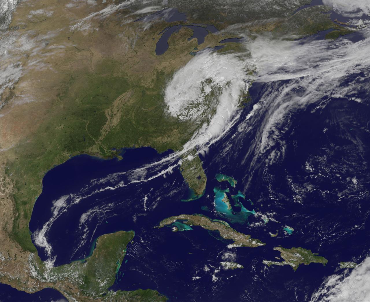
NASA image captured April 12, 2011 at 1731 UTC (1:31 p.m. EDT) A giant swirl of clouds that form an apostrophe-like shape over the eastern U.S. was spotted in visible imagery from the Geostationary Operational Environmental Satellite, GOES-13 on April 12, 2011 at 1731 UTC (1:31 p.m. EDT). The GOES-13 satellite monitors weather over the eastern continental U.S. and Atlantic Ocean, while GOES-11 monitors the western U.S. and the Eastern Pacific Ocean. GOES-13 captured this image of the clouds associated with a strong upper level low pressure area that is moving though the Tennessee River Valley and bringing moderate to heavy rainfall as it moves eastward. The low is forecast by the National Weather Service to bring unsettled conditions to the Mid-Atlantic and then to New England late Tuesday and Wednesday as it tracks northeast. Severe thunderstorms are possible today in extreme eastern Virginia and North Carolina as the cold front associated with the low pushes through that region. Meanwhile, rainfall from the low stretches from Massachusetts south to Florida today. It seems that New Englanders are having a tough time getting warm spring weather and this low won't help as it moves north. The low pressure area may even bring some light to moderate snowfall on the northern fringe of the storm. The GOES series of satellites keep an eye on the weather happening over the continental U.S. and eastern Pacific and Atlantic Oceans. NASA's GOES Project, located at NASA's Goddard Space Flight Center in Greenbelt, Md., procures and manages the development and launch of the GOES series of satellites for NOAA and creates images and animations. The GOES satellites are operated by NOAA. Rob Gutro NASA's Goddard Space Flight Center <b><a href="http://goes.gsfc.nasa.gov/" rel="nofollow">Credit: NOAA/NASA GOES Project</a></b> <b><a href="http://www.nasa.gov/centers/goddard/home/index.html" rel="nofollow">NASA Goddard Space Flight Center</a></b> enables NASA’s mission through four scientific endeavors: Earth Science, Heliophysics, Solar System Exploration, and Astrophysics. Goddard plays a leading role in NASA’s accomplishments by contributing compelling scientific knowledge to advance the Agency’s mission. <b>Follow us on <a href="http://twitter.com/NASA_GoddardPix" rel="nofollow">Twitter</a></b> <b>Join us on <a href="http://www.facebook.com/pages/Greenbelt-MD/NASA-Goddard/395013845897?ref=tsd" rel="nofollow">Facebook</a></b>