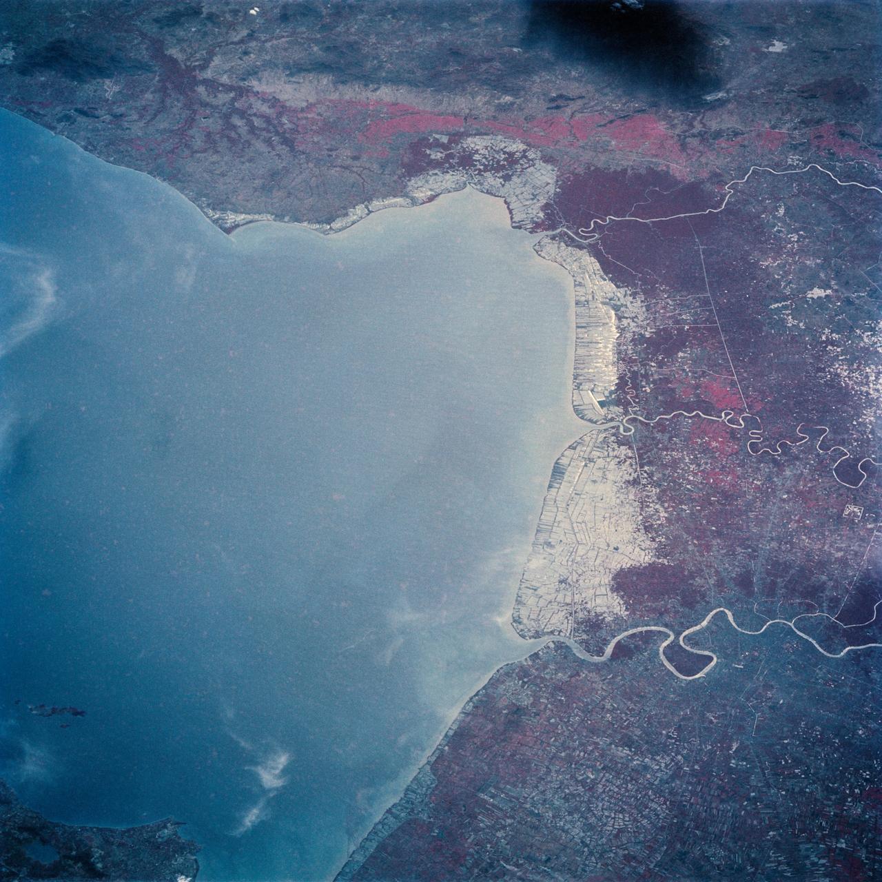
The Bight of Bangkok and the city of Bangkok, Thailand are visible in this west looking view. The city of Bangkok, with an estimated population in excess of 3.7 million people, can be seen in the lower right-hand corner of the view. The city, famous as a jewelry trading center, dealing in precious stones and silver and bronze ware, is situated in a vast lowland. This lowland is a major rice growing area interspersed with canals used for irrigation and drainage. Rice is a major export commodity of Thailand. The deforested hills of the Bilauktaung Range can be seen at the top of the view.

This radar image shows the dramatic landscape in the Phang Hoei Range of north central Thailand, about 40 kilometers 25 miles northeast of the city of Lom Sak.
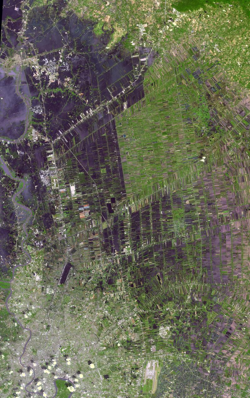
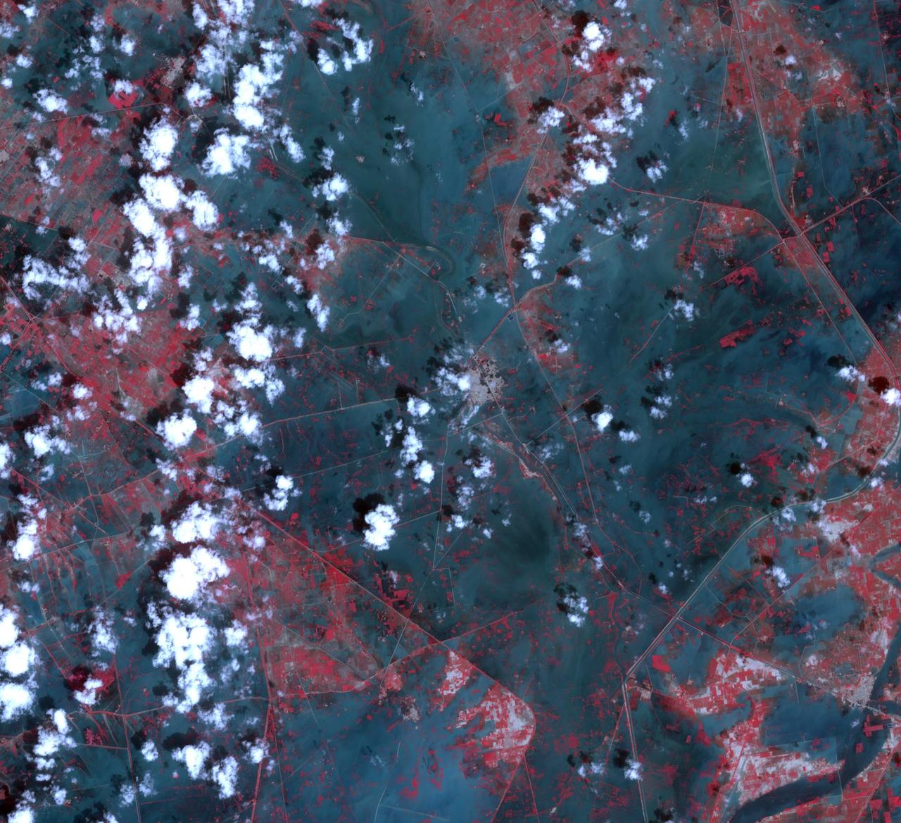
The flooding from the Chao Phraya River, Thailand, was draining slowly when this image was acquired on Nov. 17, 2011, by NASA Terra spacecraft.
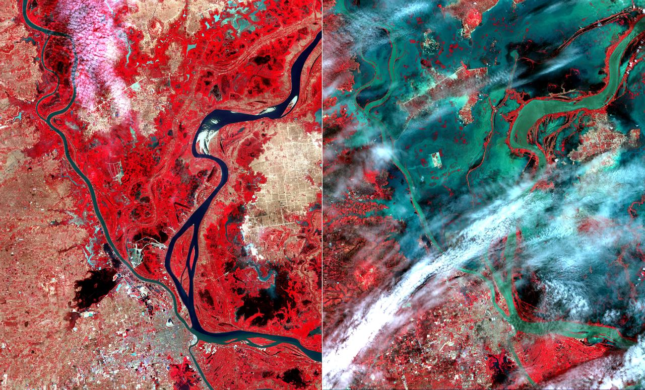
Flooding from the Chao Phraya River, Thailand, had begun to ebb in this image acquired by NASA Terra spacecraft on Nov. 1, 2011. Here, in blue-gray is the muddy water that had overflowed the banks of the river, flooding agricultural fields and villages.
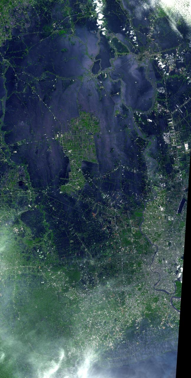
NASA Terra spacecraft acquired this image of flooding from the Chao Phraya River, Thailand on Nov. 8, 2011. The muddy water that had overflowed the banks of the river, flooding agricultural fields and villages, is seen in dark blue and blue-gray.
iss072e143370 (Nov. 1, 2024) --- Earth's dim atmopsheric glow blankets the Gulf of Thailand dotted with the lights of fishing boats in this orbital nighttime photograph from the International Space Station as it soared 259 miles above.
This image from NASA Terra spacecraft shows the Indian Ocean coastline north of Phuket, Thailand is a major tourist destination that was in the path of the tsunami produced by a giant offshore earthquake on December 26, 2004.
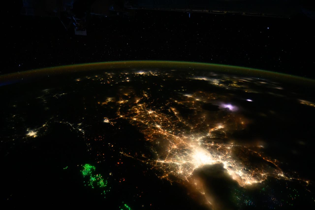
iss071e056627 (May 6, 2024) --- The city lights of Bangkok,Thailand, and its suburbs contrast with the green lights of the fishing boats on the Gulf of Thailand and the Andaman Sea.
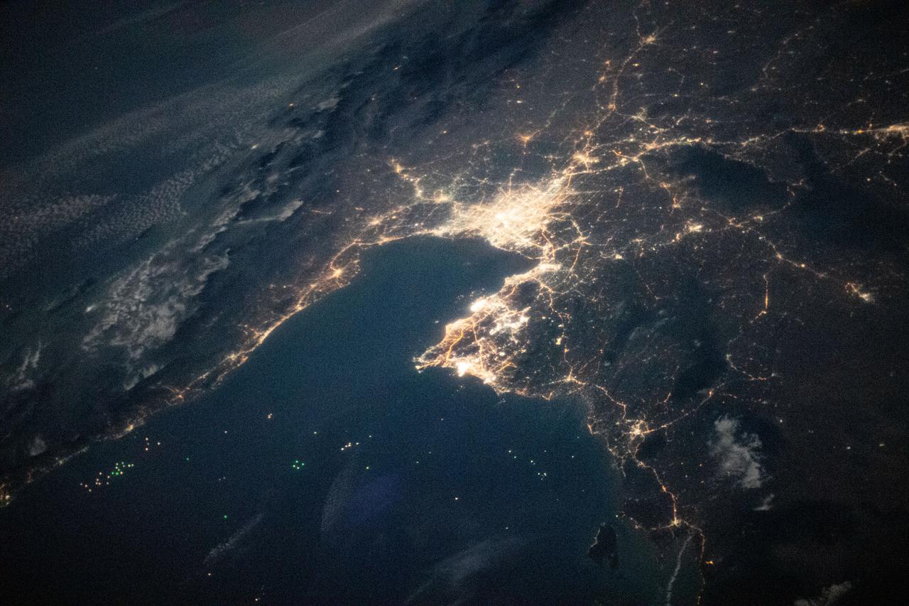
iss064e037842 (Feb. 26, 2021) --- The night lights of Bangkok, the capital of Thailand, on the Gulf of Thailand, are pictured from the International Space Station as it orbited 260 miles above the southern coast of Vietnam.

Dean Chapman displays tektites from Thailand
This image acquired by NASA Terra spacecraft shows unusually heavy rains over the upper Mekong River in Laos and Thailand that led to severe flooding in Cambodia in mid-August 2011. The city of Phnom Penh is at the bottom center of the image.
NASA Terra spacecraft captured this image of the city of Jhudo, Pakistan, and surrounding countryside on Sept. 24, 2011. Torrential monsoon rains in south Asia have displaced hundreds of thousands of residents in India, Pakistan and Thailand.
![Earth observation taken by the Expedition 39 crew aboard the ISS. Image was released by astronaut on Twitter and downlinked in folder: Bangkok [Thailand].](https://images-assets.nasa.gov/image/iss039e010626/iss039e010626~medium.jpg)
Earth observation taken by the Expedition 39 crew aboard the ISS. Image was released by astronaut on Twitter and downlinked in folder: Bangkok [Thailand].
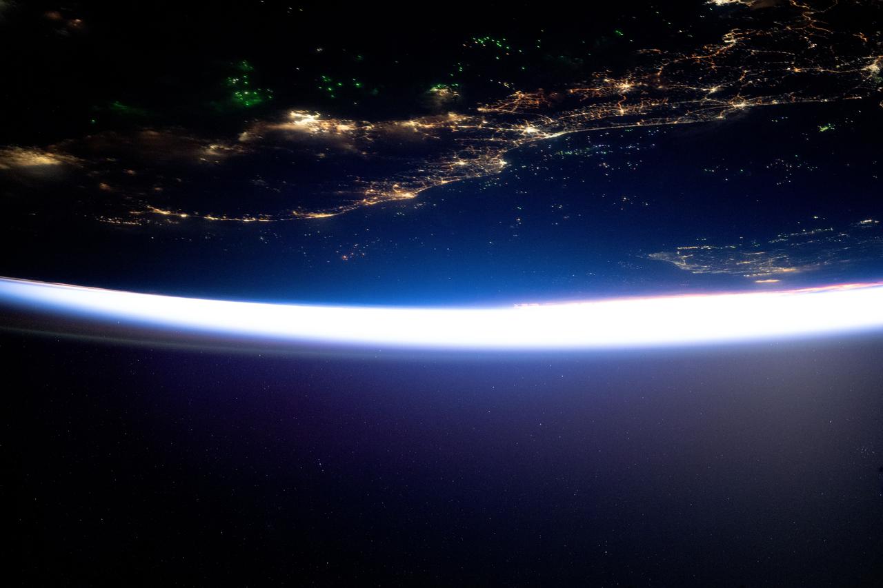
iss071e604388 (Aug. 15, 2024) --- The city lights of southern Thailand and Malaysia sit in between the Malacca Strait (top) and the Gulf of Thailand with the southern coast of Vietnam, at bottom right, revealed by Ho Chi Minh City's night lights. Fishing boats, lit by LED green lights that attract plankton luring squid for catching, are pictured in both bodies of water in this orbital nighttime photograph from the International Space Station as it soared 261 miles above into a sunrise.

iss066e154491 (Feb. 27, 2022) --- The city lights of Bangkok, the capital of Thailand, are pictured from the International Space Station as it orbited 262 miles above the Southeast Asian nation.

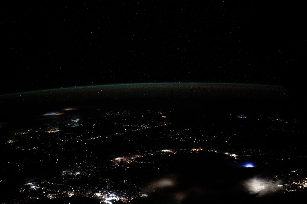
iss073e0257211 (June 17, 2025) --- The city lights of Southeast Asia and lightning storms streak below the International Space Station as it orbited 259 miles above the Gulf of Thailand at approximately 3:17 a.m. local time.
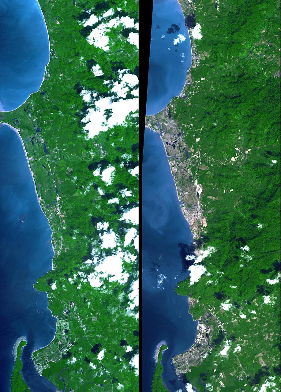
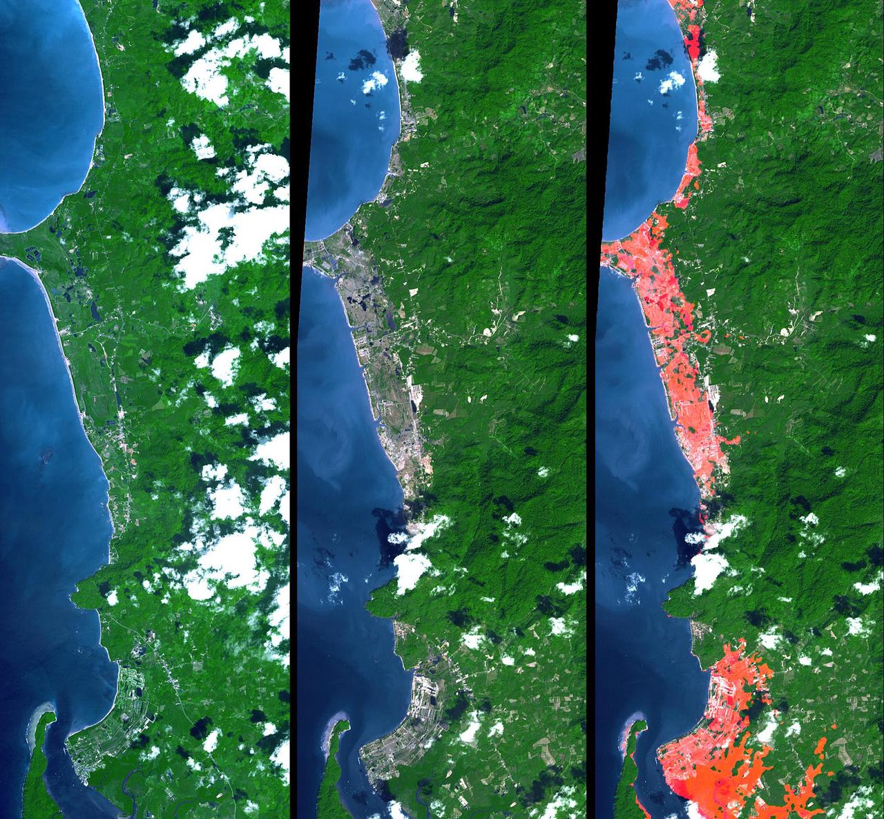
The island of Phuket on the Indian Ocean coast of Thailand is a major tourist destination and was also in the path of the tsunami that washed ashore on December 26, 2004. These simulated natural color ASTER images show a 27 kilometer (17-mile) long stretch of coast north of the Phuket airport on December 31 (right), along with an image acquired two years earlier (left). The changes along the coast are obvious where the vegetation has been stripped away. http://photojournal.jpl.nasa.gov/catalog/PIA07227
NASA image acquired December 14, 2004 In the southernmost reaches of Burma (Myanmar), along the border with Thailand, lies the Mergui Archipelago. The archipelago in the Andaman Sea is made up of more than 800 islands surrounded by extensive coral reefs. This natural color image acquired by Landsat 5 on Dec. 14, 2004, shows the middle portion of the archipelago, including Auckland and Whale Bays. Swirling patterns are visible in the near-shore waters as sediments carried by rivers slowly settle out and are deposited on the seafloor. The heavy sediment loads make the river appear nearly white. As those sediments settle out, the seawater appears deeper shades of blue. The tropical rainforests of the region appear deep green. Captain Thomas Forrest of the East India Company first described the region to Europeans after a 1782 expedition in search of potential sugar-growing lands. At that time, the islands were mainly inhabited by a nomadic fishing culture. These people, known as the Moken, still call the archipelago home and mostly live a hunter-gatherer lifestyle. As of 2006, 2,000 Moken were known to inhabit the Burmese portion of Mergui. The small population of the archipelago has helped preserve its high diversity of plants and animals. In 1997, Burma opened the region to foreign tourism and in the years since it has become a major diving destination. A valued species of pearl oyster (Pinctada maxima) are found in nearby waters. Today, overfishing is emerging as a regional problem. Landsat image created by Michael Taylor, Landsat Project Science Office. Caption by Laura Rocchio. Instrument: Landsat 5 - TM To read more go to: <a href="http://1.usa.gov/TDmjsk" rel="nofollow">1.usa.gov/TDmjsk</a> Credit: <b><a href="http://www.earthobservatory.nasa.gov/" rel="nofollow"> NASA Earth Observatory</a></b> <b><a href="http://www.nasa.gov/audience/formedia/features/MP_Photo_Guidelines.html" rel="nofollow">NASA image use policy.</a></b> <b><a href="http://www.nasa.gov/centers/goddard/home/index.html" rel="nofollow">NASA Goddard Space Flight Center</a></b> enables NASA’s mission through four scientific endeavors: Earth Science, Heliophysics, Solar System Exploration, and Astrophysics. Goddard plays a leading role in NASA’s accomplishments by contributing compelling scientific knowledge to advance the Agency’s mission. <b>Follow us on <a href="http://twitter.com/NASA_GoddardPix" rel="nofollow">Twitter</a></b> <b>Like us on <a href="http://www.facebook.com/pages/Greenbelt-MD/NASA-Goddard/395013845897?ref=tsd" rel="nofollow">Facebook</a></b> <b>Find us on <a href="http://instagram.com/nasagoddard?vm=grid" rel="nofollow">Instagram</a></b>
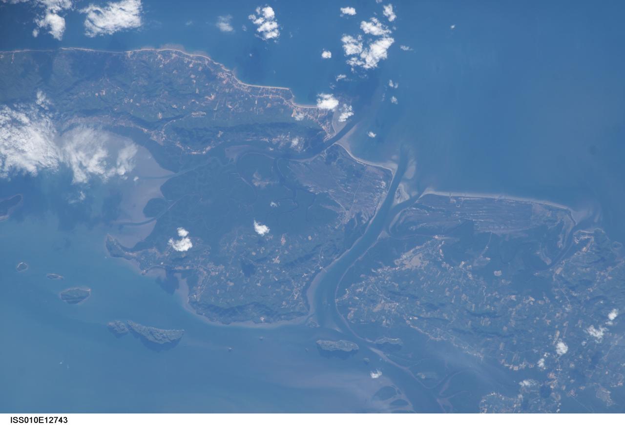
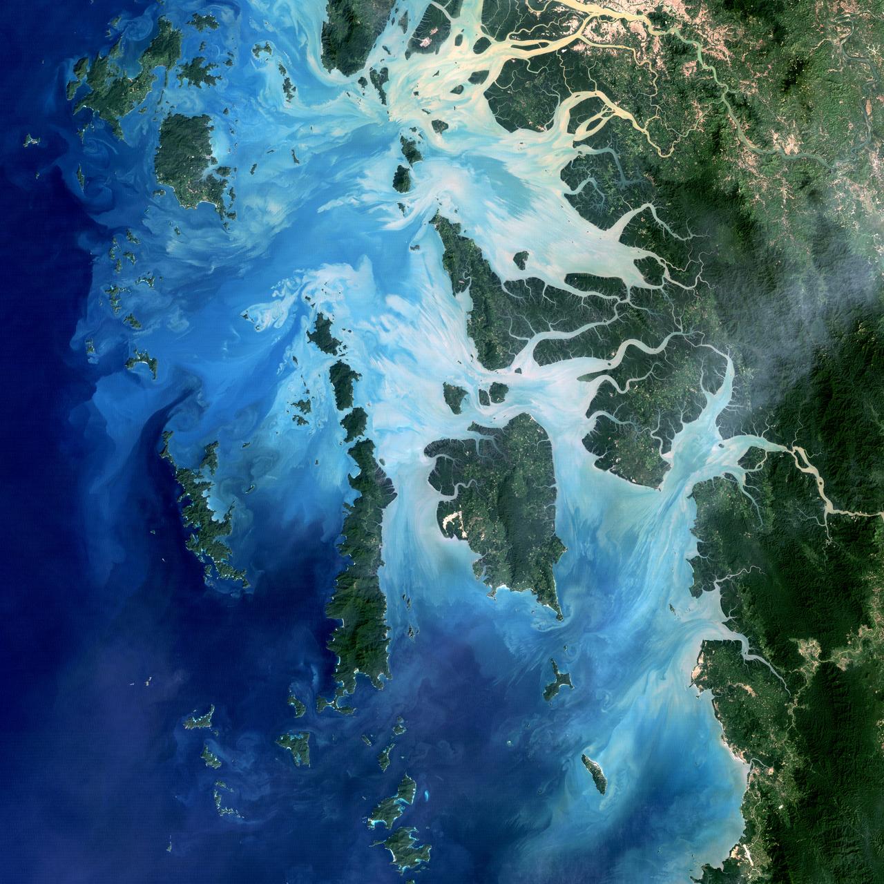
ISS010-E-12743 (11 January 2005) --- One of a series of post-tsunami digital still images photographed by the Expedition 10 crew aboard the International Space Station. This image, recorded on January 11, 2005 and centered at 7.61 degrees north latitude and 99.06 degrees east longitude, features Ko Lanta Yai (Thailand)

ISS010-E-12736 (11 January 2005) --- One of a series of post-tsunami digital still images photographed by the Expedition 10 crew aboard the International Space Station. This image, recorded on January 11, 2005 and centered at 7.83 degrees north latitude and 98.34 degrees east longitude, shows Phuket (Thailand)
ISS010-E-12727 (11 January 2005) --- One of a series of post-tsunami digital still images photographed by the Expedition 10 crew aboard the International Space Station. This image, recorded on January 11, 2005 and centered at 7.61 degrees north latitude and 99.06 degrees east longitude, features Ko Lanta Yai (Thailand)
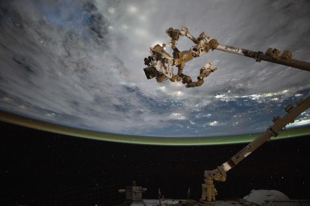
iss073e0695937 (Sept. 1, 2025) --- The Canadarm2 robotic arm with Dextre, its fine-tuned robotic hand attached, is pictured extending from the International Space Station as it orbited 258 miles above the coast of Cambodia on a cloudy Gulf of Thailand.
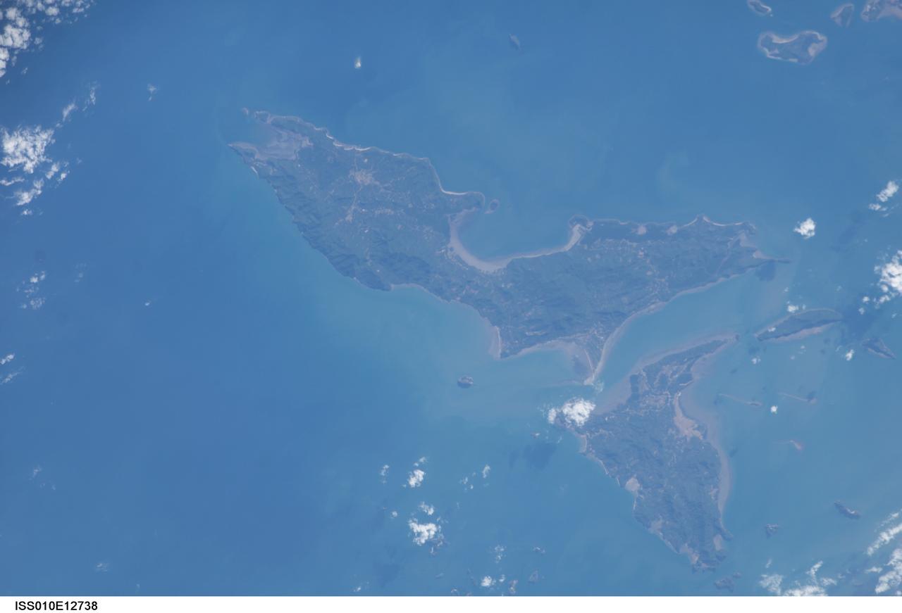
ISS010-E-12738 (11 January 2005) --- One of a series of post-tsunami digital still images photographed by the Expedition 10 crew aboard the International Space Station. This image, recorded on January 11, 2005 and centered at 8.00 degrees north latitude and 98.60 degrees east longitude, is Ko Yao Yai, northwest of Phuket (Thailand).
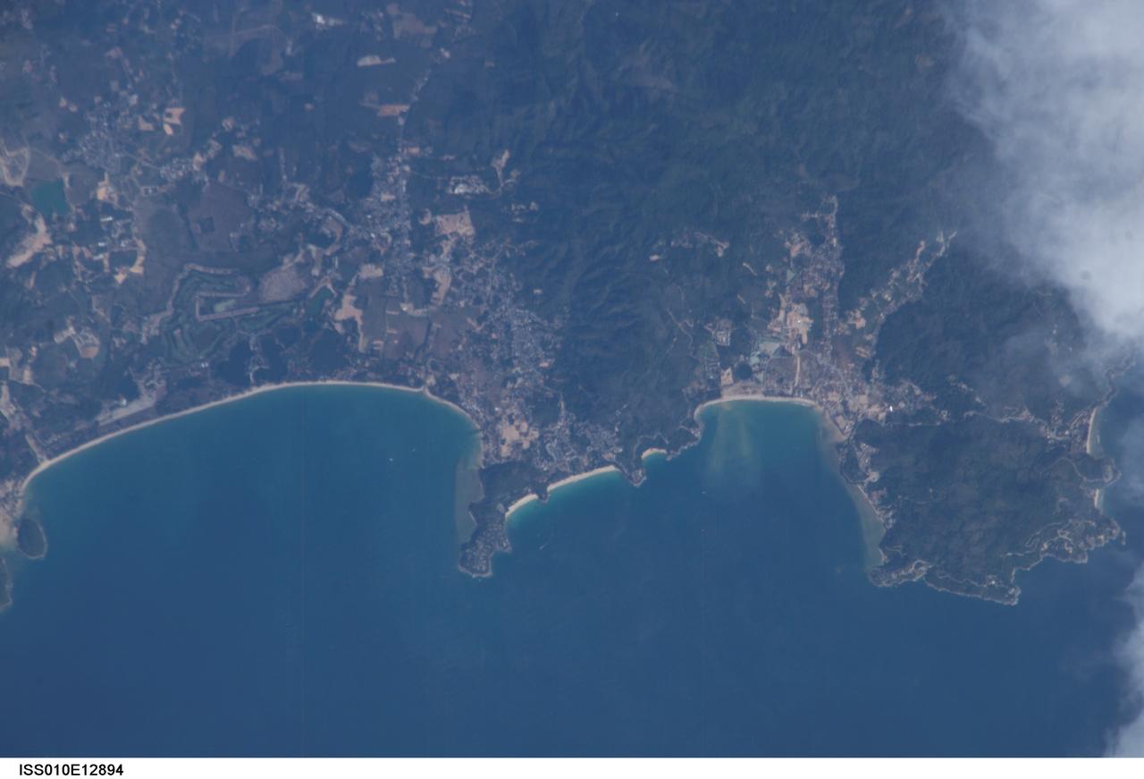
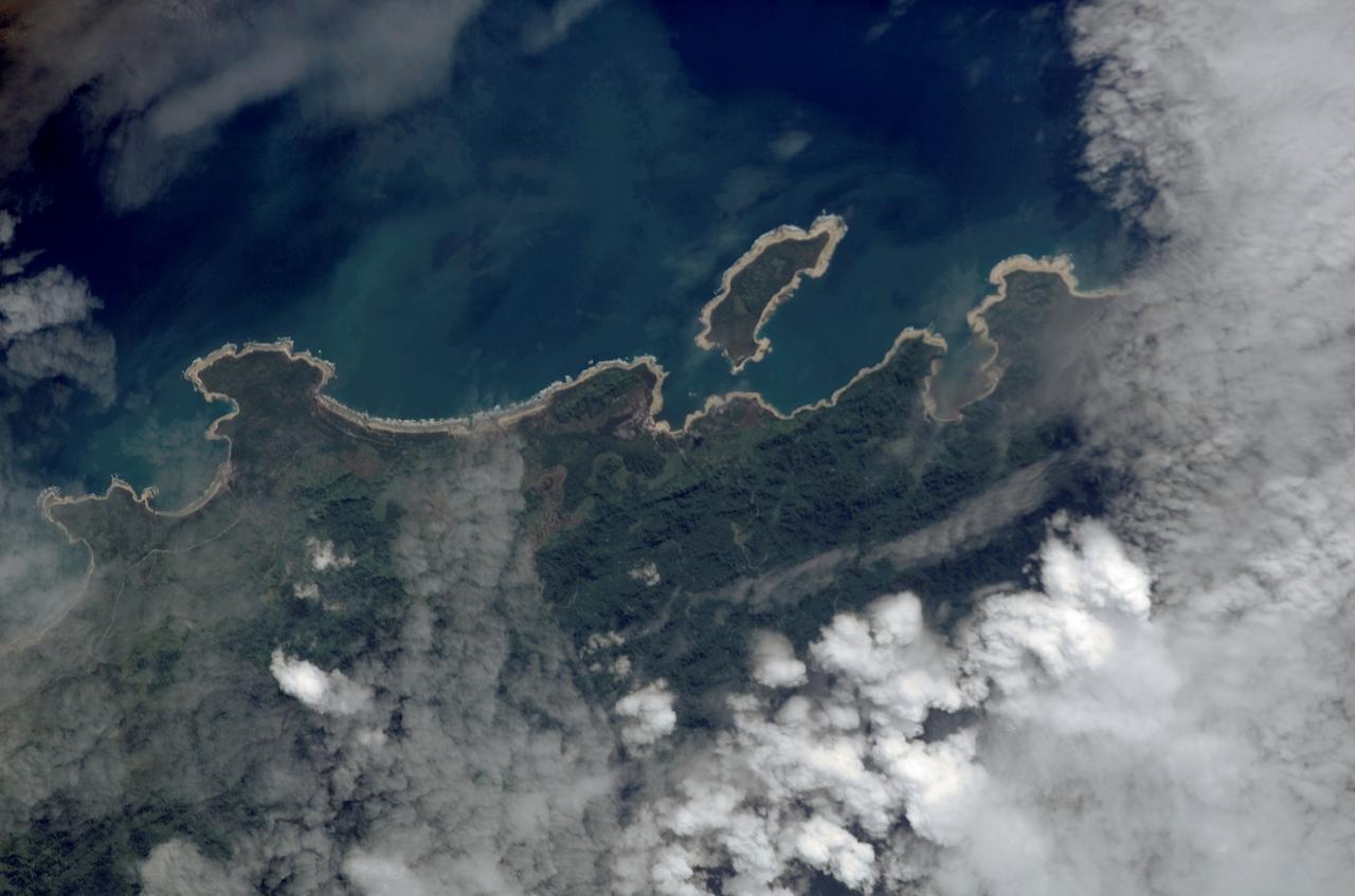
ISS010E12894 (13 January 2005) --- One of a series of post-tsunami digital still images which were photographed from the International Space Station on January 13, 2005. This image showing part of Thailand is centered at 7.96 degrees north latitude and 98.27 degrees east longitude near Phuket. According to NASA scientists studying the ISS imagery, the image shows some damage around the bays and low lying areas adjacent to the bays.

On Oct. 25, 2011, the Chao Phraya River was in flood stage as NASA Terra spacecraft imaged flooded agricultural fields and villages depicted here in dark blue, and the sediment-laden water in shades of tan.
On Oct. 23, 2011, when this image from NASA Terra spacecraft was acquired, flood waters were approaching the capital city of Bangkok as the Ayutthaya River overflowed its banks.