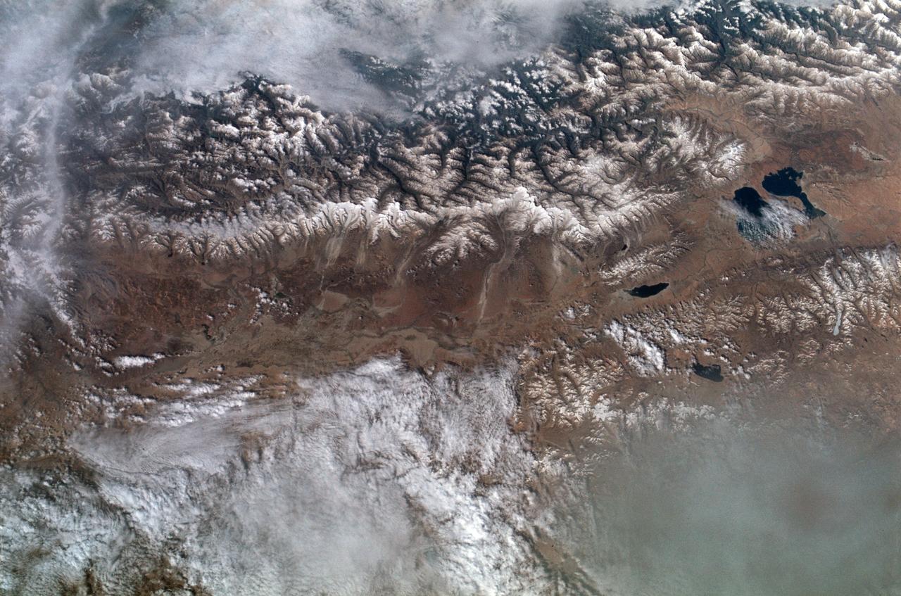
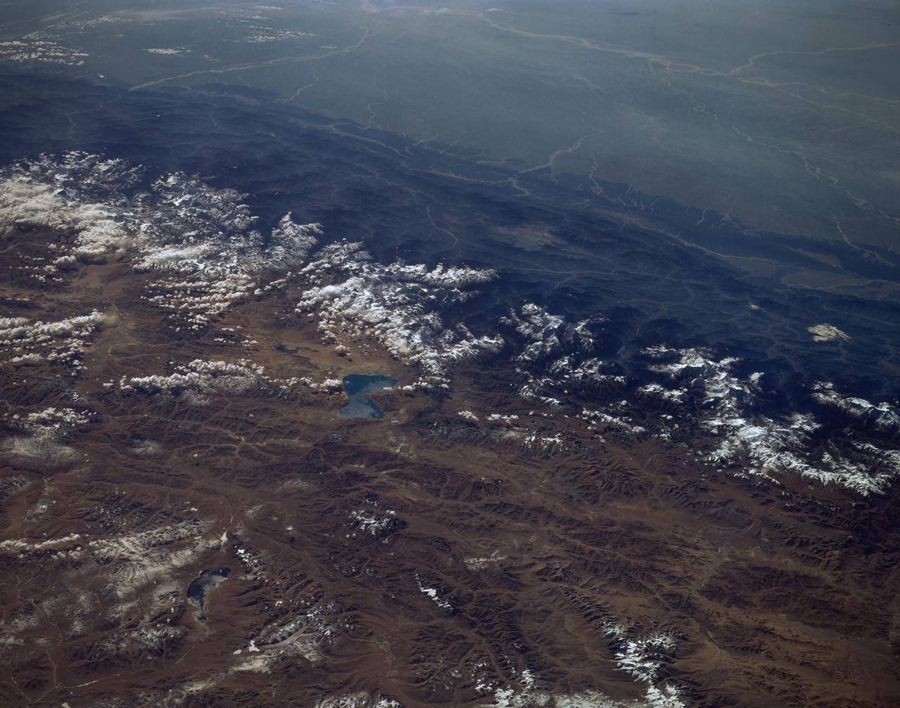
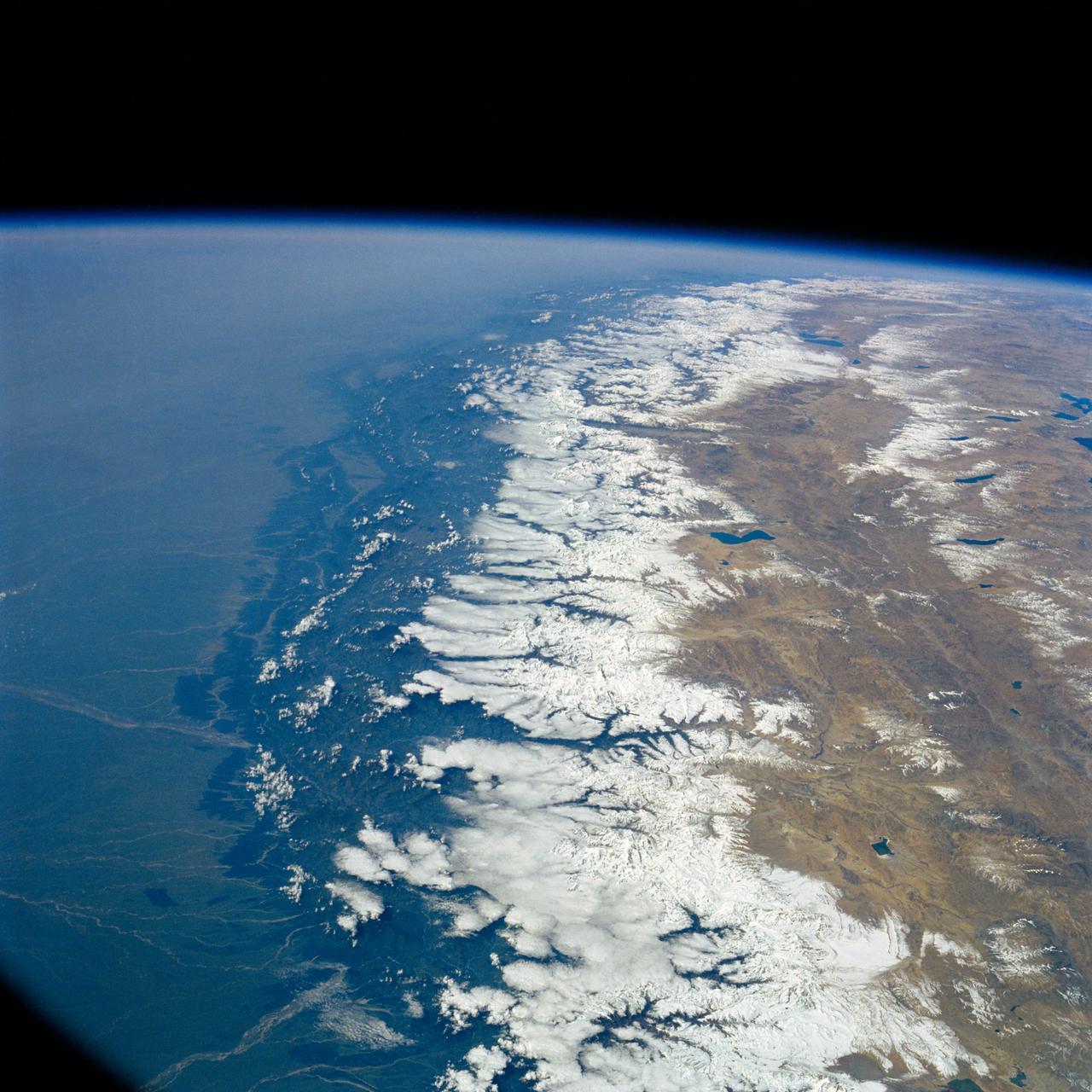
SL2-102-900 (22 June 1973) --- The Great Himalayan Mountain Range, India/Tibet (30.5N, 81.5E) is literally the top of the world where mountains soar to over 20,000 ft. effectively isolating Tibet from the rest of the world. The two lakes seen in the center of the image are the Laga Co and the Kunggyu Co located just inside the Tibet border. Although clouds and rainfall are rare in this region, snow is always present on the mountain peaks. Photo credit: NASA
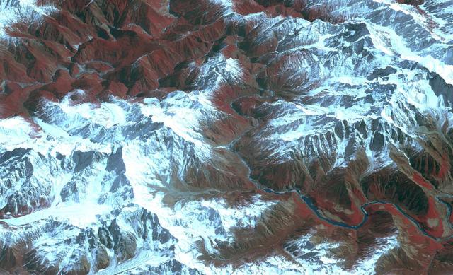
Acquired by NASA Terra spacecraft, this image shows the Yarlung Zangpo Grand Canyon or Tsangpo Gorge in Tibet, the deepest canyon in the world, and longer than the Grand Canyon.
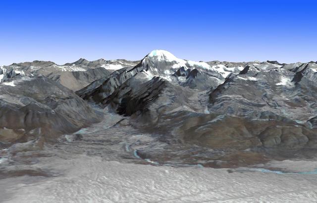
This image from NASA Terra spacecraft shows Mt. Kailash, a peak in the Kailas Range in Tibet. It lies near the source of some of the longest Asian rivers: the Brahmaputra, the Sutlej and the Karnali.
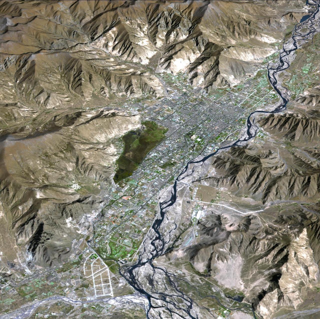
JPL Advanced Spaceborne Thermal Emission and Reflection Radiometer aboard NASA Terra satellite, shows Lhasa, the traditional seat of the Dalai Lama and capital of the Tibet Autonomous Region in China.
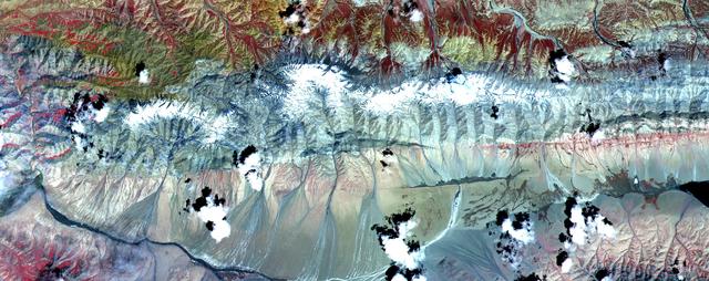
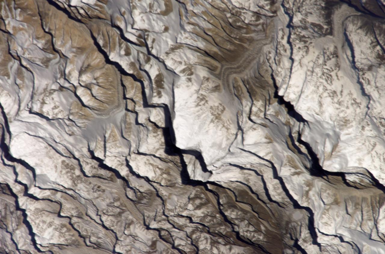
The Kunlun fault is one of the gigantic strike-slip faults that bound the north side of Tibet. Left-lateral motion along the 1,500-kilometer (932-mile) length of the Kunlun has occurred uniformly for the last 40,000 years at a rate of 1.1 centimeter per year, creating a cumulative offset of more than 400 meters (1300 feet). In this image, two splays of the fault are clearly seen crossing from east to west. The northern fault juxtaposes sedimentary rocks of the mountains against alluvial fans. Its trace is also marked by lines of vegetation, which appear red in the image. The southern, younger fault cuts through the alluvium. A dark linear area in the center of the image is wet ground where groundwater has pounded against the fault. Measurements from the image of displacements of young streams that cross the fault show 15 to 75 meters (16 to 82 yards) of left-lateral offset. This image of Tibet covers an area 40 kilometers (25 miles) wide and 15 kilometers (10 miles) long in three bands of the reflected visible and infrared wavelength region. ASTER acquired the scene on July 20, 2000. The image is located at 35.8 degrees north latitude and 93.6 degrees east longitude. http://photojournal.jpl.nasa.gov/catalog/PIA02658
Yamzho Yumco (Sacred Swan) Lake in Tibet is surrounded by snow-capped mountains and is one of the three largest sacred lakes. It is highly crenellated with many bays and inlets. The lake is home to Samding Monastery, headed by a female re-incarnation (Wikipedia). The image was acquired March 6, 2014, covers an area of 49.8 by 60 km, and is centered at 28.9 degrees north, 90.6 degrees east. http://photojournal.jpl.nasa.gov/catalog/PIA21304
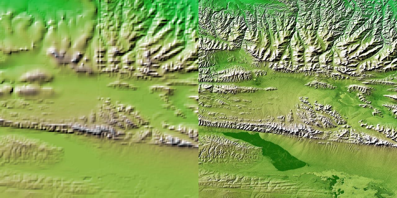
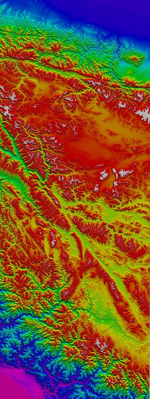
These two images show exactly the same area, part of the Kunlun fault in northern Tibet. The image on the left was created using the best global topographic data set previously available, the U.S. Geological Survey GTOPO30.

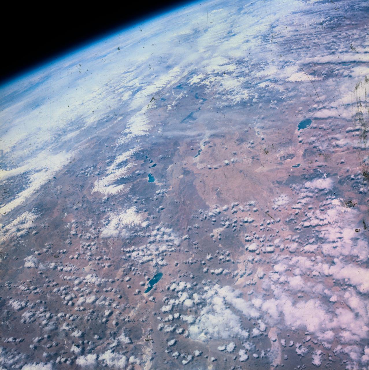
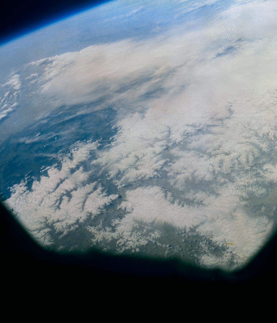
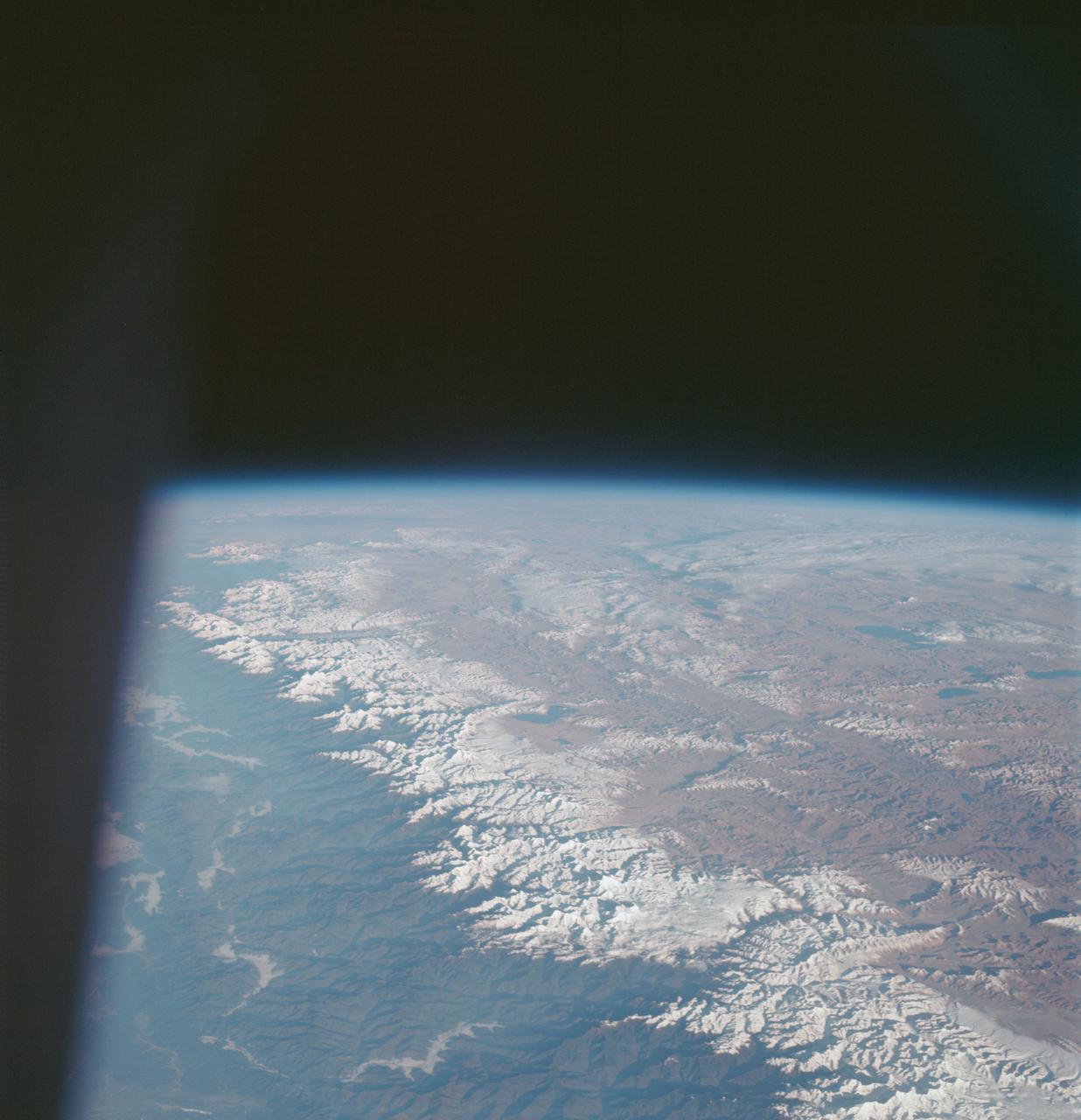
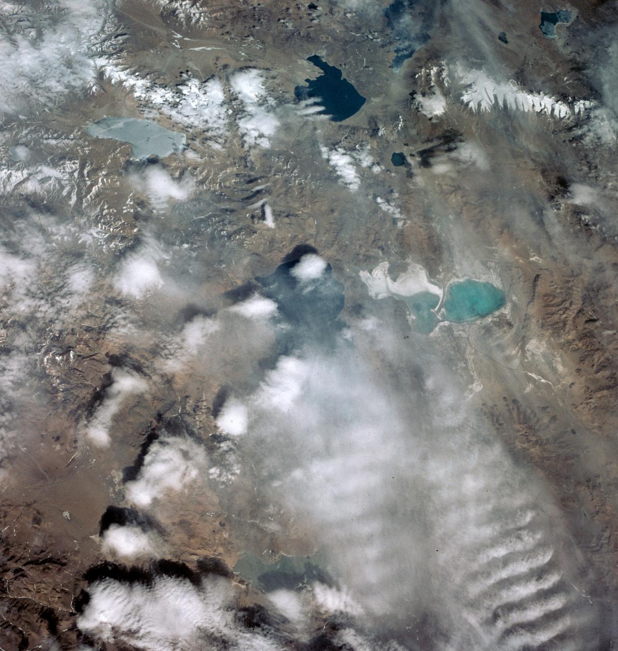
AS7-05-1617 (12 Oct. 1968) --- The great lake-studded highlands of Tibet, as seen from the Apollo 7 spacecraft during its 24th revolution of Earth. Photographed from an altitude of 124 nautical miles. The snow line in the picture is at 18,000 feet; and the lakes are at 15,000 feet above sea level.
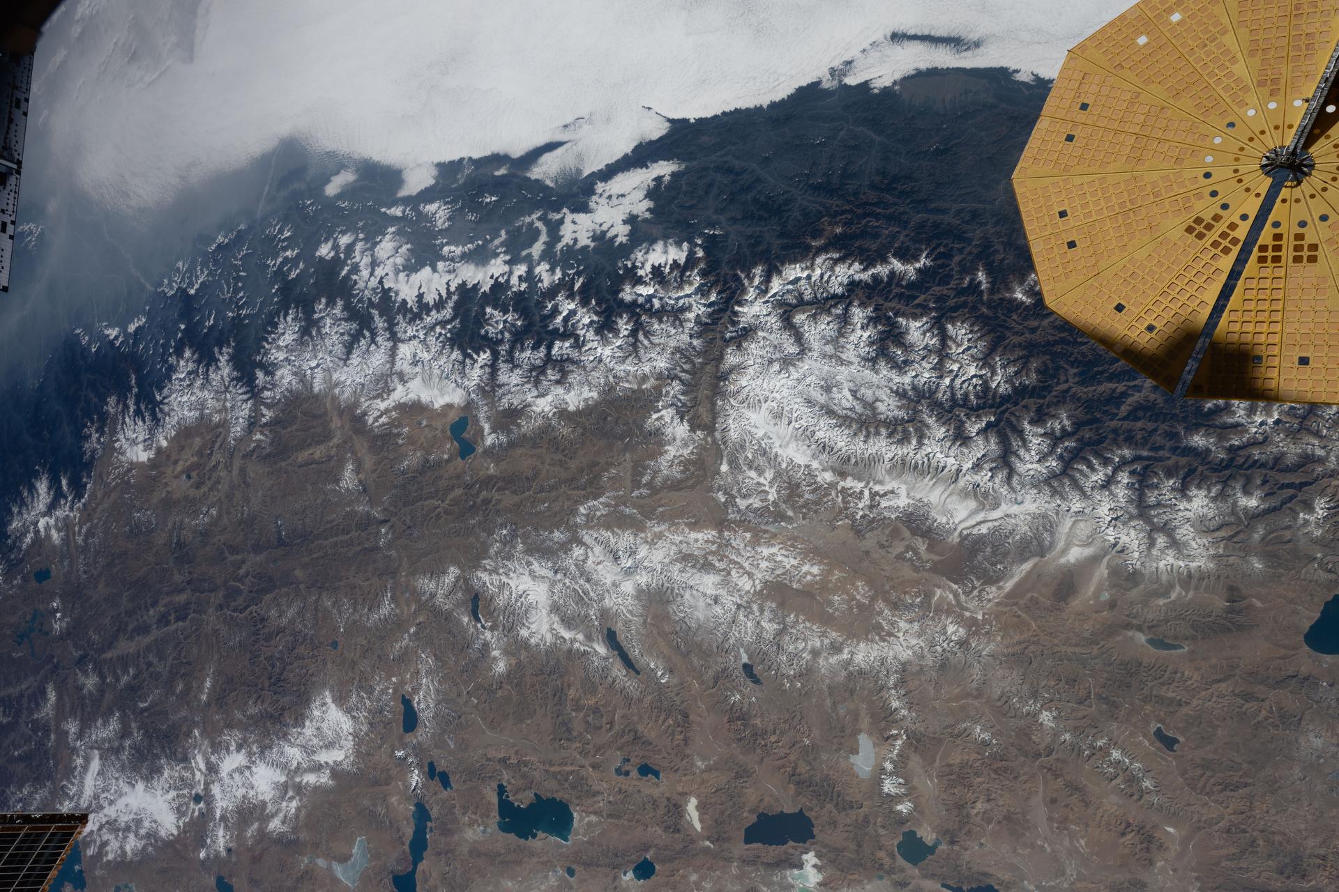
iss074e0002506 (Dec. 13, 2025) --- The Himalayas—separating the moisture-laden portion of the Indian subcontinent from the arid geography of Tibet, China—are pictured from the International Space Station as it orbited 261 miles above Nepal. At upper right is one of two UltraFlex solar arrays that power the Cygnus XL cargo craft from Northrop Grumman.
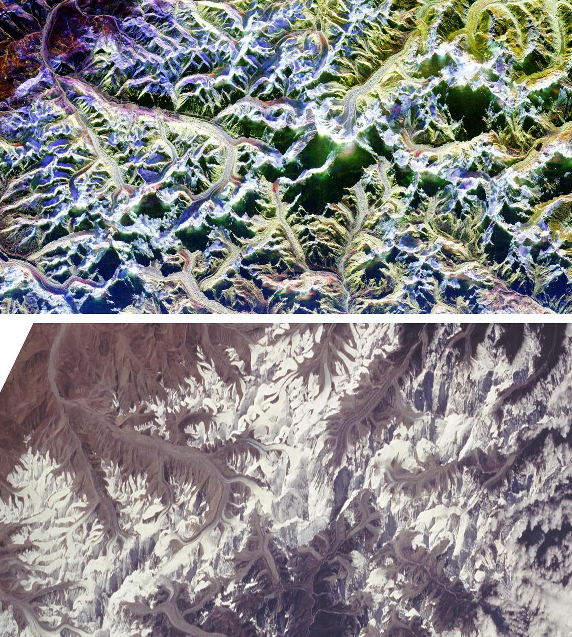
These are two comparison images of Mount Everest and its surroundings, along the border of Nepal and Tibet.
S63-06444 (15-16 May 1963) --- Tibet-Kashmir, looking northwest, as photographed from the Mercury-Atlas 9 (MA-9) capsule by astronaut L. Gordon Cooper Jr. during his 22-orbit MA-9 spaceflight. Lake Ch'in-Tzu-Hu is at upper right, Lake Yen-K'o-Ling-Ts is at lower left center. The Korakaram Range is at upper center portion of the picture. Photo credit: NASA
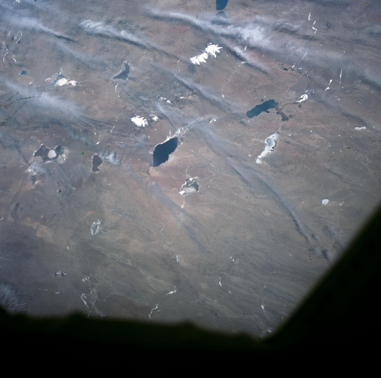
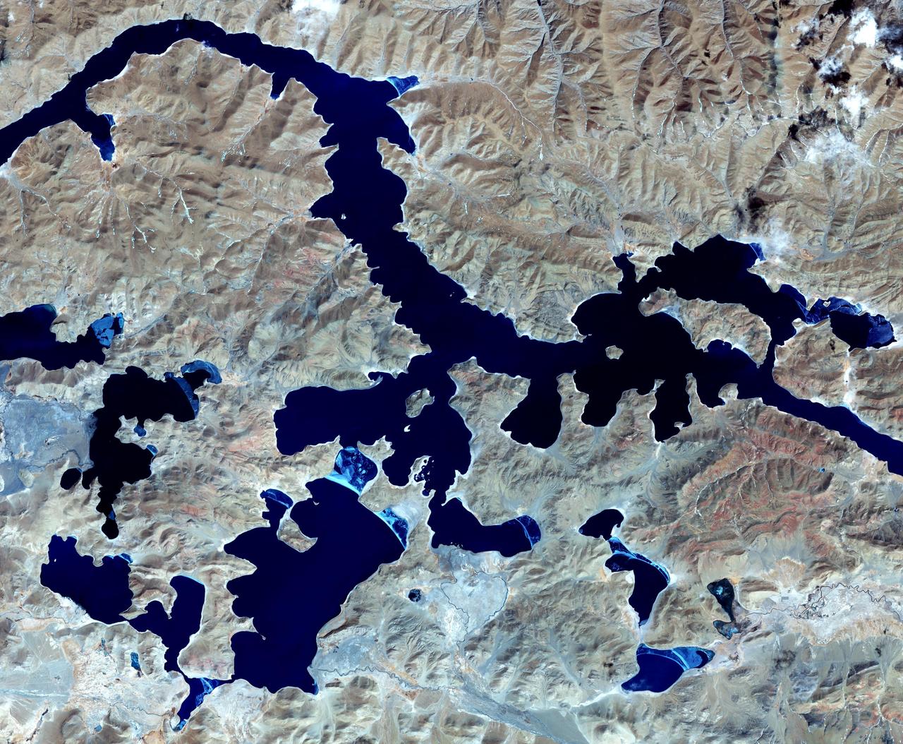
S63-06456 (15-16 May 1963) --- Lakes of Western Tibet, photographed from the Mercury-Atlas 9 (MA-9) capsule by astronaut L. Gordon Cooper Jr., during his 22-orbit MA-9 spaceflight. Photo credit: NASA
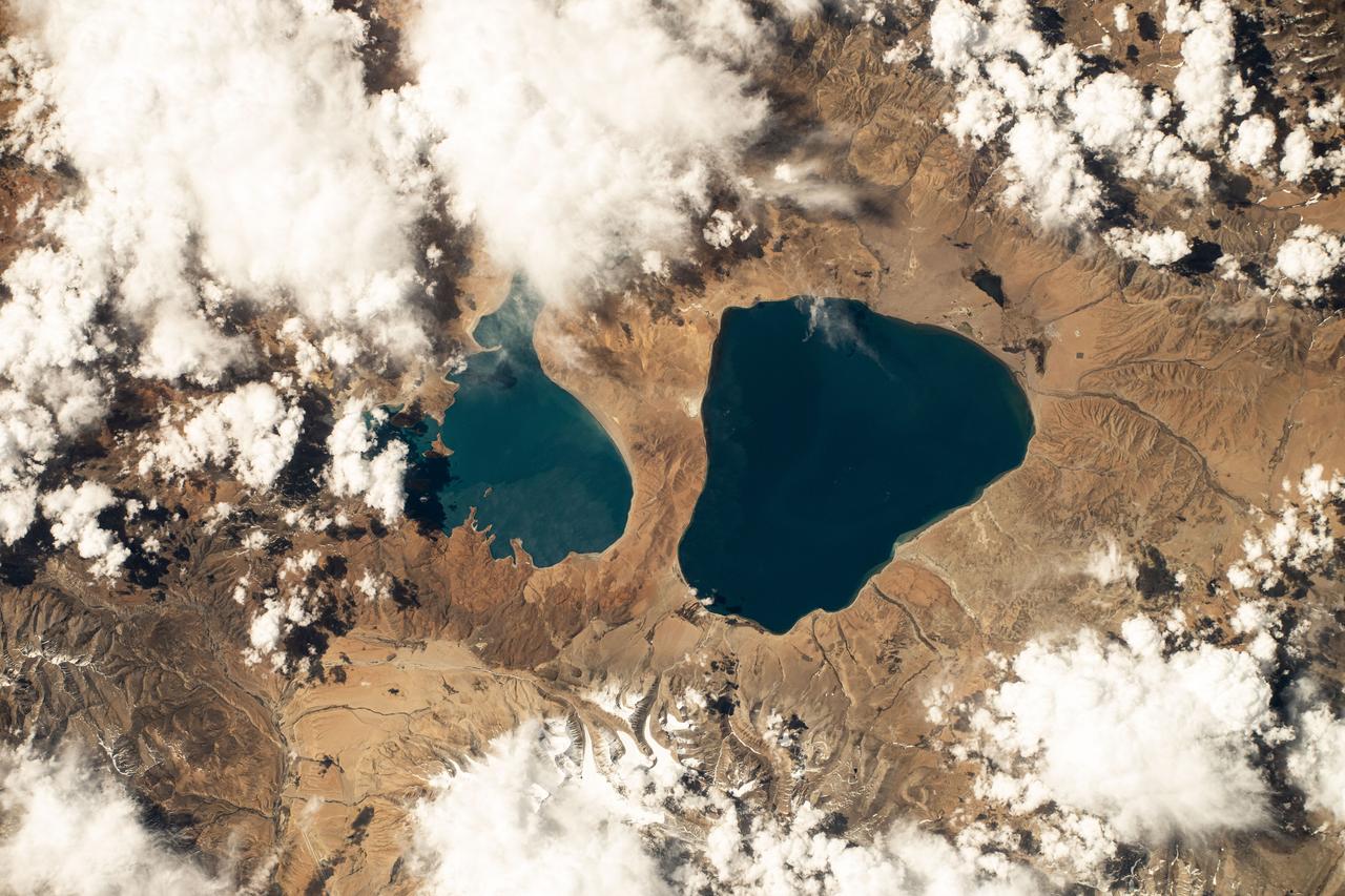
iss071e111824 (May 23, 2024) -- As the International Space Station orbited 257 miles above Tibet, Lake Manasarovar (right) and Lake Rakshastal (left) were photographed. Fed by the Kailash Glaciers, Manasarovar is a high-altitude freshwater lake, connected to its neighboring saltwater lake by the Ganga Chhu river.
S63-06429 (15-16 May 1963) --- Photograph taken of the eastern Himalayas, Tibet, China, India and Burma from the Mercury-Atlas 9 capsule taken by astronaut L. Gordon Cooper Jr., during his 22-orbit Mercury-Atlas 9 (MA-9) spaceflight. Photo credit: NASA
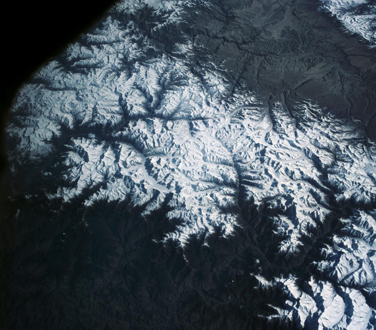
S63-06445 (15-16 May 1963) --- View of the Himalaya Mountain Range in the India-Nepal-Tibet border area, as photographed from the Mercury-Atlas 9 capsule by astronaut L. Gordon Cooper Jr., during his 22-orbit MA-9 spaceflight. Photo credit: NASA
View is southeastward across China (Tibet), half of Nepal and India. The partly frozen lake near the center of the frame is Pei-Ku T'so ("Bos-tie Lake"). The central Himalaya stretches from Mount Everest on the left past Annapurna on the right. Large tributaries converge to form the Ganges River, flowing through the lowland basin south of the Himalaya. This photograph illustrates the rain shadow effect of the Himalaya Chain; wet, warm air from the Indian Ocean is driven against the mountains, lifted, and drained of water that forms ice caps, the abundant rivers, and forests of the foothills. In contrast the high plateau of Tibet is arid, composed largely of topographically-closed basins because stream flow is inadequate to form integrated drainage networks.
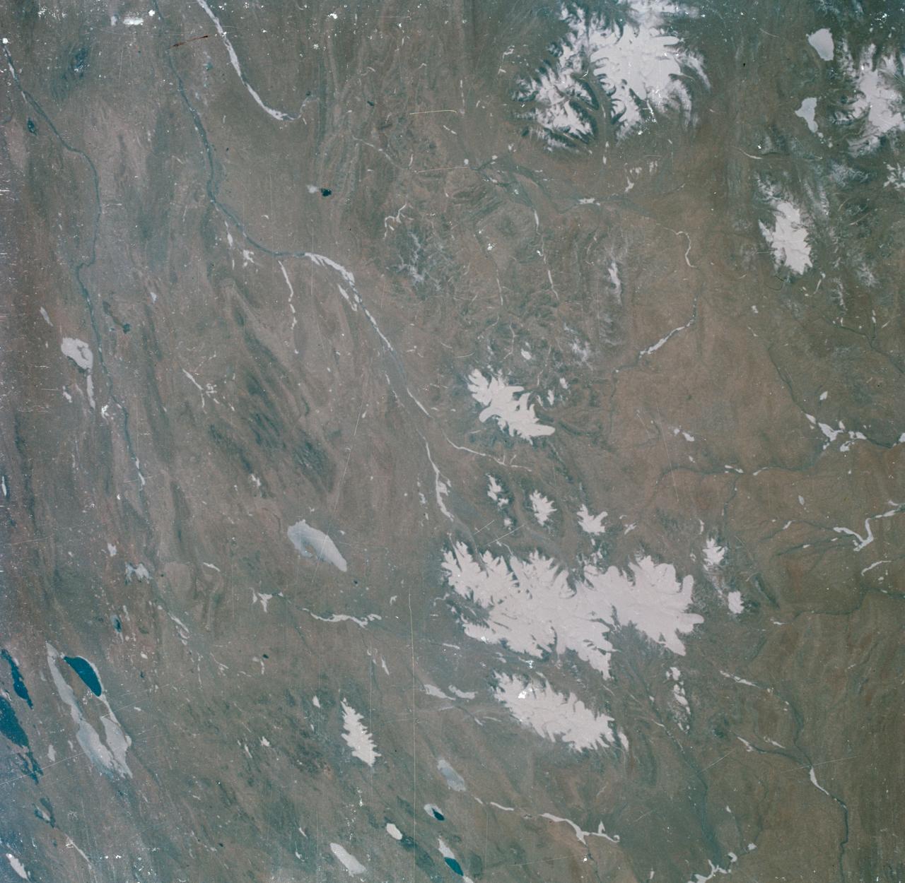
S63-06440 (15-16 May 1963) --- View of the Tibetan Plateau in north-central Tibet, as photographed from the Mercury-Atlas 9 (MA-9) capsule by astronaut L. Gordon Cooper Jr., during his 22-orbit MA-9 spaceflight. The center of the photograph is near 91 degrees east longitude and 34 degrees 30 minutes north latitude. This view includes lakes and snow-covered highlands. Photo credit: NASA
61A-31-089 (30 Oct-6 Nov 1985) --- This photograph looking to the west-northwest along the axis of the Great Himalayan range, shows India, Nepal and China. Mount Everest (8,848 meters) is near the center of the frame. The Ganges Plains are to the left and the Tibet Plateau to the right. The snow line elevations are between 3,000 and 4,000 meters.
The 5000 meter 16,000 feet high Tibetan Plateau has been formed by the collision of the Indian subcontinent with central Asia.
AS7-07-1748 (15 Oct. 1968) --- The world's dozen peaks which reach a height of greater than five miles above sea level are seen in this photograph from the Apollo 7 spacecraft at an altitude of approximately 130 nautical miles. The 29,028 ft. high Mount Everest is at lower center. On the central horizon can be seen the 28,250 ft. high Mount Godwin-Austen (K-2) some 800 miles northwest of Mount Everest. In the lower right, Mount Kanchenjunga rises 28,208 ft. to separate Nepal from Sikkim. The snow line on the peaks was at 17,500 ft. In the upper right the lake-studded highlands of Tibet are visible.
STS080-733-001 (19 Nov.-7 Dec. 1996) --- This view shows Mount Everest, near the border of Nepal and China, which reaches 29,028 feet in elevation (8,848 meters). Mount Everest is to the left of the V-shaped valley (holding picture with numbers on the right). Tibet is to the right, and Nepal is below. Rongbuk Glacier flows to the north while Khumbu Glacier flows to the south from Mount Everest. Many other glaciers are visible. The snow level is about 4,000 meters south of the divide or rain shadow, and about 6,000 meters north of the divide, in the rain shadow.
Astronaut Daniel W. Bursch, Expedition Four flight engineer, was delighted in capturing this image of Mt. Everest in the Himalayan Range from aboard the International Space Station (ISS). The mountain is near frame center. Because the photo was taken close to orbital sunrise, the low sun angle gave tremendous relief to the mountains. Named for Sir George Everest, the British surveyor-general of India, Mount Everest is the tallest point on earth. Standing 29,028 feet tall, it is 5 1/2 miles above sea level. Mount Everest is located half in Nepal and half in Tibet.
S63-06454 (15-16 May 1963) --- Tibetan Lake Country North of Katmandu, west of Ihasa, photographed from the Mercury-Atlas 9 (MA-9) capsule by astronaut L. Gordon Cooper Jr., during his 22-orbit MA-9 spaceflight. Photo credit: NASA
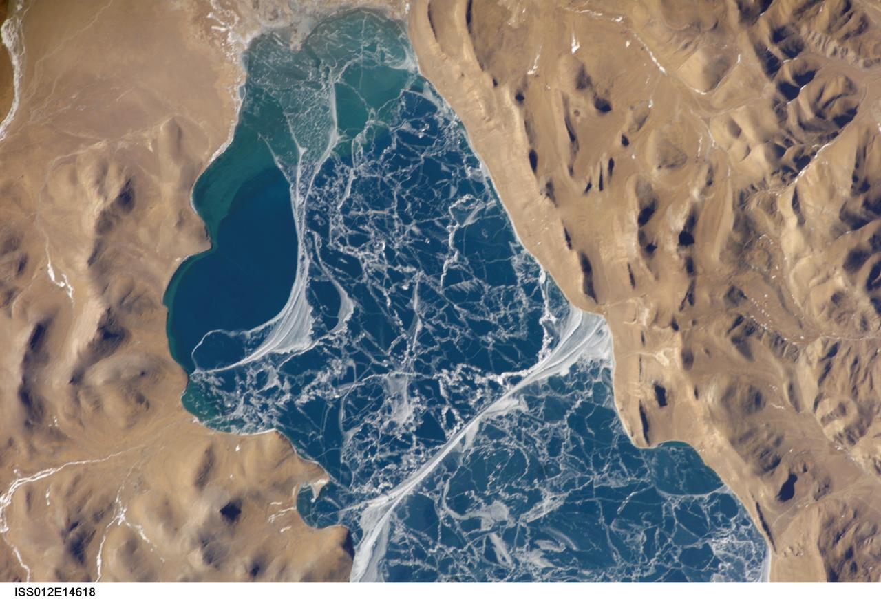
ISS012-E-14618 (6 Jan. 2006) --- A portion of Lake Puma Yumco and parts of Tibet and China are featured in this image photographed by an Expedition 12 crew member on the International Space Station. The alpine lakes of the Tibetan Plateau are some of the most remote in the world. This image depicts Lake Puma Yumco during the winter season. The lake is located at an elevation of 5,030 meters above sea level, and is considered ultraoligotrophic in that nutrient concentrations in both the water column and lake sediments are extremely low. Water in such lakes tends to be blue to blue-green and have high clarity due to the lack of abundant photosynthesizing organisms such as phytoplankton. Water color change in these lakes is usually due to shallowing of the water – blue indicating deeper water - as is visible in the depth transition along the west/southwestern shoreline (left). The maximum dimensions of the lake are 31 kilometers by 14 kilometers, indicating that the ice blocks range from less than ten to hundreds of meters in diameter. According to scientists, the ice pattern is caused by repeated cycles of freezing, fracturing, and refreezing of the ice due to variations in temperature and wind-induced ice motion. A prominent white linear feature extending north-south across the center of the lake (lower center) is suggestive of an ice ridge formed by east-west winds subsequently highlighted by snow.
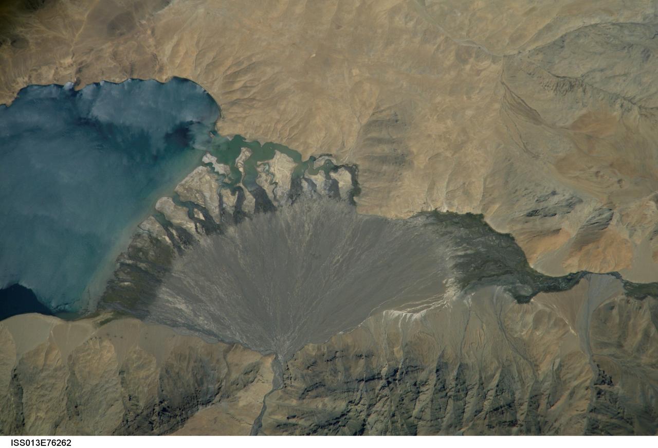
ISS013-E-76262 (4 Sept. 2006) --- Lake Morari, Tibet is featured in this image photographed by an Expedition 13 crewmember onboard the International Space Station. Melt-water from glaciers to the east and west drains into Lake Morari, a large lake on the Tibetan Plateau which lies at an altitude of 4,521 meters (14,830 feet). The main inflow to the lake is via a west-side stream. Mud from this river gives the light blue hues to the lake water. The well-formed alluvial fan (center), built by sediment from the main inflow river, is the reason the lake has formed at this point in the valley. The fan has dammed up the depression now occupied by Lake Morari (approximately 7 kilometers wide in this view) and forms the curved southern shore of the lake. The apex of the fan lies fully 40 meters above the level of the lake. The change of color and texture on the fan seems to result from a new influx of gray sediment on top of an older fan which had several channels cut into it. Interestingly, the alluvial fan also acts as the only outlet of the lake, although no obvious outlet channel can be seen in this detailed view. South of the fan an outlet river appears as a green surface, possibly due to aquatic vegetation or algae. Altitude measurements show that the outlet river lies many meters below the lake surface.
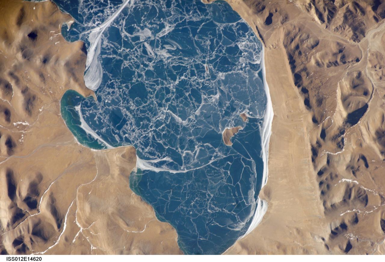
ISS012-E-14620 (6 Jan. 2006) --- A portion of Lake Puma Yumco and parts of Tibet and China are featured in this image photographed by an Expedition 12 crew member on the International Space Station. The alpine lakes of the Tibetan Plateau are some of the most remote in the world. This image depicts Lake Puma Yumco during the winter season. The lake is located at an elevation of 5,030 meters above sea level, and is considered ultraoligotrophic in that nutrient concentrations in both the water column and lake sediments are extremely low. Water in such lakes tends to be blue to blue-green and have high clarity due to the lack of abundant photosynthesizing organisms such as phytoplankton. The maximum dimensions of the lake are 31 kilometers by 14 kilometers, indicating that the ice blocks range from less than ten to hundreds of meters in diameter. According to scientists, the ice pattern is caused by repeated cycles of freezing, fracturing, and refreezing of the ice due to variations in temperature and wind-induced ice motion. A prominent white linear feature across the center of the lake (partially visible in upper left in this image) is suggestive of an ice ridge formed by east-west winds subsequently highlighted by snow.
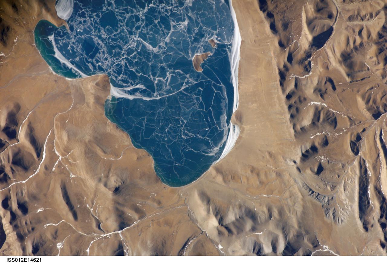
ISS012-E-14621 (6 Jan. 2006) --- A portion of Lake Puma Yumco and parts of Tibet and China are featured in this image photographed by an Expedition 12 crew member on the International Space Station. The alpine lakes of the Tibetan Plateau are some of the most remote in the world. This image depicts Lake Puma Yumco during the winter season. The lake is located at an elevation of 5,030 meters above sea level, and is considered ultraoligotrophic in that nutrient concentrations in both the water column and lake sediments are extremely low. Water in such lakes tends to be blue to blue-green and have high clarity due to the lack of abundant photosynthesizing organisms such as phytoplankton. Water color change in these lakes is usually due to shallowing of the water – blue indicating deeper water. The maximum dimensions of the lake are 31 kilometers by 14 kilometers, indicating that the ice blocks range from less than ten to hundreds of meters in diameter. According to scientists, the ice pattern is caused by repeated cycles of freezing, fracturing, and refreezing of the ice due to variations in temperature and wind-induced ice motion. A prominent white linear feature across the center of the lake (not visible in this image) is suggestive of an ice ridge formed by east-west winds subsequently highlighted by snow.
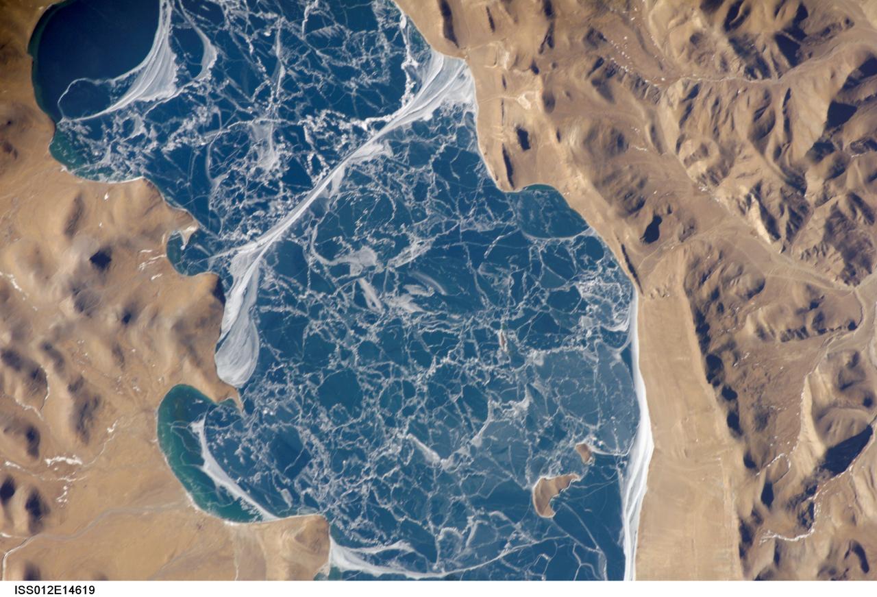
ISS012-E-14619 (6 Jan. 2006) --- A portion of Lake Puma Yumco and parts of Tibet and China are featured in this image photographed by an Expedition 12 crew member on the International Space Station. The alpine lakes of the Tibetan Plateau are some of the most remote in the world. This image depicts Lake Puma Yumco during the winter season. The lake is located at an elevation of 5,030 meters above sea level, and is considered ultraoligotrophic in that nutrient concentrations in both the water column and lake sediments are extremely low. Water in such lakes tends to be blue to blue-green and have high clarity due to the lack of abundant photosynthesizing organisms such as phytoplankton. Water color change in these lakes is usually due to shallowing of the water – blue indicating deeper water - as is visible in the depth transition along the west/southwestern shoreline (upper left). The maximum dimensions of the lake are 31 kilometers by 14 kilometers, indicating that the ice blocks range from less than ten to hundreds of meters in diameter. According to scientists, the ice pattern is caused by repeated cycles of freezing, fracturing, and refreezing of the ice due to variations in temperature and wind-induced ice motion. A prominent white linear feature across the center of the lake is suggestive of an ice ridge formed by east-west winds subsequently highlighted by snow.
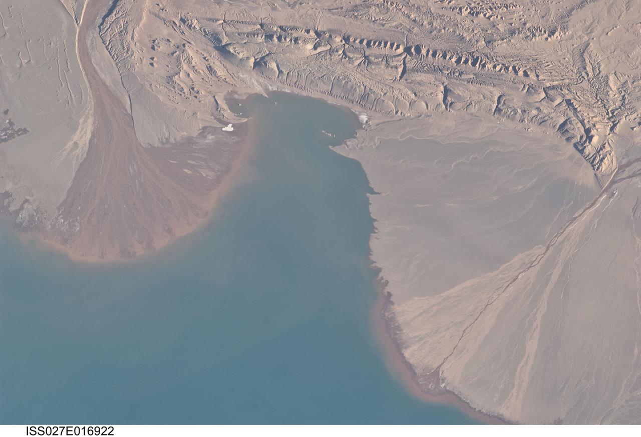
ISS027-E-016922 (25 April 2011) --- River deltas and Lake Ayakum in China (Tibet) are featured in this image photographed by an Expedition 27 crew member on the International Space Station. The Tibetan Plateau contains numerous lakes that dot an otherwise arid landscape. Lake Ayakum is located near the northern boundary of the Plateau to the southeast of the Kunlun Mountains. While many of the small glacier- and snowmelt-fed streams that cross the Tibetan Plateau eventually give rise to major Southeast Asian rivers including the Mekong and Yangtze, some empty into saline lakes such as Lake Ayakum. This detailed photograph highlights two river deltas (upper left and lower right) formed along the southwestern shoreline of the lake. When sediments build up to the point that a river can no longer flow over them, it will jump to a new channel position and begin the process anew. Scientists have noted that, over geologic time, the channels tend to sweep back and forth ? similar to the motion of an automobile windshield wiper ? to form the typical semi-circular or fan shape of the delta. Gray to tan surfaces of both deltas indicate prior positions of their respective river channels; the uniform coloration and smooth texture suggest that they are relatively old and are now inactive. In contrast, the younger and currently active delta surfaces can be recognized by reddish-brown sediment and clearly visible river channels. Lateral channel migration is particularly evident in the approximately eight-kilometer-wide active delta area at upper left. The reddish coloration of the actively depositing sediment may indicate a change from the sources that formed the older parts of the deltas (or indicate weathering and soil formation on the older deposits), or an episodic input of dust or other material to the river catchments.
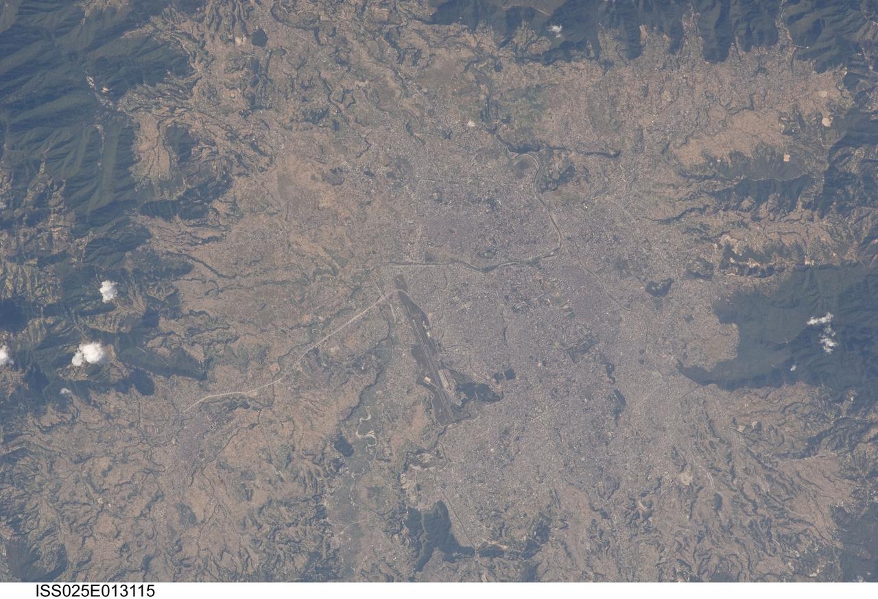
ISS025-E-013115 (9 Nov. 2010) --- Kathmandu, Nepal is featured in this image photographed by an Expedition 25 crew member on the International Space Station. The capital and largest city of Nepal, Kathmandu occupies much of the Kathmandu Valley located near the center of the country. Nepal itself contains much of the Himalaya mountain range between China (Tibet) to the north and India to the south. Geological and fossil evidence indicates that the Kathmandu Valley was filled by a large lake (Paleo-Kathmandu Lake) between approximately 2.8 million and 10,000 years ago, according to scientists. Geologists believe the lake drained in phases over time due both to a drier regional climate, continuing tectonic uplift and faulting in the region, and formation of an integrated valley drainage system as river channels cut through previous natural rock ridge dams. The green vegetated slopes that ring the Kathmandu metro area (light gray, center) include both forest reserves and national parks. The metropolitan area is relatively flat compared to the surrounding high mountains. Tribhuvan International Airport, located near the current eastern margin of the metro area, is the only international airport in Nepal. Archeological evidence suggests that the development of Kathmandu, together with the nearby “sister cities” of Lalitpur and Bhaktapur, began almost 2,000 years ago. Today, Kathmandu and its sister cities form the governmental, cultural, and—as a main access point to the Himalayas for tourism—economic center of the country.
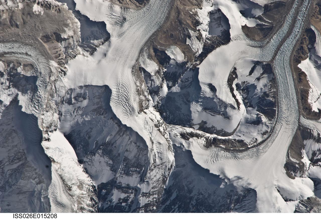
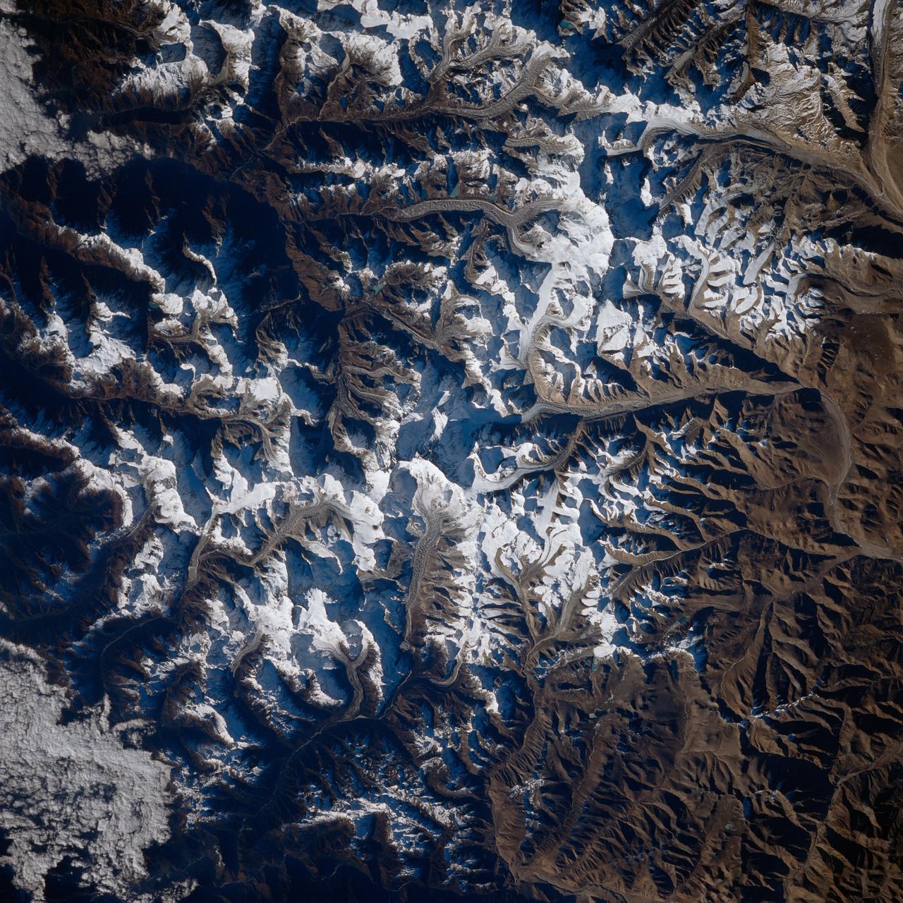
ISS026-E-015208 (6 Jan. 2011) --- Photographed by an Expedition 26 crew member on the International Space Station, this detailed photograph highlights the northern approach to Mount Everest from Tibet. Known as the northeast ridge route, climbers travel along the East Rongbuk Glacier (top right) to camp at the base of Changtse mountain. From this point at approximately 6,100 meters above sea level, the North Col--a sharp-edged pass carved by glaciers, center--is ascended to reach a series of progressively higher camps along the North Face of Everest, culminating in Camp VI at 8,230 meters above sea level. Climbers make their final push to the summit (not visible, just off the bottom edge of the image) from this altitude. While the near-nadir viewing angle--almost looking "straight down" from the International Space Station--tends to flatten the topography, crew members have also taken images that highlight the rugged nature of the area. Everest (or Sagarmatha in Nepali), located within the Himalaya mountain chain, is Earth’s highest mountain with its summit at 8,848 meters above sea level. Khumbutse mountain, visible at top left, has a summit elevation of 6,640 meters above sea level. Climbing to the summit of Everest requires much advance planning, conditioning, and situational awareness on the part of mountaineers to avoid potentially fatal consequences--as of 2010, there have been over 200 reported fatalities.