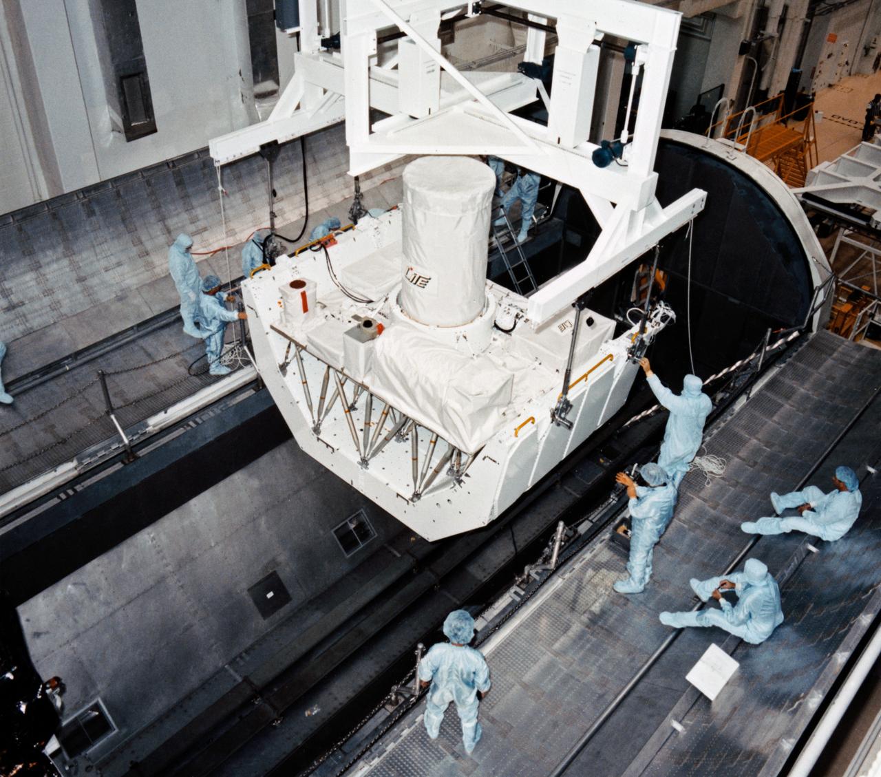
S94-40916 (5 July 1994) --- Workers in the Operations and Checkout Building are transporting the Lidar In-Space Technology Experiment (LITE-1) into the payload canister transporter for transfer to the Orbiter Processing Facility, where it will be installed into the cargo bay of the space shuttle Discovery. LITE-1, which will demonstrate the technology of a spaceborne Lidar instrument, is scheduled to fly on STS-64 later this year. Photo credit: NASA or National Aeronautics and Space Administration
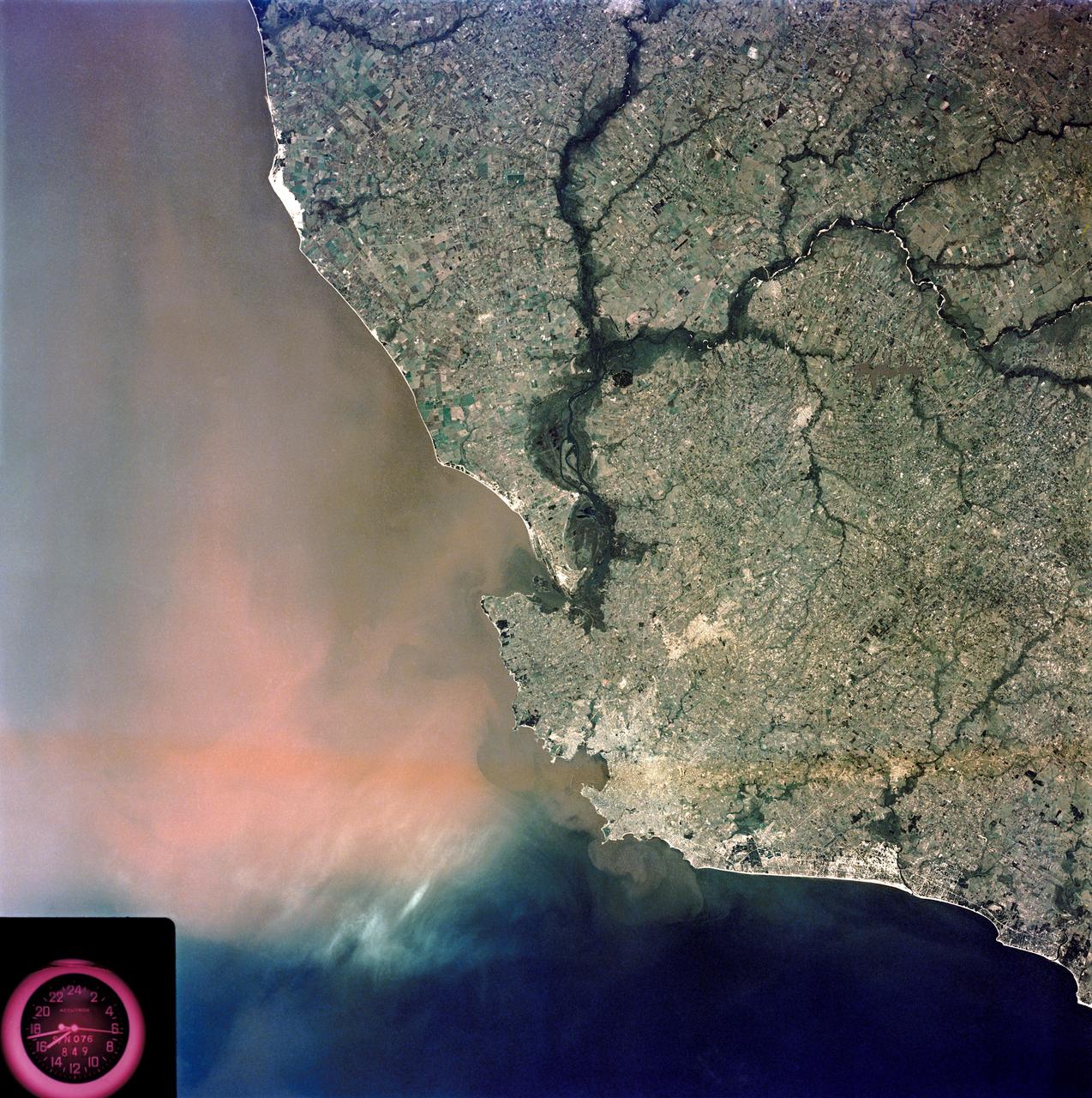
SL3-84-202 (July-September 1973) --- A vertical view of the Montevideo, Uruguay area of South America is seen in this Skylab 3 Earth Resources Experiments Package S190-B (five-inch Earth terrain camera) photograph taken from the Skylab space station in Earth orbit. The large body of water is Rio de la Plata which flows into the South Atlantic Ocean at the bottom of the picture. The red plum in the Rio de la Plata is probably sediment moving seaward. The Santa Lucia River enters the Rio de la Plata west of Montevideo and is the major drainage for the region. Note the small Isla del Tigre at the mouth of the Santa Lucia. The white beach and sand dune areas are plainly visible along the coast. A major airport can be seen immediately east of downtown Montevideo. Major thoroughfares and residential areas, such as the bright one in the suburbs, are clearly visible, also. Farm tracts in green and grey rectangular patterns indicate agricultural regions. Photo credit: NASA
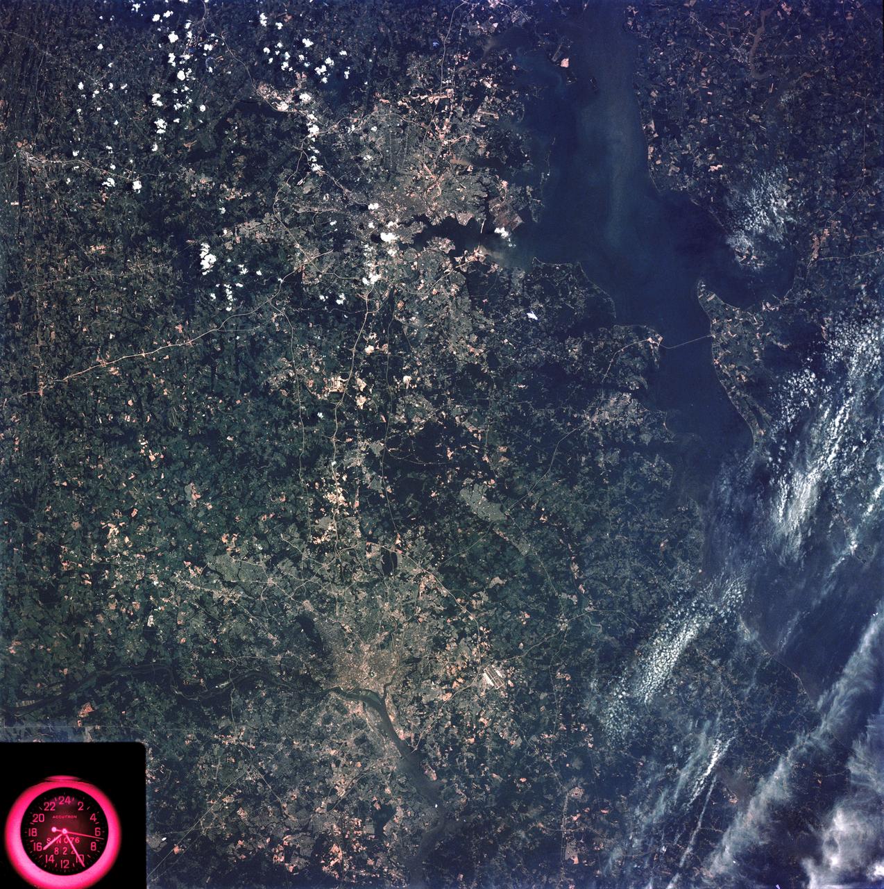
SL3-83-166 (July-September 1973) --- A vertical view of the Washington D.C. and the Baltimore, Maryland area is seen in the Skylab 3 Earth Resources Experiments Package S190-B (five-inch Earth terrain camera) photograph taken from the Skylab space station in Earth orbit. The Chesapeake Bay is on the right (east) side of the picture. The Potomac River flows through the Washington area in the lower left (southwest) corner of the photograph. Several transportation routes and major highways stand out very distinctly. Especially conspicuous are the beltways around the cities, Interstate 95 between Baltimore and the nation?s capitol and Interstate 70N leading west from Baltimore. The tunnel and harbor facilities in Baltimore show clearly, also. Identifiable features in the Washington area include the Capitol Building, the Mall area, Robert F. Kennedy Stadium (white circle), the five bridges across the Potomac, Andrews Air Force Base (on east loop), and the smaller Anacostia River. The extent of the urbanization in this area is dramatically illustrated in this picture. The photograph has sufficient resolution that the housing patterns for individual suburban areas are clearly defined with the houses shown as pink gray, wooded areas as dark green and cleared areas light green. Chesapeake Bay circulation patterns are indicated by contrast of dark and light blue. Sediment plumes (red) are seen entering the bay north and east of Baltimore. The bay bridge stands out white against the blue water. The detailed information contained in this one photograph will be of direct use to several EREP investigator teams in land use analysis, sedimentation and circulation patterns in the bay, and resource surveys of Maryland. All EREP photography is available to the public through the Department of Interior?s Earth Resources Observations Systems Data Center, Sioux Falls, South Dakota, 57198. Photo credit: NASA
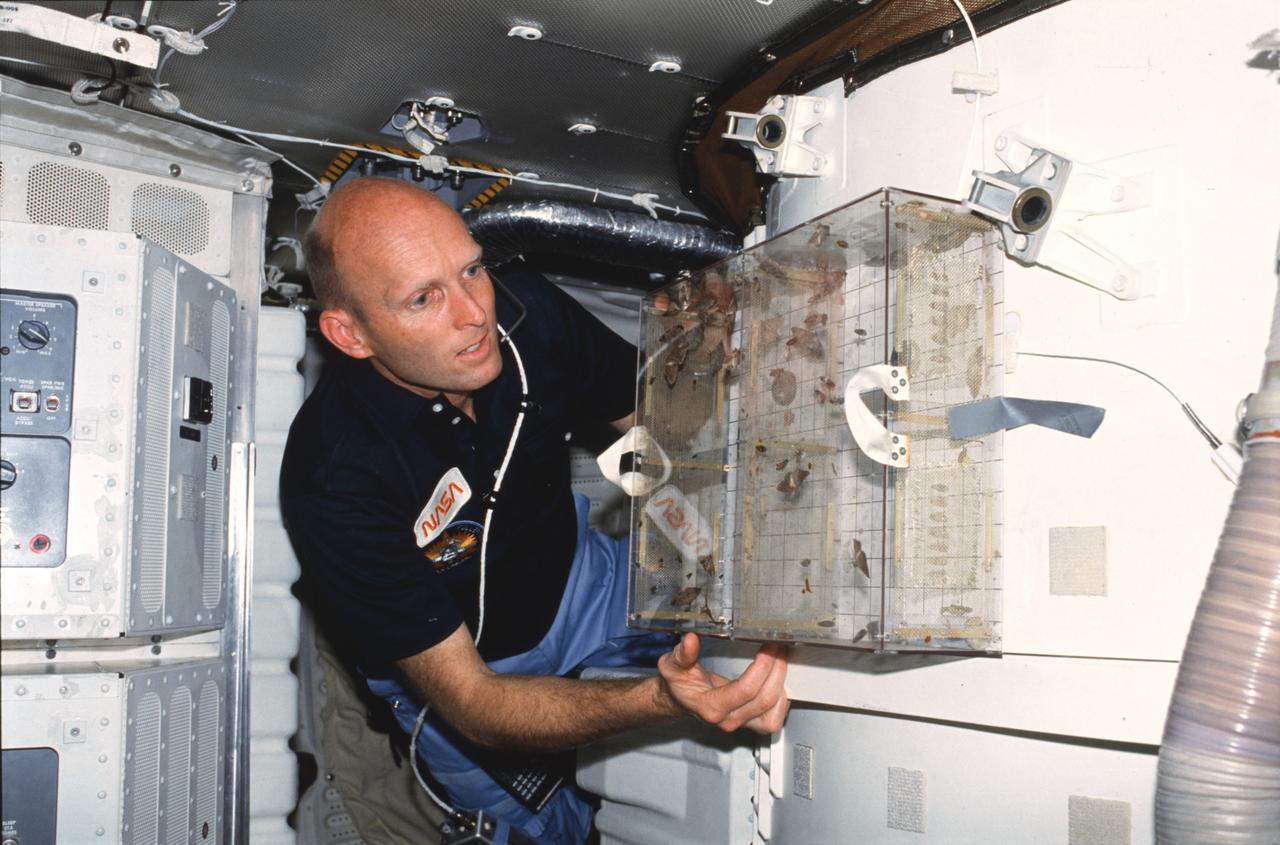
STS003-23-178 (22-30 March 1982) --- Astronaut C. Gordon Fullerton, STS-3 pilot, examines Student Experiment 81-8 (SE-81-8) Insect Flight Motion Study taped to the airlock on aft middeck. Todd Nelson, a high school senior from Minnesota, won a national contest to fly his experiment on this particular flight. Moths, flies, and bees were studied in the near weightless environment. Photo credit: NASA
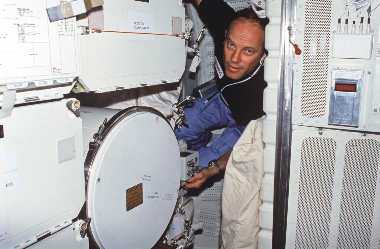
STS003-22-127 (22-30 March 1982) --- Astronaut Jack R. Lousma, STS-3 commander, wearing communications kit assembly (assy) mini-headset, adjusts controls on Monodisperse Latex Reactor (MLR) experiment located in forward middeck lockers MF57H and MF57K. To reach MLR support electronics assy controls, Lousma squeezes in between forward lockers and Development Flight Instrument (DFI) unit on starboard bulkhead. Photo credit: NASA
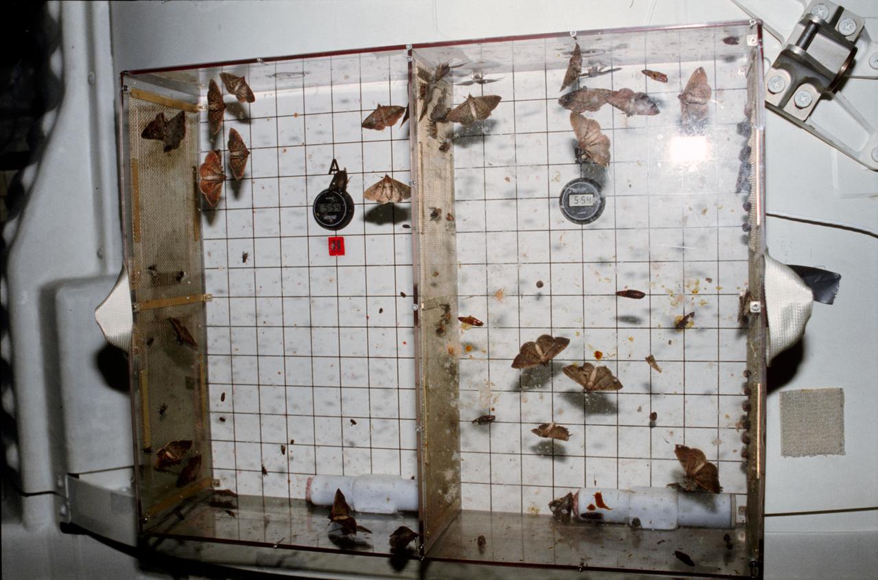
STS003-23-175 (22-30 March 1982) --- Student Experiment 81-8 (SE-81-8) Insect Flight Motion Study taped to the airlock on aft middeck of space shuttle Columbia. Photo credit: NASA
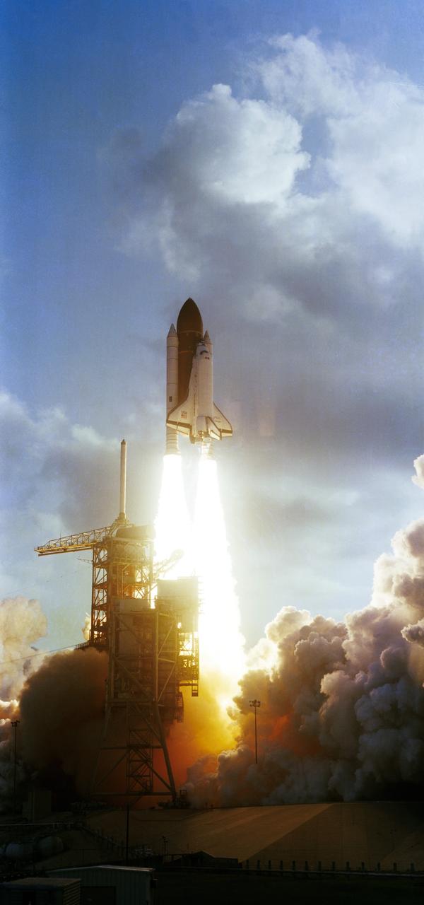
S83-35702 (18 June 1983) --- The seventh launch of the NASA Space Transportation System and the second lift-off of the space shuttle Challenger occurred at 7:33 a.m. (EDT) today from the Pad 39A launch site, at the Kennedy Space Center (KSC). The six-day mission will be highlighted by the first direct landing from space by an orbiter to the Shuttle Landing Facility (SLF). The crew consists of astronauts Robert Crippen, commander, the first two-time space shuttle astronaut; Frederick H. Hauck, pilot; and three mission specialists -- Sally K. Ride, John M. Fabian and Norman E. Thagard. During the mission the crew will deploy the Indonesian PALAPA-B and the Canadian ANIK-C communications satellites. They will also use the Remote Manipulator System (RMS) arm to deploy and retrieve a platform for space experiments called the Shuttle Pallet Satellite (SPAS), and serve as a spaceborne laboratory for OSTA-2, a scientific payload. Getaway Special canisters and materials processing experiments will fill out the complement of payloads on the mission. Photo credit: NASA
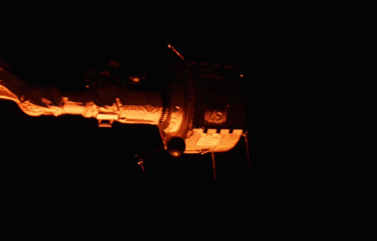
STS003-21-080 (22-30 March 1982) --- Plasma Diagnostics Package (PDP) grappled by remote manipulator system (RMS) end effector is positioned above payload bay (PLB) at sunrise. Photo credit: NASA
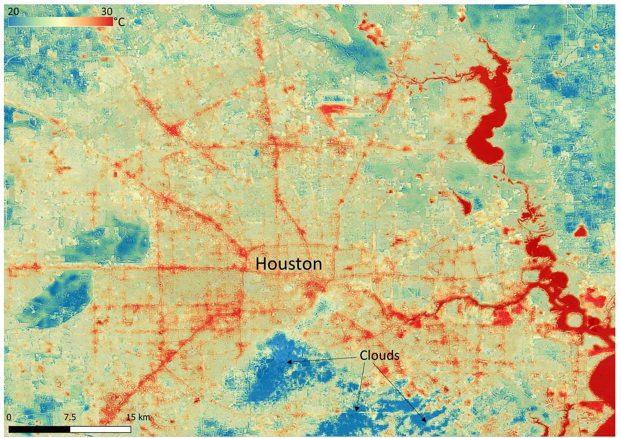
NASA's Ecosystem Spaceborne Thermal Radiometer Experiment on Space Station (ECOSTRESS) instrument recorded this image of ground surface temperatures in Houston and its environs on June 20, 2022, at 6:29 a.m. Central Daylight Time. Even just after sunrise, manmade urban surfaces near the city center and transportation networks – streets, roads, and highways shown in red and orange – were significantly warmer than the outskirts by up to 18 degrees Fahrenheit (10 degrees Celsius). Clouds, which are cool compared with the ground, are shown in blue and labeled in the image. Cities are usually warmer than open land because of human activities and the materials used in building and construction. Streets are often the hottest part of the built environment due to asphalt paving. Dark-colored surfaces absorb more heat from the Sun than lighter-colored ones; asphalt absorbs up to 95% of solar radiation and retains the heat for hours into the nighttime. ECOSTRESS measures the temperature of the ground, which is hotter than the air temperature during the daytime. The instrument launched to the space station in 2018. Its primary mission is to identify plants' thresholds for water use and water stress, giving insight into their ability to adapt to a warming climate. However, ECOSTRESS is also useful for documenting other heat-related phenomena, like patterns of heat absorption and retention. Its high-resolution images, with a pixel size of about 225 feet (70 meters) by 125 feet (38 meters), are a powerful tool for understanding our environment. https://photojournal.jpl.nasa.gov/catalog/PIA25421
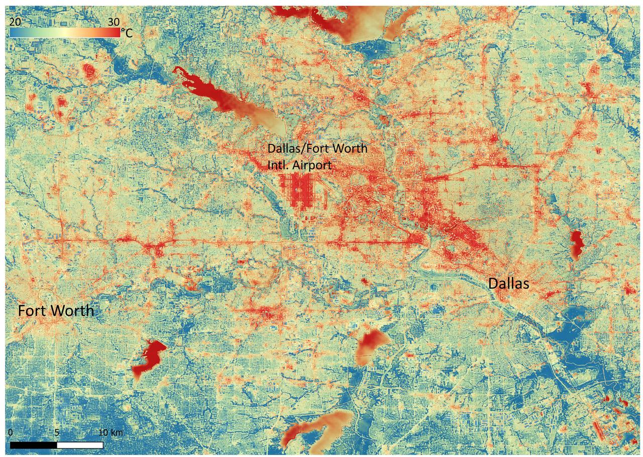
NASA's Ecosystem Spaceborne Thermal Radiometer Experiment on Space Station (ECOSTRESS) instrument recorded this image of ground surface temperatures in Dallas and Fort Worth, Texas, on June 20, 2022, at 7:17 a.m. Central Daylight Time. Even early in the day, manmade urban surfaces near city centers and transportation networks – streets, roads, and highways shown in red and orange – are warmer than the outskirts by up to 18 degrees Fahrenheit (10 degrees Celsius). The paved surfaces at Dallas/Fort Worth International Airport, shown in red near the top-center of the image, had the warmest temperatures, exceeding 86 F (30 C). Natural land surfaces such as vegetation and streams in rural areas, shown in green and blue, are cooler than nearby large bodies of water, shown in red and yellow, that tend to retain more heat overnight due to their higher heat capacity. Cities are usually warmer than open land because of human activities and the materials used in building and construction. Streets are often the hottest part of the built environment due to asphalt paving. Dark-colored surfaces absorb more heat from the Sun than lighter-colored ones; asphalt absorbs up to 95% of solar radiation and retains the heat for hours into the nighttime. ECOSTRESS measures the temperature of the ground, which is hotter than the air temperature during the daytime. The instrument launched to the space station in 2018. Its primary mission is to identify plants' thresholds for water use and water stress, giving insight into their ability to adapt to a warming climate. However, ECOSTRESS is also useful for documenting other heat-related phenomena, like patterns of heat absorption and retention. Its high-resolution images, with a pixel size of about 225 feet (70 meters) by 125 feet (38 meters), are a powerful tool for understanding our environment. https://photojournal.jpl.nasa.gov/catalog/PIA25422