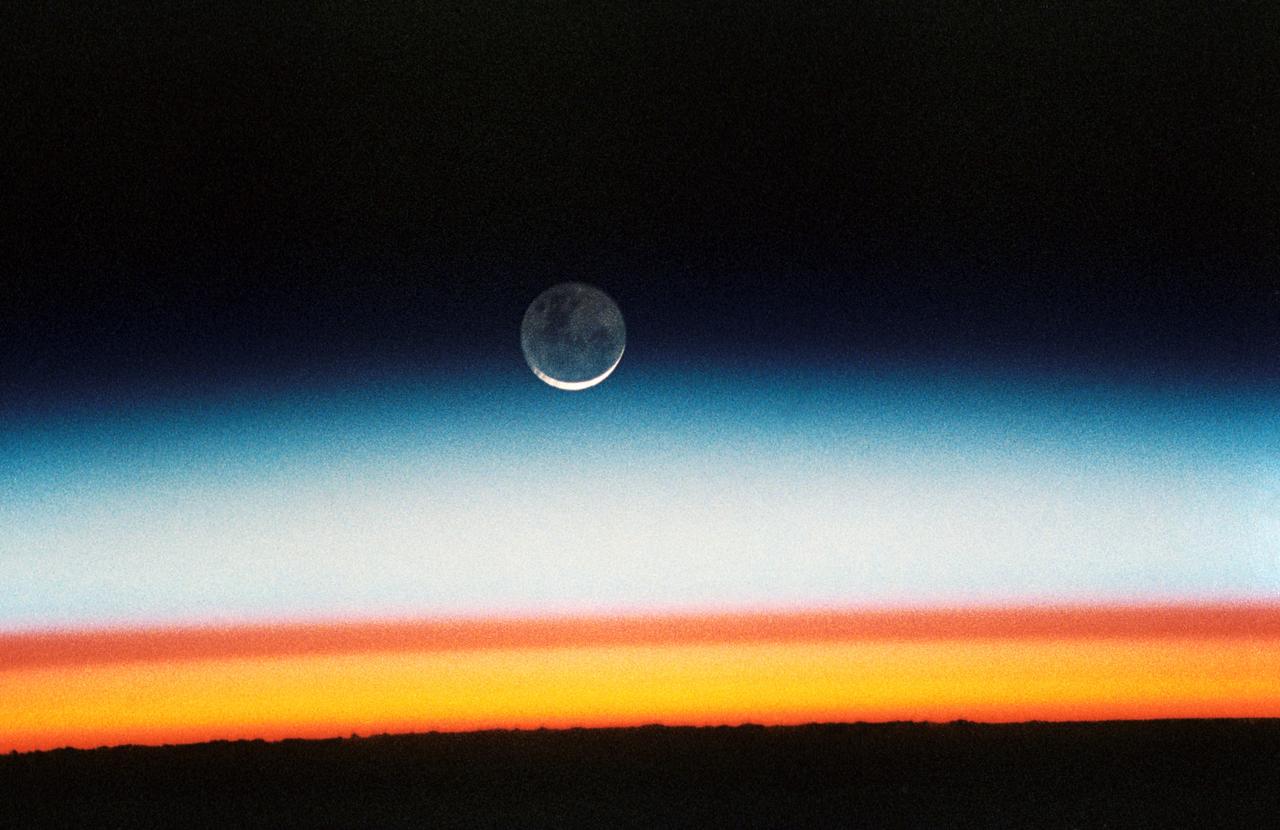
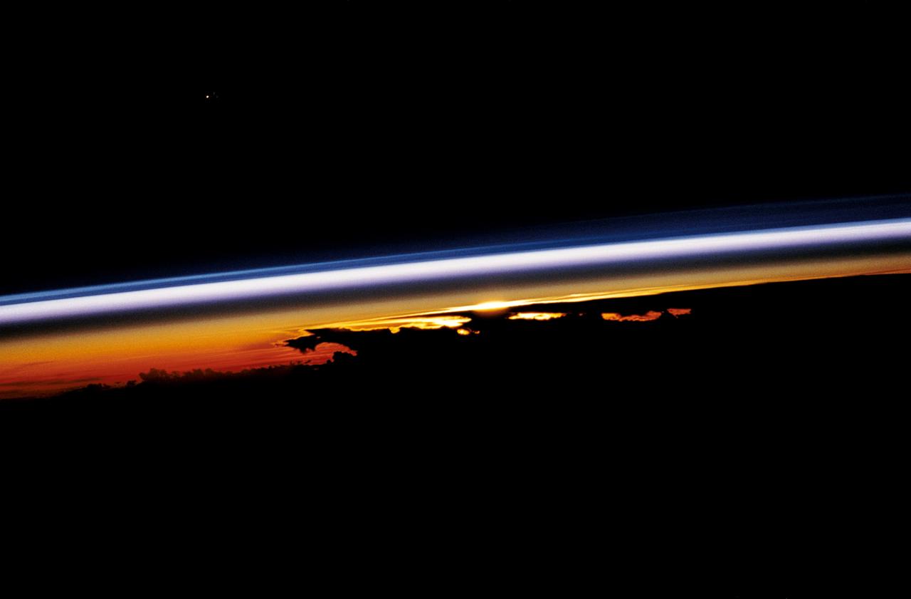
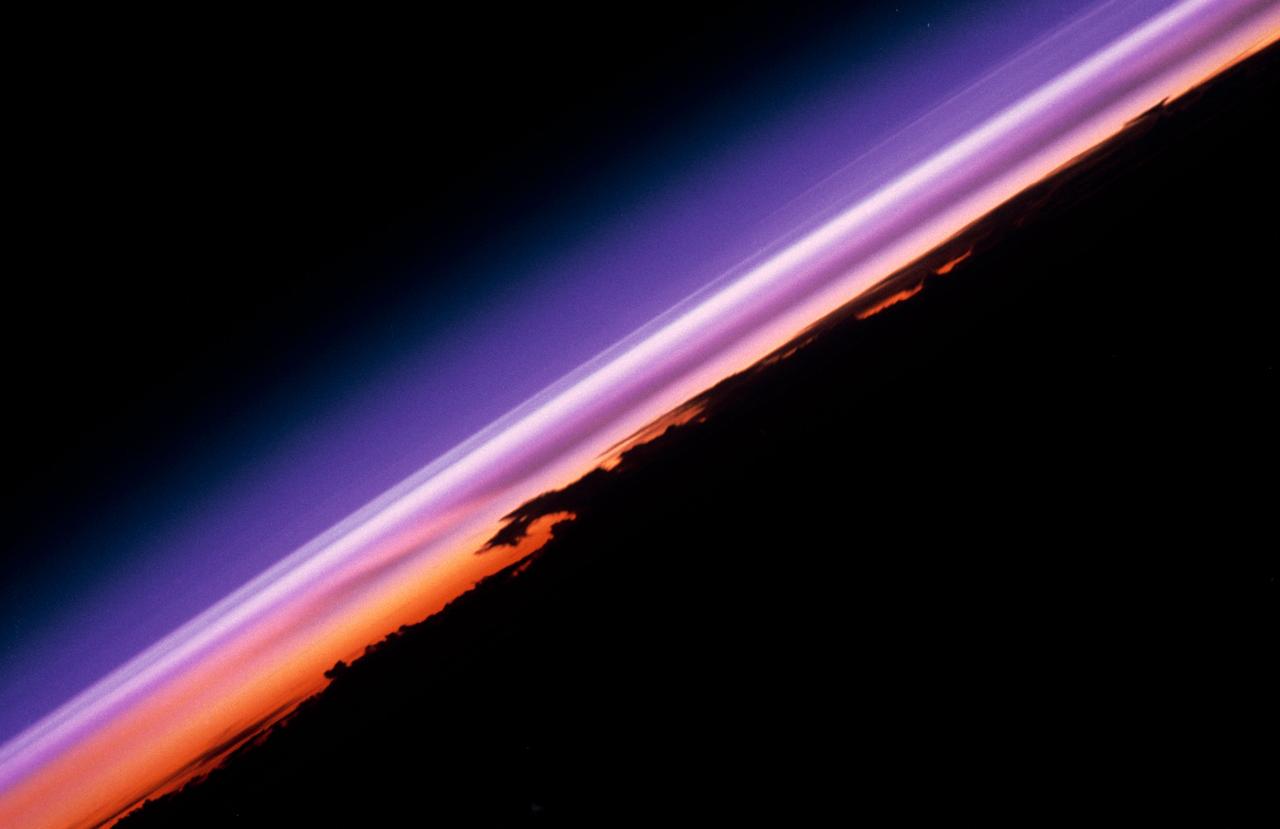
STS052-23-022 (22 Oct.-1 Nov. 1992) --- As the Space Shuttle Columbia orbited Earth in an easterly direction over the Indian Ocean, moonrise was followed quickly by sunrise. The photograph was taken from an altitude of 285 kilometers (154 nautical miles), over Lake Tanganyika in central Africa. The Sun was still 28 degrees below the horizon and not yet illuminating the dark band of low-level clouds on the limb 1,850 kilometers (l,000 nautical miles) away. Ranging from 13--18 kilometers above these low-level clouds is a brown layer at the tropical tropopause. A tropopause is a major atmospheric temperature inversion which isolates the troposphere from the stratosphere and effectively concentrates particulate from both above and below this level.
STS099-734-012 (11-22 February 2000) ---As photographed by one of the STS-99 crew members aboard the Space Shuttle Endeavour, a shallow atmosphere displays the various layers by color. The layer that holds the gases we breathe are under the yellow band called the tropopause.

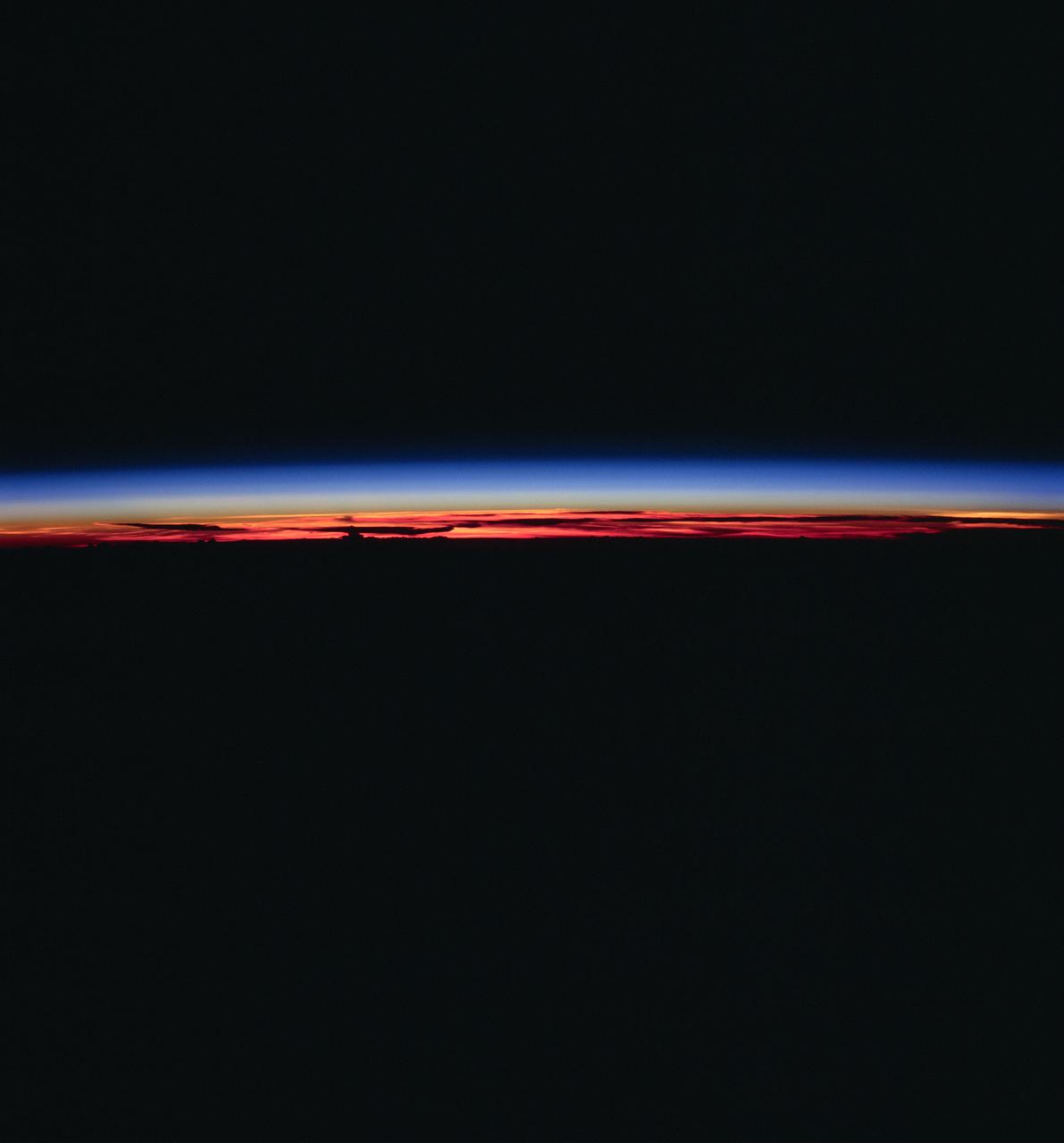
ISS007-E-10974 (27 July 2003) --- Photographed by an Expedition 7 crewmember onboard the International Space Station (ISS), this image shows the limb of the Earth at the bottom transitioning into the orange-colored troposphere, the lowest and most dense portion of the Earth's atmosphere. The troposphere ends abruptly at the tropopause, which appears in the image as the sharp boundary between the orange- and blue- colored atmosphere. The silvery-blue noctilucent clouds extend far above the Earth's troposphere. The sliver of the setting moon is visible at upper right.
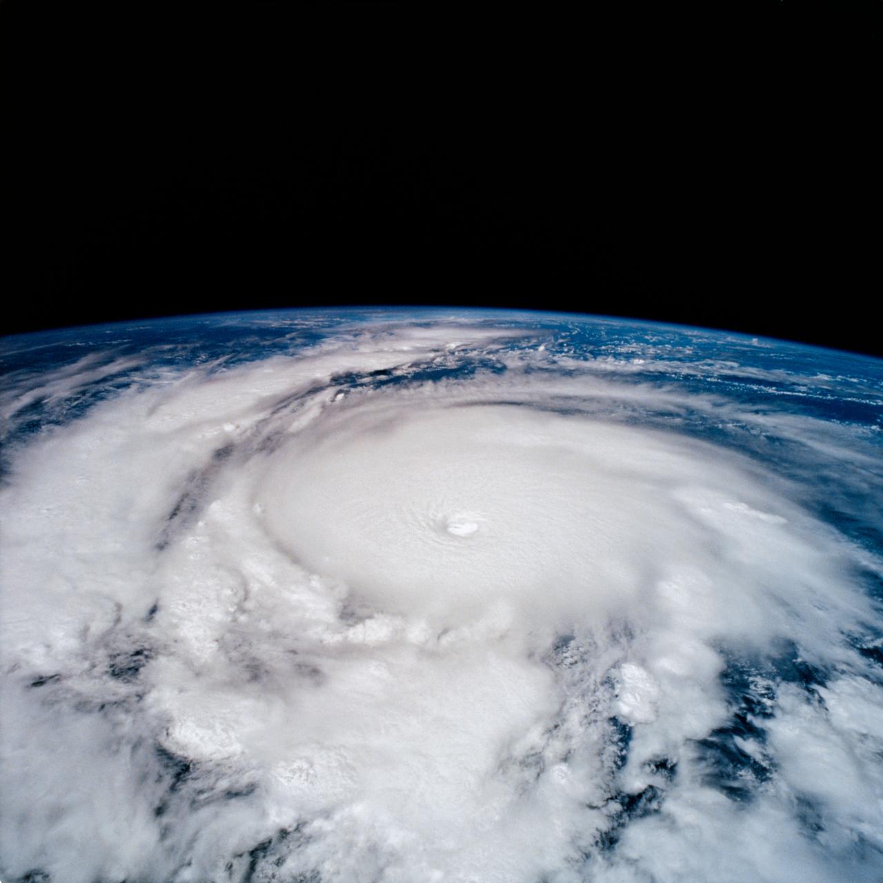
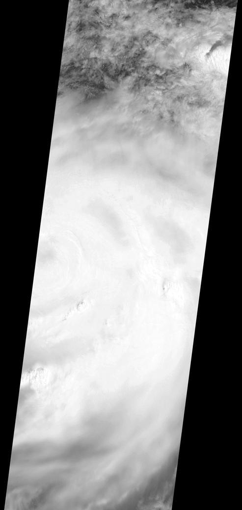
STS-65 Earth observation taken aboard Columbia, Orbiter Vehicle (OV) 102, shows Hurricane Emilia in the Eastern Pacific Ocean. Hurricane Emilia's wind speeds exceeded 150 knots. This high oblique view of the storm shows numerous spiral bands of thunderstorms, overshooting thunderstorm tops at the tropopause, and a well developed eye at the center of the picture. Shuttle photography provides high resolution details of these powerful and destructive systems that are not fully possible from lower-resolution, unmanned satellites.
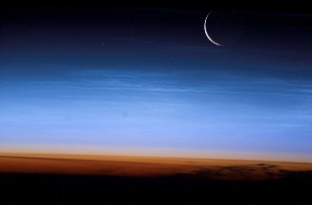
This Expedition Seven image, taken while aboard the International Space Station (ISS), shows the limb of the Earth at the bottom transitioning into the orange-colored stratosphere, the lowest and most dense portion of the Earth's atmosphere. The troposphere ends abruptly at the tropopause, which appears in the image as the sharp boundary between the orange- and blue-colored atmosphere. The silvery blue noctilucent clouds extend far above the Earth's troposphere. The silver of the setting moon is visible at upper right.
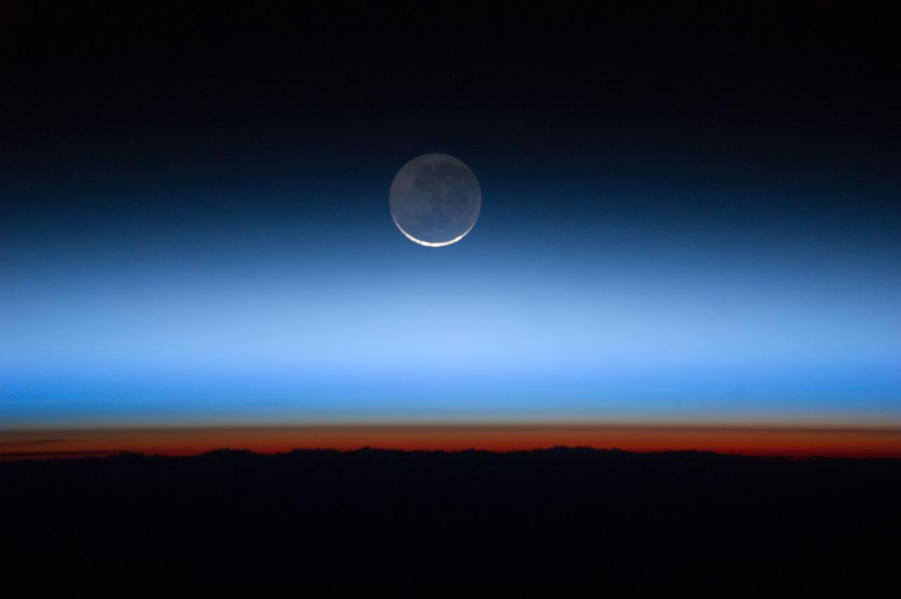
ISS028-E-020072 (31 July 2011) --- Photographed by an Expedition 28 crew member onboard the International Space Station, this image shows the moon at center, with the limb of Earth near the bottom transitioning into the orange-colored troposphere, the lowest and most dense portion of the Earth's atmosphere. The troposphere ends abruptly at the tropopause, which appears in the image as the sharp boundary between the orange- and blue- colored atmosphere. The silvery-blue noctilucent clouds extend far above the Earth's troposphere.
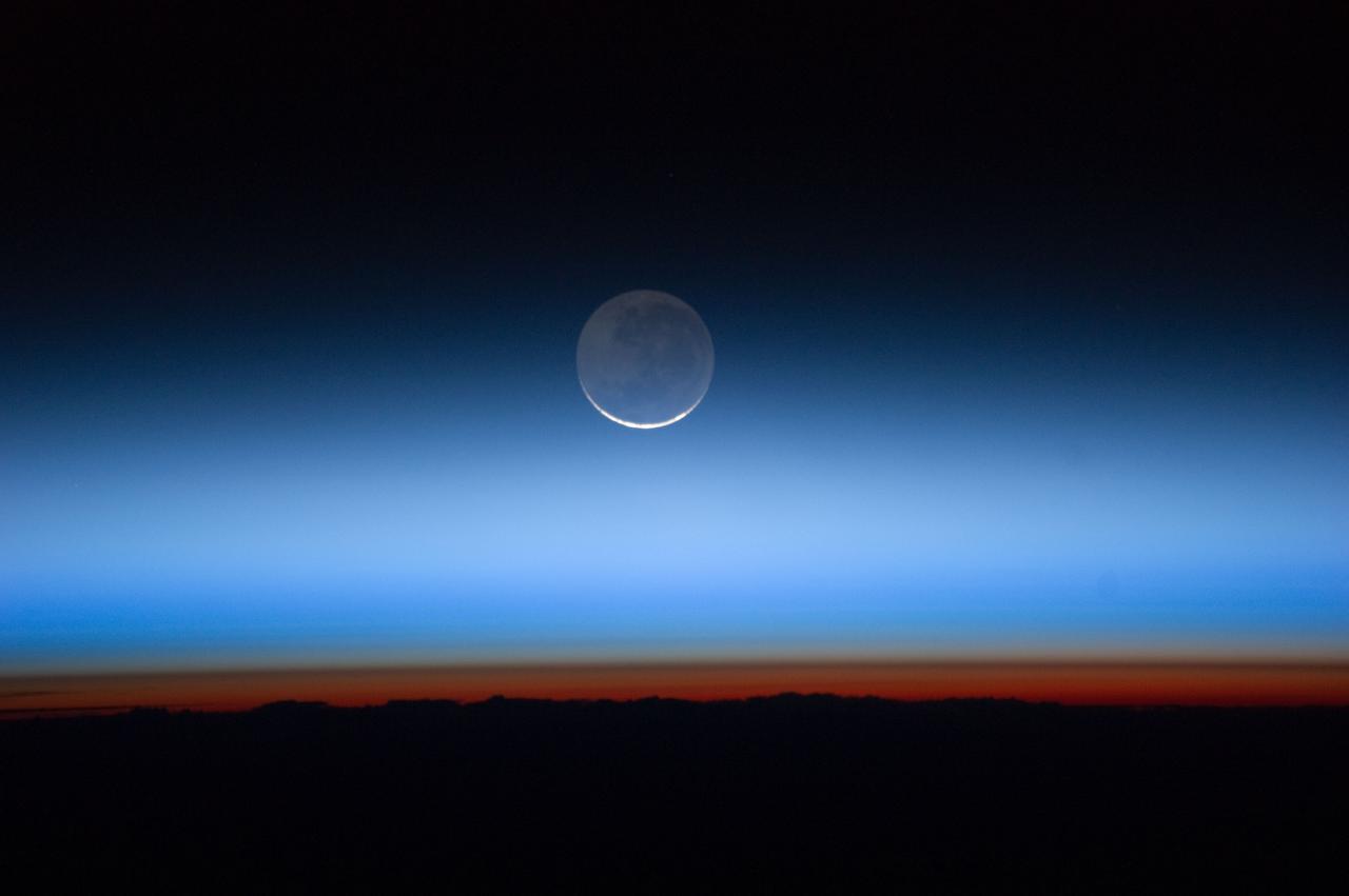
ISS028-E-020073 (31 July 2011) --- Photographed by an Expedition 28 crew member onboard the International Space Station, this image shows the moon at center, with the limb of Earth near the bottom transitioning into the orange-colored troposphere, the lowest and most dense portion of the Earth's atmosphere. The troposphere ends abruptly at the tropopause, which appears in the image as the sharp boundary between the orange- and blue- colored atmosphere. The silvery-blue noctilucent clouds extend far above the Earth's troposphere.
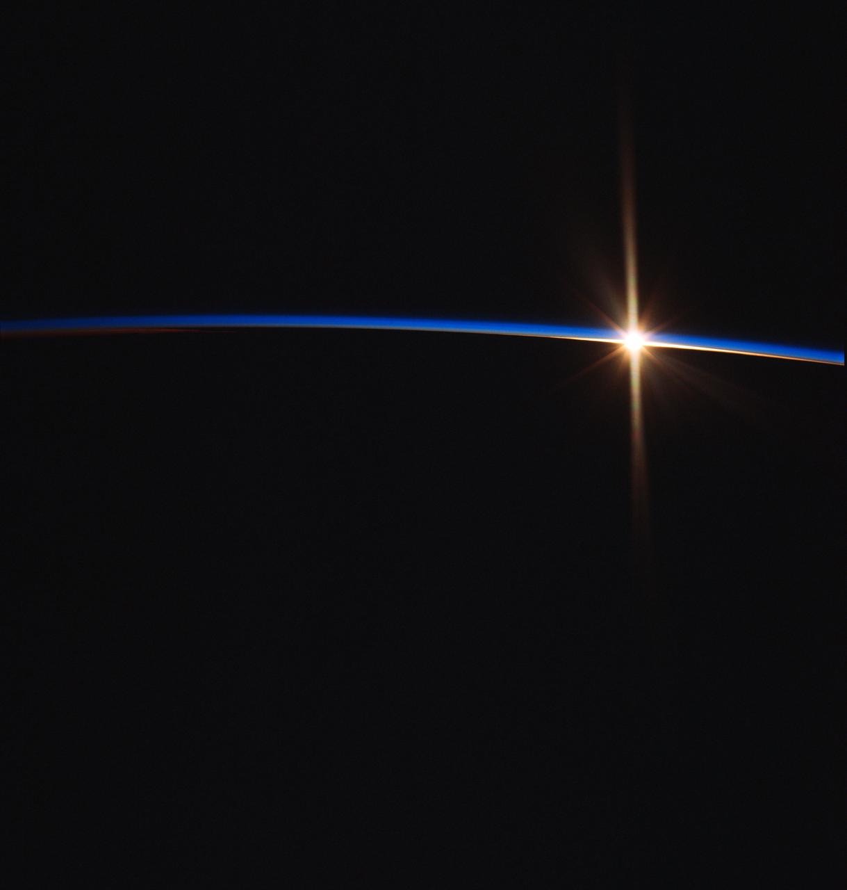
NASA7-726-049 (May 1998) --- This view of a sunrise was taken as the Russia's Mir Space Station was on a descending track toward Johnston Island, in the central Pacific (18.1 degrees north latitude and 176.6 degrees west longitude). Sunrises and sunsets are seen by the astronauts and cosmonauts approximately every 45 minutes and differ in structure, since the tropopause altitude and atmospheric lamina temperatures vary with time of day, season, and latitude. From accounts by the astronauts, true replication of human vision is not possible using present film. Some have said there are many more layers in the atmosphere than what the film is recording.
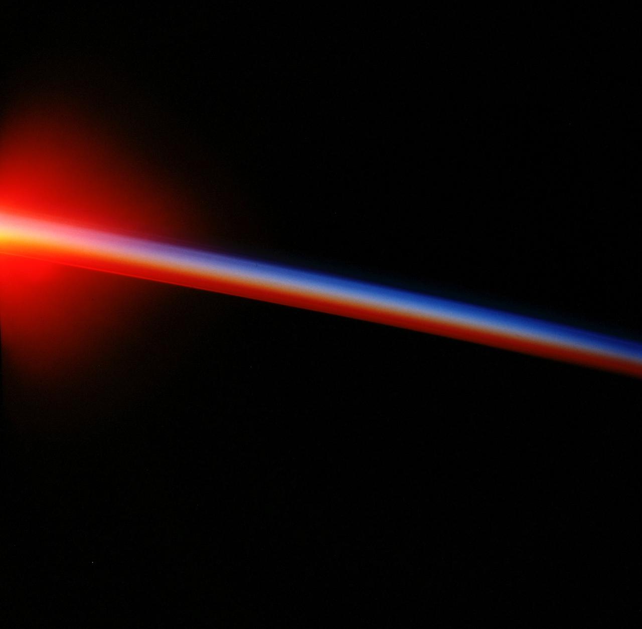
STS047-54-018 (12-20 Sept. 1992) --- The colors in this photograph provide insight into the relative density of the atmosphere. The crew members had many opportunities to witness sunrises and sunsets, considering they orbit the Earth every 90 minutes, but few, they said, compared to this scene. It captures the silhouette of several mature thunderstorms with their cirrus anvil tops spreading out against the tropopause (the top of the lowest layer of Earth's atmosphere) at sunset. The lowest layer (troposphere) is the densest and refracts light at the red end of the visible spectrum (7,400 Angstroms), while the blues (4,000 Angstroms) are separated in the least dense portion of the atmosphere (middle and upper atmosphere, or stratosphere and mesosphere). Several layers of blue can be seen. NASA scientists studying the photos believe this stratification to be caused by the scattering of light by particulate trapped in the stratosphere and mesosphere particulate that generally originate from volcanic eruptions, such as those of Mt. Pinatubo in the Philippines and, most recently, Mt. Spurr in Alaska.
STS047-54-016 (12 - 20 Sept 1992) --- The colors in this photograph provide insight into the relative density of the atmosphere. The crew members had many opportunities to witness sunrises and sunsets, considering they orbit the Earth every 90 minutes, but few, they said, compared to this scene. It captures the silhouette of several mature thunderstorms with their cirrus anvil tops spreading out against the tropopause (the top of the lowest layer of Earth's atmosphere) at sunset. The lowest layer (troposphere) is the densest and refracts light at the red end of the visible spectrum (7,400 Angstroms), while the blues (4,000 Angstroms) are separated in the least dense portion of the atmosphere (middle and upper atmosphere, or stratosphere and mesosphere). Several layers of blue can be seen. NASA scientists studying the photos believe this stratification to be caused by the scattering of light by particulate trapped in the stratosphere and mesosphere particulate that generally originate from volcanic eruptions, such as those of Mt. Pinatubo in the Philippines and, most recently, Mt. Spurr in Alaska.
STS083-748-006 (4-8 April 1997) --- This type of scene is seen about every 45 minutes as the astronauts travel around the world. Sunrises and sunsets differ in structure, since the tropopause altitude and atmospheric lamina temperatures vary with time of day, season, and latitude. Close analysis of these terminator photographs provide counts of the number and spacing of atmospheric laminae. In the photographs, as many as 4 laminae have been noted in the normally red-to-orange troposphere, and up to 12 laminae have been counted in the blue upper atmosphere. However, true replication of human vision is not possible using present films. For instance, while on orbit, one astronaut counted 22 layers. The photograph of that event recorded only 8 such layers.

ISS016-E-027426 (5 Feb. 2008) --- Cumulonimbus Cloud over Africa is featured in this image photographed by an Expedition 16 crewmember on the International Space Station. Deemed by many meteorologists as one of the most impressive of cloud formations, cumulonimbus (from the Latin for "puffy" and "dark") clouds form due to vigorous convection of warm and moist unstable air. Surface air warmed by the Sun-heated ground surface rises, and if sufficient atmospheric moisture is present, water droplets will condense as the air mass encounters cooler air at higher altitudes. The air mass itself also expands and cools as it rises due to decreasing atmospheric pressure, a process known as adiabatic cooling. This type of convection is common in tropical latitudes year-round and during the summer season at higher latitudes. As water in the rising air mass condenses and changes from a gaseous to a liquid state, it releases energy to its surroundings, further heating the surrounding air and leading to more convection and rising of the cloud mass to higher altitudes. This leads to the characteristic vertical "towers" associated with cumulonimbus clouds, an excellent example of which is visible in this image (right). If enough moisture is present to condense and continue heating the cloud mass through several convective cycles, a tower can rise to altitudes of approximately 10 kilometers at high latitudes to 20 kilometers in the tropics -- before encountering a region of the atmosphere known as the tropopause. The tropopause is characterized by a strong temperature inversion where the atmosphere is dryer and no longer cools with altitude. This halts further vertical motion of the cloud mass, and causes flattening and spreading of the cloud tops into an anvil-shaped cloud as illustrated by this oblique photograph. The view direction is at an angle from the vertical, rather than straight "down" towards the Earth's surface. The image, photographed while the International Space Station was passing over western Africa near the Senegal-Mali border, shows a fully-formed anvil cloud with numerous smaller cumulonimbus towers rising near it. The high energetics of these storm systems typically make them hazardous due to associated heavy precipitation, lightning, high wind speeds and possible tornadoes.
On the morning of October 4, 2016, Hurricane Matthew passed over the island nation of Haiti. A Category 4 storm, it made landfall around 7 a.m. local time (5 a.m. PDT/8 a.m. EDT) with sustained winds over 145 mph. This is the strongest hurricane to hit Haiti in over 50 years. On October 4, at 10:30 a.m. local time (8:30 a.m. PDT/11:30 a.m. EDT), the Multi-angle Imaging SpectroRadiometer (MISR) instrument aboard NASA's Terra satellite passed over Hurricane Matthew. This animation was made from images taken by MISR's downward-pointing (nadir) camera is 235 miles (378 kilometers) across, which is much narrower than the massive diameter of Matthew, so only the hurricane's eye and a portion of the storm's right side are visible. Haiti is completely obscured by Matthew's clouds, but part of the Bahamas is visible to the north. Several hot towers are visible within the central part of the storm, and another at the top right of the image. Hot towers are enormous thunderheads that punch through the tropopause (the boundary between the lowest layer of the atmosphere, the troposphere, and the next level, the stratosphere). The rugged topography of Haiti causes uplift within the storm, generating these hot towers and fueling even more rain than Matthew would otherwise dump on the country. MISR has nine cameras fixed at different angles, which capture images of the same point on the ground within about seven minutes. This animation was created by blending images from these nine cameras. The change in angle between the images causes a much larger motion from south to north than actually exists, but the rotation of the storm is real motion. From this animation, you can get an idea of the incredible height of the hot towers, especially the one to the upper right. The counter-clockwise rotation of Matthew around its closed (cloudy) eye is also visible. These data were acquired during Terra orbit 89345. An animation is available at http://photojournal.jpl.nasa.gov/catalog/PIA21070