On Oct. 23, 2011, a magnitude 7.2 earthquake struck eastern Turkey, near the city of Van, the result of the collision between the Arabian and Eurasian tectonic plates. Turkey is a tectonically active country, experiencing frequent devastating earthquakes.
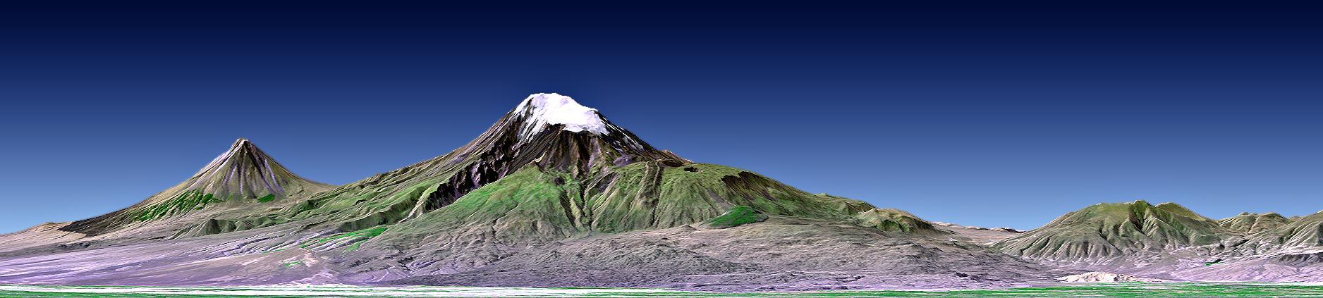
This perspective view shows Mount Ararat in easternmost Turkey, which has been the site of several searches for the remains of Noah Ark.
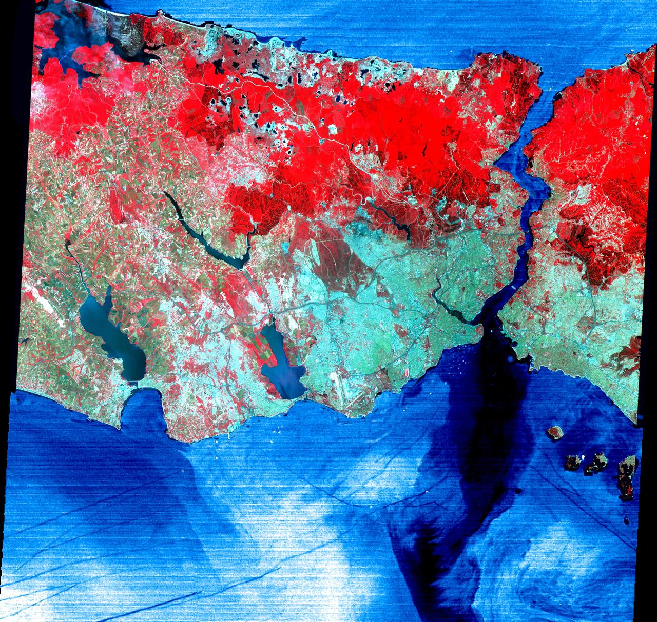
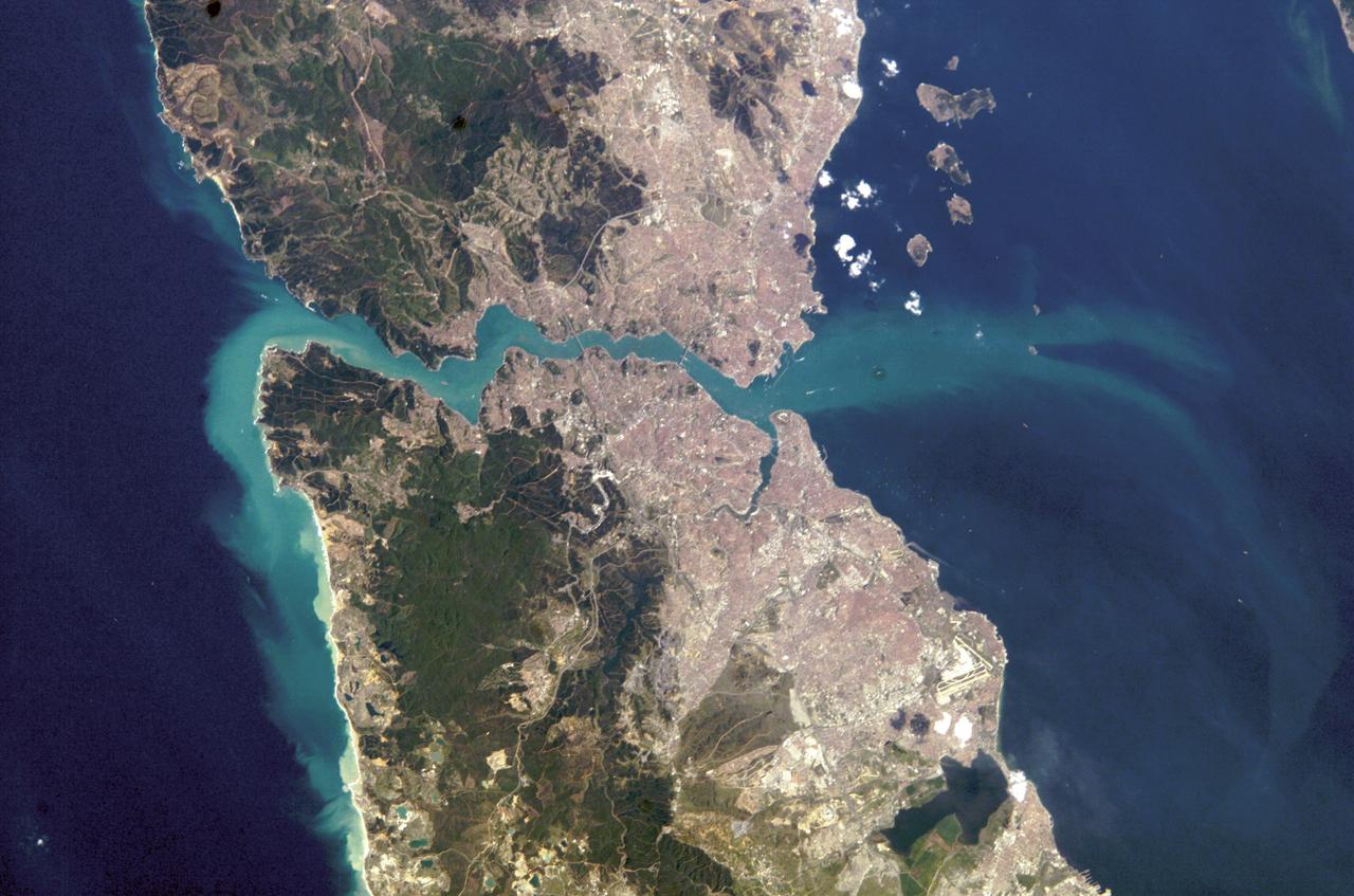
This June 16, 2000 image of Istanbul, Turkey show a full 60 by 60 km ASTER scene in the visible and infrared channels. Vegetation appears red, and urban areas blue-green. Bustling Istanbul, with its magnificent historical heritage, has spanned the divide between Europe and Asia for more than 2,500 years. Originally called Byzantium, the city was founded in the 7th century BC on the Golden Horn, an arm of the narrow Bosporus (also spelled Bosphorus) Strait, which connects the Sea of Marmara to the south, with the Black Sea to the north. Constantine I made it his capital of the Eastern Roman Empire in AD 330. As Constantinople, the strategically located city arose as the preeminent cultural, religious, and political center of the Western world. It reached the height of its wealth and glory in the early 5th century. After centuries of decline, the city entered another period of tremendous growth and prosperity when, as Istanbul, it became the capital of the Turkish Ottoman Empire in 1457. Although Turkey moved its capital to Ankara in 1923, Istanbul remains the nation's largest city with a population of over 8 million, its commercial center, and a major port. Two bridges spanning the Bosporus, and ships in the busy channel can be seen on the enlargement. On the image, the water areas have been replaced with a thermal image: colder waters are displayed in dark blue, warmer areas in light blue. Note the dark lines showing boat wakes, and the cold water entering the Sea of Marmara from deeper waters of the Bosporus. http://photojournal.jpl.nasa.gov/catalog/PIA02665
In western Turkey, Pamukkale travertine pools and terraces form the largest such complex in the world. For thousands of years, people have visited the area due to the attraction of the thermal pools. The ancient Greco-Roman city of Hierapolis was built on top of the travertine formation. The volcanic activity which causes the hot springs, forced carbon dioxide into a cave, which was called the place of the god Pluto, and instantly killed any animals (and people) that ventured in. The perspective image was acquired May 25, 2021, and is located at 37.9 degrees north, 29.1 degrees east. https://photojournal.jpl.nasa.gov/catalog/PIA24868
AST-16-1268 (20 July 1975) --- A near vertical view of a portion of the Mediterranean coast of Turkey and Syria, as photographed from the Apollo spacecraft in Earth orbit during the joint U.S-USSR Apollo-Soyuz Test Project mission. This view covers the Levant Coast north of Beirut, showing the cities of Aleppo, Hamah, Homs and Latakia. The Levantine rift bends to the northeast. This picture was taken with a 70mm Hasselblad camera using high-definition aerial Ektachrome SO-242 type film. The altitude of the spacecraft was 225 kilometers (140 statute miles) when this photograph was taken.
SL3-122-2558 (July-September 1973) --- Skylab 3 Earth view of southwest Turkey, Aegean Sea, Rhodes, Lesbos and Samos. Photo credit: NASA
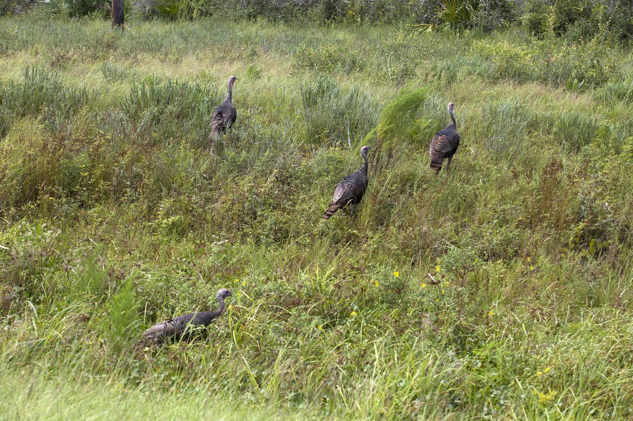
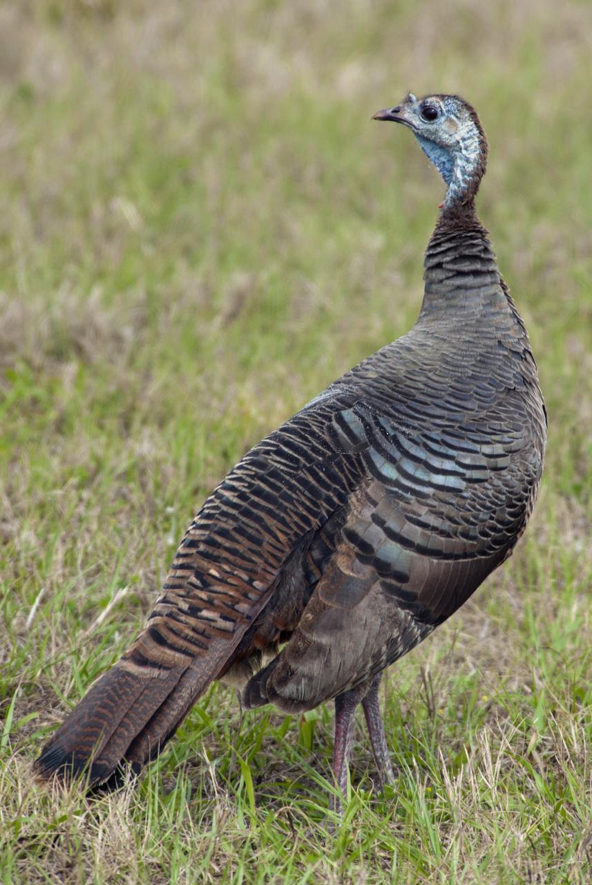
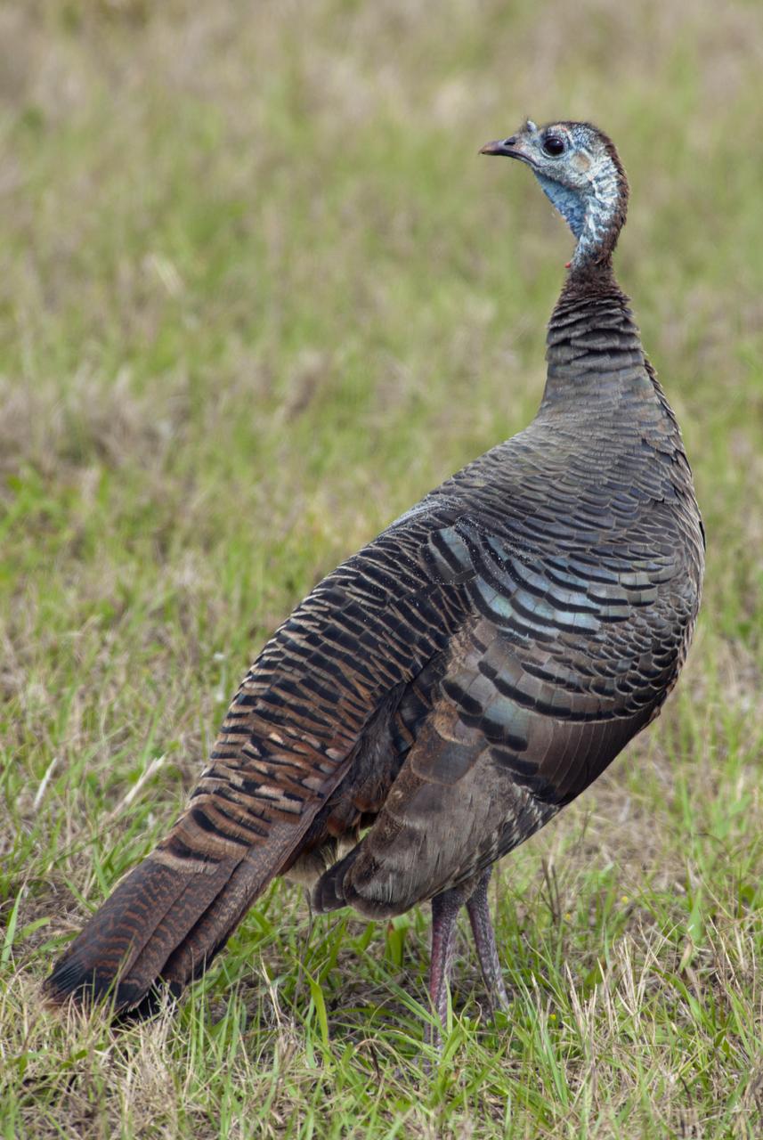
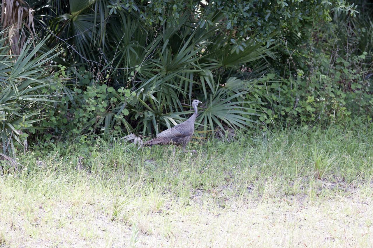
Four wild turkeys walk through tall grass at NASA’s Kennedy Space Center in Florida. Kennedy shares a boundary with the Merritt Island National Wildlife Refuge. The Refuge encompasses 140,000 acres that are a habitat for more than 331 species of birds, 31 mammals, 117 fishes, and 65 amphibians and reptiles. The marshes and open water of the refuge provide wintering areas for 23 species of migratory waterfowl, as well as a year-round home for great blue herons, great egrets, wood storks, cormorants, brown pelicans and other species of marsh and shore birds, as well as a variety of insects.
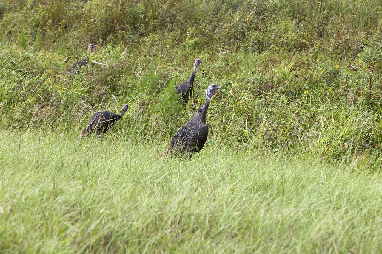
Four wild turkeys walk through tall grass at NASA’s Kennedy Space Center in Florida. Kennedy shares a boundary with the Merritt Island National Wildlife Refuge. The Refuge encompasses 140,000 acres that are a habitat for more than 331 species of birds, 31 mammals, 117 fishes, and 65 amphibians and reptiles. The marshes and open water of the refuge provide wintering areas for 23 species of migratory waterfowl, as well as a year-round home for great blue herons, great egrets, wood storks, cormorants, brown pelicans and other species of marsh and shore birds, as well as a variety of insects.
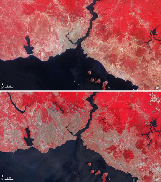
Istanbul has been a bustling trade city for thousands of years. In this 1975 image, taken by Landsat, the city centers on the Golden Horn the estuary that flows into the Bosporus Straight at the center of the scene. Shown in false color, vegetation is red, urban areas are gray, and water appears black. A bridge built in 1973 to connect the Asian and European sides of Istanbul is barely visible. By 2011, Istanbul's population had exploded from 2 to 13 million people, and the city has gone through a dramatic expansion. This Landsat 5 image shows densely packed urban areas stretching along the Sea of Marmara and up the Bosporus Straight where a second bridge built in 1988 now crosses the water. ---- NASA and the U.S. Department of the Interior through the U.S. Geological Survey (USGS) jointly manage Landsat, and the USGS preserves a 40-year archive of Landsat images that is freely available over the Internet. The next Landsat satellite, now known as the Landsat Data Continuity Mission (LDCM) and later to be called Landsat 8, is scheduled for launch in 2013. In honor of Landsat’s 40th anniversary in July 2012, the USGS released the LandsatLook viewer – a quick, simple way to go forward and backward in time, pulling images of anywhere in the world out of the Landsat archive. <b><a href="http://www.nasa.gov/audience/formedia/features/MP_Photo_Guidelines.html" rel="nofollow">NASA image use policy.</a></b> <b><a href="http://www.nasa.gov/centers/goddard/home/index.html" rel="nofollow">NASA Goddard Space Flight Center</a></b> enables NASA’s mission through four scientific endeavors: Earth Science, Heliophysics, Solar System Exploration, and Astrophysics. Goddard plays a leading role in NASA’s accomplishments by contributing compelling scientific knowledge to advance the Agency’s mission. <b>Follow us on <a href="http://twitter.com/NASA_GoddardPix" rel="nofollow">Twitter</a></b> <b>Like us on <a href="http://www.facebook.com/pages/Greenbelt-MD/NASA-Goddard/395013845897?ref=tsd" rel="nofollow">Facebook</a></b> <b>Find us on <a href="http://instagrid.me/nasagoddard/?vm=grid" rel="nofollow">Instagram</a></b>
SL3-122-2562 (July-September 1973) --- A near vertical view of the border area of Turkey-Iran?Union of Soviet Socialist Republics as seen from the Skylab space station in Earth orbit. This picture was taken by one of the Skylab 3 crewmen using a hand-held 70mm Hasselblad camera. THE PICTURE SHOULD BE HELD WITH THE MASS OF WHITE CLOUDS ON THE RIGHT SIDE. The lake at the top center edge is Ozero (Lake) Sevan in the USSR?s Armenian Soviet Socialist Republic. The other body of water is Iran?s Lake Urmia. The major feature in this photograph can be seen in the upper left corner. Mount Ararat is in Turkey only a few miles from Iran and USSR borders. Yerevan, the capital of Armenian SSR, is located north-northwest of Mount Ararat. Photo credit: NASA
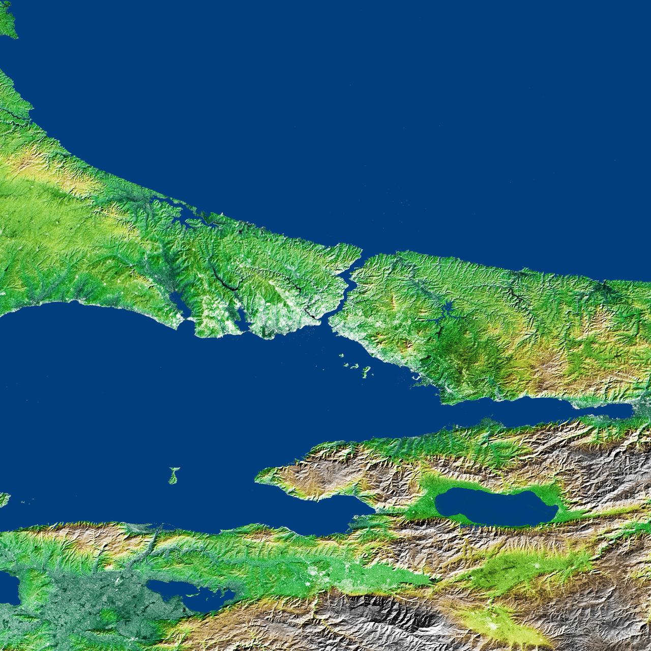
The Bosporus also spelled Bosphorus is a strait that connects the Black Sea with the Sea of Marmara in the center of this view of northwest Turkey, taken during NASA Shuttle Radar Topography Mission.
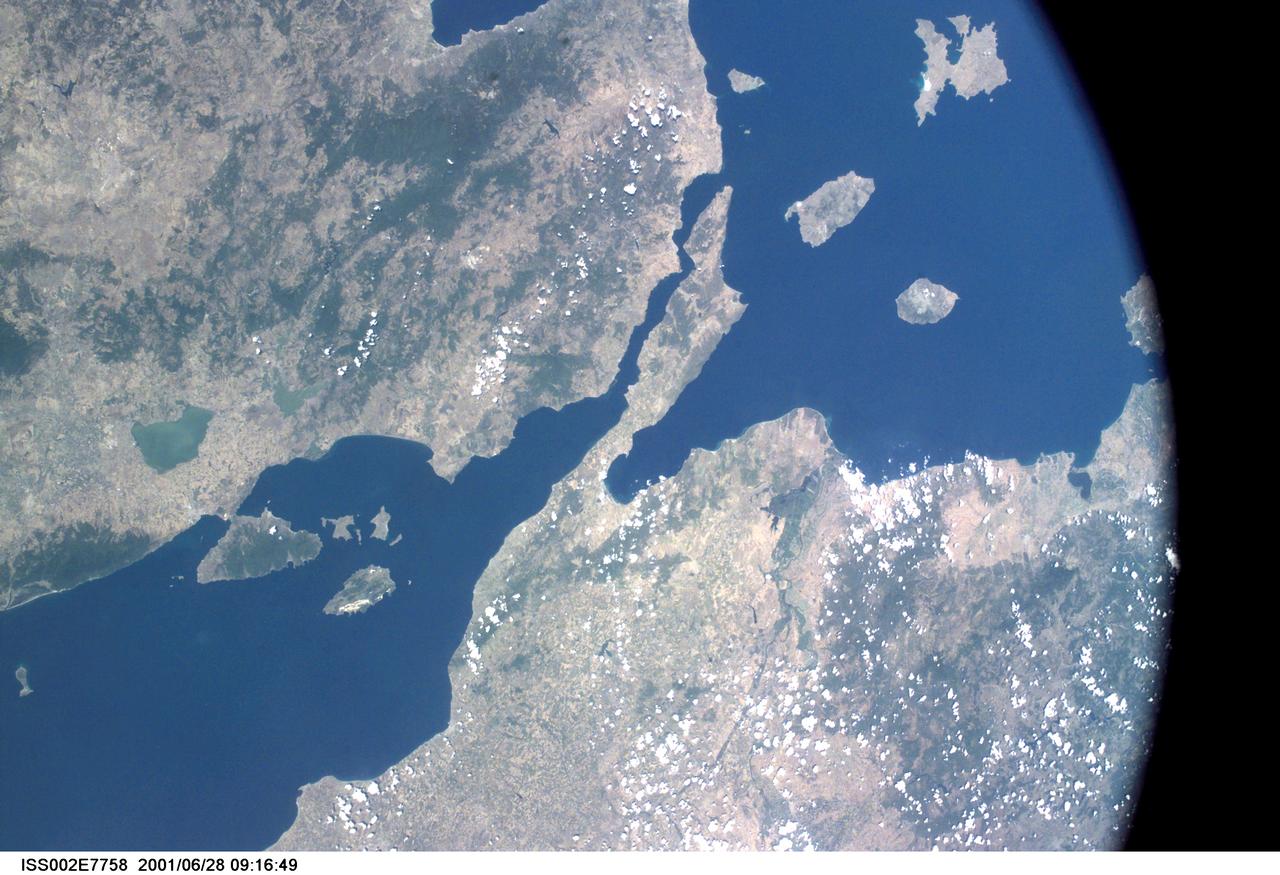
ISS002-E-7758 (28 June 2001) --- View of the Dardanelles, Turkey, as photographed with a digital still camera aboard the International Space Station (ISS).
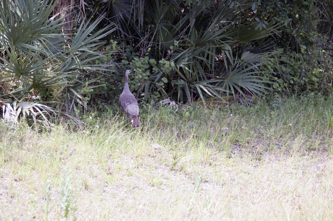
CAPE CANAVERAL, Fla. – At NASA’s Kennedy Space Center in Florida, a female Osceola wild turkey roams a grassy area near Launch Complex 39. The center shares a boundary with the Merritt Island National Wildlife Refuge. The refuge encompasses 140,000 acres that are a habitat for more than 330 species of birds, 31 mammals, 117 fishes, and 65 amphibians and reptiles. It contains more than 1,000 known plant species. The marshes and open water of the refuge provide wintering areas for 23 species of migratory waterfowl, as well as a year-round home for great blue herons, great egrets, wood storks, cormorants, brown pelicans and other species of marsh and shore birds, and a variety of insects. Photo credit: NASA/Tony Gray
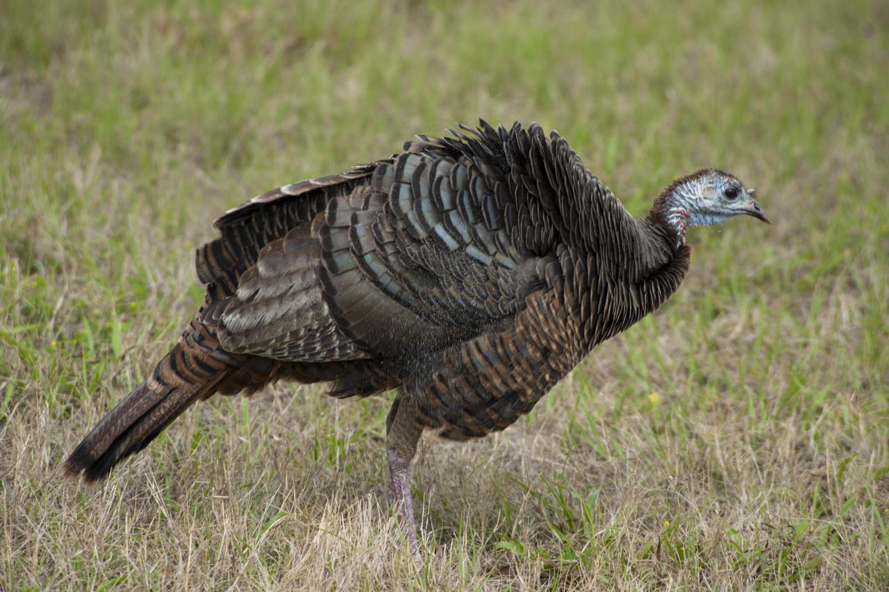
CAPE CANAVERAL, Fla. – At NASA’s Kennedy Space Center in Florida, a female Osceola wild turkey roams a grassy area near Launch Complex 39. The center shares a boundary with the Merritt Island National Wildlife Refuge. The refuge encompasses 140,000 acres that are a habitat for more than 330 species of birds, 31 mammals, 117 fishes, and 65 amphibians and reptiles. It contains more than 1,000 known plant species. The marshes and open water of the refuge provide wintering areas for 23 species of migratory waterfowl, as well as a year-round home for great blue herons, great egrets, wood storks, cormorants, brown pelicans and other species of marsh and shore birds, and a variety of insects. Photo credit: NASA/Tony Gray
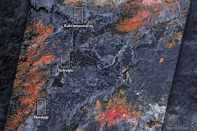
The magnitude 7.8 and 7.5 earthquakes that struck southern Turkey and western Syria on February 6, 2023, caused widespread destruction in both countries. The initial, stronger earthquake emanated from a fault 11 miles (18 kilometers) below the surface. The shallow depth meant the earthquake produced violent shaking that affected areas hundreds of miles from the epicenter, 16 miles (26 kilometers) east of the city of Nurdağı, Turkey. The second quake followed nine hours later, striking 6 miles (10 kilometers) deep, roughly 2.5 miles (4 kilometers) south-southeast of the Turkish town of Ekinözü. Hundreds of smaller aftershocks occurred in subsequent days. The preliminary damage proxy map above shows parts of the Turkish cities of Islahiye, Kahramanmaras, and Nurdağı. Dark red pixels represent areas likely to have severe damage to buildings, homes, and infrastructure or changes to landscape, while orange and yellow areas are moderately or partially damaged. Each pixel measures about 100 feet (30 meters) across (about the size of a baseball infield). The damage estimates are most accurate for urban areas and may be less accurate in the mountain and vegetated areas. The Earth Observatory of Singapore – Remote Sensing Lab and the Advanced Rapid Imaging and Analysis (ARIA) team at NASA's Jet Propulsion Laboratory and Caltech collaborated to derive the map from data collected by Japan's Advanced Land Observing Satellite-2 satellite (ALOS-2) on February 8, 2023. The satellite carries a synthetic aperture radar, a sensor that sends pulses of microwaves toward Earth's surface and records for the reflections of those waves to map the landscape, including buildings. By comparing the February 8 data to observations made by the same satellite before the earthquake (on April 7, 2021 and April 6, 2022), scientists tracked the changes and began to identify areas that were likely damaged. https://photojournal.jpl.nasa.gov/catalog/PIA25564
![More than 70% of the world's hazelnuts come from Turkey, and about 60% come from the Eastern Black Sea region on the slopes of the Pontic mountain range, around the ancient coastal city of Giresun. The tradition of hazelnut farming goes back thousands of years. Presently, most of the hazelnut products are processed by women [BBC Travel]. The image was acquired August 15, 2024, covers an area of 35.7 by 36.2 km, and is located at 40.9 degrees north, 38.4 degrees east. With its 14 spectral bands from the visible to the thermal infrared wavelength region and its high spatial resolution of about 50 to 300 feet (15 to 90 meters), ASTER images Earth to map and monitor the changing surface of our planet. ASTER is one of five Earth-observing instruments launched Dec. 18, 1999, on Terra. The instrument was built by Japan's Ministry of Economy, Trade and Industry. A joint U.S./Japan science team is responsible for validation and calibration of the instrument and data products. The broad spectral coverage and high spectral resolution of ASTER provides scientists in numerous disciplines with critical information for surface mapping and monitoring of dynamic conditions and temporal change. Example applications are monitoring glacial advances and retreats; monitoring potentially active volcanoes; identifying crop stress; determining cloud morphology and physical properties; wetlands evaluation; thermal pollution monitoring; coral reef degradation; surface temperature mapping of soils and geology; and measuring surface heat balance. https://photojournal.jpl.nasa.gov/catalog/PIA26450](https://images-assets.nasa.gov/image/PIA26450/PIA26450~medium.jpg)
More than 70% of the world's hazelnuts come from Turkey, and about 60% come from the Eastern Black Sea region on the slopes of the Pontic mountain range, around the ancient coastal city of Giresun. The tradition of hazelnut farming goes back thousands of years. Presently, most of the hazelnut products are processed by women [BBC Travel]. The image was acquired August 15, 2024, covers an area of 35.7 by 36.2 km, and is located at 40.9 degrees north, 38.4 degrees east. With its 14 spectral bands from the visible to the thermal infrared wavelength region and its high spatial resolution of about 50 to 300 feet (15 to 90 meters), ASTER images Earth to map and monitor the changing surface of our planet. ASTER is one of five Earth-observing instruments launched Dec. 18, 1999, on Terra. The instrument was built by Japan's Ministry of Economy, Trade and Industry. A joint U.S./Japan science team is responsible for validation and calibration of the instrument and data products. The broad spectral coverage and high spectral resolution of ASTER provides scientists in numerous disciplines with critical information for surface mapping and monitoring of dynamic conditions and temporal change. Example applications are monitoring glacial advances and retreats; monitoring potentially active volcanoes; identifying crop stress; determining cloud morphology and physical properties; wetlands evaluation; thermal pollution monitoring; coral reef degradation; surface temperature mapping of soils and geology; and measuring surface heat balance. https://photojournal.jpl.nasa.gov/catalog/PIA26450
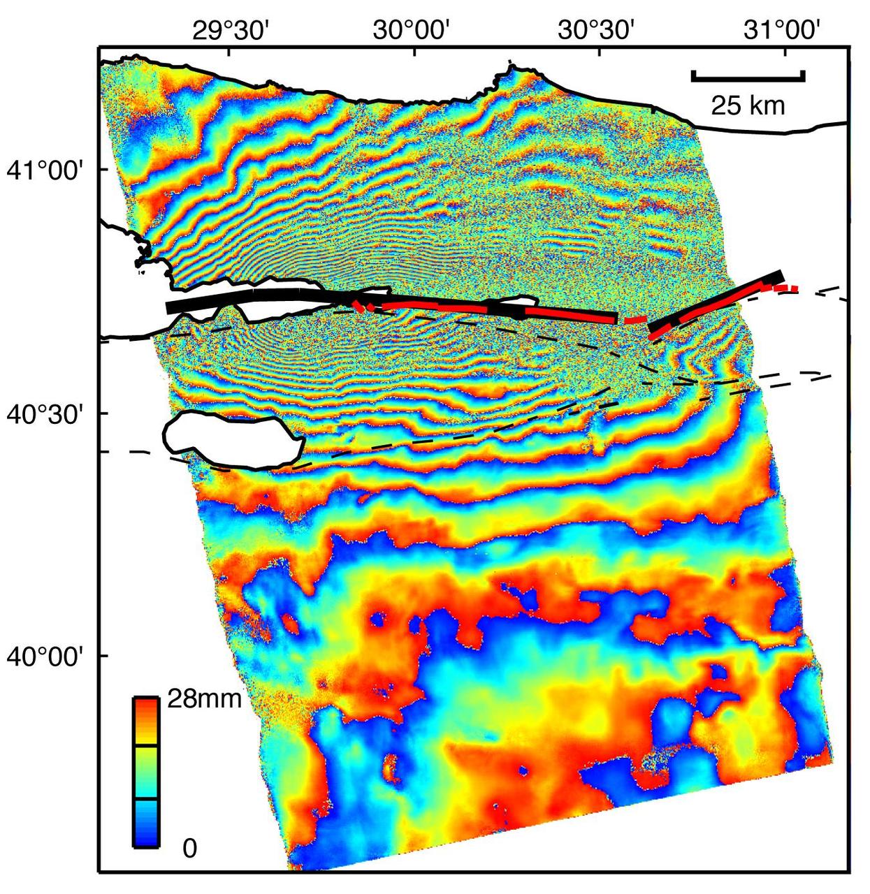
This image is an interferogram that was created using pairs of images taken by Synthetic Aperture Radar (SAR). The images, acquired at two different times, have been combined to measure surface deformation or changes that may have occurred during the time between data acquisition. The images were collected by the European Space Agency's Remote Sensing satellite (ERS-2) on 13 August 1999 and 17 September 1999 and were combined to produce these image maps of the apparent surface deformation, or changes, during and after the 17 August 1999 Izmit, Turkey earthquake. This magnitude 7.6 earthquake was the largest in 60 years in Turkey and caused extensive damage and loss of life. Each of the color contours of the interferogram represents 28 mm (1.1 inches) of motion towards the satellite, or about 70 mm (2.8 inches) of horizontal motion. White areas are outside the SAR image or water of seas and lakes. The North Anatolian Fault that broke during the Izmit earthquake moved more than 2.5 meters (8.1 feet) to produce the pattern measured by the interferogram. Thin red lines show the locations of fault breaks mapped on the surface. The SAR interferogram shows that the deformation and fault slip extended west of the surface faults, underneath the Gulf of Izmit. Thick black lines mark the fault rupture inferred from the SAR data. Scientists are using the SAR interferometry along with other data collected on the ground to estimate the pattern of slip that occurred during the Izmit earthquake. This then used to improve computer models that predict how this deformation transferred stress to other faults and to the continuation of the North Anatolian Fault, which extends to the west past the large city of Istanbul. These models show that the Izmit earthquake further increased the already high probability of a major earthquake near Istanbul. http://photojournal.jpl.nasa.gov/catalog/PIA00557
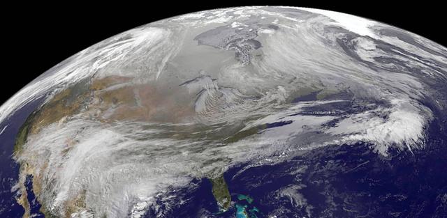
On November 23, 2013 at at 2045 UTC/3:45 p.m. EST, Arctic air pours over North America during the week before Thanksgiving, bringing several days of unseasonal freezing temperatures and difficult weather to the United States. Credit: NASA GOES Project/Dennis Chesters <b><a href="http://www.nasa.gov/audience/formedia/features/MP_Photo_Guidelines.html" rel="nofollow">NASA image use policy.</a></b> <b><a href="http://www.nasa.gov/centers/goddard/home/index.html" rel="nofollow">NASA Goddard Space Flight Center</a></b> enables NASA’s mission through four scientific endeavors: Earth Science, Heliophysics, Solar System Exploration, and Astrophysics. Goddard plays a leading role in NASA’s accomplishments by contributing compelling scientific knowledge to advance the Agency’s mission. <b>Follow us on <a href="http://twitter.com/NASA_GoddardPix" rel="nofollow">Twitter</a></b> <b>Like us on <a href="http://www.facebook.com/pages/Greenbelt-MD/NASA-Goddard/395013845897?ref=tsd" rel="nofollow">Facebook</a></b> <b>Find us on <a href="http://instagrid.me/nasagoddard/?vm=grid" rel="nofollow">Instagram</a></b>
iss074e0591602 (May 19, 2026) --- The Atatürk Dam, built on the Euphrates River in Turkey, expanded the nation’s water supply, increasing agricultural productivity and boosting hydroelectric power production, which has promoted growth and development throughout the region. The International Space Station was orbiting 259 miles above Earth at the time of this photograph. Credit: NASA/Jessica Meir
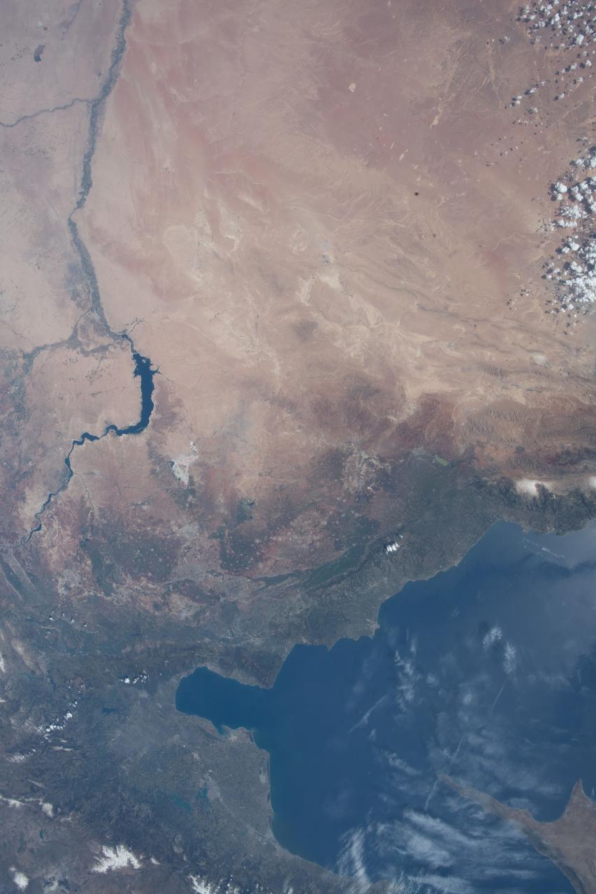
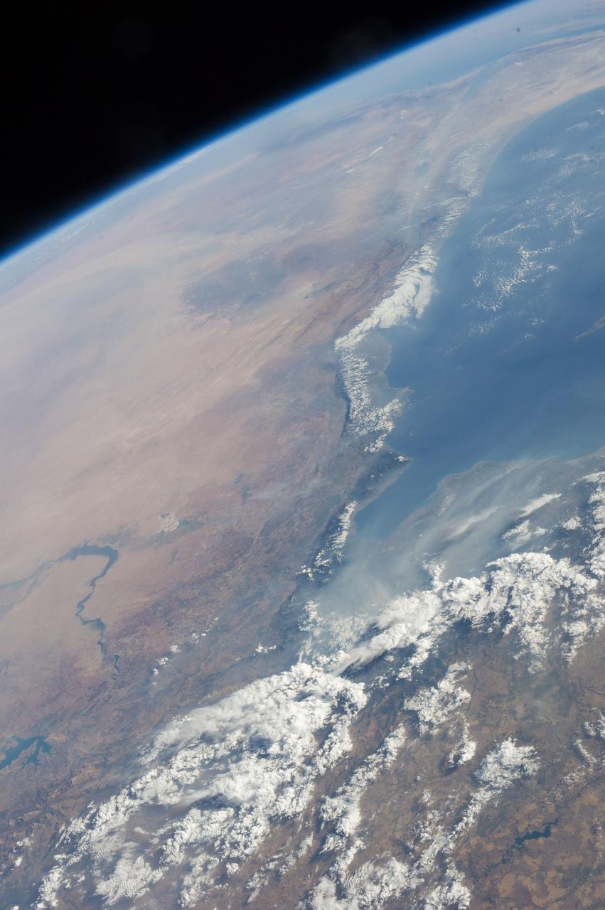
STS058-95-028 (18 Oct-1Nov 1993) --- Lake Urmia (Orumiyeh) in the high desert plateau of northwest Iran dominates the center of this northeast-looking view. The left edge of the view cuts Lake Van in eastern Turkey. The Caucasus Mountains in war-torn Georgia appear just beyond. Mount Ararat, of biblical fame, is a major peak north of Lake Van. The Caspian Sea, an international body of water, stretches across the top right of the view. Countries bordering the Caspian are Iran in the south, Kazakhstan in the west, and Russia and Azerbaijan in the west.
STS057-73-075 (21 June-1 July 1993) --- Eastern Mediterranean from an unusually high vantage point over the Nile River, this north-looking view shows not only the eastern Mediterranean but also the entire landmass of Asia Minor, with the Black Sea dimly visible at the horizon. Many of the Greek islands can be seen in the Aegean Sea (top left), off the coast of Asia Minor. Cyprus is visible under atmospheric dust in the northeast corner of the Mediterranean. The dust cloud covers the east end of the Mediterranean, its western edge demarcated by a line that cuts the center of the Nile Delta. This dust cloud originated far to the west, in Algeria, and moved northeast over Sicily, southern Italy, and Greece. Part of the cloud then moved on over the Black Sea, but another part swerved southward back towards Egypt. A gyre of clouds in the southeast corner of the Mediterranean indicates a complementary counterclockwise (cyclonic) circulation of air. The Euphrates River appears as a thin green line (upper right) in the yellow Syrian Desert just south of the blue-green mountains of Turkey. The Dead Sea (lower right) lies in a rift valley which extends north into Turkey and south thousands of miles down the Gulf of Aqaba, the Red Sea, and on through East Africa. The straight international boundary between Israel and Egypt (where the coastline angles) is particularly clear in this view, marked by the thicker vegetation on the Israeli side of the border. The green delta of the Nile River appears in the foreground, with the great conurbation of Cairo seen as a gray area at the apex of the triangle. Most of Egypt's 52 million inhabitants live in the delta. On the east side of the delta, the Suez Canal is visible. On the western corner of the delta lies the ancient city of Alexandria, beside the orange and white salt pans. The World War II battlesite El Alamein lies on the coast.
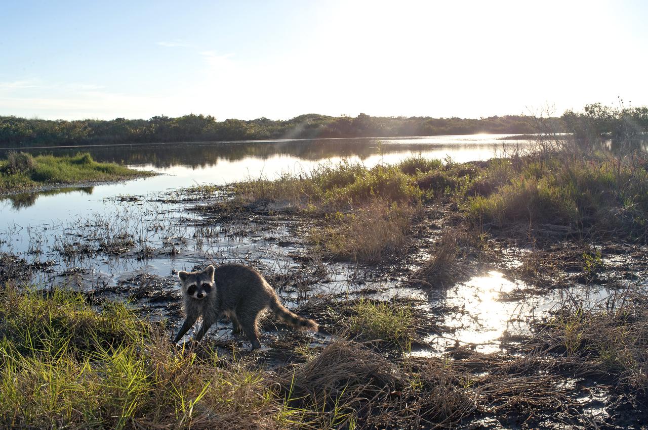
Bobcat, Racoons and Turkey
Bobcat, Racoons and Turkey

Bobcat, Racoons and Turkey
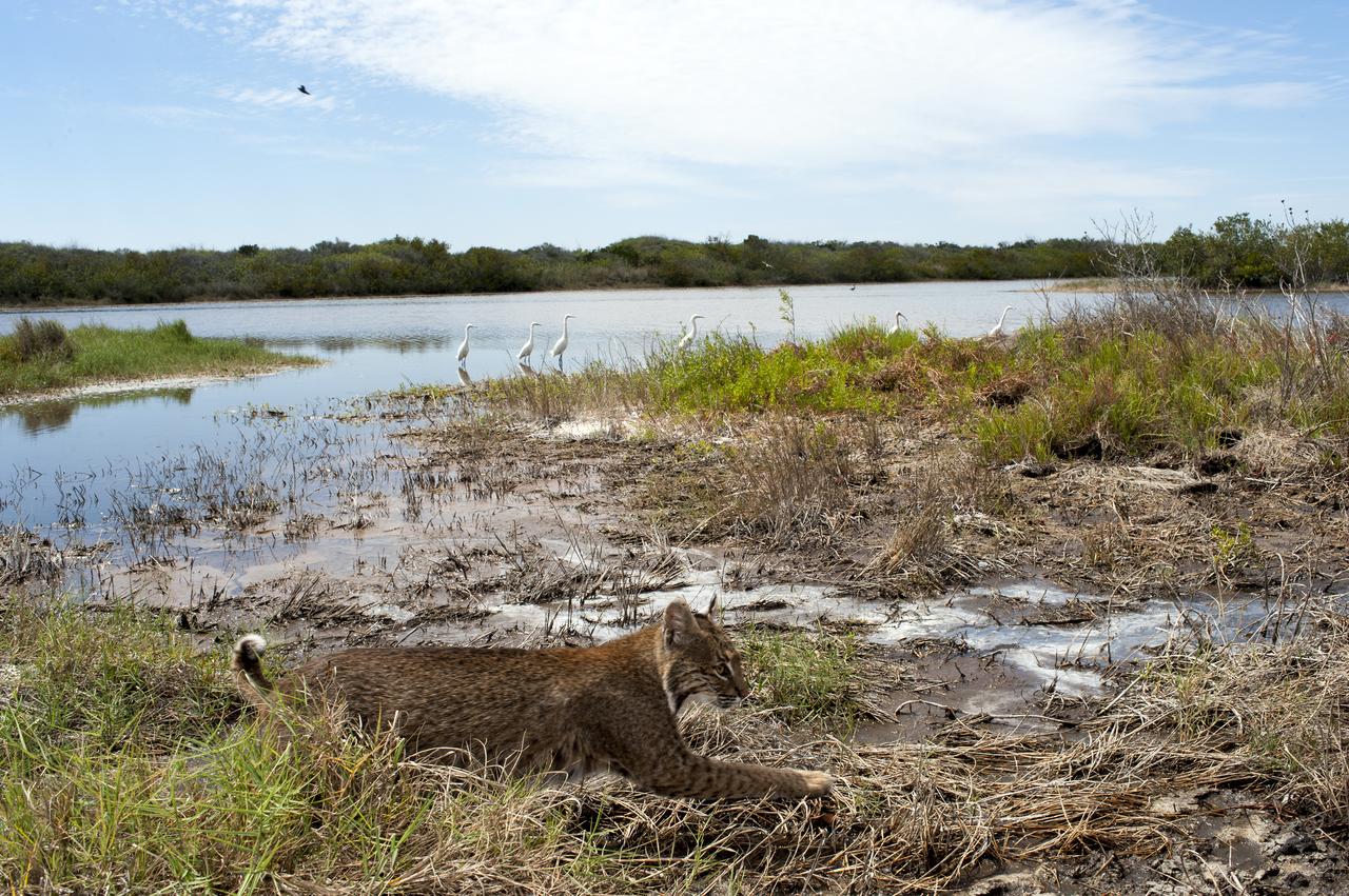
Bobcat, Racoons and Turkey
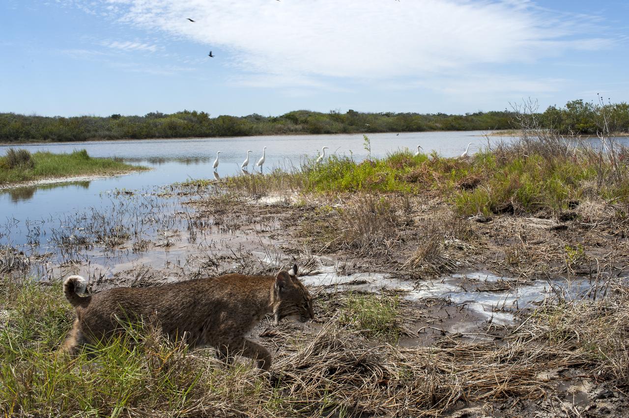
Bobcat, Racoons and Turkey
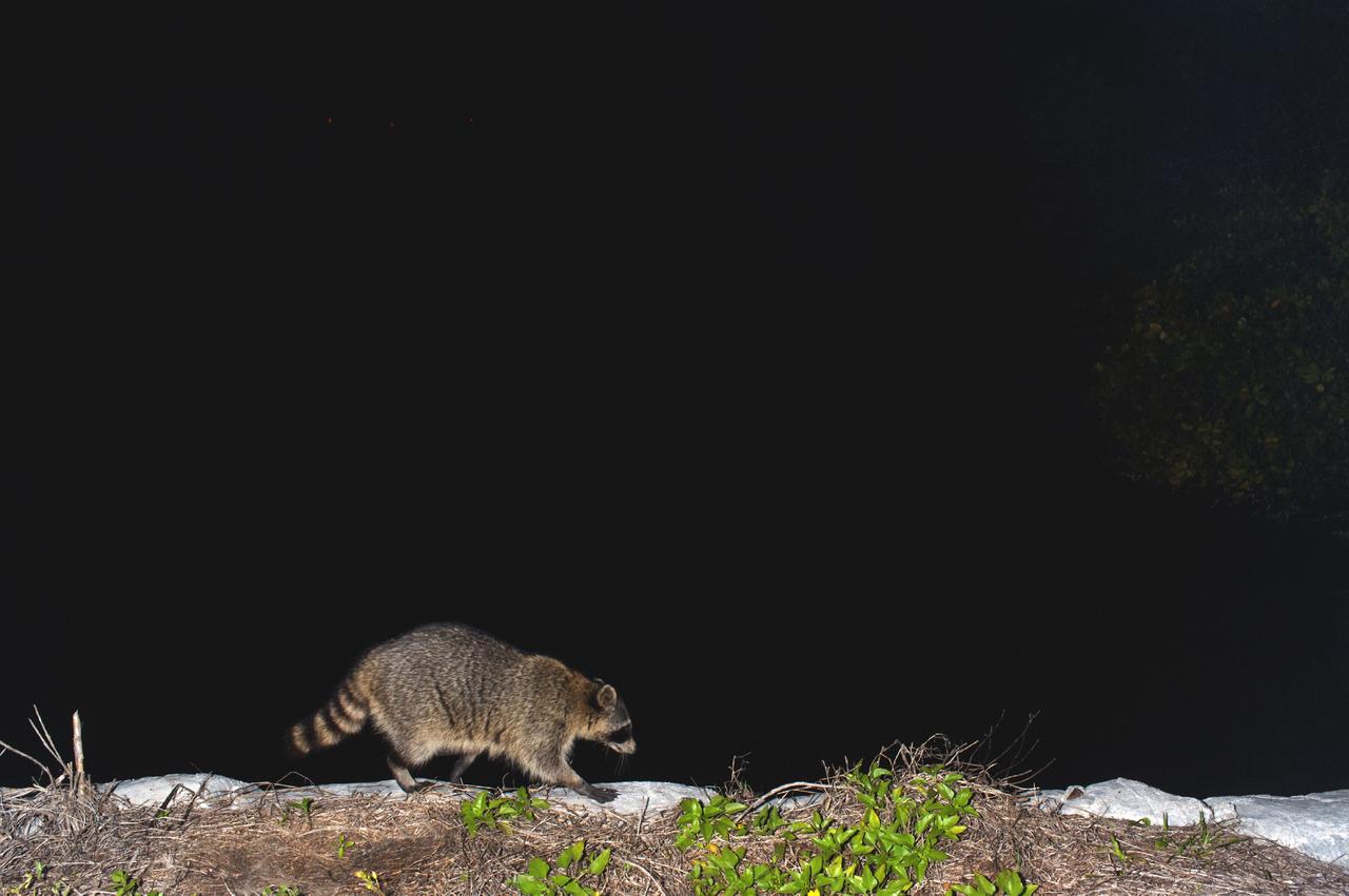
Bobcat, Racoons and Turkey
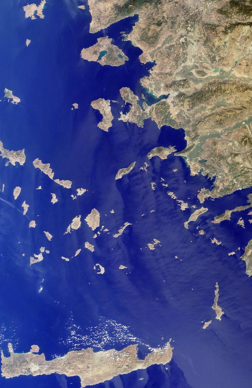
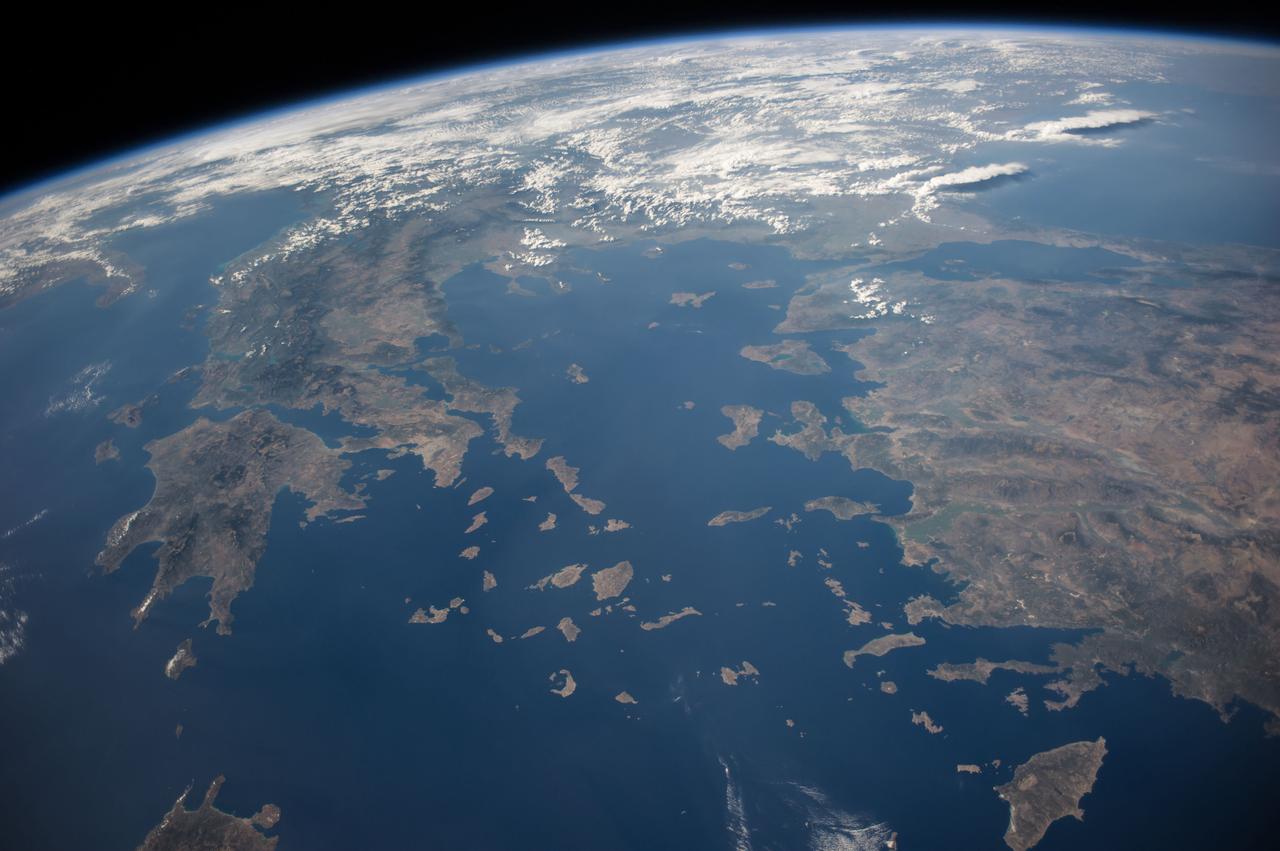
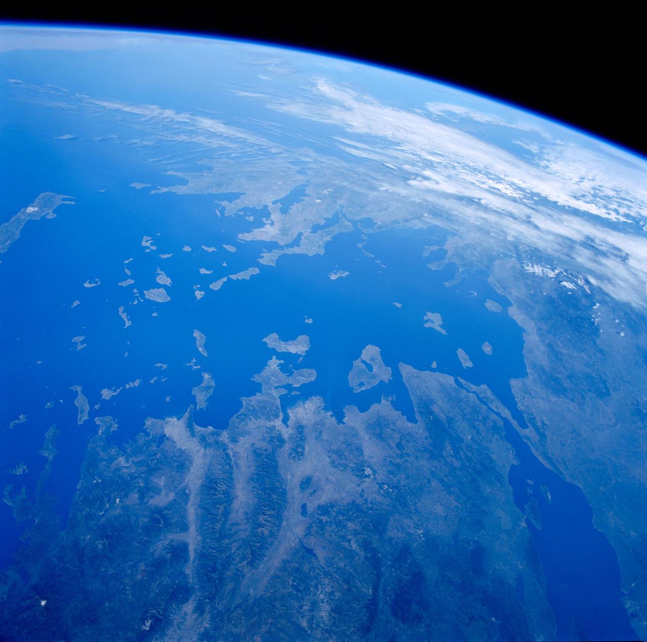
The Greek islands of the Aegean Sea, scattered across 800 kilometers from north to south and between Greece and western Turkey, are uniquely situated at the intersection of Europe, Asia and Africa. This image from NASA Terra satellite was acquired on Se
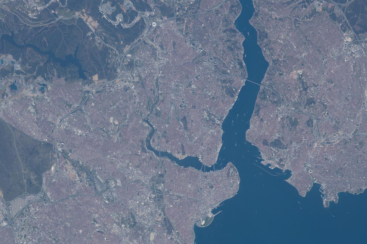
iss065e001923 (April 22, 2021) --- Istanbul, Turkey, connects Europe and Asia and is split by the Golden Horn and the Bosphorus Strait which links the Sea of Marmara to the Black Sea. The International Space Station was orbiting 264 miles above Turkey just southwest of its capital city, Ankara, at the time this photograph was taken.
GMT358_21_53_Terry Virts_CEO chad sand dunes israel eastern turkey zoom_129
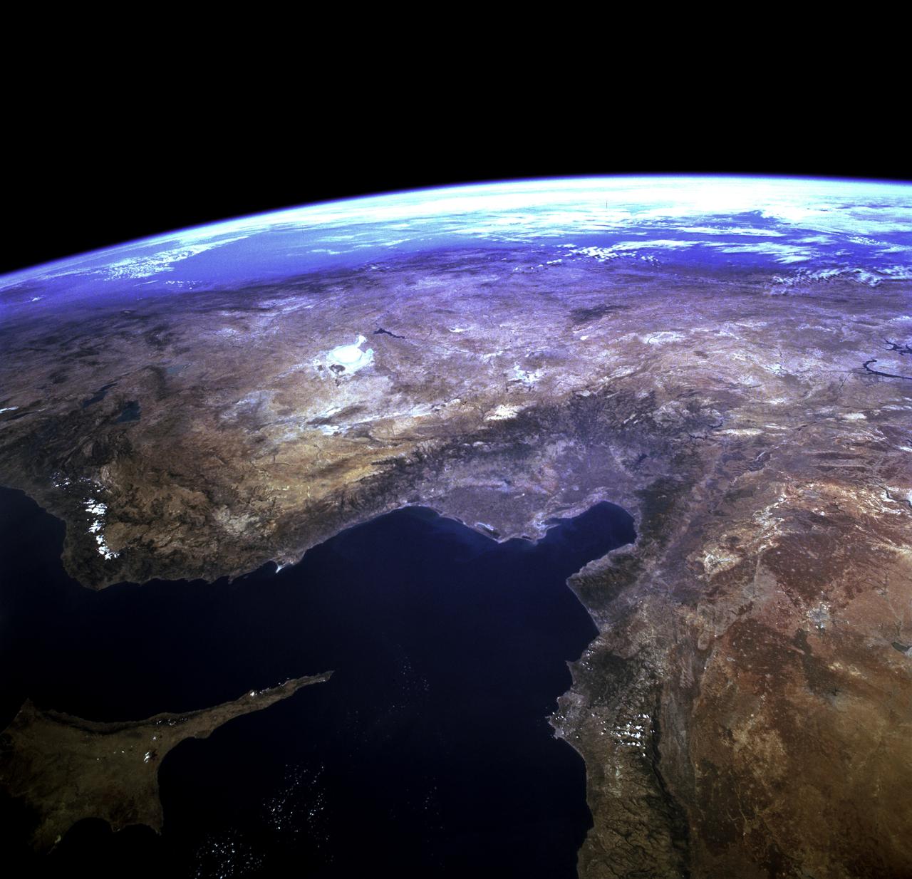
STS073-723-054 (21 October 1995) --- Central Turkey dominates this north-looking panorama, with the long fingered island of Cyprus lower left, surrounded by the deep blue waters of the Mediterranean Sea. Turkey's capital, Ankara, lies just north of the white bed of a dry lake in the center of the view. The city is supplied with water from the neighboring blue lake. The coast of Syria and Lebanon appear bottom right. Man-made lakes on the upper Euphrates River in eastern Turkey appear extreme right. According to scientists studying the STS-73 photo collection, the striking difference in visibility to north and south of Turkey suggests a pollution event over the Black Sea. Air pollution from East European industry flows down into the Black Sea basin, especially at the west end (haze top left) as shown in this view (compare clearer air top right).

Earth observation taken by the Expedition 39 crew aboard the ISS. Image was released by astronaut on Twitter and downlinked in folder: Turkey.
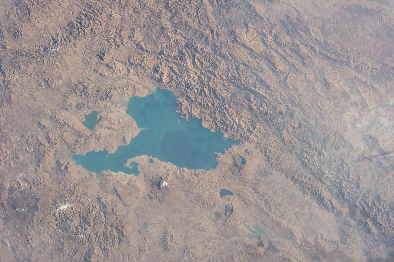
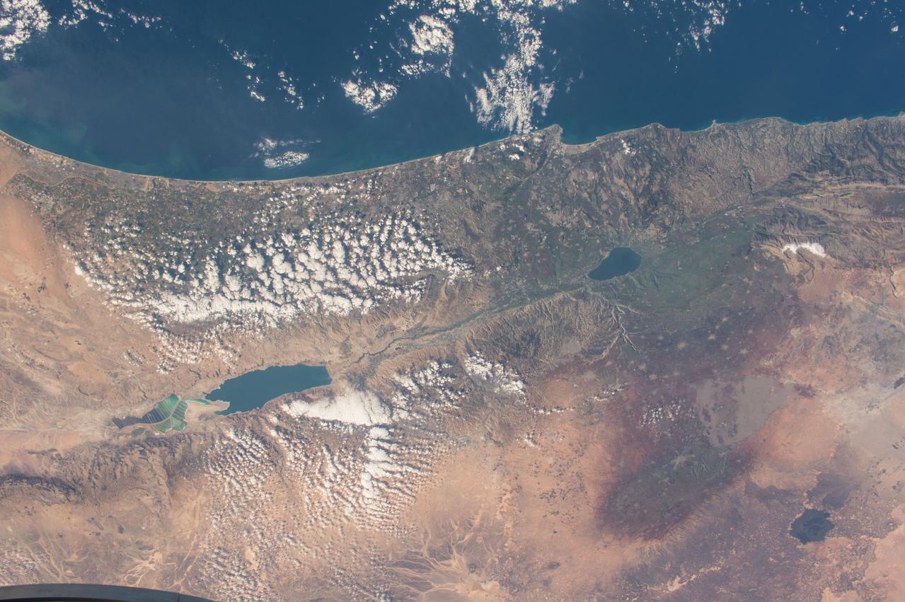
Earth observation taken during a day pass by the Expedition 37 crew. Per Twitter message: Lake Van, eastern Turkey.
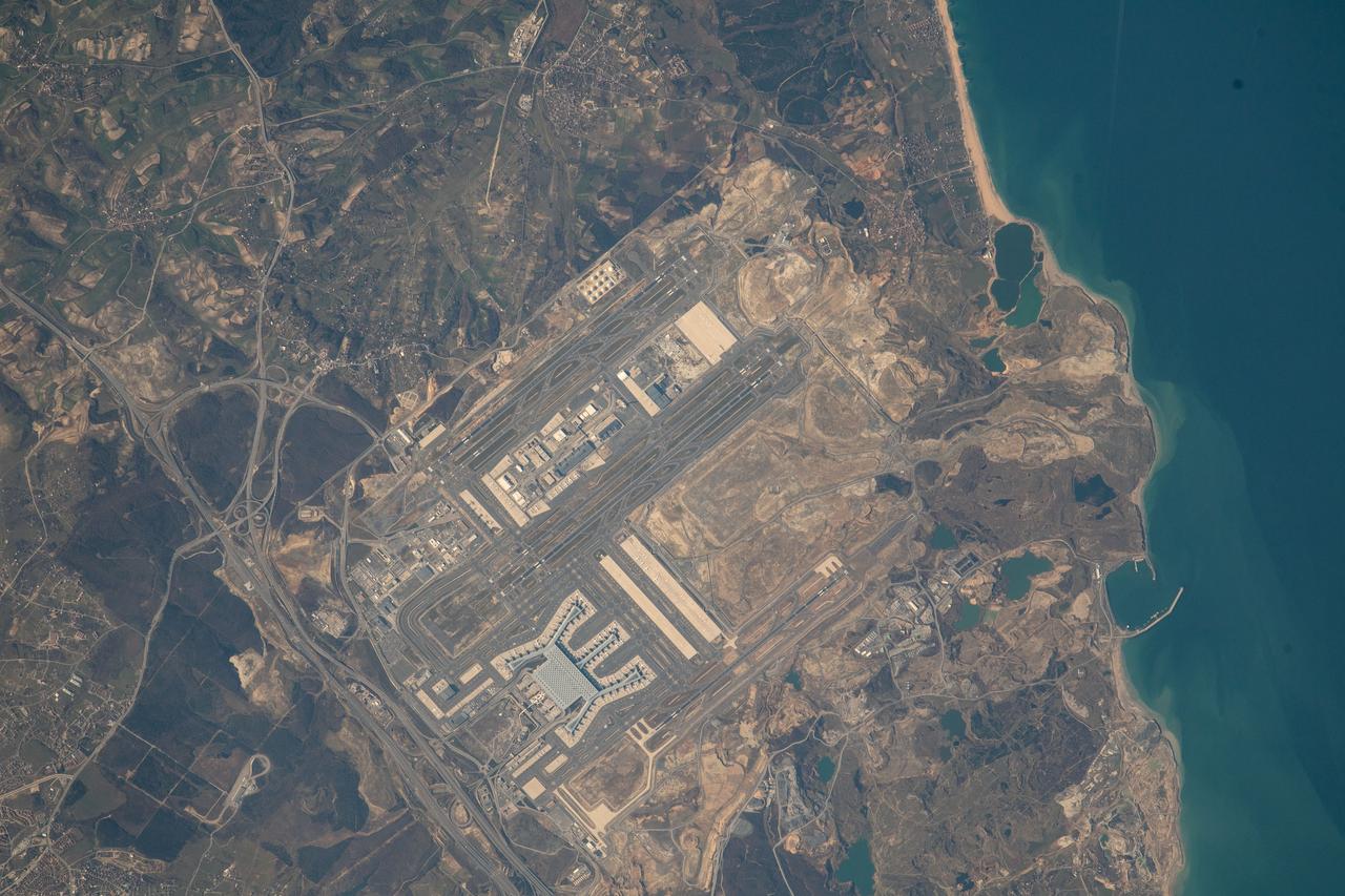
iss068e053699 (Feb. 14, 2023) --- Istanbul Airport on Turkey's Black Sea coast is pictured from the International Space Station as it orbited 264 miles above.
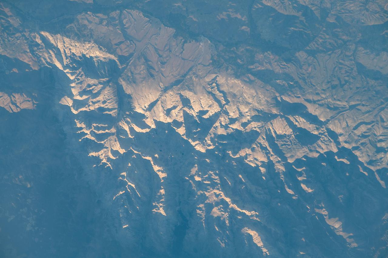
iss069e033761 (July 17, 2023) -- The Sun reflects off mountaintops as the International Space Station orbited roughly 260 miles above Turkey.
iss062e112757 (March 25, 2020) --- Ankara, the capital of Turkey, is pictured from the International Space Station as it orbited nearly directly above the cosmopolitan city.
Earth observation taken by the Expedition 39 crew aboard the ISS. Image downlinked in folder: Sofia, Bulgaria and Istanbul, Turkey. Image was released by astronaut on Twitter.
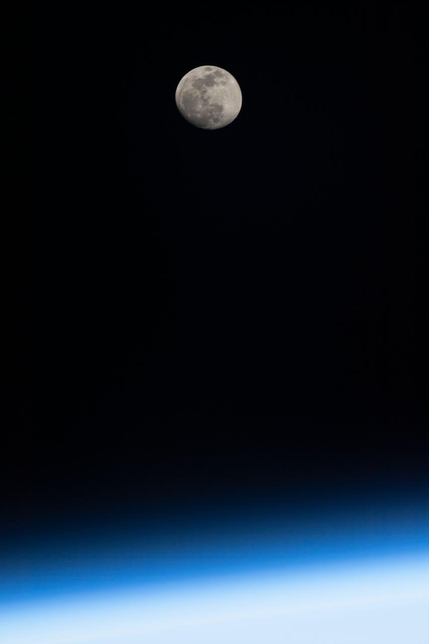
iss067e123467 (June 12, 2022) --- The waxing gibbous Moon is photographed above Earth's horizon from the International Space Station as it orbited 261 miles above Turkey.
iss072e065376 (Oct. 17, 2024) --- The island Republic of Cyprus in the Mediterranean Sea is pictured from the International Space Station as it orbited 258 miles above the nation of Turkey.
Earth observation taken by the Expedition 39 crew aboard the ISS. Image downlinked in folder: Sofia, Bulgaria and Istanbul, Turkey. Image was released by astronaut on Twitter.
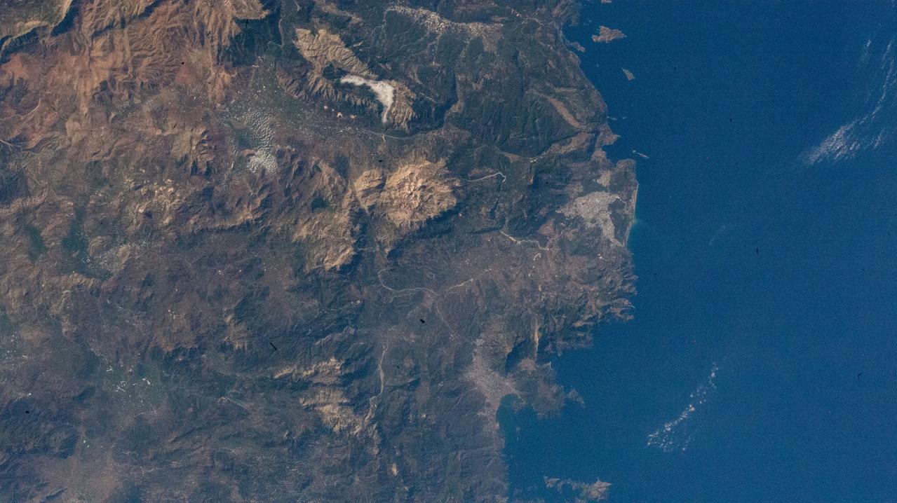
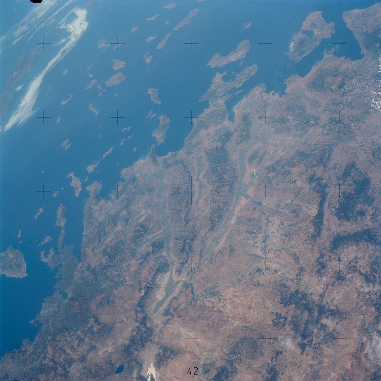
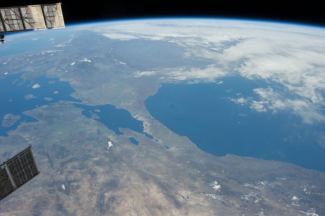
iss067e135192 (June 16, 2022) --- The southwestern coast of Turkey on the Mediterranean Sea is pictured from the International Space Station as it orbited 262 miles above.

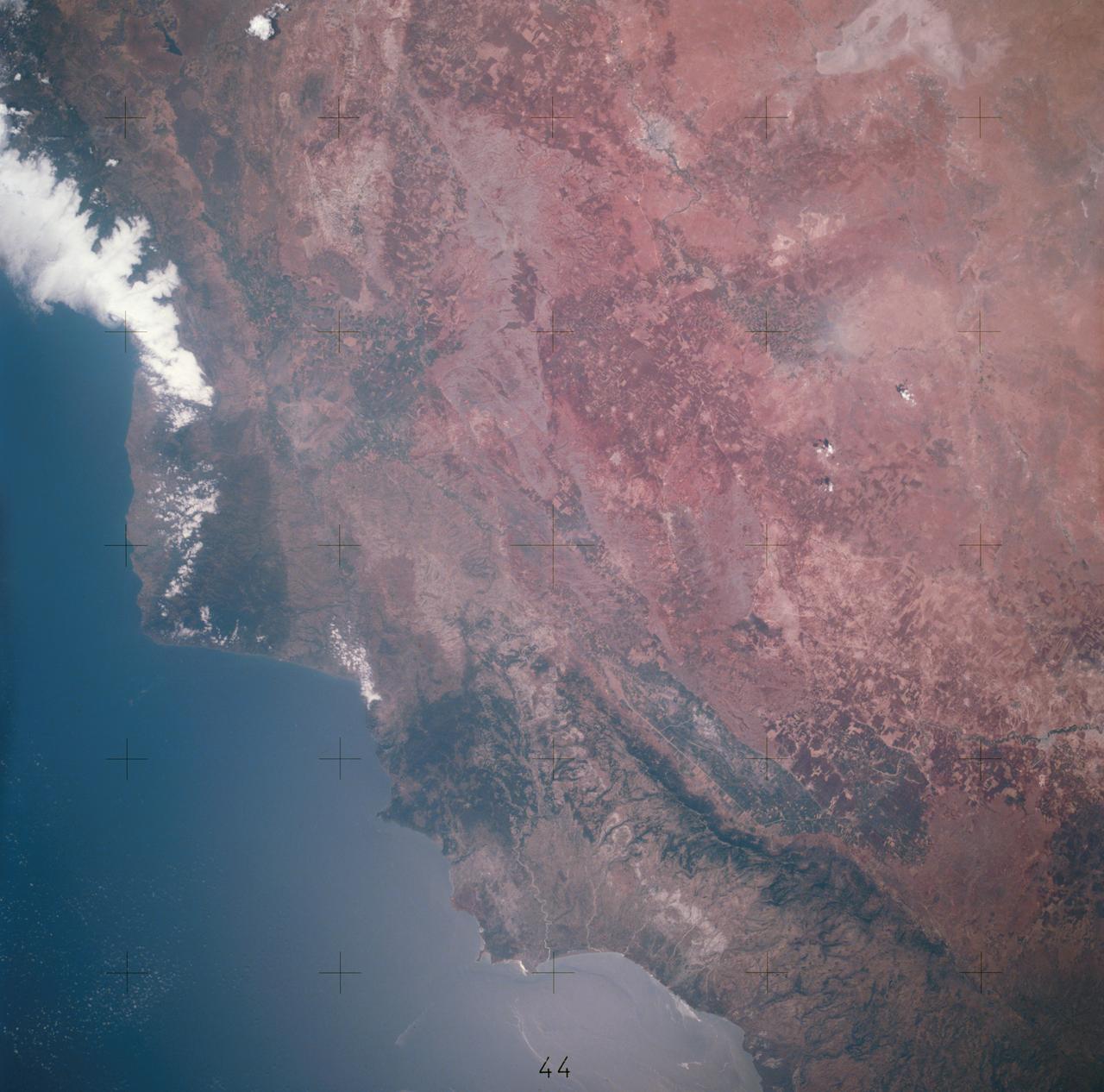
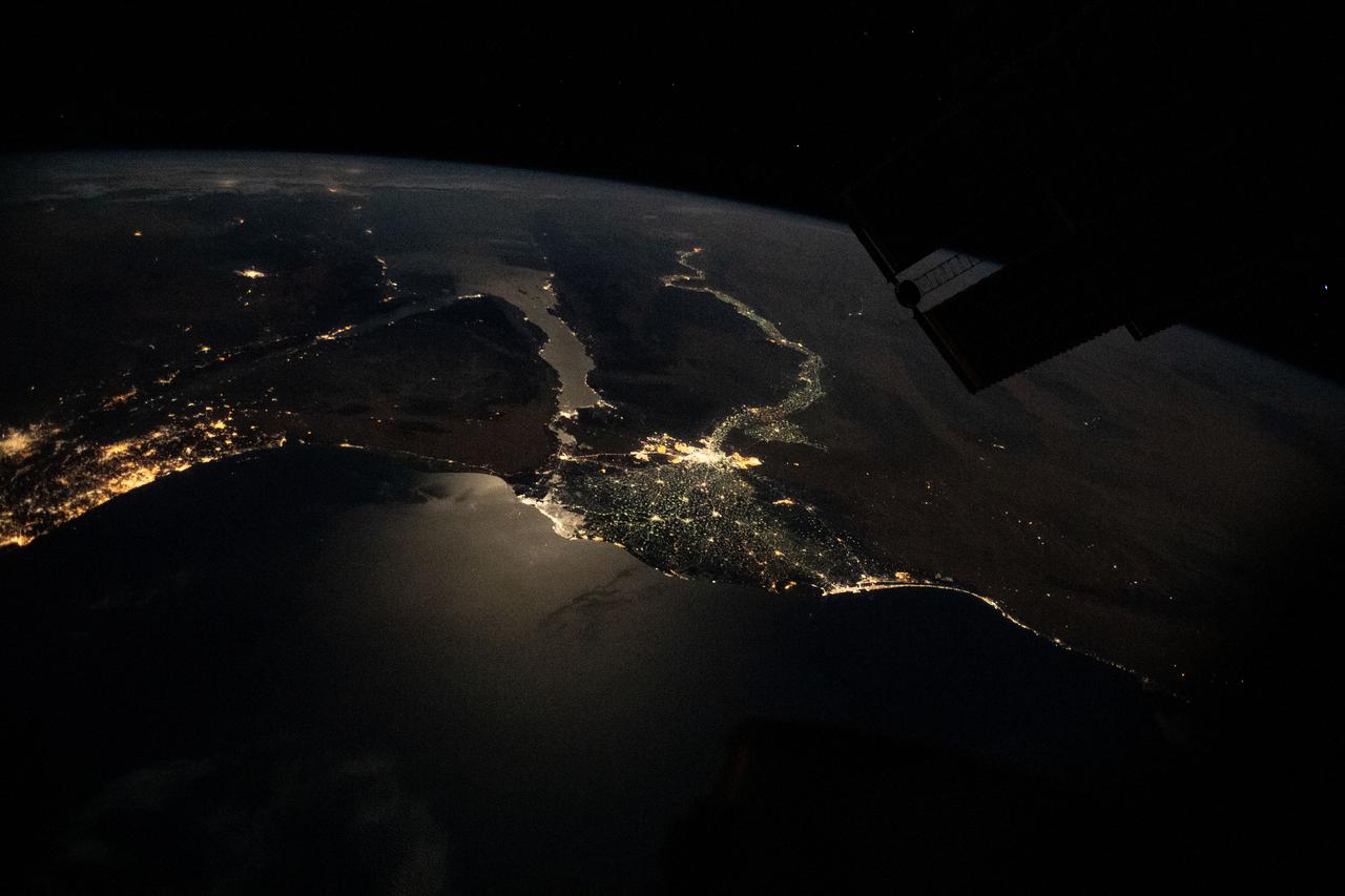
iss068e053809 (Feb. 14, 2023) --- The southern coast of Turkey on the Mediterranean Sea near Syria is pictured from the International Space Station as it orbited 264 miles above.
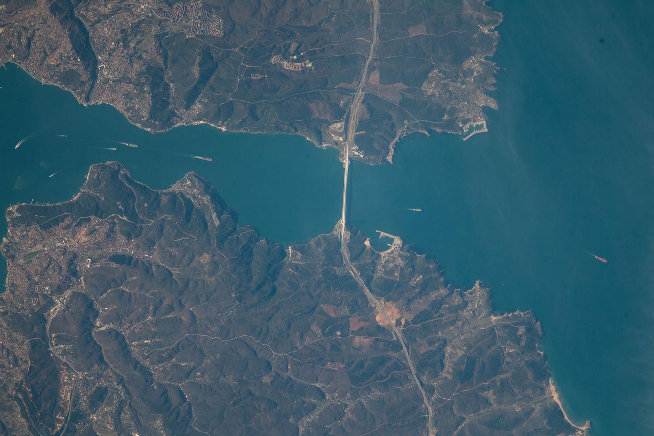
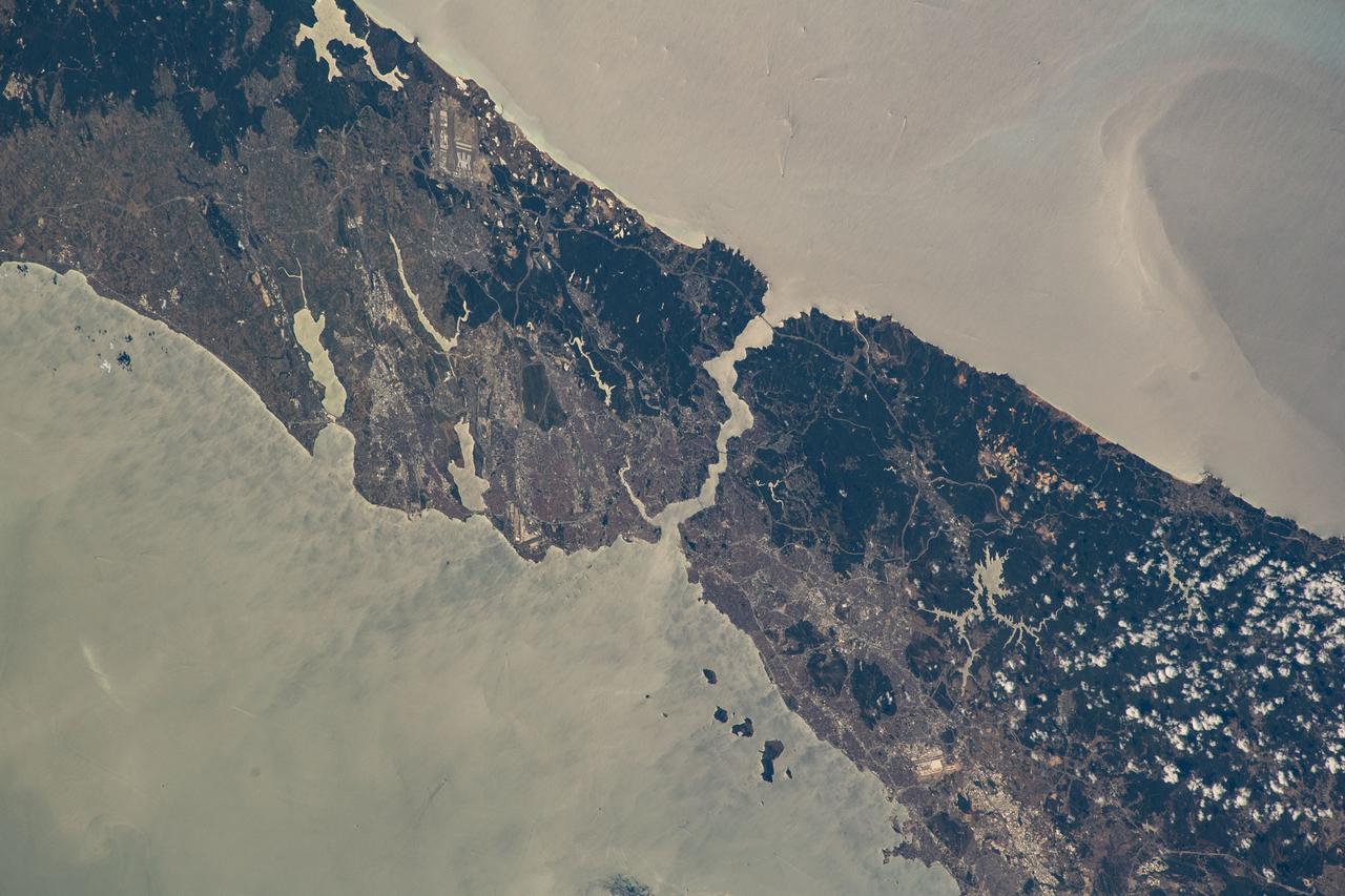
iss068e053710 (Feb. 14, 2023) --- The northern portion of Turkey's Bosporus Strait, crossed by the Yavuz Sultan Selim Bridge, leads into the Black Sea in this photograph from the International Space Station as it orbited 264 miles above.

iss067e286515 (Aug. 21, 2022) --- This oblique view of Turkey and the island nation of Cyprus is pictured from the International Space Station as it orbited 257 miles above the Nile Delta in Egypt.
Earth observation taken during day pass by an Expedition 36 crew member on board the International Space Station (ISS). Per Twitter message: Evening in southern Turkey, on the Mediterranean Sea.
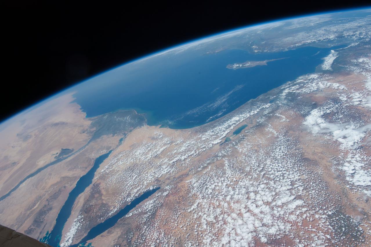
iss055e013356 (April 7, 2018) --- The eastern-most portion of the Mediterranean Sea and portions of the countries of Turkey, Syria and Lebanon was photographed from the International Space Station by an Expedition 55 crew member.
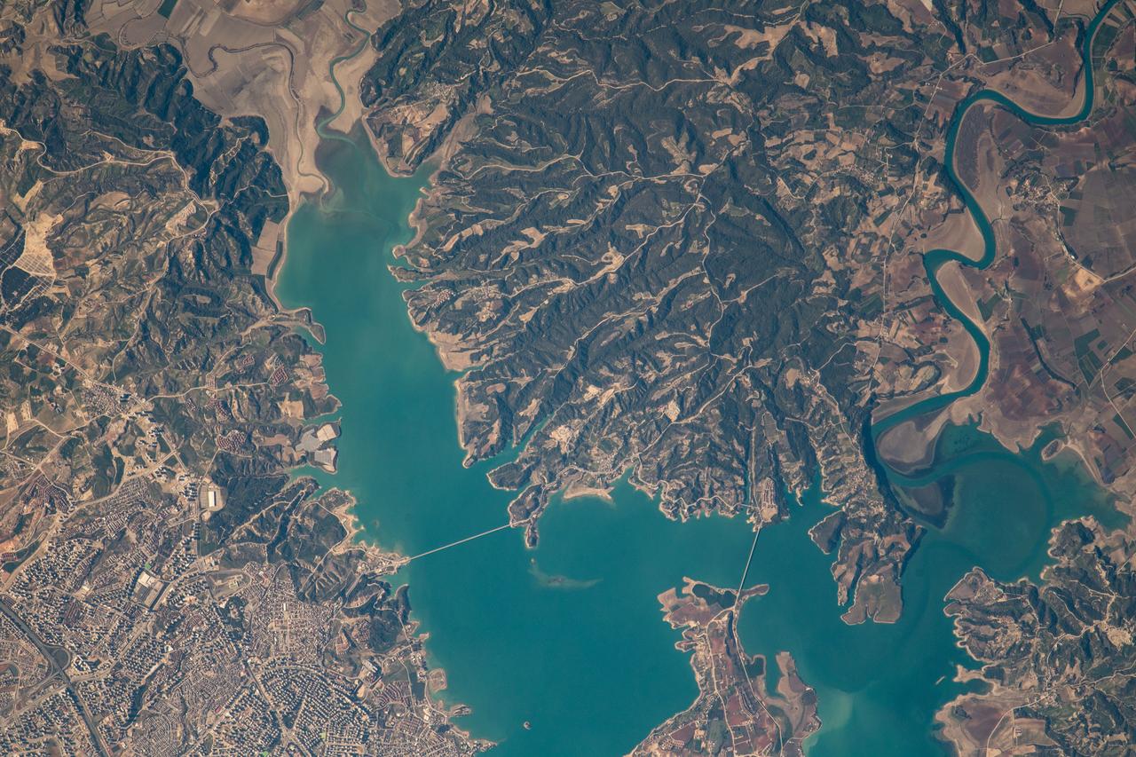
iss068e053748 (Feb. 14, 2023) --- At lower left, the city of Adana, Turkey, rests on the banks of the Seyhan Dam Lake in this photograph from the International Space Station as it orbited 264 miles above. Prominent at lower center, is the Çatalan Bridge.
Earth observation taken by an Expedition 36 crew member on board the International Space Station (ISS). Per Twitter message: Eastern Mediterranean Sea coast, Turkey, Syria, Lebanon, Israel.
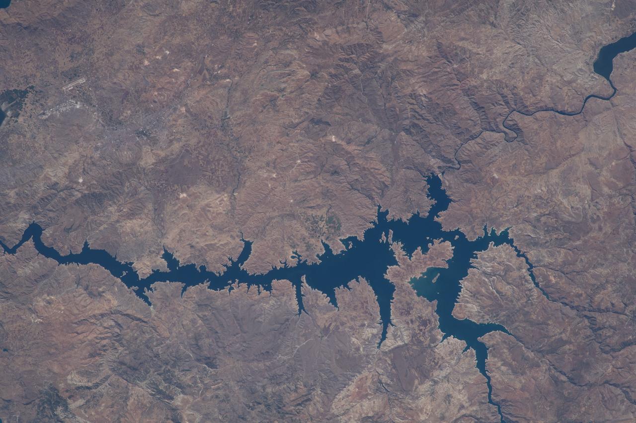
iss068e006715 (Oct. 1, 2022) --- This portion of the Euphrates River, containing the Keban Dam Reservoir created by the Keban Dam, is pictured in eastern Turkey from the International Space Station as it orbited 260 miles above.
iss067e213409 (July 30, 2022) --- The city of Istanbul, Turkey, is separated by the Bosphorus Strait and sits in between the Black Sea (top) and the Sea of Marmara (bottom) in this photograph from the International Space Station as it orbited 259 miles above.
iss067e149384 (June 24, 2022) --- The sun's glint beams off the Caspian Sea in this photograph from the International Space Station as it was orbiting on a southwest to northeast trek 262 miles above Turkey near the Black Sea coast.
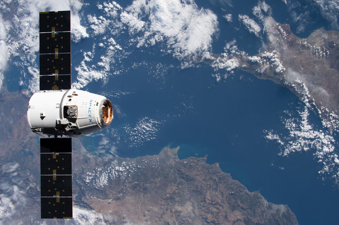
iss061e069087 (Dec. 8, 2019) --- The SpaceX Dragon resupply ship approaches the International Space Station as both spacecraft were orbiting 258 miles above the Mediterranean Sea in between Turkey and Cyprus.
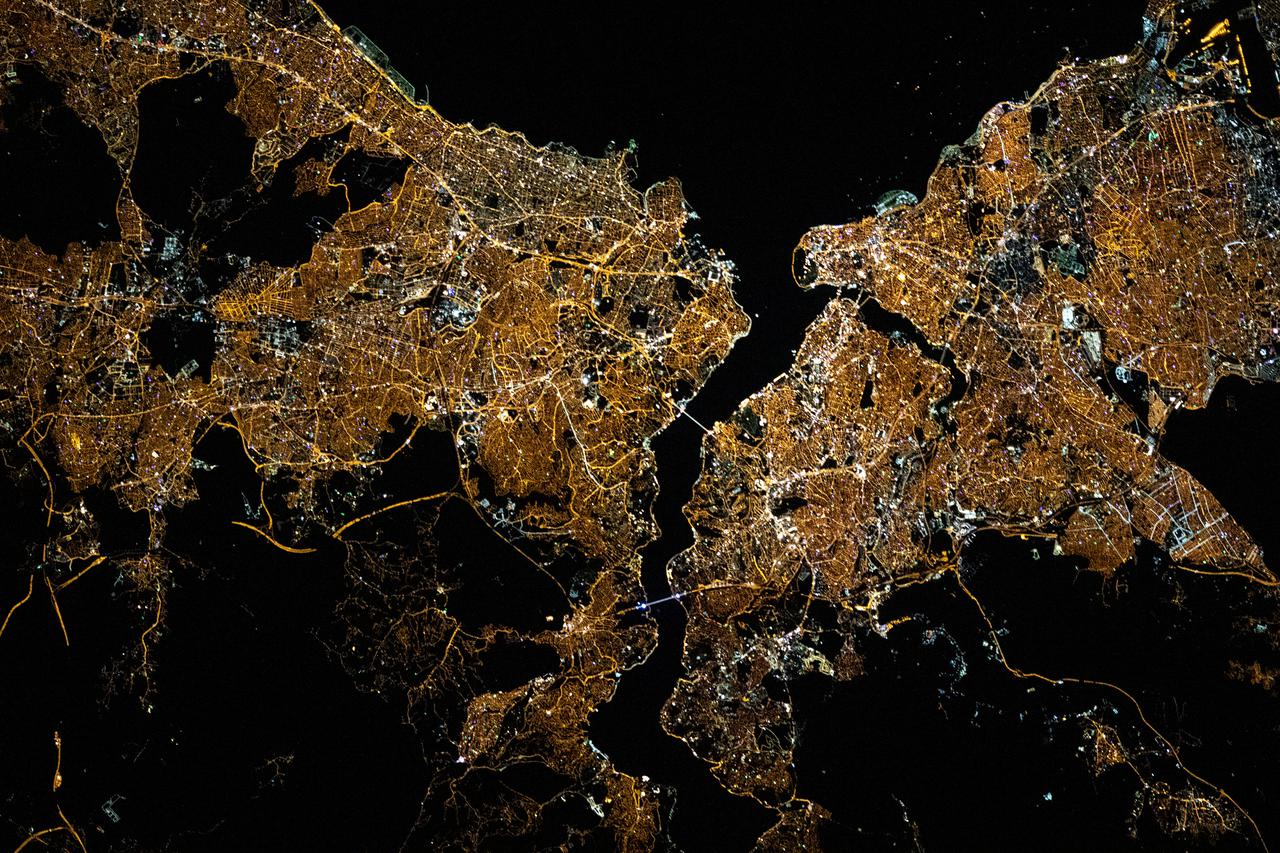
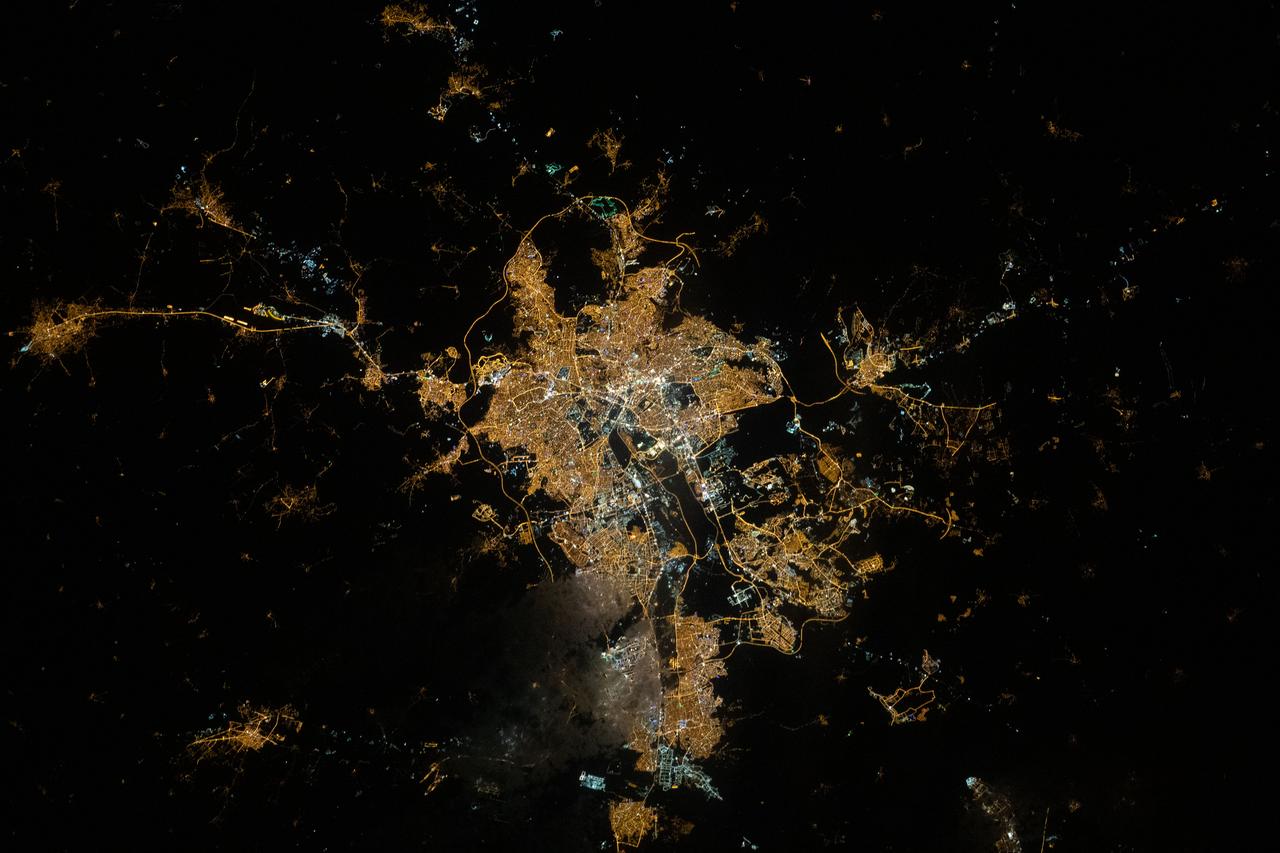
iss065e030820 (May 10, 2021) --- The night lights of Istanbul, Turkey, split by the Bosphorus Strait and the Golden Horn, are pictured from the International Space Station as it orbited 263 miles above the Black Sea.
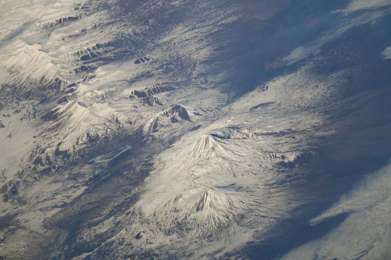
iss064e029480 (Feb. 8, 2021) --- This oblique view of Mount Ararat in eastern Turkey was taken from the International Space Station as it orbited 262 miles above Iran just south of the Caspian Sea. Credit: Roscosmos
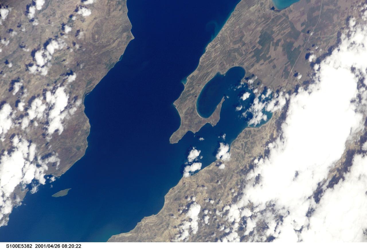
S100-E-5382 (26 April 2001) --- The northeast part of Lake Van (Van Golu) in Turkey was photographed with a digital still camera by the crew members aboard the Space Shuttle Endeavour on April 26, 2001.
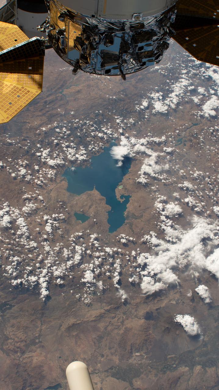
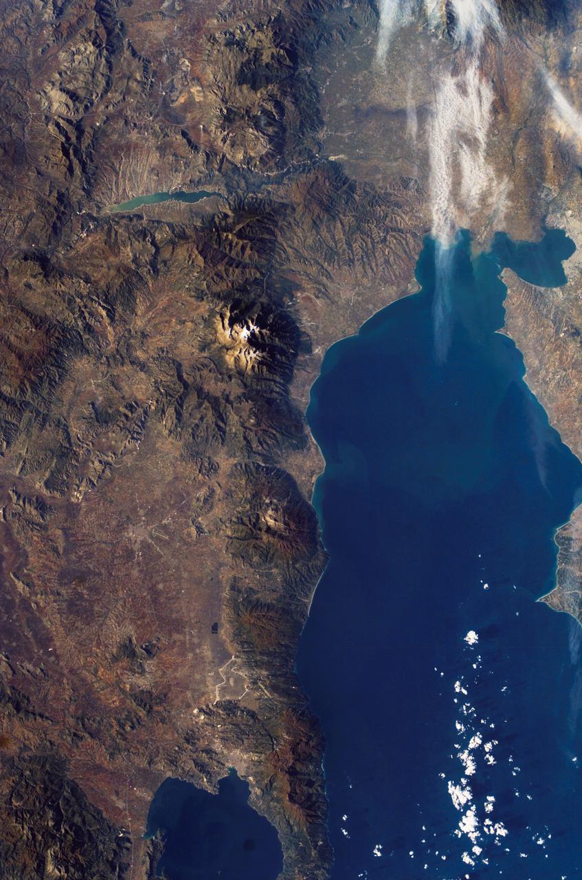
iss070e001546 (Sept. 30, 2023) --- Two lakes in Turkey, the larger Van Lake and the smaller Erçek Lake, are pictured from the International Space Station as it orbited 259 miles above the Eurasian region near the Caspian Sea.
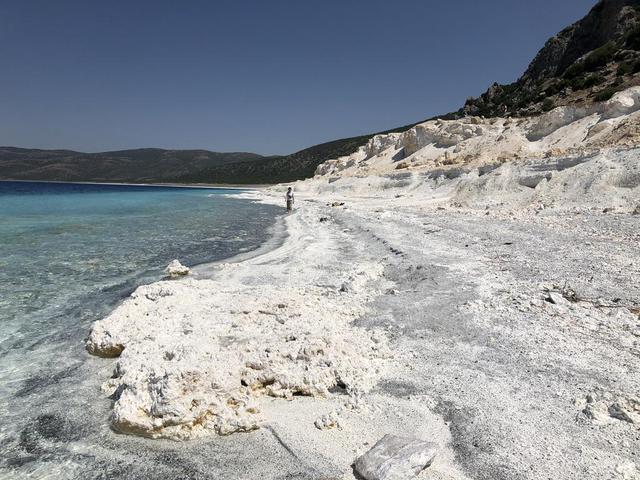
The eastern shore of Lake Salda in Turkey is a good analog for what an ancient lake may have looked like at Jezero Carter on Mars. The white sands and rocks are carbonate minerals that precipitated in the lake. The terraces on the right are old shorelines from when the lake levels were higher, where dried-out sediments have now cemented. These types of deposits might be present along the former shorelines at Jezero. What's more, these deposits might contain signs of microbes, if they ever existed on the Red Planet. NASA's Mars 2020 Perseverance mission will search for signs of ancient life in an dried-up lakebed on the surface of Mars. https://photojournal.jpl.nasa.gov/catalog/PIA24375
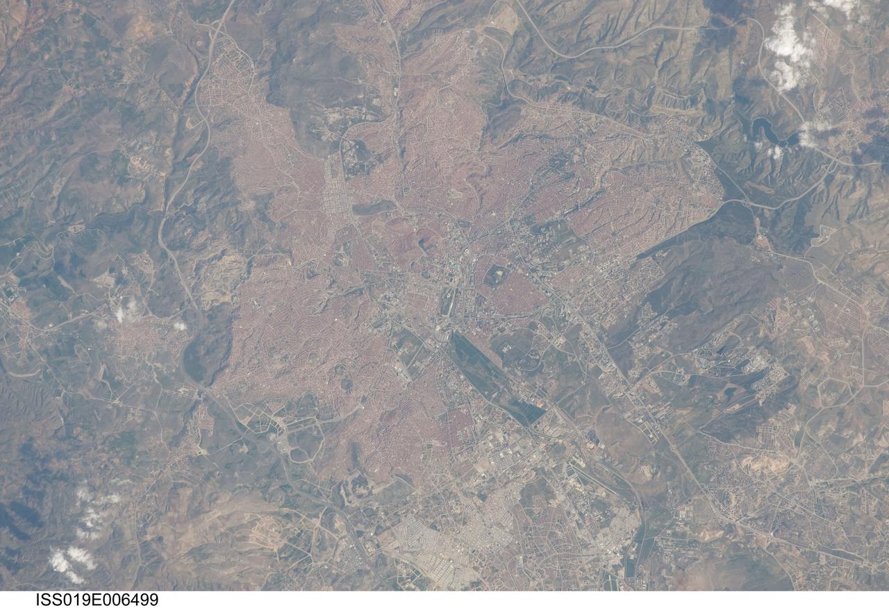
ISS019-E-006499 (11 April 2009) --- Ankara, Turkey is featured in this image photographed by an Expedition 19 crewmember on the International Space Station. The central portion of the capital city of Turkey, Ankara, is featured in this view. Ankara is located in central Turkey ? the climate here is continental and relatively dry, leading to cold winters and hot summers. The region is prone to major earthquakes, as Turkey experiences tectonic forces from both the African plate to the west and the Arabian plate to the east. Despite the earthquake hazard, the city traces its roots back into antiquity, with a Hittite settlement here prior to 1200 BC. A citadel built and occupied in turn by the Galatians, Romans, Byzantines, and Seljuks overlooks the central portion of the city, and today serves as both a historical and recreational site. Perhaps an even more imposing structure - the mausoleum of the founder of the modern-day Republic of Turkey, Mustafa Kemal Ataturk is visible upon an adjacent hill to the southwest. Hillslopes around the city (left and right) are fairly green due to spring seasonal rainfall. One of the most striking aspects of the urban area is the almost uniform use of red brick roofing tiles that contrast with lighter colored road networks ? this is particularly evident in the northern (lower left) and southern (upper right) portions of the city. Numerous park areas are visible as green patches interspersed within the red-tile roofed urban region. A region of cultivated fields in the western portion of the city (center) is a recreational farming area known as the Ataturk Forest Farm and Zoo ? an interesting example of intentional preservation of a former land use within an urban area.
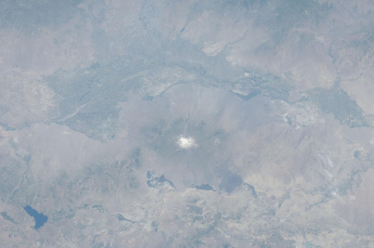
ISS028-E-015023 (8 July 2011) --- The Aras River and Turkey-Armenia-Iran border region are featured in this image photographed by an Expedition 28 crew member on the International Space Station. This photograph highlights a segment of the international border between Turkey to the south-southwest and Armenia to the north-northeast. The Aras River is the physical expression of the closed border between the two countries. Extensive green agricultural fields are common on both sides of the river (top), as well as a number of gray to tan urban areas including Artashat and Armavir in Armenia and Igdir in Turkey. While there have been efforts to normalize diplomatic relations between the two countries in recent years, the Armenia-Turkey border remains officially closed. The dominant geographic feature in the region is Mt. Ararat, also known as Agri Dagi. The peak of Ararat, a large stratovolcano that last erupted in 1840 according to historical records, is located approximately 40 kilometers to the south of the Armenia-Turkey border. A lower peak to the east, known as Lesser or Little Ararat, is also volcanic in origin. Dark gray lava flows to the south of Mt. Ararat are located near the Turkish border with Iran. While this border is also closed along much of its length, official crossing points allow relatively easy travel between the two countries. The white, glacier-clad peak of Mt. Ararat is evident at center; dark green areas on the lower slopes indicate where vegetation cover is abundant. A large lake, Balik Golu or Fish Lake, is visible to the west (lower left).
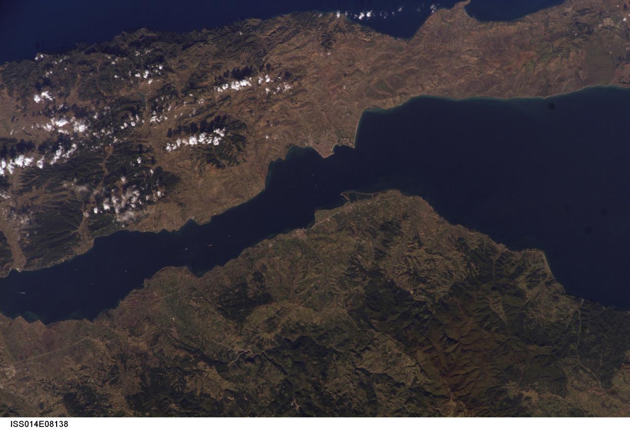
ISS014-E-08138 (9 Nov. 2006) --- Gallipoli and Dardanelles Strait, Turkey are featured in this image photographed by an Expedition 14 crewmember on the International Space Station. The city of Gallipoli (or Gelibolu in Turkish) sits at a crossroads between the Marmara and Aegean Seas, connected by the Dardanelles Strait. According to scientists, the strait is a 61 kilometer-long drowned fault valley formed during tectonic activity during the Tertiary period as the Arabian, Indian, and African plates collided with the Eurasian plate. This faulting, which formed the great mountain ranges of the Alps and Himalayas, also created the rugged terrain of western Turkey visible in the lower half of this image. Plate collision continues today, leading to frequent strike-slip (side-by-side relative motion along a fault, rather than up or down motion) earthquakes in the region as Turkey moves westward in relation to Eurasia (sometimes called escape tectonics). The urbanized area of modern Gallipoli is visible as a light gray to pink region at the entrance to the Dardanelles Strait. Water in the Strait flows in both northeast and southwest directions due to opposite surface and undercurrents. Several ships are visible in the Strait to the southwest of Gallipoli (center left).
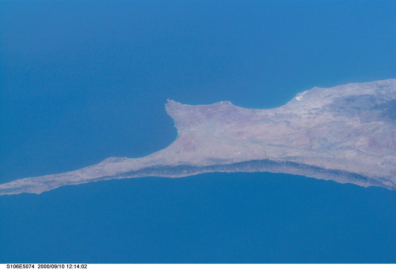
S106-E-5074 (10 September 2000) --- This south-looking view from the Space Shuttle Atlantis, flying above Turkey, features the Mediterranean island of Cyprus. The photo was taken with an electronic still camera (ESC) on Flight Day 3 of the scheduled 11-day STS-106 mission.
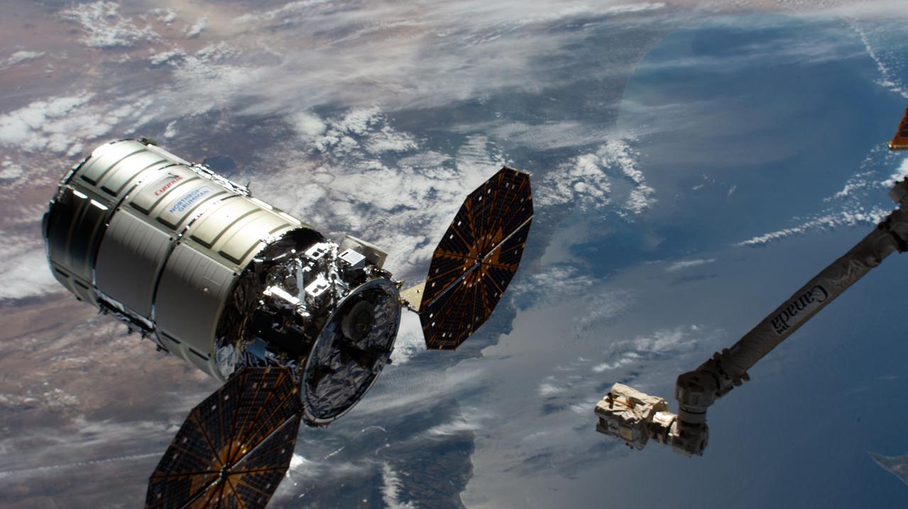
iss064e035890 (Feb. 22, 2021) --- The Cygnus space freighter from Northrop Grumman is pictured moments before its capture with the Canadarm2 robotic arm. Cygnus and the International Space Station were orbiting 263 miles above Turkey at the time this photograph was taken.
ISS040-E-098804 (16 Aug. 2014) --- One of the Expedition 40 crew members aboard the International Space Station, flying at an altitude of 221 nautical miles, photographed this oblique image showing parts of the continents of Europe and Asia. Much of Greece is visible on the left side of the frame and a large area of Turkey can be seen at right.
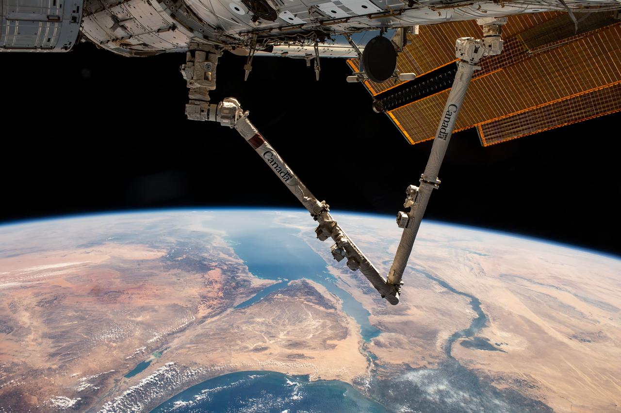
iss070e007599 (Oct. 20, 2023) --- The Canadarm2 robotic arm extends from the International Space Station as it orbited 261 miles above Turkey. Below, the Sinai Peninsula, the Red Sea, and the Nile River Delta are pictured leading toward the Mediterranean Sea at bottom.
iss068e024146 (Nov. 23, 2022) --- The sun's glint beams across the Mediterranean, Ionian, and Myrtoan Seas highlighting southern Greece in this photograph from the International Space Station as it orbited 259 miles above the Aegean Sea off the coast of Turkey.
iss065e074560 (May 20, 2021) --- This nighttime photograph, taken from the International Space Station as it orbited 263 miles above Turkey, highlights the Moon's glint on the Mediterranean Sea and the Gulf of Suez. The city lights along the Nile Delta and the eastern Mediterranean coast also figure prominently in the picture.
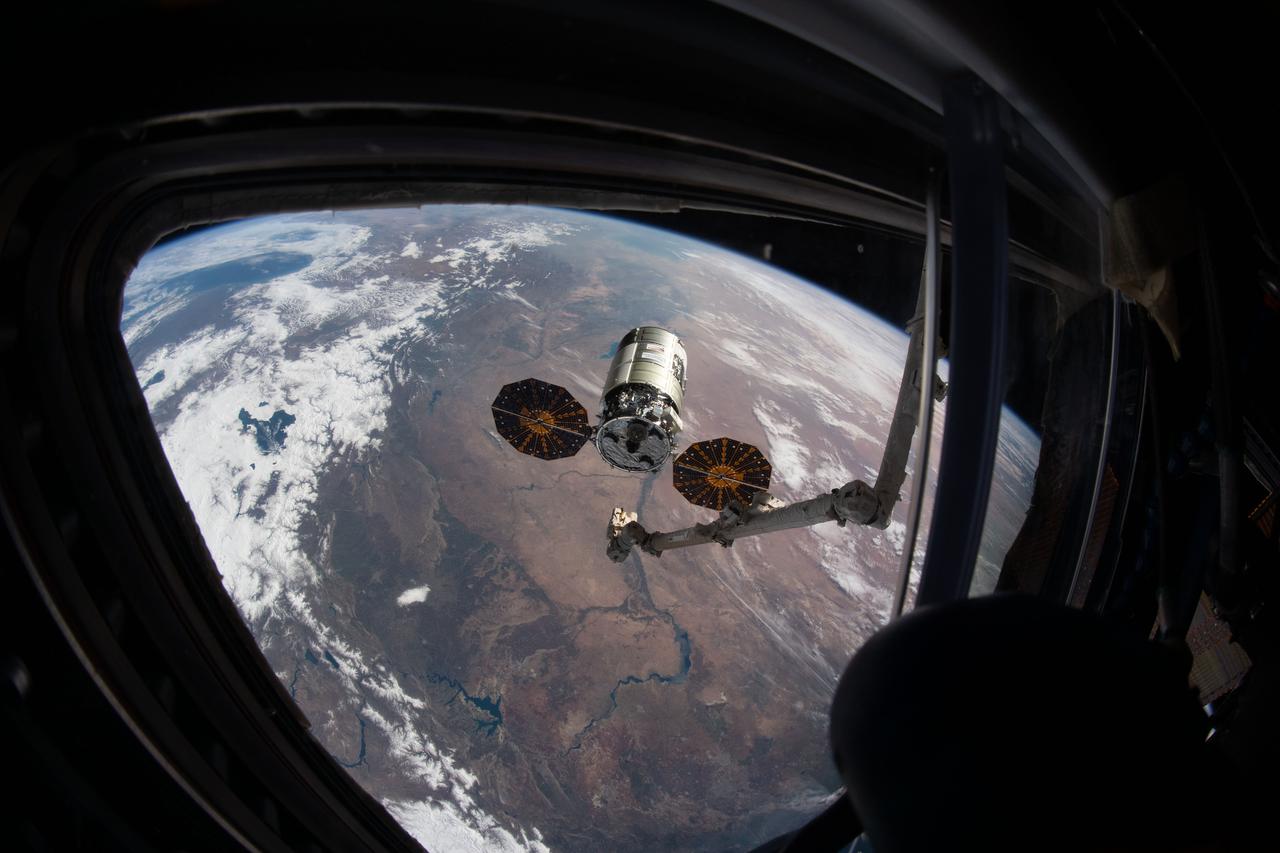
iss064e036104 (Feb. 22, 2021) --- The Cygnus space freighter from Northrop Grumman is pictured moments before its capture with the Canadarm2 robotic arm. Cygnus and the International Space Station were both orbiting 263 miles above Turkey in this photograph taken from inside the cupola.
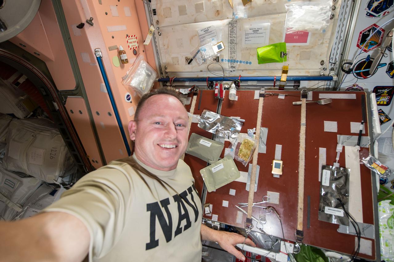
Commander Barry Wilmore takes a self-portrait with food packages (smoked turkey, cranapple dessert, cornbread dressing, and tea with sugar) planned for his Thanksgiving meal. Image was taken near the galley table in the Unity Node 1, and released by Wilmore on Instagram.
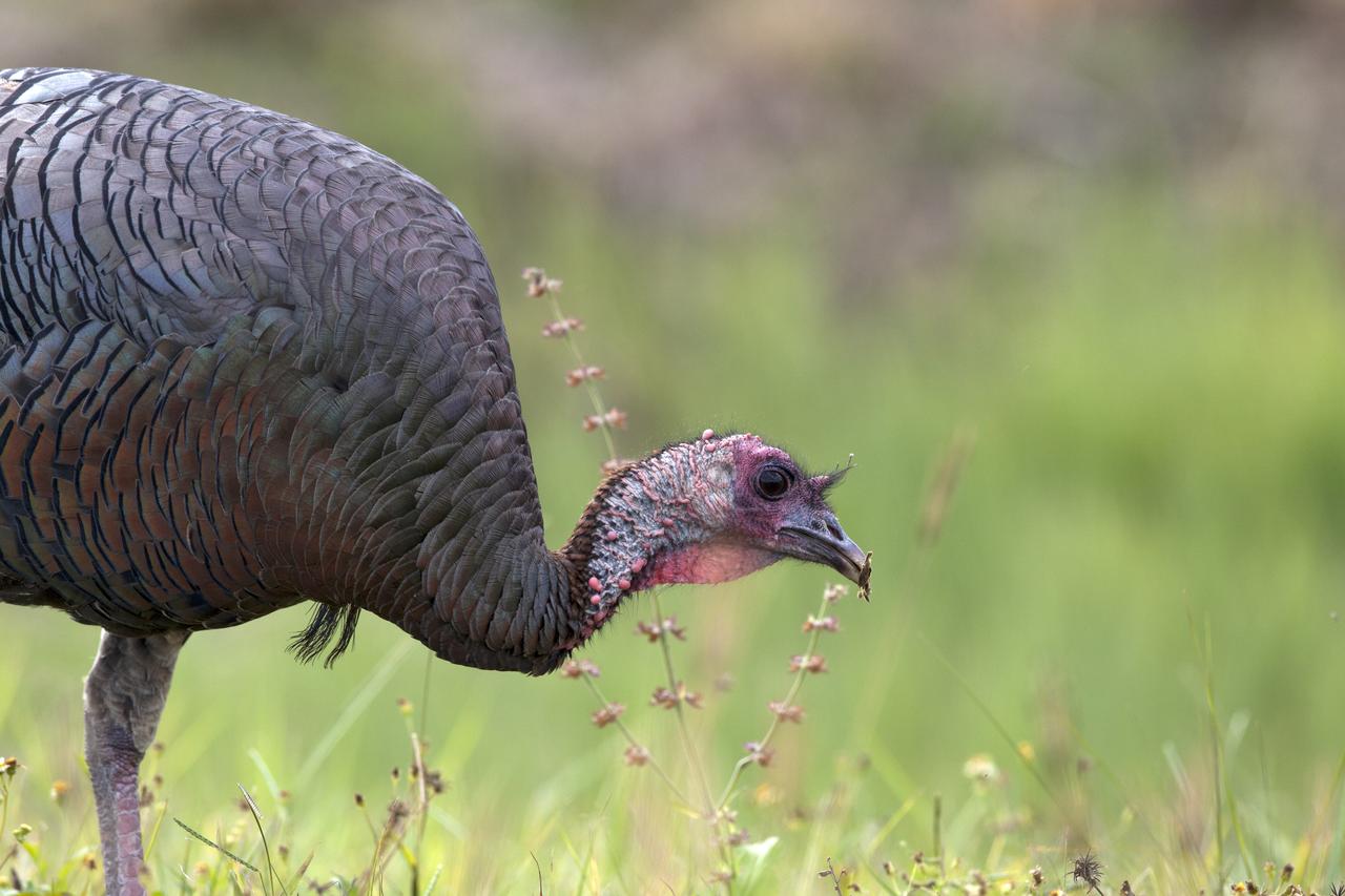
A wild turkey is seen at NASA's Kennedy Space Center in Florida. Kennedy shares a boundary with the Merritt Island National Wildlife Refuge. The refuge encompasses 140,000 acres that are a habitat for more than 331 species of birds, 31 mammals, 117 fish, and 65 amphibians and reptiles. The marshes and open water of the refuge provide wintering areas for 23 species of migratory waterfowl, as well as a year-round home for great blue herons, great egrets, wood storks, cormorants, brown pelicans and other species of marsh and shore birds.
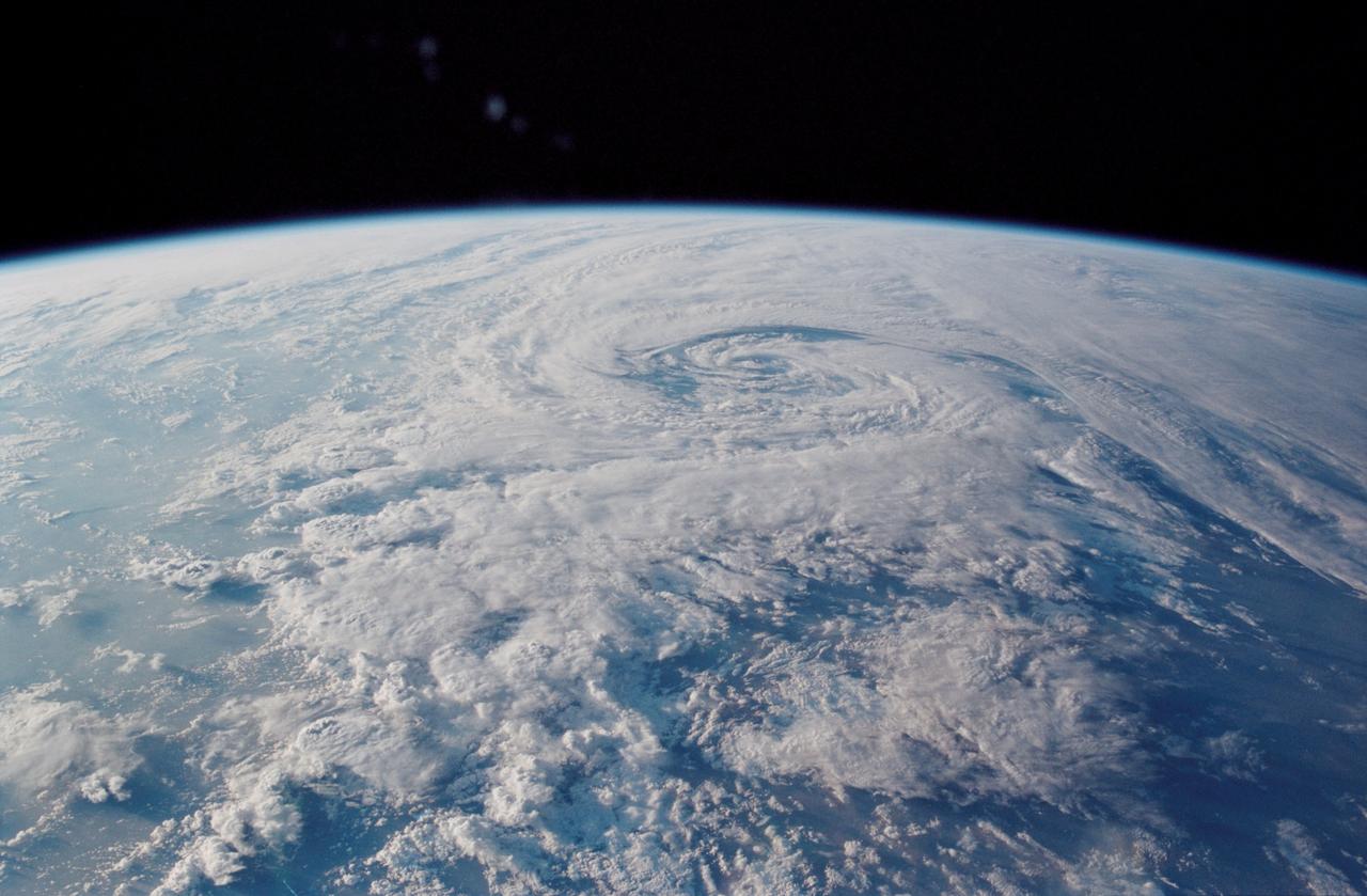
STS113-348-012 (3 December 2002) --- The STS-113 crewmembers used a 35mm still camera to record this image of a mid latitude storm system. The counter-clockwise swirl shows that this is a northern hemisphere storm. The storm was northeast of the Mediterranean Sea, covering the Balkans and western Turkey. The view was taken looking northwest in the early afternoon of Dec 3, 2002.
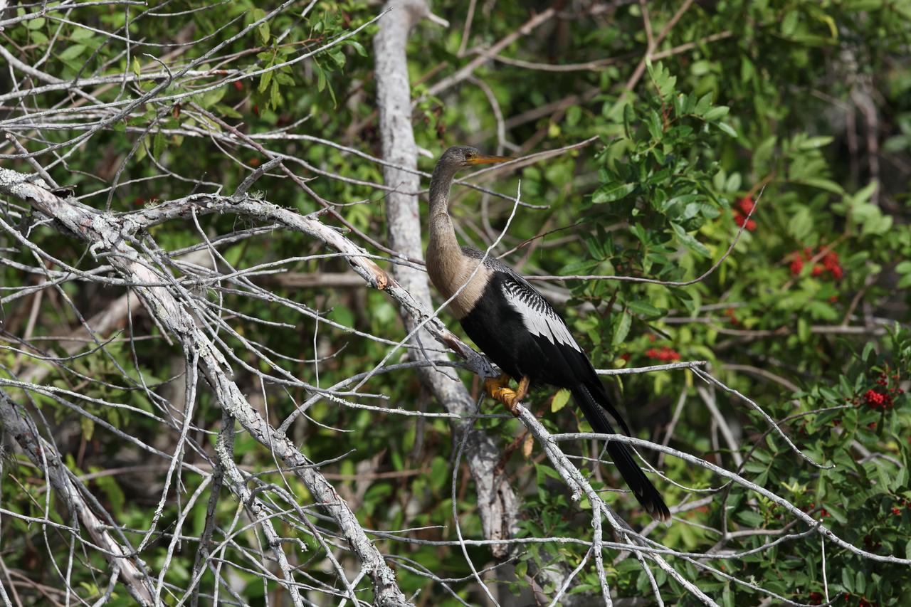
An Anhinga perches on a branch in an area of underbrush at NASA's Kennedy Space Center in Florida. The Anhinga is also known as a Water-Turkey for its swimming habits and broad tail. The center shares a border with the Merritt Island National Wildlife Refuge. More than 330 native and migratory bird species, 25 mammals, 117 fishes and 65 amphibians and reptiles call Kennedy and the wildlife refuge home.
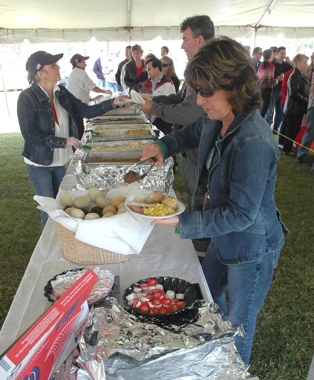
KENNEDY SPACE CENTER, FLA. - NASA Civil Service employees and their families help themselves to a traditional holiday meal of turkey, ham and all of the trimmings at an annual holiday dinner and celebration hosted by Center Director Jim Kennedy, at KARS Park 1 on Merritt Island, Fla. The theme for the celebration was "Launching Dreams of Those in Need." The event was sponsored by the Change Leaders Network and the Combined Federal Campaign Cabinet.
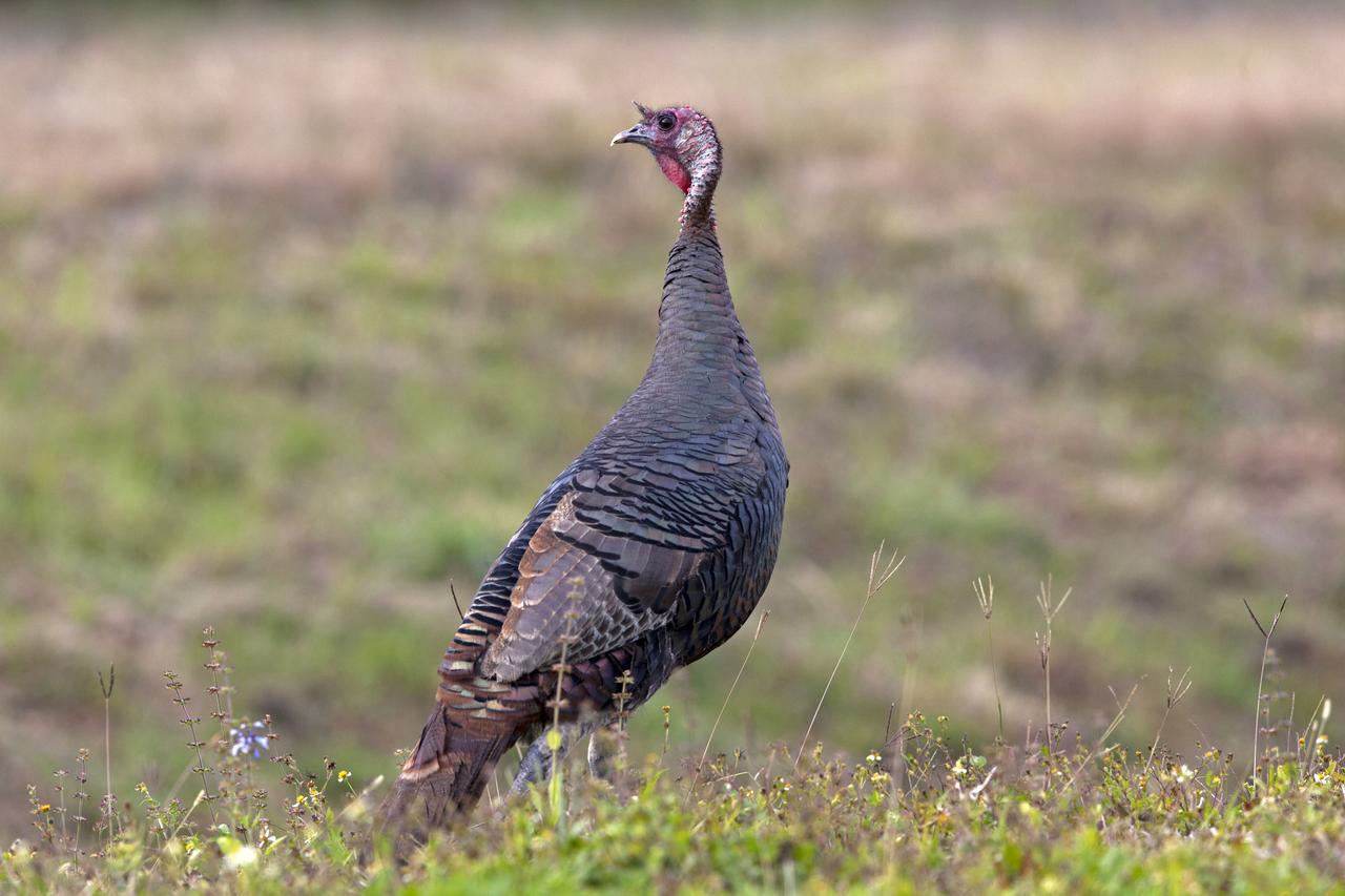
A wild turkey is seen at NASA's Kennedy Space Center in Florida. Kennedy shares a boundary with the Merritt Island National Wildlife Refuge. The refuge encompasses 140,000 acres that are a habitat for more than 331 species of birds, 31 mammals, 117 fish, and 65 amphibians and reptiles. The marshes and open water of the refuge provide wintering areas for 23 species of migratory waterfowl, as well as a year-round home for great blue herons, great egrets, wood storks, cormorants, brown pelicans and other species of marsh and shore birds.
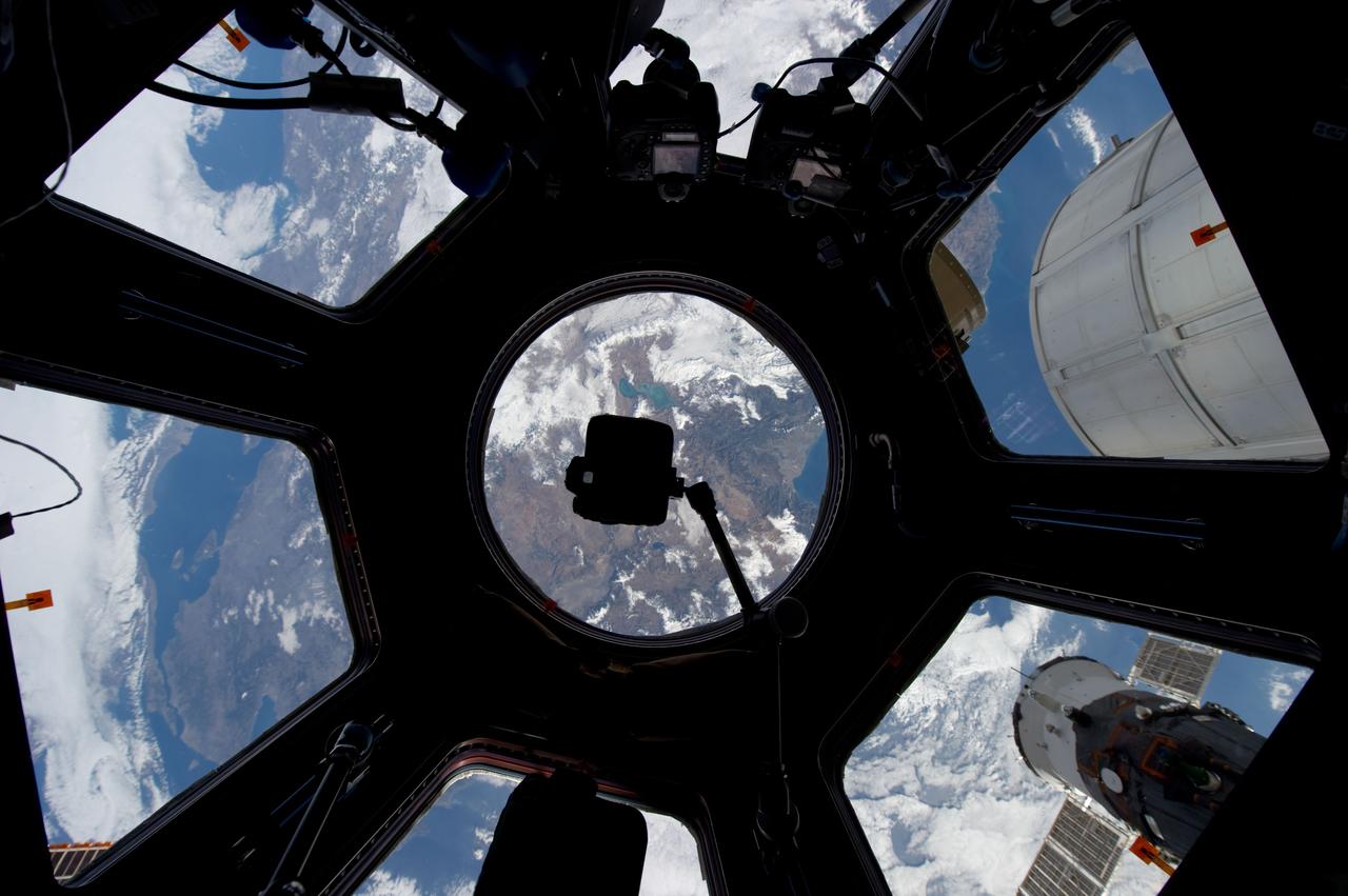
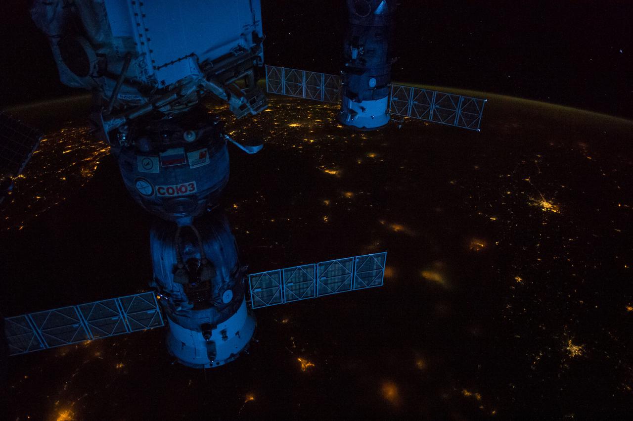
ISS030-E-019300 (29 Dec. 2011) --- This unusual image, photographed through the Cupola on the International Space Station by one of the Expedition 30 crew members, is centered over Turkey. The lake just above the bracket- mounted camera at center is Egirdir Golu, located at 38.05 degrees north latitude and 30.89 degrees east longitude. A Russian Soyuz spacecraft is docked to the station at lower right and part of the Permanent Multipurpose Module(PMM) can be seen just above it.
41G-120-053 (5-13 Oct. 1984) --- Turkey and a portion of the Mediterranean Sea, with the city of Antalya visible, were photographed with a medium format camera during the 41-G mission aboard the space shuttle Challenger. Numerous eddies and an ocean front can be observed in the sun's glint off the water's surface. The folded mountains indicate the rugged topography in this region. Photo credit: NASA
iss073e0312086 (May 22, 2025) --- At top left, the city lights of Benghazi, Libya, arc downward toward the glow of civilization on Egypt's Nile Delta outlining Africa's Mediterranean Sea coast. Israel's metropolitan lights then round north and east into Istanbul, Turkey (far right), and Athens, Greece, and their surrounding suburbs in southern Europe. Resting in the center of the Mediterranean's darkness is the Greek island of Crete.
ISS047e057822 (04/14/2016) --- The Middle East is seen from 250 miles above in this photo from the International Space Station. Countries seen left to right along the Mediterranean coast include Egypt, Gaza, Saudi Arabia, Israel, Lebanon, Syria, and Turkey. The major waterways shown from left to right are the Nile River, Gulf of Suez, Gulf of Aqaba, and the Red Sea.
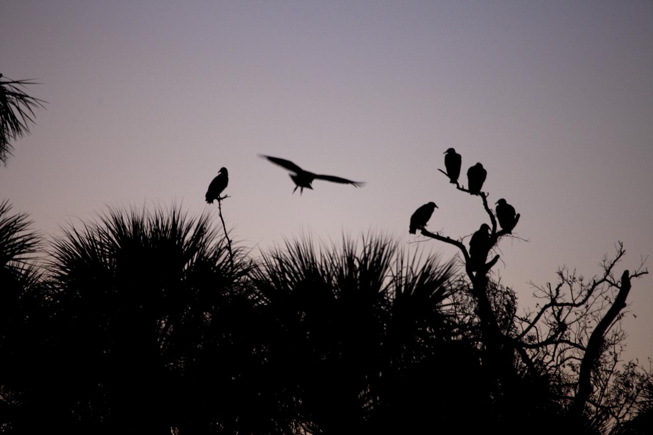
CAPE CANAVERAL, Fla. -- Black vultures gather at dawn at NASA's Kennedy Space Center in Florida. NASA's Environmental Management Branch monitors the movement and activity of about 250 black and turkey vultures using satellite trackers and radio transmitters. Kennedy coexists with the Merritt Island National Wildlife Refuge, habitat to more than 310 species of birds, 25 mammals, 117 fish and 65 amphibians and reptiles. Photo credit: NASA/Frank Michaux
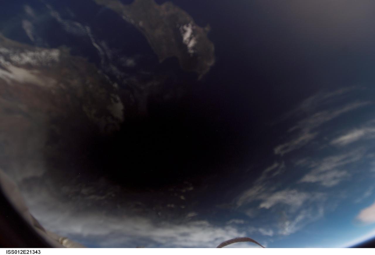
ISS012-E-21343 (29 Mar. 2006) --- The shadow of the moon falls on Earth as seen from the International Space Station, 230 miles above the planet, during a total solar eclipse at about 4:50 a.m. CST Wednesday, March 29. This digital photo was taken by the Expedition 12 crew, Commander William McArthur and Flight Engineer Valery Tokarev, who are wrapping up a six-month mission on the complex. Visible near the shadow are portions of Cyprus in the Mediterranean Sea and the coast of Turkey.
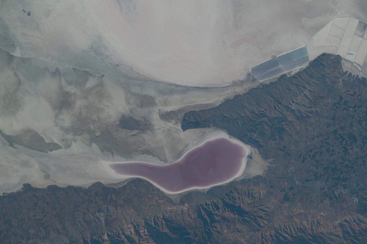
iss069e033759 (July 17, 2023) -- As the International Space Station orbited 260 miles above Turkey, NASA astronaut Woody Hoburg captured this image of Lake Tuz—a disappearing lake that was once the second-largest in the country. During some summers, the salt lake completely dries up, leaving the off-white appearance of higher concentrations of salt and minerals. What's left of the lake experiences seasonal color changes due to algae blooms, like the deep red shown near the bottom center of the image.

KENNEDY SPACE CENTER, FLA. - NASA Civil Service employees and their families enjoy a traditional holiday meal of turkey, ham and all of the trimmings at an annual holiday dinner and celebration hosted by Center Director Jim Kennedy, at KARS Park 1 on Merritt Island, Fla. The theme for the celebration was "Launching Dreams of Those in Need." The event was sponsored by the Change Leaders Network and the Combined Federal Campaign Cabinet.
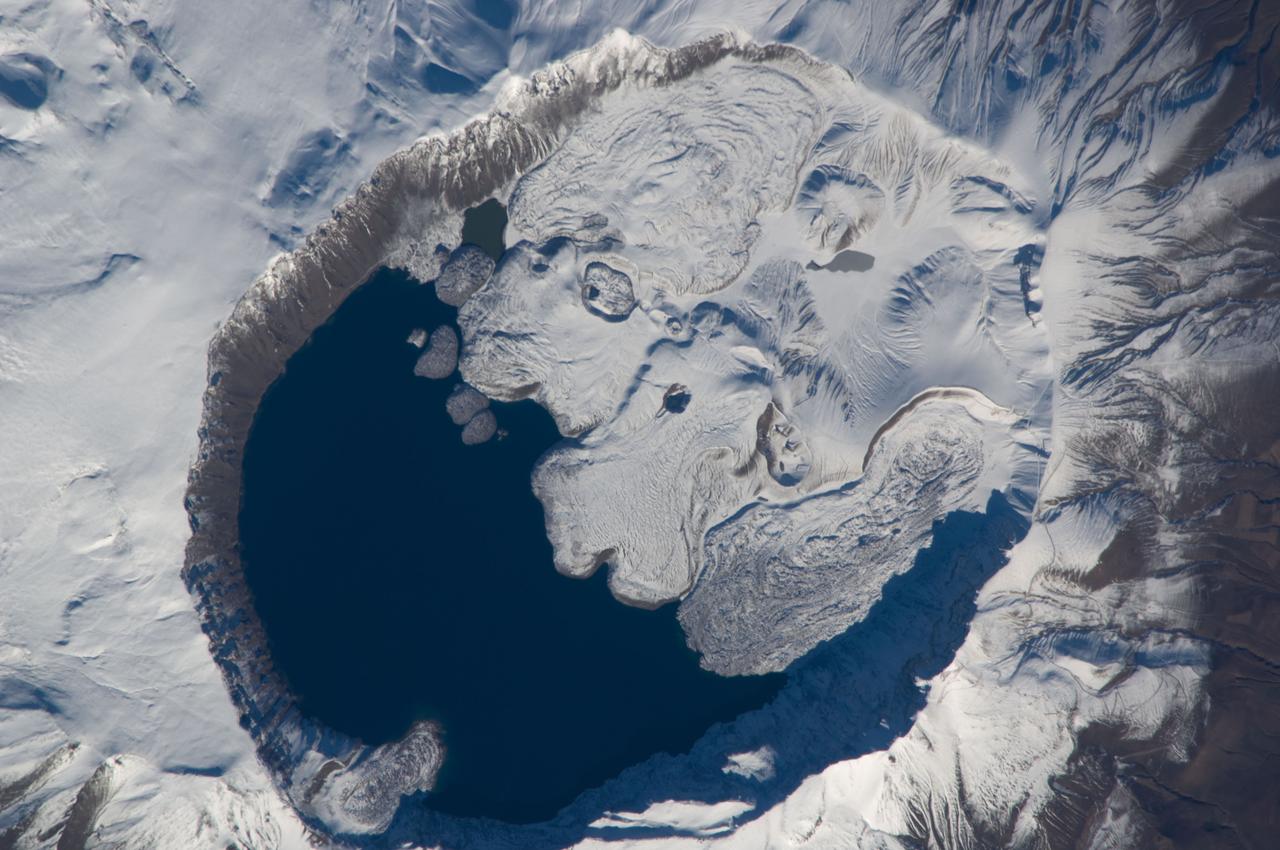
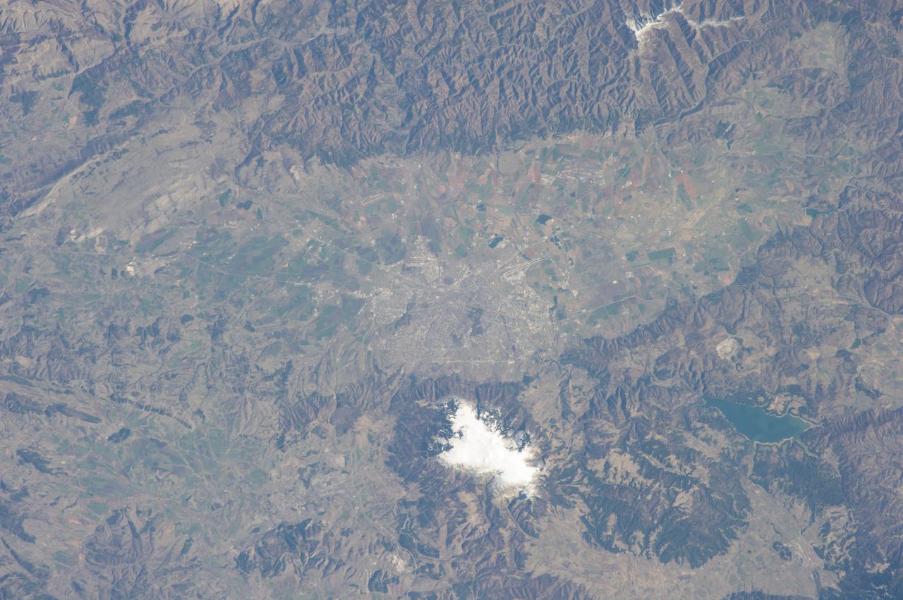
ISS018-E-010206 (3 Dec. 2008) --- Mount Nemrut in Turkey is featured in this image photographed by an Expedition 18 crewmember on the International Space Station. This detailed view centers on the summit caldera of Mount Nemrut (Nemrut Dagi in Turkish), a stratovolcano located in the eastern Anatolia region of Turkey along the shoreline of Lake Van. Winter snow blankets the 2,948 meter elevation summit of the mountain, highlighting the brown caldera rim (a caldera is a large, usually circular or elliptical, collapse feature caused by the rapid emptying of an underlying magma chamber). The snow also highlights the irregular shape and wrinkled surfaces of several lava flows present in the eastern portion of the caldera. Lava flows associated with Mt. Nemrut range in composition from thin, fluid basalt to thick, glassy obsidian. A coldwater caldera lake occupies the western half of the summit. The geologic record at Mt. Nemrut indicates numerous prehistoric explosive eruptions during the Holocene Epoch ?which, according to scientists, began approximately 10,000 years ago and extends to the present day ? with eruption of lava last observed during 1441. The last well-documented explosive eruption occurred during 1650. Volcanism at Mt. Nemrut is the result of tectonic activity associated with the collision of the Arabian and Eurasian Plates; this collision is ongoing, and the presence of a warm water lake in the caldera suggests that the volcano is merely quiescent at present.
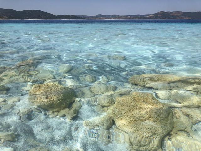
The rocks seen here along the shoreline of Lake Salda in Turkey were formed over time by microbes that trap minerals and sediments in the water. These so-called microbialites were once a major form of life on Earth and provide some of the oldest known fossilized records of life on our planet. NASA's Mars 2020 Perseverance mission will search for signs of ancient life on the Martian surface. Studying these microbial fossils on Earth has helped scientists prepare for the mission. Today, the Martian surface is devoid of lakes and rivers, but billions of years ago it may have looked like this aqueous location on Earth. NASA's Perseverance Mars rover will land in Jezero Crater, which scientists believe was home to a lake and river delta about 3.5 billion years ago. Together, they could have collected and preserved ancient organic molecules and other potential signs of microbial life from the water and sediments that flowed into the crater billions of years ago. https://photojournal.jpl.nasa.gov/catalog/PIA24374
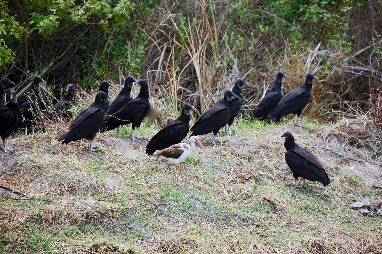
CAPE CANAVERAL, Fla. – Black vultures gather near woods in NASA's Kennedy Space Center in Florida. They are accompanied by a young white ibis. Ranging across the south and southeast, black vultures scavenge for both carrion and weak, sick or unprotected prey. They differ from turkey vultures in that they depend on vision to find food. They can be found all around Kennedy, on the ground or any higher landing spot, from buildings to utility poles. The center shares a boundary with the Merritt Island Wildlife Nature Refuge, which is a habitat for more than 310 species of birds, 25 mammals, 117 fishes and 65 amphibians and reptiles. Photo credit: NASA/Ben Smegelsky
STS040-152-180 (5-24 June 1991) --- The Sinai Peninsula dominates this north-looking, oblique view. According to NASA photo experts studying the STS 40 imagery, the Red Sea in the foreground is clear of river sediment because of the prevailing dry climate of the Middle East. The great rift of the Gulf of Aqaba extends northward to Turkey (top right) through the Dead Sea. The international boundary between Israel and Egypt, reflecting different rural landscapes, stands out clearly. The Nile River runs through the frame. NASA photo experts believe the haze over the Mediterranean to be wind-borne dust. The photo was taken with an Aero-Linhof large format camera.
STS096-330-004 (30 May 1999) --- Astronaut Tamara E. Jernigan, mission specialist, is backdropped over the Aegean Sea as she handles the American-built crane which she helped to install on the International Space Station (ISS) during the May 30th space walk. Jernigan's feet are anchored to a mobile foot restraint connected to the Space Shuttle Discovery's Canadian-built Remote Manipulator System (RMS). Jernigan was joined by astronaut Daniel T. Barry, mission specialist, for the lengthy extravehicular activity (EVA). Parts of Greece, Turkey and the Dardenelles are visible some 171 nautical miles below the docked tandem of Discovery and the ISS.
CAPE CANAVERAL, Fla. -- A wild turkey tries to blend into the palmetto underbrush near the Shuttle Landing Facility at NASA's Kennedy Space Center in Florida. The center coexists with the Merritt Island National Wildlife Refuge, which encompasses 140,000 acres. The refuge comprises a wide variety of habitats, including coastal dunes, saltwater estuaries and marshes, freshwater impoundments, scrub, pine flatwoods, and hardwood hammocks. These habitats provide sanctuary for more than 1,500 species of plants and animals, including more than 330 species of birds, 31 mammals, 117 fishes, and 65 amphibians and reptiles. For additional information about the refuge, visit http://www.fws.gov/merrittisland. Photo credit: NASA/Ben Smegelsky
CAPE CANAVERAL, Fla. -- A wild turkey heads for the safety of the palmetto underbrush near the Shuttle Landing Facility at NASA's Kennedy Space Center in Florida. The center coexists with the Merritt Island National Wildlife Refuge, which encompasses 140,000 acres. The refuge comprises a wide variety of habitats, including coastal dunes, saltwater estuaries and marshes, freshwater impoundments, scrub, pine flatwoods, and hardwood hammocks. These habitats provide sanctuary for more than 1,500 species of plants and animals, including more than 330 species of birds, 31 mammals, 117 fishes, and 65 amphibians and reptiles. For additional information about the refuge, visit http://www.fws.gov/merrittisland. Photo credit: NASA/Ben Smegelsky
KENNEDY SPACE CENTER, FLA. - A turkey vulture appears to hide from the camera at a site near the NASA News Center at Kennedy Space Center. A wide-ranging bird, it is seen throughout Florida and the Space Coast. It is a common site around KSC. The Center, which shares a boundary with the Merritt Island National Wildlife Refuge, is a habitat for more than 310 species of birds, 25 mammals, 117 fishes and 65 amphibians and reptiles. In addition, the Refuge supports 19 endangered or threatened wildlife species on Federal or State lists, more than any other single refuge in the U.S. Photo credit: NASA/Ken Thornsley
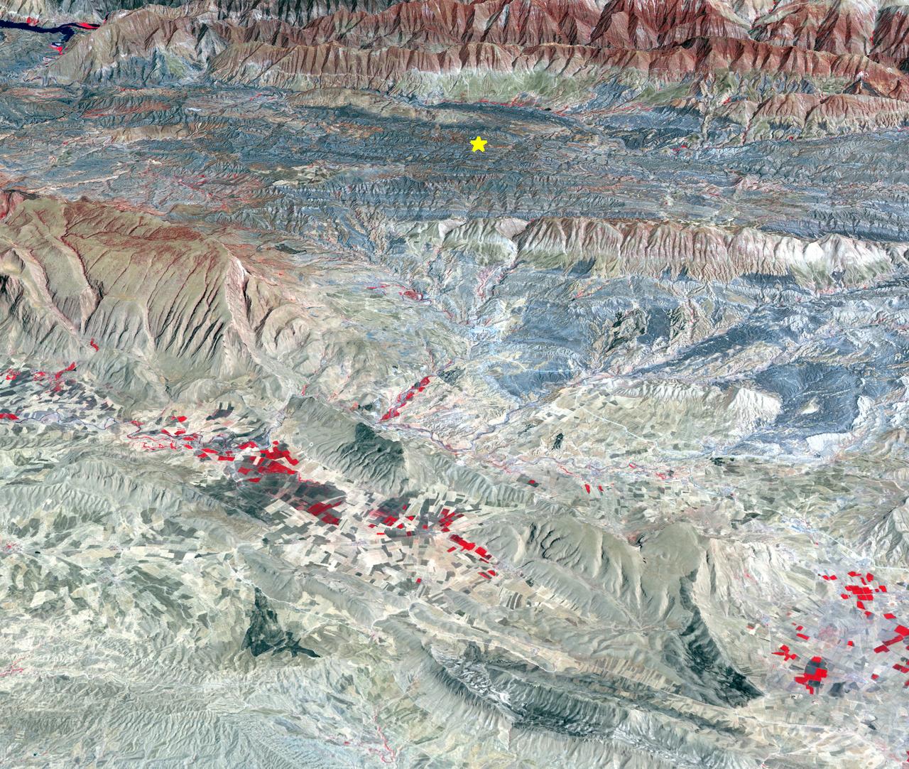
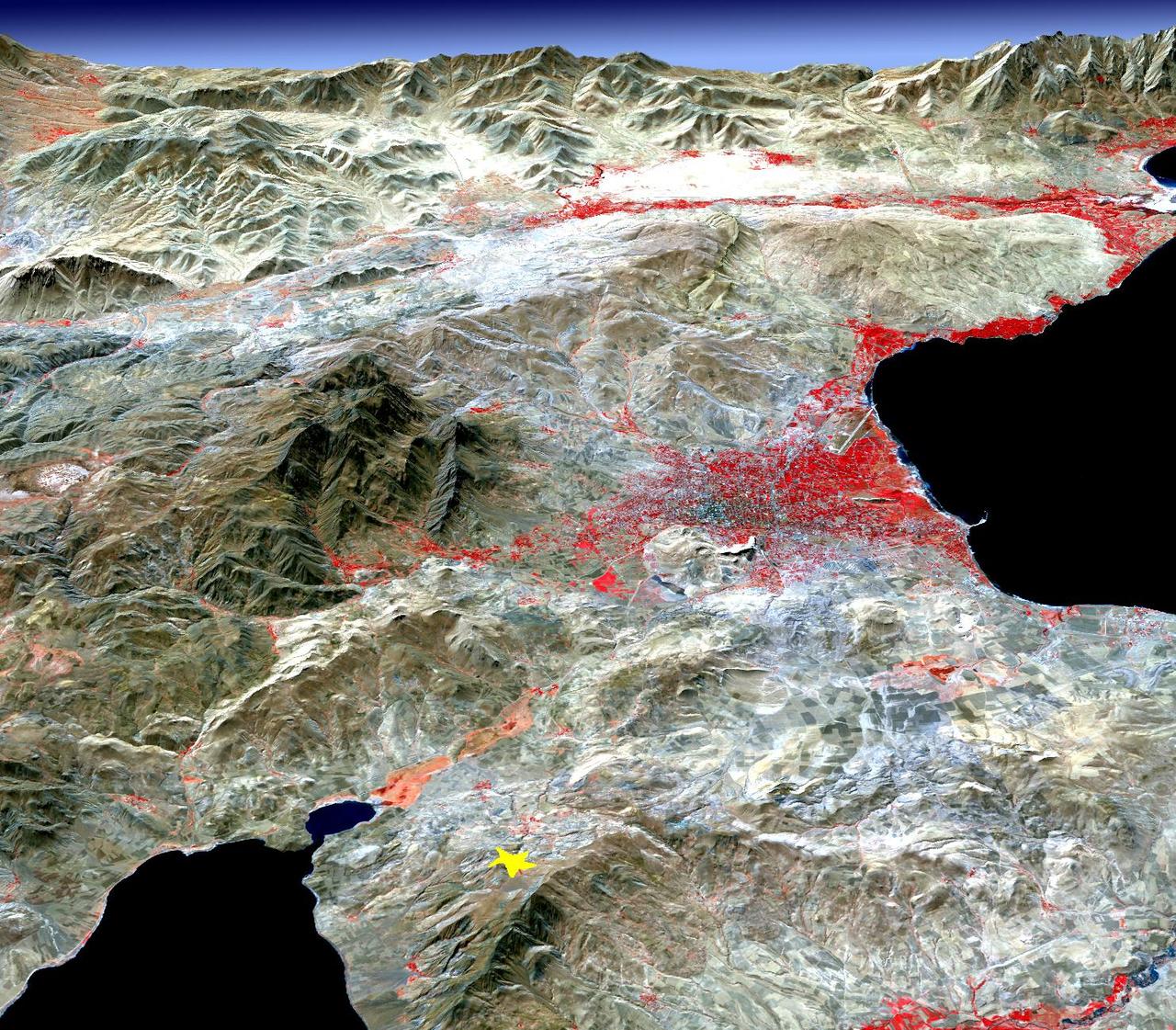
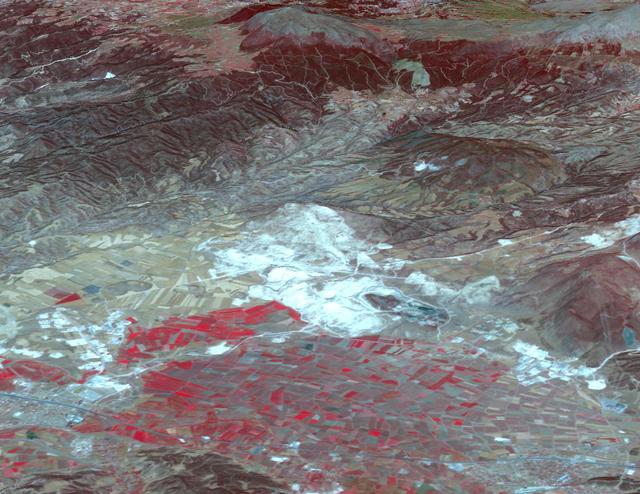
On Sunday, Nov. 12, 2017, a magnitude 7.3 earthquake struck along the Iran-Iraq border near Halabjah, Iraq. The earthquake was felt as far away as Kuwait, Qatar, Turkey, Lebanon and Israel. Extensive damage and numerous casualties were reported in the area near the epicenter (yellow star on image). The earthquake occurred along the boundary between the Arabian and Eurasian tectonic plates. This is an earthquake-prone area, and has experienced many deadly earthquakes in the past. In this perspective-view image, bright red areas are crops in fields, pale red on mountain ridges are shrubs and trees, dark gray areas are traces of earlier brush fires, and gray and tan colors are different rock types. The image was acquired Sept. 8, 2017, and the star marks the earthquake epicenter at 34.9 degrees north, 45.9 degrees east. https://photojournal.jpl.nasa.gov/catalog/PIA22112
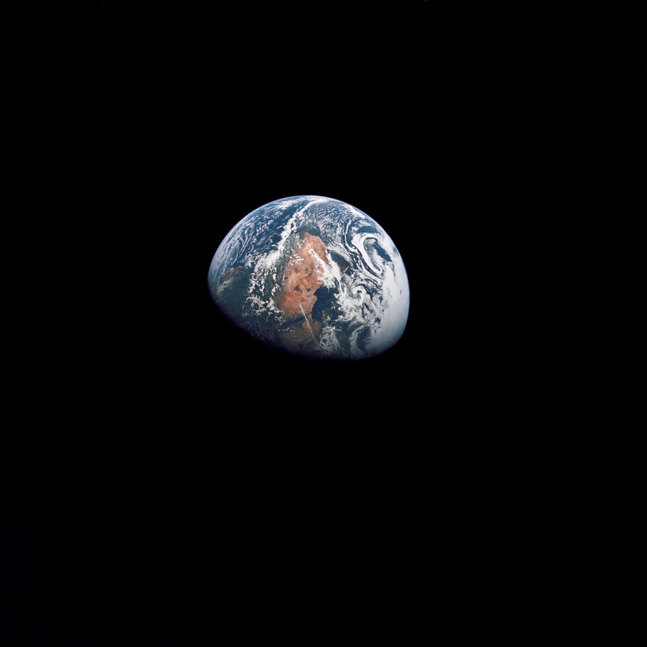
AS10-34-5026 (18-26 May 1969) --- An Apollo 10 photograph of Earth taken from 100,000 miles away. Visible are many areas of Europe and Africa. Among the features and countries identifiable are Portugal, Spain, Italy, the Mediterranean Sea, Greece, Turkey, Bulgaria, the Black Sea, Libya, Egypt, Saudi Arabia, the Sinai Peninsula, the Nile Delta, Lake Chad, and South Africa. The crew members for Apollo 10 are astronauts Thomas P. Stafford, commander; John W. Young, command module pilot; and Eugene E. Cernan, lunar module pilot. Astronaut Young remained in lunar orbit, in the Command and Service Modules (CSM) "Charlie Brown", while astronauts Stafford and Cernan descended to within nine miles of the lunar surface, in the Lunar Module (LM) "Snoopy".
STS084-707-013 (15-24 May 1997) --- As photographed from the Earth-orbiting Space Shuttle Atlantis, this 70mm scene provides a modern view from space of a region rich in ancient history. The Minoan civilization thrived on Crete (western end of the island is visible on the left side of the image) from 3000 BC to about 1100 BC. It is believed by some historians that the eruption of the volcanic island of Thera (the "C" shaped island facing Crete) and possible tsunami helped to bring about the end of the Minoan civilization. The next great civilization to emerge was that of the Greeks. One of the most prominent city-states was Athens which can be seen as a light colored area on an elongated piece of land at center of view (near the clouds). The Aegean Sea separates Greece from Asia Minor (Turkey) in the foreground.
ISS029-E-031143 (15 Oct. 2011) --- One of the Expedition 29 crew members aboard the International Space Station recorded this oblique view showing the Mediterranean Sea area, including parts of Turkey, the Nile River and the river's delta, and the Sinai Peninsula, on Oct. 15, 2011. At first look, the image appears to have been photographed in daylight, but actually it was taken at 01:01:26 GMT. Some areas of the photo like the river and river delta appear as the brightest areas because of either man-made lighting (mostly incandescent) or man-made lighting reflected off nearby surfaces. The other areas appear to be illuminated naturally by moonlight, starlight, or back-scattered light from the atmosphere. A 20-mm focal length was used to record the image.
ISS008-E-21752 (16 April 2004) --- This image featuring Istanbul, Turkey was photographed by an Expedition 8 crewmember on the International Space Station (ISS). This metropolis of 15 million occupies both sides of the entrance to the narrow, 20-mile long Bosporus Strait connecting the Mediterranean and Sea of Marmara (south) to the Black Sea (north). When this image was taken, strong currents carried turbid coastal waters from the Black Sea through the Strait and into the Sea of Marmara. The rugged uplands to the north of the city are forested and contain vital reservoirs. Note Ataturk airport southwest of the city near the bottom of the image, the picturesque Prince Islands in the Sea of Marmara, and the sinuous waterway and harbor on the western shore known as the Golden Horn.
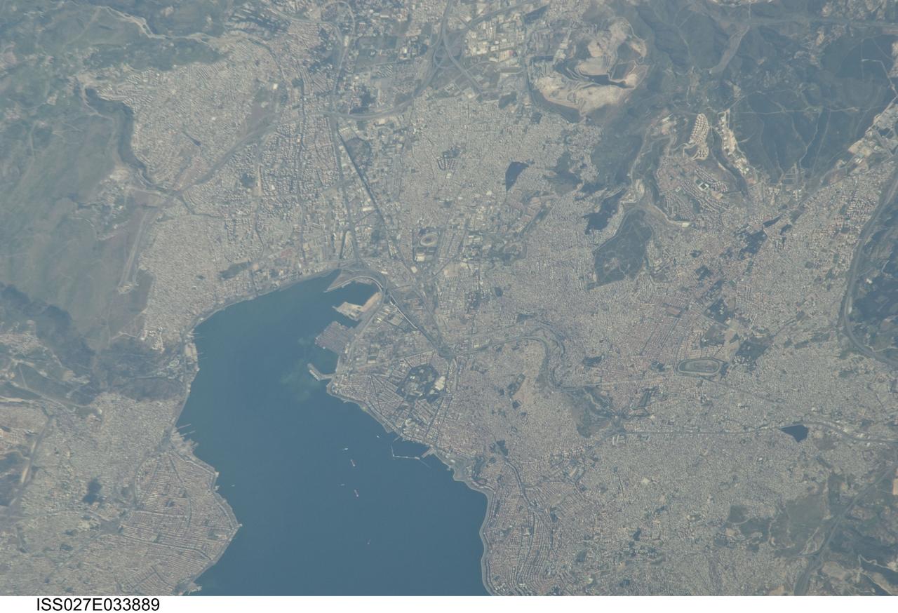
ISS027-E-033889 (16 May 2011) --- Izmir Metropolitan Area, Izmir Province in Turkey is featured in this image photographed by an Expedition 27 crew member on the International Space Station. The metropolis of Izmir is located in the western Anatolia region of Turkey. It is the country’s third largest city in terms of population and the second largest port city (after Istanbul). The Izmir region has included urban areas for almost 3,500 years, and the ancient core of the metropolitan area was originally known as Smyrna. Due to its location on the Gulf of Izmir (lower left) with access to the Aegean Sea, Izmir (or Smyrna) has been an important Mediterranean Sea port for most of its history. This detailed photograph highlights the modern urban landscape of the Izmir metropolitan area. Today, the metropolitan area includes eleven districts, many of which were independent neighborhoods prior to agglomeration into “greater Izmir”. Densely built-up residential and commercial districts, characterized by gray to reddish gray rooftops occupy much of the central part of the image. Larger structures with bright white rooftops are indicative of commercial/industrial areas near the Izmir Port at left. Two large sport complexes, the Ataturk Stadium and Sirinyer Hippodrome (horse racing track) are clearly visible at upper left and right respectively. Numerous vegetated parks (green) are located throughout the area. In addition to being a major trade center, greater Izmir is a hub for regional tourism.
ISS041-E-057060 (1 Oct. 2014) --- One of the Expedition 41 crew members aboard the International Space Station, flying at an altitude of 220 nautical miles, photographed this night panorama of parts of Europe on Oct. 1, 2014. Kiev, Ukraine is seen near the right edge of the photo in the vertical center. Lights of Constanta, Romania can be seen just below the Russian Progress 56 cargo vehicle docked to the orbital outpost at the top of the frame. The Black Sea is to the left of the Soyuz TMA-13M docked to the station on the left side of the scene. The Sea of Azov is at the right of the bottom portion the Soyuz. Mariupol is near bottom center; and Donetsk, although it appears as a (bottom-most) tiny smudge on the right side of the image, has a population of just under five million. Krasnodar, Russia is in the bottom left corner. Part of Greece is in the top of the image near the solar panel of the Progress, with Thessaloniki and Sofia among the many bright lights. Part of Turkey is in upper left of the land mass visible. Pre-dawn light coming through the atmosphere gives the station hardware a bluish color.
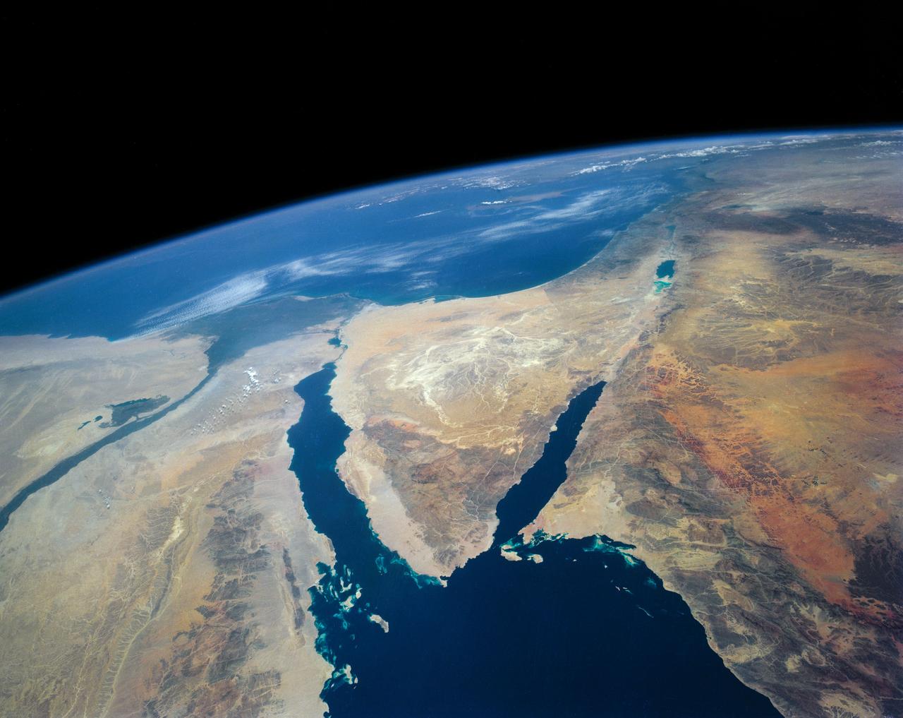
STS109-708-024 (1-12 March 2002) --- The astronauts on board the Space Shuttle Columbia took this 70mm picture featuring the Sinai Peninsula and the Dead Sea Rift. The left side of the view is dominated by the great triangle of the Sinai peninsula, which is partly obscured by an unusual cloud mass on this day. The famous Monastery of St. Catherine lies in the very remote, rugged mountains in the southern third of the peninsula (foreground). The Gulf of Aqaba is a finger of the Red Sea bottom center, pointing north to the Dead Sea, the small body of water near the center of the view. According to NASA scientists studying the STS-109 photo collection, the gulf and the Dead Sea are northerly extensions of the same geological rift that resulted in the opening of the Red Sea . The Gulf of Suez appears in the lower left corner. Northwest Saudi Arabia occupies the lower right side of the view, Jordan and Syria the right and top right, and the Eastern Mediterranean Sea the top left. Thin white lines of cloud have formed along the coastal mountains of southern Turkey and stretch across the top of the view near the Earth's limb.
This frame a movie from NASA's Phoenix Mars Lander shows the spacecraft's robotic arm in its stowed configuration, with its biobarrier unpeeled. The arm is still folded up, with its "elbow" shown at upper left and its scoop at bottom right. The biobarrier is the shiny film seen to the left of the arm in this view. The barrier is an extra precaution to protect Mars from contamination with any bacteria from Earth. While the whole spacecraft was decontaminated through cleaning, filters and heat, the robotic arm was given additional protection because it is the only spacecraft part that will directly touch the ice below the surface of Mars. Before the arm was heated, it was sealed in the biobarrier, which is made of a trademarked film called Tedlar that holds up to baking like a turkey-basting bag. This ensures that any new bacterial spores that might have come about during the final steps before launch, and during the journey to Mars, will not contact the robotic arm. After Phoenix landed, springs were used to pop back the barrier, giving it room to deploy. The arm is scheduled to begin to unlatch on the second Martian day of the mission, or Sol 3 (May 28, 2008). This image was taken on Sol 1 (May 26, 2008) by the spacecraft's Surface Stereo Imager. http://photojournal.jpl.nasa.gov/catalog/PIA10708
ISS010-E-08224 (22 November 2004) --- Mount Olympus, Greece is featured in this image photographed by an Expedition 10 crewmember on the International Space Station (ISS). Mount Olympus is the highest peak (2917 meters) in Greece, as well as the mountain chain that runs north into Bulgaria and south, via the Cyclades Islands, into Turkey. In this winter view, Olympus is the only peak with a dusting of snow—perhaps for this reason its name in classical Greek means “the luminous one.” In Greek mythology the peak was inhabited by the Twelve Olympians, the most famous gods of the ancient Greeks. North of Mount Olympus lies Macedonia, the homeland of Alexander the Great. Climbing the mountain is a favorite tourist activity today. The slopes of the peaks of Olympus and its neighboring peaks drop sheer into the Thermaikos Gulf, a northern arm of the Aegean Sea. White cirrus clouds obscure the shoreline near the city of Thessaloniki. This major port is spread along the shores of a small and well protected bay at the north end of the gulf. On the plains inland of the Olympus chain lie a lake, on the Aliakmon River, and the town of Larisa, at the focus point of a series of transport routes.
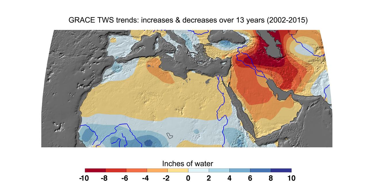
Cumulative total freshwater losses in North Africa and the Middle East from 2002 to 2015 (in inches) observed by NASA's Gravity Recovery and Climate Experiment (GRACE) mission. Total water refers to all of the snow, surface water, soil water and groundwater combined. Groundwater depletion in Turkey, Syria, Iraq and Iran, and along the Arabian Peninsula, are leading to large changes in total water storage in the region. Likewise, drought and groundwater pumping is contributing to the drying of the Caspian Sea Region. The Northwest Sahara Aquifer System, which underlies Tunisia and Libya, is also experiencing increasing water stress as shown in the map. Image updated from Voss et al., 2013. Citation of Record: Voss, K. A., J. S. Famiglietti, M. Lo, C. R. de Linage, M. Rodell and S. C. Swenson, Groundwater depletion in the Middle East from GRACE with Implications for Transboundary Water Management in the Tigris-Euphrates-Western Iran Region, Wat. Resour. Res., 49(2), 904-914, DOI: 10.1002/wrcr.20078. http://photojournal.jpl.nasa.gov/catalog/PIA20207