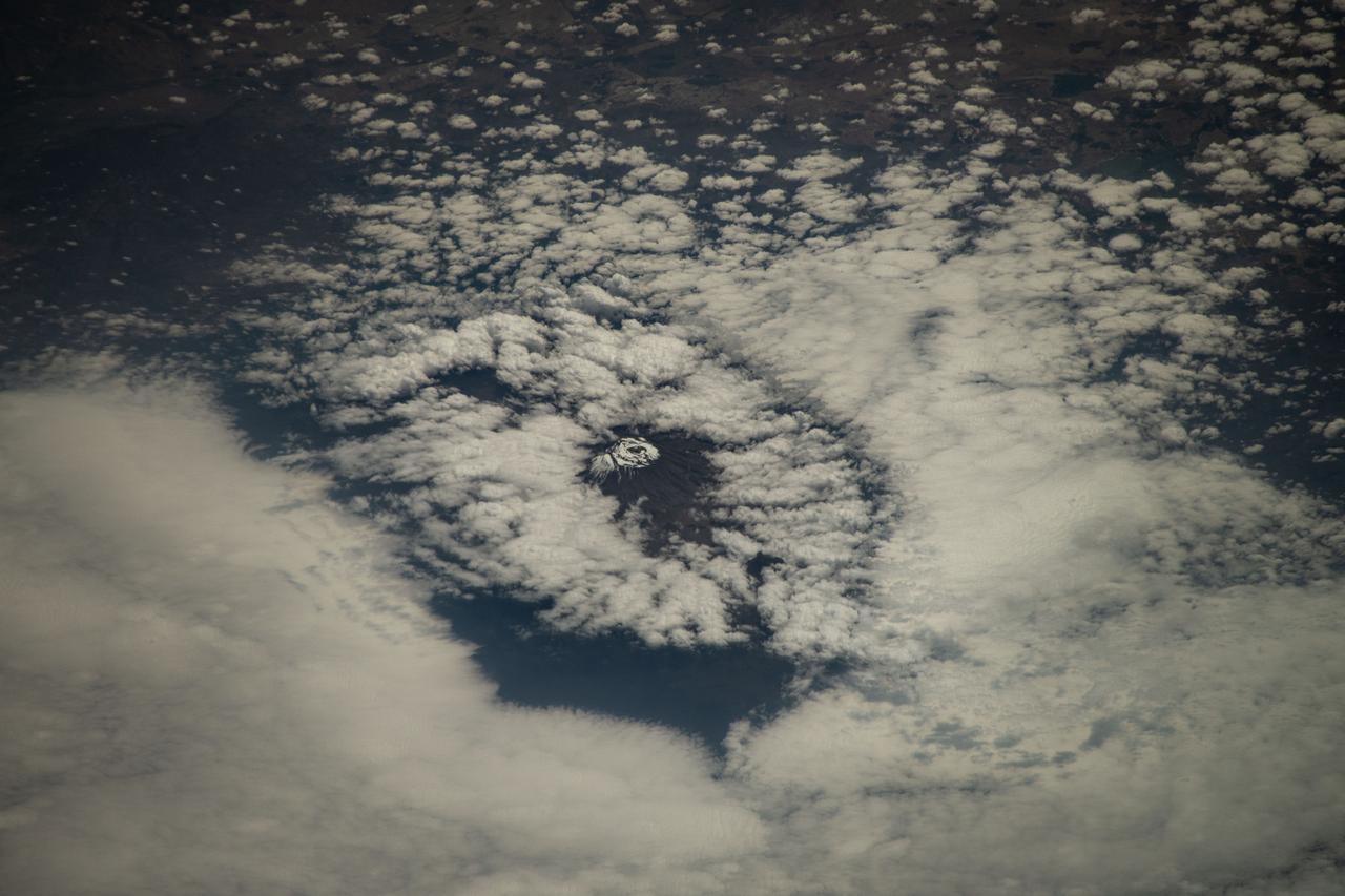
iss071e378517 (July 21, 2024) --- Mount Kilimanjaro, surrounded by clouds and the highest mountian in Africa, is pictured from the International Space Station as it orbited 261 miles above the Indian Ocean off the coast of Tanzania.
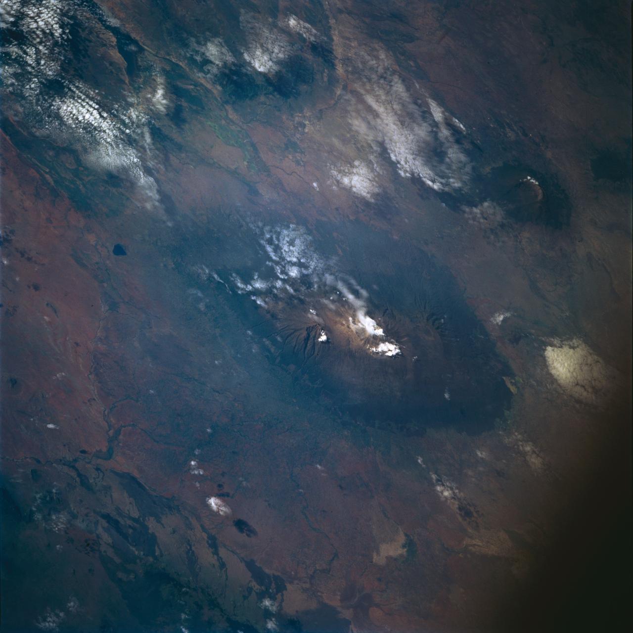
STS072-722-004 (11-20 Jan. 1996) --- Mount Kilimanjaro in Tanzania is featured in this 70mm frame exposed from the Earth-orbiting Space Shuttle Endeavour. Orient with the clouds trailing to the left; then the view is southwest from Kenya past Kilimanjaro to Mount Meru, in Tanzania. Mount Kilimanjaro is about three degrees south of the Equator, but at nearly 6,000 meters has a permanent snowfield. The mountain displays a classic zonation of vegetation types from seasonally dry savannah on the plains at 1,000 meters, to the cloud forest near the top. The mountain is being managed experimentally as an international biosphere reserve. A buffer zone of "traditional" agriculture and pastoral land use is designated around the closed-canopy forest reserve. Specialists familiar with this area say management is partially successful so far, but cleared areas of the forest can be seen on this photograph as light green "nibbles" or "cookie cuts" extending into the dark forest region.
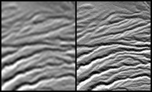
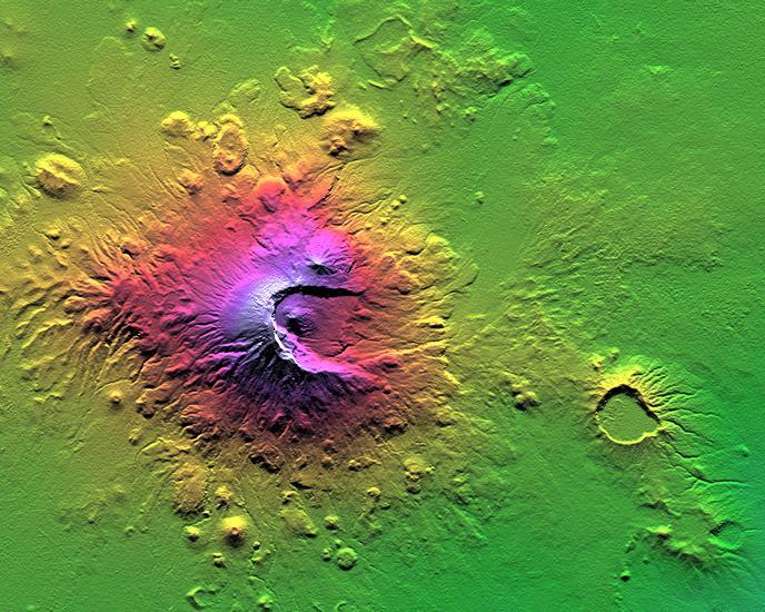
A site in the Crater Highlands of Tanzania reveals the difference between NASA Shuttle Radar Topography Mission SRTM digital elevation model data as originally released in 2004 left and as now released at full resolution in 2014 right.
iss074e0103137 (Dec. 29, 2025) --- A SpaceX Dragon spacecraft fires its Draco engines, an independent propellant system located in the spacecraft’s trunk, for a regularly scheduled orbital reboost of the International Space Station. The orbital outpost was soaring into a sunset 259 miles above the Indian Ocean off the coast of Tanzania on the African continent at approximately 9:09 p.m. local time.
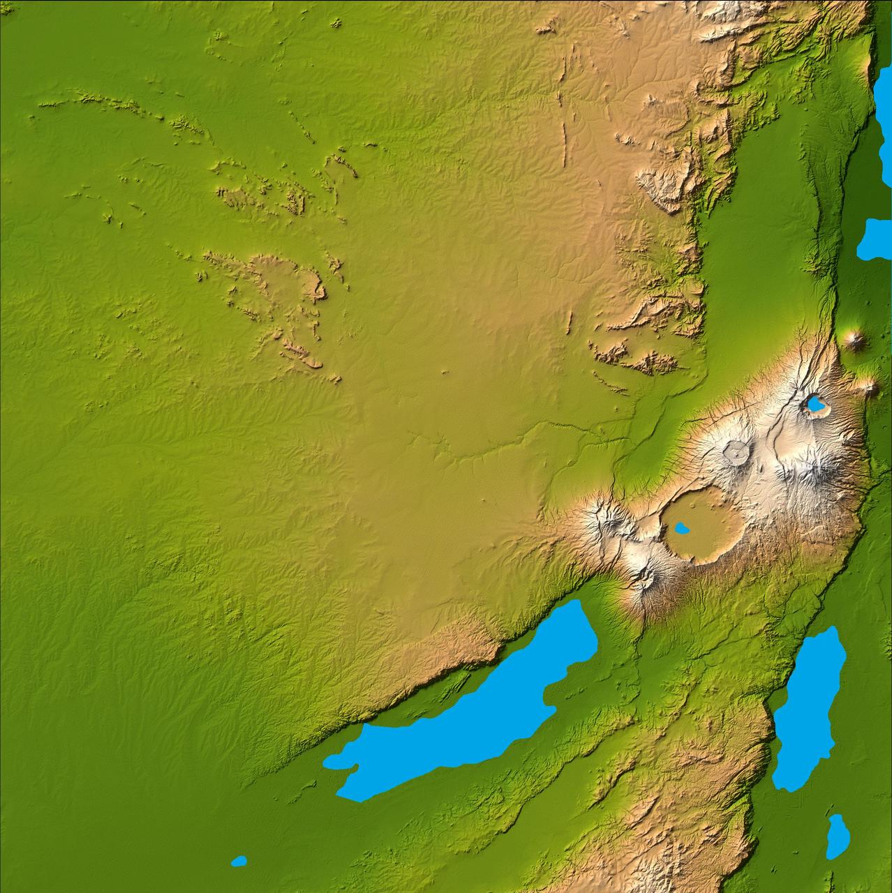
Three striking and important areas of Tanzania in eastern Africa are shown in this color-coded shaded relief image from NASA Shuttle Radar Topography Mission.
Earth observation taken during a day pass by the Expedition 37 crew. Per Twitter message: Ruvuma River, Tanzania and Mozambique.
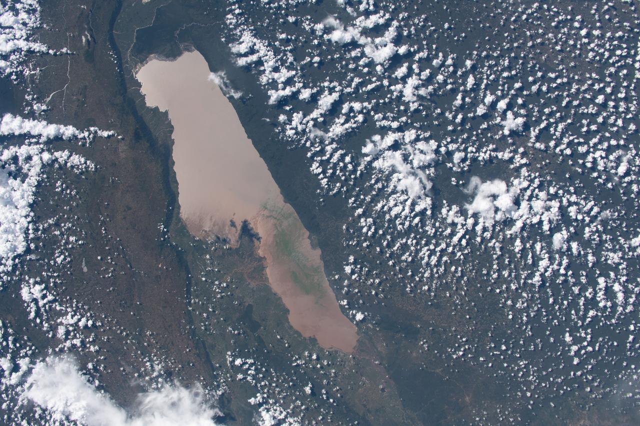
iss062e105922 (March 24, 2020) --- Lake Rukwa in Tanzania is pictured from the International Space Station as it orbited above the Africa continent.

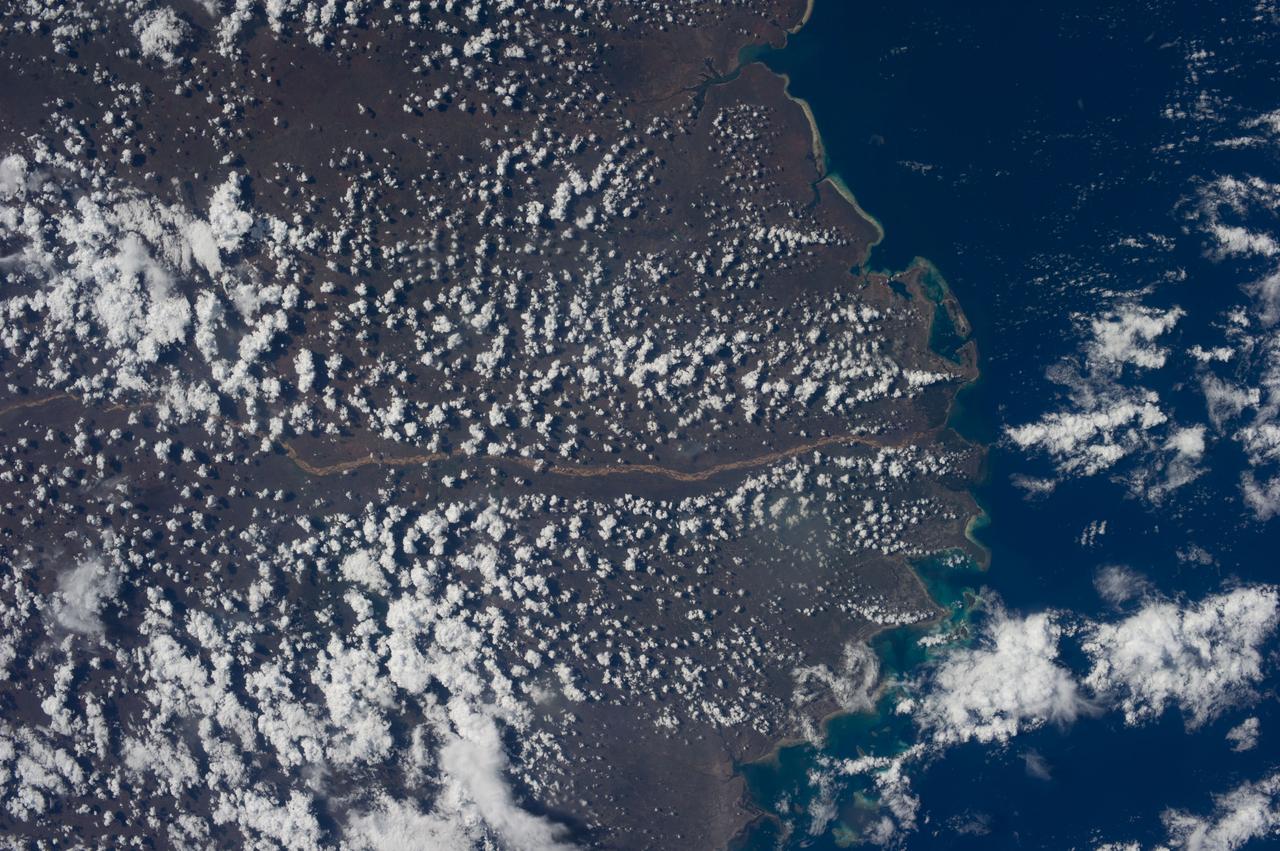
Earth Observation taken during a day pass by the Expedition 40 crew aboard the International Space Station (ISS). Folder lists this as: Tanzania Kenya.
Earth Observation taken during a day pass by the Expedition 40 crew aboard the International Space Station (ISS). Folder lists this as: Tanzania Kenya.
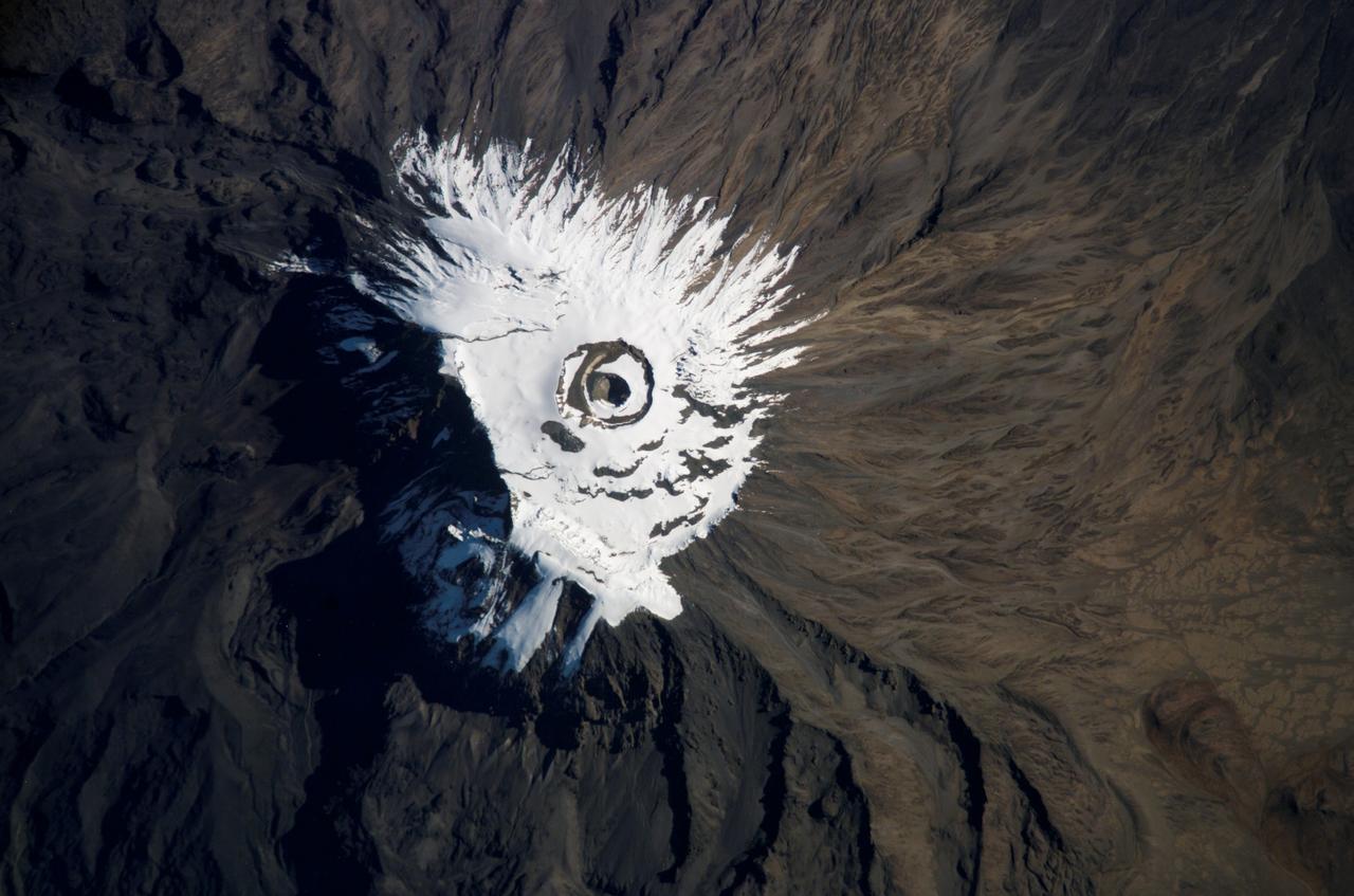
ISS014-E-18950 (3 April 2007) --- Covered with snow and ice, Mount Kilimanjaro, Tanzania is featured in this image photographed by an Expedition 14 crewmember on the International Space Station.
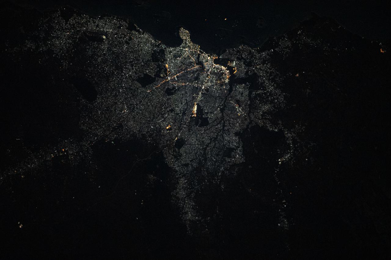
iss063e082691 (Sept. 1, 2020) --- The city of Dar Es Salaam, a major commercial port on the Indian Ocean coast of Tanzania, is pictured during an orbital night period as the International Space Station soared above the eastern coast of Africa.
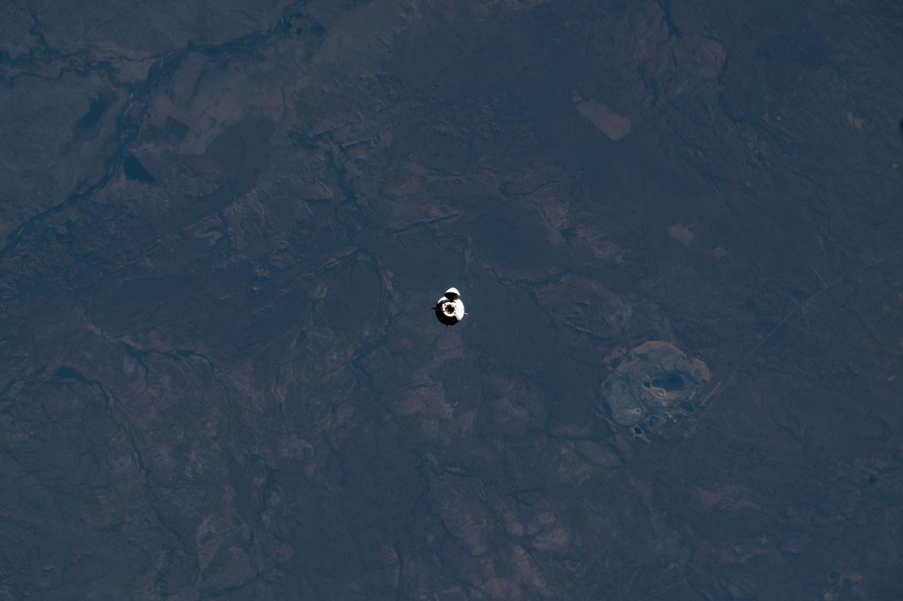
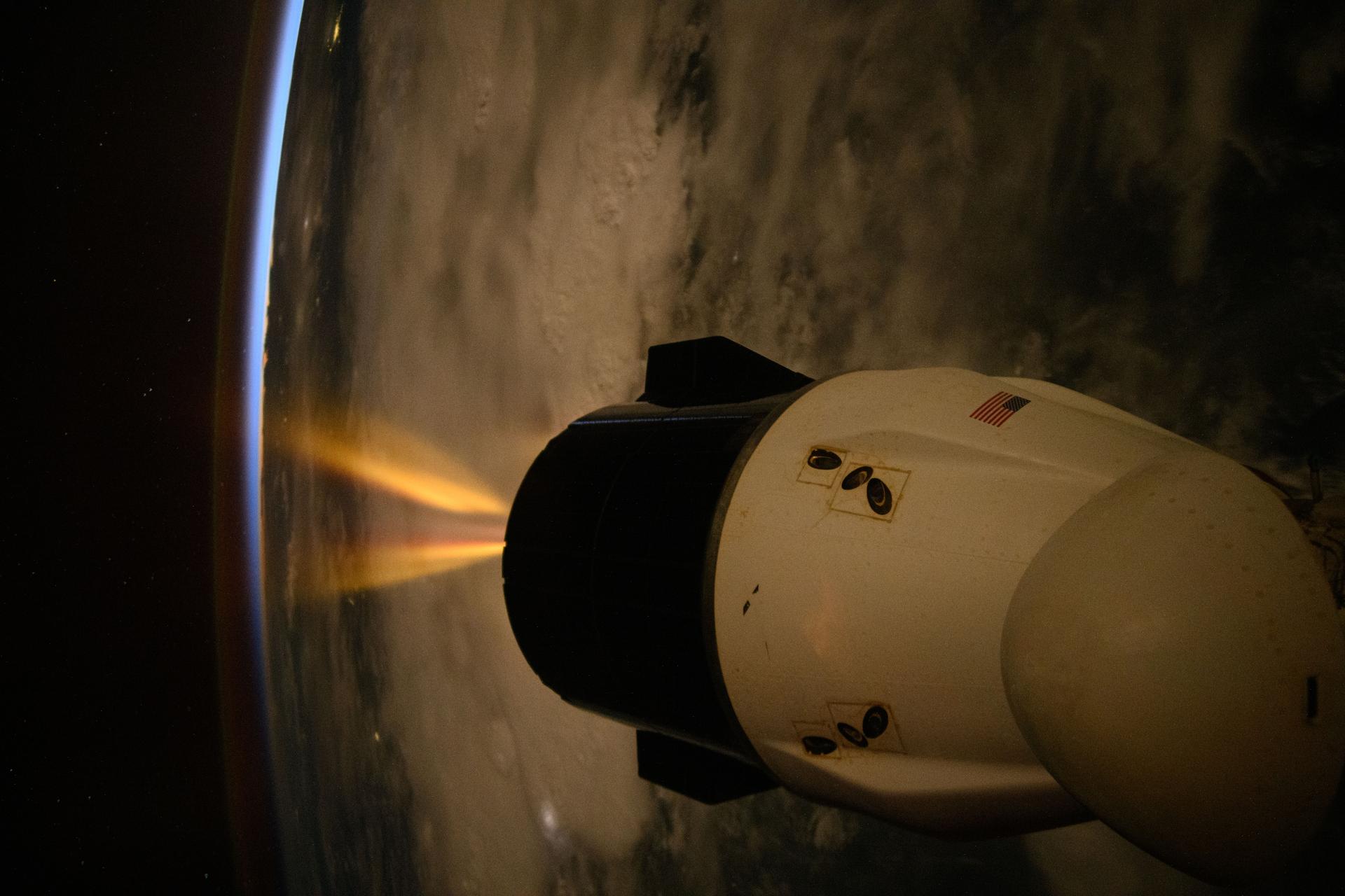
iss073e0422195 (Aug. 2, 2025) --- The SpaceX Dragon spacecraft carrying NASA's Crew-11 mission approaches the International Space Station while orbiting 260 miles above the Indian Ocean coast of Tanzania on the African continent.
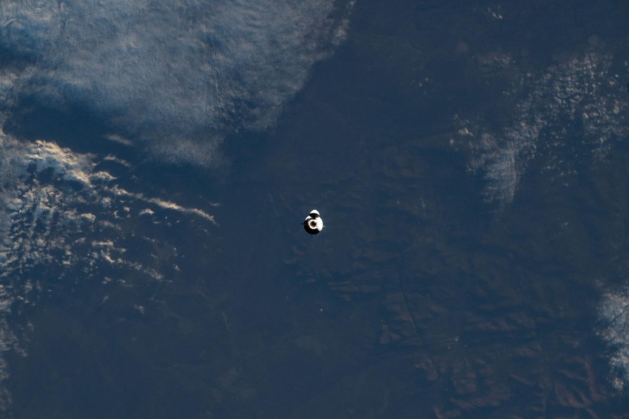
iss073e0422191 (Aug. 2, 2025) --- The SpaceX Dragon spacecraft carrying NASA's Crew-11 mission approaches the International Space Station while orbiting 260 miles above the Indian Ocean coast of Tanzania on the African continent.

iss056e098062 (July 22, 2018) --- Mount Kilimanjaro is pictured in the northeastern region of Tanzania near the border of Kenya as the International Space Station orbited nearly 251 miles above the African continent.
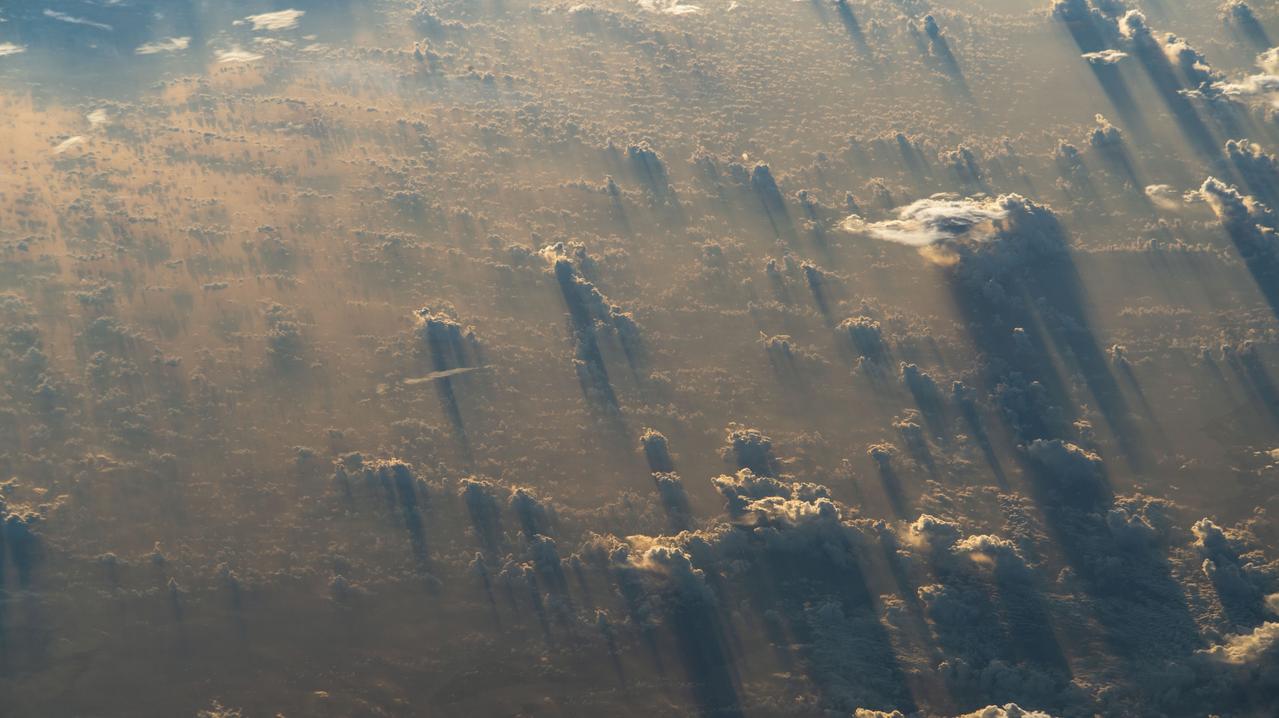
iss068e040120 (Jan. 13, 2023) --- A sunset stretches cloud shadows over Tanzania in this photograph from the International Space Station as it orbited 259 miles above the African nation.
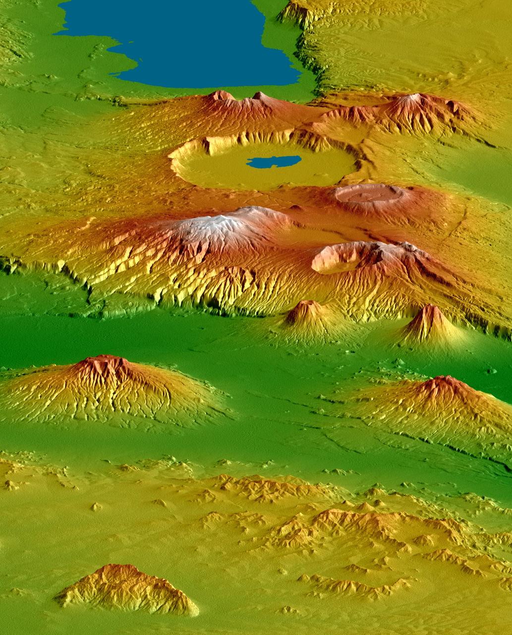
NASA Shuttle Radar Topography Mission SRTM, flown aboard Space Shuttle Endeavour in February 2000, acquired elevation measurements for nearly all of Earth landmass between 60°N and 56°S latitudes.

iss065e214029 (Aug. 2, 2021) --- Russia's "Nauka" Multipurpose Laboratory Module is pictured docked to the Zvezda service module's Earth-facing port as the International Space Station orbited 262 miles above the Kenya-Tanzania border on Africa's Indian Ocean coast. In the foreground, is the Soyuz MS-18 crew ship docked to the Rassvet module.

iss073e0422445 (July 29, 2025) --- The city lights of Sub-Saharan Africa streak below the International Space Station as it orbited 260 miles above the Tanzania-Zambia border in this long-duration photograph. At top right, lightning storms illuminate the cloud tops with the Soyuz MS-27 spacecraft docked to the Prichal module in the foreground.
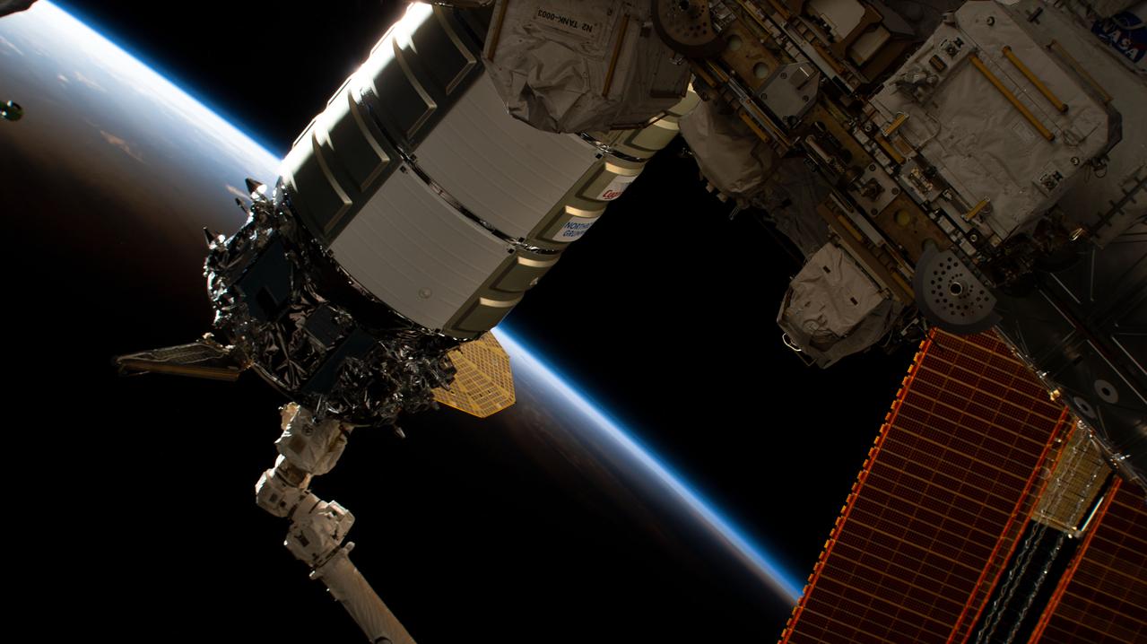
iss068e021452 (Nov. 9, 2022) --- The Northrop Grumman Cygnus space freighter is pictured in the grip of the Canadarm2 robotic arm as ground controllers remotely install the cargo craft to the International Space Station's Unity module. The space station was orbiting into a sunset 257 miles above the Indian Ocean off the coast of the African nation of Tanzania.
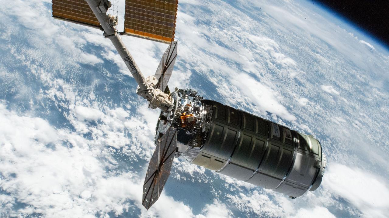
iss073e0703409 (Sept. 18, 2025) --- Northrop Grumman's Cygnus XL cargo craft, carrying over 11,000 pounds of new science and supplies for the Expedition 73 crew, is pictured in the grips of the International Space Station's Canadarm2 robotic arm following its capture. Both spacecraft were orbiting 257 miles above Tanzania. Cygnus XL is Northrop Grumman's expanded version of its previous Cygnus cargo craft increasing its payload capacity and pressurized cargo volume.
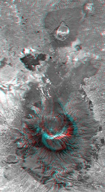
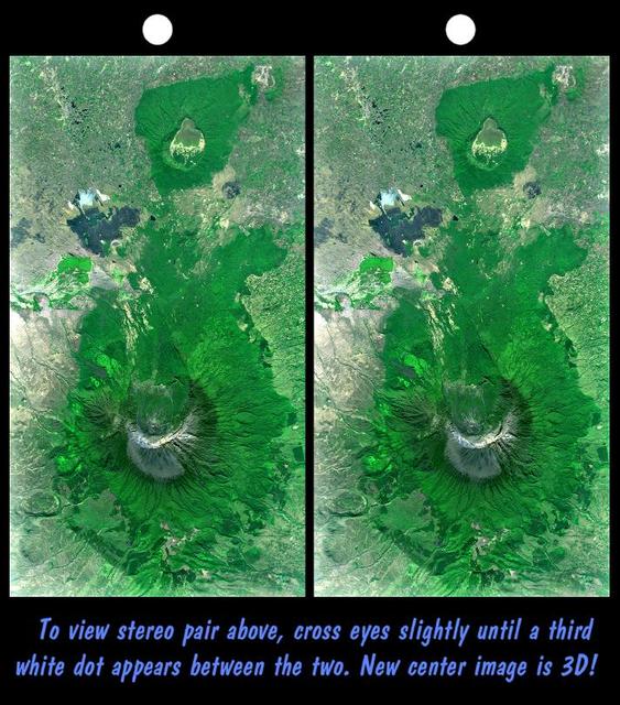
This anaglyph, from NASA Shuttle Radar Topography Mission, is of Mount Meru, an active volcano located just 70 kilometers 44 miles west of Mount Kilimanjaro. 3D glasses are necessary to view this image.
Mount Meru is an active volcano located just 70 kilometers 44 mileswest of Mount Kilimanjaro.
Mount Meru is an active volcano located just 70 kilometers 44 miles west of Mount Kilimanjaro.
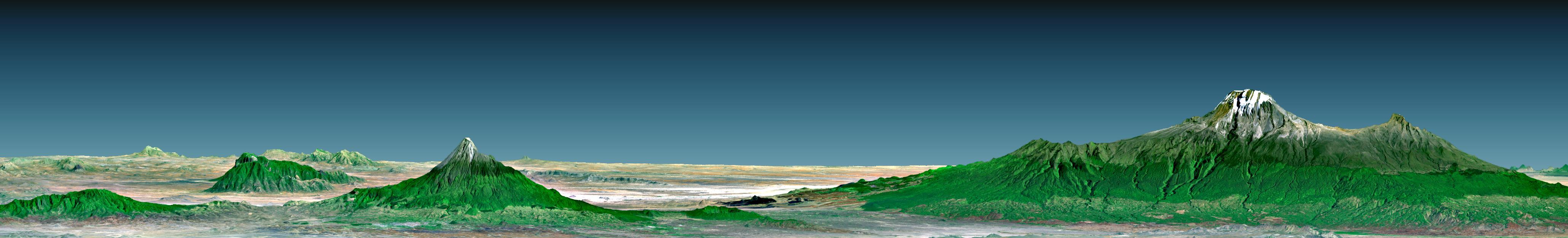
Mount Kilimanjaro, the highest point in Africa, reaches 5,895 meters 19,340 feet above sea level, tall enough to maintain a permanent snow cap despite being just 330 kilometers 210 miles south of the equator.
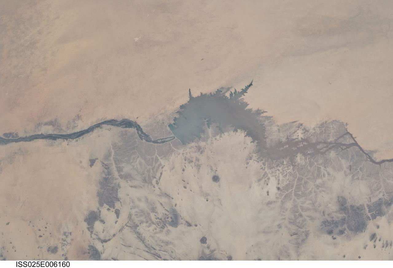
ISS025-E-006160 (5 Oct. 2010) --- Merowe Dam, Nile River and the Republic of the Sudan are featured in this image photographed by an Expedition 25 crew member on the International Space Station. The Merowe Dam is located near the 4th cataract of the Nile River, in the Nubian Desert of the northeastern Republic of the Sudan (also known as Sudan). The dam was built to generate hydroelectric power—electricity intended to further industrial and agricultural development of the country. This photograph illustrates the current extent of the reservoir filling behind the dam; the final spill gate was closed in 2008. The Merowe Dam is located approximately 350 kilometers (215 miles) to the northwest of Sudan’s capital, Khartoum. The nearest settlement downstream of the dam is Karima. Following Sudan’s independence from Egypt and the United Kingdom in 1956, allocation and control of Nile River water was divided between Egypt and Sudan by the Nile Waters Treaty signed in 1959. Today, other countries within the Nile basin—including Ethiopia, Kenya, Rwanda, Tanzania, and Uganda—are seeking more equitable allocation and utilization of the water and recently (2010) signed a new water use pact challenging the 1959 treaty. Beyond the issues of water rights, several local tribes will be displaced by the planned 170 kilometer-long reservoir, and the flooded region contains significant but little-studied archeological sites. The Sudanese government has a resettlement program in place for the tribes. A variety of international institutions have been conducting “salvage” or “rescue” archeological surveys since 1999. Such rescue surveys seek to preserve as much information as possible from sites that will be destroyed or otherwise made inaccessible (in this case by flooding).
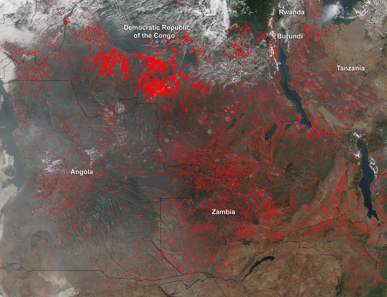
Widespread agricultural burning continues throughout central Africa. Smoke and fires in several countries were seen by the Suomi NPP satellite. Most of the fires were burning in the southern region of the Democratic Republic of the Congo, Tanzania, Zambia and Angola. NASA-NOAA's Suomi NPP satellite's Visible Infrared Imaging Radiometer Suite (VIIRS) instrument captured a look at multiple fires and smoke on August 1 at 7:55 a.m. EDT (11:55 UTC). Actively burning areas, detected by VIIRS are outlined in red. Credit: NASA/Jeff Schmaltz/NASA Goddard Rapid Response Team <b><a href="http://www.nasa.gov/audience/formedia/features/MP_Photo_Guidelines.html" rel="nofollow">NASA image use policy.</a></b> <b><a href="http://www.nasa.gov/centers/goddard/home/index.html" rel="nofollow">NASA Goddard Space Flight Center</a></b> enables NASA’s mission through four scientific endeavors: Earth Science, Heliophysics, Solar System Exploration, and Astrophysics. Goddard plays a leading role in NASA’s accomplishments by contributing compelling scientific knowledge to advance the Agency’s mission. <b>Follow us on <a href="http://twitter.com/NASAGoddardPix" rel="nofollow">Twitter</a></b> <b>Like us on <a href="http://www.facebook.com/pages/Greenbelt-MD/NASA-Goddard/395013845897?ref=tsd" rel="nofollow">Facebook</a></b> <b>Find us on <a href="http://instagrid.me/nasagoddard/?vm=grid" rel="nofollow">Instagram</a></b>
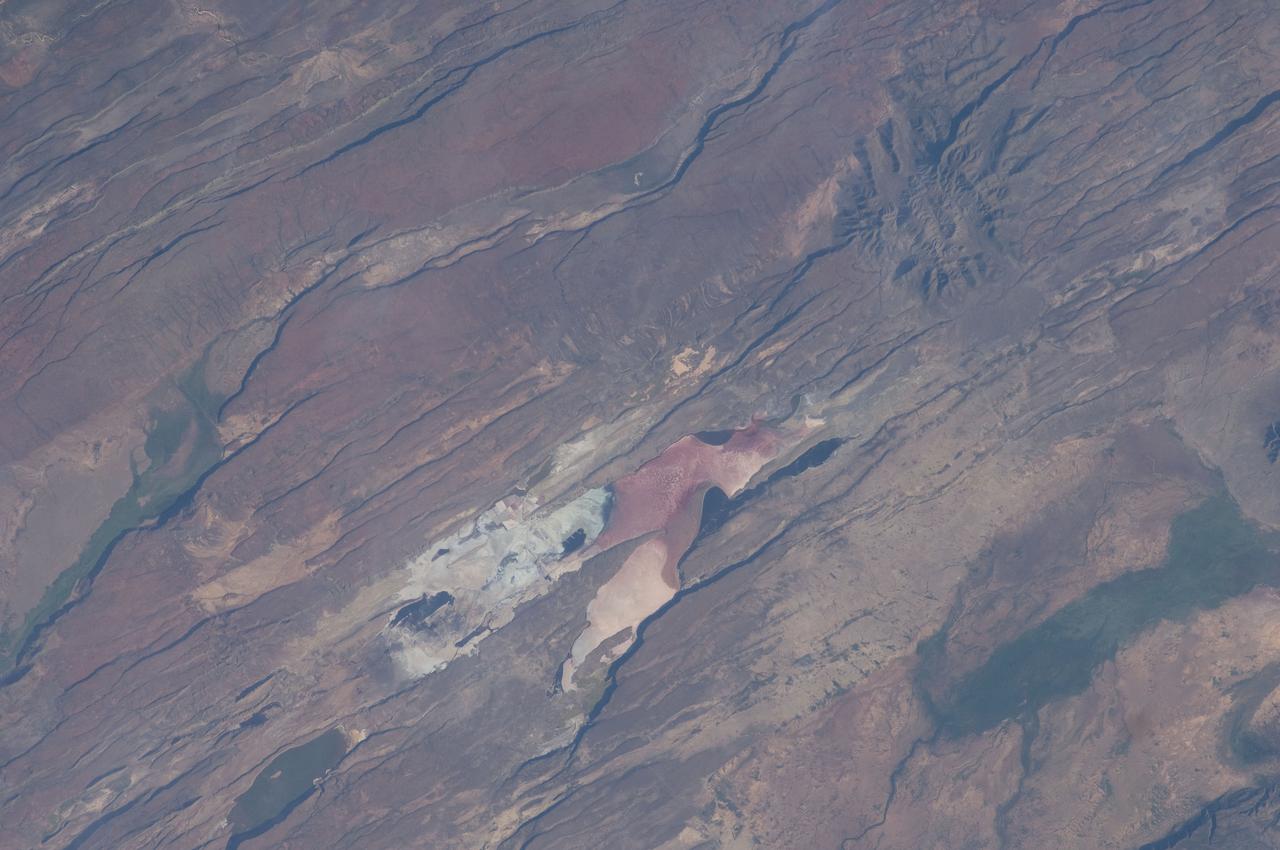
ISS030-E-035487 (14 Jan. 2012) --- The East African Rift Valley in Kenya is featured in this image photographed by an Expedition 30 crew member on the International Space Station. This photograph highlights classical geological structures associated with a tectonic rift valley, in this case the Eastern Branch of the East African Rift near Kenya’s southern border with Tanzania and just south of the Equator. The East African Rift is one of the great tectonic features of Africa, caused by fracturing of Earth’s crust. The Nubian (or African) plate includes the older continental crust of Africa to the west, while the Somalian plate that is moving away includes the Horn of Africa to the northeast; the tectonic boundary stretches from the southern Red Sea to central Mozambique. Landscapes in the rift valley can appear confusing. The most striking features in this view are the numerous, nearly parallel, linear fault lines that occupy the floor of the valley (most of the image). Shadows cast by the late afternoon sun make the fault scarps (steps in the landscape caused by slip motion along individual faults) more prominent. The faults are aligned with the north-south axis of the valley (lower left to top right). A secondary trend of less linear faults cuts the main fault trend at an acute angle, the fault steps throwing large shadows. The Eastern Branch of the East African Rift is arid (compared with the Western Branch which lies on the border of the Congolese rainforest). Evidence of this can be seen in the red, salt-loving algae of the shallow and salty Lake Magadi (center). A neighboring small lake to the north has deeper water and appears dark in the image. The white salt deposits of the dry part of the Lake Magadi floor (center) host a few small commercial salt pans. The lakes appear to be located where the main and secondary fault trends intersect. The East African rift system is marked by substantial volcanic activity, including lavas erupted from fissures along the rift in the region. Much of the faulting observed in this image cuts through such lavas. Elsewhere along the rift system individual volcanoes form. Some of those volcanoes are very large, including Mt. Kilimanjaro and Mt. Kenya. In this image, rising 400 meters above the valley floor, a volcano appears to be superimposed on the faults—indicating that the volcano is younger than the faults it covers. Deeply eroded slopes also suggest that the volcano has not been active for a long time. The largest vegetated area (lower left)—in an desert zone with no vegetation visible to the naked eye from space—is the green floor of a valley which drains an area large enough for water to exist near the surface so that plants can thrive. For a sense of scale, the vegetated valley floor is 17 kilometers long (10.5 miles).