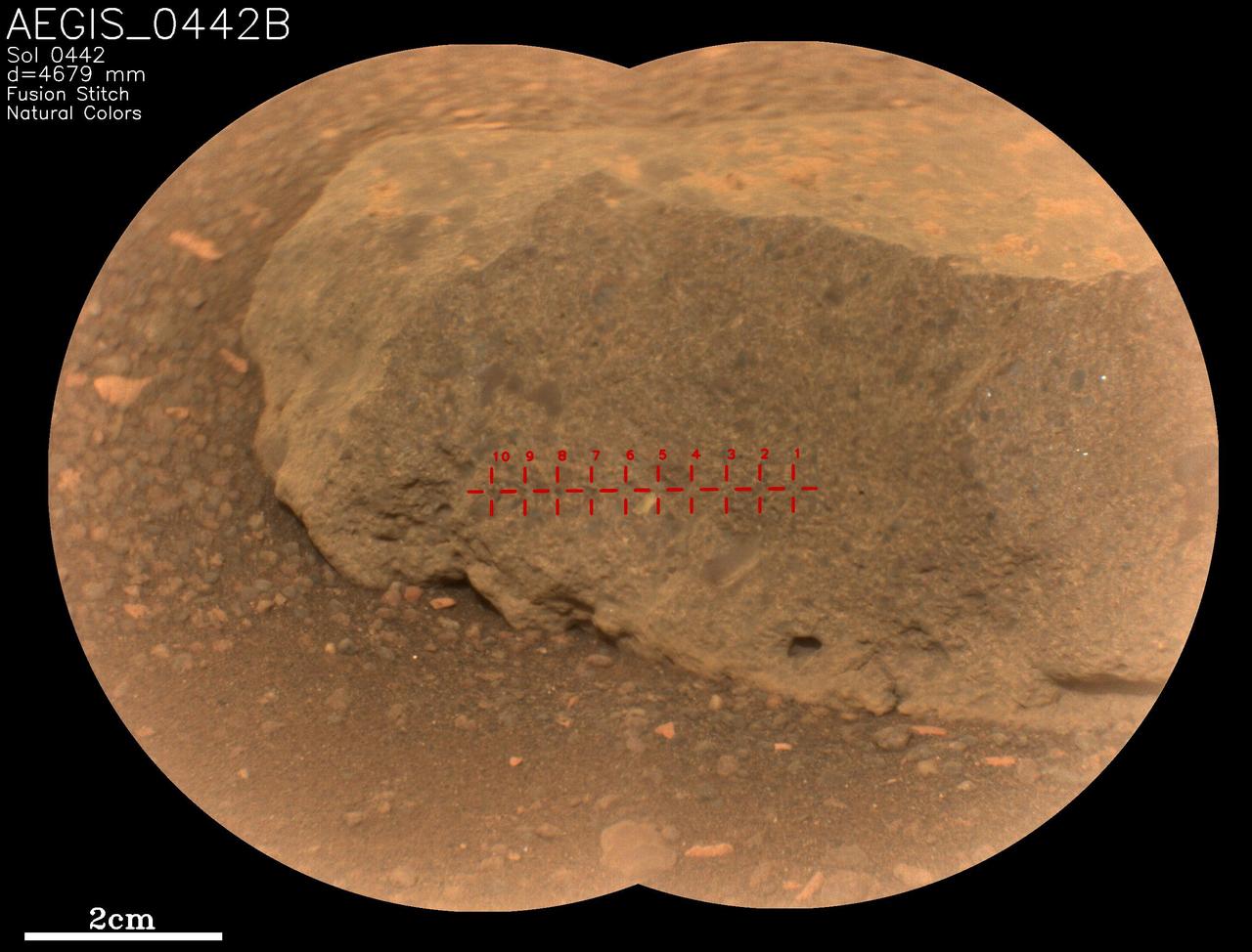
On May 18, 2022, NASA's Perseverance Mars rover used an artificial intelligence software called Autonomous Exploration for Gathering Increased Science (AEGIS) to select and target the rock seen in close-up here. It's one of two rocks that the AI for the first time helped Perseverance study without direction from the mission's team back on Earth. AEGIS was developed by NASA's Jet Propulsion Laboratory in Southern California – which also built Perseverance – to collect data on rocks and other Martian features that the rover discovers while driving. AEGIS is used in conjunction with Perseverance's SuperCam laser instrument, directing the laser to zap certain features that scientists have commanded the rover to look for. SuperCam used its Remote Micro-Imager (RMI) camera to take two images of this target, which were stitched together into the main picture seen here. The rock target, which was about 16 feet (5 meters) away from the rover, is named "AEGIS_0442B," referring to the Martian day, or sol, it was targeted (Sol 442) and that it was the second rock ("B") targeted by AEGIS on that sol. The red crosshairs seen across the rock target indicate each place AEGIS directed the laser to zap. SuperCam is led by Los Alamos National Laboratory in New Mexico, where the instrument's body unit was developed. That part of the instrument includes several spectrometers as well as control electronics and software. The mast unit, including RMI, was developed and built by several laboratories of the CNRS (the French research center) and French universities under the contracting authority of Centre National d'Études Spatiales (CNES), the French space agency. A key objective for Perseverance's mission on Mars is astrobiology, including the search for signs of ancient microbial life. The rover will characterize the planet's geology and past climate, pave the way for human exploration of the Red Planet, and be the first mission to collect and cache Martian rock and regolith (broken rock and dust). Subsequent NASA missions, in cooperation with ESA (European Space Agency), would send spacecraft to Mars to collect these sealed samples from the surface and return them to Earth for in-depth analysis. The Mars 2020 Perseverance mission is part of NASA's Moon to Mars exploration approach, which includes Artemis missions to the Moon that will help prepare for human exploration of the Red Planet. https://photojournal.jpl.nasa.gov/catalog/PIA25289
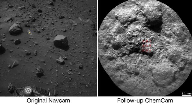
NASA's Curiosity Mars rover autonomously selects some of the targets for the laser and telescopic camera of the rover's Chemistry and Camera (ChemCam) instrument. For example, on-board software analyzed the image on the left, chose the target highlighted with the yellow dot, and pointed ChemCam to acquire laser analysis and the image on the right. Most ChemCam targets are still selected by scientists discussing rocks or soil seen in images the rover has sent to Earth, but the autonomous targeting provides an added capability. It can offer a head start on acquiring composition information at a location just reached by a drive. The software for target selection and instrument pointing is called AEGIS, for Autonomous Exploration for Gathering Increased Science. The image on the left was taken by the left eye of Curiosity's stereo Navigation Camera (Navcam) a few minutes after the rover completed a drive of about 43 feet (13 meters) on July 14, 2016, during the 1,400th Martian day, or sol, of the rover's work on Mars. Using AEGIS for target selection and pointing based on the Navcam imagery, Curiosity's ChemCam zapped a grid of nine points on a rock chosen for meeting criteria set by the science team. In this run, parameters were set to find bright-toned outcrop rock rather than darker rocks, which in this area tend to be loose on the surface. Within less than 30 minutes after the Navcam image was taken, ChemCam had used its laser on all nine points and had taken before-and-after images of the target area with its remote micro-imager (RMI) camera. The image at right combines those two RMI exposures. The nine laser targets are marked in red at the center. On the Navcam image at left, the yellow dot identifies the selected target area, which is about 2.2 inches (5.6 centimeters) in diameter. An unannotated version of this Sol 1400 Navcam image is available. ChemCam records spectra of glowing plasma generated when the laser hits a target point. These spectra provide information about the chemical elements present in the target. The light-toned patch of bedrock identified by AEGIS on Sol 1400 appears, geochemically, to belong to the "Stimson" sandstone unit of lower Mount Sharp. In mid-2016, Curiosity typically uses AEGIS for selecting a ChemCam target more than once per week. http://photojournal.jpl.nasa.gov/catalog/PIA20762
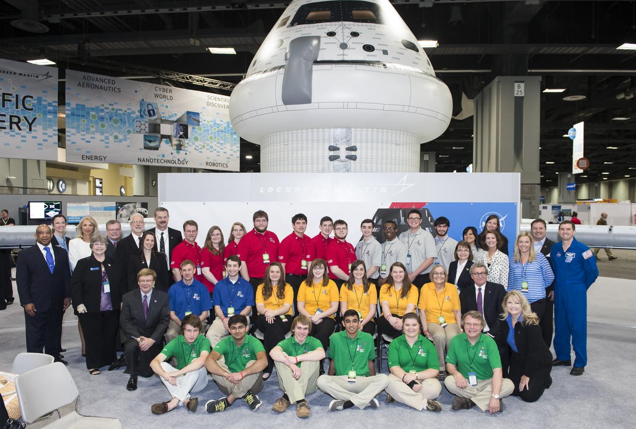
Sponsors of all of the semi-finalist teams in the Exploration Design Challenge pose for a group photo with the teams. Team ARES from the Governors School for Science and Technology in Hampton, Va. won the challenge with their radiation shield design, which will be built and flown aboard the Orion/EFT-1. The award was announced at the USA Science and Engineering Festival on April 25, 2014 at the Washington Convention Center. Photo Credit: (NASA/Aubrey Gemignani)
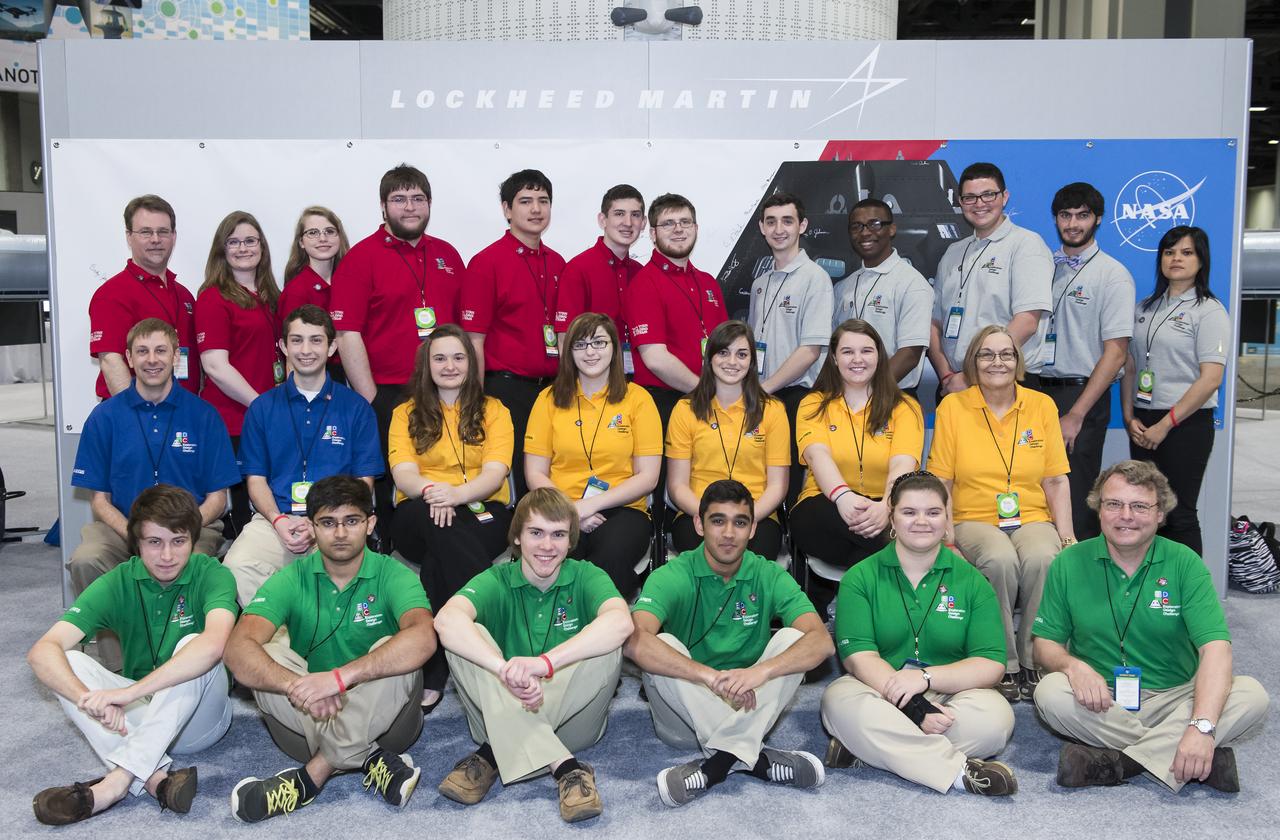
Pictured are all Semi-finalist teams in the Exploration Design Challenge. NASA Administrator, Charles Bolden and Lockheed Martin CEO, Marillyn Hewson announced the winner of the Exploration Design Challenge at the USA Science and Engineering Festival on April 25, 2014. The goal of the challenge was for students to research and design ways to protect astronauts from space radiation. The winning team's design will be built and flown aboard the Orion/EFT-1. The USA Science and Engineering Festival is taking place at the Washington Convention Center in Washington, DC on April 26 and 27, 2014. Photo Credit: (NASA/Aubrey Gemignani)