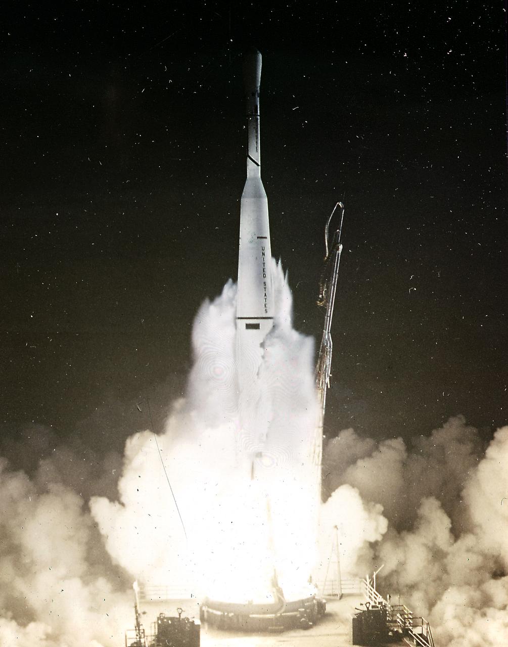
The Thor-Delta-5 launched an Earth observation satellite, TIROS III (Television Infrared Observation Satellite), on July 12, 1961.
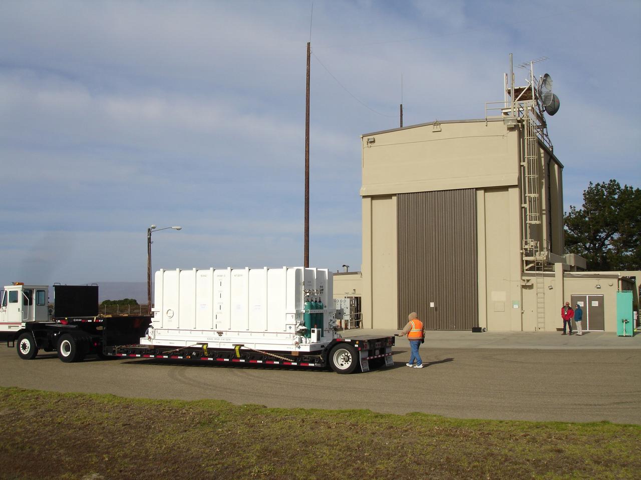
VANDENBERG AIR FORCE BASE, Calif. – The NOAA-N Prime spacecraft arrives at NASA's Hazardous Processing Facility on Vandenberg Air Force Base in California. NOAA-N Prime was built by Lockheed Martin Space Systems Company for its Advanced Television Infrared Observational Satellites -N series. It is the latest polar-orbiting operational environmental weather satellite developed by NASA for the National Oceanic and Atmospheric Administration. The satellite will provide a platform to support environmental monitoring instruments for imaging and measuring the Earth's atmosphere, its surface and cloud cover, including Earth radiation, atmospheric ozone, aerosol distribution, sea surface temperature and vertical temperature and water profiles in the troposphere and stratosphere. The satellite will assist in measuring proton and electron fluxes at orbit altitude, collecting data from remote platforms to assist the Search and Rescue Satellite-Aided Tracking system. The satellite will be launched from the Western Range at Vandenberg AFB by a United Launch Alliance two-stage Delta II rocket managed by NASA's Launch Service Program at Kennedy. Photo credit: NASA/Jerry Nagy, VAFB
VANDENBERG AIR FORCE BASE, Calif. – The NOAA-N Prime spacecraft is positioned for movement into NASA's Hazardous Processing Facility on Vandenberg Air Force Base in California. NOAA-N Prime was built by Lockheed Martin Space Systems Company for its Advanced Television Infrared Observational Satellites -N series. It is the latest polar-orbiting operational environmental weather satellite developed by NASA for the National Oceanic and Atmospheric Administration. The satellite will provide a platform to support environmental monitoring instruments for imaging and measuring the Earth's atmosphere, its surface and cloud cover, including Earth radiation, atmospheric ozone, aerosol distribution, sea surface temperature and vertical temperature and water profiles in the troposphere and stratosphere. The satellite will assist in measuring proton and electron fluxes at orbit altitude, collecting data from remote platforms to assist the Search and Rescue Satellite-Aided Tracking system. The satellite will be launched from the Western Range at Vandenberg AFB by a United Launch Alliance two-stage Delta II rocket managed by NASA's Launch Service Program at Kennedy. Photo credit: NASA/Jerry Nagy, VAFB

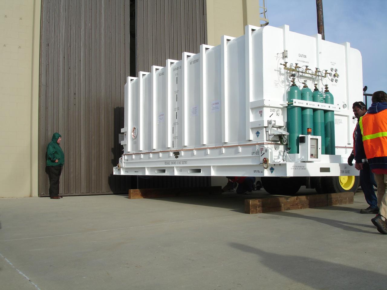
VANDENBERG AIR FORCE BASE, Calif. – Workers move the NOAA-N Prime spacecraft into NASA's Hazardous Processing Facility on Vandenberg Air Force Base in California. NOAA-N Prime was built by Lockheed Martin Space Systems Company for its Advanced Television Infrared Observational Satellites -N series. It is the latest polar-orbiting operational environmental weather satellite developed by NASA for the National Oceanic and Atmospheric Administration. The satellite will provide a platform to support environmental monitoring instruments for imaging and measuring the Earth's atmosphere, its surface and cloud cover, including Earth radiation, atmospheric ozone, aerosol distribution, sea surface temperature and vertical temperature and water profiles in the troposphere and stratosphere. The satellite will assist in measuring proton and electron fluxes at orbit altitude, collecting data from remote platforms to assist the Search and Rescue Satellite-Aided Tracking system. The satellite will be launched from the Western Range at Vandenberg AFB by a United Launch Alliance two-stage Delta II rocket managed by NASA's Launch Service Program at Kennedy. Photo credit: NASA/Jerry Nagy, VAFB
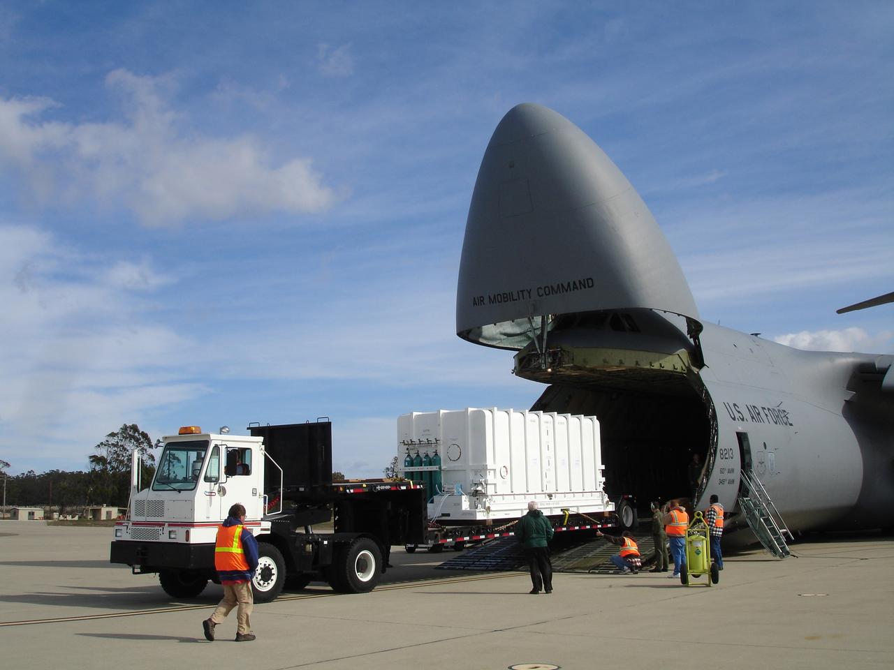
VANDENBERG AIR FORCE BASE, Calif. – The NOAA-N Prime spacecraft is offloaded from a C-5 aircraft after arrival at Vandenberg Air Force Base Airfield in California. NOAA-N Prime was built by Lockheed Martin Space Systems Company for its Advanced Television Infrared Observational Satellites -N series. It is the latest polar-orbiting operational environmental weather satellite developed by NASA for the National Oceanic and Atmospheric Administration. The satellite will provide a platform to support environmental monitoring instruments for imaging and measuring the Earth's atmosphere, its surface and cloud cover, including Earth radiation, atmospheric ozone, aerosol distribution, sea surface temperature and vertical temperature and water profiles in the troposphere and stratosphere. The satellite will assist in measuring proton and electron fluxes at orbit altitude, collecting data from remote platforms to assist the Search and Rescue Satellite-Aided Tracking system. The satellite will be launched from the Western Range at Vandenberg AFB by a United Launch Alliance two-stage Delta II rocket managed by NASA's Launch Service Program at Kennedy. Photo credit: NASA/Jerry Nagy, VAFB

VANDENBERG AIR FORCE BASE, Calif. – The NOAA-N Prime spacecraft is offloaded from the transporter at NASA's Hazardous Processing Facility on Vandenberg Air Force Base in California. NOAA-N Prime was built by Lockheed Martin Space Systems Company for its Advanced Television Infrared Observational Satellites -N series. It is the latest polar-orbiting operational environmental weather satellite developed by NASA for the National Oceanic and Atmospheric Administration. The satellite will provide a platform to support environmental monitoring instruments for imaging and measuring the Earth's atmosphere, its surface and cloud cover, including Earth radiation, atmospheric ozone, aerosol distribution, sea surface temperature and vertical temperature and water profiles in the troposphere and stratosphere. The satellite will assist in measuring proton and electron fluxes at orbit altitude, collecting data from remote platforms to assist the Search and Rescue Satellite-Aided Tracking system. The satellite will be launched from the Western Range at Vandenberg AFB by a United Launch Alliance two-stage Delta II rocket managed by NASA's Launch Service Program at Kennedy. Photo credit: NASA/Jerry Nagy, VAFB
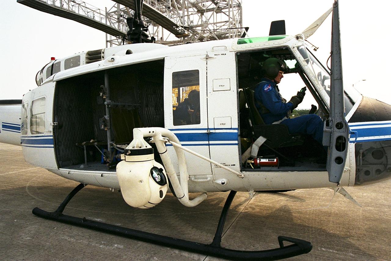
KENNEDY SPACE CENTER, FLA. -- A beach ball-sized infrared camera, part of the Forward Looking Infrared Radar (FLIR), has been mounted on the right siderail of NASA's Huey UH-1 helicopter and is being used to search for fires in Volusia County, Florida. The helicopter has also been outfitted with a portable global positioning satellite (GPS) system to support Florida's Division of Forestry as they fight the brush fires which have been plaguing the state as a result of extremely dry conditions and lightning storms. The FLIR also includes a real-time television monitor and recorder installed inside the helicopter. While the FLIR collects temperature data and images, the GPS system provides the exact coordinates of the fires being observed and transmits the data to the firefighters on the ground. The Kennedy Space Center (KSC) security team routinely uses the FLIR equipment prior to Shuttle launch and landing activities to ensure that the area surrounding the launch pad and runway are clear of unauthorized personnel. KSC's Base Operations Contractor, EG&G Florida, operates the NASA-owned helicopter
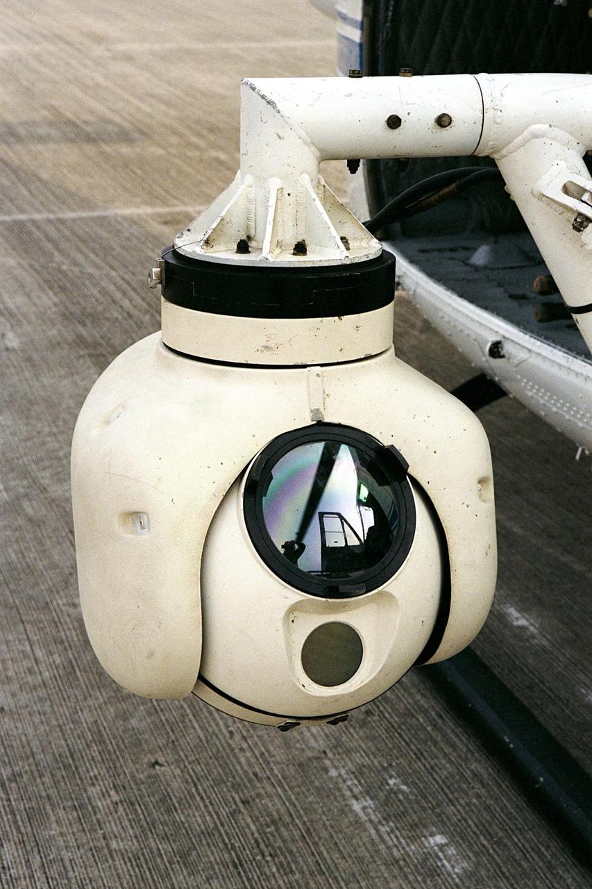
KENNEDY SPACE CENTER, FLA. -- A beach ball-sized infrared camera, part of the Forward Looking Infrared Radar (FLIR), has been mounted on the right siderail of NASA's Huey UH-1 helicopter. The helicopter has also been outfitted with a portable global positioning satellite (GPS) system to support Florida's Division of Forestry as they fight the brush fires which have been plaguing the state as a result of extremely dry conditions and lightning storms. The FLIR also includes a real-time television monitor and recorder installed inside the helicopter. While the FLIR collects temperature data and images, the GPS system provides the exact coordinates of the fires being observed and transmits the data to the firefighters on the ground. The Kennedy Space Center (KSC) security team routinely uses the FLIR equipment prior to Shuttle launch and landing activities to ensure that the area surrounding the launch pad and runway are clear of unauthorized personnel. KSC's Base Operations Contractor, EG&G Florida, operates the NASA-owned helicopter
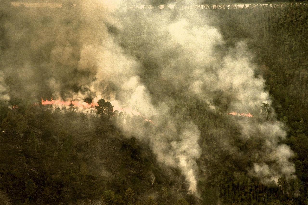
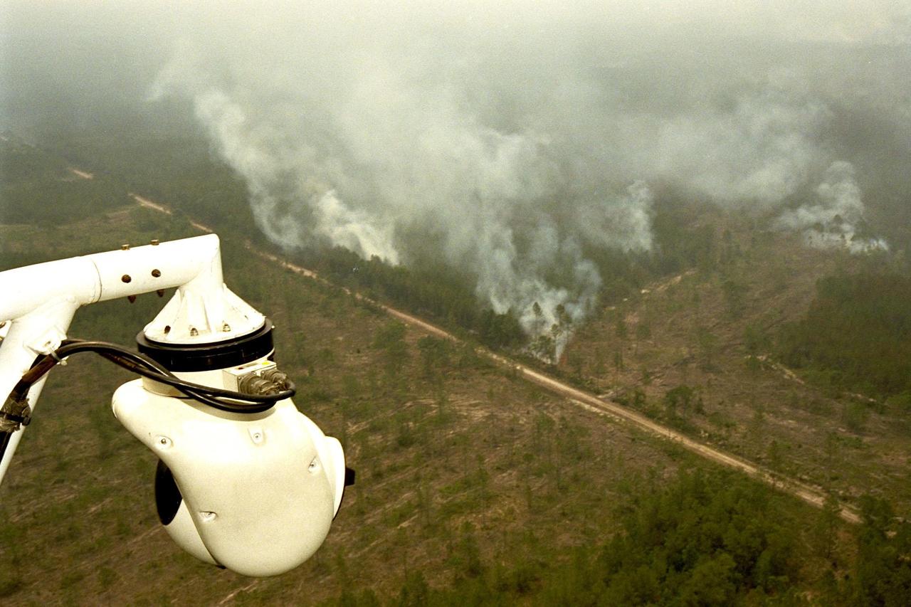
KENNEDY SPACE CENTER, FLA. -- A forest fire burning in Volusia County, Florida, is clearly visible from NASA's Huey UH-1 helicopter. The helicopter has been outfitted with a Forward Looking Infrared Radar (FLIR) and a portable global positioning satellite (GPS) system to support Florida's Division of Forestry as they fight the brush fires which have been plaguing the state as a result of extremely dry conditions and lightning storms. The FLIR includes a beach ball-sized infrared camera that is mounted on the helicopter's right siderail and a real-time television monitor and recorder installed inside. While the FLIR collects temperature data and images, the GPS system provides the exact coordinates of the fires being observed and transmits the data to the firefighters on the ground. The Kennedy Space Center (KSC) security team routinely uses the FLIR equipment prior to Shuttle launch and landing activities to ensure that the area surrounding the launch pad and runway are clear of unauthorized personnel. KSC's Base Operations Contractor, EG&G Florida, operates the NASA-owned helicopter
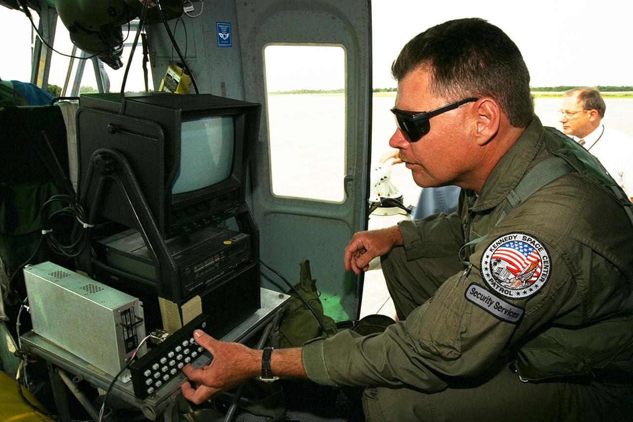
KENNEDY SPACE CENTER, FLA. -- Sgt. Mark Hines, of Kennedy Space Center (KSC) Security, checks out equipment used to operate the Forward Looking Infrared Radar (FLIR) installed on NASA's Huey UH-1 helicopter. The helicopter has also been outfitted with a portable global positioning satellite (GPS) system to support Florida's Division of Forestry as they fight the brush fires which have been plaguing the state as a result of extremely dry conditions and lightning storms. The FLIR includes a beach ball-sized infrared camera that is mounted on the helicopter's right siderail and a real-time television monitor and recorder installed inside. While the FLIR collects temperature data and images, the GPS system provides the exact coordinates of the fires being observed and transmits the data to the firefighters on the ground. KSC's security team routinely uses the FLIR equipment prior to Shuttle launch and landing activities to ensure that the area surrounding the launch pad and runway are clear of unauthorized personnel. KSC's Base Operations Contractor, EG&G Florida, operates the NASA-owned helicopter
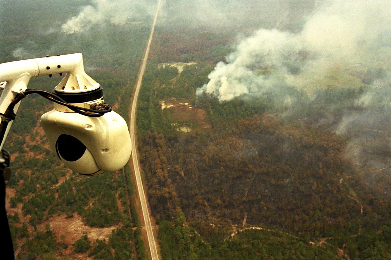
KENNEDY SPACE CENTER, FLA. -- A beach ball-sized infrared camera, part of the Forward Looking Infrared Radar (FLIR), has been mounted on the right siderail of NASA's Huey UH-1 helicopter and is being used to scan a large area of Volusia County, Florida, where a fire burns. The helicopter has also been outfitted with a portable global positioning satellite (GPS) system to support Florida's Division of Forestry as they fight the brush fires which have been plaguing the state as a result of extremely dry conditions and lightning storms. The FLIR also includes a real-time television monitor and recorder installed inside the helicopter. While the FLIR collects temperature data and images, the GPS system provides the exact coordinates of the fires being observed and transmits the data to the firefighters on the ground. The Kennedy Space Center (KSC) security team routinely uses the FLIR equipment prior to Shuttle launch and landing activities to ensure that the area surrounding the launch pad and runway are clear of unauthorized personnel. KSC's Base Operations Contractor, EG&G Florida, operates the NASA-owned helicopter
KENNEDY SPACE CENTER, FLA. -- A beach ball-sized infrared camera, part of the Forward Looking Infrared Radar (FLIR), has been mounted on the right siderail of NASA's Huey UH-1 helicopter. A KSC pilot prepares to fly the helicopter, which has also been outfitted with a portable global positioning satellite (GPS) system, to support Florida's Division of Forestry as they fight the brush fires which have been plaguing the state as a result of extremely dry conditions and lightning storms. The FLIR also includes a real-time television monitor and recorder installed inside the helicopter. While the FLIR collects temperature data and images, the GPS system provides the exact coordinates of the fires being observed and transmits the data to the firefighters on the ground. The Kennedy Space Center (KSC) security team routinely uses the FLIR equipment prior to Shuttle launch and landing activities to ensure that the area surrounding the launch pad and runway are clear of unauthorized personnel. KSC's Base Operations Contractor, EG&G Florida, operates the NASA-owned helicopter
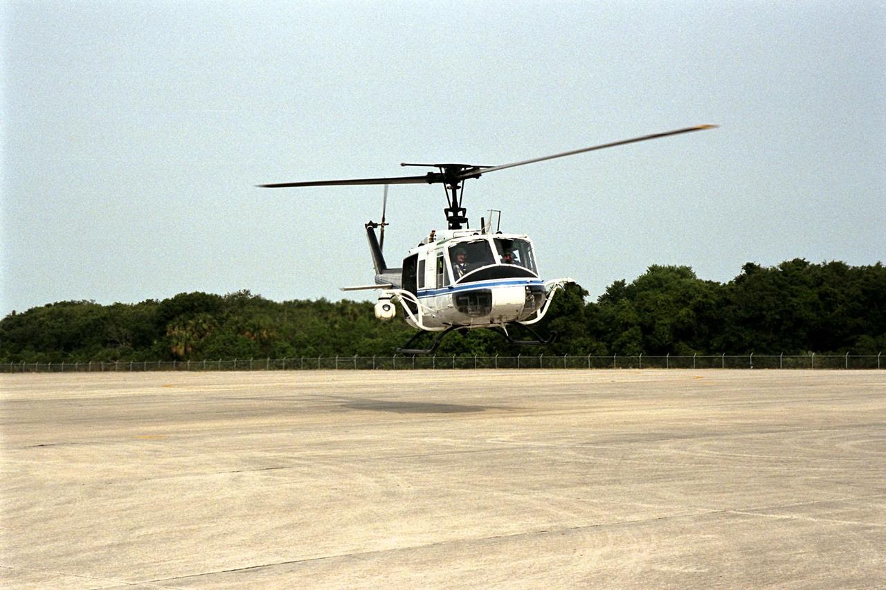
KENNEDY SPACE CENTER, FLA. -- NASA's Huey UH-1 helicopter lands at the Shuttle Landing Facility to pick up Kennedy Space Center (KSC) Security personnel who operate the Forward Looking Infrared Radar (FLIR) installed on board. The helicopter has also been outfitted with a portable global positioning satellite (GPS) system to support Florida's Division of Forestry as they fight the brush fires which have been plaguing the state as a result of extremely dry conditions and lightning storms. The FLIR includes a beach ball-sized infrared camera that is mounted on the helicopter's right siderail and a real-time television monitor and recorder installed inside. While the FLIR collects temperature data and images, the GPS system provides the exact coordinates of the fires being observed and transmits the data to the firefighters on the ground. KSC's security team routinely uses the FLIR equipment prior to Shuttle launch and landing activities to ensure that the area surrounding the launch pad and runway are clear of unauthorized personnel. KSC's Base Operations Contractor, EG&G Florida, operates the NASA-owned helicopter
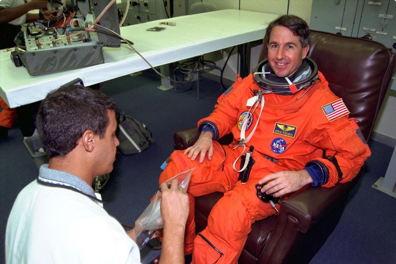
STS-85 Mission Specialist Stephen K. Robinson smiles as he is assisted with his ascent/reentry flight suit by a suit technician in the Operations and Checkout (O&C) Building. He has been a NASA employee since 1975 and has worked at Ames and Langley Research Centers. Robinson holds a doctorate in mechanical engineering and is a licensed pilot. He will assist Mission Specialist Robert L. Curbeam, Jr. with the Cryogenic Infrared Spectrometers and Telescopes for the Atmosphere-Shuttle Pallet Satellite-2 (CRISTA-SPAS-2) free-flyer and conduct Comet Hale-Bopp observations with the Southwest Ultraviolet Imaging System. Robinson will also coordinate photo and television data operations during the mission. The primary payload aboard the Space Shuttle orbiter Discovery is the CRISTA-SPAS2. Other payloads on the 11-day mission include the Manipulator Flight Demonstration (MFD), and Technology Applications and Science-1 (TAS-1) and International Extreme Ultraviolet Hitchhiker-2 (IEH-2) experiments