The THEMIS camera contains 5 filters. The data from different filters can be combined in multiple ways to create a false color image. These false color images may reveal subtle variations of the surface not easily identified in a single band image. Today's false color image shows part of Terby Crater. Orbit Number: 43440 Latitude: -27.3622 Longitude: 73.7577 Instrument: VIS Captured: 2011-09-30 02:20 http://photojournal.jpl.nasa.gov/catalog/PIA20990

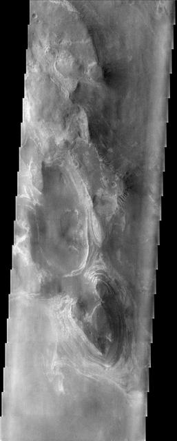
Layers in Terby Crater
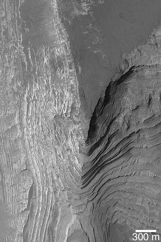
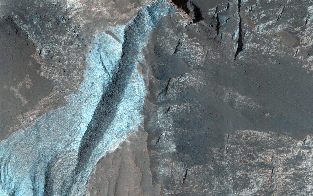
Cliff in Terby Crater
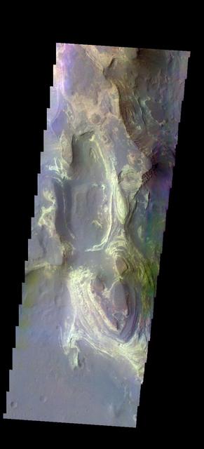
Terby Crater Layers
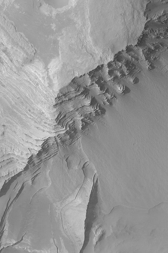
Layers in Terby Crater
This image shows some of the eroded, layered crater fill material within Terby Crater.
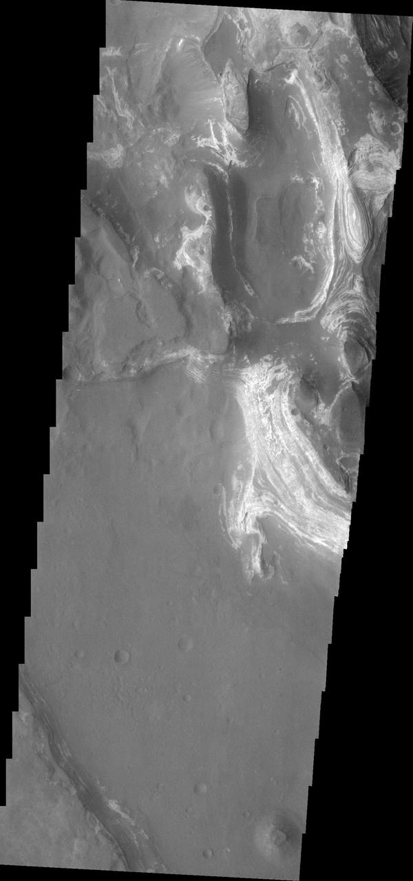
Perched on the northern rim of the enormous Hellas Basin, Terby Crater, imaged by NASA Mars Odyssey, is host to an impressive range of landforms. As is common for many Martian craters, Terby has been filled with layered material, presumably sediments. The process of erosion has exposed some of these layers along with strange, rectilinear ridges. Sinuous channels, collapse pits, and a scoured-looking cap rock are some of the other interesting landforms in Terby. Such a variety of landforms attests to a diversity of rock types and geologic processes in the relatively small area of this THEMIS image. http://photojournal.jpl.nasa.gov/catalog/PIA04024
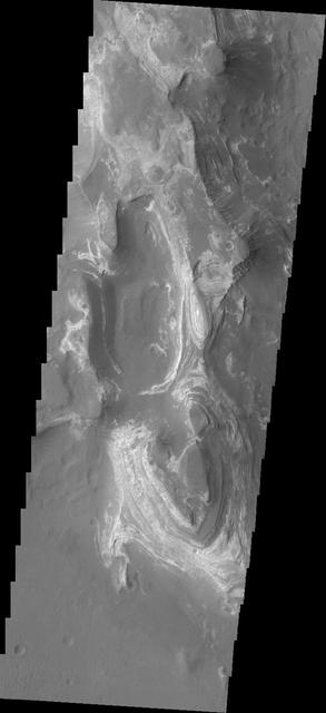
This image shows from NASA 2001 Mars Odyssey spacecraft some of the layered deposits in Terby Crater.
Multiple layers of material are located in Terby Crater in this image from NASA 2001 Mars Odyssey.
This somewhat cloudy image from NASA Mars Odyssey spacecraft shows a stunning example of layered deposits in Terby crater, just north of the Hellas impact basin.
Terby Crater, sitting on the northern rim of Hellas Basin, has been filled by sedimentary deposits, perhaps deposited by or in water, as observed by NASA Mars Reconnaissance Orbiter.
The THEMIS camera contains 5 filters. The data from different filters can be combined in multiple ways to create a false color image. These false color images may reveal subtle variations of the surface not easily identified in a single band image. Today's false color image shows the northern part of Terby Crater. This image shows the layered deposits that fill the crater. Orbit Number: 42741 Latitude: -27.348 Longitude: 74.2507 Instrument: VIS Captured: 2011-08-03 13:23 http://photojournal.jpl.nasa.gov/catalog/PIA20795
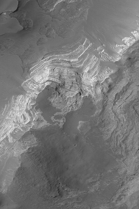
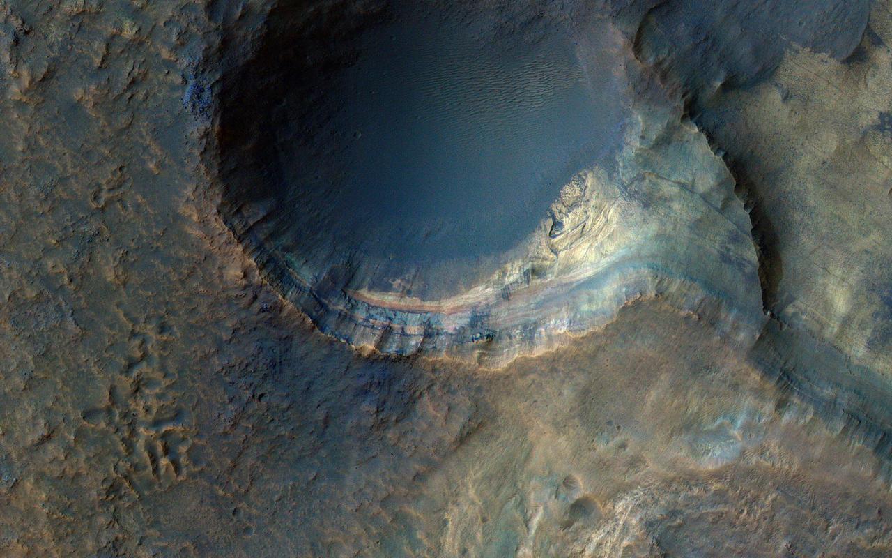
This image from NASA's Mars Reconnaissance Orbiter shows the north-facing wall of a moat-like depression in the middle of Terby Crater, exposing a beautiful 400 meter-high sequence of light-toned, repetitive sedimentary layers. These deposits are often obscured by darker-toned patches of material as well as ripples and dunes. The deposits in Terby, located on the northern rim of Hellas Planitia, are consistent with deposition in a standing body of water. The layers have been proposed as science targets for future landed missions. https://photojournal.jpl.nasa.gov/catalog/PIA21952
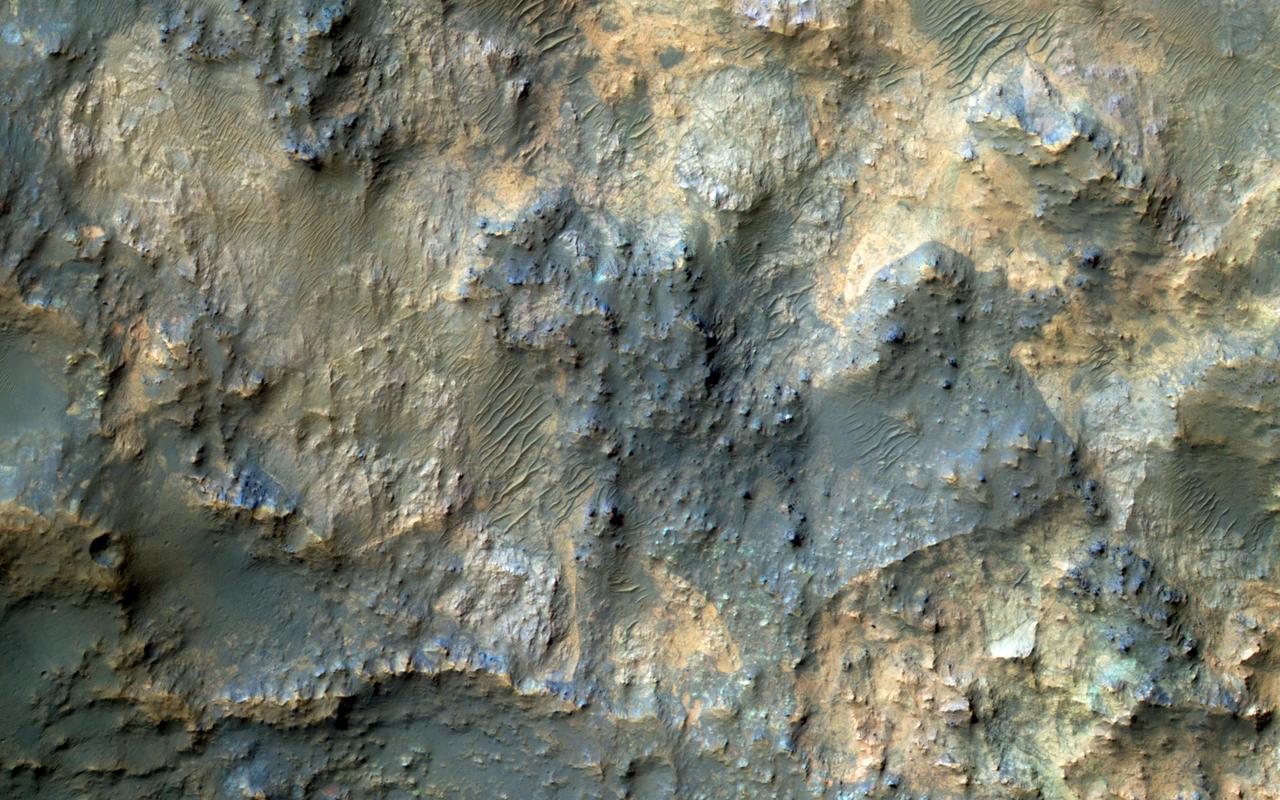
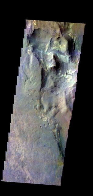
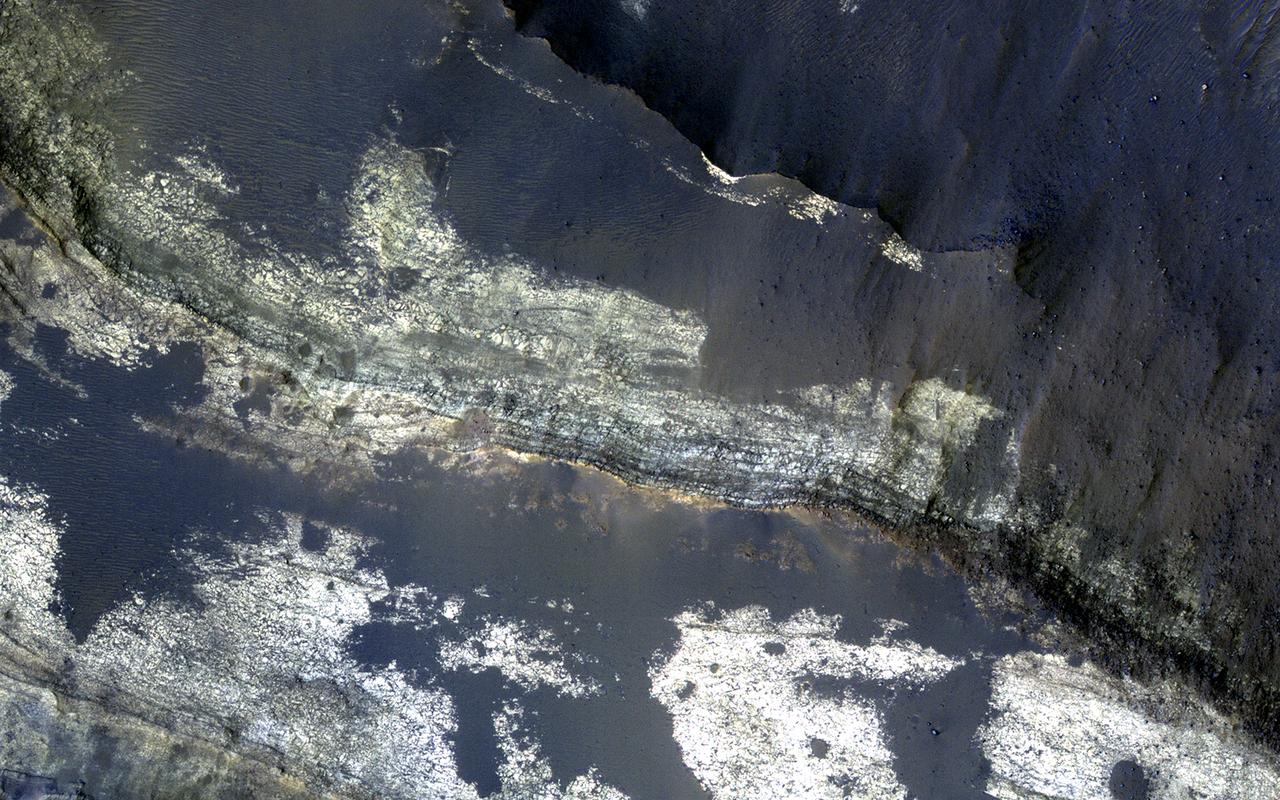
This image samples the excellent bedrock exposures north of Terby Crater, which lies on the northern rim of the giant Hellas basin. An enhanced-color cutout shows a sample of this bedrock, which has a variety of colors and textures. The warm-colored bedrock probably contains hydrated minerals such as clays, whereas the blue-green bedrock is dominated by unaltered mafic minerals. These may be some of the oldest rocks exposed at the Martian surface. Such ancient rocks are extremely rare on Earth. http://photojournal.jpl.nasa.gov/catalog/PIA20737
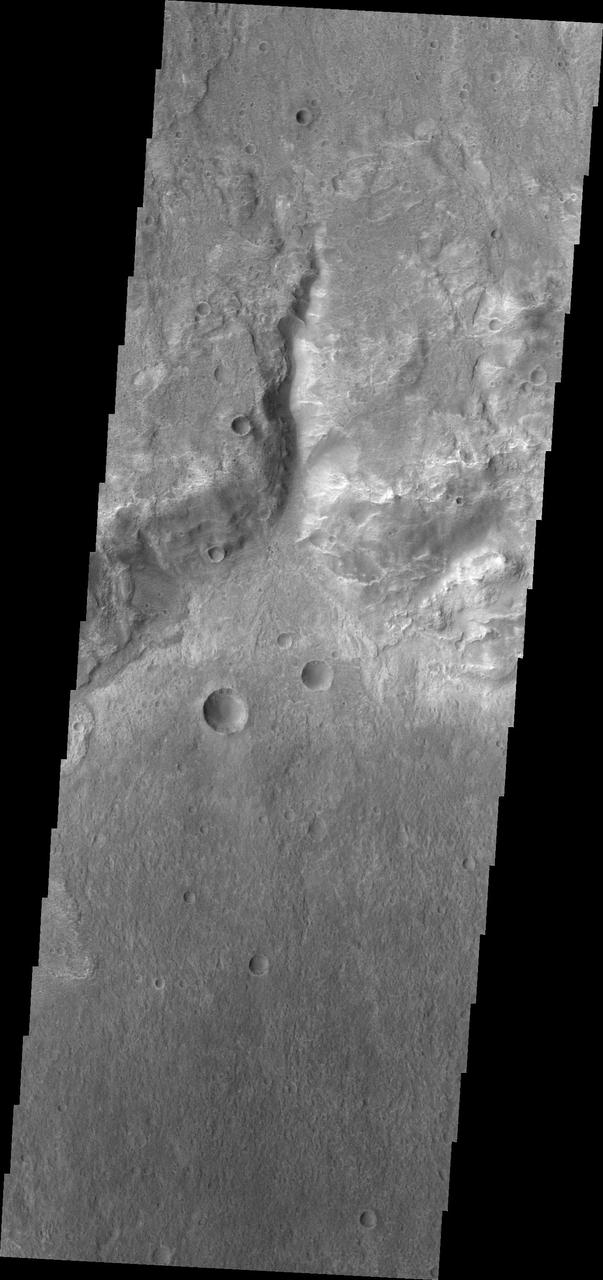
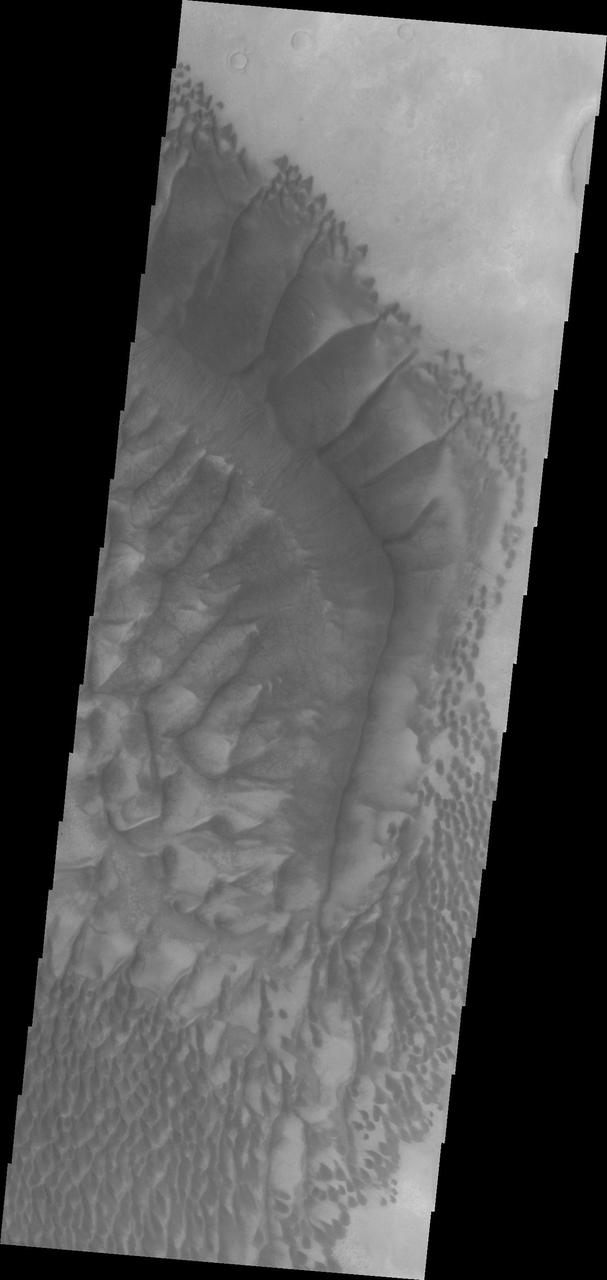
This small channel dissects the rim of an unnamed crater north of Terby Crater and Hellas Planitia as seen by NASA 2001 Mars Odyssey spacecraft.
The sedimentary history of Mars is important to understanding climate change and the evolution of Mars. Sedimentary rocks consist of fine particles carried by the atmosphere and/or water and deposited in generally flat-lying layers, which become indurated (turn into rock) over time. This image covers some steep slopes with good exposures of the bedrock layers, revealing diverse color and textures. A detailed study of many such exposures along with compositional data can be used to reconstruct the sequence of events and interpret the geologic history. https://photojournal.jpl.nasa.gov/catalog/PIA25354