Promethei Terra
Promethei Terra
Terra Sirenum
Terra Sirenum
Tempe Terra
Tempe Terra
Arabia Terra
Arabia Terra
Tempe Terra
Tempe Terra
Tempe Terra
Tempe Terra
Terra Sabaea
Terra Sabaea
Tempe Terra
Tempe Terra
Terra Sabaea
Terra Sabaea
This image from NASA 2001 Mars Odyssey spacecraft is of an unnamed crater in Terra Sirenum. There are gullies dissecting part of the crater rim, and small dunes on the crater floor.  Orbit Number: 66334 Latitude: -43.8989 Longitude: 194.906 Instrument: VIS Captured: 2016-11-26 19:49  http://photojournal.jpl.nasa.gov/catalog/PIA21289
Terra Sirenum
On Oct. 23, 2011, when this image from NASA Terra spacecraft was acquired, flood waters were approaching the capital city of Bangkok as the Ayutthaya River overflowed its banks.
NASA Terra Spacecraft Images Thailand Flooding
Plosky Tolbachik volcano, in Russia far eastern Kamchatka peninsula, erupted on Nov. 27, 2012 for the first time in 35 years, sending clouds of ash almost 10,000 feet into the sky. This image was acquired by NASA Terra spacecraft.
NASA Terra Spacecraft Captures Russian Volcano Eruption
This VIS image shows a group of craters in Terra Sirenum. The elongate crater in the top half of the image has numerous gullies dissecting the inner crater rim as will has channels that have dissected the block of material near the center of the crater. It appears that these channel are possible extensions of the rim gullies.  Orbit Number: 65324 Latitude: -37.7922 Longitude: 186.323 Instrument: VIS Captured: 2016-09-04 14:55  http://photojournal.jpl.nasa.gov/catalog/PIA21154
Terra Sirenum
On Jan. 16, 2014, NASA Terra spacecraft acquired this image of a wildfire broke that out in the mountains above the Los Angeles suburbs of Glendora and Azusa.
NASA Terra Spacecraft Images Destructive Colby Fire East of Los Angeles
The channel in this image captured by NASA 2001 Mars Odyssey spacecraft is located in Terra Sirenum.  Orbit Number: 65935 Latitude: -34.327 Longitude: 190.432 Instrument: VIS Captured: 2016-10-24 22:57  http://photojournal.jpl.nasa.gov/catalog/PIA21190
Terra Sirenum Channel
This VIS image shows several channels in and around unnamed craters in Noachis Terra.  Orbit Number: 66252 Latitude: -38.0339 Longitude: 40.923 Instrument: VIS Captured: 2016-11-20 01:43  http://photojournal.jpl.nasa.gov/catalog/PIA21286
Noachis Terra Channels
Numerous channels dissect the higher elevation material at the top of this image. This image captured by NASA 2001 Mars Odyssey spacecraft is located in Noachis Terra.  Orbit Number: 65679 Latitude: -25.5077 Longitude: 18.2562 Instrument: VIS Captured: 2016-10-03 20:51  http://photojournal.jpl.nasa.gov/catalog/PIA21179
Noachis Terra Channels
Today's VIS image shows part of Noachis Terra, including several large dunes on the floor of an unnamed crater.  Orbit Number: 66203 Latitude: -52.1314 Longitude: 17.9281 Instrument: VIS Captured: 2016-11-16 00:45  http://photojournal.jpl.nasa.gov/catalog/PIA21285
Noachis Terra Dunes
Plosky Tolbachik volcano in Russia far eastern Kamchatka peninsula erupted on Nov. 27, 2012, for the first time in 35 years, sending clouds of ash to the height of more than 9,800 feet 3,000 meters in this image from NASA Terra spacecraft.
NASA Terra Spacecraft Images Russian Volcanic Eruption
On Oct. 6, 2018, NASA's Terra satellite became one of a handful of NASA satellite ever to complete 100,000 orbits. Launched in 1999, Terra and its five scientific instruments were originally slated to last six years. More than 18 years later, the Multi-angle Imaging SpectroRadiometer (MISR), built by NASA's Jet Propulsion Laboratory in Pasadena, California, and other instruments on Terra are still collecting data and are expected to continue into the 2020s, limited only by the amount of fuel in the spacecraft.  MISR carries nine cameras that view the sunlit Earth simultaneously at widely spaced angles, providing global coverage with high spatial detail. The left image shows dusk falling over snowy Queen Maud Land, Antarctica, at the end of orbit 99,999, as captured by MISR's 70-degree backward-looking camera. On the right is MISR's first view from orbit 100,000, taken by its 70-degree forward-looking camera as sunrise illuminated clouds over the Kara Sea, north of Siberia.  Over the years, researchers have used MISR's observations to construct a variety of global data sets that have advanced our understanding of Earth. These include the heights of clouds and wildfire smoke, the amounts of dangerous pollutants in the atmosphere, the movements of global wind systems, and the health of vegetation. The instrument remains as healthy as it was in 1999.  https://photojournal.jpl.nasa.gov/catalog/PIA22836
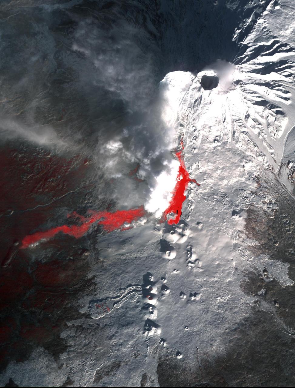
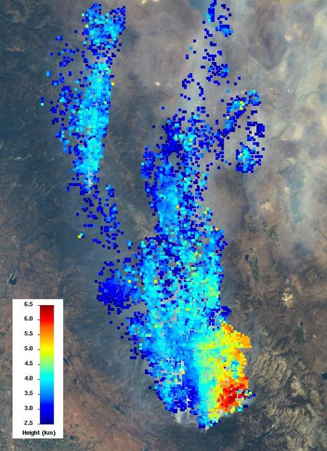
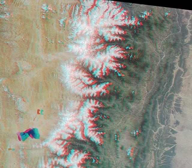
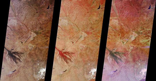
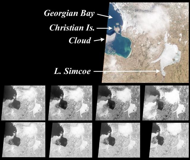
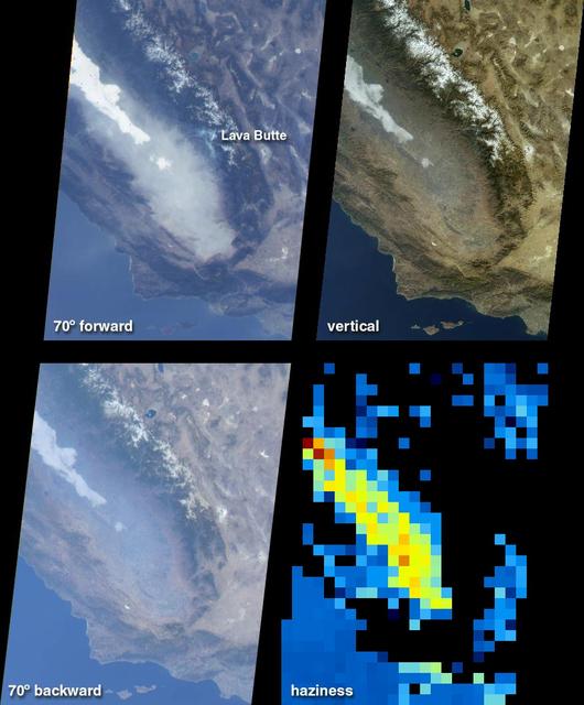
MISR Records the View as NASA's Terra Satellite Passes Its 100,000th Orbit
NASA Terra spacecraft provided this view of the eastern part of Grand Canyon National Park in northern Arizona in this image on July 14, 2011. This view looks to the west, with tourist facilities of Grand Canyon Village visible in the upper left.
A Spacebird-eye View of the Grand Canyon from NASA Terra Spacecraft
This image from the MISR instrument onboard NASA Terra spacecraft shows a 121-by-165-mile 194-by-266 kilometer portion of California Rim fire where the smoke is the thickest.
NASA Terra Spacecraft Measures Height of California Rim Fire Smoke Plumes
This VIS image shows two craters in Terra Cimmeria. The inner crater impacted at some time after the outer crater was created. The rim of the smaller, interior crater has several gullies on the south facing side.  Orbit Number: 65039 Latitude: -40.5002 Longitude: 132.389 Instrument: VIS Captured: 2016-08-12 03:28  http://photojournal.jpl.nasa.gov/catalog/PIA20999
Terra Cimmeria Craters
Terra Cimmeria Dunes
Troughs in Tempe Terra
Dunes in Aonia Terra IR
Gullied Trough in Noachis Terra
Xanthe Terra Landslide in IR
Arabia Terra Crater
Arabia Terra Crater
Day And Night In Terra Meridiani
Seasonal Frost in Terra Sirenum
Dunes in Noachis Terra
Aonia Terra Dunes
Aonia Terra Dunes
Dune Fields of Terra Cimmeria
Northeast Arabia Terra
Terra Cimmeria Dunes VIS
The Plains of Central Terra Meridiani
Dunes in Aonia Terra VIS
Terra Sirenum Crater
Gullies in Sirenum Terra, Mars
Northeast Arabia Terra
Terra Sirenum Gullies
More Terra Sabaea
More Terra Sabaea
Terra Cimmeria Dunes
Devil Den in Terra Sirenum
Dunes in Terra Cimmeria
Gullies in Terra Sirenum
Gullies and... Gullies? in Terra Sirenum
Terra Cimmeria Dunes IR
Terra Sirenum Slope
Terra Sirenum Slope
Aonia Terra Dunes VIS
Slope Streaks in Terra Sabaea
Crater Edge in Terra Sirenum
Dunes in Noachis Terra
Terra Sabaea Channel
Small Volcano in Tempe Terra
Terra Cimmeria Crater Landslide
Sand Dunes in Noachis Terra
The Chesapeake region as seen by NASA Terra satellite, near local noon on July 17, 2001 Terra orbit 8407.
A CLAMS-Eye View of Earth
Lake Manicouagan in northern Quebec, Canada, as seen by NASA Terra satellite on June 1, 2001, during Terra orbit 7737.
Manicouagan Impact Structure, Quebec
This image from NASA Terra satellite ofYugoslavia was acquired on July 28, 2000 during Terra orbit 3248.
MISR Looks at Yugoslavia
These images from NASA Terra satellite images are of southern Florida were acquired on October 18, 2000 Terra orbit 4446.
MISR Views Southern Florida
The Nile River was captured by NASA Terra satellite on January 30, 2001 Terra orbit 5956. The Nile is the longest river in the world.
The Nile
NASA Mars Reconnaissance Orbiter observed a small portion of a dark crater floor in the Tyrrhena Terra region of Mars. This is largely ancient hard bedrock that has been cratered by numerous impacts over the eons.  http://photojournal.jpl.nasa.gov/catalog/PIA11179
Hard Knocks in Tyrrhena Terra
The THEMIS VIS camera contains 5 filters. The data from different filters can be combined in multiple ways to create a false color image. These false color images may reveal subtle variations of the surface not easily identified in a single band image. Today's false color image shows part of Terra Sabaea.  Orbit Number: 45137 Latitude: 18.9344 Longitude: 75.7307 Instrument: VIS Captured: 2012-02-16 20:17  http://photojournal.jpl.nasa.gov/catalog/PIA21169
Terra Sabaea - False Color
The THEMIS VIS camera contains 5 filters. The data from different filters can be combined in multiple ways to create a false color image. These false color images may reveal subtle variations of the surface not easily identified in a single band image. Today's false color image shows part of the plains of Terra Sabaea.  Orbit Number: 49034 Latitude: -25.4878 Longitude: 44.1368 Instrument: VIS Captured: 2013-01-02 12:26  http://photojournal.jpl.nasa.gov/catalog/PIA21200
Terra Sabaea - False Color
The THEMIS VIS camera contains 5 filters. The data from different filters can be combined in multiple ways to create a false color image. These false color images may reveal subtle variations of the surface not easily identified in a single band image. Today's false color image shows some of the plains of Margaritifer Terra.  Orbit Number: 51484 Latitude: -19.1306 Longitude: 331.896 Instrument: VIS Captured: 2013-07-23 03:11  http://photojournal.jpl.nasa.gov/catalog/PIA21309
Margaritifer Terra - False Color
The THEMIS VIS camera contains 5 filters. The data from different filters can be combined in multiple ways to create a false color image. These false color images may reveal subtle variations of the surface not easily identified in a single band image. Today's false color images shows part of the plains and craters of Terra Sirenum.  Orbit Number: 59298 Latitude: -48.8967 Longitude: 184.212 Instrument: VIS Captured: 2015-04-27 07:56  https://photojournal.jpl.nasa.gov/catalog/PIA21670
Terra Sirenum - False Color
The THEMIS VIS camera contains 5 filters. The data from different filters can be combined in multiple ways to create a false color image. These false color images may reveal subtle variations of the surface not easily identified in a single band image. Today's false color image shows part of the plains of Terra Cimmeria.  Orbit Number: 59219 Latitude: -9.46406 Longitude: 128.617 Instrument: VIS Captured: 2015-04-20 19:09  https://photojournal.jpl.nasa.gov/catalog/PIA21668
Terra Cimmeria - False Color
The THEMIS VIS camera contains 5 filters. The data from different filters can be combined in multiple ways to create a false color image. These false color images may reveal subtle variations of the surface not easily identified in a single band image. Today's false color image shows part of the plains and craters in Terra Sirenum.  Orbit Number: 59228 Latitude: -37.9211 Longitude: 224.753 Instrument: VIS Captured: 2015-04-21 13:06  https://photojournal.jpl.nasa.gov/catalog/PIA21669
Terra Sirenum - False Color
The THEMIS VIS camera contains 5 filters. The data from different filters can be combined in multiple ways to create a false color image. These false color images may reveal subtle variations of the surface not easily identified in a single band image. Today's false color image shows dust devil tracks (dark blue linear feature) in Terra Cimmeria.  Orbit Number: 43463 Latitude: -53.1551 Longitude: 125.069 Instrument: VIS Captured: 2011-10-01 23:55  http://photojournal.jpl.nasa.gov/catalog/PIA21009
Terra Cimmeria - False Color
The THEMIS VIS camera contains 5 filters. The data from different filters can be combined in multiple ways to create a false color image. These false color images may reveal subtle variations of the surface not easily identified in a single band image. Today's false color image shows part of the plains of Margaritifer Terra.  Orbit Number: 52108 Latitude: -12.6683 Longitude: 344.894 Instrument: VIS Captured: 2013-09-12 11:25  http://photojournal.jpl.nasa.gov/catalog/PIA21508
Margaritifer Terra - False Color
The THEMIS VIS camera contains 5 filters. The data from different filters can be combined in multiple ways to create a false color image. These false color images may reveal subtle variations of the surface not easily identified in a single band image. Today's false color image shows some of the extensive plains that comprise Terra Sabaea.  Orbit Number: 50907 Latitude: -24.7157 Longitude: 44.6408 Instrument: VIS Captured: 2013-06-05 15:43  http://photojournal.jpl.nasa.gov/catalog/PIA21281
Terra Sabaea - False Color
The THEMIS camera contains 5 filters. The data from different filters can be combined in multiple ways to create a false color image. These false color images may reveal subtle variations of the surface not easily identified in a single band image. Today's false color image shows part of the plains of Tyrrhena Terra.  Orbit Number: 43315 Latitude: -25.3184 Longitude: 78.9694 Instrument: VIS Captured: 2011-09-19 19:23  http://photojournal.jpl.nasa.gov/catalog/PIA20985
Tyrrhena Terra - False Color
The THEMIS VIS camera contains 5 filters. The data from different filters can be combined in multiple ways to create a false color image. These false color images may reveal subtle variations of the surface not easily identified in a single band image. Today's false color image shows part of the plains and highlands of Terra Sirenum.  Orbit Number: 59752 Latitude: -37.1173 Longitude: 228.666 Instrument: VIS Captured: 2015-06-03 16:39  https://photojournal.jpl.nasa.gov/catalog/PIA21786
Terra Sirenum - False Color
The THEMIS VIS camera contains 5 filters. The data from different filters can be combined in multiple ways to create a false color image. These false color images may reveal subtle variations of the surface not easily identified in a single band image. Today's false color image shows part of the plains of Tyrrhena Terra.  Orbit Number: 43764 Latitude: -19.5412 Longitude: 91.4825 Instrument: VIS Captured: 2011-10-26 18:19  http://photojournal.jpl.nasa.gov/catalog/PIA21016
Tyrrhena Terra - False Color
The THEMIS VIS camera contains 5 filters. The data from different filters can be combined in multiple ways to create a false color image. These false color images may reveal subtle variations of the surface not easily identified in a single band image. Today's false color images shows part of the plains and craters of Terra Cimmeria.  Orbit Number: 59405 Latitude: -38.6916 Longitude: 158.645 Instrument: VIS Captured: 2015-05-06 02:53  https://photojournal.jpl.nasa.gov/catalog/PIA21671
Terra Cimmeria - False Color
The THEMIS VIS camera contains 5 filters. The data from different filters can be combined in multiple ways to create a false color image. These false color images may reveal subtle variations of the surface not easily identified in a single band image. Today's false color image shows part of the plains of Margaritifer Terra.  Orbit Number: 52021 Latitude: -18.9842 Longitude: 332.027 Instrument: VIS Captured: 2013-09-05 07:38  http://photojournal.jpl.nasa.gov/catalog/PIA21506
Margaritifer Terra - False Color
The THEMIS camera contains 5 filters. The data from different filters can be combined in multiple ways to create a false color image. These false color images may reveal subtle variations of the surface not easily identified in a single band image. Today's false color image shows part of the plains of Noachis Terra.  Orbit Number: 43006 Latitude: -38.3345 Longitude: 349.255 Instrument: VIS Captured: 2011-08-25 09:00  http://photojournal.jpl.nasa.gov/catalog/PIA20976
Noachis Terra - False Color
The THEMIS camera contains 5 filters. The data from different filters can be combined in multiple ways to create a false color image. These false color images may reveal subtle variations of the surface not easily identified in a single band image. Today's false color image shows part of the plains of Terra Cimmeria.  Orbit Number: 43426 Latitude: -15.9541 Longitude: 119.282 Instrument: VIS Captured: 2011-09-28 22:37  http://photojournal.jpl.nasa.gov/catalog/PIA20989
Terra Cimmeria - False Color
The THEMIS camera contains 5 filters. The data from different filters can be combined in multiple ways to create a false color image.l These false color images may reveal subtle variations of the surface not easily identified in a single band image. Today's false color image shows part of the plains of Terra Sirenum.  Orbit Number: 42973 Latitude: -38.8923 Longitude: 220.888 Instrument: VIS Captured: 2011-08-22 15:49  http://photojournal.jpl.nasa.gov/catalog/PIA20975
Terra Sirenum - False Color
The THEMIS VIS camera contains 5 filters. The data from different filters can be combined in multiple ways to create a false color image. These false color images may reveal subtle variations of the surface not easily identified in a single band image. Today's false color image shows part of the plains in Terra Sabaea.  Orbit Number: 43466 Latitude: -24.3218 Longitude: 44.5089 Instrument: VIS Captured: 2011-10-02 05:41  http://photojournal.jpl.nasa.gov/catalog/PIA21010
Terra Sabaea - False Color
At 14,505 feet high, Mt. Whitney, the highest point in the contiguous U.S., is located in California Sierra Nevada Mountains, on the west side of Owens Valley. The Alabama Hills appear in the foreground of this image from NASA Terra spacecraft.
NASA Terra Spacecraft Views Mt. Whitney, the Highest Point in the Contiguous United States
This image acquired by NASA Terra spacecraft is of Mount Etna, on the Italian island of Sicily, Europe most active volcano, where its latest series of eruptions has continued for weeks.
Lava Flows from Latest Eruption of Mount Etna Spotted by NASA Terra Spacecraft
This visible image of California Rim Fire was acquired Aug. 23, 2013 by the Multi-angle Imaging SpectroRadiometer MISR instrument on NASA Terra spacecraft, showing extensive, brownish smoke.
NASA Terra Spacecraft Eyes Smoke Plumes from Massive Rim Fire Near Yosemite
Northern Arizona and the Grand Canyon are captured in this pair of images from December 31, 2000 as seen by NASA Terra satellite Terra orbit 5525.
The Grand Canyon
This colorful image of the Arctic National Wildlife Refuge and the Beaufort Sea was acquired by the NASA Terra satellite on August 16, 2000, during Terra orbit 3532.
Summer in the Arctic National Wildlife Refuge
These images of mixing waters and moving ships off the North Carolina Coast were acquired by NASA Terra satellite on October 11, 2000 Terra orbit 4344.
Mixing Waters and Moving Ships off the North Carolina Coast
The Tibetan Plateau and a portion of the Himalayan Mountain chain are captured in this stereo image acptured by NASA Terra satellite May 14, 2000 Terra orbit 2153.
Roof of the World and the Abode of Snow
This illustration features images of southern California and southwestern Nevada acquired by NASA Terra satellite on January 3, 2001 Terra orbit 5569.
Fog and Haze in California San Joaquin Valley
These images from NASA Terra satellite images of Oklahoma and north Texas were acquired on March 12, 2000 during Terra orbit 1243.
MISR Scans the Texas-Oklahoma Border
These images from NASA Terra satellite images of Zambia and Botswana, Africa were acquired on August 25, 2000 during Terra orbit 3655.
MISR Images Zambia and Botswana
These images from NASA Terra satellite are of tropical northern Australia acquired on June 1, 2000 Terra orbit 2413 during the long dry season.
MISR Views Northern Australia
This pair of images from NASA Terra satellite are of the Pine Island Glacier in western Antarctica, acquired on December 12, 2000 during Terra orbit 5246.
Pine Island Glacier, Antarctica
These images, centered just north of Shikoku Island in southwest Japan, were acquired by NASA Terra satellite on April 13, 2001 during Terra orbit 7015.
MISR Participates in Aerosol Characterization Experiment over Asia
These images from NASA Terra satellite are of the southeast portion of Georgian Bay in Ontario, Canada, acquired on March 6, 2000, during Terra orbit 1155.
MISR View of Georgian Bay, Ontario, Canada
These images from NASA Terra satellite images of the Ntwetwe and Sua Pans in northeastern Botswana were acquired on August 18, 2000 Terra orbit 3553.
MISR Images Northeastern Botswana
This image is a natural-color view of the Celtic Sea and English Channel regions, and was acquired by NASA Terra satellite on June 4, 2001 during Terra orbit 7778.
Coccoliths in the Celtic Sea
This satellite image, taken by NASA's Earth-observing Terra satellite on Aug. 18, 2019, shows the ECOSTRESS study area in the Amazon Basin and smoke from active fires in the rainforest. ECOSTRESS also captured an image of the Amazon rainforest, PIA23432, revealing water-stressed and non-stressed forest in the area. The water-stressed areas of the forest look as green and healthy as these cooler areas, making them invisible except to a radiometer that can measure thermal infrared energy from the surface.  https://photojournal.jpl.nasa.gov/catalog/PIA23546
NASA Terra Satellite Sees Amazon Fires in Peru
The Soberanes fire, in northern California near Big Sur, had grown to more than 27,000 acres when the Advanced Spaceborne Thermal Emission and Reflection Radiometer (ASTER) instrument on NASA's Terra spacecraft captured this image on July 28, 2016. More than 3,000 personnel are battling the blaze, that is only 10 percent contained. The fire has destroyed 36 homes and caused one fatality. Evacuation orders were issued for a number of nearby communities. The image covers an area of 29 by 30 miles (46 by 48 kilometers), and is located at 36.4 degrees north, 121.8 degrees west.   http://photojournal.jpl.nasa.gov/catalog/PIA20722
Destructive Wildfire Near Big Sur, California Captured NASA Terra Satellite