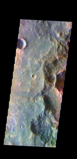
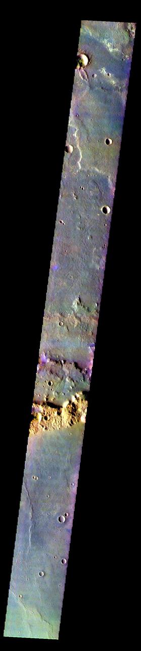
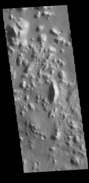
This VIS image shows two craters in Terra Cimmeria. The inner crater impacted at some time after the outer crater was created. The rim of the smaller, interior crater has several gullies on the south facing side. Orbit Number: 65039 Latitude: -40.5002 Longitude: 132.389 Instrument: VIS Captured: 2016-08-12 03:28 http://photojournal.jpl.nasa.gov/catalog/PIA20999
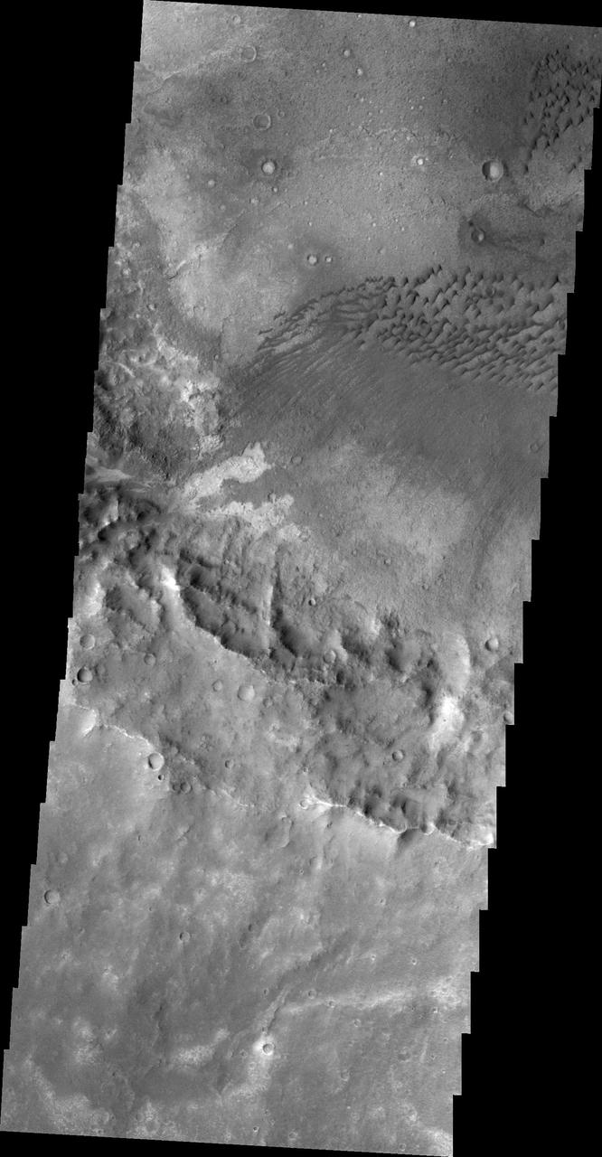
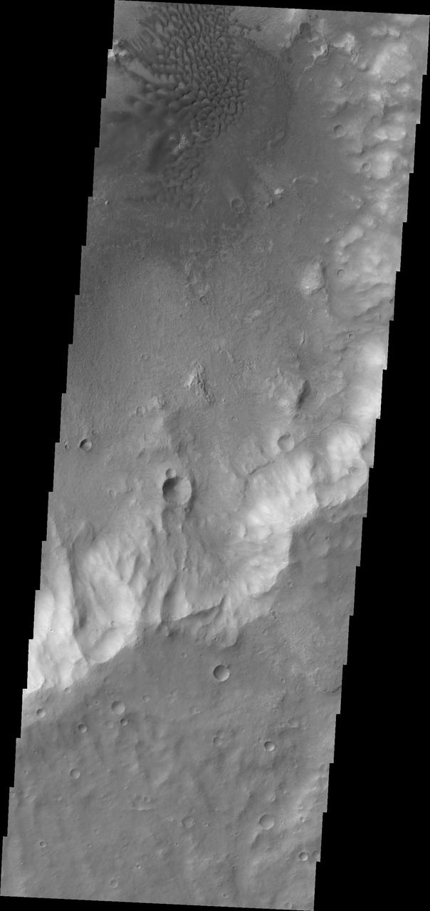
Dune Fields of Terra Cimmeria
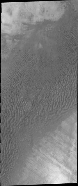
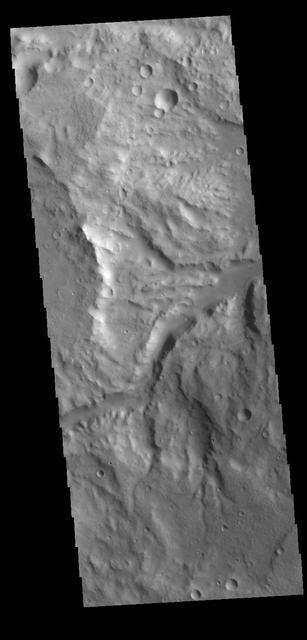
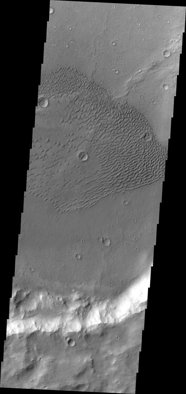
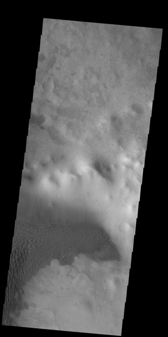
Dunes in Terra Cimmeria
Terra Cimmeria Dunes
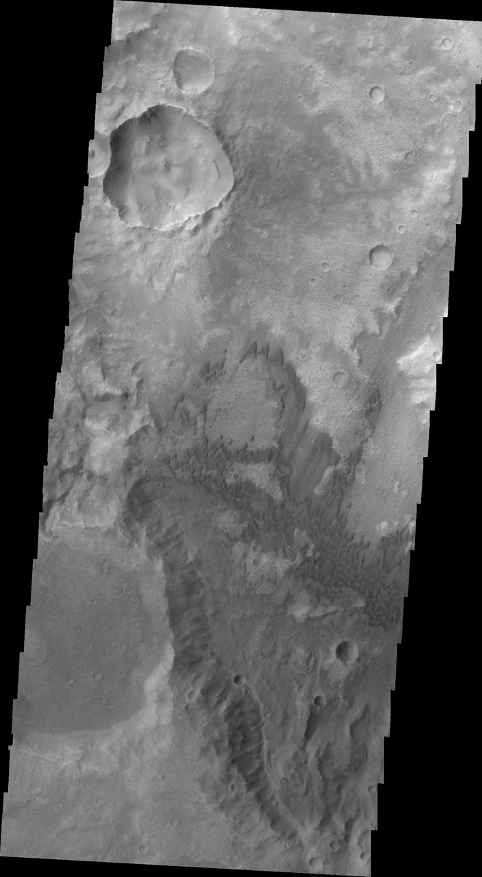
Terra Cimmeria Crater Landslide
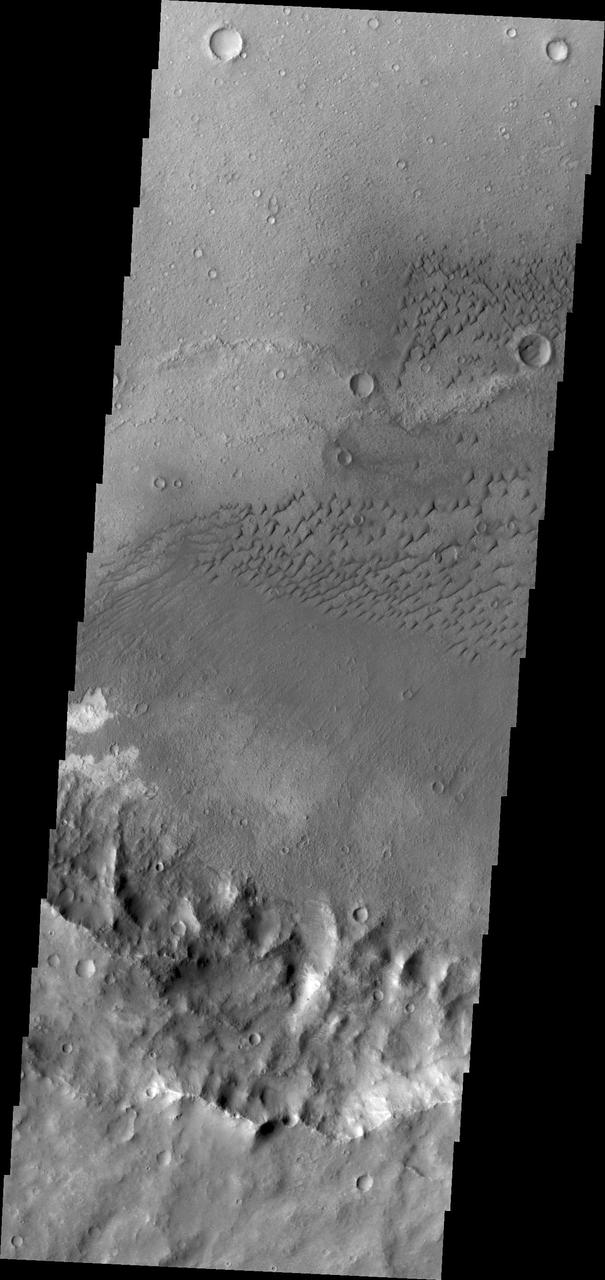
Terra Cimmeria Dunes
Terra Cimmeria Dunes VIS
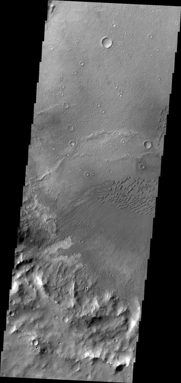
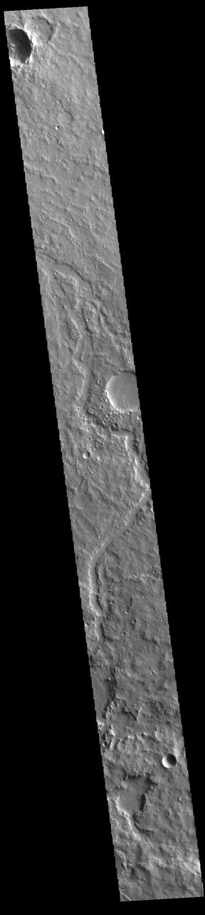
Terra Cimmeria Dunes IR
The THEMIS camera contains 5 filters. The data from different filters can be combined in multiple ways to create a false color image. These false color images may reveal subtle variations of the surface not easily identified in a single band image. Today's false color image shows part of the plains of Terra Cimmeria. Orbit Number: 43426 Latitude: -15.9541 Longitude: 119.282 Instrument: VIS Captured: 2011-09-28 22:37 http://photojournal.jpl.nasa.gov/catalog/PIA20989
The THEMIS VIS camera contains 5 filters. The data from different filters can be combined in multiple ways to create a false color image. These false color images may reveal subtle variations of the surface not easily identified in a single band image. Today's false color image shows part of the plains of Terra Cimmeria. Orbit Number: 59219 Latitude: -9.46406 Longitude: 128.617 Instrument: VIS Captured: 2015-04-20 19:09 https://photojournal.jpl.nasa.gov/catalog/PIA21668
The THEMIS VIS camera contains 5 filters. The data from different filters can be combined in multiple ways to create a false color image. These false color images may reveal subtle variations of the surface not easily identified in a single band image. Today's false color images shows part of the plains and craters of Terra Cimmeria. Orbit Number: 59405 Latitude: -38.6916 Longitude: 158.645 Instrument: VIS Captured: 2015-05-06 02:53 https://photojournal.jpl.nasa.gov/catalog/PIA21671
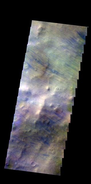
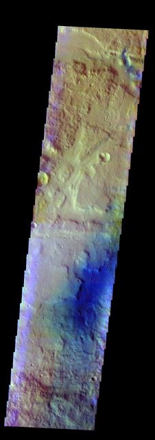
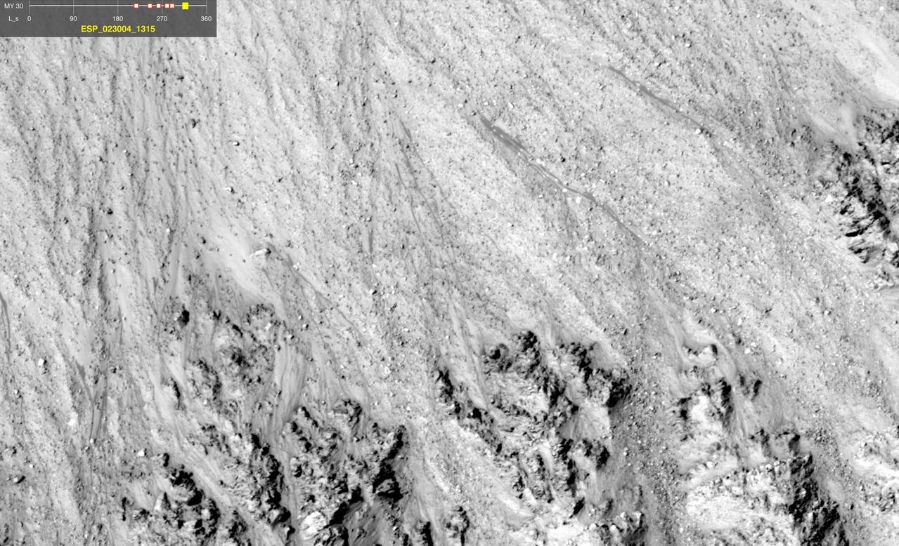
The THEMIS VIS camera contains 5 filters. The data from different filters can be combined in multiple ways to create a false color image. These false color images may reveal subtle variations of the surface not easily identified in a single band image. Today's false color image shows dust devil tracks (dark blue linear feature) in Terra Cimmeria. Orbit Number: 43463 Latitude: -53.1551 Longitude: 125.069 Instrument: VIS Captured: 2011-10-01 23:55 http://photojournal.jpl.nasa.gov/catalog/PIA21009
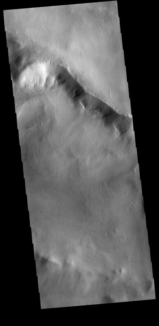
Scarp and Channels in a Crater in Terra Cimmeria
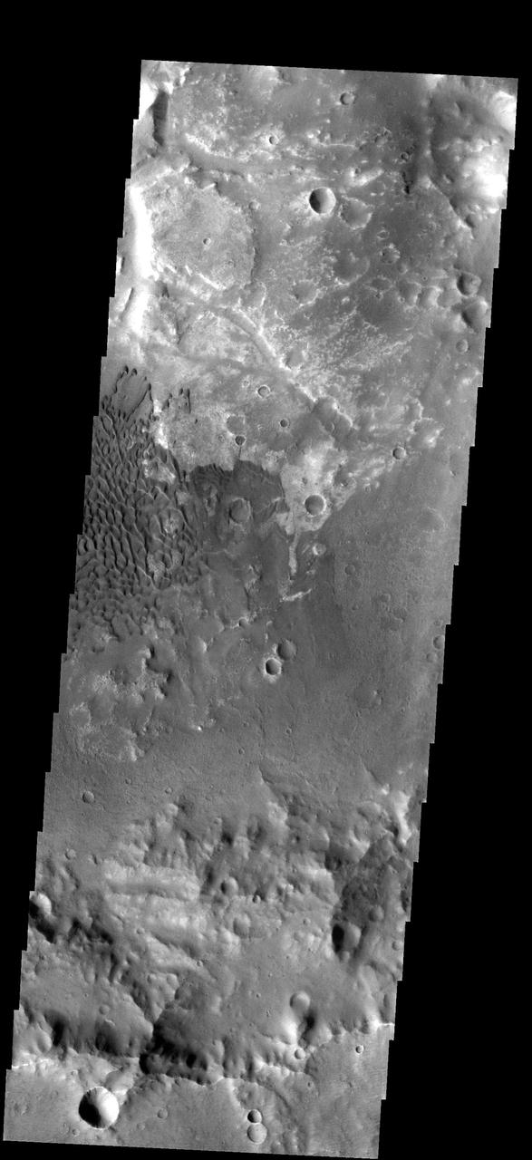
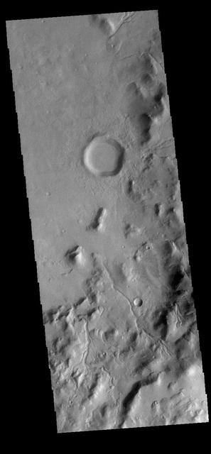
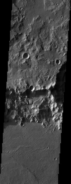
A Myriad of Geologic Processes in Terra Cimmeria
The unnamed channels in this image captured by NASA 2001 Mars Odyssey spacecraft are located in Terra Cimmeria.
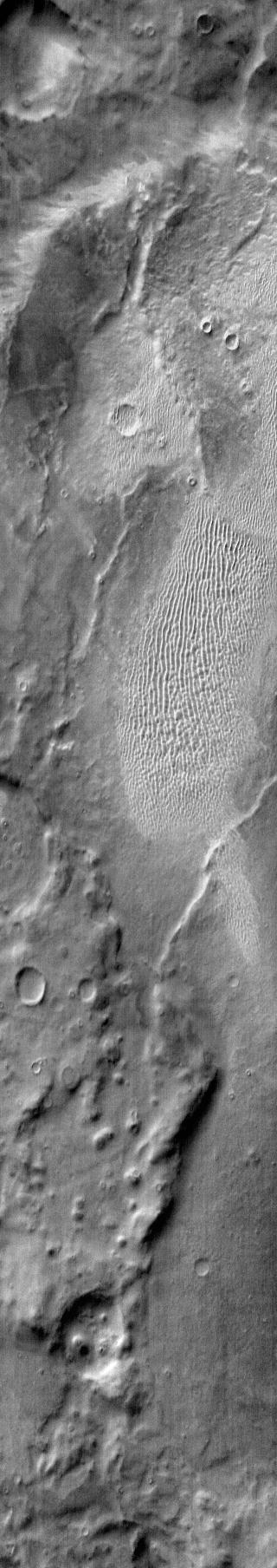
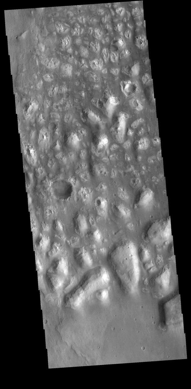
A Complex, Ridged Terrain in North Terra Cimmeria
This VIS image is located in Terra Cimmeria, near the margin with Nepenthes Mensae. The highlands of Terra Cimmeria are at the bottom of the image. Tectonic activity has created fault blocked regions along the highland boundary. With time and erosion, the blocks become isolated mesas, and then the low hills of Nepenthes Mensae. Orbit Number: 78685 Latitude: 1.97703 Longitude: 122.103 Instrument: VIS Captured: 2019-09-10 05:44 https://photojournal.jpl.nasa.gov/catalog/PIA23489
This image of Terra Cimmeria taken by NASA 2001 Mars Odyssey shows channeling and dunes near Herschel Crater.
The dunes in this image from NASA Mars Odyssey are located on the floor of an unnamed crater in Terra Cimmeria.
This subtle, unnamed channel is located in northern Terra Cimmeria as seen by NASA Mars Odyssey.
NASA 2001 Mars Odyssey image shows a field of dark dunes on the floor of an unnamed crater in Terra Cimmeria.
These dunes are located on the floor of an unnamed crater in Terra Cimmeria in this image captured by NASA Mars Odyssey spacecraft.
The dunes in this image captured by NASA 2001 Mars Odyssey are located in an unnamed crater in Terra Cimmeria.
This image from NASA Mars Odyssey shows part of an unnamed channel in Terra Cimmeria.

This 2001 Mars Odyssey daytime infrared image shows dunes found in craters and on the plains of Terra Cimmeria.
A sand dune field is located on the floor of this unnamed crater in Terra Cimmeria by NASA 2001 Mars Odyssey spacecraft.
This image captured by NASA 2001 Mars Odyssey spacecraft shows one of the many unnamed channels in northern Terra Cimmeria.
This image, taken by NASA Mars Odyssey, shows dunes of several sizes in Terra Cimmeria.

This daytime 2001 Mars Odyssey image of Terra Cimmeria shows dunes occurring both on crater floors and on the plains between the craters.
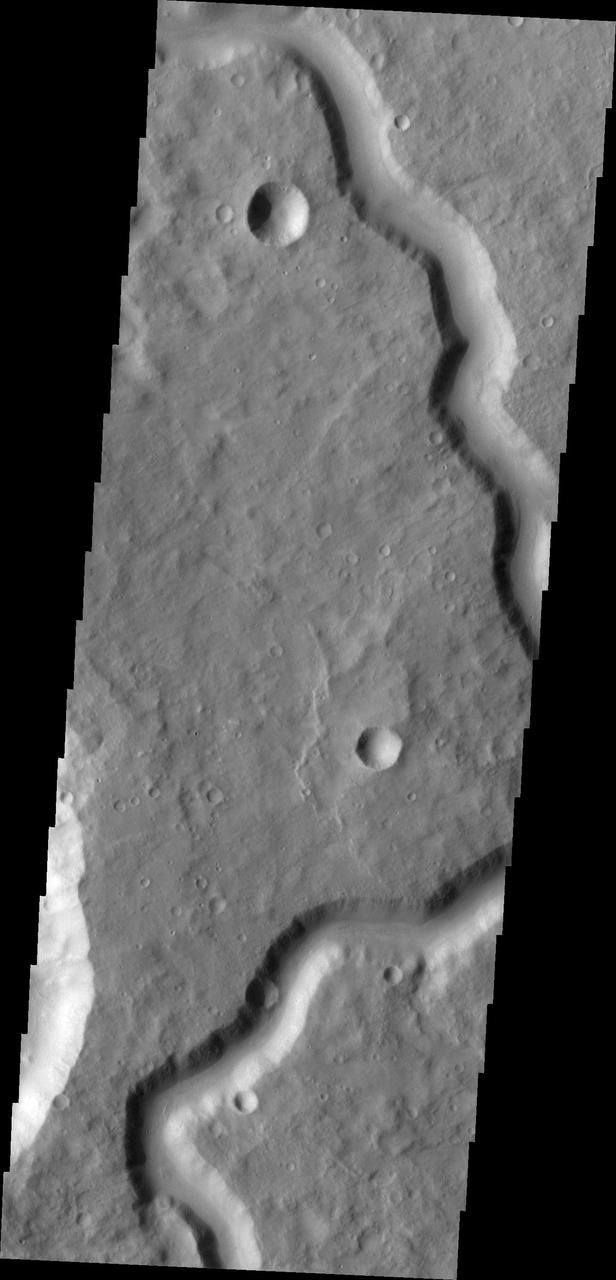
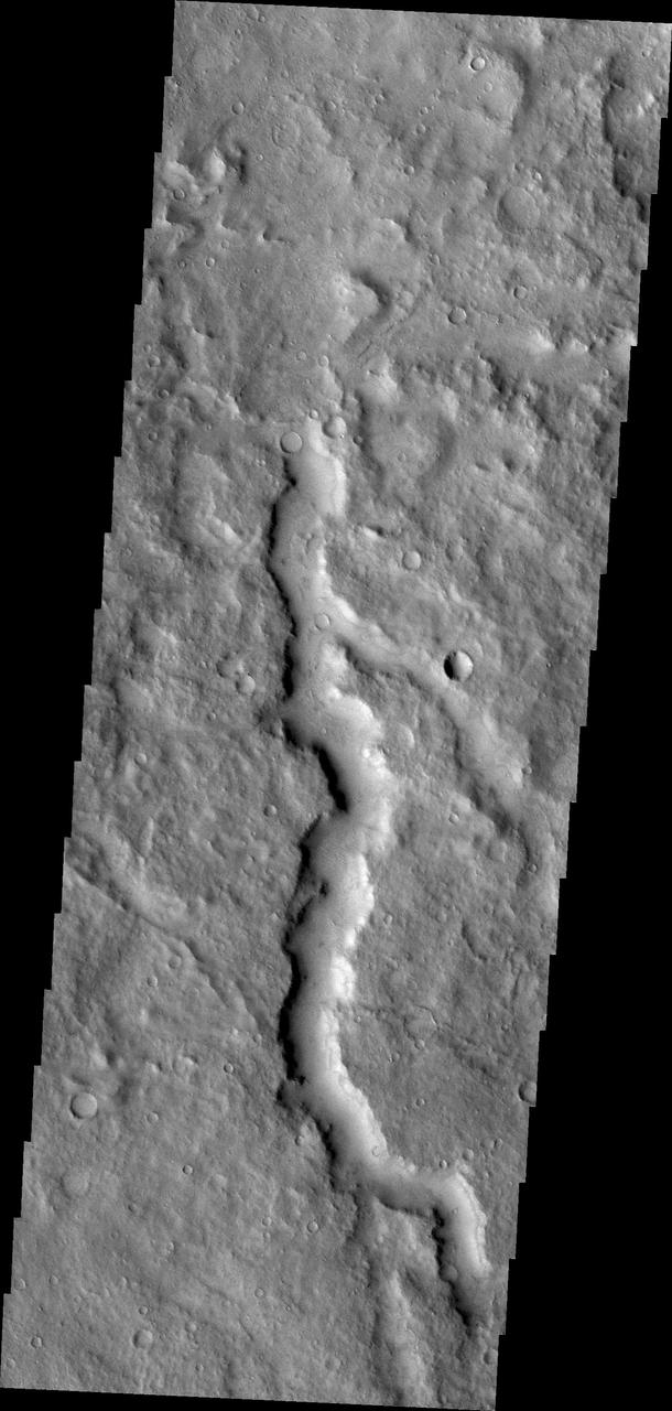
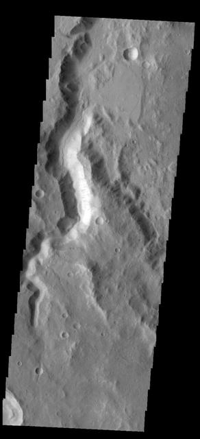
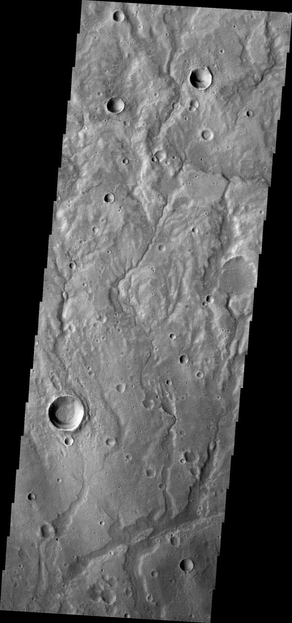
Today's VIS image shows an unnamed channel in Terra Cimmeria. Orbit Number: 87308 Latitude: 2.36838 Longitude: 116.9 Instrument: VIS Captured: 2021-08-20 05:54 https://photojournal.jpl.nasa.gov/catalog/PIA25209

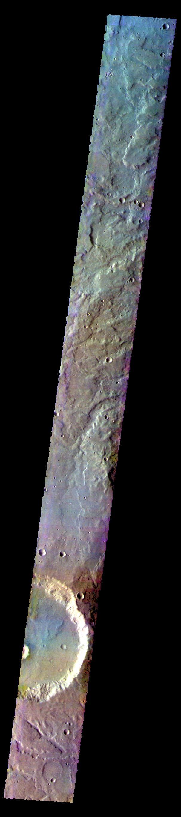
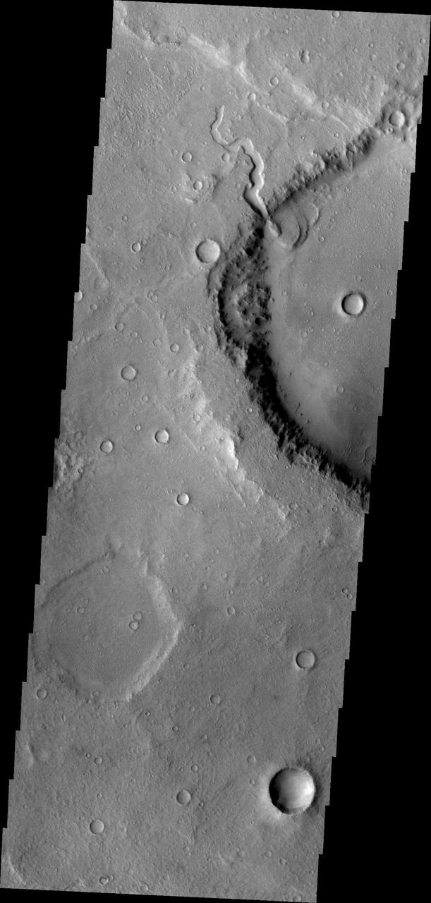
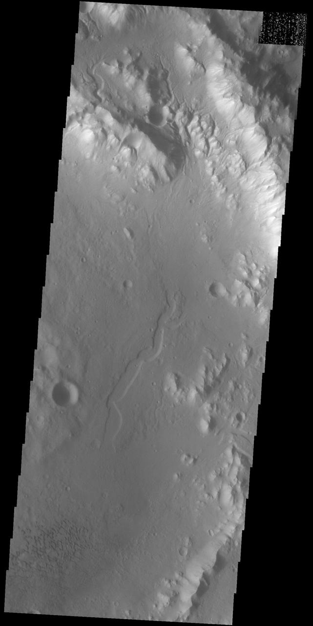
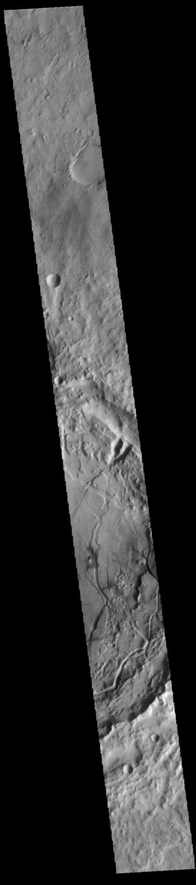
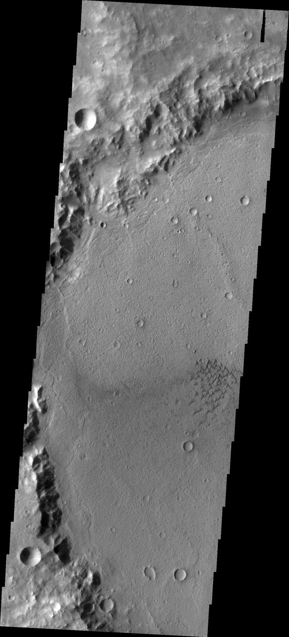
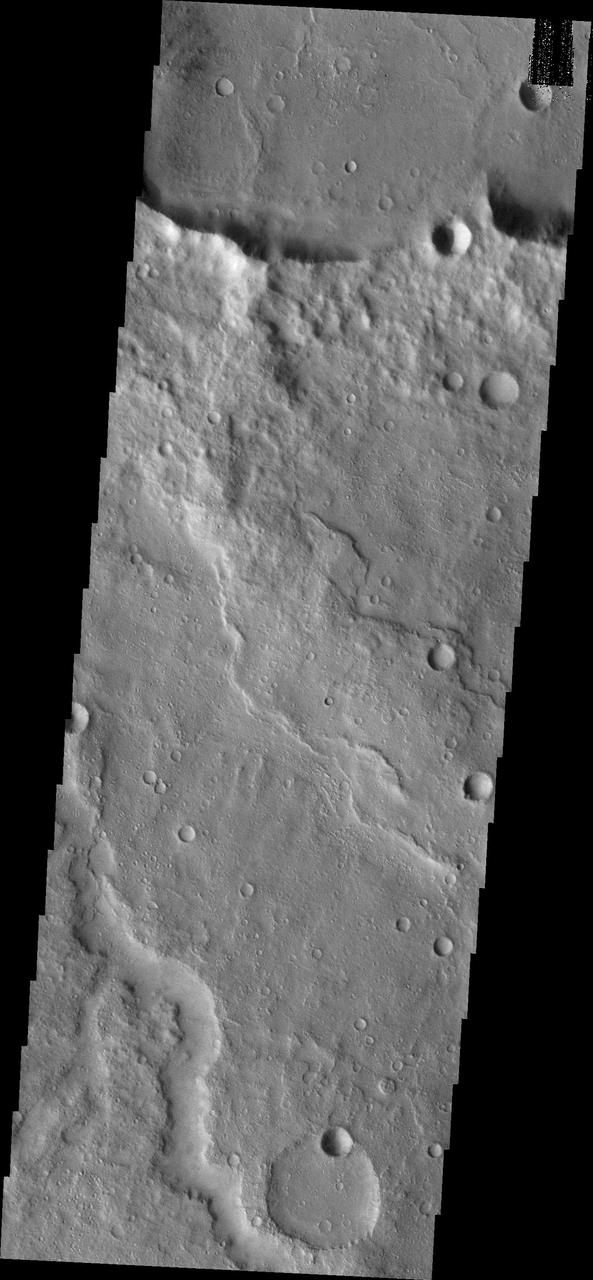
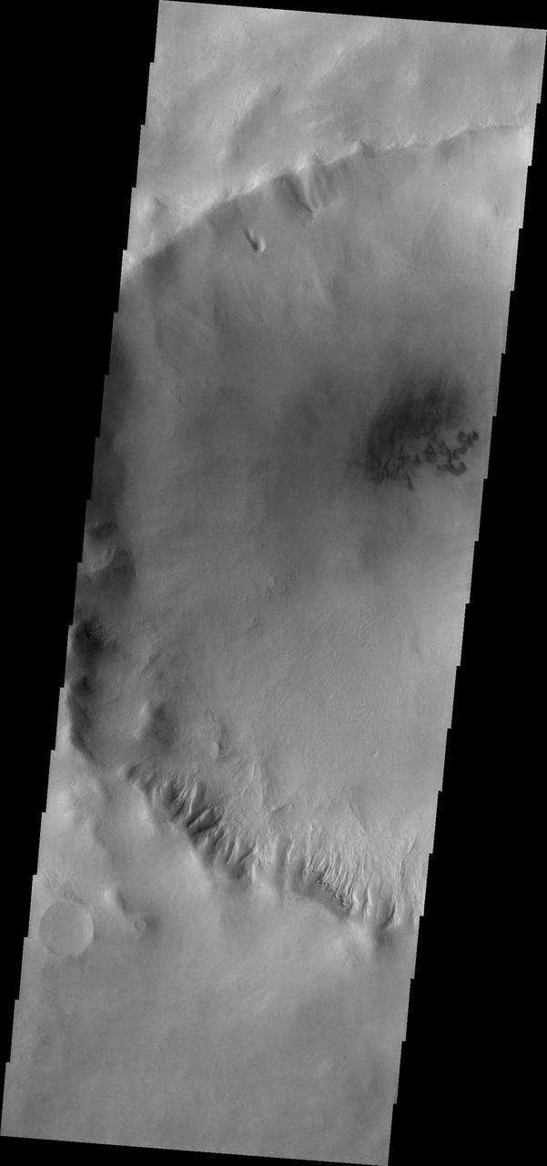
This VIS image shows a portion of eastern Terra Cimmeria. The image contains from bottom to top: a region of hills, part of Sirenum Fossae, channels dissecting a ridge, and a region of linear erosion. The top of the image is higher in elevation than the bottom. Orbit Number: 81703 Latitude: -36.0913 Longitude: 179.445 Instrument: VIS Captured: 2020-05-15 17:36 https://photojournal.jpl.nasa.gov/catalog/PIA24004
Dunes can be seen in the bottom and upper right central parts this image of Terra Cimmeria captured by NASA 2001 Mars Odyssey spacecraft.
Channels are a common feature on the margin of Terra Cimmeria where the elevation changes from highland to northern lowlands in this image captured by NASA Mars Odyssey.
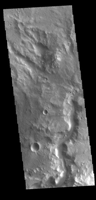
This VIS image shows a section of an unnamed channel in Terra Cimmeria. Orbit Number: 81393 Latitude: -9.10693 Longitude: 118.856 Instrument: VIS Captured: 2020-04-20 05:09 https://photojournal.jpl.nasa.gov/catalog/PIA23958
This VIS image shows a section of an unnamed channel in Terra Cimmeria. Orbit Number: 80781 Latitude: -8.28653 Longitude: 134.422 Instrument: VIS Captured: 2020-02-29 19:45 https://photojournal.jpl.nasa.gov/catalog/PIA23902
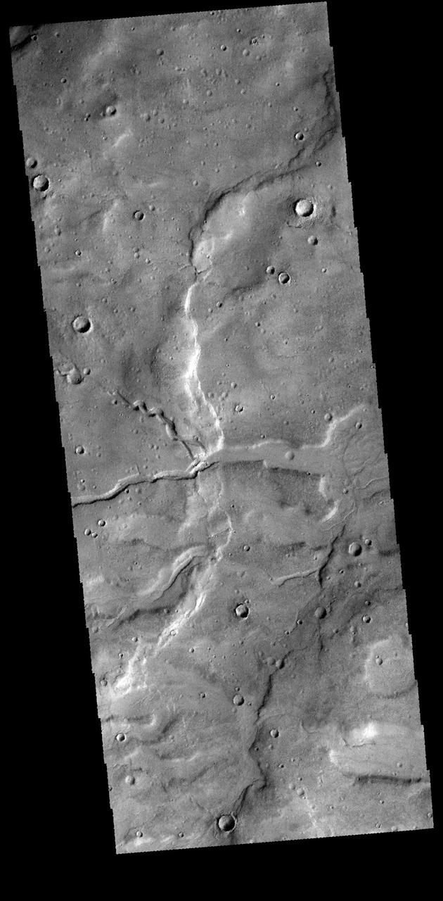
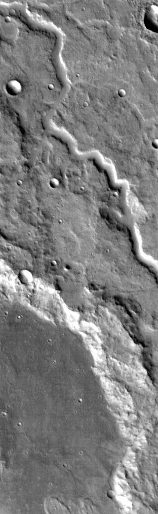
This image of Terra Cimmeria captured by NASA 2001 Mars Odyssey spacecraft shows two channels intersecting to become one larger channel. Orbit Number: 58450 Latitude: -42.1886 Longitude: 165.142 Instrument: VIS Captured: 2015-02-16 12:08 http://photojournal.jpl.nasa.gov/catalog/PIA19281
Today's VIS image shows a portion of an unnamed channel in northern Terra Cimmeria. Orbit Number: 81867 Latitude: -1.64386 Longitude: 123.348 Instrument: VIS Captured: 2020-05-29 05:53 https://photojournal.jpl.nasa.gov/catalog/PIA24083
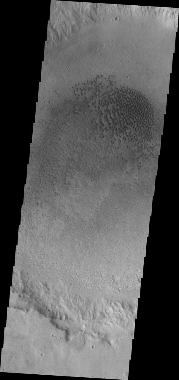
Today's VIS image shows a field of sand dunes on the floor of an unnamed crater in Terra Cimmeria. Orbit Number: 89604 Latitude: -7.58904 Longitude: 119.349 Instrument: VIS Captured: 2022-02-25 07:08 https://photojournal.jpl.nasa.gov/catalog/PIA25401
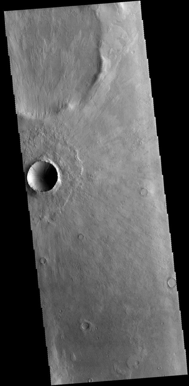
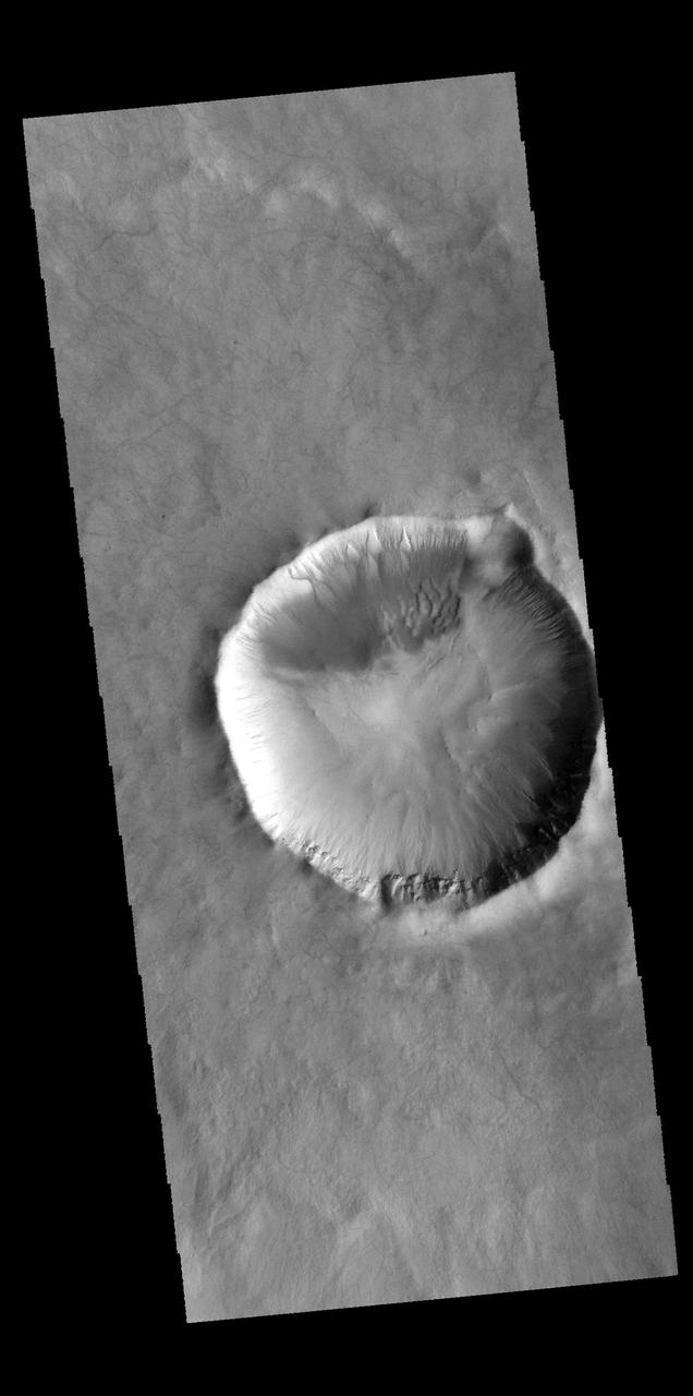
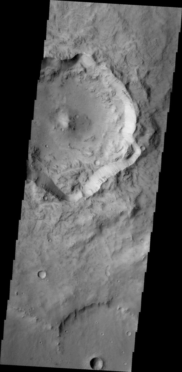
This VIS image shows an unnamed crater in Terra Cimmeria. Note how the ejecta overlays the surrounding terrain, radial to the crater. Orbit Number: 68431 Latitude: -44.3744 Longitude: 139.441 Instrument: VIS Captured: 2017-05-18 14:27 https://photojournal.jpl.nasa.gov/catalog/PIA21789
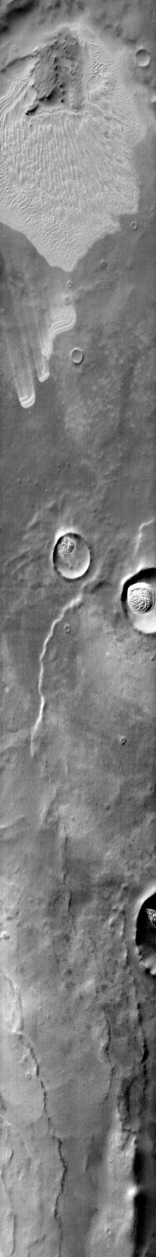
This unnamed crater in northern Terra Cimmeria has a small channel that created a delta feature. Such features are important indicators of liquid water in Mars past as shown in this image from NASA Mars Odyssey.
The THEMIS VIS camera contains 5 filters. The data from different filters can be combined in multiple ways to create a false color image. These false color images may reveal subtle variations of the surface not easily identified in a single band image. Today's false color image shows part of Terra Cimmeria. Orbit Number: 74904 Latitude: -28.5018 Longitude: 141.031 Instrument: VIS Captured: 2018-11-02 20:40 https://photojournal.jpl.nasa.gov/catalog/PIA24557
Today's false color image shows part of Terra Cimmeria. The THEMIS VIS camera contains 5 filters. The data from different filters can be combined in multiple ways to create a false color image. These false color images may reveal subtle variations of the surface not easily identified in a single band image. Orbit Number: 63092 Latitude: -23.8466 Longitude: 158.387 Instrument: VIS Captured: 2016-03-04 18:39 https://photojournal.jpl.nasa.gov/catalog/PIA23216

The THEMIS VIS camera contains 5 filters. The data from different filters can be combined in multiple ways to create a false color image. These false color images may reveal subtle variations of the surface not easily identified in a single band image. Today's VIS image shows plains and craters in Terra Cimmeria. Orbit Number: 60004 Latitude: -39.3417 Longitude: 158.618 Instrument: VIS Captured: 2015-06-24 10:41 https://photojournal.jpl.nasa.gov/catalog/PIA22676
The THEMIS VIS camera contains 5 filters. The data from different filters can be combined in multiple ways to create a false color image. These false color images may reveal subtle variations of the surface not easily identified in a single band image. Today's VIS image shows plains and craters in Terra Cimmeria. Orbit Number: 59979 Latitude: -39.2993 Longitude: 159.815 Instrument: VIS Captured: 2015-06-22 09:17 https://photojournal.jpl.nasa.gov/catalog/PIA22675
This VIS image shows an unnamed channel in Terra Cimmeria. The channel is located immediately outside of the rim of Knobel Crater. Orbit Number: 77674 Latitude: -5.54225 Longitude: 132.393 Instrument: VIS Captured: 2019-06-18 23:37 https://photojournal.jpl.nasa.gov/catalog/PIA23365
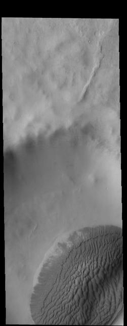
Today's VIS image shows a sand sheet with surface dune forms on the floor of an unnamed crater in Terra Cimmeria. Orbit Number: 67171 Latitude: -64.7606 Longitude: 158.647 Instrument: VIS Captured: 2017-02-03 18:44 https://photojournal.jpl.nasa.gov/catalog/PIA21521
This false color image shows part of Terra Cimmeria. The complexity of the surface is evident in the multiple colors seen in this image. The bright blue-white and lavender spots towards the bottom of the image stand out against the more usual blues and yellows. The THEMIS VIS camera contains 5 filters. The data from different filters can be combined in multiple ways to create a false color image. These false color images may reveal subtle variations of the surface not easily identified in a single band image. Orbit Number: 64802 Latitude: -9.56903 Longitude: 127.898 Instrument: VIS Captured: 2016-07-23 15:06 https://photojournal.jpl.nasa.gov/catalog/PIA23613
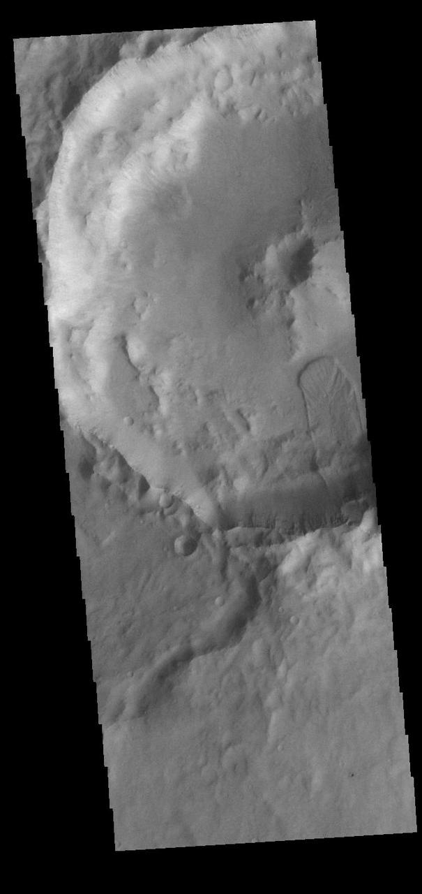
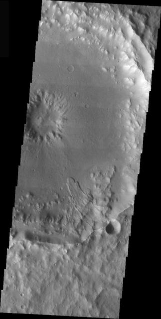
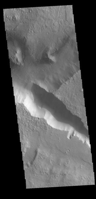
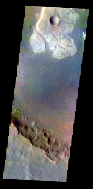
Today's VIS image shows a part of an unnamed crater in Terra Cimmeria. The finger-like projection from the southern rim towards the central peak is a landslide deposit. Orbit Number: 90663 Latitude: -21.8761 Longitude: 169.361 Instrument: VIS Captured: 2022-05-23 11:50 https://photojournal.jpl.nasa.gov/catalog/PIA25478

This 2001 Mars Odyssey image shows sand that has been trapped in several depressions in this region of Terra Cimmeria near the Thyles Rupes.

The THEMIS VIS camera contains 5 filters. The data from different filters can be combined in multiple ways to create a false color image. These false color images may reveal subtle variations of the surface not easily identified in a single band image. Today's false color image shows several craters and plains of Terra Cimmeria. Orbit Number: 59979 Latitude: -39.2993 Longitude: 159.815 Instrument: VIS Captured: 2015-06-22 09:17 https://photojournal.jpl.nasa.gov/catalog/PIA22671
Today's VIS image shows part of an unnamed crater in southern Terra Cimmeria. The rim of the crater is dissected by several channels (top of image) and the floor contains a small group of sand dunes (bottom of image). Orbit Number: 84031 Latitude: -33.338 Longitude: 163.552 Instrument: VIS Captured: 2020-11-23 09:26 https://photojournal.jpl.nasa.gov/catalog/PIA24366

This VIS image shows part of a large unnamed crater in Terra Cimmeria. The THEMIS VIS camera contains 5 filters. The data from different filters can be combined in multiple ways to create a false color image. These false color images may reveal subtle variations of the surface not easily identified in a single band image. Orbit Number: 61409 Latitude: -6.93691 Longitude: 118.806 Instrument: VIS Captured: 2015-10-18 04:10 https://photojournal.jpl.nasa.gov/catalog/PIA22792
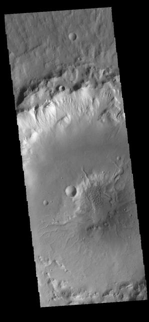
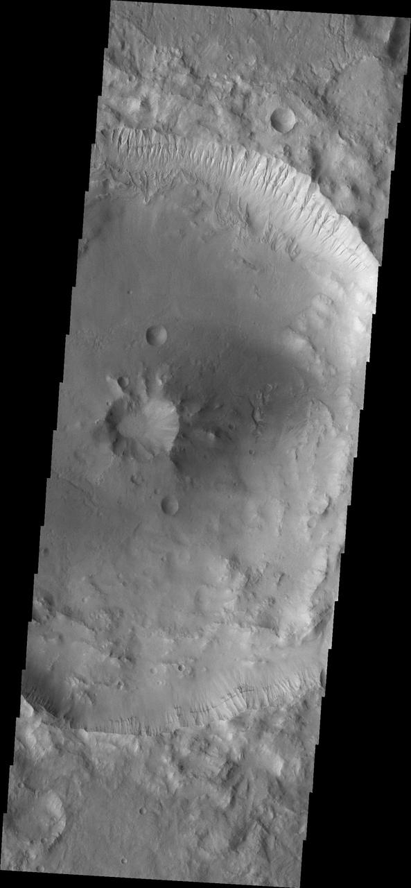
This VIS image shows part of an unnamed crater in Terra Cimmeria. The crater rim is dissected by gullies, and the central pit has several channels entering from the higher elevation of the crater floor. Dunes are also visible in the crater pit. Orbit Number: 66435 Latitude: -36.1641 Longitude: 158.141 Instrument: VIS Captured: 2016-12-05 03:34 http://photojournal.jpl.nasa.gov/catalog/PIA21296
This VIS image captured by NASA 2001 Mars Odyssey spacecraft shows a small dune field on the floor of an unnamed crater in Terra Cimmeria. Just south of the dune field is the crater's central peak. Orbit Number: 67277 Latitude: -49.2513 Longitude: 154.189 Instrument: VIS Captured: 2017-02-12 11:59 https://photojournal.jpl.nasa.gov/catalog/PIA21524
The THEMIS VIS camera contains 5 filters. The data from different filters can be combined in multiple ways to create a false color image. This false color image from NASA 2001 Mars Odyssey spacecraft shows part of the plains of Terra Cimmeria.

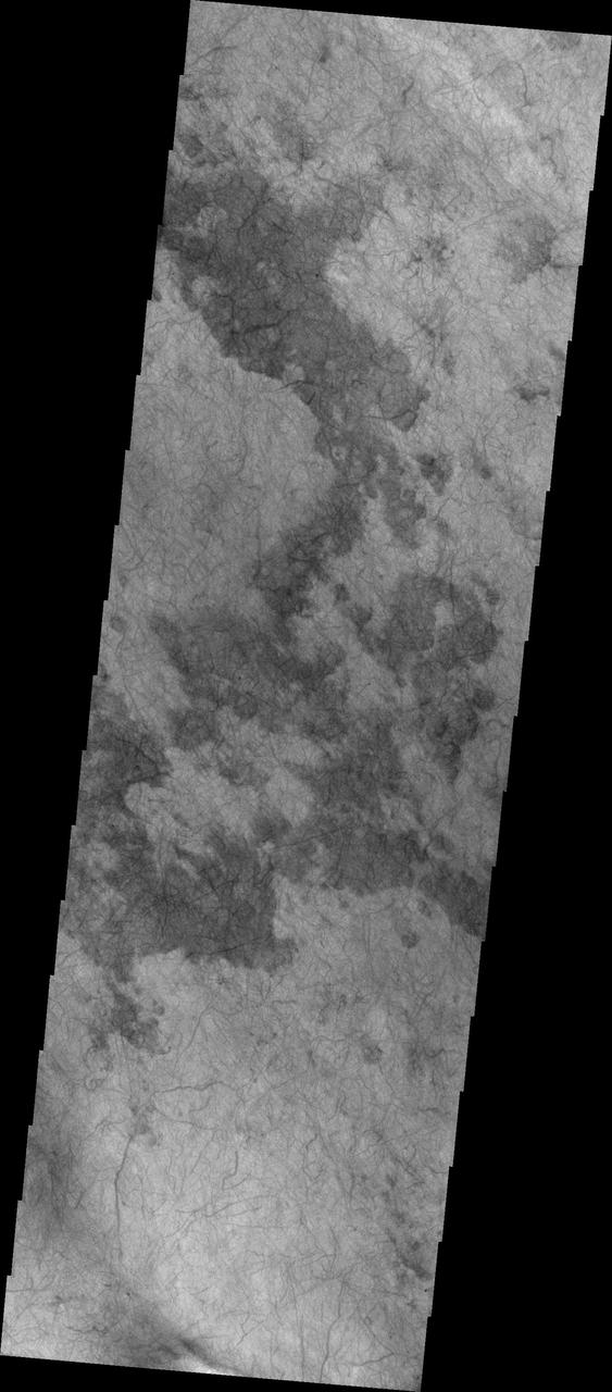
This infrared image from NASA 2001 Mars Odyssey spacecraft covers a large swath of Terra Cimmeria, including numerous craters with dunes and dune fields on their floors, as well as dunes located on the plains between craters. Orbit Number: 66840 Latitude: -68.6677 Longitude: 163.443 Instrument: IR Captured: 2017-01-07 11:57 http://photojournal.jpl.nasa.gov/catalog/PIA21505

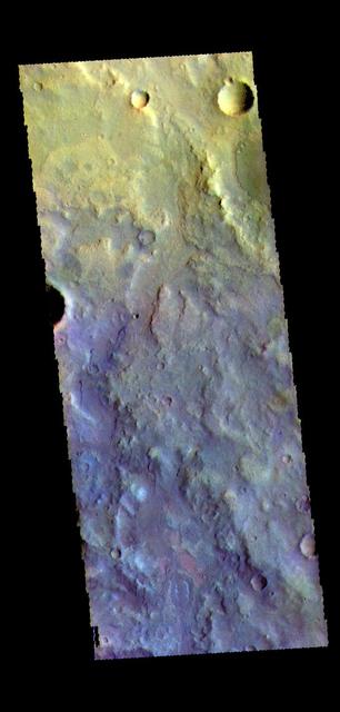
The THEMIS VIS camera contains 5 filters. The data from different filters can be combined in multiple ways to create a false color image. These false color images may reveal subtle variations of the surface not easily identified in a single band image. Today's false color image shows several craters located in Terra Cimmeria. Orbit Number: 70002 Latitude: -16.4105 Longitude: 144.043 Instrument: VIS Captured: 2017-09-25 01:08 https://photojournal.jpl.nasa.gov/catalog/PIA24457
This false color image from NASA 2001 Mars Odyssey spacecraft shows an unnamed channel on the margin between the higher elevations of Terra Cimmeria and the lower elevations of Elysium Planitia. Orbit Number: 7648 Latitude: -8.87244 Longitude: 143.027 Instrument: VIS Captured: 2003-09-05 02:35 http://photojournal.jpl.nasa.gov/catalog/PIA19487
The THEMIS camera contains 4 filters. The data from different filters can be combined in multiple ways to create a false color image. These false color images may reveal subtle variations of the surface not easily identified in a single band image. Today's false color image shows some of the plains of Terra Cimmeria. Orbit Number: 41441 Latitude: -28.1782 Longitude: 135.93 Instrument: VIS Captured: 2011-04-18 12:37 http://photojournal.jpl.nasa.gov/catalog/PIA20789
The THEMIS VIS camera contains 5 filters. The data from different filters can be combined in multiple ways to create a false color image. This false color image from NASA 2001 Mars Odyssey spacecraft shows craters in Terra Cimmeria. Orbit Number: 7236 Latitude: -21.6412 Longitude: 142.906 Instrument: VIS Captured: 2003-08-02 04:43 http://photojournal.jpl.nasa.gov/catalog/PIA19454
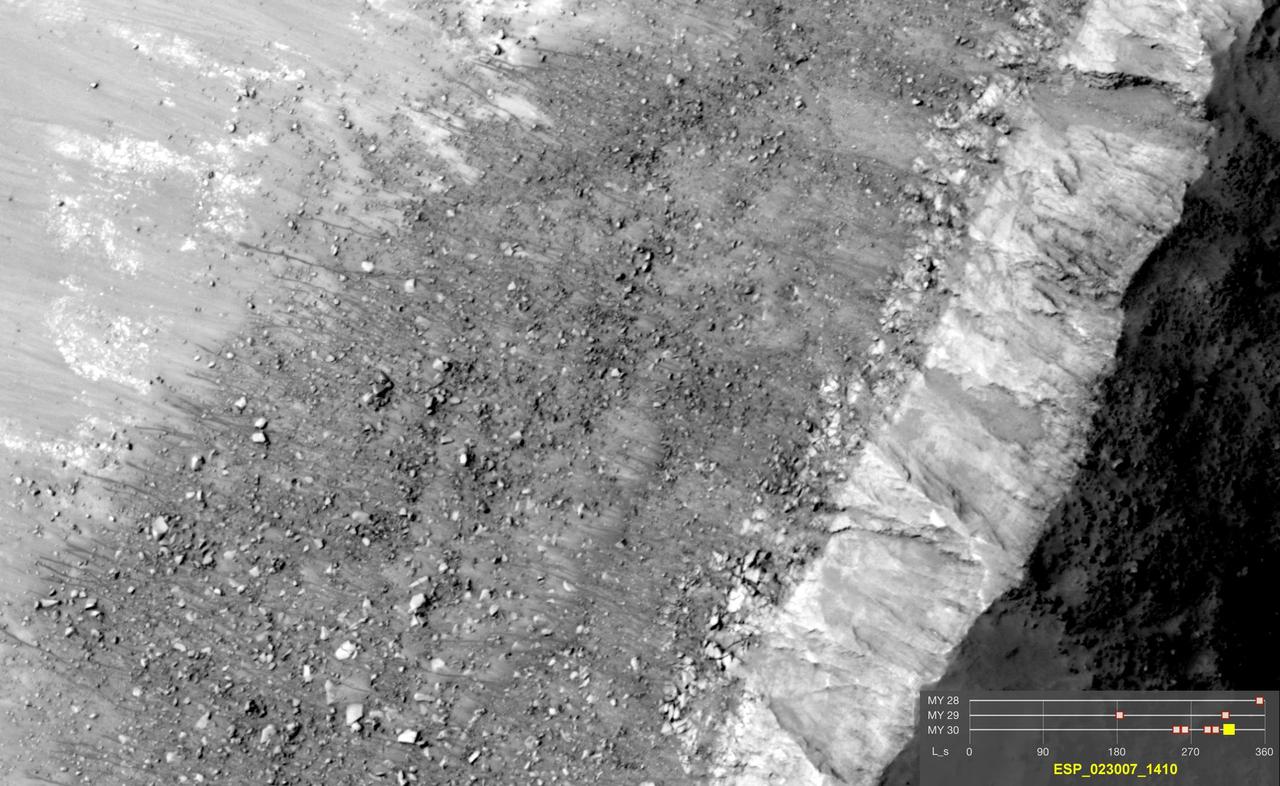
This image comes from observations of steep crater slopes on Terra Cimmeria by the HiRISE camera onboard NASA Mars Reconnaissance Orbiter.
Today's VIS image shows a complex crater located in Terra Cimmeria, just north of Hesperia Planum. The floor of this unnamed crater has features indicating a substantial amount of crater fill material was deposited at some point after the formation of the crater. These materials have since been eroded into multiple different forms. There are valley and mesa forms in the bottom part of the crater in this image, with the valleys becoming more shallow and channel-like toward the northern part of the crater floor. It is thought that the formation of the valley and mesa formation (called chaos terrain) arises from the release of subsurface fluids. Orbit Number: 90328 Latitude: -8.81454 Longitude: 112.309 Instrument: VIS Captured: 2022-04-25 21:52 https://photojournal.jpl.nasa.gov/catalog/PIA25474
The THEMIS VIS camera contains 5 filters. The data from different filters can be combined in multiple ways to create a false color image. These false color images may reveal subtle variations of the surface not easily identified in a single band image. Today's false color image shows sand dunes on the floor of an unnamed crater in Terra Cimmeria. Dark blue in this filter combination indicates basaltic sand. Orbit Number: 69566 Latitude: -9.20212 Longitude: 129.12 Instrument: VIS Captured: 2017-08-20 03:02 https://photojournal.jpl.nasa.gov/catalog/PIA24453
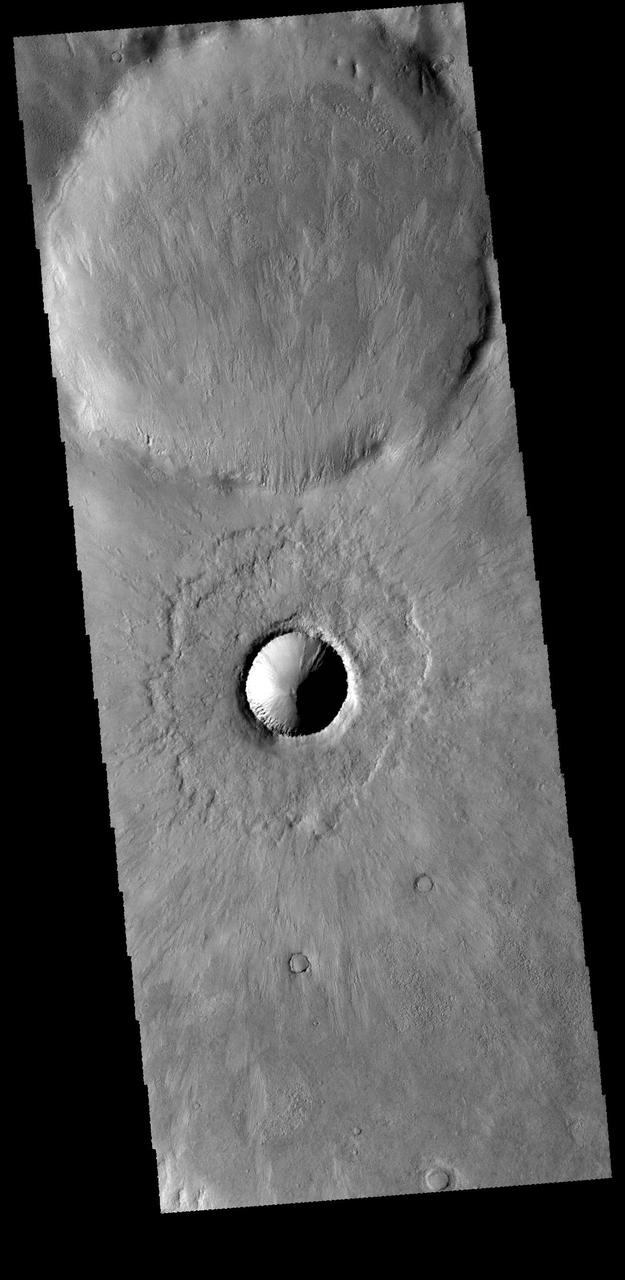
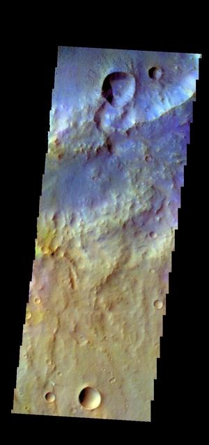
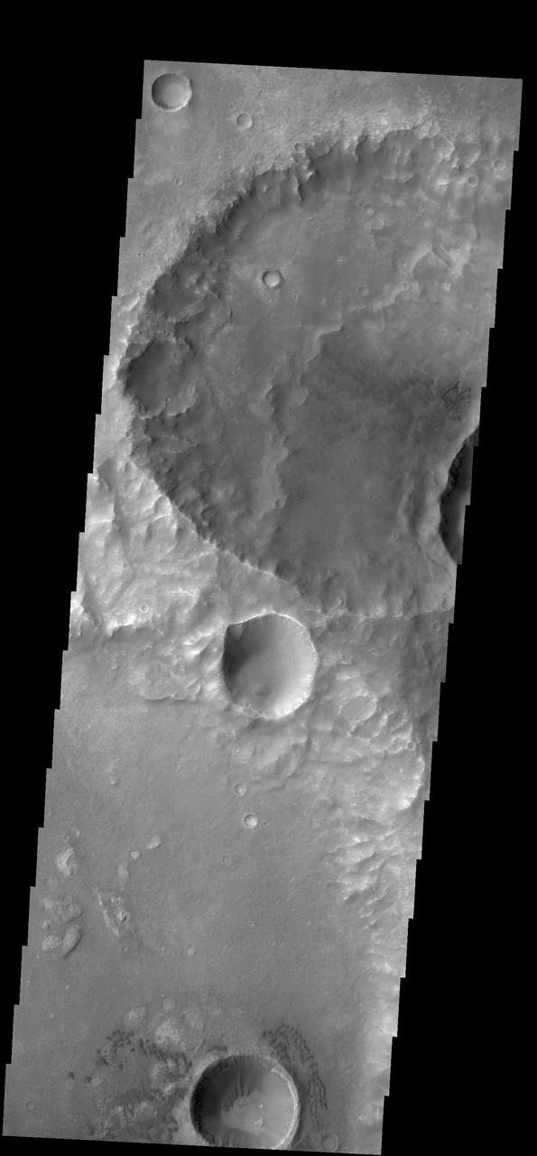
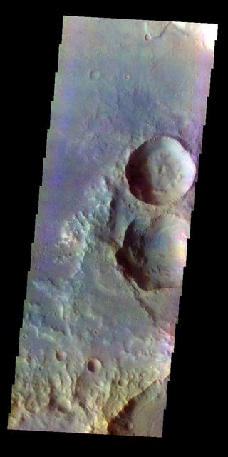
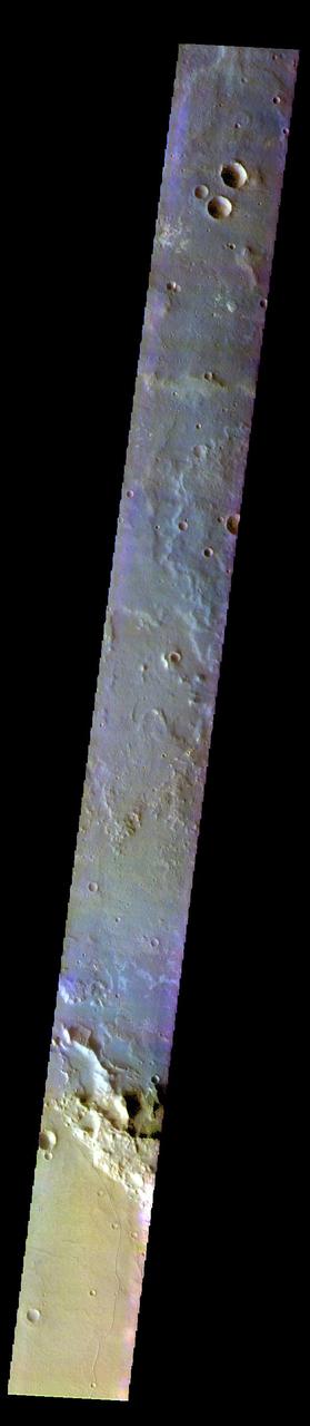
This image captured by NASA 2001 Mars Odyssey spacecraft shows two craters in Terra Cimmeria just north of Kepler Crater. The small crater in the middle of the image is a relatively new crater. The interior rim has gullies, but the bowl shape shows that there has been very little deposition of materials. Additionally, the radial emplacement of thin ejecta is still identifiable, and can be seen in the larger crater in the top of the image. With time the crater floor will flatten due to influx of materials and the subtle radial ejecta will be hidden by dust. While the actual age of the small crater is not known, it is relatively younger than the larger crater. Orbit Number: 66523 Latitude: -44.3019 Longitude: 139.301 Instrument: VIS Captured: 2016-12-12 09:31 http://photojournal.jpl.nasa.gov/catalog/PIA21300
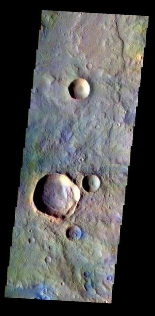
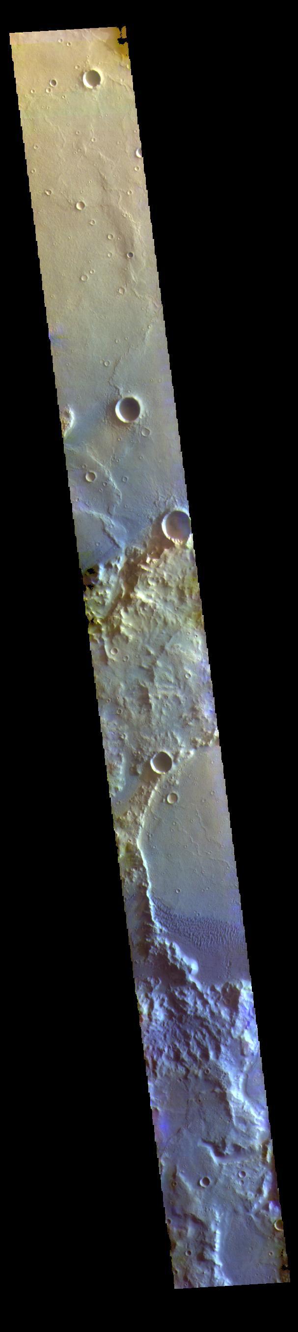
The THEMIS VIS camera contains 5 filters. The data from different filters can be combined in multiple ways to create a false color image. These false color images may reveal subtle variations of the surface not easily identified in a single band image. Today's false color image shows several craters in Terra Cimmeria. The THEMIS VIS camera is capable of capturing color images of the Martian surface using five different color filters. In this mode of operation, the spatial resolution and coverage of the image must be reduced to accommodate the additional data volume produced from using multiple filters. To make a color image, three of the five filter images (each in grayscale) are selected. Each is contrast enhanced and then converted to a red, green, or blue intensity image. These three images are then combined to produce a full color, single image. Because the THEMIS color filters don't span the full range of colors seen by the human eye, a color THEMIS image does not represent true color. Also, because each single-filter image is contrast enhanced before inclusion in the three-color image, the apparent color variation of the scene is exaggerated. Nevertheless, the color variation that does appear is representative of some change in color, however subtle, in the actual scene. Note that the long edges of THEMIS color images typically contain color artifacts that do not represent surface variation. Orbit Number: 83681 Latitude: -31.6763 Longitude: 180.725 Instrument: VIS Captured: 2020-10-25 13:48 https://photojournal.jpl.nasa.gov/catalog/PIA24999
The THEMIS VIS camera contains 5 filters. The data from different filters can be combined in multiple ways to create a false color image. These false color images may reveal subtle variations of the surface not easily identified in a single band image. Today's false color image shows part of Terra Cimmeria. The THEMIS VIS camera is capable of capturing color images of the Martian surface using five different color filters. In this mode of operation, the spatial resolution and coverage of the image must be reduced to accommodate the additional data volume produced from using multiple filters. To make a color image, three of the five filter images (each in grayscale) are selected. Each is contrast enhanced and then converted to a red, green, or blue intensity image. These three images are then combined to produce a full color, single image. Because the THEMIS color filters don't span the full range of colors seen by the human eye, a color THEMIS image does not represent true color. Also, because each single-filter image is contrast enhanced before inclusion in the three-color image, the apparent color variation of the scene is exaggerated. Nevertheless, the color variation that does appear is representative of some change in color, however subtle, in the actual scene. Note that the long edges of THEMIS color images typically contain color artifacts that do not represent surface variation. Orbit Number: 91605 Latitude: -30.5661 Longitude: 180.166 Instrument: VIS Captured: 2022-08-09 00:41 https://photojournal.jpl.nasa.gov/catalog/PIA26082
The THEMIS VIS camera contains 5 filters. The data from different filters can be combined in multiple ways to create a false color image. These false color images may reveal subtle variations of the surface not easily identified in a single band image. Today's false color image shows part of Terra Cimmeria. The THEMIS VIS camera is capable of capturing color images of the Martian surface using five different color filters. In this mode of operation, the spatial resolution and coverage of the image must be reduced to accommodate the additional data volume produced from using multiple filters. To make a color image, three of the five filter images (each in grayscale) are selected. Each is contrast enhanced and then converted to a red, green, or blue intensity image. These three images are then combined to produce a full color, single image. Because the THEMIS color filters don't span the full range of colors seen by the human eye, a color THEMIS image does not represent true color. Also, because each single-filter image is contrast enhanced before inclusion in the three-color image, the apparent color variation of the scene is exaggerated. Nevertheless, the color variation that does appear is representative of some change in color, however subtle, in the actual scene. Note that the long edges of THEMIS color images typically contain color artifacts that do not represent surface variation. Orbit Number: 92204 Latitude: -30.7921 Longitude: 179.257 Instrument: VIS Captured: 2022-09-27 08:24 https://photojournal.jpl.nasa.gov/catalog/PIA26088
The dust devil tracks in this image are located in Terra Cimmeria.
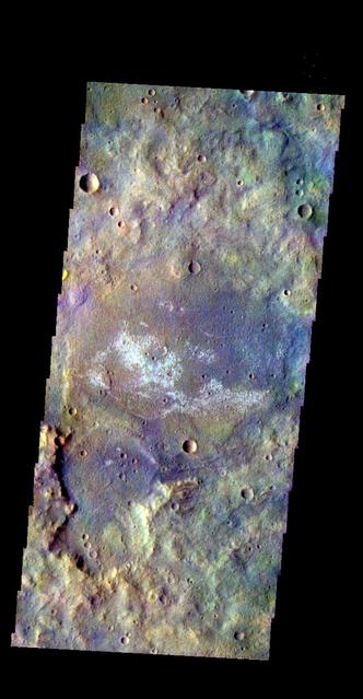
The THEMIS VIS camera contains 5 filters. The data from different filters can be combined in multiple ways to create a false color image. These false color images may reveal subtle variations of the surface not easily identified in a single band image. Today's false color image shows a unique, resistant material on the floor of an unnamed crater in Terra Cimmeria. Orbit Number: 8547 Latitude: -23.784 Longitude: 135.545 Instrument: VIS Captured: 2003-11-18 02:35 http://photojournal.jpl.nasa.gov/catalog/PIA19736
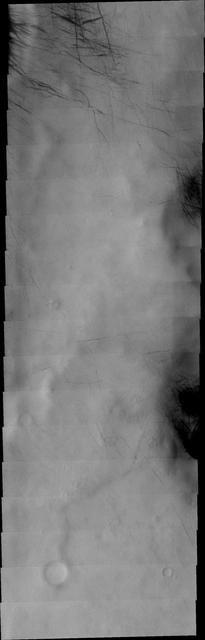
The dust devil tracks in this VIS image are located in Terra Cimmeria.
Channels dissect the northern rim of this unnamed crater in Terra Cimmeria.

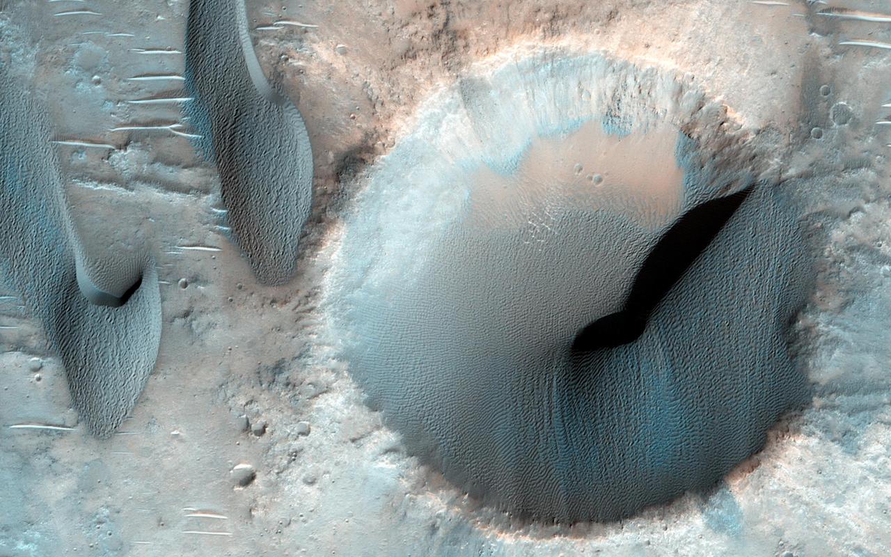
The THEMIS VIS camera contains 5 filters. The data from different filters can be combined in multiple ways to create a false color image. These false color images may reveal subtle variations of the surface not easily identified in a single band image. Today's false color image shows part of a crater in southern Terra Cimmeria. The dark blue feature on the right side of the image is a large sand dune complex. Dark blue in this false color combination indicates basaltic sands. Dunes at high latitudes — near the polar caps — are affected by seasonal frost and ice. The interactions with frost/ice reduces the amount of movement of sand grains within the dunes. This changes the morphology of near polar dunes when compared to dunes at lower latitudes where ice/frost do not occur as frequently. This crater's latitude is 68 degrees south of the equator. Orbit Number: 67545 Latitude: -68.405 Longitude: 163.524 Instrument: VIS Captured: 2017-03-06 14:17 https://photojournal.jpl.nasa.gov/catalog/PIA24072
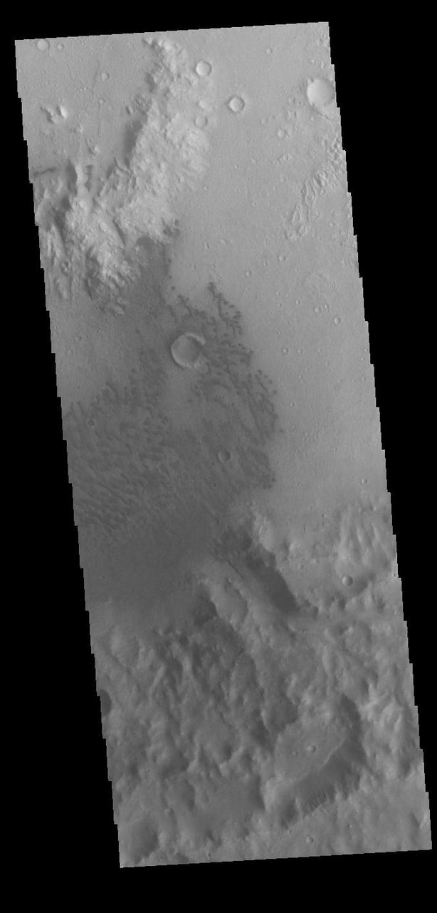
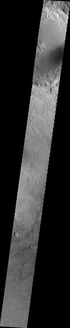
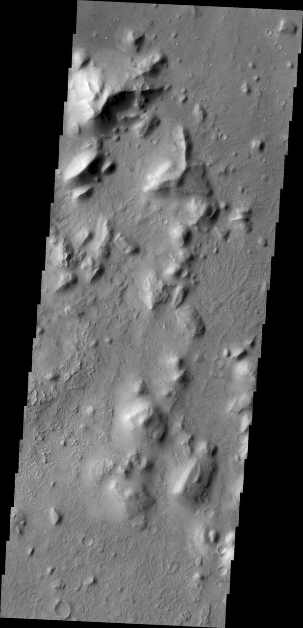
This image is located in Terra Cimmeria. The bright, irregular features are hills. This part of Terra Cimmeria is made up mostly by flat lying plains, with no other hills in the nearby vicinity. Orbit Number: 74529 Latitude: -37.2521 Longitude: 164.216 Instrument: VIS Captured: 2018-10-02 23:20 https://photojournal.jpl.nasa.gov/catalog/PIA22853
This unnamed channel is located in the northern part of Terra Cimmeria. This image was captured by NASA Mars Odyssey.
This small field of sand dunes is located on the floor of an unnamed crater in Terra Cimmeria as seen by NASA 2001 Mars Odyssey spacecraft.
Small dunes are located on the floor of this unnamed crater in Terra Cimmeria as seen by NASA 2001 Mars Odyssey spacecraft.
This image captured by NASA 2001 Mars Odyssey spacecraft shows a field of dunes on the floor of an unnamed crater in Terra Cimmeria.
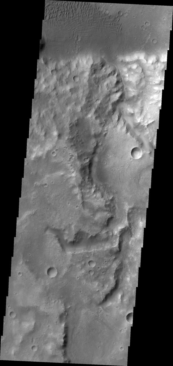
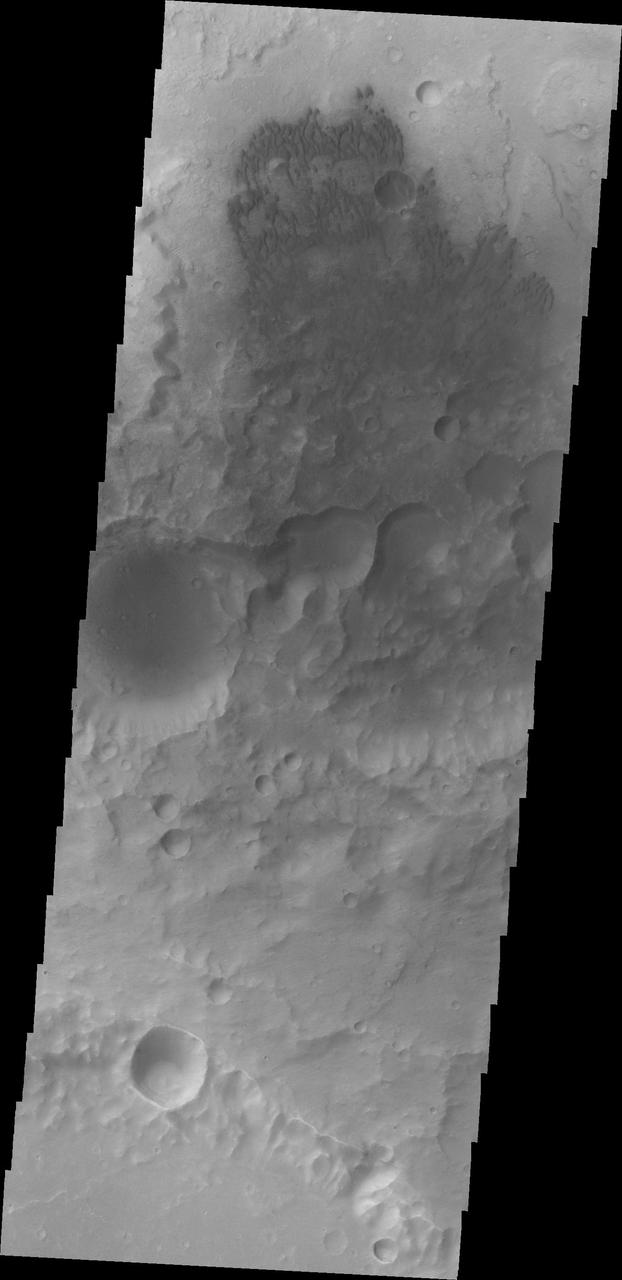
Several landslide deposits are visible in this image captured by NASA 2001 Mars Odyssey spacecraft of an unnamed crater in Terra Cimmeria.
This unnamed channel is located in Terra Cimmeria as seen by NASA 2001 Mars Odyssey spacecraft.
This is a 2001 Mars Odyssey THEMIS IR image of an unnamed channel in northwestern Terra Cimmeria.
An unnamed channel dissects the surface of Terra Cimmeria as seen by NASA 2001 Mars Odyssey spacecraft.
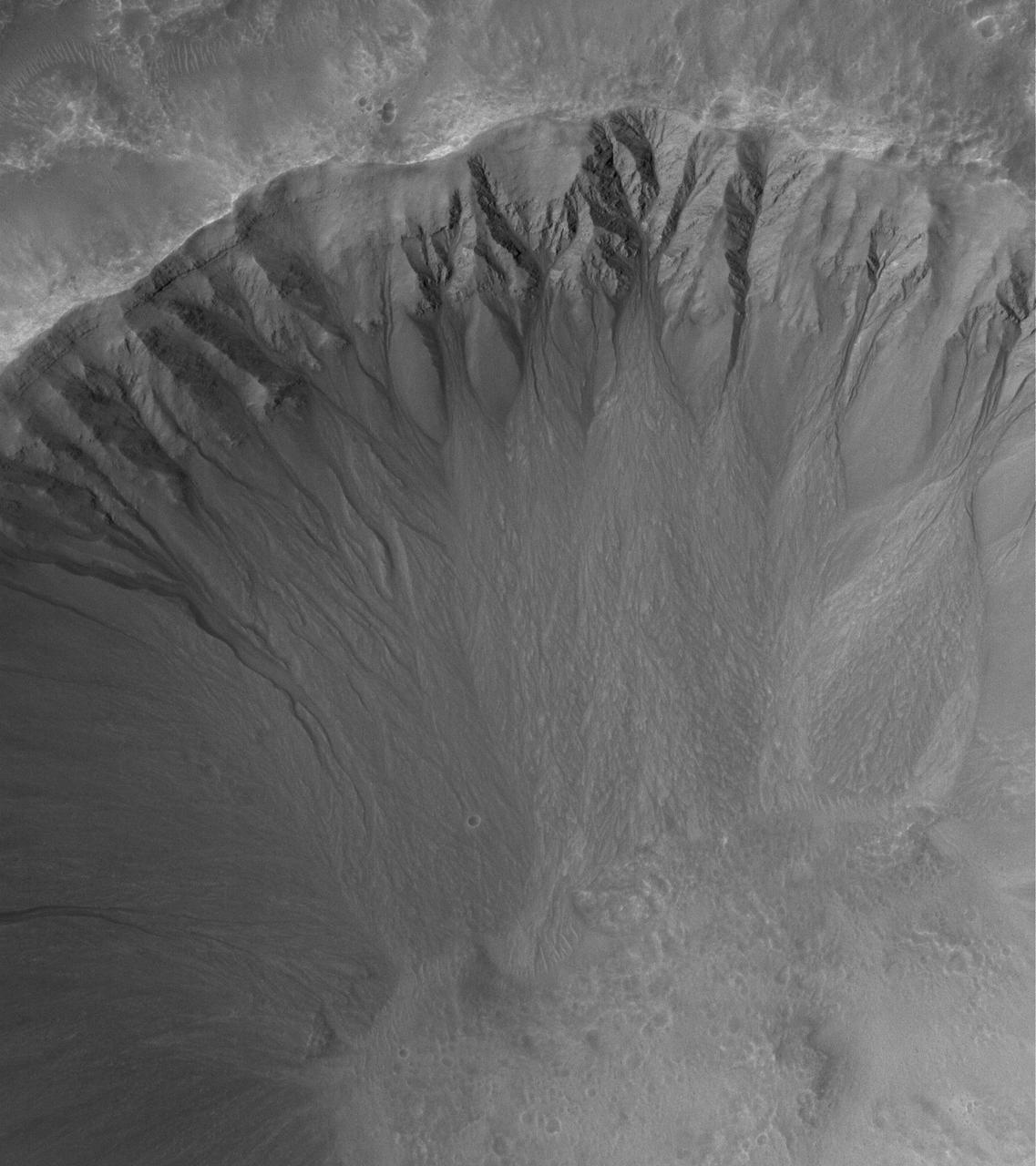
This MOC image shows an array of gullies in the north-northwest wall of a crater in Terra Cimmeria
This image from NASA Mars Odyssey shows sand dunes covering the floor of this unnamed crater in Terra Cimmeria.
This image captured by NASA 2001 Mars Odyssey spacecraft is of an unnamed channel located on the northern margin of Terra Cimmeria.
This image comes from observations of a well-preserved crater on Terra Cimmeria by the HiRISE camera onboard NASA Mars Reconnaissance Orbiter.
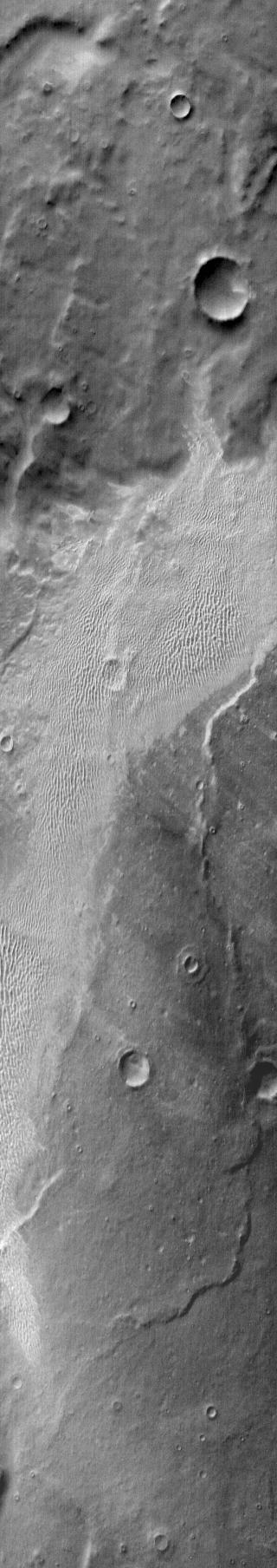
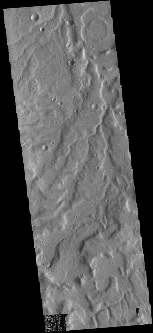
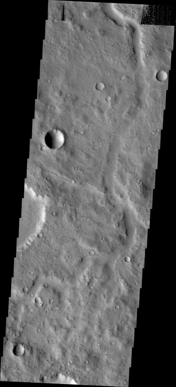
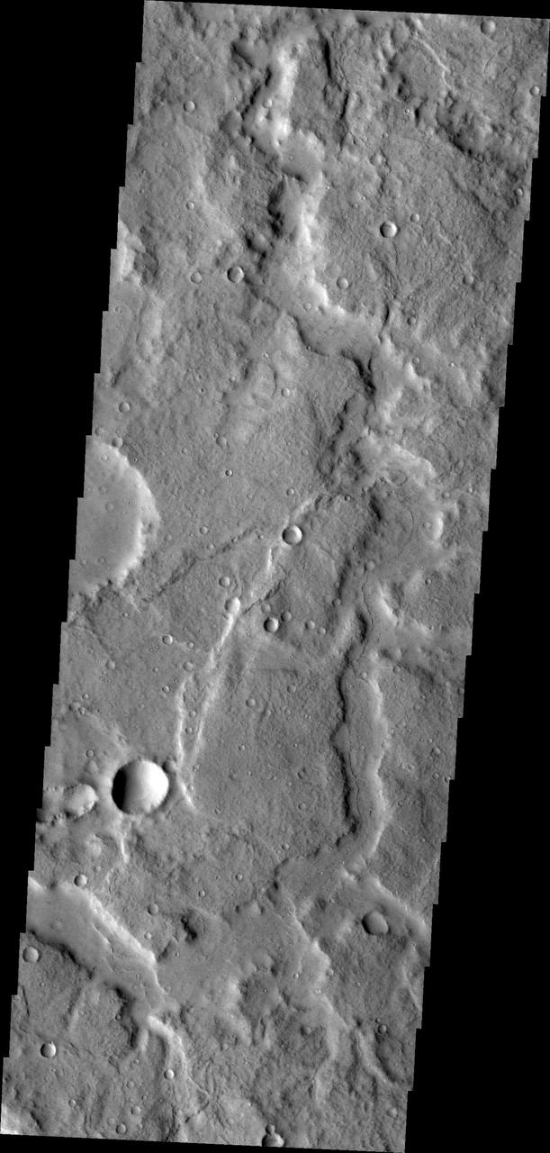
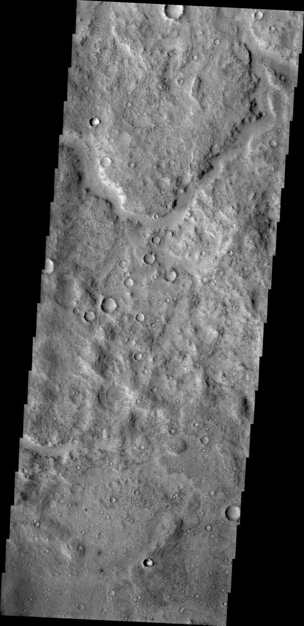
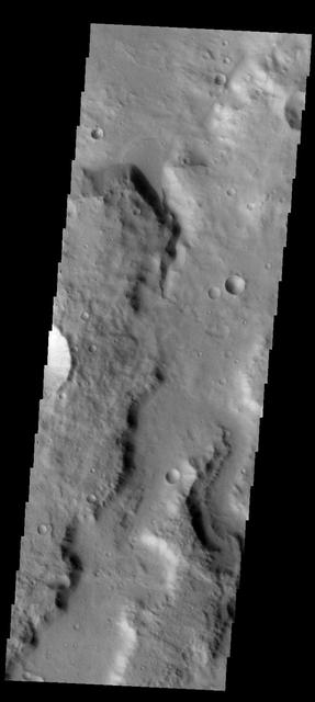
A network of large and small channels dissect this highland region in Terra Cimmeria, as shown in this image captured by NASA 2001 Mars Odyssey spacecraft.
The hills in this image from NASA 2001 Mars Odyssey spacecraft are part of Nepenthes Mensae, which is located along the margin of Terra Cimmeria.
Several gullies of different sizes in this image from NASA Mars Odyssey spacecraft are located on the southern rim of this unnamed crater in Terra Cimmeria.
Impact craters can have a variety of floor features. This image from NASA Mars Odyssey is a central peak/pit combination crater in Terra Cimmeria.
This image NASA Mars Reconnaissance Orbiter shows dozens of dark-toned dunes in and around several craters within the rugged terrain of Terra Cimmeria.

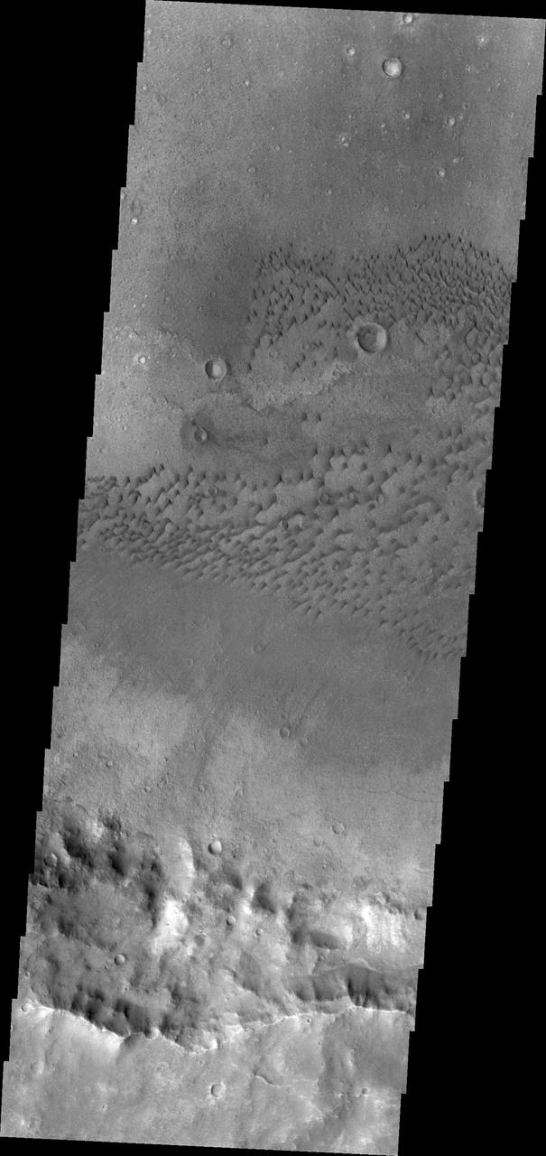
Several areas of dunes are located on the plains of Terra Cimmeria. The dunes appear bright in the daytime infrared due the warmer temperatures than the surrounding plains.
Sand dunes cover part of the floor of this unnamed crater in Terra Cimmeria. Orbit Number: 75321 Latitude: -57.5486 Longitude: 169.005 Instrument: VIS Captured: 2018-12-07 04:26 https://photojournal.jpl.nasa.gov/catalog/PIA23029
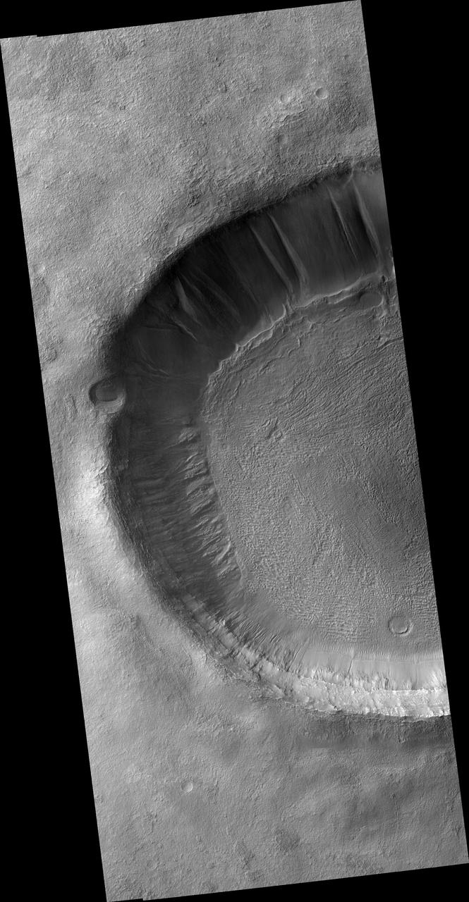
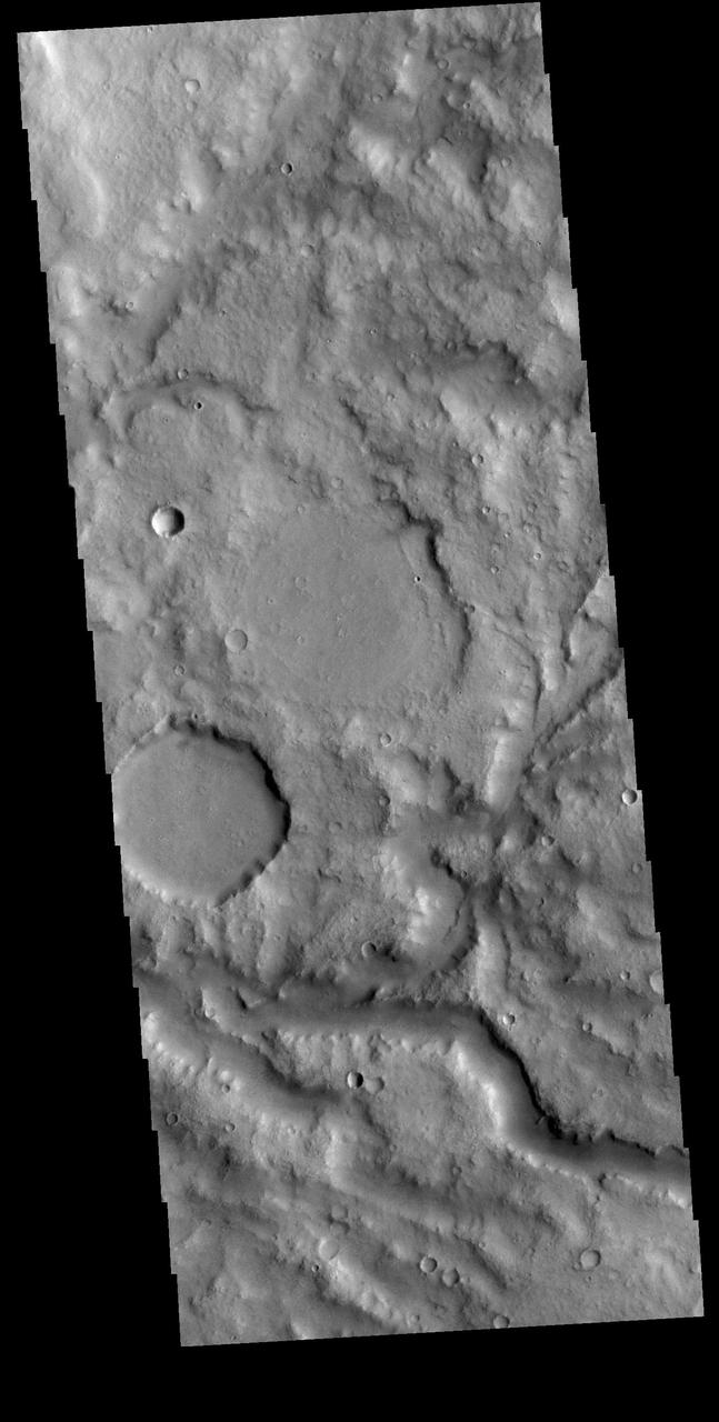
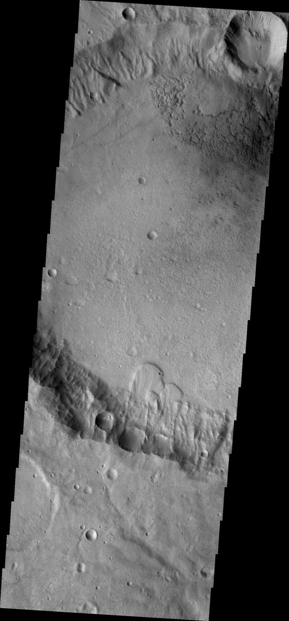
Multiple channels dissect the inner rim of this unnamed crater in Terra Cimmeria. Orbit Number: 82765 Latitude: -40.3953 Longitude: 142.091 Instrument: VIS Captured: 2020-08-11 04:15 https://photojournal.jpl.nasa.gov/catalog/PIA24153
Multiple gullies dissect the rim of this unnamed crater in Terra Cimmeria. Orbit Number: 74480 Latitude: -49.7019 Longitude: 140.533 Instrument: VIS Captured: 2018-09-28 22:24 https://photojournal.jpl.nasa.gov/catalog/PIA22850
This image captured by NASA 2001 Mars Odyssey spacecraft show numerous gullies dissect the rim of this unnamed crater in Terra Cimmeria. Orbit Number: 58026 Latitude: -52.2606 Longitude: 157.69 Instrument: VIS Captured: 2015-01-12 14:12 http://photojournal.jpl.nasa.gov/catalog/PIA19208
The impact crater observed in this NASA Mars Odyssey image taken in Terra Cimmeria suggests sediments have filled the crater due to the flat and smooth nature of the floor compared to rougher surfaces at higher elevations.

This MOC image shows a 1.5 meters ~5 feet per pixel view of a crater in the Terra Cimmeria region of Mars. Several gullies extend from near the top of the crater rim, downslope toward the floor of the crater
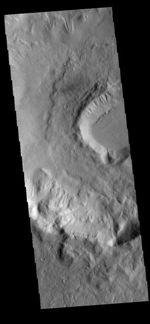
This unnamed crater in Terra Cimmeria is not as round in shape as other craters. Major landslides have occurred on the crater rim, resulting in the final shape as seen by NASA 2001 Mars Odyssey spacecraft.
Between the highlands of Terra Cimmeria and the low plains of Elysium Planitia and Nepenthes Planum lies the rugged region called Nepenthes Mensae as seen by NASA 2001 Mars Odyssey spacecraft.
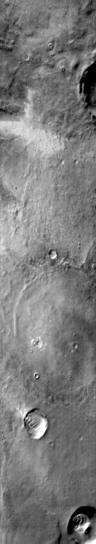
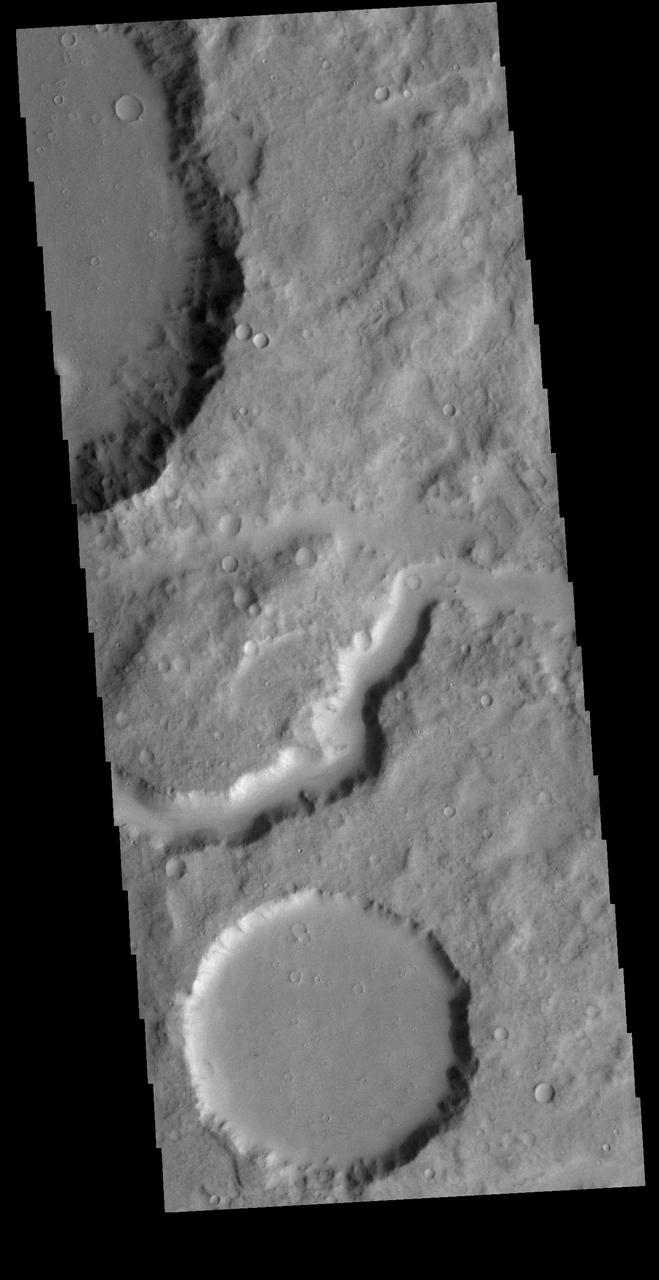
A small fan-shaped delta is located where a channel meets the floor of this unnamed crater in Terra Cimmeria, as shown in this image from NASA 2001 Mars Odyssey spacecraft.