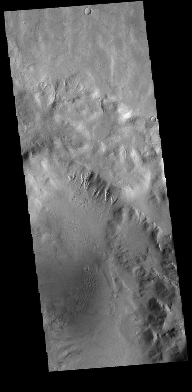
This image from NASA 2001 Mars Odyssey spacecraft is of an unnamed crater in Terra Sirenum. There are gullies dissecting part of the crater rim, and small dunes on the crater floor. Orbit Number: 66334 Latitude: -43.8989 Longitude: 194.906 Instrument: VIS Captured: 2016-11-26 19:49 http://photojournal.jpl.nasa.gov/catalog/PIA21289
Terra Sirenum
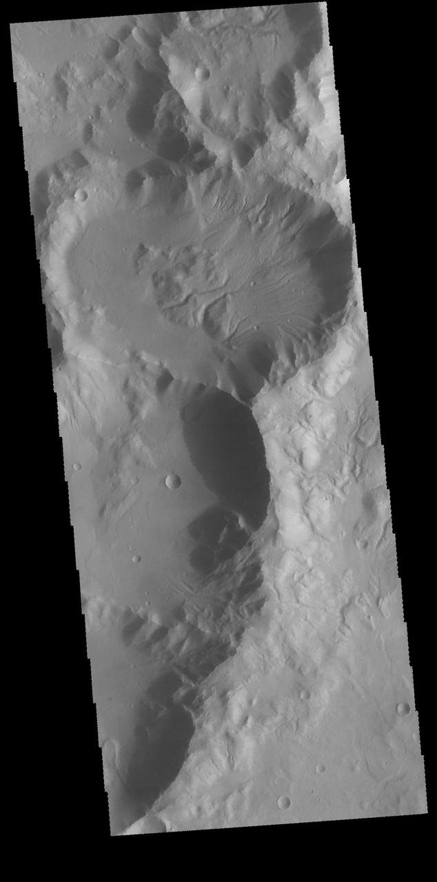
This VIS image shows a group of craters in Terra Sirenum. The elongate crater in the top half of the image has numerous gullies dissecting the inner crater rim as will has channels that have dissected the block of material near the center of the crater. It appears that these channel are possible extensions of the rim gullies. Orbit Number: 65324 Latitude: -37.7922 Longitude: 186.323 Instrument: VIS Captured: 2016-09-04 14:55 http://photojournal.jpl.nasa.gov/catalog/PIA21154
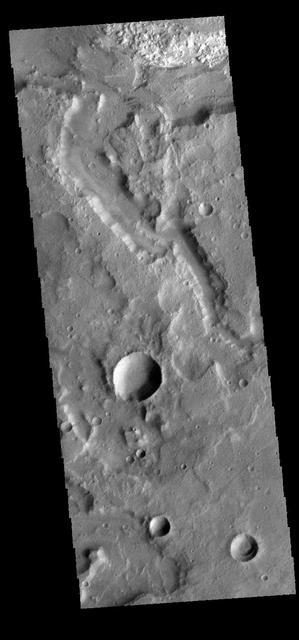
The channel in this image captured by NASA 2001 Mars Odyssey spacecraft is located in Terra Sirenum. Orbit Number: 65935 Latitude: -34.327 Longitude: 190.432 Instrument: VIS Captured: 2016-10-24 22:57 http://photojournal.jpl.nasa.gov/catalog/PIA21190
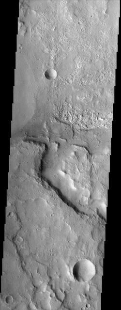
Terra Sirenum Crater
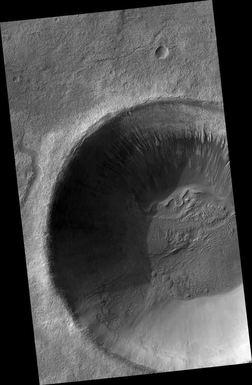
Gullies and... Gullies? in Terra Sirenum
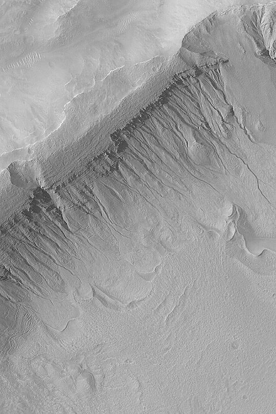
Gullies in Terra Sirenum

Terra Sirenum Slope
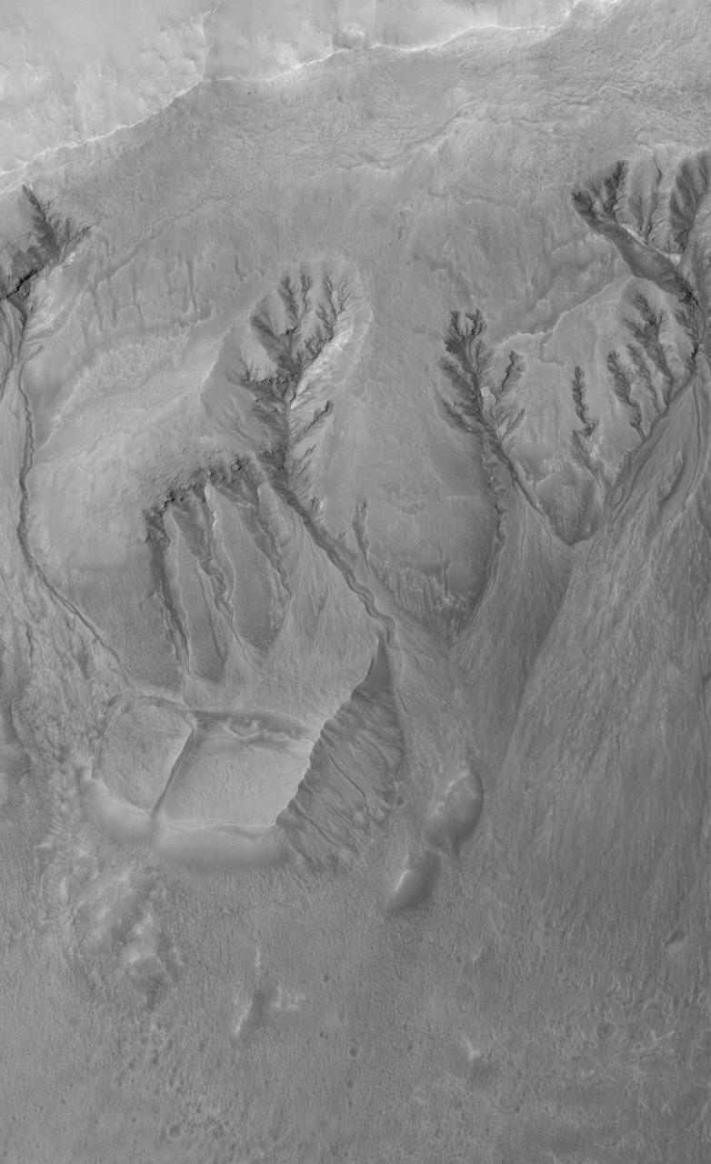
Terra Sirenum Gullies
Crater Edge in Terra Sirenum
Gullies in Sirenum Terra, Mars
Seasonal Frost in Terra Sirenum
Devil Den in Terra Sirenum
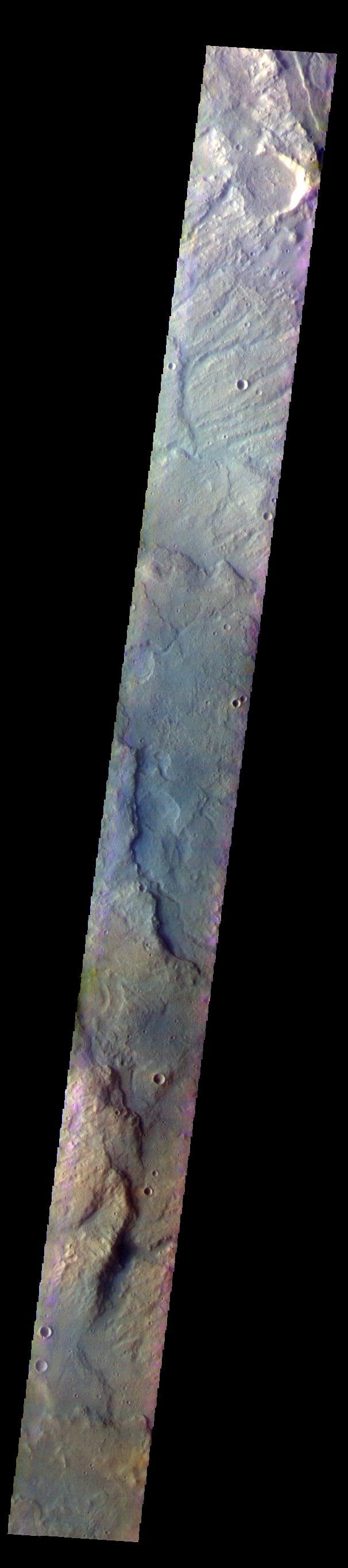
The THEMIS VIS camera contains 5 filters. The data from different filters can be combined in multiple ways to create a false color image. These false color images may reveal subtle variations of the surface not easily identified in a single band image. Today's false color image shows part of the plains and highlands of Terra Sirenum. Orbit Number: 59752 Latitude: -37.1173 Longitude: 228.666 Instrument: VIS Captured: 2015-06-03 16:39 https://photojournal.jpl.nasa.gov/catalog/PIA21786
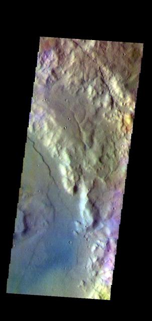
The THEMIS VIS camera contains 5 filters. The data from different filters can be combined in multiple ways to create a false color image. These false color images may reveal subtle variations of the surface not easily identified in a single band image. Today's false color image shows part of the plains and craters in Terra Sirenum. Orbit Number: 59228 Latitude: -37.9211 Longitude: 224.753 Instrument: VIS Captured: 2015-04-21 13:06 https://photojournal.jpl.nasa.gov/catalog/PIA21669
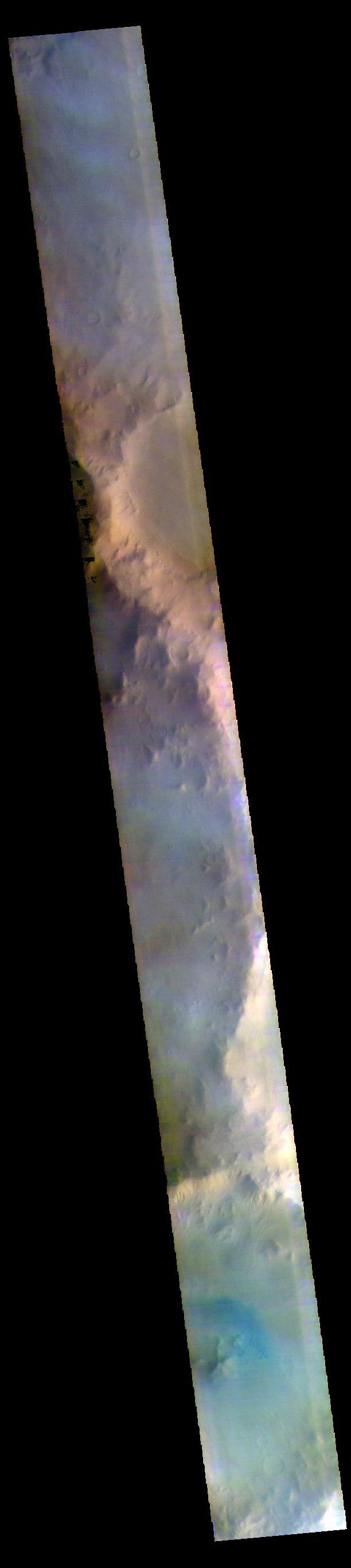
The THEMIS VIS camera contains 5 filters. The data from different filters can be combined in multiple ways to create a false color image. These false color images may reveal subtle variations of the surface not easily identified in a single band image. Today's false color images shows part of the plains and craters of Terra Sirenum. Orbit Number: 59298 Latitude: -48.8967 Longitude: 184.212 Instrument: VIS Captured: 2015-04-27 07:56 https://photojournal.jpl.nasa.gov/catalog/PIA21670
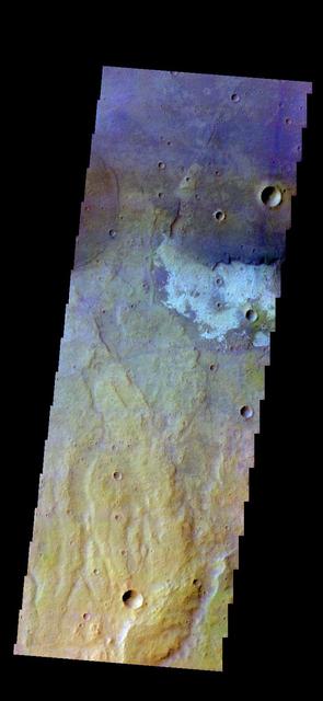
The THEMIS camera contains 5 filters. The data from different filters can be combined in multiple ways to create a false color image.l These false color images may reveal subtle variations of the surface not easily identified in a single band image. Today's false color image shows part of the plains of Terra Sirenum. Orbit Number: 42973 Latitude: -38.8923 Longitude: 220.888 Instrument: VIS Captured: 2011-08-22 15:49 http://photojournal.jpl.nasa.gov/catalog/PIA20975
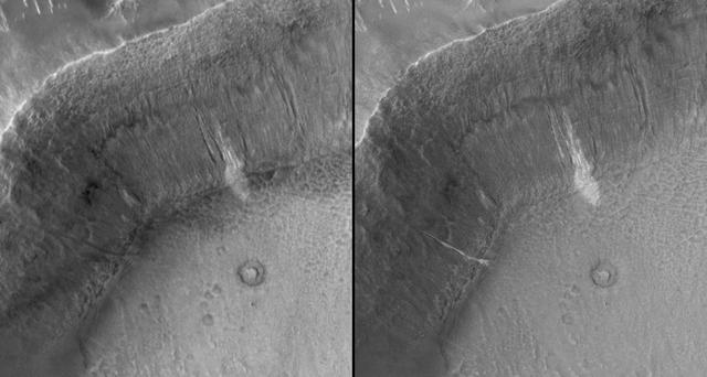
New Gully Deposit in a Crater in Terra Sirenum

Located on the floor of an unnamed crater in Terra Sirenum, the crater in the center of the this image captured by NASA 2001 Mars Odyssey spacecraft has numerous gullies on the inner rim.

This image captured by NASA 2001 Mars Odyssey spacecraft shows dunes on the floor of an unnamed crater in Terra Sirenum.

Several gullies located on the rim of this unnamed crater in Terra Sirenum are seen in this image taken by NASA 2001 Mars Odyssey spacecraft.

Terra Sirenum is the location of this image from NASA 2001 Mars Odyssey spacecraft. The unnamed crater has dunes on its floor.

This 2001 Mars Odyssey image shows dark dunes located on the floor of this unnamed crater in Terra Sirenum.
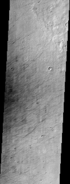
This image from NASA Mars Odyssey shows a region called Terra Sirenum in Mars southern hemisphere named for the Sea of the Sirens from Greek Mythology. This is not a sea, however, but a relatively dusty, high albedo region of Mars.
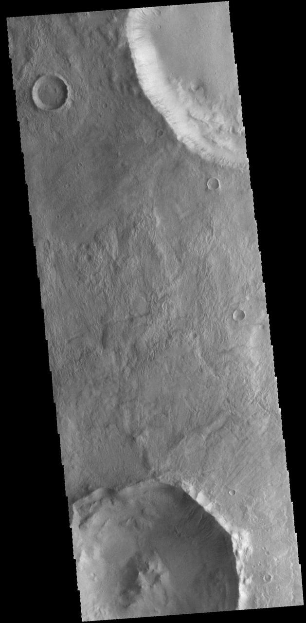
Today's VIS image shows unnamed craters in Terra Sirenum. Orbit Number: 68429 Latitude: -40.8094 Longitude: 196.569 Instrument: VIS Captured: 2017-05-18 10:31 https://photojournal.jpl.nasa.gov/catalog/PIA21788

This image from NASA 2001 Mars Odyssey spacecraft shows two landslide deposits located on the southern side of Columbus Crater in Terra Sirenum.
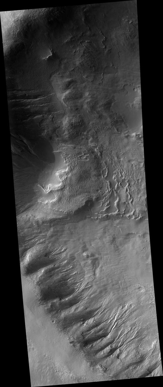
Gully Grab Bag in Crater Wall in the Terra Sirenum Region

This image captured by NASA 2001 Mars Odyssey spacecraft shows a field of dunes on the floor of an unnamed crater in Terra Sirenum. Orbit Number: 66970 Latitude: -61.4868 Longitude: 199.921 Instrument: VIS Captured: 2017-01-18 05:18 http://photojournal.jpl.nasa.gov/catalog/PIA21502
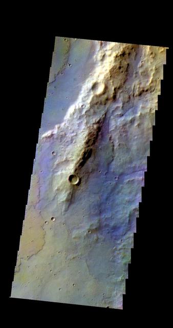
The THEMIS camera contains 5 filters. The data from different filters can be combined in multiple ways to create a false color image. This image from NASA 2001 Mars Odyssey spacecraft shows part of Terra Sirenum.
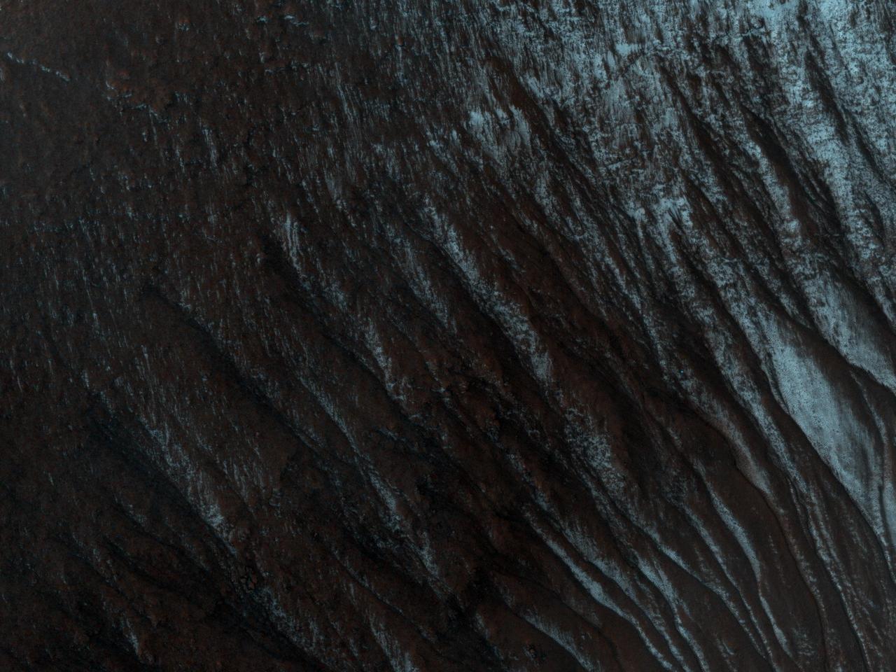
This image from NASA Mars Reconnaissance Orbiter shows part of an unnamed crater, itself located inside the much larger Newton Crater, in Terra Sirenum. Original release date March 3, 2010.
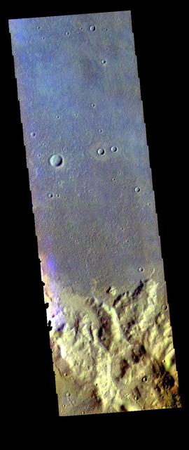
The THEMIS VIS camera contains 5 filters. The data from different filters can be combined in multiple ways to create a false color image. These false color images may reveal subtle variations of the surface not easily identified in a single band image. Today's false color image shows part of Terra Sirenum. Orbit Number: 75250 Latitude: -40.2626 Longitude: 238.511 Instrument: VIS Captured: 2018-12-01 08:32 https://photojournal.jpl.nasa.gov/catalog/PIA24560

Not all Martian sand dunes are located in craters. This image from NASA 2001 Mars Odyssey spacecraft shows dunes located on the plains of Terra Sirenum. Orbit Number: 67736 Latitude: -71.7973 Longitude: 216.088 Instrument: VIS Captured: 2017-03-22 07:46 https://photojournal.jpl.nasa.gov/catalog/PIA21662
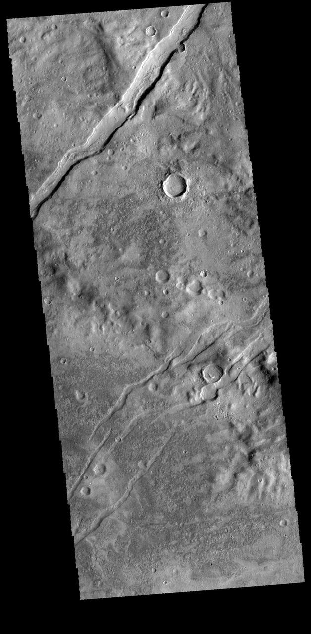
The channel-like features in this image from NASA 2001 Mars Odyssey spacecraft are tectonic graben. The graben called Icaria Fossae are located in Terra Sirenum. Orbit Number: 65846 Latitude: -41.5696 Longitude: 240.567 Instrument: VIS Captured: 2016-10-17 14:57 http://photojournal.jpl.nasa.gov/catalog/PIA21185

The THEMIS camera contains 5 filters. The data from different filters can be combined in mulitple ways to create a false color image. These false color images may reveal subtle variations of the surface not easily identified in a single band image. Today's false color image shows part of the plains of Terra Sirenum near Sirenum Fossae. Orbit Number: 43011 Latitude: -32.8634 Longitude: 206.015 Instrument: VIS Captured: 2011-08-25 18:51 http://photojournal.jpl.nasa.gov/catalog/PIA20978
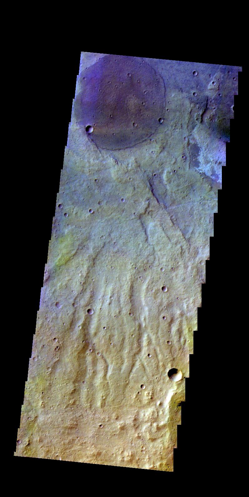
The THEMIS camera contains 5 filters. The data from different filters can be combined in multiple ways to create a false color image. This image from NASA 2001 Mars Odyssey spacecraft shows part of the plains of Terra Sirenum.

The THEMIS camera contains 5 filters. The data from different filters can be combined in multiple ways to create a false color image. This image from NASA 2001 Mars Odyssey spacecraft shows part of the plains of Terra Sirenum.
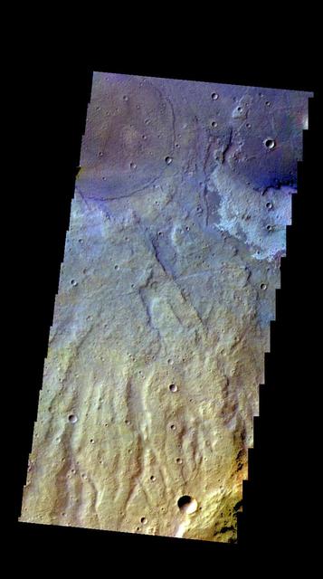
The THEMIS camera contains 5 filters. The data from different filters can be combined in multiple ways to create a false color image. This image from NASA 2001 Mars Odyssey spacecraft shows part of the plains of Terra Sirenum.
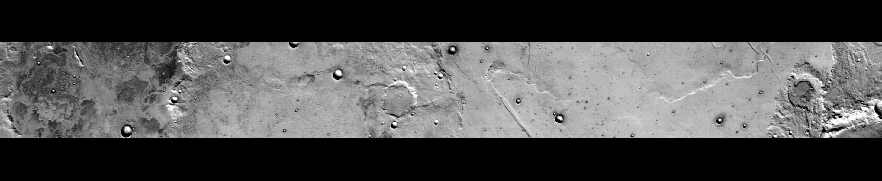
This 300-kilometer 186-mile long daytime infrared image of Terra Sirenum, taken by NASA Mars Odyssey spacecraft, displays a wide variety of geologic features. The mottled floor and rim of Kovalkiy Crater is seen at the left north of the image.
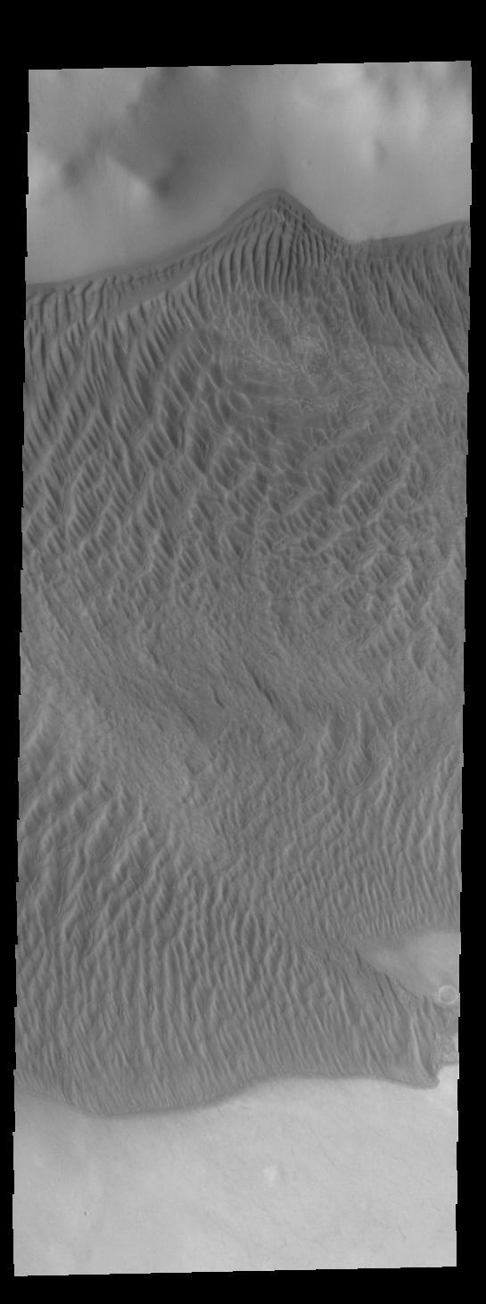
This image captured by NASA 2001 Mars Odyssey spacecraft shows part of the large sand sheet with surface dune forms on the floor of Charlier Crater in Terra Sirenum. Orbit Number: 67288 Latitude: -68.1351 Longitude: 191.161 Instrument: VIS Captured: 2017-02-13 09:50 https://photojournal.jpl.nasa.gov/catalog/PIA21526
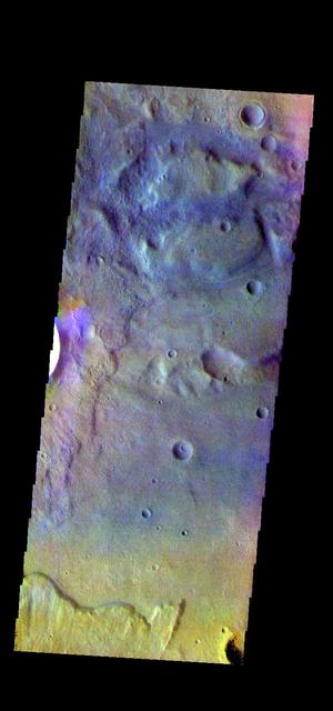
The THEMIS VIS camera contains 5 filters. The data from different filters can be combined in multiple ways to create a false color image. These false color images may reveal subtle variations of the surface not easily identified in a single band image. Today's false color image shows the floor of an unnamed crater in Terra Sirenum. Orbit Number: 74920 Latitude: -38.149 Longitude: 224.32 Instrument: VIS Captured: 2018-11-04 03:41 https://photojournal.jpl.nasa.gov/catalog/PIA24559
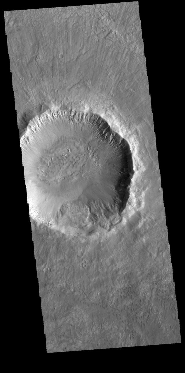
Today's VIS image is of Palikir Crater in Terra Sirenum. The inner rim of the crater is dissected with numerous gullies. In higher resolution images from other imagers these gullies are the location of changing linea, which appear to grow and retreat as seasons change. Orbit Number: 65311 Latitude: -41.6177 Longitude: 202.206 Instrument: VIS Captured: 2016-09-03 13:12 http://photojournal.jpl.nasa.gov/catalog/PIA21152
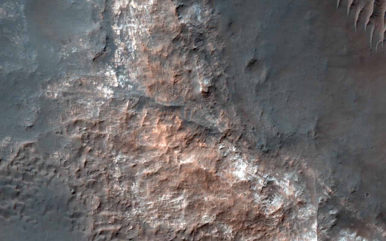
This image from NASA's Mars Reconnaissance Orbiter shows Gorgonum Basin, one of several large basins within the Terra Sirenum region of Mars. Each basin has light-toned mounds, many of which contain clays. Scientists think that Terra Sirenum once had a large lake during an epoch called the Late Noachian/Early Hesperian, and each basin filled with sediments. The water within the lake may have altered these sediments to form the clays we now observe from orbit. Ma'adim Vallis, which drains into Gusev Crater where the Spirit rover landed, drained the water from this ancient lake. Why the basin floors exhibit mounds similar to chaos regions on Mars is unknown, but could be the result of collapse and subsequent erosion within the basins. https://photojournal.jpl.nasa.gov/catalog/PIA21767
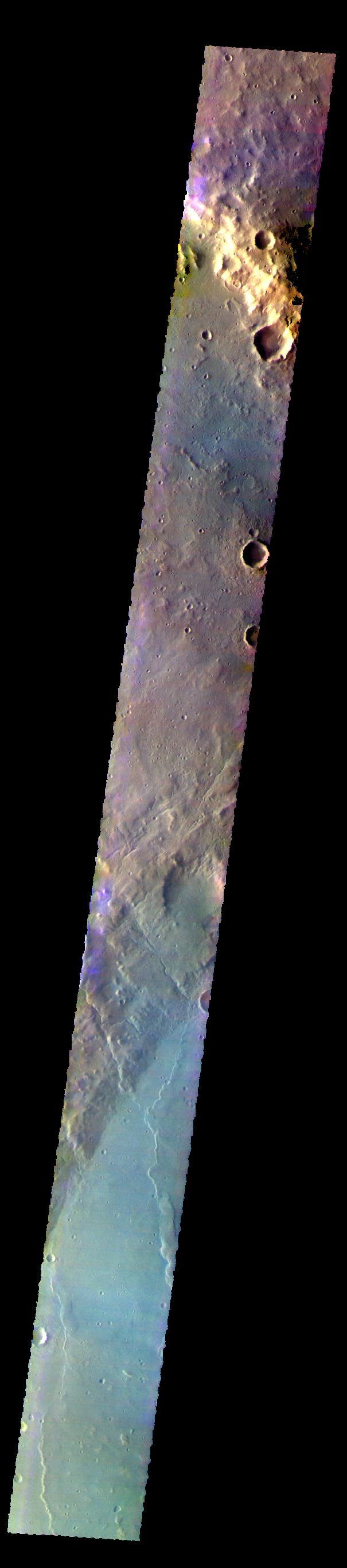
The THEMIS VIS camera contains 5 filters. THe data from different filters can be combined in multiple ways to create a false color image. These false color images may reveal subtle variations of the surface not easily identified in a single band image. Today's false color image shows part of Newton Crater in Terra Sirenum. Orbit Number: 59753 Latitude: -38.4654 Longitude: 199.631 Instrument: VIS Captured: 2015-06-03 18:38 https://photojournal.jpl.nasa.gov/catalog/PIA21793

The THEMIS camera contains 5 filters. The data from different filters can be combined in multiple ways to create a false color image. This image from NASA 2001 Mars Odyssey spacecraft shows part of the plains of Terra Sirenum. Orbit Number: 40240 Latitude: -38.9101 Longitude: 221.138 Instrument: VIS Captured: 2011-01-09 15:22 http://photojournal.jpl.nasa.gov/catalog/PIA20771

The THEMIS camera contains 5 filters. The data from different filters can be combined in multiple ways to create a false color image. These false color images may reveal subtle variations of the surface not easily identified in a single band image. Today's false color image shows some of the plains of Terra Sirenum. Orbit Number: 42749 Latitude: -32.0252 Longitude: 202.837 Instrument: VIS Captured: 2011-08-04 05:13 http://photojournal.jpl.nasa.gov/catalog/PIA20796
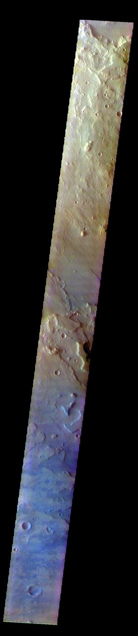
The THEMIS VIS camera contains 5 filters. The data from different filters can be combined in multiple ways to create a false color image. These false color images may reveal subtle variations of the surface not easily identified in a single band image. Today's false color image shows part of Terra Sirenum. The THEMIS VIS camera is capable of capturing color images of the Martian surface using five different color filters. In this mode of operation, the spatial resolution and coverage of the image must be reduced to accommodate the additional data volume produced from using multiple filters. To make a color image, three of the five filter images (each in grayscale) are selected. Each is contrast enhanced and then converted to a red, green, or blue intensity image. These three images are then combined to produce a full color, single image. Because the THEMIS color filters don't span the full range of colors seen by the human eye, a color THEMIS image does not represent true color. Also, because each single-filter image is contrast enhanced before inclusion in the three-color image, the apparent color variation of the scene is exaggerated. Nevertheless, the color variation that does appear is representative of some change in color, however subtle, in the actual scene. Note that the long edges of THEMIS color images typically contain color artifacts that do not represent surface variation. Orbit Number: 92940 Latitude: -36.9577 Longitude: 185.11 Instrument: VIS Captured: 2022-11-26 22:52 https://photojournal.jpl.nasa.gov/catalog/PIA26123
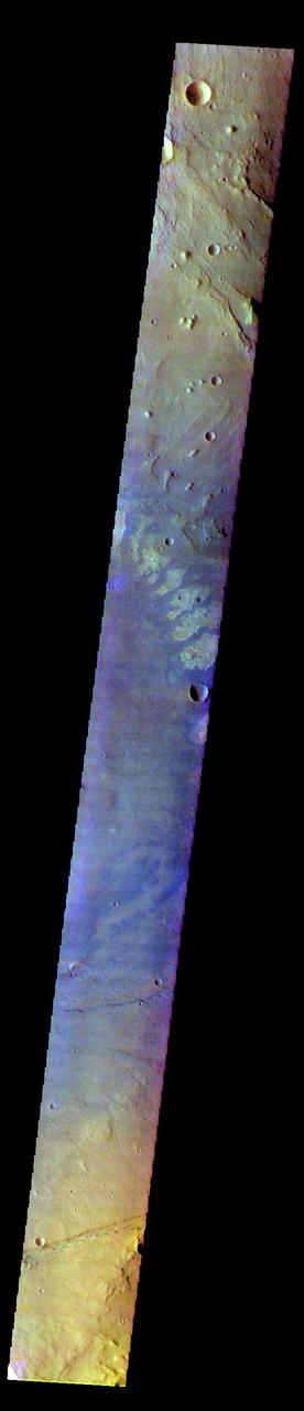
The THEMIS VIS camera contains 5 filters. The data from different filters can be combined in multiple ways to create a false color image. These false color images may reveal subtle variations of the surface not easily identified in a single band image. Today's false color image shows part of Terra Sirenum. The THEMIS VIS camera is capable of capturing color images of the Martian surface using five different color filters. In this mode of operation, the spatial resolution and coverage of the image must be reduced to accommodate the additional data volume produced from using multiple filters. To make a color image, three of the five filter images (each in grayscale) are selected. Each is contrast enhanced and then converted to a red, green, or blue intensity image. These three images are then combined to produce a full color, single image. Because the THEMIS color filters don't span the full range of colors seen by the human eye, a color THEMIS image does not represent true color. Also, because each single-filter image is contrast enhanced before inclusion in the three-color image, the apparent color variation of the scene is exaggerated. Nevertheless, the color variation that does appear is representative of some change in color, however subtle, in the actual scene. Note that the long edges of THEMIS color images typically contain color artifacts that do not represent surface variation. Orbit Number: 92366 Latitude: -37.8538 Longitude: 184.585 Instrument: VIS Captured: 2022-10-10 16:34 https://photojournal.jpl.nasa.gov/catalog/PIA26089
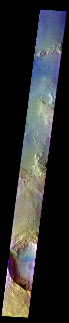
The THEMIS VIS camera contains 5 filters. The data from different filters can be combined in multiple ways to create a false color image. These false color images may reveal subtle variations of the surface not easily identified in a single band image. Today's false color image shows part of Terra Sirenum. The THEMIS VIS camera is capable of capturing color images of the Martian surface using five different color filters. In this mode of operation, the spatial resolution and coverage of the image must be reduced to accommodate the additional data volume produced from using multiple filters. To make a color image, three of the five filter images (each in grayscale) are selected. Each is contrast enhanced and then converted to a red, green, or blue intensity image. These three images are then combined to produce a full color, single image. Because the THEMIS color filters don't span the full range of colors seen by the human eye, a color THEMIS image does not represent true color. Also, because each single-filter image is contrast enhanced before inclusion in the three-color image, the apparent color variation of the scene is exaggerated. Nevertheless, the color variation that does appear is representative of some change in color, however subtle, in the actual scene. Note that the long edges of THEMIS color images typically contain color artifacts that do not represent surface variation. Orbit Number: 92415 Latitude: -38.6129 Longitude: 210.798 Instrument: VIS Captured: 2022-10-14 17:24 https://photojournal.jpl.nasa.gov/catalog/PIA26121
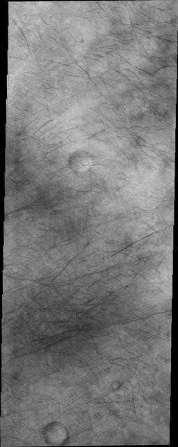
The dust devil tracks in this image are located in Terra Sirenum.
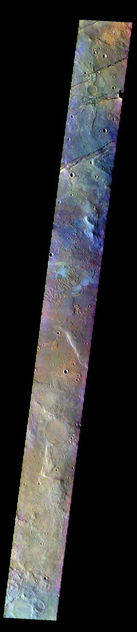
The THEMIS VIS camera contains 5 filters. The data from different filters can be combined in multiple ways to create a false color image. These false color images may reveal subtle variations of the surface not easily identified in a single band image. Today's false color image shows part of Terra Sirenum. The linear features at the top of the image are tectonic features called graben. These graben are part of Sirenum Fossae. Graben are formed by extension of the crust and faulting. When large amounts of pressure or tension are applied to rocks on timescales that are fast enough that the rock cannot respond by deforming, the rock breaks along faults. In the case of a graben, two parallel faults are formed by extension of the crust and the rock in between the faults drops downward into the space created by the extension.The graben in this image are trending from north-northeast to south-southwest. Because the faults defining the graben are formed perpendicular to the direction of the applied stress, we know that extensional forces were pulling the crust apart in the west-northwest/east-southeast direction. The Sirenum Fossae graben are 2735km (1700 miles) long. The THEMIS VIS camera is capable of capturing color images of the Martian surface using five different color filters. In this mode of operation, the spatial resolution and coverage of the image must be reduced to accommodate the additional data volume produced from using multiple filters. To make a color image, three of the five filter images (each in grayscale) are selected. Each is contrast enhanced and then converted to a red, green, or blue intensity image. These three images are then combined to produce a full color, single image. Because the THEMIS color filters don't span the full range of colors seen by the human eye, a color THEMIS image does not represent true color. Also, because each single-filter image is contrast enhanced before inclusion in the three-color image, the apparent color variation of the scene is exaggerated. Nevertheless, the color variation that does appear is representative of some change in color, however subtle, in the actual scene. Note that the long edges of THEMIS color images typically contain color artifacts that do not represent surface variation. Orbit Number: 91654 Latitude: -33.0364 Longitude: 206.174 Instrument: VIS Captured: 2022-08-13 01:31 https://photojournal.jpl.nasa.gov/catalog/PIA26083
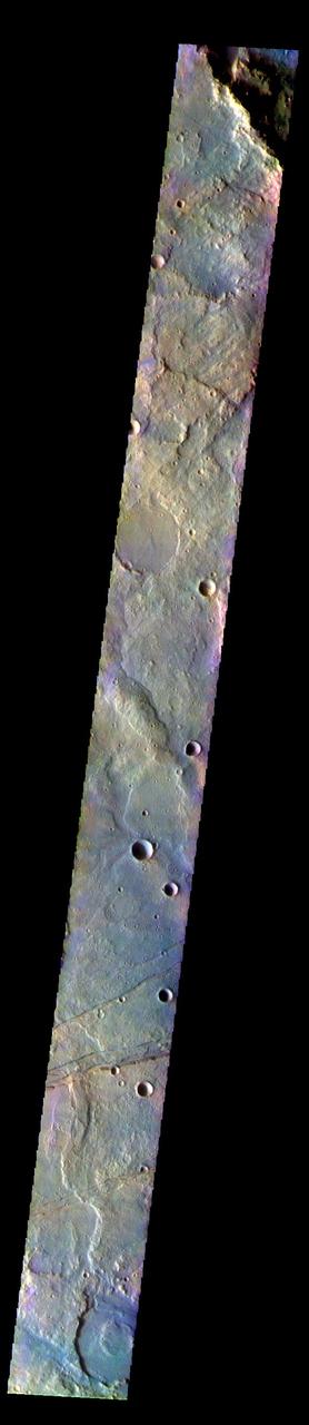
The THEMIS VIS camera contains 5 filters. The data from different filters can be combined in multiple ways to create a false color image. These false color images may reveal subtle variations of the surface not easily identified in a single band image. Today's false color image shows part of Terra Sirenum. The linear features at the bottom of the image are tectonic features called graben. These graben are part of Sirenum Fossae. Graben are formed by extension of the crust and faulting. When large amounts of pressure or tension are applied to rocks on timescales that are fast enough that the rock cannot respond by deforming, the rock breaks along faults. In the case of a graben, two parallel faults are formed by extension of the crust and the rock in between the faults drops downward into the space created by the extension.The graben in this image are trending from north-northeast to south-southwest. Because the faults defining the graben are formed perpendicular to the direction of the applied stress, we know that extensional forces were pulling the crust apart in the west-northwest/east-southeast direction. The Sirenum Fossae graben are 2735km (1700 miles) long. The THEMIS VIS camera is capable of capturing color images of the Martian surface using five different color filters. In this mode of operation, the spatial resolution and coverage of the image must be reduced to accommodate the additional data volume produced from using multiple filters. To make a color image, three of the five filter images (each in grayscale) are selected. Each is contrast enhanced and then converted to a red, green, or blue intensity image. These three images are then combined to produce a full color, single image. Because the THEMIS color filters don't span the full range of colors seen by the human eye, a color THEMIS image does not represent true color. Also, because each single-filter image is contrast enhanced before inclusion in the three-color image, the apparent color variation of the scene is exaggerated. Nevertheless, the color variation that does appear is representative of some change in color, however subtle, in the actual scene. Note that the long edges of THEMIS color images typically contain color artifacts that do not represent surface variation. Orbit Number: 91704 Latitude: -32.2019 Longitude: 203.852 Instrument: VIS Captured: 2022-08-17 04:19 https://photojournal.jpl.nasa.gov/catalog/PIA26084
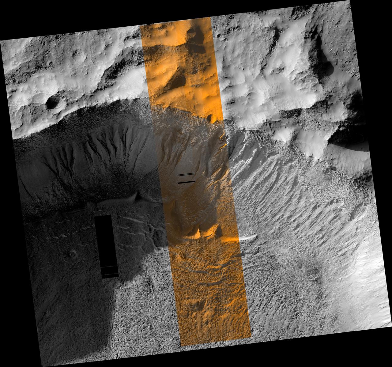
![This image covers a portion of a typical impact crater in Terra Sirenum at about 40 degrees south latitude on Mars. At the top of the image, outside the crater rim, there is a mid-latitude mantle, rough in places where ice may have sublimated. Below the crater rim, on the steep, south-facing slope, are gullies. These are erosional features with depositional fans. Some of the gully fans have a bluish color: these are probably quite recent deposits, less than a few tens of years old. On the floor of the crater (bottom of this image) are ridges that likely formed from the flow of ice, perhaps a few million years ago. The map is projected here at a scale of 50 centimeters (19.6 inches) per pixel. [The original image scale is 50.3 centimeters (19.8 inches) per pixel (with 2 x 2 binning); objects on the order of 151 centimeters (59 inches) across are resolved.] North is up. http://photojournal.jpl.nasa.gov/catalog/PIA21456](https://images-assets.nasa.gov/image/PIA21456/PIA21456~medium.jpg)
This image covers a portion of a typical impact crater in Terra Sirenum at about 40 degrees south latitude on Mars. At the top of the image, outside the crater rim, there is a mid-latitude mantle, rough in places where ice may have sublimated. Below the crater rim, on the steep, south-facing slope, are gullies. These are erosional features with depositional fans. Some of the gully fans have a bluish color: these are probably quite recent deposits, less than a few tens of years old. On the floor of the crater (bottom of this image) are ridges that likely formed from the flow of ice, perhaps a few million years ago. The map is projected here at a scale of 50 centimeters (19.6 inches) per pixel. [The original image scale is 50.3 centimeters (19.8 inches) per pixel (with 2 x 2 binning); objects on the order of 151 centimeters (59 inches) across are resolved.] North is up. http://photojournal.jpl.nasa.gov/catalog/PIA21456
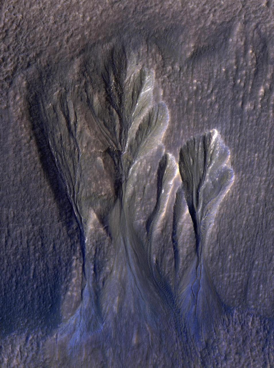
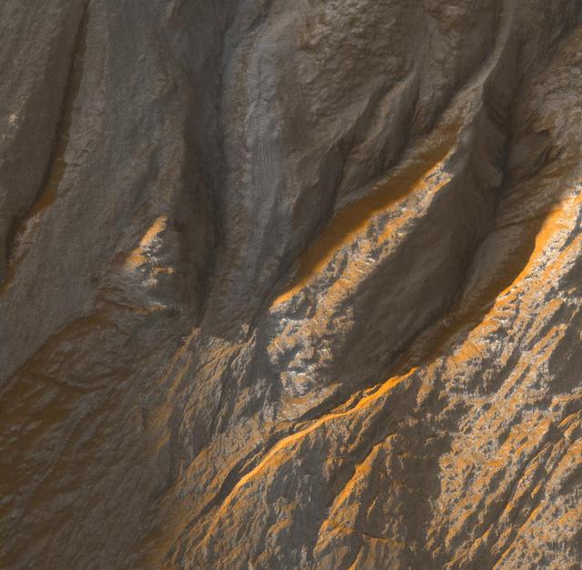
This image from NASA's Mars Reconnaissance Orbiter (MRO) shows white material believed to be dusty water ice lining the edges of Martian gullies in a region named Terra Sirenum. Scientists believe dust particles within this ice act similarly to dust that falls onto glaciers on Earth, warming up in sunlight and causing subsurface pockets of meltwater to form. On Earth, the dust that builds up on glaciers is called cryoconite, and the pockets it forms are called cryoconite holes. These pockets of water on our planet are often teeming with simple life, including algae, fungi, and cyanobacteria. Scientists believe similar shallow pools of water could exist on Mars, and may also be excellent places to search for life on the Red Planet today. This enhanced-color image was captured by MRO's HiRISE (High-Resolution Imaging Science Experiment) camera on Dec. 25, 2016. The blue color at the bottom of the gullies is likely coarse sand (not ice); the hue would not actually be perceptible to the human eye. HiRISE is able to detect this color by looking at the scene in far-infrared wavelengths. https://photojournal.jpl.nasa.gov/catalog/PIA26407
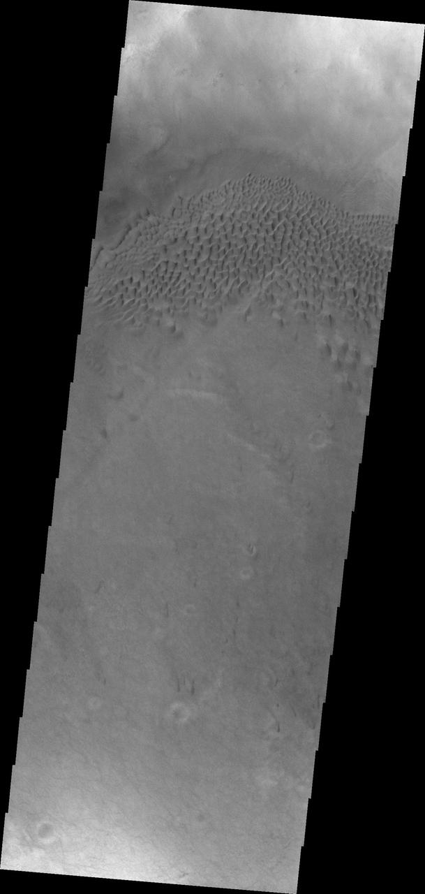
The dunes shown in this image from NASA 2001 Mars Odyssey are located on the floor of Hussey Crater in Terra Sirenum.
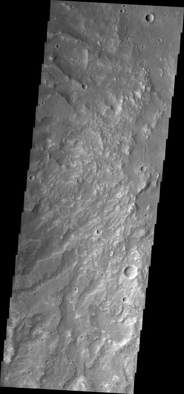
Channels dissect the hillside of Terra Sirenum in this image from NASA 2001 Mars Odyssey spacecraft.

This image captured by NASA 2001 Mars Odyssey spacecraft shows a section of Tader Valles located in Terra Sirenum.

A small channel system dissects the rim of this unnamed crater in Terra Sirenum. Orbit Number: 74466 Latitude: -39.9359 Longitude: 182.762 Instrument: VIS Captured: 2018-09-27 18:47 https://photojournal.jpl.nasa.gov/catalog/PIA22847
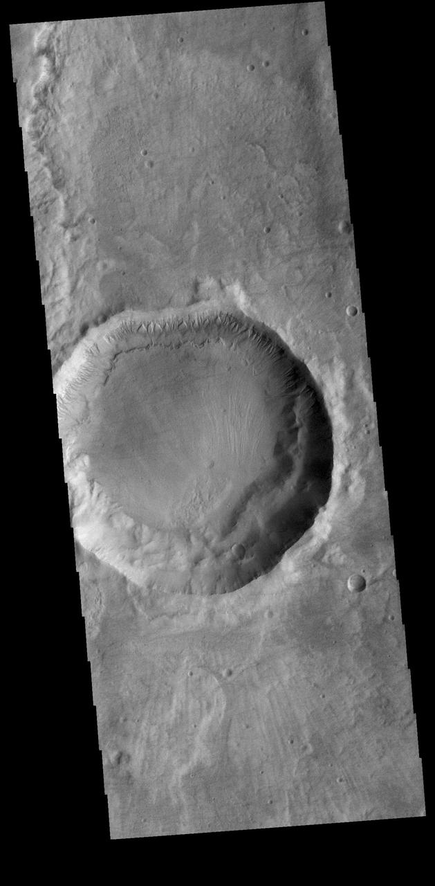
Numerous gullies dissect the northern rim of this unnamed crater in Terra Sirenum. Orbit Number: 74366 Latitude: -41.1423 Longitude: 188.928 Instrument: VIS Captured: 2018-09-19 13:05 https://photojournal.jpl.nasa.gov/catalog/PIA22842
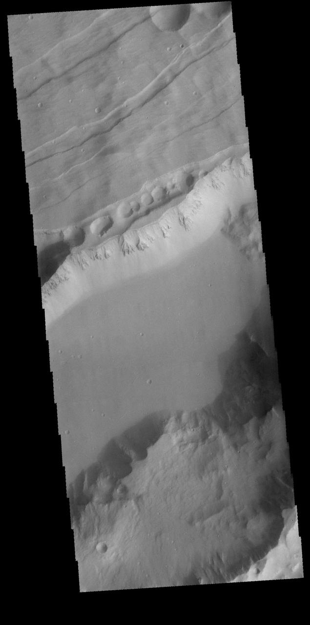
This image captured by NASA 2001 Mars Odyssey spacecraft shows part of Sirenum Fossae, a large graben on the margin between Terra Sirenum and Daedalis Planum. Grabens are formed by the downward movement of material between parallel tectonic faults. Orbit Number: 65672 Latitude: -25.6345 Longitude: 220.325 Instrument: VIS Captured: 2016-10-03 07:01 http://photojournal.jpl.nasa.gov/catalog/PIA21177
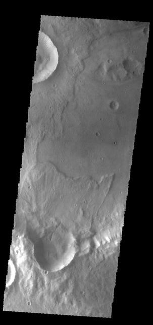
Today's VIS image of an unnamed crater in Terra Sirenum shows crater ejecta. Orbit Number: 60139 Latitude: -38.4241 Longitude: 224.216 Instrument: VIS Captured: 2015-07-05 13:30 http://photojournal.jpl.nasa.gov/catalog/PIA19760
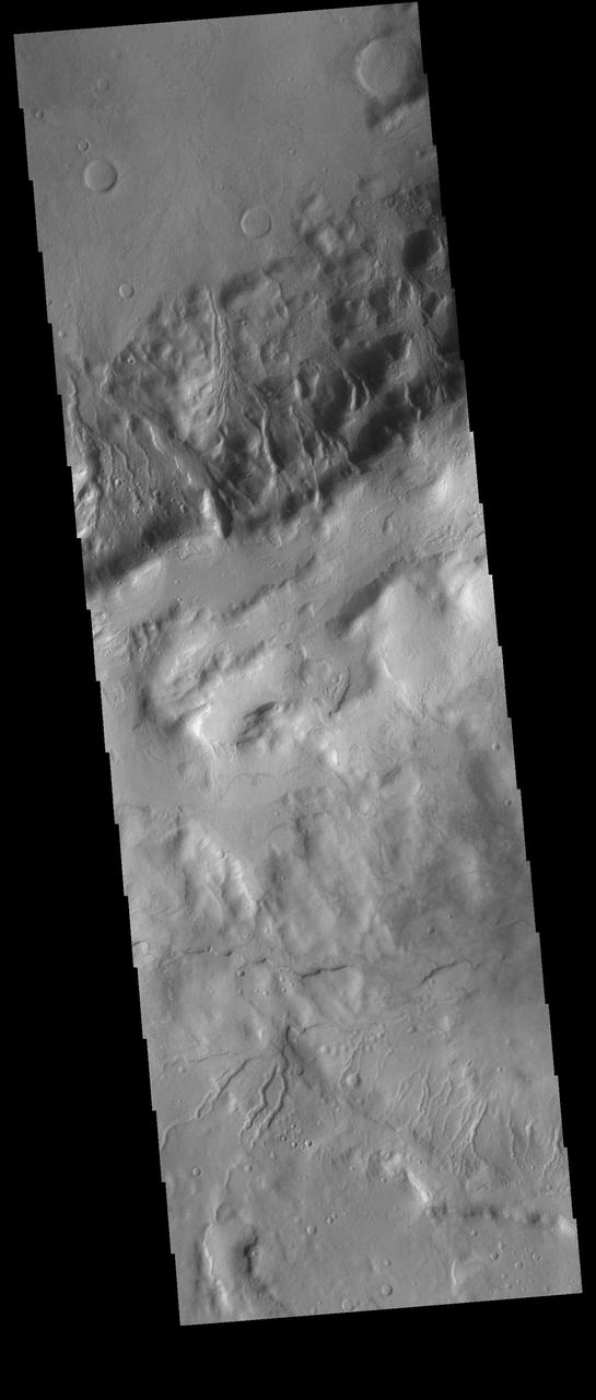
Multiple gullies dissect the rim of an unnamed crater located in Terra Sirenum. Towards the bottom of the image several small gullies are visible located on the rim of an older crater. Orbit Number: 75238 Latitude: -45.5986 Longitude: 225.72 Instrument: VIS Captured: 2018-11-30 08:47 https://photojournal.jpl.nasa.gov/catalog/PIA23015
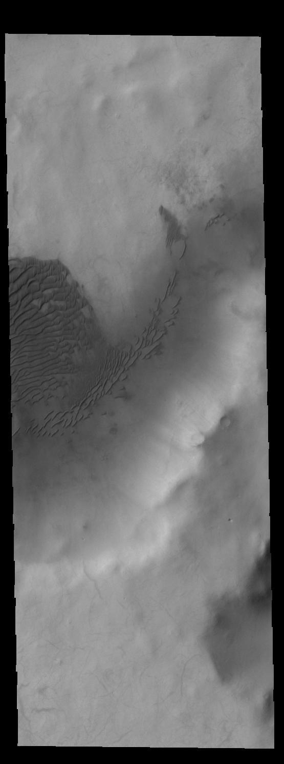
This image captured by NASA 2001 Mars Odyssey spacecraft shows sand dunes on the floor of an unnamed crater in Terra Sirenum. Orbit Number: 58736 Latitude: -61.6193 Longitude: 199.658 Instrument: VIS Captured: 2015-03-12 01:13 http://photojournal.jpl.nasa.gov/catalog/PIA19452
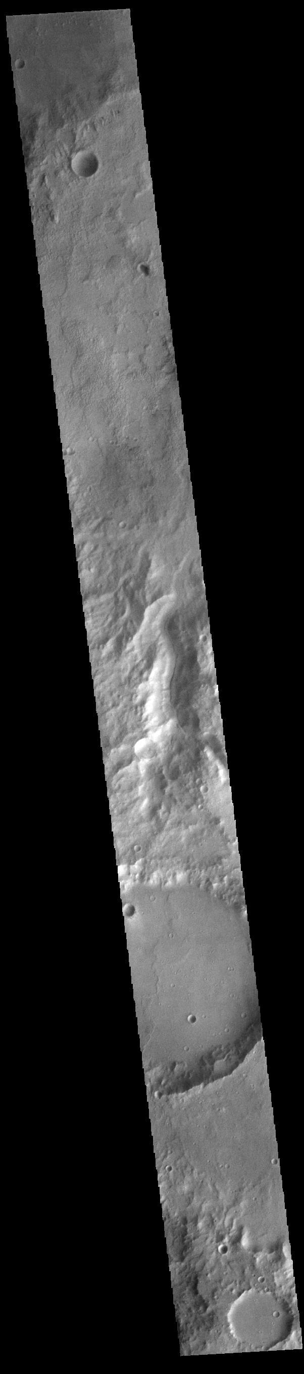
Today's VIS image shows an unnamed channel located on the northern boundary of Terra Sirenum near Lucus Planum. Orbit Number: 83225 Latitude: -12.1131 Longitude: 187.493 Instrument: VIS Captured: 2020-09-18 01:25 https://photojournal.jpl.nasa.gov/catalog/PIA24243
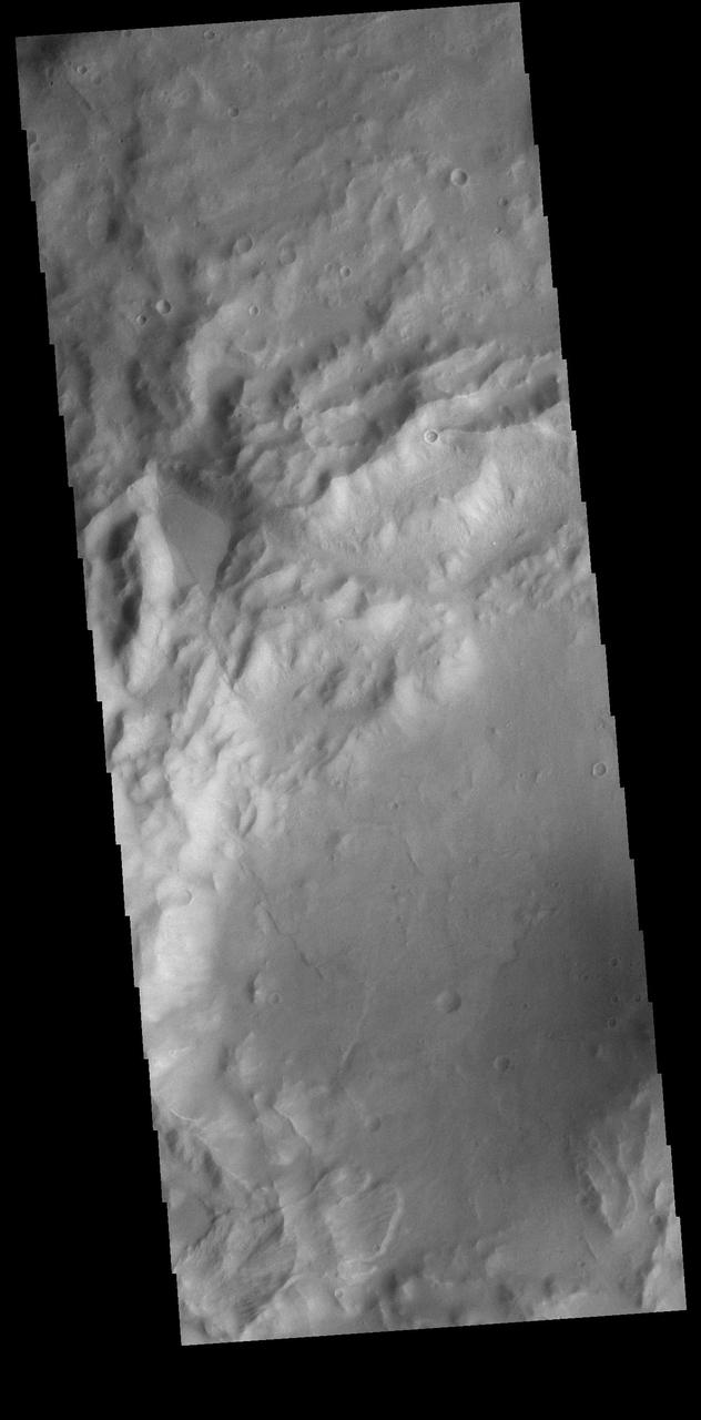
A small landslide deposit is visible at the bottom left corner of this VIS image. The landslide is in an unnamed crater in Terra Sirenum. Orbit Number: 74477 Latitude: -35.232 Longitude: 224.63 Instrument: VIS Captured: 2018-09-28 16:33 https://photojournal.jpl.nasa.gov/catalog/PIA22849

This image from NASA 2001 Mars Odyssey spacecraft shows numerous gullies dissect the rim of this unnamed crater in Terra Sirenum. Orbit Number: 58930 Latitude: -38.9319 Longitude: 181.123 Instrument: VIS Captured: 2015-03-28 00:11 http://photojournal.jpl.nasa.gov/catalog/PIA19466
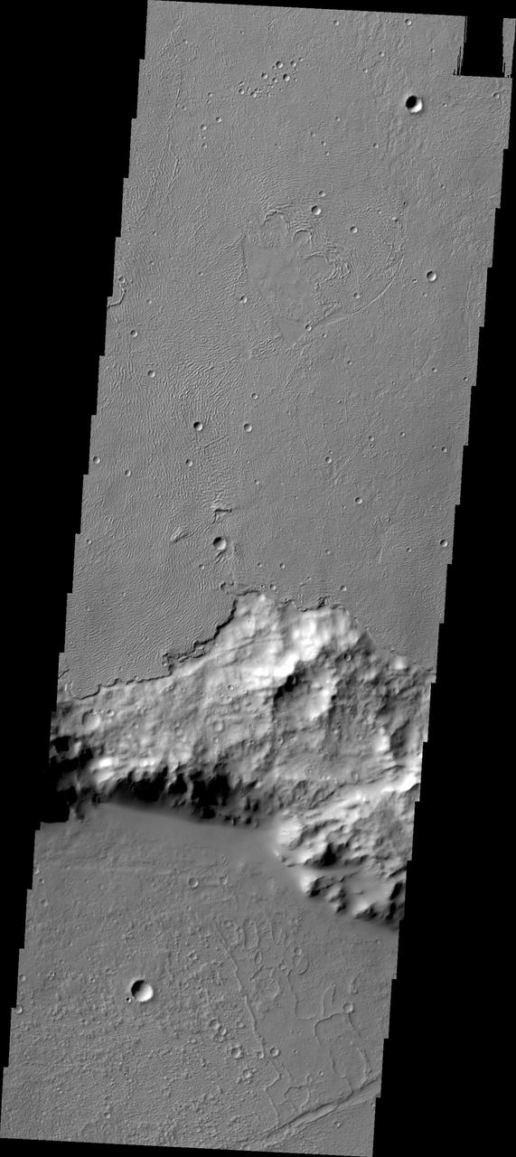
In some regions of Mars the relative ages of different materials can be determined. In this image, captured by NASA 2001 Mars Odyssey, the younger lava flows of Daedalia Planum are on top of the older Terra Sirenum materials.
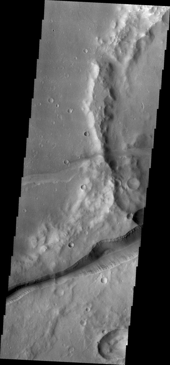
Huge fractures cutting through the surface of Terra Sirenum are called Memnonia Fossae. The term fossae means linear depression. This image is from NASA 2001 Mars Odyssey.
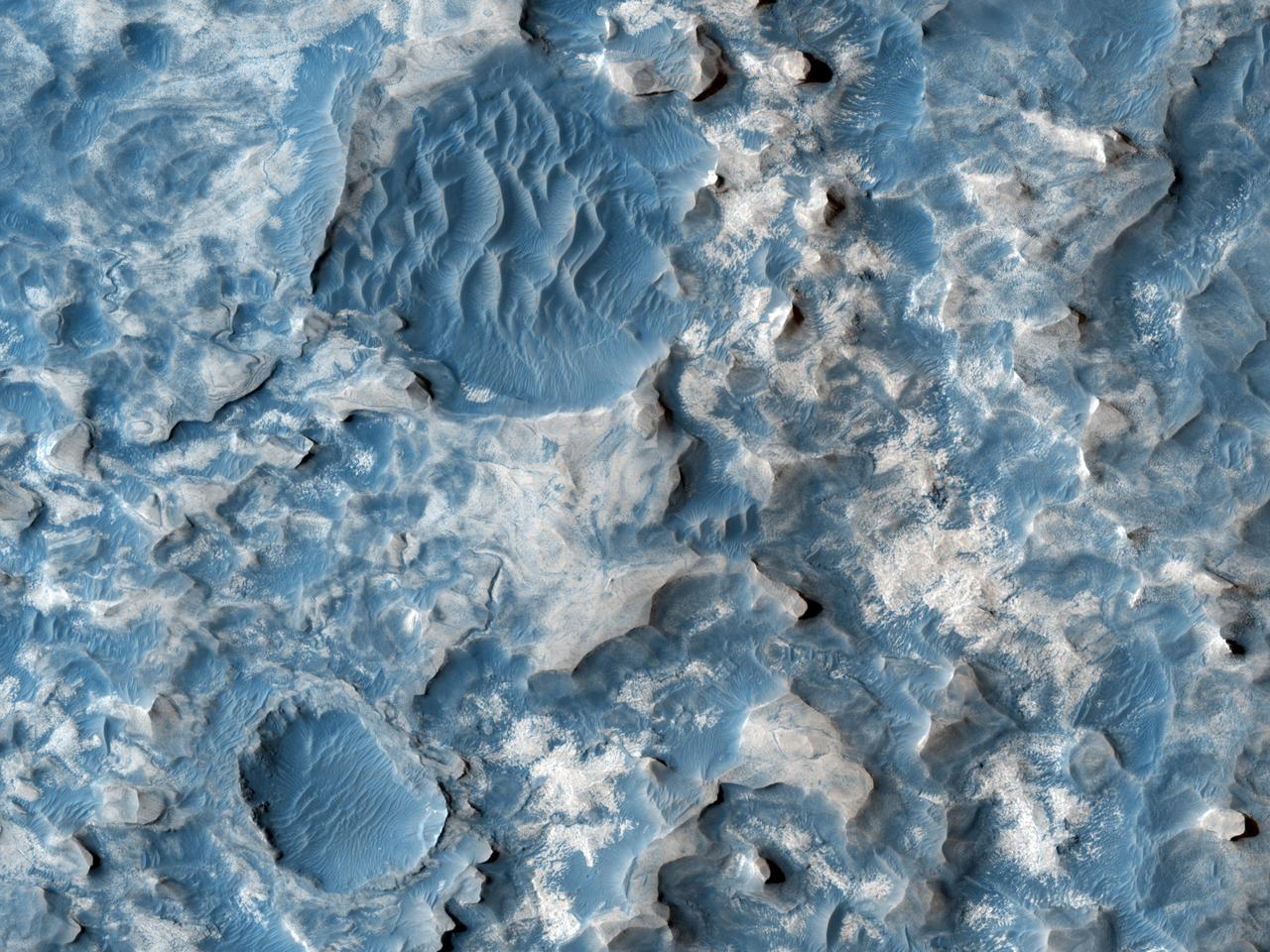
This image from NASA Mars Reconnaissance Orbiter shows part of an unnamed crater, itself located inside the much larger Newton Crater, in Terra Sirenum. Original release date March 3, 2010.
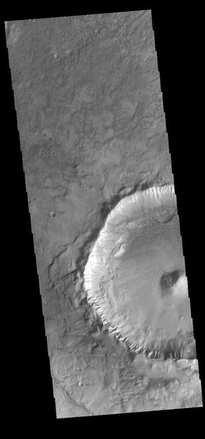
This image captured by NASA 2001 Mars Odyssey spacecraft shows an example of a central peak crater. This unnamed crater is located on the floor of Newton Crater in Terra Sirenum. Orbit Number: 57962 Latitude: -42.1211 Longitude: 201.814 Instrument: VIS Captured: 2015-01-07 07:47 photojournal.jpl.nasa.gov/catalog/PIA19200

This VIS image shows part of the large sand sheet with surface dune forms on the floor of Charlier Crater in Terra Sirenum. Orbit Number: 91804 Latitude: -68.028 Longitude: 190.573 Instrument: VIS Captured: 2022-08-25 10:08 https://photojournal.jpl.nasa.gov/catalog/PIA25644

Today's VIS image shows part of an unnamed crater in Terra Sirenum. The inner crater rim is dissected by numerous small channels. Orbit Number: 82888 Latitude: -44.1271 Longitude: 194.346 Instrument: VIS Captured: 2020-08-21 07:18 https://photojournal.jpl.nasa.gov/catalog/PIA24182

A field of sand dunes is visible on the floor of this unnamed crater. The crater is located in Terra Sirenum. Orbit Number: 75239 Latitude: -46.362 Longitude: 196.929 Instrument: VIS Captured: 2018-11-30 10:45 https://photojournal.jpl.nasa.gov/catalog/PIA23023
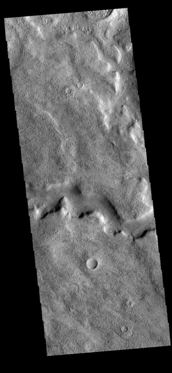
Today's VIS image shows a section of Tader Valles located in Terra Sirenum. Tader Valles is 200 km long (124 miles). Orbit Number: 91735 Latitude: -48.4634 Longitude: 206.888 Instrument: VIS Captured: 2022-08-19 18:08 https://photojournal.jpl.nasa.gov/catalog/PIA25631
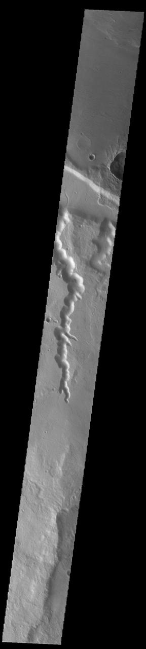
Today's VIS image shows the complete length of two channels in northern Terra Sirenum. As with all channels in this region – including Mangala Valles – the flow is northward into the low elevation region south of Amazonis Mensa. Abus Vallis is on the left and is 66 km long (41 miles). Senus Vallis is on the right and is 22 km long (13 miles). Orbit Number: 92178 Latitude: -5.63635 Longitude: 212.823 Instrument: VIS Captured: 2022-09-25 04:53 https://photojournal.jpl.nasa.gov/catalog/PIA25752
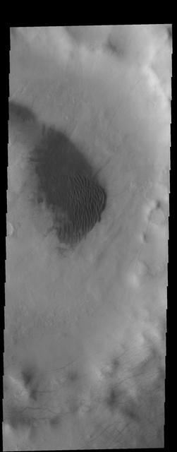
Today's VIS image shows a field on dunes on the floor of an unnamed crater in southern Terra Sirenum. The tracks of dust devils can be seen elsewhere on the crater floor, as well as on the crater rim. Orbit Number: 84004 Latitude: -61.0073 Longitude: 216.778 Instrument: VIS Captured: 2020-11-21 04:14 https://photojournal.jpl.nasa.gov/catalog/PIA24364

This VIS image is located in Terra Sirenum. The bright linear feature at the bottom of the image is the crest of a ridge. The multiple channel features toward the top of this image were created by liquid flow running down slope from the ridge. Orbit Number: 74452 Latitude: -40.0299 Longitude: 226.894 Instrument: VIS Captured: 2018-09-26 15:06 https://photojournal.jpl.nasa.gov/catalog/PIA22845
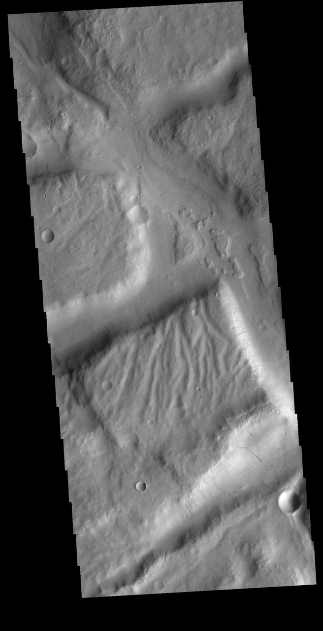
Today's VIS image shows a complex region of features in northern Terra Sirenum. Right angle valley intersections were created by tectonic forces, the tops of the mesas are dissected by channels and several cliff sides contain dark slope streaks. Orbit Number: 81952 Latitude: -7.86492 Longitude: 191.975 Instrument: VIS Captured: 2020-06-05 05:49 https://photojournal.jpl.nasa.gov/catalog/PIA24113
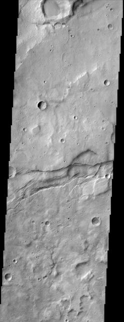
This image from NASA Mars Odyssey spacecraft shows the cratered highlands of Terra Sirenum in Mars southern hemisphere. Near the center of the image running from left to right one can see long parallel to semi-parallel troughs called graben.
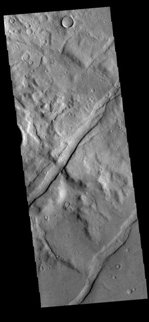
The channel-like features in this VIS image are tectonic graben. These graben are called Icaria Fossae and are located in Terra Sirenum. Graben are created in regions of extensional tectonic stress, where the bedrock is faulted and pulled apart, allowing linear sections of the surface to drop downward along paired faults. Orbit Number: 81751 Latitude: -46.5369 Longitude: 236.614 Instrument: VIS Captured: 2020-05-19 16:24 https://photojournal.jpl.nasa.gov/catalog/PIA24010
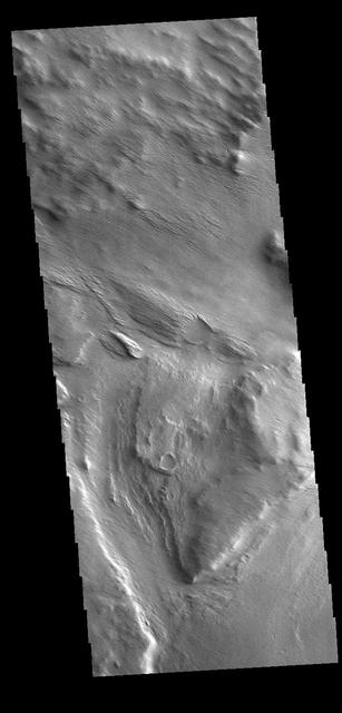
Several named and unnamed channels are located south of the Medusa Fossae Formation on the margin with Terra Sirenum. One of the unnamed channels is visible in the lower half of this VIS image. Wind erosion and deposition have modified the channel, indicating the channel is older than the wind action. Orbit Number: 77996 Latitude: -6.80206 Longitude: 202.156 Instrument: VIS Captured: 2019-07-15 12:00 https://photojournal.jpl.nasa.gov/catalog/PIA23415

This VIS image shows a group of craters in Terra Sirenum. The apparent youngest one is the center crater with the scalloped rim. Subsurface tectonic features like faults can interfere with crater formation and lead to craters that are not completely circular. The linear fault features towards the bottom of the image are good indications that tectonic faults interacted with the impact event, resulting in the crater shape seen in the image. Orbit Number: 74934 Latitude: -29.081 Longitude: 181.756 Instrument: VIS Captured: 2018-11-05 07:19 https://photojournal.jpl.nasa.gov/catalog/PIA23011

Dark dunes fill part of the floor of this unnamed crater in Terra Sirenum. There are numerous gullies on the rim of the crater. Winds are moving the sand towards the upper left of this image, filling the lower sections of many gullies. Orbit Number: 75020 Latitude: -52.6235 Longitude: 215.879 Instrument: VIS Captured: 2018-11-12 09:26 https://photojournal.jpl.nasa.gov/catalog/PIA22988
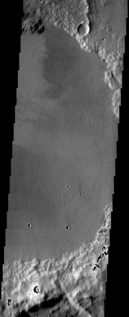
The floor of the crater in this NASA Mars Odyssey image displays interesting textures and it appears to have been flooded by some type of material. It is unclear if this material was fluvially emplaced mud hyperconcentrated flows or lava.
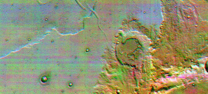
This is the first high-resolution color infrared image taken of Mars. The image was constructed using three of the ten infrared filters on the thermal emission imaging system of NASA Mars Odyssey spacecraft.
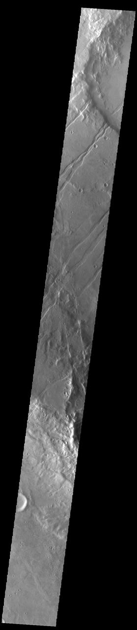
The linear features in this VIS image are tectonic graben called Icaria Fossae and are located in Terra Sirenum. Graben are formed by extension of the crust and faulting. When large amounts of pressure or tension are applied to rocks on timescales that are fast enough that the rock cannot respond by deforming, the rock breaks along faults. In the case of a graben, two parallel faults are formed by extension of the crust and the rock in between the faults drops downward into the space created by the extension. The Icaria Fossae graben are 2115km (1314 miles) long. Orbit Number: 93200 Latitude: -41.7764 Longitude: 243.379 Instrument: VIS Captured: 2022-12-18 08:42 https://photojournal.jpl.nasa.gov/catalog/PIA25847
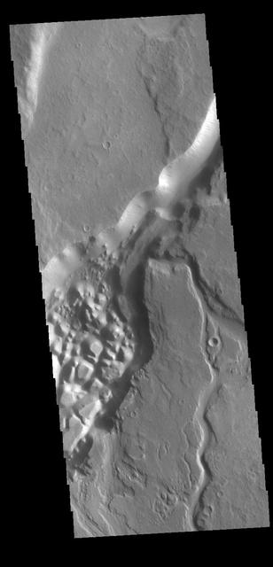
This VIS image shows part of Minio Vallis. Minio Vallis is just one of many channels that flow northward thru Terra Sirenum to empty into Amazonis Planitia. Minio Vallis is 88km long (55miles), and is located west of the much larger Mangala Valles. Orbit Number: 79855 Latitude: -4.62787 Longitude: 208.183 Instrument: VIS Captured: 2019-12-15 13:52 https://photojournal.jpl.nasa.gov/catalog/PIA23734
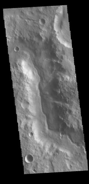
Today's VIS image is located along the northern margin of Terra Sirenum. This unnamed channel contains a small channel within a larger channel. This would indicate two separate channel forming events. The inner one has eroded into the center of the larger channel, and was therefore created after the larger channel. Orbit Number: 70337 Latitude: -8.01257 Longitude: 192.647 Instrument: VIS Captured: 2017-10-22 15:35 https://photojournal.jpl.nasa.gov/catalog/PIA22364
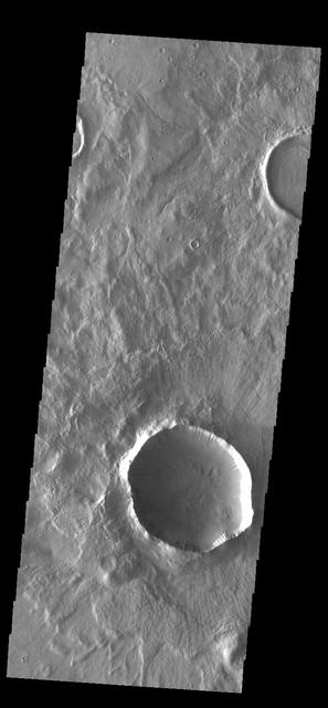
This VIS image shows an unnamed crater located in Terra Sirenum. The surface of the ejecta contains radial grooves, visible on the thicker ejecta near the crater rim. The formation mechanism for the grooves is still unknown but several theories exist including basal surge flows and air pressure rock entrainment. Several gullies dissect the inner crater rim. Orbit Number: 84865 Latitude: -43.7455 Longitude: 222.519 Instrument: VIS Captured: 2021-01-31 01:32 https://photojournal.jpl.nasa.gov/catalog/PIA24734
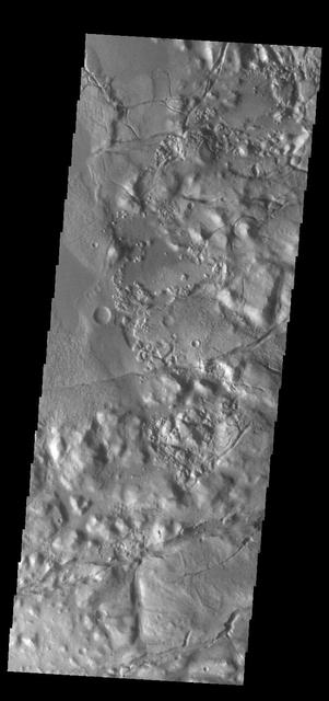
This VIS image shows part of Gorgonum Chaos. Chaotic regions form when groundwater escapes to the surface, undermining it and causing the ground to collapse. The linear depressions at the bottom of the image are part of Sirenum Fossae. Gorgonum Chaos is located in Terra Sirenum. Orbit Number: 84080 Latitude: -37.7334 Longitude: 189.356 Instrument: VIS Captured: 2020-11-27 10:17 https://photojournal.jpl.nasa.gov/catalog/PIA24369
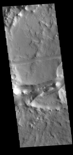
This VIS image shows part of the Memnonia Fossae graben. Memnonia Fossae, Mangala Fossae and Sirenum Fossae are all long graben (tectonic troughs) systems that stretch from eastern Terra Sirenum into western Daedalia Planum. Orbit Number: 80629 Latitude: -21.8719 Longitude: 201.417 Instrument: VIS Captured: 2020-02-17 07:18 https://photojournal.jpl.nasa.gov/catalog/PIA23909
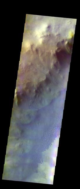
The THEMIS VIS camera contains 5 filters. The data from different filters can be combined in multiple ways to create a false color image. These false color images may reveal subtle variations of the surface not easily identified in a single band image. Today's false color image shows dunes of the floor of Keeler Crater in Terra Sirenum. Orbit Number: 9917 Latitude: -60.2955 Longitude: 208.203 Instrument: VIS Captured: 2004-03-09 21:56 http://photojournal.jpl.nasa.gov/catalog/PIA19751
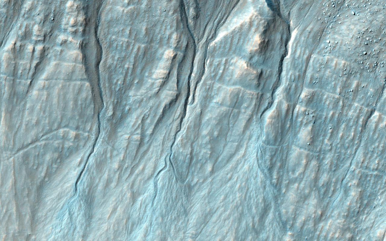
NASA Mars Reconnaissance Orbiter reveals that gullies, or ravines, are landforms commonly found in the mid-latitudes on Mars, particularly in the Southern highlands.

This VIS image shows part of the rim of an unnamed crater in Terra Sirenum. A group of channels dissect the rim in the center of the image. These channels are called gullies due to being on a steep slope rather than a flat river plain. In some images it is possible to see a boundary layer between the upper incised gully and a lower deposition region. The boundary marks a change in slope, the steep upper portion supports fast moving fluid that carves into the rim eroding materials. The change to a flatter slope causes the fluid to slow down and as it slows the materials carried by the fluid are deposited. Orbit Number: 92703 Latitude: -39.1381 Longitude: 182.069 Instrument: VIS Captured: 2022-11-07 10:33 https://photojournal.jpl.nasa.gov/catalog/PIA25804
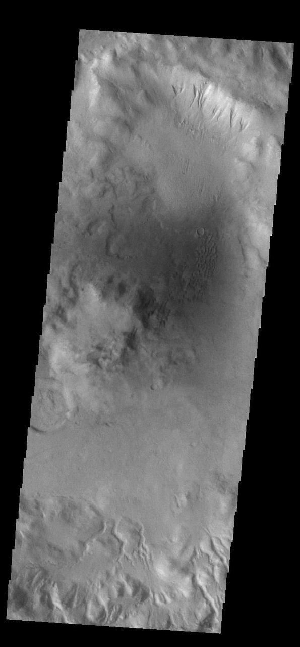
This VIS image shows part of the rim of an unnamed crater in Terra Sirenum. A group of channels dissect the rim in the center of the image. These channels are called gullies due to being on a steep slope rather than a flat river plain. In some images it is possible to see a boundary layer between the upper incised gully and a lower deposition region. The boundary marks a change in slope, the steep upper portion supports fast moving fluid that carves into the rim eroding materials. The change to a flatter slope causes the fluid to slow down and as it slows the materials carried by the fluid are deposited. Orbit Number: 92428 Latitude: -44.183 Longitude: 194.798 Instrument: VIS Captured: 2022-10-15 19:08 https://photojournal.jpl.nasa.gov/catalog/PIA25761
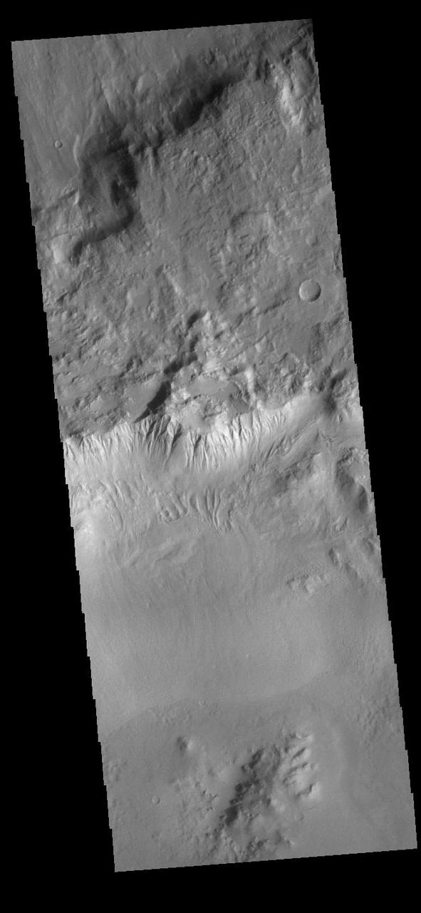
This VIS image shows part of the rim of an unnamed crater in Terra Sirenum. A group of channels dissect the rim in the center of the image. These channels are called gullies due to being on a steep slope rather than a flat river plain. In some images it is possible to see a boundary layer between the upper incised gully and a lower deposition region. The boundary marks a change in slope, the steep upper portion supports fast moving fluid that carves into the rim eroding materials. The change to a flatter slope causes the fluid to slow down and as it slows the materials carried by the fluid are deposited. Orbit Number: 91136 Latitude: -43.5736 Longitude: 206.861 Instrument: VIS Captured: 2022-07-01 10:26 https://photojournal.jpl.nasa.gov/catalog/PIA25542
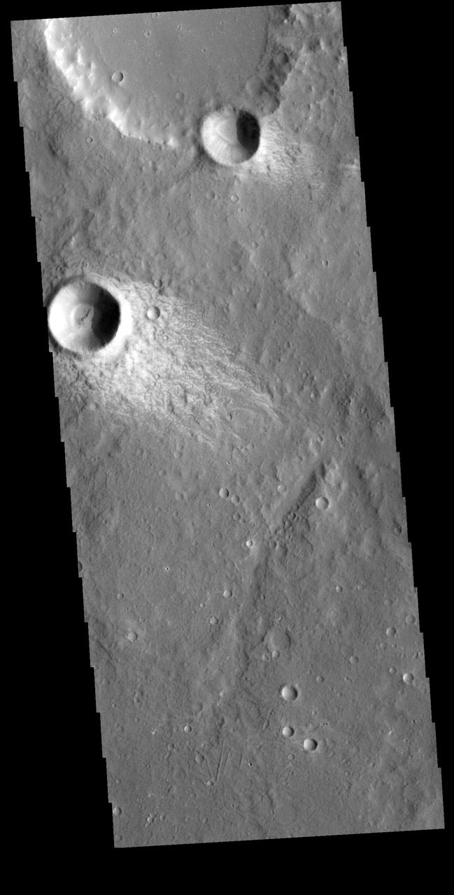
This VIS image shows a small region in Terra Sirenum. The bright material forming "tails" behind the craters were created by surface winds funneled over and around the crater. The raised rims and bowls of impact craters causes a complex interaction such that the wind vortex in the lee of the crater can both scour away the surface dust and deposit it back in the center of the lee. The "tail" shows the direction of the wind, in this case blowing from the upper right to the lower left. Orbit Number: 73131 Latitude: -15.549 Longitude: 188.595 Instrument: VIS Captured: 2018-06-09 19:41 https://photojournal.jpl.nasa.gov/catalog/PIA22668
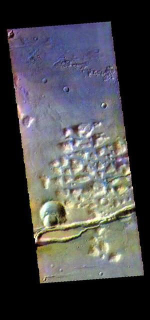
The THEMIS camera contains 5 filters. The data from different filters can be combined in multiple ways to create a false color image. hese false color images may reveal subtle variations of the surface not easily identified in a single band image. This image from NASA 2001 Mars Odyssey spacecraft shows part of Gorgonum Chaos. The linear depression at the bottom of the image are part of Sirenum Fossae. Gorgonum Chaos is located in Terra Sirenum. Orbit Number: 58237 Latitude: -38.0276 Longitude: 188.624 Instrument: VIS Captured: 2015-01-29 23:14 https://photojournal.jpl.nasa.gov/catalog/PIA21545
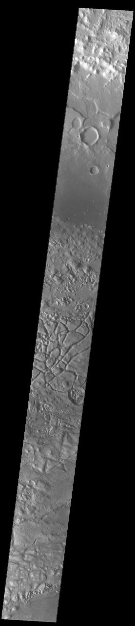
This VIS image shows part of Gorgonum Chaos. Chaos terrain is typified by regions of blocky, often steep sided, mesas interspersed with deep valleys. With time and erosion the valleys widen and the mesas become smaller. Chaotic regions form when groundwater escapes to the surface, undermining it and causing the ground to collapse. The linear depressions at the bottom of the image are part of Sirenum Fossae. Gorgonum Chaos is located in Terra Sirenum. Orbit Number: 92266 Latitude: -36.8519 Longitude: 189.676 Instrument: VIS Captured: 2022-10-02 10:57 https://photojournal.jpl.nasa.gov/catalog/PIA25754
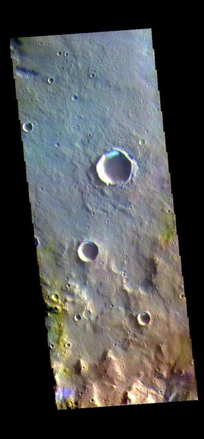
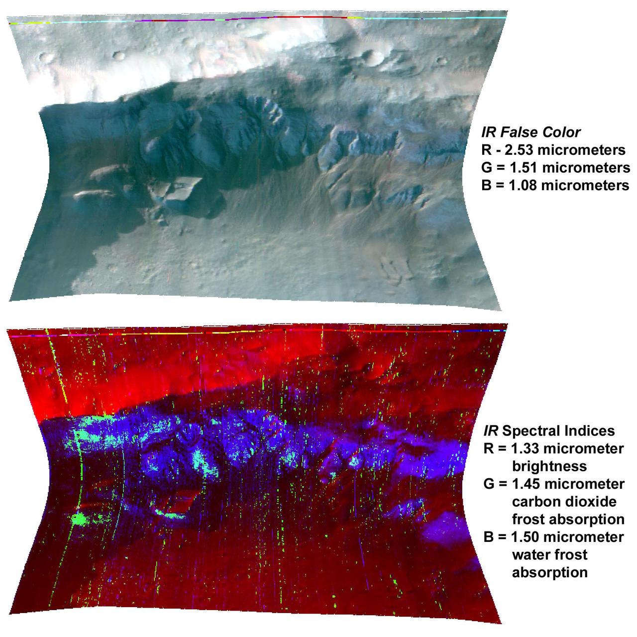
The THEMIS VIS camera contains 5 filters. The data from different filters can be combined in multiple ways to create a false color image. These false color images may reveal subtle variations of the surface not easily identified in a single band image. Today's false color image shows several small, unnamed craters in Terra Sirenum. The bright blue region on the inner crater rim is morning frost. Collected during the winter, south facing slopes stay in shadow and retain frost longer than the rest of the rim already in sunlight. Frosts are only identifiable in multi filter images. Orbit Number: 80442 Latitude: -36.3327 Longitude: 198.274 Instrument: VIS Captured: 2020-02-01 21:41 https://photojournal.jpl.nasa.gov/catalog/PIA24676
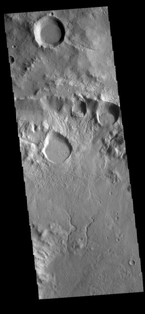
This VIS image shows part of the crater rim and floor of an unnamed crater located in Terra Sirenum on the north rim of Newton Crater. The rim of the crater is in the upper half of the image. Several rounded features are located near the top of the rim. Rather than being impact craters, these features are more likely formed by collapse of the crater rim. In this type of slope failure a block of material slides down a fracture leaving a scalloped shaped feature with a block of material along the lower edge of the slope. There are also several channels dissecting the rim. This crater has a central peak, just off the image at the bottom left corner. The channels in the bottom part of the image are flowing away from the peak. Orbit Number: 81565 Latitude: -37.72 Longitude: 200.927 Instrument: VIS Captured: 2020-05-04 08:53 https://photojournal.jpl.nasa.gov/catalog/PIA23998