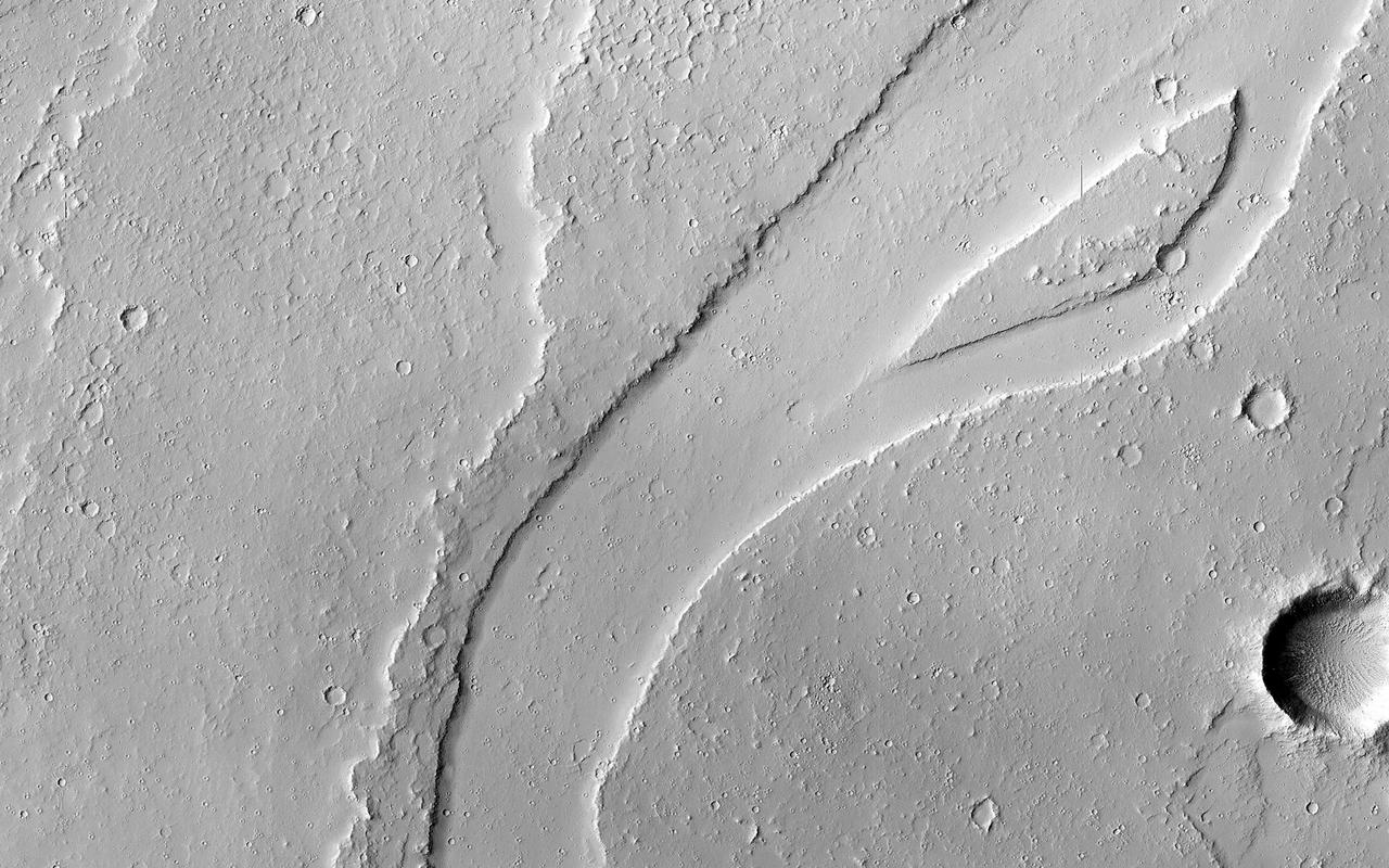
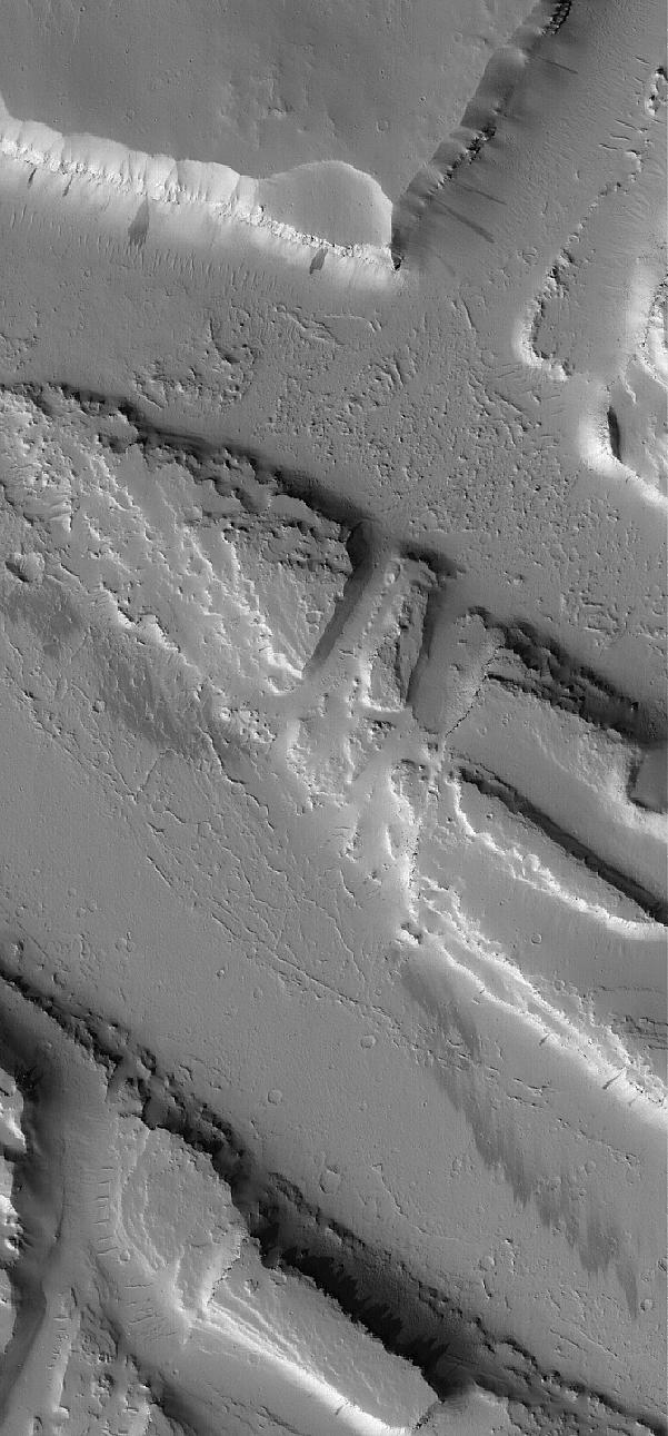
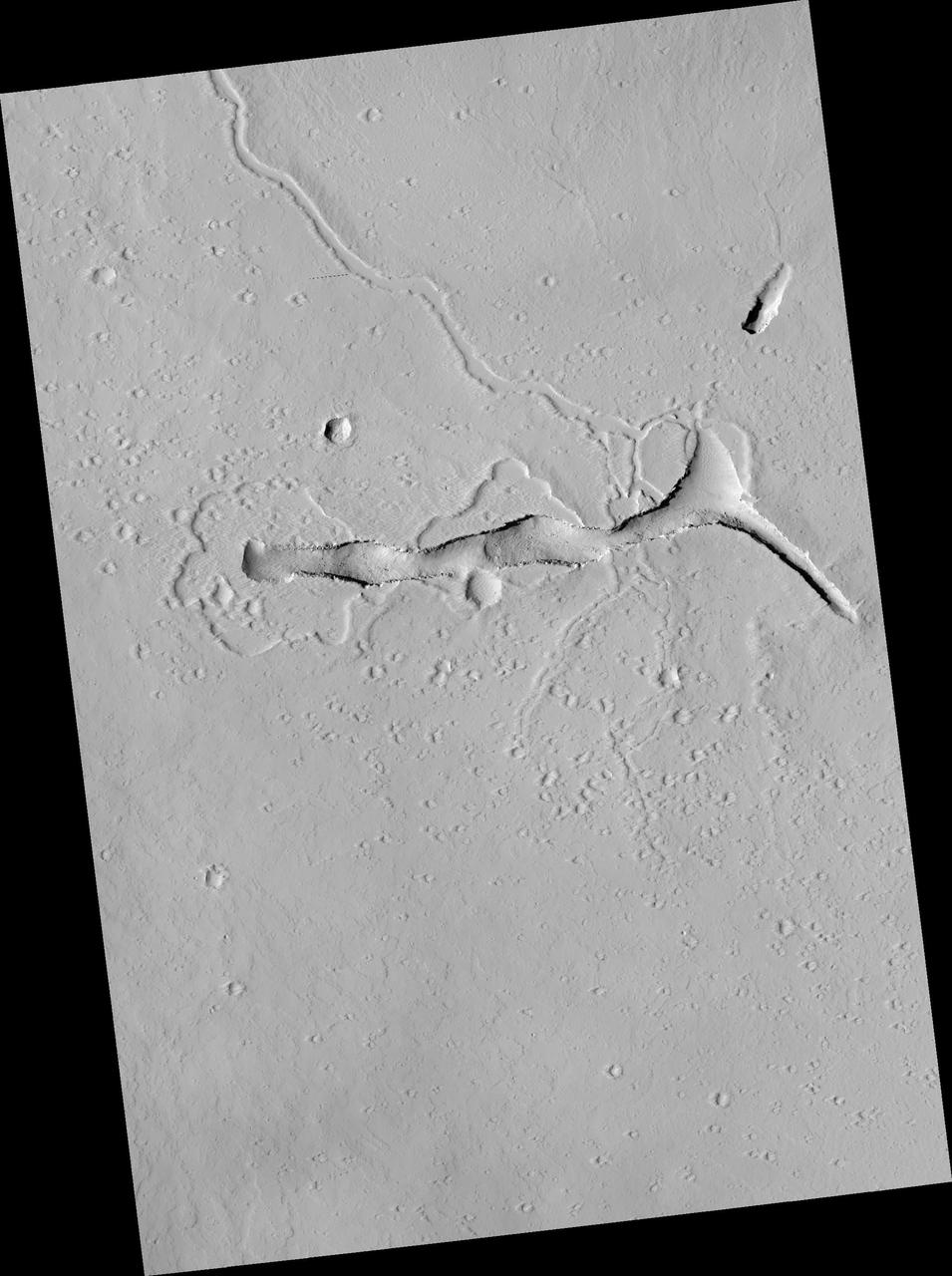
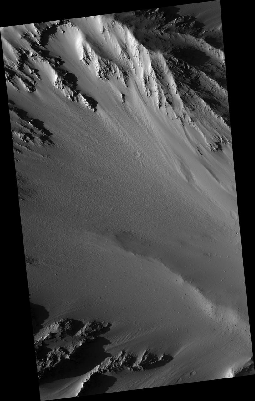
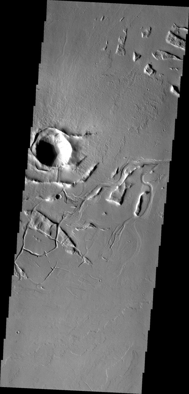
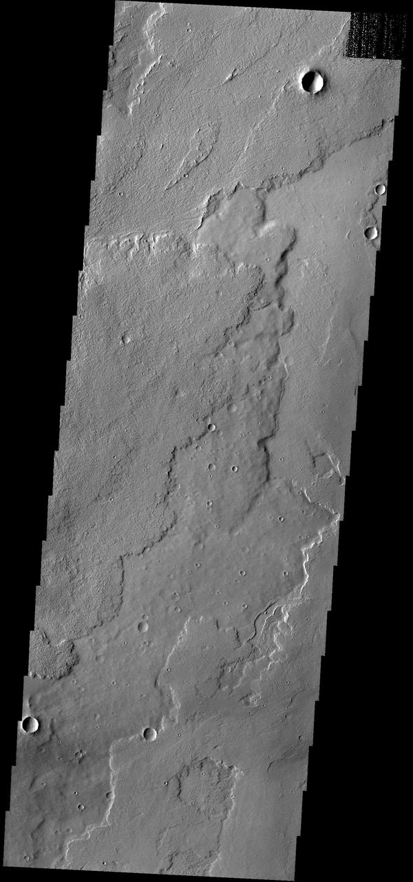
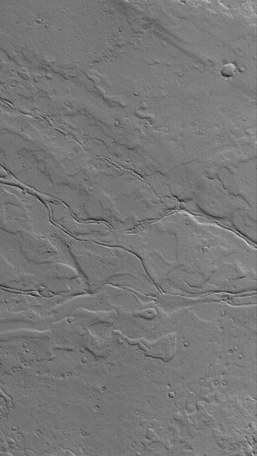
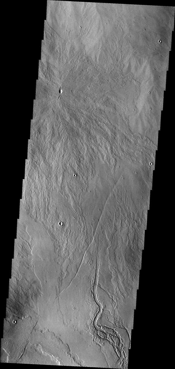
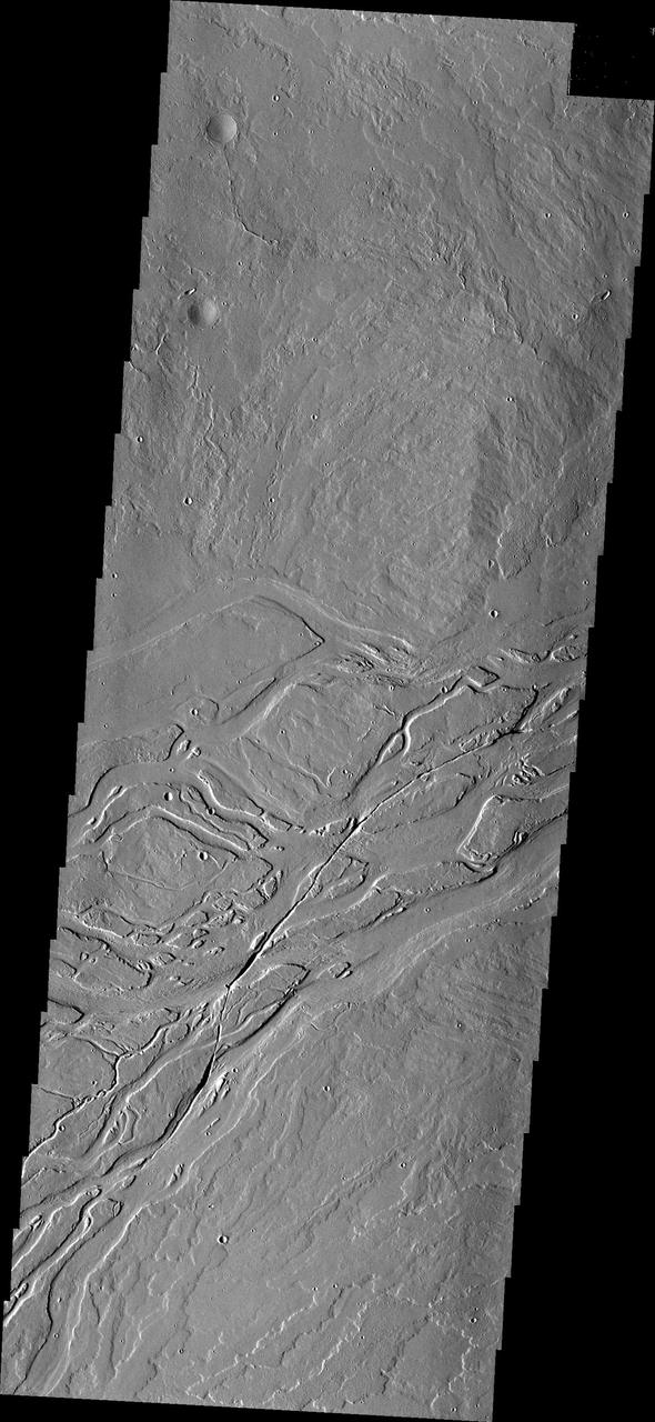
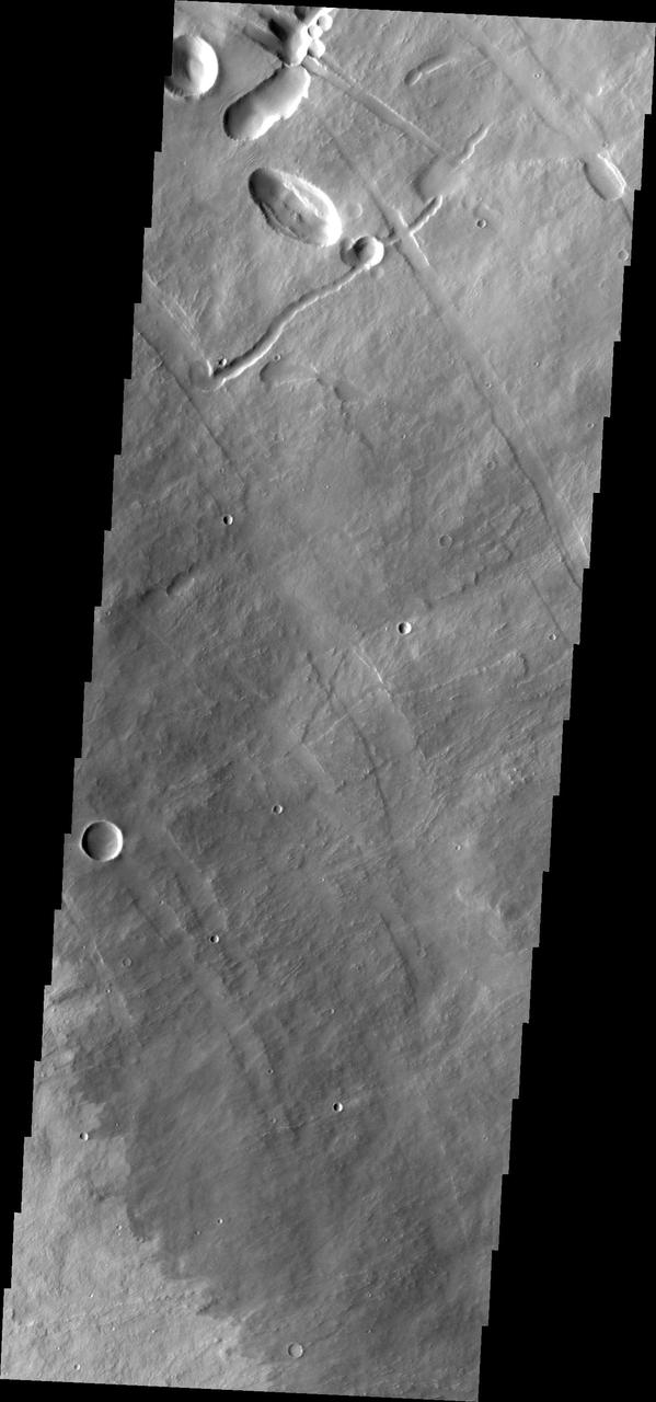
The Tharsis region of Mars is covered in vast lava flows, many with channels. Some channels, however, resemble features that may have been formed by water. In this image, we see a smooth, flat-bottomed channel within the roughly irregular edges of a possible lava flow. This long, winding channel runs for 115 kilometers (70 miles) from its source (shown in ESP_045091_2045), maintaining a nearly consistent width. There is also a streamlined island within the channel, which is 1.25 kilometers (about 3/4 mile) long. One possibility is that a lava flow formed, and later groundwater was released, preferentially flowing through and further eroding the pre-existing lava channel. Or, the original lava flow could have been a very low-viscosity lava. We look at the shape and profile of the channel, and the channel and lava flow edges, to understand the characteristics of the fluids at work. Although there are lava flows and rivers on Earth that we can observe to understand the processes at work, the interplay of the features on Mars may tell a more complicated story. We want to be able to understand the history of volcanic activity in Tharsis, as well as possible interaction with ground water release, to better understand some of the younger landforms on Mars. http://photojournal.jpl.nasa.gov/catalog/PIA21104
Tharsis Channels
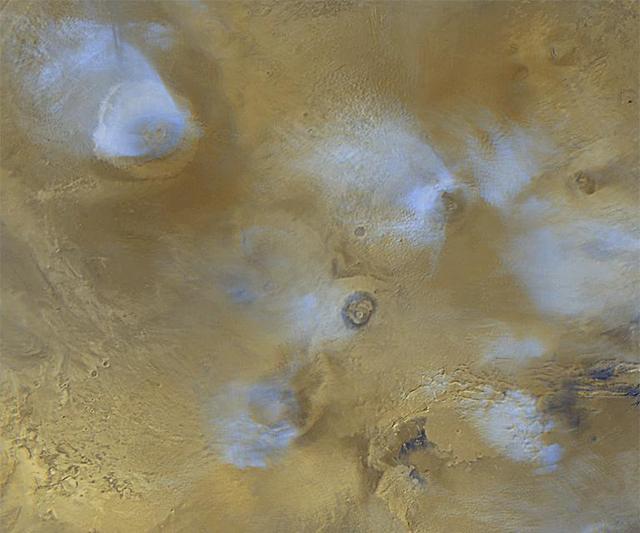
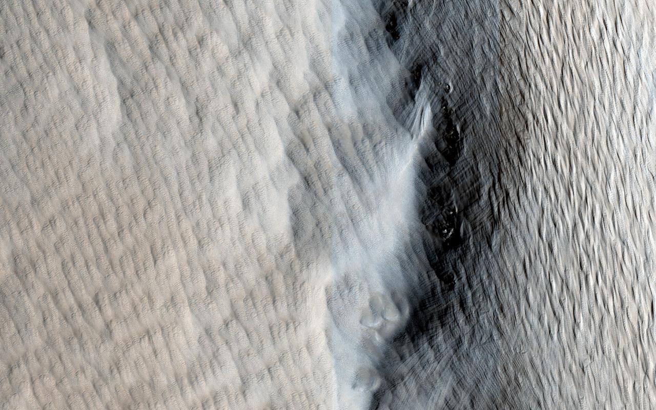
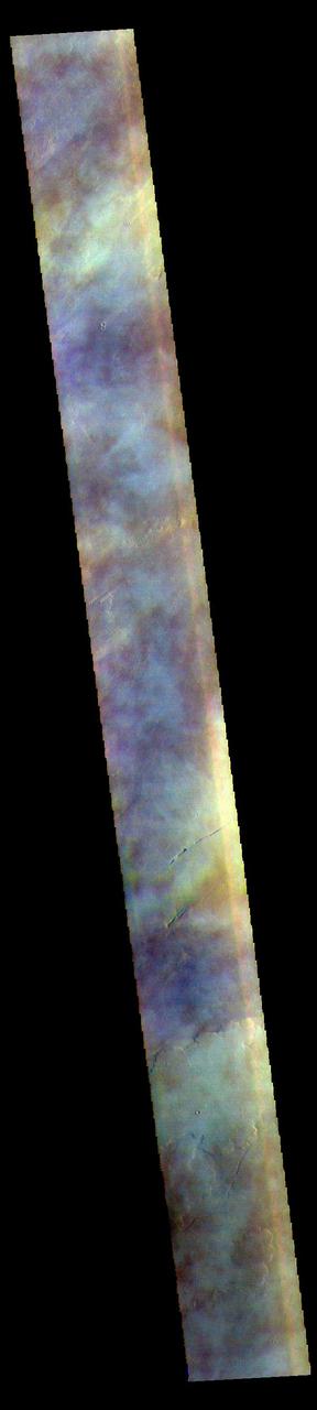
Tharsis Winds
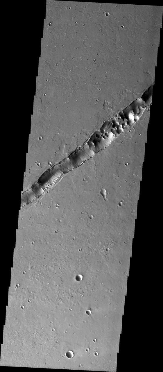
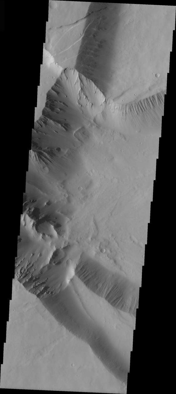
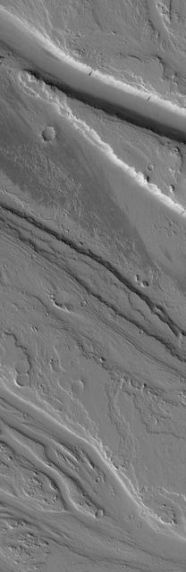
Troughs in Tharsis
Troughs in Tharsis
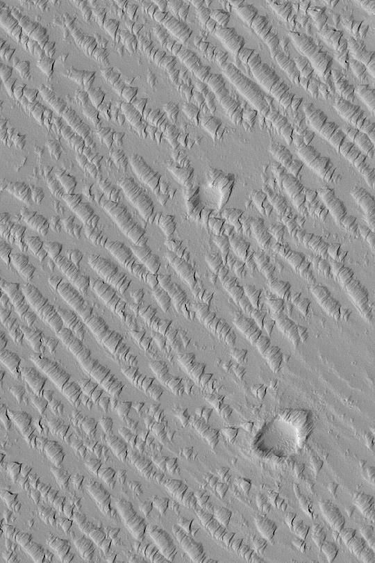
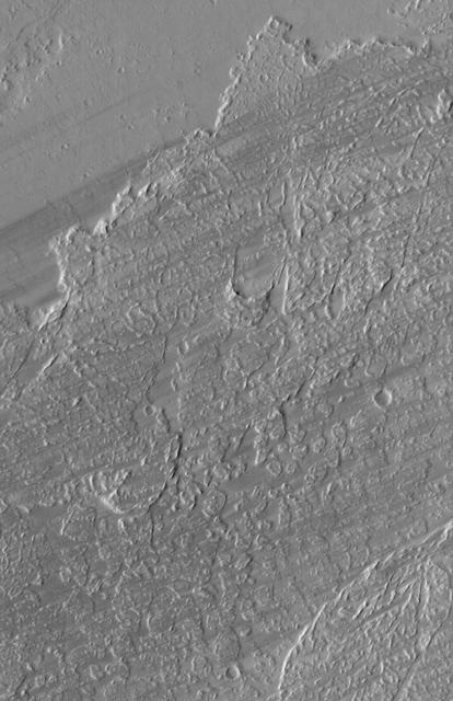
Tharsis Textures
Tharsis Landslide
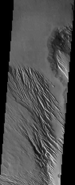
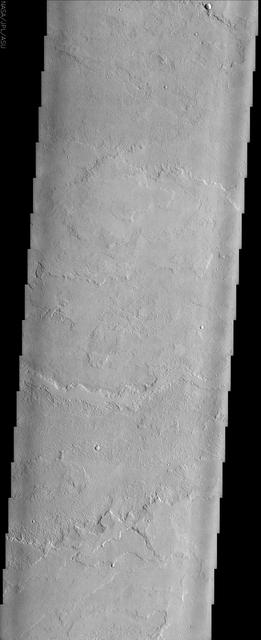
Tharsis Lavas
Tharsis and Marineris
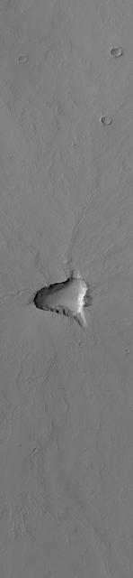
Small Tharsis Volcano
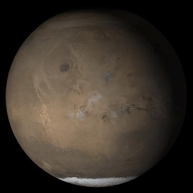
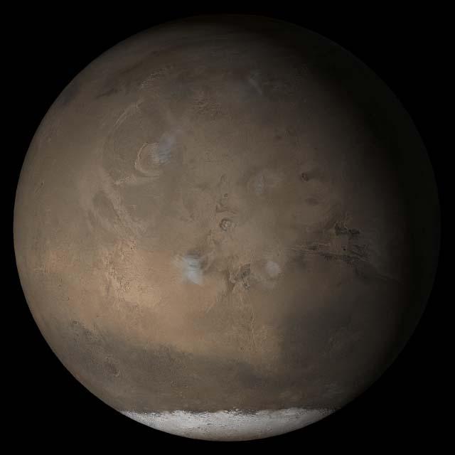
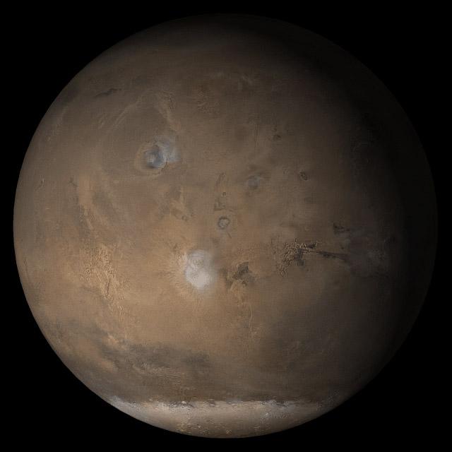
Mars at Ls 211°: Tharsis
Mars at Ls 357°: Tharsis
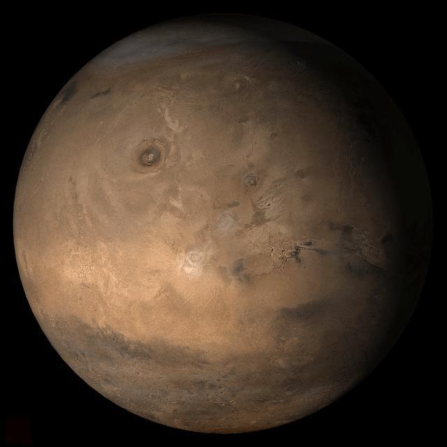
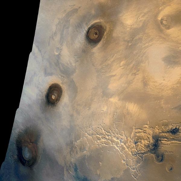
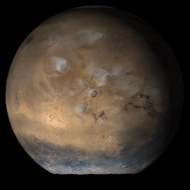
Regional View of the Tharsis Volcanoes
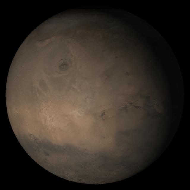
Mars at Ls 324°: Tharsis
Wind-Eroded Terrain in Tharsis
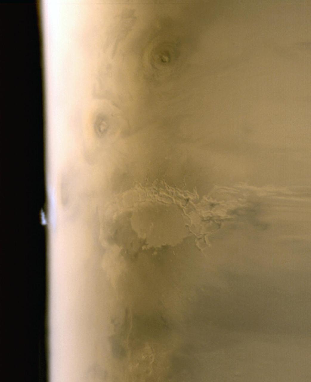
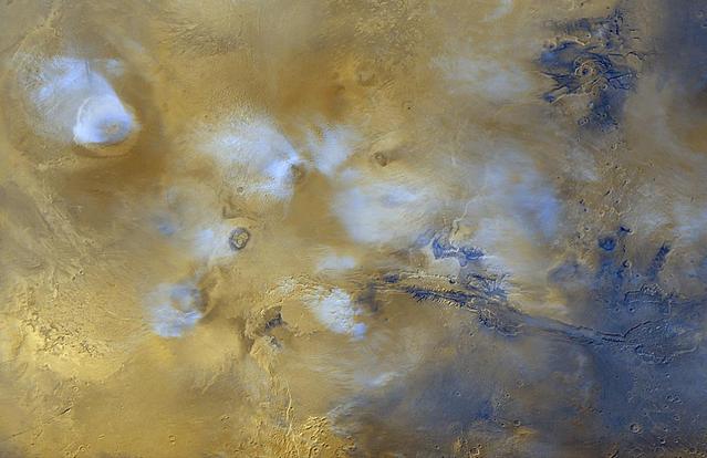
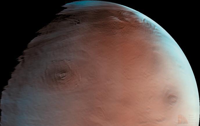
Tharsis Limb Cloud
Photomosiac of the Tharsis Region
Mars at Ls 230°: Tharsis
Winter Morning in Northern Tharsis
Tharsis Collapse Pits
East Tharsis Pit Chain
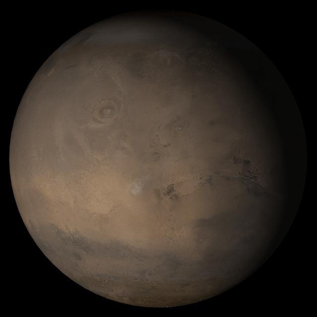
Mars at Ls 341°: Tharsis
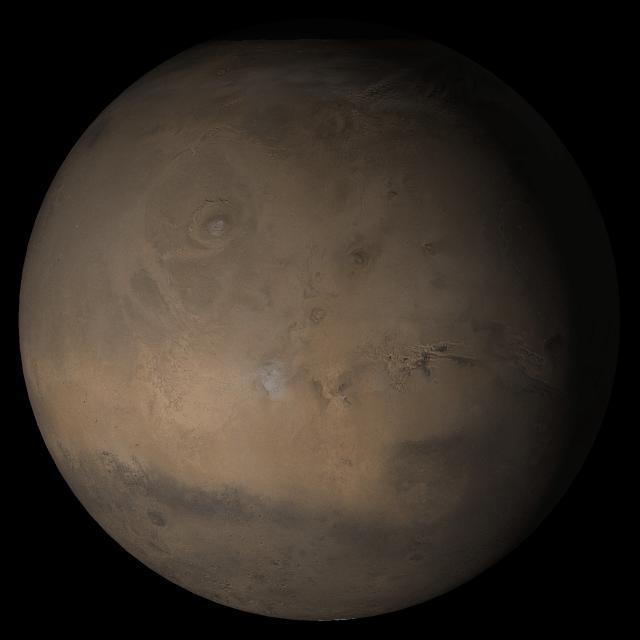
Mars at Ls 306°: Tharsis
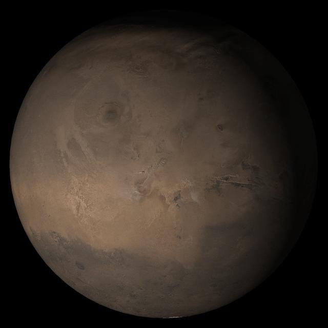
Mars at Ls 288°: Tharsis

Mars at Ls 39°: Tharsis
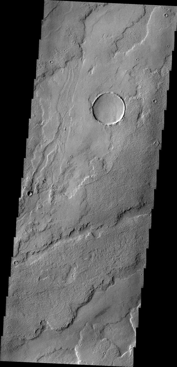
East Tharsis Flows
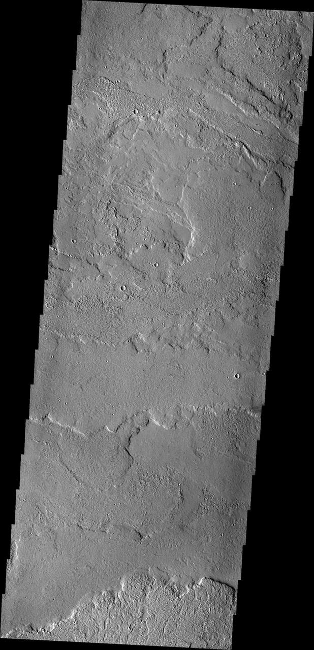
Lava Flows in Tharsis
Fractures in Tharsis Tholus
Wind Effects in Tharsis

Mars at Ls 25°: Tharsis
Mars at Ls 66°: Tharsis
Mars at Ls 249°: Tharsis
Tharsis Wind Streaks
Volcanic Vent in the Tharsis Region
Tharsis Flood Features

Mars at Ls 269°: Tharsis
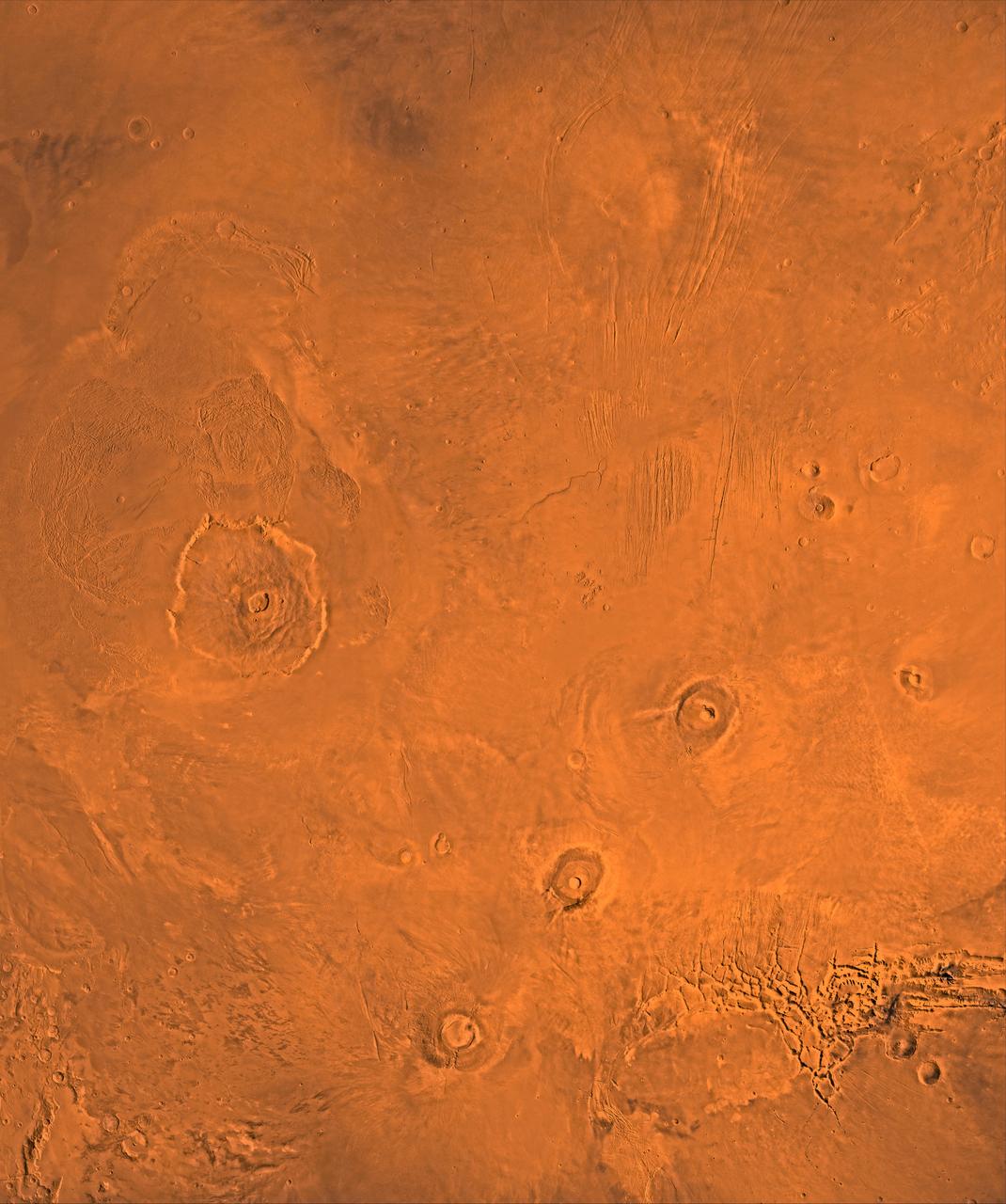
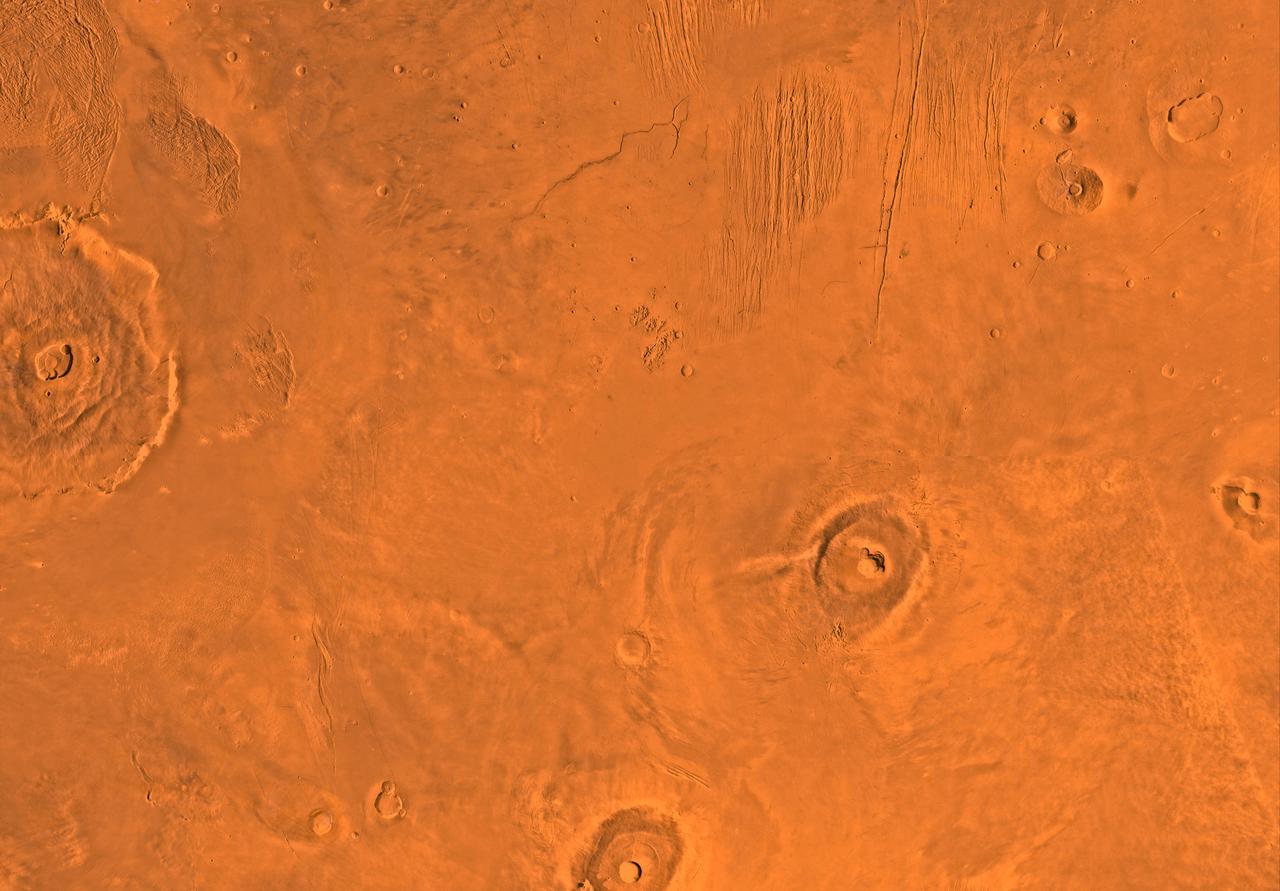
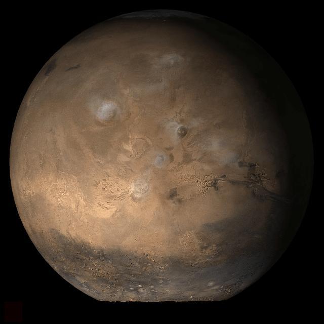
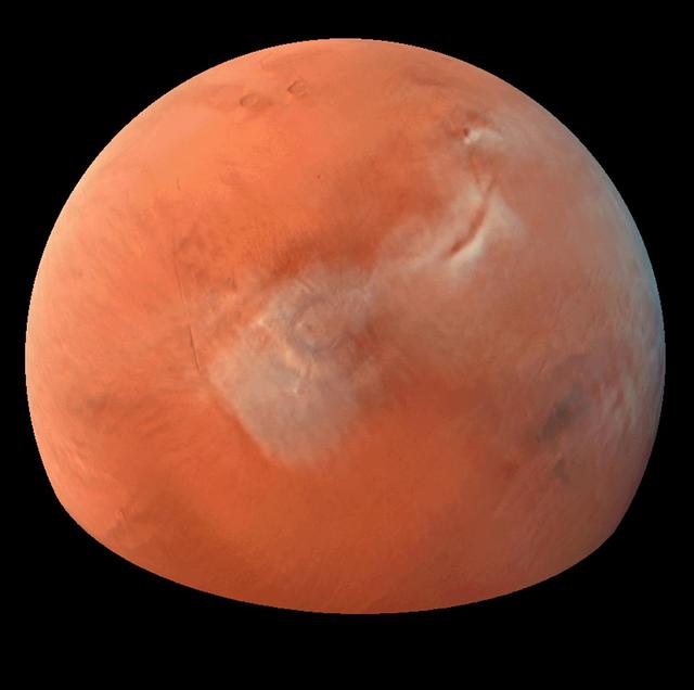
A color image of the Tharsis region of Mars; north toward top. The scene shows the Tharsis bulge, a huge ridge covered by the 3 large aligned Tharsis Montes shield volcanoes (from lower left to right): Arsia, Pavonis, and Ascraeus Mons. To the left of the Tharsis Montes lies the huge Olympus Mons shield volcano, followed clockwise by Alba Patera (north center), several smaller volcanoes, and the linear depressions of Mareotis and Tempe Fossae (upper right). This image is a composite of Viking medium-resolution images in black and white and low-resolution images in color. The image extends from latitude 50 degrees N. to 20 degrees S. and from longitude 85 degrees to 150 degrees. Mercator projection is used between latitudes 20 degrees S. and 30 degrees N.; Lambert projection is used above latitude 30 degrees N. The Tharsis bulge encompasses the most intensely and most recently active volcanic region of the planet. Each Tharsis Montes volcano is 350-400 km in diameter and about 17 km above the surrounding plain. The volcanoes are about 700 km apart and appear to be above a major northeast-trending fracture zone along the bulge, now buried by volcanic deposits. Olympus Mons (left center) is the largest known volcano in the Solar System. It is 27 km high, over 600 km at the base, and is surrounded by a well-defined scarp that is up to 6 km high. The summit calderas (central depressions) of all four volcanoes probably formed from recurrent collapse following drainage of magma resulting from flank eruptions. 1,600-km-diameter Alba Patera (north center) far exceeds any other known volcano in areal extent; it covers eight times the area of Olympus Mons but reaches only about 6 km in height. Fossae (linear depressions) of the Tharsis area are fault-bound graben formed by upwarping of the Tharsis bulge. http://photojournal.jpl.nasa.gov/catalog/PIA00408
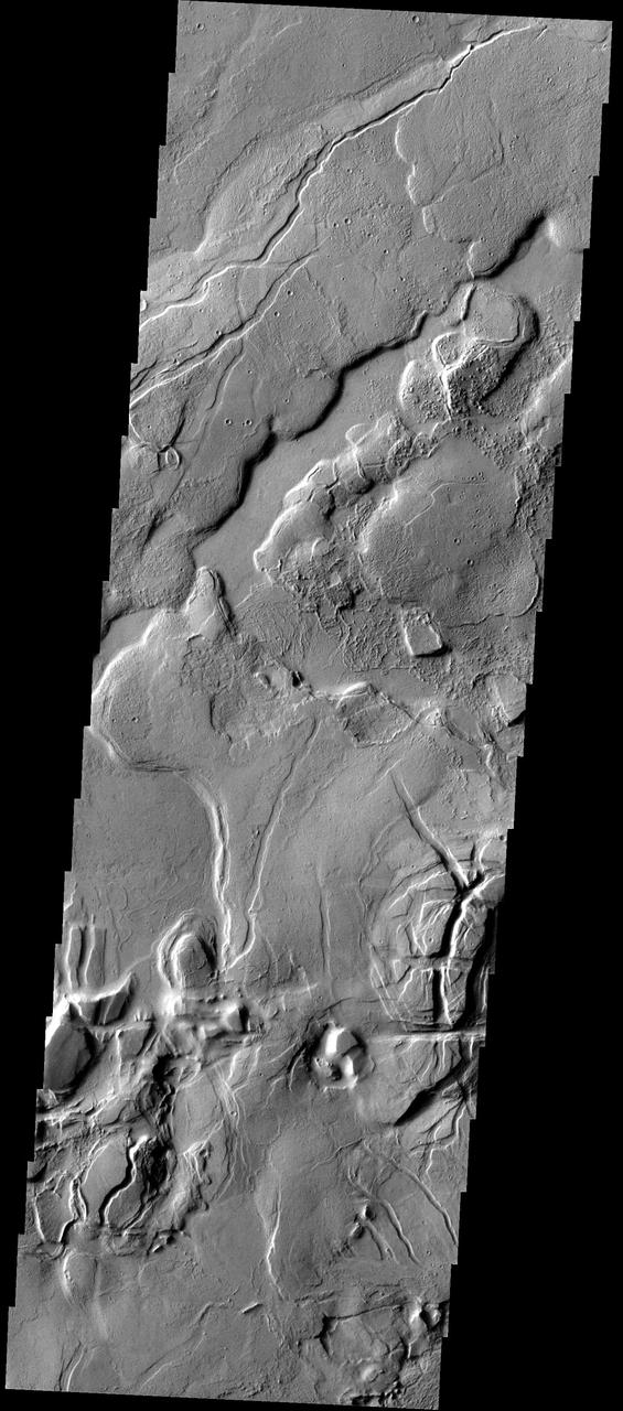
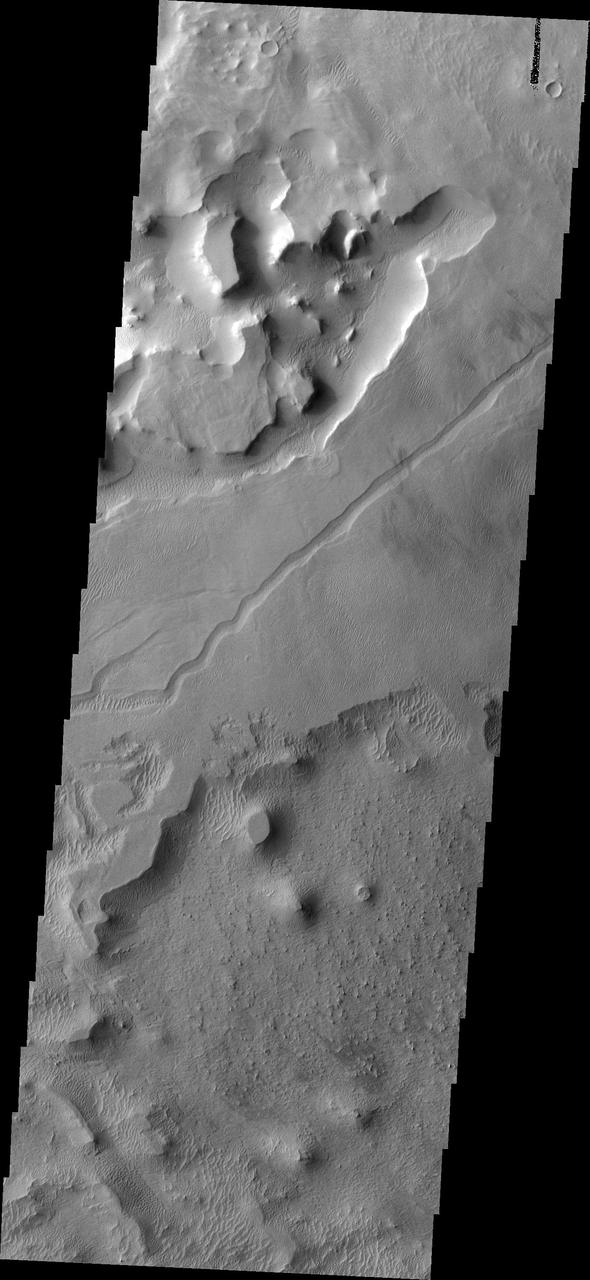
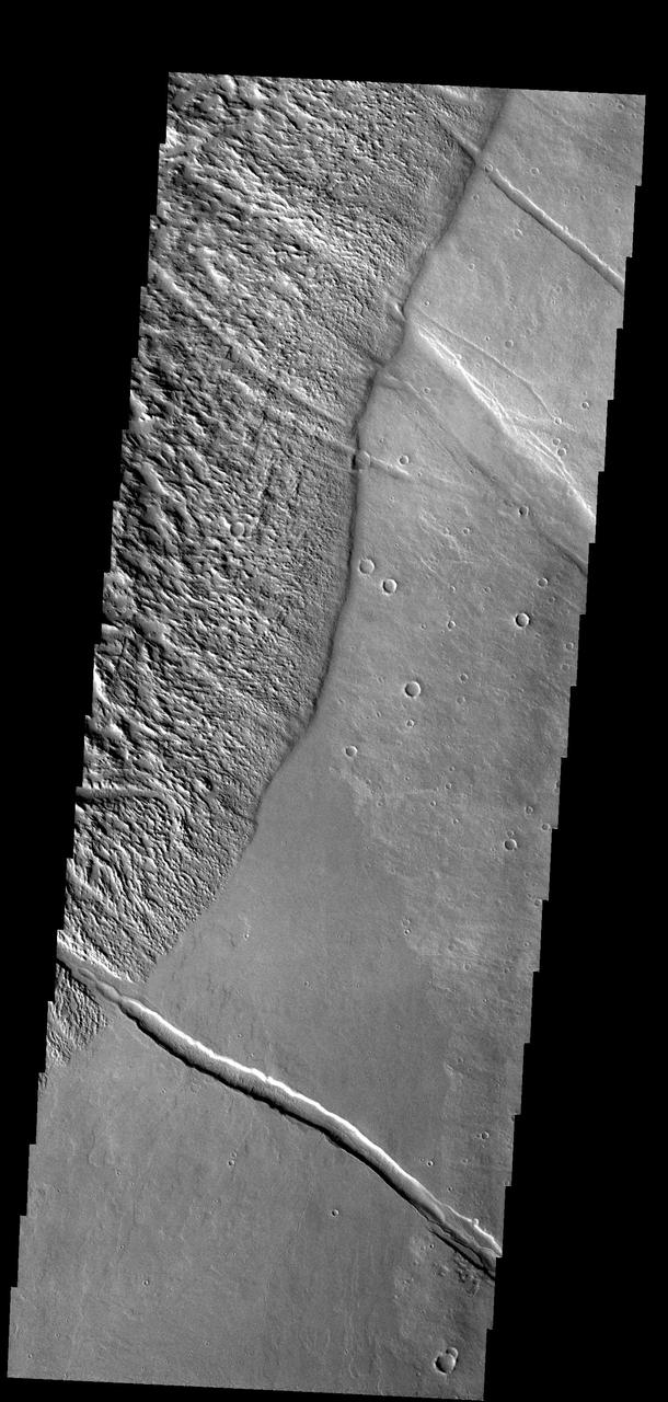
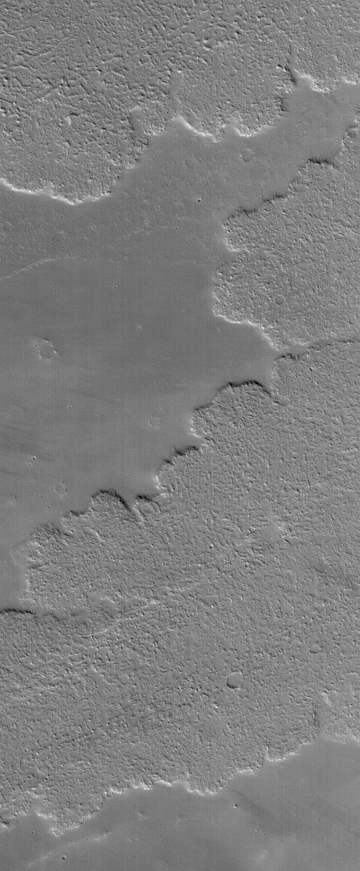
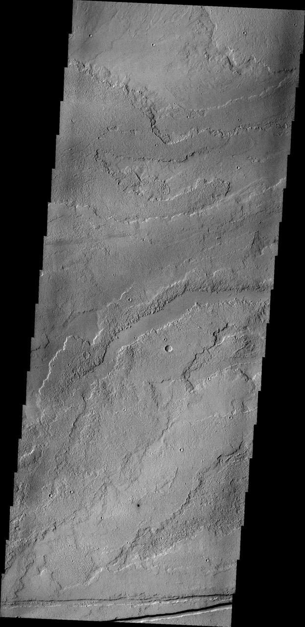
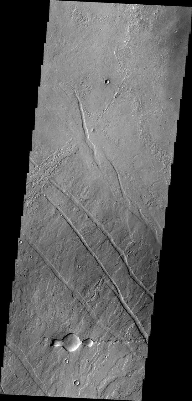
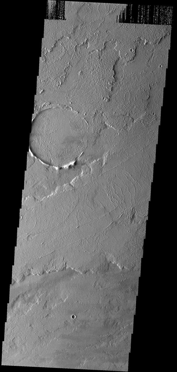
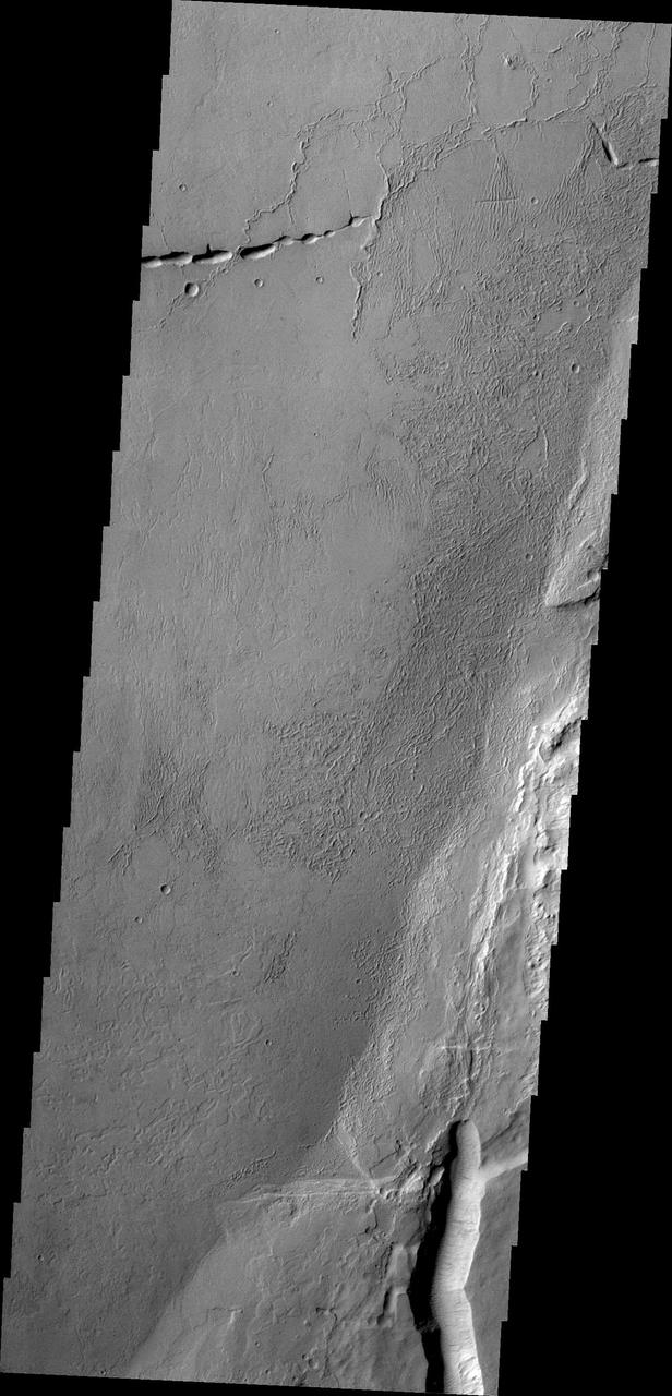
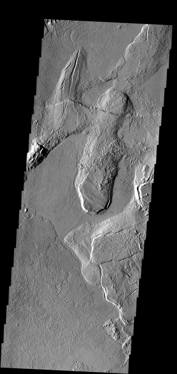
This complex region of lava flows and fracturing is located at the eastern margin of the Tharsis Volcanic Complex

A Closer Hubble Encounter With Mars - Tharsis
A Fresh Crater Drills to Tharsis Bedrock
Sample Tharsis Tholus Caldera Wall
The 2001 Great Dust Storms - Tharsis

Tharsis Volcanoes and Valles Marineris, Mars
Fresh Impact Crater and Rays in Tharsis
This VIS image is located on the flank of Tharsis Tholus. The Tharsis region of Mars is dominated by large volcanoes and extensive lava plains. Orbit Number: 77220 Latitude: 12.1833 Longitude: 269.178 Instrument: VIS Captured: 2019-05-12 14:27 https://photojournal.jpl.nasa.gov/catalog/PIA23299

The eastern margin of Tharsis Tholus is visible on the left side of this image
This image to the east of Tharsis Tholus from NASA Mars Odyssey spacecraft shows one of many vast fields of lava flows produced by the great Tharsis volcanoes.
This image captured by NASA Mars Reconnaissance Orbiter shows Tharsis Tholus, one of the smaller shield volcanoes on Mars massive Tharsis Rise.
This image captured by NASA 2001 Mars Odyssey spacecraft shows a small portion of the volcanic flows in the Tharsis region.
This image from NASA 2001 Mars Odyssey spacecraft shows some of the extensive volcanic flows east of the large Tharsis volcanoes.
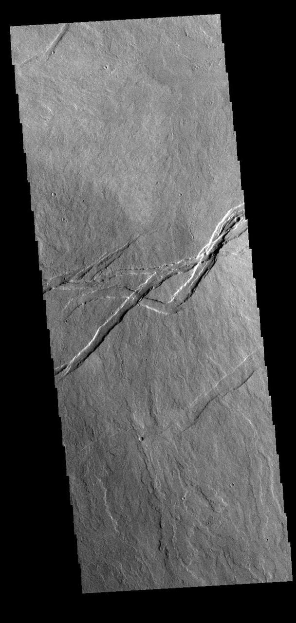
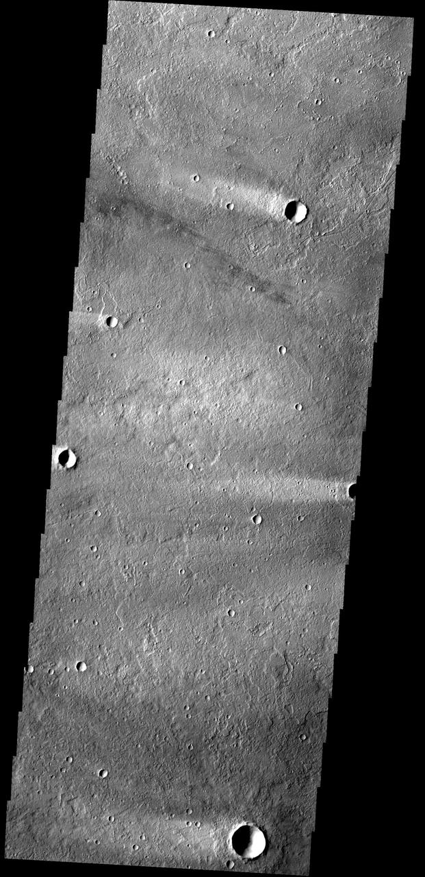
Lava channels and tectonic fractures are both found in the Tharsis region as shown in this image from NASA Mars Odyssey.

Diverse Geologic Features of Western Tharsis, Mars
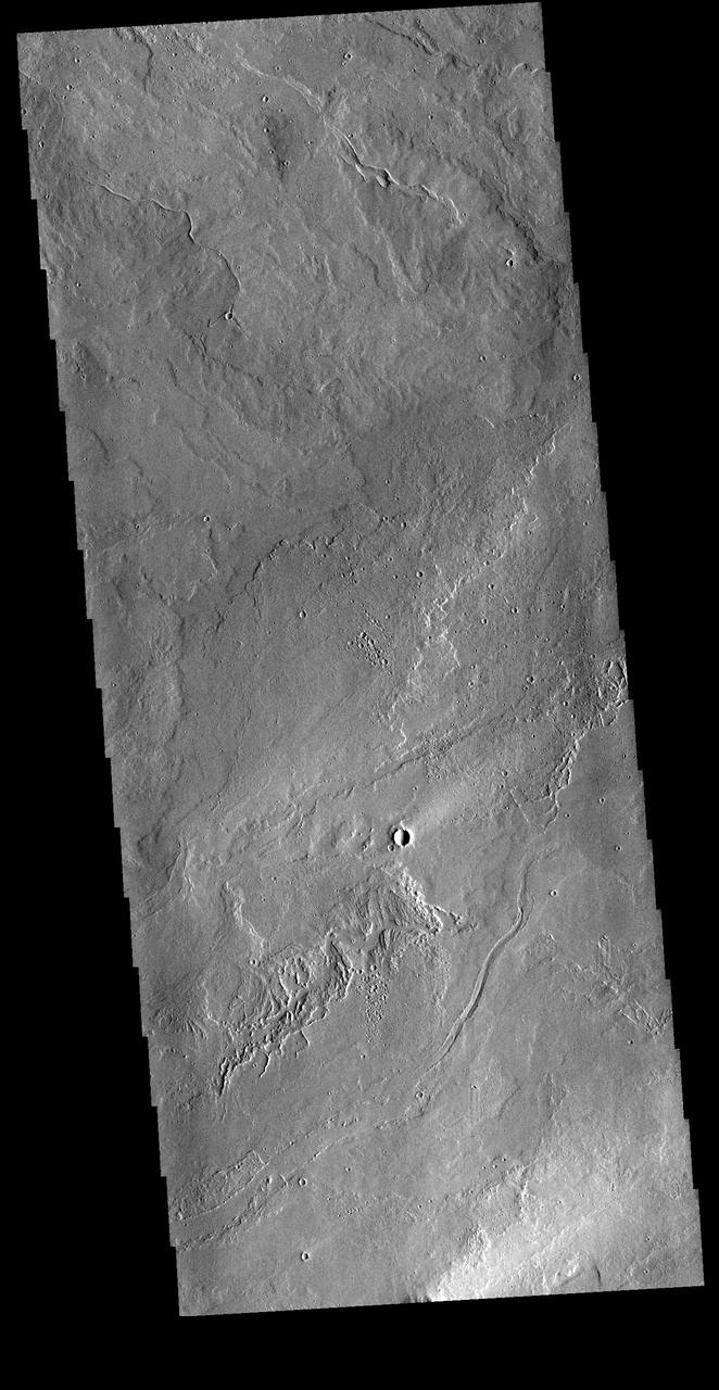
This VIS image shows part of the Tharsis lava plains between Sulci Gordii and Ulysses Fossae. While large volcanoes and huge lava flow sheets dominate the Tharsis region, extensive tectonic features are also present. The entire Tharsis region forms a bulge on the equatorial part of Mars, generated by the uplift of magma rising through the crust. The motion of subsurface magma created extensional forces, tearing the surface apart releasing the magma in floods of lava and volcano building events. At the same time the extension cracked the surface creating the faults and graben also seen in the region. In this image, the linear graben post-date the lava flows. Orbit Number: 78394 Latitude: 17.6427 Longitude: 235.778 Instrument: VIS Captured: 2019-08-17 06:43 https://photojournal.jpl.nasa.gov/catalog/PIA23475
This image from NASA 2001 Mars Odyssey spacecraft shows a small portion of the vast lava flow fields between Echus Chasma and the main Tharsis volcanoes.
A volcanic vent has created a small construct a volcano in this region of Tharsis east of Arsia Mons. This image is from NASA 2001 Mars Odyssey spacecraft.
The lava flows in this image captured by NASA 2001 Mars Odyssey spacecraft are located of the eastern margin of the Tharsis Volcanic complex.
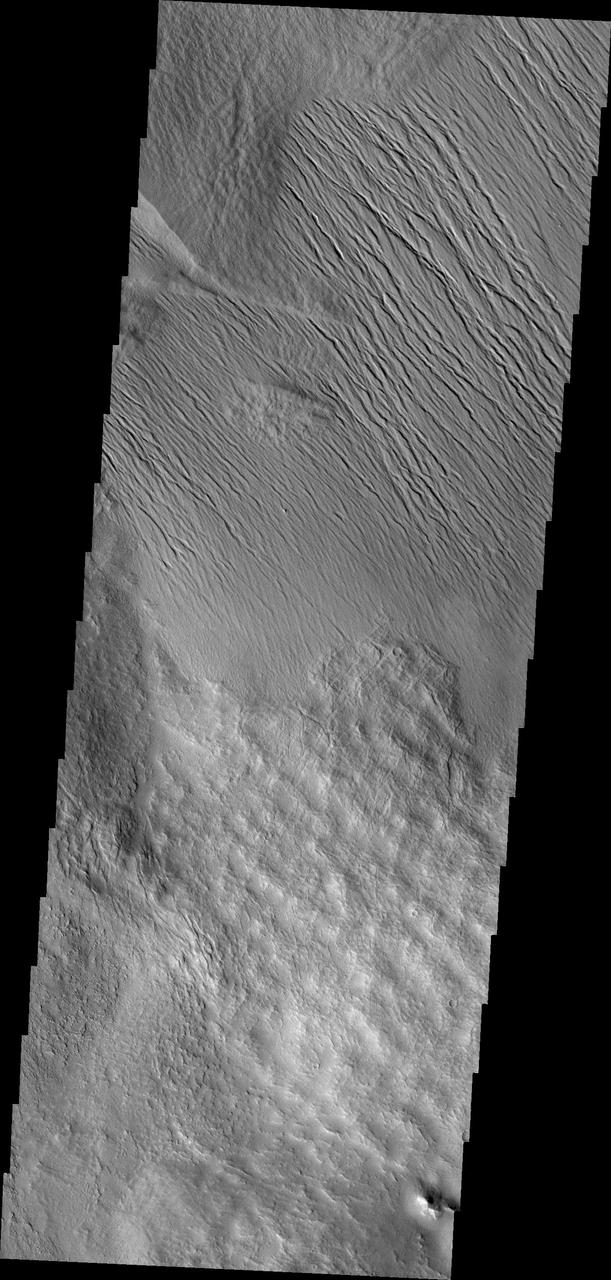
This image shows a small portion of the extensive Tharsis Volcanic Field. Several different surface textures are present in this image
This VIS image shows part of the extensive volcanic flows in the Tharsis region. These flows are east of Ascraeus Mons. Orbit Number: 81076 Latitude: 11.2203 Longitude: 261.313 Instrument: VIS Captured: 2020-03-25 02:50 https://photojournal.jpl.nasa.gov/catalog/PIA23935
This region of Tharsis near Olympus Mons contains subtle features showing its lava flow origin. Note the oftened flow fronts and lava channels in this image captured by NASA Mars Odyssey spacecraft.
This image from NASA 2001 Mars Odyssey spacecraft of the Tharsis region illustrates relative age relations. Fractures occurred in old lava flows and then younger lava flows covered the fractures.
It is unclear what process has eroded the surface in this part of the Tharsis region. Wind is likely, but it could also be a record of water erosion. This image was captured by NASA Mars Odyssey.

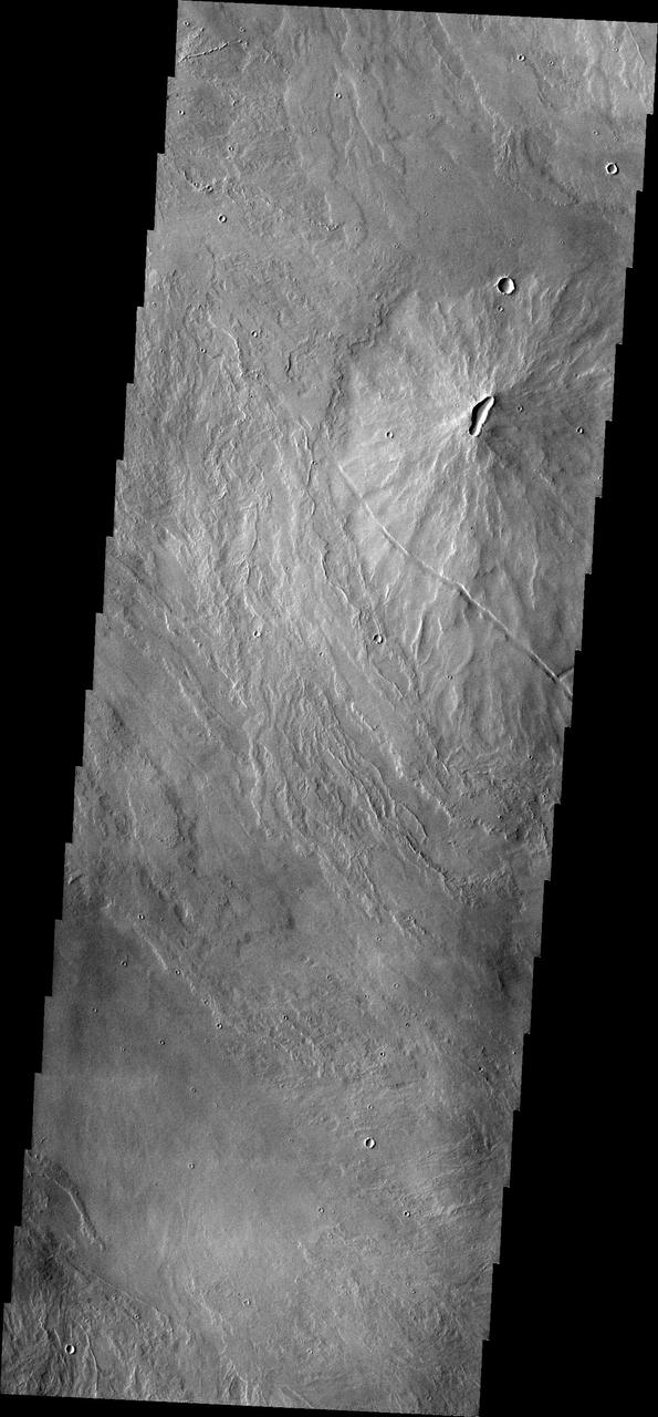
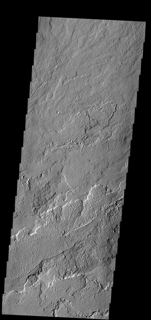
The Tharsis region contains both large volcanoes and extensive lava plains. Most of the channel features in this region were formed by the flow of lava rather than the flow of water. Tectonic processes are also common and many linear depressions were created due to stresses in the Tharsis area as the surface expanded and lava forced its way to the surface to form volcanoes. This VIS image is located north of Jovis Tholus. Orbit Number: 73129 Latitude: 20.4782 Longitude: 241.464 Instrument: VIS Captured: 2018-06-09 15:55 https://photojournal.jpl.nasa.gov/catalog/PIA22667
Today's VIS image shows volcanic flows and fractures between Arsia Mons and Pavonis Mons in the Tharsis volcanic region. The fractures – termed graben – follow the northeast/southwest trend of the three large Tharsis volcanoes. Orbit Number: 89113 Latitude: -7.38183 Longitude: 244.754 Instrument: VIS Captured: 2022-01-15 20:50 https://photojournal.jpl.nasa.gov/catalog/PIA25348
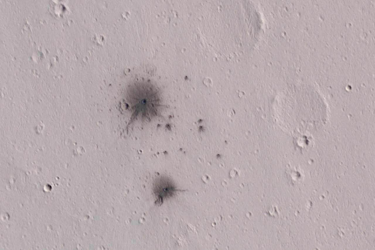
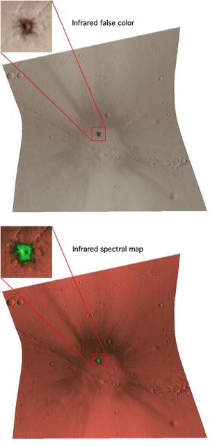
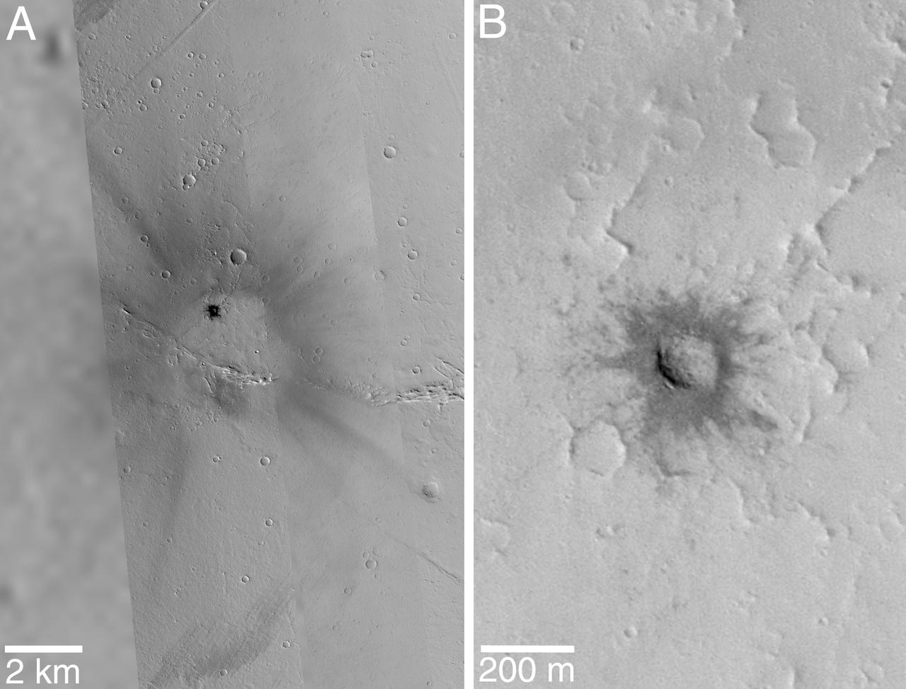
The dark spots in this enhanced-color infrared image are the recent impact craters that occurred in the Tharsis region between 2008 and 2014. These impact craters were first discovered by the Mars Context Camera (or CTX, also onboard the Mars Reconnaissance Orbiter) as a cluster of dark spots. The meteoroid that formed these craters must have broken up upon atmospheric entry and fragmented into two larger masses along with several smaller fragments, spawning at least twenty or so smaller impact craters. The dark halos around the resulting impact craters are a combination of the light-toned dust being cleared from the impact event and the deposition of the underlying dark toned materials as crater ejecta. The distribution and the pattern of the rayed ejecta suggests that the meteoroid most-likely struck from the south. http://photojournal.jpl.nasa.gov/catalog/PIA11176
Extensional forces in the volcanic province of Tharsis, shown in this image from NASA Mars Odyssey spacecraft, have produced a fractured terrain that resembles wrinkled skin. http://photojournal.jpl.nasa.gov/catalog/PIA04005
Mars digital-image mosaic merged with color of the MC-9 quadrangle, Tharsis region of Mars. This image is from NASA's Viking Orbiter 1. http://photojournal.jpl.nasa.gov/catalog/PIA00169
The Tharsis region of Mars is an immense region of volcanos, lava flows, and tectonic faulting. The entire area is a topographic bulge, with extensional stresses. The extension allowed magma to rise to the surface, creating the largest areal (Alba Mons) and tallest (Olympus Mons) volcanoes in the solar system. The extension also created faults and fractures. This VIS image shows some of the tectonic faults in the region. Orbit Number: 81214 Latitude: 10.0823 Longitude: 240.355 Instrument: VIS Captured: 2020-04-05 11:31 https://photojournal.jpl.nasa.gov/catalog/PIA23943
This image of Tharsis Rise from NASA Mars Odyssey shows a series of linear features called graben, which are associated with crustal extension resulting in up and down blocks of crust that run perpendicular to the direction of the extension.
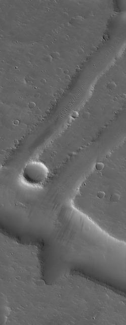
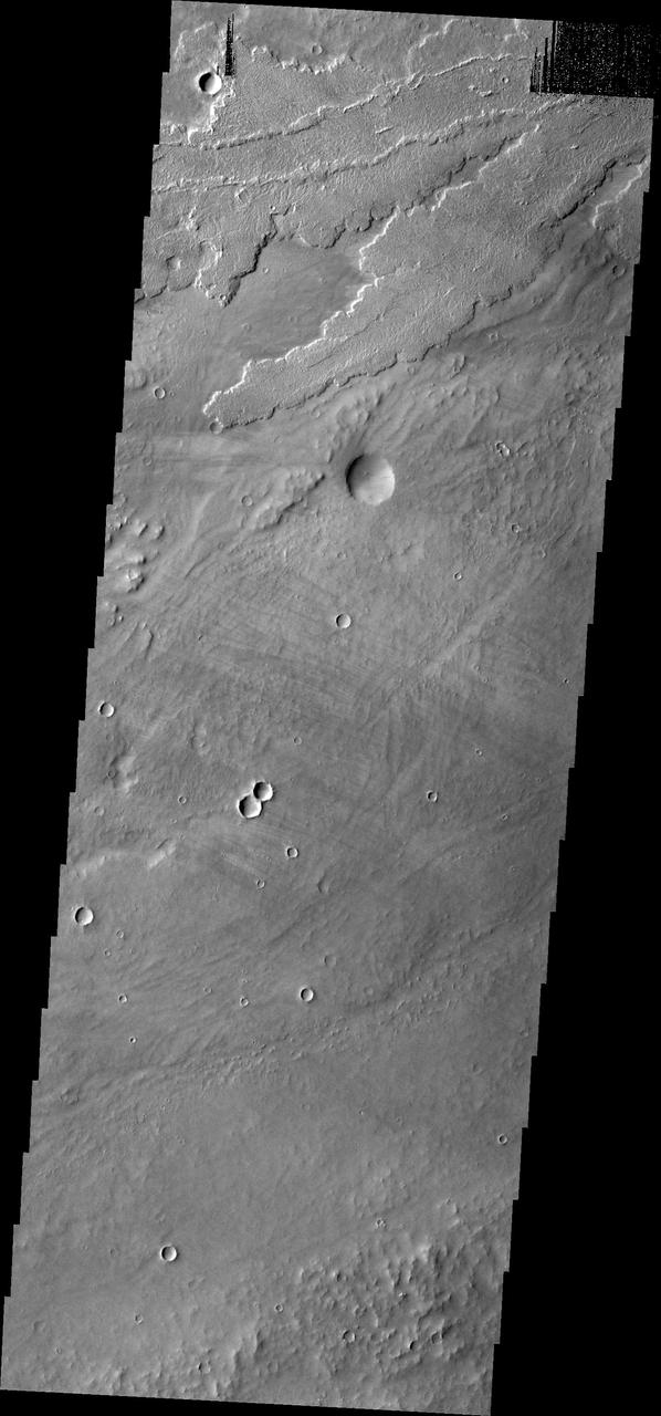
This MOC image shows ancient, dust-covered lava flows and remains of leveed lava channels located on a plain northwest of Jovis Tholus. Jovis is a relatively small volcano in the Tharsis region of Mars
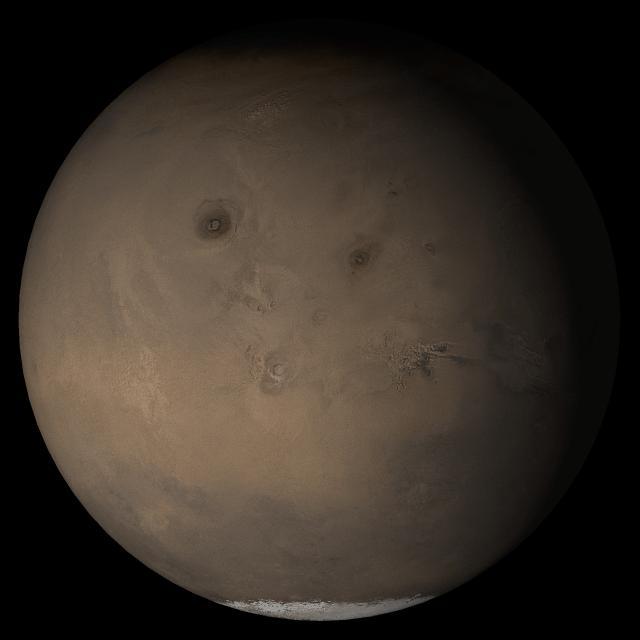
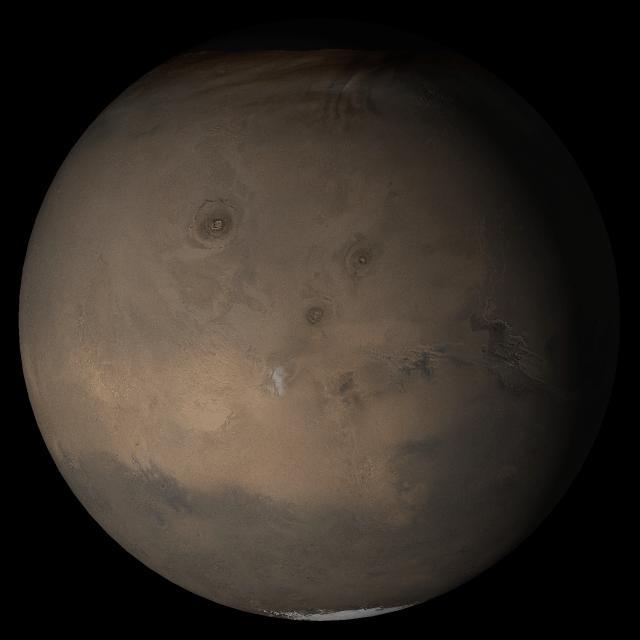
This picture is a composite of MOC daily global images acquired at Ls 53° during a previous Mars year. This month, Mars looks similar, as Ls 53° occurs in mid-May 2006. The picture shows the Tharsis face of Mars

This picture is a composite of Mars Global Surveyor MGS Mars Orbiter Camera MOC daily global images acquired at Ls 93° during a previous Mars year.of the Tharsis face of Mars
This picture is a composite of Mars Global Surveyor MGS Mars Orbiter Camera MOC daily global images acquired at Ls 93° of the Tharsis face during a previous Mars year
This image shows a small portion of the extensive lava flows created by the large Tharsis volcanoes as seen by NASA 2001 Mars Odyssey spacecraft. These flows are located north east of Ascraeus Mons.
Color composite of condensate clouds over Tharsis made from red and blue images with a synthesized green channel. Mars Orbiter Camera wide angle frames from Orbit 48. http://photojournal.jpl.nasa.gov/catalog/PIA00812
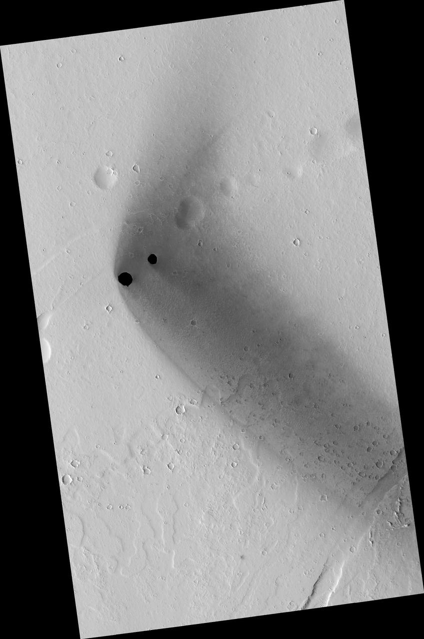
Two dark, rimless pits are located to the northwest of Ascraeus Mons in the Tharsis volcanic region of Mars in this image from NASA Mars Reconnaissance Orbiter. They are situated in the midst of a wispy, dark, boomerang-shaped deposit.
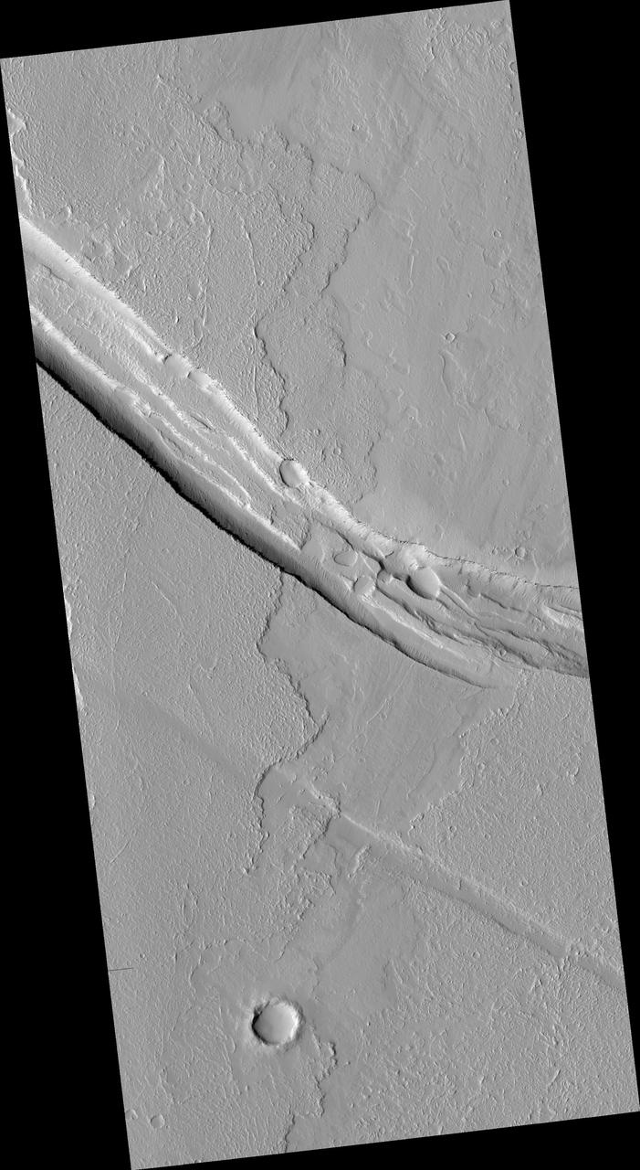
This image from NASA Mars Reconnaissance Orbiter shows a graben a trough formed when the ground drops between two parallel faults and a lava flow in the Tharsis volcanic province of Mars. North is up.
Today's VIS image shows lava flows near the flank of Pavonis Mons. Pavonis Mons is one of the three large aligned Tharsis region volcanoes. Orbit Number: 77907 Latitude: -1.36831 Longitude: 249.245 Instrument: VIS Captured: 2019-07-08 04:08 https://photojournal.jpl.nasa.gov/catalog/PIA23396
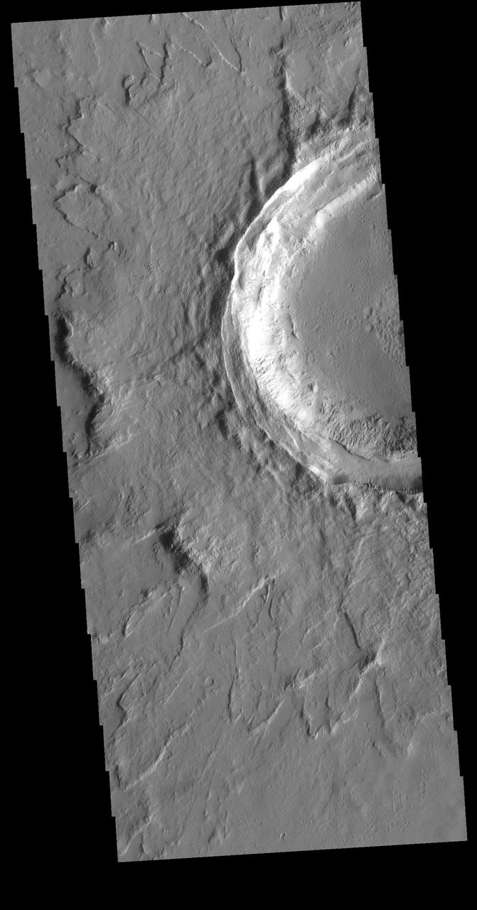
This VIS image shows an unnamed crater located northeast of Ascraeus Mons, on the volcanic plains of the Tharsis region. The rim has several concentric ridges. There are multiple layers of ejecta, with raised edges. The ejecta sits on top of the regional lava flows, indicating it formed after the lava flows covered the area. The lack of significant modification of both rim and ejecta show that this crater is relatively young. Orbit Number: 73066 Latitude: 19.1445 Longitude: 259.912 Instrument: VIS Captured: 2018-06-04 11:22 https://photojournal.jpl.nasa.gov/catalog/PIA22665
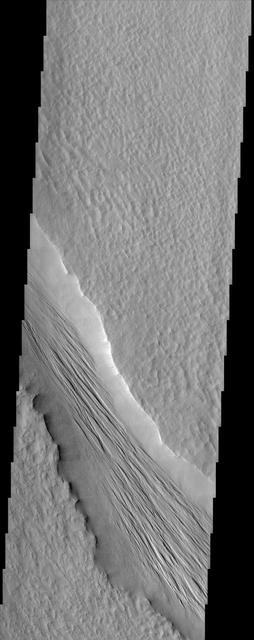
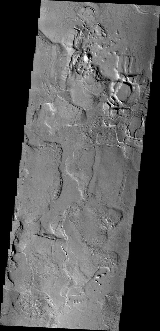
The Tharsis Montes region on Mars is a major center of volcanic and tectonic activity. The channel in this image from NASA Mars Odyssey is west of the relatively small volcano called Biblis Patera although it shows no obvious relationship to that volcano. Instead, it may be related to the more distant, but more massive volcano Olympus Mons to the north. The channel may have hosted flowing lava at one time but now contains a material that has eroded into an impressive ridge-and-groove pattern. These features may be yardangs, landforms produced from the erosion by wind of sedimentary material. http://photojournal.jpl.nasa.gov/catalog/PIA04020
converted PNM file
converted PNM file
converted PNM file
converted PNM file
These lava flows are located to the northeast of Tharsis Tholus
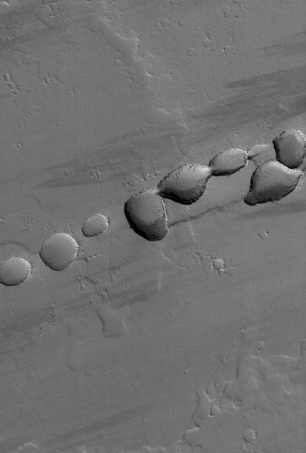
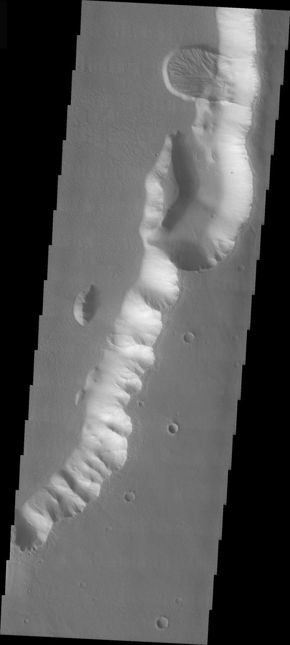
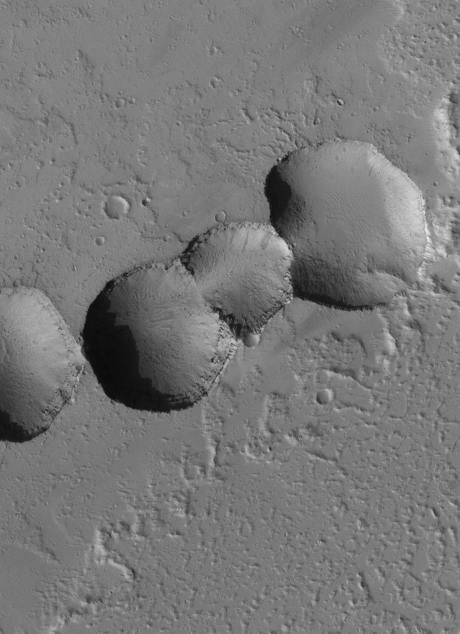
This MOC image shows a portion of a chain of pits on a lava- and dust-covered plain northwest of Tharsis Tholus, one of the many volcanic constructs in the Tharsis region of Mars
The THEMIS VIS camera contains 5 filters. The data from different filters can be combined in multiple ways to create a false color image. These false color images may reveal subtle variations of the surface not easily identified in a single band image. Today's false color image shows part of the vast volcanic plains in the Tharsis region, in this case east of Pavonis Mons. The mottled appearance of the image is being caused by high altitude cloud cover. These clouds will be primarily composed of ice rather than dust. The THEMIS VIS camera is capable of capturing color images of the Martian surface using five different color filters. In this mode of operation, the spatial resolution and coverage of the image must be reduced to accommodate the additional data volume produced from using multiple filters. To make a color image, three of the five filter images (each in grayscale) are selected. Each is contrast enhanced and then converted to a red, green, or blue intensity image. These three images are then combined to produce a full color, single image. Because the THEMIS color filters don't span the full range of colors seen by the human eye, a color THEMIS image does not represent true color. Also, because each single-filter image is contrast enhanced before inclusion in the three-color image, the apparent color variation of the scene is exaggerated. Nevertheless, the color variation that does appear is representative of some change in color, however subtle, in the actual scene. Note that the long edges of THEMIS color images typically contain color artifacts that do not represent surface variation. Orbit Number: 85818 Latitude: 6.41017 Longitude: 260.984 Instrument: VIS Captured: 2021-04-19 13:31 https://photojournal.jpl.nasa.gov/catalog/PIA25096
The windstreaks in this image are located on Tharsis volcanic flows northeast of Olympus Mons
Echus Chasma separates the Tharsis region from Lunae Planum. This image from NASA 2001 Mars Odyssey shows volcanic flow materials from Tharsis within the chasma.
Between the Tharsis region and Lunae Planum lies Echus Chasma and the source of Kasei Vallis. Flows from the Tharsis volcanoes are buckled by tectonic forces forming mounds and fractures in the Chasma as seen in this image from NASA 2001 Mars Odyssey.
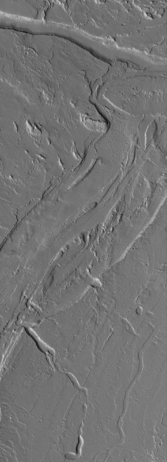
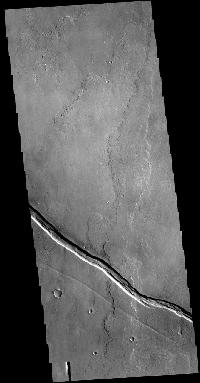
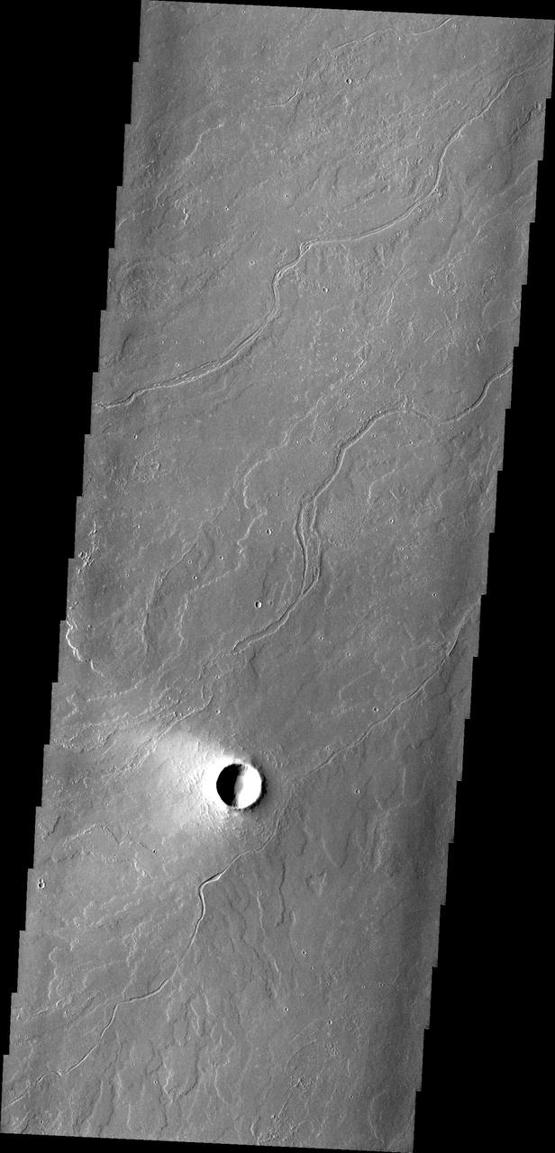
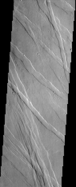
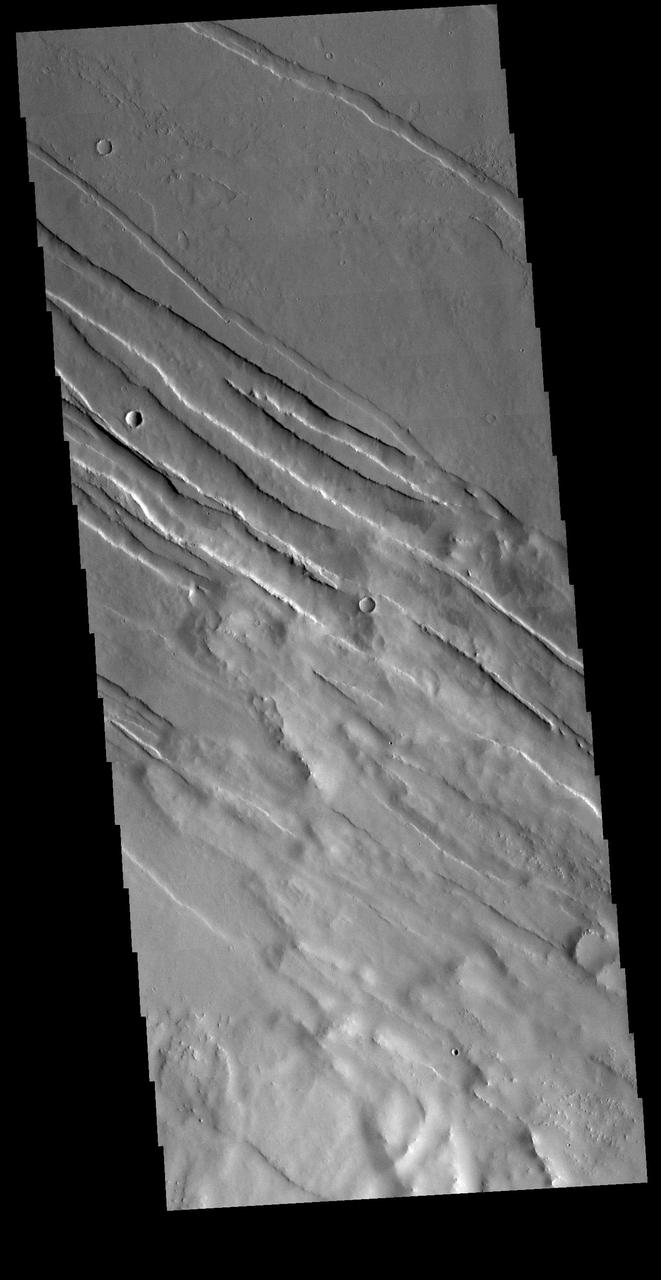
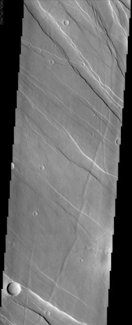
The lava channels in this image are located in the Tharsis plains as seen by NASA 2001 Mars Odyssey spacecraft.
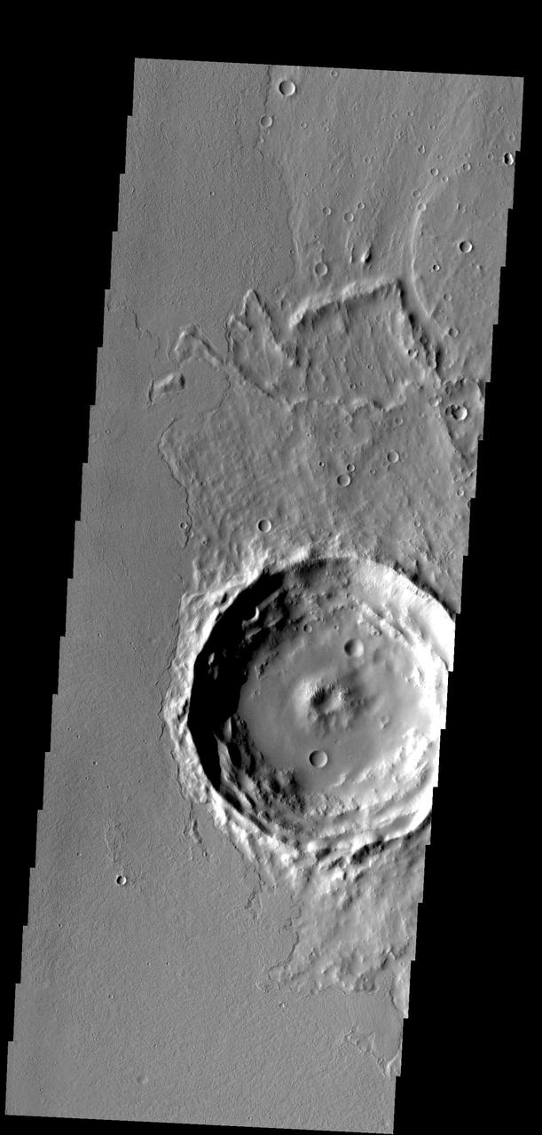
Located on the eastern edge of the Tharsis region, this crater has had half of its ejecta covered by lava flows
This image captured by NASA 2001 Mars Odyssey spacecraft shows some of the lava flows located east of the large Tharsis volcanoes.
In this part of the Tharsis region, old lava flows have been fractured. Younger lava flows are unfractured flow at bottom
This image captured by NASA 2001 Mars Odyssey spacecraft shows lava channels in the Tharsis plains.
The lava flows in this image captured by NASA 2001 Mars Odyssey spacecraft are located of the eastern margin of the Tharsis Volcanic complex.
These lava flows and channels are part of Alba Patera, a large collapsed volcano in the Tharsis region

The windstreaks in this image captured by NASA 2001 Mars Odyssey spacecraft are located on Tharsis volcanic flows east of Pavonis Mons.
This image captured by NASA 2001 Mars Odyssey spacecraft shows volcanic flows from Arsia Mons, the southernmost of the Tharsis volcanoes.
This image from NASA Mars Odyssey shows a portion of the northeastern flank of Pavonis Mons, one of the large Tharsis volcanoes.
This image shows the margin of a lava flow on a plain northwest of Jovis Tholus, a volcanic construct located in the Tharsis region of Mars