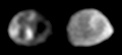
Two Galileo Views of Thebe
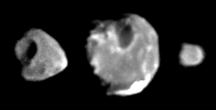
Best images yet of Thebe, Amalthea and Metis
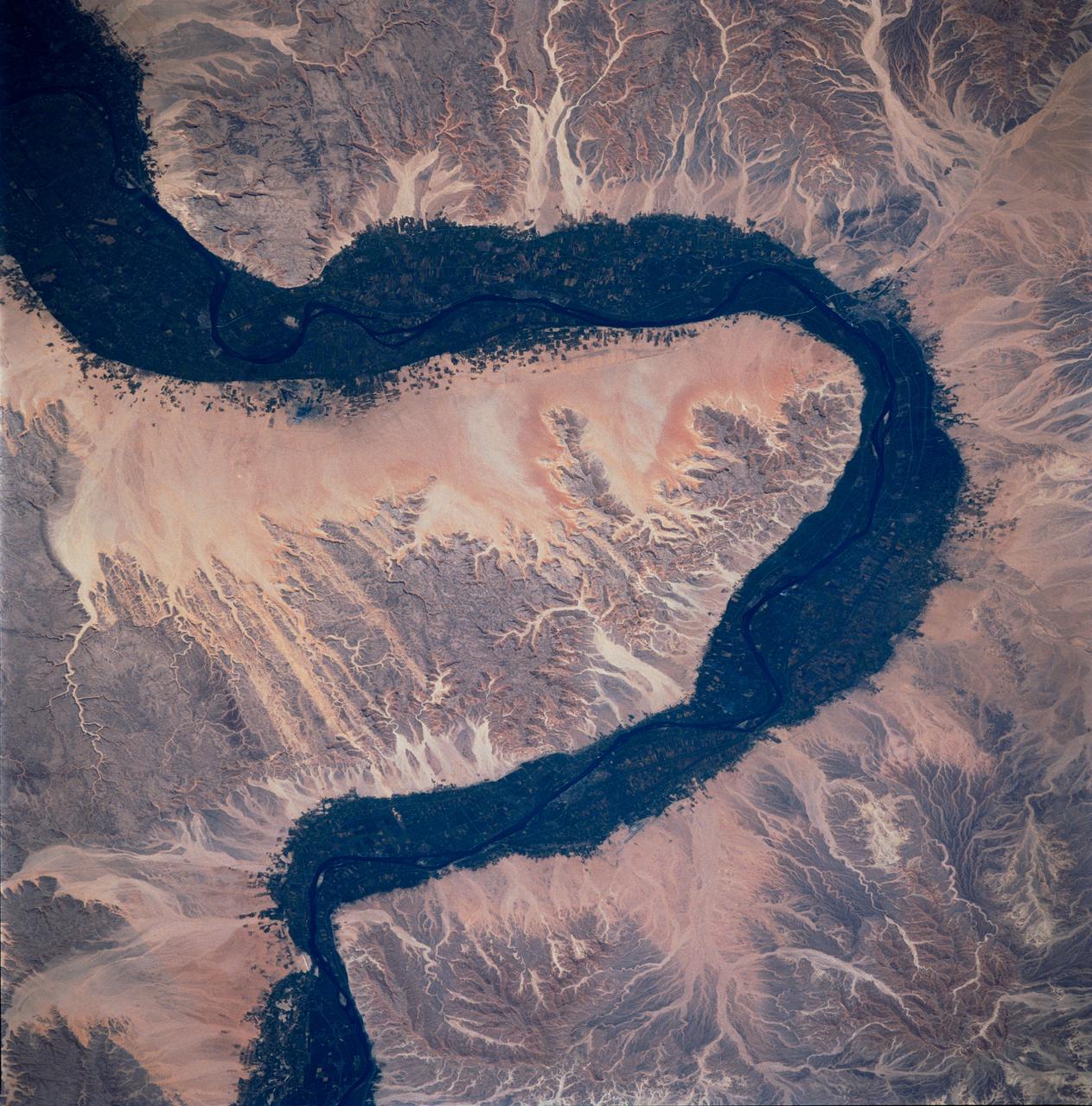
STS083-748-066 (4-8 April 1997) --- Luxor, Qus, and Qina, Egypt on the Nile. The Nile, which is about 4,132 miles long, is the longest river in the world. This photo demonstrates the dependency of the local agriculture on the River. This area is the historic area of ancient Thebes. Luxor, also called EL-AKSUR, or AL-UQSUR, a market town along the southern part of the Nile's curve, is located on the southern half of the ruins of Thebes. Ancient Thebes was about six miles square; the main part of the city was situated along the Nile's east bank; along the west bank was "the city of the dead" -- an area containing the Egyptian kings' mortuary temples and the houses of those priests, soldiers, craftsmen, and laborers who were devoted to their service. Qina, extending 3 - 4 miles (5 - 6 kilometers) on each side of the Nile River between the Arabian and Libyan deserts, is seen on the northeast part of the rivers curve. Occupying the great bend in the Nile Valley, it has an area of 715 square miles (1,851 square kilometers) and contains the celebrated ruins of Thebes and the Valley of the Tombs of the Kings. Qina has a dense agricultural population (more than 3,000 persons per square mile), and most of its land is under basin irrigation, yielding only one crop annually. Main crops are sugar (about three-fifths of the nation's production), lentils, and grains.
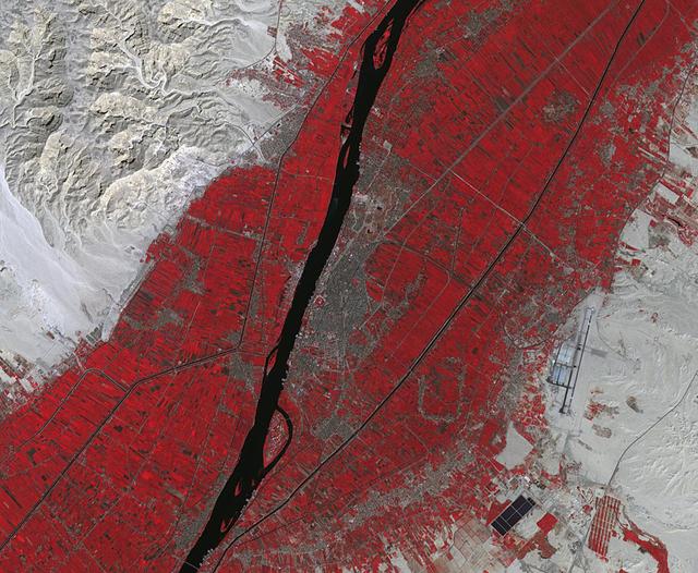
Luxor is a city in Upper Egypt, along the Nile. It is the site of the ancient Egyptian city of Waset, known to the Greeks as Thebes. Luxor is one of the world's greatest open-air museums, with the ruins of the temple complexes of Karnak and Luxor. Immediately across the Nile is the Valley of the Kings, burial place of dozens of Egypt's pharaohs, including King Tutankhamun. The image was acquired October 18, 2017, covers an area of 15.9 by 19.3 kilometers, and is located at 25.7 degrees north, 32.6 degrees east. https://photojournal.jpl.nasa.gov/catalog/PIA23060
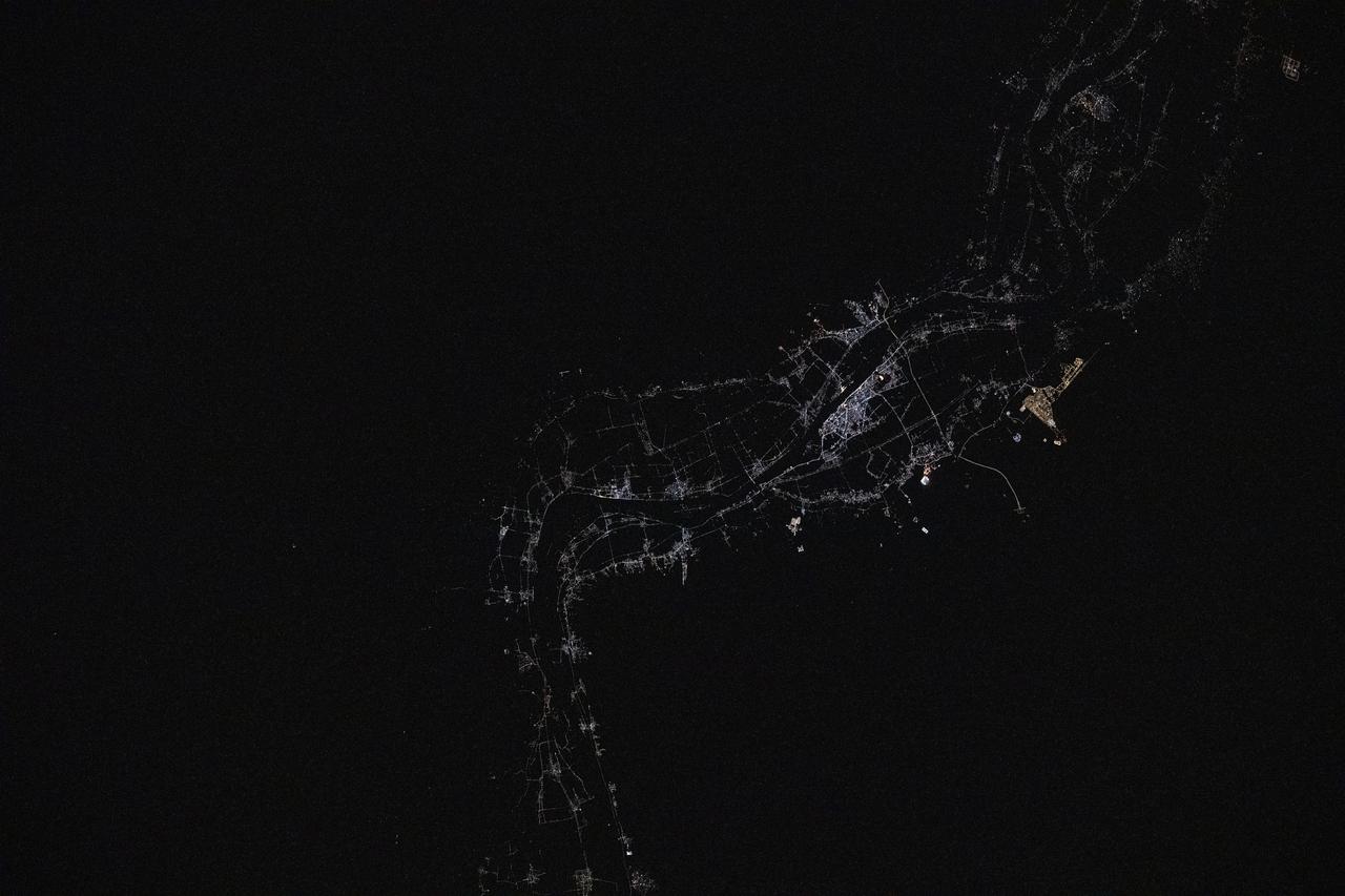
iss073e0134652 (May 22, 2025) --- Luxor, a 4,000-year-old city in Egypt with a population of over 263,000, sits on the bank of the River Nile in this photograph taken at approximately 12:17 a.m. local time from the International Space Station as it orbited 259 miles above. Luxor, a popular tourist destination, was the ancient Egyptian city of Thebes and is also home to numerous landmarks such as The Valley of the Kings and The Valley of the Queens.
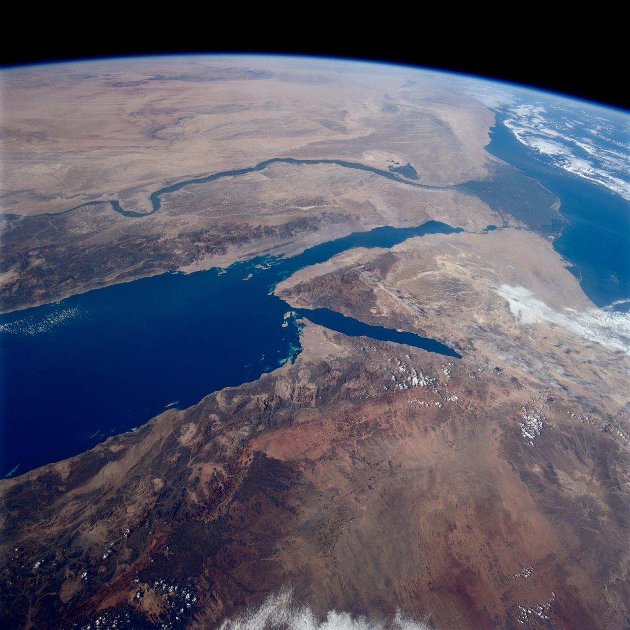
STS080-745-004 (19 Nov.-7 Dec. 1996) --- A view to the west showing Asia in the foreground and Africa in the background, as photographed by the space shuttle Columbia crewmembers. The Mediterranean Sea is to the upper right and the Red Sea to the lower left (holding photograph with NASA numbers on left). Sinai Peninsula is between the two with the Gulf of Suez above and the Gulf of Aqaba below. The Suez Canal connects the Gulf of Suez with the Mediterranean Sea. The triangular shaped dark area beyond is the Nile River Delta. The thin green fertile valley of the Nile crosses the photograph from a point at Cairo (near dark triangle area) past the great bend at Luxor with Thebes and the Valley of the Kings, and on the left into the Nubian Desert with the Aswan High Dam at the very left edge of the photograph. To the horizon is the Western Desert of Egypt and Libya. The foreground is the northwest portion of Saudi Arabia, an area known as the Hejaz with the southern portions of Israel and Jordan to the lower right.