
NBC Today Show at Lewis Field
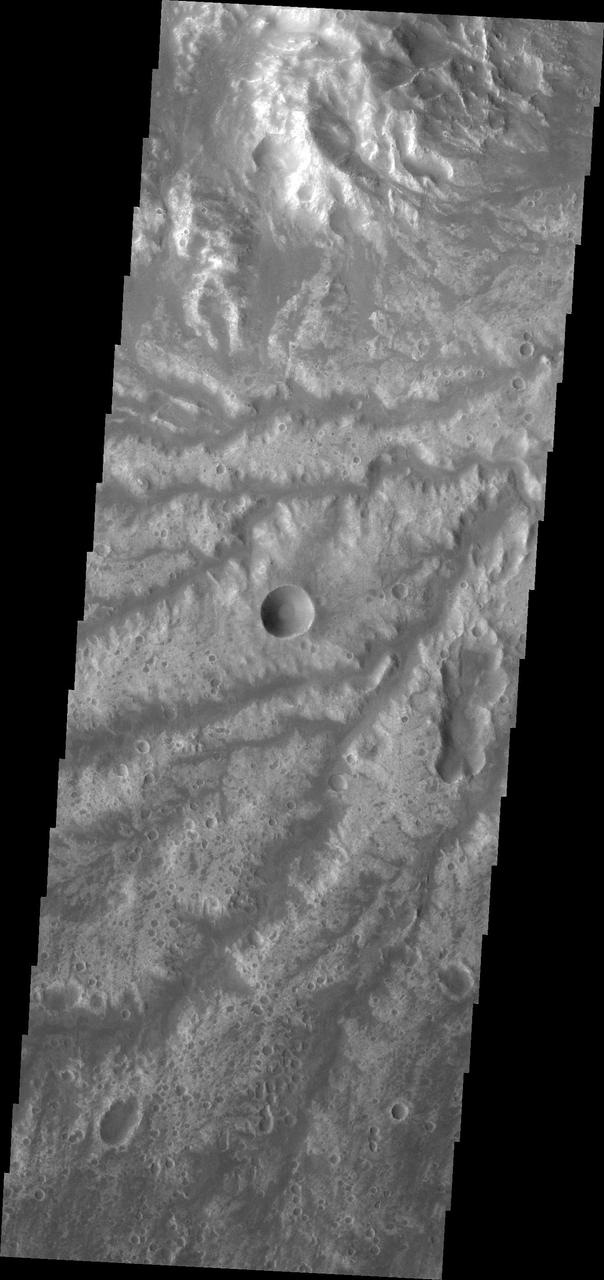
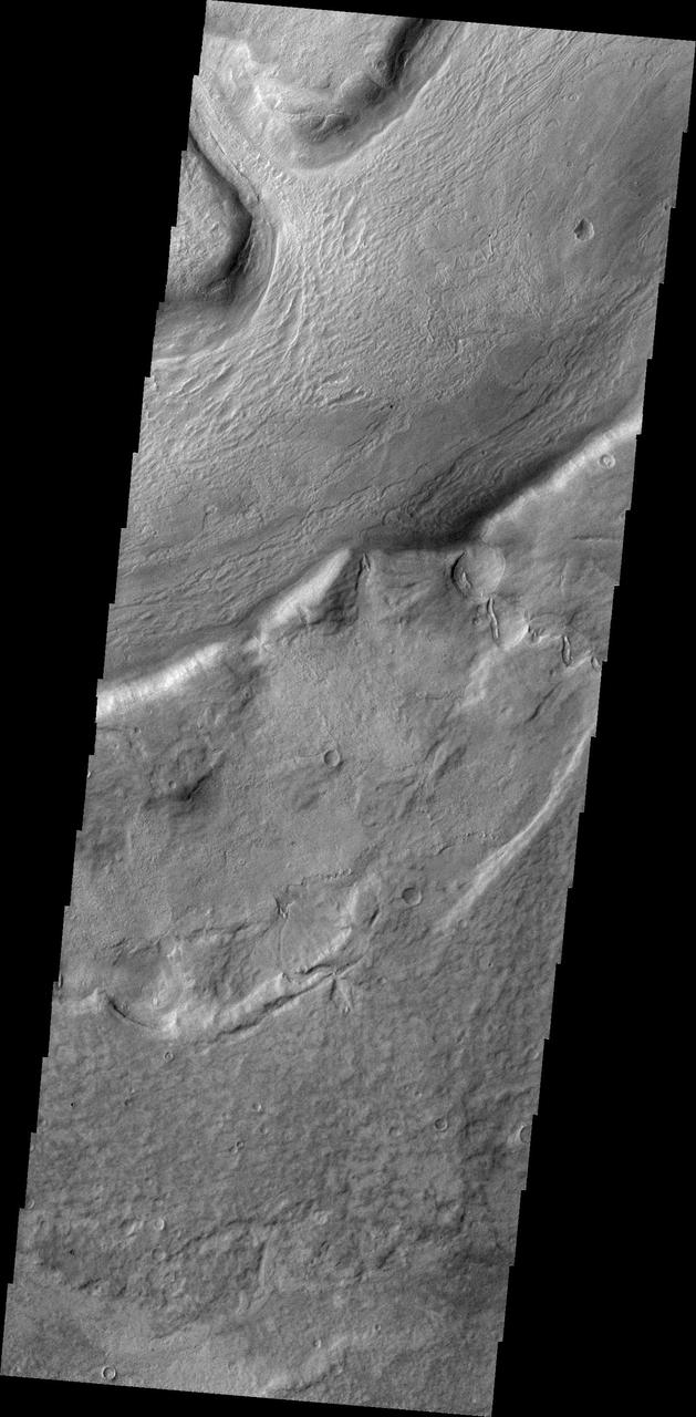
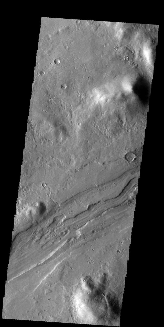
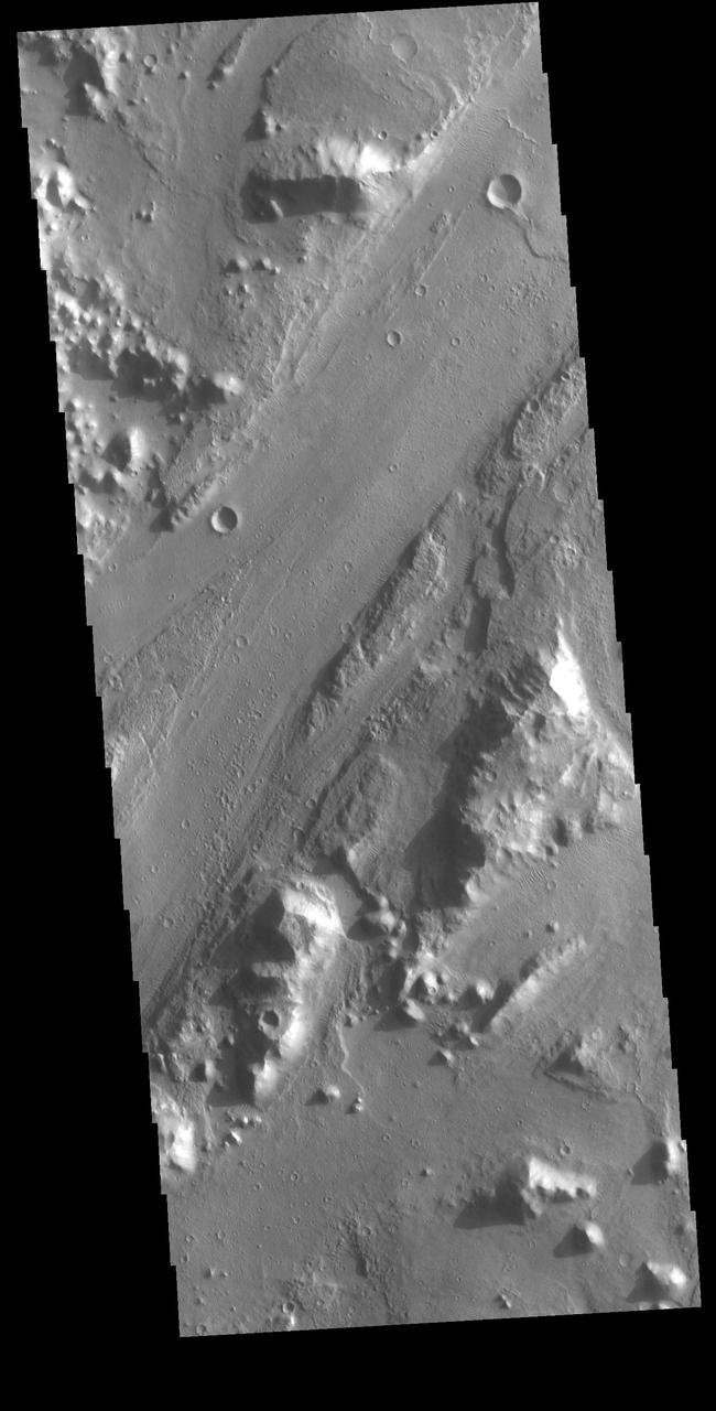
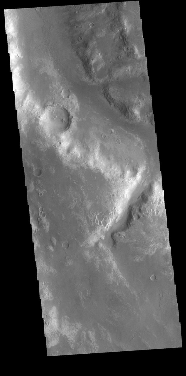
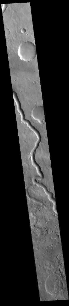
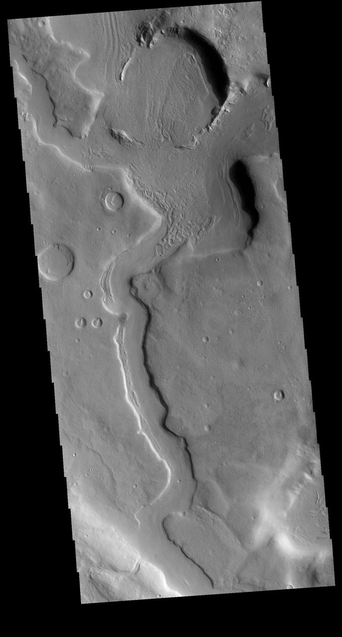
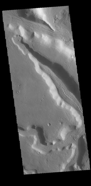
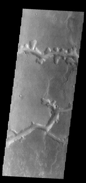
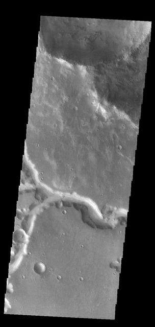
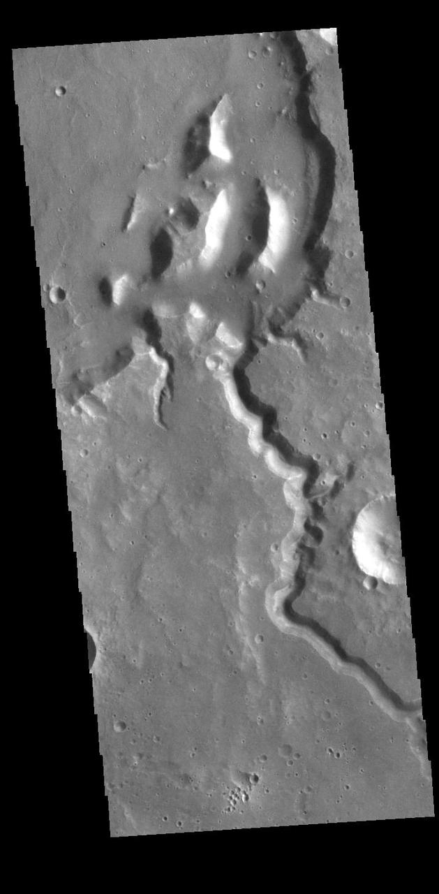
Today VIS image shows more of the channel network that comprises Arda Valles.
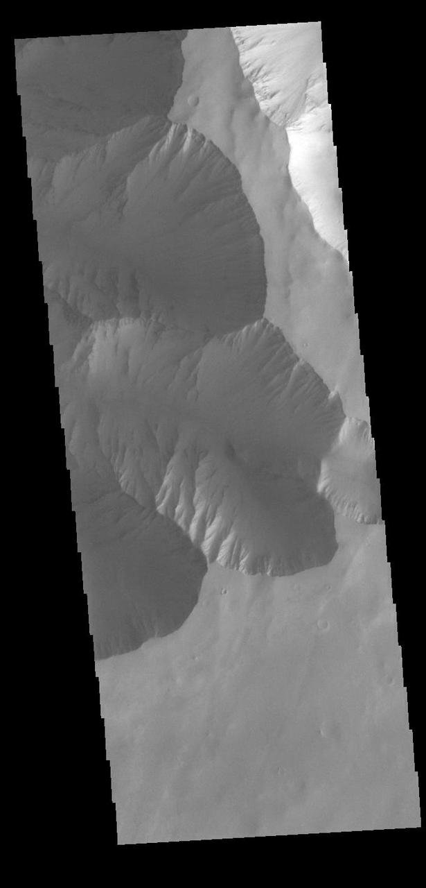
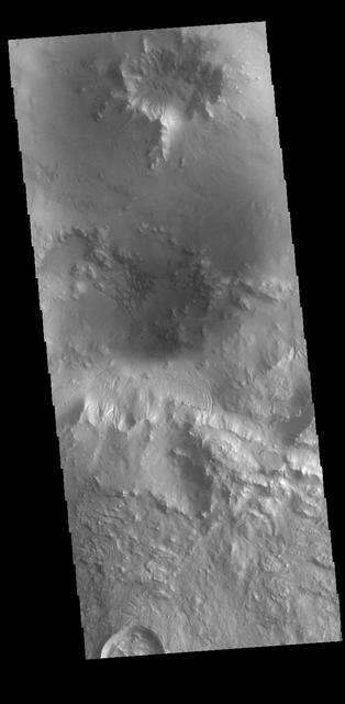
Today image shows the eastern portion of the complex caldera at the summit of Olympus Mon as seen by NASA 2001 Mars Odyssey spacecraft.
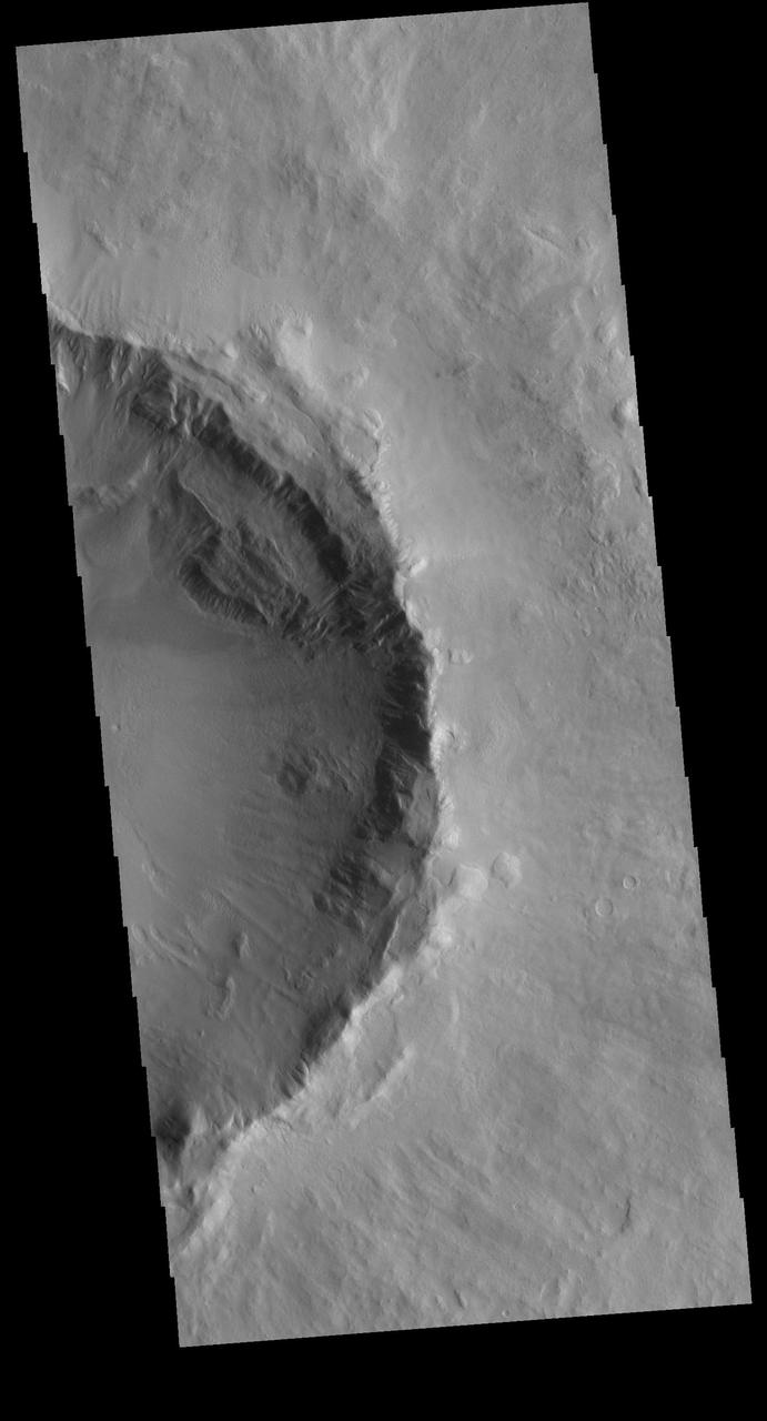
Today image shows the eastern side of the summit caldera of Ceraunius Tholus as seen by NASA 2001 Mars Odyssey spacecraft.
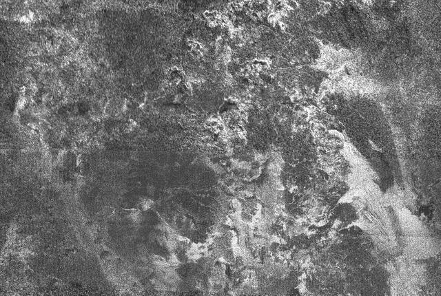
This radar image of Titan shows Ganesa Macula, interpreted as a cryovolcano ice volcano, and its surroundings. Cryovolcanism is thought to have been an important process on Titan and may still be happening today
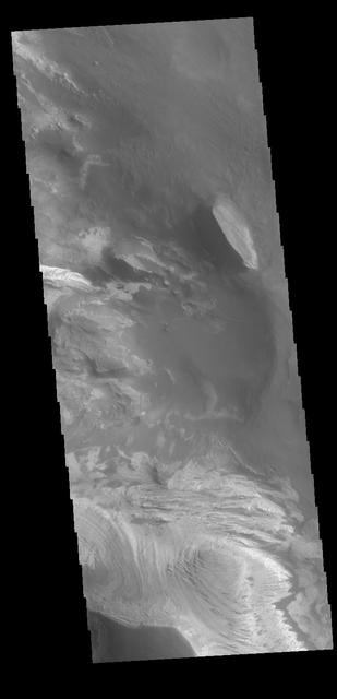
This image from NASA Mars Odyssey spacecraft shows a flooded crater in Amazonis Planitia. This crater has been either flooded with mud and or lava. The fluid then ponded up, dried and formed the surface textures we see today.
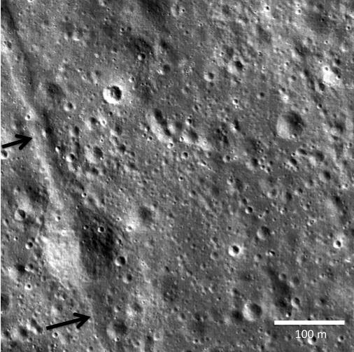
Two small black arrows on today image taken by NASA Lunar Reconnaissance Orbiter show the location of a small graben 28 meters in width in a pyroclastic mantling deposit in the SW portion of Mare Humorum.
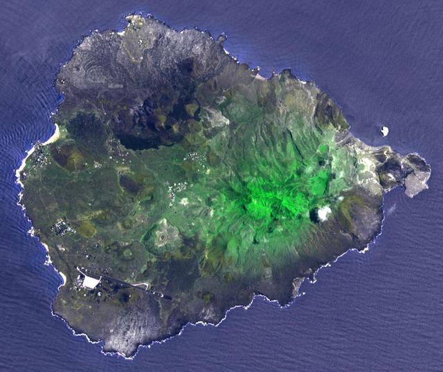
Two hundred years ago, Ascension Island was a barren volcanic edifice. This image from NASA Terra spacecraft shows that today its peaks are covered by lush tropical cloud forest.
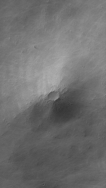
This MOC image shows a small volcano in the Syria Planum region of Mars. Today, the lava flows that compose this small volcano are nearly hidden by a mantle of rough-textured, perhaps somewhat cemented, dust
This image from NASA 2001 Mars Odyssey spacecraft shows several large channels emptying into the eastern Hellas Basin. These southern channels are filled with material today. Whether the material contains volitiles like ice is unknown.
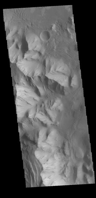
Today's VIS image shows part of the interior of Candor Chasma. At the bottom of the frame is a bright feature formed by layers of material deposited in the canyon after it formed. Additional darker material is likely sand blown into the canyon and eroded from rocks within the chasma. Candor Chasma is just one of the canyons that make up Valles Marineris. Orbit Number: 71344 Latitude: -6.20728 Longitude: 285.115 Instrument: VIS Captured: 2018-01-13 14:41 https://photojournal.jpl.nasa.gov/catalog/PIA22388
Today's VIS image shows the start of Mamers Valles. Orbit Number: 60364 Latitude: 31.4345 Longitude: 20.3221 Instrument: VIS Captured: 2015-07-24 03:06 http://photojournal.jpl.nasa.gov/catalog/PIA19764
Today's VIS image shows unnamed craters in Terra Sirenum. Orbit Number: 68429 Latitude: -40.8094 Longitude: 196.569 Instrument: VIS Captured: 2017-05-18 10:31 https://photojournal.jpl.nasa.gov/catalog/PIA21788
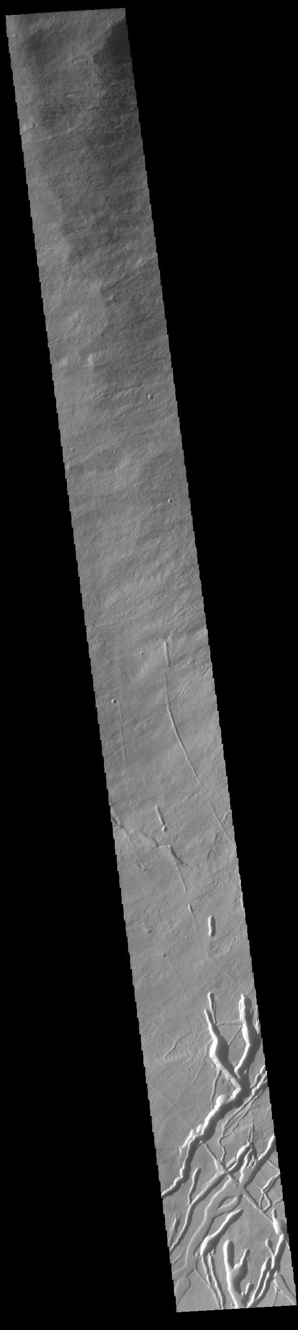
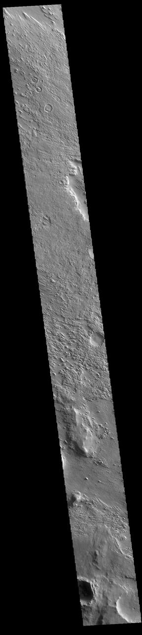
Today's VIS image shows part of an unnamed channel in Arabia Terra. Orbit Number: 81023 Latitude: -5.09236 Longitude: 352.53 Instrument: VIS Captured: 2020-03-20 18:00 https://photojournal.jpl.nasa.gov/catalog/PIA23926
Today's VIS image shows part of Candor Chasma. Orbit Number: 59700 Latitude: -8.61477 Longitude: 292.969 Instrument: VIS Captured: 2015-05-30 09:44 http://photojournal.jpl.nasa.gov/catalog/PIA19758
Today's VIS image shows a portion of an unnamed channel in Arabia Terra. Orbit Number: 79850 Latitude: -5.14669 Longitude: 352.509 Instrument: VIS Captured: 2019-12-15 03:59 https://photojournal.jpl.nasa.gov/catalog/PIA23733
Today's VIS image shows a section of an unnamed channel in Tyrrhena Terra. Orbit Number: 80421 Latitude: -12.0208 Longitude: 80.6346 Instrument: VIS Captured: 2020-01-31 04:20 https://photojournal.jpl.nasa.gov/catalog/PIA23831
Today's VIS image shows a small section of Reull Vallis. Orbit Number: 59494 Latitude: -39.0839 Longitude: 111.047 Instrument: VIS Captured: 2015-05-13 10:47 http://photojournal.jpl.nasa.gov/catalog/PIA19741
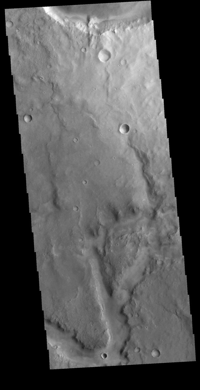
Today's VIS image shows an unnamed channel in Terra Cimmeria. Orbit Number: 87308 Latitude: 2.36838 Longitude: 116.9 Instrument: VIS Captured: 2021-08-20 05:54 https://photojournal.jpl.nasa.gov/catalog/PIA25209
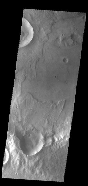
Today's VIS image shows half of an unnamed crater in Utopia Planitia. Orbit Number: 79833 Latitude: 42.973 Longitude: 115.983 Instrument: VIS Captured: 2019-12-13 18:40 https://photojournal.jpl.nasa.gov/catalog/PIA23731
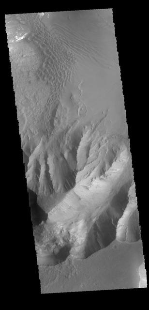
Today's VIS image shows part of the canyon wall of Melas Chasma. Orbit Number: 65682 Latitude: -9.38343 Longitude: 289.417 Instrument: VIS Captured: 2016-10-04 02:52 http://photojournal.jpl.nasa.gov/catalog/PIA21181

NASA CTO Douglas Terrier talks with the "Today Show's" Al Roker about NASA's science research during an Eclipse Across America broadcast aboard the USS Yorktown in Charleston, South Carolina on Aug. 21, 2017.
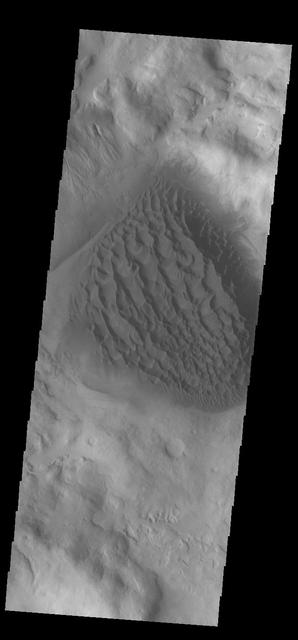
Today's VIS image shows dunes on the floor of Orson Welles Crater. Orbit Number: 80338 Latitude: -0.951622 Longitude: 313.628 Instrument: VIS Captured: 2020-01-24 08:22 https://photojournal.jpl.nasa.gov/catalog/PIA23819

This archival image was released as part of a gallery comparing JPL's past and present, commemorating the 80th anniversary of NASA's Jet Propulsion Laboratory on Oct. 31, 2016. This photograph from 1949 shows the main entrance gate to the Jet Propulsion Laboratory in Pasadena, California, after a snowstorm. To the left is JPL's administration building at the time (Building 67). Building 67 is the Materials Research Building today. The Space Flight Operations Facility (Building 230), which houses JPL's Mission Control, now stands over the parking area on the right. As the lab expanded, the main entrance gate moved farther south. http://photojournal.jpl.nasa.gov/catalog/PIA21118

Today's VIS image shows part of the south polar cap. This image was taken at the end of southern summer. Orbit Number: 76263 Latitude: -85.7084 Longitude: 307.344 Instrument: VIS Captured: 2019-02-22 18:27 https://photojournal.jpl.nasa.gov/catalog/PIA23258
Today's VIS image shows sand dunes on the floor of an unnamed crater in Noachis Terra. Orbit Number: 74840 Latitude: -58.7099 Longitude: 8.80766 Instrument: VIS Captured: 2018-10-28 13:39 https://photojournal.jpl.nasa.gov/catalog/PIA22890
Today's VIS image shows a field of sand dunes in an unnamed crater located in Margaritifer Terra. Most sand dunes on Mars are made of dark basaltic sands. Orbit Number: 78228 Latitude: 6.60598 Longitude: 346.706 Instrument: VIS Captured: 2019-08-03 14:35 https://photojournal.jpl.nasa.gov/catalog/PIA23455
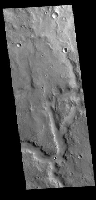
Today's VIS image shows a portion of an unnamed channel in northern Terra Cimmeria. Orbit Number: 81867 Latitude: -1.64386 Longitude: 123.348 Instrument: VIS Captured: 2020-05-29 05:53 https://photojournal.jpl.nasa.gov/catalog/PIA24083
Today's VIS image shows a section of Morava Valles. Morava Valles is located in Margaritifer Terra. Orbit Number: 79601 Latitude: -12.1454 Longitude: 336.946 Instrument: VIS Captured: 2019-11-24 15:53 https://photojournal.jpl.nasa.gov/catalog/PIA23665
Today's VIS image shows a very small portion of the extensive lava flows of the Tharsis volcanic complex. These flows are located southwest of Ascraeus Mons. Orbit Number: 81900 Latitude: 6.11029 Longitude: 250.287 Instrument: VIS Captured: 2020-05-31 23:08 https://photojournal.jpl.nasa.gov/catalog/PIA24089
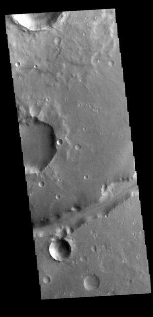
Today's VIS image of an unnamed crater in Terra Sirenum shows crater ejecta. Orbit Number: 60139 Latitude: -38.4241 Longitude: 224.216 Instrument: VIS Captured: 2015-07-05 13:30 http://photojournal.jpl.nasa.gov/catalog/PIA19760
Today's VIS image shows part of Auqakuh Vallis. Sand dunes are visible on the floor of the channel. Orbit Number: 61598 Latitude: 31.0614 Longitude: 60.7982 Instrument: VIS Captured: 2015-11-02 17:55 http://photojournal.jpl.nasa.gov/catalog/PIA20218

Al Roker, NBC TODAY Show co-host and weatherman, serves as the emcee for the Apollo 11 50th Gala, presented by Northrop Grumman, inside the Apollo/Saturn V Center at the Kennedy Space Center Visitor Complex on July 16, 2019.
Today's VIS image shows the large layered deposit on the floor of Gale. The Curiosity Rover is located in Gale Crater. Gale crater is 150km (90 miles) in diameter. Orbit Number: 86309 Latitude: -4.67469 Longitude: 137.724 Instrument: VIS Captured: 2021-05-29 23:44 https://photojournal.jpl.nasa.gov/catalog/PIA24951
Today's VIS image shows several unnamed channels located in northern Arabia Terra. Orbit Number: 87685 Latitude: 39.6067 Longitude: 35.4683 Instrument: VIS Captured: 2021-09-20 07:06 https://photojournal.jpl.nasa.gov/catalog/PIA25264
Today's VIS image shows a dune field on the floor of an unnamed crater in Noachis Terra. Orbit Number: 83268 Latitude: -52.0585 Longitude: 33.3902 Instrument: VIS Captured: 2020-09-21 14:11 https://photojournal.jpl.nasa.gov/catalog/PIA24247
Today's VIS image shows a sand sheet with surface dune forms on the floor of an unnamed crater in Terra Cimmeria. Orbit Number: 67171 Latitude: -64.7606 Longitude: 158.647 Instrument: VIS Captured: 2017-02-03 18:44 https://photojournal.jpl.nasa.gov/catalog/PIA21521
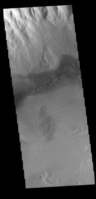
Today's VIS image shows sand dune forms in Juventae Chasma. In this part of Juventae Chasma the entire floor appears to be covered by sand and dunes. Orbit Number: 65083 Latitude: -4.52447 Longitude: 297.293 Instrument: VIS Captured: 2016-08-15 18:39 http://photojournal.jpl.nasa.gov/catalog/PIA21001
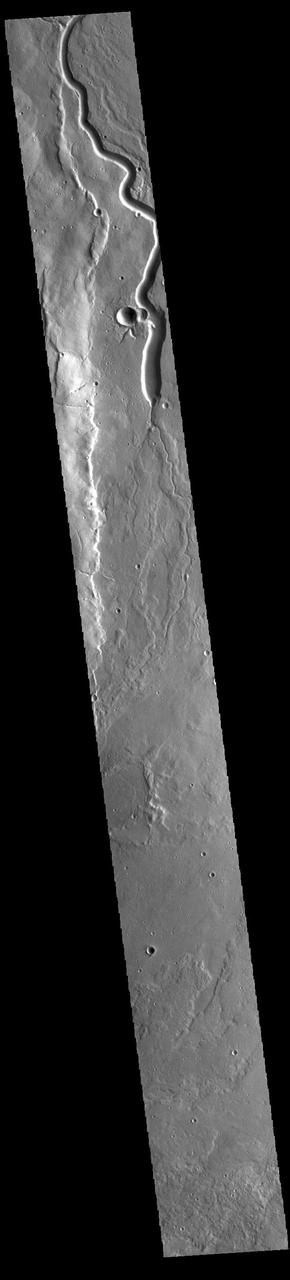
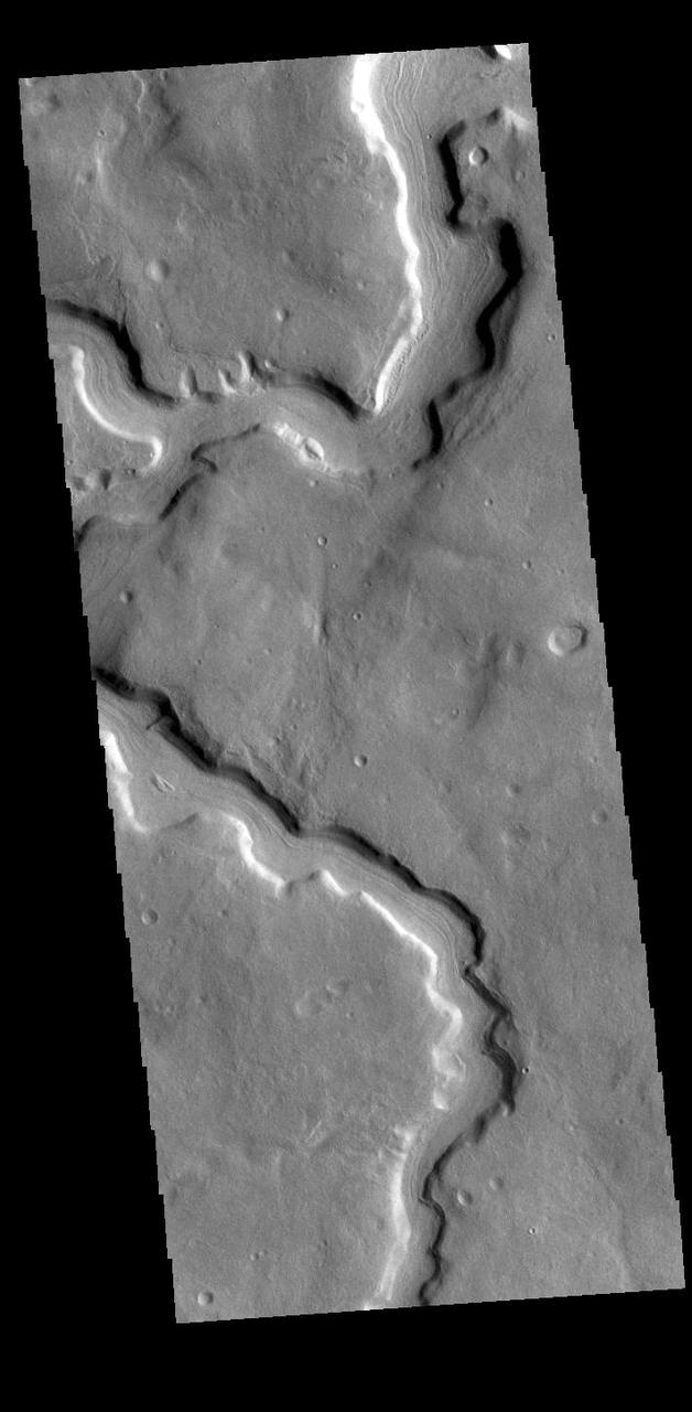
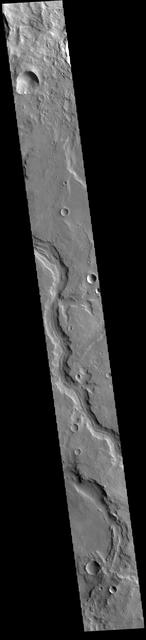
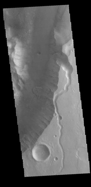
Today's VIS image show a section of Ladon Vallis. The channel is 278km long (173 miles). Ladon Vallis is located in Noachis Terrra and flows northward to Margaritifer Terra. Orbit Number: 91481 Latitude: -23.1934 Longitude: 330.565 Instrument: VIS Captured: 2022-07-29 20:19 https://photojournal.jpl.nasa.gov/catalog/PIA25602
Today's VIS image shows a small section of Nirgal Valles. Located in Noachis Terra, Nirgal Valles is 610km long (379 miles). Orbit Number: 83308 Latitude: -27.164 Longitude: 315.114 Instrument: VIS Captured: 2020-09-24 21:22 https://photojournal.jpl.nasa.gov/catalog/PIA24255
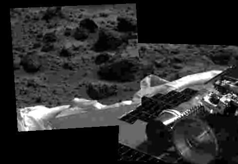
This image shows that the Mars Pathfinder airbags have been successfully retracted, allowing safe deployment of the rover ramps. The Sojourner rover is at lower right, and rocks are visible in the background. Mars Pathfinder landed successfully on the surface of Mars today at 10:07 a.m. PDT. http://photojournal.jpl.nasa.gov/catalog/PIA00618

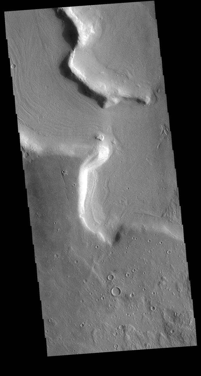
Today's VIS image shows a section of Hypanis Valles. Located in Xanthe Terra, the valley system is 270 km (167 miles) long. Orbit Number: 88861 Latitude: 9.34241 Longitude: 312.724 Instrument: VIS Captured: 2021-12-26 02:55 https://photojournal.jpl.nasa.gov/catalog/PIA25303
Today's VIS image shows the complex interior of an unnamed crater in Arabia Terra. Dark slope streaks are visible in the channel form at the top of the image. Orbit Number: 78851 Latitude: 20.6793 Longitude: 10.3731 Instrument: VIS Captured: 2019-09-23 21:54 https://photojournal.jpl.nasa.gov/catalog/PIA23509
Today's VIS image shows part of the ejecta blanket of Tooting Crater. Tooting Crater is located west of Olympus Mons. Orbit Number: 77272 Latitude: 23.1953 Longitude: 207.317 Instrument: VIS Captured: 2019-05-16 21:16 https://photojournal.jpl.nasa.gov/catalog/PIA23323

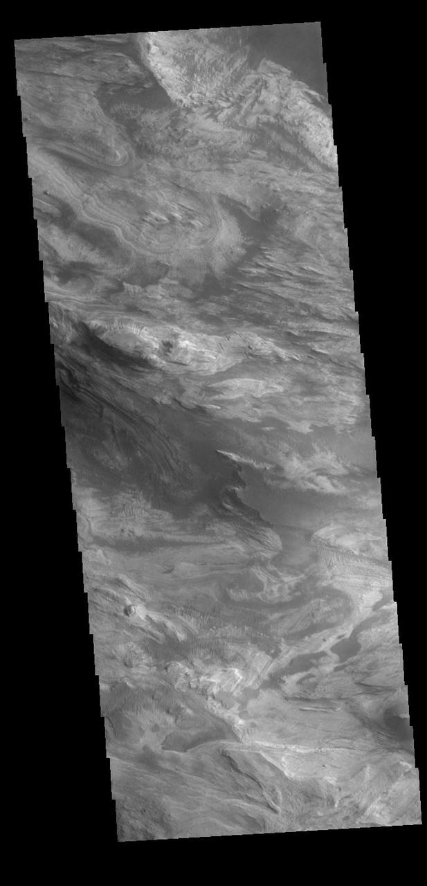
Today's VIS image shows part of the South Pole. Chasma Australe crosses diagonally through the middle of the image. The layers that comprise the polar cap are visible along the sides of the chasma. Orbit Number: 76217 Latitude: -85.2706 Longitude: 96.9588 Instrument: VIS Captured: 2019-02-18 23:34
Today's VIS image shows a section of Mamers Valles, located in Arabia Terra. Orbit Number: 68784 Latitude: 33.2068 Longitude: 17.9281 Instrument: VIS Captured: 2017-06-16 16:55 https://photojournal.jpl.nasa.gov/catalog/PIA22305
Today's VIS image shows a small section of Nirgal Valles. Located in Noachis Terra, Nirgal Valles is 610km long (379 miles). Orbit Number: 83514 Latitude: -28.1171 Longitude: 319.016 Instrument: VIS Captured: 2020-10-11 16:26 https://photojournal.jpl.nasa.gov/catalog/PIA24273
Today's VIS image shows the very eastern margin of Ophir Chasma. Ophir Chasma is approximately 317km long (197 miles) and is part of the Valles Marineris system of canyons. Orbit Number: 90796 Latitude: -4.92716 Longitude: 290.059 Instrument: VIS Captured: 2022-06-03 10:45 https://photojournal.jpl.nasa.gov/catalog/PIA25509
Today's VIS image shows lava flows near the flank of Pavonis Mons. Pavonis Mons is one of the three large aligned Tharsis region volcanoes. Orbit Number: 77907 Latitude: -1.36831 Longitude: 249.245 Instrument: VIS Captured: 2019-07-08 04:08 https://photojournal.jpl.nasa.gov/catalog/PIA23396
Today's VIS image shows part of Indus Vallis, located in northern Terra Sabaea. The channel system is over 300 km (186 miles) long. Orbit Number: 94960 Latitude: 19.1891 Longitude: 38.424 Instrument: VIS Captured: 2023-05-12 07:31 https://photojournal.jpl.nasa.gov/catalog/PIA26220
Today's VIS image shows a small section of Nirgal Valles. Located in Noachis Terra, Nirgal Valles is 610km long (379 miles). Orbit Number: 91494 Latitude: -27.1735 Longitude: 316.077 Instrument: VIS Captured: 2022-07-30 21:59 https://photojournal.jpl.nasa.gov/catalog/PIA25574
Today's VIS image shows the floor of Matara Crater. A large sand sheet with surface dune forms dominates the floor of this crater located in Noachis Terra. Orbit Number: 75438 Latitude: -49.5195 Longitude: 34.6327 Instrument: VIS Captured: 2018-12-16 19:39 https://photojournal.jpl.nasa.gov/catalog/PIA23119
Today's VIS image shows a small portion of Nanedi Valles. This channel is located in Xanthe Terra. Orbit Number: 77830 Latitude: 4.78092 Longitude: 310.065 Instrument: VIS Captured: 2019-07-01 20:00 https://photojournal.jpl.nasa.gov/catalog/PIA23391
Today's VIS image shows part of Indus Vallis, located in northern Terra Sabaea. The valley system is over 300 km (186 miles) long. Orbit Number: 79137 Latitude: 18.6453 Longitude: 39.3279 Instrument: VIS Captured: 2019-10-17 11:06 https://photojournal.jpl.nasa.gov/catalog/PIA23573
Today's VIS image shows a small section of Nirgal Valles. Located in Noachis Terra, Nirgal Valles is 610km long (379 miles). Orbit Number: 81773 Latitude: -28.157 Longitude: 318.842 Instrument: VIS Captured: 2020-05-21 11:59 https://photojournal.jpl.nasa.gov/catalog/PIA24015
Today's VIS image shows a small section of Uzboi Vallis. This valley system arises just north of Argyre Planitia and flows northward into Holden Crater. Orbit Number: 81698 Latitude: -31.0656 Longitude: 322.924 Instrument: VIS Captured: 2020-05-15 07:45 https://photojournal.jpl.nasa.gov/catalog/PIA24002

Today's VIS image shows a section of Hypanis Valles. Located in Xanthe Terra, the valley system is 270 km (167 miles) long. Orbit Number: 79140 Latitude: 9.82918 Longitude: 313.966 Instrument: VIS Captured: 2019-10-17 16:58 https://photojournal.jpl.nasa.gov/catalog/PIA23574

Today's VIS image shows a portion of Nanedi Valles. This channel is over 500 km long (310 miles) and is located in Xanthe Terra. Orbit Number: 79240 Latitude: 4.57002 Longitude: 309.592 Instrument: VIS Captured: 2019-10-25 22:34 https://photojournal.jpl.nasa.gov/catalog/PIA23651
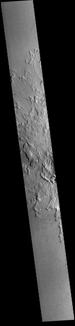
Today's VIS image shows a small portion of the immense lava plains of Daedalia Planum. These flows originated from Arsia Mons, one of the three large Tharsis volcanoes. Orbit Number: 75238 Latitude: -19.446 Longitude: 221.612 Instrument: VIS Captured: 2018-11-30 08:56 https://photojournal.jpl.nasa.gov/catalog/PIA23016
Today's VIS image shows a field of dunes on the floor of an unnamed crater near Schiaparelli Crater in Noachis Terra. Orbit Number: 79163 Latitude: -3.81259 Longitude: 12.247 Instrument: VIS Captured: 2019-10-19 14:21 https://photojournal.jpl.nasa.gov/catalog/PIA23580
Today's VIS image shows a section of an unnamed channel in Arabia Terra. This channel empties into Madler Crater. Orbit Number: 82907 Latitude: -11.1198 Longitude: 1.33091 Instrument: VIS Captured: 2020-08-22 21:02 https://photojournal.jpl.nasa.gov/catalog/PIA24185
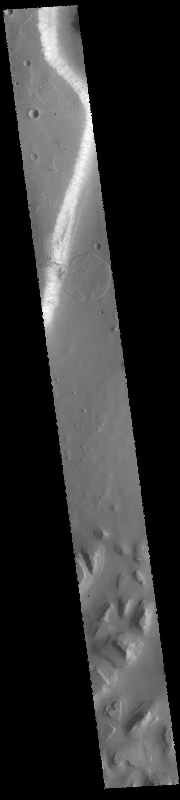
Today's VIS image shows a section of Scamander Vallis. Scamander Vallis is located in northern Terra Sabaea. The channel is 269km (167 miles) long. Orbit Number: 87598 Latitude: 14.9414 Longitude: 28.9915 Instrument: VIS Captured: 2021-09-13 03:03 https://photojournal.jpl.nasa.gov/catalog/PIA25227
Today's VIS image shows a small field of sand dunes on the floor of Bamberg Crater. Orbit Number: 77666 Latitude: 39.3767 Longitude: 356.912 Instrument: VIS Captured: 2019-06-18 08:04 https://photojournal.jpl.nasa.gov/catalog/PIA23388
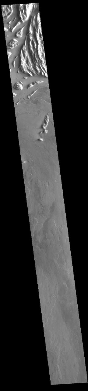
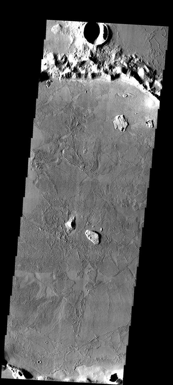
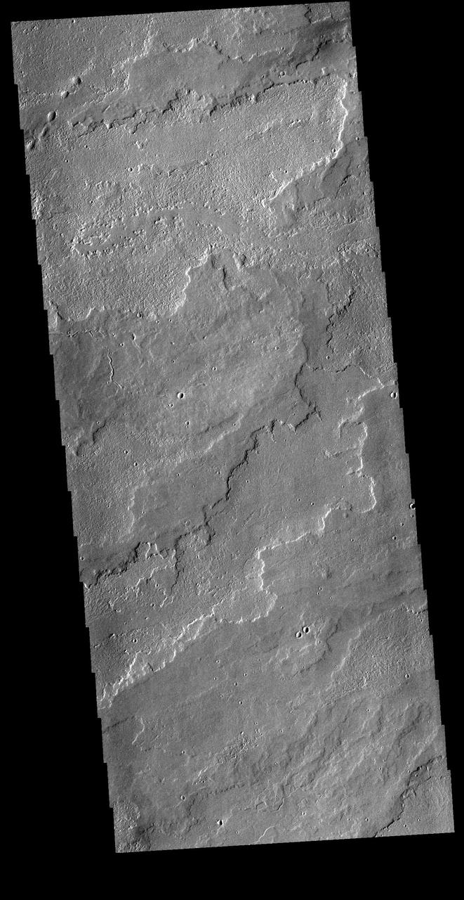
The top of today's VIS image shows a portion of Cyane Sulci. Located to the northeast of Olympus Mons, Cyane Sulci is a complexly fractured region of material inundated on its margins by volcanic flows. Orbit Number: 94217 Latitude: 22.1596 Longitude: 232.704 Instrument: VIS Captured: 2023-03-12 03:17
Today's VIS image shows a portion of Buvinda Vallis, a channel located near the flank of Hecates Tholus. Buvinda Vallis is 134km (83miles) long. Orbit Number: 94070 Latitude: 31.603 Longitude: 152.174 Instrument: VIS Captured: 2023-02-28 00:51 https://photojournal.jpl.nasa.gov/catalog/PIA25978
Today's image shows the southwestern flank of Ascraeus Mons. Ascraeus is the northenmost of the three aligned Tharsis volcanoes and is the tallest at 18,225meters (59,793ft). Orbit Number: 82112 Latitude: 9.73717 Longitude: 253.773 Instrument: VIS Captured: 2020-06-18 10:06 https://photojournal.jpl.nasa.gov/catalog/PIA24141
Today's VIS image shows part of the large dune form on the floor of Russell Crater. Orbit Number: 67151 Latitude: -54.3002 Longitude: 13.0603 Instrument: VIS Captured: 2017-02-02 03:15 http://photojournal.jpl.nasa.gov/catalog/PIA21517

Today's VIS image shows a portion of an unnamed channel in northern Arabia Terra. Numerous channels dissect this region of Arabia Terra where it borders the northern lowlands. Orbit Number: 81196 Latitude: 36.607 Longitude: 35.816 Instrument: VIS Captured: 2020-04-04 00:06 https://photojournal.jpl.nasa.gov/catalog/PIA23939
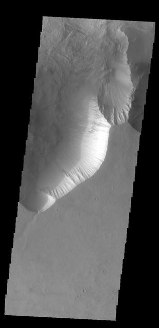
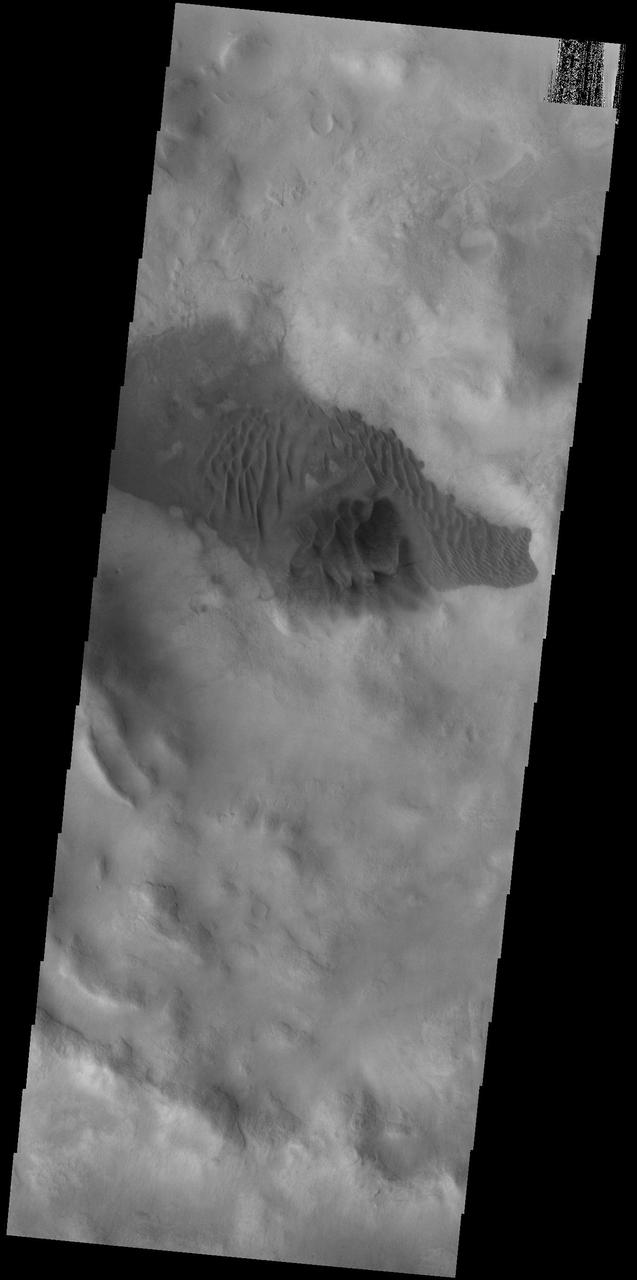
Today's VIS image shows part of Ceti Mensa. This mesa feature is located in western Candor Chasma and is composed of layered deposits and sand dunes. Orbit Number: 88887 Latitude: -5.94433 Longitude: 284.64 Instrument: VIS Captured: 2021-12-28 06:13 https://photojournal.jpl.nasa.gov/catalog/PIA25341
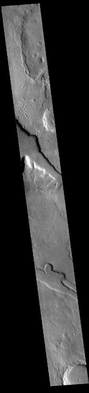
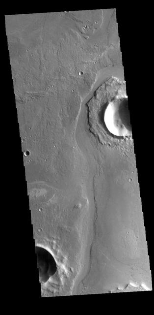
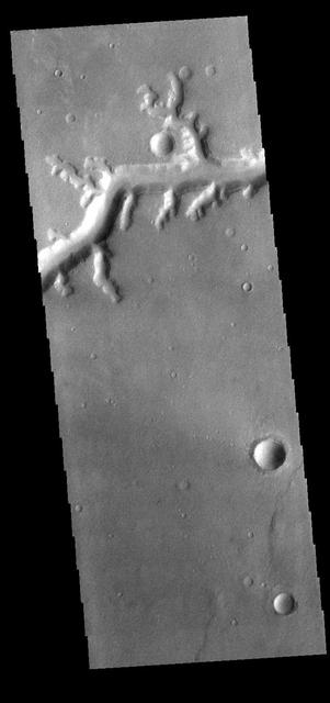
Today's VIS image shows an unnamed channel in Terra Sabaea. The channel is flowing into the crater just visible in the upper left portion of the image. Orbit Number: 81221 Latitude: 6.14616 Longitude: 38.9585 Instrument: VIS Captured: 2020-04-06 01:20 https://photojournal.jpl.nasa.gov/catalog/PIA23946
Today's VIS image shows a portion of an unnamed channel in northern Arabia Terra. Numerous channels dissect this region of Arabia Terra where it borders the northern lowlands. Orbit Number: 86537 Latitude: 38.0081 Longitude: 34.2916 Instrument: VIS Captured: 2021-06-17 18:31 https://photojournal.jpl.nasa.gov/catalog/PIA24958
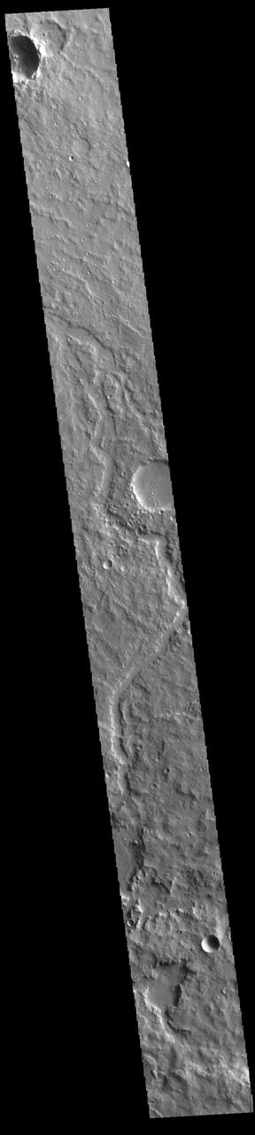
Today's VIS image shows a number of unnamed channels located on the northeastern margin of Terra Sabaea. Orbit Number: 61049 Latitude: 33.5036 Longitude: 58.6967 Instrument: VIS Captured: 2015-09-18 12:54 http://photojournal.jpl.nasa.gov/catalog/PIA20097
Today's VIS image shows an unnamed channel located on the northern boundary of Terra Sirenum near Lucus Planum. Orbit Number: 83225 Latitude: -12.1131 Longitude: 187.493 Instrument: VIS Captured: 2020-09-18 01:25 https://photojournal.jpl.nasa.gov/catalog/PIA24243
Today's VIS image shows a small section of Nirgal Vallis. Nirgal Vallis is located in Noachis Terra. Orbit Number: 74561 Latitude: -27.9987 Longitude: 319.355 Instrument: VIS Captured: 2018-10-05 14:39 https://photojournal.jpl.nasa.gov/catalog/PIA22856
Today's VIS image shows a small section of Nirgal Valles. Located in Noachis Terra, Nirgal Valles is 610km long (379 miles). Orbit Number: 84500 Latitude: -27.3291 Longitude: 314.675 Instrument: VIS Captured: 2021-01-01 00:11 https://photojournal.jpl.nasa.gov/catalog/PIA24361
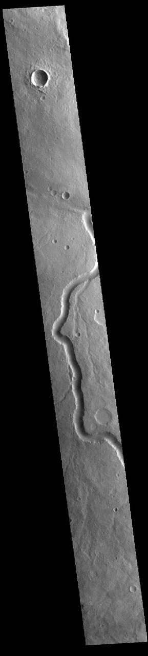
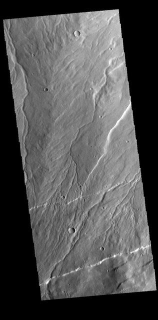
Today's VIS image shows part of Clasia Vallis, located in Terra Sabaea. Clasia Vallis is 125km long (77 miles). Orbit Number: 88720 Latitude: 33.6222 Longitude: 57.0277 Instrument: VIS Captured: 2021-12-14 12:25 https://photojournal.jpl.nasa.gov/catalog/PIA25299
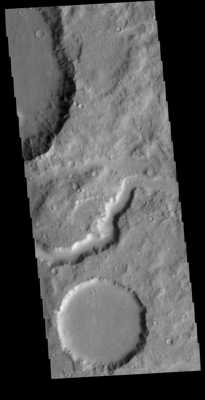
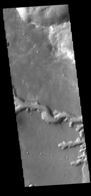
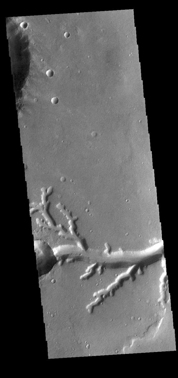
Today's VIS image shows a portion of Athabasca Valles. The channel has eroded some of the ejecta around the unnamed crater in the upper part of the image. Orbit Number: 61495 Latitude: 8.45676 Longitude: 155.671 Instrument: VIS Captured: 2015-10-25 06:13 http://photojournal.jpl.nasa.gov/catalog/PIA20217
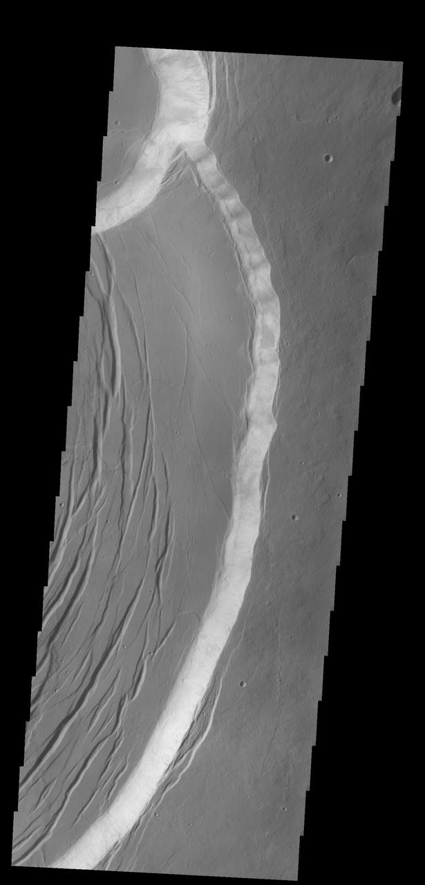
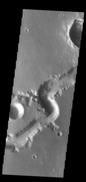
Today's VIS image shows a landslide deposit from the cliffside along Tiu Valles. The mesas at the bottom of the image are part of Hydraotes Chaos. Orbit Number: 64820 Latitude: 2.76947 Longitude: 326.791 Instrument: VIS Captured: 2016-07-25 02:44 http://photojournal.jpl.nasa.gov/catalog/PIA20992
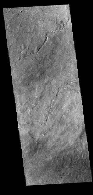
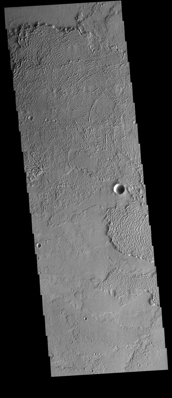
Today's VIS image shows part of Aeolis Planum. The surface in this region has been heavily eroded by wind action. Orbit Number: 87307 Latitude: -0.895655 Longitude: 146.176 Instrument: VIS Captured: 2021-08-20 03:54 https://photojournal.jpl.nasa.gov/catalog/PIA25208
Today's VIS image shows a section of Naktong Vallis. Located in Terra Sabaea, Naktong Vallis is 670 km long (415 miles). Orbit Number: 79337 Latitude: 7.12086 Longitude: 30.7954 Instrument: VIS Captured: 2019-11-02 22:16 https://photojournal.jpl.nasa.gov/catalog/PIA23655
Today's VIS image shows a field of sand dunes on the floor of an unnamed crater in Terra Cimmeria. Orbit Number: 89604 Latitude: -7.58904 Longitude: 119.349 Instrument: VIS Captured: 2022-02-25 07:08 https://photojournal.jpl.nasa.gov/catalog/PIA25401
Today's VIS image shows a sand sheet with surface dunes forms on the floor of an unnamed crater in Noachis Terra. Orbit Number: 74596 Latitude: -52.0302 Longitude: 33.4965 Instrument: VIS Captured: 2018-10-08 11:42 https://photojournal.jpl.nasa.gov/catalog/PIA22858
Today's VIS image shows a small section of Nirgal Valles. Located in Noachis Terra, Nirgal Valles is 610km long (379 miles). Orbit Number: 83302 Latitude: -27.1434 Longitude: 315.095 Instrument: VIS Captured: 2020-09-24 08:50 https://photojournal.jpl.nasa.gov/catalog/PIA24252
Today's VIS image shows part of Huo Hsing Valles, located in northern Terra Sabaea. This valley system is 318 km (197 miles) long. Orbit Number: 79136 Latitude: 30.7086 Longitude: 66.391 Instrument: VIS Captured: 2019-10-17 09:11 https://photojournal.jpl.nasa.gov/catalog/PIA23572
Today's VIS image shows a very small portion of the extensive lava flows of the Tharsis volcanic complex. These flows are located southeast of Ascraeus Mons. Orbit Number: 64473 Latitude: 5.06074 Longitude: 260.881 Instrument: VIS Captured: 2016-06-26 12:47 http://photojournal.jpl.nasa.gov/catalog/PIA20971
Today's VIS image shows a section of Scamander Vallis. Scamander Vallis is located in northern Terra Sabaea. The channel is 269km (167 miles) long. Orbit Number: 85539 Latitude: 16.1834 Longitude: 28.5207 Instrument: VIS Captured: 2021-03-27 14:14 https://photojournal.jpl.nasa.gov/catalog/PIA24853
Today's VIS image shows an unnamed channel system in northern Arabia Terra. Orbit Number: 88161 Latitude: 30.6021 Longitude: 344.658 Instrument: VIS Captured: 2021-10-29 11:43 https://photojournal.jpl.nasa.gov/catalog/PIA25130
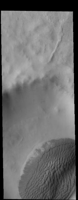
Today's image shows part of the southern margin of Juventae Chasma. Also visible are sand dunes located on the floor of the canyon. Orbit Number: 64372 Latitude: -5.09577 Longitude: 297.061 Instrument: VIS Captured: 2016-06-18 05:03 http://photojournal.jpl.nasa.gov/catalog/PIA20808
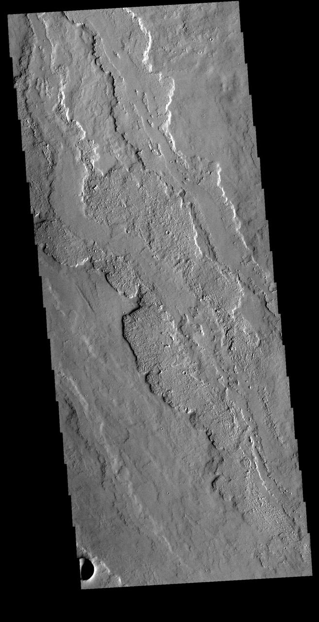
Today's VIS image shows several channels. These unnamed channels are flowing downhill into the northern part of Bosporos Planum. Orbit Number: 90796 Latitude: -30.5588 Longitude: 293.615 Instrument: VIS Captured: 2022-06-03 10:37 https://photojournal.jpl.nasa.gov/catalog/PIA25508
Today's VIS image shows a small section of Nirgal Valles. Located in Noachis Terra, Nirgal Valles is 610km long (379 miles). Orbit Number: 82110 Latitude: -27.3723 Longitude: 316.499 Instrument: VIS Captured: 2020-06-18 05:57 https://photojournal.jpl.nasa.gov/catalog/PIA24125
Today's VIS image shows a portion of the immense volcanic flow fields in the Tharsis region. These flows are northeast of Ascraeus Mons. Orbit Number: 81575 Latitude: 16.1457 Longitude: 264.928 Instrument: VIS Captured: 2020-05-05 04:57 https://photojournal.jpl.nasa.gov/catalog/PIA24001
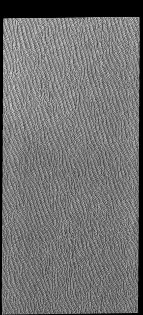
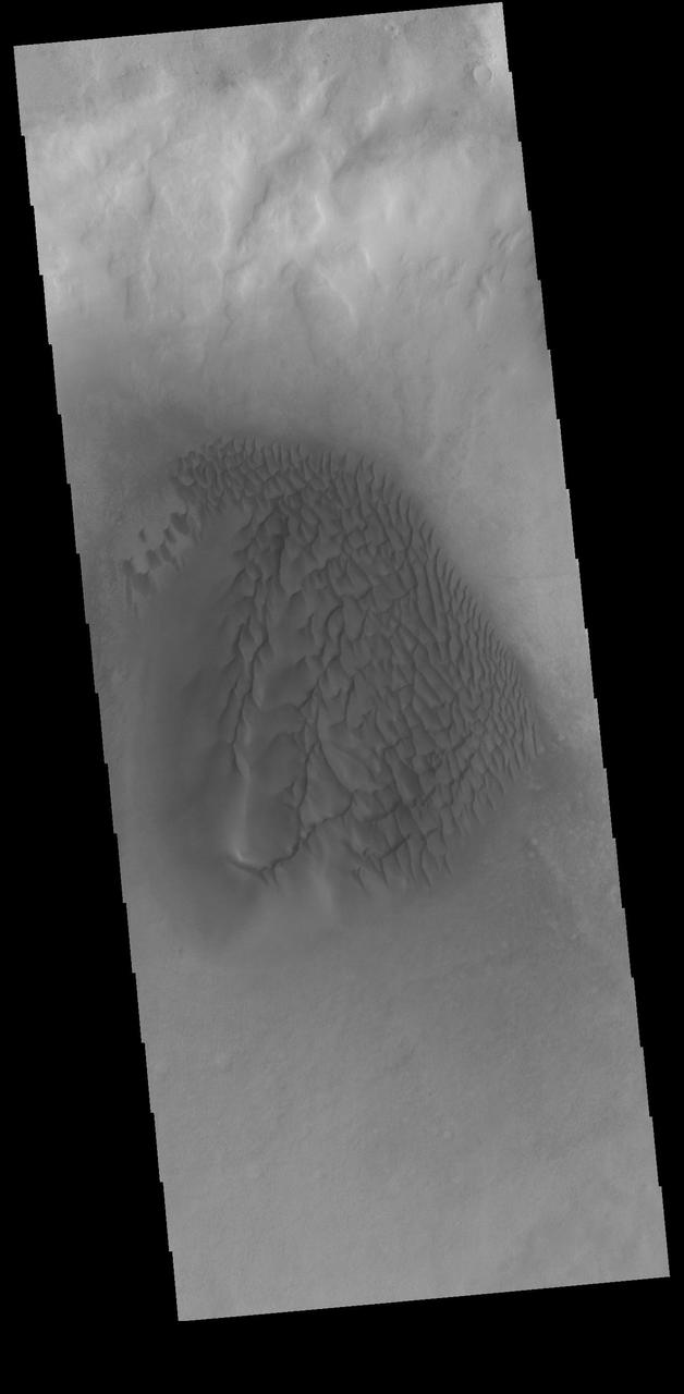
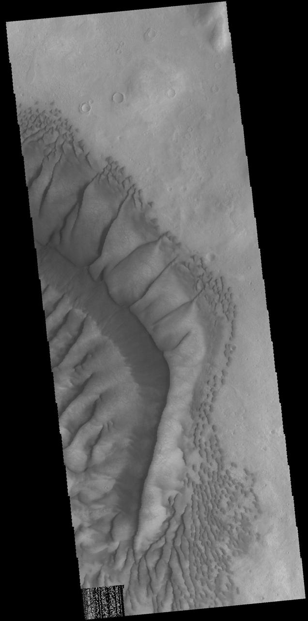
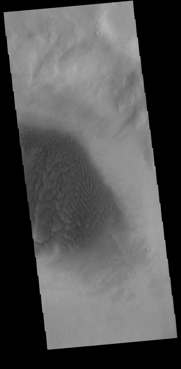
Today's VIS image shows part of Olympia Undae, the largest of several dune fields that encircle the north polar cap. This image was collected in the spring season. Orbit Number: 78164 Latitude: 80.7292 Longitude: 224.712 Instrument: VIS Captured: 2019-07-29 08:37 https://photojournal.jpl.nasa.gov/catalog/PIA23417
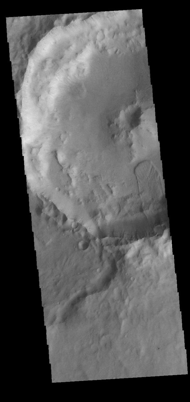
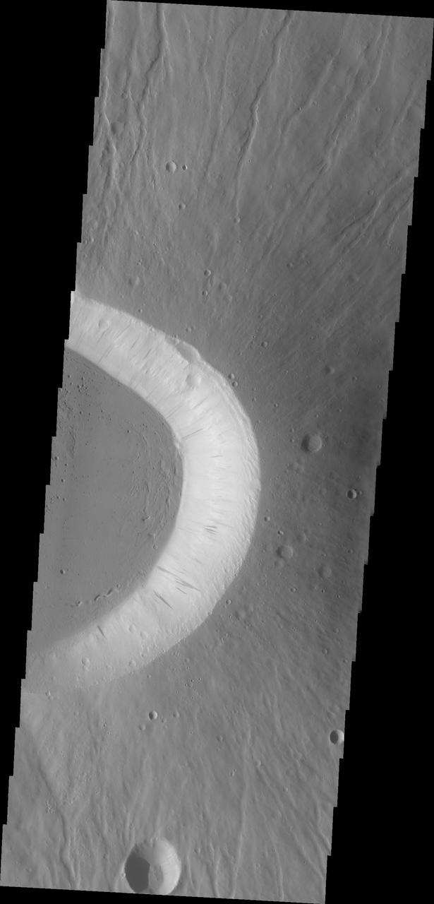
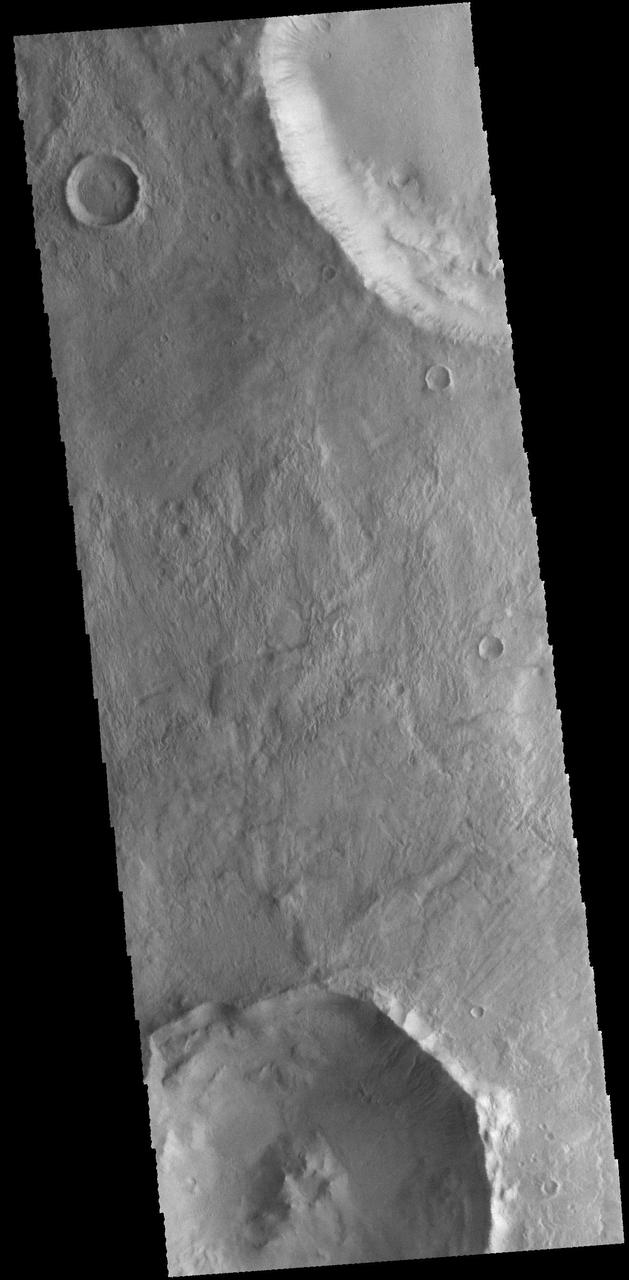
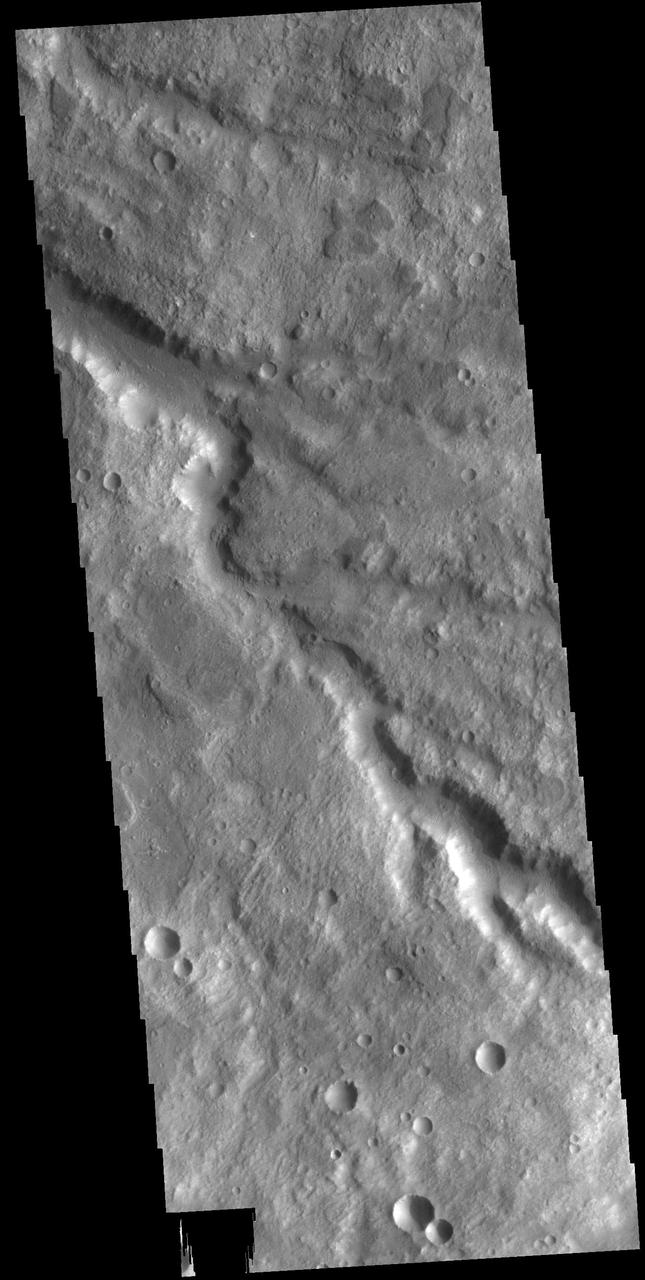
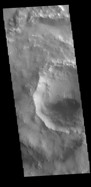
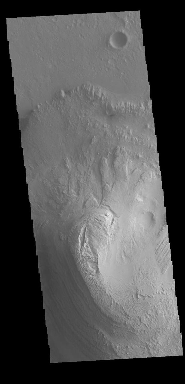
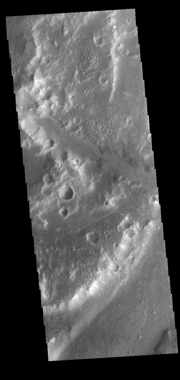
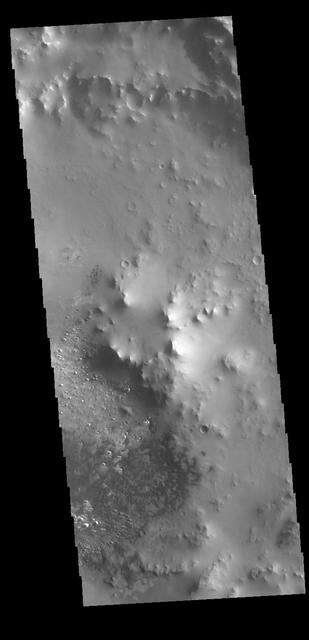
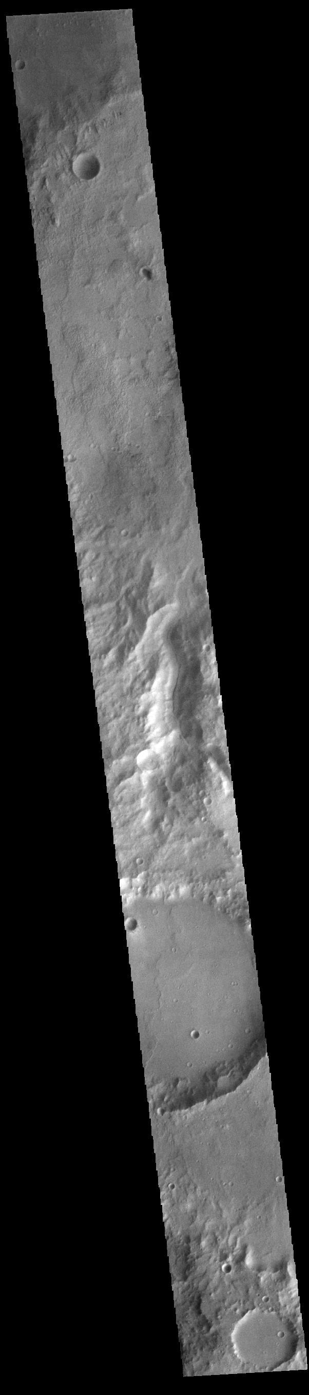
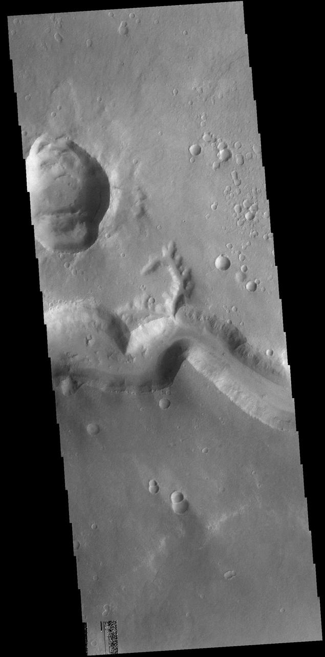
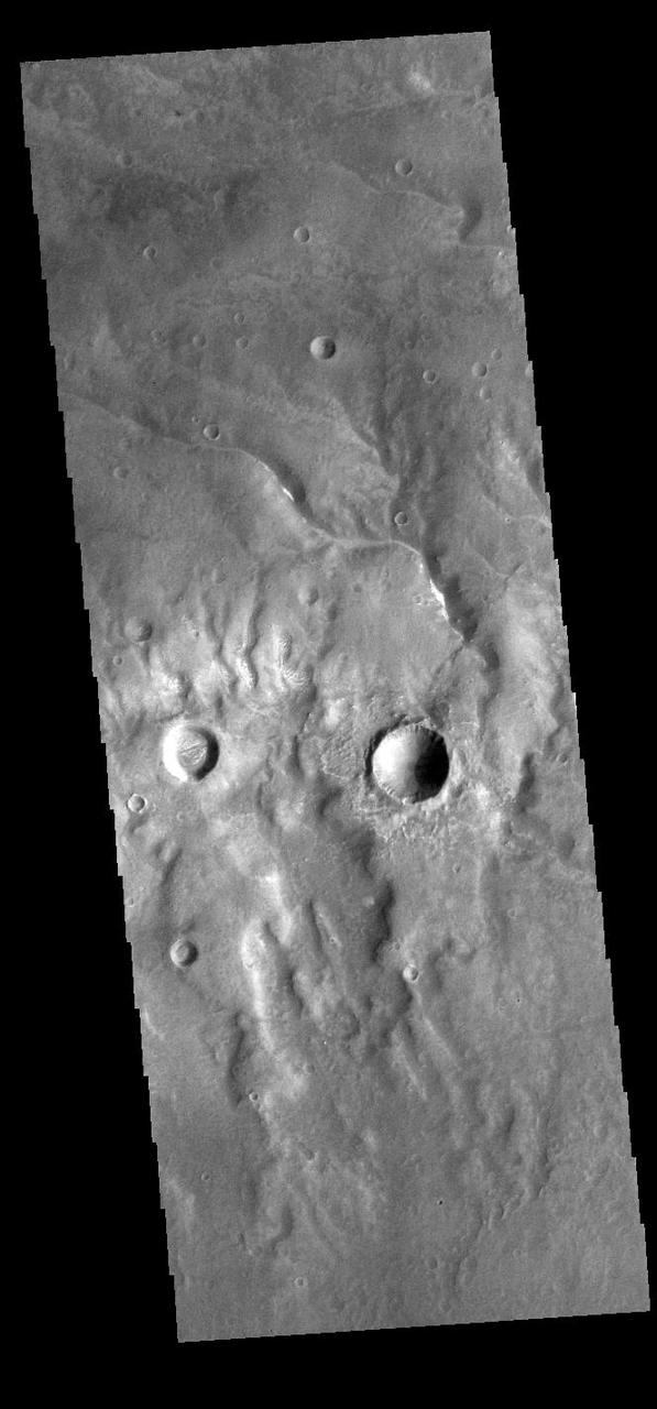
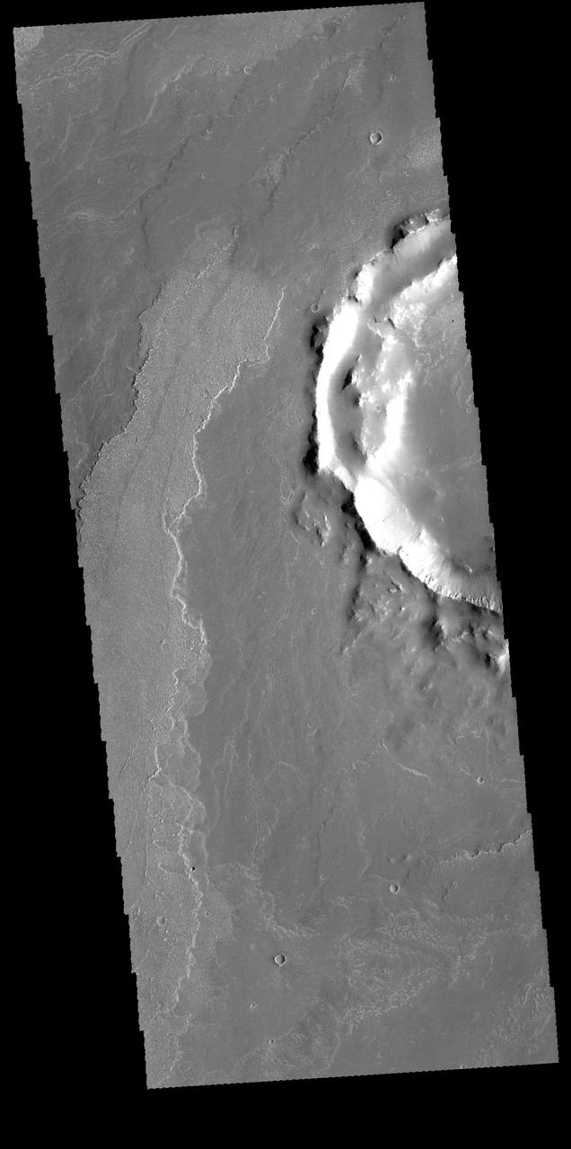
Today's VIS image shows a part of an unnamed crater in Terra Cimmeria. The finger-like projection from the southern rim towards the central peak is a landslide deposit. Orbit Number: 90663 Latitude: -21.8761 Longitude: 169.361 Instrument: VIS Captured: 2022-05-23 11:50 https://photojournal.jpl.nasa.gov/catalog/PIA25478
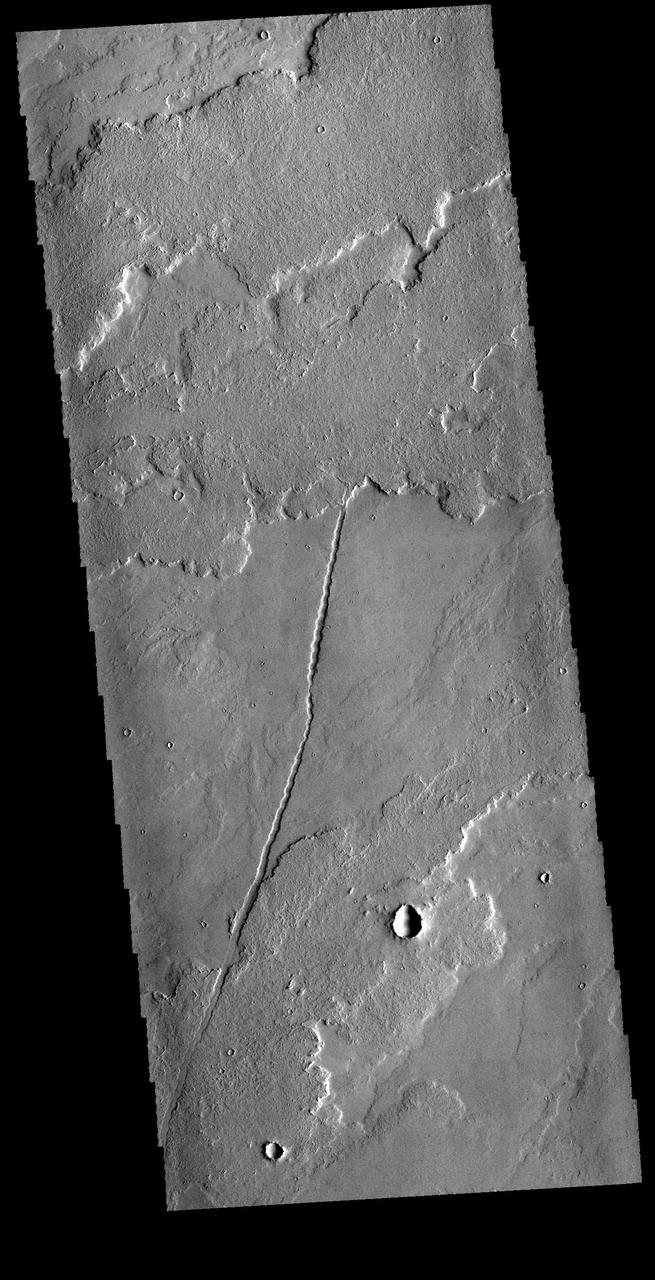
Today's VIS image shows part of Rzvius Valles, located on the northern flank of Alba Mons. Orbit Number: 60281 Latitude: 46.16 Longitude: 252.006 Instrument: VIS Captured: 2015-07-17 07:09 http://photojournal.jpl.nasa.gov/catalog/PIA19761
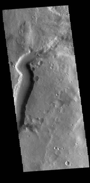
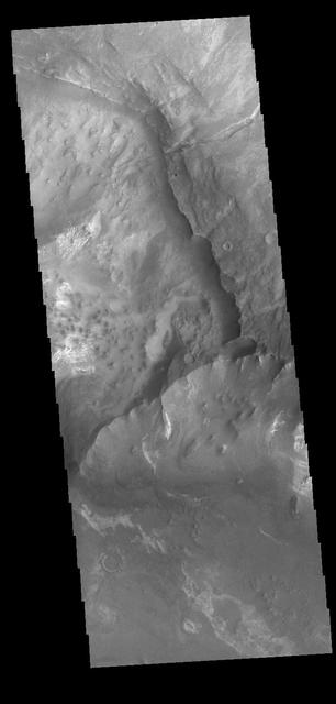
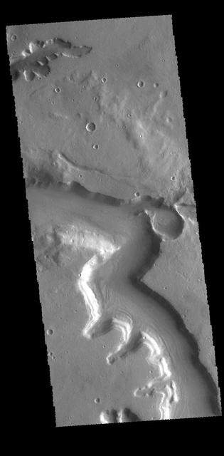
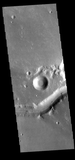
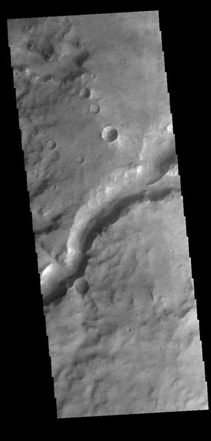
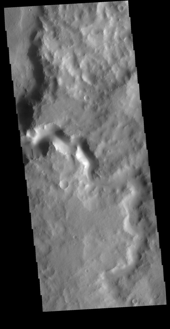
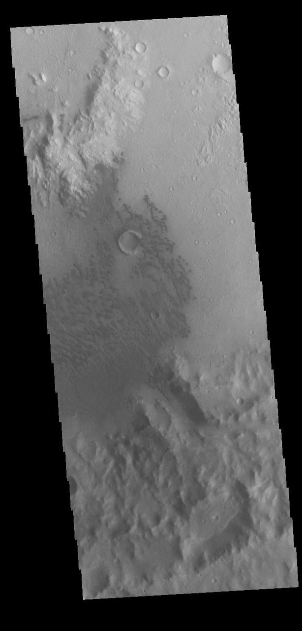
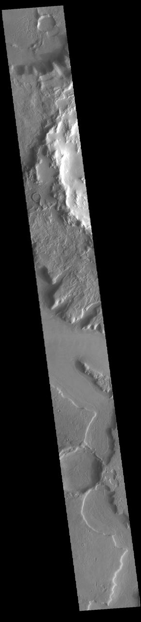
Today's VIS image shows a section of Shalbatana Vallis. Along side of the major channel is a smaller tributary channel. A landslide deposit is also visible in this image. Orbit Number: 77131 Latitude: 6.62847 Longitude: 317.821 Instrument: VIS Captured: 2019-05-05 06:31 https://photojournal.jpl.nasa.gov/catalog/PIA23293
The margin between Arabia Terra and the surrounding lowlands is dissected by numerous named and unnamed channels. Today's VIS image shows part of an unnamed channel in the region. Orbit Number: 77815 Latitude: 39.3327 Longitude: 17.9212 Instrument: VIS Captured: 2019-06-30 14:32 https://photojournal.jpl.nasa.gov/catalog/PIA23384
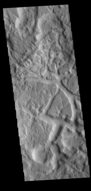
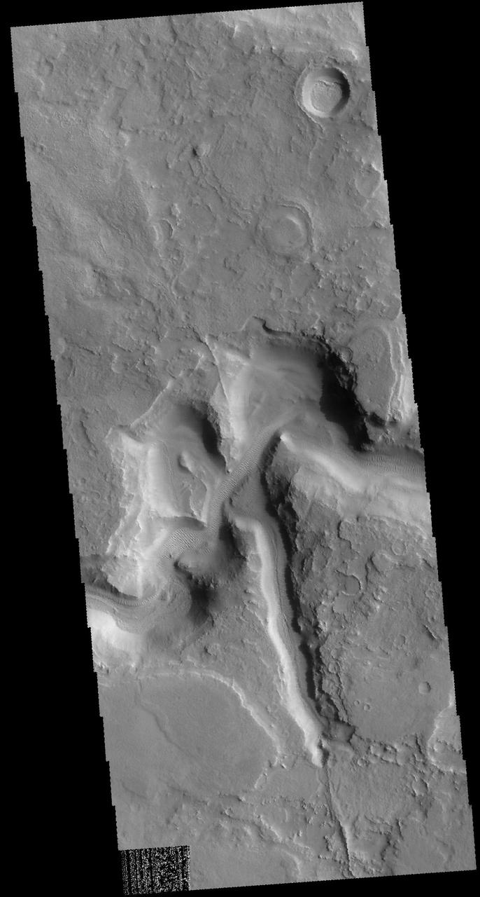
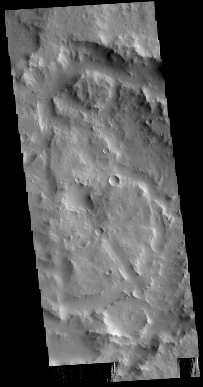
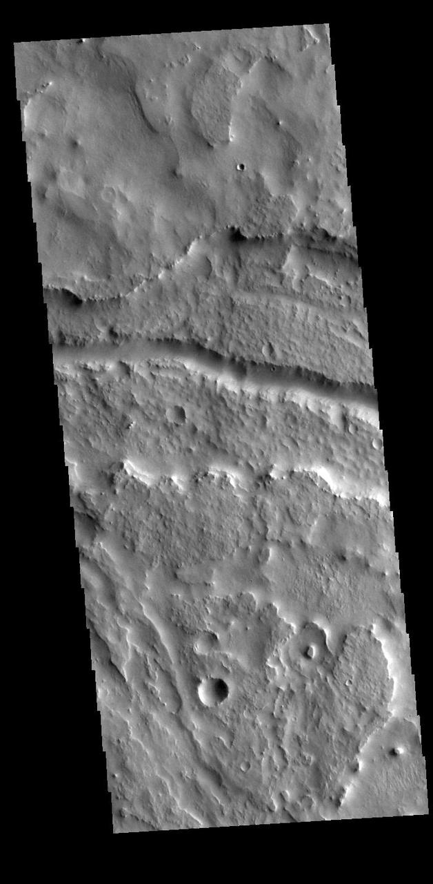
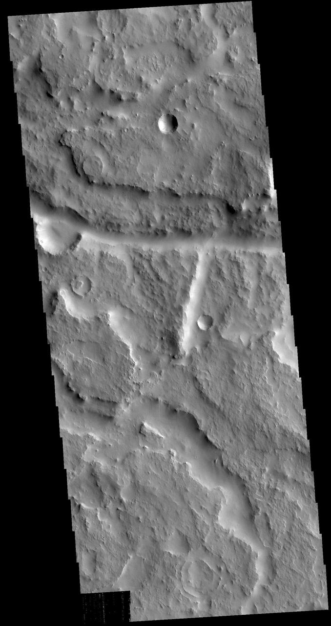
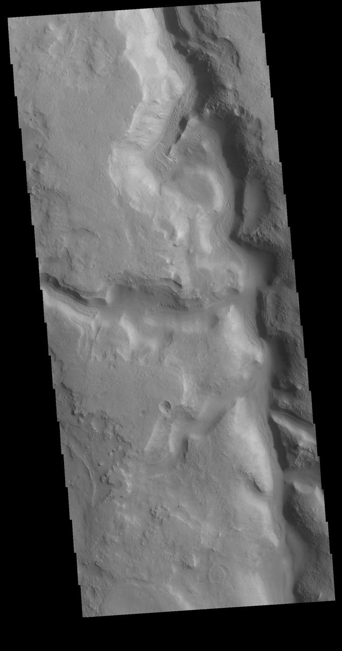
Today's VIS image shows part of the floor of the huge de Vaucouleurs Crater. This crater has a mix of features, including the chaotic terrain seen in this image. Orbit Number: 80942 Latitude: -14.7382 Longitude: 170.602 Instrument: VIS Captured: 2020-03-14 01:53 https://photojournal.jpl.nasa.gov/catalog/PIA23905
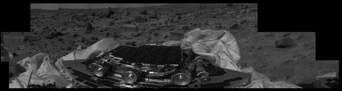
This image shows that the Mars Pathfinder airbags have been successfully retracted, allowing safe deployment of the rover ramps. The Sojourner rover, still in its deployed position, is at center image, and rocks are visible in the background. Mars Pathfinder landed successfully on the surface of Mars today at 10:07 a.m. PDT. http://photojournal.jpl.nasa.gov/catalog/PIA00617
Today's VIS image shows a small portion of Daedalia Planum. Daedalia Planum was created by lava flows from Arsia Mons. Orbit Number: 64898 Latitude: -23.0356 Longitude: 239.131 Instrument: VIS Captured: 2016-07-31 12:48 http://photojournal.jpl.nasa.gov/catalog/PIA20997
Today's VIS image shows several unnamed channels located in northern Arabia Terra. Channels in this region of Arabia Terra are flowing northward into the lower elevations of Acidalia Planitia. Orbit Number: 89794 Latitude: 39.9655 Longitude: 31.1803 Instrument: VIS Captured: 2022-03-12 22:52 https://photojournal.jpl.nasa.gov/catalog/PIA25462