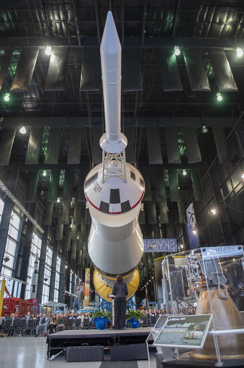
Guest Speaker, Monica Manning, Assistant Administrator, NASA Office of Procurement, talks about Procurement Transformation Activities at the 2020 Small Business Alliance meeting at the U.S. Space and Rocket Center's Davidson Center.
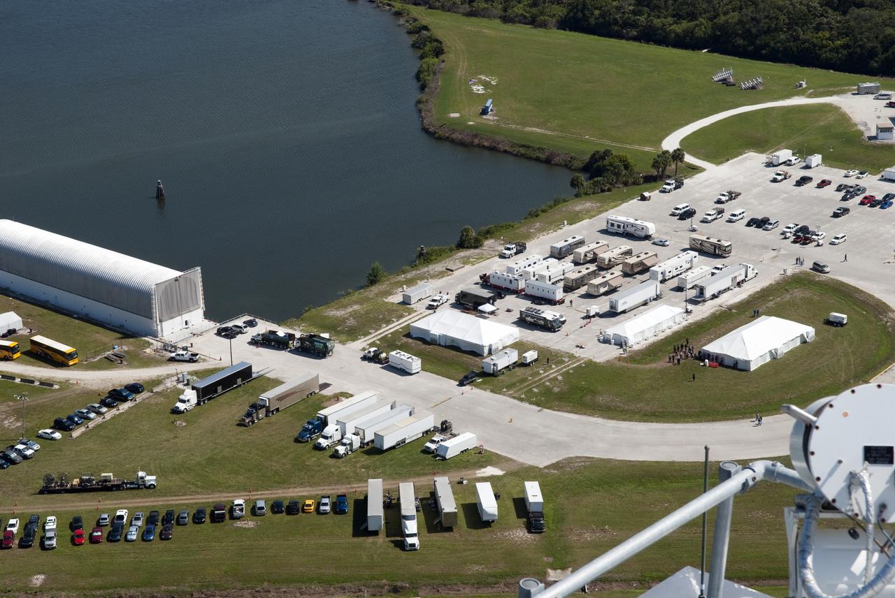
Transformer Movie Activities Around Press Site, Shot from VAB Roof
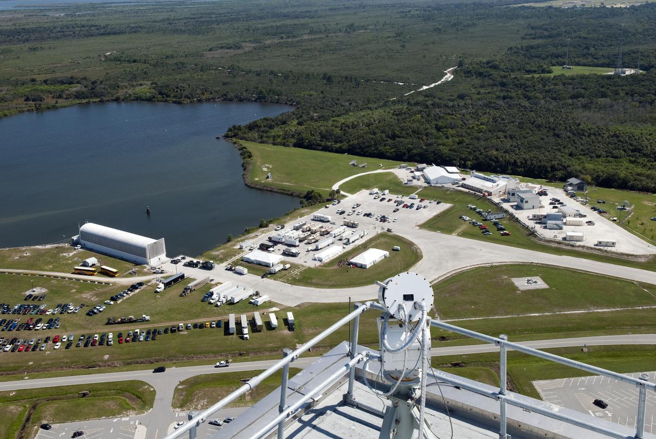
Transformer Movie Activities Around Press Site, Shot from VAB Roof
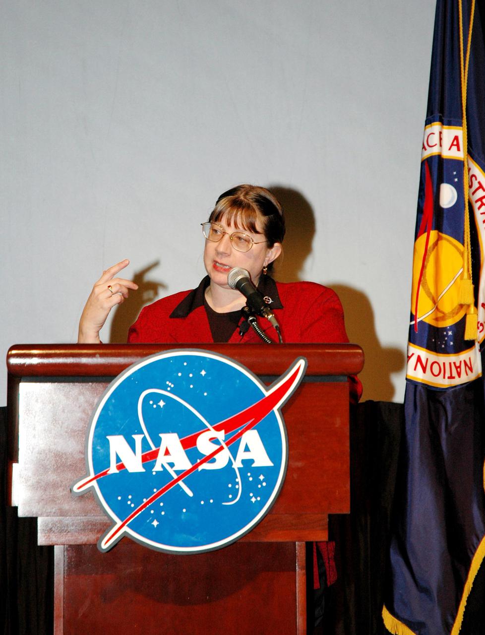
KENNEDY SPACE CENTER, FLA. - Lynn Cline, deputy associate administrator for Space Operations, speaks to attendees of the One NASA Leader-Led Workshop about Transformation activities at Kennedy. The workshop included senior leadership in the Agency.
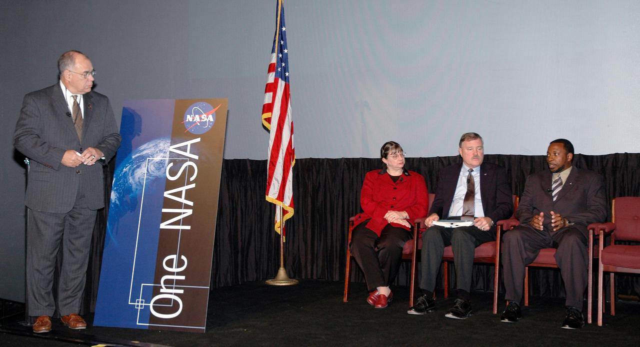
KENNEDY SPACE CENTER, FLA. - NASA Deputy Administrator Fred Gregory (left) moderates the panel presentation during the One NASA Leader-Led Workshop about the Agency’s Transformation and implementation strategies. Seated at right are panel members Lynn Cline, deputy associate administrator for Space Operations, Adm. Craig Steidle, associate administrator for Exploration Systems, and Woodrow Whitlow Jr., Kennedy deputy director. The workshop included senior leadership in the Agency who talked about ongoing Transformation activities and Kennedy’s role in the Vision for Space Exploration.
KENNEDY SPACE CENTER, FLA. - Kennedy Deputy Director Woodrow Whitlow Jr. speaks to attendees of the One NASA Leader-Led Workshop about Kennedy’s role in supporting the Vision for Space Exploration. The workshop included senior leadership in the Agency who talked about ongoing Transformation activities.
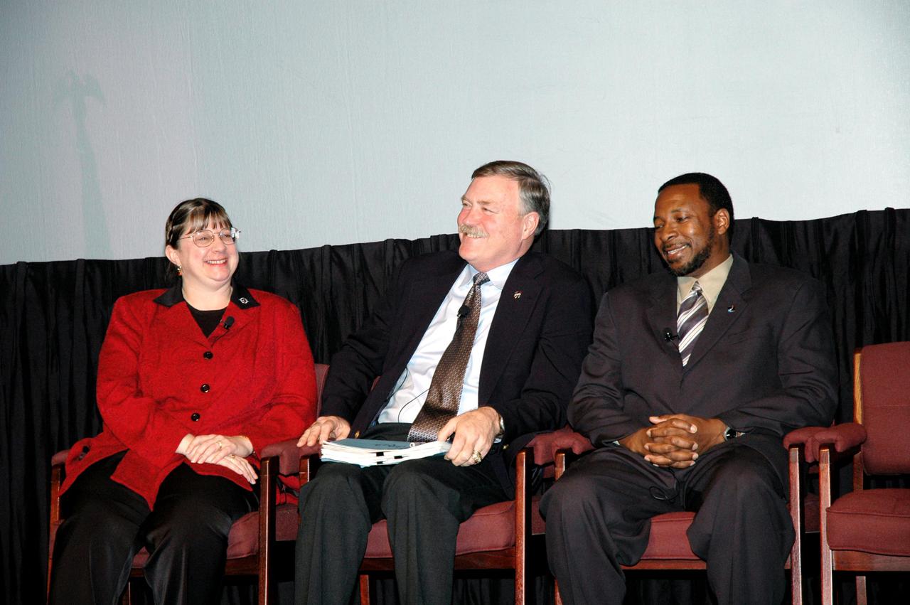
KENNEDY SPACE CENTER, FLA. - Activities at the One NASA Leader-Led Workshop included a panel to answer questions from the audience. Seated here are Lynn Cline, deputy associate administrator for Space Operations, Adm. Craig Steidle, associate administrator for Exploration Systems, and Woodrow Whitlow Jr., Kennedy deputy director. The workshop included senior leadership in the Agency who talked about ongoing Transformation activities and Kennedy’s role in the Vision for Space Exploration.
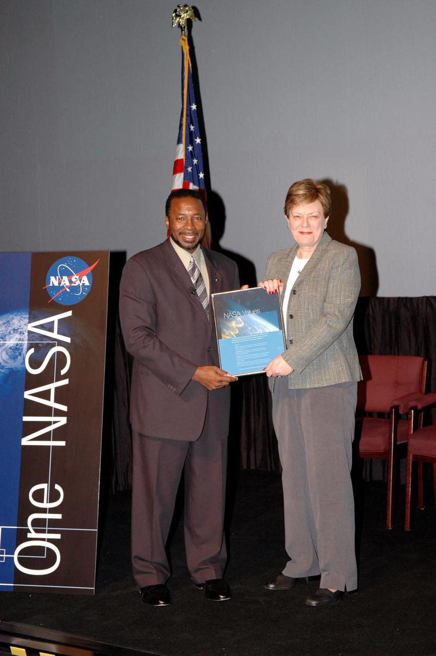
KENNEDY SPACE CENTER, FLA. - Kennedy’s Deputy Director Woodrow Whitlow Jr. presents Carol Anne Dunn an award for a winning entry in the NASA Values essay contest. The award was presented during the One NASA Leader-Led Workshop, which presented senior leadership in the Agency talking about ongoing Transformation activities and Kennedy’s role in the Vision for Space Exploration.
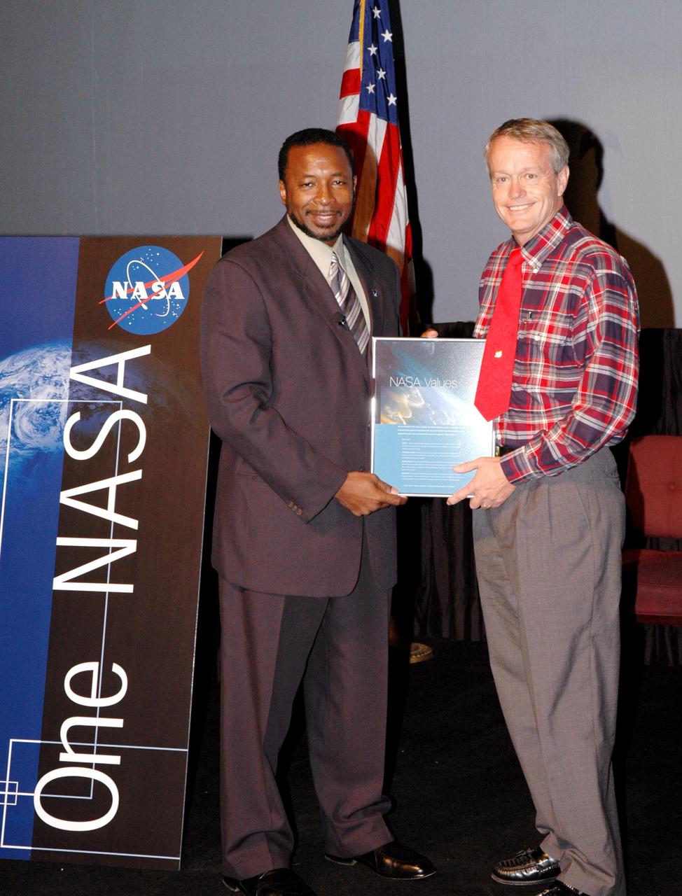
KENNEDY SPACE CENTER, FLA. - Kennedy’s Deputy Director Woodrow Whitlow Jr. presents Ronny Goodin an award for a winning entry in the NASA Values essay contest. The award was presented during the One NASA Leader-Led Workshop, which presented senior leadership in the Agency talking about ongoing Transformation activities and Kennedy’s role in the Vision for Space Exploration.
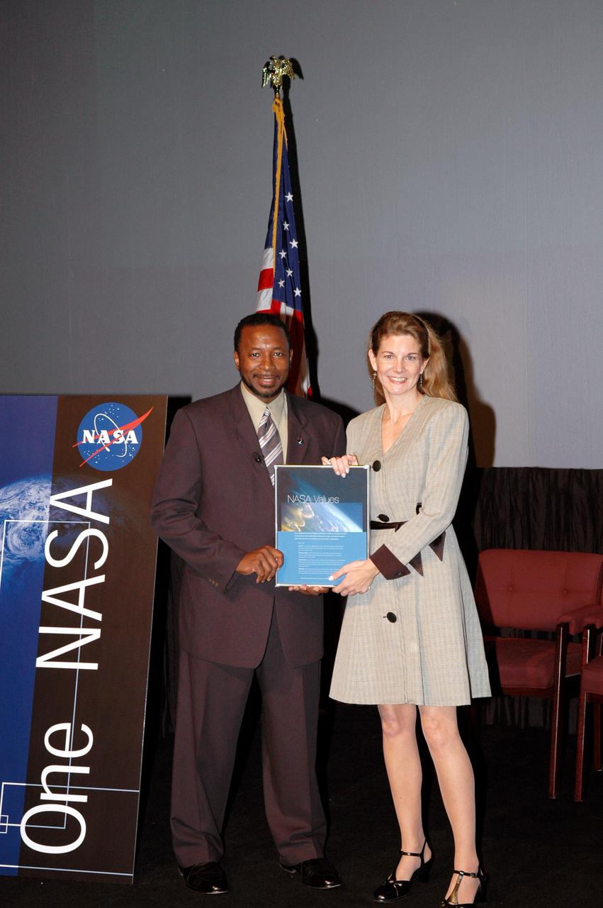
KENNEDY SPACE CENTER, FLA. - Kennedy’s Deputy Director Woodrow Whitlow Jr. presents Mary Erdmann an award for a winning entry in the NASA Values essay contest. The award was presented during the One NASA Leader-Led Workshop, which presented senior leadership in the Agency talking about ongoing Transformation activities and Kennedy’s role in the Vision for Space Exploration.
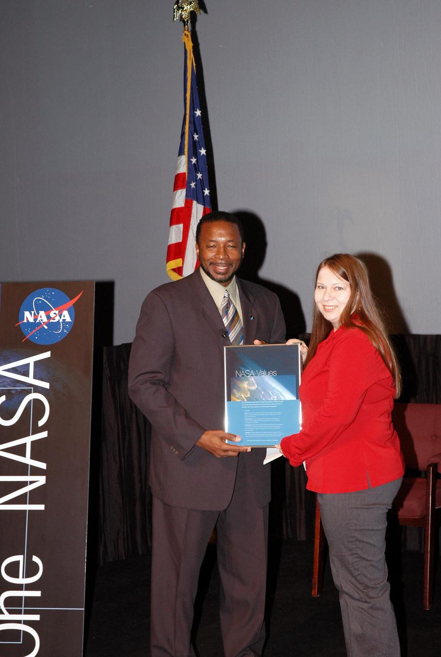
KENNEDY SPACE CENTER, FLA. - Kennedy’s Deputy Director Woodrow Whitlow Jr. presents Pattie Lewis an award for a winning entry in the NASA Values essay contest. The award was presented during the One NASA Leader-Led Workshop, which presented senior leadership in the Agency talking about ongoing Transformation activities and Kennedy’s role in the Vision for Space Exploration.
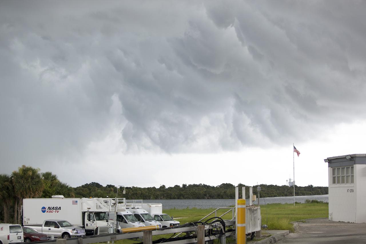
CAPE CANAVERAL, Fla. – A thunderstorm moving through NASA’s Kennedy Space Center in Florida hovers over the NASA Press Site. In the distance is Launch Pad 39A, recently turned over to SpaceX to support their commercial launch activities under a property agreement. Kennedy's Ground Support Development and Operations Program is hard at work transforming the center's facilities into a multi-user spaceport, when the weather permits. For more on Kennedy Space Center, visit http://www.nasa.gov/kennedy. Photo credit: NASA/Ben Smegelsky
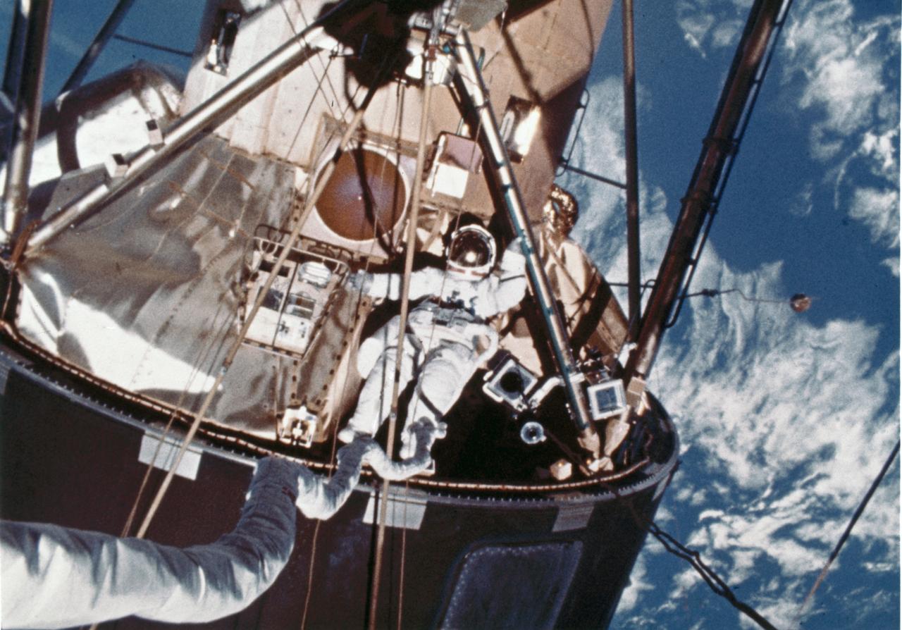
In this photograph, a skylab-4 astronaut performs Extra Vehicular Activities (EVA) outside of the lab. The third crew (Skylab-4) spent 84 days in the orbiting laboratory. The solar observatory was designed for full exposure to the Sun throughout most of the Skylab mission. Solar energy was transformed into electrical power for operation of all spacecraft systems. The proper operation of these solar arrays was vital to the mission.
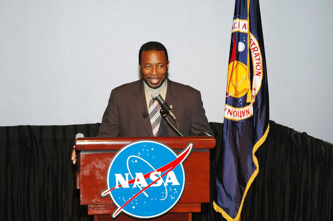
KENNEDY SPACE CENTER, FLA. - Adm. Craig Steidle, associate administrator for Exploration Systems, speaks to attendees of the One NASA Leader-Led Workshop about the Agency plan for achieving the Vision for Space Exploration. The workshop included senior leadership in the Agency who talked about ongoing Transformation activities and Kennedy’s role in the Vision for Space Exploration.

Workers at Launch Complex 17 Pad A, Kennedy Space Center (KSC) encapsulate the Geomagnetic Tail (GEOTAIL) spacecraft (upper) and attached payload Assist Module-D upper stage (lower) in the protective payload fairing. GEOTAIL project was designed to study the effects of Earth's magnetic field. The solar wind draws the Earth's magnetic field into a long tail on the night side of the Earth and stores energy in the stretched field lines of the magnetotail. During active periods, the tail couples with the near-Earth magnetosphere, sometimes releasing energy stored in the tail and activating auroras in the polar ionosphere. GEOTAIL measures the flow of energy and its transformation in the magnetotail and will help clarify the mechanisms that control the imput, transport, storage, release, and conversion of mass, momentum, and energy in the magnetotail.
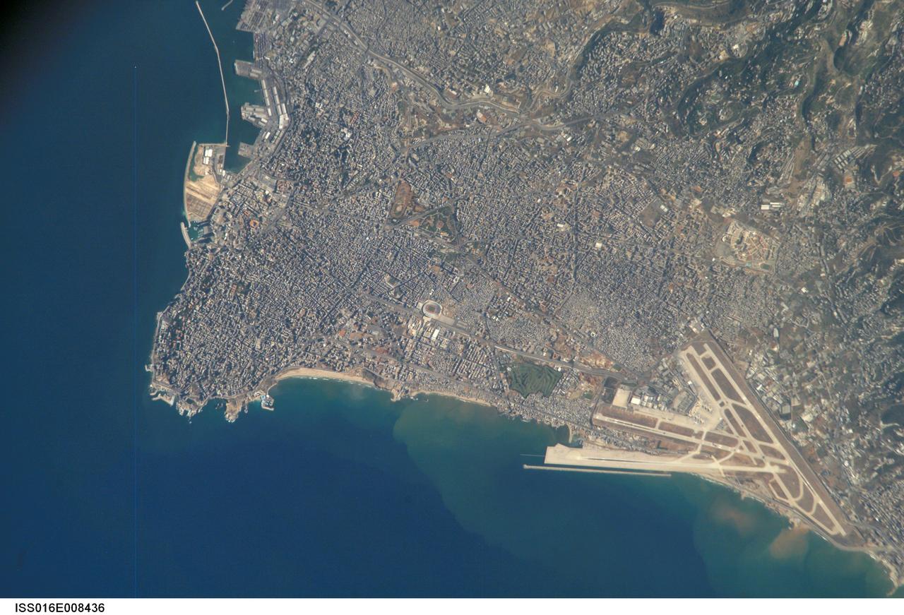
ISS016-E-008436 (26 Oct. 2007) --- Beirut Metropolitan Area, Lebanon is featured in this image photographed by an Expedition 16 crewmember on the International Space Station. The capital of Lebanon, Beirut is located along the southeastern shoreline of the Mediterranean Sea. According to geologists, the metropolitan area is built on a small peninsula composed mainly of sedimentary rock deposited over the past 100 million years or so. The growth of the city eastwards is bounded by foothills of the more mountainous interior of Lebanon (sparsely settled greenish brown region visible at upper right). While this sedimentary platform is stable, the country of Lebanon is located along a major transform fault zone, or region where the African and Arabian tectonic plates are moving laterally in relation to (and against) each other. This active tectonism creates an earthquake hazard for the country. The Roum Fault, one of the fault strands that is part of the transform boundary, is located directly to the south of the Beirut metropolitan area. Other distinctive features visible in this image include the Rafic Hariri Airport at lower right, the city sports arena at center, and several areas of green and open space (such a large golf course at center). Also visible in the image are several plumes of sediment along the coastline -- the most striking of which are located near the airport. The general lack of vegetation in the airport may promote higher degrees of soil transport by surface water runoff or wind.
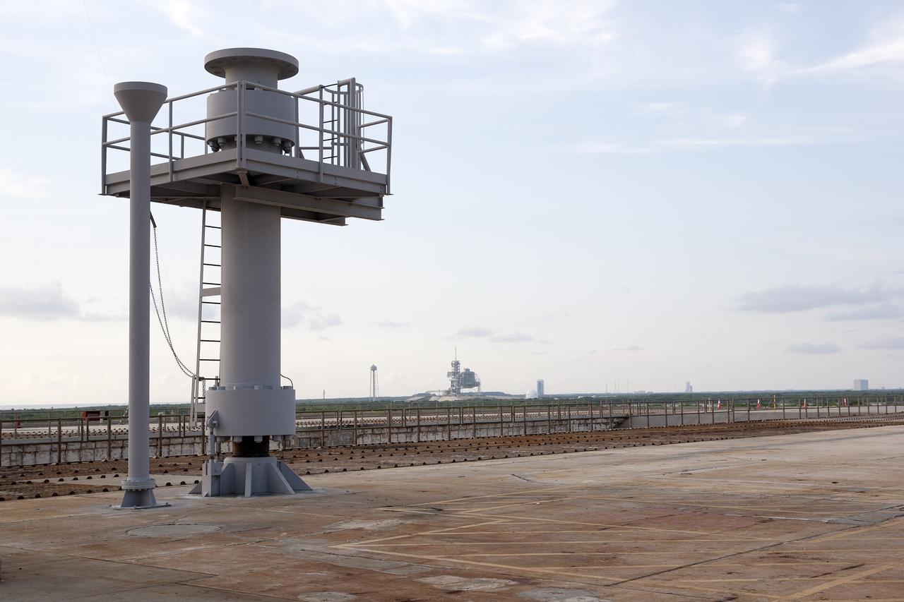
CAPE CANAVERAL, Fla. -- At the Kennedy Space Center in Florida, work is underway to transform the center into a multi-user spaceport. Launch Pad 39B, in the foreground, is being modified to support the agency's new Orion spacecraft which will lift off atop the Space Launch System rocket. Orion is designed to take humans farther than they’ve ever gone before, serving as the exploration vehicle that will carry astronauts to deep space and sustain the crew during travel to destinations such as an asteroid or Mars. On April 14, NASA signed a property agreement with SpaceX of Hawthorne, Calif., for use and occupancy of Launch Pad 39A, in the distance, to serve as a platform to support SpaceX's future launch activities. For more, visit http://www.nasa.gov/kennedy. Photo credit: NASA/Kim Shiflett
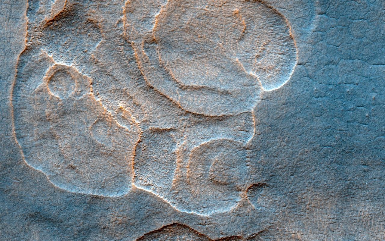
The western Utopia Planitia in the Northern mid-latitudes of Mars is marked by a peculiar type of depression with scalloped edges and by a network of polygonal fractures. The scalloped depressions are typical features; a smooth layered terrain located between 40 and 60 degrees in both hemispheres. Scalloped depressions probably form by removal of ice-rich subsurface material by sublimation (ice transforming directly from a solid to a gaseous state), a process that may still be active today. Isolated scalloped depressions generally have a steep pole-facing scarp and a gentler equator-facing slope. This asymmetry is interpreted as being the result of difference in solar heating. Scalloped depressions may coalesce, leading to the formation of large areas of pitted terrain. The polygonal pattern of fractures resembles permafrost polygons that form in terrestrial polar and high alpine regions by seasonal-to-annual contraction of the permafrost (permanently frozen ground). On Earth, such polygons indicate the presence of ground ice. These landforms most likely show that sub-surface ice is present or has been present geologically recently at these latitudes, and they may slowly be continuing their development at the present time. http://photojournal.jpl.nasa.gov/catalog/PIA13485
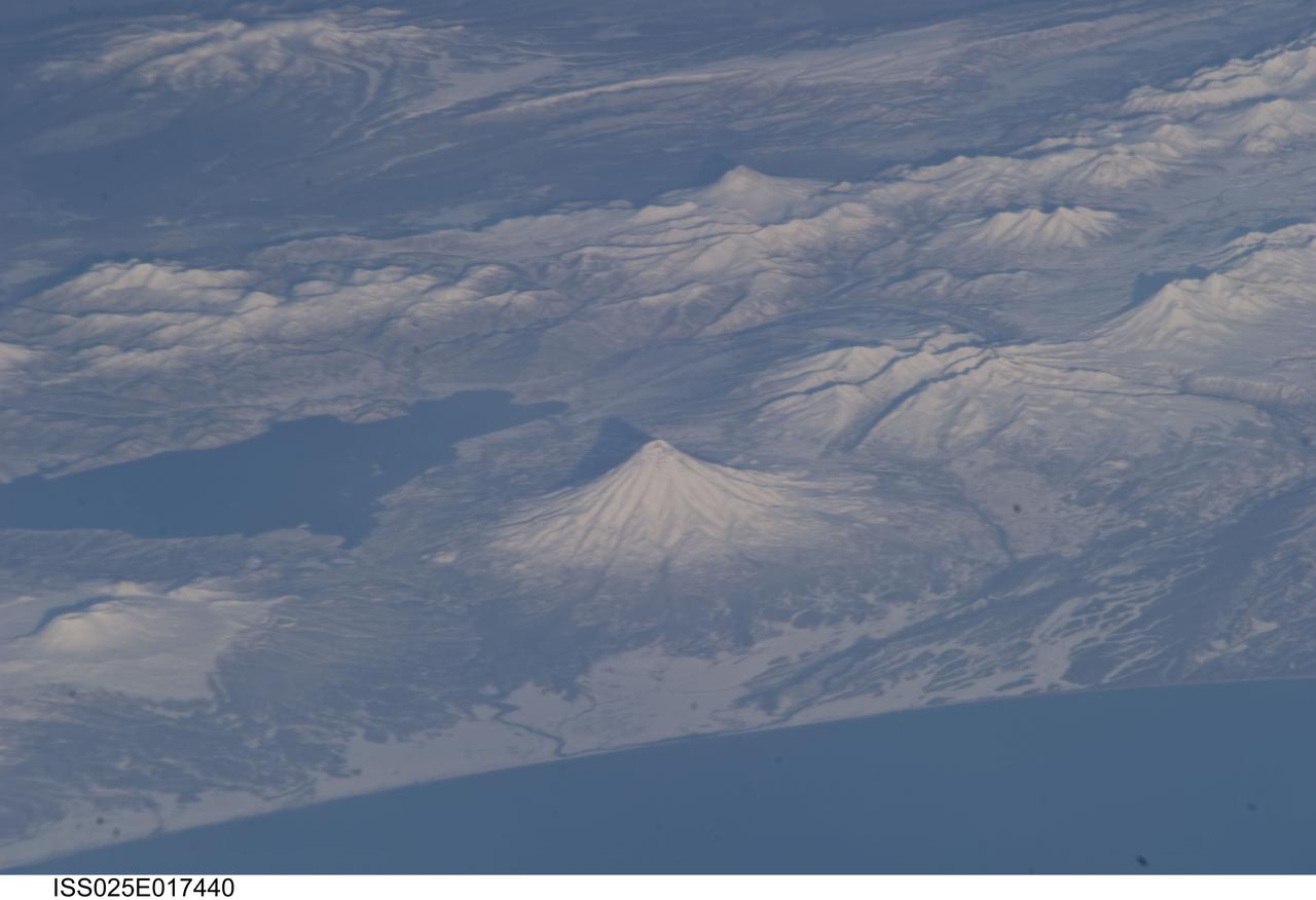
ISS025-E-017440 (19 Nov. 2010) --- Kamchatka volcanoes are featured in this image photographed by an Expedition 25 crew member on the International Space Station. This striking photograph features several snow-covered volcanoes located on the Kamchatka Peninsula of the Russian Federation, as seen from the orbital perspective of the International Space Station (ISS). This image also illustrates one of the unique attributes provided by the ISS – the ability to view Earth landscapes at an angle, rather than the “straight down” view typical of many orbital satellite-based sensors. This oblique view, together with shadows cast by the volcanoes and other mountains provides perspective about the setting and a sense of topography of the region, especially highlighting the symmetrical cones of Kronotsky (center) and Kizimen (top right) stratovolcanoes. Kizimen Volcano last erupted in 1928, while Kronotsky Volcano—one of the largest on the peninsula—last erupted in 1923. Schmidt Volcano, located to the north of Kronotsky, has the morphology of a shield volcano and is not known to have erupted during the period of historical record. To the south of Kronotsky is Krasheninnikov Volcano, comprised of two overlapping stratovolcanoes that formed within an earlier caldera. Scientists believe Krasheninnikov may have last erupted in 1550. The two summit craters of the stratovolcanoes are clearly visible in this image (lower left). Lake Kronotsky (left) is Kamchatka’s largest lake; it was formed when lava flows from Kronotsky Volcano dammed the Listvenichnaya River. The Kamchatka Peninsula lies along the so-called “Ring of Fire” in the Pacific Ocean. The Ring of Fire is characterized by the presence of active volcanoes and frequent earthquakes; these are associated with the many active subduction and transform boundary zones that ring the Pacific tectonic plate. According to scientists, there are currently 114 volcanoes identified on the Kamchatka Peninsula that have erupted during the Holocene Epoch (approximately 12,000 years ago to the present).
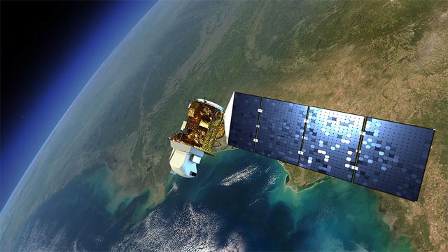
An artist's rendition of the next Landsat satellite, the Landsat Data Continuity Mission (LDCM) that will launch in Feb. 2013. Credit: NASA The Landsat program is the longest continuous global record of Earth observations from space – ever. Since its first satellite went up in the summer of 1972, Landsat has been looking at our planet. The view of Earth that this 40-year satellite program has recorded allows scientists to see, in ways they never imagined, how the Earth's surface has transformed, over time. In the 1970s Landsat captured the first views from space of the Amazonian rainforest and continued to track the area year after year after year, giving the world an unprecedented view of systemic and rapid deforestation. This view from space let us see an activity that was taking place in an exceptionally remote part of our world. These now iconic-images of tropical deforestation spurred the global environmental community to rally in an unprecedented way, and resulted in worldwide attention and action. To read more go to: <a href="http://www.nasa.gov/mission_pages/landsat/news/landsat-history.html" rel="nofollow">www.nasa.gov/mission_pages/landsat/news/landsat-history.html</a> <b><a href="http://www.nasa.gov/audience/formedia/features/MP_Photo_Guidelines.html" rel="nofollow">NASA image use policy.</a></b> <b><a href="http://www.nasa.gov/centers/goddard/home/index.html" rel="nofollow">NASA Goddard Space Flight Center</a></b> enables NASA’s mission through four scientific endeavors: Earth Science, Heliophysics, Solar System Exploration, and Astrophysics. Goddard plays a leading role in NASA’s accomplishments by contributing compelling scientific knowledge to advance the Agency’s mission. <b>Follow us on <a href="http://twitter.com/NASA_GoddardPix" rel="nofollow">Twitter</a></b> <b>Like us on <a href="http://www.facebook.com/pages/Greenbelt-MD/NASA-Goddard/395013845897?ref=tsd" rel="nofollow">Facebook</a></b> <b>Find us on <a href="http://instagrid.me/nasagoddard/?vm=grid" rel="nofollow">Instagram</a></b>

Pilot Joe Algranti climbs into the cockpit of a McDonnell F2H-2B Banshee on the tarmac at the National Advisory Committee for Aeronautics (NACA) Lewis Flight Propulsion Laboratory. Nine months later the laboratory became part of the new National Aeronautics and Space Administration, and the NACA logo was permanently removed from the hangar. Algranti served as a Navy fighter pilot from 1946 to 1947 and earned a Physics degree from the University of North Carolina. He joined the NACA Lewis staff in 1951 witnessed the technological transformation from high speed flight to space. At Lewis Algranti piloted icing research flights, operated the liquid-hydrogen pump system for Project Bee, and served as the primary test subject for the Multi-Axis Space Test Inertia Facility (MASTIF). The MASTIF was a device used to train the Mercury astronauts how to control a spinning capsule. In 1960, Algranti and fellow Lewis pilots Warren North and Harold Ream transferred to NASA’s Space Task Group at Langley to actively participate in the space program. Two years later, Algranti became the Chief of Aircraft Operations and Chief Test Pilot at NASA’s new Manned Space Center in Houston. Algranti earned notoriety in 1968 when he test flew the first Lunar Landing Training Vehicle. He operated the vehicle four minutes before being forced to eject moments before it impacted the ground. Algranti also flew the NASA’s modified Boeing 747 Shuttle Carrier Aircraft, the Super Guppy, and the KC-135 "Vomit Comet" training aircraft. He retired in 1992 with over 40 years of NASA service.

This image depicts a vast canyon of dust and gas in the Orion Nebula from a 3-D computer model based on observations by NASA's Hubble Space Telescope and created by science visualization specialists at the Space Telescope Science Institute (STScI) in Baltimore, Md. A 3-D visualization of this model takes viewers on an amazing four-minute voyage through the 15-light-year-wide canyon. Credit: NASA, G. Bacon, L. Frattare, Z. Levay, and F. Summers (STScI/AURA) Go here to learn more about Hubble 3D: <a href="http://www.nasa.gov/topics/universe/features/hubble_imax_premiere.html" rel="nofollow">www.nasa.gov/topics/universe/features/hubble_imax_premier...</a> or <a href="http://www.imax.com/hubble/" rel="nofollow">www.imax.com/hubble/</a> Take an exhilarating ride through the Orion Nebula, a vast star-making factory 1,500 light-years away. Swoop through Orion's giant canyon of gas and dust. Fly past behemoth stars whose brilliant light illuminates and energizes the entire cloudy region. Zoom by dusty tadpole-shaped objects that are fledgling solar systems. This virtual space journey isn't the latest video game but one of several groundbreaking astronomy visualizations created by specialists at the Space Telescope Science Institute (STScI) in Baltimore, the science operations center for NASA's Hubble Space Telescope. The cinematic space odysseys are part of the new Imax film "Hubble 3D," which opens today at select Imax theaters worldwide. The 43-minute movie chronicles the 20-year life of Hubble and includes highlights from the May 2009 servicing mission to the Earth-orbiting observatory, with footage taken by the astronauts. The giant-screen film showcases some of Hubble's breathtaking iconic pictures, such as the Eagle Nebula's "Pillars of Creation," as well as stunning views taken by the newly installed Wide Field Camera 3. While Hubble pictures of celestial objects are awe-inspiring, they are flat 2-D photographs. For this film, those 2-D images have been converted into 3-D environments, giving the audience the impression they are space travelers taking a tour of Hubble's most popular targets. "A large-format movie is a truly immersive experience," says Frank Summers, an STScI astronomer and science visualization specialist who led the team that developed the movie visualizations. The team labored for nine months, working on four visualization sequences that comprise about 12 minutes of the movie. "Seeing these Hubble images in 3-D, you feel like you are flying through space and not just looking at picture postcards," Summers continued. "The spacescapes are all based on Hubble images and data, though some artistic license is necessary to produce the full depth of field needed for 3-D." The most ambitious sequence is a four-minute voyage through the Orion Nebula's gas-and-dust canyon, about 15 light-years across. During the ride, viewers will see bright and dark, gaseous clouds; thousands of stars, including a grouping of bright, hefty stars called the Trapezium; and embryonic planetary systems. The tour ends with a detailed look at a young circumstellar disk, which is much like the structure from which our solar system formed 4.5 billion years ago. Based on a Hubble image of Orion released in 2006, the visualization was a collaborative effort between science visualization specialists at STScI, including Greg Bacon, who sculpted the Orion Nebula digital model, with input from STScI astronomer Massimo Roberto; the National Center for Supercomputing Applications at the University of Illinois at Urbana-Champaign; and the Spitzer Science Center at the California Institute of Technology in Pasadena. For some of the sequences, STScI imaging specialists developed new techniques for transforming the 2-D Hubble images into 3-D. STScI image processing specialists Lisa Frattare and Zolt Levay, for example, created methods of splitting a giant gaseous pillar in the Carina Nebula into multiple layers to produce a 3-D effect, giving the structure depth. The Carina Nebula is a nursery for baby stars. Frattare painstakingly removed the thousands of stars in the image so that Levay could separate the gaseous layers on the isolated Carina pillar. Frattare then replaced the stars into both foreground and background layers to complete the 3-D model. For added effect, the same separation was done for both visible and infrared Hubble images, allowing the film to cross-fade between wavelength views in 3-D. In another sequence viewers fly into a field of 170,000 stars in the giant star cluster Omega Centauri. STScI astronomer Jay Anderson used his stellar database to create a synthetic star field in 3-D that matches recent razor-sharp Hubble photos. The film's final four-minute sequence takes viewers on a voyage from our Milky Way Galaxy past many of Hubble's best galaxy shots and deep into space. Some 15,000 galaxies from Hubble's deepest surveys stretch billions of light-years across the universe in a 3-D sequence created by STScI astronomers and visualizers. The view dissolves into a cobweb that traces the universe's large-scale structure, the backbone from which galaxies were born. In addition to creating visualizations, STScI's education group also provided guidance on the "Hubble 3D" Educator Guide, which includes standards-based lesson plans and activities about Hubble and its mission. Students will use the guide before or after seeing the movie. "The guide will enhance the movie experience for students and extend the movie into classrooms," says Bonnie Eisenhamer, STScI's Hubble Formal Education manager. The Hubble Space Telescope is a project of international cooperation between NASA and the European Space Agency (ESA) and is managed by NASA’s Goddard Space Flight Center (GSFC) in Greenbelt, Md. The Space Telescope Science Institute (STScI) conducts Hubble science operations. The institute is operated for NASA by the Association of Universities for Research in Astronomy, Inc., Washington, D.C.