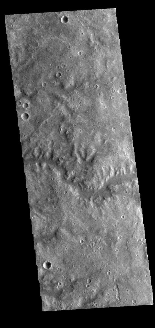
NASA Mars Reconnaissance Orbiter observed a small portion of a dark crater floor in the Tyrrhena Terra region of Mars. This is largely ancient hard bedrock that has been cratered by numerous impacts over the eons. http://photojournal.jpl.nasa.gov/catalog/PIA11179
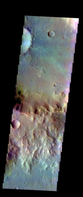
The THEMIS camera contains 5 filters. The data from different filters can be combined in multiple ways to create a false color image. These false color images may reveal subtle variations of the surface not easily identified in a single band image. Today's false color image shows part of the plains of Tyrrhena Terra. Orbit Number: 43315 Latitude: -25.3184 Longitude: 78.9694 Instrument: VIS Captured: 2011-09-19 19:23 http://photojournal.jpl.nasa.gov/catalog/PIA20985
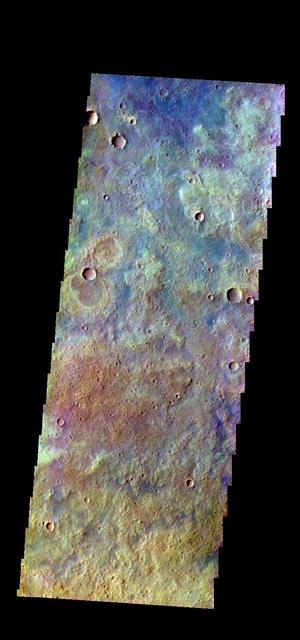
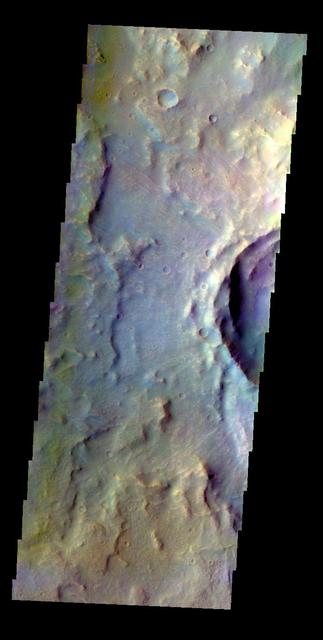
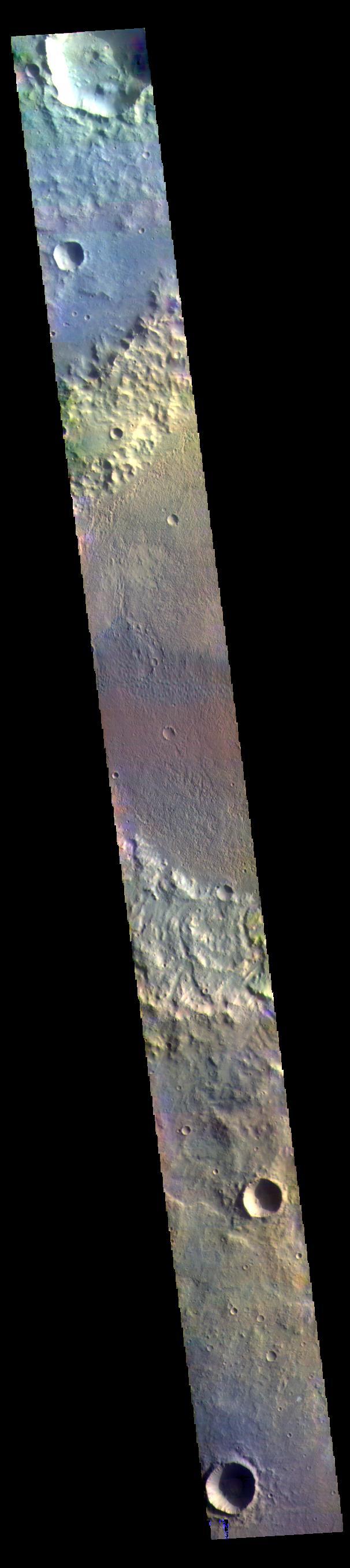
The THEMIS VIS camera contains 5 filters. The data from different filters can be combined in multiple ways to create a false color image. These false color images may reveal subtle variations of the surface not easily identified in a single band image. Today's false color image shows part of the plains of Tyrrhena Terra. Orbit Number: 43764 Latitude: -19.5412 Longitude: 91.4825 Instrument: VIS Captured: 2011-10-26 18:19 http://photojournal.jpl.nasa.gov/catalog/PIA21016
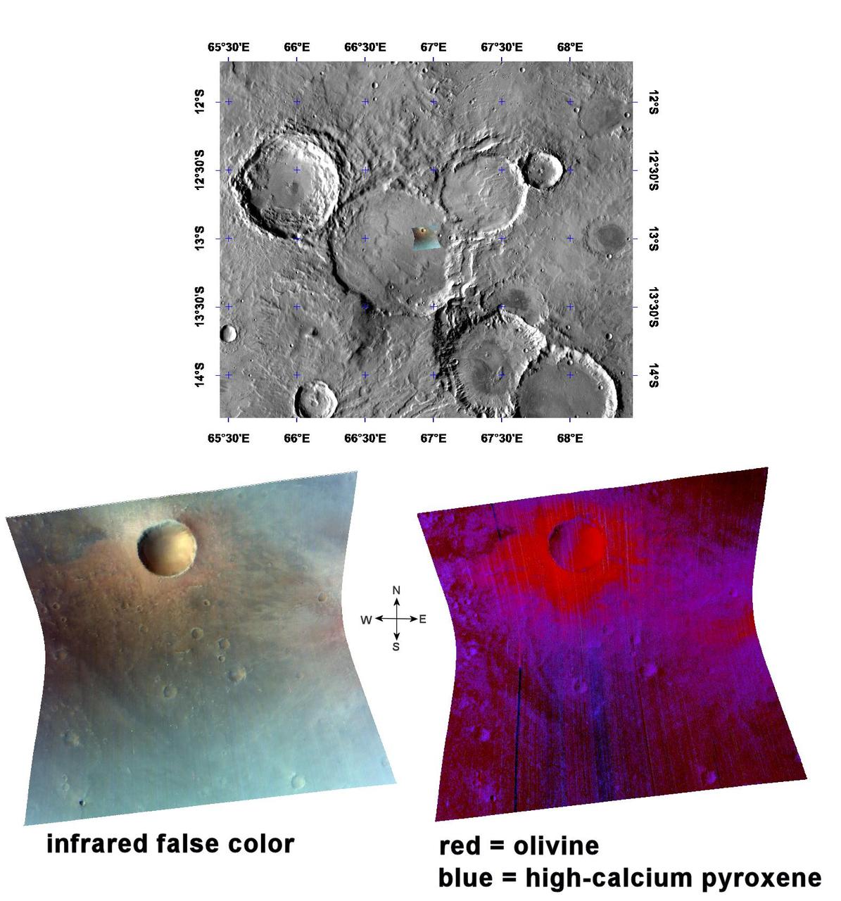
An Olivine-Rich Crater in Tyrrhena Terra
This image from NASA Mars Odyssey spacecraft shows old, heavily cratered volcanic terrain in Terra Tyrrhena within the Martian southern highlands.
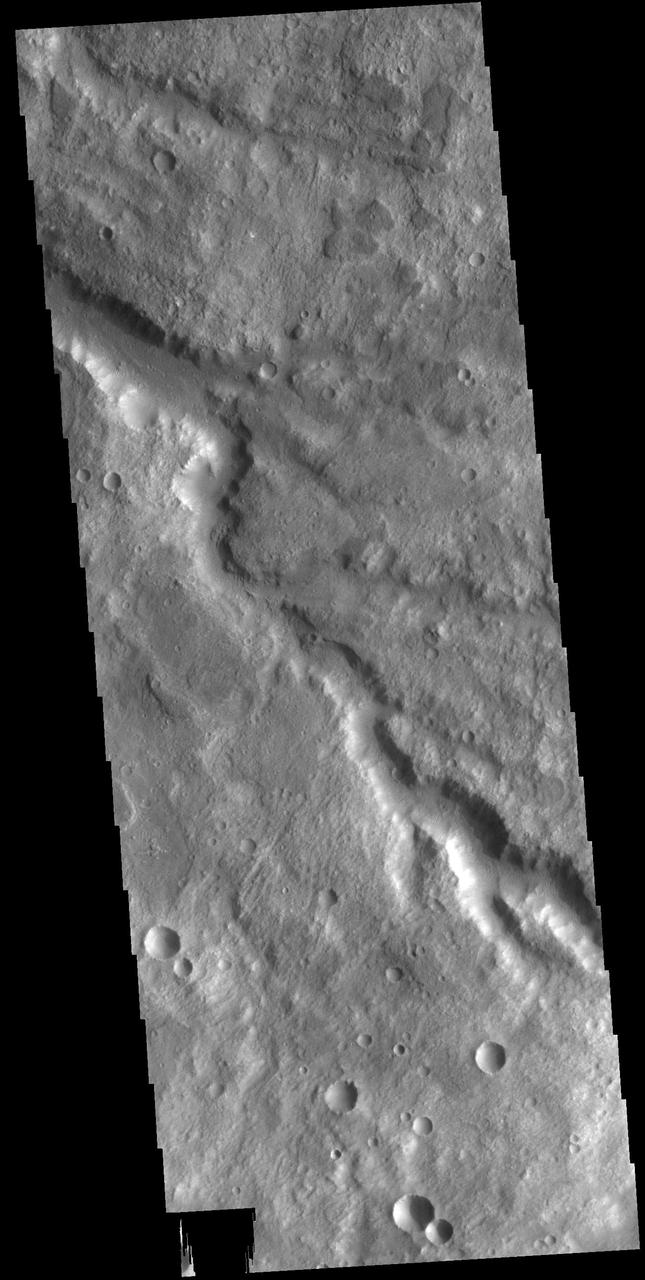
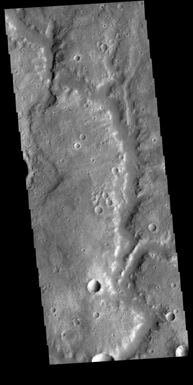
An unnamed channel drains a high standing region in Tyrrhena Terra in this image captured by NASA 2001 Mars Odyssey spacecraft.
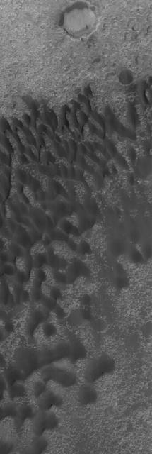
NASA 2001 Mars Odyssey spacecraft captured this image of dunes on the floor of an unnamed crater in Tyrrhena Terra.
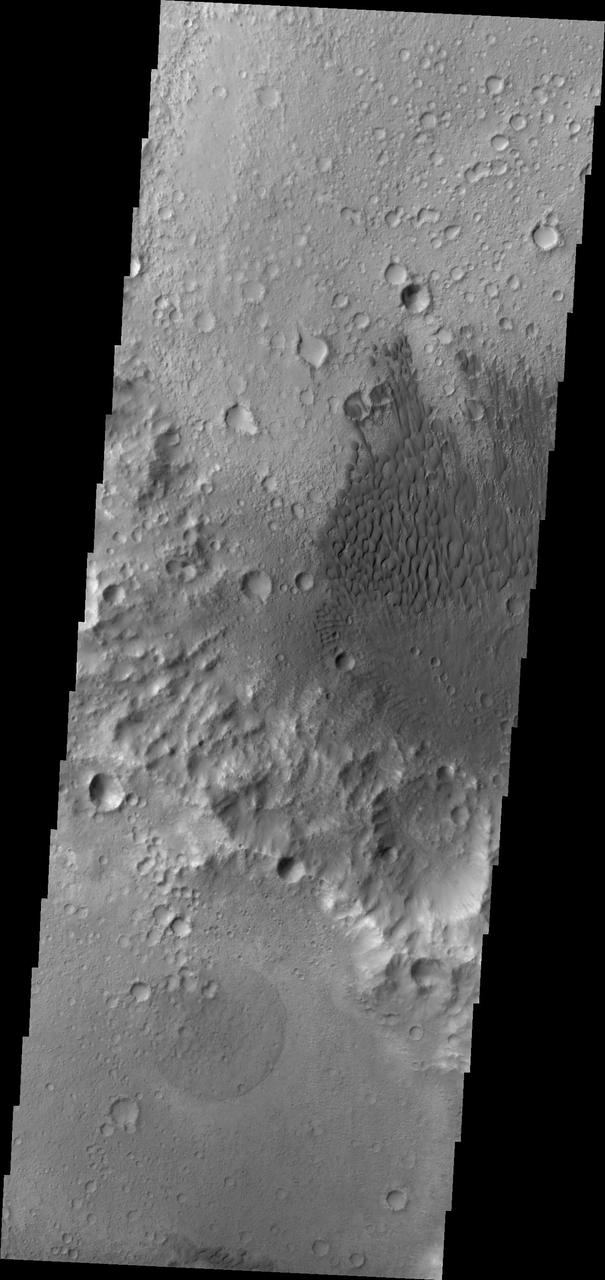
The dunes in this image are located on the floor of an unnamed crater in Tyrrhena Terra as seen by NASA 2001 Mars Odyssey spacecraft.
This image, taken by NASA 2001 Mars Odyssey spacecraft, shows dunes on the floor of an unnamed crater in Tyrrhena Terra.
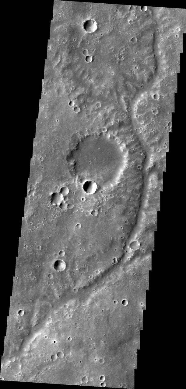
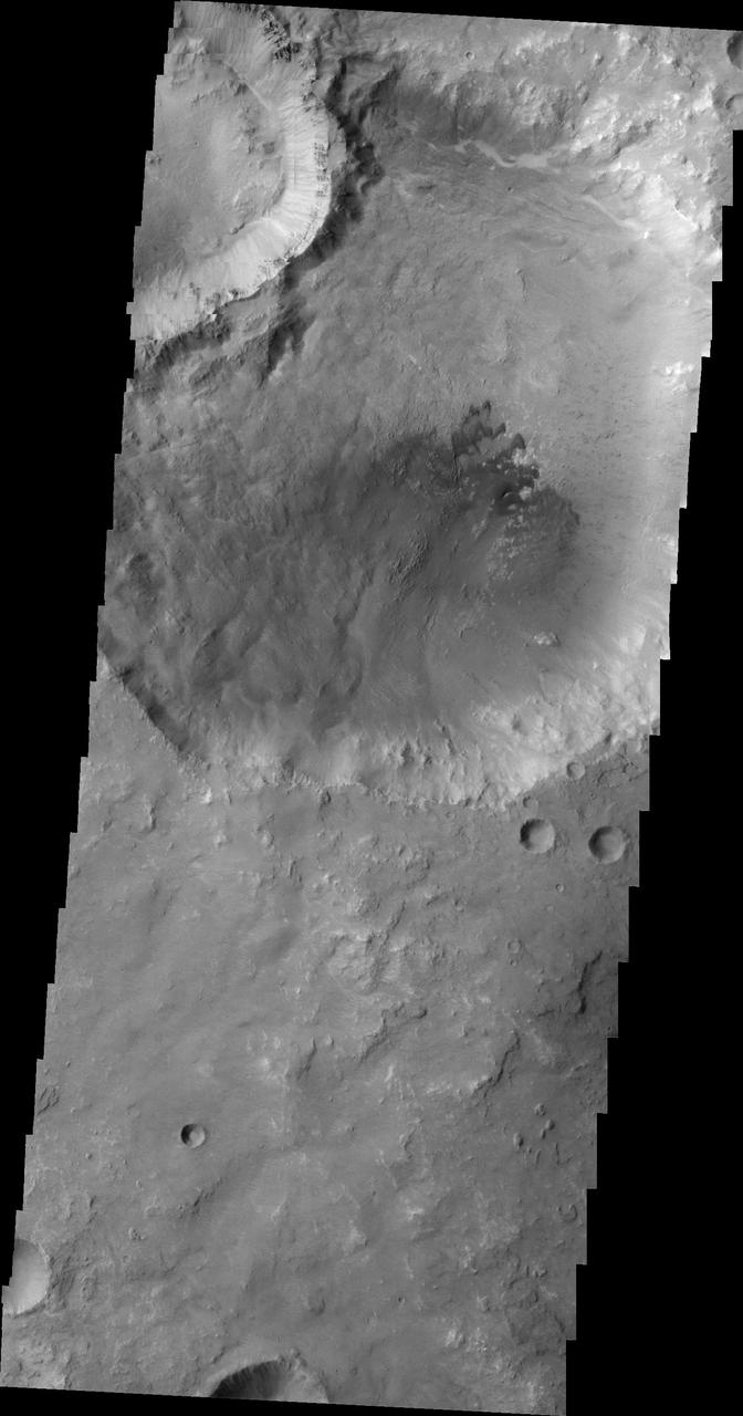
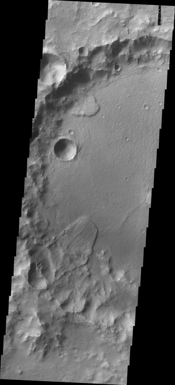
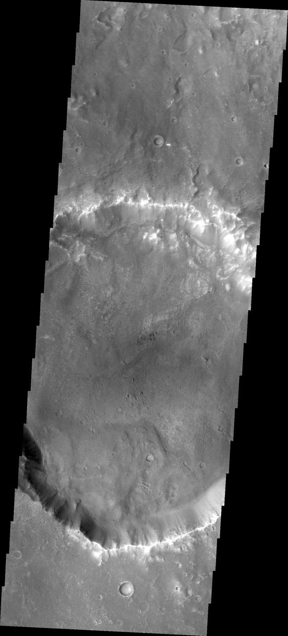
This well-preserved impact crater in Tyrrhena Terra, northeast of Hellas Planitia, is approximately 6 kilometers in diameter as seen by NASA Mars Reconnaissance Orbiter.
The THEMIS camera contains 5 filters. The data from different filters can be combined in multiple ways to create a false color image. This image from NASA 2001 Mars Odyssey spacecraft shows a hill in Tyrrhena Terra.
The THEMIS VIS camera contains 5 filters. The data from different filters can be combined in multiple ways to create a false color image. These false color images may reveal subtle variations of the surface not easily identified in a single band image. Today's false color image shows part of Tyrrhena Terra. Orbit Number: 77663 Latitude: -18.5098 Longitude: 91.5468 Instrument: VIS Captured: 2019-06-18 01:49 https://photojournal.jpl.nasa.gov/catalog/PIA24634
The THEMIS VIS camera contains 5 filters. The data from different filters can be combined in multiple ways to create a false color image. This false color image from NASA 2001 Mars Odyssey spacecraft shows part of an unnamed crater in Tyrrhena Terra.
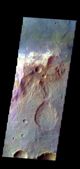
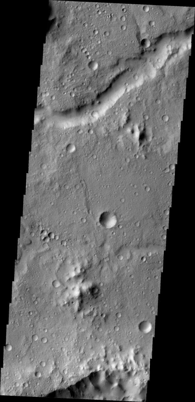
The THEMIS VIS camera contains 5 filters. The data from different filters can be combined in multiple ways to create a false color image. These false color images may reveal subtle variations of the surface not easily identified in a single band image. Today's false color image shows a rim of material between two unnamed craters in Tyrrhena Terra. Orbit Number: 8986 Latitude: -14.7069 Longitude: 73.1867 Instrument: VIS Captured: 2003-12-24 05:59 http://photojournal.jpl.nasa.gov/catalog/PIA19740
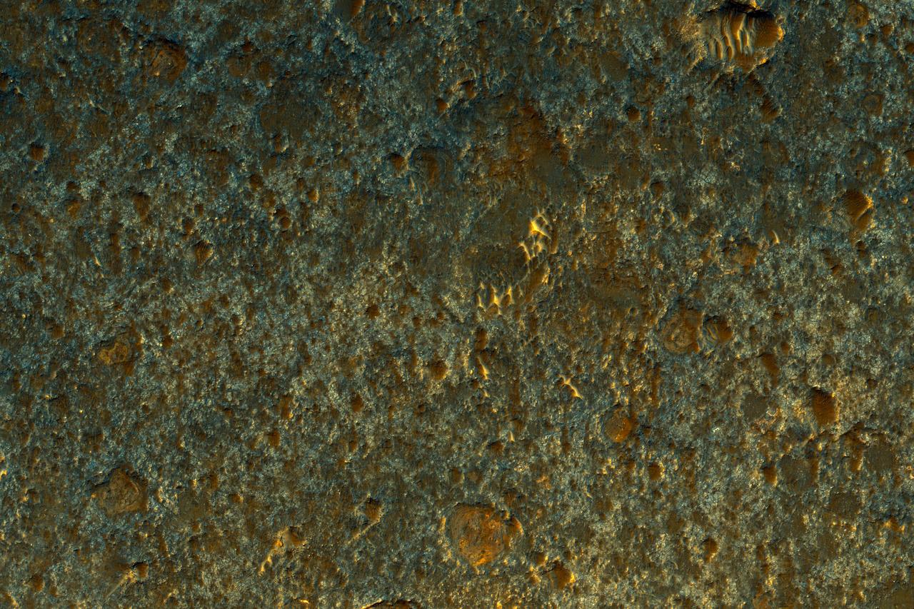
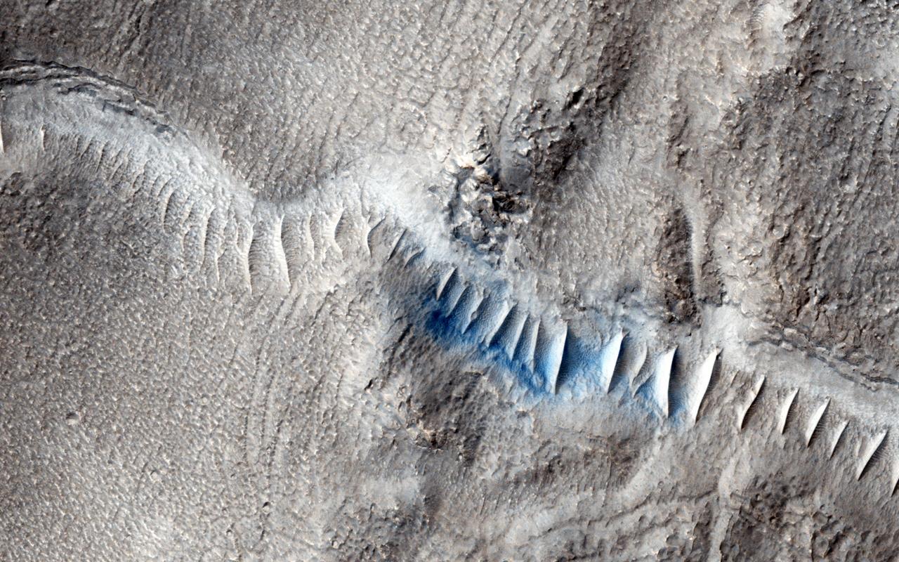
The THEMIS VIS camera contains 5 filters. The data from different filters can be combined in multiple ways to create a false color image. These false color images may reveal subtle variations of the surface not easily identified in a single band image. Today's false color image shows the floor of an unnamed crater in Tyrrhena Terra. Sand dunes are visible on the crater floor. Dark blue tones indicate basaltic sands. Orbit Number: 71862 Latitude: -5.32227 Longitude: 93.5361 Instrument: VIS Captured: 2018-02-25 06:52 https://photojournal.jpl.nasa.gov/catalog/PIA24514
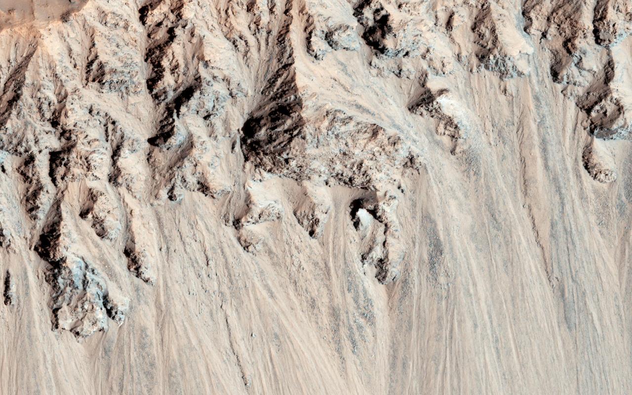
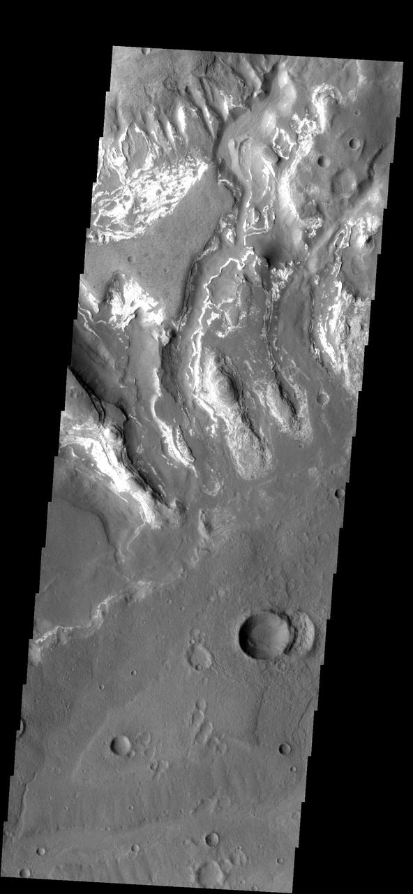
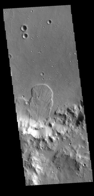
This landslide is located in an unnamed crater in Tyrrhena Terra
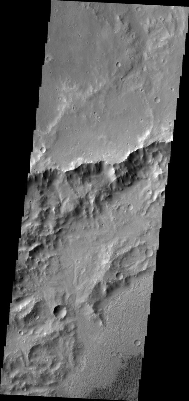
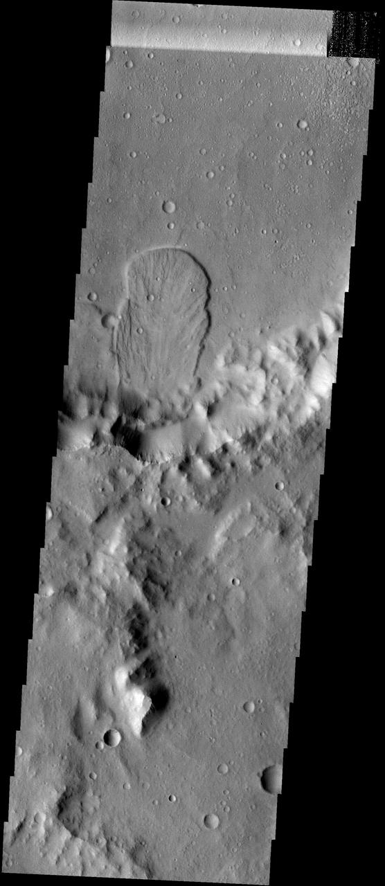
Landslide deposits cover part of the floor of this unnamed crater in Tyrrhena Terra as seen by NASA 2001 Mars Odyssey spacecraft.
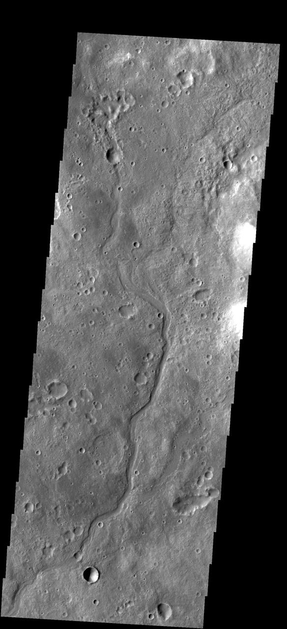
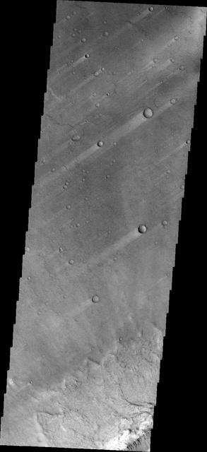
This small unnamed channel is located in southern Tyrrhena Terra as seen by NASA 2001 Mars Odyssey spacecraft.
The unnamed channel in this image from NASA 2001 Mars Odyssey spacecraft is located in northern Tyrrhena Terra.
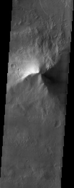
This image is located in the Tyrrhena Terra region. The cause of the bright markings/material is unknown. It is possible that the formation of the channels are exposing a series of bright layered material
These windstreaks are located in northern Terra Tyrrhena. The wind was blowing from NE to SW to create the streaks in the lee of the craters. This image is from NASA Mars Odyssey.
Today's VIS image shows a section of an unnamed channel in Tyrrhena Terra. Orbit Number: 80421 Latitude: -12.0208 Longitude: 80.6346 Instrument: VIS Captured: 2020-01-31 04:20 https://photojournal.jpl.nasa.gov/catalog/PIA23831
This Mars Global Surveyor MGS Mars Orbiter Camera MOC image shows a portion of a field of dark sand dunes superposed on the light-toned floor of a crater in eastern Tyrrhena Terra
This VIS image shows a section of Vichada Valles. Vichada Valles is located in Tyrrhena Terra and is over 430km long (267miles). Orbit Number: 89106 Latitude: -20.8967 Longitude: 88.5453 Instrument: VIS Captured: 2022-01-15 06:55 https://photojournal.jpl.nasa.gov/catalog/PIA25346
This VIS image shows a section of Vichada Valles. Vichada Valles is located in Tyrrhena Terra and is over 430km long (267miles). Orbit Number: 81756 Latitude: -18.8291 Longitude: 87.9863 Instrument: VIS Captured: 2020-05-20 02:26 https://photojournal.jpl.nasa.gov/catalog/PIA24011
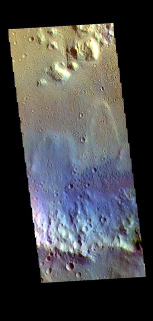
The THEMIS VIS camera contains 5 filters. The data from different filters can be combined in multiple ways to create a false color image. These false color images may reveal subtle variations of the surface not easily identified in a single band image. Today's false color image shows part of Briault Crater located in Tyrrhena Terra. Orbit Number: 63007 Latitude: -10.2464 Longitude: 89.4098 Instrument: VIS Captured: 2016-02-26 18:43 https://photojournal.jpl.nasa.gov/catalog/PIA23197
As wind is the only active geologic process on Mars today, sand and dust continue to be moved around the surface. Most craters host a sand dune or two, like this unnamed crater in Tyrrhena Terra. This image is from NASA 2001 Mars Odyssey.
This observation from NASA Mars Reconnaissance Orbiter shows enigmatic, shallowly incised valleys, found in some mid- to low-latitude regions on Mars.
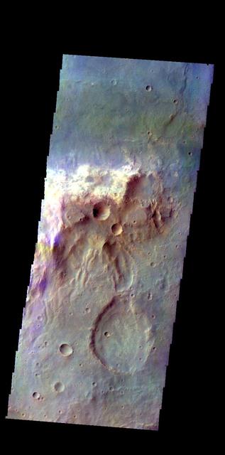
This VIS image is located in an unnamed crater within Tyrrhena Terra. The 'mitten' shaped feature extends from the crater rim (bottom of frame) onto the crater floor. Radial surface grooves and sharp margins are common with landslide deposits. Orbit Number: 71101 Latitude: 0.638432 Longitude: 98.3042 Instrument: VIS Captured: 2017-12-24 14:16 https://photojournal.jpl.nasa.gov/catalog/PIA22368
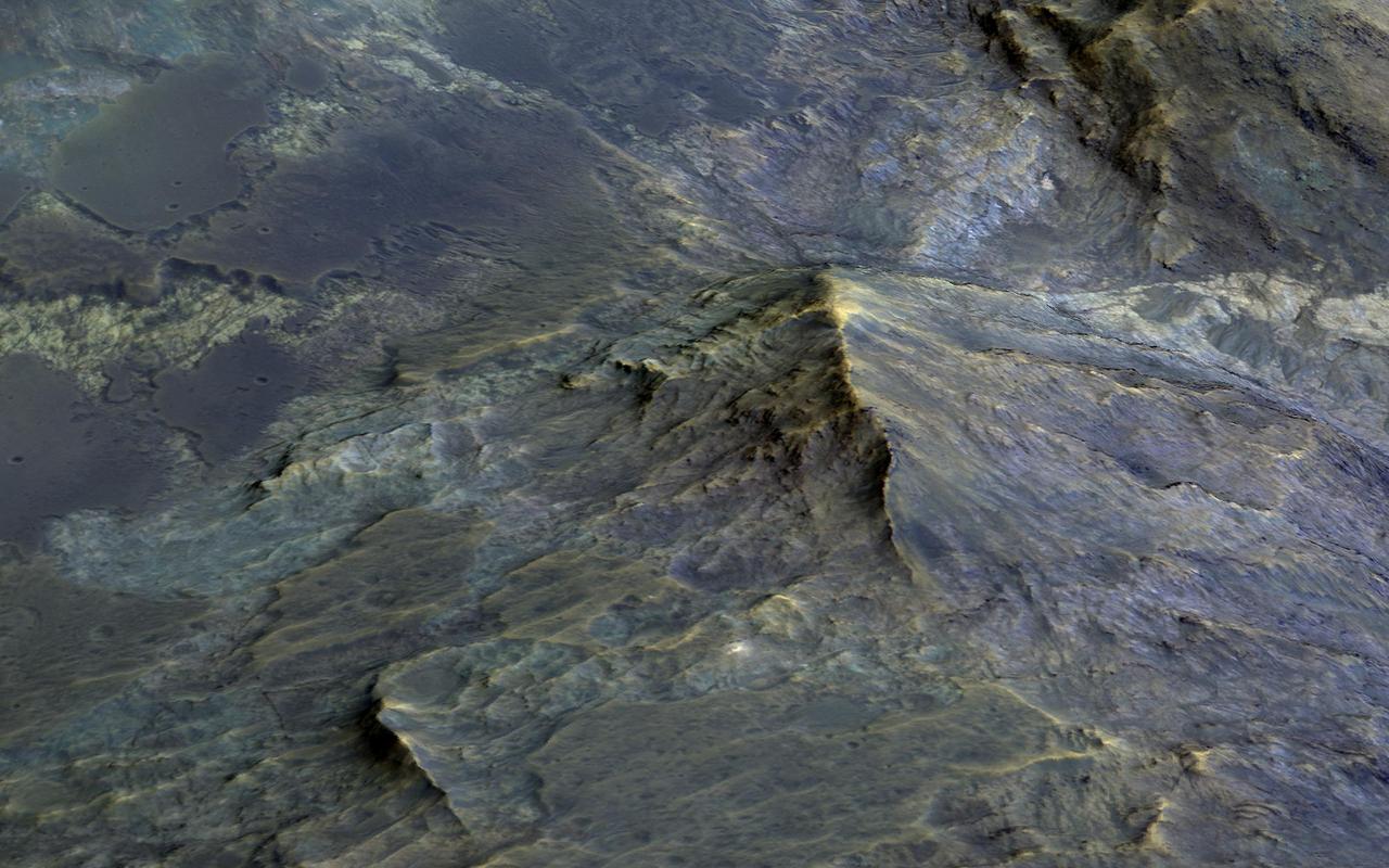
Large craters, like this 50-kilometer diameter one, can uplift material from below and form a mountain-like central peak. Craters of this size on Mars become unstable as they form and collapse due to gravity. Craters with central peaks and terraced rims are referred to as "complex" craters. Geologists study these central peaks because the uplifted bedrock was once deep within the Martian crust. A 3D perspective shows heavily-fractured bedrock exposed within the peak, and also dark-toned and fragmental rocks that formed during the impact process. Sometimes, we observe similar rocks in the crater wall terraces. Some areas of the terrace show dark-toned materials coating and surrounding the white- and green-colored bedrock. This dark-toned rock was the once-molten material that was produced by the tremendous energy generated during the formation of the crater. Similarly, the impact melt material coats and surrounds the higher-standing bedrock of the peak. There are additional exposures of bedrock in the northern wall-terraces of the crater. Previous HiRISE images have focused largely on central structures, but clearly the wall-terraces of these craters may also be informative in our exploration of the Martian subsurface. More information is available at https://photojournal.jpl.nasa.gov/catalog/PIA22784
The THEMIS VIS camera contains 5 filters. The data from different filters can be combined in multiple ways to create a false color image. These false color images may reveal subtle variations of the surface not easily identified in a single band image. Today's false color image shows a cross section of Isil Crater and its surrounding ejecta blanket. Isil Crater is located in Tyrrhena Terra near Hellas Planitia and is 77km (48 miles) in diameter. Orbit Number: 80608 Latitude: -26.7188 Longitude: 87.9754 Instrument: VIS Captured: 2020-02-15 13:46 https://photojournal.jpl.nasa.gov/catalog/PIA24677