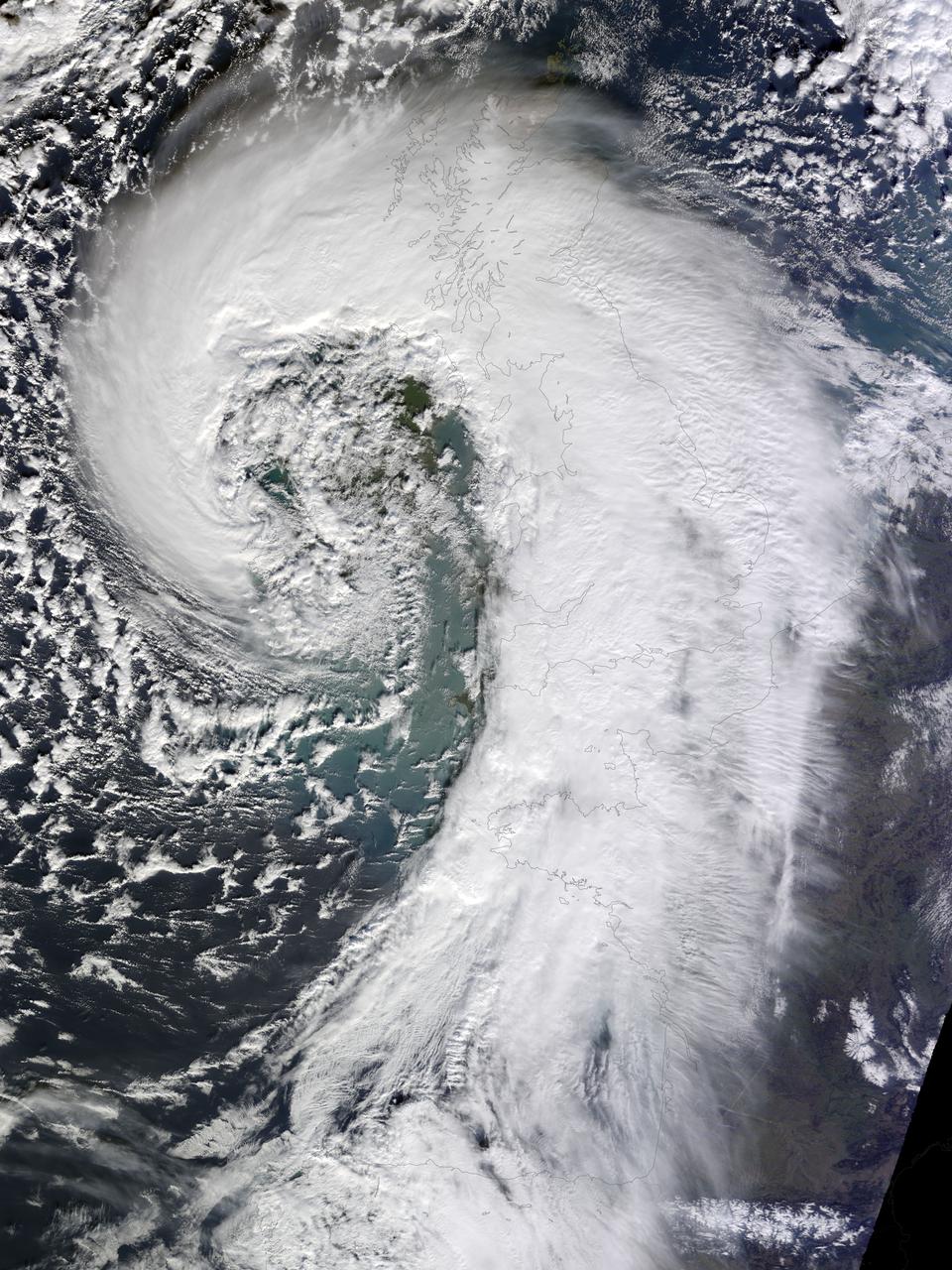
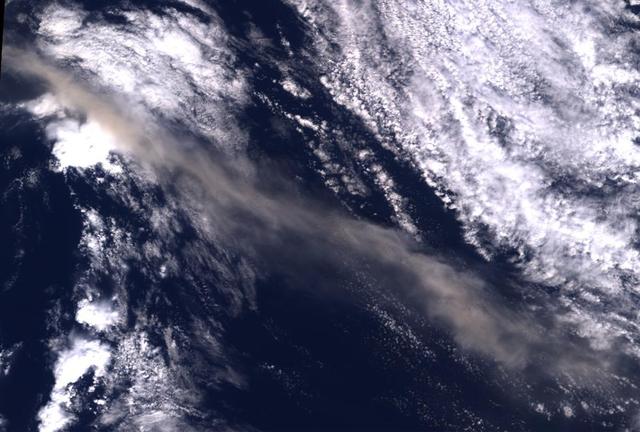
Soggy winters are not unusual in the United Kingdom, but this winter has been in a category of its own. UK Met Office meteorologists had just declared January 2014 the wettest month on record for parts of southern Britain when another series of storms swept across the area in early February. The Moderate Resolution Imaging Spectroradiometer (MODIS) on NASA’s Terra satellite captured this image of an extratropical cyclone bearing down on the United Kingdom on February 12, 2014. Mature extratropical cyclones often feature comma-shaped cloud patterns that are the product of “conveyor belt” circulation. While heavy precipitation is often present near the low-pressure head of the comma, a slot of dry air usually trails the west side of the tail. The storm brought the United Kingdom yet another round of heavy rain, as well as winds that exceeded 160 kilometers (100 miles) per hour. It snarled traffic, disrupted train service, and caused power outages for more than 700,000 people. The also exacerbated severe flooding in southern England. More than 5,800 homes have flooded since early December, according to media reports. Authorities have deployed thousands of soldiers to towns and cities in southern England to help with flood recovery. Meanwhile, the Met Office was forecasting more of the same. They warned that another system bearing heavy rain and winds was lining up to push into the United Kingdom from the southeast on Friday morning. NASA Earth Observatory image by Jesse Allen, using data from the Land Atmosphere Near real-time Capability for EOS (LANCE). Caption by Adam Voiland. More info: <a href="http://earthobservatory.nasa.gov/NaturalHazards/view.php?id=83127" rel="nofollow">earthobservatory.nasa.gov/NaturalHazards/view.php?id=83127</a> Instrument: Terra - MODIS Credit: <b><a href="http://www.earthobservatory.nasa.gov/" rel="nofollow"> NASA Earth Observatory</a></b> <b><a href="http://www.nasa.gov/audience/formedia/features/MP_Photo_Guidelines.html" rel="nofollow">NASA image use policy.</a></b> <b><a href="http://www.nasa.gov/centers/goddard/home/index.html" rel="nofollow">NASA Goddard Space Flight Center</a></b> enables NASA’s mission through four scientific endeavors: Earth Science, Heliophysics, Solar System Exploration, and Astrophysics. Goddard plays a leading role in NASA’s accomplishments by contributing compelling scientific knowledge to advance the Agency’s mission. <b>Follow us on <a href="http://twitter.com/NASAGoddardPix" rel="nofollow">Twitter</a></b> <b>Like us on <a href="http://www.facebook.com/pages/Greenbelt-MD/NASA-Goddard/395013845897?ref=tsd" rel="nofollow">Facebook</a></b> <b>Find us on <a href="http://instagrid.me/nasagoddard/?vm=grid" rel="nofollow">Instagram</a></b>
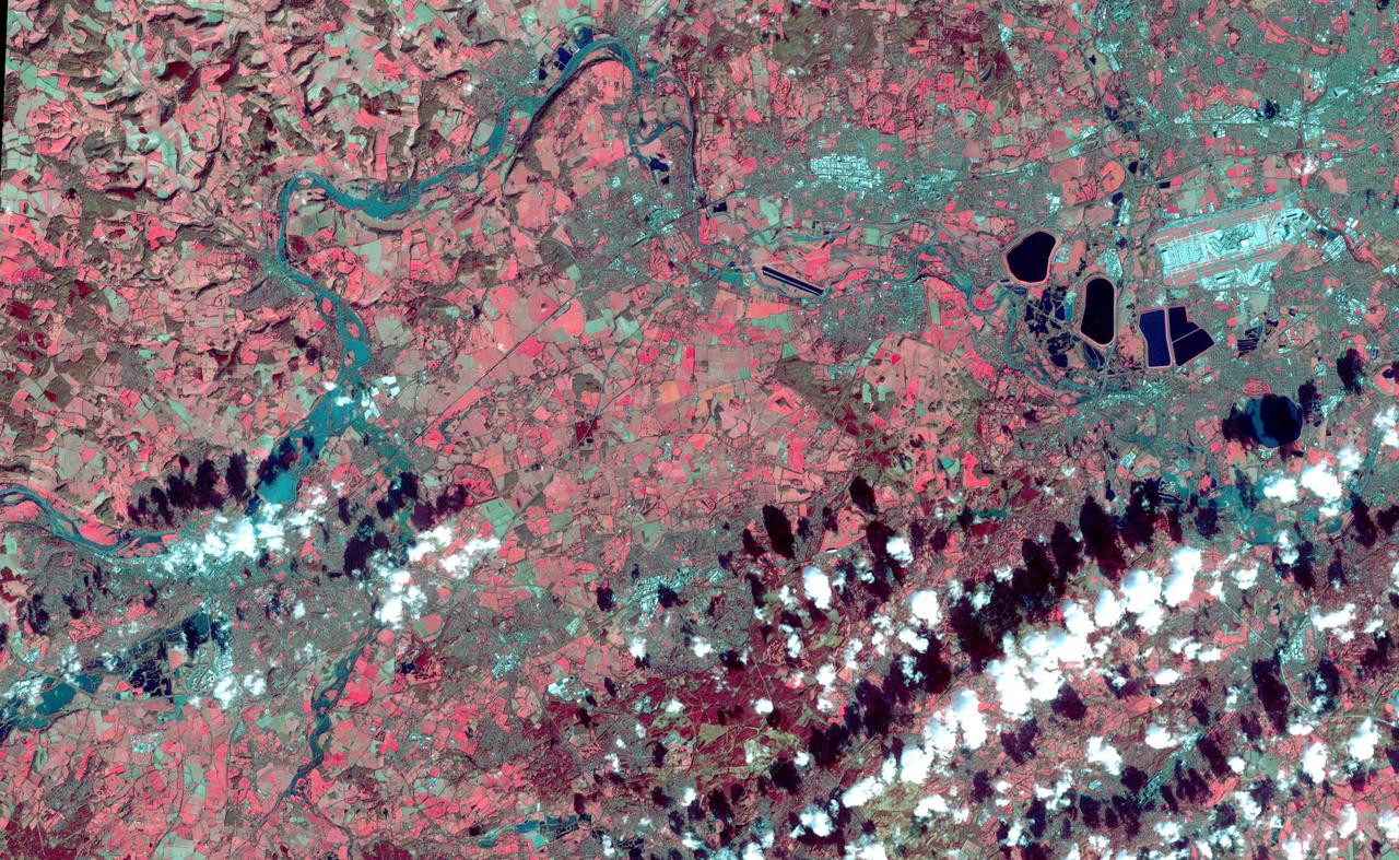
This image acquired by NASA Terra spacecraft depicts the high water levels and flooding along the Thames River west of London as record-breaking rains covered the United Kingdom in January and February.
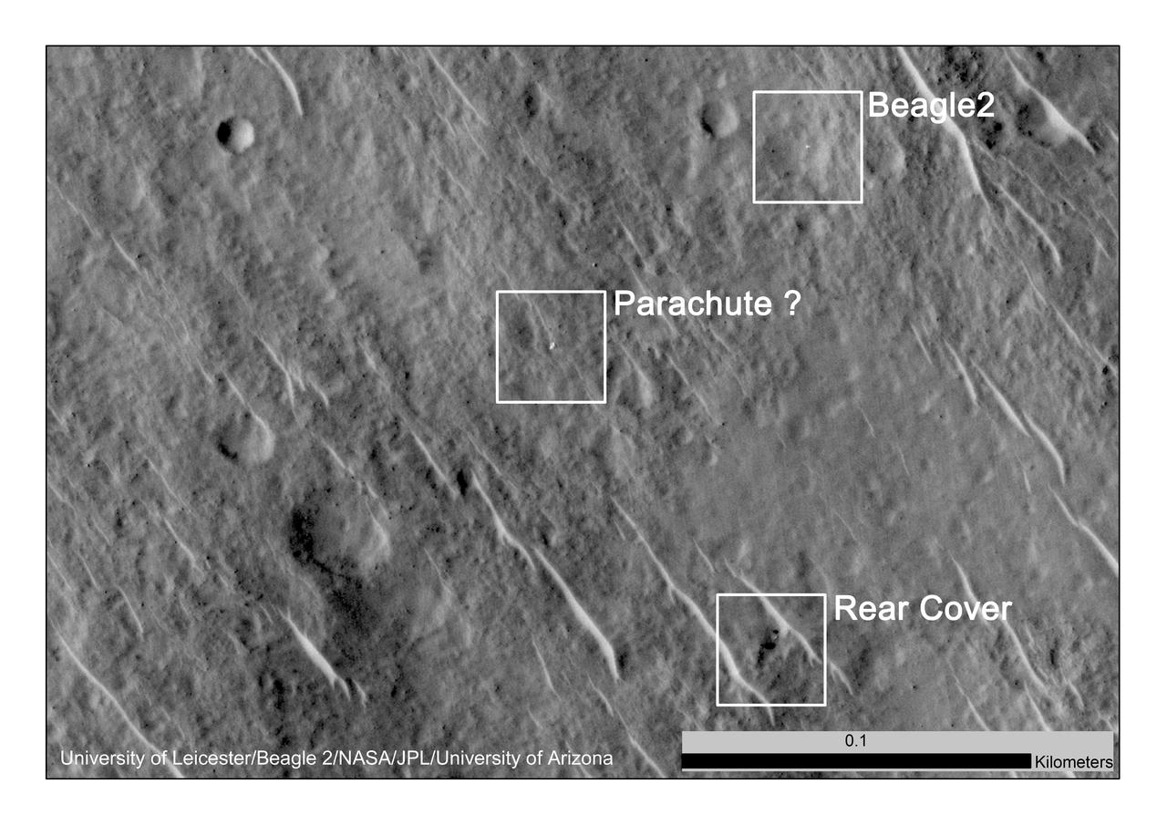
This annotated image, taken in 2014, shows where features seen in an observation by NASA Mars Reconnaissance Orbiter have been interpreted as hardware from the Dec. 25, 2003, arrival at Mars of the United Kingdom Beagle 2 Lander.
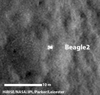
A configuration interpreted as the United Kingdom Beagle 2 Lander, with solar panels at least partially deployed, is indicated in this composite of two images from NASA Mars Reconnaissance Orbiter.
Ash from Iceland Eyjafjallajökull volcano, viewed here in imagery from NASA Terra spacecraft on May 16, 2010, once again disrupted air traffic over Europe with the closure of major airports in the United Kingdom and the Netherlands.
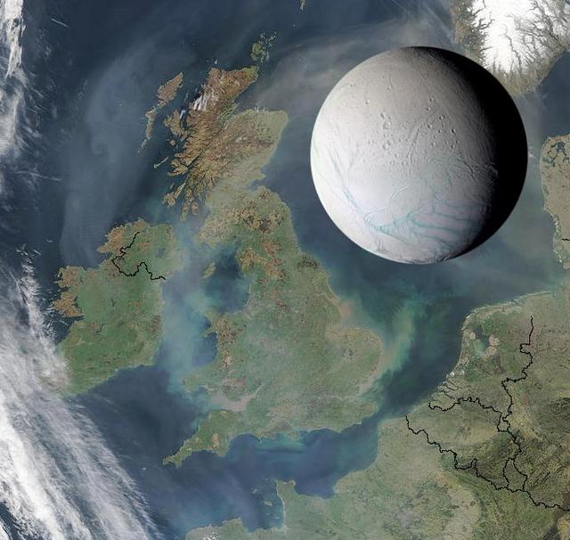
Saturn's moon Enceladus is only 505 kilometers (314 miles) across, small enough to fit within the length of the United Kingdom, as illustrated here. The intriguing icy moon also could fit comfortably within the states of Arizona or Colorado. http://photojournal.jpl.nasa.gov/catalog/PIA07724
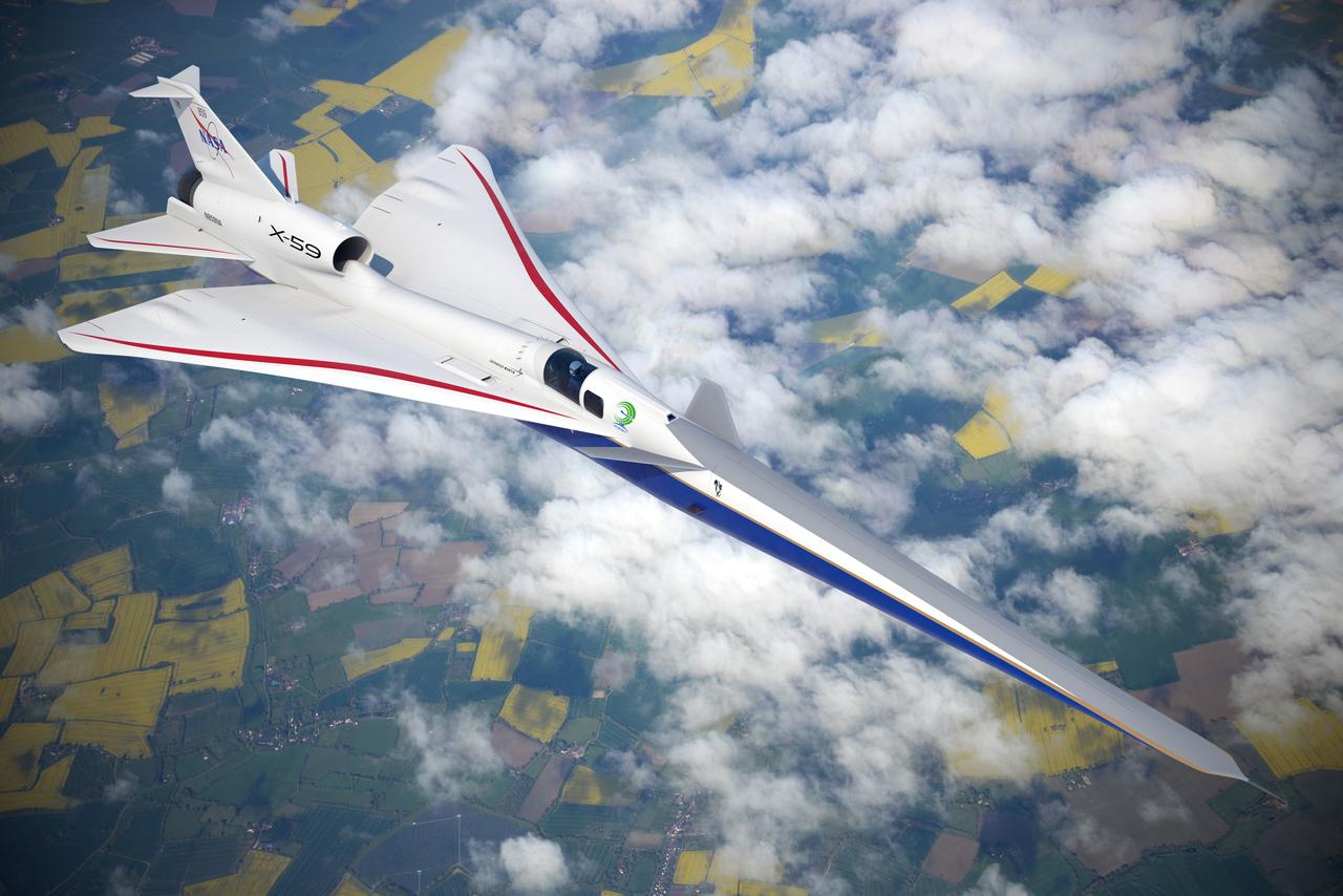
Artist illustration of the X-59 in flight over land.
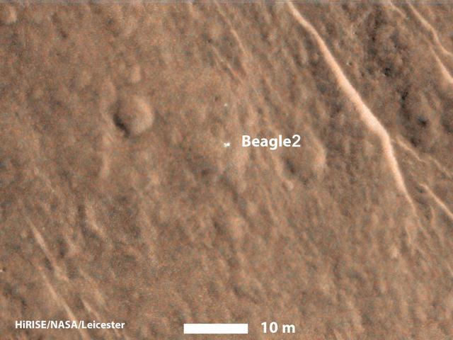
This annotated image taken on Dec. 15, 2014 by NASA Mars Reconnaissance Orbiter shows a bright feature interpreted as the United Kingdom Beagle 2 Lander, which was never heard from after its expected Dec. 25, 2003, landing.

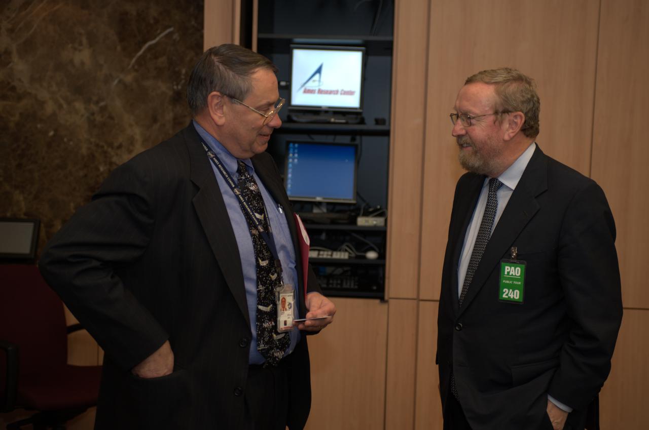
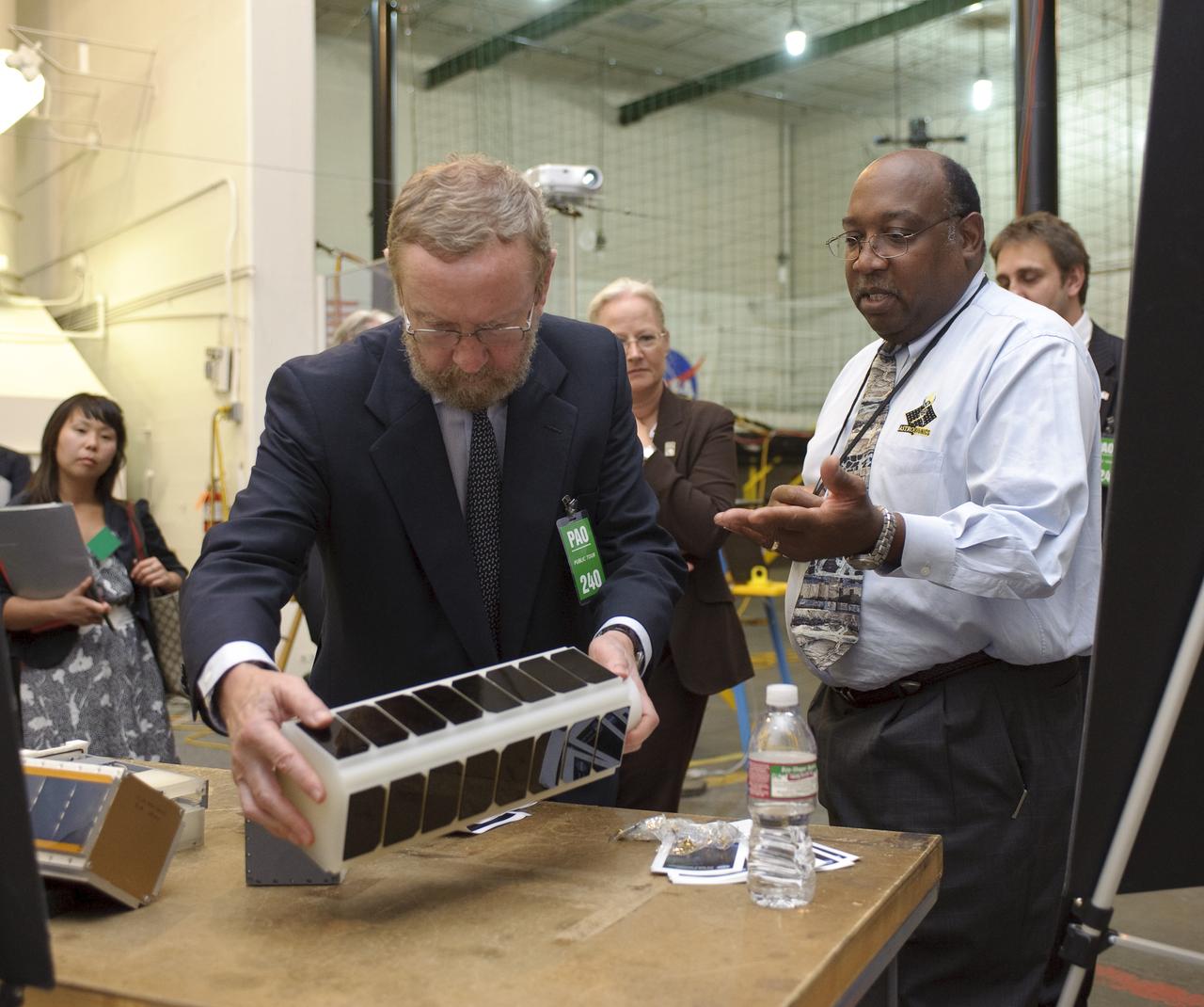
Lord Drayson, Minister of State for Science, United Kingdom visits Ames Research Center, Moffett Field, Calif.
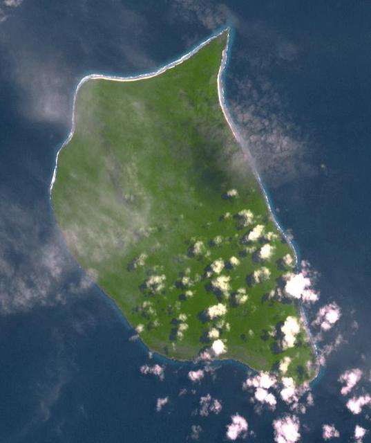
Uninhabited Henderson Island is part of the United Kingdom's Pitcairn Islands group in the South Pacific. According to a study by the University of Tasmania published in the Proceedings of the National Academy of Science, the island has the highest density of plastic waste anywhere in the world, an estimated 38 million pieces of rubbish. The island is near the center of an ocean current, so it collects rubbish from boats and South America. The image was acquired February 7, 2012, covers an area of 10.3 by 12.3 km, and is located at 24.3 degrees south, 128.3 degrees west. https://photojournal.jpl.nasa.gov/catalog/PIA21691

Professor John Beddington, UK (United Kingdom) Government Chief Scientist Advisor visit to Ames in Bldg N-200 Boyd Room
Professor John Beddington, UK (United Kingdom) Government Chief Scientist Advisor visit to Ames with John Hinein N-200 Boyd Room

Professor John Beddington, UK (United Kingdom) Government Chief Scientist Advisor visit to Ames in Bldg N-200 Boyd Room
Lord Drayson, Minister of State for Science, United Kingdom visits Ames Research Center, Moffett Field, Calif. LADEE facility at Ames.

Professor John Beddington, UK (United Kingdom) Government Chief Scientist Advisor visit to Ames in Bldg N-200 Boyd Room
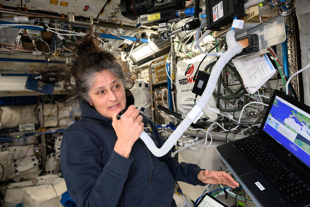
iss072e013206 (Oct. 5, 2024) --- NASA astronaut and Expedition 72 Commander Suni Williams calls down to students in Shepperton, United Kingdom, on the International Space Station's ham radio and answers their questions about living in space.
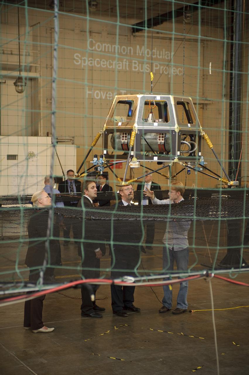
Professor John Beddington, UK (United Kingdom) Government Chief Scientist Advisor visit to Ames on tour of the Small Satellites area Bldg 45 (and a lunar lander prototype LADEE)
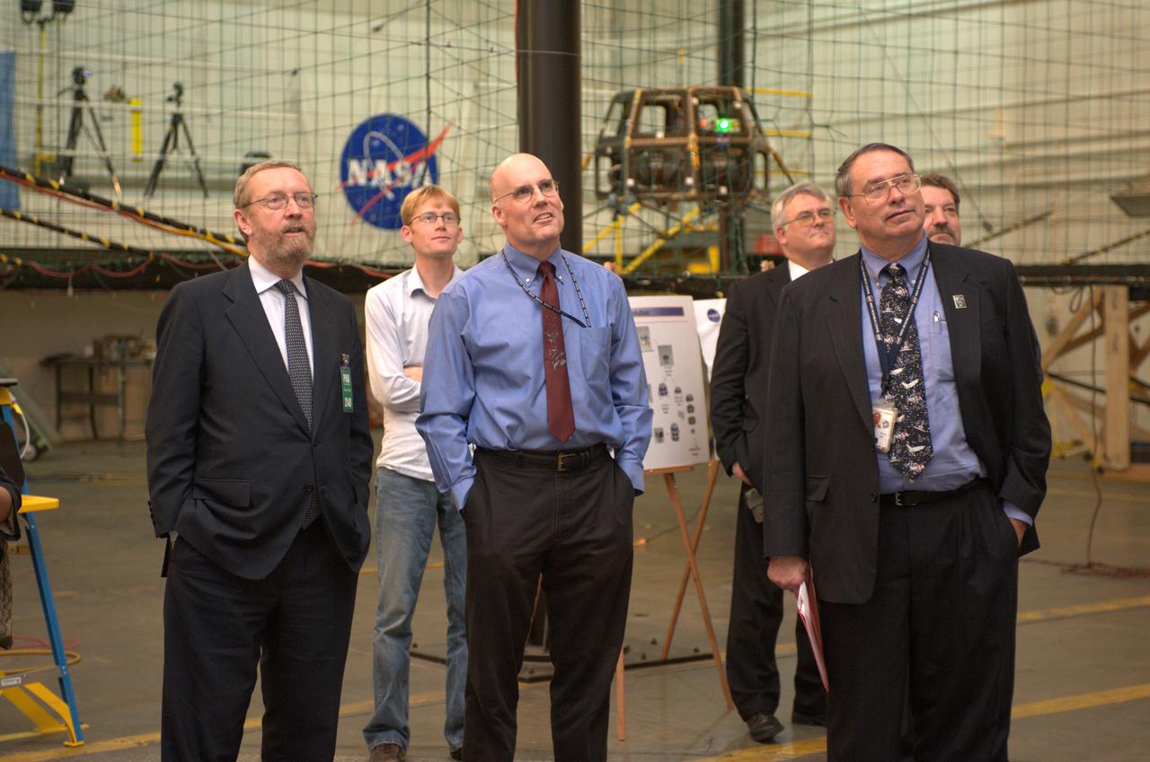
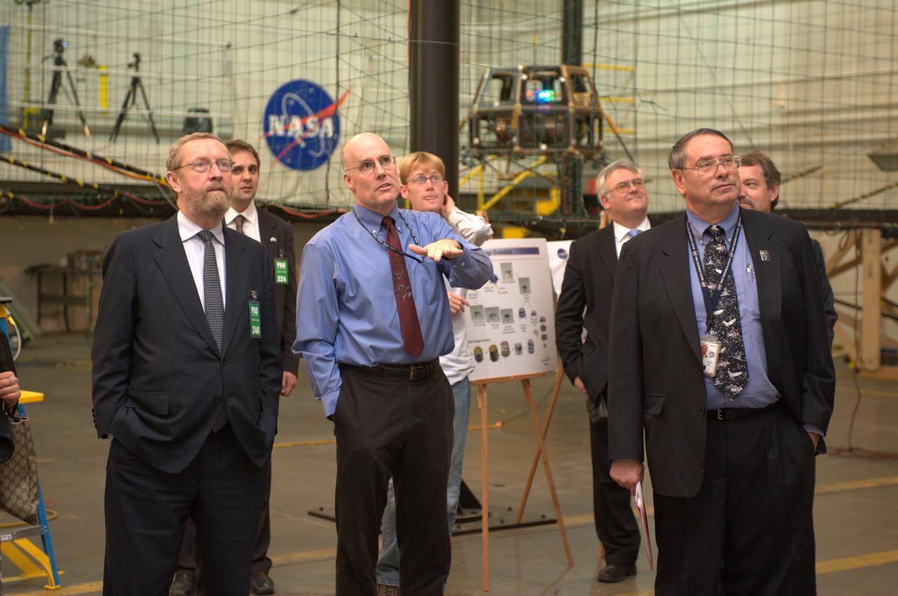
Professor John Beddington, UK (United Kingdom) Government Chief Scientist Advisor visit to Ames - greeted by Ames Center Director Pete Worden in Bldg N-200 Boyd Room

Professor John Beddington, UK (United Kingdom) Government Chief Scientist Advisor visit to Ames on tour of the Small Satellites area Bldg 45 with John Hine of Ames Research Center
Professor John Beddington, UK (United Kingdom) Government Chief Scientist Advisor visit to Ames on tour of the Small Satellites area Bldg 45 (and a lunar lander prototype)
Professor John Beddington, UK (United Kingdom) Government Chief Scientist Advisor visit to Ames on tour of the Small Satellites area Bldg 45 with ______and Ames Center Director Pete Worden (and a lunar lander prototype)
Professor John Beddington, UK (United Kingdom) Government Chief Scientist Advisor visit to Ames on tour of the Small Satellites area Bldg 45 (and a lunar lander prototype LADEE)
Professor John Beddington, UK (United Kingdom) Government Chief Scientist Advisor visit to Ames on tour of the Small Satellites area Bldg 45 (and a lunar lander prototype LADEE)
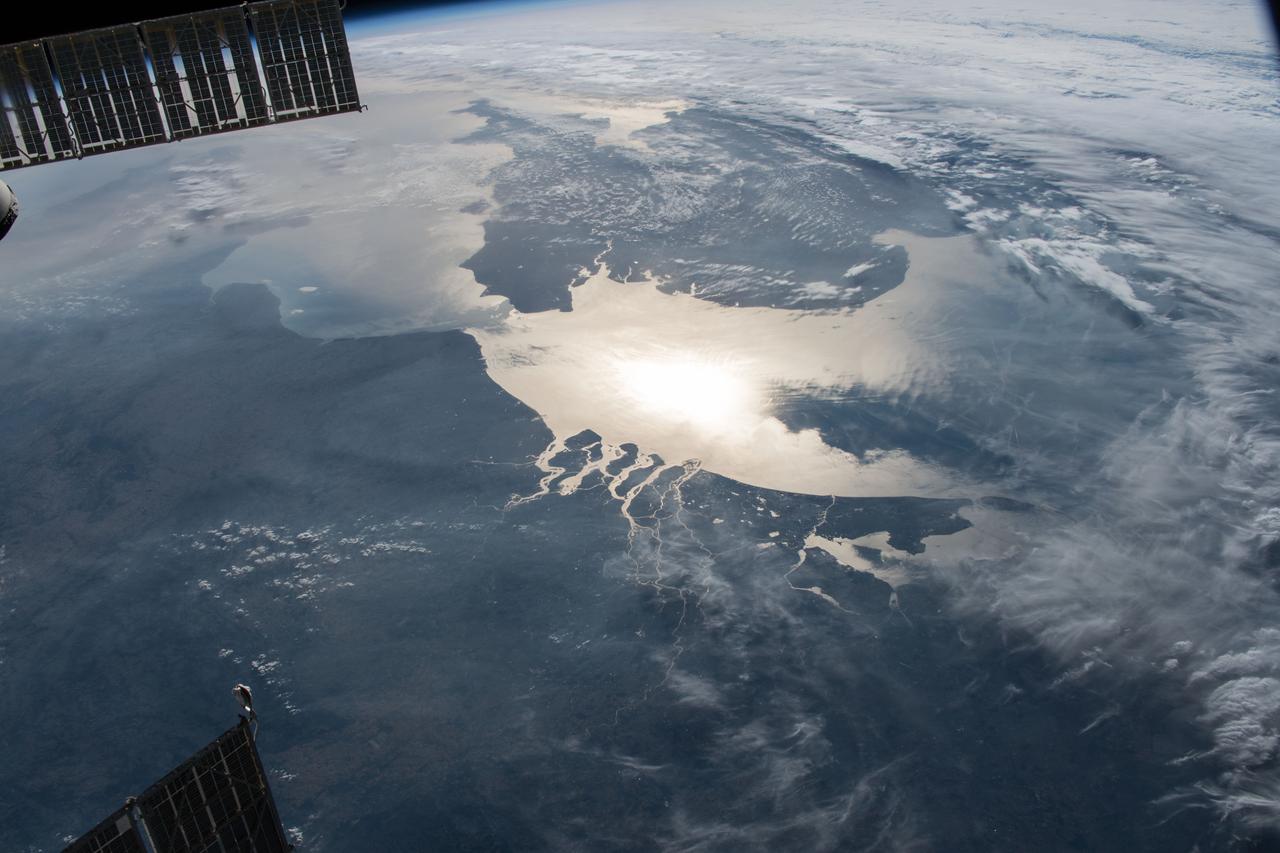
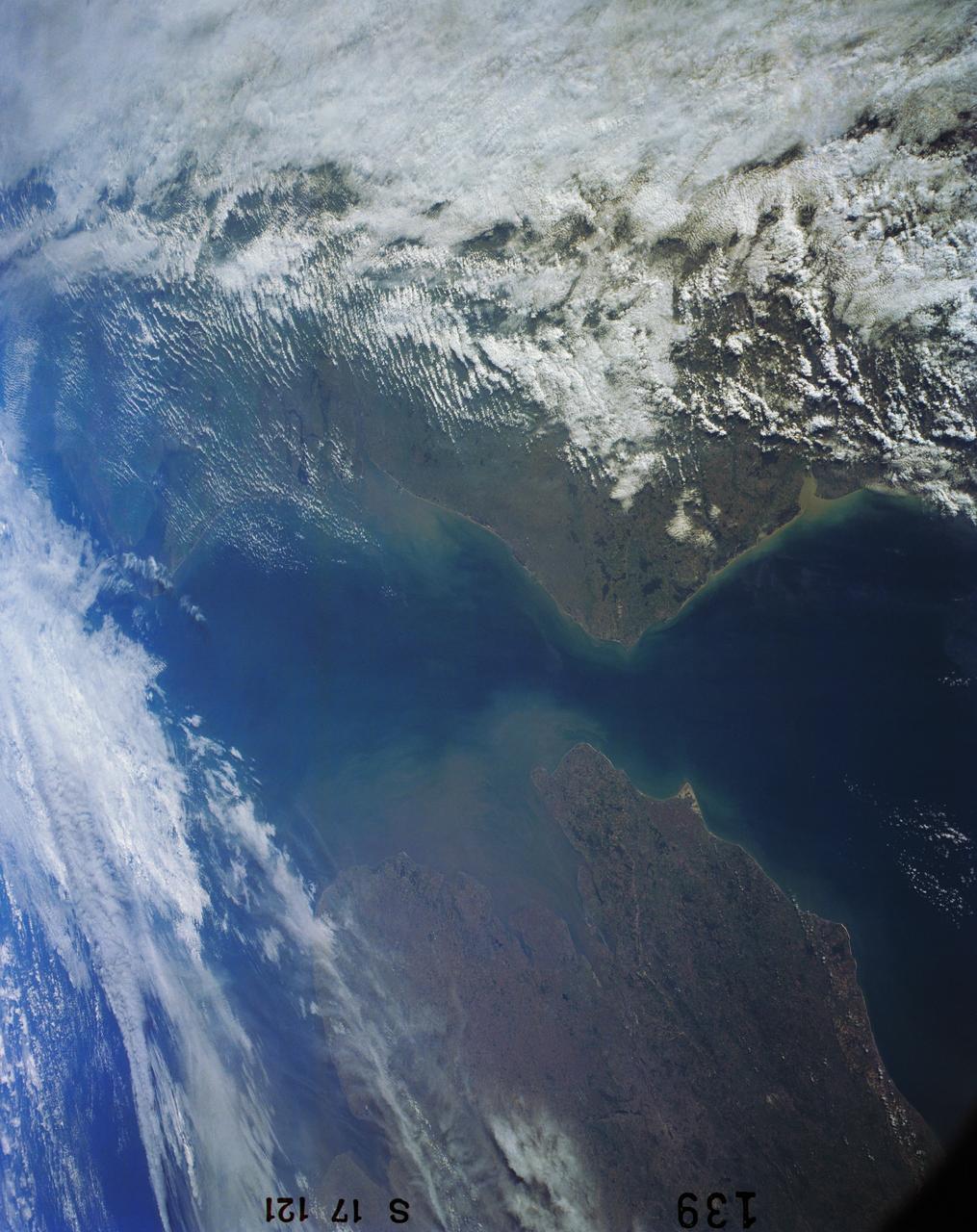
Earth observation taken during day pass by an Expedition 37 crew member on board the International Space Station (ISS). Identified via Twitter message as London and lower United Kingdom.
Professor John Beddington, UK (United Kingdom) Government Chief Scientist Advisor visit to Ames on tour of the Small Satellites area Bldg 45 with John Hine of Ames Research Center
Professor John Beddington, UK (United Kingdom) Government Chief Scientist Advisor visit to Ames on tour of the Small Satellites area Bldg 45 with John Hine of Ames Research Center

Artist illustration of the X-59 in flight in blue skies and white clouds.
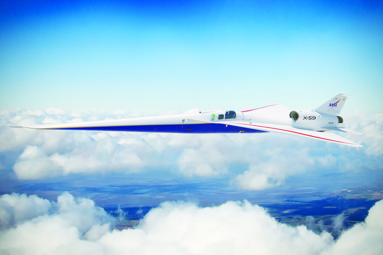
Artist illustration of the X-59 in flight above the clouds with land below, flying left.

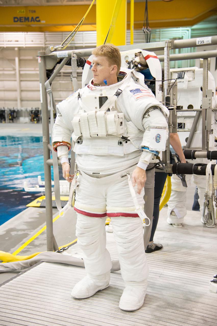
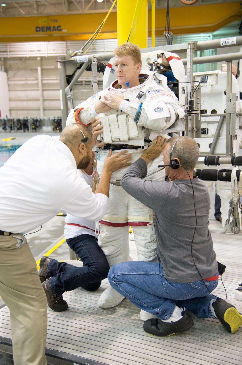
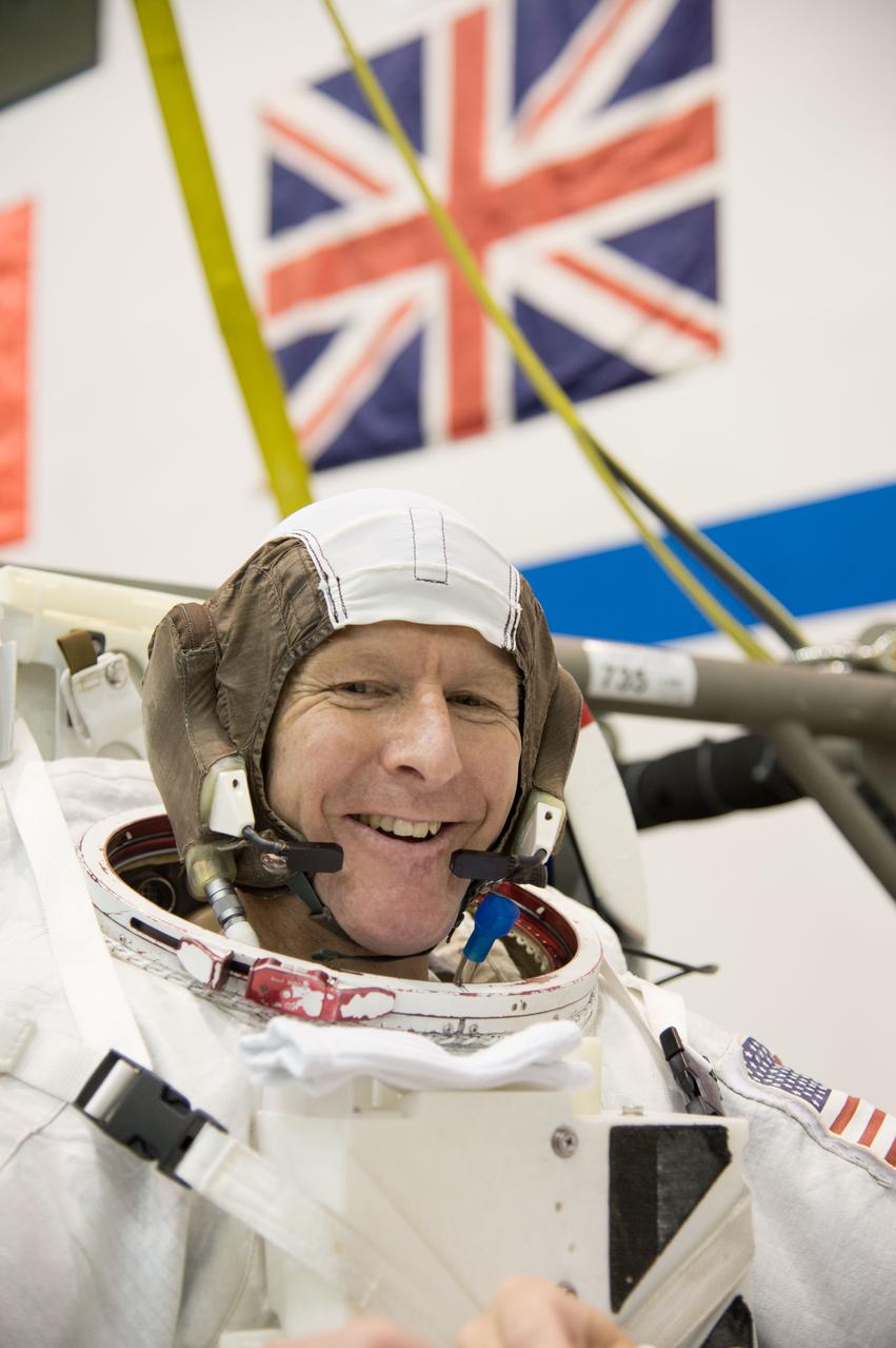
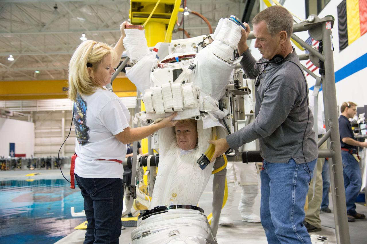
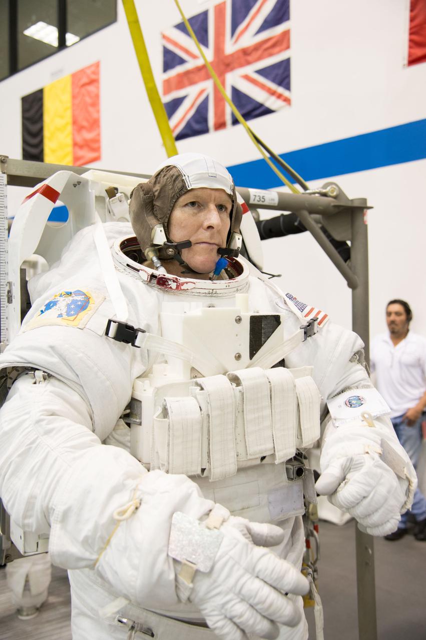
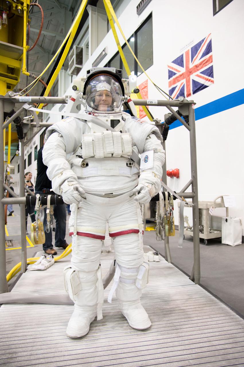
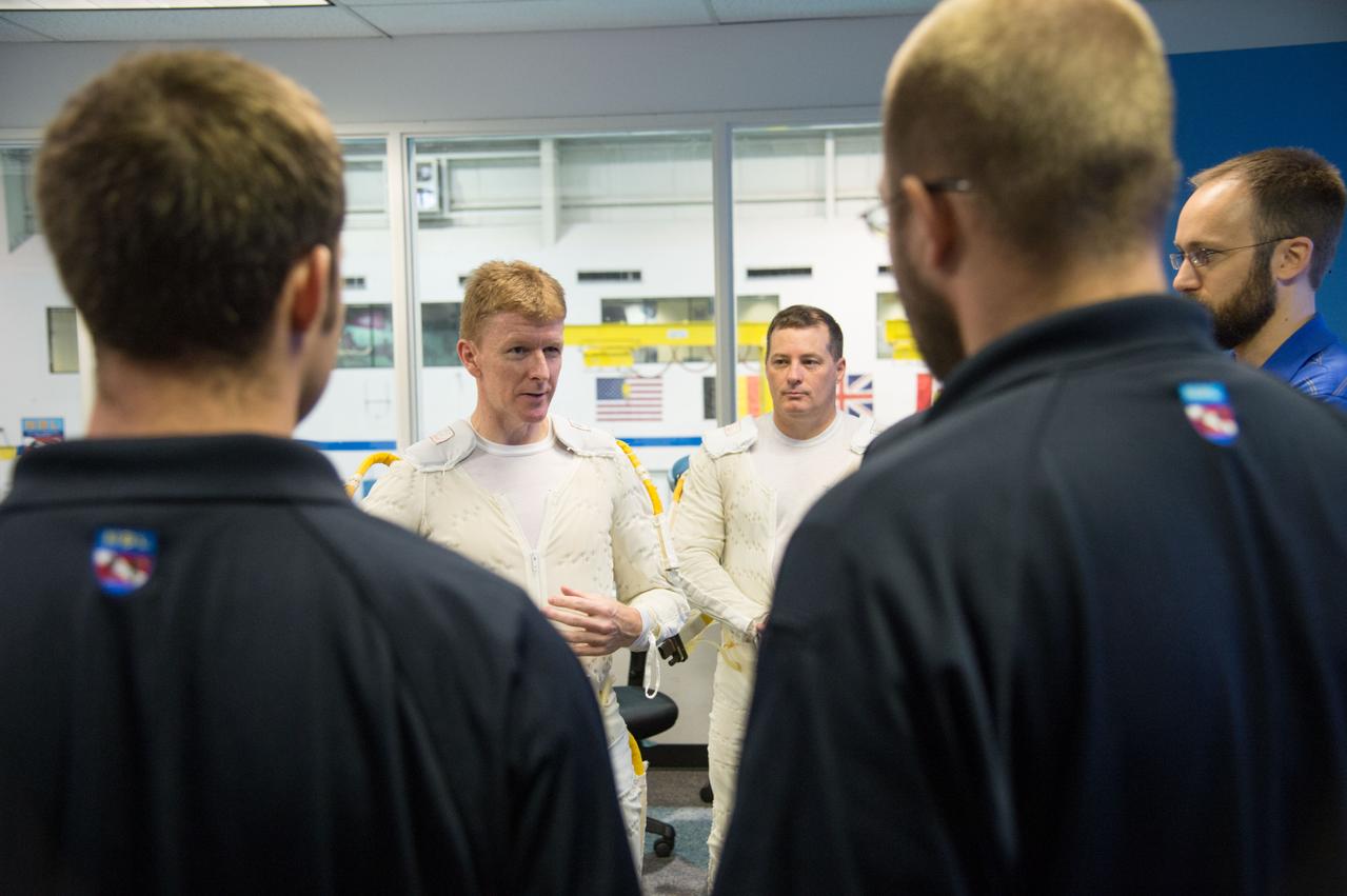
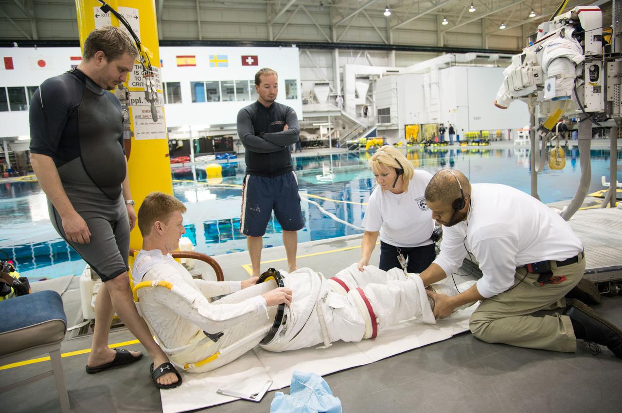
ESA astronaut and first astronaut from the United Kingdom, Timothy Peake, with NASA astronaut Scott Tingle (unassigned) during EVA Skills training in the NBL. Photo Date: November 27, 2012. Location: NBL - Pool Topside. Photographer: Robert Markowitz
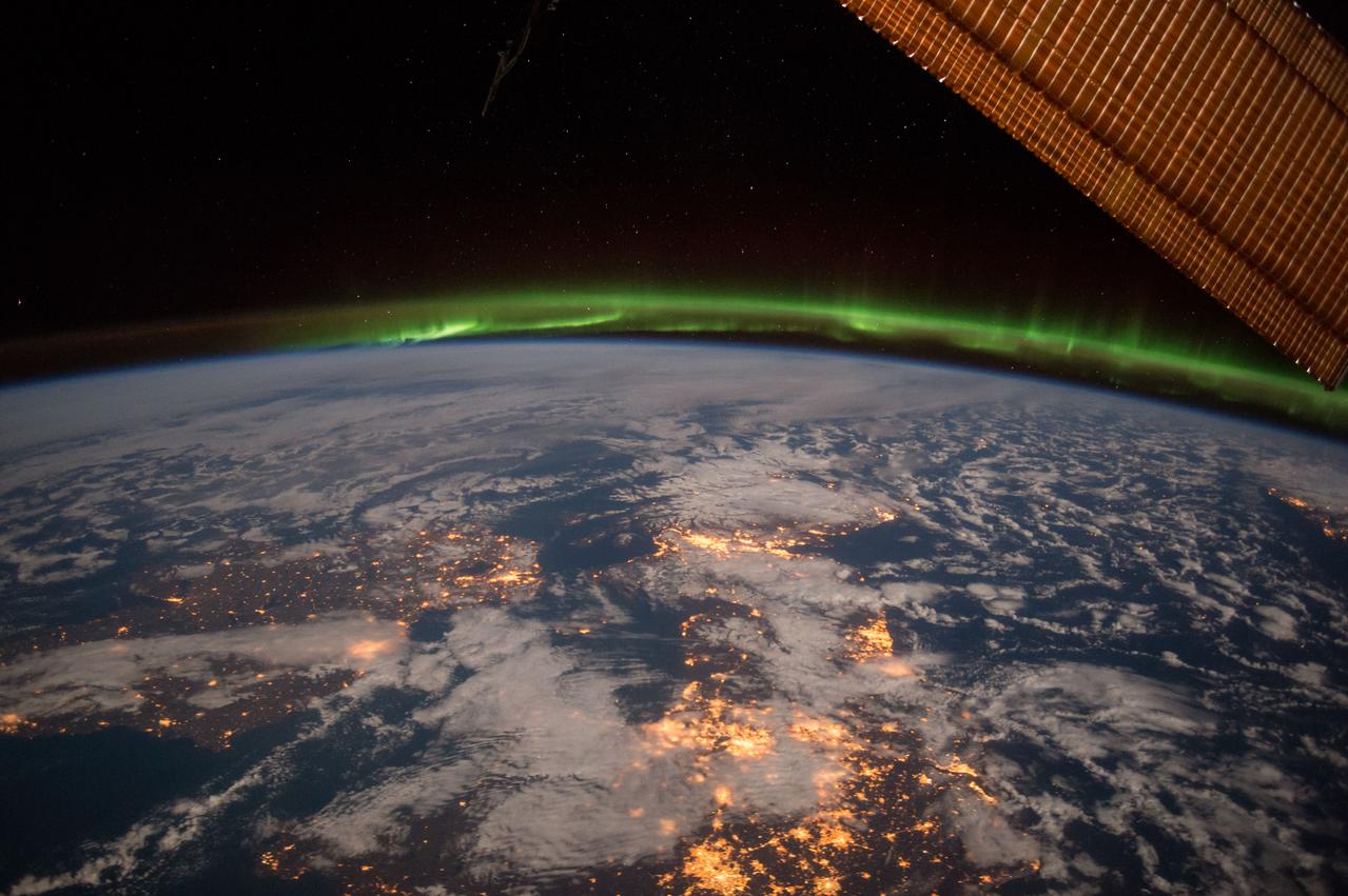
ISS042E215971 (02/06/2015) --- NASA US Astronaut Terry Virts on Feb. 6, 2015 captured this Earth observation of Ireland, United Kingdom and Scandinavia on a moonlit night under an amazing and ever-changing aurora. Terry is a flight engineer on the international Space Station with Expedition 42.
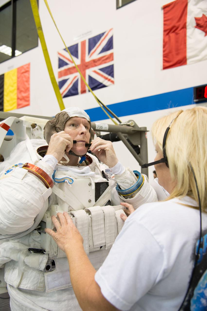
ESA astronaut and first astronaut from the United Kingdom, Timothy Peake, with NASA astronaut Scott Tingle (unassigned) during EVA Skills training in the NBL. Photo Date: November 27, 2012. Location: NBL - Pool Topside. Photographer: Robert Markowitz
ESA astronaut and first astronaut from the United Kingdom, Timothy Peake, with NASA astronaut Scott Tingle (unassigned) during EVA Skills training in the NBL. Photo Date: November 27, 2012. Location: NBL - Pool Topside. Photographer: Robert Markowitz
ESA astronaut and first astronaut from the United Kingdom, Timothy Peake, with NASA astronaut Scott Tingle (unassigned) during EVA Skills training in the NBL. Photo Date: November 27, 2012. Location: NBL - Pool Topside. Photographer: Robert Markowitz

ESA astronaut and first astronaut from the United Kingdom, Timothy Peake, with NASA astronaut Scott Tingle (unassigned) during EVA Skills training in the NBL. Photo Date: November 27, 2012. Location: NBL - Pool Topside. Photographer: Robert Markowitz
iss056e127185 (Aug. 6, 2018) --- The International Space Station was orbiting above Germany when an Expedition 56 crew member photographed the English Channel and the North Sea, lit by the Sun's glint, separating the United Kingdom from the European countries of France, Belgium and the Netherlands.
ESA astronaut and first astronaut from the United Kingdom, Timothy Peake, with NASA astronaut Scott Tingle (unassigned) during EVA Skills training in the NBL. Photo Date: November 27, 2012. Location: NBL - Pool Topside. Photographer: Robert Markowitz
ESA astronaut and first astronaut from the United Kingdom, Timothy Peake, with NASA astronaut Scott Tingle (unassigned) during EVA Skills training in the NBL. Photo Date: November 27, 2012. Location: NBL - Pool Topside. Photographer: Robert Markowitz
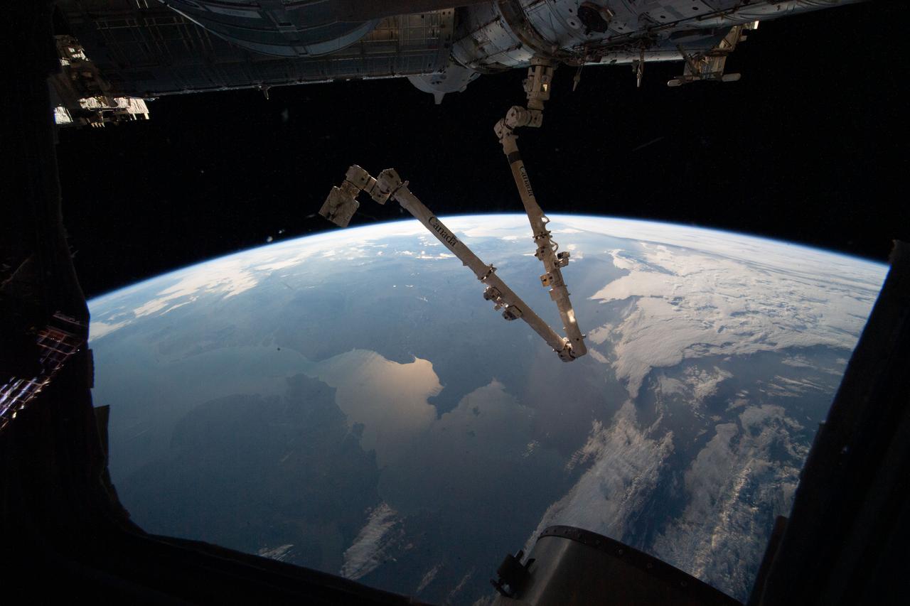
iss066e153504 (Feb. 27, 2022) --- The 57.7-foot-long Canadarm2 robotic arm is pictured extending from the Harmony module as the International Space Station orbited 264 miles above the Atlantic Ocean off the coast of Ireland and the United Kingdom.
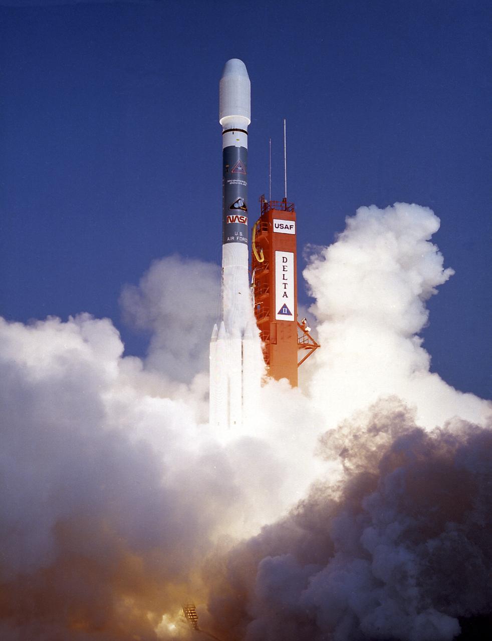
The Delta II expendable launch vehicle with the ROSAT (Roentgen Satellite), cooperative space X-ray astronomy mission between NASA, Germany and United Kingdom, was launched from the Cape Canaveral Air Force Station on June 1, 1990.
ESA astronaut and first astronaut from the United Kingdom, Timothy Peake, with NASA astronaut Scott Tingle (unassigned) during EVA Skills training in the NBL. Photo Date: November 27, 2012. Location: NBL - Pool Topside. Photographer: Robert Markowitz

ESA astronaut and first astronaut from the United Kingdom, Timothy Peake, with NASA astronaut Scott Tingle (unassigned) during EVA Skills training in the NBL. Photo Date: November 27, 2012. Location: NBL - Pool Topside. Photographer: Robert Markowitz
ESA astronaut and first astronaut from the United Kingdom, Timothy Peake, with NASA astronaut Scott Tingle (unassigned) during EVA Skills training in the NBL. Photo Date: November 27, 2012. Location: NBL - Pool Topside. Photographer: Robert Markowitz
ESA astronaut and first astronaut from the United Kingdom, Timothy Peake, with NASA astronaut Scott Tingle (unassigned) during EVA Skills training in the NBL. Photo Date: November 27, 2012. Location: NBL - Pool Topside. Photographer: Robert Markowitz
ESA astronaut and first astronaut from the United Kingdom, Timothy Peake, with NASA astronaut Scott Tingle (unassigned) during EVA Skills training in the NBL. Photo Date: November 27, 2012. Location: NBL - Pool Topside. Photographer: Robert Markowitz
ESA astronaut and first astronaut from the United Kingdom, Timothy Peake, with NASA astronaut Scott Tingle (unassigned) during EVA Skills training in the NBL. Photo Date: November 27, 2012. Location: NBL - Pool Topside. Photographer: Robert Markowitz

ESA astronaut and first astronaut from the United Kingdom, Timothy Peake, with NASA astronaut Scott Tingle (unassigned) during EVA Skills training in the NBL. Photo Date: November 27, 2012. Location: NBL - Pool Topside. Photographer: Robert Markowitz
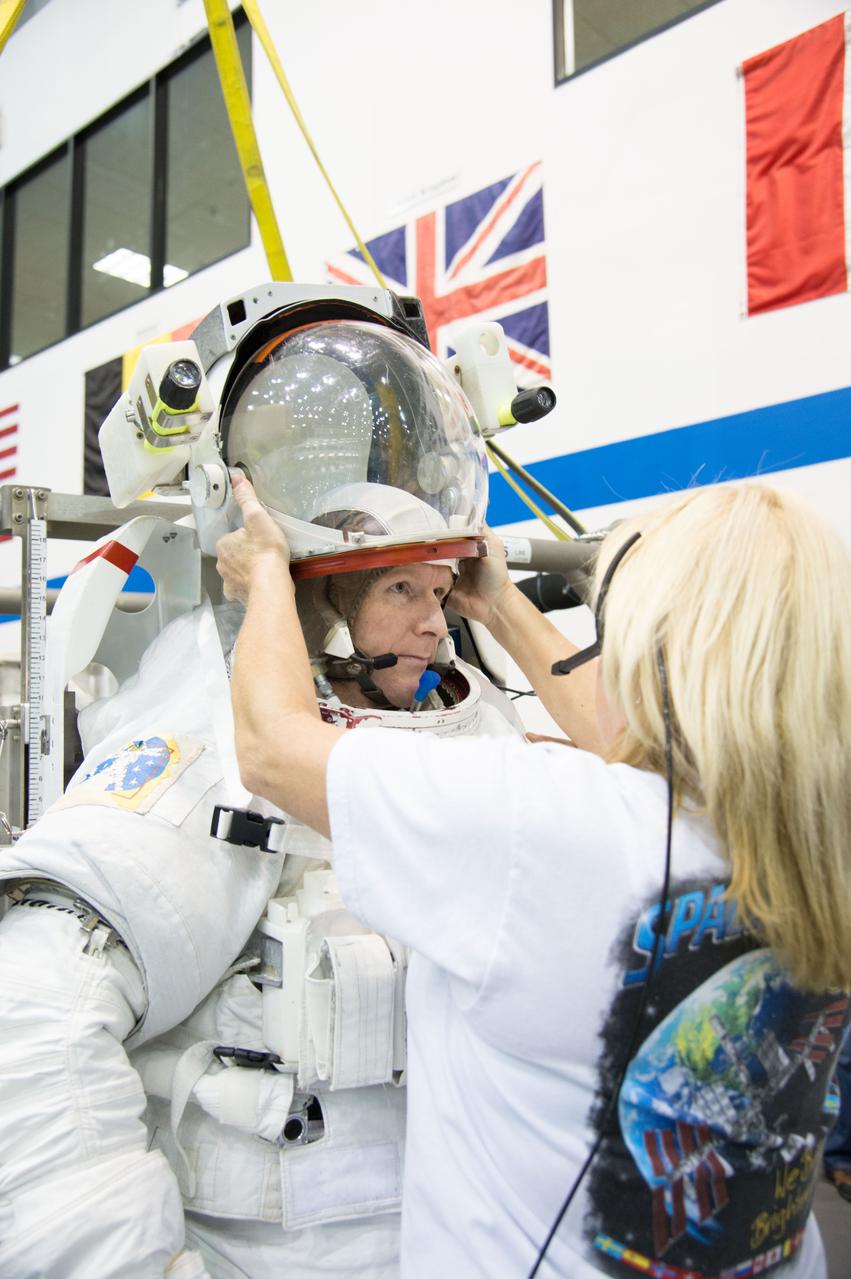
ESA astronaut and first astronaut from the United Kingdom, Timothy Peake, with NASA astronaut Scott Tingle (unassigned) during EVA Skills training in the NBL. Photo Date: November 27, 2012. Location: NBL - Pool Topside. Photographer: Robert Markowitz
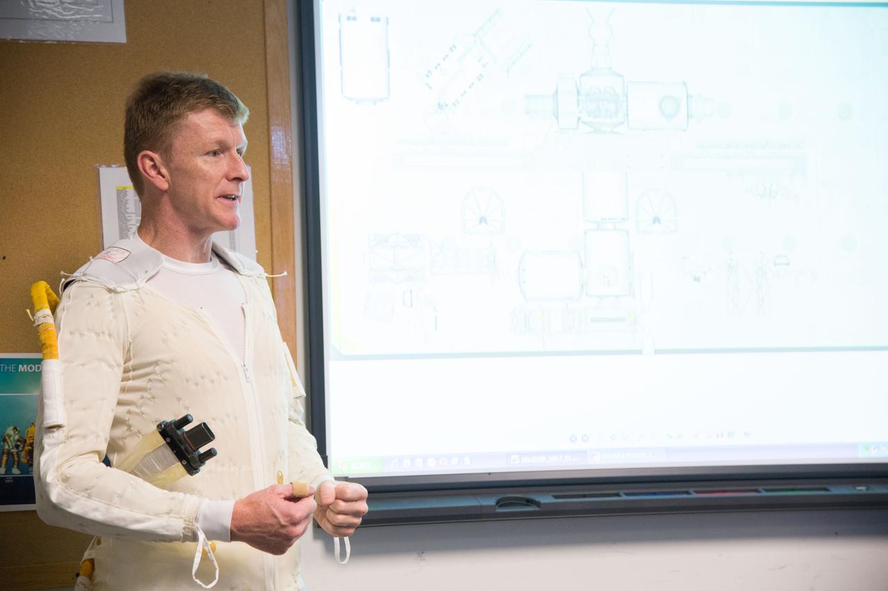
ESA astronaut and first astronaut from the United Kingdom, Timothy Peake, with NASA astronaut Scott Tingle (unassigned) during EVA Skills training in the NBL. Photo Date: November 27, 2012. Location: NBL - Pool Topside. Photographer: Robert Markowitz
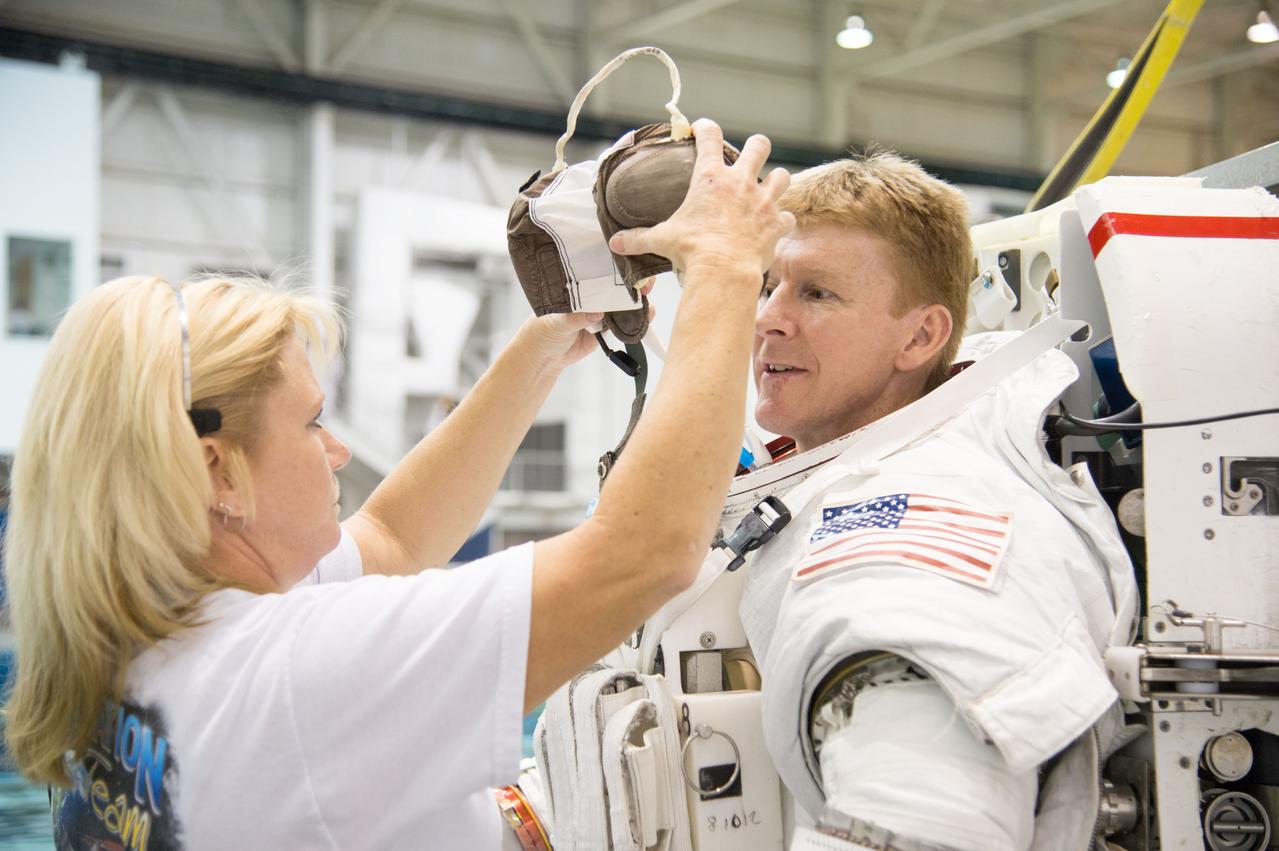
ESA astronaut and first astronaut from the United Kingdom, Timothy Peake, with NASA astronaut Scott Tingle (unassigned) during EVA Skills training in the NBL. Photo Date: November 27, 2012. Location: NBL - Pool Topside. Photographer: Robert Markowitz

ESA astronaut and first astronaut from the United Kingdom, Timothy Peake, with NASA astronaut Scott Tingle (unassigned) during EVA Skills training in the NBL. Photo Date: November 27, 2012. Location: NBL - Pool Topside. Photographer: Robert Markowitz
41G-121-139 (5-13 Oct. 1984) --- The Strait of Dover and London, seldom seen in space photography, can be delineated in this medium format camera's scene showing parts of England and France from onboard the Earth-orbiting space shuttle Challenger. Parts of the Thames River can also be traced in the frame. The 41-G crew consisted of astronauts Robert L. Crippen, commander; Jon A. McBride, pilot; and Mission Specialists Kathryn D. Sullivan, Sally K. Ride, and David D. Leestma; along with Canadian astronaut Marc Garneau; and Paul D. Scully-Power, both payload specialists. Photo credit: NASA

KENNEDY SPACE CENTER, FLA. - On NASA Kennedy Space Center’s Shuttle Landing Facility runway, the Virgin Atlantic GlobalFlyer, piloted by Steve Fossett, begins its takeoff as a nearby helicopter films the historic event for audiences in the United Kingdom. Fossett is attempting a record-breaking solo flight, non-stop without refueling, to surpass the current record for the longest flight of any aircraft. This is the second attempt in two days after a fuel leak was detected Feb. 7. The actual launch time was 7:22 a.m. Feb. 8.

ISS030-E-177670 (28 March 2012) --- One of the Expedition 30 crew members photographed this nighttime scene while the International Space Station was flying at an altitude approximately 240 miles over the eastern North Atlantic. The view looks northeastward. Center point coordinates are 46.8 degrees north latitude and 14.3 degrees west longitude. The night lights of the cities of Ireland, in the foreground, and the United Kingdom, in the back and to the right, are contrasted by the bright sunrise in the background. The greens and purples of the Aurora Borealis are seen along the rest of the horizon.

KENNEDY SPACE CENTER, FLA. - On NASA Kennedy Space Center’s Shuttle Landing Facility runway, the Virgin Atlantic GlobalFlyer, piloted by Steve Fossett, begins its takeoff as a nearby helicopter films the event for audiences in the United Kingdom. Fossett is attempting a record-breaking solo flight, non-stop without refueling, to surpass the current record for the longest flight of any aircraft. This is the second attempt in two days after a fuel leak was detected Feb. 7. The actual launch time was 7:22 a.m. Feb. 8.
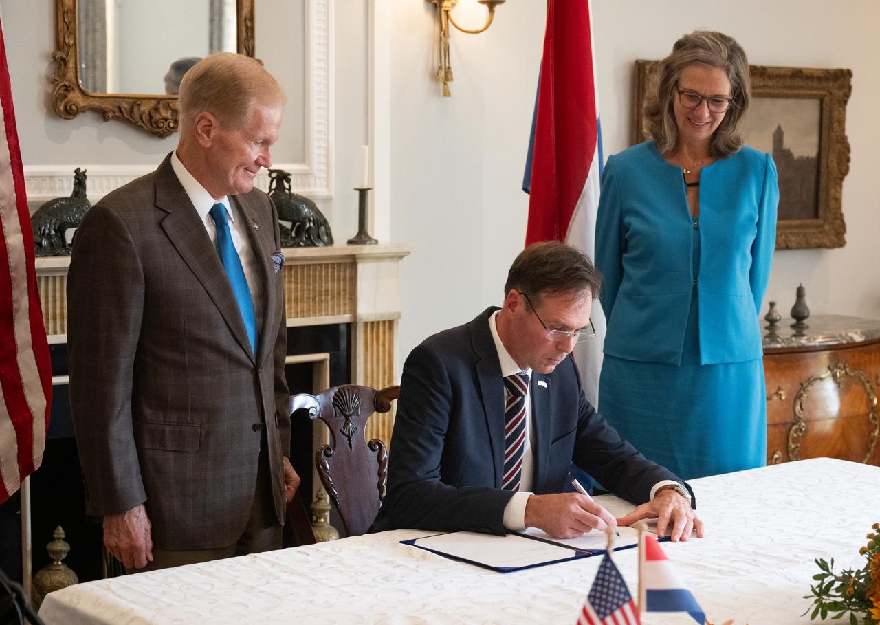
Harm van de Wetering, director of the Netherlands Space Office, center, signs the Artemis Accords as NASA Administrator Bill Nelson, left, and Ambassador of the Kingdom of the Netherlands to the United States Birgitta Tazelaar, right, look on, Wednesday, Nov. 1, 2023, at the Dutch Ambassador’s Residence in Washington. Netherlands is the 31st country to sign the Artemis Accords, which establish a practical set of principles to guide space exploration cooperation among nations participating in NASA’s Artemis program. Photo Credit: (NASA/Joel Kowsky)

Ambassador of the Kingdom of the Netherlands to the United States Birgitta Tazelaar delivers remarks during an Artemis Accords signing ceremony, Wednesday, Nov. 1, 2023, at the Dutch Ambassador’s Residence in Washington. Netherlands is the 31st country to sign the Artemis Accords, which establish a practical set of principles to guide space exploration cooperation among nations participating in NASA’s Artemis program. Photo Credit: (NASA/Joel Kowsky)
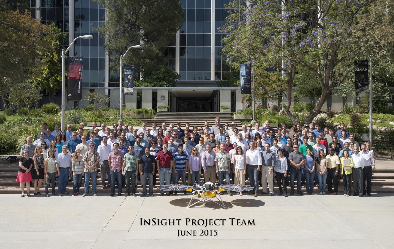
The InSight Team at NASA's Jet Propulsion Laboratory, JPL, in June 2015. The InSight team is comprised of scientists and engineers from multiple disciplines and is a unique collaboration between countries and organizations around the world. The science team includes co-investigators from the U.S., France, Germany, Austria, Belgium, Canada, Japan, Switzerland and the United Kingdom. https://photojournal.jpl.nasa.gov/catalog/PIA22234

Harm van de Wetering, director of the Netherlands Space Office, center, signs the Artemis Accords as NASA Administrator Bill Nelson, left, and Ambassador of the Kingdom of the Netherlands to the United States Birgitta Tazelaar, right, look on, Wednesday, Nov. 1, 2023, at the Dutch Ambassador’s Residence in Washington. Netherlands is the 31st country to sign the Artemis Accords, which establish a practical set of principles to guide space exploration cooperation among nations participating in NASA’s Artemis program. Photo Credit: (NASA/Joel Kowsky)

Ambassador of the Kingdom of the Netherlands to the United States Birgitta Tazelaar delivers remarks during an Artemis Accords signing ceremony, Wednesday, Nov. 1, 2023, at the Dutch Ambassador’s Residence in Washington. Netherlands is the 31st country to sign the Artemis Accords, which establish a practical set of principles to guide space exploration cooperation among nations participating in NASA’s Artemis program. Photo Credit: (NASA/Joel Kowsky)
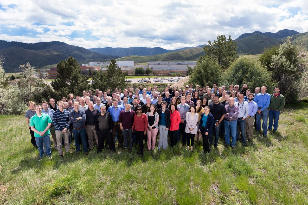
The InSight Team at Lockheed Martin Space in May 2017 The InSight team is comprised of scientists and engineers from multiple disciplines and is a unique collaboration between countries and organizations around the world. The science team includes co-investigators from the U.S., France, Germany, Austria, Belgium, Canada, Japan, Switzerland and the United Kingdom. https://photojournal.jpl.nasa.gov/catalog/PIA22235

This artist's digital concept depicts the completely assembled International Space Station (ISS) passing over Florida. As a gateway to permanent human presence in space, the Space Station Program is to expand knowledge benefiting all people and nations. The ISS is a multidisciplinary laboratory, technology test bed, and observatory that will provide unprecedented undertakings in scientific, technological, and international experimentation. Experiments to be conducted in the ISS include: microgravity research, Earth science, space science, life sciences, space product development, and engineering research and technology. The sixteen countries participating the ISS are: United States, Russian Federation, Canada, Japan, United Kingdom, Germany, Italy, France, Norway, Netherlands, Belgium, Spain, Denmark, Sweden, Switzerland, and Brazil.

This artist's concept depicts the completely assembled International Space Station (ISS) passing over Florida and the Bahamas. As a gateway to permanent human presence in space, the Space Station Program is to expand knowledge benefiting all people and nations. The ISS is a multidisciplinary laboratory, technology test bed, and observatory that will provide unprecedented undertakings in scientific, technological, and international experimentation. Experiments to be conducted in the ISS include: microgravity research, Earth science, space science, life sciences, space product development, and engineering research and technology. The sixteen countries participating in the ISS are: United States, Russian Federation, Canada, Japan, United Kingdom, Germany, Italy, France, Norway, Netherlands, Belgium, Spain, Denmark, Sweden, Switzerland, and Brazil.
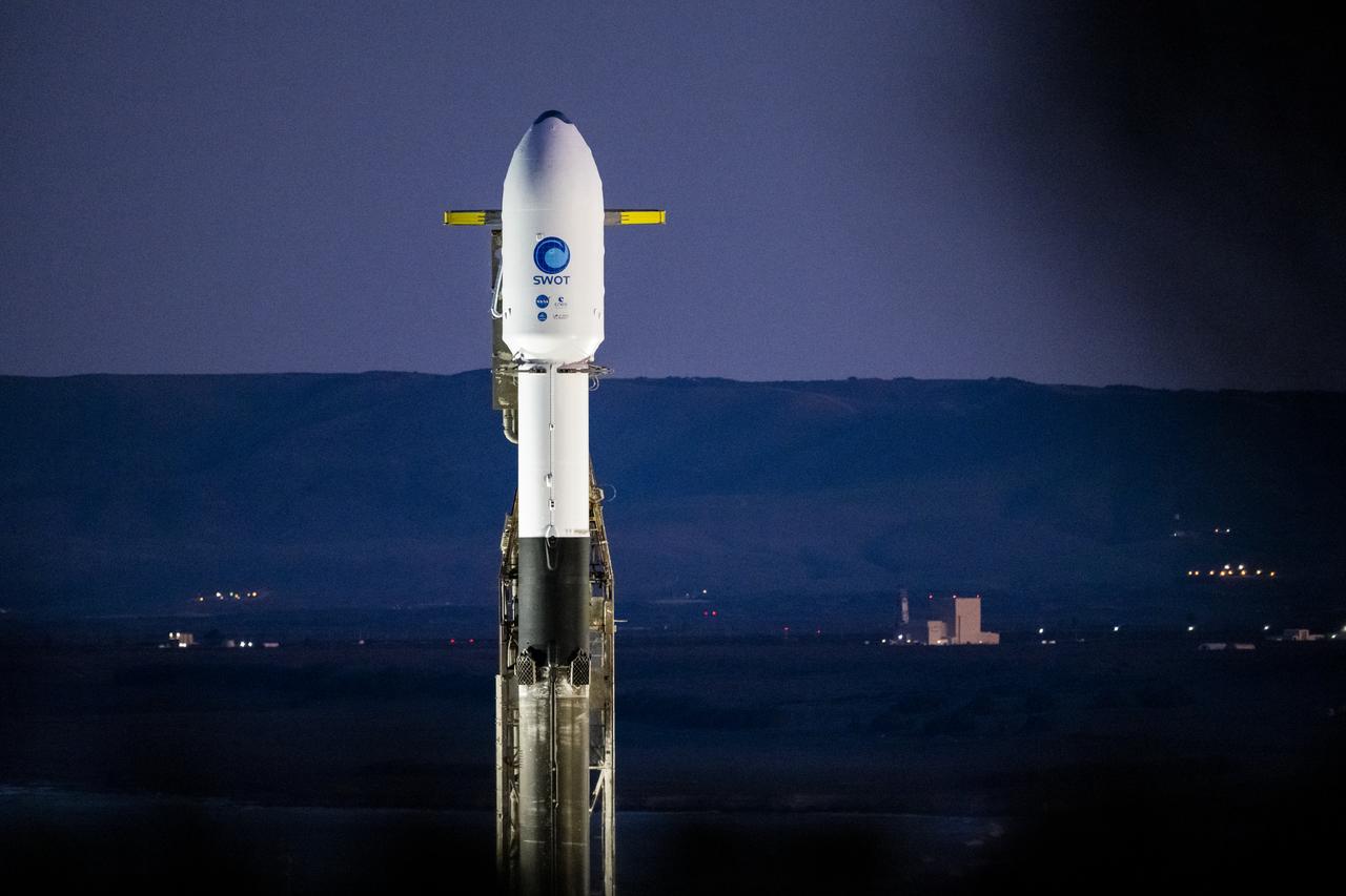
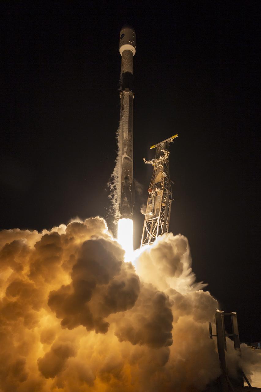
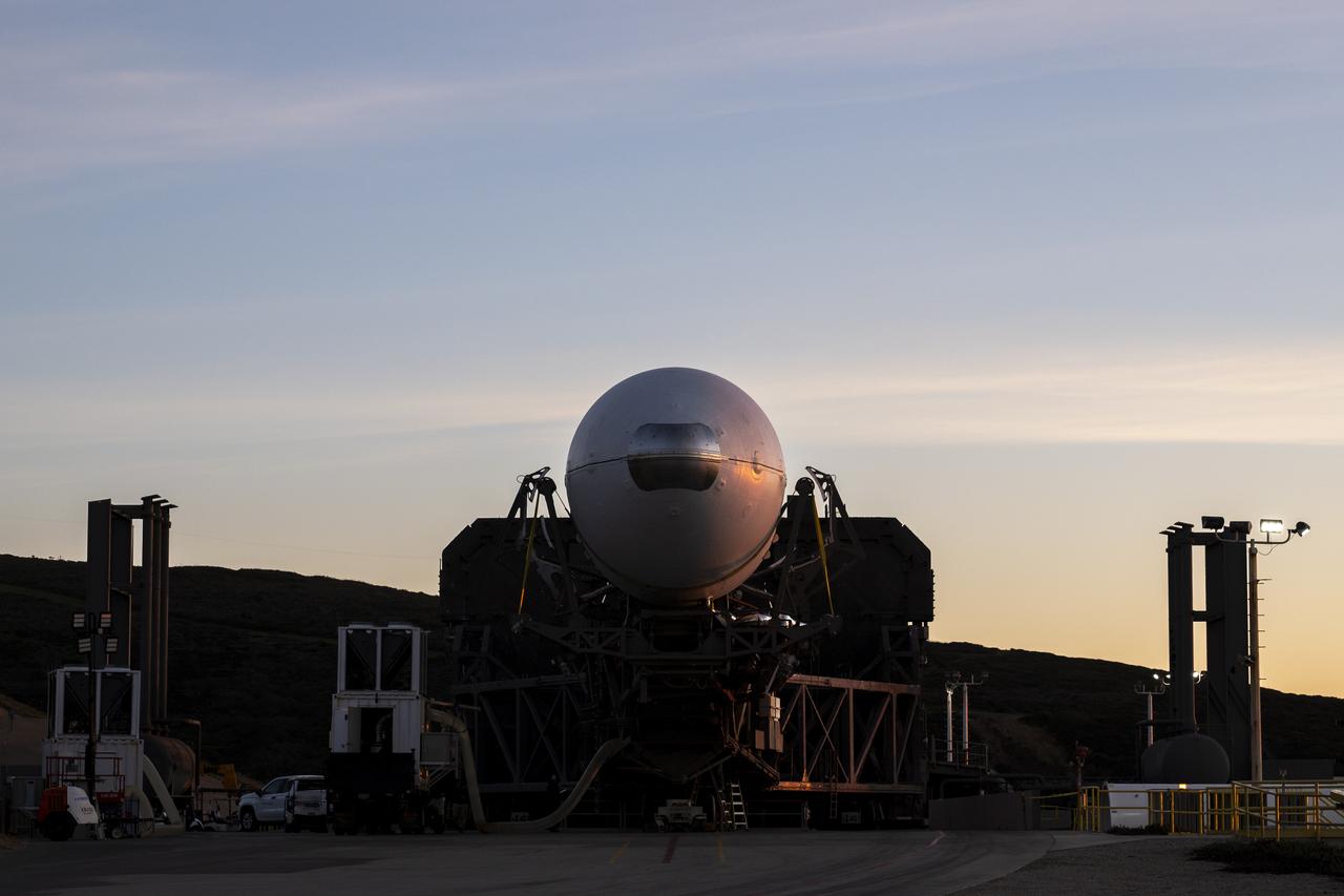
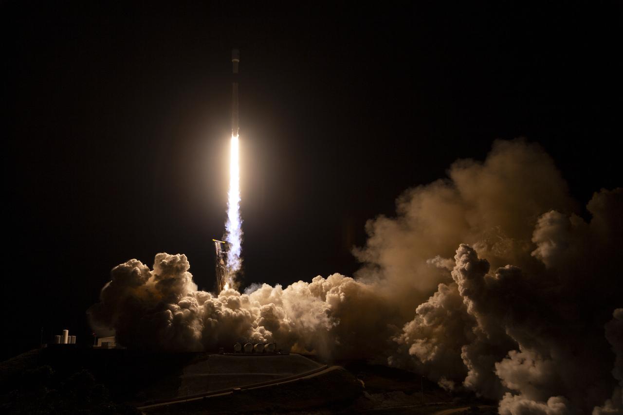
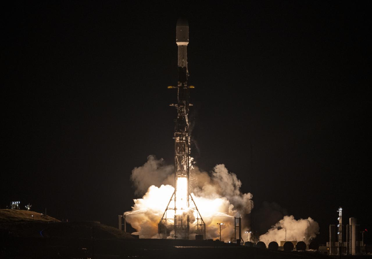
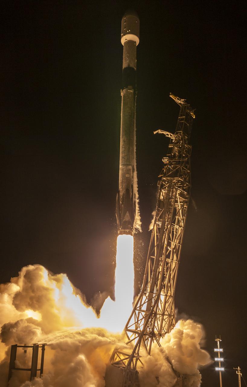
A SpaceX Falcon 9 rocket with the Surface Water and Ocean Topography (SWOT) spacecraft onboard is seen as preparations for launch continue, Wednesday, Dec. 14, 2022, at Space Launch Complex 4E at Vandenberg Space Force Base in California. Jointly developed by NASA and Centre National D'Etudes Spatiales (CNES), with contributions from the Canadian Space Agency (CSA) and United Kingdom Space Agency, SWOT is the first satellite mission that will observe nearly all water on Earth’s surface, measuring the height of water in the planet’s lakes, rivers, reservoirs, and the ocean. Photo Credit: (NASA/Keegan Barber)
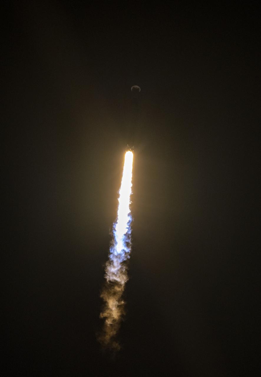
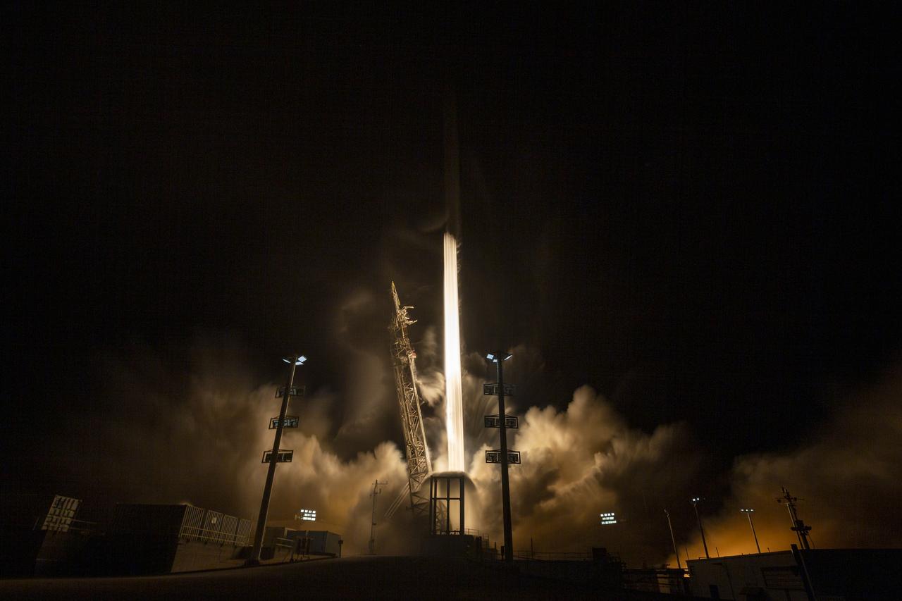
A SpaceX Falcon 9 rocket launches with the Surface Water and Ocean Topography (SWOT) spacecraft onboard, Friday, Dec. 16, 2022, from Space Launch Complex 4E at Vandenberg Space Force Base in California. Jointly developed by NASA and Centre National D'Etudes Spatiales (CNES), with contributions from the Canadian Space Agency (CSA) and United Kingdom Space Agency, SWOT is the first satellite mission that will observe nearly all water on Earth’s surface, measuring the height of water in the planet’s lakes, rivers, reservoirs, and the ocean. Photo Credit: (NASA/Keegan Barber)
A SpaceX Falcon 9 rocket launches with the Surface Water and Ocean Topography (SWOT) spacecraft onboard, Friday, Dec. 16, 2022, from Space Launch Complex 4E at Vandenberg Space Force Base in California. Jointly developed by NASA and Centre National D'Etudes Spatiales (CNES), with contributions from the Canadian Space Agency (CSA) and United Kingdom Space Agency, SWOT is the first satellite mission that will observe nearly all water on Earth’s surface, measuring the height of water in the planet’s lakes, rivers, reservoirs, and the ocean. Photo Credit: (NASA/Keegan Barber)
A SpaceX Falcon 9 rocket with the Surface Water and Ocean Topography (SWOT) spacecraft onboard is seen as preparations for launch continue, Wednesday, Dec. 14, 2022, at Space Launch Complex 4E at Vandenberg Space Force Base in California. Jointly developed by NASA and Centre National D'Etudes Spatiales (CNES), with contributions from the Canadian Space Agency (CSA) and United Kingdom Space Agency, SWOT is the first satellite mission that will observe nearly all water on Earth’s surface, measuring the height of water in the planet’s lakes, rivers, reservoirs, and the ocean. Photo Credit: (NASA/Keegan Barber)
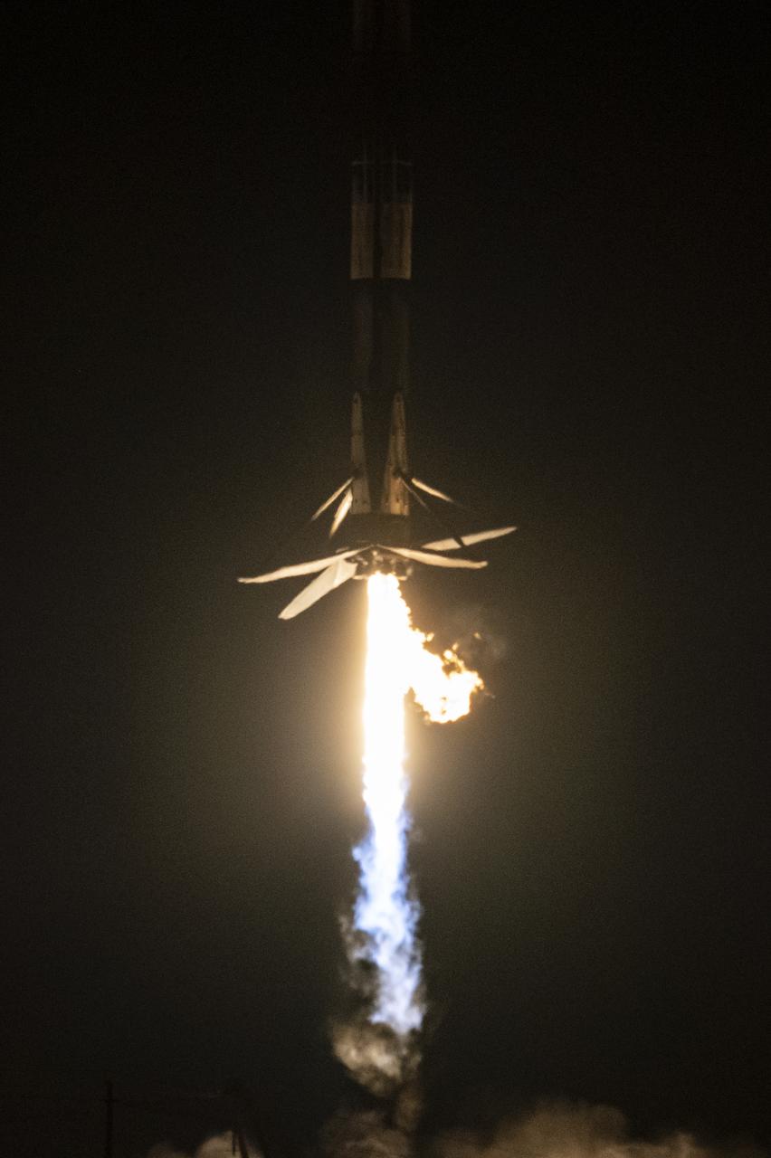
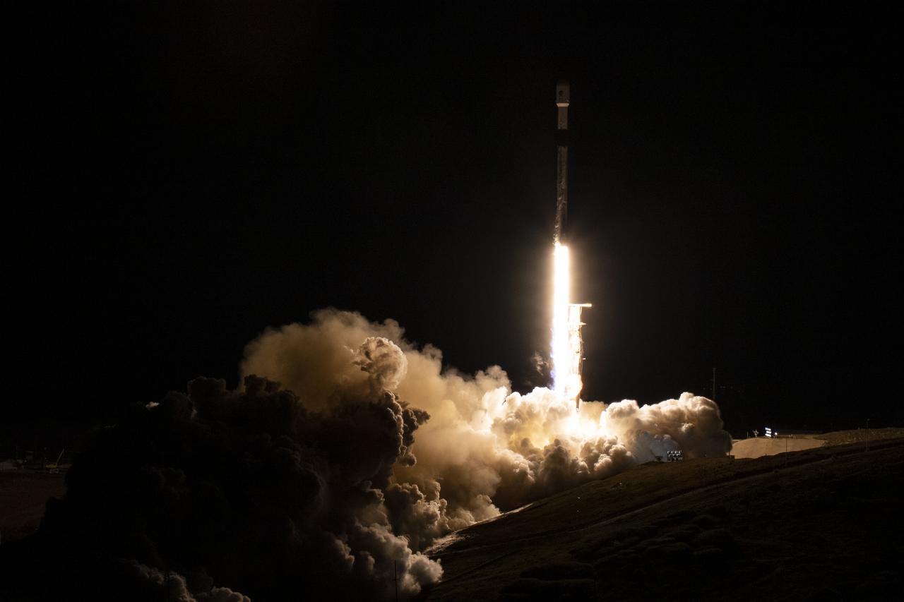
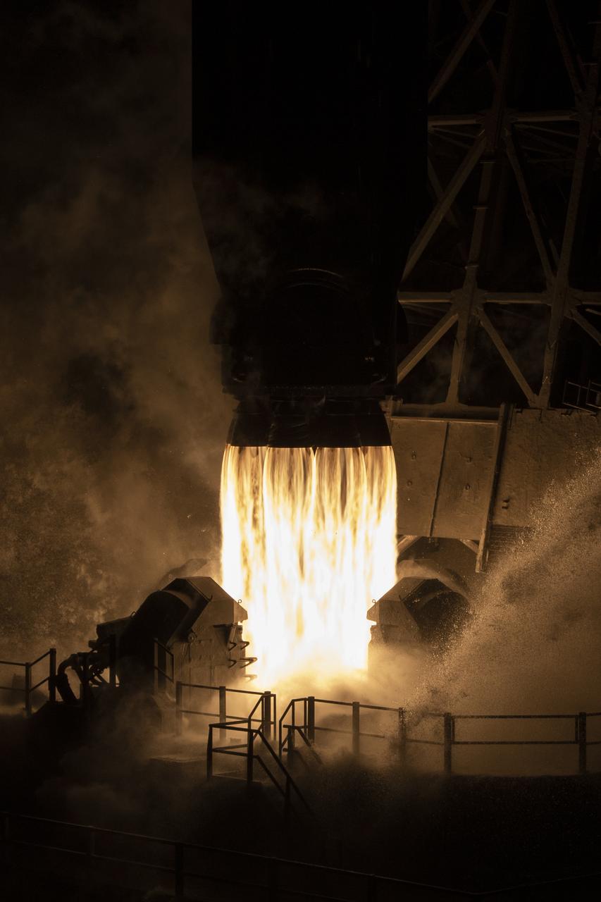
A SpaceX Falcon 9 first-stage booster returns to the landing pad following the launch of the Surface Water and Ocean Topography (SWOT) spacecraft, Friday, Dec. 16, 2022, from Space Launch Complex 4E at Vandenberg Space Force Base in California. Jointly developed by NASA and Centre National D'Etudes Spatiales (CNES), with contributions from the Canadian Space Agency (CSA) and United Kingdom Space Agency, SWOT is the first satellite mission that will observe nearly all water on Earth’s surface, measuring the height of water in the planet’s lakes, rivers, reservoirs, and the ocean. Photo Credit: (NASA/Keegan Barber)
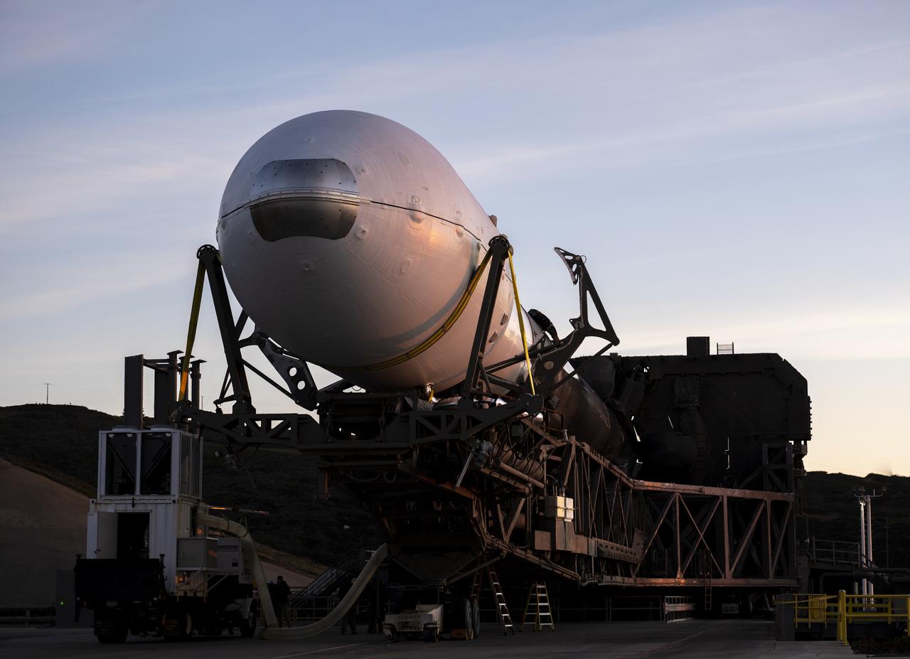
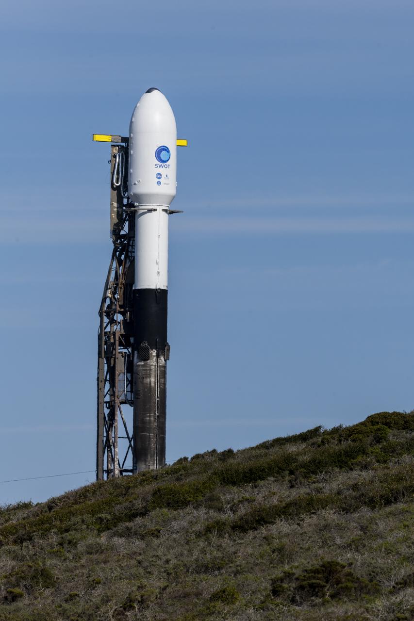
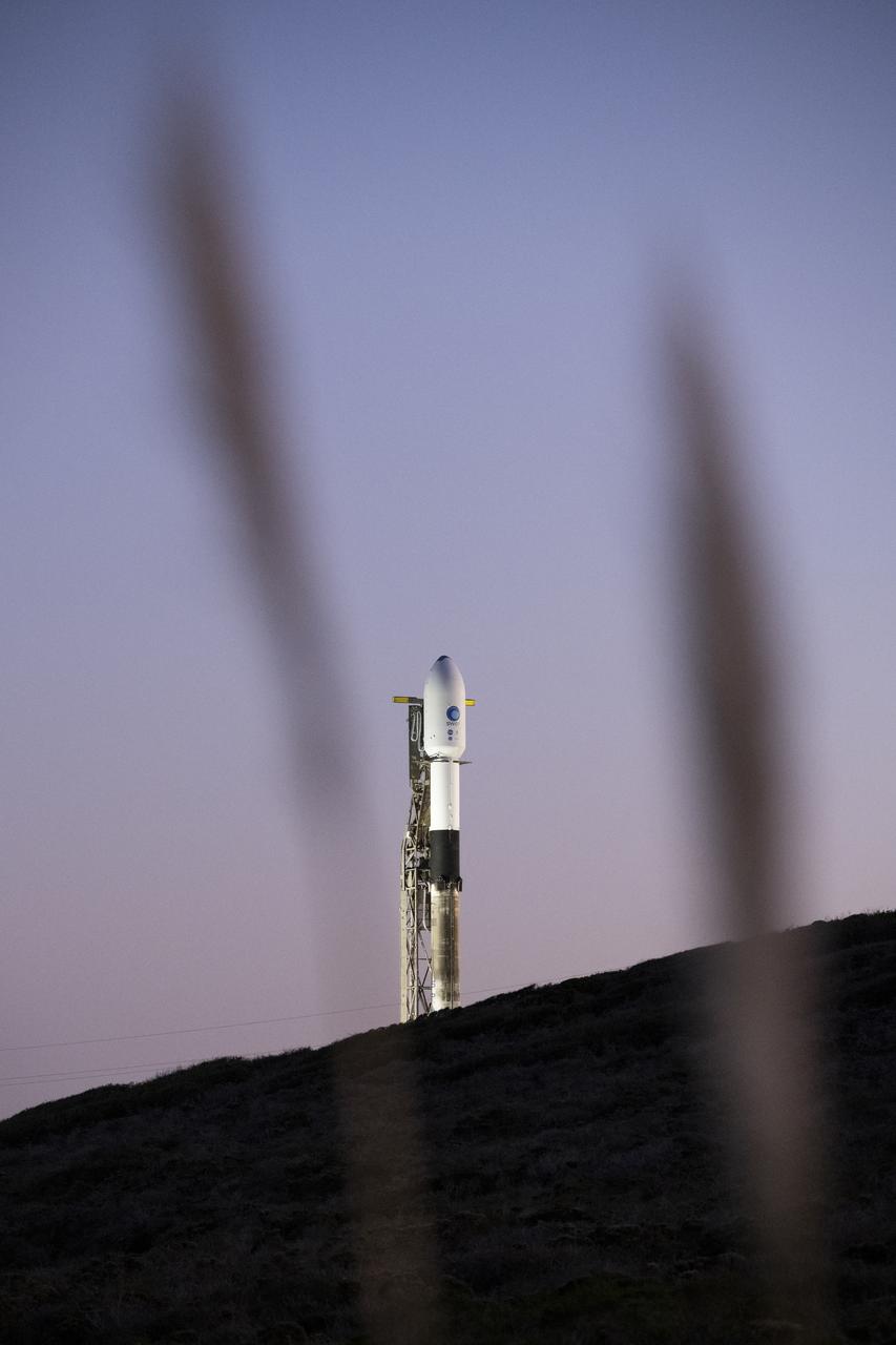
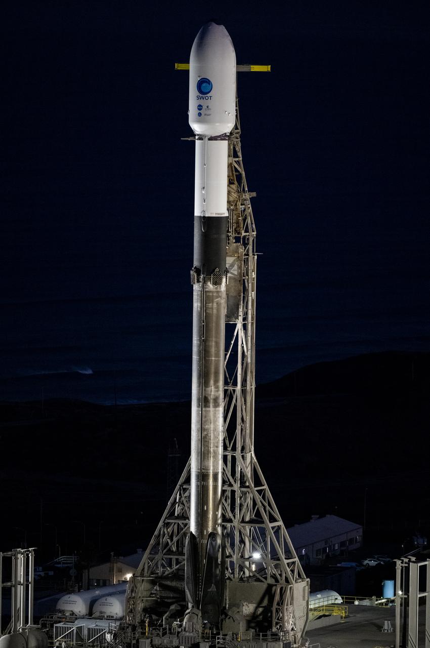
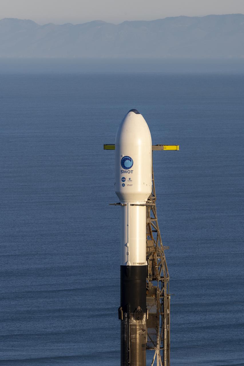
A SpaceX Falcon 9 rocket with the Surface Water and Ocean Topography (SWOT) spacecraft onboard is seen as it rolls out to the pad, Tuesday, Dec. 13, 2022, at Space Launch Complex 4E at Vandenberg Space Force Base in California. Jointly developed by NASA and Centre National D'Etudes Spatiales (CNES), with contributions from the Canadian Space Agency (CSA) and United Kingdom Space Agency, SWOT is the first satellite mission that will observe nearly all water on Earth’s surface, measuring the height of water in the planet’s lakes, rivers, reservoirs, and the ocean. Photo Credit: (NASA/Keegan Barber)
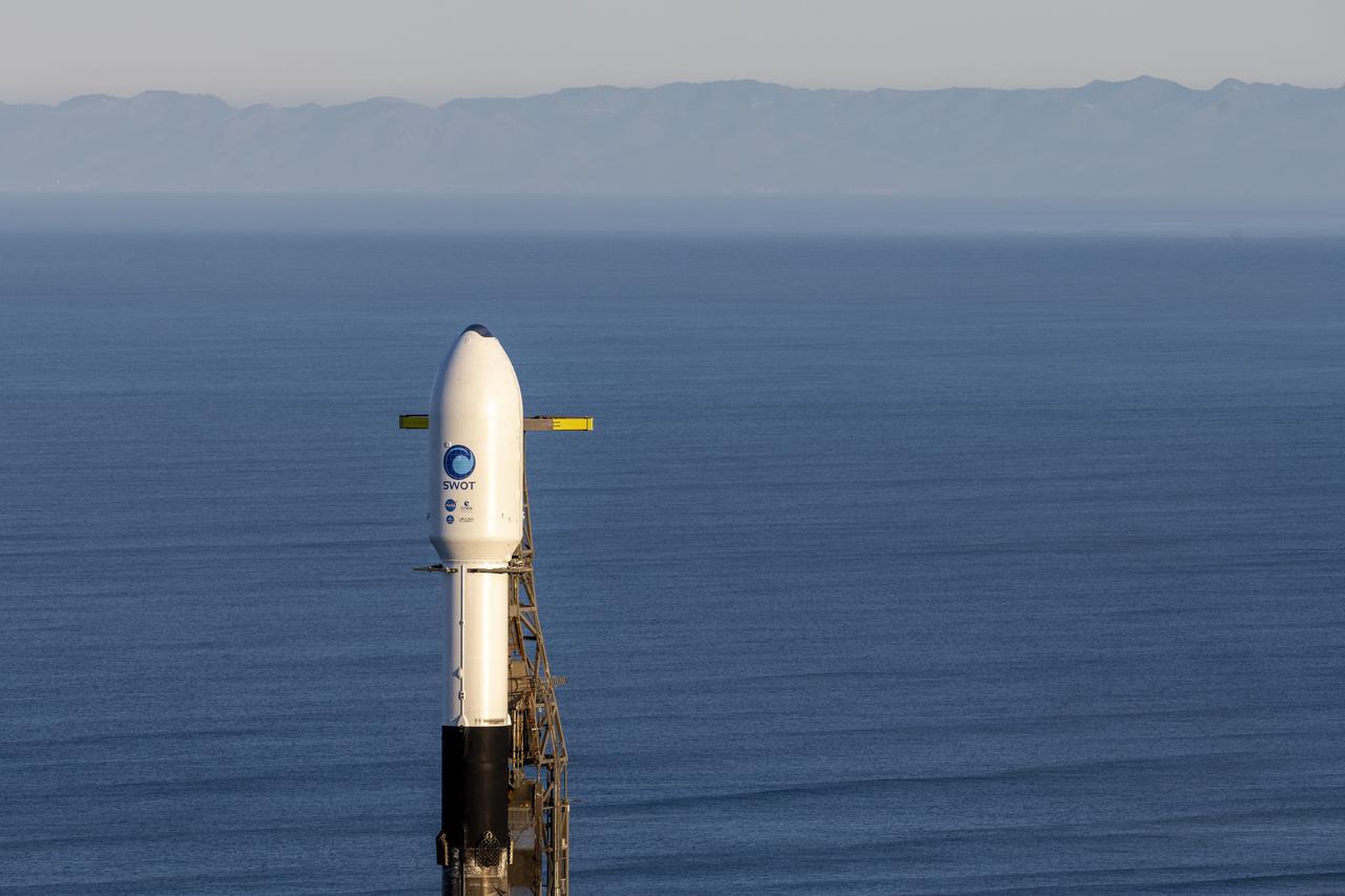
A SpaceX Falcon 9 rocket with the Surface Water and Ocean Topography (SWOT) spacecraft onboard is seen as preparations for launch continue, Wednesday, Dec. 14, 2022, at Space Launch Complex 4E at Vandenberg Space Force Base in California. Jointly developed by NASA and Centre National D'Etudes Spatiales (CNES), with contributions from the Canadian Space Agency (CSA) and United Kingdom Space Agency, SWOT is the first satellite mission that will observe nearly all water on Earth’s surface, measuring the height of water in the planet’s lakes, rivers, reservoirs, and the ocean. Photo Credit: (NASA/Keegan Barber)

Harm van de Wetering, director of the Netherlands Space Office, left, NASA Administrator Bill Nelson, second from right, Chiragh Parikh, executive secretary of the National Space Council, not visible, NASA Deputy Administrator Pam Melroy, second from right, and Ambassador of the Kingdom of the Netherlands to the United States Birgitta Tazelaar, right, are seen as they speak following the signing of the Artemis Accords, Wednesday, Nov. 1, 2023, at the Dutch Ambassador’s Residence in Washington. Netherlands is the 31st country to sign the Artemis Accords, which establish a practical set of principles to guide space exploration cooperation among nations participating in NASA’s Artemis program. Photo Credit: (NASA/Joel Kowsky)

A SpaceX Falcon 9 rocket launches with the Surface Water and Ocean Topography (SWOT) spacecraft onboard, Friday, Dec. 16, 2022, from Space Launch Complex 4E at Vandenberg Space Force Base in California. Jointly developed by NASA and Centre National D'Etudes Spatiales (CNES), with contributions from the Canadian Space Agency (CSA) and United Kingdom Space Agency, SWOT is the first satellite mission that will observe nearly all water on Earth’s surface, measuring the height of water in the planet’s lakes, rivers, reservoirs, and the ocean. Photo Credit: (NASA/Keegan Barber)
A SpaceX Falcon 9 rocket with the Surface Water and Ocean Topography (SWOT) spacecraft onboard is seen as preparations for launch continue, Wednesday, Dec. 14, 2022, at Space Launch Complex 4E at Vandenberg Space Force Base in California. Jointly developed by NASA and Centre National D'Etudes Spatiales (CNES), with contributions from the Canadian Space Agency (CSA) and United Kingdom Space Agency, SWOT is the first satellite mission that will observe nearly all water on Earth’s surface, measuring the height of water in the planet’s lakes, rivers, reservoirs, and the ocean. Photo Credit: (NASA/Keegan Barber)
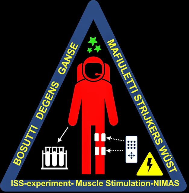
jsc2023e053549 (9/18/2023) --- The Muscle Stimulation Patch is designed to represent the aims of the experiment, namely apply inflight a small electrical muscle stimulation (represented by the yellow triangle) to the leg muscles (white arrows) of astronauts on-board the ISS, to sustain their muscle mass and performance, and measure with several experimental techniques (represented by the white cuvettes) in which way the muscles respond to this exercise modality delivered in Space (represented by the green stars)..The patch’s colors represent the Countries of the team members (Italy, United Kingdom, Germany, The Netherlands and Switzerland). Image courtesy of ESA.
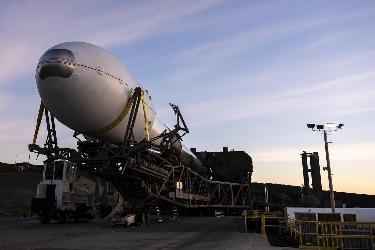
A SpaceX Falcon 9 rocket with the Surface Water and Ocean Topography (SWOT) spacecraft onboard is seen as it rolls out to the pad, Tuesday, Dec. 13, 2022, at Space Launch Complex 4E at Vandenberg Space Force Base in California. Jointly developed by NASA and Centre National D'Etudes Spatiales (CNES), with contributions from the Canadian Space Agency (CSA) and United Kingdom Space Agency, SWOT is the first satellite mission that will observe nearly all water on Earth’s surface, measuring the height of water in the planet’s lakes, rivers, reservoirs, and the ocean. Photo Credit: (NASA/Keegan Barber)
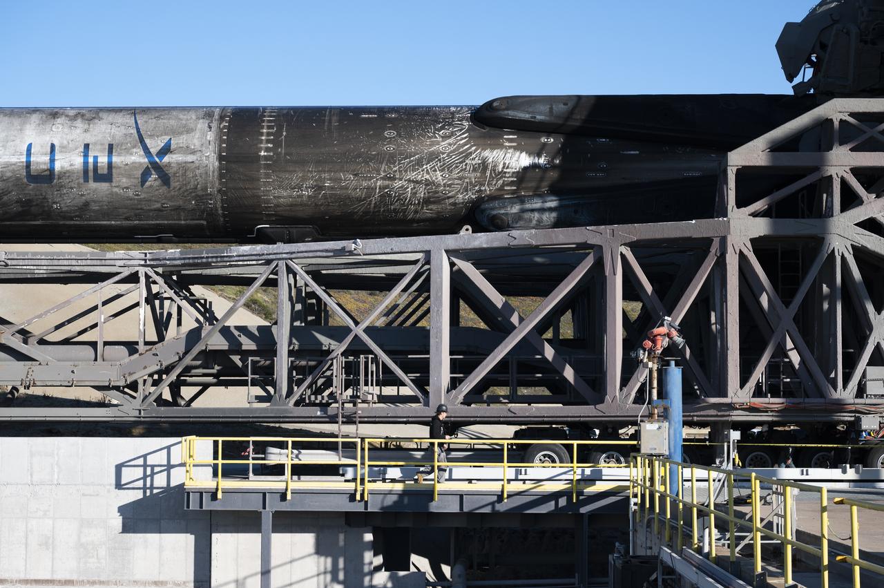
A SpaceX Falcon 9 rocket with the Surface Water and Ocean Topography (SWOT) spacecraft onboard is seen as it rolls out to the pad, Tuesday, Dec. 13, 2022, at Space Launch Complex 4E at Vandenberg Space Force Base in California. Jointly developed by NASA and Centre National D'Etudes Spatiales (CNES), with contributions from the Canadian Space Agency (CSA) and United Kingdom Space Agency, SWOT is the first satellite mission that will observe nearly all water on Earth’s surface, measuring the height of water in the planet’s lakes, rivers, reservoirs, and the ocean. Photo Credit: (NASA/Keegan Barber)
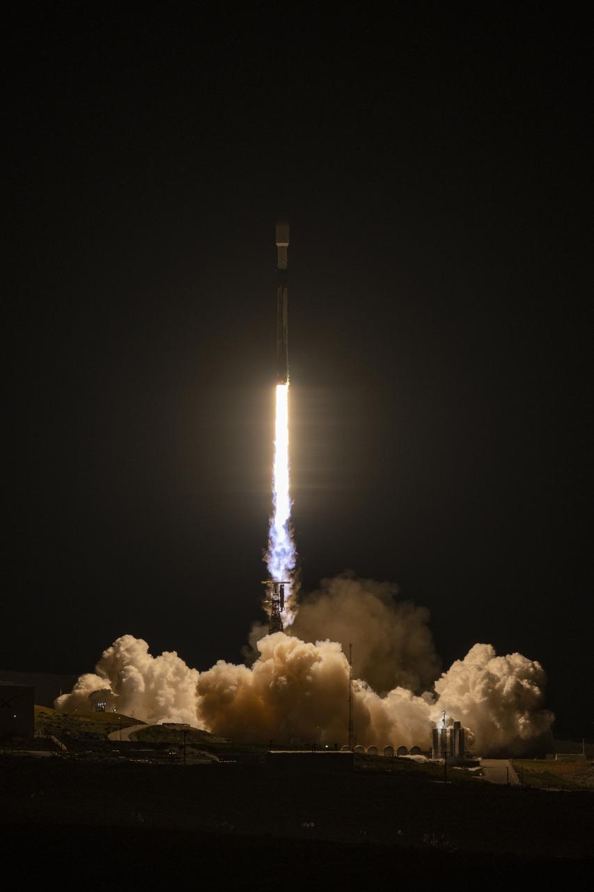
A SpaceX Falcon 9 rocket launches with the Surface Water and Ocean Topography (SWOT) spacecraft onboard, Friday, Dec. 16, 2022, from Space Launch Complex 4E at Vandenberg Space Force Base in California. Jointly developed by NASA and Centre National D'Etudes Spatiales (CNES), with contributions from the Canadian Space Agency (CSA) and United Kingdom Space Agency, SWOT is the first satellite mission that will observe nearly all water on Earth’s surface, measuring the height of water in the planet’s lakes, rivers, reservoirs, and the ocean. Photo Credit: (NASA/Keegan Barber)
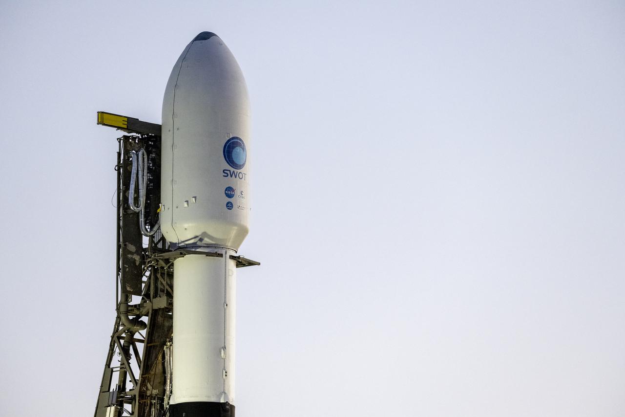
A SpaceX Falcon 9 rocket with the Surface Water and Ocean Topography (SWOT) spacecraft onboard is seen as preparations for launch continue, Wednesday, Dec. 14, 2022, at Space Launch Complex 4E at Vandenberg Space Force Base in California. Jointly developed by NASA and Centre National D'Etudes Spatiales (CNES), with contributions from the Canadian Space Agency (CSA) and United Kingdom Space Agency, SWOT is the first satellite mission that will observe nearly all water on Earth’s surface, measuring the height of water in the planet’s lakes, rivers, reservoirs, and the ocean. Photo Credit: (NASA/Keegan Barber)
A SpaceX Falcon 9 rocket with the Surface Water and Ocean Topography (SWOT) spacecraft onboard is seen as preparations for launch continue, Wednesday, Dec. 14, 2022, at Space Launch Complex 4E at Vandenberg Space Force Base in California. Jointly developed by NASA and Centre National D'Etudes Spatiales (CNES), with contributions from the Canadian Space Agency (CSA) and United Kingdom Space Agency, SWOT is the first satellite mission that will observe nearly all water on Earth’s surface, measuring the height of water in the planet’s lakes, rivers, reservoirs, and the ocean. Photo Credit: (NASA/Keegan Barber)
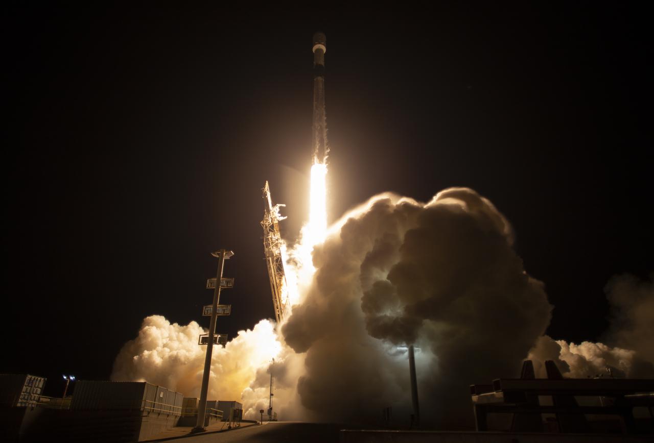
A SpaceX Falcon 9 rocket launches with the Surface Water and Ocean Topography (SWOT) spacecraft onboard, Friday, Dec. 16, 2022, from Space Launch Complex 4E at Vandenberg Space Force Base in California. Jointly developed by NASA and Centre National D'Etudes Spatiales (CNES), with contributions from the Canadian Space Agency (CSA) and United Kingdom Space Agency, SWOT is the first satellite mission that will observe nearly all water on Earth’s surface, measuring the height of water in the planet’s lakes, rivers, reservoirs, and the ocean. Photo Credit: (NASA/Keegan Barber)
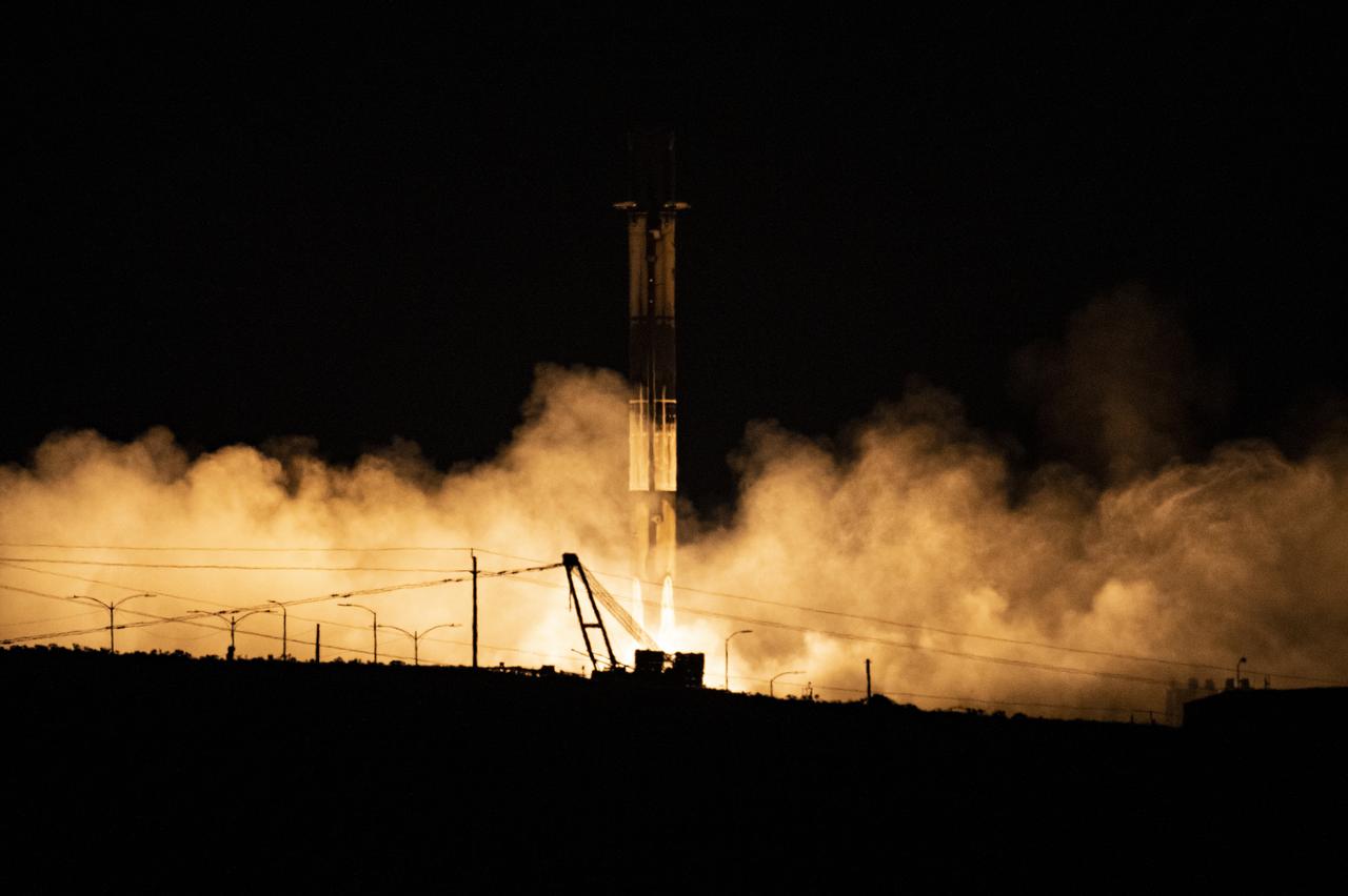
A SpaceX Falcon 9 first-stage booster returns to the landing pad following the launch of the Surface Water and Ocean Topography (SWOT) spacecraft, Friday, Dec. 16, 2022, from Space Launch Complex 4E at Vandenberg Space Force Base in California. Jointly developed by NASA and Centre National D'Etudes Spatiales (CNES), with contributions from the Canadian Space Agency (CSA) and United Kingdom Space Agency, SWOT is the first satellite mission that will observe nearly all water on Earth’s surface, measuring the height of water in the planet’s lakes, rivers, reservoirs, and the ocean. Photo Credit: (NASA/Keegan Barber)
A SpaceX Falcon 9 rocket with the Surface Water and Ocean Topography (SWOT) spacecraft onboard is seen as it rolls out to the pad, Tuesday, Dec. 13, 2022, at Space Launch Complex 4E at Vandenberg Space Force Base in California. Jointly developed by NASA and Centre National D'Etudes Spatiales (CNES), with contributions from the Canadian Space Agency (CSA) and United Kingdom Space Agency, SWOT is the first satellite mission that will observe nearly all water on Earth’s surface, measuring the height of water in the planet’s lakes, rivers, reservoirs, and the ocean. Photo Credit: (NASA/Keegan Barber)
A SpaceX Falcon 9 rocket with the Surface Water and Ocean Topography (SWOT) spacecraft onboard is seen as preparations for launch continue, Wednesday, Dec. 14, 2022, at Space Launch Complex 4E at Vandenberg Space Force Base in California. Jointly developed by NASA and Centre National D'Etudes Spatiales (CNES), with contributions from the Canadian Space Agency (CSA) and United Kingdom Space Agency, SWOT is the first satellite mission that will observe nearly all water on Earth’s surface, measuring the height of water in the planet’s lakes, rivers, reservoirs, and the ocean. Photo Credit: (NASA/Keegan Barber)
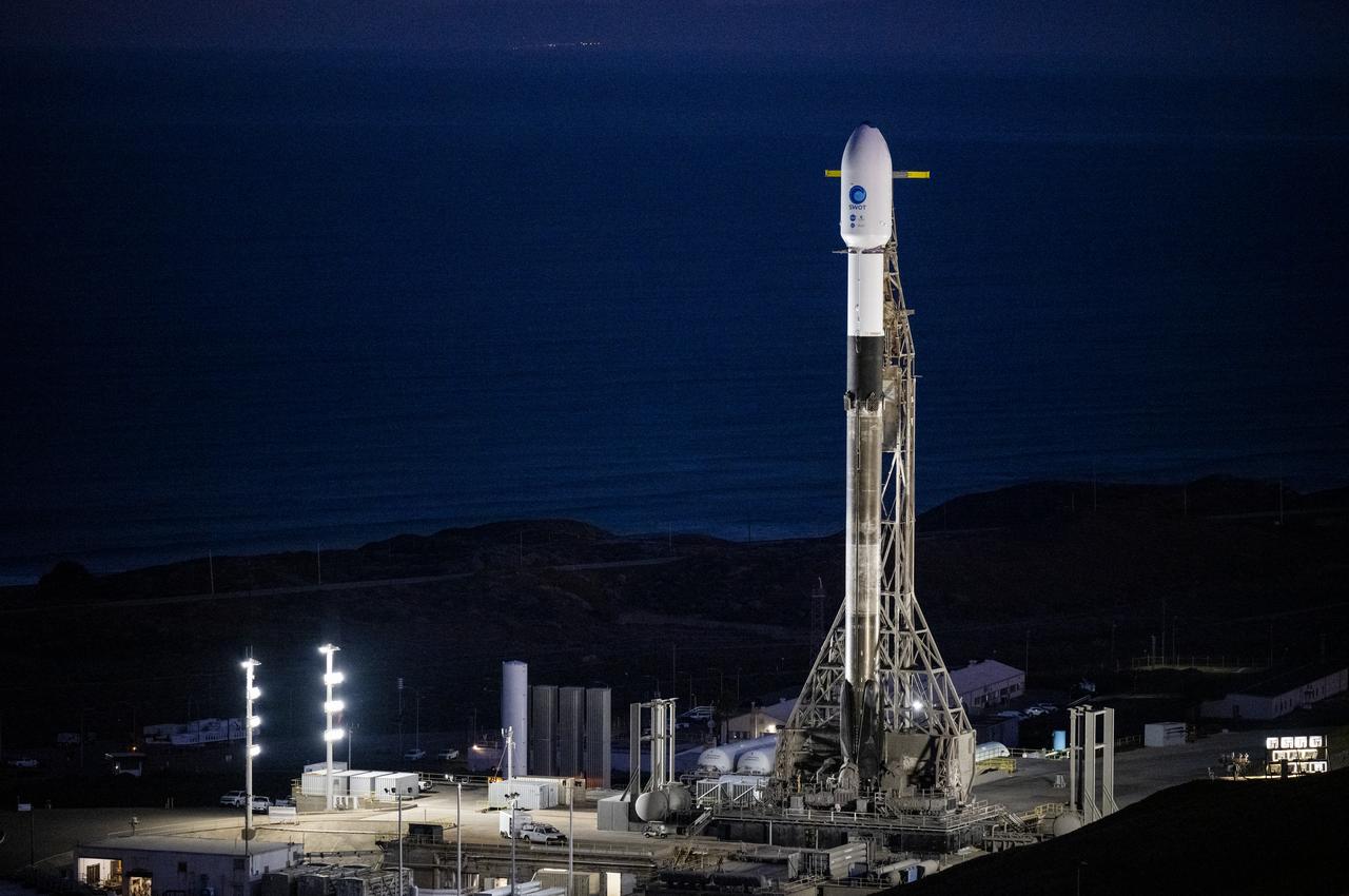
A SpaceX Falcon 9 rocket with the Surface Water and Ocean Topography (SWOT) spacecraft onboard is seen as preparations for launch continue, Wednesday, Dec. 14, 2022, at Space Launch Complex 4E at Vandenberg Space Force Base in California. Jointly developed by NASA and Centre National D'Etudes Spatiales (CNES), with contributions from the Canadian Space Agency (CSA) and United Kingdom Space Agency, SWOT is the first satellite mission that will observe nearly all water on Earth’s surface, measuring the height of water in the planet’s lakes, rivers, reservoirs, and the ocean. Photo Credit: (NASA/Keegan Barber)
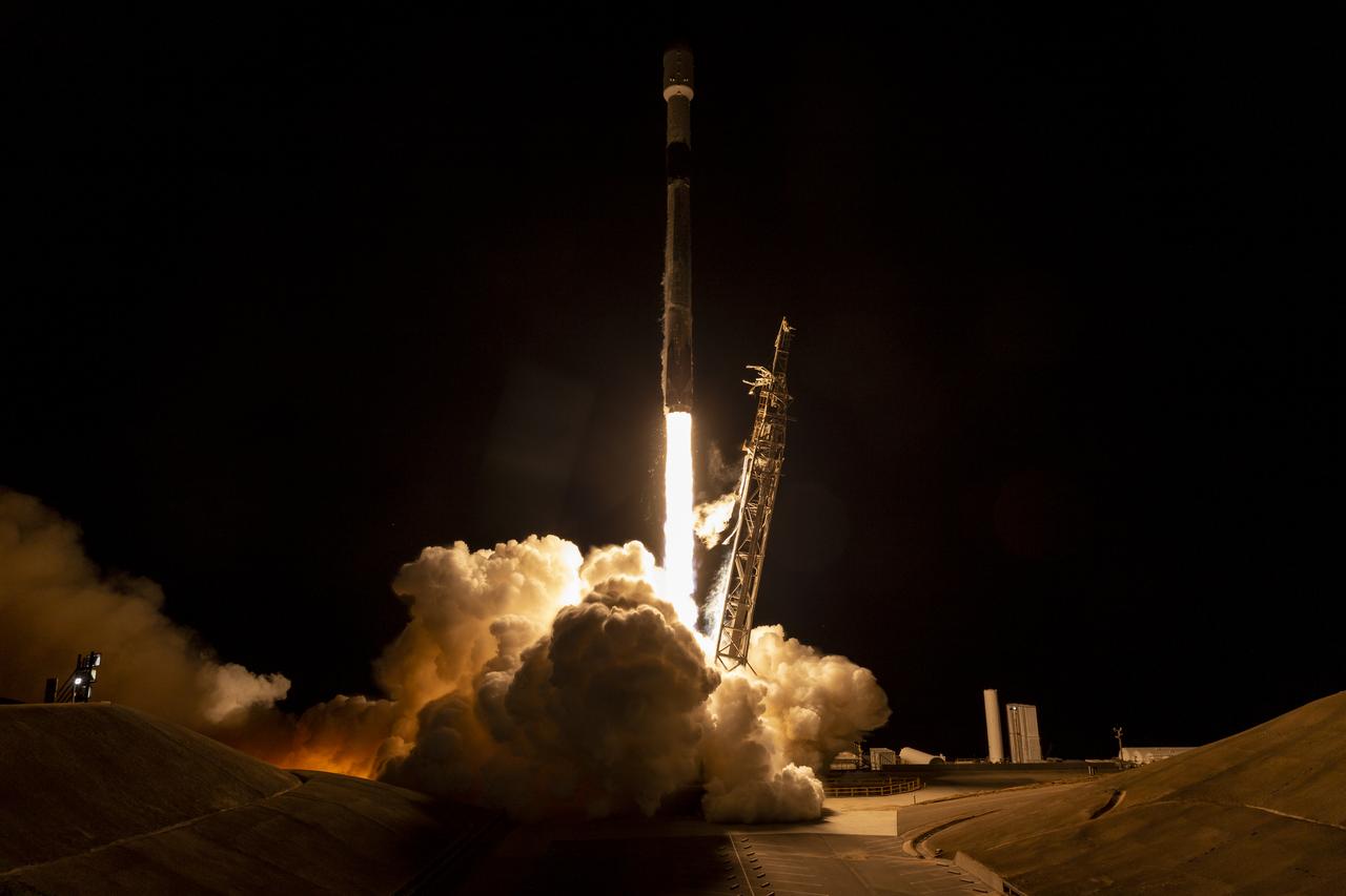
A SpaceX Falcon 9 rocket launches with the Surface Water and Ocean Topography (SWOT) spacecraft onboard, Friday, Dec. 16, 2022, from Space Launch Complex 4E at Vandenberg Space Force Base in California. Jointly developed by NASA and Centre National D'Etudes Spatiales (CNES), with contributions from the Canadian Space Agency (CSA) and United Kingdom Space Agency, SWOT is the first satellite mission that will observe nearly all water on Earth’s surface, measuring the height of water in the planet’s lakes, rivers, reservoirs, and the ocean. Photo Credit: (NASA/Keegan Barber)
A SpaceX Falcon 9 rocket launches with the Surface Water and Ocean Topography (SWOT) spacecraft onboard, Friday, Dec. 16, 2022, from Space Launch Complex 4E at Vandenberg Space Force Base in California. Jointly developed by NASA and Centre National D'Etudes Spatiales (CNES), with contributions from the Canadian Space Agency (CSA) and United Kingdom Space Agency, SWOT is the first satellite mission that will observe nearly all water on Earth’s surface, measuring the height of water in the planet’s lakes, rivers, reservoirs, and the ocean. Photo Credit: (NASA/Keegan Barber)
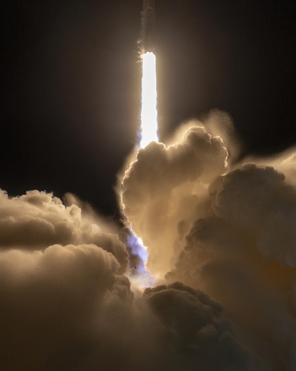
In this 30 second exposure, A SpaceX Falcon 9 rocket launches with the Surface Water and Ocean Topography (SWOT) spacecraft onboard, Friday, Dec. 16, 2022, from Space Launch Complex 4E at Vandenberg Space Force Base in California. Jointly developed by NASA and Centre National D'Etudes Spatiales (CNES), with contributions from the Canadian Space Agency (CSA) and United Kingdom Space Agency, SWOT is the first satellite mission that will observe nearly all water on Earth’s surface, measuring the height of water in the planet’s lakes, rivers, reservoirs, and the ocean. Photo Credit: (NASA/Keegan Barber)
A SpaceX Falcon 9 rocket launches with the Surface Water and Ocean Topography (SWOT) spacecraft onboard, Friday, Dec. 16, 2022, from Space Launch Complex 4E at Vandenberg Space Force Base in California. Jointly developed by NASA and Centre National D'Etudes Spatiales (CNES), with contributions from the Canadian Space Agency (CSA) and United Kingdom Space Agency, SWOT is the first satellite mission that will observe nearly all water on Earth’s surface, measuring the height of water in the planet’s lakes, rivers, reservoirs, and the ocean. Photo Credit: (NASA/Keegan Barber)
A SpaceX Falcon 9 rocket with the Surface Water and Ocean Topography (SWOT) spacecraft onboard is seen as preparations for launch continue, Wednesday, Dec. 14, 2022, at Space Launch Complex 4E at Vandenberg Space Force Base in California. Jointly developed by NASA and Centre National D'Etudes Spatiales (CNES), with contributions from the Canadian Space Agency (CSA) and United Kingdom Space Agency, SWOT is the first satellite mission that will observe nearly all water on Earth’s surface, measuring the height of water in the planet’s lakes, rivers, reservoirs, and the ocean. Photo Credit: (NASA/Keegan Barber)
A SpaceX Falcon 9 rocket launches with the Surface Water and Ocean Topography (SWOT) spacecraft onboard, Friday, Dec. 16, 2022, from Space Launch Complex 4E at Vandenberg Space Force Base in California. Jointly developed by NASA and Centre National D'Etudes Spatiales (CNES), with contributions from the Canadian Space Agency (CSA) and United Kingdom Space Agency, SWOT is the first satellite mission that will observe nearly all water on Earth’s surface, measuring the height of water in the planet’s lakes, rivers, reservoirs, and the ocean. Photo Credit: (NASA/Keegan Barber)
A SpaceX Falcon 9 rocket launches with the Surface Water and Ocean Topography (SWOT) spacecraft onboard, Friday, Dec. 16, 2022, from Space Launch Complex 4E at Vandenberg Space Force Base in California. Jointly developed by NASA and Centre National D'Etudes Spatiales (CNES), with contributions from the Canadian Space Agency (CSA) and United Kingdom Space Agency, SWOT is the first satellite mission that will observe nearly all water on Earth’s surface, measuring the height of water in the planet’s lakes, rivers, reservoirs, and the ocean. Photo Credit: (NASA/Keegan Barber)
A SpaceX Falcon 9 rocket launches with the Surface Water and Ocean Topography (SWOT) spacecraft onboard, Friday, Dec. 16, 2022, from Space Launch Complex 4E at Vandenberg Space Force Base in California. Jointly developed by NASA and Centre National D'Etudes Spatiales (CNES), with contributions from the Canadian Space Agency (CSA) and United Kingdom Space Agency, SWOT is the first satellite mission that will observe nearly all water on Earth’s surface, measuring the height of water in the planet’s lakes, rivers, reservoirs, and the ocean. Photo Credit: (NASA/Keegan Barber)
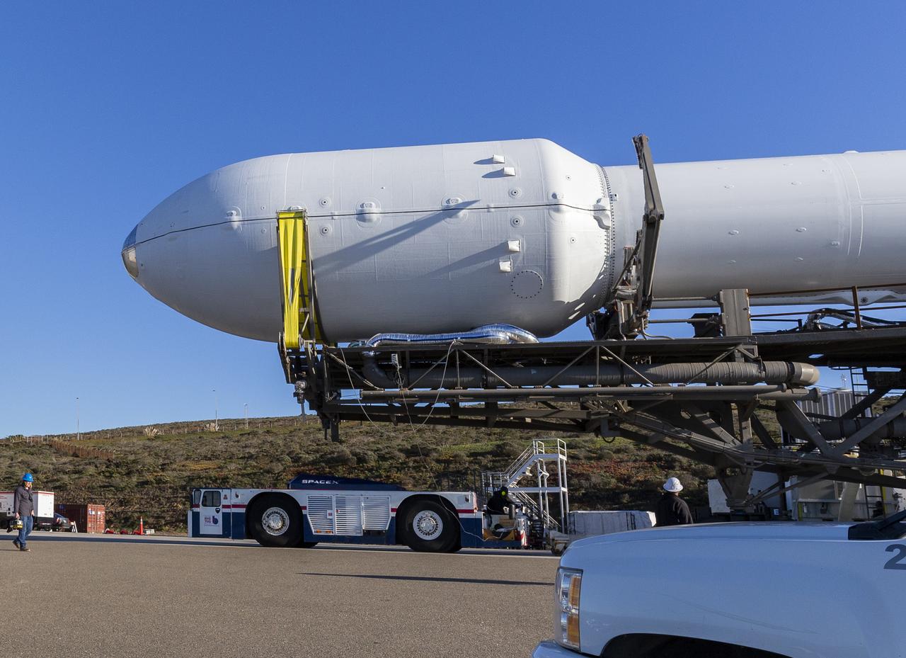
A SpaceX Falcon 9 rocket with the Surface Water and Ocean Topography (SWOT) spacecraft onboard is seen as it rolls out to the pad, Tuesday, Dec. 13, 2022, at Space Launch Complex 4E at Vandenberg Space Force Base in California. Jointly developed by NASA and Centre National D'Etudes Spatiales (CNES), with contributions from the Canadian Space Agency (CSA) and United Kingdom Space Agency, SWOT is the first satellite mission that will observe nearly all water on Earth’s surface, measuring the height of water in the planet’s lakes, rivers, reservoirs, and the ocean. Photo Credit: (NASA/Keegan Barber)
A SpaceX Falcon 9 rocket launches with the Surface Water and Ocean Topography (SWOT) spacecraft onboard, Friday, Dec. 16, 2022, from Space Launch Complex 4E at Vandenberg Space Force Base in California. Jointly developed by NASA and Centre National D'Etudes Spatiales (CNES), with contributions from the Canadian Space Agency (CSA) and United Kingdom Space Agency, SWOT is the first satellite mission that will observe nearly all water on Earth’s surface, measuring the height of water in the planet’s lakes, rivers, reservoirs, and the ocean. Photo Credit: (NASA/Keegan Barber)

NASA Administrator Bill Nelson, left, NASA Deputy Administrator Pam Melroy, Harm van de Wetering, director of the Netherlands Space Office, Ambassador of the Kingdom of the Netherlands to the United States Birgitta Tazelaar, and Chiragh Parikh, executive secretary of the National Space Council, pose for a picture after the signing of the Artemis Accords, Wednesday, Nov. 1, 2023, at the Dutch Ambassador’s Residence in Washington. Netherlands is the 31st country to sign the Artemis Accords, which establish a practical set of principles to guide space exploration cooperation among nations participating in NASA’s Artemis program. Photo Credit: (NASA/Joel Kowsky)
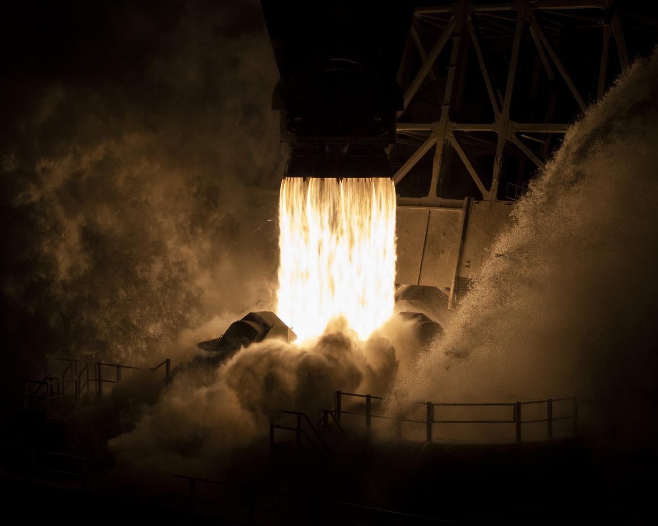
A SpaceX Falcon 9 rocket launches with the Surface Water and Ocean Topography (SWOT) spacecraft onboard, Friday, Dec. 16, 2022, from Space Launch Complex 4E at Vandenberg Space Force Base in California. Jointly developed by NASA and Centre National D'Etudes Spatiales (CNES), with contributions from the Canadian Space Agency (CSA) and United Kingdom Space Agency, SWOT is the first satellite mission that will observe nearly all water on Earth’s surface, measuring the height of water in the planet’s lakes, rivers, reservoirs, and the ocean. Photo Credit: (NASA/Keegan Barber)

This artist's concept depicts the completely assembled International Space Station (ISS) passing over the Straits of Gibraltar and the Mediterranean Sea. As a gateway to permanent human presence in space, the Space Station Program is to expand knowledge benefiting all people and nations. The ISS is a multidisciplinary laboratory, technology test bed, and observatory that will provide unprecedented undertakings in scientific, technological, and international experimentation. Experiments to be conducted in the ISS include: microgravity research, Earth science, space science, life sciences, space product development, and engineering research and technology. The sixteen countries participating the ISS are: United States, Russian Federation, Canada, Japan, United Kingdom, Germany, Italy, France, Norway, Netherlands, Belgium, Spain, Denmark, Sweden, Switzerland, and Brazil.
The Seismic Experiment for Interior Structure (SEIS) instrument for NASA's InSight mission to Mars undergoes a checkout for the spacecraft's assembly, test and launch operations (ATLO) in this photo taken July 20, 2017, in a Lockheed Martin clean room facility in Littleton, Colorado. The SEIS was provided by France's national space agency (CNES) with collaboration from the United States, the United Kingdom, Switzerland and Germany. The InSight mission (for Interior Exploration using Seismic Investigations, Geodesy and Heat Transport) is scheduled to launch in May 2018 and land on Mars Nov. 26, 2018. It will investigate processes that formed and shaped Mars and will help scientists better understand the evolution of our inner solar system's rocky planets, including Earth. https://photojournal.jpl.nasa.gov/catalog/PIA21846
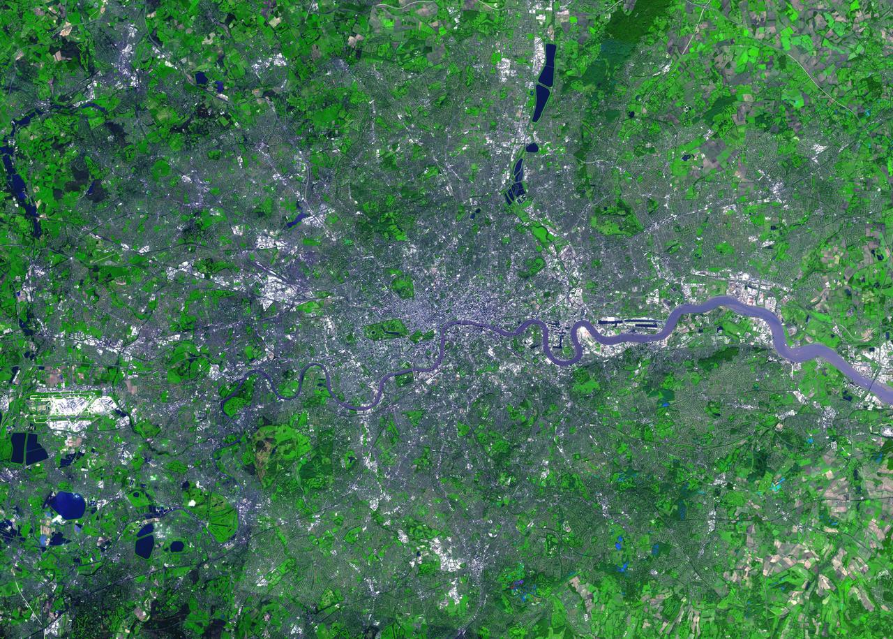
For almost 2,000 years, the River Thames has served as the life force of London, capital of the United Kingdom and one of the world's most famous cities. In AD 43 the Romans established the trading settlement of Londinium at a favorable crossing point on the river. The Romans remained until the 5th century, when the city came under Saxon control. The early 17th century saw enormous growth, but the deadly plague of 1664 and 1665 ravaged the population, and in the following year the Great Fire, which burned for four days, destroyed most of the city. A public transportation system and other city services in the early 19th century eased many of the increasing urban problems of the burgeoning capital of the wealthy British Empire. After coping with the devastating effects of bombing during World War II and the gradual dismantling of the empire, London today thrives as a vital modern metropolis. London is one of 100 cities being studied using ASTER data to map and monitor urban use patterns and growth. This image was acquired on October 12, 2001 by the Advanced Spaceborne Thermal Emission and Reflection Radiometer (ASTER) on NASA's Terra satellite. With its 14 spectral bands from the visible to the thermal infrared wavelength region, and its high spatial resolution of 15 to 90 meters (about 50 to 300 feet), ASTER images Earth to map and monitor the changing surface of our planet. http://photojournal.jpl.nasa.gov/catalog/PIA04301
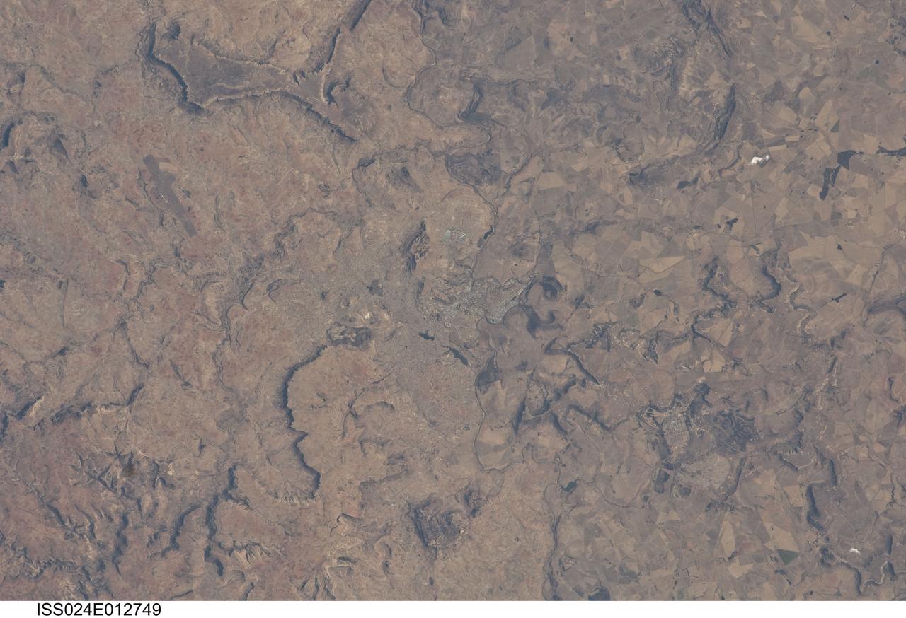
ISS024-E-012749 (28 Aug. 2010) --- Maseru, Lesotho is featured in this image photographed by an Expedition 24 crew member on the International Space Station. Maseru is the capital city of the Kingdom of Lesotho and is located along the northwestern border of the country with the Republic of South Africa. The footprint of the urban area, recognizable by street grids and distinctive blue-roofed industrial buildings at center, is only just visible against the surrounding landscape. The city has expanded eightfold (to 230,000 today) since independence from the United Kingdom of Great Britain and Northern Ireland in 1966, and is now home to one in five inhabitants in the country. The Caledon (or Mohokare) River flows adjacent to Maseru and forms a part of the border between Lesotho and South Africa. Locally, the border extends from approximately top center left to bottom center right, with the cities of Ladybrand and Manyatseng located in South Africa. Moshoeshoe I International Airport (left) provides access to the capital. Major industries in the city include flour mills, and footwear and textile companies. Tourism is also a growing part of the local economy. The Kingdom of Lesotho is completely landlocked by the surrounding Republic of South Africa. Major landforms visible in the image near Maseru include the Qeme and Berea Plateaus to the south and east respectively; these are erosional remnants of widespread horizontally layered sedimentary rocks that formed in the Karoo Basin during the Upper Triassic Period (approximately 200–229 million years ago), according to scientists.
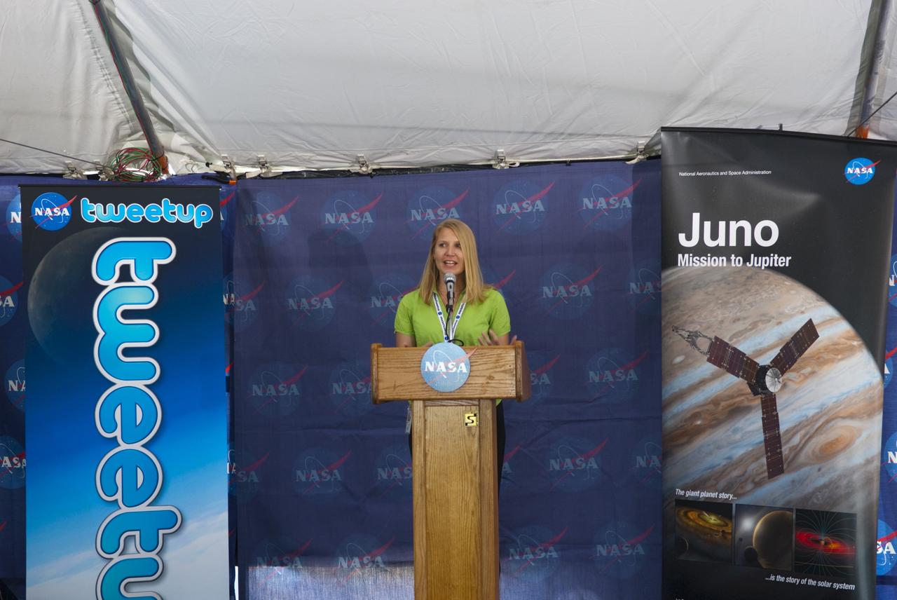
CAPE CANAVERAL, Fla. – At NASA’s Kennedy Space Center in Florida, NASA Tweetup coordinator Stephanie Schierholz welcomes about 150 tweeters to Juno Tweetup activities inside a tent at the Press Site. The tweeters are at the center for two days of prelaunch activities. Juno is NASA’s mission to Jupiter to study the giant planet and improve our understanding of the planet’s formation and evolution. The tweeters will share their experiences with followers through the social networking site Twitter. Attendees represent 28 states, the District of Columbia and five other countries: Canada, Finland, Norway, Spain and the United Kingdom. This is the first time NASA has invited Twitter followers to experience the launch of a planetary spacecraft. The Juno spacecraft is scheduled to launch on an Atlas V rocket from Space Launch Complex 41 at Cape Canaveral Air Force Station in Florida, Aug. 5, at 11:34 a.m. EDT. For more information, visit http://www.nasa.gov/juno. Photo credit: Jim Grossmann