
This STS-48 onboard photo is of the Upper Atmosphere Research Satellite (UARS) in the grasp of the RMS (Remote Manipulator System) during deployment, September 1991. UARS gathers data related to the chemistry, dynamics, and energy of the ozone layer. UARS data is used to study energy input, stratospheric photo chemistry, and upper atmospheric circulation. UARS helps us understand and predict how the nitrogen and chlorine cycles, and the nitrous oxides and halo carbons which maintain them, relate to the ozone balance. It also observes diurnal variations in short-lived stratospheric chemical species important to ozone destruction. Data from UARS enables scientists to study ozone depletion in the upper atmosphere.

This STS-48 onboard photo is of the Upper Atmosphere Research Satellite (UARS) in the grasp of the RMS (Remote Manipulator System) during deployment, September 1991. UARS gathers data related to the chemistry, dynamics, and energy of the ozone layer. UARS data is used to study energy input, stratospheric photo chemistry, and upper atmospheric circulation. UARS helps us understand and predict how the nitrogen and chlorine cycles, and the nitrous oxides and halo carbons which maintain them, relate to the ozone balance. It also observes diurnal variations in short-lived stratospheric chemical species important to ozone destruction. Data from UARS enables scientists to study ozone depletion in the upper atmosphere.
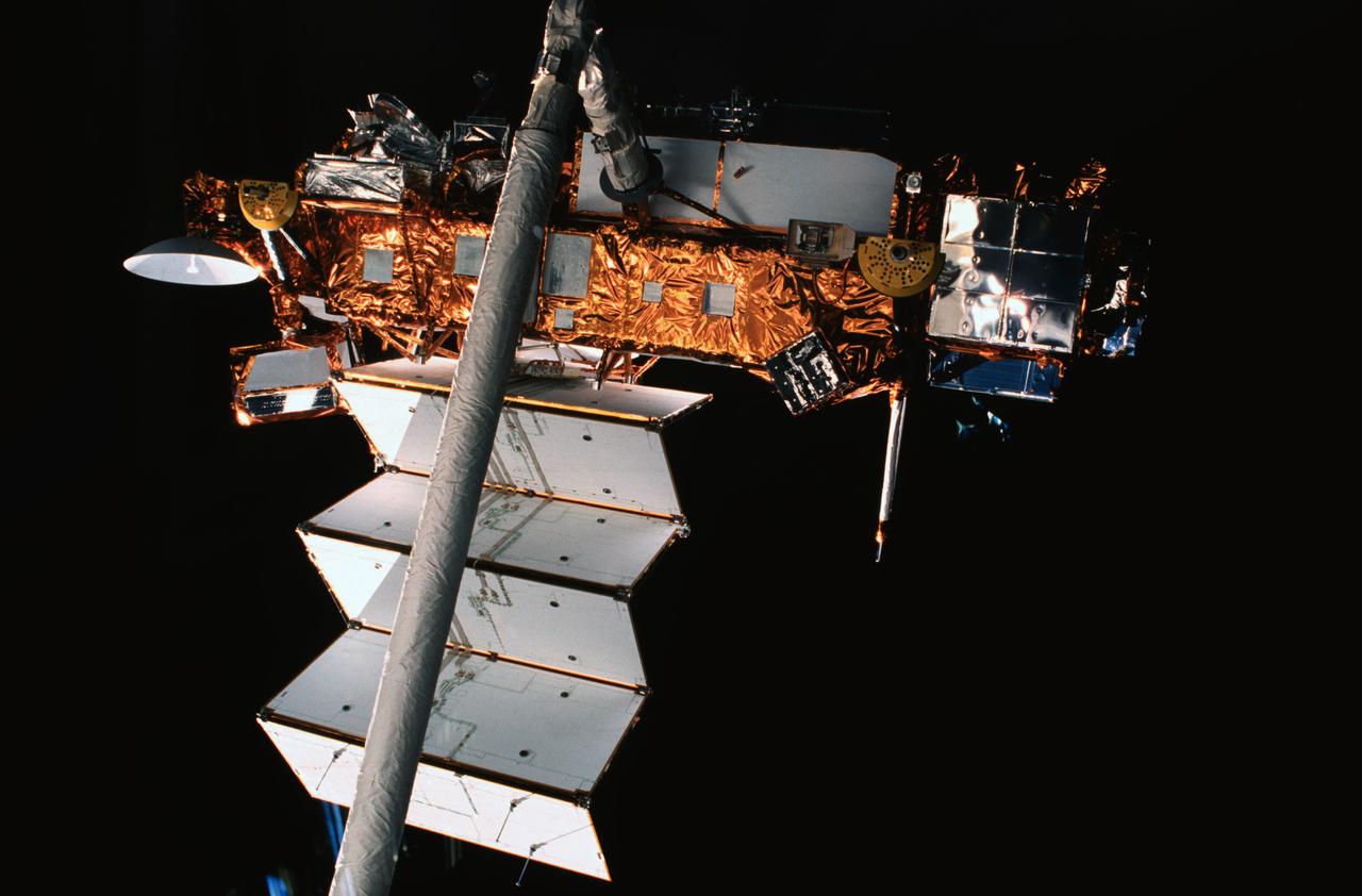
STS048-05-024 (15 Sept 1991) --- The Upper Atmosphere Research Satellite (UARS), in the grasp of the Remote Manipulator System (RMS), was captured on film by a camera aimed through one of the Space Shuttle Discovery's overhead windows. At the time of the photo, deployment of UARS' solar array panel was in progress. A few hours later, the huge satellite was free and on its way to a higher orbit. Data from UARS will enable scientists to study ozone depletion in the stratosphere, or upper atmosphere. The image was photographed with a 35mm camera.
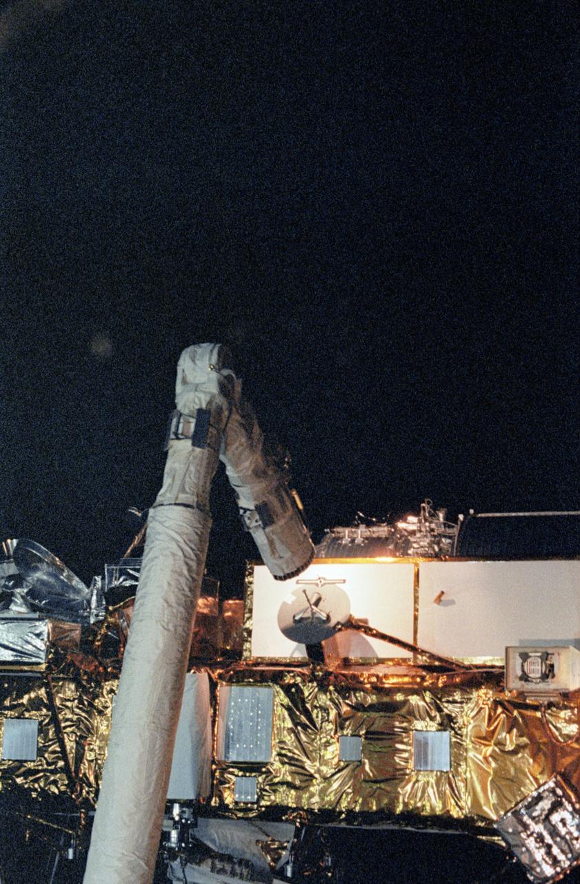
STS048-31-002 (15 Sept 1991) --- The Upper Atmosphere Research Satellite (UARS) separates from the Remote Manipulator System (RMS) and begins to move away from the payload bay of the Earth-orbiting Space Shuttle Discovery. Data from UARS will enable scientists to study ozone depletion in the stratosphere, or upper atmosphere. The image was photographed with a 35mm camera.
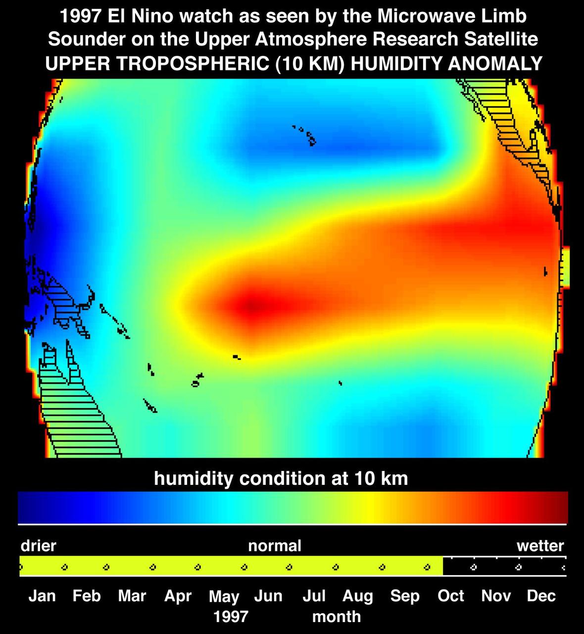
This image shows atmospheric water vapor in Earth upper troposphere, about 10 kilometers 6 miles above the surface, as measured by NASA Microwave Limb Sounder MLS instrument flying aboard the Upper Atmosphere Research Satellite.
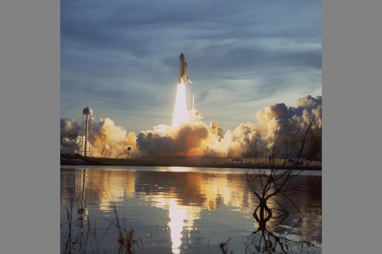
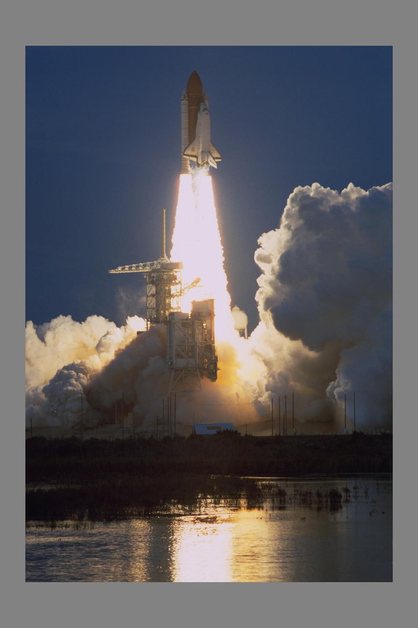
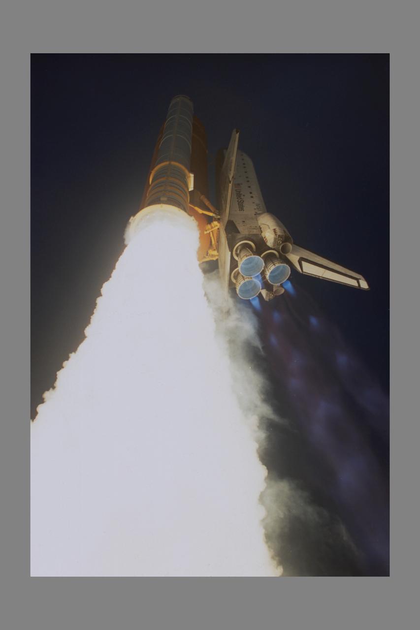
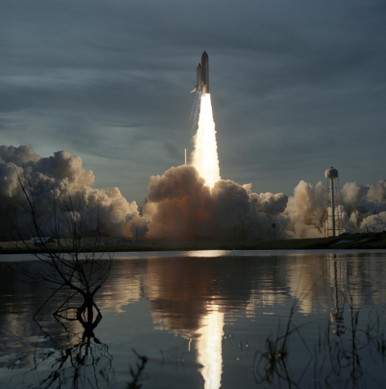
Space Shuttle Discovery STS-48 launch from Kennedy Space Center, FLA to deploy the Upper Atmosphere Research Satellite (UARS)
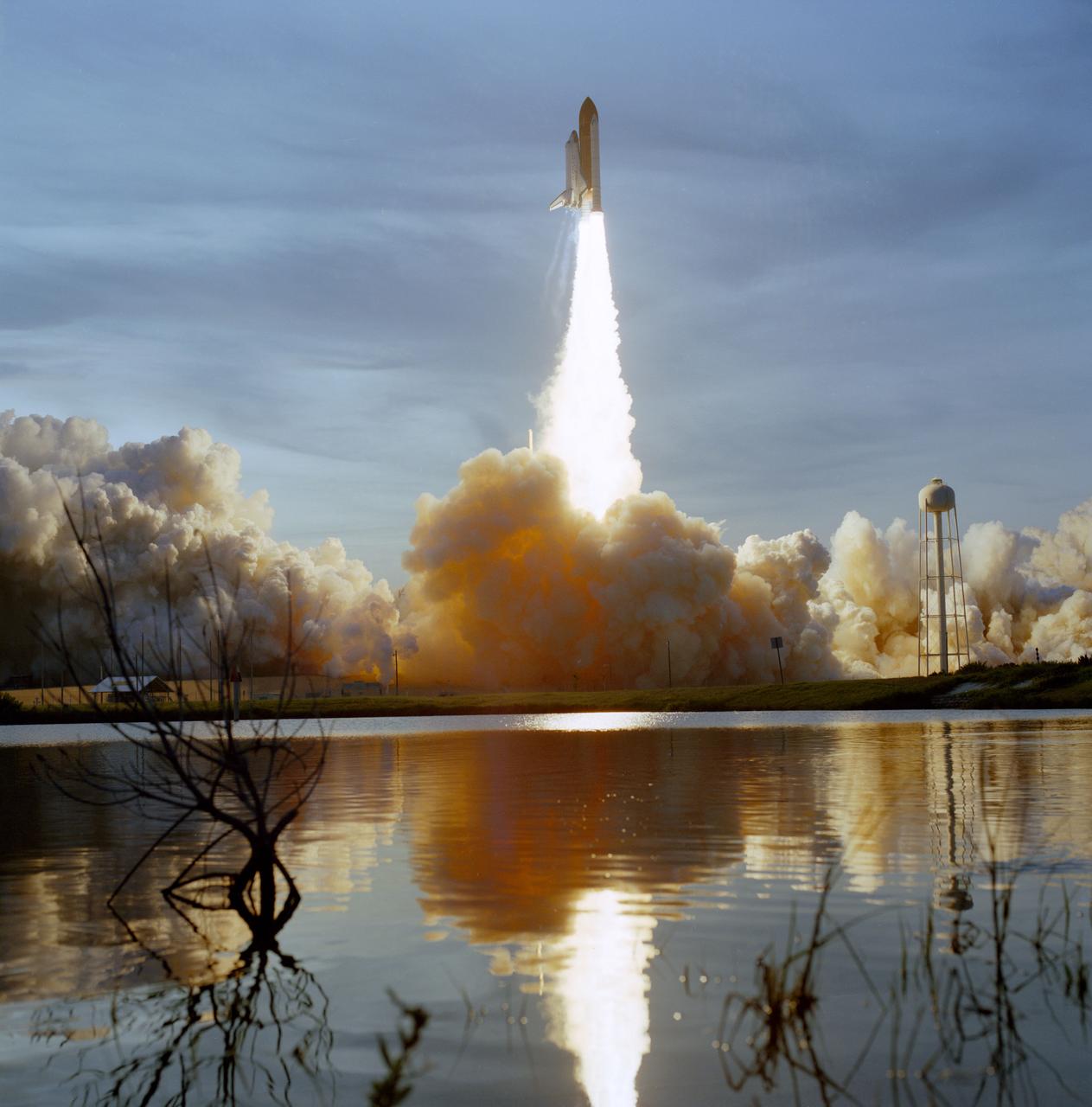
Space Shuttle Discovery STS-48 launch from Kennedy Space Center, FLA to deploy the Upper Atmosphere Research Satellite (UARS)
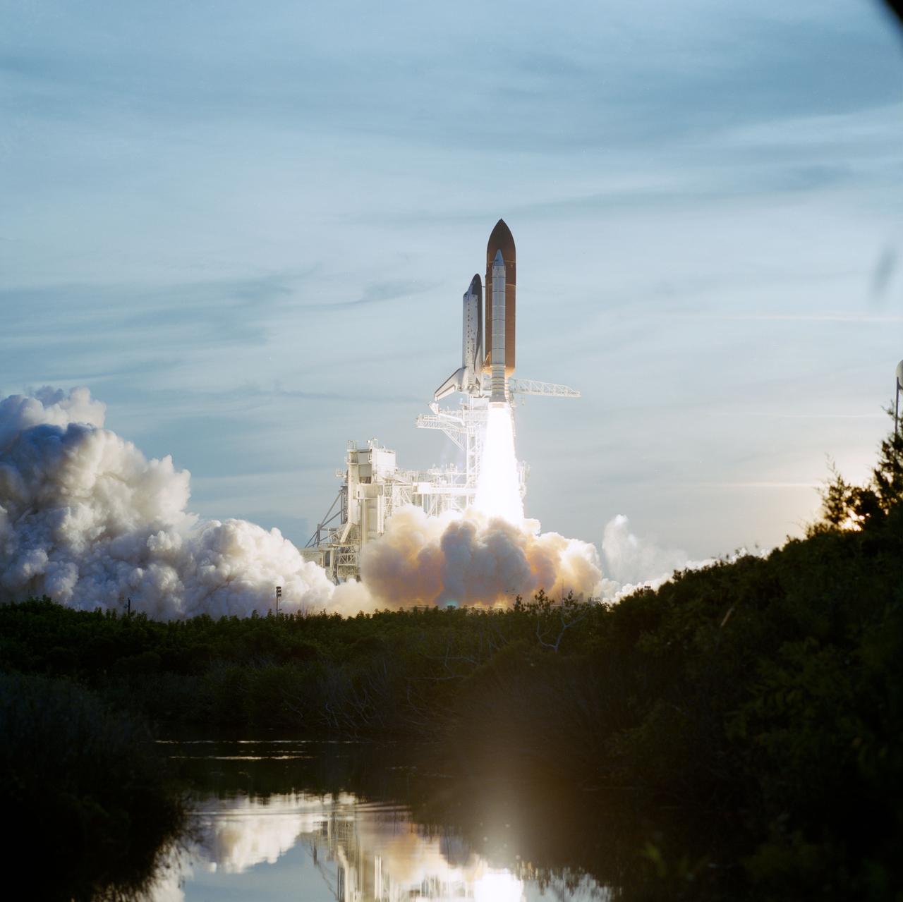
Space Shuttle Discovery STS-48 launch from Kennedy Space Center, FLA to deploy the Upper Atmosphere Research Satellite (UARS)

Space Shuttle Discovery STS-48 launch from Kennedy Space Center, FLA to deploy the Upper Atmosphere Research Satellite (UARS)
Space Shuttle Discovery STS-48 launch from Kennedy Space Center, FLA to deploy the Upper Atmosphere Research Satellite (UARS)
Space Shuttle Discovery STS-48 launch from Kennedy Space Center, FLA to deploy the Upper Atmosphere Research Satellite (UARS)
Space Shuttle Discovery STS-48 launch from Kennedy Space Center, FLA to deploy the Upper Atmosphere Research Satellite (UARS)
Space Shuttle Discovery STS-48 launch from Kennedy Space Center, FLA to deploy the Upper Atmosphere Research Satellite (UARS)

Launch of a three-stage Vanguard (SLV-7) from Cape Canaveral, Florida, September 18, 1959. Designated Vanguard III, the 100-pound satellite was used to study the magnetic field and radiation belt. In September 1955, the Department of Defense recommended and authorized the new program, known as Project Vanguard, to launch Vanguard booster to carry an upper atmosphere research satellite in orbit. The Vanguard vehicles were used in conjunction with later booster vehicle such as the Thor and Atlas, and the technique of gimbaled (movable) engines for directional control was adapted to other rockets.

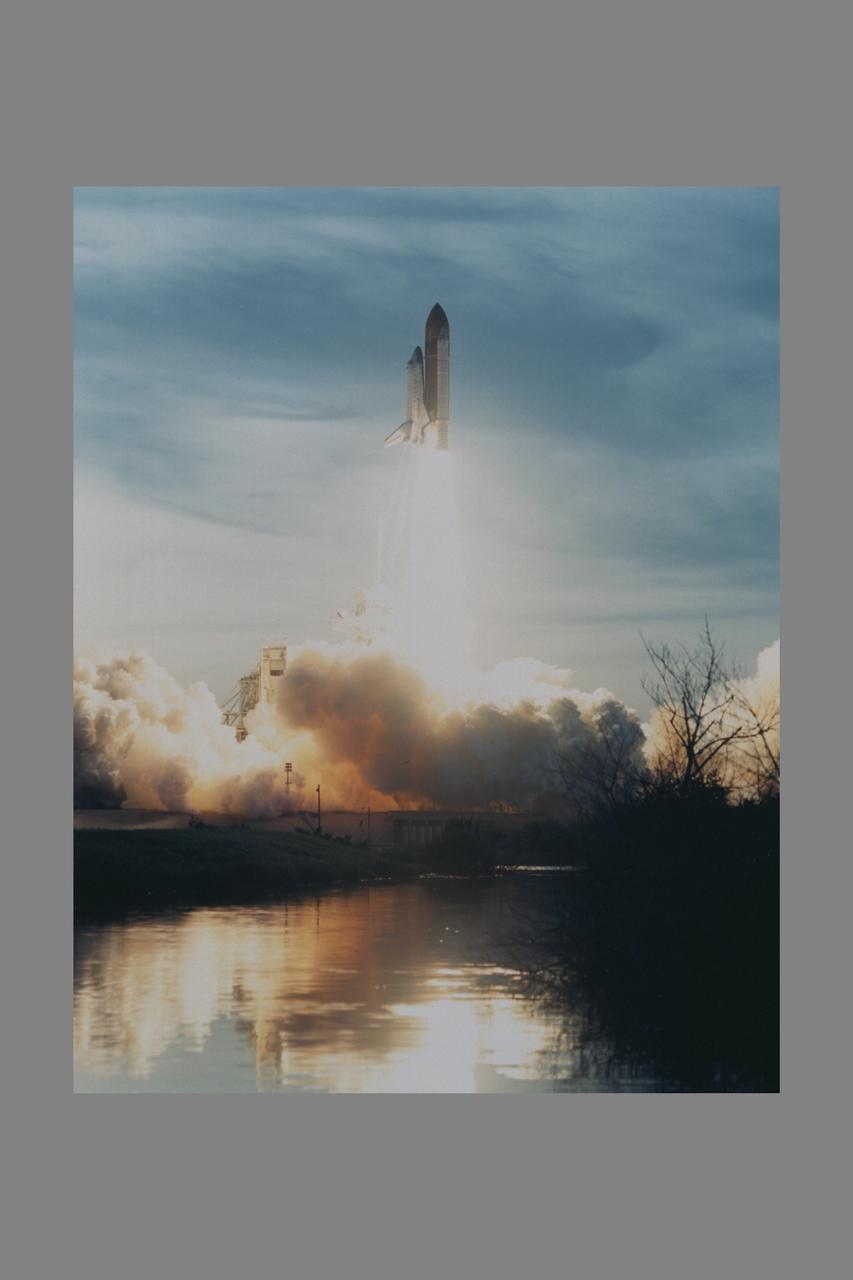
The STS-48 mission launched aboard the Space Shuttle Discovery on September 12, 1991 at 7:11:04 pm. Five astronauts composed the crew including: John O. Creighton, commander; Kenneth S. Reightler, pilot; and Mark N. Brown, Charles D. (Sam) Gemar, and James F. Buchli, all mission specialists. The primary payload of the mission was the Upper Atmosphere Research Satellite (UARS).
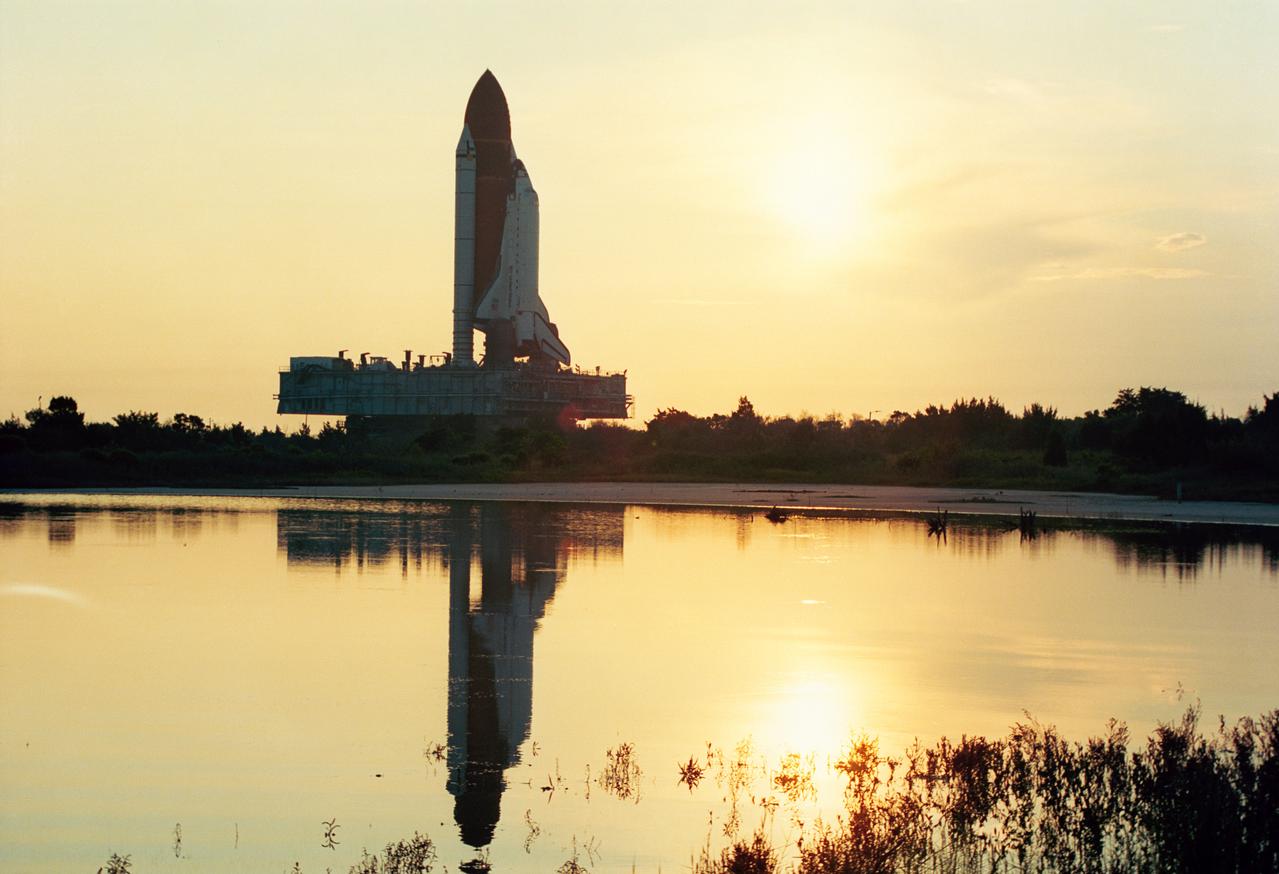
S91-44810 (12 Aug 1991) --- The Space Shuttle Discovery is rolled to launch pad 39A atop the mobile launcher platform and crawler/transporter. Already at the pad and awaiting installation in the orbiter cargo bay is the Upper Atmosphere Research Satellite (UARS), the primary payload which Discovery will carry into space on NASA?s STS-48 mission. A crew of five astronauts will be on board when Discovery lifts off in September. (KSC photo id: KSC-91PC-1474)
The STS-48 mission launched aboard the Space Shuttle Discovery on September 12, 1991 at 7:11:04 pm. Five astronauts composed the crew including: John O. Creighton, commander; Kenneth S. Reightler, pilot; and Mark N. Brown, Charles D. (Sam) Gemar, and James F. Buchli, all mission specialists. The primary payload of the mission was the Upper Atmosphere Research Satellite (UARS).
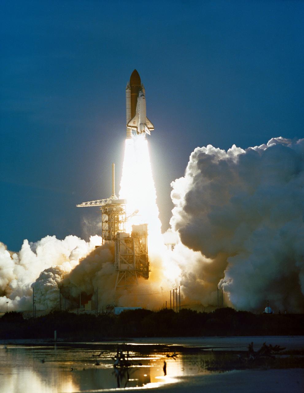
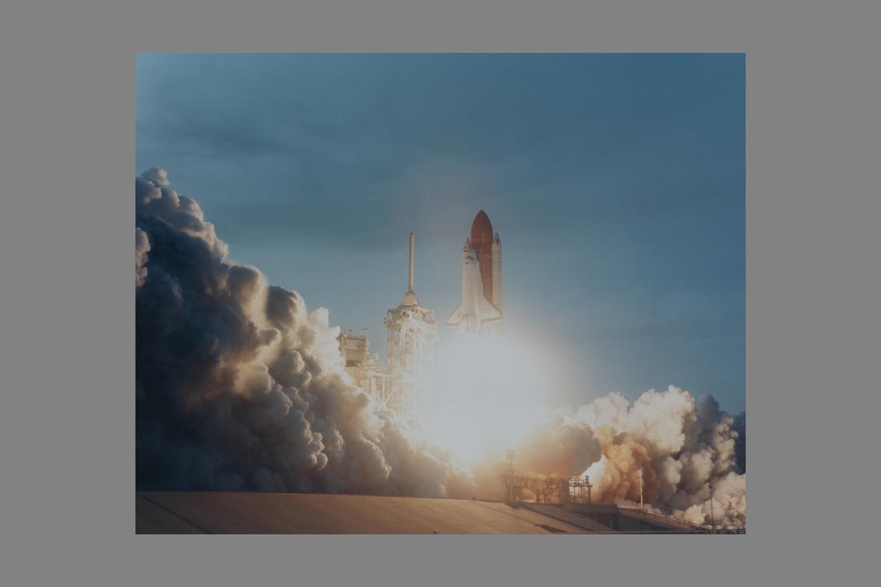
STS048-S-171 (12 Sept 1991) --- With five astronauts and the Upper Atmosphere Research Satellite (UARS) onboard, the Space Shuttle Discovery heads toward a six day mission in Earth orbit. Onboard are astronauts John O. Creighton, Kenneth S. Reightler, Charles D. (Sam) Gemar, James F. Buchli and Mark N. Brown. Liftoff occurred at 7:11:04 p.m. (EDT), September 12, 1991.
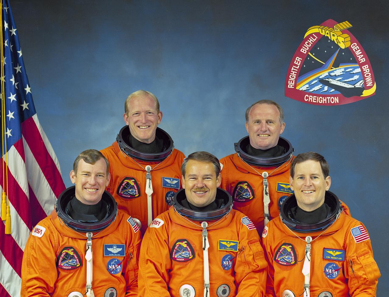
The STS-48 crew portrait includes (front row left to right): Mark N. Brown, mission specialist; John O. Creighton, commander; and Kenneth S. Reightler, pilot. Pictured on the back row (left to right) are mission specialists Charles D. (Sam) Gemar, and James F. Buchli. The crew of five launched aboard the Space Shuttle Discovery on September 12, 1991 at 7:11:04 pm (EDT). The primary payload of the mission was the Upper Atmosphere Research Satellite (UARS).
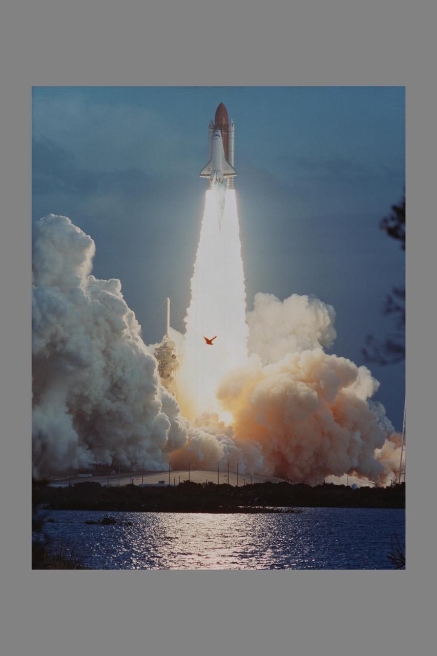
STS048-S-170 (12 Sept 1991) ---- With five astronauts and the Upper Atmosphere Research Satellite (UARS) onboard, the Space Shuttle Discovery heads toward a six day mission in Earth orbit. Onboard are astronauts John O. Creighton, Kenneth S. Reightler, Charles D. (Sam) Gemar, James F. Buchli and Mark N. Brown. Liftoff occurred at 7:11:04 p.m. (EDT), September 12, 1991.
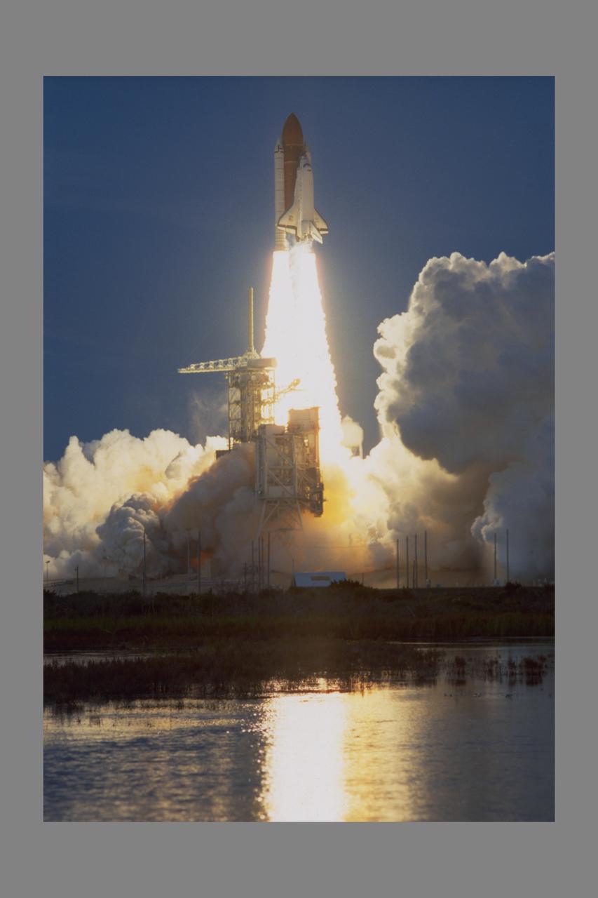
STS048-S-172 (12 Sept 1991) ---- With five astronauts and the Upper Atmosphere Research Satellite (UARS) onboard, the Space Shuttle Discovery heads toward a six day mission in Earth orbit. Onboard are astronauts John O. Creighton, Kenneth S. Reightler, Charles D. (Sam) Gemar, James F. Buchli and Mark N. Brown. Liftoff occurred at 7:11:04 p.m. (EDT), September 12, 1991.
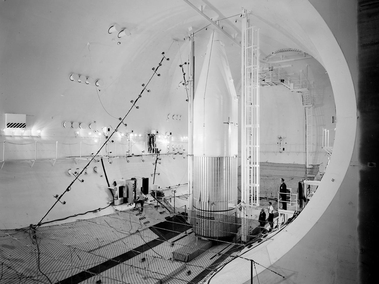
Preparations for a shroud jettison test for the Orbiting Astronomical Observatory-1 (OAO-1) satellite in the Space Power Chambers facility at the National Aeronautics and Space Administration (NASA) Lewis Research Center. The satellite was to be launched on an Atlas-Agena rocket in the spring of 1966. The 3900-pound payload was the heaviest ever attempted by Agena. The satellite was the first of three equipped with powerful telescopes to study ultraviolet data from specific stars and galaxies. In-depth observations were not possible from Earth-bound telescopes because of the filtering and distortion of the atmosphere. The OAO-1 satellite was wider in diameter than the Agena stage, so a new clamshell shroud was created to enclose both the satellite and the Agena. The clamshell shroud consisted of three sections that enclosed both the Agena and OAO-1: a fiberglass nose fairing and aluminum mid and aft fairings. The upper two fairings separated when the Atlas engines stopped, and the aft fairing fell away with the Atlas upon separation from the upper stages The large altitude tank in the Space Power Chambers could simulate altitudes up to 100,000 feet. Three shroud jettison tests were run in July 1965 and the first week of August at a simulated altitude of 20 miles. The April 8, 1966 launch from Cape Canaveral went smoothly, but the OAO-1 satellite failed after only 90 minutes due to a battery failure.
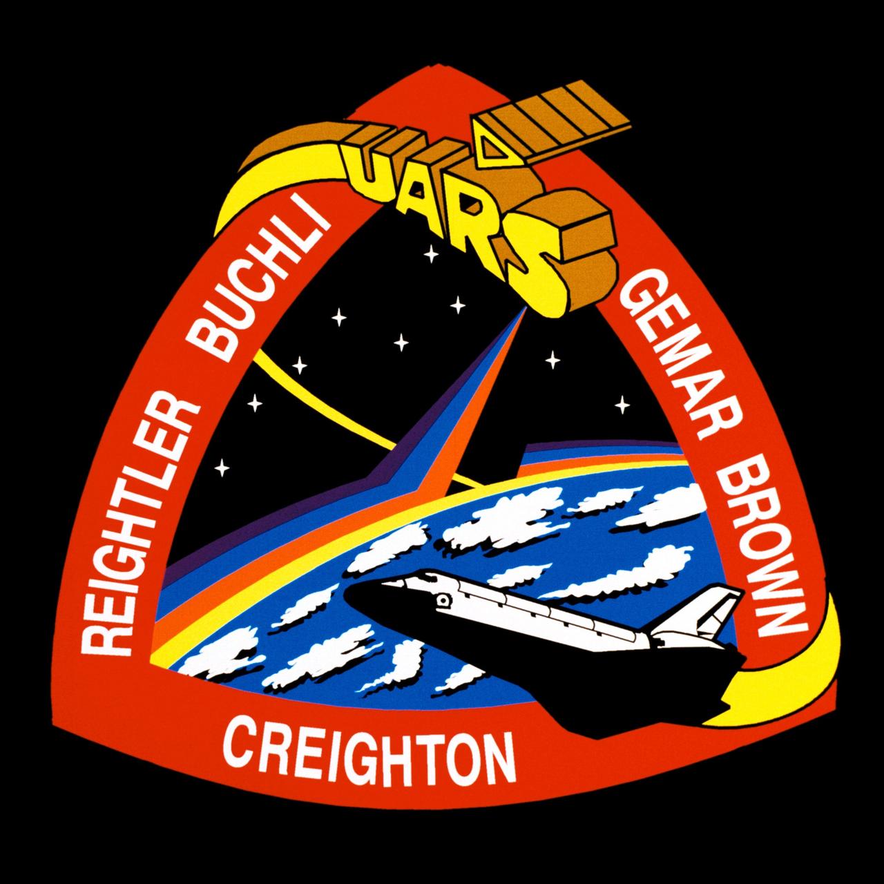
STS048-S-001 (July 1991) --- Designed by the astronaut crew members, the patch represents the space shuttle orbiter Discovery in orbit about Earth after deploying the Upper Atmospheric Research Satellite (UARS) depicted in block letter style. The stars are those in the northern hemisphere as seen in the fall and winter when UARS will begin its study of Earth's atmosphere. The color bands on Earth's horizon, extending up to the UARS spacecraft, depict the study of Earth's atmosphere. The triangular shape represents the relationship among the three atmospheric processes that determine upper atmospheric structure and behavior: chemistry, dynamics and energy. In the words of the crew members, "This continuous process brings life to our planet and makes our planet unique in the solar system." The NASA insignia design for space shuttle flights is reserved for use by the astronauts and for other official use as the NASA Administrator may authorize. Public availability has been approved only in the form of illustrations by the various news media. When and if there is any change in this policy, which is not anticipated, it will be publicly announced. Photo credit: NASA
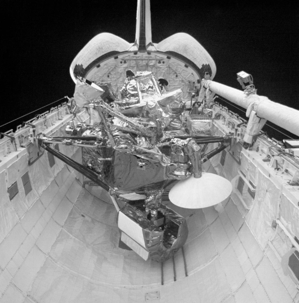
S48-E-013 (15 Sept 1991) --- The Upper Atmosphere Research Satellite (UARS) in the payload bay of the earth- orbiting Discovery. UARS is scheduled for deploy on flight day three of the STS-48 mission. Data from UARS will enable scientists to study ozone depletion in the stratosphere, or upper atmosphere. This image was transmitted by the Electronic Still Camera (ESC), Development Test Objective (DTO) 648. The ESC is making its initial appearance on a Space Shuttle flight. Electronic still photography is a new technology that enables a camera to electronically capture and digitize an image with resolution approaching film quality. The digital image is stored on removable hard disks or small optical disks, and can be converted to a format suitable for downlink transmission or enhanced using image processing software. The Electronic Still Camera (ESC) was developed by the Man- Systems Division at the Johnson Space Center and is the first model in a planned evolutionary development leading to a family of high-resolution digital imaging devices. H. Don Yeates, JSC's Man-Systems Division, is program manager for the ESC. THIS IS A SECOND GENERATION PRINT MADE FROM AN ELECTRONICALLY PRODUCED NEGATIVE.
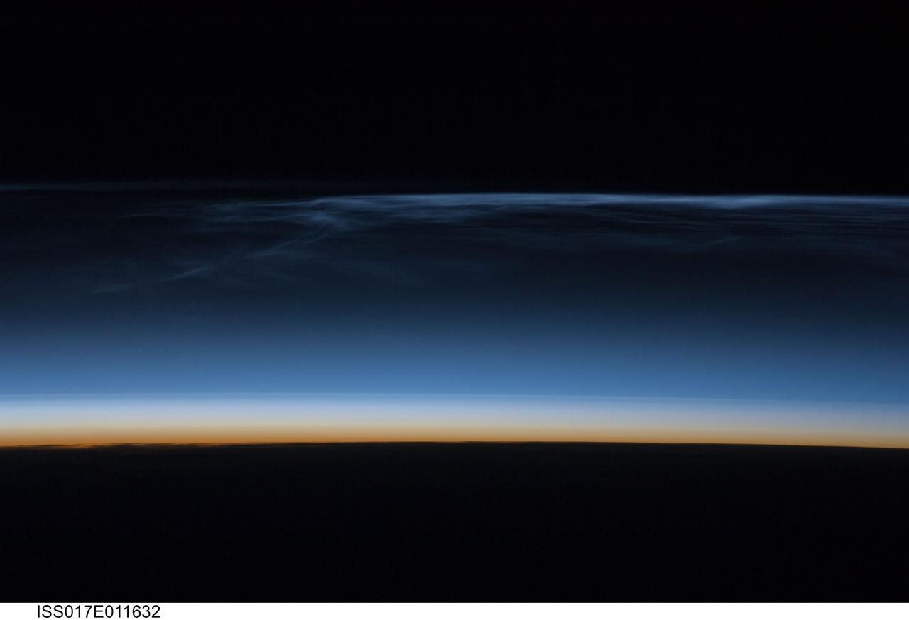
ISS017-E-011632 (22 July 2008) --- Polar Mesospheric Clouds (also known as noctilucent clouds) are transient, upper atmospheric phenomena observed usually in the summer months at high latitudes (greater than 50 degrees) of both the Northern and Southern Hemispheres. They are bright and cloudlike in appearance while in deep twilight. They are illuminated by sunlight when the lower layers of the atmosphere are in the darkness of the Earth's shadow. This image was acquired at an altitude of just over 200 miles in the pre-dawn hours of July 22, 2008 as the International Space Station was passing over western Mongolia in central Asia. The dark horizon of the Earth appears below with some layers of the lower atmosphere already illuminated. The higher, bluish-colored clouds look much like wispy cirrus clouds which can be found in the troposphere as high as 60,000 feet. However noctilucent clouds, as seen here, are observed in the mesosphere at altitudes of 250,000 to 280,000 feet. Astronaut observations of Polar Mesospheric Clouds (PMC) over northern Asia in June and July are not uncommon. The Expedition 17 crew of the International Space Station acquired this image, and more, in support of research for the International Polar Year. Some researchers link increased observations of PMC to changes in global climate; PMC have been the subject of extensive observation and research from space by the Swedish satellite Odin launched in 2001 and more recently by NASA's Aeronomy of Ice in the Mesosphere (AIM) satellite system beginning in 2007.
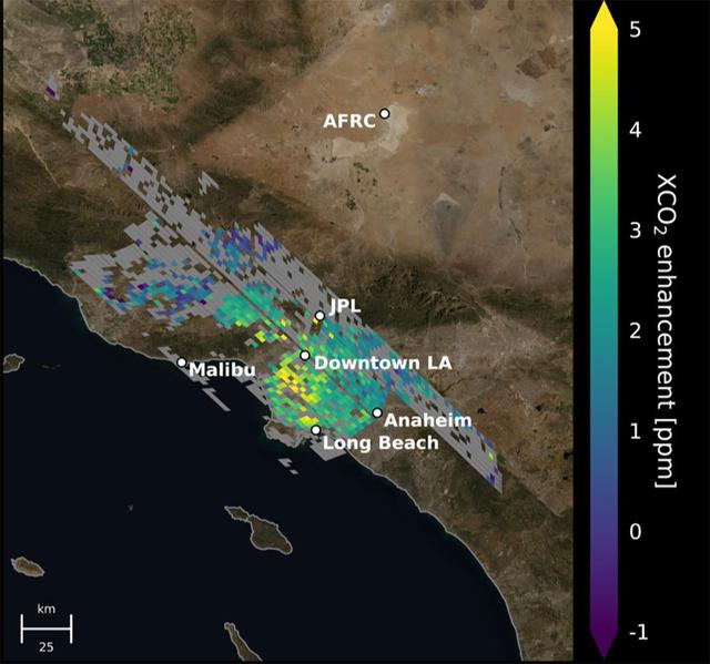
This animation shows the accumulation of five adjoining swaths of data over the Los Angeles metropolitan area that when combined, create a map of carbon dioxide (CO2) concentrations that covers about 50 square miles (80 square kilometers). Researchers have used the data, collected by NASA's Orbiting Carbon Observatory 3 (OCO-3) instrument aboard the space station, to create one of the most accurate maps ever made from space of the human influence on CO2 abundances in the L.A. Basin Each pixel is about 1.3 miles (2.2 kilometers); the color indicates how much higher the concentration of CO2 is in that spot than in clean desert air north of the city (measured at NASA's Armstrong Research Center, upper right). The highest CO2 readings, in yellow on the map, are on the west side of downtown L.A. – a densely populated area with congested freeways and CO2-emitting industries. Yellow indicates atmospheric CO2 elevated by five or more molecules out of every million molecules of air, or five parts per million. That's equivalent to the amount that global atmospheric CO2 is rising globally on average every two years Most of the increasing CO2 in the global atmosphere comes from humans burning fossil fuels for energy, and 70% of that comes from cities. Los Angeles has set goals for cutting its carbon emissions. This type of data can help decisionmakers choose the most effective policies to reach those goals and to measure the effectiveness of new regulations. Data from ground level provides critical local measurements, but satellite data is equally necessary because it covers a wider area and also measure CO2 throughout the entire depth of the atmosphere. Animation available at https://photojournal.jpl.nasa.gov/catalog/PIA24523
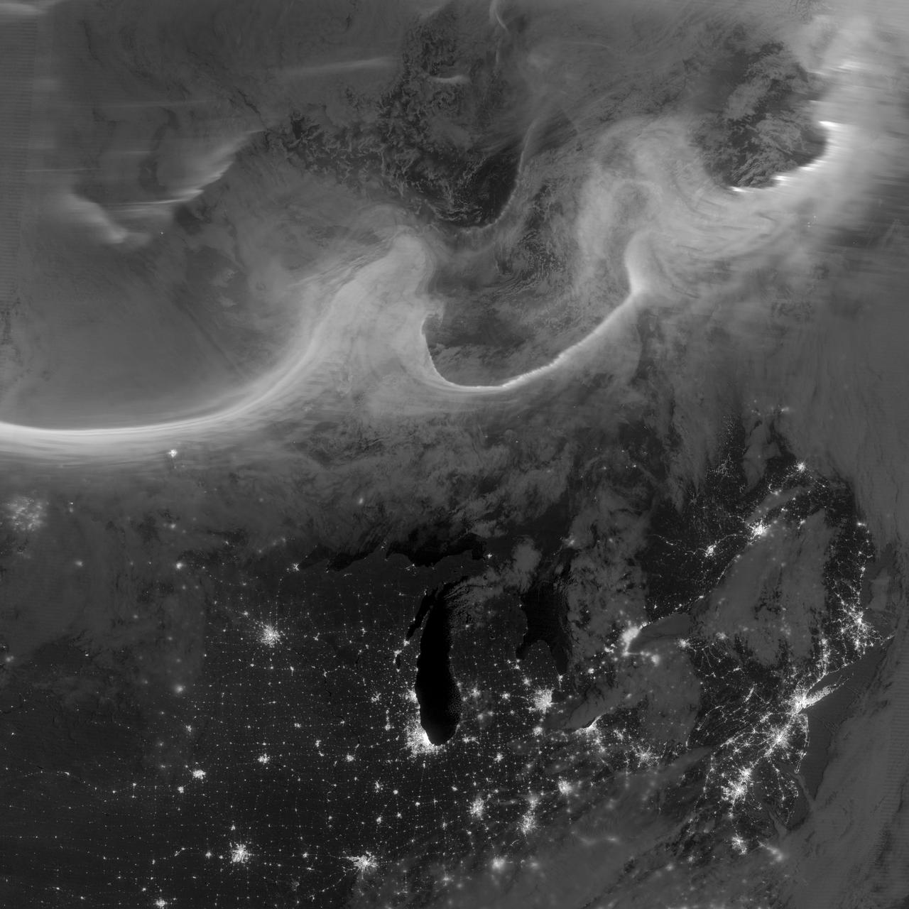
Overnight on October 4-5, 2012, a mass of energetic particles from the atmosphere of the Sun were flung out into space, a phenomenon known as a coronal mass ejection. Three days later, the storm from the Sun stirred up the magnetic field around Earth and produced gorgeous displays of northern lights. NASA satellites track such storms from their origin to their crossing of interplanetary space to their arrival in the atmosphere of Earth. Using the “day-night band” (DNB) of the Visible Infrared Imaging Radiometer Suite (VIIRS), the Suomi National Polar-orbiting Partnership (Suomi NPP) satellite acquired this view of the aurora borealis early on the morning of October 8, 2012. The northern lights stretch across Canada’s Quebec and Ontario provinces in the image, and are part of the auroral oval that expanded to middle latitudes because of a geomagnetic storm. The DNB sensor detects dim light signals such as auroras, airglow, gas flares, city lights, and reflected moonlight. In the case of the image above, the sensor detected the visible light emissions as energetic particles rained down from Earth’s magnetosphere and into the gases of the upper atmosphere. The images are similar to those collected by the Operational Linescan System flown on U.S. Defense Meteorological Satellite Program (DMSP) satellites for the past three decades. “When I first saw images like this as a graduate student, I was immediately struck by the fluid dynamic characteristics of the aurora,” said Tom Moore, a space physicist at NASA's Goddard Space Flight Center. “Viewing the aurora in this way makes it immediately clear that space weather is an interaction of fluids from the Sun with those of the Earth's upper atmosphere. The electrodynamics make for important differences between plasmas and ordinary fluids, but familiar behaviors (for example, waves and vortices) are still very apparent. It makes me wonder at the ability of apparently empty space to behave like a fluid.” Auroras typically occur when solar flares and coronal mass ejections—or even an active solar wind stream—disturb and distort the magnetosphere, the cocoon of space protected by Earth’s magnetic field. The collision of solar particles and pressure into our planet’s magnetosphere accelerates particles trapped in the space around Earth (such as in the radiation belts). Those particles are sent crashing down into Earth’s upper atmosphere—at altitudes of 100 to 400 kilometers (60 to 250 miles)—where they excite oxygen and nitrogen molecules and release photons of light. The results are rays, sheets, and curtains of dancing light in the sky. Auroras are a beautiful expression of the connection between Sun and Earth, but not all of the connections are benign. Auroras are connected to geomagnetic storms, which can distort radio communications (particularly high frequencies), disrupt electric power systems on the ground, and give slight but detectable doses of radiation to flight crews and passengers on high-latitude airplane flights and on spacecraft. The advantage of images like those from VIIRS and DMSP is resolution, according to space physicist Patrick Newell of the Johns Hopkins University Applied Physics Laboratory. “You can see very fine detail in the aurora because of the low altitude and the high resolution of the camera,” he said. Most aurora scientists prefer to use images from missions dedicated to aurora studies (such as Polar, IMAGE, and ground-based imagers), which can offer many more images of a storm (rather than one per orbit) and can allow researchers to calculate the energy moving through the atmosphere. There are no science satellites flying right now that provide such a view, though astronauts regularly photograph and film auroras from the International Space Station. NASA Earth Observatory image by Jesse Allen and Robert Simmon, using VIIRS Day-Night Band data from the Suomi National Polar-orbiting Partnership (Suomi NPP) and the University of Wisconsin's Community Satellite Processing Package. Suomi NPP is the result of a partnership between NASA, the National Oceanic and Atmospheric Administration, and the Department of Defense. Caption by Mike Carlowicz. Instrument: Suomi NPP - VIIRS Credit: <b><a href="http://www.earthobservatory.nasa.gov/" rel="nofollow"> NASA Earth Observatory</a></b> <b><a href="http://www.nasa.gov/audience/formedia/features/MP_Photo_Guidelines.html" rel="nofollow">NASA image use policy.</a></b> <b><a href="http://www.nasa.gov/centers/goddard/home/index.html" rel="nofollow">NASA Goddard Space Flight Center</a></b> enables NASA’s mission through four scientific endeavors: Earth Science, Heliophysics, Solar System Exploration, and Astrophysics. Goddard plays a leading role in NASA’s accomplishments by contributing compelling scientific knowledge to advance the Agency’s mission. <b>Follow us on <a href="http://twitter.com/NASA_GoddardPix" rel="nofollow">Twitter</a></b> <b>Like us on <a href="http://www.facebook.com/pages/Greenbelt-MD/NASA-Goddard/395013845897?ref=tsd" rel="nofollow">Facebook</a></b> <b>Find us on <a href="http://instagrid.me/nasagoddard/?vm=grid" rel="nofollow">Instagram</a></b>

In January 2013, a new Earth-observing instrument was installed on the International Space Station (ISS). ISERV Pathfinder consists of a commercial camera, a telescope, and a pointing system, all positioned to look through the Earth-facing window of ISS’s Destiny module. ISERV Pathfinder is intended as an engineering exercise, with the long-term goal of developing a system for providing imagery to developing nations as they monitor natural disasters and environmental concerns. The image above is the “first light” from the new ISERV camera system, taken at 1:44 p.m. local time on February 16, 2013. It shows the Rio San Pablo as it empties into the Golfo de Montijo in Veraguas, Panama. It is an ecological transition zone, changing from agriculture and pastures to mangrove forests, swamps, and estuary systems. The area has been designated a protected area by the National Environmental Authority (ANAM) of Panama and is listed as a “wetland of international importance” under the Ramsar Convention. (Note that the image is rotated so that north is to the upper right.) “ISERV’s full potential is yet to be seen, but we hope it will really make a difference in people’s lives,” said principal investigator Burgess Howell of NASA’s Marshall Space Flight Center. “For example, if an earthen dam gives way in Bhutan, we want to be able to show officials where the bridge is out or where a road is washed out or a power substation is inundated. This kind of information is critical to focus and speed rescue efforts.” The instrument will be controlled from NASA Marshall in Huntsville, Alabama, in collaboration with researchers at hubs in Central America, East Africa, and the Hindu Kush–Himalaya region. They will rely on positioning software to know where the space station is at each moment and to calculate the next chance to view a particular area on the ground. If there's a good viewing opportunity, the SERVIR team will instruct the camera to take high-resolution photographs at 3 to 7 frames per second, totaling as many as 100 images per pass. With a resolution down to 3.2 meters (10 feet), it will be possible to spot fairly small details and objects. The current mission will test the limitations of Pathfinder and identify measures for improvements in a more permanent system. For instance, the engineering team is working to determine how the geometry of the ISS window affects the imagery; how much sunlight is needed to capture clear images; and how the atmosphere affects that clarity. This characterization phase will last several weeks to a few months. Eventually, ISERV should be made available to the natural hazards community and to basic research scientists. ISERV is short for ISS SERVIR Environmental Research and Visualization system. Together with the U.S. Agency for International Development, NASA runs the SERVIR program to provide satellite data, maps, and other tools to environmental decisionmakers in developing countries. (Servir is a Spanish word meaning “to serve.”) Learn more about the SERVIR program by clicking here: <a href="https://servirglobal.net/Global.aspx" rel="nofollow">servirglobal.net/Global.aspx</a> NASA image by Burgess Howell, SERVIR Global program. Caption by Dauna Coulter, NASA Marshall Space Flight Center, and Mike Carlowicz, NASA Earth Observatory. Instrument: ISS - ISERV Pathfinder Credit: <b><a href="http://www.earthobservatory.nasa.gov/" rel="nofollow"> NASA Earth Observatory</a></b> - <a href="http://1.usa.gov/12Aqmg9" rel="nofollow">1.usa.gov/12Aqmg9</a> <b><a href="http://www.nasa.gov/audience/formedia/features/MP_Photo_Guidelines.html" rel="nofollow">NASA image use policy.</a></b> <b><a href="http://www.nasa.gov/centers/goddard/home/index.html" rel="nofollow">NASA Goddard Space Flight Center</a></b> enables NASA’s mission through four scientific endeavors: Earth Science, Heliophysics, Solar System Exploration, and Astrophysics. Goddard plays a leading role in NASA’s accomplishments by contributing compelling scientific knowledge to advance the Agency’s mission. <b>Follow us on <a href="http://twitter.com/NASA_GoddardPix" rel="nofollow">Twitter</a></b> <b>Like us on <a href="http://www.facebook.com/pages/Greenbelt-MD/NASA-Goddard/395013845897?ref=tsd" rel="nofollow">Facebook</a></b> <b>Find us on <a href="http://instagram.com/nasagoddard?vm=grid" rel="nofollow">Instagram</a></b>