This image of Urvara Crater was obtained by NASA's Dawn spacecraft on May 20, 2018 from an altitude of about 920 miles (1480 kilometers). The center of Urvara Crater is located at about 46 degrees south in latitude and 249 degrees east in longitude. https://photojournal.jpl.nasa.gov/catalog/PIA22472
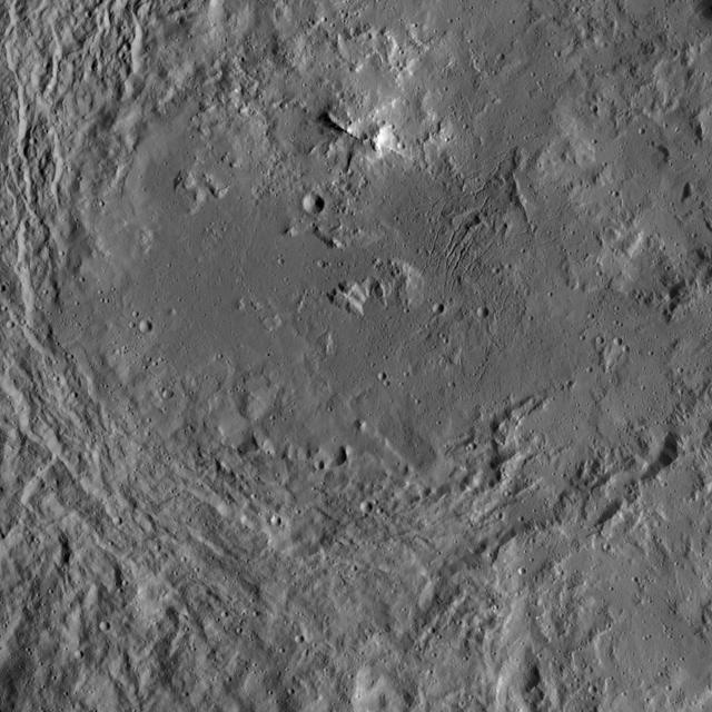
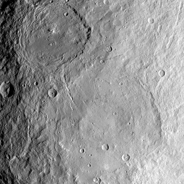
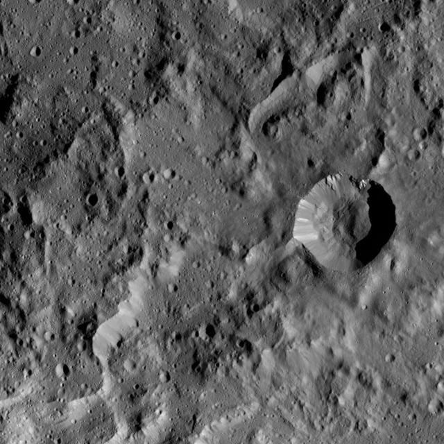
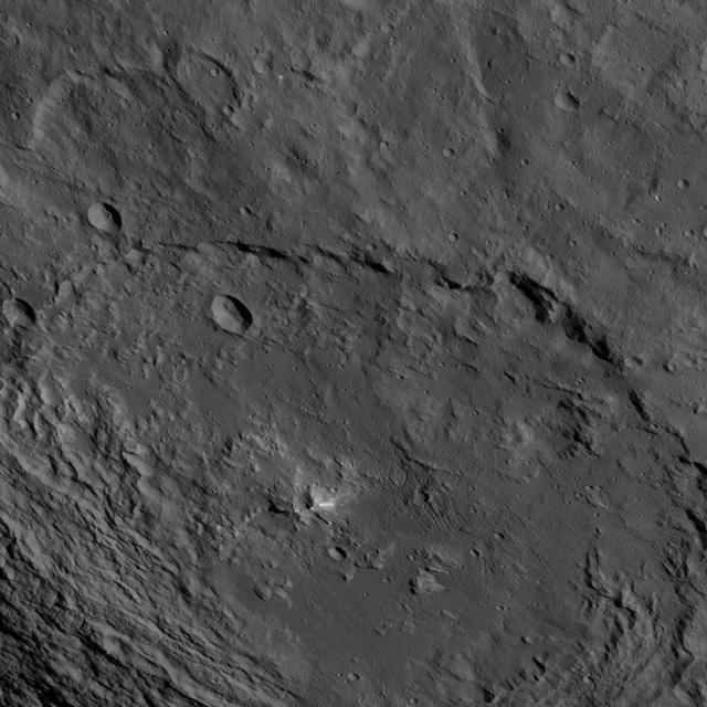
The interior of Urvara Crater (101 miles, 163 kilometers wide) is featured in this image from NASA's Dawn spacecraft. Terrain seen here is adjacent to the area seen in PIA20941. Dawn took this image on June 2, 2016, from its low-altitude mapping orbit, at a distance of about 240 miles (385 kilometers) above the surface. The image resolution is 120 feet (35 meters) per pixel. http://photojournal.jpl.nasa.gov/catalog/PIA20942
The interior of Urvara Crater (101 miles, 163 kilometers wide) is featured in this image from NASA's Dawn spacecraft. Dawn took this image on June 2, 2016, from its low-altitude mapping orbit, at a distance of about 240 miles (385 kilometers) above the surface. The image resolution is 120 feet (35 meters) per pixel. http://photojournal.jpl.nasa.gov/catalog/PIA20943
NASA's Dawn spacecraft captures part of the northern rim of Urvara Crater (101 miles, 163 kilometers wide) in this image. Dawn obtained this view on June 2, 2016, from its low-altitude mapping orbit, at a distance of about 240 miles (385 kilometers) above the surface. The image resolution is 120 feet (35 meters) per pixel. http://photojournal.jpl.nasa.gov/catalog/PIA20941
This image from NASA's Dawn spacecraft shows the large craters Urvara (top) and Yalode (bottom) on dwarf planet Ceres. These features are so big that they must be observed from high altitudes in order to fit in the frame of a single image. Urvara is (101 miles (163 kilometers) in diameter, while Yalode is 162 miles (260 kilometers) in diameter. The two giant craters were formed at different times. Yalode is almost 1 billion years older than Urvara, which is about 120 million to 140 million years old. Yalode's relatively smooth floor indicates Ceres' crust material became close to -- or even reached -- the melting temperature of ice as a consequence of the heat generated by the impact. On the other hand, the smaller Urvara has rougher terrain. This suggests Urvara had either a lower temperature increase from the impact, or a colder crust temperature at the time of the crater's formation, or a combination of the two. Indeed, Ceres' interior was warmer in the past, and has been slowly cooling as its supply of radioactive isotopes, whose decay represents Ceres' main heat source, has been decreasing over time. This picture also reveals geological details such, as the feature Nar Sulcus inside Yalode and a central peak in Urvara. Urvara is named after the Indian and Iranian deity of plants and fields. Yalode is named for the Dahomey goddess, worshipped by women at the harvest rites. This image was obtained by NASA's Dawn spacecraft on June 9, 2015. The spacecraft was then in its survey orbit (2,700 miles, 4,400 kilometers above the surface), when the footprint of Dawn's framing camera on Ceres' surface was about 260 miles (420 kilometers) across on Ceres' surface. The resolution is 1,400 feet (410 meters) per pixel. The central coordinates of the picture are 43 degrees south latitude, 278 degrees east in longitude. https://photojournal.jpl.nasa.gov/catalog/PIA21917
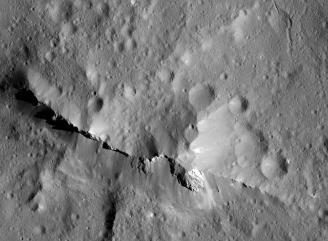
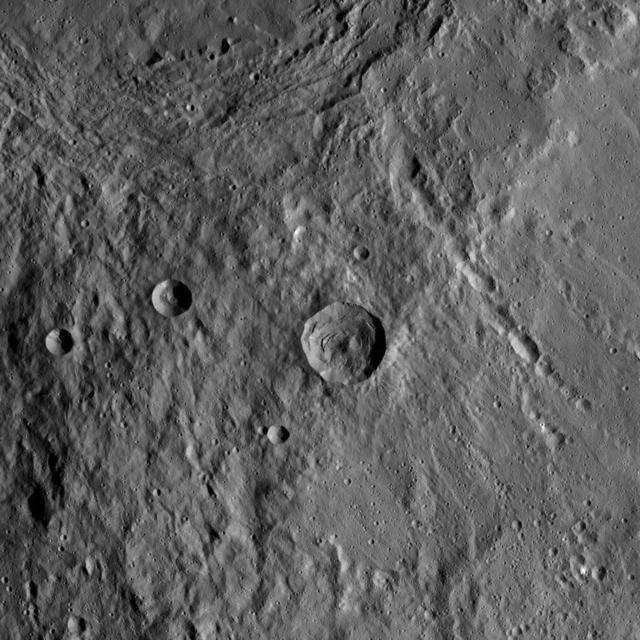
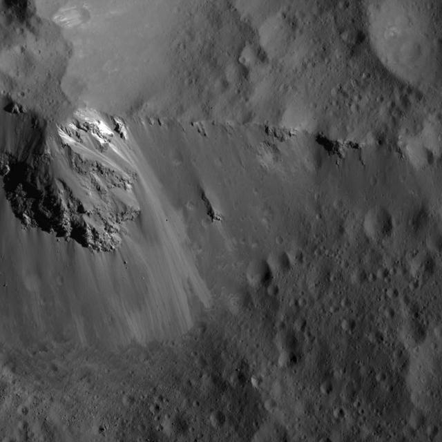
NASA's Dawn spacecraft captured this close-up view of the central peak of the 99-mile-wide (160-kilometer-wide) Urvara impact crater on Ceres. The 6,500-foot (1980-meter) central ridge rises above the nearby terrain. The image was captured by Dawn's Framing Camera, during XM2, on June 21, 2018 from an altitude of about 83 miles (134 kilometers). NASA announced the conclusion of Dawn's mission operations was Oct. 31, 2018, when the spacecraft depleted its hydrazine. https://photojournal.jpl.nasa.gov/catalog/PIA22771
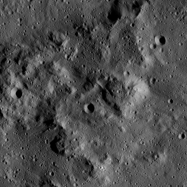
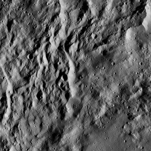
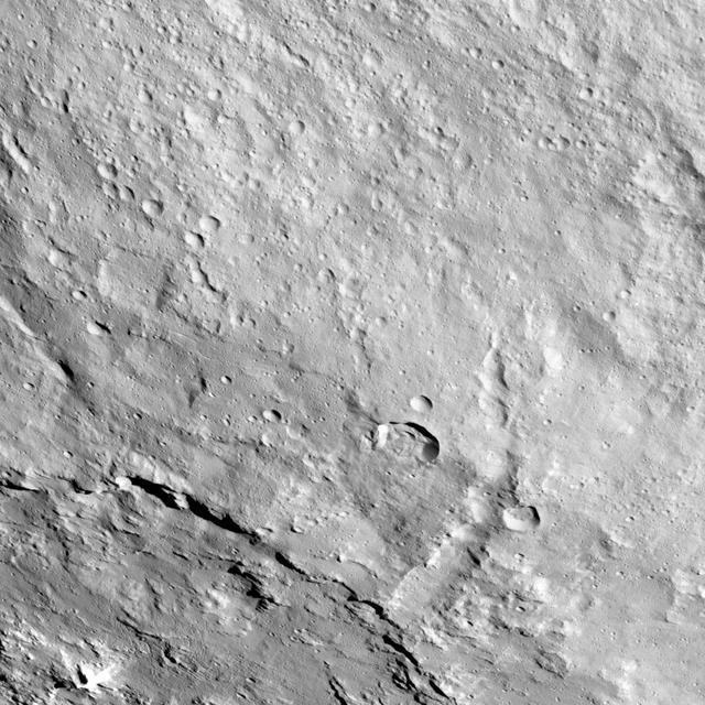
This image, taken by NASA Dawn spacecraft, shows a knobby surface on Ceres. The region is adjacent to the giant impact crater Urvara.
NASA's Dawn spacecraft took this image that shows a mountain ridge, near lower left, that lies in the center of Urvara crater on Ceres. Urvara is an Indian and Iranian deity of plants and fields. The crater's diameter is 101 miles (163 kilometers). This view was acquired on August 19, 2015, from a distance of 915 miles (1,470 kilometers). The resolution of the image is 450 feet (140 meters) per pixel. http://photojournal.jpl.nasa.gov/catalog/PIA19632

Part of the southern hemisphere on dwarf planet Ceres is seen in this image taken by NASA Dawn spacecraft. This left side of the image shows the eastern rim of Urvara crater.
This image was obtained by NASA's Dawn spacecraft on July 5, 2018 from an altitude of about 75 miles (121 kilometers). The center of this picture is located at about 43.8 degrees south latitude and 247.6 degrees east longitude. https://photojournal.jpl.nasa.gov/catalog/PIA22636
This image from NASA Dawn spacecraft shows a scene located at mid-latitudes in the southern hemisphere of Ceres. The view features a portion of a crater between the large impact features Urvara and Yalode.
The terraced rim of the large crater named Urvara can be seen at the upper left in this view from Ceres. Urvara is 106 miles (170 kilometers) wide. This image shows terrain in the southern hemisphere of the dwarf planet. NASA's Dawn spacefcraft took this image on Oct. 14, 2015, from an altitude of 915 miles (1,470 kilometers). It has a resolution of 450 feet (140 meters) per pixel. http://photojournal.jpl.nasa.gov/catalog/PIA20128
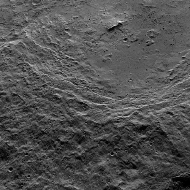
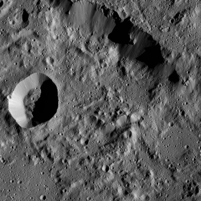
This view shows the southwestern rim of 106-mile-wide (170-kilometer-wide) Urvara crater on Ceres. The crater's terraced rim leads down to a generally smooth floor. In the crater's center is a prominent double peak, surrounded by rough terrain to the west and some linear, parallel grooves to the east. NASA's Dawn spacecraft obtained the image on Oct. 15, 2015, from an altitude of 915 miles (1,470 kilometers). It has a resolution of 450 feet (140 meters) per pixel. North on Ceres is up. http://photojournal.jpl.nasa.gov/catalog/PIA20134
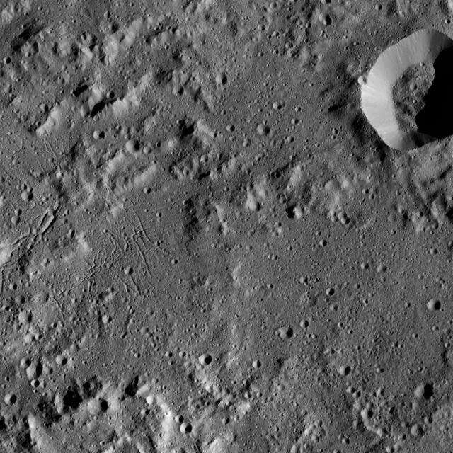
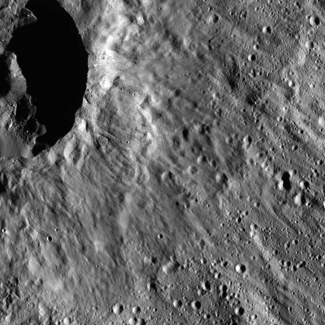
This image taken by NASA's Dawn spacecraft shows a region located next to the northwestern rim of Urvara Crater on Ceres. This terrain displays a rugged texture also found within Urvara. Multiple Dawn observations, in particular neutron spectroscopy (which measures the hydrogen content in the regolith) and flow features, have shown that water ice is present near the surface above 40 degrees north latitude, where these features are found. Therefore, the rugged texture may result from the high strength exhibited by ice at the temperatures found at mid- and high latitudes on Ceres. The prominent crater (5.0 miles, 8.8 kilometers in diameter) at right in this picture is called Tawals. Its sharp rim suggests it was created by a relatively recent impact into a relatively strong material. A different view of this crater can be found in PIA20941. Tawals Crater is named after the Polish god of the fields and the tilling. Dawn took this image during its extended mission on August 25, 2016, from its low-altitude mapping orbit, or LAMO, at a distance of about 240 miles (385 kilometers) above the surface. The center coordinates of this image are 40 degrees south latitude, 237 degrees east longitude. https://photojournal.jpl.nasa.gov/catalog/PIA21750
This image of the region between Urvara Crater's eastern rim and Yalode Crater's western rim was obtained by NASA's Dawn spacecraft on May 20, 2018 from an altitude of about 1070 miles (1720 kilometers). The center of this picture is located at about 54 degrees south in latitude and 272 degrees east in longitude. https://photojournal.jpl.nasa.gov/catalog/PIA22516
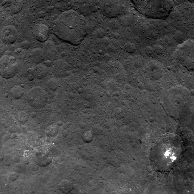
This image was obtained by NASA's Dawn spacecraft on July 29, 2018 from an altitude of about 28 miles (45 kilometers). The center of this picture is located at about 36.5 degrees south latitude and 247.5 degrees east longitude. https://photojournal.jpl.nasa.gov/catalog/PIA22674
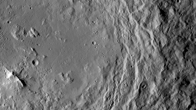
This view from NASA's Dawn spacecraft captures gently curving canyons amid cratered plains on Ceres. The image is centered at approximately 31 degrees south latitude, 259 degrees east longitude, just north of the large crater Urvara. Dawn captured the scene on Dec. 19, 2015 from its low-altitude mapping orbit (LAMO), at an approximate altitude of 240 miles (385 kilometers) above Ceres. The image resolution is 120 feet (35 meters) per pixel. http://photojournal.jpl.nasa.gov/catalog/PIA20299
This image, taken by NASA's Dawn spacecraft, shows a portion of the southern hemisphere of dwarf planet Ceres from an altitude of 915 miles (1,470 kilometers). The image was taken on Sept. 28, 2015, and has a resolution of 450 feet (140 meters) per pixel. Urvara crater, named for the Indian and Iranian deity of plants and fields, is featured. Its diameter is 101 miles (163 kilometers). http://photojournal.jpl.nasa.gov/catalog/PIA19992

This image was obtained by NASA's Dawn spacecraft on July 16, 2018 from an altitude of about 35 miles (56 kilometers). The center of this picture is located at about 36.5 degrees south latitude and 247.3 degrees east longitude. https://photojournal.jpl.nasa.gov/catalog/PIA22756
This image was obtained by NASA's Dawn spacecraft on July 24, 2018 from an altitude of about 36 miles (58 kilometers). The center of this picture is located at about 46.1 degrees south latitude and 248.5 degrees east longitude. https://photojournal.jpl.nasa.gov/catalog/PIA22759
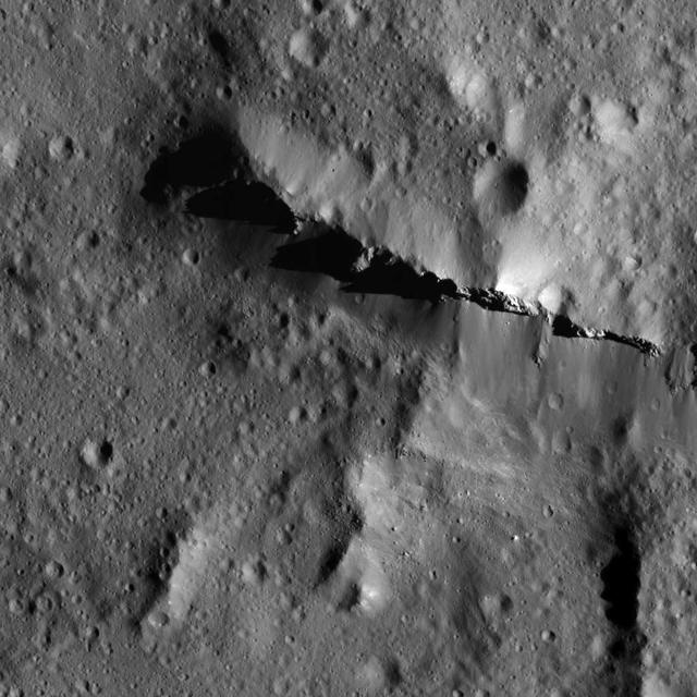
This image from NASA's Dawn spacecraft shows the northeastern rim of Urvara Crater on Ceres at lower left. To the right of the crater, the long, narrow feature that appears to jut out toward the north is called Pongal Catena, which is about 60 miles (96 km) long. Catenae are large grooves or troughs that can have various origins. They refer to chains of closely connected craters formed by a series of impacts, as found on Jupiter's moon Ganymede. They can also represent large faults created by internal forces, for example in this example found on Mars. The mechanism that formed Pongal Catena is not understood yet, but it likely formed as a consequence of the stresses generated by the large impacts that resulted in the formation of the Urvara and Yalode craters. Pongal catena is one of several types of fractures found in this region that reflect a complex history. A feature called Nar Sulcus is another example. Studying the geometry of these features and their relationships can help shed light on the nature of Ceres' subsurface. This image was obtained on September 28, 2015, from an altitude of about 915 miles (1,470 kilometers). Pongal Catena is centered at 37.4 degrees south latitude, 267.7 degrees east longitude. This feature gets its name from the Tamil (Sri Lanka and southern India) harvest festival observed in mid-January. It is a time for giving thanks to nature, and we thank Ceres for all the wonders it has offered us so far. https://photojournal.jpl.nasa.gov/catalog/PIA21408
NASA's Dawn spacecraft took this picture on its way to a new orbit, at an altitude of about 30,000 miles (48,300 kilometers), as part of a series of images intended to help the navigation of the spacecraft relative to Ceres. The image was taken on March 28, 2017. Several familiar features can be identified: At the top, we see Occator Crater and its faculae (bright deposits identified as a mixture of sodium carbonate and other salts). Below center is the crater Urvara, and to the right of it, the larger crater Yalode (the third and second largest craters on Ceres, respectively). Large-scale faults called Samhain Catenae stretch from the Occator region toward the Yalode-Urvara region. The spacecraft will settle into a new orbit that will allow it to observe Ceres in opposition at the end of April 2017, when Dawn is directly between the sun and the Occator bright spots, at an altitude of about 12,400 miles (20,000 kilometers). The Dawn Journal has more details about the science expected from these observations. https://photojournal.jpl.nasa.gov/catalog/PIA21401
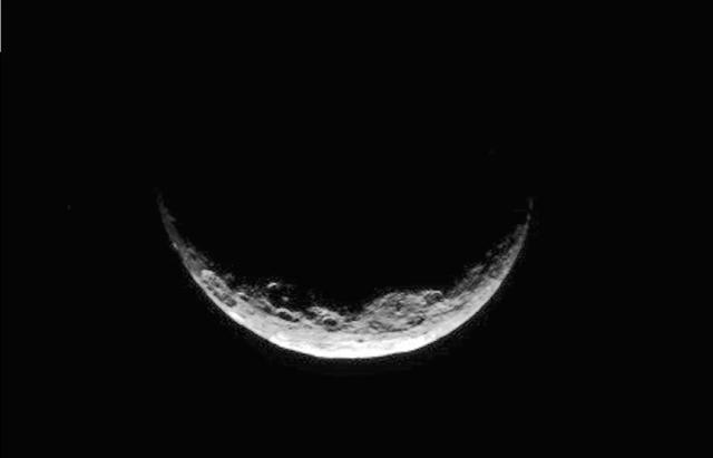
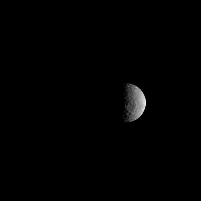
NASA's Dawn spacecraft took this image of Ceres' south polar region on May 17, 2017, from an altitude of about 26,400 miles (42,500 kilometers). The image scale is about 2.5 miles (4 kilometers) per pixel. Dawn took this image to help navigators refine their measurements of the spacecraft's position in orbit. Ceres appears as a crescent as Dawn is on the night side of the dwarf planet. Zadeni Crater, which is 80 miles (128 kilometers) wide, is recognizable on the bottom left side of the crescent. The large crater seen on the right side is Urvara Crater, which is 101 miles (163 kilometers) wide. Large fractures scarring Ceres' surface can also be distinguished here. Dawn captured a similar scene (Figure 1) at higher resolution, although with a slightly different geometry, on April 26, 2015, from its RC3 orbit at an altitude of about 8,450 miles (13,600 kilometers) and an image scale of about 0.81 miles (1.3 kilometers) per pixel. The geology of Ceres' polar regions is very rough in comparison to that generally found at lower latitudes. This is because colder temperatures near the poles allow craters to hold their original shapes over longer periods of time. Features found on Ceres are named after gods and goddesses of agriculture, as well as harvest festivals, from around the world. Zadeni is named for the ancient Georgian god of bountiful harvest, while Urvara is an Indian and Iranian deity of plants and fields. https://photojournal.jpl.nasa.gov/catalog/PIA21407
This image from NASA's Dawn spacecraft showing the northern part of Hanami Planum on Ceres honors the Japanese cherry blossom festival, or "Hanami," which is a long-standing Japanese tradition of welcoming spring. Hanami Planum is the third largest geological feature on Ceres, after Vendimia Planitia and the Samhain Catenae. It extends over 345 miles (555 kilometers). This image shows familiar features, such as Occator Crater, characterized both by bright material inside the crater and dark ejecta material outside. Several parallel linear features, called Junina Catenae, can be seen departing from Occator and extending toward the top of the image. These catenae are chains of small craters formed by the impact and scouring of material ejected when large craters are formed. Scientists were able to relate these crater chains to Urvara and Yalode. Even though these are located in the southern hemisphere, some of their ejecta could reach the northern hemisphere, thanks to Ceres' fast rotation and small size. This image was obtained by Dawn on June 15, 2015. The spacecraft was then in its survey orbit (2,700 miles, or 4,400 kilometers high), when the footprint of Dawns framing camera on Ceres surface was about 260 miles (420 kilometers). The resolution is 1,400 feet (410 meters) per pixel. The central coordinates of the picture are 14 degrees north latitude, 213 degrees east in longitude. https://photojournal.jpl.nasa.gov/catalog/PIA21921