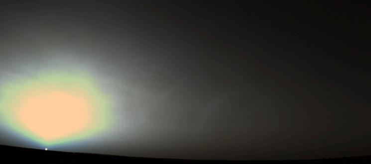
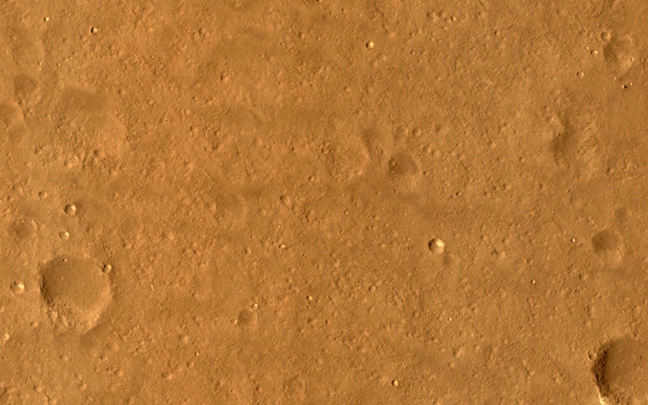
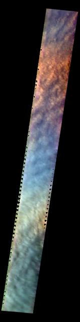
Martian Sunrise at Utopia Planitia

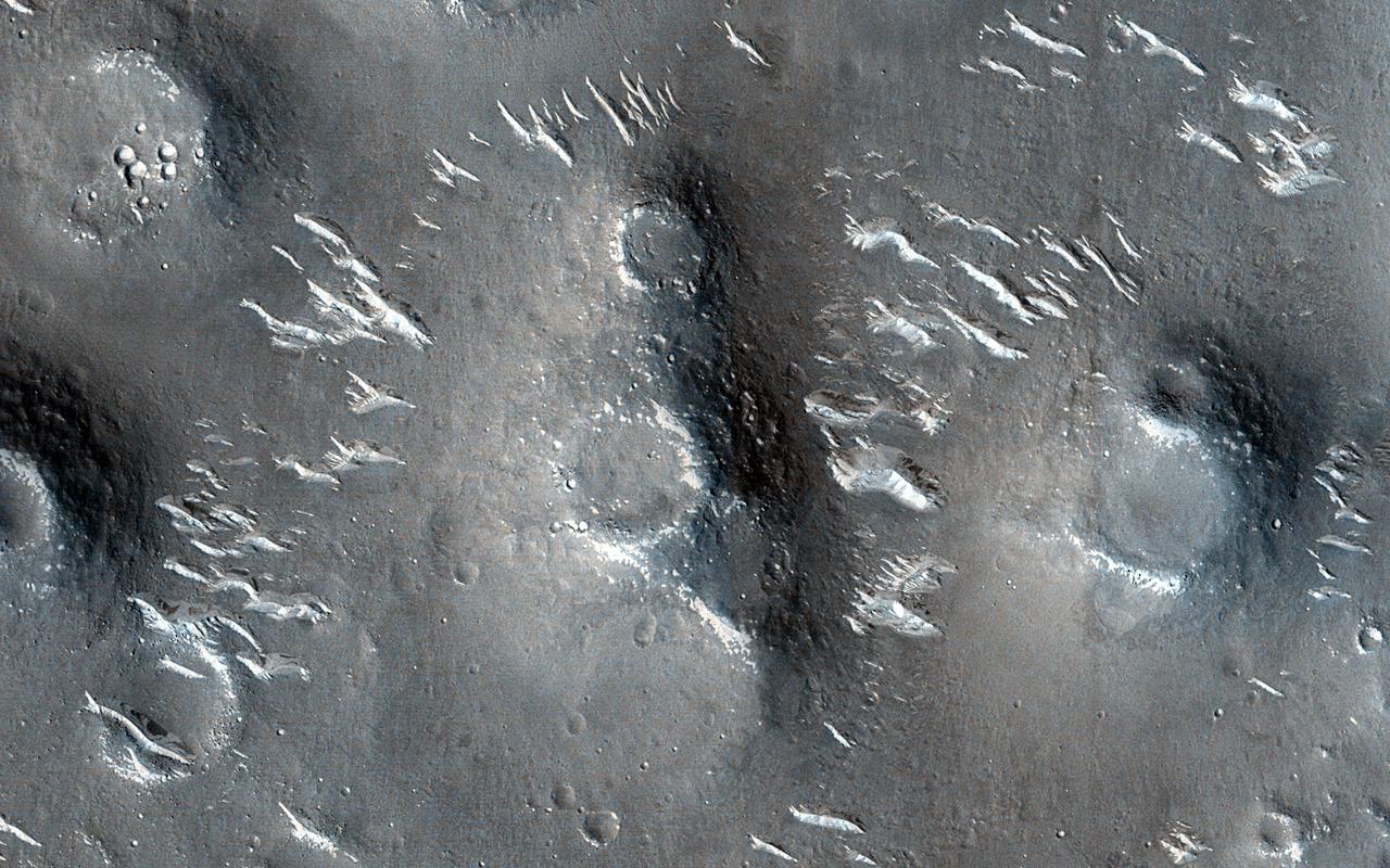
Frost on Utopia Planitia
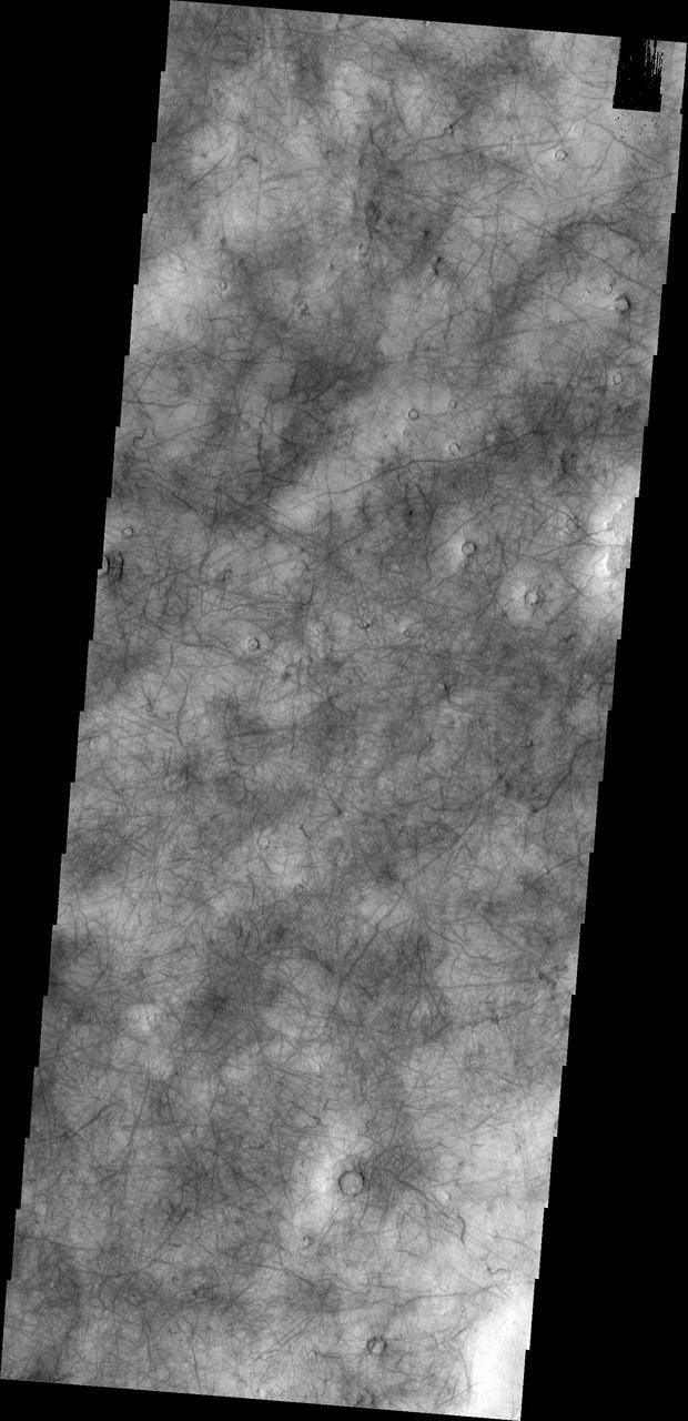
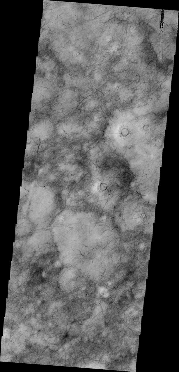
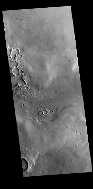
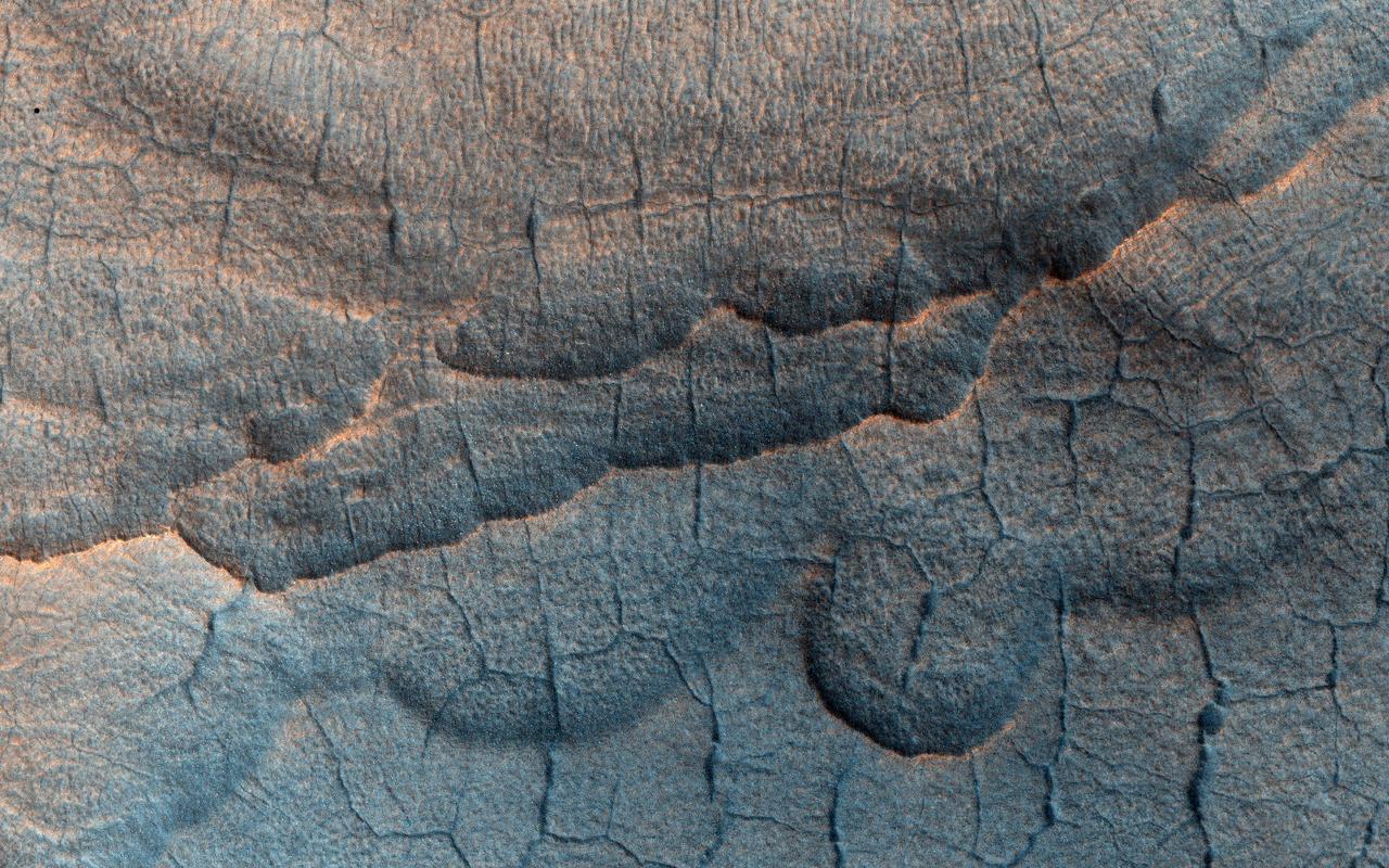
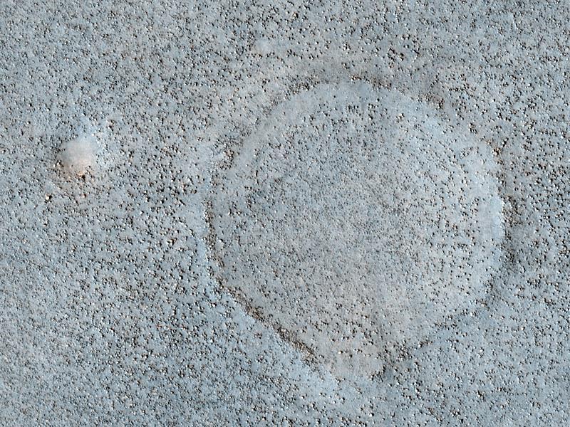
This unusual surface texture is found in Utopia Planitia.
Ice on Mars Utopia Planitia Again
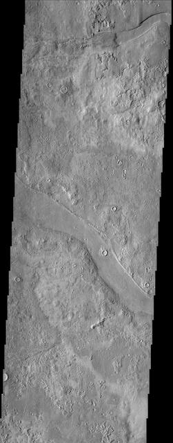
The small channels in this image of Utopia Planitia are south of Granicus Valles were captured by NASA Mars Odyssey on July 23, 2010.
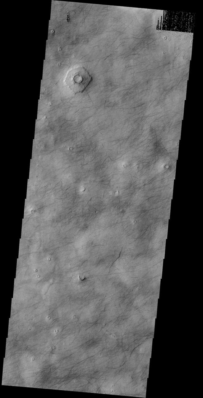
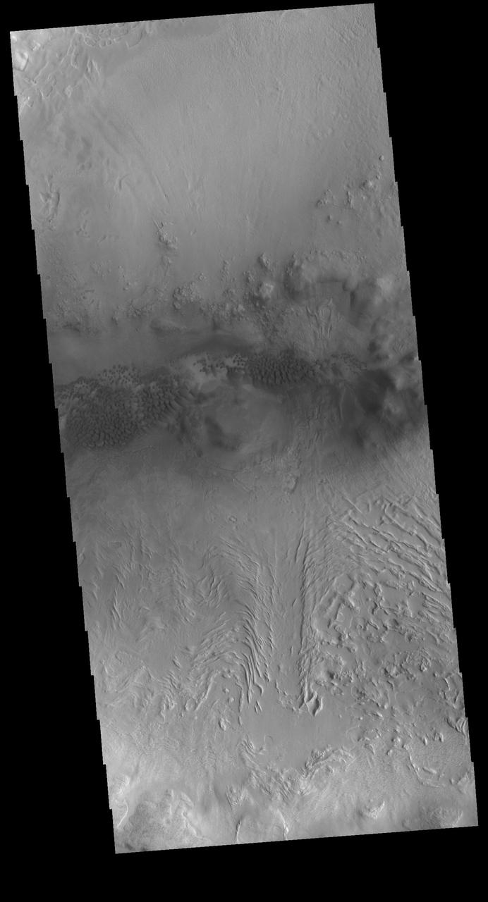
This image shows a portion of Utopia Planitia that is covered by dust devil tracks as seen by NASA 2001 Mars Odyssey spacecraft.
This image of Utopia Planitia, NASA 2001 Mars Odyssey, is covered with the tracks of dust devils.
The dark surface markings of Utopia Planitia are thought to be caused by dust devils as seen by NASA 2001 Mars Odyssey spacecraft.
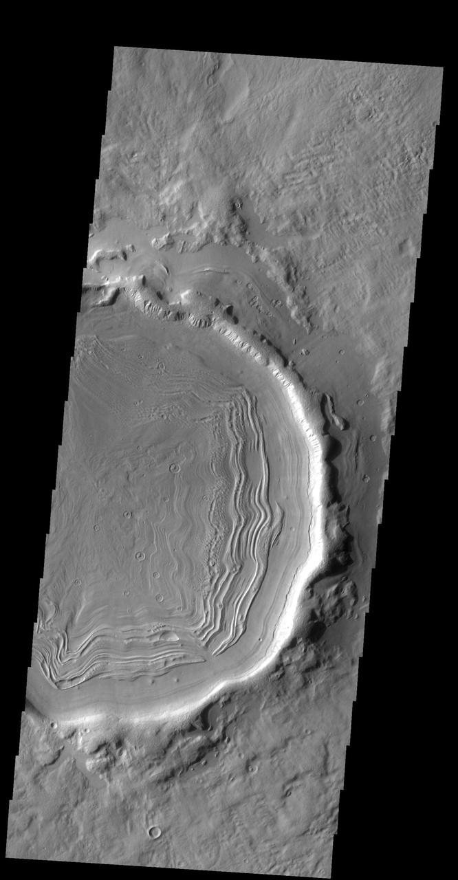
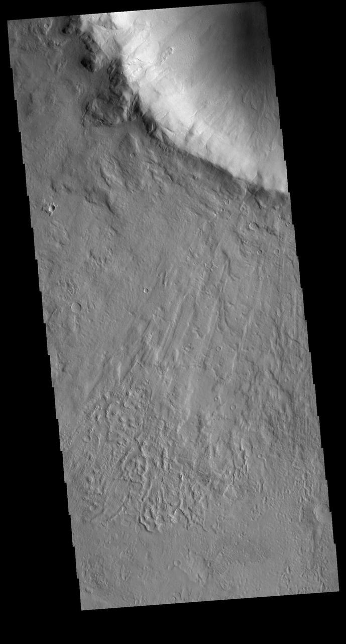
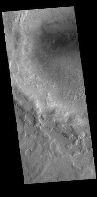
Eroded Layered Material in Southwest Utopia Planitia
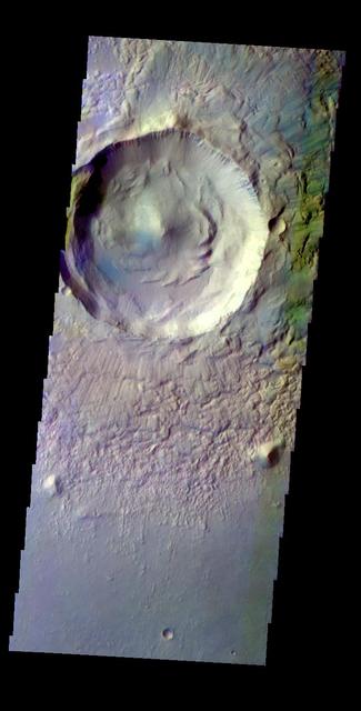
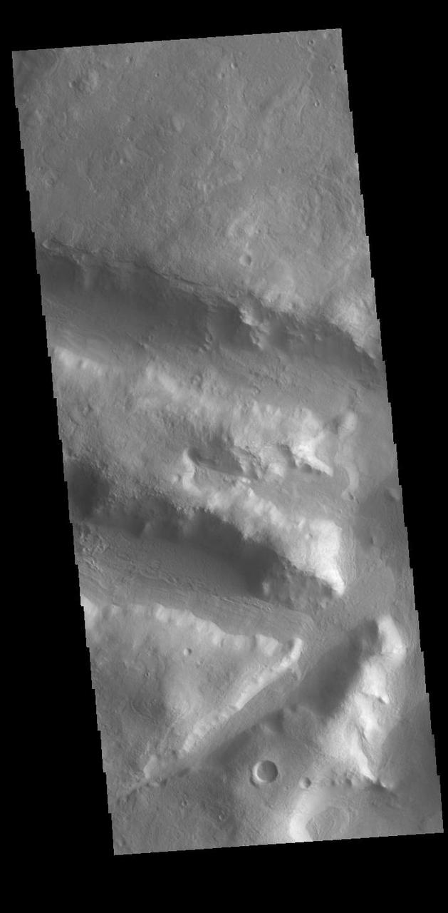
Spokes, Creep, and Channels in a Crater in Utopia Planitia
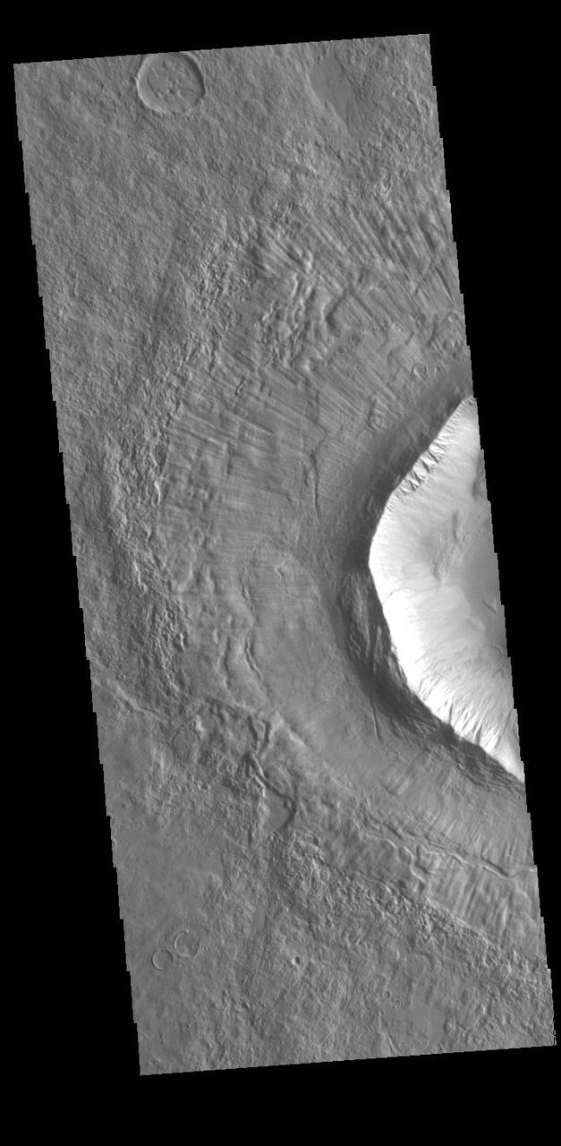
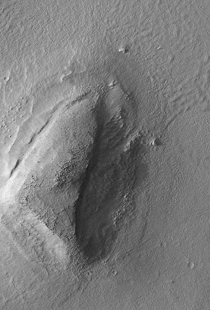
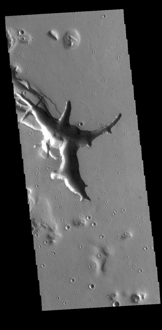
Unusual Structure on Crater Rim in West Utopia Planitia
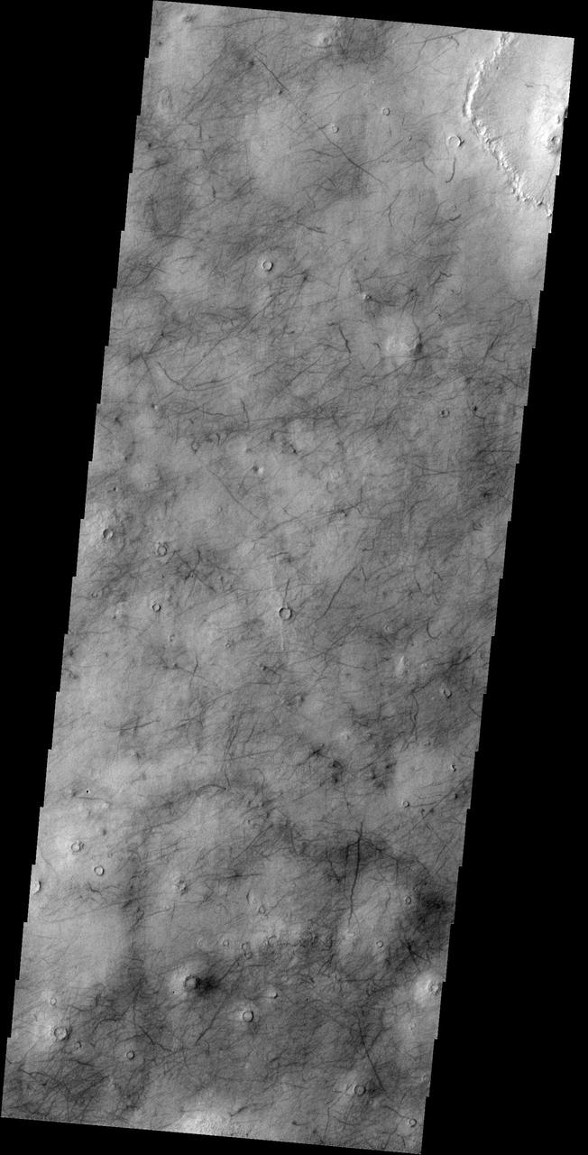
This image captured by NASA 2001 Mars Odyssey spacecraft show the dark marks left behind after the passage of a dust devil cover this region of Utopia Planitia.
This image from NASA 2001 Mars Odyssey of central Utopia Planitia shows some dust devil tracks. These features are common in this region of Mars.
This image by NASA Mars Odyssey spacecraft shows Utopia Planitia, a large plain in the northern hemisphere of Mars. It is believed that this basin is the result of a large impact.
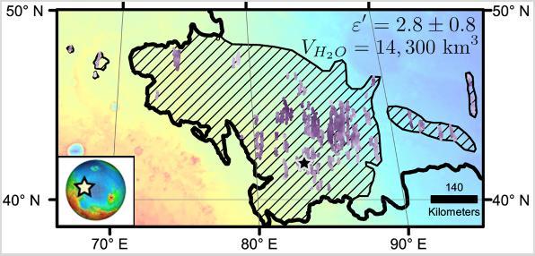
Diagonal striping on this map of a portion of the Utopia Planitia region on Mars indicates the area where a large subsurface deposit rich in water ice was assessed using the Shallow Radar (SHARAD) instrument on NASA's Mars Reconnaissance Orbiter. The area is about halfway between the planet's equator and north pole, and the deposit is estimated to hold about as much water as what is in Lake Superior, largest of the Great Lakes. The scale bar at lower right indicates 140 kilometers (76 miles). The violet vertical bars show depth to the bottom of the ice-rich deposit, as estimated from SHARAD passes overhead. Darkest violet indicates a depth of about 550 feet (about 170 meters). Palest violet indicates a depth of about 33 feet (10 meters). The value of 2.8 plus-or-minus 0.8 in the upper right corner denotes the dielectric constant, a property related to radar reflectivity. The value of 14,300 cubic kilometers is an estimate of the volume of water in the deposit. http://photojournal.jpl.nasa.gov/catalog/PIA21138
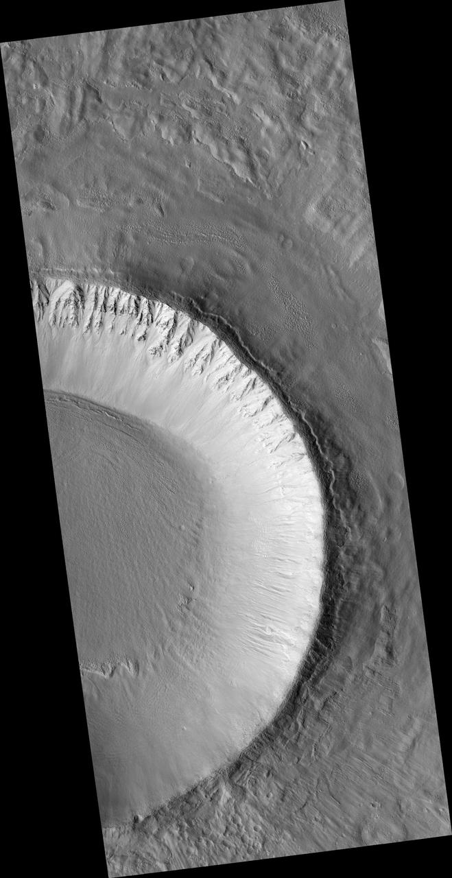
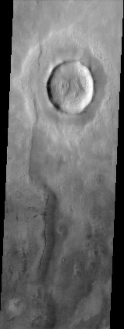
Today's VIS image shows half of an unnamed crater in Utopia Planitia. Orbit Number: 79833 Latitude: 42.973 Longitude: 115.983 Instrument: VIS Captured: 2019-12-13 18:40 https://photojournal.jpl.nasa.gov/catalog/PIA23731

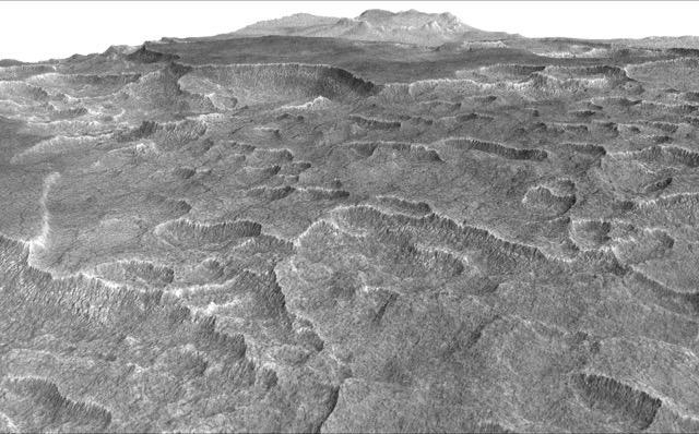
The Chinese Zhurong rover, named after the god of fire in Chinese mythology, landed in Utopia Planitia in May 2021. Utopia Planitia is a volcanic region located in the low-lying Northern Hemisphere of Mars. The expansive, flat, smooth plains of Utopia are dimpled by impact craters, volcanic domes, light-toned ridges made of wind-blown materials, and troughs. If the rover continues to drive south from its landing site, this HiRISE view shows the kind of terrain and features Zhurong may explore. https://photojournal.jpl.nasa.gov/catalog/PIA24914
Today's VIS image shows some of the ejecta from Bacolor Crater in Utopia Planitia. There are several layers of ejecta visible in the image. The crater itself is just off the image to the lower right. Orbit Number: 68581 Latitude: 33.2419 Longitude: 118.099 Instrument: VIS Captured: 2017-05-30 23:30 https://photojournal.jpl.nasa.gov/catalog/PIA21790
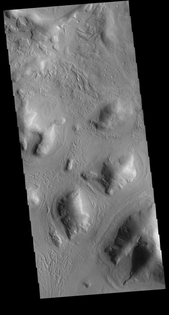
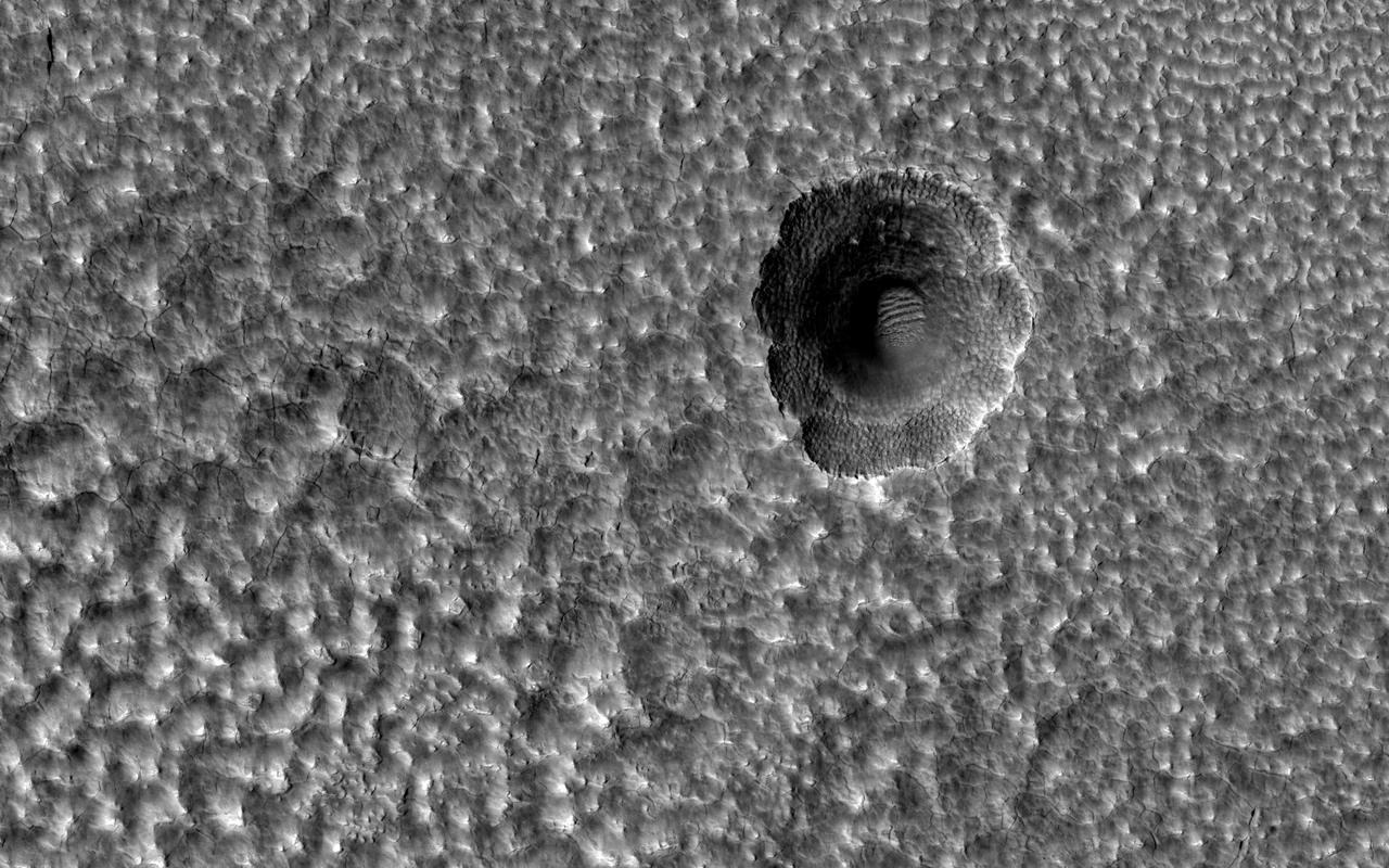
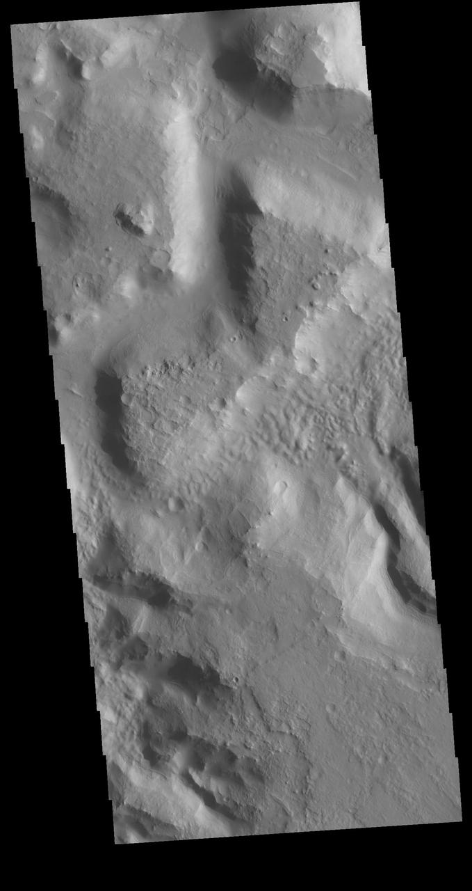
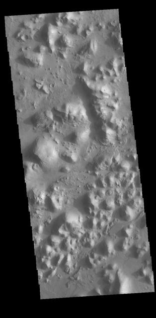
The Utopia Planitia region contains many distinctive landscapes. The bumpy and pitted ground in this image may have formed through the eruption of either lava or mud onto the surface from deep underground. Mud volcanoes on Earth provide oases for life. If these features also formed through the eruption of mud, these landforms may hold clues to possible life-supporting oases in Mars' distant past. https://photojournal.jpl.nasa.gov/catalog/PIA24917
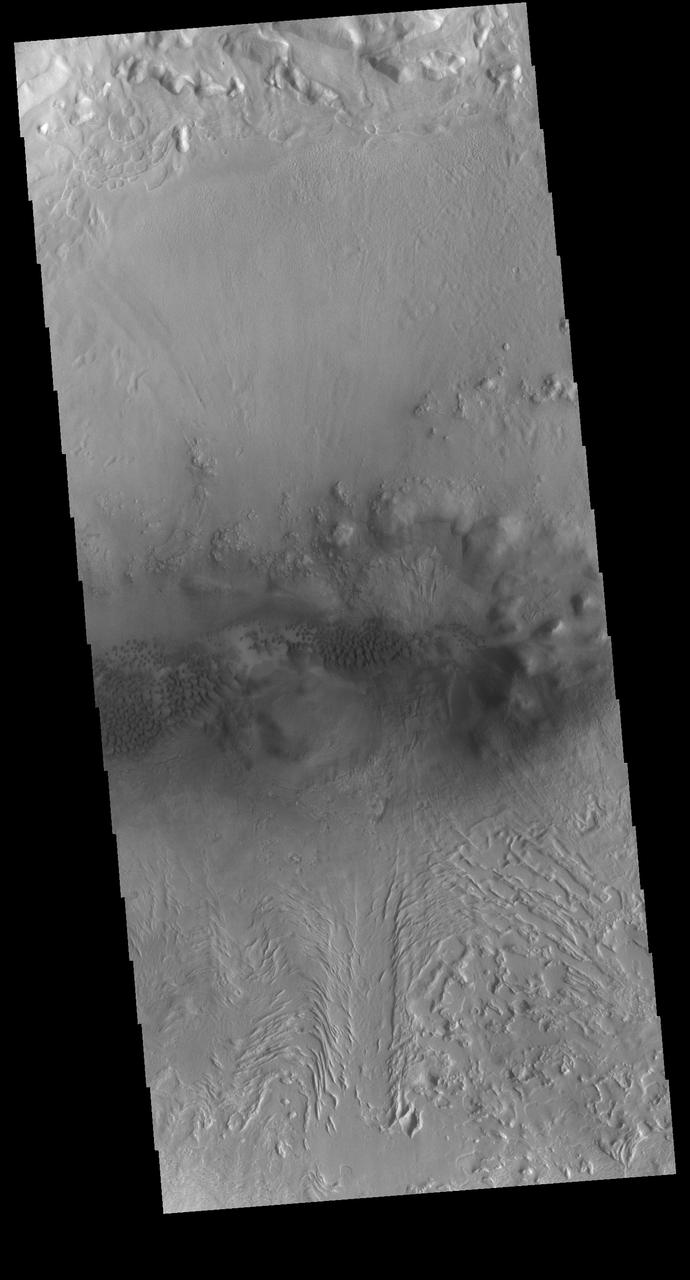
In this image from NASA Mars Odyssey spacecraft, bizarre textures cover the surface of eastern Utopia Planitia, where there is a high probability that ground ice has played a role in the formation of this unusual landscape.
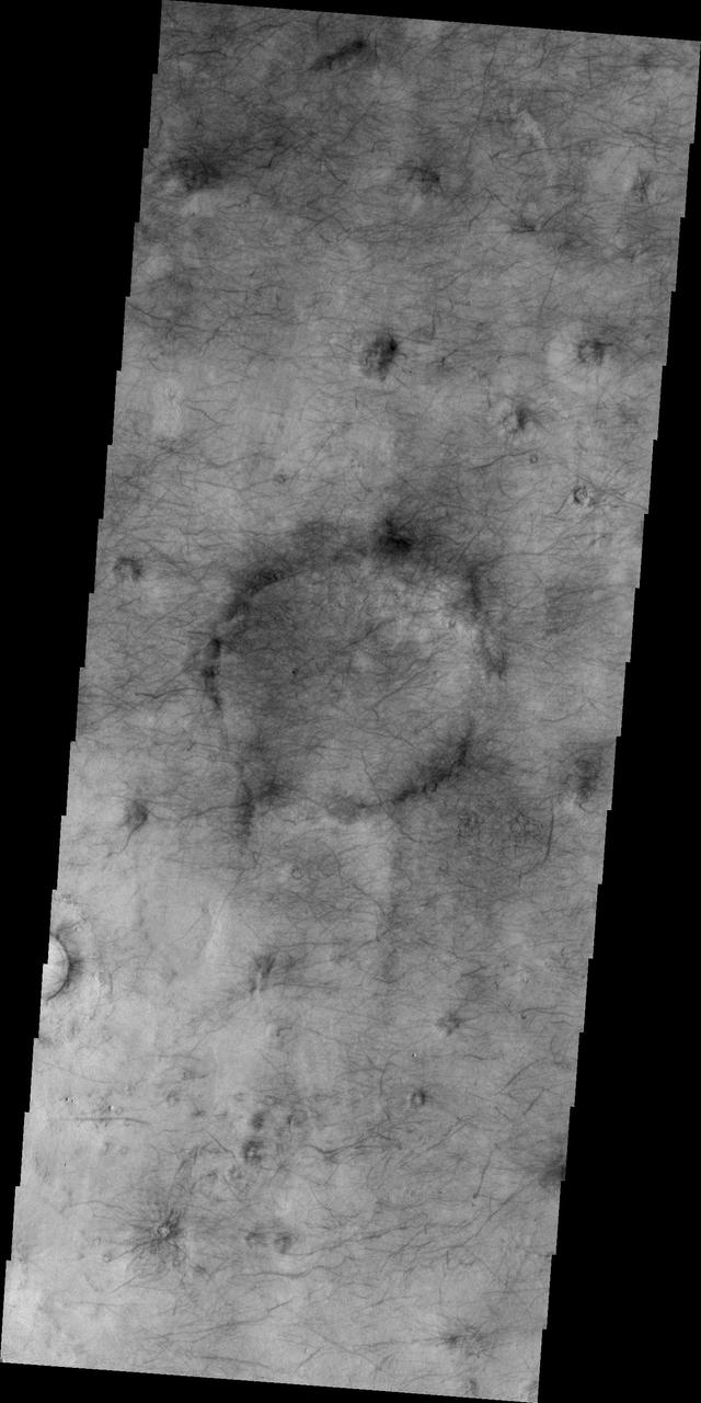
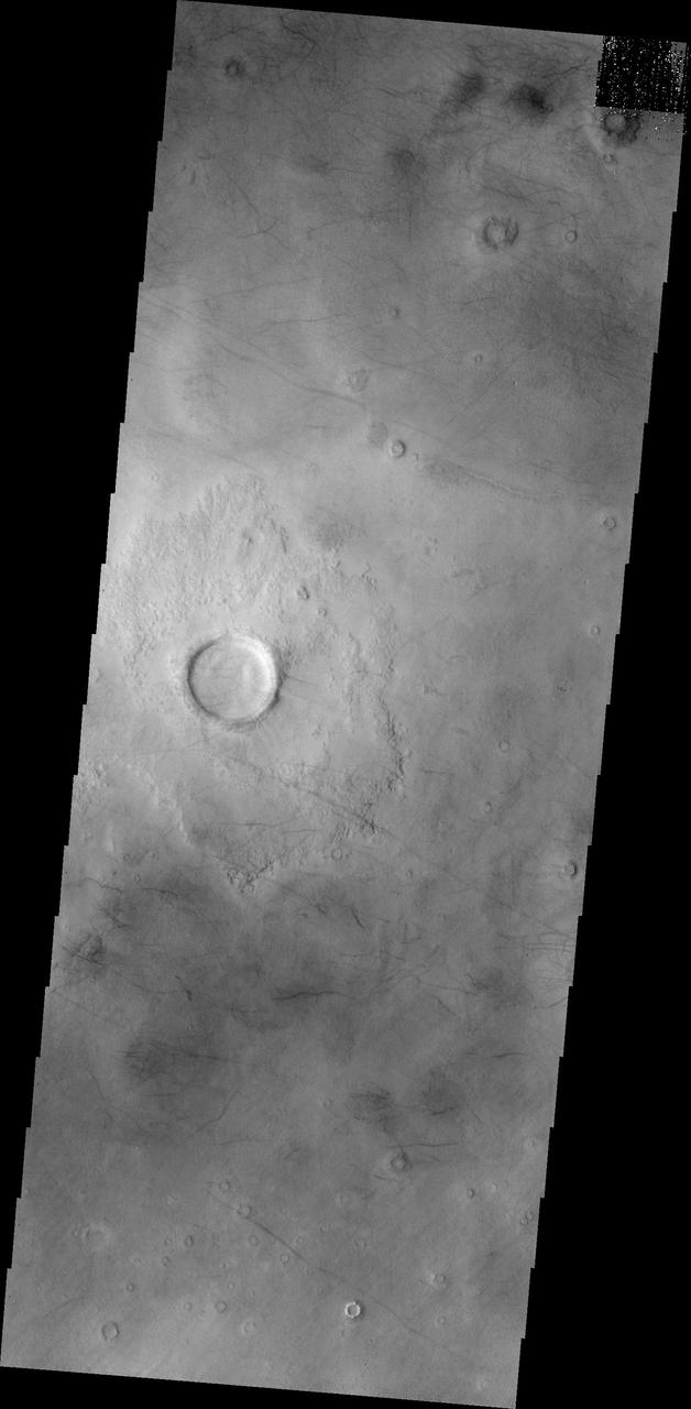
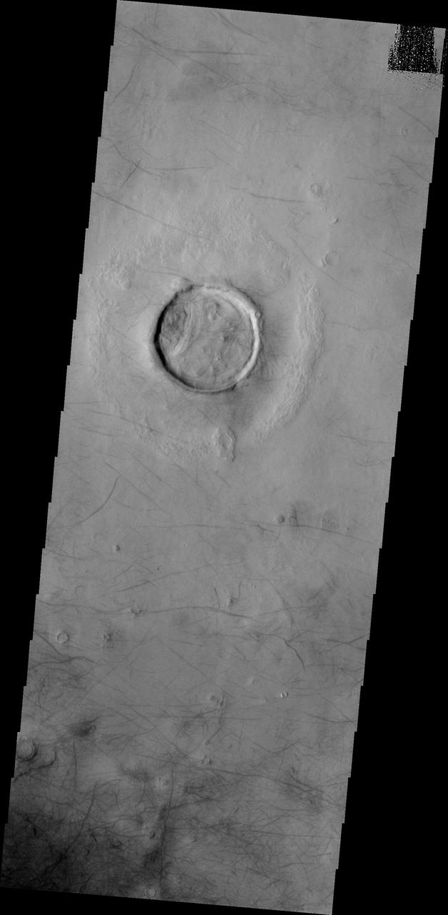
Sometimes we see circles on the Martian landscape with no apparent cause, such as in this picture of Utopia Planitia. Landscapes have rich histories, and what's happening here is likely the result of a long sequence of events. Impact craters are common throughout Mars' history. This area of Utopia Planitia has been buried by material and some of these craters have been buried with it. Loose material compacts over time and if there was the same thickness of material everywhere, then the surface would drop in height by the same amount everywhere. However, there's more of this material inside the buried craters than outside, so there's more compaction and dropdown of the surface in the circular area above the buried crater. This stretches the surface and causes the cracks to appear around the edge. The crater may be long lost from view, but it's still affecting the landscape today. https://photojournal.jpl.nasa.gov/catalog/PIA24698
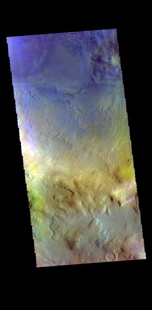
The THEMIS VIS camera contains 5 filters. The data from different filters can be combined in multiple ways to create a false color image. These false color images may reveal subtle variations of the surface not easily identified in a single band image. Today's false color image shows the rim and ejecta blanket of an unnamed crater located in Utopia Planitia. Orbit Number: 79834 Latitude: 41.3617 Longitude: 87.3919 Instrument: VIS Captured: 2019-12-13 20:38 https://photojournal.jpl.nasa.gov/catalog/PIA24672
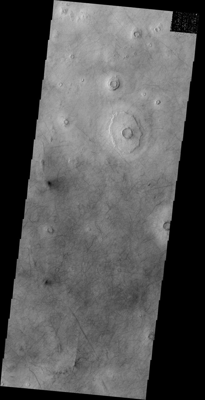
The THEMIS VIS camera contains 5 filters. The data from different filters can be combined in multiple ways to create a false color image. This false color image from NASA 2001 Mars Odyssey spacecraft shows an unnamed crater in Utopia Planitia.
Today's VIS image shows part of an unnamed crater in Utopia Planitia. The ejecta surrounding the crater rim shows both layering and radial grooves. These features formed during the impact event. Orbit Number: 94546 Latitude: 38.5545 Longitude: 98.9045 Instrument: VIS Captured: 2023-04-08 05:31 https://photojournal.jpl.nasa.gov/catalog/PIA26034
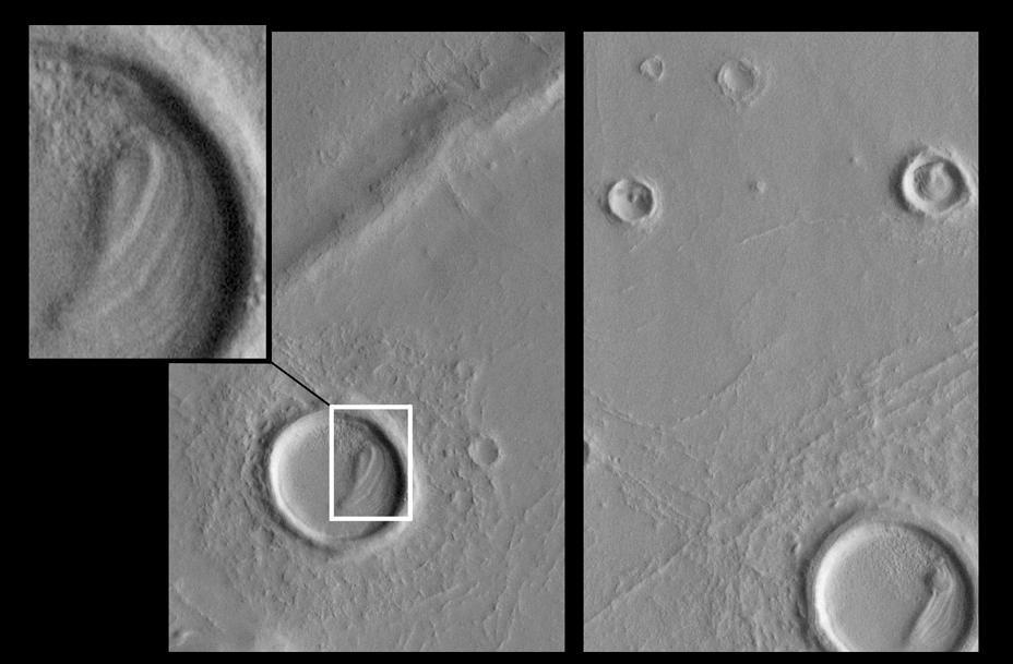
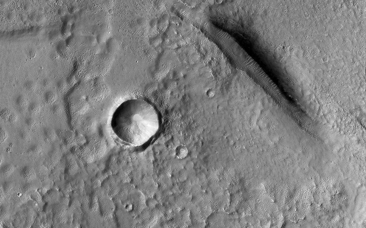
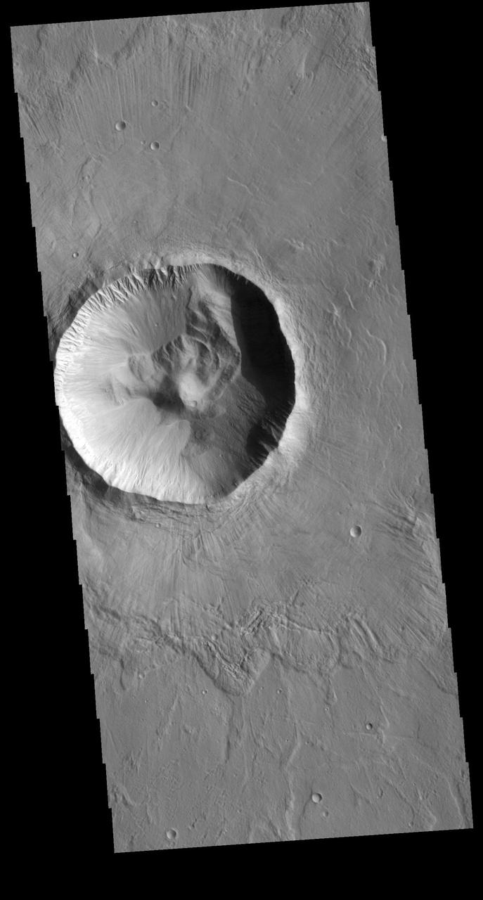
This unnamed crater in Utopia Planitia is shaped like a peanut shell, with an indentation in the crater rim at the middle of the crater. It is likely that this crater was created by a dual impact. In a dual (or double) impact the incoming meteor is broken into two or more pieces which impact together into the surface. This type of impact often has a unique ejecta blanket shape, pinched at the center making a butterfly shape, and a pronounced inner rim jutting out at the center. The ejecta blanket in this case does not show the butterfly shape, and the middle rim is on slightly visible on the left side of the crater. These irregularities may indicate the the meteor pieces were still very close together when they hit the surface. Orbit Number: 95144 Latitude: 31.6611 Longitude: 128.303 Instrument: VIS Captured: 2023-05-27 11:12 https://photojournal.jpl.nasa.gov/catalog/PIA26261
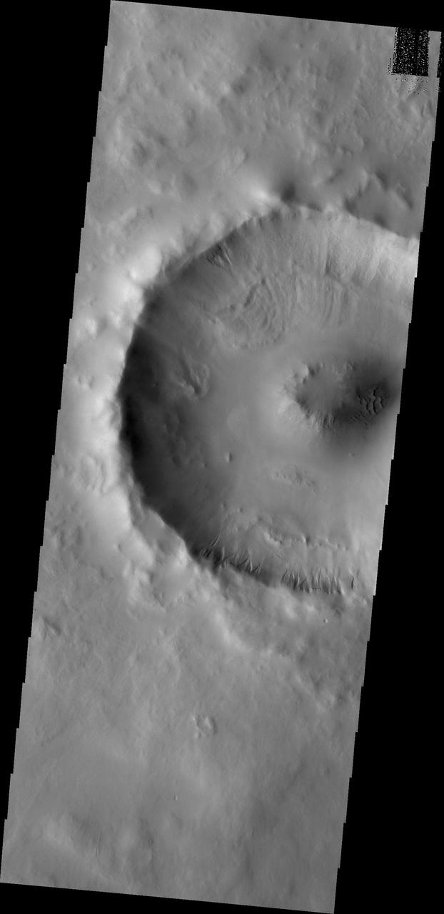
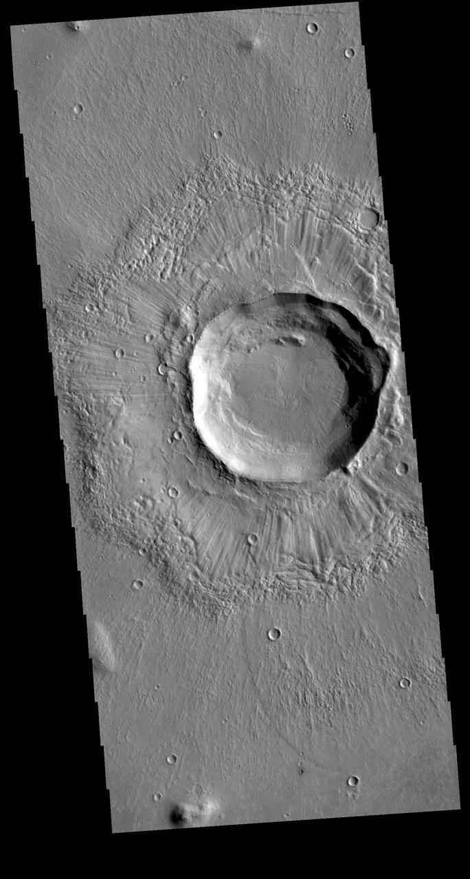
This VIS image shows an unnamed crater located in Utopia Planitia. This relatively young crater has a steep inner rim, with floor deposits that originate from the crater rim itself. As craters age, the floor starts to fill with wind blown materials. Regional lava flows can also enter and fill the crater, raising and smoothing the floor. The lack of such modifications indicates the relatively youthful nature of this crater. Orbit Number: 71425 Latitude: 33.9121 Longitude: 101.49 Instrument: VIS Captured: 2018-01-20 07:04 https://photojournal.jpl.nasa.gov/catalog/PIA22394
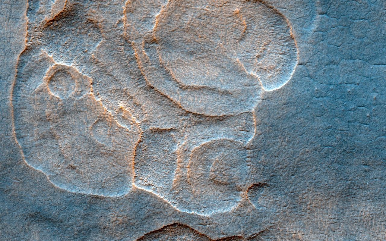
Utopia Planitia, a vast plain in the Northern Hemisphere of Mars, has an interesting and complex history. One of the intriguing features is a field of mounds showing circular depressions at their summits. The fact that many of these "craters" are on top of mounds argues against them being craters created by impacts, as is common on Mars and other planetary bodies across the solar system. There are many processes that can form such landforms, most notably hot lava. However, mud ejected from beneath the surface (through different geologic mechanisms) could also be a possibility. Being able to better understand how these features formed (aided by HiRISE stereo images) is crucial to our understanding of the geologic history of the region. https://photojournal.jpl.nasa.gov/catalog/PIA25898
This image samples the smooth plains within one of the areas being considered for setting down China's lander and rover, expected to launch in 2020. While smooth on large scales, HiRISE reveals small-scale roughness elements, including craters, boulders, and other features. Such hazards may be avoided by using "terminal hazard avoidance," a technology China has demonstrated on the Moon. Utopia Planitia may have been extensively resurfaced by mud flows, so it is an interesting place to investigate potential past subsurface habitability. https://photojournal.jpl.nasa.gov/catalog/PIA23739
The Mars Global Surveyor (MGS) Mars Orbiter Camera (MOC) was designed specifically to provide images of Mars that have a resolution comparable to the aerial photographs commonly used by Earth scientists to study geological processes and map landforms on our home planet. When MGS reaches its Mapping Orbit in March 1999, MOC will be able to obtain pictures with spatial resolutions of 1.5 meters (5 feet) per pixel--this good enough to easily see objects the size of an automobile. Boulders are one of the keys to determining which processes have eroded, transported, and deposited material on Mars (e.g.,landslides, mud flows, flood debris). During the first year in orbit,MGS MOC obtained pictures with resolutions between 2 and 30 meters (7to 98 feet) per pixel. It was found that boulders are difficult to identify on Mars in images with resolutions worse than about 2-3 meters per pixel. Although not known when the MOC was designed,"thresholds" like this are found on Earth, too. The MOC's 1.5 m/pixel resolution was a compromise between (1) the anticipation of such resolution-dependent sensitivity based on our experience with Earth and (2)the cost in terms of mass if we had built a larger telescope to get a higher resolution. Some rather larger boulders (i.e., larger than about 10 meters--or yards--in size) have already been seen on Mars by the orbiting camera. This is a feat similar to that which can be obtained by "spy" satellites on Earth. The MOC image 53104 subframe shown above features a low, rounded hill in southeastern Utopia Planitia. Each of the small, lumpy features on the top of this hill is a boulder. In this picture, boulders are not seen on the surrounding plain. These boulders are interpreted to be the remnants of a layer of harder rock that once covered the top of the hill, but was subsequently eroded and broken up by weathering and wind processes. MOC image 53104 was taken on September 2, 1998. The subframe shows an area 2.2 km by 3.3 km (1.4 miles by 2.7 miles). The image has a resolution of about 3.25 meters (10.7 feet) per pixel. The subframe is centered at 41.0°N latitude and 207.3°W longitude. North is approximately up, illumination is from the left. http://photojournal.jpl.nasa.gov/catalog/PIA01500
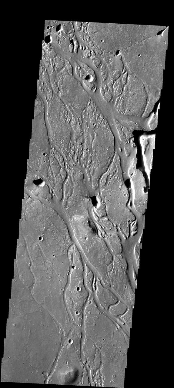
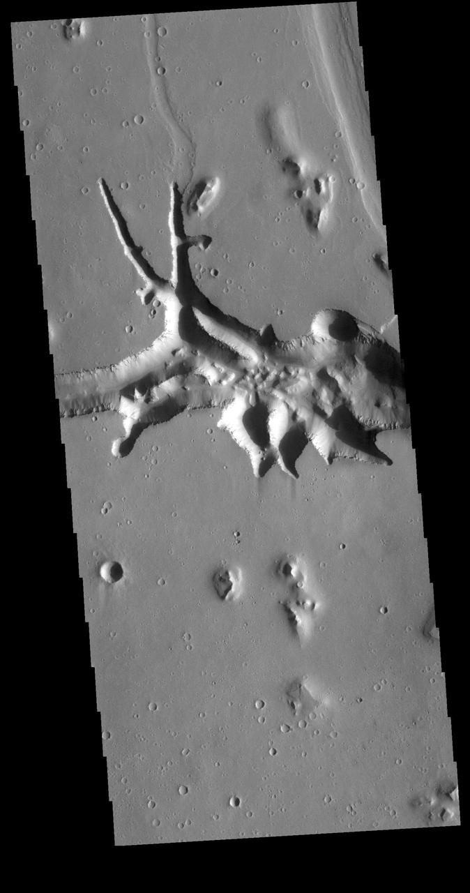
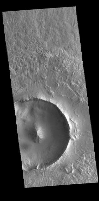
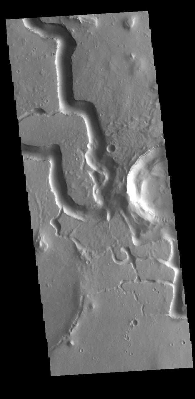
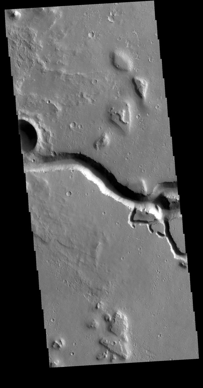
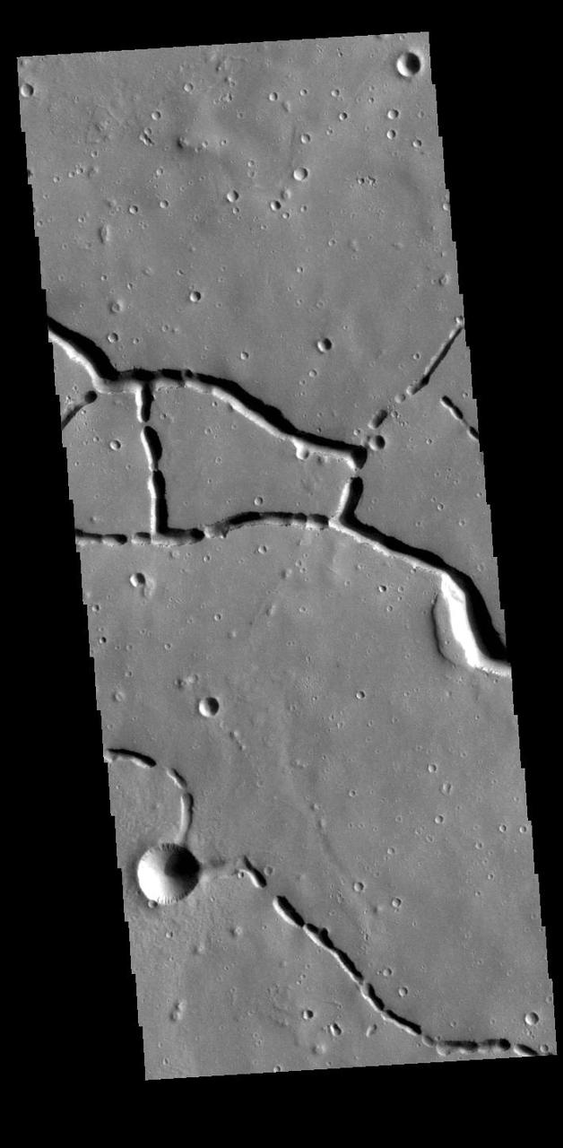
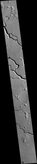
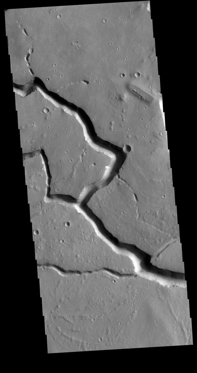
These channels in Utopia Planitia are called Hephaestus Fossae
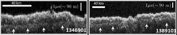
These two images show data acquired by the Shallow Radar (SHARAD) instrument while passing over two ground tracks in a part of Mars' Utopia Planitia region where the orbiting, ground-penetrating radar detected subsurface deposits rich in water ice. The instrument on NASA's Mars Reconnaissance Orbiter emits radio waves and times their echo off of radio-reflective surfaces and interfaces on Mars. The white arrows indicate a subsurface reflector interpreted as the bottom of the ice-rich deposit. The deposit is about as large in area as the state of New Mexico and contains about as much water as Lake Superior. The horizontal scale bar indicates 40 kilometers (25 miles) along the ground track of the radar, as flown by the orbiter overhead. The vertical scale bar indicates a return time of one microsecond for the reflected radio signal, equivalent to a distance of about 90 meters (295 feet). http://photojournal.jpl.nasa.gov/catalog/PIA21137
The western Utopia Planitia in the Northern mid-latitudes of Mars is marked by a peculiar type of depression with scalloped edges and by a network of polygonal fractures. The scalloped depressions are typical features; a smooth layered terrain located between 40 and 60 degrees in both hemispheres. Scalloped depressions probably form by removal of ice-rich subsurface material by sublimation (ice transforming directly from a solid to a gaseous state), a process that may still be active today. Isolated scalloped depressions generally have a steep pole-facing scarp and a gentler equator-facing slope. This asymmetry is interpreted as being the result of difference in solar heating. Scalloped depressions may coalesce, leading to the formation of large areas of pitted terrain. The polygonal pattern of fractures resembles permafrost polygons that form in terrestrial polar and high alpine regions by seasonal-to-annual contraction of the permafrost (permanently frozen ground). On Earth, such polygons indicate the presence of ground ice. These landforms most likely show that sub-surface ice is present or has been present geologically recently at these latitudes, and they may slowly be continuing their development at the present time. http://photojournal.jpl.nasa.gov/catalog/PIA13485
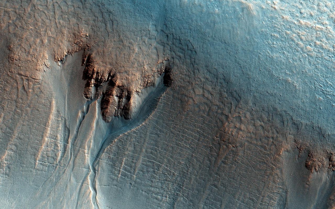
This enhanced-color image from NASA Mars Reconnaissance Orbiter shows gullies in the northern wall of an unnamed crater in Utopia Planitia. The banked, sinuous shape of the gully channels suggest that water was involved in their formation. The source of this water however is a subject of debate. Hypotheses include melting of snow or near-surface ground ice. Other features also suggest the past (and possibly present) presence of snow or ground ice in this region. For example, the "mantle" deposit on the crater wall displays polygonal fractures. Polygons on Earth are associated with periglacial activity. This refers to processes that occur from the presence of ground ice, which interacts with surface and subsurface materials, as well as the Martian atmosphere as a function of climate and seasons). The mantle itself may be the remains of a dusty snowpack deposited in Mars' recent past. At the base of the mantle are fractures associated with the slumping of these deposits under their own weight and Martian gravity. The largest gullies cut into these mantling deposits, and in some places obscure the underlying fractures at the base of the crater wall. This indicates that the largest gullies are younger than both the mantle and the fractures. http://photojournal.jpl.nasa.gov/catalog/PIA19862

The dust devil tracks in this image captured by NASA 2001 Mars Odyssey spacecraft are located in Utopia Planitia.
The numerous dust devil tracks in this image captured by NASA 2001 Mars Odyssey spacecraft are located in Utopia Planitia.
The dark surface markings in this image from NASA Mars Odyssey spacecraft are dust devil tracks. These tracks are located in Utopia Planitia.
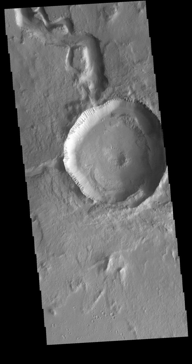
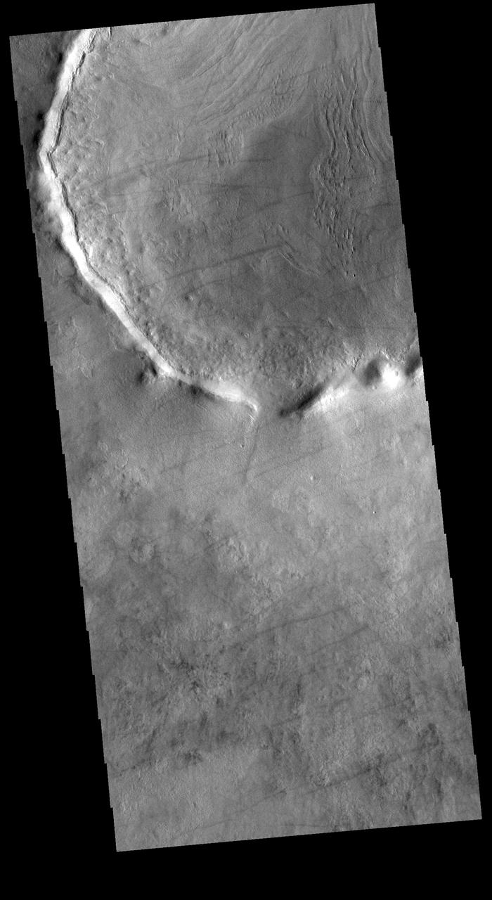
Small gullies mark the rim of this unnamed crater in Utopia Planitia in this image from NASA Mars Odyssey.
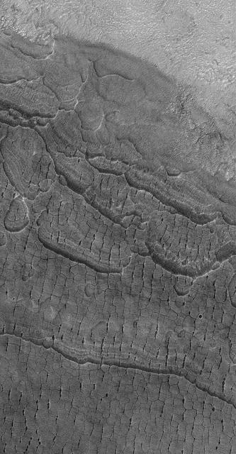
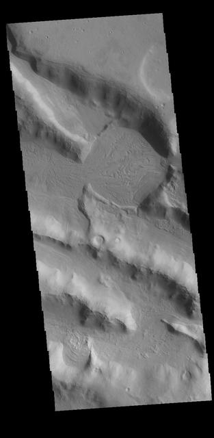
This MOC image shows cracked, layered plains-forming material in the western part of Utopia Planitia, Mars

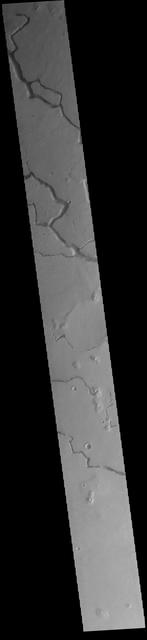
This image captured by NASA 2001 Mars Odyssey spacecraft shows layering in the plains that comprise Utopia Planitia.
A multitude of dust devil tracks mark the suface in this region of Utopia Planitia. This image is from NASA 2001 Mars Odyssey spacecraft.
This image captured by NASA 2001 Mars Odyssey spacecraft shows dust devil tracks covering most of the surface in this region of Utopia Planitia.
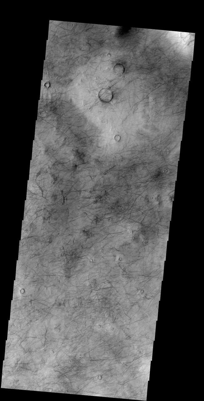
Looking at yet another portion of Utopia Planitia, NASA 2001 Mars Odyssey spacecraft still find hundreds of dust devil tracks.
This unnamed crater in this image from NASA 2001 Mars Odyssey spacecraft is located on the margin between Terra Sabaea and Utopia Planitia and is filled with material with a grooved surface.
This image captured by NASA 2001 Mars Odyssey spacecraft is located on the boundary between Terra Sabaea and Utopia Planitia - west of yesterday image location.
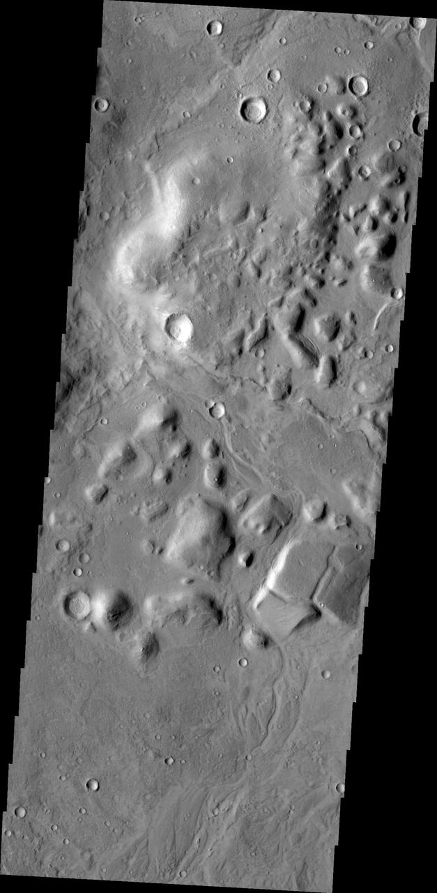
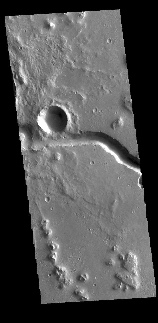
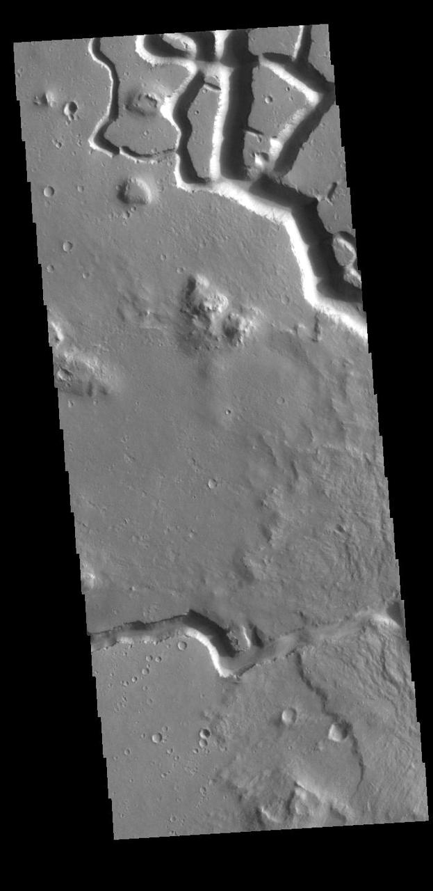
Chaos and small channels mark the boundary between the highlands of Terra Sabaea and the lowlands of Utopia Planitia in this image captured by NASA Mars Odyssey.
This image captured by NASA 2001 Mars Odyssey spacecraft shows a small portion of the boundary region between Terra Sabaea and Utopia Planitia.
The lowland plains of Elysium and Utopia Planitiae are separated from the darker heavily cratered highlands by a broad escarpment in this image from NASA's Viking Orbiter 1. http://photojournal.jpl.nasa.gov/catalog/PIA00196
This image from NASA Mars Odyssey spacecraft shows Rampart crater in Utopia Planitia, west of NASA Viking 2 landing site. http://photojournal.jpl.nasa.gov/catalog/PIA04029
This VIS image shows part of Chincoteague Crater. Chincoteague Crater is located in Utopia Planitia. The crater is 37km (23miles) across. Orbit Number: 78822 Latitude: 40.7151 Longitude: 123.929 Instrument: VIS Captured: 2019-09-21 12:42 https://photojournal.jpl.nasa.gov/catalog/PIA23525
This VIS image is located on plains between Terra Sabaea and Utopia Planitia. In this region craters and other depressions have sharp, narrow margins and rims. Orbit Number: 77214 Latitude: 36.3388 Longitude: 78.7687 Instrument: VIS Captured: 2019-05-12 02:43 https://photojournal.jpl.nasa.gov/catalog/PIA23298
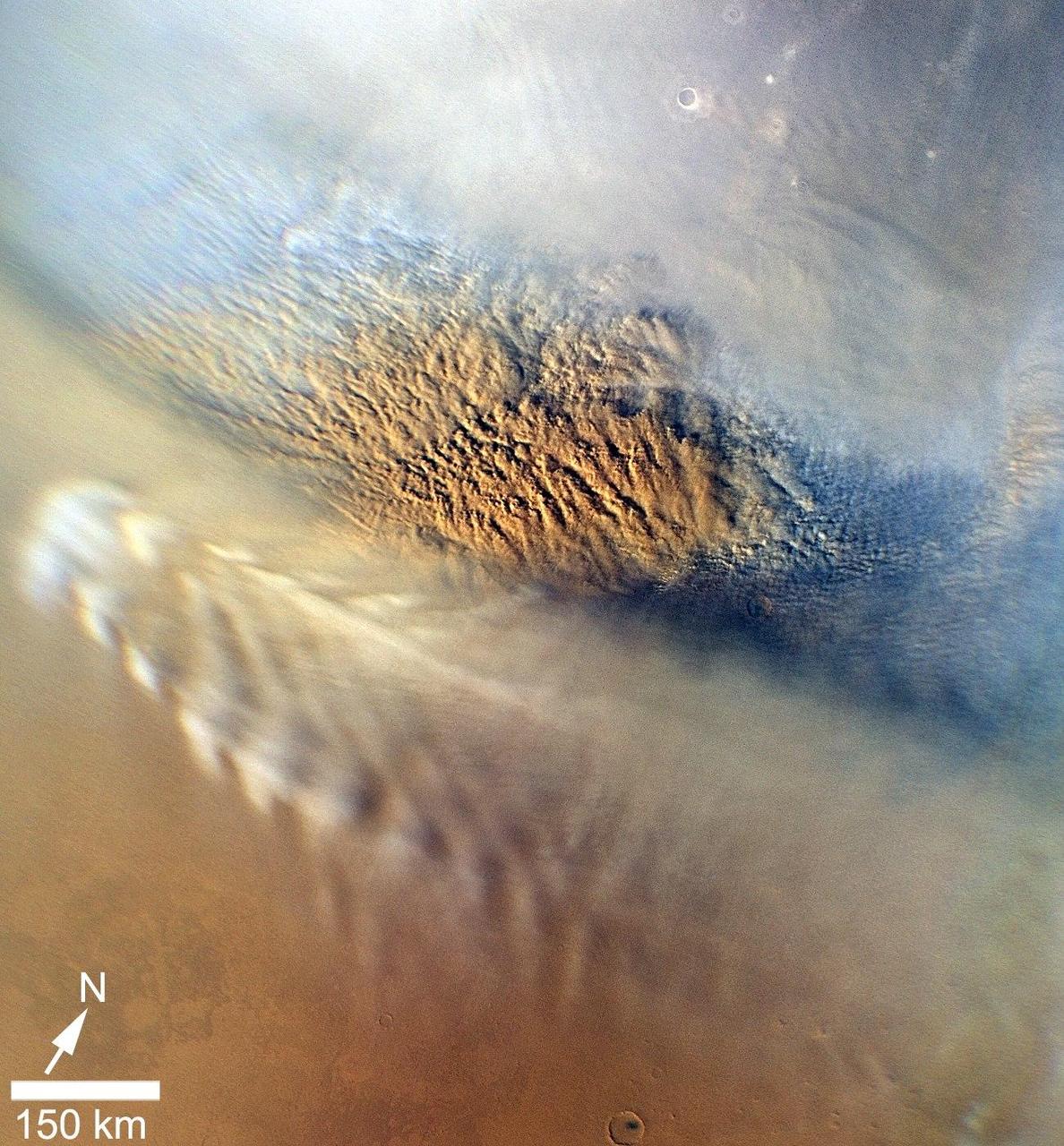
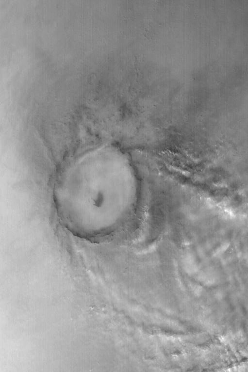
This close-up image of a dust storm on Mars was acquired by the Mars Color Imager instrument on NASA Mars Reconnaissance Orbiter on Nov. 7, 2007. This image is centered on Utopia Planitia.
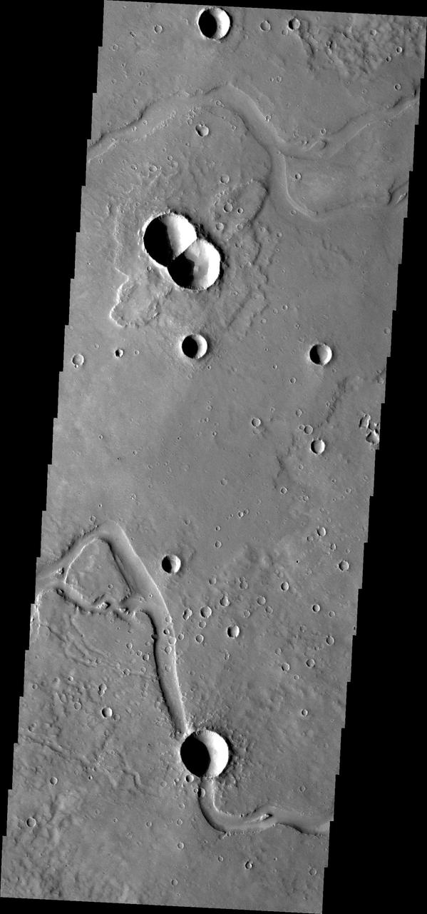
This image from NASA Mars Odyssey is of a doublet crater located in Utopia Planitia, near the Elysium Volcanic region. Doublet craters are formed by simultaneous impact of a meteor that broke into two pieces prior to hitting the surface.
This vertically exaggerated view shows scalloped depressions in Mars Utopia Planitia region, prompting using ground-penetrating radar aboard NASA Mars Reconnaissance Orbiter to check for underground ice.
This image shows a different part of Utopia Planitia than yesterday image. Both are marked with hundreds of dust devil tracks as seen by by NASA 2001 Mars Odyssey spacecraft.
The dark markings in this image from NASA 2001 Mars Odyssey spacecraft are tracks made by the passage of dust devils. Dust devils are common in the extensive plains of the northern latitudes. This image is located in Utopia Planitia.
This VIS image shows a crater located in Utopia Planitia. The THEMIS VIS camera contains 5 filters. The data from different filters can be combined in multiple ways to create a false color image. These false color images may reveal subtle variations of the surface not easily identified in a single band image. Orbit Number: 62670 Latitude: 40.0367 Longitude: 86.9845 Instrument: VIS Captured: 2016-01-30 00:51 https://photojournal.jpl.nasa.gov/catalog/PIA23113
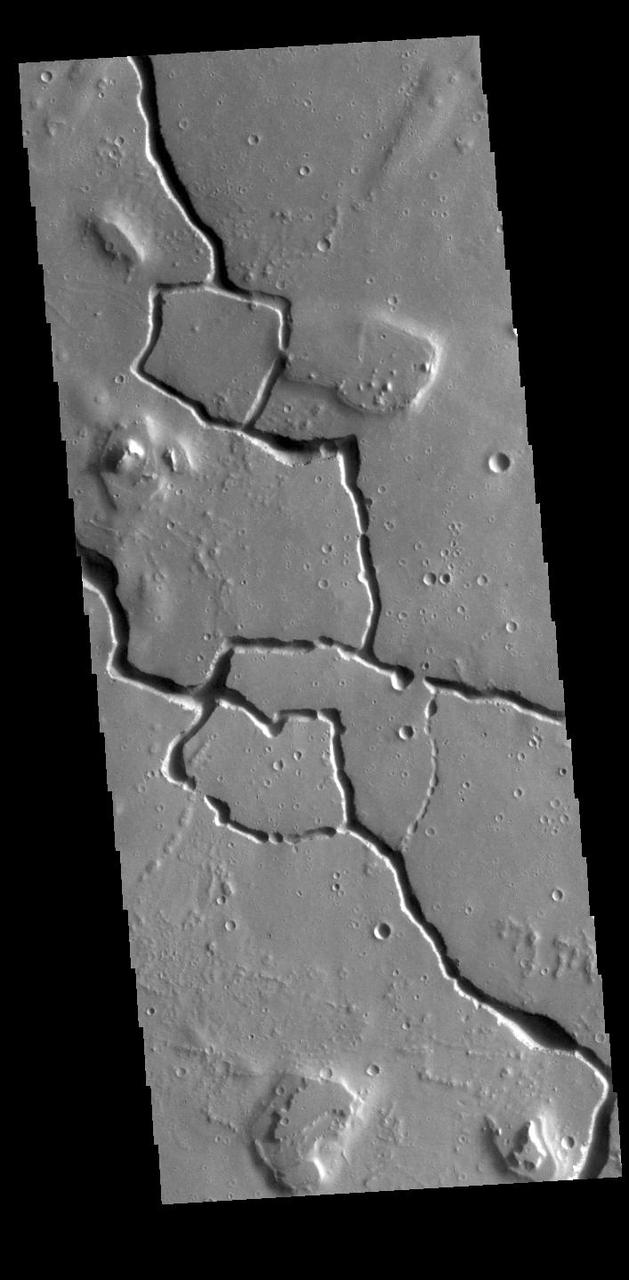
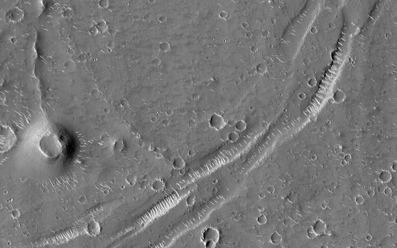
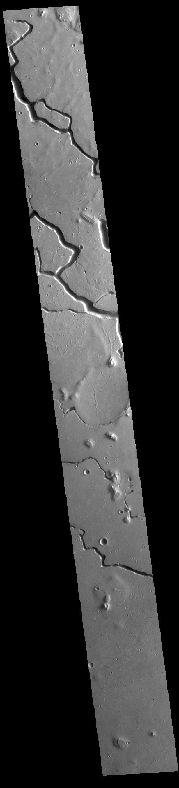
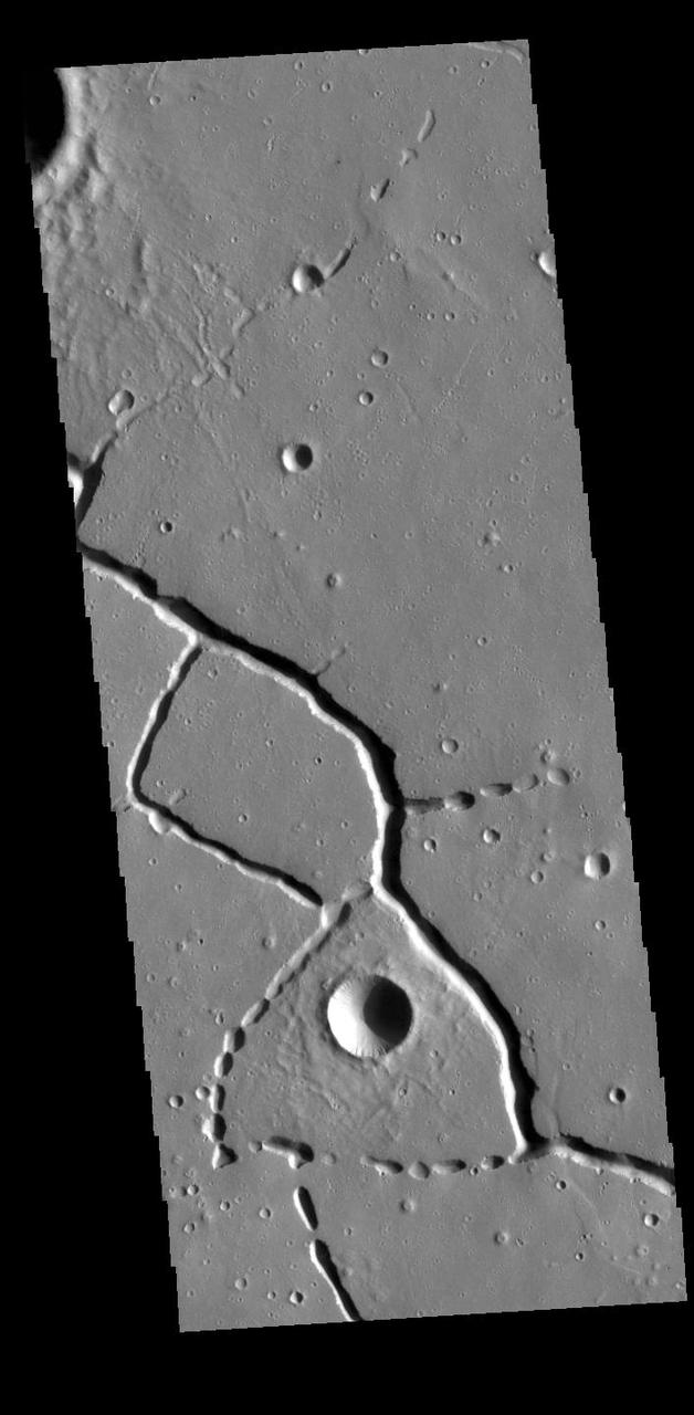
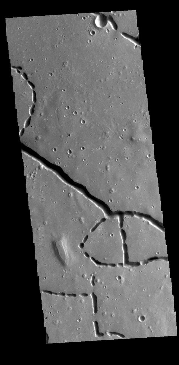
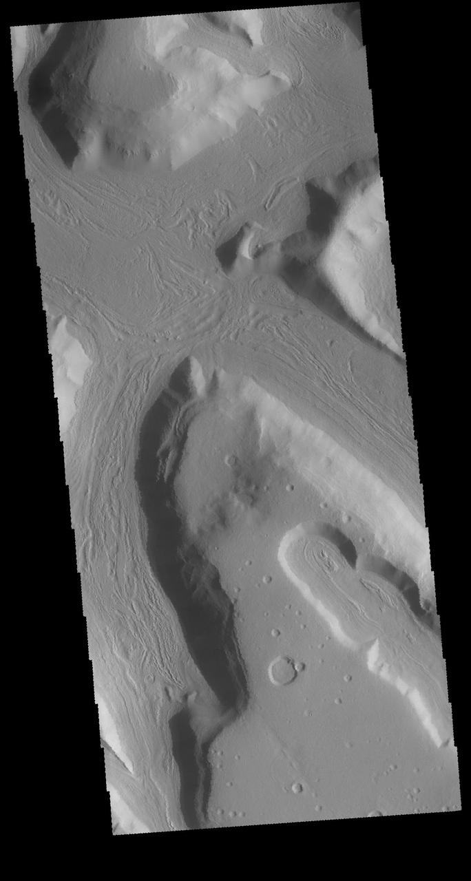
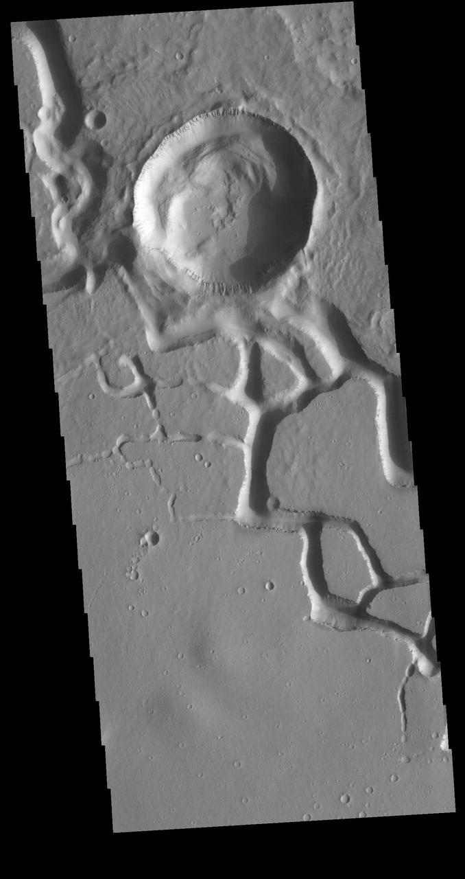
This VIS image shows part of Hephaestus Fossae. Hephaestus Fossae is a complex channel system in Utopia Planitia near Elysium Mons. Orbit Number: 94982 Latitude: 19.5692 Longitude: 123.658 Instrument: VIS Captured: 2023-05-14 03:00 https://photojournal.jpl.nasa.gov/catalog/PIA26225
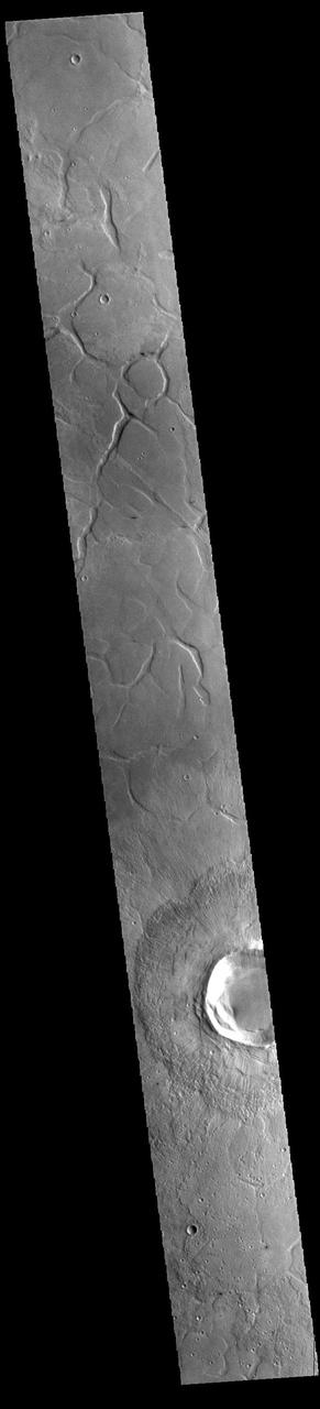
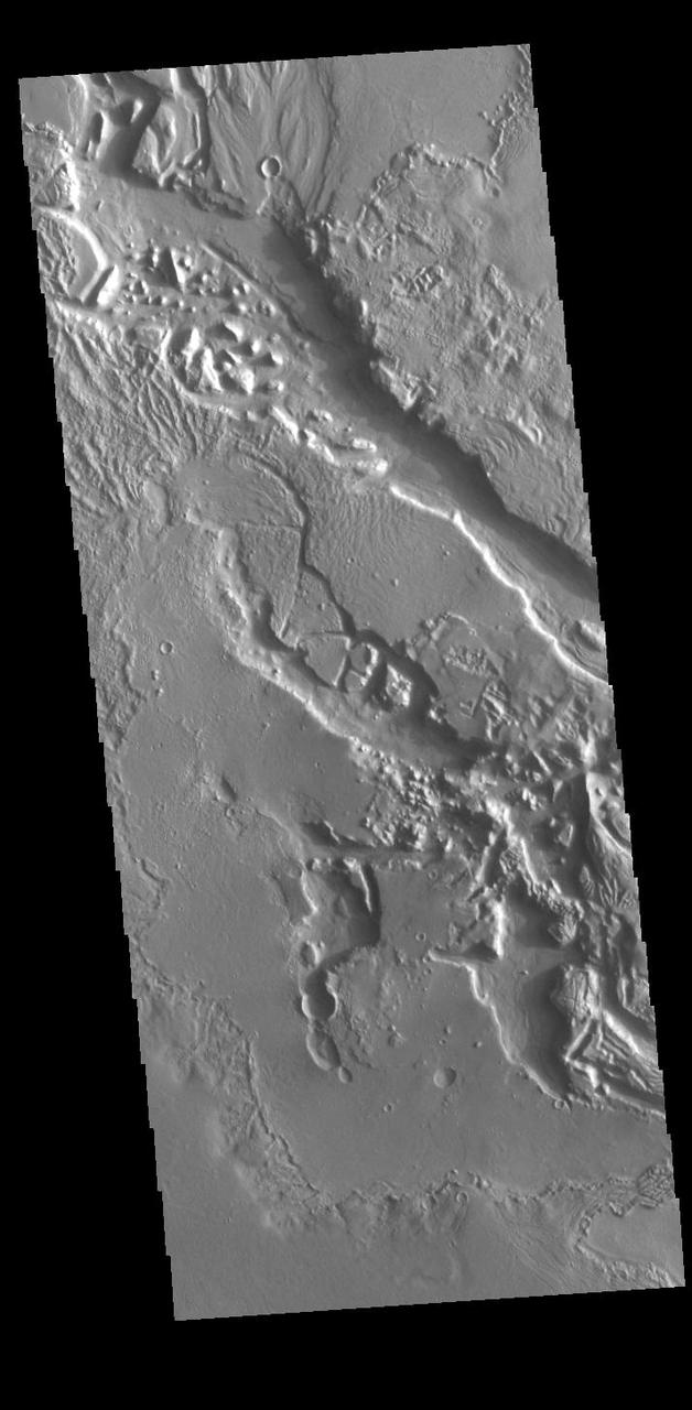
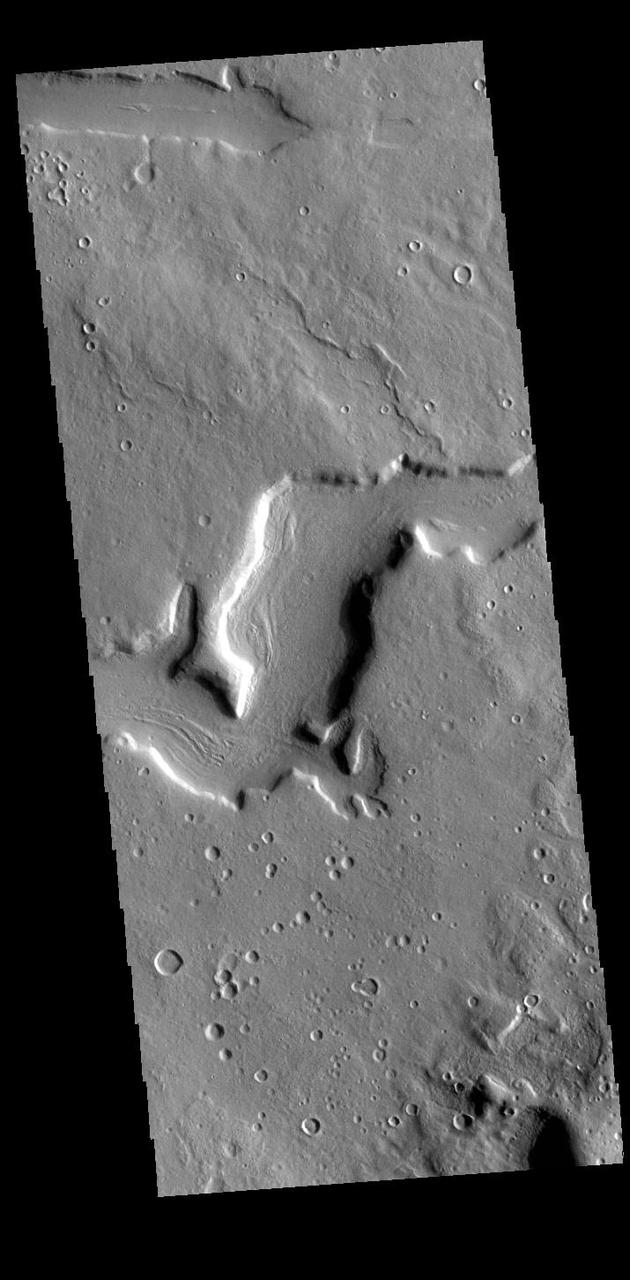
Today's VIS image shows part of southern Utopia Planitia. The irregular channel features are called Adamas Labyrinthus. Adamas Labyrinthus is approximately 853km (530 miles) along it's widest part. Orbit Number: 93897 Latitude: 35.6024 Longitude: 102.309 Instrument: VIS Captured: 2023-02-13 19:00 https://photojournal.jpl.nasa.gov/catalog/PIA25905
This VIS image is located in Utopia Planitia and shows part of Hephaestus Fossae. Hephaestus Fossae is a complex channel system. It has been proposed that the channel formed by the release of melted subsurface ice during an impact event. Additionally, the nearby Elysium volcanic center created subsurface heating that may have played a part in creating both Hephaestus Fossae and Hebrus Valles to the north. Orbit Number: 85286 Latitude: 17.535 Longitude: 127.087 Instrument: VIS Captured: 2021-03-06 18:17 https://photojournal.jpl.nasa.gov/catalog/PIA24823
This VIS image shows an unnamed crater located in Utopia Planitia. The surface of the ejecta contains radial grooves, visible on both the thicker near crater ejecta and the outer thin ejecta layer. The formation mechanism for the grooves is still unknown but several theories exist including basal surge flows and air pressure rock entrianment. Orbit Number: 79023 Latitude: 33.0045 Longitude: 86.1051 Instrument: VIS Captured: 2019-10-08 01:53 https://photojournal.jpl.nasa.gov/catalog/PIA23543
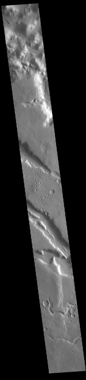
A variegated mottled texture located NW of the volcano Elysium Monsis is readily apparent in the terrain imaged here by NASA Mars Odyssey spacecraft. The Hrad Vallis channel system can be seen sauntering across the bumpy landscape of Utopia Planitia.
This VIS image is located in the region between northern Terra Sabaea and Utopia Planitia. This unnamed crater contains a small dune field. The crater rim is heavily eroded and it appears that some downslope movement on the interior of the rim may have included a volatile component such as ice. Orbit Number: 72636 Latitude: 42.2873 Longitude: 66.9553 Instrument: VIS Captured: 2018-04-30 01:22 https://photojournal.jpl.nasa.gov/catalog/PIA22618
Today's VIS image is located in northern Terra Sabaea, on the topographic boundary between the highlands of Terra Sabaea and the lower elevations of Utopia Planitia. Numerous channels and graben dissect this region. Orbit Number: 94023 Latitude: 33.809 Longitude: 67.6676 Instrument: VIS Captured: 2023-02-24 03:59 https://photojournal.jpl.nasa.gov/catalog/PIA25943
This VIS image is located at the eastern end of Hephaestus Fossae. Hephaestus Fossae is a channel system in Utopia Planitia near Elysium Mons. It has been proposed that the channel formed by the release of melted subsurface ice during the impact event that created a large crater west of this image. The method of formation for this complex feature at end of the channel is still unknown. Orbit Number: 72659 Latitude: 17.3167 Longitude: 126.988 Instrument: VIS Captured: 2018-05-01 22:42 https://photojournal.jpl.nasa.gov/catalog/PIA22621
Today's VIS image shows part of an unnamed crater in Utopia Planitia. The ejecta surrounding the crater rim shows both layering and radial grooves. These features formed during the impact event. Orbit Number: 77363 Latitude: 38.7001 Longitude: 99.283 Instrument: VIS Captured: 2019-05-24 09:13 https://photojournal.jpl.nasa.gov/catalog/PIA23328
This VIS image shows sand dunes on the floor of an unnamed crater located between Terra Sabaea and Utopia Planitia. The inner crater rim seen in the bottom half of the image has flow-like features. This morphology is usually indicative of material containing a volatile such as ice moving downslope. Orbit Number: 79947 Latitude: 42.4781 Longitude: 67.2101 Instrument: VIS Captured: 2019-12-23 03:56 https://photojournal.jpl.nasa.gov/catalog/PIA23744
This observation captured by NASA Mars Reconnaissance Orbiter shows a couple of landforms that may result from the loss of large amounts of ice from subsurface deposits: polygonal patterns of troughs and large scallop-shaped depressions.
This VIS image is located in Utopia Planitia and shows part of Hephaestus Fossae. Hephaestus Fossae is a complex channel system. It has been proposed that the channel formed by the release of melted subsurface ice during the impact event that created a large crater in the center of this image. Additionally, the nearby Elysium volcanic center created subsurface heating that may have played a part in creating both Hephaestus Fossae and Hebrus Valles to the north. Orbit Number: 81767 Latitude: 17.6969 Longitude: 125.709 Instrument: VIS Captured: 2020-05-21 00:22 https://photojournal.jpl.nasa.gov/catalog/PIA24014
This VIS image is located in Utopia Planitia and shows part of Hephaestus Fossae. Hephaestus Fossae is a complex channel system. It has been proposed that the channel formed by the release of melted subsurface ice during an impact event that created a large crater south of this image. Additionally, the nearby Elysium volcanic center created subsurface heating that may have played a part in creating both Hephaestus Fossae and Hebrus Valles to the north. Orbit Number: 85623 Latitude: 19.0345 Longitude: 124.821 Instrument: VIS Captured: 2021-04-03 12:15 https://photojournal.jpl.nasa.gov/catalog/PIA24858
Today's VIS image shows dust devil tracks in Utopia Planitia. The tracks occur where dust devils have scoured the fine materials off the underlying surface. In some cases dust devils can create arced tracks. The ones in this image are mostly linear. Orbit Number: 72335 Latitude: 51.4292 Longitude: 112.722 Instrument: VIS Captured: 2018-04-05 06:20 https://photojournal.jpl.nasa.gov/catalog/PIA22578
This image captured by NASA 2001 Mars Odyssey spacecraft show part of the ejecta of Bacolor Crater. The ejecta is layered and grooved, all radial to the crater itself. Bacolor Crater is located in Utopia Planitia. Orbit Number: 60710 Latitude: 33.4786 Longitude: 118.408 Instrument: VIS Captured: 2015-08-21 14:55 http://photojournal.jpl.nasa.gov/catalog/PIA20088
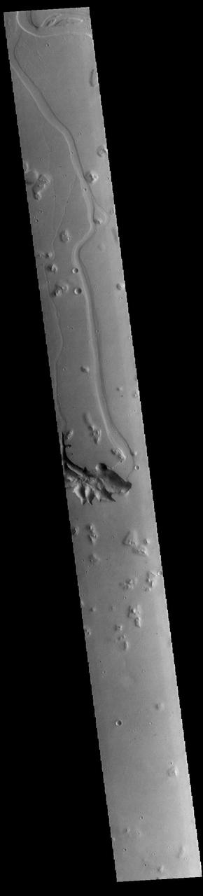
Today's VIS image shows a small section of Hrad Vallis. Hrad Vallis originates on the northwest margin of the Elysium Volcanic complex and flows into Utopia Planitia. Hrad Vallis is 825 km (513 miles) long. Orbit Number: 85822 Latitude: 33.8698 Longitude: 141.725 Instrument: VIS Captured: 2021-04-19 21:35 https://photojournal.jpl.nasa.gov/catalog/PIA24877
The THEMIS VIS camera contains 5 filters. The data from different filters can be combined in multiple ways to create a false color image. These false color images may reveal subtle variations of the surface not easily identified in a single band image. This VIS image shows the cloud tops of a large storm over Utopia Planitia. The clouds are composed mainly of dust and completely hide the surface. Orbit Number: 60143 Latitude: 56.7602 Longitude: 95.2069 Instrument: VIS Captured: 2015-07-05 22:51 https://photojournal.jpl.nasa.gov/catalog/PIA22679
This VIS image is located on the floor of an unnamed crater between Terra Sabaea and Utopia Planitia. The center of the image contains several regions of sand dunes. The dunes occupy the lowest elevation of the crater. Towards the bottom of the image is an unusual texture, most likely created by movement of a volatile rich material down towards the center of the crater. This may have formed in a glacial type material, rich in ice. Orbit Number: 72399 Latitude: 42.5577 Longitude: 67.2377 Instrument: VIS Captured: 2018-04-10 12:49 https://photojournal.jpl.nasa.gov/catalog/PIA22583
This VIS image is located in the southeastern portion of Hephaestus Fossae. Hephaestus Fossae is a complex channel system in Utopia Planitia near Elysium Mons. It has been proposed that the channel formed by the release of melted subsurface ice during the impact event that created a large crater west of this image. Additionally, the nearby Elysium volcanic center created subsurface heating that may have played a part in creating both Hephaestus Fossae and Hebrus Valles to the north. Hephaestus Fossae are over 600km long (373 miles). Orbit Number: 78847 Latitude: 17.5748 Longitude: 126.158 Instrument: VIS Captured: 2019-09-23 13:59 https://photojournal.jpl.nasa.gov/catalog/PIA23507
This VIS image is located in the central portion of Hephaestus Fossae. Hephaestus Fossae is a complex channel system in Utopia Planitia near Elysium Mons. It has been proposed that the channel formed by the release of melted subsurface ice during the impact event that created a large crater southeast of this image. Additionally, the nearby Elysium volcanic center created subsurface heating that may have played a part in creating both Hephaestus Fossae and Hebrus Valles to the north. Orbit Number: 82079 Latitude: 18.8004 Longitude: 124.5724 Instrument: VIS Captured: 2020-06-15 16:56 https://photojournal.jpl.nasa.gov/catalog/PIA24122
This VIS image is located in the central portion of Hephaestus Fossae. Hephaestus Fossae is a complex channel system in Utopia Planitia near Elysium Mons. It has been proposed that the channel formed by the release of melted subsurface ice during the impact event that created a large crater south of this image. Additionally, the nearby Elysium volcanic center created subsurface heating that may have played a part in creating both Hephaestus Fossae and Hebrus Valles to the north. Orbit Number: 77487 Latitude: 18.8111 Longitude: 124.593 Instrument: VIS Captured: 2019-06-03 14:10 https://photojournal.jpl.nasa.gov/catalog/PIA23335
This image covers part of the ejecta from an impact crater (about 6-kilometers in diameter) to the west in Utopia Planitia. The ejecta lobes have morphologies suggesting icy flow. Several small (about 100 to 200 meters in diameter) craters on top of those lobes have a distinctive formation. One interpretation is that the impact crater exposed nearly pure water ice, which then sublimated away where exposed by the slopes of the crater, expanding the crater's diameter and producing a scalloped appearance. The small polygons are another indicator of shallow ice. https://photojournal.jpl.nasa.gov/catalog/PIA23759
This VIS image is located in the northern portion of Hephaestus Fossae. Hephaestus Fossae is a complex channel system in Utopia Planitia near Elysium Mons. It has been proposed that the channels formed by the release of melted subsurface ice during the impact event that created a large crater southeast of this image. Additionally, the nearby Elysium volcanic center created subsurface heating that may have played a part in creating both Hephaestus Fossae and Hebrus Valles to the north. The right angle intersections indicate there is some tectonic activity in the region, and the circular depressions indicate surface collapse into subsurface voids. Hephaestus Fossae is a very complex set of features. Orbit Number: 88618 Latitude: 22.2991 Longitude: 121.441 Instrument: VIS Captured: 2021-12-06 02:47 https://photojournal.jpl.nasa.gov/catalog/PIA25199
This VIS image is located in the northern portion of Hephaestus Fossae. Hephaestus Fossae is a complex channel system in Utopia Planitia near Elysium Mons. It has been proposed that the channels formed by the release of melted subsurface ice during the impact event that created a large crater southeast of this image. Additionally, the nearby Elysium volcanic center created subsurface heating that may have played a part in creating both Hephaestus Fossae and Hebrus Valles to the north. The right angle intersections indicate there is some tectonic activity in the region, and the circular depressions indicate surface collapse into subsurface voids. Hephaestus Fossae is a very complex set of features. Orbit Number: 85960 Latitude: 21.3916 Longitude: 122.454 Instrument: VIS Captured: 2021-05-01 06:13 https://photojournal.jpl.nasa.gov/catalog/PIA24212
This VIS image is located in the northern portion of Hephaestus Fossae. Hephaestus Fossae is a complex channel system in Utopia Planitia near Elysium Mons. It has been proposed that the channels formed by the release of melted subsurface ice during the impact event that created a large crater southeast of this image. Additionally, the nearby Elysium volcanic center created subsurface heating that may have played a part in creating both Hephaestus Fossae and Hebrus Valles to the north. The right angle intersections indicate there is some tectonic activity in the region, and the circular depressions indicate surface collapse into subsurface voids. Hephaestus Fossae is a very complex set of features. Orbit Number: 88019 Latitude: 21.1587 Longitude: 122.646 Instrument: VIS Captured: 2021-10-17 19:02 https://photojournal.jpl.nasa.gov/catalog/PIA25111
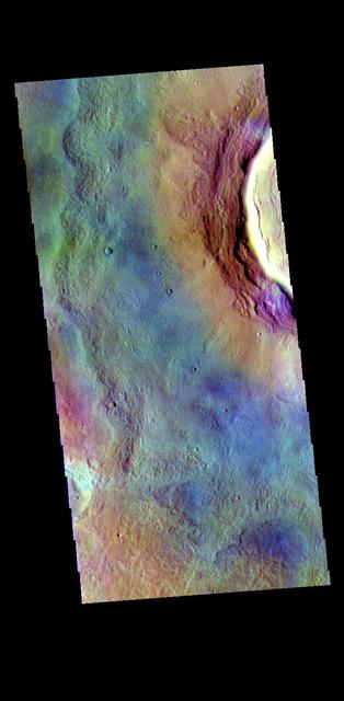
Today's image shows part of the floor of Renaudot Crater, located on the margin between Terra Sabaea and Utopia Planitia. The small dark blue features at the top right corner of the image are sand dunes. Dark blue is this false color combination indicates that these dunes are comprised of basaltic sands. The THEMIS VIS camera contains 5 filters. The data from different filters can be combined in multiple ways to create a false color image. These false color images may reveal subtle variations of the surface not easily identified in a single band image. Orbit Number: 63594 Latitude: 41.6455 Longitude: 62.4624 Instrument: VIS Captured: 2016-04-15 03:21 https://photojournal.jpl.nasa.gov/catalog/PIA23255
Today's VIS image shows an unnamed channel in northern Terra Sabaea. The regional boundary between the highlands of Terra Sabaea and lowlands of Utopia Planitia is heavily dissected by both fluid flow channels and extensive faulting. Orbit Number: 79922 Latitude: 28.8312 Longitude: 70.6552 Instrument: VIS Captured: 2019-12-21 02:28 https://photojournal.jpl.nasa.gov/catalog/PIA23741
Today's VIS image shows an unnamed channel in northern Terra Sabaea. The regional boundary between the highlands of Terra Sabaea and lowlands of Utopia Planitia is heavily dissected by both fluid flow channels and extensive faulting. Orbit Number: 86125 Latitude: 38.054 Longitude: 39.8599 Instrument: VIS Captured: 2021-05-14 20:22 https://photojournal.jpl.nasa.gov/catalog/PIA24224
Today's VIS image shows part of Arena Colles. The term colles means hills. Arena Colles is located on the margin where Terra Sabaea steps down in elevation into Utopia Planitia. Orbit Number: 77476 Latitude: 25.1573 Longitude: 81.0592 Instrument: VIS Captured: 2019-06-02 16:28 https://photojournal.jpl.nasa.gov/catalog/PIA23333
This image captured by NASA 2001 Mars Odyssey spacecraft is located on the eastern margin of Terra Sabaea. The boundary region between the highlands of Terra Sabaea and the lower elevations of Utopia Planitia is a complex of channels, chaos and graben. Orbit Number: 63956 Latitude: 35.3885 Longitude: 56.728 Instrument: VIS Captured: 2016-05-14 22:55 http://photojournal.jpl.nasa.gov/catalog/PIA20781
This image taken by NASA Mars Reconnaissance Orbiter in the Cydnus Rupes region, shows that the northern plains of Mars are rock and boulder strewn landscapes otherwise devoid of major features except a few impact craters.
Mie Crater, a large basin formed by asteroid or comet impact in Utopia Planitia, lies at the center of this Mars Global Surveyor (MGS) Mars Orbiter Camera (MOC) red wide angle image. The crater is approximately 104 km (65 mi) across. To the east and southeast (toward the lower right) of Mie, in this 5 December 2003 view, are clouds of dust and water ice kicked up by local dust storm activity. It is mid-winter in the northern hemisphere of Mars, a time when passing storms are common on the northern plains of the red planet. Sunlight illuminates this image from the lower left; Mie Crater is located at 48.5°N, 220.3°W. Viking 2 landed west/southwest of Mie Crater, off the left edge of this image, in September 1976. http://photojournal.jpl.nasa.gov/catalog/PIA04930
This VIS image shows part of Hephaestus Fossae. Hephaestus Fossae is a complex channel system in Utopia Planitia near Elysium Mons. It has been proposed that the channel formed by the release of melted subsurface ice during the impact event that created the crater just off the left side of the image – only the ejecta is seen in this image. The crater is fairly young, as there is only minimal modification of the crater floor. While it appears that the crater sits of top of the channel, the creation of the crater may have also created the channel. The impact event would have caused subsurface heating, melting any subsurface ice in the region which would have created surface flow to form the channel. Additionally, the nearby Elysium volcanic center created subsurface heating that may have played a part in creating both Hephaestus Fossae and Hebrus Valles to the north. Orbit Number: 94645 Latitude: 17.6141 Longitude: 126.055 Instrument: VIS Captured: 2023-04-16 09:02 https://photojournal.jpl.nasa.gov/catalog/PIA26040
This VIS image is located in the central portion of Hephaestus Fossae. Hephaestus Fossae is a complex channel system in Utopia Planitia near Elysium Mons. It has been proposed that the channel formed by the release of melted subsurface ice during the impact event that created the crater in this image. Additionally, the nearby Elysium volcanic center created subsurface heating that may have played a part in creating both Hephaestus Fossae and Hebrus Valles to the north. Orbit Number: 81193 Latitude: 18.8168 Longitude: 124.985 Instrument: VIS Captured: 2020-04-03 18:04 https://photojournal.jpl.nasa.gov/catalog/PIA23938
This VIS image is located in the central portion of Hephaestus Fossae. Hephaestus Fossae is a complex channel system in Utopia Planitia near Elysium Mons. It has been proposed that the channel formed by the release of melted subsurface ice during the impact event that created a large crater south of this image. Additionally, the nearby Elysium volcanic center created subsurface heating that may have played a part in creating both Hephaestus Fossae and Hebrus Valles to the north. Orbit Number: 79159 Latitude: 19.0493 Longitude: 124.534 Instrument: VIS Captured: 2019-10-19 06:34 https://photojournal.jpl.nasa.gov/catalog/PIA23579
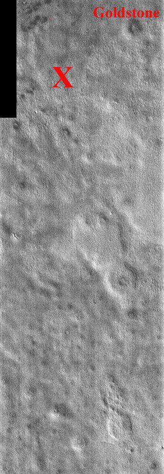
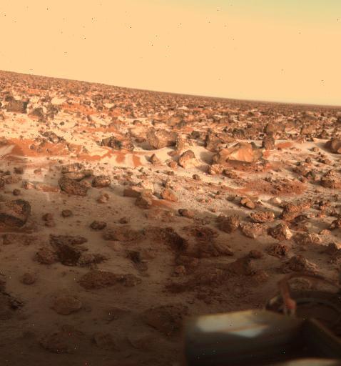
This portion of NASA Mars Odyssey image covers NASA Viking 2 landing site shown with the X. The second landing on Mars took place September 3, 1976 in Utopia Planitia. The exact location of Lander 2 is not as well established as Lander 1 because there were no clearly identifiable features in the lander images as there were for the site of Lander 1. The Utopia landing site region contains pedestal craters, shallow swales and gentle ridges. The crater Goldstone was named in honor of the Tracking Station in the desert of California. The two Viking Landers operated for over 6 years (nearly four martian years) after landing. This one band IR (band 9 at 12.6 microns) image shows bright and dark textures, which are primarily due to differences in the abundance of rocks on the surface. The relatively cool (dark) regions during the day are rocky or indurated materials, fine sand and dust are warmer (bright). Many of the temperature variations are due to slope effects, with sun-facing slopes warmer than shaded slopes. The dark rings around several of the craters are due to the presence of rocky (cool) material ejected from the crater. These rocks are well below the resolution of any existing Mars camera, but THEMIS can detect the temperature variations they produce. Daytime temperature variations are produced by a combination of topographic (solar heating) and thermophysical (thermal inertia and albedo) effects. Due to topographic heating the surface morphologies seen in THEMIS daytime IR images are similar to those seen in previous imagery and MOLA topography. http://photojournal.jpl.nasa.gov/catalog/PIA04023
Located west of the Elysium Volcanic complex, Hebrus Valles is a channel system that flowed to the north. This VIS image shows the complex region at the start of the channel. The process that formed the channel system is unknown. Some of the channel features have the appearance of being formed by liquid flow. In other portions of the valles, there are pits and collapse features which appear to have formed by material falling into subsurface voids. This is a common feature in regions of volcanic activity where lava tubes run below the surface. Both water and lava probably contributed to the formation of Hebrus Valles. Hebrus Valles is located in southern Utopia Planitia and is 325km (202 miles) long. Orbit Number: 86147 Latitude: 17.8139 Longitude: 128.204 Instrument: VIS Captured: 2021-05-16 15:44 https://photojournal.jpl.nasa.gov/catalog/PIA24225

This VIS image shows a double impact - two meteors hitting simultaneously. The two meteors would have started as a single object, at some point prior to impact the object separated into parts. The two parts followed the same path to the surface, hitting at the same time in close proximity. The linear feature at the center is where the shock waves intersect, its straightness showing the impacts were simultaneous (and nearly equal in size). The ejecta created from the impact tends to be focused to the sides of the doublet, often forming a butterfly-like ejecta blanket. The butterfly pattern is most common at oblique angle impacts, but can also form by the interaction of the impact shock waves. These craters are located in Utopia Planitia. Orbit Number: 72448 Latitude: 27.1977 Longitude: 95.4916 Instrument: VIS Captured: 2018-04-14 13:36 https://photojournal.jpl.nasa.gov/catalog/PIA22606
This VIS image is located in the central portion of Hephaestus Fossae. Hephaestus Fossae is a complex channel system in Utopia Planitia near Elysium Mons. It has been proposed that the channel formed by the release of melted subsurface ice during the impact event that created a large crater south of this image. Additionally, the nearby Elysium volcanic center created subsurface heating that may have played a part in creating both Hephaestus Fossae and Hebrus Valles to the north. Since many of the channels have right angle intersections, tectonic forces may also have played a part in the formation of this system. In fact, the entire feature is called a 'fossae' rather than a 'vallis', recognizing the dual forces of tectonic stresses and fluid flow. The entire system is approximately 605km long (375 miles). Orbit Number: 79446 Latitude: 19.3029 Longitude: 124.484 Instrument: VIS Captured: 2019-11-11 21:45 https://photojournal.jpl.nasa.gov/catalog/PIA23661
Today's VIS image shows part of the northeastern margin of Terra Sabaea. This regional boundary between the highlands of Terra Sabaea and lowlands of Utopia Planitia is heavily dissected by both fluid flow channels and extensive faulting. While many of the channels are unnamed, this image has three named channels: Clasia Vallis (center of image with ridge in the middle of the channel), Hypsas Vallis (the next channel below Clasia Vallis) and Clanis Valles (the very shallow channel at the bottom of the image). Clasia Vallis is 147km (91 miles) long, Hypsas Vallis is 33km (20 miles) long. and Clanis Valles is 58km (36 miles) long. Orbit Number: 94223 Latitude: 34.7195 Longitude: 57.7232 Instrument: VIS Captured: 2023-03-12 15:13 https://photojournal.jpl.nasa.gov/catalog/PIA25993
This VIS image shows part of Hephaestus Fossae. Hephaestus Fossae is a complex channel system in Utopia Planitia near Elysium Mons. It has been proposed that the channel formed by the release of melted subsurface ice during the impact event that created the crater just off the bottom right of the image – only the ejecta is seen in this image. The crater is fairly young, as there is only minimal modification of the crater floor. While it appears that the crater sits of top of the channel, the creation of the crater may have also created the channel. The impact event would have caused subsurface heating, melting any subsurface ice in the region which would have created surface flow to form the channel. Additionally, the nearby Elysium volcanic center created subsurface heating that may have played a part in creating both Hephaestus Fossae and Hebrus Valles to the north. The THEMIS VIS camera is capable of capturing color images of the Martian surface using five different color filters. In this mode of operation, the spatial resolution and coverage of the image must be reduced to accommodate the additional data volume produced from using multiple filters. To make a color image, three of the five filter images (each in grayscale) are selected. Each is contrast enhanced and then converted to a red, green, or blue intensity image. These three images are then combined to produce a full color, single image. Because the THEMIS color filters don't span the full range of colors seen by the human eye, a color THEMIS image does not represent true color. Also, because each single-filter image is contrast enhanced before inclusion in the three-color image, the apparent color variation of the scene is exaggerated. Nevertheless, the color variation that does appear is representative of some change in color, however subtle, in the actual scene. Note that the long edges of THEMIS color images typically contain color artifacts that do not represent surface variation. Orbit Number: 86796 Latitude: 17.9392 Longitude: 125.437 Instrument: VIS Captured: 2021-07-09 02:13 https://photojournal.jpl.nasa.gov/catalog/PIA24995