
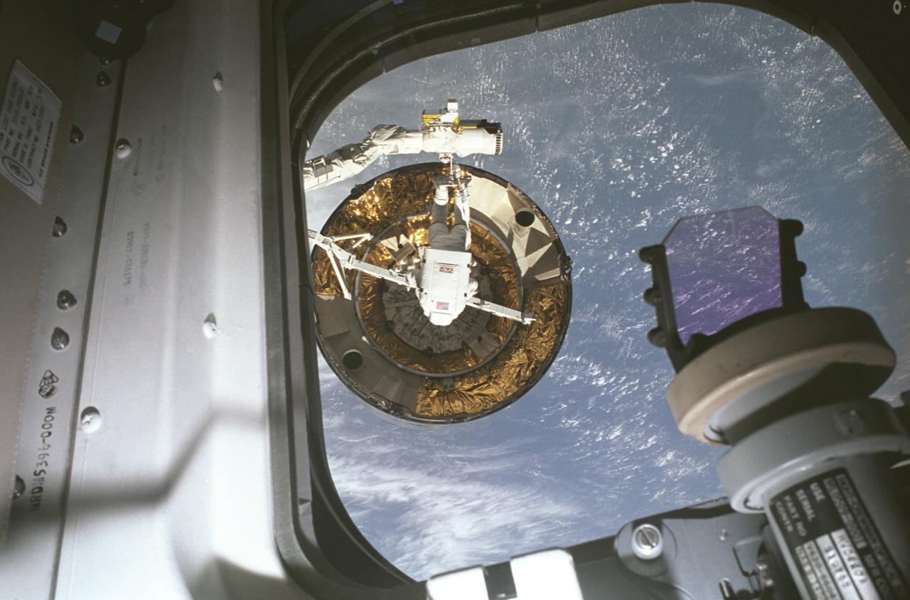
The Orion spacecraft delivers the Crew and Science Airlock (represented here by a government reference design) to the Gateway Space Station on the Artemis VI mission. The Mohammed Bin Rashid Space Centre of the United Arab Emirates will provide the airlock for Gateway, humanity's first space station that will orbit the Moon.
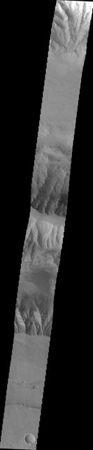
Russell Crater Dunes VIS
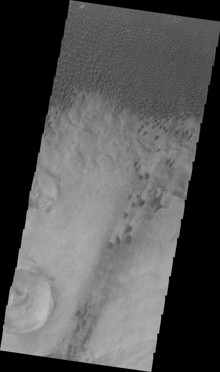
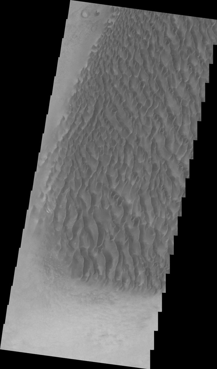
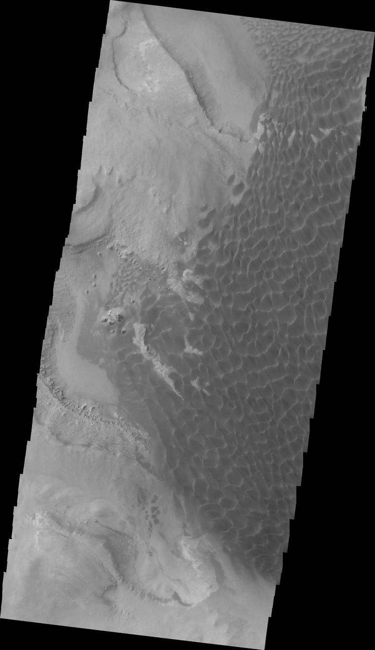
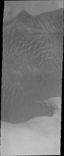
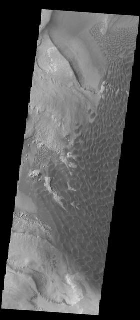
Aonia Terra Dunes VIS
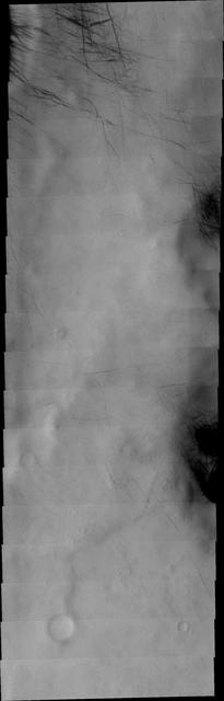
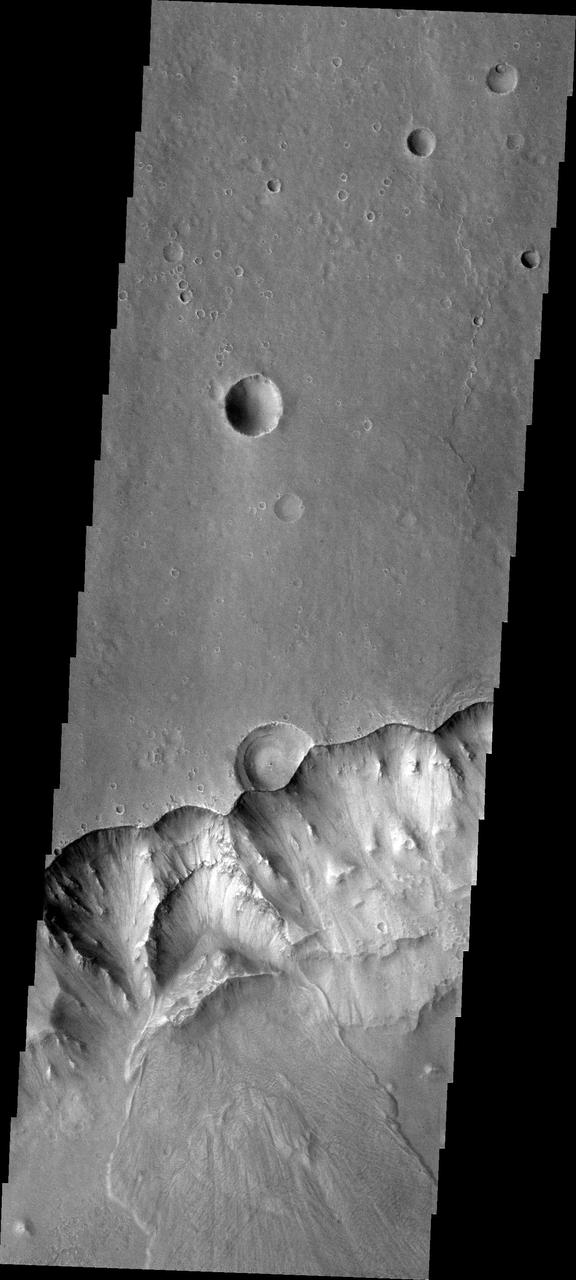
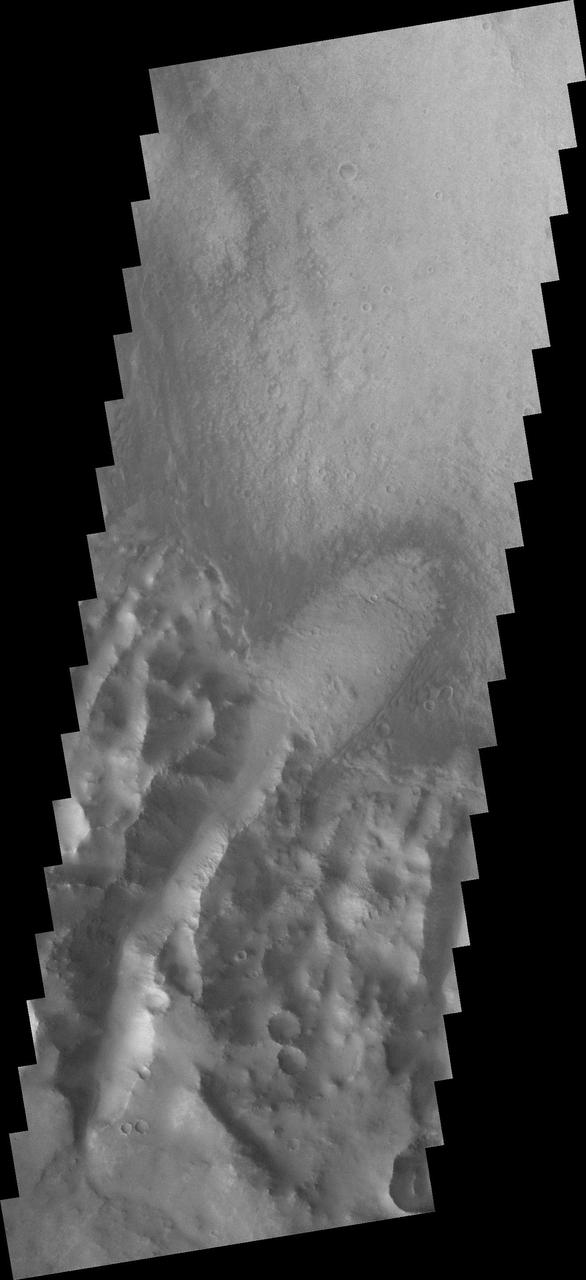
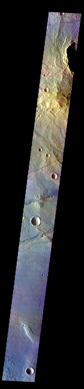
Russell Crater - VIS
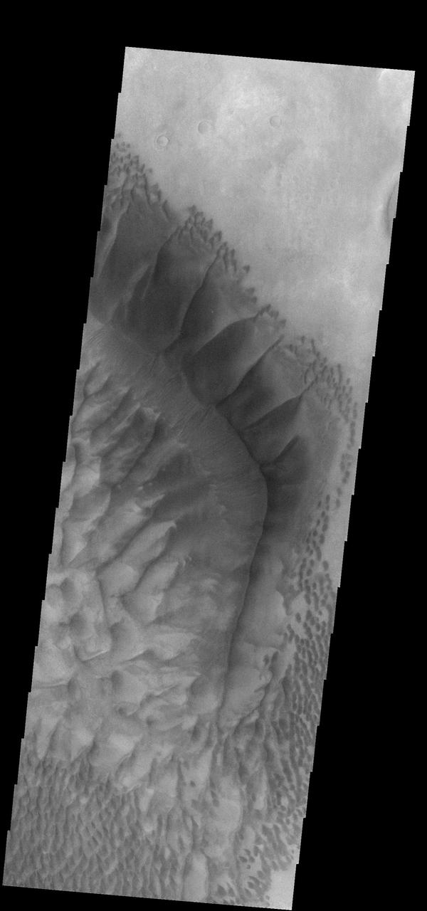
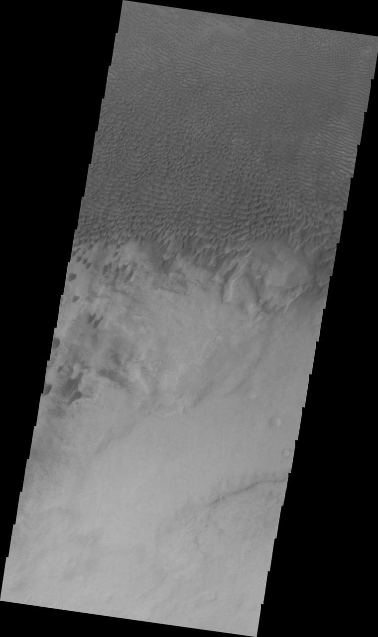
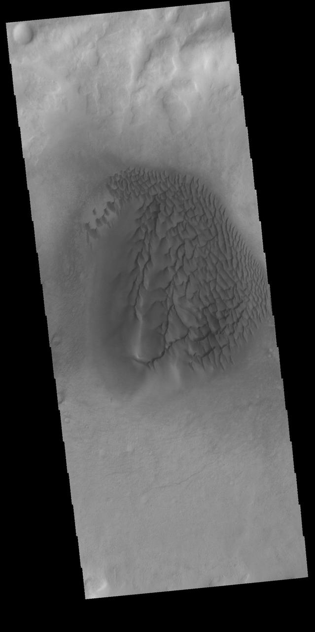
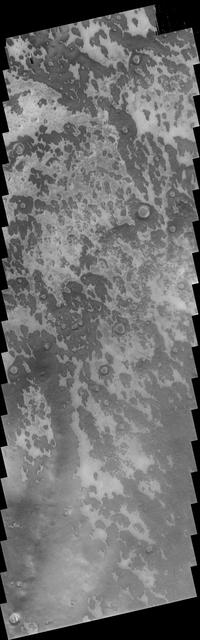
Kaiser Crater Dunes VIS
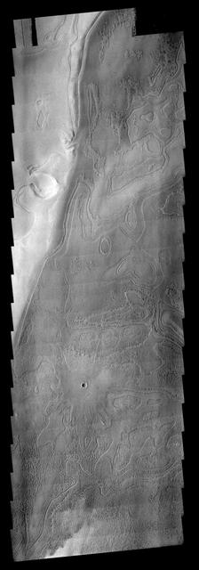
Terra Cimmeria Dunes VIS
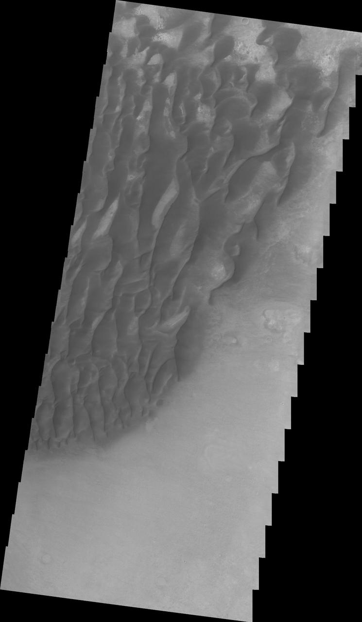
Proctor Crater Dunes VIS
Dunes in Aonia Terra VIS
Kaiser Crater Dunes VIS
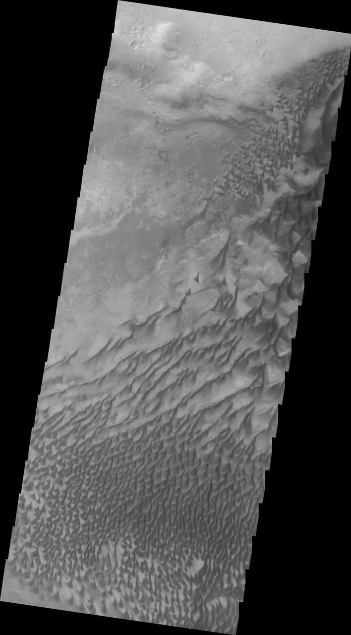
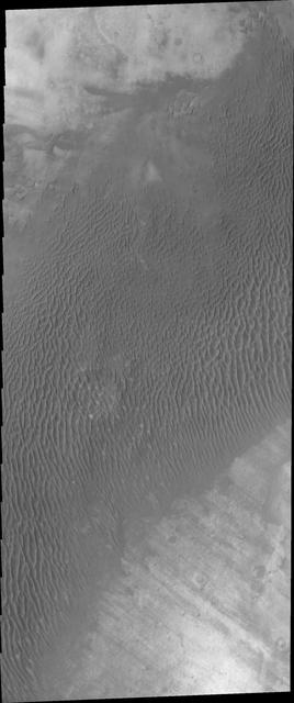
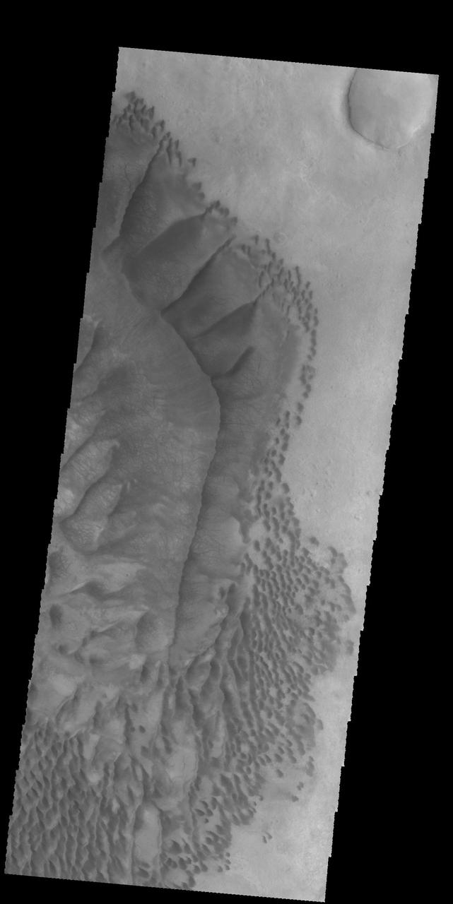
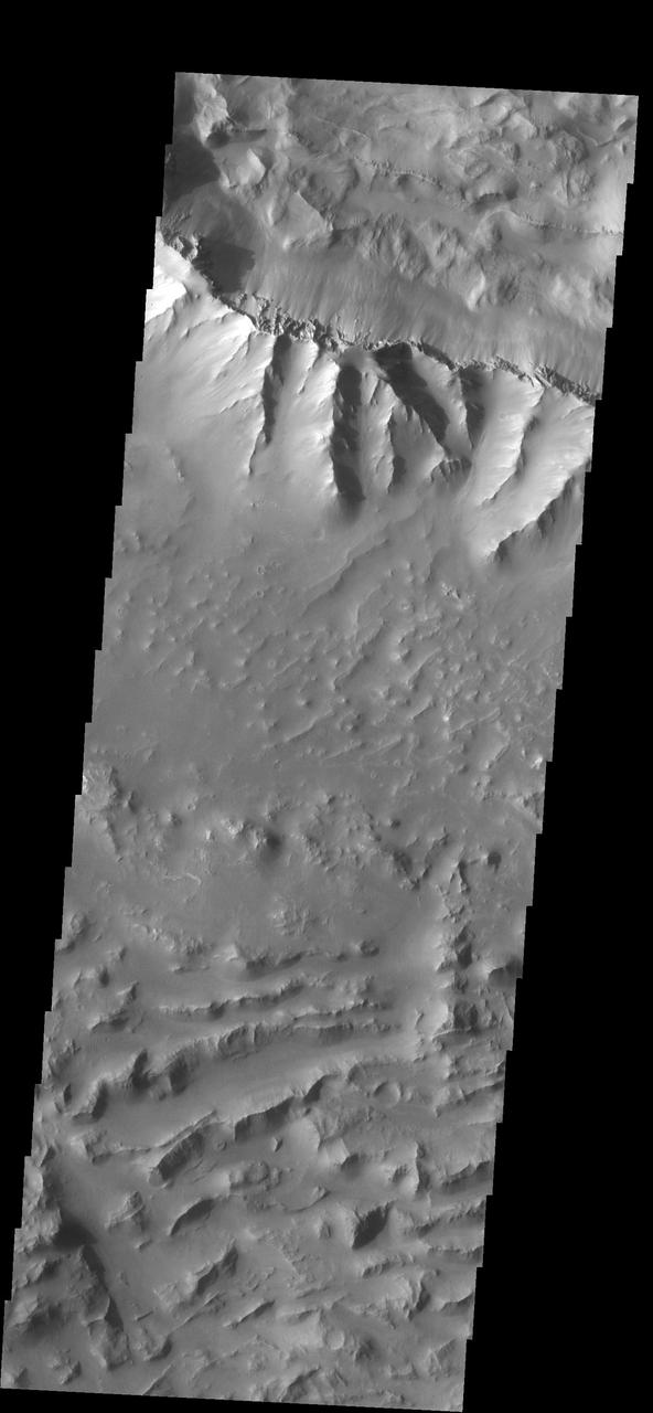
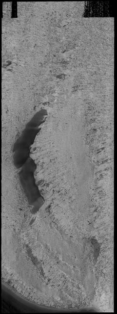
Russell Crater VIS
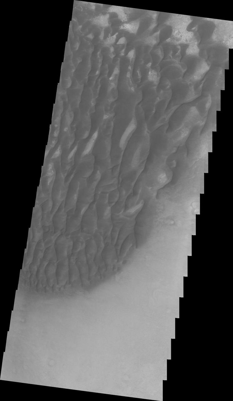
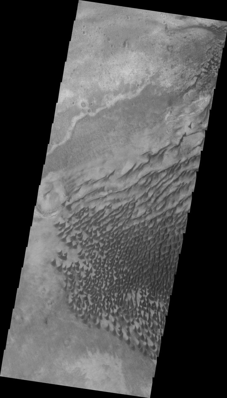
Rabe Crater Dunes VIS
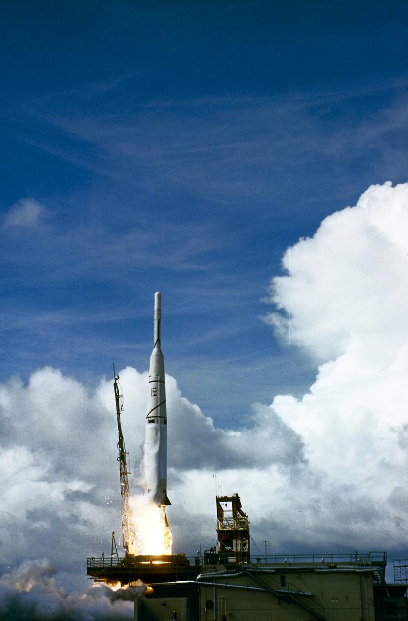
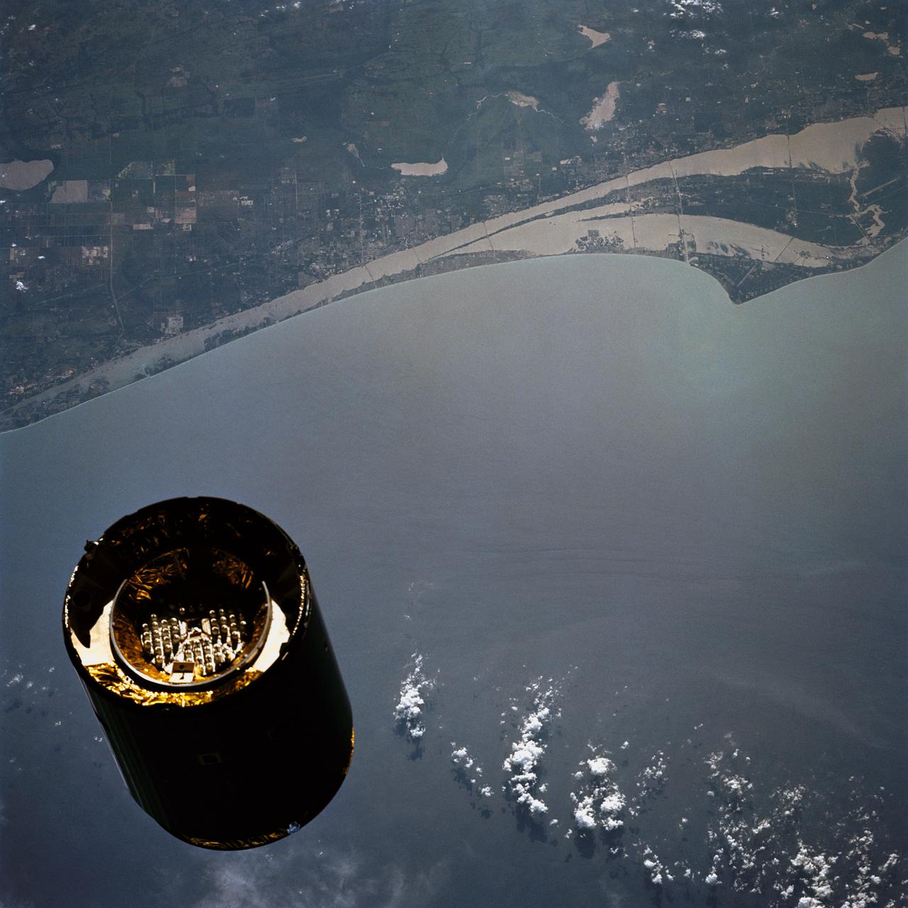
The launch of Thor/Able 3 launch vehicle on August 6, 1959, from the Atlantic Missile Range. The payload was Explorer VI for meteorology study.
This VIS image captured by NASA 2001 Mars Odyssey spacecraft was collected at the same time as yesterday IR image. The dunes are darker in visible wavelengths than the surrounding material. Latitude: -52.2059 Longitude: 33.364 Instrument: VIS Captured: 2015-01-29 09:20 http://photojournal.jpl.nasa.gov/catalog/PIA19234
This image from NASA 2001 Mars Odyssey spacecraft was collected at the same time as yesterday IR image. The dunes are dark in the VIS image, because the material is darker in color than the surrounding material. Latitude: -54.3016 Longitude: 13.1403 Instrument: VIS Captured: 2015-01-21 17:09 http://photojournal.jpl.nasa.gov/catalog/PIA19229
This VIS image of Charlier Crater sand sheet was taken at the same time as yesterday THEMIS IR image. In this image the dunes are darker than the surroundings, unlike yesterday thermal image.
STS-49, the first flight of the Space Shuttle Orbiter Endeavour, lifted off from launch pad 39B on May 7, 1992 at 6:40 pm CDT. The STS-49 mission was the first U.S. orbital flight to feature 4 extravehicular activities (EVAs), and the first flight to involve 3 crew members working simultaneously outside of the spacecraft. The primary objective was the capture and redeployment of the INTELSAT VI (F-3), a communication satellite for the International Telecommunication Satellite organization, which was stranded in an unusable orbit since its launch aboard the Titan rocket in March 1990. Recorded with a 35 mm camera inside Endeavour’s cabin, is astronaut Pierre Thuot after his second unsuccessful attempt to affix a specially designed grapple bar to the 4.5 ton INTELSAT VI.
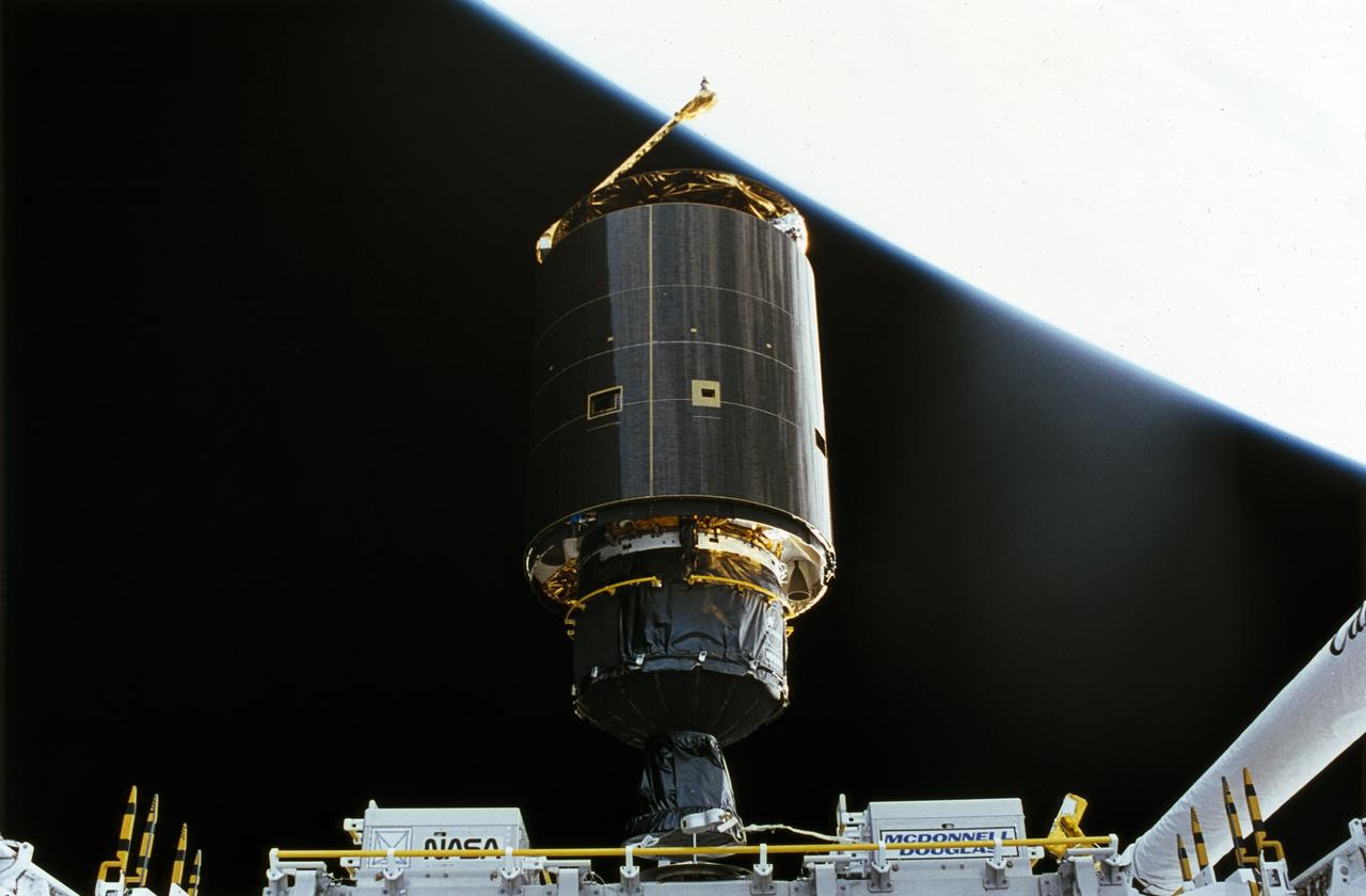
STS-49, the first flight of the Space Shuttle Orbiter Endeavour, lifted off from launch pad 39B on May 7, 1992 at 6:40 pm CDT. The STS-49 mission was the first U.S. orbital flight to feature 4 extravehicular activities (EVAs), and the first flight to involve 3 crew members working simultaneously outside of the spacecraft. The primary objective was the capture and redeployment of the INTELSAT VI (F-3), a communication satellite for the International Telecommunication Satellite organization, which was stranded in an unusable orbit since its launch aboard the Titan rocket in March 1990. The 4.5 ton INTELSAT VI was successfully snared by three astronauts on a third EVA. In this photo, the satellite, with its newly deployed perigee stage, begins its separation from the Shuttle.
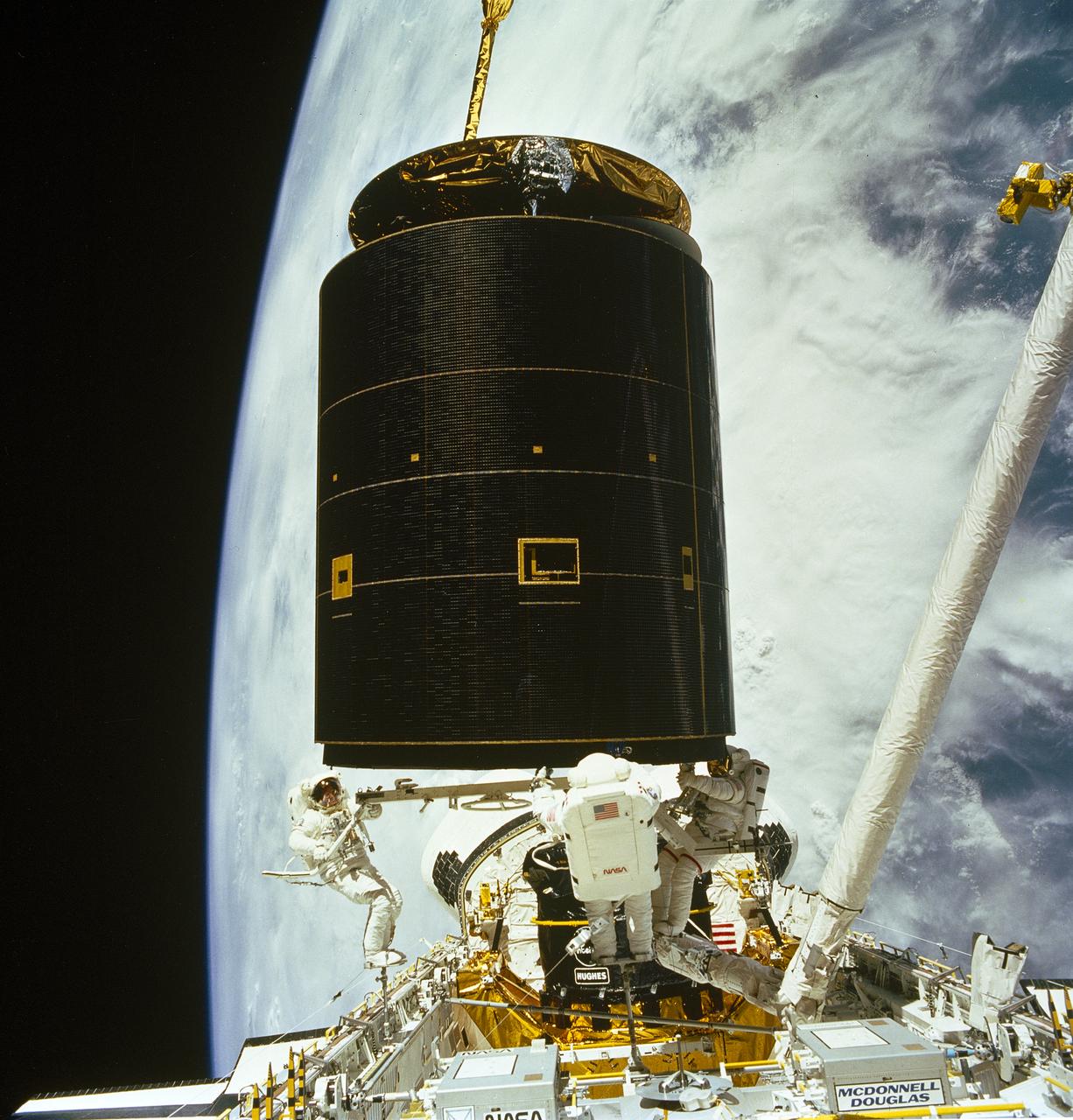
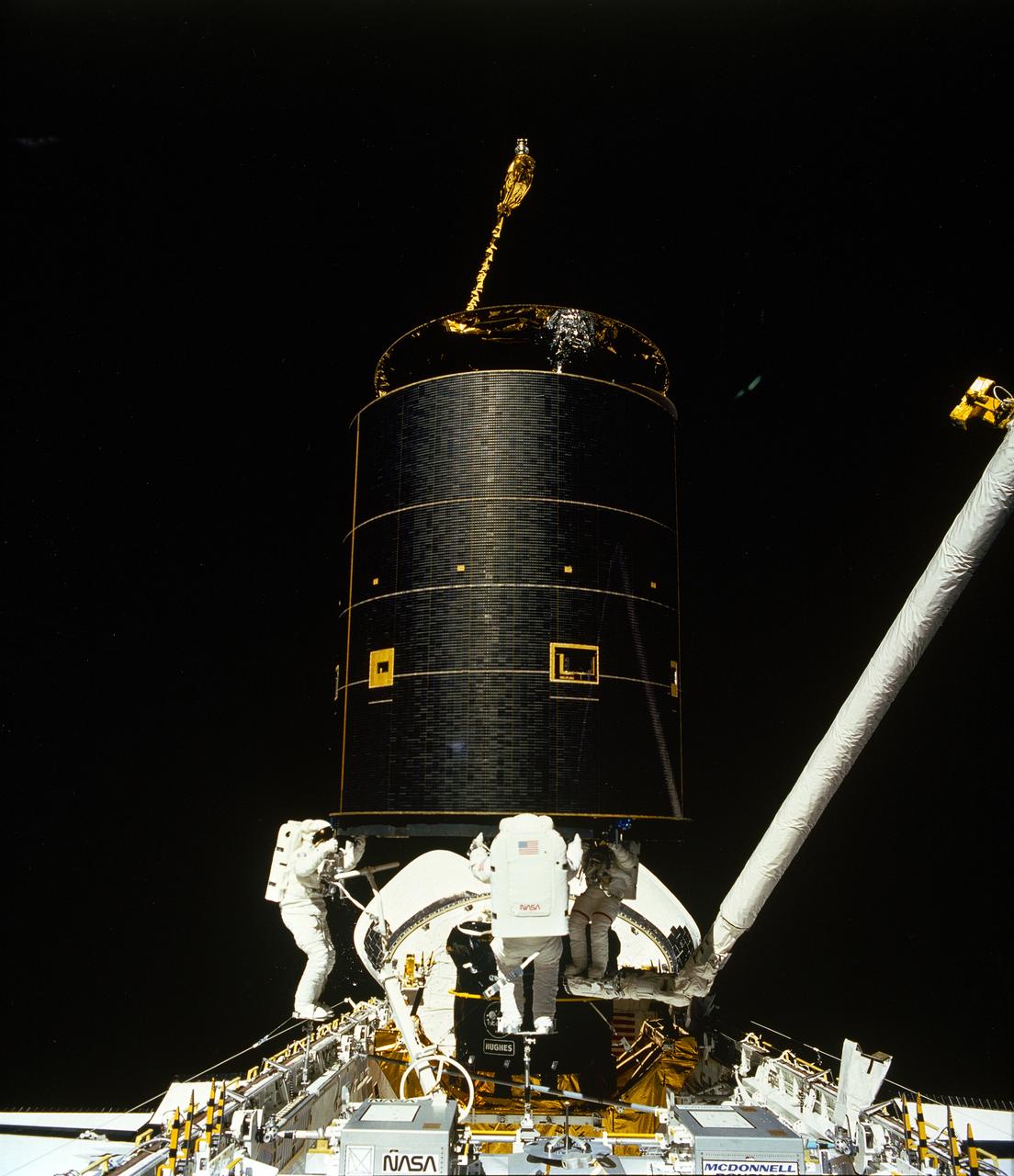
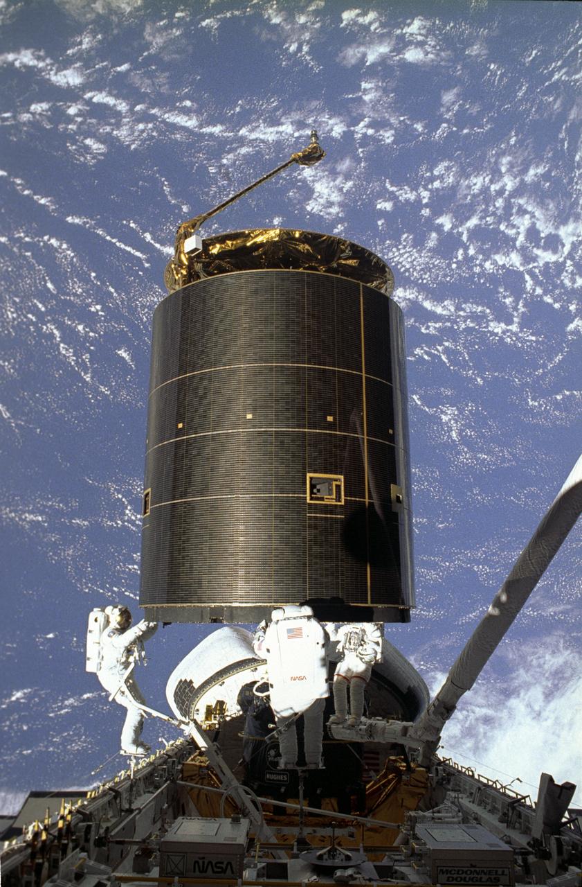
STS-49, the first flight of the Space Shuttle Orbiter Endeavour, lifted off from launch pad 39B on May 7, 1992 at 6:40 pm CDT. The STS-49 mission was the first U.S. orbital flight to feature 4 extravehicular activities (EVAs), and the first flight to involve 3 crew members working simultaneously outside of the spacecraft. The primary objective was the capture and redeployment of the INTELSAT VI (F-3), a communication satellite for the International Telecommunication Satellite organization, which was stranded in an unusable orbit since its launch aboard the Titan rocket in March 1990. After securing the satellite with the Remote Manipulator System (RMS), the crew proceeded with preparing the satellite for its release into space.
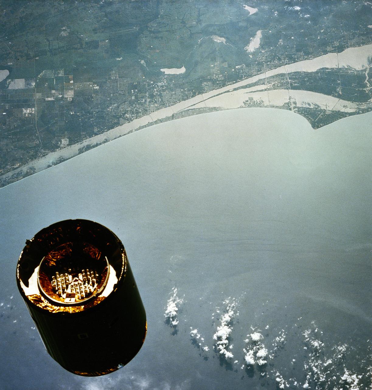
STS-49, the first flight of the Space Shuttle Orbiter Endeavour, lifted off from launch pad 39B on May 7, 1992 at 6:40 pm CDT. The STS-49 mission was the first U.S. orbital flight to feature 4 extravehicular activities (EVAs), and the first flight to involve 3 crew members working simultaneously outside of the spacecraft. The primary objective was the capture and redeployment of the INTELSAT VI (F-3), a communication satellite for the International Telecommunication Satellite organization, which was stranded in an unusable orbit since its launch aboard the Titan rocket in March 1990. This onboard photo depicts Florida’s Atlantic coast and the Cape Canaveral area as the backdrop for this scene of the INTELSAT VI’s approach to the Shuttle Endeavour.
STS-49, the first flight of the Space Shuttle Orbiter Endeavour, lifted off from launch pad 39B on May 7, 1992 at 6:40 pm CDT. The STS-49 mission was the first U.S. orbital flight to feature 4 extravehicular activities (EVAs), and the first flight to involve 3 crew members working simultaneously outside of the spacecraft. The primary objective was the capture and redeployment of the INTELSAT VI (F-3), a communication satellite for the International Telecommunication Satellite organization, which was stranded in an unusable orbit since its launch aboard the Titan rocket in March 1990. The 4.5 ton INTELSAT VI was successfully snared by three astronauts on a third EVA. The three hand-grabbed the errant satellite, pulled it into the cargo bay, and attached a boost-given perigee stage before its release.
STS-49, the first flight of the Space Shuttle Orbiter Endeavour, lifted off from launch pad 39B on May 7, 1992 at 6:40 pm CDT. The STS-49 mission was the first U.S. orbital flight to feature 4 extravehicular activities (EVAs), and the first flight to involve 3 crew members working simultaneously outside of the spacecraft. The primary objective was the capture and redeployment of the INTELSAT VI (F-3), a communication satellite for the International Telecommunication Satellite organization, which was stranded in an unusable orbit since its launch aboard the Titan rocket in March 1990. The 4.5 ton INTELSAT VI was successfully snared by three astronauts on a third EVA. The three hand-grabbed the errant satellite, pulled it into the cargo bay, and attached a boost-given perigee stage before its release.
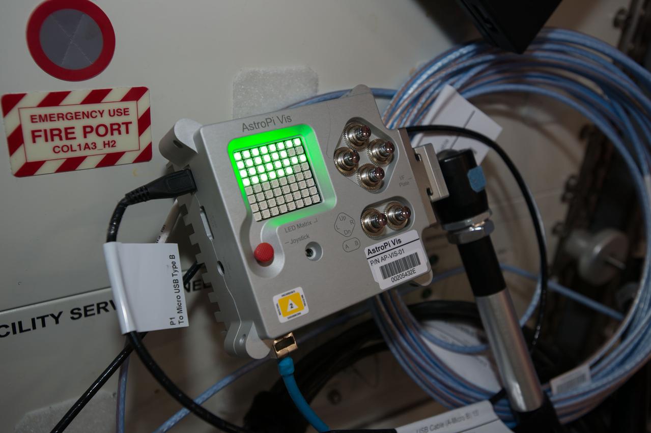
iss050e011416 (11/23/2016) --- A view of Astro PI Camera VIS being powered up. One of the goals of the Astro Pi mission was to enable school-age students to gain inexpensive access to the same computer used by the crew of the ISS. This is made possible by the low-cost Raspberry Pi. Photo was taken during Expedition 50 onboard the International Space Station (ISS).
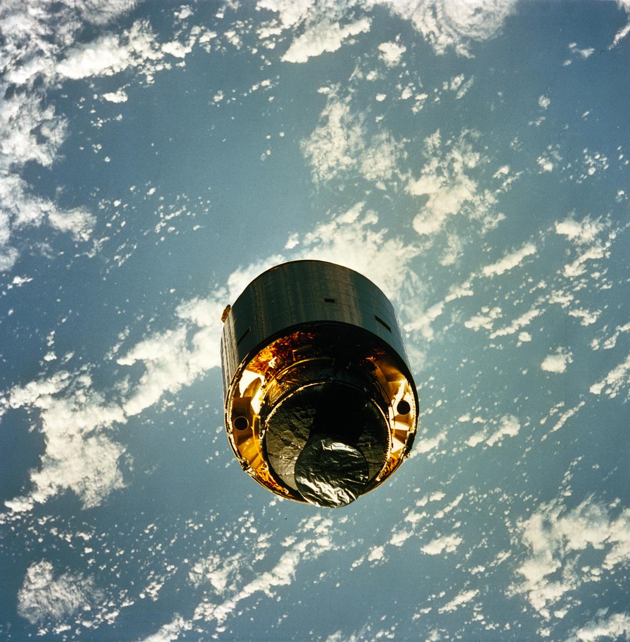
STS-49, the first flight of the Space Shuttle Orbiter Endeavour, lifted off from launch pad 39B on May 7, 1992 at 6:40 pm CDT. The STS-49 mission was the first U.S. orbital flight to feature 4 extravehicular activities (EVAs), and the first flight to involve 3 crew members working simultaneously outside of the spacecraft. The primary objective was the capture and redeployment of the INTELSAT VI (F-3), a communication satellite for the International Telecommunication Satellite organization, which was stranded in an unusable orbit since its launch aboard the Titan rocket in March 1990. The 4.5 ton satellite was successfully snared by three astronauts on a third EVA. The three hand-grabbed the errant satellite, pulled it into the cargo bay, and attached a boost-given perigee stage before its release. In this photo, the satellite spins slowly out of cargo bay to begin its “new lift”.
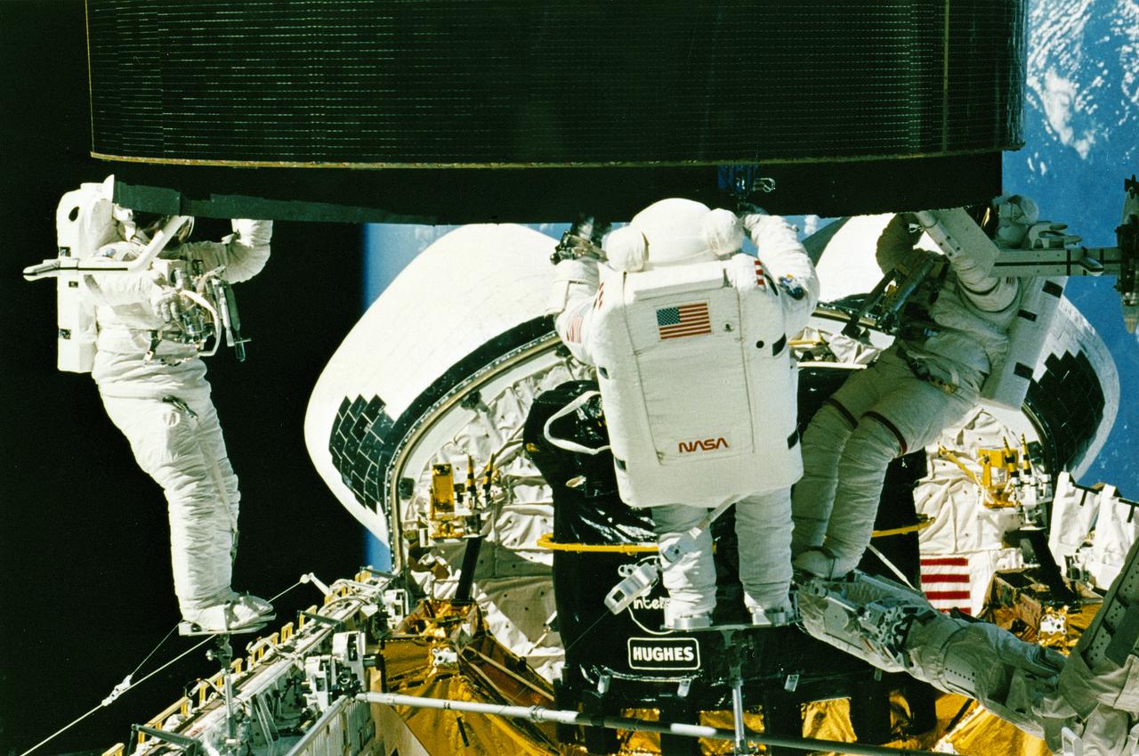
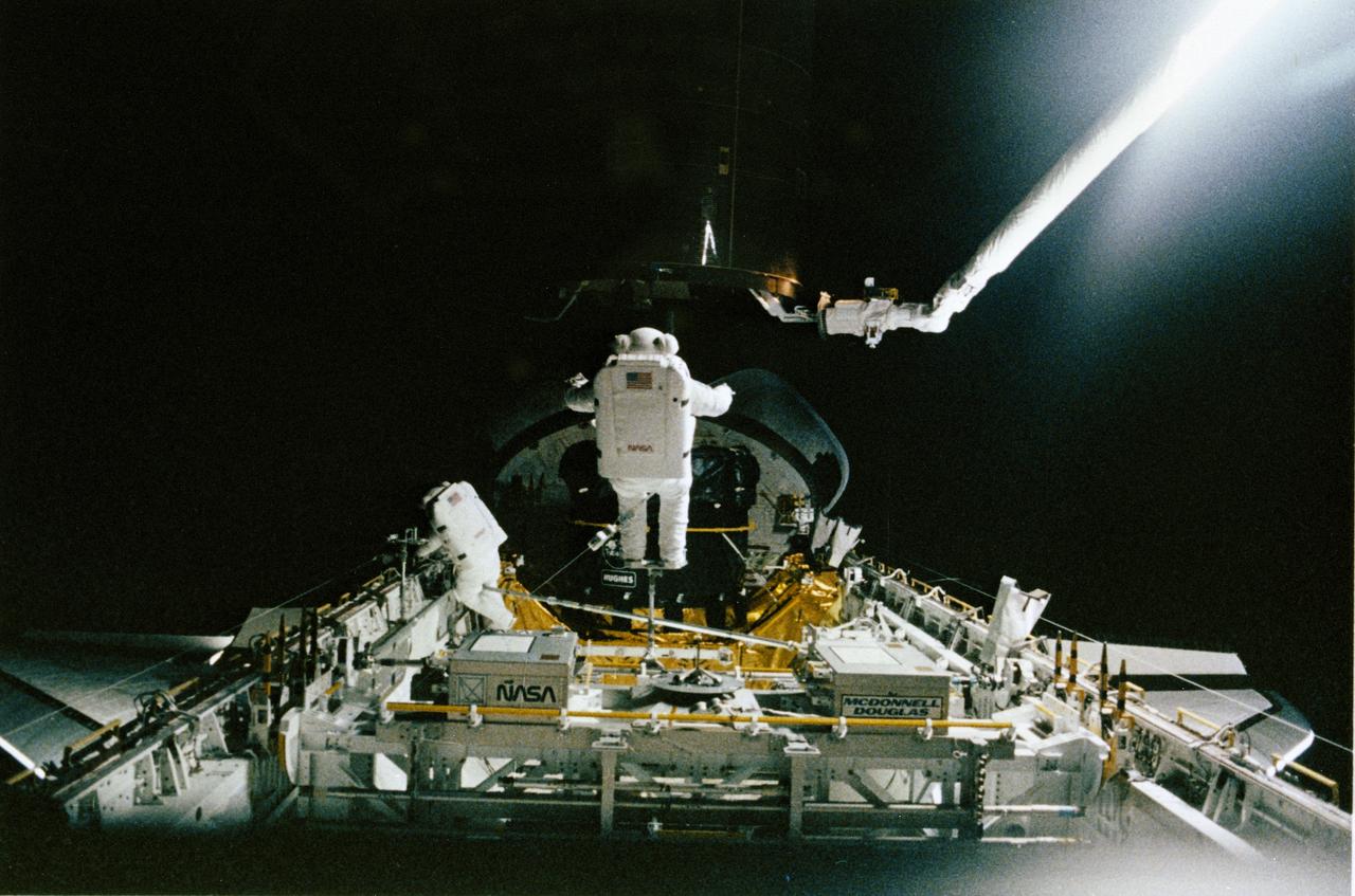
STS-49, the first flight of the Space Shuttle Orbiter Endeavour, lifted off from launch pad 39B on May 7, 1992 at 6:40 pm CDT. The STS-49 mission was the first U.S. orbital flight to feature 4 extravehicular activities (EVAs), and the first flight to involve 3 crew members working simultaneously outside of the spacecraft. The primary objective was the capture and redeployment of the INTELSAT VI (F-3), a communication satellite for the International Telecommunication Satellite organization, which was stranded in an unusable orbit since its launch aboard the Titan rocket in March 1990. In this onboard photo, astronauts Hieb, Akers, and Thuot have handholds on the satellite.
STS-49, the first flight of the Space Shuttle Orbiter Endeavour, lifted off from launch pad 39B on May 7, 1992 at 6:40 pm CDT. The STS-49 mission was the first U.S. orbital flight to feature 4 extravehicular activities (EVAs), and the first flight to involve 3 crew members working simultaneously outside of the spacecraft. The primary objective was the capture and redeployment of the INTELSAT VI (F-3), a communication satellite for the International Telecommunication Satellite organization, which was stranded in an unusable orbit since its launch aboard the Titan rocket in March 1990. In this onboard photo, astronauts Hieb, Akers, and Thuot have handholds on the satellite.

Astronat Dale A. Gardner achieves a hard dock with the previously spinning Westar VI satellite. Gardner uses a "stinger" device to stabilize the communications satellite.

51A-39-040 (14 Nov. 1984) --- A 70mm frame of Westar VI retrieval. Astronauts Dale A. Gardner, left, and Joseph P. Allen IV work together with Anna L. Fisher (not pictured, controlling remote manipulator system (RMS) arm from Discovery?s cabin) to bring Westar VI/PAM-D into cargo bay. Allen is on the mobile foot restraint, which is attached to the RMS end effector, while Gardner works to remove a stinger device from the now stabilized satellite. Photo credit: NASA

51A-46-057 (14 November 1984) --- Astronaut Dale A. Gardner, getting his turn in the Manned Maneuvering Unit (MMU) like those used by five other astronauts this year, prepares to dock with the spinning WESTAR VI satellite. Gardner used a large tool called the Apogee Kick Motor Capture Device (ACD) to enter the nozzle of a spent WESTAR VI engine and stabilize the communications spacecraft sufficiently to capture it for return to Earth in the cargo bay of the Space Shuttle Discovery. This frame was used by the STS-51A crew at its Post-Flight Press Conference (PFPC) on November 28, 1984.
STS049-79-024 (13 May 1992) --- Florida's Atlantic Coast and the Cape Canaveral area form the backdrop for this 70mm scene of Intelsat VI's approach to the Space Shuttle Endeavour. Later, the seven-member crew was successful in capturing the satellite and adding a perigee phase. The new motor allowed the needed boost for Intelsat, once the crew members had released it into space.

51A-104-008 (14 Nov 1984) --- Astronaut Dale A. Gardner appears to be under the remote manipulator system (RMS) end effector as he makes a turn in space and prepared to traverse, using the manned maneuvering unit (MMU) backpack, to the nearby Westar VI to "Sting" it with the device he carries. The stringer will enter the communications satellite through the nozzle of the spent motor. Gardner achieved a hard dock at 6:32 A.M. and this picture was photographed about five minutes earlier, on Nov. 14, 1984.

51A-39-034 (14 Nov. 1984) --- A 70mm frame of astronaut Dale A. Gardner, wearing the Manned Maneuvering Unit (MMU) approaching the spinning WESTAR VI satellite over Bahama Banks. The end effector of the Remote Manipulator System (RMS) controlled by Dr. Anna L. Fisher inside the space shuttle Discovery's cabin, awaits its duty at right. Gardner made a hard dock with the stinger at 6:32 a.m. (CST). Photo credit: NASA
The dust devil tracks in this VIS image are located in Terra Cimmeria.
This VIS image shows dunes in a topographic low within Aonia Terra.
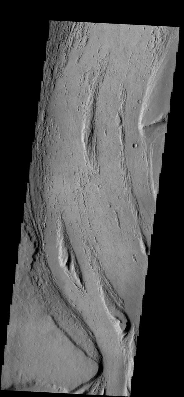
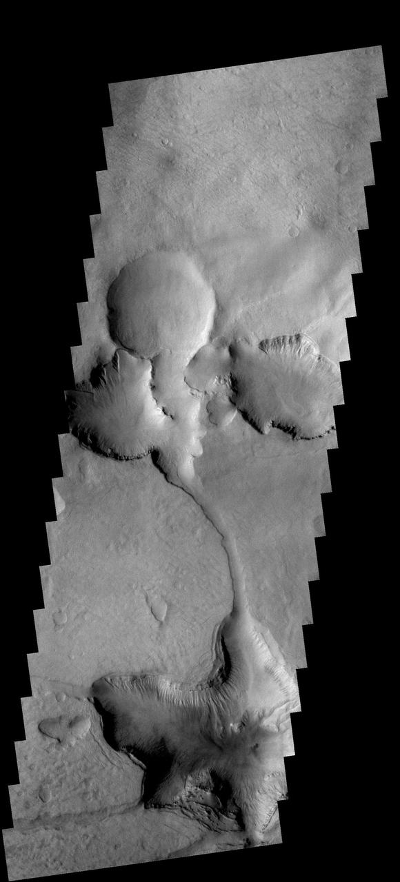
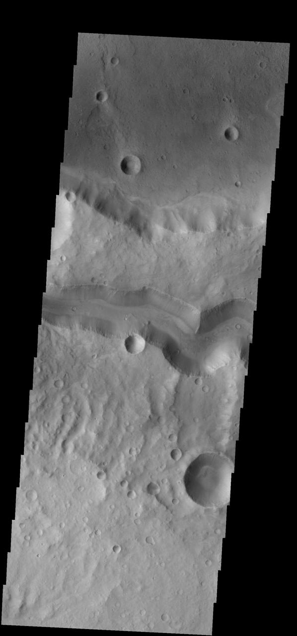
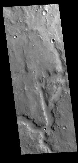
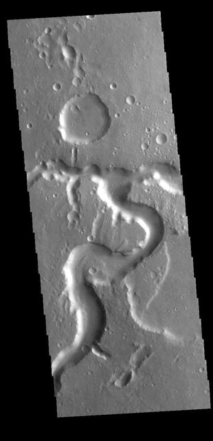
Today VIS image shows more of the channel network that comprises Arda Valles.
This 2001 Mars Odyssey THEMIS VIS image shows a landslide in Capri Chasma.
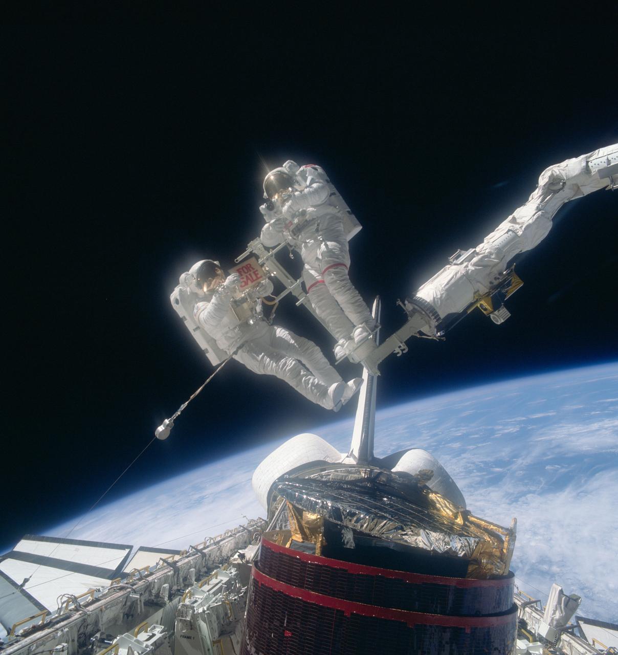
51A-39-063 (14 Nov 1984) --- A 70mm frame of WESTAR VI post-retrieval activity. Astronaut Dale A. Gardner (left), STS-51A mission specialist, holds a "For Sale" sign, making light reference to the status of the re-captured communications spacecraft, which has been stranded since its initial deployment. Astronaut Joseph P. Allen IV stands on the Mobile Foot Restraint (MFR), which in tandem with the Remote Manipulator System (RMS) arm, controlled by Dr. Anna L. Fisher inside the space shuttle Discovery's cabin, served as a cherry-picker for capture efforts. Photo credit: NASA
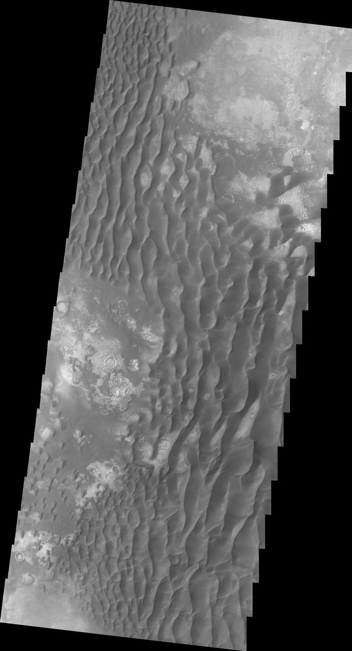
This daytime infrared image of Kaiser Crater, taken by NASA 2001 Mars Odyssey spacecraft, shows the majority of the dune field located on the floor of the crater.
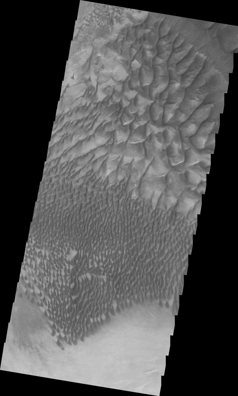
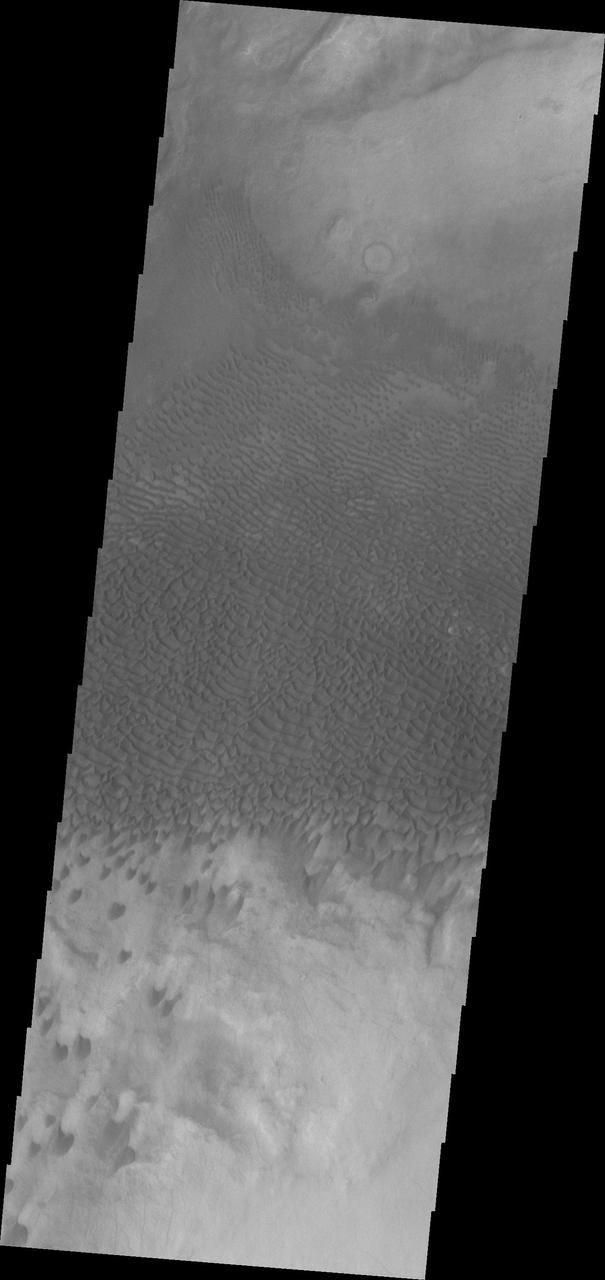
This 2001 Mars Odyssey image shows a portion of the extensive dune field in on the floor of Russell Crater.
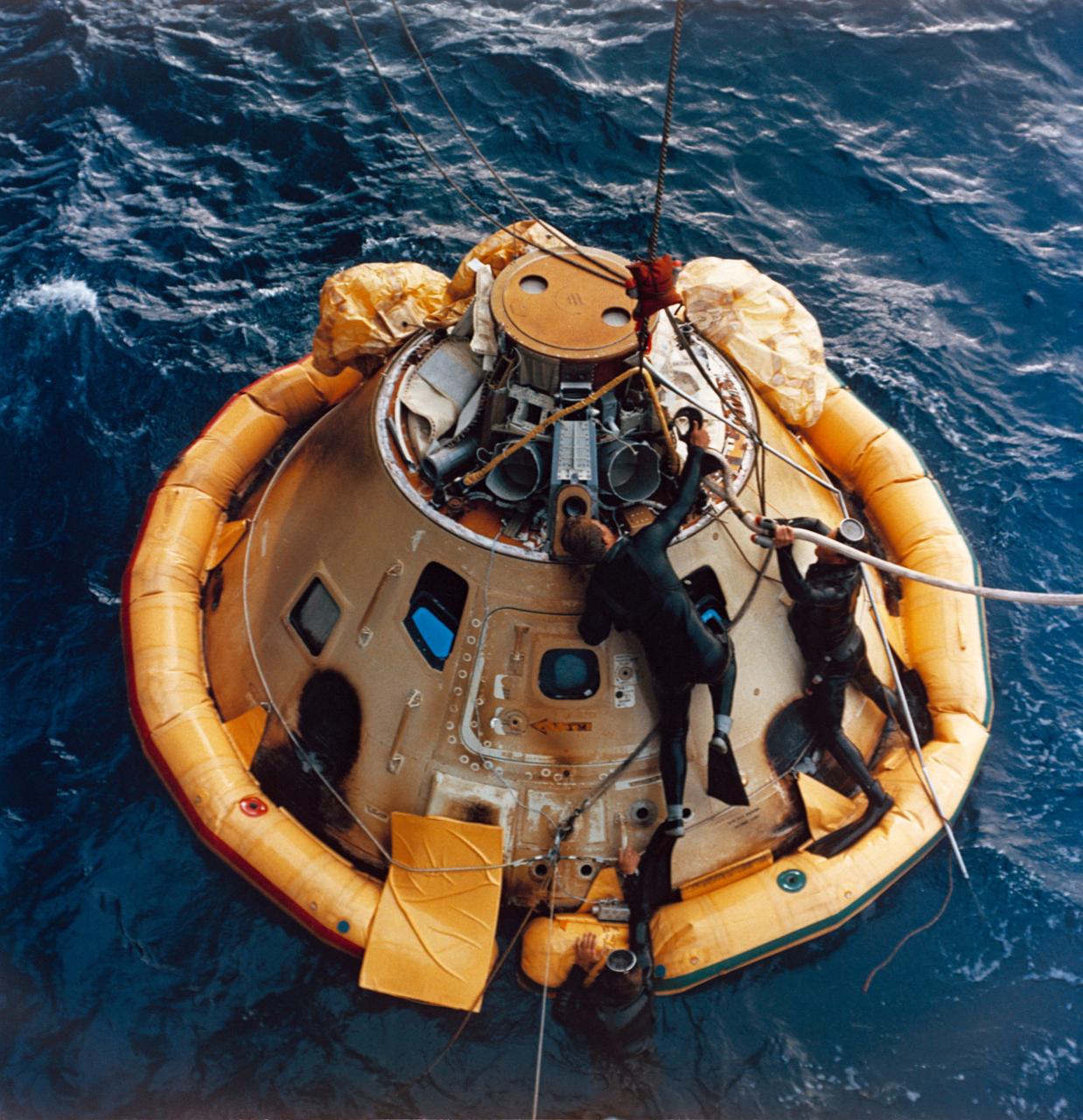
S68-27884 (4 April 1968) --- A U. S. Navy frogman team prepares the Apollo Spacecraft 020 Command Module (CM) for hoisting aboard the USS Okinawa. The USS Okinawa was the prime recovery ship for the Apollo 6 (Spacecraft 020/Saturn 502) unmanned space mission. Splashdown occurred at 4:58:45 p.m. (EST), April 4, 1968, at 375 nautical miles north of Honolulu, Hawaii.
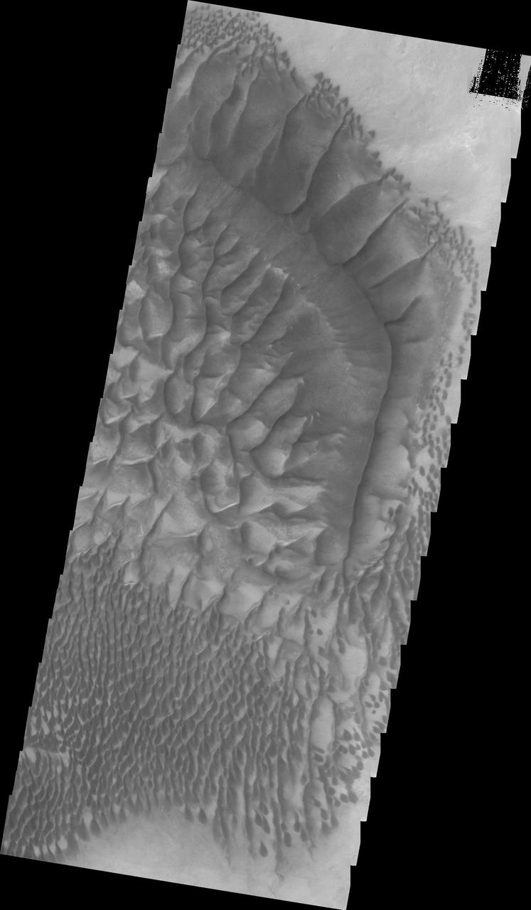
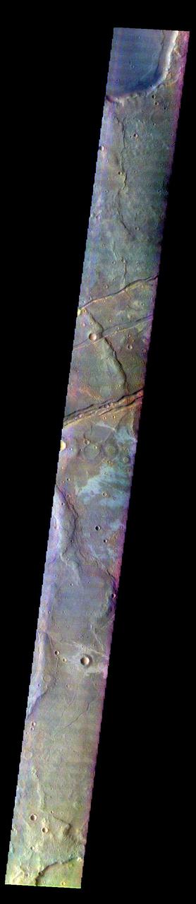
The Thermal Emission Imaging System aboard NASA Mars Odyssey highlights the complexity and variety of dune forms on the floor of Russell Crater.
This 2001 Mars Odyssey THEMIS VIS image of the western portion of Sirenum Fossae shows mesa formation.
Dark slope streaks are common in Lycus Sulci in this 2001 Mars Odyssey THEMIS VIS image.
This 2001 Mars Odyssey THEMIS VIS image shows a channel with extensive scalloping of its margins. The process of scalloping is widening the channel.
Small, dark dunes are found on the floor of this crater near Meridiani Planum in this 2001 Mars Odyssey THEMIS VIS image.
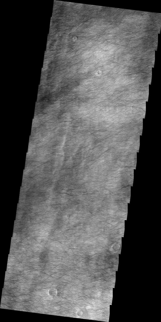
The plains of Planum Chronium shown in this 2001 Mars Odyssey THEMIS VIS image are covered by hundreds of dust devil tracks.
The dark material in this VIS image of Danielson Crater are dunes at the foot of the fill material located on the southwestern end of the crater floor.
This 2001 Mars Odyssey THEMIS VIS image shows a portion of the eastern end of Sirenum Fossae.
The numerous layers of the south polar cap are shown in cross-section in this 2001 Mars Odyssey THEMIS VIS image.
Odd rimmed depressions are located on the floor of this unnamed crater in Noachis Terra in this 2001 Mars Odyssey THEMIS VIS image.
This 2001 Mars Odyssey THEMIS VIS image shows a portion of Nirgal Vallis and a scalloped tributary channel.
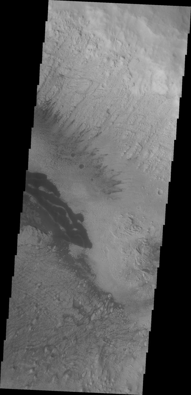
The landslide deposits in this VIS image from NASA 2001 Mars Odyssey spacecraft are located in Valles Marineris and are called Coprates Labes.
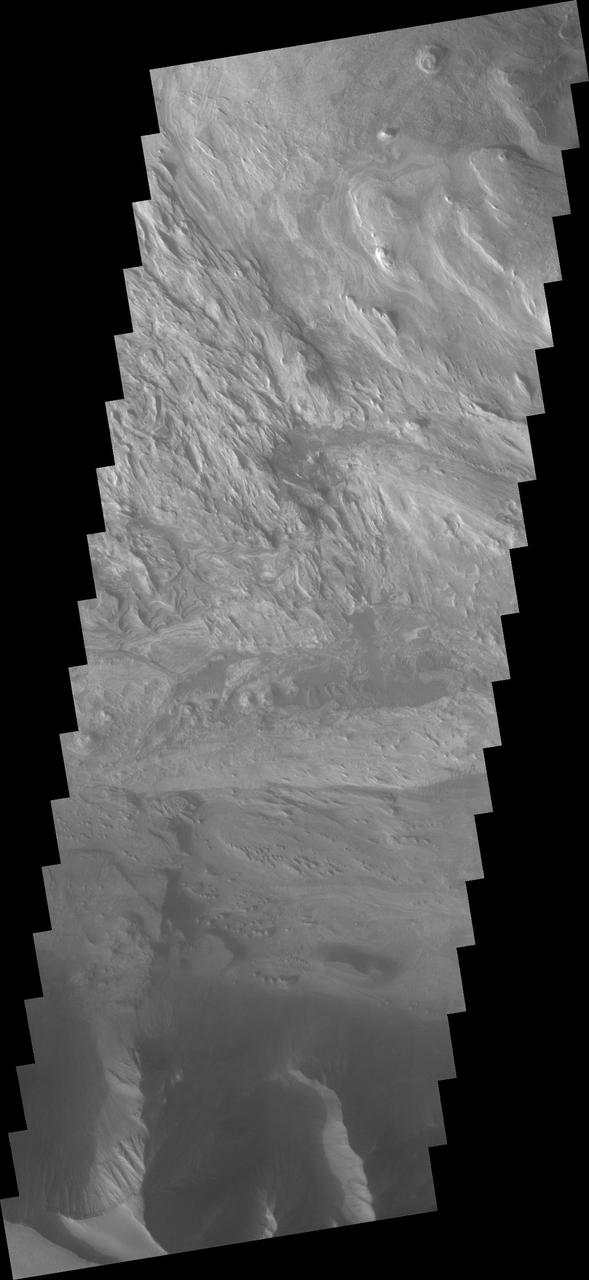
This 2001 Mars Odyssey THEMIS VIS image crosses Coprates Chasma, showing both floor and wall features of the canyon.
The dunes in this VIS image are located on the floor of an unnamed crater in Noachis Terra as seen by NASA 2001 Mars Odyssey spacecraft.
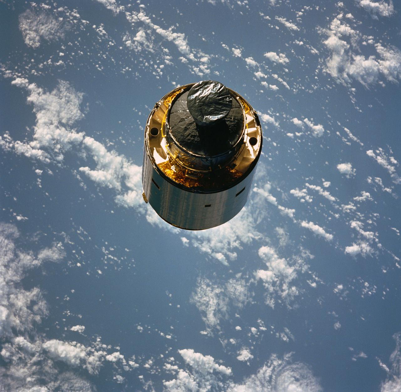
STS049-91-056 (13 May 1992) --- The 4.5-ton Intelsat VI communications satellite begins its separation from the Space Shuttle Endeavour. Crew members deployed a new perigee stage on the satellite after three astronauts on a third extravehicular activity (EVA) successfully snared it. Clouds over the open ocean serve as backdrop for the 70mm image.
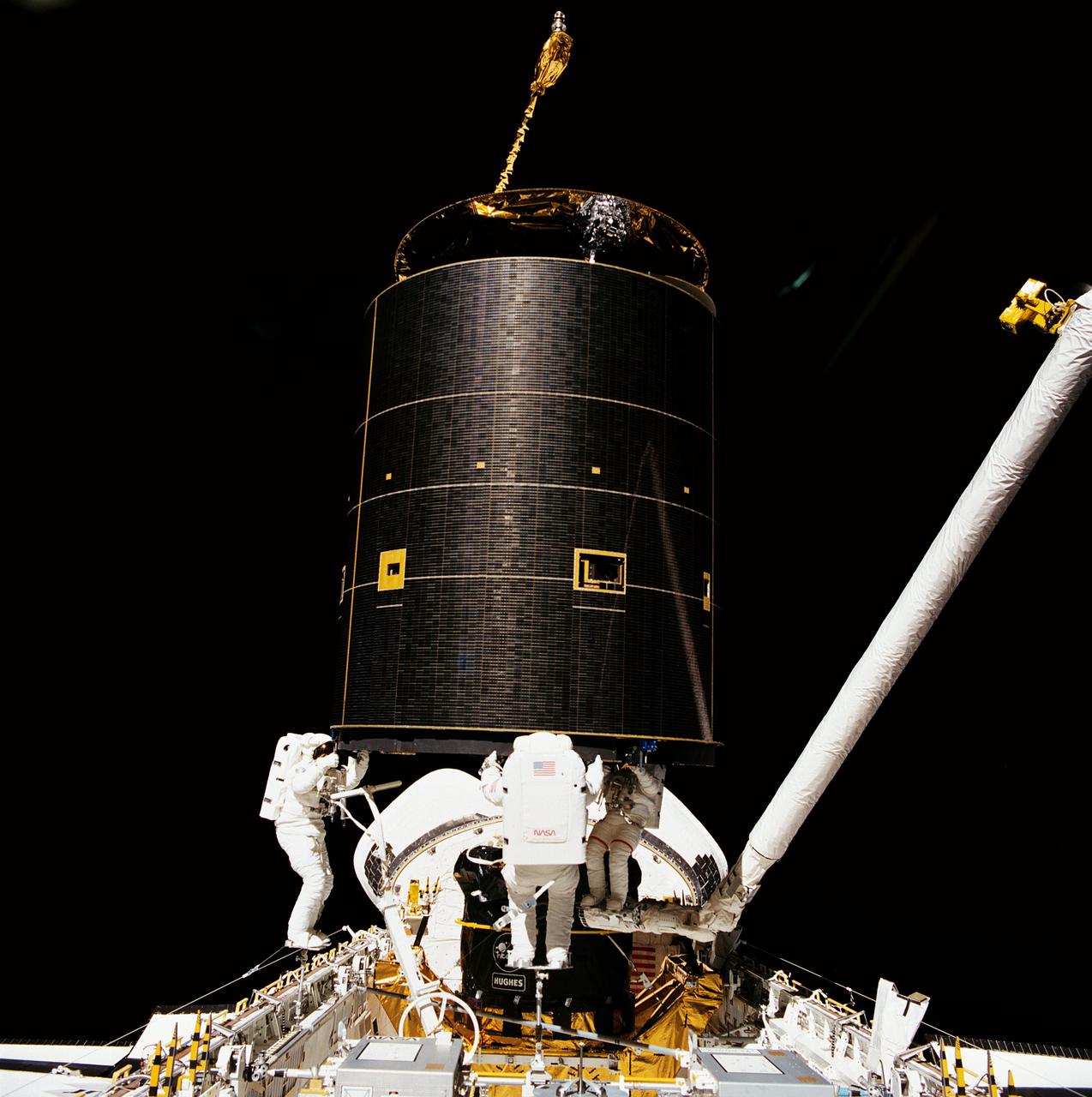
STS049-91-026 (13 May 1992) --- Three astronauts hold onto the 4.5-ton Intelsat VI satellite after a six-handed "capture" was made minutes earlier. Left to right are astronauts Richard J. Hieb, Thomas D. Akers and Pierre J. Thuot. Thuot stands on the end of the remote manipulator system arm, from which he had made two earlier unsuccessful grapple attempts on two-person extravehicular activity sessions. Ground controllers and crew members agreed that a third attempt, using three mission specialists in the cargo bay of the space shuttle Endeavour, was the effort needed to accomplish the capture feat.
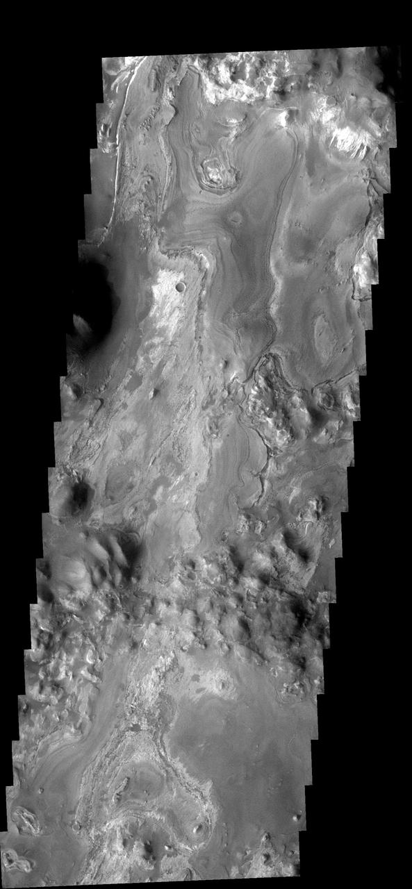
This VIS image captured by NASA 2001 Mars Odyssey spacecraft of Iani Chaos shows the layered deposit that occurs on the floor. It appears that the layers were deposited after the chaos was formed. Image information: VIS instrument. Latitude 2.3S, Longitude 342.3E. 17 meter/pixel resolution. http://photojournal.jpl.nasa.gov/catalog/PIA03200
This VIS image captured by NASA 2001 Mars Odyssey spacecraft shows streamlined islands are located in the channel of Mangala Valles, a portion of which is shown in the image.
This VIS image captured by NASA 2001 Mars Odyssey spacecraft, compared to yesterday IR image, shows the dunes darker than their surroundings due to cooler temperature.
This VIS image from NASA 2001 Mars Odyssey spacecraft shows part of the floor of an unnamed crater located between the Hellas and Argyre Basins.
This VIS image shows part of the south polar region. The ejecta from the relatively young crater covers the rougher textured polar surface

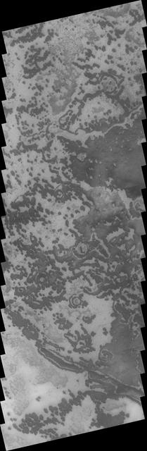
This low resolution VIS image from NASA 2001 Mars Odyssey spacecraft shows a large portion of etched terrain near the south pole of Mars.
This VIS image from NASA 2001 Mars Odyssey spacecraft shows part of the layered and wind sculpted deposit that occurs on the floor of Candor Chasma.
Faint dust devil tracks can be seen in the 2001 Mars Odyssey THEMIS VIS image. These tracks are located on the eastern margin of Argyre Planitia.
This low resolution VIS image from NASA 2001 Mars Odyssey spacecraft shows a large portion of etched terrain near the south pole of Mars.
This VIS image captured by NASA 2001 Mars Odyssey spacecraft shows a small area just off the margin of Mars southern polar cap.
This VIS image from NASA 2001 Mars Odyssey spacecraft shows Tinto Vallis middle of image and Palos Crater top of image.
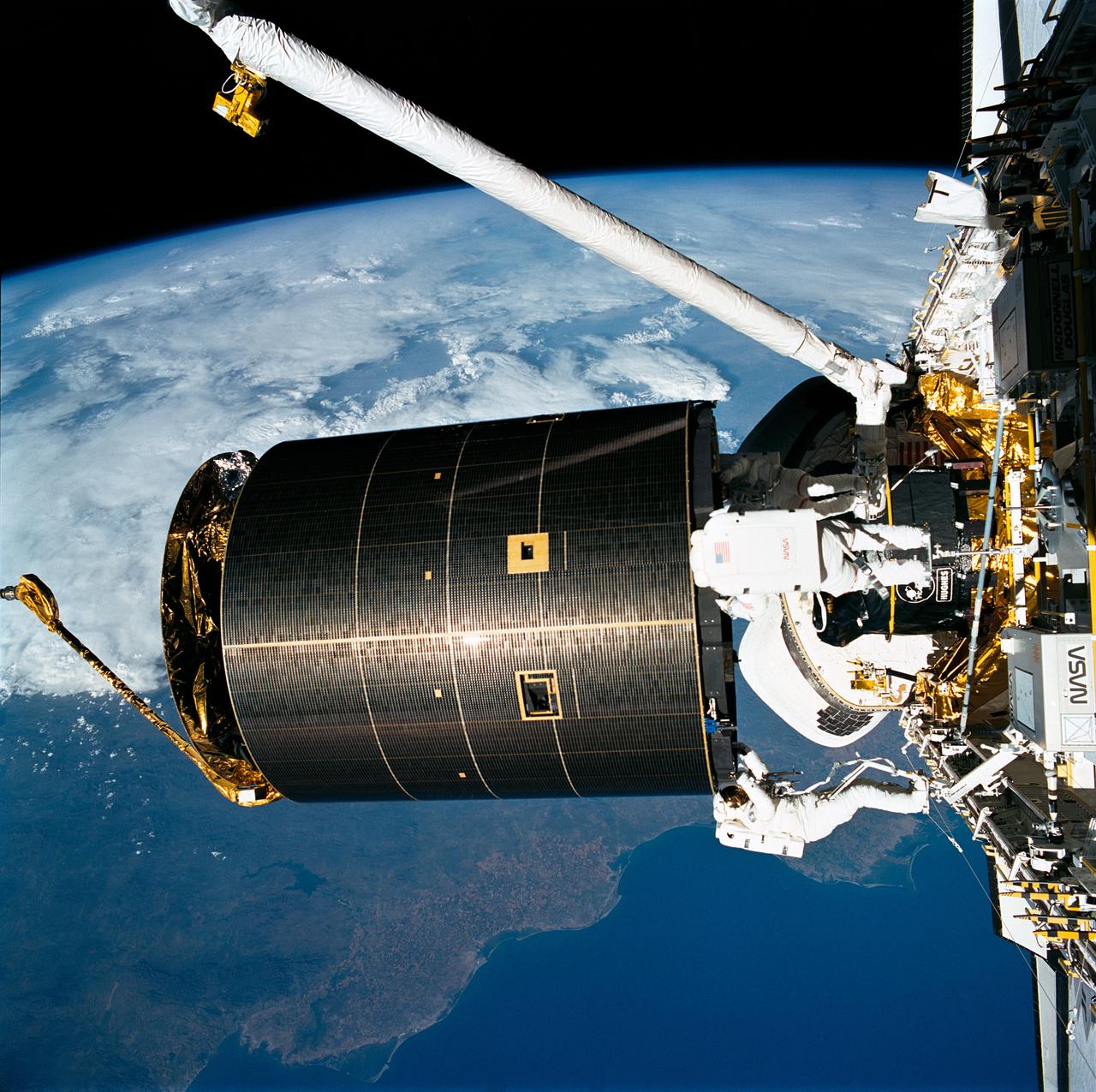
STS049-91-020 (13 May 1992) --- The successful capture of Intelsat VI satellite is recorded over Mexico on this 70mm frame, from inside the Space Shuttle Endeavour's cabin. Left to right, astronauts Richard J. Hieb, Thomas D. Akers and Pierre J. Thuot have handholds on the satellite. Ground coverage in the frame includes an area from Hermosillo, Sonara to Los Mochis in the state of Sinaloa. The nine-day mission accomplished the capture of the Intelsat, subsequent mating of the satellite to a booster and its eventual deployment, as well as a Space Station Freedom preview Extravehicular Activity (EVA). Endeavour's crew members were astronauts Daniel C. Brandenstein, mission commander; Kevin P. Chilton, pilot; and Thomas D. Akers, Richard J. Hieb, Bruce E. Melnick, Kathryn C. Thornton and Pierre J. Thuot, all mission specialists.
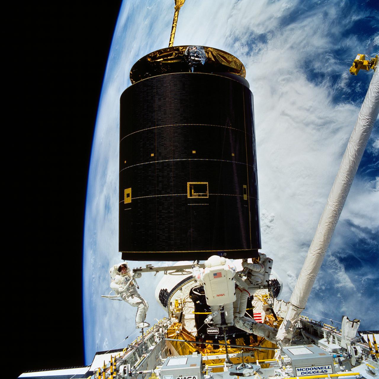
STS049-91-029 (13 May 1992) --- Following the successful capture of Intelsat VI satellite, three astronauts continue their chores toward moving the 4.5 ton communications satellite into the space shuttle Endeavour's cargo bay. A fellow crew member recorded this 70mm still frame from inside Endeavour's cabin. Left to right, astronauts Richard J. Hieb, Thomas D. Akers and Pierre J. Thuot, cooperate on the effort to attach a specially designed grapple bar underneath the satellite. Thuot stands on the end of the Remote Manipulator System's (RMS) arm while Hieb and Akers are on Portable Foot Restraints (PFR) affixed to Endeavour's portside and the Multipurpose Support Structure (MPESS), respectively. The sections of Earth which form the backdrop for the scene are blanketed with thousands of square miles of clouds. Photo credit: NASA
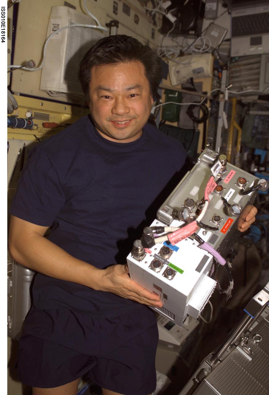
ISS010-E-18164 (17 February 2005) --- Astronaut Leroy Chiao, Expedition 10 commander and NASA ISS science officer, holds an Electronic Box Assembly, and Violation Isolation and Stabilization (VIS) Controller Assembly, which is part of the Treadmill Vibration Isolation System (TVIS) in the Zvezda Service Module of the International Space Station (ISS). Also in view is a VIS/TM data cable and VIS/TM power cable. This box receives power and distributes it between the treadmill and the VIS subassemblies.
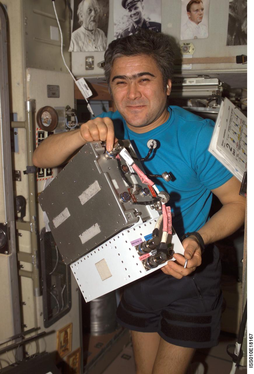
ISS010-E-18167 (17 February 2005) --- Cosmonaut Salizhan S. Sharipov, Expedition 10 flight engineer representing Russia's Federal Space Agency, holds an Electronic Box Assembly, and Violation Isolation and Stabilization (VIS) Controller Assembly, which is part of the Treadmill Vibration Isolation System (TVIS) in the Zvezda Service Module of the International Space Station (ISS). Also in view is a VIS/TM data cable and VIS/TM power cable. This box receives power and distributes it between the treadmill and the VIS subassemblies.
The THEMIS VIS camera contains 5 filters. The data from different filters can be combined in multiple ways to create a false color image. These false color images may reveal subtle variations of the surface not easily identified in a single band image. Today's false color image shows part of Sirenum Fossae. The linear depressions in this VIS image are tectonic graben. Graben are formed by extension of the crust and faulting. When large amounts of pressure or tension are applied to rocks on timescales that are fast enough that the rock cannot respond by deforming, the rock breaks along faults. In the case of a graben, two parallel faults are formed by extension of the crust and the rock in between the faults drops downward into the space created by the extension. Several graben are visible in this THEMIS VIS image, trending from north-northeast to south-southwest. Because the faults defining the graben are formed perpendicular to the direction of the applied stress, we know that extensional forces were pulling the crust apart in the west-northwest/east-southeast direction. The Sirenum Fossae graben are 2735km (1700 miles) long. The THEMIS VIS camera is capable of capturing color images of the Martian surface using five different color filters. In this mode of operation, the spatial resolution and coverage of the image must be reduced to accommodate the additional data volume produced from using multiple filters. To make a color image, three of the five filter images (each in grayscale) are selected. Each is contrast enhanced and then converted to a red, green, or blue intensity image. These three images are then combined to produce a full color, single image. Because the THEMIS color filters don't span the full range of colors seen by the human eye, a color THEMIS image does not represent true color. Also, because each single-filter image is contrast enhanced before inclusion in the three-color image, the apparent color variation of the scene is exaggerated. Nevertheless, the color variation that does appear is representative of some change in color, however subtle, in the actual scene. Note that the long edges of THEMIS color images typically contain color artifacts that do not represent surface variation. Orbit Number: 92540 Latitude: -32.6048 Longitude: 205.563 Instrument: VIS Captured: 2022-10-25 00:23 https://photojournal.jpl.nasa.gov/catalog/PIA26122
The THEMIS VIS camera contains 5 filters. The data from different filters can be combined in multiple ways to create a false color image. These false color images may reveal subtle variations of the surface not easily identified in a single band image. Today's false color image shows part of Sirenum Fossae. The linear depressions in this VIS image are tectonic graben. Graben are formed by extension of the crust and faulting. When large amounts of pressure or tension are applied to rocks on timescales that are fast enough that the rock cannot respond by deforming, the rock breaks along faults. In the case of a graben, two parallel faults are formed by extension of the crust and the rock in between the faults drops downward into the space created by the extension. Several graben are visible in this THEMIS VIS image, trending from north-northeast to south-southwest. Because the faults defining the graben are formed perpendicular to the direction of the applied stress, we know that extensional forces were pulling the crust apart in the west-northwest/east-southeast direction. The Sirenum Fossae graben are 2735km (1700 miles) long. The THEMIS VIS camera is capable of capturing color images of the Martian surface using five different color filters. In this mode of operation, the spatial resolution and coverage of the image must be reduced to accommodate the additional data volume produced from using multiple filters. To make a color image, three of the five filter images (each in grayscale) are selected. Each is contrast enhanced and then converted to a red, green, or blue intensity image. These three images are then combined to produce a full color, single image. Because the THEMIS color filters don't span the full range of colors seen by the human eye, a color THEMIS image does not represent true color. Also, because each single-filter image is contrast enhanced before inclusion in the three-color image, the apparent color variation of the scene is exaggerated. Nevertheless, the color variation that does appear is representative of some change in color, however subtle, in the actual scene. Note that the long edges of THEMIS color images typically contain color artifacts that do not represent surface variation. Orbit Number: 92203 Latitude: -31.0389 Longitude: 208.065 Instrument: VIS Captured: 2022-09-27 06:25 https://photojournal.jpl.nasa.gov/catalog/PIA26087
This VIS image from NASA 2001 Mars Odyssey spacecraft of the south polar region was collected during the summer season. The markings of the pole are very diverse and easy to see after the winter frost has been removed.
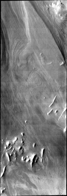
This VIS image illlustrates how distinct polar layers appear with no frost cover. This image was collected during the height of summer at the south pole of Mars by NASA 2001 Mars Odyssey spacecraft.
As spring turns to summer, the frost cover has been removed from the south polar cap. The surface textures seen in this VIS image are created by action of the sun on the icy cap.
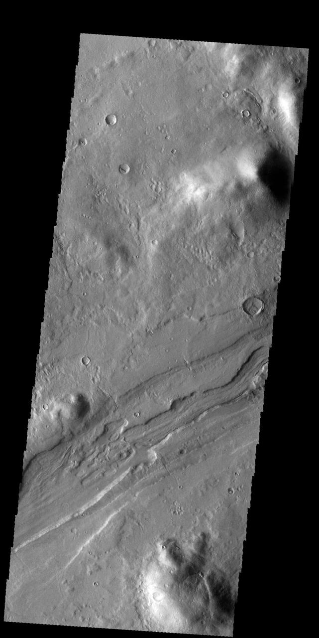
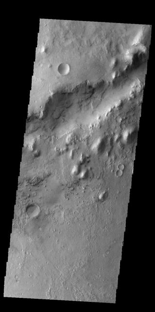
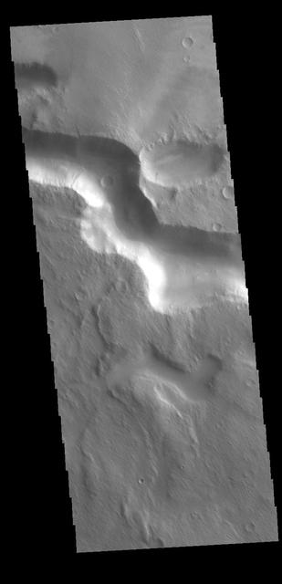
This VIS image shows a section of an unnamed channel in Terra Cimmeria. Orbit Number: 81393 Latitude: -9.10693 Longitude: 118.856 Instrument: VIS Captured: 2020-04-20 05:09 https://photojournal.jpl.nasa.gov/catalog/PIA23958
Today's VIS image shows the start of Mamers Valles. Orbit Number: 60364 Latitude: 31.4345 Longitude: 20.3221 Instrument: VIS Captured: 2015-07-24 03:06 http://photojournal.jpl.nasa.gov/catalog/PIA19764
This VIS image shows the southern wall of Juventae Chasma. Orbit Number: 64347 Latitude: -5.0713 Longitude: 298.551 Instrument: VIS Captured: 2016-06-16 03:38 http://photojournal.jpl.nasa.gov/catalog/PIA20807
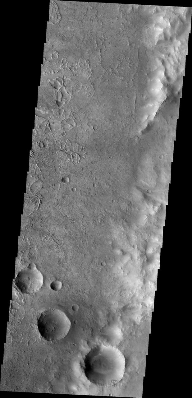
Today's VIS image shows unnamed craters in Terra Sirenum. Orbit Number: 68429 Latitude: -40.8094 Longitude: 196.569 Instrument: VIS Captured: 2017-05-18 10:31 https://photojournal.jpl.nasa.gov/catalog/PIA21788
Today's VIS image shows part of an unnamed channel in Arabia Terra. Orbit Number: 81023 Latitude: -5.09236 Longitude: 352.53 Instrument: VIS Captured: 2020-03-20 18:00 https://photojournal.jpl.nasa.gov/catalog/PIA23926
Today's VIS image shows part of Candor Chasma. Orbit Number: 59700 Latitude: -8.61477 Longitude: 292.969 Instrument: VIS Captured: 2015-05-30 09:44 http://photojournal.jpl.nasa.gov/catalog/PIA19758
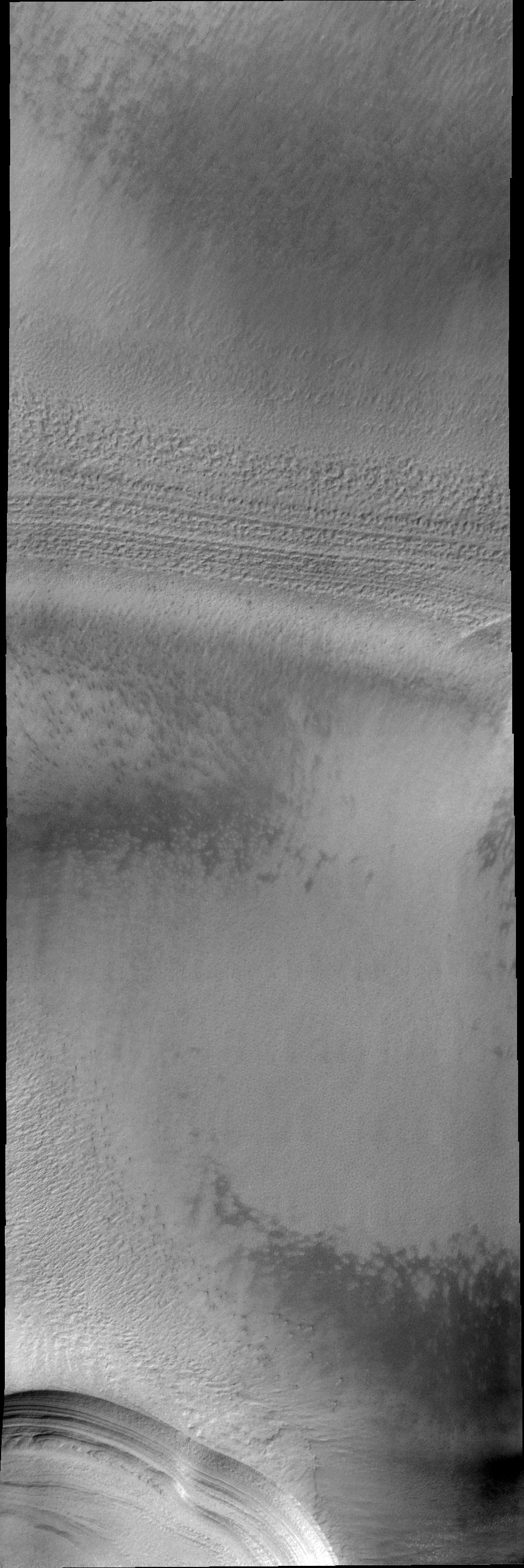
This VIS image shows layering in the south polar cap. Orbit Number: 75417 Latitude: -86.5045 Longitude: 160.818 Instrument: VIS Captured: 2018-12-15 02:22 https://photojournal.jpl.nasa.gov/catalog/PIA23084
Today's VIS image shows a portion of an unnamed channel in Arabia Terra. Orbit Number: 79850 Latitude: -5.14669 Longitude: 352.509 Instrument: VIS Captured: 2019-12-15 03:59 https://photojournal.jpl.nasa.gov/catalog/PIA23733

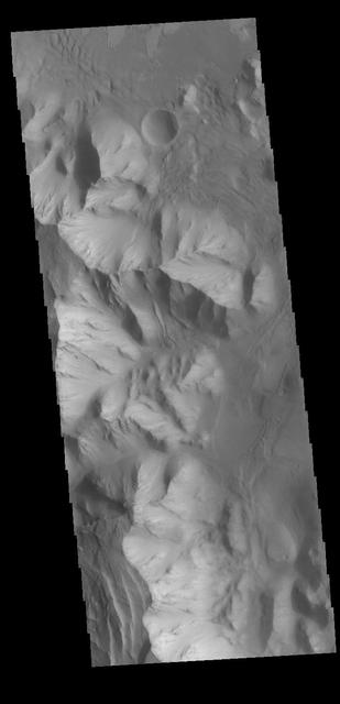
This VIS image shows a portion of the hills that make up Phlegra Montes. Orbit Number: 61507 Latitude: 38.9897 Longitude: 164.896 Instrument: VIS Captured: 2015-10-26 06:06 http://photojournal.jpl.nasa.gov/catalog/PIA20220
This VIS image shows a portion of Buvinda Vallis, a channel near the flank of Hecates Tholus. Orbit Number: 72683 Latitude: 32.6024 Longitude: 152.107 Instrument: VIS Captured: 2018-05-03 22:14
Today's VIS image shows a section of an unnamed channel in Tyrrhena Terra. Orbit Number: 80421 Latitude: -12.0208 Longitude: 80.6346 Instrument: VIS Captured: 2020-01-31 04:20 https://photojournal.jpl.nasa.gov/catalog/PIA23831
Today's VIS image shows a small section of Reull Vallis. Orbit Number: 59494 Latitude: -39.0839 Longitude: 111.047 Instrument: VIS Captured: 2015-05-13 10:47 http://photojournal.jpl.nasa.gov/catalog/PIA19741

This VIS image shows a portion of the hills that make up Phlegra Montes. Orbit Number: 61507 Latitude: 38.9897 Longitude: 164.896 Instrument: VIS Captured: 2015-10-26 06:06 http://photojournal.jpl.nasa.gov/catalog/PIA20219
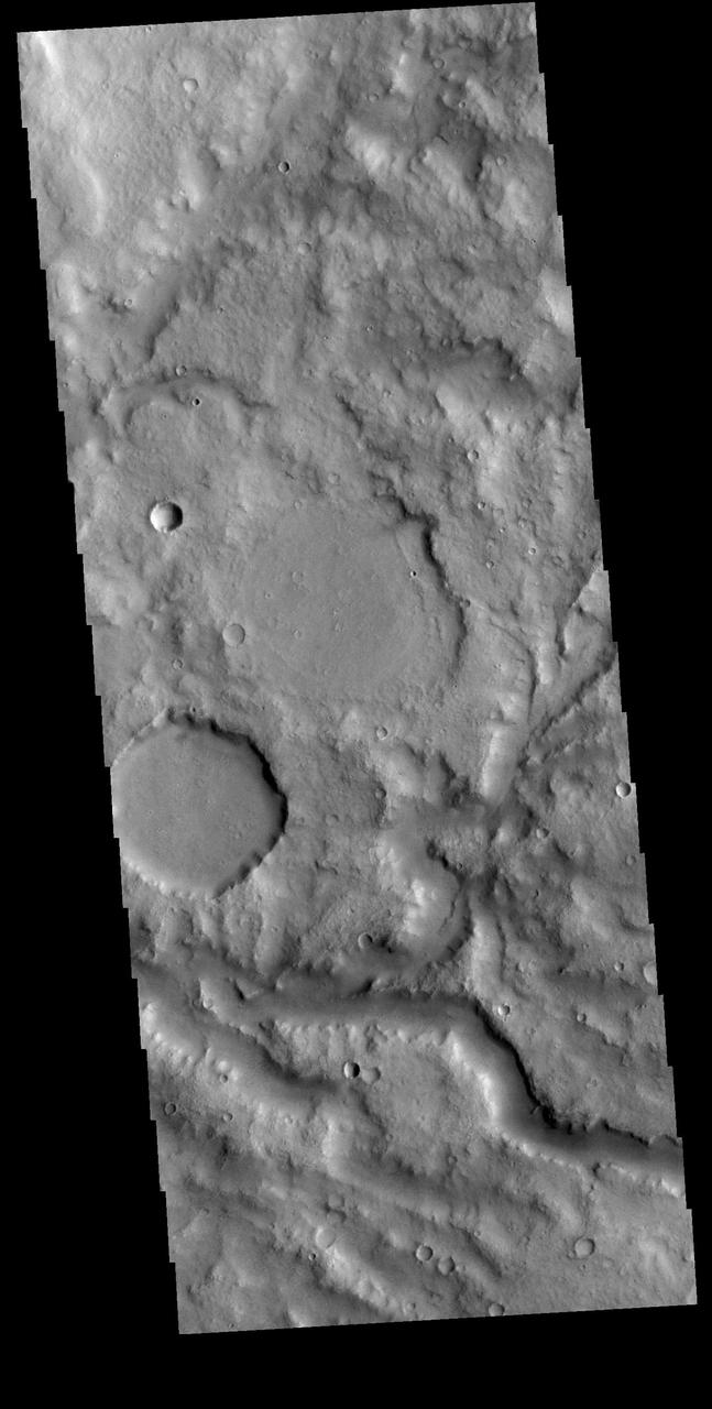
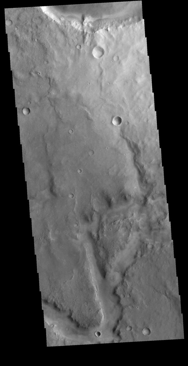
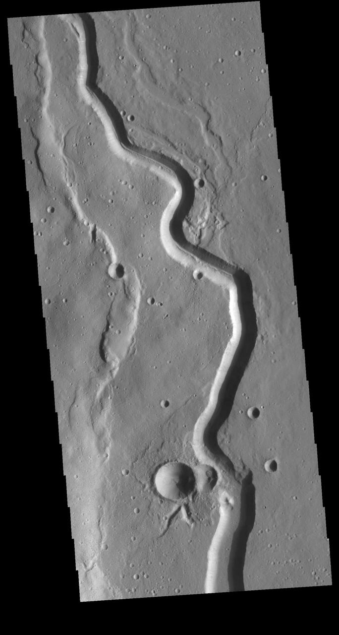
Today's VIS image shows an unnamed channel in Terra Cimmeria. Orbit Number: 87308 Latitude: 2.36838 Longitude: 116.9 Instrument: VIS Captured: 2021-08-20 05:54 https://photojournal.jpl.nasa.gov/catalog/PIA25209
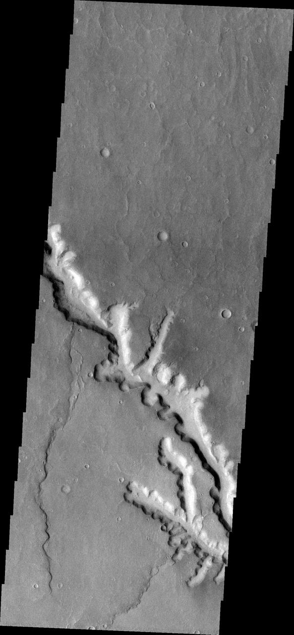
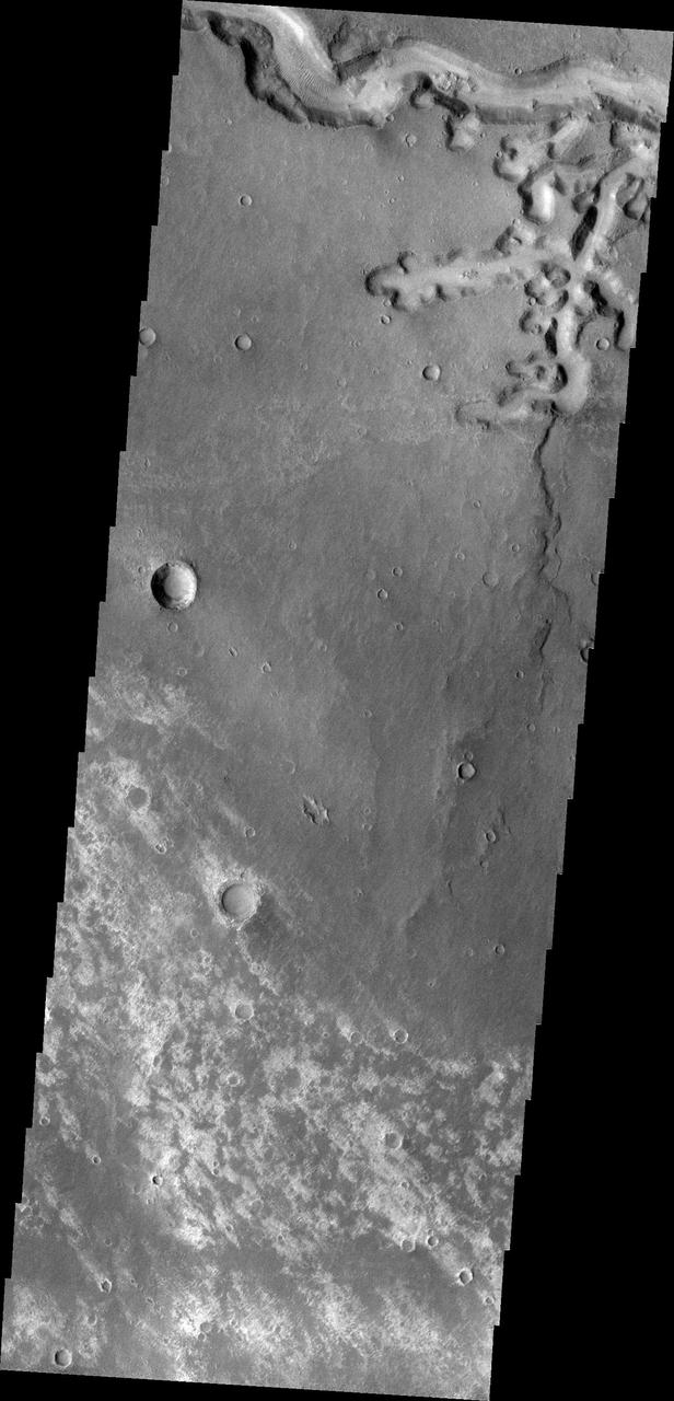
The linear depression in today's VIS image is part of Nili Fossae. Orbit Number: 60318 Latitude: 24.7944 Longitude: 80.7404 Instrument: VIS Captured: 2015-07-20 08:53 http://photojournal.jpl.nasa.gov/catalog/PIA19763
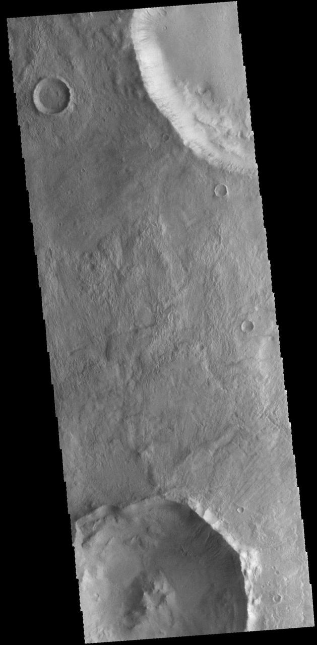
Today's VIS image shows half of an unnamed crater in Utopia Planitia. Orbit Number: 79833 Latitude: 42.973 Longitude: 115.983 Instrument: VIS Captured: 2019-12-13 18:40 https://photojournal.jpl.nasa.gov/catalog/PIA23731
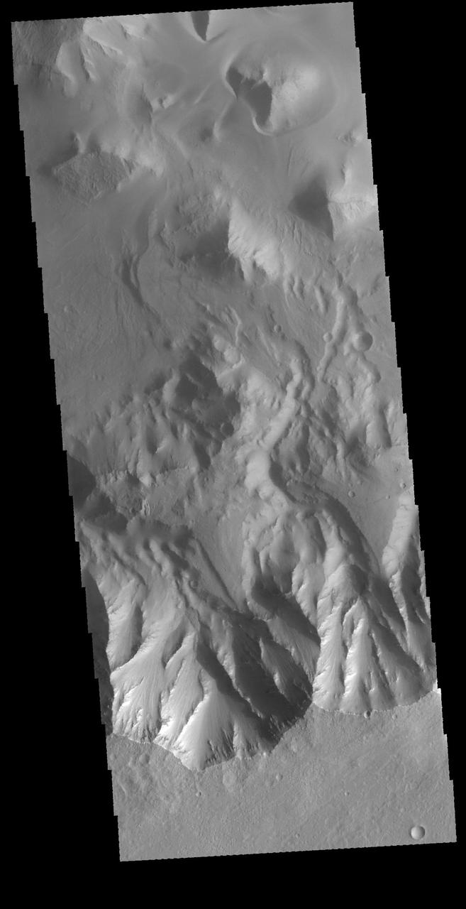
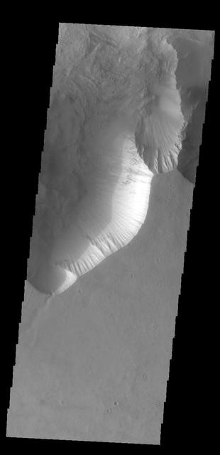
Today's VIS image shows part of the canyon wall of Melas Chasma. Orbit Number: 65682 Latitude: -9.38343 Longitude: 289.417 Instrument: VIS Captured: 2016-10-04 02:52 http://photojournal.jpl.nasa.gov/catalog/PIA21181
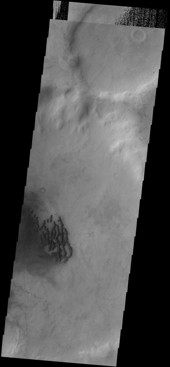
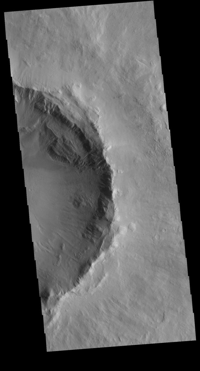
Today's VIS image shows dunes on the floor of Orson Welles Crater. Orbit Number: 80338 Latitude: -0.951622 Longitude: 313.628 Instrument: VIS Captured: 2020-01-24 08:22 https://photojournal.jpl.nasa.gov/catalog/PIA23819
This VIS image shows a section of Nanedi Valles, located in Xanthe Terra. Orbit Number: 69198 Latitude: 5.22677 Longitude: 310.49 Instrument: VIS Captured: 2017-07-20 19:26 https://photojournal.jpl.nasa.gov/catalog/PIA22308
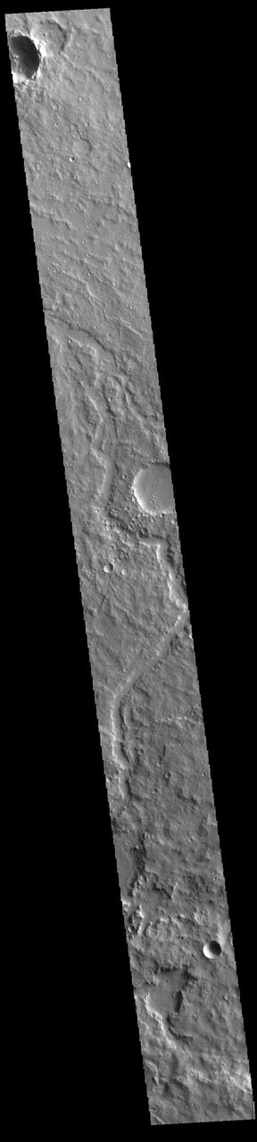
The channel in this VIS image is located on the western margin of Medusae Fossae. Orbit Number: 78907 Latitude: -5.87425 Longitude: 198.259 Instrument: VIS Captured: 2019-09-28 12:25 https://photojournal.jpl.nasa.gov/catalog/PIA23522
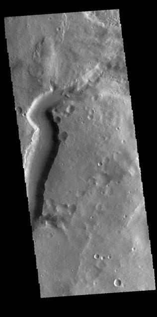
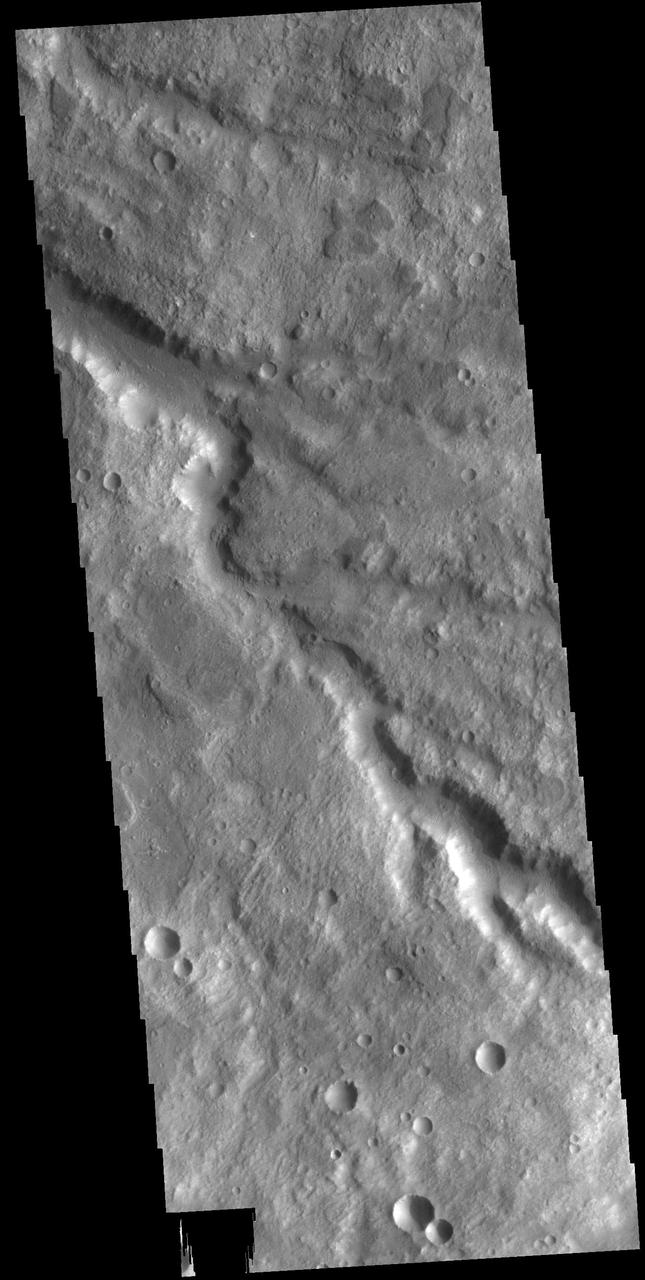
This VIS image shows a section of an unnamed channel in Terra Cimmeria. Orbit Number: 80781 Latitude: -8.28653 Longitude: 134.422 Instrument: VIS Captured: 2020-02-29 19:45 https://photojournal.jpl.nasa.gov/catalog/PIA23902
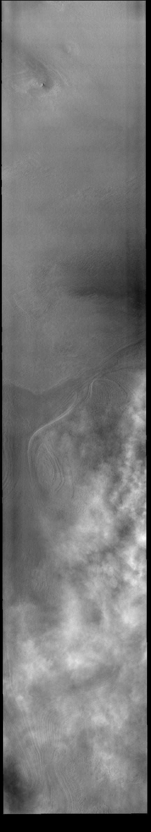
This VIS image shows a layer of clouds over the South polar cap. Orbit Number: 75301 Latitude: -84.8947 Longitude: 243.682 Instrument: VIS Captured: 2018-12-05 13:05 https://photojournal.jpl.nasa.gov/catalog/PIA22901
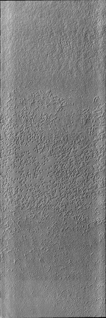
This VIS image shows more of the variety of textures on the south polar cap. Orbit Number: 68068 Latitude: -86.1964 Longitude: 308.717 Instrument: VIS Captured: 2017-04-18 16:22 https://photojournal.jpl.nasa.gov/catalog/PIA21681
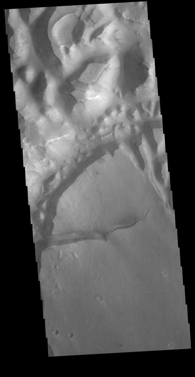
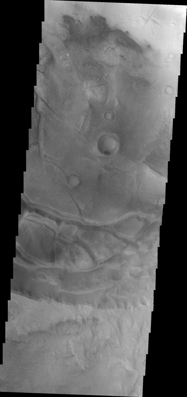
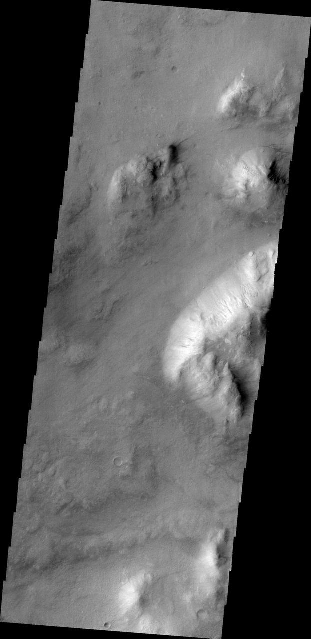
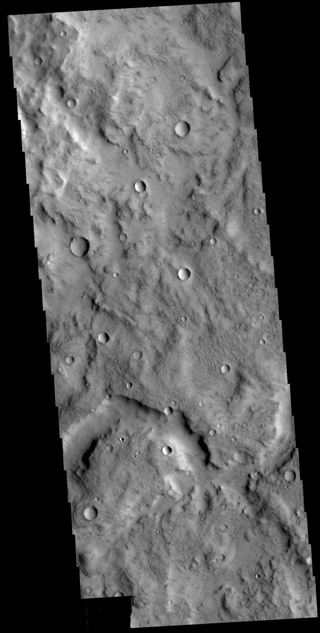
The region of hills and mesas at the top of this VIS image are part of Hydaspis Chaos. Orbit Number: 65406 Latitude: 1.42739 Longitude: 334.12 Instrument: VIS Captured: 2016-09-11 09:15 http://photojournal.jpl.nasa.gov/catalog/PIA21156
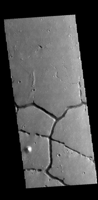
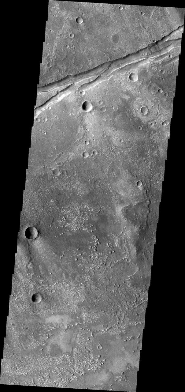
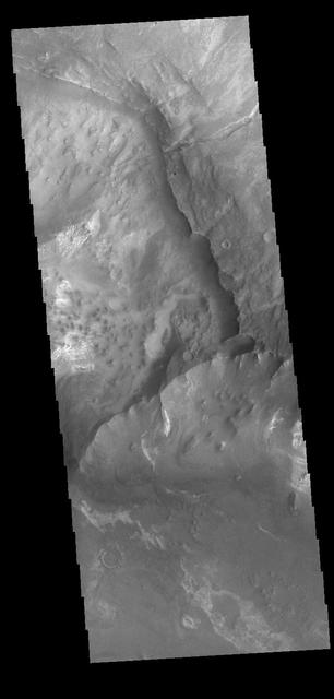
The intersecting linear depressions in this VIS image are part of Hephaestus Fossae. Orbit Number: 60373 Latitude: 21.9161 Longitude: 122.075 Instrument: VIS Captured: 2015-07-24 20:50 http://photojournal.jpl.nasa.gov/catalog/PIA19765