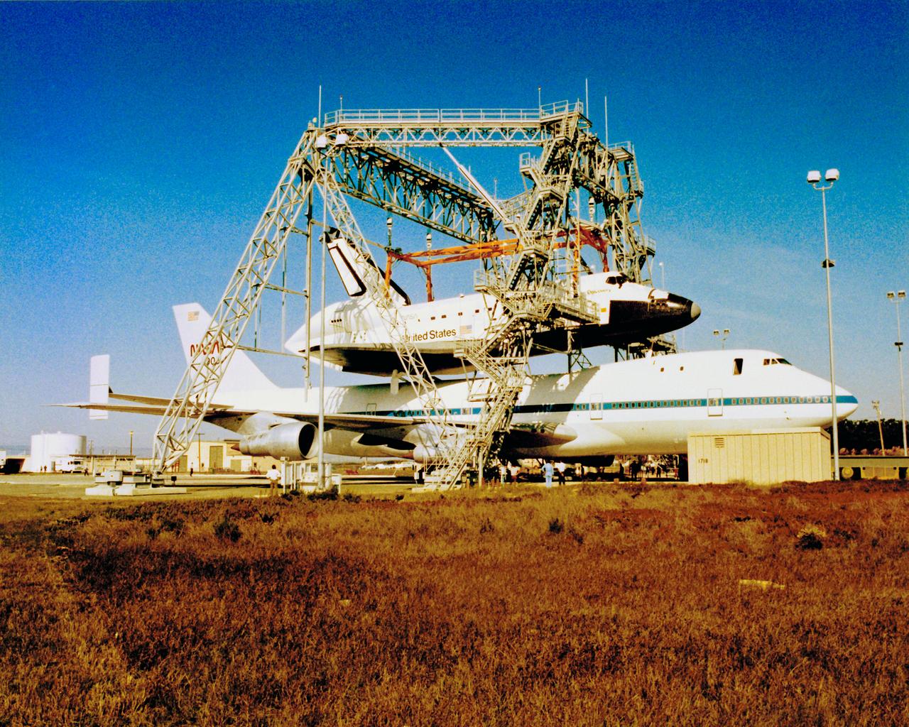
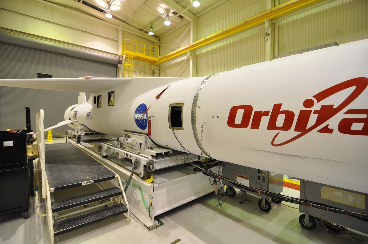
Orbiter at Vandenberg
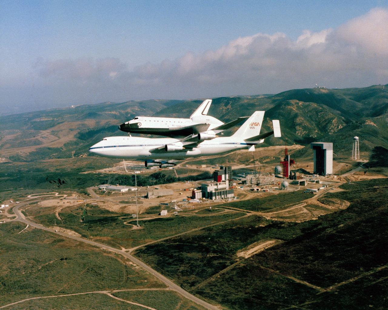
Orbiter at Vandenberg
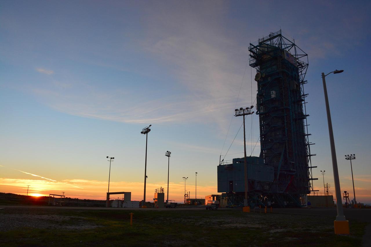
The sun sets behind Space Launch Complex 2, Vandenberg Air Force Base, California, where NASA Soil Moisture Active Passive SMAP mission satellite is being prepared for liftoff. Launch is scheduled for Jan. 29.
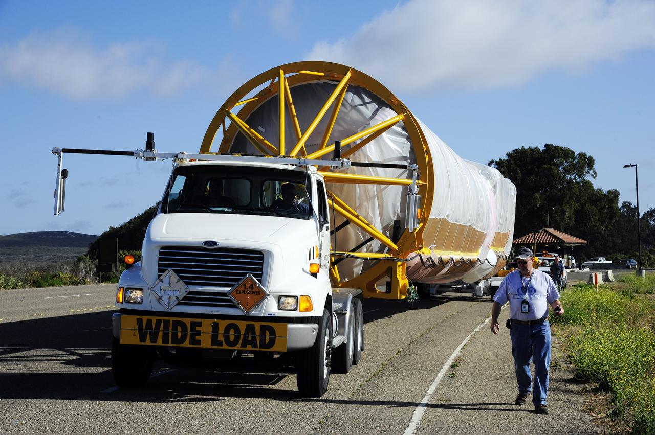
NASA Wide-field Infrared Survey Explorer arrives at Vandenberg Air Force Base

VANDENBERG AIR FORCE BASE, Calif. – In Orbital Sciences Corp. Building 1555 at Vandenberg Air Force Base in California, technicians monitor the loading of the Taurus XL rocket components onto an Assembly Integration Trailer in preparation for moving to Pad 576-E on north Vandenberg later this month. The Orbital Sciences Taurus XL rocket, targeted to lift off Feb. 23, 2011, from Vandenberg's Space Launch Complex 576-E, will take NASA's Glory satellite into low Earth orbit. Glory is scheduled to collect data on the properties of aerosols and black carbon. It also will help scientists understand how the sun's irradiance affects Earth's climate. Photo credit: NASA/Randy Beaudoin

VANDENBERG AIR FORCE BASE, Calif. – In Orbital Sciences Corp. Building 1555 at Vandenberg Air Force Base in California, technicians monitor the loading of the Taurus XL rocket components onto an Assembly Integration Trailer in preparation for moving to Pad 576-E on north Vandenberg later this month. The Orbital Sciences Taurus XL rocket, targeted to lift off Feb. 23, 2011, from Vandenberg's Space Launch Complex 576-E, will take NASA's Glory satellite into low Earth orbit. Glory is scheduled to collect data on the properties of aerosols and black carbon. It also will help scientists understand how the sun's irradiance affects Earth's climate. Photo credit: NASA/Randy Beaudoin

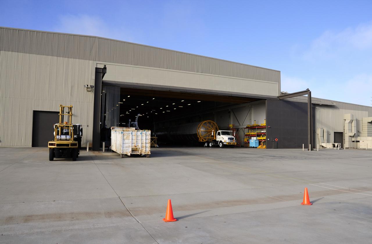
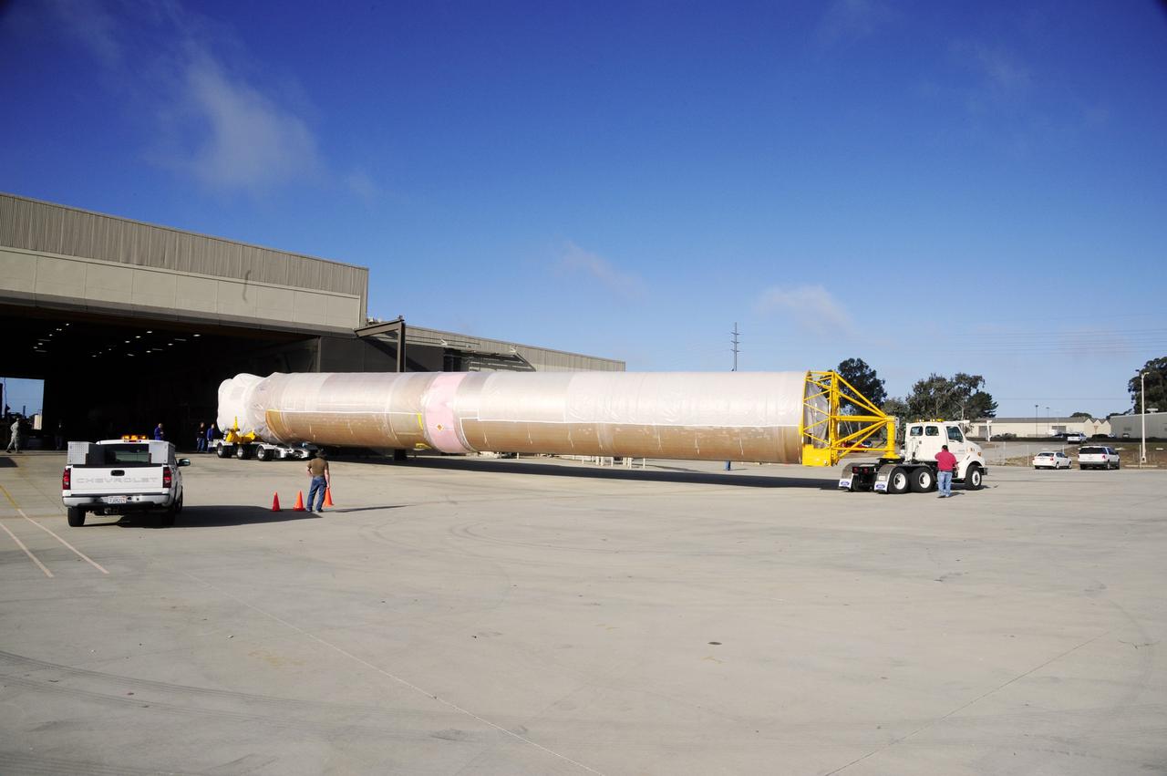
VANDENBERG AIR FORCE BASE, Calif. – In Orbital Sciences Corp. Building 1555 at Vandenberg Air Force Base in California, the first and second stage of the Taurus XL rocket is being loaded onto an Assembly Integration Trailer in preparation for moving to Pad 576-E on north Vandenberg later this month. The Orbital Sciences Taurus XL rocket, targeted to lift off Feb. 23, 2011, from Vandenberg's Space Launch Complex 576-E, will take NASA's Glory satellite into low Earth. Glory is scheduled to collect data on the properties of aerosols and black carbon. It also will help scientists understand how the sun's irradiance affects Earth's climate. Photo credit: NASA/Randy Beaudoin
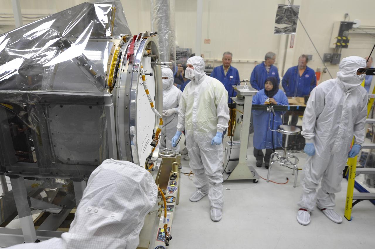
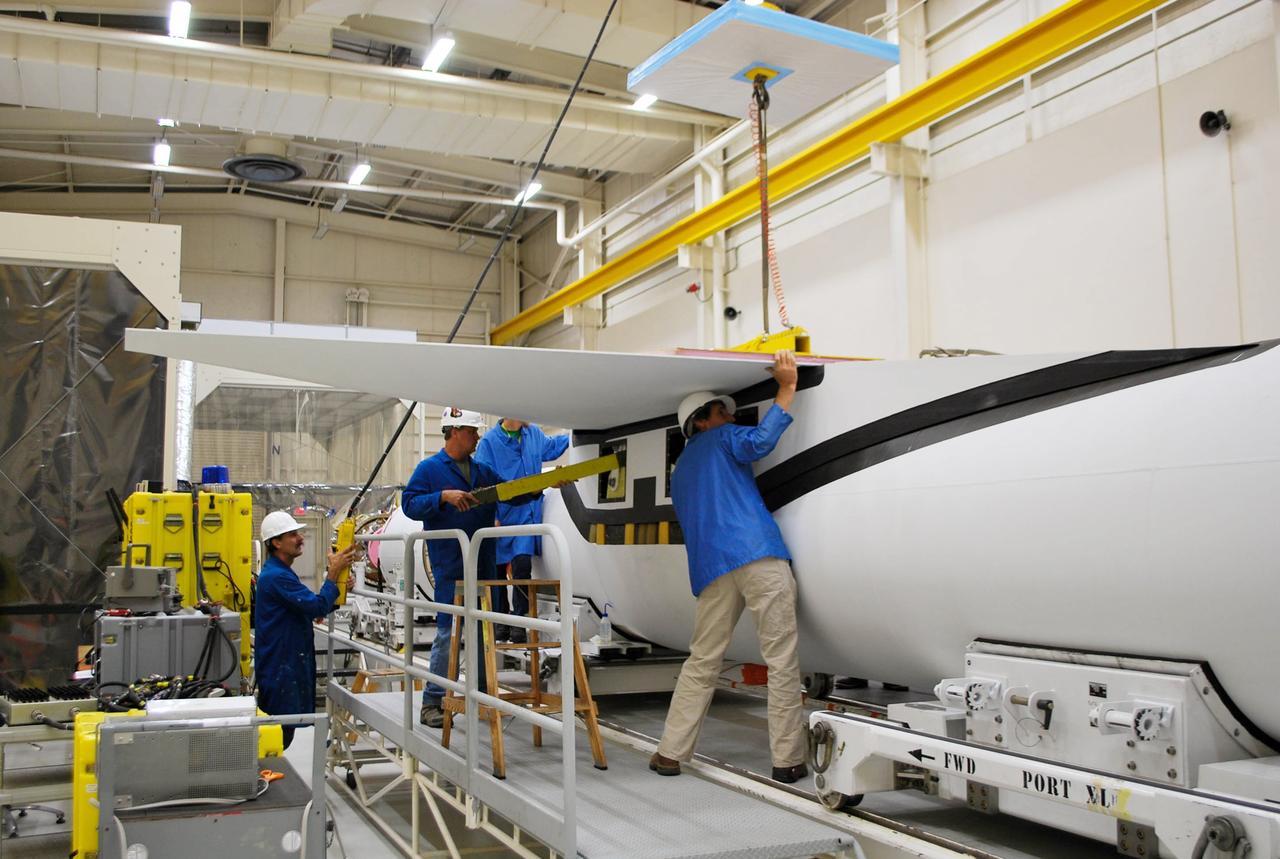
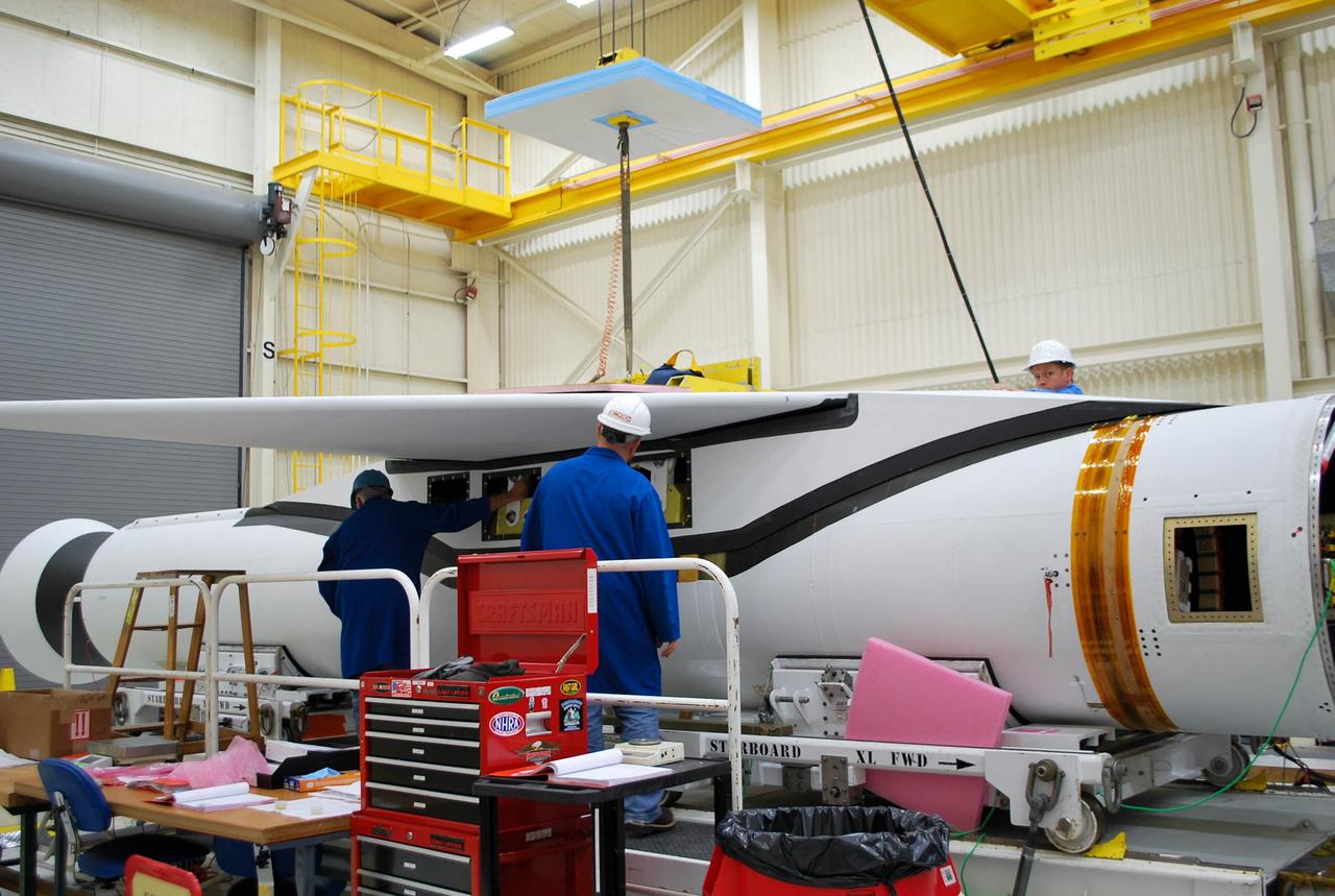
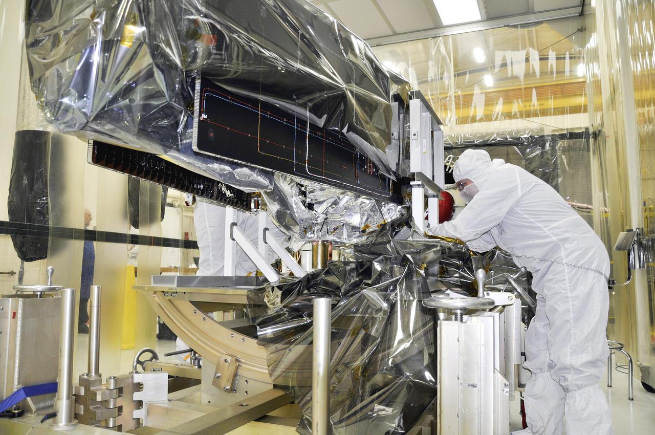
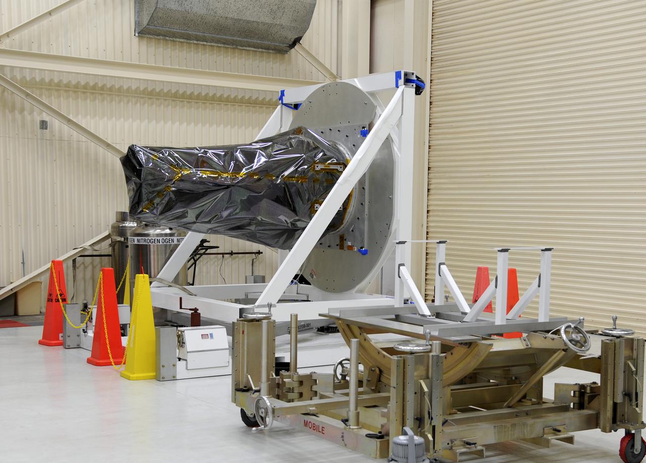
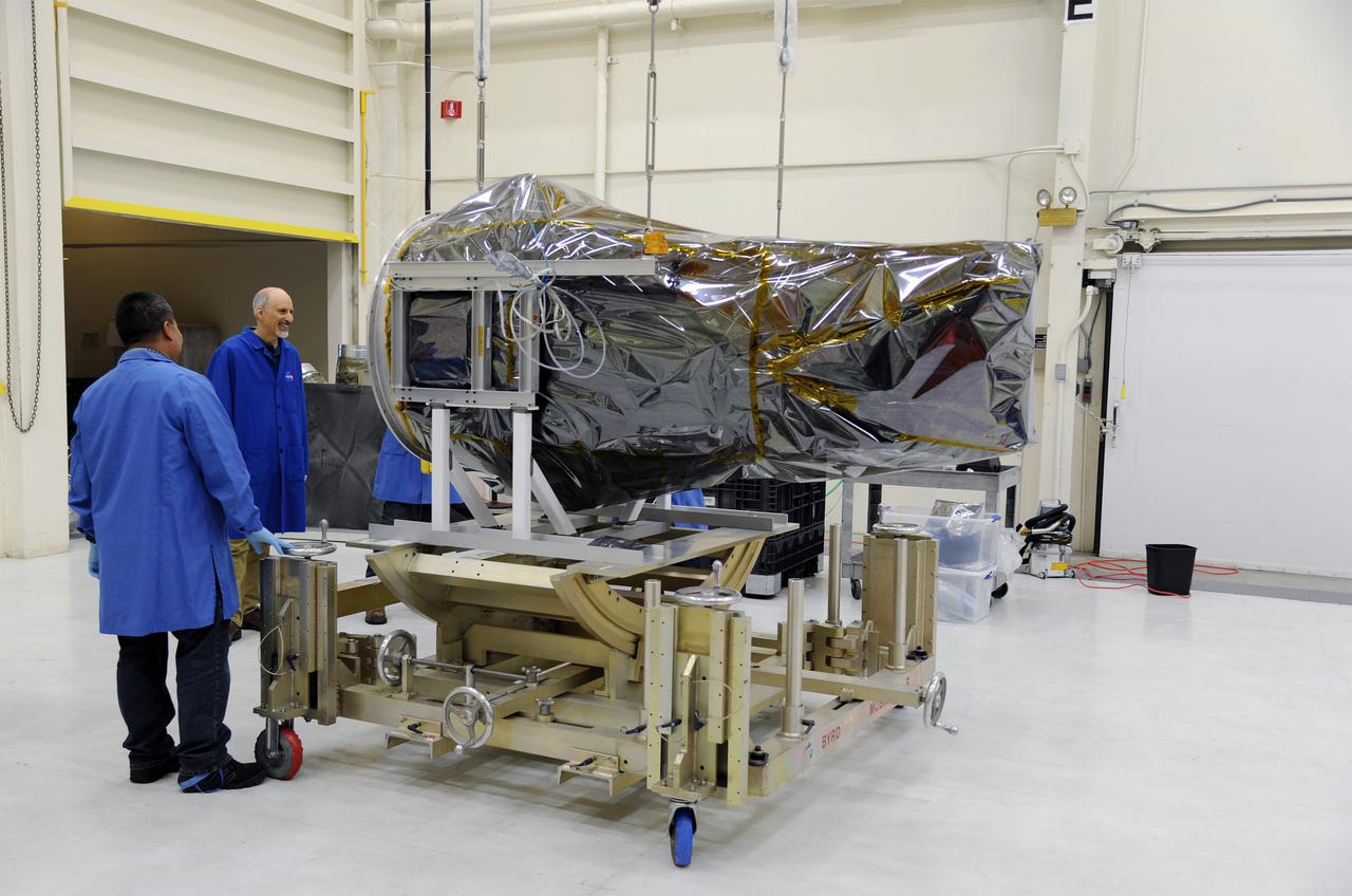
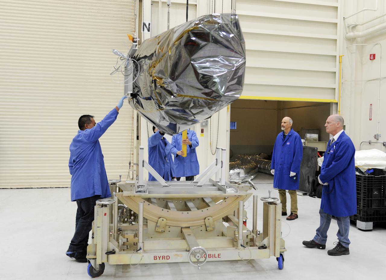
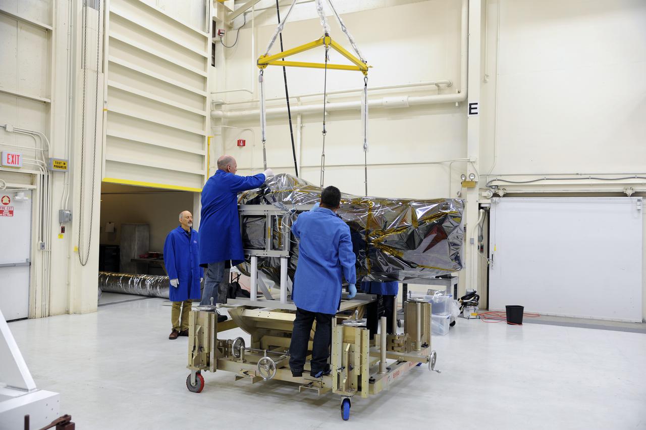
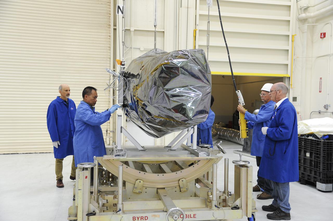
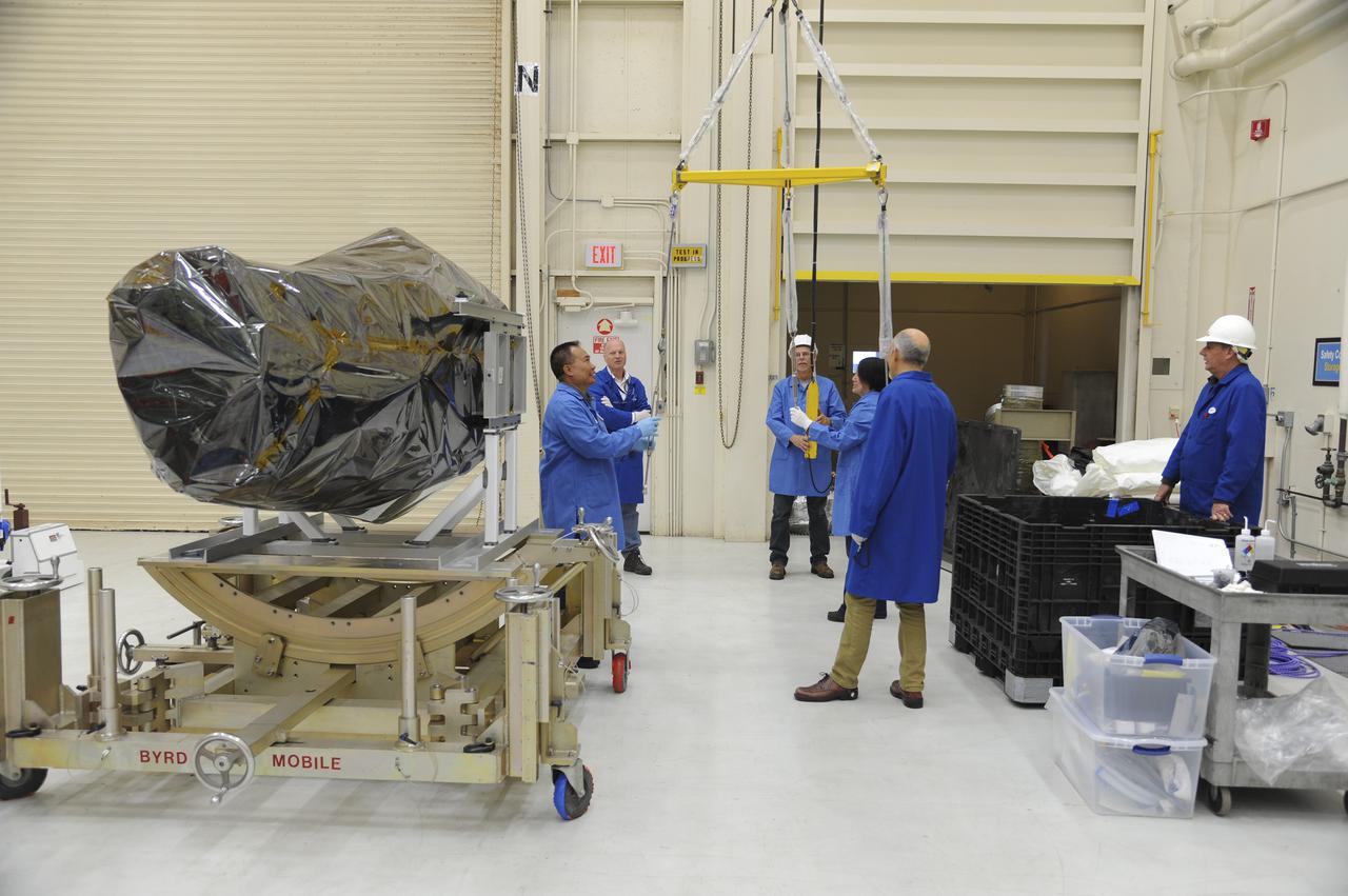
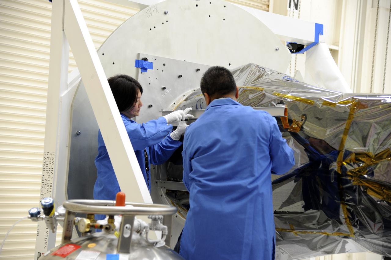
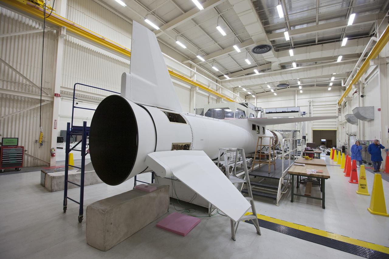
VANDENBERG AFB, Calif. – Engineers prepare to connect NASA's IRIS spacecraft to the nose of an Orbital Sciences Pegasus XL rocket that will lift the solar observatory into orbit in June. The work is taking place in a hangar at Vandenberg Air Force Base where IRIS, short for Interface Region Imaging Spectrograph, is being prepared for launch on a Pegasus XL rocket. Scheduled for launch from Vandenberg no earlier than June 26, 2013, IRIS will open a new window of discovery by tracing the flow of energy and plasma through the chromospheres and transition region into the sun’s corona using spectrometry and imaging. IRIS fills a crucial gap in our ability to advance studies of the sun-to-Earth connection by tracing the flow of energy and plasma through the foundation of the corona and the region around the sun known as the heliosphere. Photo credit: NASA/Randy Beaudoin
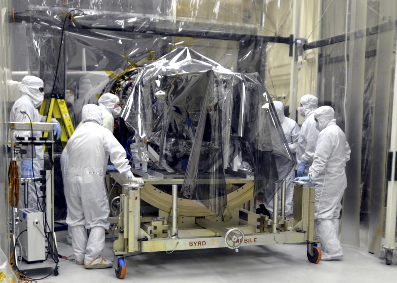
VANDENBERG AFB, Calif. – Engineers prepare to connect NASA's IRIS spacecraft to the nose of an Orbital Sciences Pegasus XL rocket that will lift the solar observatory into orbit in June. The work is taking place in a hangar at Vandenberg Air Force Base where IRIS, short for Interface Region Imaging Spectrograph, is being prepared for launch on a Pegasus XL rocket. Scheduled for launch from Vandenberg no earlier than June 26, 2013, IRIS will open a new window of discovery by tracing the flow of energy and plasma through the chromospheres and transition region into the sun’s corona using spectrometry and imaging. IRIS fills a crucial gap in our ability to advance studies of the sun-to-Earth connection by tracing the flow of energy and plasma through the foundation of the corona and the region around the sun known as the heliosphere. Photo credit: NASA/Randy Beaudoin
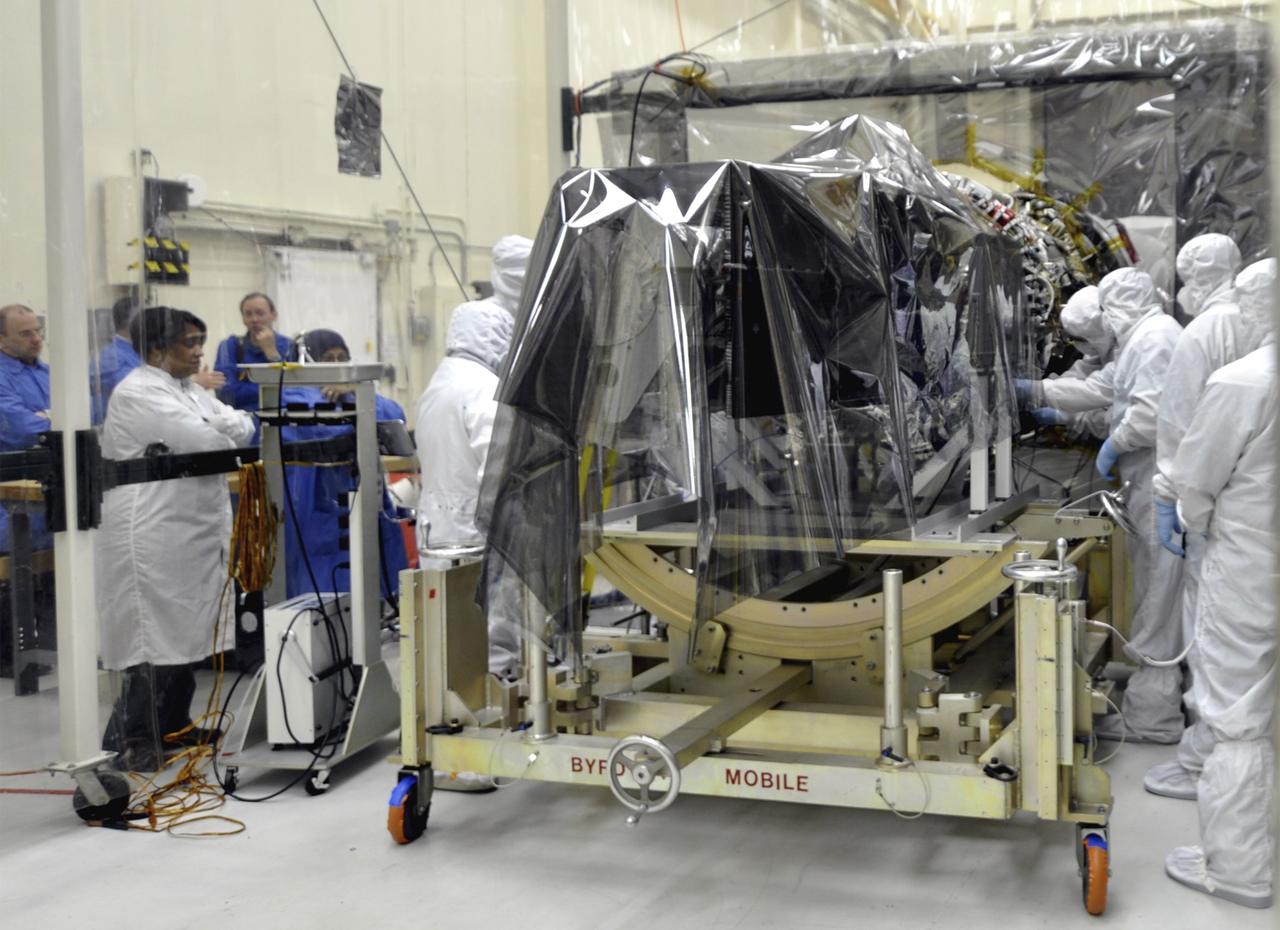
VANDENBERG AFB, Calif. – Engineers prepare to connect NASA's IRIS spacecraft to the nose of an Orbital Sciences Pegasus XL rocket that will lift the solar observatory into orbit in June. The work is taking place in a hangar at Vandenberg Air Force Base where IRIS, short for Interface Region Imaging Spectrograph, is being prepared for launch on a Pegasus XL rocket. Scheduled for launch from Vandenberg no earlier than June 26, 2013, IRIS will open a new window of discovery by tracing the flow of energy and plasma through the chromospheres and transition region into the sun’s corona using spectrometry and imaging. IRIS fills a crucial gap in our ability to advance studies of the sun-to-Earth connection by tracing the flow of energy and plasma through the foundation of the corona and the region around the sun known as the heliosphere. Photo credit: NASA/Randy Beaudoin
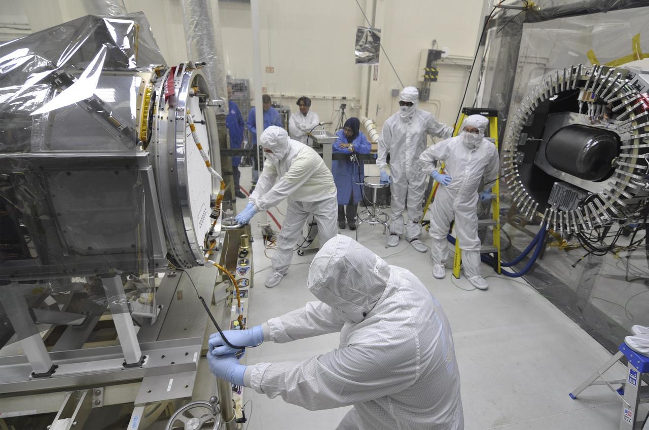
VANDENBERG AFB, Calif. – Engineers prepare to connect NASA's IRIS spacecraft to the nose of an Orbital Sciences Pegasus XL rocket that will lift the solar observatory into orbit in June. The work is taking place in a hangar at Vandenberg Air Force Base where IRIS, short for Interface Region Imaging Spectrograph, is being prepared for launch on a Pegasus XL rocket. Scheduled for launch from Vandenberg no earlier than June 26, 2013, IRIS will open a new window of discovery by tracing the flow of energy and plasma through the chromospheres and transition region into the sun’s corona using spectrometry and imaging. IRIS fills a crucial gap in our ability to advance studies of the sun-to-Earth connection by tracing the flow of energy and plasma through the foundation of the corona and the region around the sun known as the heliosphere. Photo credit: NASA/Randy Beaudoin
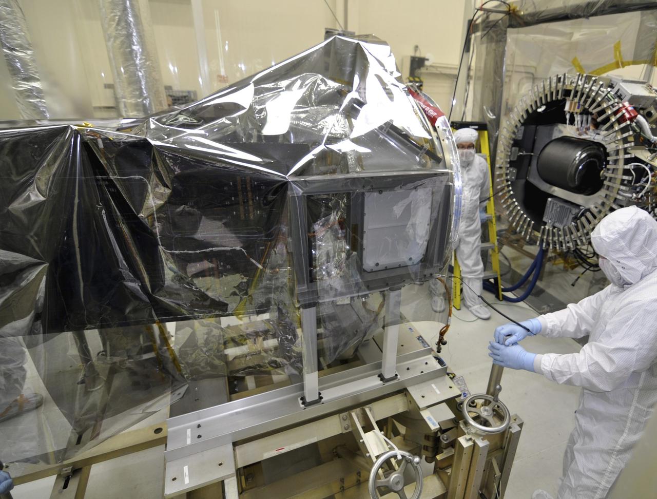
VANDENBERG AFB, Calif. – Engineers prepare to connect NASA's IRIS spacecraft to the nose of an Orbital Sciences Pegasus XL rocket that will lift the solar observatory into orbit in June. The work is taking place in a hangar at Vandenberg Air Force Base where IRIS, short for Interface Region Imaging Spectrograph, is being prepared for launch on a Pegasus XL rocket. Scheduled for launch from Vandenberg no earlier than June 26, 2013, IRIS will open a new window of discovery by tracing the flow of energy and plasma through the chromospheres and transition region into the sun’s corona using spectrometry and imaging. IRIS fills a crucial gap in our ability to advance studies of the sun-to-Earth connection by tracing the flow of energy and plasma through the foundation of the corona and the region around the sun known as the heliosphere. Photo credit: NASA/Randy Beaudoin
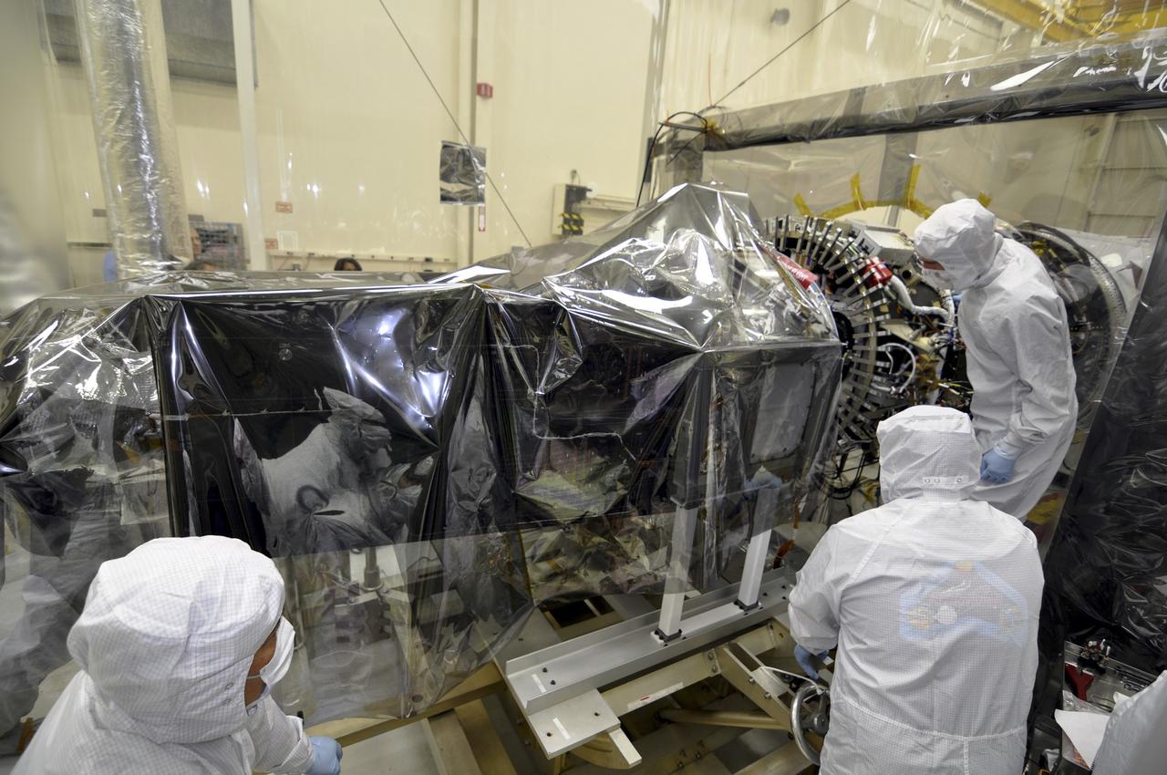
VANDENBERG AFB, Calif. – Engineers prepare to connect NASA's IRIS spacecraft to the nose of an Orbital Sciences Pegasus XL rocket that will lift the solar observatory into orbit in June. The work is taking place in a hangar at Vandenberg Air Force Base where IRIS, short for Interface Region Imaging Spectrograph, is being prepared for launch on a Pegasus XL rocket. Scheduled for launch from Vandenberg no earlier than June 26, 2013, IRIS will open a new window of discovery by tracing the flow of energy and plasma through the chromospheres and transition region into the sun’s corona using spectrometry and imaging. IRIS fills a crucial gap in our ability to advance studies of the sun-to-Earth connection by tracing the flow of energy and plasma through the foundation of the corona and the region around the sun known as the heliosphere. Photo credit: NASA/Randy Beaudoin
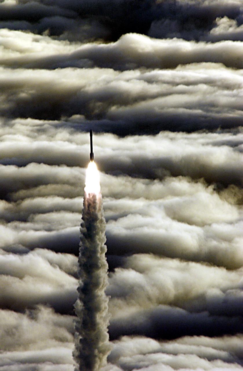
Vandenberg AFB CA-- A Boeing Delta II rocket soars above the clouds here today at Vandenberg AFB CA. The NASA payload aboard the rocket is the ICESat, an Ice Cloud and land Elevation Satellite, and CHIPSat, a Cosmic Hot Interstellar Plasma Spectrometer. ICESat, a 661-pound satellite, is a benchmark satellite for the Earth Observing System that will help scientists determine if the global sea level is rising or falling. It will observe the ice sheets that blanket the Earth’s poles to determine if they are growing or shrinking. It will assist in developing an understanding of how changes in the Earth’s atmosphere and climate affect polar ice masses and global sea level. The Geoscience Laser Altimeter System is the sole instrument on the satellite. CHIPSat, a suitcase-size 131-pound satellite, will provide information about the origin, physical processes and properties of the hot gas contained in the interstellar medium. This launch, marks the first Delta from Vandenberg this year. (USAF photo by: SSgt Lee A Osberry Jr.)
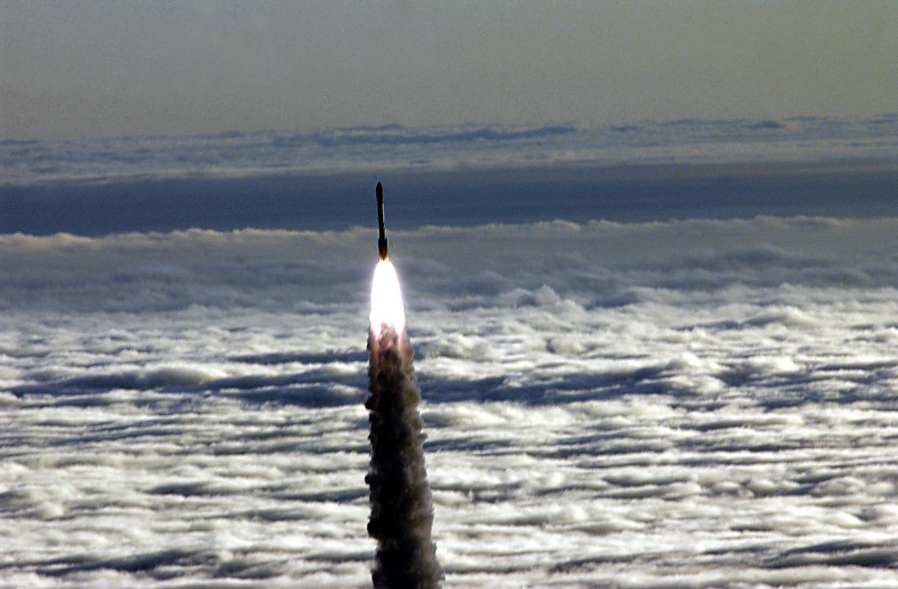
Vandenberg AFB CA-- A Boeing Delta II rocket soars above the clouds here today at Vandenberg AFB CA. The NASA payload aboard the rocket is the ICESat, an Ice Cloud and land Elevation Satellite, and CHIPSat, a Cosmic Hot Interstellar Plasma Spectrometer. ICESat, a 661-pound satellite, is a benchmark satellite for the Earth Observing System that will help scientists determine if the global sea level is rising or falling. It will observe the ice sheets that blanket the Earth’s poles to determine if they are growing or shrinking. It will assist in developing an understanding of how changes in the Earth’s atmosphere and climate affect polar ice masses and global sea level. The Geoscience Laser Altimeter System is the sole instrument on the satellite. CHIPSat, a suitcase-size 131-pound satellite, will provide information about the origin, physical processes and properties of the hot gas contained in the interstellar medium. This launch, marks the first Delta from Vandenberg this year. (USAF photo by: SSgt Lee A Osberry Jr.)
VANDENBERG AIR FORCE BASE, Calif. -- In a clean room at Vandenberg Air Force Base's processing facility in California, NASA's NuSTAR spacecraft undergoes a limited performance test, a two-day functional checkout of the spacecraft. A Pegasus XL rocket is set to launch NuSTAR into space. Once the rocket and spacecraft are processed at Vandenberg, they will be flown on the Orbital Sciences’ L-1011 carrier aircraft to the Ronald Reagan Ballistic Missile Defense Test Site at the Pacific Ocean’s Kwajalein Atoll for launch. The high-energy x-ray telescope will conduct a census for black holes, map radioactive material in young supernovae remnants, and study the origins of cosmic rays and the extreme physics around collapsed stars. For more information, visit science.nasa.gov/missions/nustar/. Photo credit: NASA/Randy Beaudoin, VAFB
VANDENBERG AIR FORCE BASE, Calif. -- In Orbital Sciences' Pegasus processing facility at Vandenberg Air Force Base's in California, the Pegasus XL rocket is readied for flight. The Pegasus will launch NASA's Nuclear Spectroscopic Telescope Array (NuSTAR) into space. After the rocket and spacecraft are processed at Vandenberg, they will be flown on the Orbital Sciences’ L-1011 carrier aircraft to the Ronald Reagan Ballistic Missile Defense Test Site at the Pacific Ocean’s Kwajalein Atoll for launch. The high-energy x-ray telescope will conduct a census for black holes, map radioactive material in young supernovae remnants, and study the origins of cosmic rays and the extreme physics around collapsed stars. For more information, visit science.nasa.gov/missions/nustar/. Photo credit: NASA/Randy Beaudoin, VAFB
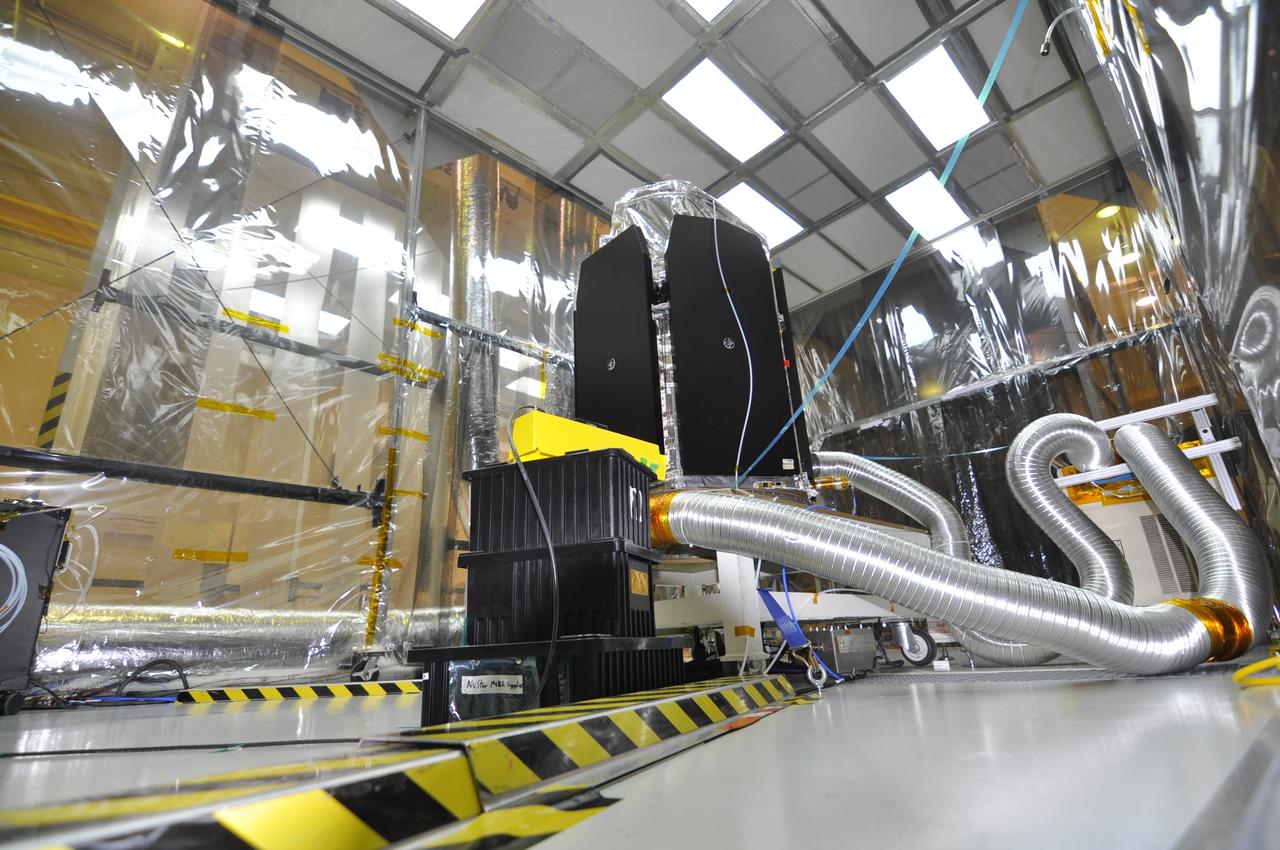
VANDENBERG AIR FORCE BASE, Calif. -- In a clean room at Vandenberg Air Force Base's processing facility in California, NASA's NuSTAR spacecraft undergoes a limited performance test, a two-day functional checkout of the spacecraft. A Pegasus XL rocket is set to launch NuSTAR into space. Once the rocket and spacecraft are processed at Vandenberg, they will be flown on the Orbital Sciences’ L-1011 carrier aircraft to the Ronald Reagan Ballistic Missile Defense Test Site at the Pacific Ocean’s Kwajalein Atoll for launch. The high-energy x-ray telescope will conduct a census for black holes, map radioactive material in young supernovae remnants, and study the origins of cosmic rays and the extreme physics around collapsed stars. For more information, visit science.nasa.gov/missions/nustar/. Photo credit: NASA/Randy Beaudoin, VAFB
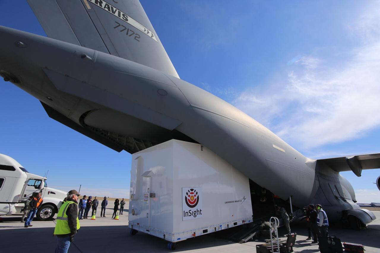
Personnel supporting NASA's InSight mission to Mars load the crated InSight spacecraft into a C-17 cargo aircraft at Buckley Air Force Base, Denver, for shipment to Vandenberg Air Force Base, California. The spacecraft, built in Colorado by Lockheed Martin Space, was shipped February 28, 2018, in preparation for launch from Vandenberg in May 2018. InSight, short for Interior Exploration using Seismic Investigations, Geodesy and Heat Transport, is the first mission dedicated to studying the deep interior of Mars. Its findings will advance understanding of the early history of all rocky planets, including Earth. https://photojournal.jpl.nasa.gov/catalog/PIA22220
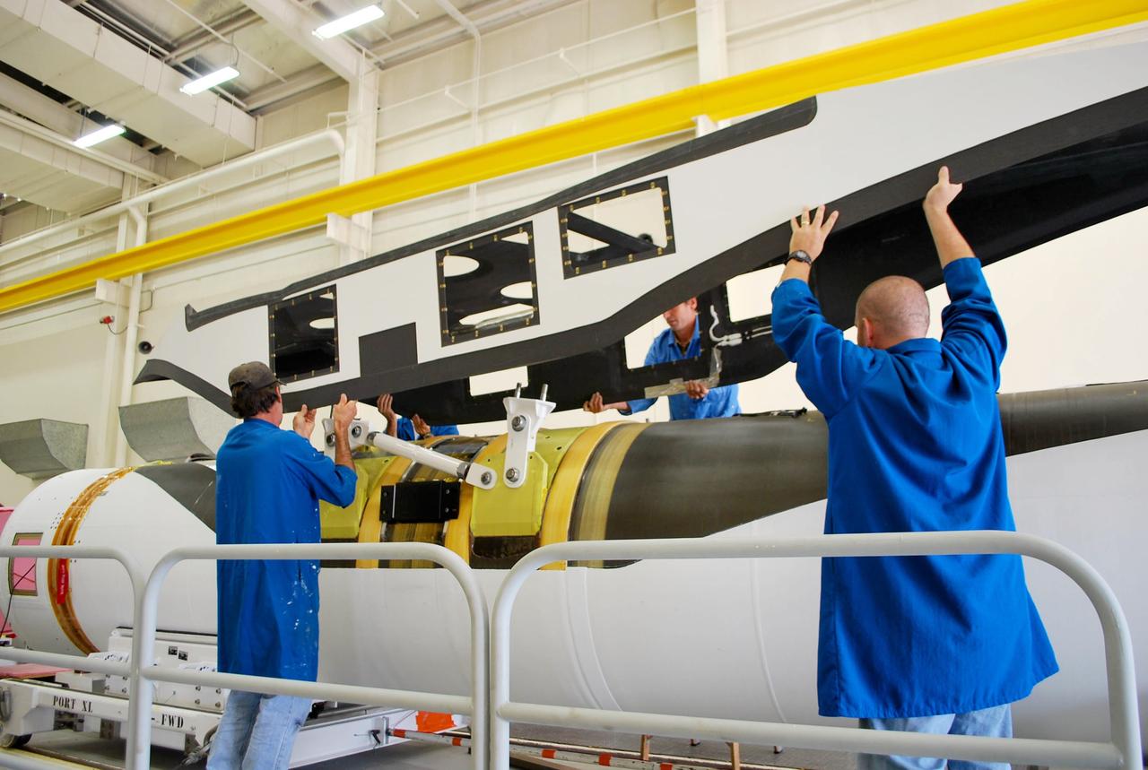
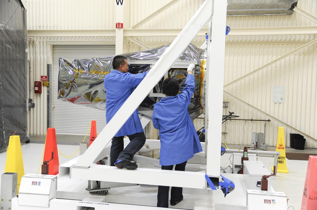
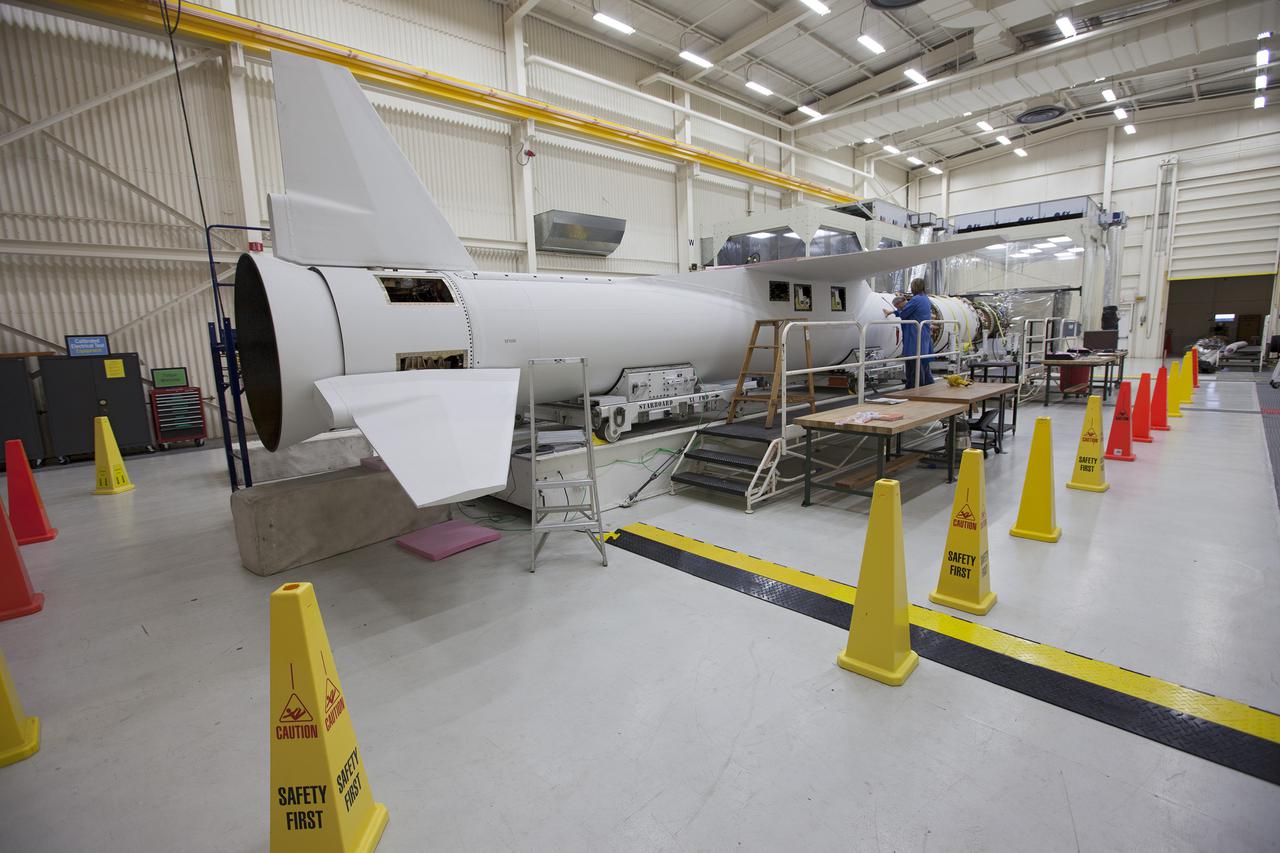
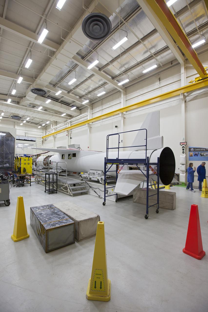
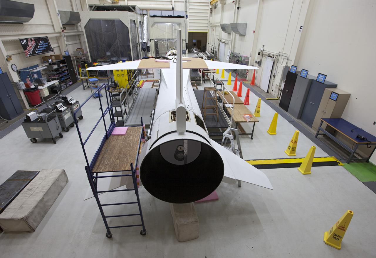
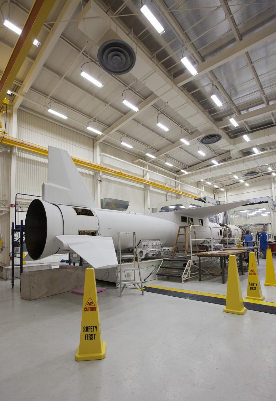
VANDENBERG AFB, Calif. – Technicians perform a fit check on an Orbital Sciences Pegasus rocket as the launcher is processed for the Interface Region Imaging Spectrograph mission known as IRIS. The technicians are attaching the portion of the Pegasus that joins the wing to the fuselage, a piece called a fillet. Photo credit: VAFB/Randy Beaudoin

VANDENBERG AFB, Calif. – Technicians perform a fit check on an Orbital Sciences Pegasus rocket as the launcher is processed for the Interface Region Imaging Spectrograph mission known as IRIS. The technicians are attaching the portion of the Pegasus that joins the wing to the fuselage, a piece called a fillet. Photo credit: VAFB/Randy Beaudoin
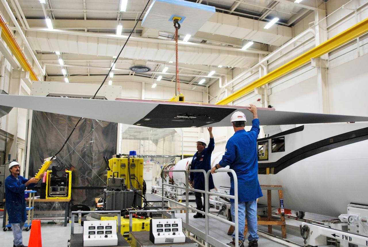
VANDENBERG AFB, Calif. – Technicians perform a fit check on an Orbital Sciences Pegasus rocket as the launcher is processed for the Interface Region Imaging Spectrograph mission known as IRIS. The technicians are attaching the wing of the Pegasus to the fuselage. Photo credit: VAFB/Randy Beaudoin
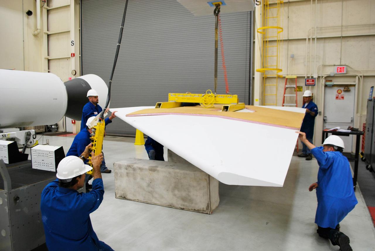
VANDENBERG AFB, Calif. – Technicians perform a fit check on an Orbital Sciences Pegasus rocket as the launcher is processed for the Interface Region Imaging Spectrograph mission known as IRIS. The technicians are attaching the wing of the Pegasus to the fuselage. Photo credit: VAFB/Randy Beaudoin
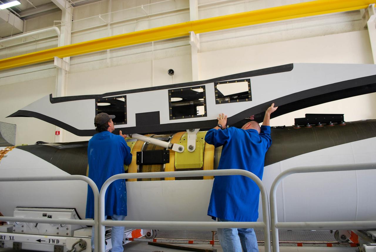
VANDENBERG AFB, Calif. – Technicians perform a fit check on an Orbital Sciences Pegasus rocket as the launcher is processed for the Interface Region Imaging Spectrograph mission known as IRIS. The technicians are attaching the portion of the Pegasus that joins the wing to the fuselage, a piece called a fillet. Photo credit: VAFB/Randy Beaudoin

VANDENBERG AFB, Calif. – Technicians perform a fit check on an Orbital Sciences Pegasus rocket as the launcher is processed for the Interface Region Imaging Spectrograph mission known as IRIS. The technicians are attaching the portion of the Pegasus that joins the wing to the fuselage, a piece called a fillet. Photo credit: VAFB/Randy Beaudoin
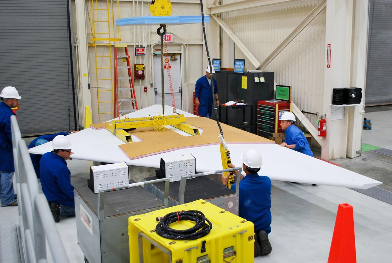
VANDENBERG AFB, Calif. – Technicians perform a fit check on an Orbital Sciences Pegasus rocket as the launcher is processed for the Interface Region Imaging Spectrograph mission known as IRIS. The technicians are attaching the wing of the Pegasus to the fuselage. Photo credit: VAFB/Randy Beaudoin
VANDENBERG AFB, Calif. – Technicians perform a fit check on an Orbital Sciences Pegasus rocket as the launcher is processed for the Interface Region Imaging Spectrograph mission known as IRIS. The technicians are attaching the wing of the Pegasus to the fuselage. Photo credit: VAFB/Randy Beaudoin
VANDENBERG AFB, Calif. – Technicians perform a fit check on an Orbital Sciences Pegasus rocket as the launcher is processed for the Interface Region Imaging Spectrograph mission known as IRIS. The technicians are attaching the wing of the Pegasus to the fuselage. Photo credit: VAFB/Randy Beaudoin
NASA CloudSat spacecraft sits encapsulated within its Boeing Delta launch vehicle dual payload attach fitting at Vandenberg Air Force Base, Calif.
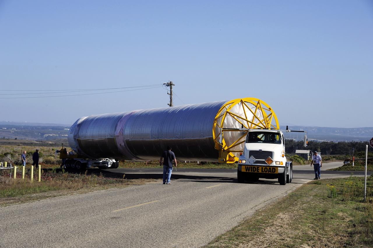
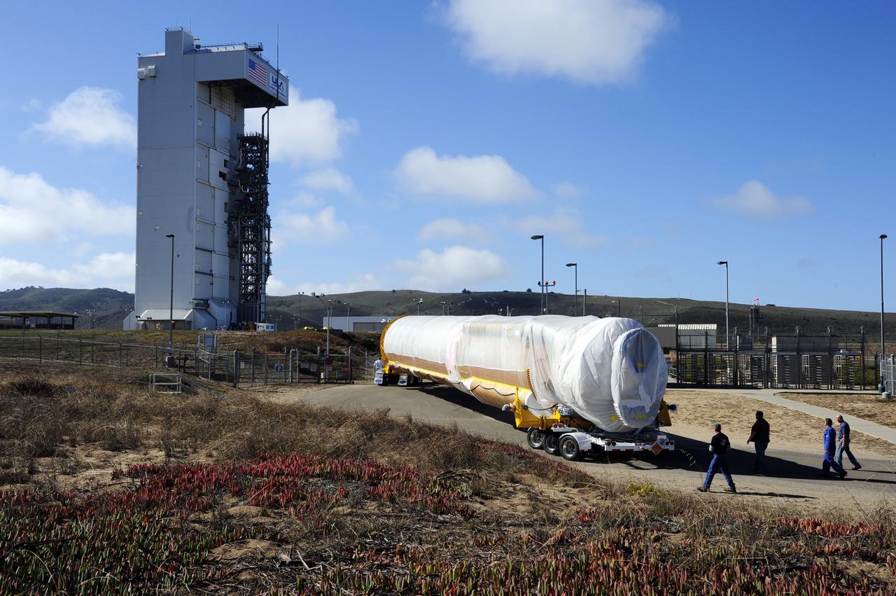
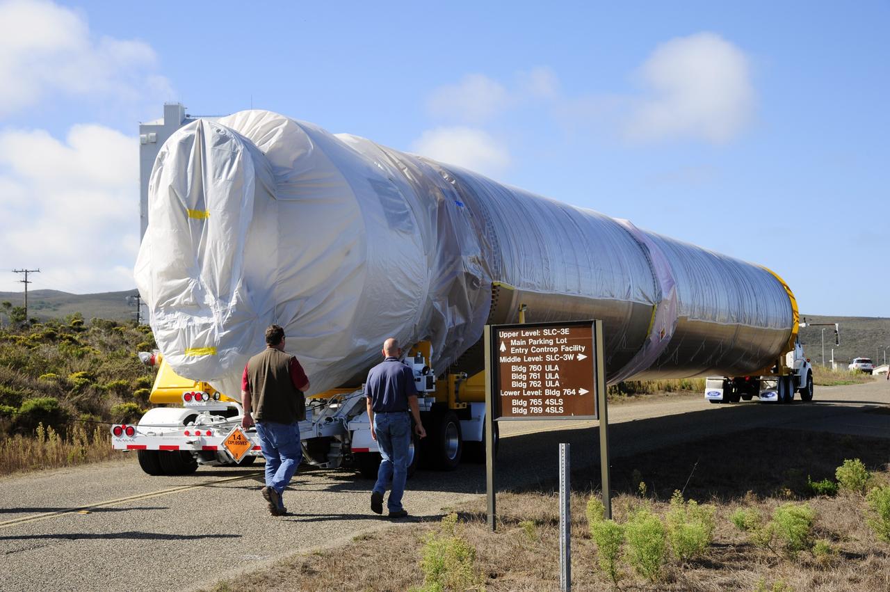
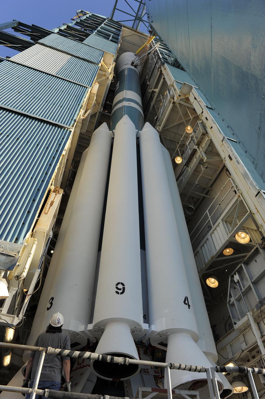
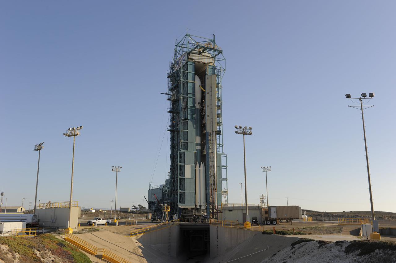
VANDENBERG AFB, Calif. – A truck moves the first stage booster of a United Launch Alliance Atlas V to Space Launch Complex-3E at Vandenberg Air Force Base, Calif. in preparation for the launch of the Landsat Data Continuity Mission. The Landsat Data Continuity Mission, or LDCM, is the future of Landsat satellites. It will continue to obtain valuable data and imagery to be used in agriculture, education, business, science, and government. The Landsat Program provides repetitive acquisition of high resolution multispectral data of the Earth's surface on a global basis. The data from the Landsat spacecraft constitute the longest record of the Earth's continental surfaces as seen from space. It is a record unmatched in quality, detail, coverage, and value. Launch is planned for Feb. 2013. Photo credit: NASA/Roy Allison
VANDENBERG AFB, Calif. – A truck moves the first stage booster of a United Launch Alliance Atlas V to Space Launch Complex-3E at Vandenberg Air Force Base, Calif. in preparation for the launch of the Landsat Data Continuity Mission. The Landsat Data Continuity Mission, or LDCM, is the future of Landsat satellites. It will continue to obtain valuable data and imagery to be used in agriculture, education, business, science, and government. The Landsat Program provides repetitive acquisition of high resolution multispectral data of the Earth's surface on a global basis. The data from the Landsat spacecraft constitute the longest record of the Earth's continental surfaces as seen from space. It is a record unmatched in quality, detail, coverage, and value. Launch is planned for Feb. 2013. Photo credit: NASA/Roy Allison
VANDENBERG AFB, Calif. – A truck moves the first stage booster of a United Launch Alliance Atlas V to Space Launch Complex-3E at Vandenberg Air Force Base, Calif. in preparation for the launch of the Landsat Data Continuity Mission. The Landsat Data Continuity Mission, or LDCM, is the future of Landsat satellites. It will continue to obtain valuable data and imagery to be used in agriculture, education, business, science, and government. The Landsat Program provides repetitive acquisition of high resolution multispectral data of the Earth's surface on a global basis. The data from the Landsat spacecraft constitute the longest record of the Earth's continental surfaces as seen from space. It is a record unmatched in quality, detail, coverage, and value. Launch is planned for Feb. 2013. Photo credit: NASA/Roy Allison
VANDENBERG AFB, Calif. – A truck moves the first stage booster of a United Launch Alliance Atlas V to Space Launch Complex-3E at Vandenberg Air Force Base, Calif. in preparation for the launch of the Landsat Data Continuity Mission. The Landsat Data Continuity Mission, or LDCM, is the future of Landsat satellites. It will continue to obtain valuable data and imagery to be used in agriculture, education, business, science, and government. The Landsat Program provides repetitive acquisition of high resolution multispectral data of the Earth's surface on a global basis. The data from the Landsat spacecraft constitute the longest record of the Earth's continental surfaces as seen from space. It is a record unmatched in quality, detail, coverage, and value. Launch is planned for Feb. 2013. Photo credit: NASA/Roy Allison
VANDENBERG AFB, Calif. – A truck moves the first stage booster of a United Launch Alliance Atlas V to Space Launch Complex-3E at Vandenberg Air Force Base, Calif. in preparation for the launch of the Landsat Data Continuity Mission. The Landsat Data Continuity Mission, or LDCM, is the future of Landsat satellites. It will continue to obtain valuable data and imagery to be used in agriculture, education, business, science, and government. The Landsat Program provides repetitive acquisition of high resolution multispectral data of the Earth's surface on a global basis. The data from the Landsat spacecraft constitute the longest record of the Earth's continental surfaces as seen from space. It is a record unmatched in quality, detail, coverage, and value. Launch is planned for Feb. 2013. Photo credit: NASA/Roy Allison
VANDENBERG AFB, Calif. – A truck moves the first stage booster of a United Launch Alliance Atlas V to Space Launch Complex-3E at Vandenberg Air Force Base, Calif. in preparation for the launch of the Landsat Data Continuity Mission. The Landsat Data Continuity Mission, or LDCM, is the future of Landsat satellites. It will continue to obtain valuable data and imagery to be used in agriculture, education, business, science, and government. The Landsat Program provides repetitive acquisition of high resolution multispectral data of the Earth's surface on a global basis. The data from the Landsat spacecraft constitute the longest record of the Earth's continental surfaces as seen from space. It is a record unmatched in quality, detail, coverage, and value. Launch is planned for Feb. 2013. Photo credit: NASA/Roy Allison
VANDENBERG AFB, Calif. – A truck moves the first stage booster of a United Launch Alliance Atlas V to Space Launch Complex-3E at Vandenberg Air Force Base, Calif. in preparation for the launch of the Landsat Data Continuity Mission. The Landsat Data Continuity Mission, or LDCM, is the future of Landsat satellites. It will continue to obtain valuable data and imagery to be used in agriculture, education, business, science, and government. The Landsat Program provides repetitive acquisition of high resolution multispectral data of the Earth's surface on a global basis. The data from the Landsat spacecraft constitute the longest record of the Earth's continental surfaces as seen from space. It is a record unmatched in quality, detail, coverage, and value. Launch is planned for Feb. 2013. Photo credit: NASA/Roy Allison
VANDENBERG AFB, Calif. – A truck moves the first stage booster of a United Launch Alliance Atlas V to Space Launch Complex-3E at Vandenberg Air Force Base, Calif. in preparation for the launch of the Landsat Data Continuity Mission. The Landsat Data Continuity Mission, or LDCM, is the future of Landsat satellites. It will continue to obtain valuable data and imagery to be used in agriculture, education, business, science, and government. The Landsat Program provides repetitive acquisition of high resolution multispectral data of the Earth's surface on a global basis. The data from the Landsat spacecraft constitute the longest record of the Earth's continental surfaces as seen from space. It is a record unmatched in quality, detail, coverage, and value. Launch is planned for Feb. 2013. Photo credit: NASA/Roy Allison
VANDENBERG AFB, Calif. – A truck moves the first stage booster of a United Launch Alliance Atlas V to Space Launch Complex-3E at Vandenberg Air Force Base, Calif. in preparation for the launch of the Landsat Data Continuity Mission. The Landsat Data Continuity Mission, or LDCM, is the future of Landsat satellites. It will continue to obtain valuable data and imagery to be used in agriculture, education, business, science, and government. The Landsat Program provides repetitive acquisition of high resolution multispectral data of the Earth's surface on a global basis. The data from the Landsat spacecraft constitute the longest record of the Earth's continental surfaces as seen from space. It is a record unmatched in quality, detail, coverage, and value. Launch is planned for Feb. 2013. Photo credit: NASA/Roy Allison
VANDENBERG AFB, Calif. – A truck moves the first stage booster of a United Launch Alliance Atlas V to Space Launch Complex-3E at Vandenberg Air Force Base, Calif. in preparation for the launch of the Landsat Data Continuity Mission. The Landsat Data Continuity Mission, or LDCM, is the future of Landsat satellites. It will continue to obtain valuable data and imagery to be used in agriculture, education, business, science, and government. The Landsat Program provides repetitive acquisition of high resolution multispectral data of the Earth's surface on a global basis. The data from the Landsat spacecraft constitute the longest record of the Earth's continental surfaces as seen from space. It is a record unmatched in quality, detail, coverage, and value. Launch is planned for Feb. 2013. Photo credit: NASA/Roy Allison
VANDENBERG AFB, Calif. – A truck moves the first stage booster of a United Launch Alliance Atlas V to Space Launch Complex-3E at Vandenberg Air Force Base, Calif. in preparation for the launch of the Landsat Data Continuity Mission. The Landsat Data Continuity Mission, or LDCM, is the future of Landsat satellites. It will continue to obtain valuable data and imagery to be used in agriculture, education, business, science, and government. The Landsat Program provides repetitive acquisition of high resolution multispectral data of the Earth's surface on a global basis. The data from the Landsat spacecraft constitute the longest record of the Earth's continental surfaces as seen from space. It is a record unmatched in quality, detail, coverage, and value. Launch is planned for Feb. 2013. Photo credit: NASA/Roy Allison
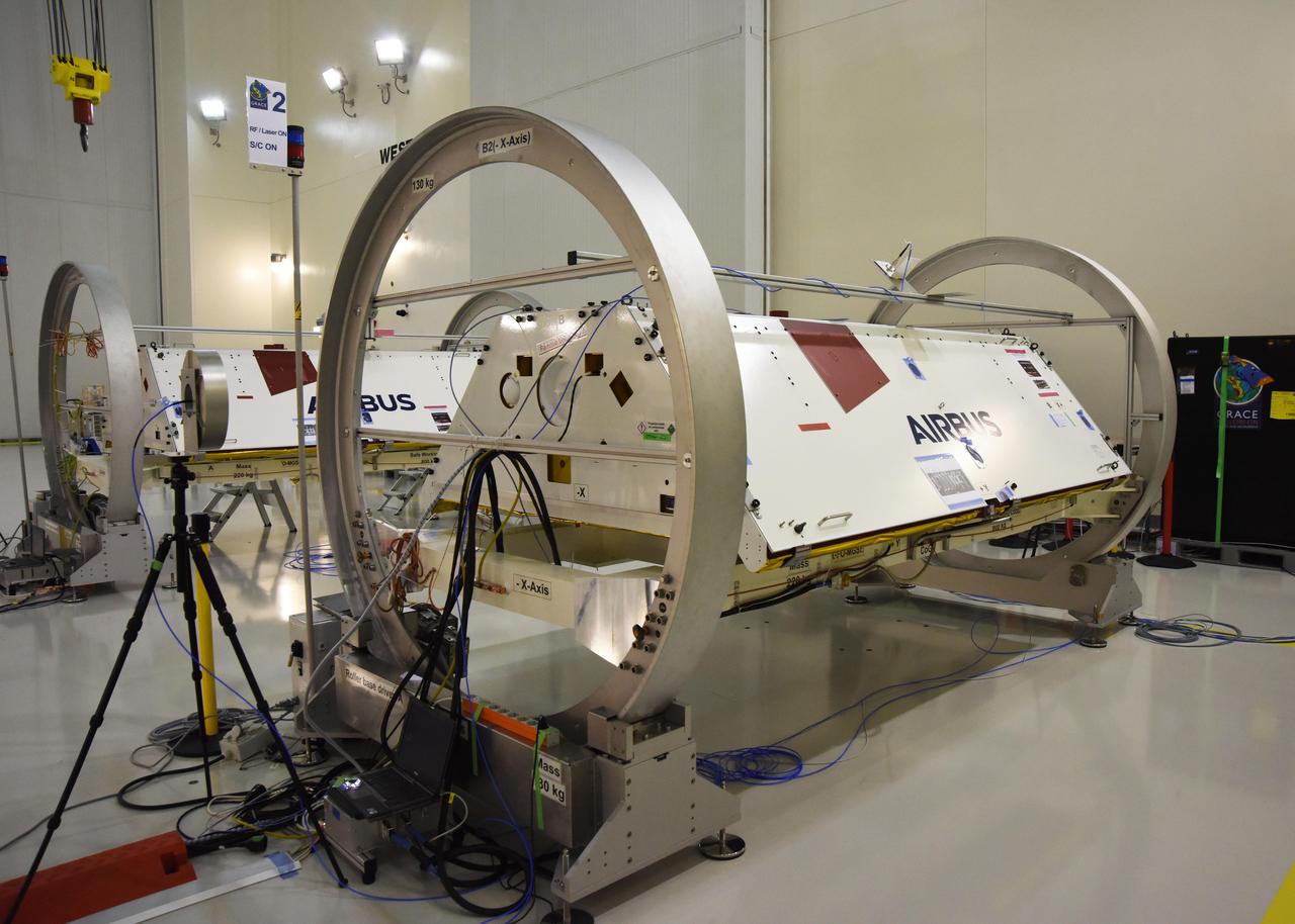
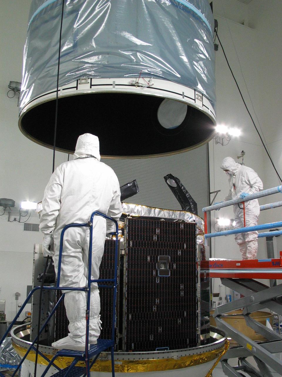
The Gravity Recovery and Climate Experiment Follow-On (GRACE-FO) twin satellites, attached to turntable fixtures, at the Astrotech Space Operations processing facility at Vandenberg Air Force Base, California. GRACE-FO will extend GRACE's legacy of scientific achievements, which range from tracking mass changes of Earth's polar ice sheets and estimating global groundwater changes, to measuring the mass changes of large earthquakes and inferring changes in deep ocean currents, a driving force in climate. To date, GRACE observations have been used in more than 4,300 research publications. Its measurements provide a unique view of the Earth system and have far-reaching benefits to society, such as providing insights into where global groundwater resources may be shrinking or growing and where dry soils are contributing to drought. GRACE-FO is planned to fly at least five years. https://photojournal.jpl.nasa.gov/catalog/PIA22340
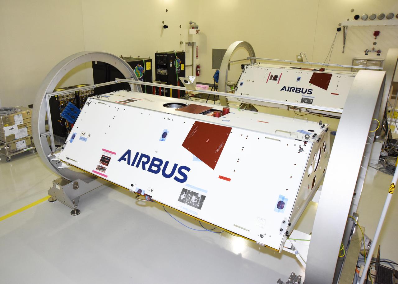
The Gravity Recovery and Climate Experiment Follow-On (GRACE-FO) twin satellites, attached to turntable fixtures, at the Astrotech Space Operations processing facility at Vandenberg Air Force Base, California. GRACE-FO will extend GRACE's legacy of scientific achievements, which range from tracking mass changes of Earth's polar ice sheets and estimating global groundwater changes, to measuring the mass changes of large earthquakes and inferring changes in deep ocean currents, a driving force in climate. To date, GRACE observations have been used in more than 4,300 research publications. Its measurements provide a unique view of the Earth system and have far-reaching benefits to society, such as providing insights into where global groundwater resources may be shrinking or growing and where dry soils are contributing to drought. GRACE-FO is planned to fly at least five years. https://photojournal.jpl.nasa.gov/catalog/PIA22341

The Gravity Recovery and Climate Experiment Follow-On (GRACE-FO) twin satellites, attached to turntable fixtures, at the Astrotech Space Operations processing facility at Vandenberg Air Force Base, California. GRACE-FO will extend GRACE's legacy of scientific achievements, which range from tracking mass changes of Earth's polar ice sheets and estimating global groundwater changes, to measuring the mass changes of large earthquakes and inferring changes in deep ocean currents, a driving force in climate. To date, GRACE observations have been used in more than 4,300 research publications. Its measurements provide a unique view of the Earth system and have far-reaching benefits to society, such as providing insights into where global groundwater resources may be shrinking or growing and where dry soils are contributing to drought. GRACE-FO is planned to fly at least five years. https://photojournal.jpl.nasa.gov/catalog/PIA22338
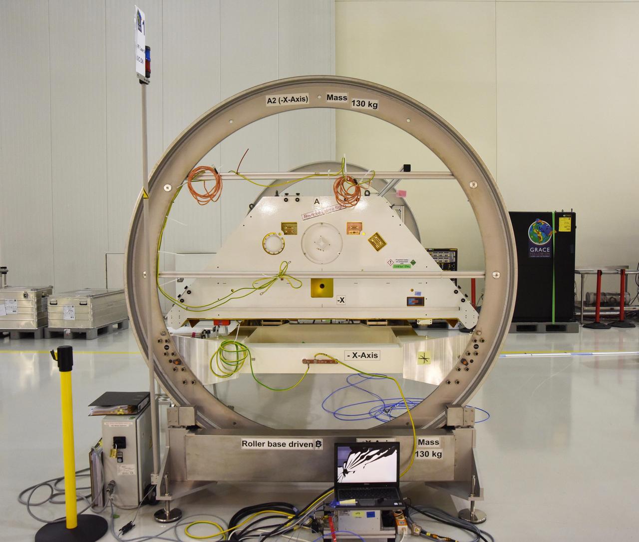
One of the two Gravity Recovery and Climate Experiment Follow-On (GRACE-FO) satellites and its turntable fixture at the Astrotech Space Operations processing facility at Vandenberg Air Force Base, California. GRACE-FO will extend GRACE's legacy of scientific achievements, which range from tracking mass changes of Earth's polar ice sheets and estimating global groundwater changes, to measuring the mass changes of large earthquakes and inferring changes in deep ocean currents, a driving force in climate. To date, GRACE observations have been used in more than 4,300 research publications. Its measurements provide a unique view of the Earth system and have far-reaching benefits to society, such as providing insights into where global groundwater resources may be shrinking or growing and where dry soils are contributing to drought. GRACE-FO is planned to fly at least five years. https://photojournal.jpl.nasa.gov/catalog/PIA22339
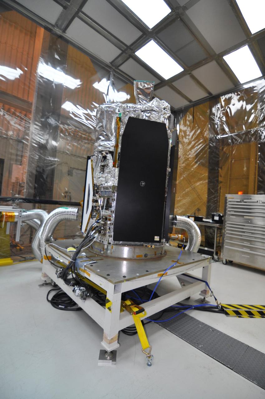
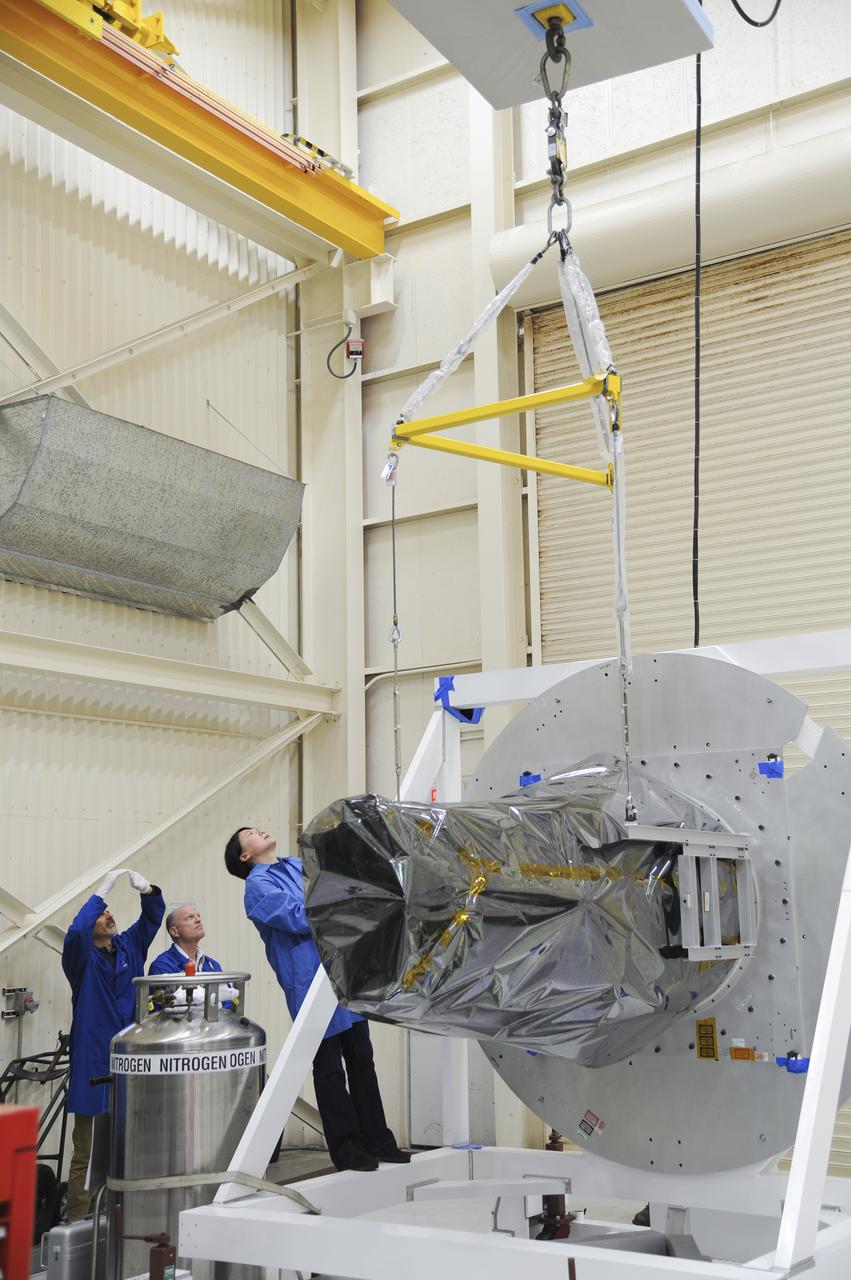
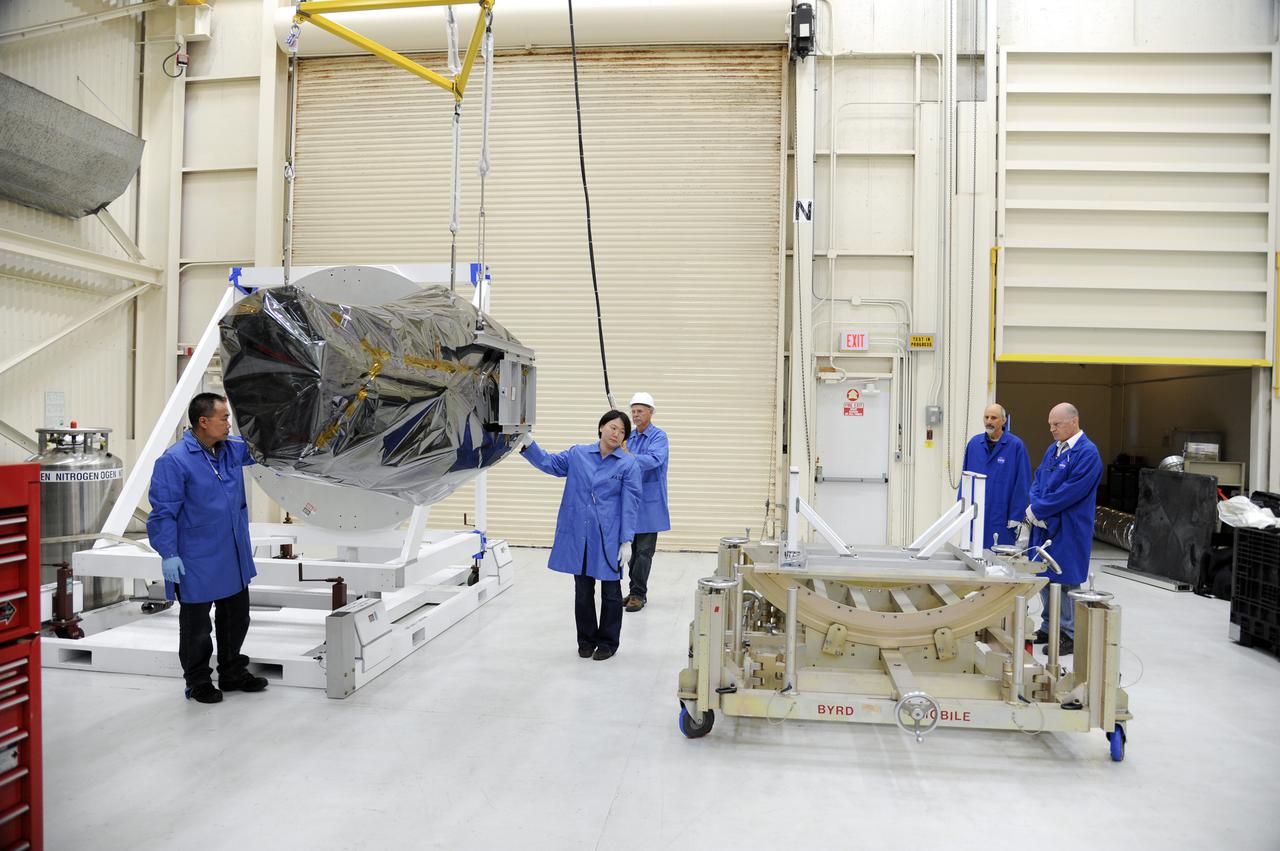
VANDENBERG AFB, Calif. – A technician removes protective Mylar wrapping from NASA's IRIS spacecraft in a clean room at Vandenberg where the spacecraft will be readied for launch aboard an Orbital Sciences Pegasus XL rocket. IRIS is short for Interface Region Imaging Spectrograph and the spacecraft's mission will improve our understanding of how heat and energy move through the deepest levels of the sun’s atmosphere, thereby increasing our ability to forecast space weather. Photo credit: VAFB_Randy Beaudoin

VANDENBERG AFB, Calif. – NASA's IRIS spacecraft stands in a clean room at Vandenberg where the spacecraft will be readied for launch aboard an Orbital Sciences Pegasus XL rocket. IRIS is short for Interface Region Imaging Spectrograph and the spacecraft's mission will improve our understanding of how heat and energy move through the deepest levels of the sun’s atmosphere, thereby increasing our ability to forecast space weather. Photo credit: VAFB_Randy Beaudoin
VANDENBERG AFB, Calif. – A technician finishes removing protective Mylar wrapping from NASA's IRIS spacecraft in a clean room at Vandenberg where the spacecraft will be readied for launch aboard an Orbital Sciences Pegasus XL rocket. IRIS is short for Interface Region Imaging Spectrograph and the spacecraft's mission will improve our understanding of how heat and energy move through the deepest levels of the sun’s atmosphere, thereby increasing our ability to forecast space weather. Photo credit: VAFB_Randy Beaudoin
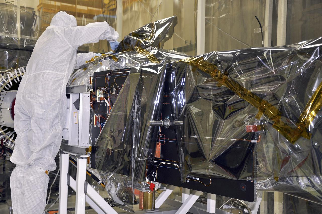
VANDENBERG AFB, Calif. – A technician removes protective Mylar wrapping from NASA's IRIS spacecraft in a clean room at Vandenberg where the spacecraft will be readied for launch aboard an Orbital Sciences Pegasus XL rocket. IRIS is short for Interface Region Imaging Spectrograph and the spacecraft's mission will improve our understanding of how heat and energy move through the deepest levels of the sun’s atmosphere, thereby increasing our ability to forecast space weather. Photo credit: VAFB_Randy Beaudoin
VANDENBERG AFB, Calif. – Technicians remove protective Mylar wrapping from NASA's IRIS spacecraft in a clean room at Vandenberg where the spacecraft will be readied for launch aboard an Orbital Sciences Pegasus XL rocket. IRIS is short for Interface Region Imaging Spectrograph and the spacecraft's mission will improve our understanding of how heat and energy move through the deepest levels of the sun’s atmosphere, thereby increasing our ability to forecast space weather. Photo credit: VAFB_Randy Beaudoin
VANDENBERG AFB, Calif. – A technician removes protective Mylar wrapping from NASA's IRIS spacecraft in a clean room at Vandenberg where the spacecraft will be readied for launch aboard an Orbital Sciences Pegasus XL rocket. IRIS is short for Interface Region Imaging Spectrograph and the spacecraft's mission will improve our understanding of how heat and energy move through the deepest levels of the sun’s atmosphere, thereby increasing our ability to forecast space weather. Photo credit: VAFB_Randy Beaudoin

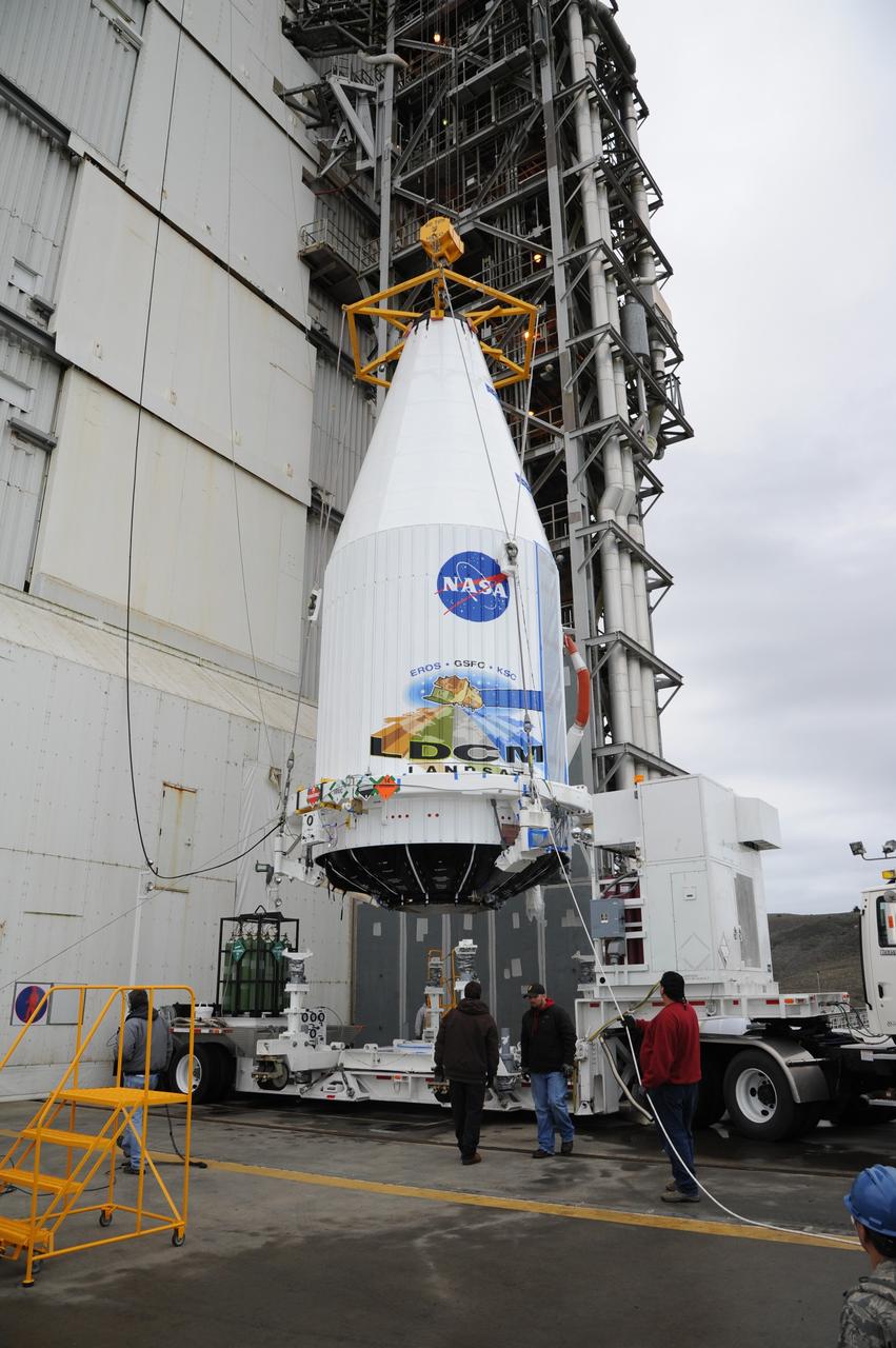
VANDENBERG AIR FORCE BASE, Calif. --- Loaded on a transporter, the payload faring containing the Landsat Data Continuity Mission LDCM spacecraft departs the Astrotech processing facility at Vandenberg Air Force Base in California and heads toward the launch pad at Space Launch Complex-3E. There it will be hoisted atop a United Launch Alliance Atlas V for launch. LDCM is the eighth satellite in the Landsat Program series of Earth-observing missions jointly managed by NASA and the U.S. Geological Survey. LDCM will continue the program’s critical role in monitoring, understanding and managing the resources needed for human sustainment such as food, water and forests. Photo credit: NASA/VAFB
VANDENBERG AIR FORCE BASE, Calif. --- Loaded on a transporter, the payload faring containing the Landsat Data Continuity Mission LDCM spacecraft arrives at Vandenberg Air Force Base's Space Launch Complex-3E where it will be hoisted atop a United Launch Alliance Atlas V for launch. LDCM is the eighth satellite in the Landsat Program series of Earth-observing missions jointly managed by NASA and the U.S. Geological Survey. LDCM will continue the program’s critical role in monitoring, understanding and managing the resources needed for human sustainment such as food, water and forests. Photo credit: NASA/VAFB
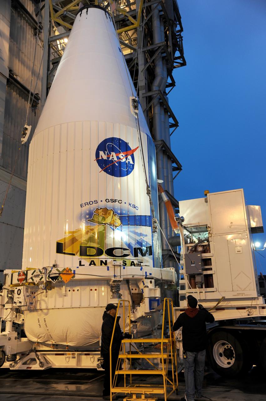
VANDENBERG AIR FORCE BASE, Calif. ---The payload faring containing the Landsat Data Continuity Mission LDCM spacecraft is lifted from a transporter at Vandenberg Air Force Base's Space Launch Complex-3E where it will be hoisted atop a United Launch Alliance Atlas V for launch. LDCM is the eighth satellite in the Landsat Program series of Earth-observing missions jointly managed by NASA and the U.S. Geological Survey. LDCM will continue the program’s critical role in monitoring, understanding and managing the resources needed for human sustainment such as food, water and forests. Photo credit: NASA/VAFB
VANDENBERG AIR FORCE BASE, Calif. --- Loaded on a transporter, the payload faring containing the Landsat Data Continuity Mission LDCM spacecraft arrives at Vandenberg Air Force Base's Space Launch Complex-3E where it will be hoisted atop a United Launch Alliance Atlas V for launch. LDCM is the eighth satellite in the Landsat Program series of Earth-observing missions jointly managed by NASA and the U.S. Geological Survey. LDCM will continue the program’s critical role in monitoring, understanding and managing the resources needed for human sustainment such as food, water and forests. Photo credit: NASA/VAFB
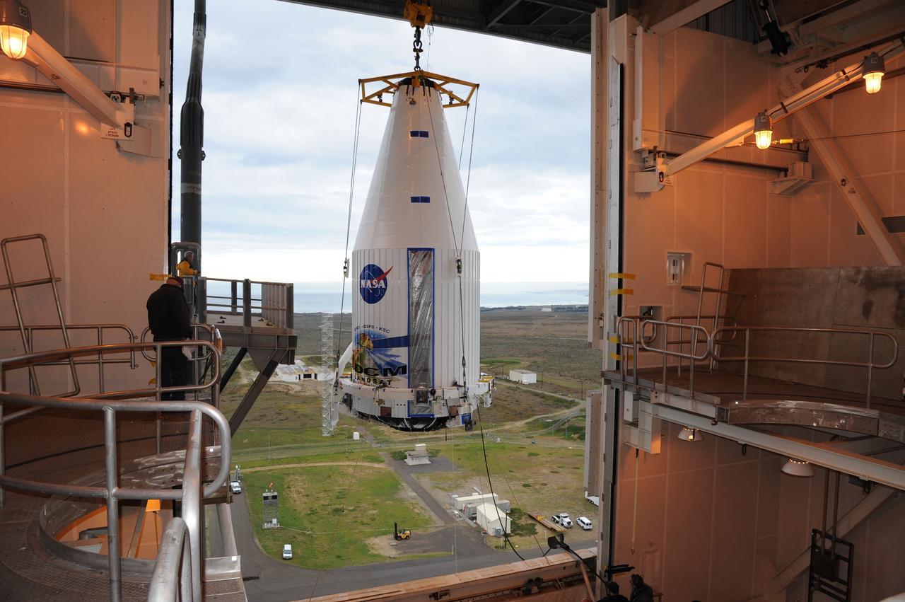
VANDENBERG AIR FORCE BASE, Calif. ---The payload faring containing the Landsat Data Continuity Mission LDCM spacecraft is lifted to the top of Space Launch Complex-3E at Vandenberg Air Force Base where it will be hoisted atop a United Launch Alliance Atlas V for launch. LDCM is the eighth satellite in the Landsat Program series of Earth-observing missions jointly managed by NASA and the U.S. Geological Survey. LDCM will continue the program’s critical role in monitoring, understanding and managing the resources needed for human sustainment such as food, water and forests. Photo credit: NASA/VAFB
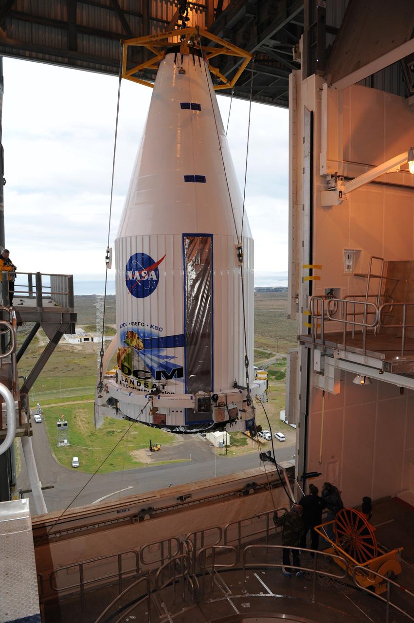
VANDENBERG AIR FORCE BASE, Calif. ---The payload faring containing the Landsat Data Continuity Mission LDCM spacecraft is lifted to the top of Space Launch Complex-3E at Vandenberg Air Force Base where it will be hoisted atop a United Launch Alliance Atlas V for launch LDCM is the eighth satellite in the Landsat Program series of Earth-observing missions jointly managed by NASA and the U.S. Geological Survey. LDCM will continue the program’s critical role in monitoring, understanding and managing the resources needed for human sustainment such as food, water and forests. Photo credit: NASA/VAFB

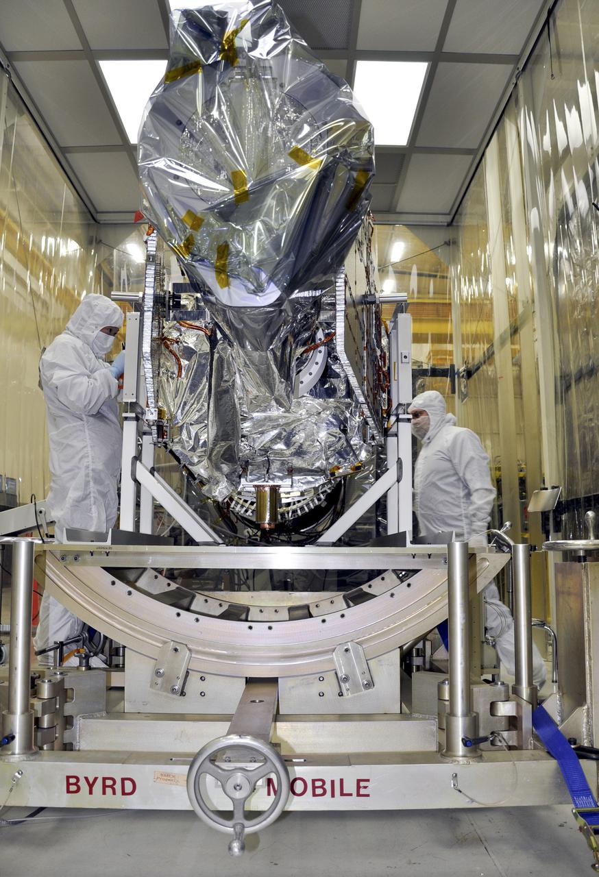
VANDENBERG AFB, Calif. – Technicians get ready to lift NASA's IRIS spacecraft at Vandenberg where the spacecraft will be readied for launch aboard an Orbital Sciences Pegasus XL rocket. IRIS is short for Interface Region Imaging Spectrograph and the spacecraft's mission will improve our understanding of how heat and energy move through the deepest levels of the sun’s atmosphere, thereby increasing our ability to forecast space weather. Photo credit: VAFB_Doug Gruber
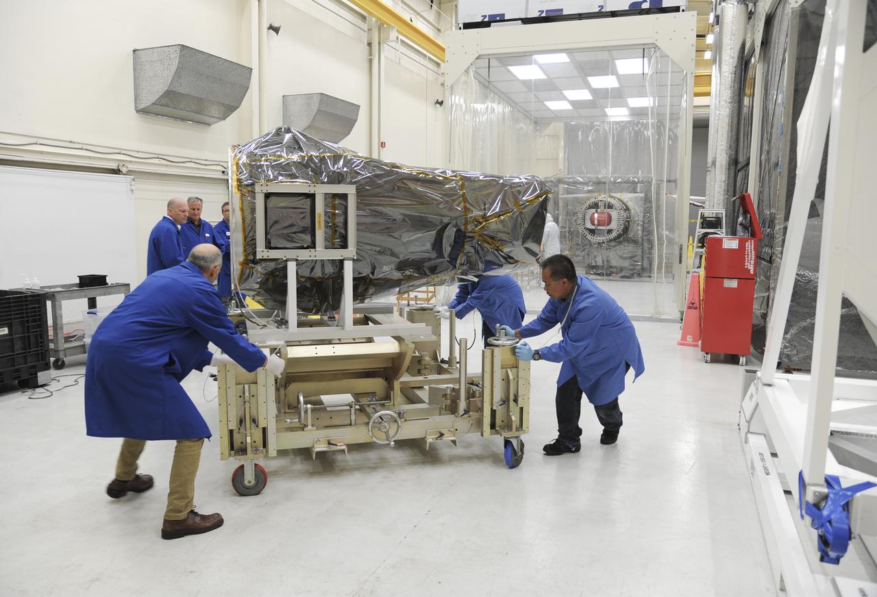
VANDENBERG AFB, Calif. – Technicians move NASA's IRIS spacecraft at Vandenberg where the spacecraft will be readied for launch aboard an Orbital Sciences Pegasus XL rocket. IRIS is short for Interface Region Imaging Spectrograph and the spacecraft's mission will improve our understanding of how heat and energy move through the deepest levels of the sun’s atmosphere, thereby increasing our ability to forecast space weather. Photo credit: VAFB_Doug Gruber
VANDENBERG AFB, Calif. – NASA's IRIS spacecraft at Vandenberg where the spacecraft will be readied for launch aboard an Orbital Sciences Pegasus XL rocket. IRIS is short for Interface Region Imaging Spectrograph and the spacecraft's mission will improve our understanding of how heat and energy move through the deepest levels of the sun’s atmosphere, thereby increasing our ability to forecast space weather. Photo credit: VAFB_Doug Gruber
VANDENBERG AFB, Calif. – Technicians connect NASA's IRIS spacecraft to a fixture at Vandenberg where the spacecraft will be readied for launch aboard an Orbital Sciences Pegasus XL rocket. IRIS is short for Interface Region Imaging Spectrograph and the spacecraft's mission will improve our understanding of how heat and energy move through the deepest levels of the sun’s atmosphere, thereby increasing our ability to forecast space weather. Photo credit: VAFB_Doug Gruber
VANDENBERG AFB, Calif. – Technicians move NASA's IRIS spacecraft at Vandenberg where the spacecraft will be readied for launch aboard an Orbital Sciences Pegasus XL rocket. IRIS is short for Interface Region Imaging Spectrograph and the spacecraft's mission will improve our understanding of how heat and energy move through the deepest levels of the sun’s atmosphere, thereby increasing our ability to forecast space weather. Photo credit: VAFB_Doug Gruber
VANDENBERG AFB, Calif. – Technicians begin processing NASA's IRIS spacecraft at Vandenberg where the spacecraft will be readied for launch aboard an Orbital Sciences Pegasus XL rocket. IRIS is short for Interface Region Imaging Spectrograph and the spacecraft's mission will improve our understanding of how heat and energy move through the deepest levels of the sun’s atmosphere, thereby increasing our ability to forecast space weather. Photo credit: VAFB_Doug Gruber
VANDENBERG AFB, Calif. – Technicians remove a lifting apparatus from NASA's IRIS spacecraft at Vandenberg where the spacecraft will be readied for launch aboard an Orbital Sciences Pegasus XL rocket. IRIS is short for Interface Region Imaging Spectrograph and the spacecraft's mission will improve our understanding of how heat and energy move through the deepest levels of the sun’s atmosphere, thereby increasing our ability to forecast space weather. Photo credit: VAFB_Doug Gruber
VANDENBERG AFB, Calif. – Technicians get ready to lift NASA's IRIS spacecraft at Vandenberg where the spacecraft will be readied for launch aboard an Orbital Sciences Pegasus XL rocket. IRIS is short for Interface Region Imaging Spectrograph and the spacecraft's mission will improve our understanding of how heat and energy move through the deepest levels of the sun’s atmosphere, thereby increasing our ability to forecast space weather. Photo credit: VAFB_Doug Gruber
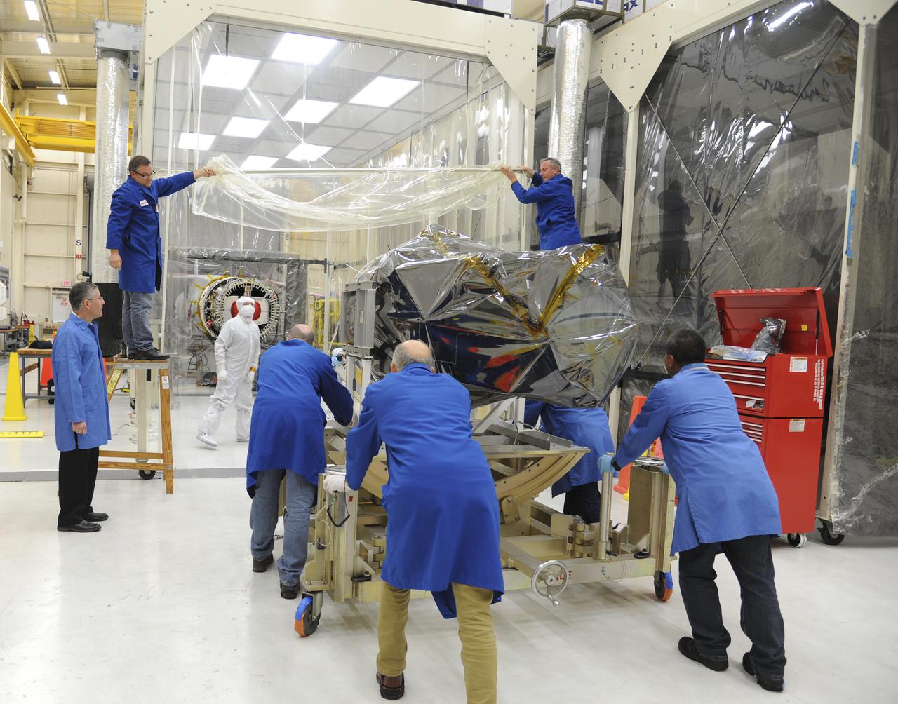
VANDENBERG AFB, Calif. – Technicians move NASA's IRIS spacecraft into a clean room at Vandenberg where the spacecraft will be readied for launch aboard an Orbital Sciences Pegasus XL rocket. IRIS is short for Interface Region Imaging Spectrograph and the spacecraft's mission will improve our understanding of how heat and energy move through the deepest levels of the sun’s atmosphere, thereby increasing our ability to forecast space weather. Photo credit: VAFB_Doug Gruber
VANDENBERG AFB, Calif. – Technicians move NASA's IRIS spacecraft at Vandenberg where the spacecraft will be readied for launch aboard an Orbital Sciences Pegasus XL rocket. IRIS is short for Interface Region Imaging Spectrograph and the spacecraft's mission will improve our understanding of how heat and energy move through the deepest levels of the sun’s atmosphere, thereby increasing our ability to forecast space weather. Photo credit: VAFB_Doug Gruber
VANDENBERG AFB, Calif. – Technicians connect NASA's IRIS spacecraft to a fixture at Vandenberg where the spacecraft will be readied for launch aboard an Orbital Sciences Pegasus XL rocket. IRIS is short for Interface Region Imaging Spectrograph and the spacecraft's mission will improve our understanding of how heat and energy move through the deepest levels of the sun’s atmosphere, thereby increasing our ability to forecast space weather. Photo credit: VAFB_Doug Gruber
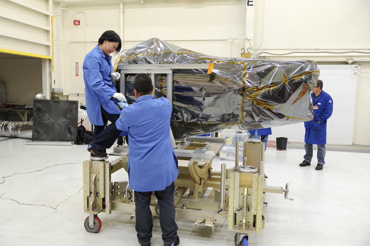
VANDENBERG AFB, Calif. – Technicians remove a lifting apparatus from NASA's IRIS spacecraft at Vandenberg where the spacecraft will be readied for launch aboard an Orbital Sciences Pegasus XL rocket. IRIS is short for Interface Region Imaging Spectrograph and the spacecraft's mission will improve our understanding of how heat and energy move through the deepest levels of the sun’s atmosphere, thereby increasing our ability to forecast space weather. Photo credit: VAFB_Doug Gruber
VANDENBERG AFB, Calif. – Technicians remove a lifting apparatus from NASA's IRIS spacecraft at Vandenberg where the spacecraft will be readied for launch aboard an Orbital Sciences Pegasus XL rocket. IRIS is short for Interface Region Imaging Spectrograph and the spacecraft's mission will improve our understanding of how heat and energy move through the deepest levels of the sun’s atmosphere, thereby increasing our ability to forecast space weather. Photo credit: VAFB_Doug Gruber
VANDENBERG AFB, Calif. – Technicians begin processing NASA's IRIS spacecraft at Vandenberg where the spacecraft will be readied for launch aboard an Orbital Sciences Pegasus XL rocket. IRIS is short for Interface Region Imaging Spectrograph and the spacecraft's mission will improve our understanding of how heat and energy move through the deepest levels of the sun’s atmosphere, thereby increasing our ability to forecast space weather. Photo credit: VAFB_Doug Gruber
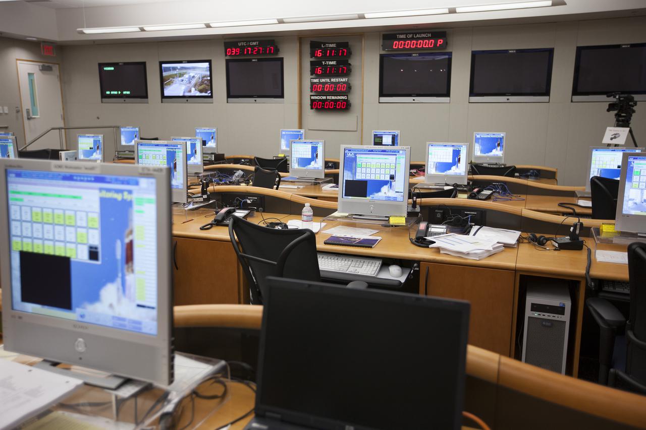
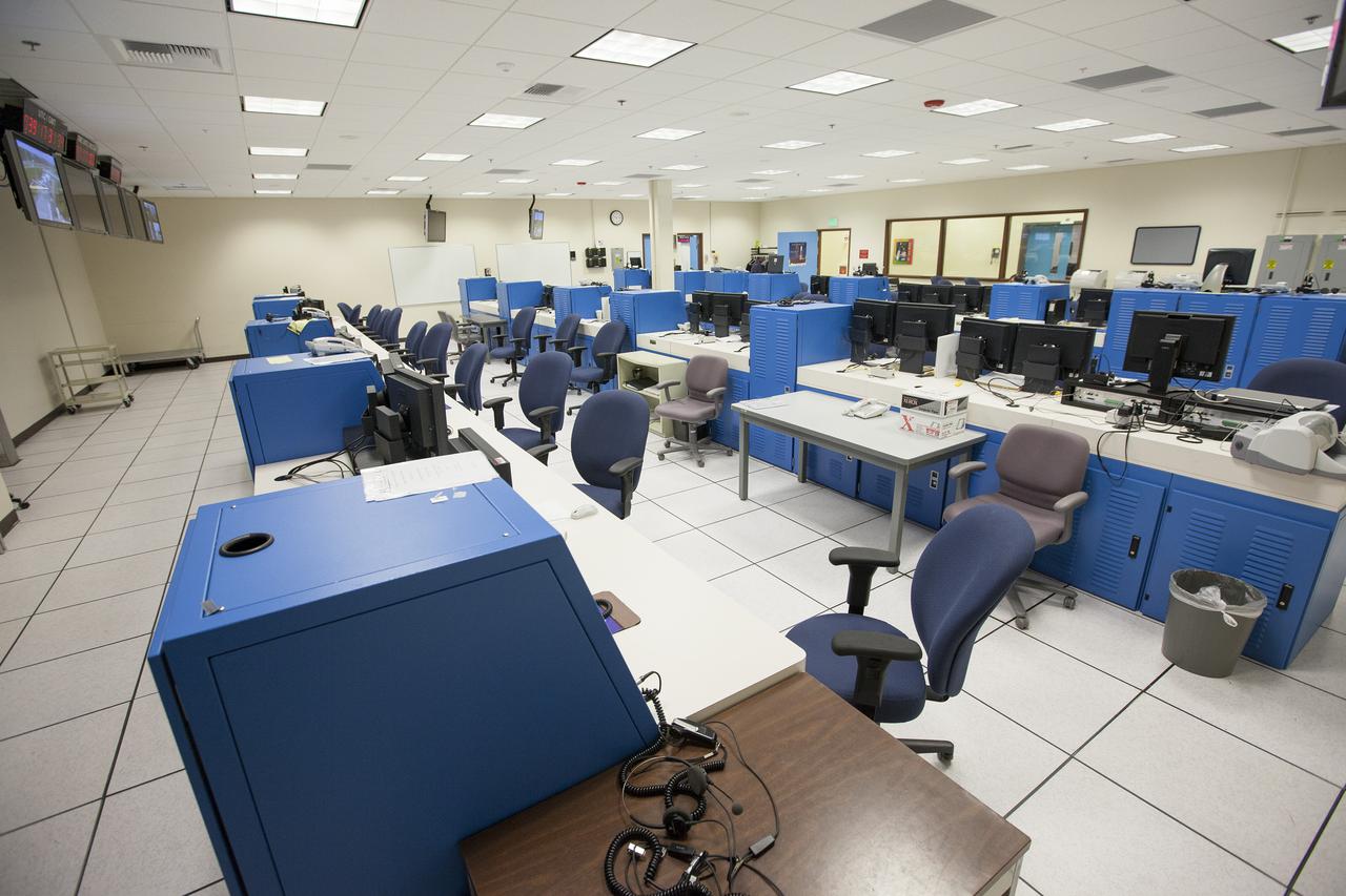
VANDENBERG AFB, Calif. – The Mission Director's Center MDC inside the Remote Launch Control Center RLCC at Vandenberg Air Force Base in California. The facility is involved with launches of Atlas V and Delta IV rockets. Photo credit: Kim Shiflett
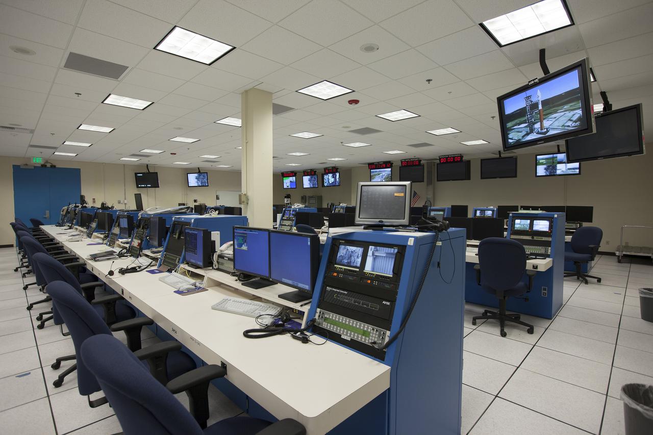
VANDENBERG AFB, Calif. – The Launch Control Center LCC inside the Remote Launch Control Center RLCC at Vandenberg Air Force Base in California. The facility is involved with launches of Atlas V and Delta IV rockets. Photo credit: Kim Shiflett
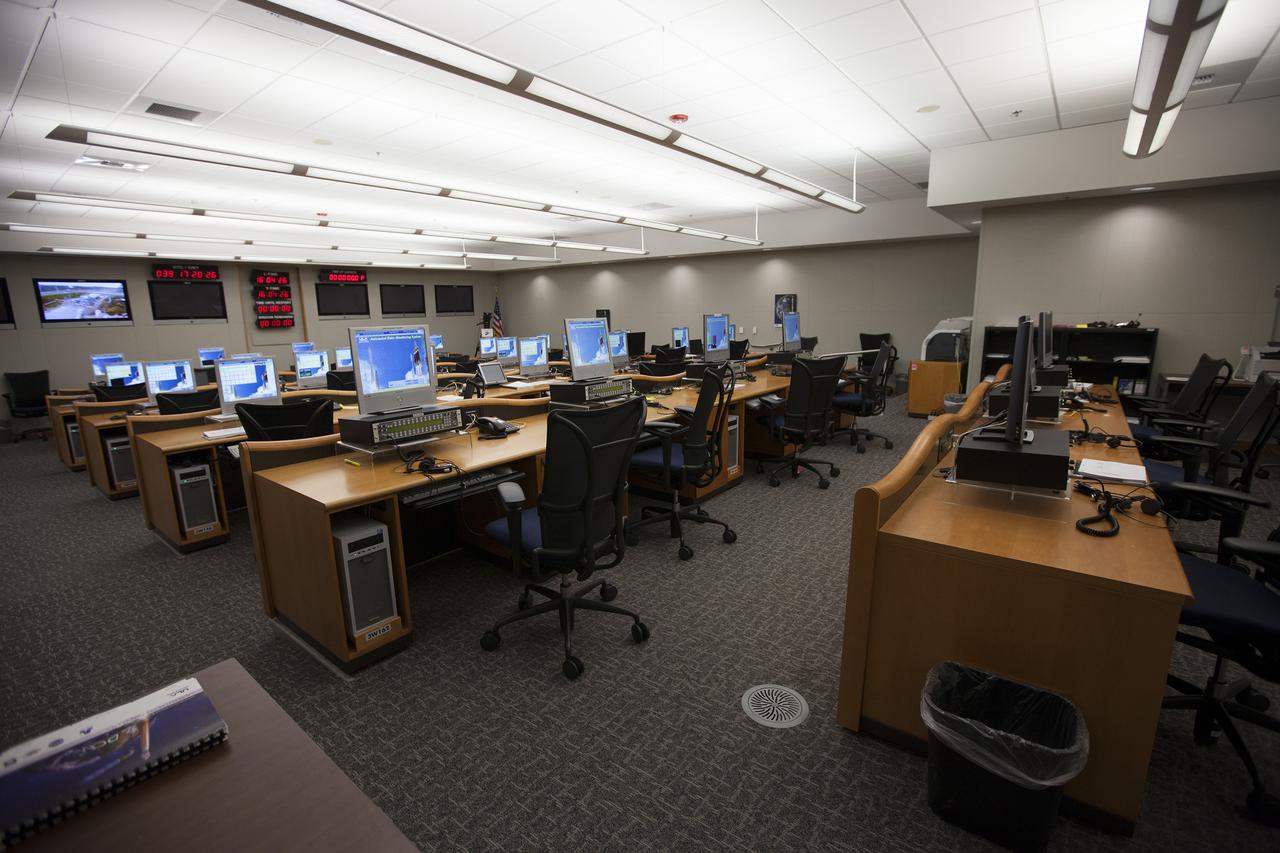
VANDENBERG AFB, Calif. – The Mission Director's Center MDC inside the Remote Launch Control Center RLCC at Vandenberg Air Force Base in California. The facility is involved with launches of Atlas V and Delta IV rockets. Photo credit: Kim Shiflett
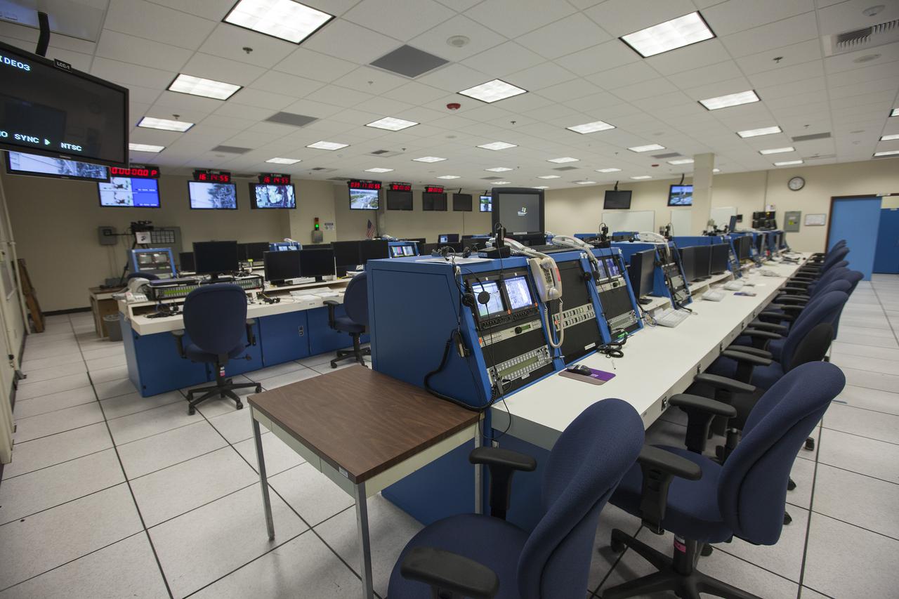
VANDENBERG AFB, Calif. – The Launch Control Center LCC inside the Remote Launch Control Center RLCC at Vandenberg Air Force Base in California. The facility is involved with launches of Atlas V and Delta IV rockets. Photo credit: Kim Shiflett
VANDENBERG AFB, Calif. – The Launch Control Center LCC inside the Remote Launch Control Center RLCC at Vandenberg Air Force Base in California. The facility is involved with launches of Atlas V and Delta IV rockets. Photo credit: Kim Shiflett
VANDENBERG AFB, Calif. – The Mission Director's Center MDC inside the Remote Launch Control Center RLCC at Vandenberg Air Force Base in California. The facility is involved with launches of Atlas V and Delta IV rockets. Photo credit: Kim Shiflett

VANDENBERG AFB, Calif. – The Mission Director's Center MDC inside the Remote Launch Control Center RLCC at Vandenberg Air Force Base in California. The facility is involved with launches of Atlas V and Delta IV rockets. Photo credit: Kim Shiflett
VANDENBERG AFB, Calif. – Engineers prepare to connect NASA's IRIS spacecraft to the nose of an Orbital Sciences Pegasus XL rocket that will lift the solar observatory into orbit in June. The work is taking place in a hangar at Vandenberg Air Force Base where IRIS, short for Interface Region Imaging Spectrograph, is being prepared for launch on a Pegasus XL rocket. Scheduled for launch from Vandenberg no earlier than June 26, 2013, IRIS will open a new window of discovery by tracing the flow of energy and plasma through the chromospheres and transition region into the sun’s corona using spectrometry and imaging. IRIS fills a crucial gap in our ability to advance studies of the sun-to-Earth connection by tracing the flow of energy and plasma through the foundation of the corona and the region around the sun known as the heliosphere. Photo credit: NASA_Randy Beaudoin
VANDENBERG AIR FORCE BASE, Calif. – At Vandenberg Air Force Base in California, technicians prepare the Orbital Sciences Corp. Pegasus XL rocket which will launch the Interface Region Imaging Spectrograph, or IRIS, spacecraft. IRIS will open a new window of discovery by tracing the flow of energy and plasma through the chromospheres and transition region into the sun’s corona using spectrometry and imaging. IRIS fills a crucial gap in our ability to advance studies of the sun-to-Earth connection by tracing the flow of energy and plasma through the foundation of the corona and the region around the sun known as the heliosphere. For more information, visit http:__iris.gsfc.nasa.gov. Photo credit: NASA_Cory Huston

VANDENBERG AIR FORCE BASE, Calif. – Inside the Pegasus Hangar, Building 1555 on North Vandenberg Air Force Base in California, the Orbital Sciences Corp. Pegasus XL rocket is being prepared to launch the Interface Region Imaging Spectrograph, or IRIS, spacecraft. IRIS will open a new window of discovery by tracing the flow of energy and plasma through the chromospheres and transition region into the sun’s corona using spectrometry and imaging. IRIS fills a crucial gap in our ability to advance studies of the sun-to-Earth connection by tracing the flow of energy and plasma through the foundation of the corona and the region around the sun known as the heliosphere. For more information, visit http:__iris.gsfc.nasa.gov. Photo credit: NASA_Cory Huston
VANDENBERG AIR FORCE BASE, Calif. – At Vandenberg Air Force Base in California, the Orbital Sciences Corp. Pegasus XL rocket is being prepared to launch the Interface Region Imaging Spectrograph, or IRIS, spacecraft. IRIS will open a new window of discovery by tracing the flow of energy and plasma through the chromospheres and transition region into the sun’s corona using spectrometry and imaging. IRIS fills a crucial gap in our ability to advance studies of the sun-to-Earth connection by tracing the flow of energy and plasma through the foundation of the corona and the region around the sun known as the heliosphere. For more information, visit http:__iris.gsfc.nasa.gov. Photo credit: NASA_Cory Huston
VANDENBERG AIR FORCE BASE, Calif. – At Vandenberg Air Force Base in California, the Orbital Sciences Corp. Pegasus XL rocket is being prepared to launch the Interface Region Imaging Spectrograph, or IRIS, spacecraft. IRIS will open a new window of discovery by tracing the flow of energy and plasma through the chromospheres and transition region into the sun’s corona using spectrometry and imaging. IRIS fills a crucial gap in our ability to advance studies of the sun-to-Earth connection by tracing the flow of energy and plasma through the foundation of the corona and the region around the sun known as the heliosphere. For more information, visit http:__iris.gsfc.nasa.gov. Photo credit: NASA_Cory Huston
VANDENBERG AIR FORCE BASE, Calif. – At Vandenberg Air Force Base in California, technicians prepare the Orbital Sciences Corp. Pegasus XL rocket which will launch the Interface Region Imaging Spectrograph, or IRIS, spacecraft. IRIS will open a new window of discovery by tracing the flow of energy and plasma through the chromospheres and transition region into the sun’s corona using spectrometry and imaging. IRIS fills a crucial gap in our ability to advance studies of the sun-to-Earth connection by tracing the flow of energy and plasma through the foundation of the corona and the region around the sun known as the heliosphere. For more information, visit http:__iris.gsfc.nasa.gov. Photo credit: NASA_Cory Huston
VANDENBERG AIR FORCE BASE, Calif. – At Vandenberg Air Force Base in California, the Orbital Sciences Corp. Pegasus XL rocket is being prepared to launch the Interface Region Imaging Spectrograph, or IRIS, spacecraft. IRIS will open a new window of discovery by tracing the flow of energy and plasma through the chromospheres and transition region into the sun’s corona using spectrometry and imaging. IRIS fills a crucial gap in our ability to advance studies of the sun-to-Earth connection by tracing the flow of energy and plasma through the foundation of the corona and the region around the sun known as the heliosphere. For more information, visit http:__iris.gsfc.nasa.gov. Photo credit: NASA_Cory Huston
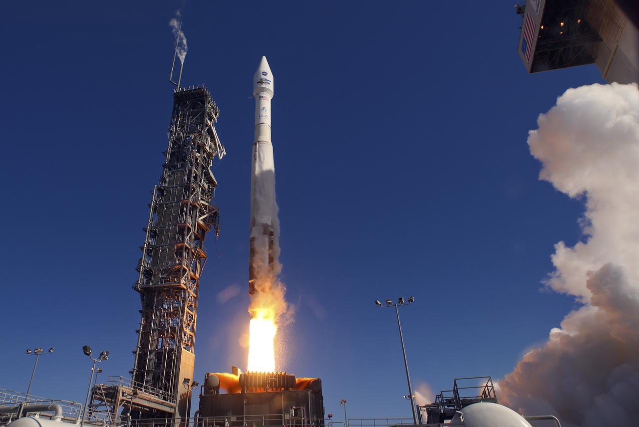
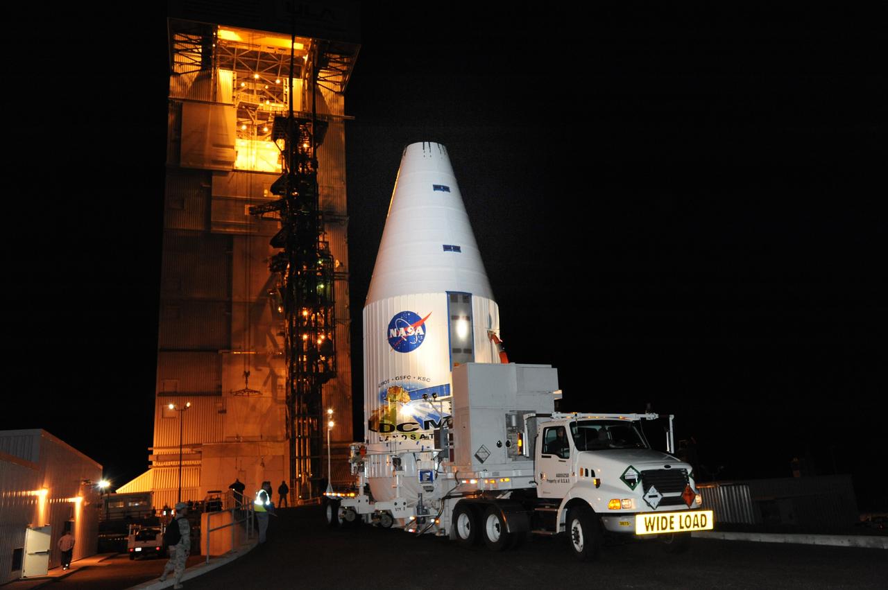
Launch of Atlas V LDCM, from Vandenberg AFB, California
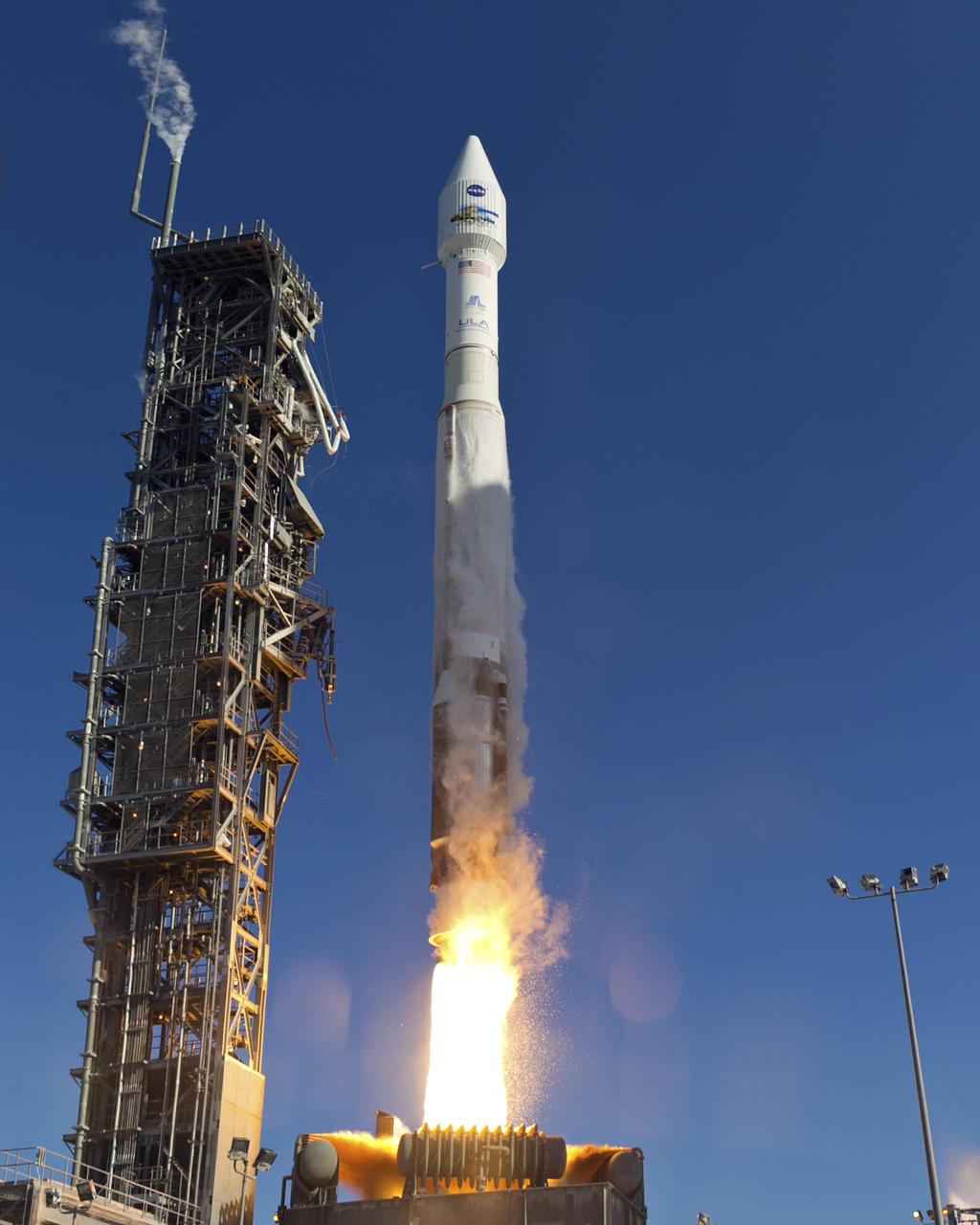
Launch of Atlas V LDCM, from Vandenberg AFB, California
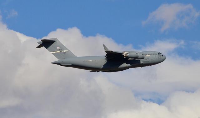
A C-17 cargo aircraft carrying NASA's InSight spacecraft flew from Buckley Air Force Base, Denver, to Vandenberg Air Force Base, California, on February 28, 2018. The spacecraft was being shipped from Lockheed Martin Space, Denver, where InSight was built and tested. Its launch period opens May 5, 2018. InSight, short for Interior Exploration using Seismic Investigations, Geodesy and Heat Transport, is the first mission dedicated to studying the deep interior of Mars. Its findings will advance understanding of the early history of all rocky planets, including Earth. https://photojournal.jpl.nasa.gov/catalog/PIA22251
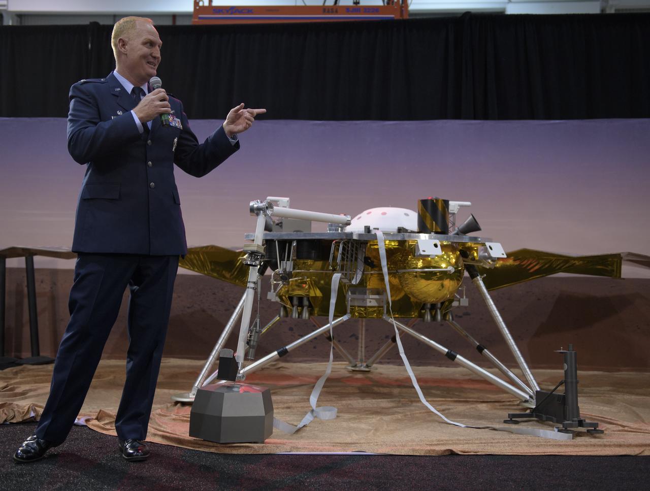
Col. Michael Hough, Commander 30th Space Wing, Vandenberg Air Force Base, discusses NASA's InSight mission during a prelaunch media briefing, Thursday, May 3, 2018, at Vandenberg Air Force Base in California. InSight, short for Interior Exploration using Seismic Investigations, Geodesy and Heat Transport, is a Mars lander designed to study the "inner space" of Mars: its crust, mantle, and core. Photo Credit: (NASA/Bill Ingalls)

1st Lt. Daniel Smith, Weather Officer, 30th Space Wing, Vandenberg Air Force Base, is seen during a NASA Ice, Cloud and land Elevation Satellite-2 (ICESat-2) prelaunch briefing, Thursday, Sept. 13, 2018, at Vandenberg Air Force Base in California. The ICESat-2 mission will measure the changing height of Earth's ice. Photo Credit: (NASA/Bill Ingalls)

1st Lieutenant Kristina Williams, weather officer, 30th Space Wing, Vandenberg Air Force Base, discusses NASA's InSight mission during a prelaunch media briefing, Thursday, May 3, 2018, at Vandenberg Air Force Base in California. InSight, short for Interior Exploration using Seismic Investigations, Geodesy and Heat Transport, is a Mars lander designed to study the "inner space" of Mars: its crust, mantle, and core. Photo Credit: (NASA/Bill Ingalls)
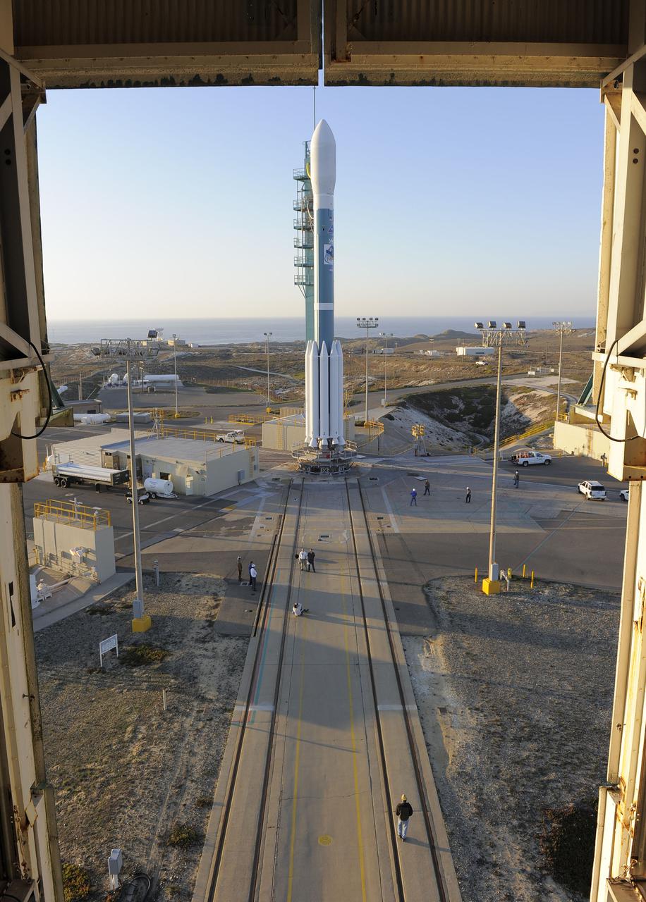
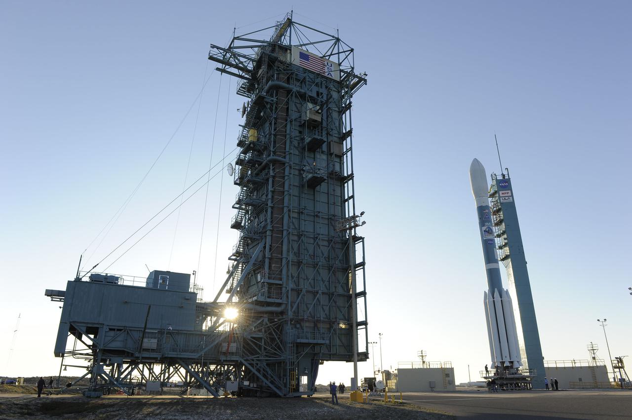
VANDENBERG AIR FORCE BASE, Calif. – At Vandenberg Air Force Base's Space Launch Complex-2 in California, the mobile service tower begins to roll back from around a United Launch Alliance Delta II rocket with the National Polar-orbiting Operational Environmental Satellite System Preparatory Project (NPP) spacecraft aboard. NPP represents a critical first step in building the next-generation of Earth-observing satellites. NPP will carry the first of the new sensors developed for this satellite fleet, now known as the Joint Polar Satellite System (JPSS) to be launched in 2016. NPP is the bridge between NASA's Earth Observing System (EOS) satellites and the forthcoming series of JPSS satellites. The mission will test key technologies and instruments for the JPSS missions. For more information, visit http:__www.nasa.gov_NPP. Photo credit: NASA_Kim Shiflett
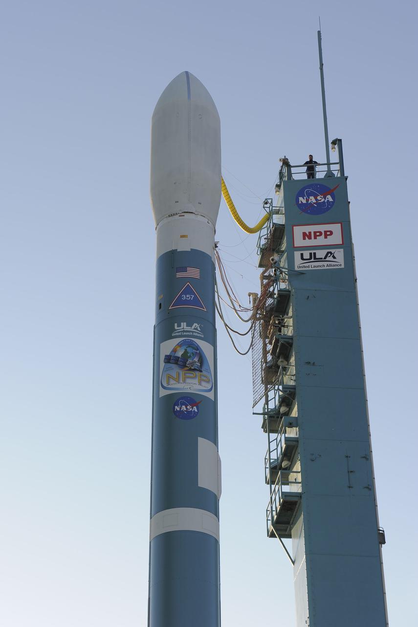
VANDENBERG AIR FORCE BASE, Calif. – At Vandenberg Air Force Base's Space Launch Complex-2 in California, a United Launch Alliance Delta II rocket with the National Polar-orbiting Operational Environmental Satellite System Preparatory Project (NPP) spacecraft aboard stands by itself on the launch pad following rollback of the mobile service tower. NPP represents a critical first step in building the next-generation of Earth-observing satellites. NPP will carry the first of the new sensors developed for this satellite fleet, now known as the Joint Polar Satellite System (JPSS) to be launched in 2016. NPP is the bridge between NASA's Earth Observing System (EOS) satellites and the forthcoming series of JPSS satellites. The mission will test key technologies and instruments for the JPSS missions. For more information, visit http:__www.nasa.gov_NPP. Photo credit: NASA_Kim Shiflett
VANDENBERG AIR FORCE BASE, Calif. – At Vandenberg Air Force Base's Space Launch Complex-2 in California, the mobile service tower begins to roll back from around a United Launch Alliance Delta II rocket with the National Polar-orbiting Operational Environmental Satellite System Preparatory Project (NPP) spacecraft aboard. NPP represents a critical first step in building the next-generation of Earth-observing satellites. NPP will carry the first of the new sensors developed for this satellite fleet, now known as the Joint Polar Satellite System (JPSS) to be launched in 2016. NPP is the bridge between NASA's Earth Observing System (EOS) satellites and the forthcoming series of JPSS satellites. The mission will test key technologies and instruments for the JPSS missions. For more information, visit http:__www.nasa.gov_NPP. Photo credit: NASA_Kim Shiflett
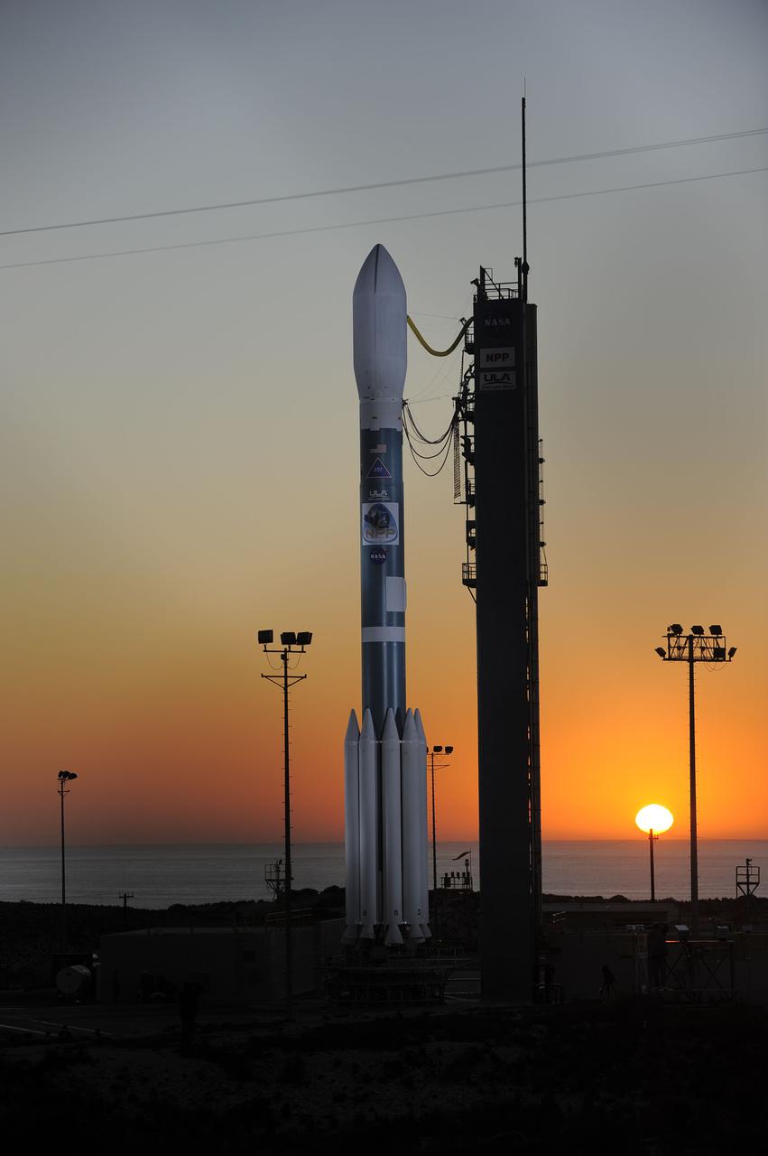
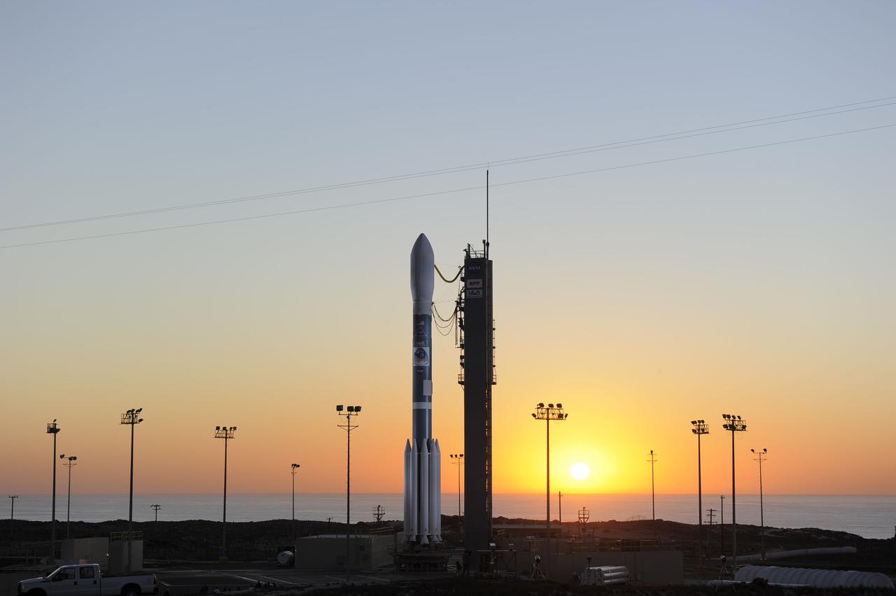
VANDENBERG AIR FORCE BASE, Calif. – At Vandenberg Air Force Base's Space Launch Complex-2 in California, a United Launch Alliance Delta II rocket with the National Polar-orbiting Operational Environmental Satellite System Preparatory Project (NPP) spacecraft aboard stands by itself on the launch pad following rollback of the mobile service tower. NPP represents a critical first step in building the next-generation of Earth-observing satellites. NPP will carry the first of the new sensors developed for this satellite fleet, now known as the Joint Polar Satellite System (JPSS) to be launched in 2016. NPP is the bridge between NASA's Earth Observing System (EOS) satellites and the forthcoming series of JPSS satellites. The mission will test key technologies and instruments for the JPSS missions. For more information, visit http:__www.nasa.gov_NPP. Photo credit: NASA_Kim Shiflett
VANDENBERG AIR FORCE BASE, Calif. – At Vandenberg Air Force Base's Space Launch Complex-2 in California, a United Launch Alliance Delta II rocket with the National Polar-orbiting Operational Environmental Satellite System Preparatory Project (NPP) spacecraft aboard stands by itself on the launch pad following rollback of the mobile service tower. NPP represents a critical first step in building the next-generation of Earth-observing satellites. NPP will carry the first of the new sensors developed for this satellite fleet, now known as the Joint Polar Satellite System (JPSS) to be launched in 2016. NPP is the bridge between NASA's Earth Observing System (EOS) satellites and the forthcoming series of JPSS satellites. The mission will test key technologies and instruments for the JPSS missions. For more information, visit http:__www.nasa.gov_NPP. Photo credit: NASA_Kim Shiflett
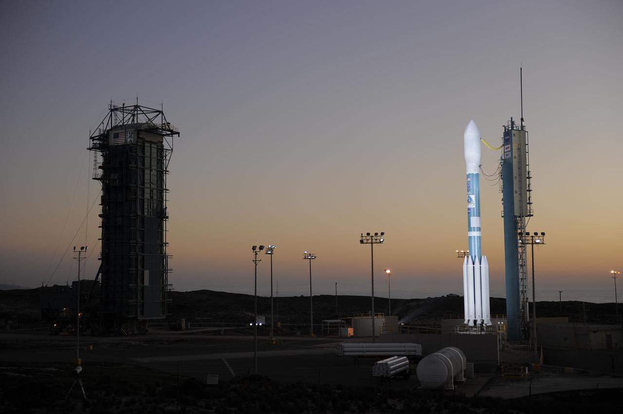
VANDENBERG AIR FORCE BASE, Calif. – At Vandenberg Air Force Base's Space Launch Complex-2 in California, a United Launch Alliance Delta II rocket with the National Polar-orbiting Operational Environmental Satellite System Preparatory Project (NPP) spacecraft aboard stands by itself on the launch pad following rollback of the mobile service tower. NPP represents a critical first step in building the next-generation of Earth-observing satellites. NPP will carry the first of the new sensors developed for this satellite fleet, now known as the Joint Polar Satellite System (JPSS) to be launched in 2016. NPP is the bridge between NASA's Earth Observing System (EOS) satellites and the forthcoming series of JPSS satellites. The mission will test key technologies and instruments for the JPSS missions. For more information, visit http:__www.nasa.gov_NPP. Photo credit: NASA_Kim Shiflett

VANDENBERG AIR FORCE BASE, Calif. – At Vandenberg Air Force Base's Space Launch Complex-2 in California, the mobile service tower begins to roll back from around a United Launch Alliance Delta II rocket with the National Polar-orbiting Operational Environmental Satellite System Preparatory Project (NPP) spacecraft aboard. NPP represents a critical first step in building the next-generation of Earth-observing satellites. NPP will carry the first of the new sensors developed for this satellite fleet, now known as the Joint Polar Satellite System (JPSS) to be launched in 2016. NPP is the bridge between NASA's Earth Observing System (EOS) satellites and the forthcoming series of JPSS satellites. The mission will test key technologies and instruments for the JPSS missions. For more information, visit http:__www.nasa.gov_NPP. Photo credit: NASA_Kim Shiflett
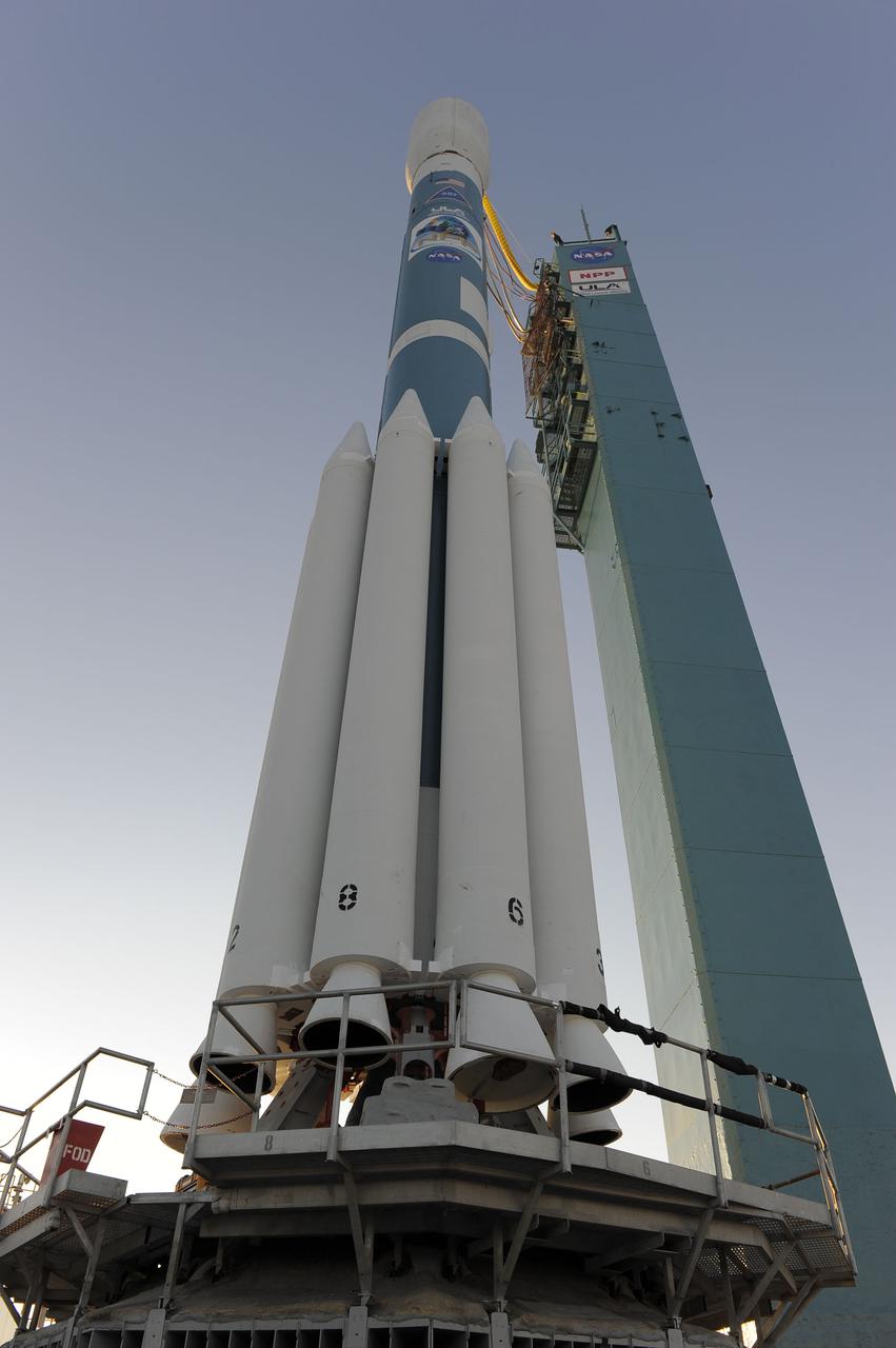
VANDENBERG AIR FORCE BASE, Calif. – At Vandenberg Air Force Base's Space Launch Complex-2 in California, a United Launch Alliance Delta II rocket with the National Polar-orbiting Operational Environmental Satellite System Preparatory Project (NPP) spacecraft aboard stands by itself on the launch pad following rollback of the mobile service tower. NPP represents a critical first step in building the next-generation of Earth-observing satellites. NPP will carry the first of the new sensors developed for this satellite fleet, now known as the Joint Polar Satellite System (JPSS) to be launched in 2016. NPP is the bridge between NASA's Earth Observing System (EOS) satellites and the forthcoming series of JPSS satellites. The mission will test key technologies and instruments for the JPSS missions. For more information, visit http:__www.nasa.gov_NPP. Photo credit: NASA_Kim Shiflett
VANDENBERG AIR FORCE BASE, Calif. – At Vandenberg Air Force Base's Space Launch Complex-2 in California, the mobile service tower rolls back from around a United Launch Alliance Delta II rocket with the National Polar-orbiting Operational Environmental Satellite System Preparatory Project (NPP) spacecraft aboard. NPP represents a critical first step in building the next-generation of Earth-observing satellites. NPP will carry the first of the new sensors developed for this satellite fleet, now known as the Joint Polar Satellite System (JPSS) to be launched in 2016. NPP is the bridge between NASA's Earth Observing System (EOS) satellites and the forthcoming series of JPSS satellites. The mission will test key technologies and instruments for the JPSS missions. For more information, visit http:__www.nasa.gov_NPP. Photo credit: NASA_Kim Shiflett
VANDENBERG AIR FORCE BASE, Calif. – At Vandenberg Air Force Base's Space Launch Complex-2 in California, a United Launch Alliance Delta II rocket with the National Polar-orbiting Operational Environmental Satellite System Preparatory Project (NPP) spacecraft aboard stands by itself on the launch pad following rollback of the mobile service tower. NPP represents a critical first step in building the next-generation of Earth-observing satellites. NPP will carry the first of the new sensors developed for this satellite fleet, now known as the Joint Polar Satellite System (JPSS) to be launched in 2016. NPP is the bridge between NASA's Earth Observing System (EOS) satellites and the forthcoming series of JPSS satellites. The mission will test key technologies and instruments for the JPSS missions. For more information, visit http:__www.nasa.gov_NPP. Photo credit: NASA_Kim Shiflett