NASA Wide-field Infrared Survey Explorer arrives at Vandenberg Air Force Base
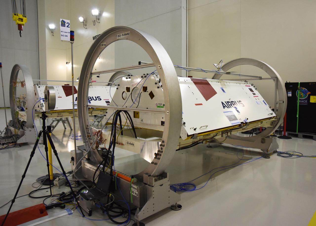
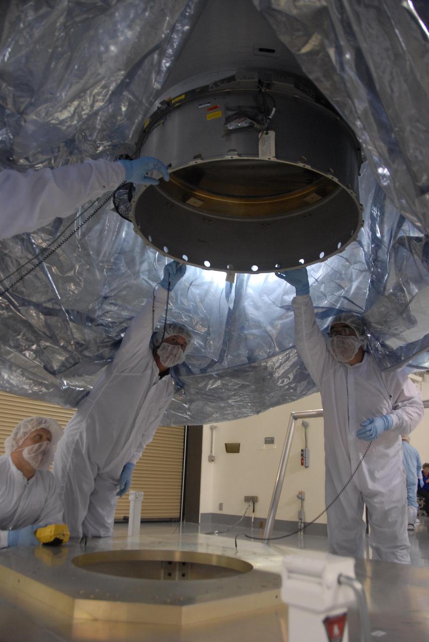
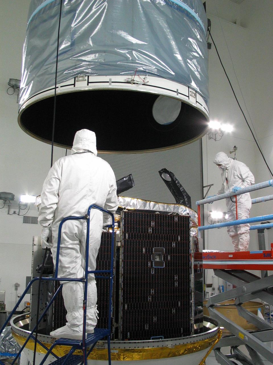
The Gravity Recovery and Climate Experiment Follow-On (GRACE-FO) twin satellites, attached to turntable fixtures, at the Astrotech Space Operations processing facility at Vandenberg Air Force Base, California. GRACE-FO will extend GRACE's legacy of scientific achievements, which range from tracking mass changes of Earth's polar ice sheets and estimating global groundwater changes, to measuring the mass changes of large earthquakes and inferring changes in deep ocean currents, a driving force in climate. To date, GRACE observations have been used in more than 4,300 research publications. Its measurements provide a unique view of the Earth system and have far-reaching benefits to society, such as providing insights into where global groundwater resources may be shrinking or growing and where dry soils are contributing to drought. GRACE-FO is planned to fly at least five years. https://photojournal.jpl.nasa.gov/catalog/PIA22340
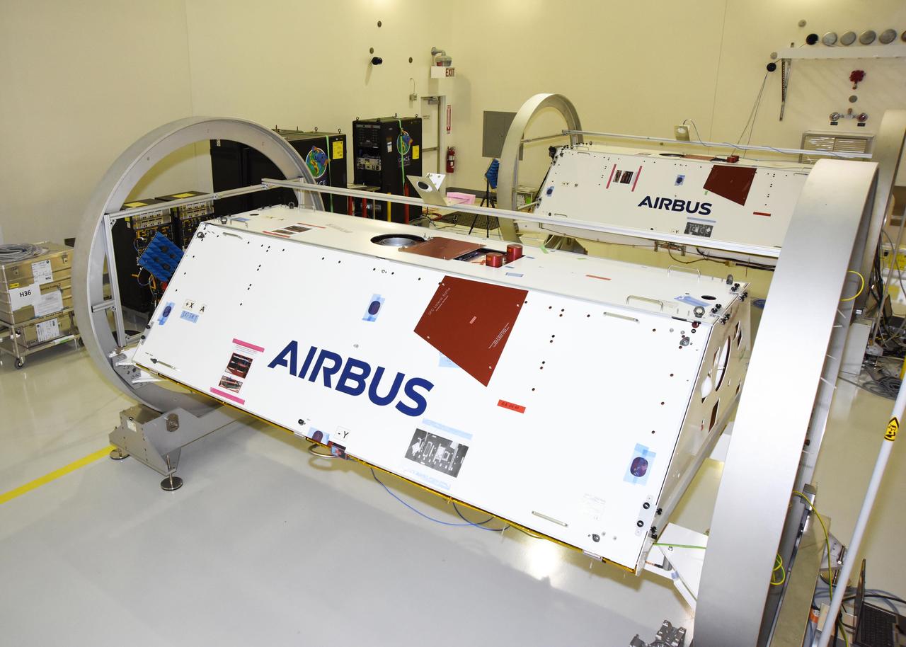
The Gravity Recovery and Climate Experiment Follow-On (GRACE-FO) twin satellites, attached to turntable fixtures, at the Astrotech Space Operations processing facility at Vandenberg Air Force Base, California. GRACE-FO will extend GRACE's legacy of scientific achievements, which range from tracking mass changes of Earth's polar ice sheets and estimating global groundwater changes, to measuring the mass changes of large earthquakes and inferring changes in deep ocean currents, a driving force in climate. To date, GRACE observations have been used in more than 4,300 research publications. Its measurements provide a unique view of the Earth system and have far-reaching benefits to society, such as providing insights into where global groundwater resources may be shrinking or growing and where dry soils are contributing to drought. GRACE-FO is planned to fly at least five years. https://photojournal.jpl.nasa.gov/catalog/PIA22341

The Gravity Recovery and Climate Experiment Follow-On (GRACE-FO) twin satellites, attached to turntable fixtures, at the Astrotech Space Operations processing facility at Vandenberg Air Force Base, California. GRACE-FO will extend GRACE's legacy of scientific achievements, which range from tracking mass changes of Earth's polar ice sheets and estimating global groundwater changes, to measuring the mass changes of large earthquakes and inferring changes in deep ocean currents, a driving force in climate. To date, GRACE observations have been used in more than 4,300 research publications. Its measurements provide a unique view of the Earth system and have far-reaching benefits to society, such as providing insights into where global groundwater resources may be shrinking or growing and where dry soils are contributing to drought. GRACE-FO is planned to fly at least five years. https://photojournal.jpl.nasa.gov/catalog/PIA22338
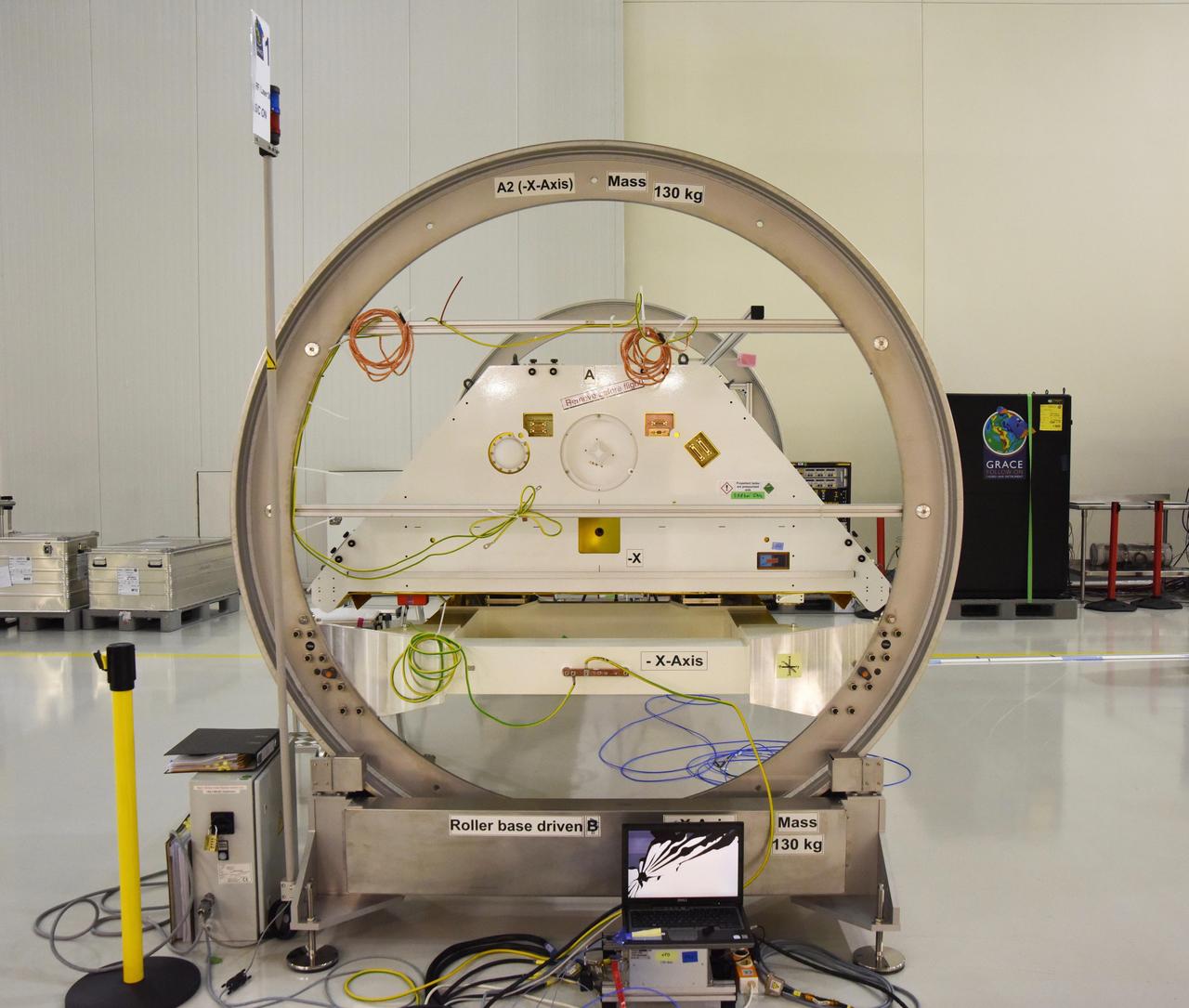
One of the two Gravity Recovery and Climate Experiment Follow-On (GRACE-FO) satellites and its turntable fixture at the Astrotech Space Operations processing facility at Vandenberg Air Force Base, California. GRACE-FO will extend GRACE's legacy of scientific achievements, which range from tracking mass changes of Earth's polar ice sheets and estimating global groundwater changes, to measuring the mass changes of large earthquakes and inferring changes in deep ocean currents, a driving force in climate. To date, GRACE observations have been used in more than 4,300 research publications. Its measurements provide a unique view of the Earth system and have far-reaching benefits to society, such as providing insights into where global groundwater resources may be shrinking or growing and where dry soils are contributing to drought. GRACE-FO is planned to fly at least five years. https://photojournal.jpl.nasa.gov/catalog/PIA22339
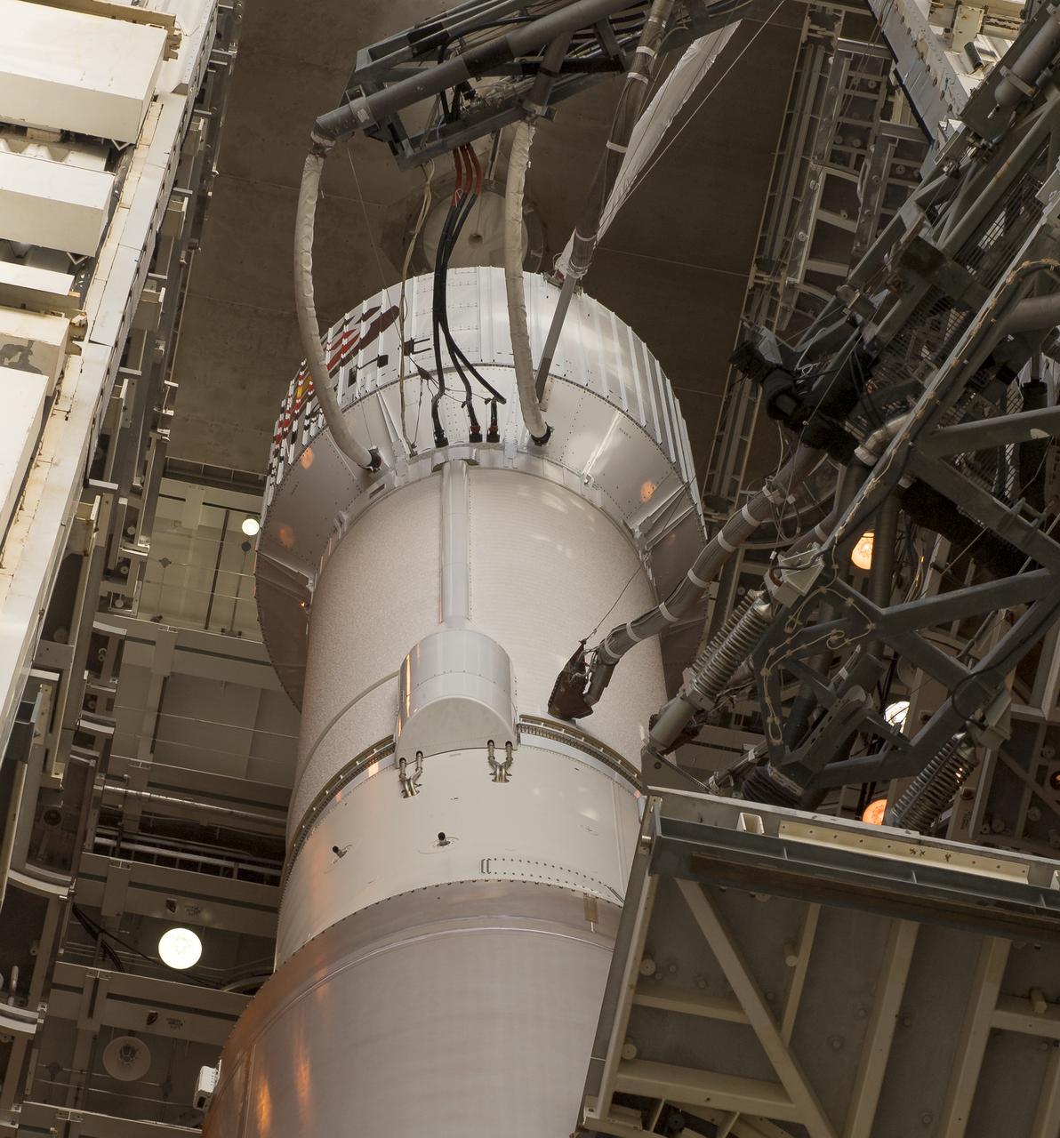
NASA CloudSat spacecraft sits encapsulated within its Boeing Delta launch vehicle dual payload attach fitting at Vandenberg Air Force Base, Calif.
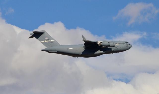
A C-17 cargo aircraft carrying NASA's InSight spacecraft flew from Buckley Air Force Base, Denver, to Vandenberg Air Force Base, California, on February 28, 2018. The spacecraft was being shipped from Lockheed Martin Space, Denver, where InSight was built and tested. Its launch period opens May 5, 2018. InSight, short for Interior Exploration using Seismic Investigations, Geodesy and Heat Transport, is the first mission dedicated to studying the deep interior of Mars. Its findings will advance understanding of the early history of all rocky planets, including Earth. https://photojournal.jpl.nasa.gov/catalog/PIA22251
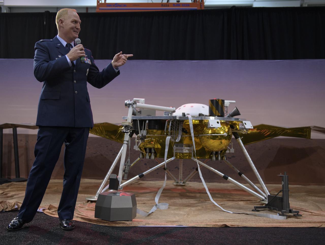
Col. Michael Hough, Commander 30th Space Wing, Vandenberg Air Force Base, discusses NASA's InSight mission during a prelaunch media briefing, Thursday, May 3, 2018, at Vandenberg Air Force Base in California. InSight, short for Interior Exploration using Seismic Investigations, Geodesy and Heat Transport, is a Mars lander designed to study the "inner space" of Mars: its crust, mantle, and core. Photo Credit: (NASA/Bill Ingalls)
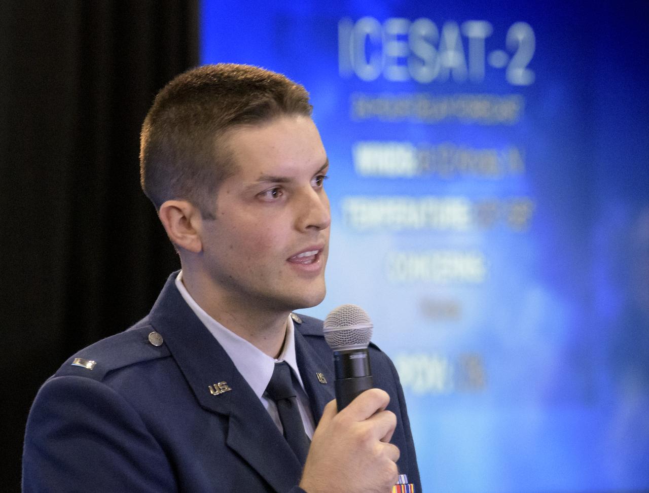
1st Lt. Daniel Smith, Weather Officer, 30th Space Wing, Vandenberg Air Force Base, is seen during a NASA Ice, Cloud and land Elevation Satellite-2 (ICESat-2) prelaunch briefing, Thursday, Sept. 13, 2018, at Vandenberg Air Force Base in California. The ICESat-2 mission will measure the changing height of Earth's ice. Photo Credit: (NASA/Bill Ingalls)

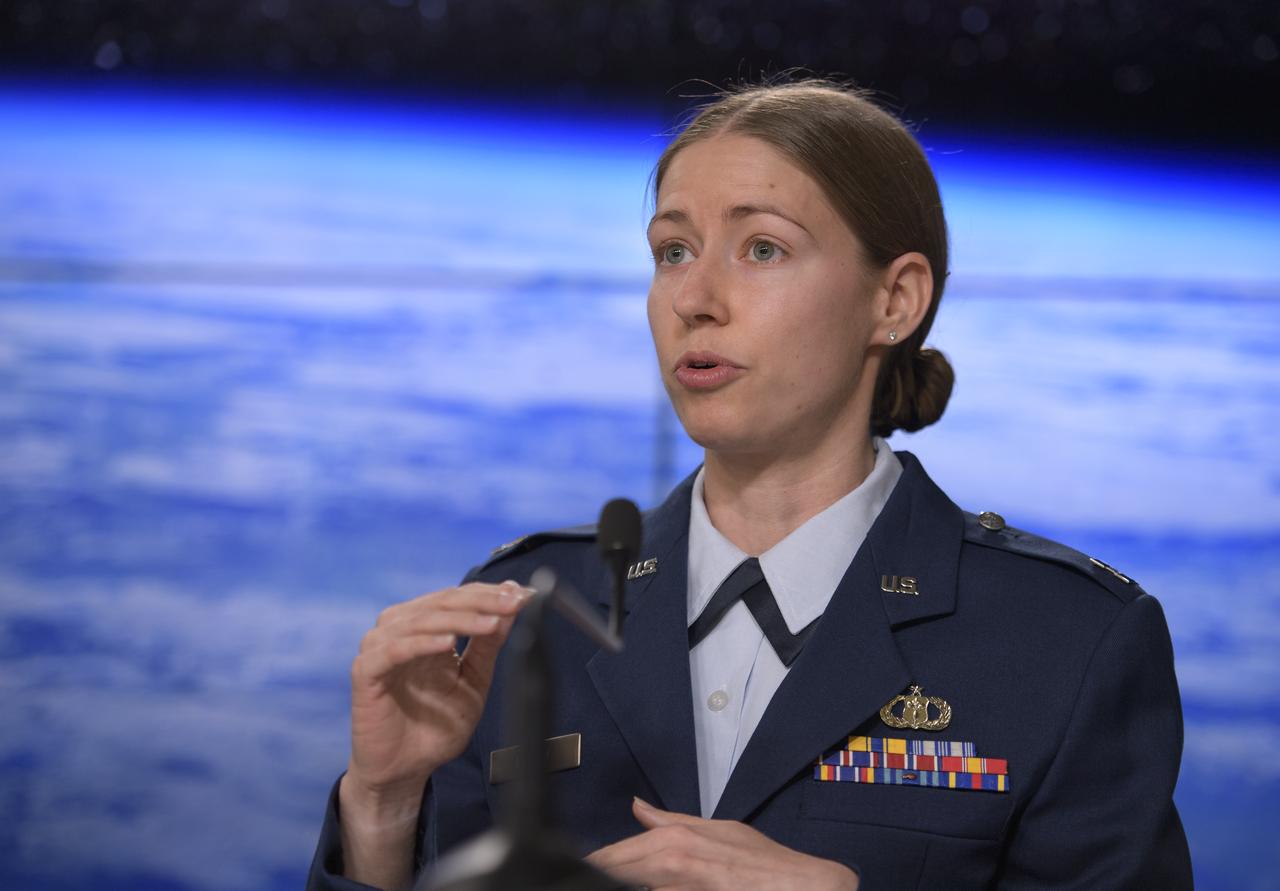
1st Lieutenant Kristina Williams, weather officer, 30th Space Wing, Vandenberg Air Force Base, discusses NASA's InSight mission during a prelaunch media briefing, Thursday, May 3, 2018, at Vandenberg Air Force Base in California. InSight, short for Interior Exploration using Seismic Investigations, Geodesy and Heat Transport, is a Mars lander designed to study the "inner space" of Mars: its crust, mantle, and core. Photo Credit: (NASA/Bill Ingalls)
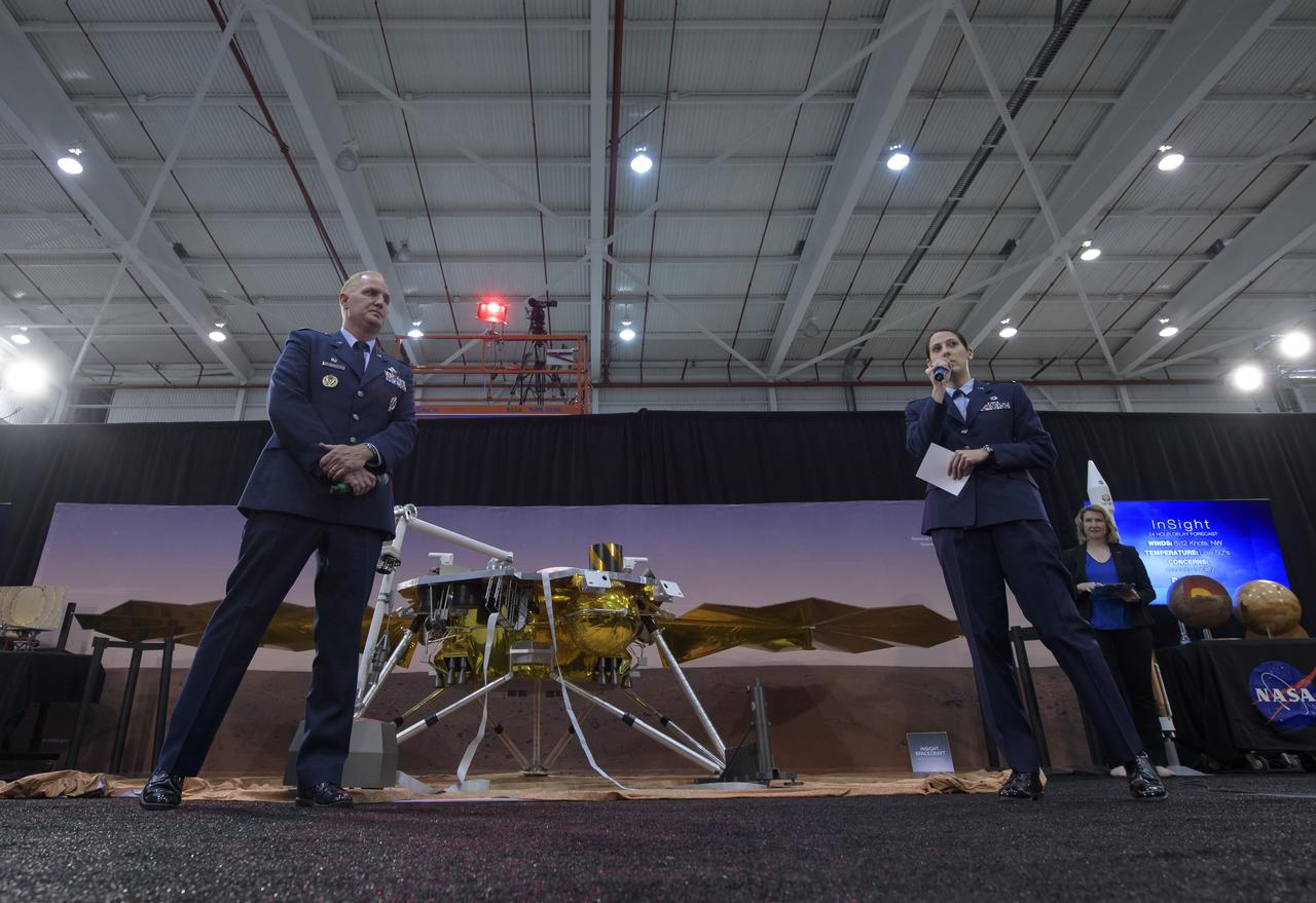
Col. Michael Hough, Commander 30th Space Wing, Vandenberg Air Force Base, left, and 1st Lieutenant Kristina Williams, weather officer, 30th Space Wing, Vandenberg Air Force Base, discuss NASA's InSight mission during a prelaunch media briefing, Thursday, May 3, 2018, at Vandenberg Air Force Base in California. InSight, short for Interior Exploration using Seismic Investigations, Geodesy and Heat Transport, is a Mars lander designed to study the "inner space" of Mars: its crust, mantle, and core. Photo Credit: (NASA/Bill Ingalls)
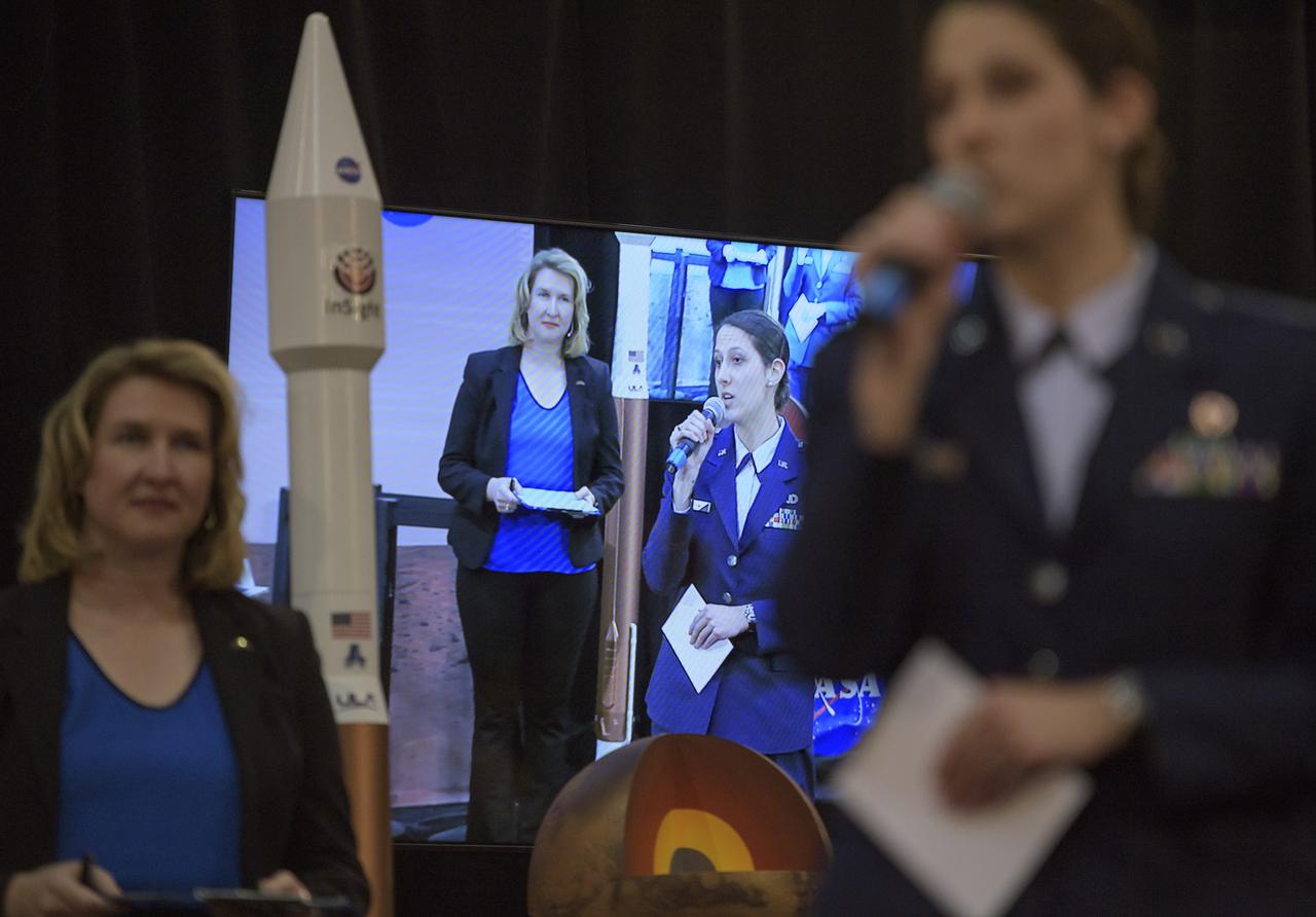
1st Lieutenant Kristina Williams, weather officer, 30th Space Wing, Vandenberg Air Force Base, right, discusses NASA's InSight mission during a prelaunch media briefing, Thursday, May 3, 2018, at Vandenberg Air Force Base in California. InSight, short for Interior Exploration using Seismic Investigations, Geodesy and Heat Transport, is a Mars lander designed to study the "inner space" of Mars: its crust, mantle, and core. Photo Credit: (NASA/Bill Ingalls)
Capt. Jennifer Haden, weather officer, 30th Space Wing, Vandenberg Air Force Base, discusses the weather forecast during a Gravity Recovery and Climate Experiment Follow-On (GRACE-FO) mission prelaunch media briefing, Monday, May 21, 2018, at Vandenberg Air Force Base in California. The twin GRACE-FO spacecraft will measure changes in how mass is redistributed within and among Earth's atmosphere, oceans, land and ice sheets, as well as within Earth itself. Photo Credit: (NASA/Bill Ingalls)
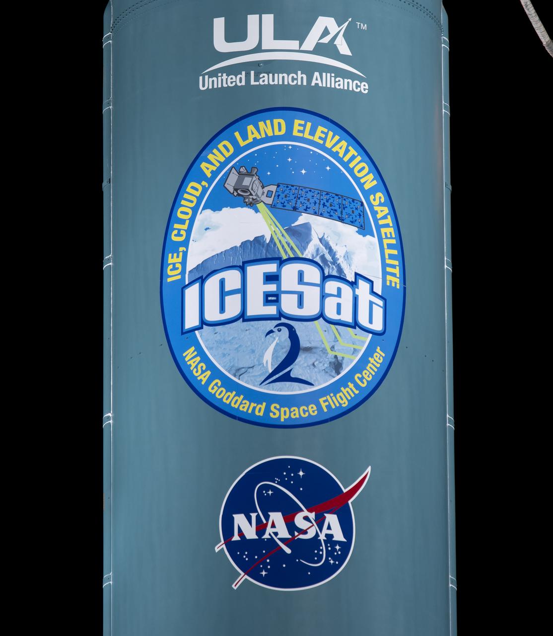
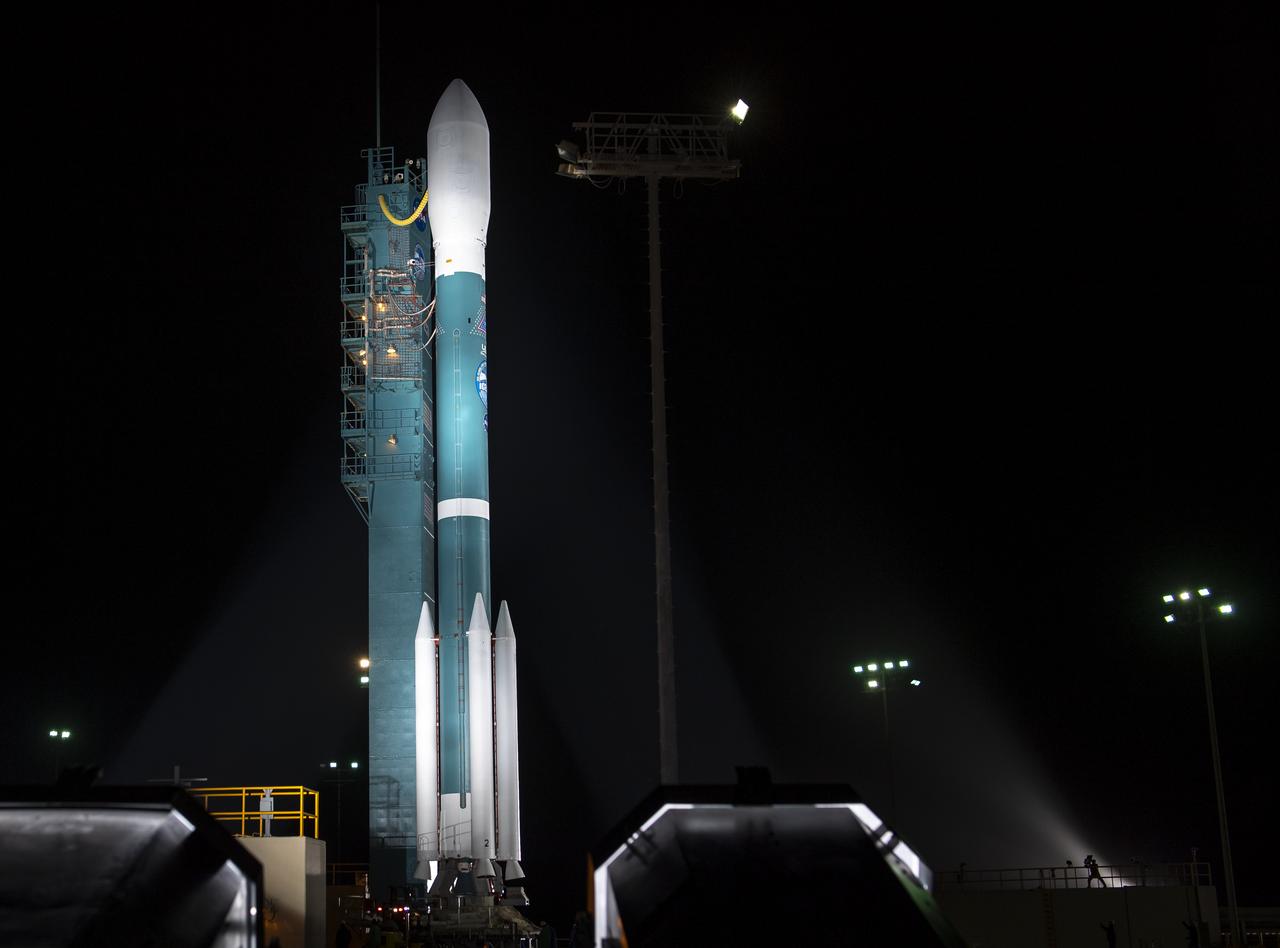
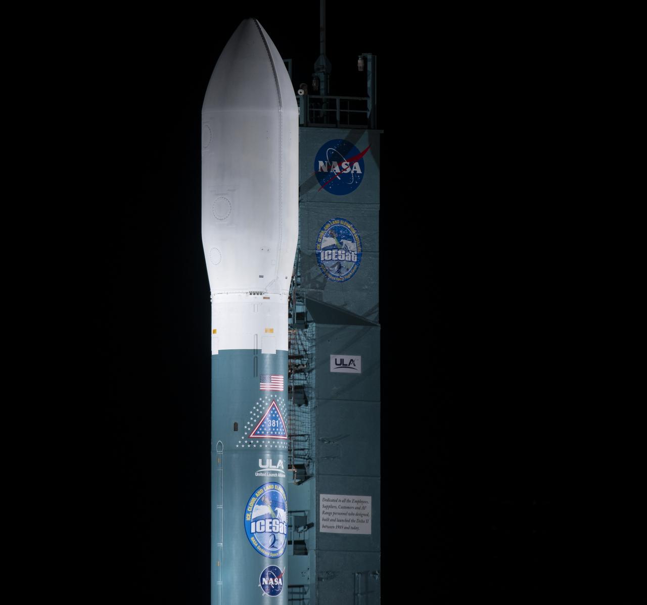
The United Launch Alliance (ULA) Delta II rocket with the NASA Ice, Cloud and land Elevation Satellite-2 (ICESat-2) onboard, Thursday, Sept. 13, 2018, Vandenberg Air Force Base in California. The ICESat-2 mission will measure the changing height of Earth's ice. Photo Credit: (NASA/Bill Ingalls)
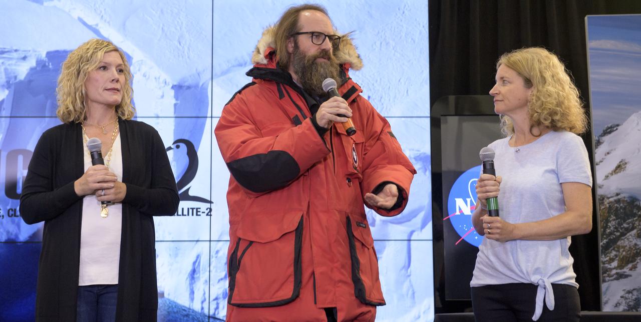
Prelaunch briefing for the NASA Ice, Cloud and land Elevation Satellite-2 (ICESat-2), Thursday, Sept. 13, 2018, at Vandenberg Air Force Base in California. The ICESat-2 mission will measure the changing height of Earth's ice. Photo Credit: (NASA/Bill Ingalls)
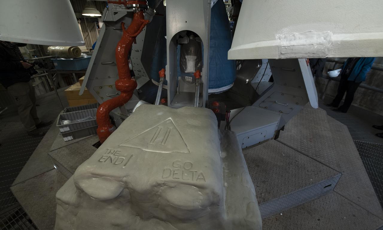
Base of the SLC-2 launch pad is embossed with well wishes for the final launch of the United Launch Alliance Delta II rocket, Thursday, Sept. 13, 2018, at Vandenberg Air Force Base in California. ULA launched NASA's Ice, Cloud and land Elevation Satellite-2 (ICESat-2) on Saturday, Sept. 15, 2018. The ICESat-2 mission will measure the changing height of Earth's ice. Photo Credit: (NASA/Bill Ingalls)
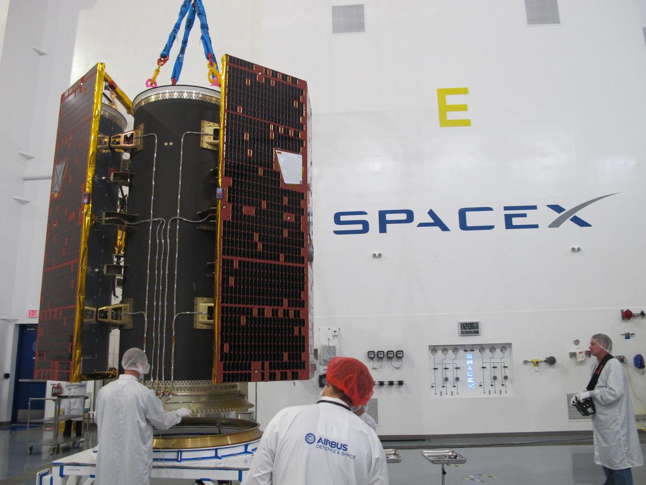
Technicians inspect the twin GRACE Follow-On satellites and their multi-satellite dispenser at the SpaceX facility at Vandenberg Air Force Base in California. The satellites were subsequently stacked atop another satellite dispenser containing the five Iridium NEXT communications satellites they will share a ride to orbit with. https://photojournal.jpl.nasa.gov/catalog/PIA22452
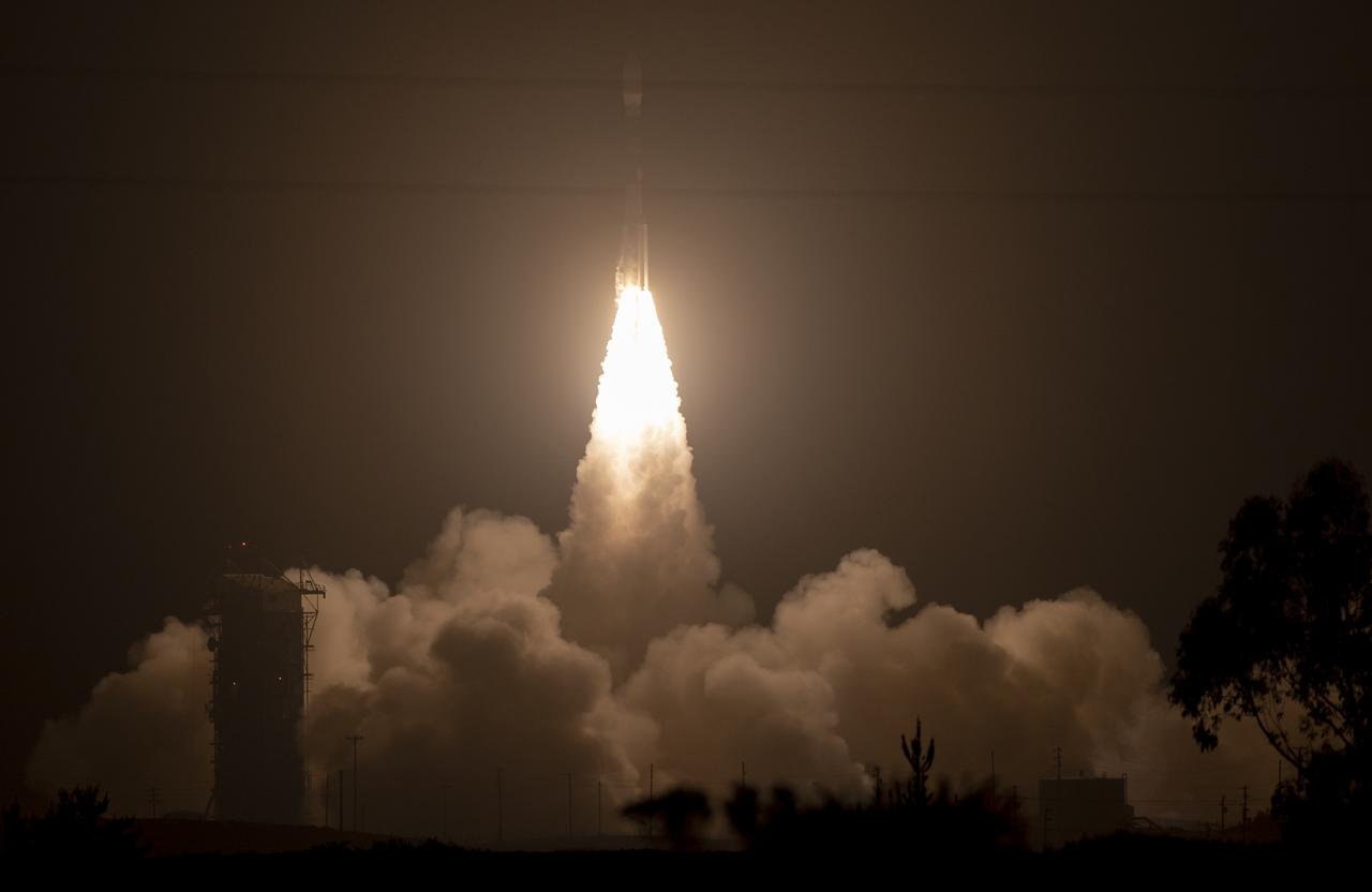
The United Launch Alliance (ULA) Delta II rocket launches with the NASA Ice, Cloud and land Elevation Satellite-2 (ICESat-2) onboard, Saturday, Sept. 15, 2018, from Vandenberg Air Force Base in California. The ICESat-2 mission will measure the changing height of Earth's ice. Photo Credit: (NASA/Bill Ingalls)

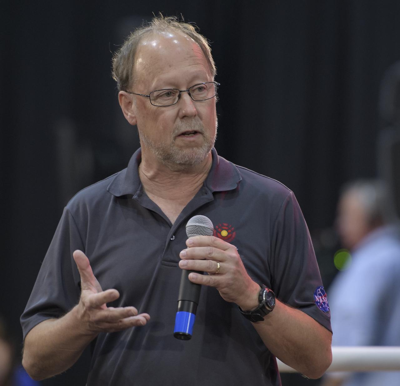
Tom Neumann, ICESat-2 Deputy Project Scientist, NASA's Goddard Space Flight Center, is seen during a NASA Ice, Cloud and land Elevation Satellite-2 (ICESat-2) prelaunch briefing, Thursday, Sept. 13, 2018, at Vandenberg Air Force Base in California. The ICESat-2 mission will measure the changing height of Earth's ice. Photo Credit: (NASA/Bill Ingalls)

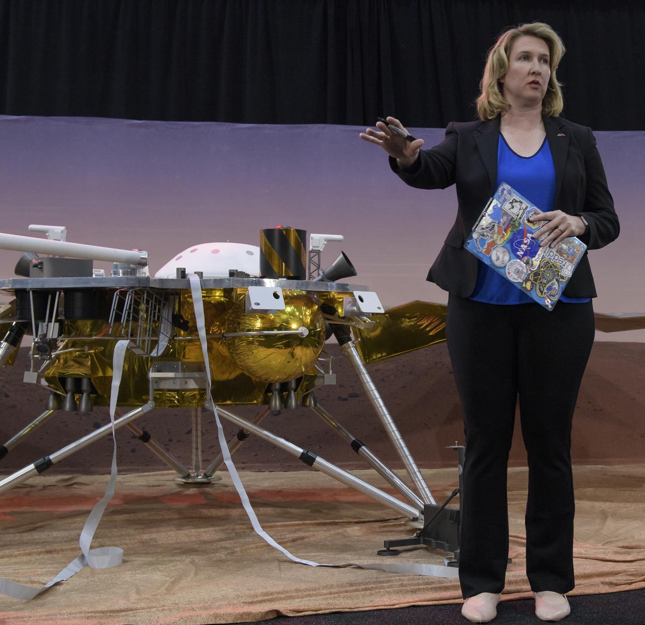
Lori Magruder, ICESat-2 Science Definition Team Lead, University of Texas, is seen during a NASA Ice, Cloud and land Elevation Satellite-2 (ICESat-2) prelaunch briefing, Thursday, Sept. 13, 2018, at Vandenberg Air Force Base in California. The ICESat-2 mission will measure the changing height of Earth's ice. Photo Credit: (NASA/Bill Ingalls)
Stephanie Smith, Digital & Social Media Supervisor, Jet Propulsion Laboratory moderates a prelaunch media briefing for the NASA InSight mission, Thursday, May 3, 2018, at Vandenberg Air Force Base in California. InSight, short for Interior Exploration using Seismic Investigations, Geodesy and Heat Transport, is a Mars lander designed to study the "inner space" of Mars: its crust, mantle, and core. Photo Credit: (NASA/Bill Ingalls)
Cathy Richardson, Deputy Program Manager, Earth Science Projects Division, NASA's Goddard Space Flight Center, is seen during a NASA Ice, Cloud and land Elevation Satellite-2 (ICESat-2) prelaunch briefing, Thursday, Sept. 13, 2018, at Vandenberg Air Force Base in California. The ICESat-2 mission will measure the changing height of Earth's ice. Photo Credit: (NASA/Bill Ingalls)
Tim Dunn, Launch Director, NASA's Kennedy Space Center, is seen during a NASA Ice, Cloud and land Elevation Satellite-2 (ICESat-2) prelaunch briefing, Thursday, Sept. 13, 2018, at Vandenberg Air Force Base in California. The ICESat-2 mission will measure the changing height of Earth's ice. Photo Credit: (NASA/Bill Ingalls)
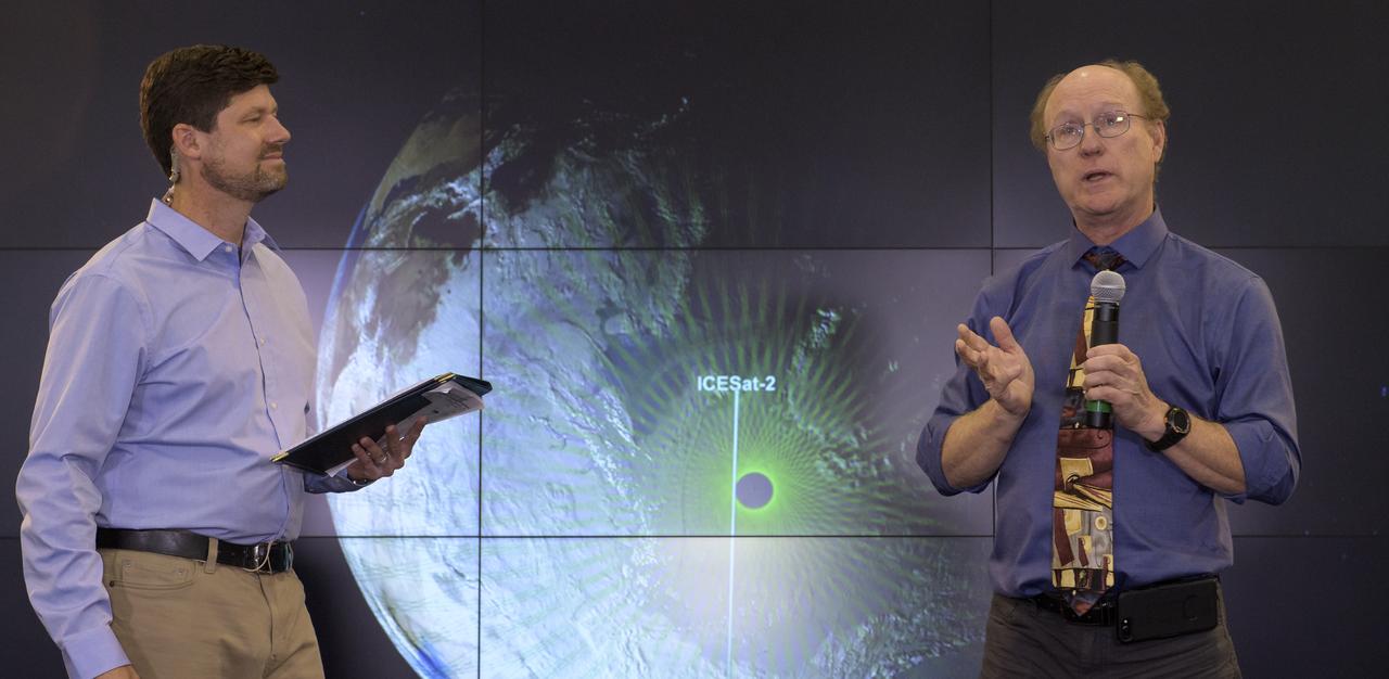
Tom Wagner, ICESat-2 Program Scientist, NASA Headquarters, left, and Doug McLennan, ICESat-2 Project Manager, NASA's Goddard Space Flight Center, are seen during a NASA Ice, Cloud and land Elevation Satellite-2 (ICESat-2) prelaunch briefing, Thursday, Sept. 13, 2018, at Vandenberg Air Force Base in California. The ICESat-2 mission will measure the changing height of Earth's ice. Photo Credit: (NASA/Bill Ingalls)
The United Launch Alliance (ULA) Delta II rocket with the NASA Ice, Cloud and land Elevation Satellite-2 (ICESat-2) onboard is seen shortly after the mobile service tower at SLC-2 was rolled back, Saturday, Sept. 15, 2018, at Vandenberg Air Force Base in California. The ICESat-2 mission will measure the changing height of Earth's ice. Photo Credit: (NASA/Bill Ingalls)
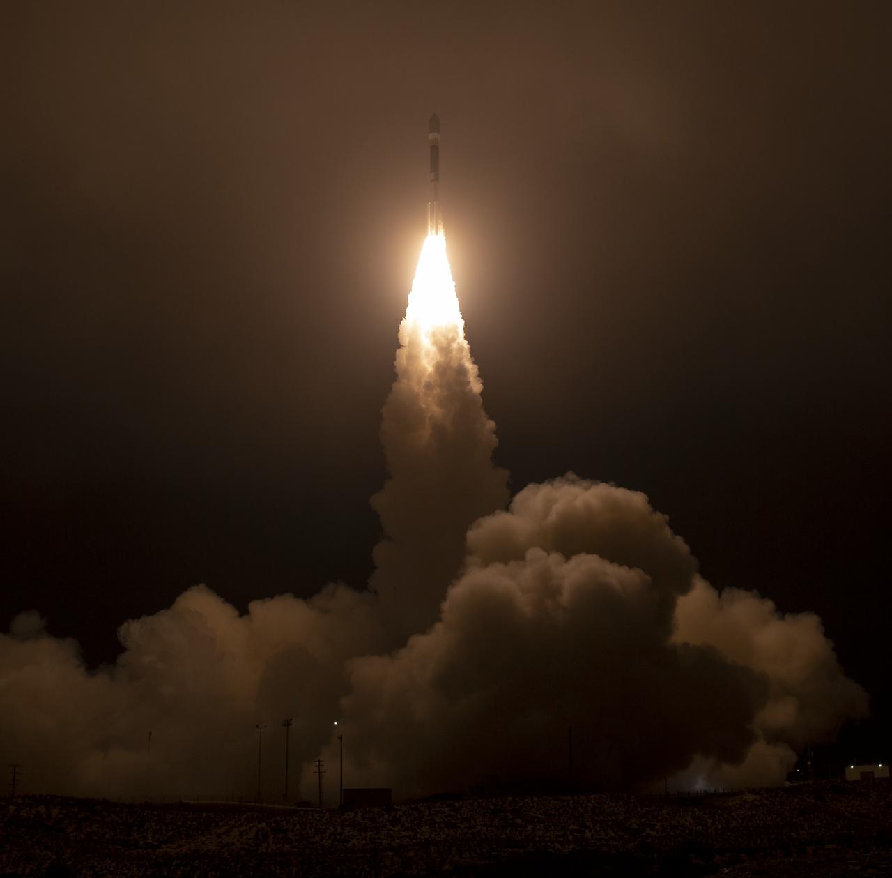
The United Launch Alliance (ULA) Delta II rocket launches with the NASA Ice, Cloud and land Elevation Satellite-2 (ICESat-2) onboard, Saturday, Sept. 15, 2018, from Vandenberg Air Force Base in California. The ICESat-2 mission will measure the changing height of Earth's ice. Photo Credit: (NASA/Bill Ingalls)
Andy Klesh, MarCO chief engineer, NASA JPL, discusses NASA's InSight mission during a prelaunch media briefing, Thursday, May 3, 2018, at Vandenberg Air Force Base in California. InSight, short for Interior Exploration using Seismic Investigations, Geodesy and Heat Transport, is a Mars lander designed to study the "inner space" of Mars: its crust, mantle, and core. Photo Credit: (NASA/Bill Ingalls)
The United Launch Alliance (ULA) Delta II rocket launches with the NASA Ice, Cloud and land Elevation Satellite-2 (ICESat-2) onboard, Saturday, Sept. 15, 2018, from Vandenberg Air Force Base in California. The ICESat-2 mission will measure the changing height of Earth's ice. Photo Credit: (NASA/Bill Ingalls)
The United Launch Alliance (ULA) Delta II rocket launches with the NASA Ice, Cloud and land Elevation Satellite-2 (ICESat-2) onboard, Saturday, Sept. 15, 2018, from Vandenberg Air Force Base in California. The ICESat-2 mission will measure the changing height of Earth's ice. Photo Credit: (NASA/Bill Ingalls)
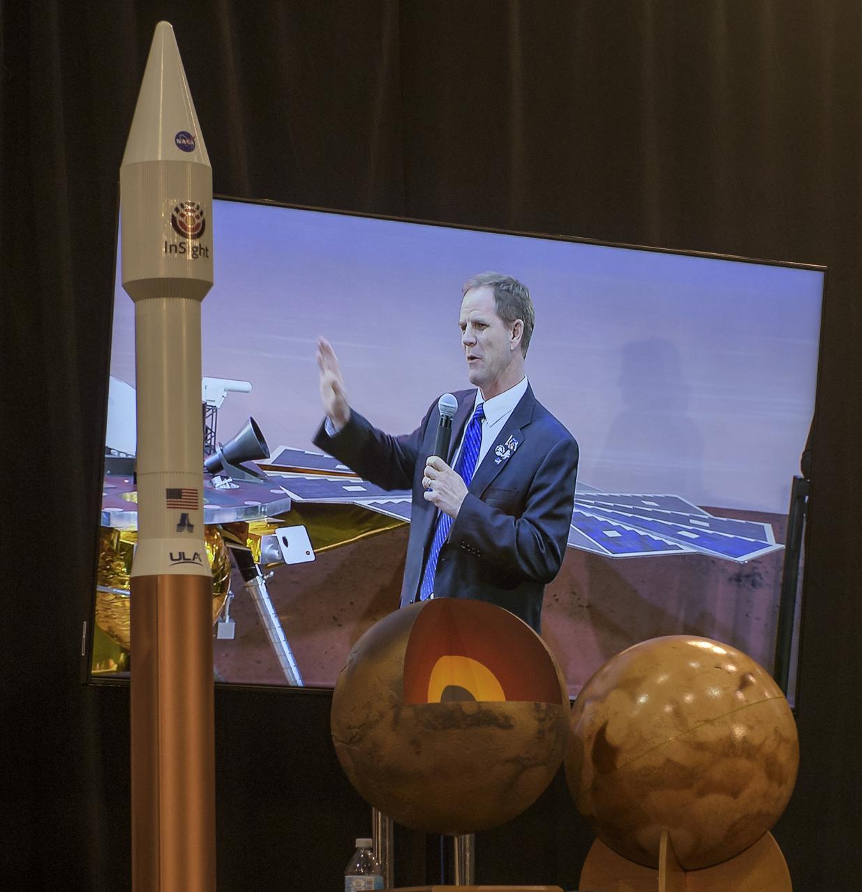
Scott Messer, United Launch Alliance program manager for NASA missions, is seen on a monitor as he discusses NASA's InSight mission during a prelaunch media briefing, Thursday, May 3, 2018, at Vandenberg Air Force Base in California. InSight, short for Interior Exploration using Seismic Investigations, Geodesy and Heat Transport, is a Mars lander designed to study the "inner space" of Mars: its crust, mantle, and core. Photo Credit: (NASA/Bill Ingalls)

The United Launch Alliance (ULA) Delta II rocket launches with the NASA Ice, Cloud and land Elevation Satellite-2 (ICESat-2) onboard, Saturday, Sept. 15, 2018, from Vandenberg Air Force Base in California. The ICESat-2 mission will measure the changing height of Earth's ice. Photo Credit: (NASA/Bill Ingalls)
Tim Dunn, launch director, NASA’s Launch Services Program, discusses NASA's InSight mission during a prelaunch media briefing, Thursday, May 3, 2018, at Vandenberg Air Force Base in California. InSight, short for Interior Exploration using Seismic Investigations, Geodesy and Heat Transport, is a Mars lander designed to study the "inner space" of Mars: its crust, mantle, and core. Photo Credit: (NASA/Bill Ingalls)
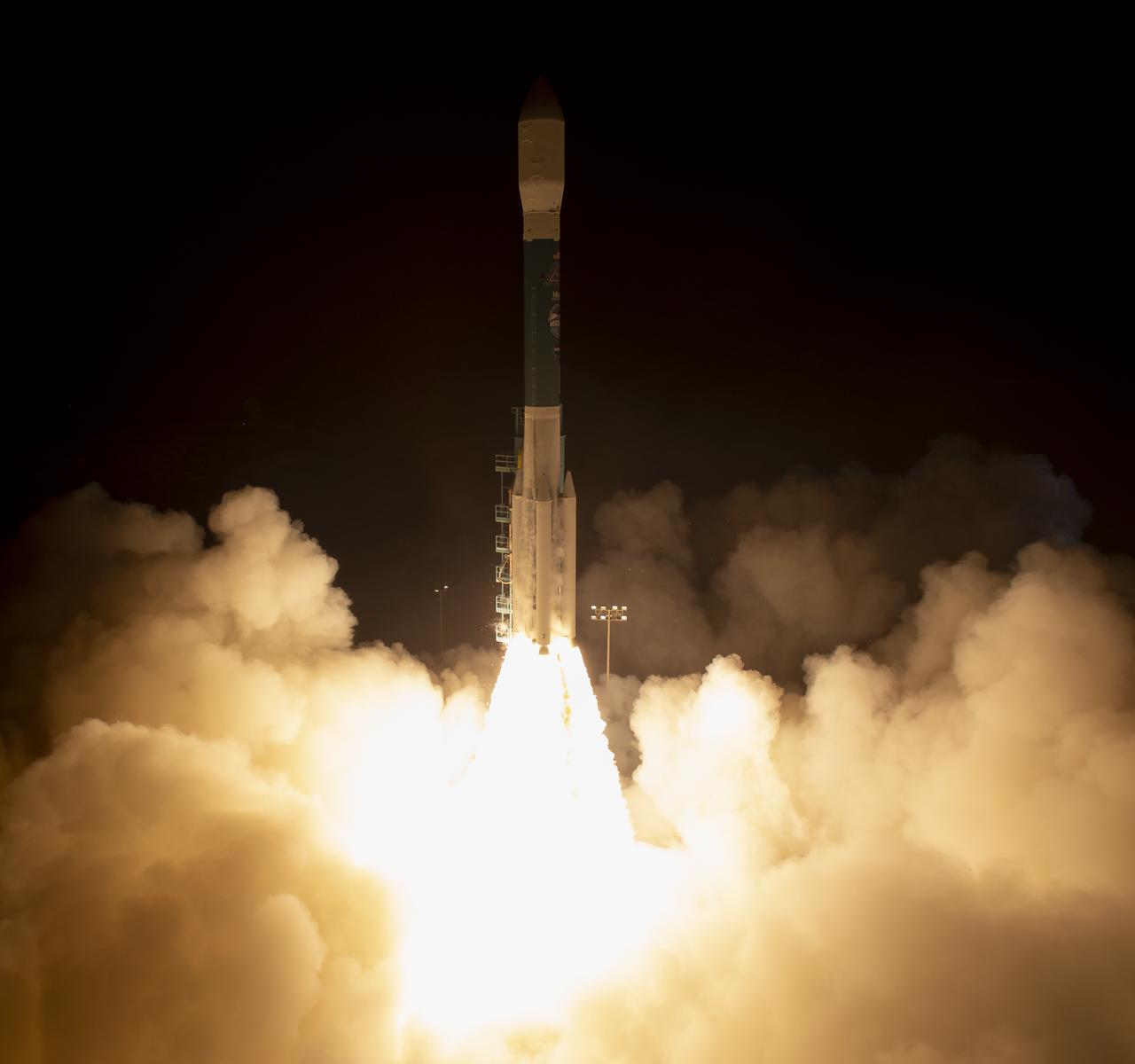
The United Launch Alliance (ULA) Delta II rocket launches with the NASA Ice, Cloud and land Elevation Satellite-2 (ICESat-2) onboard, Saturday, Sept. 15, 2018, from Vandenberg Air Force Base in California. The ICESat-2 mission will measure the changing height of Earth's ice. Photo Credit: (NASA/Bill Ingalls)

Jason Townsend, NASA's Deputy Social Media Manager, reads questions submitted by online social media followers during a prelaunch media briefing for NASA's InSight mission, Thursday, May 3, 2018, at Vandenberg Air Force Base in California. InSight, short for Interior Exploration using Seismic Investigations, Geodesy and Heat Transport, is a Mars lander designed to study the "inner space" of Mars: its crust, mantle, and core. Photo Credit: (NASA/Bill Ingalls)

Artist and NASA social media attendee Maria Coryell-Martin captures a prelaunch briefing for the NASA Ice, Cloud and land Elevation Satellite-2 (ICESat-2), Thursday, Sept. 13, 2018, at Vandenberg Air Force Base in California. The ICESat-2 mission will measure the changing height of Earth's ice. Photo Credit: (NASA/Bill Ingalls)
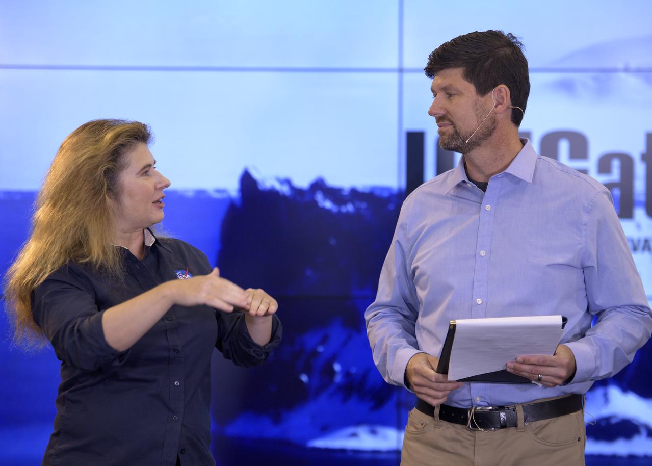
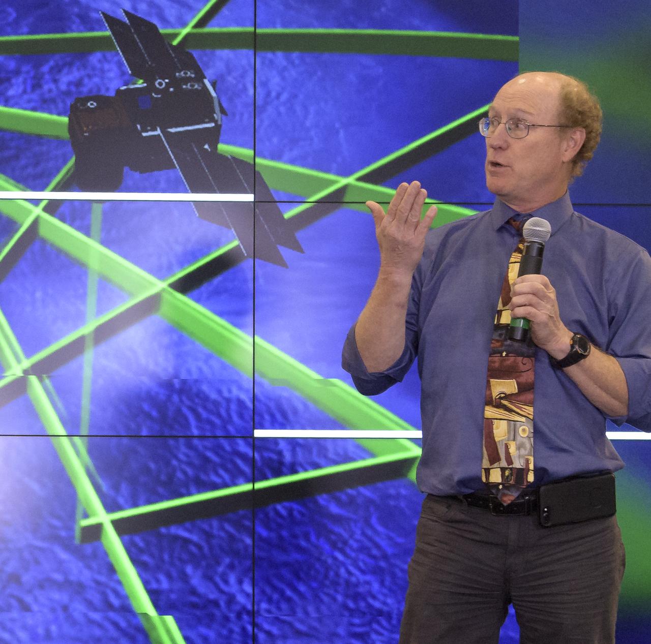
NASA Scientist Michelle Thaller and Tom Wagner, ICESat-2 Program Scientist, NASA Headquarters are seen during a NASA Ice, Cloud and land Elevation Satellite-2 (ICESat-2) prelaunch briefing, Thursday, Sept. 13, 2018, at Vandenberg Air Force Base in California. The ICESat-2 mission will measure the changing height of Earth's ice. Photo Credit: (NASA/Bill Ingalls)

Andy Klesh, MarCO chief engineer, NASA JPL, discusses NASA's InSight mission during a prelaunch media briefing, Thursday, May 3, 2018, at Vandenberg Air Force Base in California. InSight, short for Interior Exploration using Seismic Investigations, Geodesy and Heat Transport, is a Mars lander designed to study the "inner space" of Mars: its crust, mantle, and core. Photo Credit: (NASA/Bill Ingalls)
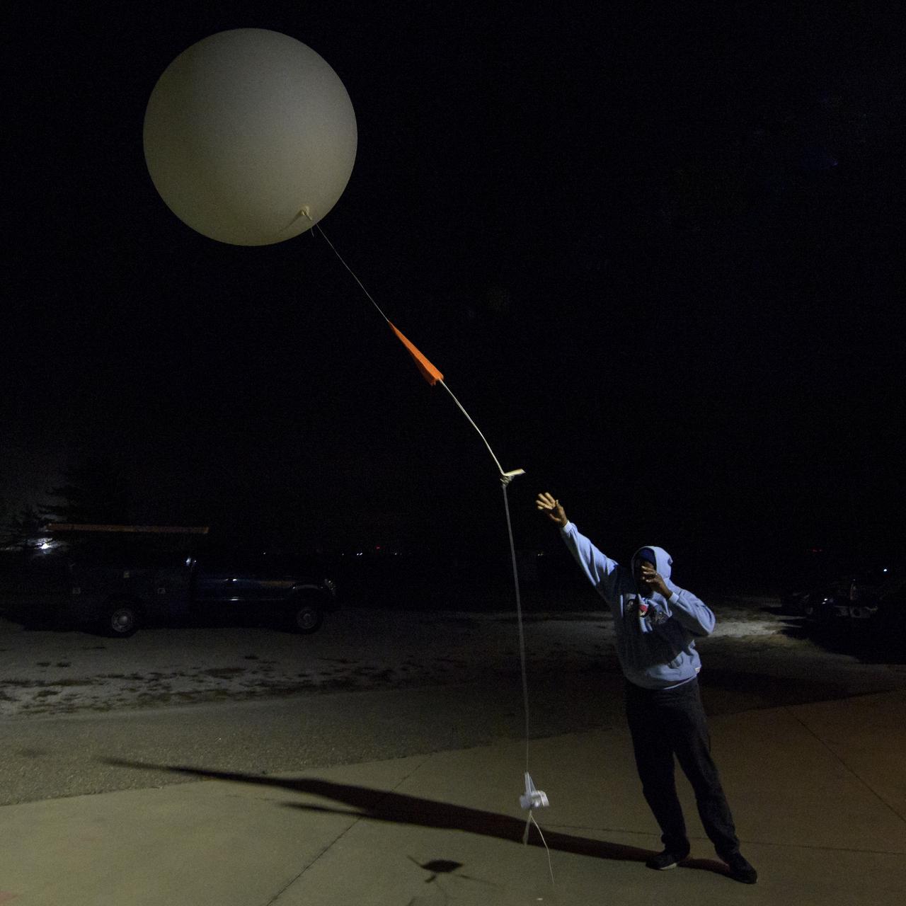
Isiah Toran releases a weather balloon to help measure atmospheric conditions ahead of the launch of the NASA Ice, Cloud and land Elevation Satellite-2 (ICESat-2), Saturday, Sept. 15, 2018, Vandenberg Air Force Base in California. The ICESat-2 mission will measure the changing height of Earth's ice. Photo Credit: (NASA/Bill Ingalls)
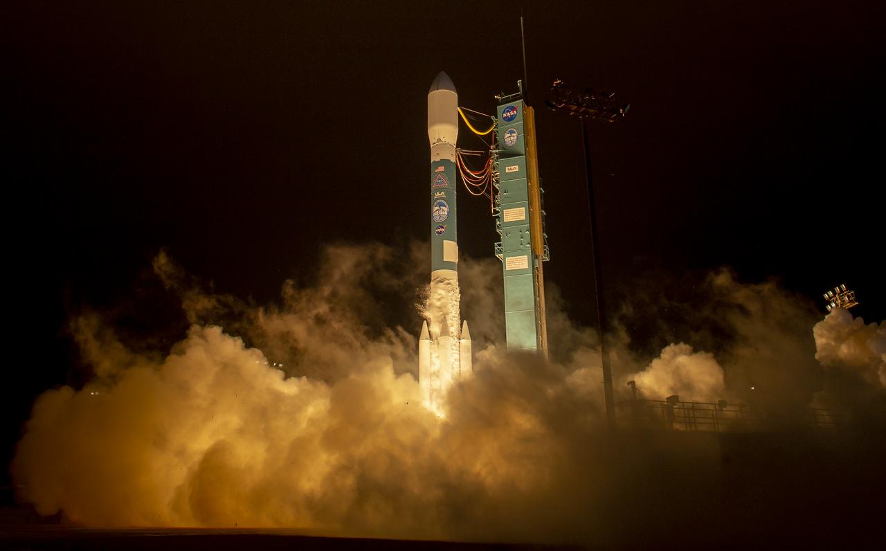
The United Launch Alliance (ULA) Delta II rocket launches with the NASA Ice, Cloud and land Elevation Satellite-2 (ICESat-2) onboard, Saturday, Sept. 15, 2018, from Vandenberg Air Force Base in California. The ICESat-2 mission will measure the changing height of Earth's ice. Photo Credit: (NASA/Bill Ingalls)
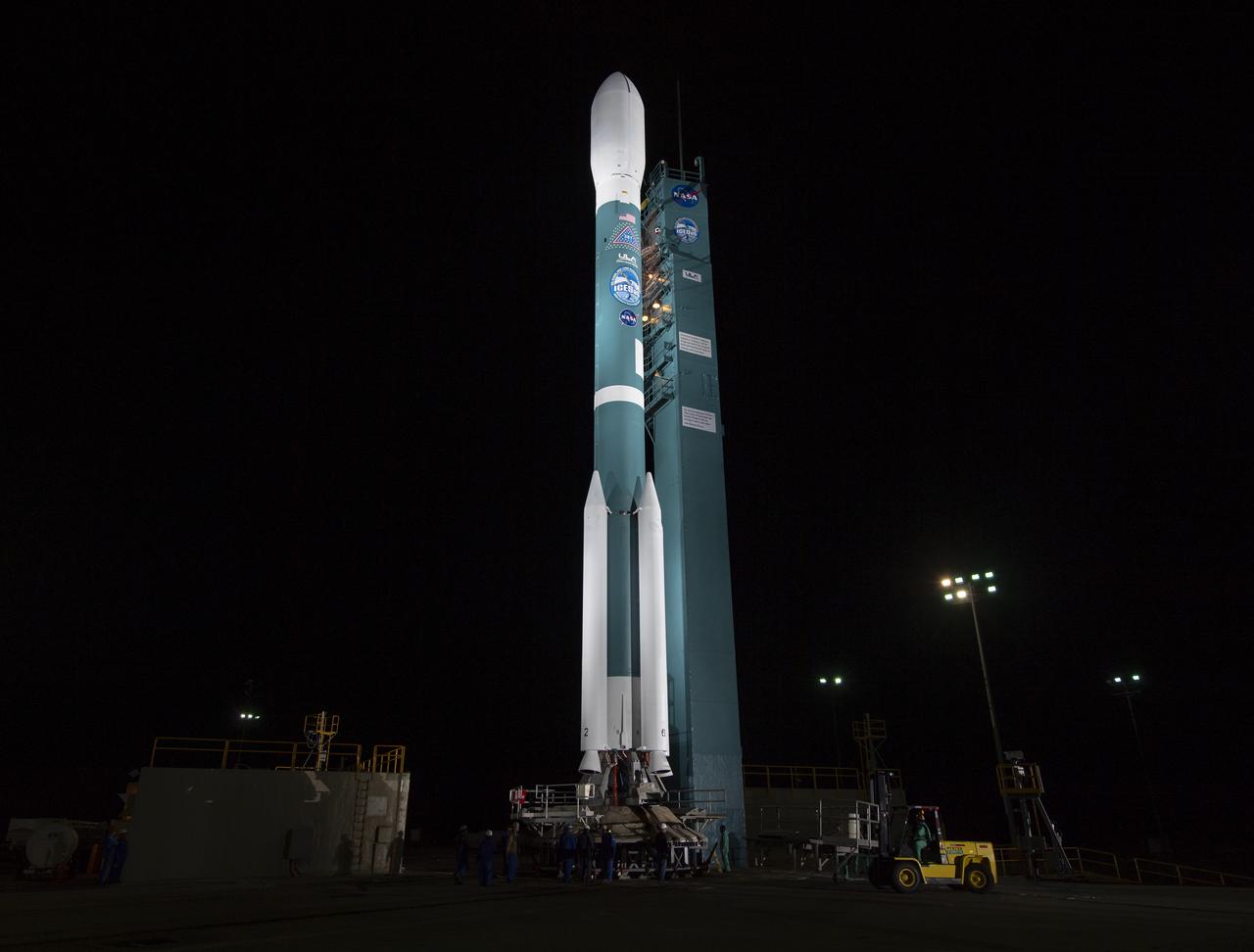
The United Launch Alliance (ULA) Delta II rocket with the NASA Ice, Cloud and land Elevation Satellite-2 (ICESat-2) onboard is seen shortly after the mobile service tower at SLC-2 was rolled back, Saturday, Sept. 15, 2018, at Vandenberg Air Force Base in California. The ICESat-2 mission will measure the changing height of Earth's ice. Photo Credit: (NASA/Bill Ingalls)
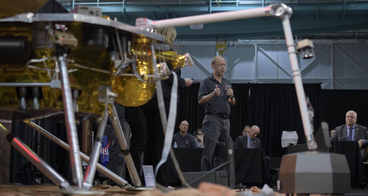
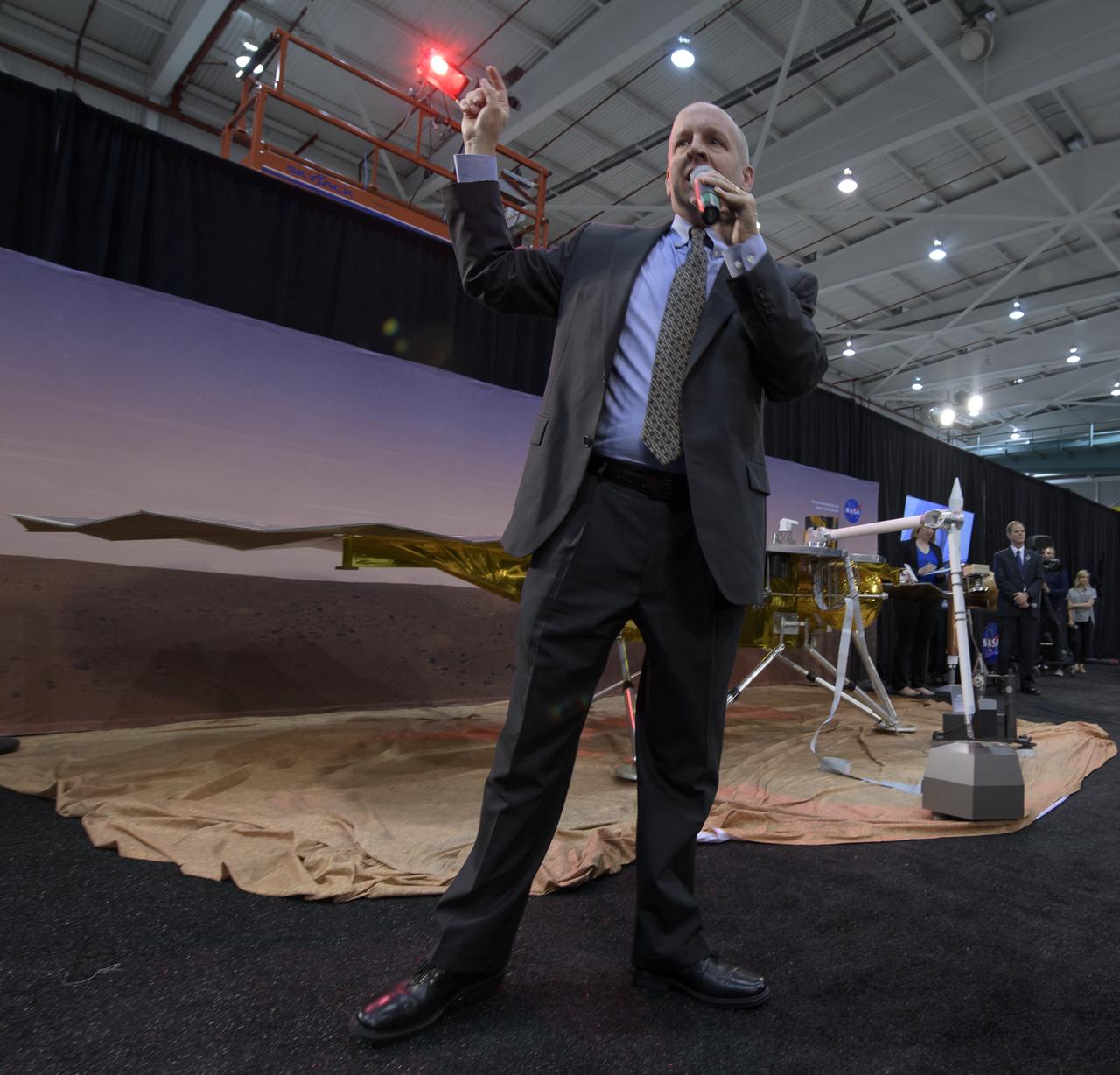
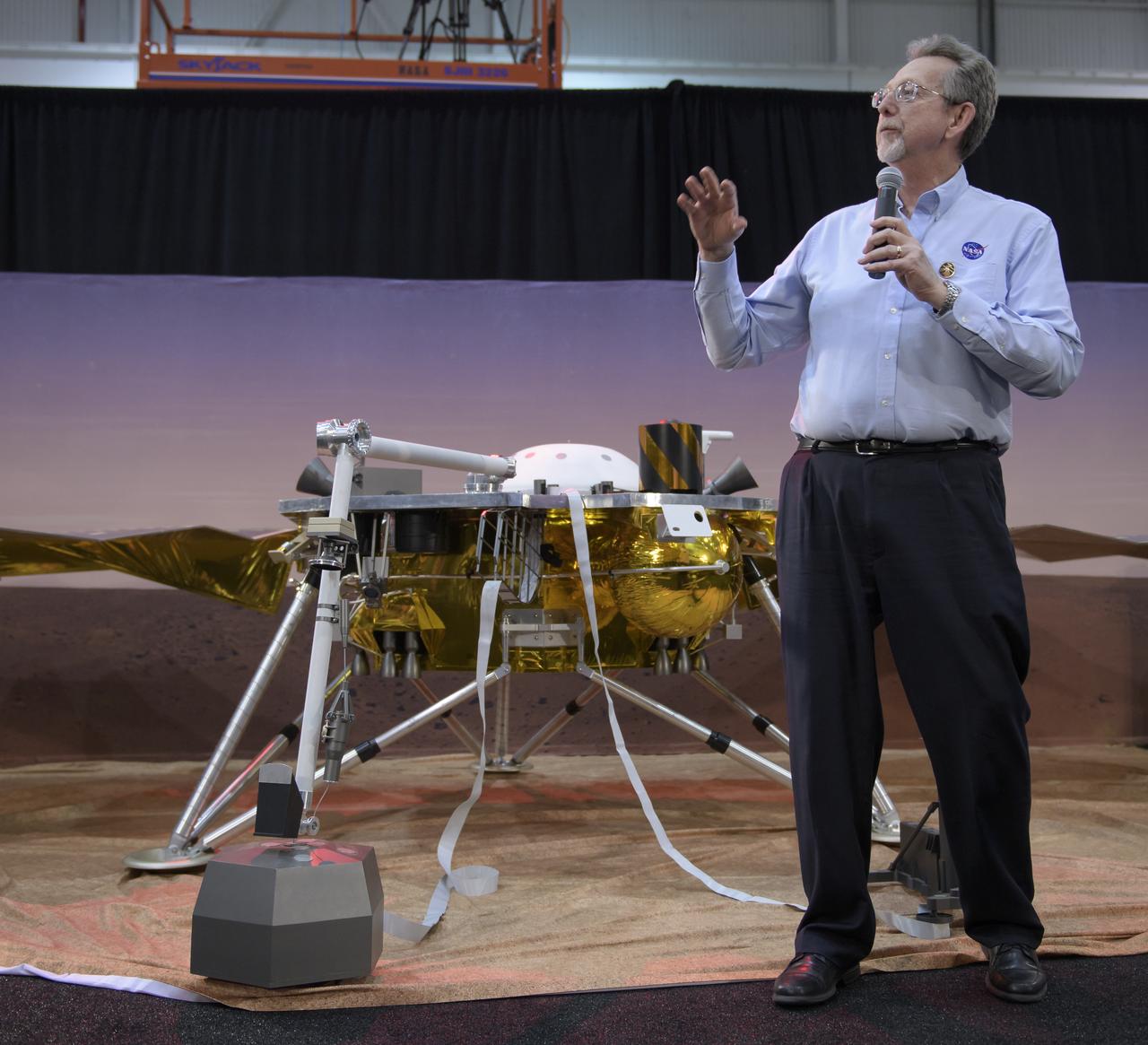
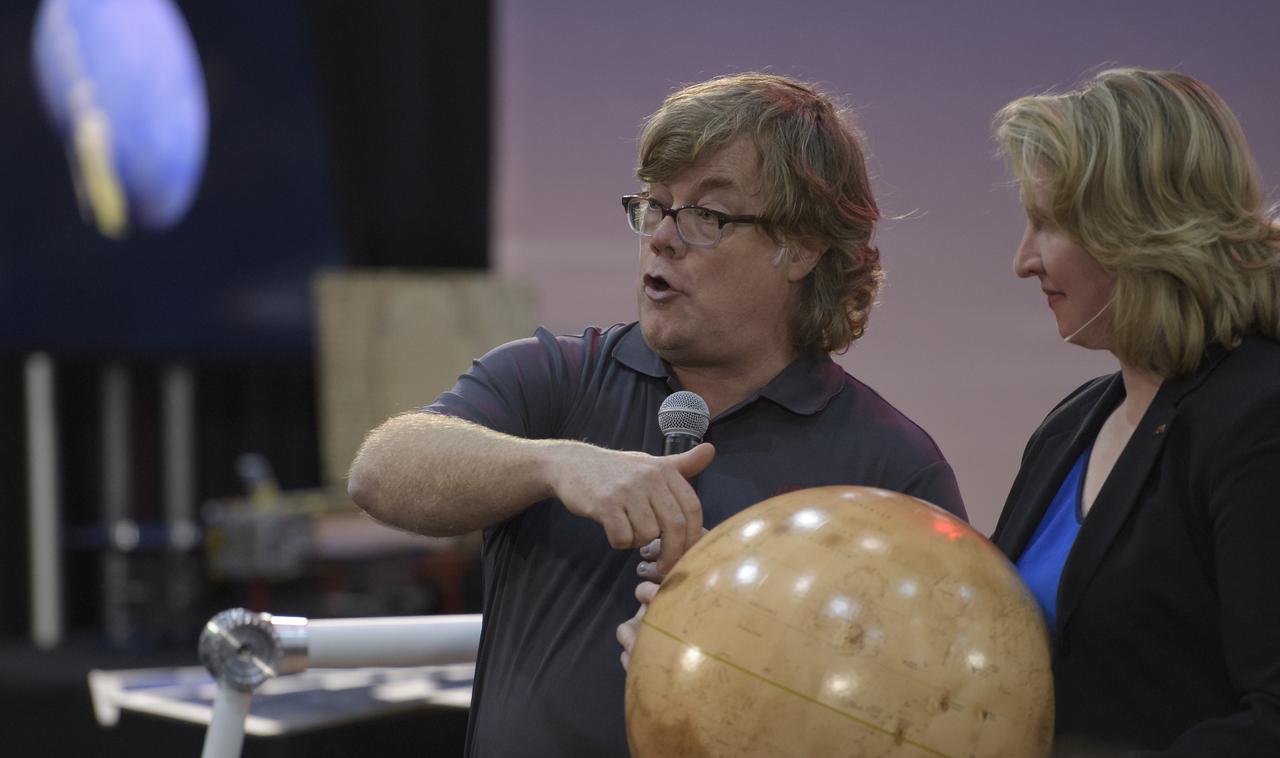
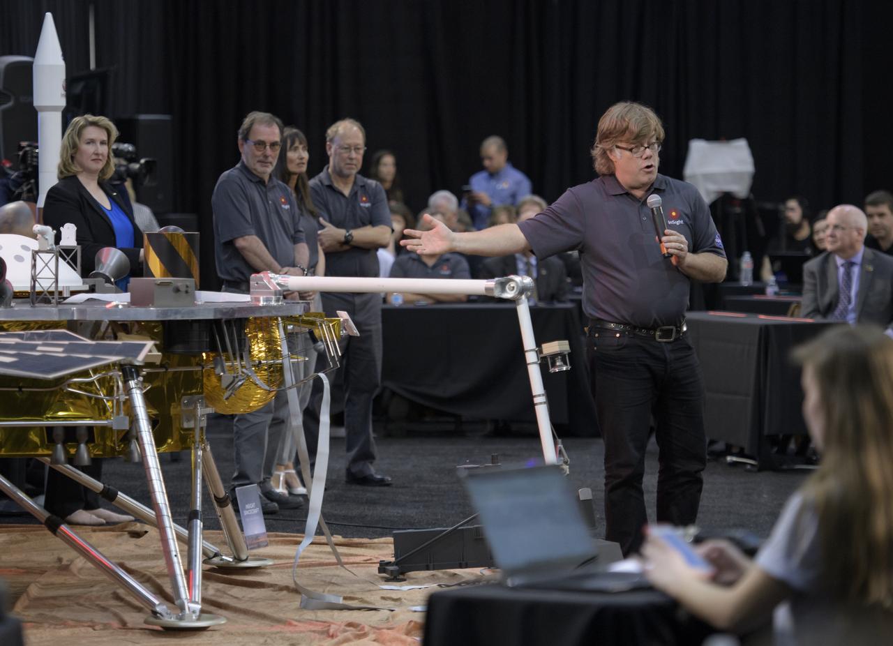
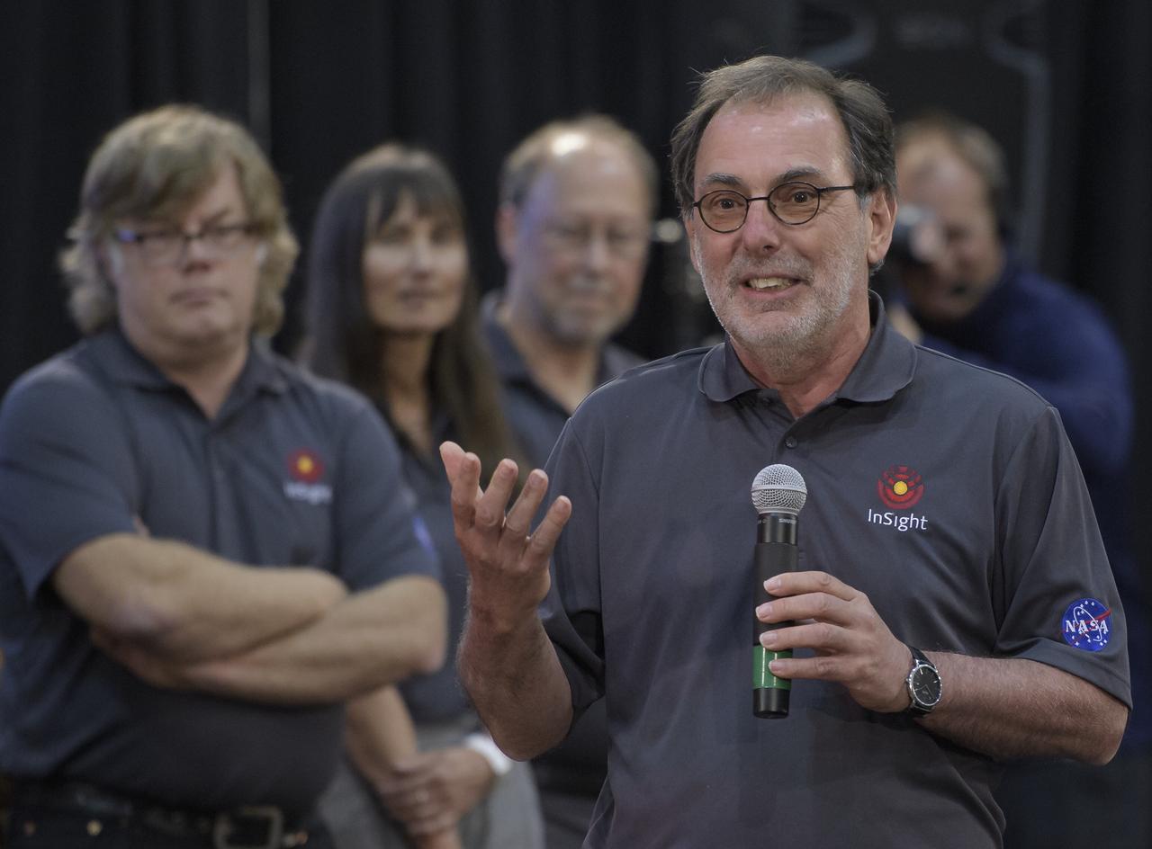
Bruce Banerdt, InSight principal investigator, NASA JPL, discusses NASA's InSight mission during a prelaunch media briefing, Thursday, May 3, 2018, at Vandenberg Air Force Base in California. InSight, short for Interior Exploration using Seismic Investigations, Geodesy and Heat Transport, is a Mars lander designed to study the "inner space" of Mars: its crust, mantle, and core. Photo Credit: (NASA/Bill Ingalls)
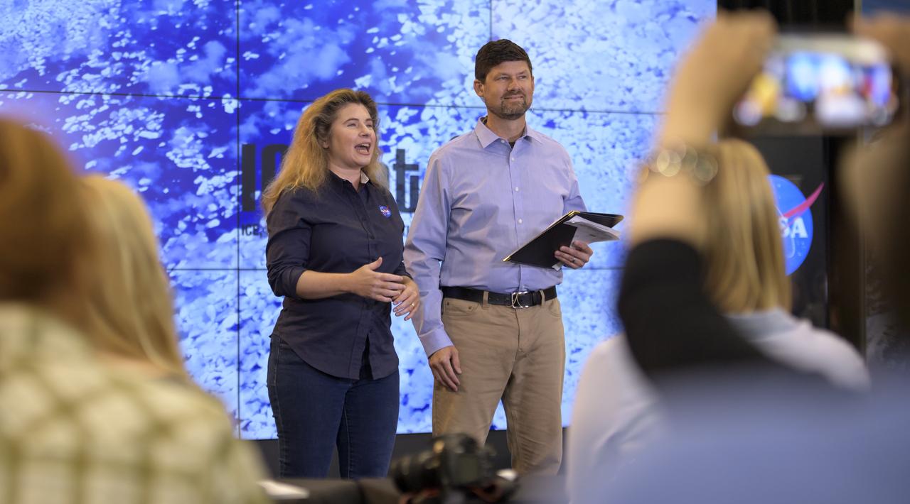
NASA Scientist Michelle Thaller and Tom Wagner, ICESat-2 Program Scientist, NASA Headquarters are seen during a NASA Ice, Cloud and land Elevation Satellite-2 (ICESat-2) prelaunch briefing, Thursday, Sept. 13, 2018, at Vandenberg Air Force Base in California. The ICESat-2 mission will measure the changing height of Earth's ice. Photo Credit: (NASA/Bill Ingalls)
NASA Chief Scientist Jim Green discusses NASA's InSight mission during a prelaunch media briefing, Thursday, May 3, 2018, at Vandenberg Air Force Base in California. InSight, short for Interior Exploration using Seismic Investigations, Geodesy and Heat Transport, is a Mars lander designed to study the "inner space" of Mars: its crust, mantle, and core. Photo Credit: (NASA/Bill Ingalls)
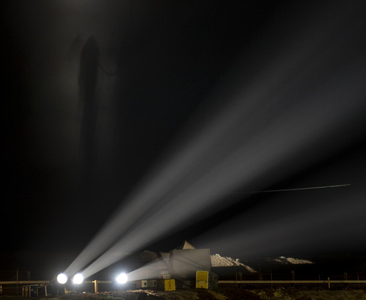
The silhouette of the United Launch Alliance (ULA) Delta II rocket, with the NASA Ice, Cloud and land Elevation Satellite-2 (ICESat-2) onboard, is seen in the fog shortly after the mobile service tower at SLC-2 was rolled back, Saturday, Sept. 15, 2018, at Vandenberg Air Force Base in California. The ICESat-2 mission will measure the changing height of Earth's ice. Photo Credit: (NASA/Bill Ingalls)

The United Launch Alliance (ULA) Delta II rocket launches with the NASA Ice, Cloud and land Elevation Satellite-2 (ICESat-2) onboard, Saturday, Sept. 15, 2018, from Vandenberg Air Force Base in California. The ICESat-2 mission will measure the changing height of Earth's ice. Photo Credit: (NASA/Bill Ingalls)
Philippe Lognonné, SEIS investigation lead, Institut de Physique du Globe de Paris (IPGP) discusses NASA's InSight mission during a prelaunch media briefing, Thursday, May 3, 2018, at Vandenberg Air Force Base in California. InSight, short for Interior Exploration using Seismic Investigations, Geodesy and Heat Transport, is a Mars lander designed to study the "inner space" of Mars: its crust, mantle, and core. Photo Credit: (NASA/Bill Ingalls)
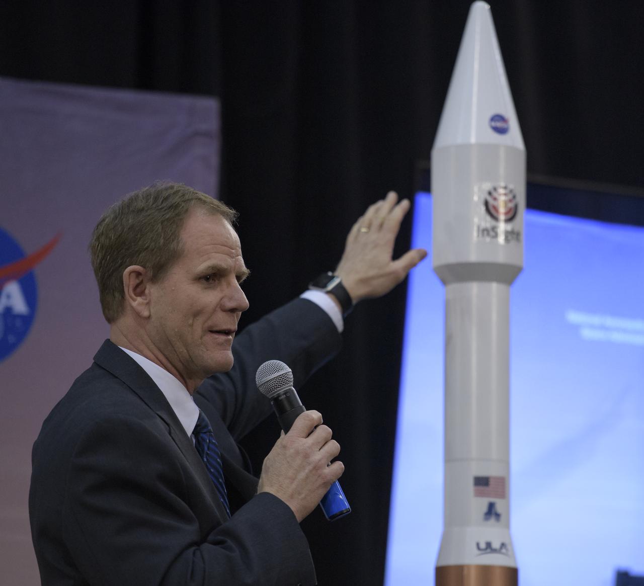
Scott Messer, United Launch Alliance program manager for NASA missions, discusses NASA's InSight mission during a prelaunch media briefing, Thursday, May 3, 2018, at Vandenberg Air Force Base in California. InSight, short for Interior Exploration using Seismic Investigations, Geodesy and Heat Transport, is a Mars lander designed to study the "inner space" of Mars: its crust, mantle, and core. Photo Credit: (NASA/Bill Ingalls)
Philippe Lognonné, SEIS investigation lead, Institut de Physique du Globe de Paris (IPGP) discusses NASA's InSight mission during a prelaunch media briefing, Thursday, May 3, 2018, at Vandenberg Air Force Base in California. InSight, short for Interior Exploration using Seismic Investigations, Geodesy and Heat Transport, is a Mars lander designed to study the "inner space" of Mars: its crust, mantle, and core. Photo Credit: (NASA/Bill Ingalls)

Stu Spath, InSight program manager, Lockheed Martin Space, discusses NASA's InSight mission during a prelaunch media briefing, Thursday, May 3, 2018, at Vandenberg Air Force Base in California. InSight, short for Interior Exploration using Seismic Investigations, Geodesy and Heat Transport, is a Mars lander designed to study the "inner space" of Mars: its crust, mantle, and core. Photo Credit: (NASA/Bill Ingalls)

NASA Scientist Michelle Thaller and Tom Wagner, ICESat-2 Program Scientist, NASA Headquarters are seen during a NASA Ice, Cloud and land Elevation Satellite-2 (ICESat-2) prelaunch briefing, Thursday, Sept. 13, 2018, at Vandenberg Air Force Base in California. The ICESat-2 mission will measure the changing height of Earth's ice. Photo Credit: (NASA/Bill Ingalls)
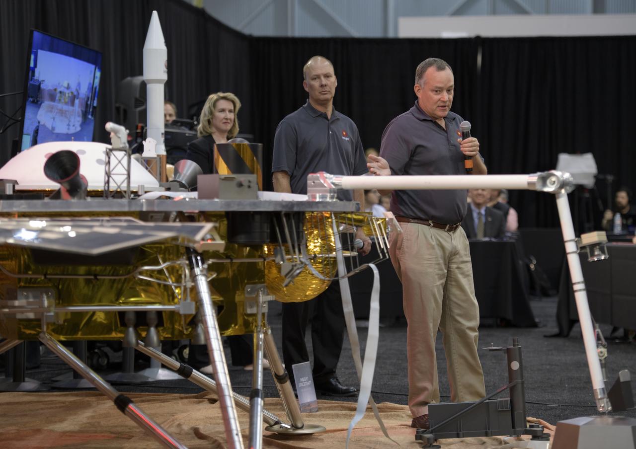
Tom Hoffman, InSight project manager, NASA JPL, right, discusses NASA's InSight mission during a prelaunch media briefing, Thursday, May 3, 2018, at Vandenberg Air Force Base in California. InSight, short for Interior Exploration using Seismic Investigations, Geodesy and Heat Transport, is a Mars lander designed to study the "inner space" of Mars: its crust, mantle, and core. Photo Credit: (NASA/Bill Ingalls)

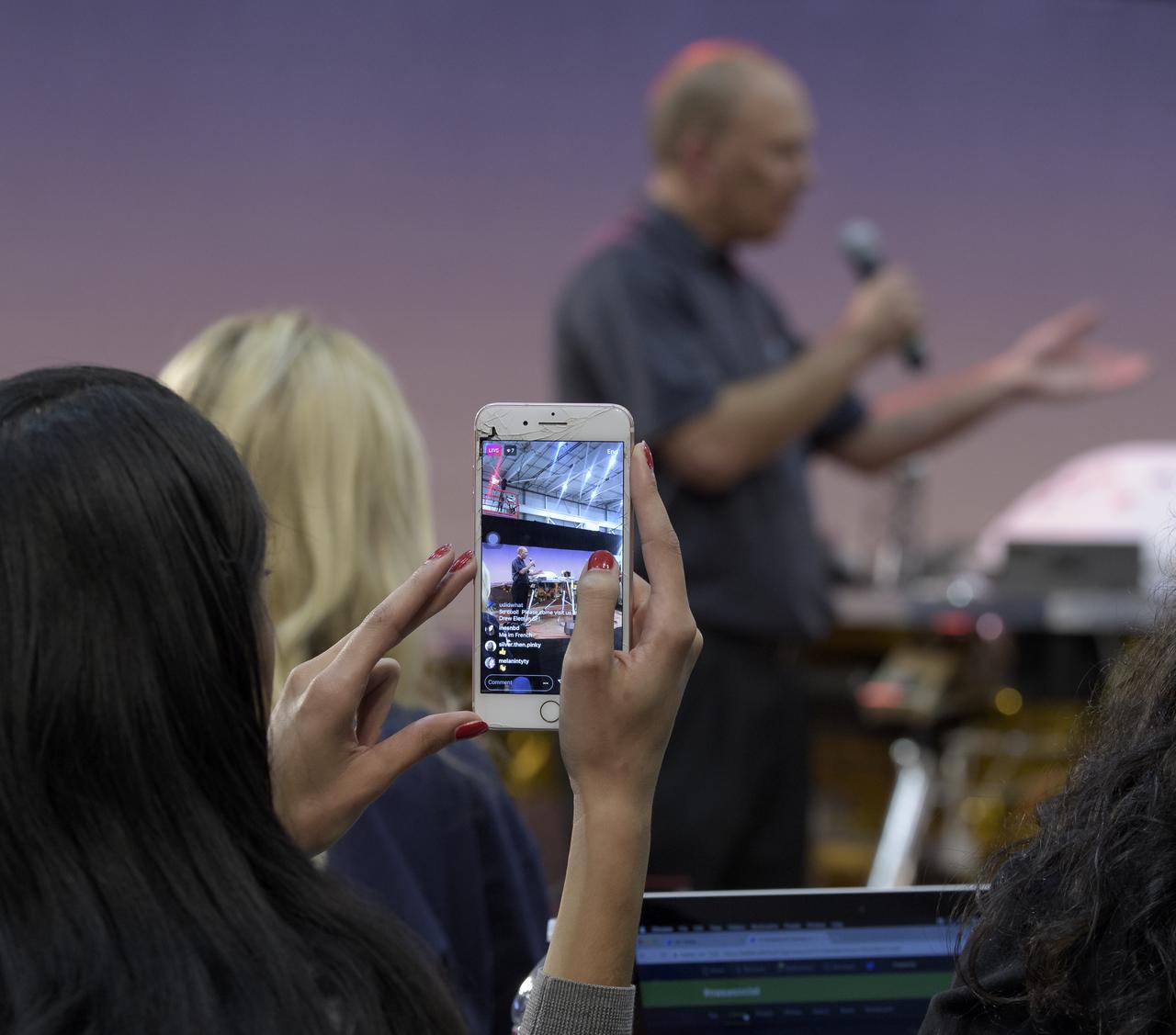
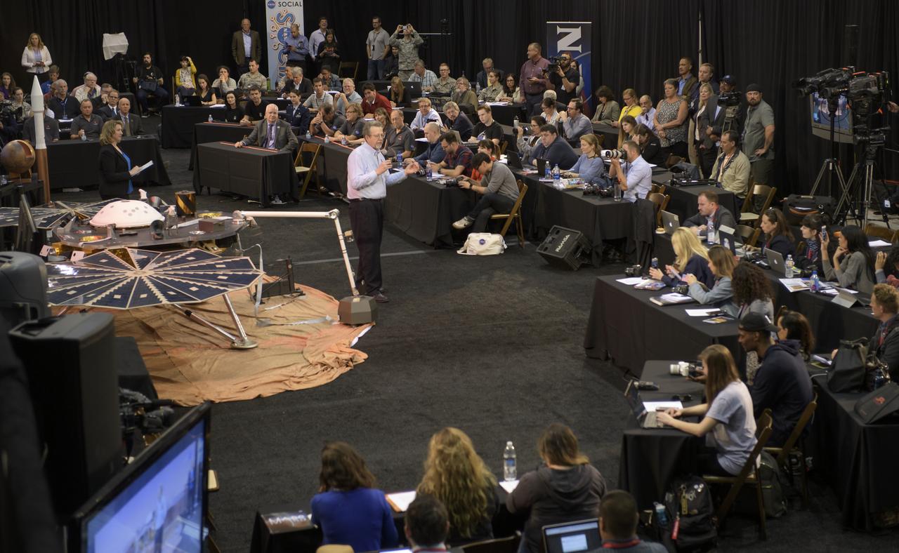
Social media guest listen as Bruce Banerdt, InSight principal investigator, NASA JPL, discusses NASA's InSight mission during a prelaunch media briefing, Thursday, May 3, 2018, at Vandenberg Air Force Base in California. InSight, short for Interior Exploration using Seismic Investigations, Geodesy and Heat Transport, is a Mars lander designed to study the "inner space" of Mars: its crust, mantle, and core. Photo Credit: (NASA/Bill Ingalls)
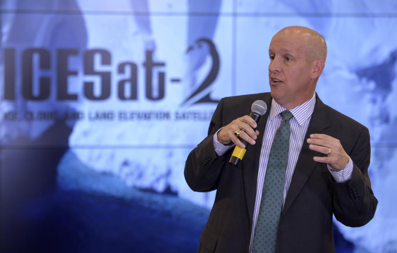
Doug McLennan, ICESat-2 Project Manager, NASA's Goddard Space Flight Center, is seen during a NASA Ice, Cloud and land Elevation Satellite-2 (ICESat-2) prelaunch briefing, Thursday, Sept. 13, 2018, at Vandenberg Air Force Base in California. The ICESat-2 mission will measure the changing height of Earth's ice. Photo Credit: (NASA/Bill Ingalls)
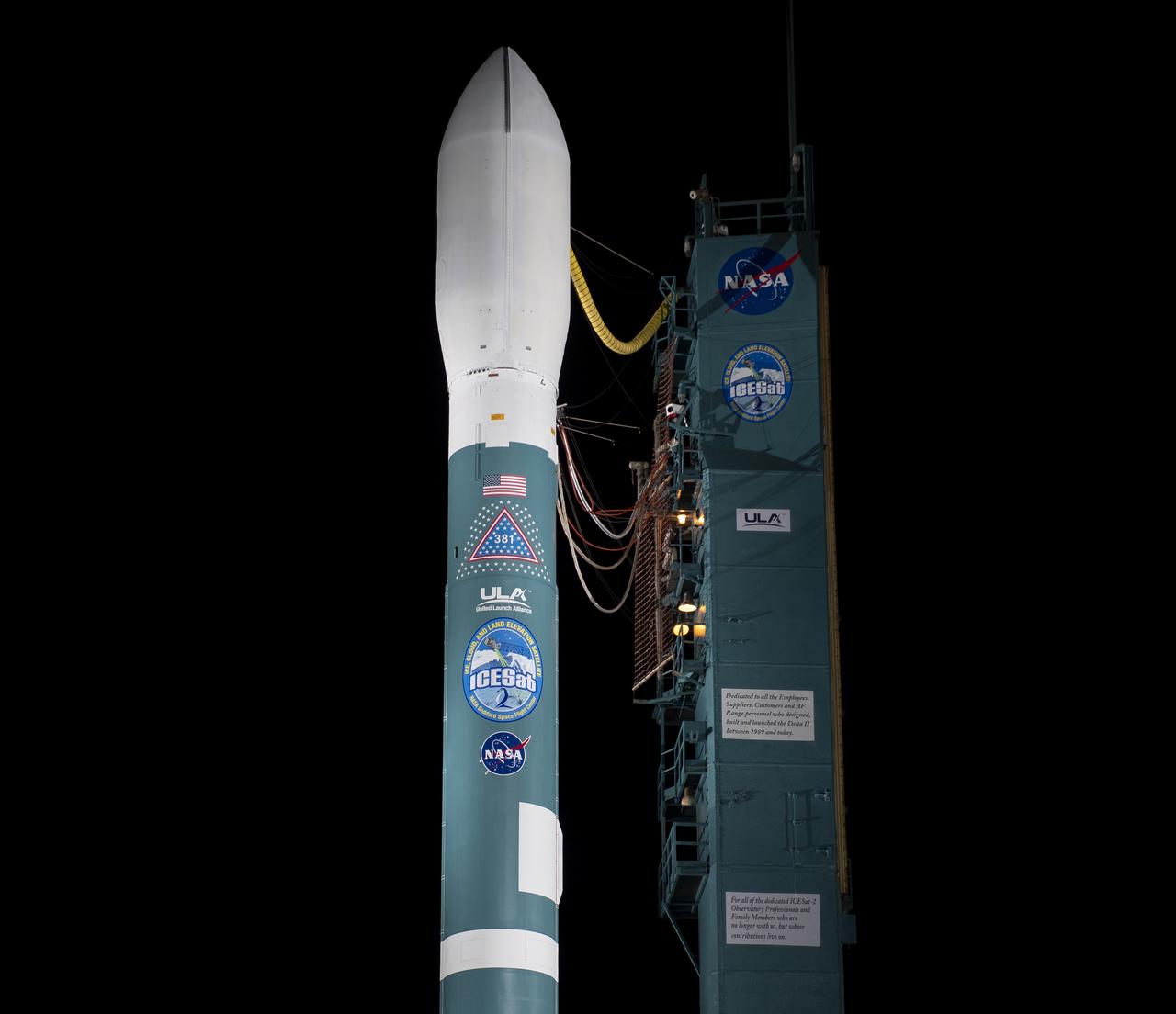
The United Launch Alliance (ULA) Delta II rocket with the NASA Ice, Cloud and land Elevation Satellite-2 (ICESat-2) onboard is seen shortly after the mobile service tower at SLC-2 was rolled back, Saturday, Sept. 15, 2018, at Vandenberg Air Force Base in California. The ICESat-2 mission will measure the changing height of Earth's ice. Photo Credit: (NASA/Bill Ingalls)
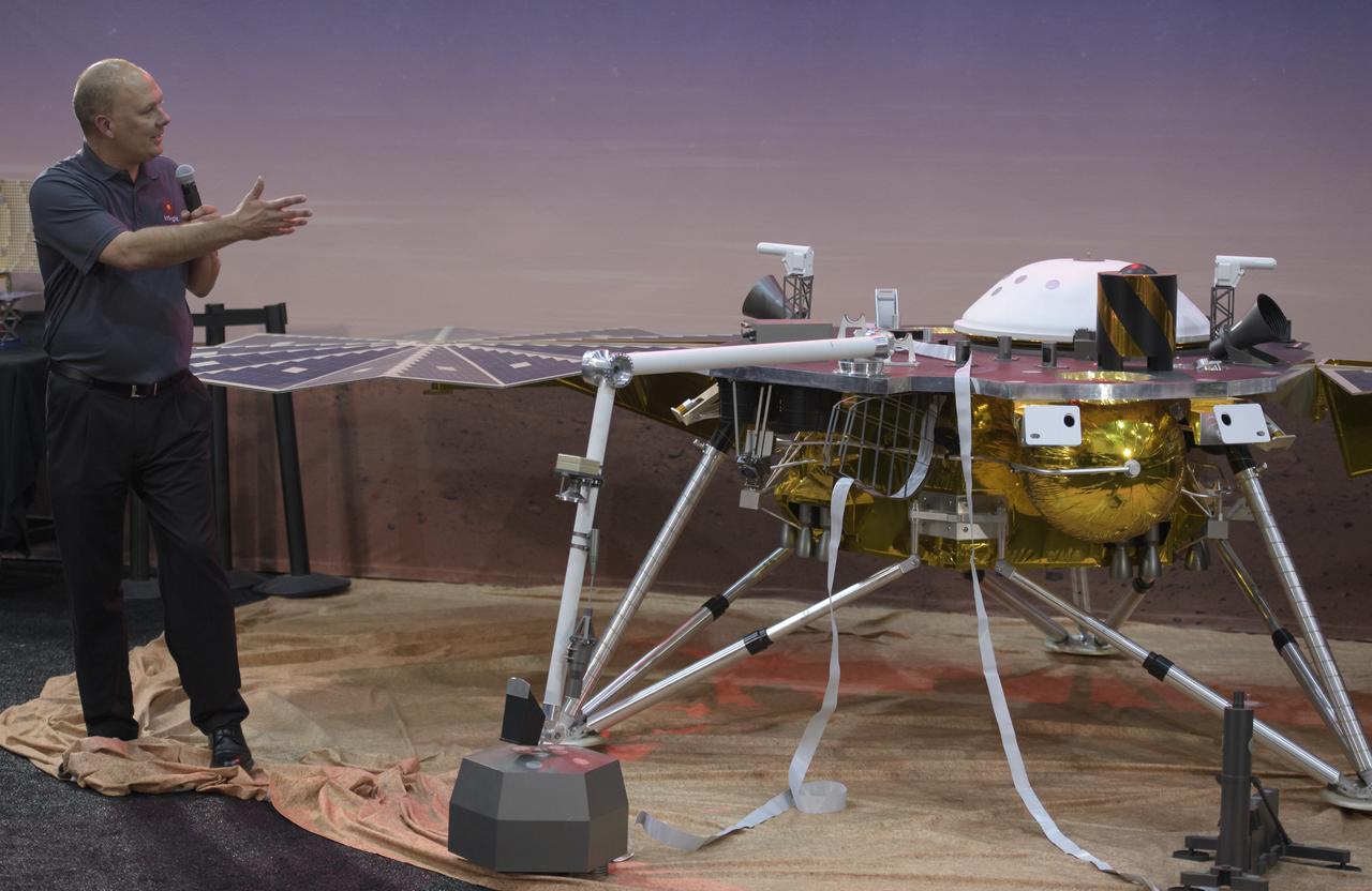
Stu Spath, InSight program manager, Lockheed Martin Space, discusses NASA's InSight mission during a prelaunch media briefing, Thursday, May 3, 2018, at Vandenberg Air Force Base in California. InSight, short for Interior Exploration using Seismic Investigations, Geodesy and Heat Transport, is a Mars lander designed to study the "inner space" of Mars: its crust, mantle, and core. Photo Credit: (NASA/Bill Ingalls)
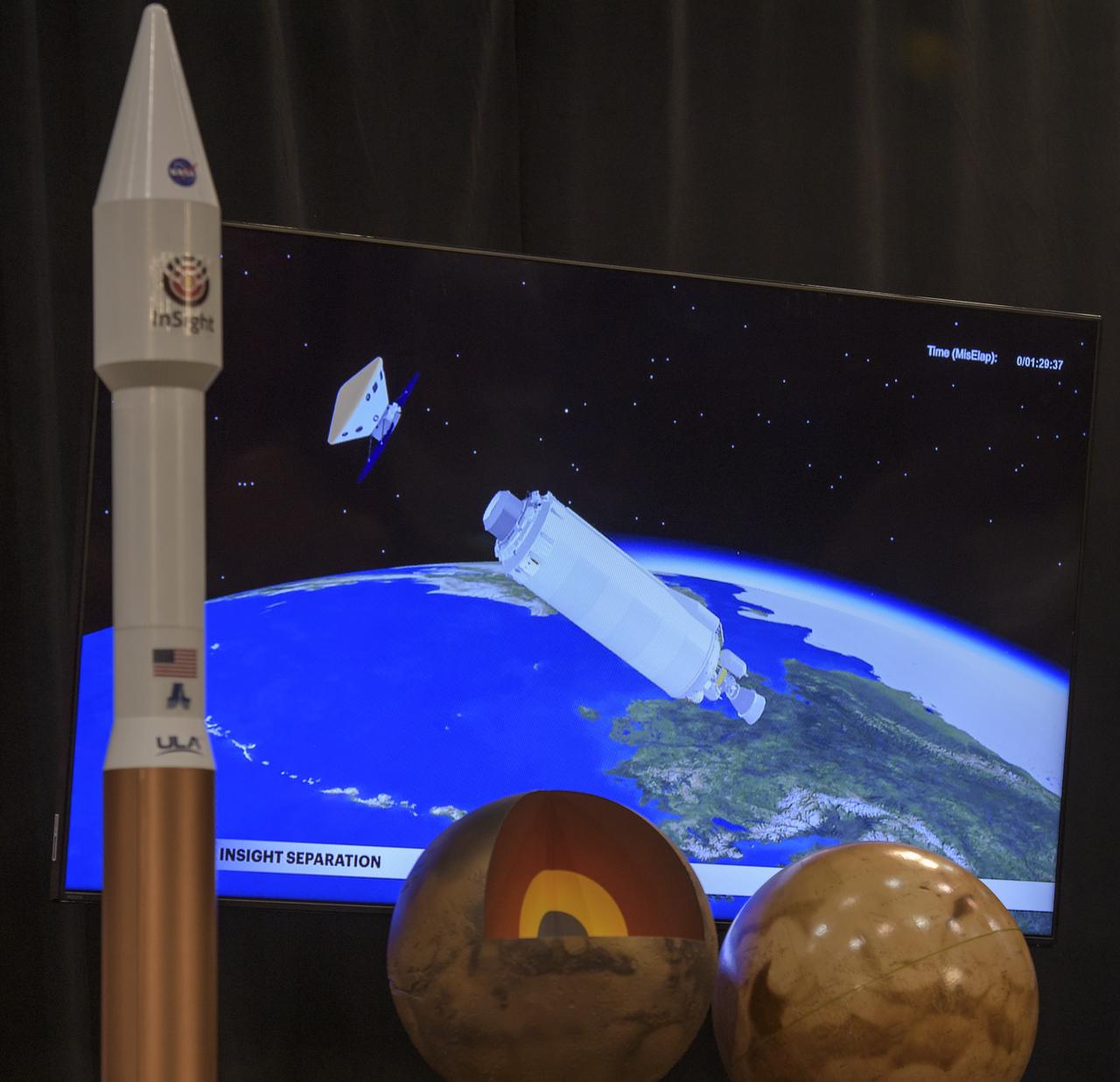
A video showing NASA's InSight spacecraft separating from the Atlas V rocket is seen during a prelaunch media briefing, Thursday, May 3, 2018, at Vandenberg Air Force Base in California. InSight, short for Interior Exploration using Seismic Investigations, Geodesy and Heat Transport, is a Mars lander designed to study the "inner space" of Mars: its crust, mantle, and core. Photo Credit: (NASA/Bill Ingalls)
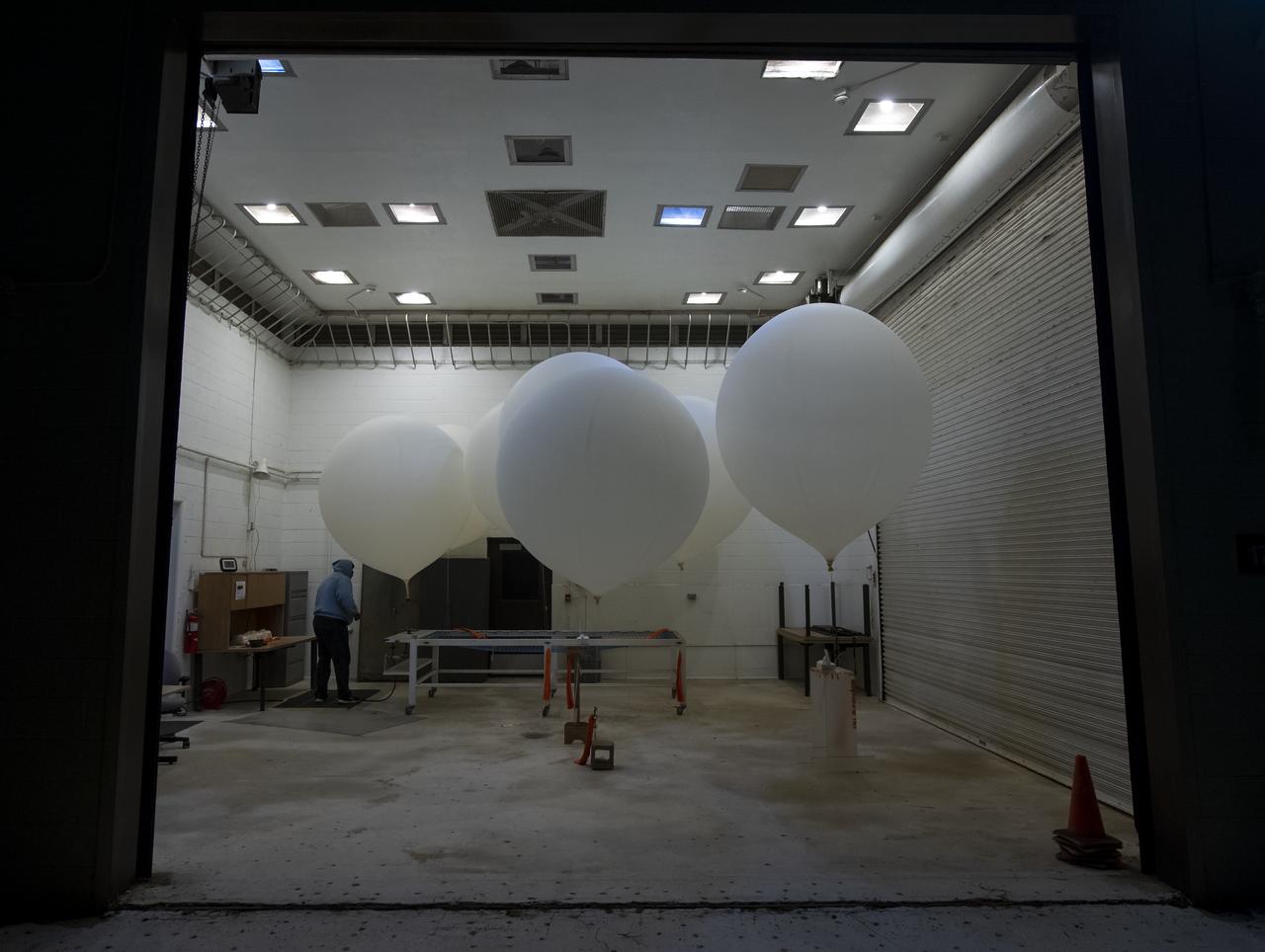
Weather balloons are prepared for release to help measure atmospheric conditions ahead of the launch of the NASA Ice, Cloud and land Elevation Satellite-2 (ICESat-2), Saturday, Sept. 15, 2018, Vandenberg Air Force Base in California. The ICESat-2 mission will measure the changing height of Earth's ice. Photo Credit: (NASA/Bill Ingalls)
Bruce Banerdt, InSight principal investigator, NASA JPL, discusses NASA's InSight mission during a prelaunch media briefing, Thursday, May 3, 2018, at Vandenberg Air Force Base in California. InSight, short for Interior Exploration using Seismic Investigations, Geodesy and Heat Transport, is a Mars lander designed to study the "inner space" of Mars: its crust, mantle, and core. Photo Credit: (NASA/Bill Ingalls)
The United Launch Alliance (ULA) Delta II rocket with the NASA Ice, Cloud and land Elevation Satellite-2 (ICESat-2) onboard is seen shortly after the mobile service tower at SLC-2 was rolled back, Saturday, Sept. 15, 2018, at Vandenberg Air Force Base in California. The ICESat-2 mission will measure the changing height of Earth's ice. Photo Credit: (NASA/Bill Ingalls)
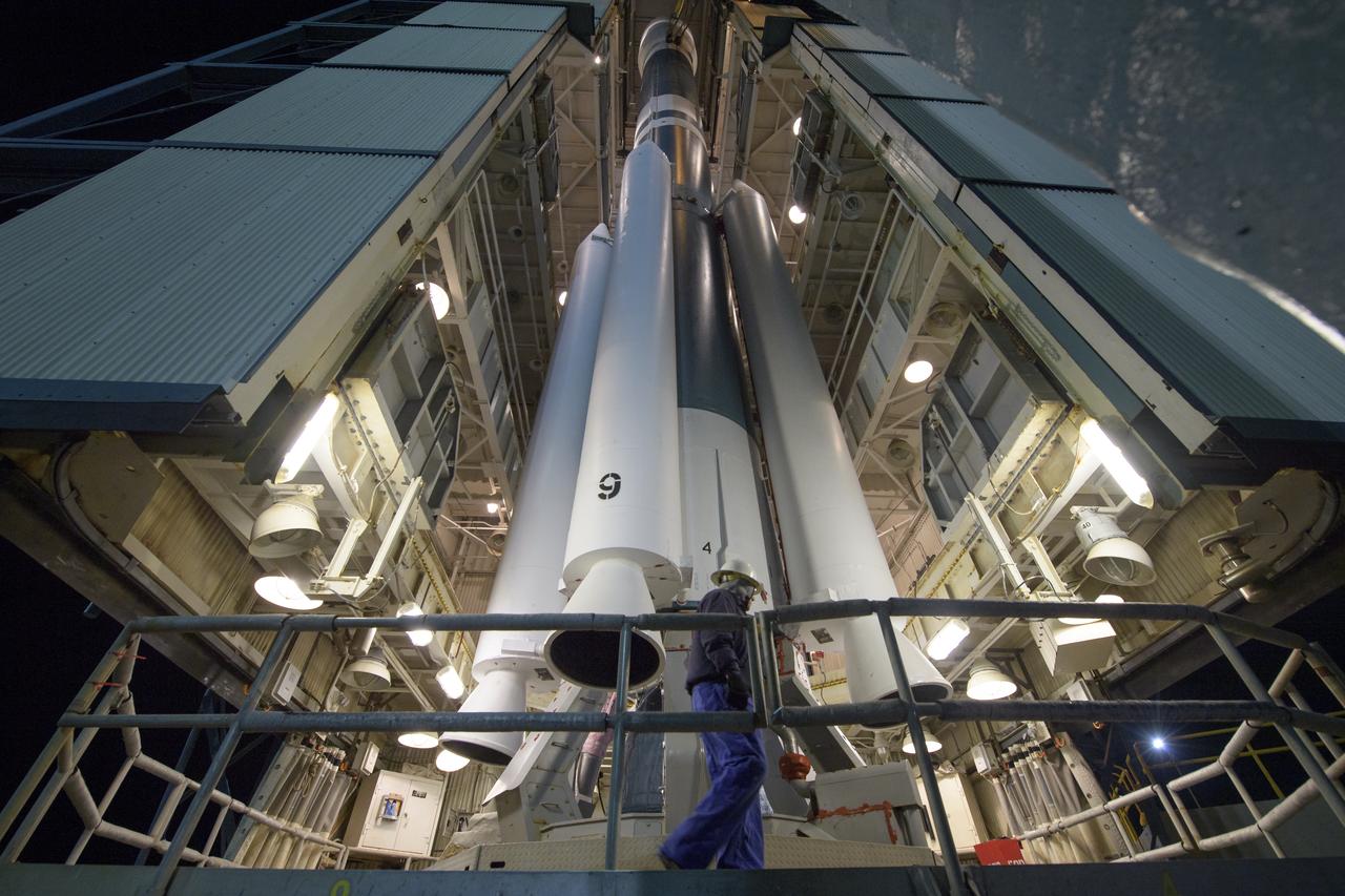
Workers prepare the United Launch Alliance (ULA) Delta II rocket, with the NASA Ice, Cloud and land Elevation Satellite-2 (ICESat-2) onboard, for launch, Friday, Sept. 14, 2018, at Vandenberg Air Force Base in California. The ICESat-2 mission will measure the changing height of Earth's ice. Photo Credit: (NASA/Bill Ingalls)
A graphic is shown as experts discuss the Gravity Recovery and Climate Experiment Follow-On (GRACE-FO) mission during a prelaunch media briefing, Monday, May 21, 2018, at Vandenberg Air Force Base in California. The twin GRACE-FO spacecraft will measure changes in how mass is redistributed within and among Earth's atmosphere, oceans, land and ice sheets, as well as within Earth itself. Photo Credit: (NASA/Bill Ingalls)

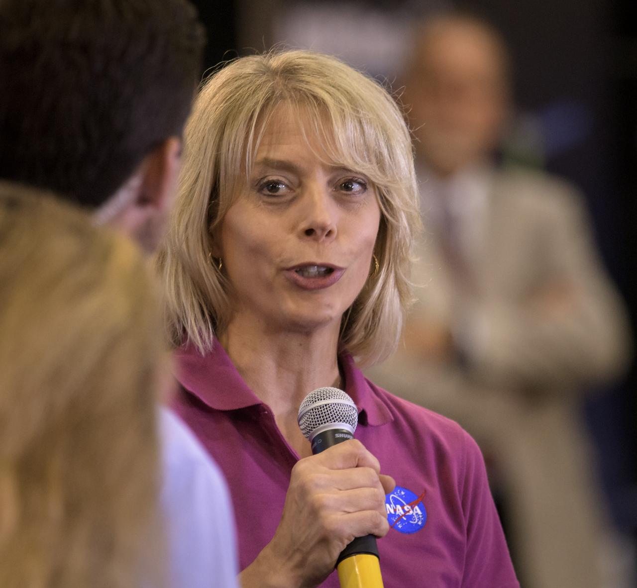
Helen Fricker, ICESat-2 Science Definition Team Member, Scripps Institution of Oceanography, is seen during a NASA Ice, Cloud and land Elevation Satellite-2 (ICESat-2) prelaunch briefing, Thursday, Sept. 13, 2018, at Vandenberg Air Force Base in California. The ICESat-2 mission will measure the changing height of Earth's ice. Photo Credit: (NASA/Bill Ingalls)
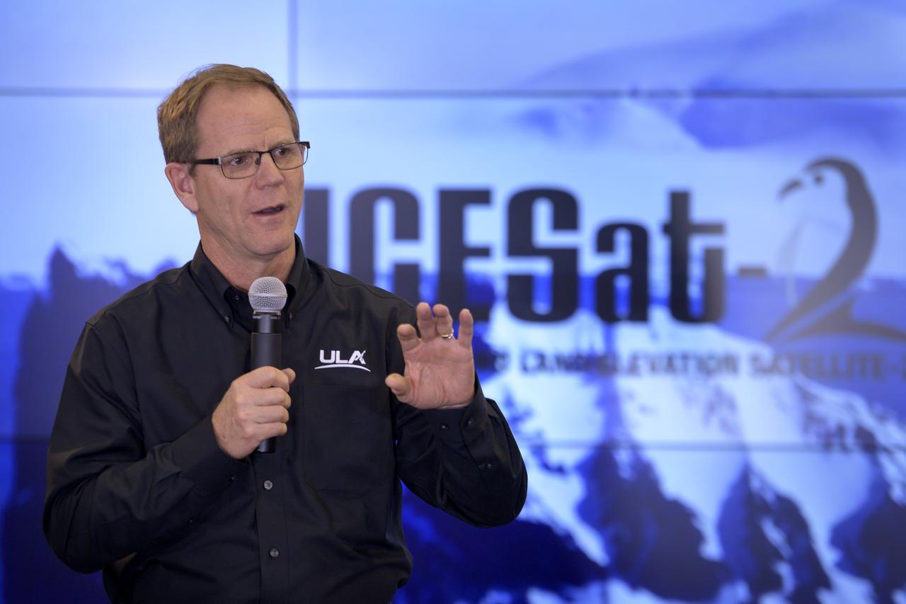
Scott Messer, Program Manager, United Launch Alliance, is seen during a NASA Ice, Cloud and land Elevation Satellite-2 (ICESat-2) prelaunch briefing, Thursday, Sept. 13, 2018, at Vandenberg Air Force Base in California. The ICESat-2 mission will measure the changing height of Earth's ice. Photo Credit: (NASA/Bill Ingalls)
Tilman Spohn, HP3 investigation lead, Institute of Planetary Research (DLR), discusses NASA's InSight mission during a prelaunch media briefing, Thursday, May 3, 2018, at Vandenberg Air Force Base in California. InSight, short for Interior Exploration using Seismic Investigations, Geodesy and Heat Transport, is a Mars lander designed to study the "inner space" of Mars: its crust, mantle, and core. Photo Credit: (NASA/Bill Ingalls)

Tim Dunn, launch director, NASA’s Launch Services Program, discusses NASA's InSight mission during a prelaunch media briefing, Thursday, May 3, 2018, at Vandenberg Air Force Base in California. InSight, short for Interior Exploration using Seismic Investigations, Geodesy and Heat Transport, is a Mars lander designed to study the "inner space" of Mars: its crust, mantle, and core. Photo Credit: (NASA/Bill Ingalls)
The United Launch Alliance (ULA) Delta II rocket with the NASA Ice, Cloud and land Elevation Satellite-2 (ICESat-2) onboard is seen shortly after the mobile service tower at SLC-2 was rolled back, Saturday, Sept. 15, 2018, at Vandenberg Air Force Base in California. The ICESat-2 mission will measure the changing height of Earth's ice. Photo Credit: (NASA/Bill Ingalls)
The United Launch Alliance (ULA) Delta II rocket launches with the NASA Ice, Cloud and land Elevation Satellite-2 (ICESat-2) onboard, Saturday, Sept. 15, 2018, from Vandenberg Air Force Base in California. The ICESat-2 mission will measure the changing height of Earth's ice. Photo Credit: (NASA/Bill Ingalls)
The United Launch Alliance (ULA) Delta II rocket with the NASA Ice, Cloud and land Elevation Satellite-2 (ICESat-2) onboard is seen shortly after the mobile service tower at SLC-2 was rolled back, Saturday, Sept. 15, 2018, at Vandenberg Air Force Base in California. The ICESat-2 mission will measure the changing height of Earth's ice. Photo Credit: (NASA/Bill Ingalls)
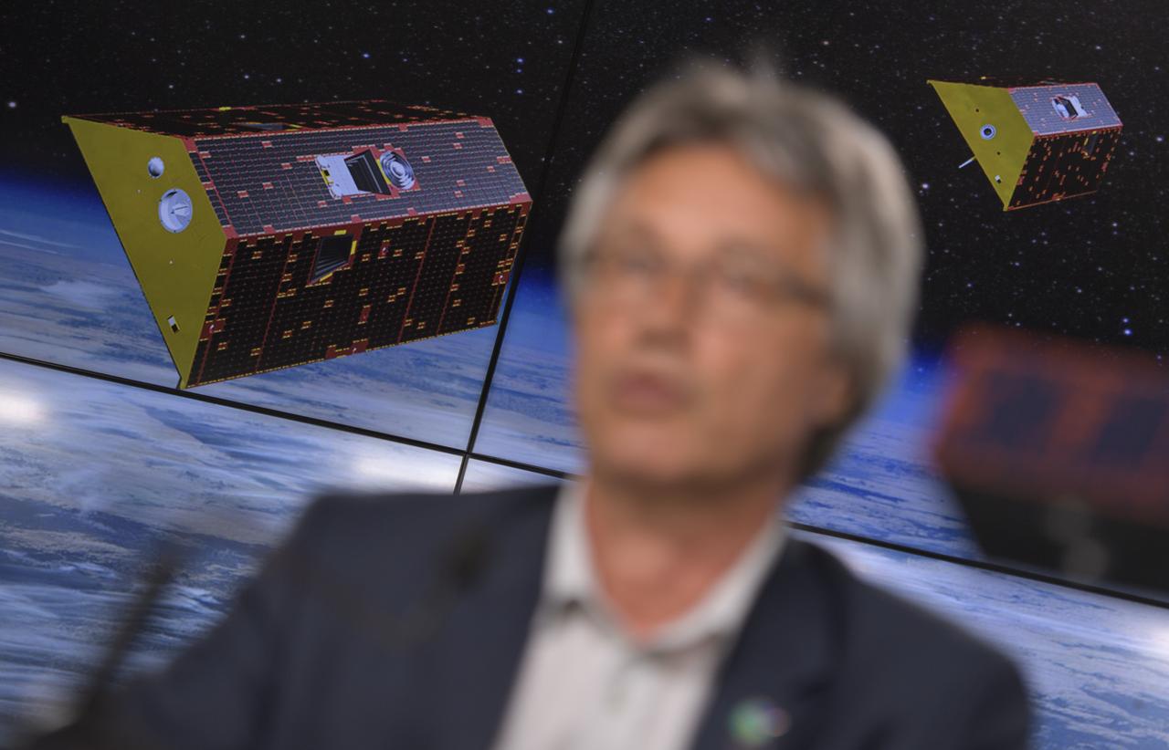
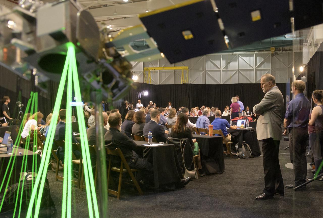
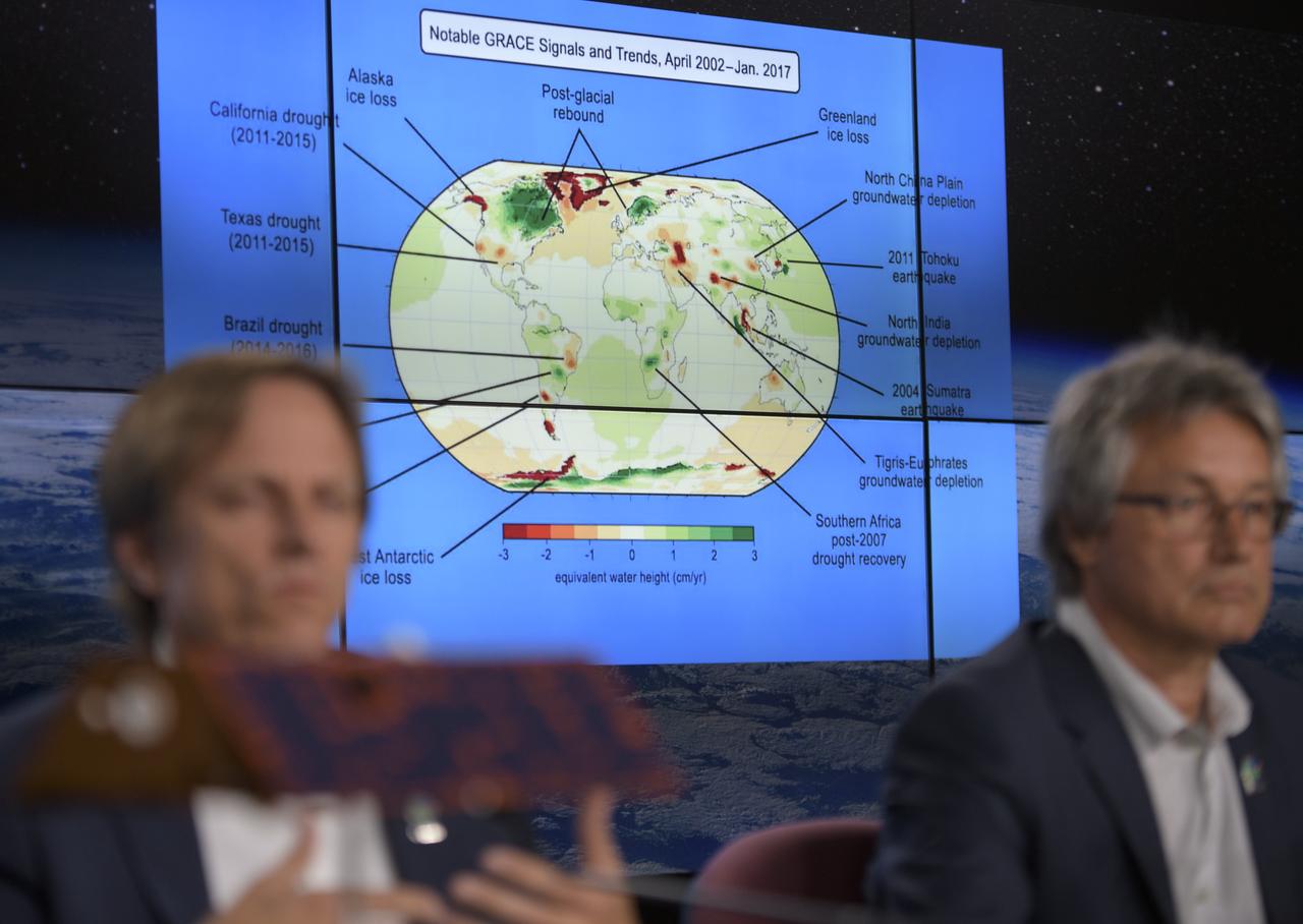
Experts discuss the Gravity Recovery and Climate Experiment Follow-On (GRACE-FO) mission during a prelaunch media briefing, Monday, May 21, 2018, at Vandenberg Air Force Base in California. The twin GRACE-FO spacecraft will measure changes in how mass is redistributed within and among Earth's atmosphere, oceans, land and ice sheets, as well as within Earth itself. Photo Credit: (NASA/Bill Ingalls)
Stu Spath, InSight program manager, Lockheed Martin Space, discusses NASA's InSight mission during a prelaunch media briefing, Thursday, May 3, 2018, at Vandenberg Air Force Base in California. InSight, short for Interior Exploration using Seismic Investigations, Geodesy and Heat Transport, is a Mars lander designed to study the "inner space" of Mars: its crust, mantle, and core. Photo Credit: (NASA/Bill Ingalls)
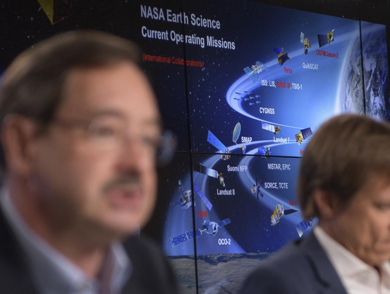
A graphic is shown as experts discuss the Gravity Recovery and Climate Experiment Follow-On (GRACE-FO) mission during a prelaunch media briefing, Monday, May 21, 2018, at Vandenberg Air Force Base in California. The twin GRACE-FO spacecraft will measure changes in how mass is redistributed within and among Earth's atmosphere, oceans, land and ice sheets, as well as within Earth itself. Photo Credit: (NASA/Bill Ingalls)
NASA Scientist Michelle Thaller, Tom Wagner, ICESat-2 Program Scientist, NASA Headquarters, center, and Bill Barnhart, ICESat-2 Program Manager, Northrop Grumman, are seen during a NASA Ice, Cloud and land Elevation Satellite-2 (ICESat-2) prelaunch briefing, Thursday, Sept. 13, 2018, at Vandenberg Air Force Base in California. The ICESat-2 mission will measure the changing height of Earth's ice. Photo Credit: (NASA/Bill Ingalls)
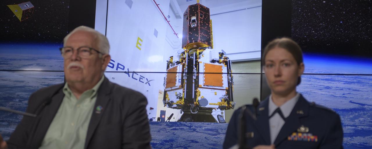
A photo showing the The twin GRACE-FO spacecraft installed on top of the five Iridium NEXT communications satellites is seen as experts discuss the Gravity Recovery and Climate Experiment Follow-On mission during a prelaunch media briefing, Monday, May 21, 2018, at Vandenberg Air Force Base in California. The twin GRACE-FO spacecraft will measure changes in how mass is redistributed within and among Earth's atmosphere, oceans, land and ice sheets, as well as within Earth itself. Photo Credit: (NASA/Bill Ingalls)
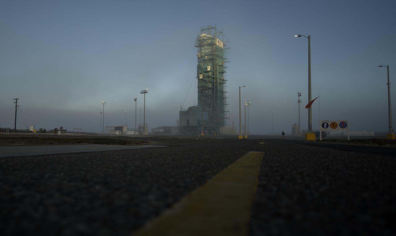
A thin fog covers the mobile service tower and the United Launch Alliance (ULA) Delta II rocket with the NASA Ice, Cloud and land Elevation Satellite-2 (ICESat-2) onboard, Thursday, Sept. 13, 2018, Vandenberg Air Force Base in California. The ICESat-2 mission will measure the changing height of Earth's ice. Photo Credit: (NASA/Bill Ingalls)
NASA Chief Scientist Jim Green discusses NASA's InSight mission during a prelaunch media briefing, Thursday, May 3, 2018, at Vandenberg Air Force Base in California. InSight, short for Interior Exploration using Seismic Investigations, Geodesy and Heat Transport, is a Mars lander designed to study the "inner space" of Mars: its crust, mantle, and core. Photo Credit: (NASA/Bill Ingalls)
The United Launch Alliance (ULA) Delta II rocket launches with the NASA Ice, Cloud and land Elevation Satellite-2 (ICESat-2) onboard, Saturday, Sept. 15, 2018, from Vandenberg Air Force Base in California. The ICESat-2 mission will measure the changing height of Earth's ice. Photo Credit: (NASA/Bill Ingalls)

Tilman Spohn, HP3 investigation lead, Institute of Planetary Research (DLR), discusses NASA's InSight mission during a prelaunch media briefing, Thursday, May 3, 2018, at Vandenberg Air Force Base in California. InSight, short for Interior Exploration using Seismic Investigations, Geodesy and Heat Transport, is a Mars lander designed to study the "inner space" of Mars: its crust, mantle, and core. Photo Credit: (NASA/Bill Ingalls)
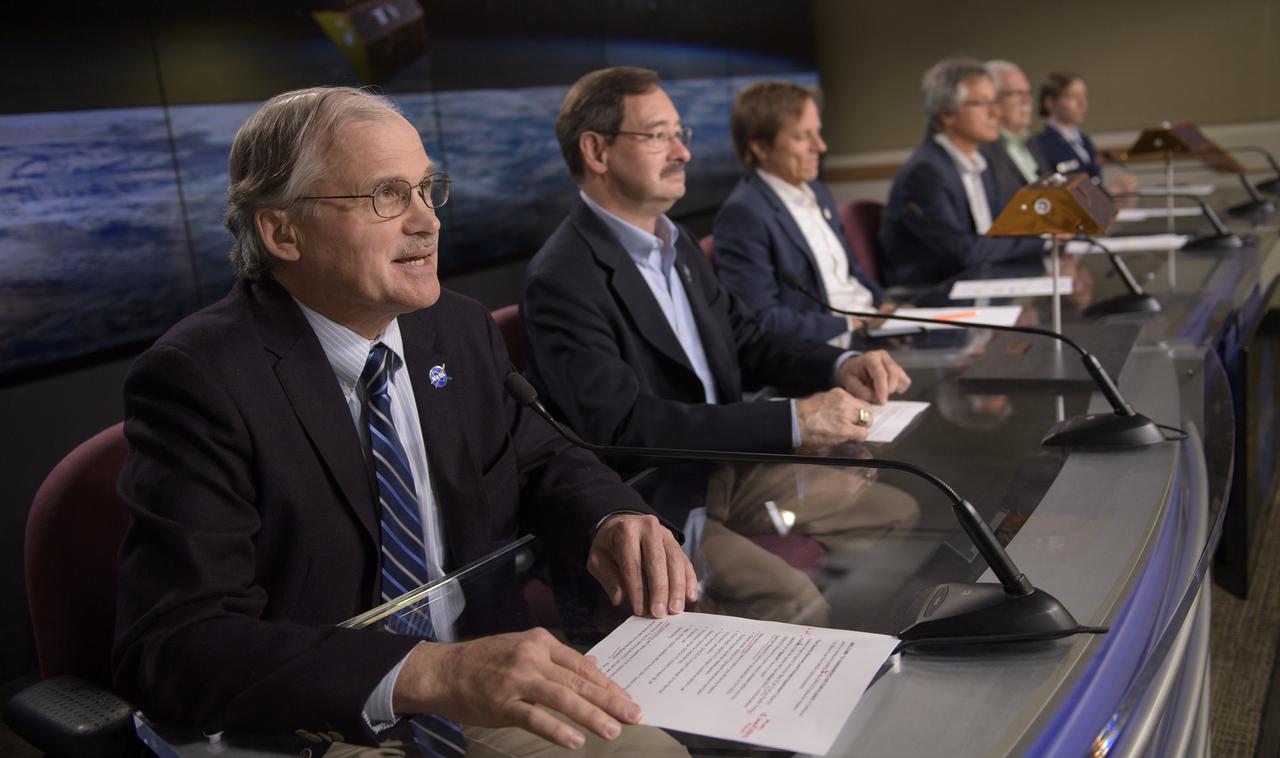
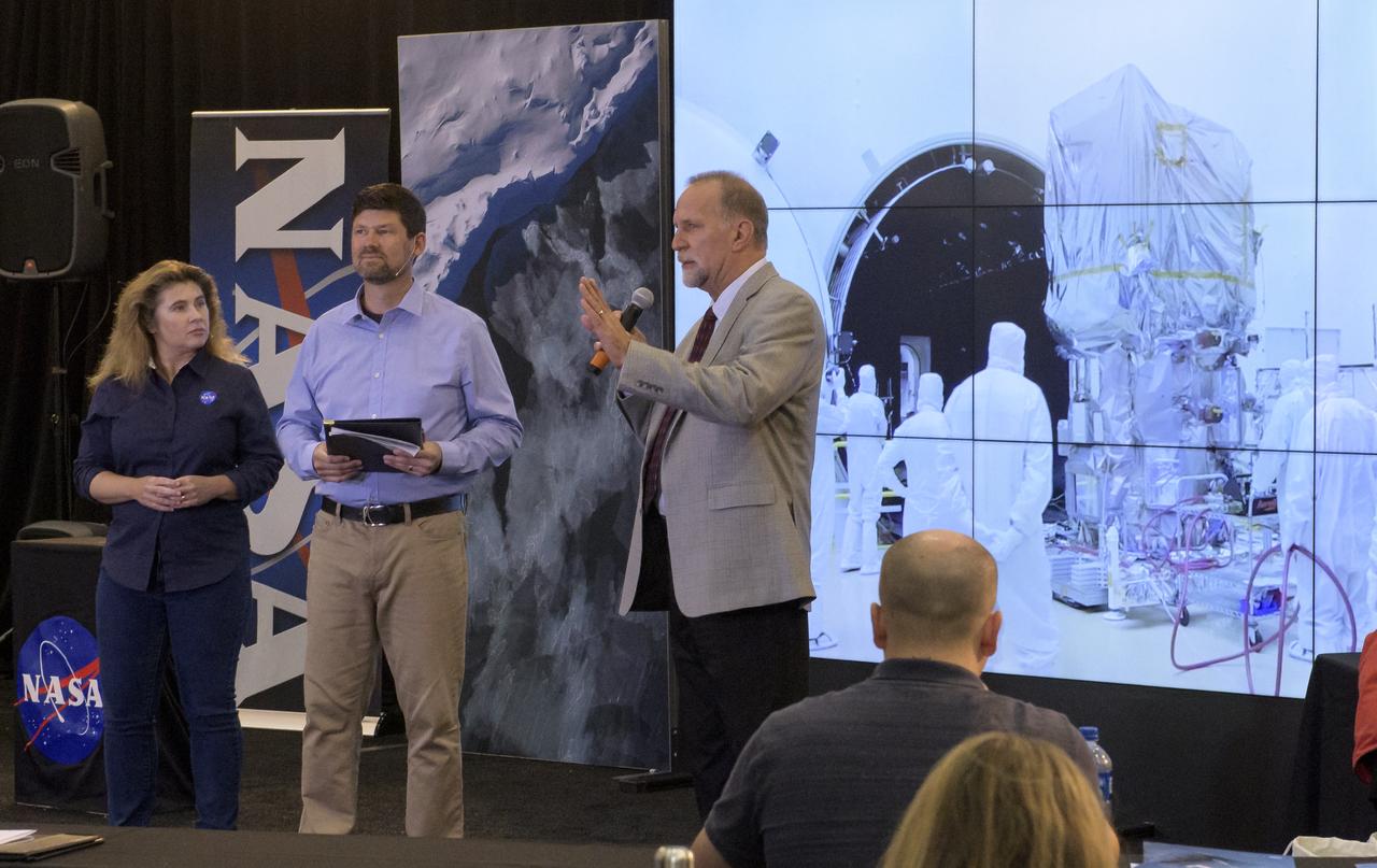
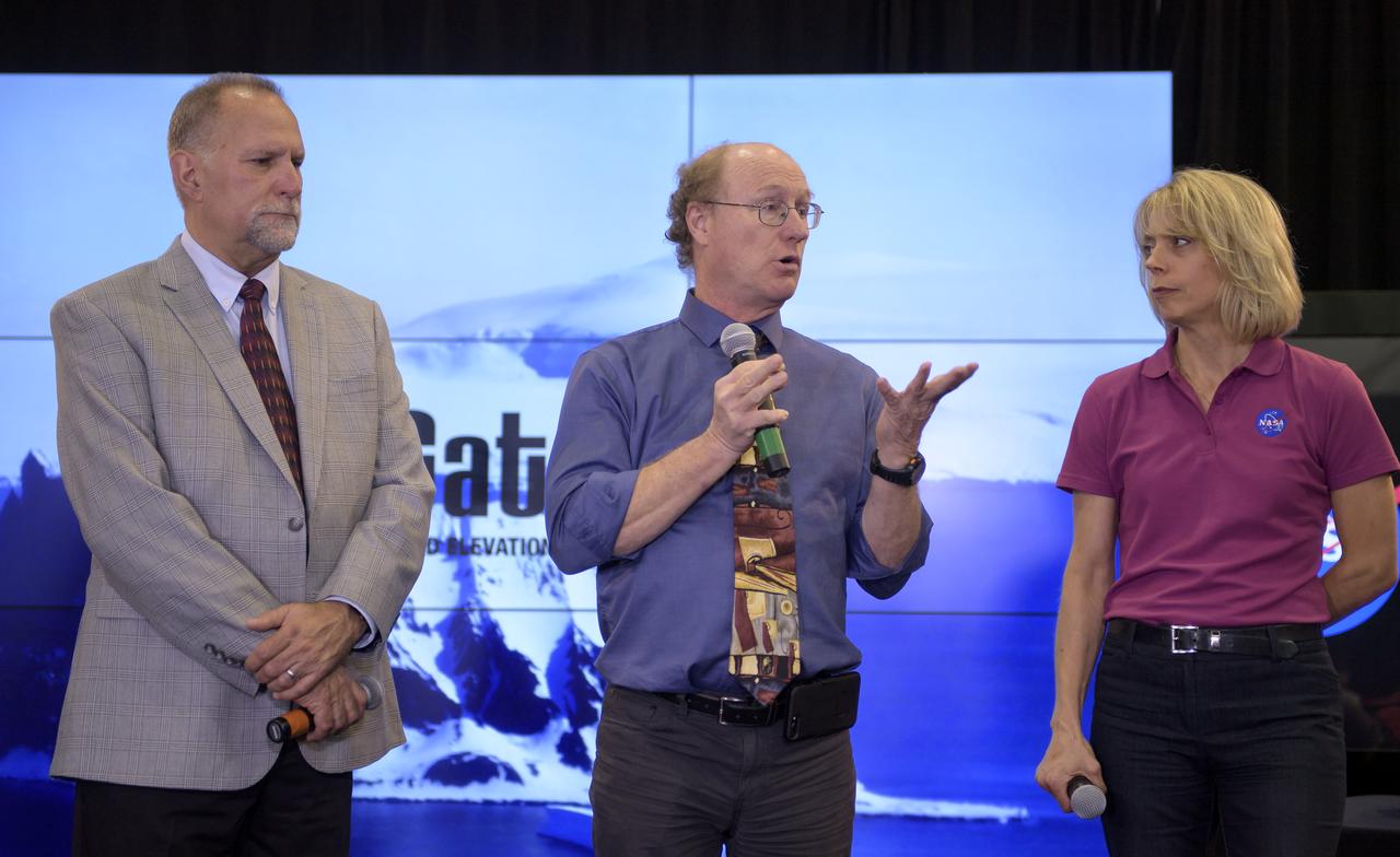
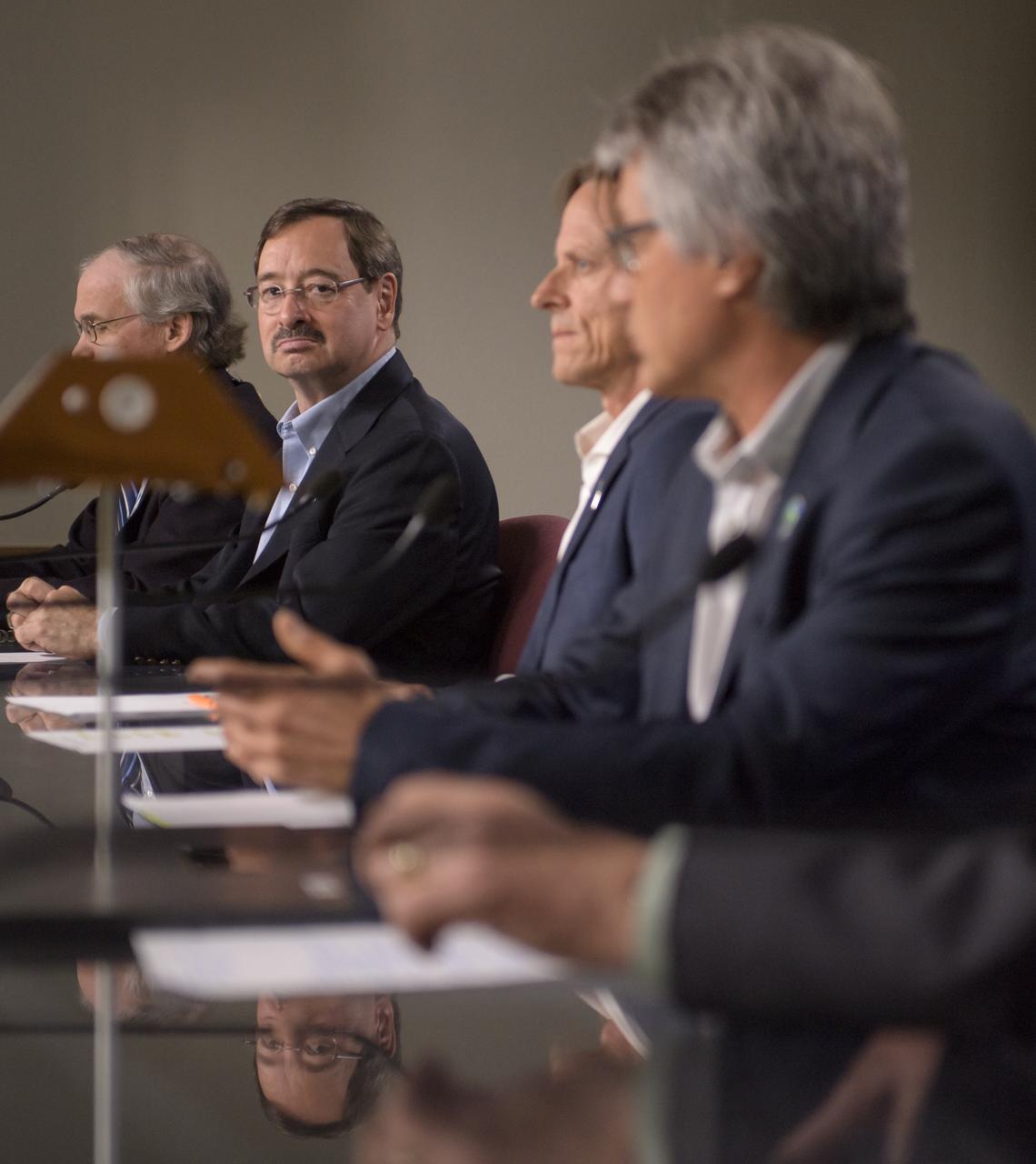
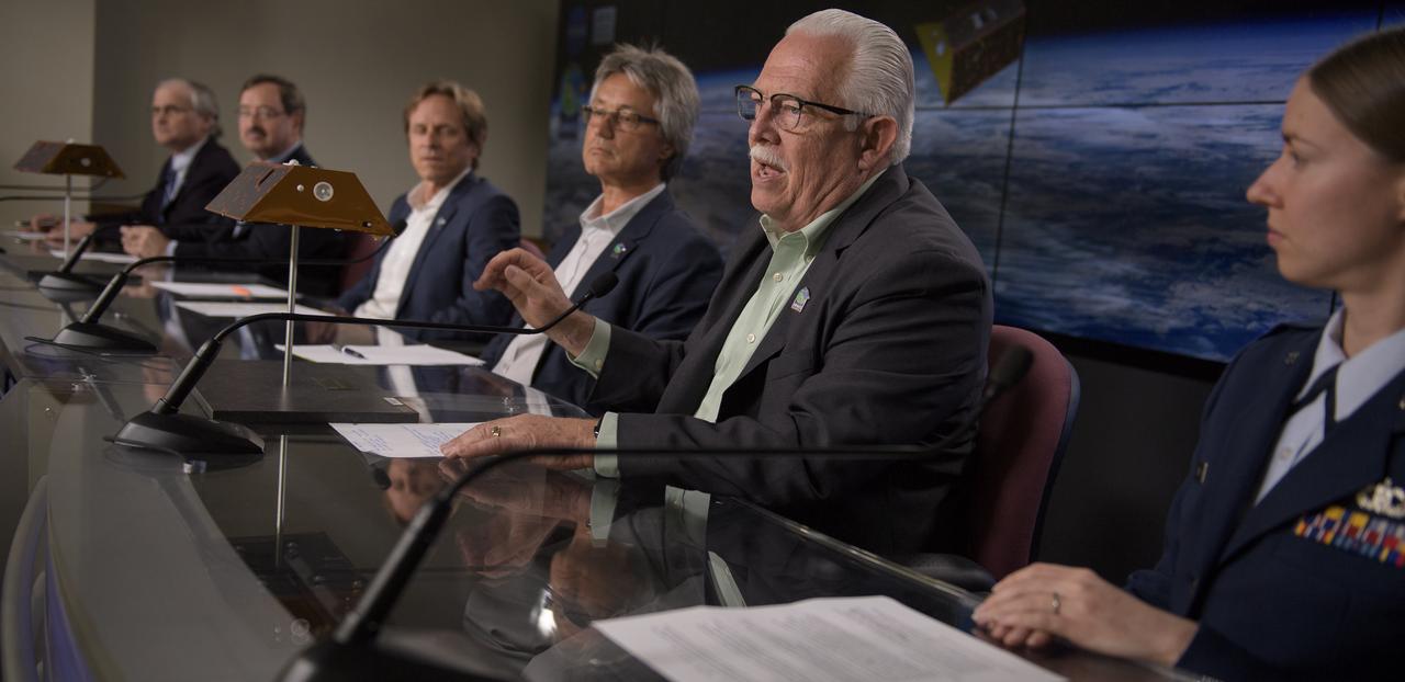
NASA Headquarters Public Affairs Officer Steve Cole, left, moderates the Gravity Recovery and Climate Experiment Follow-On (GRACE-FO) mission prelaunch media briefing with David Jarrett, GRACE-FO program executive in the Earth Science Division at NASA Headquarters; Frank Webb, GRACE-FO project scientist at JPL; Frank Flechtner, GRACE-FO project manager for the German Research Centre for Geosciences (GFZ) in Potsdam, Germany; Phil Morton, NASA GRACE-FO project manager at JPL; and Capt. Jennifer Haden, weather officer, 30th Space Wing, Vandenberg Air Force Base, right, Monday, May 21, 2018, at Vandenberg Air Force Base in California. The twin GRACE-FO spacecraft will measure changes in how mass is redistributed within and among Earth's atmosphere, oceans, land and ice sheets, as well as within Earth itself. Photo Credit: (NASA/Bill Ingalls)
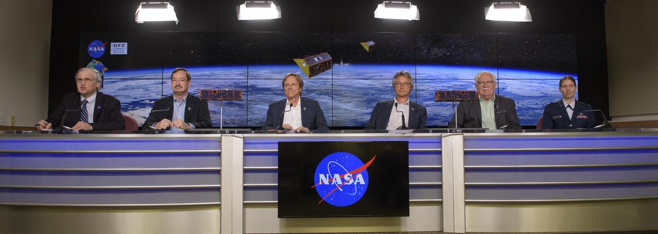
NASA Headquarters Public Affairs Officer Steve Cole, left, moderates the Gravity Recovery and Climate Experiment Follow-On (GRACE-FO) mission prelaunch media briefing with David Jarrett, GRACE-FO program executive in the Earth Science Division at NASA Headquarters; Frank Webb, GRACE-FO project scientist at JPL; Frank Flechtner, GRACE-FO project manager for the German Research Centre for Geosciences (GFZ) in Potsdam, Germany; Phil Morton, NASA GRACE-FO project manager at JPL; and Capt. Jennifer Haden, weather officer, 30th Space Wing, Vandenberg Air Force Base, right, Monday, May 21, 2018, at Vandenberg Air Force Base in California. The twin GRACE-FO spacecraft will measure changes in how mass is redistributed within and among Earth's atmosphere, oceans, land and ice sheets, as well as within Earth itself. Photo Credit: (NASA/Bill Ingalls)
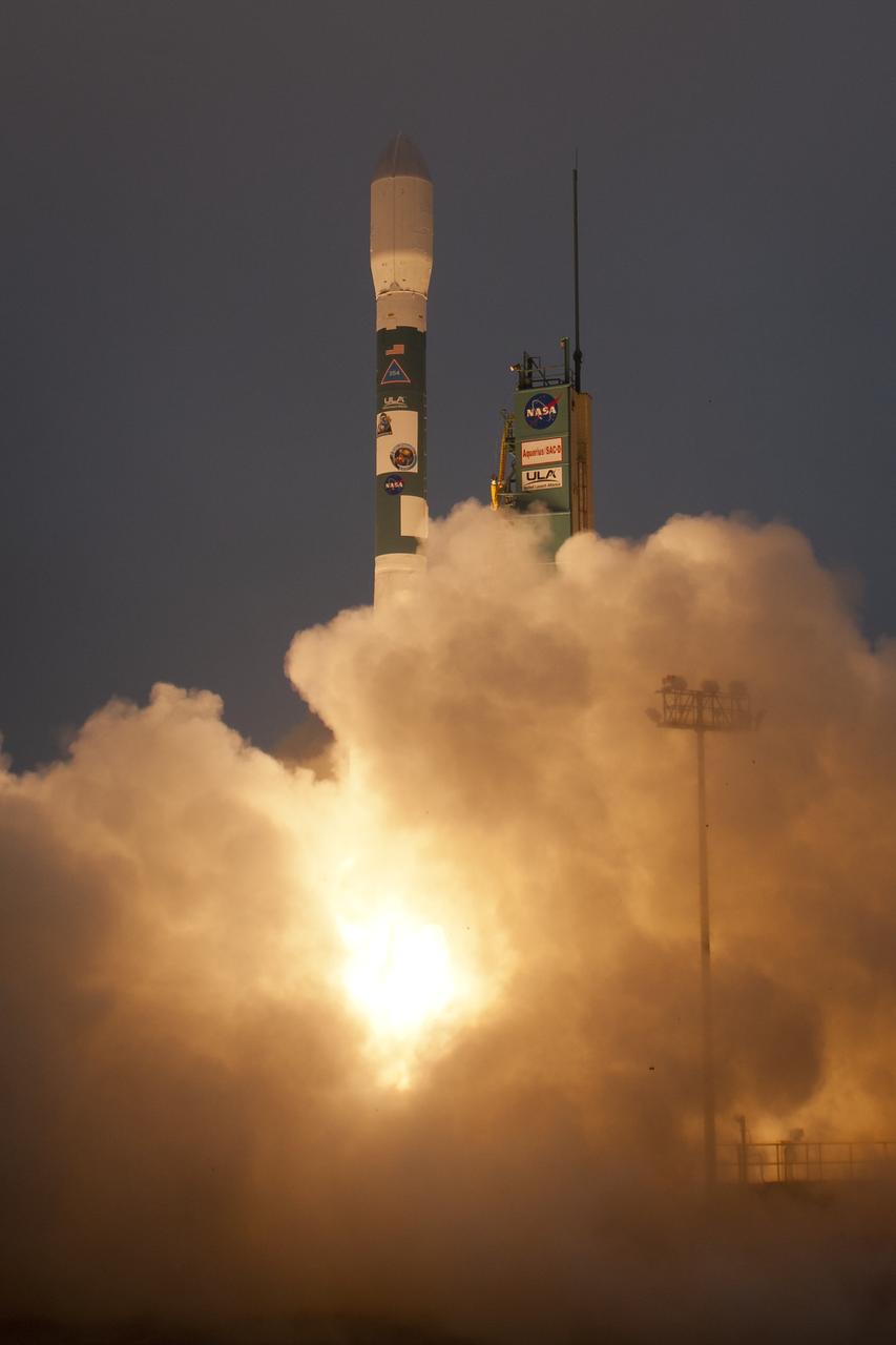
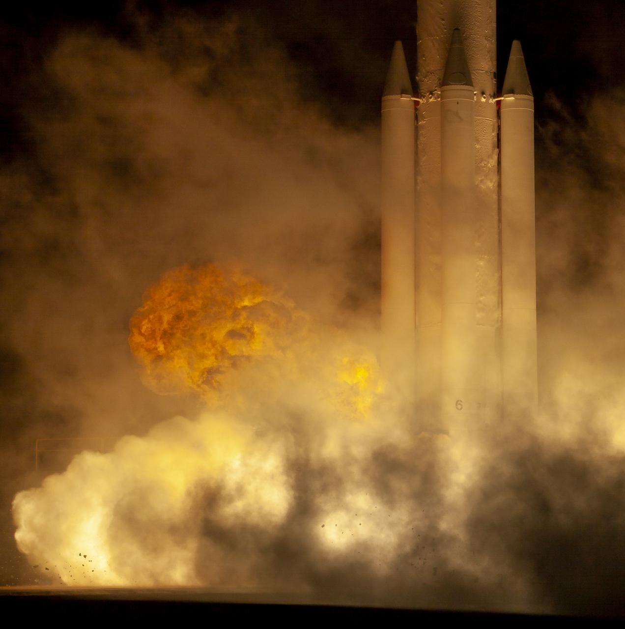
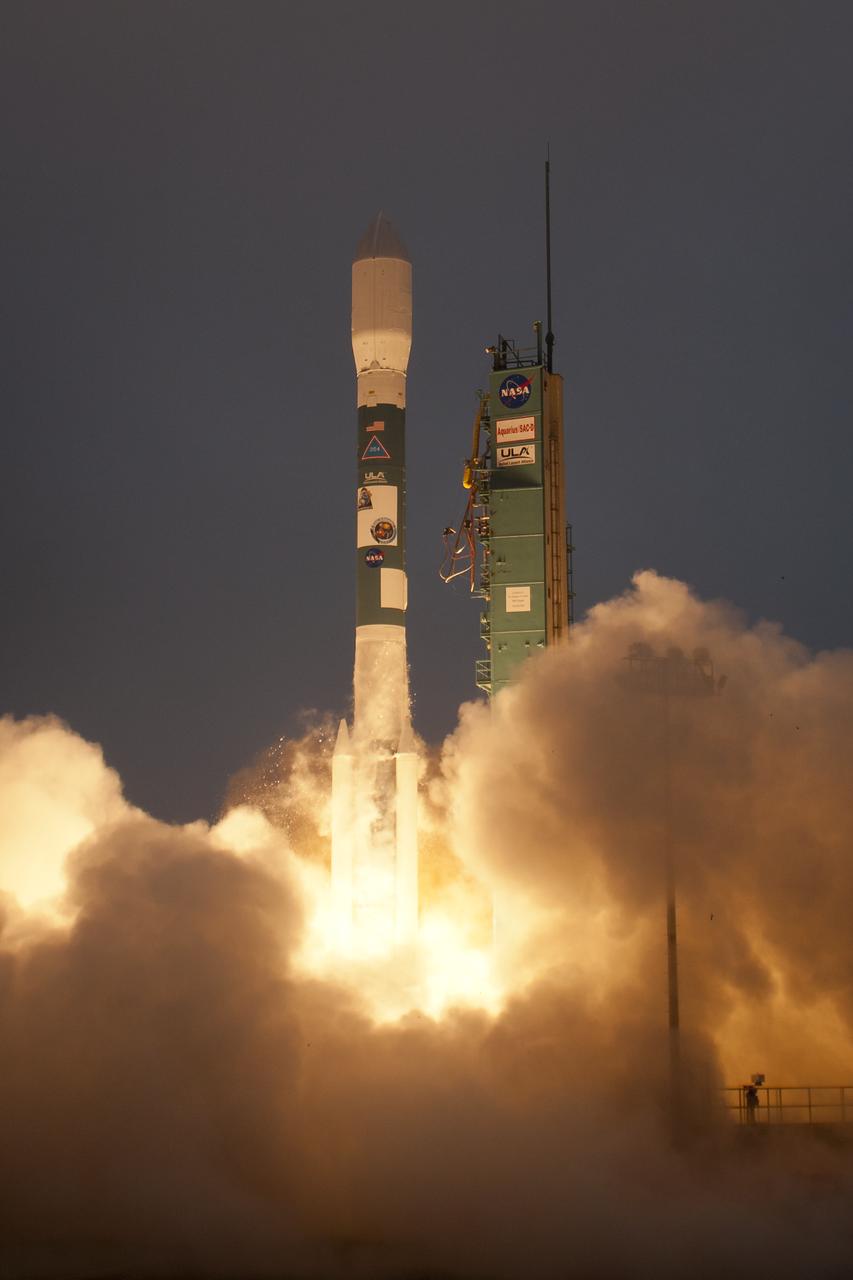
A Delta II rocket launches with the Aquarius/SAC-D spacecraft payload from Space Launch Complex 2 at Vandenberg Air Force Base, Calif. on Friday, June 10, 2011. The joint U.S./Argentinian Aquarius/Satélite de Aplicaciones Científicas (SAC)-D mission will map the salinity at the ocean surface, information critical to improving our understanding of two major components of Earth's climate system: the water cycle and ocean circulation. Photo Credit: (NASA/Bill Ingalls)
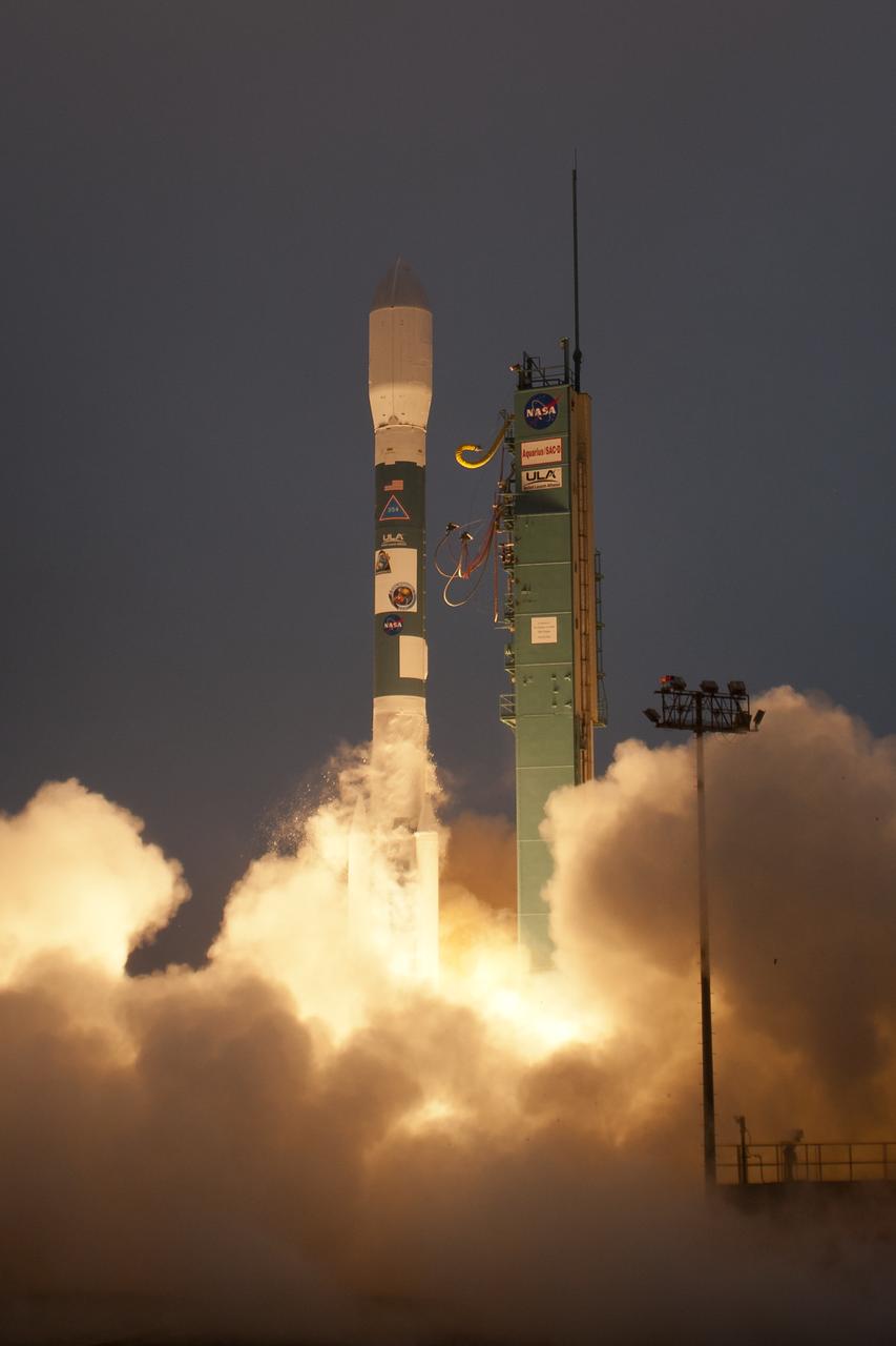
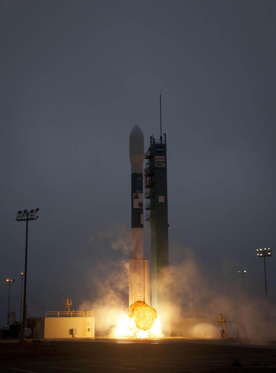
A Delta II rocket launches with the Aquarius/SAC-D spacecraft payload from Space Launch Complex 2 at Vandenberg Air Force Base, Calif. on Friday, June 10, 2011. The joint U.S./Argentinian Aquarius/Satélite de Aplicaciones Científicas (SAC)-D mission will map the salinity at the ocean surface, information critical to improving our understanding of two major components of Earth's climate system: the water cycle and ocean circulation. Photo Credit: (NASA/Bill Ingalls)
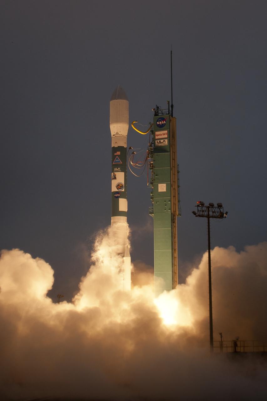
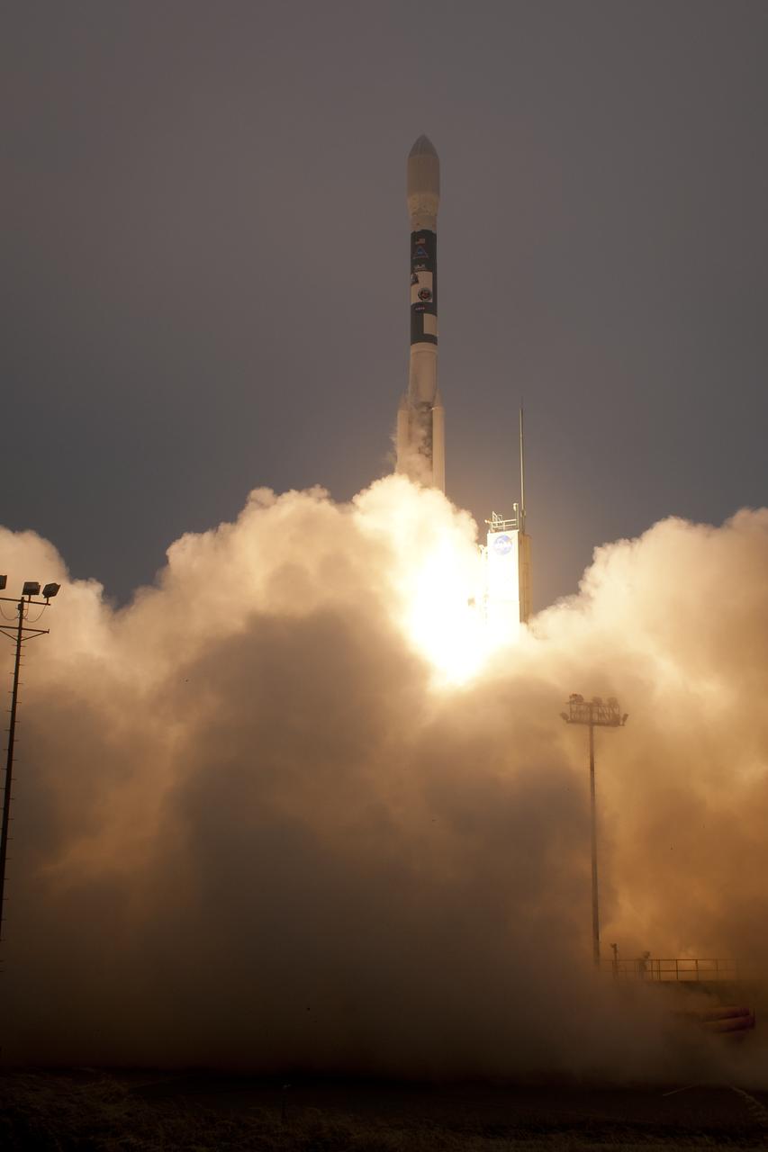
A Delta II rocket launches with the Aquarius/SAC-D spacecraft payload from Space Launch Complex 2 at Vandenberg Air Force Base, Calif. on Friday, June 10, 2011. The joint U.S./Argentinian Aquarius/Satélite de Aplicaciones Científicas (SAC)-D mission will map the salinity at the ocean surface, information critical to improving our understanding of two major components of Earth's climate system: the water cycle and ocean circulation. Photo Credit: (NASA/Bill Ingalls)
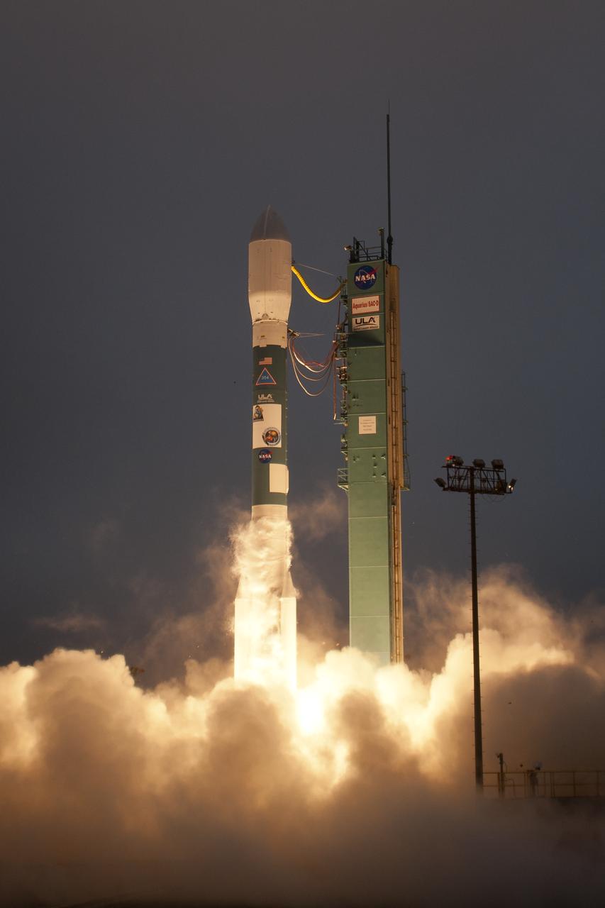
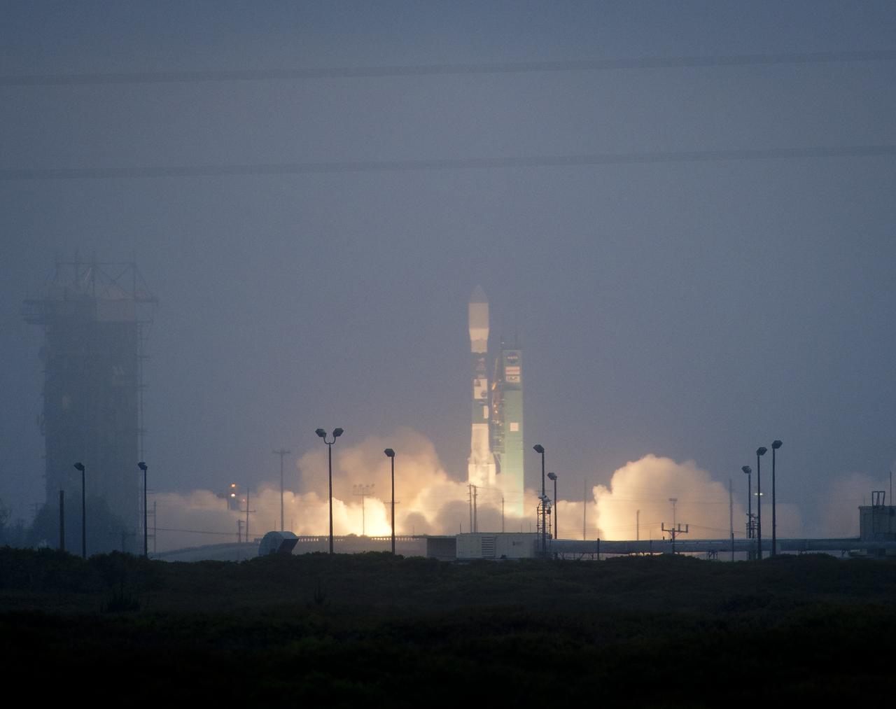
A Delta II rocket launches with the Aquarius/SAC-D spacecraft payload from Space Launch Complex 2 at Vandenberg Air Force Base, Calif. on Friday, June 10, 2011. The joint U.S./Argentinian Aquarius/Satélite de Aplicaciones Científicas (SAC)-D mission will map the salinity at the ocean surface, information critical to improving our understanding of two major components of Earth's climate system: the water cycle and ocean circulation. Photo Credit: (NASA/Bill Ingalls)
A Delta II rocket launches with the Aquarius/SAC-D spacecraft payload from Space Launch Complex 2 at Vandenberg Air Force Base, Calif. on Friday, June 10, 2011. The joint U.S./Argentinian Aquarius/Satélite de Aplicaciones Científicas (SAC)-D mission will map the salinity at the ocean surface, information critical to improving our understanding of two major components of Earth's climate system: the water cycle and ocean circulation. Photo Credit: (NASA/Bill Ingalls)
A Delta II rocket launches with the Aquarius/SAC-D spacecraft payload from Space Launch Complex 2 at Vandenberg Air Force Base, Calif. on Friday, June 10, 2011. The joint U.S./Argentinian Aquarius/Satélite de Aplicaciones Científicas (SAC)-D mission will map the salinity at the ocean surface, information critical to improving our understanding of two major components of Earth's climate system: the water cycle and ocean circulation. Photo Credit: (NASA/Bill Ingalls)
A Delta II rocket launches with the Aquarius/SAC-D spacecraft payload from Space Launch Complex 2 at Vandenberg Air Force Base, Calif. on Friday, June 10, 2011. The joint U.S./Argentinian Aquarius/Satélite de Aplicaciones Científicas (SAC)-D mission will map the salinity at the ocean surface, information critical to improving our understanding of two major components of Earth's climate system: the water cycle and ocean circulation. Photo Credit: (NASA/Bill Ingalls)
A Delta II rocket launches with the Aquarius/SAC-D spacecraft payload from Space Launch Complex 2 at Vandenberg Air Force Base, Calif. on Friday, June 10, 2011. The joint U.S./Argentinian Aquarius/Satélite de Aplicaciones Científicas (SAC)-D mission, set to launch June 10, will map the salinity at the ocean surface, information critical to improving our understanding of two major components of Earth's climate system: the water cycle and ocean circulation. Photo Credit: (NASA/Bill Ingalls)
Bill Barnhart, ICESat-2 Program Manager, Northrop Grumman, left, Doug McLennan, ICESat-2 Project Manager, NASA's Goddard Space Flight Center, center, and Cathy Richardson, Deputy Program Manager, Earth Science Projects Division, NASA's Goddard Space Flight Center, are seen during a NASA Ice, Cloud and land Elevation Satellite-2 (ICESat-2) prelaunch briefing, Thursday, Sept. 13, 2018, at Vandenberg Air Force Base in California. The ICESat-2 mission will measure the changing height of Earth's ice. Photo Credit: (NASA/Bill Ingalls)
Lori Magruder, ICESat-2 Science Definition Team Lead, University of Texas, left, Tom Neumann, ICESat-2 Deputy Project Scientist, NASA's Goddard Space Flight Center, and Helen Fricker, ICESat-2 Science Definition Team Member, Scripps Institution of Oceanography, are seen during a NASA Ice, Cloud and land Elevation Satellite-2 (ICESat-2) prelaunch briefing, Thursday, Sept. 13, 2018, at Vandenberg Air Force Base in California. The ICESat-2 mission will measure the changing height of Earth's ice. Photo Credit: (NASA/Bill Ingalls)
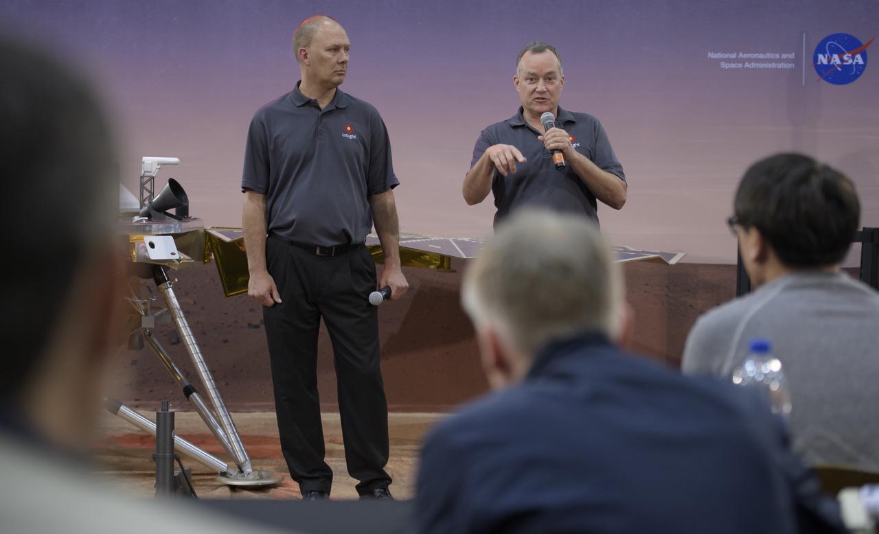
Stu Spath, InSight program manager, Lockheed Martin Space, left, and Tom Hoffman, InSight project manager, NASA JPL, discuss NASA's InSight mission during a prelaunch media briefing, Thursday, May 3, 2018, at Vandenberg Air Force Base in California. InSight, short for Interior Exploration using Seismic Investigations, Geodesy and Heat Transport, is a Mars lander designed to study the "inner space" of Mars: its crust, mantle, and core. Photo Credit: (NASA/Bill Ingalls)
David Jarrett, GRACE-FO program executive in the Earth Science Division at NASA Headquarters is seen during a Gravity Recovery and Climate Experiment Follow-On (GRACE-FO) mission prelaunch media briefing, Monday, May 21, 2018, at Vandenberg Air Force Base in California. The twin GRACE-FO spacecraft will measure changes in how mass is redistributed within and among Earth's atmosphere, oceans, land and ice sheets, as well as within Earth itself. Photo Credit: (NASA/Bill Ingalls)
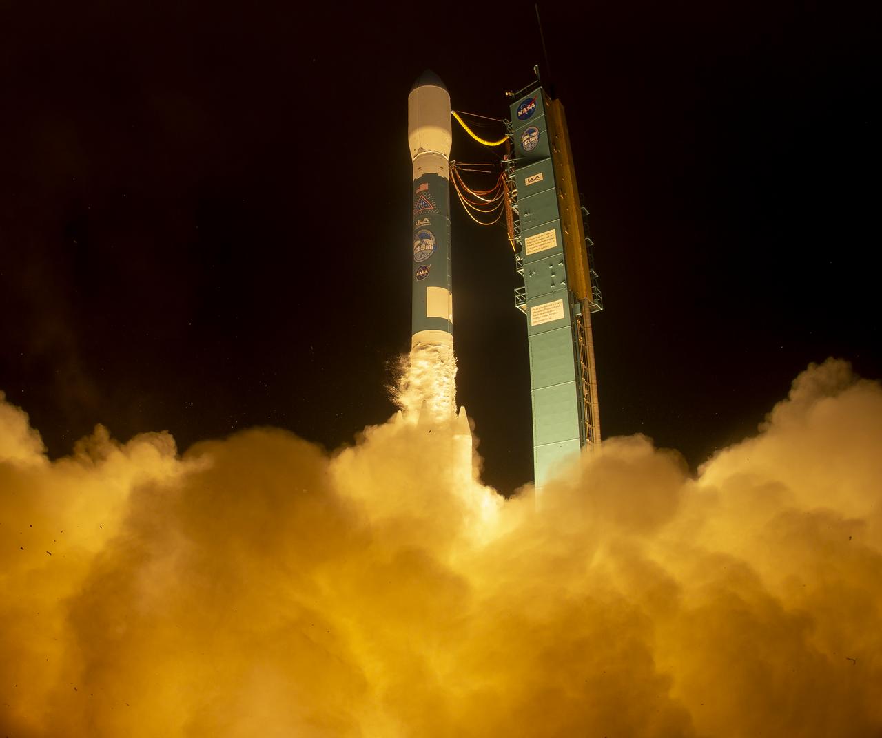
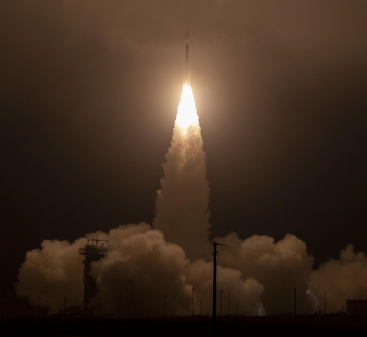
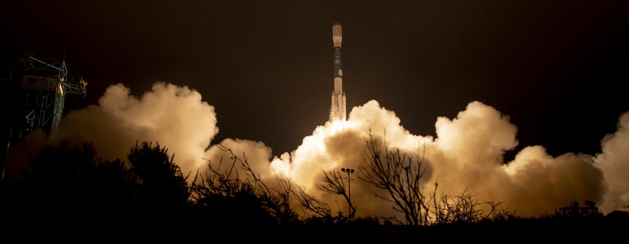
The NASA InSight spacecraft launches onboard a United Launch Alliance Atlas-V rocket, Saturday, May 5, 2018, from Vandenberg Air Force Base in California. InSight, short for Interior Exploration using Seismic Investigations, Geodesy and Heat Transport, is a Mars lander designed to study the "inner space" of Mars: its crust, mantle, and core. Photo Credit: (NASA/Bill Ingalls)
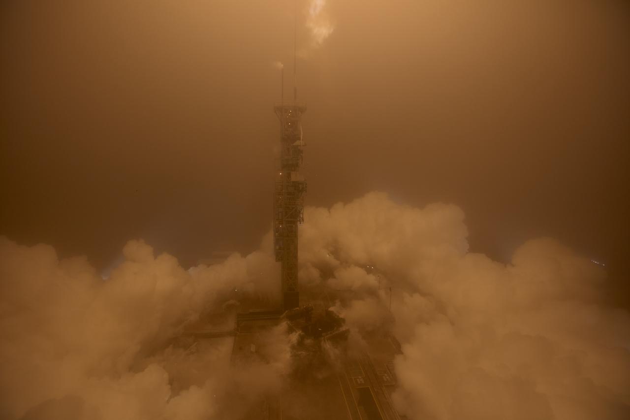
The United Launch Alliance (ULA) Atlas-V rocket with the NASA InSight spacecraft onboard is seen shortly after the mobile service tower was rolled back, Friday, May 4, 2018, at Vandenberg Air Force Base in California. InSight, short for Interior Exploration using Seismic Investigations, Geodesy and Heat Transport, is a Mars lander designed to study the "inner space" of Mars: its crust, mantle, and core. Photo Credit: (NASA/Bill Ingalls)
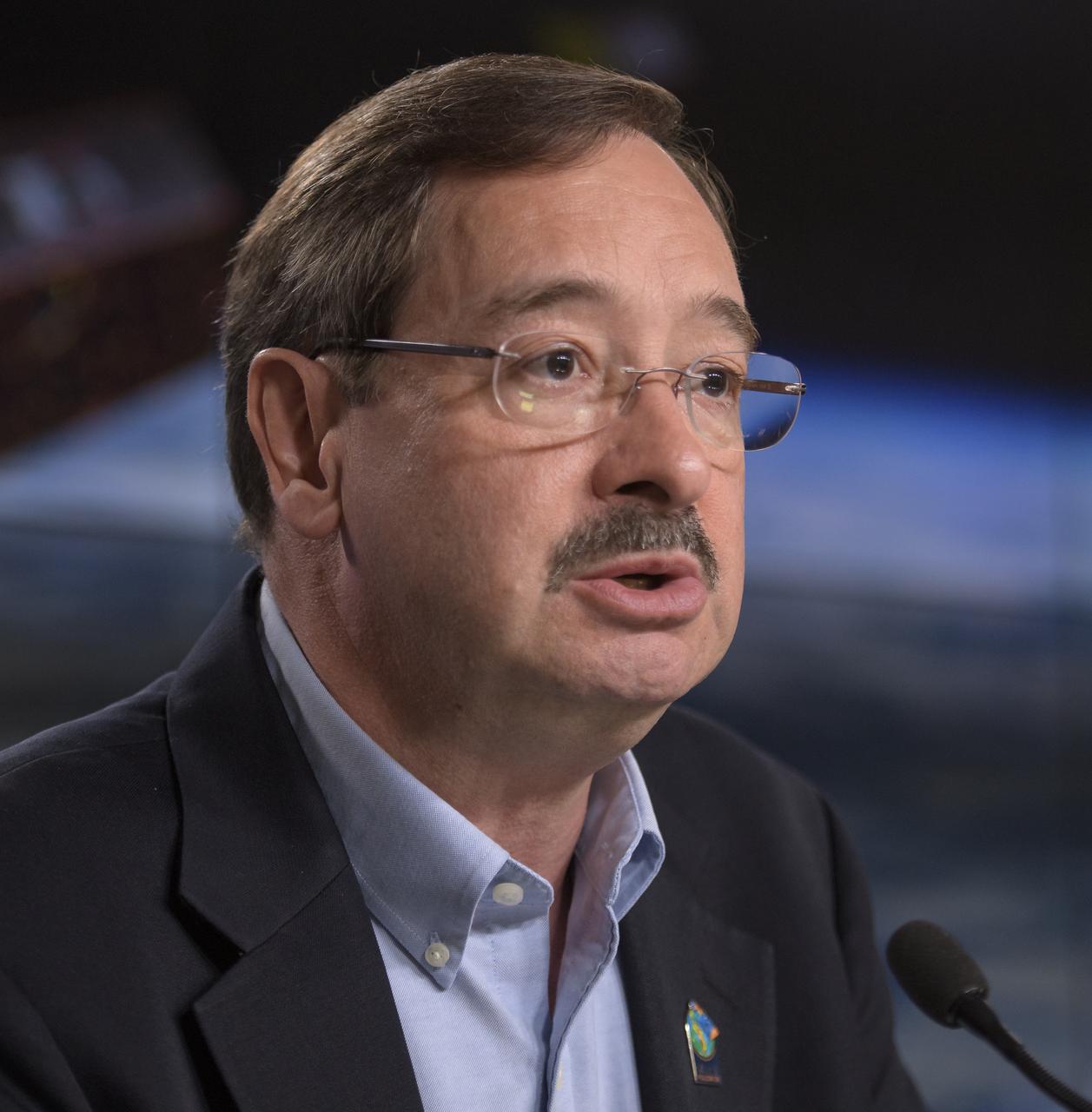
Phil Morton, NASA GRACE-FO project manager at JPL, second from right, discusses the Gravity Recovery and Climate Experiment Follow-On (GRACE-FO) mission during a prelaunch media briefing, Monday, May 21, 2018, at Vandenberg Air Force Base in California. The twin GRACE-FO spacecraft will measure changes in how mass is redistributed within and among Earth's atmosphere, oceans, land and ice sheets, as well as within Earth itself. Photo Credit: (NASA/Bill Ingalls)
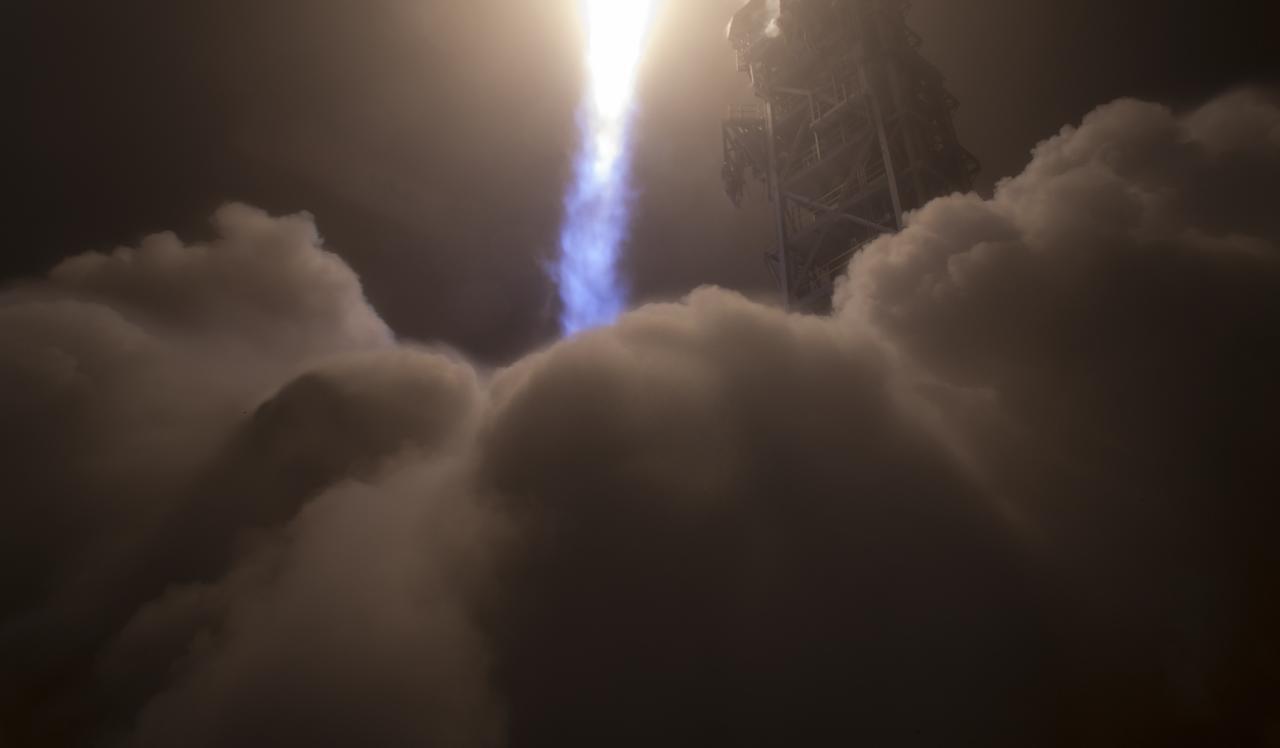
The NASA InSight spacecraft launches onboard a United Launch Alliance Atlas-V rocket, Saturday, May 5, 2018, from Vandenberg Air Force Base in California. InSight, short for Interior Exploration using Seismic Investigations, Geodesy and Heat Transport, is a Mars lander designed to study the "inner space" of Mars: its crust, mantle, and core. Photo Credit: (NASA/Bill Ingalls)
David Jarrett, GRACE-FO program executive in the Earth Science Division at NASA Headquarters, discusses the Gravity Recovery and Climate Experiment Follow-On (GRACE-FO) mission during a prelaunch media briefing, Monday, May 21, 2018, at Vandenberg Air Force Base in California. The twin GRACE-FO spacecraft will measure changes in how mass is redistributed within and among Earth's atmosphere, oceans, land and ice sheets, as well as within Earth itself. Photo Credit: (NASA/Bill Ingalls)
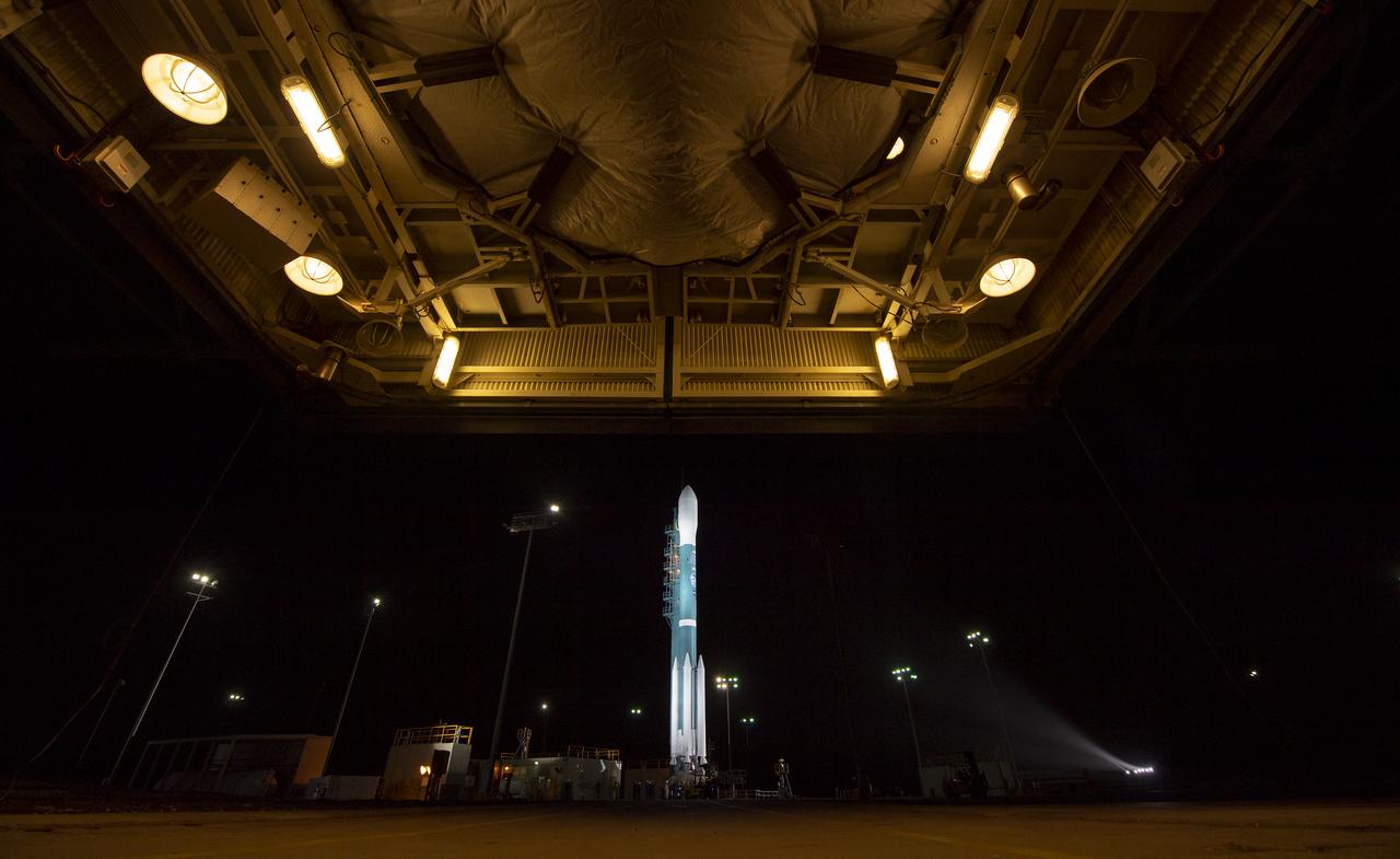
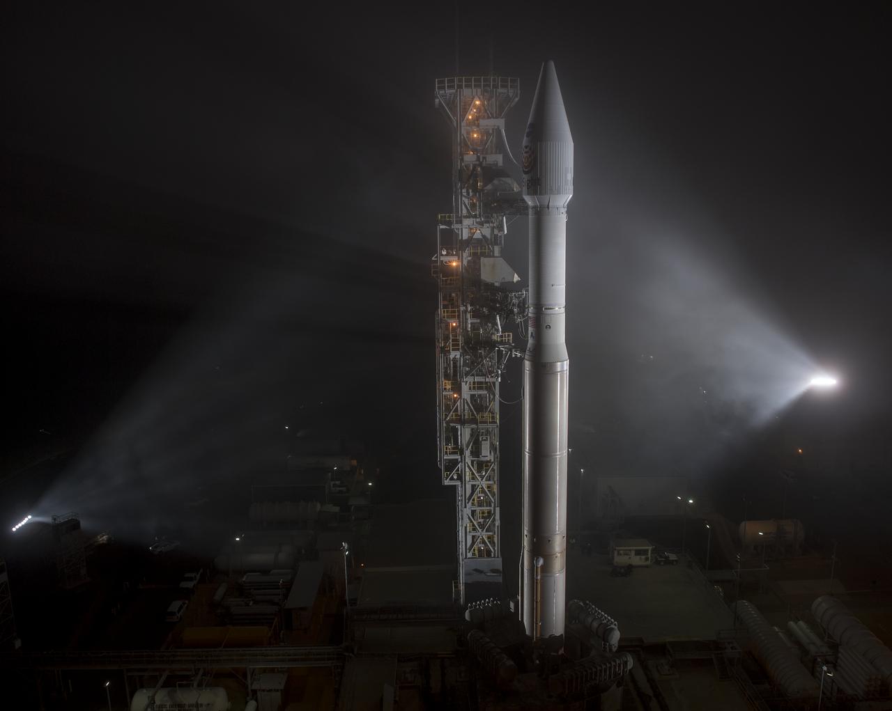
The United Launch Alliance (ULA) Atlas-V rocket is seen with NASA's InSight spacecraft onboard, Thursday, May 3, 2018, at Vandenberg Air Force Base in California. InSight, short for Interior Exploration using Seismic Investigations, Geodesy and Heat Transport, is a Mars lander designed to study the "inner space" of Mars: its crust, mantle, and core. Photo Credit: (NASA/Bill Ingalls)
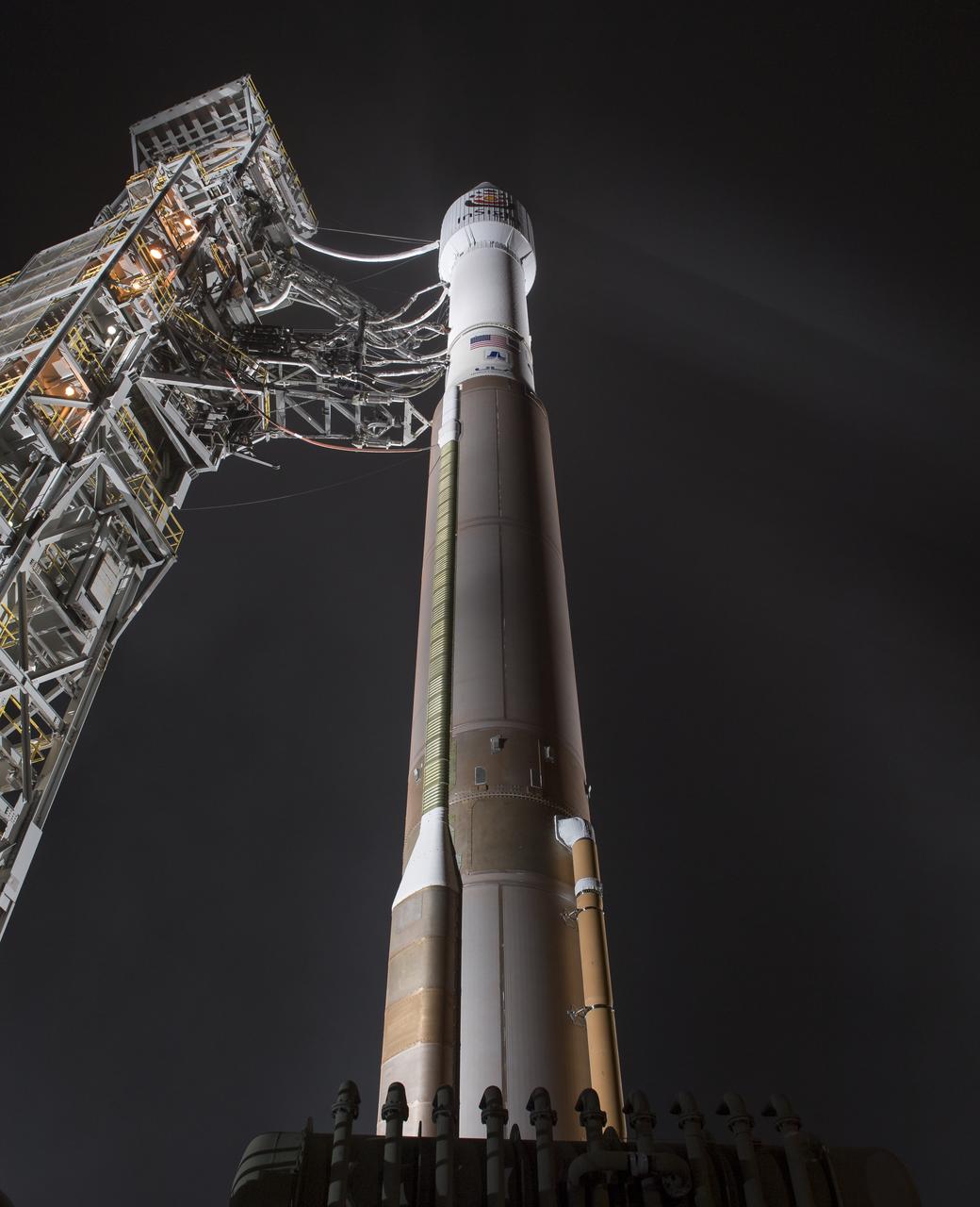
The United Launch Alliance (ULA) Atlas-V rocket with the NASA InSight spacecraft onboard is seen shortly after the mobile service tower was rolled back, Friday, May 4, 2018, at Vandenberg Air Force Base in California. InSight, short for Interior Exploration using Seismic Investigations, Geodesy and Heat Transport, is a Mars lander designed to study the "inner space" of Mars: its crust, mantle, and core. Photo Credit: (NASA/Bill Ingalls)
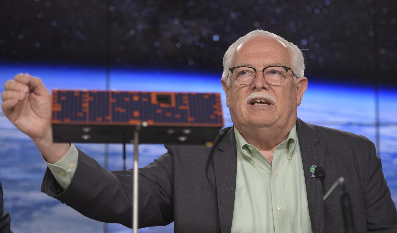
Phil Morton, NASA GRACE-FO project manager at JPL, discusses the Gravity Recovery and Climate Experiment Follow-On (GRACE-FO) mission during a prelaunch media briefing, Monday, May 21, 2018, at Vandenberg Air Force Base in California. The twin GRACE-FO spacecraft will measure changes in how mass is redistributed within and among Earth's atmosphere, oceans, land and ice sheets, as well as within Earth itself. Photo Credit: (NASA/Bill Ingalls)
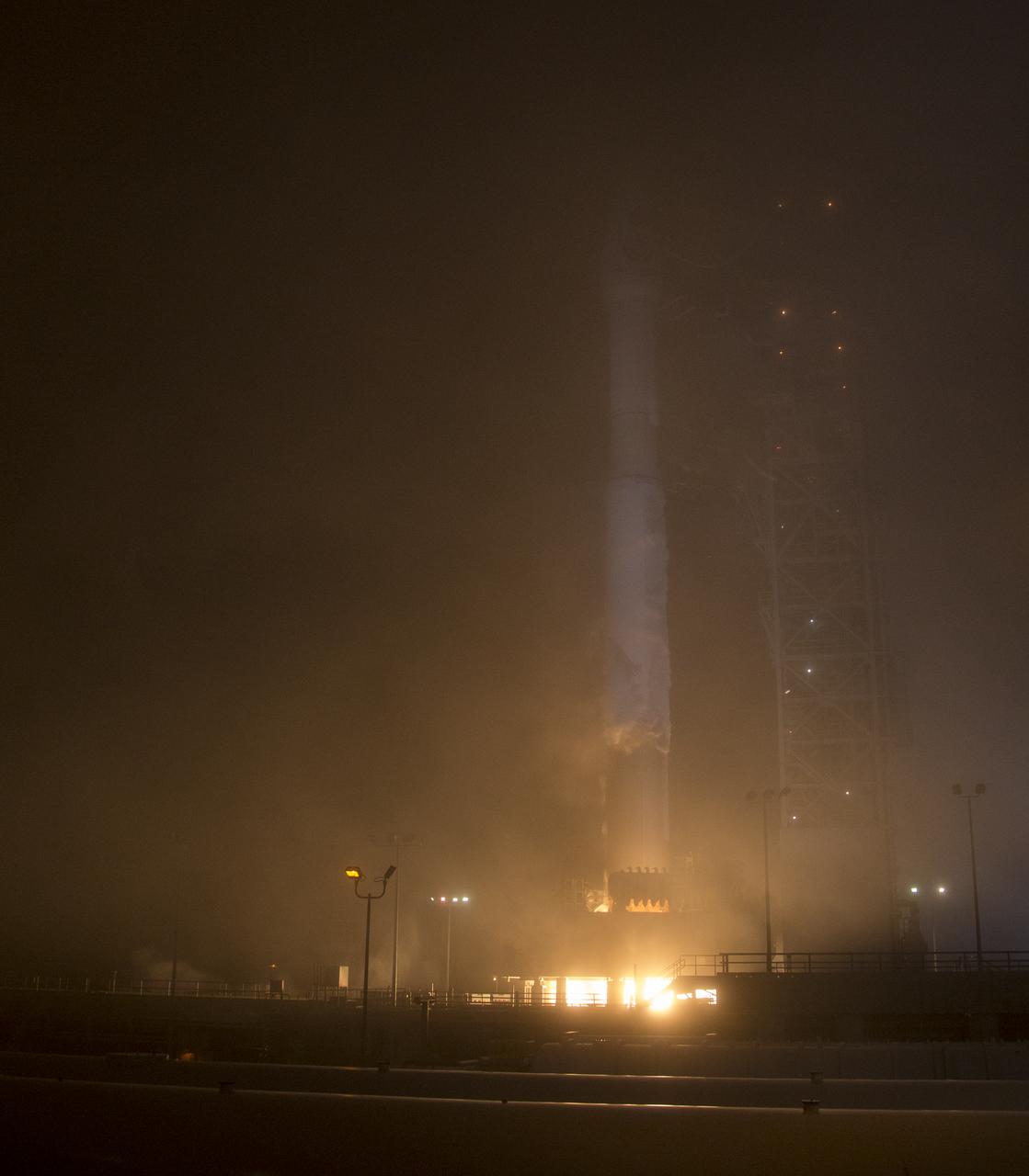
The NASA InSight spacecraft launches onboard a United Launch Alliance Atlas-V rocket, Saturday, May 5, 2018, from Vandenberg Air Force Base in California. InSight, short for Interior Exploration using Seismic Investigations, Geodesy and Heat Transport, is a Mars lander designed to study the "inner space" of Mars: its crust, mantle, and core. Photo Credit: (NASA/Bill Ingalls)