
VANDENBERG AFB, Calif. -- The air field at Vandenberg Air Force Base in California. Vandenberg Air Force Base has a mission of placing satellites into polar orbit from the West Coast, using expendable boosters such as the Pegasus, Taurus, Minotaur, Atlas V and Delta IV. Photo credit: NASA_Cory Huston
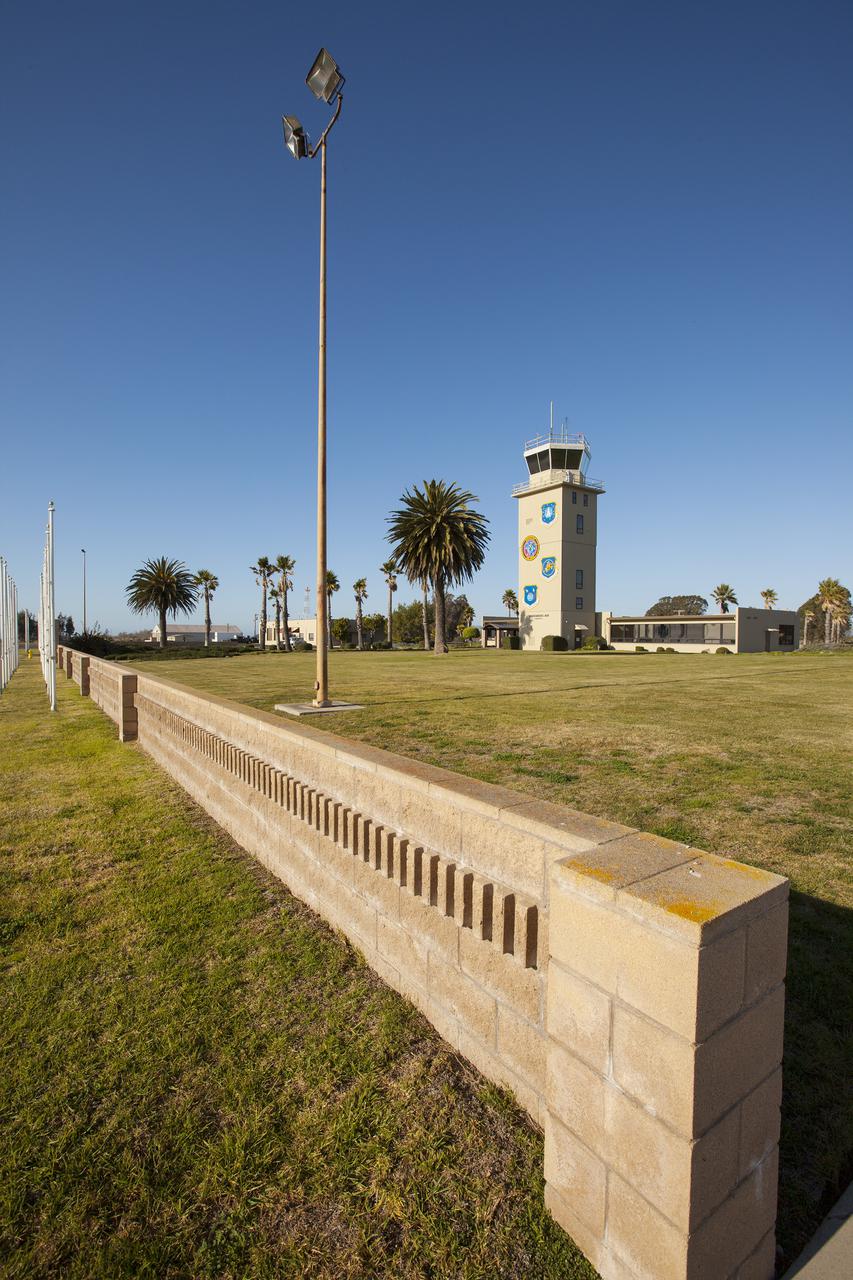
VANDENBERG AFB, Calif. -- The air traffic control tower for the 30th Space Wing air field at Vandenberg Air Force Base in California. Vandenberg Air Force Base has a mission of placing satellites into polar orbit from the West Coast, using expendable boosters such as the Pegasus, Taurus, Minotaur, Atlas V and Delta IV. Photo credit: NASA_Cory Huston
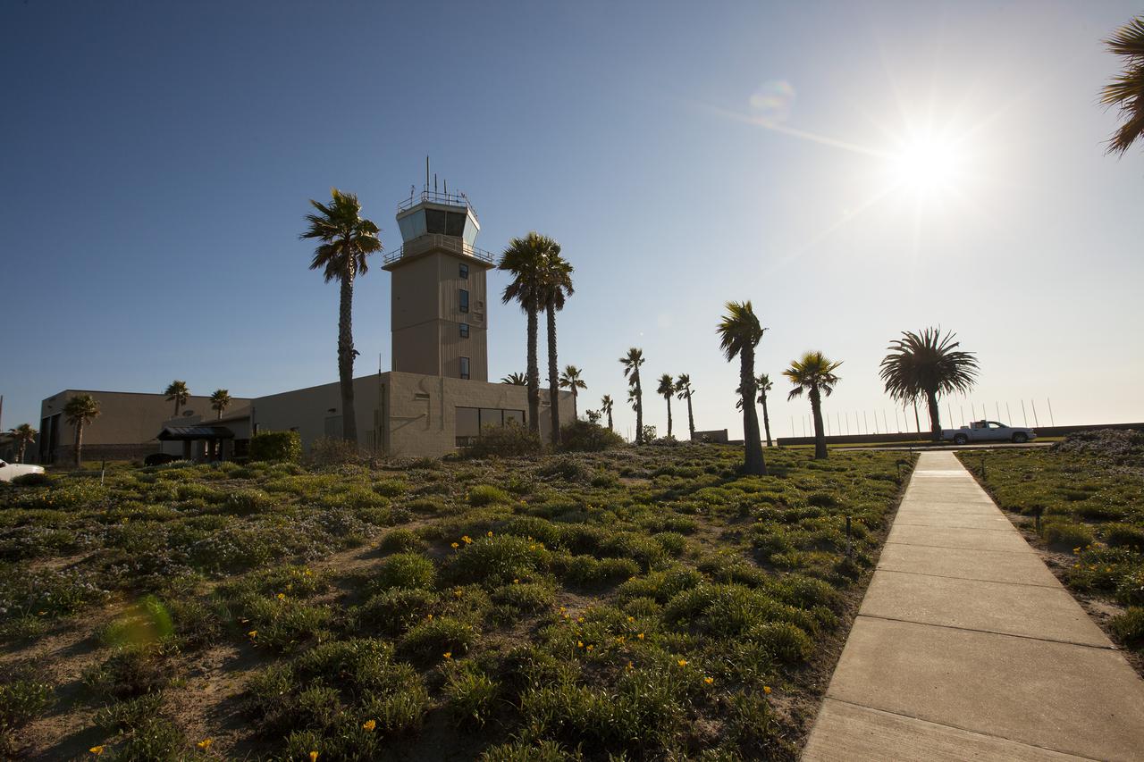
VANDENBERG AFB, Calif. -- The air traffic control tower for the 30th Space Wing air field at Vandenberg Air Force Base in California. Vandenberg Air Force Base has a mission of placing satellites into polar orbit from the West Coast, using expendable boosters such as the Pegasus, Taurus, Minotaur, Atlas V and Delta IV. Photo credit: NASA_Cory Huston
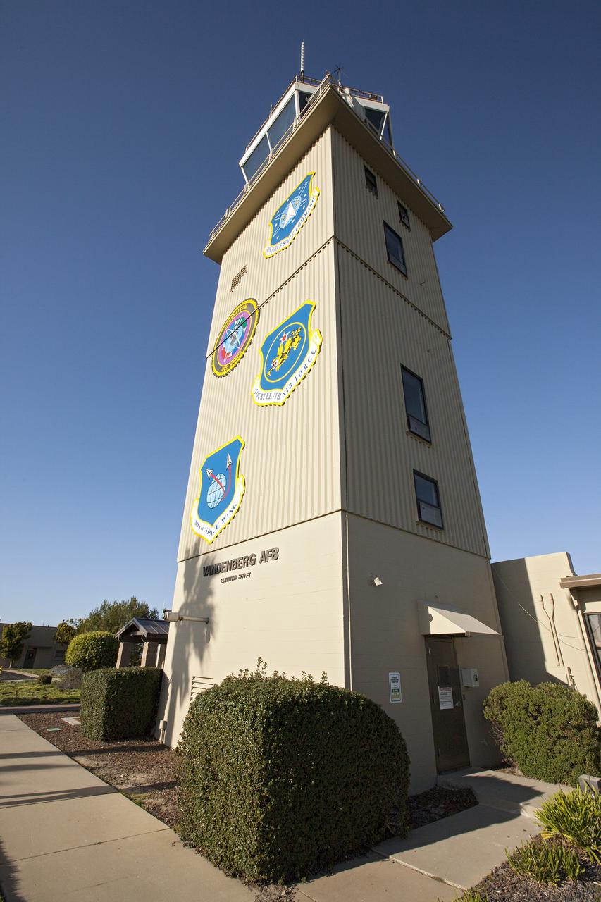
VANDENBERG AFB, Calif. -- The air traffic control tower for the 30th Space Wing air field at Vandenberg Air Force Base in California. Vandenberg Air Force Base has a mission of placing satellites into polar orbit from the West Coast, using expendable boosters such as the Pegasus, Taurus, Minotaur, Atlas V and Delta IV. Photo credit: NASA_Cory Huston
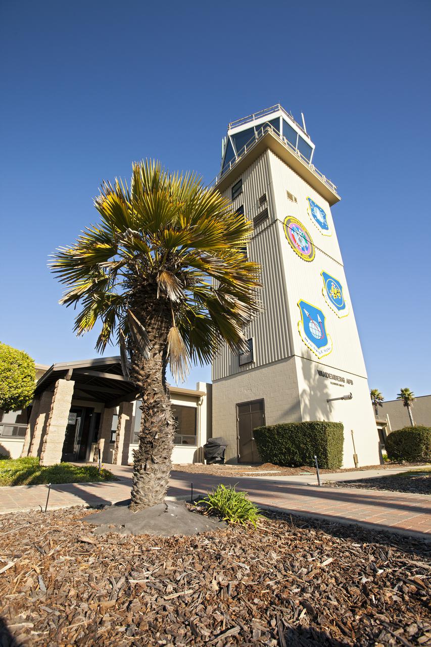
VANDENBERG AFB, Calif. -- The air traffic control tower for the 30th Space Wing air field at Vandenberg Air Force Base in California. Vandenberg Air Force Base has a mission of placing satellites into polar orbit from the West Coast, using expendable boosters such as the Pegasus, Taurus, Minotaur, Atlas V and Delta IV. Photo credit: NASA_Cory Huston
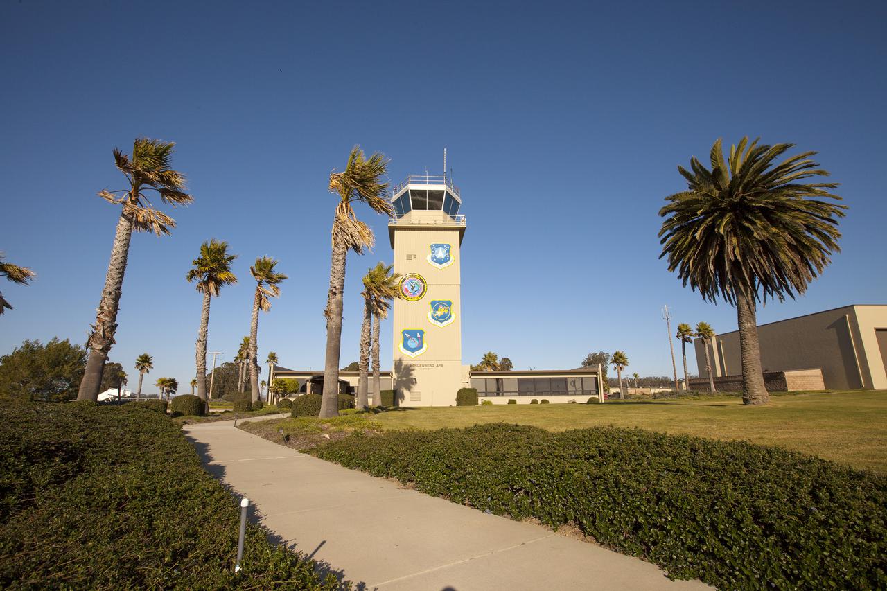
VANDENBERG AFB, Calif. -- The air traffic control tower for the 30th Space Wing air field at Vandenberg Air Force Base in California. Vandenberg Air Force Base has a mission of placing satellites into polar orbit from the West Coast, using expendable boosters such as the Pegasus, Taurus, Minotaur, Atlas V and Delta IV. Photo credit: NASA_Cory Huston
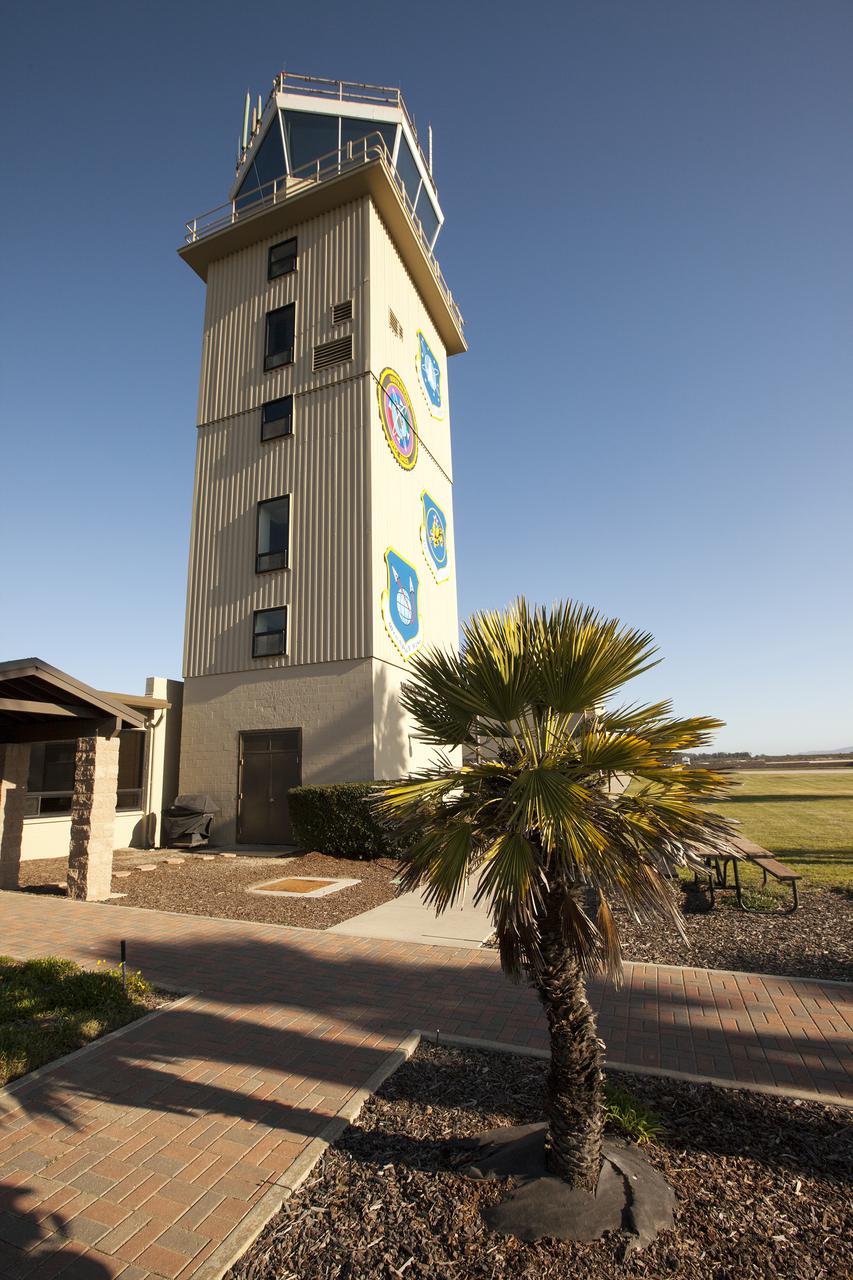
VANDENBERG AFB, Calif. -- The air traffic control tower for the 30th Space Wing air field at Vandenberg Air Force Base in California. Vandenberg Air Force Base has a mission of placing satellites into polar orbit from the West Coast, using expendable boosters such as the Pegasus, Taurus, Minotaur, Atlas V and Delta IV. Photo credit: NASA_Cory Huston
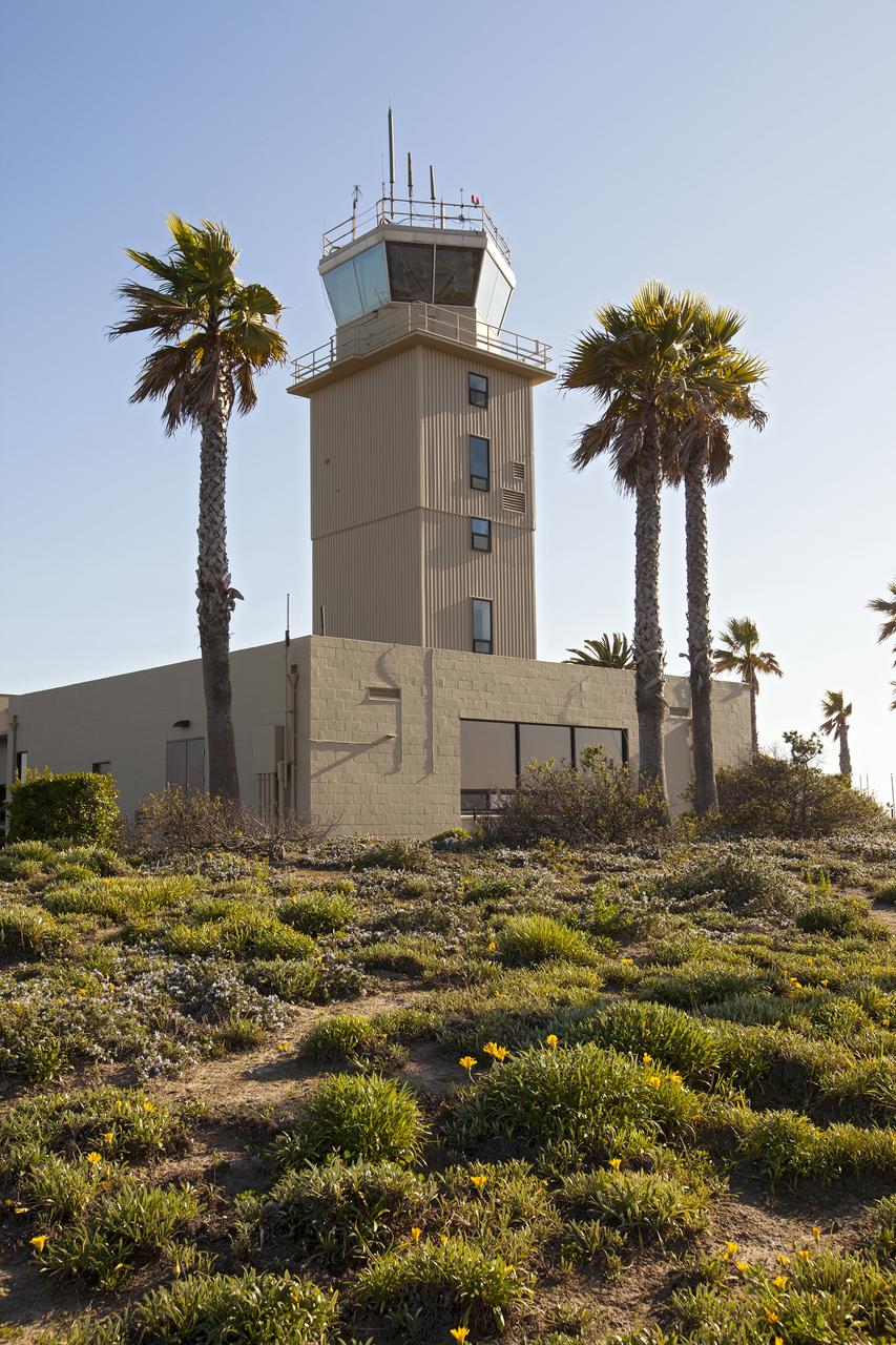
VANDENBERG AFB, Calif. -- The air traffic control tower for the 30th Space Wing air field at Vandenberg Air Force Base in California. Vandenberg Air Force Base has a mission of placing satellites into polar orbit from the West Coast, using expendable boosters such as the Pegasus, Taurus, Minotaur, Atlas V and Delta IV. Photo credit: NASA_Cory Huston
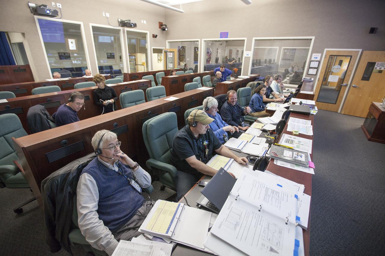
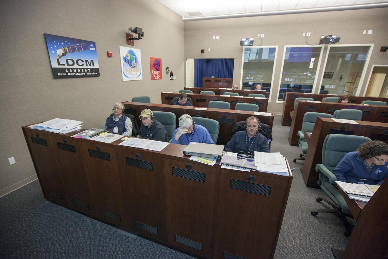
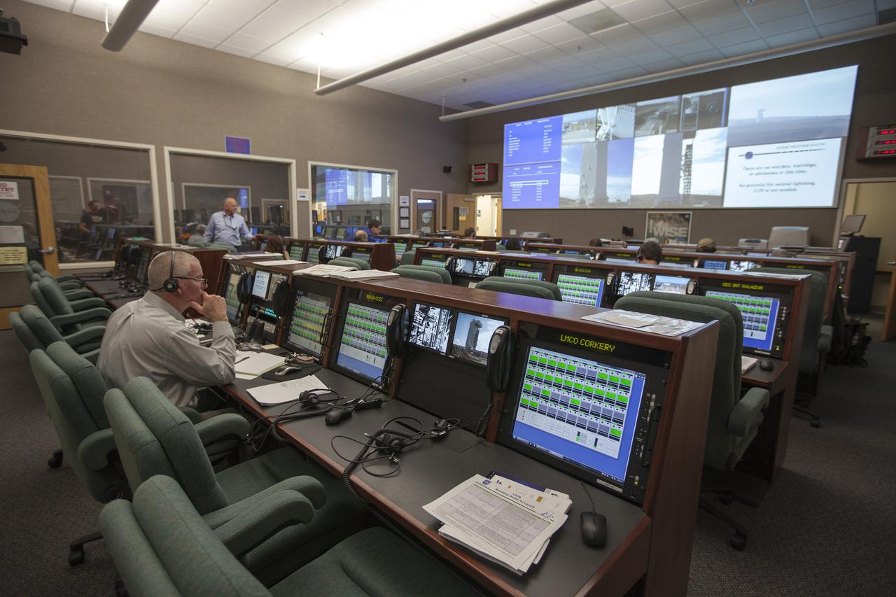
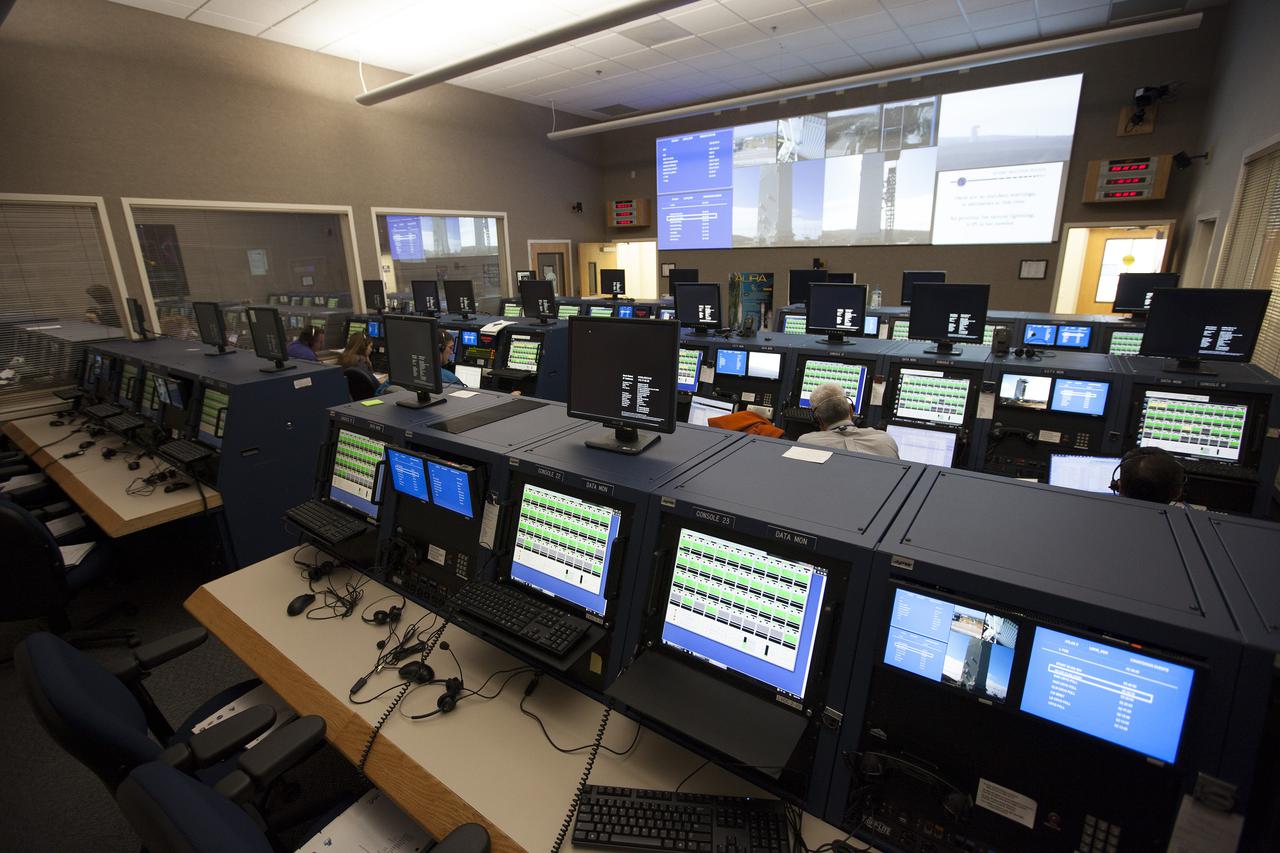
VANDENBERG AFB, Calif. -- From their consoles in the Mission Director's Center at Vandenberg Air Force Base, launch controllers monitor the countdown for a United Launch Alliance Atlas V with the Landsat Data Continuity Mission, or LDCM, satellite prior to liftoff. The Landsat Data Continuity Mission, or LDCM, is the future of Landsat satellites. It will continue to obtain valuable data and imagery to be used in agriculture, education, business, science, and government. The Landsat Program provides repetitive acquisition of high resolution multispectral data of the Earth's surface on a global basis. The data from the Landsat spacecraft constitute the longest record of the Earth's continental surfaces as seen from space. It is a record unmatched in quality, detail, coverage, and value. Liftoff is planned for Feb. 11, 2013 aboard a United Launch Alliance Atlas V rocket. For more information, visit: http:__www.nasa.gov_mission_pages_landsat_main_index.html Photo credit: NASA_ Kim Shiflett
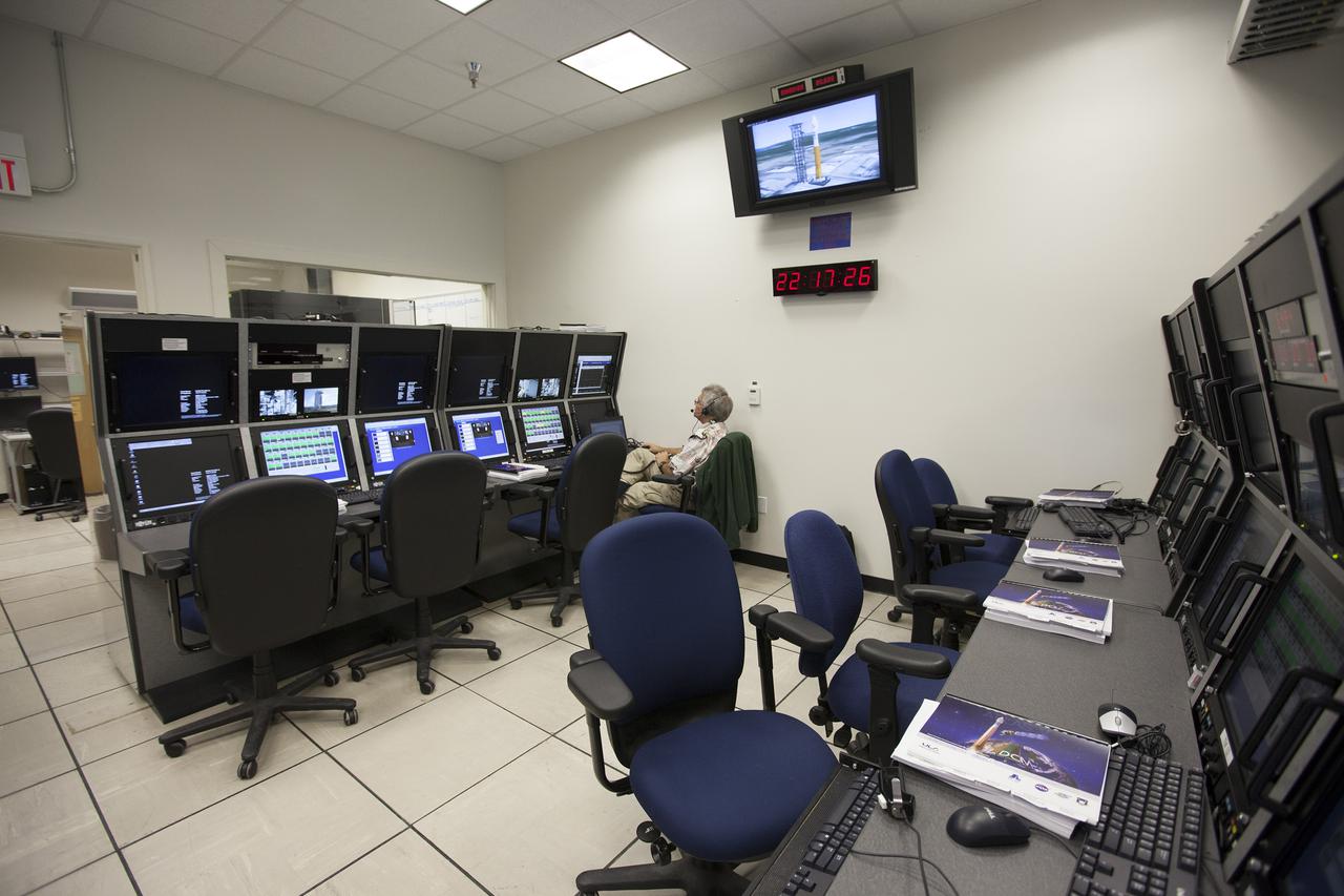
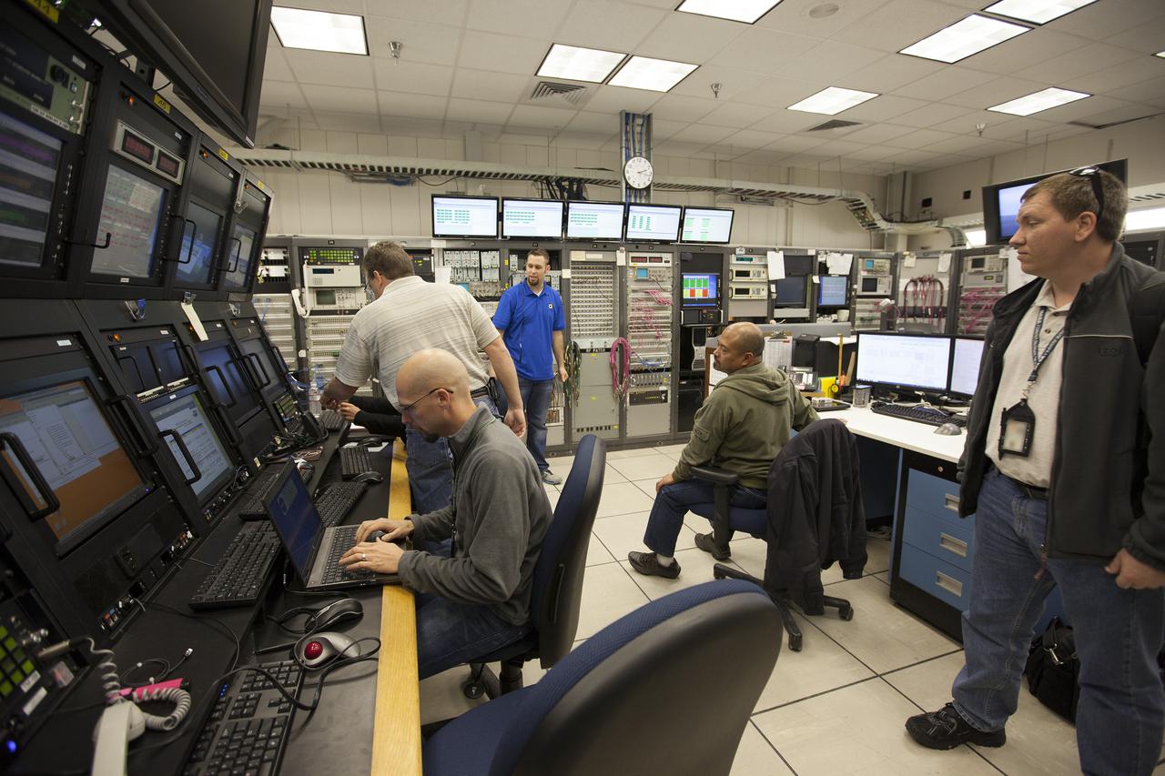
VANDENBERG AFB, Calif. -- From their positions in the telemetry laboratory at Vandenberg Air Force Base, engineers and technicians monitor the countdown for a United Launch Alliance Atlas V with the Landsat Data Continuity Mission, or LDCM, satellite prior to liftoff. The Landsat Data Continuity Mission, or LDCM, is the future of Landsat satellites. It will continue to obtain valuable data and imagery to be used in agriculture, education, business, science, and government. The Landsat Program provides repetitive acquisition of high resolution multispectral data of the Earth's surface on a global basis. The data from the Landsat spacecraft constitute the longest record of the Earth's continental surfaces as seen from space. It is a record unmatched in quality, detail, coverage, and value. Liftoff is planned for Feb. 11, 2013 aboard a United Launch Alliance Atlas V rocket. For more information, visit: http:__www.nasa.gov_mission_pages_landsat_main_index.html Photo credit: NASA_ Kim Shiflett
VANDENBERG AFB, Calif. -- From their consoles in the Mission Director's Center at Vandenberg Air Force Base, launch controllers monitor the countdown for a United Launch Alliance Atlas V with the Landsat Data Continuity Mission, or LDCM, satellite prior to liftoff. The Landsat Data Continuity Mission, or LDCM, is the future of Landsat satellites. It will continue to obtain valuable data and imagery to be used in agriculture, education, business, science, and government. The Landsat Program provides repetitive acquisition of high resolution multispectral data of the Earth's surface on a global basis. The data from the Landsat spacecraft constitute the longest record of the Earth's continental surfaces as seen from space. It is a record unmatched in quality, detail, coverage, and value. Liftoff is planned for Feb. 11, 2013 aboard a United Launch Alliance Atlas V rocket. For more information, visit: http:__www.nasa.gov_mission_pages_landsat_main_index.html Photo credit: NASA_ Kim Shiflett
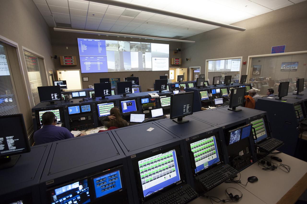
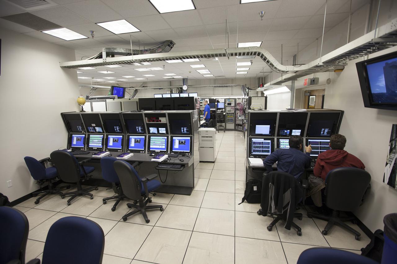
VANDENBERG AFB, Calif. -- From their consoles in the NASA Launch Vehicle Data Center at Vandenberg Air Force Base, engineers monitor the countdown for a United Launch Alliance Atlas V with the Landsat Data Continuity Mission, or LDCM, satellite prior to liftoff. The Landsat Data Continuity Mission, or LDCM, is the future of Landsat satellites. It will continue to obtain valuable data and imagery to be used in agriculture, education, business, science, and government. The Landsat Program provides repetitive acquisition of high resolution multispectral data of the Earth's surface on a global basis. The data from the Landsat spacecraft constitute the longest record of the Earth's continental surfaces as seen from space. It is a record unmatched in quality, detail, coverage, and value. Liftoff is planned for Feb. 11, 2013 aboard a United Launch Alliance Atlas V rocket. For more information, visit: http:__www.nasa.gov_mission_pages_landsat_main_index.html Photo credit: NASA_ Kim Shiflett
VANDENBERG AFB, Calif. -- From their consoles in the Mission Director's Center at Vandenberg Air Force Base, launch controllers monitor the countdown for a United Launch Alliance Atlas V with the Landsat Data Continuity Mission, or LDCM, satellite prior to liftoff. The Landsat Data Continuity Mission, or LDCM, is the future of Landsat satellites. It will continue to obtain valuable data and imagery to be used in agriculture, education, business, science, and government. The Landsat Program provides repetitive acquisition of high resolution multispectral data of the Earth's surface on a global basis. The data from the Landsat spacecraft constitute the longest record of the Earth's continental surfaces as seen from space. It is a record unmatched in quality, detail, coverage, and value. Liftoff is planned for Feb. 11, 2013 aboard a United Launch Alliance Atlas V rocket. For more information, visit: http:__www.nasa.gov_mission_pages_landsat_main_index.html Photo credit: NASA_ Kim Shiflett
VANDENBERG AFB, Calif. -- From their positions in the telemetry laboratory at Vandenberg Air Force Base, engineers and technicians monitor the countdown for a United Launch Alliance Atlas V with the Landsat Data Continuity Mission, or LDCM, satellite prior to liftoff. The Landsat Data Continuity Mission, or LDCM, is the future of Landsat satellites. It will continue to obtain valuable data and imagery to be used in agriculture, education, business, science, and government. The Landsat Program provides repetitive acquisition of high resolution multispectral data of the Earth's surface on a global basis. The data from the Landsat spacecraft constitute the longest record of the Earth's continental surfaces as seen from space. It is a record unmatched in quality, detail, coverage, and value. Liftoff is planned for Feb. 11, 2013 aboard a United Launch Alliance Atlas V rocket. For more information, visit: http:__www.nasa.gov_mission_pages_landsat_main_index.html Photo credit: NASA_ Kim Shiflett
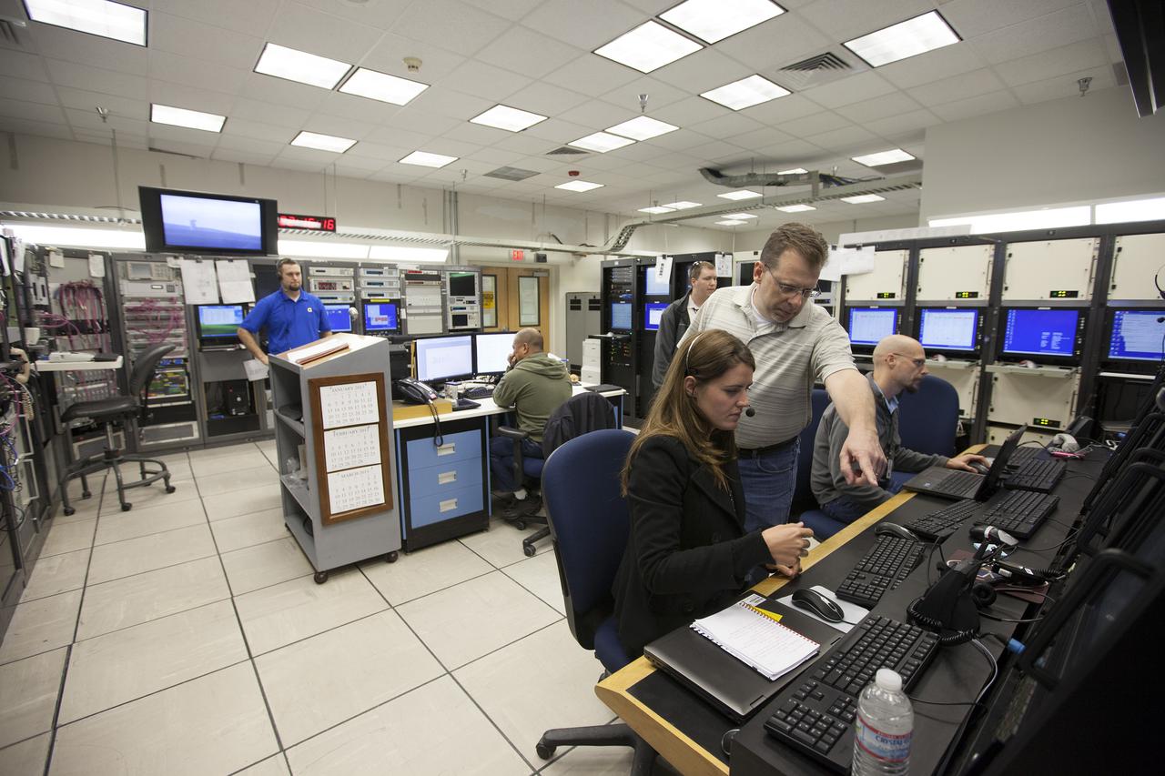
VANDENBERG AFB, Calif. -- From their positions in the telemetry laboratory at Vandenberg Air Force Base, engineers and technicians monitor the countdown for a United Launch Alliance Atlas V with the Landsat Data Continuity Mission, or LDCM, satellite prior to liftoff. The Landsat Data Continuity Mission, or LDCM, is the future of Landsat satellites. It will continue to obtain valuable data and imagery to be used in agriculture, education, business, science, and government. The Landsat Program provides repetitive acquisition of high resolution multispectral data of the Earth's surface on a global basis. The data from the Landsat spacecraft constitute the longest record of the Earth's continental surfaces as seen from space. It is a record unmatched in quality, detail, coverage, and value. Liftoff is planned for Feb. 11, 2013 aboard a United Launch Alliance Atlas V rocket. For more information, visit: http:__www.nasa.gov_mission_pages_landsat_main_index.html Photo credit: NASA_ Kim Shiflett
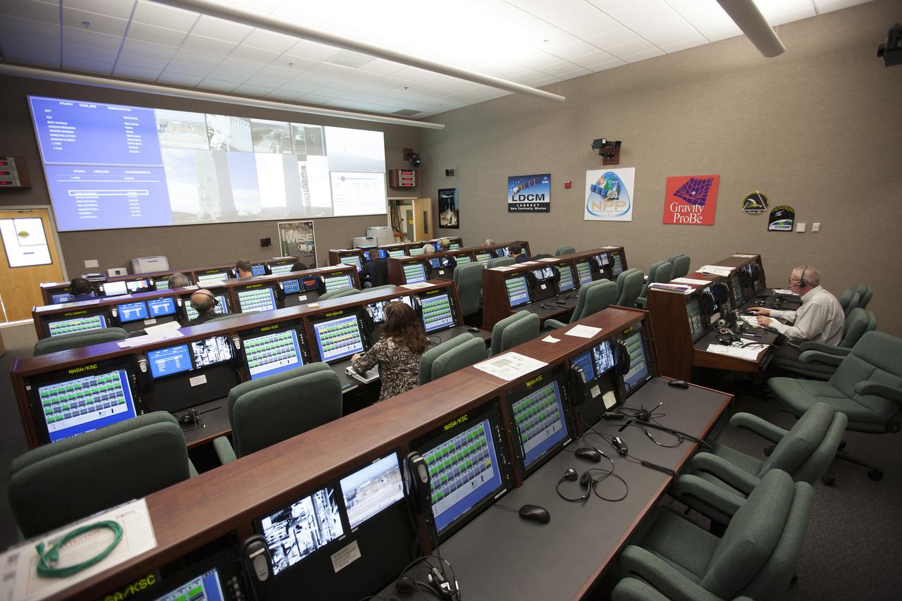
VANDENBERG AFB, Calif. -- From their consoles in the Mission Director's Center at Vandenberg Air Force Base, launch controllers monitor the countdown for a United Launch Alliance Atlas V with the Landsat Data Continuity Mission, or LDCM, satellite prior to liftoff. The Landsat Data Continuity Mission, or LDCM, is the future of Landsat satellites. It will continue to obtain valuable data and imagery to be used in agriculture, education, business, science, and government. The Landsat Program provides repetitive acquisition of high resolution multispectral data of the Earth's surface on a global basis. The data from the Landsat spacecraft constitute the longest record of the Earth's continental surfaces as seen from space. It is a record unmatched in quality, detail, coverage, and value. Liftoff is planned for Feb. 11, 2013 aboard a United Launch Alliance Atlas V rocket. For more information, visit: http:__www.nasa.gov_mission_pages_landsat_main_index.html Photo credit: NASA_ Kim Shiflett
VANDENBERG AFB, Calif. -- From their positions in the telemetry laboratory at Vandenberg Air Force Base, engineers and technicians monitor the countdown for a United Launch Alliance Atlas V with the Landsat Data Continuity Mission, or LDCM, satellite prior to liftoff. The Landsat Data Continuity Mission, or LDCM, is the future of Landsat satellites. It will continue to obtain valuable data and imagery to be used in agriculture, education, business, science, and government. The Landsat Program provides repetitive acquisition of high resolution multispectral data of the Earth's surface on a global basis. The data from the Landsat spacecraft constitute the longest record of the Earth's continental surfaces as seen from space. It is a record unmatched in quality, detail, coverage, and value. Liftoff is planned for Feb. 11, 2013 aboard a United Launch Alliance Atlas V rocket. For more information, visit: http:__www.nasa.gov_mission_pages_landsat_main_index.html Photo credit: NASA_ Kim Shiflett
VANDENBERG AFB, Calif. -- From their positions in the telemetry laboratory at Vandenberg Air Force Base, engineers and technicians monitor the countdown for a United Launch Alliance Atlas V with the Landsat Data Continuity Mission, or LDCM, satellite prior to liftoff. The Landsat Data Continuity Mission, or LDCM, is the future of Landsat satellites. It will continue to obtain valuable data and imagery to be used in agriculture, education, business, science, and government. The Landsat Program provides repetitive acquisition of high resolution multispectral data of the Earth's surface on a global basis. The data from the Landsat spacecraft constitute the longest record of the Earth's continental surfaces as seen from space. It is a record unmatched in quality, detail, coverage, and value. Liftoff is planned for Feb. 11, 2013 aboard a United Launch Alliance Atlas V rocket. For more information, visit: http:__www.nasa.gov_mission_pages_landsat_main_index.html Photo credit: NASA_ Kim Shiflett
VANDENBERG AFB, Calif. -- From their consoles in the NASA Launch Vehicle Data Center at Vandenberg Air Force Base, engineers monitor the countdown for a United Launch Alliance Atlas V with the Landsat Data Continuity Mission, or LDCM, satellite prior to liftoff. The Landsat Data Continuity Mission, or LDCM, is the future of Landsat satellites. It will continue to obtain valuable data and imagery to be used in agriculture, education, business, science, and government. The Landsat Program provides repetitive acquisition of high resolution multispectral data of the Earth's surface on a global basis. The data from the Landsat spacecraft constitute the longest record of the Earth's continental surfaces as seen from space. It is a record unmatched in quality, detail, coverage, and value. Liftoff is planned for Feb. 11, 2013 aboard a United Launch Alliance Atlas V rocket. For more information, visit: http:__www.nasa.gov_mission_pages_landsat_main_index.html Photo credit: NASA_ Kim Shiflett