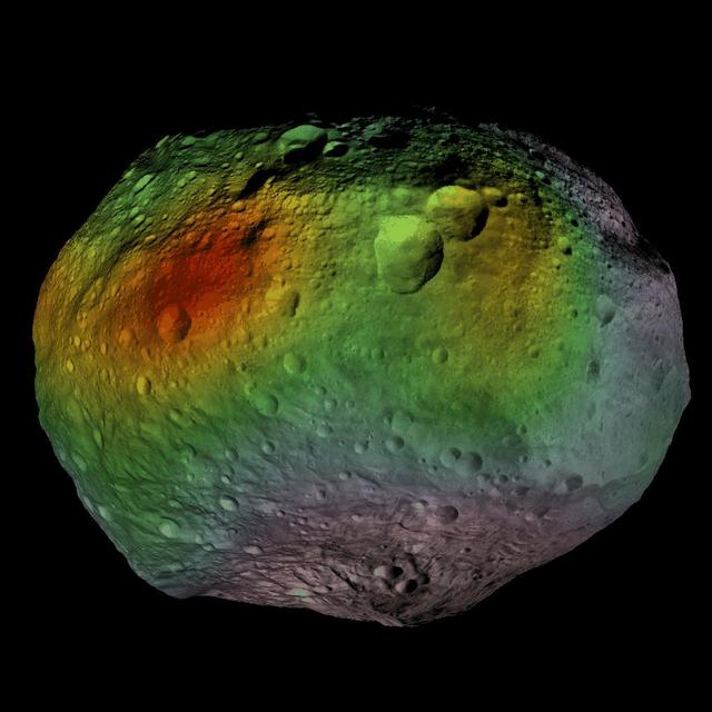
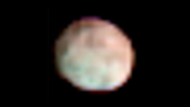
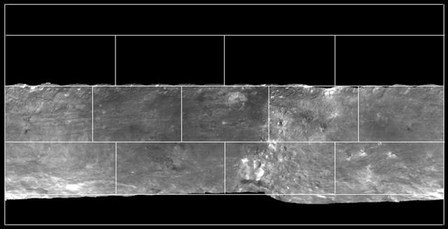
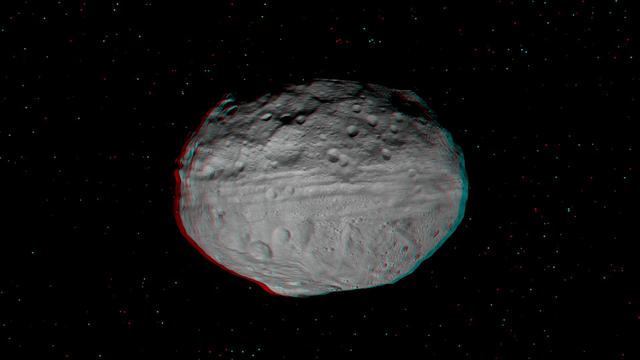
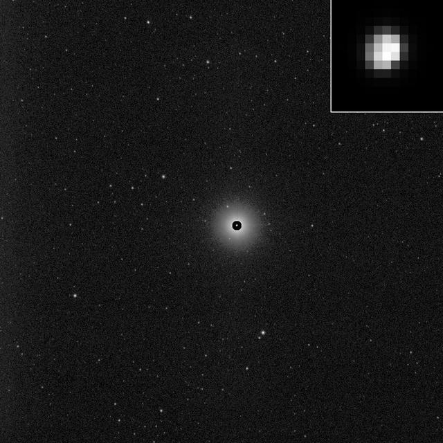
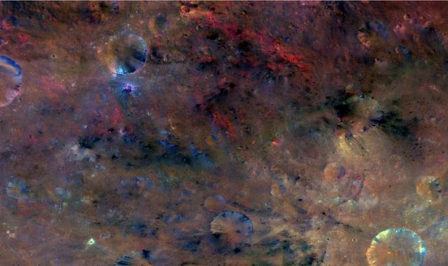
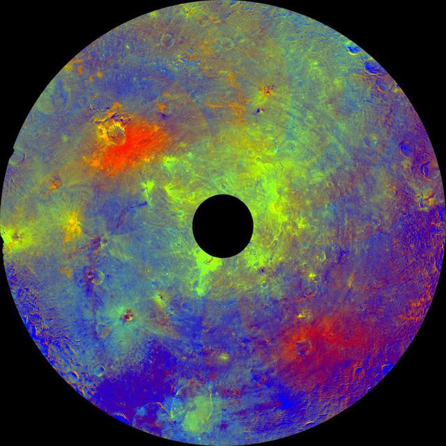
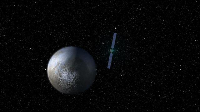
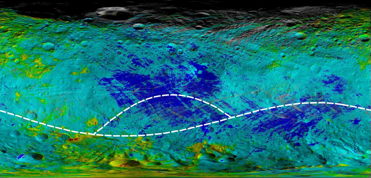
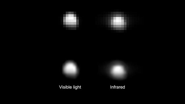
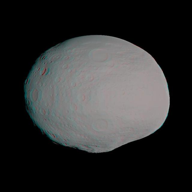
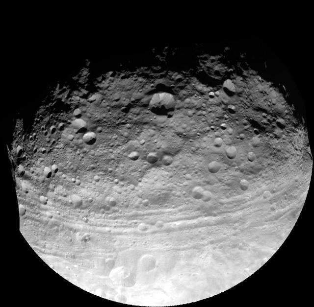
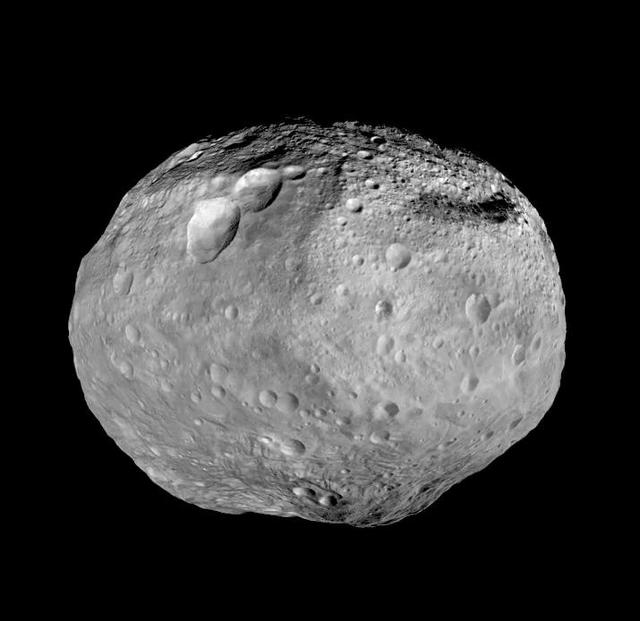
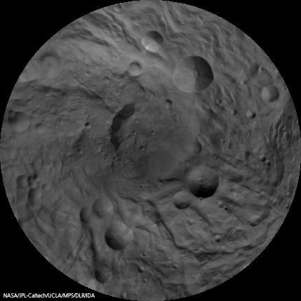
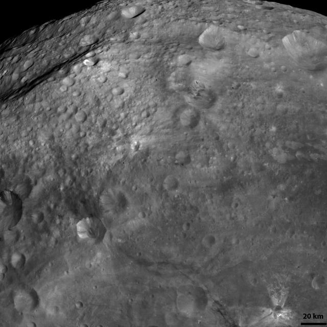
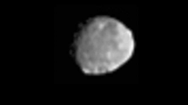
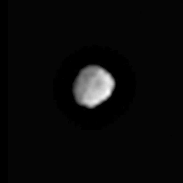
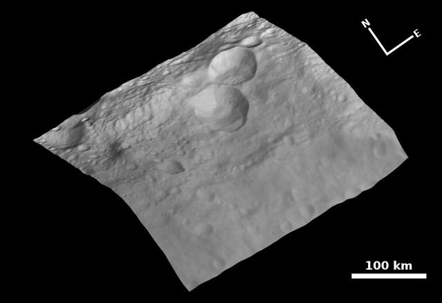
This image from NASA Dawn spacecraft shows linear grooves and ridges in Vesta regolith, located in Vesta Tuccia quadrangle, in asteroid Vesta southern hemisphere.
Patterns in Vesta Regolith
This image from NASA Dawn spacecraft shows an escarpment located in asteroid Vesta near Rheasilvia quadrangle, near Vesta south pole.
Escarpment on Vesta
This image from NASA Dawn mission shows topography of the giant asteroid Vesta and a map of Vesta gravity variations.
Shape and Gravity of Vesta
This image incorporates the best data on dimples and bulges of the protoplanet Vesta from ground-based telescopes and NASA Hubble Space Telescope. This model of Vesta uses scientists best guess to date of what the surface might look like.
Model of Vesta
This image mosaic from NASA Dawn mission shows a slice of the surface of the giant asteroid Vesta. This mosaic, which covers one quarter of Vesta surface, shows the pronounced difference between the northern and southern hemispheres.
Slice of Vesta
This set of images from NASA Dawn spacecraft shows topography of the southern hemisphere of the giant asteroid Vesta and a map of Vesta gravity variations that have been adjusted to account for Vesta shape.
Shape and Gravity of Vesta South Pole
This frame from a video from NASA Dawn mission shows that the gravity field of Vesta closely matches the surface topography of the giant asteroid Vesta.
Vesta Shape and Gravity
Vesta is the largest asteroid visited by a spacecraft. It is currently being observed by NASA Dawn spacecraft, which has entered orbit around Vesta.
Vesta Sizes Up
Dawn mission Vesta Logo, part of NASA Dawn Mission Art series.  http://photojournal.jpl.nasa.gov/catalog/PIA19372
Dawn Mission Vesta Logo
This image is from the last sequence of images NASA Dawn spacecraft obtained of the giant asteroid Vesta, looking down at Vesta north pole as it was departing. Dawn escaped from Vesta orbit on Sept. 4, 2012 PDT Sept. 5, 2012 CET.
A Last Look Back at Vesta
This image shows that NASA Dawn mission detected abundances of hydrogen in a wide swath around the equator of the giant asteroid Vesta. The hydrogen probably exists in the form of hydroxyl or water bound to minerals in Vesta surface.
Hydrogen Hotspots on Vesta
NASA Dawn spacecraft obtained this image of the giant asteroid Vesta with its framing camera on July 9, 2011. Vesta is also considered a protoplanet because it is a large body that almost became a planet.
All Eyes on Vesta
NASA Dawn spacecraft obtained this image of the giant asteroid Vesta with its framing camera on July 24, 2011. Dawn entered orbit around Vesta on July 15, and will spend a year orbiting the body.
Full-Frame Image of Vesta
This map from NASA Dawn mission indicates the presence of hydrated minerals on the giant asteroid Vesta about 30 degrees north latitude, in August 2011. At the time, it was winter in Vesta northern hemisphere.
Map of Hydrated Minerals on Vesta
NASA Dawn spacecraft has spiraled closer and closer to the surface of the giant asteroid Vesta. These images were obtained by Dawn framing camera in the three phases of its campaign since arriving at Vesta in mid-2011.
Closer and Closer to the Vesta Surface
This image from NASA Dawn spacecraft shows the sun illuminating the landscape of asteroid Vesta during a Vestan unrise; the sun had a low angle relative to Vesta surface, just as the sun has a low angle in the sky in the morning on Earth.
Dawn on Vesta
This global, colorized image of the giant asteroid Vesta from NASA Dawn mission reveals how the minerals are distributed on the surface.
Vesta in the Infrared
This image from NASA Dawn spacecraft shows a very shadowed region in Vesta northern hemisphere. Roughly the upper one third of asteroid Vesta northern hemisphere is currently in shadow.
A Part of Vesta Shadowed Northern Hemisphere
This frame from a movie presents a series of animations showing NASA Dawn spacecraft traveling to and operating at the giant asteroid Vesta.
Animation of Dawn Visit to Vesta
This graphic shows the geologic time scale of asteroid Vesta derived from geologic mapping.
Geological Time Scale of Vesta
Scientists believe a large number of the meteorites that are found on Earth originate from the protoplanet Vesta. This image is from NASA Dawn spacecraft.
Possible Piece of Vesta
This mosaic depicts a portion of asteroid Vesta imaged by NASA Dawn spacecraft where pockets of bright materials are visible.
Map of Bright Areas on Vesta
This high-resolution geological map of Vesta is derived from NASA Dawn spacecraft data.
Geological Map of Vesta
This map from NASA Dawn mission shows the global distribution of hydrogen on the surface of the giant asteroid Vesta.
Hydrogen Map of Vesta
This image from NASA Dawn mission shows the varied minerals on the surface of the giant asteroid Vesta in false color.
Colorized Infrared View of Vesta
This detail of NASA Dawn spacecraft framing camera image shows low sun angles and large shadows on asteroid Vesta.
Night and Day Boundary on Vesta
These composite images from NASA Dawn spacecraft images show the spectacular spectral diversity of asteroid Vesta surface.
Color Composite Images of Vesta
Vesta science orbits from NASA Dawn mission, part of the Mission Art series.  http://photojournal.jpl.nasa.gov/catalog/PIA19373
Vesta Science Orbits
This anaglyph shows the topography of Vesta eastern hemisphere; equatorial troughs are visible around asteroid Vesta equator and north of these troughs there are a number of highly degraded, old, large craters. You need 3-D glasses to view this image.
3-D Image of Vesta Eastern Hemisphere
The terrain model of Vesta southern hemisphere shows a big circular structure, its rim rising above the interior of the structure. This false-color map of the giant asteroid Vesta is from the framing camera aboard NASA Dawn spacecraft.
A False-Color Topography of Vesta South Pole
This image of asteroid Vesta, from NASA Dawn spacecraft, calculated from a shape model, shows a tilted view of the topography of the south polar region. This perspective removes the overall curvature of Vesta, as if the giant asteroid were flat and not
Oblique View of Vesta South Polar Region
This image from NASA Dawn mission shows the topography of the northern and southern hemispheres of the giant asteroid Vesta, updated with pictures obtained during Dawn last look back.
Shape of Vesta
NASA Dawn spacecraft obtained this image of the giant asteroid Vesta with its framing camera on Aug. 26, 2011. The detail in this image shows a steep scarp with landslides and vertical craters in the scarp wall.
Landslides on Vesta
This image from NASA Dawn spacecraft shows a fresh scarp rimmed crater with many boulders on asteroid Vesta crater floor. These boulders have diameters of 100-200m, which is roughly the size of many asteroids.
Boulders on Vesta
This image shows NASAS Dawn scientists best guess to date of what the surface of the protoplanet Vesta might look like; it incorporates the best data on dimples and bulges from ground-based telescopes and NASA Hubble Space Telescope.
Virtual Vesta
This image shows the scientists best guess to date of what the surface of the protoplanet Vesta might look like from the south pole and incorporates the best data on dimples and bulges Vesta from ground-based telescopes and NASA Hubble Space Telescope.
Simulated Vesta from the South Pole
This image, processed to show the true size of the giant asteroid Vesta, shows Vesta in front of a spectacular background of stars. It was obtained by the framing camera aboard NASA Dawn spacecraft on May 3, 2011, from a distance of about 750,000 miles.
Dawn First Glimpse of Vesta -- Processed
This image from NASA Dawn spacecraft shows some of the undulating terrain in asteroid Vesta southern hemisphere.
Undulating Terrain in Vesta Southern Hemisphere
These images show part of asteroid Vesta equatorial region, which contains impact craters and troughs linear depressions.
Topography of Vesta Equatorial Region I
This image, made from data obtained by NASA Dawn spacecraft, shows the mineral distribution in the southern hemisphere of the giant asteroid Vesta.
Mineral Diversity at Vesta South Pole
This image from NASA Dawn spacecraft shows numerous grooves linear depressions and crater chains, especially in the right hand side of the image of asteroid Vesta.
Grooves and Crater Chains on Vesta
This image from NASA Dawn mission shows a shadowy view of the northern hemisphere of the giant asteroid Vesta during Dawn last look back.
Best Northern View of Vesta
Hydrogen is most abundant in areas with low reflectivity, or albedo, on the giant asteroid Vesta, as shown in this contour map from NASA Dawn mission.
Contour Map of Hydrogen on Vesta
This image of asteroid Vesta is one of many images taken by NASA Dawn spacecraft to create an animation showing the diversity of minerals through color representation.
Vesta Coat of Many Colors
This colorized composite image from NASA Dawn mission shows the crater Antonia, which lies in the enormous Rheasilvia basin in the southern hemisphere of the giant asteroid Vesta.
Vesta Many Colors at Sextilia
This image, one of the first obtained by NASA Dawn spacecraft in its low altitude mapping orbit, shows a part of one of the troughs at the equator of the giant asteroid Vesta.
Trough in Dark and Bright on Vesta
This atlas of the giant asteroid Vesta was created from images taken as NASA Dawn mission flew around the object, also known as a protoplanet.
Touring the Giant Asteroid Vesta
This image shows three slices of a class of meteorites that fell to Earth that NASA Dawn mission has confirmed as originating from the giant asteroid Vesta.
Meteorites from Vesta
This global map from NASA Dawn mission shows the topography of the giant asteroid Vesta, with the seven most prominent impact basins highlighted.
Global Topography of Vesta
This image from NASA Dawn spacecraft shows craters with both sharp and smooth rims, a ghost crater and dark and bright material in asteroid Vesta southern hemisphere.
Unusual Craters on Vesta IV
This image is a mosaic of Vesta equatorial region, composed of observations taken through the panchromatic filter on the framing camera onboard NASA Dawn spacecraft on July 24, 2011.
Mosaic Image of Vesta Surface
This image from NASA Dawn spacecraft is of the south pole region of the asteroid Vesta, a mountain is rising approximately 9 miles 15 kilometers above the floor of a crater.
Impressive Mountain Tops on Vesta
This image from NASA Dawn mission shows huge grooves on the giant asteroid Vesta that were the result of mega impacts at the south pole.
Huge Troughs on Vesta
NASA Hubble Space Telescope snapped these images of the asteroid Vesta in preparation for the Dawn spacecraft visit in 2011. The images show the difference in brightness and color on the asteroid surface.
The Faces of Vesta
This artist rendition shows the asteroid Vesta and is part of the Mission Art series from NASA's Dawn mission.  http://photojournal.jpl.nasa.gov/catalog/PIA19369
Artist Rendition of Asteroid Vesta
These two images compare topographic maps of the giant asteroid Vesta as discerned by NASA Hubble Space Telescope top and as seen by NASA Dawn spacecraft bottom. Hubble has been in an orbit around Earth, while Dawn orbited Vesta from 2011 to 2012.
Comparing Vesta Topography
This image using color data obtained by the framing camera aboard NASA Dawn spacecraft shows asteroid Vesta southern hemisphere in color, centered on the Rheasilvia formation.
Asteroid Vesta in a Rainbow-Colored Palette
This map, made from data obtained by NASA Dawn spacecraft, shows the distribution of pyroxene, an iron- and magnesium-rich mineral, in the southern hemisphere of the giant asteroid Vesta.
Pyroxene Map of Vesta South Pole
This image from NASA Dawn spacecraft shows undulating terrain, located only in asteroid Vesta southern hemisphere, in and around the Rheasilvia impact basin.
Undulating Terrain in Vesta Southern Hemisphere
The south pole of the giant asteroid Vesta reveals cliffs that are several miles or kilometers high, deep grooves, and craters. This oblique view is from NASA Dawn spacecraft.
High Cliffs at Vesta South Pole
These images from NASA Dawn spacecraft show part of asteroid Vesta equatorial region, which contains impact craters and troughs linear depressions.
Topography of Vesta Equatorial Region III
This image from NASA Dawn spacecraft shows the hummocky wavy/undulating terrain of Vesta Rheasilvia quadrangle, which is the south polar region.
Hummocky Terrain in Vesta Rheasilvia Quadrangle
This anaglyph from NASA Dawn spacecraft image shows the topography of asteroid Vesta southeastern region. You need 3D glasses to view this image.
Anaglyph Image of Vesta Southeastern Latitudes
This image from NASA Dawn spacecraft shows dark colored mountains top of the image in the northern region of asteroid Vesta. The origin of such mountains is currently being investigated.
Mountains and Bright and Dark Material on Vesta
This image from NASA Dawn spacecraft shows old cratered terrain located on asteroid Vesta equator. Many of these craters have very degraded, rounded rims.
Old Cratered Terrain on Vesta Equator
This false-color image from NASA Dawn spacecraft is of the of the giant asteroid Vesta. Scientists are studying image like these to better understand the different materials on the surface.
Different Shades of Vesta False-Color
These images from NASA Dawn spacecraft show part of asteroid Vesta equatorial region, which contains many different sizes of impact craters.
Topography of Vesta Equatorial Region II
This colorized map from NASA Dawn mission shows the types of rocks and minerals distributed around the surface of the giant asteroid Vesta.
Map of Rock Properties at Giant Asteroid Vesta
NASA Dawn spacecraft obtained this albedo image of asteroid Vesta with its framing camera on August 11th 2011.
Topography of Vesta South Polar Region I
This composite image from NASA Dawn spacecraft is a simulated true color image of asteroid Vesta northern and equatorial regions.
Vesta Northern and Equatorial Regions in Simulated True Color
This image shows NASA Dawn spacecraft flying above Vesta, based on an artist concept of the surface of the giant asteroid.
Animation of Dawn Scanning and Flying Above Vesta Surface
This composite image NASA Dawn spacecraft is a simulated true color image of part of asteroid Vesta south polar region.
Vesta South Polar Region in Simulated True Color
This image shows NASA Dawn spacecraft leaving the giant asteroid Vesta and arriving at the dwarf planet Ceres.
Animation of Dawn Leaving Vesta and Arriving at Ceres
This image from the framing camera aboard NASA Dawn spacecraft shows surface details beginning to resolve as the spacecraft closes in on the giant asteroid Vesta on June 1, 2011, from a distance of about 300,000 miles 483,000 kilometers.
Vesta Surface Comes into View
On June 8, 2011, the visible and infrared mapping spectrometer aboard NASA Dawn spacecraft captured the instrument first images of Vesta that are larger than a few pixels, from a distance of about 218,000 miles 351,000 kilometers.
Vesta in Spectrometer View
NASA Dawn spacecraft obtained this image of an unusual hill on asteroid Vesta with its framing camera on August 18, 2011. The image has a resolution of about 260 meters per pixel.
Unusual Hill on Vesta
This image from NASA Dawn spacecraft shows craters with both sharp and smooth crater rims in asteroid Vesta southern hemisphere. Detailed structure is seen more readily in the the image with a smaller view at right.
Unusual Craters on Vesta III
NASA Dawn spacecraft obtained this image of terrestrial mountains on asteroid Vesta with its framing camera on Aug. 26, 2011. The image has a resolution of about 260 meters per pixel.
Steep Slope on Vesta
NASA Dawn spacecraft obtained this image of various craters on asteroid Vesta with its framing camera on August 19, 2011. The image has a resolution of about 260 meters per pixel.
The Various Craters on Vesta
This image mosaic of Vesta south pole is generated from dozens of individual images from the framing camera aboard NASA Dawn spacecraft. This view is centered on the asteroid south pole, which is surrounded by several large impact craters.
Map of Vesta South Pole
This image combines two separate views of the giant asteroid Vesta obtained by NASA Dawn spacecraft. The data reveal a world of many varied, well-separated layers and ingredients.
A Comparative View of Terrains on Vesta
This image obtained by the framing camera on NASA Dawn spacecraft shows the south pole of the giant asteroid Vesta. Scientists are discussing whether the circular structure that covers most of this image originated by a collision with another asteroid.
Viewing the South Pole of Vesta
NASA Dawn spacecraft obtained this image of the surface of asteroid Vesta with its framing camera on August 11, 2011. It was taken through the camera clear filter. The image has a resolution of about 260 meters per pixel.
Bright and Dark Material on Vesta
This image is one from a series of images provided by the framing camera on NASA Dawn spacecraft; the series shows a full rotation of Vesta, which occurs over the course of roughly five hours.
Vesta Full Rotation Movie
This graphic shows the global distribution of craters that hit the giant asteroid Vesta, based on data from NASA Dawn mission. The yellow circles indicate craters of 2 miles or wider, with the size of the circles indicating the size of the crater.
Crater Impacts on Vesta
This image, one of the first obtained by NASA Dawn spacecraft in its low altitude mapping orbit, shows part of the rim of a fresh crater on the giant asteroid Vesta. The terrain is known as the Heavily Cratered Terrain in the northern hemisphere.
Crater in Shadow on Vesta
This color-coded topography map from NASA Dawn mission shows the giant asteroid Vesta in an equirectangular projection at 32 pixels per degree, relative to an ellipsoid of 177 miles by 177 miles by 142 miles.
Vesta Topography Map
As NASA Dawn spacecraft takes off for its next destination, this mosaic synthesizes some of the best views the spacecraft had of the giant asteroid Vesta. The set of three craters known as the nowman can be seen at the top left.
Full View of Vesta
This image from NASA Dawn spacecraft shows many craters of different sizes and states of preservation on asteroid Vesta surface. In the top of the image there are four large, very degraded craters.
Cratered Surface of Vesta
This image, one of the first obtained by NASA Dawn spacecraft in its low altitude mapping orbit, shows many buried craters located within the equatorial trough region of the giant asteroid Vesta.
Buried Craters on Vesta
he visible and infrared mapping spectrometer aboard NASA Dawn spacecraft acquired this set of images during the high-altitude mapping orbit phase at about 420 miles 680 kilometers above the surface of asteroid Vesta.
A Global View of Vesta
This view of the topography of asteroid Vesta surface is composed of several images obtained with the framing camera on NASA Dawn spacecraft on August 6, 2011. The image mosaic is shown superimposed on a digital terrain model.
Topography of Vesta Surface
This colorized map from NASA Dawn mission shows the distribution of minerals across the surface of the giant asteroid Vesta. It was made from spectra -- or data collected in different wavelengths of radiation.
Global Mineral Map of Vesta
This image from NASA Dawn spacecraft shows a part of the surface of asteroid Vesta, which is mantled covered by an ejecta blanket, evident as smoothly textured surface visible across the image.
Mantled Surface of Vesta with Secondaries
This view of the topography of asteroid Vesta surface is composed of several images obtained with the clear filter in the framing camera on NASA Dawn spacecraft on August 6, 2011. The image has a resolution of about 260 meters per pixel.
Topography of Troughs on Vesta
This anaglyph shows a 3-D model of the protoplanet Vesta, using scientists best guess to date of what the surface of the protoplanet might look like. It was created as part of an exercise for NASA Dawn mission. 3D glasses are necessary.
Anaglyph of Vesta Model
This full view of the giant asteroid Vesta was taken by NASA Dawn spacecraft, as part of a rotation characterization sequence on July 24, 2011, at a distance of 3,200 miles and shows impact craters of various sizes and grooves parallel to the equator.
Capturing the Surface of Asteroid Vesta
This image shows NASA Dawn view of Vesta from June 20, 2011, when the approaching spacecraft was about 117,000 miles 189,000 kilometers away from the body.
Dawn Approach to Vesta
This map is a mosaic of images obtained by NASA Dawn framing camera during the high-altitude mapping orbit phase. This map shows the distribution of dark materials on the surface of asteroid Vesta.
Map of Dark Materials on Vesta
NASA Dawn spacecraft obtained this image of a dark band on asteroid Vesta with its framing camera on August 19, 2011. The image has a resolution of about 260 meters per pixel.
A Dark Band on Vesta