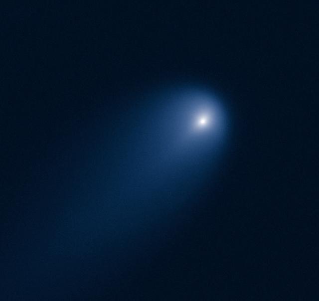
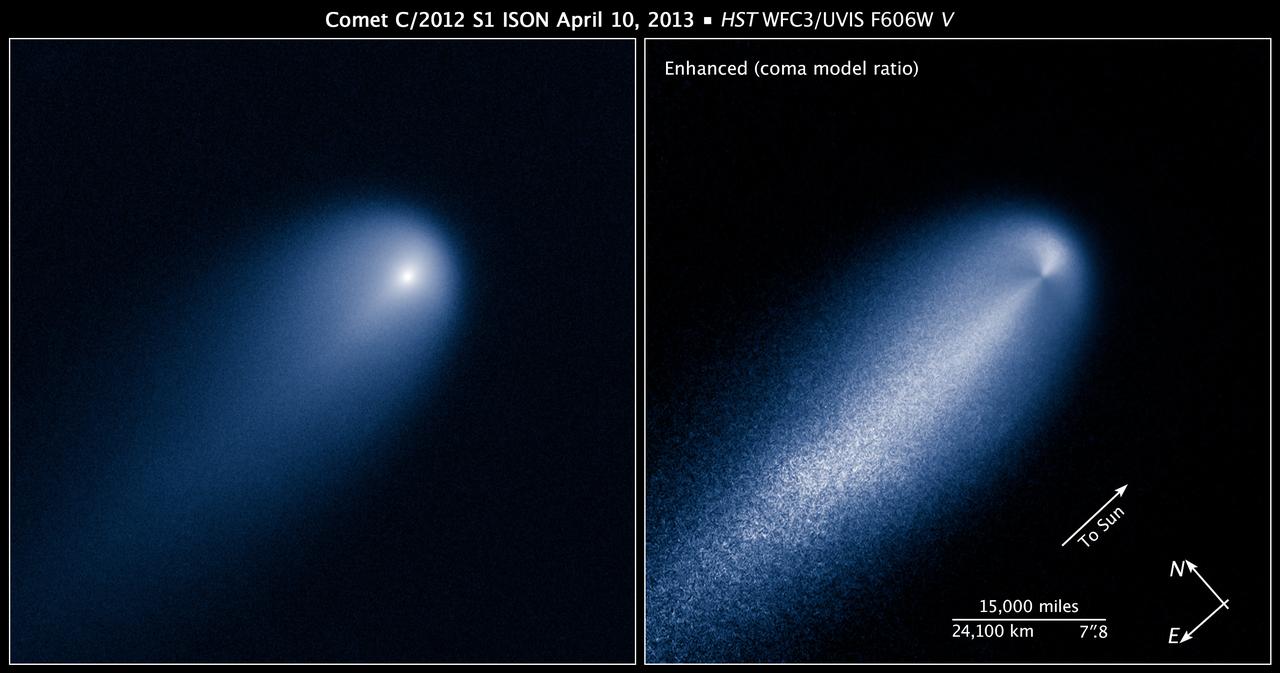
This NASA Hubble Space Telescope image of Comet (C/2012 S1) ISON was photographed on April 10, 2013, when the comet was slightly closer than Jupiter's orbit at a distance of 394 million miles from Earth. Even at that great distance the comet is already active as sunlight warms the surface and causes frozen volatiles to boil off. Astronomers used such early images to try to measure the size of the nucleus, in order to predict whether the comet would stay intact when it slingshots around the sun -- at 700,000 miles above the sun's surface -- on Nov. 28, 2013. The comet's dusty coma, or head of the comet, is approximately 3,100 miles across, or 1.2 times the width of Australia. A dust tail extends more than 57,000 miles, far beyond Hubble's field of view. This image was taken in visible light. The blue false color was added to bring out details in the comet structure. Credit: NASA/ ESA/STScI/AURA -------- More details on Comet ISON: Comet ISON began its trip from the Oort cloud region of our solar system and is now travelling toward the sun. The comet will reach its closest approach to the sun on Thanksgiving Day -- 28 Nov 2013 -- skimming just 730,000 miles above the sun's surface. If it comes around the sun without breaking up, the comet will be visible in the Northern Hemisphere with the naked eye, and from what we see now, ISON is predicted to be a particularly bright and beautiful comet. Catalogued as C/2012 S1, Comet ISON was first spotted 585 million miles away in September 2012. This is ISON's very first trip around the sun, which means it is still made of pristine matter from the earliest days of the solar system’s formation, its top layers never having been lost by a trip near the sun. Comet ISON is, like all comets, a dirty snowball made up of dust and frozen gases like water, ammonia, methane and carbon dioxide -- some of the fundamental building blocks that scientists believe led to the formation of the planets 4.5 billion years ago. NASA has been using a vast fleet of spacecraft, instruments, and space- and Earth-based telescope, in order to learn more about this time capsule from when the solar system first formed. The journey along the way for such a sun-grazing comet can be dangerous. A giant ejection of solar material from the sun could rip its tail off. Before it reaches Mars -- at some 230 million miles away from the sun -- the radiation of the sun begins to boil its water, the first step toward breaking apart. And, if it survives all this, the intense radiation and pressure as it flies near the surface of the sun could destroy it altogether. This collection of images show ISON throughout that journey, as scientists watched to see whether the comet would break up or remain intact. The comet reaches its closest approach to the sun on Thanksgiving Day -- Nov. 28, 2013 -- skimming just 730,000 miles above the sun’s surface. If it comes around the sun without breaking up, the comet will be visible in the Northern Hemisphere with the naked eye, and from what we see now, ISON is predicted to be a particularly bright and beautiful comet. ISON stands for International Scientific Optical Network, a group of observatories in ten countries who have organized to detect, monitor, and track objects in space. ISON is managed by the Keldysh Institute of Applied Mathematics, part of the Russian Academy of Sciences. <b><a href="http://www.nasa.gov/audience/formedia/features/MP_Photo_Guidelines.html" rel="nofollow">NASA image use policy.</a></b> <b><a href="http://www.nasa.gov/centers/goddard/home/index.html" rel="nofollow">NASA Goddard Space Flight Center</a></b> enables NASA’s mission through four scientific endeavors: Earth Science, Heliophysics, Solar System Exploration, and Astrophysics. Goddard plays a leading role in NASA’s accomplishments by contributing compelling scientific knowledge to advance the Agency’s mission. <b>Follow us on <a href="http://twitter.com/NASA_GoddardPix" rel="nofollow">Twitter</a></b> <b>Like us on <a href="http://www.facebook.com/pages/Greenbelt-MD/NASA-Godd</b>
This NASA Hubble Space Telescope image of Comet (C/2012 S1) ISON was photographed on April 10, 2013, when the comet was slightly closer than Jupiter's orbit at a distance of 394 million miles from Earth. Even at that great distance the comet is already active as sunlight warms the surface and causes frozen volatiles to boil off. Astronomers used such early images to try to measure the size of the nucleus, in order to predict whether the comet would stay intact when it slingshots around the sun -- at 700,000 miles above the sun's surface -- on Nov. 28, 2013. The comet's dusty coma, or head of the comet, is approximately 3,100 miles across, or 1.2 times the width of Australia. A dust tail extends more than 57,000 miles, far beyond Hubble's field of view. This image was taken in visible light. The blue false color was added to bring out details in the comet structure. Credit: NASA/ ESA/STScI/AURA -------- More details on Comet ISON: Comet ISON began its trip from the Oort cloud region of our solar system and is now travelling toward the sun. The comet will reach its closest approach to the sun on Thanksgiving Day -- 28 Nov 2013 -- skimming just 730,000 miles above the sun's surface. If it comes around the sun without breaking up, the comet will be visible in the Northern Hemisphere with the naked eye, and from what we see now, ISON is predicted to be a particularly bright and beautiful comet. Catalogued as C/2012 S1, Comet ISON was first spotted 585 million miles away in September 2012. This is ISON's very first trip around the sun, which means it is still made of pristine matter from the earliest days of the solar system’s formation, its top layers never having been lost by a trip near the sun. Comet ISON is, like all comets, a dirty snowball made up of dust and frozen gases like water, ammonia, methane and carbon dioxide -- some of the fundamental building blocks that scientists believe led to the formation of the planets 4.5 billion years ago. NASA has been using a vast fleet of spacecraft, instruments, and space- and Earth-based telescope, in order to learn more about this time capsule from when the solar system first formed. The journey along the way for such a sun-grazing comet can be dangerous. A giant ejection of solar material from the sun could rip its tail off. Before it reaches Mars -- at some 230 million miles away from the sun -- the radiation of the sun begins to boil its water, the first step toward breaking apart. And, if it survives all this, the intense radiation and pressure as it flies near the surface of the sun could destroy it altogether. This collection of images show ISON throughout that journey, as scientists watched to see whether the comet would break up or remain intact. The comet reaches its closest approach to the sun on Thanksgiving Day -- Nov. 28, 2013 -- skimming just 730,000 miles above the sun’s surface. If it comes around the sun without breaking up, the comet will be visible in the Northern Hemisphere with the naked eye, and from what we see now, ISON is predicted to be a particularly bright and beautiful comet. ISON stands for International Scientific Optical Network, a group of observatories in ten countries who have organized to detect, monitor, and track objects in space. ISON is managed by the Keldysh Institute of Applied Mathematics, part of the Russian Academy of Sciences. <b><a href="http://www.nasa.gov/audience/formedia/features/MP_Photo_Guidelines.html" rel="nofollow">NASA image use policy.</a></b> <b><a href="http://www.nasa.gov/centers/goddard/home/index.html" rel="nofollow">NASA Goddard Space Flight Center</a></b> enables NASA’s mission through four scientific endeavors: Earth Science, Heliophysics, Solar System Exploration, and Astrophysics. Goddard plays a leading role in NASA’s accomplishments by contributing compelling scientific knowledge to advance the Agency’s mission. <b>Follow us on <a href="http://twitter.com/NASA_GoddardPix" rel="nofollow">Twitter</a></b> <b>Like us on <a href="http://www.facebook.com/pages/Greenbelt-MD/NASA-Godd</b>

Titan T28 Viewed by Cassini Radar-- April 10, 2007
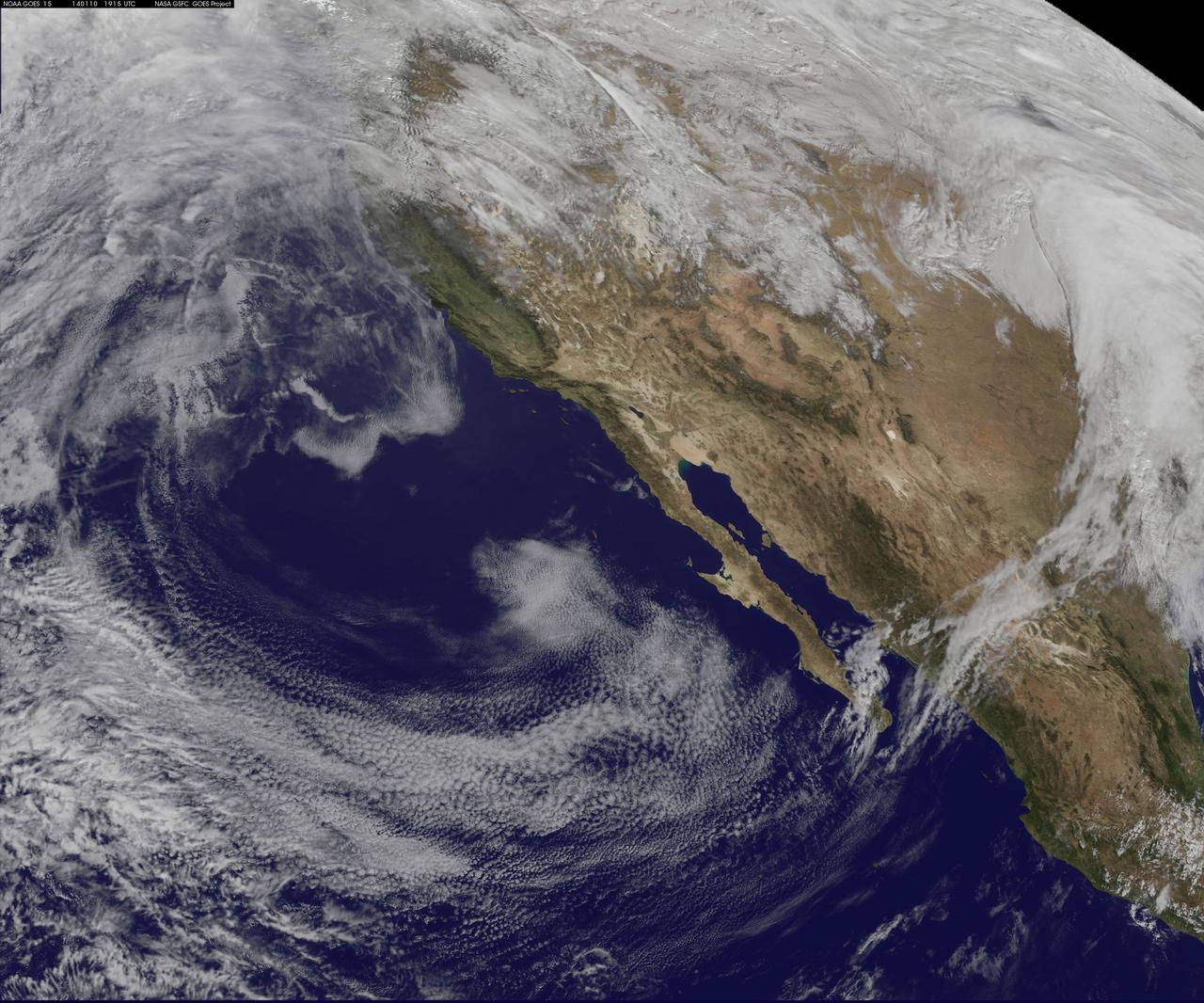
This NOAA GOES-west satellite image shows high pressure over the 4 corners region (Utah, Colorado, northern Arizona and northwestern New Mexico), and the National Weather Service has forecast snow north of the high in the Wasatch range and adjacent valleys. Toward the top of the GOES image, there's a strong Pacific storm moving onshore that NWS expects will bring high winds, heavy rains, and feet of snow to the northwestern U.S. There's a flood watch in effect for portions of western Washington State through Saturday night (January 11), that includes the counties of King, Mason, Pierce, and Snohomish. That storm will bring more snow to the Wasatch range that's getting snow today. Meanwhile, on the far right side of the image, there's a surface low pressure area moving through the Central Plains and middle Mississippi Valley today, Jan. 10, 2014. The image was created by the NASA-NOAA GOES Project at NASA's Goddard Space Flight Center, Greenbelt, Md. <b><a href="http://goes.gsfc.nasa.gov/" rel="nofollow">Credit: NOAA/NASA GOES Project</a></b> <b><a href="http://www.nasa.gov/audience/formedia/features/MP_Photo_Guidelines.html" rel="nofollow">NASA image use policy.</a></b> <b><a href="http://www.nasa.gov/centers/goddard/home/index.html" rel="nofollow">NASA Goddard Space Flight Center</a></b> enables NASA’s mission through four scientific endeavors: Earth Science, Heliophysics, Solar System Exploration, and Astrophysics. Goddard plays a leading role in NASA’s accomplishments by contributing compelling scientific knowledge to advance the Agency’s mission. <b>Follow us on <a href="http://twitter.com/NASA_GoddardPix" rel="nofollow">Twitter</a></b> <b>Like us on <a href="http://www.facebook.com/pages/Greenbelt-MD/NASA-Goddard/395013845897?ref=tsd" rel="nofollow">Facebook</a></b> <b>Find us on <a href="http://instagram.com/nasagoddard?vm=grid" rel="nofollow">Instagram</a></b>
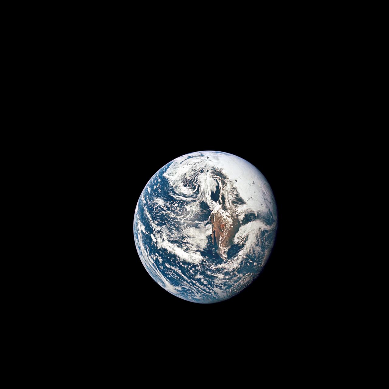
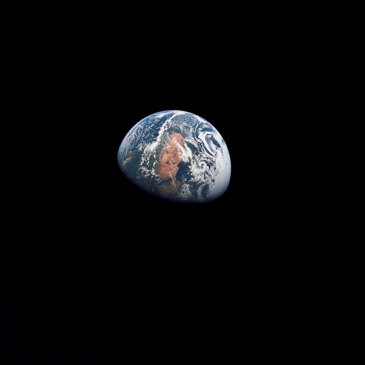
AS10-34-5010 (18 May 1969) --- This photograph of Earth was taken from the Apollo 10 spacecraft shortly after trans-lunar insertion. The counter-clockwise arrangement of the cloud formations indicates a northern hemisphere view, although insufficient amounts of land are visible for exact location.
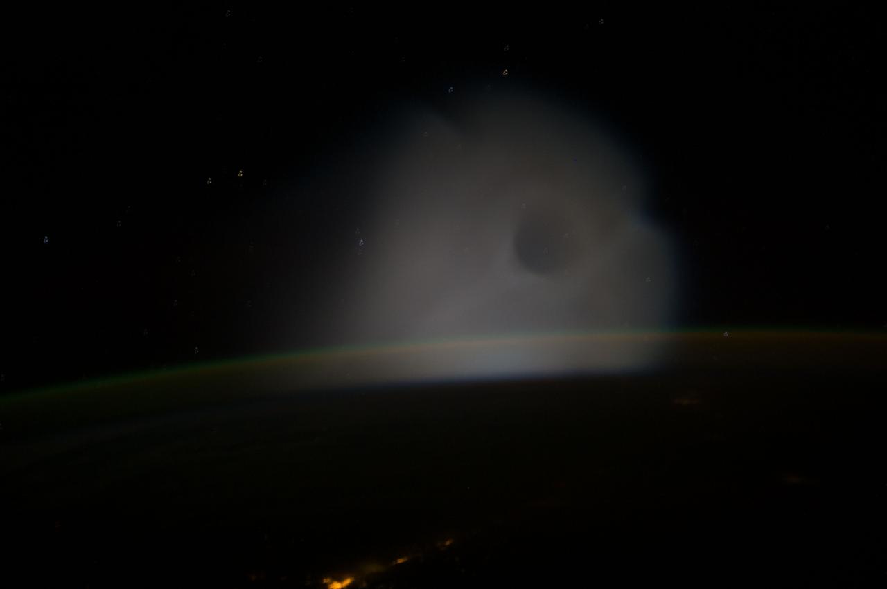
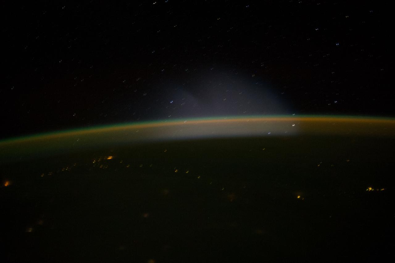
ISS010-E-18583 (24 February 2005) --- A full moon is visible in this view above Earth’s horizon and airglow, photographed by an Expedition 10 crewmember on the International Space Station.
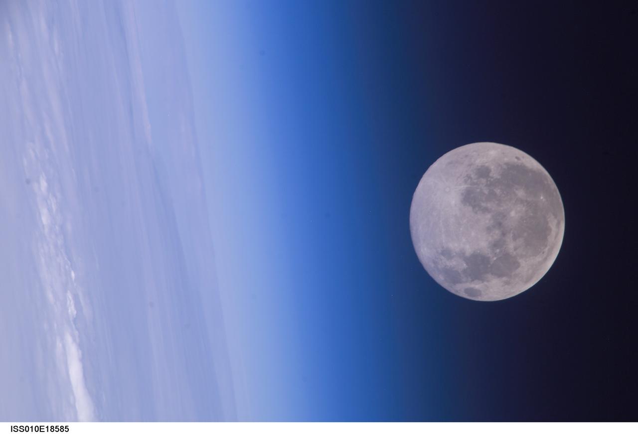
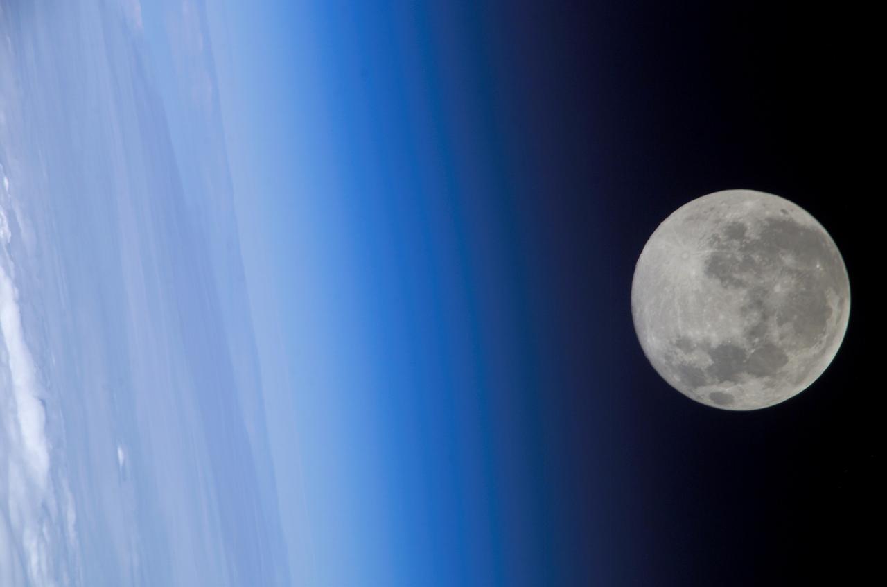
ISS010-E-18585 (24 February 2005) --- A full moon is visible in this view above Earth’s horizon and airglow, photographed by an Expedition 10 crewmember on the International Space Station (ISS).
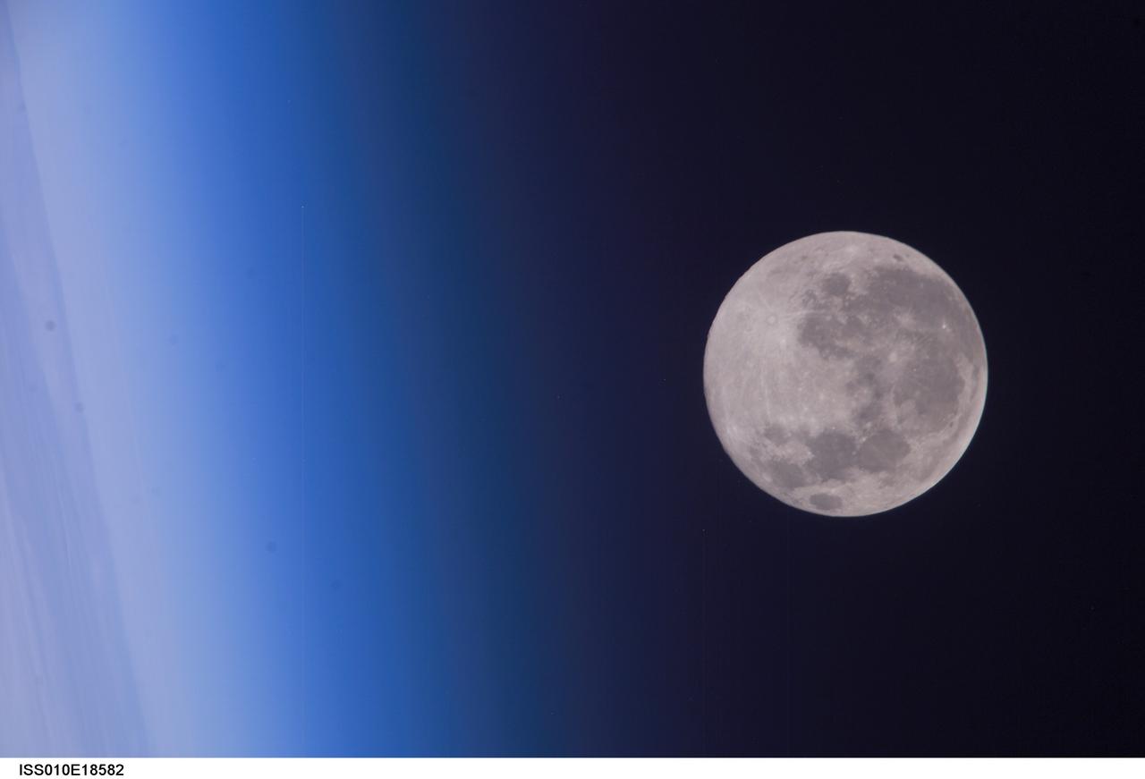
ISS010-E-18582 (24 February 2005) --- A full moon is visible in this view above Earth’s horizon and airglow, photographed by an Expedition 10 crewmember on the International Space Station (ISS).
AS10-34-5013 (18 May 1969) --- A view of Earth from 36,000 nautical miles away as photographed from the Apollo 10 spacecraft during its trans-lunar journey toward the moon. While the Yucatan Peninsula is obscured by clouds, nearly all of Mexico north of the Isthmus of Tehuantepec can be clearly delineated. The Gulf of California and Baja California and the San Joaquin Valley can be easily identified. Also, the delta of the Rio Grande River and the Texas coast are visible. Note the color differences (greens - east, browns - west) along the 100 degrees meridian. The crew members on Apollo 10 are astronauts Thomas P. Stafford, commander; John W. Young, command module pilot; and Eugene E. Cernan, lunar module pilot. Astronaut Young remained in lunar orbit, in the Command and Service Modules (CSM) "Charlie Brown", while astronauts Stafford and Cernan descended to within nine miles of the lunar surface, in the Lunar Module (LM) "Snoopy".
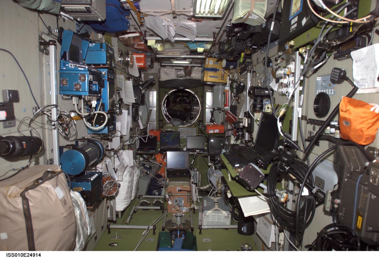
ISS010-E-24914 (17 April 2005) --- View of the interior of the Zvezda Service module from the forward section to the aft end, as photographed by one of the Expedition 10 crewmembers on the International Space Station (ISS).
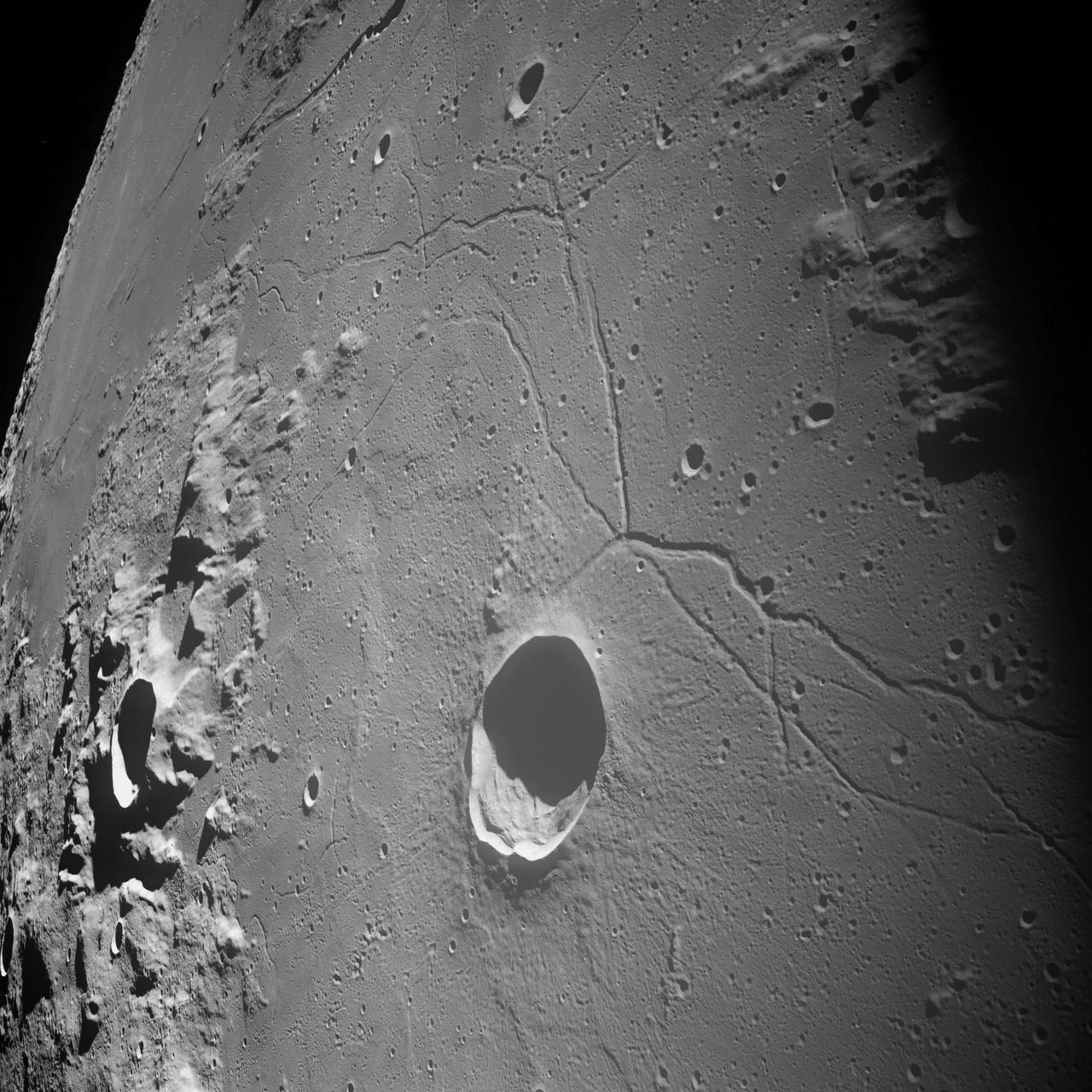
AS10-32-4819 (18-26 May 1969) --- An Apollo 10 northwestward oblique view of Triesnecker crater, centered near 3.6 degrees east longitude, and 4 degrees north latitude. HOLD PICTURE WITH SKY AT UPPER RIGHT. This picture, taken from the Command and Service Modules, shows terrain features typical of northeastern Central Bay. Beyond the highlands, the smooth floor of the Sea of Vapors extends almost to the horizon some 600 kilometers (375 statute miles) from the spacecraft. Triesnecker crater, about 27 kilometers (17 statute miles) in diameter, was 135 kilometers (85 statute miles) northwest of Apollo 10 when the picture was taken. The intersecting linear features to the right of Triesnecker crater are the Triesnecker Rilles.
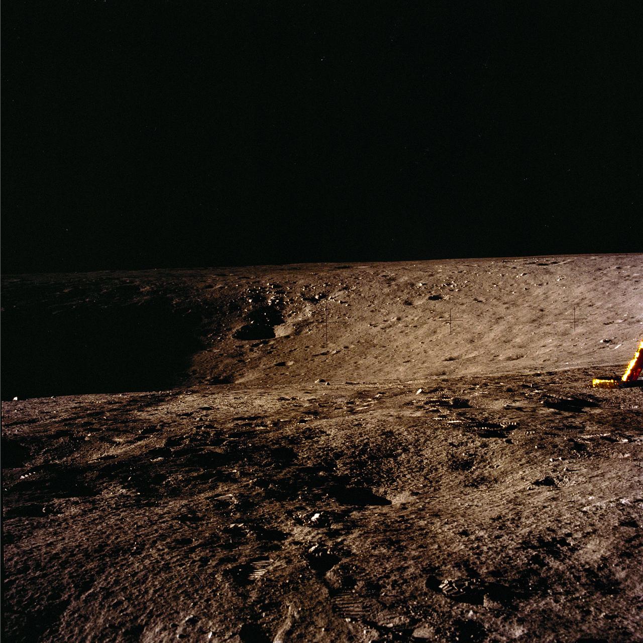
The second manned lunar landing mission, Apollo 12 launched from launch pad 39-A at Kennedy Space Center in Florida on November 14, 1969 via a Saturn V launch vehicle. The Saturn V vehicle was developed by the Marshall Space Flight Center (MSFC) under the direction of Dr. Wernher von Braun. Aboard Apollo 12 was a crew of three astronauts: Alan L. Bean, pilot of the Lunar Module (LM), Intrepid; Richard Gordon, pilot of the Command Module (CM), Yankee Clipper; and Spacecraft Commander Charles Conrad. The LM, Intrepid, landed astronauts Conrad and Bean on the lunar surface in what’s known as the Ocean of Storms while astronaut Richard Gordon piloted the CM, Yankee Clipper, in a parking orbit around the Moon. Lunar soil activities included the deployment of the Apollo Lunar Surface Experiments Package (ALSEP), finding the unmanned Surveyor 3 that landed on the Moon on April 19, 1967, and collecting 75 pounds (34 kilograms) of rock samples. This is the tenth of 25 images captured by the crew in attempt to provide a 360 degree Lunar surface scene. Apollo 12 safely returned to Earth on November 24, 1969.
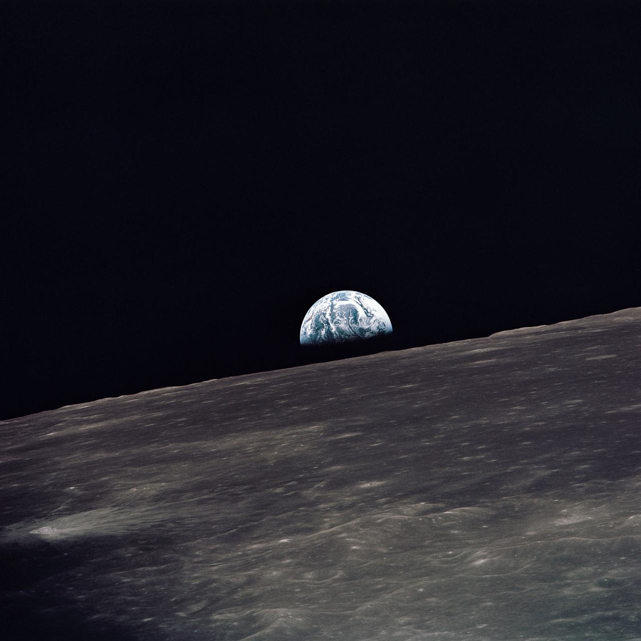
AS10-27-3890 (18-26 May 1969) --- A view of Earth rising above the lunar horizon photographed from the Apollo 10 Lunar Module, looking west in the direction of travel. The Lunar Module at the time the picture was taken was located above the lunar farside highlands at approximately 105 degrees east longitude.
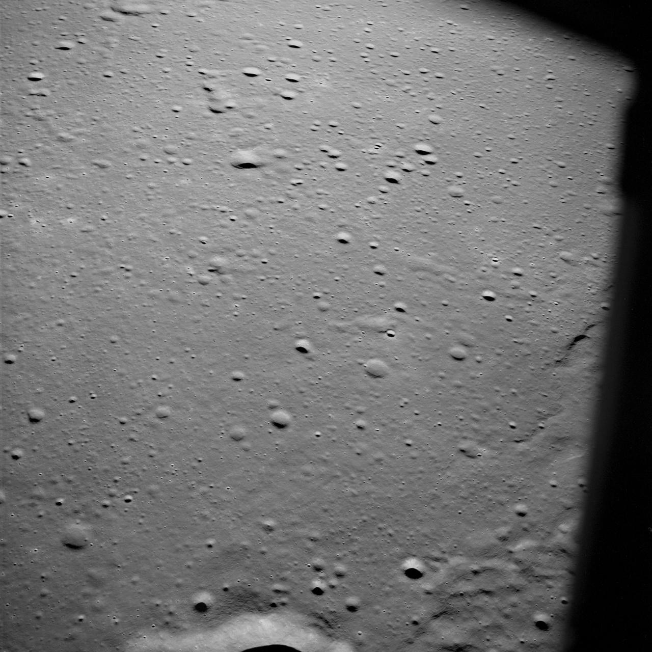
AS10-29-4321 (18-26 May 1969) --- An Apollo 10 oblique view of the western portion of the Sea of Tranquility. The area in the picture is located approximately 70 nautical miles east-southeast of Apollo Landing Site 2. The flat terrain pitted by moderate-sized craters is typical of this portion of Mare Tranquillitatis.
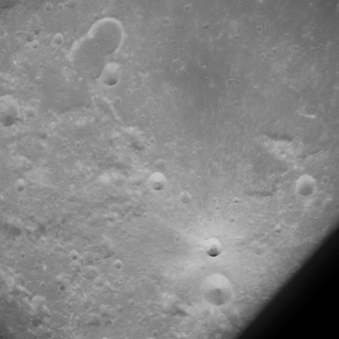
AS10-32-4845 (18-26 May 1969) --- An Apollo 10 southwest oblique view of the crater Censorinus which is located in the highland terrain bordering the Sea of Tranquility. HOLD PICUTRE WITH WINDOW FRAME AT LOWER LEFT. Censorinus is the bright crater in the lower left of the photograph. Censorinus is about 5 kilometers (about 3 statute miles) in diameter. Immediately to the left of Censorinus is the larger crater Censorinus A. The Sea of Tranquility is to the lower right of the photograph, which was taken from the Command and Service Modules. Censorinus is one of the brighter craters on the lunar surface.
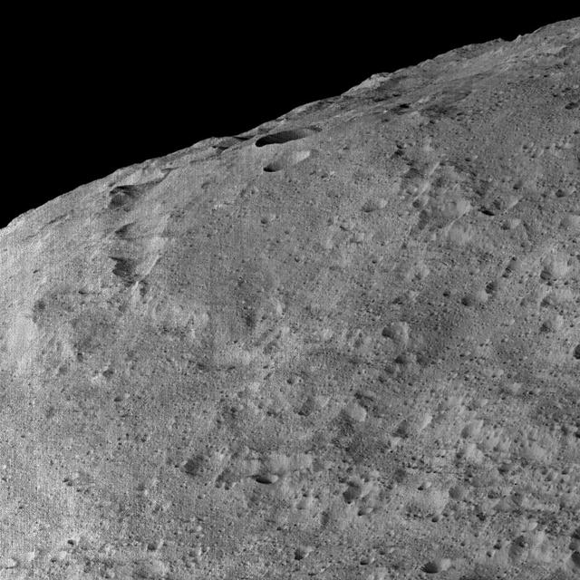
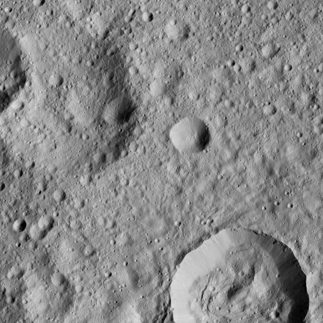
These views of Ceres, taken by NASA Dawn spacecraft on December 10, show an area in the southern part of the southern hemisphere of the dwarf planet.
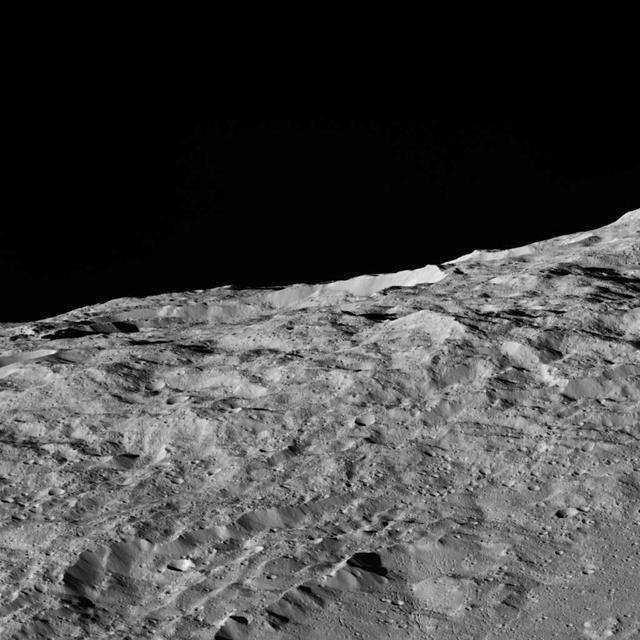
This view of Ceres, taken by NASA Dawn spacecraft on December 10, 2015, shows an area in the southern mid-latitudes of the dwarf planet.
NASA Terra spacecraft captured these views of the dust and sand that swept over northeast China on March 10, 2004.
S69-33854 (4 May 1969) --- Aerial (high-angle, clasp) view of the Apollo 10 (Spacecraft 106/Lunar Module 4/Saturn 505) space vehicle on Pad B, Launch Complex 39, Kennedy Space Center. This photograph of the 363-feet tall Apollo/Saturn V stack was taken during pull back of the mobile service structure. The Apollo 10 crew will be astronauts Thomas P. Stafford, John W. Young, and Eugene A. Cernan.
S69-34320 (17 May 1969) --- Ground level view of the 363-feet tall Apollo 10 (Spacecraft 106/Lunar Module 4/Saturn 505) space vehicle on Pad B, Launch Complex 39, Kennedy Space Center. The service structure is in the right foreground. The crew of the Apollo 10 lunar orbit mission will be astronauts Thomas P. Stafford, commander; John W. Young, command module pilot; and Eugene A. Cernan, lunar module pilot.
S69-34327 (13 May 1969) --- Aerial, high-angle, view of the Apollo 10 (Spacecraft 106/Lunar Module 4/Saturn 505) space vehicle at Pad B, Launch Complex 39, Kennedy Space Center, Florida. The crew of the Apollo 10 lunar orbit mission will be astronauts Thomas P. Stafford, commander; John W. Young, command module pilot; and Eugene A. Cernan, lunar module pilot.
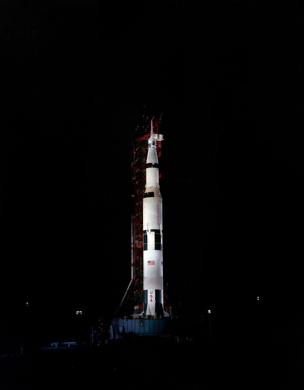
S69-33855 (4 May 1969) --- Nighttime, ground-level view of the Apollo 10 (Spacecraft 106/Lunar Module 4/Saturn 505) space vehicle on Pad B, Launch Complex 39, Kennedy Space Center. This photograph of the 363-feet tall Apollo/Saturn V stack was taken during pull back of the mobile service structure. The Apollo 10 crew will be astronauts Thomas P. Stafford, John W. Young, and Eugene A. Cernan.
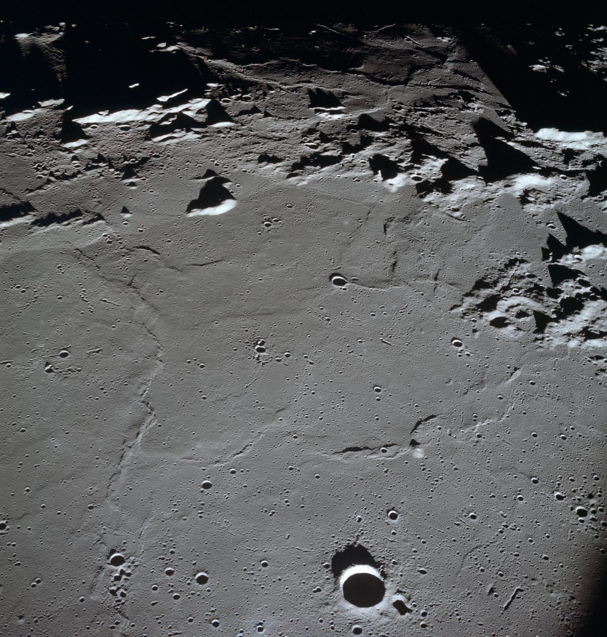
AS10-27-3907 (18-26 May 1969) --- Apollo 10 westward view across Apollo Landing Site 3 in the Central Bay. Apollo Landing Site 3 is in the middle distance at the left margin of the pronounced ridge in the left half of the photograph. Bruce, the prominent crater, near the bottom of the scene, is about 6 kilometers (3.7 statute miles) in diameter. Topographic features on the surface of the Central Bay are accentuated by the low sun angle. Sun angles range from near 6 degrees at the bottom of the photograph to less than one degree at the top.

S69-27916 (11 March 1969) --- Aerial view at Launch Complex 39, Kennedy Space Center, showing the Apollo 10 (Spacecraft 106/Lunar Module-4/Saturn 505) space vehicle on its way to Pad B. The Saturn V stack and its mobile launch tower are atop a huge crawler-transporter. The Apollo 10 flight is scheduled as a lunar orbit mission. The Apollo 10 crew will be astronauts Thomas P. Stafford, commander; John W. Young, command module pilot; and Eugene A. Cernan, lunar module pilot.
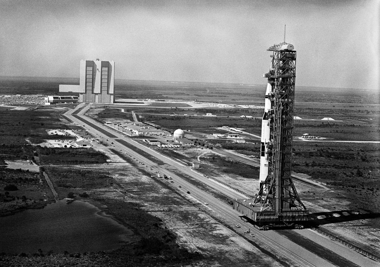
S69-27741 (11 March 1969) --- Aerial view at Launch Complex 39, Kennedy Space Center, showing the 363-feet tall Apollo 10 (Spacecraft 106/Lunar Module-4/Saturn 505) space vehicle on its way to Pad B. The Vehicle Assembly Building is in the background. The Saturn V stack and its mobile launch tower are atop a huge crawler-transporter. The Apollo 10 flight is schedule as a lunar orbit mission. The Apollo 10 crew will be astronauts Thomas P. Stafford, commander; John W. Young, command module pilot; and Eugene A. Cernan, lunar module pilot.
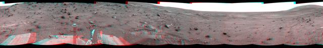
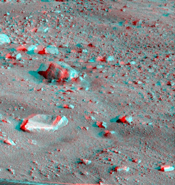
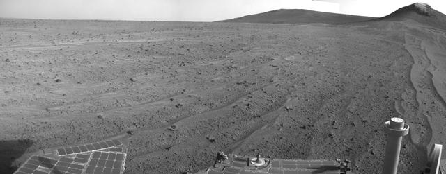
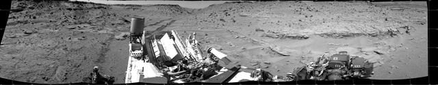
NASA Mars Exploration Rover Spirit used its navigation camera to take the images that have been combined into this stereo, full-circle view of the rover surroundings on March 10, 2009. 3D glasses are necessary to view this image.
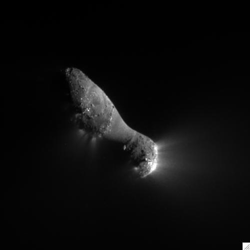
This close-up view of comet Hartley 2 was taken at 7:00 a.m. PDT 10 a.m. EDT, after NASA EPOXI mission flew by.
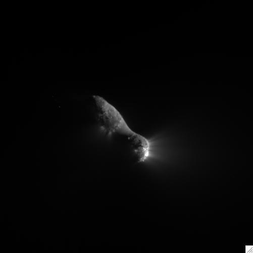
This close-up view of comet Hartley 2 was taken at 7:00 a.m. PDT 10 a.m. EDT, after NASA EPOXI mission flew by.
This anaglyph, acquired by NASA Phoenix Lander on Jun. 10, 2008, shows a large rock called Winkies. 3D glasses are necessary to view this image.

A recent NASA Hubble Space Telescope view reveals Uranus surrounded by its four major rings and by 10 of its 17 known satellites.
AS10-34-5026 (18-26 May 1969) --- An Apollo 10 photograph of Earth taken from 100,000 miles away. Visible are many areas of Europe and Africa. Among the features and countries identifiable are Portugal, Spain, Italy, the Mediterranean Sea, Greece, Turkey, Bulgaria, the Black Sea, Libya, Egypt, Saudi Arabia, the Sinai Peninsula, the Nile Delta, Lake Chad, and South Africa. The crew members for Apollo 10 are astronauts Thomas P. Stafford, commander; John W. Young, command module pilot; and Eugene E. Cernan, lunar module pilot. Astronaut Young remained in lunar orbit, in the Command and Service Modules (CSM) "Charlie Brown", while astronauts Stafford and Cernan descended to within nine miles of the lunar surface, in the Lunar Module (LM) "Snoopy".
NASA Mars rover Opportunity captured this view southward just after completing a 338-foot 103-meter southward drive, in reverse, on Aug. 10, 2014. The foreground of this view from the rover Navcam includes the rear portion of the rover deck.
This stereo view combining images taken on Feb. 10, 2014, by the Navigation Camera Navcam on NASA Curiosity Mars rover looks back to where the rover crossed a dune at Dingo Gap four days earlier. You need 3D glasses to view this image.
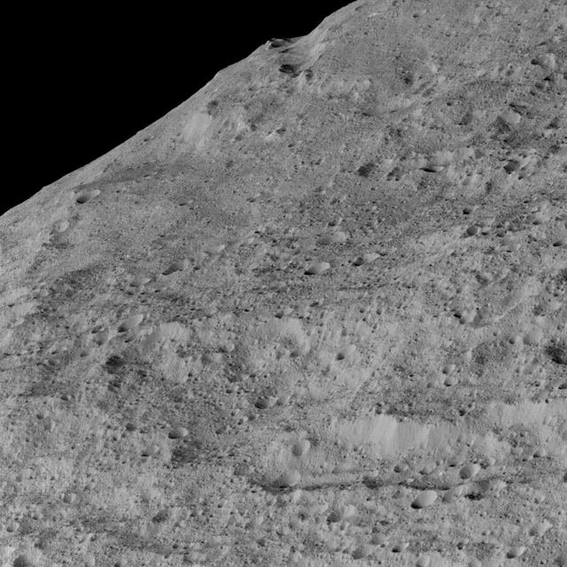
This view of Ceres, taken by NASA Dawn spacecraft on December 10, 2015, shows an area in the southern mid-latitudes of the dwarf planet. It is located in an area around a crater chain called Samhain Catena.
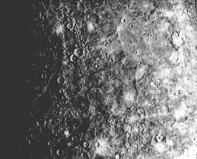
A field of bright rays, created by ejecta from a crater, radiating to the north top from off camera lower right is seen in this view of Mercury taken Sept. 21, 1974 by NASA Mariner 10.
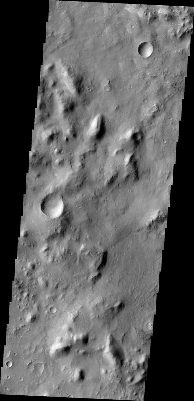
NASA Mars Odyssey spacecraft captured this image on Feb. 19, 2012, 10 years to the day after the camera recorded its first view of Mars. This image covers an area in the Nepenthes Mensae region north of the Martian equator.
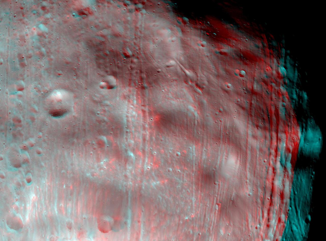
NASA Mars Reconnaissance Orbiter took two images of the larger of Mars two moons, Phobos, within 10 minutes of each other on March 23, 2008. 3D glasses are necessary to view this image.
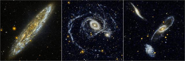
Located 10 million light-years away in the southern constellation Sculptor, the Silver Dollar galaxy, or NGC 253, is one of the brightest spiral galaxies in the night sky as seen in this edge-on view from NASA Galaxy Evolution Explorer.
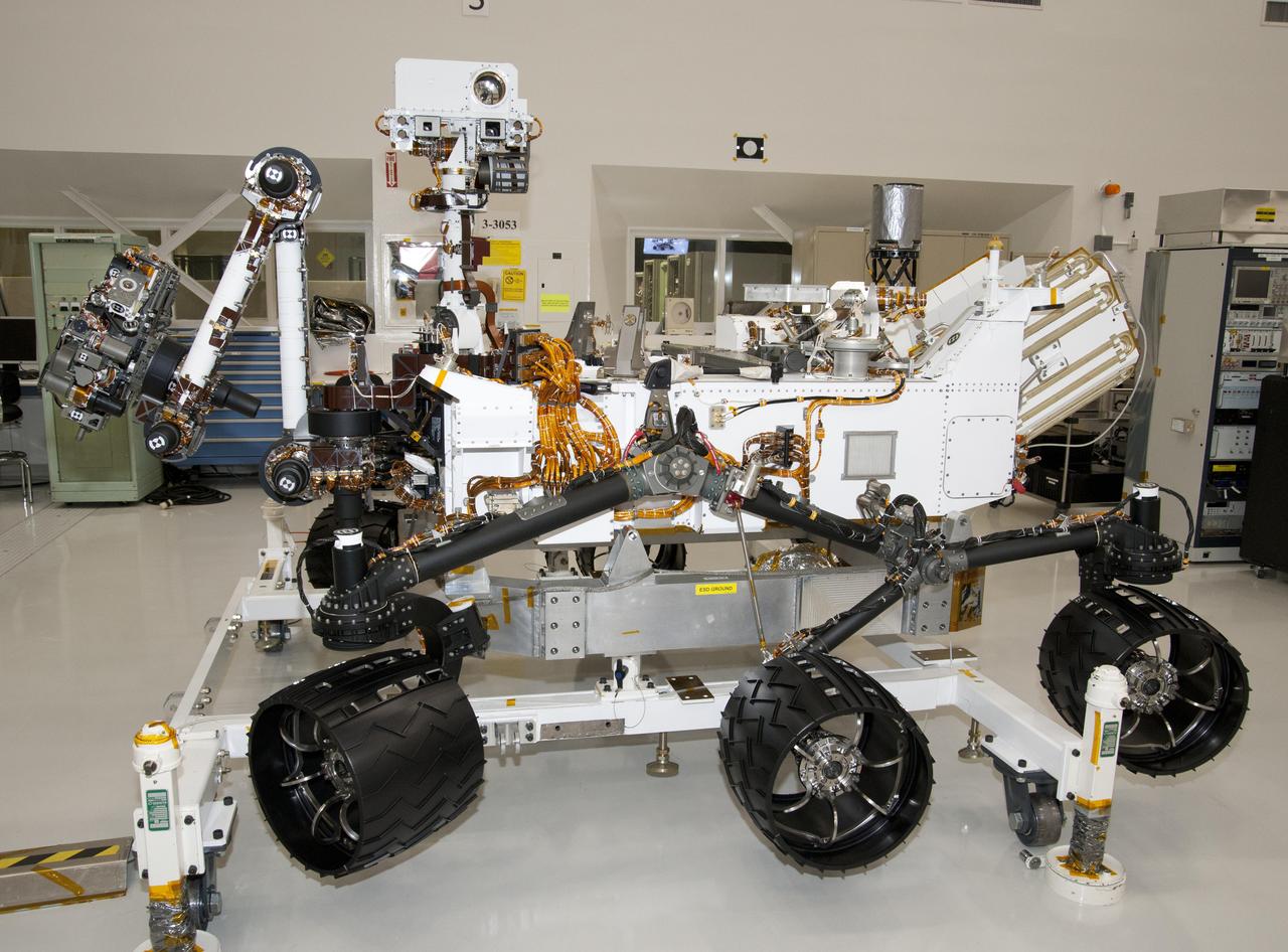
The rover for NASA Mars Science Laboratory mission, named Curiosity, is about 3 meters 10 feet long, not counting the additional length that the rover arm can be extended forward. The front of the rover is on the left in this side view.
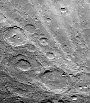
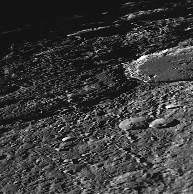
NASA Mariner 10 shows a close-up view of one-half of a circular basin the largest observed on Mercury. Hills and valleys extend in a radial fashion outward from the main ring.
NASA Mariner 10 shows a close-up view of craters Vyasa and Stravinsky on Mercury. Stravinsky is a smooth-floored crater partially seen overlying the rim of the larger, rougher crater Vyasa in the center and left.
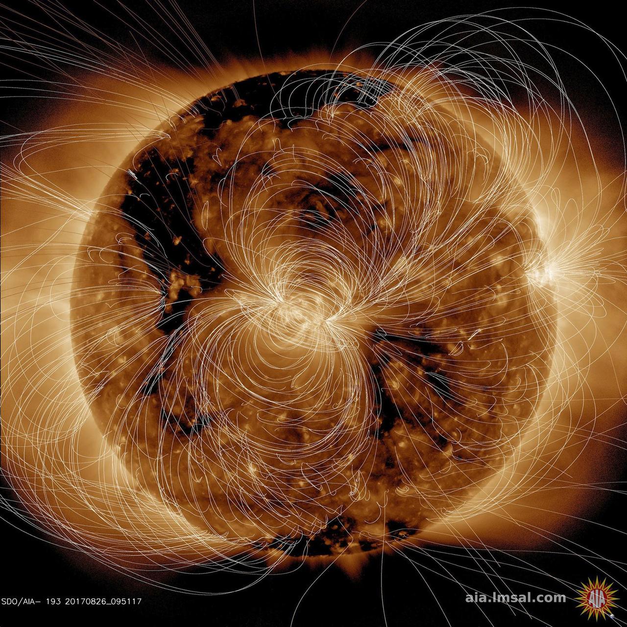
NASA's Solar Dynamics Observatory (SDO) scientists use their computer models to generate a view of the sun's magnetic field (Aug. 10, 2018). We took the opportunity to compare an extreme ultraviolet view of the sun with the same image showing the superimposed field lines. The bright active region right at the central area of the sun clearly shows a concentration of field lines, as well as the small active region at the sun's right edge, but to a lesser extent. Magnetism drives the dynamic activity near the sun's surface. Movies are available at https://photojournal.jpl.nasa.gov/catalog/PIA22662
NASA Mariner 10 was launched on November 3, 1973, 12:45 am PST, from Cape Canaveral on an Atlas/Centaur rocket a reconditioned Intercontinental Ballistic Missile - ICBM.
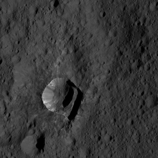
NASA's Dawn spacecraft views Oxo Crater (6 miles, 10 kilometers wide) in this view from Ceres. Dawn took this image on June 4, 2016, from its low-altitude mapping orbit, at a distance of about 240 miles (385 kilometers) above the surface. The image resolution is 120 feet (35 meters) per pixel. http://photojournal.jpl.nasa.gov/catalog/PIA20950

As it sped away from Venus, NASA's Mariner 10 spacecraft captured this seemingly peaceful view of a planet the size of Earth, wrapped in a dense, global cloud layer. But, contrary to its serene appearance, the clouded globe of Venus is a world of intense heat, crushing atmospheric pressure and clouds of corrosive acid. This newly processed image revisits the original data with modern image processing software. A contrast-enhanced version of this view, also provided here, makes features in the planet's thick cloud cover visible in greater detail. The clouds seen here are located about 40 miles (60 kilometers) above the planet's surface, at altitudes where Earth-like atmospheric pressures and temperatures exist. They are comprised of sulfuric acid particles, as opposed to water droplets or ice crystals, as on Earth. These cloud particles are mostly white in appearance; however, patches of red-tinted clouds also can be seen. This is due to the presence of a mysterious material that absorbs light at blue and ultraviolet wavelengths. Many chemicals have been suggested for this mystery component, from sulfur compounds to even biological materials, but a consensus has yet to be reached among researchers. The clouds of Venus whip around the planet at nearly over 200 miles per hour (100 meters per second), circling the globe in about four and a half days. That these hurricane-force winds cover nearly the entire planet is another unexplained mystery, especially given that the solid planet itself rotates at a very slow 4 mph (less than 2 meters per second) — much slower than Earth's rotation rate of about 1,000 mph (450 meters per second). The winds and clouds also blow to the west, not to the east as on the Earth. This is because the planet itself rotates to the west, backward compared to Earth and most of the other planets. As the clouds travel westward, they also typically progress toward the poles; this can be seen in the Mariner 10 view as a curved spiral pattern at mid latitudes. Near the equator, instead of long streaks, areas of more clumpy, discrete clouds can be seen, indicating enhanced upwelling and cloud formation in the equatorial region, spurred on by the enhanced power of sunlight there. This view is a false color composite created by combining images taken using orange and ultraviolet spectral filters on the spacecraft's imaging camera. These were used for the red and blue channels of the color image, respectively, with the green channel synthesized by combining the other two images. Flying past Venus en route to the first-ever flyby of Mercury, Mariner 10 became the first spacecraft to use a gravity assist to change its flight path in order to reach another planet. The images used to create this view were acquired by Mariner 10 on Feb. 7 and 8, 1974, a couple of days after the spacecraft's closest approach to Venus on Feb. 5. Despite their many differences, comparisons between Earth and Venus are valuable for helping to understand their distinct climate histories. Nearly 50 years after this view was obtained, many fundamental questions about Venus remain unanswered. Did Venus have oceans long ago? How has its atmosphere evolved over time, and when did its runaway greenhouse effect begin? How does Venus lose its heat? How volcanically and tectonically active has Venus been over the last billion years? This image was processed from archived Mariner 10 data by JPL engineer Kevin M. Gill. The Mariner 10 mission was managed by NASA's Jet Propulsion Laboratory. https://photojournal.jpl.nasa.gov/catalog/PIA23791
This view from NASA's Dawn spacecraft shows cratered terrain on Ceres, centered at 10 degrees south latitude, 197 degrees east longitude. Dawn took this image on June 1, 2016, from its low-altitude mapping orbit, at a distance of about 240 miles (385 kilometers) above the surface. The image resolution is 120 feet (35 meters) per pixel. http://photojournal.jpl.nasa.gov/catalog/PIA20931
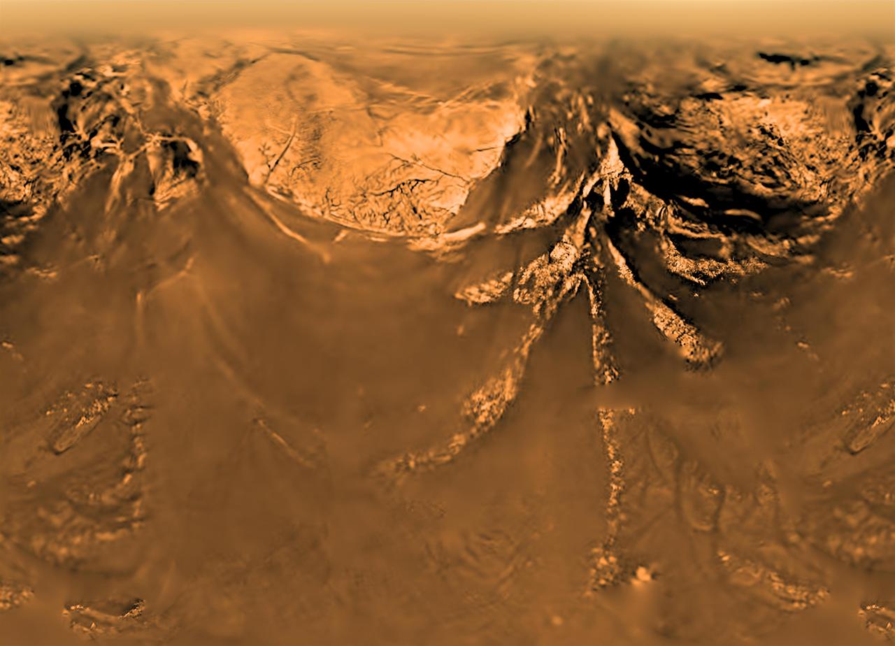
This poster shows a flattened (Mercator) projection of the Huygens probe's view from 10 kilometers altitude (6 miles). The images that make up this view were taken on Jan. 14, 2005, with the descent imager/spectral radiometer onboard the European Space Agency's Huygens probe. The Huygens probe was delivered to Saturn's moon Titan by the Cassini spacecraft, which is managed by NASA's Jet Propulsion Laboratory, Pasadena, Calif. NASA supplied two instruments on the probe, the descent imager/spectral radiometer and the gas chromatograph mass spectrometer. http://photojournal.jpl.nasa.gov/catalog/PIA08113
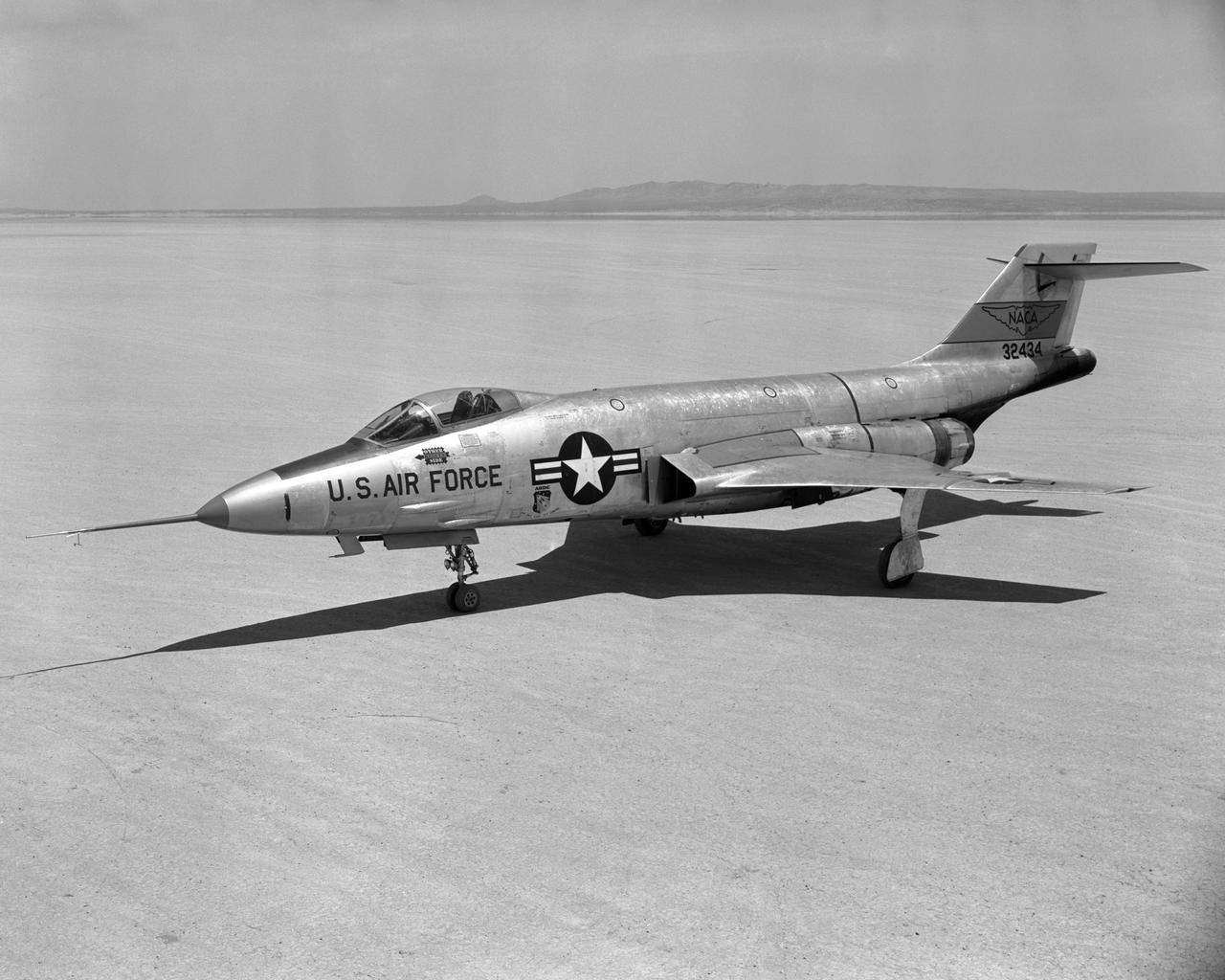
F-101A Front quarter view on Edwards Lakebed Aug. 10, 1956
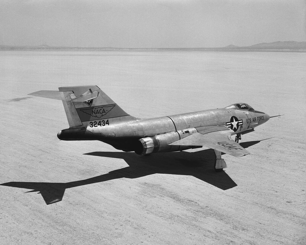
F-101A Rear quarter view on Edwards Lakebed. Aug. 10, 1956
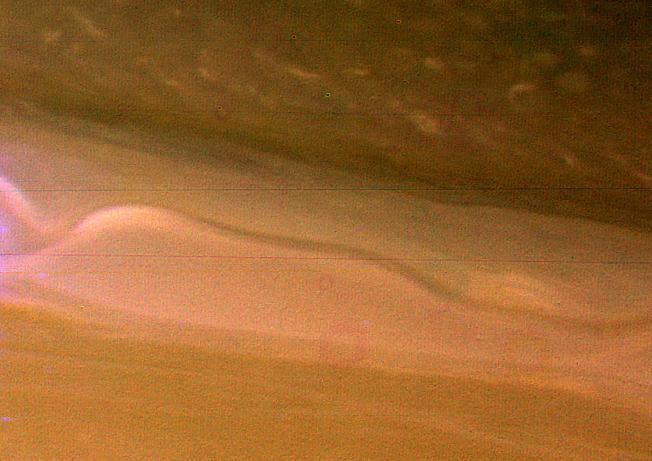
A view of Saturn clouds extending from 40 N latitude shows a ribbon-like wave structure in the south with small convective features marking a westward jet in the north. This image was obtained on November 10, 1980 by NASA Voyager 1.
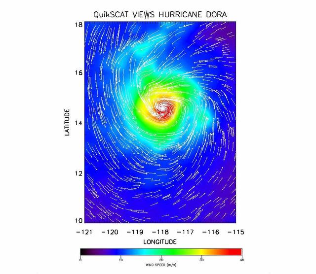
The SeaWinds instrument onboard NASA new QuikScat ocean-viewing satellite captured this image of Hurricane Dora in the eastern tropical Pacific Ocean on August 10, as it was blowing at speeds of nearly 40 meters per second 90 miles per hour.
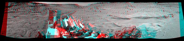
This panorama combining images taken on Feb. 10, 2014, by NASA Curiosity Mars rover looks back to where the rover crossed a dune at Dingo Gap four days earlier. The view is centered toward the east and spans about 225 degrees.
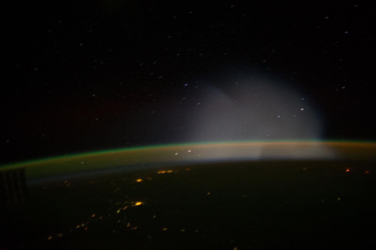
ISS037-E-009321 (10 Oct. 2013) --- This is one of a series of views that captured a missile launch from Earth as seen on Oct. 10, 2013 by the Expedition 37 crew aboard the International Space Station.
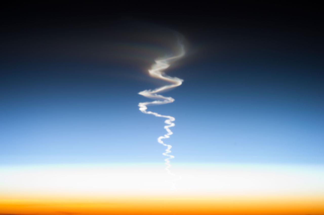
ISS037-E-009203 (10 Oct. 2013) --- This is one of a series of views that captured a missile launch from Earth as seen on Oct. 10, 2013 by the Expedition 37 crew aboard the International Space Station.

ISS037-E-009302 (10 Oct. 2013) --- This is one of a series of views that captured a missile launch from Earth as seen on Oct. 10, 2013 by the Expedition 37 crew aboard the International Space Station.
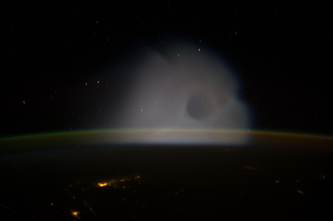
ISS037-E-009301 (10 Oct. 2013) --- This is one of a series of views that captured a missile launch from Earth as seen on Oct. 10, 2013 by the Expedition 37 crew aboard the International Space Station.
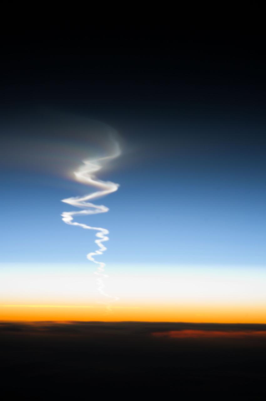
ISS037-E-009212 (10 Oct. 2013) --- This is one of a series of views that captured a missile launch from Earth as seen on Oct. 10, 2013 by the Expedition 37 crew aboard the International Space Station.
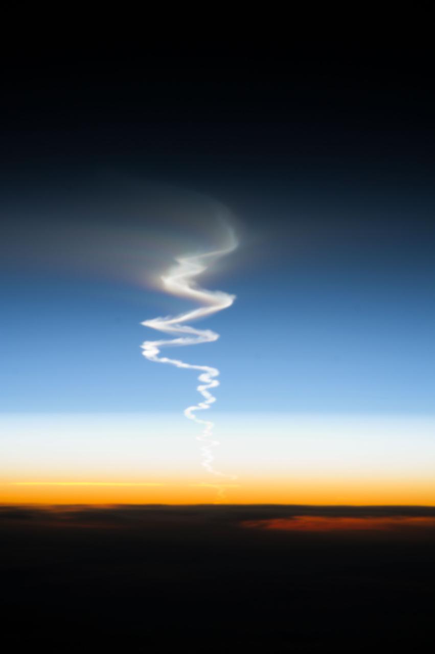
ISS037-E-009224 (10 Oct. 2013) --- This is one of a series of views that captured a missile launch from Earth as seen on Oct. 10, 2013 by the Expedition 37 crew aboard the International Space Station.
ISS037-E-009296 (10 Oct. 2013) --- This is one of a series of views that captured a missile launch from Earth as seen on Oct. 10, 2013 by the Expedition 37 crew aboard the International Space Station.
ISS037-E-009333 (10 Oct. 2013) --- This is one of a series of views that captured a missile launch from Earth as seen on Oct. 10, 2013 by the Expedition 37 crew aboard the International Space Station.

With two cameras set about 10 inches apart at the top of the rover's remote sensing mast, Mastcam-Z can produce a 3D image to be viewed with 3D glasses. This is similar to the way our two human eyes work, with our brain forming the 3D image, but no glasses needed! This stereo, or 3D, image was taken with the Mastcam-Z simulator system, used during testing at Arizona State University. https://photojournal.jpl.nasa.gov/catalog/PIA24196
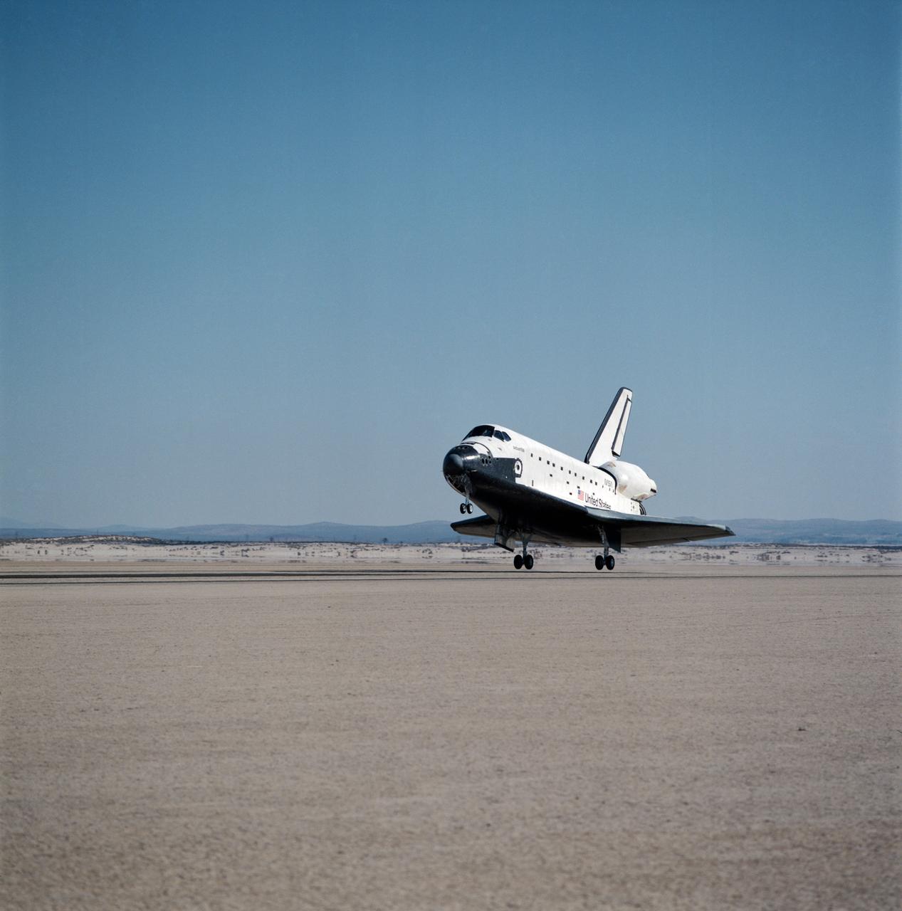
DFRF views of "Atlantis" Touchdown, Landing and Egress at the end of the STS-28/51J Mission, 10/07/1985.
A pre launch view of Pioneer-10 (or F) spacecraft encapsulated and mated with a Atlas-Centaura launch vehicle in preparation for mission to Jupiter
A pre launch view of Pioneer-10 (or F) spacecraft encapsulated and mated with a Atlas-Centaura launch vehicle in preparation for mission to Jupiter
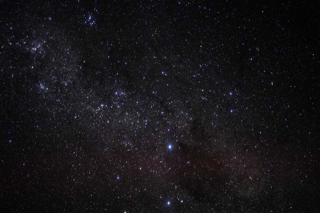
iss045e057047 (10/11/2015) --- A view of stars taken by the Expedition 45 crew aboard the International Space Station (ISS).
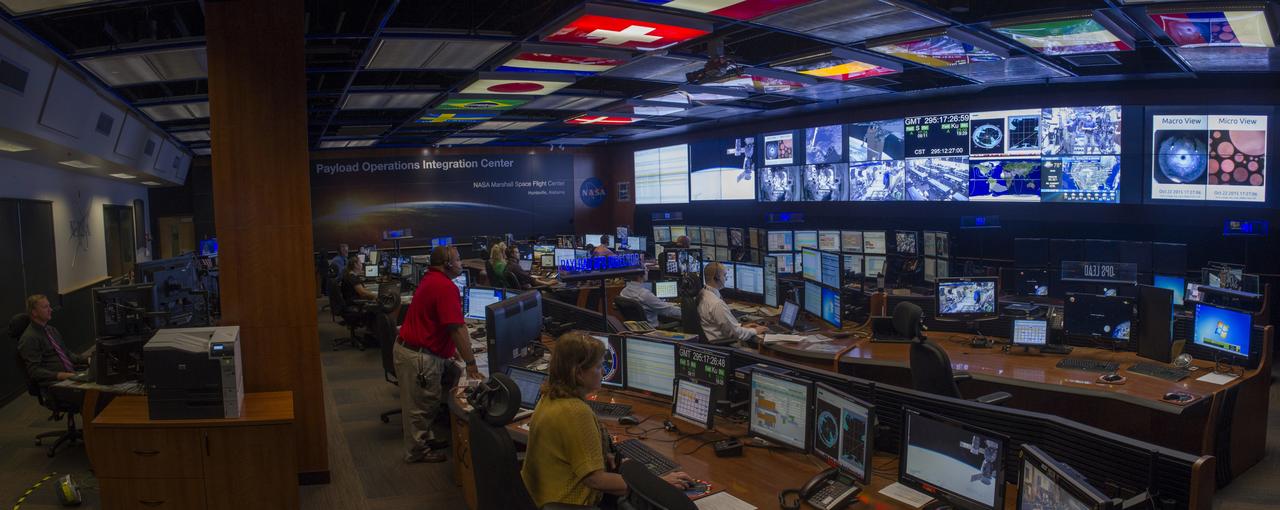
PANORAMIC VIEW OF PAYLOAD OPERATIONS INTEGRATION CENTER, PCA1, BLDG. 4663…UPDATED 10/21/15
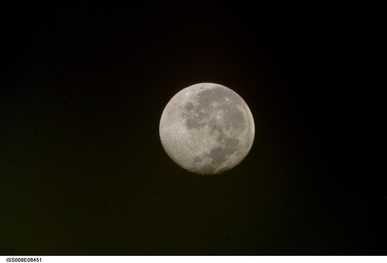
ISS008-E-08451 (10 December 2003) --- This view of a full moon was photographed by one of the Expedition 8 crewmembers aboard the International Space Station (ISS).
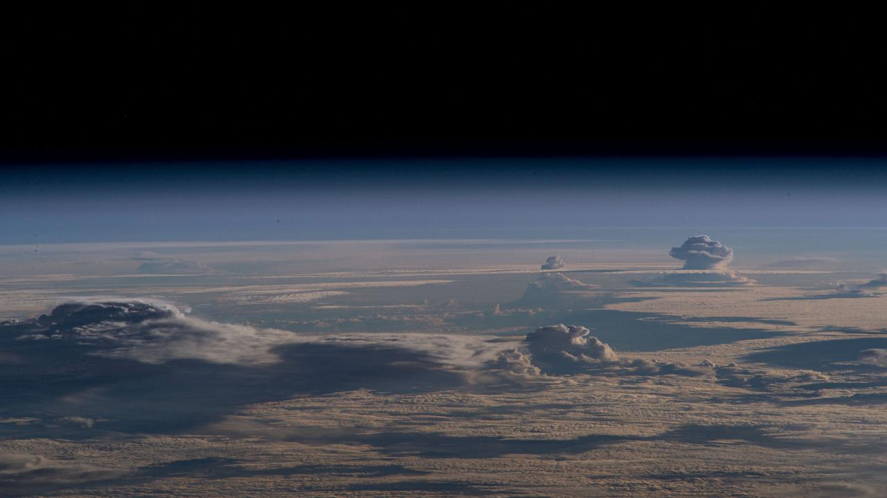
iss069e056653 (Aug. 10, 2023) --- Storm clouds are pictured in this oblique view from the International Space Station as it orbited 261 miles above Australia's Gulf of Carpentaria.
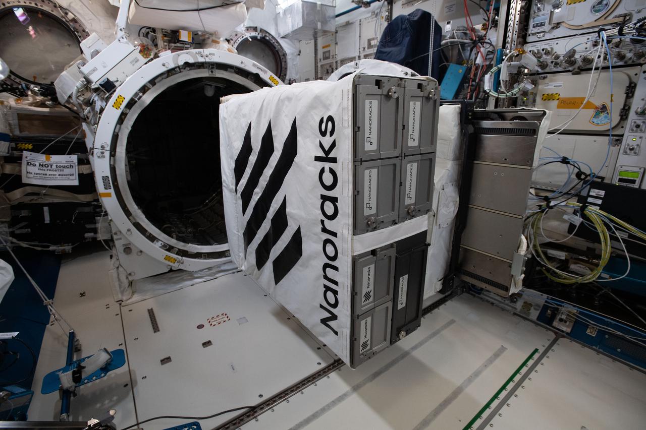
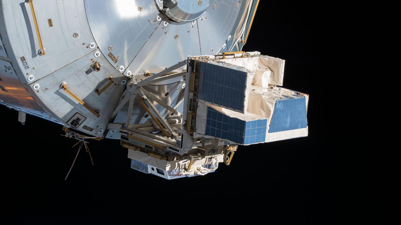
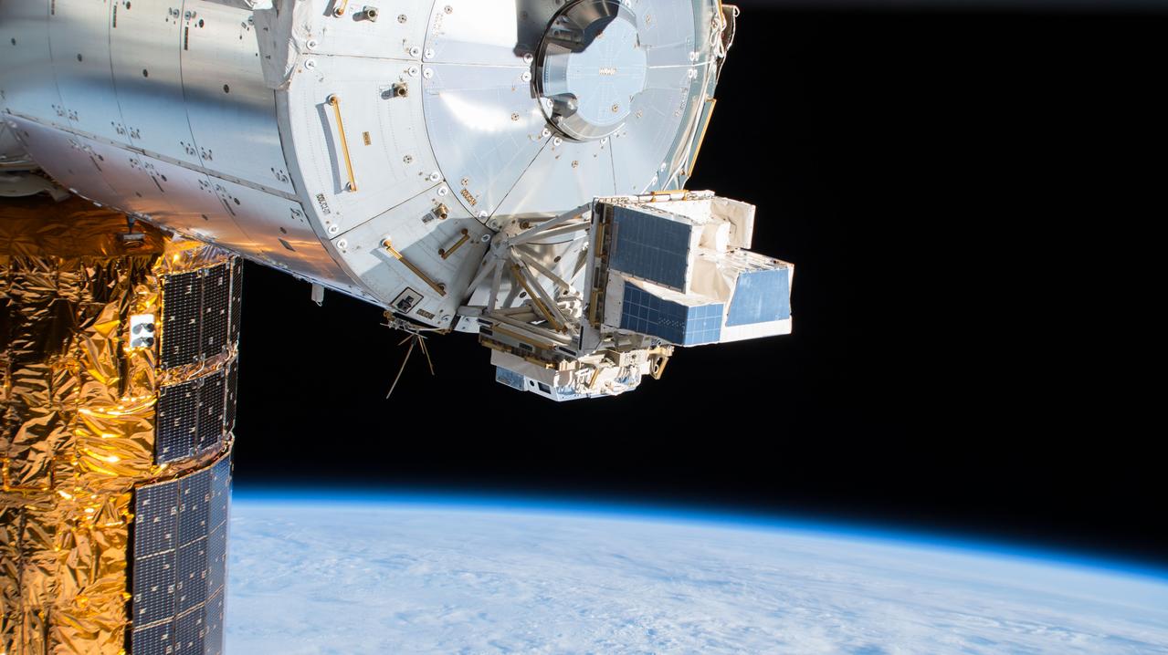
iss065e444435 (10/11/2021) --- A view of NanoRacks CubeSat Deployers hardware on the MPEP (Multipurpose Experiment Platform) aboard the International Space Station (ISS).

jsc2021e010281 (3/10/2021) --- A preflight view of the EasyXtal hanging-drop vapor diffusion crystal plates. Photo courtesy of Timothy Mueser.
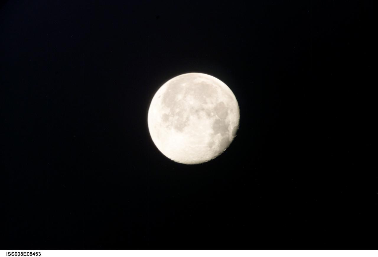
ISS008-E-08453 (10 December 2003) --- This view of a full moon was photographed by one of the Expedition 8 crewmembers aboard the International Space Station (ISS).
iss057e055411 (10/19/2018) - View of the Atmosphere-Space Interactions Monitor (ASIM) and the High Definition Earth Viewing (HDEV) payloads installed on the Columbus External Payload Facility (Columbus-EPF). Photo was taken by the ground-controlled External High Definition Camera 3 (EHDC3).
iss057e055409 (10/19/2018) - View of the Atmosphere-Space Interactions Monitor (ASIM) and the High Definition Earth Viewing (HDEV) payloads installed on the Columbus External Payload Facility (Columbus-EPF). Photo was taken by the ground-controlled External High Definition Camera 3 (EHDC3).
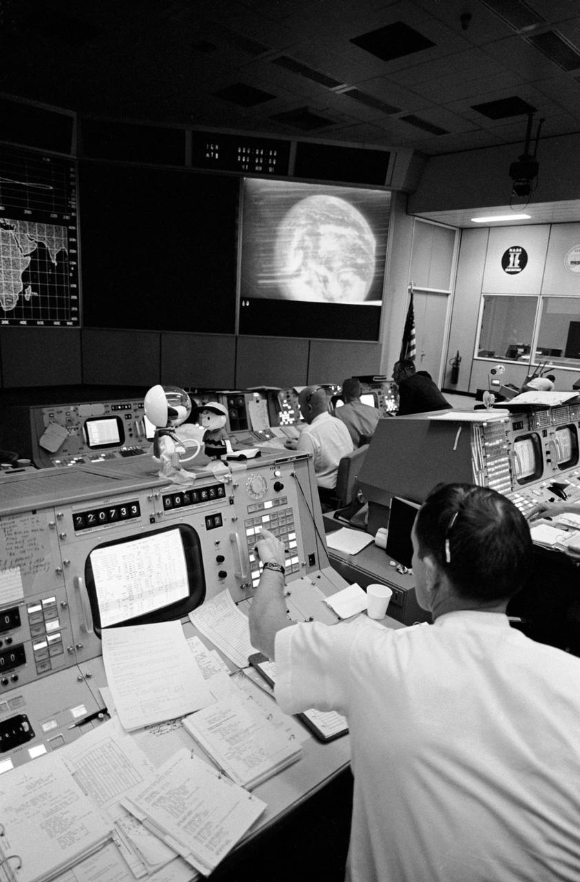
S69-34040 (18 May 1969) --- Partial view of activity in the Mission Operations Control Room in the Mission Control Center, Building 30, on the first day of the Apollo 10 lunar orbit mission. The television monitor shows a picture of Earth made during the second telecast from the Apollo 10's color TV camera.
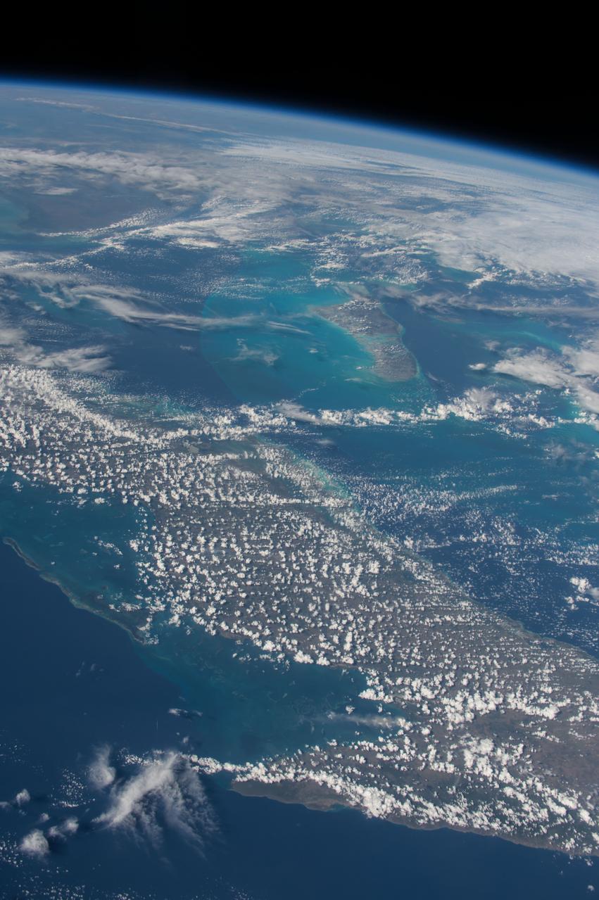
ISS042E135486 (01/10/2015) --- Just another sunny day in the Caribbean sea as viewed by astronauts aboard the International Space Station. This image was tweeted out by NASA astronaut Terry Virts as he captured the Earth observation of #Cuba and #Bahamas on Jan. 10, 2015.

Views of the STS-31/61B Crew during Emergency Egress Training, Bldg. 9A, 10/28/1985; and, the Crew Preflight Press Conference, Bldg. 2, 10/24/1985. 1. STS-31/61B - CREW TRAINING (EMERGENCY EGRESS) JSC, HOUSTON, TX
ISS028-E-015790 (10 July 2011) --- Although it appears very tiny in this view, photographed through a nadir-facing window of the International Space Station's Zvezda service module, the space shuttle Atlantis docked with the oribiting outpost shortly afterward. Docking took place at 10:27 a.m. (CDT).

The Sun's rotation brought a new active region into view, revealing the dynamic arches and twisting streams of its magnetic field (Oct. 10-11, 2018). A new active region is becoming more of a rare sight, as the Sun is currently approaching solar minimum -- the point of the 11-year solar cycle when activity is most reduced. The video clip, showing images taken in a wavelength of extreme ultraviolet light covers 33 hours and consists of over 500 frames (i.e., one frame selected every 4 minutes). Animations are available at https://photojournal.jpl.nasa.gov/catalog/PIA18139

The view, from the spacecraft's wide-angle camera (WAC), includes an inset view, near center left, from the narrow-angle camera (NAC). The NAC view (also available here at its full resolution) shows features about 10 times smaller than the WAC view. The wide-angle camera view has an image scale of about 105 feet (32 meters) per pixel; the narrow-angle camera view has an image scale of about 10 feet (3 meters) per pixel. Sunlight illuminates the scene from top. North on Dione is down. The views were acquired in visible light at an altitude of 334 miles (537 kilometers) above Dione. The images were acquired simultaneously during a close flyby of the icy moon on Aug. 17, 2015. The views were obtained near the time of Cassini's closest approach to Dione during the encounter, like PIA19654. The NAC images in these two image releases are the highest resolution views of Dione's surface acquired by Cassini. http://photojournal.jpl.nasa.gov/catalog/PIA19653

jsc2011e118362 - Panorama view of Apollo 16 lunar surface photos of the Station 10 and Sample 381 Rock taken during the second moonwalk of the mission. The panoramas were built by combining Apollo 16 images starting with frame AS16-114-18450 thru end frame AS16-114-18467. The panoramic images received minimal retouching by NASA imagery specialists, including the removal of lens flares that were problematic in stitching together the individual frames and blacking out the sky to the lunar horizon. These adjustments were made based on observations of the Moon walkers who reported that there are no stars visible in the sky due to the bright lunar surface reflection of the Sun.

PHOTO DATE: January 10, 2022. LOCATION: Bldg. 30, Apollo MOCR Viewing Room. SUBJECT: ASCAN Class of 2021 official swearing in ceremony. PHOTOGRAPHER: Josh Valcarcel
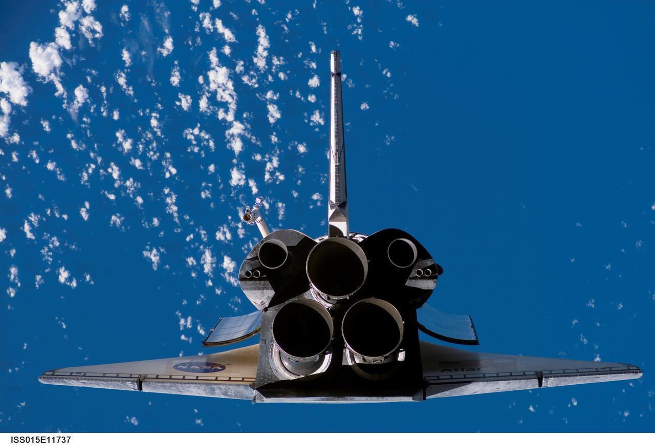
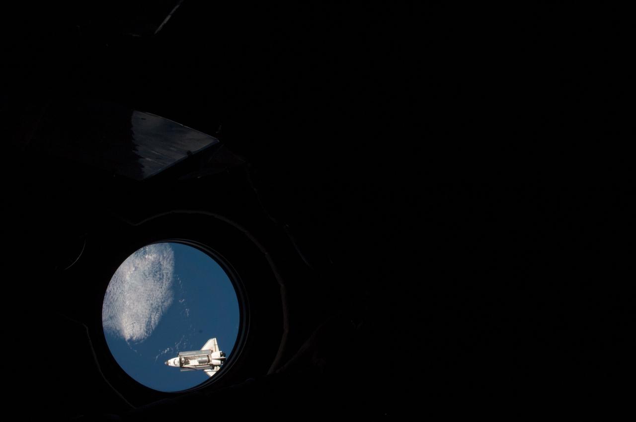
ISS015-E-11737 (10 June 2007) --- A view photographed from the International Space Station shows the Space Shuttle Atlantis' aft portions as the two spacecraft were nearing their much-anticipated link-up in Earth orbit.

S106-E-5061 (10 September 2000) --- The U.S.-built Unity node is heavily covered with shadow in this electronic still camera's (ESC) view recorded during rendezvous operations by the Space Shuttle Atlantis.
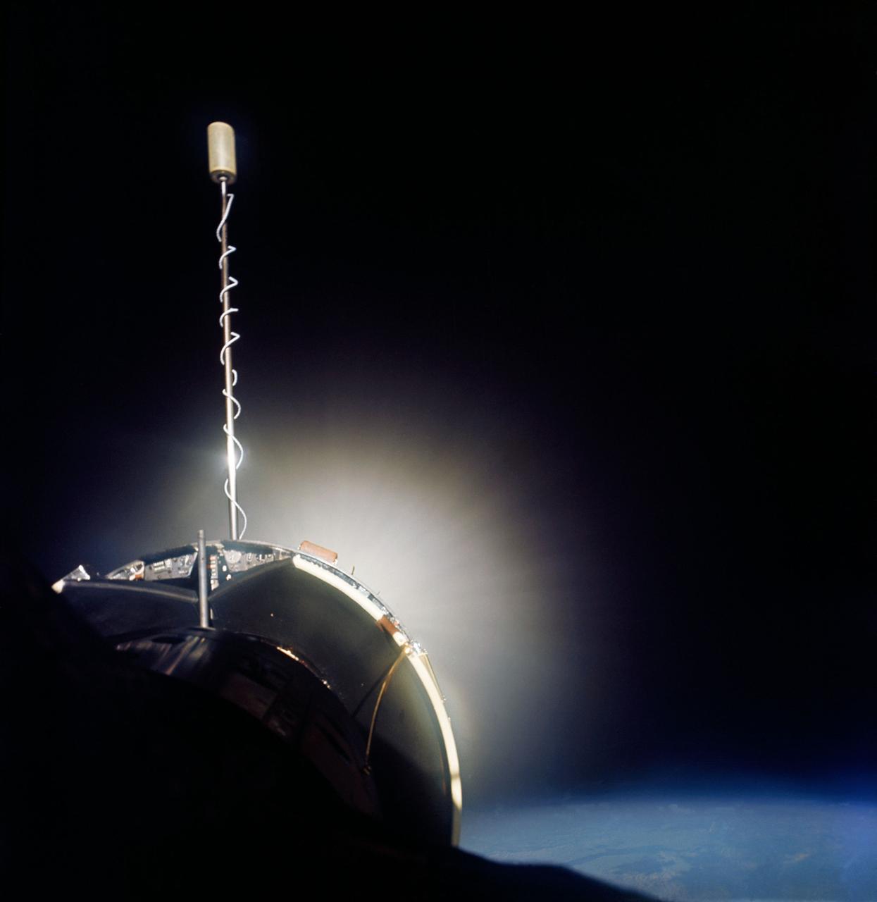
S66-46249 (18-21 July 1966) --- Agena Target Docking Vehicle docked to Gemini-10 spacecraft. Excellent view of Agena display panel. Glow from Agena's primary propulsion system. Photo credit: NASA
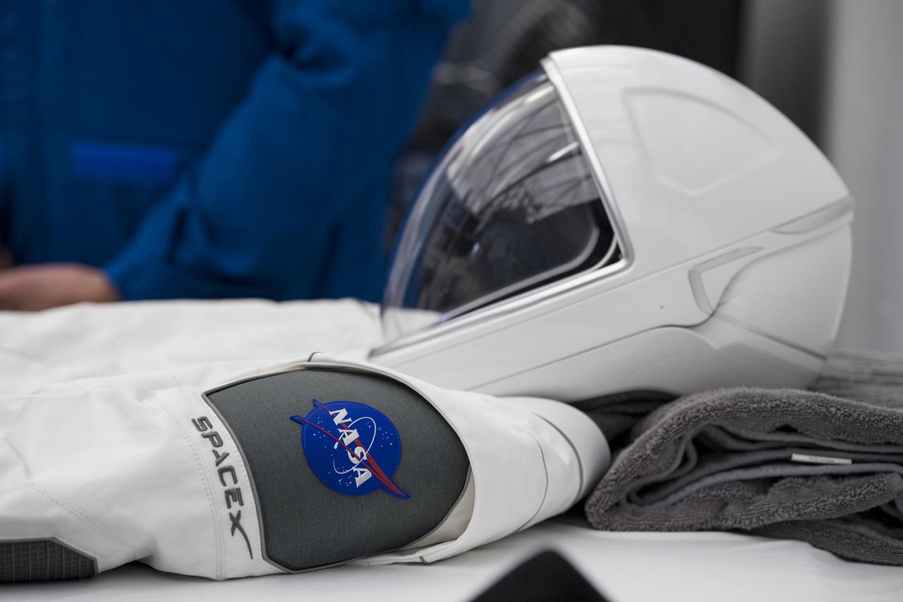
A view of one of the SpaceX suits that will be used for the Demo-2 launch at the SpaceX Headquarters, Thursday, Oct. 10, 2019 in Hawthorne, CA. Photo credit: (NASA/Aubrey Gemignani)
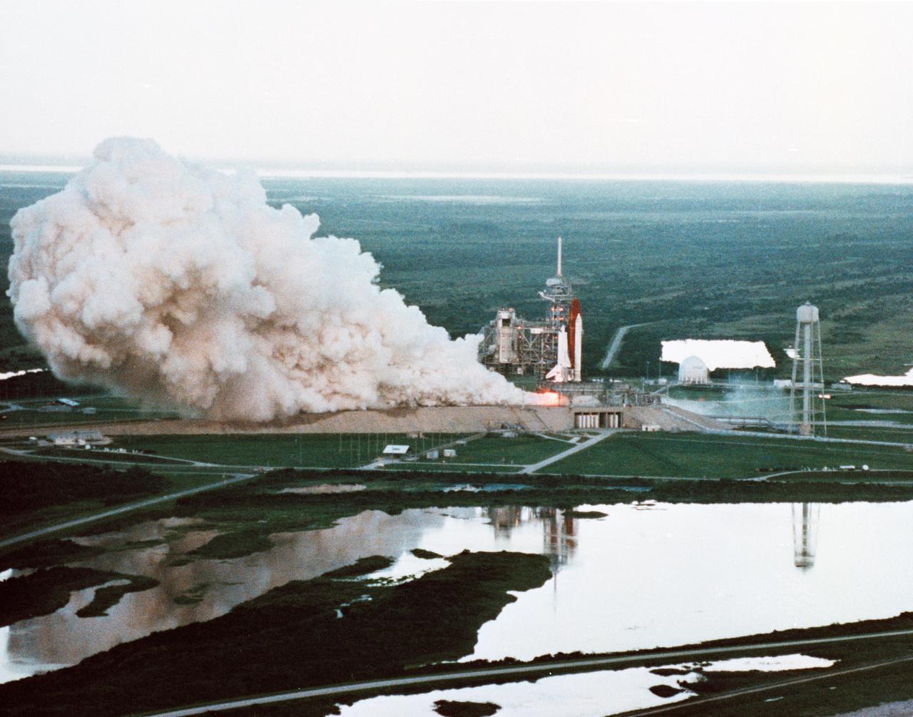
Documentary views of the STS-26 Flight Readiness Firing at KSC, Pad 39B, on 10 Aug 1988. (KSC-88PC-752 closer) (KSC-88PC-752, 753)

S124-E-008618 (10 June 2008) --- A partial view of International Space Station solar panels and Earth's atmosphere are photographed by a STS-124 crewmember on the International Space Station while Space Shuttle Discovery is docked with the station.
STS102-E-5095 (10 March 2001) --- The Leonardo Multi Purpose Logistics Module rests in Discovery's payload bay in this view taken from the station by a crew member using a digital still camera.
iss050e040296 (2/10/2017) --- View during the Packed Bed Reactor Experiment (PBRE) removal from the Microgravity Science Glovebox (MSG), in the U.S. Laboratory. Photo was taken during Expedition 50.
Candid views, Astronaut Donald L. Lind posing with the Shuttle Model and Payload Flight Assignment, Bldg. 9A, 03/10/1983. 1. EXHIBITS - SHUTTLE MODEL JSC, HOUSTON, TX
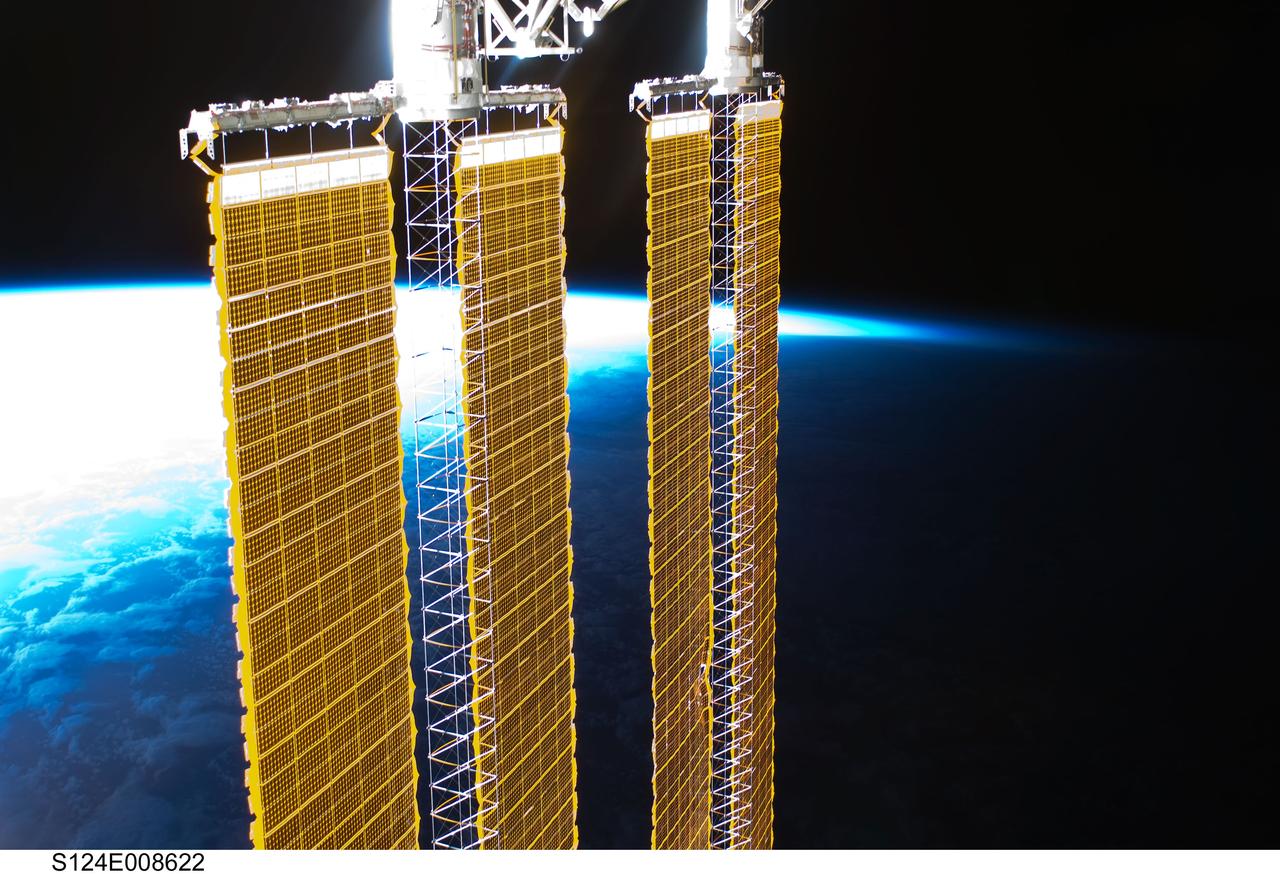
S124-E-008622 (10 June 2008) --- A partial view of International Space Station solar panels and Earth's horizon are photographed by a STS-124 crewmember on the International Space Station while Space Shuttle Discovery is docked with the station.

PHOTO DATE: January 10, 2022. LOCATION: Bldg. 30, Apollo MOCR Viewing Room. SUBJECT: ASCAN Class of 2021 official swearing in ceremony. PHOTOGRAPHER: Josh Valcarcel
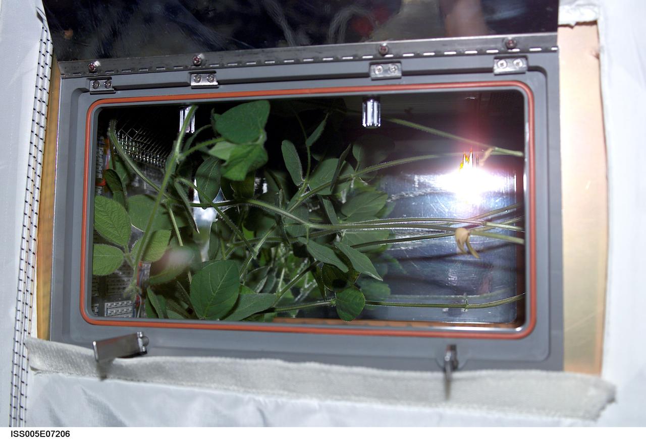
ISS005-E-07206 (10 July 2002) --- A close-up view of the Advanced Astroculture soybean plant growth experiment in the Destiny laboratory on the International Space Station (ISS).
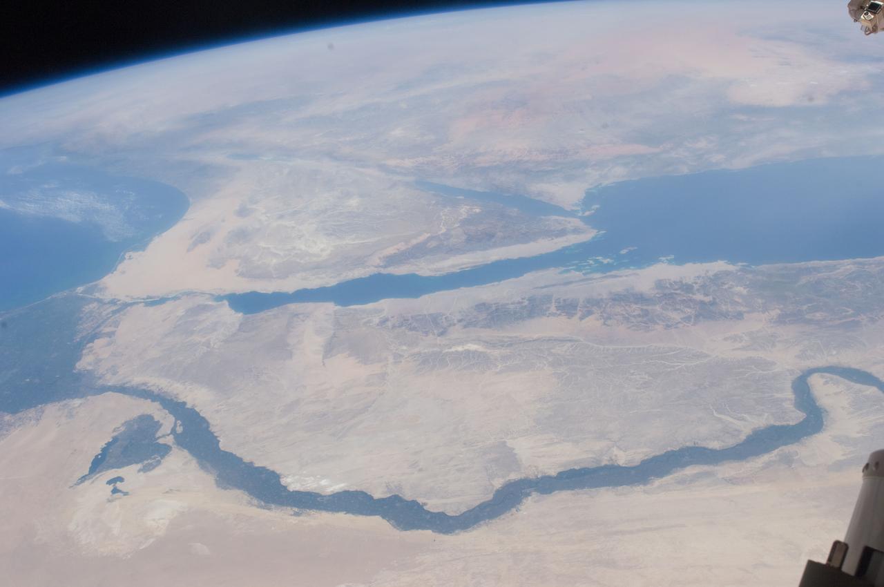
ISS028-E-014970 (10 July 2011) --- One of the crewmembers aboard the International Space Station recorded this oblique view showing the Nile River Delta and the Sinai Peninsula, with a 28 millimeter lens. The Mediterranean Coast is at far left.
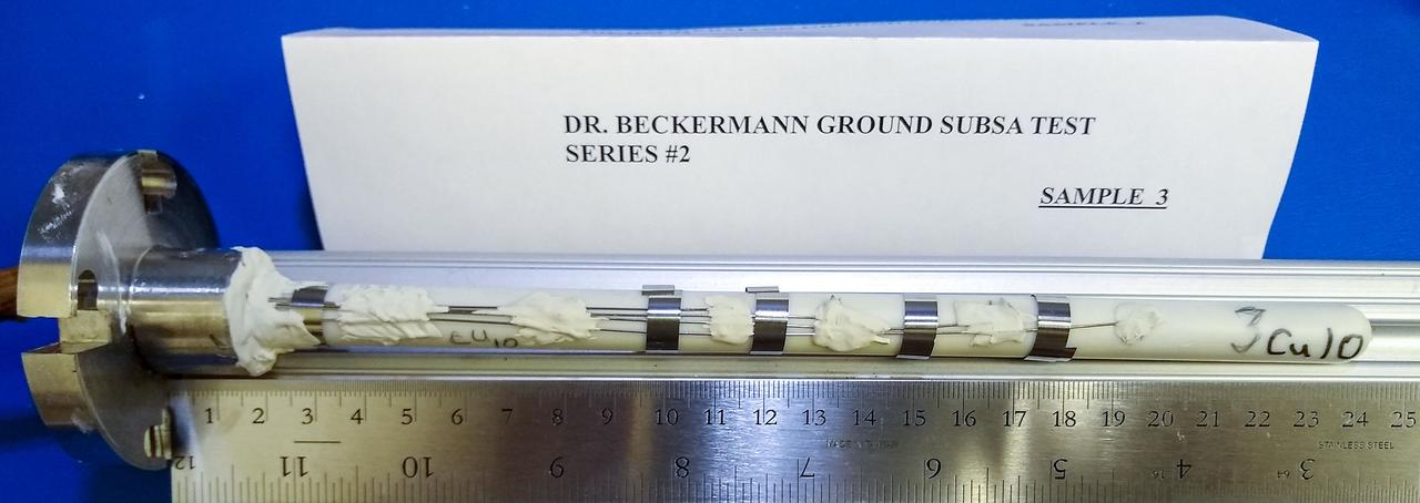
jsc2020e017722 (3/30/2020) --- A preflight view of an Alumina ampoule containing an Al-10%Cu alloy sample. The thermocouple wires are secured to the outside of the ampoule with refractory bonding material, while the metal clips provide additional support.

Aerial view of Press Site on April 10, 1981, as media and others wait for the launch of STS-1, which was eventually scrubbed. (Lift-off occurred two days later, April 12, 1981.)
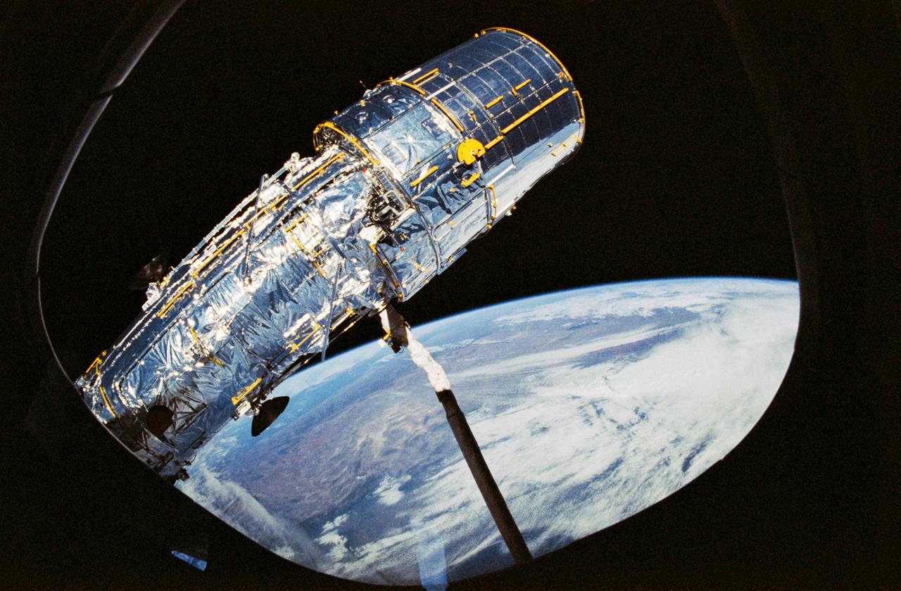
STS031-10-023 (25 April 1990) --- View of the Hubble Space Telescope (HST) on the end of Discovery's Remote Manipulator System (RMS) arm prior to deployment of its antennae and solar array panels.

PHOTO DATE: January 10, 2022. LOCATION: Bldg. 30, Apollo MOCR Viewing Room. SUBJECT: ASCAN Class of 2021 official swearing in ceremony. PHOTOGRAPHER: Josh Valcarcel
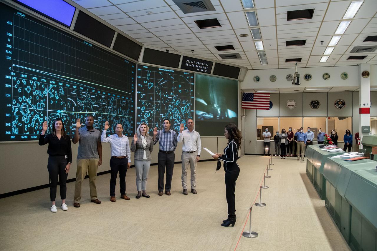
PHOTO DATE: January 10, 2022. LOCATION: Bldg. 30, Apollo MOCR Viewing Room. SUBJECT: ASCAN Class of 2021 official swearing in ceremony. PHOTOGRAPHER: Josh Valcarcel

PHOTO DATE: January 10, 2022. LOCATION: Bldg. 30, Apollo MOCR Viewing Room. SUBJECT: ASCAN Class of 2021 official swearing in ceremony. PHOTOGRAPHER: Josh Valcarcel