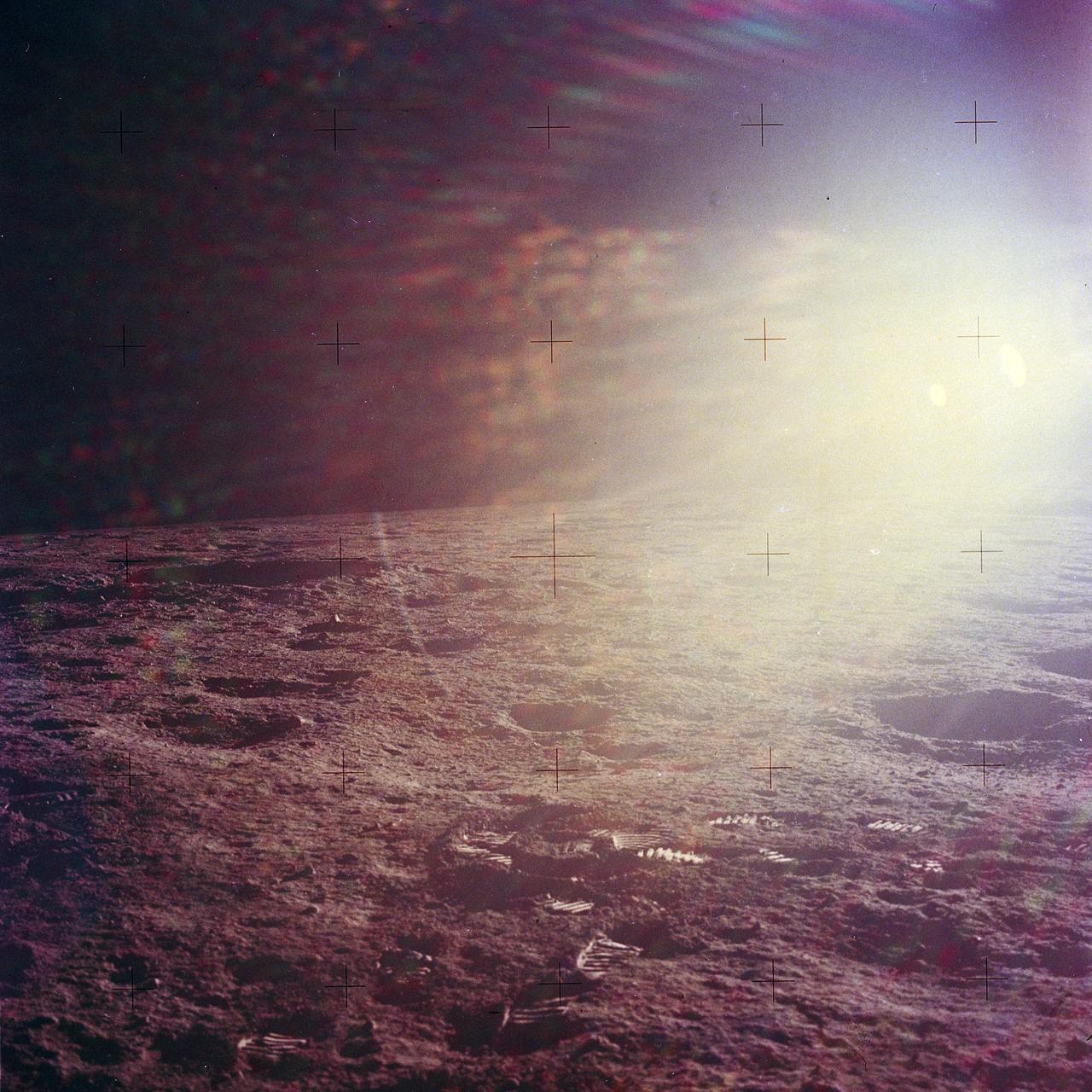
The second manned lunar landing mission, Apollo 12, launched from launch pad 39-A at Kennedy Space Center in Florida on November 14, 1969 via a Saturn V launch vehicle. The Saturn V vehicle was developed by the Marshall Space Flight Center (MSFC) under the direction of Dr. Wernher von Braun. Aboard Apollo 12 was a crew of three astronauts: Alan L. Bean, pilot of the Lunar Module (LM), Intrepid; Richard Gordon, pilot of the Command Module (CM), Yankee Clipper; and Spacecraft Commander Charles Conrad. The LM, Intrepid, landed astronauts Conrad and Bean on the lunar surface in what’s known as the Ocean of Storms while astronaut Richard Gordon piloted the CM, Yankee Clipper, in a parking orbit around the Moon. Lunar soil activities included the deployment of the Apollo Lunar Surface Experiments Package (ALSEP), finding the unmanned Surveyor 3 that landed on the Moon on April 19, 1967, and collecting 75 pounds (34 kilograms) of rock samples. This is the eighteenth of 25 images captured by the crew in attempt to provide a 360 degree Lunar surface scene. Apollo 12 safely returned to Earth on November 24, 1969.
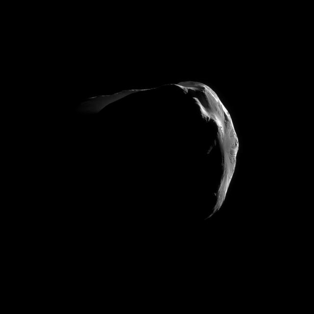
Saturn small, irregularly shaped moon Helene is strikingly illuminated in this close view captured by NASA Cassini during the spacecraft June 18, 2011, flyby.
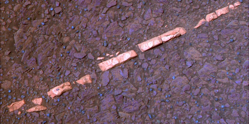
This false-color view of a mineral vein called Homestake comes from the panoramic camera Pancam on NASA Mars Exploration Rover Opportunity. The vein is about the width of a thumb and about 18 inches 45 centimeters long.

Hurricane Daniel intensified between July 18 and July 23rd. NASA new CloudSat satellite was able to capture and confirm this transformation in its side-view images of Hurricane Daniel as seen in this series of images
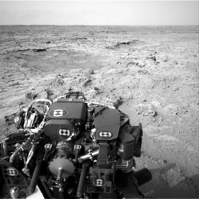
NASA Mars rover Curiosity drove 83 feet eastward during the 102nd Martian day, or sol, of the mission Nov. 18, 2012. At the end of the drive, Curiosity view was toward Yellowknife Bay in the Glenelg area of Gale Crater.
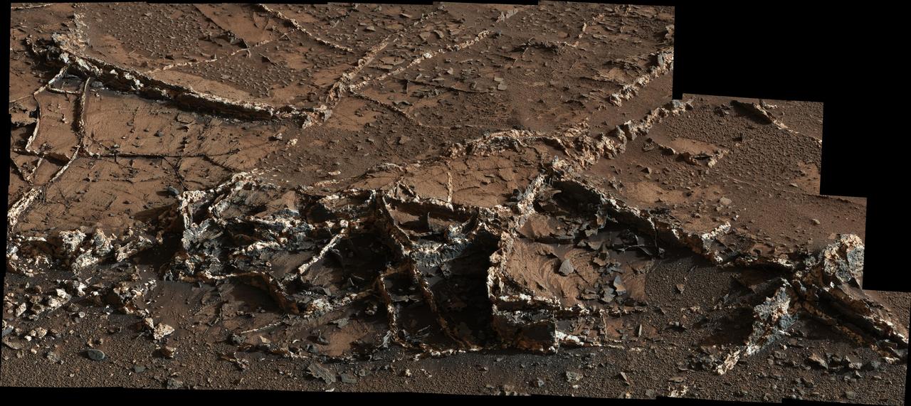
This March 18, 2015, view from the Mast Camera on NASA Curiosity Mars rover shows a network of two-tone mineral veins at an area called Garden City on lower Mount Sharp.
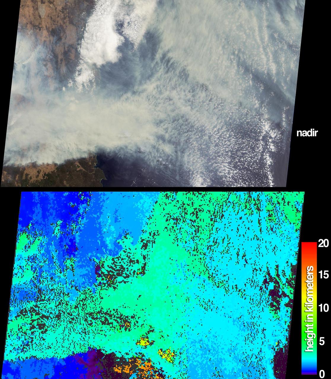
The height and extent of billowing smoke plumes from bushfires near Canberra, the Australian capital, are illustrated by these views from NASA Terra spacecraft acquired on January 18, 2003.
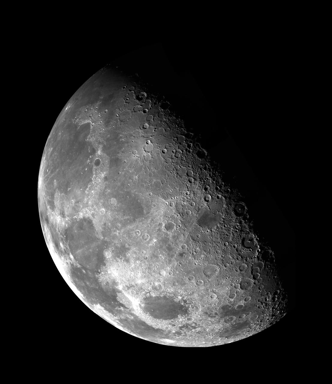
This view of the Moon north pole is a mosaic assembled from 18 images taken by NASA's Galileo imaging system through a green filter as the spacecraft flew by on December 7, 1992. http://photojournal.jpl.nasa.gov/catalog/PIA00130
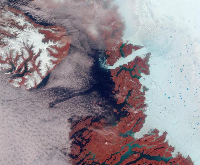
Vibrant reds, emerald greens, brilliant whites, and pastel blues adorn this view of the area surrounding the Jakobshavn Glacier on the western coast of Greenland captured by NASA Terra spacecraft on June 18, 2003.

NASA Mars Exploration Rover Opportunity arrived at this location close to a small crater dubbed Alvin on Feb. 18 & 19, 2005. 3D glasses are necessary to view this image.
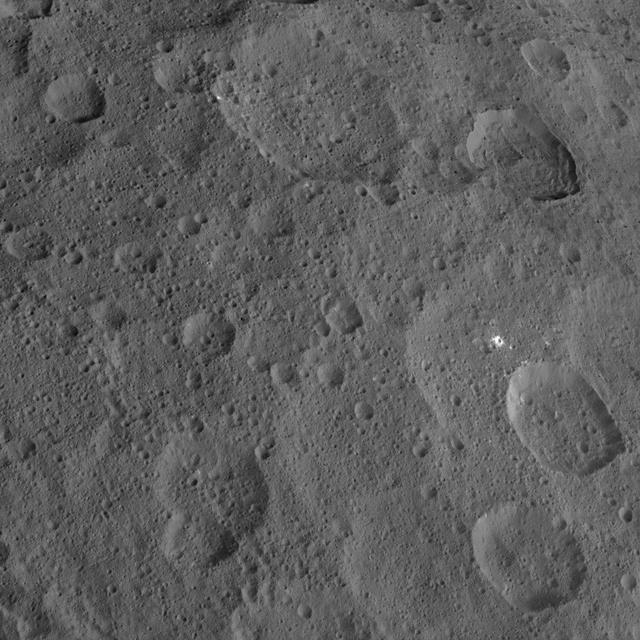
NASA Dawn spacecraft captured this view of mid-latitudes on Ceres on Oct. 18, 2015, from an altitude of 915 miles 1,470 kilometers. The image has a resolution of 450 feet 140 meters per pixel.
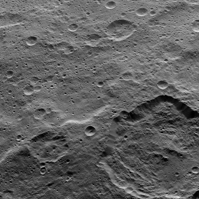
This view from NASA Dawn spacecraft taken on Oct. 18, 2015, from an altitude of 915 miles 1,470 kilometers, shows Toharu crater 55 miles or 88 kilometers wide at lower right.
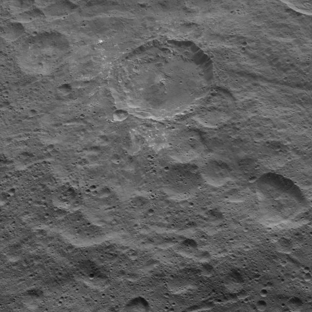
This view, captured on Oct. 18, 2015 from an altitude of 915 miles 1,470 kilometers by NASA Dawn spacecraft, shows northern mid-latitudes on Ceres, including a small impact crater surrounded by bright material. http://photojournal.jpl.nasa.gov/catalog/PIA20140
This stereo anaglyph combines two views from the Multi-angle Imaging SpectroRadiometer (MISR) instrument aboard the Terra satellite. The images were taken minutes after a fireball - the term used for exceptionally bright meteors that are visible over a wide area - exploded over the Bering Sea on Dec. 18, 2018. The anaglyph has been rotated 93.8 degrees counterclockwise to enable 3D viewing. The 3D effect can be seen with red-blue glasses. https://photojournal.jpl.nasa.gov/catalog/PIA23050

This view from a NASA Dryden F-18 chase aircraft shows Dryden's highly modified F-15B, tail number 837, which resumed Intelligent Flight Control System (IFCS) project flights on Dec. 6, 2002.
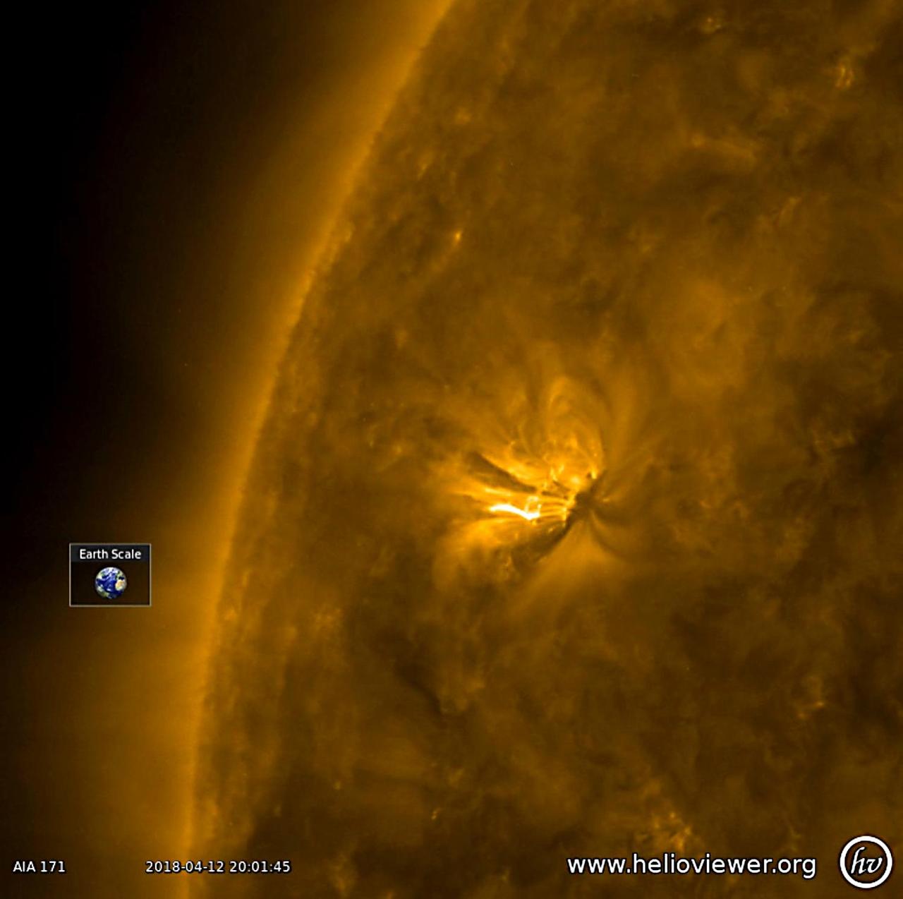
A good-sized active region with bright, towering arches began to rotate into view (Apr. 18-19, 2018). The arches consist of charged particles spiraling along magnetic field lines revealed in this wavelength of extreme ultraviolet light. They rise up above the sun's surface many times the size of Earth. The video covers just 16 hours of activity. We will keep our eyes on this region to see if it has the kind of dynamism to produce solar storms. Videos are available at https://photojournal.jpl.nasa.gov/catalog/PIA22430
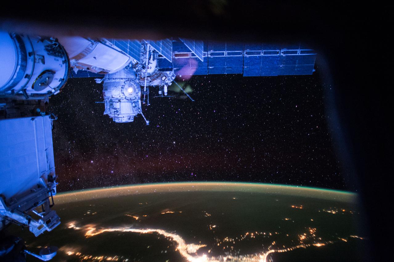
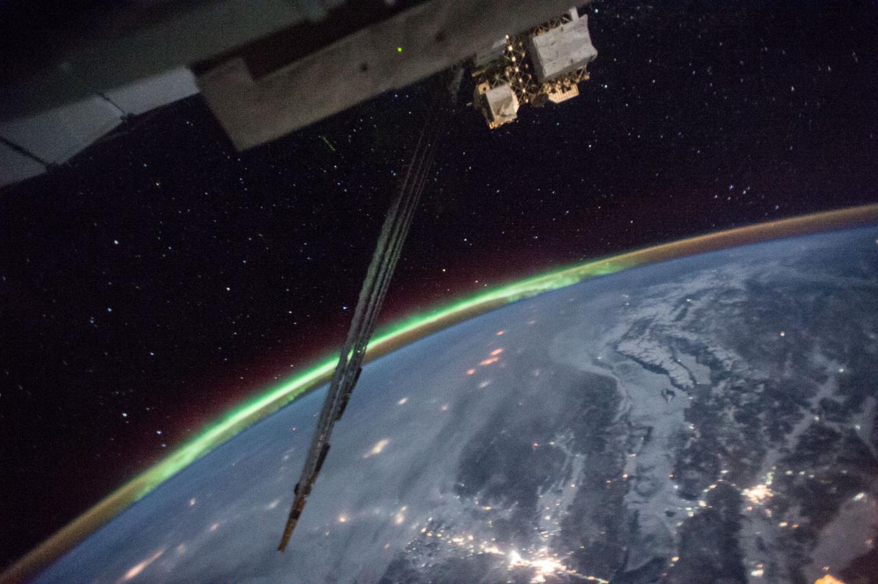
ISS043E218074 (05/18/2015) --- This night view from the International Space Station on May 18, 2015 gives a view of brilliant city lights on the Earth’s surface shining beneath thousands of stars above. The thin line of Earth’s atmosphere can be seen with the green glow of aurora along the outer edge.
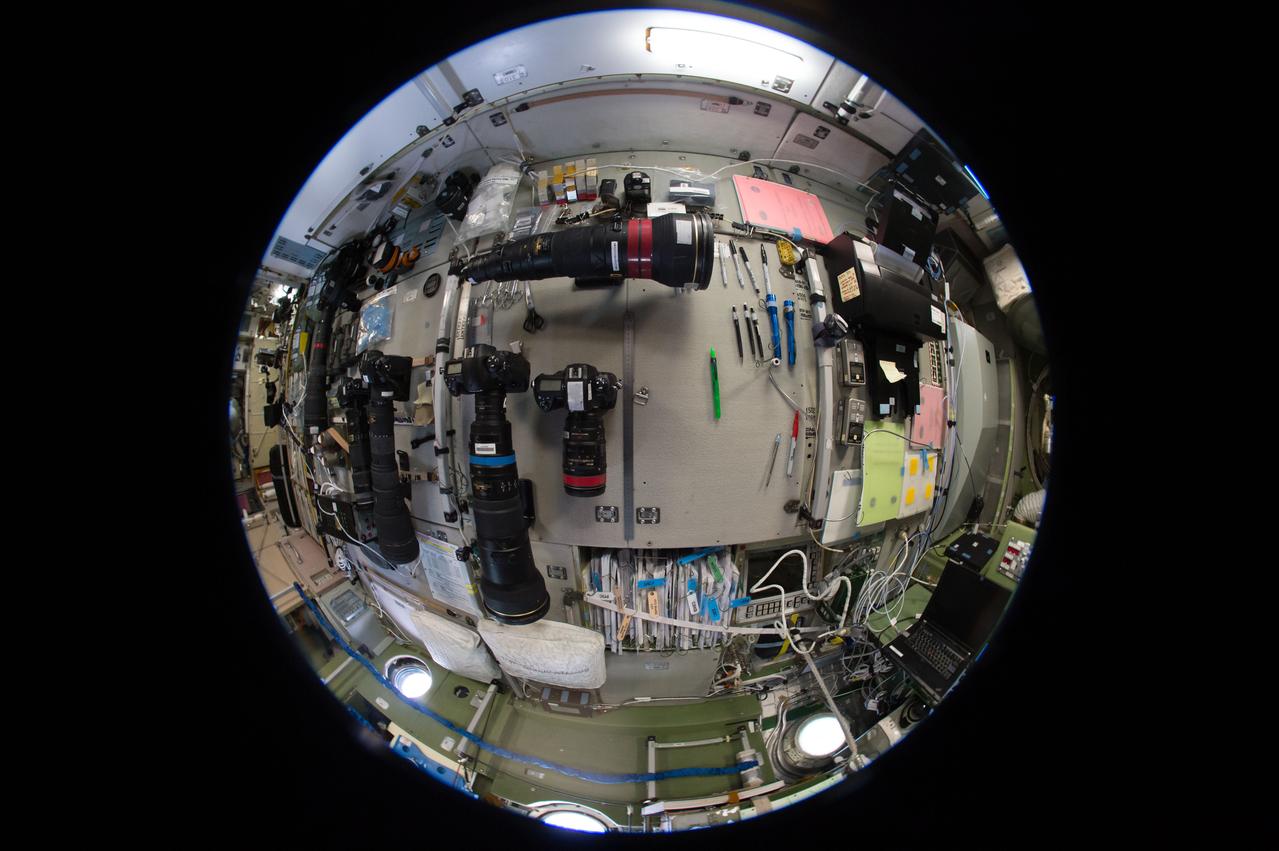
iss051e018869 (4/18/2017) --- A fish-eye view looking port in the Zvezda Service Module (SM), taken for a Google Street View of the ISS.
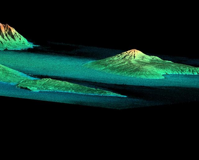
This perspective view acquired by NASA Shuttle Radar Topography Mission SRTM from data collected on February 18, 2000 shows three Hawaiian islands: Molokai lower left, Lanai right, and the northwest tip of Maui upper left.

This unique view, looking directly up at two NASA Dryden F/A-18's used in the Autonomous Formation Flight (AFF) program, was captured by Carla Thomas from another F-18 flying safety/chase.
STS095-E-5145 (2 Nov. 1998) --- View of sunrise from Discovery's side hatch was captured with an electronic still camera (ESC) at 18:18:14 GMT, Nov. 2.
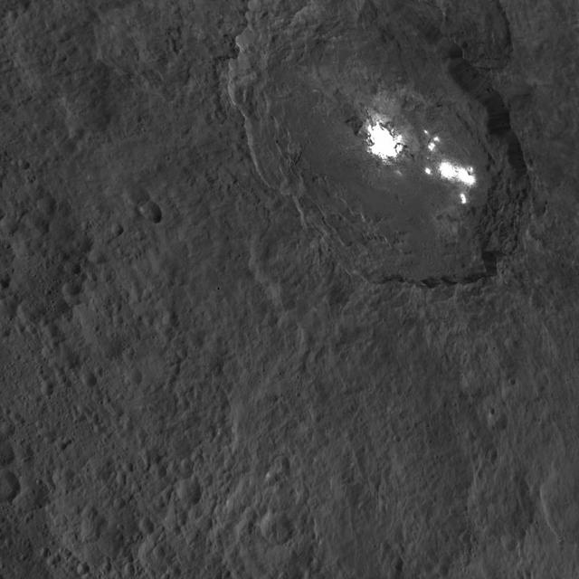
One of the most intriguing features on Ceres, Occator crater, is seen in this oblique view from NASA's Dawn spacecraft. This crater is 60 miles (90 kilometers) across and 2 miles (4 kilometers) deep, and is home to the brightest areas on Ceres. This image was acquired from an altitude of 915 miles (1,470 kilometers). Dawn took this image on Oct. 18, 2015. http://photojournal.jpl.nasa.gov/catalog/PIA20132

iss042e006636 (11/18/2014) ---Aboard the International Space Station: this image is a Close-up view of hardware for a chemistry experiment and was taken in the Rassvet Mini-Research Module.

View from F/A-18 #845 behind Omega Air Boeing 707 tanker during an AARD flight showing probe and drogue.
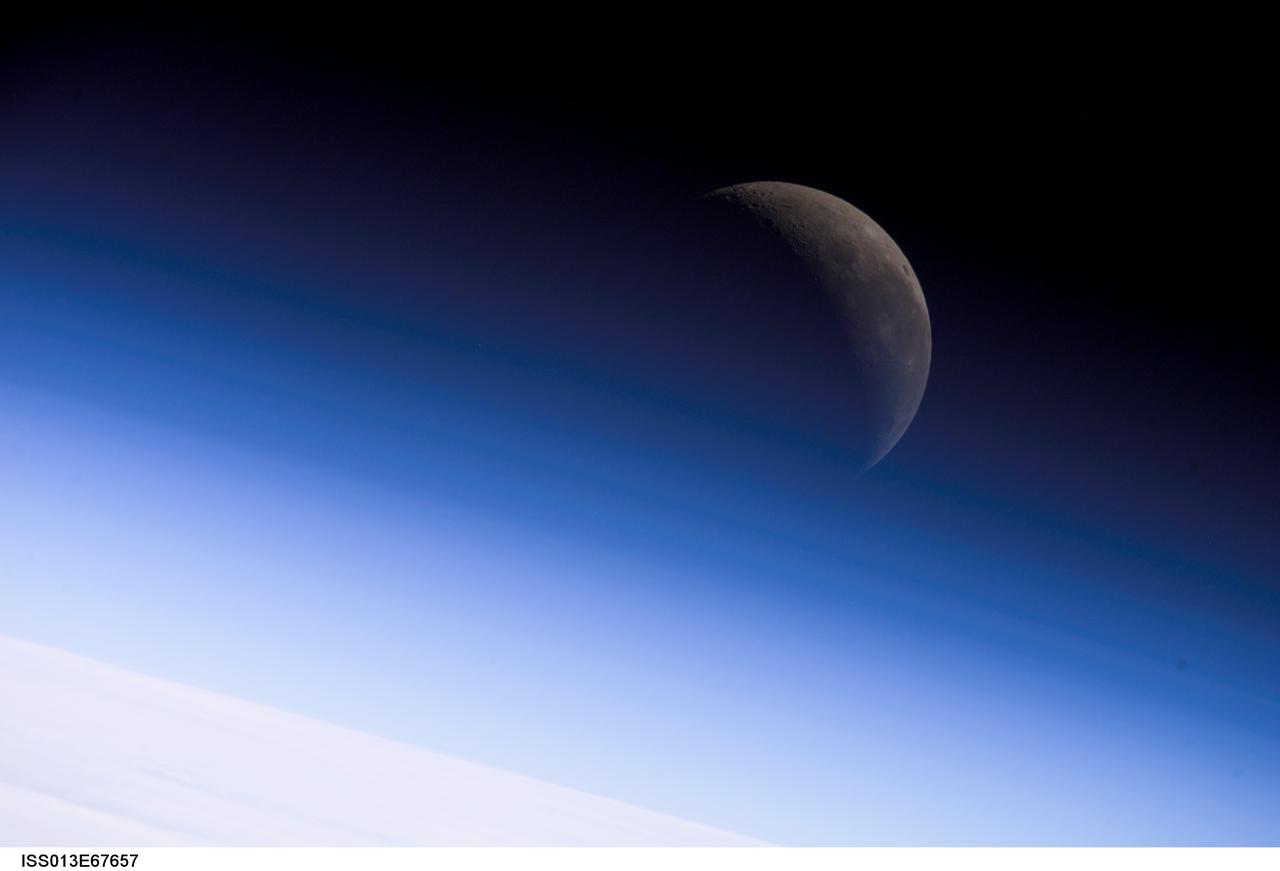
ISS013-E-67657 (18 Aug. 2006) --- A crescent moon is visible in this view of Earth's horizon and airglow, photographed by an Expedition 13 crewmember on the International Space Station.
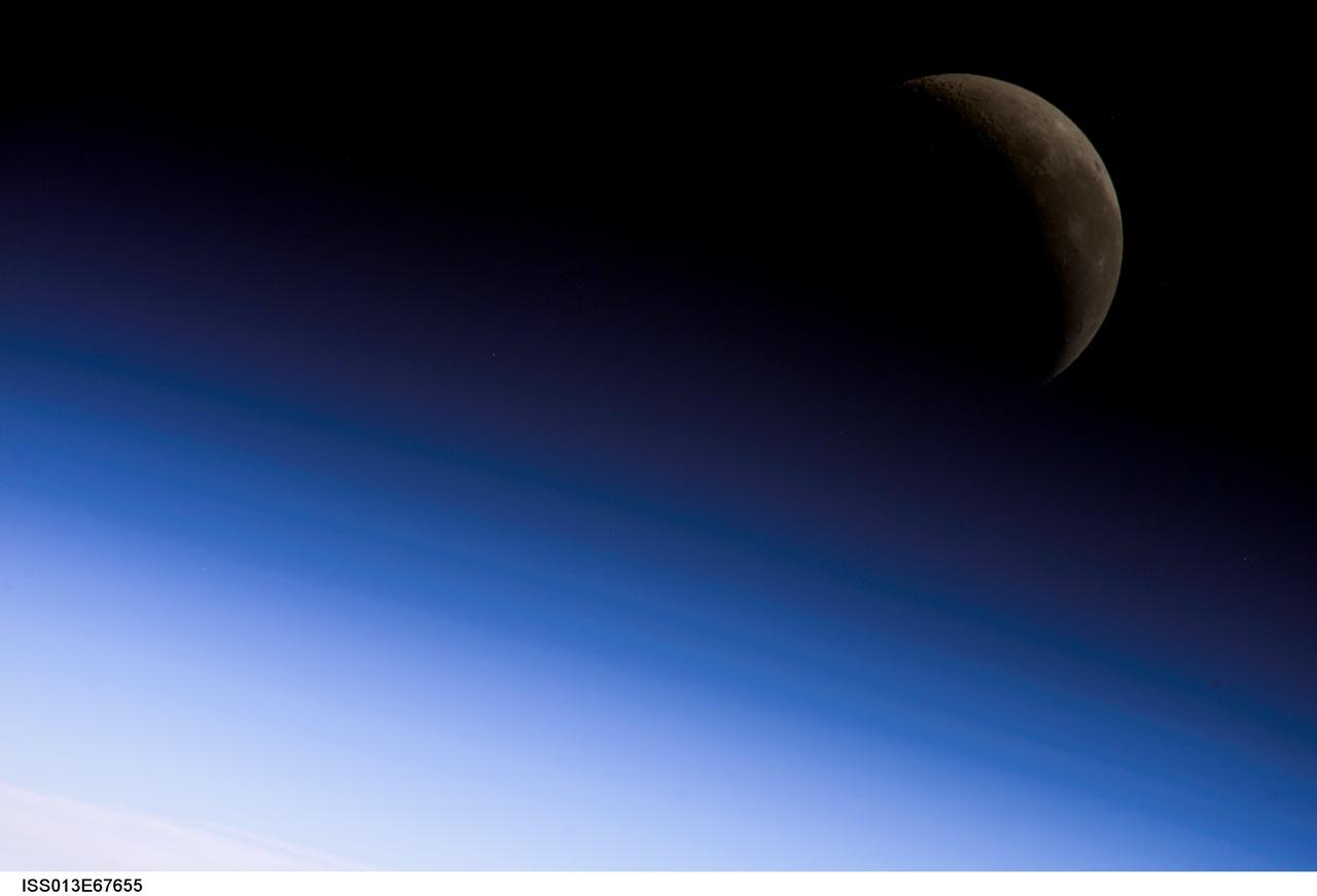
ISS013-E-67655 (18 Aug. 2006) --- A crescent moon is visible in this view of Earth's horizon and airglow, photographed by an Expedition 13 crewmember on the International Space Station.
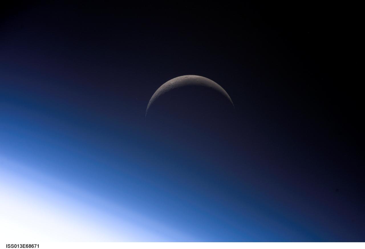
ISS013-E-68671 (18 Aug. 2006) --- A crescent moon is visible in this view of Earth's horizon and airglow, photographed by an Expedition 13 crewmember on the International Space Station.
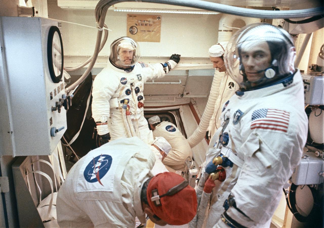
S69-35317 (18 May 1969) --- ? Interior view of the White Room at Pad B, Launch Complex 39, Kennedy Space Center, showing preparations being made for insertion of the Apollo 10 crew into their spacecraft during the prelaunch countdown. In the background is astronaut Thomas P. Stafford, commander. Astronaut Eugene A. Cernan, lunar module pilot, is in right foreground. Out of view is astronaut John W. Young, command module pilot. Liftoff for the lunar orbit mission was at 12:49 p.m. (EDT), May 18, 1969.
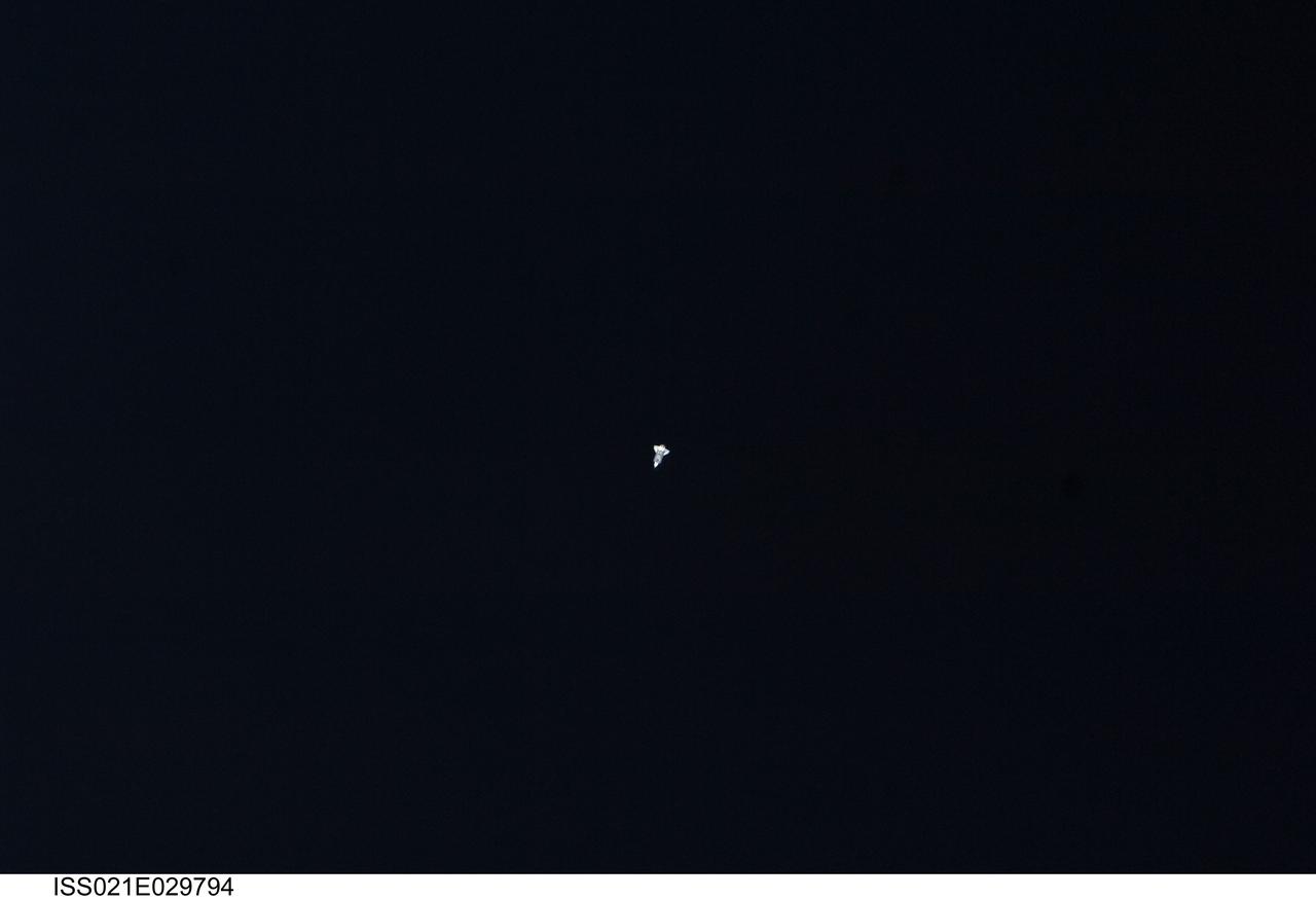
ISS021-E-029794 (18 Nov. 2009) --- Surrounded by the blackness of space, the Space Shuttle Atlantis appears very small from the point of view of the International Space Station as the shuttle approaches the station during STS-129 rendezvous and docking operations. Docking occurred at 10:51 a.m. (CST) on Nov. 18, 2009.
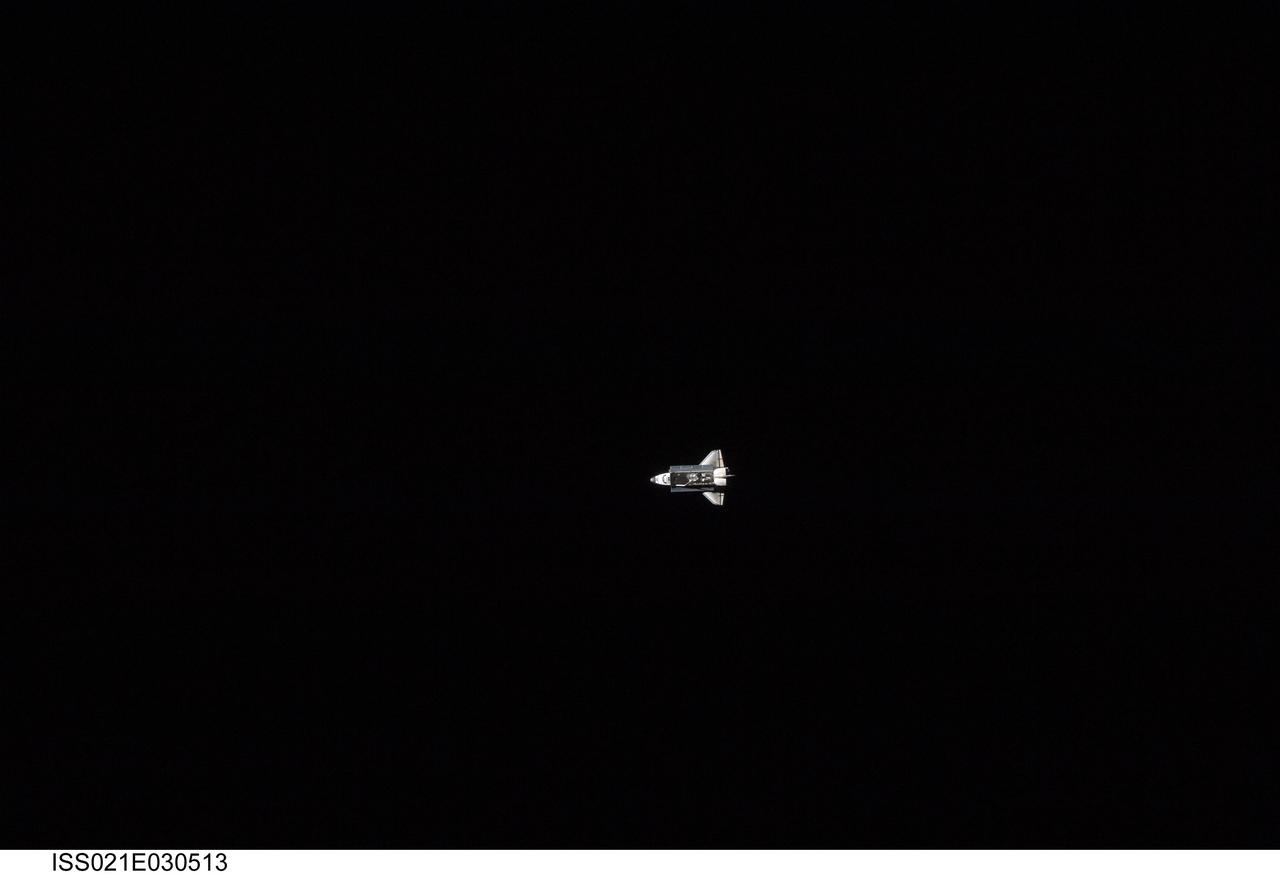
ISS021-E-030513 (18 Nov. 2009) --- Surrounded by the blackness of space, the Space Shuttle Atlantis appears very small from the point of view of the International Space Station as the shuttle approaches the station during STS-129 rendezvous and docking operations. Docking occurred at 10:51 a.m. (CST) on Nov. 18, 2009.
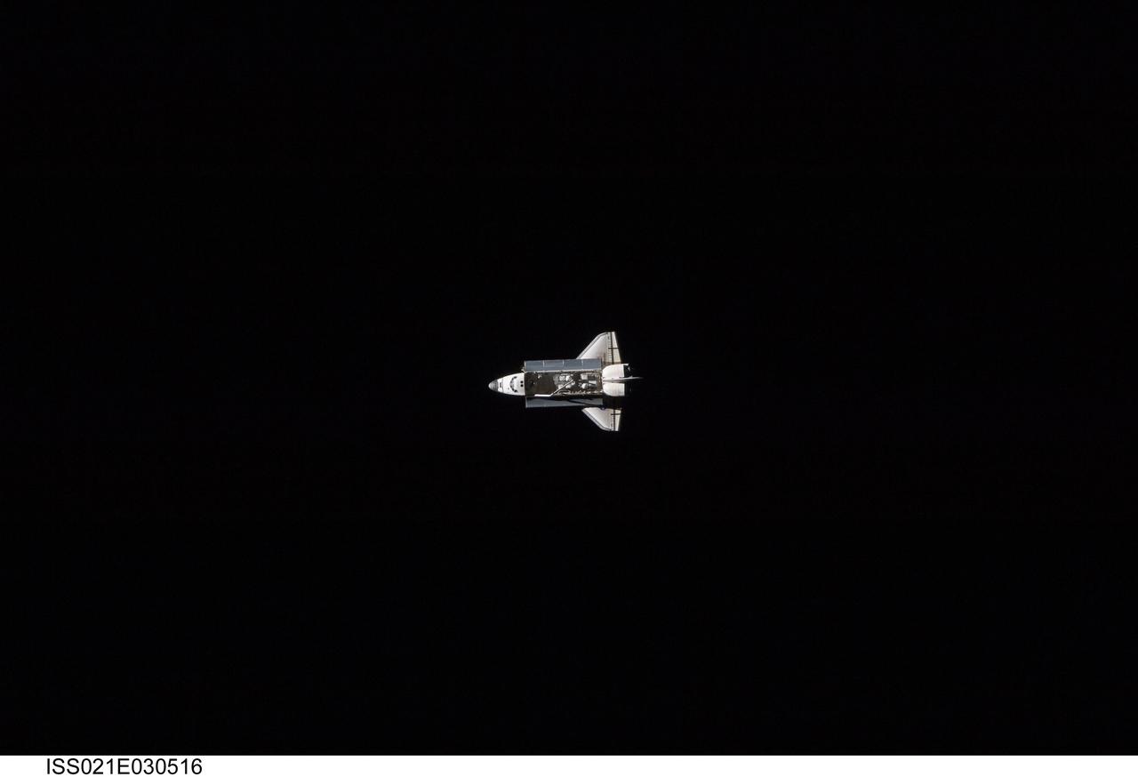
ISS021-E-030516 (18 Nov. 2009) --- Surrounded by the blackness of space, the Space Shuttle Atlantis appears very small from the point of view of the International Space Station as the shuttle approaches the station during STS-129 rendezvous and docking operations. Docking occurred at 10:51 a.m. (CST) on Nov. 18, 2009.
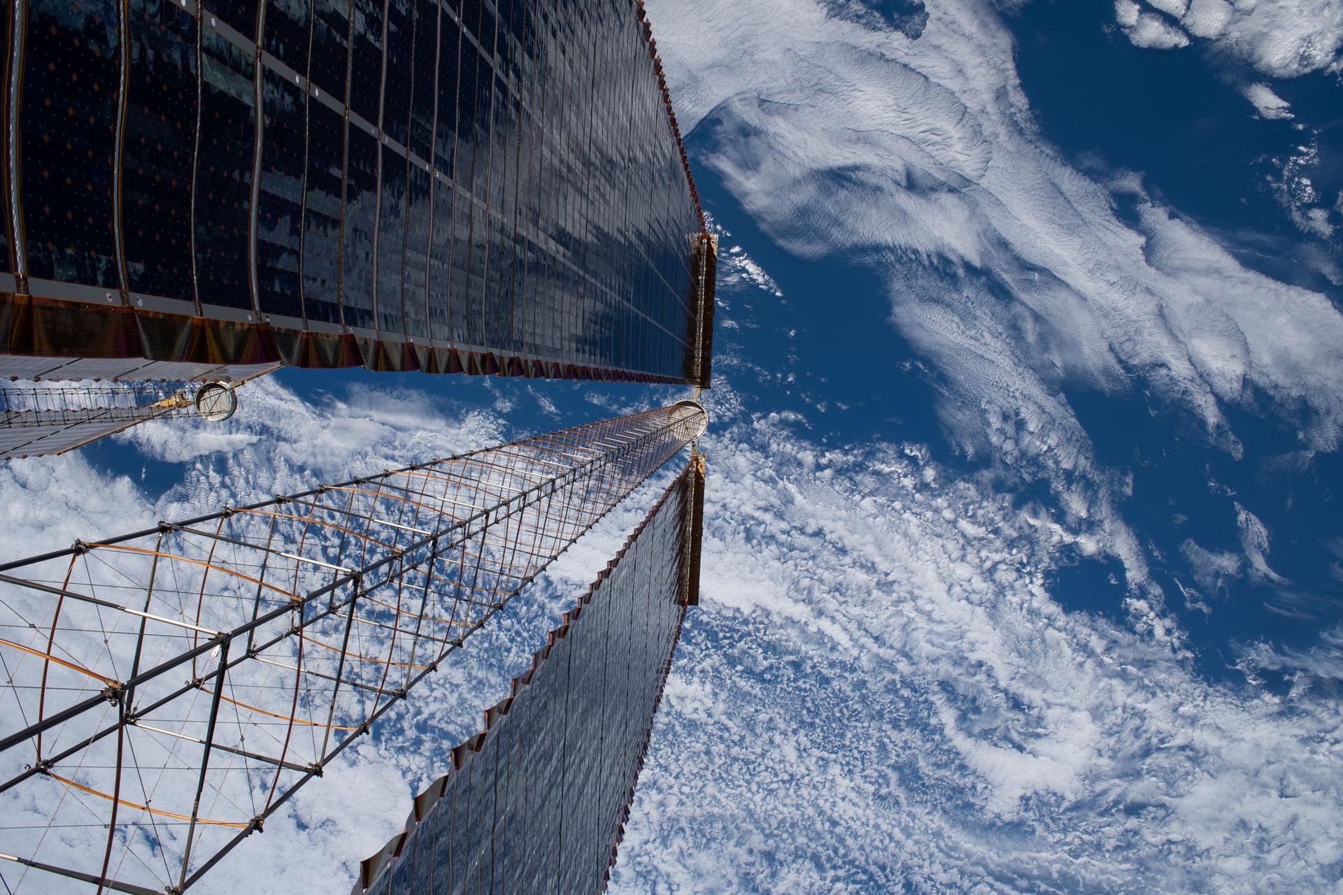
iss074e0403068 (March 18, 2026) -- A view peering down a pair of the International Space Station's roll-out solar arrays, photographed during a spacewalk conducted on March 18, 2026 to build and install a modification kit ahead of future solar array installation on the 2A power channel of the space station. Credit: NASA/Jessica Meir
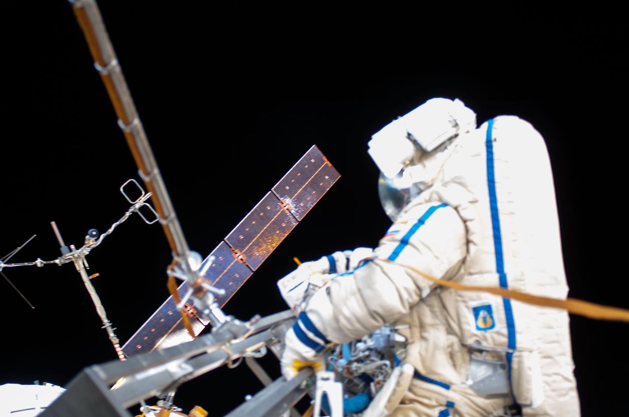
ISS040E099104 (08/18/2014) --- View of Cosmonaut Oleg Artemyev (blue stripe), Expedition 40 flight engineer outside the International Space Station, taken while performing maintenance work on the Russian segment during the Russian EVA 39 on Aug 18 2014.
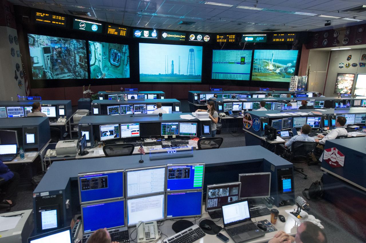
PHOTO DATE: 18 September 2013 LOCATION: Bldg. 30 FCR-1 Viewing Room SUBJECT: Students with experiements aboard the Orbital Sciences Cygnus launch watch the launch in the FCR-1 viewing room. PHOTOGRAPHER: Mark Sowa
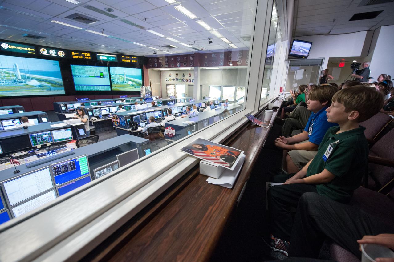
PHOTO DATE: 18 September 2013 LOCATION: Bldg. 30 FCR-1 Viewing Room SUBJECT: Students with experiements aboard the Orbital Sciences Cygnus launch watch the launch in the FCR-1 viewing room. PHOTOGRAPHER: Mark Sowa
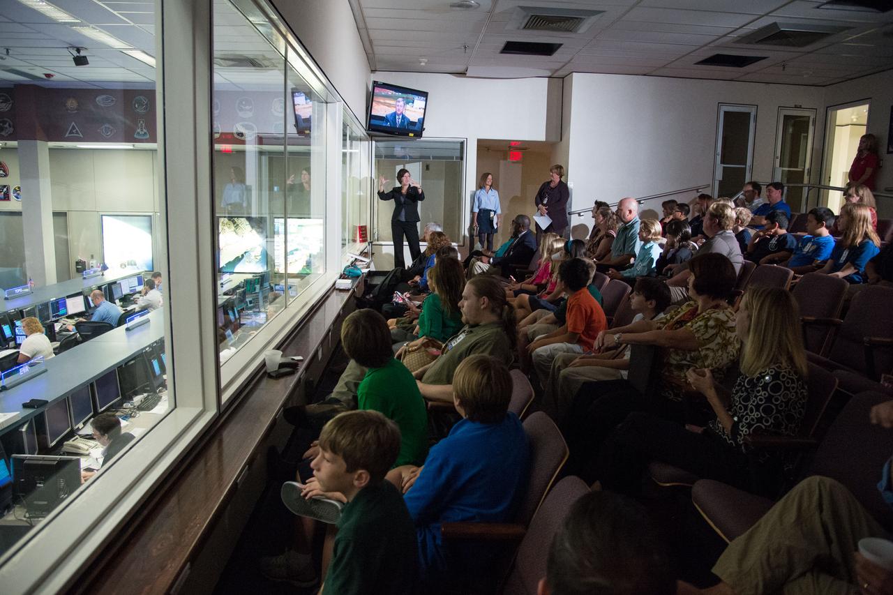
PHOTO DATE: 18 September 2013 LOCATION: Bldg. 30 FCR-1 Viewing Room SUBJECT: Students with experiements aboard the Orbital Sciences Cygnus launch watch the launch in the FCR-1 viewing room. PHOTOGRAPHER: Mark Sowa

PHOTO DATE: 18 September 2013 LOCATION: Bldg. 30 FCR-1 Viewing Room SUBJECT: Students with experiements aboard the Orbital Sciences Cygnus launch watch the launch in the FCR-1 viewing room. PHOTOGRAPHER: Mark Sowa

PHOTO DATE: 18 September 2013 LOCATION: Bldg. 30 FCR-1 Viewing Room SUBJECT: Students with experiements aboard the Orbital Sciences Cygnus launch watch the launch in the FCR-1 viewing room. PHOTOGRAPHER: Mark Sowa

PHOTO DATE: 18 September 2013 LOCATION: Bldg. 30 FCR-1 Viewing Room SUBJECT: Students with experiements aboard the Orbital Sciences Cygnus launch watch the launch in the FCR-1 viewing room. PHOTOGRAPHER: Mark Sowa
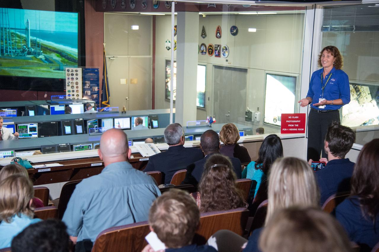
PHOTO DATE: 18 September 2013 LOCATION: Bldg. 30 FCR-1 Viewing Room SUBJECT: Students with experiements aboard the Orbital Sciences Cygnus launch watch the launch in the FCR-1 viewing room. PHOTOGRAPHER: Mark Sowa
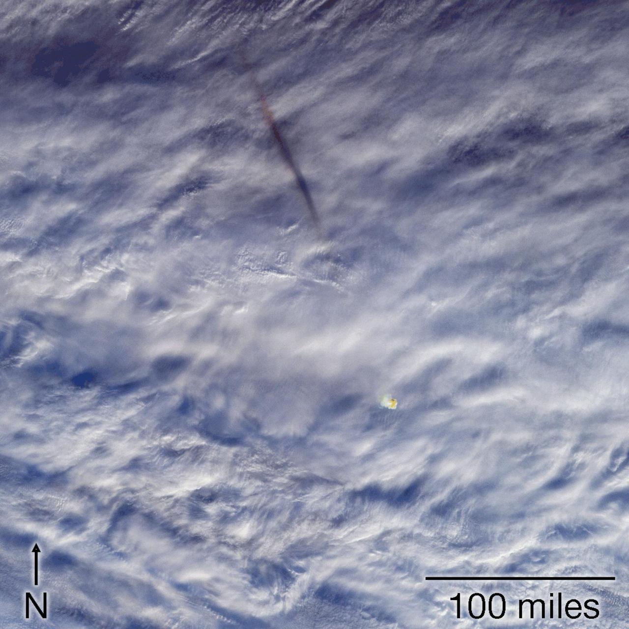
This image sequence shows views from five of nine cameras on the Multi-angle Imaging SpectroRadiometer (MISR) instrument taken at 23:55 Coordinated Universal Time (UTC), a few minutes after a fireball - the term used for exceptionally bright meteors that are visible over a wide area - exploded over the Bering Sea on Dec. 18, 2018. The shadow of the meteor's trail through Earth's atmosphere, cast on the cloud tops and elongated by the low sun angle, is to the northwest. The orange-tinted cloud that the fireball left behind by super-heating the air it passed through can be seen below and to the right of the GIF's center. Animation available at https://photojournal.jpl.nasa.gov/catalog/PIA22825
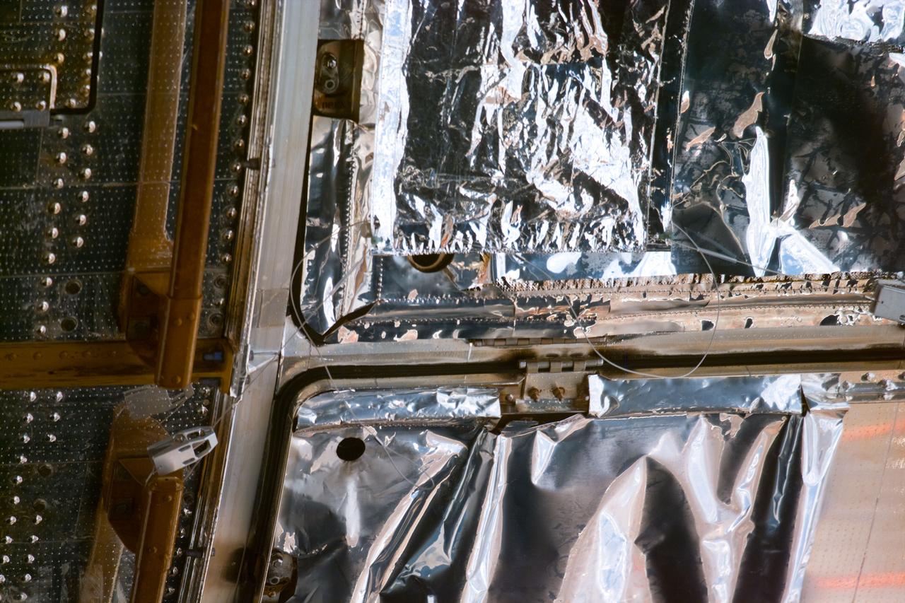
S82-E-5746 (18 Feb. 1997) --- Patch work for Bay #8 is visible at top (hold picture horizontally). This view was taken with an Electronic Still Camera (ESC).
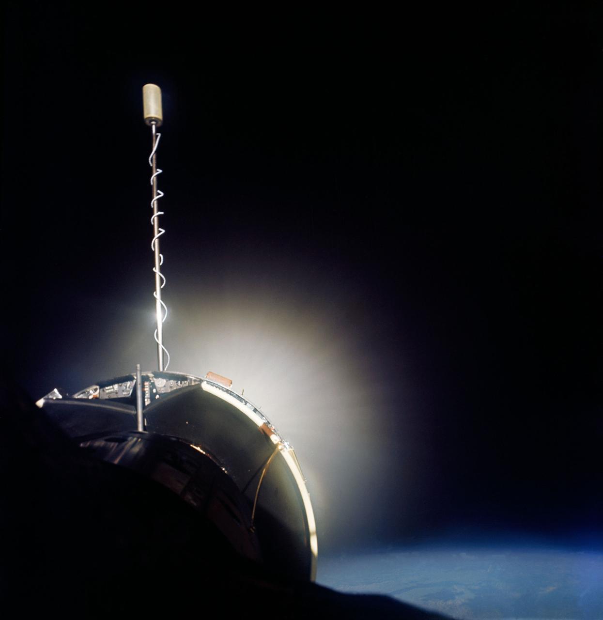
S66-46249 (18-21 July 1966) --- Agena Target Docking Vehicle docked to Gemini-10 spacecraft. Excellent view of Agena display panel. Glow from Agena's primary propulsion system. Photo credit: NASA
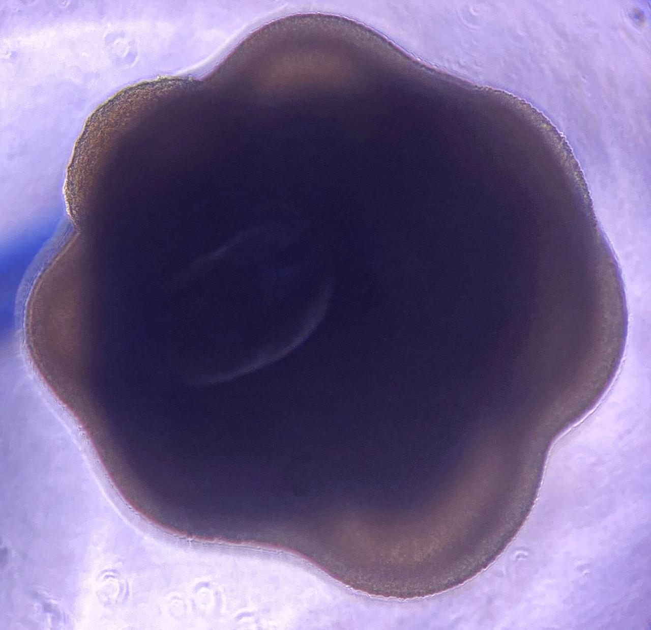
jsc2024e006093 (1/18/2024) --- Two-month old cerebral organoid.A two-month old cerebral organoid viewed under the microscope, measuring approximately two millimetres across. Credit: Institut Pasteur-SupBiotech.
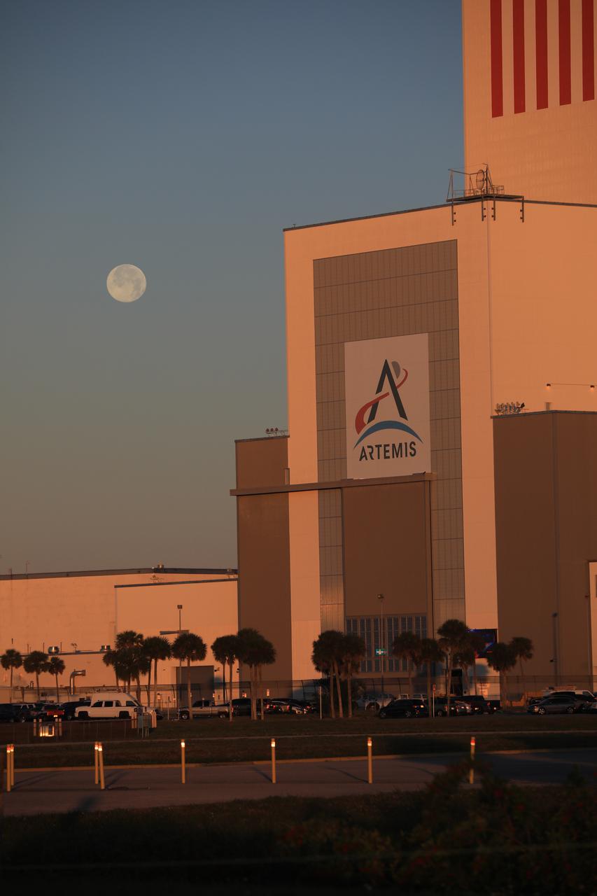
A brilliant Moon serves as the backdrop in this view of the low bay entrance to the Vehicle Assembly Building at NASA’s Kennedy Space Center in Florida on Jan. 18, 2020. An Artemis banner is positioned over the entrance.
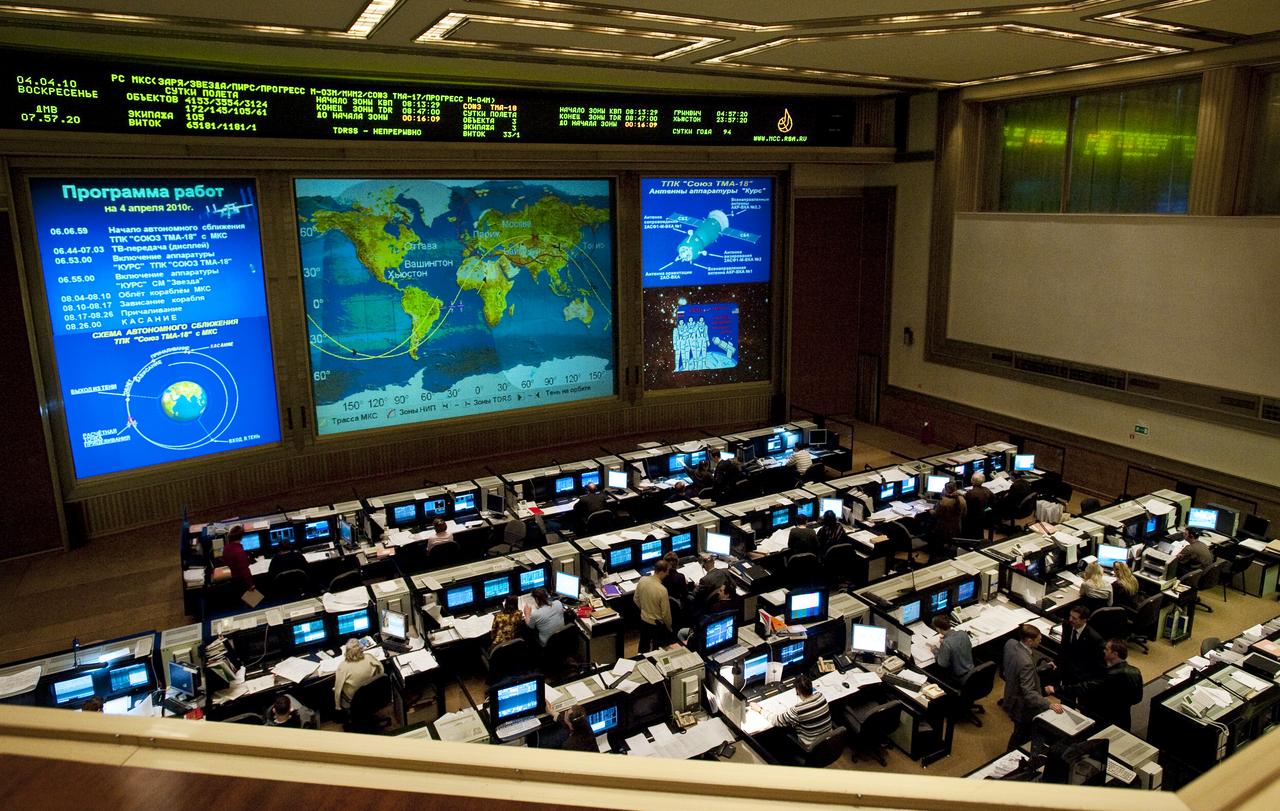
View of Russian Mission Control Center in Korolev, Russia moments before the Soyuz TMA-18 docks to the International Space Station on Sunday, April 4, 2010. Photo Credit: (NASA/Carla Cioffi)
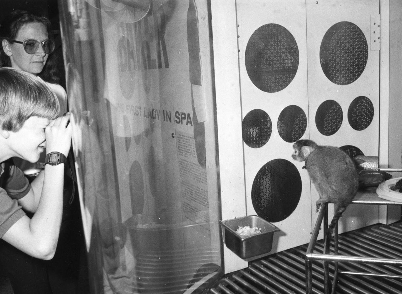
Miss Baker, a squirrel monkey who made a historical flight aboard the Jupiter (AM-18) in May 1959, is seen here in her viewing area where she resided at the U.S. Space and Rocket Center.
STS058-78-021 (18 Oct-1 Nov 1993) --- A clear three-dimensional view of the Karakorum Range. This northwestern extension of the Himalaya contains glaciated peaks having elevations of 7,000 to 8,000 meters.
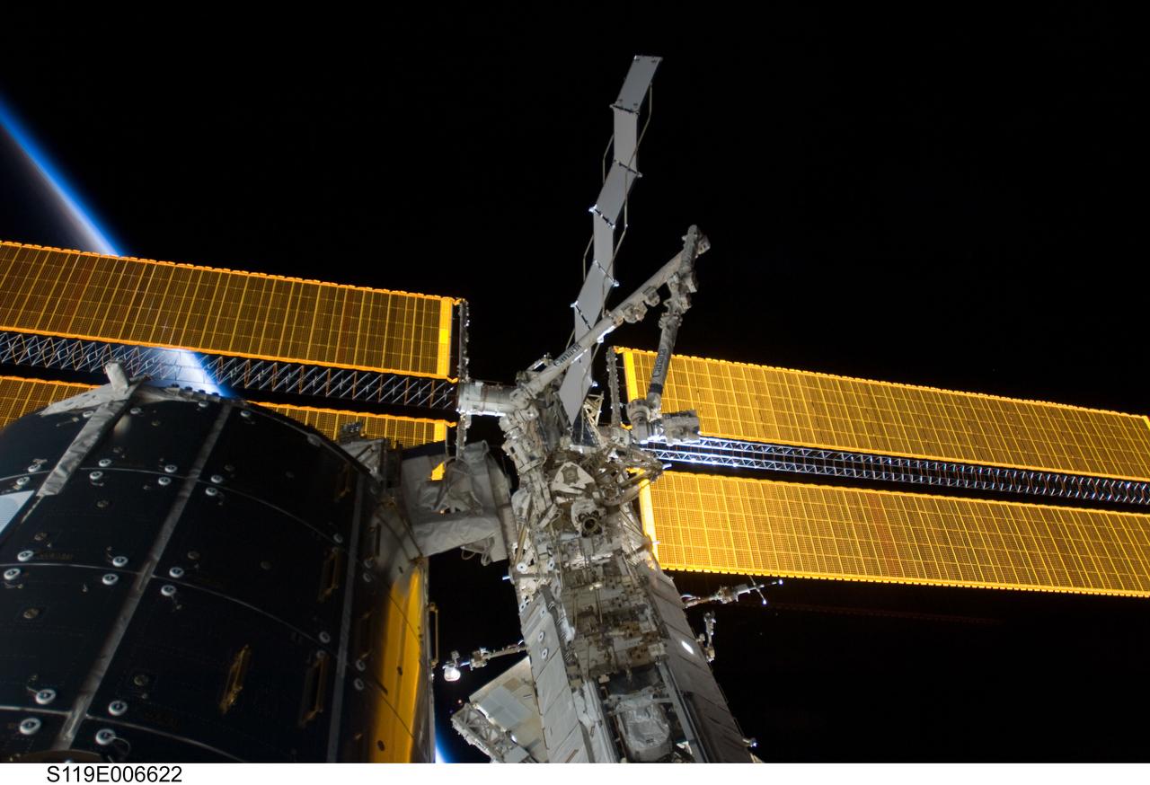
View of the Space Station Remote Manipulator System (SSRMS) on the Mobile Transporter (MT) for S6 Relocation OPS during STS-119 / Expedition 18 joint docked OPS. The MT is on the S1 Truss segment.
iss050e034428 (01/18/2017) --- This long exposure photo taken from the International Space Station as it orbits around the Earth provides a spectacular view of auroras, sparkling city lights and the stars filling the cosmos beyond.

The Moon and Venus, center, are seen in conjunction above the Washington Monument, Monday, May 18, 2026, as viewed from the Mary W. Jackson NASA Headquarters Building in Washington. Photo Credit: (NASA/Bill Ingalls)
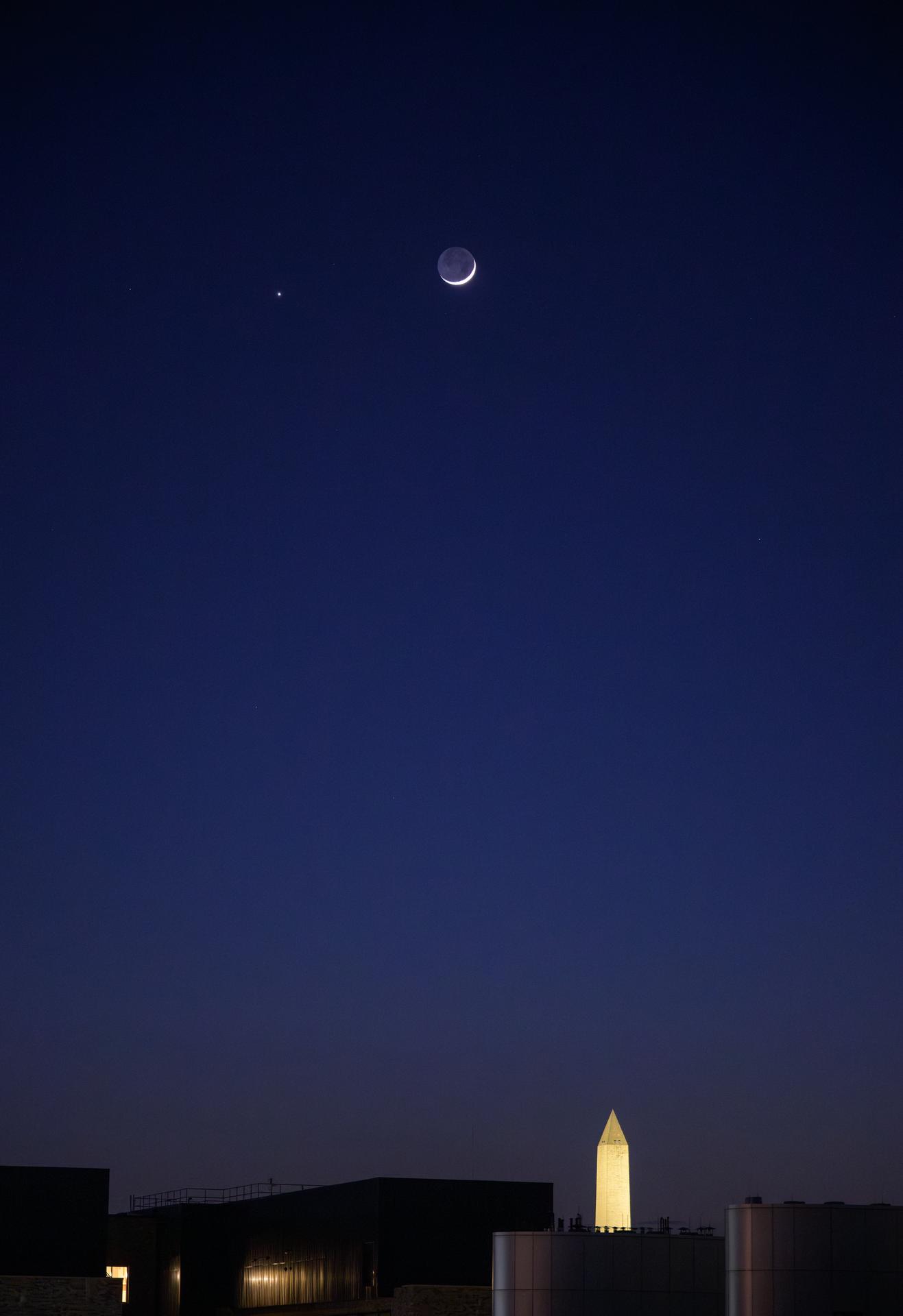
The Moon and Venus, left, are seen in conjunction above the Washington Monument, Monday, May 18, 2026, as viewed from the Mary W. Jackson NASA Headquarters Building in Washington. Photo Credit: (NASA/Bill Ingalls)
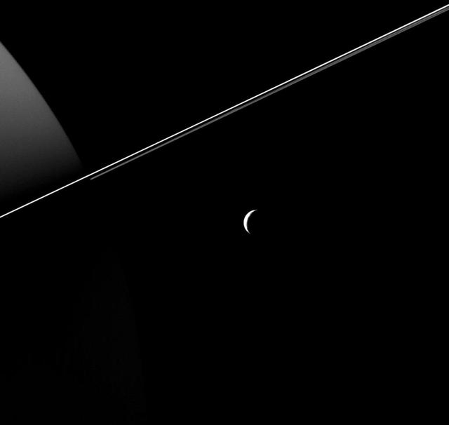
Tethys, dwarfed by the scale of Saturn and its rings, appears as an elegant crescent in this image taken by NASA's Cassini Spacecraft. Views like this are impossible from Earth, where we only see Saturn's moons as (more or less) fully illuminated disks. The region of Saturn seen at left is on the planet's night side. Reflected light from the rings dimly illuminates the planet's northern hemisphere. This view looks toward the anti-Saturn side of Tethys. North on Tethys is up and rotated 24 degrees to the left. The image was taken in visible light with the Cassini spacecraft wide-angle camera on Aug. 18, 2015. The view was acquired at a distance of approximately 184,000 miles (296,000 kilometers) from Tethys. Image scale is 11 miles (18 kilometers) per pixel. http://photojournal.jpl.nasa.gov/catalog/PIA18348
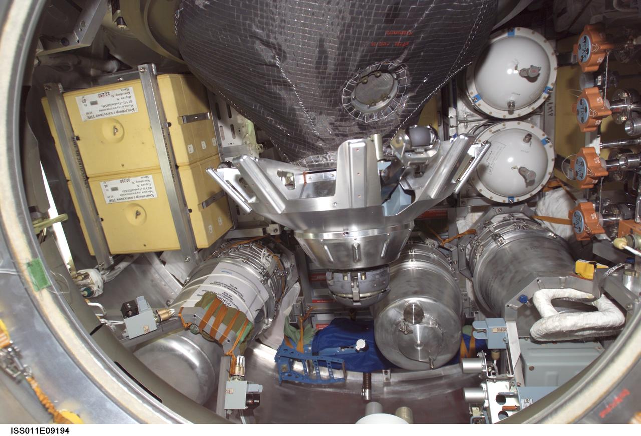
ISS011-E-09194 (19 June 2005) --- View of stowage items and the probe-and-cone docking mechanism in the hatch of the Progress 18 resupply craft, which docked to the aft port of the Zvezda Service Module of the International Space Station at 7:42 p.m. (CDT) on June 18 as the station flew approximately 225 statute miles above a point near Beijing, China. Progress delivered two tons of supplies, food, water, fuel and equipment to the Expedition 11 crewmembers onboard the station.
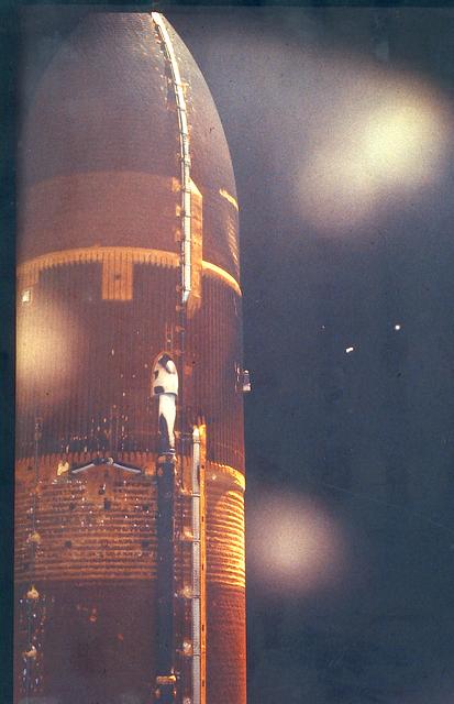
JSC2003-E-15408 (18 June 1983) --- A 35mm still camera located in the umbilical well of the space shuttle Challenger took this photograph of the external fuel tank (ET) after it was dropped from the launch stack as the shuttle headed for Earth orbit on June 18, 1983. The camera was located in the LO2 umbilical near the aft end of the orbiter (right side as you view the ET). Photo credit: NASA
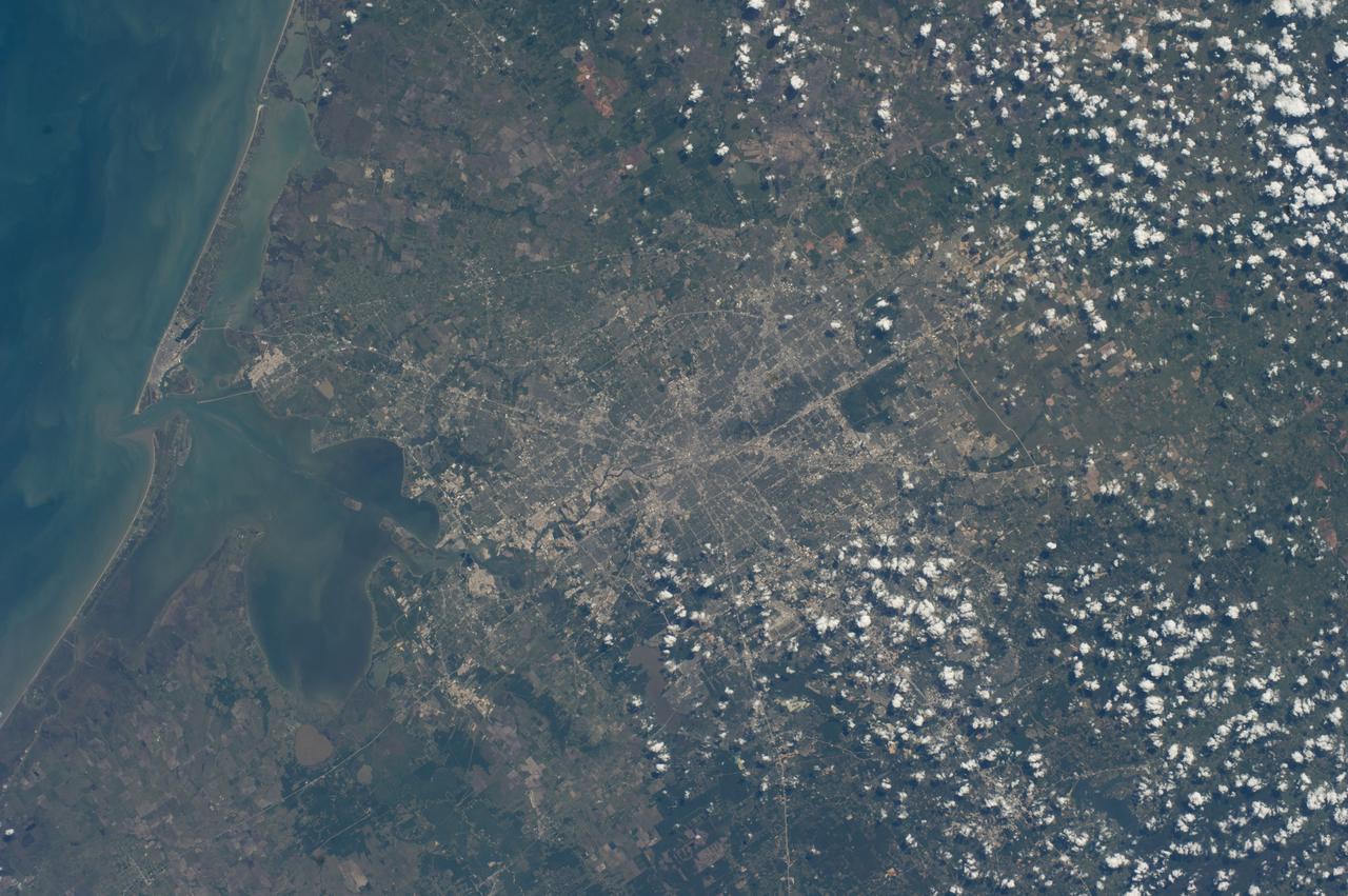
ISS039-E-013926 (18 April 2014) --- One of the Expedition 39 crew members aboard the International Space Station photographed this vertical view of the greater Houston metropolitan area on April 18, 2014. Harris County, Galveston County and several other southeast Texas counties are visible in the scene. Houston's central business district or "downtown" is near center frame and part of the Gulf of Mexico Coast occupies most of the left side of the image.
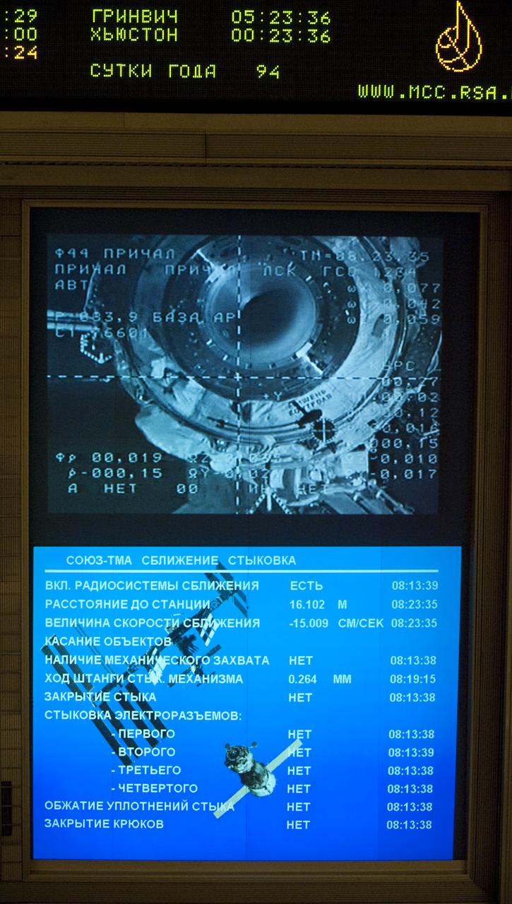
View from the balcony of the Russian Mission Control Center in Korolev, Russia as the Soyuz TMA-18 docks to the International Space Station on Sunday, April 4, 2010. The Soyuz TMA-18 docked to the International Space Station carrying Expedition 23 Soyuz Commander Alexander Skvortsov, Flight Engineer Mikhail Kornienko and NASA Flight Engineer Tracy Caldwell Dyson. Photo Credit: (NASA/Carla Cioffi)
S66-42736 (18 July 1966) --- Fisheye camera lens view of activity in white room atop Pad 19 as technicians secure equipment in preparation for erector lowering. Inside the Gemini-10 spacecraft are astronauts John W. Young, command pilot, and Michael Collins, pilot. Liftoff was at 5:20 p.m. (EST), July 18, 1966. Photo credit: NASA
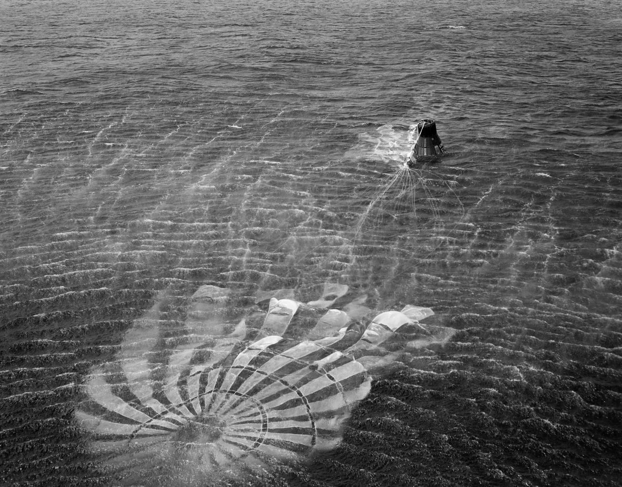
S61-01398 (18 March 1961) --- View of the recovery of the Little Joe-5A spacecraft which lifted off on March 18, 1961 from Wallops Island. The photo was taken from the recovery helicopter and shows the craft's parachute still attached and floating in the water next to the capsule. Little Joe-5A was a suborbital flight to test the Mercury capsule. The escape rocket motor fired prematurely and prior to capsule release. Photo credit: NASA
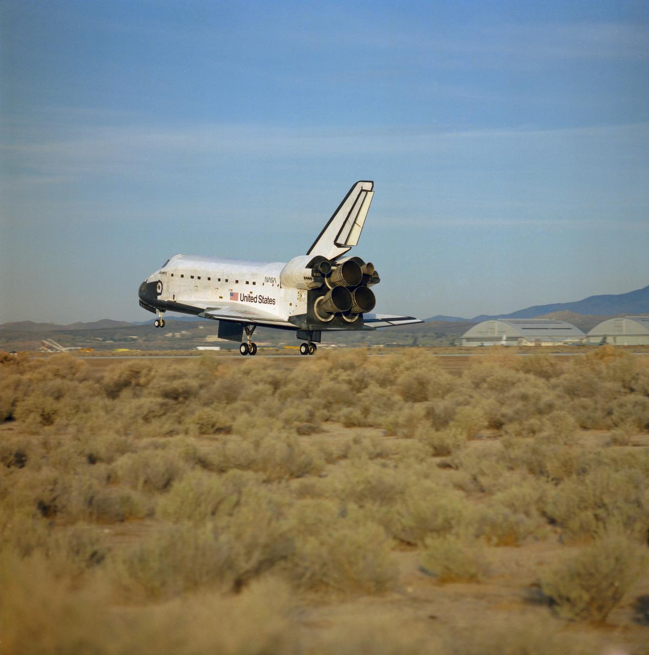
STS029-S-064 (18 Mar 1989) --- A rear view photographed from the ground just after Discovery's main landing gear touches down on Runway 22 at Edwards Air Force Base in California following a successful five-day mission in Earth orbit. Onboard the spacecraft were Astronauts Michael L. Coats, John E. Blaha, James F. Buchli, Robert C. Springer and James P. Bagian. Wheels came to a stop at 6:36:40 a.m. (PST), March 18, 1989.
This frame from a sequence of images shows a dust-carrying whirlwind, called a dust devil, on lower Mount Sharp inside Gale Crater, as viewed by NASA's Curiosity Mars Rover during the summer afternoon of the rover's 1,613rd Martian day, or sol (Feb. 18, 2017). Set within a broader southward view from the rover's Navigation Camera, the rectangular area outlined in black was imaged multiple times over a span of several minutes to check for dust devils. Images from the period with most activity are shown in the inset area. The images are in pairs that were taken about 12 seconds apart, with an interval of about 90 seconds between pairs. Timing is accelerated and not fully proportional in this animation. Contrast has been modified to make frame-to-frame changes easier to see. A black frame provides a marker between repeats of the sequence. On Mars as on Earth, dust devils result from sunshine warming the ground, prompting convective rising of air that has gained heat from the ground. Observations of dust devils provide information about wind directions and interaction between the surface and the atmosphere. An animation is available at http://photojournal.jpl.nasa.gov/catalog/PIA21483
This view captured by NASA's 2001 Mars Odyssey spacecraft looks like a dinosaur head at the top of the image. Orbit Number: 65488 Latitude: 4.92808 Longitude: 126.933 Instrument: VIS Captured: 2016-09-18 03:24 https://photojournal.jpl.nasa.gov/catalog/PIA21698
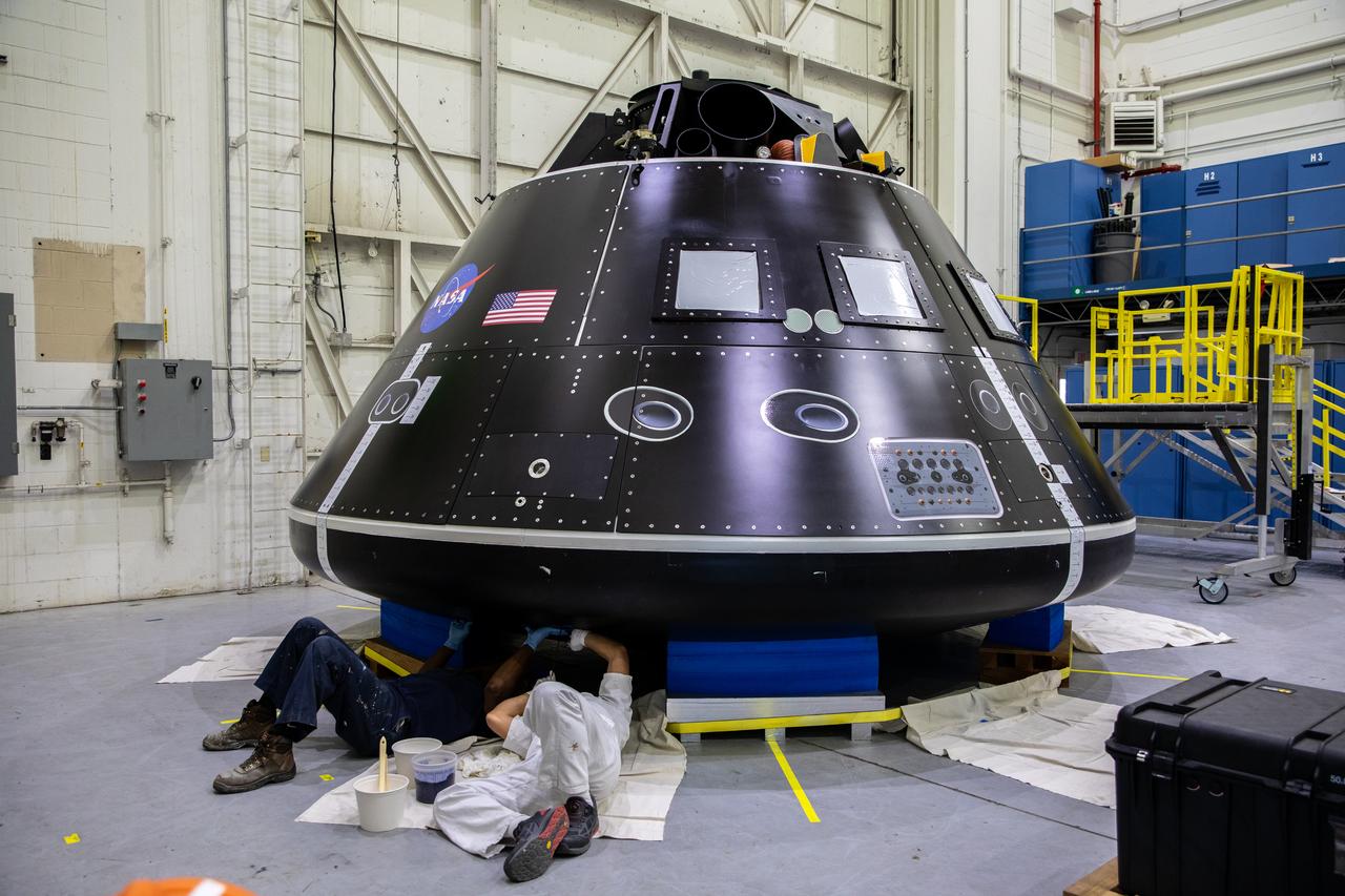
The Artemis Orion crew module test article (CMTA) is in view in the high bay inside the Launch Equipment Test Facility at NASA's Kennedy Space Center in Florida on March 18, 2022. The CMTA is used to practice recovery after splashdown of the Orion spacecraft to prepare for Artemis missions. Exploration Ground Systems leads recovery efforts.
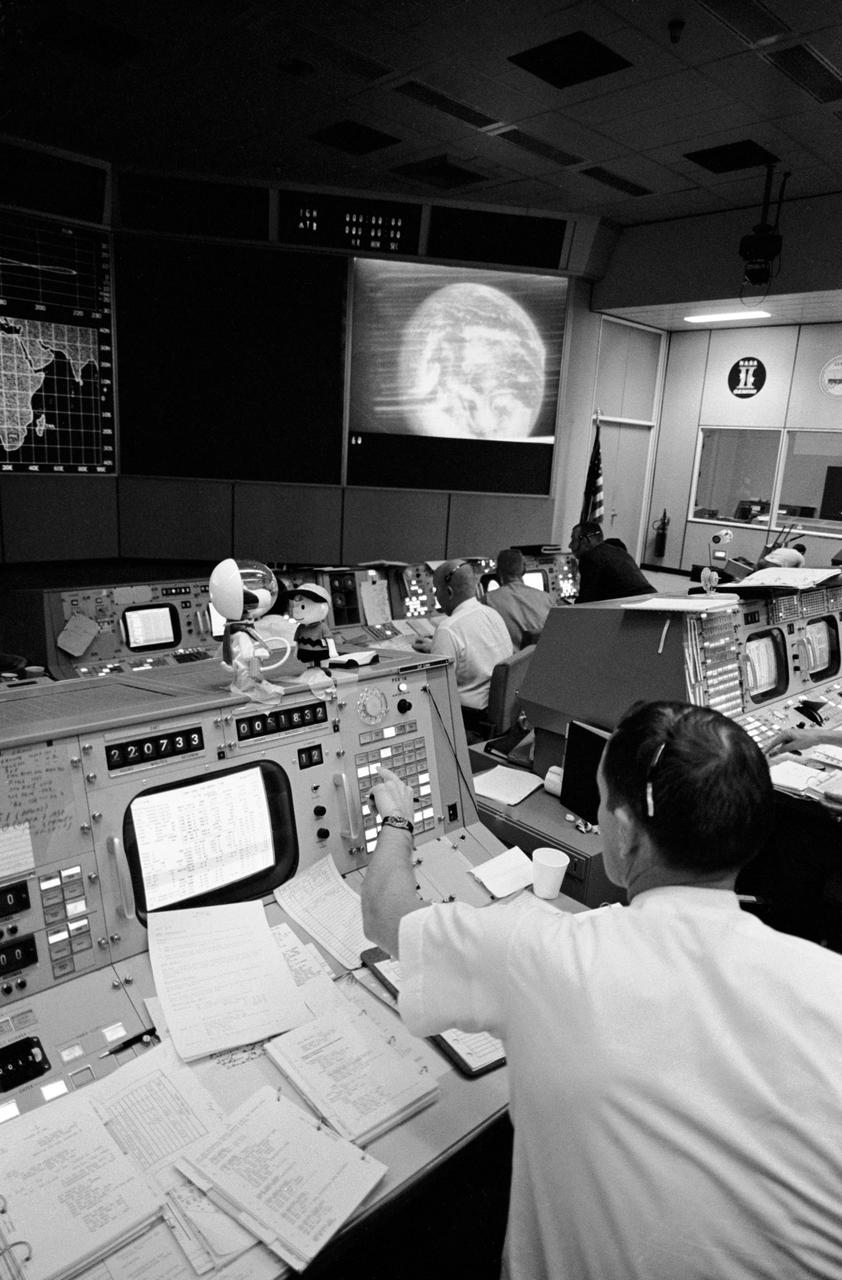
S69-34040 (18 May 1969) --- Partial view of activity in the Mission Operations Control Room in the Mission Control Center, Building 30, on the first day of the Apollo 10 lunar orbit mission. The television monitor shows a picture of Earth made during the second telecast from the Apollo 10's color TV camera.

ISS046e012758 (01/18/2016) --- This long exposure image of Northern India was taken by astronauts on the International Space Station while the Earth was shrouded in darkness. Major cities in view include New Delhi, on the left side of the image, and Lahore (right), which is located to the northwest of New Delhi.
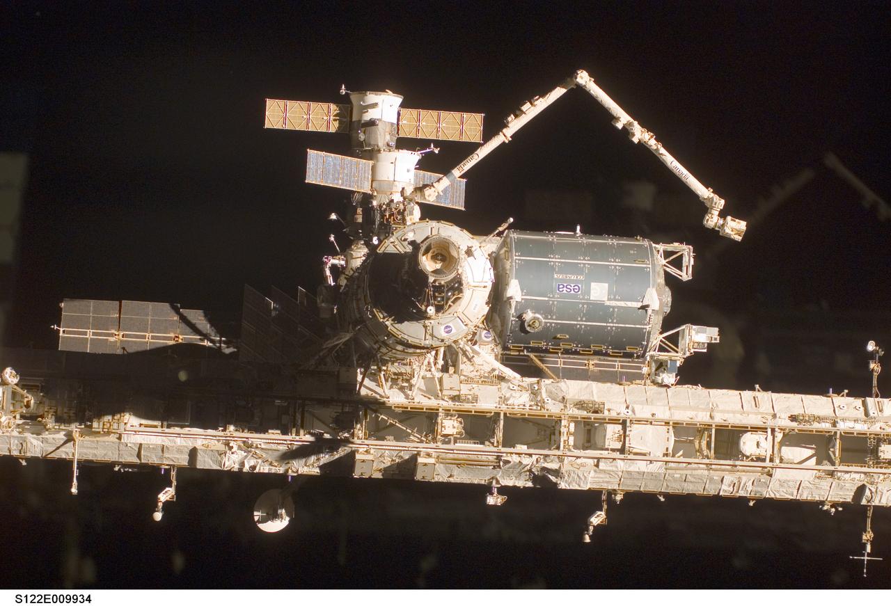
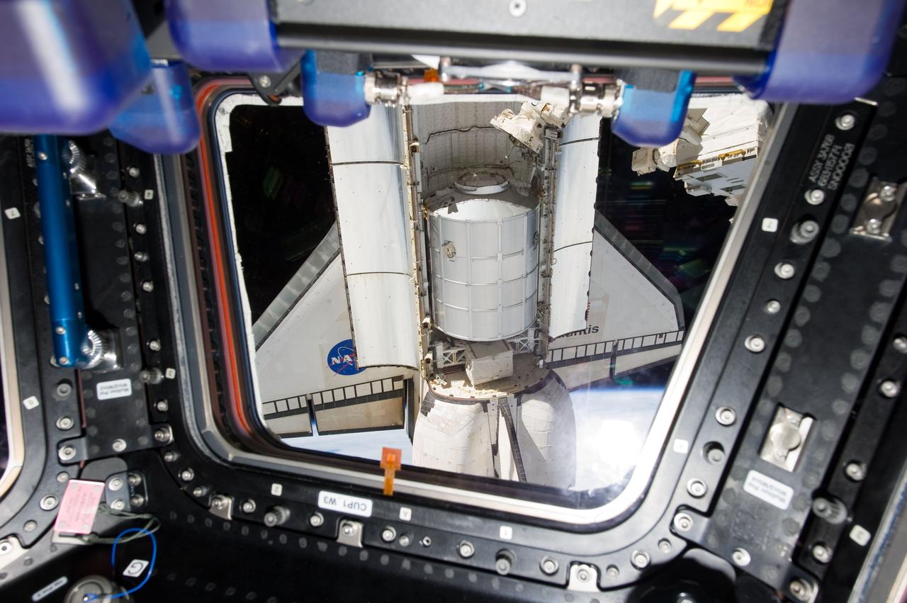
S122-E-009934 (18 Feb. 2008) --- A close-up view of the Columbus laboratory (center right) -- newest addition to the International Space Station -- is featured in this image photographed by a STS-122 crewmember on Space Shuttle Atlantis shortly after the undocking of the two spacecraft.
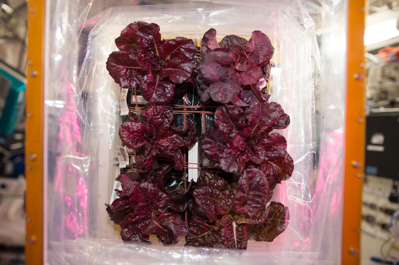
iss050e019639 (12/18/2016) --- A view during VEG-03 harvest and stow of Red Romaine lettuce, in the Columbus Module. Veg-03 uses the Veggie plant growth facility to cultivate a type of cabbage, which is harvested in orbit with samples returned to Earth for testing.
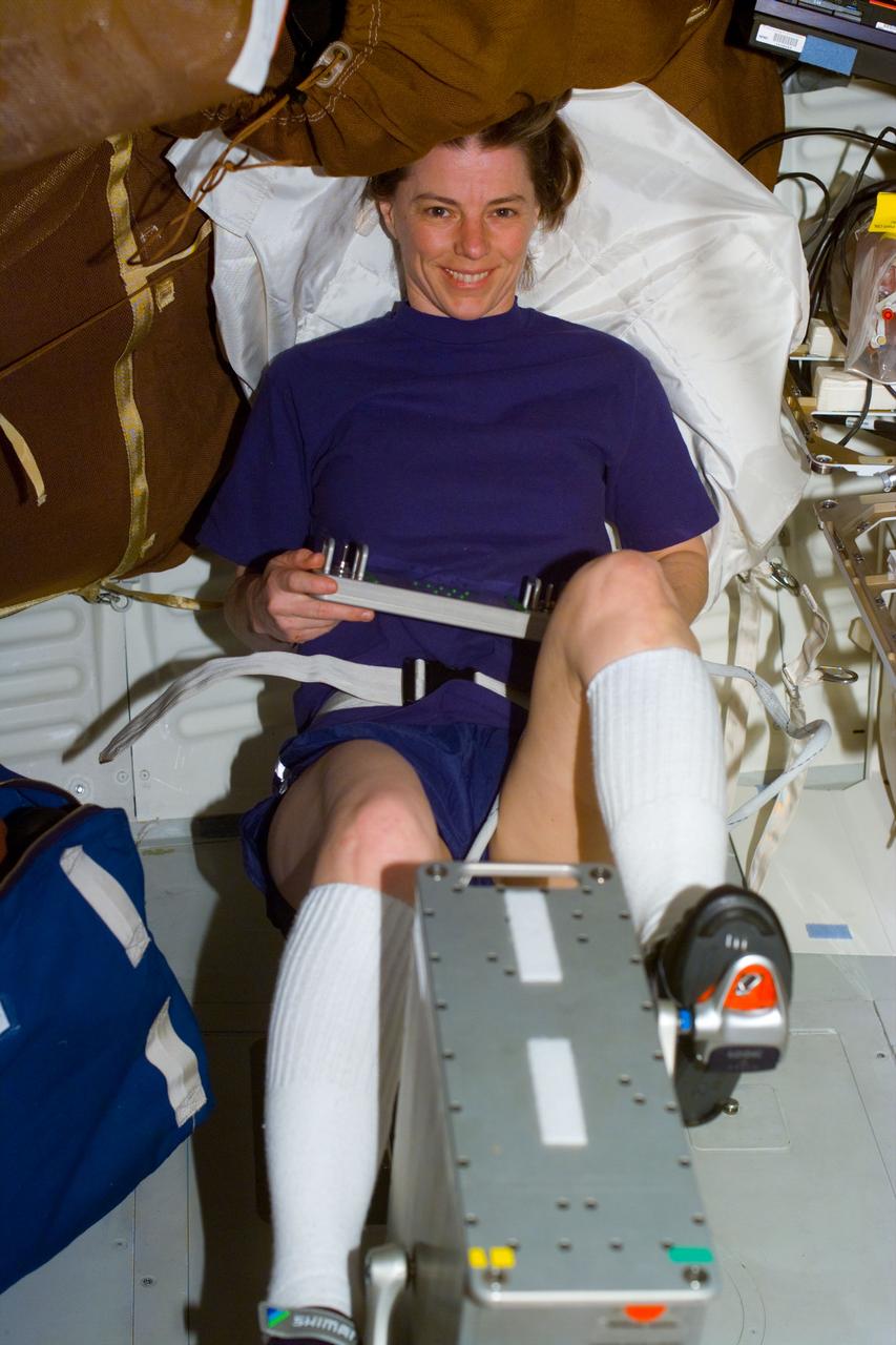
S89-E-5202 (25 Jan 1998) --- This Electronic Still Camera (ESC) image shows mission specialist, Bonnie J. Dunbar, payload commander, working out on the bicycle ergometer onboard the Earth-orbiting Space Shuttle Endeavour. This ESC view was taken on January 25, 1998, at 18:36:52 GMT.
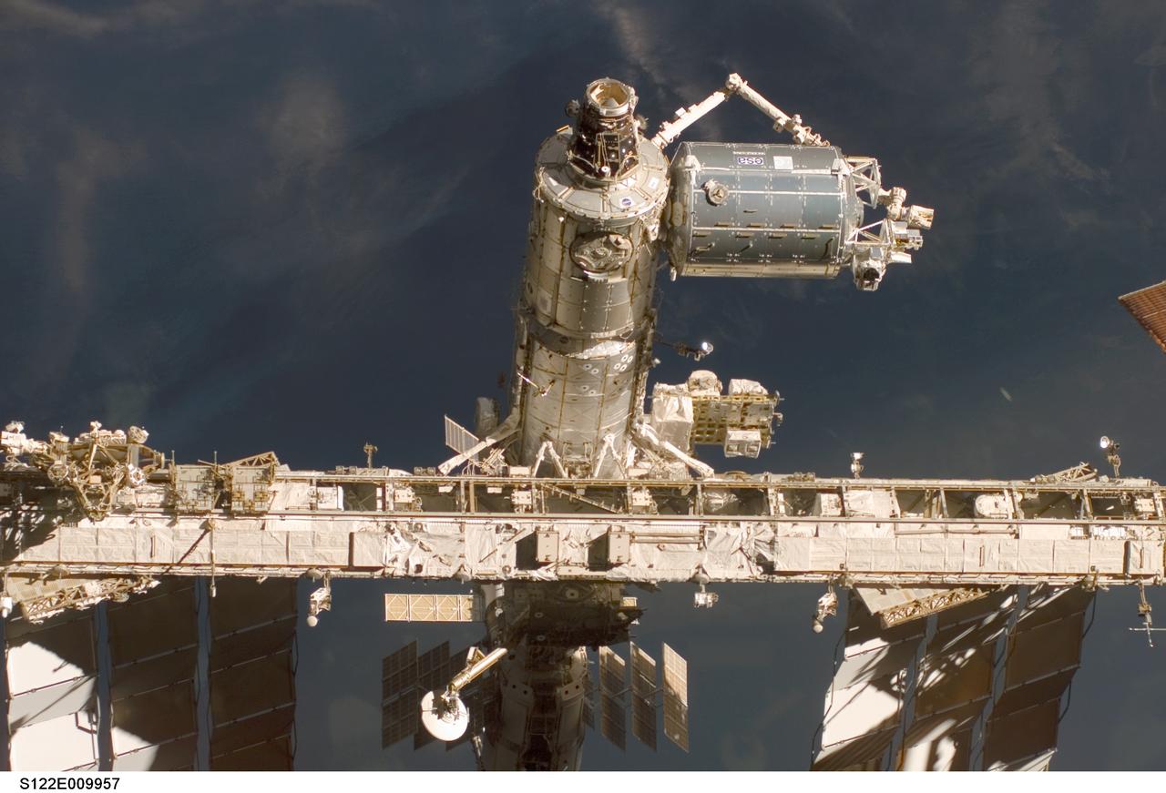
S122-E-009957 (18 Feb. 2008) --- A close-up view of the Columbus laboratory (top right) -- newest addition to the International Space Station -- is featured in this image photographed by a STS-122 crewmember on Space Shuttle Atlantis shortly after the undocking of the two spacecraft.
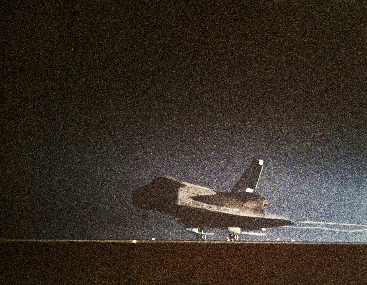
61C-S-050 (18 Jan 1986) --- This NASA photo records the night landing of space shuttle Columbia at Edwards Air Force Base and end of the STS 61-C mission. View is of the shuttle's main landing gear touching down, with streams of light trailing behind the orbiter. Photo credit: NASA
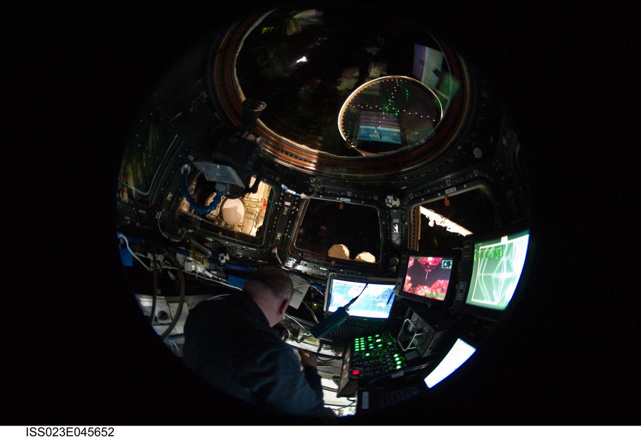
ISS023-E-045652 (18 May 2010) --- In this ?fish-eye? lens view, NASA astronaut Garrett Reisman, STS-132 mission specialist, is surrounded by windows and computers in the International Space Station's Cupola during his mission's flight day five activities. Photo credit: NASA or National Aeronautics and Space Administration
S135-E-009330 (18 July 2011) --- As seen through one of the windows on the International Space Station's Cupola, this is a view of the space shuttle Atlantis and its Raffaello multi-purpose logistics module during the final day of being docked with the International Space Station. Photo credit: NASA

STS008-18-479 (5 Sept 1983) --- Aft flight deck documentation includes on orbit station with control panel A2, aft viewing window W9, and communications kit assembly (ASSY) headset (HDST) interface unit (HIU) and cable free floating in front of it.
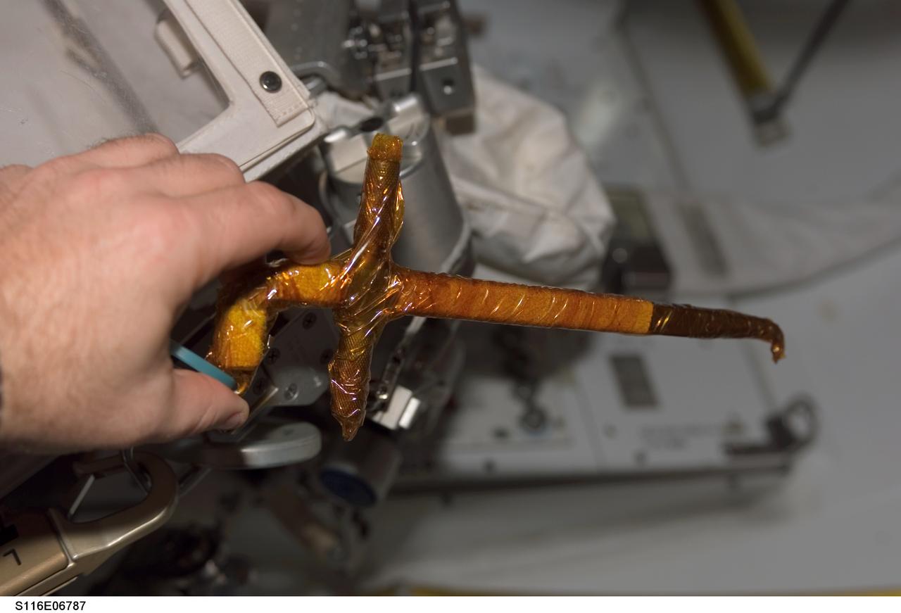
S116-E-06787 (18 Dec. 2006) --- A view of a loop-pin-puller wrapped in insulating tape onboard Space Shuttle Discovery, scheduled for use during STS-116 extravehicular activity (EVA) as construction resumes on the International Space Station.
S82-E-5694 (18 Feb. 1997) --- Astronaut Joseph R. Tanner watches two astronauts at work in the Space Shuttle Discovery's cargo bay from aft flight deck during final Extravehicular Activity (EVA-5). This view was taken with an Electronic Still Camera (ESC).
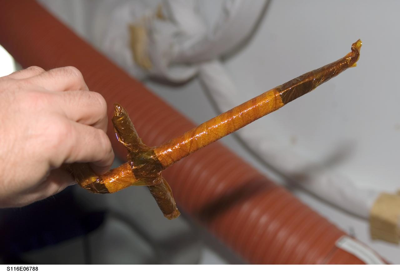
S116-E-06788 (18 Dec. 2006) --- A view of a loop-pin-puller wrapped in insulating tape onboard Space Shuttle Discovery, scheduled for use during STS-116 extravehicular activity (EVA) as construction resumes on the International Space Station.
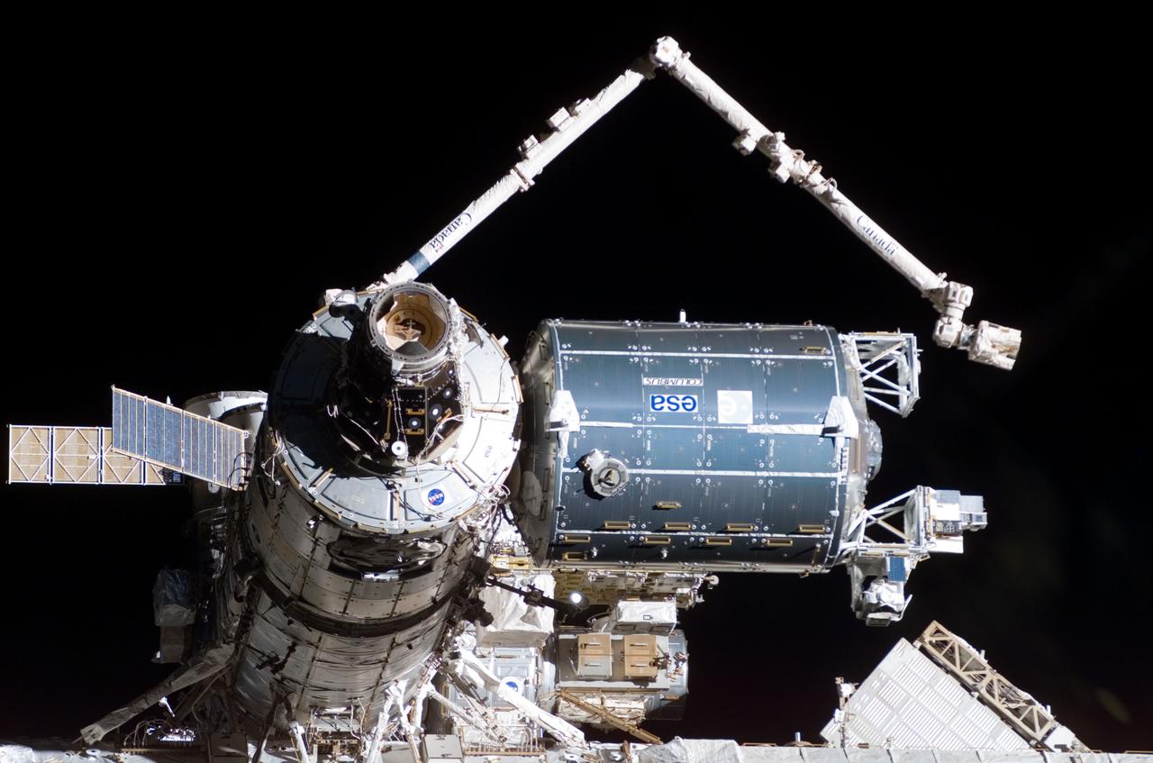
S122-E-009954 (18 Feb. 2008) --- A close-up view of the Columbus laboratory (center right) -- newest addition to the International Space Station -- is featured in this image photographed by a STS-122 crewmember on Space Shuttle Atlantis shortly after the undocking of the two spacecraft.

S89-E-5246 (26 Jan 1998) --- This Electronic Still Camera (ESC) image shows astronaut Michael P. Anderson, mission specialist, exercising on the modified bicycle ergometer onboard the Space Shuttle Endeavour. This ESC view was taken on January 26, 1998, at 18:31:30 MET.
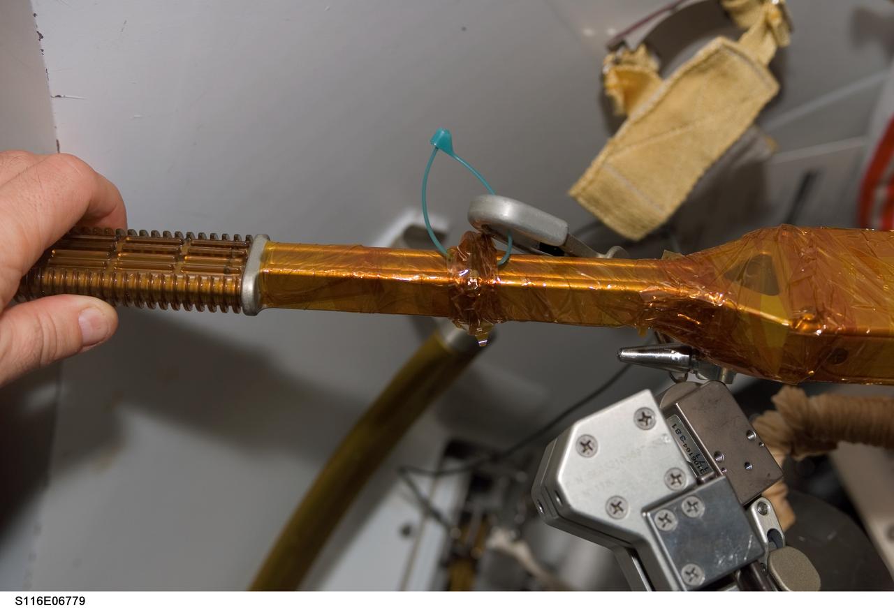
S116-E-06779 (18 Dec. 2006) --- A view of a cheater bar assembly wrapped in insulating tape onboard Space Shuttle Discovery, scheduled for use during STS-116 extravehicular activity (EVA) as construction resumes on the International Space Station.

S82-E-5734 (18 Feb. 1997) --- Tear is visible (lower right if picture is oriented horizontally) at base of Bay #8, later repaired by Smith and Lee. One bit of patchwork is visible on left. This view was taken with an Electronic Still Camera (ESC).
Views OSS-1 Payload Pallet, vehicle changing and potential experiment being checked out by technicians after its arrival at the Operations & Checkout (O&C) Bldg., 09/18/1981, for the STS-3 Mission 1. STS-3 - EXERIMENT (OSS-1) 2. SHUTTLE - PAYLOADS (OSS-1) KSC, FL
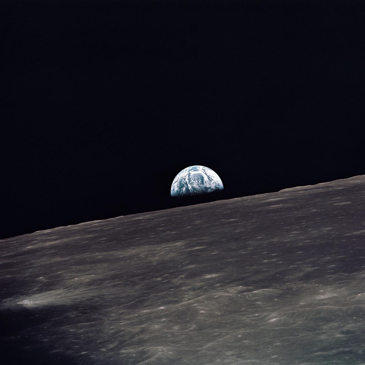
AS10-27-3890 (18-26 May 1969) --- A view of Earth rising above the lunar horizon photographed from the Apollo 10 Lunar Module, looking west in the direction of travel. The Lunar Module at the time the picture was taken was located above the lunar farside highlands at approximately 105 degrees east longitude.

S89-E-5204 (25 Jan 1998) --- This Electronic Still Camera (ESC) image shows astronaut Michael P. Anderson, mission specialist, checking the Biotechnology Refrigerator (BTR) while transferring logistics, onboard the Space Shuttle Endeavour. This ESC view was taken on January 25, 1998, at 18:54:53 GMT.
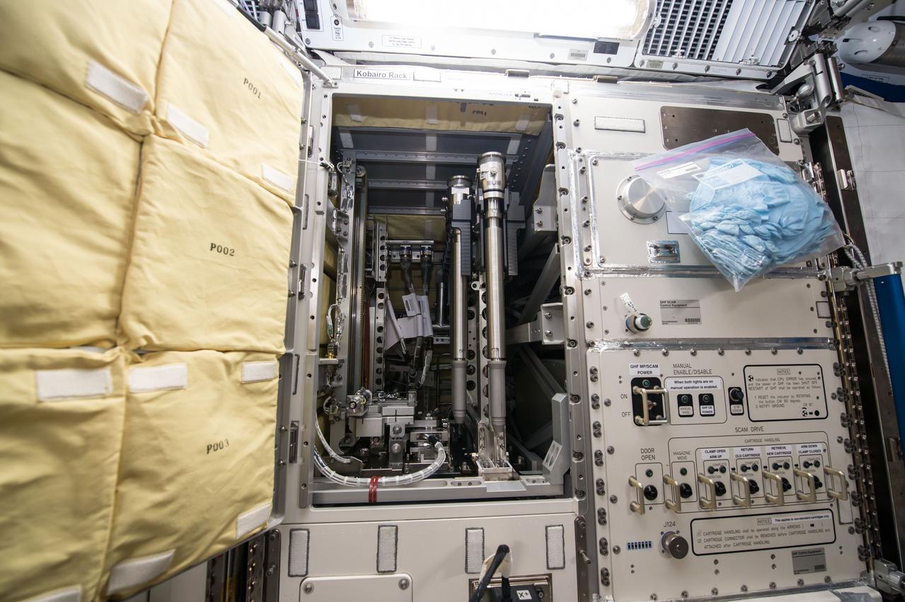
iss042e049014 (12/18/2014) --- A view of the interior of the Kobairo rack of the Japanese Experiment Module (JEM) aboard the International Space station (ISS).The KOBAIRO Rack houses the Gradient Heating Furnace (GHF), an experiment facility for investigating crystal growth of semiconductors. This furnace has the capability of directional solidification of samples.
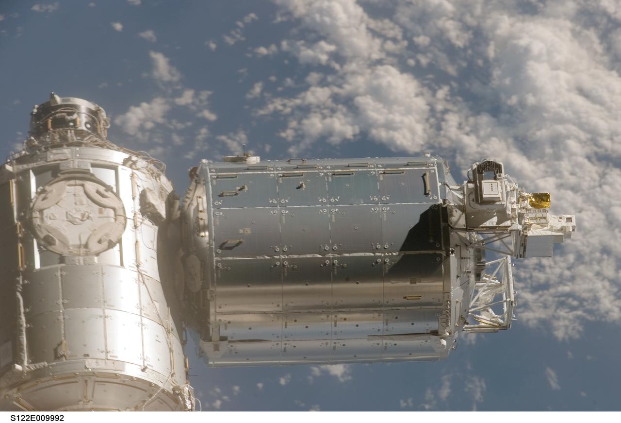
S122-E-009992 (18 Feb. 2008) --- A close-up view of the Columbus laboratory (center) -- newest addition to the International Space Station -- is featured in this image photographed by a STS-122 crewmember on Space Shuttle Atlantis shortly after the undocking of the two spacecraft.
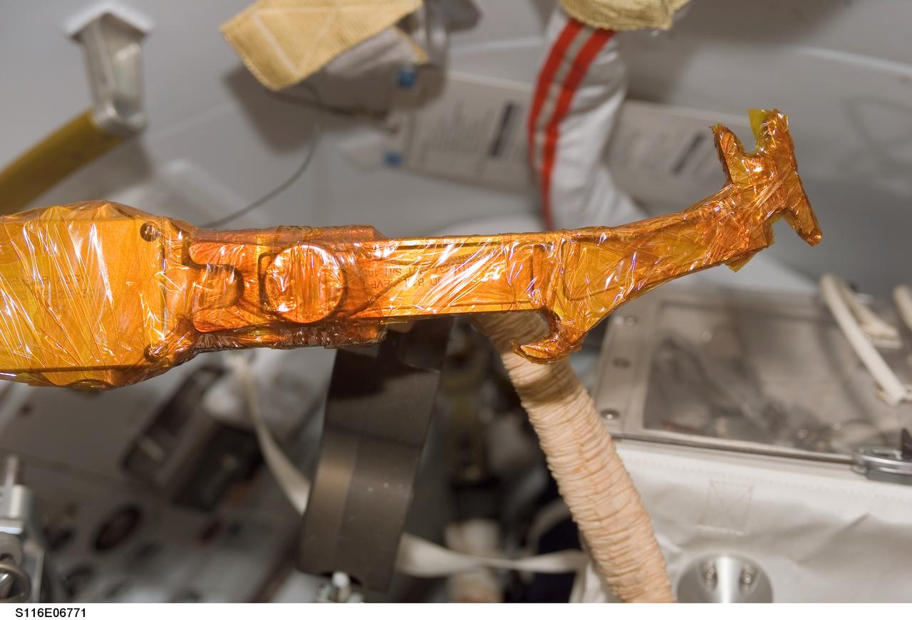
S116-E-06771 (18 Dec. 2006) --- A view of a bail drive lever and cheater bar assembly wrapped in insulating tape onboard Space Shuttle Discovery, scheduled for use during STS-116 extravehicular activity (EVA) as construction resumes on the International Space Station.
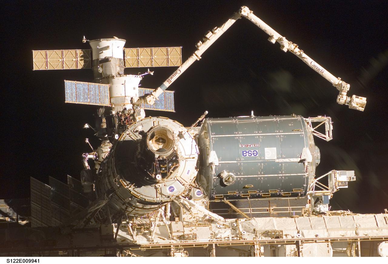
S122-E-009941 (18 Feb. 2008) --- A close-up view of the Columbus laboratory (center right) -- newest addition to the International Space Station -- is featured in this image photographed by a STS-122 crewmember on Space Shuttle Atlantis shortly after the undocking of the two spacecraft.
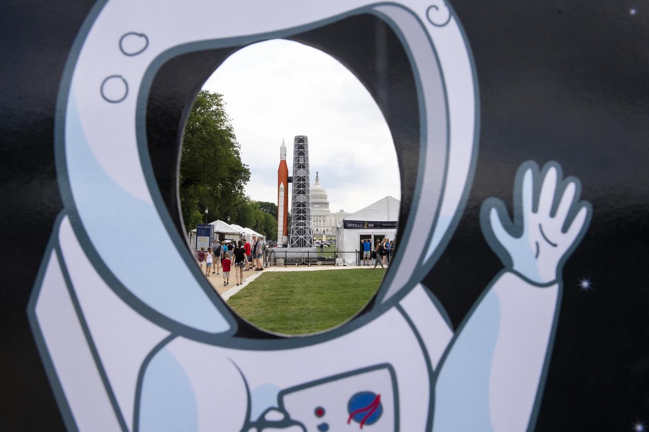
A view of the Apollo 11 50th Anniversary celebration on the National Mall, Thursday, July 18, 2019 in Washington. Apollo 11 was the first mission to land astronauts on the Moon and launched on July 16, 1969 with astronauts Neil Armstrong, Michael Collins, and Buzz Aldrin. Photo Credit: (NASA/Connie Moore)
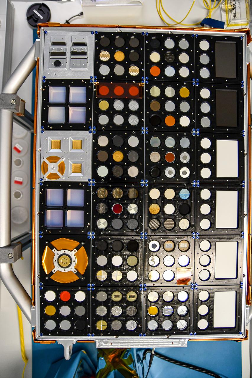
jsc2024e065153 (1/18/2024) --- Preflight view of the Space Experiment Study on Ageing of MatErial (SESAME) experiment portion of the Euro Material Ageing investigation. SESAME is an exposure panel to the space environment which contains different samples and sensors. Samples were chosen in function of projects' needs and research and development activities. Image courtesy of CNES..

S89-E-5247 (26 Jan 1998) --- This Electronic Still Camera (ESC) image shows astronaut Terrence W. Wilcutt, commander, on the flight-deck of the Earth-orbiting Space Shuttle Endeavour. This ESC view was taken on January 26, 1998, at 18:47:06 MET.
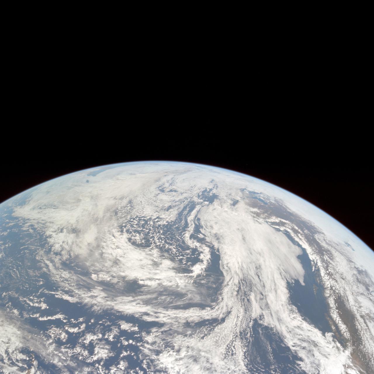
AS10-34-5010 (18 May 1969) --- This photograph of Earth was taken from the Apollo 10 spacecraft shortly after trans-lunar insertion. The counter-clockwise arrangement of the cloud formations indicates a northern hemisphere view, although insufficient amounts of land are visible for exact location.
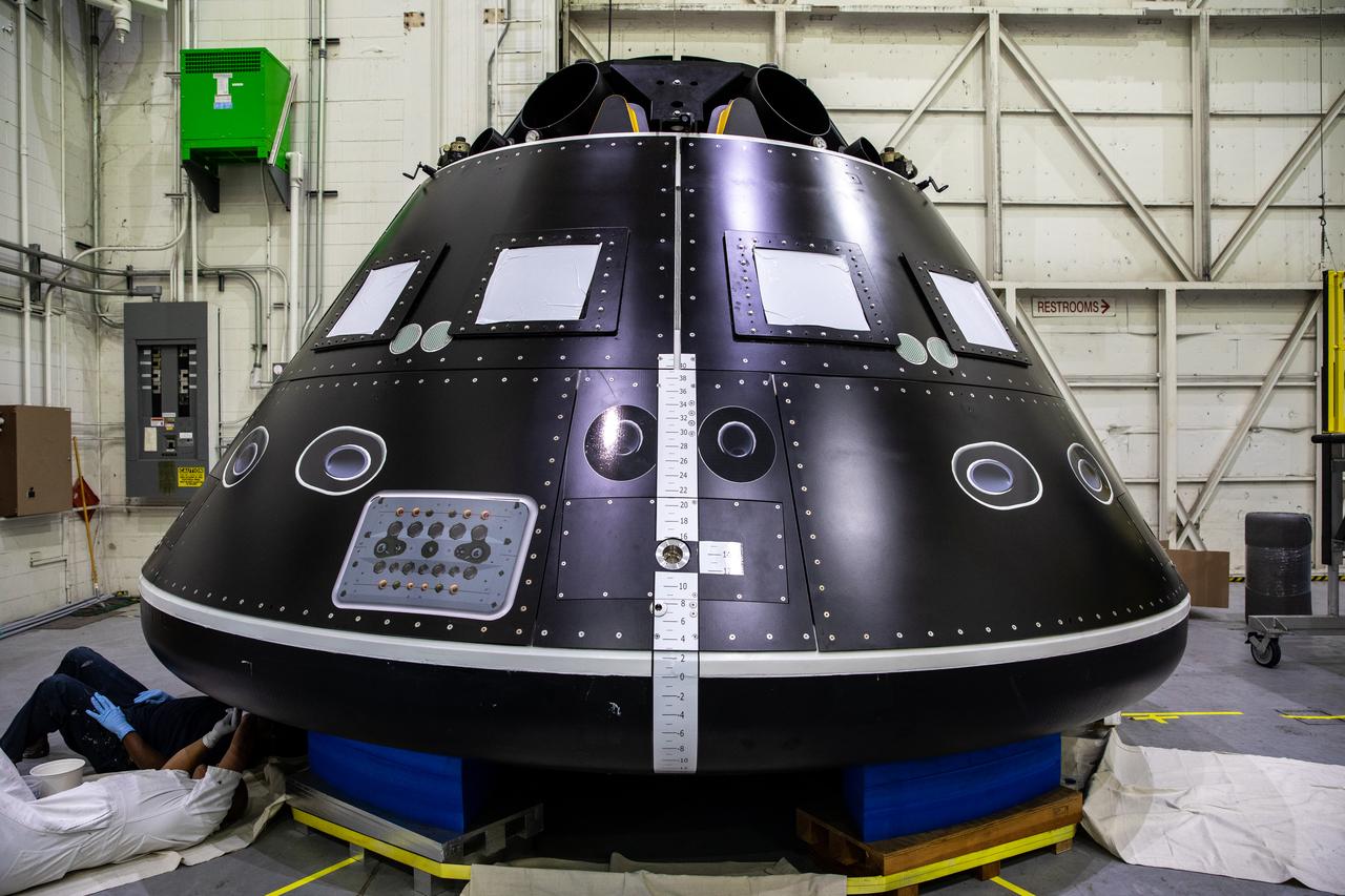
The Artemis Orion crew module test article (CMTA) is in view in the high bay inside the Launch Equipment Test Facility at NASA's Kennedy Space Center in Florida on March 18, 2022. The CMTA is used to practice recovery after splashdown of the Orion spacecraft to prepare for Artemis missions. Exploration Ground Systems leads recovery efforts.
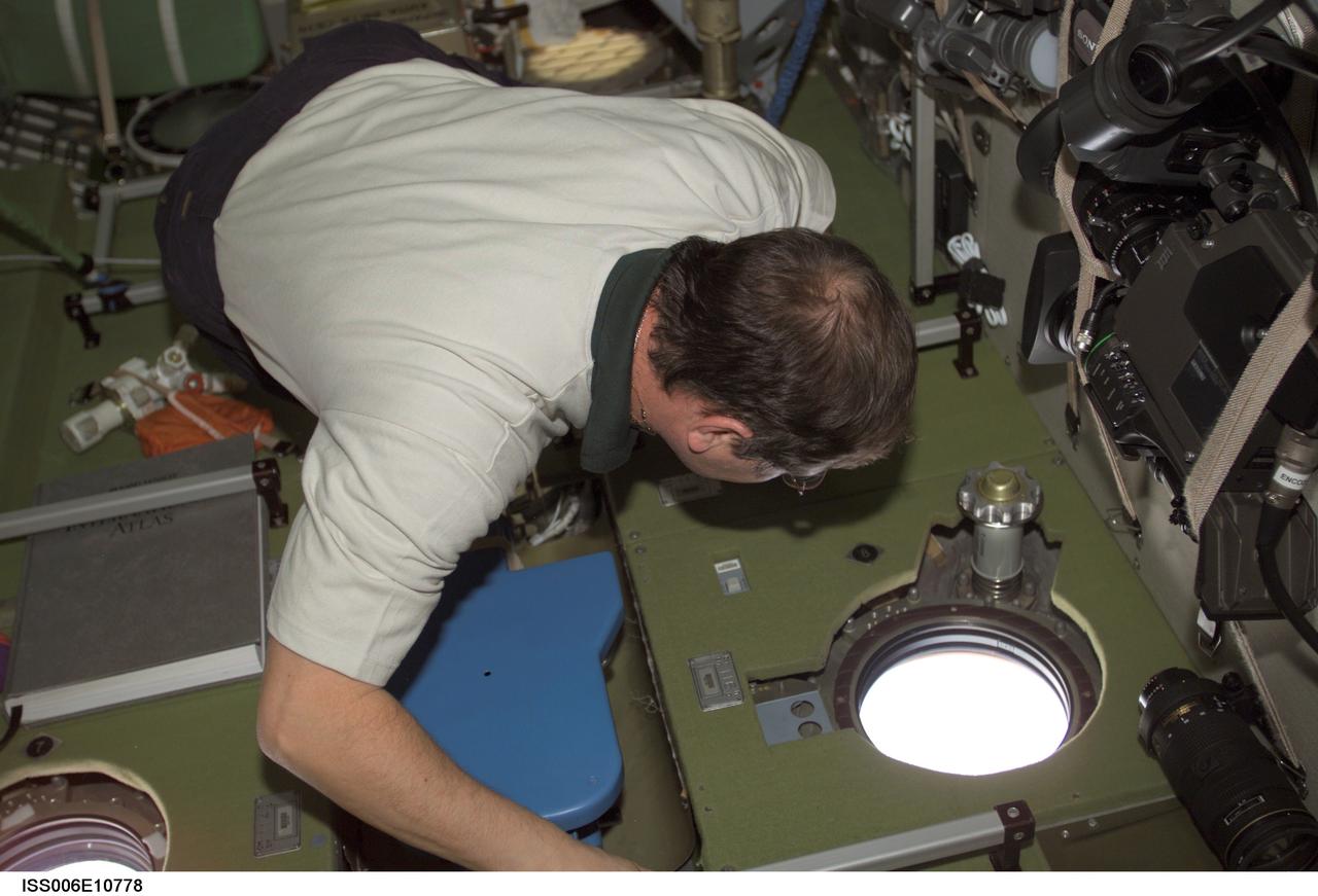
ISS006-E-10778 (18 December 2002) --- Cosmonaut Nikolai M. Budarin, Expedition Six flight engineer, views the topography of a point on Earth from a window in the Zvezda Service Module on the International Space Station (ISS). Budarin represents Rosaviakosmos.
AS10-29-4321 (18-26 May 1969) --- An Apollo 10 oblique view of the western portion of the Sea of Tranquility. The area in the picture is located approximately 70 nautical miles east-southeast of Apollo Landing Site 2. The flat terrain pitted by moderate-sized craters is typical of this portion of Mare Tranquillitatis.

S89-E-5207 (25 Jan 1998) --- This Electronic Still Camera (ESC) image shows astronaut Michael P. Anderson, mission specialist, checking the Biotechnology Refrigerator (BTR) while transferring logistics onboard the Space Shuttle Endeavour. This ESC view was taken on January 25, 1998, at 18:56:29 GMT.
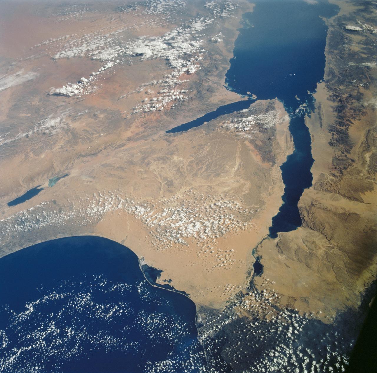
STS112-702-002 (7-18 October 2002) --- Egypt's triangular Sinai Peninsula lies in the center of this view, photographed from the Space Shuttle Atlantis, with the dark greens of the Nile delta lower right. In this southwesterly view, the Red Sea, with its characteristic parallel coastlines, stretches toward the top. At the bottom of the image, the Suez Canal appears as an irregular line joining the Red Sea to the Mediterranean Sea (lower left). The Dead Sea in central Israel, with its light blue salt ponds at the south end, appears on the left margin.
STS058-102-018 (18 Oct-1 Nov 1993) --- A cloud-free, wide-angle view from above western Tennessee to the northern edge of Lake Michigan. The view extends from Saint Louis, Missouri near the lower left-hand corner, past Evansville, Indiana and Louisville, Kentucky to Cincinnati, Ohio. A range of hills covered by trees in Fall foliage extends from the Ohio River toward Lake Michigan, ending just southwest of Indianapolis, Indiana.
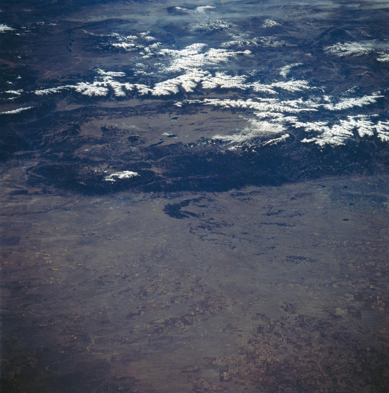
STS058-89-013 (18 Oct-1 Nov 1993) --- An oblique westward view, across the wheat fields and cattle pastures, of eastern Colorado to the Front Range of the Rocky Mountains. Denver is bisected at the center of the right edge of the frame. Pikes Peak and Colorado Springs are left of center, and the Arkansas River Valley with Canyon City and the Royal Gorge are along the left edge of the frame. This view shows the startling contrast between the nearly-flat High Plains and the ancient geological uplift of the Rockies.
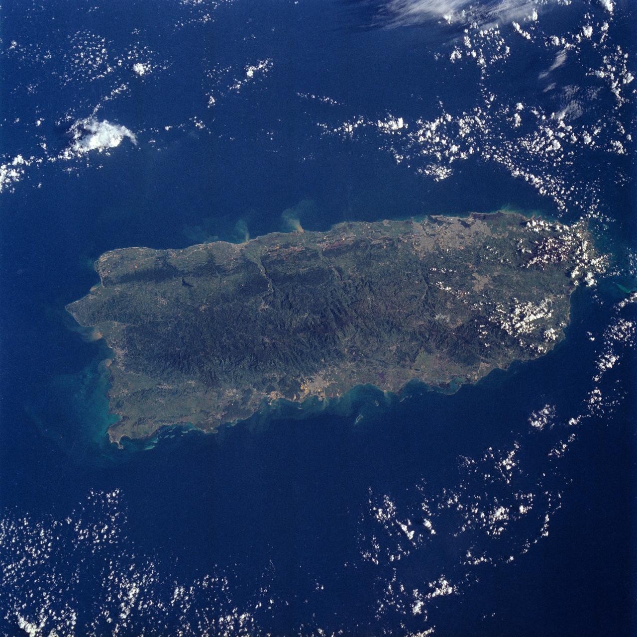
STS034-76-088 (18-23 Oct. 1989) --- A nearly vertical view over the island of Puerto Rico. NASA photo experts believe this to be an excellent view of Puerto Rico, because it has no cloud cover and the island is captured in its entirety. A 70mm handheld aimed through the space shuttle Atlantis' aft windows was used to expose the frame. Center point of the frame is 18.0 degrees north latitude and 66.5 degrees west longitude.
S82-E-5718 (18 Feb. 1997) --- Making use of the Remote Manipulator System (RMS) astronauts Mark C. Lee (left), STS-82 payload commander, and Steven L. Smith, mission specialist, perform the final phases of Extravehicular Activity (EVA) duty. Lee holds a patch piece for Bay #10, out of view, toward which the two were headed. A sample of the patch work can be seen on Bay #9 in the upper left quadrant of the picture. This view was taken with an Electronic Still Camera (ESC).