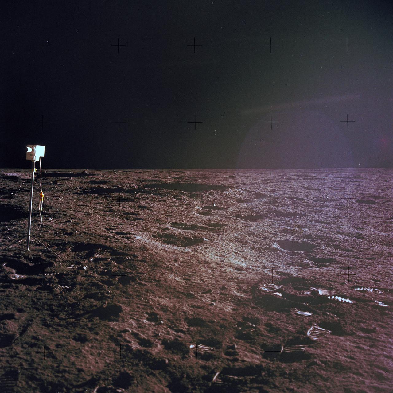
The second manned lunar landing mission, Apollo 12, launched from launch pad 39-A at Kennedy Space Center in Florida on November 14, 1969 via a Saturn V launch vehicle. The Saturn V vehicle was developed by the Marshall Space Flight Center (MSFC) under the direction of Dr. Wernher von Braun. Aboard Apollo 12 was a crew of three astronauts: Alan L. Bean, pilot of the Lunar Module (LM), Intrepid; Richard Gordon, pilot of the Command Module (CM), Yankee Clipper; and Spacecraft Commander Charles Conrad. The LM, Intrepid, landed astronauts Conrad and Bean on the lunar surface in what’s known as the Ocean of Storms while astronaut Richard Gordon piloted the CM, Yankee Clipper, in a parking orbit around the Moon. Lunar soil activities included the deployment of the Apollo Lunar Surface Experiments Package (ALSEP), finding the unmanned Surveyor 3 that landed on the Moon on April 19, 1967, and collecting 75 pounds (34 kilograms) of rock samples. This is the nineteenth of 25 images captured by the crew in attempt to provide a 360 degree Lunar surface scene. Apollo 12 safely returned to Earth on November 24, 1969.
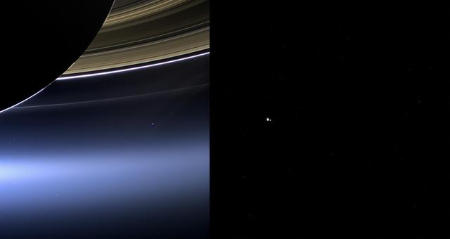
These images show views of Earth and the moon from NASA Cassini left and MESSENGER spacecraft right from July 19, 2013.

Alabama House Minority Leader Anthony Daniels, (Left), and Auburn University President, Dr. Stephen Leahy, were part of the Leadership Alabama group that viewed the SLS Liquid Hydrogen test stand at Marshall Space Flight Center on 3/7/19.

This 360-degree, stereo mosaic of images from NASA Mars Exploration Rover Opportunity shows the view from the western rim of Santa Maria crater on Dec. 19, 2010. 3D glasses are necessary to view this image.
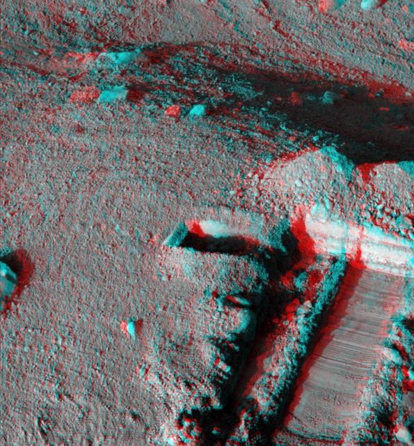
This anaglyph, acquired by NASA Phoenix Lander on Jun. 19, 2008, shows a stereoscopic 3D view of the Martian surface near the lander. 3D glasses are necessary to view this image.
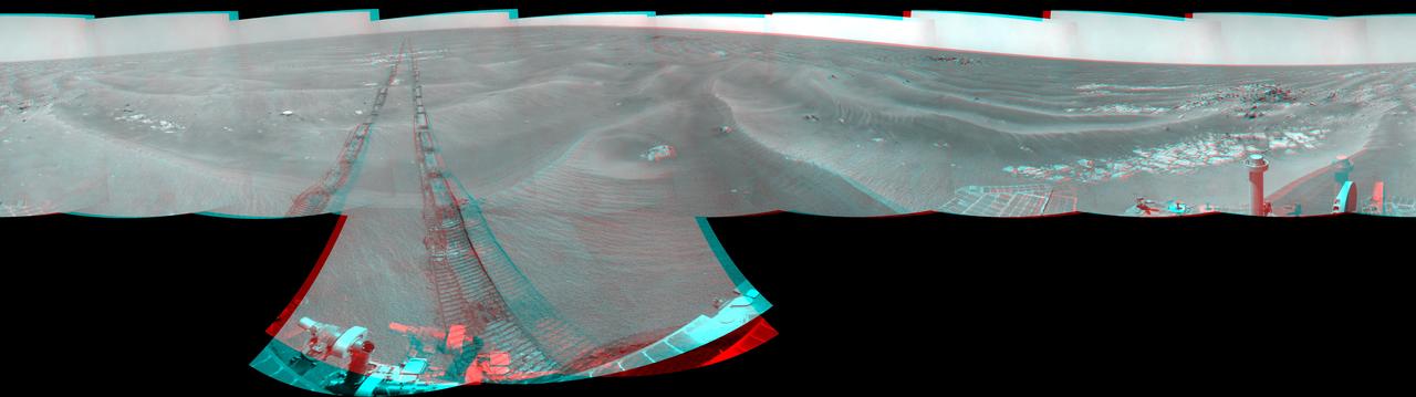
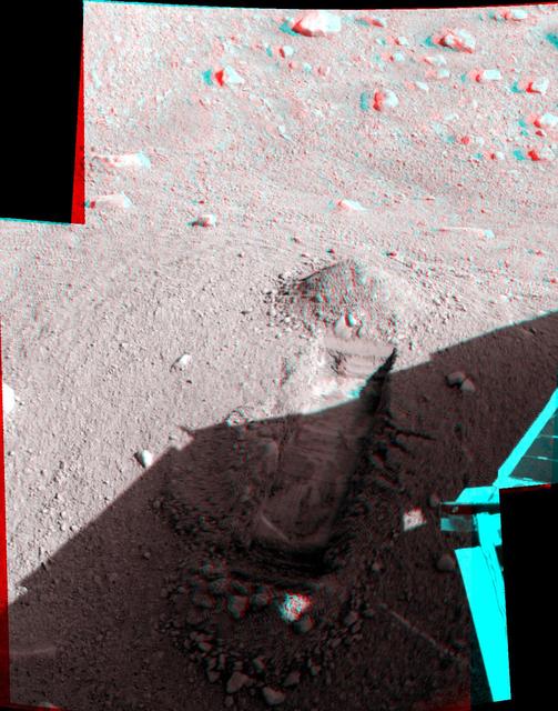
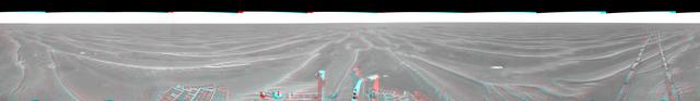
NASA Mars Exploration Rover Opportunity used its navigation camera to take the images combined into this 360-degree stereo view of the rover surroundings on July 19, 2009. 3D glasses are necessary to view this image.

This colorized mosaic from NASA Cassini mission shows an infrared view of the Saturn system, backlit by the sun, from July 19, 2013.
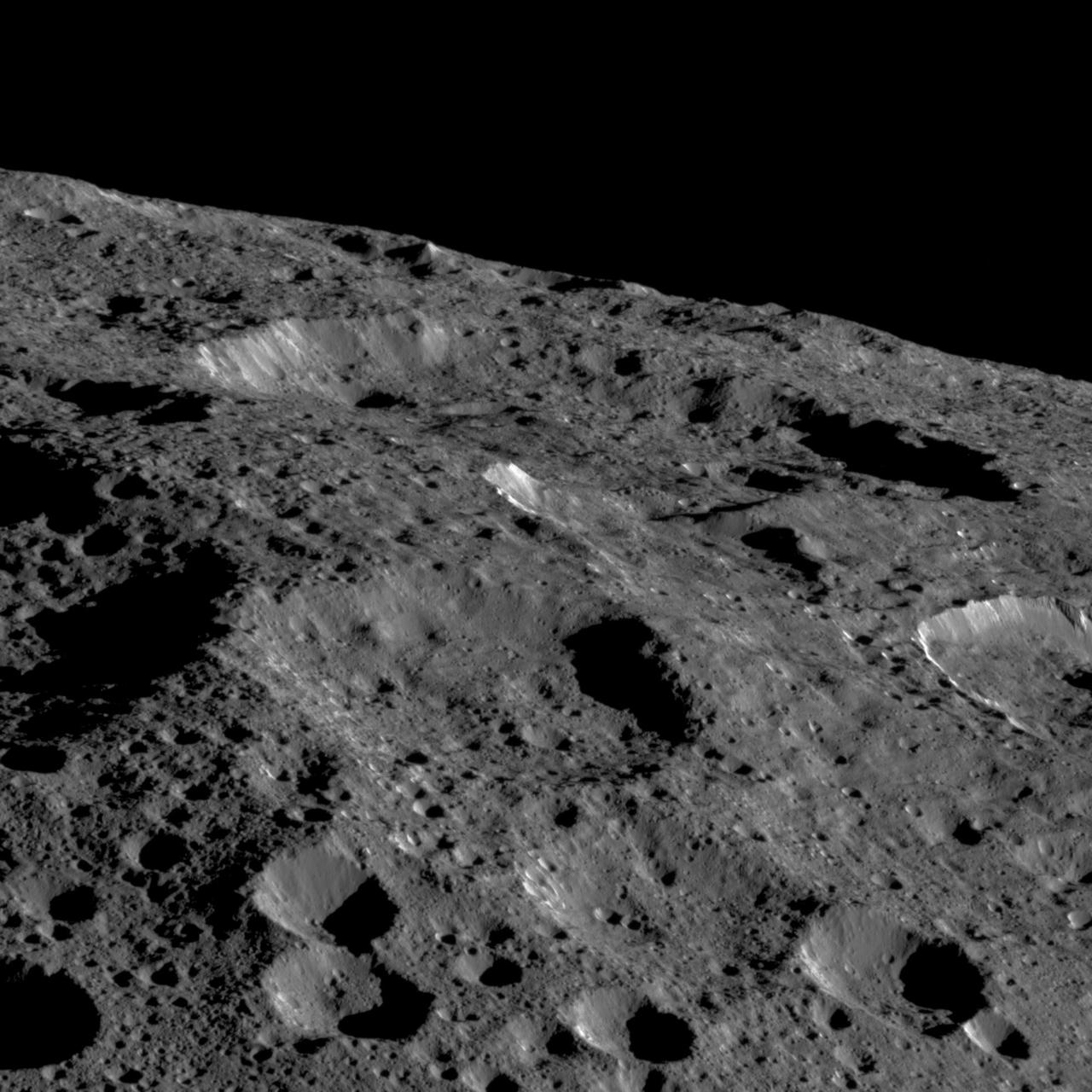
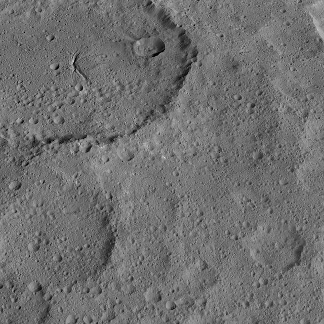
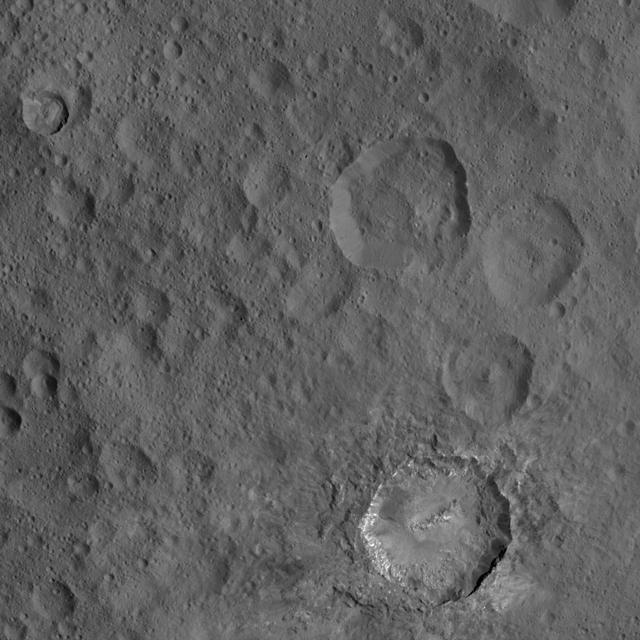
Dawn captured this view on May 19, 2018. The image shows the limb of Ceres at about 270E, 30N looking south. The spatial resolution is about 200 feet (60 meters) per pixel in the nearest parts of the image. The impact crater to the right (only partially visible) is Ninsar, named after a Sumerian goddess of plants and vegetation. It is about 25 miles (40 kilometers) in diameter. The conclusion of Dawn's mission operations was Oct. 31, 2018, when the spacecraft depleted its hydrazine used for attitude control. https://photojournal.jpl.nasa.gov/catalog/PIA23017

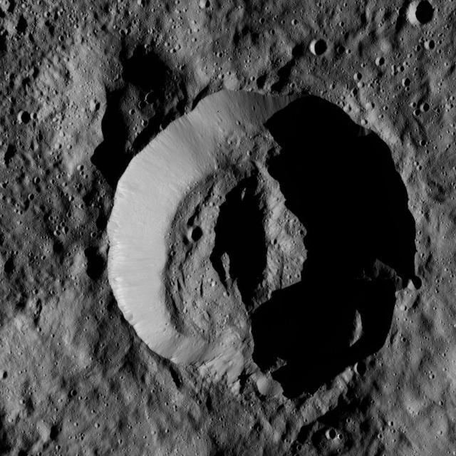
This view of the Cerean crater Victa was captured by NASA Dawn spacecraft on Dec. 19, 2015. The steep-walled crater is approximately 19 miles 30 kilometers in diameter, and was named for the Roman goddess of food and nourishment. Dawn took this image from its low-altitude mapping orbit (LAMO), at an approximate altitude of 240 miles (385 kilometers) above Ceres. The image resolution is 120 feet (35 meters) per pixel. http://photojournal.jpl.nasa.gov/catalog/PIA20195
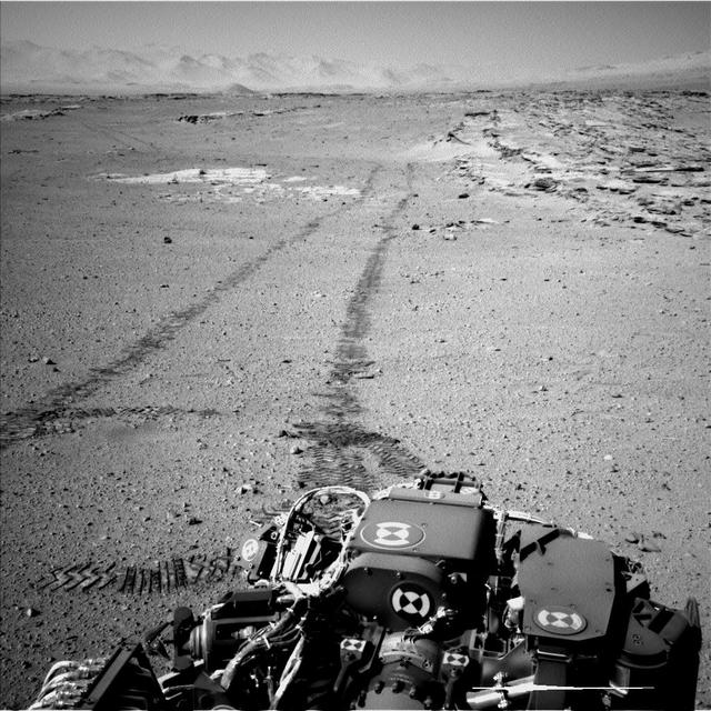
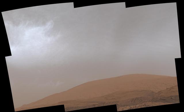
On Feb. 19, 2014, NASA Curiosity Mars rover looked back after finishing a long drive. The rows of rocks just to the right of the fresh wheel tracks in this view are an outcrop called Junda. This view is looking toward the east-northeast.
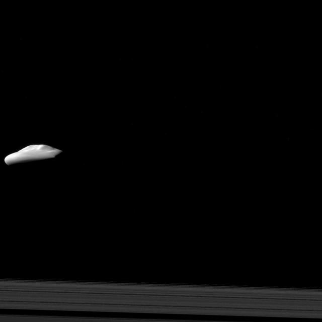
NASA Cassini spacecraft captured this view of Saturn moon Atlas 30 kilometers, or 19 miles across, with its smooth equatorial ridge, during a moderately close flyby on Dec. 6, 2015. The view offers one of Cassini best glimpses of Atlas.
NASA Mars Exploration Rover used its panoramic camera to record this view of the rim of a crater about 65 kilometers 40 miles in the distance, on the southwestern horizon. This crater, Bopolu, is about 19 kilometers 12 miles in diameter.
This anaglyph, acquired by NASA Phoenix Lander Surface Stereo Imager on June 19, 2008, shows a view of the Martian surface near the lander. The trench shown here is informally called Snow White 1. 3D glasses are necessary.
NASA Mars Exploration Rover Opportunity used its navigation camera to take the images combined into this 360-degree vertical view of the rover surroundings on the 1,950th Martian day, or sol, of its surface mission July 19, 2009.
NASA Mars Odyssey spacecraft captured this image on Feb. 19, 2012, 10 years to the day after the camera recorded its first view of Mars. This image covers an area in the Nepenthes Mensae region north of the Martian equator.
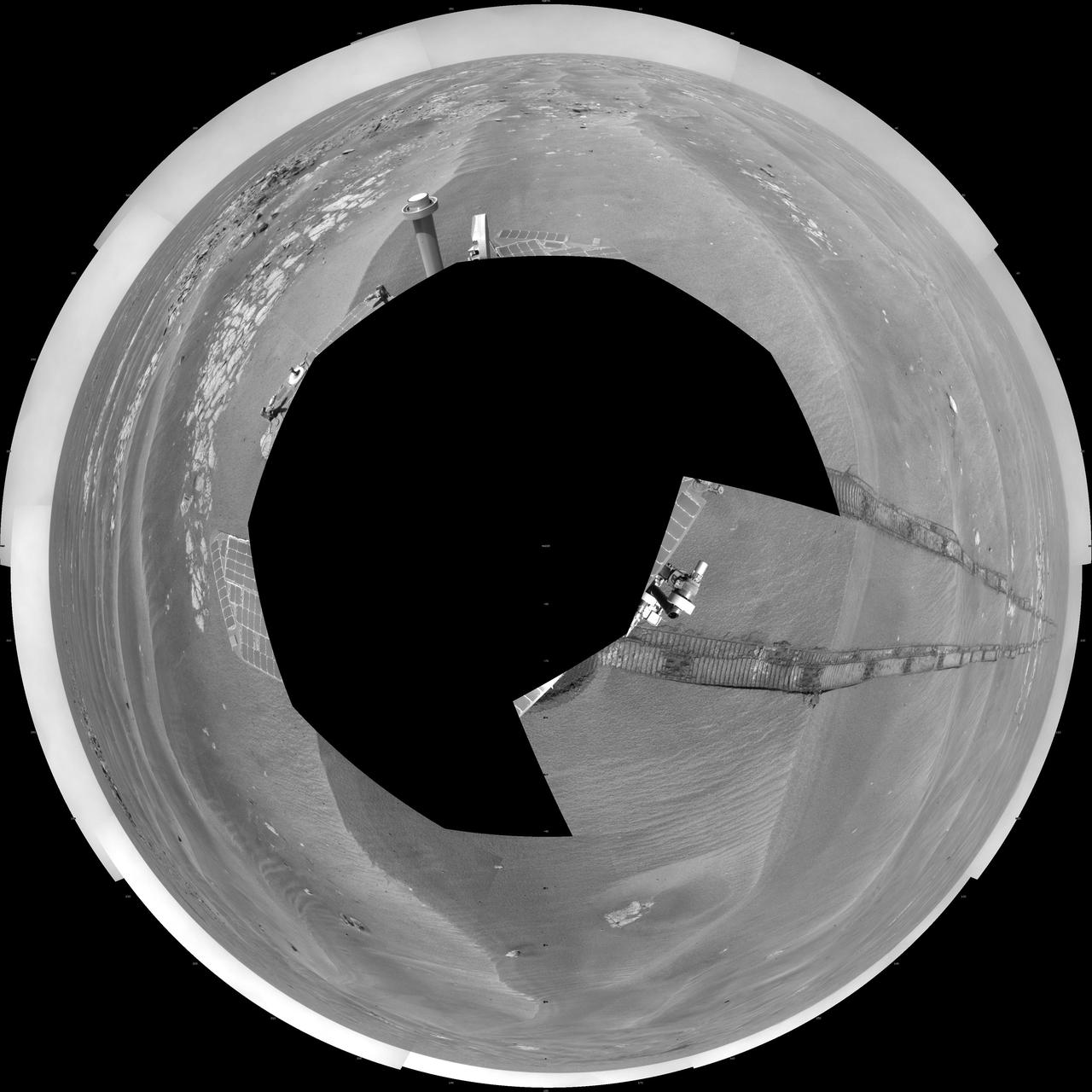
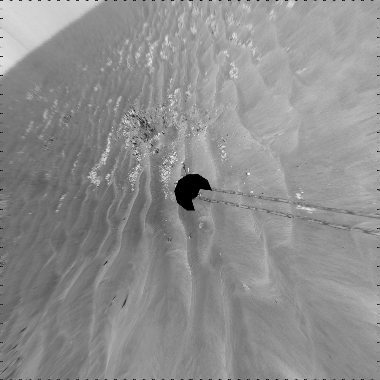
NASA Mars Exploration Rover Opportunity used its navigation camera to take the images combined into this 360-degree polar view of the rover surroundings on the 1,950th Martian day, or sol, of its surface mission July 19, 2009.
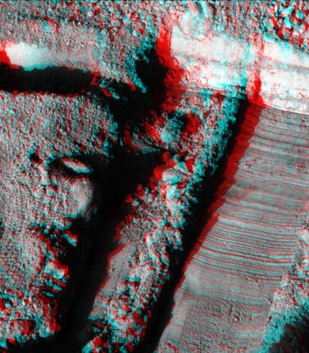
This anaglyph, acquired by NASA Phoenix Lander Surface Stereo Imager on June 19, 2008, shows a view of the Martian surface near the lander. The trench shown here is informally called Snow White 1. 3D glasses are necessary.
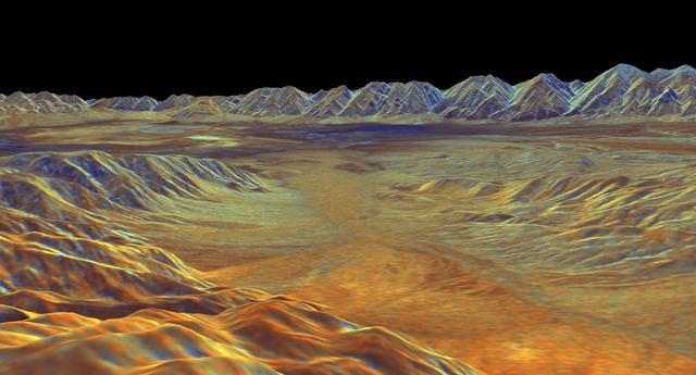
This is a three-dimensional perspective view of Saline Valley, about 30 km 19 miles east of the town of Independence, California created by combining two spaceborne radar images using a technique known as interferometry.

NASA Mars Exploration Rover Opportunity arrived at this location close to a small crater dubbed Alvin on Feb. 18 & 19, 2005. 3D glasses are necessary to view this image.
On Feb. 19, 2005, NASA Mars Exploration Rover Opportunity had completed a drive of 124 meters 407 feet across the rippled flatland of the Meridiani Planum region. 3D glasses are necessary to view this image.
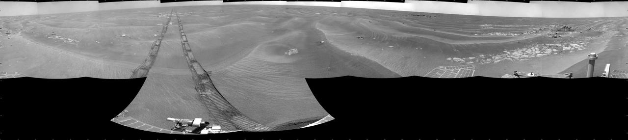
NASA Mars Exploration Rover Opportunity used its navigation camera to take the images combined into this 360-degree cylindrical view of the rover surroundings on the 1,950th Martian day, or sol, of its surface mission July 19, 2009.
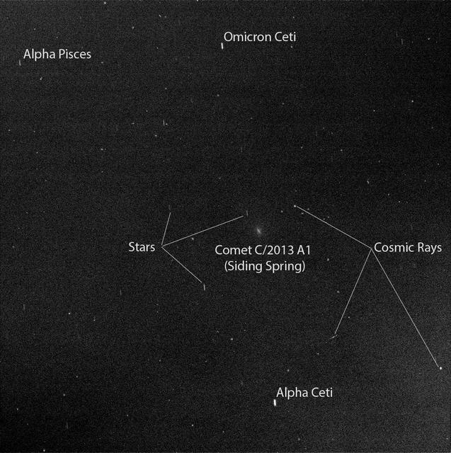
Researchers used the Pancam on NASA Mars Exploration Rover Opportunity to capture this view of comet C/2013 A1 Siding Spring as it flew near Mars on Oct. 19, 2014.
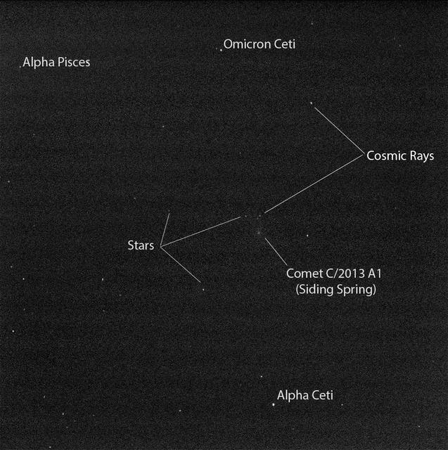
Researchers used the Pancam on NASA Mars Exploration Rover Opportunity to capture this view of comet C/2013 A1 Siding Spring as it flew near Mars on Oct. 19, 2014.
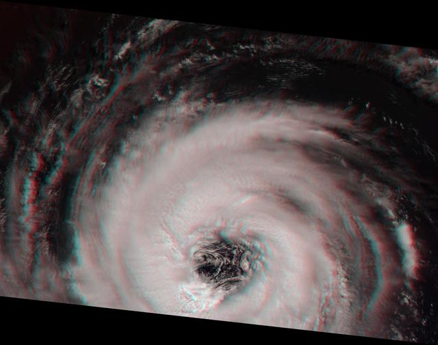
This stereoimage of Hurricane Alberto on August 19, 2000 was acquired by NASA Terra satellite. At this time, the storm was located in the North Atlantic Ocean, west of the Azores. 3D glasses are necessary to view this image.

NASA Terra satellite flew directly over Iceland on April 19, 2010 and captured this image of the Eyjafjallajökull volcano and its erupting ash plume. 3D glasses are necessary to view this image.

NASA Dawn spacecraft obtained these side-by-side views of a dark hill of the surface of asteroid Vesta with its framing camera on August 19, 2011. The images have a resolution of about 260 meters per pixel.
This GIF shows clouds drifting over Mount Sharp on Mars, as viewed by NASA's Curiosity rover on March 19, 2021, the 3,063rd Martian day, or sol, of the mission. Each frame of the scene was stitched together from six individual images. Movie available at https://photojournal.jpl.nasa.gov/catalog/PIA24661
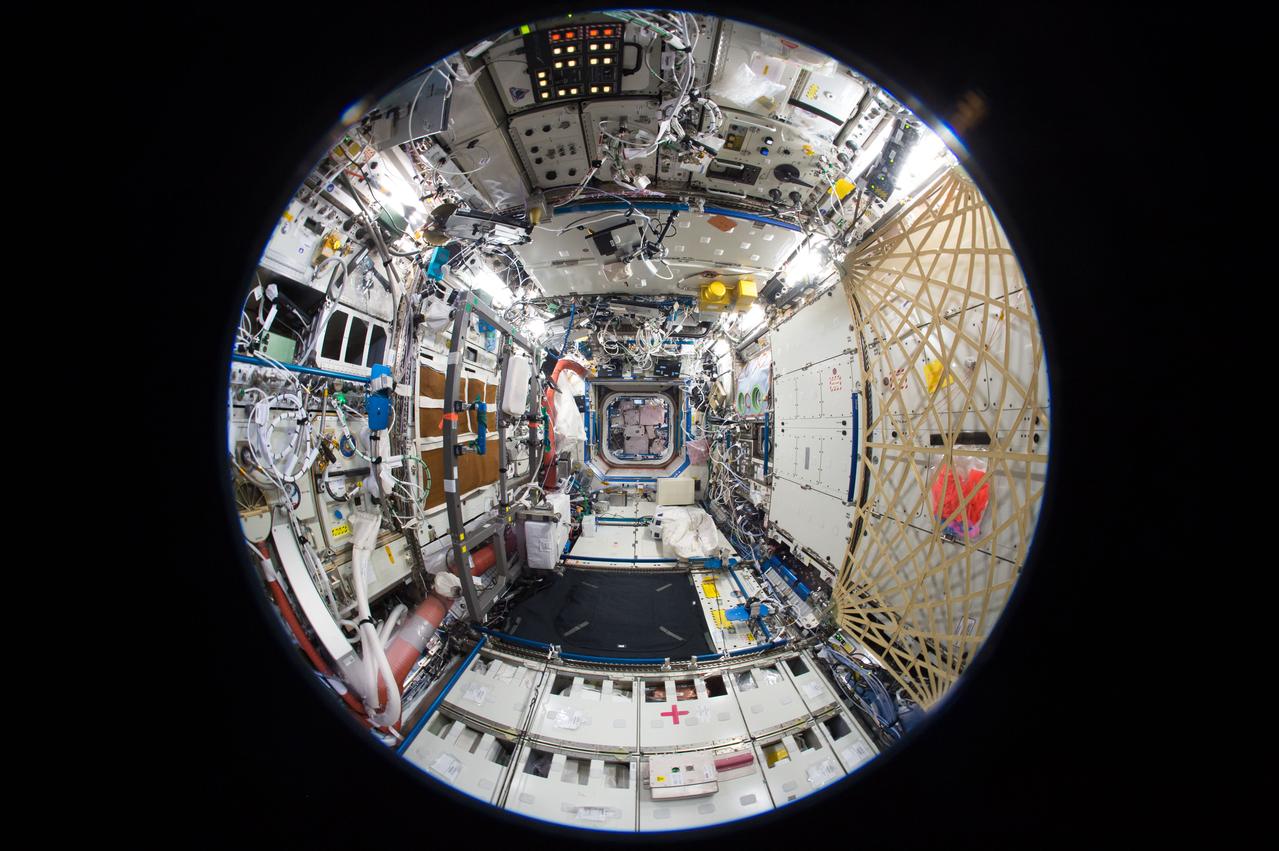
iss050e050873 (2/19/2017) --- A fish-eye view of the U.S. Laboratory taken for a Google Street View of the ISS.
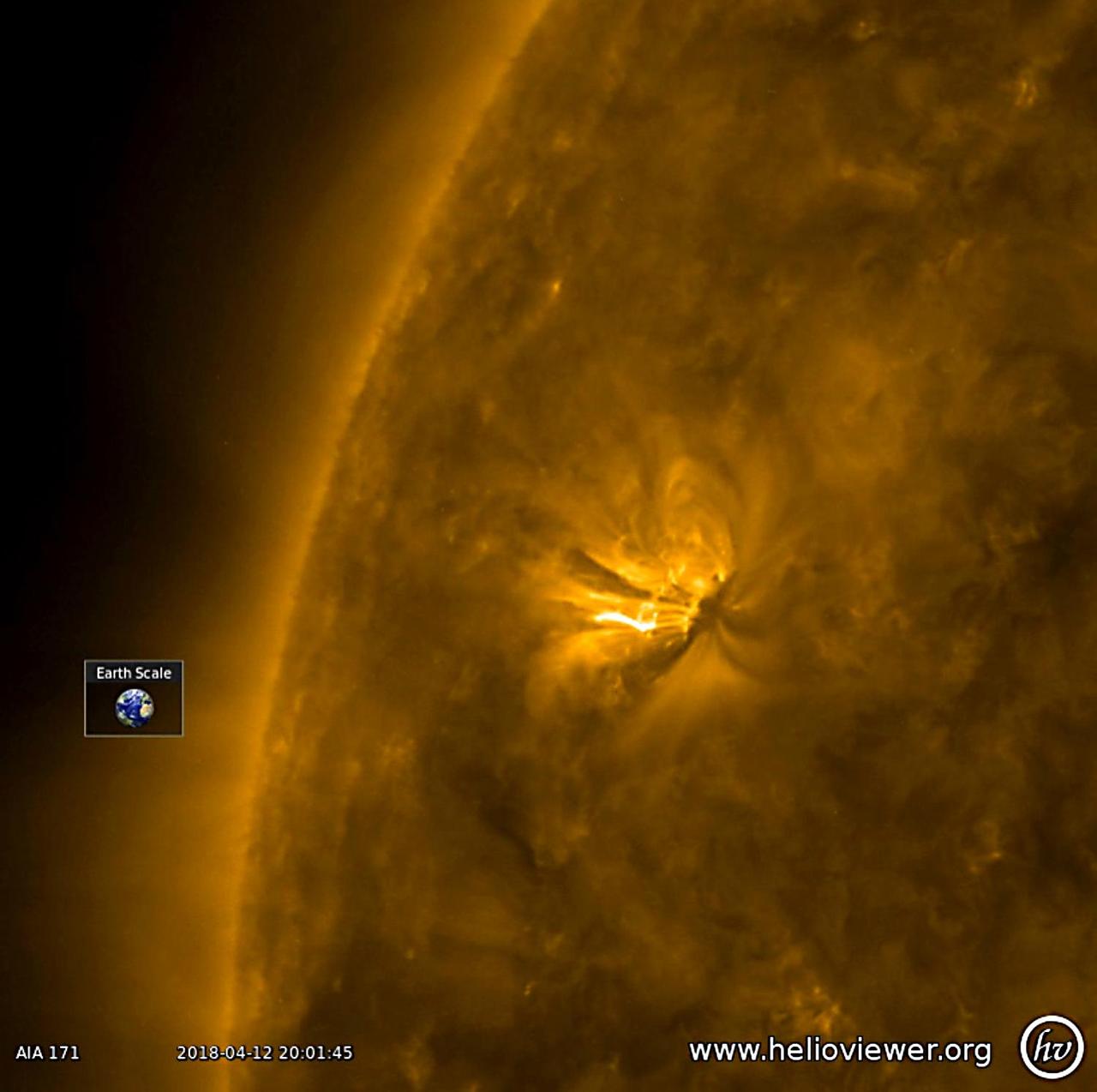
A good-sized active region with bright, towering arches began to rotate into view (Apr. 18-19, 2018). The arches consist of charged particles spiraling along magnetic field lines revealed in this wavelength of extreme ultraviolet light. They rise up above the sun's surface many times the size of Earth. The video covers just 16 hours of activity. We will keep our eyes on this region to see if it has the kind of dynamism to produce solar storms. Videos are available at https://photojournal.jpl.nasa.gov/catalog/PIA22430
On Feb. 19, 2005, NASA Mars Exploration Rover Opportunity set a one-day distance record for martian driving; Opportunity rolled 177.5 meters 582 feet across the plain of Meridiani. 3D glasses are necessary to view this image.
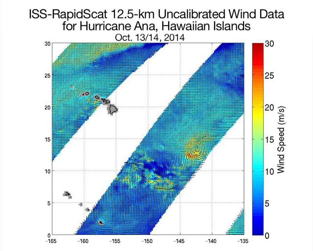
NASA ISS-RapidScat ocean wind scatterometer viewed Hurricane Ana as it approached Hawaii. From Oct. 13 to Oct. 19, 2014, RapidScat observed Ana seven times. This frame is from a movie containing multiple days of observation.
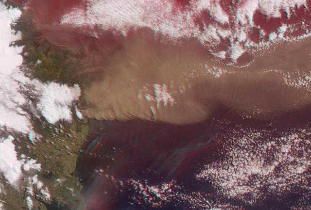
NASA Terra satellite flew directly over Iceland on April 19, 2010, to capture this stereo anaglyph generated from the nadir and 46-degree forward-viewing cameras of the Eyjafjallajökull volcano and its erupting ash plume. 3D glasses are necessary to vie

Intrepid crater on Mars carries the name of the lunar module of NASA Apollo 12 mission, which landed on Earth moon Nov. 19, 1969. NASA Mars Exploration Rover Opportunity recorded this stereo view on Nov. 11, 2010. 3D glasses are necessary.
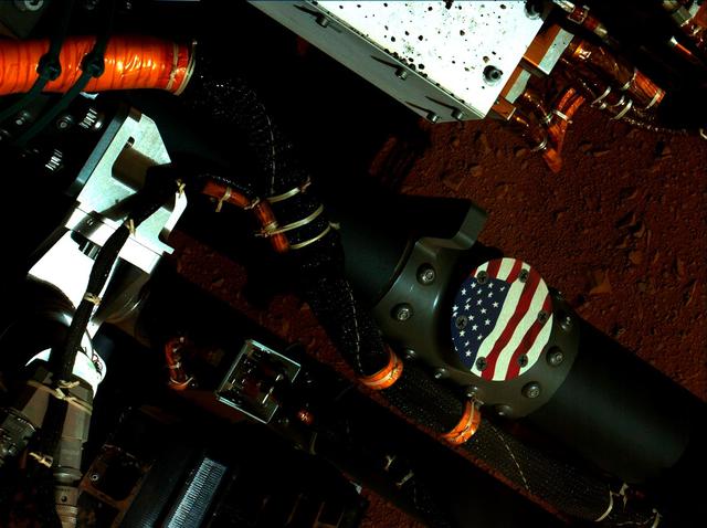
This view of the American flag medallion on NASA Mars rover Curiosity was taken by the rover MAHLI camera during the 44th Martian sol on Sept. 19, 2012. The flag is one of four mobility logos placed on the rover mobility rocker arms.
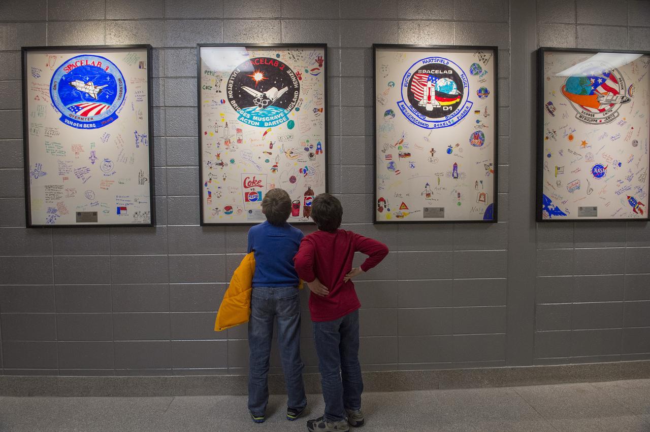
TWO STUDENTS VIEW WHITE BOARDS CREATED BY STUDENTS OF CHALLENGER ELEMENTARY AND MIDDLE SCHOOLS COMMEMORATING THE 19 MISSIONS OF SHUTTLE CHALLENGER
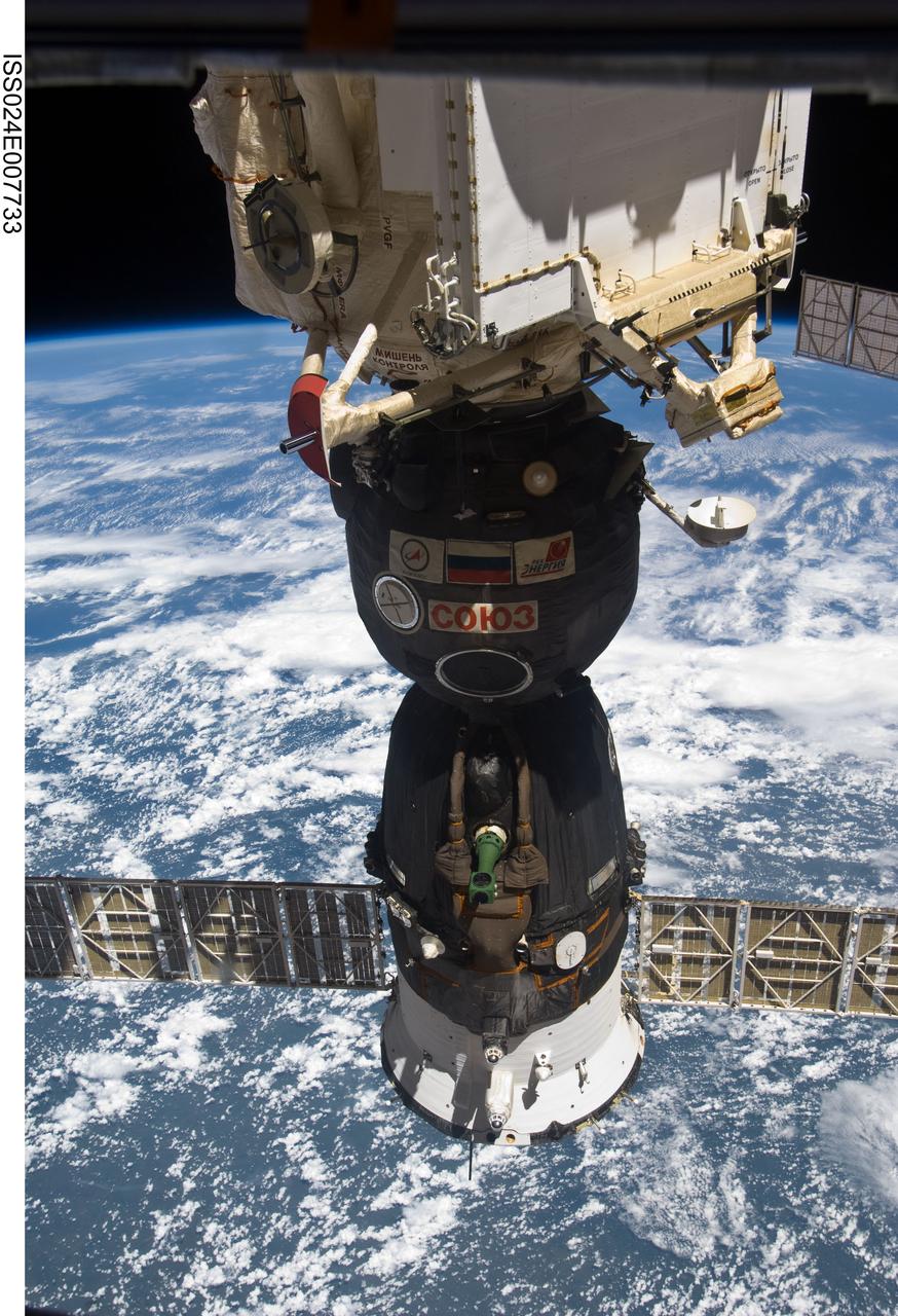
ISS024-E-007733 (9 July 2010) --- The Soyuz TMA-19 spacecraft, docked to the Rassvet Mini-Research Module 1 (MRM1), is featured in this image photographed by an Expedition 24 crew member on the International Space Station. A blue and white part of Earth and the blackness of space provide the backdrop for the scene.
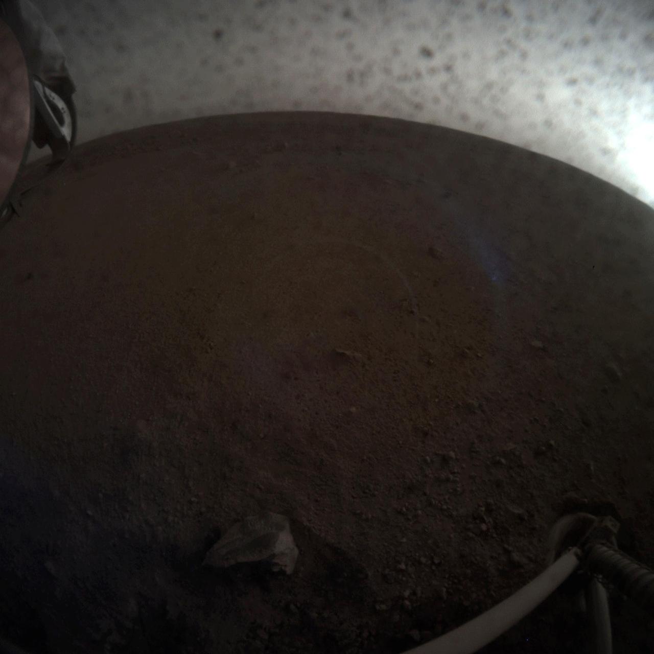
A fish-eye view of NASA's InSight lander deploying its first instrument onto the surface of Mars. InSight's robotic arm placed the seismometer on Dec. 19, 2018, around the time of dusk on Mars. These images were taken by the Instrument Context Camera (ICC), a fish-eye camera under the spacecraft's deck. Animation available at https://photojournal.jpl.nasa.gov/catalog/PIA22978
NASA's Dawn spacecraft obtained this view of Laukumate Crater (19 miles, 30 kilometers wide) on Ceres on June 2, 2016. Laukumate is named for a Latvian goddess of agriculture. Dawn took this image from its low-altitude mapping orbit, at a distance of about 240 miles (385 kilometers) above the surface. The image resolution is 120 feet (35 meters) per pixel. http://photojournal.jpl.nasa.gov/catalog/PIA20937

This close-up view of a plate on NASA's Perseverance rover commemorating the impact of the COVID-19 pandemic and paying tribute to the perseverance of health care workers around the world was acquired on June 28, 2025 (the 1,548th day, or sol, of its mission to Mars). Located on the left side of the rover chassis, the 3-by-5-inch (8-by-13-centimeter) aluminum plaque was attached in May 2020 during final assembly at NASA's Kennedy Space Center in Florida. https://photojournal.jpl.nasa.gov/catalog/PIA26641

A view of the exhibits at NASA's Earth Day event on Thursday, April 19, 2018 at Union Station in Washington, D.C. Photo Credit: (NASA/Aubrey Gemignani)
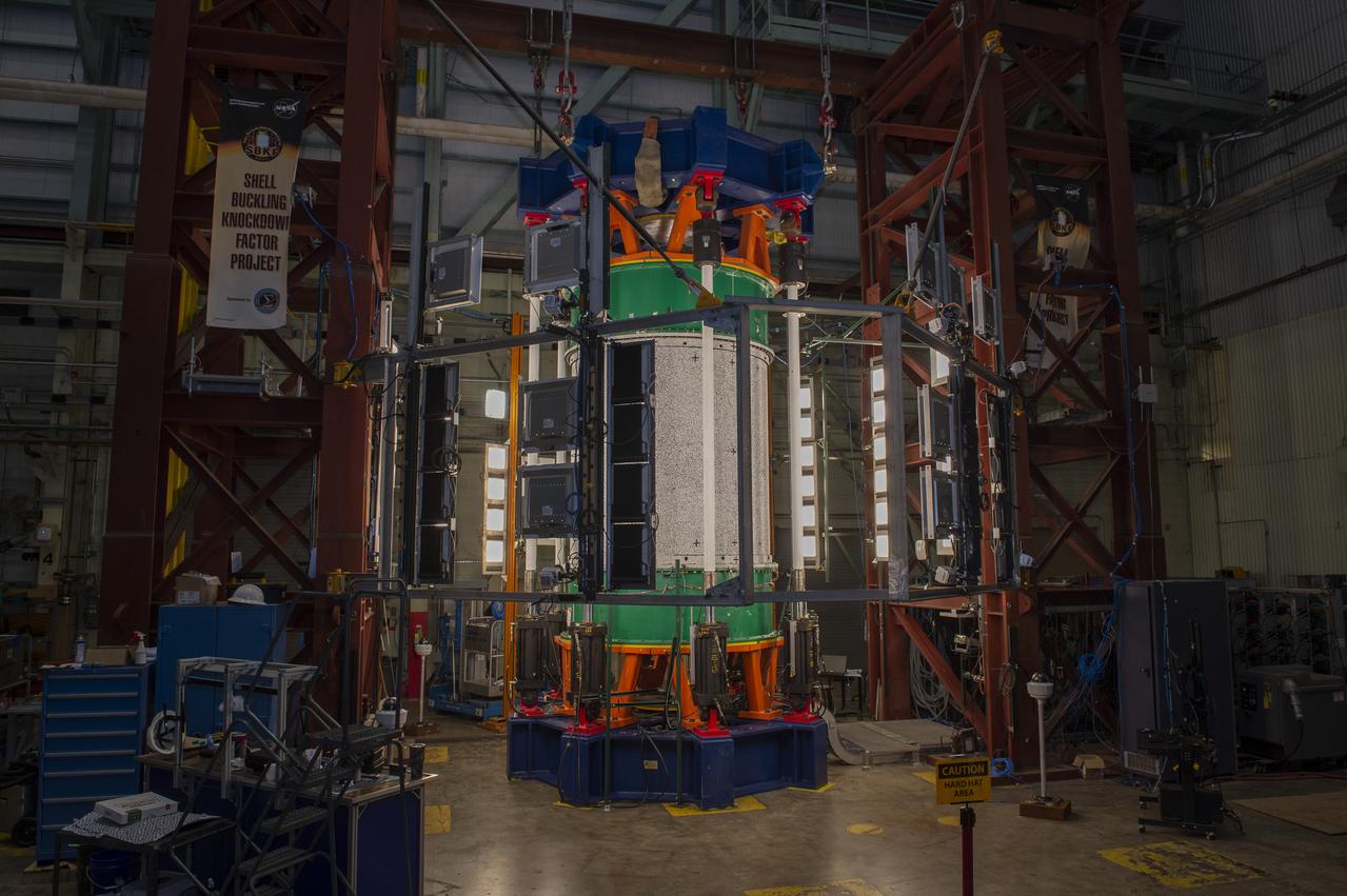
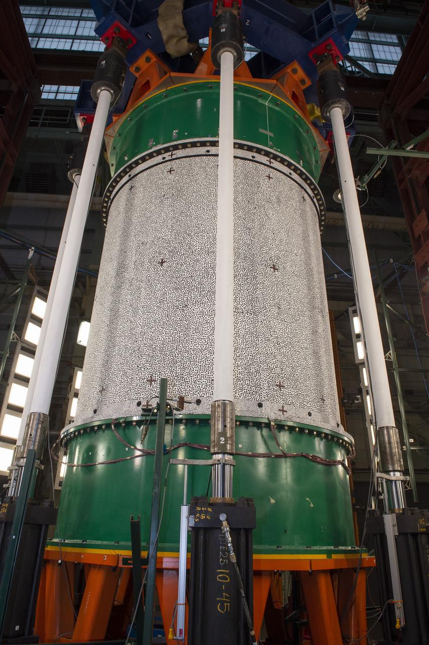
SHELL BUCKLING KNOCKDOWN FACTOR (SBKF) PROJECT - COMPOSITE TEST ARTICLE, (CTA) 8.3 – 12/17/19 – VIEW 1 OF 12

A view of the exhibits at NASA's Earth Day event on Thursday, April 19, 2018 at Union Station in Washington, D.C. Photo Credit: (NASA/Aubrey Gemignani)
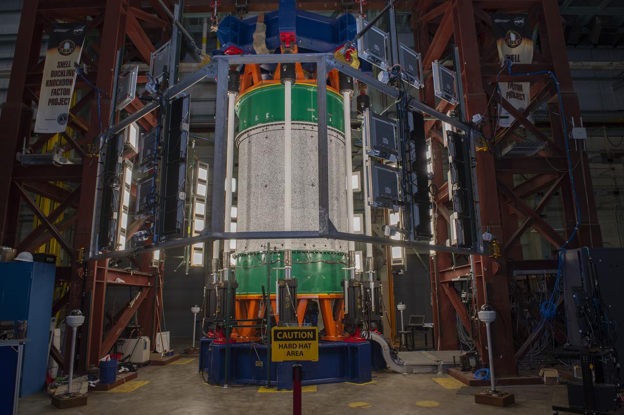
SHELL BUCKLING KNOCKDOWN FACTOR (SBKF) PROJECT - COMPOSITE TEST ARTICLE, (CTA) 8.3 – 12/17/19 – VIEW 1 OF 12

iss062e039503 (Feb. 19, 2020) --- Mount Rainier is viewed from the International Space Station as it orbited 266 miles above Washington state.
SHELL BUCKLING KNOCKDOWN FACTOR (SBKF) PROJECT - COMPOSITE TEST ARTICLE, (CTA) 8.3 – 12/17/19 – VIEW 1 OF 12
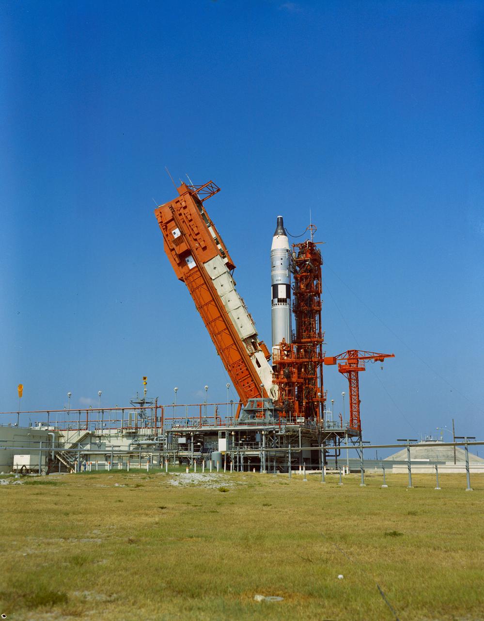
S65-29648 (3 June 1965) --- View of the Gemini-Titan 4 spacecraft on Pad 19 on day of launch with erector being removed.

This high-contrast, colorized mosaic from NASA Cassini mission shows an infrared view of the Saturn system, backlit by the sun, from July 19, 2013.
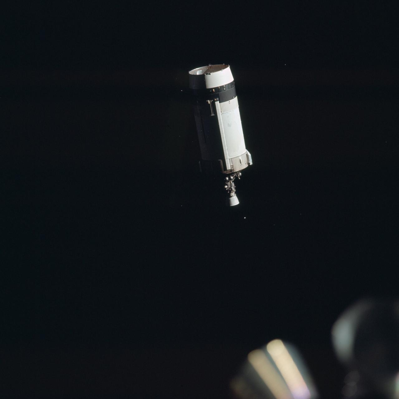
AS17-148-22714 (7-19 Dec. 1972) --- View of the expended Saturn IVB stage before Apollo 17 transposition/docking maneuvers.
S65-42044 (28 July 1965) --- Close-up view of the Rendezvous Evaluation Pod installed in the equipment section of the Gemini-5 spacecraft at Pad 19.
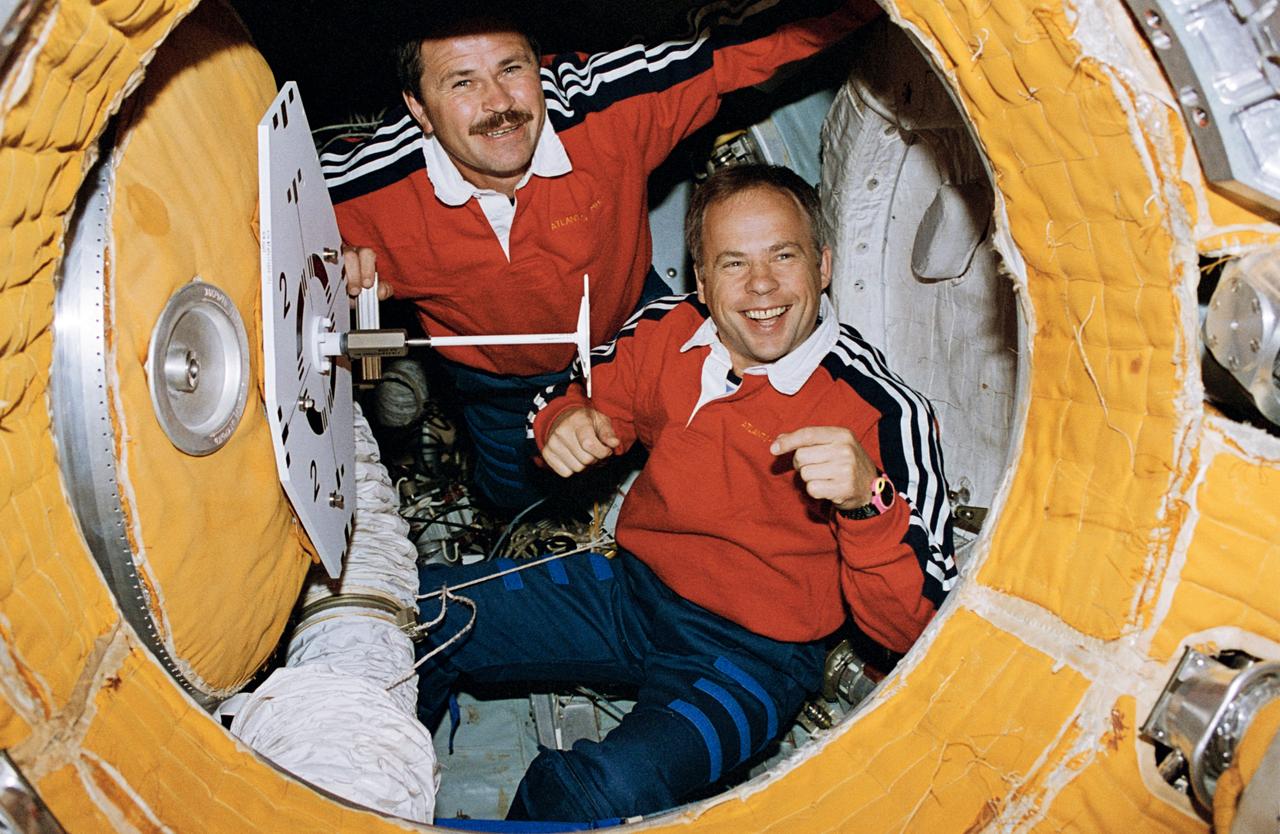
View of the Mir 19 commander Anatoly Solovyev and flight engineer Nikolai Budarin preparing to close the hatch to the docking module which leads to the Mir space station.

iss063e093260 (Sept. 19, 2020) --- This oblique view of Houston, Texas, was taken from the International Space Station as it orbited above northern Louisiana.

ISS017-E-013843 (19 Aug. 2008) --- A panoramic view of the island of Hispaniola in the foreground and Cuba extending to over the horizon. The sunglint is illuminating Haiti and the Dominican Republic while the thunderstorms persist in the late afternoon of the summertime day. Taken by the Expedition 17 crew onboard the ISS on Aug 19, 2008 with a 28 mm lens.
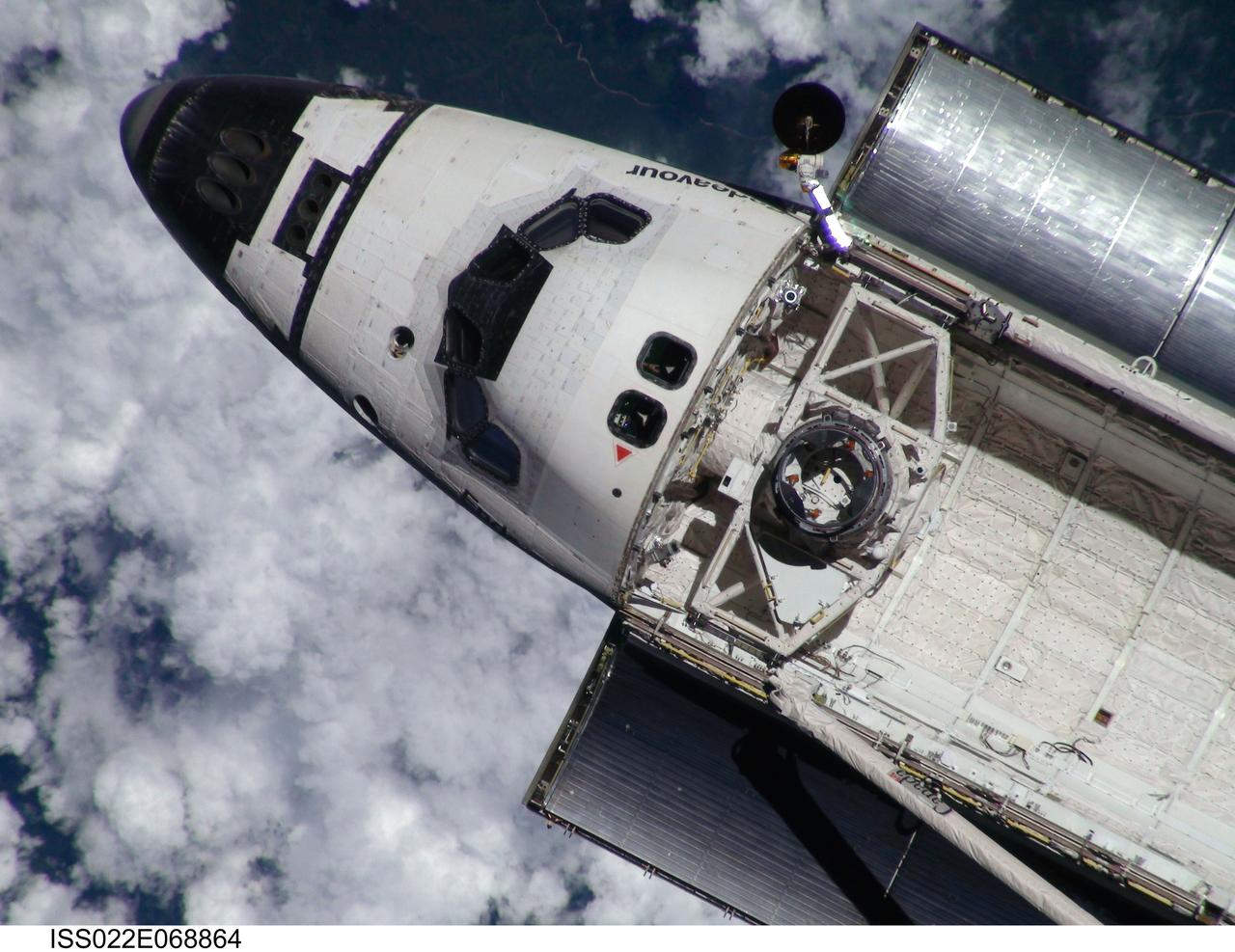
ISS022-E-068864 (9 Feb. 2010) --- This view of the space shuttle Endeavour, taken on Feb. 9 from the International Space Station as the two spacecraft conducted their rendezvous operations, was downlinked by the Expedition 22 crew on Feb. 19. The Tranquility node and the Cupola are just out of view in the aft part of shuttle's payload bay.
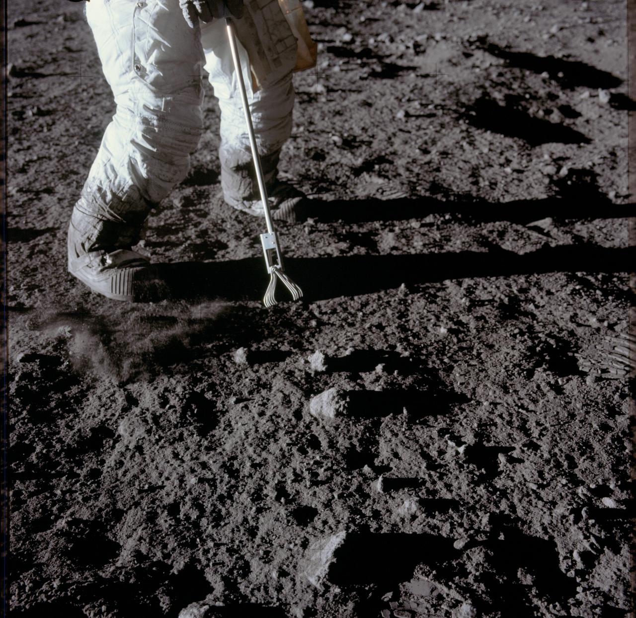
AS12-47-6932 (19 Nov. 1969) --- Close-up view of a set of tongs, an Apollo Lunar Hand Tool, being used by astronaut Charles Conrad Jr., commander, to pick up lunar samples during the Apollo 12 extravehicular activity. This photograph shows Conrad's legs and a good view of the lunar soil.
AS17-145-22287 (7-19 Dec. 1972) --- An oblique view of the large crater Copernicus on the lunar nearside, as photographed from the Apollo 17 spacecraft in lunar orbit. This view is looking generally southwest toward the crater on the horizon. The coordinates of the center of Copernicus are approximately 20 degrees west longitude and 9.5 degrees north latitude.
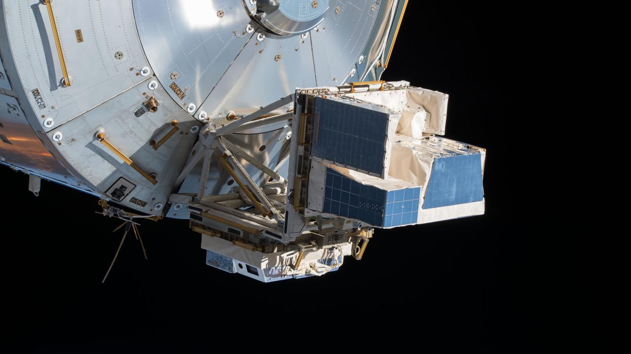
iss057e055411 (10/19/2018) - View of the Atmosphere-Space Interactions Monitor (ASIM) and the High Definition Earth Viewing (HDEV) payloads installed on the Columbus External Payload Facility (Columbus-EPF). Photo was taken by the ground-controlled External High Definition Camera 3 (EHDC3).
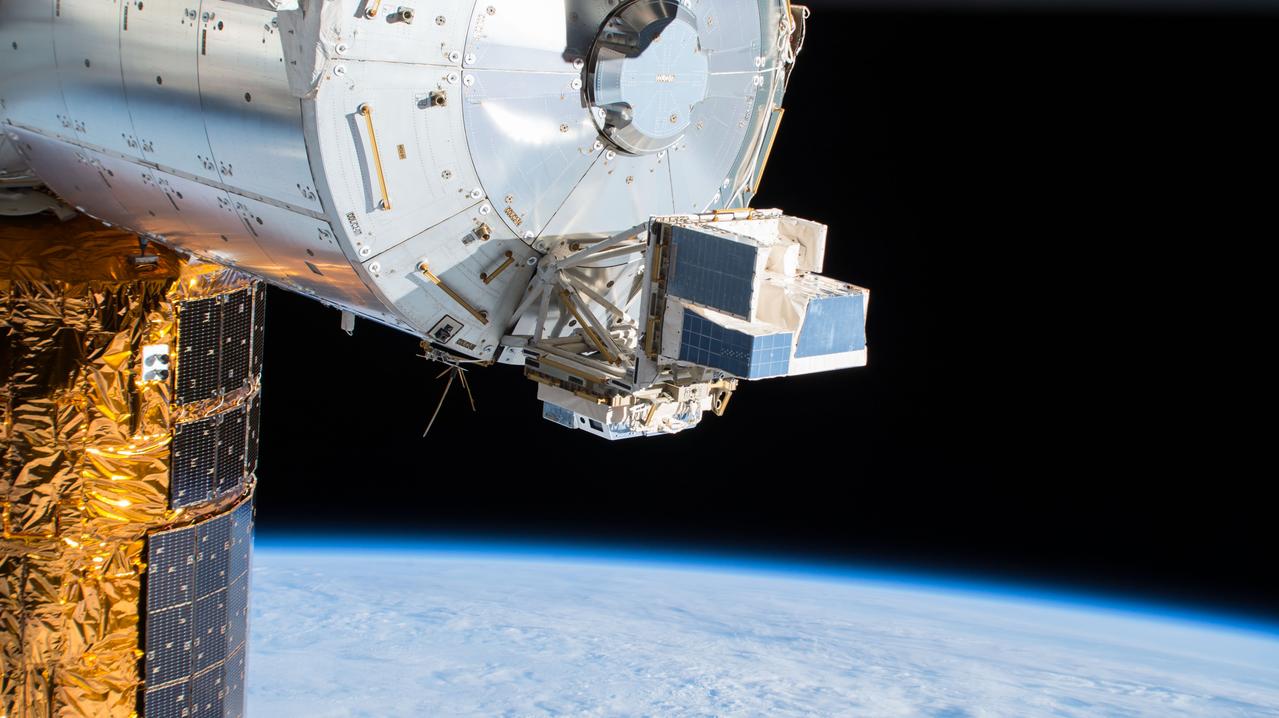
iss057e055409 (10/19/2018) - View of the Atmosphere-Space Interactions Monitor (ASIM) and the High Definition Earth Viewing (HDEV) payloads installed on the Columbus External Payload Facility (Columbus-EPF). Photo was taken by the ground-controlled External High Definition Camera 3 (EHDC3).
This view of Ezinu Crater on Ceres was taken by NASA's Dawn spacecraft on Oct. 19, 2015. Ezinu is the large crater in the top left corner of the image. The crater is 72 miles (116 kilometers) wide and contains a canyon-like feature near its center. The image was taken from a spacecraft altitude of 915 miles (1,470 kilometers) during Dawn's High Altitude Mapping Orbit (HAMO) phase. Image resolution is 450 feet (140 meters) per pixel. The image is centered at approximately 37 degrees north latitude, 200 degrees east latitude. http://photojournal.jpl.nasa.gov/catalog/PIA20190
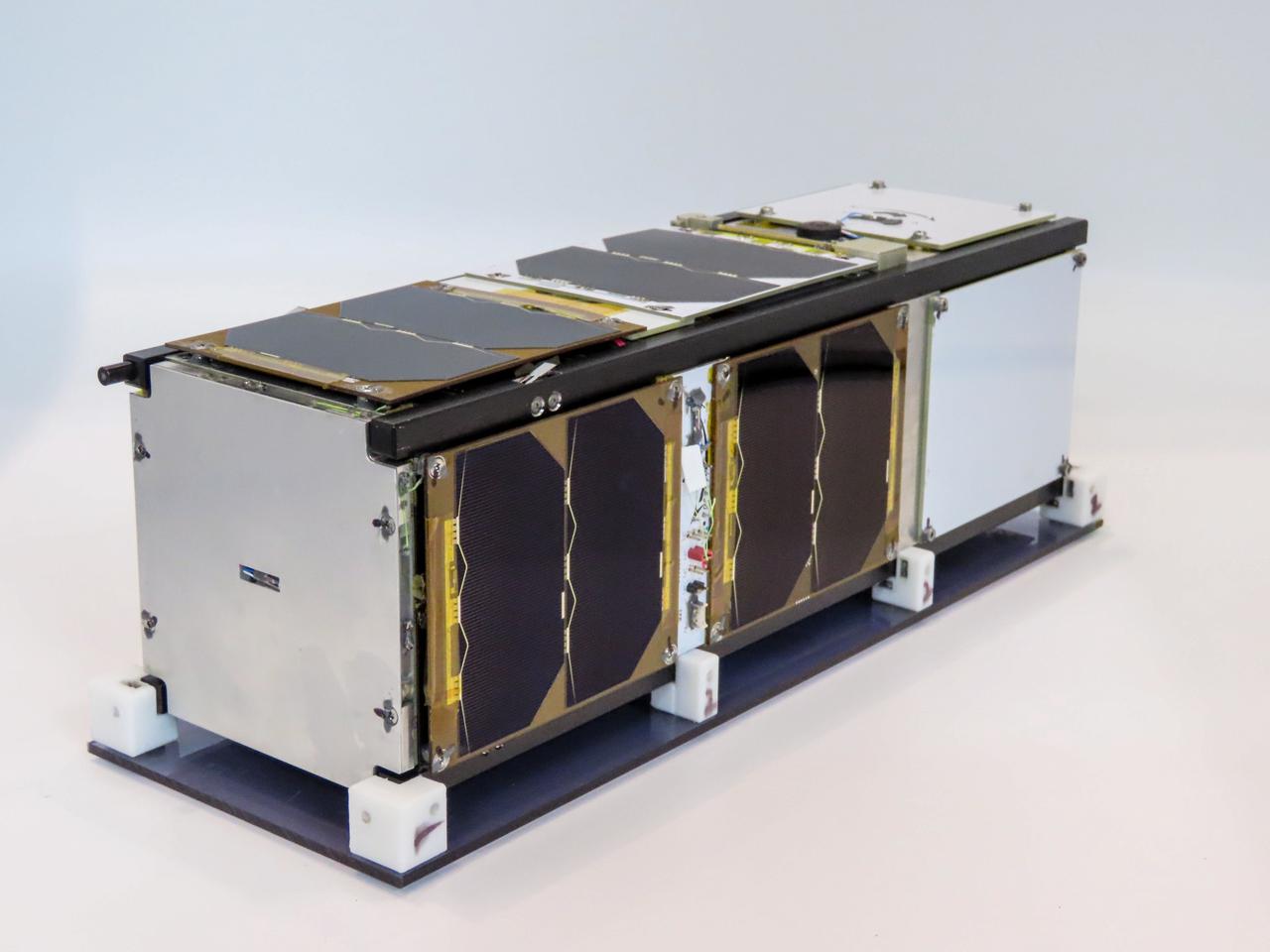
jsc2021e052204 (5/19/2021) --- A preflight view of a Pathfinder Satellite for Remote Sensing and Earth Observation (CUAVA-1) about to undergo thermal vacuum testing at the Australian Research Council Industrial Transformation Training Centre (AITC). The CUAVA-1 investigation is part of the JEM (Japanese Experiment Module) Small Satellite Orbital Deployer-19 (J-SSOD-19) mission. Image Credit: CUAVA.
This view from NASA Dawn spacecraft includes Haulani, a relatively fresh crater 19 miles 31 kilometers in diameter. The interior of Haulani shows landslides from its crater rim, along with smooth material and a central ridge on its crater floor. The image was taken from a spacecraft altitude of 918 miles (1,478 kilometers) during Dawn's High Altitude Mapping Orbit (HAMO) phase on Oct. 6, 2015. Image resolution is 394 feet (120 meters) per pixel. http://photojournal.jpl.nasa.gov/catalog/PIA20146
Sunlit cliffs tower above Yalode Crater on Ceres in this shadowy perspective view. At 152 miles (260 kilometers) in diameter, Yalode is one of Ceres' largest craters. A fissure called Nar Sulcus is seen just right of center. Dawn took this image on Oct. 19, 2016, from its second extended-mission science orbit (XMO2), at a distance of about 920 miles (1,480 kilometers) above the surface. The image resolution is about 460 feet (140 meters) per pixel. http://photojournal.jpl.nasa.gov/catalog/PIA21236

iss058e005282 (Jan. 19, 2019) --- A portion of the International Space Station's solar arrays caps this nighttime view of the Earth's limb with an aurora as the orbital complex orbited 258 miles above Ukraine and Russia.
iss050e017076 (12/19/2016) --- A view after Japanese Experiment Module Remote Manipulator System (JEMRMS) Small Satellite Deployment called Space Tethered Autonomous Robotic satellite (STARS-C).
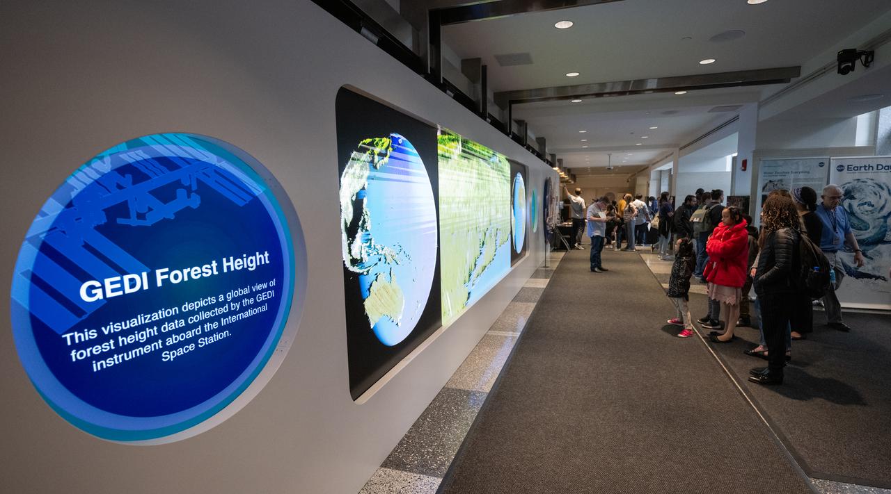
Visitors to NASA’s Earth Information Center view a video on the hyperwall as NASA celebrates Earth Day, Friday, April 19, 2024, at the Mary W. Jackson NASA Headquarters building in Washington. Photo Credit: (NASA/Joel Kowsky)
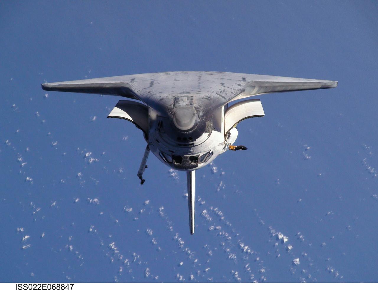
ISS022-E-068847 (9 Feb. 2010) --- This view of the space shuttle Endeavour, taken on Feb. 9 from the International Space Station as the two spacecraft conducted their rendezvous operations, was downlinked by the Expedition 22 crew on Feb. 19.
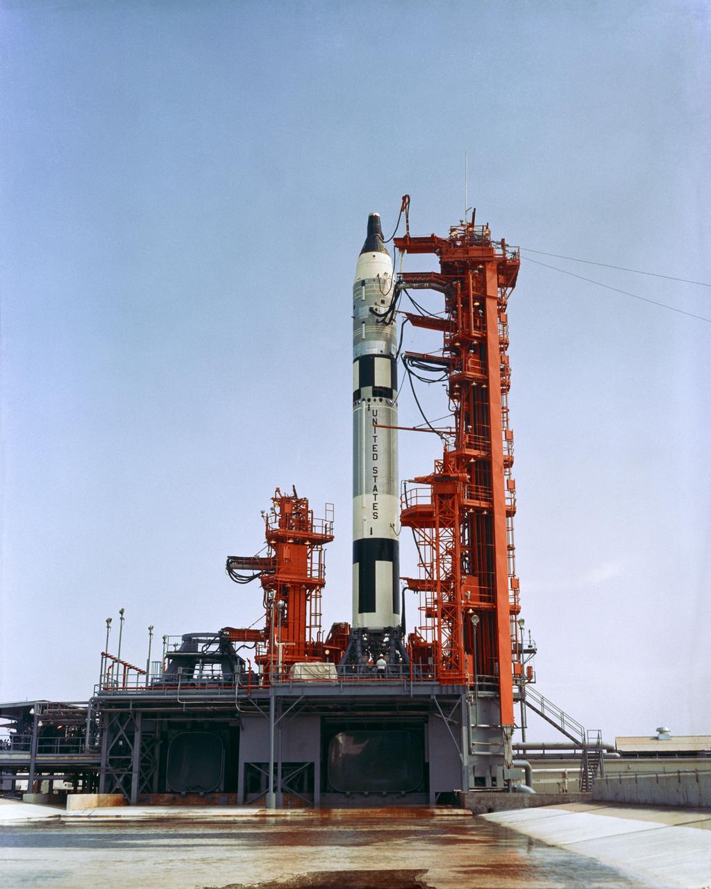
S65-43447 (22 July 1965) --- Overall view of Pad 19 showing Gemini-5 spacecraft atop the Gemini Launch Vehicle 5 during a wet mock simulation exercise.

STS101-714-028 (19-29 May 2000) --- The International Space Station is contrasted against the cloud-covered home planet and the darkness of space in this post-undocking view.
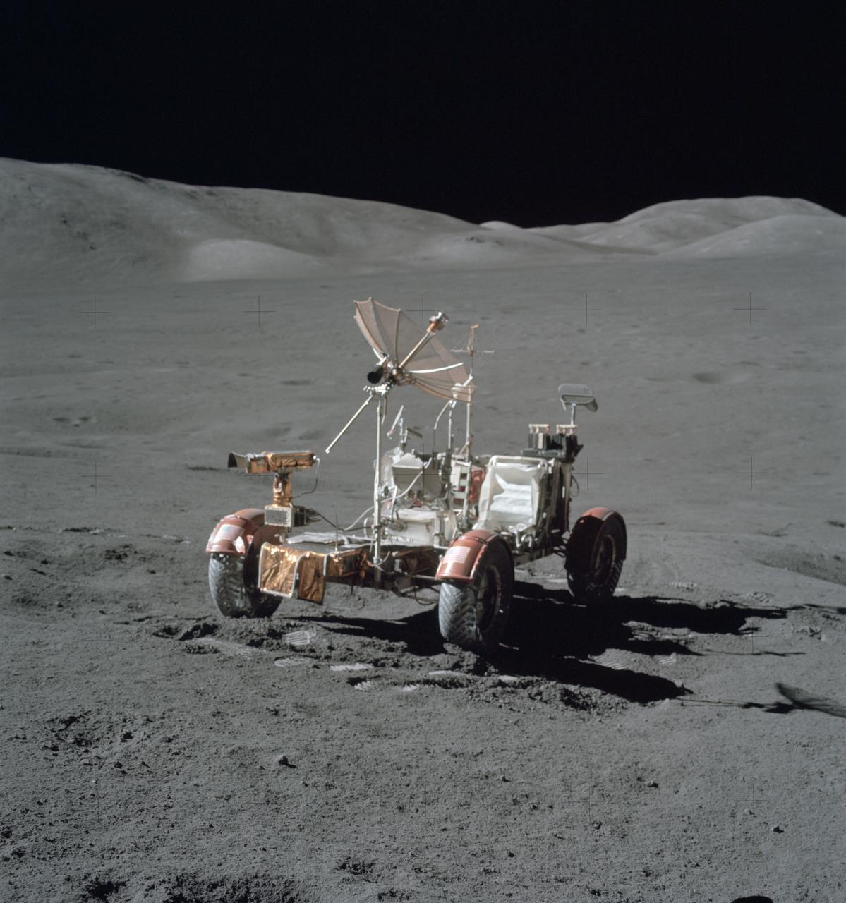
AS17-146-22367 (7-19 Dec. 1972) --- This is an excellent view of the Lunar Roving Vehicle (LRV) which was used extensively by astronauts Eugene A. Cernan and Harrison H. Schmitt at the Taurus-Littrow landing site.
![This is one of three views of locations where hardware from the European Space Agency's Schiaparelli test lander reached the surface of Mars on Oct. 19, 2016, combine two orbital views from different angles as a stereo pair. The view was created to appear three-dimensional when seen through red-blue glasses with the red lens on the left, though the scene is too flat to show much relief. The stereo preparation uses images taken on Oct. 25, 2016, [PIA21131] and Nov. 1, 2016, [PIA21132] by the High Resolution Imaging Science Experiment (HiRISE) camera on NASA's Mars Reconnaissance Orbiter. The left-eye (red-tinted) component of the stereo is from the earlier observation, which was taken from farther west than the second observation. These views shows three sites where parts of the Schiaparelli spacecraft hit the ground: the lander module itself in the upper portion, the parachute and back shell at lower left, and the heat shield at lower right. The parachute's shape on the ground changed between the two observation dates, cancelling the three-dimensional effect of having views from different angles. The scale bar of 20 meters (65.6 feet) applies to all three portions. Schiaparelli was one component of the European Space Agency's ExoMars 2016 project, which placed the Trace Gas Orbiter into orbit around Mars on the same arrival date. The ExoMars project received data from Schiaparelli during its descent through the atmosphere. ESA has reported that the heat shield separated as planned, the parachute deployed as planned but was released (with back shell) prematurely, and the lander hit the ground at a velocity of more than 180 miles per hour (more than 300 kilometers per hour). More views are available at http://photojournal.jpl.nasa.gov/catalog/PIA21135](https://images-assets.nasa.gov/image/PIA21135/PIA21135~thumb.jpg)
This is one of three views of locations where hardware from the European Space Agency's Schiaparelli test lander reached the surface of Mars on Oct. 19, 2016, combine two orbital views from different angles as a stereo pair. The view was created to appear three-dimensional when seen through red-blue glasses with the red lens on the left, though the scene is too flat to show much relief. The stereo preparation uses images taken on Oct. 25, 2016, [PIA21131] and Nov. 1, 2016, [PIA21132] by the High Resolution Imaging Science Experiment (HiRISE) camera on NASA's Mars Reconnaissance Orbiter. The left-eye (red-tinted) component of the stereo is from the earlier observation, which was taken from farther west than the second observation. These views shows three sites where parts of the Schiaparelli spacecraft hit the ground: the lander module itself in the upper portion, the parachute and back shell at lower left, and the heat shield at lower right. The parachute's shape on the ground changed between the two observation dates, cancelling the three-dimensional effect of having views from different angles. The scale bar of 20 meters (65.6 feet) applies to all three portions. Schiaparelli was one component of the European Space Agency's ExoMars 2016 project, which placed the Trace Gas Orbiter into orbit around Mars on the same arrival date. The ExoMars project received data from Schiaparelli during its descent through the atmosphere. ESA has reported that the heat shield separated as planned, the parachute deployed as planned but was released (with back shell) prematurely, and the lander hit the ground at a velocity of more than 180 miles per hour (more than 300 kilometers per hour). More views are available at http://photojournal.jpl.nasa.gov/catalog/PIA21135
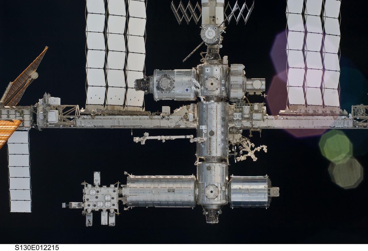
S130-E-012215 (19 Feb. 2010) --- A close-up view of a portion of the International Space Station is featured in this image photographed by an STS-130 crew member on space shuttle Endeavour after the station and shuttle began their post-undocking relative separation. Undocking of the two spacecraft occurred at 7:54 p.m. (EST) on Feb. 19, 2010. The newly-installed Tranquility node and Cupola are visible at top center.
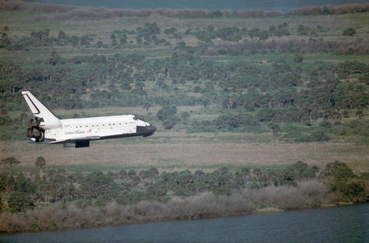
51D-9107 (19 April 1985) --- A side-looking, wide view of the Space Shuttle Discovery shows the vehicle on its final phase following a full week in space. The Discovery and its seven-member crew arrived at KSC's landing facility at 8:54:29 a.m. (EST), April 19, 1985. Launch was at 8:59 a.m. (EST) on April 12.
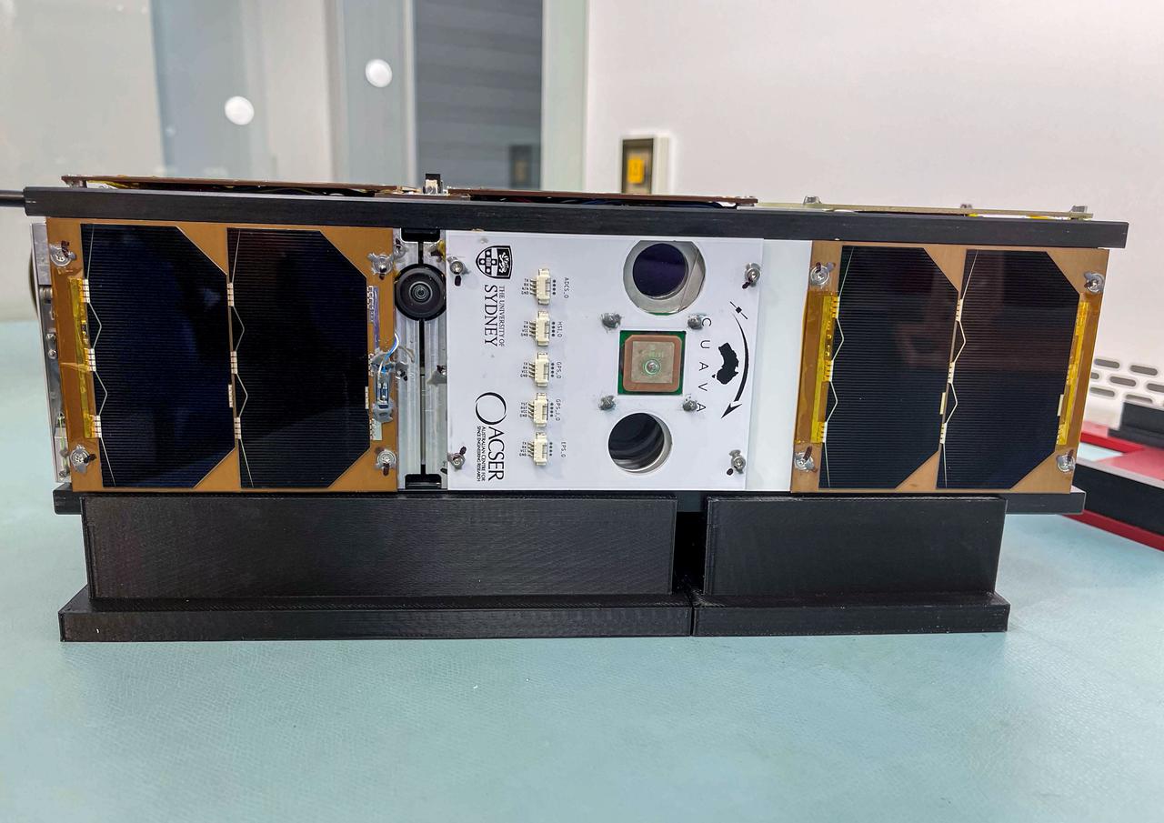
jsc2021e052206 (11/3/2021) --- A preflight view of a Pathfinder Satellite for Remote Sensing and Earth Observation (CUAVA-1) CubeSat about to undergo thermal vacuum testing at the Australian Research Council Industrial Transformation Training Centre (AITC). The CUAVA-1 investigation is part of the JEM (Japanese Experiment Module) Small Satellite Orbital Deployer-19 (J-SSOD-19) mission. Image Credit: CUAVA.
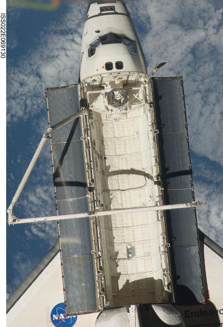
ISS022-E-069130 (19 Feb. 2010) --- A close-up view of the space shuttle Endeavour is featured in this image photographed by an Expedition 22 crew member on the International Space Station soon after the shuttle and station began their post-undocking relative separation. Undocking of the two spacecraft occurred at 7:54 p.m. (EST) on Feb. 19, 2010.
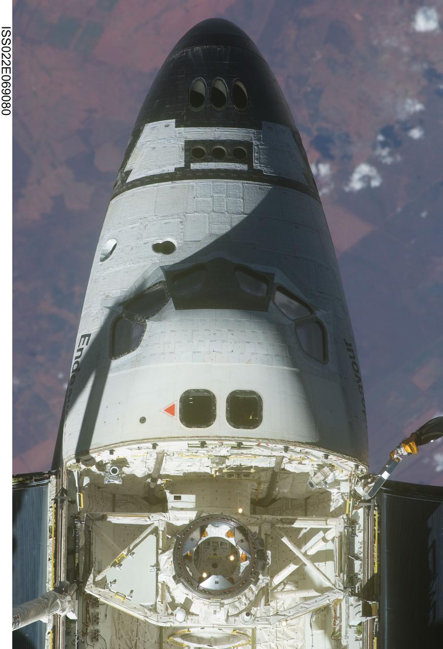
ISS022-E-069080 (19 Feb. 2010) --- This view of the crew cabin and forward payload bay of the space shuttle Endeavour was provided by an Expedition 22 crew member on the International Space Station soon after the shuttle and station began their post-undocking relative separation. Undocking of the two spacecraft occurred at 7:54 p.m. (EST) on Feb. 19, 2010.
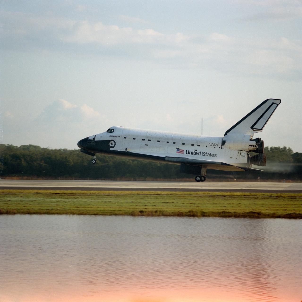
STS054-S-098 (19 Jan 1993) --- This ground-level side view shows the Space Shuttle Endeavour during main landing gear touchdown at KSC's Shuttle Landing Facility to successfully complete a six day Earth-orbital mission. Landing occurred at 8:38 a.m. (EST), Jan. 19, 1993. Onboard were astronauts John H. Casper, mission commander; Donald R. McMonagle, pilot; Gregory J. Harbaugh, Mario Runco Jr. and Susan J. Helms, mission specialists.
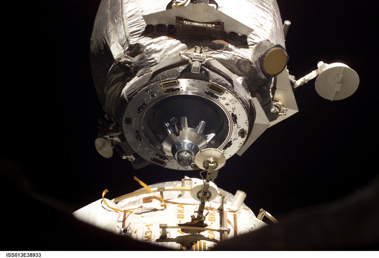
ISS013-E-38933 (19 June 2006) --- This close-up view of an unpiloted Progress supply vehicle was photographed by an Expedition 13 crewmember on the International Space Station as it departed from the Pirs Docking Compartment. The Progress 20 undocked June 19, 2006 and was later commanded to de-orbit with its load of trash and unneeded equipment and burn in Earth's atmosphere. The undocking clears the way for the arrival of a new Progress 22, planned to launch June 24 and dock with the station on June 26.
KENNEDY SPACE CENTER, FLA. - A fish eye view captures the liftoff of Space Shuttle Atlantis from Launch Pad 39B. At left is the Fixed Service Structure and below the Shuttle is the Mobile Launcher Platform. In the background is the Atlantic Ocean. Liftoff of Atlantis on mission STS-110 occurred at 4:44:19 p.m. EDT (20:41:19 GMT). Carrying the S0 Integrated Truss Structure and Mobile Transporter, STS-110 is the 13th assembly flight to the International Space Station
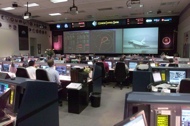
JSC2002-E-26015 (19 June 2002) --- The Space Shuttle Endeavour is shown on the big screen in this overall view of the shuttle flight control room (WFCR) in Houston’s Mission Control Center (MCC). The shuttle landed at Edwards Air Force Base, California at 10:58 a.m. (PDT) on June 19, 2002. The landing site was switched to Edwards after three days of wave offs at Kennedy Space Center, Florida, due to unacceptable weather conditions.
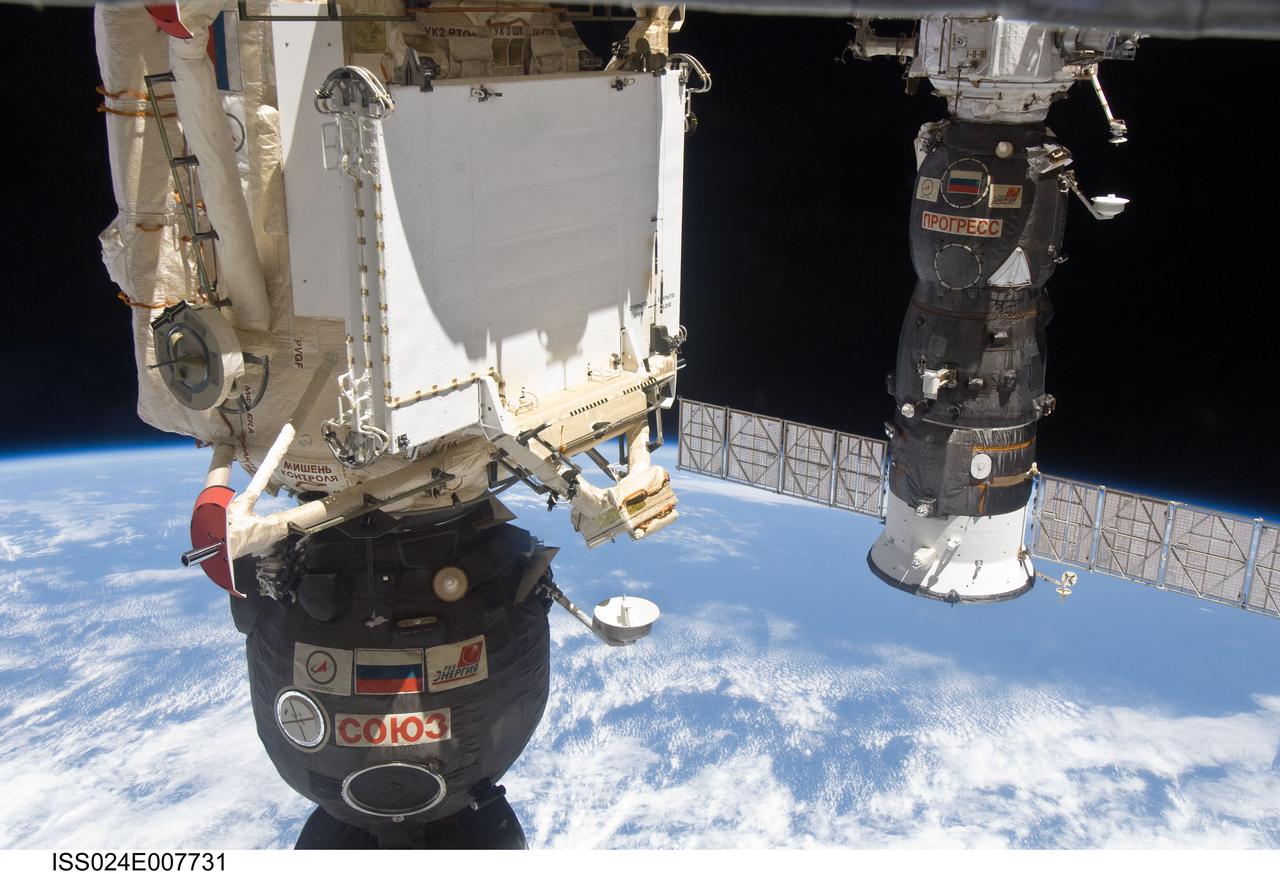
ISS024-E-007731 (9 July 2010) --- The Soyuz TMA-19 spacecraft (partially out of frame in the foreground), docked to the Rassvet Mini-Research Module 1 (MRM1), and Progress 37 resupply vehicle, docked to the Pirs Docking Compartment, are featured in this image photographed by an Expedition 24 crew member on the International Space Station. A blue and white part of Earth and the blackness of space provide the backdrop for the scene.
iss055e026913 (4/19/2018) --- View of the Materials ISS Experiment Flight Facility (MISSE-FF) taken by the External High Definition Camera (EHDC1). The MISSE-FF platform provides the ability to test materials, coatings, and components or other larger experiments in the harsh environment of space, which is virtually impossible to do collectively on Earth.

STS100-714-059 (19 April-1 May 2001) --- Astronaut Scott E. Parazynski, mission specialist, was photographed by a crew mate inside the Space Shuttle Endeavour in this close up view, during one of the two days of extravehicular activity (EVA) on the STS-100 mission.
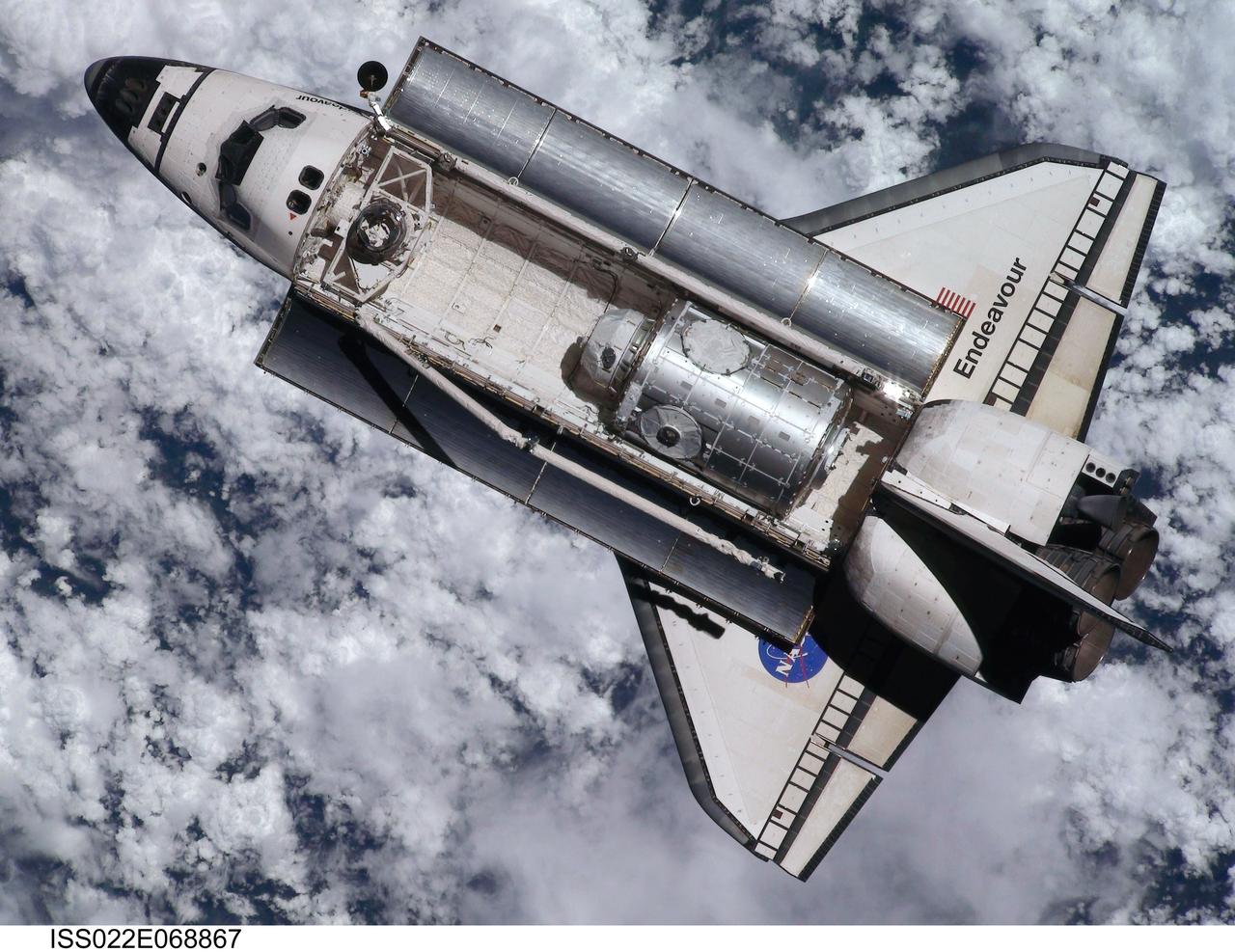
ISS022-E-068867 (9 Feb. 2010) --- This view of the space shuttle Endeavour, taken on Feb. 9 from the International Space Station as the two spacecraft conducted their rendezvous operations, was downlinked by the Expedition 22 crew on Feb. 19. The Tranquility node and the Cupola can be seen in the shuttle's payload bay.
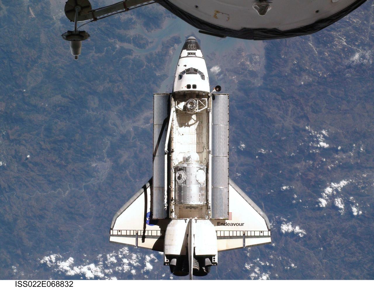
ISS022-E-068832 (9 Feb. 2010) --- This view of the space shuttle Endeavour, taken on Feb. 9 from the International Space Station as the two spacecraft conducted their rendezvous operations, was downlinked by the Expedition 22 crew on Feb. 19. The Tranquility node and the Cupola can be clearly seen in the shuttle's payload bay.

STS087-375-015 (19 November – 5 December 1997) --- Astronaut Winston E. Scott, mission specialist, during one of two extravehicular activities (EVA) in the cargo bay of the Earth-orbiting Space Shuttle Columbia, is backdropped against a blue “blanket” of ocean water. This view was taken with a 35mm camera.
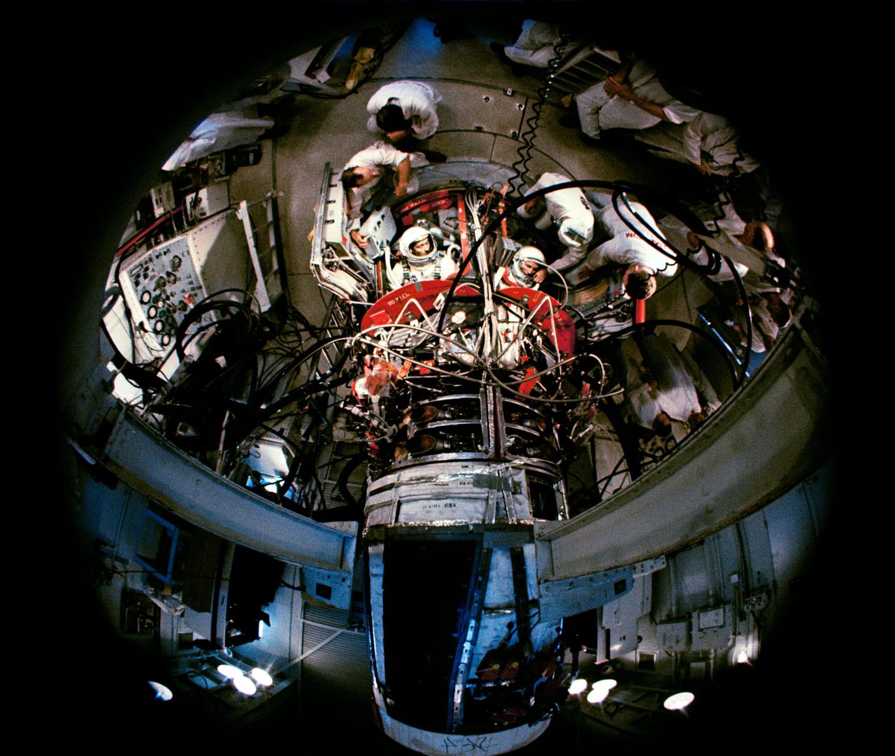
S65-29650 (3 June 1965) --- Fisheye view of astronauts James A. McDivitt and Edward H. White II inside the Gemini-4 spacecraft during simulated exercises at pad 19, Cape Kennedy, Florida. NASA Headquarters alternative photo number is 65-H-274.

Visitors to NASA’s Earth Information Center view exhibits and hands-on activities as NASA celebrates Earth Day, Friday, April 19, 2024, at the Mary W. Jackson NASA Headquarters building in Washington. Photo Credit: (NASA/Joel Kowsky)

ISS011-E-12982 (14 September 2005, 19:14:09 GMT) --- This high oblique view of Hurricane Ophelia was taken on the afternoon of September 14 from the International Space Station. The ill-defined eye is located at bottom center of the frame. The slow-moving storm is off the coast of the Carolinas.
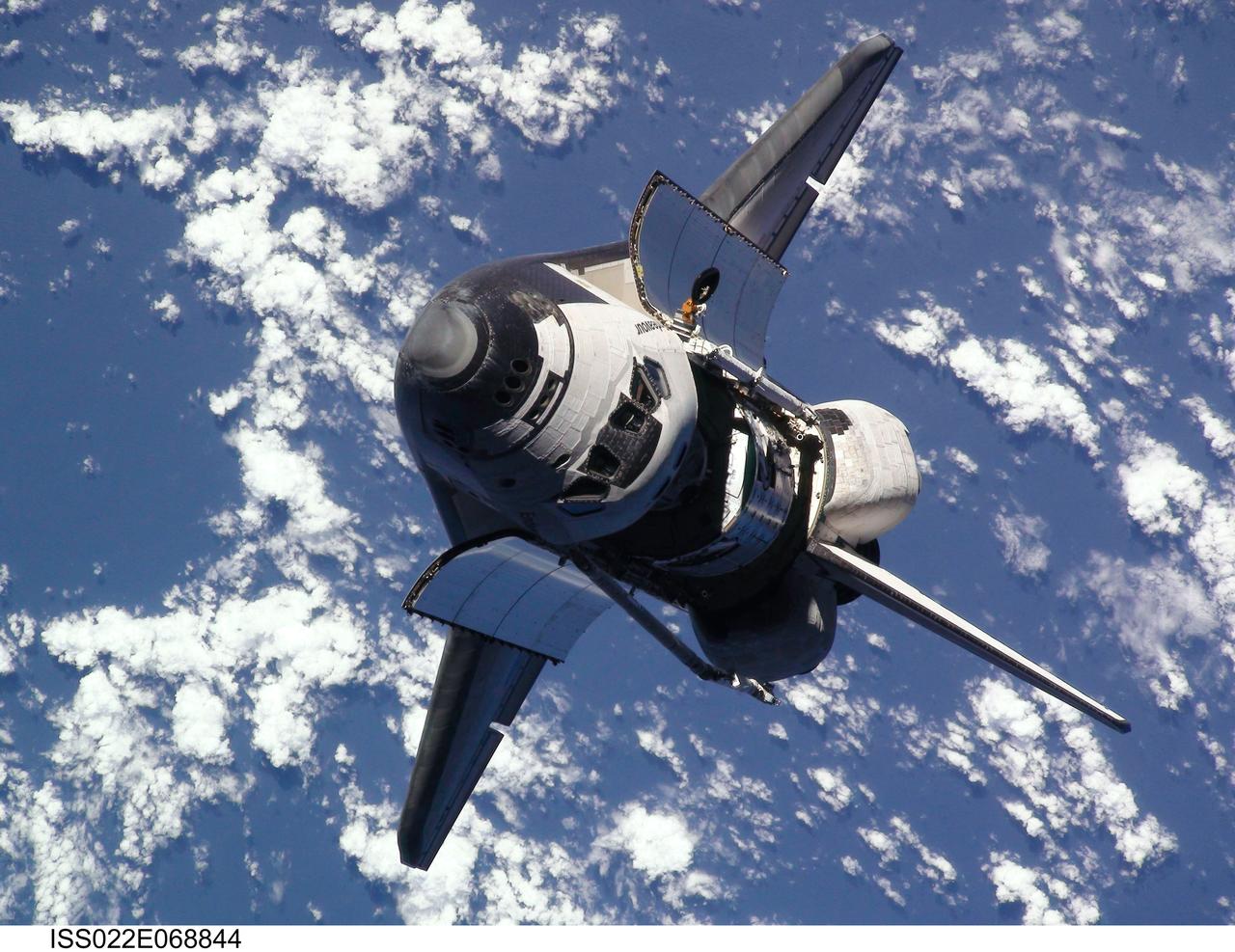
ISS022-E-068844 (9 Feb. 2010) --- This view of the space shuttle Endeavour, taken from the International Space Station on Feb. 9 as the two spacecraft conducted their rendezvous operations, was downlinked by the Expedition 22 crew on Feb. 19. The Tranquility node and the Cupola can be clearly seen in the shuttle's payload bay.

iss065e277010 (Aug. 19, 2021) --- A view of cell samples for the Anti-Atrophy muscle investigation inside the International Space Station's Kibo laboratory module. The samples are being incubated and observed in the Cell Biology Experiment Facility to learn how to prevent and treat space-caused muscle atrophy and Earth-bound muscle conditions.
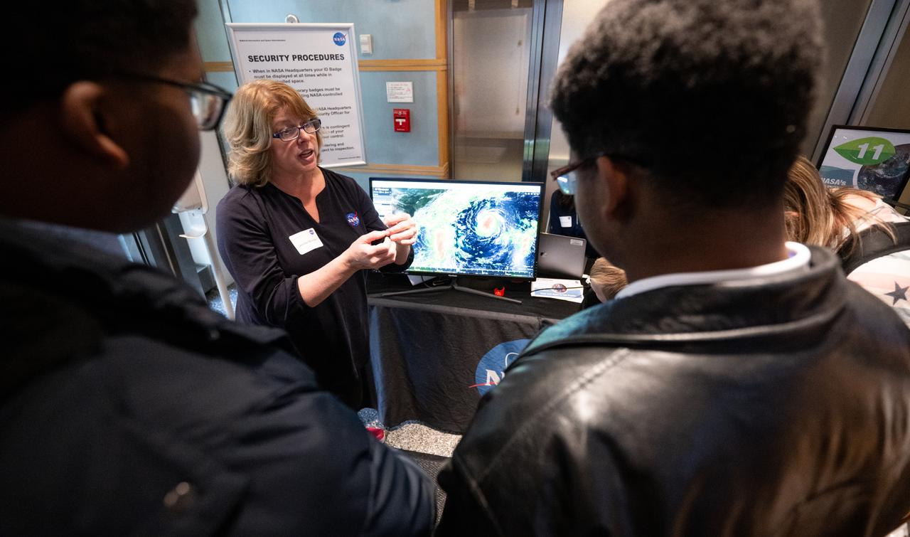
Visitors to NASA’s Earth Information Center view exhibits and hands-on activities as NASA celebrates Earth Day, Friday, April 19, 2024, at the Mary W. Jackson NASA Headquarters building in Washington. Photo Credit: (NASA/Joel Kowsky)
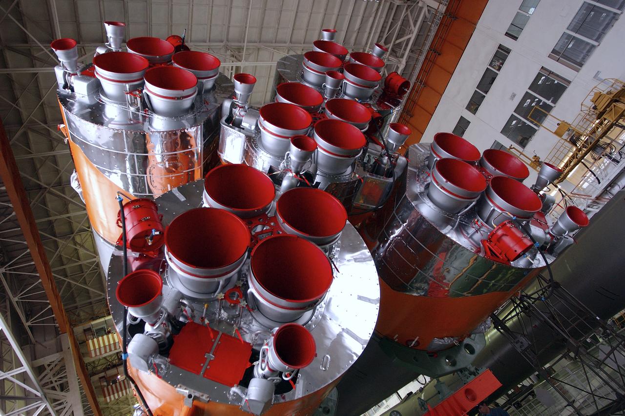
A view of the Soyuz rocket engines after engineers at the Baikonur Cosmodrome mated the Soyuz TMA-4 capsule with its booster rocket in preparation for a launch on April 19 of the Expedition 9 crew and a European astronaut to the International Space Station, Friday, April 16, 2004 in Baikonur, Kazakhstan. Photo Credit: (NASA/Bill Ingalls)

Wildflowers are in view in a field at NASA’s John F. Kennedy Space Center in Florida on May 19, 2023. The center shares a border with the Merritt Island National Wildlife Refuge. More than 330 native and migratory bird species, along with 65 amphibian and reptile species, call Kennedy and the wildlife refuge home.

STS054-97-018 (13-19 Jan 1993) --- The STS-54 crew used a handheld 70mm camera to record this view of the constellation Orion. Five astronauts spent six days aboard the Space Shuttle Endeavour in Earth orbit.
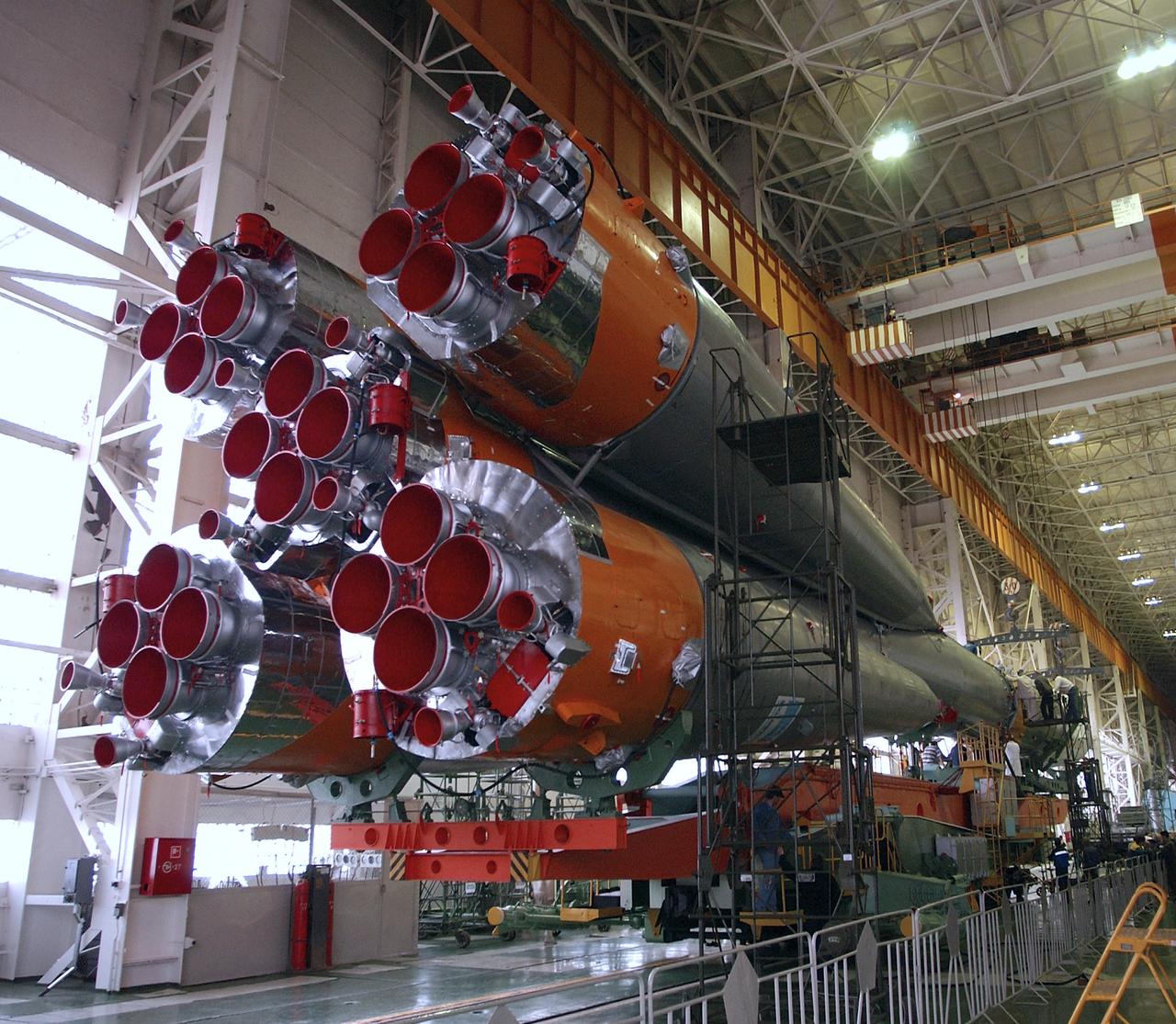
A view of the Soyuz rocket engines after engineers at the Baikonur Cosmodrome mated the Soyuz TMA-4 capsule with its booster rocket in preparation for a launch on April 19 of the Expedition 9 crew and a European astronaut to the International Space Station, Friday, April 16, 2004 in Baikonur, Kazakhstan. Photo Credit: (NASA/Bill Ingalls)

Wildflowers are in view in a field at NASA’s John F. Kennedy Space Center in Florida on May 19, 2023. The center shares a border with the Merritt Island National Wildlife Refuge. More than 330 native and migratory bird species, along with 65 amphibian and reptile species, call Kennedy and the wildlife refuge home.
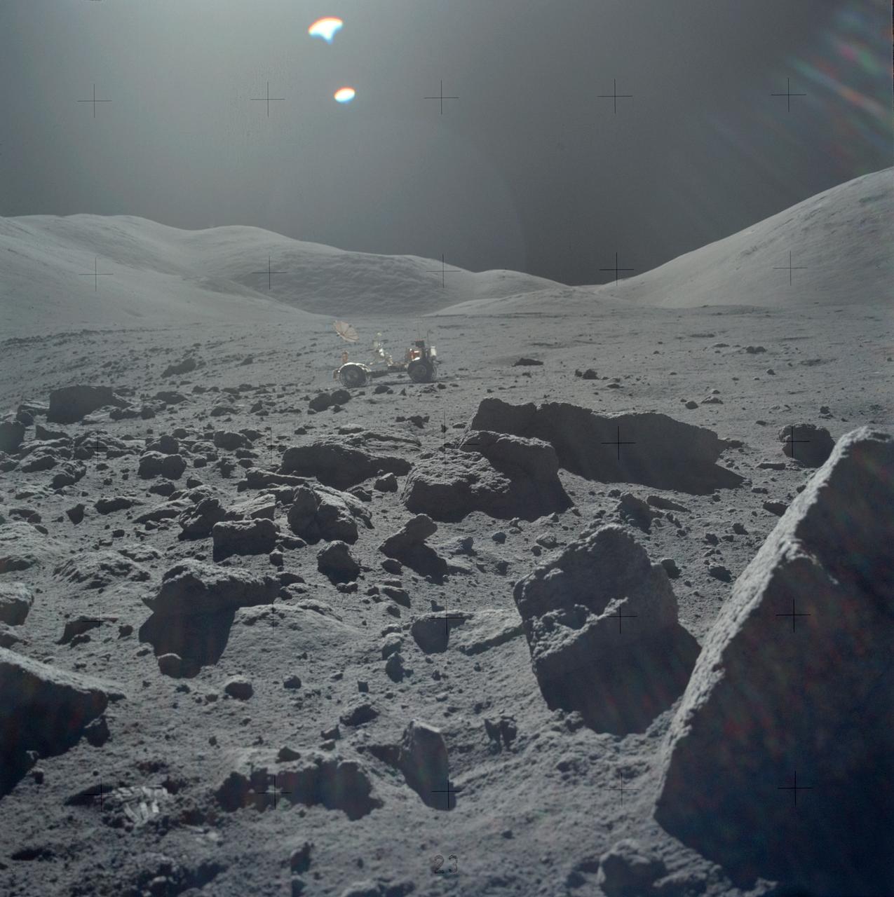
AS17-145-22162 (7-19 Dec. 1972) --- One of the Apollo 17 crew photographed this view during lunar surface extravehicular activities (EVA) at the Taurus-Littrow landing site. The Lunar Rover Vehicle (LRV), which was used extensively by astronauts Eugene A. Cernan and Harrison H. Schmitt, is visible in the background.
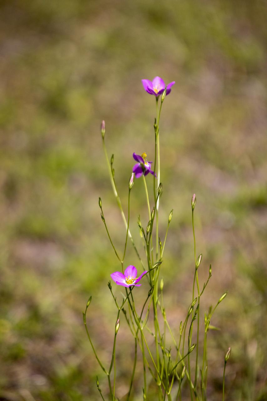
Wildflowers are in view in a field at NASA’s John F. Kennedy Space Center in Florida on May 19, 2023. The center shares a border with the Merritt Island National Wildlife Refuge. More than 330 native and migratory bird species, along with 65 amphibian and reptile species, call Kennedy and the wildlife refuge home.
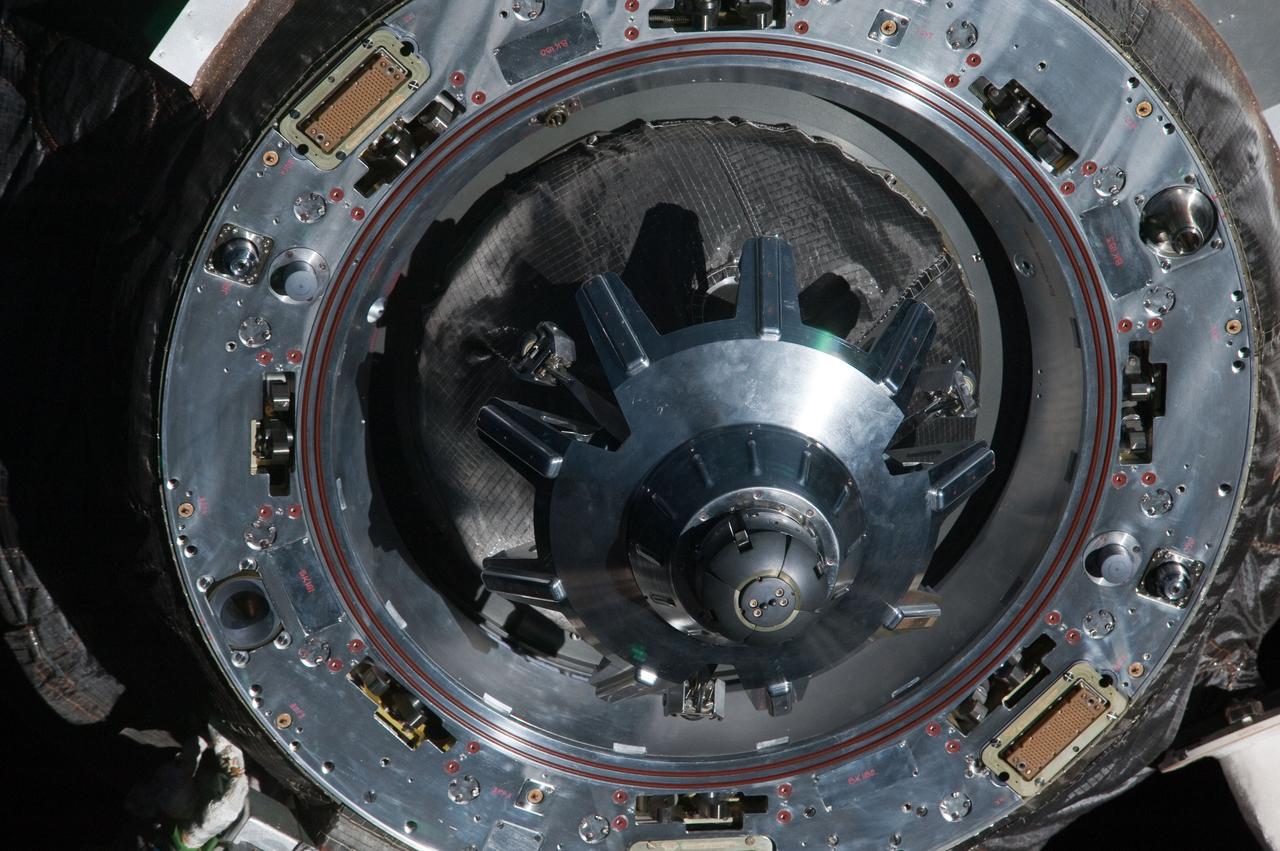
ISS030-E-238803 (19 April 2012) --- A close-up view of the docking mechanism of the unpiloted ISS Russian Progress 46 spacecraft is featured in this image photographed by an Expedition 30 crew member as Progress departs from the International Space Station.
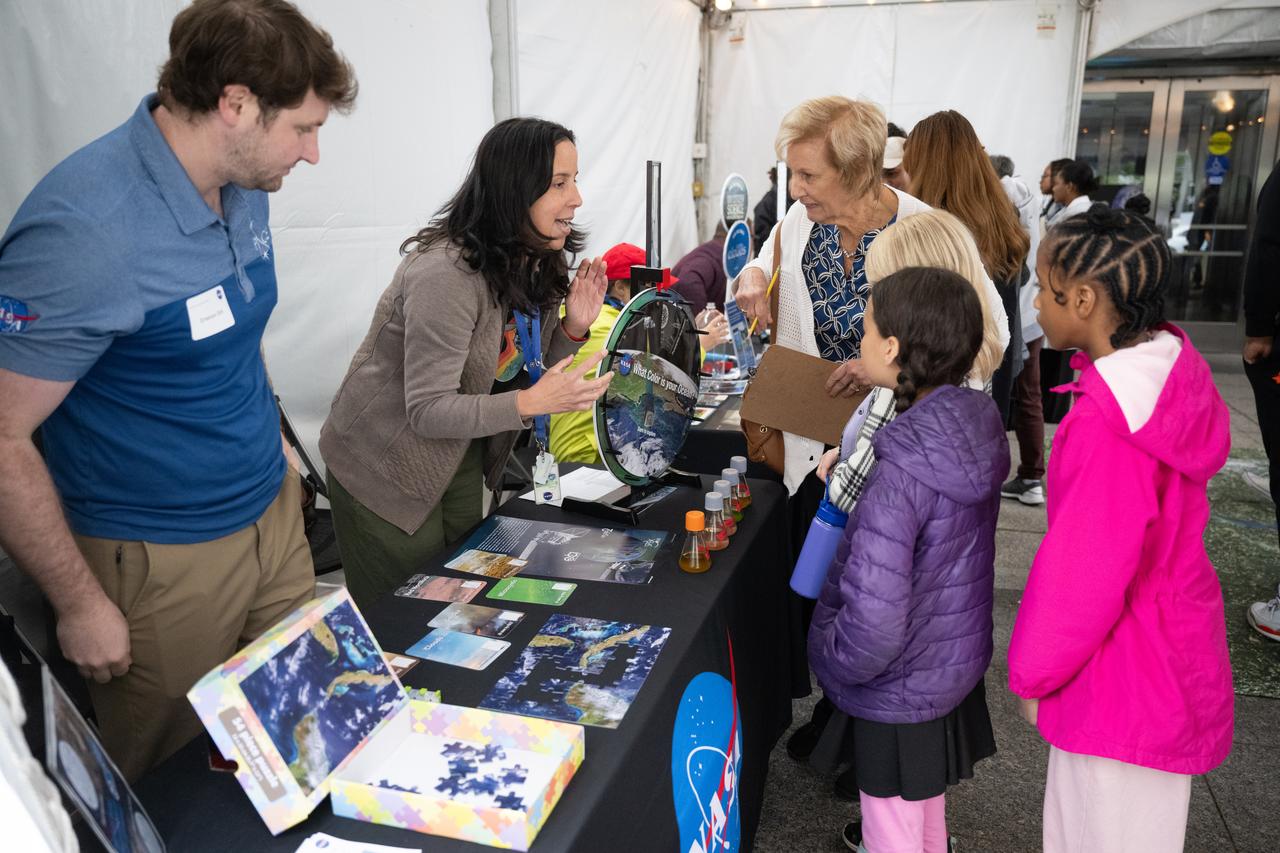
Visitors to NASA’s Earth Information Center view exhibits and hands-on activities as NASA celebrates Earth Day, Friday, April 19, 2024, at the Mary W. Jackson NASA Headquarters building in Washington. Photo Credit: (NASA/Joel Kowsky)
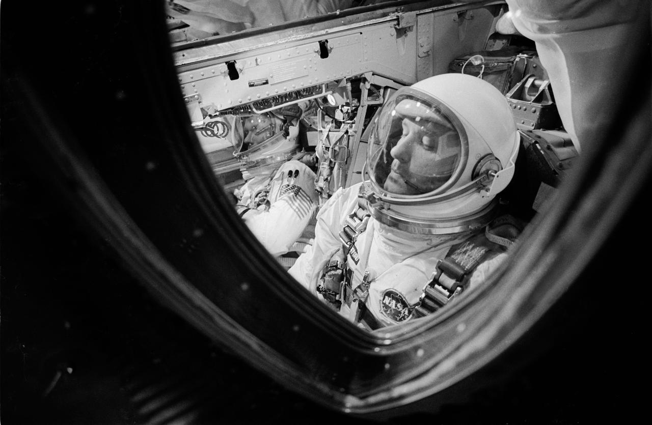
S66-34057 (3 June 1966) --- Fisheye view of astronauts Thomas P. Stafford and Eugene A. Cernan in the Gemini-9 spacecraft while hatches are sealed. They are in the White Room atop Pad 19 at the Kennedy Space Center. Photo credit: NASA