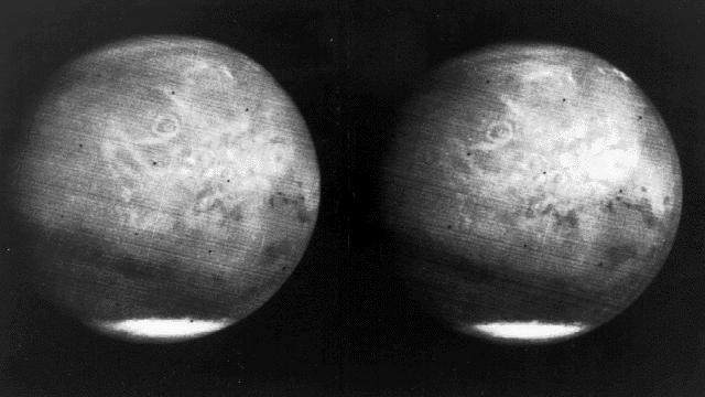
Mars full disk approach view from Mariner 7
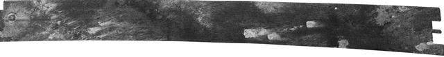
Titan T17 Viewed by Cassini Radar - Sept. 7, 2006
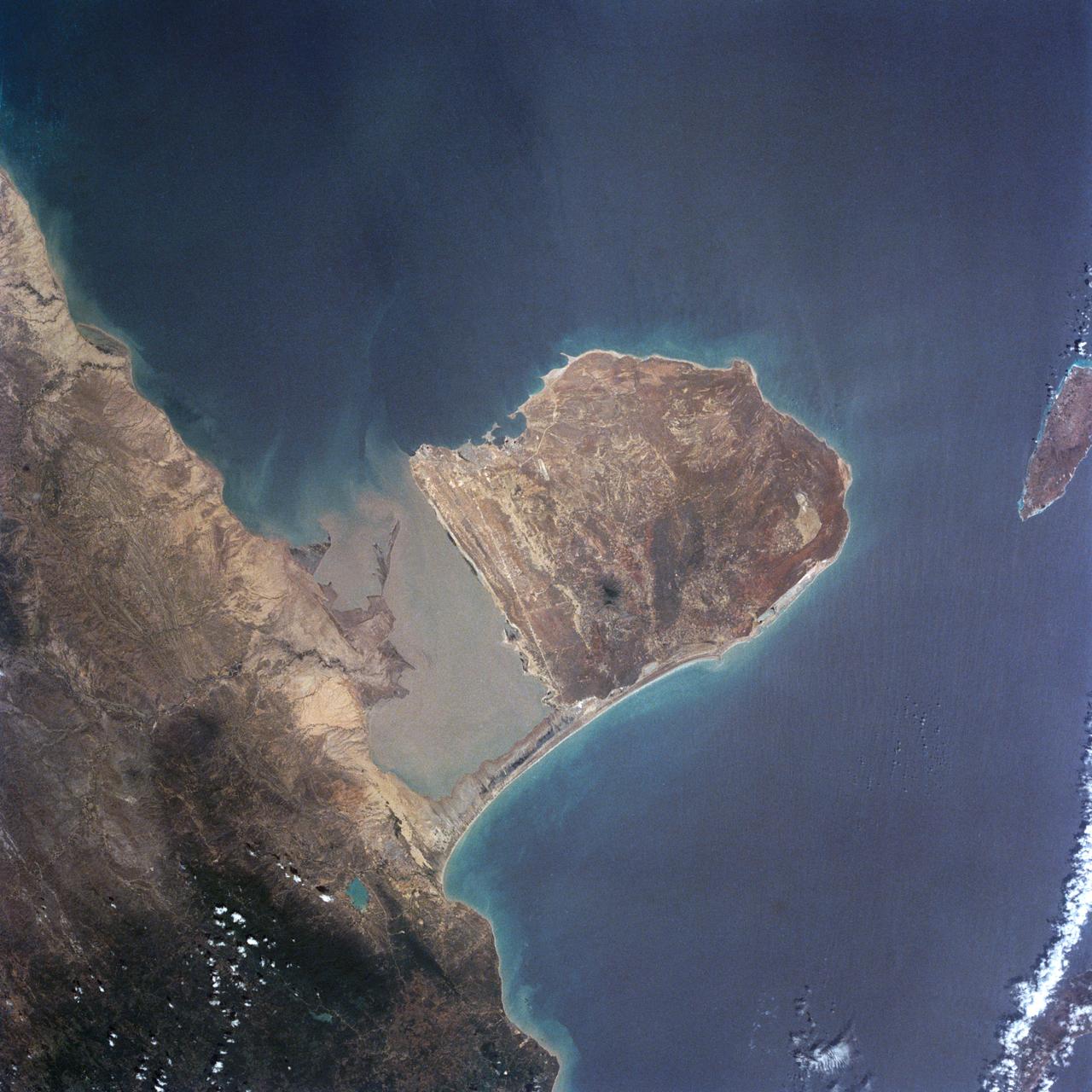
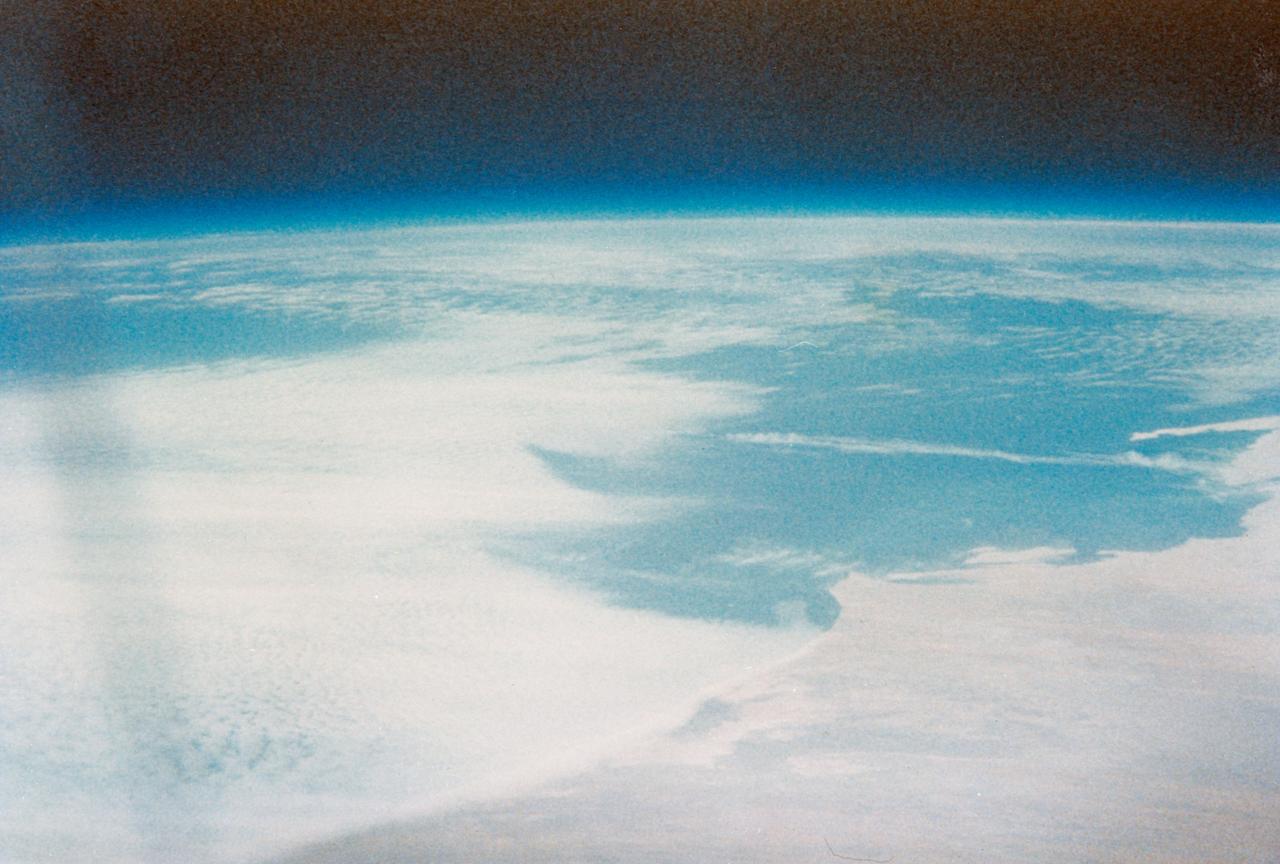
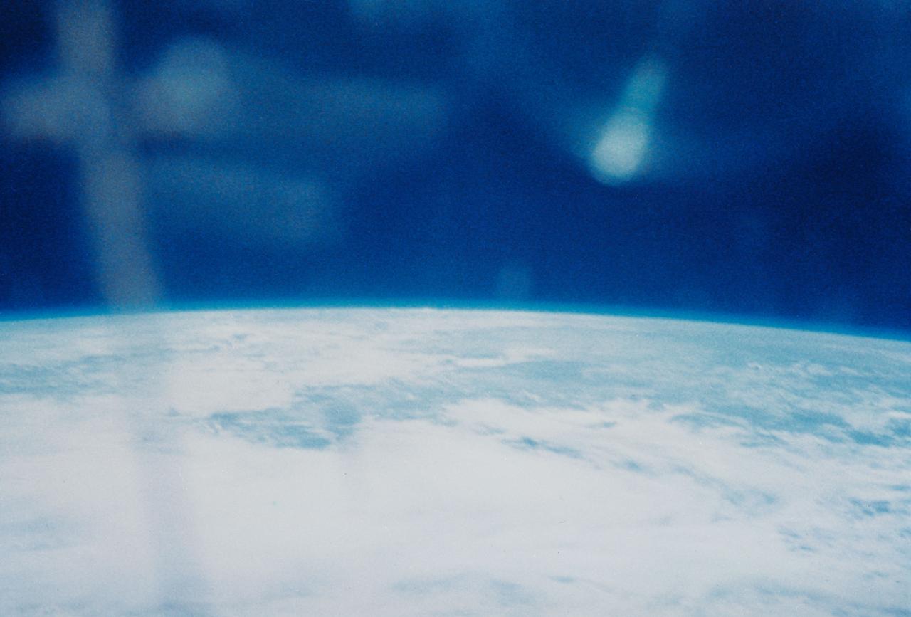
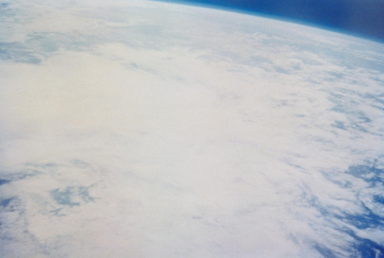
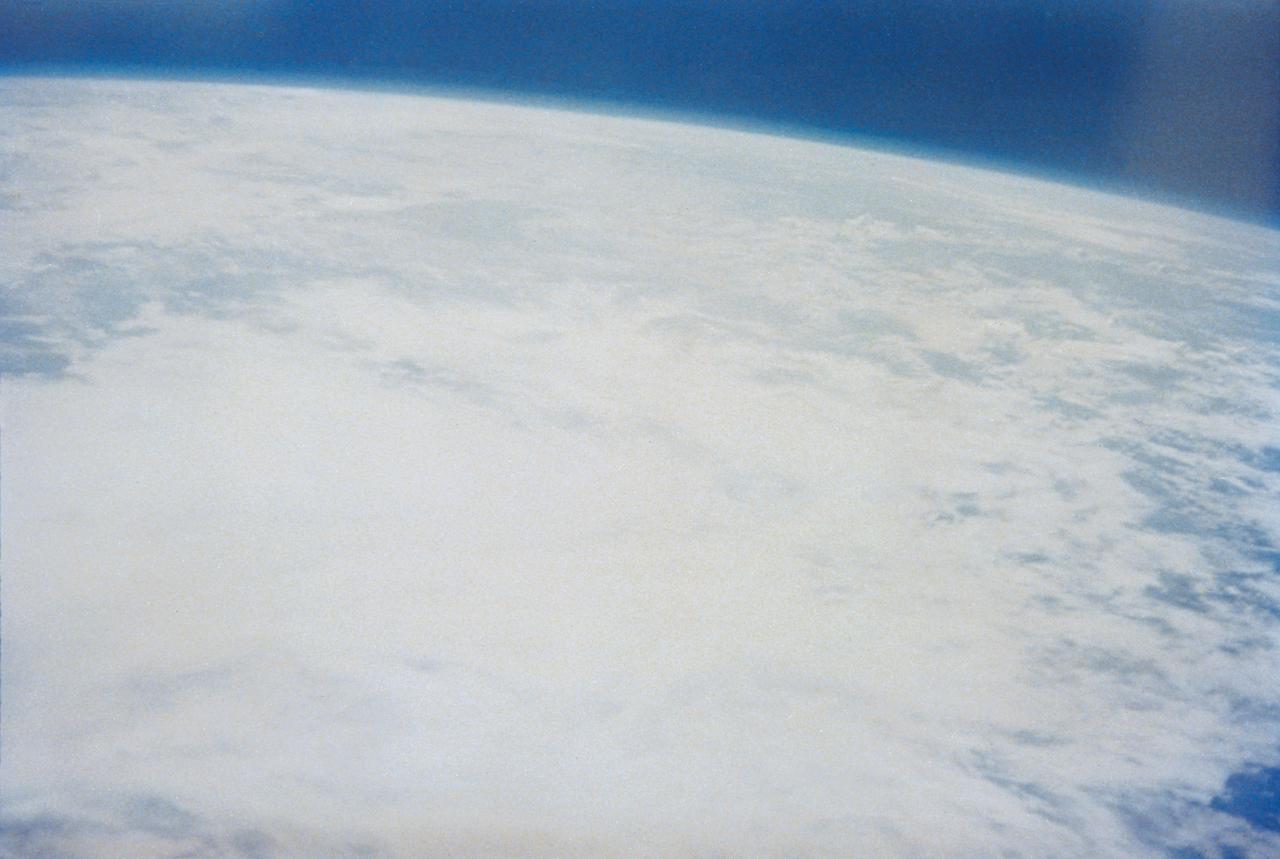
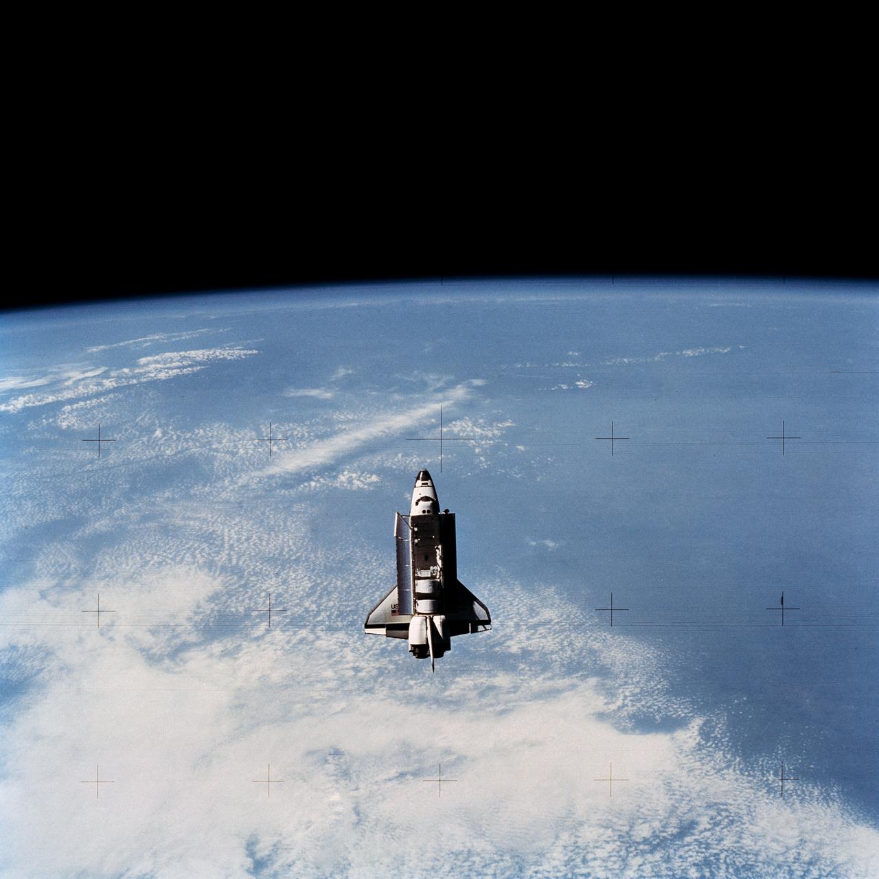
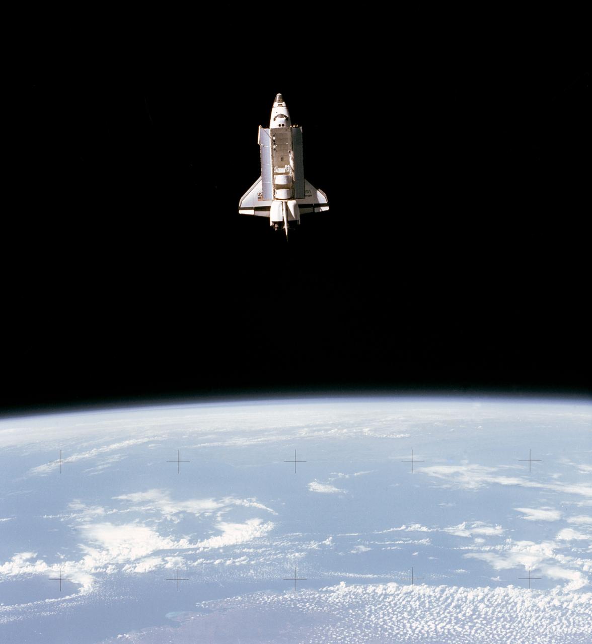
Various views of Earth taken on STS-7 for news release.
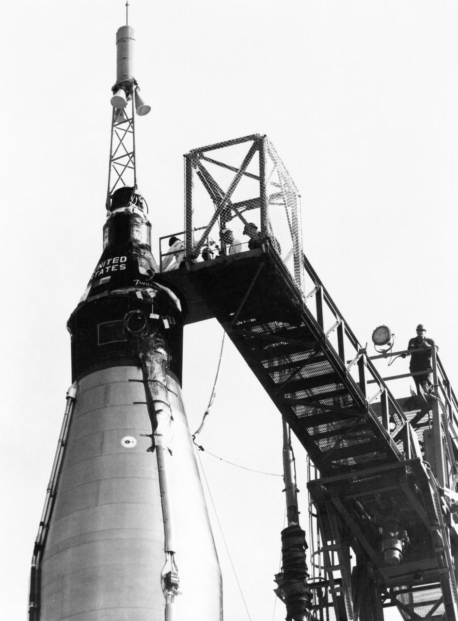
S62-00380 (20 Feb. 1962) --- Close-up view of the Mercury Atlas 6 (MA-6) Friendship 7 capsule on top of its booster rocket with catwalk still attached. Photo credit: NASA
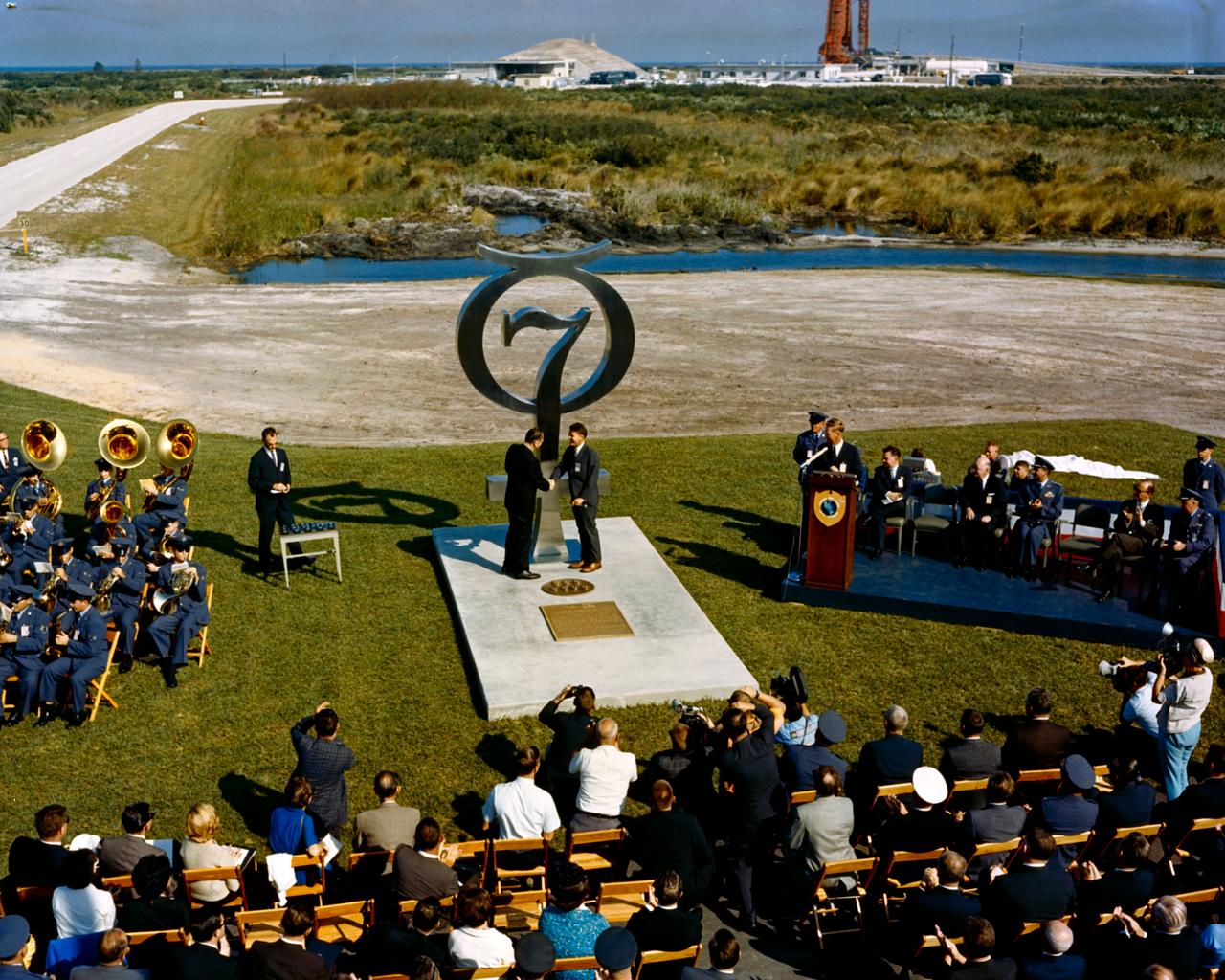
S64-40111 (1964) --- Wide angle view of the Mercury 7 memorial dedication. Photo credit: NASA
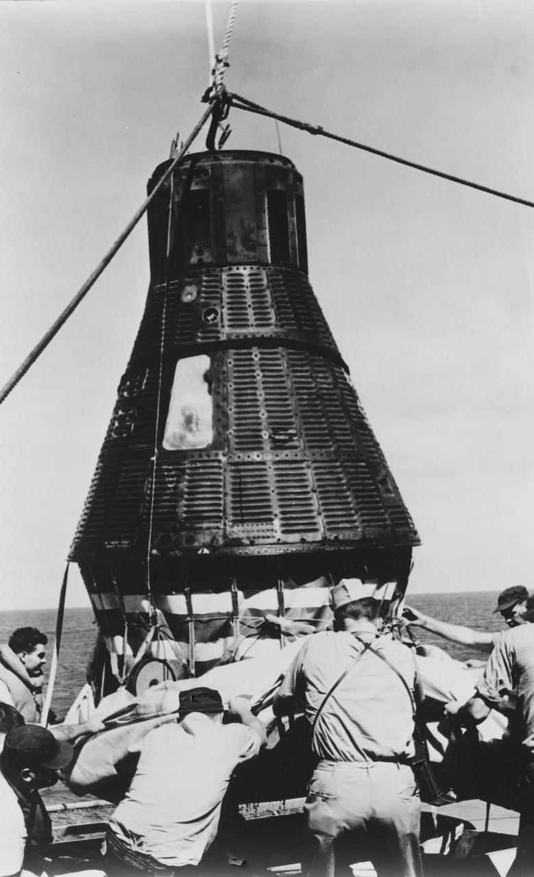
S62-06175 (3 Oct. 1962) --- Closeup view of the Mercury-Atlas 8 (MA-8) Sigma 7 capsule being lowered to recovery ship's deck. Navy personnel remove the floatation device before opening the capsule. Photo credit: NASA
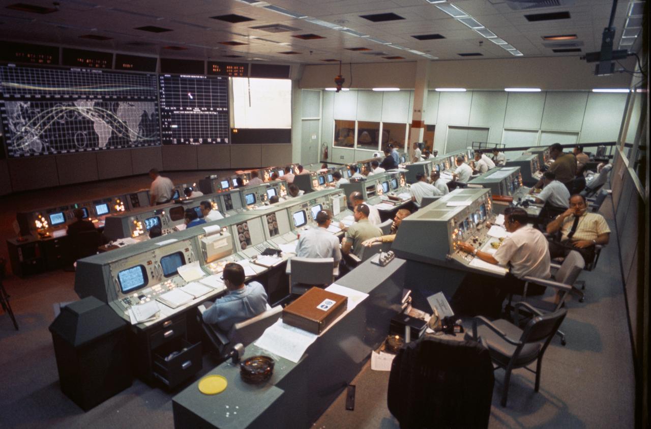
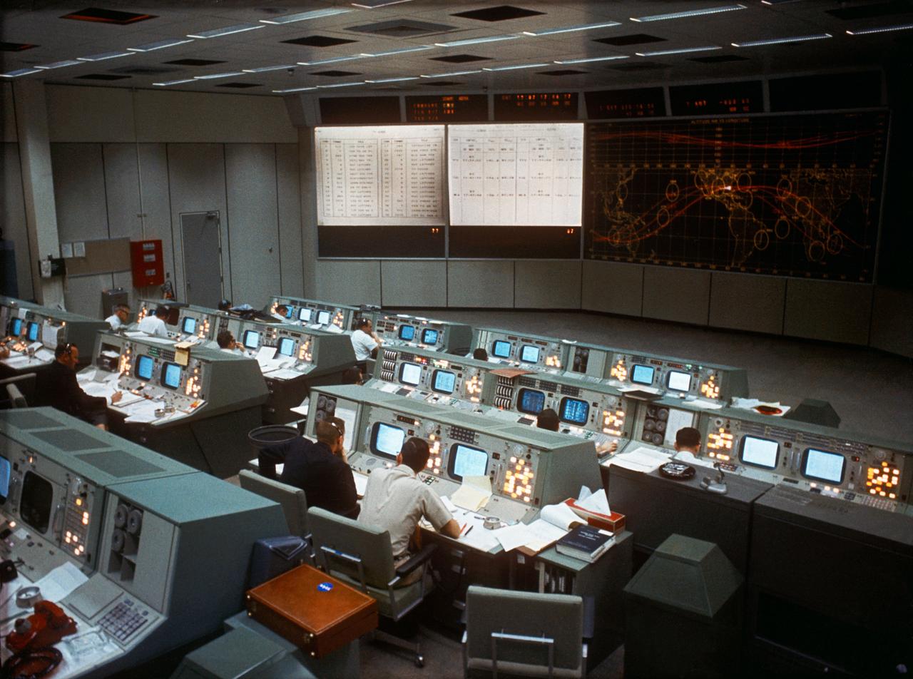
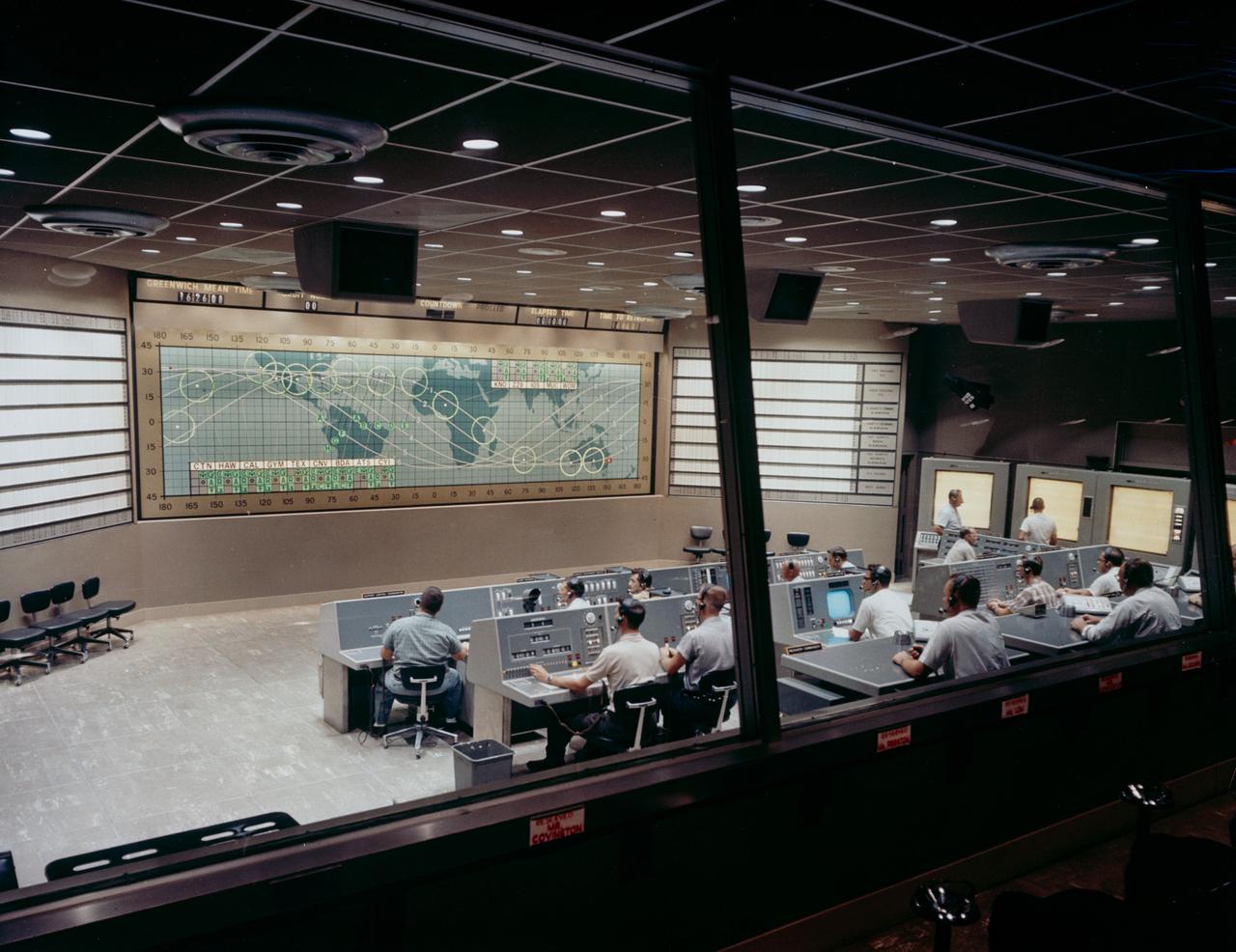
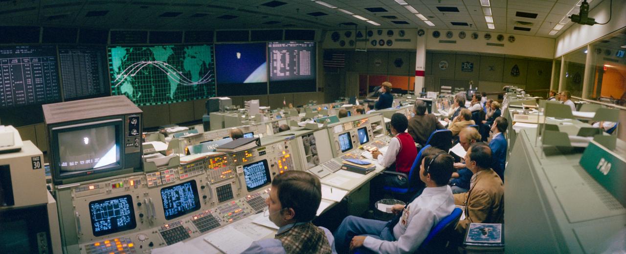
Overall view of activity in the Mission Operations Control Room in the Mission Control Center, Bldg 30, on the first day of the Apollo 7 space mission.
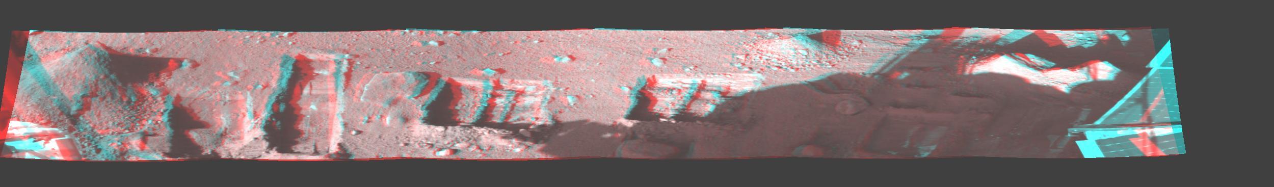
This image is a stereo, panoramic view of various trenches dug by NASA Phoenix Mars Lander on Oct. 7, 2008. 3D glasses are necessary to view this image.

S62-03270 (24 May 1962) --- Earth and sky views taken with hand-held camera by astronaut M. Scott Carpenter during Mercury-Atlas 7 (MA-7) mission. Photo credit: NASA
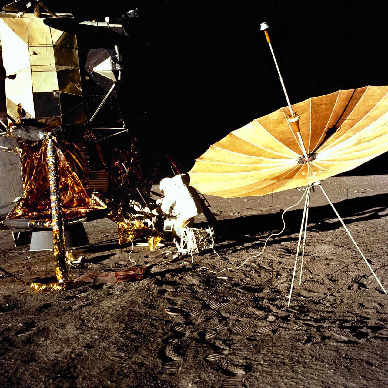
The second manned lunar landing mission, Apollo 12 launched from launch pad 39-A at Kennedy Space Center in Florida on November 14, 1969 via a Saturn V launch vehicle. The Saturn V vehicle was developed by the Marshall Space Flight Center (MSFC) under the direction of Dr. Wernher von Braun. Aboard Apollo 12 was a crew of three astronauts: Alan L. Bean, pilot of the Lunar Module (LM), Intrepid; Richard Gordon, pilot of the Command Module (CM), Yankee Clipper; and Spacecraft Commander Charles Conrad. The LM, Intrepid, landed astronauts Conrad and Bean on the lunar surface in what’s known as the Ocean of Storms while astronaut Richard Gordon piloted the CM, Yankee Clipper, in a parking orbit around the Moon. Lunar soil activities included the deployment of the Apollo Lunar Surface Experiments Package (ALSEP), finding the unmanned Surveyor 3 that landed on the Moon on April 19, 1967, and collecting 75 pounds (34 kilograms) of rock samples. This is the seventh of 25 images captured by the crew in attempt to provide a 360 degree Lunar surface scene. Apollo 12 safely returned to Earth on November 24, 1969.
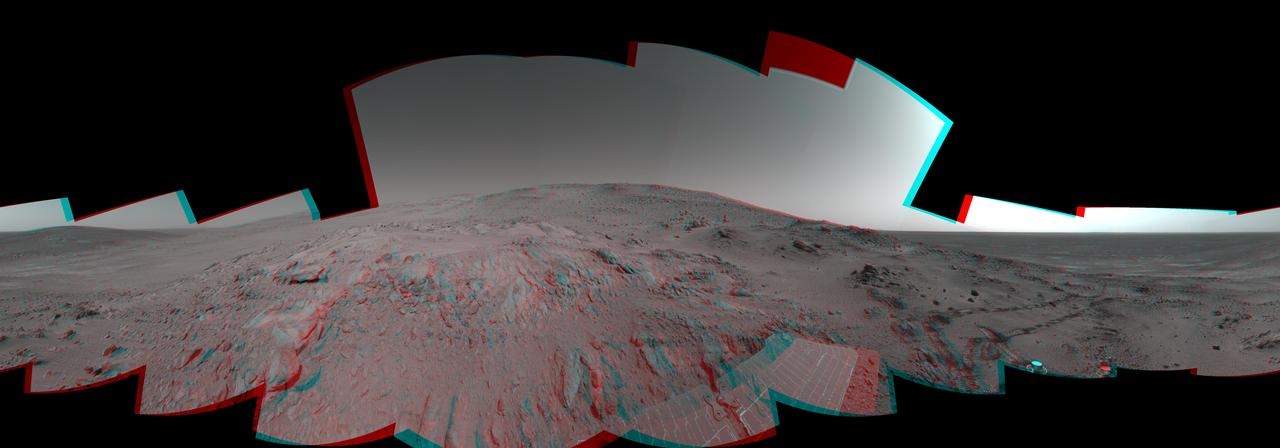
NASA Mars Exploration Rover Opportunity recorded this view of a crater informally named Freedom 7 shortly before the 50th anniversary of the first American in space: astronaut Alan Shepard flight in the Freedom 7 spacecraft.
This anaglyph, acquired by NASA Phoenix Lander on Jun. 7, 2008, shows a stereoscopic 3D view of the Martian surface near the lander. 3D glasses are necessary to view this image.
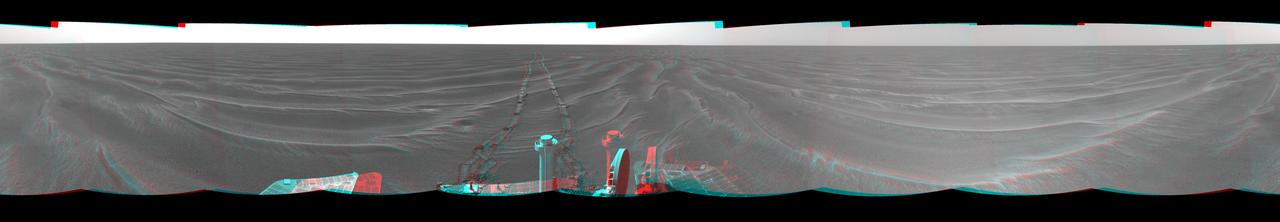
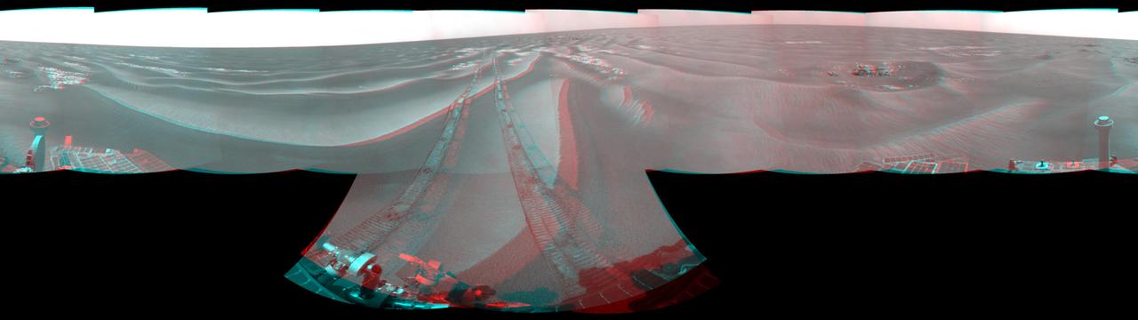
NASA Mars Exploration Rover Opportunity used its navigation camera to take the images combined into this stereo 180-degree view on March 7-9, 2009. 3D glasses are necessary to view this image.

This 360-degree view combines frames taken by the navigation camera on NASA Mars Exploration Rover Spirit during the rover 271st martian day, or sol, on Oct. 7, 2004. 3D glasses are necessary to view this image.

These images from NASA Terra satellite eastern China compare a somewhat hazy summer view from July 9, 2000 left with a spectacularly dusty spring view from April 7, 2001 middle.

Alabama House Minority Leader Anthony Daniels, (Left), and Auburn University President, Dr. Stephen Leahy, were part of the Leadership Alabama group that viewed the SLS Liquid Hydrogen test stand at Marshall Space Flight Center on 3/7/19.
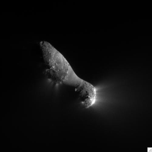
This close-up view of comet Hartley 2 was taken at 7:00 a.m. PDT 10 a.m. EDT, after NASA EPOXI mission flew by.
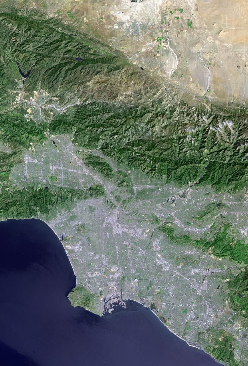
Los Angeles and vicinity seen from space, as viewed by NASA Landsat 7 satellite from an altitude of 437 miles on May 4, 2001.
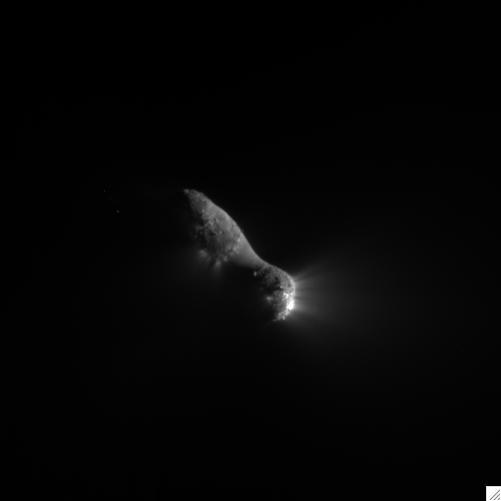
This close-up view of comet Hartley 2 was taken at 7:00 a.m. PDT 10 a.m. EDT, after NASA EPOXI mission flew by.
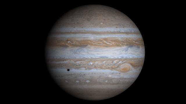
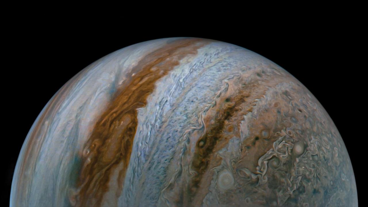
This true-color simulated view of Jupiter is composed of 4 images taken by NASA's Cassini spacecraft on December 7, 2000. To illustrate what Jupiter would have looked like if the cameras had a field-of-view large enough to capture the entire planet, the cylindrical map was projected onto a globe. The resolution is about 144 kilometers (89 miles) per pixel. Jupiter's moon Europa is casting the shadow on the planet. https://photojournal.jpl.nasa.gov/catalog/PIA02873
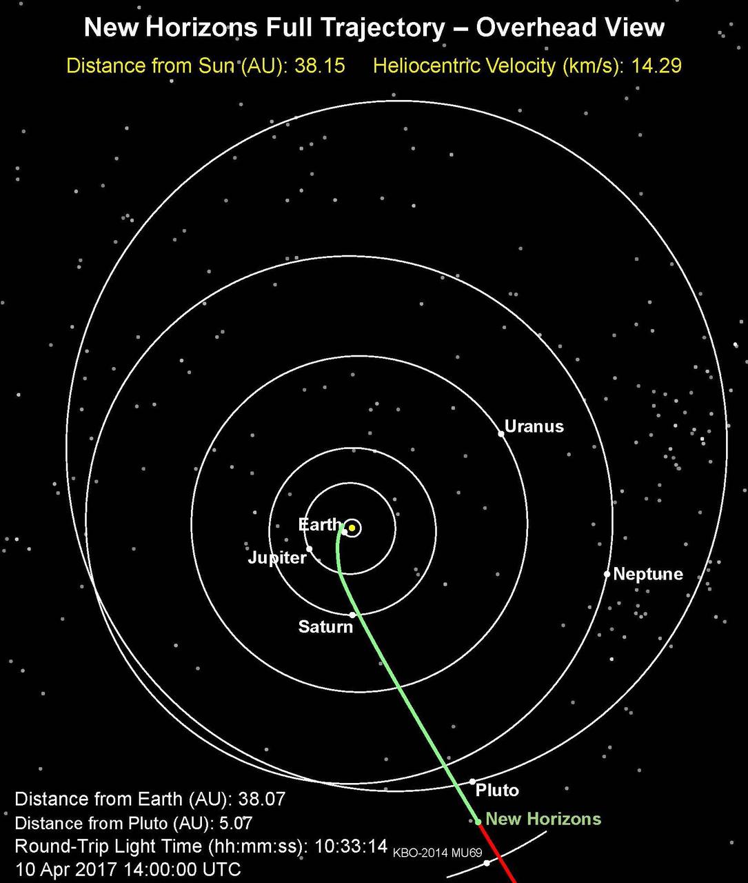
This is an overhead view of NASA's New Horizons full trajectory; the spacecraft has entered a hibernation phase on April 7 that will last until early September. The full article is available at https://photojournal.jpl.nasa.gov/catalog/PIA21589

This view of the north polar region of the Moon was obtained by NASA's Galileo camera during the spacecraft flyby of the Earth-Moon system on December 7 and 8, 1992. http://photojournal.jpl.nasa.gov/catalog/PIA00126
NASA Mars Exploration Rover Opportunity took this stereo view of a crater informally named Freedom 7 shortly before the 50th anniversary of the first American in space: astronaut Alan Shepard flight in the Freedom 7 spacecraft. You need 3D glasses.
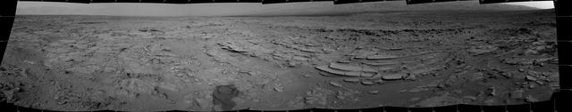
This stereo panoramic view combines 14 images taken by NASA Mars rover Curiosity during the mission 120th Martian day, or sol Dec. 7, 2012. You need 3D glasses.
The NASA Mars rover Curiosity used its Mast Camera Mastcam during the mission 120th Martian day, or sol Dec. 7, 2012, to record this view of a rock outcrop informally named Shaler.
On Feb. 26, 2005, NASA Mars Exploration Rover Spirit had drive 2 meters 7 feet on this sol to get in position on Cumberland Ridge for looking into Tennessee Valley to the east. 3D glasses are necessary to view this image.
This view of the Moon north pole is a mosaic assembled from 18 images taken by NASA's Galileo imaging system through a green filter as the spacecraft flew by on December 7, 1992. http://photojournal.jpl.nasa.gov/catalog/PIA00130
On Mar. 7, 2005, NASA Mars Exploration Rover Opportunity drove 35 meters 115 feet toward Vostok Crater that sol before taking images. 3D glasses are necessary to view this image.
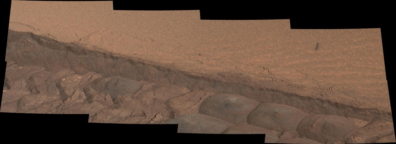
A wheel track cuts through a windblown ripple of dusty sand in this Nov. 7, 2014, image from the Mastcam on NASA Curiosity rover. The view spans about four feet across.
The NASA Mars rover Curiosity used its Navigation Camera Navcam during the mission 120th Martian day, or sol Dec. 7, 2012, to record the seven images combined into this panoramic view.
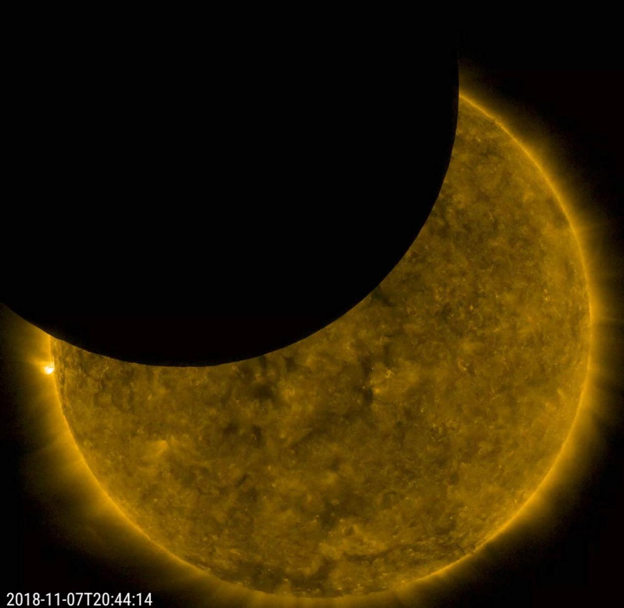
On Nov. 7, 2018 for just under an hour, SDO viewed a lunar transit, when the Moon partially blocked SDO's view of the Sun. At its peak about 44% of the Sun was covered. In this view, the Sun was observed in extreme ultraviolet light and, as is customary, been given false color. SDO's orbit gives it two three-week periods per year when either the Earth or the Moon cross in front of the Sun. These transits provide scientific value as well: The sharp edge of the lunar limb helps researchers measure how light diffracts around the telescope's optics and filter support grids, allowing scientists to better calibrate their instruments for even sharper images. Movies available at https://photojournal.jpl.nasa.gov/catalog/PIA18142

This image of the moon was obtained by the Galileo Solid State imaging system on Dec. 8 at 7 p.m. PST as NASA Galileo spacecraft passed the Earth and was able to view the lunar surface from a vantage point not possible from the Earth. http://photojournal.jpl.nasa.gov/catalog/PIA00225
iss057e059221 (11/7/2018) --- A view taken through the Harmony Node 2 nadir hatch window of the Kounotori H-II Transfer Vehicle 7 (HTV-7), with the HTV Small Re-entry Capsule (HSRC) in view, during unberthing and backing away from the International Space Station (ISS).
S83-35770 (18?24 June 1983)--- Astronaut Norman E. Thagard, STS-7 mission specialist, is actually performing a medical experiment though his appearance resembles popular depictions of an invading alien. Thagard, a medical doctor, has been assigned a busy project of evaluating physiological reactions of astronauts in space travel. He is on the middeck of the Earth-orbiting space shuttle Challenger. Photo credit: NASA
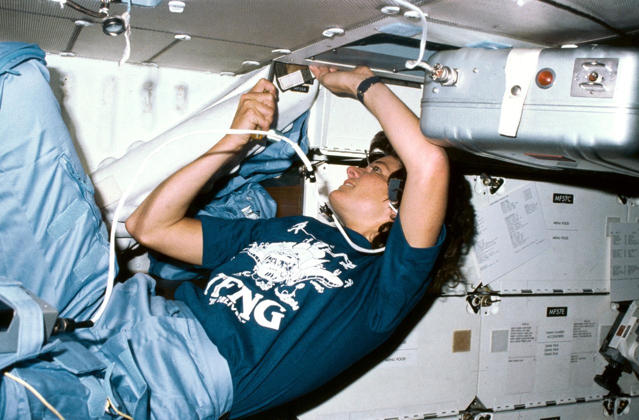
S83-35768 (18-24 June 1983) --- Astronaut Sally K. Ride, mission specialist for STS-7, uses a screw driver in order to clean out an air filtering system in the mid-deck of the Earth-orbiting Space Shuttle Challenger. Dr. Ride's constant wear garment bears some extras -- a cartoon of 35 busy astronauts around a Space Shuttle and the acronym TFNG, below which is written, "We deliver!" TFNG stands for thirty-five new guys, referring to the 1978 class of astronaut candidates (ASCAN) from which Dr. Ride and three of her crew members hail. The tiny two-word declarative in white lettering refers to the successful deployment of two communications satellites. This photograph was made with a 35mm camera.
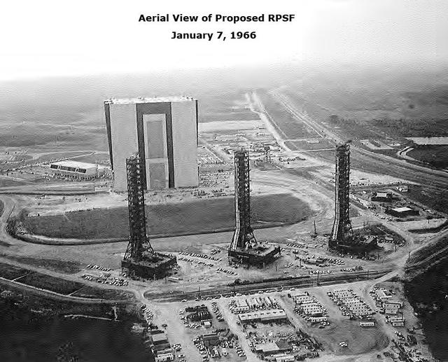
Aerial View of Proposed RPSF Area, January 7, 1966
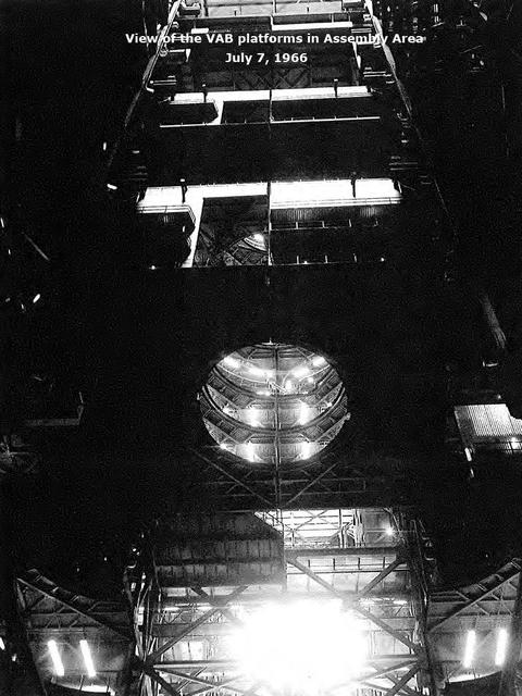
View of the VAB platforms in Assembly Area, July 7, 1966
NASA Opportunity had driven 62.5 meters 205 feet on April 7, 2009, southward away from an outcrop called Penrhyn, which the rover had been examining for a few sols, and toward a crater called Adventure. 3D glasses are necessary to view this image.
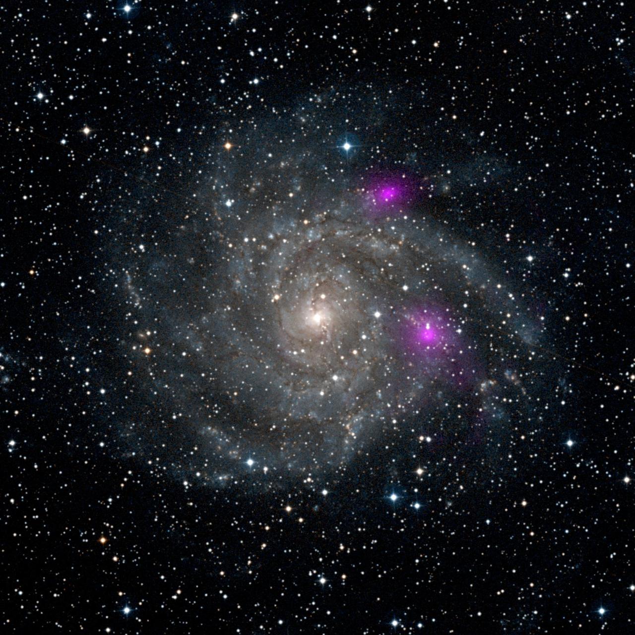
This new view of spiral galaxy IC 342, also known as Caldwell 5, includes data from NASA Nuclear Spectroscopic Telescope Array, or NuSTAR. IC 342 lies 7 million light-years away in the Camelopardalis constellation.
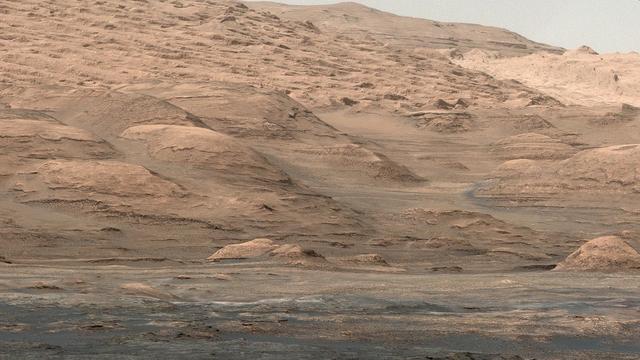
This view from the Mastcam on NASA Curiosity Mars rover shows dramatic buttes and layers on the lower flank of Mount Sharp. It was taken on Sept. 7, 2013, from near the waypoint called Darwin on the route toward an entry point to the mountain.
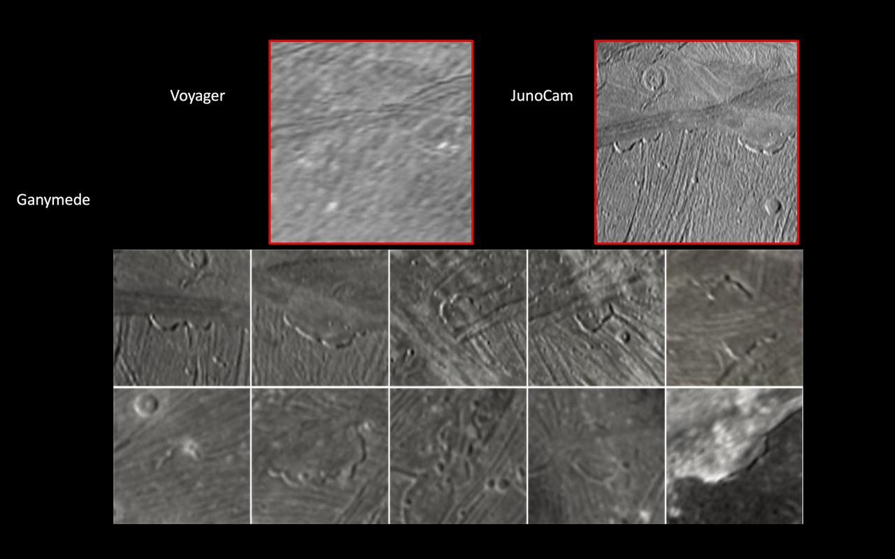
JunoCam, the public engagement camera aboard NASA's Juno spacecraft, captured these views of Jupiter's moon Ganymede during a close pass on June 7, 2021. JunoCam was able to obtain significantly higher quality images compared to those taken by NASA's Voyager spacecraft in 1979 (upper left). In these images, JunoCam revealed 12 paterae – broad, shallow bowl-shaped features on a planetary body's surface – only two of which are evident in the Voyager data. These features were likely formed by late-stage volcanic processes. https://photojournal.jpl.nasa.gov/catalog/PIA25721
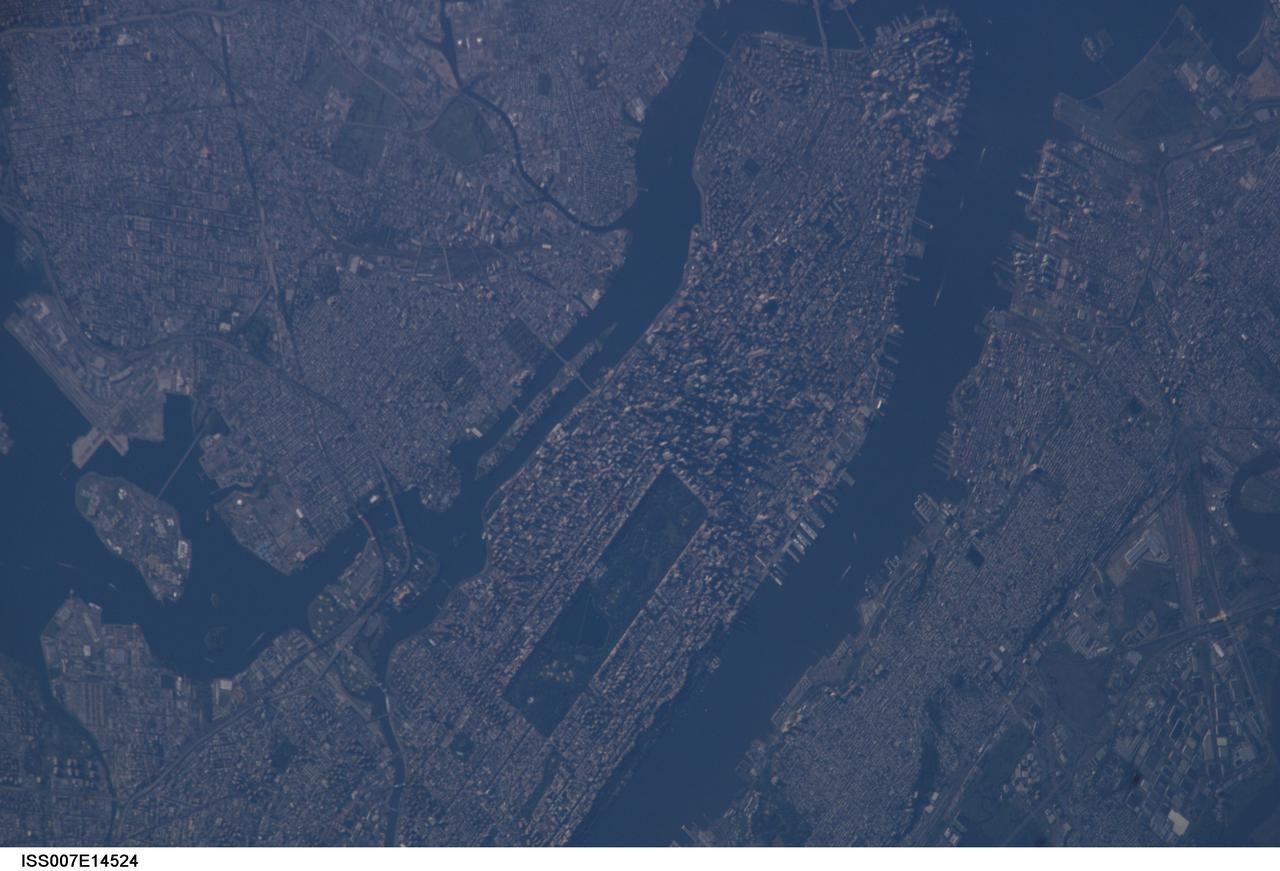
ISS007-E-14524 (7 September 2003) --- This view of New York City at dawn was taken by an Expedition 7 crewmember onboard the International Space Station (ISS). Central Park on Manhattan is just below center frame.
S62-03266 (24 May 1962) --- Earth and sky views taken with hand-held camera by astronaut M. Scott Carpenter during Mercury-Atlas 7 (MA-7) mission. Photo credit: NASA
S65-60037 (7 Dec. 1965) --- An overall view of the Manned Spacecraft Center's Mission Control Center, during the National Aeronautics and Space Administration's Gemini-7 spaceflight. Photo credit: NASA
S62-03248 (24 May 1962) --- Earth and sky views taken with hand-held camera by astronaut M. Scott Carpenter during Mercury-Atlas 7 (MA-7) mission. Photo credit: NASA
S62-03250 (24 May 1962) --- Earth and sky views taken with hand-held camera by astronaut M. Scott Carpenter during Mercury-Atlas 7 (MA-7) mission. Photo credit: NASA
S62-03257 (24 May 1962) --- Earth and sky views taken with hand-held camera by astronaut M. Scott Carpenter during Mercury-Atlas 7 (MA-7) mission. Photo credit: NASA
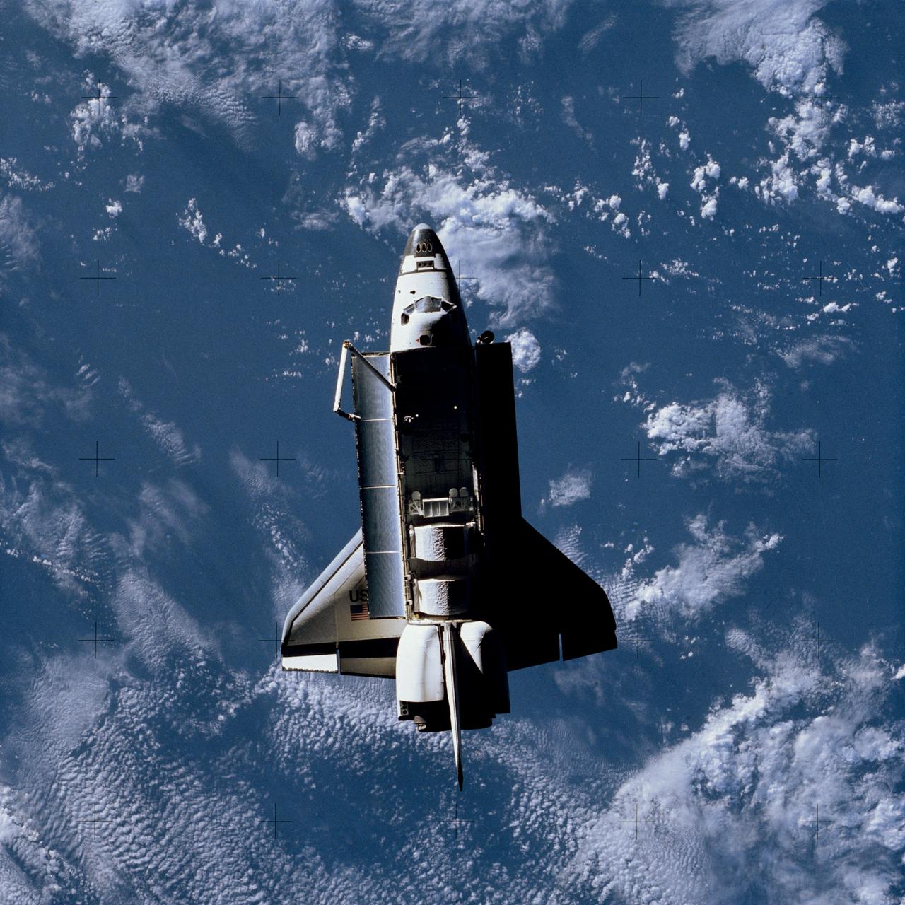
Full views of "Challenger" in Space, taken by the Shuttle Pallet Satellite (SPAS), also views of Cargo Bay and Remote Manipulator System (RMS) extended. 1. SHUTTLE - RMS (STS-7) Also available in 4x5 CN
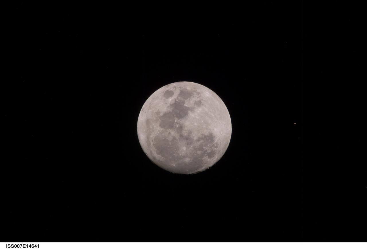
ISS007-E-14641 (9 September 2003) --- This view of a full Moon was photographed by one of the Expedition 7 crewmembers aboard the International Space Station (ISS). The view also includes Mars, which appears as a small dot.
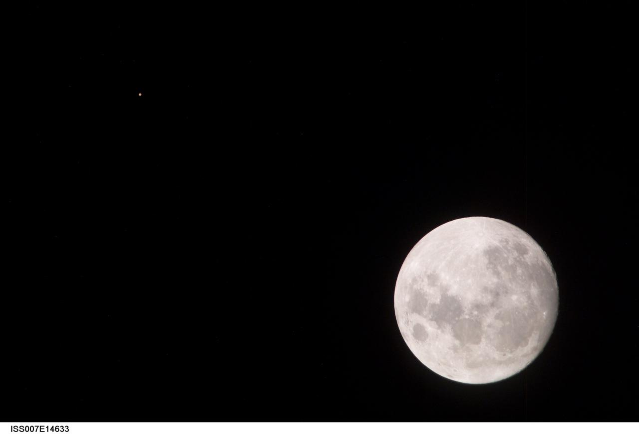
ISS007-E-14633 (9 September 2003) --- This view of a full Moon was photographed by one of the Expedition 7 crewmembers aboard the International Space Station (ISS). The view also includes Mars, which appears as a small dot.
Full views of "Challenger" in Space, taken by the Shuttle Pallet Satellite (SPAS), also views of Cargo Bay and Remote Manipulator System (RMS) extended. 1. SHUTTLE - RMS (STS-7) Also available in 4x5 CN
Full views of "Challenger" in Space, taken by the Shuttle Pallet Satellite (SPAS), also views of Cargo Bay and Remote Manipulator System (RMS) extended. 1. SHUTTLE - RMS (STS-7) Also available in 4x5 CN
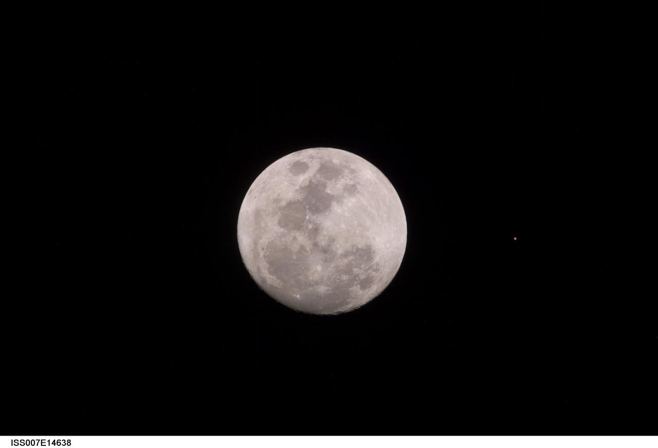
ISS007-E-14638 (9 September 2003) --- This view of a full Moon was photographed by one of the Expedition 7 crewmembers aboard the International Space Station (ISS). The view also includes Mars, which appears as a small dot.
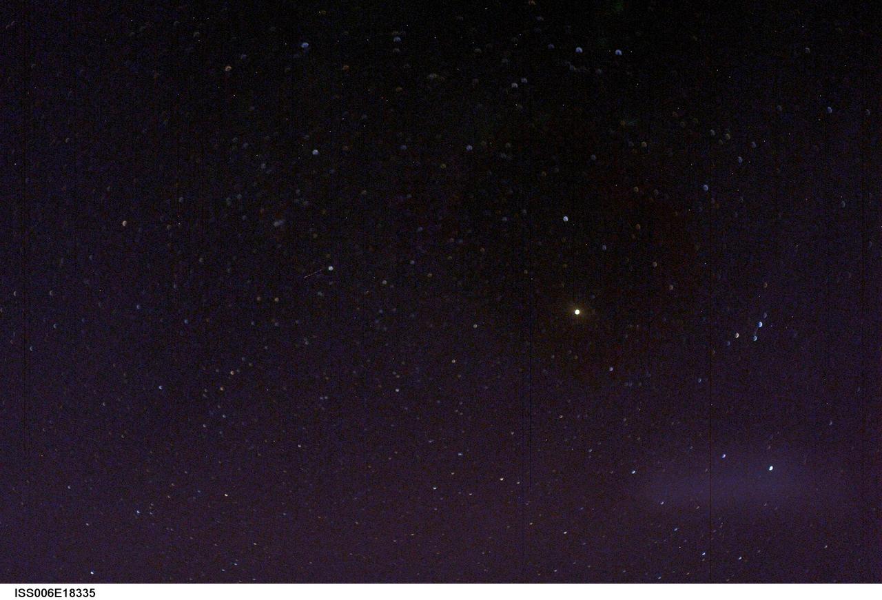
ISS006-E-18335 (7 January 2003) --- View of stars photographed by an Expedition Six crewmember on the International Space Station (ISS).
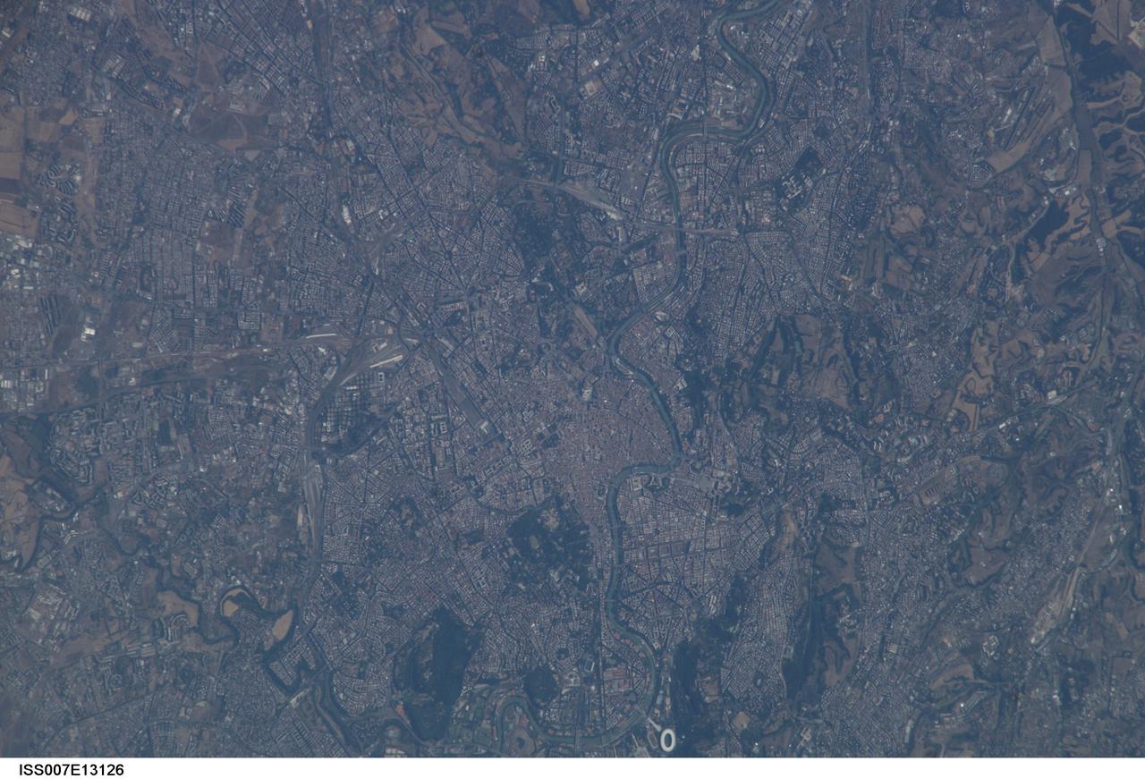
ISS007-E-13126 (21 August 2003) --- This view of Rome, Italy was taken by one of the Expedition 7 crewmembers onboard the International Space Station (ISS).
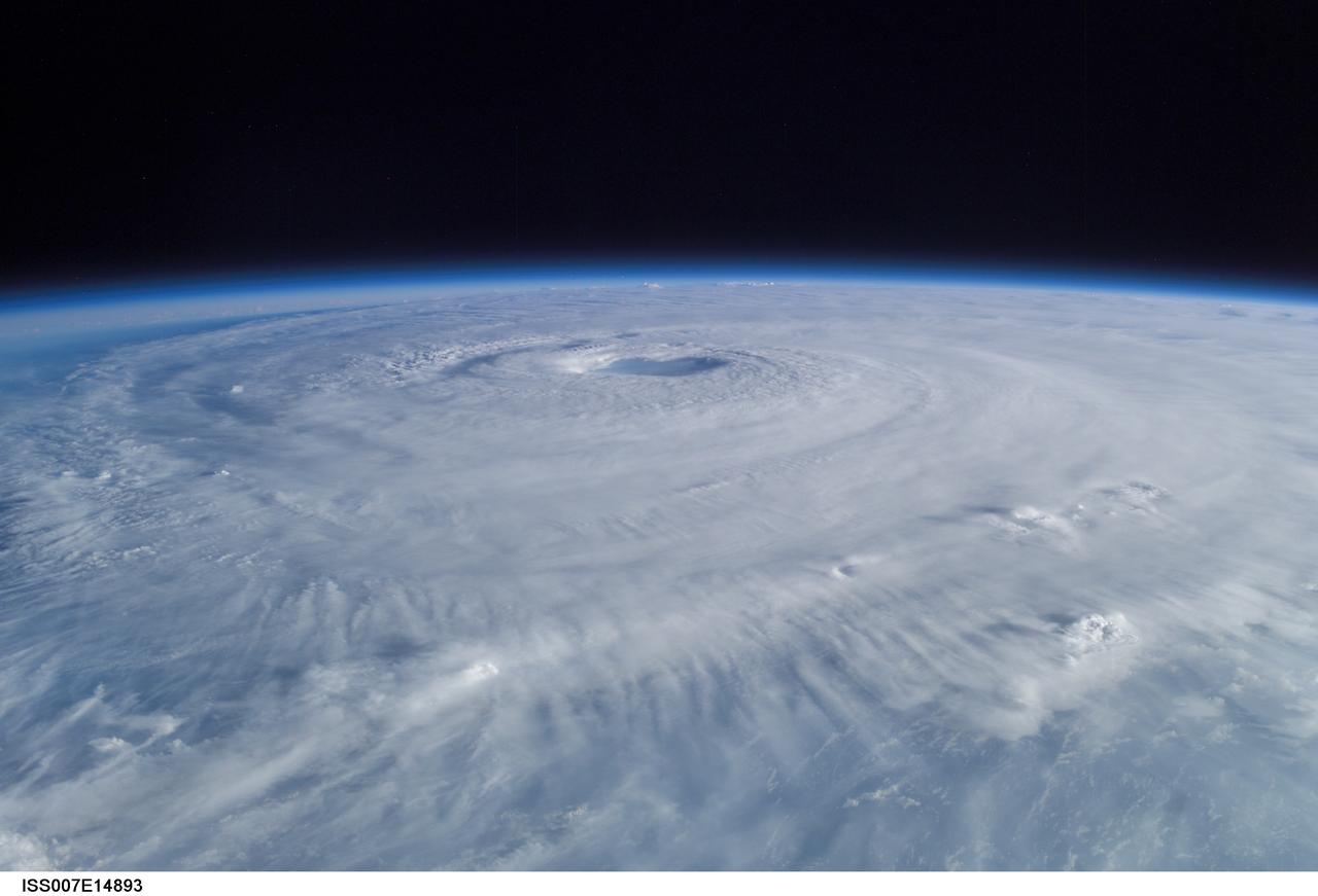
ISS007-E-14887 (15 September 2003) --- This view of Hurricane Isabel was taken by one of the Expedition 7 crewmembers onboard the International Space Station (ISS).
S61-03705 (1961) --- Close-up view of the fueling of the Liberty Bell 7 for the Mercury-Redstone 4 (MR-4) mission. Photo credit: NASA
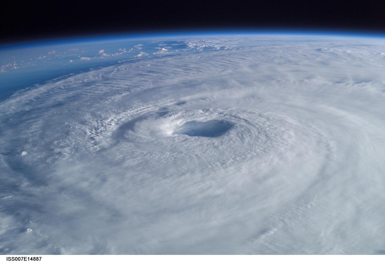
ISS007-E-14893 (15 September 2003) --- This view of Hurricane Isabel was taken by one of the Expedition 7 crewmembers onboard the International Space Station (ISS).
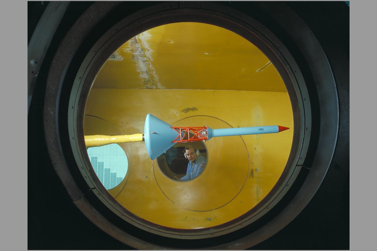
Side view of assembled command module, tower with flap & launch-escape rocket. Apollo FS-2 in 9 x 7 ft. SupersonicWind Tunnel.
iss062e001720 (Feb. 7, 2020) --- This oblique view of Houston, Texas, was taken from the International Space Station as it was orbiting over Mexico several hundreds of miles away.
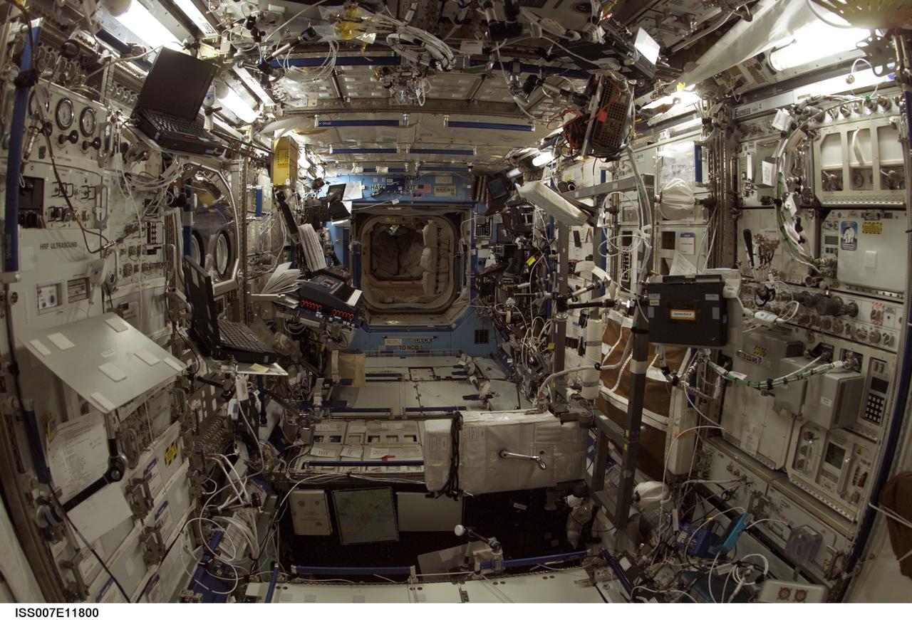
ISS007-E-11800 (3 August 2003) --- Interior view of the Destiny laboratory on the International Space Station (ISS) during the Expedition 7 mission.
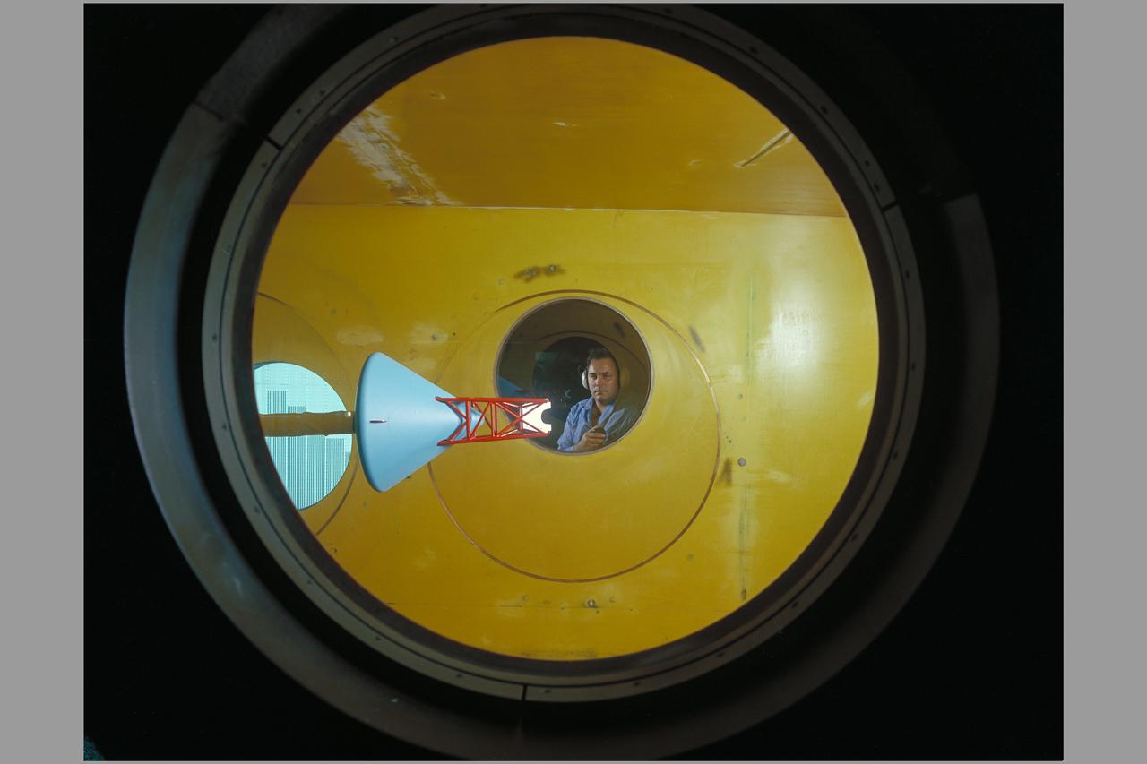
Side view of assembled command module, tower with flap & launch-escape rocket. Apollo FS-2 in 9 x 7 ft. SupersonicWind Tunnel.
S62-05139 (1962) --- View of Mercury Control Center prior to the Mercury-Atlas 8 (MA-8) flight of the Sigma 7. Photo credit: NASA

ISS007-E-12270 (9 August 2003) --- View of a gibbous Moon photographed by an Expedition 7 crewmember onboard the International Space Station (ISS).
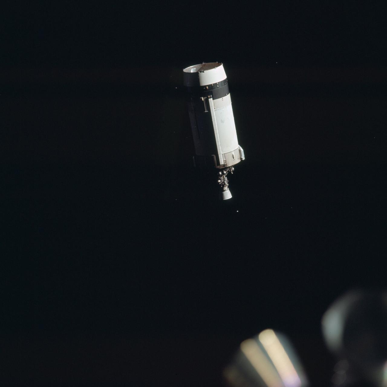
AS17-148-22714 (7-19 Dec. 1972) --- View of the expended Saturn IVB stage before Apollo 17 transposition/docking maneuvers.
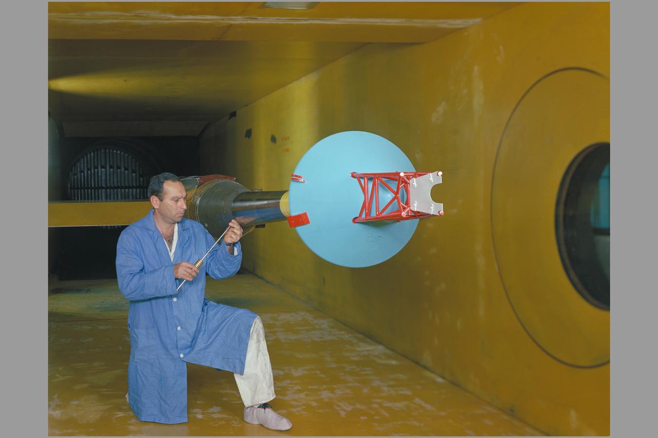
Side view of assembled command module, tower with flap & launch-escape rocket. Apollo FS-2 in 9 x 7 ft. SupersonicWind Tunnel.
STS085-706-051 (7 August 1997) --- This view documenting the release from the Space Shuttle Discovery of Cryogenic Infrared Spectrometers and Telescopes for the Atmosphere-Shuttle Pallet Satellite-2 (CRISTA-SPAS-2) was taken early in the flight (August 7, 1997) over northwest Canada. The viewing direction is east. The swirl of cloud indicates a storm which tracked over Canada during the flight, limiting the topographic photo opportunities for the subsequent several days.
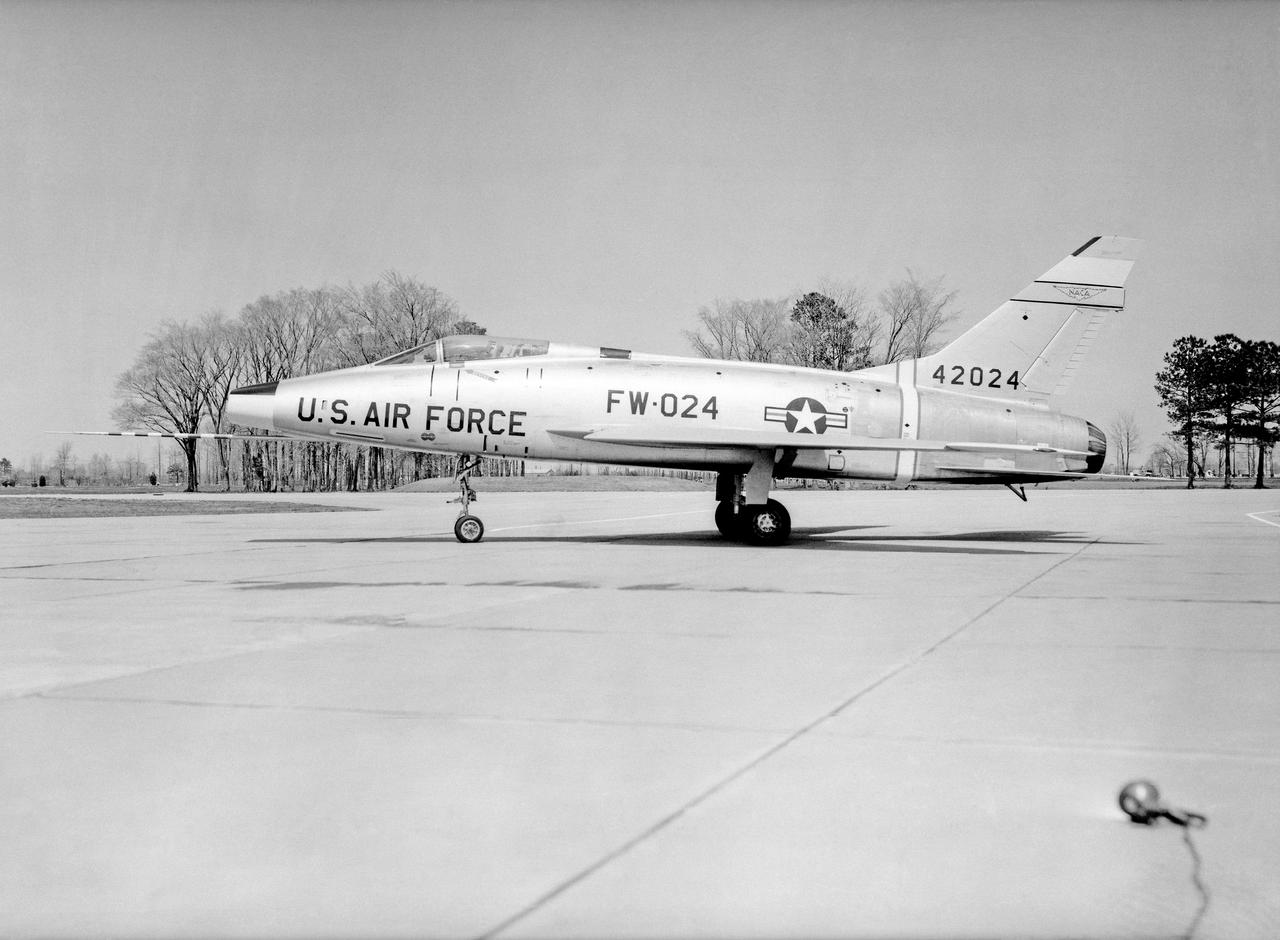
North American F-100 C airplane used in sonic boom investigation at Wallops, October 7, 1958. Photograph published in: A New Dimension Wallops Island Flight Test Range: The First Fifteen Years by Joseph Shortal. A NASA publication. Page 672. -- Aircraft number: NACA 42024. Side view, 3/4 view from front, 3/4 view from rear, rear view, and two front views.
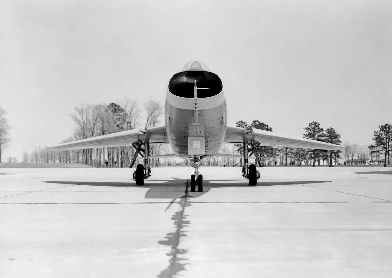
North American F-100 C airplane used in sonic boom investigation at Wallops, October 7, 1958. Photograph published in: A New Dimension Wallops Island Flight Test Range: The First Fifteen Years by Joseph Shortal. A NASA publication. Page 672. -- Aircraft number: NACA 42024. Side view, 3/4 view from front, 3/4 view from rear, rear view, and two front views.
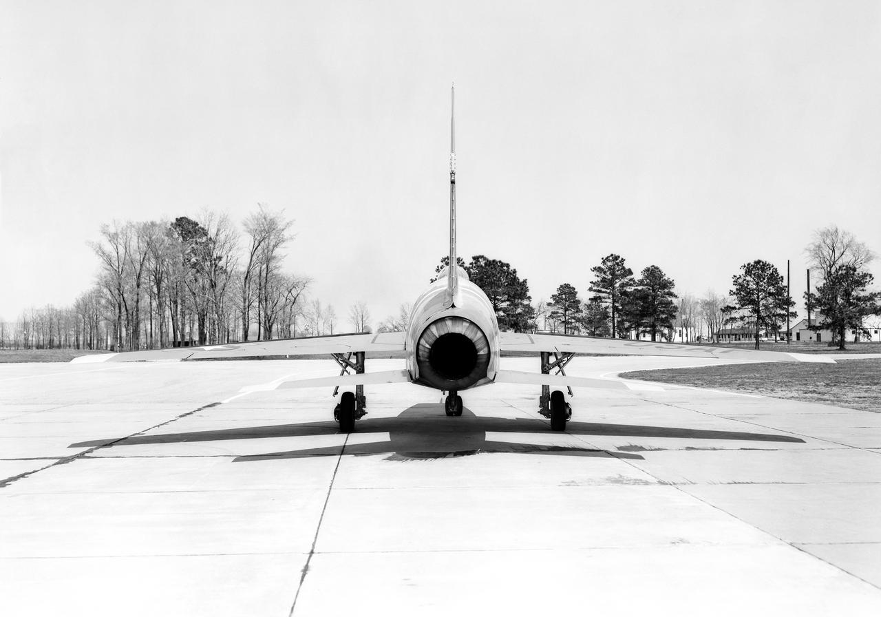
North American F-100 C airplane used in sonic boom investigation at Wallops, October 7, 1958. Photograph published in: A New Dimension Wallops Island Flight Test Range: The First Fifteen Years by Joseph Shortal. A NASA publication. Page 672. -- Aircraft number: NACA 42024. Side view, 3/4 view from front, 3/4 view from rear, rear view, and two front views.
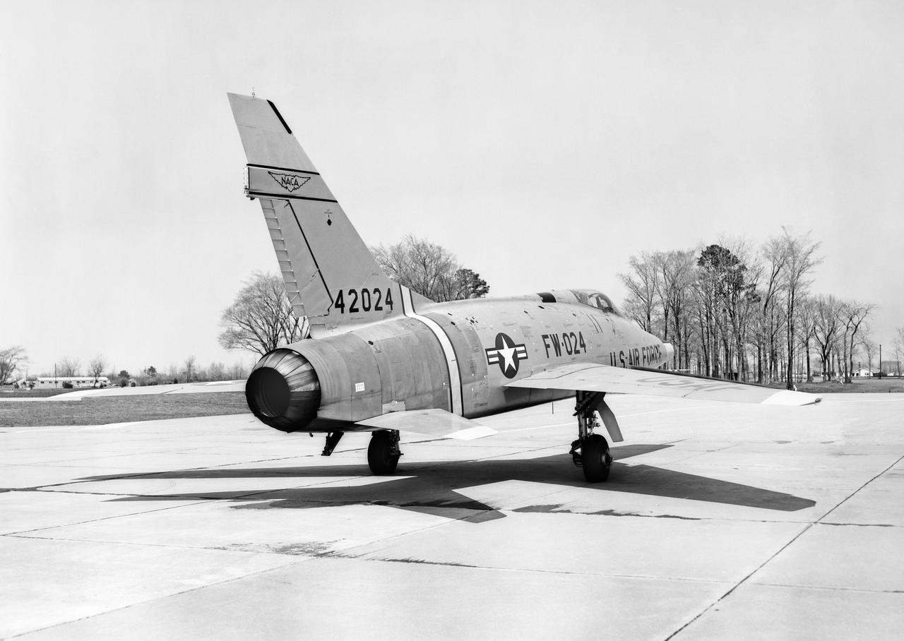
North American F-100 C airplane used in sonic boom investigation at Wallops, October 7, 1958. Photograph published in: A New Dimension Wallops Island Flight Test Range: The First Fifteen Years by Joseph Shortal. A NASA publication. Page 672. -- Aircraft number: NACA 42024. Side view, 3/4 view from front, 3/4 view from rear, rear view, and two front views.
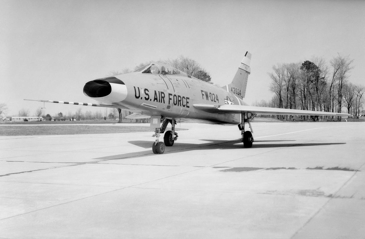
North American F-100 C airplane used in sonic boom investigation at Wallops, October 7, 1958. Photograph published in: A New Dimension Wallops Island Flight Test Range: The First Fifteen Years by Joseph Shortal. A NASA publication. Page 672. -- Aircraft number: NACA 42024. Side view, 3/4 view from front, 3/4 view from rear, rear view, and two front views.
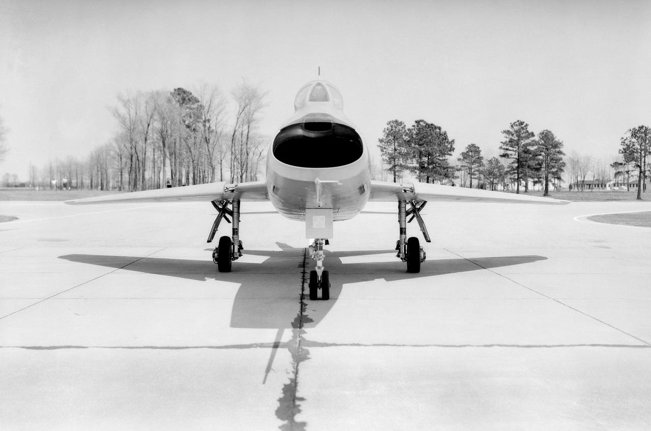
North American F-100 C airplane used in sonic boom investigation at Wallops, October 7, 1958. Photograph published in: A New Dimension Wallops Island Flight Test Range: The First Fifteen Years by Joseph Shortal. A NASA publication. Page 672. -- Aircraft number: NACA 42024. Side view, 3/4 view from front, 3/4 view from rear, rear view, and two front views.
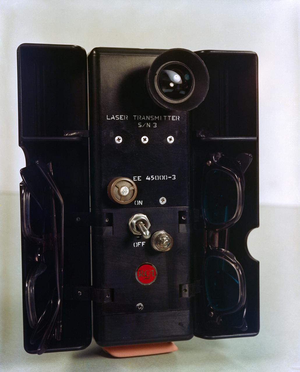
S65-61777 (8 Dec. 1965) --- Close-up view of a laser transmitter unit which is being used for the Gemini-7 Optical Communication (MSC-4) experiment. Astronauts Frank Borman, command pilot; and James A. Lovell Jr., pilot, are now orbiting Earth in NASA's Gemini-7 spacecraft. Photo credit: NASA
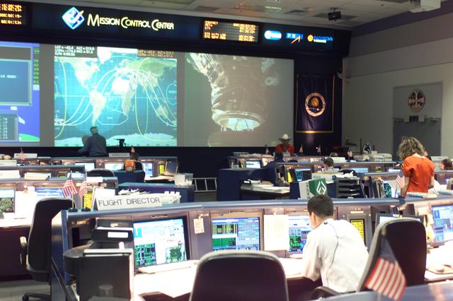
JSC2002-E-23236 (7 June 2002) --- In this overall view of the shuttle flight control room (WFCR) in Houston’s Mission Control Center (MCC), the docking of the Space Shuttle Endeavour and the International Space Station (ISS) is shown on the big screen. The docking occurred at 11:25 a.m. (CDT) on June 7, 2002.
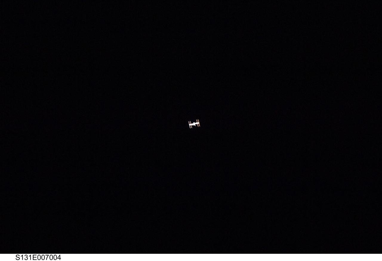
S131-E-007004 (7 April 2010) --- Surrounded by the blackness of space, the International Space Station appears to be very small from the point of view of space shuttle Discovery as the shuttle approaches the station during STS-131 rendezvous and docking operations. Docking occurred at 2:44 a.m. (CDT) on April 7, 2010.
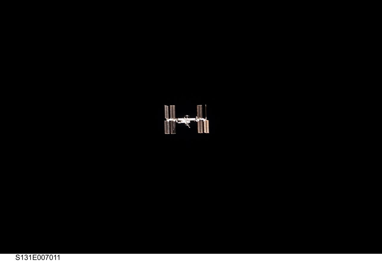
S131-E-007011 (7 April 2010) --- Surrounded by the blackness of space, the International Space Station appears to be very small from the point of view of space shuttle Discovery as the shuttle approaches the station during STS-131 rendezvous and docking operations. Docking occurred at 2:44 a.m. (CDT) on April 7, 2010.
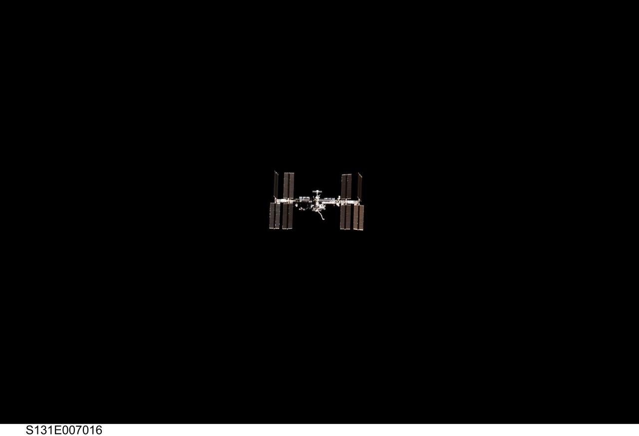
S131-E-007016 (7 April 2010) --- Surrounded by the blackness of space, the International Space Station appears to be very small from the point of view of space shuttle Discovery as the shuttle approaches the station during STS-131 rendezvous and docking operations. Docking occurred at 2:44 a.m. (CDT) on April 7, 2010.

ISS040-E-050750 (7 July 2014) --- One of the Expedition 40 crew members aboard the International Space Station photographed a series of images of Typhoon Neoguri in the vicinity of Japan and Taiwan on July 7, 2014. This oblique 35mm focal length view was photographed at 07:41:29 GMT.
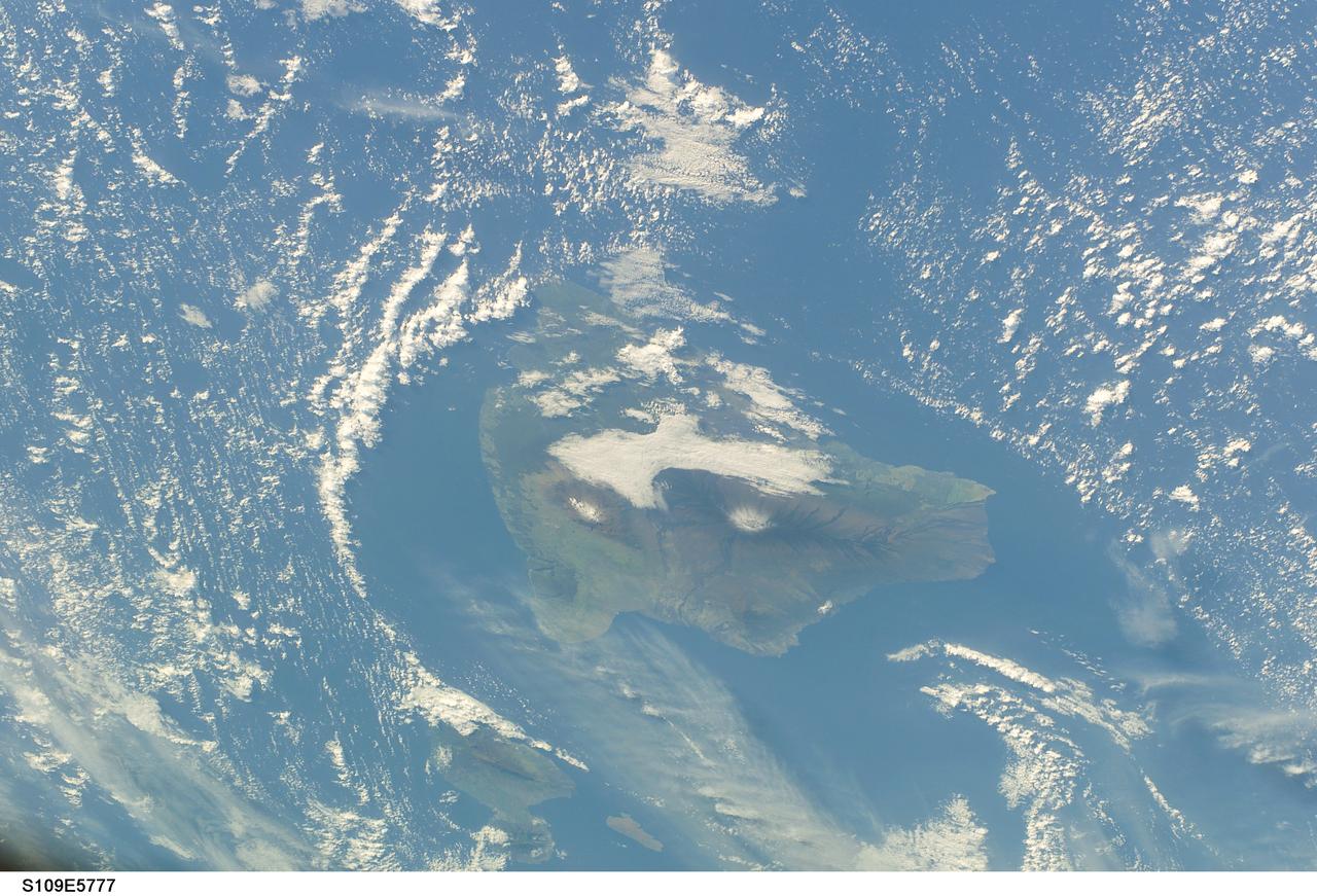
STS109-E-5777 (7 March 2002) --- The main island of Hawaii is at frame center of this digital still camera's view recorded from the Space Shuttle Columbia during flight day 7. Maui (left) and Kahoolawe can be seen at bottom center.
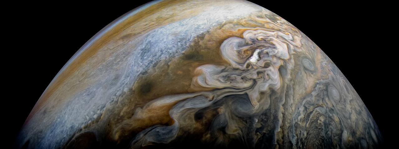
See swirling cloud formations in the northern area of Jupiter's north temperate belt in this new view taken by NASA's Juno spacecraft. The color-enhanced image was taken on Feb. 7 at 5:42 a.m. PST (8:42 a.m. EST), as Juno performed its eleventh close flyby of Jupiter. At the time the image was taken, the spacecraft was about 5,086 miles (8,186 kilometers) from the tops of the clouds of the planet at a latitude of 39.9 degrees. Citizen scientist Kevin M. Gill processed this image using data from the JunoCam imager. https://photojournal.jpl.nasa.gov/catalog/PIA21978 . - Enhanced image by Kevin M. Gill (CC-BY) based on images provided courtesy of NASA/JPL-Caltech/SwRI/MSSS

S65-63171 (15 Dec. 1965) --- The Gemini-7 spacecraft as seen from the Gemini-6 spacecraft during their rendezvous mission in space. Photo credit: NASA or National Aeronautics and Space Administration
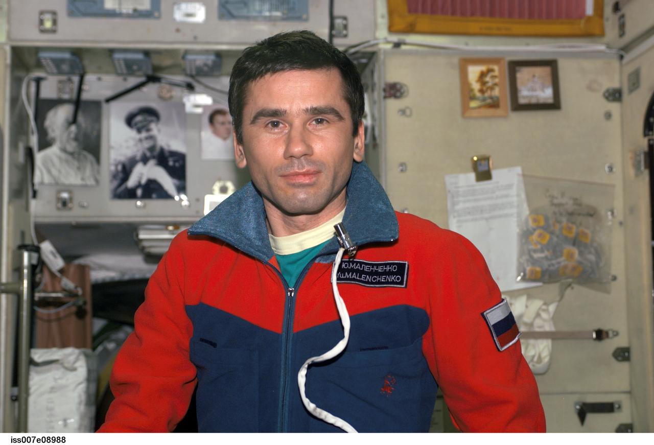
ISS007-E-08988 (1 July 2003) --- Cosmonaut Yuri I. Malenchenko, Expedition 7 mission commander, is pictured in the Zvezda Service Module of the International Space Station (ISS). The photo was taken by NASA ISS Science Officer and Flight Engineer Edward T. Lu, who was celebrating a birthday at the time.
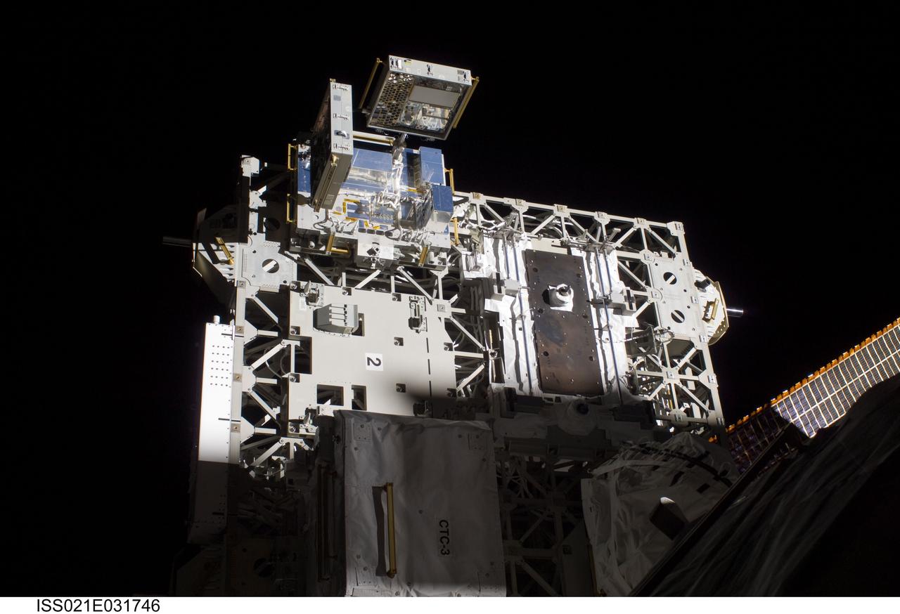
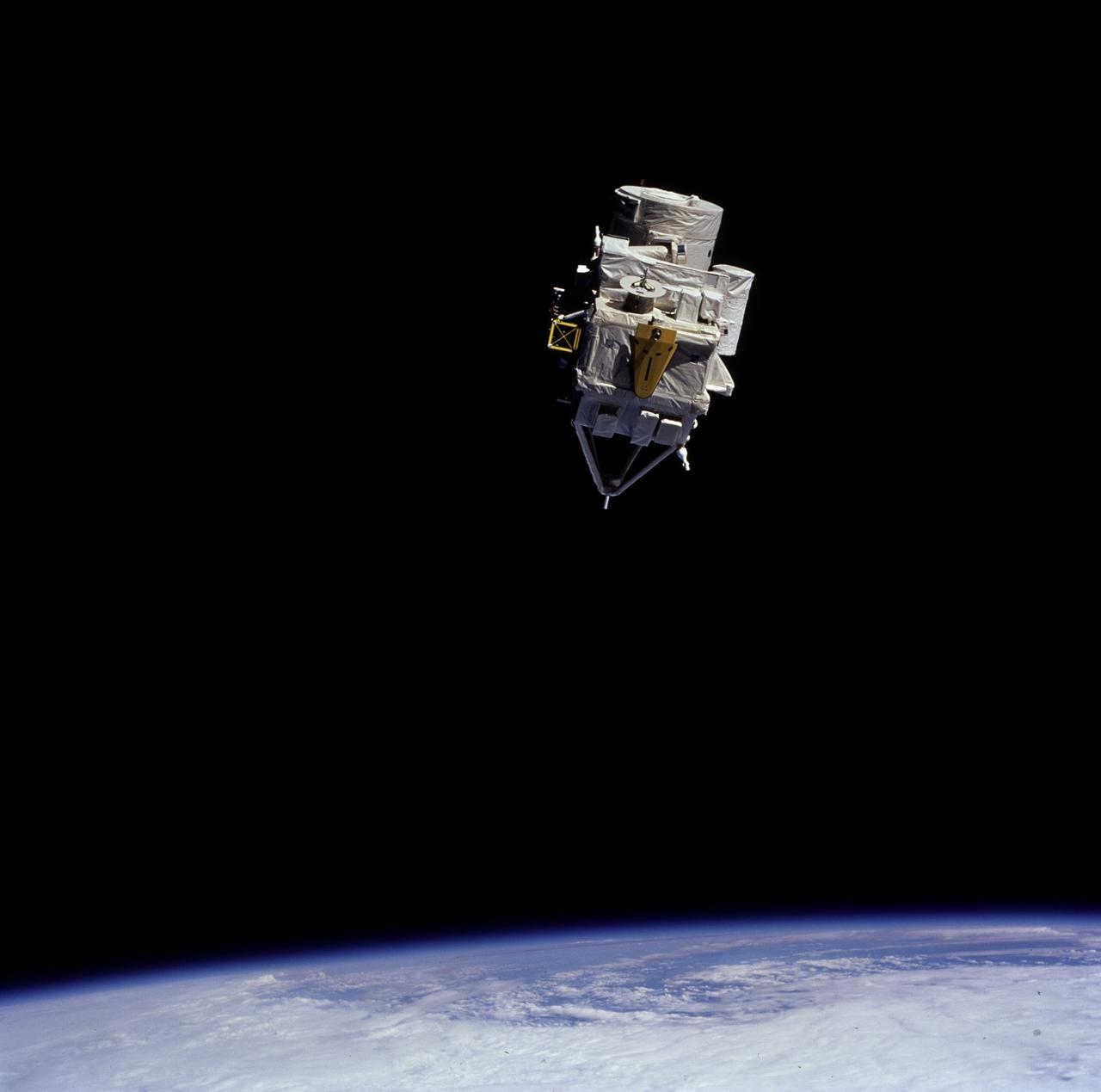
ISS021-E-031746 (23 Nov. 2009) --- The MISSE 7 experiment on the Express Logistics Carrier 2 of the International Space Station was photographed by a space-walking STS-129 astronaut during the mission's third and final session of extravehicular activity (EVA). This is the latest in a series of experiments that expose materials and composite samples to space for several months before they are returned for experts to analyze. This MISSE experiment actually is plugged into the space station’s power supply.

S65-63198 (15 Dec. 1965) --- The Gemini-7 spacecraft as seen from the Gemini-6 spacecraft during their rendezvous mission in space. They are approximately 39 feet apart. Photo credit: NASA or National Aeronautics and Space Administration

S65-63113 (15 Dec. 1965) --- This photograph of the Gemini-7 spacecraft was taken from the hatch window of the Gemini-6 spacecraft during rendezvous and station keeping maneuvers at an altitude of approximately 160 miles on Dec. 15, 1965. Photo credit: NASA or National Aeronautics and Space Administration
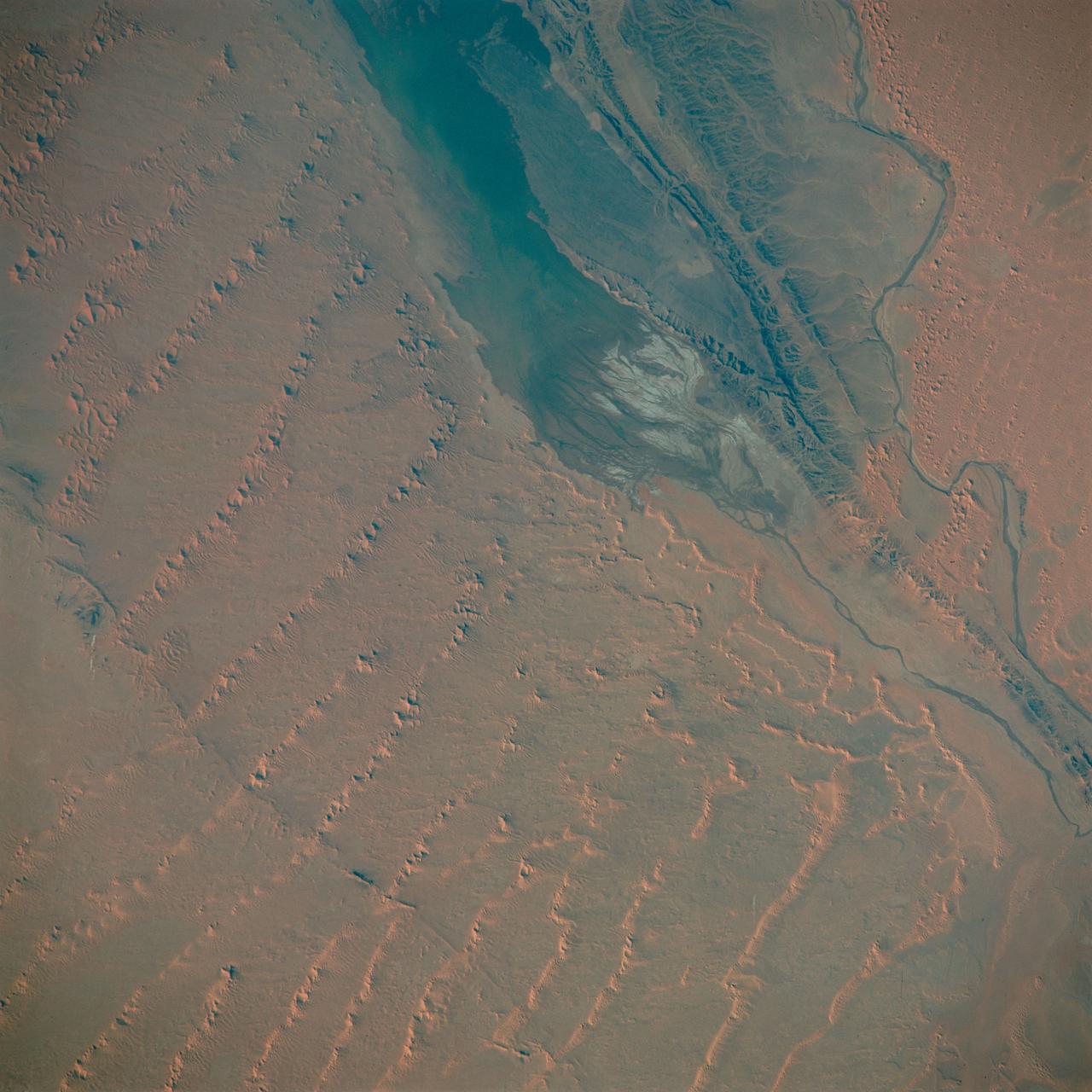
S65-63830 (5 Dec. 1965) --- Algeria, south-southeast of the Colomb Bechar area, as seen from the National Aeronautics and Space Administration's Gemini-7 spacecraft. Sand dunes are 200 to 300 feet high in the Grand Erg Occidental area. The Quod Sacura River can be seen in the upper left corner. The white spot in the middle of the picture is the Sebcha el Malah salt beds. It should be noted that the area had just experienced very heavy rains (first in many years) and the stream and salt flat are inundated. This photograph was taken with a modified 70mm Hasselblad camera, with Eastman Kodak, Ektachrome MS (S.O. 217) color film. Photo credit: NASA

S65-63220 (15 Dec. 1965) --- This photograph of the Gemini-Titan 7 (GT-7) spacecraft was taken from the Gemini-Titan 6 (GT-6) spacecraft during the historic rendezvous of the two spacecraft on Dec. 15, 1965. The two spacecraft are some 37 feet apart here. Earth can be seen below. Astronauts Walter M. Schirra Jr., command pilot; and Thomas P. Stafford, pilot, were inside the GT-6 spacecraft, while crewmen for the GT-7 mission were astronauts Frank Borman, command pilot, and James A. Lovell Jr., pilot. Photo credit: NASA or National Aeronautics and Space Administration
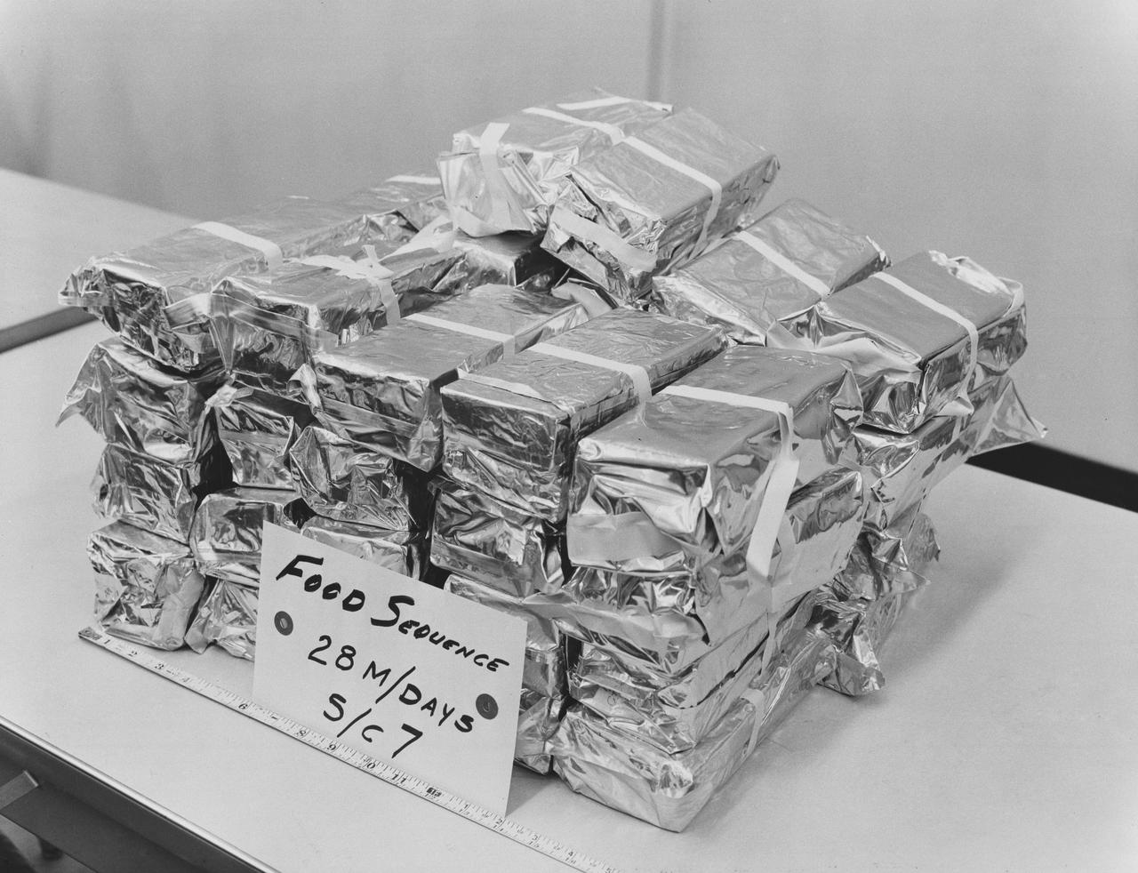
S65-61653 (1 Dec. 1965) --- Complete food supply for the two-man crew of the National Aeronautics and Space Administration's Gemini-7 spaceflight as it appears prior to stowage in the spacecraft. The food packages are tied in sequence for 28-manned days or a complete supply for two men for a 14-day mission. Photo credit: NASA
NASA's Juno spacecraft captured this view of Jupiter during the mission's 54th close flyby of the giant planet on Sept. 7, 2023. The colorful zones and belts in Jupiter's atmosphere run from the cloud tops down to approximately 1,860 miles (3,000 kilometers). Citizen scientist Tanya Oleksuik made this image using raw data from the JunoCam instrument, processing the data to enhance details in cloud features and colors. At the time the raw image was taken, the Juno spacecraft was about 52,400 miles (about 84,400 kilometers) above Jupiter's cloud tops. https://photojournal.jpl.nasa.gov/catalog/PIA26077
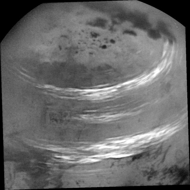
NASA's Cassini spacecraft captured this view of bands of bright, feathery methane clouds drifting across Saturn's moon Titan on May 7, 2017. The view was obtained during a distant (non-targeted) flyby, during which Cassini passed 303,000 miles (488,000 kilometers) above the moon's surface. Although Cassini will have no further close, targeted flybys of Titan, the spacecraft continues to observe the giant moon and its atmosphere from a distance. The dark regions at top are Titan's hydrocarbon lakes and seas. The image was taken on May 7, 2017, at a distance of 316,000 miles (508,000 kilometers). The view is an orthographic projection centered on 57 degrees north latitude, 48 degrees west longitude. An orthographic view is most like the view seen by a distant observer. Image scale is about 2 miles (3 kilometers) per pixel. The Cassini mission is a cooperative project of NASA, ESA (the European Space Agen https://photojournal.jpl.nasa.gov/catalog/PIA21450
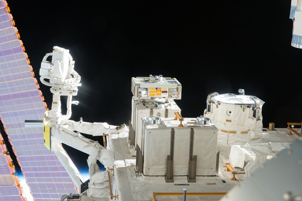
iss048e025920 (7/13/2016) --- View of the JEM (Japanese Experiment Module) Exposed Facility (JEF) taken through a window in the Kibo Japanese Experiment Pressurized Module (JPM). An Exposed Experiment Handrail Attachment Mechanism (ExHAM) and a Exposed Facility Unit (EFU) is in view.
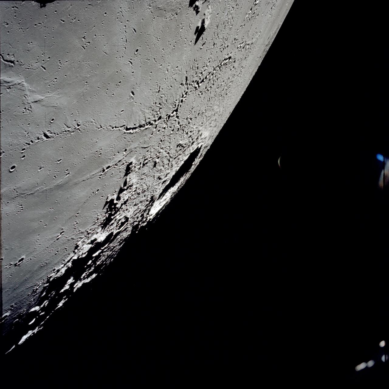
AS17-145-22287 (7-19 Dec. 1972) --- An oblique view of the large crater Copernicus on the lunar nearside, as photographed from the Apollo 17 spacecraft in lunar orbit. This view is looking generally southwest toward the crater on the horizon. The coordinates of the center of Copernicus are approximately 20 degrees west longitude and 9.5 degrees north latitude.
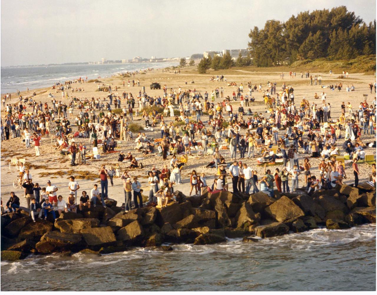
At Jetty Park in Port Canaveral, a crowd of approximately 6,000 gathered to view the 7 a.m. space shuttle launch. Many people spent the night at the Brevard County park, equipped with cameras, lawn chairs, and coolers. Jetty Park, south of the space center, was one of the best viewing sites in the county.

Stunning views like this image of Saturn's night side are only possible thanks to our robotic emissaries like Cassini. Until future missions are sent to Saturn, Cassini's image-rich legacy must suffice. Because Earth is closer to the Sun than Saturn, observers on Earth only see Saturn's day side. With spacecraft, we can capture views (and data) that are simply not possible from Earth, even with the largest telescopes. This view looks toward the sunlit side of the rings from about 7 degrees above the ring plane. The image was taken in visible light with the wide-angle camera on NASA's Cassini spacecraft on June 7, 2017. The view was obtained at a distance of approximately 751,000 miles (1.21 million kilometers) from Saturn. Image scale is 45 miles (72 kilometers) per pixel. The Cassini spacecraft ended its mission on Sept. 15, 2017. https://photojournal.jpl.nasa.gov/catalog/PIA21350
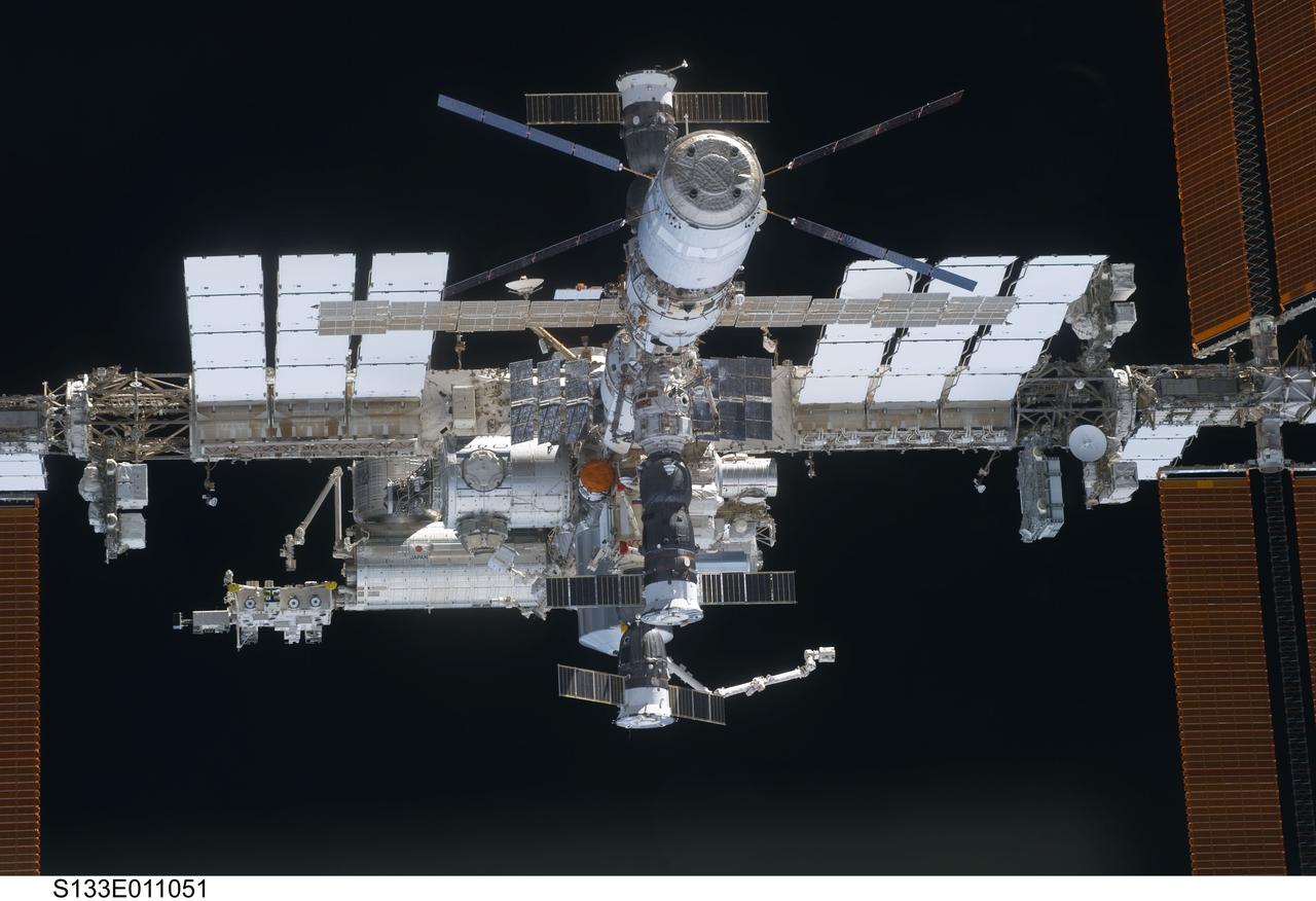
S133-E-011051 (7 March 2011) --- A close-up view of the International Space Station is featured in this image photographed by an STS-133 crew member on space shuttle Discovery after the station and shuttle began their post-undocking relative separation. Undocking of the two spacecraft occurred at 7 a.m. (EST) on March 7, 2011. Discovery spent eight days, 16 hours, and 46 minutes attached to the orbiting laboratory. Photo credit: NASA or National Aeronautics and Space Administration
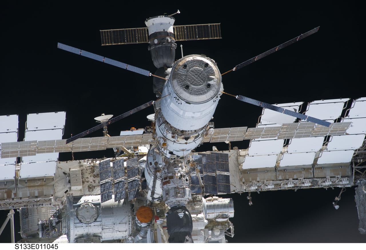
S133-E-011045 (7 March 2011) --- A close-up view of the aft section of the International Space Station is featured in this image photographed by an STS-133 crew member on space shuttle Discovery after the station and shuttle began their post-undocking relative separation. Undocking of the two spacecraft occurred at 7 a.m. (EST) on March 7, 2011. Discovery spent eight days, 16 hours, and 46 minutes attached to the orbiting laboratory. Photo credit: NASA or National Aeronautics and Space Administration

S133-E-010583 (7 March 2011) --- A close-up view of the International Space Station is featured in this image photographed by an STS-133 crew member on space shuttle Discovery after the station and shuttle began their post-undocking relative separation. Undocking of the two spacecraft occurred at 7 a.m. (EST) on March 7, 2011. Discovery spent eight days, 16 hours, and 46 minutes attached to the orbiting laboratory. Photo credit: NASA or National Aeronautics and Space Administration
S84-26503 (7 Feb 1984) --- This wide angle, overall view of activity in the mission operations control room in the Johnson Space Center?s mission control center, was photographed during the first even non-tethered extravehicular activity (EVA) in space. The large MOCR monitor and those at individual consoles feed to ground controllers the spectacular scene of Astronaut Bruce McCandless II ?suspended? I space above the blue and white Earth. The scene was photographed at 7:30 a.m. (CST), February 7, 1984.

Attendees view exhibits and listen to speakers during NASA’s Science Day on the Hill event, Wednesday, June 7, 2023, at the Rayburn House Office Building in Washington. Photo Credit: (NASA/Joel Kowsky)