
Mariner 9 View of Arsia Silva

Mariner 9 views of shield volcano
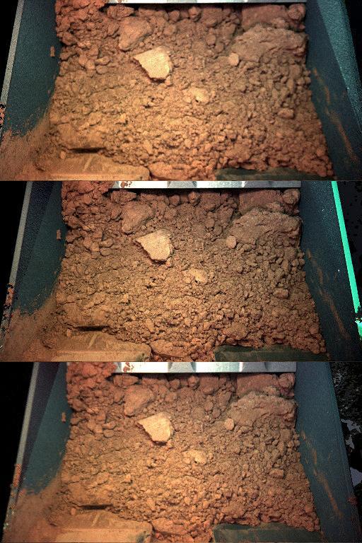
Color Views of Soil Scooped on Sol 9

South Pole as viewed by Mariner 9 on Mars Approach
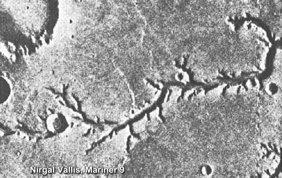
This view of channels on Mars came from NASA Mariner 9 orbiter. In 1971, Mariner 9 became the first spacecraft to enter orbit around Mars.

Mariner 9 views Canyon System emerging from Martian Dust Storm

Mariner 9 views Olympus Mons standing above the Martian Dust Storm
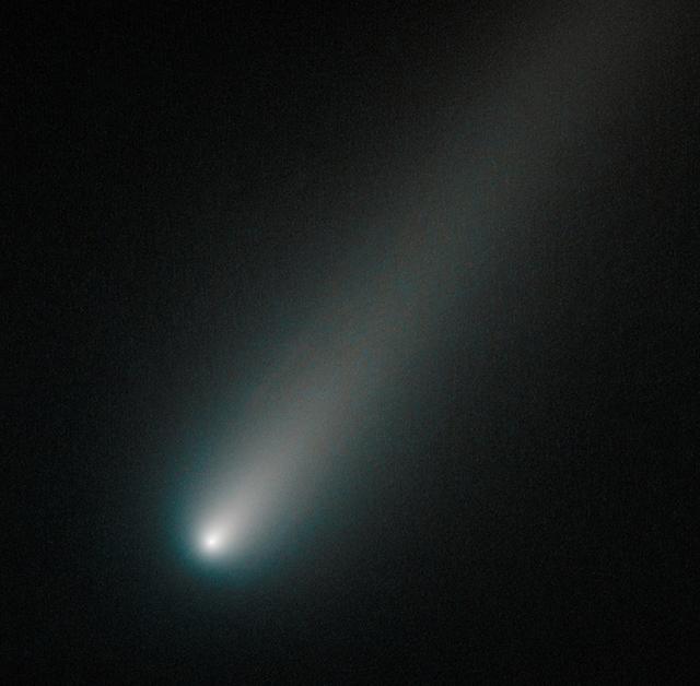
On Oct. 9, 2013, Hubble observed comet ISON once again, when it was inside the orbit of Mars, about 177 million miles from Earth. This image shows that the comet was still intact despite some predictions that the fragile icy nucleus might disintegrate closer to the sun. The comet will pass closest to the sun on Nov. 28, 2013. If the nucleus had broke apart then Hubble would have likely seen evidence of multiple fragments. Moreover, the coma, or head, surrounding the comet's nucleus is symmetric and smooth. This would probably not be the case if clusters of smaller fragments were flying along. This color composite image was assembled using two filters. The comet's coma appears cyan, a greenish-blue color due to gas, while the tail is reddish due to dust streaming off the nucleus. The tail forms as dust particles are pushed away from the nucleus by the pressure of sunlight. Credit: NASA -------- More details on Comet ISON: Comet ISON began its trip from the Oort cloud region of our solar system and is now travelling toward the sun. The comet will reach its closest approach to the sun on Thanksgiving Day -- 28 Nov 2013 -- skimming just 730,000 miles above the sun's surface. If it comes around the sun without breaking up, the comet will be visible in the Northern Hemisphere with the naked eye, and from what we see now, ISON is predicted to be a particularly bright and beautiful comet. Catalogued as C/2012 S1, Comet ISON was first spotted 585 million miles away in September 2012. This is ISON's very first trip around the sun, which means it is still made of pristine matter from the earliest days of the solar system’s formation, its top layers never having been lost by a trip near the sun. Comet ISON is, like all comets, a dirty snowball made up of dust and frozen gases like water, ammonia, methane and carbon dioxide -- some of the fundamental building blocks that scientists believe led to the formation of the planets 4.5 billion years ago. NASA has been using a vast fleet of spacecraft, instruments, and space- and Earth-based telescope, in order to learn more about this time capsule from when the solar system first formed. The journey along the way for such a sun-grazing comet can be dangerous. A giant ejection of solar material from the sun could rip its tail off. Before it reaches Mars -- at some 230 million miles away from the sun -- the radiation of the sun begins to boil its water, the first step toward breaking apart. And, if it survives all this, the intense radiation and pressure as it flies near the surface of the sun could destroy it altogether. This collection of images show ISON throughout that journey, as scientists watched to see whether the comet would break up or remain intact. The comet reaches its closest approach to the sun on Thanksgiving Day -- Nov. 28, 2013 -- skimming just 730,000 miles above the sun’s surface. If it comes around the sun without breaking up, the comet will be visible in the Northern Hemisphere with the naked eye, and from what we see now, ISON is predicted to be a particularly bright and beautiful comet. ISON stands for International Scientific Optical Network, a group of observatories in ten countries who have organized to detect, monitor, and track objects in space. ISON is managed by the Keldysh Institute of Applied Mathematics, part of the Russian Academy of Sciences. <b><a href="http://www.nasa.gov/audience/formedia/features/MP_Photo_Guidelines.html" rel="nofollow">NASA image use policy.</a></b> <b><a href="http://www.nasa.gov/centers/goddard/home/index.html" rel="nofollow">NASA Goddard Space Flight Center</a></b> enables NASA’s mission through four scientific endeavors: Earth Science, Heliophysics, Solar System Exploration, and Astrophysics. Goddard plays a leading role in NASA’s accomplishments by contributing compelling scientific knowledge to advance the Agency’s mission. <b>Follow us on <a href="http://twitter.com/NASA_GoddardPix" rel="nofollow">Twitter</a></b> <b>Like us on <a href="http://www.facebook.com/pages/Greenbelt-MD/NASA-Goddard/39501</b>
![Oblique view of the crater complex near Ascraeus Lacus in the Tharsis region of Mars was taken by Mariner 9. It is the northernmost of the prominent dark spots observed by Mariner during its approach to the planet. The spot consists of several intersecting shallow crater-like depressions. The main crater is approximately 21 kilometers (13 miles) across, the whole complex about 40 kilometers (25 miles) across. The crater probably is in a relatively high area of the Martian surface, which accounts for its being visible above the dust storm. The faint circular features outside the crater are probably atmospheric. Mariner 9 was the first spacecraft to orbit another planet. The spacecraft was designed to continue the atmospheric studies begun by Mariners 6 and 7, and to map over 70% of the Martian surface from the lowest altitude (1500 kilometers [900 miles]) and at the highest resolutions (1 kilometer per pixel to 100 meters per pixel) of any previous Mars mission. Mariner 9 was launched on May 30, 1971 and arrived on November 14, 1971. http://photojournal.jpl.nasa.gov/catalog/PIA03100](https://images-assets.nasa.gov/image/PIA03100/PIA03100~medium.jpg)
Oblique view of the crater complex near Ascraeus Lacus in the Tharsis region of Mars was taken by Mariner 9. It is the northernmost of the prominent dark spots observed by Mariner during its approach to the planet. The spot consists of several intersecting shallow crater-like depressions. The main crater is approximately 21 kilometers (13 miles) across, the whole complex about 40 kilometers (25 miles) across. The crater probably is in a relatively high area of the Martian surface, which accounts for its being visible above the dust storm. The faint circular features outside the crater are probably atmospheric. Mariner 9 was the first spacecraft to orbit another planet. The spacecraft was designed to continue the atmospheric studies begun by Mariners 6 and 7, and to map over 70% of the Martian surface from the lowest altitude (1500 kilometers [900 miles]) and at the highest resolutions (1 kilometer per pixel to 100 meters per pixel) of any previous Mars mission. Mariner 9 was launched on May 30, 1971 and arrived on November 14, 1971. http://photojournal.jpl.nasa.gov/catalog/PIA03100

S63-06443 (15-16 May 1963) --- A northwest-looking view across Pakistan, eastern Iran and Afghanistan as photographed from the Mercury-Atlas 9 (MA-9) capsule by astronaut L. Gordon Cooper Jr., during his 22-orbit MA-9 spaceflight. Photo credit: NASA
S63-06445 (15-16 May 1963) --- View of the Himalaya Mountain Range in the India-Nepal-Tibet border area, as photographed from the Mercury-Atlas 9 capsule by astronaut L. Gordon Cooper Jr., during his 22-orbit MA-9 spaceflight. Photo credit: NASA
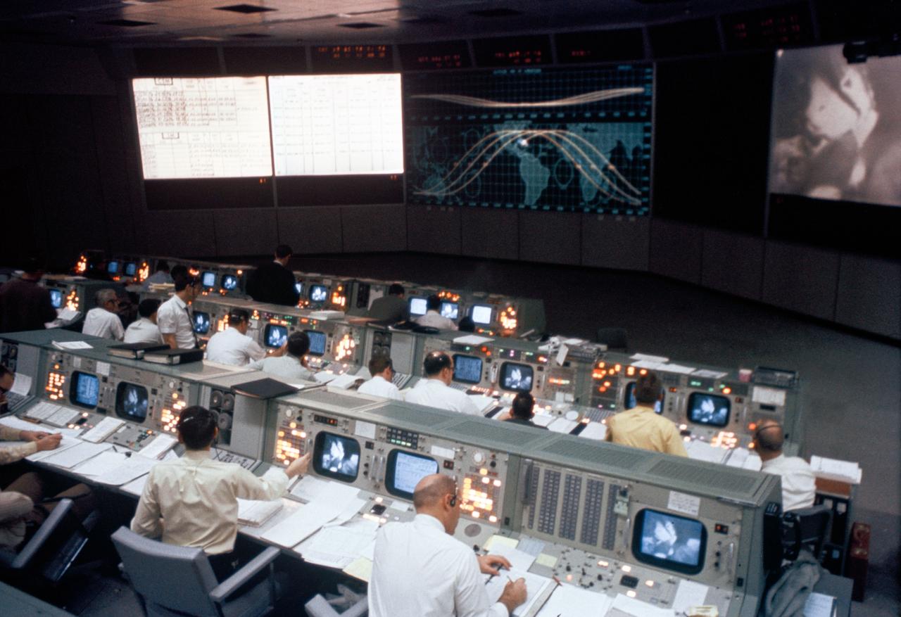
S69-26301 (March 1969) --- Overall view of the Mission Operations Control Room in the Mission Control Center, Building 30, during the Apollo 9 Earth-orbital mission. When this photograph was taken a live television transmission was being received from Apollo 9 as it orbited Earth.
AS09-22-3463 (9 March 1969) --- Oblique view of the Houston, Texas area as photographed from the Apollo 9 spacecraft during its Earth-orbital mission. This picture was taken from an altitude of 103 nautical miles, at about 1:40 p.m. (CST), on March 9, 1969. Prominent features visible include highways leading out of the city, Lake Houston, San Jacinto River, Trinity Bay, Galveston Bay, Brazos River, Baytown, and Texas City.
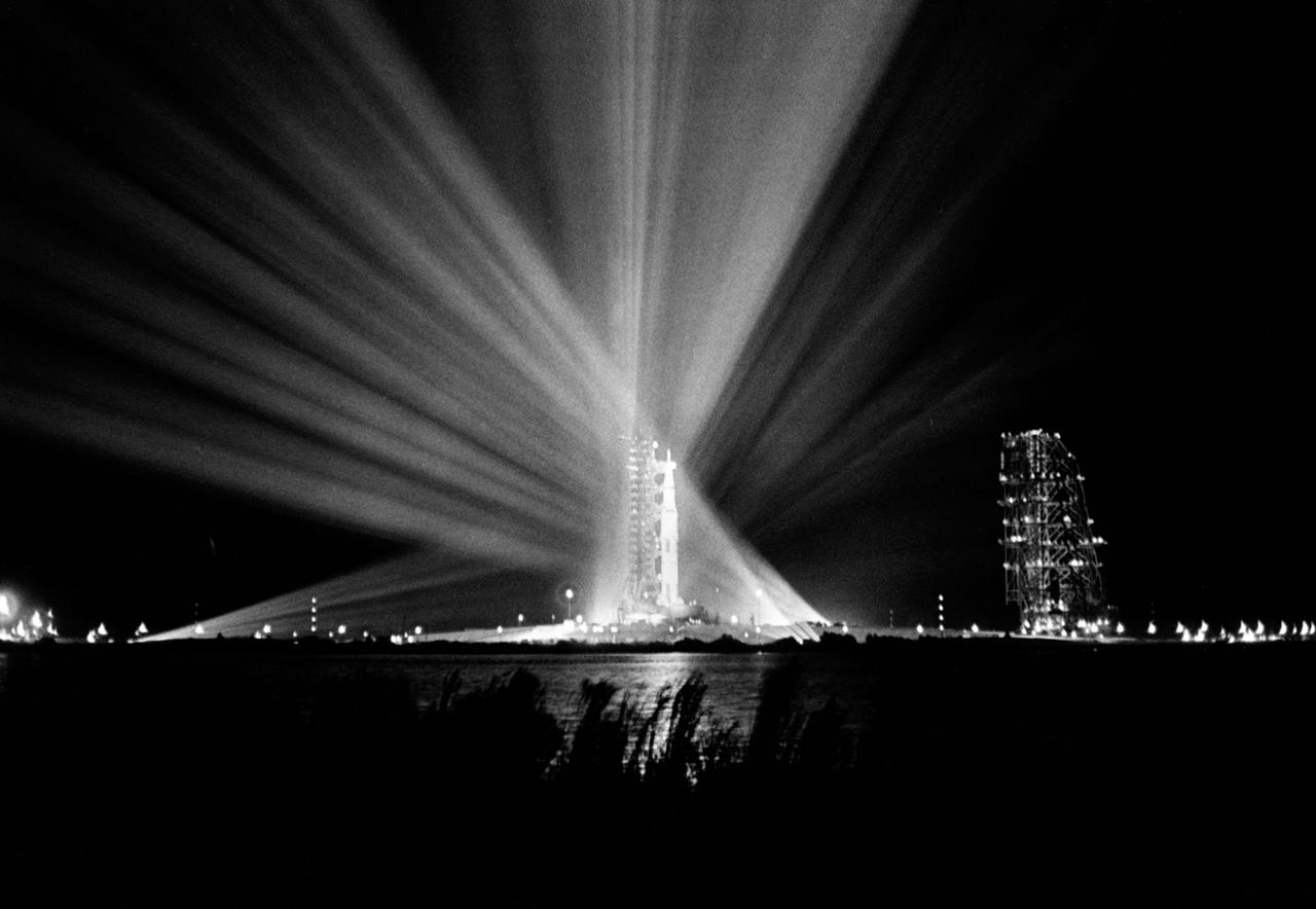
S69-25879 (23 Feb. 1969) --- Nighttime view of the 363-feet-high Apollo 9 space vehicle at Pad A, Launch Complex 39, Kennedy Space Center, during preparations for the scheduled 10-day Earth-orbital space mission. The crew of the Apollo 9 (Spacecraft 104/Lunar Module 3/Saturn 504) space flight will be astronauts James A. McDivitt, David R. Scott, and Russell L. Schweickart.

AS09-20-3064 (6 March 1969) --- Excellent view of the docked Apollo 9 Command and Service Modules (CSM) and Lunar Module (LM), with Earth in the background, during astronaut David R. Scott's stand-up extravehicular activity (EVA), on the fourth day of the Apollo 9 Earth-orbital mission. Scott, command module pilot, is standing in the open hatch of the Command Module (CM). Astronaut Russell L. Schweickart, lunar module pilot, took this photograph of Scott from the porch of the LM. Inside the LM was astronaut James A. McDivitt, Apollo 9 commander.
AS09-23-3566 (3-13 March 1969) --- Near vertical view of the Birmingham, Alabama area extending to Gadeden, as photographed from the Apollo 9 spacecraft during its Earth-orbital mission. The city spreads out between ridges of the folded southern Appalachian Mountains. The major stream in the picture is the Coosa River.
AS09-22-3441 (March 1969) --- Near vertical view of the Phoenix, Arizona area as photographed from the Apollo 9 spacecraft during its Earth-orbital mission. Farmland patterns checkerboard the area along the Gila River. Phoenix is located right of center near the clouds.

This trio of NASA Junocam views of Earth was taken during Juno close flyby on October 9, 2013.
AS09-22-3374 (March 1969) --- Near vertical view of thunderhead over South America as photographed from the Apollo 9 spacecraft during its Earth-orbital mission.
S63-06434 (15-16 May 1963) --- East looking view across Atlantic waters toward Africa, showing Mauritania and Spanish Sahara photographed from the Mercury-Atlas 9 (MA-9) capsule by astronaut L. Gordon Cooper Jr., during his 22-orbit MA-9 spaceflight. Photo credit: NASA
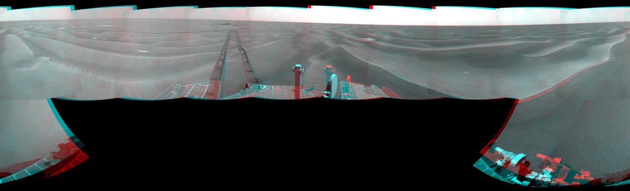
NASA Mars Exploration Rover Opportunity used its navigation camera to take the images combined into this stereo 180-degree view on March 7-9, 2009. 3D glasses are necessary to view this image.

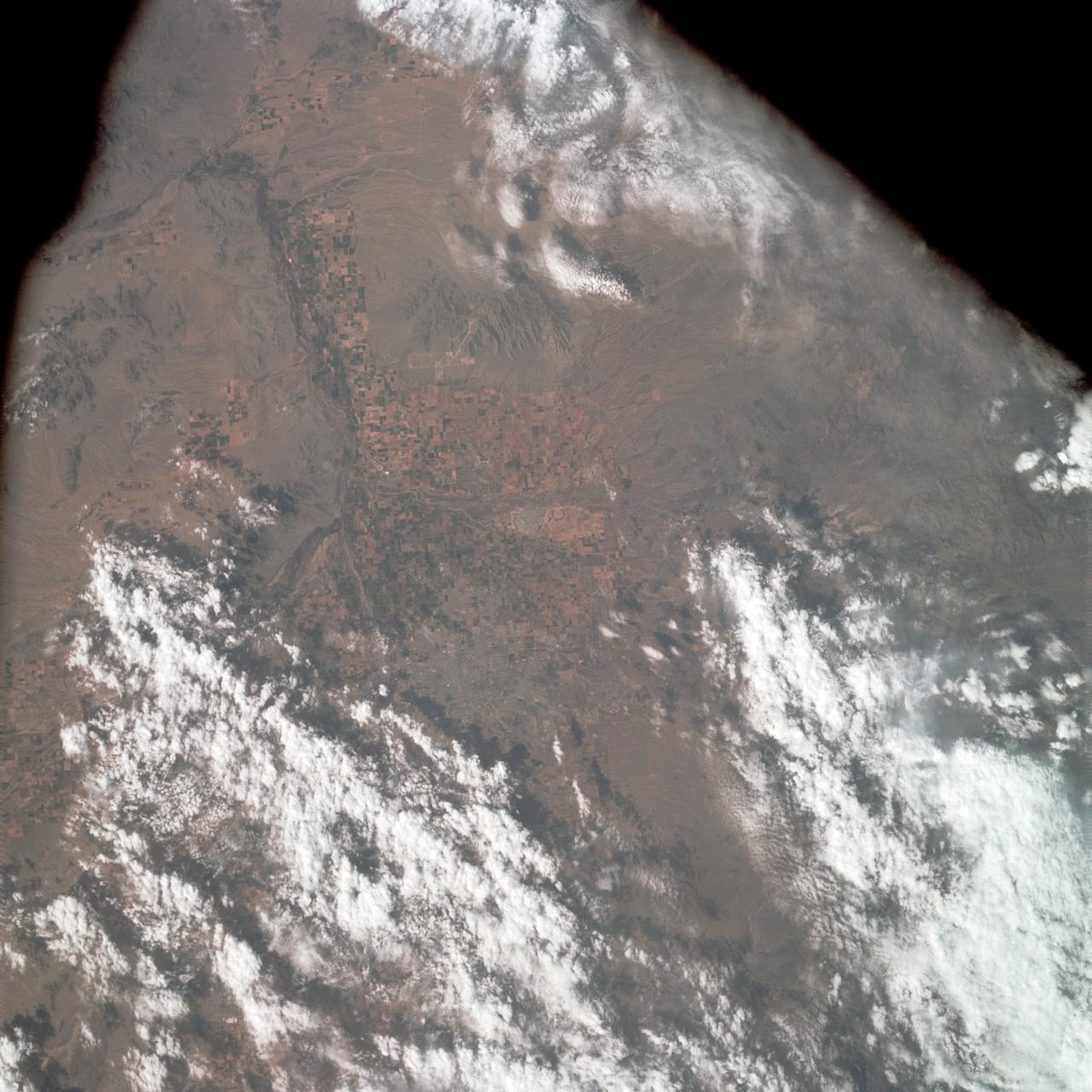
These images from NASA Terra satellite eastern China compare a somewhat hazy summer view from July 9, 2000 left with a spectacularly dusty spring view from April 7, 2001 middle.
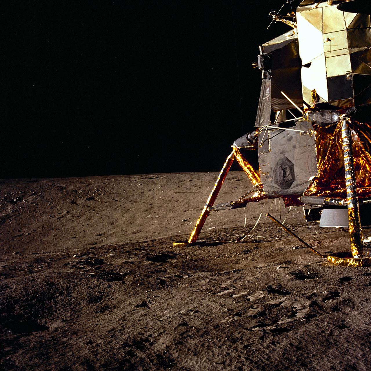
The second manned lunar landing mission, Apollo 12, launched from launch pad 39-A at Kennedy Space Center in Florida on November 14, 1969 via a Saturn V launch vehicle. The Saturn V vehicle was developed by the Marshall Space Flight Center (MSFC) under the direction of Dr. Wernher von Braun. Aboard Apollo 12 was a crew of three astronauts: Alan L. Bean, pilot of the Lunar Module (LM), Intrepid; Richard Gordon, pilot of the Command Module (CM), Yankee Clipper; and Spacecraft Commander Charles Conrad. The LM, Intrepid, landed astronauts Conrad and Bean on the lunar surface in what’s known as the Ocean of Storms while astronaut Richard Gordon piloted the CM, Yankee Clipper, in a parking orbit around the Moon. Lunar soil activities included the deployment of the Apollo Lunar Surface Experiments Package (ALSEP), finding the unmanned Surveyor 3 that landed on the Moon on April 19, 1967, and collecting 75 pounds (34 kilograms) of rock samples. This is the ninth of 25 images captured by the crew in attempt to provide a 360 degree Lunar surface scene. Apollo 12 safely returned to Earth on November 24, 1969.
S69-25884 (23 Feb. 1969) --- Interior view of the white room atop Pad A, Launch Complex 39, Kennedy Space Center, during Apollo 9 Countdown Demonstration Test activity. Standing next to spacecraft hatch is astronaut James A. McDivitt, commander. Also, taking part in the training exercise were astronauts David R. Scott, command module pilot; and Russell L. Schweickart, lunar module pilot. The Apollo 9 mission will evaluate spacecraft lunar module systems performance during manned Earth-orbital flight. Apollo 9 will be the second manned Saturn V mission.
This enhanced image, taken by the framing camera instrument aboard NASA Dawn spacecraft on July 9, 2011, views the south polar region of this giant asteroid.
This close-up view of comet Hartley 2 was taken as NASA EPOXI mission approached the comet at 6:59 a.m. PDT 9:59 a.m. EDT.
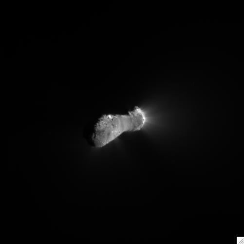
This close-up view of comet Hartley 2 was taken as NASA EPOXI mission approached the comet at 6:58 a.m. PDT 9:58 a.m. EDT.
AS09-23-3561 (3-13 March 1969) --- Near vertical view of the Lubbock area in west Texas as photographed from the Apollo 9 spacecraft during its Earth-orbital mission. Conspicuous patterns of farmland surround the city and extend eastward (up) to the Caprock Escarpment. The Double Mountain fork of the Brazos River drains east (toward upper center); Leeland is at lower center; Brownfield at lower right. The sharp edge of a cloud disk cuts across the upper right corner.
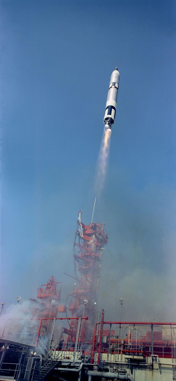
S66-34064 (3 June 1966) ?-- The Gemini-9 spacecraft, carrying astronauts Thomas P. Stafford, command pilot, and Eugene A. Cernan, pilot, was successfully launched by the National Aeronautics and Space Administration from the Kennedy Space Center?s Launch Complex 19 at 8:39 a.m. (EST), June 3, 1966. Photo credit: NASA
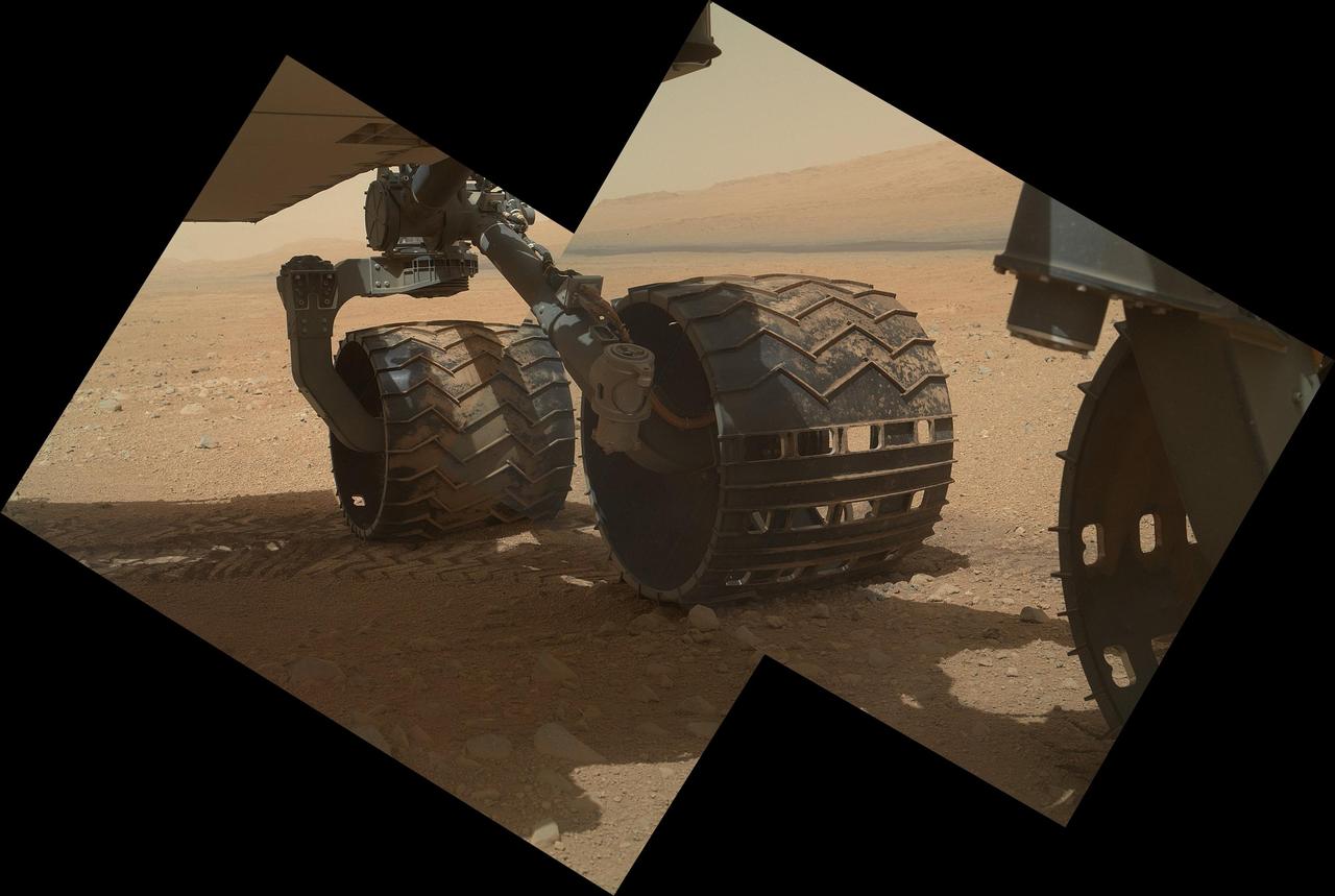
This view of the three left wheels of NASA Mars rover Curiosity combines two images that were taken by the rover Mars Hand Lens Imager MAHLI during the 34th Martian day, or sol, on Mars Sept. 9, 2012.
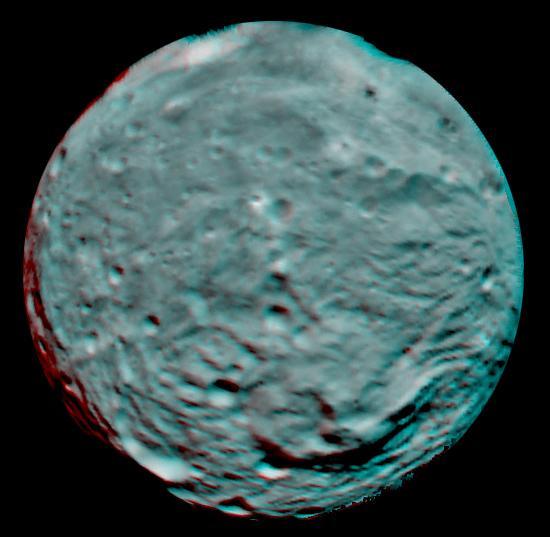
This 3D image of the asteroid Vesta was taken on July 9, 2011 by the framing camera instrument aboard NASA Dawn spacecraft. You need 3D glasses to view this image.

On Oct. 9, NASA Juno spacecraft flew past Earth, using our home planet gravity to get the final boost it needed to reach Jupiter. The JunoCam instrument captured this monochrome view of Earth.
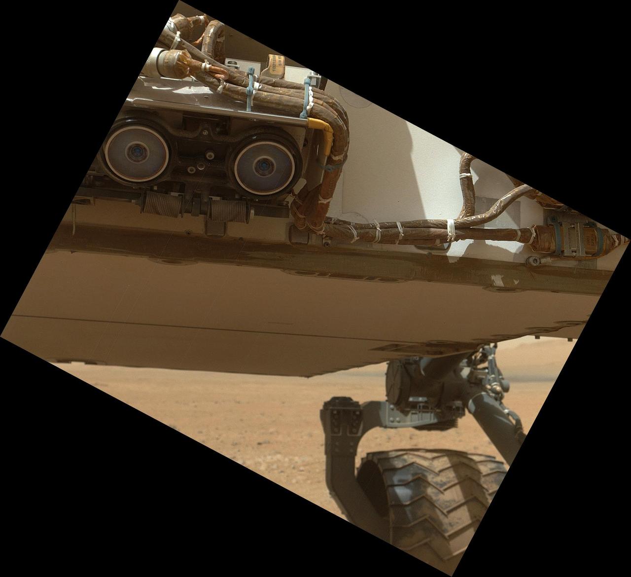
This view of the lower front and underbelly areas of NASA Mars rover Curiosity was taken by the rover MAHLI camera during Sept. 9, 2012. Also visible are the hazard avoidance cameras on the front of the rover.

Bright veins cutting across outcrop in a section of Endeavour crater rim called Botany Bay are visible in the foreground and middle distance of this view from NASA Mars Exploration Rover Opportunity on sol 2,681 Aug. 9, 2011.
This view of rock layers exposed in the upper portion of the inner slope of "Endurance Crater" was captured by the navigation camera on NASA's Mars Exploration Rover Opportunity from the rover's position inside the crater during Opportunity's 134th sol on June 9, 2004. Scientists and engineers are assessing possible targets and routes among these rocks. The view is looking down into the crater, so the layers at the top of the image lie lower in the crater than the rocks in the foreground. http://photojournal.jpl.nasa.gov/catalog/PIA06263
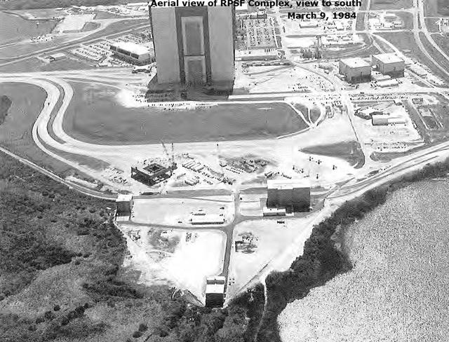
Aerial View of RPSF Complex, view to the south, March 9, 1984

The JunoCam instrument aboard NASA's Juno spacecraft captured this view of Jupiter's moon Io – the first-ever image of the moon's south polar region – during Juno's 60th flyby of Jupiter on Apr. 9, 2024. Citizen scientist Thomas Thomopoulos made this image by applying further processing to an image created from raw JunoCam data by another citizen scientist, Gerald Eichstädt. At the time the raw image was taken, Juno was about 10,250 miles (16,500 kilometers) above the surface of Io. https://photojournal.jpl.nasa.gov/catalog/PIA25697

Cassini obtained this panoramic view of Saturn's rings on Sept. 9, 2017, just minutes after it passed through the ring plane. The view looks upward at the southern face of the rings from a vantage point above Saturn's southern hemisphere. The entirety of the main rings can be seen here, but due to the low viewing angle, the rings appear extremely foreshortened. The C ring, with its sharp, bright plateaus (see PIA20529), appears at left; the B ring is the darkened region stretching from bottom center toward upper right; the A ring is seen at far right. This view shows the rings' unilluminated face, where sunlight filters through from the other side. The Cassini spacecraft ended its mission on Sept. 15, 2017. https://photojournal.jpl.nasa.gov/catalog/PIA21898
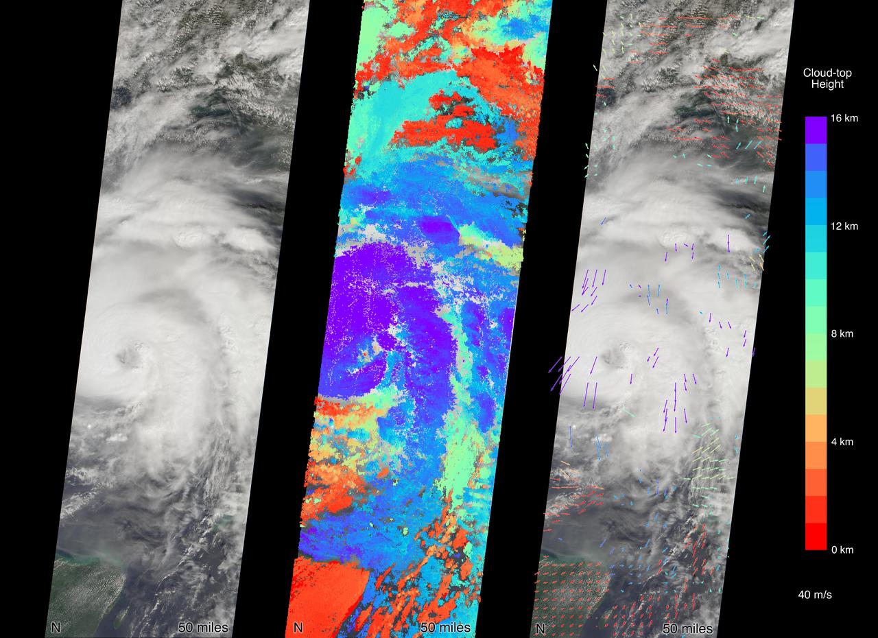
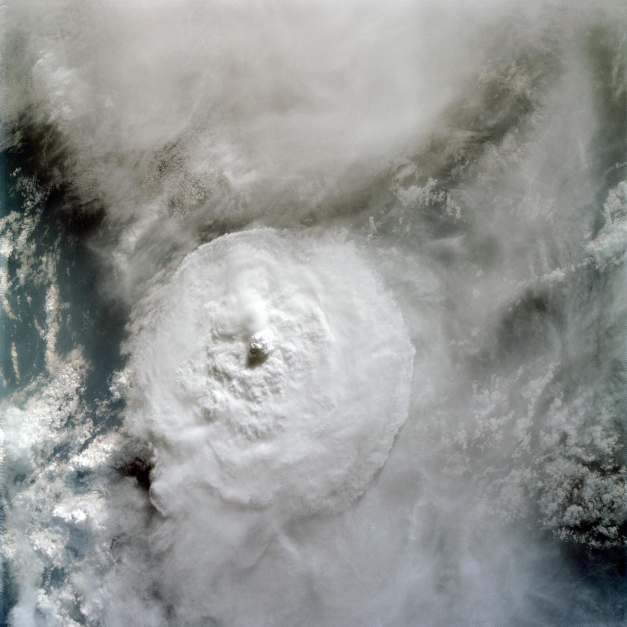
MISR carries nine cameras fixed at different angles, each of which viewed Michael over the course of approximately seven minutes when it was just off Florida's west coast on Tuesday, October 9. Images from the nine views are used to calculate the height of the cloud tops, and the motion of the clouds between the views provides information on wind speed and direction. This composite image shows the view from the central, downward-pointing camera (left), the calculated cloud-top heights (middle), and wind velocity vectors (right) superimposed on the image. The length of the arrows is proportional to wind speed and the colors show the altitude of the cloud tops in kilometers. The National Hurricane Center clocked Michael's sustained wind speed at 150 mph (240 kph) just before noon local time on Wednesday. It is expected to bring strong winds, storm surge and heavy rain to much of the southeast. https://photojournal.jpl.nasa.gov/catalog/PIA22750
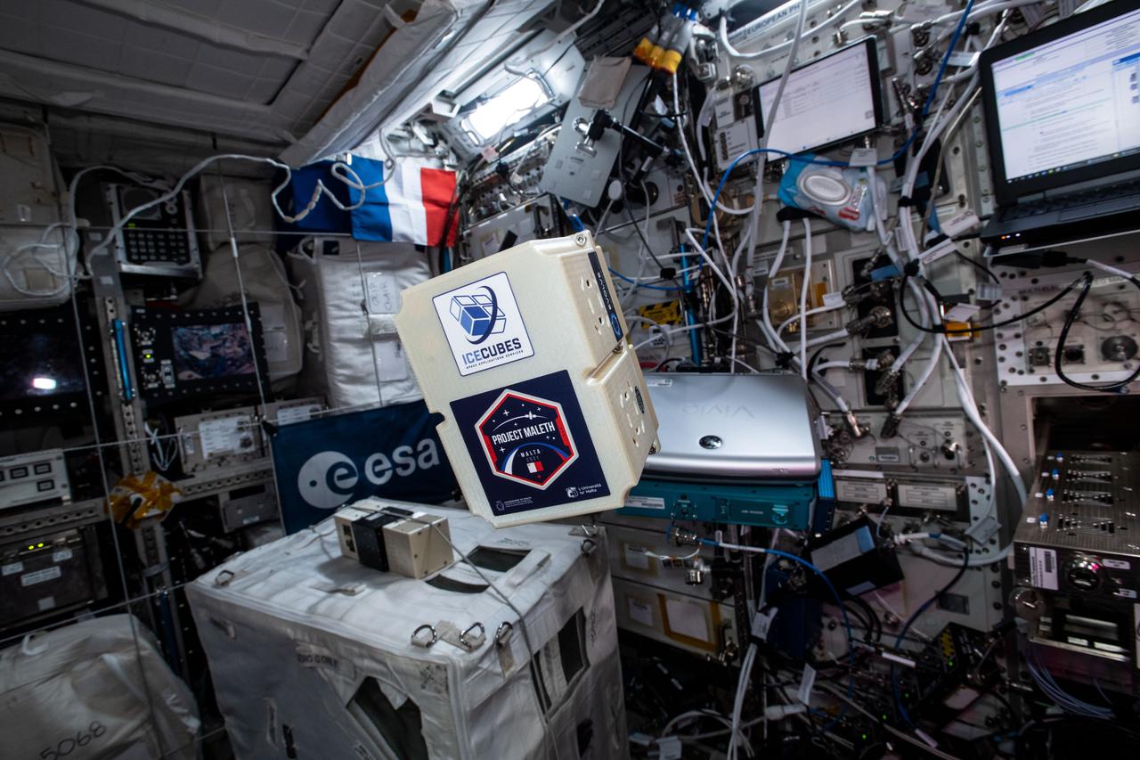
iss065e343722 (9/2/2021) --- A view aboard the International Space Station Columbus module with the Ice Cube #9 BioCube. Ice Cube #9 seeks to analize the Skin Microbiome of Diabetic Foot Ulcers
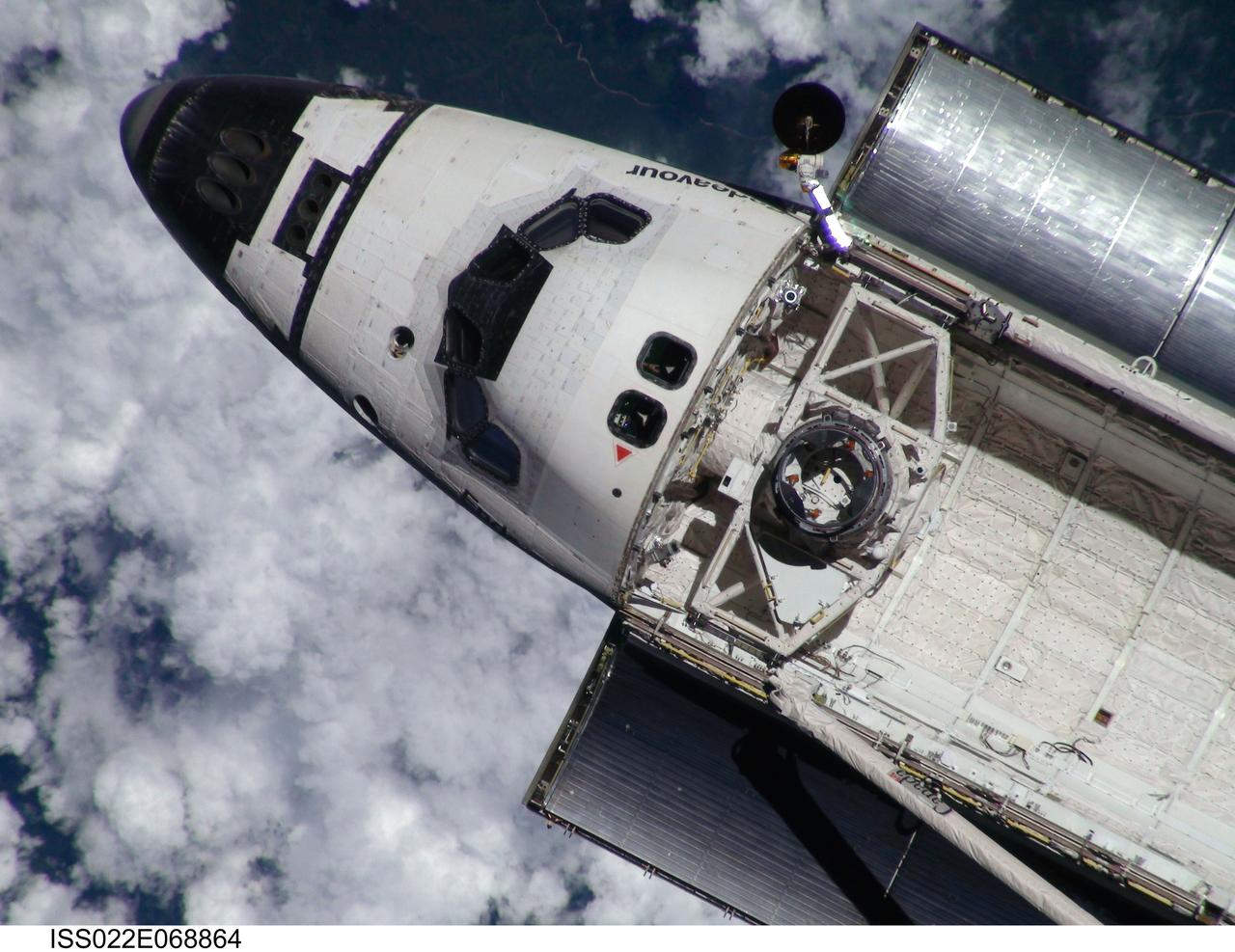
ISS022-E-068864 (9 Feb. 2010) --- This view of the space shuttle Endeavour, taken on Feb. 9 from the International Space Station as the two spacecraft conducted their rendezvous operations, was downlinked by the Expedition 22 crew on Feb. 19. The Tranquility node and the Cupola are just out of view in the aft part of shuttle's payload bay.

View of STS-9 Mission Specialist (MS) Owen K. Garriott with hardware.
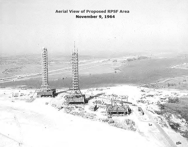
Aerial View of Proposed RPSF Area, November 9, 1964

iss026e032787 (3/9/2011) --- A view of the Asian Seed investigation.
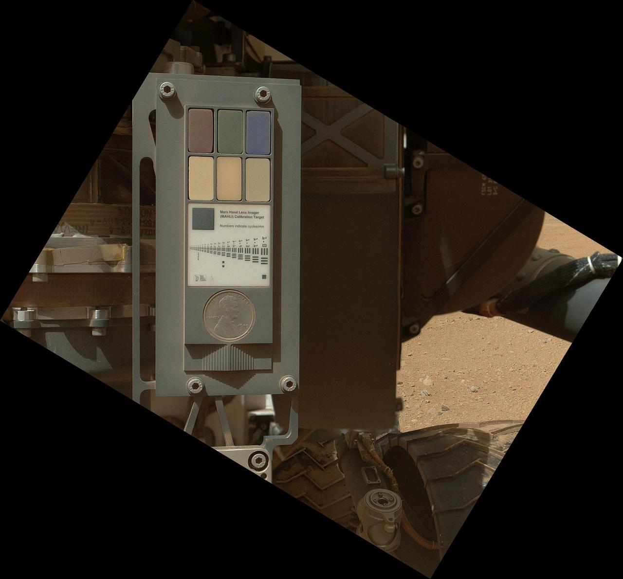
This view of the calibration target for the MAHLI camera aboard NASA Mars rover Curiosity combines two images taken by that camera during Sept. 9, 2012. Part of Curiosity left-front and center wheels and a patch of Martian ground are also visible.
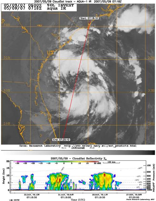
CloudSat's Cloud Profiling Radar captured a profile across Tropical Storm Andrea on Wednesday, May 9, 2007, near the South Carolina/Georgia/Florida Atlantic coast. The upper image shows an infrared view of Tropical Storm Andrea from the Moderate Resolution Imaging Spectroradiometer instrument on NASA's Aqua satellite, with CloudSat's ground track shown as a red line. The lower image is the vertical cross section of radar reflectivity along this path, where the colors indicate the intensity of the reflected radar energy. CloudSat orbits approximately one minute behind Aqua in a satellite formation known as the A-Train. http://photojournal.jpl.nasa.gov/catalog/PIA09379
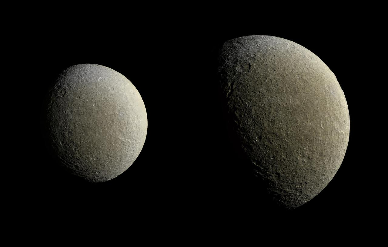
After a couple of years in high-inclination orbits that limited its ability to encounter Saturn's moons, NASA's Cassini spacecraft returned to Saturn's equatorial plane in March 2015. As a prelude to its return to the realm of the icy satellites, the spacecraft had its first relatively close flyby of an icy moon (apart from Titan) in almost two years on Feb. 9. During this encounter Cassini's cameras captured images of the icy moon Rhea, as shown in these in two image mosaics. The views were taken about an hour and a half apart as Cassini drew closer to Rhea. Images taken using clear, green, infrared and ultraviolet spectral filters were combined to create these enhanced color views, which offer an expanded range of the colors visible to human eyes in order to highlight subtle color differences across Rhea's surface. The moon's surface is fairly uniform in natural color. The image at right represents one of the highest resolution color views of Rhea released to date. A larger, monochrome mosaic is available in PIA07763. Both views are orthographic projections facing toward terrain on the trailing hemisphere of Rhea. An orthographic view is most like the view seen by a distant observer looking through a telescope. The views have been rotated so that north on Rhea is up. The smaller view at left is centered at 21 degrees north latitude, 229 degrees west longitude. Resolution in this mosaic is 450 meters (1,476 feet) per pixel. The images were acquired at a distance that ranged from about 51,200 to 46,600 miles (82,100 to 74,600 kilometers) from Rhea. The larger view at right is centered at 9 degrees north latitude, 254 degrees west longitude. Resolution in this mosaic is 300 meters (984 feet) per pixel. The images were acquired at a distance that ranged from about 36,000 to 32,100 miles (57,900 to 51,700 kilometers) from Rhea. The mosaics each consist of multiple narrow-angle camera (NAC) images with data from the wide-angle camera used to fill in areas where NAC data was not available. The image was produced by Heike Rosenberg and Tilmann Denk at Freie Universität in Berlin, Germany. http://photojournal.jpl.nasa.gov/catalog/PIA19057
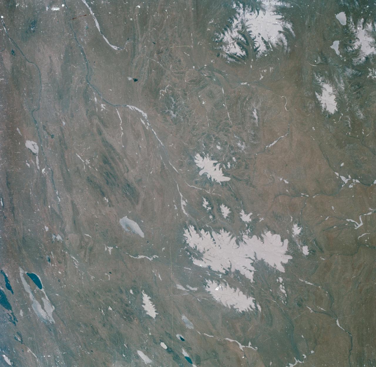
S63-06440 (15-16 May 1963) --- View of the Tibetan Plateau in north-central Tibet, as photographed from the Mercury-Atlas 9 (MA-9) capsule by astronaut L. Gordon Cooper Jr., during his 22-orbit MA-9 spaceflight. The center of the photograph is near 91 degrees east longitude and 34 degrees 30 minutes north latitude. This view includes lakes and snow-covered highlands. Photo credit: NASA
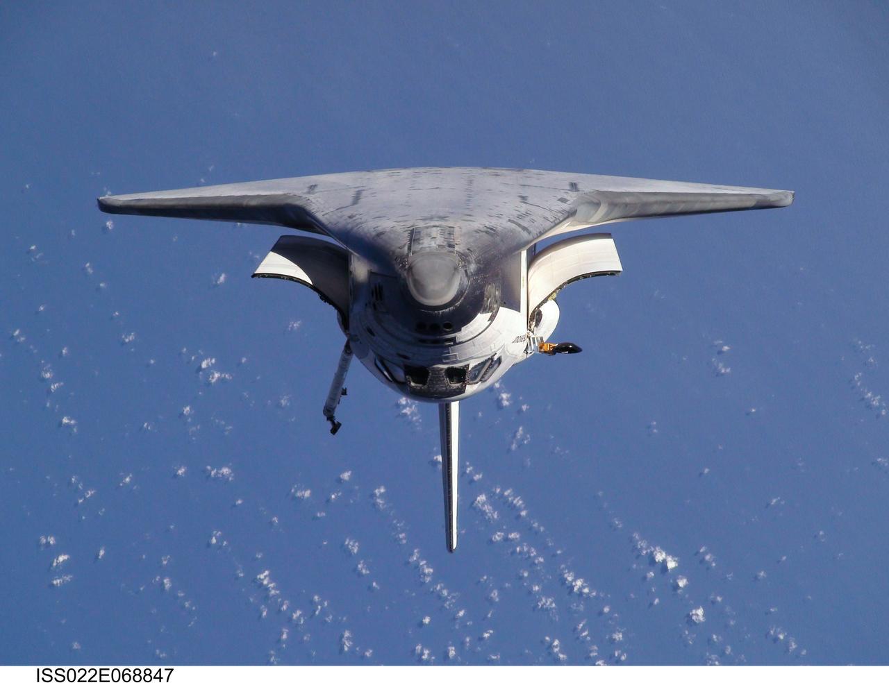
ISS022-E-068847 (9 Feb. 2010) --- This view of the space shuttle Endeavour, taken on Feb. 9 from the International Space Station as the two spacecraft conducted their rendezvous operations, was downlinked by the Expedition 22 crew on Feb. 19.
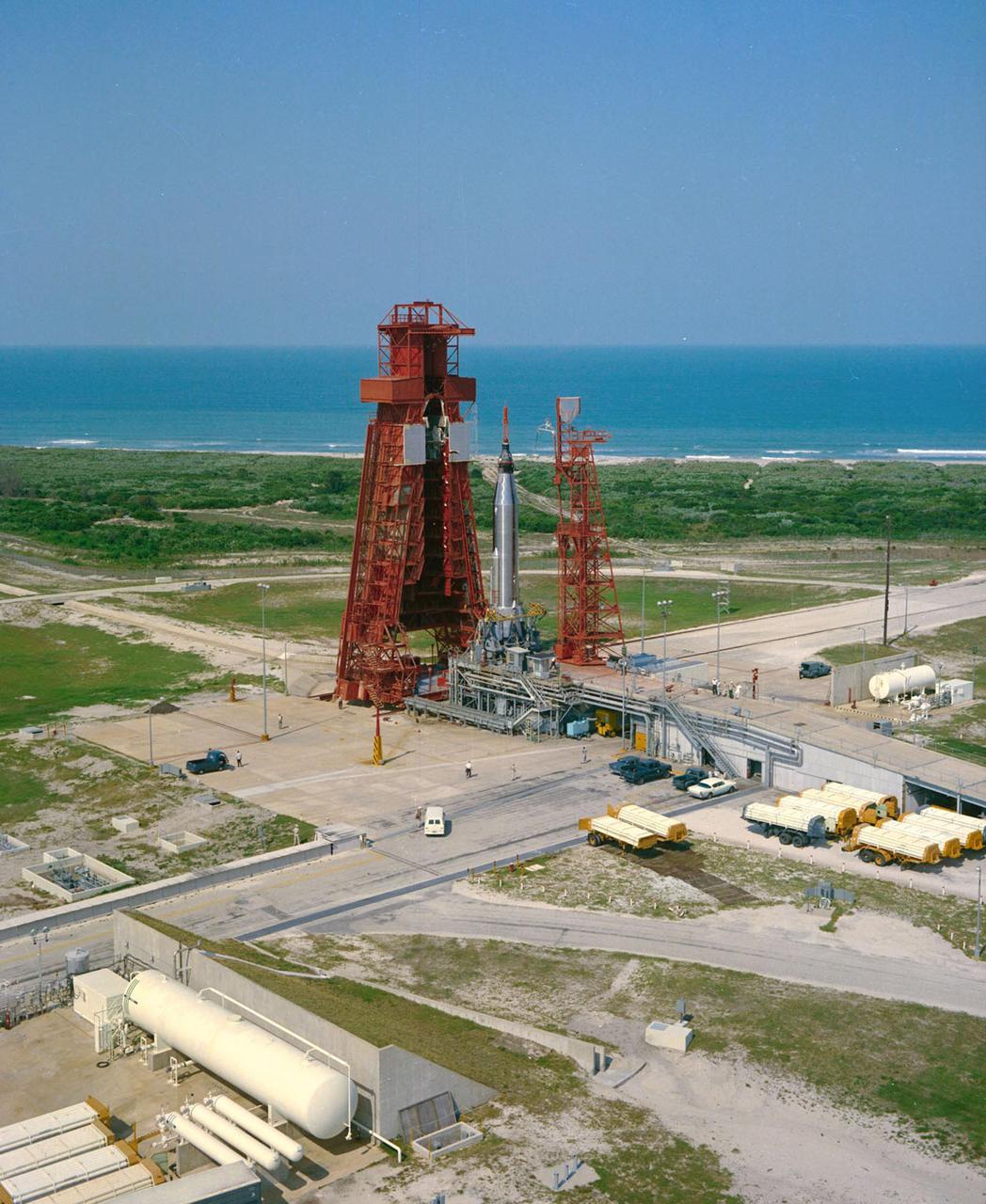
KENNEDY SPACE CENTER, FLA. -- Aerial view of Launch Complex 14. Mercury-Atlas 9 (MA-9), visible on Pad 14, is scheduled to carry astronaut Gordon Cooper for the fourth manned orbital mission.
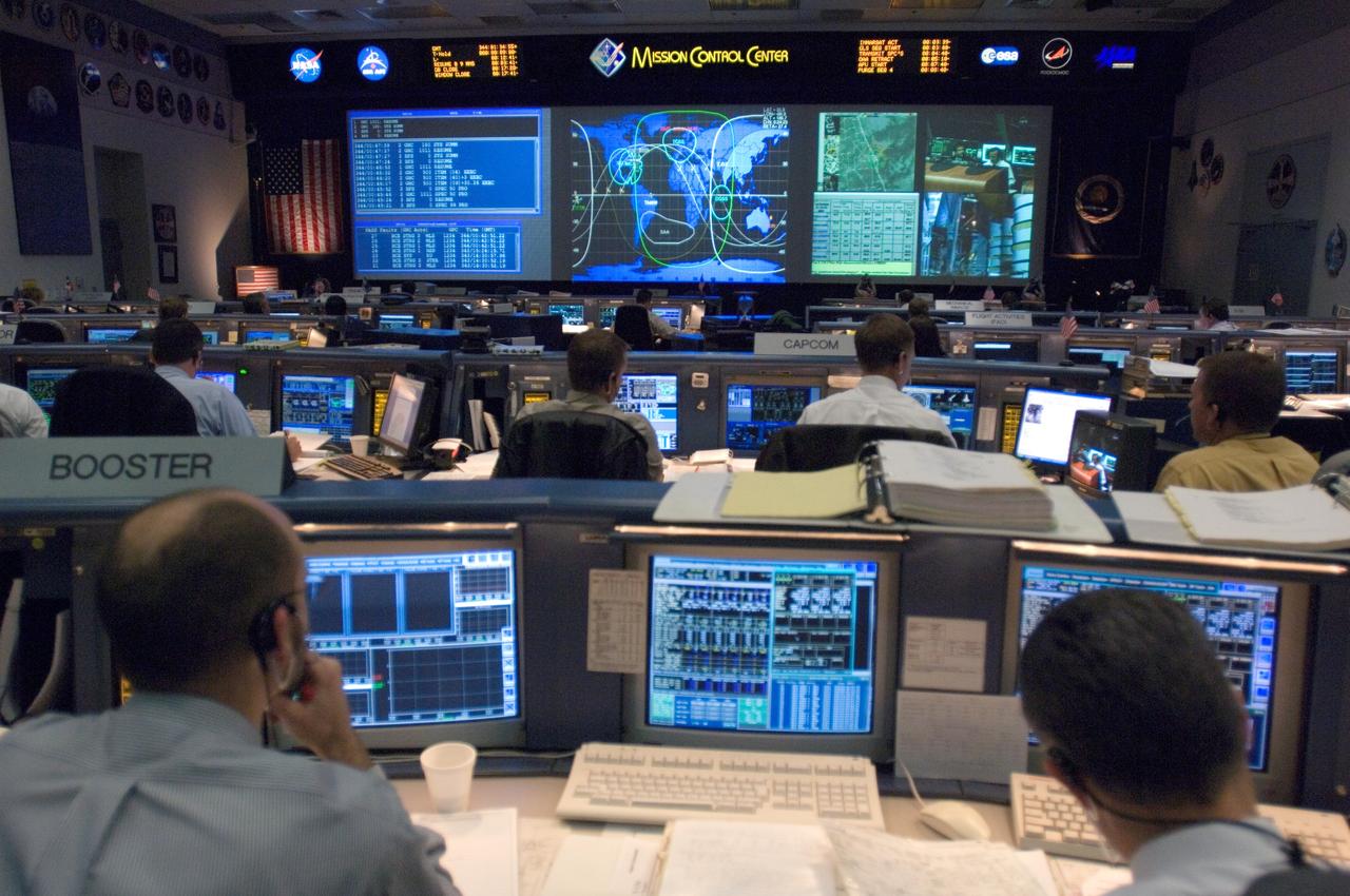
JSC2006-E-53519 (9 Dec. 2006) --- Overall view in the shuttle flight control room, from the point of view of the Booster console, on launch day for STS-116.
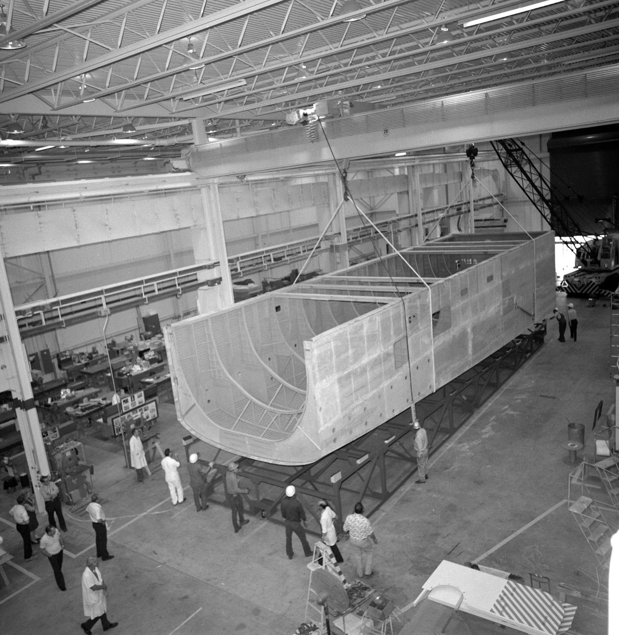
Eleven (11) wide-angle views and medium shots showing progess on construction of Shuttle Orbiter Mid-Body Mockup in Bldg. 9. Workers seen in views. JSC, Houston, TX
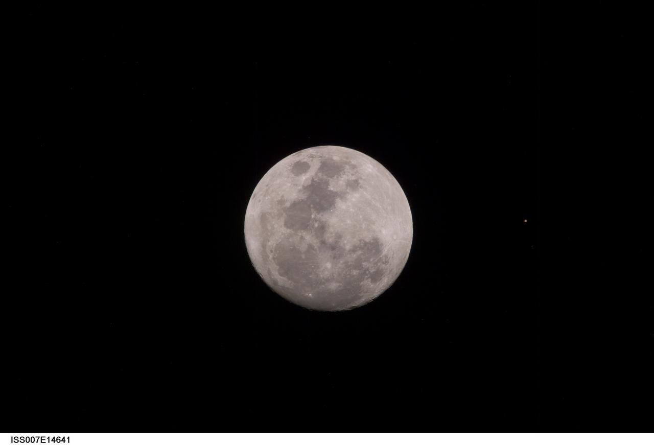
ISS007-E-14641 (9 September 2003) --- This view of a full Moon was photographed by one of the Expedition 7 crewmembers aboard the International Space Station (ISS). The view also includes Mars, which appears as a small dot.
Expedition 11 Training with Krikalev/Henderson as their continued their training in the Virtual Reality Laboratory in building 9. View includes: Sergei Krikalev and Henderson using the virtual optics to view the International Space Station.
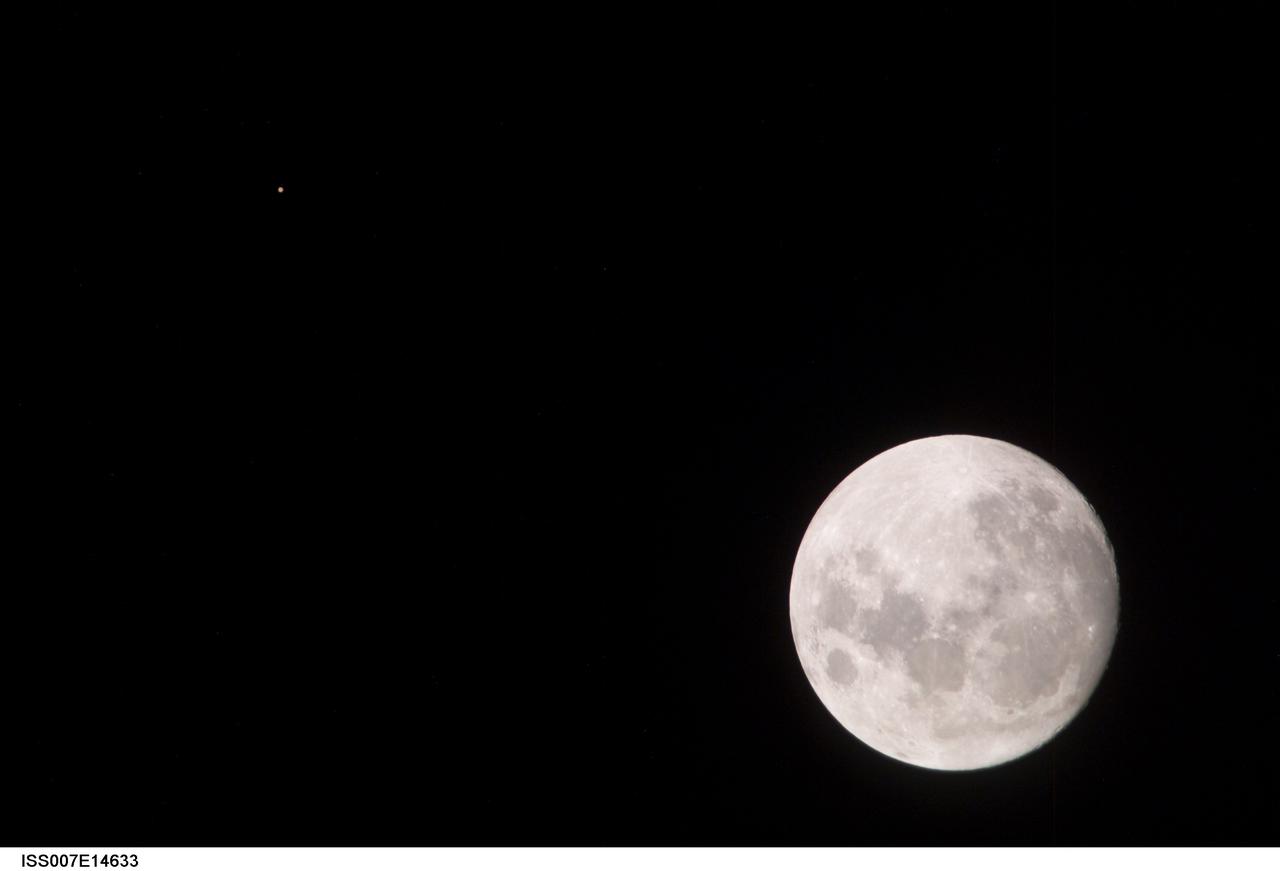
ISS007-E-14633 (9 September 2003) --- This view of a full Moon was photographed by one of the Expedition 7 crewmembers aboard the International Space Station (ISS). The view also includes Mars, which appears as a small dot.
JSC2006-E-53520 (9 Dec. 2006) --- Overall view in the shuttle flight control room, from the point of view of the Booster console, on launch day for STS-116.
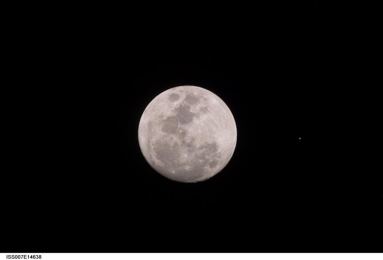
ISS007-E-14638 (9 September 2003) --- This view of a full Moon was photographed by one of the Expedition 7 crewmembers aboard the International Space Station (ISS). The view also includes Mars, which appears as a small dot.
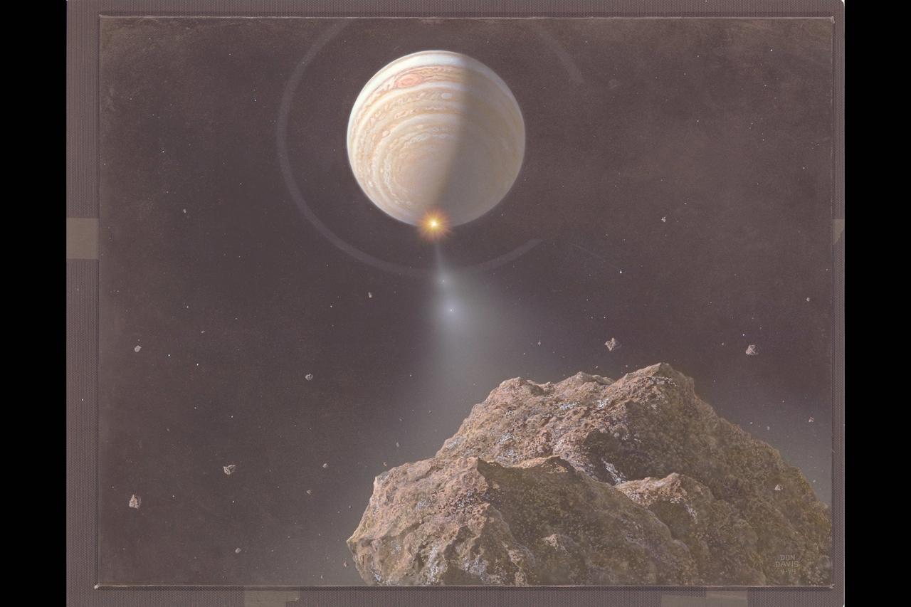
Comet (Artwork by Don Davis) Shoemaker Levy 9 impact on Jupiter (Artwork nucleus chunk view)
AS09-22-3341 (3-13 March 1969) --- Central Texas area as photographed from the Apollo 9 spacecraft during its Earth-orbital mission. Interstate 35 runs from Austin (right center edge of picture) to Waco (near bottom left corner). Also visible are the cities of Georgetown, Taylor, Temple and Killeen. The Colorado River runs through Austin. The Brazos River flows through Waco. Lake Travis is upstream from Austin. Lake Whitney is at bottom left corner of picture. The Belton Reservoir is near bottom center. The lake formed by the dam on the Lampasas River near Belton is also clearly visible.
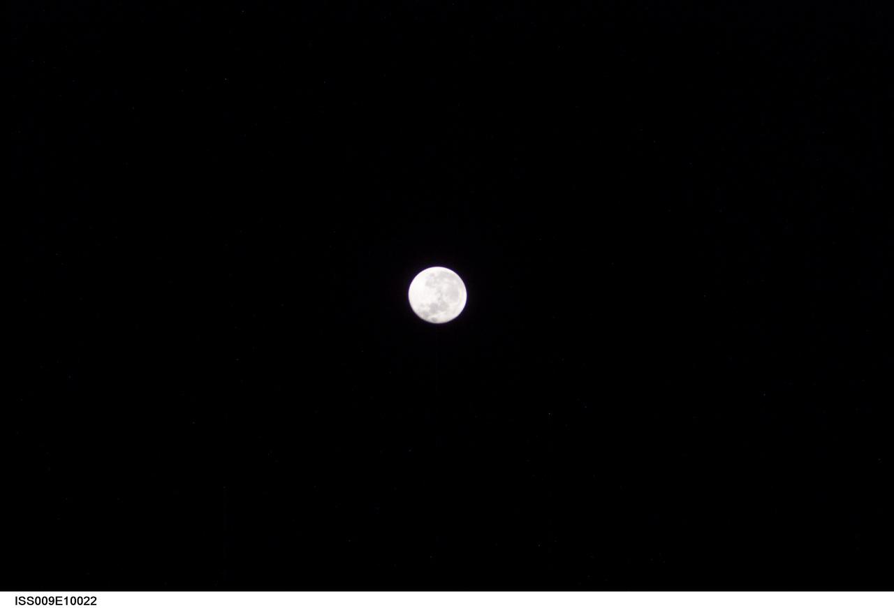
ISS009-E-10022 (4 June 2004) --- This view of a full Moon was photographed by one of the Expedition 9 crewmembers aboard the International Space Station (ISS).
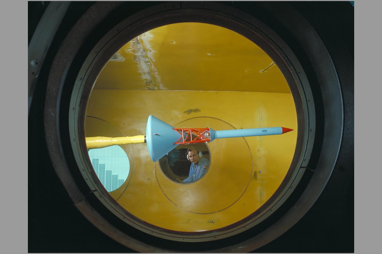
Side view of assembled command module, tower with flap & launch-escape rocket. Apollo FS-2 in 9 x 7 ft. SupersonicWind Tunnel.

Views of STS-9/41A Crewmen John Young, with wife Susy, and Brewster Shaw with his family upn their return. EAFB, HOUSTON, TX
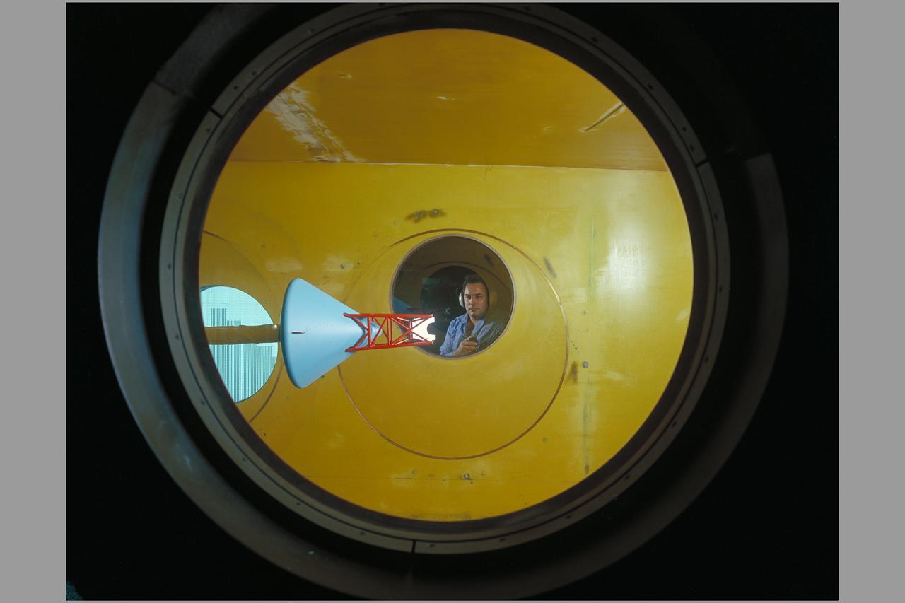
Side view of assembled command module, tower with flap & launch-escape rocket. Apollo FS-2 in 9 x 7 ft. SupersonicWind Tunnel.
Date: Nov 9, 1940 Aerial view of Ames Aeronautical Laboratory showing Flight Research Lab and Construction of 16ft wind tunnel

ISS007-E-12270 (9 August 2003) --- View of a gibbous Moon photographed by an Expedition 7 crewmember onboard the International Space Station (ISS).
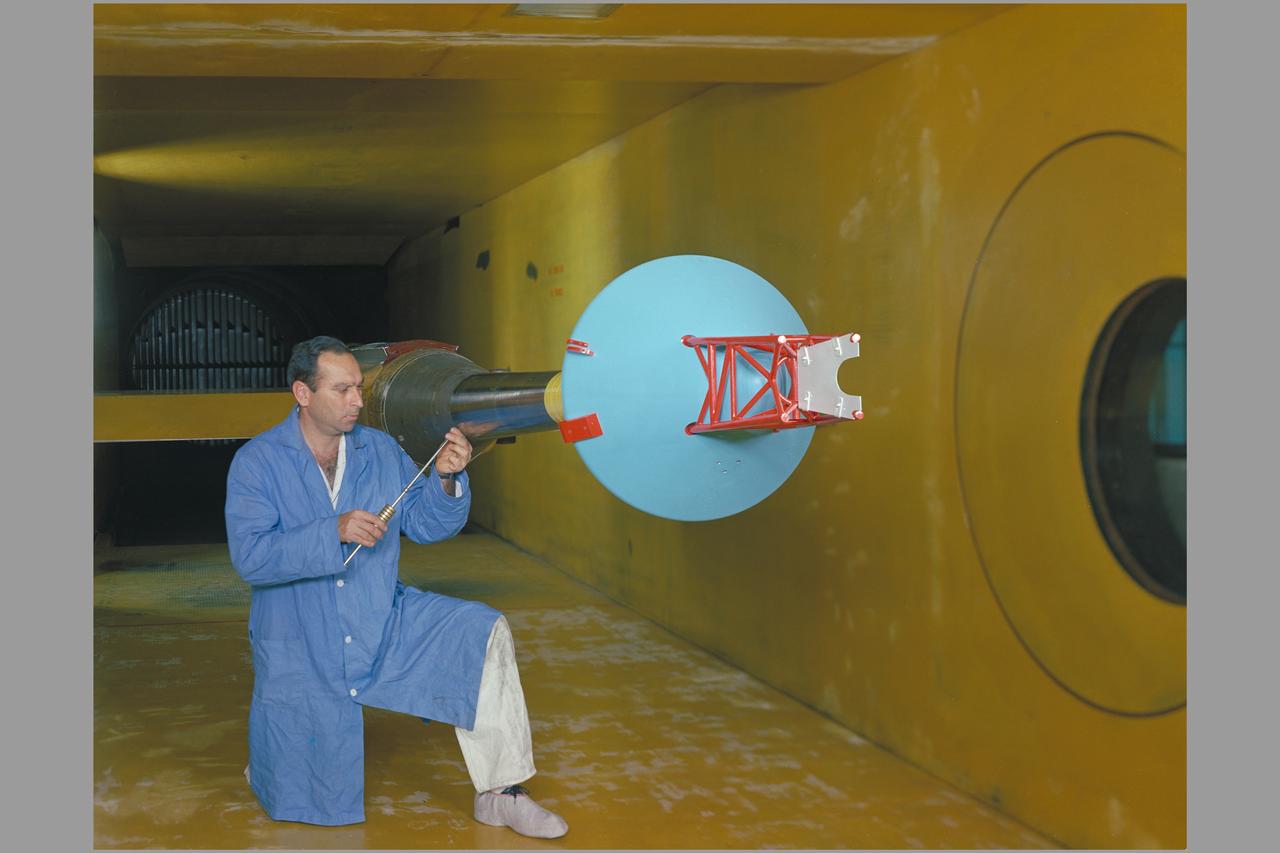
Side view of assembled command module, tower with flap & launch-escape rocket. Apollo FS-2 in 9 x 7 ft. SupersonicWind Tunnel.
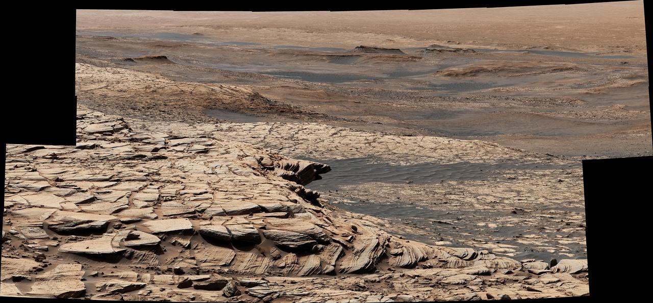
Stitched together from 28 images, this view from NASA's Curiosity Mars rover was captured on April 9, 2020, the 2,729th Martian day, or sol, of the mission after the rover ascended a steep slope, part of a geologic feature called "Greenheugh Pediment." In the foreground is the crusty sandstone cap that stretches the length of the pediment, forming an overhanging ledge in some parts. At center is the "clay-bearing unit," a region with a unique story to tell about the history of water on Mount Sharp, the 3-mile-tall (5-kilometer-tall) mountain Curiosity has been ascending since 2014. In the distance at the top of the image is the floor of Gale Crater, which is 96 miles (154 kilometers) wide. https://photojournal.jpl.nasa.gov/catalog/PIA23974
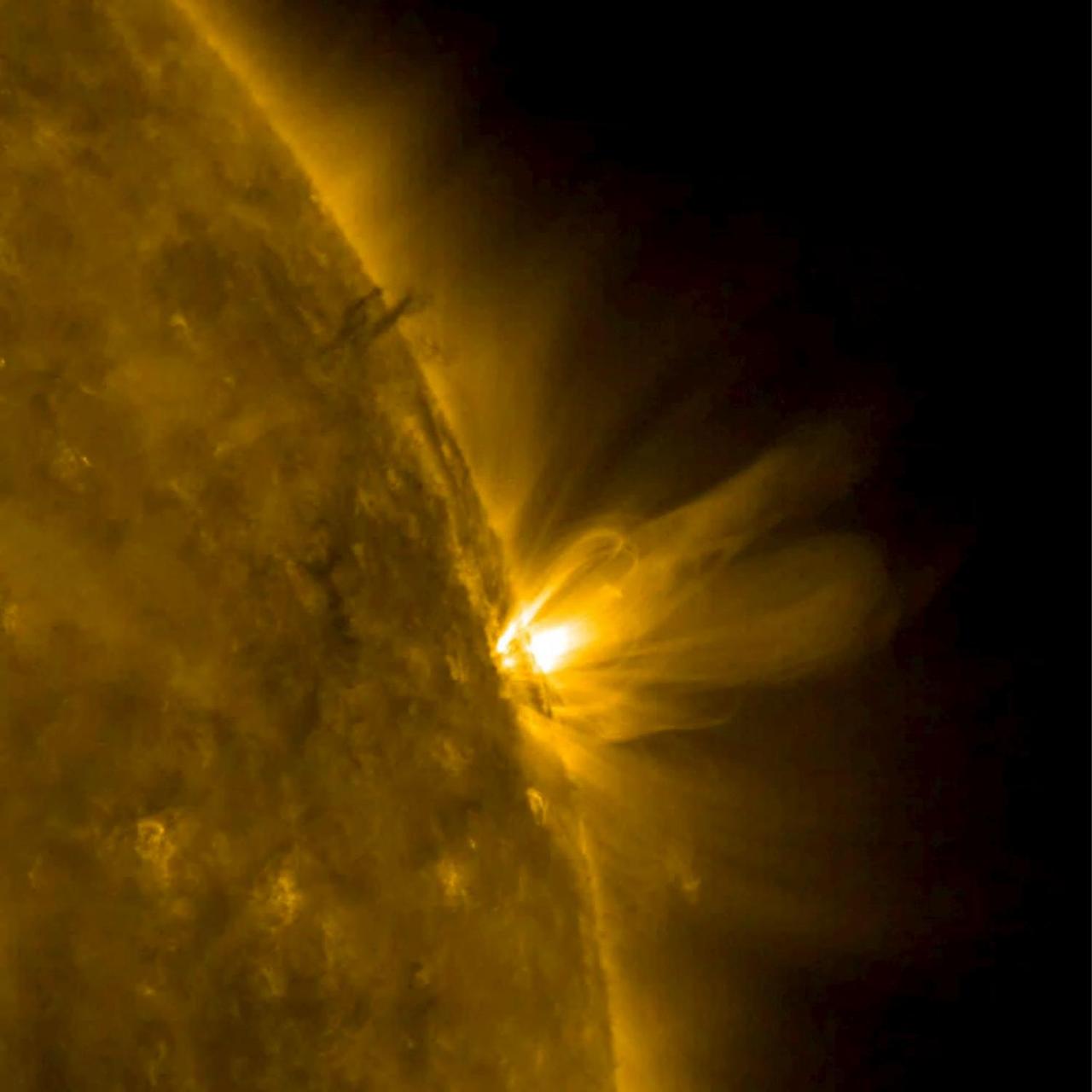
When an active region rotated over to the edge of the sun, it presented us with a nice profile view of its elongated loops stretching and swaying above it (Mar. 8-9, 2017). These loops are actually charged particles (made visible in extreme ultraviolet light) swirling along the magnetic field lines of the active region. The video covers about 30 hours of activity. Also of note is a darker twisting mass of plasma to the left of the active region being pulled and spun about by magnetic forces. Video is available at http://photojournal.jpl.nasa.gov/catalog/PIA21562
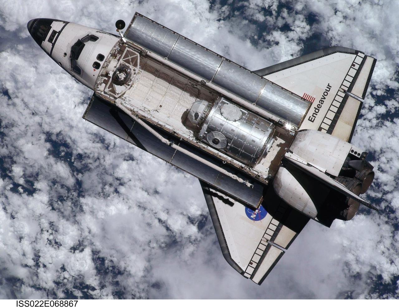
ISS022-E-068867 (9 Feb. 2010) --- This view of the space shuttle Endeavour, taken on Feb. 9 from the International Space Station as the two spacecraft conducted their rendezvous operations, was downlinked by the Expedition 22 crew on Feb. 19. The Tranquility node and the Cupola can be seen in the shuttle's payload bay.
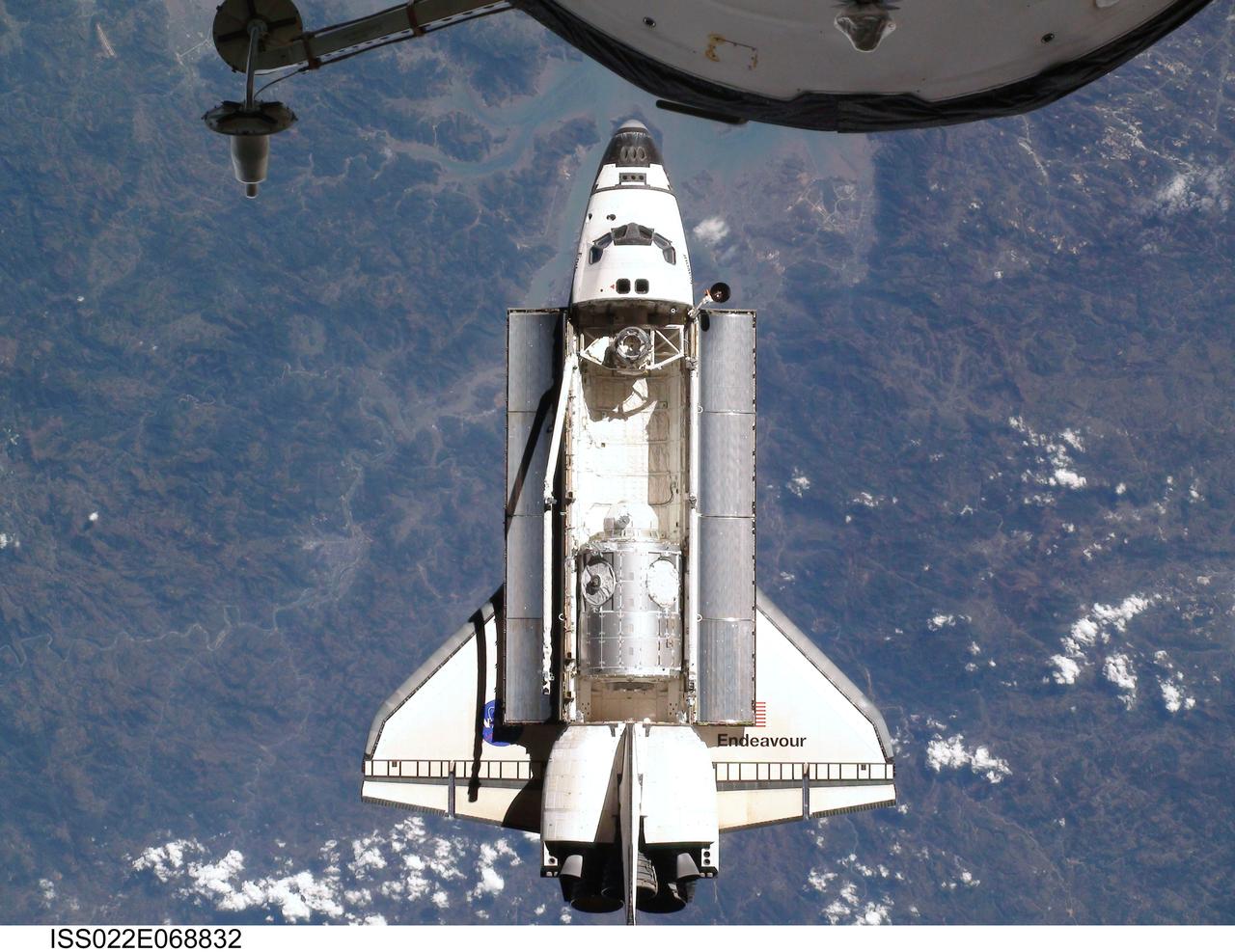
ISS022-E-068832 (9 Feb. 2010) --- This view of the space shuttle Endeavour, taken on Feb. 9 from the International Space Station as the two spacecraft conducted their rendezvous operations, was downlinked by the Expedition 22 crew on Feb. 19. The Tranquility node and the Cupola can be clearly seen in the shuttle's payload bay.
iss065e341636 (9/2/2021) --- A view of the Genes in Space 8 Fluorescence Viewer floating in front of the Cupola module window aboard the International Space Station (ISS). Genes in Space-9 evaluates low-cost and portable BioBits cell-free technology as well as two biological sensors aboard the International Space Station (ISS).
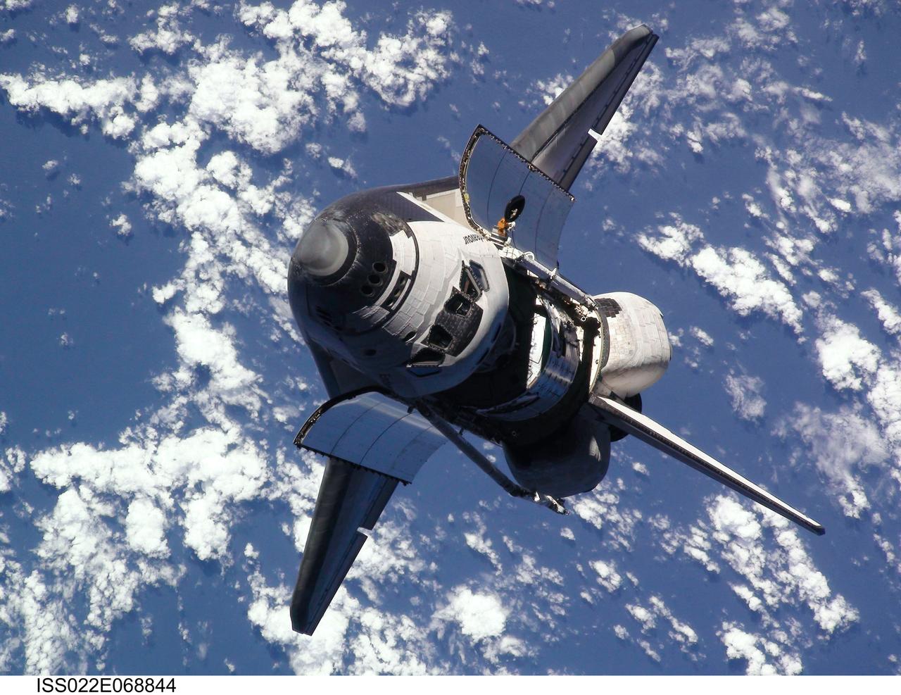
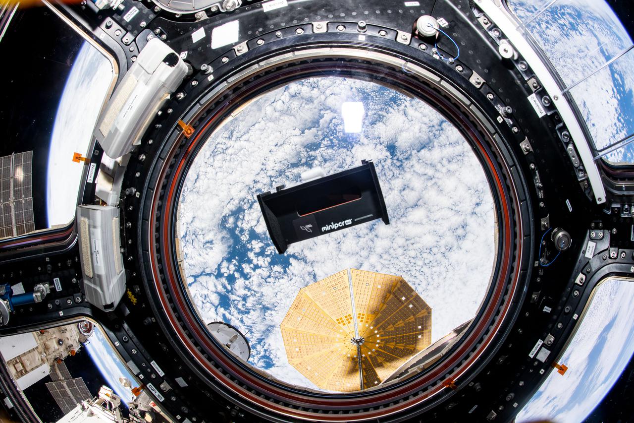
ISS022-E-068844 (9 Feb. 2010) --- This view of the space shuttle Endeavour, taken from the International Space Station on Feb. 9 as the two spacecraft conducted their rendezvous operations, was downlinked by the Expedition 22 crew on Feb. 19. The Tranquility node and the Cupola can be clearly seen in the shuttle's payload bay.
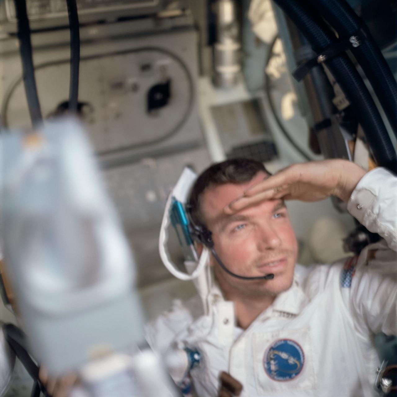
View of Astronaut David R.Scott ,Apollo 9 Command Module pilot, inside the Command Module "Gumdrop" during the Apollo 9 earth-orbital mission. . Film magazine was D,film type was SO-368 Ektachrome with 0.460 - 0.710 micrometers film / filter transmittance response and haze filter,80mm lens.
s83-46015 Views of the Mission Control Center activity of Eidophor with STS-9 Landing Data; PAO Console ith Steve Nesbitt and Harold S. Stall; FD Console with Charles Lewis and Ralph Hoodless, Lewis and M.P. "Pete" Frank; and the hanging of the STS-9 Plaque
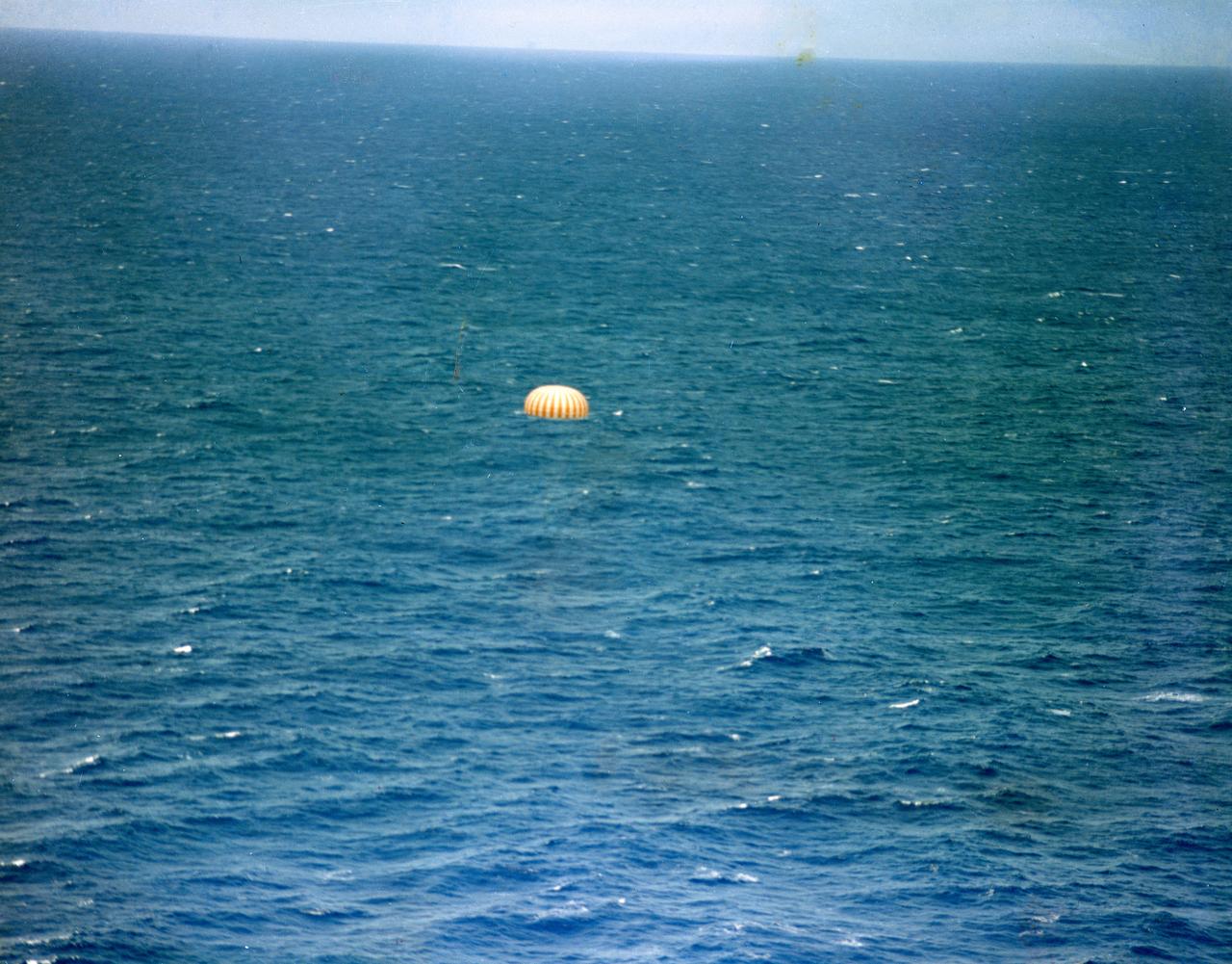
S63-09630 (16 May 1963) --- The Mercury-Atlas 9 (MA-9) "Faith 7" spacecraft, with astronaut L. Gordon Cooper Jr. aboard, nears splashdown in the Pacific Ocean to conclude a 22-orbit mission lasting 34 hours and 20.5 minutes. The capsule's parachute is fully deployed in this view. Photo credit: NASA
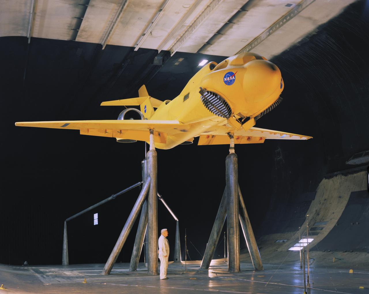
3/4 front view of McDonnell-Douglas Large-Scale lift fan, vertical and/or short take-off and landing (V/STOL), transport model. Francis Malerick in photograph. The McDonnell Douglas DC-9 (initially known as the Douglas DC-9) is a twin-engine, single-aisle jet airliner.
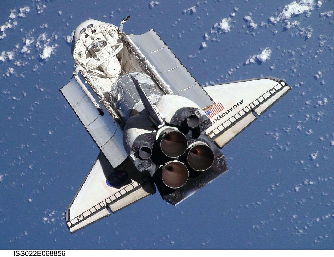
ISS022-E-068856 (9 Feb. 2010) --- This view of the space shuttle Endeavour, taken on Feb. 9 from the International Space Station as the two spacecraft conducted their rendezvous operations, was downlinked by the Expedition 22 crew on Feb. 19. The Tranquility node and the Cupola can be seen in the shuttle's payload bay.
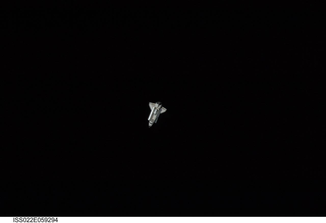
ISS022-E-059294 (9 Feb. 2010) --- Surrounded by the blackness of space, the space shuttle Endeavour appears very small from the point of view of the International Space Station as the shuttle approaches the station during STS-130 rendezvous and docking operations. Docking occurred at 11:06 p.m. (CST) on Feb. 9, 2010.
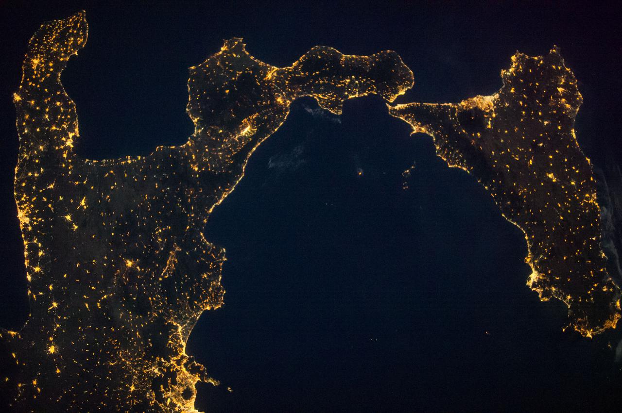
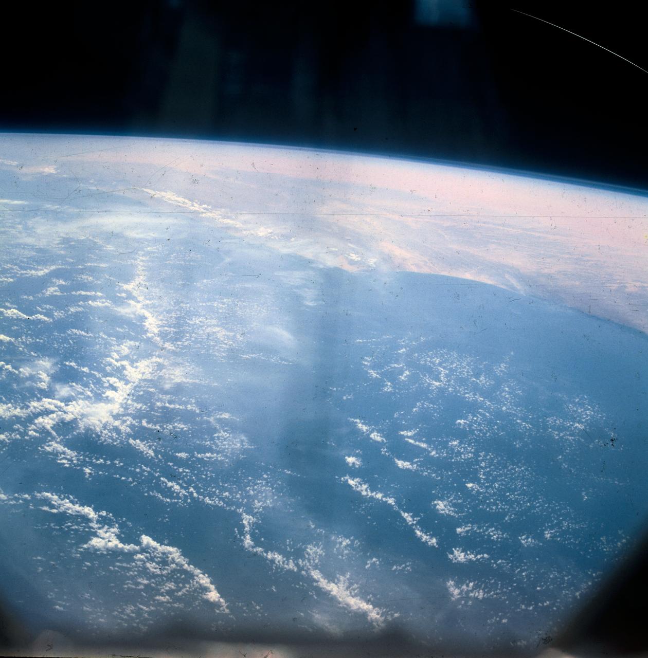
ISS040-E-090718 (9 Aug. 2014) --- One of the Expedition 40 crew members aboard the International Space Station, flying 225 nautical miles above Earth, recorded this night view over southern Italy on Aug. 9, 2014. South is at the top of the picture. Italy's "boot" and Sicily are featured in the 28mm image.
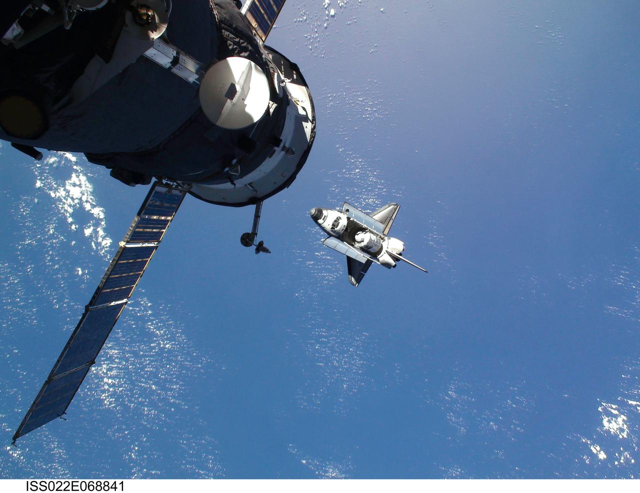
ISS022-E-068841 (9 Feb. 2010) --- This view of the space shuttle Endeavour, taken on Feb. 9 from the International Space Station as the two spacecraft conducted their rendezvous operations, was downlinked by the Expedition 22 crew on Feb. 19. A Russian spacecraft is docked to the station in the foreground.
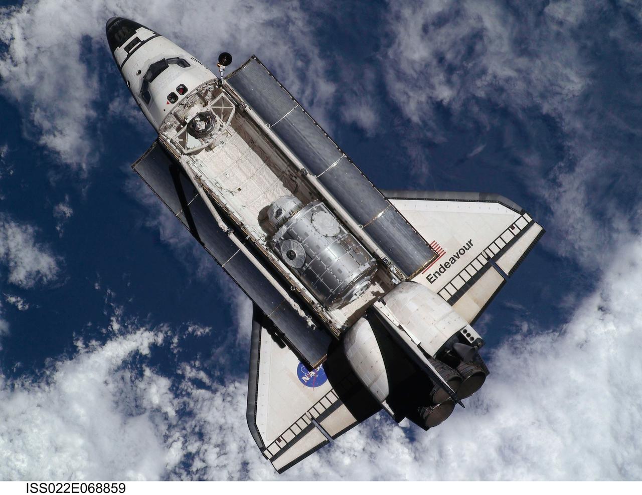
ISS022-E-068859 (9 Feb. 2010) --- This view of the space shuttle Endeavour, taken on Feb. 9 from the International Space Station as the two spacecraft conducted their rendezvous operations, was downlinked by the Expedition 22 crew on Feb. 19. The Tranquility node and the Cupola can be seen in the shuttle's payload bay.
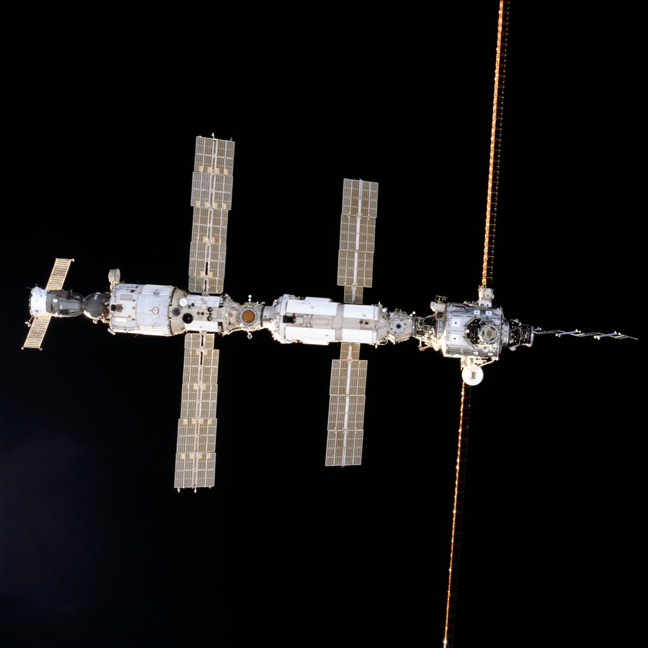
STS098-707-019 (9 February 2001) --- This close view of the International Space Station (ISS), backdropped against the blackness of space, was photographed by one of the astronauts onboard the Space Shuttle Atlantis as it approached the station for docking on Feb. 9, at 10:51 a.m. (CST).
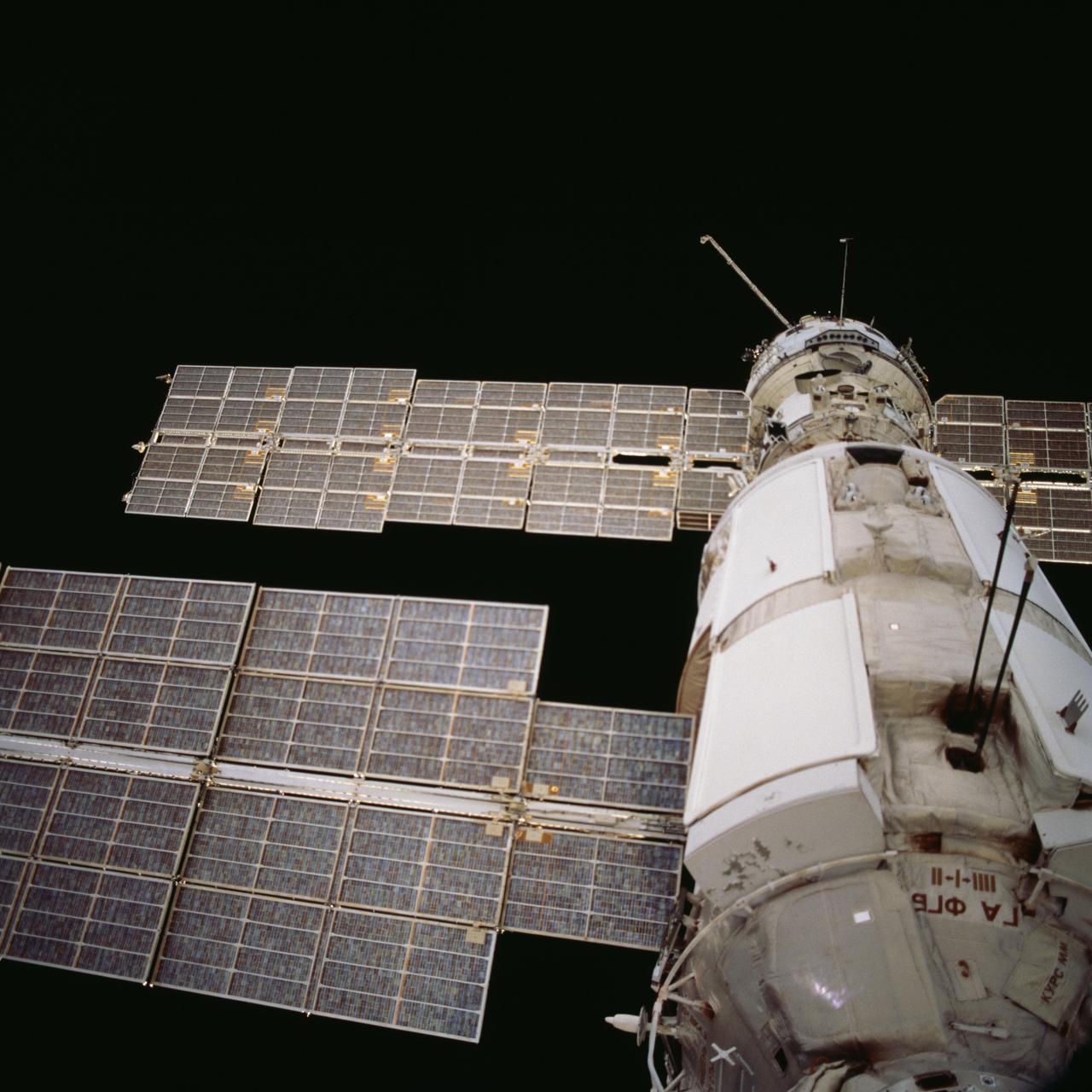
STS098-707-062 (9 February 2001) --- This close-up view of the Zvezda Service Module on the International Space Station (ISS), backdropped against the blackness of space, was photographed by one of the astronauts onboard the Space Shuttle Atlantis at it approached the station for docking on Feb. 9, at 10:51 a.m. (CST).
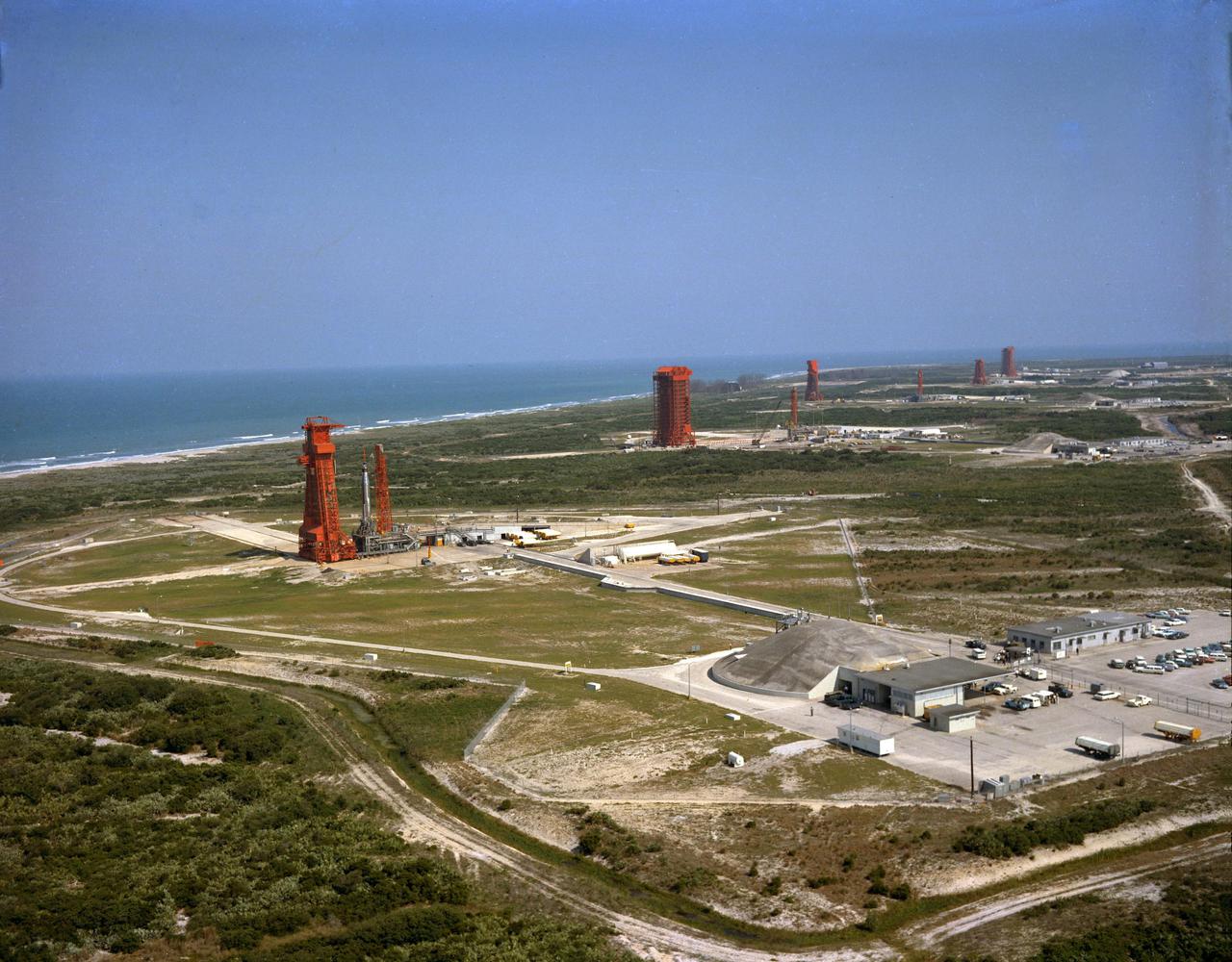
KENNEDY SPACE CENTER, FLA. -- Aerial view of Launch Complex 14 with Missile Row visible to the right. Mercury-Atlas 9 (MA-9), visible on Pad 14, is scheduled to carry astronaut Gordon Cooper for the fourth manned orbital mission.
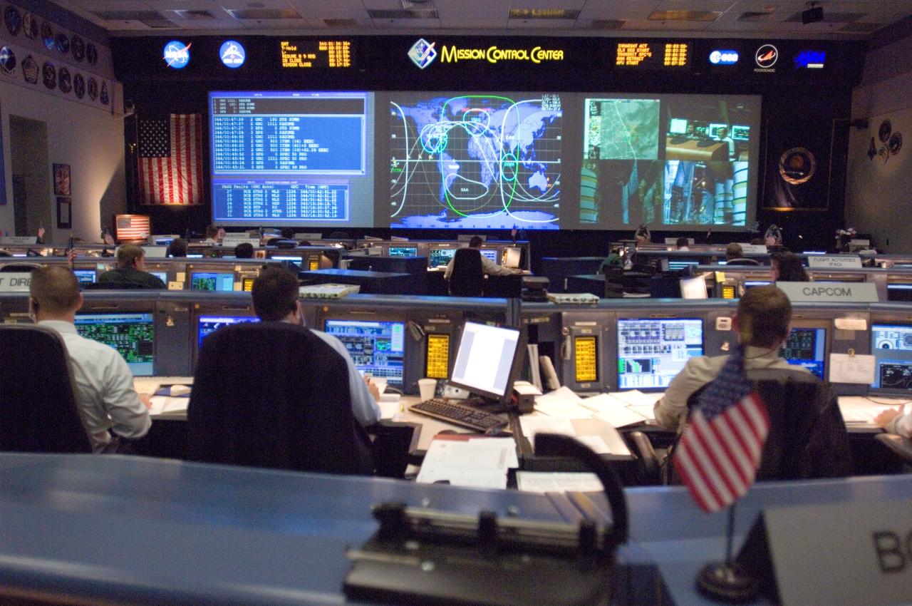
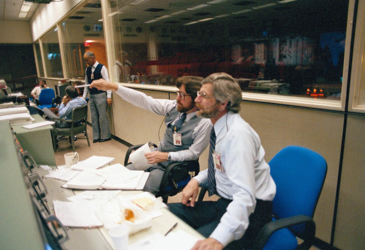
JSC2006-E-53518 (9 Dec. 2006) --- Overall view in the shuttle flight control room, from the point of view of the Booster console, on launch day for STS-116. Steve Stich (center) and Norm Knight (far left), ascent and entry flight directors, respectively, are seated at their consoles.

JSC2006-E-53521 (9 Dec. 2006) --- Overall view in the shuttle flight control room, from the point of view of the Booster console, on launch day for STS-116. The Space Shuttle Discovery can be seen awaiting its liftoff on the large screens in the front of the flight control room.
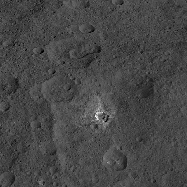
This view from NASA Dawn spacecraft features a crater named Oxo, which is about 6 miles 9 kilometers in diameter. A short, linear slump, where a mass of material has dropped below the surface, is seen to the left of Oxo crater rim. Dawn took this image on Oct. 17, 2015, from an altitude of 915 miles (1,470 kilometers). It has a resolution of 450 feet (140 meters) per pixel. http://photojournal.jpl.nasa.gov/catalog/PIA20136
S69-26150 (6 March 1969) --- Television watchers on Earth saw this view of the Apollo 9 Command Module during the second live telecast from Apollo 9 early Thursday afternoon on the fourth day in space. This view is looking through the docking window of the Lunar Module. The cloud-covered Earth can be seen in the background. Inside the Lunar Module "Spider" were Astronauts James A. McDivitt, Apollo 9 commander; and Russell L. Schweickart, lunar module pilot. At this moment Apollo 9 was orbiting Earth with the Command and Service Modules docked nose-to-nose with the Lunar Module. Astronaut David R. Scott, command module pilot, remained at the controls in the Command Module "Gumdrop" while the other two astronauts checked out the Lunar Module. McDivitt and Schweickart moved into the Lunar Module from the Command Module by way of the docking tunnel.
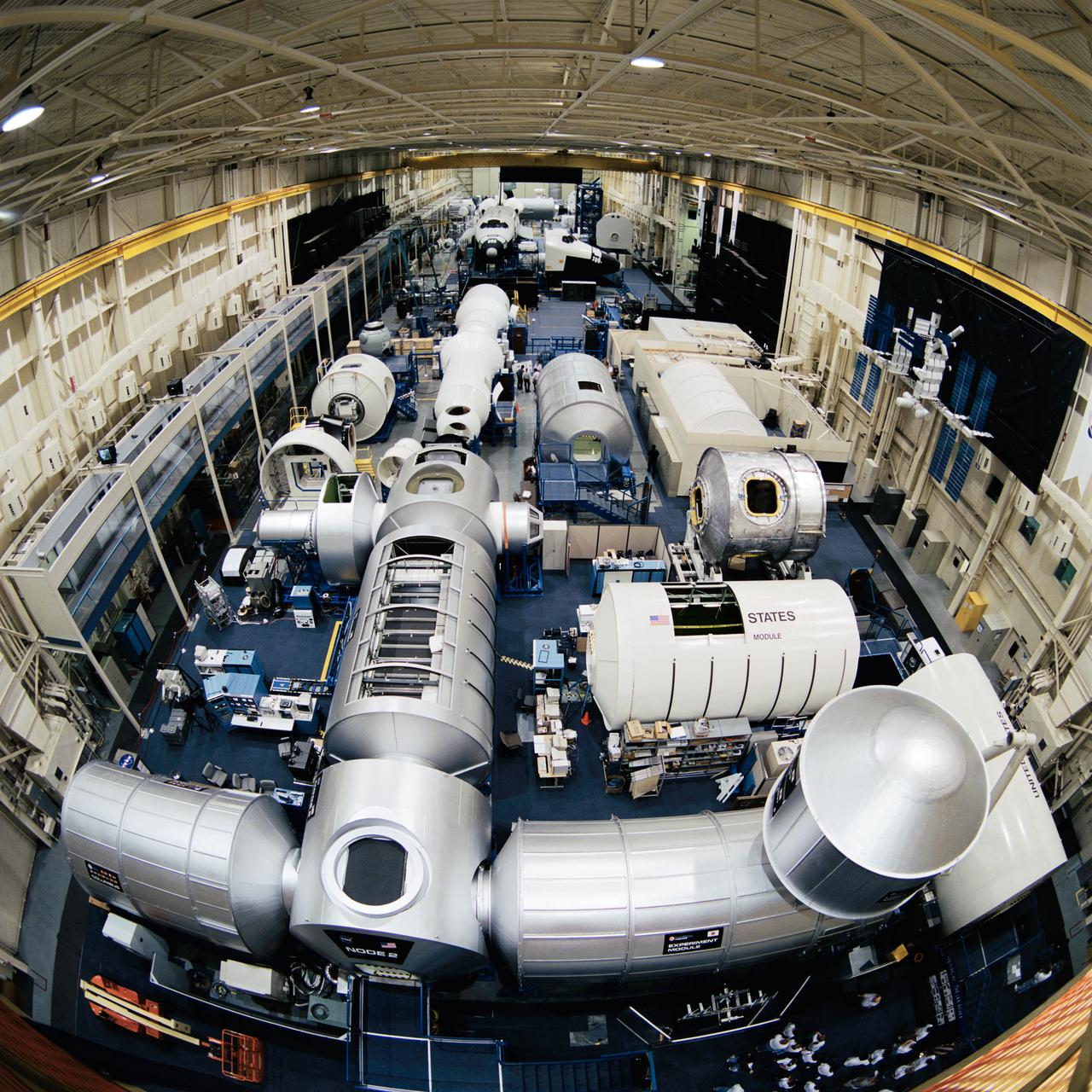
Photographic documentation showing the bldg. 9 ISS module mock-ups and trainers. Views include: various overall views of the configuration of the ISS module trainers on the floor of bldg. 9 (08445-46, 08449-51, 08458-61, 08464-65, 08469, 08471, 08476); various portions of the mock-ups (08447-48, 08470); views of the Node 2, Experiment Module and Logistics Module (08452); Node 2 (08453, 08466); Destiny and Node 2 (08454); Destiny, Unity and Airlock (08455); Zarya, Service Module and shuttle mock-ups (08456); Logistics Module and Experiment Module (08457, 08468); various views of Columbia, Node 2 and Destiny (08462-63); Columbus, Node 2, Experiment Module and Logistics Module (08467); U.S. Laboratory module (08472); Logistics Module (08473); module layout (08474); Logistics Module and Experiment Module (08475).

jsc2022e084482 (11/02/2022) --- A preflight view of the Space Test Program-Houston 9-Neutron Radiation Detection Instrument (STP-H9-NeRDI). Image courtesy of U.S. Naval Research Laboratory.

51L-10162 (8-9 March 1986) --- View of the left solid rocket booster first piece retrieval #11 (STS-51L space shuttle Challenger). Photo credit: NASA
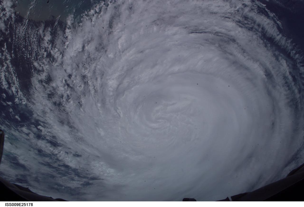
ISS009-E-25178 (26 September 2004) --- The Expedition 9 crew aboard the International Space Station recorded this vertical view of Hurricane Jeanne at 17:47:42 GMT, Sept 26, 2004.
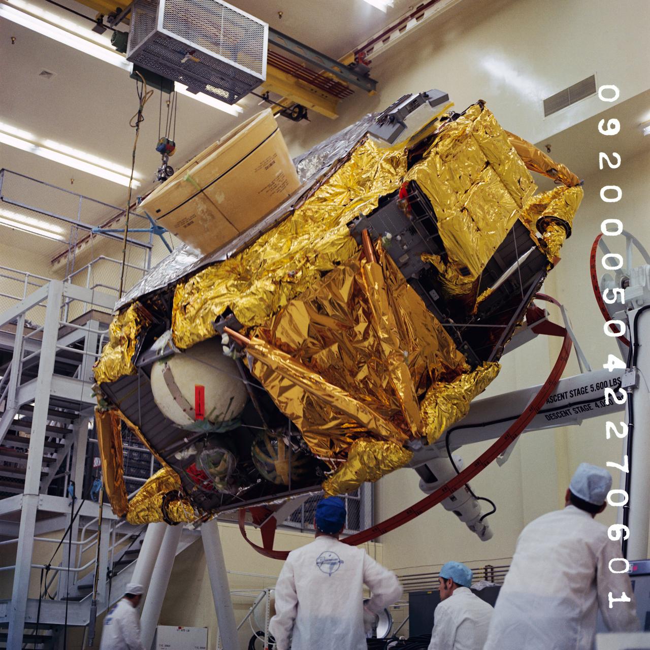
S70-39998 (2 June 1970) --- Manufacturing and testing view of Lunar Module (LM)-9 Descent Stage to Rotate & Clean Fixture at the Grumman, Bethpage, NY, Facility. Photo credit: NASA/Grumman
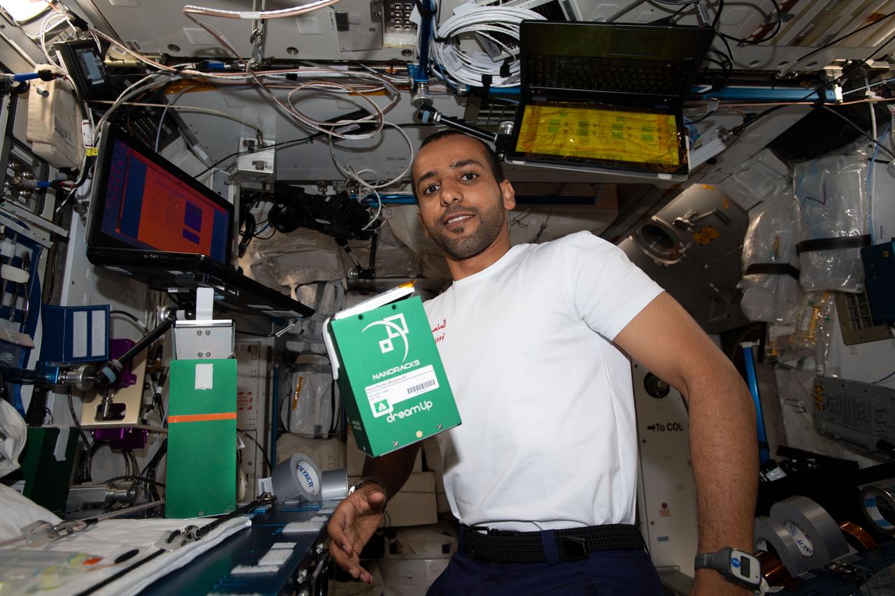
iss060e081230 (9/27/2019) --- A view of United ARAB Emirates (UAE) Spaceflight Participant Hazzaa Ali Almansoori with the NanoRacks Module 82 investigation aboard the International Space Station (ISS).
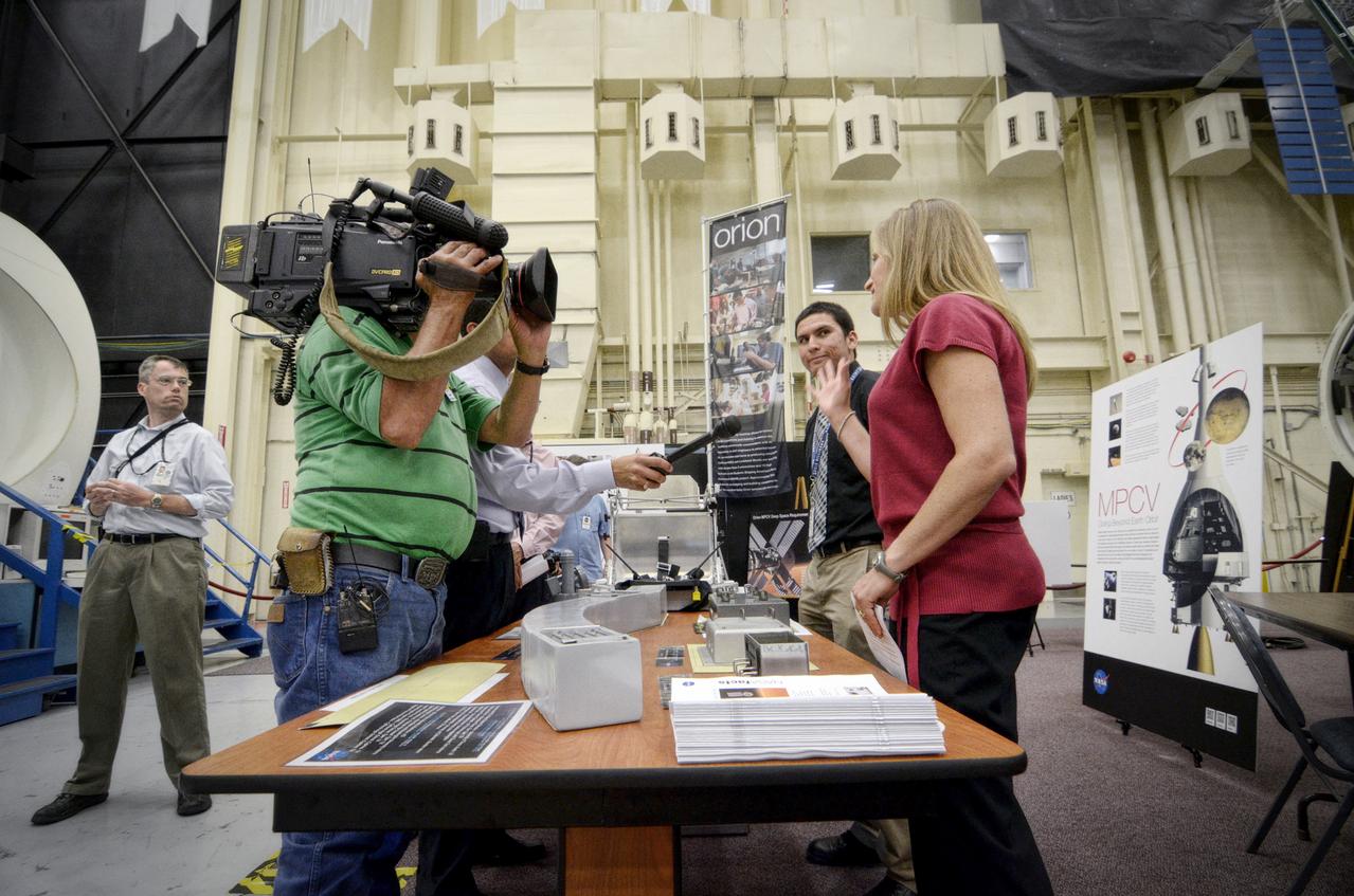
View taken during tour of the Orion mockups in Bldg. 9 at Johnson Space Center in Houston followed by a short Q&A in front of the mockup on Sept. 26, 2011. . Part of Batch image transfer from Flickr.

jsc2022e072973 (9/22/2022) --- A preflight view of the Veg-05 ‘Red Robin’ dwarf tomato growing in Veggie hardware at the Kennedy Space Center. Image courtesy of NASA, ground study
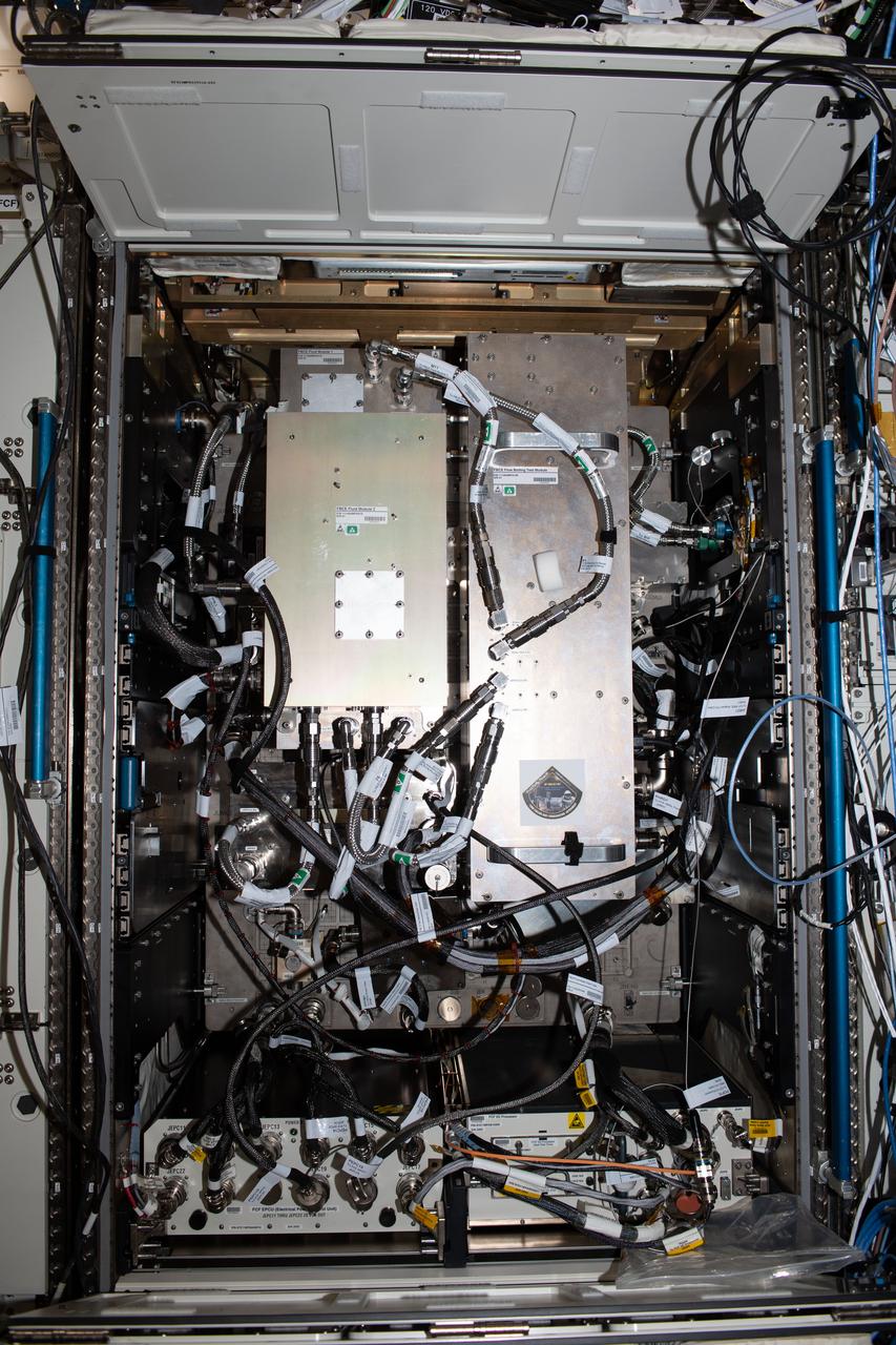
iss066e087939 (12/9/2021) --- A view of the Fluids and Combustion Facility (FCF), used for the Flow Boiling and Condensation Experiment (FBCE) during Expedition 66. The study may improve thermal systems for Earth and other planetary environments.
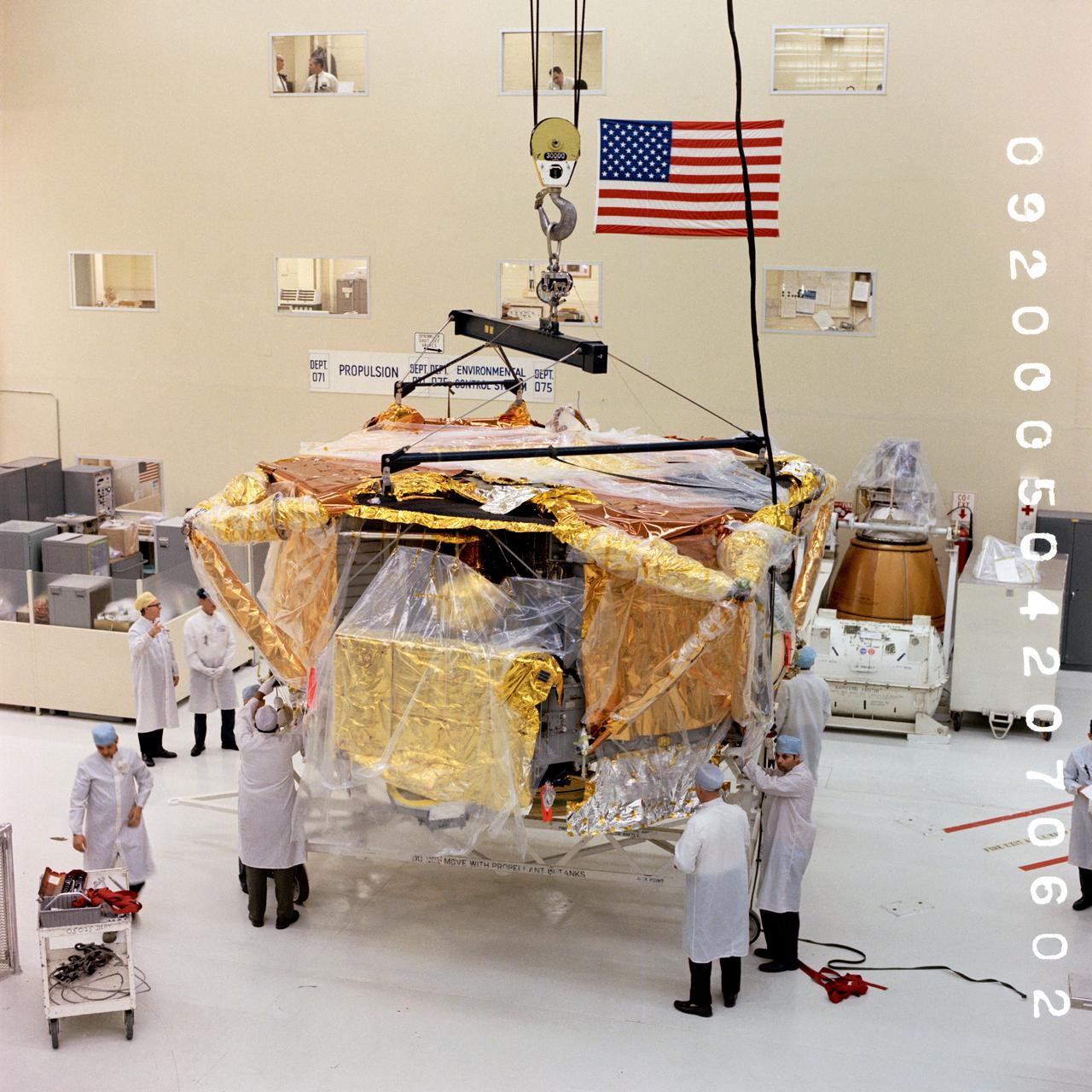
S70-39997 (2 June 1970) --- Manufacturing and testing view of Lunar Module (LM)-9 Descent Stage to Rotate & Clean Fixture at the Grumman, Bethpage, NY, Facility. Photo credit: NASA/Grumman
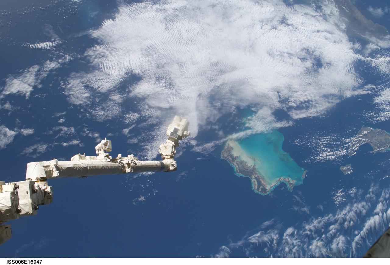
ISS006-E-16947 (9 January 2003) --- The Space Station Remote Manipulator System (SSRMS) or Canadarm2 is pictured over the Bahama Islands in this digital still camera's view taken from the International Space Station (ISS).
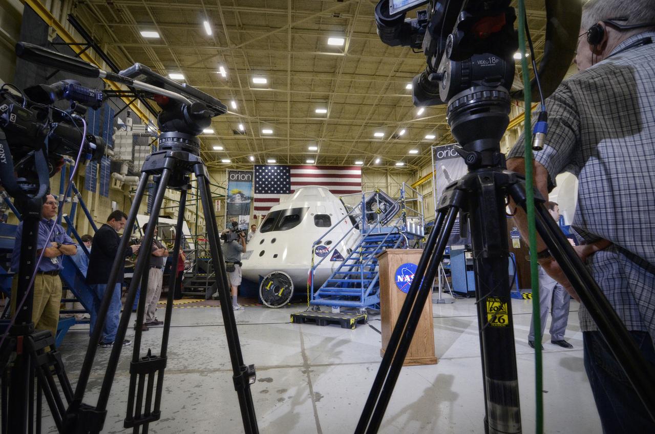
View taken during tour of the Orion mockups in Bldg. 9 at Johnson Space Center in Houston followed by a short Q&A in front of the mockup on Sept. 26, 2011. . Part of Batch image transfer from Flickr.