
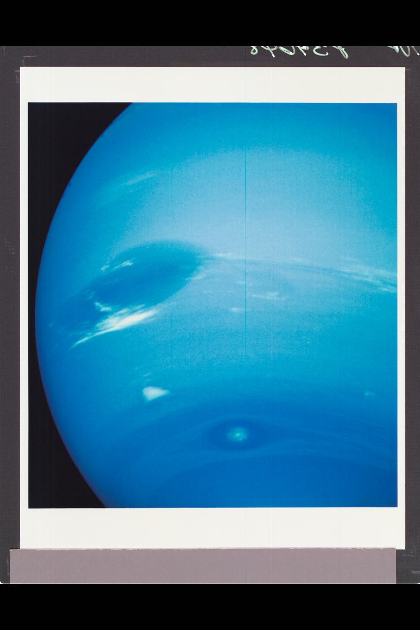
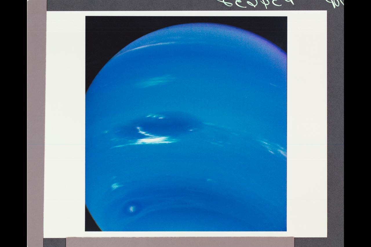
This picture of Neptune was produced from the last whole planet images taken through the green and orange filters on NASA's Voyager 2 narrow angle camera. The images were taken at a range of 4.4 million miles from the planet, 4 days and 20 hours before closest approach. The picture shows the Great Dark Spot and its companion bright smudge; on the west limb the fast moving bright feature called Scooter and the little dark spot are visible. These clouds were seen to persist for as long as Voyager's cameras could resolve them. North of these, a bright cloud band similar to the south polar streak may be seen. http://photojournal.jpl.nasa.gov/catalog/PIA01492
Voyager 2 Image of Saturn

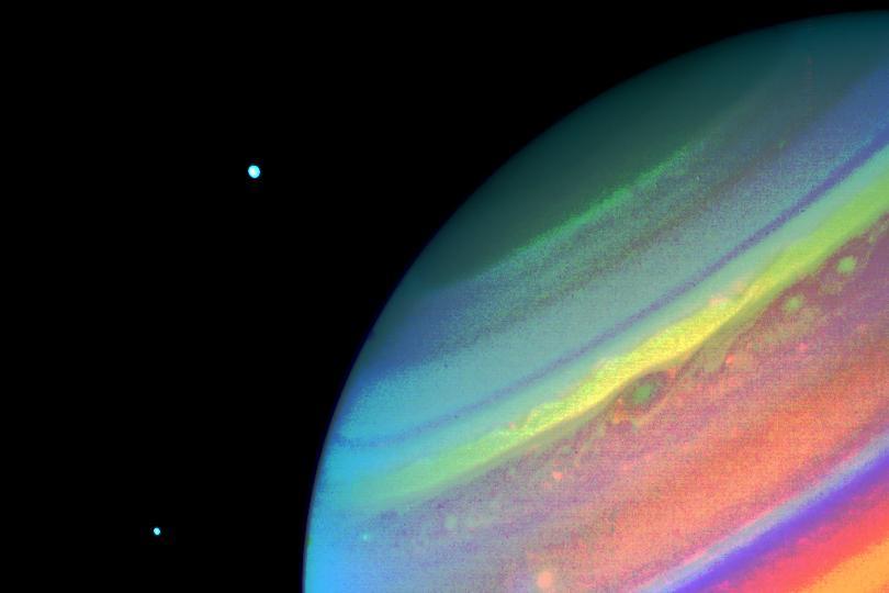
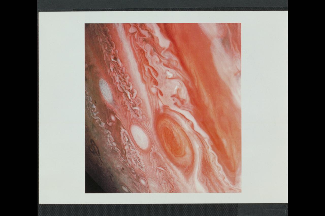
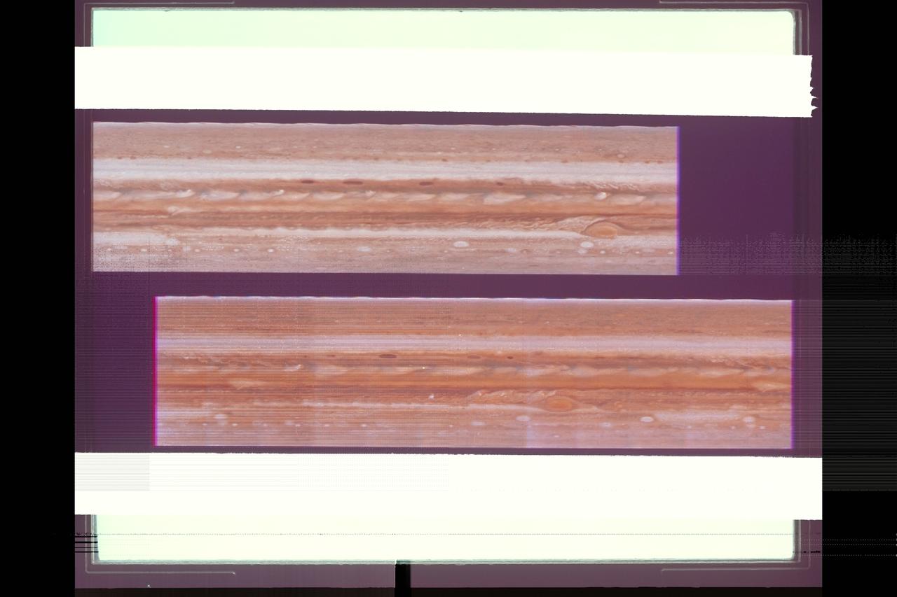
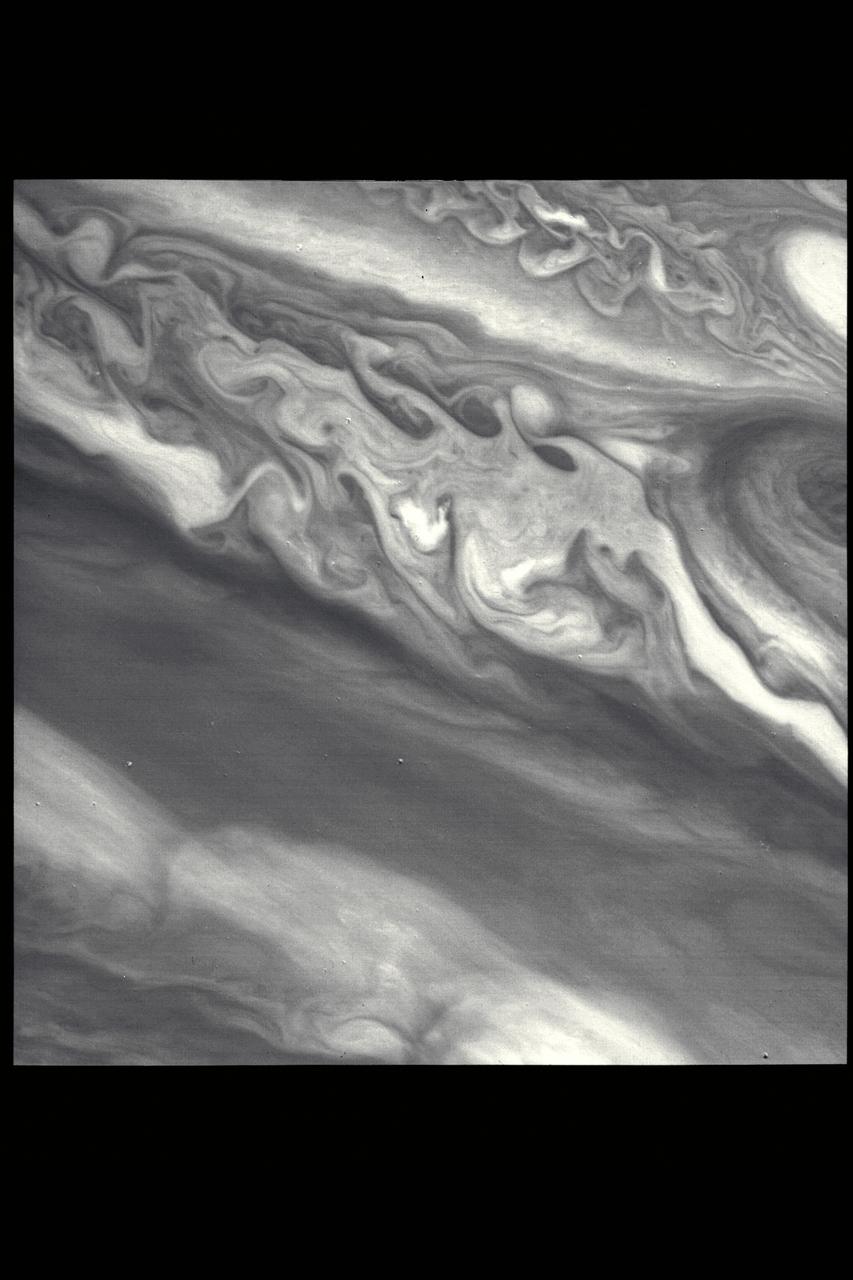
Jupiter from Voyager 2
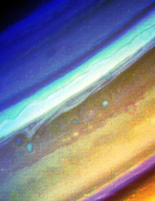
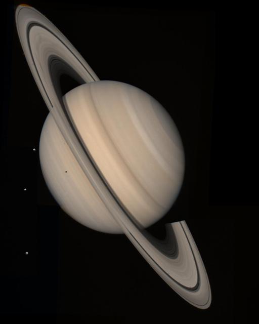
Voyager 2 Image of Saturn
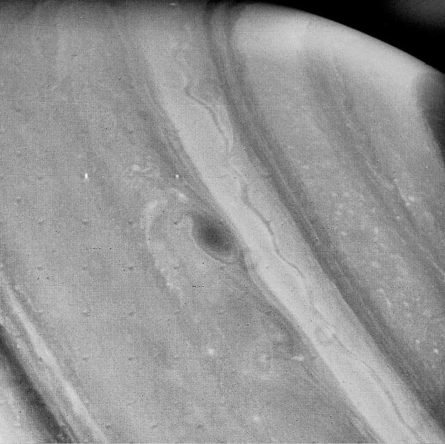
Voyager 2 Image of Saturn

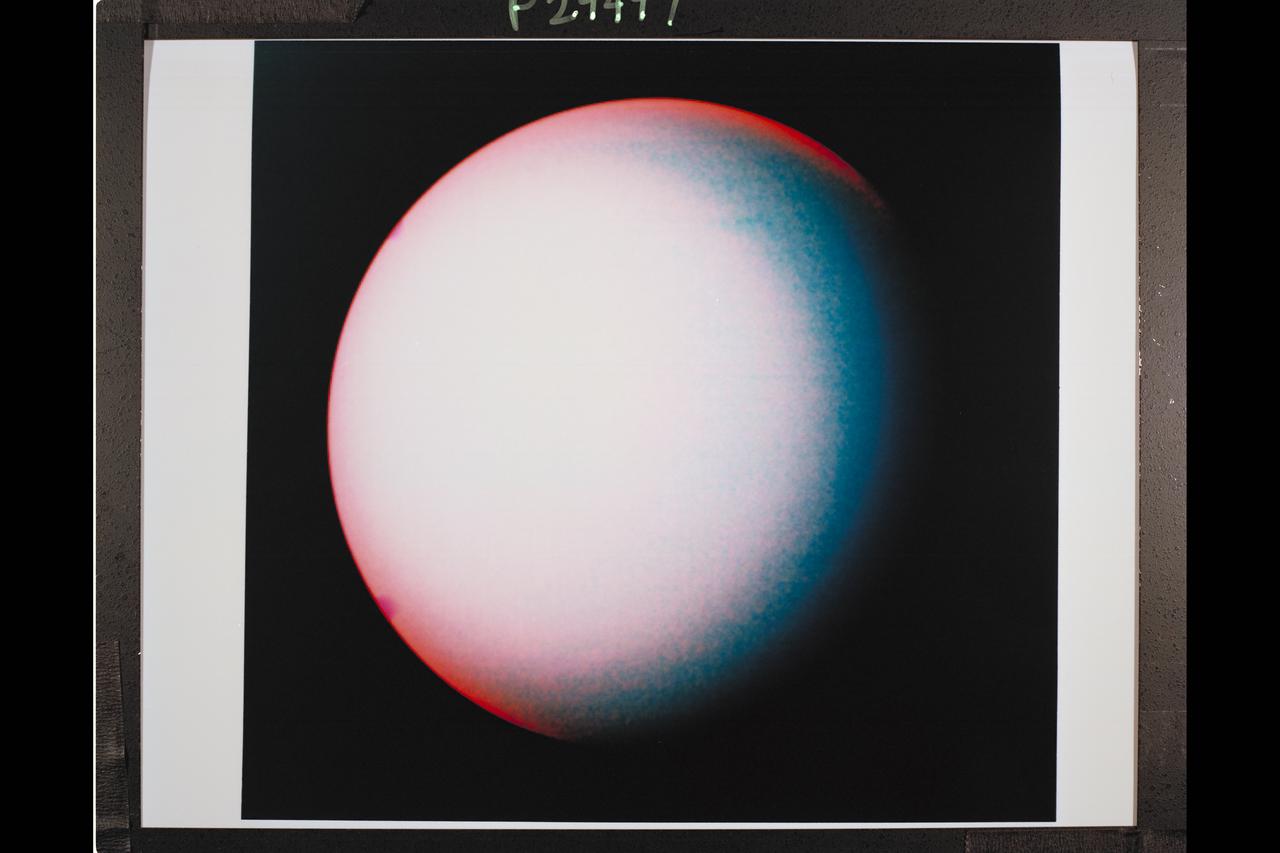
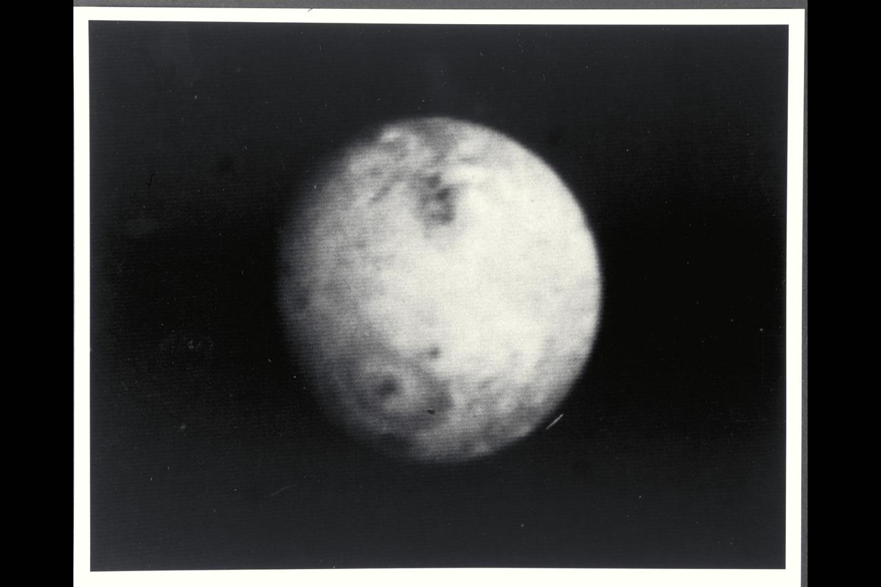
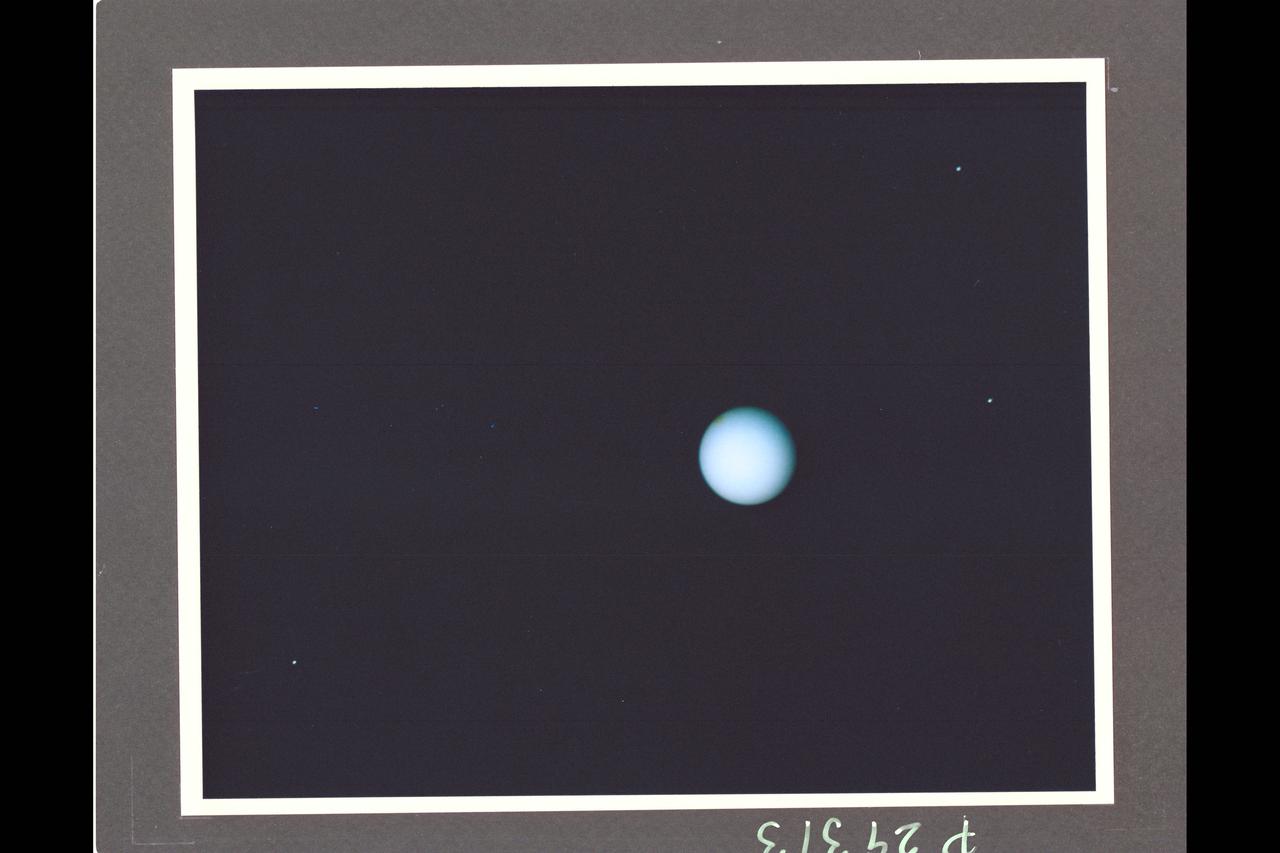
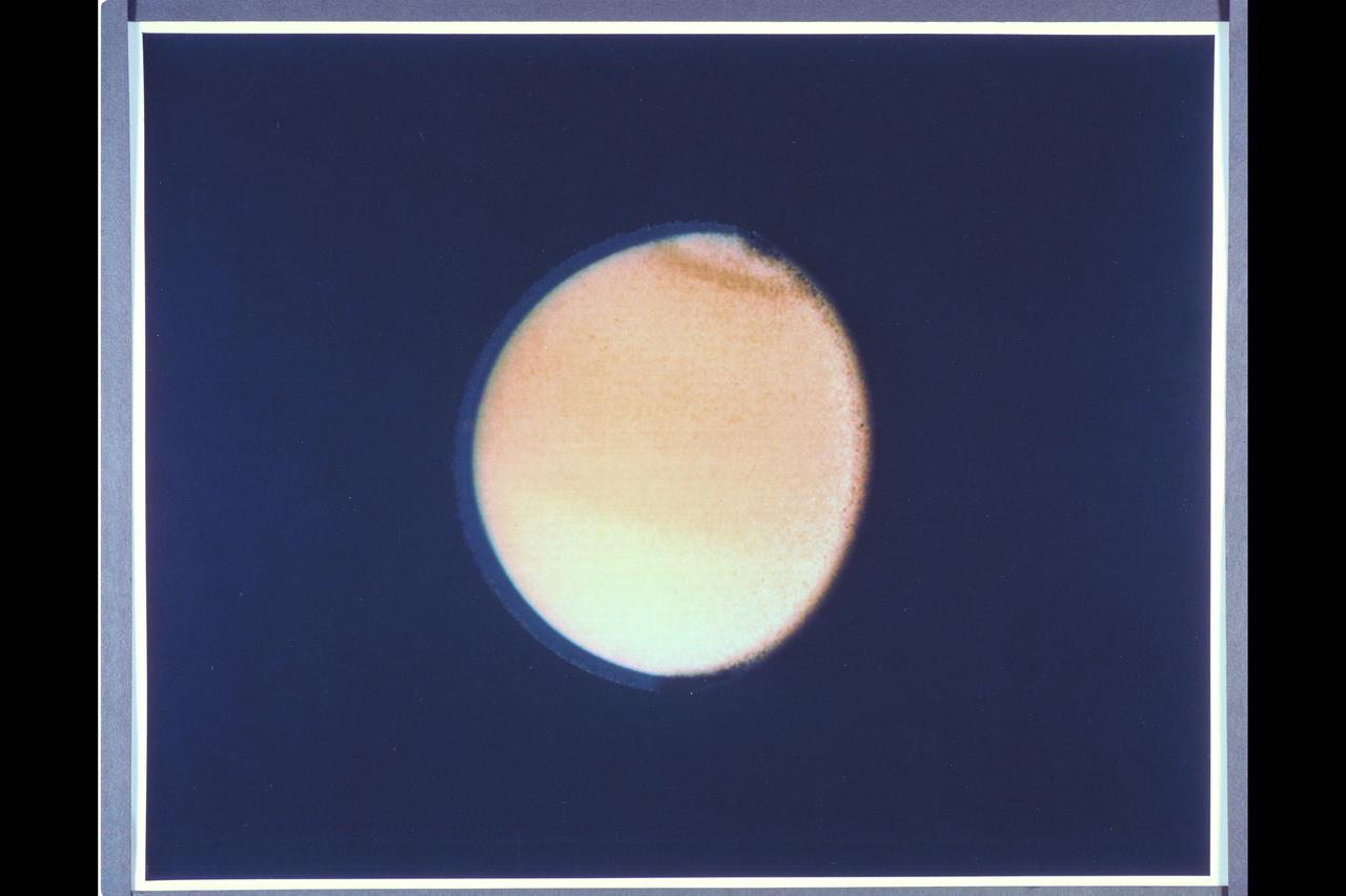
This is an image of the planet Uranus taken by the spacecraft Voyager 2 in 1986.
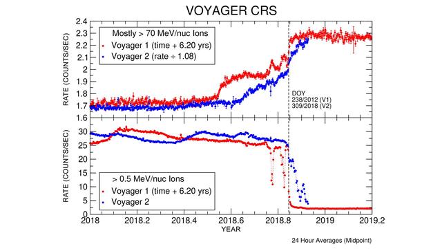
These graphs compare data from identical instruments onboard NASA's Voyager 1 and Voyager 2 spacecraft as they each exited the heliosphere. Voyager 1 exited in 2012, and Voyager 2 exited in 2018. The cosmic ray subsystem (CRS) measures the rate of energetic particles hitting the radiation detector on the instrument. The top graph shows high energy particles (called cosmic rays) that originate outside the heliosphere. The CRS instruments on both spacecraft observed similar, but not identical, increases in the cosmic ray rate as they both crossed the heliopause (the outer edge of the heliosphere). The lower graph shows slightly lower energy particles that originate inside the heliosphere. Both spacecraft detected a similar but not identical decrease in these lower energy particles when they crossed the heliopause and immediately after. https://photojournal.jpl.nasa.gov/catalog/PIA22916
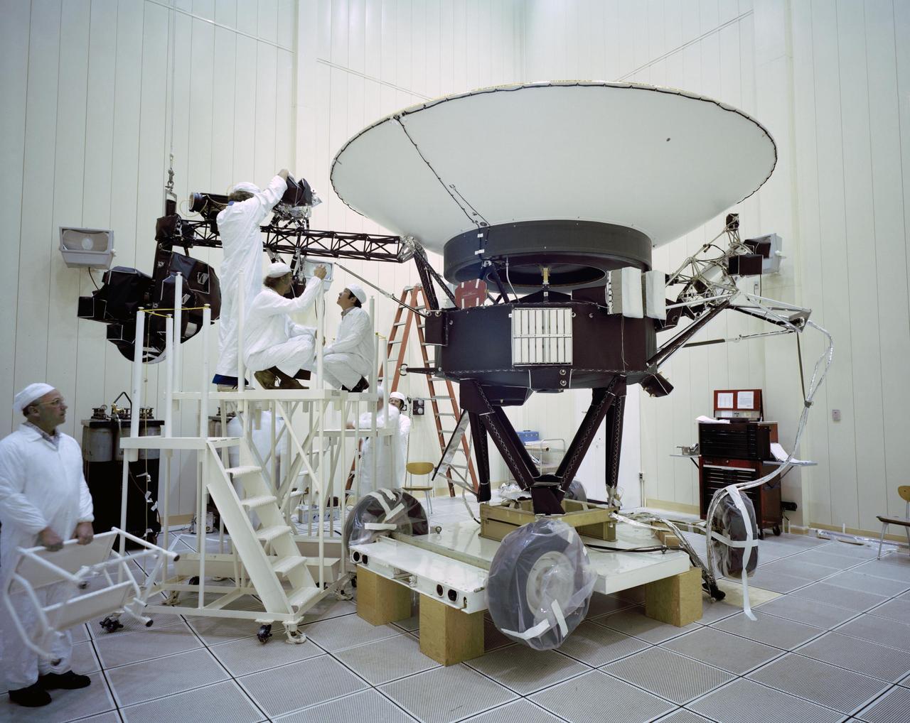
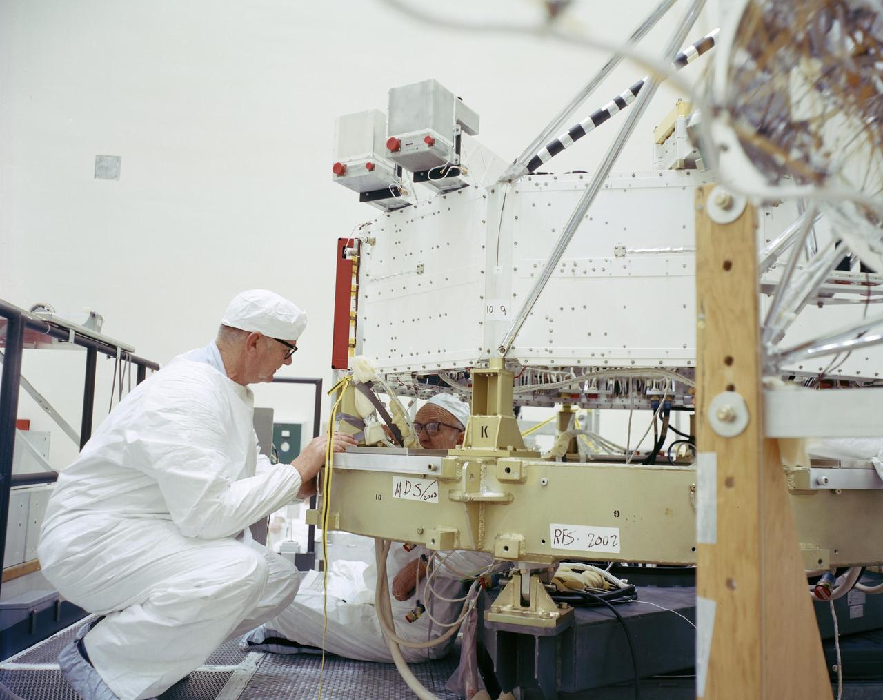
This archival photo shows engineers working on NASA's Voyager 2 spacecraft on March 23, 1977. https://photojournal.jpl.nasa.gov/catalog/PIA21736
The Voyager 2 spacecraft, which was the first of the two Voyagers to launch, is seen at the Spacecraft Assembly and Encapsulation Facility-1 at NASA's Kennedy Space Center in Cape Canaveral, Florida. This archival photo is from August 1977. The spacecraft was put into this shroud on August 2, 1977, to protect it during flight through the atmosphere. https://photojournal.jpl.nasa.gov/catalog/PIA21743
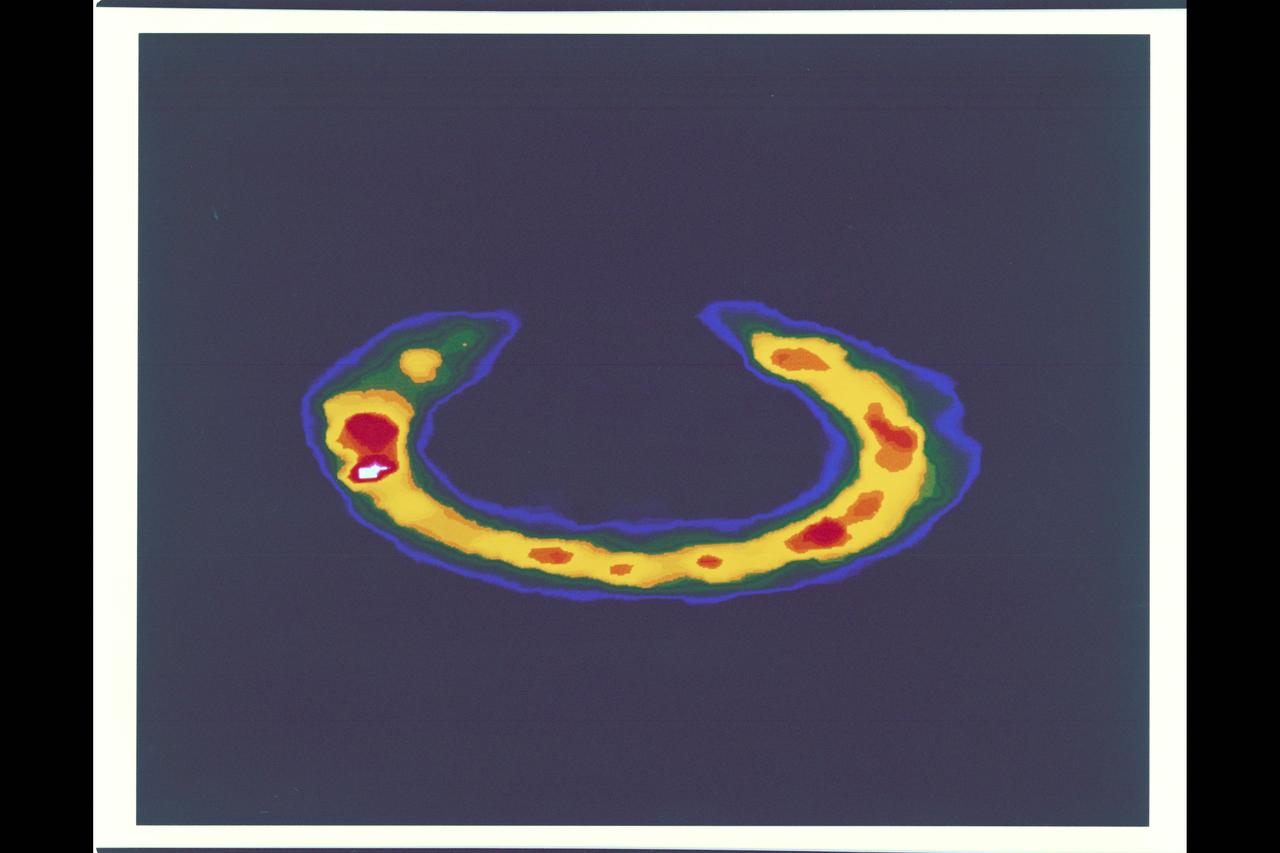
Saturn storms observed by NASA Voyager, Aug. 5, 2004. Voyager 1 and 2 observed radio signals from lightning which were interpreted as being from a persistent, low-latitude storm system.
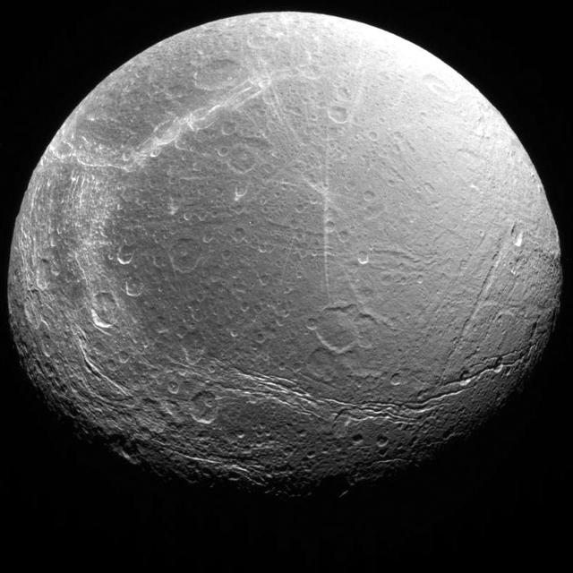
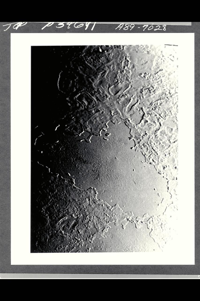
Cracks, canyons, craters, and streaks are seen in this image of Saturn icy moon, Dione, taken from Voyager 2 on August 3, 2005.

This archival photo shows Voyager 2 at the Spacecraft Assembly and Encapsulation Facility at NASA's Kennedy Space Center in Cape Canaveral, Florida. https://photojournal.jpl.nasa.gov/catalog/PIA21728
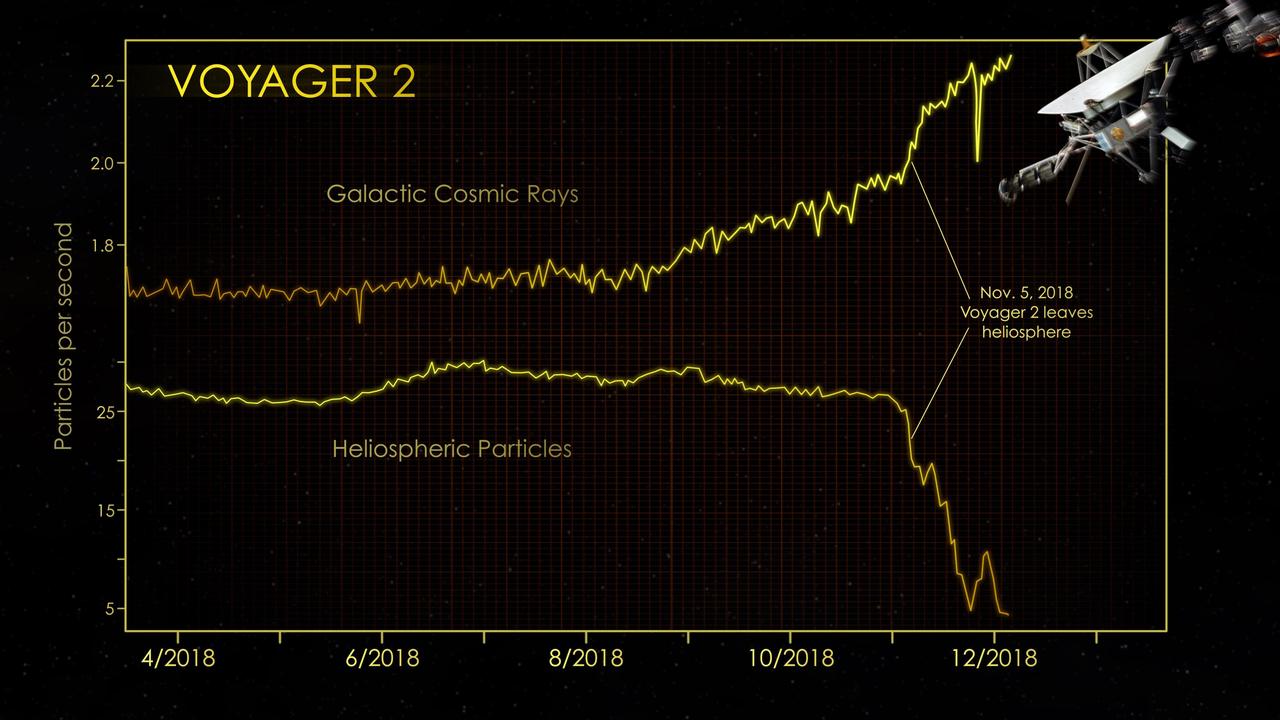
At the end of 2018, the cosmic ray subsystem (CRS) aboard NASA's Voyager 2 spacecraft provided evidence that Voyager 2 had left the heliosphere (the plasma bubble the Sun blows around itself). There were steep drops in the rate at which particles that originate inside the heliosphere hit the instrument's radiation detector. At the same time, there were significant increases in the rate at which particles that originate outside our heliosphere (also known as galactic cosmic rays) hit the detector. The graphs show data from Voyager 2's CRS, which averages the number of particle hits over a six-hour block of time. CRS detects both lower-energy particles that originate inside the heliosphere (greater than 0.5 MeV) and higher-energy particles that originate farther out in the galaxy (greater than 70 MeV). https://photojournal.jpl.nasa.gov/catalog/PIA22924
This archival photo shows engineers at NASA's Jet Propulsion Laboratory working on the 10-sided central structure, or "bus," of the Voyager 2 spacecraft on February 24,1977. https://photojournal.jpl.nasa.gov/catalog/PIA21478
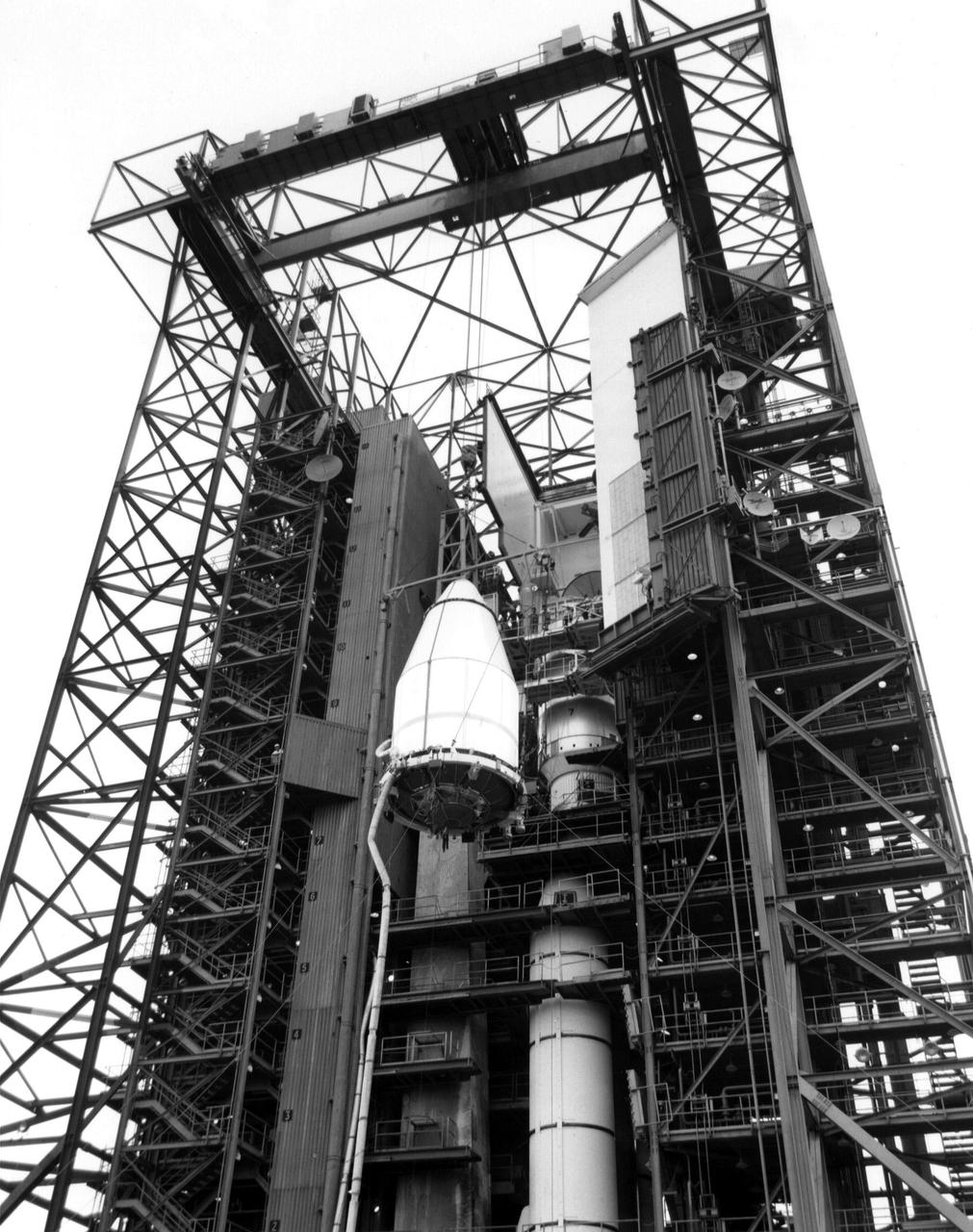
NASA's Voyager 2 spacecraft, encapsulated within its payload fairing, is seen on August 5, 1977. It launched atop the Titan/Centaur-7 launch vehicle from Cape Canaveral Air Force Station in Florida on August 20, 1977, at 10:29 a.m. local time. https://photojournal.jpl.nasa.gov/catalog/PIA21742
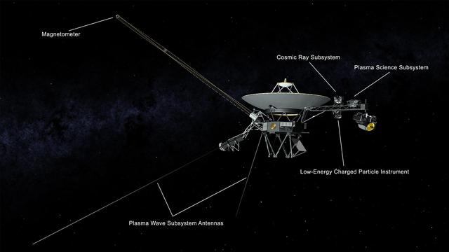
This illustration of NASA's Voyager 2 spacecraft shows the location of the onboard science instruments that are still operating: the magnetometer, the cosmic ray subsystem, the plasma science experiment, the low-energy charged particle instrument and the antennas used by the plasma wave subsystem. https://photojournal.jpl.nasa.gov/catalog/PIA22915
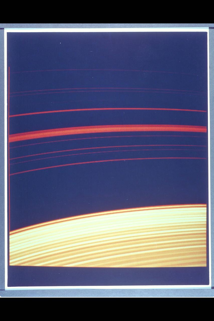
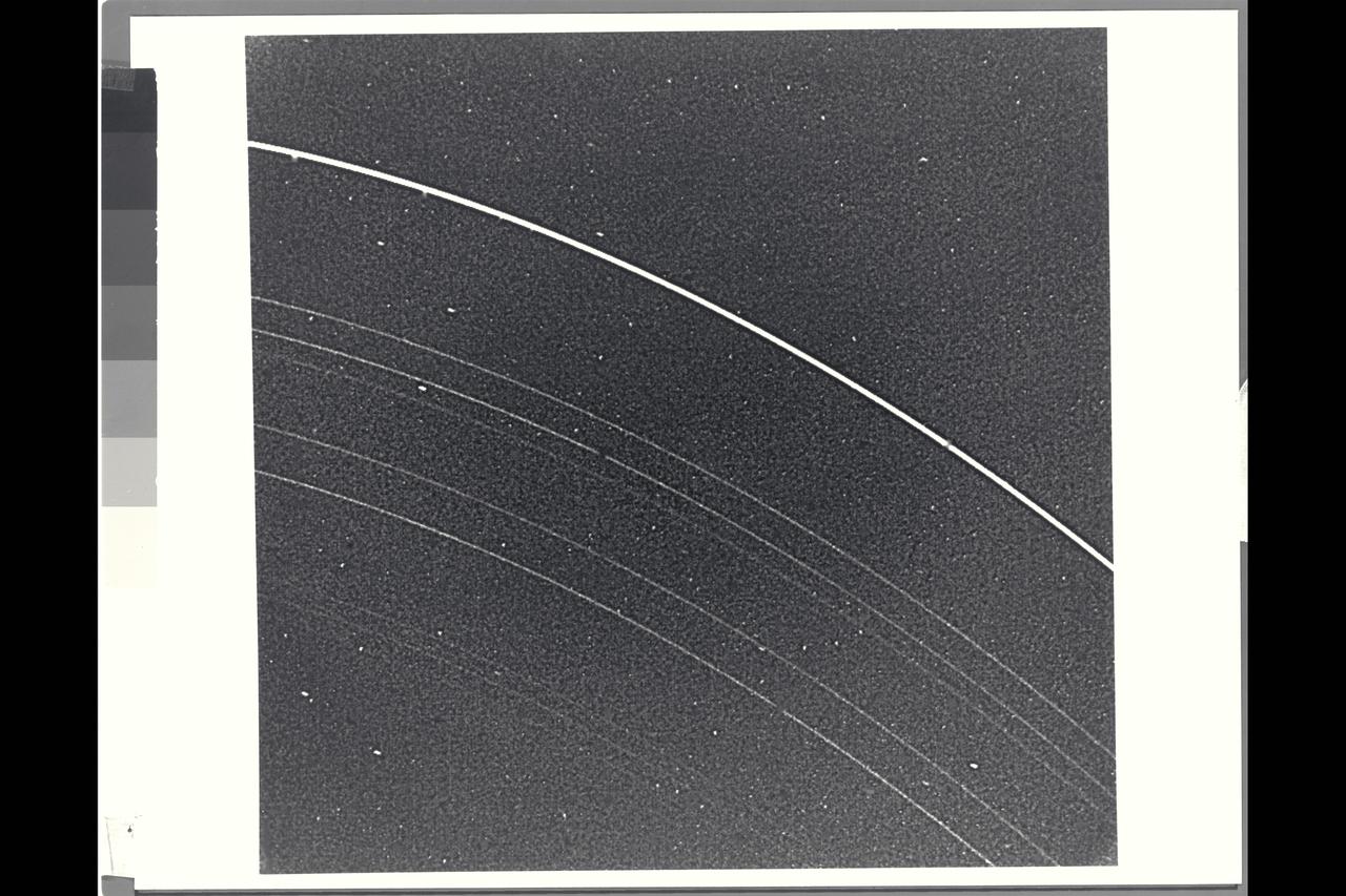
Saturn's rings, as photographed by Voyager 2.
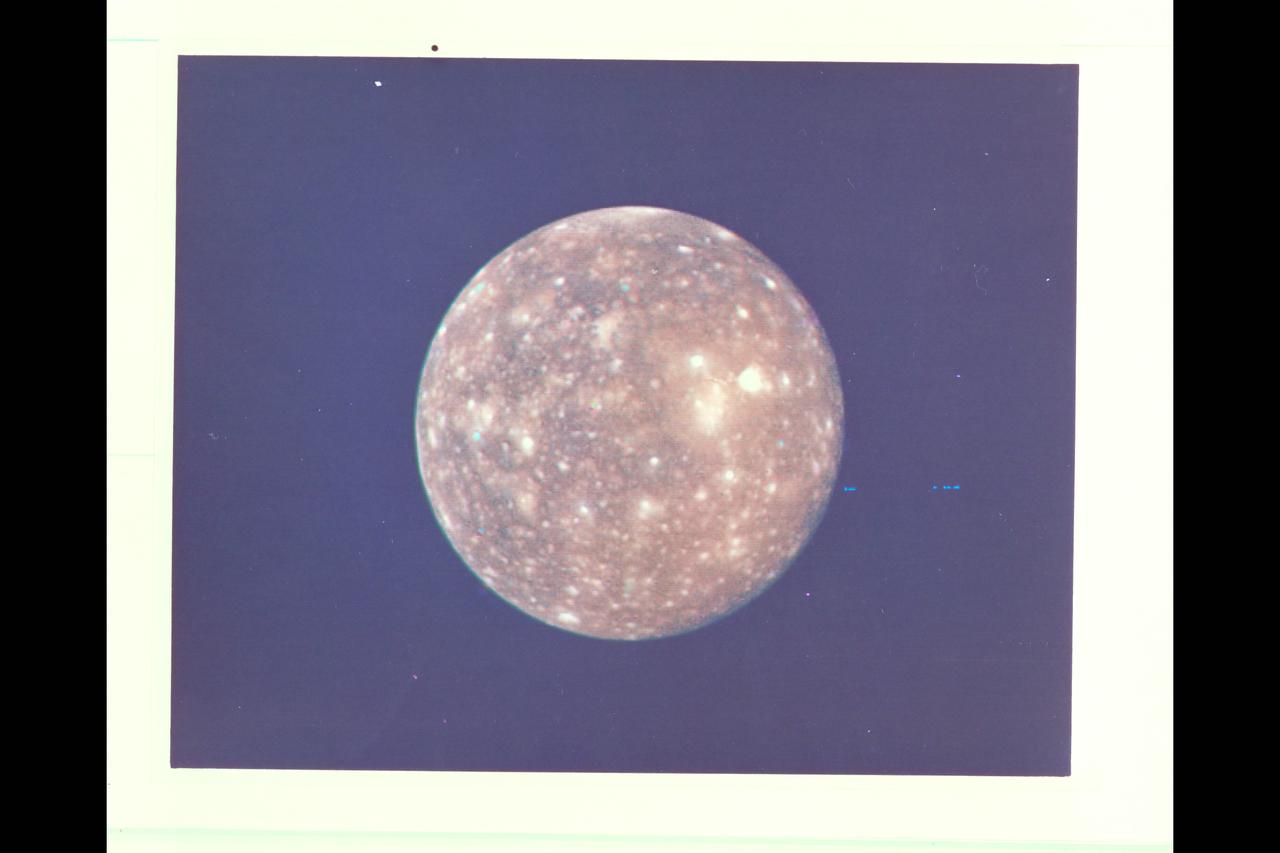
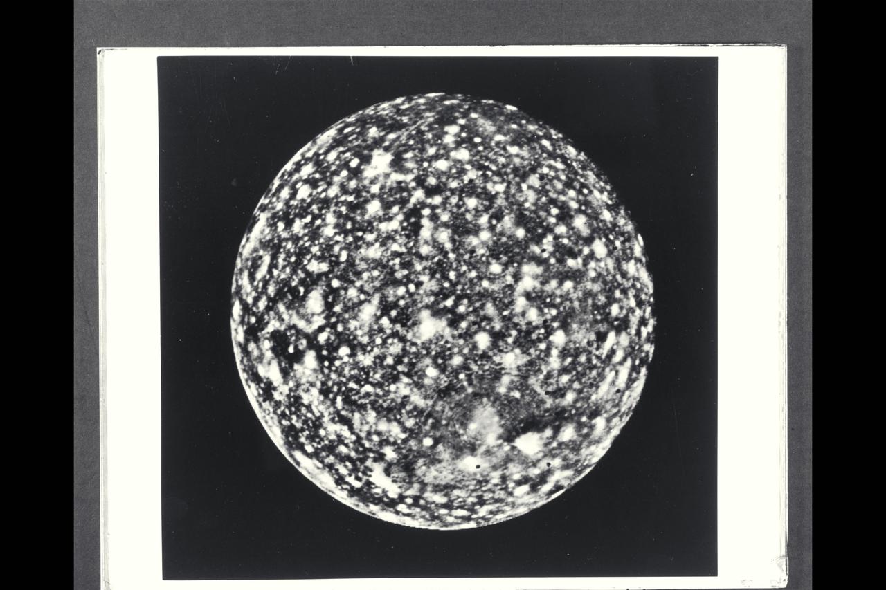
P-21740 C Range: 2,318,000 kilometers (1,438,000 miles) This picture of Callisto taken by Voyager 2 shows the moon covered with bright spots which are metoerite impact craters--a fact originally discovered from the high resolution pictures taken by Voyager 1. Scientists believe that heavily cratered terrains like these on Callisto are indicative of ancient planetary surfaces. Voyager 2 mapped the side of Callisto not seen by Voyager 1. The obsure dark streaks in this area may be fault zones, but higher resolution pictures are needed for identification.

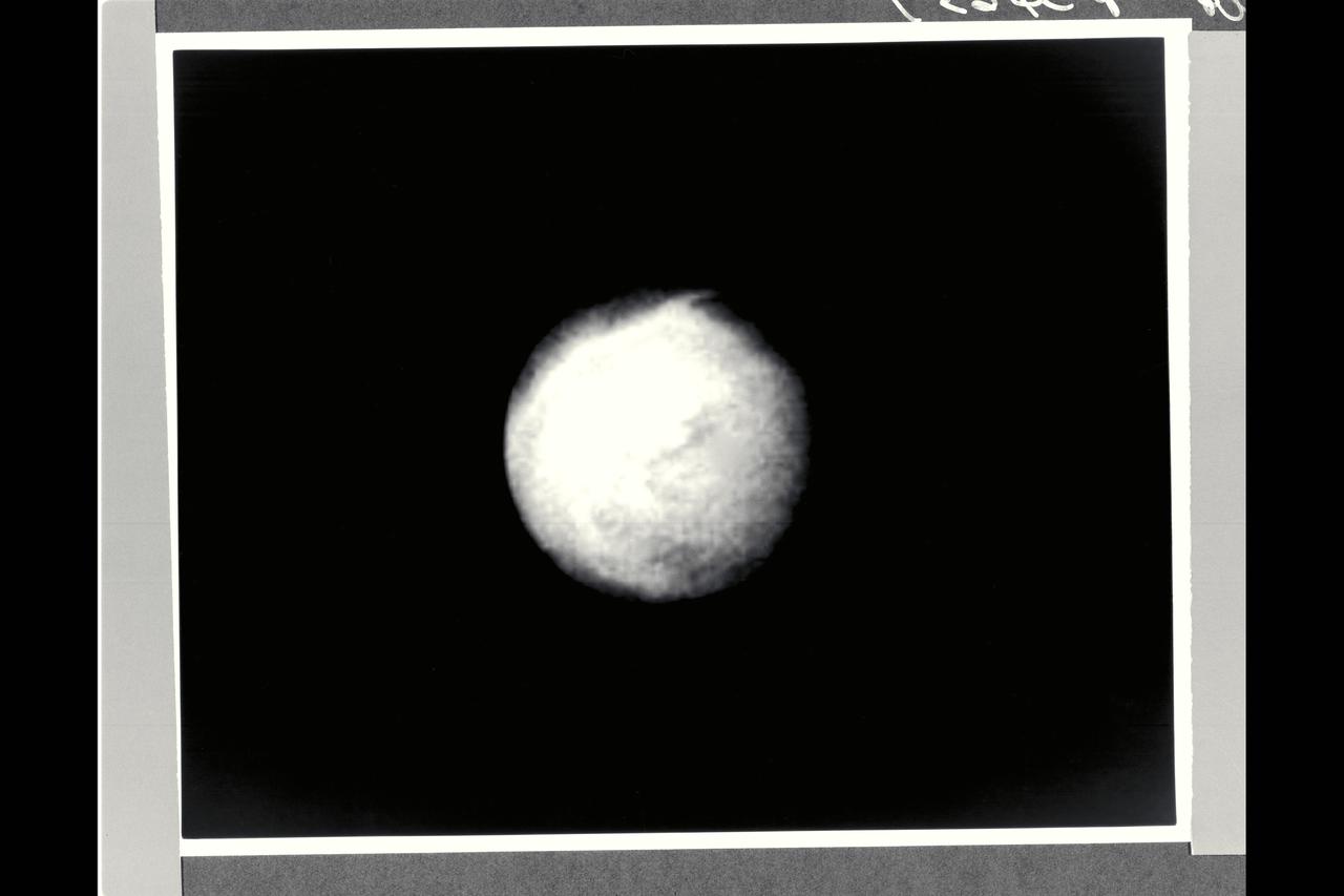
This photograph is a Voyager 2 image of one of the moons of Saturn.
Saturn and it's rings, with callouts, as photographed by Voyager 2
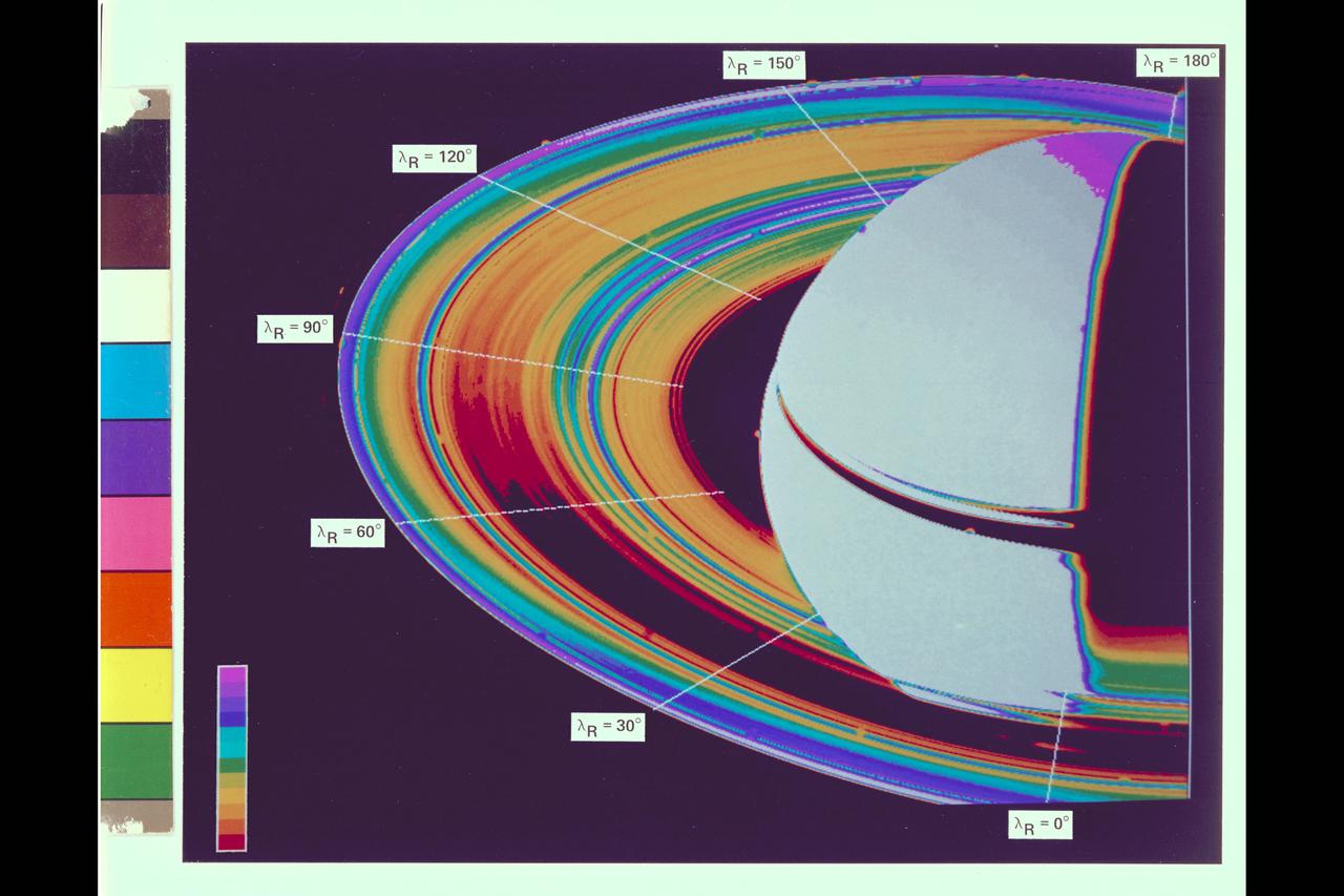
Saturn and it's rings, with callouts, as photographed by Voyager 2
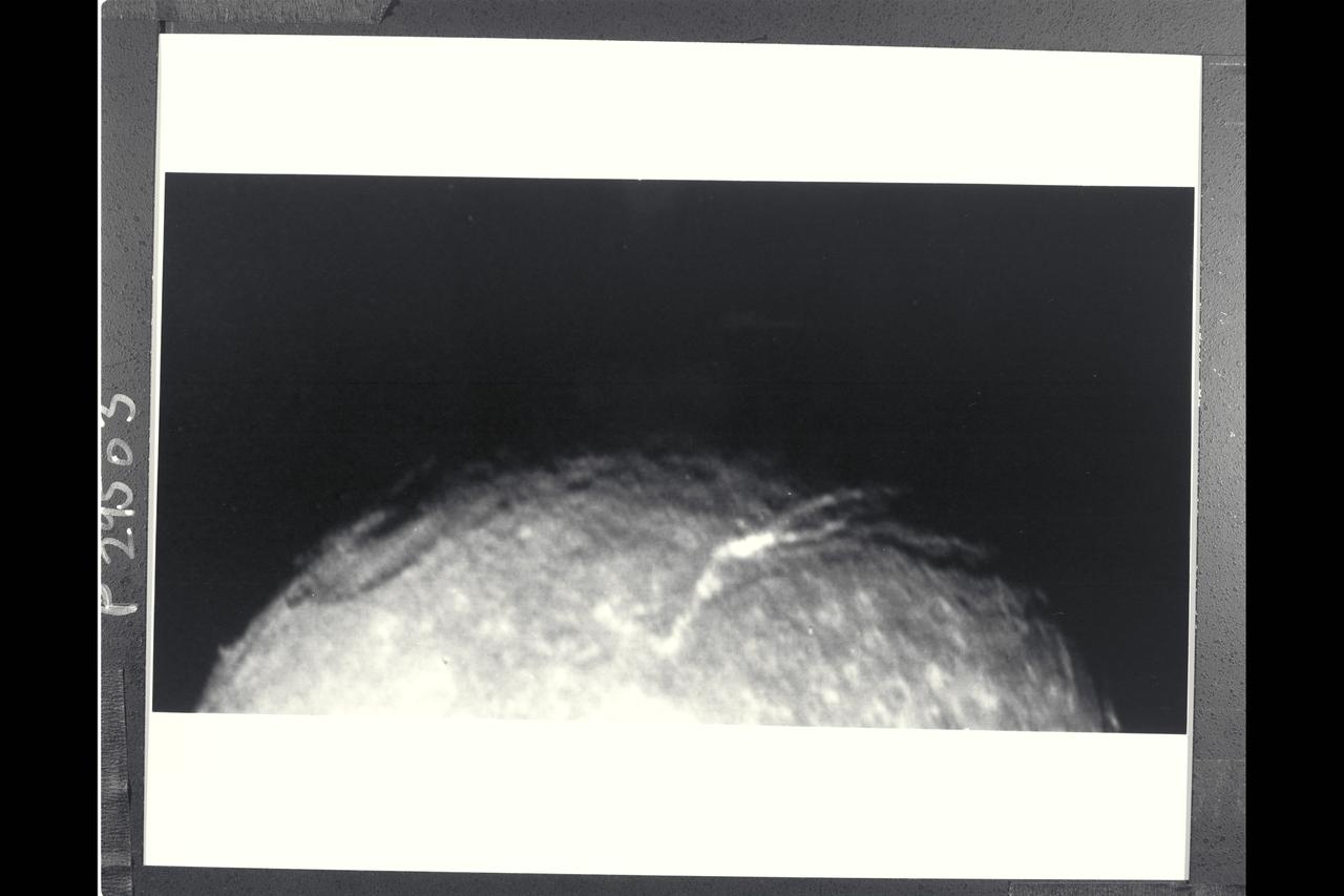
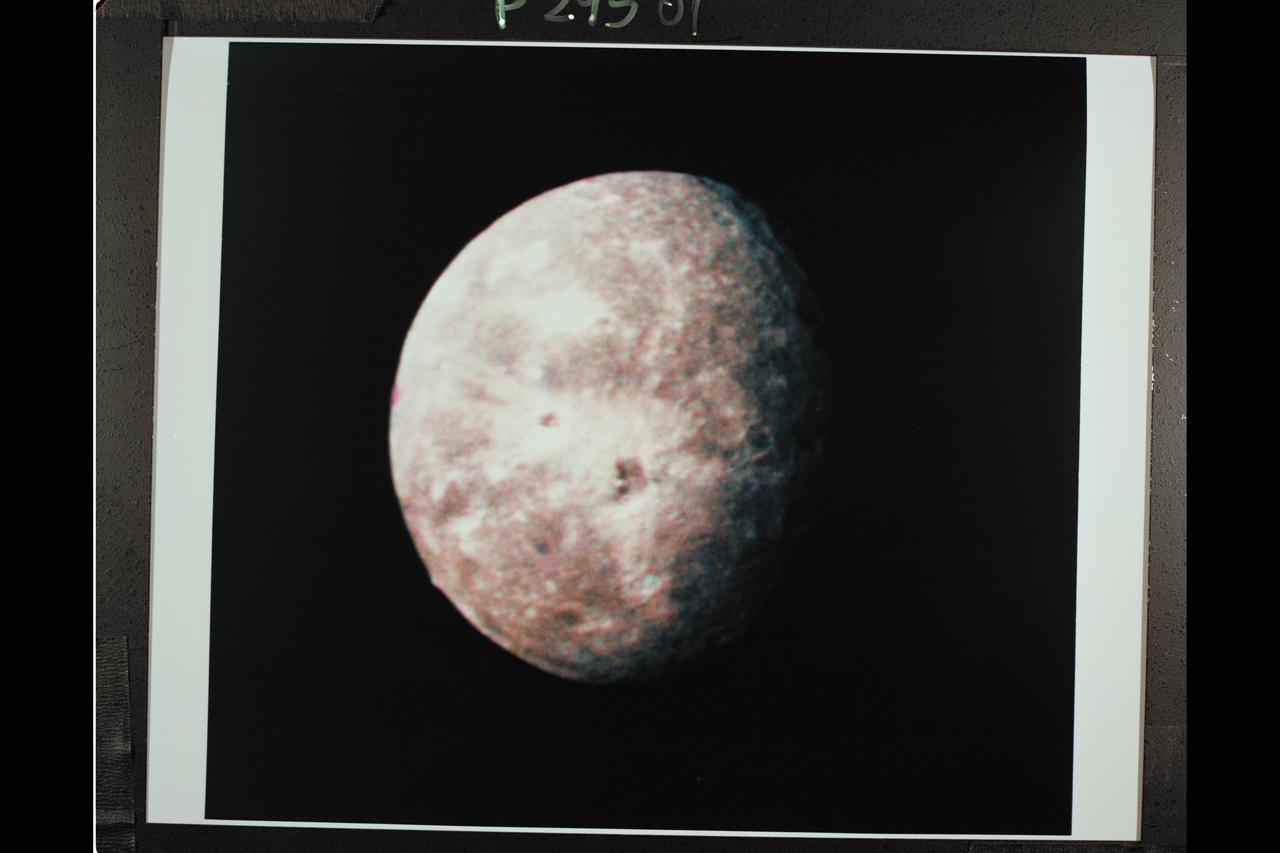
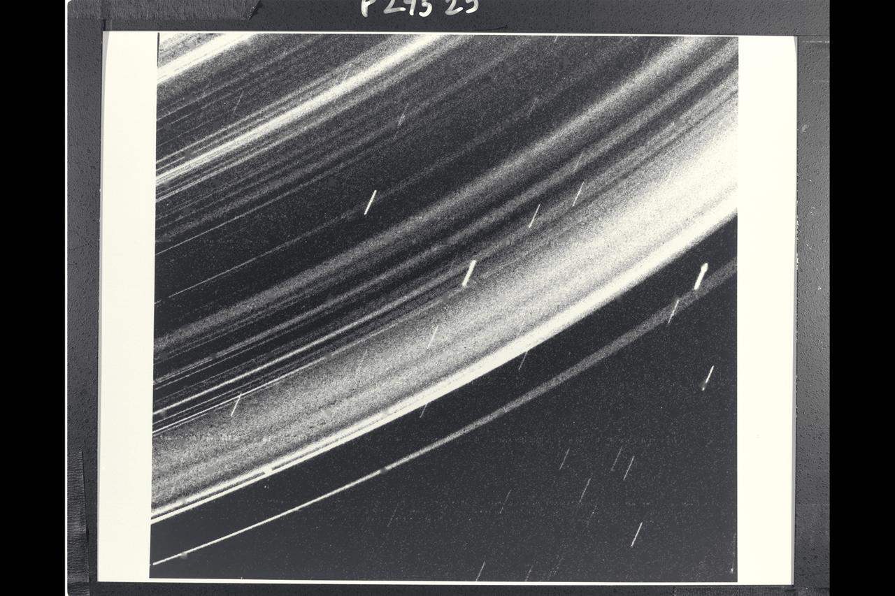
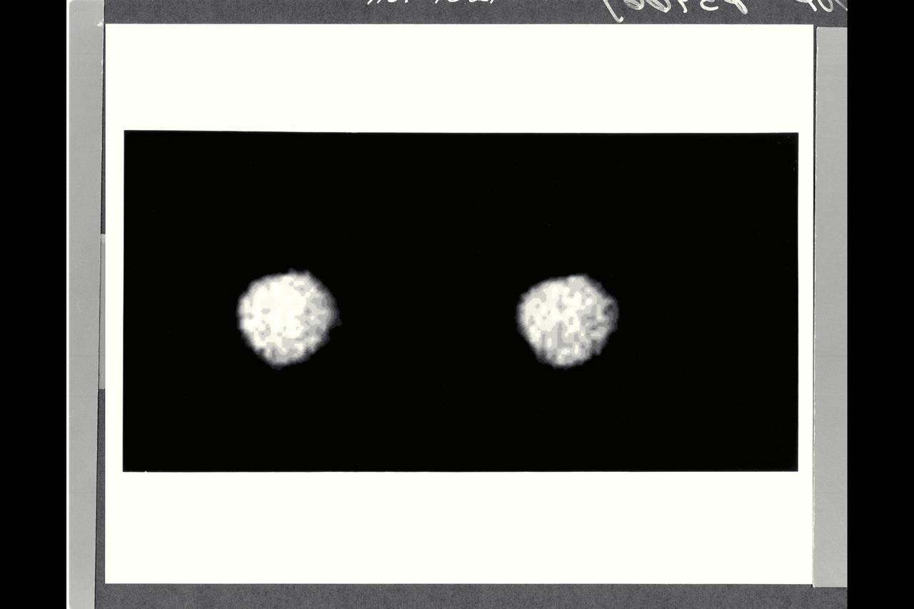
P29503 Moon (closeup) Voyager 2 flyby of Uranus
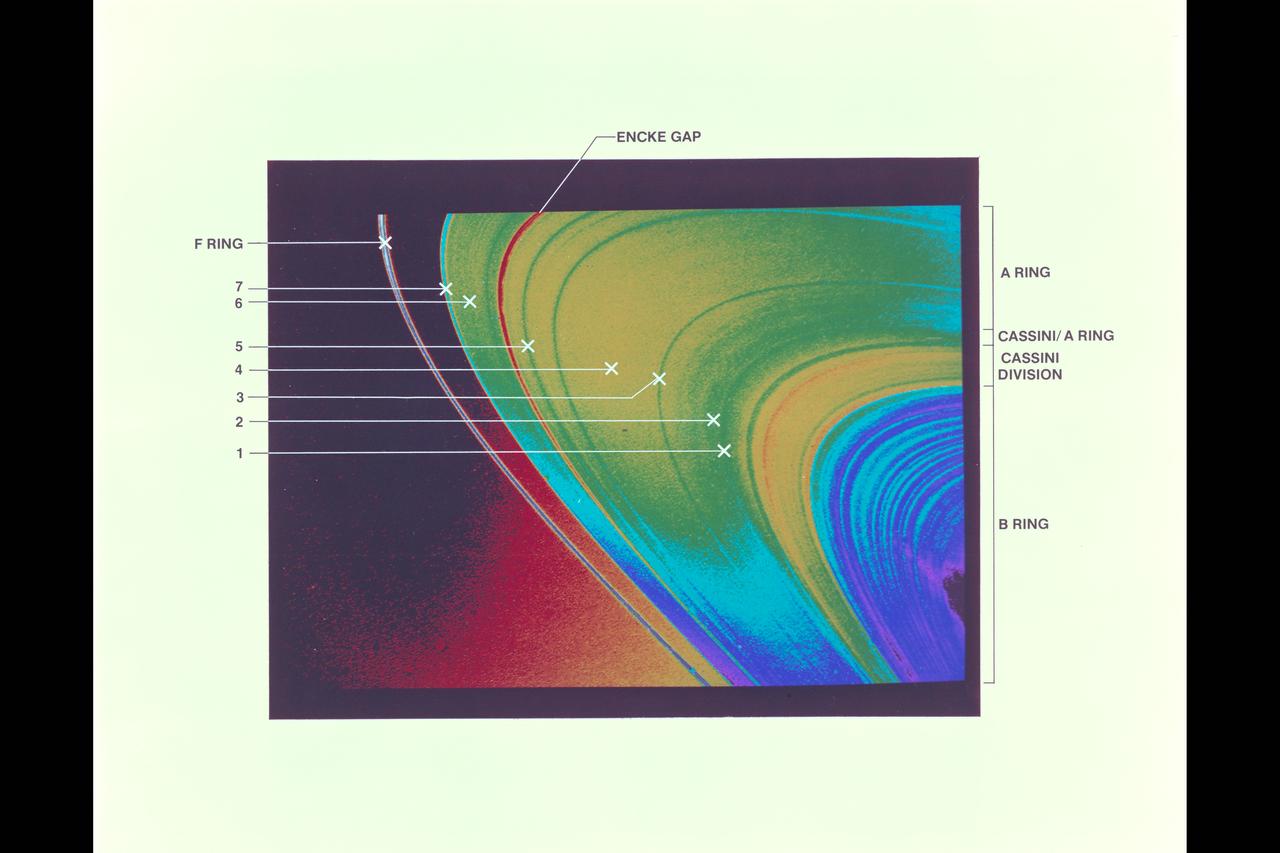
Saturn and it's rings, with callouts, as photographed by Voyager 2

This artist's concept puts solar system distances -- and the travels of NASA's Voyager 2 spacecraft -- in perspective. The scale bar is in astronomical units, with each set distance beyond 1 AU representing 10 times the previous distance. One AU is the distance from the Sun to Earth, which is about 93 million miles, or 150 million kilometers. Neptune, the most distant planet from the Sun, is about 30 AU. Much of the solar system is actually in interstellar space. Informally, the term "solar system" is often used to mean the space out to the last planet. Scientific consensus, however, says the solar system goes out to the Oort Cloud, the source of the comets that swing by our sun on long time scales. Beyond the outer edge of the Oort Cloud, the gravity of other stars begins to dominate that of the Sun. The inner edge of the main part of the Oort Cloud could be as close as 1,000 AU from our Sun. The outer edge is estimated to be around 100,000 AU. Voyager 2, the second farthest human-made object after Voyager 1, is around 119 AU from the Sun. Indications from the scientific instruments suggest Voyager 2 passed beyond our heliosphere (the bubble of plasma the Sun blows around itself) and into interstellar space (the space between stars) in November 2018. The heliosphere has a turbulent outer boundary known as the heliosheath. The termination shock is the inner boundary of the heliosheath and the heliopause is the outer boundary, beyond which lies interstellar space. Voyager 2 crossed the termination shock at 84 AU in August 2007. It will take about 300 years for Voyager 2 to reach the inner edge of the Oort Cloud and possibly about 30,000 years to fly beyond it. Voyager 2 is heading away from the Sun about 36 degrees out of the ecliptic plane (plane of the planets) to the south, toward the constellations of Sagittarius and Pavo. In about 40,000 years, Voyager 2 will be closer to another star than our own Sun, coming within about 1.7 light years of a star called Ross 248, a small star in the constellation of Andromeda. https://photojournal.jpl.nasa.gov/catalog/PIA22921
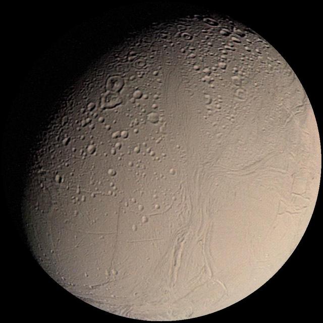
Voyager 2 Color Image of Enceladus, Almost Full Disk http://photojournal.jpl.nasa.gov/catalog/PIA00347
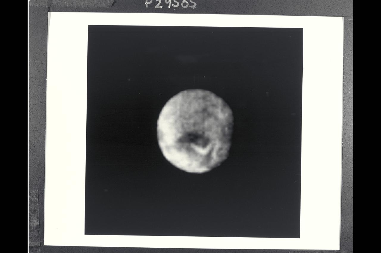
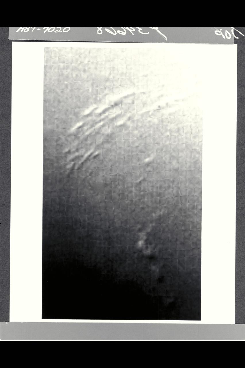
P-29505 Moon Voyager 2 flyby of Uranus' moons
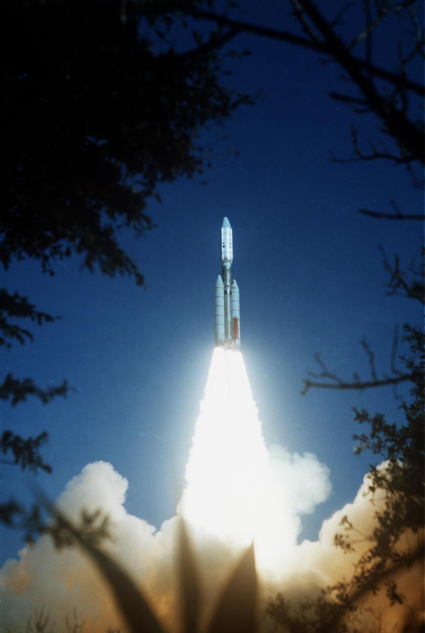
NASA Voyager 2 was launched on Aug. 20, 1977 from the NASA Kennedy Space Center at Cape Canaveral in Florida where it was propelled into space on a Titan/Centaur rocket.
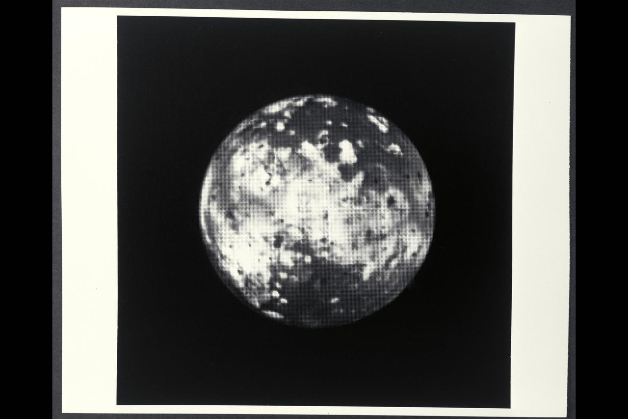
P-21741 BW Range: 2.6 million kilometers (1.6 million miles) This picture of Io, taken by Voyager 1, shows the region of the Jovian moon which will be monitored for volcanic eruptions by Voyager 2 during the 'Io movie' sequence. The white and orange patches probably are deposits of sulphur compounds and other volcanic materials. The Voyager 2 pictures of this region will be much more detailed.
P-21738 BW Raange: 4.76 million kilometers (2.9 million miles) This Voyager 2 picture of Io was taken in ultraviolet light and shows one of the volcanic eruption plumes first photographed by Voyager 1. (the bright spot on the right limb) The plume is more than 200 kilometers (124 miles) high. The volcano apparently has been erupting since it was observed by Voyager 1 in March, 1979. This suggests that the volcanoes on Io probably are in continuous eruption.
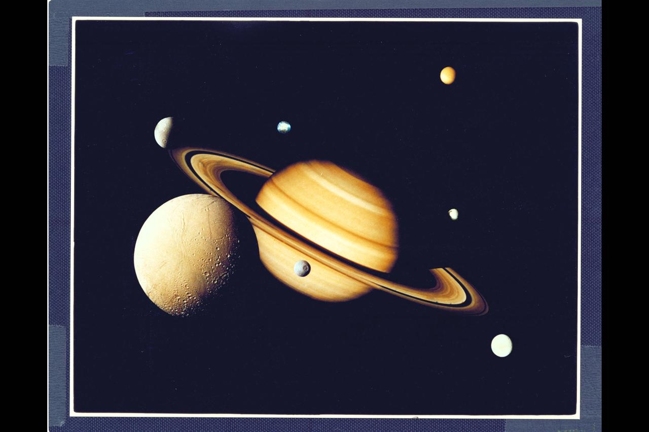
P- 24281 Saturn and it's seven moons, as photographed by Voyager 2. composite image
P29501C Moon from Voyager 2 Uranus flyby
P-29507 Rings Voyager 2 flyby of Uranus

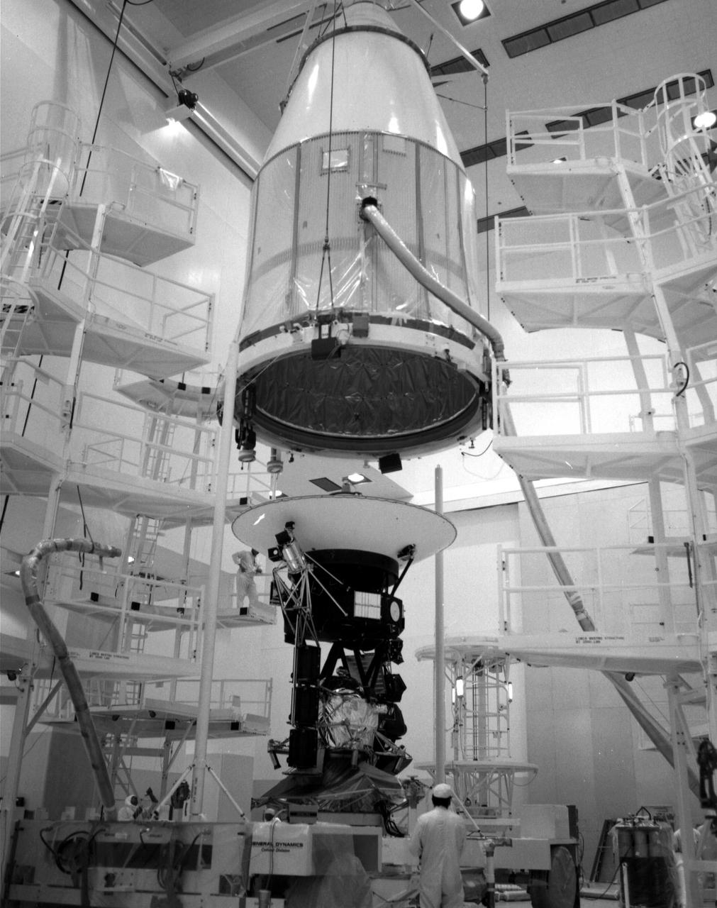
The Voyager 2 spacecraft, encapsulated within its payload fairing, is seen in August 1977, as it was being hoisted upward for attachment to its launch vehicle at NASA's Kennedy Space Center in Cape Canaveral, Florida. https://photojournal.jpl.nasa.gov/catalog/PIA21727
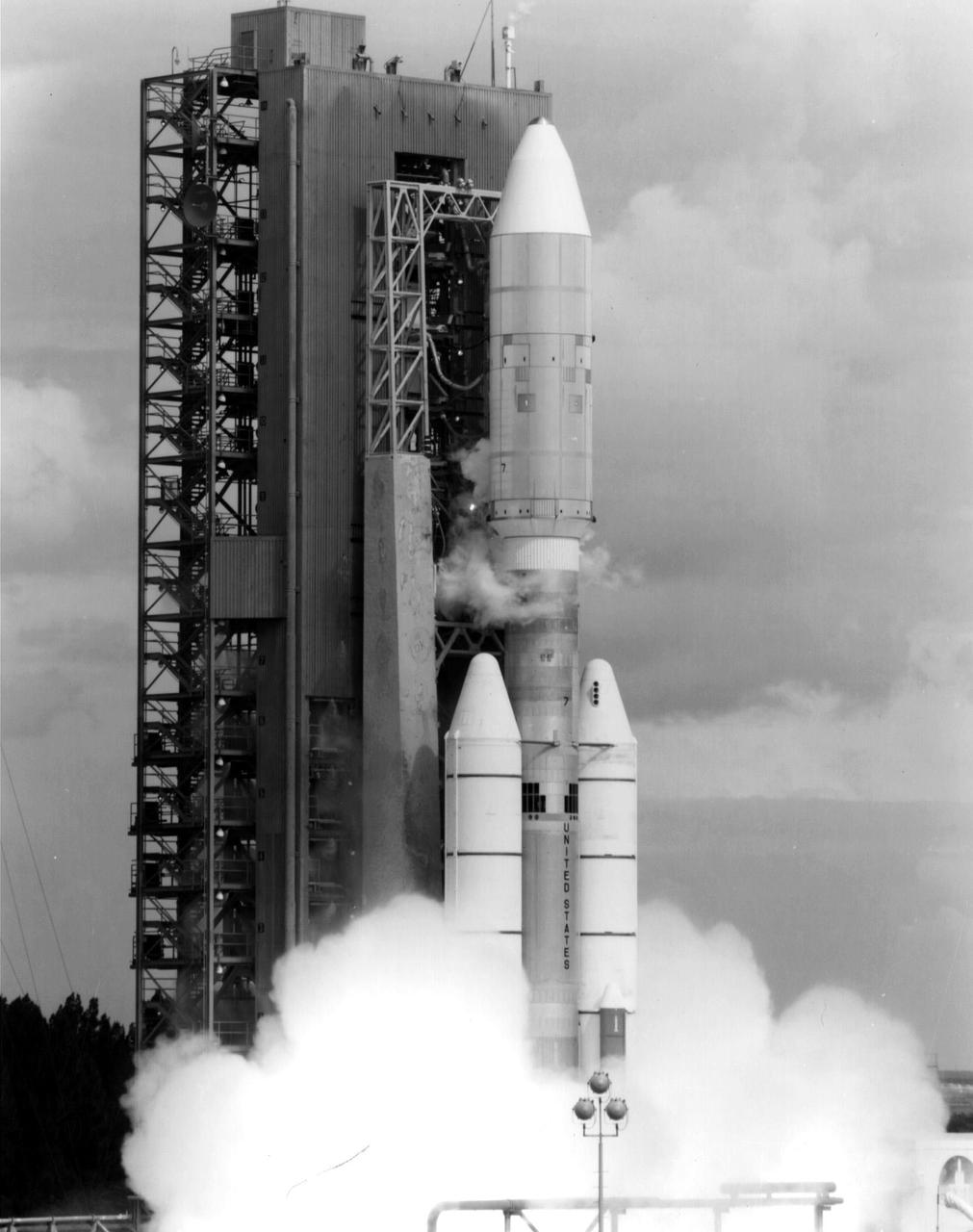
NASA's Voyager 2 spacecraft launched atop its Titan/Centaur-7 launch vehicle from Cape Canaveral Air Force Station in Florida on August 20, 1977, at 10:29 a.m. local time. https://photojournal.jpl.nasa.gov/catalog/PIA21745

NASA's Voyager 2 spacecraft launched atop its Titan/Centaur-7 launch vehicle from Cape Canaveral Air Force Station in Florida on August 20, 1977, at 10:29 a.m. local time. https://photojournal.jpl.nasa.gov/catalog/PIA21744
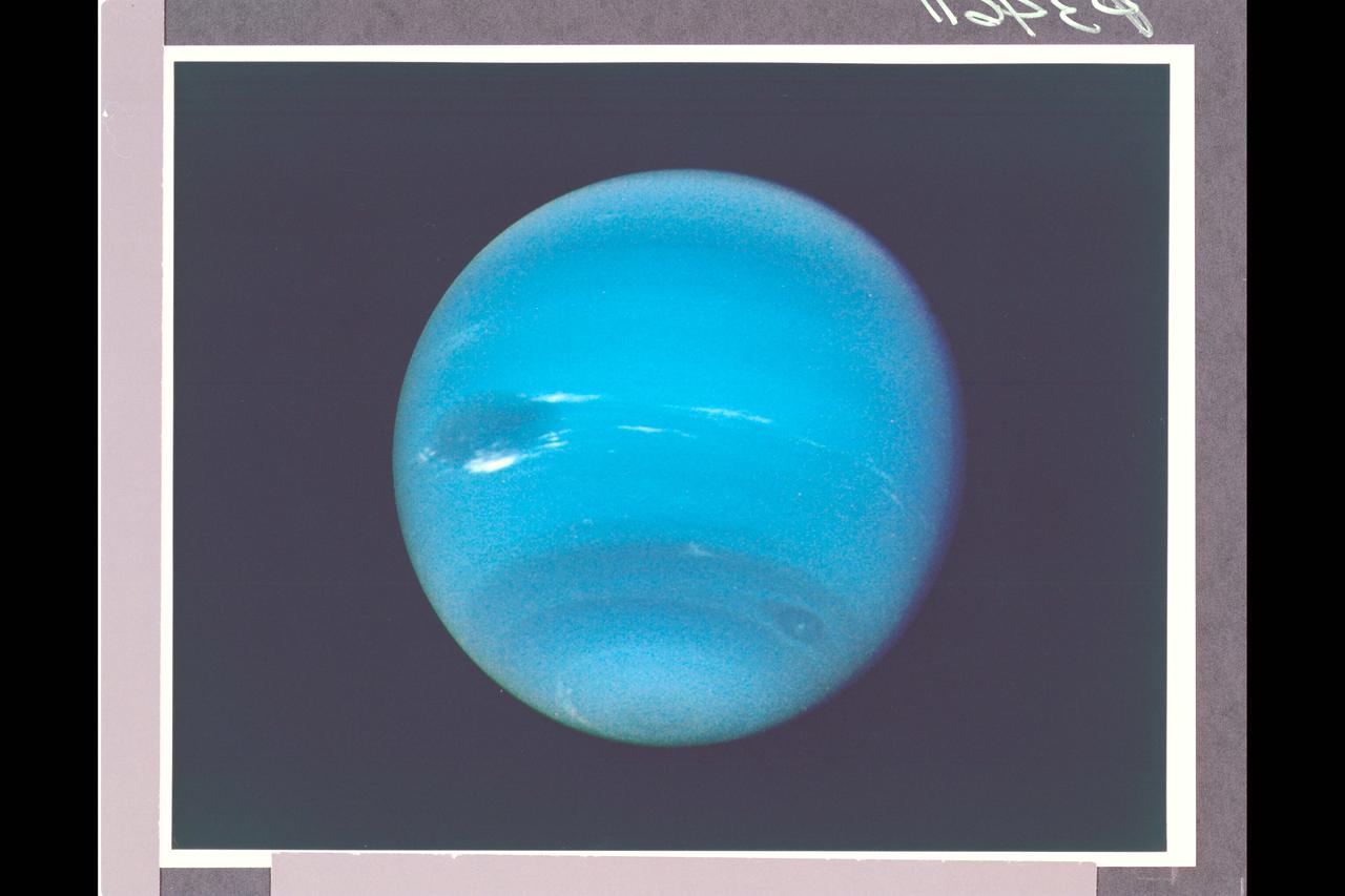
Photo by Voyager 2 (JPL) During August 16 and 17, 1989, the Voyager 2 narrow-angle camera was used to photograph Neptune almost continuously, recording approximately two and one-half rotations of the planet. These images represent the most complete set of full disk Neptune images that the spacecraft will acquire. This picture from the sequence shows two of the four cloud features which have been tracked by the Voyager cameras during the past two months. The large dark oval near the western limb (the left edge) is at a latitude of 22 degrees south and circuits Neptune every 18.3 hours. The bright clouds immediately to the south and east of this oval are seen to substantially change their appearances in periods as short as four hours. The second dark spot, at 54 degrees south latitude near the terminator (lower right edge), circuits Neptune every 16.1 hours. This image has been processed to enchance the visibility of small features, at some sacrifice of color fidelity. The Voyager Mission is conducted by JPL for NASA's Office of Space Science and Applications. (JPL Ref: A-34611 Voyager 2-N29)

P-25517 3 UP COMPOSITE Voyager 2 and Uranus
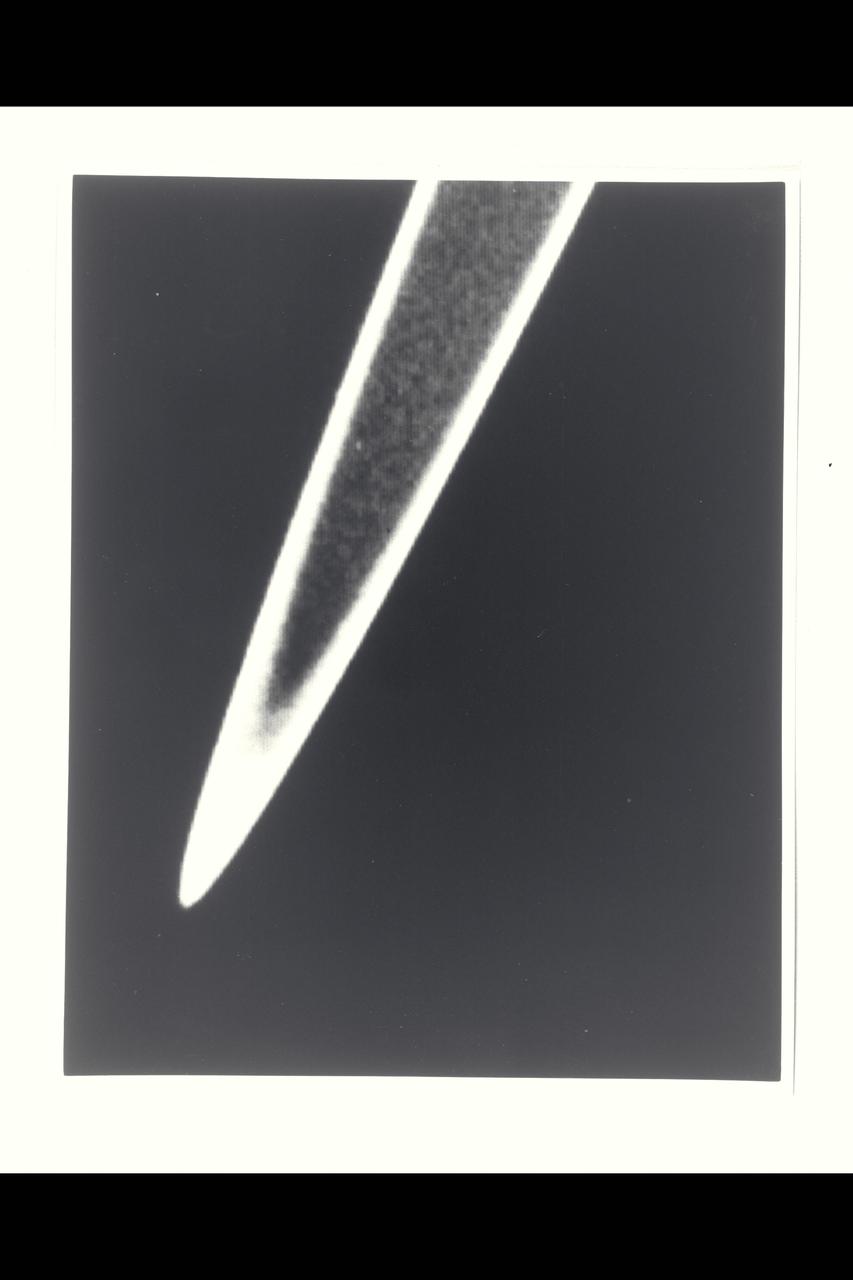
P-34648 This photograph of Neptune was reconstructed from two images taken by Voyager 2's narrow angle camera, through the green and clear filters. the image shows three of the features that Voyager 2 has been photographing during recent weeks. At the north ( top ) is the Great Dark Spot, accompanied by bright, white clouds that undergo rapid changes in appearance. to the south of the Great Dark Spot is the bright feature that Voyager scientists have nicknamed 'Scooter.' Still farther south is the feature called ' Dark Spot 2,' which has a bright core. Each feature moves eastward at a different at a different velocity, so it is only occasionally that they appear close to each other, such as at the time this picture was taken.
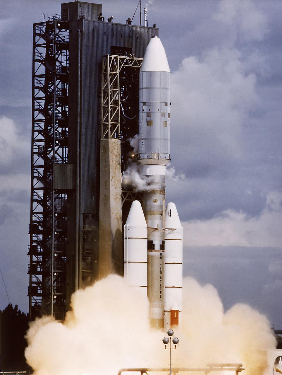
The Voyager 2 aboard Titan III-Centaur launch vehicle lifted off on August 20, 1977. The Voyager 2 was a scientific satellite to study the Jupiter and the Saturn planetary systems including their satellites and Saturn's rings.

P-29452 These two images of Uranus are shown here to reveal the pole rotation of the planet, as photographed by Voyager 2. The left is seen as the human eye would see, and the right isfalse color to reveal more intricate details.
Range : 236,000 km. ( 147,000 mi. ) Resolution : 33 km. ( 20 mi. ) P-29525B/W This Voyager 2 image reveals a contiuos distribution of small particles throughout the Uranus ring system. This unigue geometry, the highest phase angle at which Voyager imaged the rings, allows us to see lanes of fine dust particles not visible from other viewing angles. All the previously known rings are visible. However, some of the brightest features in the image are bright dust lanes not previously seen. the combination of this unique geometry and a long, 96 second exposure allowed this spectacular observation, acquired through the clear filter if Voyager 2's wide angle camera. the long exposure produced a noticable, non-uniform smear, as well as streaks due to trailed stars.
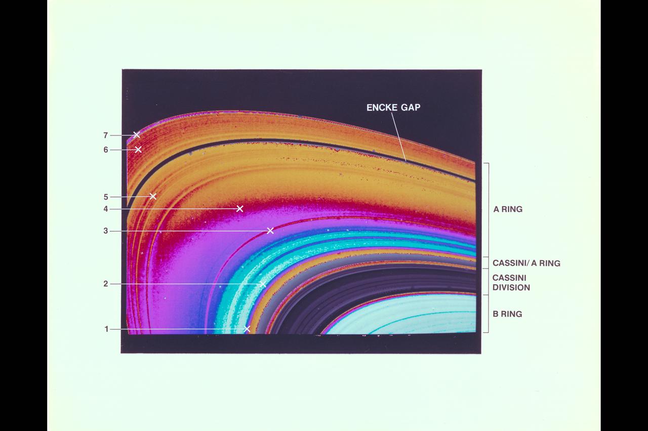
Resolution : 2 km. ( 1.2 miles ) P-24069C In this computer generated photograph, created from a cross section of Saturn's rings by Voyager 2 photopolarimeter's star occulation, the Encke Division in the outer A-ring. Clearly shown is the central ringlet, also observed by the imaging cameras.
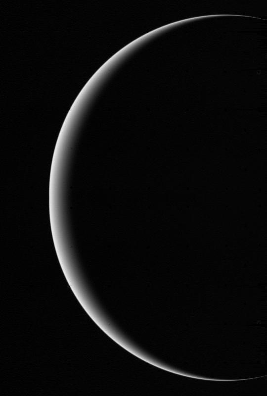
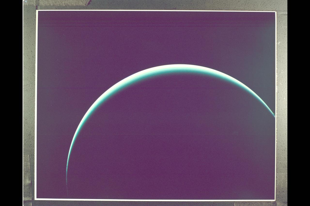
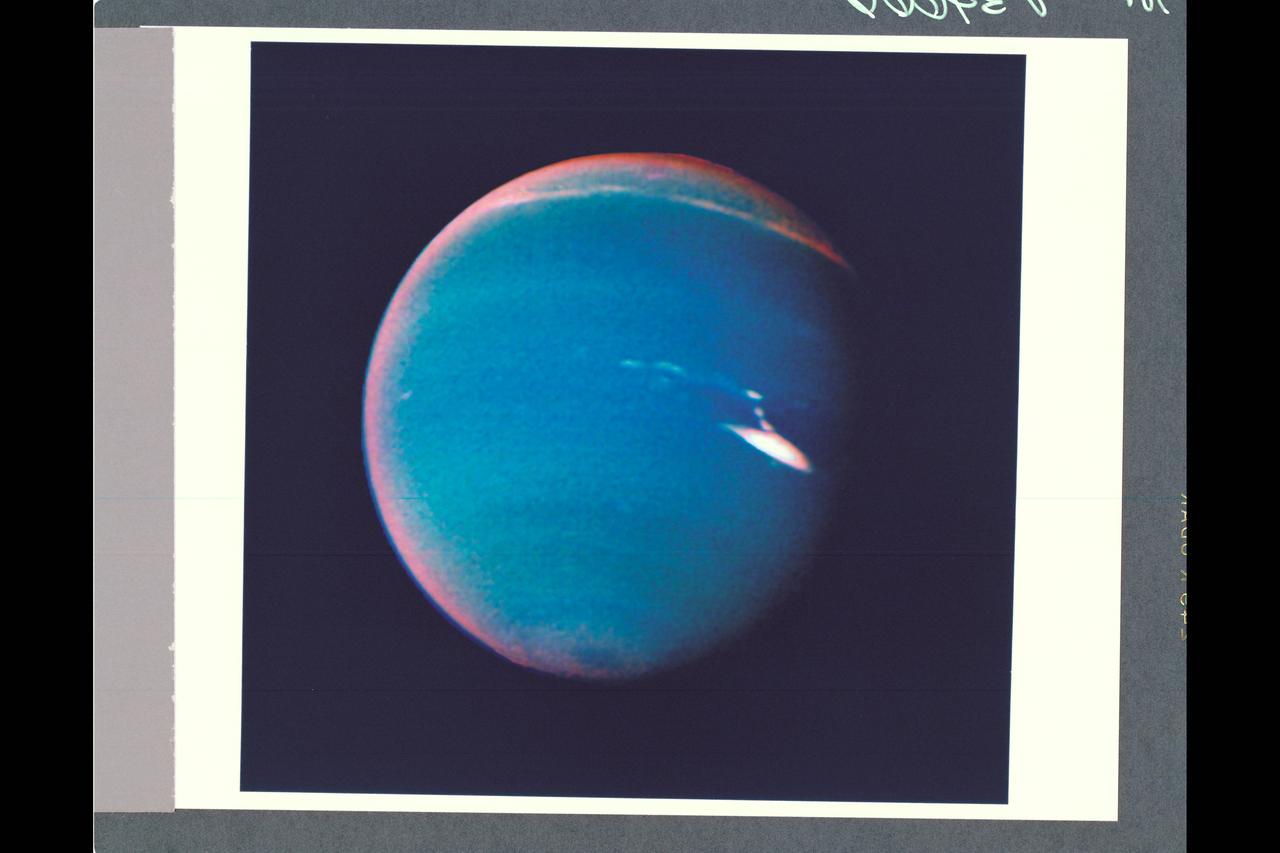
This image shows a crescent Uranus, a view that Earthlings never witnessed until Voyager 2 flew near and then beyond Uranus on Jan 24, 1986. http://photojournal.jpl.nasa.gov/catalog/PIA00346
Voyager II Imagery - Neptune: This image of clouds in Neptune's atmosphere is the first that tests the accuracy of the weather forecast that was made eight days earlier to select targets for the Voyager narrow-angle camera. Three of the four targeted features are visible in this photograph; all three are close to their predicted locations. The Great Dark Spot with its bright white companion is slightly to the left of center. The small bright Scooter is below and to the left, and the second dark spot with its bright core is below the Scooter. Strong eastward winds -- up to 400 mph -- cause the second dark spot to overtake and pass the larger one every five days. The spacecraft was 6.1 million kilometers (3.8 million miles) from the planet at the time of camera shuttering, and the images use the orange, green and clear filters of the camera. The Voyager Mission is conducted by JPL for NASA's Office of Space Science and Applications. (JPL ref P-34632 Voyager 2 N-32C)
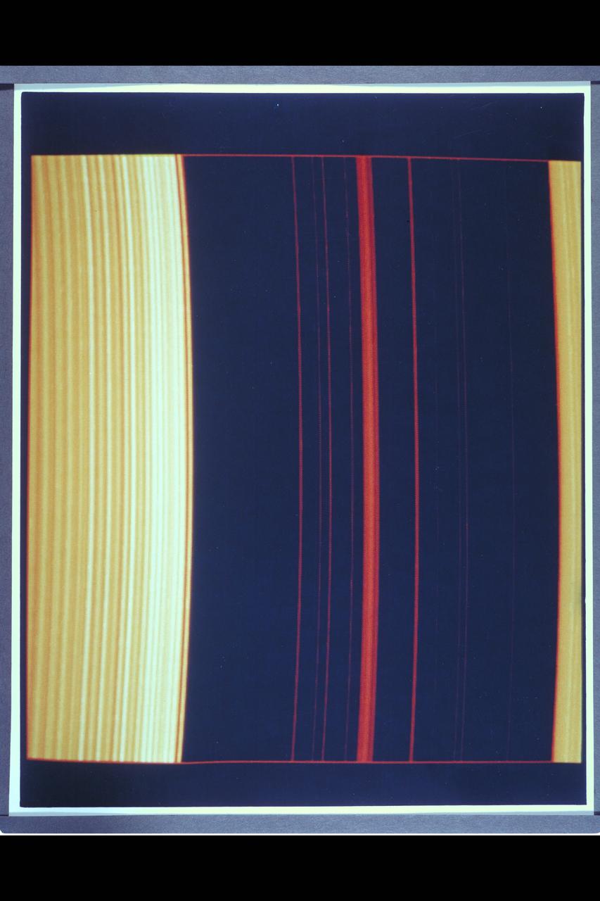
Resolution : 1 km. ( .6 miles ) Region Shown : 100 km. ( 60 miles ) P-24068C This computer generated photograph was created from a cross-section of Saturn's rings as measured by Voyager 2 photopolarimeter's occulation of the star Delta Scorpii. The region shown is near the inner edge of the Encke Division in the outer part of A-ring. The waves seen at left become successively closer together nearer to the Encke Division. At right are four strands of the ringlet that lies within the Encke Division. Voyager 2's imaging system saw this structure as a single ringlet.
Range : 4.2 million km. ( 2.6 million miles ) P-34649 This photograph of Neptune's southern hemisphere taken by Voyager 2's narrow angle camera, through the green and clear filters. The smallest feature that can be seen are 38 km ( 24 miles ) across. the almond shaped structure at the left is a large cloud system that has been seen for several weeks. Internal details in the feature have become increasingly apparent as Voyager 2 has approached. Systems with similiar shapes in Jupiter's atmosphere rotate about their centers, rolling in the local winds that increase toward the south. However, the wispy nature of the white central clouds in this Neptunian feature make confirmation of the syste.m's rotation difficult
Range : 1.5 million km ( 930,000 miles ) This high resolution view of Jupitor's ring, part of a set obtained by Voyager 2 (A79-7101), suggests that it may be divided into several components, as are the rings of Saturn. The ring was unexpectedly bright, due to forward scattering of sunlight by small ring particles. The rings were discovered 4 months ago by Voyager 1. The 'V' shaped figure to the left is caused by a star image which was trailed out as the camera moved slightly during the long exposure.
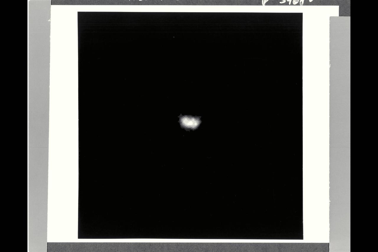
Range : 4.7 million km (2.9 million mi.) Nereid, the last satellite of Neptune to be discovered before Voyager's recent discoveries, was first seen by Gerard Kuiper in 1949. Until this Voyager 2 image was obtained, all that was known about Nereid was its orbital parameters and intrinsic brightness. With a resolution of 43 kilometers (26.6 mi.) per pixel, this image has sufficient detail to show the overall size and albedo. Nereid is about 170 km (105 mi.) across and reflects about 12 percent of the incident light.
Range : 1.5 million km ( 930,000 miles ) This high resolution view of Jupitor's ring, part of a set obtained by Voyager 2 (A79-7101), suggests that it may be divided into several components, as are the rings of Saturn. Seen within the inner edge of the brighter ring is a fainter ring, which may extend all the way down to Jupiter's cloud tops. The ring was unexpectedly bright, due to forward scattering of sunlight by small ring particles. The rings were discovered in March 1979 by Voyager 1.

Range : 1 million kilometers Voyager 2 completed a dramatic 10 hour time lapse photo sequence to monitor the active volcanos on Jupiter's moon Io following the spacecraft's closest approach to Jupiter. This picture is one of about 200 images that will be used to generate a time lapse motion picture to illustrate Io's volcanic activity. On the bright limb, two of the plumes (P-5 & P-6) discovered in March by Voyager 1 are again visible. The plumes are spewing materials to a height of about 100 kilometers.
Range : 1 illion km. ( 600,000 mi. ) Resolution : 140 km. ( 90 mi. ) P-29539C This Voyager 2 image of Uranus was captured as the spacecraft was leaving Uranus behind on its cruise to Neptune. The image is a color composite of three photographs taken through blue, grren, and orange filters. Thin thin crecent seen here is at an angle of 153 degrees between the the spacecraft, the planet, and the sun. Even at this extreme angle, uranus retains the pale blue-green color seen by the ground based astronomers and recorded by Voyager 2 during its historic encounter, this color results from the presence of methane in Uranus' atmosphere. The gas absorbs red wavelengths of light, leaving the predominant hue seen here. The tendency for the cresent to become white at the extreme edge is cased by the presence of a high-altitude haze. Voyager 2, having encountered Jupiter in 1979, Saturn in 1981, and Uranus in 1986, will proceed on its jouney to Neptune. Closest approach is scheduled for August 24, 1989.
Range : 3.2 million km This image returned by Voyager 2 shows one of the long dark clouds observed in the North Equatorial Belt of Jupiter. A high, white cloud is seen moving over the darker cloud, providing an indication of the structure of the cloud layers. Thin white clouds are also seen within the dark cloud.
JUPITER'S FAINT RING SYSTEM IS SHOWN HERE AS TWO ORANGE LINES PROTRUDE FROM THE LEFT TOWARD JUPITER'S LIMB. THIS COLORFUL COMPOSITE WAS TAKEN IN JUPITER'S SHADOW THROUGH ORANGE AND VIOLET FILTERS. THE COLORFUL IMAGES OF JUPITER'S LIMB ARE EVIDENCE OF THE SPACECRAFT MOTION DERING THIS LONG EXPOSURE. VOYAGER 2
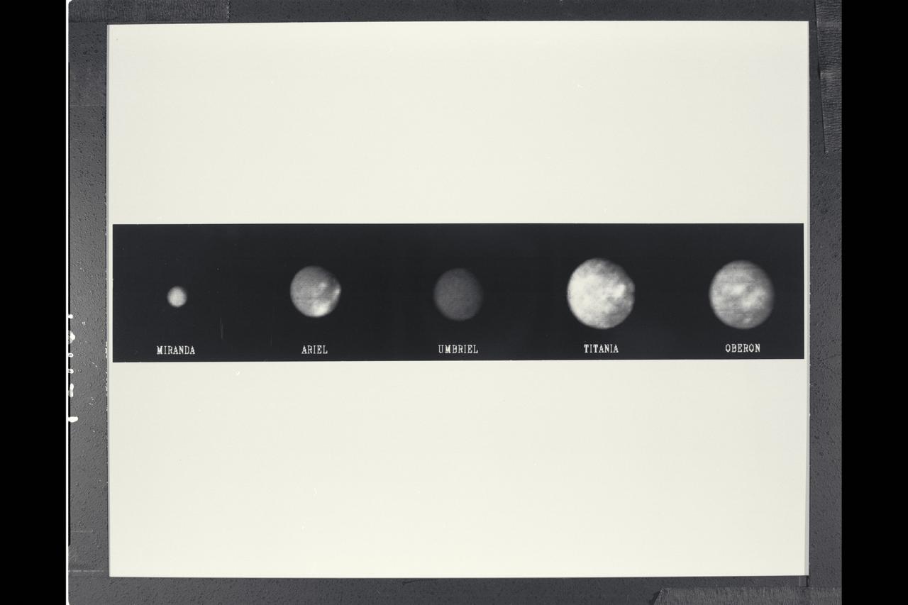
Range : 5 to 6.1 million km. ( 3.1-.8 million miles ) P-29314B/W This 'family portrait' of Uranus' five largest moons was compiled from images sent back from Voyager 2 The photographs were taken through a clear filter.
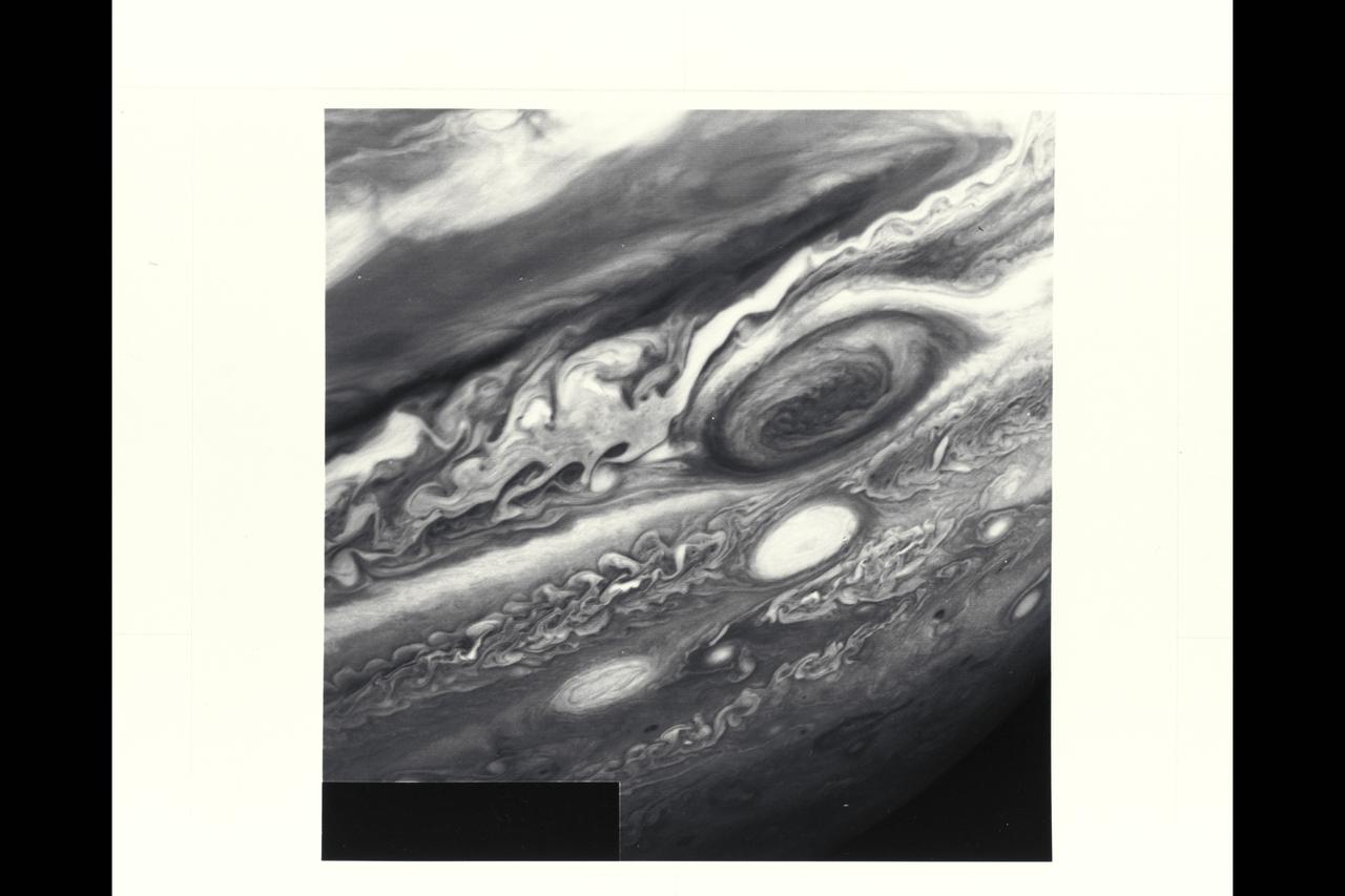
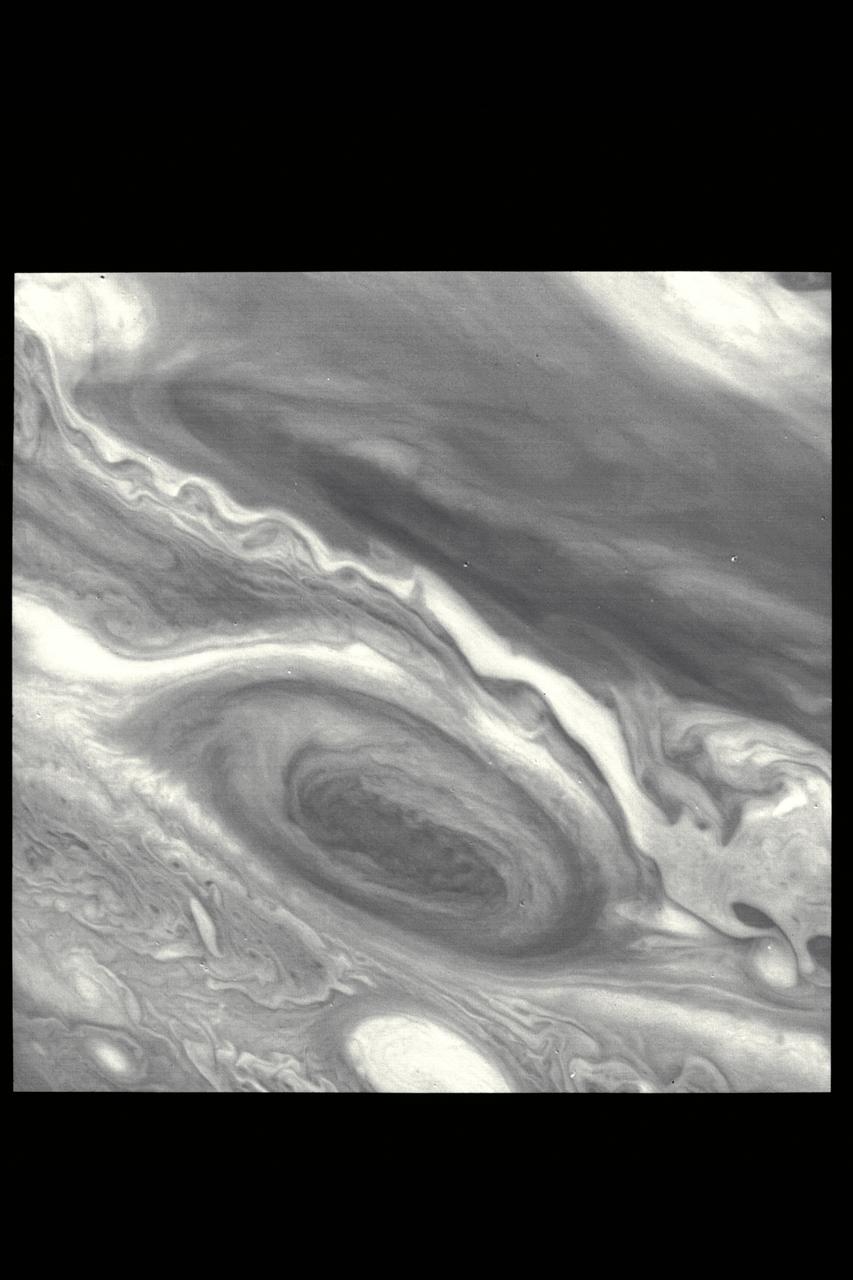
P-21742 BW Range: 6 million kilometers (3.72 million miles) This Voyager 2 image shows the region of Jupiter extending from the equator to the southern polar latitudes in the neighborhood of the Great Red Spot. A white oval, different from the one observed in a similiar position at the time of the Voyager 1 encounter, is situated south of the Great Red Spot. The region of white clouds now extends from east of the red spot and around its northern boundary, preventing small cloud vortices from circling the feature. The disturbed region west of the red spot has also changed since the equivalent Voyager 1 image. It shows more small scale structure and cloud vortices being formed out of the wave structures.
Range : 2.7 million miles (1.7 million miles) P-29497C Tis Voyager 2, false color composite of Uranus demonstrates the usefulness of special filters in the Voyager cameras for revealing the presence of high altitude hazes in Uranus' atmosphere. The picture is a composite of images obtained through the single orange and two methane filters of Voyager's wide angle camera. Orange, short wavelength and long wavelength methane images are displayed, retrospectively, as blue, green, and orange. The pink area centered on the pole is due to the presence of hazes high in the atmosphere that reflect the light before it has traversed a long enough path through the atmosphere to suffer absorbtion by methane gas. The bluest region at mid-latitude represent the most haze free regions on Uranus, thus, deeper cloud levels can be detected in these areas.
P-21745 BW Range: 1.1 million miles (675,000 miles) This image of Callisto taken by Voyager 2 was enhanced to reveal detail in the scene. Voyager 1's high resolution coverage was of the hemisphere just over the right-hand (eastern) horizon, and the large ring structure discovered by Voyager 1 is just over the eastern limb. This image shows yet another ring structure in the upper part of the picture. Callisto exhibits some of the most ancient terrain seen on any of the satellites. Scientists think Callisto's surface is a mixture of ice and rock dating back to the final stages of planetary accretion (over 4 billion years ago) when the surface was pockmarked by a torrential bombardment of meteorites. Younger craters show as bright spots, probably because they expose fresh ice and frost.
P-21742 C Range: 6 million kilometers (3.72 million miles) This Voyager 2 image shows the region of Jupiter extending from the equator to the southern polar latitudes in the neighborhood of the Great Red Spot. A white oval, different from the one observed in a similiar position at the time of the Voyager 1 encounter, is situated south of the Great Red Spot. The region of white clouds now extends from east of the red spot and around its northern boundary, preventing small cloud vortices from circling the feature. The disturbed region west of the red spot has also changed since the equivalent Voyager 1 image. It shows more small scale structure and cloud vortices being formed out of the wave structures.
Range : 900,000 miles A brilliant halo around Jupiter, the thin ring of particles discovered by Voyager 1 four months ago, is seen here unusually bright due to forward scattering of the particles within it. Similiarly, the planet is outlined by sunlight scattered toward the spacecraft from a haze layer high in jupiter's atmosphere. The arms of the ring are cut off on each sideby the planet's shadow as they approach the brightly outlined disk. The night side of the planet appears completly dark in this reproduction, but later will be specially reprocessed to search for evidence of lightning sorms and auroras. This 4 image mosaic was obtained with Voyager 2's wide angle camera.
Range : 30 million km. ( 18.6 million miles ) P-34628 C The south pole of Neptune is at the center of this polar projection made from five color images taken by Voyager 2 over the course of one Neptunian day-- about 18 hours. Latitude lines are concentric circles, and the outer circle is at about 15 degrees north latitude. Cloud paterns are organized by the planet's rotation and are generally concentric with the pole . Oval storms, which drift in longitude at relative speeds up to 400 miles an hour, disrupt the circular symmetry. The color composite was made from black and white frames through the Voyager narrow angle camera's clear, orange, and green filters.
P-34666 This false color photograph of Neptune was reconstructed from two images taken by Voyager 2's wide angle camera, through the orange and two different methane filters. Objects that deep in the atmosphere are blue, while those at higher altitudes are white. Light at methane wavelengths is mostly absorbed in the deeper atmosphere. The bright, white feature is a high altitude cloud just south of the Great dark Spot. The hard, sharp inner boundary within the bright cloud is an artifact of computer processing on Earth. Other, smaller clouds associated with the Great Dark Spot are white or pink, and are also at high altitudes. Neptune's limb looks reddish because Voyager 2 is viewing it tangentially, and the sunlight is scattered back to space before it can be absorbed by methane. A long, narrow band of high-altitude clouds near the top of the image is located at 25 degrees north latitude, and faint hazes mark the equator and polor regions
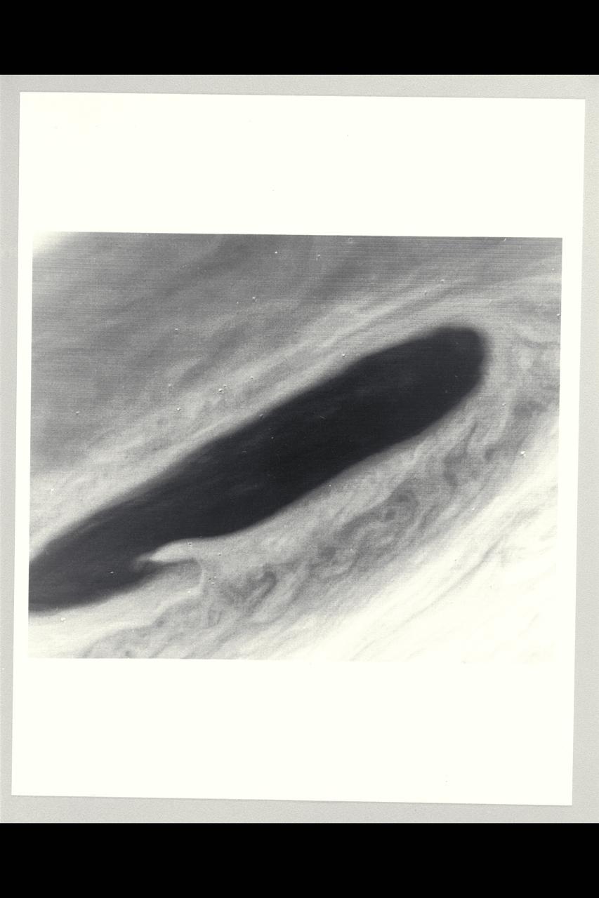
P-34668 Range : 2.8 million km. ( 1.7 million miles ) Smallest Resolvable Feature : 50 km or 31 miles This Voyager 2 image shows the last face on view of the Great Dark Spot that Voyager 2 will take with the narrow angle camera. It was made 45 hours before the closest approach to Neptune. the image shows feathery white clouds that overlie the boundary of the dark and light blue regions. the pinwheel ( spiral ) structure of both the dark boundary and the white cirrus suggest a storm system rotating counterclockwise. Periodic, small-scale patterns in the white clouds, possibly waves, are short-lived and do not persist from one Neptunian rotation to the next. This color composite was made from the clear and green filter images.
Voyager II Imagery, Neptune: This is one of the most detailed views of the surface of Triton taken by Voyager 2 on its flyby of the large satellite of Neptune early in the morning of August 25, 1989. The picture was stored on the tape recorder and relayed to Earth later. Taken from a distanT ce of only 40,000 km (25, 000 miles), the frame is about 220 kilometers (140 miles) across and shows details as small as 750 meters (0.5 miles). Most of the area is covered by a peculiar landscape of roughly circular depressions separated by rugged ridges. This type of terrain, which covers large tracts of Triton's northern hemisphere, is unlike anything seen elsewhere in the solar system. The depressions are probably not impact craters: They are too similar in size and too regularly spaced. Their origin is still unknown, but may involve local melting and collapse of the icy surface. A conspicuous set of grooves and ridges cuts across the landscape, indicating fracturing and deformation of Triton's surface. The rarity of impact craters suggests a young surface by solar-system standards, probably less than a few billion years old. The Voyager Mission is conducted by JPL for NASA's Office of Space Science and Applications. (JPL ref: P-34722 Voyager N-60 )
P-21739 BW Range: 4.7 million kilometers (2.9 million miles) This picture of Io was taken as Voyager 2 closes in on the Jovian system. Scientists are studying these distant views of Io for evidences of changes since Voyager 1 observations in March of 79. Voyager 1 discovered that Io, the innermost of the Galilean satellites, is the most volcanically active body yet seen in the solar system, surpassing even earth. In this picture, the first volcano discovered by Voyager 1 is again visible in the lower left portion of the disk as a dark oval with a dark spot in the center. In March, this volcano appeared as a heart-shaped marking, not a symmetrical oval. Scientists believe that the non-symmetric markings earlier resulted from a constriction in the mouth of the volcanic vent causing erupting material to extrude preferentially in certain directions. Apparently, the volcanic eruptive activity, which sends material to altitudes of 280 kilometers (175 miles) or more above this volcano, has changed the vent geometry or dislodged an obstruction. Such changes in the form of eruptive fountains are common in terrestial volcanos, although on a much smaller scale than on Io.

Range : 1,450,000 km. ( 900,000 miles ) Jupiter's faint ring system is shown here as two orange lines protrude from the left toward Jupiter's limb. This colorful composite was taken in Jupiter's shadow through orange and violet filters. The colorful images of Jupiter's limb are evidence of the spacecraft motion dering this long exposure. Voyager 2 was about 2 degrees below the plane of the ring when this was shot, leaving the lower ring image cut short by Jupiter's shadow on the ring. (JPL ref No. P-21779)
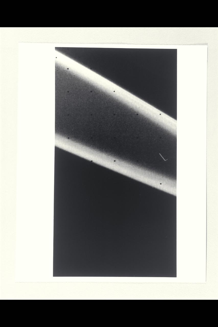
Range : 2.52 million miles (1.56 million miles) P-29481B/W Voyager 2 returned this photograph with all nine known Uranus rings visible from a 15 sec. exposure through the narrow angle camera. The rings are quite dark and very narrow. The most prominent and outermost of the nine, Epsilon, is seen at top. The next three in toward Uranus, called Delta, Gamma, and Eta, are much fainter and more narrow than Epsilon ring. Then come Beta and Alpha rings, and finally, the innermost grouping, known simply as the 4,5, & 6 rings. The last three are very faint and are at the limit of detection for the Voyager camera. Uranus' rings range in width from about 100 km. (60 mi.) at the widest part of the Epsilon ring, to only a few kilometers for most of the others. this iamge was processed to enhance narrow features; the bright dots are imperfections on the camera detector. The resolution scale is about 50 km. (30 mi.)
Range : 4 million km (2.5 million miles) Already-intriquing patterns of unknown origin appear on the surgace of Neptune's largest satellite, Trition, in this image from Voyager 2. Voyager images show that Trition's diameter is about 2,720 km (1,690 miles), and that it is one of the brightest objects in the solar system, reflecting about 70 percent of the sunlight that strikes it. THis is the hemisphere of Triton that always faces away from Neptune. The south pole is near the botton of the image. Triton's rotation axis is tilted so that the latitude at the center of the disk is 55 degrees south. Dark regions at the top of the disk extend from roughly the equator to beyond 20 degrees north. The margin between the bright and dark regions varies with longitude around the satellite. The gray, featureless area just to the right of the center of the disk is due to a reseau (reticule mark) in the camera.
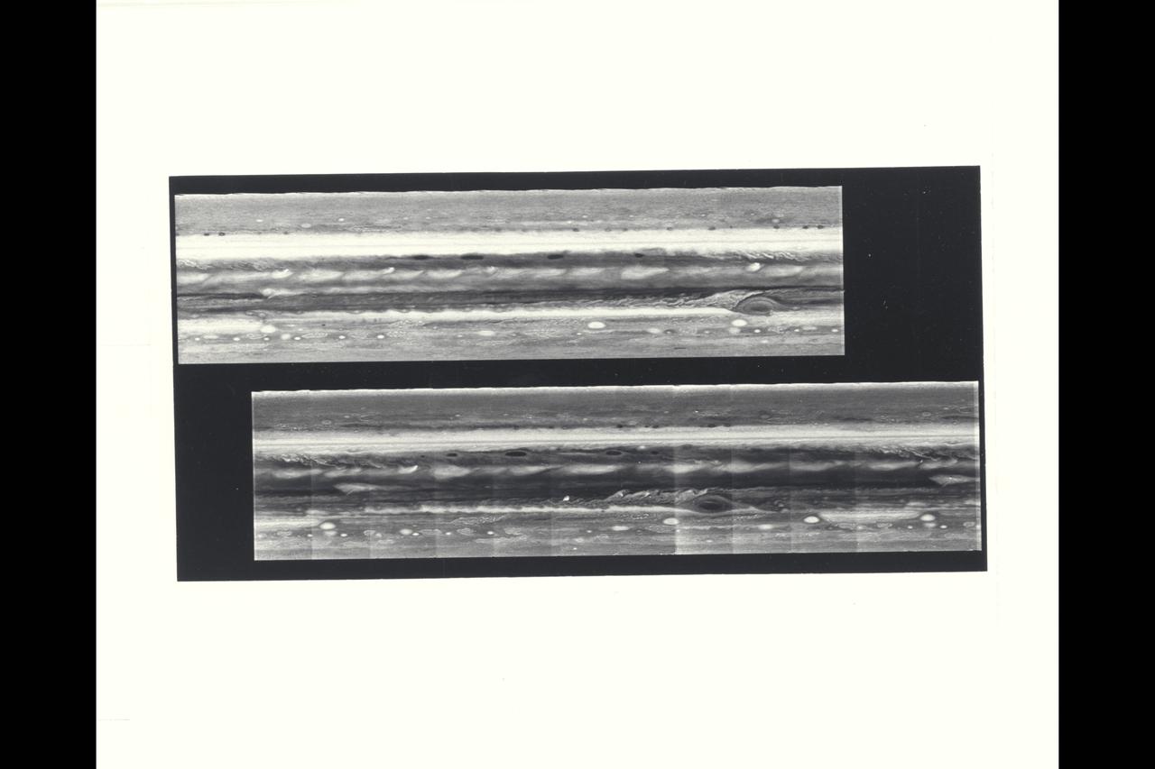
The cylindrical projections of Jupiter, representing both Voyager 1 (top) and Voyager 2 (bottom), are presented in this comparison. The top picture extends 400 degrees longitude to 0 degrees (right edge). It is aligned with the lower image so that the longitude scale is correct for both frames. The comparison between the pictures shows the relative motions of features in Jupiter's atmosphere. It can be seen that the Great Red Spot has moved westward and the white oval features eastward during the time between the acquisition of these pictures. Regulare plume patterns are equidistant around the northern edge of the equator, while a train of small spots has moved eastward at approxiamately 80 degrees south latitude. In addition to these relative motions, significant changes are evident in the recirculation flow east of the Great Red Spot, in the disturbed region west of the Greast Red Spot, and as seen in the brightening of material spreading into the equatorial region from the more southerly latitudes.
P-34669 Range : 2.6 million km. ( 1.6 million miles ) Smallest Resolvable Feature : 50 km or 31 miles These two Voyager 2 images, shot through clear filters, show the largest of the new moons of Neptune, 1989N1, discovered by Voyager. The satellite, made of dark material that reflects about 6 % of incident sunlight, has an average radius of about 200 kilometers ( 124 miles ) and an irregular shape. Its similiar appearance in the two images shows that the shape seen here is not the result of image noise or smear. This may the largest satellite in the solar system with such an irregular shape. satellite 1989N1 is slightly larger than the previously known small Neptunian moon Nereid but is very much darker.
P-34668 Range : 25 million km. ( 16 million miles ) Smallest Resolvable Feature : 45 km or 28 miles This Voyager 2 image of Neptune, shot with a narrow angle camera, shows the discovery of shadows in Neptune's atmosphere. The shadows cast onto deep cloud banks by smaller elevated clouds. Located at about 68 degrees south latitude, they are the first cloud shadows ever seen by Voyager on any planet. The dark regions adjacent to the small bright clouds are believed to be shadows, because they are on the side of the cloud that is opposite to the incoming sunlight and because they lengthen in places where the sun lies closer to the horizon. Estimates of the height of these discrete clouds above the underlying cloud bank can be obtained by careful analysis of this data.
Range : 74 million km. ( 46 million miles ) P-29313CThis Voyager photograph of Uranus is a composite of for images taken by the narrow angle camera. At this range, clouds and other features in the atmosphere as small as 1,370 km. could be detected by Voyager 2. Yet, no such features are visible. This view is toward the illuminated south pole of Uranus. The predominant blue color is the result of atmospheric methane, which absorbs the red wavelengths from incoming sunlight. The spot at the upper left edge of the planet's disk reulted from the removal of a reseau mark used in making measurments on the photograph. Three of Uranus' five known satellites are visible; Miranda ( at far right, closest to the planet ), Ariel ( next out , at top), and Umbriel ( lower left ). Titania and Oberon are now outside the narrow angle camera's field of view when it centered on the planet. This color composite was made from images taken through blue, green, orange, and clear filters.
The cylindrical projections of Jupiter, representing both Voyager 1 (top) and Voyager 2 (bottom), are presented in this comparison. The top picture extends 400 degrees longitude to 0 degrees (right edge). It is aligned with the lower image so that the longitude scale is correct for both frames. The comparison between the pictures shows the relative motions of features in Jupiter's atmosphere. It can be seen that the Great Red Spot has moved westward and the white oval features eastward during the time between the acquisition of these pictures. Regulare plume patterns are equidistant around the northern edge of the equator, while a train of small spots has moved eastward at approxiamately 80 degrees south latitude. In addition to these relative motions, significant changes are evident in the recirculation flow east of the Great Red Spot, in the disturbed region west of the Greast Red Spot, and as seen in the brightening of material spreading into the equatorial region from the more southerly latitudes.
P-34665 This false color Voyager 2 image of Neptune's satellite Triton, is a composite of three images taken through ultraviolet, green, and viloet filters. The smallest resolvable features are about 47 km., or 29 miles accross. Mottling in the bright southern hemisphere may be the result of topography, if Triton's crust is predominently water ice, which is rigid at Triton's surface temperature. Alternatively, the mottling could be due to markings on a smooth surface, if the crust is composed of nitrogen, carbon monoxide, or methane ice, since they are soft at the same temperature.
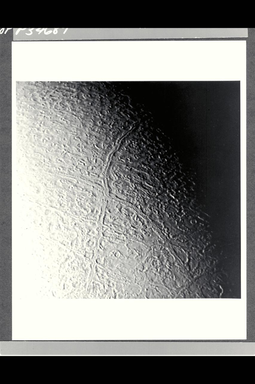
P-34689 Range : 130,000 km. ( 80,000 miles ) Smallest Resolvable Feature : 2.5 km or 1.5 miles This image of Neptune's moon Triton, shot by Voyager 2, is seen here. The long linear feature exteding vertically across the image is probably a graben -- a norrow down-dropped fault block about 35 km. or 20 miles across. The ridge in the center of the graben. The surrounding terrain is a relatively young icy surface with few impact craters.
P-34690 Field of View : 1,000 km. or 600 miles This photograph of Neptune's moon Triton was acquired by Voyager 2. Triton's limb cuts obliquely accross the middle of the image. Three irregular dark areas, surrounded by brighter material, dominate the image. Low-lying material with intermediate albedo occupies the central area, anf fresh craters occur along the right margin. sub-parallel alignment of linear patches of dark material shown in the lower and left part of the image suggests that the patches are structurally controlled.
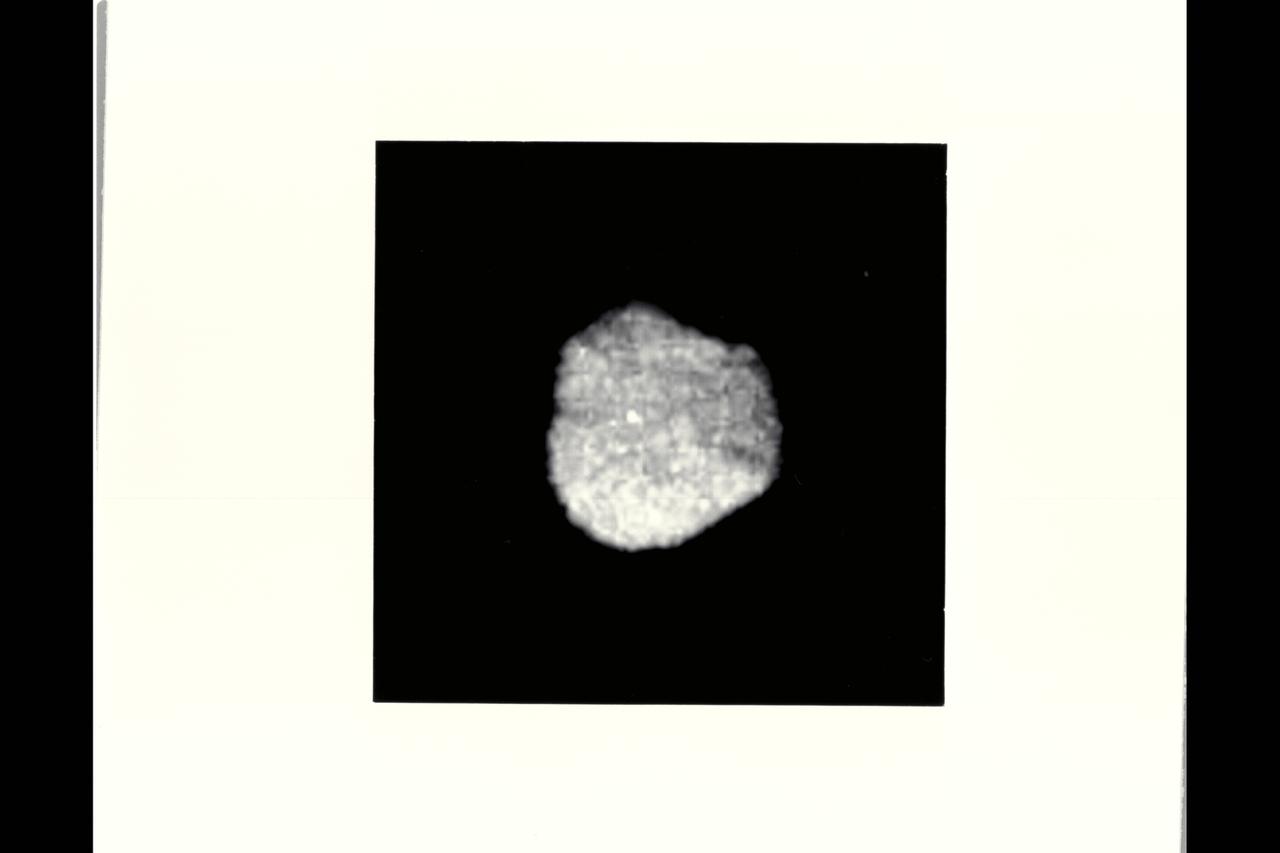
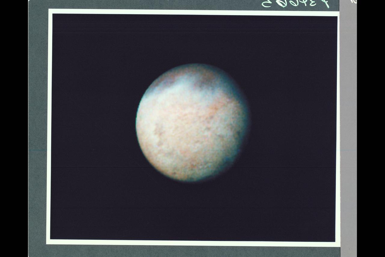
P-34681 Range: 870,000 kilometers (540,000 miles) This image of Neptune's irregularly-shaped satellite 1989N1 taken by Voyager 2 shows a resolution of 8 kilometers (5 miles) per pixel. The satellite has an average radius of about 200 kilometers (120 miles) and is uniformly dark with an albedo of about 6 percent. The irregular shape suggests that 1989N1 has been cold and rigid throughout its history and subject to significant impact cratering.
P-21735 BW This Jupiter image taken by Voyager 2 shows an area from 10° N. Lat. to 34° S. Lat. in a region west of the Great Red Spot. At the top of the picture, equatorial plumes are seen. These features move along the edge of the equatorial zone. The remainder of the equatorial region is characterized by diffuse clouds. The region west of the Great Red Spot is seen as a disturbed wave-like pattern. Similiar flows are seen to the west of the white oval at bottom.
Range : 2.3 million km. ( 1.4 million miles ) P-24067C This Voyager 2 photograph of Titan, a satellite of Saturn, shows some detail in the cloud systems. The southern hemisphere appears lighter in contrast, a well defined band is seen near the equator, and a dark collar is evident at the north pole. All these bands are associated with the cloud circulation in titan's atmosphere. The extended haze, composed of of sub-micron size particles, is seen clearly around the satellite's limb. This image was composed from blue, green, and violet frames.
Range : 3.2 million km This image returned by Voyager 2 shows one of the long dark clouds observed in the North Equatorial Belt of Jupiter. A high, white cloud is seen moving over the darker cloud, providing an indication of the structure of the cloud layers. Thin white clouds are also seen within the dark cloud. At right, blue areas, free of high clouds, are seen.
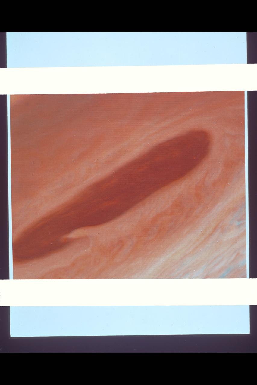
P-21736 BW This Voyager 2 pictures shows the Great Red Spot and the south equatorial belt extending into the equatorial region. At right is an interchange of material between the south equatorial belt and the equatorial zone. The clouds in this zone are more diffuse and do not display the structures seen in other locations. Considerable structure is evident within the Great Red Spot.
Range : 1.2 million km. ( 740,000 miles ) P-23954C Voyager 2 obtained this color image of Saturn's F-ring and its small inner sheparding satellite (1990S27) against the full disk of the planet. TheA-ring and the Encke Gap appear in the lower left corner. This view shows that the shepard is more refective than Sturn's clouds, suggesting that it is an icy, bright surfaced object like the larger satellites and the ring particles themselves.

P-34679 Range : 2 million km. ( 1.2 million miles ) In this Voyager 2, wide-angle image, the two main rings of Neptune can be clearly seen. In the lower part of the frame, the originally-announced ring arc, consisting of three distinct features, is visible. This feature covers about 35 degrees of longitude and has yet to be radially resolved in Voyager Images. from higher resolution images it is known that this region contains much more material than the diffuse belts seen elsewhere in its orbit, which seem to encircle the planet. This is consistent with the fact that ground-based observations of stellar occultations by the rings show them to be very broken and clumpy. The more sensitive, wide-angle camera is revealing more widely distributed but fainter material. Each of these rings of material lies just outside of the orbit of a newly discovered moon. One of these moons, 1989N2, may be seen in the upper right corner. The moon is streaked by its orbital motion, whereas the stars in the frame are less smeared. the dark area around the bright moon and star are artifacts of the processing required to bring out the faint rings.
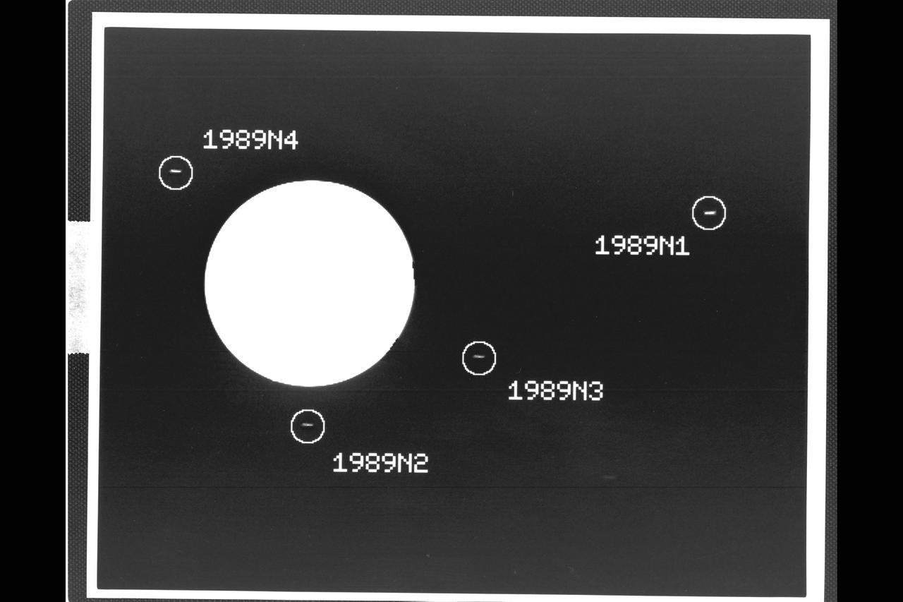
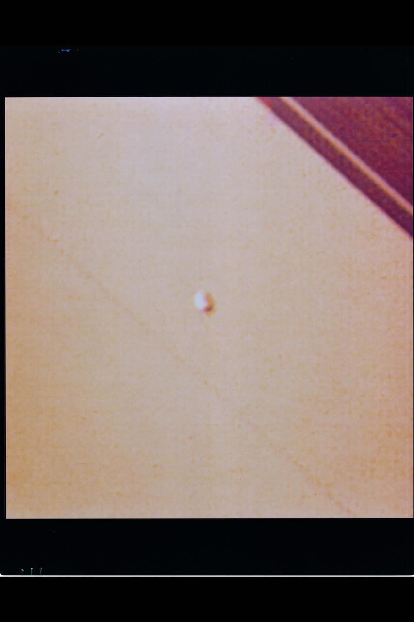
P-34540 Range: 37.3 million kilometers (23.6 million miles) This image captured by the Voyager 2 spacecraft was used to confirm the discovery of three new satellites orbiting Neptune. The 46-second exposure was taken with the narrow angle camera and shows the large globe of the planet to be severely overexposed and almost pure white in appearance. The image has been computer-processed to accentuate the new moons, which otherwise would be hard to distinguish from background noise. The satellite 1989N1, at right in this frame, was discovered by Voyager 2 in early July 1989. The new satellites confirmed later are 1989N2, 1989N3 and 1989N4. Each of the moons appears as a small streak, an effect caused by movement of the spacecraft during the long exposure. The new moons occupy nearly circular and equatorial orbits ranging from about 27,300 to 48,300 kilometers (17,000 to 30,000 miles) from Neptunes's cloud tops, and are estimated to range in diameter from about 100 to 200 kilometers (about 60 to 125 miles).
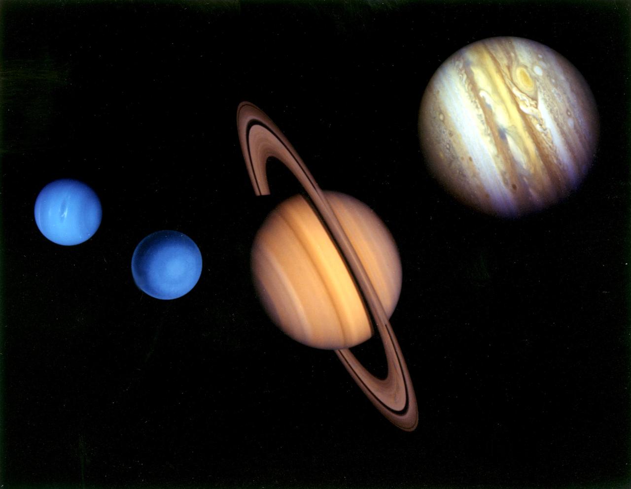
This montage of images of the planets visited by NASA's Voyager 2 was prepared from an assemblage of images taken by the 2 Voyager spacecraft. https://photojournal.jpl.nasa.gov/catalog/PIA01483
Range : 168,694 km (105,000 mi.) Voyager 2 discovered detached limb hazes in the atmosphere of Triton in Pictures that arrived at Earth between 3:30 am and 5:30 am. The principal layer seen here begins about three km (2 miles) above the surface, and is about 3 km thick. Fainter upward extension of the haze has been seen to an altitude of at least 14 km (9 mi.). The haze must be comoposed of tiny particles in order to be supported in Trition's thin atmosphere. Composition of the haze is currently unknown, but may be either condensed atmospheric gases or complex orgainc molecules produced by irradiation of the methane in Triton's atmosphere. The vaguely linear mottling on the surface may be shadows of other haze striations. Other features of the haze layer should be appaarent in images of Triton taken at higher phase angles (including crescent phase). The image shows features as small as 2 km (1.2 mi) wide.
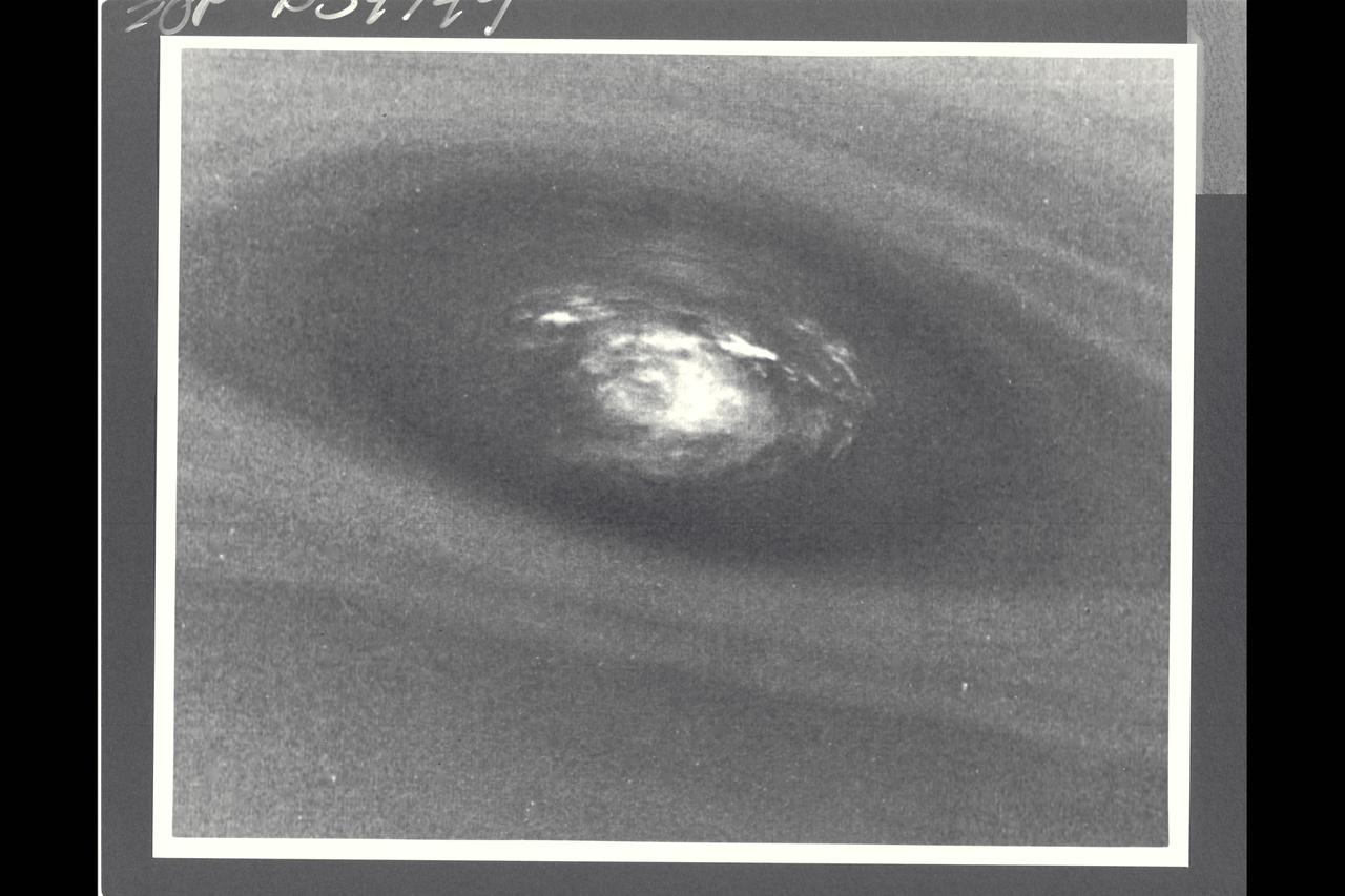
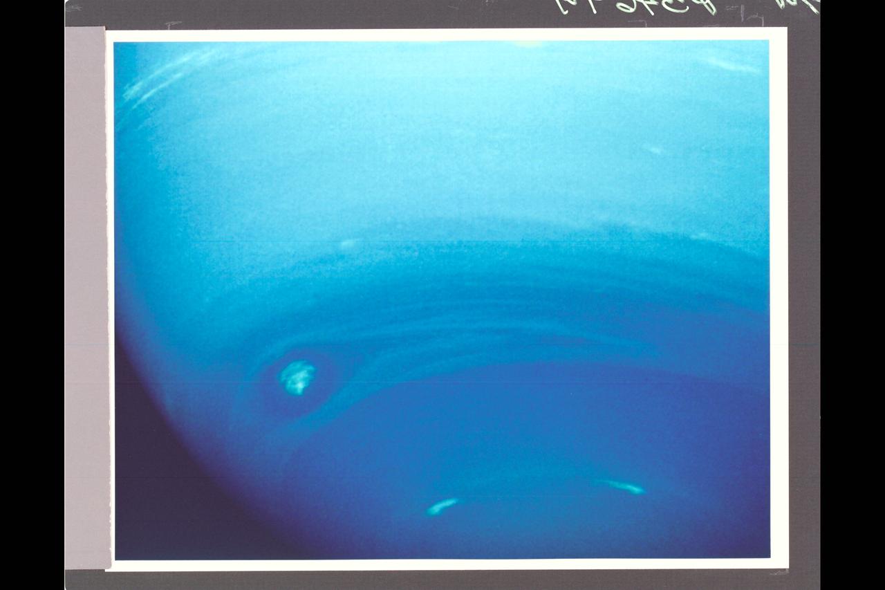
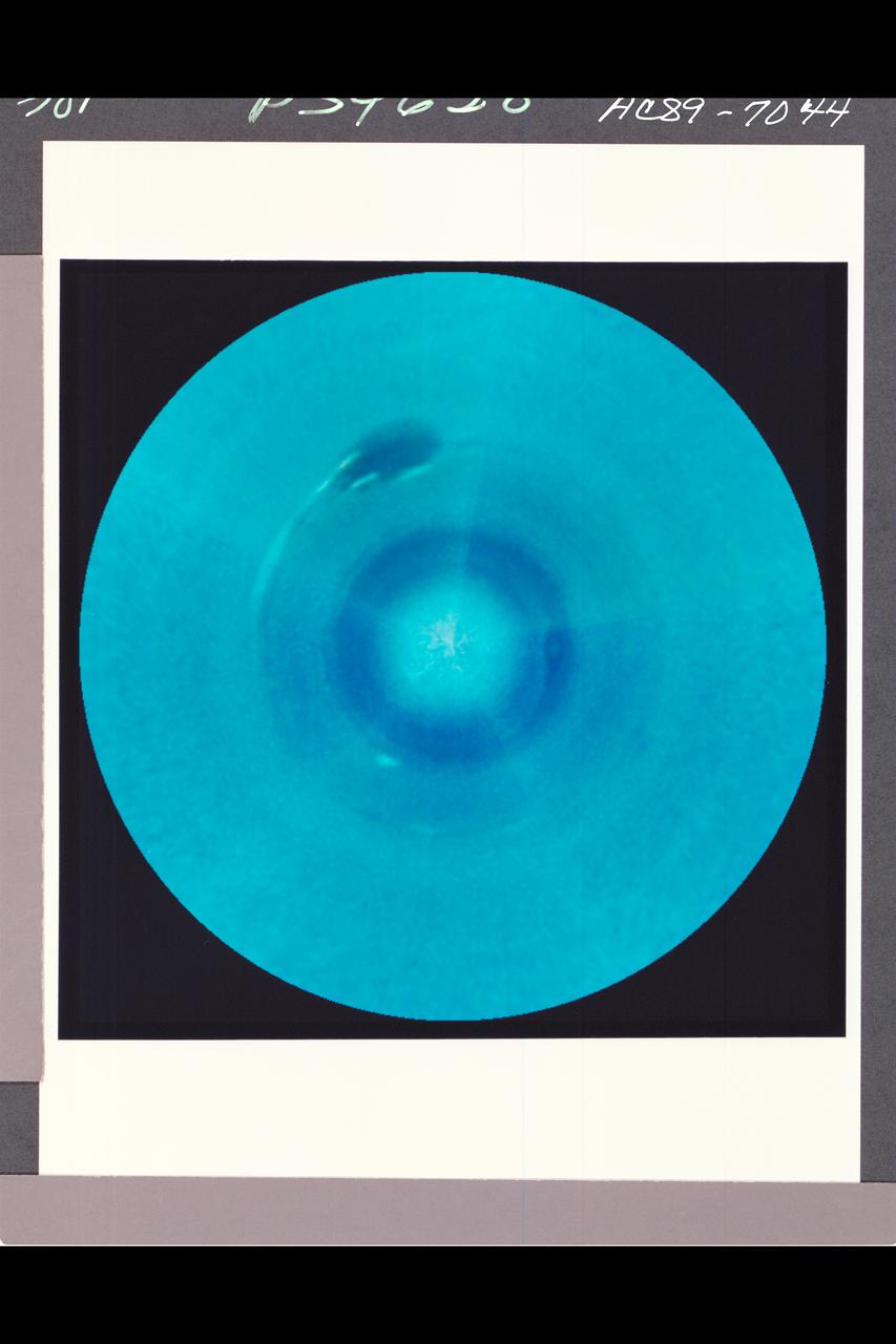
Voyager II Imagery; Neptune. This bulls-eye view of Neptune's small dark spot (D2) was obtained by Voyager 2's narrow-angle camera , when Neptune was within 1.1 million km (680,000 miles) of the planet. The smallest structures that can be seen are 20 km (12 miles) across. This unplanned photograph was obtained when the infrared spectrograph was mapping the the highest-resolution view of the feature taken during the flyby. Banding surrounding the feature indicates unseen strong winds, while structues within the bright spot suggest both active upwelling of clouds and rotation about the center. A rotation rate has not yet been measured, but the v-shaped structure near the right edge of the bright area indicates that the spot rotates clockwise. Unlike the Great Red Spot on Jupiter, which rotates counterclockwise, if the D2 spot on Neptune rotates clockwise, the material will be descending in the dark oval region. The fact that infrared data will yield temperature information about the region above the clouds makes this observation especially valuable. The Voyager Mission is conducted by JPL for NASA's Office of Space Science and Applicaitons. (JPL ref: P-34749 Voyager N-71) taken during the flyby. Banding surrounding the feature indicates unseen strong winds, while structures within the bright spot suggest both active upwelling of clouds and rotation about the center. A rotation rate has not yest been measured, but the Vv-sphped

Photo by Voyager 2 (jpl) These images show changes in the clouds around Neptune's Great Dark Spot (GDS) over a four and one-half-day period. From top to bottom the images show successive rotations of the planet -- an interval of about 18 hours. The GDS is at a mean latitude of 20 degrees south, and covers about 30 degrees of longitude. The violet filter of the Voyager narrow angle camera was used to produce these images at distances ranging from 17 million kilometers (10.5 million miles) at the top, to 10 million kiloeters (6.2 million miles) at the bottom. The images have been mapped on to a rectangular latitude-longitude grid to remove the effects of changing viewing geometry and the changing distance to Neptune. The sequence shows a large change in the western end (left side) of the GDS, where dark extension apparent in the earlier images converges into an extended string of small dark spots over the next five rotations. This 'string of beads' extends from the GDS a surprisingly large angle relative to horizontal lines of constant latitude. The large bright cloud at the southen (bottom) boarder of the GDS is a more or less permanent companion of the GDS -- reminiscent of flow around the Great Red Spot in Jupiter's atmosphere. This activity of the GDS is surprising because the total energy flux from the sun and from Neptune's interior is only 5 percent as large as the total energy flux on Jupiter. (JPL Ref: P-34610 Voyager 2-N23)

Range : 3.4 million km This pair of images shows two of the long-lived white oval clouds which have resided in the Jovian southern hemisphere for nearly 40 years. The upper picture shows the cloud that is at a longitude west of the Great Red Spot, and the lower frame, the cloud at a longitude east of this feature. The third oval is currently just south of the Great Red Spot. The clouds show very similar internal structures. To the east of each of them, recirculation currents are clearly seen. In the lower frame, a similar structure is seen to the west of the cloud. Although a recirculation current is associated with the upper western region of the cloud, it is further away from this feature and not seen in the image. This photo was taken by Voyager 2.
Range : 2.52 million miles (1.56 million miles) Resolution : 47km. ( 29 mi.) Closest Approach: 127,000 km. (79,000 mi.) P-29479B/W This Voyager 2 image of the brightest Uranian satellite of the five largest, Ariel, was shot through a clear filter with the narrow angle camera. Ariel is about 1,300 km. ( 800 mi. )in diameter. This image shows several distinct bright areas that reflect nearly 45 % of the incident sunlight. On average, the satellite displays reflectivity of about 25-30 %. The bright areas are probably fresh water ice, perhaps excavated by impacts. the south pole of Ariel is slightly off center of the disk in this view.
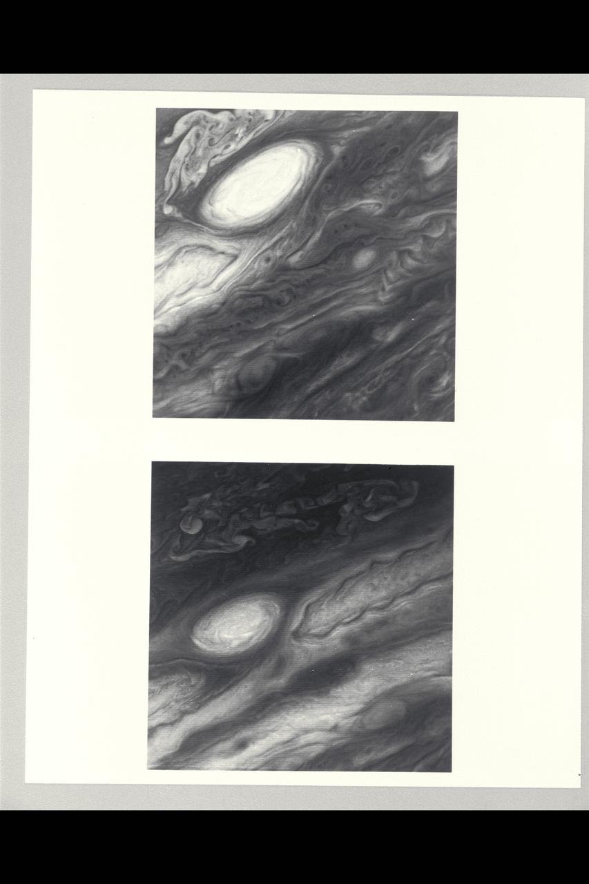
Range : 3.4 million km This pair of images shows two of the long-lived white oval clouds which have resided in the Jovian southern hemisphere for nearly 40 years. The upper picture shows the cloud that is at a longitude west of the Great Red Spot, and the lower frame, the cloud at a longitude east of this feature. The third oval is currently just south of the Great Red Spot. The clouds show very similar internal structures. To the east of each of them, recirculation currents are clearly seen. In the lower frame, a similar structure is seen to the west of the cloud. Although a recirculation current is associated with the upper western region of the cloud, it is further away from this feature and not seen in the image. This photo was taken by Voyager 2.
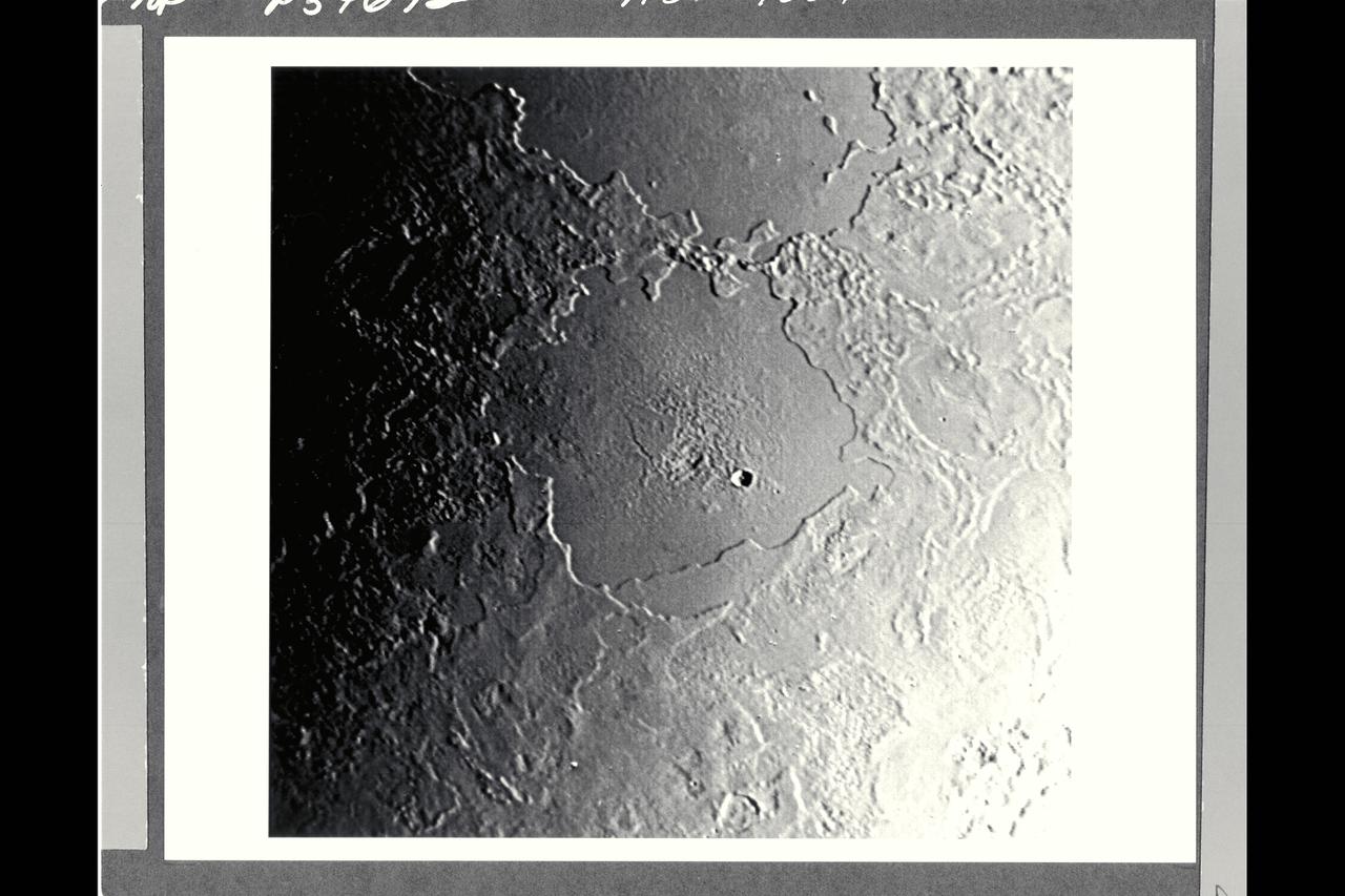
P-34692 Range : 500 km. ( 300 miles ) Smallest Resolvable Feature : 900 m. or 2,700 ft. Part of Triton's complex geological history canbe seen in this image, shot by Voyager 2. Part of a sequence, this photograph encompasses two depressions, possibly old impact basins, that have been extensively modified by floodind, melting, faulting, and collapse. Several episodes of filling and partial removal of material appear to have occurred. The rough area in the middle of the bottom depression probably marks the most recent eruption of material. Only a few impact craters dot the area, which shows the dominance of internally driven geologic processes on Triton.

Range : 4.86 million km (3 million mi.) This dramatic view of the crescents of Neptune and Triton was acquired by Voyager 2 approx. 3 days, 6 1/2 hours after its closest approach to Neptune. The space craft was pluging southward at an angle of 48 degrees to the plane of the ecliptic. This direction, combined with the current season of southern summer in the Neptune system, gives this picture its unique geometry. The smallest detail discernible is approx. 90 km (56 mi.). Color was produced using images taken through the narrow-angle camera's clear, orange and green filters. Neptune does not appear as blue from this viewpoint because the forward scattering nature of its atmosphere is more important than its absorption of red light at this high phase angle (134 degrees).

P-34712 Range: 1.1 million kilometers (683,000 miles) This wide-angle Voyager 2 image, taken through the camera's clear filter, is the first to show Neptune's rings in detail. The two main rings, about 53,000 km (33,000 miles) and 63,000 km (39,000 miles) from Neptune, are 5 to 10 times brighter than in earlier images. The difference is due to lighting and viewing geometry. In approach images, the rings were seen in light scattered backward toward the spacecraft at a 15° phase angle. However, this image was taken at a 135° phase angle as Voyager left the planet. That geometry is ideal for detecting microscopic particles that forward scatter light preferentially. The fact that Neptune's rings are so much brighter at that angle means the particle-size distribution is quite different from most of Uranus' and Saturn's rings, which contain fewer dust-size grains. However, a few componenets of the Saturian and Uranian ring systems exhibit forward-scattering behavior: The F ring and the Encke Gap ringlet at Saturn and 1986U1R at Uranus. They are also narrow, clumpy ringlets with kinks, and are associated with nearby moonlets too small to detect directly. In this image, the main clumpy arc, composed of three features each about 6 to 8 degrees long, is clearly seen. Exposure time for this image was 111 seconds.
Range : 12.9 million km. ( 8.0 million miles ) P-29467B/W Time lapse Voyager 2 images of Uranus show the movement of two small, bright, streaky clouds, the first such features ever seen on the planet. The clouds were detected in this series of orange filtered images, over a 4.6 hour interval ( from top to bottom ). Uranus, which is tipped on its side with respect to the other planets, is rotating in a counter-clockwise direction, with its pole of rotation near the center of the disk, as are the two clouds seen here as bright streaks. The larger of the two clouds is ata lattitude of 33 degrees. The smaller cloud, seen faintly in the three lower images, lies at 26 degrees ( a lower alttitude and hence closer to the limb). Their counterclockwise periods of rotation are 16.2 and 16.9 hours, respectively. This difference implies that the lower lattitude feature is lagging behind the higher latitude feture at a speed of almost 100 meters pers second (220 mph). Latitudinal bands are also visible in these images, the faint bands, more numerous now then in previous Voyager images from longer range, are concentric with the pole rotation. thatis, they circle the planet in lines of contant latitude.

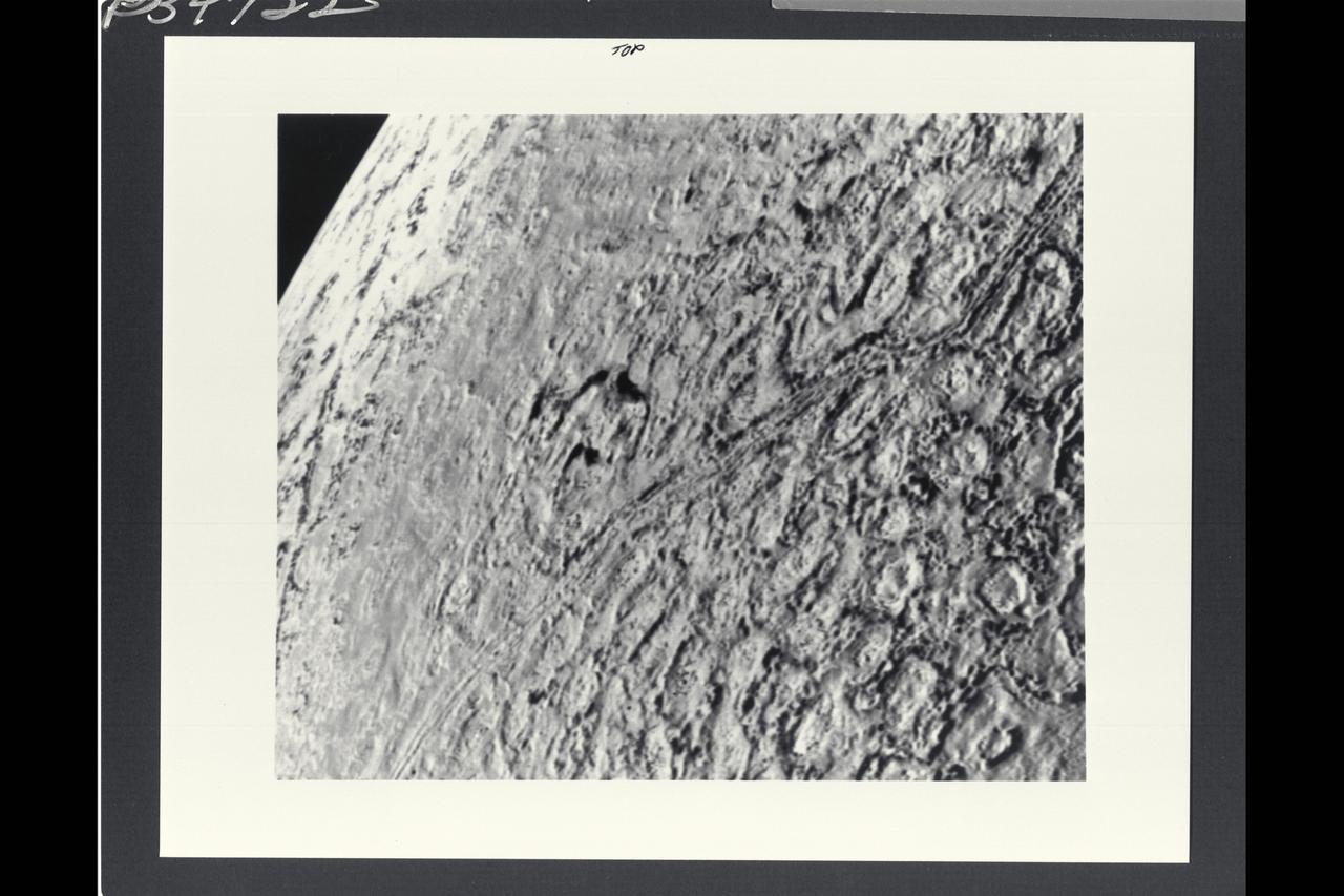
Range : 312, 000 kilometers (195,000 miles) This photo of Ganymede (Ice Giant) was taken from Voyager 2 and shows features down to about 5 to 6 kilometers across. Different types of terrain common on Ganymede's surface are visible. The boundary of the largest region of dark ancient terrain on Ganymede can be seen to the east (right), revealing some of the light linear features which may be all that remains of a large ancient impact structure similar to the large ring structure on Callisto. The broad light regions running through the image are the typical grooved structures seen within another example of what might be evidence of large scale lateral motion in Ganymede's crust. The band of grooved terrain (about 100 kilometers wide) in this region appears to be offset by 50 kilometers or more on the left hand edge by a linear feature perpendicular to it. A feature similar to this one was previously discovered by Voyager 1. These are the first clear examples of strike-slip style faulting on any planet other than Earth. Many examples of craters of all ages can be seen in this image, ranging from fresh, bright ray craters to large, subdued circular markings thought to be the 'scars' of large ancient impacts that have been flatteded by glacier-like flows.
This artist rendering shows NASA Voyager spacecraft. Voyager 2 was launched on Aug. 20, 1977. Voyager 1 was launched on Sept. 5, 1977.
Range : 5.4 million km (3.3 million miles) Features as small as 100 km (62 miles) across can be seen in this color image of Neptune's satellite Triton, photographed by Voyager 2. Triton's overall pinkish color may be due to reddish materials produced by irradiation of methane gas and ice on the satellite. The dark areas near the top of the image seem to be part of a belt of dark markings observed near Trition's equator at different longitudes. Generally, darker areas on Triton appear to be somewhat redder in color than brighter areas. The central longitude in the image is 123 degrees. Here the south pole is at about 6 o'clock, approximately 1/6th of the way up from the bottom. The color image was made from three black-and-white frames, taken through clear, violet and green filters.
P-34668 This narrow angled image of Neptune's Triton, part of a sequence recieved from Voyager 2 shows a large flooded basin about 200 km. or 120 miles wide and 400 km. or 240 miles long. It appears to have been formed chiefly by two large, ancient craters. The walls of the basin have retreated, possibly as a consequence of sapping or collapse into the fluid that filled the main floor. The vent from which the flood evidently erupted lies near the right hand end of the basin. The surface of the eruptive material is rough near the vent and along the center of the basin, perhaps as a consequence of the presence of large rafts of ice. The absence of resolved impact craters on the floor of the basin indicatyes a young age for the flood.
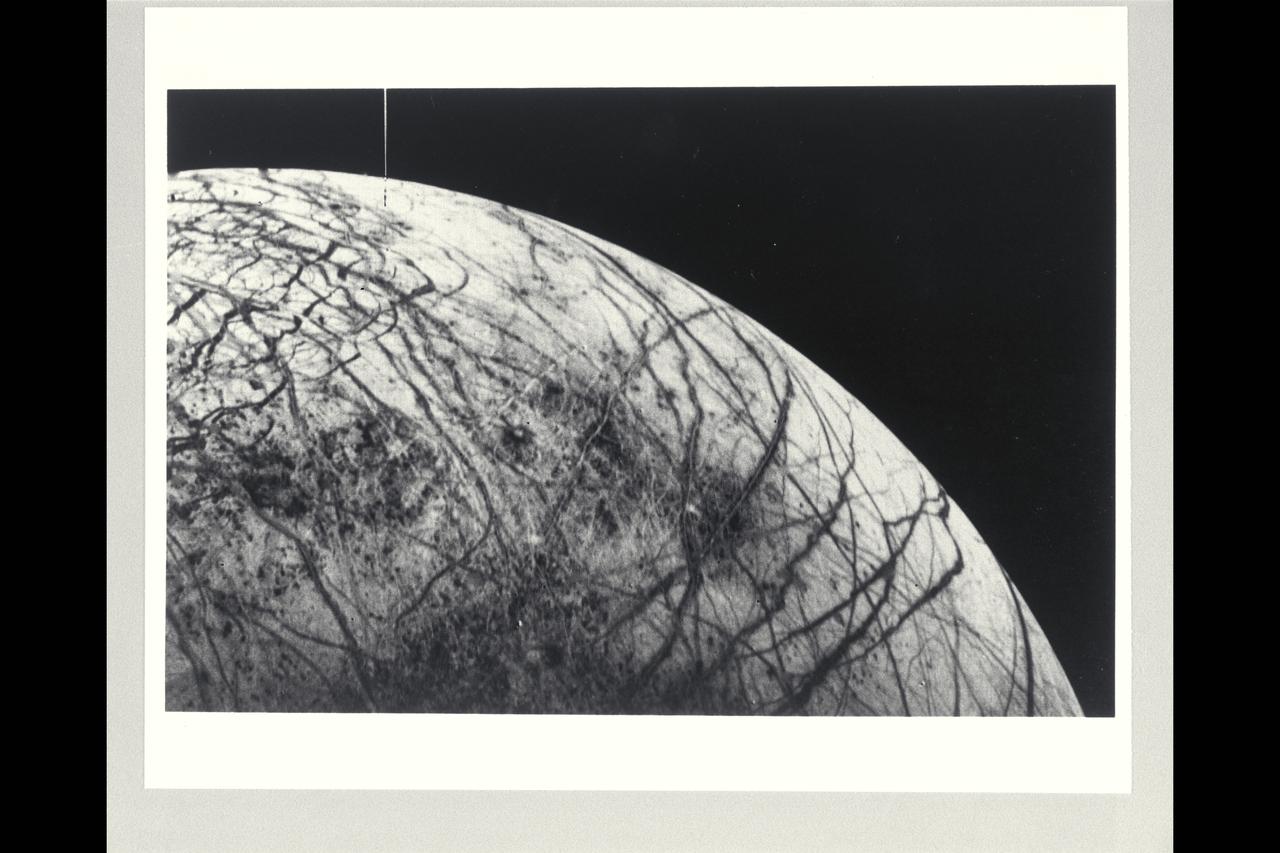
Range : 241,000km (150,600 mi.). This black and white image of Europa, smallest of Jupiter's four Galilean satellites, was acquired by Voyager 2. Europa, the brightest of the Galiliean satellites, has a density slightly less than Io, suggesting it has a substantial quantity of water. Scientists previously speculated that the water must have cooled from the interior and formed a mantle of ice perhaps 100 km thick. The complex patterns on its surface suggest that the icy surface was fractured, and that the cracks filled with dark material from below. Very few impact craters are visible on the surface, suggesting that active processes on the surface are still modifying Europa. The tectonic pattern seen on its surface differs drastically from the fault systems seen on Ganymede where pieces of the crust have moved relative to each other. On Europa, the crust evidently fractures but the pieces remain in roughly their original position.

This picture of Neptune was produced from images taken through the ultraviolet, violet and green filters of the Voyager 2 wide-angle camera. This 'false' color image has been made to show clearly details of the cloud structure and to paint clouds located at different altitudes with different colors. Dark, deeplying clouds tend to be masked in the ultraviolet wavelength since overlying air molecules are particularly effective in scattering sunlight there which brightens the sky above them. Such areas appear dark blue in this photo. The Great Dark Spot (GDS) and the high southern latitudes have a deep bluish cast in this image, indication they are regions where visible light (but not ultraviolet light) may penetrate to a deeper layer of dark cloud or haze in Neptune's atmosphere. Conversely, the pinkish clouds may be positioned at high altitudes.