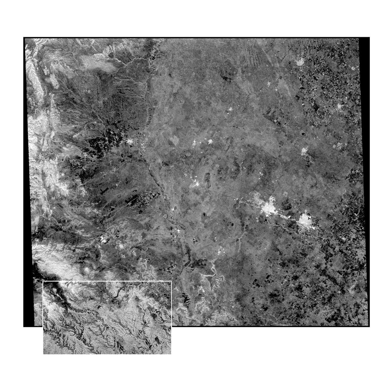
This radar image of the Midland/Odessa region of West Texas, demonstrates an experimental technique, called ScanSAR, that allows scientists to rapidly image large areas of the Earth's surface. The large image covers an area 245 kilometers by 225 kilometers (152 miles by 139 miles). It was obtained by the Spaceborne Imaging Radar-C/X-Band Synthetic Aperture Radar (SIR-C/X-SAR) flying aboard the space shuttle Endeavour on October 5, 1994. The smaller inset image is a standard SIR-C image showing a portion of the same area, 100 kilometers by 57 kilometers (62 miles by 35 miles) and was taken during the first flight of SIR-C on April 14, 1994. The bright spots on the right side of the image are the cities of Odessa (left) and Midland (right), Texas. The Pecos River runs from the top center to the bottom center of the image. Along the left side of the image are, from top to bottom, parts of the Guadalupe, Davis and Santiago Mountains. North is toward the upper right. Unlike conventional radar imaging, in which a radar continuously illuminates a single ground swath as the space shuttle passes over the terrain, a Scansar radar illuminates several adjacent ground swaths almost simultaneously, by "scanning" the radar beam across a large area in a rapid sequence. The adjacent swaths, typically about 50 km (31 miles) wide, are then merged during ground processing to produce a single large scene. Illumination for this L-band scene is from the top of the image. The beams were scanned from the top of the scene to the bottom, as the shuttle flew from left to right. This scene was acquired in about 30 seconds. A normal SIR-C image is acquired in about 13 seconds. The ScanSAR mode will likely be used on future radar sensors to construct regional and possibly global radar images and topographic maps. The ScanSAR processor is being designed for 1996 implementation at NASA's Alaska SAR Facility, located at the University of Alaska Fairbanks, and will produce digital images from the forthcoming Canadian RADARSAT satellite. http://photojournal.jpl.nasa.gov/catalog/PIA01787
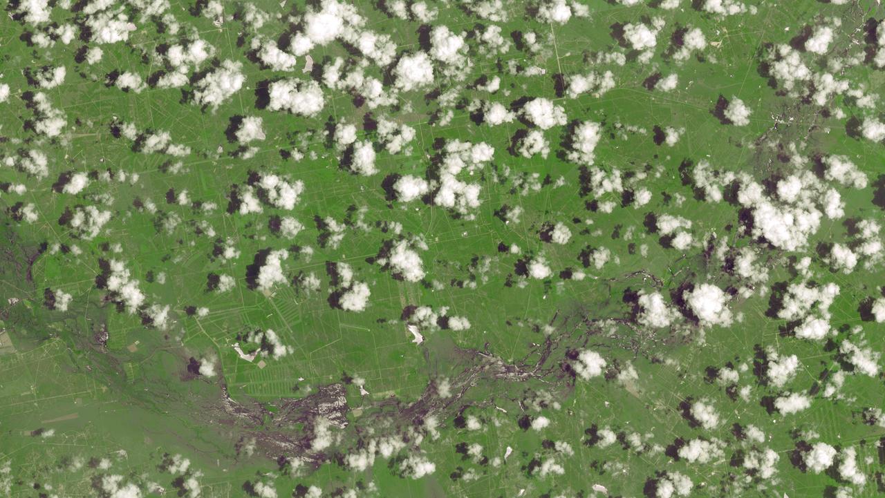
This image, acquired by NASA Terra spacecraft on May 1, 2011, shows more than 314,000 acres burned in west Texas. The 2011 fire season in Texas is of historic proportions.
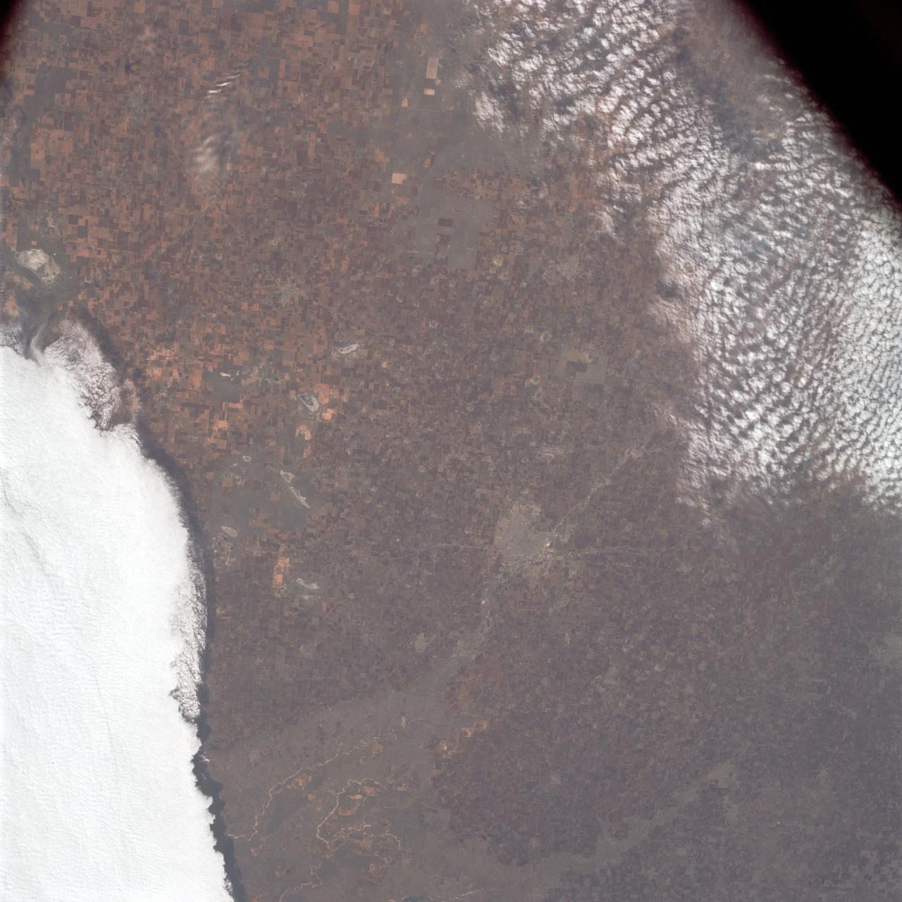
AS09-23-3561 (3-13 March 1969) --- Near vertical view of the Lubbock area in west Texas as photographed from the Apollo 9 spacecraft during its Earth-orbital mission. Conspicuous patterns of farmland surround the city and extend eastward (up) to the Caprock Escarpment. The Double Mountain fork of the Brazos River drains east (toward upper center); Leeland is at lower center; Brownfield at lower right. The sharp edge of a cloud disk cuts across the upper right corner.
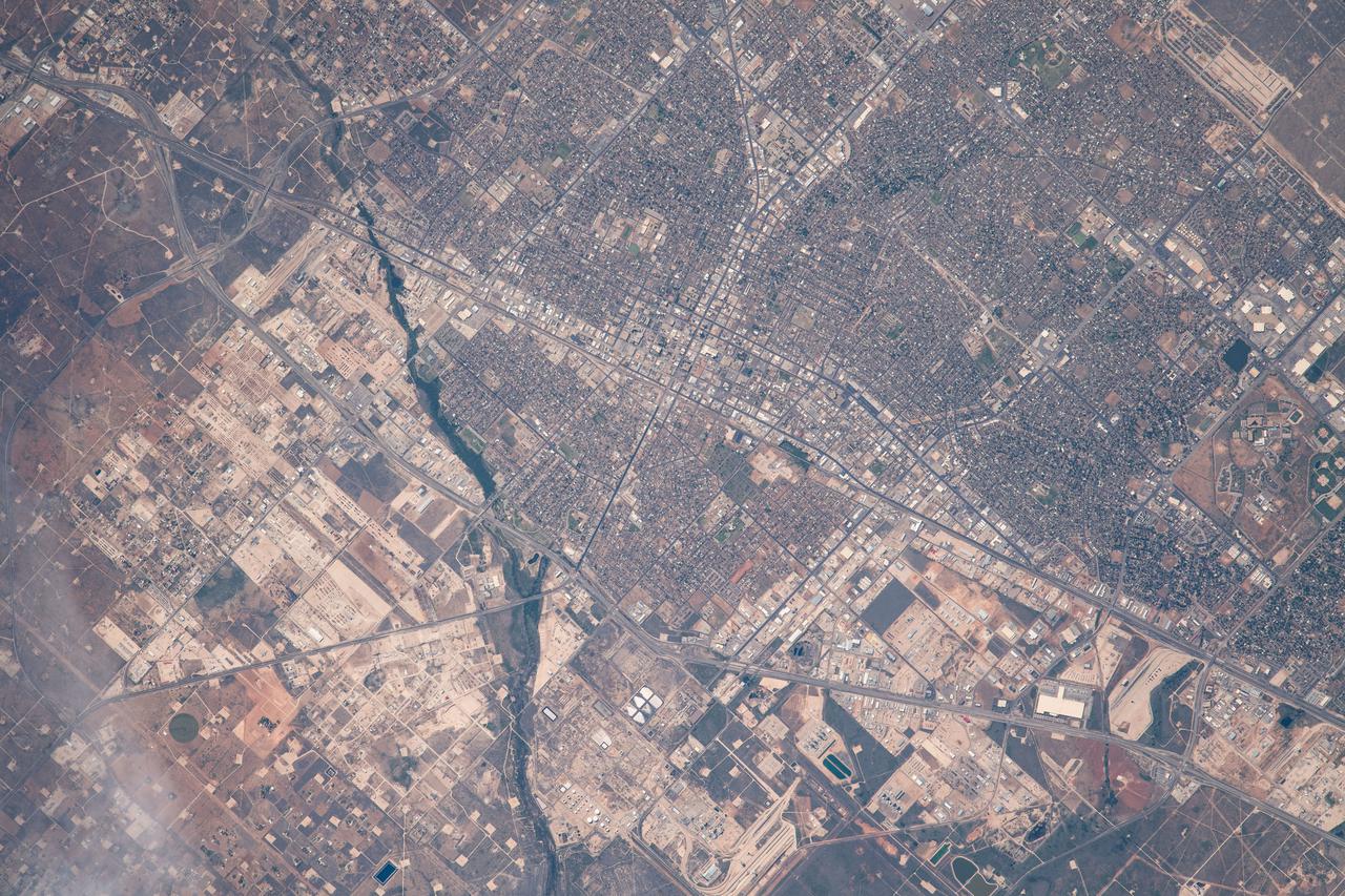
iss065e074434 (May 26, 2021) --- Odessa, Texas, is pictured from the International Space Station as it orbited 261 miles above west Texas.

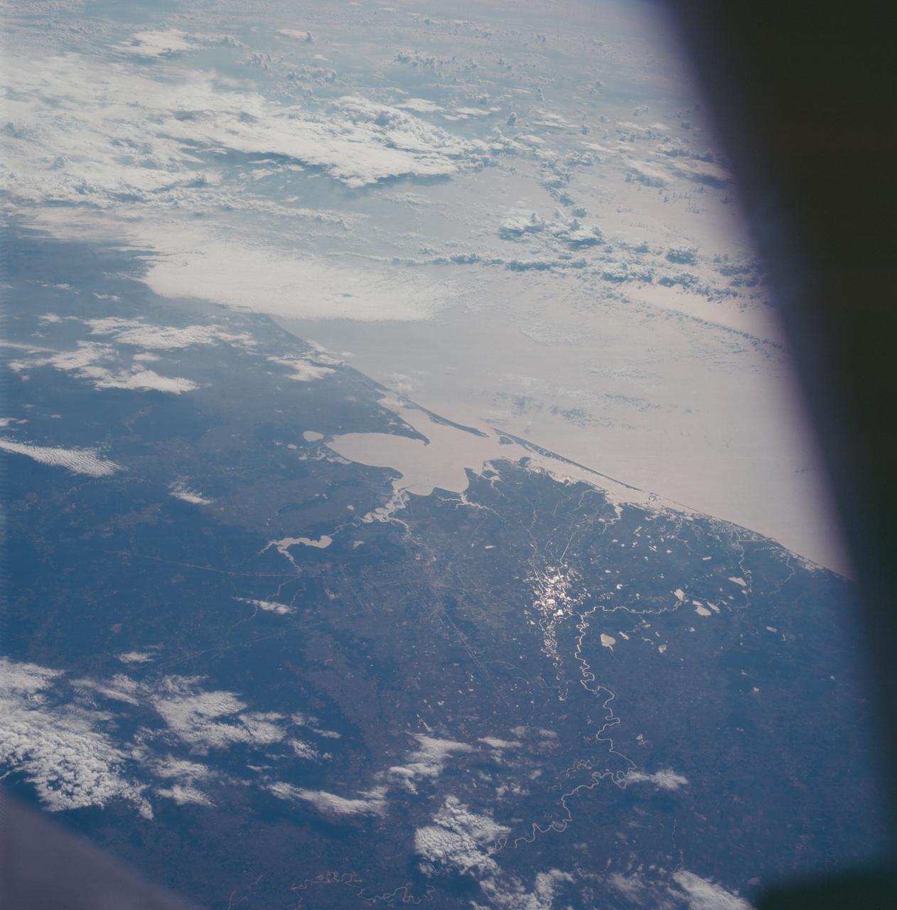
AS6-02-1455 (4 April 1968) --- Texas is photographed from the Apollo 6 (Spacecraft 020/Saturn 502) unmanned space mission. Seen in this photograph are Midland, Brownfield, Big Spring, J. B. Thomas Lake, headwaters of Colorado and Brazos Rivers, and the west Texas gas and oil fields.
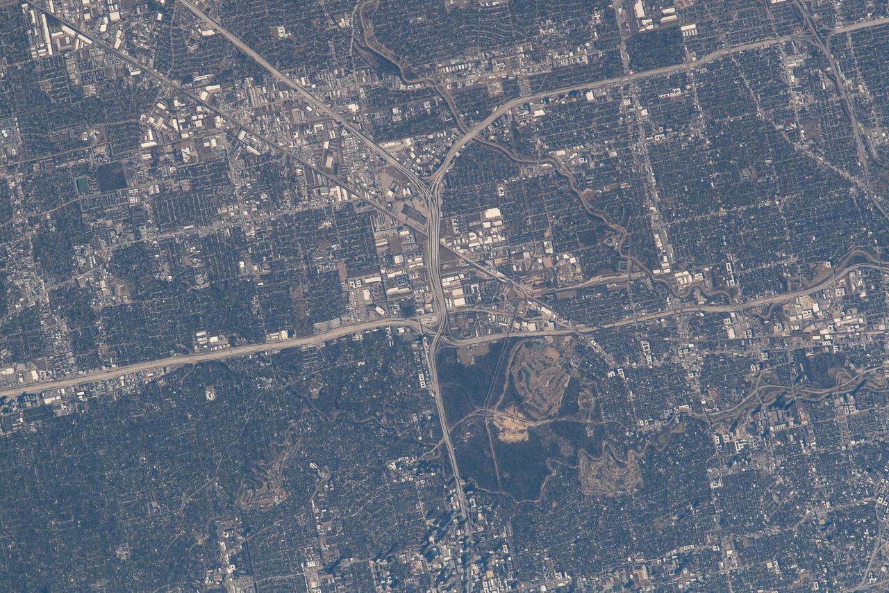
iss066e143699 (Feb. 13, 2022) --- The northwest corner of Houston, Texas, with the major highways of Interstate 610 looping around the city, Interstate 10 moving east to west, and U.S. 290 heading northwest, are pictured from the International Space Station as it orbited 258 miles above the Lone Star state.
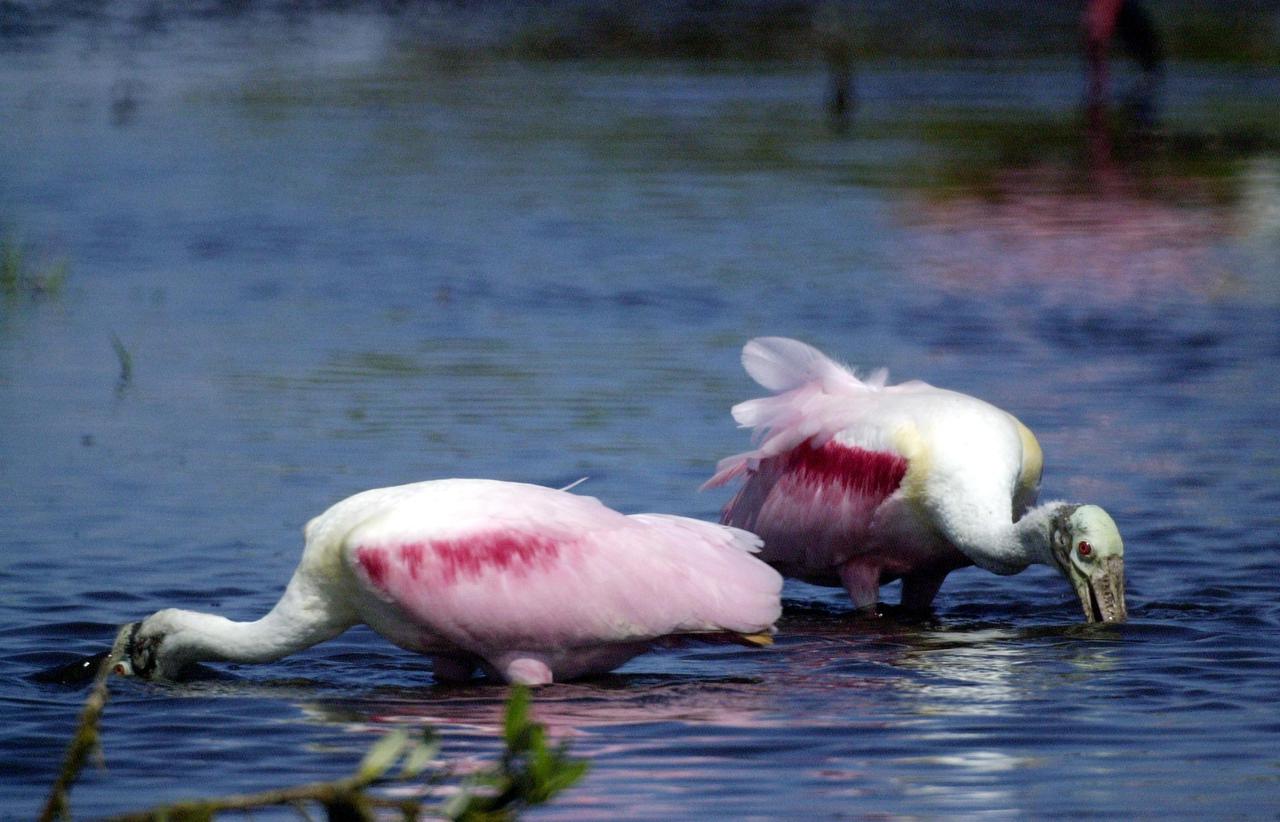
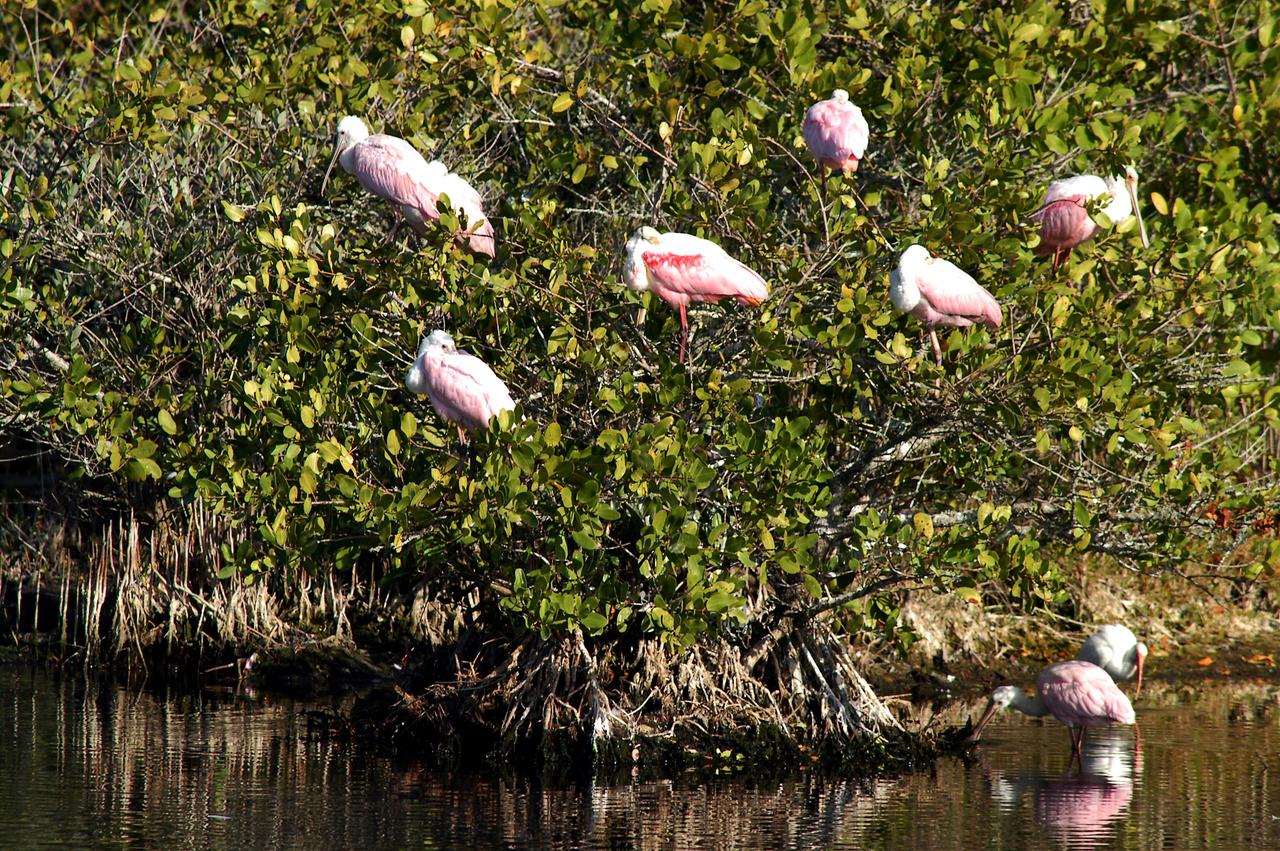
KENNEDY SPACE CENTER, FLA. -- In a lake near Kennedy Space Center, a pair of Roseate Spoonbills search the water for food. They obtain food by sweeping their broad bills from side to side. This species inhabits mangroves, ranging from the coasts of southern Florida and Texas (sometimes Louisiana), the West Indies, Mexico and Central and South America.
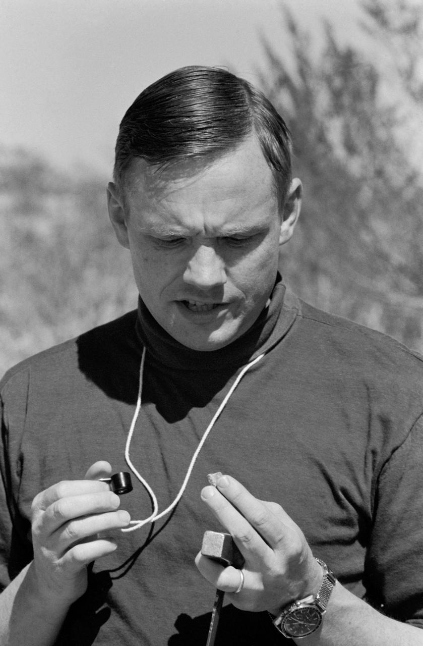
S69-25198 (25 Feb. 1969) --- Astronaut Neil A. Armstrong, commander of the Apollo 11 prime crew, studies rock sample during a geological field trip to the Quitman Mountains area near the Fort Quitman ruins in far west Texas.
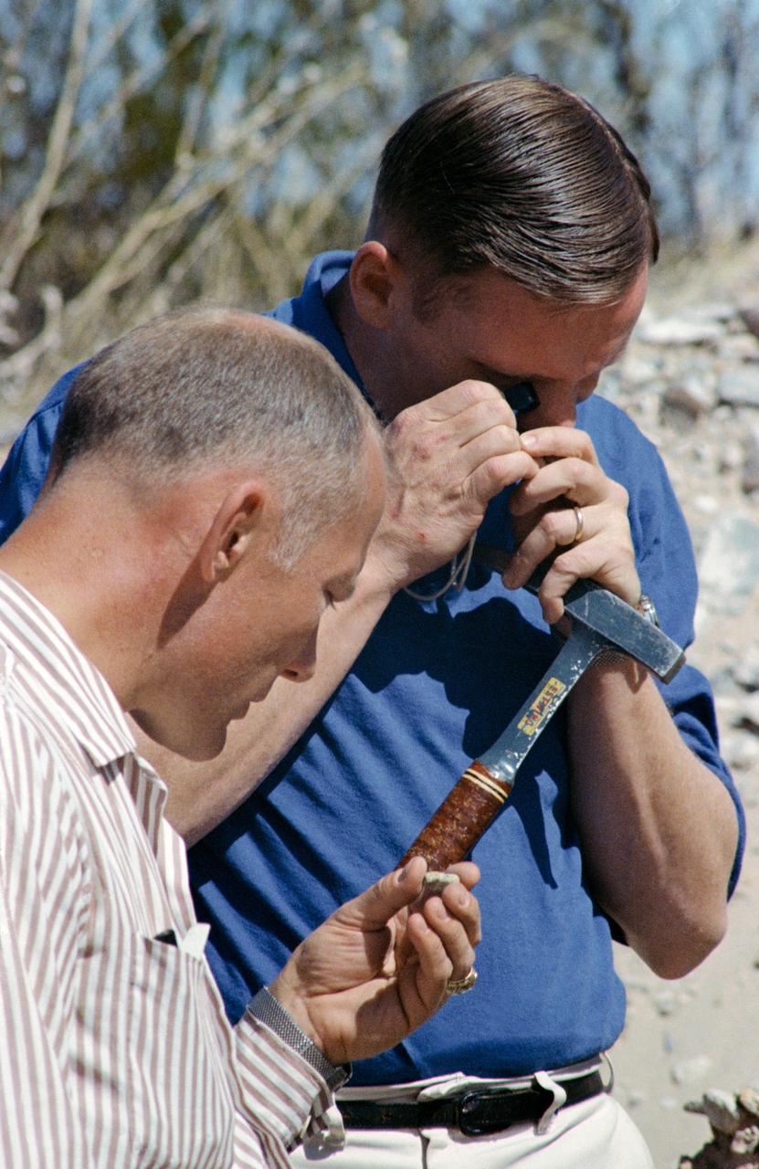
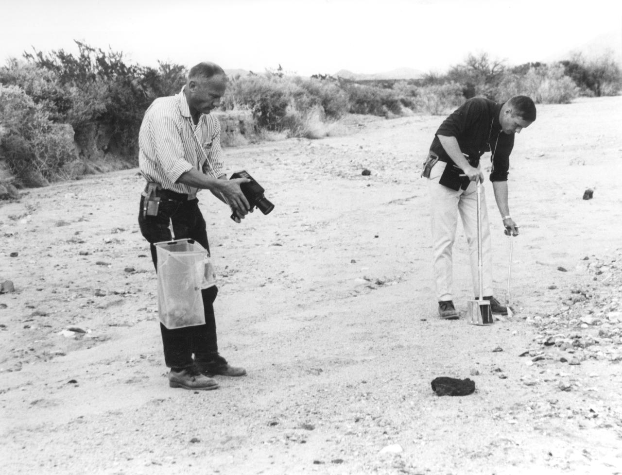
S69-25944 (25 Feb. 1969) --- These two Apollo 11 crew astronauts study rock samples during a geological field trip to the Quitman Mountains area near the Fort Quitman ruins in far west Texas. Neil A. Armstrong (in background) is the Apollo 11 commander; and Edwin E. Aldrin Jr. is the lunar module pilot.
ISS043E249636 (05/24/2015) --- The southern US state of West Virginia was captured by cameras aboard the International Space Station and NASA astronaut Scott Kelly tweeted it out with this comment: "Good morning #WestVirginia! It looks like if you were pounded flat you'd be bigger than Texas. #YearInSpace".
STS109-714-035 (1-12 March 2002) --- The astronauts on board the Space Shuttle Columbia took this 70mm picture featuring the greater metropolitan Houston, Texas area. The view direction is northwest, with Houston's downtown as the brightest region (center) where major highways converge. Interstate 10 is a fine line extending towards the lower right, around the north side of Galveston Bay, part of which appears in the lower right corner. The interstate also appears as a line cutting through the wooded parts of west Houston (just west of downtown). Bush Intercontinental Airport is the largest light patch on the view north of downtown, and lies next to Highway 59, a thin white line that stretches toward the right side of the picture. Forests of East Texas make the top right corner of the view a dark green.
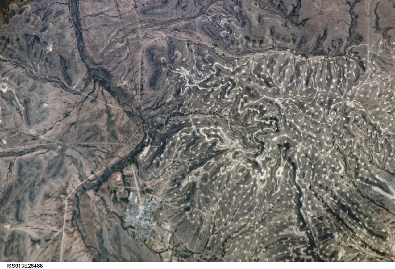
ISS013-E-26488 (25 May 2006) --- Yates Oilfield, west Texas is featured in this image photographed by an Expedition 13 crewmember on the International Space Station. The Permian Basin of west Texas and southeastern New Mexico is one of the most productive petroleum provinces of North America. The Basin is a large depression in the Precambrian bedrock surface along the southern edge of the North American craton, or oldest bedrock core of the continent. The Yates Oil Field is marked in this image by numerous white well locations and petroleum infrastructure dotting the layered sedimentary rocks of the Permian Basin. The Pecos River bed borders the oil field to the east-northeast. The Yates Field started petroleum production in 1926, and by 1995 had produced over 2 billion barrels of oil.
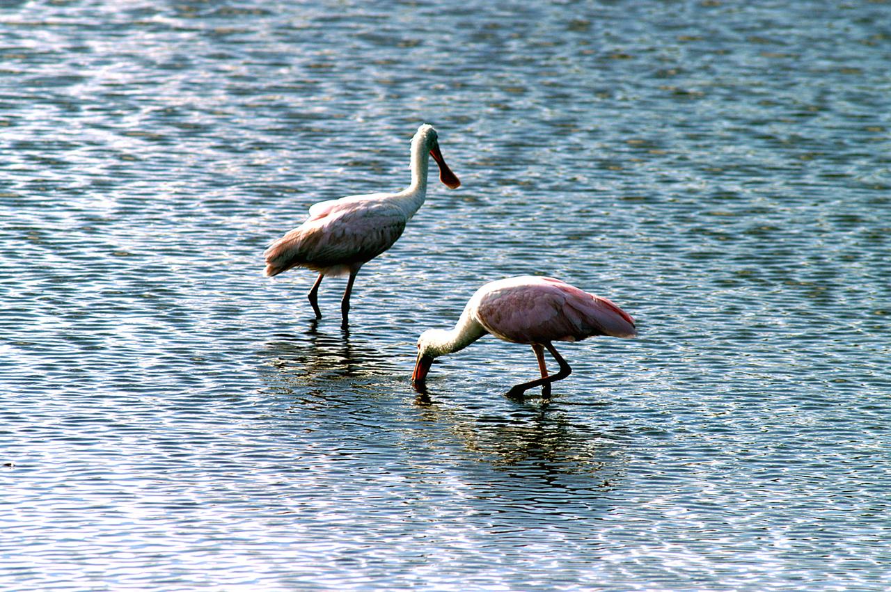
KENNEDY SPACE CENTER, FLA. -- Two roseate spoonbills hunt for their supper in the water near KSC. Spoonbills prefer to inhabit mangroves, ranging from the coasts of southern Florida, Louisiana and Texas, to the West Indies, Mexico, Central and South America. They feed on shrimps and fish in shallow waters. Spoonbills are one of 310 species of birds that inhabit the National Merritt Island Wildlife Refuge, which shares a boundary with KSC. The marshes and open water of the refuge also provide wintering areas for 23 species of migratory waterfowl, as well as a year-round home for great blue herons, great egrets, wood storks, cormorants, brown pelicans and other species of marsh and shore birds.
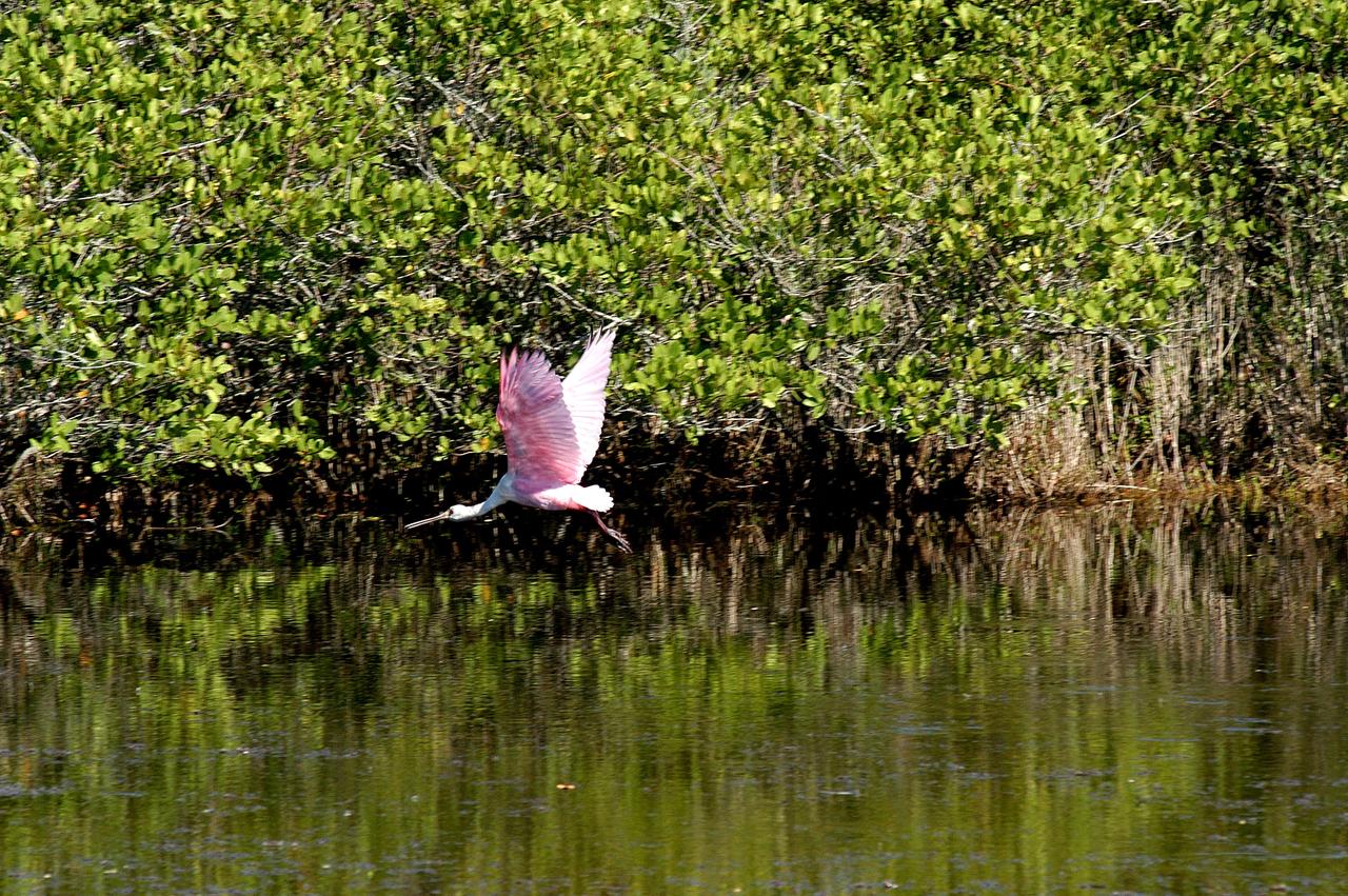
KENNEDY SPACE CENTER, FLA. - A roseate spoonbill flies across the water near KSC. Spoonbills prefer to inhabit mangroves, ranging from the coasts of southern Florida, Louisiana and Texas, to the West Indies, Mexico, Central and South America. They feed on shrimps and fish in shallow waters. Spoonbills are one of 310 species of birds that inhabit the National Merritt Island Wildlife Refuge, which shares a boundary with KSC. The marshes and open water of the refuge also provide wintering areas for 23 species of migratory waterfowl, as well as a year-round home for great blue herons, great egrets, wood storks, cormorants, brown pelicans and other species of marsh and shore birds.
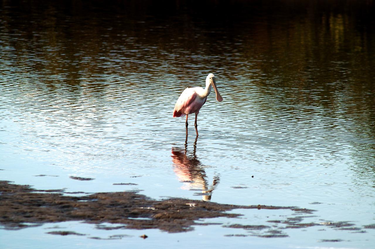
KENNEDY SPACE CENTER, FLA. -- A roseate spoonbill contemplates its reflection in the water near KSC. Spoonbills prefer to inhabit mangroves, ranging from the coasts of southern Florida, Louisiana and Texas, to the West Indies, Mexico, Central and South America. They feed on shrimps and fish in shallow waters. Spoonbills are one of 310 species of birds that inhabit the Merritt Island National Wildlife Refuge, which shares a boundary with KSC. The marshes and open water of the refuge also provide wintering areas for 23 species of migratory waterfowl, as well as a year-round home for great blue herons, great egrets, wood storks, cormorants, brown pelicans and other species of marsh and shore birds.
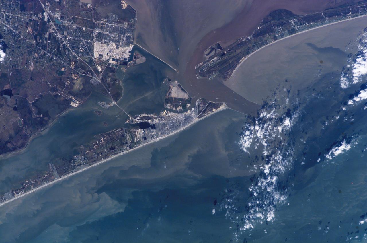
ISS014-E-07258 (4 Nov. 2006) --- Galveston, Texas is featured in this image photographed by an Expedition 14 crewmember on the International Space Station (ISS). Mexico established a port of entry (known as Galveston) in 1825, and following the Texas Revolution it was the capital of the Republic of Texas during 1836. The modern-day city of Galveston was incorporated in 1839, and became the major trading seaport of Texas during the latter half of the 19th century. The city was largely destroyed in early September of 1900 by a powerful hurricane; this, coupled with construction of the Houston Ship Channel and discovery of oil in eastern Texas shifted the center of trade northwest to Houston. Many human footprints are easily observed from the vantage point of low Earth orbit. The eastern half of Galveston Island is dominated by the city of Galveston (gray-white region at center). A large seawall along the Gulf of Mexico (southern coastline of Galveston Island) protects most of the city. To the west of Galveston, coastal wetlands are largely submerged by regional subsidence--a result of ground water withdrawal by the petrochemical industry of Houston and Texas City. The entrance to Galveston Bay and the Houston Ship Channel is located between Galveston Island and the Bolivar Peninsula (upper right). Numerous ship wakes are visible along the Houston Ship Channel. Other visible features of the entrance to Galveston Bay include the five-mile long Texas City Dike, a structure that protects the Texas City channel and includes a fishing pier that extends 600 feet beyond the end of the Dike. Extensive petroleum processing facilities are located to the west of the Dike in Texas City. The Intracoastal Waterway runs through western Galveston Bay; new subdivisions built on dredge spoils are visible along the northern boundary of the Waterway. Geologists studying the ISS collection of down linked still imagery observe that complex estuarine sediment patterns are visible in this image. Dark brown to tan waters adjacent to the Bolivar Peninsula and Texas City Dike reflect increased sediment loads following heavy rains in mid-to-late October, coupled with northerly winds moving Bay water southwards. Turbidity currents to both the northwest and southeast of Galveston Island produce a more chaotic pattern of sediment-laden (light green to tan) and relatively sediment-free (dark green) water leading into the dark green Gulf of Mexico (lower right).
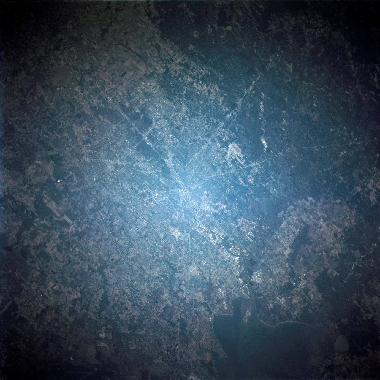
Long regarded as one of the best photo of Houston, Texas (29.5N, 95.0W), this view from space shows the entire greater Houston/Galveston region in remarkable detail and clarity. The dark north/south line in the water between Houston and Galveston is the Houston Ship Channel. NASA's Johnson Space Center and Mission Control is located on the north shore of Clear Lake west of the channel. The extensive road and highway network can be seen in great detail.
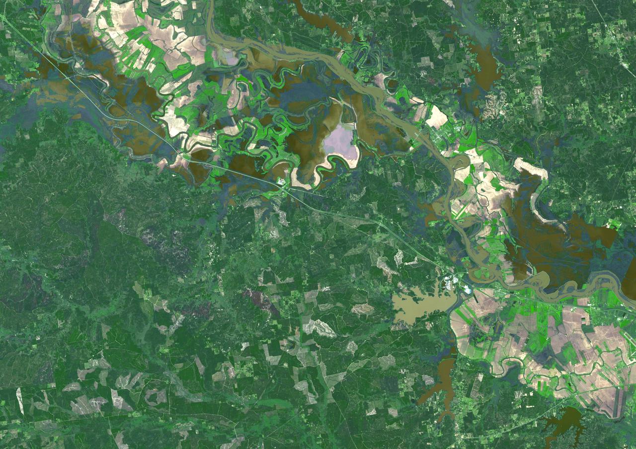
Torrential rains in the mid-South of the United States in mid-March 2016 produced flooding throughout Texas, Louisiana and Mississippi. On March 21, 2016, the Advanced Spaceborne Thermal Emission and Reflection Radiometer (ASTER) instrument on NASA's Terra spacecraft acquired this image showing persistent flooding along the Mississippi River between the Louisiana cities of Alexandria and Natchitoches. The image covers an area of 25 to 36 miles (41 by 58 kilometers), and is located at 31.5 degrees north, 92.8 degrees west. http://photojournal.jpl.nasa.gov/catalog/PIA20533

ISS010-E-13680 (17 January 2005) --- The border of Galveston and Brazoria Counties in Texas is visible in this electronic still camera's image, as photographed by the Expedition 10 crew onboard the International Space Station. Polly Ranch, near Friendswood, is visible west of Interstate Highway 45 (right side). FM528 goes horizontally through the middle, and FM518 runs vertically through frame center, with the two roads intersecting near Friendswood.
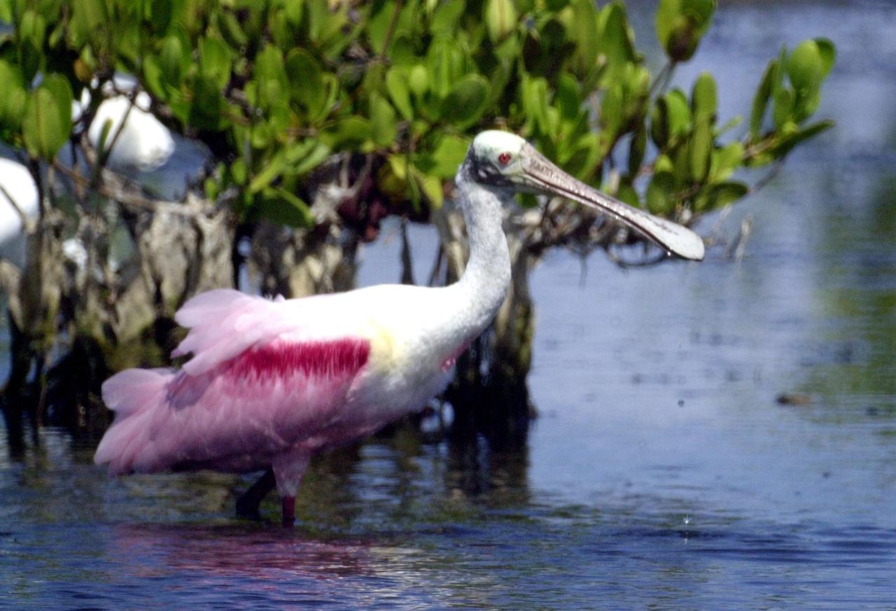
KENNEDY SPACE CENTER, FLA. - Water droplets fall from the broad bill of a Roseate Spoonbill after lifting its head from the water. The site is near Kennedy Space Center. Spoonbills obtain food by sweeping their broad bills from side to side. They inhabit mangroves, ranging from the coasts of southern Florida and Texas (sometimes Louisiana), the West Indies, Mexico and Central and South America.
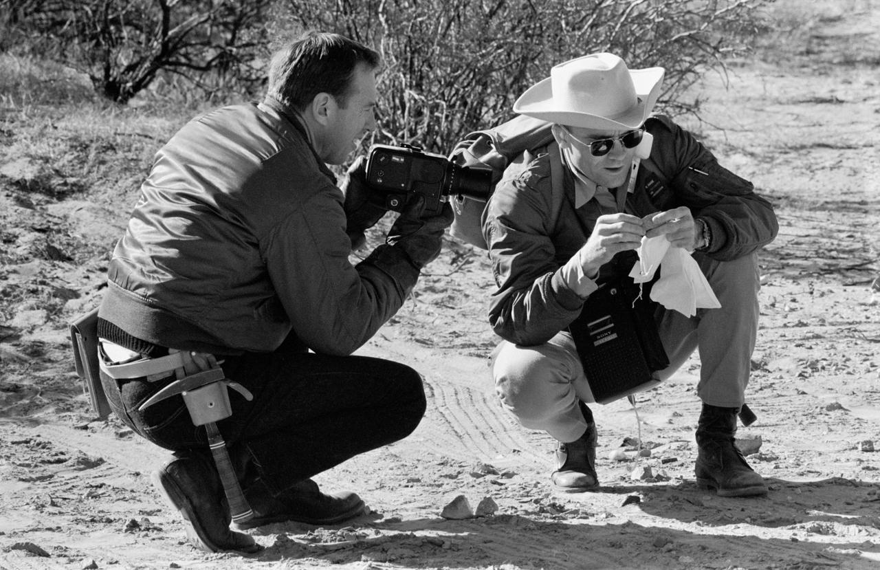
S69-25199 (25 Feb. 1969) --- Two Apollo 11 astronauts study a rock specimen during a geological field trip to the Quitman Mountains area near the Fort Quitman ruins in far west Texas. On the left is James A. Lovell Jr., Apollo 11 backup crew commander; and on the right is Fred W. Haise Jr., backup crew lunar module pilot. Lovell holds a camera which was used in simulating taking pictures of actual lunar samples on the surface of the Moon.
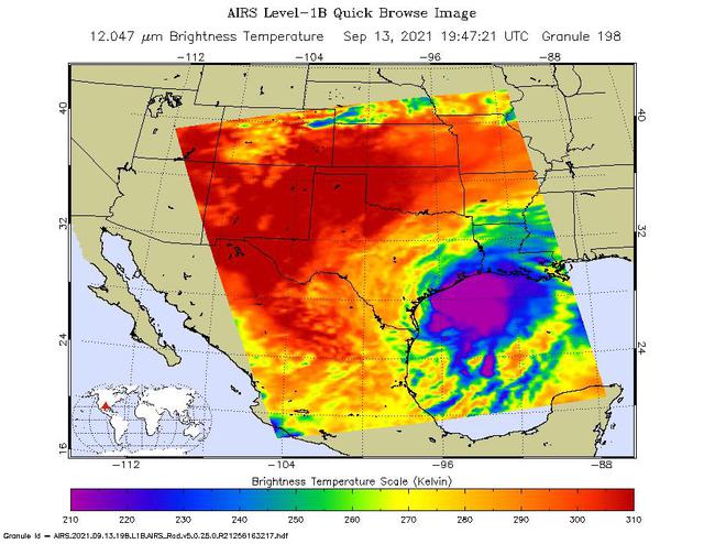
NASA's Atmospheric Infrared Sounder (AIRS) captured views of Hurricane Nicholas before and after it made landfall about 10 miles west-southwest of Sargent Beach, Texas, on Tuesday, Sept. 14, 2021. One image showed Nicholas approaching the Texas coast as a tropical storm in the early afternoon on Monday, Sept. 13, 2021. The storm strengthened to a Category 1 hurricane on Monday night and made landfall Tuesday morning around 12:30 a.m. CDT. The second AIRS image (Figure 1) captured Hurricane Nicholas shortly after landfall around 2:53 a.m. CDT. In the infrared AIRS images, the large purple areas indicate very cold clouds carried high into the atmosphere by lofty thunderstorms that are also associated with heavy rainfall. Warmer areas with shallower rain clouds are shown in blue and green. The orange and red areas represent mostly cloud-free air. AIRS, in conjunction with the Advanced Microwave Sounding Unit (AMSU), senses emitted infrared and microwave radiation from Earth to provide a three-dimensional look at the planet's weather and climate. Working in tandem, the two instruments make simultaneous observations down to Earth's surface. With more than 2,000 channels sensing different regions of the atmosphere, the system creates a global, three-dimensional map of atmospheric temperature and humidity, cloud amounts and heights, greenhouse gas concentrations, and many other atmospheric phenomena. Launched into Earth orbit in 2002 aboard NASA's Aqua spacecraft, the AIRS and AMSU instruments are managed by NASA's Jet Propulsion Laboratory in Southern California, under contract to NASA. JPL is a division of Caltech. https://photojournal.jpl.nasa.gov/catalog/PIA24532
S85-38312 (September 1985) --- Logo designed for use by the 10 finalists in NASA’s Teacher in Space Project, who were at JSC for training and orientation the week of July 8–12, 1985. They are David M. Marquart, Boise High, Boise, Idaho; Michael W. Metcalf, Hazen Union School, Hardwick, Vermont; Judith Marie Garcia, Thomas Jefferson School for Science and Technology, Alexandria, Virginia; Peggy J. Lathlaen, Westwood Elementary, Friendswood, Texas; Niki Mason Wenger, Vandevender Junior High, Parkersburg, West Virginia; Barbara R. Morgan, McCall-Donnelly Elementary, McCall, Idaho; Kathleen Anne Beres, Kenwood High, Baltimore, Maryland; Richard A. Methia, New Bedford High, New Bedford, Mass.; Sharon Christa McAuliffe, Concord High, Concord, New Hampshire; and Robert S. Foerster, Cumberland Elementary School, West Lafayette, Indiana. Photo credit: NASA
KENNEDY SPACE CENTER, FLA. -- A group of roseate spoonbills share their watery hunting ground with a lone white ibis near KSC. Spoonbills prefer to inhabit mangroves, ranging from the coasts of southern Florida, Louisiana and Texas, to the West Indies, Mexico, Central and South America. They feed on shrimps and fish in shallow waters. Spoonbills are one of 310 species of birds that inhabit the Merritt Island National Wildlife Refuge, which shares a boundary with KSC. The marshes and open water of the refuge also provide wintering areas for 23 species of migratory waterfowl, as well as a year-round home for great blue herons, great egrets, wood storks, cormorants, brown pelicans and other species of marsh and shore birds.

KENNEDY SPACE CENTER, FLA. -- A lone white ibis shares its watery hunting ground with a group of roseate spoonbills near KSC. Spoonbills prefer to inhabit mangroves, ranging from the coasts of southern Florida, Louisiana and Texas, to the West Indies, Mexico, Central and South America. They feed on shrimps and fish in shallow waters. Spoonbills are one of 310 species of birds that inhabit the Merritt Island National Wildlife Refuge, which shares a boundary with KSC. The marshes and open water of the refuge also provide wintering areas for 23 species of migratory waterfowl, as well as a year-round home for great blue herons, great egrets, wood storks, cormorants, brown pelicans and other species of marsh and shore birds.
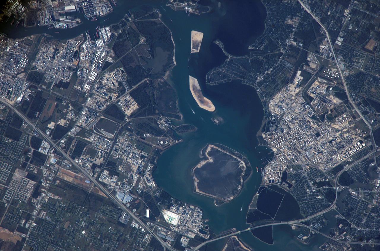
ISS012-E-09567 (28 Nov. 2005) --- Houston Ship Channel, Texas is featured in this image photographed by an Expedition 12 crewmember on the International Space Station. This view depicts the San Jacinto River portion of the Houston Ship Channel, one of the United States' busiest sea ports. The Channel provides a conduit between the continental interior and the Gulf of Mexico for both petrochemical products and Midwestern grain. The original watercourse for the Channel, Buffalo Bayou, has its headwaters 30 miles to the west of the city of Houston and has been used to move goods to the sea since at least 1836. Wakes of ships traveling along the channel are visible to the south of the Goat Islands (bright oblong islands at top center of image). The close proximity to Texas oilfields led to the establishment of numerous petrochemical refineries along the waterway, such as the Exxon Mobil Baytown installation on the eastern bank of the San Jacinto River. While much of the Ship Channel is associated with heavy industry, two icons of Texas history are also located along its length. A close search of the photo's details reveals both the battleship U.S.S. Texas and the neighboring San Jacinto Monument. The Texas saw service during both World Wars, and is the last remaining example of a dreadnought-class battleship in existence. The nearby San Jacinto Monument commemorates the 1836 battle in which Texas won its independence from Mexico. The monument itself is a 570 feet (173 meters) high shaft topped by a 34 feet (10 meters) high star, making it 15 feet (5 meters) higher than the Washington Monument in Washington, D.C. The Houston Ship Channel has been periodically widened and deepened to accommodate ever-larger ships, and is currently 530 feet (161 meters) wide by 45 feet (14 meters) deep by 50 miles (80 kilometers) long. The islands in the ship channel are part of the ongoing channel widening and deepening project--created by dredge spoils, salt marshes and bird islands are part of the Houston Port Authority's beneficial use and environmental mitigation responsibilities.
The torrential rains that lashed Texas in late May 2015 caused widespread flooding and devastation. Now that skies have partially cleared, evidence of the excessive water can still be seen in this image, acquired June 1, 2015 by the Advanced Spaceborne Thermal Emission and Reflection Radiometer (ASTER) instrument on NASA's Terra spacecraft. Located south of San Antonio, the Nueces River was one of many that overflowed its banks, sending water into adjacent fields and towns. The image covers an area of 23 by 13 miles (37 by 21 kilometers), and is located at 28.2 degrees north, 99 degrees west. http://photojournal.jpl.nasa.gov/catalog/PIA19681
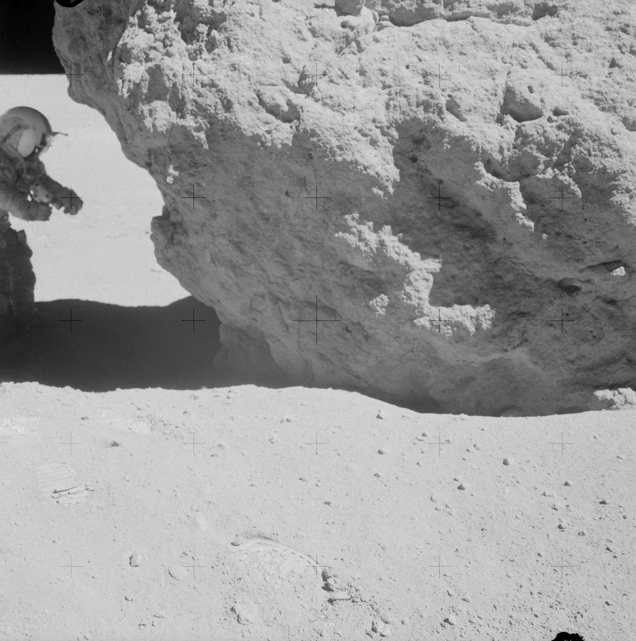
AS16-106-17413 (23 April 1972) --- Astronaut John W. Young, commander of the Apollo 16 lunar landing mission, looks over a large boulder at Station No.13 during the third Apollo 16 extravehicular activity (EVA) at the Descartes landing site. This was the site of the permanently shadowed soil sample which was taken from a hole extending under overhanging rock. Astronaut Charles M. Duke Jr., lunar module pilot, took this photograph. Concerning Young's reaching under the big rock, Duke remarked: "You do that in west Texas and you get a rattlesnake!"
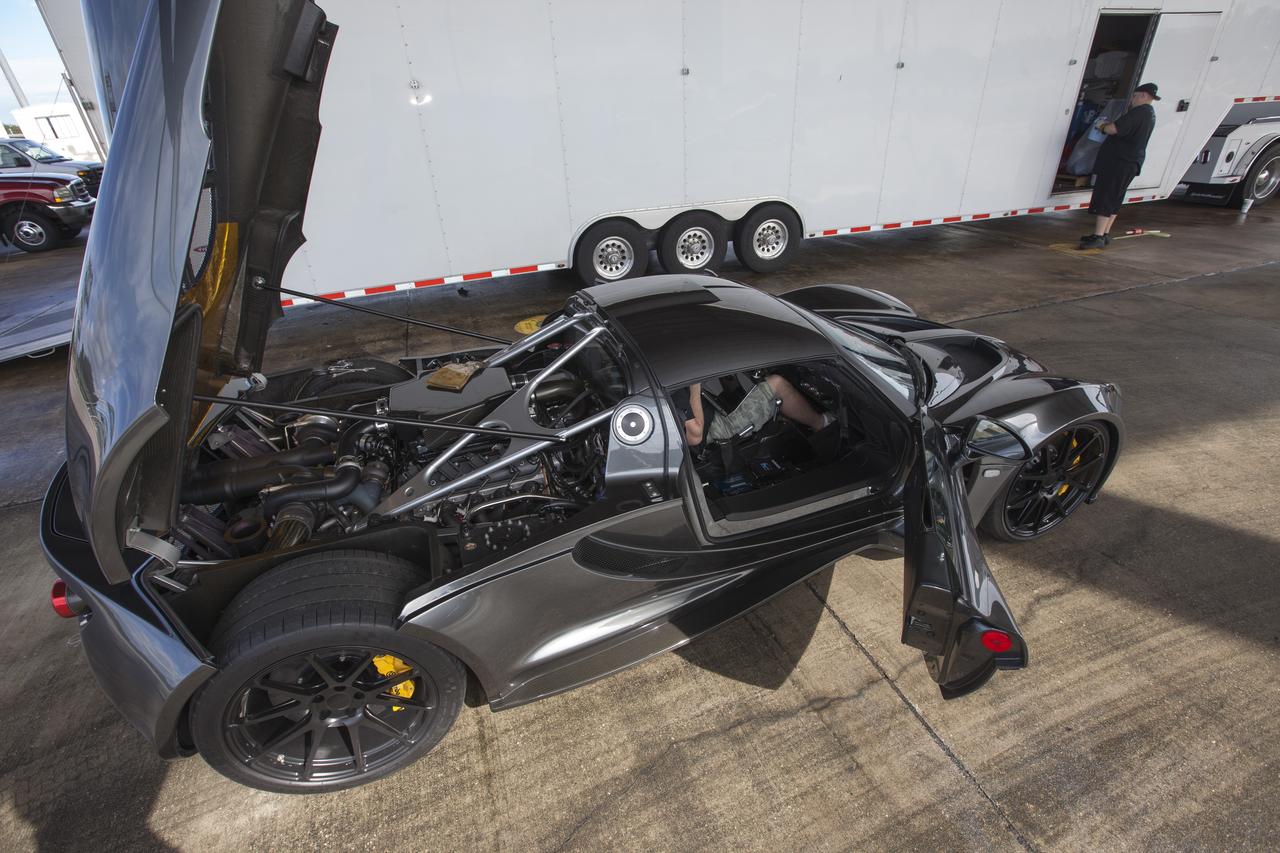
CAPE CANAVERAL, Fla. - An engineer readies a Hennessey Venom GT for test runs on the 3.5-mile long runway at the Shuttle Landing Facility at NASA's Kennedy Space Center in Florida. The flat concrete runway is one of the few places in the world where high performance automobiles can be tested for aerodynamic and safety designs. Hennessey Performance of Sealy, Texas, worked with Performance Power Racing in West Palm Beach to arrange use of the NASA facility. Performance Power Racing has conducted numerous engineering tests on the runway with a variety of vehicles. Photo credit: NASA/Kim Shiflett
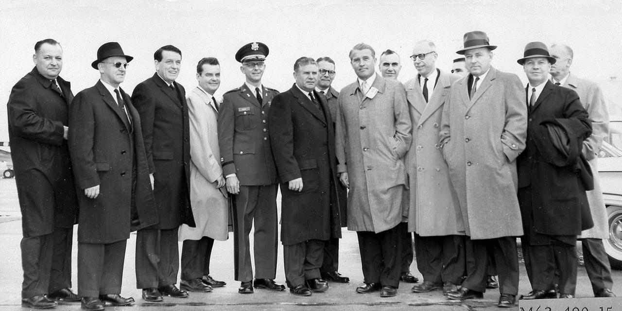
The members of the House Committee on Science and Astronautics visited the Marshall Space Flight Center (MSFC) on March 9, 1962 to gather first-hand information of the nation's space exploration program. The congressional group was composed of members of the Subcommittee on Marned Space Flight. Headed by Representative Olin E. Teague of Texas, other members were James G. Fulton, Pennsylvania; Ken Heckler, West Virginia; R. Walter Riehlman, New York; Richard L. Roudebush,, Indiana; John W. Davis, Georgia; James C. Corman, California; Joseph Waggoner, Louisiana; J. Edgar Chenoweth, Colorado; and William G. Bray, Indiana.
On Sept. 5, 2017, the Advanced Spaceborne Thermal Emission and Reflection Radiometer (ASTER) instrument on NASA's Terra spacecraft captured this image of the area around Bay City, Texas, about 50 miles (80 kilometers) southwest of Houston. Hurricane Harvey caused extensive inland flooding, seen as dark blue areas where the water is relatively clear, and green-grey where the water carries sediment. The image covers an area of 32 by 65 miles (52 by 105 kilometers), and is centered at 29.2 degrees north, 95.8 degrees west. https://photojournal.jpl.nasa.gov/catalog/PIA21940
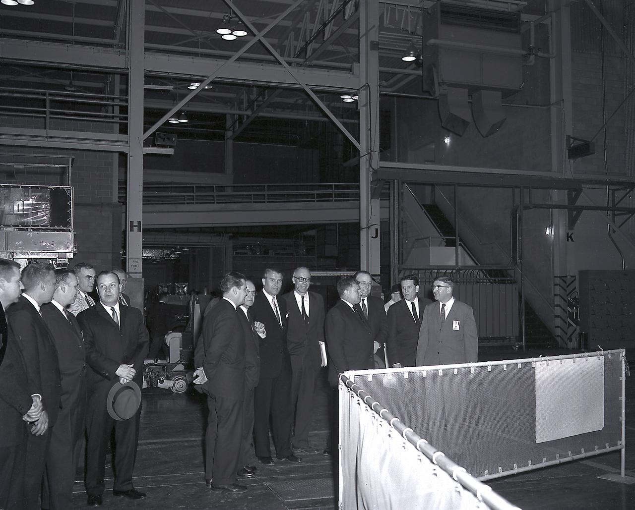
The members of the House Committee on Science and Astronautics visited the Marshall Space Flight Center (MSFC) on March 9, 1962 to gather first-hand information of the nation's space exploration program. The congressional group was composed of members of the Subcommittee on Marned Space Flight. Headed by Representative Olin E. Teague of Texas, other members were James G. Fulton, Pennsylvania; Ken Heckler, West Virginia; R. Walter Riehlman, New York; Richard L. Roudebush, Indiana; John W. Davis, Georgia; James C. Corman, California; Joseph Waggoner, Louisiana; J. Edgar Chenoweth, Colorado; and William G. Bray, Indiana.
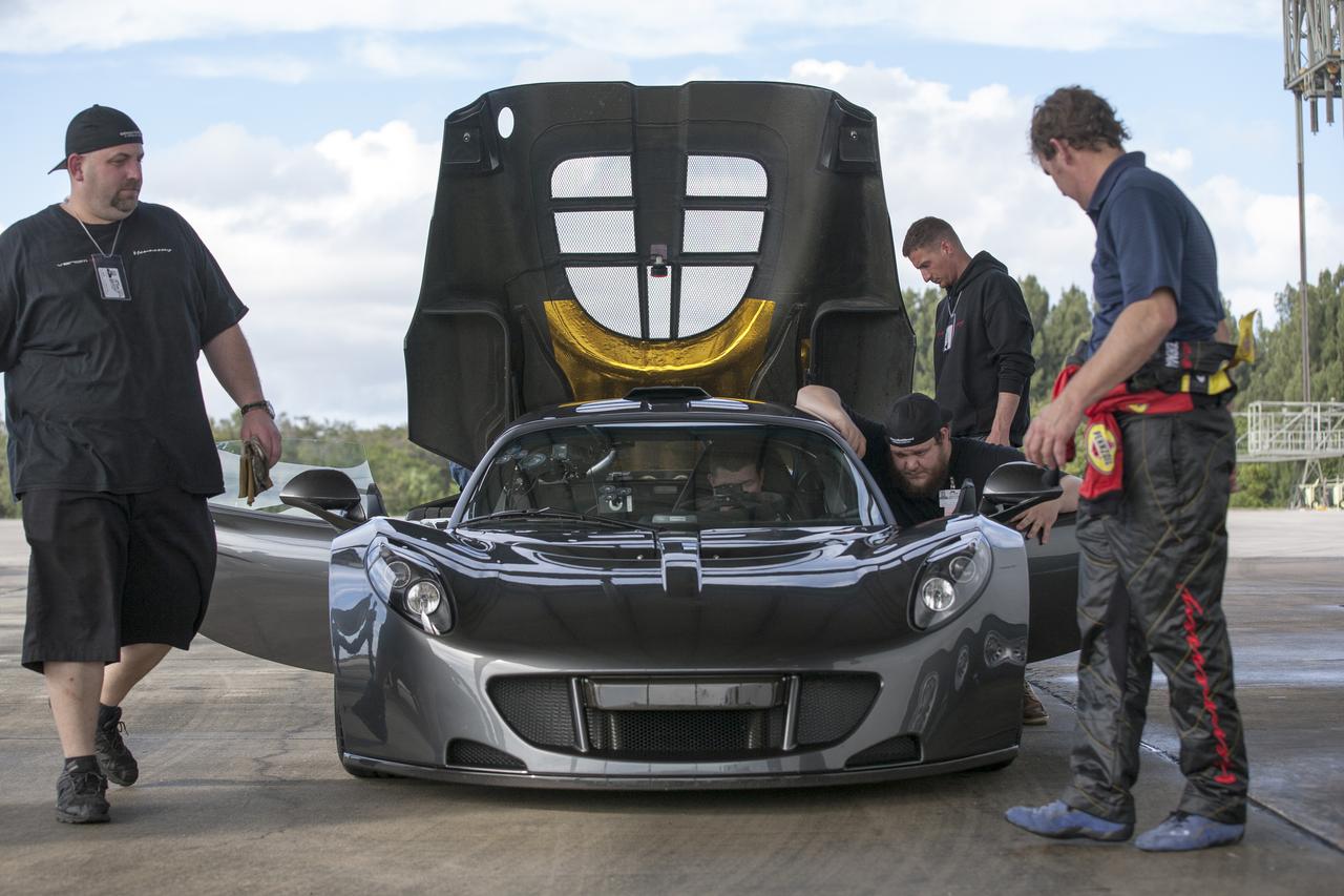
CAPE CANAVERAL, Fla. - Mechanics, engineers and Driver Brian Smith, in jumpsuit, ready a Hennessey Venom GT for test runs on the 3.5-mile long runway at the Shuttle Landing Facility at NASA's Kennedy Space Center in Florida. The flat concrete runway is one of the few places in the world where high performance automobiles can be tested for aerodynamic and safety designs. Hennessey Performance of Sealy, Texas, worked with Performance Power Racing in West Palm Beach to arrange use of the NASA facility. Performance Power Racing has conducted numerous engineering tests on the runway with a variety of vehicles. Photo credit: NASA/Kim Shiflett

CAPE CANAVERAL, Fla. - A Hennessey Venom GT stands on the 3.5-mile long runway between test runs at the Shuttle Landing Facility at NASA's Kennedy Space Center in Florida. The flat concrete runway is one of the few places in the world where high performance automobiles can be tested for aerodynamic and safety designs. Hennessey Performance of Sealy, Texas, worked with Performance Power Racing in West Palm Beach to arrange use of the NASA facility. Performance Power Racing has conducted numerous engineering tests on the runway with a variety of vehicles. Photo credit: NASA/Kim Shiflett

The Falcon International Reservoir is on the Rio Grande, 65 km southeast of Laredo, Texas, USA and Nuevo Laredo, Tamaulipas, Mexico. The Falcon Dam was constructed in 1953 to provide water conservation, irrigation, and hydroelectricity. Its maximum surface area, seen in the 2010 image, was 34,000 hectares. As a result of the 2010s-20s drought, the reservoir holds only a small fraction of its capacity. In 2010, vegetation in the area was healthy (dark red); in 2022, the area is parched. The images were acquired 14 July 2010 and 31 July 2022, cover an area of 29.8 by 46.9 km, and are located at 26.6 degrees north, 99.2 degrees west. https://photojournal.jpl.nasa.gov/catalog/PIA25446

AS06-02-1462 (4 April 1968) --- View of the Dallas-Fort Worth, Texas, area as photographed from the unmanned Apollo 6 (Spacecraft 020/Saturn 502) space mission. The highway and expressway system in and around both cities is clearly visible. North is toward left side of picture. Grapevine Reservoir and Garza-Little Elm Reservoir are to the north-west of Dallas. The city of Denton can be seen in left center of picture at conjunction of highways leading to both Fort Worth and Dallas. The Brazos River is in lower right corner. This photograph was made three hours and nine minutes after liftoff of the Apollo 6 space flight.
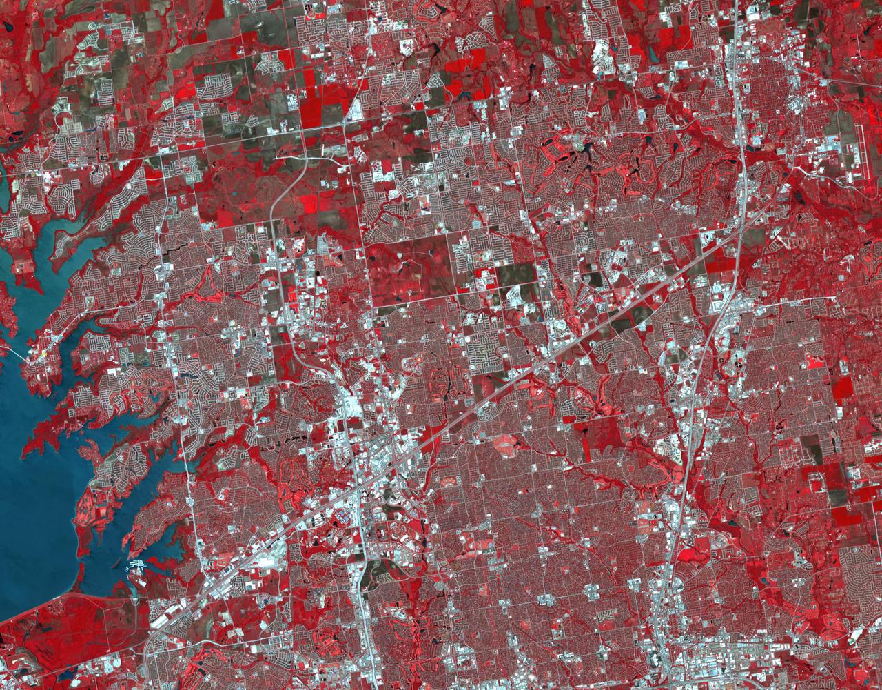
Frisco, Texas is a city in the Dallas-Fort Worth metroplex, located about 40 km (24.9 mi) northeast of the Dallas/Fort Worth International Airport. Founded in 1860 along the Shawnee Trail, the town has become a bedroom community for workers in Dallas-Fort Worth. The city saw explosive growth between April 9, 1984 when the Landsat TM image was acquired, and April 15, 2018 when the ASTER image was acquired. Population grew from 4,500 to 174,000. The images cover an area of 27 by 34.5 km (16.7 by 21.4 mi), and are located at 33.1 degrees north, 96.8 degrees west. https://photojournal.jpl.nasa.gov/catalog/PIA22552
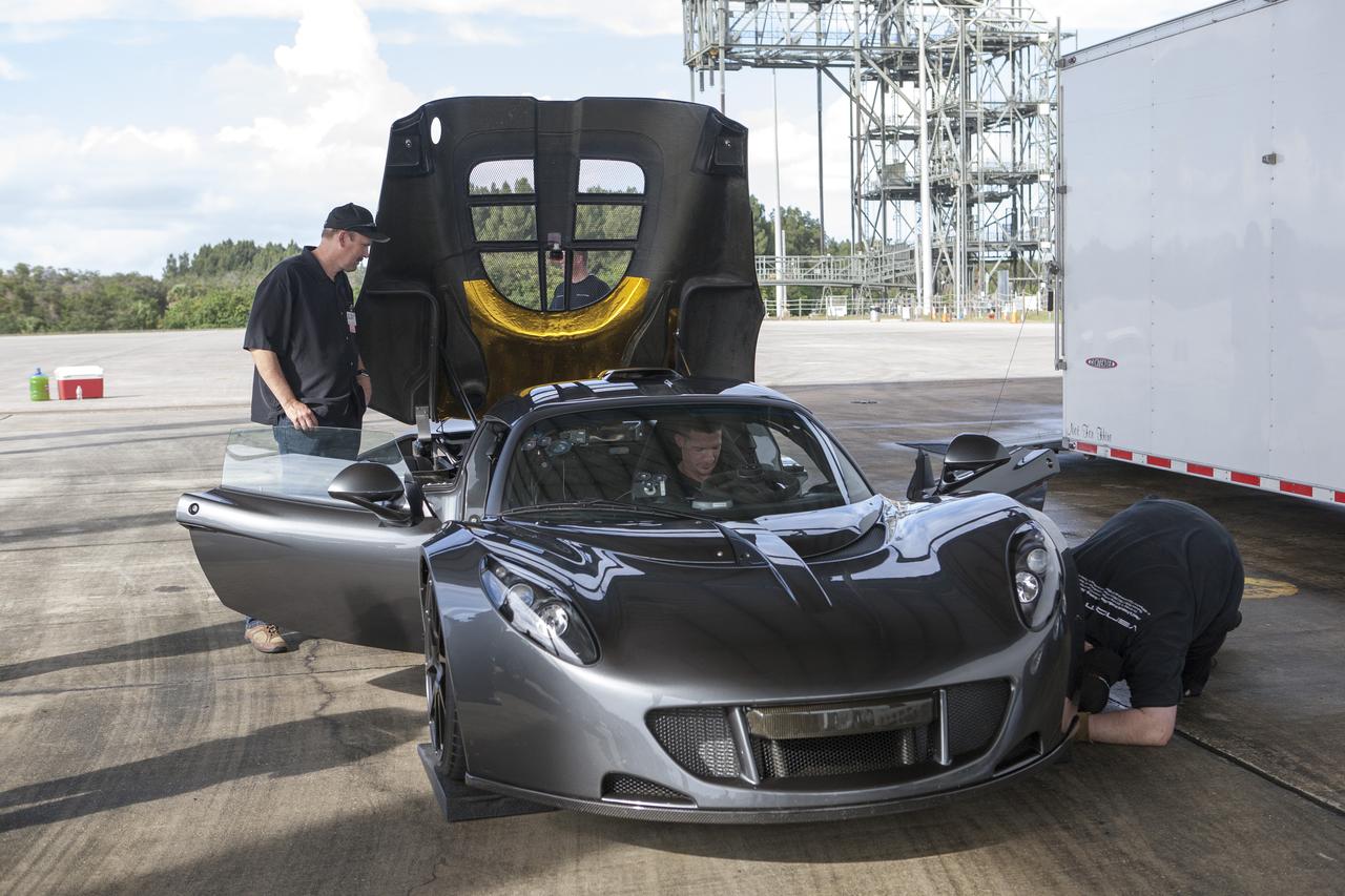
CAPE CANAVERAL, Fla. - Mechanics and engineers ready a Hennessey Venom GT for test runs on the 3.5-mile long runway at the Shuttle Landing Facility at NASA's Kennedy Space Center in Florida. The flat concrete runway is one of the few places in the world where high performance automobiles can be tested for aerodynamic and safety designs. Hennessey Performance of Sealy, Texas, worked with Performance Power Racing in West Palm Beach to arrange use of the NASA facility. Performance Power Racing has conducted numerous engineering tests on the runway with a variety of vehicles. Photo credit: NASA/Kim Shiflett
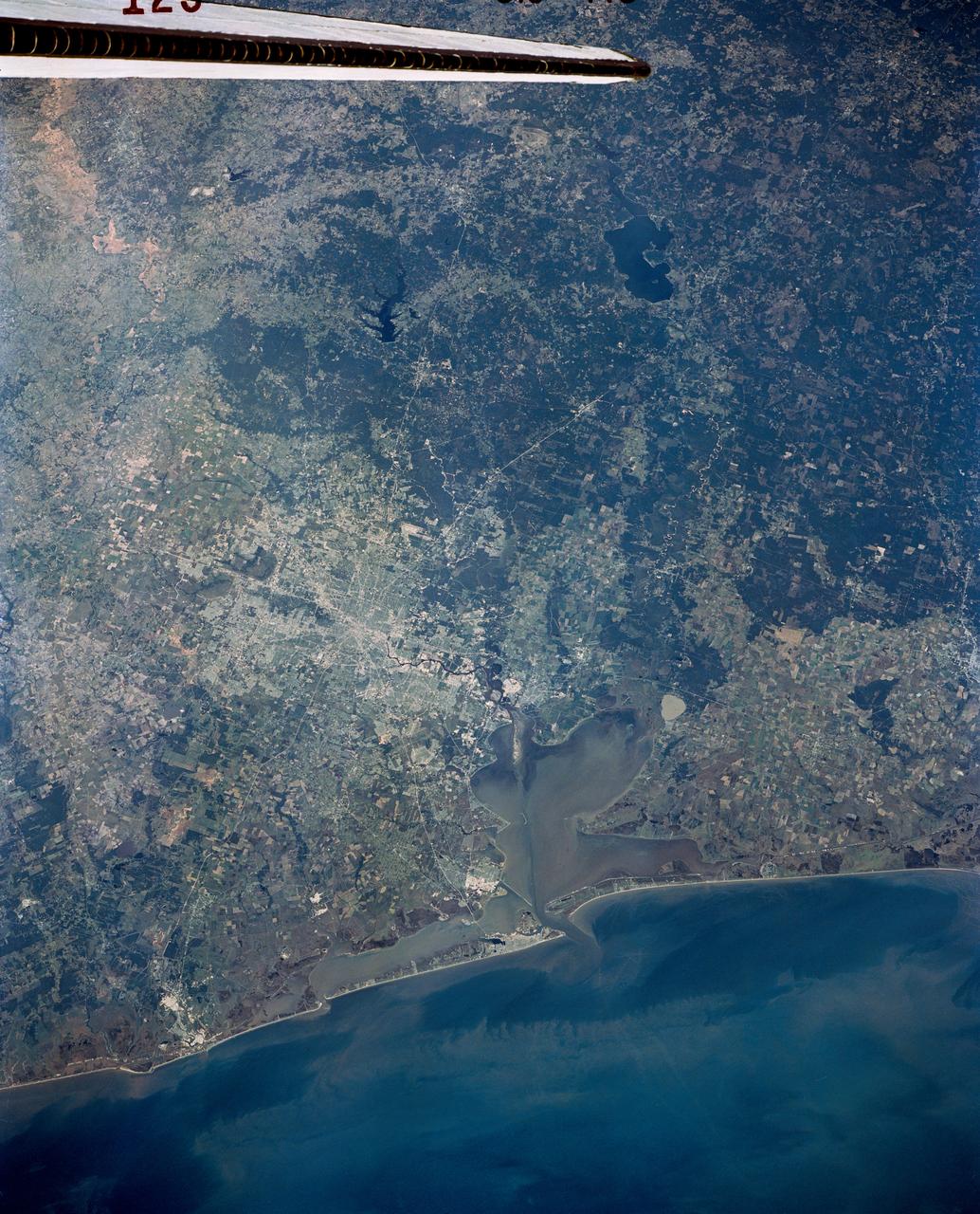
AS07-07-1872 (11-22 Oct. 1968) --- The Houston, Texas, and Gulf Coast area, looking southeast, as seen from the Apollo 7 spacecraft at an altitude of 101 nautical miles. This photograph was made during the spacecraft's 91st revolution of Earth, at ground elapsed time of 144 hours and 26 minutes. The morning sun causes a spectacular reflection on water surfaces such as the Gulf of Mexico, Galveston Bay, Buffalo Bayou, and the Brazos River, and causes a unique reflection in the canals and rice fields west of Alvin. Some of the landmarks visible in this picture include highways and freeways, the Astrodome, the new Intercontinental Airport, and the Manned Spacecraft Center.

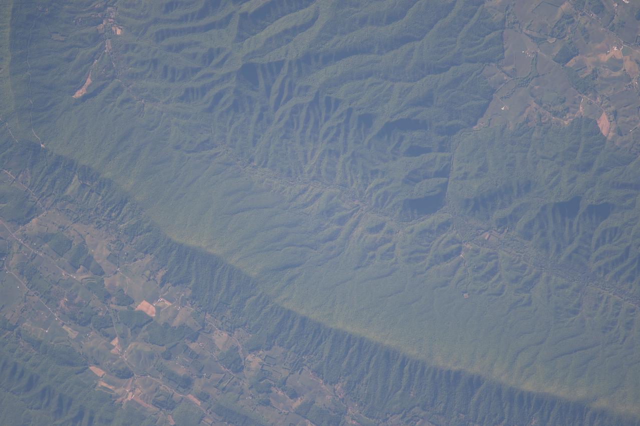
A new NASA-funded study has identified which glaciers in West Greenland are most susceptible to thinning in the coming decades by analyzing how they’re shaped. The research could help predict how much the Greenland Ice Sheet will contribute to future sea level rise in the next century, a number that currently ranges from inches to feet. “There are glaciers that popped up in our study that flew under the radar until now,” said lead author Denis Felikson, a graduate research assistant at The University of Texas Institute for Geophysics (UTIG) and a Ph.D. student in The University of Texas Department of Aerospace Engineering and Engineering Mechanics. Felikson’s study was published in Nature Geoscience on April 17. Read more: <a href="https://go.nasa.gov/2pJJwNA" rel="nofollow">go.nasa.gov/2pJJwNA</a> Caption: Terminus of Kangerlugssuup Sermerssua glacier in west Greenland Photo credit: Denis Felikson, Univ. of Texas <b><a href="http://www.nasa.gov/audience/formedia/features/MP_Photo_Guidelines.html" rel="nofollow">NASA image use policy.</a></b> <b><a href="http://www.nasa.gov/centers/goddard/home/index.html" rel="nofollow">NASA Goddard Space Flight Center</a></b> enables NASA’s mission through four scientific endeavors: Earth Science, Heliophysics, Solar System Exploration, and Astrophysics. Goddard plays a leading role in NASA’s accomplishments by contributing compelling scientific knowledge to advance the Agency’s mission. <b>Follow us on <a href="http://twitter.com/NASAGoddardPix" rel="nofollow">Twitter</a></b> <b>Like us on <a href="http://www.facebook.com/pages/Greenbelt-MD/NASA-Goddard/395013845897?ref=tsd" rel="nofollow">Facebook</a></b> <b>Find us on <a href="http://instagrid.me/nasagoddard/?vm=grid" rel="nofollow">Instagram</a></b>
ISS028-E-037978 (6 Sept. 2011) --- Wildfire smoke plumes in Texas are featured in this image photographed by an Expedition 28 crew member on the International Space Station. This panoramic view of east-central Texas highlights numerous smoke plumes caused by wildfires burning across the state. The image was taken using a short focal length lens (12-mm), which captures a wide field of view at the cost of fine feature resolution. Smoke plumes are clearly visible in the image to the east of Austin; to the north of Houston; to the northwest of Lake Sam Rayburn and Toledo Bend Reservoir; and to the west of Shreveport, LA. More diffuse smoke moving offshore into the Gulf of Mexico is visible at bottom. Part of an ISS photovoltaic radiator panel is visible at top center. Record-setting drought conditions have affected much of Texas since early 2011 and have dried out both forest and grassland, providing ample fuel for wildfires. Relatively high winds and low humidity levels have also contributed to the rapid spread and expansion of fires. According to a Texas Forest Service (TXFS) Incident Management Situation Report dated Sept. 7, 2011, TXFS had responded to 172 fires affecting an area of 546.53 square kilometers (135,051 acres) over the preceding seven days. Fires near Bastrop, TX to the east of Austin had destroyed 785 homes as of Sept. 7, 2011.
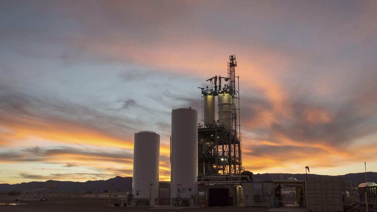
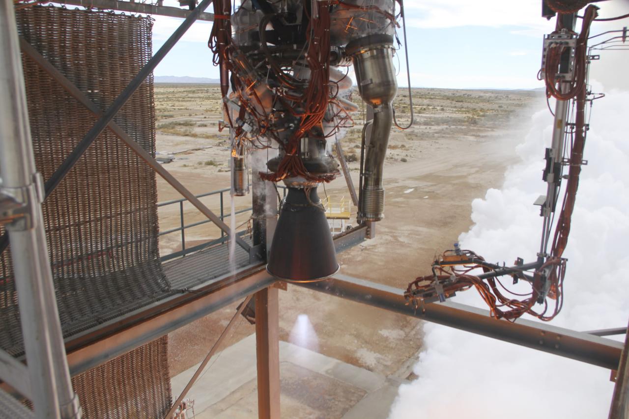
VAN HORN, Texas – The sun sets over a test stand at Blue Origin’s West Texas facility. The company used this test stand to fire its powerful new hydrogen- and oxygen-fueled American rocket engine, the BE-3, on Nov. 20. The BE-3 fired at full power for more than two minutes to simulate a launch, then paused for about four minutes, mimicking a coast through space before it re-ignited for a brief final burn. The last phase of the test covered the work the engine could perform in landing the booster back softly on Earth. Blue Origin, a partner of NASA’s Commercial Crew Program, or CCP, is developing its Orbital Launch Vehicle, which could eventually be used to launch the company's Space Vehicle into orbit to transport crew and cargo to low-Earth orbit. CCP is aiding in the innovation and development of American-led commercial capabilities for crew transportation and rescue services to and from the station and other low-Earth orbit destinations by the end of 2017. For information about CCP, visit www.nasa.gov/commercialcrew. Photo credit: NASA/Lauren Harnett
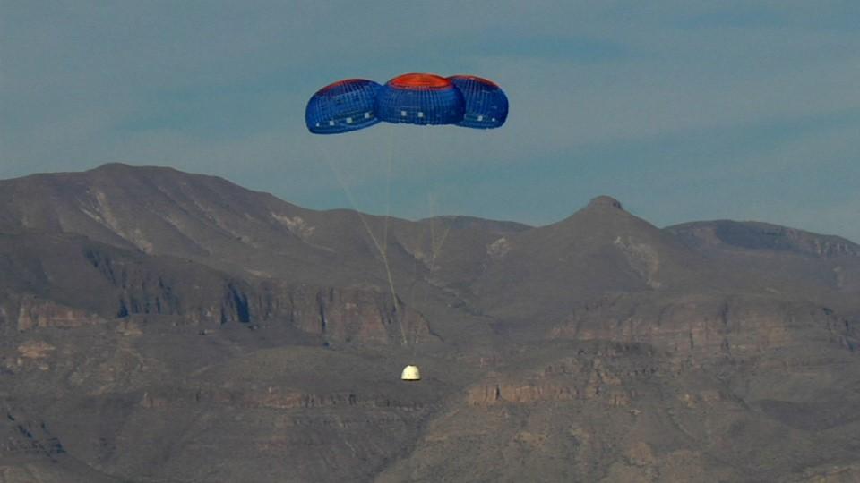
VAN HORN, Texas – Blue Origin’s New Shepard crew capsule escaped to an altitude of 2,307 feet before deploying parachutes for a safe return for a pad escape test at the company's West Texas launch site. The pusher escape system was designed and developed by Blue Origin to allow crew escape in the event of an emergency during any phase of ascent for its suborbital New Shepard system. As part of an incremental development program, the results of this test will shape the design of the escape system for the company's orbital biconic-shaped Space Vehicle. The system is expected to enable full reusability of the launch vehicle, which is different from NASA's previous launch escape systems that would pull a spacecraft away from its rocket before reaching orbit. The test was part of Blue Origin's work supporting its funded Space Act Agreement with NASA during Commercial Crew Development Round 2 CCDev2). Through initiatives like CCDev2, NASA is fostering the development of a U.S. commercial crew space transportation capability with the goal of achieving safe, reliable and cost-effective access to and from the International Space Station and low-Earth orbit. After the capability is matured and available to the government and other customers, NASA could contract to purchase commercial services to meet its station crew transportation needs. For more information, visit www.nasa.gov/commercialcrew. Image credit: Blue Origin
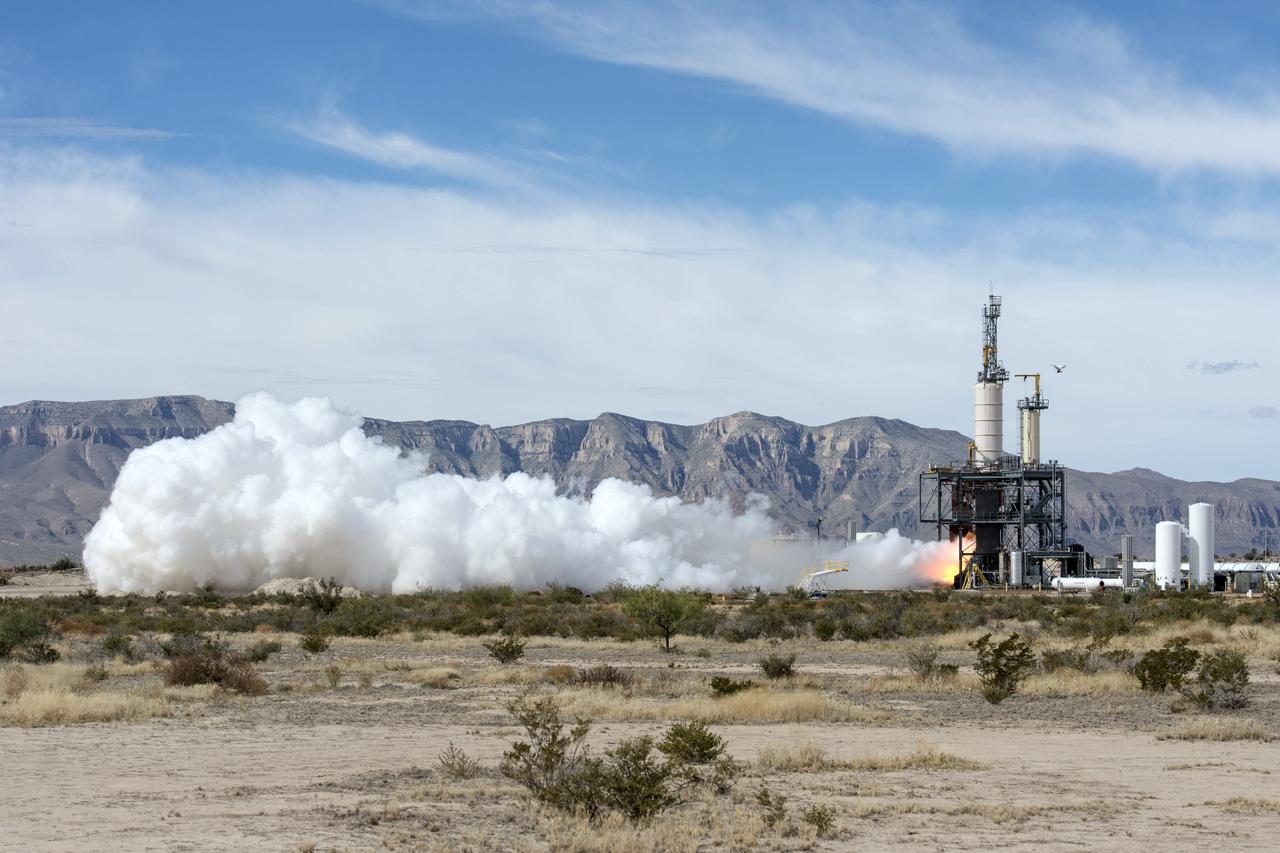
VAN HORN, Texas – Blue Origin test fires a powerful new hydrogen- and oxygen-fueled American rocket engine at the company's West Texas facility. During the test, the BE-3 engine fired at full power for more than two minutes to simulate a launch, then paused for about four minutes, mimicking a coast through space before it re-ignited for a brief final burn. The last phase of the test covered the work the engine could perform in landing the booster back softly on Earth. Blue Origin, a partner of NASA’s Commercial Crew Program, or CCP, is developing its Orbital Launch Vehicle, which could eventually be used to launch the company's Space Vehicle into orbit to transport crew and cargo to low-Earth orbit. CCP is aiding in the innovation and development of American-led commercial capabilities for crew transportation and rescue services to and from the station and other low-Earth orbit destinations by the end of 2017. For information about CCP, visit www.nasa.gov/commercialcrew. Photo credit: NASA/Lauren Harnett
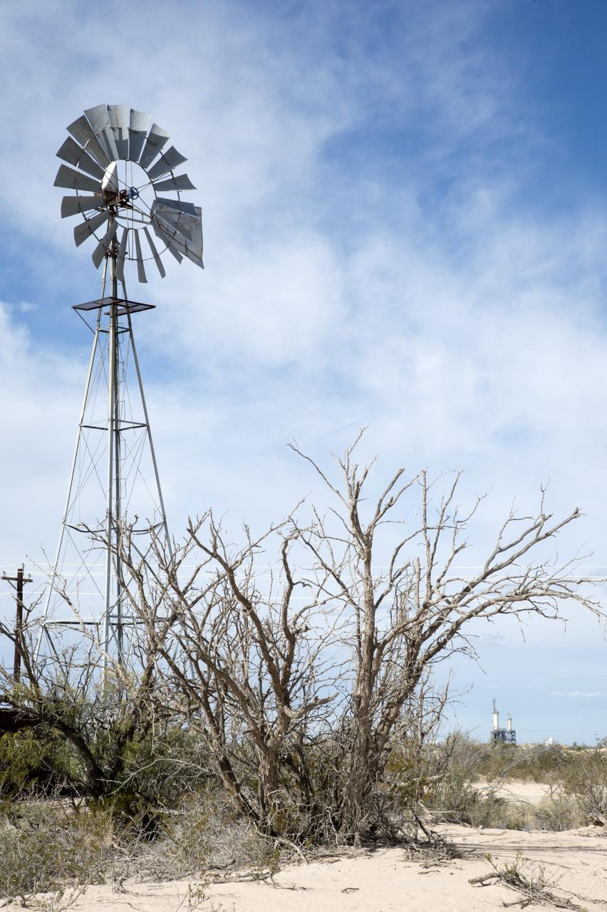
VAN HORN, Texas – Blue Origin’s test stand, back right, is framed by a wind mill at the company’s West Texas facility. The company used this test stand to fire its powerful new hydrogen- and oxygen-fueled American rocket engine, the BE-3. The engine fired at full power for more than two minutes to simulate a launch, then paused for about four minutes, mimicking a coast through space before it re-ignited for a brief final burn. The last phase of the test covered the work the engine could perform in landing the booster back softly on Earth. Blue Origin, a partner of NASA’s Commercial Crew Program, or CCP, is developing its Orbital Launch Vehicle, which could eventually be used to launch the company's Space Vehicle into orbit to transport crew and cargo to low-Earth orbit. CCP is aiding in the innovation and development of American-led commercial capabilities for crew transportation and rescue services to and from the station and other low-Earth orbit destinations by the end of 2017. For information about CCP, visit www.nasa.gov/commercialcrew. Photo credit: NASA/Lauren Harnett
VAN HORN, Texas – Blue Origin test fires a powerful new hydrogen- and oxygen-fueled American rocket engine at the company's West Texas facility. During the test, the BE-3 engine fired at full power for more than two minutes to simulate a launch, then paused for about four minutes, mimicking a coast through space before it re-ignited for a brief final burn. The last phase of the test covered the work the engine could perform in landing the booster back softly on Earth. Blue Origin, a partner of NASA’s Commercial Crew Program, or CCP, is developing its Orbital Launch Vehicle, which could eventually be used to launch the company's Space Vehicle into orbit to transport crew and cargo to low-Earth orbit. CCP is aiding in the innovation and development of American-led commercial capabilities for crew transportation and rescue services to and from the station and other low-Earth orbit destinations by the end of 2017. For information about CCP, visit www.nasa.gov/commercialcrew. Photo credit: Blue Origin
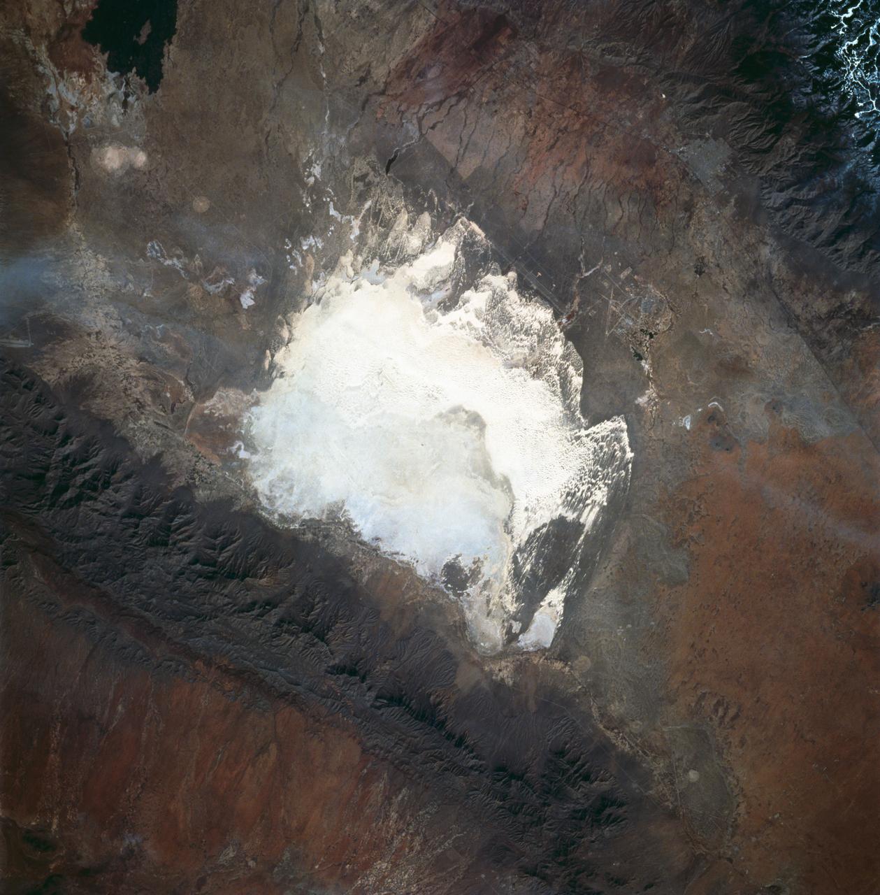
STS060-83-016 (3-11 Feb 1994) --- White Sands National Monument (Park) is easily recognized in the center of this near-vertical color photograph. White Sands is the world's largest gypsum dune field. It represents an alabaster sea that covers nearly 300 square miles. The National Park Service has the responsibility to preserve this unique feature, allowing the dune world to unfold in its natural environment, but without interference from humans. White Sands lies within a spectacular, oblong geological depression called the Tularosa Basin bounded by the Sacramento Mountains on the east and the San Andres Mountains on the west. Climatically the basin is a true desert, averaging less than 10 inches of rainfall per year. In terms of topographic relief the Sacramento Mountains attain elevations greater than 9,000 feet above sea level, while the San Andres Mountains on the west exceed altitudes of 8,000 feet. At the southwest corner of the White Sands is dry lake, Lucero. This lake is the lowest point in the Tularosa Basin at 3,900 feet. In terms of cultural features the city of Alamogordo (over 20,000 population) and Holloman Air Force Base can be seen with great clarity on this photograph. The area is accessible by highways U.S.70 & 82 from Las Cruces, New Mexico, and U.S.54 from El Paso, Texas.
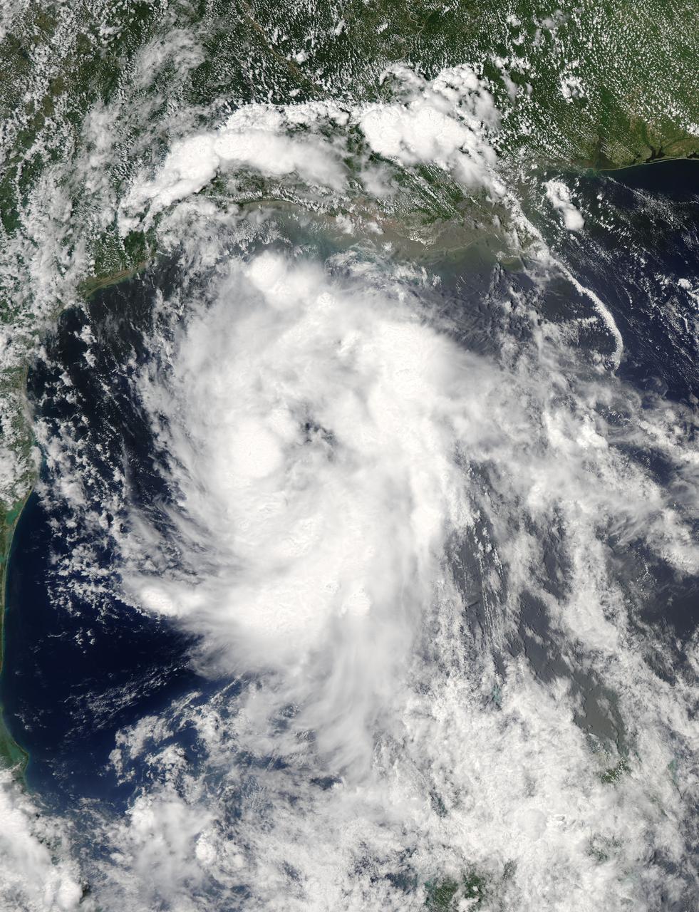
On June 15 at 19:15 UTC (3:15 p.m. EDT) the MODIS instrument aboard NASA's Aqua satellite captured a visible image of Tropical Storm Bill approaching Texas and Louisiana. Powerful thunderstorms circled the center in fragmented bands. At 11 a.m. CDT on June 16, a Tropical Storm Warning was in effect from Baffin Bay to High Island Texas as Bill was making landfall. The National Hurricane Center noted that Bill is expected to produce total rain accumulations of 4 to 8 inches over eastern Texas and eastern Oklahoma and 2 to 4 inches over western Arkansas and southern Missouri, with possible isolated maximum amounts of 12 inches in eastern Texas. In eastern Texas and far western Louisiana today and tonight, isolated tornadoes are also possible, as with any landfalling tropical storm. Tropical storm conditions are expected to continue into the evening in the warning area. Along the coasts, the combination of a storm surge and the tide will cause normally dry areas near the coast to be flooded by rising waters. The water could reach the following heights above ground if the peak surge occurs at the time of high tide. The NHC noted that the Upper Texas coast could experience 2 to 4 feet, and the western Louisiana coast between 1 to 2 feet. At 10 a.m. CDT (1500 UTC), the center of Tropical Storm Bill was located near latitude 28.2 North, longitude 96.4 West. Bill was moving toward the northwest near 10 mph (17 kph) and that general motion is expected to continue today. The latest minimum central pressure reported by an Air Force Reserve Hurricane Hunter aircraft was 997 millibars. Reports from an Air Force Reserve reconnaissance aircraft indicate that maximum sustained winds remain near 60 mph (95 kph) with higher gusts. Unlike Carlos, Bill is not a compact storm. Tropical-storm-force winds extend outward up to 150 miles (240 km) from the center. Between 9 and 10 a.m. CDT, an automated observing station at Port O'Connor also reported a sustained wind of 44 mph (70 kph) and a gust to 53 mph (85 kph). For updated forecasts, watches and warnings, visit the National Hurricane Center webpage at <a href="http://www.nhc.noaa.gov" rel="nofollow">www.nhc.noaa.gov</a>. For local forecasts and advisories, visit: <a href="http://www.weather.gov" rel="nofollow">www.weather.gov</a>. Bill is forecast to continue moving inland and is expected to be a tropical depression by Wednesday, June 17, west of Dallas. The remnants of Bill are forecast to move into the Midwest later in the week. Credit: NASA/GSFC/Jeff Schmaltz/MODIS Land Rapid Response Team <b><a href="http://www.nasa.gov/audience/formedia/features/MP_Photo_Guidelines.html" rel="nofollow">NASA image use policy.</a></b> <b><a href="http://www.nasa.gov/centers/goddard/home/index.html" rel="nofollow">NASA Goddard Space Flight Center</a></b> enables NASA’s mission through four scientific endeavors: Earth Science, Heliophysics, Solar System Exploration, and Astrophysics. Goddard plays a leading role in NASA’s accomplishments by contributing compelling scientific knowledge to advance the Agency’s mission. <b>Follow us on <a href="http://twitter.com/NASAGoddardPix" rel="nofollow">Twitter</a></b> <b>Like us on <a href="http://www.facebook.com/pages/Greenbelt-MD/NASA-Goddard/395013845897?ref=tsd" rel="nofollow">Facebook</a></b> <b>Find us on <a href="http://instagrid.me/nasagoddard/?vm=grid" rel="nofollow">Instagram</a></b>
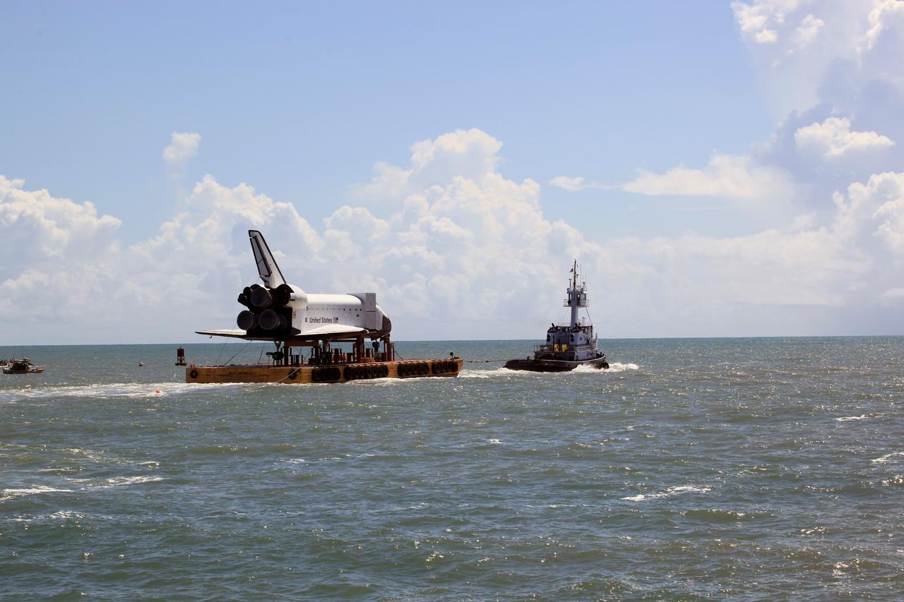
CAPE CANAVERAL, Fla. – The high-fidelity space shuttle model nears the mouth of Port Canaveral as it heads toward the Atlantic Ocean, in the distance. The model is en route by barge from NASA’s Kennedy Space Center in Florida to Space Center Houston, NASA Johnson Space Center’s official visitor center. Its journey to Texas will take it south along the Florida coastline, around Key West and into the Gulf of Mexico. The model was built in Apopka, Fla., by Guard-Lee and installed at the Kennedy Space Center Visitor Complex in 1993. The model is expected to arrive June 1 in Houston and to be transported June 3 to Space Center Houston, its final destination, where it will become part of a unique display telling the story of the space shuttle’s achievements and the nationwide team that made them possible. For more information about Space Center Houston, visit http://www.spacecenter.org. Photo credit: NASA/Dimitri Gerondidakis

CAPE CANAVERAL, Fla. - The Performance Power Racing and Hennessey Performance teams pose with a Hennessey Venom GT at the 3.5-mile long runway at the Shuttle Landing Facility at NASA's Kennedy Space Center in Florida. The teams are, from left, Hennessey's John Heinricy, John Hennessey, Brian Smith, Performance Power Racing's Johnny Bohmer, Matt Lundy and Jeff McEachran. The flat concrete runway is one of the few places in the world where high performance automobiles can be tested for aerodynamic and safety designs. Hennessey Performance of Sealy, Texas, worked with Performance Power Racing in West Palm Beach to arrange use of the NASA facility. Performance Power Racing has conducted numerous engineering tests on the runway with a variety of vehicles.

AS09-26A-3728A (8 March 1969) --- Color infrared photograph of the Houston-Galveston-Freeport, Texas Gulf Coast area taken on March 8, 1969, by one of the four synchronized cameras of the Apollo 9 Earth Resources Survey S065 Experiment. At 3:05 p.m. (EST) when this picture was made the Apollo 9 spacecraft was at an altitude of 105 nautical miles, and the sun elevation was 54 degrees above the horizon. The location of the point on Earth's surface at which the four-camera combination was aimed was 29 degrees 4 minutes north latitude, and 95 degrees 24 minutes west longitude. The three other cameras used: (B) black and white film with a red filter; (C) black and white infrared film; and (D) black and white film with a green filter.
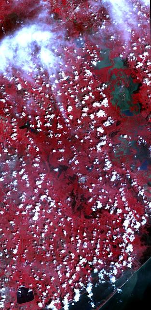
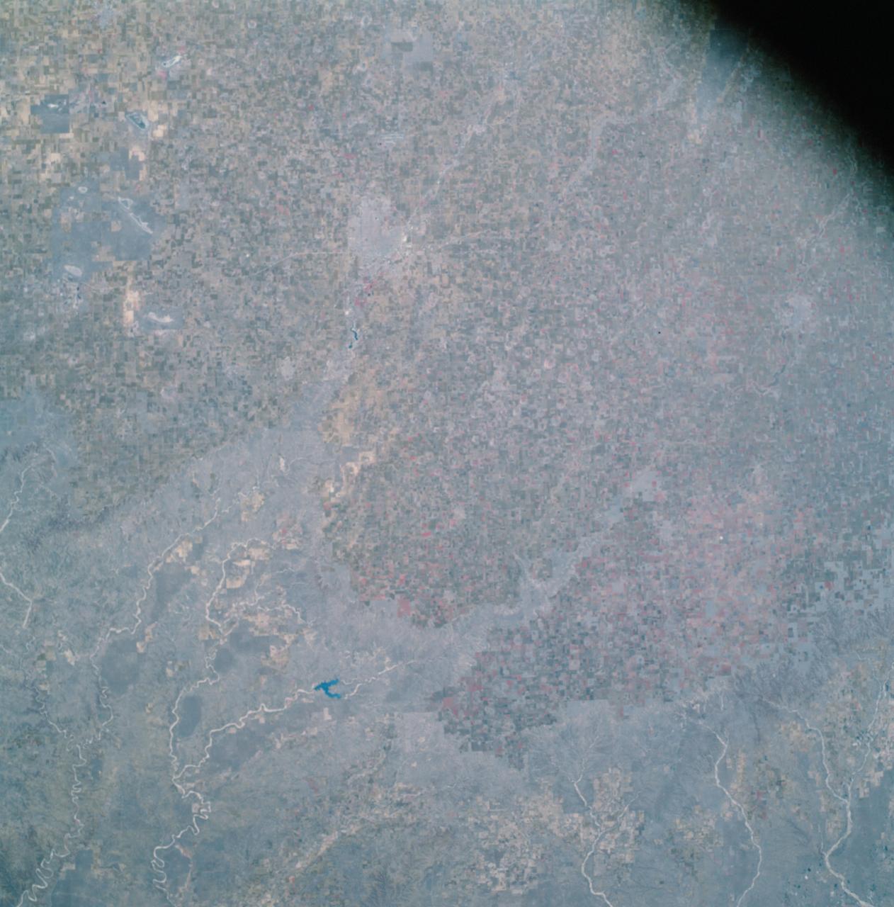
AS09-26A-3807A (12 March 1969) --- Color infrared photograph of the Texas-New Mexico border area, between Lubbock and Roswell, taken on March 12, 1969, by one of the four synchronized cameras of the Apollo 9 Earth Resources Survey (SO65). At 11:30 a.m. (EST) when this picture was made the Apollo 9 spacecraft was at an altitude of 119 nautical miles, and the sun elevation was 38 degrees above the horizon. The location of the point on Earth's surface at which the four-camera combination was aimed was 33 degrees 42 minutes north latitude, and 103 degrees 1 minute west longitude. The other three cameras used: (B) black and white film with a red filter; (C) black and white infrared film; and (D) black and white film with a green filter.
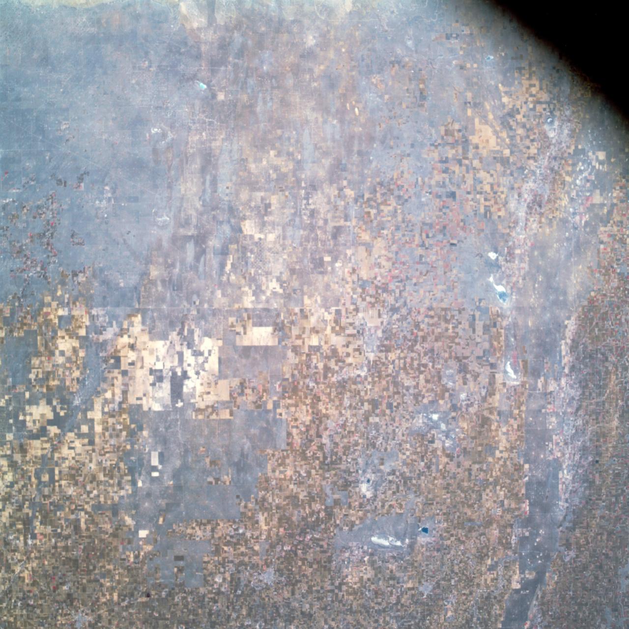
AS09-26A-3808A (12 March 1969) --- Color infrared photograph of the Lubbock, Texas area, taken on March 12, 1969, by one of the four synchronized cameras of the Apollo 9 Earth Resources Survey SO65 Experiment. At 11:31 a.m. (EST) when this picture was made the Apollo 9 spacecraft was at an altitude of 117 nautical miles, and the sun elevation was 38 degrees above the horizon. The location of the point on the surface of Earth at which the four-camera combination was aimed was 33 degrees 41 minutes north latitude, and 101 degrees 29 minutes west longitude. The other three cameras used: (B) black and white film with a red filter; (C) black and white infrared film; and (D) black and white film with a green filter.
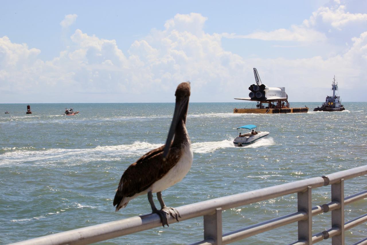
CAPE CANAVERAL, Fla. – The high-fidelity space shuttle model glides past the fishing pier – and this long-beaked fisherman -- near the mouth of Port Canaveral as it heads into the Atlantic Ocean, in the distance. The model is en route by barge from NASA’s Kennedy Space Center in Florida to Space Center Houston, NASA Johnson Space Center’s official visitor center. Its journey to Texas will take it south along the Florida coastline, around Key West and into the Gulf of Mexico. The model was built in Apopka, Fla., by Guard-Lee and installed at the Kennedy Space Center Visitor Complex in 1993. The model is expected to arrive June 1 in Houston and to be transported June 3 to Space Center Houston, its final destination, where it will become part of a unique display telling the story of the space shuttle’s achievements and the nationwide team that made them possible. For more information about Space Center Houston, visit http://www.spacecenter.org. Photo credit: NASA/Dimitri Gerondidakis
The members of the House Committee on Science and Astronautics visited the Marshall Space Flight Center (MSFC) on March 9, 1962 to gather firsthand information of the nation’s space exploration program. The congressional group was composed of members of the Subcommittee on Manned Space Flight. Pictured from left-to-right are Congressman Ken Hechler, Democratic representative of West Virginia; Dieter Grau, MSFC; Congressman John W. Davis, Democratic representative of Georgia; Congressman Joe Waggoner, Democratic representative of Louisiana; Congressman Richard L. Roudebush, Republican representative of Indiana; Congressman R. Walter Riehlman, Republican representative of New York; Congressman James G. Fulton, Republican representative of Pennsylvania; Dr. Wernher von Braun, MSFC; and Congressman Olin E. Teague, Democratic representative of Texas.
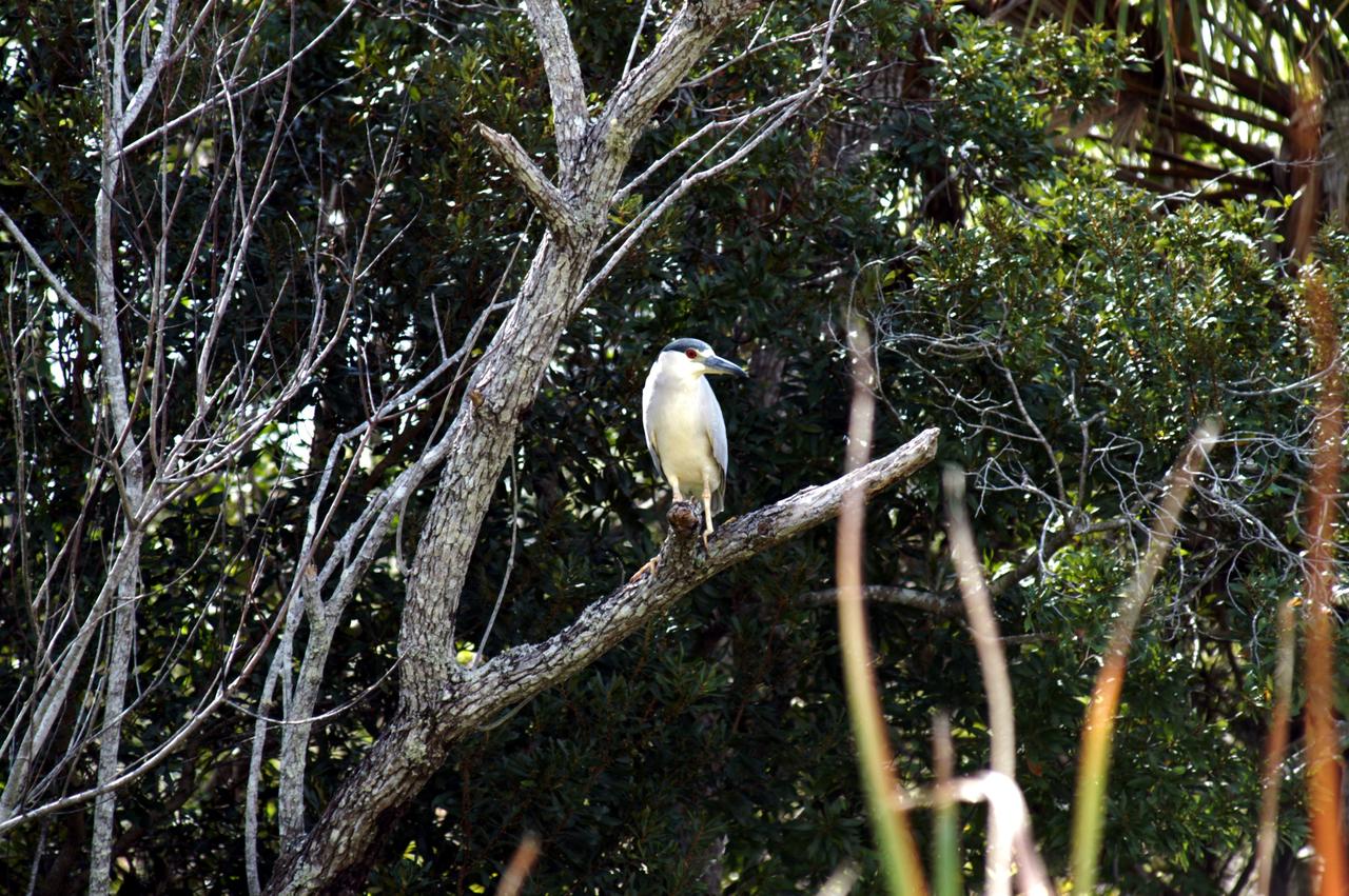
KENNEDY SPACE CENTER, FLA. - A young Yellow-Crowned Night Heron perches on a tree limb in a wooded area of NASA’s Kennedy Space Center. Its habitat is wooded swamps and coastal thickets, ranging from Massachusetts to Florida, west to Texas, and north along the Mississippi River. The Center shares a boundary with the 92,000-acre Merritt Island National Wildlife Refuge, which is a habitat for more than 310 species of birds, 25 mammals, 117 fishes and 65 amphibians and reptiles. The marshes and open water of the refuge also provide wintering areas for 23 species of migratory waterfowl, as well as a year-round home for great blue herons, great egrets, wood storks, cormorants, brown pelicans and other species of marsh and shore birds.
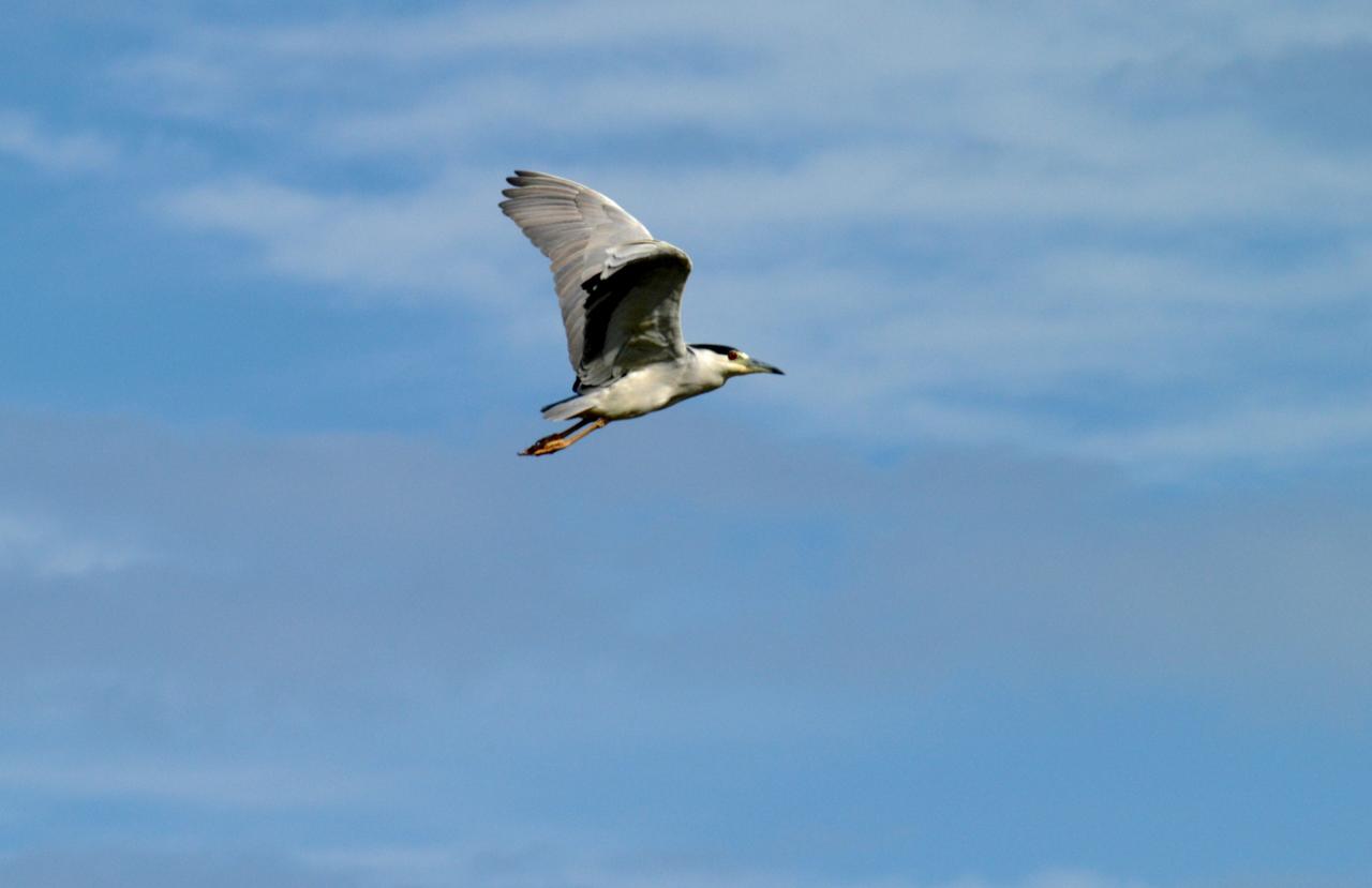
KENNEDY SPACE CENTER, FLA. - A young Yellow-Crowned Night Heron soars through the sky over NASA’s Kennedy Space Center. It’s habitat is wooded swamps and coastal thickets, ranging from Massachusetts to Florida, west to Texas, and north along the Mississippi River. The Center shares a boundary with the 92,000-acre Merritt Island National Wildlife Refuge, which is a habitat for more than 310 species of birds, 25 mammals, 117 fishes and 65 amphibians and reptiles. The marshes and open water of the refuge also provide wintering areas for 23 species of migratory waterfowl, as well as a year-round home for great blue herons, great egrets, wood storks, cormorants, brown pelicans and other species of marsh and shore birds.
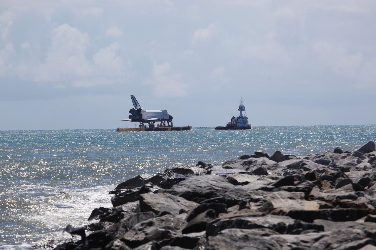
CAPE CANAVERAL, Fla. – The high-fidelity space shuttle model sails through Port Canaveral into the Atlantic Ocean. The model is en route by barge from NASA’s Kennedy Space Center in Florida to Space Center Houston, NASA Johnson Space Center’s official visitor center. Its journey to Texas will take it south along the Florida coastline, around Key West and into the Gulf of Mexico. The model was built in Apopka, Fla., by Guard-Lee and installed at the Kennedy Space Center Visitor Complex in 1993. The model is expected to arrive June 1 in Houston and to be transported June 3 to Space Center Houston, its final destination, where it will become part of a unique display telling the story of the space shuttle’s achievements and the nationwide team that made them possible. For more information about Space Center Houston, visit http://www.spacecenter.org. Photo credit: NASA/Dimitri Gerondidakis
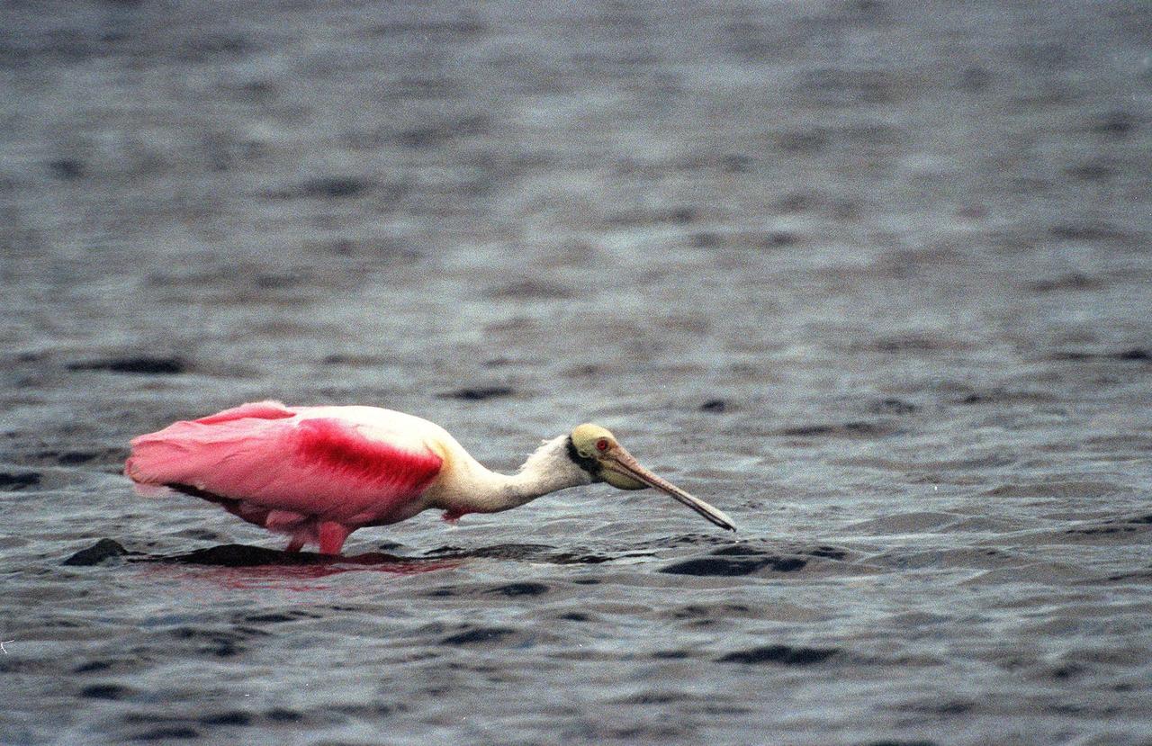
KENNEDY SPACE CENTER, FLA. -- A Roseate Spoonbill sweeps the water for food in the Merritt Island National Wildlife Refuge, which shares a boundary with Kennedy Space Center. The brilliant pink bird is named for its straight bill with the broad spatulate tip. Preferring a habitat of mangroves, it is usually found on the coasts of southern Florida and Texas, occasionally in Louisiana., in the West Indies, Mexico and Central and South America. Spoonbills feed on shrimps and fish in shallow waters, sweeping their bills from side to side and scooping up whatever they encounter. The 92,000-acre refuge is a habitat for more than 310 species of birds, 25 mammals, 117 fishes and 65 amphibians and reptiles. The marshes and open water of the refuge also provide wintering areas for 23 species of migratory waterfowl, as well as a year-round home for great blue herons, great egrets, wood storks, cormorants, brown pelicans and other species of marsh and shore birds
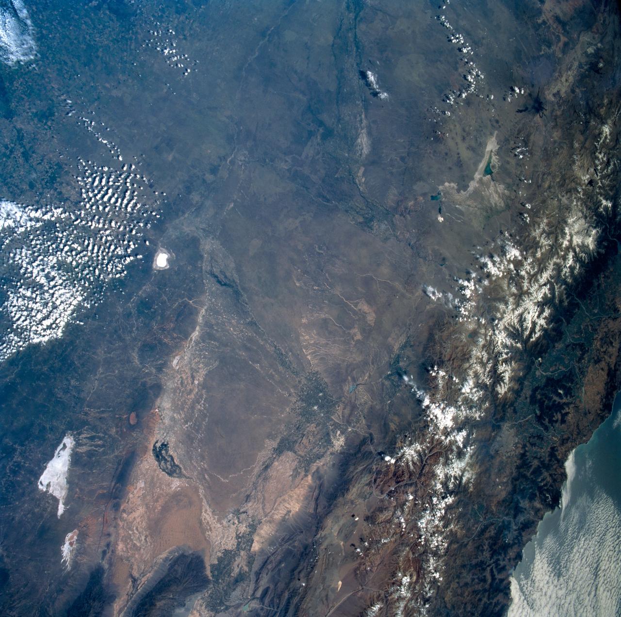
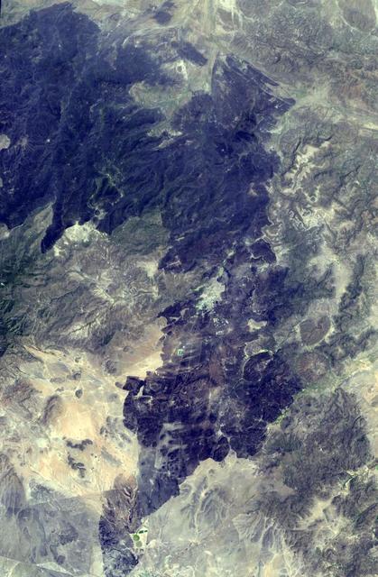
STS089-742-014 (22-31 Jan. 1998) --- This near-nadir picture of the central Andes, showing Santiago and other parts of Chile and Argentina, was photographed with a 70mm handheld camera from the Earth-orbiting space shuttle Endeavour. Santiago (population 4.7 million) is visible to the right of center, west of the snow-capped Andes Mountains. Mendoza, Argentina is the light spot in the upper center of the image in the eastern foothills of the Andes. Cerro Aconcagua, the highest peak in South America (22,834 feet) is due west of Mendoza. Note the sharp bend in the river valley to the junction with a straight north-trending valley. Aconcagua is the large, rounded mass with a bit of cloud just northwest of the valley junction. Bright white spots on the left of the image are salars, or dry lake beds of gypsum and/or salt. Usually dry, some contain water due to recent rains generated by the record El Nino this year. The Pacific Ocean is to the upper right. The continental shelf is very steep in this region and water depths drop (to almost 17,000 feet over a distance of about 60 miles) over the same distance inland from the coast, the Andes rise +17,000 to almost 23,000 feet. The reason for this is the very rapid plate motion between the Pacific Ocean plate and South America. According to NASA scientists, over the last 140 million years, South America has been overriding the Pacific plate resulting in the rapid rise in the Andes and the rapid subduction of the Pacific plate, along with any sediments that are shed into the ocean along the continental margin. The dark, linear mountain ranges east of the high Andes (right center) constitute the Precordillera block; rock strata there have been correlated with the Ordovician (approximately 470 million years old) rocks near El Paso, Texas. The rocks and the fossils within them are virtually identical in the two areas, which are now widely separated. This region would be considered a "remnant terrain" from the time when this portion of South America and Texas were once joined. Photo credit: NASA
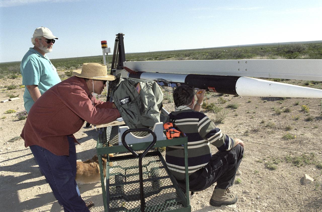
Chuck Rogers, Trong Bui, and Scott Bartel make preflight checks on the second of two aerospike research rockets on March 31, 2004.
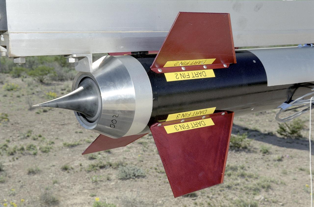
A closeup of one of the Cesaroni Technology, Inc. - constructed aerospike nozzles used in the Dryden Aerospike Rocket Test.
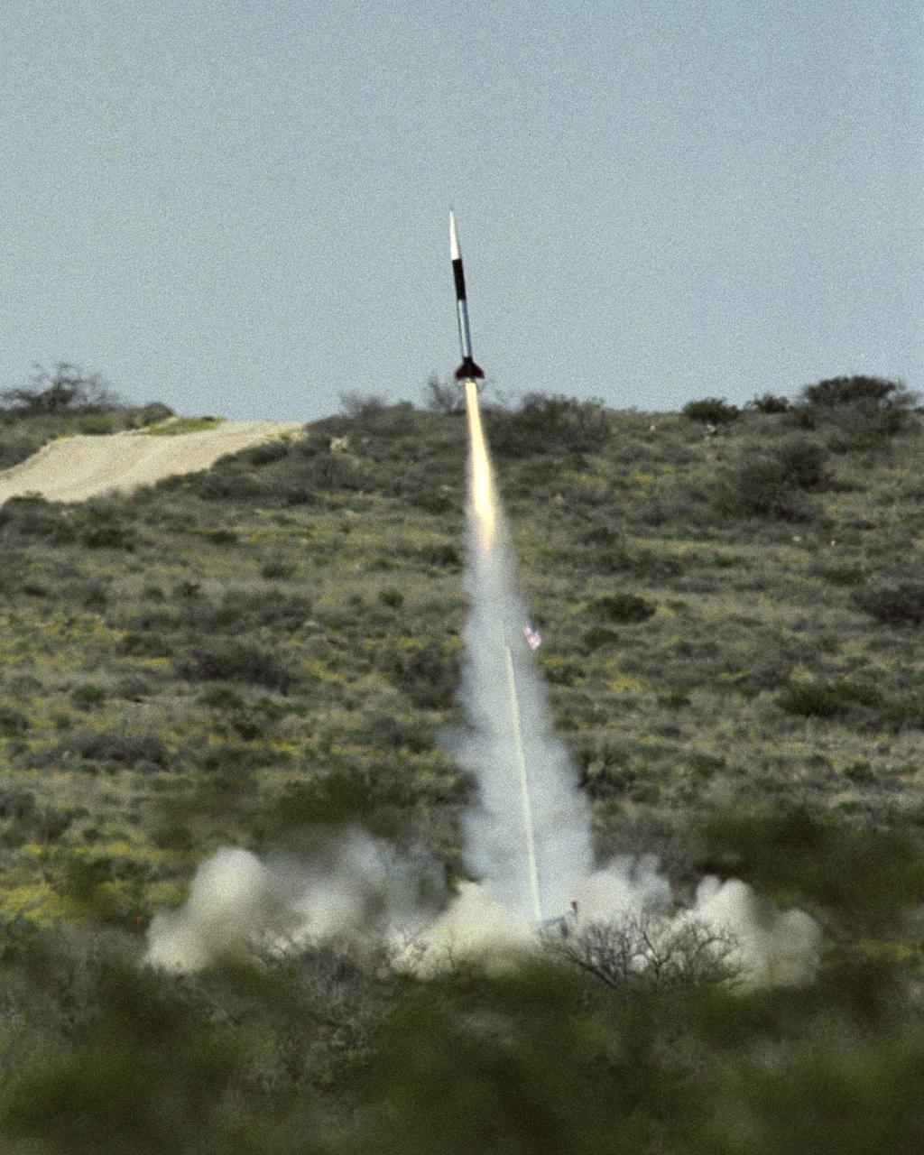
Launch of the first Dryden Aerospike rocket. The Dryden Aerospike Rocket Test provided the first known data from a solid-fueled aerospike rocket in flight.

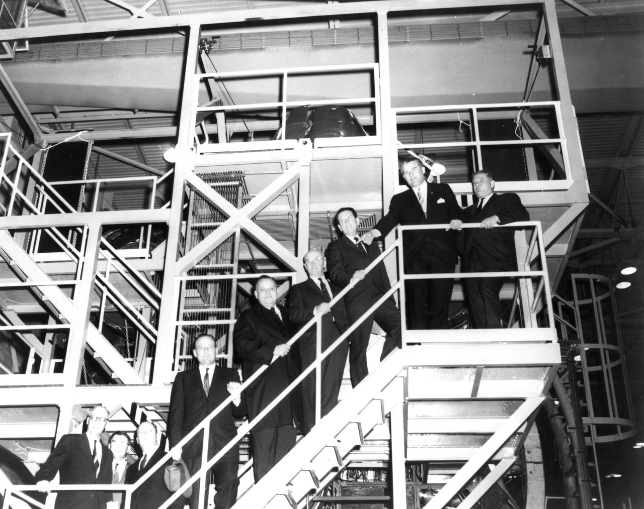
The members of the House Committee on Science and Astronautics visited the Marshall Space Flight Center (MSFC) on March 9, 1962 to gather firsthand information of the nation’s space exploration program. The congressional group was composed of members of the Subcommittee on Manned Space Flight. The subcommittee was briefed on MSFC’s manned space efforts earlier in the day and then inspected mockups of the Saturn I Workshop and the Apollo Telescope Mount, two projects developed by MSFC for the post-Apollo program. In this photograph, MSFC Director, Dr. Wernher von Braun meets with Congressmen in the MSFC boardroom. Pictured from left to right are: Jack Cramer, NASA Headquarters; Joe Waggoner, Democratic representative of Louisiana; John W. Davis, Democratic representative of Georgia; R. Walter Riehlman, Republican representative of New York; Olin E. Teague, Democratic representative of Texas; Dr. Wernher von Braun, Director of MSFC; James G. Fulton, Republican representative of Pennsylvania; Ken Hechler, Democratic representative of West Virginia; and Erich Neubert of MSFC.
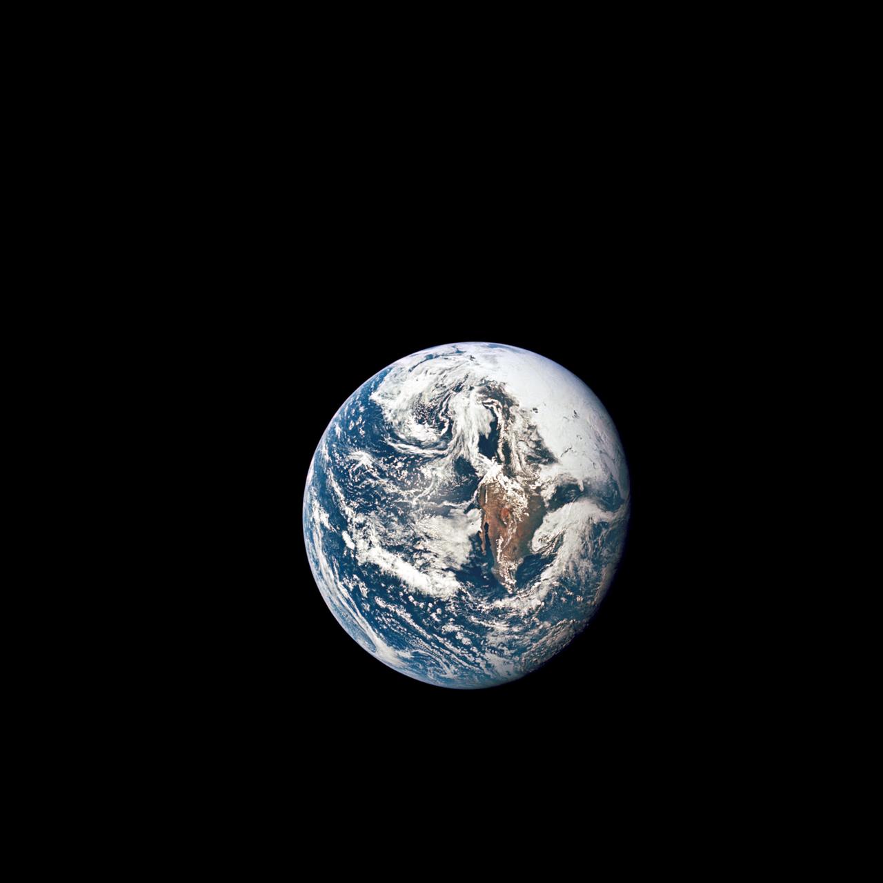
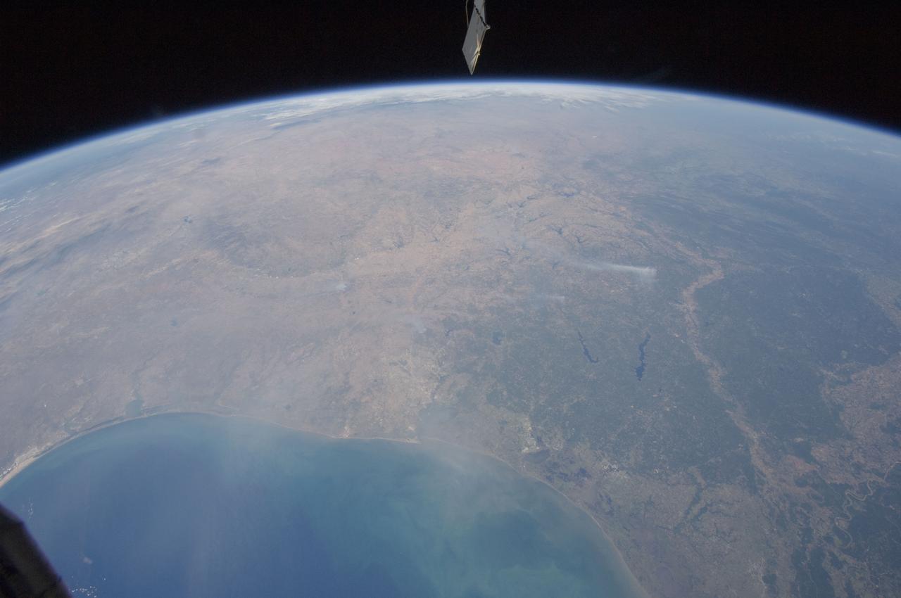
AS10-34-5013 (18 May 1969) --- A view of Earth from 36,000 nautical miles away as photographed from the Apollo 10 spacecraft during its trans-lunar journey toward the moon. While the Yucatan Peninsula is obscured by clouds, nearly all of Mexico north of the Isthmus of Tehuantepec can be clearly delineated. The Gulf of California and Baja California and the San Joaquin Valley can be easily identified. Also, the delta of the Rio Grande River and the Texas coast are visible. Note the color differences (greens - east, browns - west) along the 100 degrees meridian. The crew members on Apollo 10 are astronauts Thomas P. Stafford, commander; John W. Young, command module pilot; and Eugene E. Cernan, lunar module pilot. Astronaut Young remained in lunar orbit, in the Command and Service Modules (CSM) "Charlie Brown", while astronauts Stafford and Cernan descended to within nine miles of the lunar surface, in the Lunar Module (LM) "Snoopy".
In this photograph, Apollo 11 astronauts Edwin (Buzz) Aldrin (left) and Neil A. Armstrong prepare for the first Lunar landing as they practice gathering rock specimens during a geological field trip to the Quitman Mountains area near the Fort Quitman ruins in far west Texas. They used special lunar geological tools to pick up samples and place them in bags.Their practice paid off in July of the same year. Aboard the Marshall Space Fight center (MSFC) developed Saturn V launch vehicle, the Apollo 11 mission launched from the Kennedy Space Center, Florida on July 16, 1969 and safely returned to Earth on July 24, 1969. The 3-man crew aboard the flight consisted of Armstrong, commander; Aldrin, Lunar Module pilot; and a third astronaut Michael Collins, Command Module pilot. Armstrong was the first human to ever stand on the lunar surface, followed by Aldrin, while Collins remained in lunar orbit. The crew collected 47 pounds of lunar surface material which was returned to Earth for analysis. The lunar surface exploration was concluded in 2½ hours.

CAPE CANAVERAL, Fla. - A colony of brown pelicans takes advantage of a respite from winter temperatures to sun themselves along the edges of the Turn Basin in Launch Complex 39 at NASA's Kennedy Space Center in Florida. The brown pelican is found along the coast in California and from North Carolina to Texas, Mexico, the West Indies and many Caribbean Islands, as well as Guyana and Venezuela in South America. It is listed as endangered only in Louisiana, Mississippi, and in the Caribbean. The species is considered to be long-lived. One pelican captured in Edgewater, Fla., in November 1964, was found to have been banded in September 1933, over 31 years previously. Individuals can weigh up to eight pounds, with larger pelicans having wing spreads of over seven feet. Their nests are usually built in mangrove trees, but ground nesting may also occur. Nesting takes place mostly in early spring or summer with the male carrying nesting materials to the female. Although the female builds the nest, both share in incubation and rearing duties. The Merritt Island National Wildlife Refuge coexists with Kennedy Space Center and provides a habitat for 330 species of birds including brown pelicans. Photo credit: NASA/Jack Pfaller

KENNEDY SPACE CENTER, FLA. -- In the waters of the Merritt Island National Wildlife Refuge, which shares a boundary with Kennedy Space Center, willets (left) and American avocets (right) attack the water below in a feeding frenzy. Willets inhabit coastal beaches, freshwater and salt marches, lakeshores and wet prairies, ranging from southern Canada and United States to the West Indies. Avocets are not commonly seen in the East, but range from Washington and Manitoba south to Texas and California. However, avocets may stray eastward to the Atlantic coast during their southward migration in the fall. Their common habitat is freshwater marshes and shallow marshy lakes. The Refuge encompasses 92,000 acres that are a habitat for more than 331 species of birds, 31 mammals, 117 fishes, and 65 amphibians and reptiles. The marshes and open water of the refuge provide wintering areas for 23 species of migratory waterfowl, as well as a year-round home for great blue herons, great egrets, wood storks, cormorants, brown pelicans and other species of marsh and shore birds, as well as a variety of insects

CAPE CANAVERAL, Fla. - Brown pelicans sun themselves along the edges of the Turn Basin in Launch Complex 39 at NASA's Kennedy Space Center in Florida. Docked nearby is the Pegasus barge, often enlisted to bring the space shuttle's external tanks to the basin. The brown pelican is found along the coast in California and from North Carolina to Texas, Mexico, the West Indies and many Caribbean Islands, as well as Guyana and Venezuela in South America. It is listed as endangered only in Louisiana, Mississippi, and in the Caribbean. The species is considered to be long-lived. One pelican captured in Edgewater, Fla., in November 1964, was found to have been banded in September 1933, over 31 years previously. Individuals can weigh up to eight pounds, with larger pelicans having wing spreads of over seven feet. Their nests are usually built in mangrove trees, but ground nesting may also occur. Nesting takes place mostly in early spring or summer with the male carrying nesting materials to the female. Although the female builds the nest, both share in incubation and rearing duties. The Merritt Island National Wildlife Refuge coexists with Kennedy Space Center and provides a habitat for 330 species of birds including brown pelicans. Photo credit: NASA/Jack Pfaller
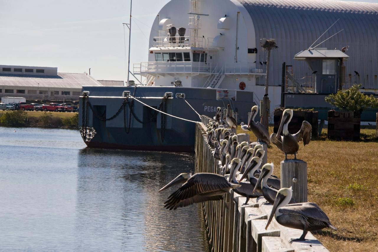
CAPE CANAVERAL, Fla. - Brown pelicans make unlikely companions for the Pegasus barge in the Turn Basin in Launch Complex 39 at NASA's Kennedy Space Center in Florida. The barge often transports the space shuttle's external tanks into the basin. The brown pelican is found along the coast in California and from North Carolina to Texas, Mexico, the West Indies and many Caribbean Islands, as well as Guyana and Venezuela in South America. It is listed as endangered only in Louisiana, Mississippi, and in the Caribbean. The species is considered to be long-lived. One pelican captured in Edgewater, Fla., in November 1964, was found to have been banded in September 1933, over 31 years previously. Individuals can weigh up to eight pounds, with larger pelicans having wing spreads of over seven feet. Their nests are usually built in mangrove trees, but ground nesting may also occur. Nesting takes place mostly in early spring or summer with the male carrying nesting materials to the female. Although the female builds the nest, both share in incubation and rearing duties. The Merritt Island National Wildlife Refuge coexists with Kennedy Space Center and provides a habitat for 330 species of birds including brown pelicans. Photo credit: NASA/Jack Pfaller
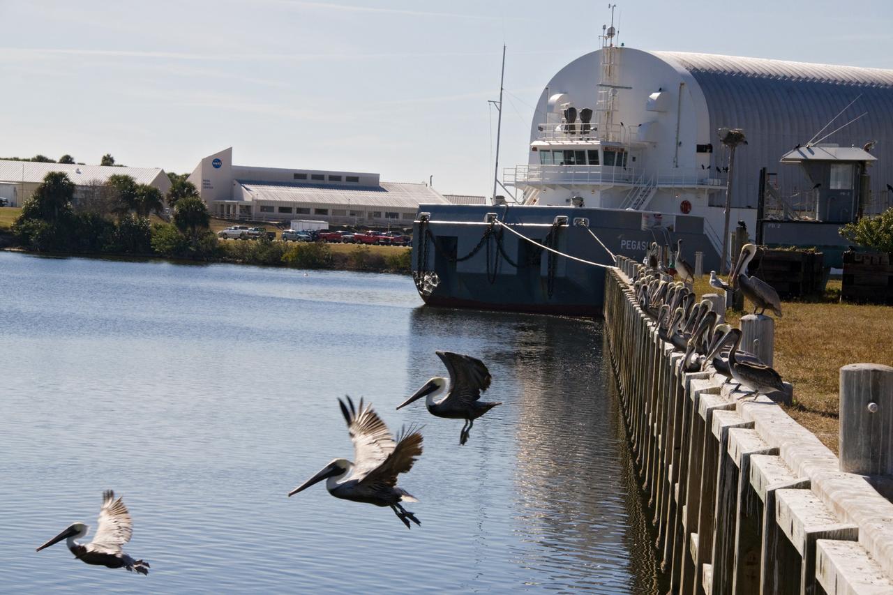
CAPE CANAVERAL, Fla. - Brown pelicans enjoy a respite from the winter temperatures at the Turn Basin in Launch Complex 39 at NASA's Kennedy Space Center in Florida. Behind them is the Pegasus barge, often used to transport the space shuttle's external tanks into the basin, and NASA's News Center. The brown pelican is found along the coast in California and from North Carolina to Texas, Mexico, the West Indies and many Caribbean Islands, as well as Guyana and Venezuela in South America. It is listed as endangered only in Louisiana, Mississippi, and in the Caribbean. The species is considered to be long-lived. One pelican captured in Edgewater, Fla., in November 1964, was found to have been banded in September 1933, over 31 years previously. Individuals can weigh up to eight pounds, with larger pelicans having wing spreads of over seven feet. Their nests are usually built in mangrove trees, but ground nesting may also occur. Nesting takes place mostly in early spring or summer with the male carrying nesting materials to the female. Although the female builds the nest, both share in incubation and rearing duties. The Merritt Island National Wildlife Refuge coexists with Kennedy Space Center and provides a habitat for 330 species of birds including brown pelicans. Photo credit: NASA/Jack Pfaller
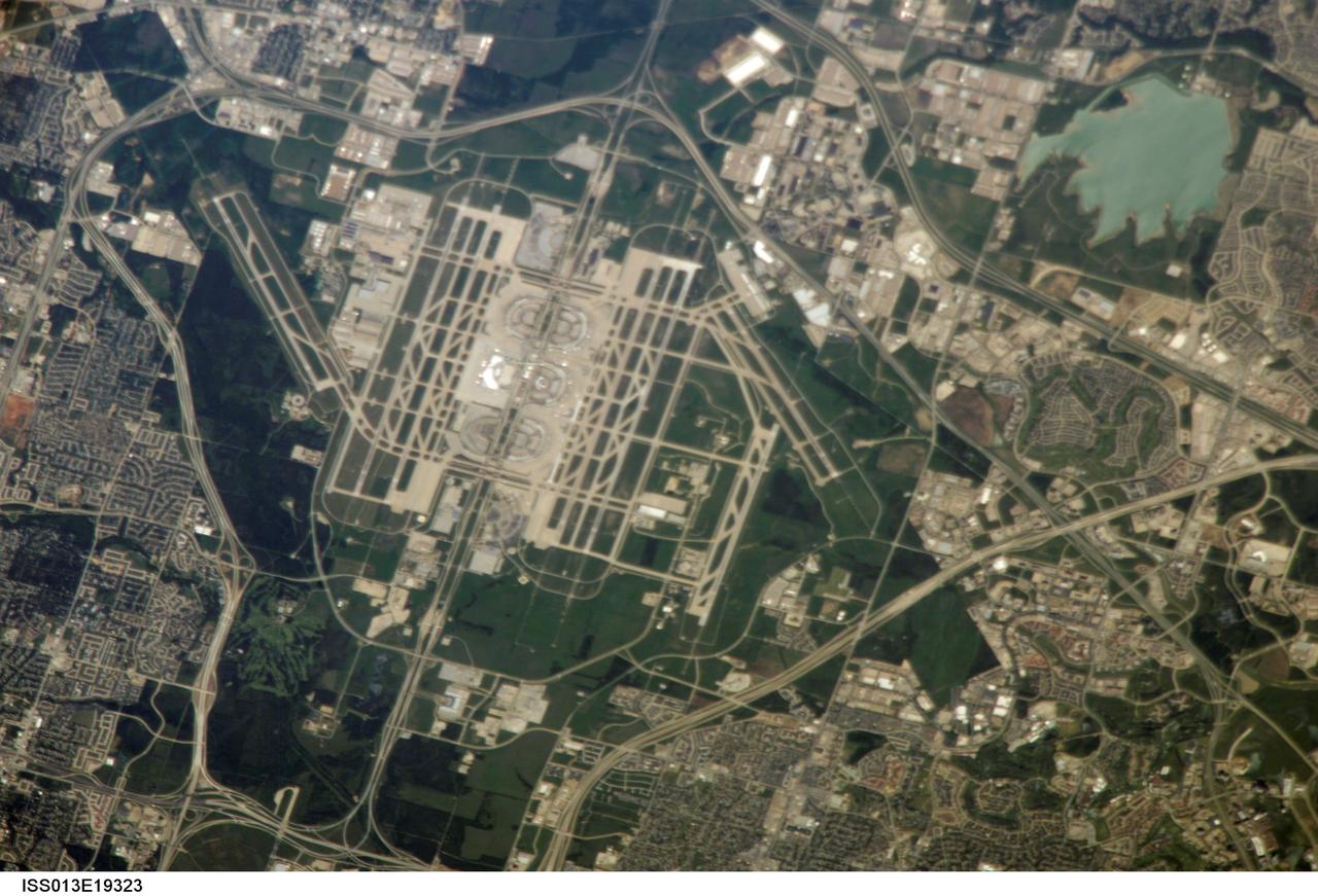
ISS013-E-19323 (13 May 2006) --- The largest airport in Texas, Dallas-Fort Worth (DFW) International Airport, is featured in this image photographed by an Expedition 13 crewmember on the International Space Station. DFW is also the fourth largest in the world, and occupies more surface area than the entire island of Manhattan in New York. The airport is officially owned by the cities of Dallas and Fort Worth, but is sited within the city limits of four neighboring cities (Coppell, Euless, Grapevine, and Irving). This oblique image captures the entire airport and portions of the surrounding Dallas-Forth Worth metropolitan area. The white rooftops of the new - completed in 2005 - International Terminal D are also distinct from less reflective rooftops of the older terminals. A sense of the size of the airport is provided by the approximately 2,800 meters long northwest-southeast oriented runway to the west of Terminal D. The oblique viewing angle also accentuates light reflection off of North Lake (image upper right), giving the water surface a grey-green cast.
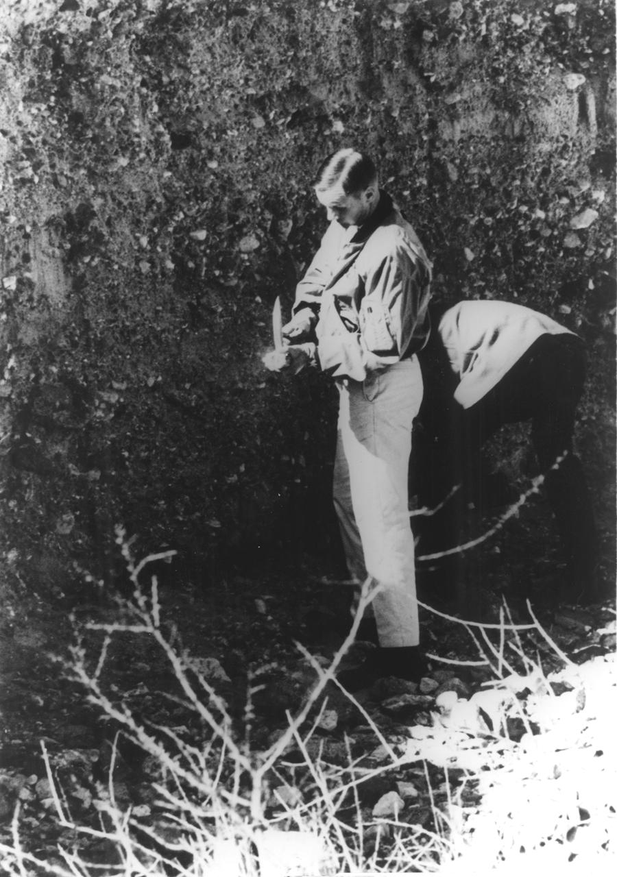
In this photograph, Apollo 11 astronaut Neil A. Armstrong uses a geologist’s hammer in selecting rock specimens during a geological field trip to the Quitman Mountains area near the Fort Quitman ruins in far west Texas. Armstrong, alongside astronaut Edwin (Buzz) Aldrin, practiced gathering rock specimens using special lunar geological tools in preparation for the first Lunar landing. Mission was accomplished in July of the same year. Aboard the Marshall Space Fight center (MSFC) developed Saturn V launch vehicle, the Apollo 11 mission launched from The Kennedy Space Center, Florida on July 16, 1969 and safely returned to Earth on July 24, 1969. The 3-man crew aboard the flight consisted of Armstrong, commander; Aldrin, Lunar Module pilot; and a third astronaut Michael Collins, Command Module pilot. Armstrong was the first human to ever stand on the lunar surface, followed by Aldrin, while Collins remained in lunar orbit. The crew collected 47 pounds of lunar surface material which was returned to Earth for analysis. The lunar surface exploration was concluded in 2½ hours.
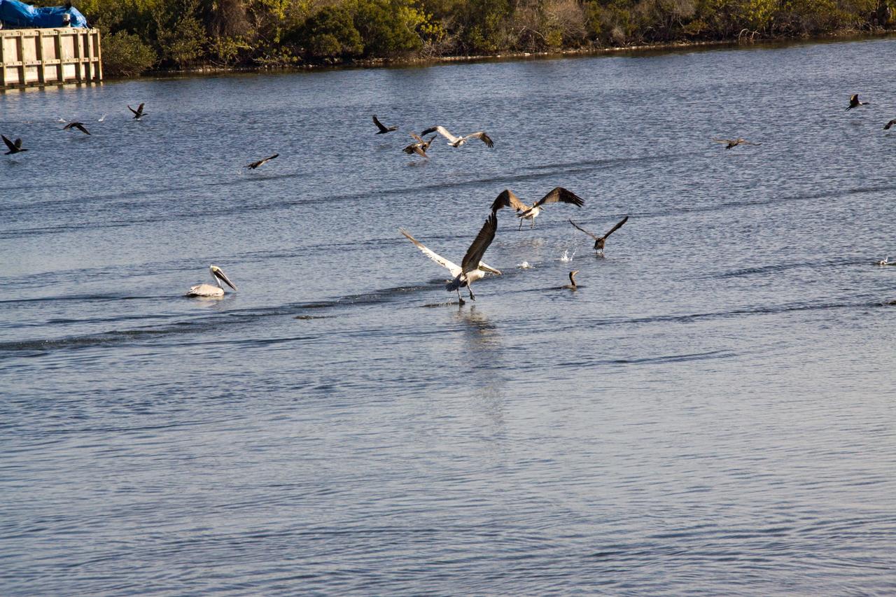
CAPE CANAVERAL, Fla. - A colony of brown pelicans enjoys a respite from the winter temperatures with a dip in the Turn Basin in Launch Complex 39 at NASA's Kennedy Space Center in Florida. The brown pelican is found along the coast in California and from North Carolina to Texas, Mexico, the West Indies and many Caribbean Islands, as well as Guyana and Venezuela in South America. It is listed as endangered only in Louisiana, Mississippi, and in the Caribbean. The species is considered to be long-lived. One pelican captured in Edgewater, Fla., in November 1964, was found to have been banded in September 1933, over 31 years previously. Individuals can weigh up to eight pounds, with larger pelicans having wing spreads of over seven feet. Their nests are usually built in mangrove trees, but ground nesting may also occur. Nesting takes place mostly in early spring or summer with the male carrying nesting materials to the female. Although the female builds the nest, both share in incubation and rearing duties. The Merritt Island National Wildlife Refuge coexists with Kennedy Space Center and provides a habitat for 330 species of birds including brown pelicans. Photo credit: NASA/Jack Pfaller

KENNEDY SPACE CENTER, FLA. -- A white pelican and several small egrets rest on the bank of a pond in in the waters of the Merritt Island National Wildlife Refuge, which shares a boundary with Kennedy Space Center. White pelicans inhabit marshy lakes and along the Pacific and Texas coasts. They winter from Florida and southern California south to Panama, chiefly in coastal lagoons. They are frequently seen flying in long lines, flapping and sailing in unison, but also ride rising air currents to soar gracefully in circles. The range of the egret includes southern and eastern states, Mexico, Central and South America, and the West Indies. The Refuge encompasses 92,000 acres that are a habitat for more than 331 species of birds, 31 mammals, 117 fishes, and 65 amphibians and reptiles. The marshes and open water of the refuge provide wintering areas for 23 species of migratory waterfowl, as well as a year-round home for great blue herons, great egrets, wood storks, cormorants, brown pelicans and other species of marsh and shore birds, as well as a variety of insects
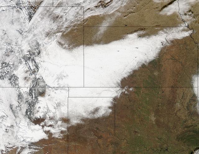
Winter arrived officially on Dec. 22 at 12:35 a.m. EST, but the U.S. Plains states received an early and cool welcome on Dec. 19 from heavy snowfall that was seen by a NASA satellite. NASA's Aqua satellite passed overhead on Dec. 21 at 20:05 UTC (3:05 p.m. EST) and the Moderate Resolution Imaging Spectroradiometer (MODIS) instrument aboard NASA's Aqua satellite captured a visible image of snow blanketing the ground through west and central Kansas, eastern and central Colorado, much of New Mexico, northern Texas and the panhandle of Oklahoma. According to CBS News, blizzard conditions were reported in northern New Mexico, the Texas Panhandle, Oklahoma and northwestern Kansas. The Associated Press reported snow drifts as high as 10 feet in southeast Colorado. Six people lost their lives in traffic accidents from this storm. Heavy snow is expected again today, Dec. 22 in New Mexico and Colorado. Snow is also expected to stretch across the plains into the upper Midwest today, according to the National Weather Service. Portions of many states are expecting some snow today, including the four corners states, north Texas, Kansas, southern Nebraska, western Oklahoma, northern Missouri, Iowa, northern Illinois and southern Wisconsin stretching east into northern New England. The first day of the winter season occurs when the sun is farthest south, either Dec. 21 or 22. The day is also known as the winter solstice. By the second day of winter, NASA's Aqua satellite is going to have a lot more snowfall to observe. Image Credit: NASA Goddard MODIS Rapid Response Team Caption: NASA, Rob Gutro <b><a href="http://www.nasa.gov/audience/formedia/features/MP_Photo_Guidelines.html" rel="nofollow">NASA image use policy.</a></b> <b><a href="http://www.nasa.gov/centers/goddard/home/index.html" rel="nofollow">NASA Goddard Space Flight Center</a></b> enables NASA’s mission through four scientific endeavors: Earth Science, Heliophysics, Solar System Exploration, and Astrophysics. Goddard plays a leading role in NASA’s accomplishments by contributing compelling scientific knowledge to advance the Agency’s mission. <b>Follow us on <a href="http://twitter.com/NASA_GoddardPix" rel="nofollow">Twitter</a></b> <b>Like us on <a href="http://www.facebook.com/pages/Greenbelt-MD/NASA-Goddard/395013845897?ref=tsd" rel="nofollow">Facebook</a></b> <b>Find us on <a href="http://instagrid.me/nasagoddard/?vm=grid" rel="nofollow">Instagram</a></b>
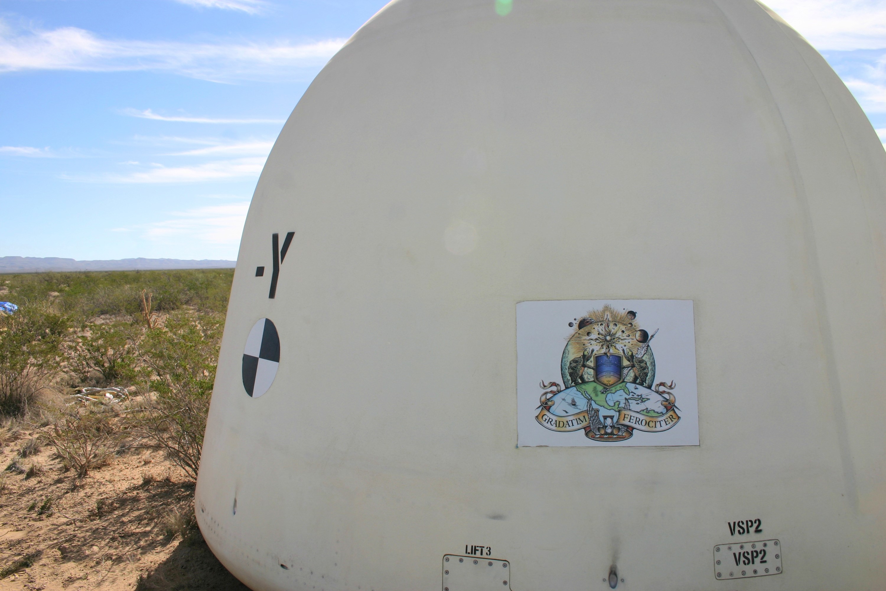
VAN HORN, Texas – Blue Origin’s New Shepard crew capsule touched down 1,630 feet from the its simulated propulsion module launch pad at the company's West Texas launch site, completing a successful test of its New Shepard crew capsule escape system. The pusher escape system was designed and developed by Blue Origin to allow crew escape in the event of an emergency during any phase of ascent for its suborbital New Shepard system. As part of an incremental development program, the results of this test will shape the design of the escape system for the company's orbital biconic-shaped Space Vehicle. The system is expected to enable full reusability of the launch vehicle, which is different from NASA's previous launch escape systems that would pull a spacecraft away from its rocket before reaching orbit. The test was part of Blue Origin's work supporting its funded Space Act Agreement with NASA during Commercial Crew Development Round 2 CCDev2). Through initiatives like CCDev2, NASA is fostering the development of a U.S. commercial crew space transportation capability with the goal of achieving safe, reliable and cost-effective access to and from the International Space Station and low-Earth orbit. After the capability is matured and available to the government and other customers, NASA could contract to purchase commercial services to meet its station crew transportation needs. For more information, visit www.nasa.gov/commercialcrew. Image credit: Blue Origin

ISS022-E-078463 (28 Feb. 2010) ---The Houston metropolitan area at night is featured in this image photographed by an Expedition 22 crew member on the International Space Station. Houston, Texas has been called the ?energy capital of the world? due to its role as a major hub of the petroleum and other energy resource industries. The image is oriented with north toward the top. The Houston metropolitan area covers almost 2,331,000 hectares (approximately 9,000 square miles) along the southeast Texas coastline, with an average elevation of 13 meters (approximately 43 feet) above sea level and a population of over 5 million (2006 US Census estimate). The Houston metropolitan area is also noteworthy as being the largest in the US without formal zoning restrictions. This has lead to a highly diverse pattern of land use at the neighborhood scale; nevertheless, more general spatial patterns of land use can be recognized in remotely sensed data. This is particularly evident in night time photography of the urban area taken by crew members onboard the space station. The image depicts the roughly 100 kilometers (approximately 62 miles) east-west extent of the Houston metropolitan area. Houston proper is at center, indicated by a ?bull?s-eye? of elliptical white to orange-lighted beltways and brightly lit white freeways radiating outwards from the central downtown area. Suburban and primarily residential urban land use is indicated by both reddish-brown and gray-green lighted regions that reflect a higher proportion of tree cover and lower light density. Petroleum refineries along the Houston Ship Channel are recognized by densely lit areas of golden yellow light. Rural and undeveloped land circles the metropolitan area, and Galveston Bay to the southeast (lower right) provides access to the Gulf of Mexico. Both types of non-urban surface appear dark in the image.
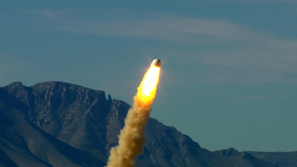
VAN HORN, Texas – Blue Origin’s pusher escape system rockets its New Shepard crew capsule away from a simulated propulsion module launch pad at the company's West Texas launch site, demonstrating a key safety system for both suborbital and orbital flights. The pad escape test took the company's suborbital crew capsule to an altitude of 2,307 feet during the flight test before descending safely by parachute to a soft landing 1,630 feet away. The pusher escape system was designed and developed by Blue Origin to allow crew escape in the event of an emergency during any phase of ascent for its suborbital New Shepard system. As part of an incremental development program, the results of this test will shape the design of the escape system for the company's orbital biconic-shaped Space Vehicle. The system is expected to enable full reusability of the launch vehicle, which is different from NASA's previous launch escape systems that would pull a spacecraft away from its rocket before reaching orbit. The test was part of Blue Origin's work supporting its funded Space Act Agreement with NASA during Commercial Crew Development Round 2 CCDev2). Through initiatives like CCDev2, NASA is fostering the development of a U.S. commercial crew space transportation capability with the goal of achieving safe, reliable and cost-effective access to and from the International Space Station and low-Earth orbit. After the capability is matured and available to the government and other customers, NASA could contract to purchase commercial services to meet its station crew transportation needs. For more information, visit www.nasa.gov/commercialcrew. Image credit: Blue Origin

ISS033-E-021663 (15 Nov. 2012) --- A nighttime view of the Dallas, Texas metropolitan area is featured in this image photographed by an Expedition 33 crew member on the International Space Station. Most metropolitan areas of the western United States are configured over large areas with a regular street grid pattern that is highly recognizable from space, particularly at night. The northern Dallas metropolitan area exhibits this pattern. The north-south and east-west grid pattern of major surface streets is highlighted by orange street lighting, lending a fishnet-like appearance to the urban area. Within this framework, smaller residential and commercial buildings and streets give green-gray stipple patterns to some blocks. The airplane terminals of Dallas-Fort Worth International Airport are lit with golden-yellow lights, and surrounded by relatively dark runways and fields at left. Likewise, the runways of Dallas Love Field at lower center are recognizable by their darkness. Other dark areas within the metro region are open space, parks, and water bodies. Dallas is part of the larger Dallas-Fort Worth-Arlington Metropolitan Statistical Area (population 6,526,548 in 2011) as recognized by the U.S. Census Bureau; to most Texans, it is simply ?DFW? or ?the Metroplex.? Several of the larger urban areas within DFW are visible in this image; Dallas, Garland and Richardson all have populations above 100,000 according to the North Central Texas Council of Governments. While historically the economy of Dallas was based in the oil and cotton industries, today commerce, technology, healthcare, and transportation are the major economic drivers.

NOAA's GOES-East satellite provided a look at the frigid eastern two-thirds of the U.S. on Jan. 7, 2015, that shows a blanket of northern snow, lake-effect snow from the Great Lakes and clouds behind the Arctic cold front. A visible picture captured at 1600 UTC (11 a.m. EST) showed the effects of the latest Arctic outbreak. The cold front that brought the Arctic air has moved as far south as Florida, and stretches back over the Gulf of Mexico and just west of Texas today. The image shows clouds behind the frontal boundary stretching from the Carolinas west over the Heartland. Farther north, a wide band of fallen snow covers the ground from New England west to Montana, with rivers appearing like veins. The GOES-East satellite image also shows wind-whipped lake-effect snows off the Great Lakes, blowing to the southeast. Meanwhile, Florida, the nation's warm spot appeared almost cloud-free. To create the image, NASA/NOAA's GOES Project used cloud data from NOAA's GOES-East satellite and overlaid it on a true-color image of land and ocean created by data from the Moderate Resolution Imaging Spectroradiometer, or MODIS, instrument that flies aboard NASA's Aqua and Terra satellites. Together, those data created the entire picture of the Arctic outbreak. The forecast from NOAA's National Weather Service Weather Prediction Center (WPC) calls for more snow along the Appalachian Mountains from Tennessee north to upstate New York. Snow is also expected to fall from New England west to Montana, and in eastern New Mexico and the Colorado Rockies. The WPC summary for Jan. 7 noted: Bitter cold will be felt from the western High Plains to the Mid-Atlantic and Northeast U.S. for the next few days. Widespread subzero overnight lows are forecast for the Dakotas, Upper Midwest, Great Lakes, and interior New England. Wind Chill Advisories and Warnings are in effect for many of these areas. GOES-East provides visible and infrared images over the eastern U.S. and the Atlantic Ocean from its fixed orbit in space. NOAA's GOES satellites provide the kind of continuous monitoring necessary for intensive data analysis. Geostationary describes an orbit in which a satellite is always in the same position with respect to the rotating Earth. This allows GOES to hover continuously over one position on Earth's surface, appearing stationary. As a result, GOES provide a constant vigil for the atmospheric triggers for severe weather conditions such as tornadoes, flash floods, hail storms and hurricanes. For updated information about the storm system, visit NOAA's NWS website: <a href="http://www.weather.gov" rel="nofollow">www.weather.gov</a> For more information about GOES satellites, visit: <a href="http://www.goes.noaa.gov/" rel="nofollow">www.goes.noaa.gov/</a> or goes.gsfc.nasa.gov/ Rob Gutro NASA's Goddard Space Flight Center, Greenbelt, Md. <b><a href="http://www.nasa.gov/audience/formedia/features/MP_Photo_Guidelines.html" rel="nofollow">NASA image use policy.</a></b> <b><a href="http://www.nasa.gov/centers/goddard/home/index.html" rel="nofollow">NASA Goddard Space Flight Center</a></b> enables NASA’s mission through four scientific endeavors: Earth Science, Heliophysics, Solar System Exploration, and Astrophysics. Goddard plays a leading role in NASA’s accomplishments by contributing compelling scientific knowledge to advance the Agency’s mission. <b>Follow us on <a href="http://twitter.com/NASAGoddardPix" rel="nofollow">Twitter</a></b> <b>Like us on <a href="http://www.facebook.com/pages/Greenbelt-MD/NASA-Goddard/395013845897?ref=tsd" rel="nofollow">Facebook</a></b> <b>Find us on <a href="http://instagram.com/nasagoddard?vm=grid" rel="nofollow">Instagram</a></b>
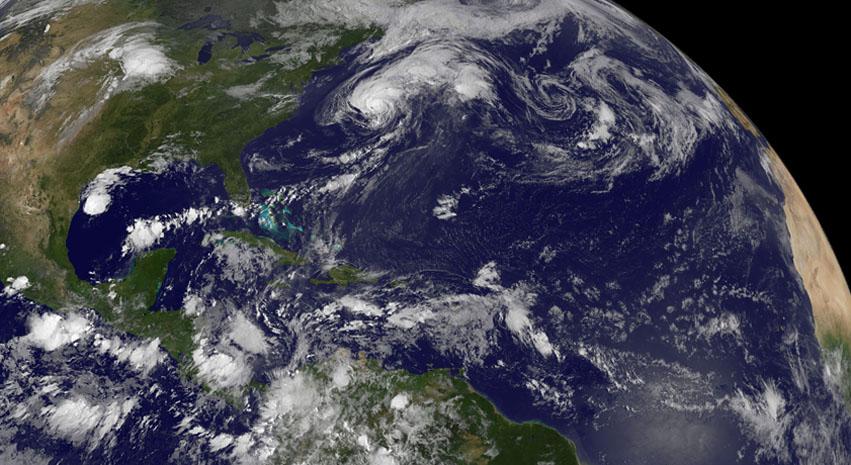
Although there's only one formed tropical cyclone in the Atlantic: Hurricane Cristobal, there are three other developing areas of low pressure and all were captured in this panoramic image from NOAA's GOES-East satellite today at 8 a.m. EDT. Cristobal is a hurricane located east of the U.S. East coast and is forecast to move up toward eastern Canada tonight (and stay off-shore). The image was made at NASA's GOES Project at NASA's Goddard Space Flight Center in Greenbelt, Maryland. Low #1. A weak area of low pressure near the coast of South Texas is producing disorganized showers and thunderstorms. Significant development of this system is unlikely before it moves inland over South Texas and northern Mexico today. It has a ten percent chance of development into a tropical depression in the next 2 days. Low #2. A tropical wave located over the eastern Caribbean Sea continues to produce disorganized cloudiness and showers. Upper-level winds are expected to remain unfavorable for development during the next couple of days while the system moves across the eastern and central Caribbean Sea. However, environmental conditions could become conducive for some development when the system moves over the northwestern Caribbean Sea on Sunday and into the southwestern Gulf of Mexico early next week. It has a near zero chance to develop in the next 2 days. Low #3. A tropical wave is forecast to move off the west coast of Africa on Friday. Environmental conditions could be conducive for some gradual development of this system while it moves westward at 10 to 15 mph across the eastern Atlantic early next week. This has a near zero chance of development in the next two days. <b><a href="http://www.nasa.gov/audience/formedia/features/MP_Photo_Guidelines.html" rel="nofollow">NASA image use policy.</a></b> <b><a href="http://www.nasa.gov/centers/goddard/home/index.html" rel="nofollow">NASA Goddard Space Flight Center</a></b> enables NASA’s mission through four scientific endeavors: Earth Science, Heliophysics, Solar System Exploration, and Astrophysics. Goddard plays a leading role in NASA’s accomplishments by contributing compelling scientific knowledge to advance the Agency’s mission. <b>Follow us on <a href="http://twitter.com/NASAGoddardPix" rel="nofollow">Twitter</a></b> <b>Like us on <a href="http://www.facebook.com/pages/Greenbelt-MD/NASA-Goddard/395013845897?ref=tsd" rel="nofollow">Facebook</a></b> <b>Find us on <a href="http://instagram.com/nasagoddard?vm=grid" rel="nofollow">Instagram</a></b>
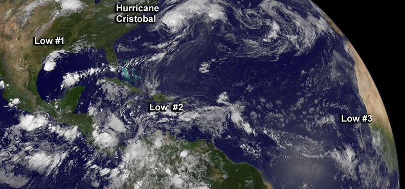
Although there's only one formed tropical cyclone in the Atlantic: Hurricane Cristobal, there are three other developing areas of low pressure and all were captured in this panoramic image from NOAA's GOES-East satellite today at 8 a.m. EDT. Cristobal is a hurricane located east of the U.S. East coast and is forecast to move up toward eastern Canada tonight (and stay off-shore). The image was made at NASA's GOES Project at NASA's Goddard Space Flight Center in Greenbelt, Maryland. Low #1. A weak area of low pressure near the coast of South Texas is producing disorganized showers and thunderstorms. Significant development of this system is unlikely before it moves inland over South Texas and northern Mexico today. It has a ten percent chance of development into a tropical depression in the next 2 days. Low #2. A tropical wave located over the eastern Caribbean Sea continues to produce disorganized cloudiness and showers. Upper-level winds are expected to remain unfavorable for development during the next couple of days while the system moves across the eastern and central Caribbean Sea. However, environmental conditions could become conducive for some development when the system moves over the northwestern Caribbean Sea on Sunday and into the southwestern Gulf of Mexico early next week. It has a near zero chance to develop in the next 2 days. Low #3. A tropical wave is forecast to move off the west coast of Africa on Friday. Environmental conditions could be conducive for some gradual development of this system while it moves westward at 10 to 15 mph across the eastern Atlantic early next week. This has a near zero chance of development in the next two days. <b><a href="http://www.nasa.gov/audience/formedia/features/MP_Photo_Guidelines.html" rel="nofollow">NASA image use policy.</a></b> <b><a href="http://www.nasa.gov/centers/goddard/home/index.html" rel="nofollow">NASA Goddard Space Flight Center</a></b> enables NASA’s mission through four scientific endeavors: Earth Science, Heliophysics, Solar System Exploration, and Astrophysics. Goddard plays a leading role in NASA’s accomplishments by contributing compelling scientific knowledge to advance the Agency’s mission. <b>Follow us on <a href="http://twitter.com/NASAGoddardPix" rel="nofollow">Twitter</a></b> <b>Like us on <a href="http://www.facebook.com/pages/Greenbelt-MD/NASA-Goddard/395013845897?ref=tsd" rel="nofollow">Facebook</a></b> <b>Find us on <a href="http://instagram.com/nasagoddard?vm=grid" rel="nofollow">Instagram</a></b>
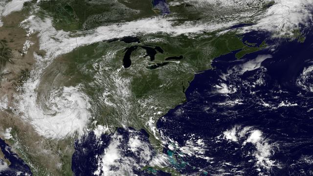
A very anomalous weather pattern is in place over the U.S. for mid-July. Trapped between an upper level ridge centered over the Ohio Valley and the closed upper level low over the Texas/Oklahoma border, atypical hot, muggy air is stifling a broad swath of the eastern U.S. The closed low is expected to drift west toward New Mexico bringing heavy, localized rain to some areas and temperatures running 10-20 degrees below mid-July averages. Across the east, temperatures will warm well into the 90's and stay there through the week. This image was taken by GOES East at 1645Z on July 15, 2013. Image credit: <b><a href="http://goes.gsfc.nasa.gov/" rel="nofollow">Credit: NOAA/NASA GOES Project</a></b> Text credit: NOAA <b><a href="http://www.nasa.gov/audience/formedia/features/MP_Photo_Guidelines.html" rel="nofollow">NASA image use policy.</a></b> <b><a href="http://www.nasa.gov/centers/goddard/home/index.html" rel="nofollow">NASA Goddard Space Flight Center</a></b> enables NASA’s mission through four scientific endeavors: Earth Science, Heliophysics, Solar System Exploration, and Astrophysics. Goddard plays a leading role in NASA’s accomplishments by contributing compelling scientific knowledge to advance the Agency’s mission. <b>Follow us on <a href="http://twitter.com/NASA_GoddardPix" rel="nofollow">Twitter</a></b> <b>Like us on <a href="http://www.facebook.com/pages/Greenbelt-MD/NASA-Goddard/395013845897?ref=tsd" rel="nofollow">Facebook</a></b> <b>Find us on <a href="http://instagram.com/nasagoddard?vm=grid" rel="nofollow">Instagram</a></b>
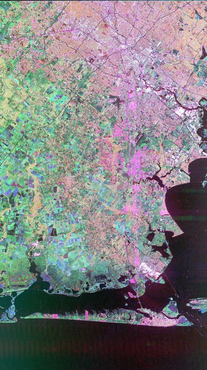
This image of Houston, Texas, shows the amount of detail that is possible to obtain using spaceborne radar imaging. Images such as this -- obtained by the Spaceborne Imaging Radar-C/X-band Synthetic Aperture Radar (SIR-C/X-SAR) flying aboard the space shuttle Endeavor last fall -- can become an effective tool for urban planners who map and monitor land use patterns in urban, agricultural and wetland areas. Central Houston appears pink and white in the upper portion of the image, outlined and crisscrossed by freeways. The image was obtained on October 10, 1994, during the space shuttle's 167th orbit. The area shown is 100 kilometers by 60 kilometers (62 miles by 38 miles) and is centered at 29.38 degrees north latitude, 95.1 degrees west longitude. North is toward the upper left. The pink areas designate urban development while the green-and blue-patterned areas are agricultural fields. Black areas are bodies of water, including Galveston Bay along the right edge and the Gulf of Mexico at the bottom of the image. Interstate 45 runs from top to bottom through the image. The narrow island at the bottom of the image is Galveston Island, with the city of Galveston at its northeast (right) end. The dark cross in the upper center of the image is Hobby Airport. Ellington Air Force Base is visible below Hobby on the other side of Interstate 45. Clear Lake is the dark body of water in the middle right of the image. The green square just north of Clear Lake is Johnson Space Center, home of Mission Control and the astronaut training facilities. The black rectangle with a white center that appears to the left of the city center is the Houston Astrodome. The colors in this image were obtained using the follow radar channels: red represents the L-band (horizontally transmitted, vertically received); green represents the C-band (horizontally transmitted, vertically received); blue represents the C-band (horizontally transmitted and received). http://photojournal.jpl.nasa.gov/catalog/PIA01783
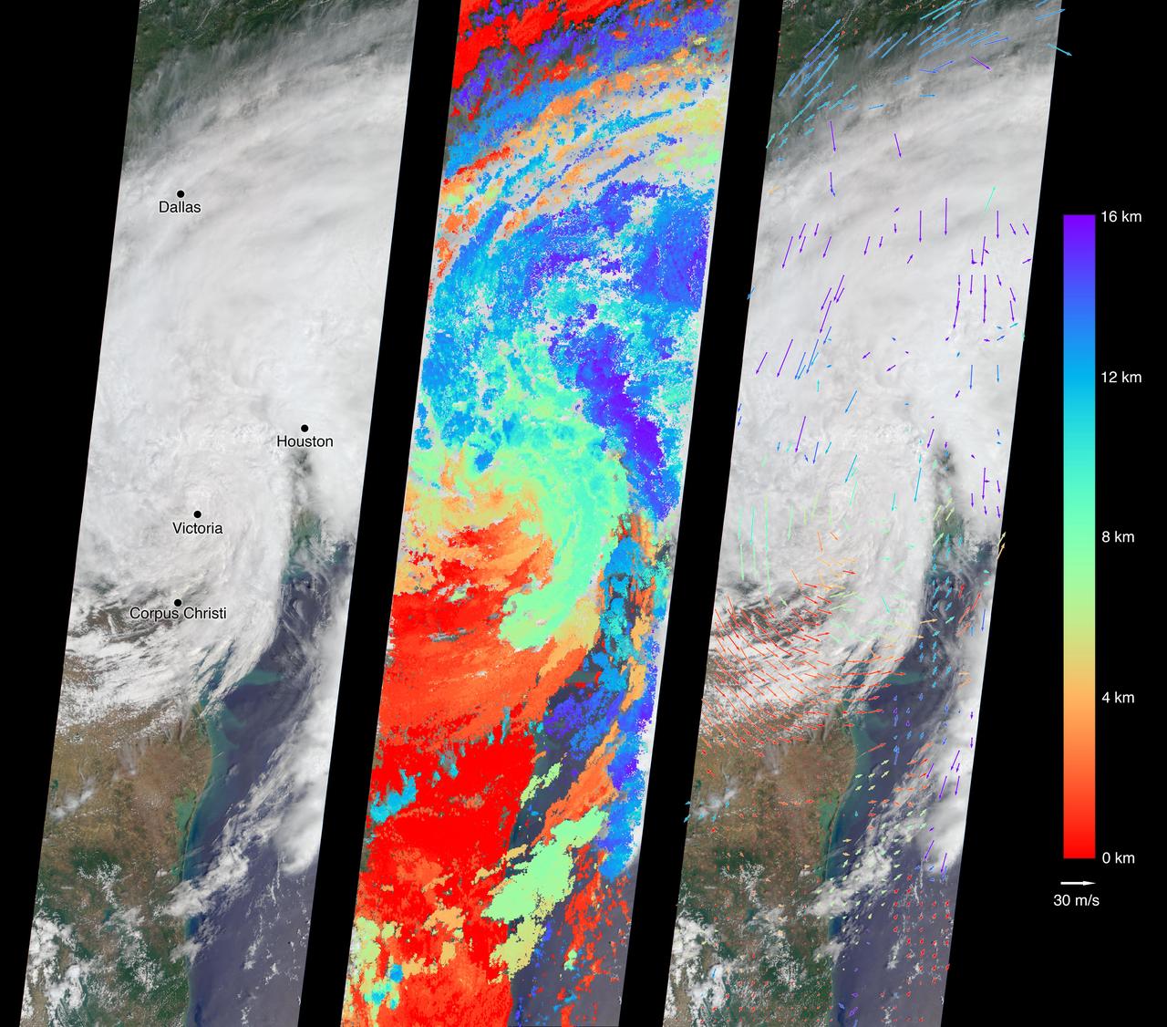
On Aug. 27, 2017, the Multi-angle Imaging SpectroRadiometer (MISR) instrument on NASA's Terra satellite passed over then-Tropical Storm Harvey about noon local time, the day after the storm first made landfall in Texas as a Category 4 hurricane. The MISR instrument is equipped with nine cameras that observe Earth at different angles over a time period of seven minutes. Geometric information from the multiple camera views is used to compute the cloud top heights, and motion of the clouds during the image sequence is used to calculate wind speed. This composite image shows the storm as viewed by the central, downward-looking camera (left), as well as the cloud top heights in kilometers (center) and the wind speeds (right) superimposed on the image. The length of the arrows is proportional to the wind speed, while their color shows the altitude at which the winds were calculated. Also included is an animation made by combining all nine images from the MISR cameras, showing the motion of the storm during the seven-minute period. At this time, the center of the tropical storm was located just northwest of the city of Victoria and maximum wind speeds on the ground were around 40 miles per hour (65 kilometers per hour) according to the National Oceanic and Atmospheric Administration (NOAA), which matches well with the near-surface winds calculated by MISR to the west of Corpus Christi. In the 36 hours or so since it had made landfall, Harvey had weakened considerably -- these images show that the eye had disappeared and much of the circular motion of storm had dissipated, as shown by the calculated wind directions. However, the area of very high clouds and strong winds near Houston shows that the storm was continuing to produce powerful rain bands. At this point, hydrographs managed by NOAA in downtown Houston were already recording flood stage at both the Buffalo Bayou (28 feet or 8.5 meters as of 12:15 p.m. CDT August 27) and the White Oak Bayou (40 feet or 12 meters at last record that morning). The MISR data show the storm clouds reaching an altitude of about 10 miles (16 kilometers). These data were captured during Terra orbit 94108. An animation is available at https://photojournal.jpl.nasa.gov/catalog/PIA21927
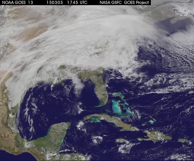
A winter storm was bringing snow, sleet and freezing rain from lower Mississippi Valley to Northeastern U.S. on Thursday, March 5, 2015. A new NASA animation of NOAA's GOES-East satellite imagery showed the progression of the clouds associated with the storm system that triggered winter storm warnings and winter weather advisories from the southern Plains eastward through the Mid-Atlantic and southern New England coast. The system also triggered flood warnings along and to the west of the central Appalachians. An animation of GOES satellite visible and infrared imagery from March 3 through March 5 showed clouds associated with a cold front push over U.S. East coast. Behind the front, Arctic air is expected to drop low temperatures into the single numbers from Washington, D.C. to Minnesota overnight. Temperatures in the Carolinas and Tennessee are expected to drop to the low 20s. NOAA's National Weather Service Weather Prediction Center (NWS NPC) in College Park, Maryland noted "a strong cold front moving across the eastern U.S. will bring heavy snow from parts of the Ohio Valley to the Northeast today (March 5) with rain, freezing rain and sleet possible from parts of the lower Mississippi Valley across the Southeast to the southern Mid-Atlantic. Snowfall totals of 5 to 10 inches are possible for some areas. Winter Storm Warnings remain in effect from Texas to Nantucket." The animation ends at 17:45 UTC (12:45 p.m. EST). Before the end of the animation, the low pressure center along an arctic frontal boundary was nearly stationary over western North Carolina at 9 a.m. EST on March 5, according to the NWS NPC. NWS radar and surface observations indicated an extended swath of precipitation from near the Texas Gulf Coast through the interior eastern U.S. into southern New England. NPC's storm summary noted at that time "rain was changing to sleet/freezing rain and to all snow along a band within this swath as colder air continues to filter in from the north. Some areas in Tennessee, the northern mid-Atlantic and southern New England were reporting moderate to heavy snow." To create the video and imagery, NASA/NOAA's GOES Project takes the cloud data from NOAA's GOES-East satellite and overlays it on a true-color image of land and ocean created by data from the Moderate Resolution Imaging Spectroradiometer, or MODIS, instrument that flies aboard NASA's Aqua and Terra satellites. Together, those data created the entire picture of the storm and show its movement. After the storm system passes, the snow on the ground becomes visible. GOES satellites provide the kind of continuous monitoring necessary for intensive data analysis. Geostationary describes an orbit in which a satellite is always in the same position with respect to the rotating Earth. This allows GOES to hover continuously over one position on Earth's surface, appearing stationary. For updated information about the storm system, visit NOAA's NWS website: <a href="http://www.weather.gov" rel="nofollow">www.weather.gov</a> For more information about GOES satellites, visit: <a href="http://www.goes.noaa.gov/" rel="nofollow">www.goes.noaa.gov/</a> or goes.gsfc.nasa.gov/ Rob Gutro NASA's Goddard Space Flight Center <b><a href="http://www.nasa.gov/audience/formedia/features/MP_Photo_Guidelines.html" rel="nofollow">NASA image use policy.</a></b> <b><a href="http://www.nasa.gov/centers/goddard/home/index.html" rel="nofollow">NASA Goddard Space Flight Center</a></b> enables NASA’s mission through four scientific endeavors: Earth Science, Heliophysics, Solar System Exploration, and Astrophysics. Goddard plays a leading role in NASA’s accomplishments by contributing compelling scientific knowledge to advance the Agency’s mission. <b>Follow us on <a href="http://twitter.com/NASAGoddardPix" rel="nofollow">Twitter</a></b> <b>Like us on <a href="http://www.facebook.com/pages/Greenbelt-MD/NASA-Goddard/395013845897?ref=tsd" rel="nofollow">Facebook</a></b> <b>Find us on <a href="http://instagrid.me/nasagoddard/?vm=grid" rel="nofollow">Instagram</a></b>
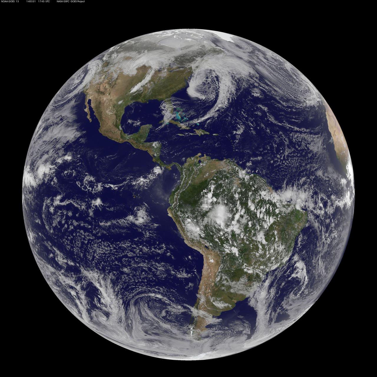
There are three low pressure systems around the U.S. and they resemble dragons on satellite imagery. NOAA's GOES-13 and GOES-15 satellite image from March 31 shows the low pressure systems in the eastern Pacific Ocean, over the nation's Heartland, and in the eastern Atlantic Ocean. All three lows have the signature comma shape that make them appear to be curled up dragons. According to the National Weather Service, the low pressure area approaching the northwestern U.S. is expected to bring rainfall to the coast and areas of snow that stretch from western Washington state south toward the four corners region. The low in the middle of the country is located over Nebraska and dropping snow to the north and west of it. That same low is bringing rain from southern Minnesota south to eastern Texas. Meanwhile, the third low pressure system is bringing rain and snow to parts of New England. NOAA's GOES-East satellite sits in a fixed orbit in space capturing visible and infrared imagery of all weather over the eastern U.S. and Atlantic Ocean. The data to create this image was taken on March 31 at 17:45 UTC/1:45 p.m. EDT by NOAA's GOES-East or GOES-13 satellite and made into an image by NASA/NOAA's GOES Project at NASA's Goddard Space Flight Center in Greenbelt, Md. To create the image NASA/NOAA's GOES Project takes the cloud data from NOAA's GOES-East satellite and overlays it on a true-color image of land and ocean created by data from the Moderate Resolution Imaging Spectroradiometer, or MODIS, instrument that flies aboard NASA's Aqua and Terra satellites. Together, those data created the entire picture of the storm and show its movement. After the storm system passes, the snow on the ground becomes visible. GOES satellites provide the kind of continuous monitoring necessary for intensive data analysis. Geostationary describes an orbit in which a satellite is always in the same position with respect to the rotating Earth. This allows GOES to hover continuously over one position on Earth's surface, appearing stationary. As a result, GOES provide a constant vigil for the atmospheric "triggers" for severe weather conditions such as tornadoes, flash floods, hail storms and hurricanes. For updated information about the storm system, visit NOAA's NWS website: <a href="http://www.weather.gov" rel="nofollow">www.weather.gov</a> For more information about GOES satellites, visit: <a href="http://www.goes.noaa.gov/" rel="nofollow">www.goes.noaa.gov/</a> or goes.gsfc.nasa.gov/ Rob Gutro NASA's Goddard Space Flight Center, Greenbelt, Md. <b><a href="http://www.nasa.gov/audience/formedia/features/MP_Photo_Guidelines.html" rel="nofollow">NASA image use policy.</a></b> <b><a href="http://www.nasa.gov/centers/goddard/home/index.html" rel="nofollow">NASA Goddard Space Flight Center</a></b> enables NASA’s mission through four scientific endeavors: Earth Science, Heliophysics, Solar System Exploration, and Astrophysics. Goddard plays a leading role in NASA’s accomplishments by contributing compelling scientific knowledge to advance the Agency’s mission. <b>Follow us on <a href="http://twitter.com/NASAGoddardPix" rel="nofollow">Twitter</a></b> <b>Like us on <a href="http://www.facebook.com/pages/Greenbelt-MD/NASA-Goddard/395013845897?ref=tsd" rel="nofollow">Facebook</a></b> <b>Find us on <a href="http://instagram.com/nasagoddard?vm=grid" rel="nofollow">Instagram</a></b>

A major winter storm is poised to wallop the Mid-Atlantic and bring large amounts of snow to cities including Baltimore, Md., Washington, D.C. area on March 2 and 3, according to NOAA's National Weather Service. NOAA's GOES-East satellite captured this image of the clouds associated with the winter storm as it continued moving east toward those cities. On March 2, the National Weather Prediction Center in College Park, Md. noted that there is a slight risk for severe thunderstorms over parts of the western Gulf Coast and the Lower Mississippi Valley as a result of the southern portion of the system. The update at 7 a.m. EST noted that freezing rain/sleet is possible over parts of the lower Mississippi Valley and parts of the central Appalachians, while eastern Texas and the lower Mississippi Valley into the Ohio Valley are expected to experience heavy rain. The NWS Short Range Forecast Discussion stated "A strong storm over the Southern Plains/Lower Mississippi Valley will advance northeastward along a quasi-stationary front to off the Southern Mid-Atlantic Coast by Monday evening. Moisture from the Gulf of Mexico will overrun and pool along the associated front producing an area of snow extending from the Central Plains into the Northeast." The clouds are associated with a cold from that stretches from eastern Maine through Maryland and west into the Tennessee Valley. The low pressure center associated with the front was located over Arkansas. At NASA/NOAA's GOES Project at NASA's Goddard Space Flight Center in Greenbelt, Md. the cloud data from NOAA's GOES-East satellite were overlaid on a true-color image of land and ocean created by data from the Moderate Resolution Imaging Spectroradiometer or MODIS instrument that flies aboard NASA's Aqua and Terra satellites. Together, those data created the entire picture of the position of this major winter storm. GOES satellites provide the kind of continuous monitoring necessary for intensive data analysis. Geostationary describes an orbit in which a satellite is always in the same position with respect to the rotating Earth. This allows GOES to hover continuously over one position on Earth's surface, appearing stationary. As a result, GOES provide a constant vigil for the atmospheric "triggers" for severe weather conditions such as tornadoes, flash floods, hail storms and hurricanes. For updated information about the storm system, visit NOAA's NWS website: <a href="http://www.weather.gov" rel="nofollow">www.weather.gov</a> For more information about GOES satellites, visit: <a href="http://www.goes.noaa.gov/" rel="nofollow">www.goes.noaa.gov/</a> or <a href="http://goes.gsfc.nasa.gov/" rel="nofollow">goes.gsfc.nasa.gov/</a> Rob Gutro NASA Goddard Space Flight Center, Greenbelt, Md. <b><a href="http://www.nasa.gov/audience/formedia/features/MP_Photo_Guidelines.html" rel="nofollow">NASA image use policy.</a></b> <b><a href="http://www.nasa.gov/centers/goddard/home/index.html" rel="nofollow">NASA Goddard Space Flight Center</a></b> enables NASA’s mission through four scientific endeavors: Earth Science, Heliophysics, Solar System Exploration, and Astrophysics. Goddard plays a leading role in NASA’s accomplishments by contributing compelling scientific knowledge to advance the Agency’s mission. <b>Follow us on <a href="http://twitter.com/NASAGoddardPix" rel="nofollow">Twitter</a></b> <b>Like us on <a href="http://www.facebook.com/pages/Greenbelt-MD/NASA-Goddard/395013845897?ref=tsd" rel="nofollow">Facebook</a></b> <b>Find us on <a href="http://instagram.com/nasagoddard?vm=grid" rel="nofollow">Instagram</a></b>