
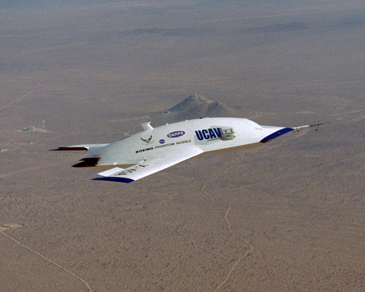
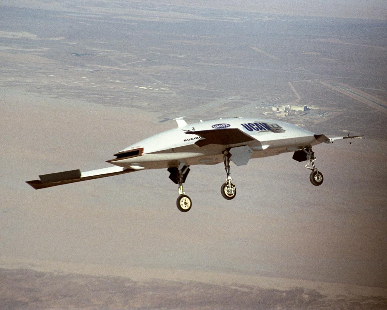
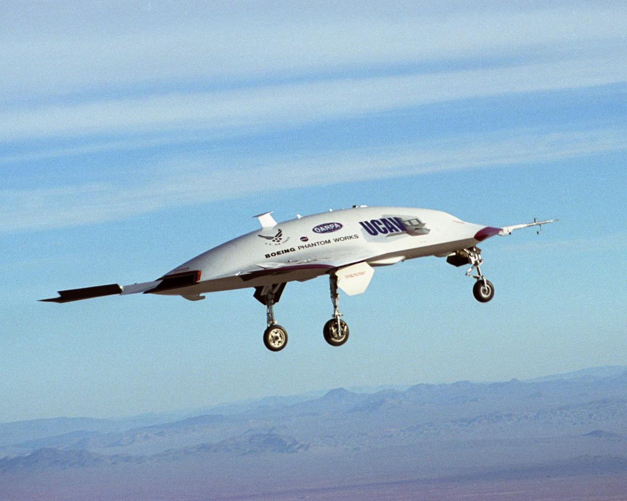
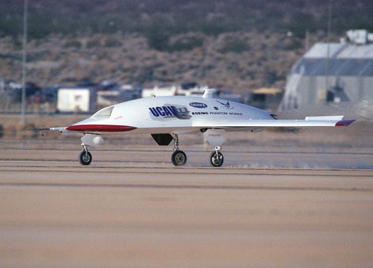
The first X-45A Unmanned Combat Air Vehicle (UCAV) technology demonstrator completed its sixth flight on Dec. 19, 2002, raising its landing gear in flight for the first time. The X-45A flew for 40 minutes and reached an airspeed of 195 knots and an altitude of 7,500 feet. Dryden is supporting the DARPA/Boeing team in the design, development, integration, and demonstration of the critical technologies, processes, and system attributes leading to an operational UCAV system. Dryden support of the X-45A demonstrator system includes analysis, component development, simulations, ground and flight tests.
The first X-45A Unmanned Combat Air Vehicle (UCAV) technology demonstrator completed its sixth flight on Dec. 19, 2002, raising its landing gear in flight for the first time. The X-45A flew for 40 minutes and reached an airspeed of 195 knots and an altitude of 7,500 feet. Dryden is supporting the DARPA/Boeing team in the design, development, integration, and demonstration of the critical technologies, processes, and system attributes leading to an operational UCAV system. Dryden support of the X-45A demonstrator system includes analysis, component development, simulations, ground and flight tests.
The first X-45A Unmanned Combat Air Vehicle (UCAV) technology demonstrator completed its sixth flight on Dec. 19, 2002, raising its landing gear in flight for the first time. The X-45A flew for 40 minutes and reached an airspeed of 195 knots and an altitude of 7,500 feet. Dryden is supporting the DARPA/Boeing team in the design, development, integration, and demonstration of the critical technologies, processes, and system attributes leading to an operational UCAV system. Dryden support of the X-45A demonstrator system includes analysis, component development, simulations, ground and flight tests.
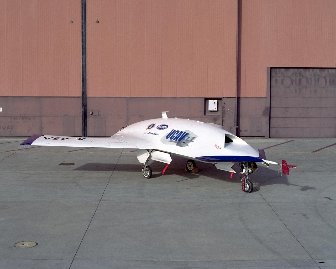
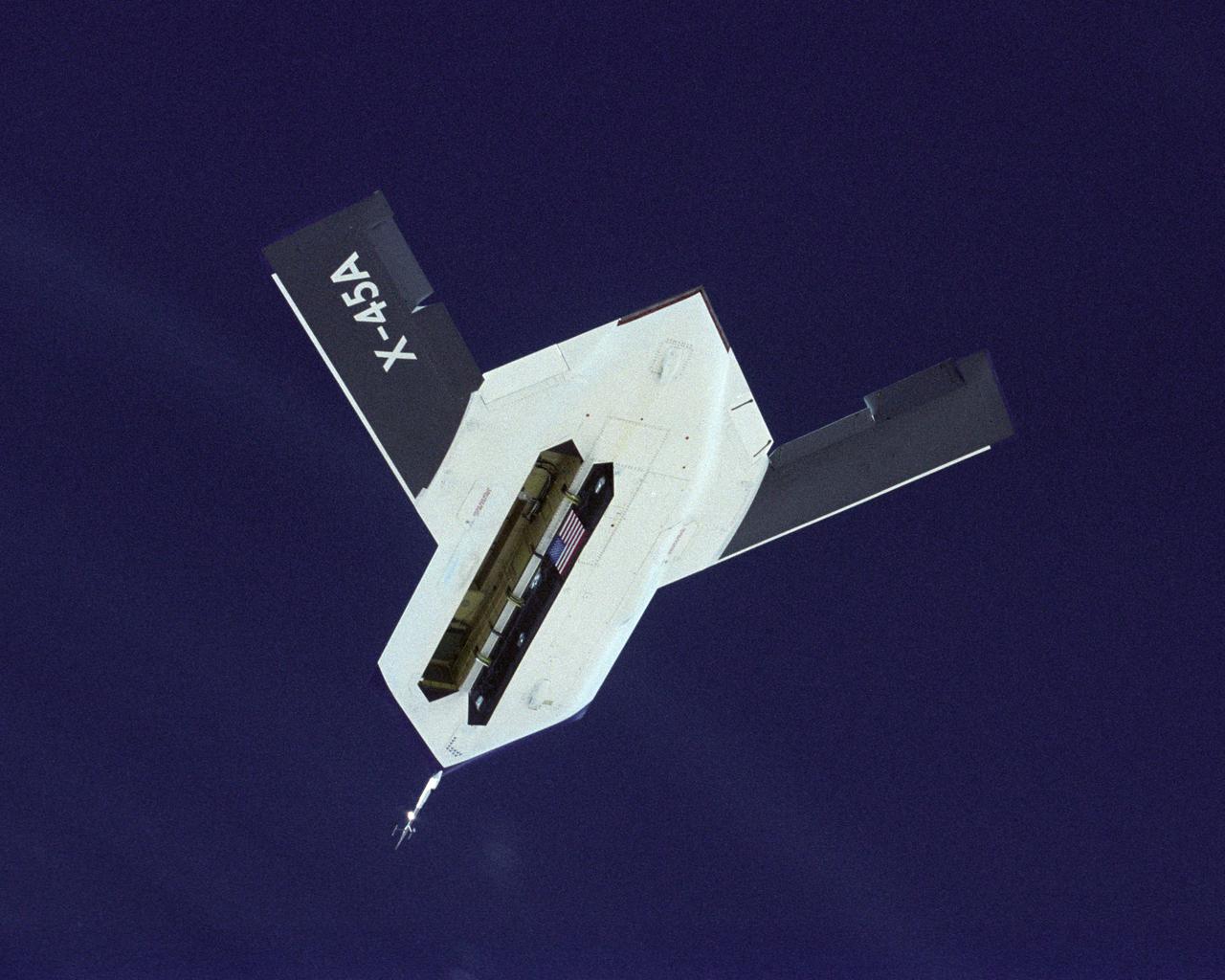
DARPA, U.S. Air Force, Boeing X-45A UCAV (Unmanned Combat Air Vehicle) at NASA Dryden Flight Research Center.
The first X-45A Unmanned Combat Air Vehicle (UCAV) technology demonstrator completed its sixth flight on Dec. 19, 2002, raising its landing gear in flight for the first time. The X-45A flew for 40 minutes and reached an airspeed of 195 knots and an altitude of 7,500 feet. Dryden is supporting the DARPA/Boeing team in the design, development, integration, and demonstration of the critical technologies, processes, and system attributes leading to an operational UCAV system. Dryden support of the X-45A demonstrator system includes analysis, component development, simulations, ground and flight tests.
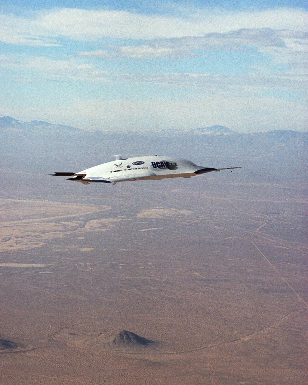
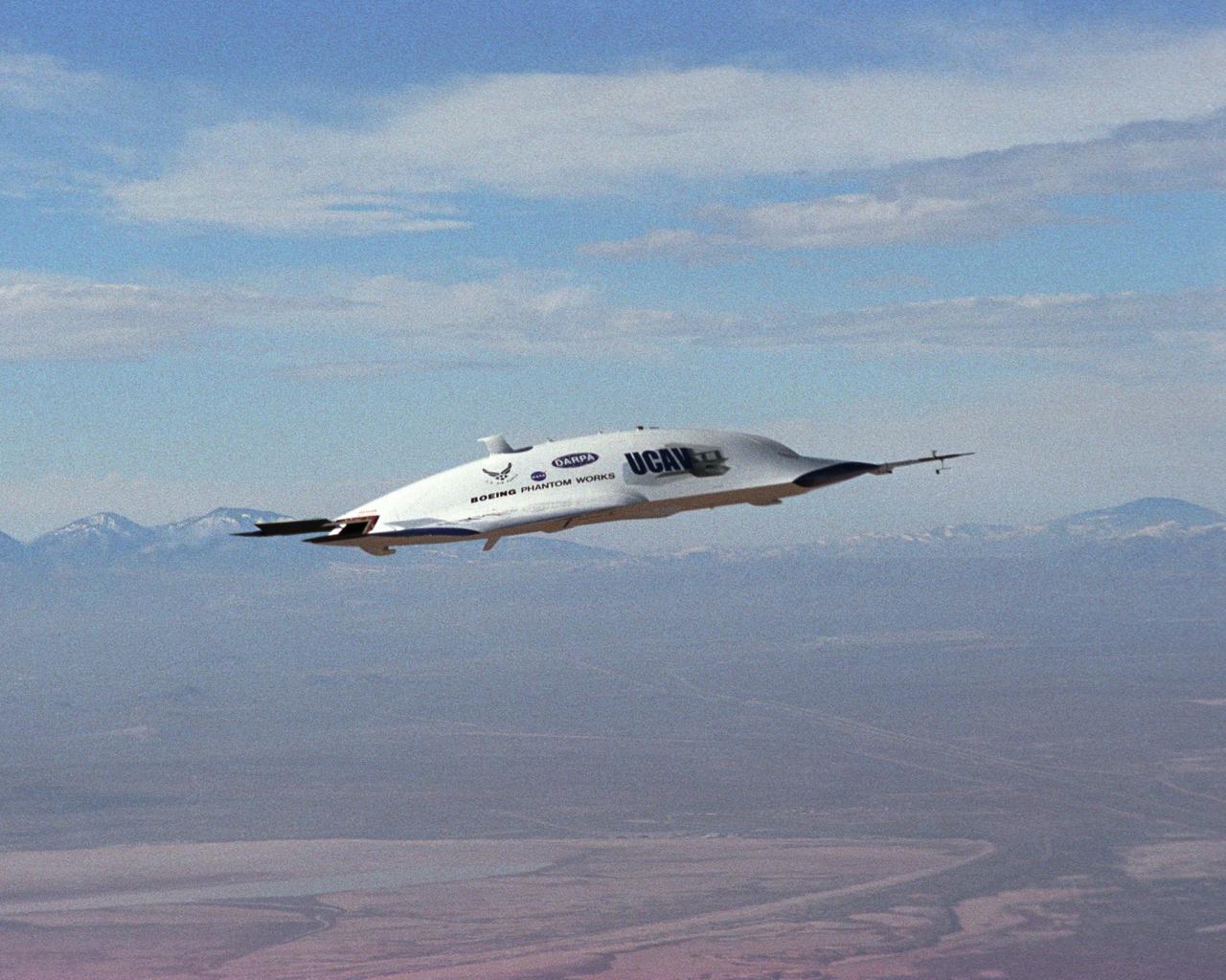
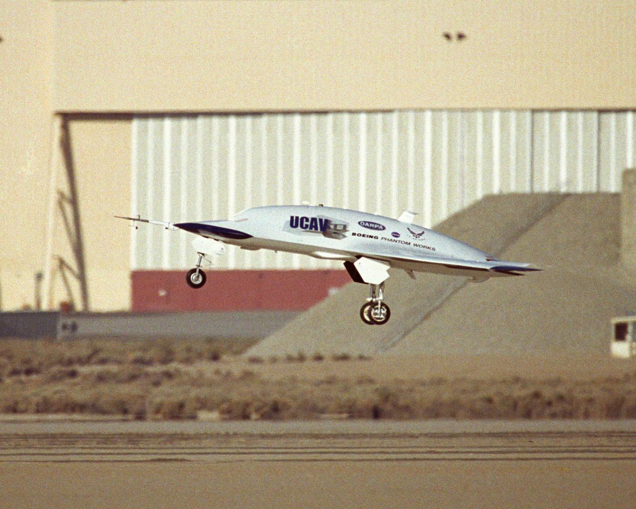
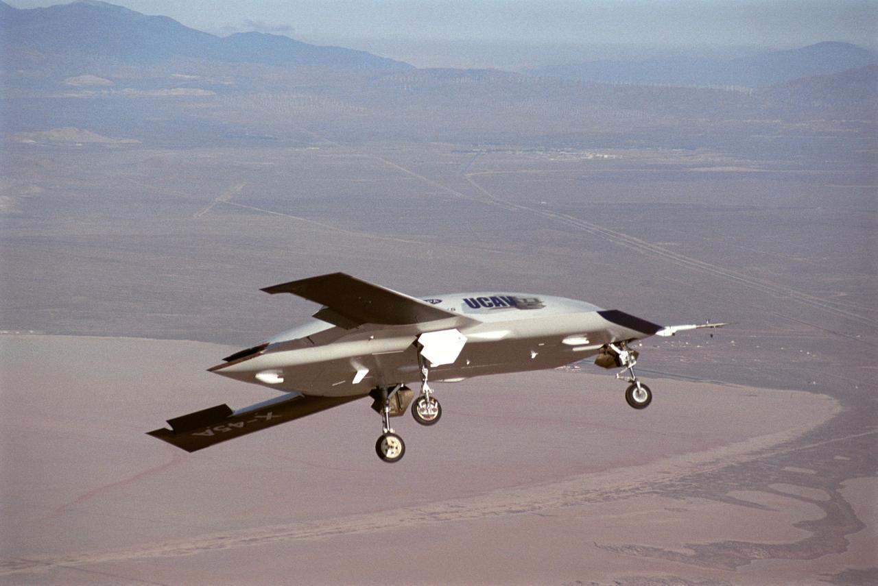
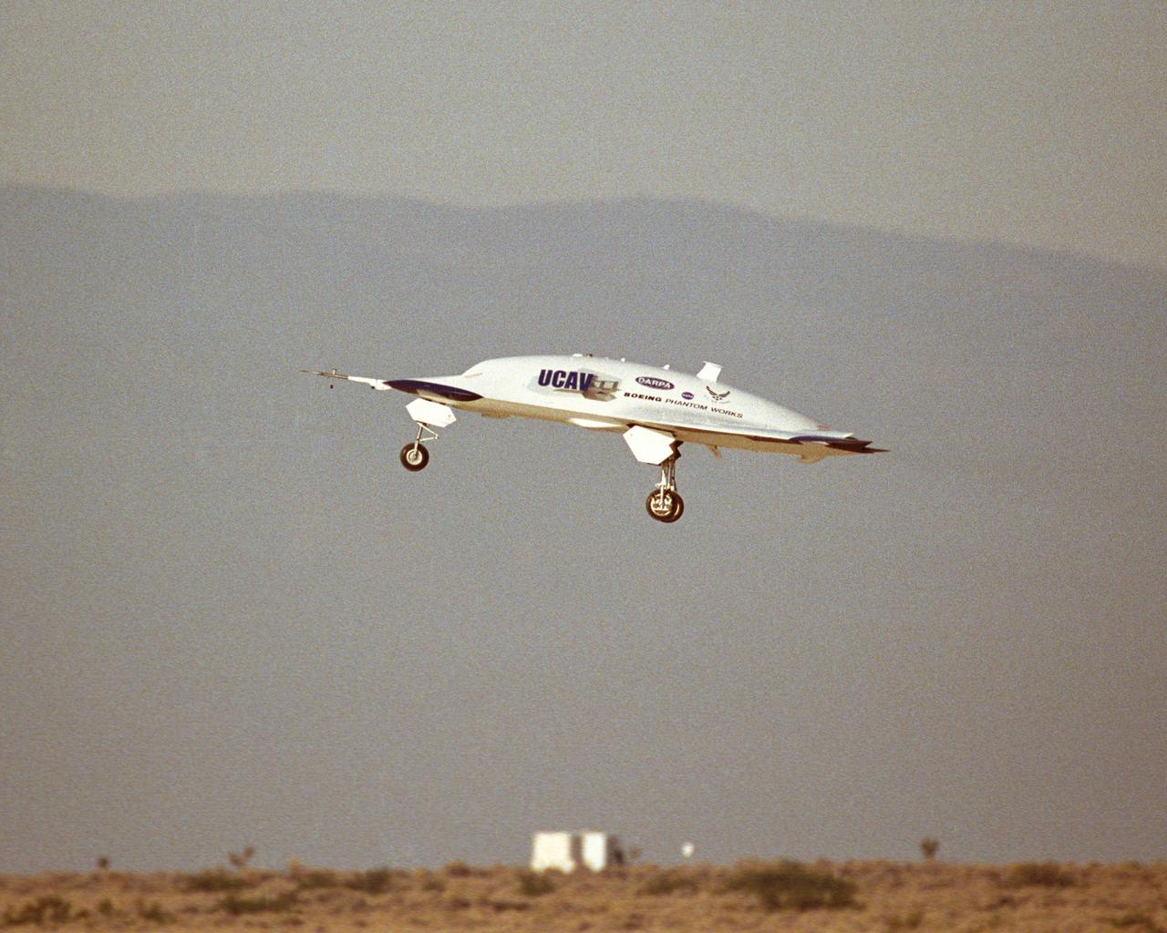
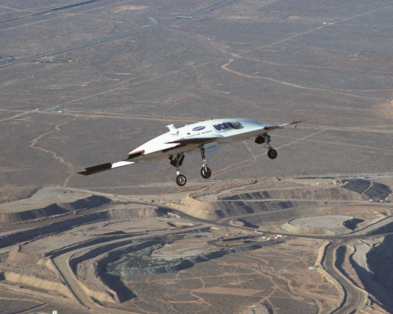
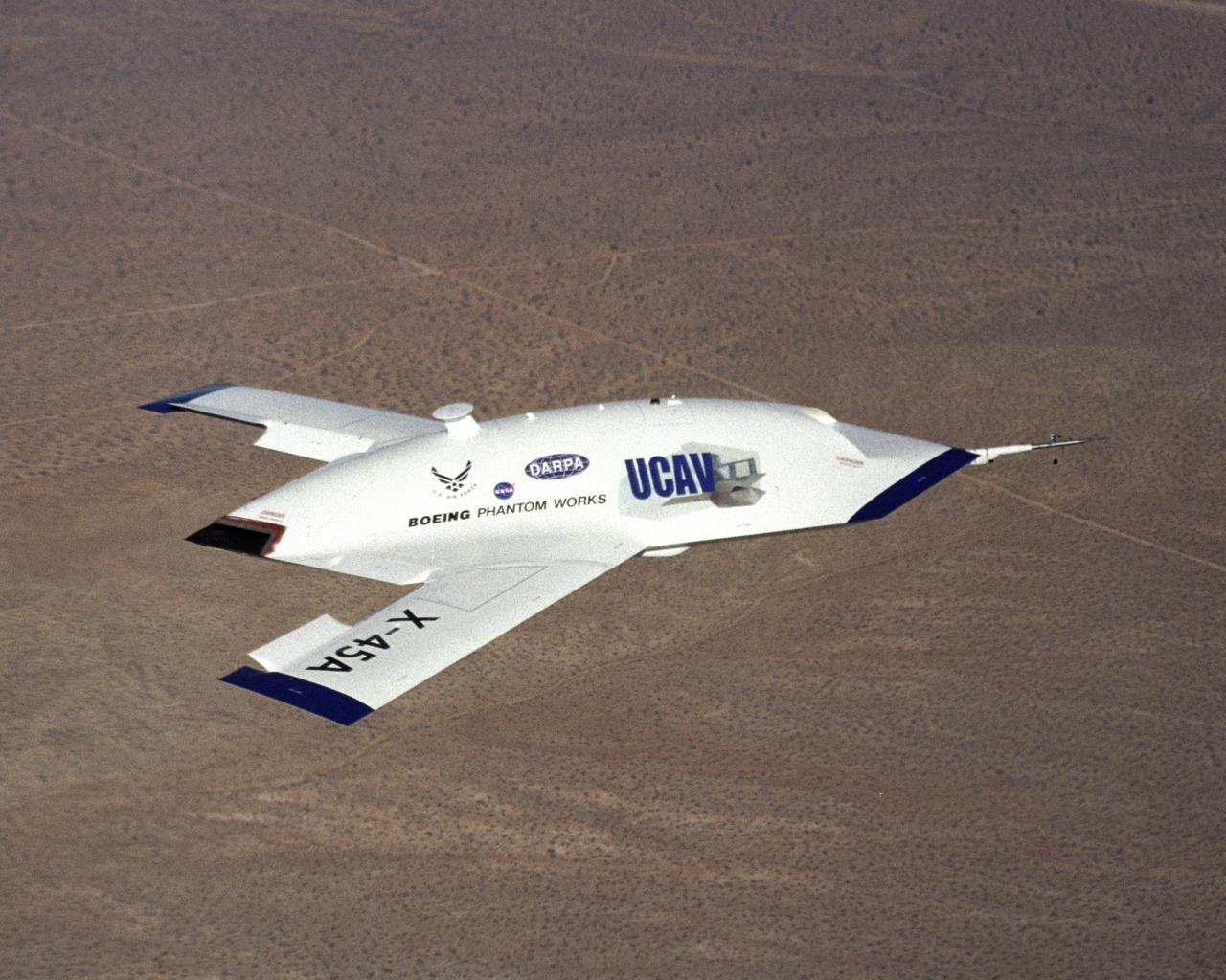
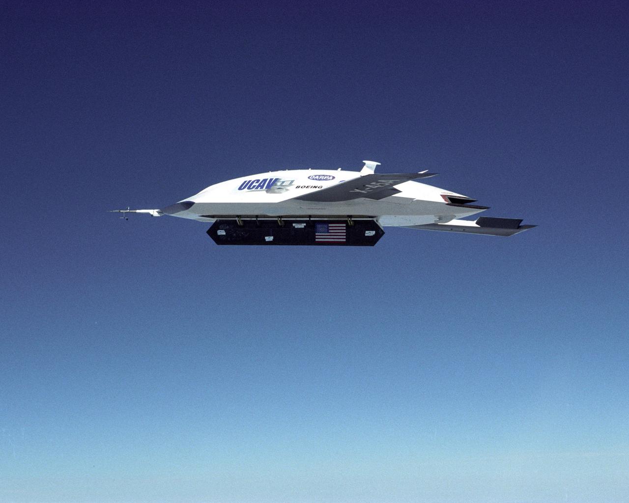
X-45A Unmanned Combat Air Vehicle, or UCAV, technology demonstration aircraft in flight during its first flight at Edwards Air Force Base, California.
X-45A Unmanned Combat Air Vehicle, or UCAV, technology demonstration aircraft in flight during its first flight at Edwards Air Force Base, California.
X-45A Unmanned Combat Air Vehicle, or UCAV, technology demonstration aircraft in flight during its first flight at Edwards Air Force Base, California.
X-45A Unmanned Combat Air Vehicle, or UCAV, technology demonstration aircraft in flight during its first flight at Edwards Air Force Base, California.
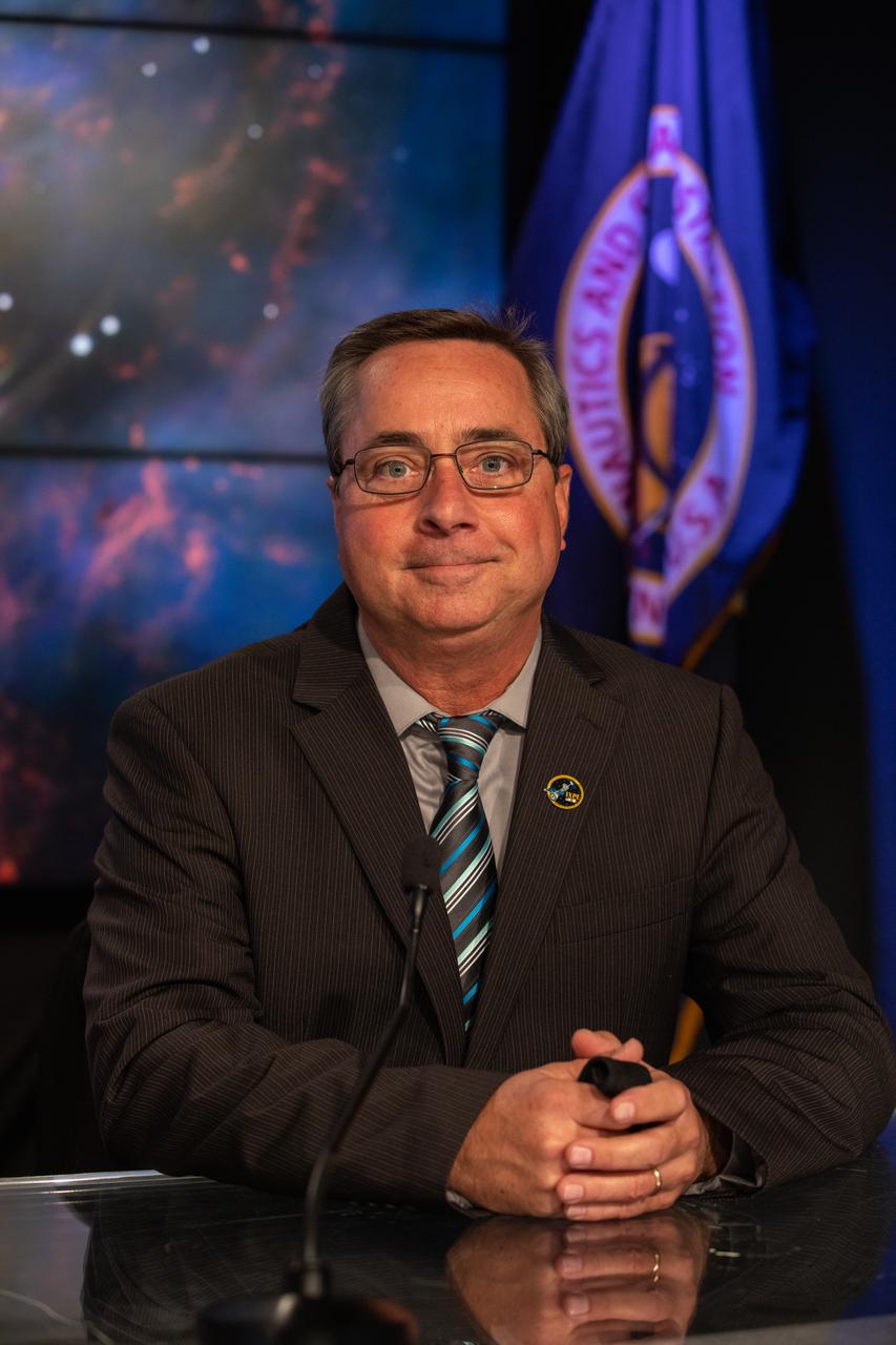
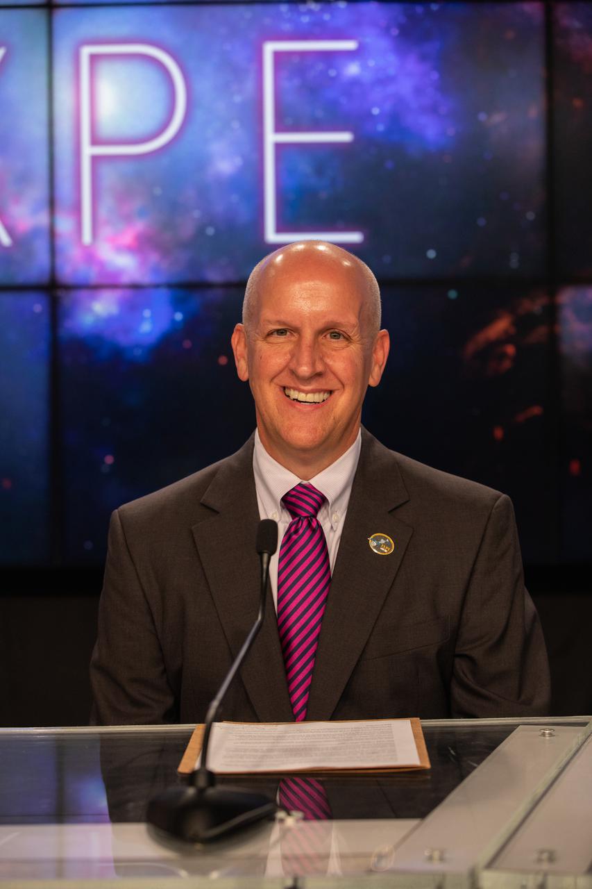
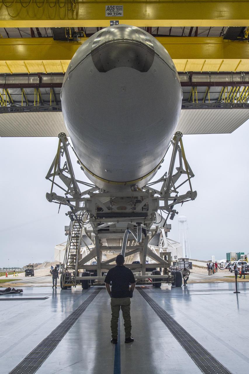
Mike McAleenan, 45th Weather Squadron, Space Launch Delta 45, participates in a prelaunch news conference for NASA’s Imaging X-ray Polarimetry Explorer (IXPE) spacecraft on Dec. 7, 2021 at NASA’s Kennedy Space Center in Florida. IXPE is scheduled to launch no earlier than 1 a.m. EST Thursday, Dec. 9, on a SpaceX Falcon 9 rocket from Kennedy’s Launch Complex 39A. NASA’s Launch Services Program is managing this launch. NASA’s Marshall Space Flight Center in Huntsville, Alabama, manages the IXPE mission. Ball Aerospace, headquartered in Broomfield, Colorado, manages spacecraft operations with support from the University of Colorado at Boulder. NASA’s Goddard Space Flight Center in Greenbelt, Maryland, manages the Explorers Program for the agency’s Science Mission Directorate in Washington. The U.S. Space Force’s Space Launch Delta 45 provides range support for this launch. SpaceX is providing the launch vehicle for this mission.
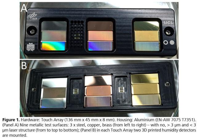
jsc2021e037879 (8/24/2021) --- A preflight view of the Touching Surfaces investigation hardware. The Touch Array (136 mm x 45 mm x 8 mm). Housing : Aluminum (EN-AW 7075 T7351). (Panel A) Nine metallic test surfaces: 3 x steel, copper, brass (from left to right) – with no greater than 3 ?m and less than 3 ?m laser structure (from top to bottom); (Panel B) in each Touch Array two 3 printed humidity detectors are mounted. Image Courtesy DLR

A prelaunch news conference for NASA’s Imaging X-ray Polarimetry Explorer (IXPE) spacecraft is held on Dec. 7, 2021 at NASA’s Kennedy Space Center in Florida. Participants from left are Greg Harland, moderator, NASA communications; Martin Weisskopf, IXPE principal investigator, NASA’s Marshall Space Flight Center; Makenzie Lystrup, vice president and general manager, civil space, Ball Aerospace; Tim Dunn, launch director, NASA’s Launch Services Program; Julianna Scheiman, director, civil satellite missions, SpaceX; Julianna Scheiman, director, civil satellite missions, SpaceX; and Mike McAleenan, 45th Weather Squadron, Space Launch Delta 45. IXPE is scheduled to launch no earlier than 1 a.m. EST Thursday, Dec. 9, on a SpaceX Falcon 9 rocket from Kennedy’s Launch Complex 39A. NASA’s Launch Services Program is managing this launch. NASA’s Marshall Space Flight Center in Huntsville, Alabama, manages the IXPE mission. Ball Aerospace, headquartered in Broomfield, Colorado, manages spacecraft operations with support from the University of Colorado at Boulder. NASA’s Goddard Space Flight Center in Greenbelt, Maryland, manages the Explorers Program for the agency’s Science Mission Directorate in Washington. The U.S. Space Force’s Space Launch Delta 45 provides range support for this launch. SpaceX is providing the launch vehicle for this mission.

Greg Harland, NASA Communications, moderates a prelaunch news conference for NASA’s Imaging X-ray Polarimetry Explorer (IXPE) spacecraft on Dec. 7, 2021 at NASA’s Kennedy Space Center in Florida. IXPE is scheduled to launch no earlier than 1 a.m. EST Thursday, Dec. 9, on a SpaceX Falcon 9 rocket from Kennedy’s Launch Complex 39A. NASA’s Launch Services Program is managing this launch. NASA’s Marshall Space Flight Center in Huntsville, Alabama, manages the IXPE mission. Ball Aerospace, headquartered in Broomfield, Colorado, manages spacecraft operations with support from the University of Colorado at Boulder. NASA’s Goddard Space Flight Center in Greenbelt, Maryland, manages the Explorers Program for the agency’s Science Mission Directorate in Washington. The U.S. Space Force’s Space Launch Delta 45 provides range support for this launch. SpaceX is providing the launch vehicle for this mission.

Elisabetta Cavazzuti, ASI IXPE program manager, Italian Space Agency, participates in a payload briefing for NASA’s Imaging X-ray Polarimetry Explorer (IXPE) spacecraft on Dec.7, 2021 at NASA’s Kennedy Space Center in Florida. IXPE is scheduled to launch no earlier than 1 a.m. EST Thursday, Dec. 9, on a SpaceX Falcon 9 rocket from Kennedy’s Launch Complex 39A. NASA’s Launch Services Program is managing this launch. NASA’s Marshall Space Flight Center in Huntsville, Alabama, manages the IXPE mission. Ball Aerospace, headquartered in Broomfield, Colorado, manages spacecraft operations with support from the University of Colorado at Boulder. NASA’s Goddard Space Flight Center in Greenbelt, Maryland, manages the Explorers Program for the agency’s Science Mission Directorate in Washington. The U.S. Space Force’s Space Launch Delta 45 provides range support for this launch. SpaceX is providing the launch vehicle for this mission.

Karen Fox, NASA Communications, moderates a payload briefing for NASA’s Imaging X-ray Polarimetry Explorer (IXPE) spacecraft on Dec.7, 2021 at NASA’s Kennedy Space Center in Florida. IXPE is scheduled to launch no earlier than 1 a.m. EST Thursday, Dec. 9, on a SpaceX Falcon 9 rocket from Kennedy’s Launch Complex 39A. NASA’s Launch Services Program is managing this launch. NASA’s Marshall Space Flight Center in Huntsville, Alabama, manages the IXPE mission. Ball Aerospace, headquartered in Broomfield, Colorado, manages spacecraft operations with support from the University of Colorado at Boulder. NASA’s Goddard Space Flight Center in Greenbelt, Maryland, manages the Explorers Program for the agency’s Science Mission Directorate in Washington. The U.S. Space Force’s Space Launch Delta 45 provides range support for this launch. SpaceX is providing the launch vehicle for this mission.

Makenzie Lystrup, vice president and general manager, civil space, Ball Aerospace, participates in a prelaunch news conference for NASA’s Imaging X-ray Polarimetry Explorer (IXPE) spacecraft on Dec. 7, 2021 at NASA’s Kennedy Space Center in Florida. IXPE is scheduled to launch no earlier than 1 a.m. EST Thursday, Dec. 9, on a SpaceX Falcon 9 rocket from Kennedy’s Launch Complex 39A. NASA’s Launch Services Program is managing this launch. NASA’s Marshall Space Flight Center in Huntsville, Alabama, manages the IXPE mission. Ball Aerospace, headquartered in Broomfield, Colorado, manages spacecraft operations with support from the University of Colorado at Boulder. NASA’s Goddard Space Flight Center in Greenbelt, Maryland, manages the Explorers Program for the agency’s Science Mission Directorate in Washington. The U.S. Space Force’s Space Launch Delta 45 provides range support for this launch. SpaceX is providing the launch vehicle for this mission.

Martin Weisskopf, IXPE principal investigator, NASA’s Marshall Space Flight Center, participates in a prelaunch news conference for NASA’s Imaging X-ray Polarimetry Explorer (IXPE) spacecraft on Dec. 7, 2021 at NASA’s Kennedy Space Center in Florida. IXPE is scheduled to launch no earlier than 1 a.m. EST Thursday, Dec. 9, on a SpaceX Falcon 9 rocket from Kennedy’s Launch Complex 39A. NASA’s Launch Services Program is managing this launch. NASA’s Marshall Space Flight Center in Huntsville, Alabama, manages the IXPE mission. Ball Aerospace, headquartered in Broomfield, Colorado, manages spacecraft operations with support from the University of Colorado at Boulder. NASA’s Goddard Space Flight Center in Greenbelt, Maryland, manages the Explorers Program for the agency’s Science Mission Directorate in Washington. The U.S. Space Force’s Space Launch Delta 45 provides range support for this launch. SpaceX is providing the launch vehicle for this mission.
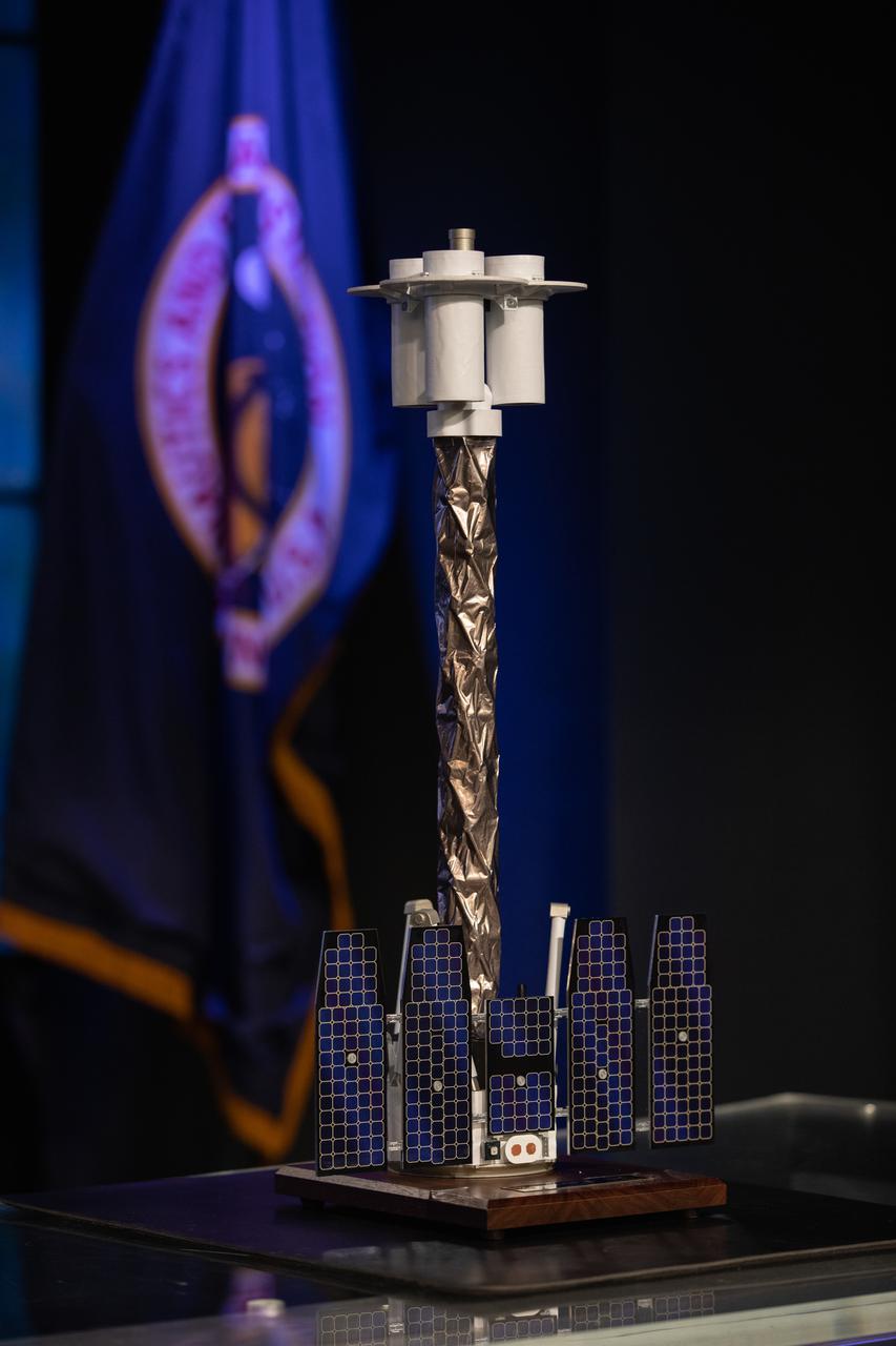
A scale model of NASA’s Imaging X-ray Polarimetry Explorer (IXPE) spacecraft is on display during a payload briefing for IXPE on Dec.7, 2021 at NASA’s Kennedy Space Center in Florida. IXPE is scheduled to launch no earlier than 1 a.m. EST Thursday, Dec. 9, on a SpaceX Falcon 9 rocket from Kennedy’s Launch Complex 39A. NASA’s Launch Services Program is managing this launch. NASA’s Marshall Space Flight Center in Huntsville, Alabama, manages the IXPE mission. Ball Aerospace, headquartered in Broomfield, Colorado, manages spacecraft operations with support from the University of Colorado at Boulder. NASA’s Goddard Space Flight Center in Greenbelt, Maryland, manages the Explorers Program for the agency’s Science Mission Directorate in Washington. The U.S. Space Force’s Space Launch Delta 45 provides range support for this launch. SpaceX is providing the launch vehicle for this mission.
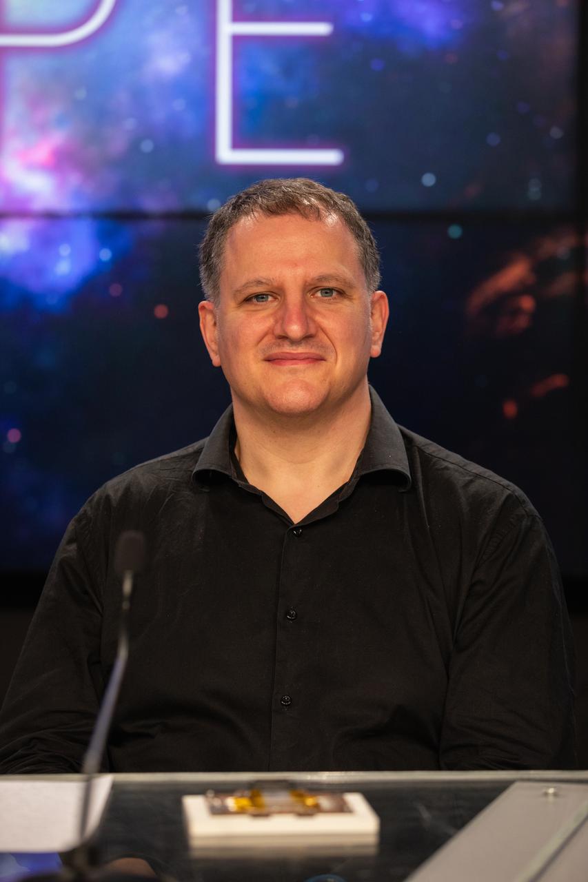
Luca Baldini, Italian co-principal investigator, National Institute for Nuclear Physics, participates in a payload briefing for NASA’s Imaging X-ray Polarimetry Explorer (IXPE) spacecraft on Dec.7, 2021 at NASA’s Kennedy Space Center in Florida. IXPE is scheduled to launch no earlier than 1 a.m. EST Thursday, Dec. 9, on a SpaceX Falcon 9 rocket from Kennedy’s Launch Complex 39A. NASA’s Launch Services Program is managing this launch. NASA’s Marshall Space Flight Center in Huntsville, Alabama, manages the IXPE mission. Ball Aerospace, headquartered in Broomfield, Colorado, manages spacecraft operations with support from the University of Colorado at Boulder. NASA’s Goddard Space Flight Center in Greenbelt, Maryland, manages the Explorers Program for the agency’s Science Mission Directorate in Washington. The U.S. Space Force’s Space Launch Delta 45 provides range support for this launch. SpaceX is providing the launch vehicle for this mission.

Sandra Connelly, deputy associate administrator for science, NASA Headquarters, participates in a prelaunch news conference for NASA’s Imaging X-ray Polarimetry Explorer (IXPE) spacecraft on Dec. 7, 2021 at NASA’s Kennedy Space Center in Florida. IXPE is scheduled to launch no earlier than 1 a.m. EST Thursday, Dec. 9, on a SpaceX Falcon 9 rocket from Kennedy’s Launch Complex 39A. NASA’s Launch Services Program is managing this launch. NASA’s Marshall Space Flight Center in Huntsville, Alabama, manages the IXPE mission. Ball Aerospace, headquartered in Broomfield, Colorado, manages spacecraft operations with support from the University of Colorado at Boulder. NASA’s Goddard Space Flight Center in Greenbelt, Maryland, manages the Explorers Program for the agency’s Science Mission Directorate in Washington. The U.S. Space Force’s Space Launch Delta 45 provides range support for this launch. SpaceX is providing the launch vehicle for this mission.

Brian Ramsey, deputy principal investigator, NASA’s Marshall Space Flight Center, participates in a payload briefing for NASA’s Imaging X-ray Polarimetry Explorer (IXPE) spacecraft on Dec.7, 2021 at NASA’s Kennedy Space Center in Florida. IXPE is scheduled to launch no earlier than 1 a.m. EST Thursday, Dec. 9, on a SpaceX Falcon 9 rocket from Kennedy’s Launch Complex 39A. NASA’s Launch Services Program is managing this launch. NASA’s Marshall Space Flight Center in Huntsville, Alabama, manages the IXPE mission. Ball Aerospace, headquartered in Broomfield, Colorado, manages spacecraft operations with support from the University of Colorado at Boulder. NASA’s Goddard Space Flight Center in Greenbelt, Maryland, manages the Explorers Program for the agency’s Science Mission Directorate in Washington. The U.S. Space Force’s Space Launch Delta 45 provides range support for this launch. SpaceX is providing the launch vehicle for this mission.

Julianna Scheiman, director, civil satellite missions, SpaceX, participates in a prelaunch news conference for NASA’s Imaging X-ray Polarimetry Explorer (IXPE) spacecraft on Dec. 7, 2021 at NASA’s Kennedy Space Center in Florida. IXPE is scheduled to launch no earlier than 1 a.m. EST Thursday, Dec. 9, on a SpaceX Falcon 9 rocket from Kennedy’s Launch Complex 39A. NASA’s Launch Services Program is managing this launch. NASA’s Marshall Space Flight Center in Huntsville, Alabama, manages the IXPE mission. Ball Aerospace, headquartered in Broomfield, Colorado, manages spacecraft operations with support from the University of Colorado at Boulder. NASA’s Goddard Space Flight Center in Greenbelt, Maryland, manages the Explorers Program for the agency’s Science Mission Directorate in Washington. The U.S. Space Force’s Space Launch Delta 45 provides range support for this launch. SpaceX is providing the launch vehicle for this mission.

MacKenzie Ferrie, IXPE program manager, Ball Aerospace, participates in a payload briefing for NASA’s Imaging X-ray Polarimetry Explorer (IXPE) spacecraft on Dec.7, 2021 at NASA’s Kennedy Space Center in Florida. IXPE is scheduled to launch no earlier than 1 a.m. EST Thursday, Dec. 9, on a SpaceX Falcon 9 rocket from Kennedy’s Launch Complex 39A. NASA’s Launch Services Program is managing this launch. NASA’s Marshall Space Flight Center in Huntsville, Alabama, manages the IXPE mission. Ball Aerospace, headquartered in Broomfield, Colorado, manages spacecraft operations with support from the University of Colorado at Boulder. NASA’s Goddard Space Flight Center in Greenbelt, Maryland, manages the Explorers Program for the agency’s Science Mission Directorate in Washington. The U.S. Space Force’s Space Launch Delta 45 provides range support for this launch. SpaceX is providing the launch vehicle for this mission.
Tim Dunn, launch director, NASA’s Launch Services Program, based at Kennedy Space Center, participates in a prelaunch news conference for NASA’s Imaging X-ray Polarimetry Explorer (IXPE) spacecraft on Dec. 7, 2021 at NASA’s Kennedy Space Center in Florida. IXPE is scheduled to launch no earlier than 1 a.m. EST Thursday, Dec. 9, on a SpaceX Falcon 9 rocket from Kennedy’s Launch Complex 39A. NASA’s Launch Services Program is managing this launch. NASA’s Marshall Space Flight Center in Huntsville, Alabama, manages the IXPE mission. Ball Aerospace, headquartered in Broomfield, Colorado, manages spacecraft operations with support from the University of Colorado at Boulder. NASA’s Goddard Space Flight Center in Greenbelt, Maryland, manages the Explorers Program for the agency’s Science Mission Directorate in Washington. The U.S. Space Force’s Space Launch Delta 45 provides range support for this launch. SpaceX is providing the launch vehicle for this mission.
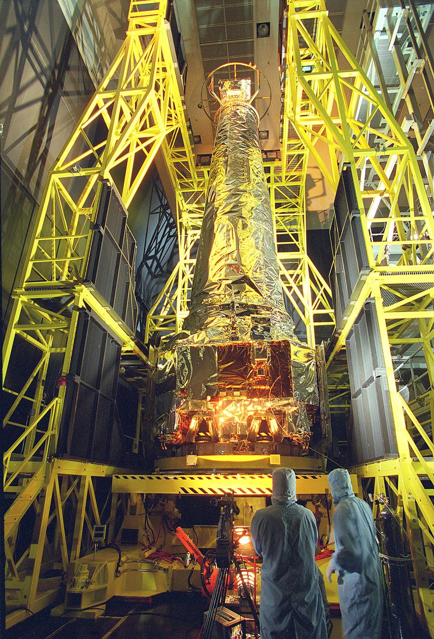
This photograph shows TRW technicians preparing the assembled Chandra X-Ray Observatory (CXO) for an official unveiling at TRW Space and Electronics Group of Redondo Beach, California. The CXO is formerly known as the Advanced X-Ray Astrophysics Facility (AXAF), which was renamed in honor of the late Indian-American Astronomer, Subrahmanyan Chandrasekhar in 1999. The CXO will help astronomers world-wide better understand the structure and evolution of the universe by studying powerful sources of x-rays such as exploding stars, matter falling into black holes, and other exotic celestial objects. X-ray astronomy can only be done from space because Earth's atmosphere blocks x-rays from reaching the surface. The Observatory provides images that are 50 times more detailed than previous x-ray missions. At more than 45 feet in length and weighing more than 5 tons, it will be one of the largest objects ever placed in Earth orbit by the Space Shuttle. TRW, Inc. was the prime contractor and assembled and tested the observatory for NASA. The CXO program is managed by the Marshall Space Flight Center. The Observatory was launched on July 22, 1999 aboard the Space Shuttle Columbia, STS-93 mission. (Image courtesy of TRW)
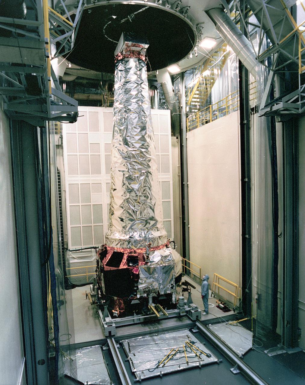
This photograph shows a TRW technician inspecting the completely assembled Chandra X-ray Observatory (CXO) in the Thermal Vacuum Chamber at TRW Space and Electronics Group of Redondo Beach, California. The CXO is formerly known as the Advanced X-Ray Astrophysics Facility (AXAF), which was renamed in honor of the late Indian-American Astronomer, Subrahmanyan Chandrasekhar in 1999. The CXO will help astronomers worldwide better understand the structure and evolution of the universe by studying powerful sources of x-rays such as exploding stars, matter falling into black holes and other exotic celestial objects. X-ray astronomy can only be done from space because Earth's atmosphere blocks x-rays from reaching the surface. The Observatory provides images that are 50 times more detailed than previous x-ray missions. At more than 45 feet in length and weighing more than 5 tons, it will be one of the largest objects ever placed in Earth orbit by the Space Shuttle. TRW, Inc. was the prime contractor and assembled and tested the observatory for NASA. The CXO program is managed by the Marshall Space Flight Center. The Observatory was launched on July 22, 1999 aboard the Space Shuttle Columbia, STS-93 mission. (Image courtesy of TRW)
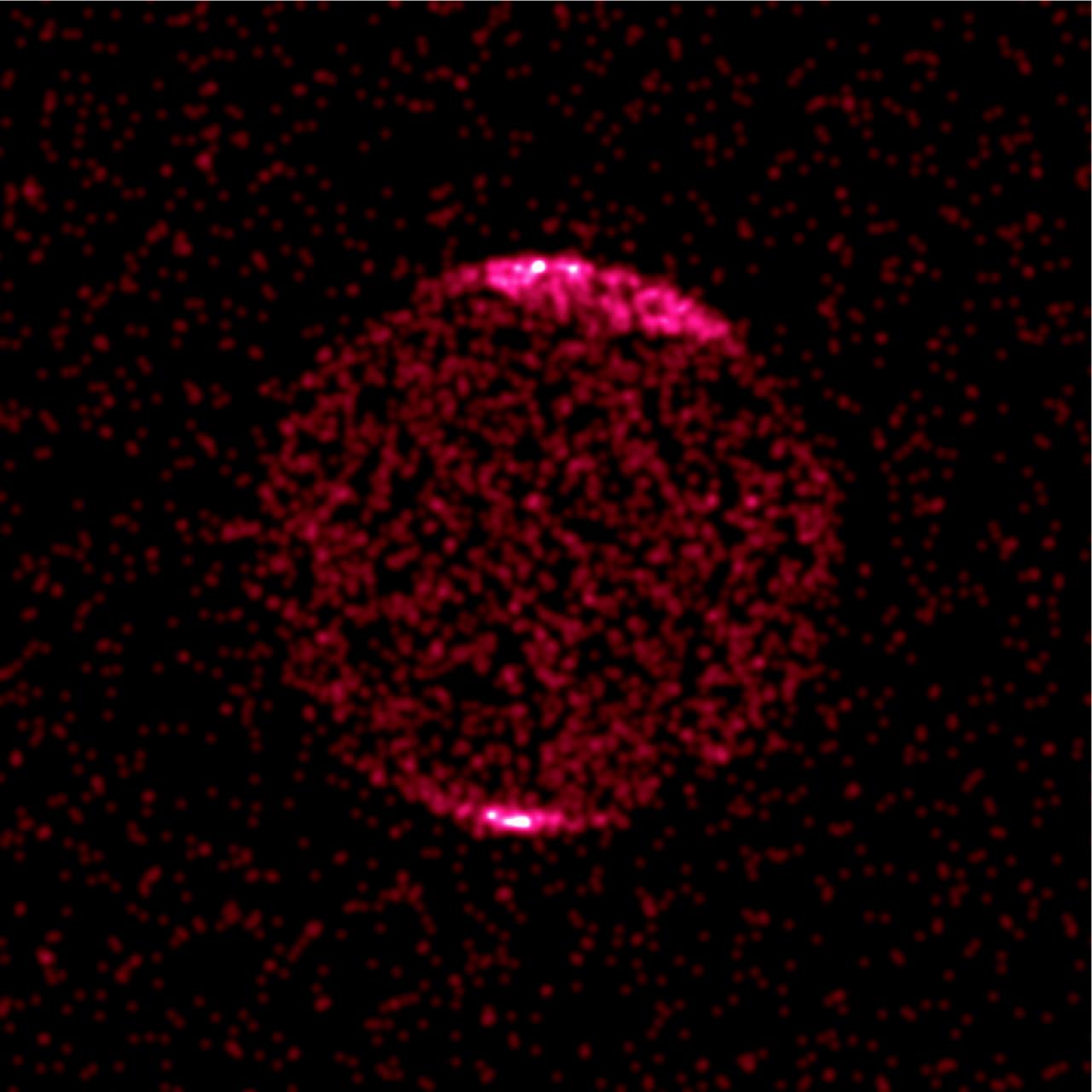
This Chandra image of Jupiter shows concentrations of aurora x-rays near the north and south poles due to a single `hot spot' that pulsates with a period of 45 minutes, similar to high-latitude radio pulsation previously detected by NASA's Galileo and Cassini spacecraft. Previous x-ray detections of Jupiter have been made with other x-ray telescopes, but did not reveal that the sources of the x-rays, energetic oxygen and sulfur ions, would be located so near the poles. Previous theories held that ions were mostly coming from Jupiter's moon, lo. Chandra's ability to pinpoint the source of the x-rays discards this theory since ions coming from near lo's orbit carnot reach the observed high latitudes. One possibility is that particles flowing out from the Sun are captured in the outer regions of Jupiter's magnetic field, then accelerated and directed toward its magnetic pole. Once captured, the ions would bounce back and forth in the magnetic field from Jupiter's north pole to the south pole in an oscillating motion that could explain the pulsation.
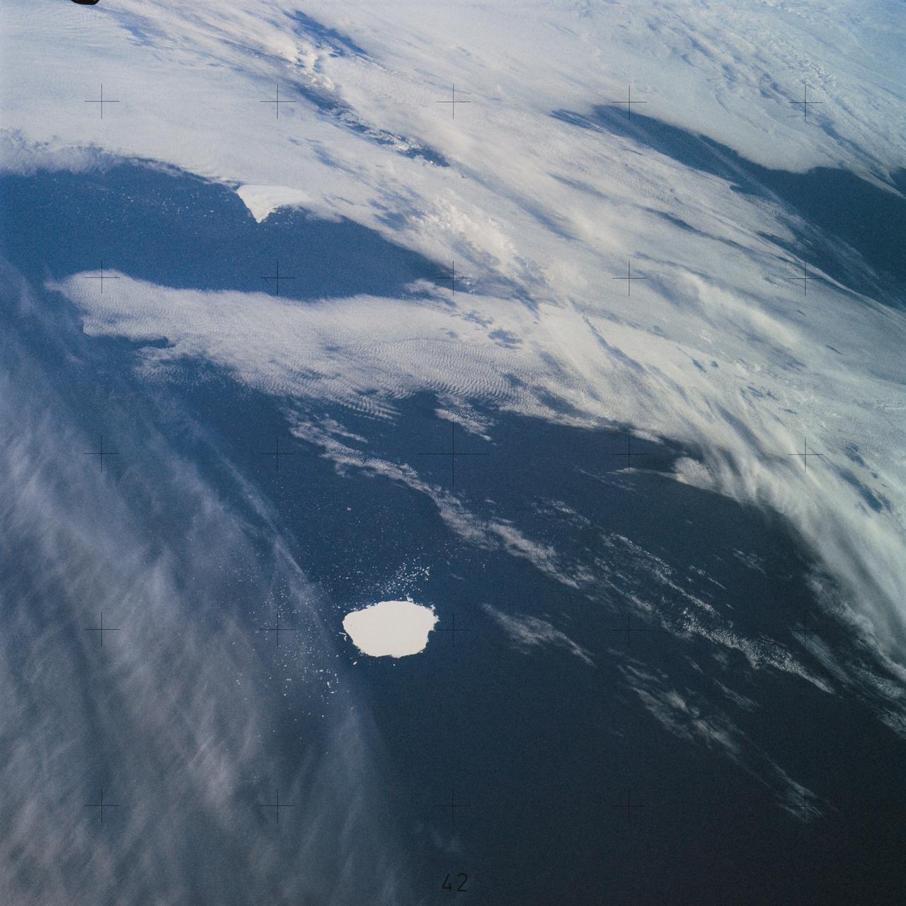
SL4-142-4577 (28 Jan. 1974) --- Two large ice islands in the vicinity of South Georgia Island in the South Atlantic Ocean, as photographed from the Skylab space station in Earth orbit by one of the Skylab 4 crewmen. The camera used was a hand-held 70mm Hasselblad, with SO-368 medium-speed Ektachrome. One of the ice islands is partially obscured by clouds. Ice islands were observed as large as 45 by 60 kilometers (27 x 37 miles) and as far north as 45 degrees south latitude. The size and distribution of the "small" icebergs (to a ship they would look very large) can be used to study the local winds and currents. Recent research has suggested the possibility of towing such Antarctic icebergs to selected areas and using them as water supplies. One such iceberg would contain many times the water as in Lake Powell. Photo credit: NASA

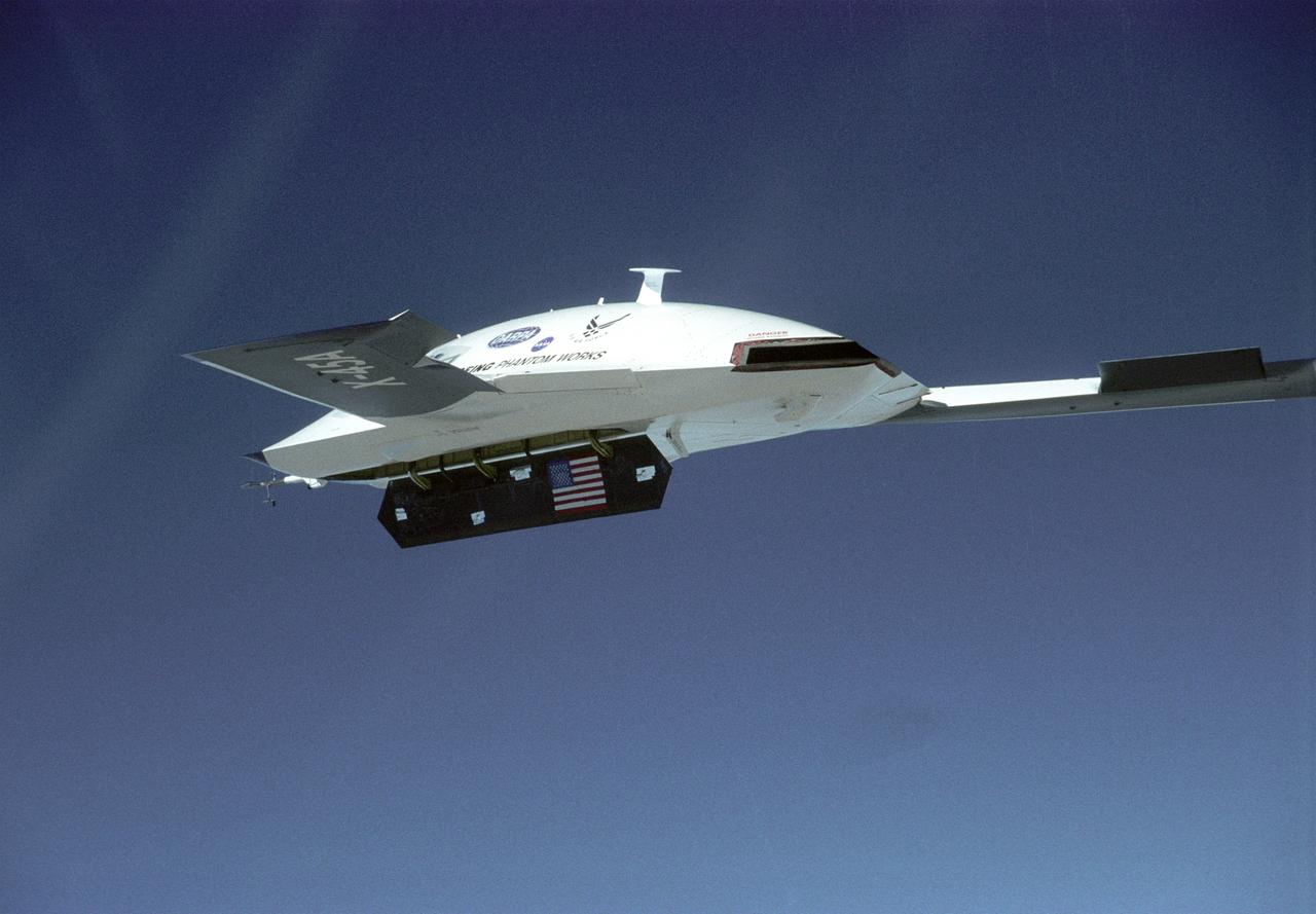
The second X-45A Unmanned Combat Air Vehicle (UCAV) technology demonstrator completed its first flight on November 21, 2002, after taking off from a dry lakebed at NASA's Dryden Flight Research Center, Edwards Air Force Base, California. X-45A vehicle two flew for approximately 30 minutes and reached an airspeed of 195 knots and an altitude of 7500 feet. This flight validated the functionality of the UCAV flight software on the second air vehicle. Dryden is supporting the DARPA/Boeing team in the design, development, integration, and demonstration of the critical technologies, processes, and system attributes leading to an operational UCAV system. Dryden support of the X-45A demonstrator system includes analysis, component development, simulations, ground and flight tests.
The second X-45A Unmanned Combat Air Vehicle (UCAV) technology demonstrator completed its first flight on November 21, 2002, after taking off from a dry lakebed at NASA's Dryden Flight Research Center, Edwards Air Force Base, California. X-45A vehicle two flew for approximately 30 minutes and reached an airspeed of 195 knots and an altitude of 7500 feet. This flight validated the functionality of the UCAV flight software on the second air vehicle. Dryden is supporting the DARPA/Boeing team in the design, development, integration, and demonstration of the critical technologies, processes, and system attributes leading to an operational UCAV system. Dryden support of the X-45A demonstrator system includes analysis, component development, simulations, ground and flight tests.
The second X-45A Unmanned Combat Air Vehicle (UCAV) technology demonstrator completed its first flight on November 21, 2002, after taking off from a dry lakebed at NASA's Dryden Flight Research Center, Edwards Air Force Base, California. X-45A vehicle two flew for approximately 30 minutes and reached an airspeed of 195 knots and an altitude of 7500 feet. This flight validated the functionality of the UCAV flight software on the second air vehicle. Dryden is supporting the DARPA/Boeing team in the design, development, integration, and demonstration of the critical technologies, processes, and system attributes leading to an operational UCAV system. Dryden support of the X-45A demonstrator system includes analysis, component development, simulations, ground and flight tests.
The first X-45A Unmanned Combat Air Vehicle (UCAV) technology demonstrator completed its sixth flight on Dec. 19, 2002, raising its landing gear in flight for the first time. The X-45A flew for 40 minutes and reached an airspeed of 195 knots and an altitude of 7,500 feet. Dryden is supporting the DARPA/Boeing team in the design, development, integration, and demonstration of the critical technologies, processes, and system attributes leading to an operational UCAV system. Dryden support of the X-45A demonstrator system includes analysis, component development, simulations, ground and flight tests.
The second X-45A Unmanned Combat Air Vehicle (UCAV) technology demonstrator completed its first flight on November 21, 2002, after taking off from a dry lakebed at NASA's Dryden Flight Research Center, Edwards Air Force Base, California. X-45A vehicle two flew for approximately 30 minutes and reached an airspeed of 195 knots and an altitude of 7500 feet. This flight validated the functionality of the UCAV flight software on the second air vehicle. Dryden is supporting the DARPA/Boeing team in the design, development, integration, and demonstration of the critical technologies, processes, and system attributes leading to an operational UCAV system. Dryden support of the X-45A demonstrator system includes analysis, component development, simulations, ground and flight tests.

A payload briefing for NASA’s Imaging X-ray Polarimetry Explorer (IXPE) spacecraft is held on Dec.7, 2021 at NASA’s Kennedy Space Center in Florida. Participants from left are Karen Fox, moderator, NASA Communications; Brian Ramsey, deputy principal investigator, NASA’s Marshall Space Flight Center; Elisabetta Cavazzuti, ASI IXPE program manager, Italian Space Agency; Luca Baldini, Italian co-principal investigator, NASA’s Marshall Space Flight Center; and MacKenzie Ferrie, IXPE program manager, Ball Aerospace. IXPE is scheduled to launch no earlier than 1 a.m. EST Thursday, Dec. 9, on a SpaceX Falcon 9 rocket from Kennedy’s Launch Complex 39A. NASA’s Launch Services Program is managing this launch. NASA’s Marshall Space Flight Center in Huntsville, Alabama, manages the IXPE mission. Ball Aerospace, headquartered in Broomfield, Colorado, manages spacecraft operations with support from the University of Colorado at Boulder. NASA’s Goddard Space Flight Center in Greenbelt, Maryland, manages the Explorers Program for the agency’s Science Mission Directorate in Washington. The U.S. Space Force’s Space Launch Delta 45 provides range support for this launch. SpaceX is providing the launch vehicle for this mission.

A payload briefing for NASA’s Imaging X-ray Polarimetry Explorer (IXPE) spacecraft is held on Dec.7, 2021 at NASA’s Kennedy Space Center in Florida. Participants from left are Karen Fox, moderator, NASA Communications; Brian Ramsey, deputy principal investigator, NASA’s Marshall Space Flight Center; Elisabetta Cavazzuti, ASI IXPE program manager, Italian Space Agency; Luca Baldini, Italian co-principal investigator, NASA’s Marshall Space Flight Center; and MacKenzie Ferrie, IXPE program manager, Ball Aerospace. IXPE is scheduled to launch no earlier than 1 a.m. EST Thursday, Dec. 9, on a SpaceX Falcon 9 rocket from Kennedy’s Launch Complex 39A. NASA’s Launch Services Program is managing this launch. NASA’s Marshall Space Flight Center in Huntsville, Alabama, manages the IXPE mission. Ball Aerospace, headquartered in Broomfield, Colorado, manages spacecraft operations with support from the University of Colorado at Boulder. NASA’s Goddard Space Flight Center in Greenbelt, Maryland, manages the Explorers Program for the agency’s Science Mission Directorate in Washington. The U.S. Space Force’s Space Launch Delta 45 provides range support for this launch. SpaceX is providing the launch vehicle for this mission.

A payload briefing for NASA’s Imaging X-ray Polarimetry Explorer (IXPE) spacecraft is held on Dec.7, 2021 at NASA’s Kennedy Space Center in Florida. Participants from left are Brian Ramsey, deputy principal investigator, NASA’s Marshall Space Flight Center; Elisabetta Cavazzuti, ASI IXPE program manager, Italian Space Agency; Luca Baldini, Italian co-principal investigator, NASA’s Marshall Space Flight Center; and MacKenzie Ferrie, IXPE program manager, Ball Aerospace. IXPE is scheduled to launch no earlier than 1 a.m. EST Thursday, Dec. 9, on a SpaceX Falcon 9 rocket from Kennedy’s Launch Complex 39A. NASA’s Launch Services Program is managing this launch. NASA’s Marshall Space Flight Center in Huntsville, Alabama, manages the IXPE mission. Ball Aerospace, headquartered in Broomfield, Colorado, manages spacecraft operations with support from the University of Colorado at Boulder. NASA’s Goddard Space Flight Center in Greenbelt, Maryland, manages the Explorers Program for the agency’s Science Mission Directorate in Washington. The U.S. Space Force’s Space Launch Delta 45 provides range support for this launch. SpaceX is providing the launch vehicle for this mission.

A payload briefing for NASA’s Imaging X-ray Polarimetry Explorer (IXPE) spacecraft is held on Dec.7, 2021 at NASA’s Kennedy Space Center in Florida. Participants from left are Elisabetta Cavazzuti, ASI IXPE program manager, Italian Space Agency; and Luca Baldini, Italian co-principal investigator, NASA’s Marshall Space Flight Center. IXPE is scheduled to launch no earlier than 1 a.m. EST Thursday, Dec. 9, on a SpaceX Falcon 9 rocket from Kennedy’s Launch Complex 39A. NASA’s Launch Services Program is managing this launch. NASA’s Marshall Space Flight Center in Huntsville, Alabama, manages the IXPE mission. Ball Aerospace, headquartered in Broomfield, Colorado, manages spacecraft operations with support from the University of Colorado at Boulder. NASA’s Goddard Space Flight Center in Greenbelt, Maryland, manages the Explorers Program for the agency’s Science Mission Directorate in Washington. The U.S. Space Force’s Space Launch Delta 45 provides range support for this launch. SpaceX is providing the launch vehicle for this mission.
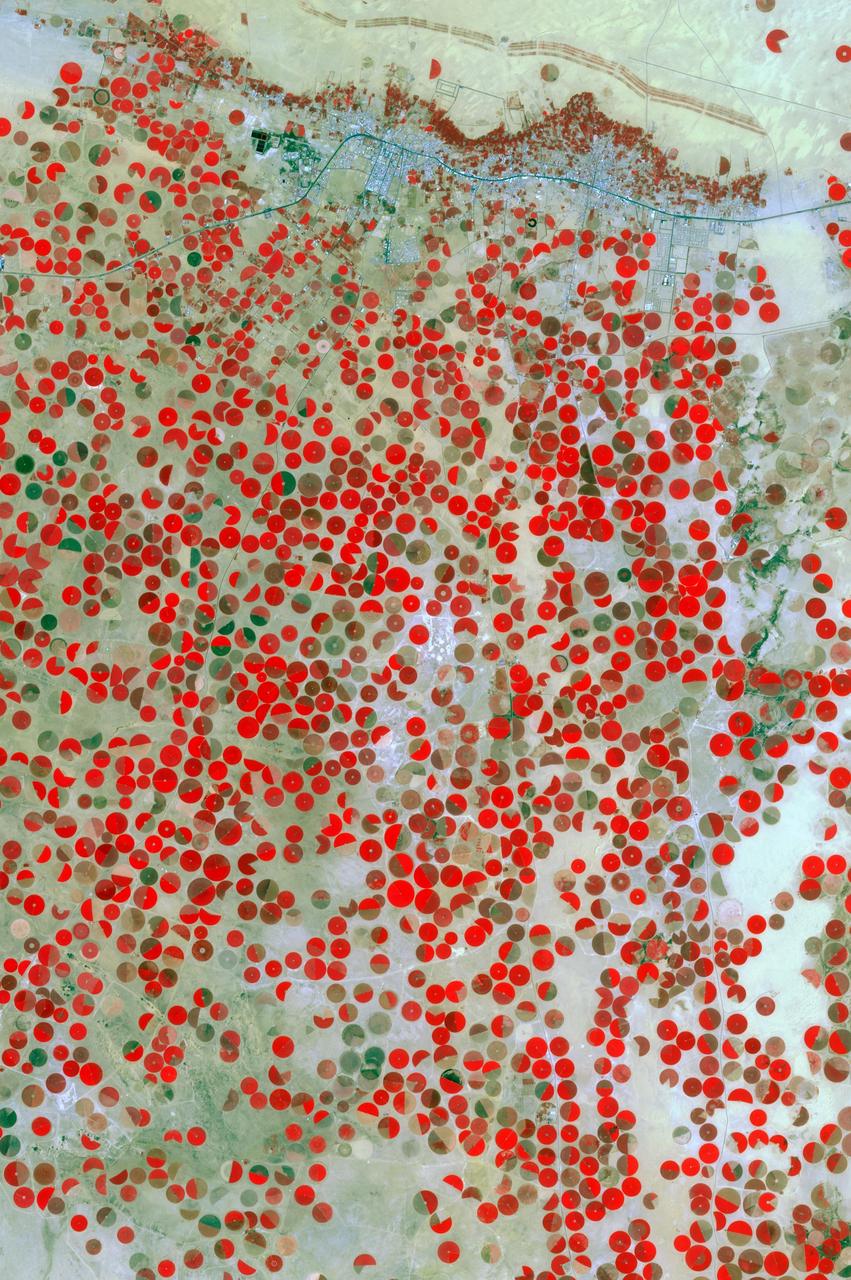
In the middle of the Arabian desert the city Green Oasis Wadi Al Dawasir is being developed as a new urban center for the Wadi Al Dawasir region of Saudi Arabia, as shown in this image from NASA Terra spacecraft. Huge solar fields supply the entire city and the surrounding region with energy. Hundreds of circular agricultural fields are fed by center pivot irrigation apparatus, drawing water from subterranean aquifers. The image was acquired March 30, 2013, covers an area of 30 x 45 km, and is located at 20.2 degrees north, 44.8 degrees east. http://photojournal.jpl.nasa.gov/catalog/PIA20077
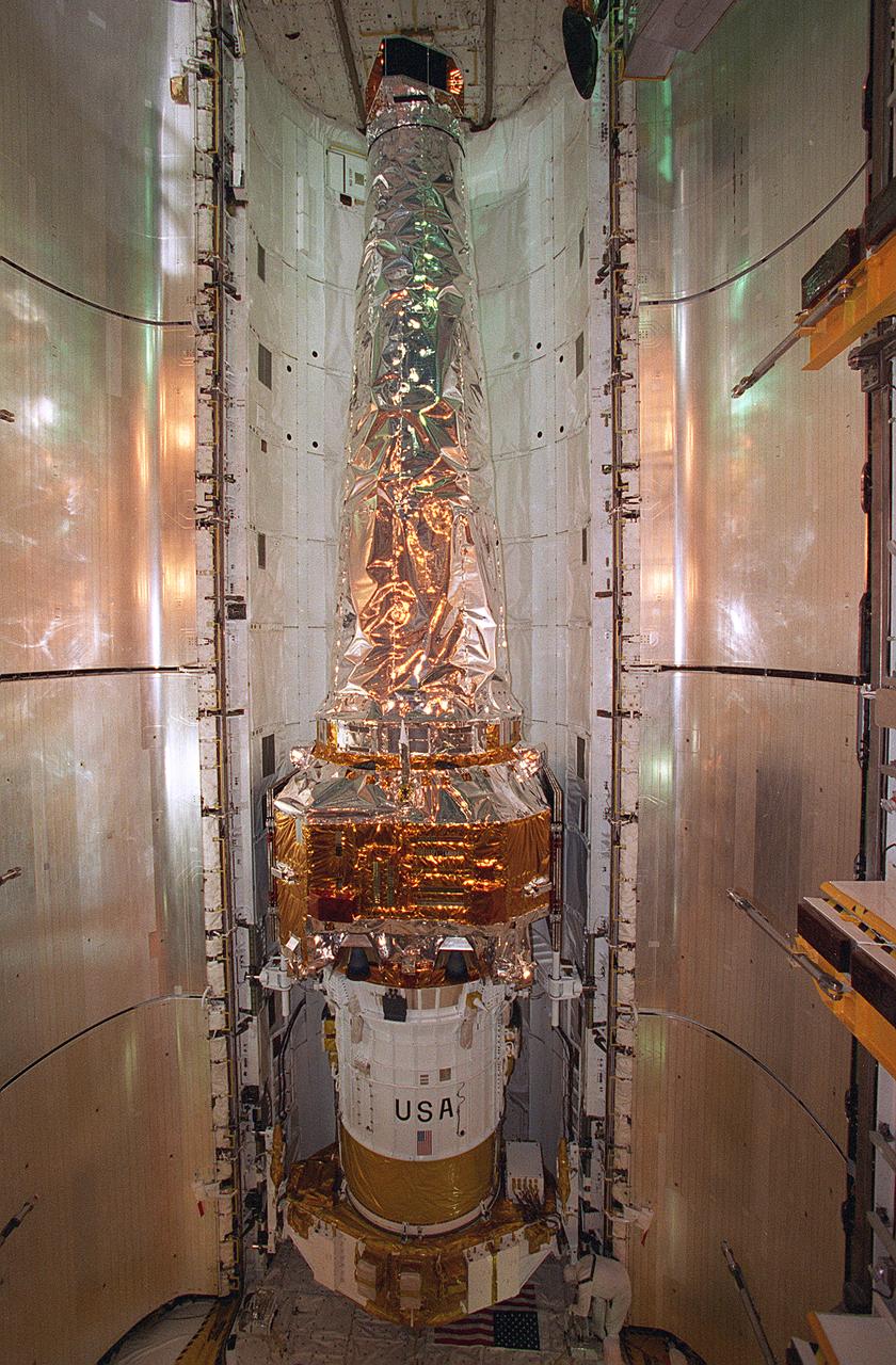
In this photograph, the Chandra X-Ray Observatory (CXO) was installed and mated to the Inertial Upper Stage (IUS) inside the Shuttle Columbia's cargo bay at the Kennedy Space Center. The CXO will help astronomers world-wide better understand the structure and evolution of the universe by studying powerful sources of x-rays such as exploding stars, matter falling into black holes, and other exotic celestial objects. X-ray astronomy can only be done from space because Earth's atmosphere blocks x-rays from reaching the surface. The Observatory provides images that are 50 times more detailed than previous x-ray missions. At more than 45 feet in length and weighing more than 5 tons, the CXO was carried into low-Earth orbit by the Space Shuttle Columbia (STS-93 mission) on July 22, 1999. The Observatory was deployed from the Shuttle's cargo bay at 155 miles above the Earth. Two firings of an attached IUS rocket, and several firings of its own onboard rocket motors, after separating from the IUS, placed the Observatory into its working orbit. The IUS is a solid rocket used to place spacecraft into orbit or boost them away from the Earth on interplanetary missions. Since its first use by NASA in 1983, the IUS has supported a variety of important missions, such as the Tracking and Data Relay Satellite, Galileo spacecraft, Magellan spacecraft, and Ulysses spacecraft. The IUS was built by the Boeing Aerospace Co., at Seattle, Washington and managed by the Marshall Space Flight Center.
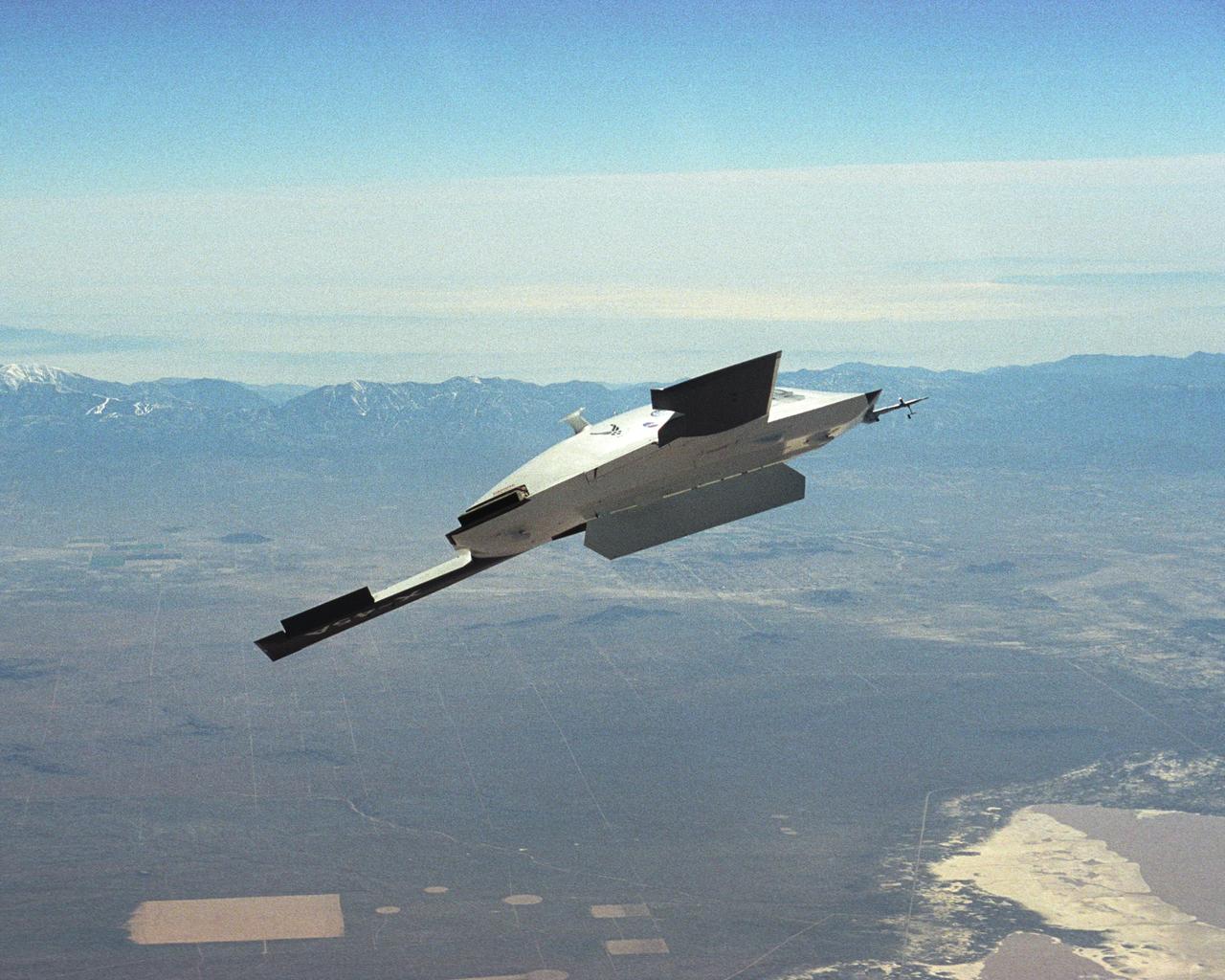
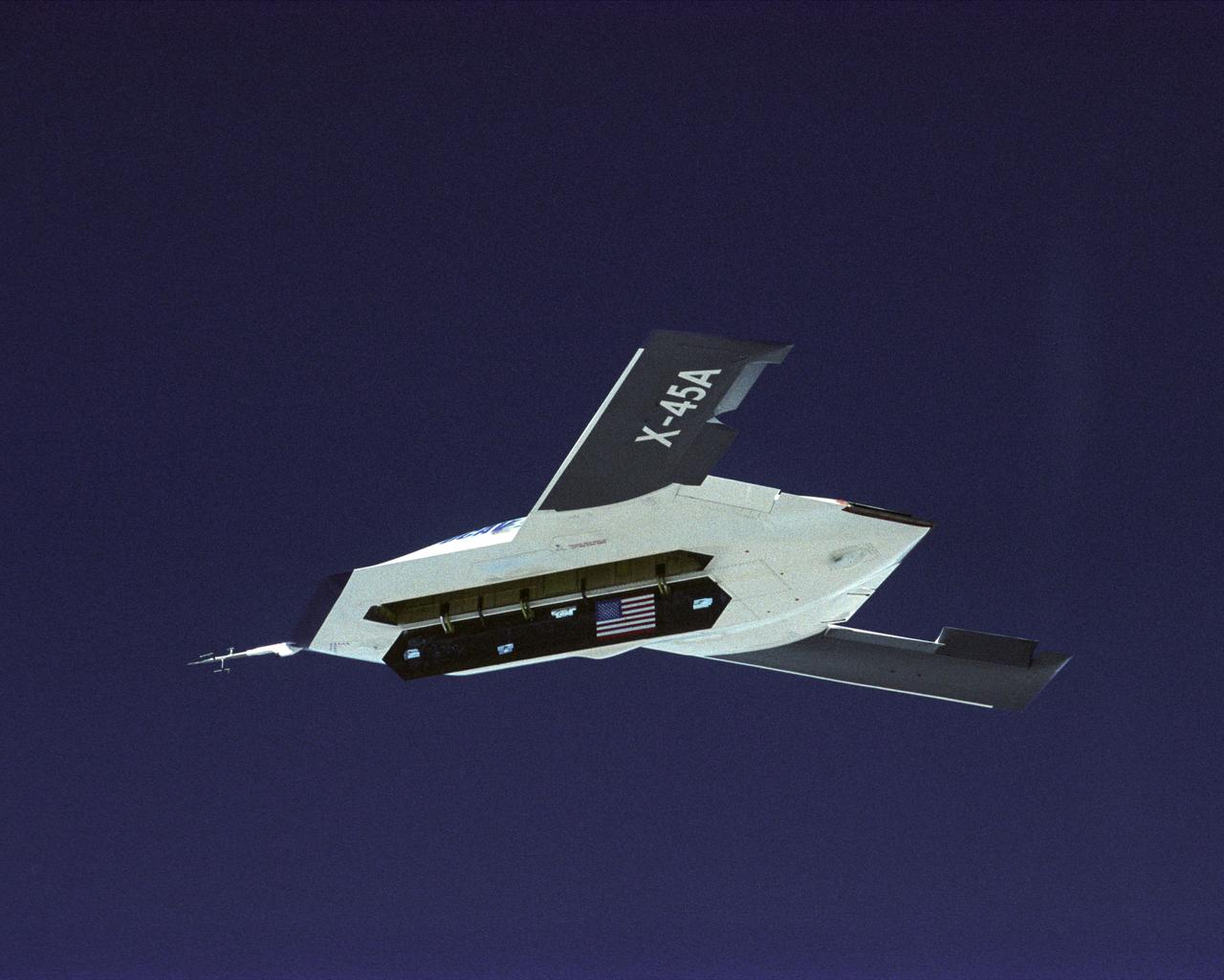
The DARPA/U.S. Air Force X-45A Unmanned Combat Air Vehicle (UCAV) system demonstration program completed the first phase of demonstrations, known as Block I, on Feb. 28, 2003. The final Block I activities included two flights at Dryden, during which safe operation of the weapons bay door was verified at 35,000 feet and speeds of Mach 0.75, the maximum planned altitude and speed for the two X-45A demonstrator vehicles.
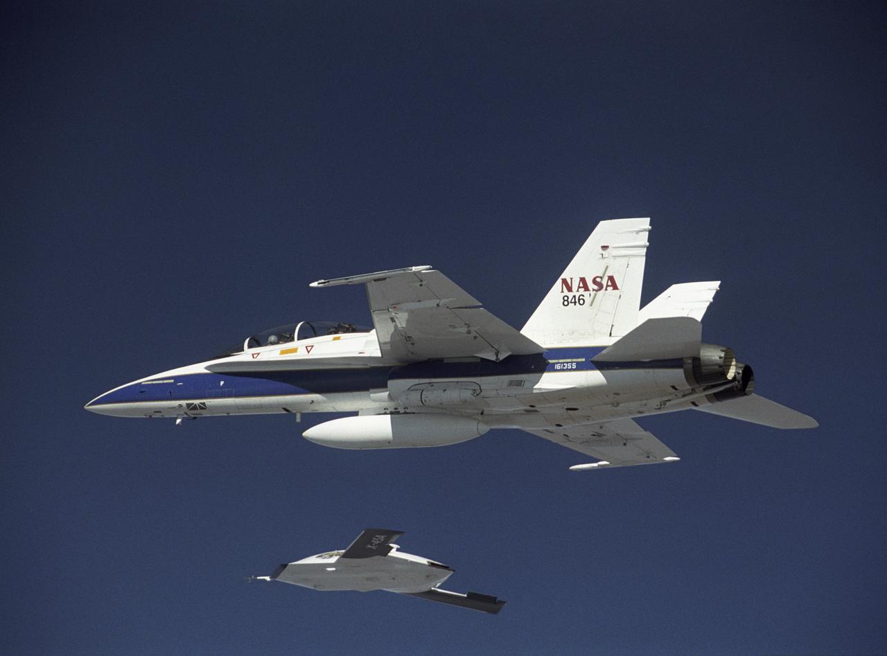
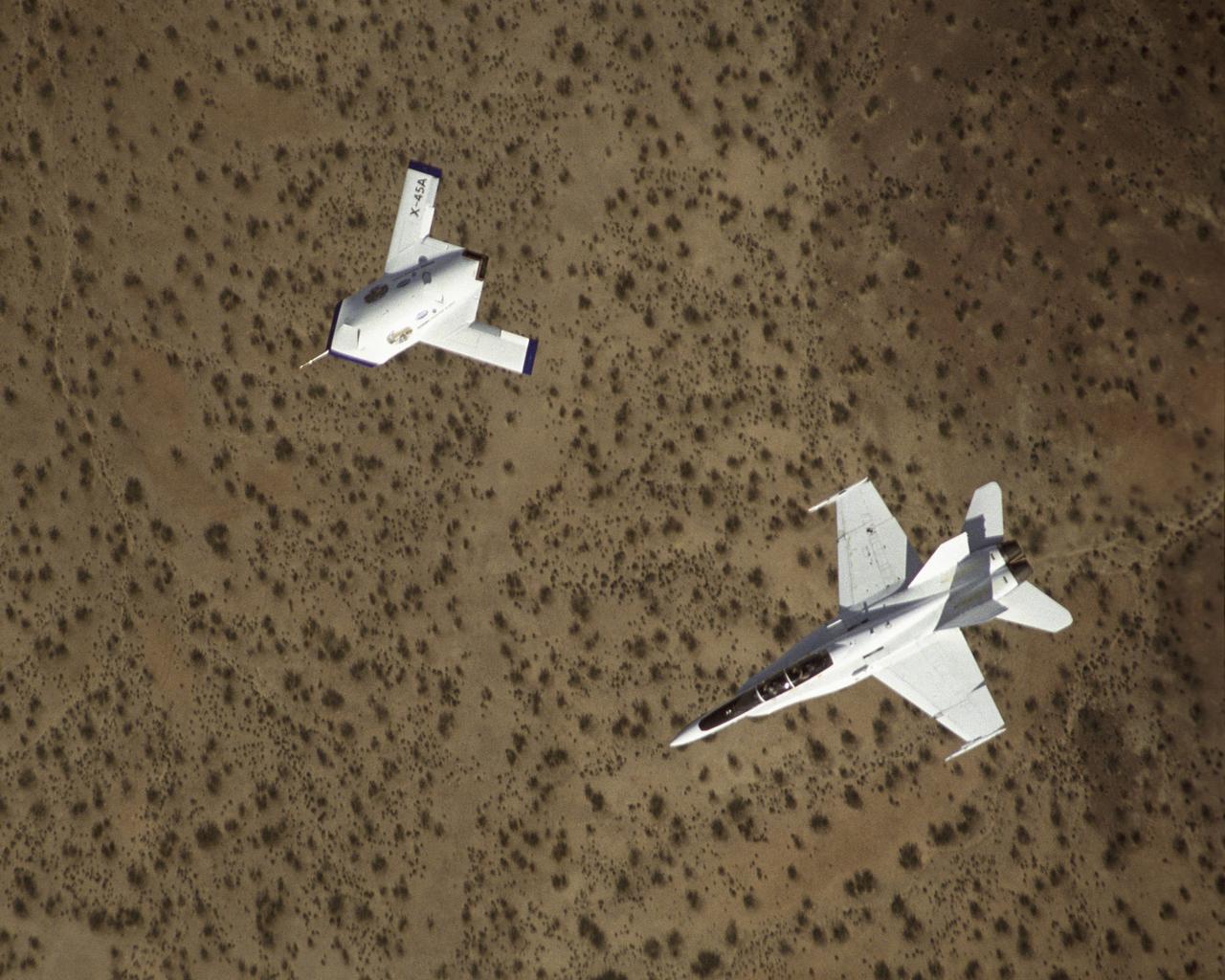
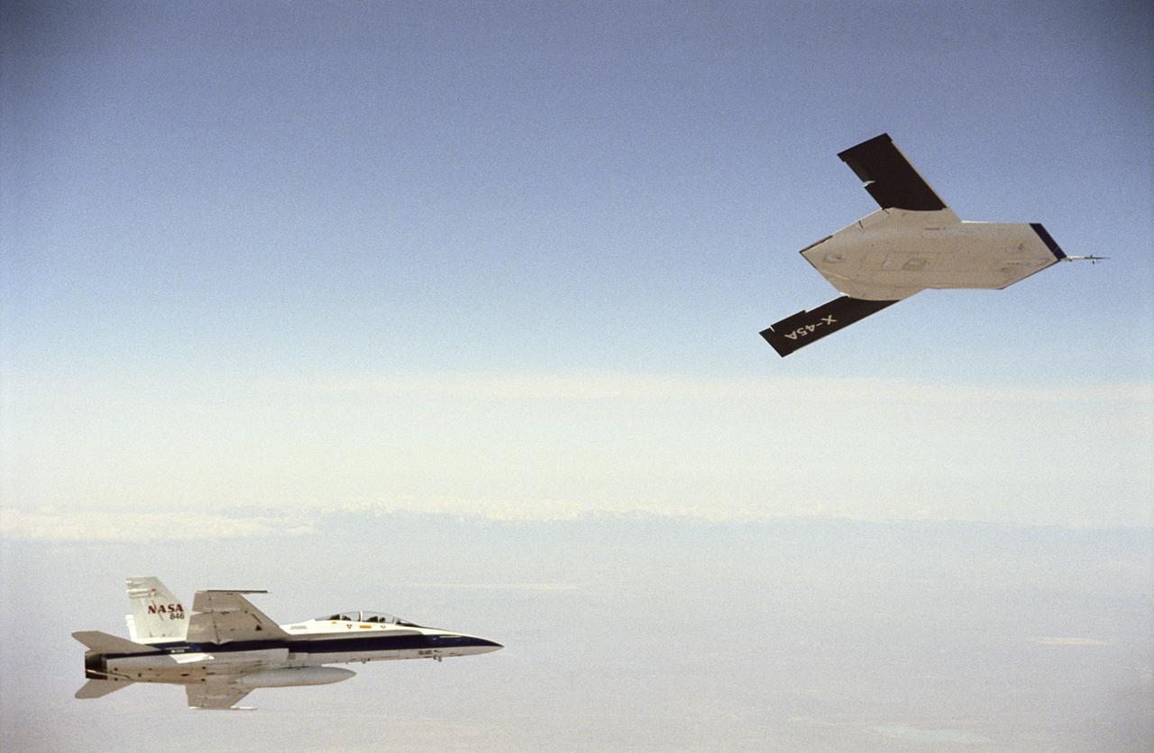
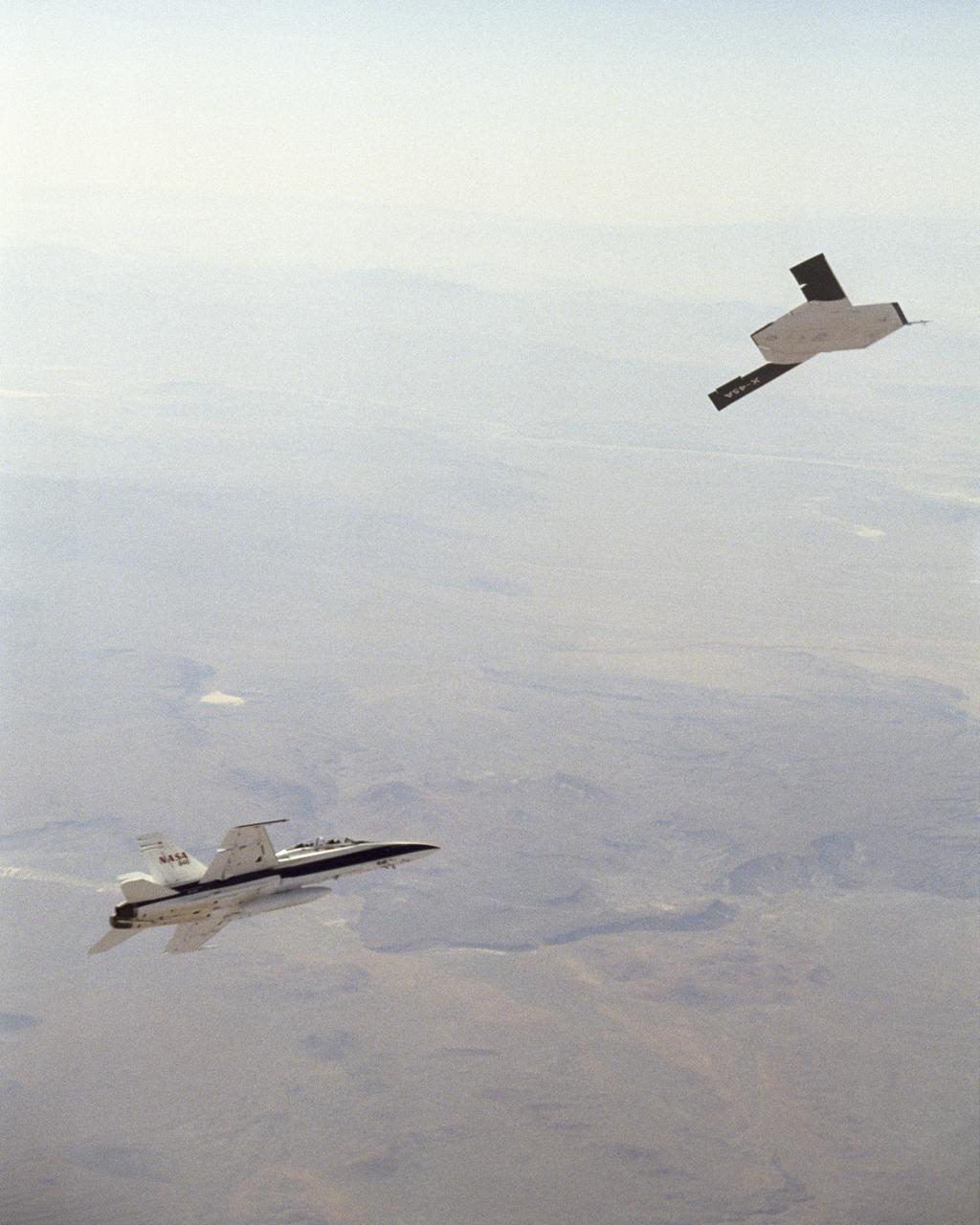
X-45A in flight with F-18 #846 chase aircraft, during first GPS-guided weapon demonstration flight.
The DARPA/U.S. Air Force X-45A Unmanned Combat Air Vehicle (UCAV) system demonstration program completed the first phase of demonstrations, known as Block I, on Feb. 28, 2003. The final Block I activities included two flights at Dryden, during which safe operation of the weapons bay door was verified at 35,000 feet and speeds of Mach 0.75, the maximum planned altitude and speed for the two X-45A demonstrator vehicles.
The DARPA/U.S. Air Force X-45A Unmanned Combat Air Vehicle (UCAV) system demonstration program completed the first phase of demonstrations, known as Block I, on Feb. 28, 2003. The final Block I activities included two flights at Dryden, during which safe operation of the weapons bay door was verified at 35,000 feet and speeds of Mach 0.75, the maximum planned altitude and speed for the two X-45A demonstrator vehicles.
The DARPA/U.S. Air Force X-45A Unmanned Combat Air Vehicle (UCAV) system demonstration program completed the first phase of demonstrations, known as Block I, on Feb. 28, 2003. The final Block I activities included two flights at Dryden, during which safe operation of the weapons bay door was verified at 35,000 feet and speeds of Mach 0.75, the maximum planned altitude and speed for the two X-45A demonstrator vehicles.
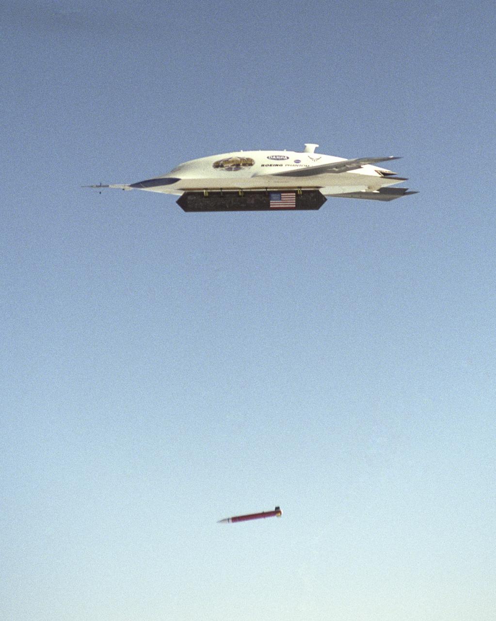
X-45A first GPS-guided weapon demonstration - weapon release
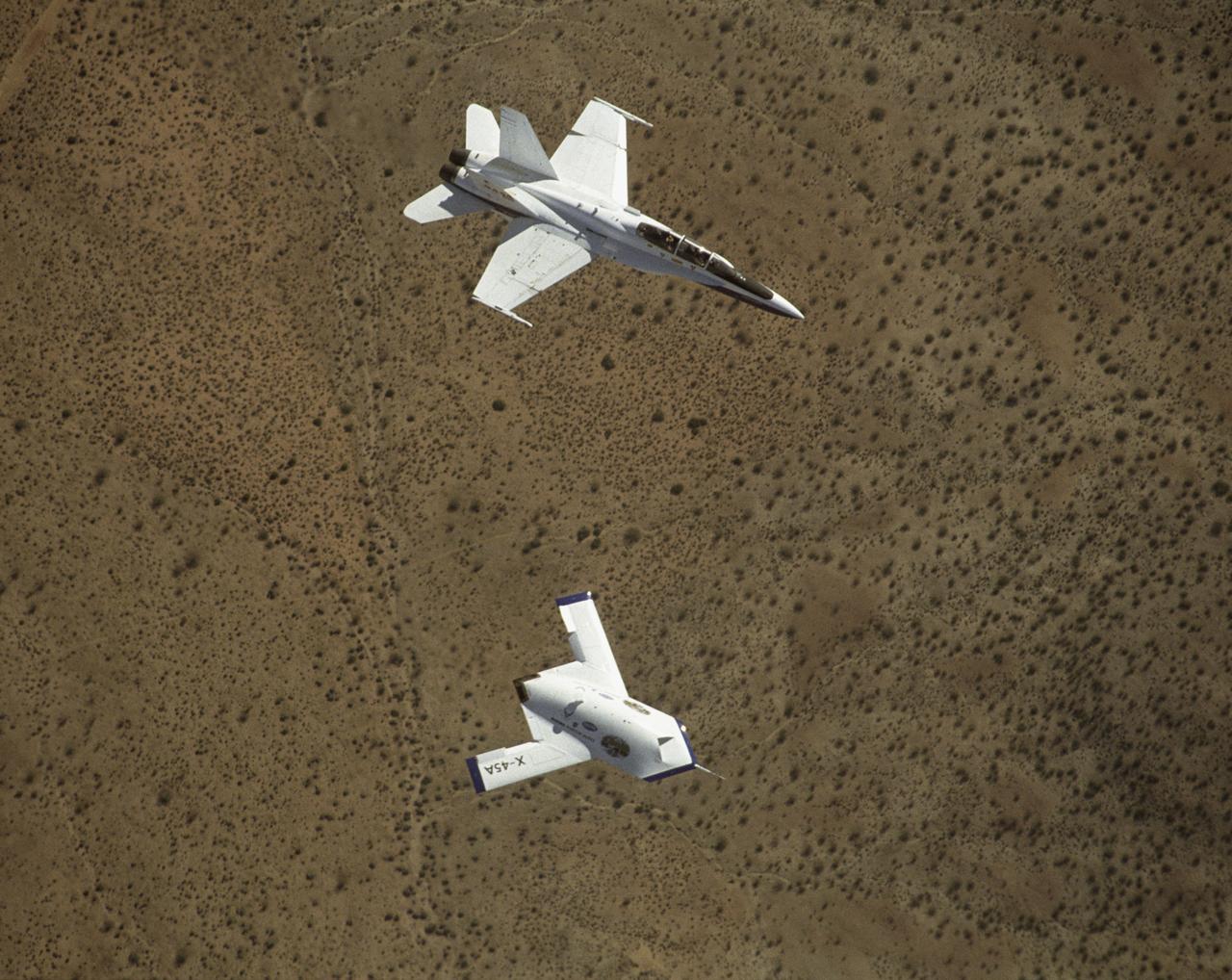
X-45A in flight with F-18 #846 chase aircraft, during first GPS-guided weapon demonstration flight.
The DARPA/U.S. Air Force X-45A Unmanned Combat Air Vehicle (UCAV) system demonstration program completed the first phase of demonstrations, known as Block I, on Feb. 28, 2003. The final Block I activities included two flights at Dryden, during which safe operation of the weapons bay door was verified at 35,000 feet and speeds of Mach 0.75, the maximum planned altitude and speed for the two X-45A demonstrator vehicles.
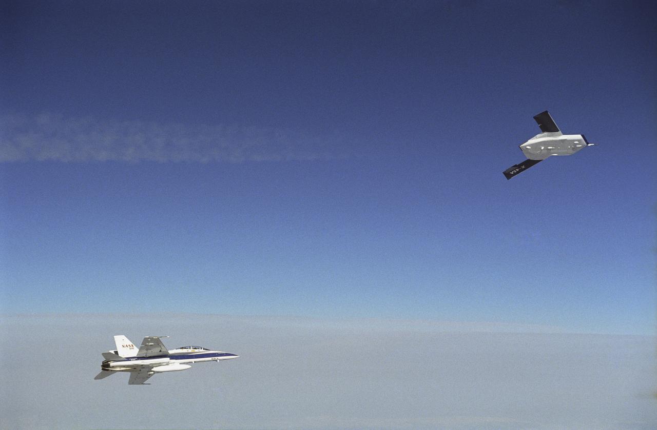
X-45A in flight with F-18 #846 chase aircraft, during first GPS-guided weapon demonstration flight.
X-45A in flight with F-18 #846 chase aircraft, during first GPS-guided weapon demonstration flight.
X-45A in flight with F-18 #846 chase aircraft, during first GPS-guided weapon demonstration flight.

X-45A first GPS-guided weapon demonstration - weapon release
X-45A in flight with F-18 #846 chase aircraft, during first GPS-guided weapon demonstration flight.
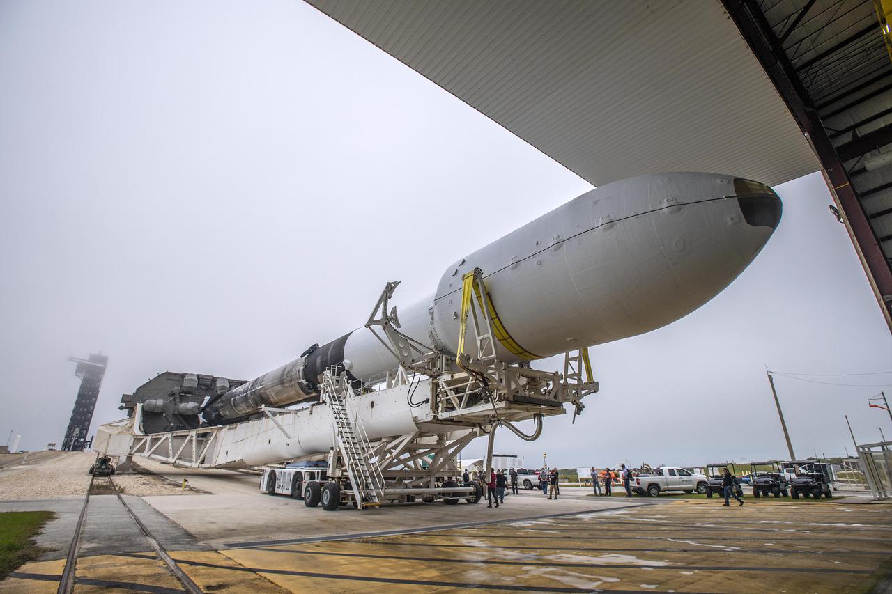
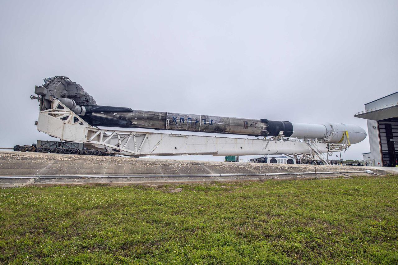
A SpaceX Falcon 9 rocket with NASA’s Imaging X-ray Polarimetry Explorer (IXPE) spacecraft, rolls out to Launch Complex 39A at NASA’s Kennedy Space Center in Florida on Dec. 7, 2021. IXPE is scheduled to launch no earlier than 1 a.m. EST Thursday, Dec. 9. NASA’s Launch Services Program is managing this launch. NASA’s Marshall Space Flight Center in Huntsville, Alabama, manages the IXPE mission. Ball Aerospace, headquartered in Broomfield, Colorado, manages spacecraft operations with support from the University of Colorado at Boulder. NASA’s Goddard Space Flight Center in Greenbelt, Maryland, manages the Explorers Program for the agency’s Science Mission Directorate in Washington. The U.S. Space Force’s Space Launch Delta 45 provides range support for this launch. SpaceX is providing the launch vehicle for this mission. The IXPE spacecraft includes three space telescopes with sensitive detectors capable of measuring the polarization of cosmic X-rays, allowing scientists to answer fundamental questions about extremely complex environments in space where gravitational, electric, and magnetic fields are at their limits. The project is a collaboration between NASA and the Italian Space Agency.
A SpaceX Falcon 9 rocket with NASA’s Imaging X-ray Polarimetry Explorer (IXPE) spacecraft, begins rollout to Launch Complex 39A at NASA’s Kennedy Space Center in Florida on Dec. 7, 2021. IXPE is scheduled to launch no earlier than 1 a.m. EST Thursday, Dec. 9. NASA’s Launch Services Program is managing this launch. NASA’s Marshall Space Flight Center in Huntsville, Alabama, manages the IXPE mission. Ball Aerospace, headquartered in Broomfield, Colorado, manages spacecraft operations with support from the University of Colorado at Boulder. NASA’s Goddard Space Flight Center in Greenbelt, Maryland, manages the Explorers Program for the agency’s Science Mission Directorate in Washington. The U.S. Space Force’s Space Launch Delta 45 provides range support for this launch. SpaceX is providing the launch vehicle for this mission. The IXPE spacecraft includes three space telescopes with sensitive detectors capable of measuring the polarization of cosmic X-rays, allowing scientists to answer fundamental questions about extremely complex environments in space where gravitational, electric, and magnetic fields are at their limits. The project is a collaboration between NASA and the Italian Space Agency.
A SpaceX Falcon 9 rocket with NASA’s Imaging X-ray Polarimetry Explorer (IXPE) spacecraft, rolls out to Launch Complex 39A at NASA’s Kennedy Space Center in Florida on Dec. 7, 2021. IXPE is scheduled to launch no earlier than 1 a.m. EST Thursday, Dec. 9. NASA’s Launch Services Program is managing this launch. NASA’s Marshall Space Flight Center in Huntsville, Alabama, manages the IXPE mission. Ball Aerospace, headquartered in Broomfield, Colorado, manages spacecraft operations with support from the University of Colorado at Boulder. NASA’s Goddard Space Flight Center in Greenbelt, Maryland, manages the Explorers Program for the agency’s Science Mission Directorate in Washington. The U.S. Space Force’s Space Launch Delta 45 provides range support for this launch. SpaceX is providing the launch vehicle for this mission. The IXPE spacecraft includes three space telescopes with sensitive detectors capable of measuring the polarization of cosmic X-rays, allowing scientists to answer fundamental questions about extremely complex environments in space where gravitational, electric, and magnetic fields are at their limits. The project is a collaboration between NASA and the Italian Space Agency.

A SpaceX Falcon 9 rocket with NASA’s Imaging X-ray Polarimetry Explorer (IXPE) spacecraft, begins rollout to Launch Complex 39A at NASA’s Kennedy Space Center in Florida on Dec. 7, 2021. IXPE is scheduled to launch no earlier than 1 a.m. EST Thursday, Dec. 9. NASA’s Launch Services Program is managing this launch. NASA’s Marshall Space Flight Center in Huntsville, Alabama, manages the IXPE mission. Ball Aerospace, headquartered in Broomfield, Colorado, manages spacecraft operations with support from the University of Colorado at Boulder. NASA’s Goddard Space Flight Center in Greenbelt, Maryland, manages the Explorers Program for the agency’s Science Mission Directorate in Washington. The U.S. Space Force’s Space Launch Delta 45 provides range support for this launch. SpaceX is providing the launch vehicle for this mission. The IXPE spacecraft includes three space telescopes with sensitive detectors capable of measuring the polarization of cosmic X-rays, allowing scientists to answer fundamental questions about extremely complex environments in space where gravitational, electric, and magnetic fields are at their limits. The project is a collaboration between NASA and the Italian Space Agency.

The junctions of the Amazon and the Rio Negro Rivers at Manaus, Brazil. The Rio Negro flows 2300 km from Columbia, and is the dark current forming the north side of the river. It gets its color from the high tannin content in the water. The Amazon is sediment laden, appearing brown in this simulated natural color image. Manaus is the capital of Amazonas state, and has a population in excess of one million. The ASTER image covers an area of 60 x 45 km. This image was acquired on July 16, 2000 by the Advanced Spaceborne Thermal Emission and Reflection Radiometer (ASTER) on NASA's Terra satellite. With its 14 spectral bands from the visible to the thermal infrared wavelength region, and its high spatial resolution of 15 to 90 meters (about 50 to 300 feet), ASTER will image Earth for the next 6 years to map and monitor the changing surface of our planet. http://photojournal.jpl.nasa.gov/catalog/PIA03851
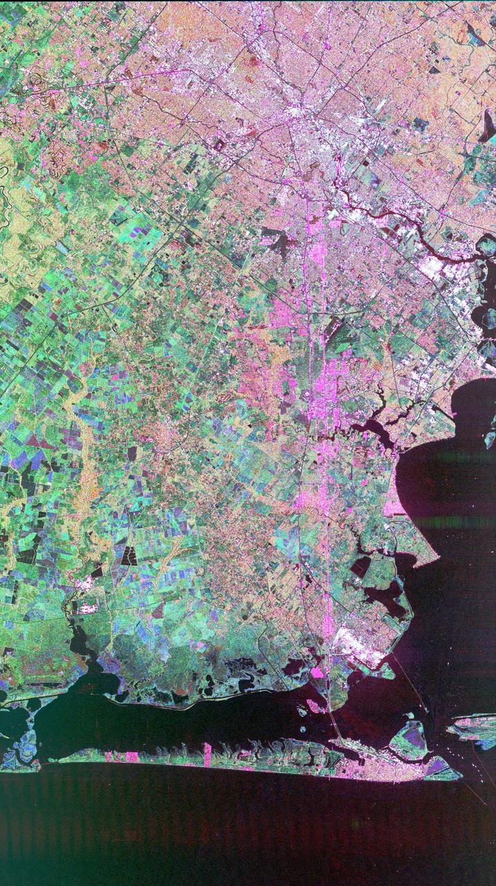
This image of Houston, Texas, shows the amount of detail that is possible to obtain using spaceborne radar imaging. Images such as this -- obtained by the Spaceborne Imaging Radar-C/X-band Synthetic Aperture Radar (SIR-C/X-SAR) flying aboard the space shuttle Endeavor last fall -- can become an effective tool for urban planners who map and monitor land use patterns in urban, agricultural and wetland areas. Central Houston appears pink and white in the upper portion of the image, outlined and crisscrossed by freeways. The image was obtained on October 10, 1994, during the space shuttle's 167th orbit. The area shown is 100 kilometers by 60 kilometers (62 miles by 38 miles) and is centered at 29.38 degrees north latitude, 95.1 degrees west longitude. North is toward the upper left. The pink areas designate urban development while the green-and blue-patterned areas are agricultural fields. Black areas are bodies of water, including Galveston Bay along the right edge and the Gulf of Mexico at the bottom of the image. Interstate 45 runs from top to bottom through the image. The narrow island at the bottom of the image is Galveston Island, with the city of Galveston at its northeast (right) end. The dark cross in the upper center of the image is Hobby Airport. Ellington Air Force Base is visible below Hobby on the other side of Interstate 45. Clear Lake is the dark body of water in the middle right of the image. The green square just north of Clear Lake is Johnson Space Center, home of Mission Control and the astronaut training facilities. The black rectangle with a white center that appears to the left of the city center is the Houston Astrodome. The colors in this image were obtained using the follow radar channels: red represents the L-band (horizontally transmitted, vertically received); green represents the C-band (horizontally transmitted, vertically received); blue represents the C-band (horizontally transmitted and received). http://photojournal.jpl.nasa.gov/catalog/PIA01783
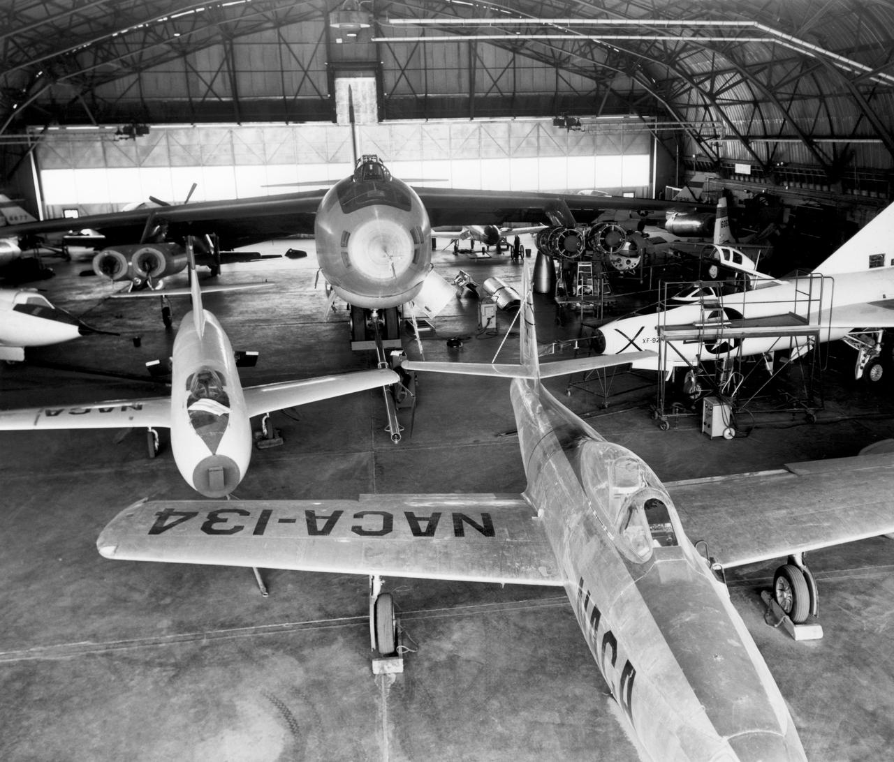
In the center foreground of this 1953 hangar photo is the YF-84A (NACA 134/Air Force 45-59490) used for vortex generator research. It arrived on November 28, 1949, and departed on April 21, 1954. Beside it is the third D-558-1 aircraft (NACA 142/Navy 37972). This aircraft was used for a total of 78 transonic research flights from April 1949 to June 1954. It replaced the second D-558-1, lost in the crash which killed Howard Lilly. Just visible on the left edge is the nose of the first D-558-2 (NACA 143/Navy 37973). Douglas turned the aircraft over to NACA on August 31, 1951, after the contractor had completed its initial test flights. NACA only made a single flight with the aircraft, on September 17, 1956, before the program was cancelled. In the center of the photo is the B-47A (NACA 150/Air Force 49-1900). The B-47 jet bomber, with its thin, swept-back wings, and six podded engines, represented the state of the art in aircraft design in the early 1950s. The aircraft undertook a number of research activities between May 1953 and its 78th and final research flight on November 22, 1957. The tests showed that the aircraft had a buffeting problem at speeds above Mach 0.8. Among the pilots who flew the B-47 were later X-15 pilots Joe Walker, A. Scott Crossfield, John B. McKay, and Neil A. Armstrong. On the right side of the B-47 is NACA's X-1 (Air Force 46-063). The second XS-1 aircraft built, it was fitted with a thicker wing than that on the first aircraft, which had exceeded Mach 1 on October 14, 1947. Flight research by NACA pilots indicated that this thicker wing produced 30 percent more drag at transonic speeds compared to the thinner wing on the first X-1. After a final flight on October 23, 1951, the aircraft was grounded due to the possibility of fatigue failure of the nitrogen spheres used to pressurize the fuel tanks. At the time of this photo, in 1953, the aircraft was in storage. In 1955, the aircraft was extensively modified, becoming the X-1E. In front o
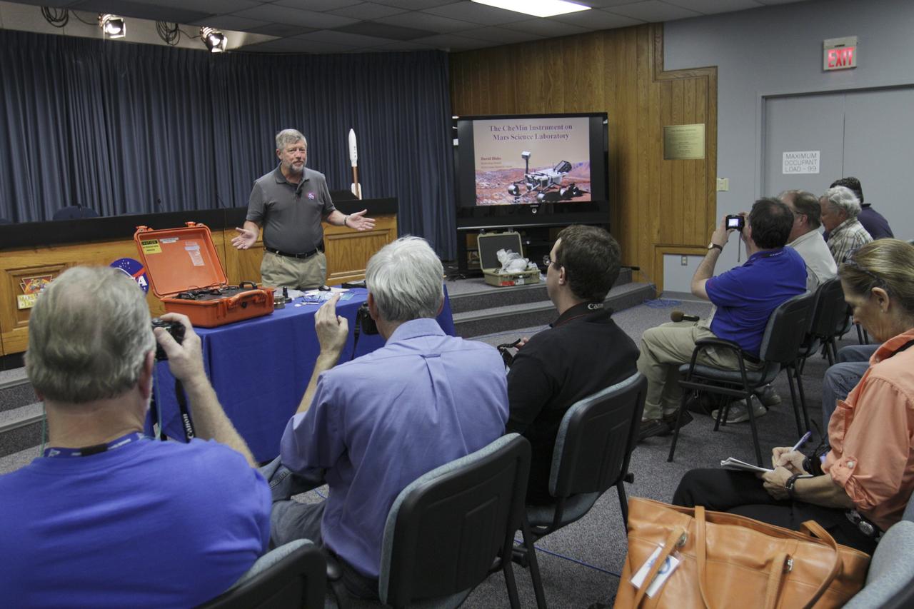
CAPE CANAVERAL, Fla. – David Blake, NASA principal investigator for the Chemistry and Mineralogy (CheMin) investigation by the Curiosity rover, explains the experiment to the media in NASA Kennedy Space Center's Press Site auditorium in Florida during prelaunch activities for the agency’s Mars Science Laboratory (MSL) launch. CheMin is designed to analyze powdered rock and soil samples by identifying and quantifying their mineral content using X-ray diffraction, a first for a mission to Mars. The car-sized Martian rover, Curiosity, has 10 science instruments designed to search for signs of life, including methane, and help determine if the gas is from a biological or geological source. Liftoff of MSL aboard a United Launch Alliance Atlas V rocket from Space Launch Complex-41 on Cape Canaveral Air Force Station is planned during a launch window which extends from 10:02 a.m. to 11:45 a.m. EST on Nov. 26. For more information, visit http://www.nasa.gov/msl. Photo credit: NASA/Kim Shiflett
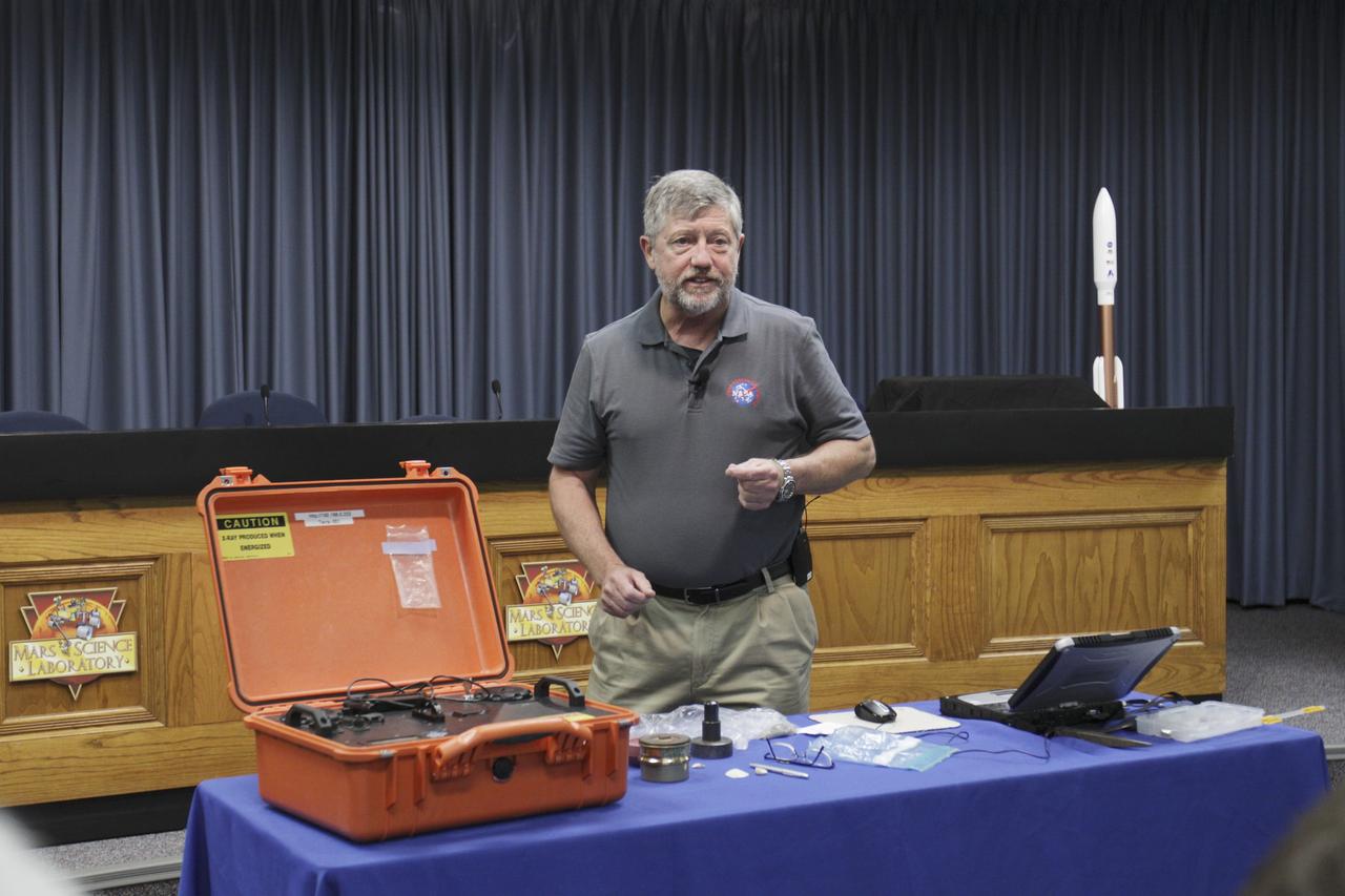
CAPE CANAVERAL, Fla. – David Blake, NASA principal investigator for the Chemistry and Mineralogy (CheMin) investigation by the Curiosity rover, demonstrates the experiment for the media in NASA Kennedy Space Center's Press Site auditorium in Florida during prelaunch activities for the agency’s Mars Science Laboratory (MSL) launch. CheMin is designed to analyze powdered rock and soil samples by identifying and quantifying their mineral content using X-ray diffraction, a first for a mission to Mars. The car-sized Martian rover, Curiosity, has 10 science instruments designed to search for signs of life, including methane, and help determine if the gas is from a biological or geological source. Liftoff of MSL aboard a United Launch Alliance Atlas V rocket from Space Launch Complex-41 on Cape Canaveral Air Force Station is planned during a launch window which extends from 10:02 a.m. to 11:45 a.m. EST on Nov. 26. For more information, visit http://www.nasa.gov/msl. Photo credit: NASA/Kim Shiflett
This is the first calibrated, multi-frequency, multi-polarization spaceborne radar image of the seasonal sea-ice cover in the Weddell Sea, Antarctica. The multi-channel data provide scientists with details about the ice pack they cannot see any other way and indicates that the large expanse of sea-ice is, in fact, comprised of many smaller rounded ice floes, shown in blue-gray. These data are particularly useful in helping scientists estimate the thickness of the ice cover which is often extremely difficult to measure with other remote sensing systems. The extent, and especially thickness, of the polar ocean's sea-ice cover together have important implications for global climate by regulating the loss of heat from the ocean to the cold polar atmosphere. The image was acquired on October 3, 1994, by the Spaceborne Imaging Radar-C/X-Band Synthetic Aperture Radar (SIR-C/X-SAR) onboard the space shuttle Endeavour. This image is produced by overlaying three channels of radar data in the following colors: red (C-band, HH-polarization), green (L-band HV-polarization), and blue (L-band, HH-polarization). The image is oriented almost east-west with a center location of 58.2 degrees South and 21.6 degrees East. Image dimensions are 45 kilometers by 18 kilometers (28 miles by 11 miles). Most of the ice cover is composed of rounded, undeformed blue-gray floes, about 0.7 meters (2 feet) thick, which are surrounded by a jumble of red-tinged deformed ice pieces which are up to 2 meters (7 feet) thick. The winter cycle of ice growth and deformation often causes this ice cover to split apart, exposing open water or "leads." Ice growth within these openings is rapid due to the cold, brisk Antarctic atmosphere. Different stages of new-ice growth can be seen within the linear leads, resulting from continuous opening and closing. The blue lines within the leads are open water areas in new fractures which are roughened by wind. The bright red lines are an intermediate stage of new-ice growth perhaps 5 to 10 centimeters (2 to 4 inches) thick. The more extensive dark zones are covered by a slightly thicker layer of smooth, level ice up to 70 centimeters (28 inches) thick. http://photojournal.jpl.nasa.gov/catalog/PIA01786
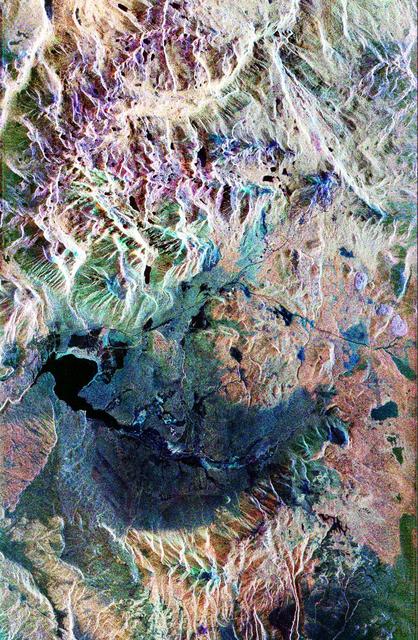
This false-color composite radar image of the Mammoth Mountain area in the Sierra Nevada Mountains, California, was acquired by the Spaceborne Imaging Radar-C and X-band Synthetic Aperture Radar aboard the space shuttle Endeavour on its 67th orbit on October 3, 1994. The image is centered at 37.6 degrees north latitude and 119.0 degrees west longitude. The area is about 39 kilometers by 51 kilometers (24 miles by 31 miles). North is toward the bottom, about 45 degrees to the right. In this image, red was created using L-band (horizontally transmitted/vertically received) polarization data; green was created using C-band (horizontally transmitted/vertically received) polarization data; and blue was created using C-band (horizontally transmitted and received) polarization data. Crawley Lake appears dark at the center left of the image, just above or south of Long Valley. The Mammoth Mountain ski area is visible at the top right of the scene. The red areas correspond to forests, the dark blue areas are bare surfaces and the green areas are short vegetation, mainly brush. The purple areas at the higher elevations in the upper part of the scene are discontinuous patches of snow cover from a September 28 storm. New, very thin snow was falling before and during the second space shuttle pass. In parallel with the operational SIR-C data processing, an experimental effort is being conducted to test SAR data processing using the Jet Propulsion Laboratory's massively parallel supercomputing facility, centered around the Cray Research T3D. These experiments will assess the abilities of large supercomputers to produce high throughput Synthetic Aperture Radar processing in preparation for upcoming data-intensive SAR missions. The image released here was produced as part of this experimental effort. http://photojournal.jpl.nasa.gov/catalog/PIA01746
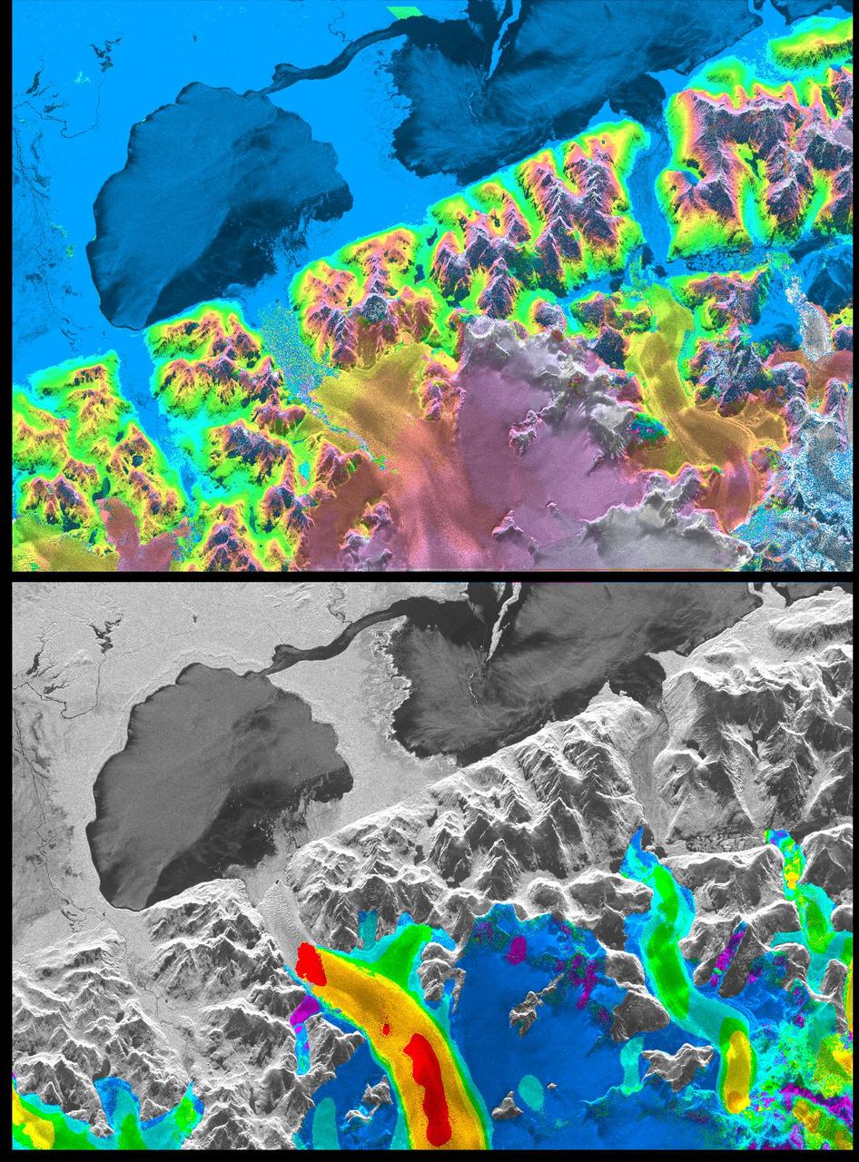
A NASA radar instrument has been successfully used to measure some of the fastest moving and most inaccessible glaciers in the world -- in Chile's huge, remote Patagonia ice fields -- demonstrating a technique that could produce more accurate predictions of glacial response to climate change and corresponding sea level changes. This image, produced with interferometric measurements made by the Spaceborne Imaging Radar-C and X-band Synthetic Aperture Radar (SIR-C/X-SAR) flown on the Space Shuttle last fall, has provided the first detailed measurements of the mass and motion of the San Rafael Glacier. Very few measurements have been made of the Patagonian ice fields, which are the world's largest mid-latitude ice masses and account for more than 60 percent of the Southern Hemisphere's glacial area outside of Antarctica. These features make the area essential for climatologists attempting to understand the response of glaciers on a global scale to changes in climate, but the region's inaccessibility and inhospitable climate have made it nearly impossible for scientists to study its glacial topography, meteorology and changes over time. Currently, topographic data exist for only a few glaciers while no data exist for the vast interior of the ice fields. Velocity has been measured on only five of the more than 100 glaciers, and the data consist of only a few single-point measurements. The interferometry performed by the SIR-C/X-SAR was used to generate both a digital elevation model of the glaciers and a map of their ice motion on a pixel-per-pixel basis at very high resolution for the first time. The data were acquired from nearly the same position in space on October 9, 10 and 11, 1994, at L-band frequency (24-cm wavelength), vertically transmitted and received polarization, as the Space Shuttle Endeavor flew over several Patagonian outlet glaciers of the San Rafael Laguna. The area shown in these two images is 50 kilometers by 30 kilometers (30 miles by 18 miles) in size and is centered at 46.6 degrees south latitude, 73.8 degrees west longitude. North is toward the upper right. The top image is a digital elevation model of the scene, where color and saturation represent terrain height (between 0 meters and 2,000 meters or up to 6,500 feet) and brightness represents radar backscatter. Low elevations are shown in blue and high elevations are shown in pink. The digital elevation map of the glacier surface has a horizontal resolution of 15 meters (50 feet) and a vertical resolution of 10 meters (30 feet). High-resolution maps like these acquired over several years would allow scientists to calculate directly long-term changes in the mass of the glacier. The bottom image is a map of ice motion parallel to the radar look direction only, which is from the top of the image. Purple indicates ice motion away from the radar at more than 6 centimeters per day; dark blue is ice motion toward or away at less than 6 cm per day; light blue is motion toward the radar of 6 cm to 20 cm (about 2 to 8 inches) per day; green is motion toward the radar of 20 cm to 45 cm (about 8 to 18 inches) per day; yellow is 45 cm to 85 cm (about 18 to 33 inches) per day; orange is 85 cm to 180 cm (about 33 to 71 inches) per day; red is greater than 180 cm (71 inches) per day. The velocity estimates are accurate to within 5 millimeters per day. The largest velocities are recorded on the San Rafael Glacier in agreement with previous work. Other outlet glaciers exhibit ice velocities of less than 1 meter per day. Several kilometers before its terminus, (left of center) the velocity of the San Rafael Glacier exceeds 10 meters (32 feet) per day, and ice motion cannot be estimated from the data. There, a revisit time interval of less than 12 hours would have been necessary to estimate ice motion from interferometry data. The results however demonstrate that the radar interferometry technique permits the monitoring of glacier characteristics unattainable by any other means. http://photojournal.jpl.nasa.gov/catalog/PIA01781
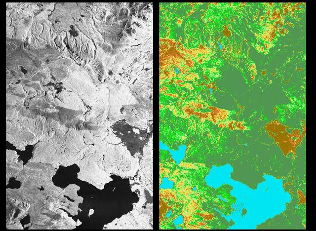
These two radar images show the majestic Yellowstone National Park, Wyoming, the oldest national park in the United States and home to the world's most spectacular geysers and hot springs. The region supports large populations of grizzly bears, elk and bison. In 1988, the park was burned by one of the most widespread fires to occur in the northern Rocky Mountains in the last 50 years. Surveys indicated that 793,880 acres of land burned. Of that, 41 percent was burned forest, with tree canopies totally consumed by the fire; 35 percent was a combination of unburned, scorched and blackened trees; 13 percent was surface burn under an unburned canopy; 6 percent was non-forest burn; and 5 percent was undifferentiated burn. Six years later, the burned areas are still clearly visible in these false-color radar images obtained by the Spaceborne Imaging Radar-C/X-band Synthetic Aperture Radar on board the space shuttle Endeavour. The image at the left was obtained using the L-band radar channel, horizontally received and vertically transmitted, on the shuttle's 39th orbit on October 2, 1994. The area shown is 45 kilometers by 71 kilometers (28 miles by 44 miles) in size and centered at 44.6 degrees north latitude, 110.7 degrees west longitude. North is toward the top of the image (to the right). Most trees in this area are lodge pole pines at different stages of fire succession. Yellowstone Lake appears as a large dark feature at the bottom of the scene. At right is a map of the forest crown, showing its biomass, or amount of vegetation, which includes foliage and branches. The map was created by inverting SIR-C data and using in situ estimates of crown biomass gathered by the Yellowstone National Biological Survey. The map is displayed on a color scale from blue (rivers and lakes with no biomass) to brown (non-forest areas with crown biomass of less than 4 tons per hectare) to light brown (areas of canopy burn with biomass of between 4 and 12 tons per hectare). Yellow indicates areas of canopy burn and mixed burn with a biomass of between 12 to 20 tons per hectare; light green is mixed burn and on-burn forest with a biomass of 20 to 35 tons per hectare; and green is non-burned forest with a biomass of greater than 35 tons per hectare. Forest recovery from the fire seems to depend on fire intensity and soil conditions. In areas of severe canopy burn and poor soil conditions, crown biomass was still low in 1994 (indicated by the brown areas at the center left), whereas in areas of mixed burn with nutrient-rich soils, seen west of Yellowstone Lake, crown biomass has increased significantly in six years (indicated by the yellow and light green areas). Imaging fire-affected regions with spaceborne radar illustrates SIR-C/X-SAR's keen abilities to monitor regrowth after a fire. Knowing the amount of carbon accumulated in the atmosphere by regenerating forest in the 20 to 50 years following a fire disturbance is also a significant factor in understanding the global carbon cycle. Measuring crown biomass is necessary to evaluate the effects of past and future fires in specific regions. http://photojournal.jpl.nasa.gov/catalog/PIA01741