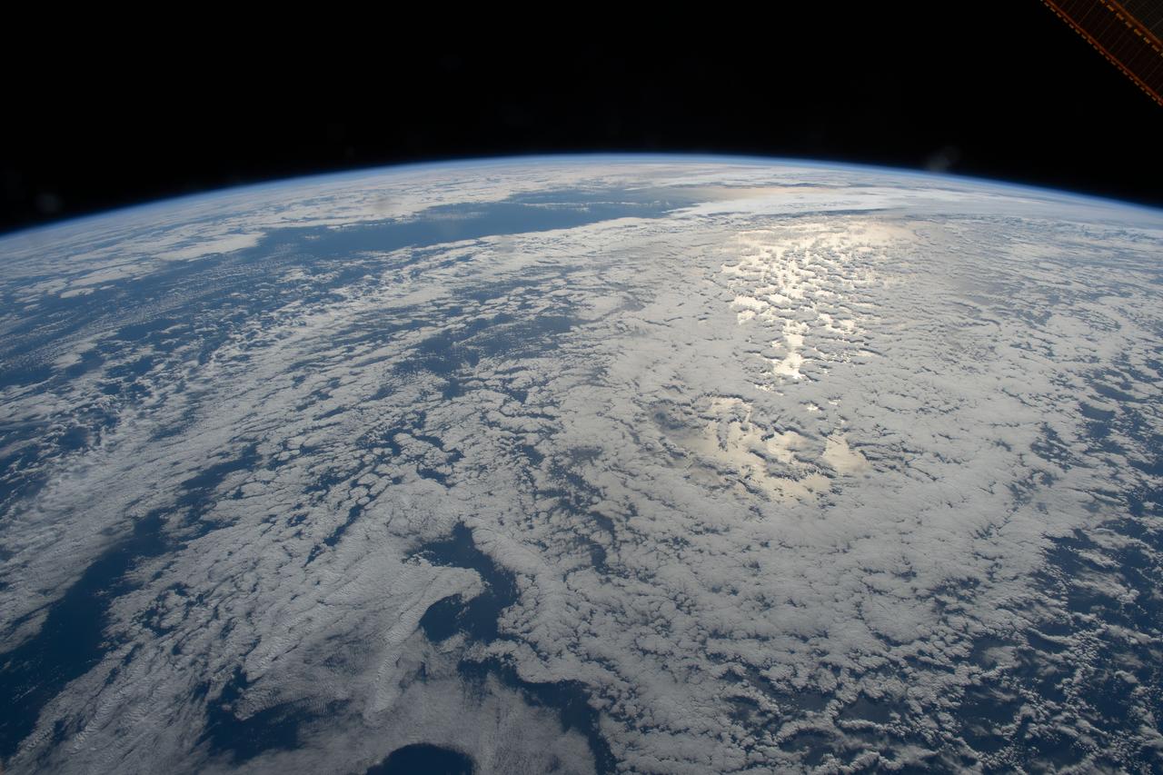
iss063e046732 (July 14, 2020) --- The sun's glint beams on the South Pacific Ocean as the International Space Station orbited just off the coast of Auckland, New Zealand.
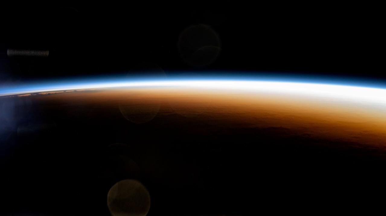
iss071e439624 (Aug. 6, 2024) --- An orbital sunrise colorfully illuminates the Earth's atmosphere and highlights the boundary between night and day, also known as the terminator, in this photograph from the International Space Station as it orbited 267 miles above the Pacific Ocean north of Auckland, New Zealand.
Earth observation taken during a day pass by the Expedition 40 crew aboard the International Space Station. Also sent down as Twitter message: Two volcanoes peek through the morning clouds near Auckland, New Zealand
iss066e117997 (Jan. 16, 2022) --- The atmospheric plume from an underwater volcano eruption in the Pacific nation of Tonga is pictured from the International Space Station as it orbited 269 miles above the Pacific Ocean northwest of Auckland, New Zealand.
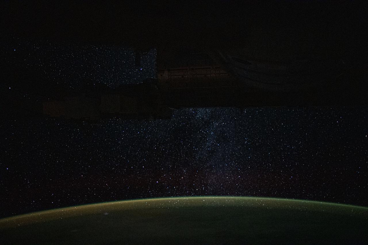
iss060e002062 (June 29, 2019) --- A starry nighttime background seemingly glitters down on Earth's atmospheric glow as the International Space Station orbited 266 miles above Auckland, New Zealand.
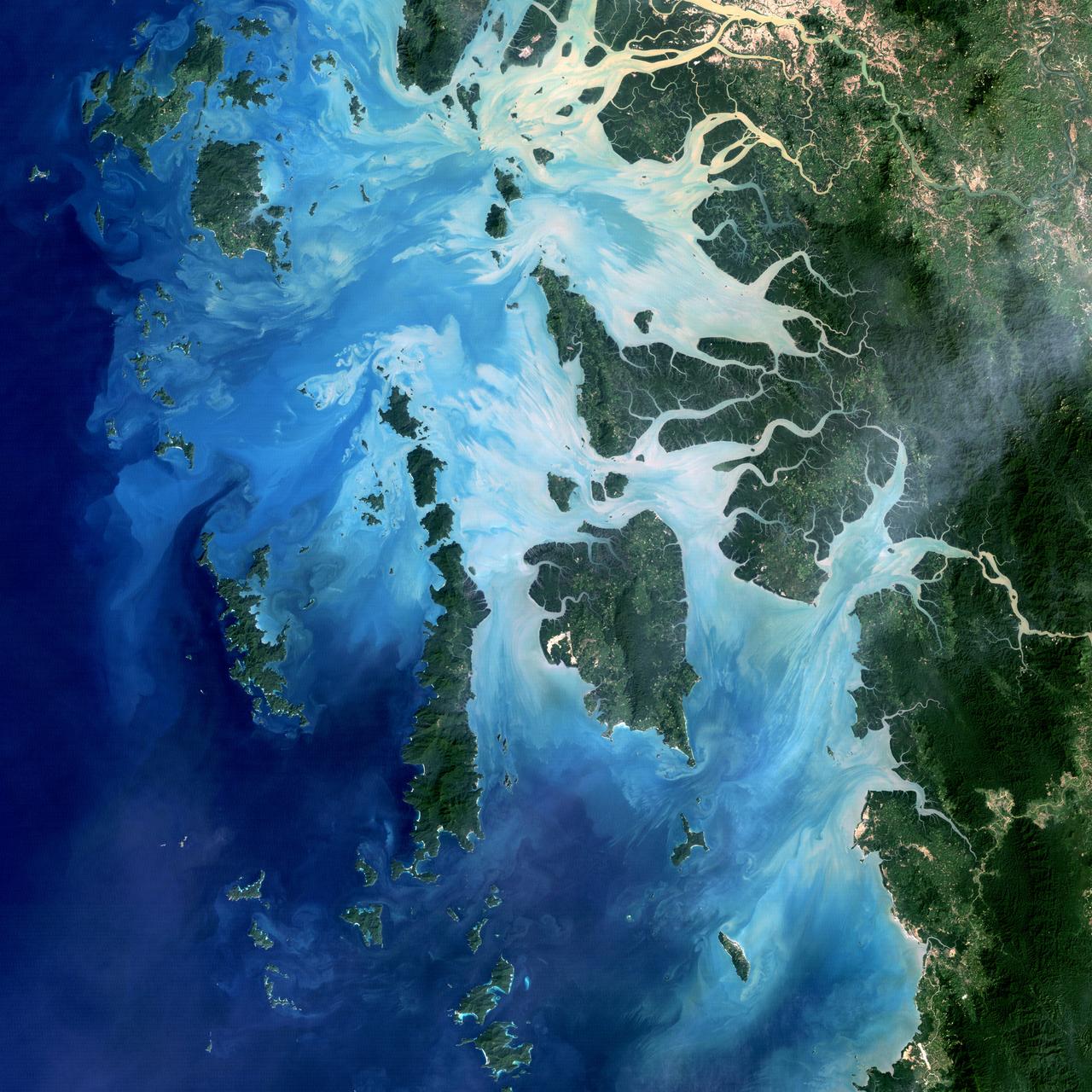
NASA image acquired December 14, 2004 In the southernmost reaches of Burma (Myanmar), along the border with Thailand, lies the Mergui Archipelago. The archipelago in the Andaman Sea is made up of more than 800 islands surrounded by extensive coral reefs. This natural color image acquired by Landsat 5 on Dec. 14, 2004, shows the middle portion of the archipelago, including Auckland and Whale Bays. Swirling patterns are visible in the near-shore waters as sediments carried by rivers slowly settle out and are deposited on the seafloor. The heavy sediment loads make the river appear nearly white. As those sediments settle out, the seawater appears deeper shades of blue. The tropical rainforests of the region appear deep green. Captain Thomas Forrest of the East India Company first described the region to Europeans after a 1782 expedition in search of potential sugar-growing lands. At that time, the islands were mainly inhabited by a nomadic fishing culture. These people, known as the Moken, still call the archipelago home and mostly live a hunter-gatherer lifestyle. As of 2006, 2,000 Moken were known to inhabit the Burmese portion of Mergui. The small population of the archipelago has helped preserve its high diversity of plants and animals. In 1997, Burma opened the region to foreign tourism and in the years since it has become a major diving destination. A valued species of pearl oyster (Pinctada maxima) are found in nearby waters. Today, overfishing is emerging as a regional problem. Landsat image created by Michael Taylor, Landsat Project Science Office. Caption by Laura Rocchio. Instrument: Landsat 5 - TM To read more go to: <a href="http://1.usa.gov/TDmjsk" rel="nofollow">1.usa.gov/TDmjsk</a> Credit: <b><a href="http://www.earthobservatory.nasa.gov/" rel="nofollow"> NASA Earth Observatory</a></b> <b><a href="http://www.nasa.gov/audience/formedia/features/MP_Photo_Guidelines.html" rel="nofollow">NASA image use policy.</a></b> <b><a href="http://www.nasa.gov/centers/goddard/home/index.html" rel="nofollow">NASA Goddard Space Flight Center</a></b> enables NASA’s mission through four scientific endeavors: Earth Science, Heliophysics, Solar System Exploration, and Astrophysics. Goddard plays a leading role in NASA’s accomplishments by contributing compelling scientific knowledge to advance the Agency’s mission. <b>Follow us on <a href="http://twitter.com/NASA_GoddardPix" rel="nofollow">Twitter</a></b> <b>Like us on <a href="http://www.facebook.com/pages/Greenbelt-MD/NASA-Goddard/395013845897?ref=tsd" rel="nofollow">Facebook</a></b> <b>Find us on <a href="http://instagram.com/nasagoddard?vm=grid" rel="nofollow">Instagram</a></b>
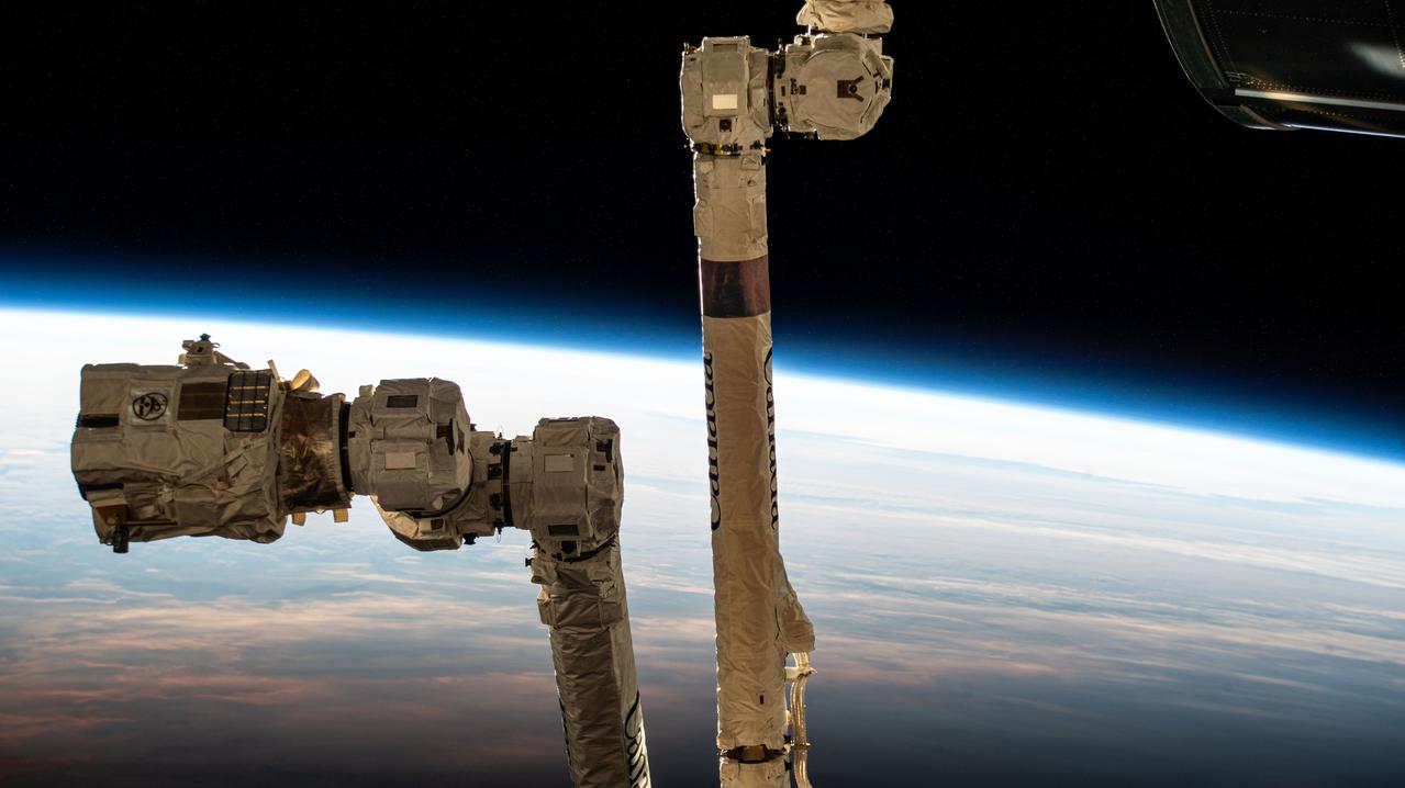
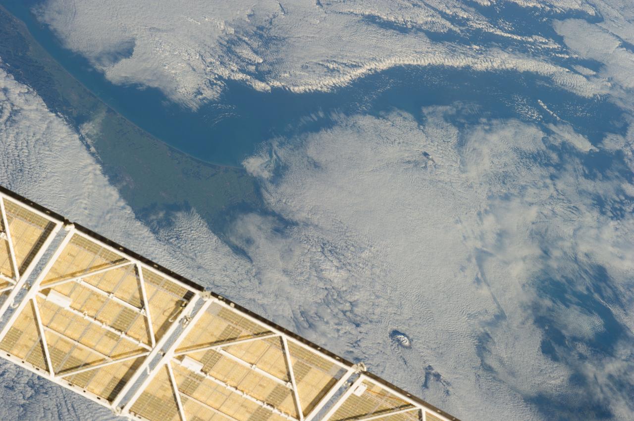
iss072e576480 (Jan. 31, 2025) --- The 57.7-foot-long Canadarm2 robotic arm with its latching end effector that can grapple spacecraft or maneuver spacewalkers is pictured as the International Space Station orbited into daylight 267 miles above the South Pacific Ocean just south of New Zealand's Auckland Islands.
iss055e005323 (March 25, 2018) --- The International Space Station was orbiting above the Tasman Sea when an Expedition 55 crew member took this picture of New Zealand's North Island where the city of Auckland is located. The sun's glint over the South Pacific Ocean and the Tasman Sea clearly outlines the island nation.
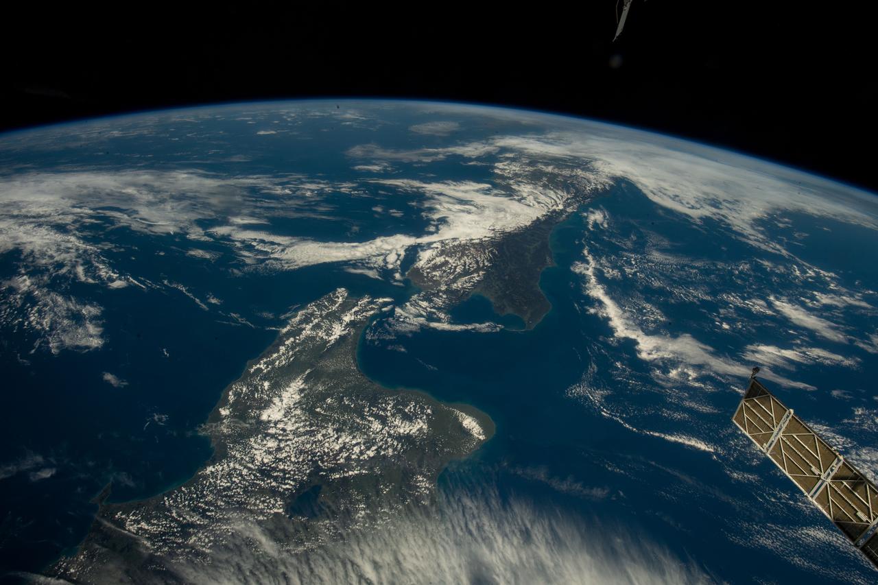
iss068e021004 (Nov. 7, 2022) --- The two main islands of New Zealand, North Island (at bottom) and South Island (at top), are pictured from the International Space Station as it orbited 269 miles above the island country east of Auckland. Credit: Koichi Wakata/Japan Aerospace Exploration Agency
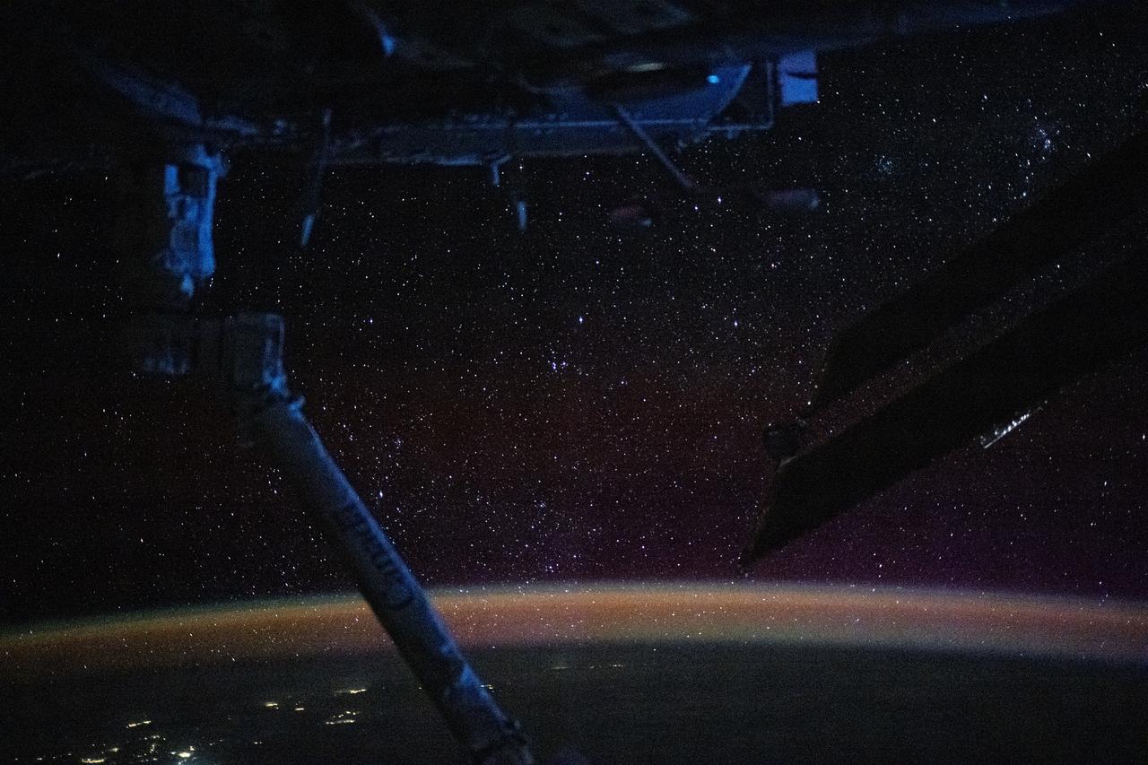
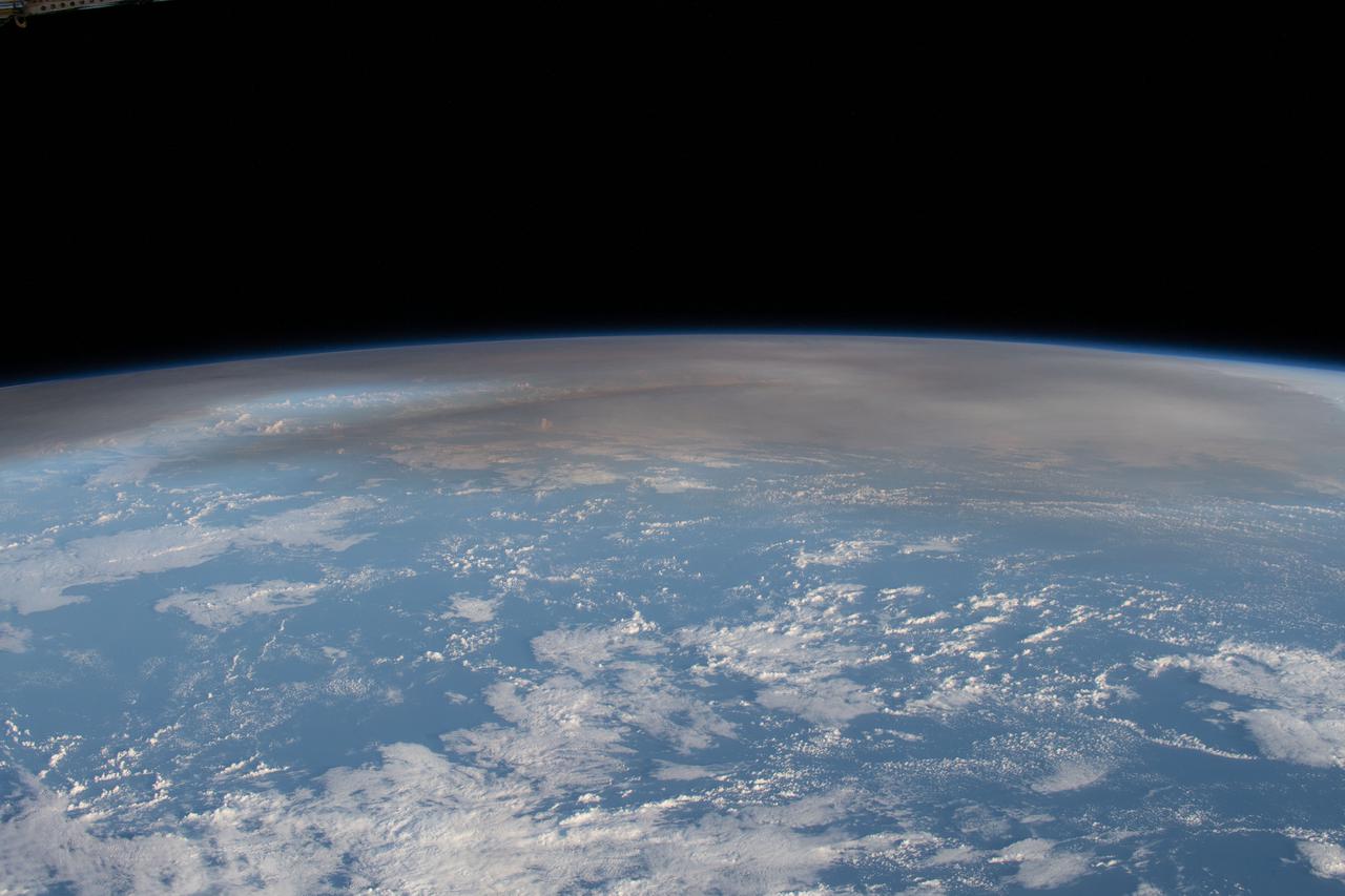
iss072e030147 (Oct. 7, 2024) --- The atmospheric glow, caused by atoms and moelcules excited by sunlight, blankets Earth's nighttime horizon with a sparkling field of stars above in this photograph from the International Space Station as it orbited 270 miles above the Pacific Ocean north of Auckland, New Zealand.
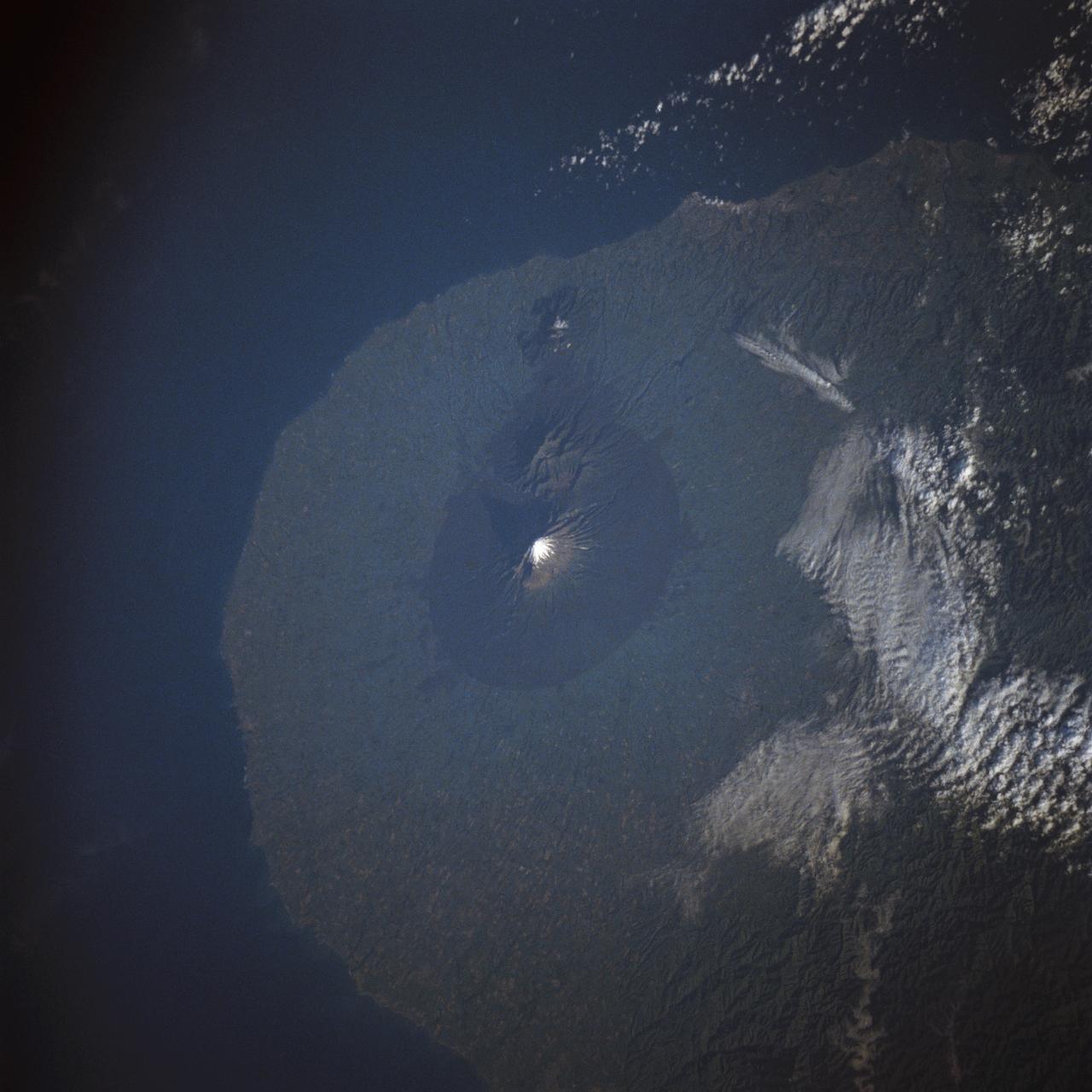
STS009-40-2574 (28 Nov-8 Dec 1983) --- New Zealand?s Mount Egmont volcano rises 8300 ft (2520 meters) out of the Tasman Sea and has been designated as a national park. It is on the North Island, 125 miles (200 Km) SSW of Auckland. The border fence of the national park is clearly seen because the lighter green area surrounding it is a grazing range.
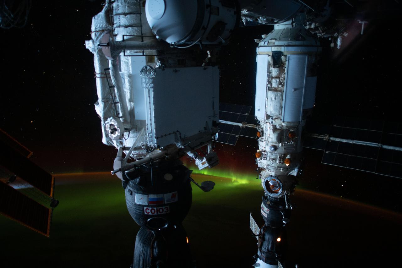
iss065e455153 (Oct. 9, 2021) --- An aurora is pictured below the International Space Station as it was orbiting 274 miles above the southern Pacific Ocean just south of Auckland Island, New Zealand. In the foreground (from left) are, the Soyuz MS-19 crew ship docked to the Rassvet module and the Soyuz MS-18 crew ship docked to the Nauka multipurpose laboratory module.
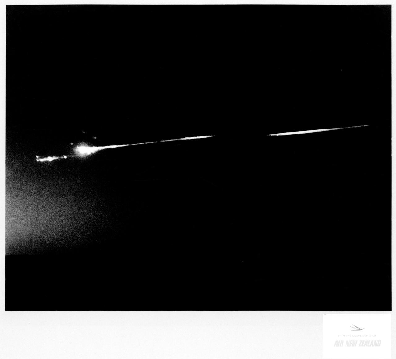
S70-17646 (18 April 1970) --- An unidentified airline passenger snapped these bright objects, believed to be the Apollo 13 Service Module (SM) and Lunar Module (LM) as they entered Earth's atmosphere over the Pacific Ocean on April 18, 1970. The aircraft, an Air New Zealand DC-8 was midway between the Fiji Islands (Nandi Island to be specific) and Auckland, New Zealand, when the photograph was taken. The crew men of the problem plagued Apollo 13 mission jettisoned the LM and SM prior to entering Earth's atmosphere in the Apollo 13 Command Module (CM).
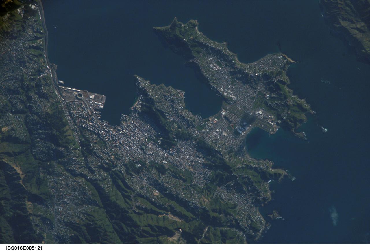
ISS016-E-005121 (21 Oct. 2007) --- Wellington, New Zealand is featured in this image photographed by an Expedition 16 crewmember on the International Space Station. New Zealand's capital of Wellington is located at the southwestern tip of North Island near the Cook Strait. The city is the second largest in New Zealand (after Auckland), and at 41 degrees south latitude, it is the southernmost capital city of the world. The North and South Islands of New Zealand are located along the active Australian-Pacific tectonic plate boundary -- the Islands are only a small part of a larger submerged fragment of continental crust. The glancing collision of these two tectonic plates results in uplift of the land surface, expressed as low hills on North Island and the Southern Alps on South Island. Local topography visible in this view is a result of these tectonic forces and weathering processes, which have exerted a strong influence on the morphology of the city. Tightly clustered white rooftops and high building density of the central business district are visible to the south of the Westpac Stadium between vegetated (green) northeast-southwest trending ridges. Lower density development (gray gridded regions with scattered white rooftops) has spread eastwards along the Miramar Peninsula. Five major faults that run through the Wellington metropolitan area; the largest magnitude earthquake recorded in New Zealand (approximately 8.2 on the Richter Scale) occurred in 1855 on one of these (the Wairarapa Fault). Recognition of the potential seismic hazard in the metropolitan area has led to adoption of building codes to maximize structural resistance to earthquake damage.
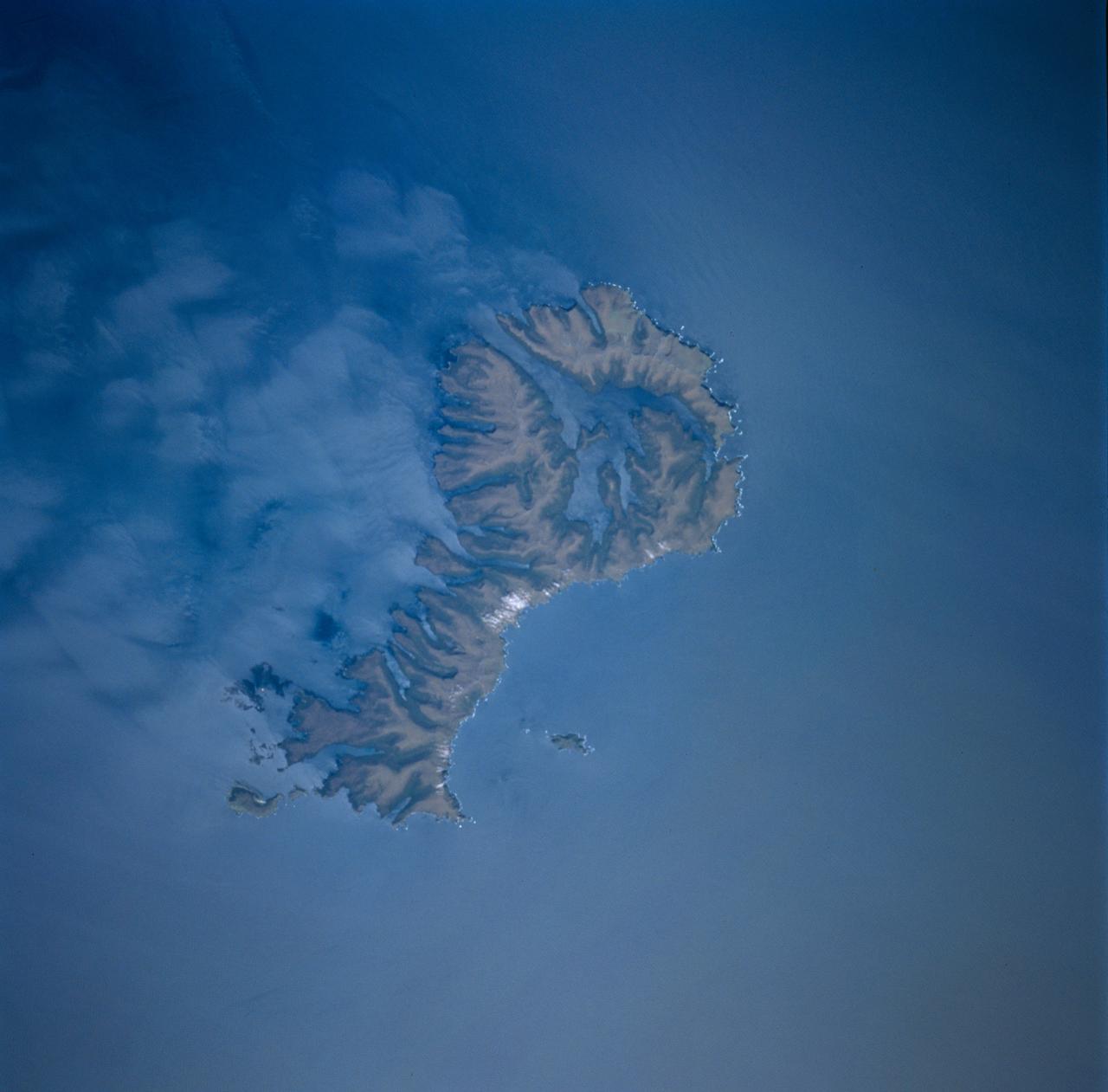
STS089-743-004 (22-31 Jan. 1998) --- This picture showing Auckland Island, New Zealand was photographed with a 70mm handheld camera from the Earth-orbiting space shuttle Endeavour. A spectacular occurrence of internal waves in the ocean is visible in the wake of the island. These waves can be generated by currents or, in some cases, wind across the island. In this case, the observation was that these waves were visible after the sunglint disappeared, suggesting current generated effects. If so, the circum-polar current that moves west-east around Antarctica would generate the scalloped appearance in the water east of the island. There is characteristically very little surface expression to these waves so they would not be noticed by a ship in this region. Fundamental processes of oceanic circulation and interaction are poorly understood. These shots help oceanographers model the dynamics of the open ocean and work out mixing models for ocean layer and ocean-air interaction (important for modeling CO2 budget, for example). The long linear valleys and bays have been excavated by glaciers cutting into this long-extinct volcano. This island is located on the submerged Campbell Plateau, which is an area almost as large as the exposed land of South Island, New Zealand. Scientists report that the plateau was submerged when New Zealand, Antarctica and Australia separated "around 75 million years ago." This could be viewed as one of the tallest mountains on the plateau. Usually the weather in this area is bad so this photo opportunity was considered a "great catch." Photo credit: NASA