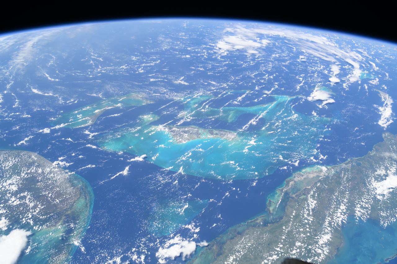
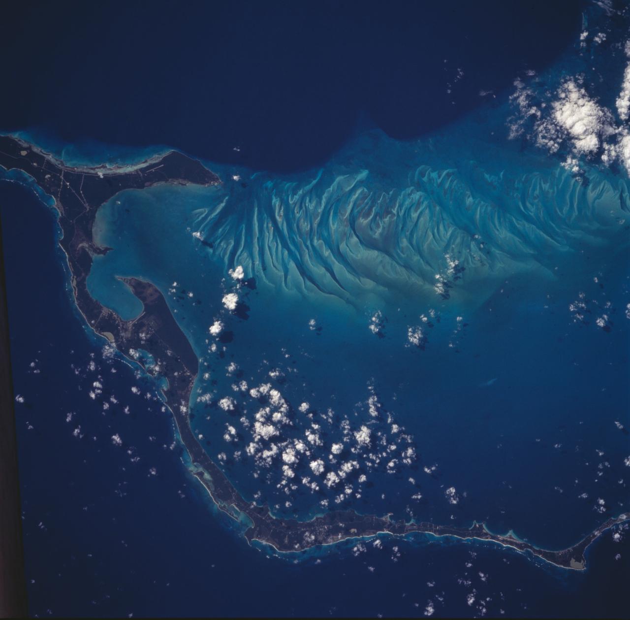
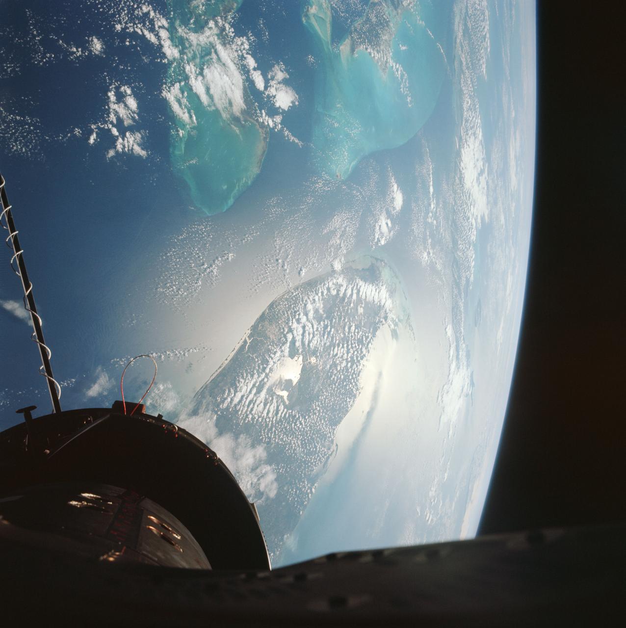
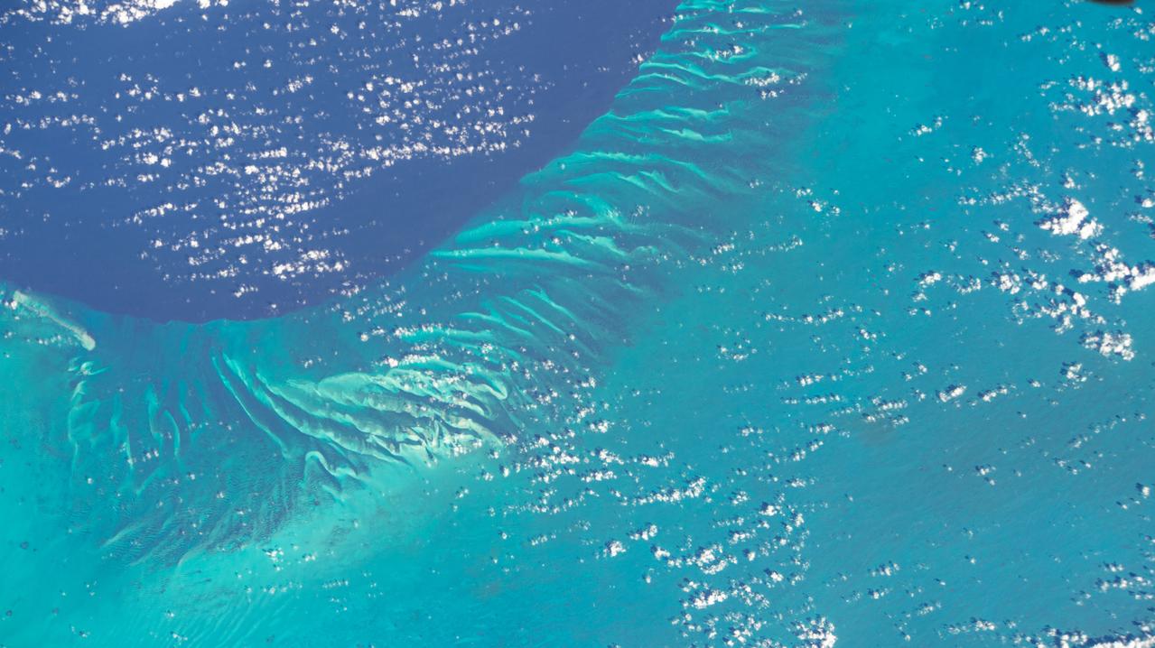
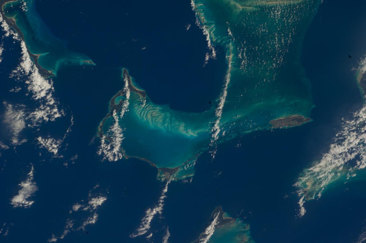
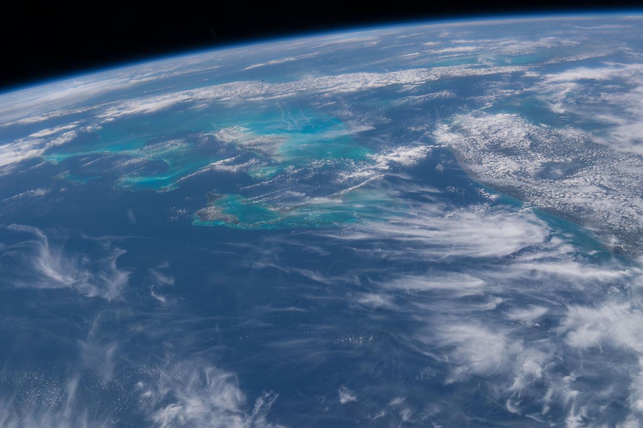
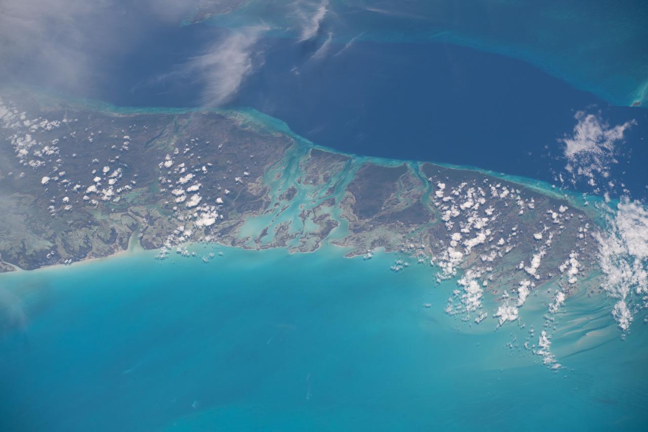
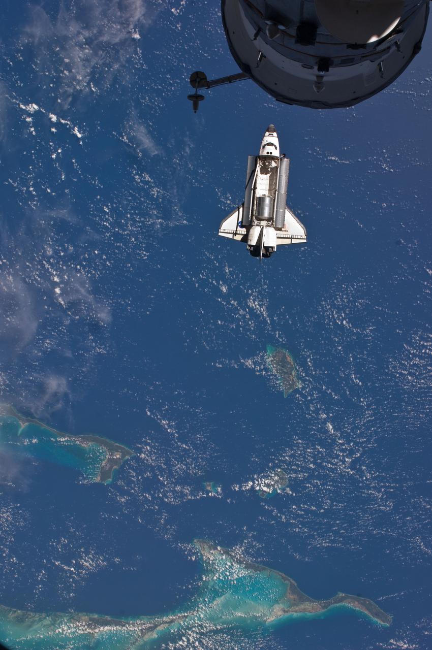
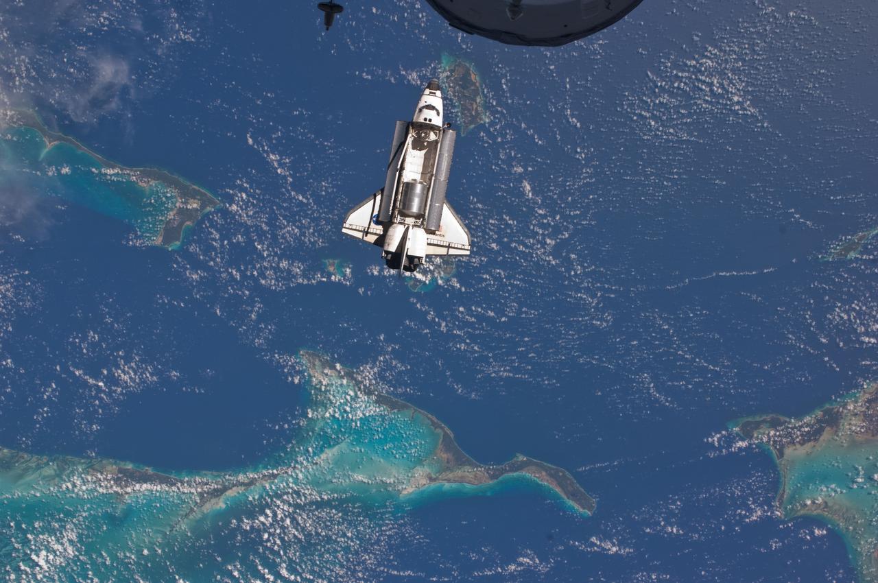
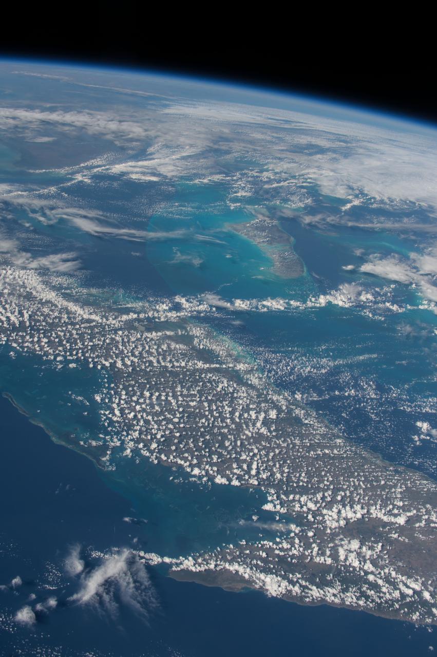
iss071e449837 (July 24, 2024) --- The clear blue waters surrounding The Bahamas in the Atlantic Ocean are pictured from the International Space Station as it soared 258 miles above.
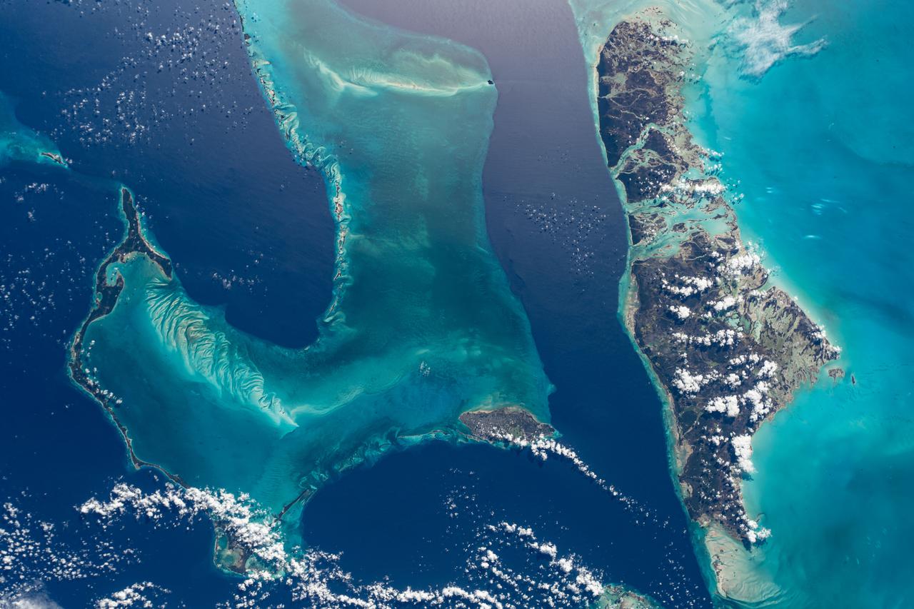
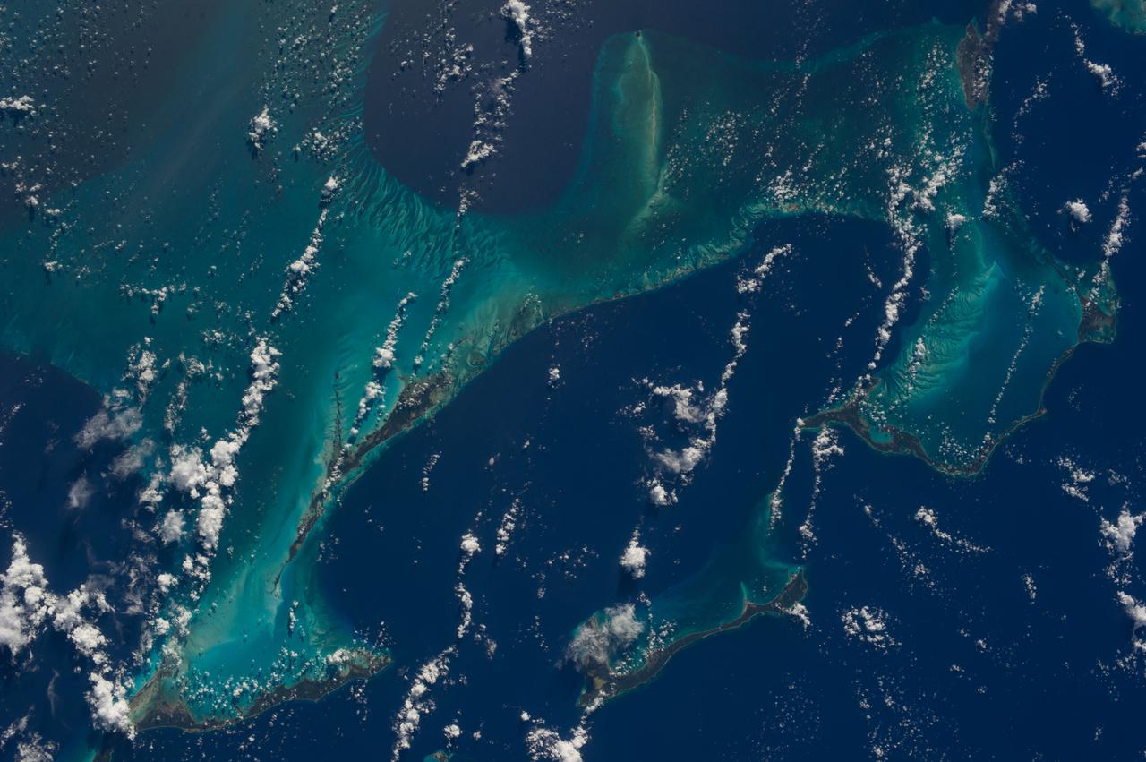
The light blue shallow water platforms of the Bahamas, (24.0N, 77.0W) which are separated by very deep dark blue channels make for a striking scene. In the foreground is Andros Island and in the background are the Tongue of the Ocean, the Exuma Islands, Exuma Sound and the Atlantic Ocean. The Bahamas are one of the few regions where calcium carbonate precipitates directly out of the water, as the mineral aragonite, to form the coral reef islands.
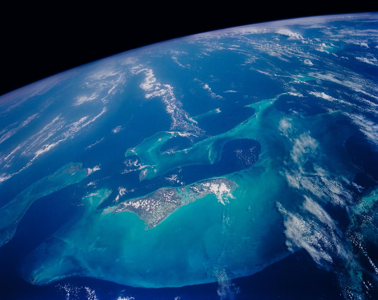
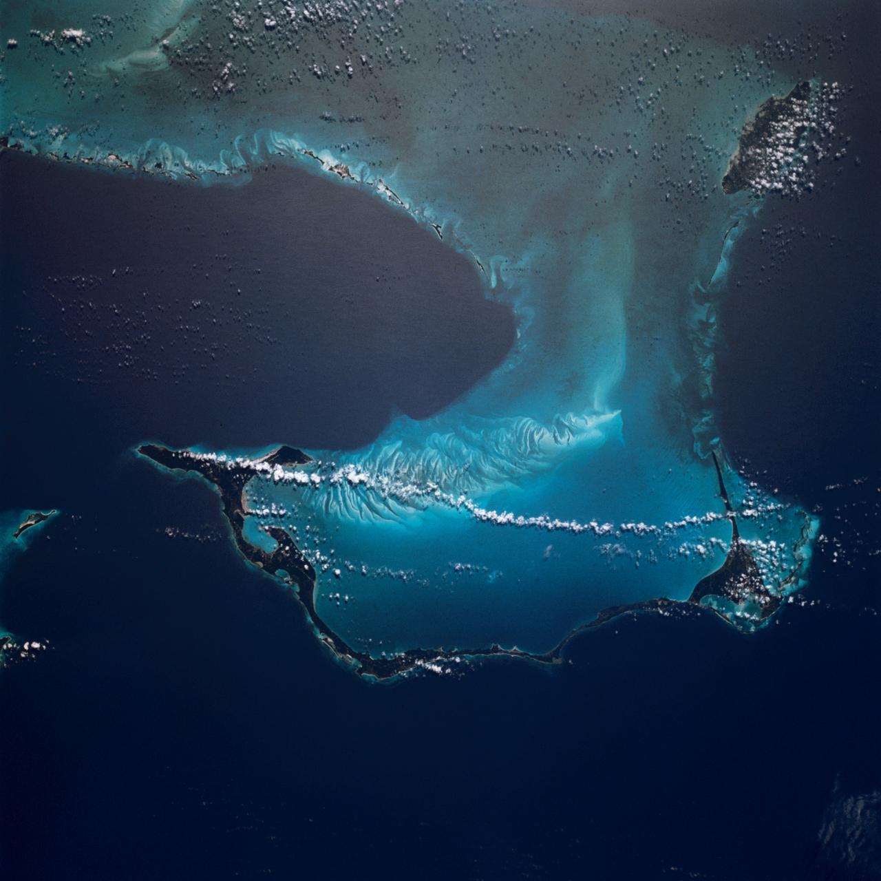
STS054-152-102 (13-19 Jan. 1993) --- This is a south-looking, wide angle view of the northern Bahamas, featuring the islands (from mid-foreground toward background) of Eleuthera, New Providence, and Andros. The northern shore of Cuba can be seen in the background. The resort city of Nassau occupies much of eastern New Providence. The Bahamas host some very distinctive features -- the deep blue channels and the shallow, light blue platforms, feathery sand bars at the edges of the deep water sounds, and colorful lakes and tidal channels like seen on Andros Island.
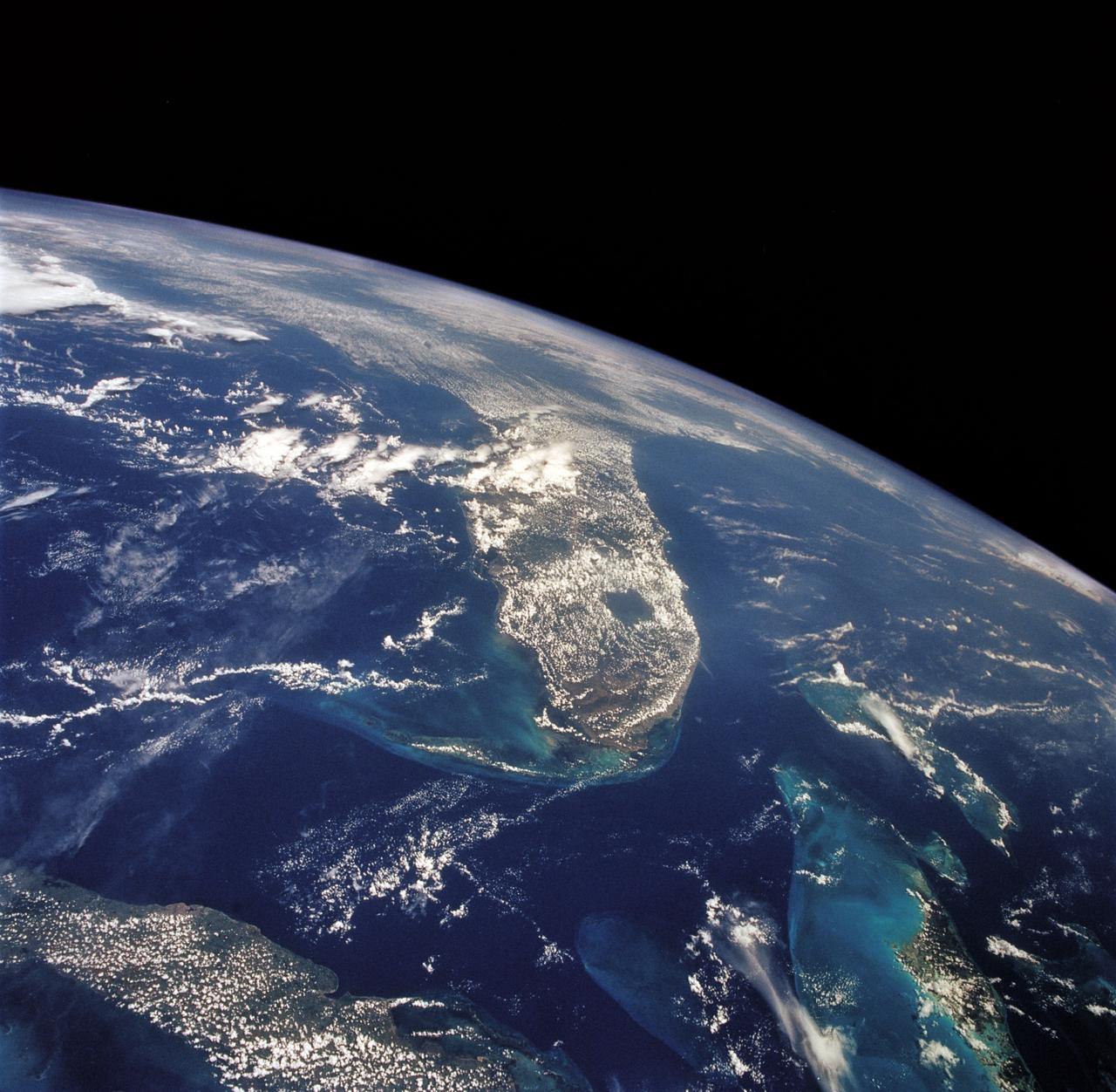
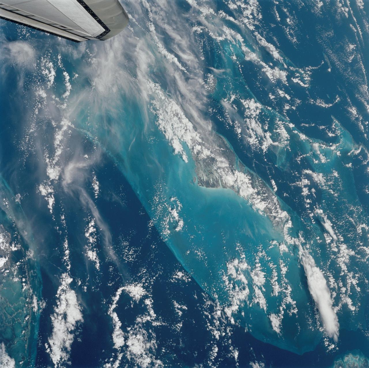
STS045-78-016 (24 March-2 April 1992) --- This view is of the Bahamas and Florida looking westward into the sunglint. The Bahama Banks are in the foreground; from left to right, Andros Island, the Berry Islands, and Grand Bahama Island are surrounded by shallow limestone banks. Bimini is the double dark spot on the edge of the Straits of Florida, with the peninsula of Florida within the sunglint. Cuba can be seen to the upper left.
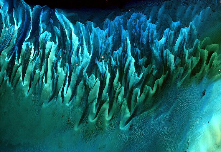
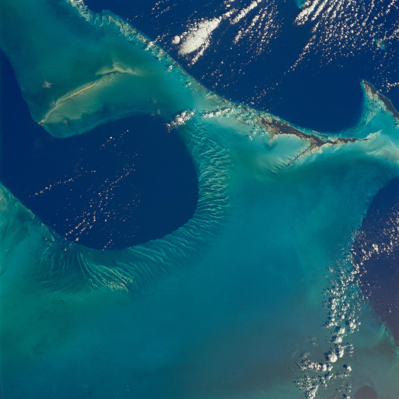
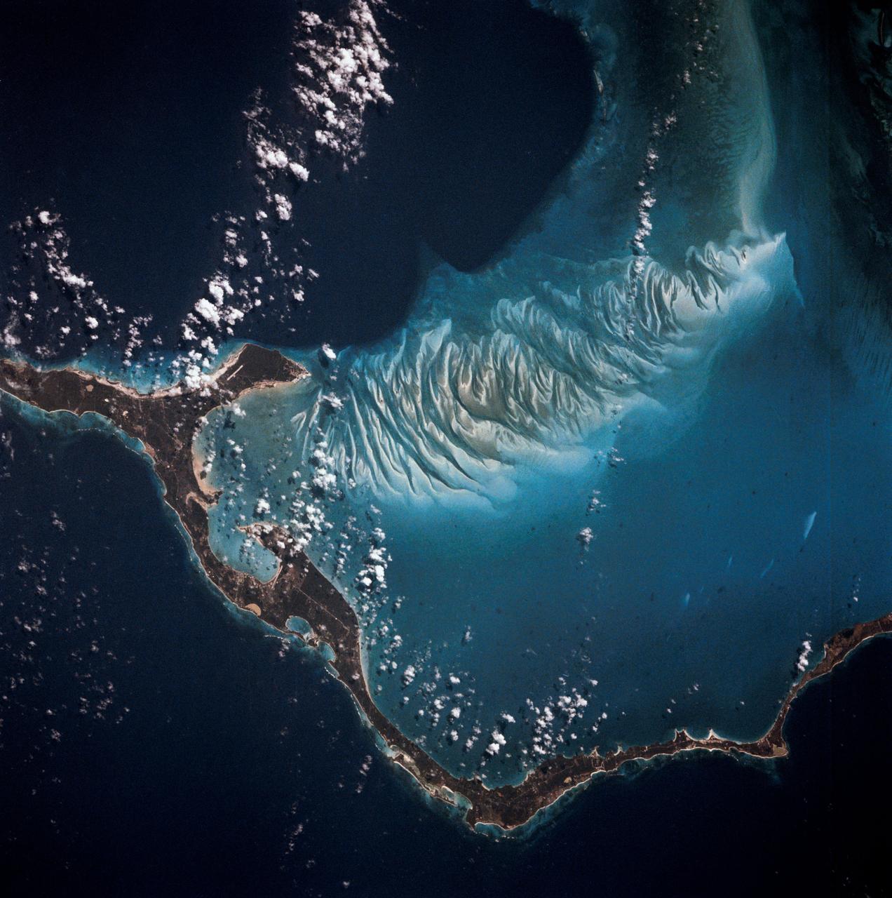
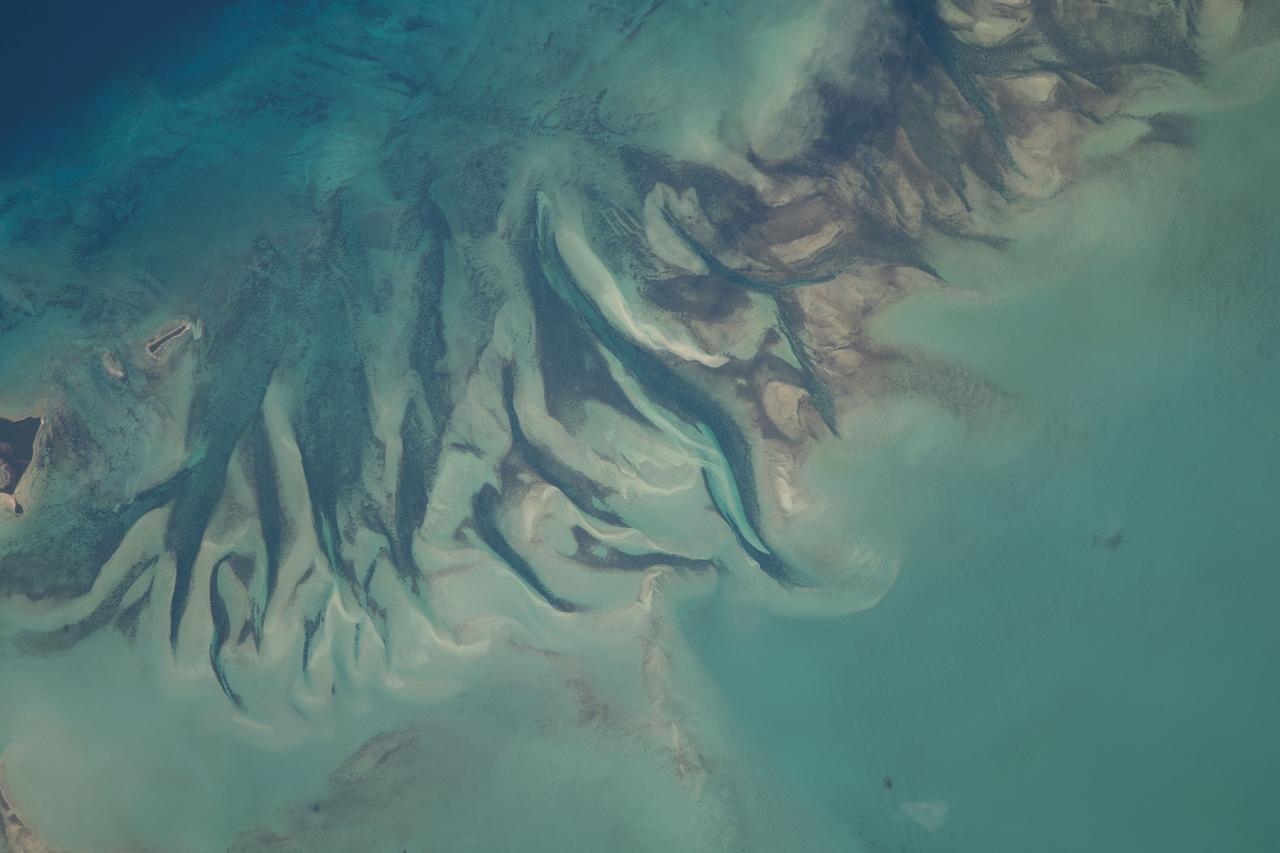
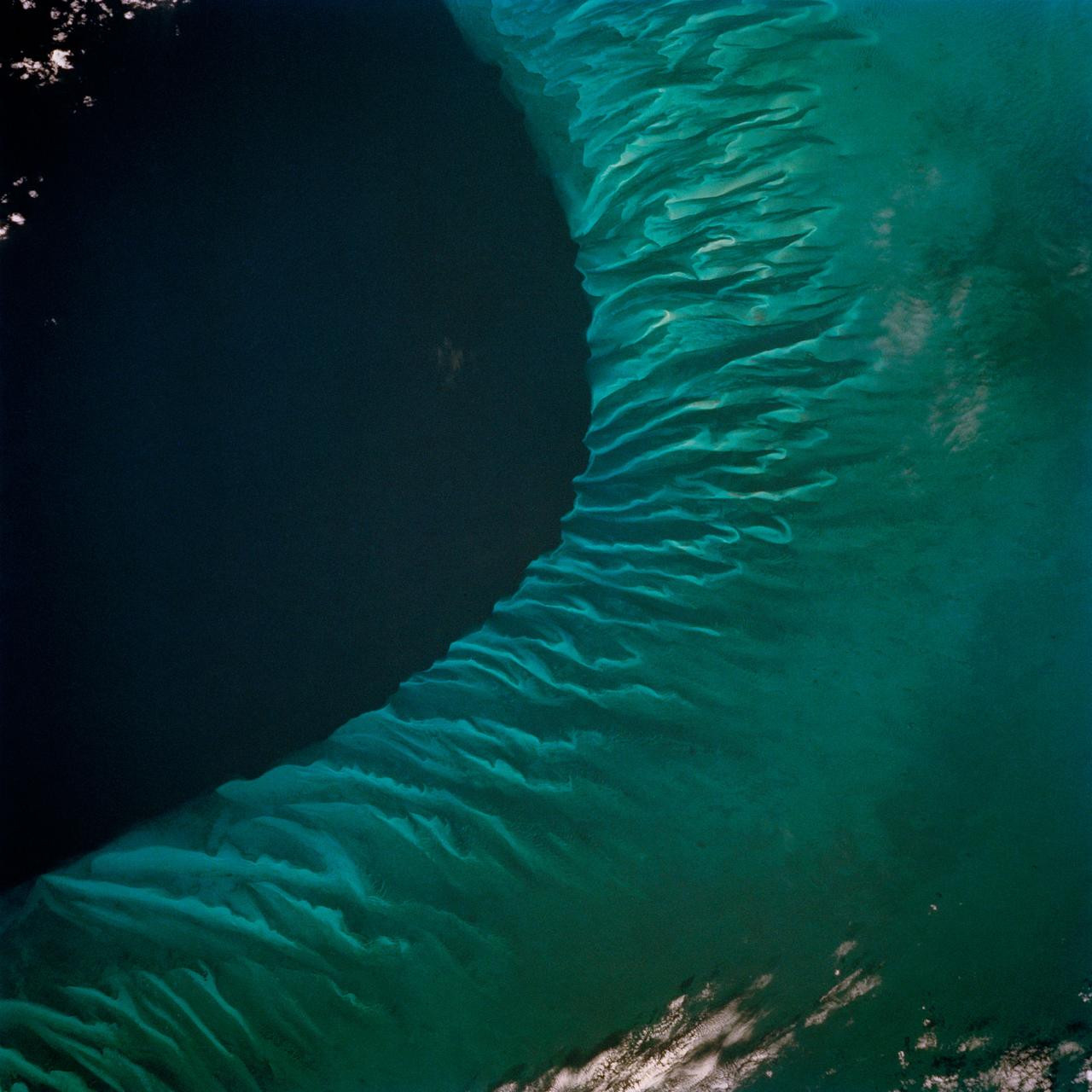
The striking views provided by the Bahama Islands lend insights into the important problems of limestone (CaCO3) production and transport. This photograph includes the southern part of Eleuthera Island in the northern Bahamas. The hook-shaped island encloses a relatively shallow platform (light blue) which is surrounded by deep water (dark blue). The feathery pattern along the western edge of Eleuthera's platform are sand bars and sand channels created by tidal currents sweeping on and off the platform. The channels serve to funnel large amounts of CaCO3 off the platform and into the deeper water.
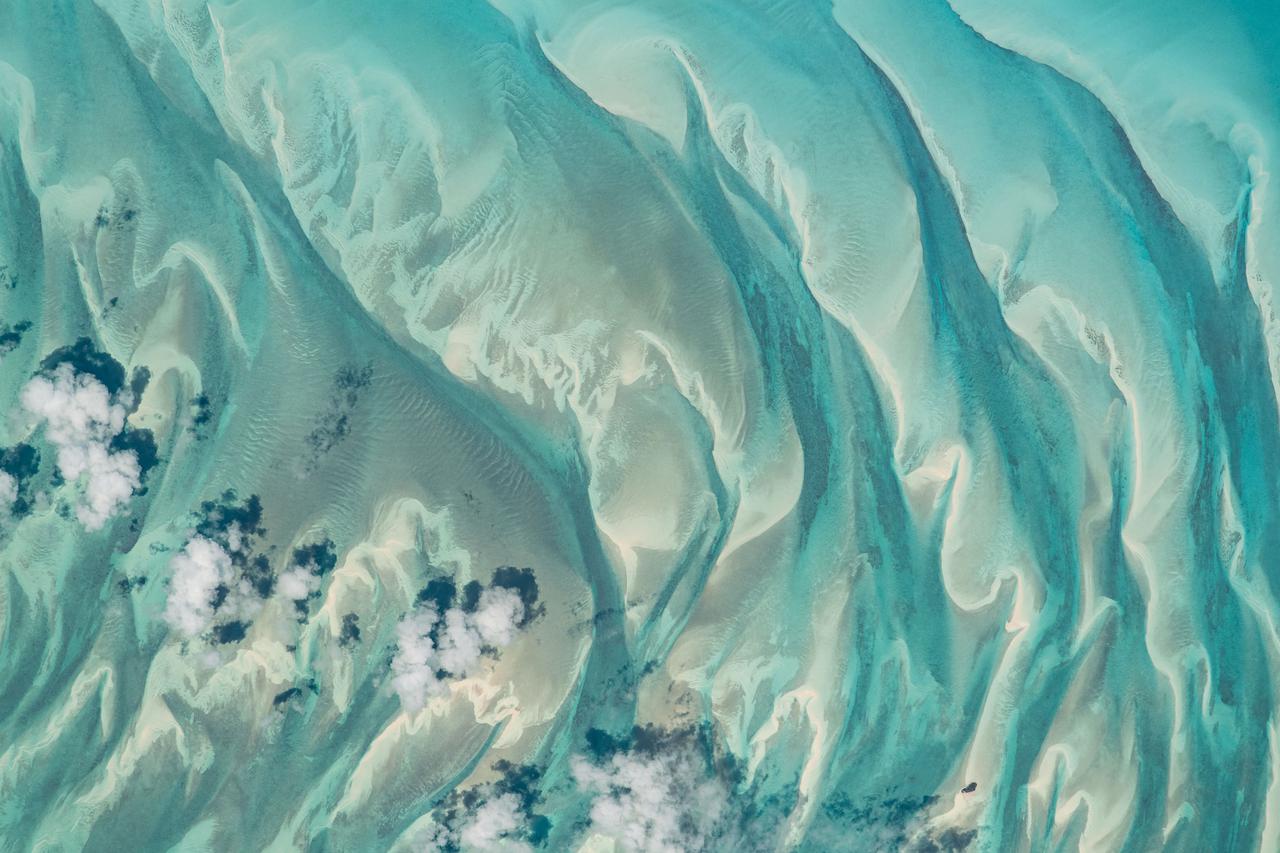
NASA image acquired January 17, 2001 Though the above image may resemble a new age painting straight out of an art gallery in Venice Beach, California, it is in fact a satellite image of the sands and seaweed in the Bahamas. The image was taken by the Enhanced Thematic Mapper plus (ETM+) instrument aboard the Landsat 7 satellite. Tides and ocean currents in the Bahamas sculpted the sand and seaweed beds into these multicolored, fluted patterns in much the same way that winds sculpted the vast sand dunes in the Sahara Desert. Image courtesy Serge Andrefouet, University of South Florida Instrument: Landsat 7 - ETM+ Credit: NASA/GSFC/Landsat <b><a href="http://www.nasa.gov/centers/goddard/home/index.html" rel="nofollow">NASA Goddard Space Flight Center</a></b> enables NASA’s mission through four scientific endeavors: Earth Science, Heliophysics, Solar System Exploration, and Astrophysics. Goddard plays a leading role in NASA’s accomplishments by contributing compelling scientific knowledge to advance the Agency’s mission. <b>Follow us on <a href="http://twitter.com/NASA_GoddardPix" rel="nofollow">Twitter</a></b> <b>Join us on <a href="http://www.facebook.com/pages/Greenbelt-MD/NASA-Goddard/395013845897?ref=tsd" rel="nofollow">Facebook</a></b>
STS006-45-097 (4-9 April 1983) --- This photograph was taken with a handheld 70mm camera aimed through the “ceiling” windows of the Earth-orbiting space shuttle Challenger during its five-day STS-6 mission. A beautiful photo shows the contrast between the islands, clouds, shallow water and deep water. Islands of the Bahamas seen are New Providence (upper left) and Eleuthera (right). Northeast Providence Channel is at the upper edge and Exuma Sound is at the lower left with the open Atlantic along the right edge. The wind, from the south, causes a long cloud to develop downwind from Eleuthera Point. Photo credit: NASA
STS058-107-046 (18 Oct-1 Nov 1993) --- Clouds streak across central Florida in this striking photograph which includes the Florida Peninsula, Andros Island of the northern Bahamas and Cuba (lower left). The light blue, shallow bank of the Bahamas contrast with the deeper blue waters of the Florida strait. The city of Miami is obscured by clouds, but one can see the Florida Keys stretching off to the left. Much of the rest of the southeast coast is barely visible under haze.
S66-63418 (13 Nov. 1966) --- Florida (south half), Bahamas Islands (Andros-Grand Bahamas-Bimini), and Cuba, looking south as seen from Gemini-12 spacecraft on its 15th revolution of Earth. Photo credit: NASA
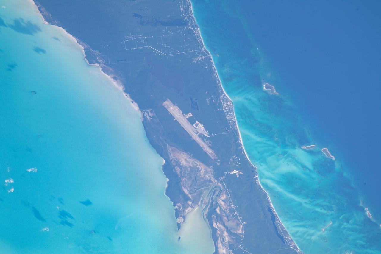
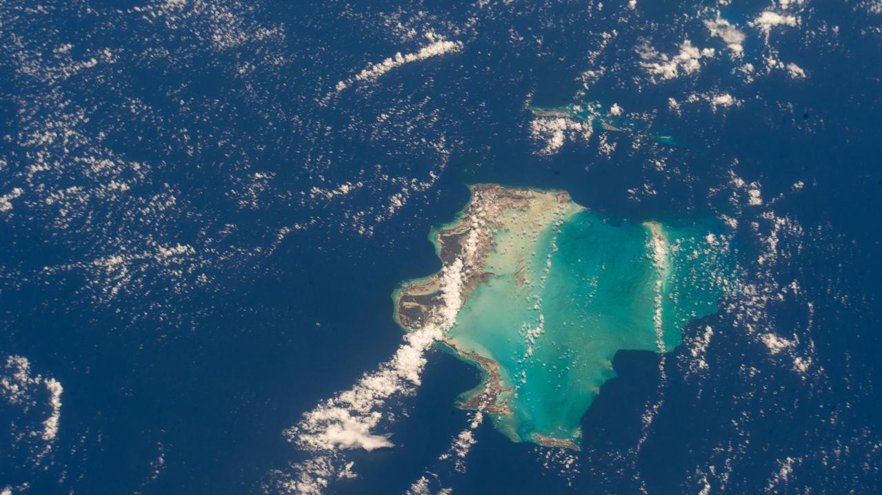
ss069e033721 (July 17, 2023) -- The Great Exuma, an island in the Bahamas, is pictured from the International Space Station as it soared 259 miles above. The bright teal water of the Atlantic Ocean can be seen surrounding the island, while the Exuma International Airport is seen near the center of the land.
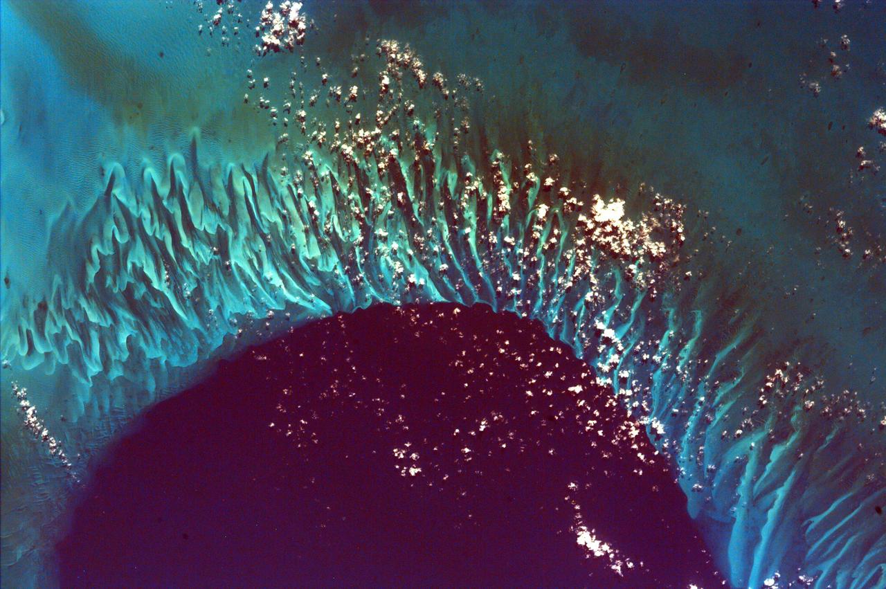
This extraordinary image captures the meeting place of the deep waters of the Tongue of the Ocean and the much shallower, completely submerged Grand Bahama Bank. This image is from NASA EarthKAM.
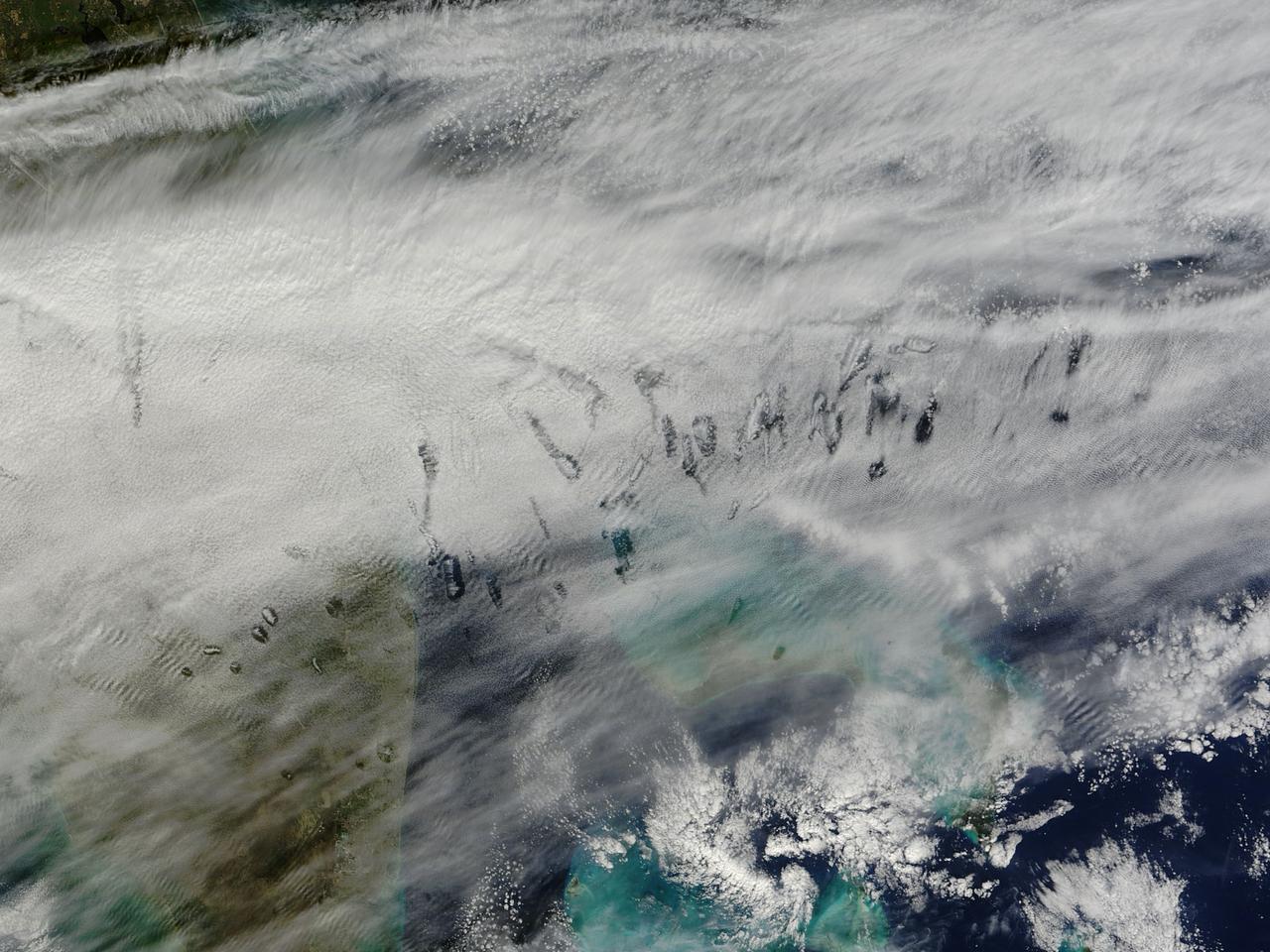
In elementary school, students learn that water freezes at 0 degrees Celsius (32 degrees Fahrenheit). That is true most of the time, but there are exceptions to the rule. For instance, water with very few impurities (such as dust or pollution particles, fungal spores, bacteria) can be chilled to much cooler temperatures and still remain liquid—a process known as supercooling. Supercooling may sound exotic, but it occurs pretty routinely in Earth’s atmosphere. Altocumulus clouds, a common type of mid-altitude cloud, are mostly composed of water droplets supercooled to a temperature of about -15 degrees C. Altocumulus clouds with supercooled tops cover about 8 percent of Earth’s surface at any given time. Supercooled water droplets play a key role in the formation of hole-punch and canal clouds, the distinctive clouds shown in these satellite images. Hole-punch clouds usually appear as circular gaps in decks of altocumulus clouds; canal clouds look similar but the gaps are longer and thinner. This true-color image shows hole-punch and canal clouds off the coast of Florida, as observed on December 12, 2014, by the Moderate Resolution Imaging Spectroradiometer (MODIS) on NASA’s Terra satellite. Both types of cloud form when aircraft fly through cloud decks rich with supercooled water droplets and produce aerodynamic contrails. Air expands and cools as it moves around the wings and past the propeller, a process known as adiabatic cooling. Air temperatures over jet wings often cool by as much as 20 degrees Celsius, pushing supercooled water droplets to the point of freezing. As ice crystals form, they absorb nearby water droplets. Since ice crystals are relatively heavy, they tend to sink. This triggers tiny bursts of snow or rain that leave gaps in the cloud cover. Whether a cloud formation becomes a hole-punch or canal depends on the thickness of the cloud layer, the air temperature, and the degree of horizontal wind shear. Both descending and ascending aircraft—including jets and propeller planes—can trigger hole-punch and canal clouds. The nearest major airports in the images above include Miami International, Fort Lauderdale International, Grand Bahama International, and Palm Beach International. Credit: NASA/GSFC/Jeff Schmaltz/MODIS Land Rapid Response Team <b><a href="http://www.nasa.gov/audience/formedia/features/MP_Photo_Guidelines.html" rel="nofollow">NASA image use policy.</a></b> <b><a href="http://www.nasa.gov/centers/goddard/home/index.html" rel="nofollow">NASA Goddard Space Flight Center</a></b> enables NASA’s mission through four scientific endeavors: Earth Science, Heliophysics, Solar System Exploration, and Astrophysics. Goddard plays a leading role in NASA’s accomplishments by contributing compelling scientific knowledge to advance the Agency’s mission. <b>Follow us on <a href="http://twitter.com/NASAGoddardPix" rel="nofollow">Twitter</a></b> <b>Like us on <a href="http://www.facebook.com/pages/Greenbelt-MD/NASA-Goddard/395013845897?ref=tsd" rel="nofollow">Facebook</a></b> <b>Find us on <a href="http://instagram.com/nasagoddard?vm=grid" rel="nofollow">Instagram</a></b>
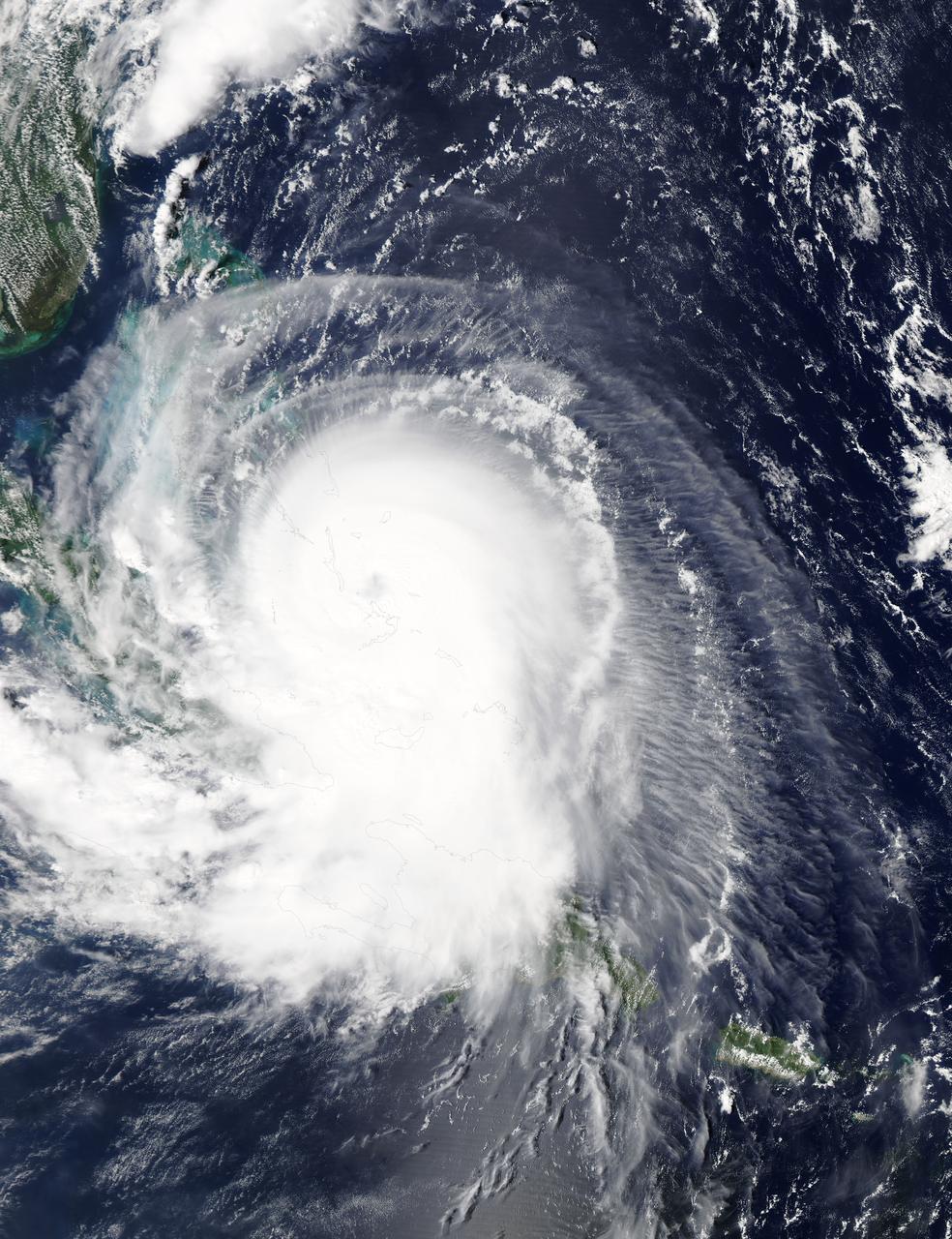
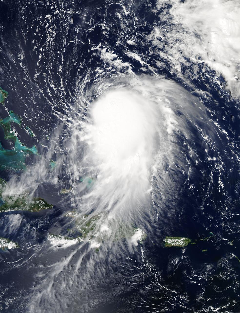
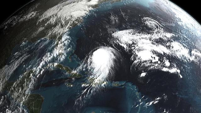
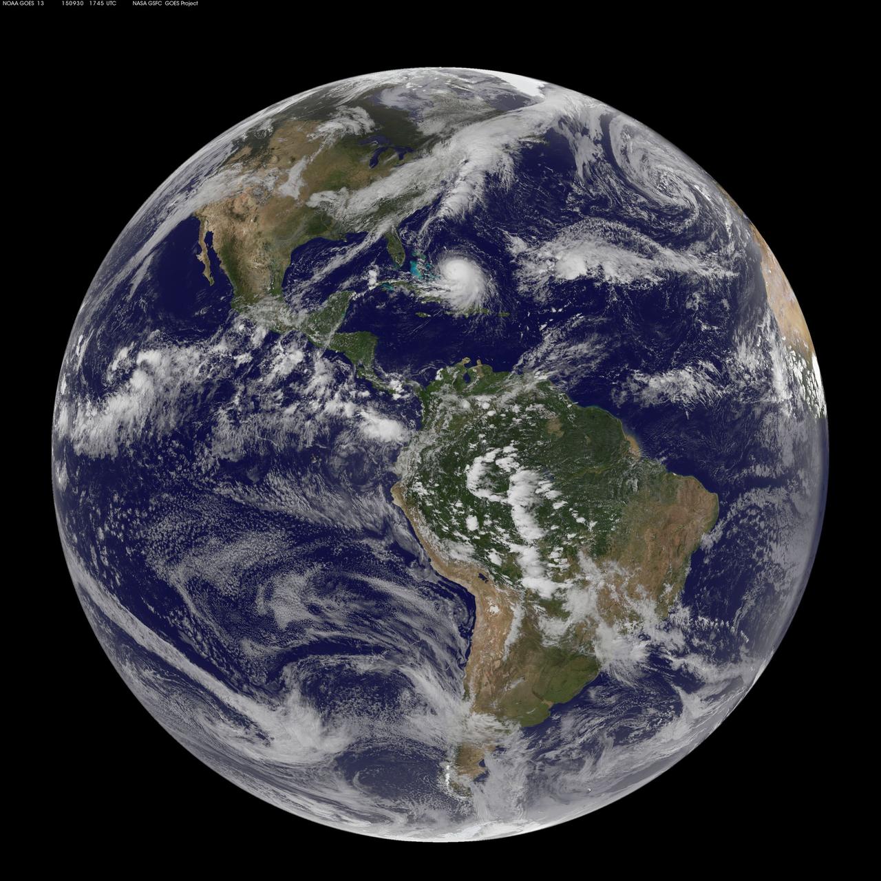
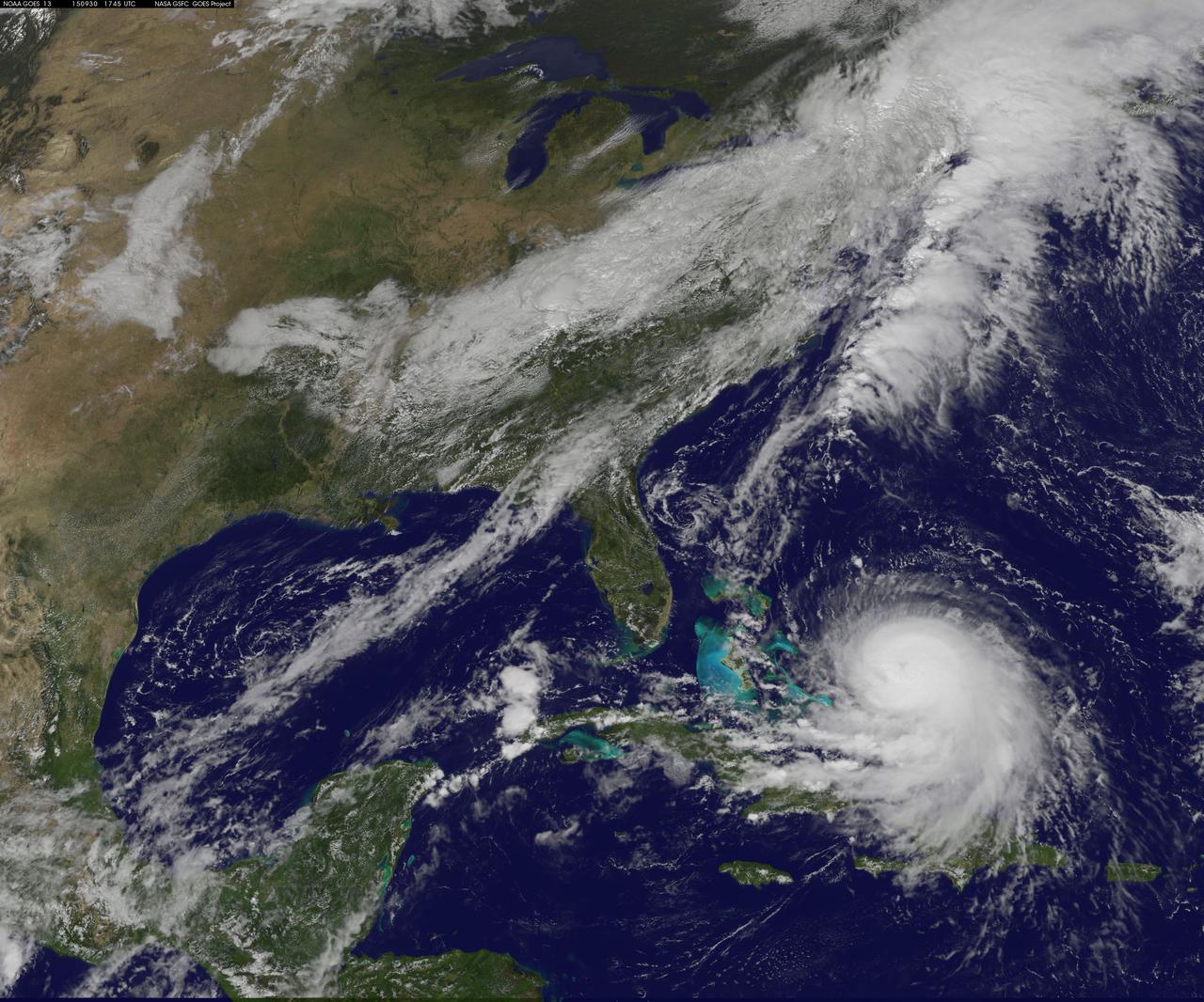
NASA's Aqua satellite captured this image of Hurricane Joaquin over the Bahamas on Oct. 1 at 17:55 UTC (1:55 p.m. EDT). Recently upgraded to Category 4, Hurricane Joaquin has maximum sustained winds of 130 mph which may grow stronger. Credit: NASA Goddard MODIS Rapid Response Team <b><a href="http://www.nasa.gov/audience/formedia/features/MP_Photo_Guidelines.html" rel="nofollow">NASA image use policy.</a></b> <b><a href="http://www.nasa.gov/centers/goddard/home/index.html" rel="nofollow">NASA Goddard Space Flight Center</a></b> enables NASA’s mission through four scientific endeavors: Earth Science, Heliophysics, Solar System Exploration, and Astrophysics. Goddard plays a leading role in NASA’s accomplishments by contributing compelling scientific knowledge to advance the Agency’s mission. <b>Follow us on <a href="http://twitter.com/NASAGoddardPix" rel="nofollow">Twitter</a></b> <b>Like us on <a href="http://www.facebook.com/pages/Greenbelt-MD/NASA-Goddard/395013845897?ref=tsd" rel="nofollow">Facebook</a></b> <b>Find us on <a href="http://instagrid.me/nasagoddard/?vm=grid" rel="nofollow">Instagram</a></b>
iss069e033719 (July 17, 2023) -- (From left) Culmer's Cay, Glass Cay, Tommy Young's Cay, Davy Cay, Hog Cay, and Green Turtle Cay—islands off the mainland Great Abaco in the Bahamas— appear like jigsaw puzzle pieces as the bright teals and blues of the Atlantic Ocean flow and swirl between the land. The International Space Station orbited 259 miles above as this photograph was taken.
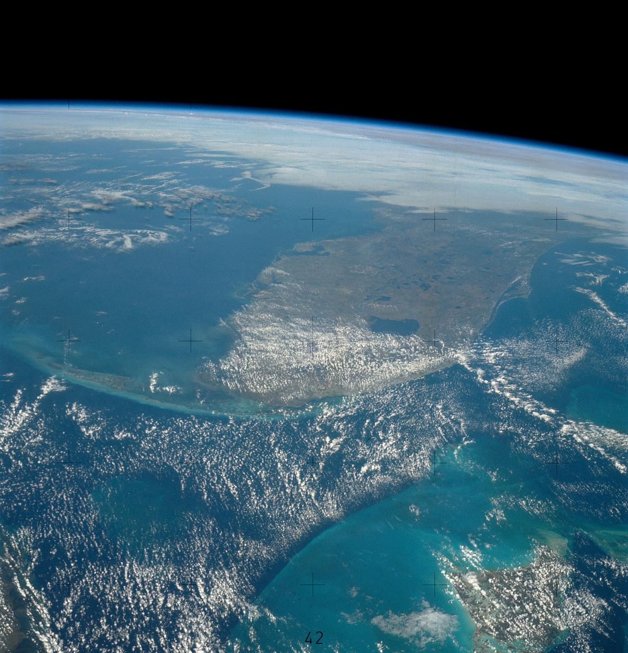
This unique photo offers a view of the Florida peninsula, western Bahamas, north central Cuba and the deep blue waters of the Gulf Stream, that hugs the east coast of Florida (27.0N, 82.0W). In addition to being an excellent photograph for showing the geographical relationships between the variety of landforms in this scene, the typical effect of the land-sea breeze is very much in evidence as few clouds over water, cumulus build up over landmass.
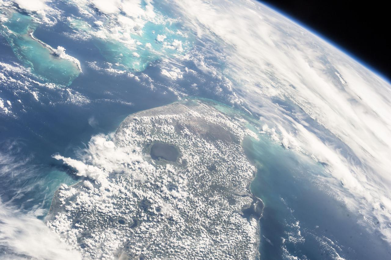
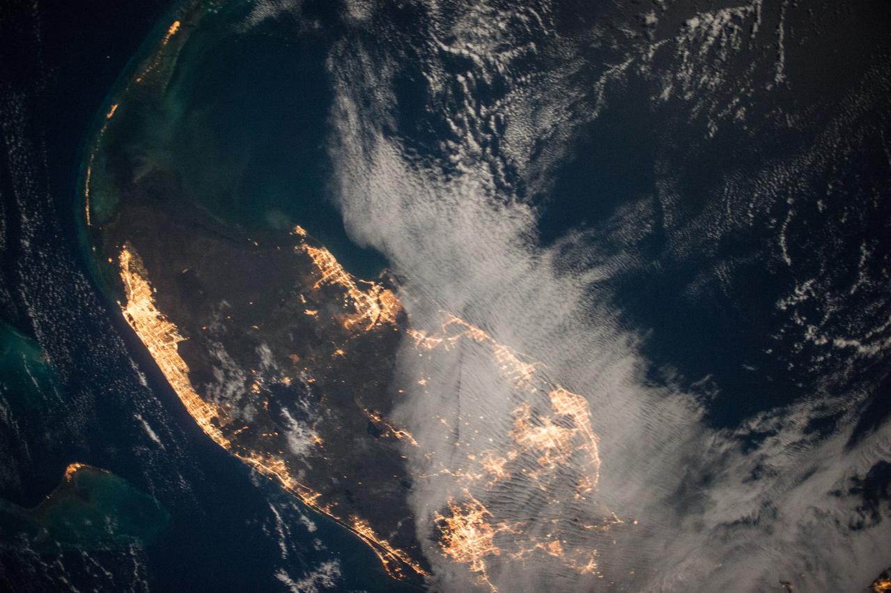
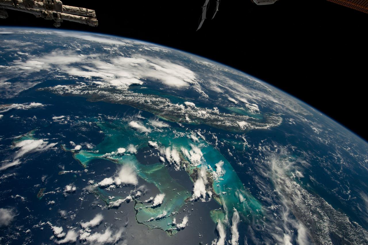
iss073e0134179 (May 20, 2025) --- South Florida, the Bahamas, and Cuba are prominently featured in this photograph from the International Space Station as it orbited 261 miles above the Sunshine State.
iss069e060929 (August 15, 2023) -- Small scatters of clouds lightly hang over the dark blue and turquoise waters of the Bahamas as the International Space Station soared 262 miles above.
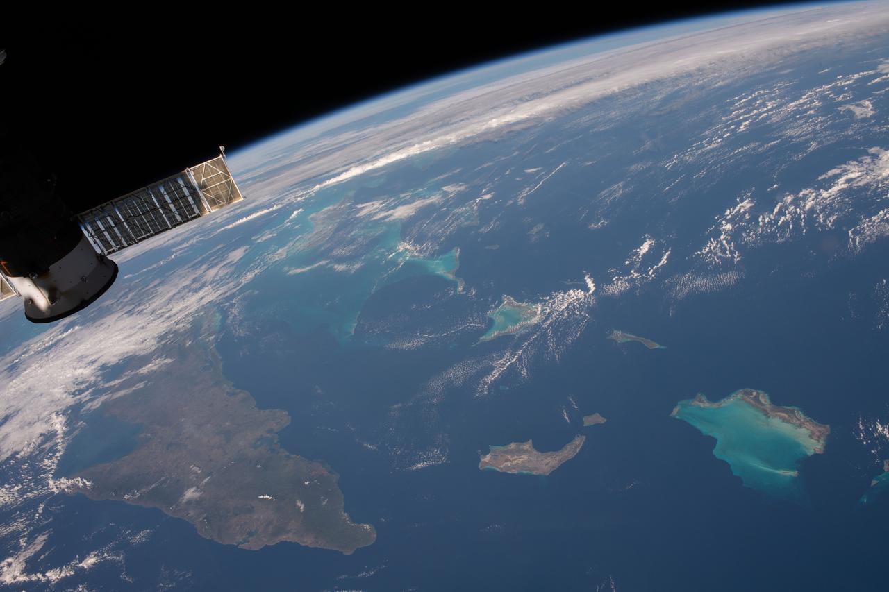
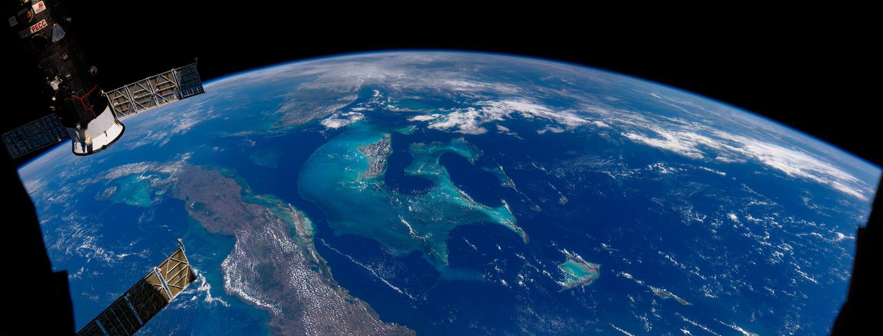
iss058e002206 (Jan. 5, 2018) --- Portions of Cuba, The Bahamas and the Turks and Caicos Islands are viewed from the International Space Station as the orbital complex flew 252 miles above the Atlantic Ocean. At left, is the aft end of the Progress 70 resupply ship from Russia attached to the Pirs docking compartment.
In this ASTER image the features that look like folded material are carbonate sand dunes in the shallow waters of Tarpum Bay, southwest of Eleuthera Island in the Bahamas. The sand making up the dunes comes from the erosion of limestone coral reefs, and has been shaped into dunes by ocean currents. This image was acquired on May 12, 2002 by the Advanced Spaceborne Thermal Emission and Reflection Radiometer (ASTER) on NASA's Terra satellite. With its 14 spectral bands from the visible to the thermal infrared wavelength region, and its high spatial resolution of 15 to 90 meters (about 50 to 300 feet), ASTER images Earth to map and monitor the changing surface of our planet. http://photojournal.jpl.nasa.gov/catalog/PIA03877
This image from NASA EarthKAM captures the tropical beauty of the major islands of the Little Bahama Bank, the most northerly of the island groups that comprise the Bahamas.
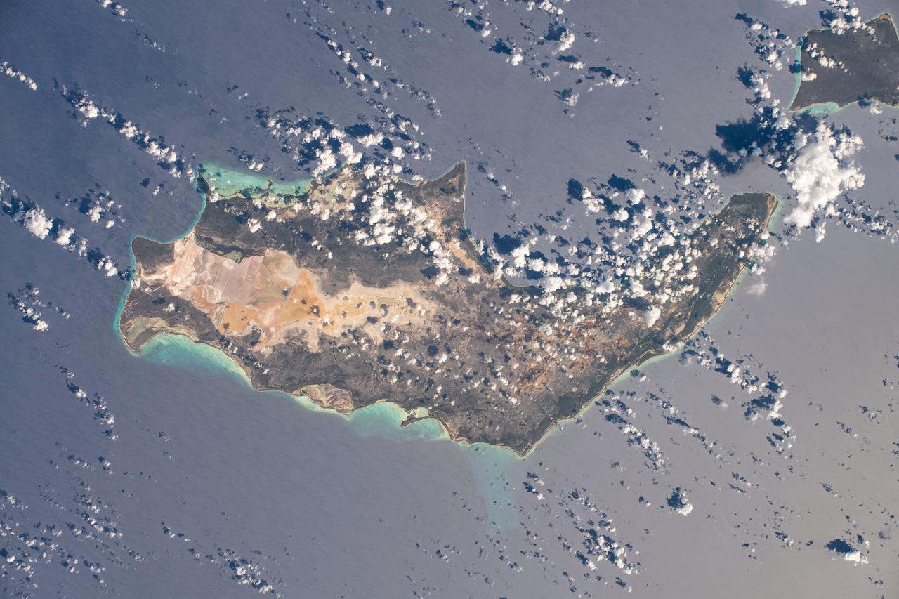
iss072e715777 (Feb. 28, 2025) --- Eleuthera, an island state that is part of the Bahamas archipelago, is pictured in the Atlantic Ocean from the International Space Station as it orbited 262 miles above.
NASA's Aqua satellite captured this image of Joaquin near the Bahamas on Sept. 29 at 18:10 UTC (2:10 p.m. EDT). Credit: NASA Goddard MODIS Rapid Response Team At 11 a.m. EDT (1500 UTC) on Wednesday, September 30, 2015 the center of Hurricane Joaquin was located near latitude 24.7 North, longitude 72.6 West. That puts the center of Joaquin about 215 miles (345 km) east-northeast of the Central Bahamas. Joaquin became a tropical storm Monday evening (EDT), September 29 when it was midway between the Bahamas and Bermuda. By 8 a.m. EDT on September 30, it strengthened into a hurricane and has become the third hurricane of the Atlantic Hurricane season. On September 30, the National Hurricane Center issued a Hurricane Warning for the central Bahamas including Cat Island, the Exumas, Long Island, Rum Cay, and San Salvador. A Hurricane Watch is in effect for the northwestern Bahamas including the Abacos, Berry Islands, Bimini, Eleuthera, Grand Bahama Island, and New Providence, but excluding Andros Island. <b><a href="http://www.nasa.gov/audience/formedia/features/MP_Photo_Guidelines.html" rel="nofollow">NASA image use policy.</a></b> <b><a href="http://www.nasa.gov/centers/goddard/home/index.html" rel="nofollow">NASA Goddard Space Flight Center</a></b> enables NASA’s mission through four scientific endeavors: Earth Science, Heliophysics, Solar System Exploration, and Astrophysics. Goddard plays a leading role in NASA’s accomplishments by contributing compelling scientific knowledge to advance the Agency’s mission. <b>Follow us on <a href="http://twitter.com/NASAGoddardPix" rel="nofollow">Twitter</a></b> <b>Like us on <a href="http://www.facebook.com/pages/Greenbelt-MD/NASA-Goddard/395013845897?ref=tsd" rel="nofollow">Facebook</a></b> <b>Find us on <a href="http://instagrid.me/nasagoddard/?vm=grid" rel="nofollow">Instagram</a></b>
STS004-41-1206 (27 June-4July 1982) --- Sunglint reflects off the water of the North Atlantic Ocean in an area to the east of the Bahamas Islands sometimes called the Sargasso Sea. The area has also been referred to as the ?Bermuda Triangle.? Astronauts Thomas K. Mattingly II, STS-4 commander, and Henry W. Hartsfield Jr., pilot, spent seven days and one hour aboard the Earth-orbiting space shuttle Columbia and performed a variety of duties in addition to those of recording 70mm and 35mm imagery. Photo credit: NASA
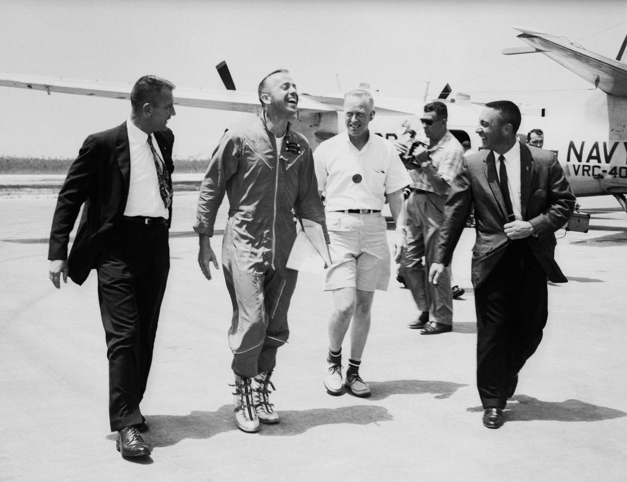
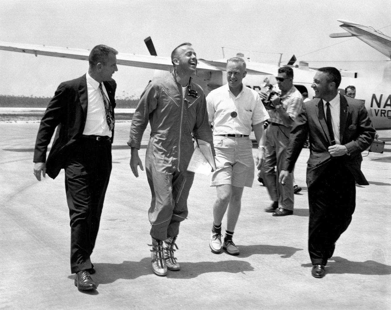
S61-02385 (5 July 1961) --- Astronaut Alan B. Shepard Jr. arrives at Grand Bahamas Island and is greeted by astronauts Virgil I. (Gus) Grissom (right) and Donald Slayton (left) and also by Keith Lindell (between Shepard and Grissom) after the first American suborbital flight. He will participate in a press conference with Grissom and Slayton. Photo credit: NASA or National Aeronautics and Space Administration

S61-02731 (5 May 1961) --- Astronaut Alan B. Shepard Jr. arrives at Grand Bahamas Island and is greeted by astronaut Virgil I. (Gus) Grissom after the first American suborbital flight. He will participate in a press conference with Grissom and Donald Slayton. Photo credit: NASA or National Aeronautics and Space Administration
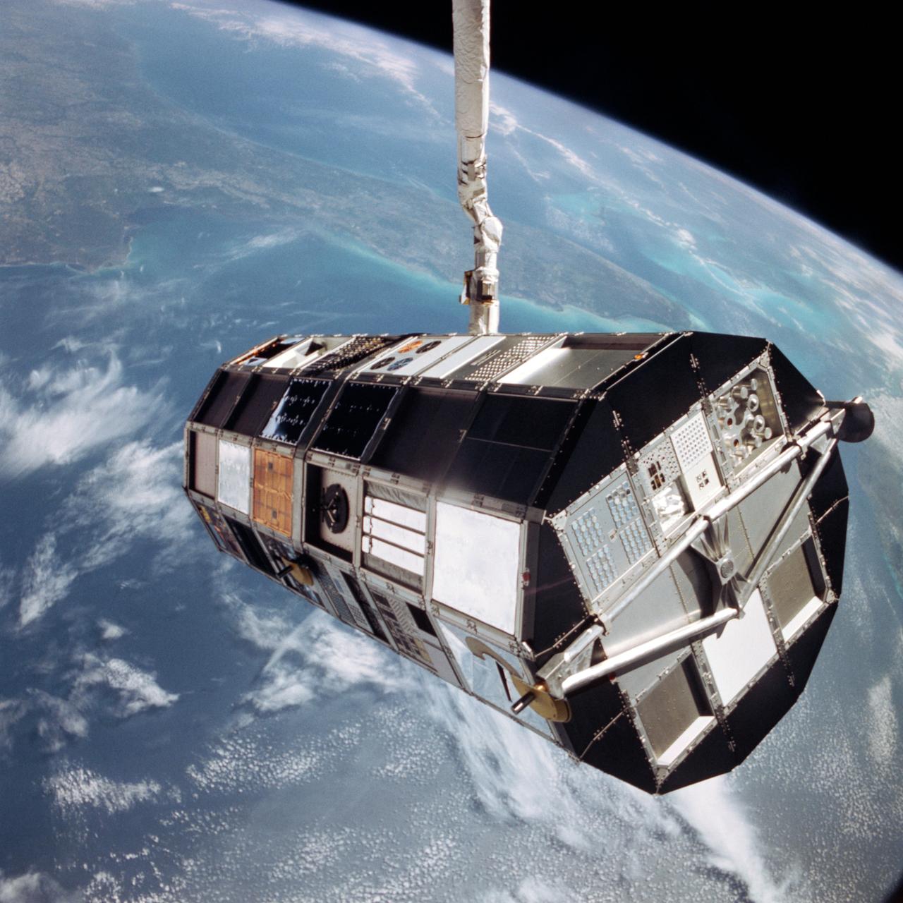
41C-36-1618 (7 April 1984) --- The Remote Manipulator System (RMS) arm suspends the giant Long Duration Exposure Facility (LDEF) high above the Gulf of Mexico prior to releasing it into space. Carried into Earth orbit with the STS-41C crew by the Space Shuttle Challenger, LDEF will remain in space until retrieved by a future Shuttle mission, in nine or ten months. Florida and the Bahama Banks are visible near the Earth's horizon in the 70mm frame.
STS100-708-78 (19 April-1 May 2001) --- Southwest of the Bahamas and north of Hispaniola lie the Turks and Caicos Islands, photographed by the astronaut/cosmonaut crew aboard the Earth-orbiting Space Shuttle Endeavour. In this view, the extensive shallow water areas of Caicos Bank (turquoise blue) dominate to the south of the Caicos Islands. Caicos Bank covers an area of 7,680 square kilometers (1.9 million acres). The coral reefs of Caicos are primarily along the north deep water edge of the islands, and in a barrier along the south margin of the bank. The area is known for its marine caves and blowholes. To the east of Caicos Bank, near the tail of the Shuttle, is the island of Grand Turk, part of the much smaller Turks Bank. The channel that runs between the two banks is more than 2,200 meters (1.4 miles) deep.
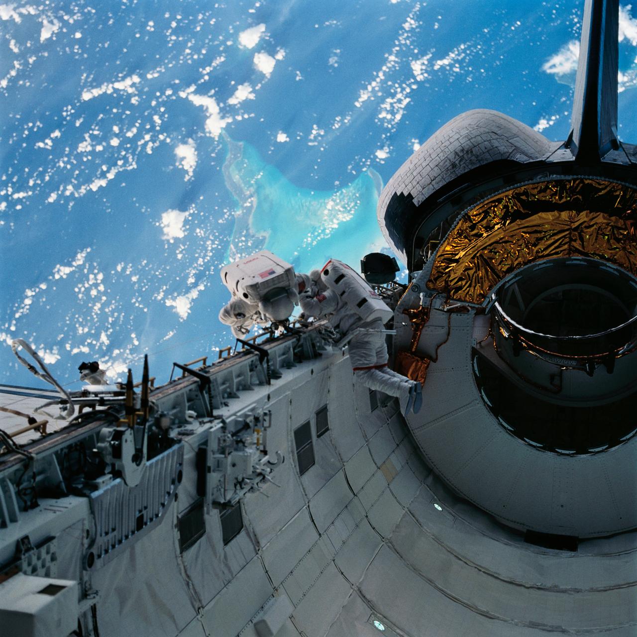
With the Caribbean Sea and part of the Bahama Islands chain as a backdrop, two STS-51 crewmembers evaluate procedures and gear to be used on the upcoming Hubble Space Telescope (HST)-servicing mission. Sharing the lengthy extravehicular activity in and around Discovery's cargo bay were astronauts James H. Newman (left), and Carl E. Walz, mission specialists.
Joaquin became a tropical storm Monday evening (EDT) midway between the Bahamas and Bermuda and has now formed into Hurricane Joaquin, the 3rd of the season--the difference is Joaquin could impact the US East Coast. NASA's GPM satellite captured Joaquin Tuesday, September 29th at 21:39 UTC (5:39 pm EDT). Credit: NASA's Scientific Visualization Studio Data provided by the joint NASA/JAXA GPM mission. Download/read more: <a href="http://svs.gsfc.nasa.gov/cgi-bin/details.cgi?aid=4367" rel="nofollow">svs.gsfc.nasa.gov/cgi-bin/details.cgi?aid=4367</a> <b><a href="http://www.nasa.gov/audience/formedia/features/MP_Photo_Guidelines.html" rel="nofollow">NASA image use policy.</a></b> <b><a href="http://www.nasa.gov/centers/goddard/home/index.html" rel="nofollow">NASA Goddard Space Flight Center</a></b> enables NASA’s mission through four scientific endeavors: Earth Science, Heliophysics, Solar System Exploration, and Astrophysics. Goddard plays a leading role in NASA’s accomplishments by contributing compelling scientific knowledge to advance the Agency’s mission. <b>Follow us on <a href="http://twitter.com/NASAGoddardPix" rel="nofollow">Twitter</a></b> <b>Like us on <a href="http://www.facebook.com/pages/Greenbelt-MD/NASA-Goddard/395013845897?ref=tsd" rel="nofollow">Facebook</a></b> <b>Find us on <a href="http://instagrid.me/nasagoddard/?vm=grid" rel="nofollow">Instagram</a></b>
Joaquin became a tropical storm Monday evening (EDT) midway between the Bahamas and Bermuda and has now formed into Hurricane Joaquin, the 3rd of the season--the difference is Joaquin could impact the US East Coast. NASA's GPM satellite captured Joaquin Tuesday, September 29th at 21:39 UTC (5:39 pm EDT). Credit: NASA's Scientific Visualization Studio Data provided by the joint NASA/JAXA GPM mission. Download/read more: <a href="http://svs.gsfc.nasa.gov/cgi-bin/details.cgi?aid=4367" rel="nofollow">svs.gsfc.nasa.gov/cgi-bin/details.cgi?aid=4367</a> <b><a href="http://www.nasa.gov/audience/formedia/features/MP_Photo_Guidelines.html" rel="nofollow">NASA image use policy.</a></b> <b><a href="http://www.nasa.gov/centers/goddard/home/index.html" rel="nofollow">NASA Goddard Space Flight Center</a></b> enables NASA’s mission through four scientific endeavors: Earth Science, Heliophysics, Solar System Exploration, and Astrophysics. Goddard plays a leading role in NASA’s accomplishments by contributing compelling scientific knowledge to advance the Agency’s mission. <b>Follow us on <a href="http://twitter.com/NASAGoddardPix" rel="nofollow">Twitter</a></b> <b>Like us on <a href="http://www.facebook.com/pages/Greenbelt-MD/NASA-Goddard/395013845897?ref=tsd" rel="nofollow">Facebook</a></b> <b>Find us on <a href="http://instagrid.me/nasagoddard/?vm=grid" rel="nofollow">Instagram</a></b>
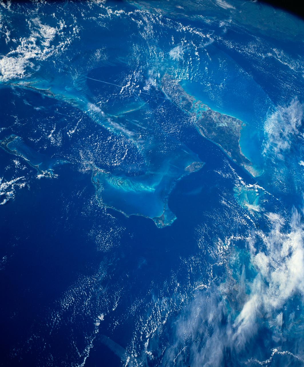
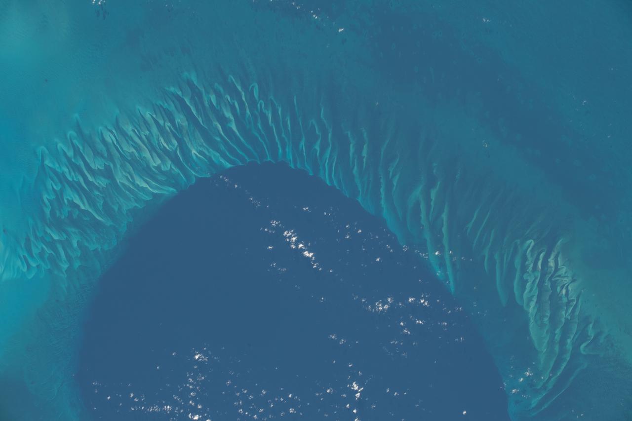
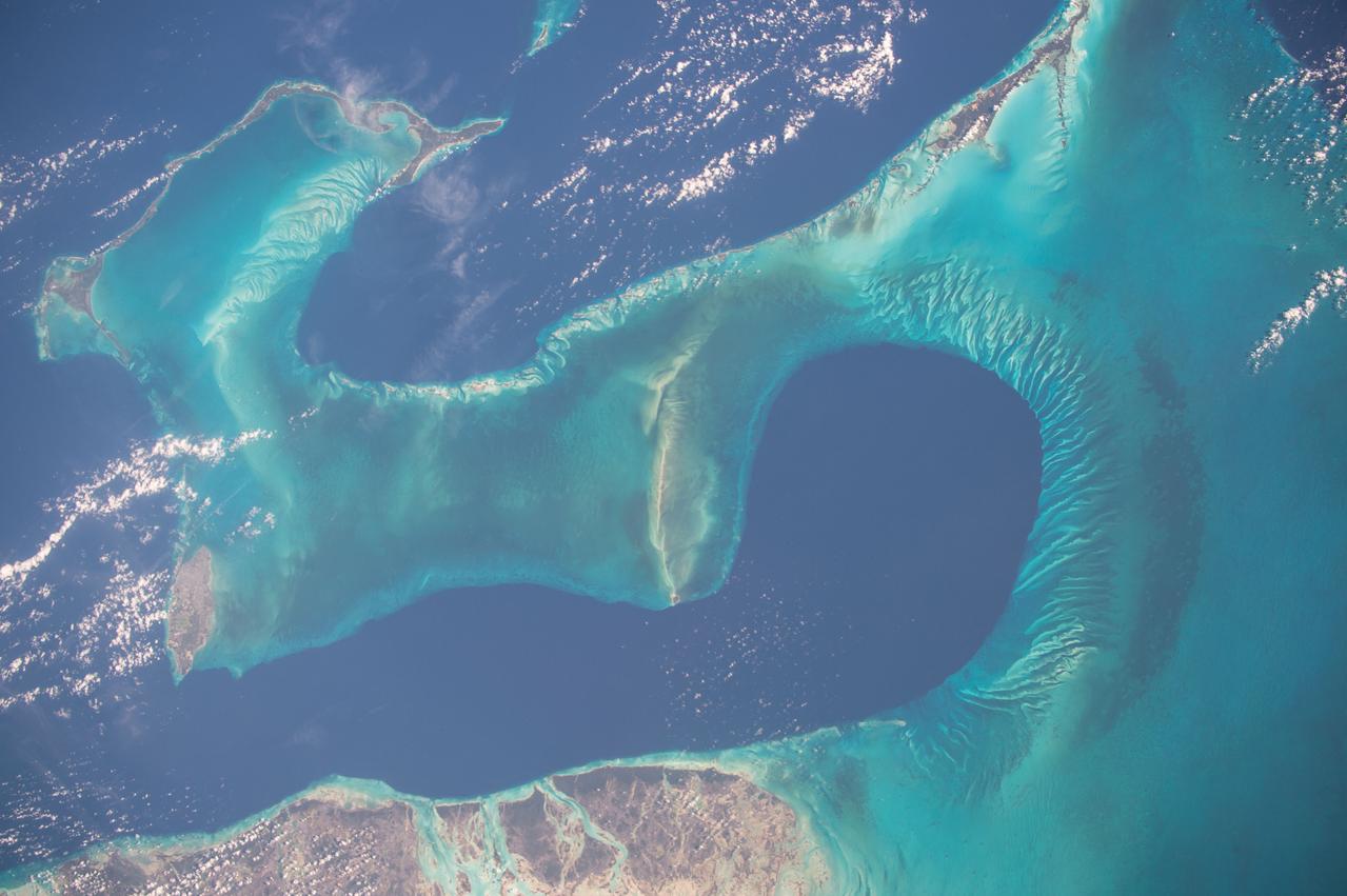
STS080-742-070 (19 Nov.-7 Dec. 1996) --- A view of the Tongue of the Ocean in the Bahama Islands east of Florida. The lines leading from the flat bottom of the Great Bahama Bank, leading into the Tongue, are caused by rapid transfer of ocean water caused by both temperature changes in the water and hurricanes that periodically cross the area. The water is about 30 feet deep on the Great Bahama Bank, and nearly a mile deep in the tongue. To the left is the Exuma Sound, over a mile deep, and a series of islands along its edge with Great Exuma Island the easiest to see. Green Cay, the small dot lower left, leaving a wake to the southeast of light colored coral. The deep blue area to the top right center is the southeastern edge of the Great Bahama Bank.
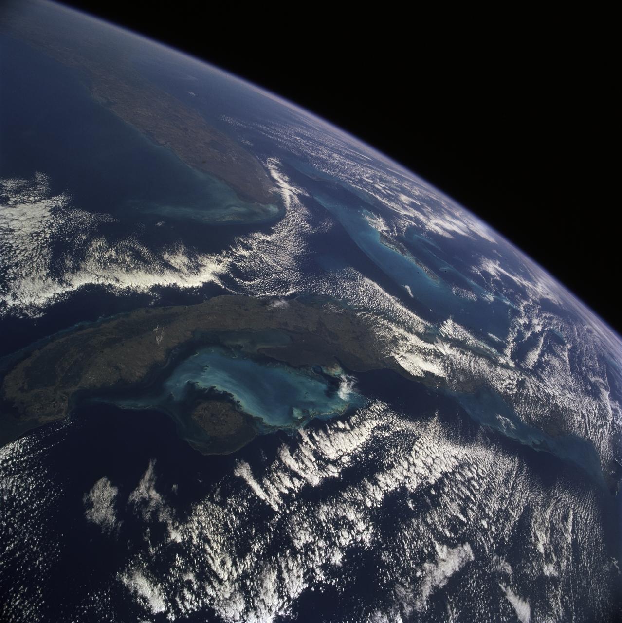
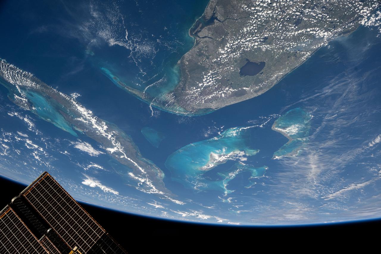
STS081-711-009 (12-22 Jan. 1997) --- As photographed with a 70mm handheld camera from the Earth-orbiting Space Shuttle Atlantis, this image provides a northeastward panorama of the Florida peninsula, the northern Bahamas and Cuba as well as a synoptic view of the northern Caribbean region. Lake Okeechobee and the urban region around Miami are the two key visual points in Florida. The turquoise shallow water platforms around the Florida Keys, the Bahamas, and south of Cuba contrast with the deep blue color of the deeper channels which separate Florida from Cuba and the Bahamas. Offshore breezes keep the coastal areas clear of clouds.
S81-30396 (12-14 April 1981) --- A vertical view of Eleuthera Island in the Bahamas and part of the great Bahama Bank, as photographed with a 70mm handheld camera from the space shuttle Columbia in Earth orbit. The light blue of the Bahama Bank contrasts sharply with the darker blue of the deep ocean waters. Astronauts John W. Young, commander, and Robert L. Crippen, pilot, took a series of Earth photos from inside the flight deck of the Columbia, which has windows on its top side, convenient for shooting photographs as the spacecraft flew ?upside down? above Earth. The mission frame ID number is STS001-12-322. Photo credit: NASA
iss064e002482 (Oct. 29, 2020) --- A portion of the Atlantic Ocean off the coast of the Bahamas is pictured from the International Space Station.
Earth observation taken during a day pass by the Expedition 37 crew. Per Twitter message: Southern Florida & the Bahamas.
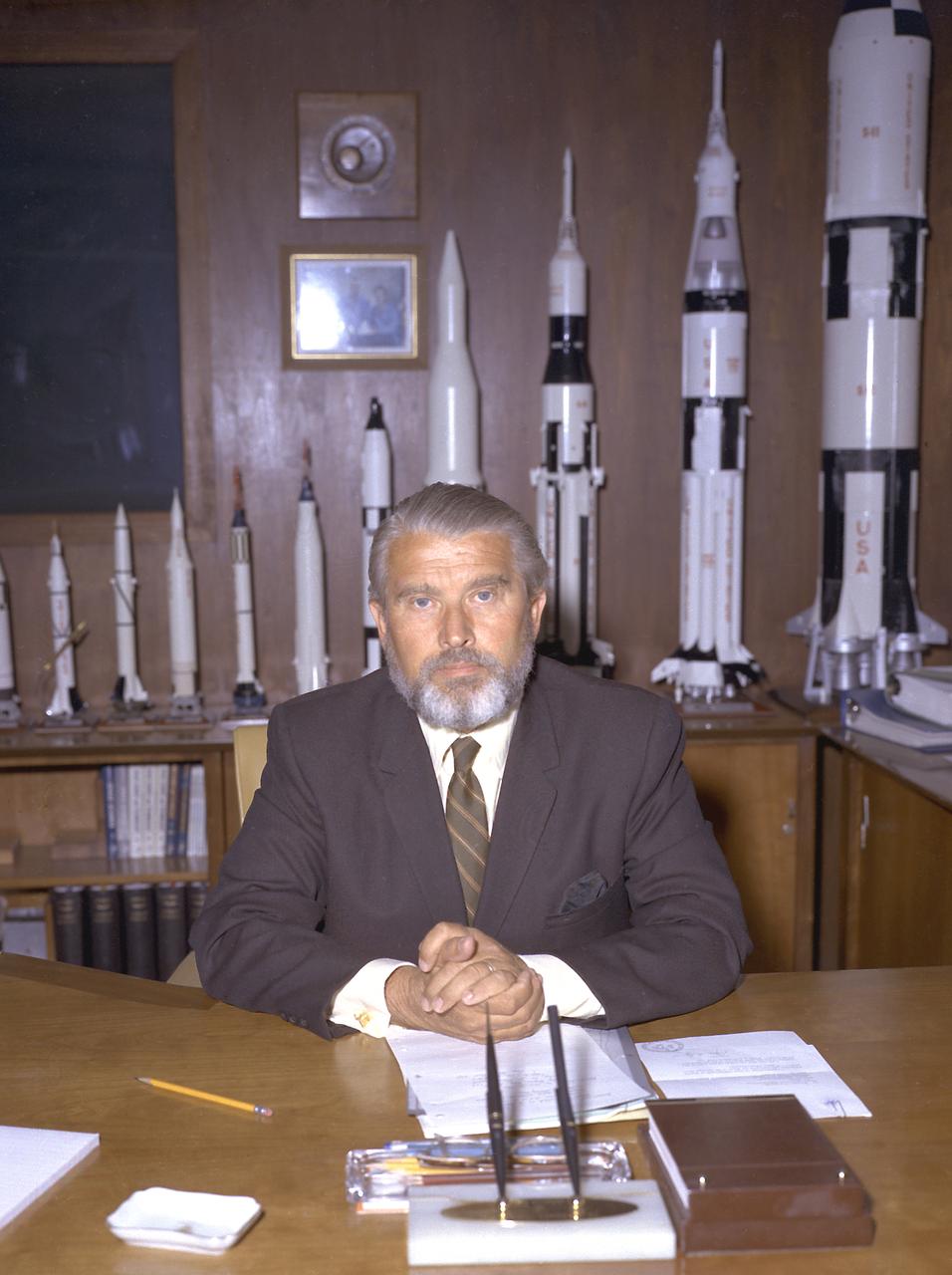
Upon return from a Bahamas vacation, Dr. von Braun pulled a practical joke upon his associates by sporting a beard.
Earth Observations taken by Expedition 38 crewmember. Photographer indicates the Bahamas and Marakaibo. Image was released by astronaut on Twitter.
GMT341_11_37_Barry Wilmore_Night Across U.S - Aurora - Great Lakes to Florida and Bahamas - For DM SB
Expedition 47 Earth observation composite created with iss047e051337 - iss047e051343 135A8768 – 135A8774 Bahamas
Earth observation taken by the Expedition 39 crew aboard the ISS. Image was released by astronaut on Instagram and downlinked in folder: Bahamas and Cuba.

GMT341_11_37_Barry Wilmore_Night Across U.S - Aurora - Great Lakes to Florida and Bahamas - For DM SB
GMT341_11_37_Barry Wilmore_Night Across U.S - Aurora - Great Lakes to Florida and Bahamas - For DM SB

NASA Terra spacecraft passed over Hurricane Irene while it was just north of the Bahamas on Aug. 25, 2011. At the time, Irene was a category three hurricane making landfall in North Carolina on the morning of Aug. 27 as a category one hurricane.
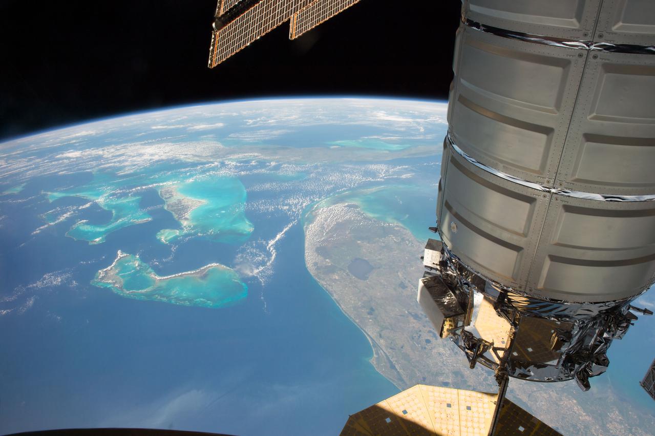
iss051e040813 (May 10, 2017) --- The Orbital ATK Cygnus cargo craft is pictured as the International Space Station orbits above the state of Florida, The Bahamas and the country of Cuba.

iss071e365062 (July 18, 2024) -- Acklins, an island in The Bahamas, was photographed by NASA astronaut Mike Barratt as the International Space Station orbited 256 miles above.
iss066e108216 (Dec. 1, 2021) --- The island nation of the Bahamas is pictured from the International Space Station as it orbited 263 miles above the Atlantic Ocean.
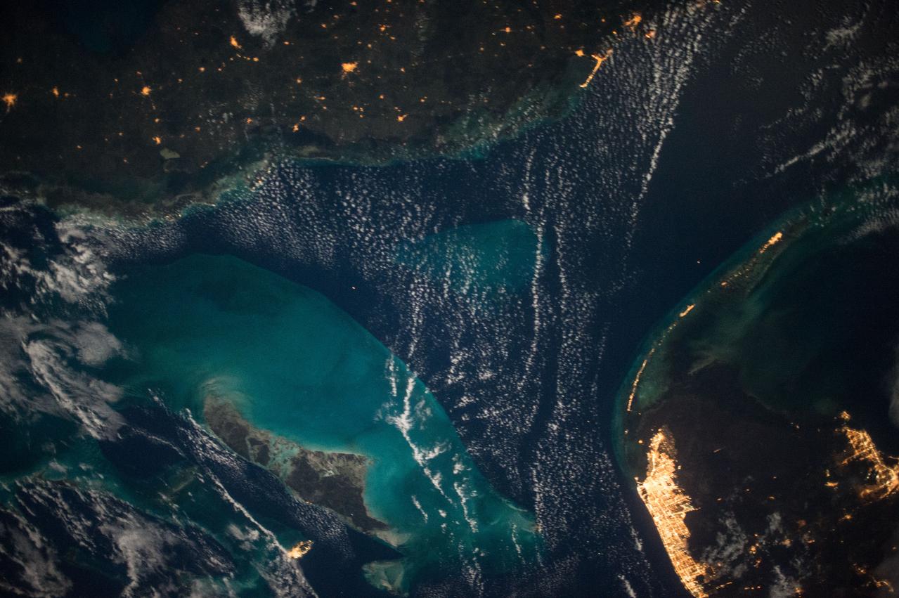
iss069e022551 (June 16, 2023) --- A portion of The Bahamas, in the Atlantic Ocean southeast of Florida, is pictured from the International Space Station as it orbited 257 miles above.
iss054e042067 (Feb, 12, 2018) --- NASA astronaut Scott Tingle captured a photo of the Bahamas from the vantage point of the International Space Station.
iss064e006423 (Nov. 27, 2020) --- A waxing gibbous moon is pictured from the International Space Station as it orbited northeast of the Bahamas in the Atlantic Ocean.
iss063e084654 (Sept. 4, 2020) --- Inagua National Park, part of The Bahamas island nation, is pictured from the International Space Station as it was orbiting above the Atlantic Ocean.
iss069e060925 (Aug. 15, 2023) --- A portion of The Bahamas off the Atlantic coast of Florida is pictured from the International Space Station as it orbited 262 miles above.
iss068e036382 (Jan. 2, 2023) --- A portion of the Atlantic Ocean surrounded by the island nation of the Bahamas is pictured from the International Space Station as it orbited 259 miles above.
Earth observation taken during day pass by an Expedition 36 crew member on board the International Space Station (ISS). Per Twitter message: Bahamas.
iss067e290699 (Aug. 22, 2022) --- The International Space Station was soaring on an orbital trek from northeast to southwest 257 miles above the Bahamas when this photograph was taken.
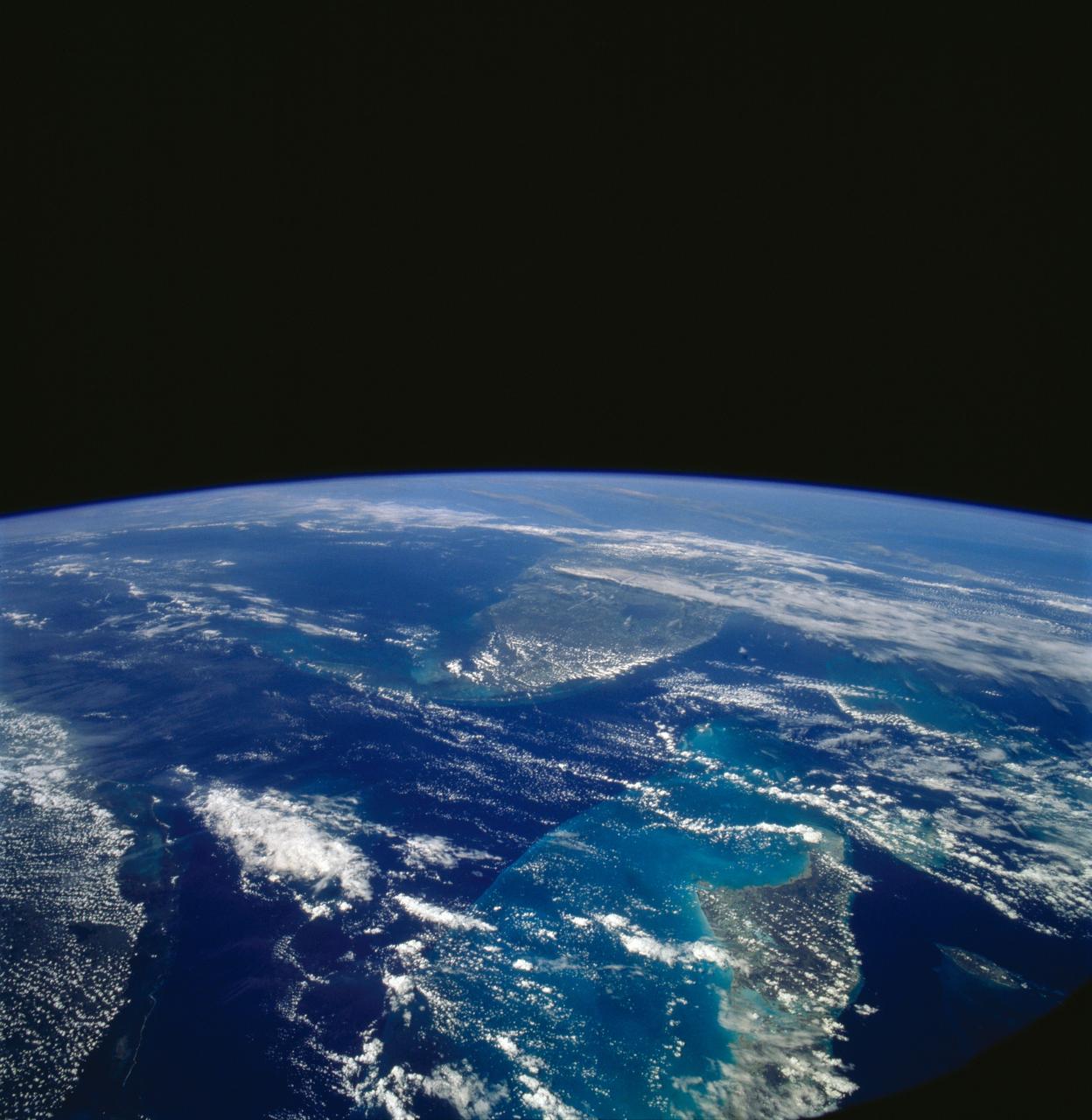
AS08-16-2581 (21-27 Dec. 1968) --- This photograph of Earth was taken from the Apollo 8 spacecraft while it was in Earth orbit. Most of the southeastern United States and the Caribbean Sea area, the U.S. coastline from Chesapeake Bay to the Florida Peninsula can be seen. The Bahamas and the islands of Cuba, Jamaica, Hispaniola and Puerto Rico extend across the Caribbean, the light blue of the shallow Bahama banks contrasting sharply with the darker hue of the deeper water, especially in the Tongue of the Ocean area.
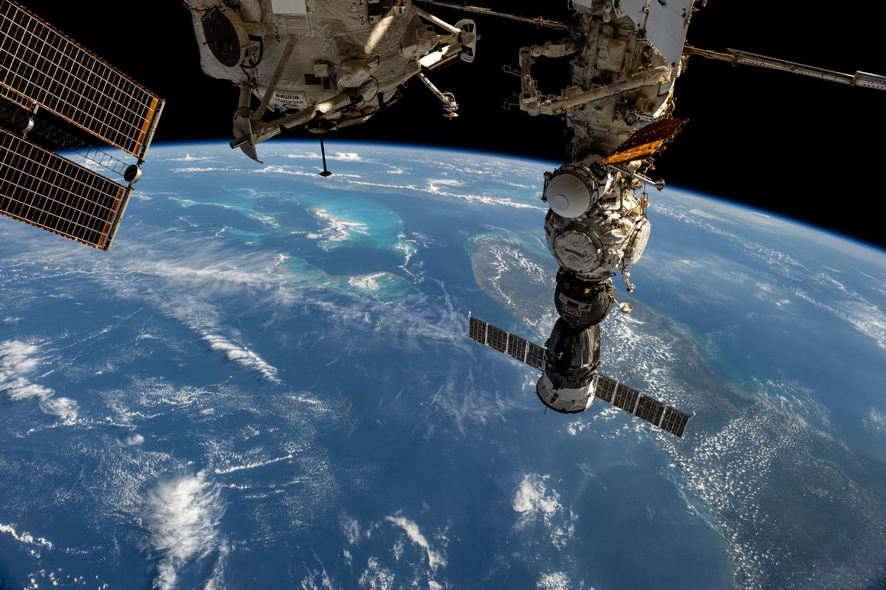
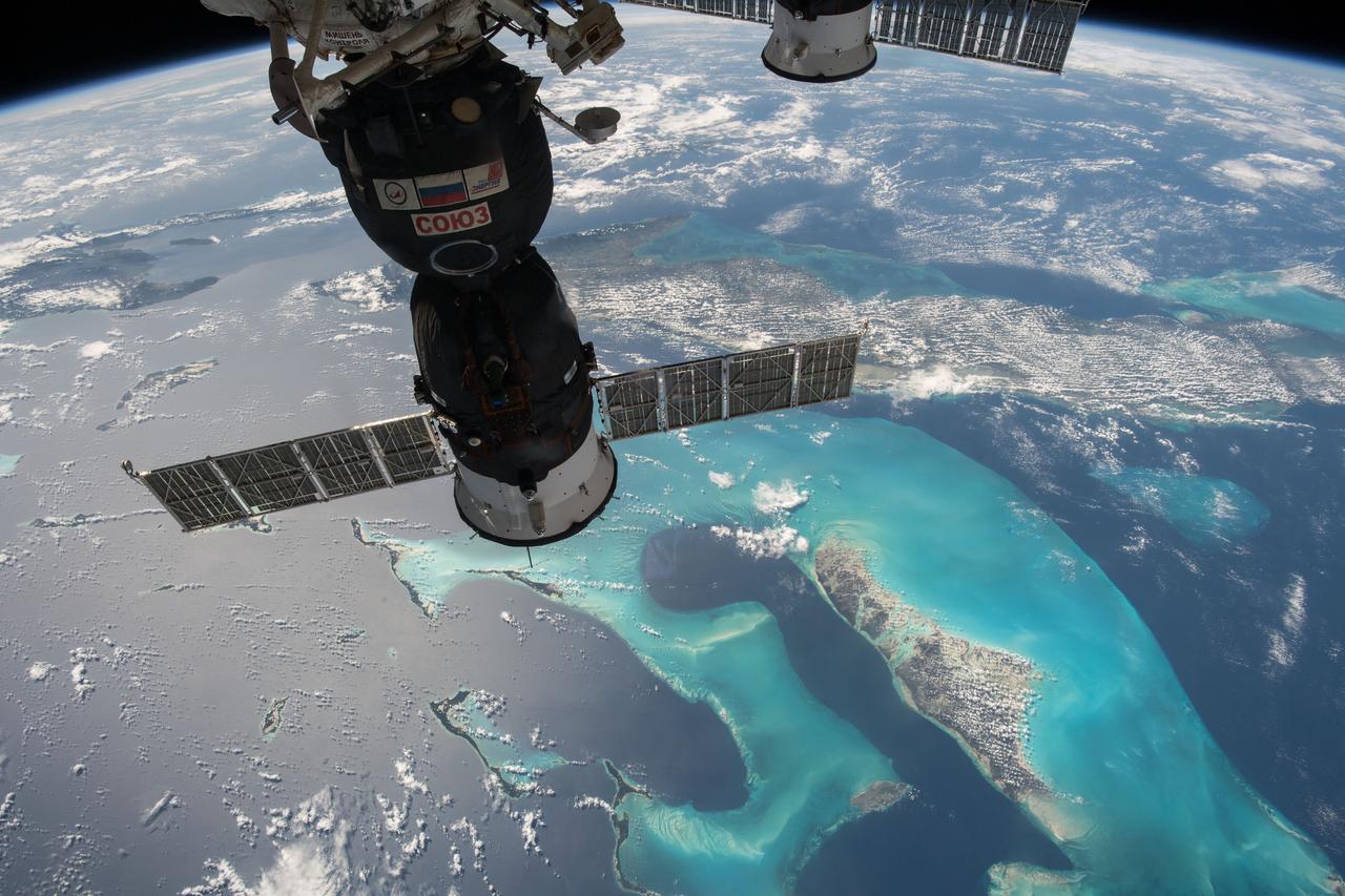
iss073e0134239 (May 20, 2025) --- The Soyuz MS-27 spacecraft that launched three Expedition 72-73 flight engineers to the International Space Station on April 8, 2025, is pictured docked to the Prichal module. 261 miles below the orbital outpost is the state of Florida and the island country of the Bahamas, also known as the Commonwealth of the Bahamas, in the Atlantic Ocean.
ISS047e069406 (04/20/2016) ---Earth observation image taken by the Expedition 47 crew aboard the International Space Station. This is an oblique south-looking view of the main Bahama island chain. Cuba is across the entire top of the image, the Florida Peninsula on the right margin. In the Bahamas, the main Andros island is just distinguishable under cloud upper left of center. Under less cloud is the Abaco Islands in the foreground (middle of pic nearest camera left of center.)
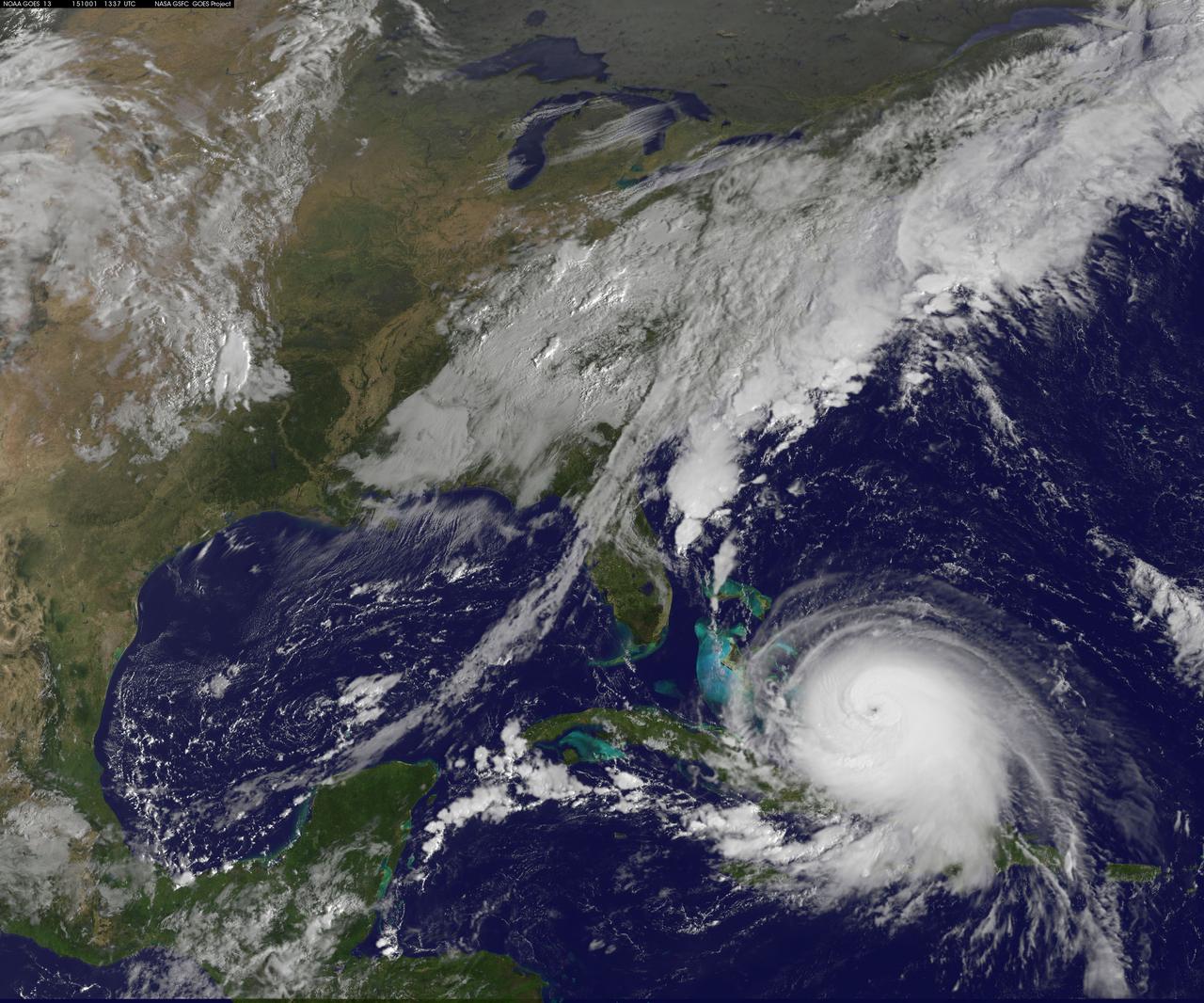
Hurricane Joaquin continued to intensify in the Bahamas on October 1 and NASA and NOAA satellites have been providing valuable data on the storm. NASA's GPM and Terra satellites and NOAA's GOES-East satellite provided rainfall, cloud extent, cloud height and other data to forecasters. Joaquin became a major hurricane today, October 1, reaching Category 3 status on the Saffir-Simpson Wind Scale. On October 1 at 1330 UTC (9:30 a.m. EDT) NOAA's GOES-East satellite captured this visible image of Hurricane Joaquin covering the southern Bahamas and extending over southeastern Cuba, and the island of Hispaniola (which includes Haiti and the Dominican Republic). Joaquin's eye had become completely visible now that the storm had reached Category 3 status. On October 1, a Hurricane Warning was in effect for the Central Bahamas, Northwestern Bahamas including the Abacos, Berry Islands, Eleuthera, Grand Bahama Island, and New Providence, The Acklins, Crooked Island, and Mayaguana in the southeastern Bahamas. A Hurricane Watch was in effect for Bimini and Andros Island, and a Tropical Storm Warning was in effect for the remainder of the southeastern Bahamas excluding the Turks and Caicos Islands and Andros Island. According to NHC, at 8 a.m. EDT (1200 UTC), the center of Hurricane Joaquin was located near latitude 23.2 North, longitude 73.7 West. That's just 10 miles (15 km) north of Samana Cays, Bahamas and about 75 miles (120 km) southeast of San Salvador, Bahamas. Joaquin was moving toward the west-southwest near 5 mph (7 kph), and this motion is expected to continue today. NHC noted that a turn toward the west- northwest is forecast tonight (Oct. 1), followed by a turn toward the north and an increase in forward speed on Friday, Oct. 2. On the forecast track, the center of Joaquin will move near or over portions of the central Bahamas today and tonight and pass near or over portions of the northwestern Bahamas on Friday. Maximum sustained winds are near 120 mph (195 km/h) with higher gusts. Joaquin is a category 3 hurricane on the Saffir-Simpson Hurricane Wind Scale. Some strengthening is forecast in the next day or so, with some fluctuations in intensity possible on Friday. Hurricane force winds extend outward up to 35 miles (55 km) from the center and tropical storm force winds extend outward up to 140 miles (220 km). The minimum central pressure just extrapolated by an Air Force Reserve Hurricane Hunter aircraft is 942 millibars. For updated forecasts, watches and warnings visit the National Hurricane Center (NHC) website: <a href="http://www.nhc.noaa.gov" rel="nofollow">www.nhc.noaa.gov</a>. Credit: NASA/NOAA GOES Project <b><a href="http://www.nasa.gov/audience/formedia/features/MP_Photo_Guidelines.html" rel="nofollow">NASA image use policy.</a></b> <b><a href="http://www.nasa.gov/centers/goddard/home/index.html" rel="nofollow">NASA Goddard Space Flight Center</a></b> enables NASA’s mission through four scientific endeavors: Earth Science, Heliophysics, Solar System Exploration, and Astrophysics. Goddard plays a leading role in NASA’s accomplishments by contributing compelling scientific knowledge to advance the Agency’s mission. <b>Follow us on <a href="http://twitter.com/NASAGoddardPix" rel="nofollow">Twitter</a></b> <b>Like us on <a href="http://www.facebook.com/pages/Greenbelt-MD/NASA-Goddard/395013845897?ref=tsd" rel="nofollow">Facebook</a></b> <b>Find us on <a href="http://instagrid.me/nasagoddard/?vm=grid" rel="nofollow">Instagram</a></b>
SL4-139-4029 (10 Jan. 1974) --- An oblique view of the State of Florida, looking northward up the peninsula, as photographed from the Skylab space station in Earth orbit by one of the Skylab 4 crewman. The camera used was a hand-held 70mm Hasselblad, with SO-368 medium-speed Ektachrome. This view shows almost the entire state, except the panhandle region. The Bahama Banks area appears in the southeast part of the picture as the light blue water. Andros Island in the Bahamas group is the island in the lower right corner. The Gulfstream flows between Florida and the Bahama Banks. This fast-moving, warm-water current transports energy from the tropics to the northern latitudes. The effect of the warmer Gulfstream waters on the atmosphere is seen as increased convection (caused by the warmer water heating the air from below) resulting in the fair weather cumulus seen confined primarily over the Gulfstream. A portion of Cuba is seen in the lower left corner of the picture. Photo credit: NASA
The MODIS instrument on NASA's Terra satellite captured Hurricane Joaquin off the Bahamas at 15:45 UTC (11:45 a.m. EDT) on September 30, 2015. Credit: NASA/GSFC/Jeff Schmaltz/MODIS Land Rapid Response Team At 11 a.m. EDT (1500 UTC) on Wednesday, September 30, 2015 the center of Hurricane Joaquin was located near latitude 24.7 North, longitude 72.6 West. That puts the center of Joaquin about 215 miles (345 km) east-northeast of the Central Bahamas. Joaquin became a tropical storm Monday evening (EDT), September 29 when it was midway between the Bahamas and Bermuda. By 8 a.m. EDT on September 30, it strengthened into a hurricane and has become the third hurricane of the Atlantic Hurricane season. On September 30, the National Hurricane Center issued a Hurricane Warning for the central Bahamas including Cat Island, the Exumas, Long Island, Rum Cay, and San Salvador. A Hurricane Watch is in effect for the northwestern Bahamas including the Abacos, Berry Islands, Bimini, Eleuthera, Grand Bahama Island, and New Providence, but excluding Andros Island. <b><a href="http://www.nasa.gov/audience/formedia/features/MP_Photo_Guidelines.html" rel="nofollow">NASA image use policy.</a></b> <b><a href="http://www.nasa.gov/centers/goddard/home/index.html" rel="nofollow">NASA Goddard Space Flight Center</a></b> enables NASA’s mission through four scientific endeavors: Earth Science, Heliophysics, Solar System Exploration, and Astrophysics. Goddard plays a leading role in NASA’s accomplishments by contributing compelling scientific knowledge to advance the Agency’s mission. <b>Follow us on <a href="http://twitter.com/NASAGoddardPix" rel="nofollow">Twitter</a></b> <b>Like us on <a href="http://www.facebook.com/pages/Greenbelt-MD/NASA-Goddard/395013845897?ref=tsd" rel="nofollow">Facebook</a></b> <b>Find us on <a href="http://instagrid.me/nasagoddard/?vm=grid" rel="nofollow">Instagram</a></b>
NOAA's GOES-East satellite captured this visible image of Hurricane Joaquin east of the Bahamas on Sept. 30 at 1745 UTC (1:45 p.m. EDT). Credit: NASA/NOAA GOES Project At 11 a.m. EDT (1500 UTC) on Wednesday, September 30, 2015 the center of Hurricane Joaquin was located near latitude 24.7 North, longitude 72.6 West. That puts the center of Joaquin about 215 miles (345 km) east-northeast of the Central Bahamas. Joaquin became a tropical storm Monday evening (EDT), September 29 when it was midway between the Bahamas and Bermuda. By 8 a.m. EDT on September 30, it strengthened into a hurricane and has become the third hurricane of the Atlantic Hurricane season. On September 30, the National Hurricane Center issued a Hurricane Warning for the central Bahamas including Cat Island, the Exumas, Long Island, Rum Cay, and San Salvador. A Hurricane Watch is in effect for the northwestern Bahamas including the Abacos, Berry Islands, Bimini, Eleuthera, Grand Bahama Island, and New Providence, but excluding Andros Island. <b><a href="http://www.nasa.gov/audience/formedia/features/MP_Photo_Guidelines.html" rel="nofollow">NASA image use policy.</a></b> <b><a href="http://www.nasa.gov/centers/goddard/home/index.html" rel="nofollow">NASA Goddard Space Flight Center</a></b> enables NASA’s mission through four scientific endeavors: Earth Science, Heliophysics, Solar System Exploration, and Astrophysics. Goddard plays a leading role in NASA’s accomplishments by contributing compelling scientific knowledge to advance the Agency’s mission. <b>Follow us on <a href="http://twitter.com/NASAGoddardPix" rel="nofollow">Twitter</a></b> <b>Like us on <a href="http://www.facebook.com/pages/Greenbelt-MD/NASA-Goddard/395013845897?ref=tsd" rel="nofollow">Facebook</a></b> <b>Find us on <a href="http://instagrid.me/nasagoddard/?vm=grid" rel="nofollow">Instagram</a></b>
NOAA's GOES-East satellite captured this visible image of Hurricane Joaquin east of the Bahamas on Sept. 30 at 1745 UTC (1:45 p.m. EDT). Credit: NASA/NOAA GOES Project At 11 a.m. EDT (1500 UTC) on Wednesday, September 30, 2015 the center of Hurricane Joaquin was located near latitude 24.7 North, longitude 72.6 West. That puts the center of Joaquin about 215 miles (345 km) east-northeast of the Central Bahamas. Joaquin became a tropical storm Monday evening (EDT), September 29 when it was midway between the Bahamas and Bermuda. By 8 a.m. EDT on September 30, it strengthened into a hurricane and has become the third hurricane of the Atlantic Hurricane season. On September 30, the National Hurricane Center issued a Hurricane Warning for the central Bahamas including Cat Island, the Exumas, Long Island, Rum Cay, and San Salvador. A Hurricane Watch is in effect for the northwestern Bahamas including the Abacos, Berry Islands, Bimini, Eleuthera, Grand Bahama Island, and New Providence, but excluding Andros Island. <b><a href="http://www.nasa.gov/audience/formedia/features/MP_Photo_Guidelines.html" rel="nofollow">NASA image use policy.</a></b> <b><a href="http://www.nasa.gov/centers/goddard/home/index.html" rel="nofollow">NASA Goddard Space Flight Center</a></b> enables NASA’s mission through four scientific endeavors: Earth Science, Heliophysics, Solar System Exploration, and Astrophysics. Goddard plays a leading role in NASA’s accomplishments by contributing compelling scientific knowledge to advance the Agency’s mission. <b>Follow us on <a href="http://twitter.com/NASAGoddardPix" rel="nofollow">Twitter</a></b> <b>Like us on <a href="http://www.facebook.com/pages/Greenbelt-MD/NASA-Goddard/395013845897?ref=tsd" rel="nofollow">Facebook</a></b> <b>Find us on <a href="http://instagrid.me/nasagoddard/?vm=grid" rel="nofollow">Instagram</a></b>
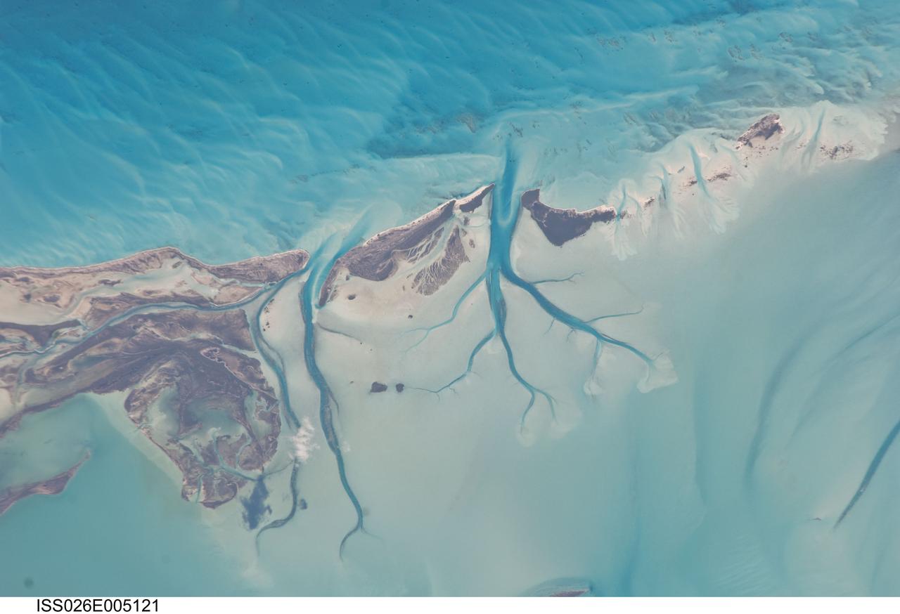
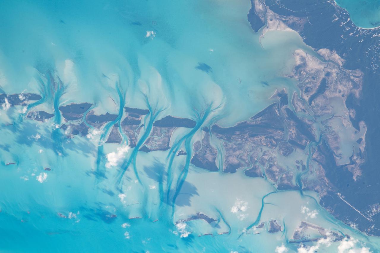
ISS026-E-005121 (27 Nov. 2010) --- Tidal flats and channels on Long Island, Bahamas are featured in this image photographed by an Expedition 26 crew member on the International Space Station. The islands of the Bahamas in the Caribbean Sea are situated on large depositional platforms (the Great and Little Bahama Banks) composed mainly of carbonate sediments ringed by fringing reefs – the islands themselves are only the parts of the platform currently exposed above sea level. The sediments are formed mostly from the skeletal remains of organisms settling to the sea floor; over geologic time, these sediments will consolidate to form carbonate sedimentary rocks such as limestone. This detailed photograph provides a view of tidal flats and tidal channels near Sandy Cay on the western side of Long Island, located along the eastern margin of the Great Bahama Bank. The continually exposed parts of the island have a brown coloration in the image, a result of soil formation and vegetation growth (left). To the north of Sandy Cay an off-white tidal flat composed of carbonate sediments is visible; light blue-green regions indicate shallow water on the tidal flat. Tidal flow of seawater is concentrated through gaps in the anchored land surface, leading to formation of relatively deep tidal channels that cut into the sediments of the tidal flat. The channels, and areas to the south of the island, have a vivid blue coloration that provides a clear indication of deeper water (center).
ISS042E070886 (12/23/2014) --- ESA astronaut Samantha Cristoforetti on the International Space Station captured this warm water image of the aquamarine and turquoise waters around the Bahamas down to the central American countries of Honduras and Nicaragua.
iss065e144117 (June 23, 2021) --- The shallow, clear blue waters off the coast of the Bahamas are pictured from the International Space Station as it orbited 260 miles above of the Atlantic Ocean.
iss073e0118628 (May 26, 2025) --- The Turks and Caicos Islands, an archipelago and British Overseas Territory in the Atlantic Ocean southeast of The Bahamas, are pictured from the International Space Station as it orbited 261 miles above.
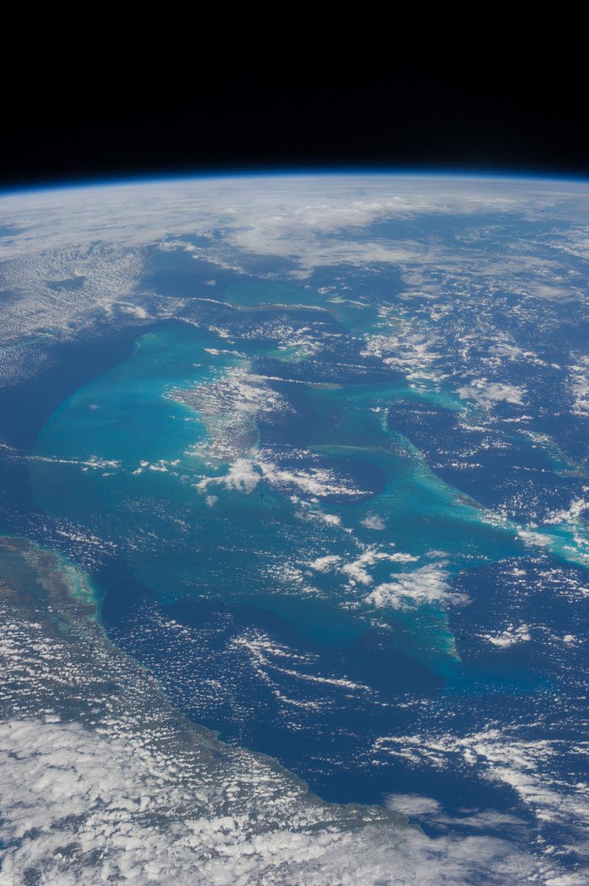
iss072e891004 (March 22, 2025) --- The Florida peninsula and the eastern coast of the United States, including the Bahamas in the Atlantic Ocean, are pictured at 1:37 a.m. local time from the International Space Station as it orbited 260 miles above.

iss060e050367 -- Expedition 60 flight engineer Christina Koch of NASA captured this image of Hurricane Dorian from the International Space Station on Sept. 2, 2019 as the storm churned over the northwestern Bahamas.
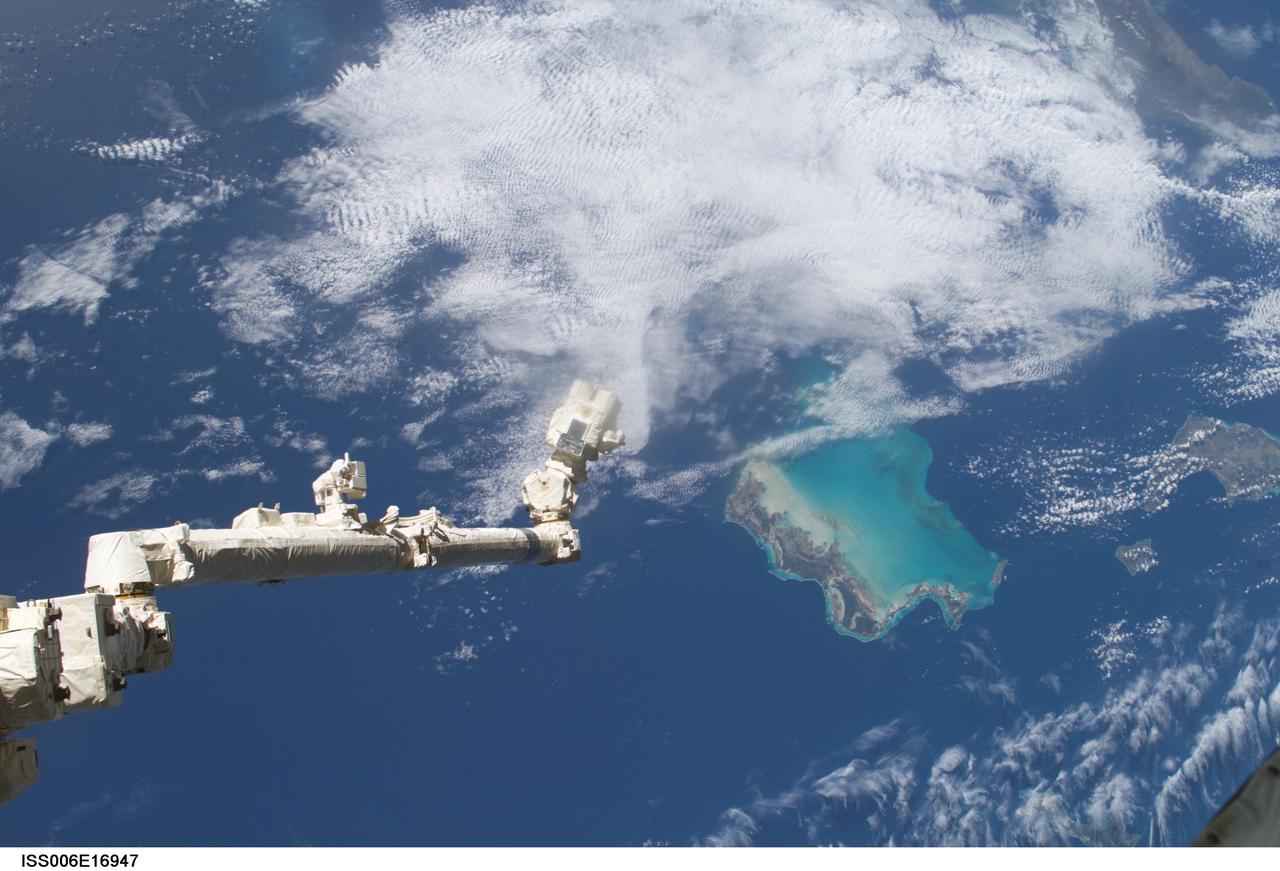
ISS006-E-16947 (9 January 2003) --- The Space Station Remote Manipulator System (SSRMS) or Canadarm2 is pictured over the Bahama Islands in this digital still camera's view taken from the International Space Station (ISS).
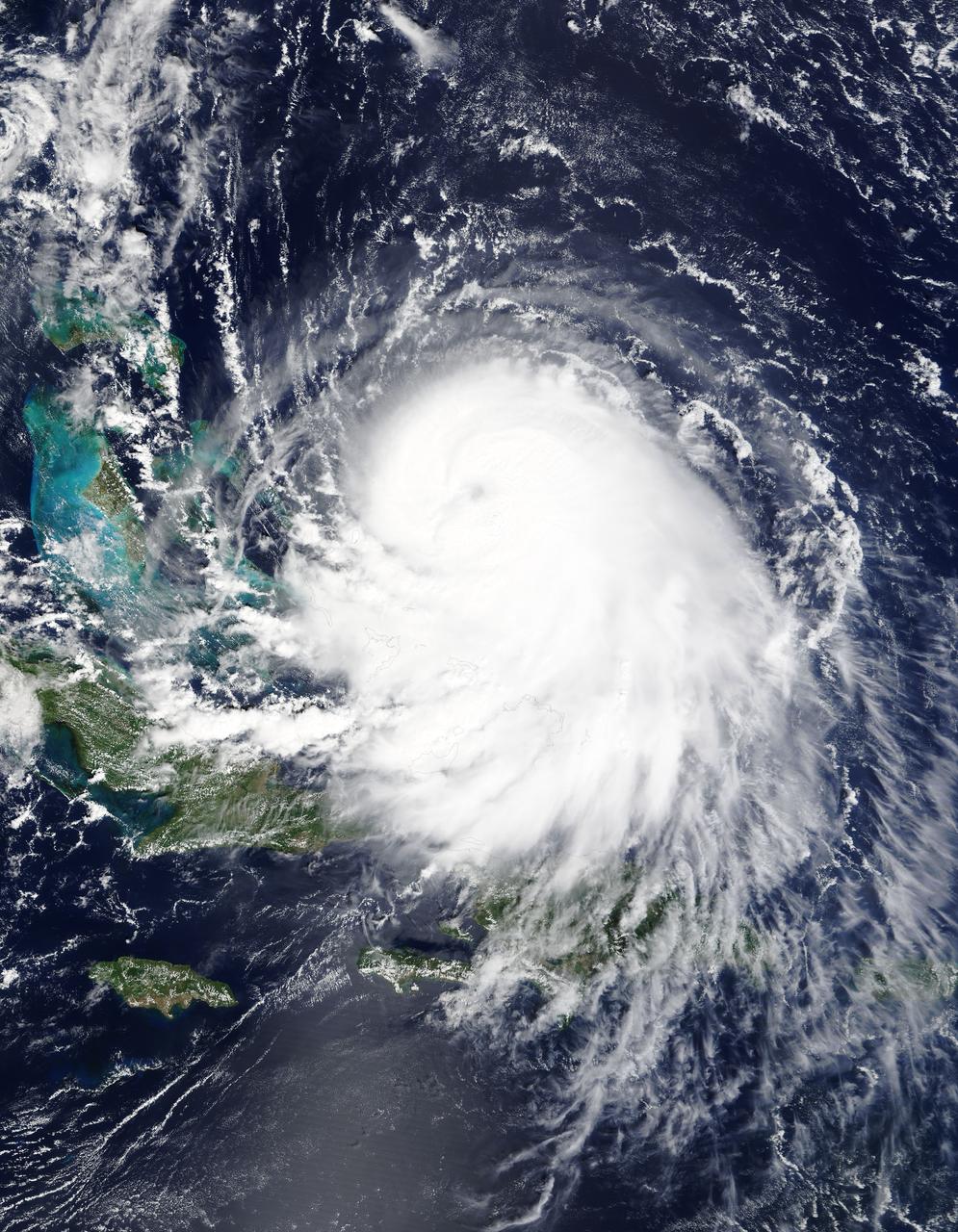
ISS045E037250 (10/02/2015) --- Hurricane Joaquin as seen from the International Space Station as it approached the Bahamas on Oct. 2, 2015. The intense storm was at Category 4 strength at the time the photo was taken.
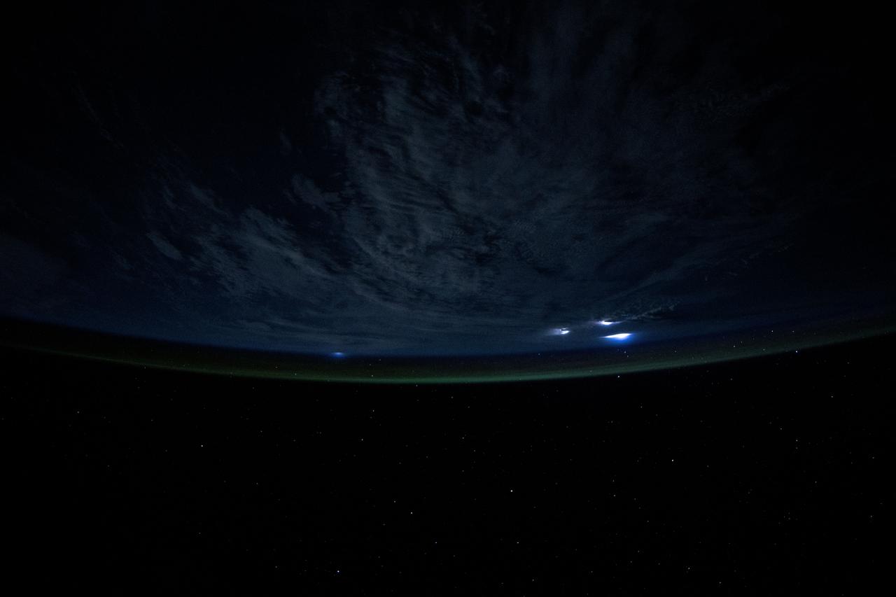
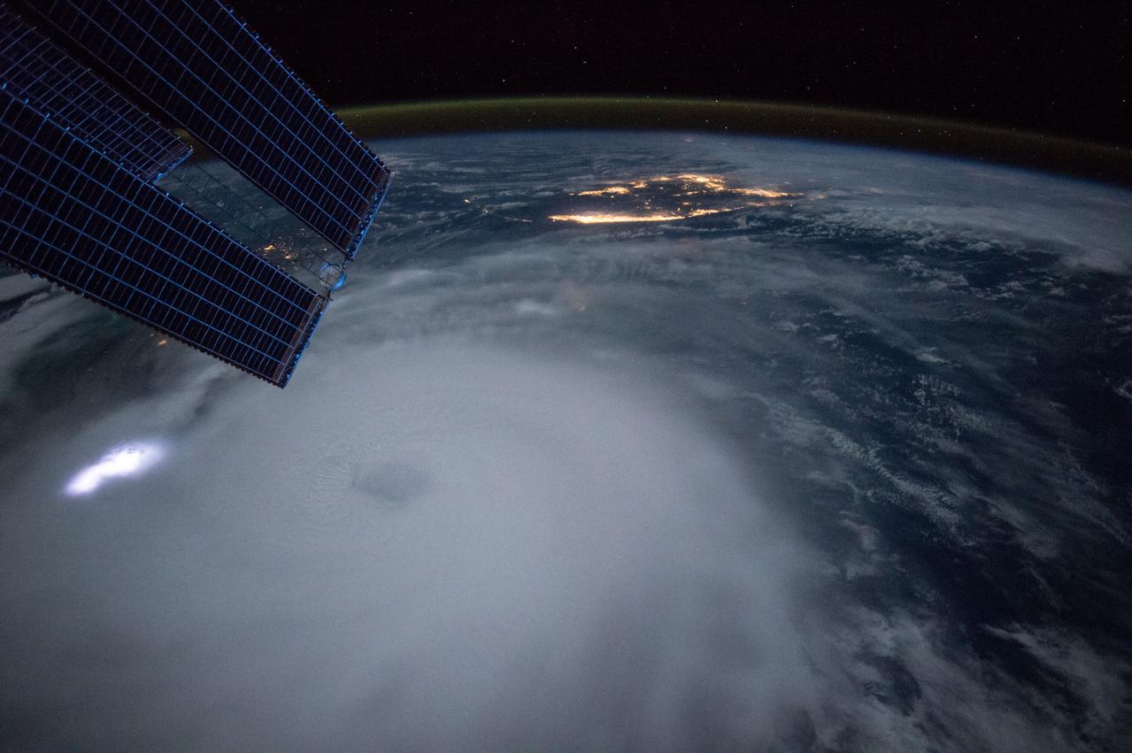
iss073e0111251 (May 18, 2025) --- Lightining illuminates the cloud tops during a storm underneath Earth's atmospheric glow in this photograph from the International Space Station as it orbited 259 miles above the Atlantic Ocean east of the Bahamas.
iss070e052109 (Dec. 30, 2023) --- The sun's glint beams off a tranquil, blue Atlantic Ocean in this photograph from the International Space Station as it orbited 261 miles above and east of the The Bahamas.

iss060e050390 -- Expedition 60 flight engineer Christina Koch of NASA captured this image of Hurricane Dorian from the International Space Station on Sept. 2, 2019 as the storm churned over the northwestern Bahamas.
iss070e008459 (Oct. 22, 2023) --- The Bahamas, an island nation southwest of Miami, Florida, in the Atlantic Ocean, is pictured from the International Space Station as it orbited 260 miles above.
jsc2021e019119 (May 2, 2021) --- This composite photograph, a combination of several distinct photographs, of Cuba, the Bahamas and southern Florida was captured as the International Space Station orbited 263 miles above the Caribbean Sea.
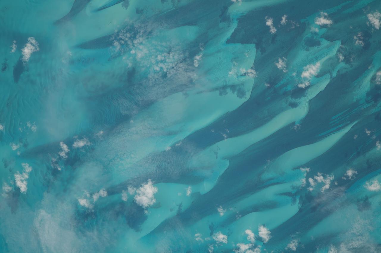
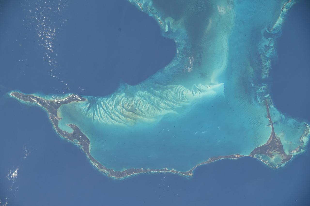
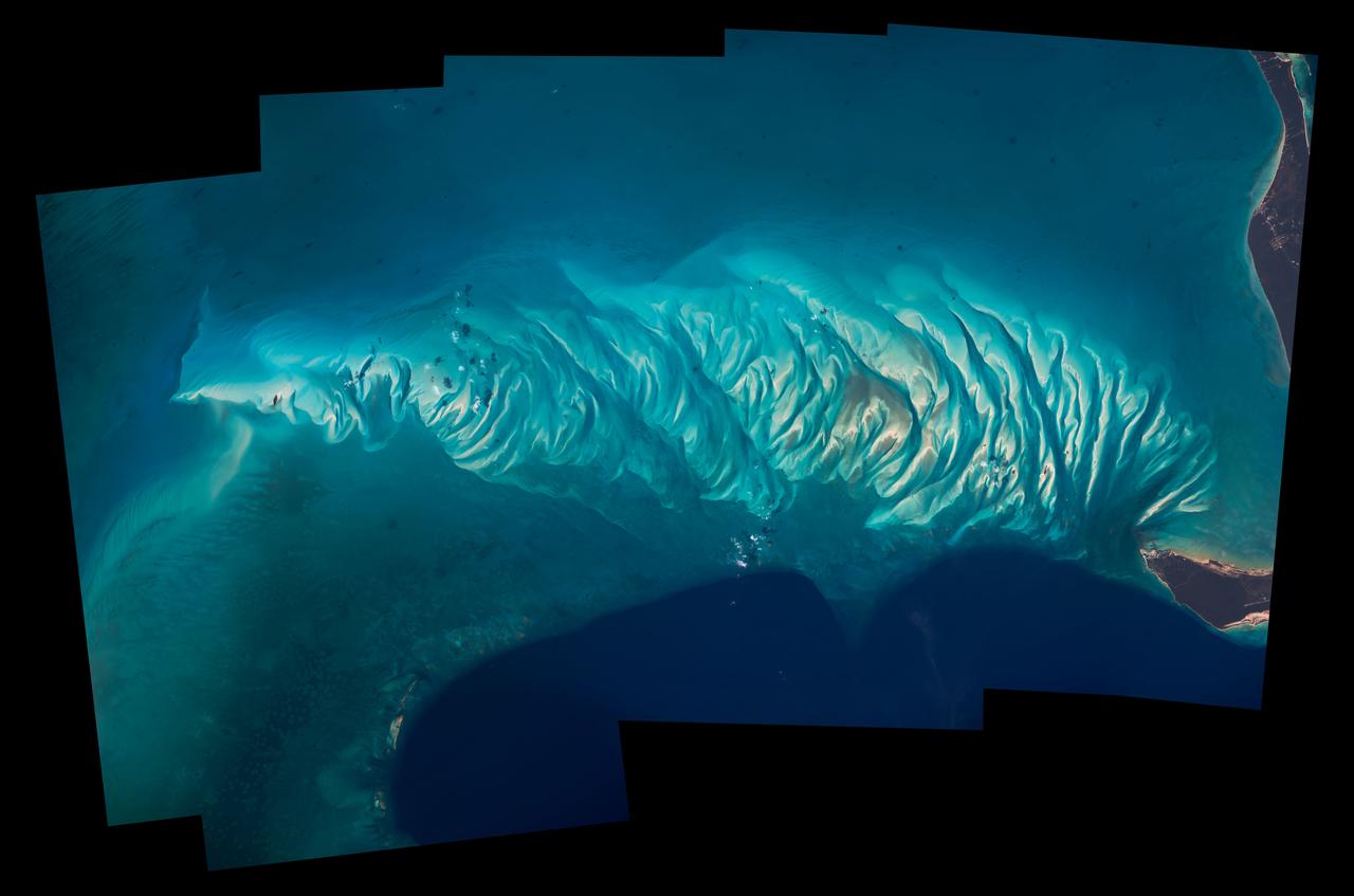
STS062-85-031 (4-18 March 1994) --- The shallow platforms (bright blue) and deep channels (dark blue) of the Bahamas provide a striking visual from space. On a finer scale, delicate patterns are created by the islands, sandbars and tidal channels. This view features a portion of the Tongue of the Ocean, one of the large deep water sounds in the western Bahamas. On the platform along the edge of the Tongue of the Ocean are convoluted sandbars bordering channels which fall into the deeper water. These channels provide an avenue for transport of sediment off the shallow platform (3-10 meters) into the deeper water (1,800 meters).
STS112-705-011 (7-18 October 2002) --- The light-blue region in the middle of this view, photographed from the Space Shuttle Atlantis, is the shallow flat platform known as the Great Bahama Bank. The platform is covered by less than 100 feet of water. Andros Island, the biggest island in the Bahamas chain, is the highest part of this platform and appears partly under cloud cover in the center of the view. The edges of the platform are steep, dropping off thousands of feet into the ocean depths, the deepest water indicated by deep blues. The 50-mile-wide Strait of Florida is the deep water along the left and lower sides of the view. The Key Largo part of the Florida Peninsula appears in the extreme lower left.

S129-E-007324 (21 Nov. 2009) --- One of the crew members onboard the space shuttle Atlantis recorded this still image of the Bahamas' lengthy narrow Eleuthra Island. Like most of the Bahama Islands, Eleuthra is composed mainly of limestone and coral, and rises from a vast submarine plateau. The island, 80 miles (133 kilometers) long, about two miles (three kilometers) wide and covering an area of 164 square miles (425 square kilometers), is generally low and flat, has many mangrove swamps, brackish lakes, coral reefs and shoals, and many miles of sandy beaches.
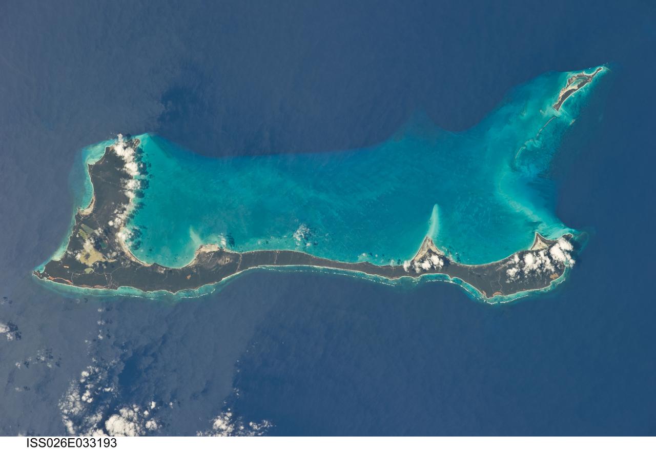
ISS026-E-033193 (10 March 2011) --- Cat Island, Commonwealth of the Bahamas, is featured in this image photographed by an Expedition 26 crew member on the International Space Station. Cat Island is one of 29 islands, 661 cays, and 2,387 islets that form the Commonwealth of the Bahamas. Mount Alvernia, the highest point in the Bahamas at an elevation of approximately 63 meters above sea level, is located on the southeastern part of the island. Like most other islands in the Bahamas, Cat Island is located on a large depositional platform that is composed mainly of carbonate sediments and surrounding reefs. The approximately 77-kilometers-long island is the part of the platform continuously exposed above the water surface; this allows for soil development (brown to tan areas) and establishment of vegetation (green areas) to occur. Shallow water to the west-southwest of the island appears bright blue in this photograph (center) in contrast to the deeper ocean waters to the north, east, and south. The ocean surface near the southeastern half of the island has a slight grey tinge; this is due to sunglint, or light reflecting off of the water surface backs towards the observer onboard the space station. Small white cumulus clouds obscure some parts of the island. Named San Salvador prior to 1925, the island has been put forward as a candidate for Christopher Columbus’ first landfall in the Americas. Cat Island is inhabited, and had a total population of 1,647 in 2000 according to the Department of Statistics of the Bahamas. The smaller island of Little San Salvador to the west is privately owned and used as a port of call for cruise ships.
KENNEDY SPACE CENTER, FLA. - Astronauts Deke Slayton, far left, and Virgil Grissom, far right, were on hand to greet Astronaut Alan B. Shepard at Grand Bahama Island after his historic first U.S. manned suborbital flight. Just behind Astronaut Shepard is Dr. Keith Lyndell.
ISS028-E-015828 (10 July 2011) --- The space shuttle Atlantis is seen over the Bahamas prior to a perfect docking with the International Space Station at 10:07 a.m. (CDT). Part of a Russian Progress spacecraft which is docked to the station is in the foreground.
ISS028-E-015819 (10 July 2011) --- The space shuttle Atlantis is seen over the Bahamas prior to a perfect docking with the International Space Station at 10:07 a.m. (CDT). Part of a Russian Progress spacecraft which is docked to the station is in the foreground.
ISS046e009103 (01/16/2016) --- In orbit around the Earth on board the International Space Station NASA astronaut Scott Kelly captured this blue water image in his "Earth Art" series and tweeted it out with this message: " A splash of #EarthArt over the #Bahamas! #YearInSpace ".
ISS028-E-015827 (10 July 2011) --- The space shuttle Atlantis is seen over the Bahamas prior to a perfect docking with the International Space Station at 10:07 a.m. (CDT). Part of a Russian Progress spacecraft which is docked to the station is in the foreground.
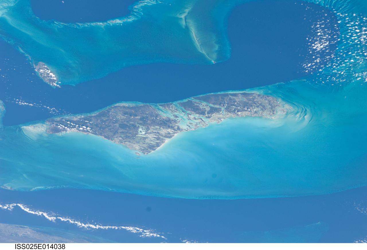
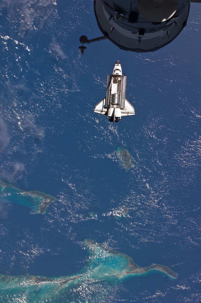
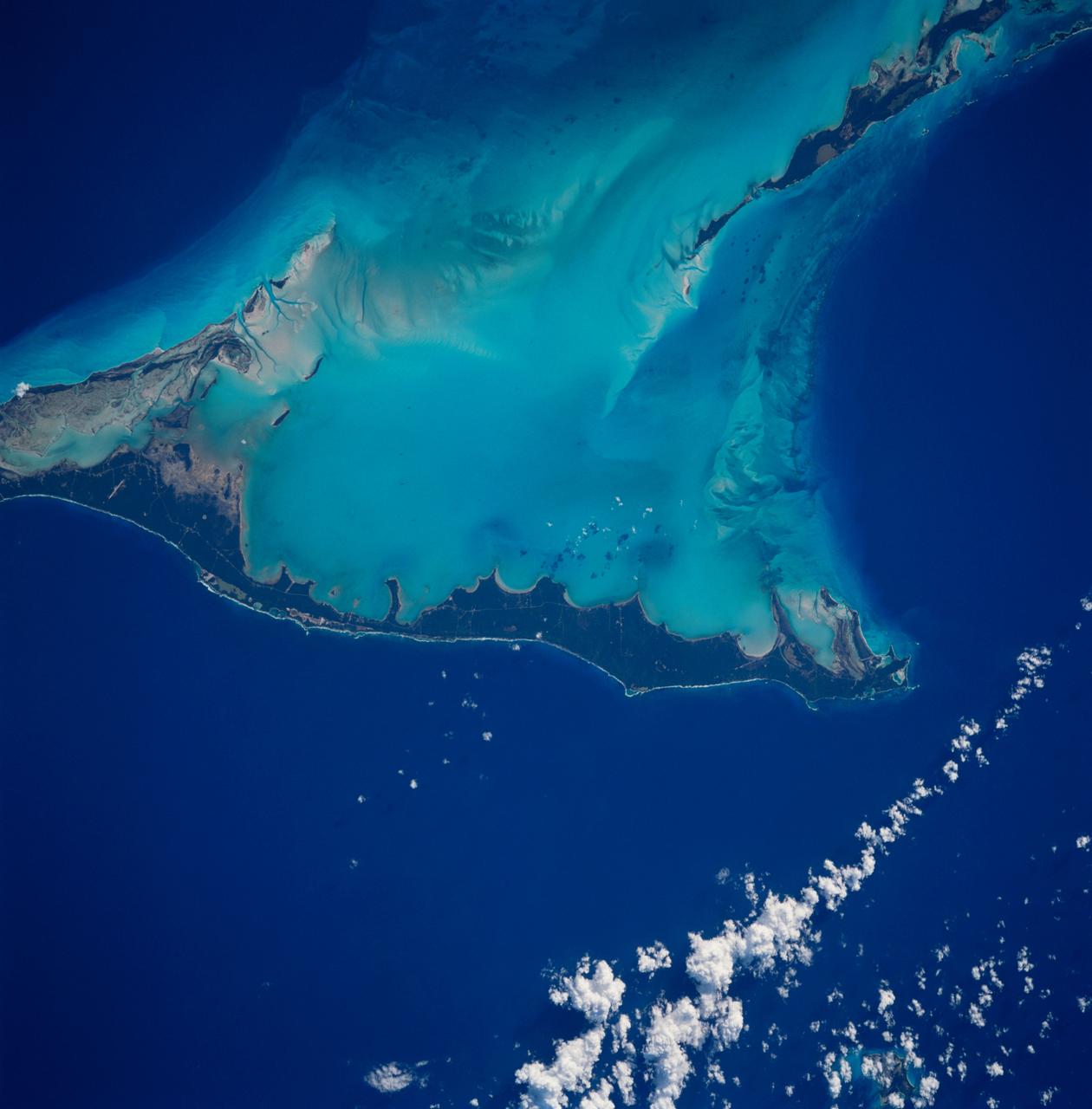
ISS025-E-014038 (10 Nov. 2010) --- Andros Island and the Tongue of the Ocean, a deep oceanic trench in the Bahamas separating the islands of Andros and nearby New Providence, captured the attention of a camera-bearing member of the Expedition 25 crew orbiting Earth onboard the International Space Station, some 220 miles above.
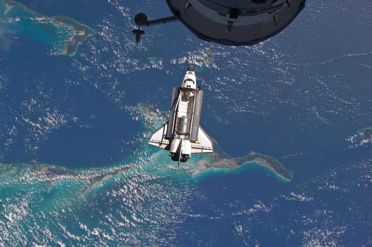
ISS028-E-015813 (10 July 2011) --- The space shuttle Atlantis is seen over the Bahamas prior to a perfect docking with the International Space Station at 10:07 a.m. (CDT). Part of a Russian Progress spacecraft which is docked to the station is in the foreground.
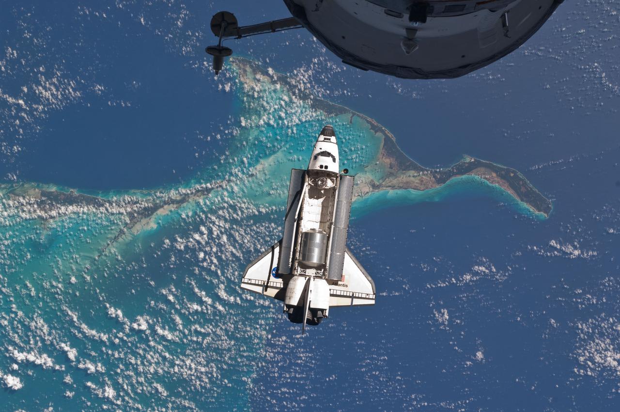
ISS028-E-015807 (10 July 2011) --- The space shuttle Atlantis is seen over the Bahamas prior to a perfect docking with the International Space Station at 10:07 a.m. (CDT). Part of a Russian Progress spacecraft which is docked to the station is in the foreground.
ISS042E135486 (01/10/2015) --- Just another sunny day in the Caribbean sea as viewed by astronauts aboard the International Space Station. This image was tweeted out by NASA astronaut Terry Virts as he captured the Earth observation of #Cuba and #Bahamas on Jan. 10, 2015.
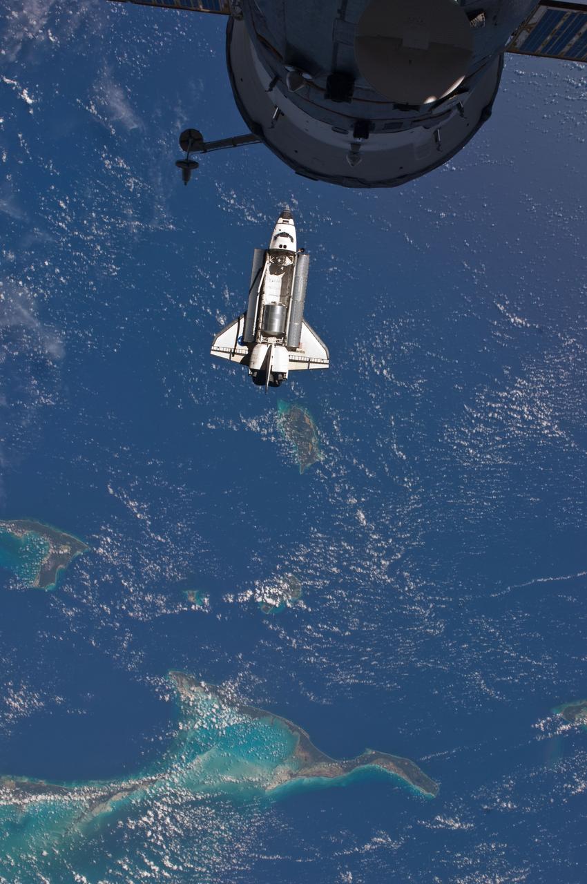
ISS028-E-015824 (10 July 2011) --- The space shuttle Atlantis is seen over the Bahamas prior to a perfect docking with the International Space Station at 10:07 a.m. (CDT). Part of a Russian Progress spacecraft which is docked to the station is in the foreground.
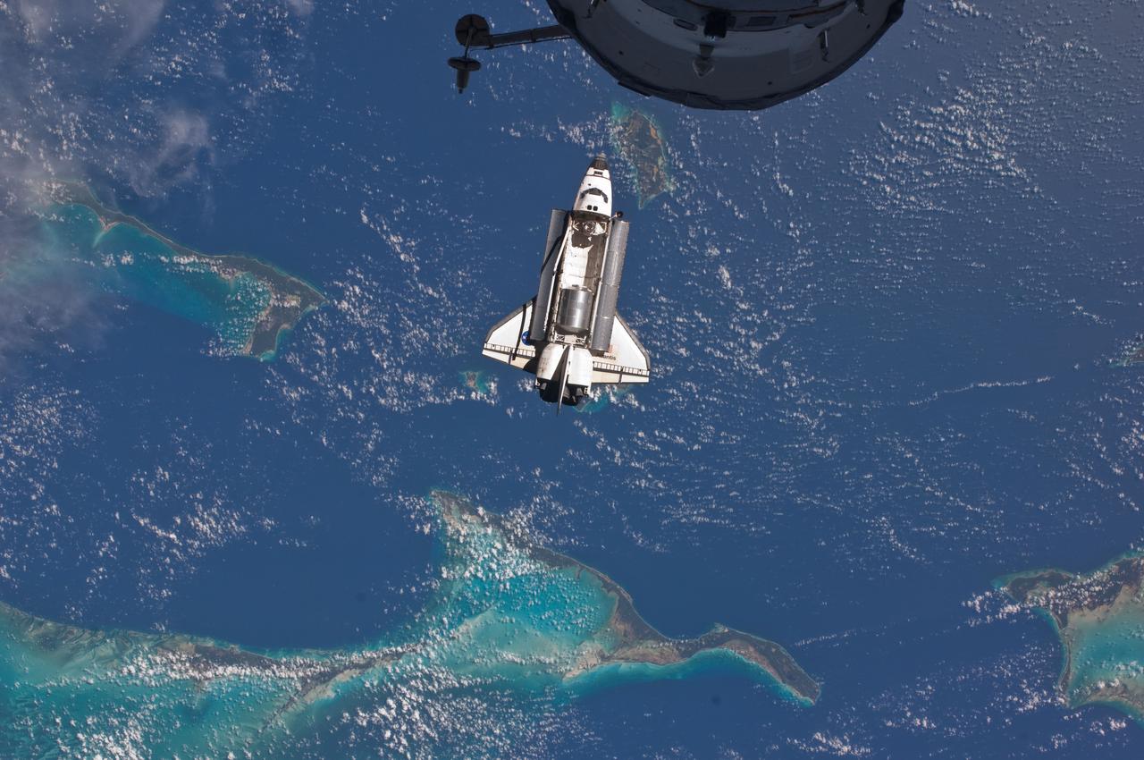
ISS028-E-015818 (10 July 2011) --- The space shuttle Atlantis is seen over the Bahamas prior to a perfect docking with the International Space Station at 10:07 a.m. (CDT). Part of a Russian Progress spacecraft which is docked to the station is in the foreground.
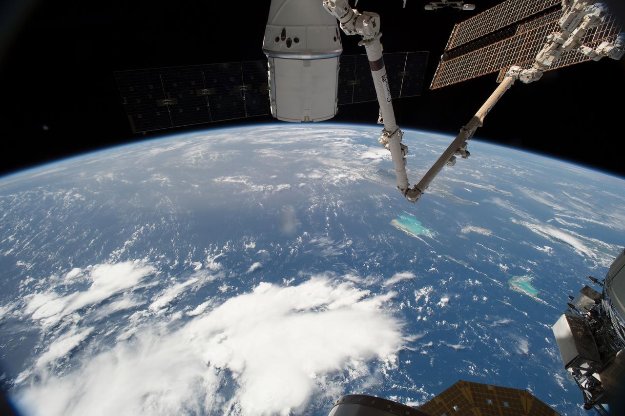
iss056e085362 (July 7, 2018) --- The SpaceX Dragon cargo craft is pictured berthed to the International Space Station's Harmony module still in the grips of the Canadarm2 robotic arm. The orbital complex was flying over the Bahamas in the Atlantic Ocean at an altitude of about 253 miles above the Earth's surface.
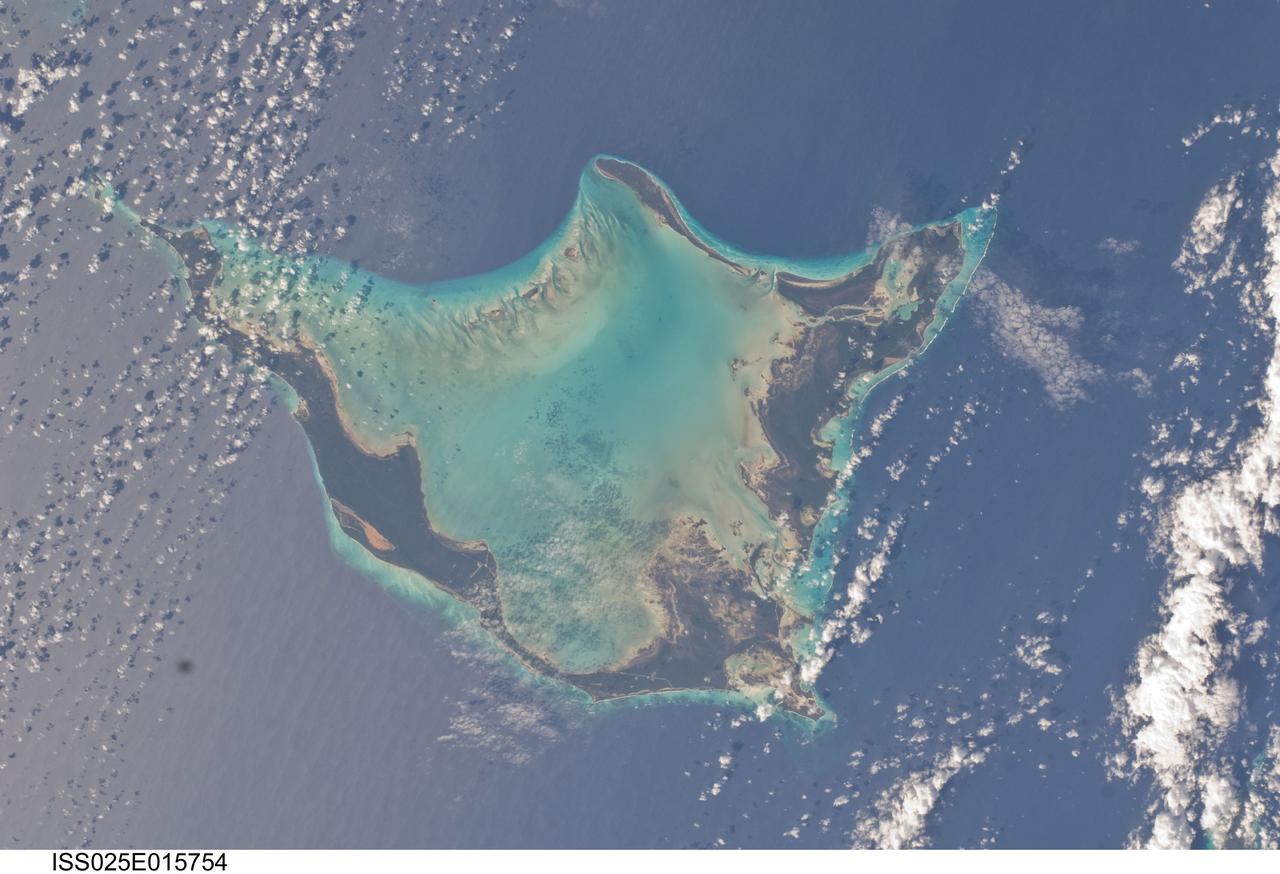
ISS025-E-015754 (16 Nov. 2010) --- Photographed by one the Expedition 25 crew members aboard the International Space Station, orbiting 220 miles above Earth, this horseshoe shaped feature is Acklins Island in the Bahamas chain in the Caribbean.
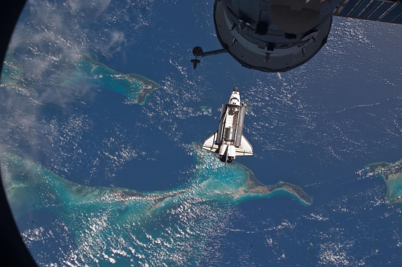
ISS028-E-015815 (10 July 2011) --- The space shuttle Atlantis is seen over the Bahamas prior to a perfect docking with the International Space Station at 10:07 a.m. (CDT). Part of a Russian Progress spacecraft which is docked to the station is in the foreground.
ISS030-E-050563 (17 Jan. 2012) --- This infrared view shows the Bahamas' Long Island (left) and parts of Little and Great Exuma (right). It was photographed as part of an experiment by one of the Expedition 30 crew members aboard the International Space Station on Jan. 17, 2012.
S135-E-006400 (9 July 2011) --- A window on space shuttle Atlantis' aft flight deck frames this scene featuring the Atlantic Ocean/Tropic of Cancer area south of Florida, including some of the 2700 islands that constitute the Bahamas. Photo credit: NASA
ISS028-E-015808 (10 July 2011) --- The space shuttle Atlantis is seen over the Bahamas prior to a perfect docking with the International Space Station at 10:07 a.m. (CDT). Part of a Russian Progress spacecraft which is docked to the station is in the foreground.
ISS028-E-015805 (10 July 2011) --- The space shuttle Atlantis is seen over the Bahamas prior to a perfect docking with the International Space Station at 10:07 a.m. (CDT). Part of a Russian Progress spacecraft which is docked to the station is in the foreground.
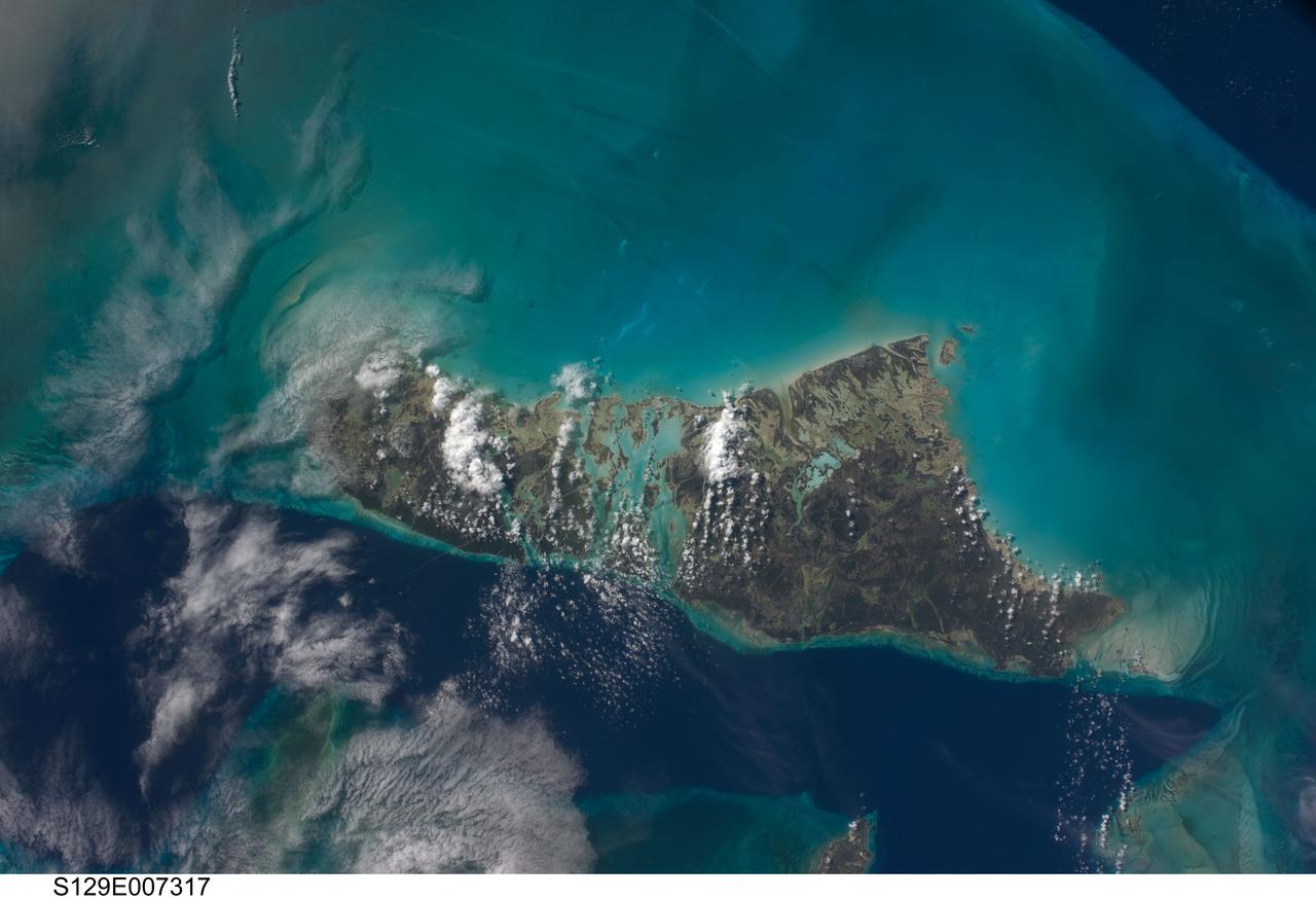
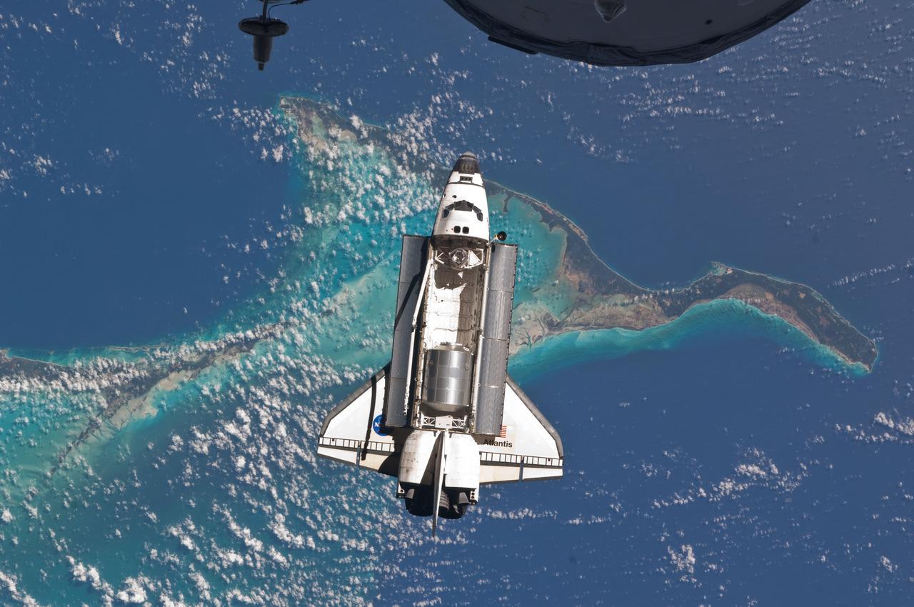
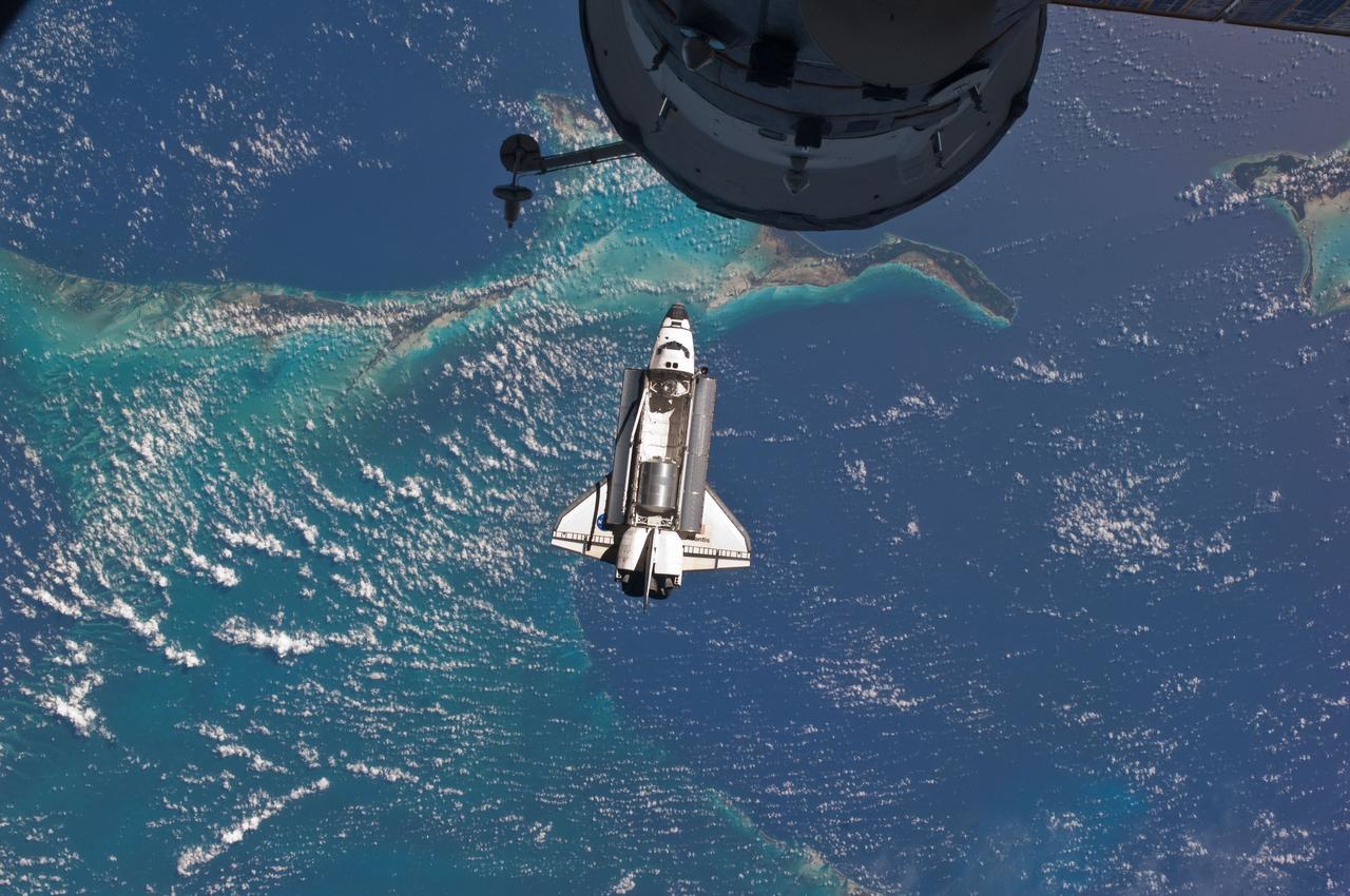
S129-E-007317 (21 Nov. 2009) --- This scene of the Bahamas’ Andros Island and the Tongue of the Ocean was captured by one of the STS-129 crewmembers aboard the space shuttle Atlantis during flight day six activities. This scene from Earth orbit appears much more peaceful than earlier in the month, when Hurricane/Tropical Storm Ida was not only threatening but seriously affecting several areas in several oceans. The dark blue area, aptly named "Tongue of the Ocean", is characterized by water depths as great as 3000 meters (almost two miles). The Atlantic Ocean just east of Eleuthra Island is nearly 5000 meters deep. By comparison, the waters of the Bahama Platform are less than 15 meters deep.
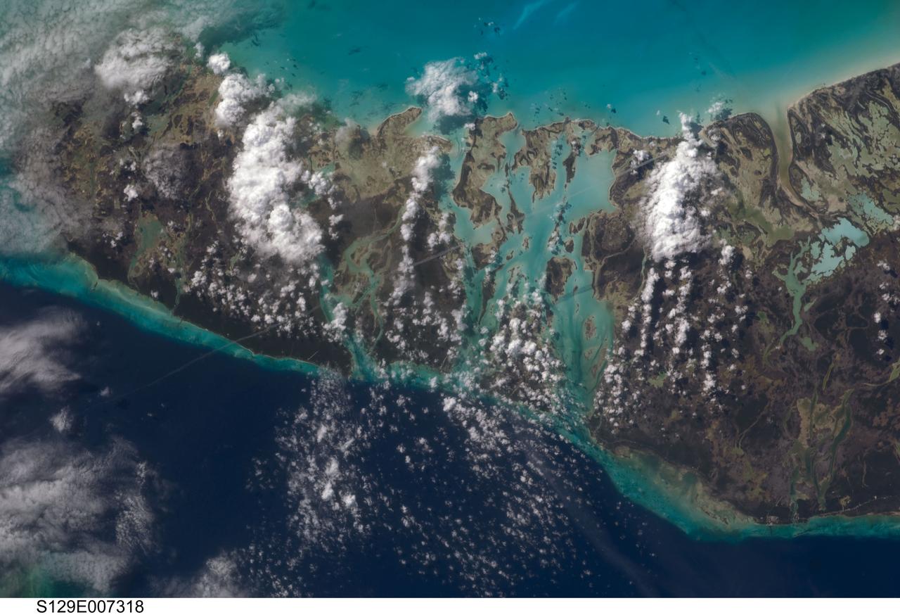
S129-E-007318 (21 Nov. 2009) --- This scene of the Bahamas’ Andros Island and the Tongue of the Ocean was captured by one of the STS-129 crew members aboard the space shuttle Atlantis during flight day six activities. This scene from Earth orbit appears much more peaceful than earlier in the month, when Hurricane/Tropical Storm Ida was not only threatening but seriously affecting several areas in several oceans. The dark blue area, aptly named "Tongue of the Ocean", is characterized by water depths as great as 3000 meters (almost two miles). The Atlantic Ocean just east of Eleuthra Island is nearly 5000 meters deep. By comparison, the waters of the Bahama Platform are less than 15 meters deep.
STS083-712-063 (4-8 April 1997) --- Northern half of Long Island, Bahamas. The vivid blues of the Bahamas stand out from space. Long Island and Great Exuma Island, which extends from the west north west into the photo, is on the eastern side of the Great Bahama Bank and form the borders of Exuma Sound. This photograph provides a rare opportunity to observe a natural chemical laboratory at work. Limestone of quite a different sort from that forming the Great Barrier Reef is actually in the process of formation. Long Island itself is little more than a sandbar rising just a few meters (about 30 to 50 meters) above sea level but it separates the deep, dark blue waters of the Atlantic on the right from the 10-meter (33 feet) shallows of the Great Bahama Bank (left). Details of the topography of the bank are visible through the clear waters. The shallow waters are warm and become extremely salty. Crystals of aragonite, a calcium carbonate mineral, are precipitated and formed into spherical sand-sized oolites as the tidal currents swirl back and forth. Lithification of the carbonate sands produces an oolithic limestone. Although the water is warm and clear, corals do not live in the shallows, probably because of the elevated salt content. Although chemically similar, the oolithic limestone forming Long Island is very different from coral reef limestone. An airfield is visible at the northern and central (bottom of photo) part of the island.