Today's VIS image shows a portion of Bahram Vallis. Bahram Vallis is located at the north eastern margin of Lunae Planum. Orbit Number: 64222 Latitude: 20.6103 Longitude: 302.477 Instrument: VIS Captured: 2016-06-05 20:40 http://photojournal.jpl.nasa.gov/catalog/PIA20803
This VIS image shows a section of Bahram Vallis. Bahram Vallis is located on the northeastern margin of Lunae Planum. Orbit Number: 70146 Latitude: 20.6144 Longitude: 302.265 Instrument: VIS Captured: 2017-10-06 22:04 https://photojournal.jpl.nasa.gov/catalog/PIA22363
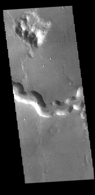
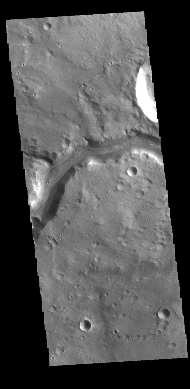
This image from NASA Mars Odyssey shows Bahram Vallis where it enters Waspam Crater. Bahram Vallis exits the crater to the north a short distance from this location along the rim of Waspam Crater.
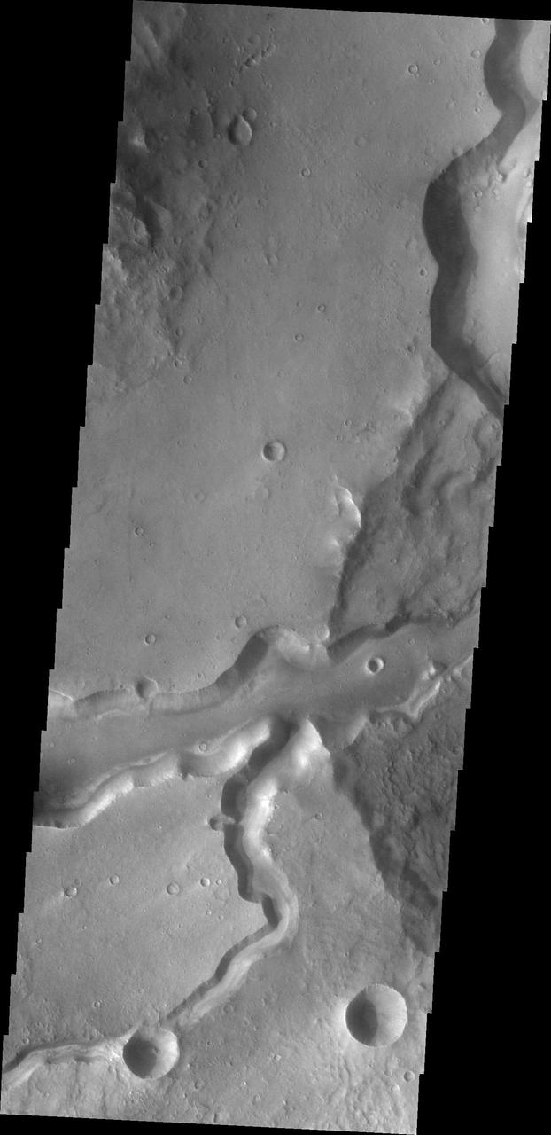
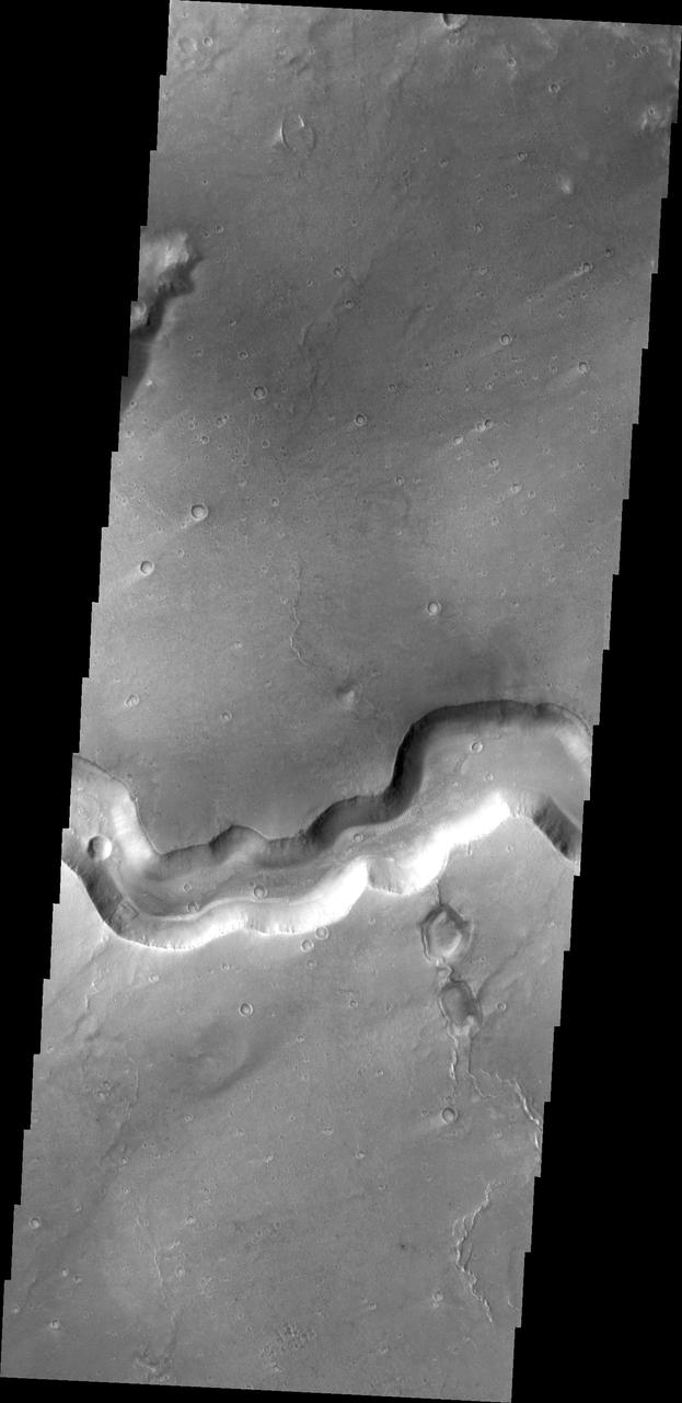
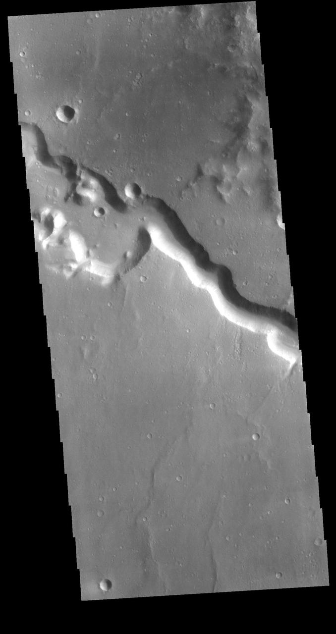
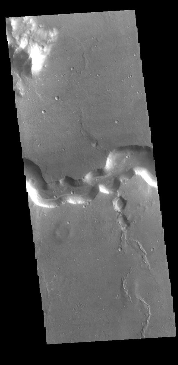
Bahram Vallis crosses this VIS image. Bharam Vallis drains from the higher elevations of Lunae Planum into the Chryse Planitia basin. Bahram Vallis is 270km (167 miles) long, with an almost uniform width along most of the channel. Orbit Number: 86116 Latitude: 20.5906 Longitude: 302.116 Instrument: VIS Captured: 2021-05-14 02:29 https://photojournal.jpl.nasa.gov/catalog/PIA24222
This image captured by NASA 2001 Mars Odyssey spacecraft shows a section of Bahram Vallis.
Today's VIS image shows a section of Bahram Vallis. This channel is located in northern Lunae Planum, south of Kasei Valles. Bharam Vallis drains from the higher elevations of Lunae Planum towards the Chryse Planitia basin. This channel is over 300km long (186miles). Orbit Number: 95138 Latitude: 20.0779 Longitude: 303.077 Instrument: VIS Captured: 2023-05-26 23:17 https://photojournal.jpl.nasa.gov/catalog/PIA26260
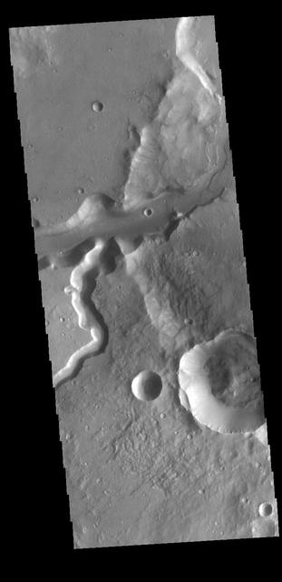
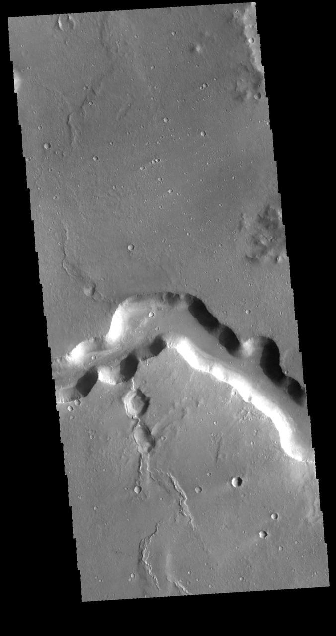
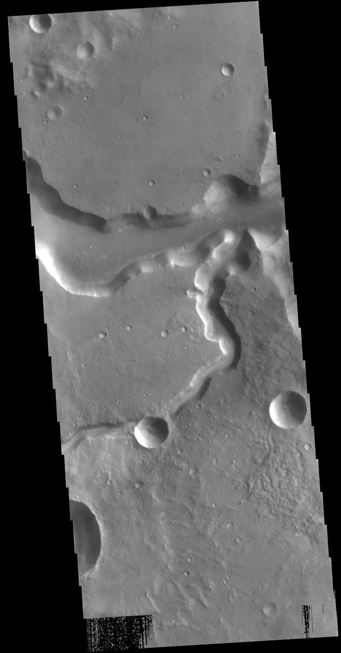
Today's VIS image shows a section of Bahram Vallis. This channel is located in northern Lunae Planum, south of Kasei Valles. Bharam Vallis drains from the higher elevations of Lunae Planum towards the Chryse Planitia basin. This channel is over 300km long (186miles). In this image Bahram Vallis enters Waspam Crater (right side of image) and then exits the crater (top right corner). Orbit Number: 81374 Latitude: 20.3853 Longitude: 303.032 Instrument: VIS Captured: 2020-04-18 15:46 https://photojournal.jpl.nasa.gov/catalog/PIA23956
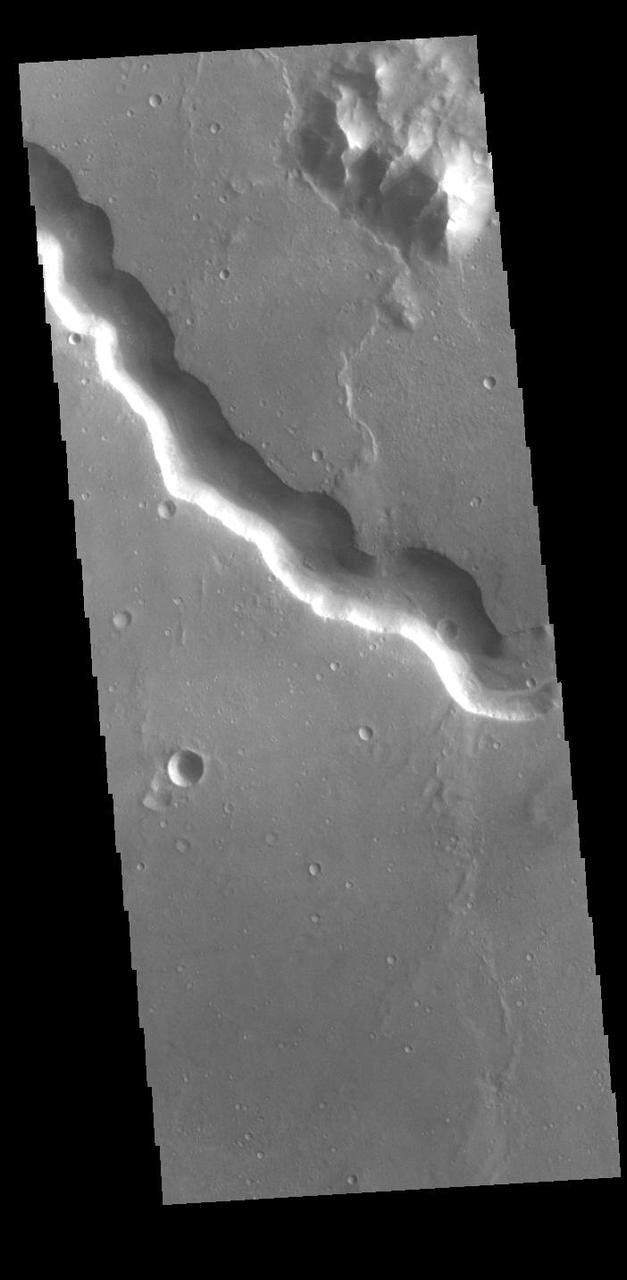
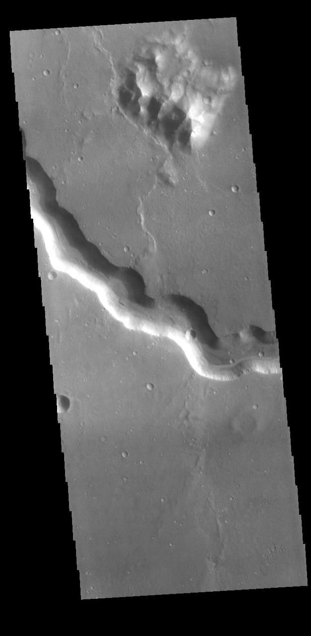
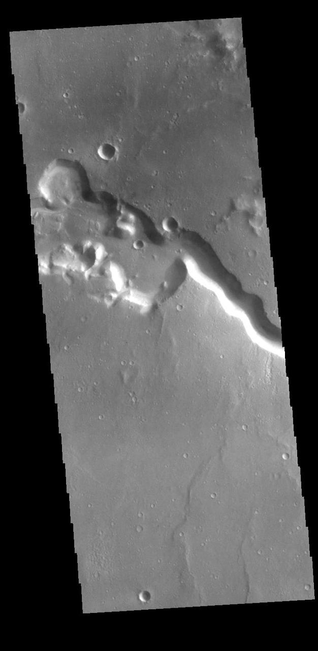
Bahram Vallis crosses this VIS image. Bharam Vallis drains from the the higher elevations of Lunae Planum into the Chryse Planitia basin. At the base of several of the scalloped channel wall sections deposits of material can be seen. Orbit Number: 77643 Latitude: 20.8706 Longitude: 303.262 Instrument: VIS Captured: 2019-06-16 10:30 https://photojournal.jpl.nasa.gov/catalog/PIA23363
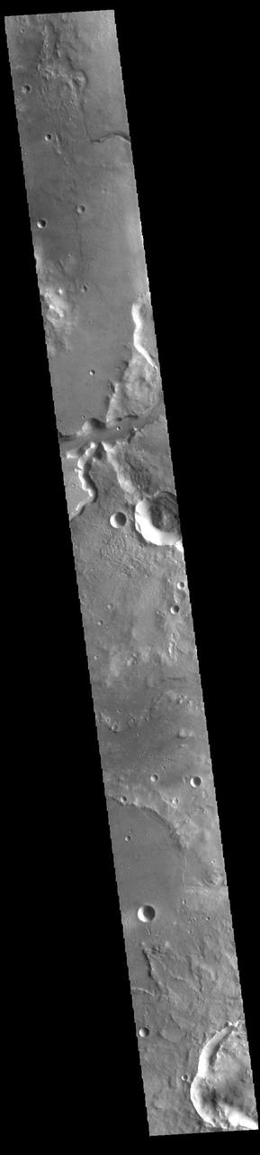
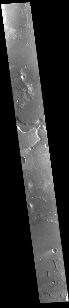
Today's VIS image shows a section of Bahram Vallis. This channel is located in northern Lunae Planum, south of Kasei Valles. Orbit Number: 71256 Latitude: 21.0762 Longitude: 301.486 Instrument: VIS Captured: 2018-01-06 08:51 https://photojournal.jpl.nasa.gov/catalog/PIA22379
Today's VIS image shows a section of Bahram Vallis. This channel is located in northern Lunae Planum, south of Kasei Valles. Bharam Vallis drains from the higher elevations of Lunae Planum towards the Chryse Planitia basin. This channel is over 300km long (186miles). Orbit Number: 94826 Latitude: 21.4639 Longitude: 303.82 Instrument: VIS Captured: 2023-05-01 06:44 https://photojournal.jpl.nasa.gov/catalog/PIA26179
Today's VIS image shows a section of Bahram Vallis. This channel is located in northern Lunae Planum, south of Kasei Valles. Bharam Vallis drains from the higher elevations of Lunae Planum towards the Chryse Planitia basin. This channel is over 300km long (186miles). Orbit Number: 93965 Latitude: 20.1543 Longitude: 302.9 Instrument: VIS Captured: 2023-02-19 09:18 https://photojournal.jpl.nasa.gov/catalog/PIA25936
Today's VIS image shows a section of Bahram Vallis. This channel is located in northern Lunae Planum, south of Kasei Valles. Bharam Vallis drains from the higher elevations of Lunae Planum towards the Chryse Planitia basin. This channel is over 300km long (186miles). Orbit Number: 88175 Latitude: 20.6178 Longitude: 302.162 Instrument: VIS Captured: 2021-10-30 15:19 https://photojournal.jpl.nasa.gov/catalog/PIA25156
Today's VIS image shows a section of Bahram Vallis. This channel is located in northern Lunae Planum, south of Kasei Valles. Bharam Vallis drains from the higher elevations of Lunae Planum towards the Chryse Planitia basin. This channel is over 300km (186 miles) long. Orbit Number: 94564 Latitude: 20.5977 Longitude: 302.359 Instrument: VIS Captured: 2023-04-09 17:00 https://photojournal.jpl.nasa.gov/catalog/PIA26036
Today's VIS image shows a section of Bahram Vallis. This channel is located in northern Lunae Planum, south of Kasei Valles. Bharam Vallis drains from the higher elevations of Lunae Planum towards the Chryse Planitia basin. This channel is over 300km long (186miles). Orbit Number: 94876 Latitude: 21.1353 Longitude: 301.426 Instrument: VIS Captured: 2023-05-05 09:33 https://photojournal.jpl.nasa.gov/catalog/PIA26211
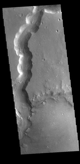
Today's VIS image shows a section of Bahram Vallis. This channel is located in northern Lunae Planum, south of Kasei Valles. Bharam Vallis drains from the higher elevations of Lunae Planum towards the Chryse Planitia basin. This channel is over 300km long (186miles). Orbit Number: 87576 Latitude: 20.3115 Longitude: 302.882 Instrument: VIS Captured: 2021-09-11 07:37 https://photojournal.jpl.nasa.gov/catalog/PIA25224
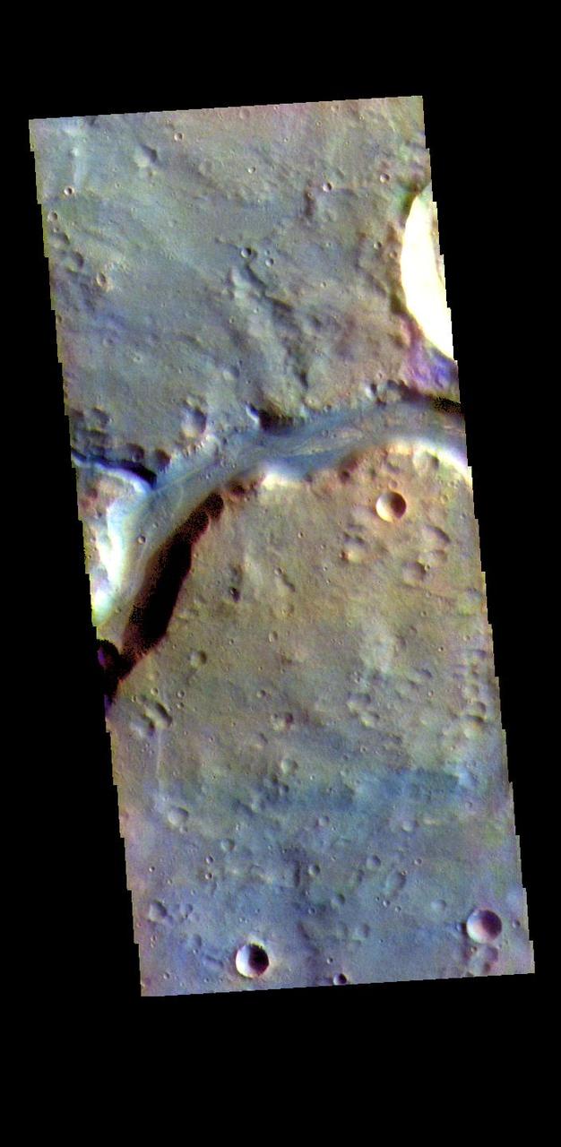
The THEMIS VIS camera contains 5 filters. The data from different filters can be combined in multiple ways to create a false color image. These false color images may reveal subtle variations of the surface not easily identified in a single band image. Today's false color image shows a section of Bahram Vallis. This channel is located in northern Lunae Planum, south of Kasei Valles. Bharam Vallis drains from the higher elevations of Lunae Planum towards the Chryse Planitia basin. This channel is over 300km long (186miles). The THEMIS VIS camera is capable of capturing color images of the Martian surface using five different color filters. In this mode of operation, the spatial resolution and coverage of the image must be reduced to accommodate the additional data volume produced from using multiple filters. To make a color image, three of the five filter images (each in grayscale) are selected. Each is contrast enhanced and then converted to a red, green, or blue intensity image. These three images are then combined to produce a full color, single image. Because the THEMIS color filters don't span the full range of colors seen by the human eye, a color THEMIS image does not represent true color. Also, because each single-filter image is contrast enhanced before inclusion in the three-color image, the apparent color variation of the scene is exaggerated. Nevertheless, the color variation that does appear is representative of some change in color, however subtle, in the actual scene. Note that the long edges of THEMIS color images typically contain color artifacts that do not represent surface variation. Orbit Number: 94826 Latitude: 21.4639 Longitude: 303.82 Instrument: VIS Captured: 2023-05-01 06:44 https://photojournal.jpl.nasa.gov/catalog/PIA26135