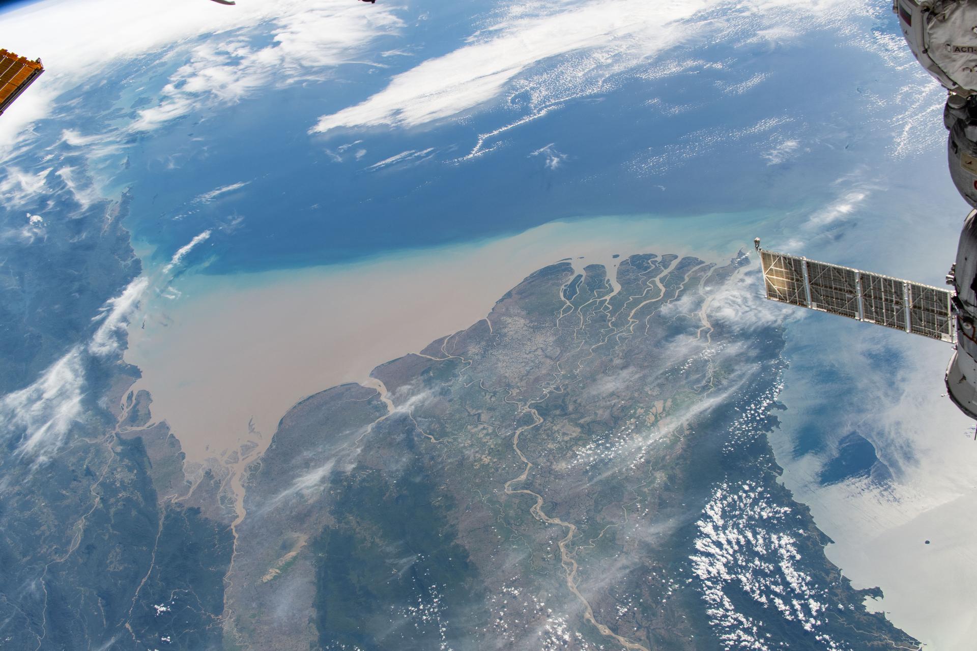
iss073e1197819 (Nov. 22, 2025) --- Myanmar’s (Burma) Irrawaddy Delta—an important agricultural region in Southeast Asia filled with mangrove forests, rice paddies, and swampy lowlands—empties into the Andaman Sea and is pictured from the International Space Station as it orbited 262 miles above.
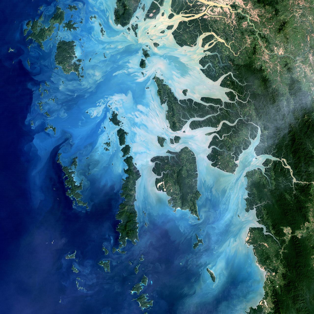
NASA image acquired December 14, 2004 In the southernmost reaches of Burma (Myanmar), along the border with Thailand, lies the Mergui Archipelago. The archipelago in the Andaman Sea is made up of more than 800 islands surrounded by extensive coral reefs. This natural color image acquired by Landsat 5 on Dec. 14, 2004, shows the middle portion of the archipelago, including Auckland and Whale Bays. Swirling patterns are visible in the near-shore waters as sediments carried by rivers slowly settle out and are deposited on the seafloor. The heavy sediment loads make the river appear nearly white. As those sediments settle out, the seawater appears deeper shades of blue. The tropical rainforests of the region appear deep green. Captain Thomas Forrest of the East India Company first described the region to Europeans after a 1782 expedition in search of potential sugar-growing lands. At that time, the islands were mainly inhabited by a nomadic fishing culture. These people, known as the Moken, still call the archipelago home and mostly live a hunter-gatherer lifestyle. As of 2006, 2,000 Moken were known to inhabit the Burmese portion of Mergui. The small population of the archipelago has helped preserve its high diversity of plants and animals. In 1997, Burma opened the region to foreign tourism and in the years since it has become a major diving destination. A valued species of pearl oyster (Pinctada maxima) are found in nearby waters. Today, overfishing is emerging as a regional problem. Landsat image created by Michael Taylor, Landsat Project Science Office. Caption by Laura Rocchio. Instrument: Landsat 5 - TM To read more go to: <a href="http://1.usa.gov/TDmjsk" rel="nofollow">1.usa.gov/TDmjsk</a> Credit: <b><a href="http://www.earthobservatory.nasa.gov/" rel="nofollow"> NASA Earth Observatory</a></b> <b><a href="http://www.nasa.gov/audience/formedia/features/MP_Photo_Guidelines.html" rel="nofollow">NASA image use policy.</a></b> <b><a href="http://www.nasa.gov/centers/goddard/home/index.html" rel="nofollow">NASA Goddard Space Flight Center</a></b> enables NASA’s mission through four scientific endeavors: Earth Science, Heliophysics, Solar System Exploration, and Astrophysics. Goddard plays a leading role in NASA’s accomplishments by contributing compelling scientific knowledge to advance the Agency’s mission. <b>Follow us on <a href="http://twitter.com/NASA_GoddardPix" rel="nofollow">Twitter</a></b> <b>Like us on <a href="http://www.facebook.com/pages/Greenbelt-MD/NASA-Goddard/395013845897?ref=tsd" rel="nofollow">Facebook</a></b> <b>Find us on <a href="http://instagram.com/nasagoddard?vm=grid" rel="nofollow">Instagram</a></b>
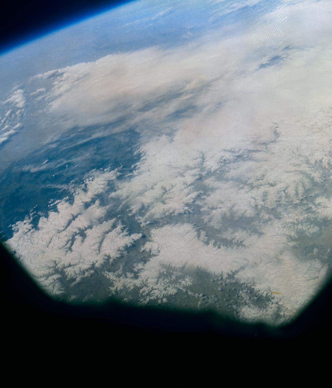
S63-06429 (15-16 May 1963) --- Photograph taken of the eastern Himalayas, Tibet, China, India and Burma from the Mercury-Atlas 9 capsule taken by astronaut L. Gordon Cooper Jr., during his 22-orbit Mercury-Atlas 9 (MA-9) spaceflight. Photo credit: NASA
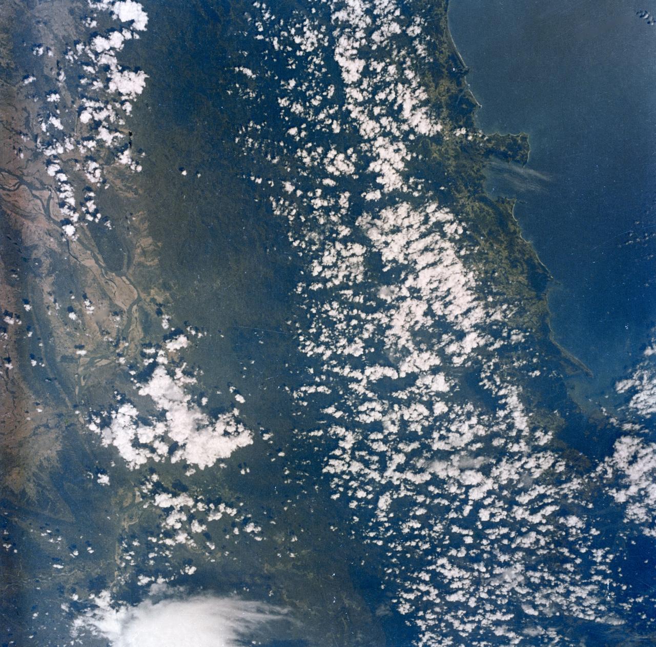
S63-06427 (15-16 May 1963) --- Burma's west coast, west of Rangoon and Irrawaddy River (right), are featured in this image photographed by astronaut L. Gordon Cooper Jr., during his 22-orbit Mercury Atlas 9 (MA-9) spaceflight. Photo credit: NASA
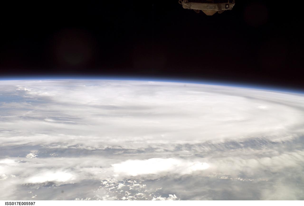
ISS017-E-005597 (29 April 2008) --- Outflow obscures the definition of the eye and center of Tropical Cyclone Nargis, seen when the storm was at approximately 13.5 degrees north latitude and 86.2 degrees east longitude with maximum winds of 74.9 miles per hour. Photographed by a crew member aboard the International Space Station, the storm was moving east-northeast at 070 degrees at 4.6 miles per hour. This picture was made several days prior to impact at Burma.
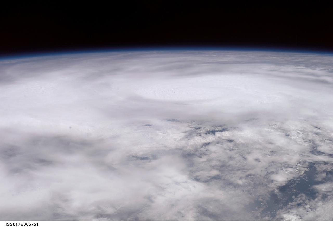
ISS017-E-005751 (30 April 2008) --- When this image was photographed by one of the crew members aboard the International Space Station, Tropical Cyclone Nargis was centered near a point located at 15.3 degrees north latitude and 88.2 degrees north longitude and moving northeast at 065 degrees at 8.1 miles per hour. The center was approximately 7 degrees southwest of Burma with sustained winds of 74.9 miles per hour, gusting to 92.2 miles per hour, forecast to strengthen. Maximum significant wave height was 27 feet.
ISS017-E-005599 (29 April 2008) --- Outflow obscures the definition of the eye and center of Tropical Cyclone Nargis, seen when the storm was at approximately 13.5 degrees north latitude and 86.2 degrees east longitude with maximum winds of 74.9 miles per hour. Photographed by a crew member aboard the International Space Station, the storm was moving east-northeast at 070 degrees at 4.6 miles per hour. This picture was made several days prior to impact at Burma.
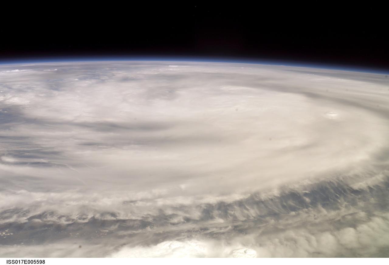
ISS017-E-005598 (29 April 2008) --- Outflow obscures the definition of the eye and center of Tropical Cyclone Nargis, seen when the storm was at approximately 13.5 degrees north latitude and 86.2 degrees east longitude with maximum winds of 74.9 miles per hour. Photographed by a crew member aboard the International Space Station, the storm was moving east-northeast at 070 degrees at 4.6 miles per hour. This picture was made several days prior to impact at Burma.
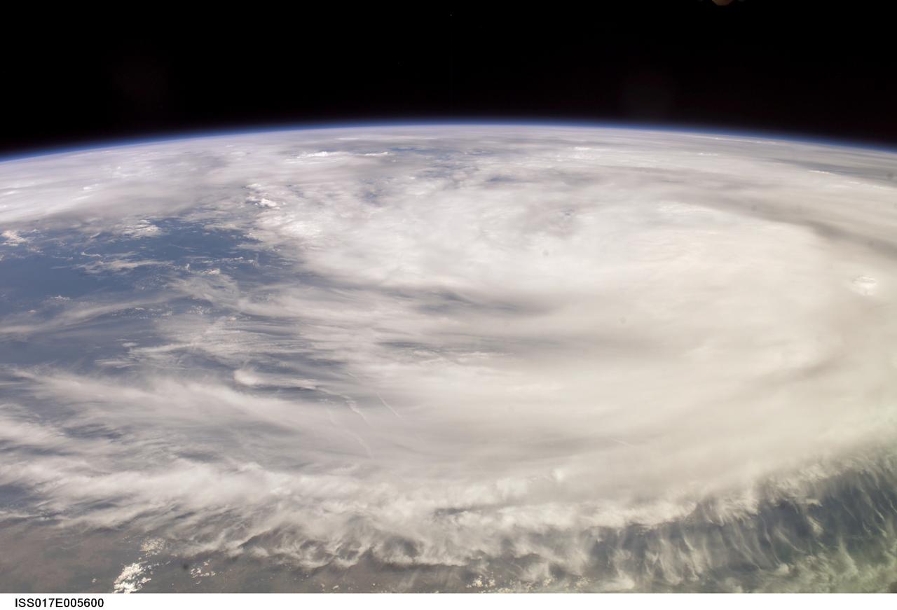
ISS017-E-005600 (29 April 2008) --- Outflow obscures the definition of the eye and center of Tropical Cyclone Nargis, seen when the storm was at approximately 13.5 degrees north latitude and 86.2 degrees east longitude with maximum winds of 74.9 miles per hour. Photographed by a crew member aboard the International Space Station, the storm was moving east-northeast at 070 degrees at 4.6 miles per hour. This picture was made several days prior to impact at Burma.
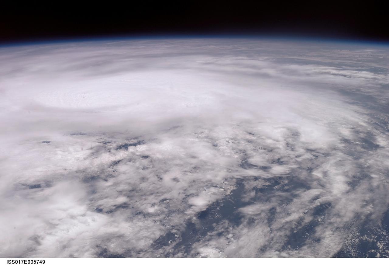
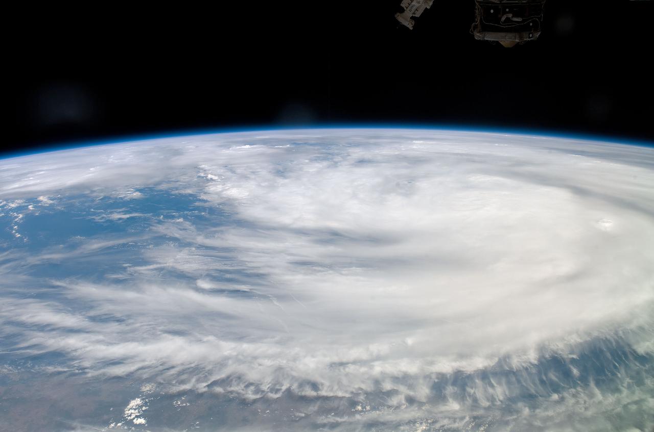
ISS017-E-005749 (30 April 2008) --- When this image was photographed by one of the crew members aboard the International Space Station, Tropical Cyclone Nargis was centered near a point located at 15.3 degrees north latitude and 88.2 degrees north longitude and moving northeast at 065 degrees at 8.1 miles per hour. The center was approximately 7 degrees southwest of Burma with sustained winds of 74.9 miles per hour, gusting to 92.2 miles per hour, forecast to strengthen. Maximum significant wave height was 27 feet.
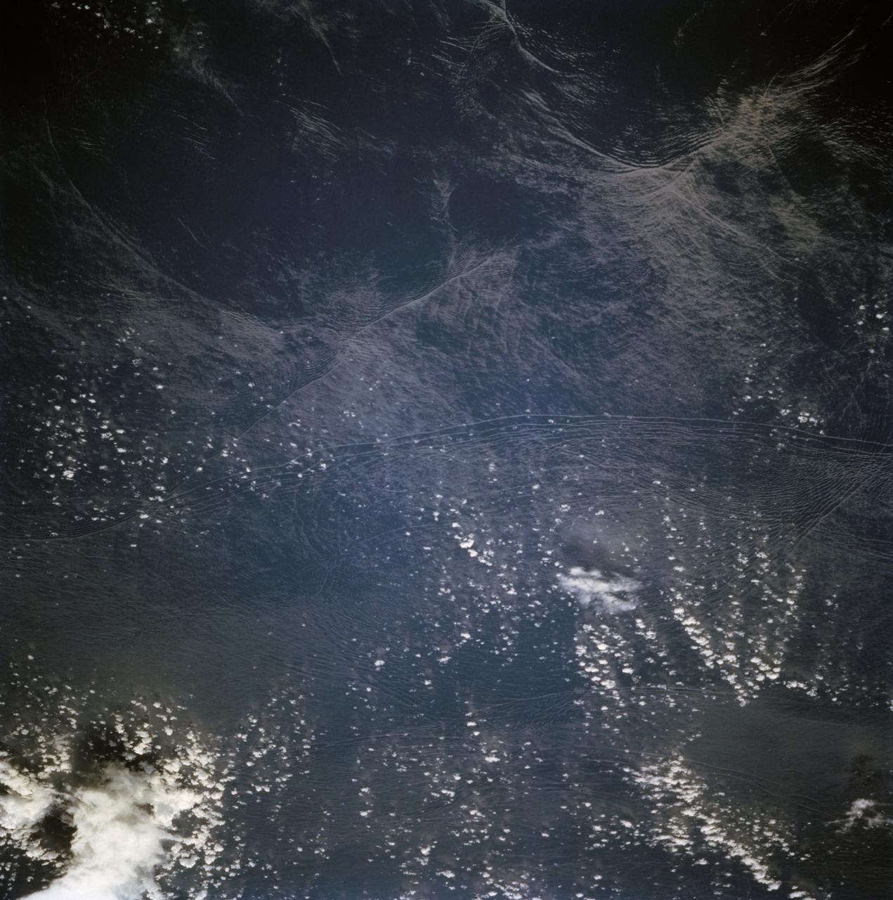
STS068-236-044 (30 September-11 October 1994) --- These internal waves in the Andaman Sea, west of Burma, were photographed from 115 nautical miles above Earth by the crew of the Space Shuttle Endeavour during the Space Radar Laboratory 2 (SRL-2) mission. The internal waves smooth out some of the capillary waves at the surface in bands and travel along the density discontinuity at the bottom of the mixed layer depth. There is little evidence of the internal waves at the surface. They are visible in the Space Shuttle photography because of sunglint, which reflects off the water.
ISS010-E-13088 (15 January 2005) --- Tsunami damage, northwestern Sumatra (Indonesia) is featured in this image photographed by an Expedition 10 crewmember on the International Space Station. On December 26, 2004 a large (magnitude 9.0) earthquake occurred off the western coast of Sumatra in the Indian Ocean. Scientists believe the earthquake was caused by the release of stresses accumulated as the India tectonic plate is overridden by the Burma tectonic plate. Movement of the seafloor due to the earthquake generated a tsunami, or seismic sea wave, that affected coastal regions around the Indian Ocean. The northwestern Sumatra coastline in particular suffered extensive damage and loss of life. This photo, along with image ISS010-E-13079, illustrates damage along the southwestern coast of Aceh Province in the vicinity of the city of Lho’ Kruet, Indonesia. The image captures the sunglint illuminating the Indian Ocean and standing water inland (light gray). Distortion and scale differences are caused by increased obliquity of the view from the Station.
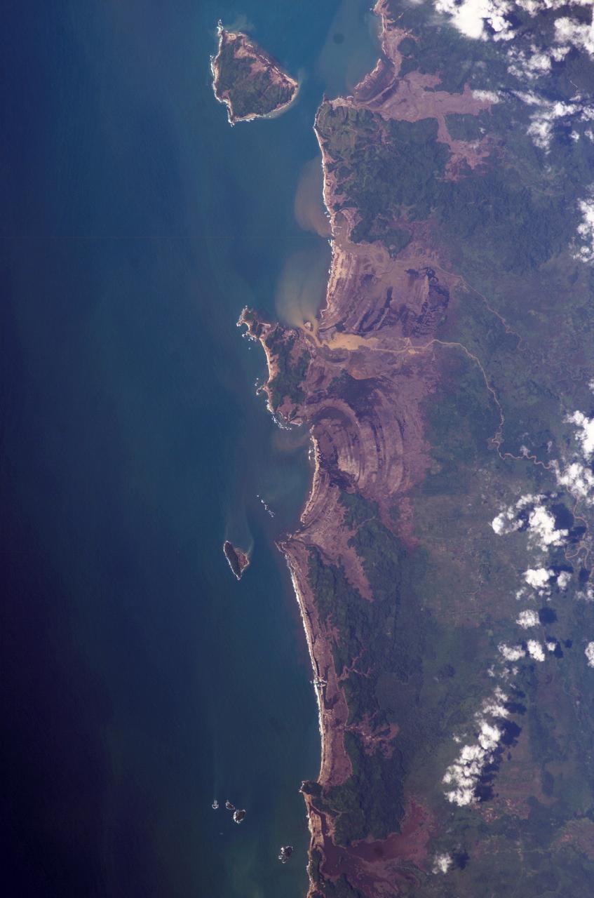
ISS010-E-13079 (15 January 2005) --- Tsunami damage, northwestern Sumatra (Indonesia) is featured in this image photographed by an Expedition 10 crewmember on the International Space Station (ISS). On December 26, 2004 a large (magnitude 9.0) earthquake occurred off the western coast of Sumatra in the Indian Ocean. Scientists believe the earthquake was caused by the release of stresses accumulated as the India tectonic plate is overridden by the Burma tectonic plate. Movement of the seafloor due to the earthquake generated a tsunami, or seismic sea wave, that affected coastal regions around the Indian Ocean. The northwestern Sumatra coastline in particular suffered extensive damage and loss of life. This photo, along with image ISS010-E-13088, illustrates damage along the southwestern coast of Aceh Province in the vicinity of the city of Lho’ Kruet, Indonesia. Large areas of bare and disturbed soil (brownish gray) previously covered with vegetation are visible along the coastline. Embayments in the coastline were particularly hard hit, while adjacent headlands were less affected.