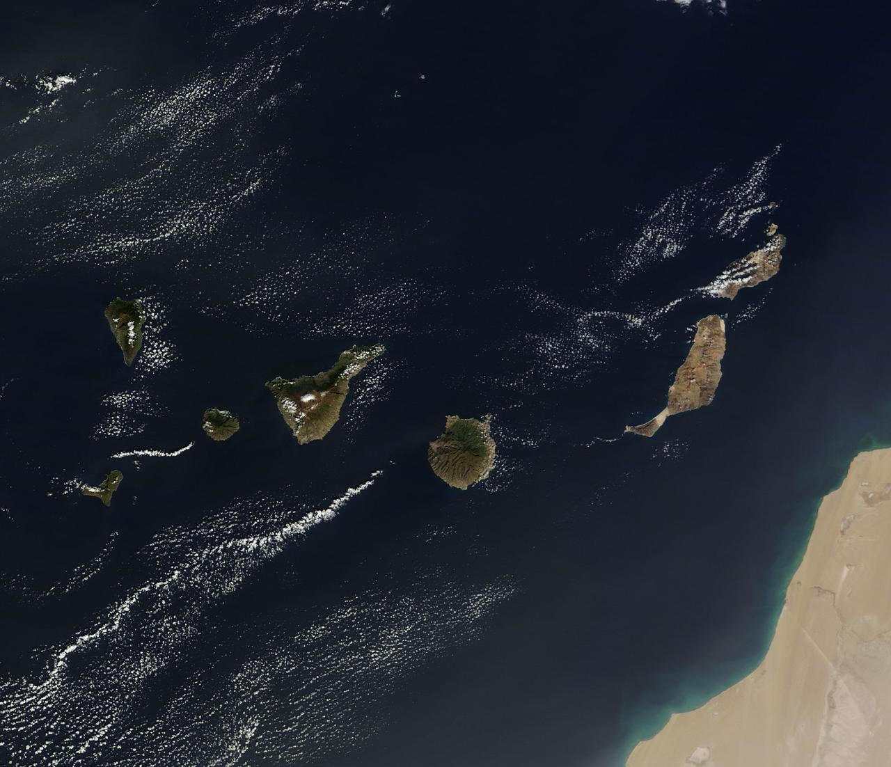
On December 10, 2013 the Moderate Resolution Imaging Spectroradiometer (MODIS) aboard NASA’s Terra satellite flew across the central Atlantic Ocean and captured a true-color image of the Canary Islands. Lying off of the coast of Western Sahara and Morocco, the islands were created by successive submarine volcanic eruptions which raised the ocean floor vertically until some of land rose above sea level. The oldest islands lie in the east and the youngest in the west. From east to west, the major islands seen in this image are: Lanzarote, Fuerteventura, Gran Canaria, Tenerife, La Gomera, La Palmera and El Hierro. While the creation of the islands began in the Late Cretaceous Period (70 – 80 million years ago), active volcanic activity continues. In 2011, a spectacular submarine eruption occurred just off the shore of El Hierro. The volcano became quiet again, but very recently increasing earthquakes and changing height of El Hierro suggested the volcano may again be entering an active eruptive phase. On December 27 the island’s volcano monitoring agency had raised the volcanic eruption risk for El Hierro to “yellow” – a code that means increasing activity but no eruption imminent. That afternoon a magnitude 5.1 earthquake struck offshore at El Hierro. The epicenter was 9 miles (15 km) deep, and it was one of the largest quakes ever recorded at the island. Credit: NASA/GSFC/Jeff Schmaltz/MODIS Land Rapid Response Team <b><a href="http://www.nasa.gov/audience/formedia/features/MP_Photo_Guidelines.html" rel="nofollow">NASA image use policy.</a></b> <b><a href="http://www.nasa.gov/centers/goddard/home/index.html" rel="nofollow">NASA Goddard Space Flight Center</a></b> enables NASA’s mission through four scientific endeavors: Earth Science, Heliophysics, Solar System Exploration, and Astrophysics. Goddard plays a leading role in NASA’s accomplishments by contributing compelling scientific knowledge to advance the Agency’s mission. <b>Follow us on <a href="http://twitter.com/NASA_GoddardPix" rel="nofollow">Twitter</a></b> <b>Like us on <a href="http://www.facebook.com/pages/Greenbelt-MD/NASA-Goddard/395013845897?ref=tsd" rel="nofollow">Facebook</a></b> <b>Find us on <a href="http://instagram.com/nasagoddard?vm=grid" rel="nofollow">Instagram</a></b>
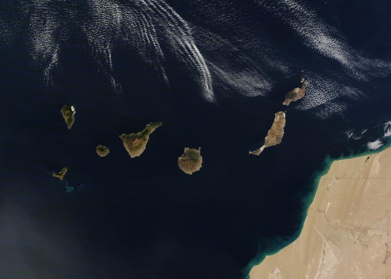
NASA image acquired December 21, 2011 The rugged landscape of the Canary Islands stood out in sharp contrast to the smooth blue waters of the Atlantic Ocean and the flat tan land of northwestern Africa on December 21, 2011, when the Moderate Resolution Imaging Spectroradiometer (MODIS) aboard the Terra satellite captured this true-color image. The Canary Islands are a group of seven large islands and several smaller islets, all volcanic in origin. The eastern edge of the chain lies only 100 kilometers from the coasts of Morocco and Western Sahara, and the chain stretches for about 500 kilometers across the Atlantic. All the islands are mountainous, and Tenerife, the central island in this image is home to Pico de Teinde, the highest peak, which rises 12,198 feet (3,718 meters) above sea level. From east to west, the islands are named Lanzarote, Fuerteventura, Gran Canaria, Tenerife, La Gomera, La Palmera and El Hierro. A bright swirl of peacock blue marks the ocean south of El Hierro, a stain on the sea from an ongoing eruption of a volcano under the waters. Credit: NASA/GSFC/Jeff Schmaltz/MODIS Land Rapid Response Team <b><a href="http://www.nasa.gov/audience/formedia/features/MP_Photo_Guidelines.html" rel="nofollow">NASA image use policy.</a></b> <b><a href="http://www.nasa.gov/centers/goddard/home/index.html" rel="nofollow">NASA Goddard Space Flight Center</a></b> enables NASA’s mission through four scientific endeavors: Earth Science, Heliophysics, Solar System Exploration, and Astrophysics. Goddard plays a leading role in NASA’s accomplishments by contributing compelling scientific knowledge to advance the Agency’s mission. <b>Follow us on <a href="http://twitter.com/NASA_GoddardPix" rel="nofollow">Twitter</a></b> <b>Like us on <a href="http://www.facebook.com/pages/Greenbelt-MD/NASA-Goddard/395013845897?ref=tsd" rel="nofollow">Facebook</a></b> <b>Find us on <a href="http://instagrid.me/nasagoddard/?vm=grid" rel="nofollow">Instagram</a></b>
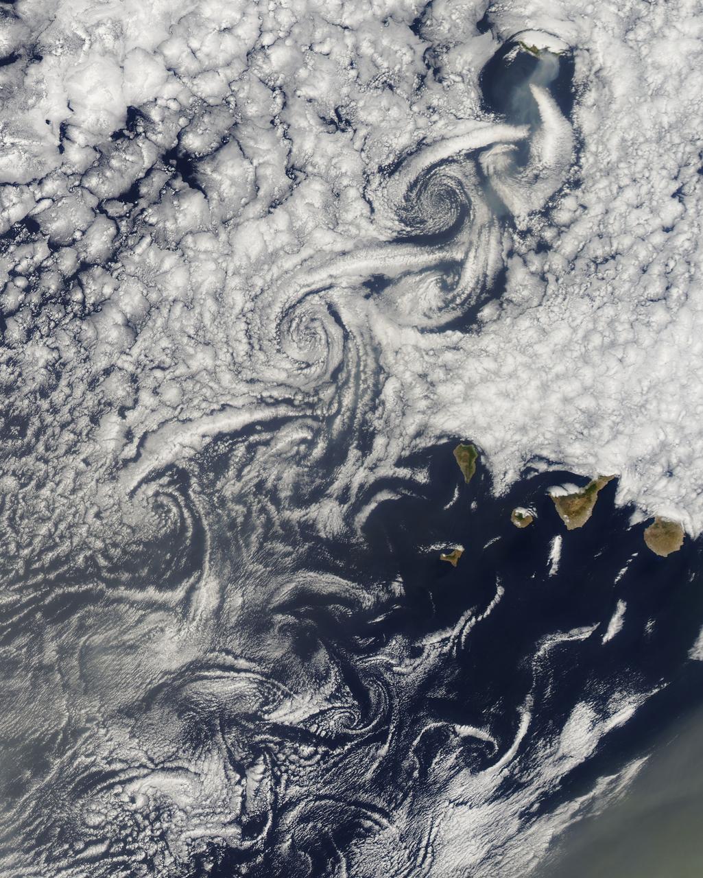
NASA image acquired August 14, 2010 at 14:55 UTC Cloud vortices off Madeira and Canary Islands Satellite: Aqua Credit: NASA/GSFC/Jeff Schmaltz/MODIS Land Rapid Response Team Click here to see more images from <b><a href="http://rapidfire.sci.gsfc.nasa.gov/gallery/?latest" rel="nofollow">MODIS</a></b> <b><a href="http://www.nasa.gov/centers/goddard/home/index.html" rel="nofollow">NASA Goddard Space Flight Center</a></b> is home to the nation's largest organization of combined scientists, engineers and technologists that build spacecraft, instruments and new technology to study the Earth, the sun, our solar system, and the universe. <b>Follow us on <a href="http://twitter.com/NASA_GoddardPix" rel="nofollow">Twitter</a></b> <b>Join us on <a href="http://www.facebook.com/pages/Greenbelt-MD/NASA-Goddard/395013845897?ref=tsd" rel="nofollow">Facebook</a><b></b></b>